Orange Center Elementary School
|
|
|
- Jeffrey Russell
- 5 years ago
- Views:
Transcription

")

1 Drag and drop pic and stretch/crop to the limits of the blue rectangle (delete this text box) Orange Center Elementary School Drag and drop pic and stretch/crop to the limits of the blue rectangle (delete this text box)
2 SCHOOL ROUTE PLAN For ORANGE CENTER ELEMENTARY SCHOOL LOCATION 36 ORANGE COUNTY Prepared for: ORANGE COUNTY SCHOOL ASSESSMENT PROGRAM ORANGE COUNTY PUBLIC WORKS Traffic Engineering Division 4200 South John Young Parkway Orlando, Florida Contract No.: Y4-903B HNTB No PL-003 Prepared by: Lake Mary, Florida September 18, 2007 Professional Engineer: Marc W. Hustad P.E. No
3 School Route Plan- Orange Center Elementary School TABLE OF CONTENTS EXECUTIVE SUMMARY INTRODUCTION EXISTING CONDITIONS QUALITATIVE ASSESSMENT RECOMMENDATIONS APPENDIX FIGURES, EXHIBITS and TABLES FIGURES Figure 2 School Boundary Map... 9 Figure 3 School Route Plan Map Figure 4 Condition Diagram: Texas Avenue at Orange Center Boulevard Figure 5 Condition Diagram: Texas Avenue at Jacobs Place Figure 6 - Conceptual Improvement Diagram EXHIBITS Exhibit 1- Texas Avenue at Orange Center Boulevard Exhibit 2- Texas Avenue at Orange Center Boulevard Exhibit 3- Texas Avenue at Jacobs Place Exhibit 4- Texas Avenue at Jacobs Place TABLES Table 1-Field Inventory... 3 Table 2-Summary of Vehicular Volumes... 4 Table 3-Summary of Pedestrian & Bicycle Volumes... 5
4 School Route Plan- Orange Center Elementary School 1 EXECUTIVE SUMMARY HNTB Corporation was retained by Orange County Public Works to conduct a School Route Plan Study for Orange Center Elementary School located at 621 Texas Avenue, Orange County, Florida. This study is being performed as a part of the County s School Assessment Program to identify safe routes for children to walk and bicycle to school. Based on the results of the analysis, field observations and engineering judgment, the following recommendations and conclusions were developed: 1. It is suggested that the Orange County School Board and the Orange Center Elementary School consider adding painted pavement marking arrows to identify one-way circulation for the pickup/dropoff area within the east-side school parking lot to reduce driver confusion. 2. Add a Stop Sign (R1-1) for the outbound side of the driveway at the carpool exit (east-side parking lot) to enhance pedestrian safety. 3. At the intersection of Orange Center Boulevard and Ohio Avenue, install countdown pedestrian signal heads for each crossing. Install the AHEAD plaque (W16-9p) on the Advance School Crosswalk Warning Assemblies and replace the School Advance Warning Assemblies (S1-1) with the diagonal downward pointing arrow plaque (W16-7p) 4. Install a curb ramp at the southwest corner of the intersection of Orange Center Boulevard and Ohio Avenue to meet ADA requirements. 5. Install a connection to the sidewalks at the northeast corner of the intersection of Orange Center Boulevard and Ohio Avenue if right of way allows. 6. Add School Advance Warning Assemblies (S1-1, W16-9p) and the School Crosswalk Warning Assemblies (S1-1, W16-7p) for the east and west approaches along Orange Center Boulevard at Texas Avenue. 7. Add a crossing guard at the intersection of Orange Center Boulevard and Texas Avenue. 8. Add a No Parking 7:00 AM to 3:15 PM School Days Only (R7 Series) along Texas Avenue just south of Jacobs Place to eliminate parents using this area as a pickup/dropoff area for children. A notice flyer should be provided to students/parents to indicate the proper pickup/dropoff location for students. 9. Repaint the existing crosswalks on the south and east approaches at the intersection of Jacobs Place and Texas Avenue. Remove the School Crosswalk Warning Assemblies at the stop controlled intersection of Jacobs Place and Texas Avenue. 10. Install the AHEAD plaque (W16-9p) to the existing School Advance Warning signs on the east, south, west, and north approaches to the intersection of Jacobs Place and Texas Avenue in advance of the stop sign.

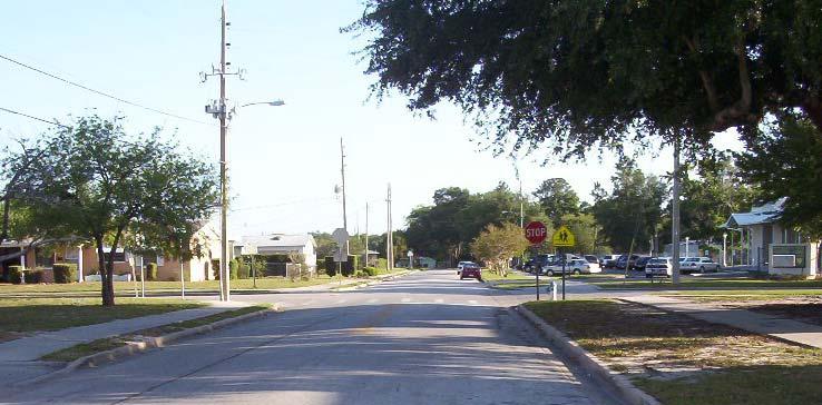
5 School Route Plan- Orange Center Elementary School 2 1. INTRODUCTION HNTB Corporation was retained by Orange County Public Works to conduct a School Route Plan Study for Orange Center Elementary School located at 621 Texas Avenue, Orange County, Florida. The purpose of this study is to identify safe routes for children to walk and bicycle to school. The analysis methods used in conducting this study are consistent with those set forth in the Manual on Uniform Traffic Control Devices (MUTCD 2003), the Manual on Uniform Traffic Studies (MUTS) and Orange County guidelines and procedures. Figure 1 shows the school location. Figure 1 - Project Location Map
6 School Route Plan- Orange Center Elementary School 3 2. EXISTING CONDITIONS Orange Center Elementary School is located in Orange County at the intersection of Texas Avenue and Jacobs Place approximately 1500 feet west of Tampa Avenue and 500 feet north of Orange Center Boulevard. Significant features for the study location are summarized in Table 1. Feature Table 1-Field Inventory Description School Name Orange Center Elementary School Address 621 Texas Avenue Orlando, FL School Hours 8:00 AM- 2:15 PM (1:15 PM Wednesday) Student Enrollment 421 Primary Roadway Access Texas Avenue 20 undivided primary access road with a closed drainage system Posted speed limit: 25 mph Sidewalks: Both sides of roadway Conventional lighting on both sides of road Pedestrian and Bicycle Access to School Carpool Access to School Bus Access Guarded School Crossings Orange Center Boulevard Four-lane divided arterial with an closed drainage system Posted speed limit: 35 mph Sidewalks: Both sides of roadway Conventional lighting in the median Sidewalk on both sides of Texas Avenue and both sides of Jacobs Place A single driveway along Jacobs Place on the eastern side of the school provides ingress and egress to carpools. Vehicles enter along Jacobs Place and circle the parking lot to the designated dropoff/pickup area. Vehicles exit via the same driveway. Bus traffic uses the southernmost driveway along Texas Avenue, the driveway is also the main entrance to the school. Buses circulate to the front of the school and continue northward to exit via the northernmost driveway along Texas Avenue. The bus entrance is blocked with cones during school hours to prevent carpool vehicles mixing with bus traffic. Texas Avenue at Jacobs Place Four-Way stop controlled School crosswalk warning assemblies on all approaches Crosswalk on the south and east approaches Ohio Avenue at Orange Center Boulevard Signal controlled Pedestrian signal heads, crosswalks and pushbuttons School crossing warning signs on all approaches Other Facilities Sidewalks are provided along most roadways in adjacent neighborhoods within the walk zone. A connector sidewalk is provided through the park north of the school to provide access between Texas Avenue and Sunset Drive. Reduced Speed School Zones None
7 School Route Plan- Orange Center Elementary School 4 Vehicular, Pedestrian and Bicycle Volumes Two-hour turning movement counts were conducted at the intersections of Texas Avenue with Orange Center Boulevard and Texas Avenue with Jacobs Place. The counts were conducted from 7:15 to 8:15 AM and 1:45 to 2:45 PM to coincide with the morning arrival time and afternoon departure time of students at the school. Pedestrian, bicycle, automobile and bus traffic were recorded separately for this count. Tables 2 and 3 summarize the results of these counts: Table 2-Summary of Vehicular Volumes Approaches Texas Avenue at Orange Center Boulevard Texas Avenue Orange Center Boulevard Direction Northbound Southbound Eastbound Westbound Movement L T R TOT L T R TOT L T R TOT L T R TOT Morning Arrival: 715 to 815 Vehicles Busses Total Afternoon Departure: 1345 to 1445 Vehicles Busses Total Approaches Texas Avenue at Jacobs Place Texas Avenue Jacobs Place Direction Northbound Southbound Eastbound Westbound Movement L T R TOT L T R TOT L T R TOT L T R TOT Morning Arrival: 715 to 815 Vehicles Busses Total Afternoon Departure: 1345 to 1445 Vehicles Busses Total
8 School Route Plan- Orange Center Elementary School 5 Table 3-Summary of Pedestrian & Bicycle Volumes Texas Avenue at Orange Center Boulevard Total 7:15 7:30 7:45 8:00 Total 1:45 2:00 2:15 2:30 AM PM AM 8 Texas Avenue AM Total Total PM 4 Total AM 5 7: : : : : : Orange Center Boulevard 8: : AM PM Total 1 0 Total AM PM 6 5 1: : : : : : : : Total PM 0 Total PM 15 Apartment Entrance Total 7:15 7:30 7:45 8:00 Total 1:45 2:00 2:15 2:30 AM PM Total AM PM 2 Orange Center Boulevard Texas Avenue at Jacobs Place Total 7:15 7:30 7:45 8:00 Total 1:45 2:00 2:15 2:30 AM PM AM 0 Texas Avenue AM Total Total PM 0 Total AM 46 7: : : : : : : : AM PM Total 0 0 Total AM PM Jacobs Place 1: : : : : : : : Total PM 0 Total PM 88 Texas Avenue Total 7:15 7:30 7:45 8:00 Total 1:45 2:00 2:15 2:30 AM PM Total AM PM 1 Jacobs Place
9 School Route Plan- Orange Center Elementary School 6 3. QUALITATIVE ASSESSMENT Orange Center Elementary School is located in Orange County at the intersection of Texas Avenue and Jacobs Place, approximately 1500 feet west of Tampa Avenue and 500 feet north of Orange Center Boulevard. The school serves children who live in adjacent neighborhoods to the east and west along Orange Center Boulevard between Orange Blossom Trail and John Young Parkway. The entire school zone falls within the two mile walk zone of the school. Orange County does not provide bus service for children that live within the school boundary. Figure 2 illustrates the school zone boundary, two-mile walk radius and existing traffic signals near Orange Center Elementary School. Figure 3 is a School Route Plan Map of the area within the two-mile walk limit. This area is the focus of the qualitative assessment. The school route plan area was reviewed by a registered professional engineer to evaluate vehicle, pedestrian and bicycle flow patterns to determine what improvements are necessary, if any, to improve the safety and efficiency of the children traveling to and from school. General Many of the students arrive to school by walking or via private vehicles. Vehicle traffic along Texas Avenue and Jacobs Place is generally light and most of it is related to the school. Most of the existing school advance and crosswalk warning assemblies do not meet current MUTCD standards, crosswalks are worn and no school speed limit assemblies exist. These assessments are described in more detail below and should be replaced or updated as necessary. School Circulation Bus service is provided to the school only for special needs. The main school driveway entrance along Texas Avenue provides access for bus entry and buses circulate through the one-way driveway along the front of the school building (west-side). The bus pickup/dropoff area is directly alongside the school and there is a sidewalk. Children from the buses do not have to cross parking lots or vehicle traffic; therefore, pedestrian access is safe and efficient. There is sufficient storage capacity, efficient circulation and minimal conflicts with pedestrians or other vehicles. The school staff block off the main driveway with cones so that carpool vehicles do not use the driveway to pickup and dropoff children. At the carpool pickup/dropoff area, vehicles enter and exit the same driveway on the eastern side of the school along Jacobs Place (the west driveway along Jacobs Place remained closed with a cyclone fence gate). Vehicles circulate through the parking area to the designated pickup/dropoff area. Pavement marking and signing is absent from the school parking lot. Some parents tend to take multiple routes to try and jump the queue to the pickup/dropoff location. A clearly marked one-way operation is needed at the drop-off location to clarify the preferred route for parents to take. It is suggested that the Orange County School Board and the Orange Center Elementary School consider adding painted pavement marking arrows to clearly identify one-way operation of the pickup/dropoff area within the school parking lot. School staff also indicated the need for additional cones to block off the center portion of parking lot to vehicles during pickup/dropoff times. It is also
10 School Route Plan- Orange Center Elementary School 7 recommended to add a Sign (R1-1) for the outbound side of the driveway at the carpool exit (east-side parking lot) to enhance pedestrian safety. Orange Center Boulevard at Ohio Avenue The intersection of Orange Center Boulevard at Ohio Avenue is signal controlled with a crossing guard at the intersection. There are pedestrian push buttons and special emphasis crosswalks on each approach. It is recommended to install countdown pedestrian signal heads for each crossing. The School Advance Warning Assemblies and School Crosswalk Warning Assemblies at this intersection do not meet current MUTCD standards. The AHEAD plaque (W16-9p) should be installed on all the School Advance Warning Assemblies and the School Crosswalk Warning Assembly (S1-1) should be installed with the diagonal downward pointing arrow plaque (W16-7p). On the southwest corner of the intersection the crosswalk ends at a curb and gutter. It is recommended to add a curb ramp at the southwest corner to provide better pedestrian accessibility. On the northeast corner of the intersection the sidewalk is interrupted by a large tree. As a result pedestrians walking south that want to turn east must walk into the intersection and along Orange Center Boulevard. If right of way allows, it is recommended to provide a continuous sidewalk in this area to provide a safer route for pedestrians. Orange Center Boulevard at Texas Avenue Although this intersection is not marked as a school crossing, a number of student pedestrians were observed crossing Orange Center Boulevard at the east approach crosswalk (see Table 3). These students appear to come from the southeast portion of the school boundary and are using this crosswalk to walk to school. As a result, it is recommended to add School Advance Warning Assemblies (S1-1, W16-9p) and School Crosswalk Warning Assemblies (S1-1, W16-7p) for this intersection. A crossing guard was not observed at the intersection while the students were crossing the uncontrolled intersection. It is recommended to add a crossing guard at this intersection to provide a safer crossing for students. Texas Avenue at Jacobs Place This intersection is a four-way stop controlled intersection. Pedestrian and bicycle traffic to and from the school predominantly occurs from the south using the east approach crosswalk at this intersection. Few students are accompanied by parents, but there is a crossing guard and school staff are prominent at the intersection. In the afternoon, a large-group of school children congregate on the southeast corner of the intersection and some are waiting for parents to pick them up. It is recommended to create a No Parking or Stopping Zone during school hours on the east side of Texas Ave just south of Jacobs Place to eliminate parents using this area as a pickup/dropoff area for children. This will increase visibility for both crossing pedestrians and drivers. A notice flyer should be provided to students/parents to indicate the proper pickup/dropoff location for students. Crosswalks exist on the east and south approaches and it was observed that the majority of students use these existing crosswalks to cross Jacobs Place or Texas Avenue. This makes it easier for the crossing guard to help children cross by allowing only two crossing points rather than four crossings. As a result, it is not recommended to add additional crosswalks at
11 School Route Plan- Orange Center Elementary School 8 this intersection. The existing crosswalk markings are worn and should be restriped. At the stop-controlled intersection, there are School Crosswalk Warning Assemblies that do not meet current MUTCD standards. It is recommended to remove all the School Crosswalk Warning Assemblies as they should not be installed on approaches controlled by a Stop Sign. In their place, it is recommended to install the appropriate AHEAD plaque (W16-9p) to the existing School Advance Warning Assemblies in advance of the stop signs on the east, south, west, and north approaches. Figures 4 and 5 illustrate the existing conditions at these intersections. Photographs of the intersections of Texas Avenue at Orange Center Boulevard and at Jacobs Place are included in Exhibits 1 through 4.

12 9 N Orange Center Elementary School 2 Mile Walk Zone Legend School Zone Boundary School School Bus Stop Traffic Signal Figure 2 School Boundary Map
13 YIELD 10 N G G Orange Center Elementary Orange Center Elementary School Legend G Crossing Guard School Bus Stops Pedestrian Route Bike Lane Crosswalk School Crossing Signalized Intersection Stop Sign Yield Sign Figure 3 School Route Plan Map
14 11 Ohio Avenue Texas Avenue SPEED LIMIT 25 N NO PARKING Orange Center Boulevard Ohio Avenue Texas Avenue at Orange Center Boulevard Figure 4 Condition Diagram
15 12 Ohio Avenue Texas Avenue N 4-WAY Jacobs Place 4-WAY 4-WAY 4-WAY Texas Avenue at Jacobs Place Figure 5 Condition Diagram


16 School Route Plan- Orange Center Elementary School 13 Exhibit 1- Texas Avenue at Orange Center Boulevard Looking south along Texas Avenue into the intersection Looking north along Orange Manor Apartment s driveway into the intersection


17 School Route Plan- Orange Center Elementary School 14 Exhibit 2- Texas Avenue at Orange Center Boulevard Looking east along Orange Center Boulevard into the intersection Looking west along Orange Center Boulevard into the intersection


18 School Route Plan- Orange Center Elementary School 15 Exhibit 3- Texas Avenue at Jacobs Place Looking south along Texas Avenue into the intersection Looking north along Texas Avenue into the intersection


19 School Route Plan- Orange Center Elementary School 16 Exhibit 4- Texas Avenue at Jacobs Place Looking east along Jacobs Place into the intersection Looking west along Jacobs Place into the intersection
20 School Route Plan- Orange Center Elementary School RECOMMENDATIONS Based on the results of the analysis, the field observations and engineering judgment, the following improvements are proposed: 1. It is suggested that the Orange County School Board and the Orange Center Elementary School consider adding painted pavement marking arrows to identify one-way circulation for the pickup/dropoff area within the east-side school parking lot to reduce driver confusion. 2. Add a Stop Sign (R1-1) for the outbound side of the driveway at the carpool exit (east-side parking lot) to enhance pedestrian safety. 3. At the intersection of Orange Center Boulevard and Ohio Avenue, install countdown pedestrian signal heads for each crossing. Install the AHEAD plaque (W16-9p) on the Advance School Crosswalk Warning Assemblies and replace the School Advance Warning Assemblies (S1-1) with the diagonal downward pointing arrow plaque (W16-7p) 4. Install a curb ramp at the southwest corner of the intersection of Orange Center Boulevard and Ohio Avenue to meet ADA requirements. 5. Install a connection to the sidewalks at the northeast corner of the intersection of Orange Center Boulevard and Ohio Avenue if right of way allows. 6. Add School Advance Warning Assemblies (S1-1, W16-9p) and the School Crosswalk Warning Assemblies (S1-1, W16-7p) for the east and west approaches along Orange Center Boulevard at Texas Avenue. 7. Add a crossing guard at the intersection of Orange Center Boulevard and Texas Avenue. 8. Add a No Parking 7:00 AM to 3:15 PM School Days Only (R7 Series) along Texas Avenue just south of Jacobs Place to eliminate parents using this area as a pickup/dropoff area for children. A notice flyer should be provided to students/parents to indicate the proper pickup/dropoff location for students. 9. Repaint the existing crosswalks on the south and east approaches at the intersection of Jacobs Place and Texas Avenue. Remove the School Crosswalk Warning Assemblies at the stop controlled intersection of Jacobs Place and Texas Avenue. 10. Install the AHEAD plaque (W16-9p) to the existing School Advance Warning signs on the east, south, west, and north approaches to the intersection of Jacobs Place and Texas Avenue in advance of the stop sign. Figure 6 (2 diagrams) has been included on the following pages to illustrate these recommendations.
21 AHEAD AHEAD AHEAD 18 Install School Advance Crossing Assembly 200 ft North of the Crosswalk. AHEAD Ohio Avenue Install School Crosswalk Warning Assembly (S1-1, W16-7p). Replace signs with standard School Crosswalk Warning Assemblies (S1-1, W16-7p). Texas Avenue SPEED LIMIT 25 N Provide Continuous Sidewalk Connection Install an AHEAD placard (W16-9p) to the existing School Advance Crossing sign Install School Crosswalk Warning Assemblies (S1-1, W16-7p). Install Pedestrian Countdown Displays on all corners Orange Center Boulevard Install An ADA- Compliant Curb Ramp Ohio Avenue Install School Advance Crossing Assembly 200 ft in advance of the Crosswalk on the west and south approaches AHEAD Install School Advance Crossing Assemblies (S1-1, W16-9p) Texas Avenue at Orange Center Boulevard Figure 6 1 of 2 Conceptual Improvement Diagram
22 AHEAD 19 Install AHEAD placards (W16-9p) to the existing School Advance Warning signs Texas Avenue Provide directional arrow markings Remove School Crossing Signs 4-WAY Restripe 4-WAY Jacobs Place Install a sign Crosswalks AHEAD AHEAD 4-WAY 4-WAY Install a NO PARKING sign with time placard Remove School Crossing Signs P 7:00 AM TO 3:15 PM SCHOOL DAYS Install AHEAD placards (W16-9p) to the existing School Advance Warning signs N AHEAD Texas Avenue at Jacobs Place Figure 6 2 of 2 Conceptual Improvement Diagram
23 School Route Plan- Orange Center Elementary School APPENDIX
24 CITY: Orlando NORTH APPROACH: Texas Avenue SOUTH APPROACH: Apartment Entrance DATE: 4/24/2007 COUNT: All Vehicles COUNTY: Orange EAST APPROACH: Orange Center Boulevard WEST APPROACH: Orange Center Boulevard ARRIVAL TIME: 7:15-8:15 AM DEPARTURE TIME: OBSERVER: JK 1:45-2:45 PM START NORTHBOUND SOUTHBOUND EASTBOUND WESTBOUND GRAND TIME LEFT THRU RIGHT U-TURN TOTAL LEFT THRU RIGHT U-TURN TOTAL NS TOTAL LEFT THRU RIGHT U-TURN TOTAL LEFT THRU RIGHT U-TURN TOTAL EW TOTAL TOTAL 7: : : Total : Total : Total : : : Total
25 CITY: Orlando NORTH APPROACH: Texas Avenue SOUTH APPROACH: Texas Avenue DATE: 4/24/2007 COUNT: All Vehicles COUNTY: Orange EAST APPROACH: Jacobs Place WEST APPROACH: Jacobs Place ARRIVAL TIME: 7:15-8:15 AM OBSERVER: DM DEPARTURE TIME: 1:45-2:45 PM START NORTHBOUND SOUTHBOUND EASTBOUND WESTBOUND GRAND TIME LEFT THRU RIGHT U-TURN TOTAL LEFT THRU RIGHT U-TURN TOTAL NS TOTAL LEFT THRU RIGHT U-TURN TOTAL LEFT THRU RIGHT U-TURN TOTAL EW TOTAL TOTAL 7: : : Total : Total : Total : : : Total
26
27
28
29
30
31
32
33
Meadow Woods Elementary School
 Drag and drop pic and stretch/crop to the limits of the blue rectangle (delete this text box) Meadow Woods Elementary School Drag and drop pic and stretch/crop to the limits of the blue rectangle (delete
Windy Ridge Elementary School
 Windy Ridge Elementary School SCHOOL ROUTE PLAN For WINDY RIDGE ELEMENTARY SCHOOL LOCATION 54 ORANGE COUNTY Prepared for: ORANGE COUNTY SCHOOL ASSESSMENT PROGRAM ORANGE COUNTY PUBLIC WORKS Traffic Engineering
Hidden Oaks Elementary School
 Hidden Oaks Elementary School SCHOOL ROUTE PLAN For HIDDEN OAKS ELEMENTARY SCHOOL LOCATION 13 ORANGE COUNTY Prepared for: ORANGE COUNTY SCHOOL ASSESSMENT PROGRAM ORANGE COUNTY PUBLIC WORKS Traffic Engineering
Drag and drop pic and stretch/crop to the limits of the blue rectangle (delete this text box) Maxey Elementary School
 Maxey Elementary School") Drag and drop pic and stretch/crop to the limits of the blue rectangle (delete this text box) Maxey Elementary School SCHOOL ROUTE PLAN For MAXEY ELEMENTARY SCHOOL LOCATION 33 ORANGE COUNTY Prepared for:
Drag and drop pic and stretch/crop to the limits of the blue rectangle (delete this text box) Maxey Elementary School SCHOOL ROUTE PLAN For MAXEY ELEMENTARY SCHOOL LOCATION 33 ORANGE COUNTY Prepared for:
Durrance Elementary School
 Durrance Elementary School SCHOOL ROUTE PLAN For DURRANCE ELEMENTARY SCHOOL LOCATION 9 ORANGE COUNTY Prepared for: ORANGE COUNTY SCHOOL ASSESSMENT PROGRAM ORANGE COUNTY PUBLIC WORKS Traffic Engineering
Lake Whitney Elementary School
 Lake Whitney Elementary School SCHOOL ROUTE PLAN For LAKE WHITNEY ELEMENTARY SCHOOL LOCATION 18 ORANGE COUNTY Prepared for: ORANGE COUNTY SCHOOL ASSESSMENT PROGRAM ORANGE COUNTY PUBLIC WORKS Traffic Engineering
SCHOOL ROUTE PLAN. For HUNTER S CREEK ELEMENTARY SCHOOL LOCATION 14 ORANGE COUNTY. Prepared for:
 SCHOOL ROUTE PLAN For HUNTER S CREEK ELEMENTARY SCHOOL LOCATION 14 ORANGE COUNTY Prepared for: ORANGE COUNTY SCHOOL ASSESSMENT PROGRAM ORANGE COUNTY PUBLIC WORKS Traffic Engineering Division 42 South John
TRAFFIC MANAGEMENT PLAN
 292 84 140440 TRAFFIC MANAGEMENT PLAN The purpose of the Traffic Management Plan (TMP) is to have established procedures for traffic flow and circulation around the elementary school related to student
Final Sidewalk Feasibility Study
 Garfield Drive From Anastasia Drive to Elizabeth Place City of South Daytona July 23, 2009 Final Sidewalk Feasibility Study Prepared for: Prepared by: Final Sidewalk Feasibility Study Garfield Drive 2
July 5, Arthur R. Ware, Jr. Elementary School 2017 Safe Routes to School Walkabout Report
 July 5, 2017 Arthur R. Ware, Jr. Elementary School 2017 Safe Routes to School Walkabout Report 1 Walkabout Report Introduction On April 28, 2017, City, School, and SAWMPO staff met to conduct a Safe Routes
Table 1 Traffic and Pedestrian Counts on Lafayette Street
 Downtown Salem Transportation Study 2 July 8, 2005 On-street parking is allowed on both sides of Lafayette Street. Cars were parked at the island that separates a pull-out area in front of the school entrance
FLORIDA DEPARTMENT OF TRANSPORTATION DISTRICT 7 DISTRICT WIDE BICYCLE/PEDESTRIAN ACCESS TO TRANSIT SAFETY ASSESSMENT AND IMPROVEMENT PLAN
 FLORIDA DEPARTMENT OF TRANSPORTATION DISTRICT 7 DISTRICT WIDE BICYCLE/PEDESTRIAN ACCESS TO TRANSIT SAFETY ASSESSMENT AND IMPROVEMENT PLAN TRANSIT SAFETY ASSESSMENT SR 55/US 19 AT 80 TH AVE N DRAFT JUNE
Forest Hills Improvement Initiative
 Forest Hills Improvement Initiative Transportation Action Plan Short Term Recommendations ONLY Final Draft as of April 30, 2008 For Community Review and Feedback Prepared for: The City of Boston Boston
Chicago Safe Routes to School Safe Routes to High School (SRTS/SRTHS)
") Chicago Safe Routes to School Safe Routes to High School (SRTS/SRTHS) Marshall Community High School and Faraday Elementary School Recommended Improvements Agenda Goals Related Programs Project Location/Area
Chicago Safe Routes to School Safe Routes to High School (SRTS/SRTHS) Marshall Community High School and Faraday Elementary School Recommended Improvements Agenda Goals Related Programs Project Location/Area
Transportation Impact Study for Abington Terrace
 Transportation Impact Study for Abington Terrace Abington Township, Montgomery County, PA Sandy A. Koza, P.E., PTOE PA PE License Number PE059911 Prepared by McMahon Associates, Inc. 425 Commerce Drive,
IMPLEMENTATION WORKBOOK
 Lawrence Township Bicycle and Pedestrian Planning Assistance Study IMPLEMENTATION WORKBOOK Final Action Plan - Part 2 April 2009 Prepared For: The Township of Lawrence and the New Jersey Department of
PEDESTRIAN SAFETY STUDY
 PEDESTRIAN SAFETY STUDY SR 699 (BLIND PASS RD/GULF BLVD) FROM 93 RD AVENUE TO PINELLAS BAYWAY PINELLAS COUNTY SECTION NO.: 15100 MILEPOST: 0.111 3.569 STUDY LIMITS Prepared For: Florida Department of Transportation
SAFE ROUTES TO SCHOOL
 SAFE ROUTES TO SCHOOL Forest Ridge Elementary School Existing Conditions and ACTION PLAN > Oak Creek - Franklin Joint School District Table of Contents CONTEXT Enrollment Boundaries
Date: April 4, Project #: Re: A Street/Binford Street Traffic/Intersection Assessment
 To: Peter Cavanaugh General Electric From: David Bohn, PE Ryan White, PE Date: April 4, 217 Project #: 13421. Re: / Traffic/Intersection Assessment Consistent with the Cooperation Agreement between the
Walkabout Summary Report
 Walkabout Summary Report Introduction On September 3, 2014, stakeholders at Bessie Weller Elementary School (Bessie Weller ES) in Staunton, Virginia met to examine the walking and bicycling network around
Ottawa Beach Road Study
 Ottawa Beach Road Study Prepared For: Park Township September 30, 2014 Project No. G140303 OTTAWA BEACH ROAD STUDY PREPARED FOR: PARK TOWNSHIP SEPTEMBER 30, 2014 PROJECT NO. G140303 TABLE OF CONTENTS 1.0
Military Road Safety Improvements
 Military Road Safety Improvements 26 th Road North to 31 st Street North SUMMARY OF DATA REVIEW AND PRELIMINARY RECOMMENDATIONS Prepared for: Department of Environmental Services Traffic Engineering and
ATTACHMENT NO. 11. RRLRT No. 2. Railroad / Light Rail Transit Technical Committee TECHNICAL COMMITTEE: Busway Grade Crossings STATUS/DATE OF ACTION
 ATTACHMENT NO. 11 RRLRT No. 2 TECHNICAL COMMITTEE: TOPIC: Railroad / Light Rail Transit Technical Committee Busway Grade Crossings STATUS/DATE OF ACTION RRLRT TC Draft: 06/23/2011 RRLRT TC Approval: 06/27/2014
City of Albert Lea Policy and Procedure Manual 4.10 ALBERT LEA CROSSWALK POLICY
 4.10 ALBERT LEA CROSSWALK POLICY PURPOSE: Pedestrian crosswalks are an integral part of our transportation infrastructure. To be effective and promote safety, marked crosswalks must be installed after
TRAFFIC ACTION PLAN. Laurie Meadows Neighborhood CITY OF SAN MATEO
 TRAFFIC ACTION PLAN Laurie Meadows Neighborhood CITY OF SAN MATEO Draft January 2017 Table of Contents Introduction... 2 The Traffic Forum Process... 5 Neighborhood Traffic Issues... 7 Neighborhood Recommendations
ORANGE COUNTY PUBLIC WORKS TRAFFIC INVESTIGATIONS
 ORANGE COUNTY PUBLIC WORKS TRAFFIC INVESTIGATIONS STAFF REPORT OF: January 6, 2019 SUPERVISORIAL DISTRICT: 5 SUBJECT: LOCATION: INVESTIGATOR: O Neill Drive at Roanoke Drive; Ladera Ranch; TB 922-E6 Clever
TRAFFIC IMPACT ANALYSIS
 TRAFFIC IMPACT ANALYSIS FOR THE CHAMPAIGN UNIT#4 SCHOOL DISTRICT PROPOSED HIGH SCHOOL (SPALDING PARK SITE) IN THE CITY OF CHAMPAIGN Final Report Champaign Urbana Urbanized Area Transportation Study 6/24/2014
DEPARTMENT OF ENVIRONMENTAL SERVICES. North Harrison Street (Lee Highway to Little Falls Road) Comparative Analysis. Prepared for:
 Comparative Analysis. Prepared for:") DEPARTMENT OF ENVIRONMENTAL SERVICES North Harrison Street (Lee Highway to Little Falls Road) Comparative Analysis Prepared for: Arlington County Department of Environmental Services 2100 Clarendon Boulevard,
DEPARTMENT OF ENVIRONMENTAL SERVICES North Harrison Street (Lee Highway to Little Falls Road) Comparative Analysis Prepared for: Arlington County Department of Environmental Services 2100 Clarendon Boulevard,
AGENDA ITEM 6 D THOMASVILLE ROAD (HERMITAGE BOULEVARD TO LIVE OAK PLANTATION ROAD) ROADWAY SAFETY AUDIT
 ROADWAY SAFETY AUDIT") May 15, 2018 AGENDA ITEM 6 D THOMASVILLE ROAD (HERMITAGE BOULEVARD TO LIVE OAK PLANTATION ROAD) ROADWAY SAFETY AUDIT TYPE OF ITEM: Discussion STATEMENT OF ISSUE The Florida Department of Transportation
May 15, 2018 AGENDA ITEM 6 D THOMASVILLE ROAD (HERMITAGE BOULEVARD TO LIVE OAK PLANTATION ROAD) ROADWAY SAFETY AUDIT TYPE OF ITEM: Discussion STATEMENT OF ISSUE The Florida Department of Transportation
Traffic Circulation & Pedestrian Safety Study
 Lyons Township High School North Campus La Grange, Illinois Parking Lot Vaughan Building N Main Building Prepared for: Prepared by: July 23, 2015 Contents List of Figures, iii 1. Introduction...1 2. Existing
Traffic Signal Phasing Study Summary & Staff Recommendations
 Traffic Signal Phasing Study Summary & Staff Recommendations Consultant Study by Skipper Consulting, Inc. Staff Committee Recommendations by Randy Pewitt, Executive Director of Emergency Mgt. and Safety
Multi-Modal Traffic Analysis. Parisi and Associates
 Mill Valley to Corte Madera Bicycle and Pedestrian Corridor Study Appendix D: Multi-Modal Traffic Analysis Prepared by Parisi and Associates August 2009 Appendix D - Multi-Modal Traffic Analysis Table
Sebastopol Charter School Traffic Management Plan
 Sebastopol Charter School The serves as the working document in support of these essential goals: to ensure the safety and efficiency of student arrival to and departure from school to ensure the safety
C/CAG. Sunnybrae Elementary School Walking and Bicycling Audit. San Mateo-Foster City School District JUNE 2013
 Sunnybrae Elementary School Walking and Bicycling Audit JUNE 2013 San Mateo-Foster City School District C/CAG City/County Association of Governments of San Mateo County SUNNYBRAE ELEMENTARY SCHOOL WALKING
Rank #1 Highest Priority Intersection
 Rank #1 Highest Priority Intersection Attachment 3: Proposed Interventions Pedestrian Safety City of Toronto s 10 Priority Intersections Sheppard Avenue East and Ambrose Road/Provost Drive Located in the
Co-ordinator Transportation Committee. Director, Mobility Services and Corporate Fleet Services Environment and Transportation Department
 28 REGIONAL MUNICIPALITY OF OTTAWA-CARLETON MUNICIPALITÉ RÉGIONALE D OTTAWA-CARLETON REPORT RAPPORT Our File/N/Réf. Your File/V/Réf. 25 23-97-R016 DATE 15 April 1997 TO/DEST. FROM/EXP. SUBJECT/OBJET Co-ordinator
Chapter 4.3 Enterprise Elementary. Volusia County MPO. March Page 7.0
 Chapter 4.3 Enterprise Elementary Enterprise, FL Volusia County MPO March 2008 Page 7.0 Volusia County MPO Bicycle and Pedestrian School Safety Review Study Introduction Enterprise Elementary School is
CAPITOL DRIVE & FOND DU LAC AVENUE INTERSECTION ANALYSIS. Urban Planning 772 SARAH BREGANT, RYAN PETERSON, & MATT WERDERITCH
 CAPITOL DRIVE & FOND DU LAC AVENUE INTERSECTION ANALYSIS Urban Planning 772 SARAH BREGANT, RYAN PETERSON, & MATT WERDERITCH OVERVIEW N 51 ST BOULEVARD N 51 ST BOULEVARD 12,100 44,700 W CAPITOL DRIVE 52,600
Chapter 3.9 Timbercrest Elementary School. Volusia County MPO. November 2008
 Chapter 3.9 Timbercrest Elementary School Deltona, FL Volusia County MPO November 2008 Volusia County MPO School Bicycle and Pedestrian Review Study, Phase 3B School Summary Timbercrest Elementary School
COWETA HIGH SCHOOL AND EAST HIGHWAY 51
 COWETA HIGH SCHOOL AND EAST HIGHWAY 51 Lack of sidewalks along Ben Lumpkin Rd. Lack of crosswalks and ramps at intersection. Hwy 51 is wide to cross as a pedestrian. No ADA compliance or connection to
City of Margate, Florida. Neighborhood Traffic Management Manual
 City of Margate, Florida Neighborhood Traffic Management Manual Table of Contents Page No. I. INTRODUCTION... 1 II. TRAFFIC CALMING REQUEST AND PROCESSING PROCEDURES... 2 1. COMPLETE AND SUBMIT PROJECT
See Figure 38, Existing Nonmotorized Connections.
 Nonmotorized Connections Existing Nonmotorized Connections Pedestrian, vehicle and bike traffic access and movements are confined primarily to Penny Drive on campus. Due to the steep slope along the length
DRAFT Davidson Elementary School Expansion Transportation Impact Analysis
 DRAFT Davidson Elementary School Expansion Transportation Impact Analysis Prepared for: Town of Davidson 216 S. Main Street Davidson, NC 28036 Prepared by: Stantec Consulting Services Inc. 2127 Ayrsley
OTTAWA TRAIN YARDS PHASE 3 DEVELOPMENT CITY OF OTTAWA TRANSPORTATION IMPACT STUDY. Prepared for:
 OTTAWA TRAIN YARDS PHASE 3 DEVELOPMENT CITY OF OTTAWA TRANSPORTATION IMPACT STUDY Prepared for: The Ottawa Train Yards Inc. 223 Colonnade Road South, Suite 212 Nepean, Ontario K2E 7K3 January 17, 2012
Addendum to SDDCTEA Pamphlet 55 17: Better Military Traffic Engineering Revision 1 Effective: 24 Aug Crosswalk Guidelines
 Addendum to SDDCTEA Pamphlet 55 17: Better Military Traffic Engineering Revision 1 Effective: 24 Aug 2017 Crosswalk Guidelines Warrants for Uncontrolled Crosswalk Locations Crosswalks at Midblock Locations
SAFE ROUTES TO SCHOOL
 SAFE ROUTES TO SCHOOL Edgewood Elementary School Existing Conditions and ACTION PLAN > Oak Creek - Franklin Joint School District Table of Contents CONTEXT Enrollment Boundaries Enrollment
INDUSTRIAL BUILDING 1660 COMSTOCK ROAD CITY OF OTTAWA TRANSPORTATION OVERVIEW. Prepared for:
 INDUSTRIAL BUILDING 1660 COMSTOCK ROAD CITY OF OTTAWA TRANSPORTATION OVERVIEW Prepared for: Simluc Contractors Limited 2550 Blackwell Street, Ottawa K1B 5R1 October 18, 2013 113-584 Overview_1.doc D. J.
Attachment No. 13. National Committee on Uniform Traffic Control Devices RWSTC RECOMMENDATION FOLLOWING SPONSOR COMMENTS
 1 2 3 4 Attachment No. 13 5 6 7 8 9 10 11 12 13 14 15 16 17 18 19 20 21 22 23 24 25 26 27 28 29 30 31 32 33 34 35 36 37 38 39 40 41 42 43 RWSTC agenda item IV. 2 June 2011 National Committee on Uniform
Draft North Industrial Area-Wide Traffic Plan
 Summary of North Industrial and Hudson Bay Industrial Recommended Improvements Table 1. Summary of s Item Location 1 2 3 4 5 6 7 8 9 10 11 12 Millar Ave north of 51st St Super 8 Motel back lane 400 Block
MT. LEBANON COMPREHENSIVE PLAN UPDATE ELEVATING CONNECTIVITY FOR PEDESTRIANS AND CYCLISTS
 MT. LEBANON COMPREHENSIVE PLAN UPDATE ELEVATING CONNECTIVITY FOR PEDESTRIANS AND CYCLISTS Municipality of Mt. Lebanon, Allegheny County, Pennsylvania INTRODUCTION The Mt. Lebanon Comprehensive Plan Update
PART 7. TRAFFIC CONTROLS FOR SCHOOL AREAS CHAPTER 7A. GENERAL
 2012 Edition Page 825 Section 7A.01 Need for Standards January 13, 2012 PART 7. TRAFFIC CONTROLS FOR SCHOOL AREAS CHAPTER 7A. GENERAL 01 Regardless of the school location, the best way to achieve effective
C. Brian Shamburger, P.E., PTOE Kimley-Horn and Associates, Inc. State of Texas Registered Firm #928
 TECHNICAL MEMORANDUM To: From: Mr. Douglas G. Williams Director Transportation Services Texas A&M University C. Brian Shamburger, P.E., PTOE Kimley-Horn and Associates, Inc. State of Texas Registered Firm
WHEREAS delivery trucks also pass through the Narrows, into the northern parking lot, to loading docks in the back of the building.
 CEDAR-ISLES-DEAN NEIGHBORHOOD ASSOCIATION ( CIDNA ) RESOLUTION OPPOSING A DRUG STORE DRIVE THRU, AND COMMENDING DORAN COMPANIES FOR PROPOSING MITIGATING AMENITIES INCLUDING NEW LANDSCAPING AND A DEDICATED
Chapter 3.3 Horizon Elementary School. Volusia County MPO. June 2009
 Chapter 3.3 Horizon Elementary School Port Orange, FL Volusia County MPO June 2009 Volusia County MPO School Bicycle and Pedestrian Review Study, Phase 3C School Summary Horizon Elementary School is located
CITY OF OAK CREEK SAFE ROUTES TO SCHOOL ACTION PLAN. East Middle School
 CITY OF OAK CREEK SAFE ROUTES TO SCHOOL ACTION PLAN East Middle School CITY OF OAK CREEK SAFE ROUTES TO SCHOOL ACTION PLAN East Middle School Why Safe Routes to School? Safe Routes to School ( SRTS ) is
Corporate. Report COUNCIL DATE: May 25, 1998 NO: R1500 REGULAR COUNCIL. TO: Mayor & Council DATE: April 27, 1998
 R1500 : Traffic Safety at 25 Avenue and 128 Street Intersection Corporate NO: R1500 Report COUNCIL DATE: May 25, 1998 REGULAR COUNCIL TO: Mayor & Council DATE: April 27, 1998 FROM: General Manager, Engineering
CITY OF SARATOGA SPRINGS PEDESTRIAN CROSSING TOOLBOX
 CITY OF SARATOGA SPRINGS PEDESTRIAN CROSSING TOOLBOX This toolbox is to be used to guide pedestrian crossing improvements within the City of Saratoga Springs. Details for each crossing type are provided.
HALFF TRAFFIC MANAGEMENT PLAN. Richardson ISD Northwood Hills Elementary School Dallas, Texas. /? /4O/2o16
 30279 161966 TRAFFIC MANAGEMENT PLAN Richardson ISD Northwood Hills Elementary School August 30 2016 Exhibit 976B Planned Development District No. 976 Z156-311(OTH) Approved City Plan Commission October
Existing Transportation System
 < Open for Additional Text Transportation System Existing Transportation System This section describes vehicular transportation associated with Children s. transportation are described in a separate section
PEDESTRIAN / BICYCLE SAFETY REVIEW
 PEDESTRIAN / BICYCLE SAFETY REVIEW SR 50 / Clearlake Road from Dixon Boulevard to Michigan Avenue Prepared for: Space Coast Transportation Planning Organization 2725 Judge Fran Jamieson Way Bldg. B / Room
Clyde Brown Elementary School Millis, MA
 Clyde Brown Elementary School Millis, MA Transportation Assessment August 8, 2017 Prepared for: Tappe Architects Six Edgerly Place Boston, MA 02116 Submitted by: Nitsch Engineering 2 Center Plaza, Suite
Caltrans Sloat Boulevard Pedestrian Safety Project Response to Community Questions, Comments & Concerns
 Caltrans Sloat Boulevard Pedestrian Safety Project Response to Community Questions, Comments & Concerns Revised: May 10, 2016 The California Department of Transportation (Caltrans) is planning various
Chapter 3.5 Osteen Elementary School. Volusia County MPO. November 2008
 Chapter 3.5 Osteen Elementary School Osteen, FL Volusia County MPO November 2008 Volusia County MPO School Bicycle and Pedestrian Review Study, Phase 3B School Summary Osteen Elementary School is located
ROAD SAFETY AUDIT. Blue Hill Avenue (Route 28) and Warren Street High Crash Locations City of Boston. November 1, 2016
 and Warren Street High Crash Locations City of Boston. November 1, 2016") ROAD SAFETY AUDIT Blue Hill Avenue (Route 28) and Warren Street High Crash Locations City of Boston November 1, 2016 Prepared For: MassDOT Highway Division Prepared By: BETA Group, Inc. Table of Contents
ROAD SAFETY AUDIT Blue Hill Avenue (Route 28) and Warren Street High Crash Locations City of Boston November 1, 2016 Prepared For: MassDOT Highway Division Prepared By: BETA Group, Inc. Table of Contents
Introduction Additional Safe Routes to School Resources Main Street Elementary School Survey Results Field Audit...
 Contents Introduction... 2 Additional Safe Routes to School Resources... 2... 3 Survey Results... 4 Field Audit... 6 Proposed Safe Routes to School Elements... 9 Typical Safe Routes to School Summary...
Traffic Impact Study. Westlake Elementary School Westlake, Ohio. TMS Engineers, Inc. June 5, 2017
 TMS Engineers, Inc. Traffic Impact Study Westlake Elementary School Westlake, Ohio June 5, 2017 Prepared for: Westlake City Schools - Board of Education 27200 Hilliard Boulevard Westlake, OH 44145 TRAFFIC
Comments EXECUTIVE SUMMARY
 Comments 1. Under any Alternatives, MCDOT should provide better at-grade pedestrian crossing of Georgia Avenue and Forest Glen Road, including improved crosswalks with wider medians and adequate signal
Summary: Mercer County Princeton Avenue & Spruce Street Study January 2009
 Summary: Several recent studies have assessed potential development and redevelopment opportunities in the Mercer Crossing area of Trenton, Ewing, and Lawrence. This Princeton Avenue and Spruce Street
PEDESTRIAN SAFETY IMPROVEMENT EVALUATION GUIDELINE FOR UNCONTROLLED CROSSINGS
 PEDESTRIAN SAFETY IMPROVEMENT EVALUATION GUIDELINE FOR UNCONTROLLED CROSSINGS Traffic Safety Engineering Division Updated: April 2018 EXECUTIVE SUMMARY NDOT Traffic Safety Engineering Division developed
Traffic Study North Shore School District 112
 Traffic Study North Shore School District 112 Proposed Expansion of Northwood Junior High School Prepared By: May 1, 2015 1. Introduction Kenig, Lindgren, O Hara, Aboona, Inc. (KLOA, Inc.) has been retained
Off-road Trails. Guidance
 Off-road Trails Off-road trails are shared use paths located on an independent alignment that provide two-way travel for people walking, bicycling, and other non-motorized users. Trails specifically along
Memorandum. Sunday, July 13, Saturday, July 19, 2014
 Memorandum To: David Lowin, Brooklyn Bridge Park Corporation From: Daniel Schack, AICP, PTP Date: Re: Brooklyn Bridge Park Pier 5/6 Loop Road Traffic Study Project No: 14-01-2407 At the request of Brooklyn
City of Wayzata Comprehensive Plan 2030 Transportation Chapter: Appendix A
 A1. Functional Classification Table A-1 illustrates the Metropolitan Council s detailed criteria established for the functional classification of roadways within the Twin Cities Metropolitan Area. Table
Traffic Impact Study WestBranch Residential Development Davidson, NC March 2016
 Traffic Impact Study WestBranch Residential Development Davidson, NC March 216 TRAFFIC IMPACT STUDY FOR THE WestBranch Residential Development LOCATED IN DAVIDSON, NC Prepared For: Lennar Carolinas, LLC
Bay to Bay Boulevard Complete Streets Project
 Bay to Bay Boulevard Complete Streets Project Dale Mabry Highway to Bayshore Boulevard February 08, 2018 Photo Source: Tampa Bay Times Alessandra Da Pra Meeting Format Introduction Resurfacing Information
DESIGN CRITERIA DIVISION 4900 TRAFFIC SIGNALS
 DESIGN CRITERIA DIVISION 4900 TRAFFIC SIGNALS 4901 GENERAL: These criteria shall be adhered to for the design of all publiclyfinanced or privately-financed traffic signal systems to be installed in the
Traffic Impact Analysis Chatham County Grocery Chatham County, NC
 Chatham County Grocery Chatham County, NC TABLE OF CONTENTS 1. INTRODUCTION... 1 1.1. Location and Study Area... 1 1.2. Proposed Land Use and Access... 2 1.3. Adjacent Land Uses... 2 1.4. Existing ways...
Improving Cyclist Safety at the Dundas Street West and Sterling Road Intersection
 STAFF REPORT ACTION REQUIRED Improving Cyclist Safety at the Dundas Street West and Sterling Road Intersection Date: August 17, 2012 To: From: Wards: Reference Number: Public Works and Infrastructure Committee
Ref. No February 19, Ms. Ashley Blissett, P. Eng., Senior Development Engineer City of Halifax PO Box 1749 HALIFAX NS B3J 3A5
 Ref. No. 151-00564-01 February 19, 2015 Ms. Ashley Blissett, P. Eng., Senior Development Engineer City of Halifax PO Box 1749 HALIFAX NS B3J 3A5 RE: Traffic Impact Statement, Proposed Multi-Tenant Residential
WEST AVENUE AND NEW ROAD TRAFFIC STUDY PART III WEST AVENUE CLOSURE ALTERNATIVES ANALYSIS
 WEST AVENUE AND NEW ROAD TRAFFIC STUDY PART III WEST AVENUE CLOSURE ALTERNATIVES ANALYSIS CITY OF LINWOOD ATLANTIC COUNTY, NEW JERSEY March 30, 2006 PREPARED FOR: City of Linwood 400 Poplar Avenue Linwood,
Oregon Supplement to the Manual on Uniform Traffic Control Devices. Adopted July 2005 by OAR
 Oregon Supplement to the Manual on Uniform Traffic Control Devices Adopted July 2005 by OAR 734-020-0005 2003 Edition Oregon Supplement to the MUTCD Page 2 INTRODUCTION Traffic control devices installed
CITY OF WEST LAKE HILLS. Forest View Neighborhood Traffic Calming Study
 CITY OF WEST LAKE HILLS 901 South Mopac Expressway Building V, Suite 220 Austin, Texas 78746 Texas P.E. Firm Registration No. F-929 Klotz Associates Final Report Submittal: March 20, 2015 Revised Final
Appendix C. TRAFFIC CALMING PROGRAM TOOLBOX
 Appendix C. TRAFFIC CALMING PROGRAM TOOLBOX PHASE I...2 Do Not Enter Sign...3 One-Way Sign...4 Turn Prohibition...5 Pavement Markings...6 Speed Monitoring Trailer...7 Neighborhood Speed Watch...8 Police
Harford County Safe Walking to School Infrastructure Program. Jeff Springer, PE, AICP
 Harford County Safe Walking to School Infrastructure Program Jeff Springer, PE, AICP Goals Improve pedestrian safety for children walking to school in Harford County Implement a County-wide program to
1609 E. FRANKLIN STREET HOTEL TRAFFIC IMPACT STUDY EXECUTIVE SUMMARY
 1609 E. FRANKLIN STREET HOTEL TRAFFIC IMPACT STUDY EXECUTIVE SUMMARY Prepared for: The Town of Chapel Hill Public Works Department Traffic Engineering Division Prepared by: HNTB North Carolina, PC 343
INDUSTRIAL BUILDING 3009 HAWTHORNE ROAD CITY OF OTTAWA TRANSPORTATION OVERVIEW REVISED. Prepared for: Canada Inc.
 INDUSTRIAL BUILDING 3009 HAWTHORNE ROAD CITY OF OTTAWA TRANSPORTATION OVERVIEW REVISED Prepared for: 7849648 Canada Inc. Octiober 1, 2015 114-598 Overview_2.doc D. J. Halpenny & Associates Ltd. Consulting
LTAC: Katie Mencarini, Central & Hampton Roads streets and a fifteen minute debrief to discuss the findings. Participants walked along Mill Road
 Walkabout Summary On June 3, 2013, five participants met at Glen Allen Elementary School in Glen Allen, Virginia to take a closer look at the walking and biking network around the school. In addition to
FRONT RANGE CROSSINGS TRAFFIC IMPACT STUDY
 FRONT RANGE CROSSINGS TRAFFIC IMPACT STUDY Prepared for: City of Thornton And Colorado Department of Transportation Prepared by: 11 Blake Street, Suite 2 Denver, Colorado 822 Contact: Brian Bern, PE, PTOE
Broad Street Bicycle Boulevard Design Guidelines
 Broad Street Bicycle Boulevard Design Guidelines Building from the strategies introduced in the 2013 Bicycle Transportation Plan and community input received thus far, City Transportation Staff have identified
TRAFFIC CONTROL DEVICES ON EDGEWATER BOULEVARD AT PORT ROYAL AVENUE (NORTH)
") Attachment 2 DATE: August 6, 2012 TO: VIA: FROM: SUBJECT: Mayor and Members of the City Council James C. Hardy, City Manager Ramon Towne, Director of Public Works Leah Edwards, Assistant Engineer TRAFFIC
Attachment 2 DATE: August 6, 2012 TO: VIA: FROM: SUBJECT: Mayor and Members of the City Council James C. Hardy, City Manager Ramon Towne, Director of Public Works Leah Edwards, Assistant Engineer TRAFFIC
Bremen Elementary. SAFE ROUTES TO SCHOOL TRAVEL PLAN October 9, 2012
 Bremen Elementary SAFE ROUTES TO SCHOOL TRAVEL PLAN October 9, 2012 Introduction The purpose of the Bremen Elementary Safe Route to School (SRTS) Plan is to encourage school age children to travel to school
INTRODUCTION THOROUGHFARE SYSTEM CLASSIFICATIONS
 INTRODUCTION The thoroughfare plan will assist public officials in the development of a specialized system for efficient and safe movement of vehicular traffic while minimizing potential conflicts with
Chapter 2: Standards for Access, Non-Motorized, and Transit
 Standards for Access, Non-Motorized, and Transit Chapter 2: Standards for Access, Non-Motorized, and Transit The Washtenaw County Access Management Plan was developed based on the analysis of existing
SCHOOL TRAFFIC ASSESSMENT
 PK# 2415-17.387 Z178-150 TRAFFIC IMPACT ANLAYSIS: SCHOOL TRAFFIC ASSESSMENT Project: In Dallas, Texas Prepared for: City of Dallas On behalf of: Dallas Independent School District Prepared by: Hunter W.
TRAFFIC MANAGEMENT PLAN
 April 19, 018 PK# 415-17.387 TRAFFIC MANAGEMENT PLAN Project: In Dallas, Texas Prepared for: City of Dallas On behalf of: Dallas Independent School District Prepared by: Hunter W. Lemley, P.E. 7557 Rambler
ALLEY 24 TRAFFIC STUDY
 ALLEY 24 TRAFFIC STUDY in City of Frostburg, Maryland January 2013 3566 Teays Valley Road Hurricane, WV Office: (304) 397-5508 www.denniscorporation.com Alley 24 Traffic Study January 2013 Frostburg, Maryland
OFFICE/RETAIL DEVELOPMENT 1625 BANK STREET OTTAWA, ONTARIO TRANSPORTATION BRIEF. Prepared for: Canada Inc.
 OFFICE/RETAIL DEVELOPMENT 1625 BANK STREET OTTAWA, ONTARIO TRANSPORTATION BRIEF Prepared for: 9402209 Canada Inc. December 15, 2015 115-625 Report_2.doc D. J. Halpenny & Associates Ltd. Consulting Transportation
Appendix B. Environmental Resource Technical Memorandum. Assessment on Travel Pattern and Access Impacts
 Appendix B Environmental Resource Technical Memorandum Assessment on Travel Pattern and Access Impacts TECHNICAL MEMORANDUM ENVIRONMENTAL RE-EVALUATION FOR UNION STATION TO OAK CLIFF DALLAS STREETCAR To:
Appendix A. Knoxville TPO Greenway Signage Guidelines. Appendix A: Knoxville TPO Greenway Signage Guidelines Knox to Oak Ridge Greenway Master Plan
 Appendix A Knoxville TPO Greenway Signage Guidelines 75 Overview: Adequate signing and marking are essential on shared-use paths, especially to alert bicyclists to potential conflicts and to convey regulatory
Controlled. Semi-Controlled PAGE 01 CHAPTER 12 INTERSECTIONS
 PAGE 01 CHAPTER 12 INTERSECTIONS You will cross many intersections while driving. Intersections are especially dangerous because vehicles are crossing each other s driving path. Many crashes happen at