Acknowledgements. Jim Stone Leah Stender Konstantina Grozdeva Hanna Kite Robert Felix Ray Traynor Hilary Potter Faye Stroud Maya Rosas Andy Hamilton
|
|
|
- Antony George Bradford
- 5 years ago
- Views:
Transcription
1

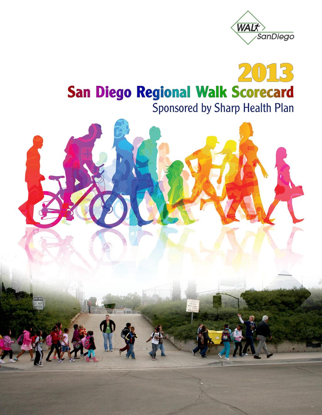
2 Acknowledgements This report was conceived by WalkSanDiego to elevate the regional dialogue about walkability, its importance to the future growth of our cities, and its role in a fully functioning transportation system. We want to thank the many people who provided input on the Scorecard methodology and BestWALKphone application rating system that was integrated into the scores for each city. A special thanks to the title sponsor of the Regional Walk Scorecard and the BestWALK phone app, Sharp Health Plan. Our thanks also to KTU+A consulting firm who donated a significant portion of their time to develop report elements and BestWALK methodology, and to RBF Consulting for providing publishing services for this year s Scorecard Report. This report could not have been completed without their help. Finally, thank you to members of the Walk Scorecard Technical Review Committee who served as expert panelists to provide input on the Scorecard methodology: Bill Chopyk, AICP, Director, Community Development Director, City of La Mesa; Graham Mitchell, City Manager, City of Lemon Grove, Dr. Sherry Ryan, Principal, Chen Ryan Associates; Elyse Lowe, Director, Move San Diego; and Andy Hamilton, San Diego County Air Pollution Control District. Mike Singleton Joe Punsalan Catrine Machi John Holloway Dr. Jim Sallis Shelley Saitowitz Katie Judd Nancy Garcia-Drew Tina Emmerick Kathleen Ferrier Sasha Jovanovic SANDAG s icommute Staff Jim Stone Leah Stender Konstantina Grozdeva Hanna Kite Robert Felix Ray Traynor Hilary Potter Faye Stroud Maya Rosas Andy Hamilton Thank you to city staff in our 18 cities for answering our survey and providing answers to many questions.
3 Table of Contents Executive Summary... 1 The Results: La Mesa Wins!... 1 What It All Means... 2 The Scoring Framework... 2 Good Work Highlighted... 4 Introduction... 5 Measuring Walkability... 5 The Purpose of the Scorecard... 5 The Role of Local Governments... 5 Scorecard Methodology... 6 Implementation Pedestrian Friendly Infrastructure Sidewalk Network and Inventory Process Safe Vehicle Speeds Safe Routes to School Work Transit Oriented Development & Walkable Land Use Policies Adopted Pedestrian Plan Universal Design Complete Streets Policy TOD Policy and Walkability Incentives Parking Policies and Requirements Transportation Demand Strategies (TDM) BestWALK Street Ratings How it Works About BestWALK BestWALK Rating Results What s Next Conclusion What it All Means WalkSanDiego Regional Walk Scorecard 2012 i
4 List of Tables Table ES-1: Regional Walk Scorecard Total Score... 3 Table 1: Regional Walk Scorecard Framework... 7 Table 2: Regional Walk Scorecard Total Score... 7 Table 3: Status of Walking in the San Diego Region Cities Ranked by Status of Walking Index... 9 Table 4: Points Allocation and Strategy: Policies and Implementation Table 5: Implementation and Policy Scores by Jurisdiction Table 6: Innovative Pedestrian Improvements - San Diego Region Table 7: Ratio of Sidewalk Miles to Streets Miles Table 8: Safe Routes to School and Traffic Calming Projects - San Diego Region Table 9: Field Data BestWALK Ratings WalkSanDiego Regional Walk Scorecard 2012 ii
5 Executive Summary Like most Americans, San Diegans increasingly demand safe and attractive walking conditions, or what we in the livable communities movement call walkability. Walkability is typically something we feel more than measure. Yet, increasingly, San Diegans recognize improved walkability as a way to improve health, increase the economic vitality of neighborhoods, and conserve natural resources. New tools are emerging to quantify the walkability of streets, neighborhoods, and cities. As detailed in this report, WalkSanDiego s Regional Walk Scorecard quantifies walking conditions, the amount of walking, and walkability-related policies in each of the region s 18 cities to measure the extent to which our local governments are responding to the call for more walkable neighborhoods. We created the Regional Walk Scorecard to raise awareness of policies and funding decisions that impact walkability, and to create healthy competition among cities to champion walk-friendly policies and facilities. WalkSanDiego issued the first Walk Scorecard in 2012, in which we recognized National City as the top-ranked jurisdiction. For this second edition of the Regional Walk Scorecard, special emphasis was given to on-the-ground pedestrian safety improvements. This change was made in direct response to feedback we received following our last effort. This year, we ve counted crossing improvements at intersections, safer amenities around schools, and the use of innovative treatments such as mid-block crossings and lighting, and signals recently approved by the state to draw more attention to the presence of pedestrians along streets and at crossings. Other changes to the Scorecard between the 2012 and 2013 versions include using more robust data on the percent of trips made on foot, and the very reluctant elimination of Tree Canopy as a rating factor. Unfortunately, there is no solid data on the extent of street trees and the shade cover they provide. We hope to restore this category in the future since trees are so essential to a pleasant walking experience and a relatively easy improvement any city can make. The Results: La Mesa Wins! La Mesa emerged as the top scoring city for several reasons. The city has (a) extensively catalogued local walking conditions, especially around transit stations and schools, (b) consistently upgraded intersections and other facilities to better alert drivers to the presence of pedestrians, (c) instituted a host of incentives to reward developers for designing buildings and neighborhoods with walking utmost in mind, especially in their downtown and transit station areas, and (d) instituted a robust program to educate students and families about pedestrian and bike safety and encourage them to walk and bike to school. In addition, La Mesa has protected its downtown grid network of streets, which allows for a mix of walkable destinations, including transit stops. National City came in a close second. Our top scoring city last year, National City continues to aggressively add pedestrian-friendly facilities and amenities throughout the city. Like La Mesa, National City has extensively inventoried the walkability of streets and neighborhoods to identify areas needing improvement. Ironically, National City has the highest rate of pedestrian collisions in the region, but overcomes this negative with the high number of residents who walk or use transit to get around. Imperial Beach moved up from fourth to third place in this year s ranking. This city is like the Little Engine that Could. It has quietly added numerous traffic calming installations and pedestrian 1
6 enhancements throughout the city. One result is the remarkable increase in residential, shopping, and visitor amenities on or near Seacoast Drive, its cozy Main Street. Visit this area soon to see how increased pedestrian comfort and convenience can turn a place around. The two cities that scored lowest in the 2012 report Santee and El Cajon continue to hold those rankings. Whereas these cities received higher marks this year for walkability improvements and pedestrian safety education programs, other cities simply outpaced them. In addition, Santee and El Cajon have not updated the policies analyzed for the Scorecard, such as Complete Streets and Transit Oriented Design policies. This is not to say there are no such policies indeed, both have focused on increasing walking, bike safety, traffic calming, and transit use in key areas such as residential neighborhoods, Main Street corridors, and trolley stations. However, their policies lack the strong language and incentives we found in the other cities. What It All Means During the post-war period, the development pattern in the San Diego region as in most of the United States (U.S.) has primarily been car-oriented and suburban. The walkability of older, once highly pedestrian-oriented neighborhoods has been eroded in many cases. As discussed further below, one result is that pedestrian crashes are particularly high in our region. Our past planning priorities help explain why the highest overall score produced for any city was only 67 within a framework of 100 possible points. Most telling are the generally low scores for Implementation and Policies. The highest score in this category was 45 (La Mesa) out of 55 possible points, although this score represents an increase over last year s highest (37, National City). The report details where improvement is needed in each of 11 areas that make up the Implementation and Policy category. We recommend that staff and elected officials from each city dig into the details to understand how the Scorecard scores were calculated, and examine how they can move up in the rankings over the next reporting period. The Scoring Framework The four scoring categories were derived as follows: (1) Status of Walking Index This measure combines two indicators related to the current walkability of each city: (a) how many people choose to walk to get around, and (b) the pedestrian collision rate from a five year period, calculated per population and per miles of street. In general, cities that ranked high in this category tend to be more compact, have a dense network of safe walking routes, and a variety of land uses near residential neighborhoods. Other cities that ranked high have generally fewer people walking and a resulting lower rate of pedestrian vehicle collisions. (2) Implementation For this category, WalkSanDiego surveyed city staffs to determine the types of projects they were funding and building to improve pedestrian safety. They include a range of features such as pedestrian count down signals and new sidewalks, traffic calming measures to slow vehicular speeds, and tools to create a mix of walkable destinations. (3) Policies We analyzed the relative strength of local policies in 6 policy areas considered critical to walkability: Pedestrian Master Plans, Universal Design, Complete Streets, Transit Oriented Development, Parking, and Transportation Demand Management. Both implementation and policies were studied to strike an intentional balance between cities 2
7 Rank established big-picture goals and on-the-ground projects, recognizing that written policies are not always implemented and completed projects are not always initiated as a result of a policy. (4) BestWalk Field Data For this category, WalkSanDiego developed a smart phone application (BestWALK) to allow residents across the region to collect and upload ( crowdsource ) data regarding the walkability of streets and intersections through the completion of fact-based questions ( Is there a painted crosswalk? ) and perceptual questions ( Do you feel safe here? ). Approximately 2,000 intersection and street assessments were completed in the combined years of 2012 and Average scores from this year were added to last year s average to determine an overall score. Due to this relatively small sample size, and because the BestWALK app will be improved over time, the field data accounted for only 10% of the total Scorecard score. Table ES-1: Regional Walk Scorecard Total Score Status of City Walking Index Implementation Policies BestWALK Field Data TOTAL POSSIBLE POINTS: La Mesa National City Imperial Beach Solana Beach Encinitas Carlsbad Coronado Chula Vista San Diego Del Mar Vista Poway Lemon Grove Escondido Oceanside San Marcos El Cajon Santee
8 Good Work Highlighted The Walk Scorecard highlights the serious and committed efforts by several local jurisdictions to make walking a safe and enjoyable transportation mode. In fact, we have learned of several new projects either under development or recently completed that will be positive models for other cities in the region. It also underscores the many challenges in implementing pedestrian improvements, particularly in historically car-oriented cities. WalkSanDiego intends to release the Walk Scorecard bi-annually, and we welcome any suggestions for improving the scoring criteria and deploying the BestWALK phone app. We also look forward to working with the San Diego Association of Governments (SANDAG) and our many local government partners to make each city a more welcoming place for residents and visitors who want to experience the joy and convenience of transporting themselves by nothing more than their own two feet. 4
9 Introduction There s a lot of talk these days about walking and walkability. Public health officials cite walking as the #1 intervention to promote better health and ward off chronic disease. Environmentalists embrace walking as a way to reduce greenhouse gas emissions and air pollution. Planners promote walking as a way to return to a high quality of life in our neighborhoods. And yes, businesses support walking as a way to get more foot traffic in the door and increase sales. Can walking really be good for all these reasons? Yes, it s all true. Measuring Walkability Walkability is something we feel more than measure. Yet, increasingly, cities are quantifying walkability as a way to improve health, increase economic vitality, and conserve natural resources. A rating system called WalkScore rates the walkability of communities and cities across the country proclaiming that walkable places make you happier and healthier. The tool has spread like wildfire in the real estate profession. Another tool, the Pedestrian Environmental Quality Index (PEQI), was developed by public health officials in San Francisco to help prioritize improvements that can get more people walking and improving their health. The national recognition program, Walk Friendly Communities, was developed to encourage towns and cities across the U.S. to establish or recommit to supporting safer walking environments. The Purpose of the Scorecard The Regional Walk Scorecard is a new tool created to generate more discussion about walkability and to better define the projects and policies cities can adopt to improve walkability. The ratings present a snapshot of not only how walkable cities are today, but how well cities are working to improve walkability. San Diegans want safer, more walkable streets and neighborhoods. They want communities where they can live well and be healthy. WalkSanDiego hopes the Regional Walk Scorecard will raise awareness of policies and funding decisions that impact walkability, and create healthy competition among cities to champion walk friendly policies and infrastructure. The need for improved walking conditions is significant. Pedestrians bear the highest risk of all road users because they are the least protected. The San Diego region has one of the highest pedestrian fatality rates in the country, almost double the national average. 1 Whereas walking accounts for 13% of total travel trips in San Diego County, pedestrians represent 36% of traffic fatalities and 3% of transportation funding. 2,3,4 The Role of Local Governments Local governments are chiefly responsible for building roads and creating spaces where people feel welcome and safe to walk. Taking actions to create walkable environments can go a long way toward building communities that people enjoy and desire, while moving us away from our dependence on motor vehicles. Local policies are critical in influencing travel choice and demand. 5
 375 (2008).")
10 Change is Afoot In 2011, the San Diego Association of Governments (SANDAG) adopted its 2050 Regional Transportation Plan and Sustainable Communities Strategy (SCS), the first of its kind in the state. The SCS addresses required reductions in vehicle-related greenhouse gases, per Senate Bill (SB) 375 (2008). Since then, three major regional agencies representing nearly two-thirds of California s population have also adopted SCSs. As documented in a recent report from the Natural Resources Defense Council, A Bold Plan for Sustainable California Communities, there are many common threads among the plans that demonstrate how planning to accommodate future growth and a healthier environment is changing: 5 Less land will be developed to accommodate each new resident More public transportation options are being made available More people will be given the option to live near transit Commutes will get shorter Bicycling and walking will be better funded to improve safety and convenience These changes at the regional level reflect what has started to happen and should continue at the local level, in order to revitalize communities and improve the quality of life while accommodating growth and remaining competitive. Scorecard Methodology To create the Scorecard, WalkSanDiego collected data in 35 categories to measure cities progress toward becoming more walkable. The categories fell under three major headings (Table 1). A description of each category and related findings are detailed in the following pages. 6
11 Table 1: Regional Walk Scorecard Framework Category I Status of Walking How much are people walking in each city and how safe are they? II Implementation What projects are cities building to create a safer walking environment? III Policies What long term vision and incentives do cities have to promote walkability and to ensure quality projects? IV Field Data What are conditions on the street as crowd-sourced by volunteers across the region using WalkSanDiego sbestwalk smart phone application? Percentage Weight points possible Rank City TOTAL POSSIBLE Table 2: Regional Walk Scorecard Total Score Status of Walking Index Implementation Policies BestWALK Field Data TOTAL La Mesa National City Imperial Beach Solana Beach Encinitas Carlsbad Coronado Chula Vista San Diego Del Mar Vista Poway Lemon Grove Escondido Oceanside San Marcos El Cajon Santee
12 Status of Walking Index The Status of Walking establishes a baseline for walking in each city in the region. The index reflects how many people choose to walk for transportation in each city and how safe they are when they walk. Understanding how people choose to get around whether they are walking, biking, driving alone and where collisions occur is critical to planning for a safe walking environment. % of Trips made Walking and with Transit Pedestrian and Vehicle Collision History Data displayed for transportation trips in the San Diego region often reflects how people commute to work. To be more inclusive, the Scorecard measures how people choose to get around for all trips, not just commuting. All trips refer to the occasions people leave their house to go somewhere whether it be on a week day or weekend, to a grocery store, a friend s house, or to work. This data shows much higher rates of walking in cities across the region than typical commute data. Table 3 compares the percentage of people walking, biking, driving and taking transit for transportation in each city in the region. Cities that rose to the top in the Status of Walking Index were those that had the lowest collision rate and at least 9-10% of trips made by walking. These included cities like Poway, Del Mar, Solana Beach and Coronado. Poway came in at first place because of its low collision rate. This is, however, one of the cities with the smallest percentage of people walking (10%), suggesting that residents are safer only because there are fewer of them walking. The next tier of cities in this Index had much higher rates of walking and a higher collision rate. This included cities like National City, Encinitas, and San Diego three cities with the highest rates of walking in the region. This data supports the need for better infrastructure to increase safety for the people walking. Cities ranked closer to the bottom of the Index had lower rates of walking and higher collision rates. These included cities like El Cajon, Escondido and Chula Vista. This data shows the need for safer streets to not only help those already walking but to also encourage others to walk. 8
13 Table 3: Status of Walking in the San Diego Region Cities Ranked by Status of Walking Index Rank City Population 2010 Miles of Streets Total # Ped Collisions Ped Collision Rate per 1,000 per Year* Ped Collision Rate per Mile of Street per Year Combined Walk & Transit Trips** 1 Poway 47, % 2% 11% Del Mar 4, % 5% 26% Solana Beach 12, % 2% 9% Coronado 18, % 11% 20% National City 58, % 22% 18% Encinitas 59, % 7% 17% San Diego 1,307, ,671 41% 15% 18% Carlsbad 105, % 6% 14% Lemon Grove 25, % 10% 14% Imperial Beach 26, % 13% 14% La Mesa 57, % 11% 15% San Marcos 83, % 7% 12% Oceanside 167, % 11% 14% Santee 53, % 7% 13% Vista 93, % 13% 14% El Cajon 99, % 21% 15% Escondido 143, % 15% 13% Chula Vista 243, % 13% 12% 12.3 Sources: Population, Census 2010; Miles of Streets, SANDAG; Pedestrian and Vehicle Collisions, Transportation Injury Mapping System, University of California Berkeley; Percent Walk and Transit Trips, National Household Travel Survey Data 2010 * Pedestrian Vehicle collision rates were normalized per year over a five year period. The rates were determined assuming an even distribution of collisions over the five years. Status of Walking Index*** ** Walking and Transit Trips combine the percentage of all trips made by walking and transit reported by the National Household Travel Survey 2010 and the percent of commute trips made by walking and transit reported by Census Data for all trips is more heavily weighted than data for commute trips. *** The Status of Walking Index was tallied by combining (a) Walking and Transit Index, (b) total number of pedestrian and vehicle collisions during per 1,000 people per year in that city, and (c) pedestrian and vehicle collisions during a five-year period ( ) per mile of street given the total miles of streets. 9
14 100 Travel by Mode for All Trips in the San Diego Region Rail Bus Bicycle Drive/Driven Walk 10 0 Source: National Household Travel Survey Data, 2010 Implementation and Policies There is a symbiotic relationship between the implementation of walk-friendly street or development projects and strong policies that incentivize these projects and make them the standard rather than the exception. Scoring in this category intentionally combines the implementation of projects and local policies to take a snapshot of how well cities are creating and promoting a walkable environment. Based on feedback we received on the 2012 Walk Scorecard, a greater emphasis has been given this year to project implementation. Further, implementation has been separated from policies to make the action items more clear. Our analysis of policies and implementation was informed by best practices around the U.S. and the region in planning and engineering to create walkable environments. Data was collected through a written survey sent to city engineering and planning staff in the summer of 2013, telephone interviews, and research of existing local policies and programs. Neither policies nor implementation can stand alone, especially considering that cities in the San Diego region range in population from 4,000 to more than one million. Each city s population and extent of roadway network were weighted to account for these differences. A summary of categories for this section is provided below and in the following pages. 10
15 Table 4: IMPLEMENTATION 35 Pedestrian Friendly Infrastructure 12 Sidewalk Network and Inventory Process Safe Vehicle Speeds 7 Points Allocation and Strategy: Policies and Implementation Points Goal/Strategy Implement policies with construction of walk- friendly infrastructure 5 Routinely provide complete network of sidewalks Improve walkability and livability through traffic-calmed streets Safe Routes to School Work 3 Prioritize safe streets around schools Transit Oriented Development and Walkable Land Use Mix 8 Prioritize growth in transit and walk-friendly environments POLICIES 20 Adopted Pedestrian Plan 2 Provide robust inventory of pedestrian needs to make walking safer, and a clear process for implementing needed fixes Universal Design 3 Plan comprehensively for all types of pedestrians Complete Streets Policy 5 De-emphasize automobile dominance in transportation policies TOD and Walkability Incentives 4 Diversify land use mix and incentivize walk-friendly development Parking Policies and Requirements 4 Match parking supply with demand to reduce the inefficiency of large parking lots TDM Policies and Programs 2 Reduce single occupancy vehicle trips and make walking easier 55 TOTAL POINTS 11
16 Table 5: Implementation and Policy Scores by Jurisdiction Implementation Policies Total Score Ped Friendly Infra Sidewalk Network Safe Vehicle Speeds Safe Routes to School TOD and Land Use Ped/ Trails Plan Universal Design Complete Streets Policy TOD Policy Parking Policies La Mesa National City Imperial Beach Chula Vista Encinitas Carlsbad San Diego Vista Escondido San Marcos Lemon Grove Coronado Oceanside Solana Beach Del Mar El Cajon Santee Poway TDM Policies 12
17 Implementation Pedestrian Friendly Infrastructure Why it Matters Cities have a wide variety of tools to improve walking conditions. This section focuses on tangible projects and street design elements cities can fund to improve pedestrian safety. What We Measured: A review of crosswalk implementation was combined with cities curb radius standard, the number of curb extensions completed in the last three years (weighted by total street mileage), and existence of innovative pedestrian treatments. These techniques are described below. Points Allocation - Pedestrian Friendly Infrastructure 12 - Percent signalized intersections with pedestrian count down signals 2 - Consistency in marking crosswalks 2 - Curb radius standard 2 - Curb extensions constructed in last 3 years 2 - Innovative pedestrian treatments 4 What We Found: All cities had implemented at least one of the design elements surveyed and had more under planning and design. Pedestrian Count Down Signals You ve seen these. They help eliminate the guessing game as to whether there is enough time to cross the street before the signal changes and have been proven to increase pedestrian safety. Cities in California are required to include the pedestrian countdown component with new signal installations. The percent of intersections with these signals in San Diego cities ran the gamut from 10% to 100% with most cities hovering around 15-20%. We hope to see the installation of these ramp up, especially on wide streets with high vehicle speeds. Crosswalks Marked crosswalks are an essential tool for helping pedestrians move safely, conveniently and predictably across roadways. Research clearly shows that determining where and how to apply crosswalks requires a context-sensitive approach that considers location, amount of vehicular and pedestrian traffic, and typical behaviors of drivers and pedestrians. We reviewed how consistently cities paint crosswalks at major intersections * and found that most cities are doing a good job at painting parallel lines at major intersections. Yet, there are a handful of cities that have either very few to no crosswalks painted or key areas like downtown intersections without crosswalks. As a result, these cities received lower scores. Curb Design The radius of a corner curb describes how far into the street the corner extends. Large radii allow vehicles to make right turns without significantly reducing speed. For this reason, reduced curb radii * As viewed through Google Maps. Important to note the presence of stop bars do not count as crosswalks. 13
18 and curb extensions are essential tools to slow turning vehicles and to reduce the crossing distance for pedestrians. Curb radii recommended in SANDAG s Planning and Design for Pedestrians (30 radius in general and radius for minor streets) were used as a baseline to compare and rate city standards for curb radius design. 6 Answers to survey questions found that all but four cities in the region have installed curb extensions to increase pedestrian safety mostly in downtown areas and near schools. Innovative Treatments Innovative treatments such as pedestrian hybrid beacons, rapid repeat flashing beacons, enhanced crosswalk signage and striping, and raised crosswalks are being constructed around the San Diego region. Cities are using a layered approach to build these, combining multiple treatments at one location to maximize safety. Treatments were considered innovative if they have not yet achieved wide spread use in the region but are accepted by the engineering profession. Almost all cities received points in this category. A list of sample projects reported by cities for the Scorecard can be found in Table 6. Bright Spot Almost all cities had something to report for this section, which reflects concentrated efforts to improve pedestrian safety and enhance walkability. Cities consistently painting standard crosswalks and constructing curb extensions are often the ones also completing innovative treatments. This layered approach of carefully selecting and applying treatments is a model for creating safe, walkable streets. Room for Improvement There are still cities with very few crosswalks painted at the majority of intersections, and many that do not use high visibility crosswalks on a regular basis outside of school zones. The City of San Diego is scheduled to complete Comprehensive Pedestrian Safety Guidelines in 2014, which will provide a positive model for crosswalk design and selection for other cities in the region. Chula Vista was the first city in the region to install a pedestrian hybrid beacon or HAWK signal that stops traffic only when a pedestrian is waiting to cross the street. The City of Imperial Beach has constructed more than 60 curb extensions, more than any other city. Many were built in close proximity to schools to ensure safer conditions for students and families. 14
19 Table 6: Innovative Pedestrian Improvements - San Diego Region Carlsbad Rectangular Rapid Flashing Beacons (RRFBs) on Carlsbad Boulevard at Oak Avenue and Army/Navy Academy crosswalk Enhanced pedestrian median islands/crosswalks on Carlsbad Boulevard at Hemlock, Cherry, Maple, Sycamore and Oak Two scramble pedestrian crossings at Carlsbad Boulevard/Carlsbad Village Drive and at Carlsbad Boulevard/Grand Avenue Chula Vista HAWK signal on Fourth Avenue (first one in California) RRFBs Coronado One roundabout Del Mar RRFBs on Camino del Mar El Cajon In-pavement flashers at a mid-block crosswalk in Downtown area Encinitas Lead pedestrian signals at 10 signalized crosswalks Four raised pedestrian crosswalks, mini traffic circles with pedestrian access on the sides, and a few raised medians for pedestrian refuge Escondido None Imperial Beach In-pavement flashers at Imperial Beach Blvd Road diet, pedestrian activated signal, and RRFBs at Palm Avenue La Mesa Pedestrian detection signals, radius reductions, and in-pavement flashers Lemon Grove In-pavement flashers, raised crosswalk, and RRFB National City 6 ped-actuated crosswalks with in-roadway warning lights and flashing LED pedestrian crossing signs 8 additional ped-actuated crosswalks with flashing LED pedestrian crossing signs, curb extensions and/or raised refuge islands, enhanced crosswalk striping, and advanced warning signs and/or pavement markings Oceanside Lead pedestrian signals at 2 signalized crosswalks Poway Mid-block raised crosswalk at Oak Knoll San Diego RRFBs with two crosswalks San Marcos RRFB at San Marcos High School Santee None Solana Beach RRFBs at 2 mid-block crosswalks on Highway 101 Vista Several ladder-style crosswalks to enhance existing pedestrian crossings Roundabout and RRFBs on Santa Fe under design 15
20 Sidewalk Network and Inventory Process Studies show residents are 65% more likely to walk in a neighborhood with sidewalks. 7 Further, a recent safety review by the Federal Highway Administration found the provision of sidewalks reduces pedestrian crashes by 88%,a reduction higher than any other measure. 8 WalkSanDiego recognizes that construction of sidewalks in some communities can be very challenging given the built-out nature of the properties. In some neighborhoods with low volume, slow-moving traffic, sidewalks are not a high priority. Sidewalks, however, are an essential component for improving walkability, and cities should consistently fund sidewalk improvements especially in areas with a high propensity for walking and/or high vehicular speeds. Having an ongoing sidewalk inventory process and an annual budget line item in place demonstrates a city s commitment to cover existing sidewalk gaps. What We Measured: Cities were scored by the ratio of total miles of sidewalks to miles of streets as well as the city s depth of data for sidewalk presence and ongoing practice of conducting a sidewalk inventory. Cities that rose to the top had a high ratio of sidewalks to streets and conducted a thorough inventory of sidewalk presence and quality. Points Allocation - Sidewalk Network and Inventory Process 5 - Ratio of sidewalk miles to street miles 3 - Sidewalk inventory in place 2 What We Found: Six cities had a ratio of sidewalk to streets greater than 1.0 and the highest ratio was 1.70 in Imperial Beach. Most cities had conducted some sort of sidewalk inventory. The largest city in our region, San Diego, has been one of the last to do this, but work has recently been initiated to inventory sidewalks throughout the City. Bright Spot Most cities had a ratio of sidewalks to roads of at least 1.0 and all cities reported having some type of sidewalk inventory in place and a budget line item for sidewalk repair and/ or construction. Room for Improvement Having sidewalks in a state of good repair represents a critical need throughout the region. Like other aging infrastructure needs, solutions are typically complex and require an upgrade to related items such as drainage and landscaping. Dependence on a meager sidewalk budget and grants is not sufficient to fill this need. The generation of additional revenue is necessary and reflects a growing need in many of our cities. 16
21 Table 7: Ratio of Sidewalk Miles to Streets Miles Miles of Sidewalk Miles of Street Ratio of Sidewalks to Streets Imperial Beach Chula Vista Coronado Carlsbad National City San Diego 4,577 3, Santee Oceanside El Cajon San Marcos Escondido La Mesa Encinitas Vista Poway Solana Beach Lemon Grove Del Mar Source: SANDAG 17
22 Safe Vehicle Speeds Excessive speeds have a dramatic impact on pedestrian safety, increasing Why it Matters both the number and seriousness of crashes. Eighty-five percent of pedestrians struck by a car going 40 miles per hour (mph) will die; at 30 mph the likelihood of death is 45 percent. At 20 mph, the fatality rate drops to just 5 percent. 9 Ironically, studies show that more traffic can be moved at 30 mph than any other speed, all else being equal. 10 Traffic calming is an effective way to encourage drivers to reduce their speed and make roads safer for everyone. What We Measured: We rated cities by the presence and quality of a traffic calming program and the percentage of roads in the city s street network with posted speed limits 35 miles per hour or less. We combined this information with the miles of road diets or lane diets completed in the city during the last three years as a percentage of the total street network. The 35 mph threshold was selected because pedestrian fatalities and severity of injuries dramatically increase at speeds higher than 35 mph. Points Allocation - Safe Vehicle Speeds 7 - % roads with posted speed limits <35 mph 1 - Miles of road diets implemented in last 3 years 2 - Miles of lane diets implemented in last 3 years 2 - Traffic calming program instituted 2 What We Found: All but three cities have completed either a road diet (eliminating a travel lane) or lane diet (reducing the width of a travel lane) in the last three years. Carlsbad and Encinitas were the two cities with the highest mileage of road diets. Carlsbad, La Mesa and the City of San Diego were the cities with the highest mileage of lane diets. Nine cities in the region have initiated a neighborhood traffic calming program with one additional program under development (Escondido). These programs not only offer a toolkit of traffic calming measures, but also provide a community reporting process that guides residents requests and encourages reporting traffic concerns. These programs provide an excellent model for other cities to emulate. Road Diets Road diets constitute an especially effective tool to promote walkability and Complete Streets. Implementation of road diets has been shown to reduce pedestrian crashes by 29% and allow for new or wider bicycle lanes and/or sidewalks within the existing right of way. 11 Studies show that road diets to create one lane each direction on streets serving up to 23,000 vehicles per day substantially improve safety without Quick Stats: Benefits of a Road Diet 34% reduction in pedestrian crashes 68% reduction in pedestrian injury rates Average of 10 mph decrease in vehicle speeds 23% increase in pedestrian volumes 30% increase in bicycle volumes Source: Local Government Commission, Presentation on Roundabouts and Road Diets,
23 significantly reducing roadway capacity. Most road diet projects result in the same or greater traffic volumes, but at a slower speed. 12 Bright Spot Room for Improvement The concept of road diets and lane diets is relatively new in the San Diego region yet the application of these treatments is starting to grow rapidly, especially as they are coordinated with street repaving --at very low additional cost. Most cities had less than five percent of roads posted with speeds higher than 35 mph. Cities with traffic calming programs do not always have adequate funding set aside to implement the programs well. Most traffic calming programs focus on neighborhood streets. Yet these tools have great value on streets with higher traffic volumes too, using somewhat different techniques, to help improve safety for all roadway users. San Marcos award winning traffic calming project on Rock Springs Road included a road diet, two roundabouts, and new crosswalks and signage. A road diet on La Costa Avenue in Carlsbad reduced the number of travel lanes from four to two, making room for a buffered bike lane. 19
24 Safe Routes to School Work Safe Routes to School is a state and federal program designed to increase Why it Matters children s physical activity and create safer streets for walking and biking to school. Initial efforts to promote walking to school in the U.S. emerged in the 1990s. 13 In 2000, the National Highway Traffic Safety Administration sponsored two pilot programs to test the effectiveness of Safe Routes to School programs in Marin County, California and Arlington, Massachusetts. These pilot programs utilized a comprehensive 5E model that included education, encouragement, engineering, enforcement, and evaluation. The strong success of these pilot programs helped to establish a federal Safe Routes to School program in What We Measured: Cities were rated by the number of traffic calming projects or Safe Routes to School projects implemented near local schools in recent years. Cities that rose to the top completed numerous projects, included multiple treatments, and had initiated some type of local pedestrian safety education program. Points Allocation - Safe Routes to School Work 3 - Projects completed 2 - Education program implemented 1 What We Found: Safe Routes to School efforts have been growing steadily in the San Diego region since Since then, most cities have received Safe Routes to School grant funding to implement infrastructure projects. A growing number of cities are constructing traffic calming projects near schools with general funds. A handful of cities have also won funding to implement education programs. A list of sample projects reported by cities for the Scorecard can be found in Table 8. Bright Spot Room for Improvement The Safe Routes to School projects being implemented in the San Diego region are largely traffic calming projects, such as the construction of roundabouts and curb extensions, and basic infrastructure improvements, such as curb ramps and crosswalks. These projects, especially the traffic calming projects, provide effective models for other cities to emulate. The majority of Safe Routes to School projects have focused on infrastructure without a complementary education component although the number of education programs in the region is growing. Lemon Grove families participate in International Walk to School Day 2013 Encinitas has implemented five traffic calming projects near schools in recent years. Techniques such as a high visibility crosswalk combined with a median and chicane provide excellent design models for other cities. 20
25 Table 8: Safe Routes to School and Traffic Calming Projects - San Diego Region Carlsbad Pedestrian median island, curb extension, and crosswalk directly adjacent to Kelly Elementary School on Kelly Drive Residential stop signs on Levante Street near La Costa Heights Elementary School Chula Vista Two Safe Routes to School projects and one Highway Safety Improvement Program project on Fourth Avenue at Lauderbach, Montgomery and Rice Elementary Schools Coronado None reported Del Mar No schools in Del Mar El Cajon Two SRTS projects in the design phase and one under construction. Approximately 1/2 mile of new sidewalks in the project that is under construction Encinitas Traffic calming project on Westminster sidewalk and raised median Rubenstein/Summit Streets neighborhood traffic calming: mini traffic circle, chicane Gardendale traffic calming: raised crosswalks Escondido On Juniper St. lane narrowed, white stripes painted on road, and new signs Imperial Beach Through an Environmental Justice Grant managed by WalkSanDiego, identify walkability and traffic calming improvements within the City with a principle focus on areas around the City's 6 schools La Mesa Road narrowed at Junior High Drive with funding through a SRTS grant Lemon Grove As part of two Safe Routes to School projects the City installed an in-pavement lighted system, raised table and a Rectangular Rapid Flashing Beacons (RRFB) at Mt. Vernon Elementary School National City 16 school-zone flashing beacons in advance of crosswalks 24 curb extensions at crosswalks with enhanced crosswalk striping, and advanced warning signs/pavement markings 8 additional crosswalks with enhanced crosswalk striping Approximately 1 mile of road diet to calm traffic Approximately 0.5 miles of lane diets to calm traffic. All improvements listed funded by SRTS capital grants and local matching funds Oceanside Bulbouts on California Street Travel lane narrowed at El Camino High School to calm traffic speeds Poway Valle Verde traffic calming improvements funded by SRTS grant, converted intersection into all way stop, installed new medians and sidewalk, and narrowed the roadway to build sidewalk San Diego Reduced turning radii, expanded parkways, narrowed travel lanes at Madison and Cherokee San Marcos RRFB installed at San Marcos High School Twin Oaks at Olive Improvements San Elijo School SRTS Improvements San Marcos Middle School improvements Rock Springs Road SRTS (2 roundabouts) Santee New sidewalks in the Atlas neighborhood to improve safety around Prospect Avenue School. Funded by SRTS grant Solana Beach None reported Vista Curb extensions and refuge medians in front of Rancho Buena Vista High School Refuge and traffic calming median at Civic Center Drive in front of Vista Magnet Middle School New sidewalk at Maryland Elementary 21
26 Transit Oriented Development & Walkable Land Use Why it Matters The basic definition of Transit Oriented Development (TOD) is the concentration of higher-density mixed-use development within walking distance or a ½ mile of transit stations. As the need for TOD has grown in recent years, cities have expressly utilized TOD as a strategy to densify housing near transit to boost transit ridership and prioritize these areas for related infrastructure improvements. This analysis was included to look at the degree to which cities are zoning and building higher density around transit stations, which ultimately results in more walking. What We Measured: We analyzed the percentage of each city s population and employment within ½ mile of high frequency transit (15 minute service all day), a local Walkability Index, and the quality of infrastructure in close proximity to transit stations. The Walkability Index is a data point recently created for SANDAG s Regional Health Atlas that measures the relative walkability of cities based on retail floor area ratio (FAR), intersection density, net residential density, and land use mix. 14 Transportation infrastructure was a composite measurement based on the percentage of households within 0.6 mile of a transit station, sidewalk completeness, and access to non-motorized trails. 15 Points Allocation - TOD Policy and Last Mile Infrastructure 8 - Percent population and employment within ½ mile high frequency transit 2 - Utilitarian Walkability Index 4 - Transportation Infrastructure Support 2 What We Found: Half of the region s cities had at least 12% of the population within a ½ mile of high frequency transit. Cities scoring lower in this category were limited by the lack of high frequency transit. Cities with a grid street pattern, typically resulting from the city s original and historic layout, scored higher in the Walkability Index than newer suburban style cities. Bright Spot Room for Improvement Cities like Chula Vista, National City and Imperial Beach had more than half of their populations living within ½ mile of high frequency transit, seven cities had less than half of their population within this radius, and seven cities did not have high frequency transit available. Approximately seven cities received less than half of the points available for the Walkability Index, indicating these cities have less of a walkable land use mix, intersection density, and residential design. Cities with higher Walkability Index scores were more compactly developed. 22
27 Policies Adopted Pedestrian Plan Communities can address walkability issues using a variety of plan types, Why it Matters such as general plans, corridor studies, specific plans, and capital improvement plans. Dedicated pedestrian plans, however, indicate a commitment to pedestrian safety by establishing baseline data on collision history and a prioritization scheme to fund improvements. Trails Master Plans are also important to encourage more designated walking routes, to create a comprehensive network, and to attract funding. What We Measured: Cities with completed Pedestrian Master Plans received the highest score in this category. Cities that have plans under development such as a Comprehensive Active Transportation Strategy (CATS) or Safe Routes to School Plan - received partial credit. Points Allocation Adopted Pedestrian Plan 2 - Adopted Pedestrian Master Plan Adopted Trails Plan 0.5 What We Found: Five cities in the region have a dedicated Pedestrian Master Plan; three additional cities have received funding to implement a CATS or a combined Bicycle and Pedestrian Plan; and six cities have some sort of trails plan. In addition, cities including Santee are creating a comprehensive Safe Routes to School Plan to outline infrastructure needs around schools. Encinitas is creating a similar plan for Safe Routes to Transit. Bright Spot WalkSanDiego s 2011 report Safe for All recommended cities begin combining pedestrian and bicycle planning into one document to better plan for all modes. One city La Mesa 16 has created such a combined plan and several others including Solana Beach and National City have similar plans under development. Room for Improvement The success of a Pedestrian Master Plan lies in its implementation. Whereas most of the region s Pedestrian Master Plans identify and prioritize numerous projects, funding strategies or implementation goals were not included. Best practices around the country indicate that goal setting such as establishing a target mode share or implementation benchmarks and annual reporting on progress help cities stay accountable to implementing pedestrian plans. Without accountability, too many Pedestrian Master Plans sit on a shelf. 23
Faye Stroud Regional city staff for answering our survey and providing answers to many questions.
 Acknowledgements This report was conceived by WalkSanDiego to elevate the regional dialogue about walkability, its importance to the future growth of our cities, and its role in a fully functioning transportation
2015 Regional Walk Scorecard. Sponsored by Sharp Health Plan
 2015 Regional Walk Scorecard Sponsored by Sharp Health Plan 2 S a n D i e g o R e g i o n a l W a l k S c o r e c a r d Acknowledgements Kathleen Ferrier Lead Author Director of Advocacy, Circulate San
Use this guide to learn more about walkability and how you can make your community safer to walk
 Walkability Guide Do You Enjoy Walking In Your Community? Use this guide to learn more about walkability and how you can make your community safer to walk 2 About This Guide Circulate San Diego believes
PEDESTRIAN ACTION PLAN
 ATTACHMENT 2 CITY OF SANTA MONICA PEDESTRIAN ACTION PLAN CITY OF SANTA MONICA PEDESTRIAN ACTION PLAN This page intentionally left blank EXECUTIVE SUMMARY CHAPTER 1 EXECUTIVE SUMMARY Setting the Stage
PEDALING FORWARD. A Glance at the SFMTA s Bike Program for SFMTA.COM
 PEDALING FORWARD A Glance at the SFMTA s Bike Program for 2017-2021 SFMTA.COM INTRODUCTION About This Booklet More people from all walks of life see their bicycle as a more convenient way to get where
REGIONAL BICYCLE AND PEDESTRIAN DESIGN GUIDELINES
 REGIONAL BICYCLE AND PEDESTRIAN DESIGN GUIDELINES November 16, 2011 Deb Humphreys North Central Texas Council of Governments Bicycle and Pedestrian Advisory Committee Snapshot of the Guide 1. Introduction
Agenda. Overview PRINCE GEORGE S PLAZA METRO AREA PEDESTRIAN PLAN
 PRINCE GEORGE S PLAZA METRO AREA PEDESTRIAN PLAN May 28, 2008 Agenda Welcome and introductions Project overview and issue identification Planning context and strengths Design challenges and initial recommendations
Board-Approved Funding Awards for Cycle 4 Active Transportation Grant Program Projects (in Order of Project Rankings) Approved on
 Approved on") CAPITAL Large Category Projects Board-Approved Funding Awards for Cycle 4 Active Transportation Grant Program Projects (in Order of Project Rankings) Approved on 07-27-18 1 La Mesa University Ave Pedestrian
CAPITAL Large Category Projects Board-Approved Funding Awards for Cycle 4 Active Transportation Grant Program Projects (in Order of Project Rankings) Approved on 07-27-18 1 La Mesa University Ave Pedestrian
Omaha s Complete Streets Policy
 Omaha s Complete Streets Policy (Adopted August 2015) VISION To create great places and enhance our quality of life, the City of Omaha will provide safe, accessible streets for all users. Complete Streets
City of Novi Non-Motorized Master Plan 2011 Executive Summary
 City of Novi Non-Motorized Master Plan 2011 Executive Summary Prepared by: February 28, 2011 Why Plan? Encouraging healthy, active lifestyles through pathway and sidewalk connectivity has been a focus
Proposed. City of Grand Junction Complete Streets Policy. Exhibit 10
 Proposed City of Grand Junction Complete Streets Policy Exhibit 10 1 City of Grand Junction Complete Streets Policy Vision: The Complete Streets Vision is to develop a safe, efficient, and reliable travel
PRINCE GEORGE S PLAZA METRO AREA PEDESTRIAN PLAN
 PRINCE GEORGE S PLAZA METRO AREA PEDESTRIAN PLAN May 28, 2008 Agenda Welcome and introductions Project overview and issue identification Planning context and strengths Design challenges and initial recommendations
Solana Beach Comprehensive Active Transportation Strategy (CATS)
") Solana Beach Comprehensive Active Transportation Strategy (CATS) 3.0 Goals & Policies The Solana Beach CATS goals and objectives outlined below were largely drawn from the Solana Beach Circulation Element
Solana Beach Comprehensive Active Transportation Strategy (CATS) 3.0 Goals & Policies The Solana Beach CATS goals and objectives outlined below were largely drawn from the Solana Beach Circulation Element
Bicycle Master Plan Goals, Strategies, and Policies
 Bicycle Master Plan Goals, Strategies, and Policies Mobilizing 5 This chapter outlines the overarching goals, action statements, and action items Long Beach will take in order to achieve its vision of
WELCOME. Thank you for joining us at the Second Public Workshop for the Carlsbad Pedestrian Master Plan. We look forward to receiving your feedback.
 City of Carlsbad Pedestrian Master Plan: WELCOME WELCOME Please Sign In Provide Input at Flip Charts Review Boards Presentation of Draft Plan Thank you for joining us at the Second Public Workshop for
Perryville TOD and Greenway Plan
 Perryville TOD and Greenway Plan Greenway Glossary Pathway: A bicycle and pedestrian path separated from motorized vehicular traffic by an open space, barrier or curb. Multi-use paths may be within the
City of Birmingham Draft Multi-modal Transportation Plan
 City of Birmingham Draft Multi-modal Transportation Plan City Commission Public Hearing Monday, November 25, 2013 7:30 pm Norman Cox, PLA, ASLA The Greenway Collaborative, Inc. Ann Arbor, Michigan The
RESOLUTION NO ?? A RESOLUTION OF THE CITY OF NEPTUNE BEACH ADOPTING A COMPLETE STREETS POLICY
 RESOLUTION NO. 2018-?? A RESOLUTION OF THE CITY OF NEPTUNE BEACH ADOPTING A COMPLETE STREETS POLICY WHEREAS, safe, convenient, and accessible transportation for all users is a priority of the City of Neptune
EXECUTIVE SUMMARY. Vision
 Vision Walking and bicycling in Salt Lake City will be safe, convenient, comfortable, and viable transportation options that connect people to places, foster recreational and economic development opportunities,
Where We Live and Work Today
 San Diego Forward: The 2019-2050 Regional Plan Network Concepts Transportation Committee Item 4 October 19, 2018 Where We Live and Work Today 2018 2 2019 Regional Plan Transportation Committee Item 4 October
Bridgewater Complete Streets Prioritization Plan and Pedestrian Safety Assessment
 Bridgewater Complete Streets Prioritization Plan and Pedestrian Safety Assessment Presented by Luciano Rabito Manager of Complete Streets Presented to Bridgewater, MA Wednesday, April 26, 2017 6:30 P.M.
Urban planners have invested a lot of energy in the idea of transit-oriented
 DOES TRANSIT-ORIENTED DEVELOPMENT NEED THE TRANSIT? D A N I E L G. C H AT M A N Urban planners have invested a lot of energy in the idea of transit-oriented developments (TODs). Developing dense housing
Welcome! San Jose Avenue Open House August 25, 2015
 Welcome! San Jose Avenue Open House August 25, 2015 Vision Zero The City and County of San Francisco adopted Vision Zero San Francisco Vision Zero High Injury Network as a policy in 2014, committing an
MASTER BICYCLE AND PEDESTRIAN PLAN
 VILLAGE OF NORTHBROOK MASTER BICYCLE AND PEDESTRIAN PLAN DRAFT PLAN OPEN HOUSE May 2, 2018 AGENDA 1. Community Engagement 2. Vision and Goals 3. General Structure of Plan 4. Recommendations Overview 5.
Chapter 2. Bellingham Bicycle Master Plan Chapter 2: Policies and Actions
 Chapter 2 Bellingham Bicycle Master Plan Chapter 2: Policies and Actions Chapter 2: Policies and Actions The Bicycle Master Plan provides a road map for making bicycling in Bellingham a viable transportation
Transportation Planning Division
 Transportation Planning Division Presentation Outline Study Tasks Recap of Previous Meetings Data Collected Focus Areas within Study Limits Design Principles Tool Box Recommended Concepts Schedule Moving
Chapter 5. Complete Streets and Walkable Communities.
 Chapter 5. Complete Streets and Walkable Communities. 5.1 Description of Complete Streets. Cities throughout the world, and specifically the United States, are coming to embrace a new transportation and
Transportation Assessment
 Transportation Assessment Midtown Open House February 10, 2018 Overview Midtown in Focus Overview & Purpose of Today Transportation Assessment overview Summary of Transportation work to date Review & Analysis
Bicycle and Pedestrian Connectivity Study Phase 2
 Connectivity Study Phase 2 Process PROCESS OUTCOMES Phase Prepared By STEP I Public Participation and Outreach 1. RTP Outreach activities, and development of the Bike and Ped Task Force Phase 1 2011 OCPC
Designing for Pedestrian Safety in Washington, DC
 Designing for Pedestrian Safety in Washington, DC February 25, 2014 George Branyan Pedestrian Program Coordinator District Department of Transportation DC Journey to work mode split: 2012 Means of Transportation
CONNECTING PEOPLE TO PLACES
 CONNECTING PEOPLE TO PLACES 82 EAST BENCH MASTER PLAN 07 Introduction The East Bench transportation system is a collection of slow moving, treelined residential streets and major arteries that are the
The DC Pedestrian Master Plan
 The DC Pedestrian Master Plan September 28, 2010 George Branyan Pedestrian Program Coordinator District Department of Transportation Presentation Agenda Scope of the Plan Methodology Recommendations Implementation
City of Elizabeth City Neighborhood Traffic Calming Policy and Guidelines
 City of Elizabeth City Neighborhood Traffic Calming Policy and Guidelines I. Purpose: The City of Elizabeth City is committed to ensure the overall safety and livability of residential neighborhoods. One
Active Transportation Facility Glossary
 Active Transportation Facility Glossary This document defines different active transportation facilities and suggests appropriate corridor types. Click on a facility type to jump to its definition. Bike
Bikeway action plan. Bicycle Friendly Community Workshop March 5, 2007 Rochester, MN
 Bikeway action plan Summary The was held on March 5, 2007 at the Rochester Mayo Civic Center. The workshop was hosted by Rochester-Olmsted County Planning Department in collaboration with the League of
City of Albert Lea Policy and Procedure Manual 4.10 ALBERT LEA CROSSWALK POLICY
 4.10 ALBERT LEA CROSSWALK POLICY PURPOSE: Pedestrian crosswalks are an integral part of our transportation infrastructure. To be effective and promote safety, marked crosswalks must be installed after
MCTC 2018 RTP SCS and Madera County RIFP Multi-Modal Project Eval Criteria GV13.xlsx
 MCTC 8 RTP SCS and Madera County RIFP Multi-Modal Project Eval Criteria GV.xlsx Madera County Transportation Commission Regional Transportation Plan / Sustainable Communities Strategy Multi-Modal Project
4 MOBILITY PLAN. Mobility Plan Objectives. Mobility Context. 1. Integrate with Local and Regional Transit Improvements
 Harbor Mixed Use CHAPTER Transit Corridor 4: Mobility Plan 4 MOBILITY PLAN Mobility Plan Objectives The Harbor Corridor Plan seeks to expand and improve the ways that people move along and through the
Oakland Pedestrian Master Plan Oakland Pedestrian Plan Draft Recommendations Chapter Outline
 EISEN LETUNIC T R A N S P O R T A T I O N, ENVIRO N M E N TA L A N D URBAN PLANNIN G MEMORANDUM To Oakland Pedestrian Plan Technical Advisory Committee & Pedestrian Advisory Group From Victoria Eisen Date
APPENDIX A: Complete Streets Checklist DRAFT NOVEMBER 2016
 APPENDIX A: Complete Streets Checklist DRAFT NOVEMBER 2016 Complete Streets Checklist MetroPlan Orlando s Complete Streets Checklist is an internal planning tool for staff to further implementation of
CITY OF BLOOMINGTON COMPLETE STREETS POLICY
 CITY OF BLOOMINGTON COMPLETE STREETS POLICY POLICY OBJECTIVE: The City of Bloomington will enhance safety, mobility, accessibility and convenience for transportation network users of all ages and abilities,
Why Zone In on Speed Reduction?
 Learn it. Do it. Live it! SPEED REDUCTION IN THE ZONE Why Zone In on Speed Reduction? Speeding is a serious issue that plays a major role in the risk of serious injury and pedestrian fatality in a crash.
5/31/2016 VIA . Arwen Wacht City of Sacramento Community Development Department 300 Richards Blvd., 3 rd Floor Sacramento, CA 95811
 5/31/2016 VIA EMAIL Arwen Wacht City of Sacramento Community Development Department 300 Richards Blvd., 3 rd Floor Sacramento, CA 95811 RE: El Pollo Loco (P16-028) Dear Ms. Wacht: WALKSacramento has reviewed
Hennepin County Pedestrian Plan Public Comment Report
 Hennepin County Pedestrian Plan Public Comment Report On May 31, 2013, the draft Hennepin County Pedestrian Plan was released for a 45-day public comment period ending July 15, 2013. The county received
Purpose and Need. Chapter Introduction. 2.2 Project Purpose and Need Project Purpose Project Need
 Chapter 2 Purpose and Need 2.1 Introduction The El Camino Real Bus Rapid Transit (BRT) Project (Project) would make transit and other transportation improvements along a 17.6-mile segment of the El Camino
NJDOT Complete Streets Checklist
 Background The New Jersey Department of Transportation s Complete Streets Policy promotes a comprehensive, integrated, connected multi-modal network by providing connections to bicycling and walking trip
Exhibit 1 PLANNING COMMISSION AGENDA ITEM
 Exhibit 1 PLANNING COMMISSION AGENDA ITEM Project Name: Grand Junction Circulation Plan Grand Junction Complete Streets Policy Applicant: City of Grand Junction Representative: David Thornton Address:
5. Pedestrian System. Accomplishments Over the Past Five Years
 5. Pedestrian System Accomplishments Over the Past Five Years The Alamo Area Metropolitan Planning Organization (MPO) and its partner agencies recognize the importance of improving pedestrian mobility.
Bicycle and Pedestrian Connectivity Study. Old Colony Planning Council
 Bicycle and Pedestrian Connectivity Study Old Colony Planning Council Outline Why consider bike/peds in road designs? Why are measures needed? Connecting Land Use with Transportation Evaluation Tools:
Vision: Traditional hamlet with an attractive business/pedestrian friendly main street connected to adjacent walkable neighborhoods
 N D. Focus Area II Vision: Traditional hamlet with an attractive business/pedestrian friendly main street connected to adjacent walkable neighborhoods Transit Road Focus Area II is located in the Hamlet
SF Transportation Plan Update
 SF Transportation Plan Update CAC Meeting #11 Existing Conditions and Future Baseline Needs Revised, Part I www.sfcta.org/movesmartsf twitter.com/sanfranciscota www.facebook.com/movesmartsf January 30,
In station areas, new pedestrian links can increase network connectivity and provide direct access to stations.
 The Last Mile Planning for Pedestrians Planning around stations will put pedestrians first. Making walking to stations safe and easy is important; walking will be a part of every rapid transit Accessible
Chapter 14 PARLIER RELATIONSHIP TO CITY PLANS AND POLICIES. Recommendations to Improve Pedestrian Safety in the City of Parlier (2014)
") Chapter 14 PARLIER This chapter describes the current status and future plans for biking and walking in the City of Parlier. RELATIONSHIP TO CITY PLANS AND POLICIES The Parlier General Plan is the primary
Chapter 14 PARLIER This chapter describes the current status and future plans for biking and walking in the City of Parlier. RELATIONSHIP TO CITY PLANS AND POLICIES The Parlier General Plan is the primary
CHAPTER 7.0 IMPLEMENTATION
 CHAPTER 7.0 IMPLEMENTATION Achieving the vision of the Better Streets Plan will rely on the ability to effectively fund, build and maintain improvements, and to sustain improvements over time. CHAPTER
County of Greenville South Carolina. Traffic Calming Program Neighborhood Traffic Education Program and Speed Hump Program
 County of Greenville South Carolina Traffic Calming Program Neighborhood Traffic Education Program and Speed Hump Program (rev) August 2008 I. PURPOSE The potential negative impacts from vehicular traffic
Chapter 2: Standards for Access, Non-Motorized, and Transit
 Standards for Access, Non-Motorized, and Transit Chapter 2: Standards for Access, Non-Motorized, and Transit The Washtenaw County Access Management Plan was developed based on the analysis of existing
ASSESSING THE WALKING & BIKING ENVIRONMENT
 ASSESSING THE WALKING & BIKING ENVIRONMENT M A Y 2 0 1 3 Jon Morgan WI DHS ACTIVE COMMUNITY LINE-UP Rationale Why do an audit What s involved in an audit Things to look for and consider Hitting the streets
Living Streets Policy
 Living Streets Policy Introduction Living streets balance the needs of motorists, bicyclists, pedestrians and transit riders in ways that promote safety and convenience, enhance community identity, create
BETHEL ROAD AND SEDGWICK ROAD CORRIDOR STUDY
 DRAFT PLAN City Council Meeting August 14, 2017 STUDY AREA Sedgwick Corridor State Route 160, principal arterial with Class 3 access management designation, commuter and freight route, connection to SR
Pedestrian Project List and Prioritization
 To: Kyle Wagenschutz, City of Memphis CC: From: Anne Conlon and John Cock, Alta Planning + Design Date: December, 2014 Re: Project List Development (Task 3.1-3.2) and Project List Prioritization (Task
City of Jacksonville Mobility Fee Update
 City of Jacksonville Mobility Fee Update 2017 Preliminary Analysis May 3, 2017 Carnival Cruise lines photo credit Presentation Overview Public Outreach Process Pedestrian and Bicycle Master Plan Study
PEDESTRIAN ACTION PLAN
 CITY OF SANTA MONICA PEDESTRIAN ACTION PLAN DRAFT OCTOBER 2015 Safe Streets Santa Monica, December 3, 2015 Beth Rolandson, AICP Principal Transportation Planner Strategic + Transportation Planning, Planning
Multimodal Through Corridors and Placemaking Corridors
 68 Multimodal Through Corridors and Placemaking Corridors Corridors have different functions in a region. Some corridors are used to get smoothly and rapidly through a region or to get quickly to major
What s Health Got to Do With It? Health and Land Use Planning
 What s Health Got to Do With It? Health and Land Use Planning CANDACE RUTT, PH.D. EXECUTIVE DIRECTOR APRIL 13 TH, 2016 Planning and Public Health Planning + Public Health Healthy Communities Healthier
Washington County SW Beaverton-Hillsdale Hwy. & SW Scholls Ferry Rd.
 Washington County SW Beaverton-Hillsdale Hwy. & SW Scholls Ferry Rd. SW Beaverton-Hillsdale Hwy. & SW Scholls Ferry Rd. Washington County The SW Beaverton-Hillsdale Hwy & SW Scholls Ferry Rd. focus area
Bicycle and Pedestrian Chapter TPP Update Overview. TAB September 20, 2017
 Bicycle and Pedestrian Chapter TPP Update Overview TAB September 20, 2017 Bicycling & Walking in the Twin Cities Where are we now? The Bike-Pedestrian system Current trends New developments Where are we
This page intentionally left blank.
 This page intentionally left blank. COMMUNITY Coweta Community Overview Coweta Coweta, a residential community located in Wagoner County, is a suburb of Tulsa situated southeast of the metropolitan area
Retrofitting Urban Arterials into Complete Streets
 Retrofitting Urban Arterials into Complete Streets John N. LaPlante, P.E., P.T.O.E., T.Y. Lin International Prepared for: Illinois Traffic Engineering & Safety Conference Urbana, Illinois October 18, 2007
5/7/2013 VIA . RE: University Village Safeway Expansion (P13-019)
") 5/7/2013 VIA EMAIL David Hung, Associate Planner Community Development Department, Current Planning Division City of Sacramento 300 Richards Boulevard, 3 rd Floor Sacramento, CA 95811 RE: University Village
5/7/2013 VIA EMAIL David Hung, Associate Planner Community Development Department, Current Planning Division City of Sacramento 300 Richards Boulevard, 3 rd Floor Sacramento, CA 95811 RE: University Village
How To Encourage More Efficient Transportation in Brazilian Cities
 How To Encourage More Efficient Transportation in Brazilian Cities Todd Litman Victoria Transport Policy Institute Presented Seminar on Discouraging The Use Of Cars São Paulo, Brazil 3 September 2013 Creating
Transportation Master Plan Advisory Task Force
 Transportation Master Plan Advisory Task Force Network Alternatives & Phasing Strategy February 2016 BACKGROUND Table of Contents BACKGROUND Purpose & Introduction 2 Linking the TMP to Key Council Approved
SOLANA BEACH BICYCLE TRANSPORTATION PLAN SECOND ADDENDUM
 SOLANA BEACH BICYCLE TRANSPORTATION PLAN SECOND ADDENDUM Prepared by the City of Solana Beach January 2005 Introduction In June of 1993, the Solana Beach City Council adopted a Bikeway Master Plan as directed
G AT E WAY PLAN. Community BRIEFING KIT GATEWAY BIKE
 G AT E WAY PLAN GATEWAY BIKE Community BRIEFING KIT PLAN August 2016 TABLE OF CONTENTS INTRODUCTION... 1 THE BENEFITS OF A BIKEABLE COMMUNITY... 2 ECONOMY...2 SAFETY...3 HEALTH...3 HOUSEHOLD SPENDING...3
Speed Limits Study and Proposal. Public Input Session: 8/14/13
 Speed Limits Study and Proposal Public Input Session: 8/14/13 Why is Decatur a unique place for this project? First Community Transportation Plan in the nation with a Health Impact Assessment. Strong sense
Complete Streets 101: The Basics
 Complete Streets 101: The Basics Michigan Municipal League - Capital Conference March 21, 2017 Chip Smith, AICP - Senior Planner - Wade Trim Inc. and City Council member City of Ann Arbor 2017 MML Capital
Caltrans Sloat Boulevard Pedestrian Safety Project Response to Community Questions, Comments & Concerns
 Caltrans Sloat Boulevard Pedestrian Safety Project Response to Community Questions, Comments & Concerns Revised: May 10, 2016 The California Department of Transportation (Caltrans) is planning various
If a person walks within this focus area, these are examples of the places he or she could walk to or from:
 Portland Hillsdale Hillsdale Portland The Hillsdale focus area is located in the City of Portland. It is situated approximately three miles from the City of Portland s downtown, 5.5 miles from the City
Broad Street Bicycle Boulevard Design Guidelines
 Broad Street Bicycle Boulevard Design Guidelines Building from the strategies introduced in the 2013 Bicycle Transportation Plan and community input received thus far, City Transportation Staff have identified
STATUS OF 2009 PEDESTRIAN MASTER PLAN (AS OF DECEMBER 2013)
") Appendix P.1 STATUS OF 2009 PEDESTRIAN MASTER PLAN (AS OF DECEMBER 2013) The 2009 Pedestrian Master Plan establishes 21 core recommendations in three goal areas to improve pedestrian transportation in
Appendix P.1 STATUS OF 2009 PEDESTRIAN MASTER PLAN (AS OF DECEMBER 2013) The 2009 Pedestrian Master Plan establishes 21 core recommendations in three goal areas to improve pedestrian transportation in
Complete Streets. Designing Streets for Everyone. Sarnia
 Complete Streets Designing Streets for Everyone Sarnia Complete Streets ~ Sarnia ~ 2018 Introduction Our City is made up of a network of streets that we use to go for a walk, cycle to work, drive to the
AGENDA ITEM G-2 Public Works
 AGENDA ITEM G-2 Public Works STAFF REPORT City Council Meeting Date: 12/6/2016 Staff Report Number: 16-214-CC Regular Business: Approve the Oak Grove University Crane Bike Improvement Concept Plan, authorize
Department of Transportation
 Department of Transportation I. Internal Scan The number of older drivers in the United States will double over the next 30 years. By 2030 one in five Americans will be age 65 or older. On a licensed-driver
Memo. Introduction. Memphis STP Pedestrian Sidewalk Project
 Memo Memphis STP Pedestrian Sidewalk Project To: Kyle Wagenshutz, City of Memphis From: Matthew Berkow, Collin Chesston, and Anne Eshleman, Alta Planning + Design Date: June 2014 Re: Photo Inventory Introduction
Item to be Addressed Checklist Consideration YES NO N/A Required Description Complete Streets Guidelines
 Passaic County Complete Streets Checklist - Concept Development Project Name Item to be Addressed Checklist Consideration YES NO N/A Required Description Complete Streets Guidelines Existing Plans Have
Existing Pedestrian Conditions. PSAC February 8, 2011
 Existing Pedestrian Conditions PSAC February 8, 2011 Contents 1. Project Background & Goals 2. Pedestrian Activity: Where people walk 3. Pedestrian Safety: The conditions people face Project Background
Transit-Driven Complete Streets
 Questions: Type questions into the box at bottom of webinar panel. Panelists for today s webinar: Nimotalai Azeez, Program Associate with the National Complete Streets Coalition Rich Weaver, Director of
Goals, Objectives, and Policies
 Goals, Objectives, and Policies ADVISORY GROUP INPUT PUBLIC INPUT SNS PREVIOUS STUDIES RBPP Goals Vision Statement Southern Nevada will develop a safe, connected, and convenient walking and bicycling system
Safe Routes to School Action Plan Aberdeen, Idaho
 Background Aberdeen, Idaho is a largely agricultural community of nearly 2,000 people and is located in the southeast portion of the state on the western edge of American Falls Reservoir. The community
Roosevelt Estates Neighborhood Improvements
 Roosevelt Estates Neighborhood Improvements Transportation Alternatives Application May 5 th, 2016 Qualifying Activities Construction of on-road and off-road trail facilities for pedestrians, bicyclists,
4. ENVIRONMENTAL IMPACT ANALYSIS 9. TRANSPORTATION AND TRAFFIC
 4. ENVIRONMENTAL IMPACT ANALYSIS 9. TRANSPORTATION AND TRAFFIC 4.9.1 INTRODUCTION The following section addresses the Proposed Project s impact on transportation and traffic based on the Traffic Study
Executive Summary Route 30 Corridor Master Plan
 Route Corridor Master Plan Project Overview The Route Corridor Master Plan is a coordinated multimodal transportation and land use plan for the entire stretch of Route through East Whiteland Township,
PRESS RELEASE San Joaquin Council of Governments
 PRESS RELEASE San Joaquin Council of Governments For Immediate Release February 23, 2018 Contact: Nicole Gorham, 235-0582 gorham@sjcog.org SJCOG Board Awards $19.63 Million in Measure K Bicycle, Pedestrian,
CONTEXT SENSITIVE STREETS STANDARDS COMMITTEE
 CONTEXT SENSITIVE STREETS STANDARDS COMMITTEE February 23, 2015 Prepared by: Denise Chaplick, AICP City Jacksonville Bicycle and Pedestrian Coordinator Source: NCDOT Complete Streets Planning and Design
Lynchburg District Update
 Lynchburg District Update Virginia Statewide Bicycle and Pedestrian Advisory Committee Spring Meeting May 16 th, 2017 David Cook Transportation Planner, VDOT Lynchburg District Table of Contents Active
CITY OF ANN ARBOR TRAFFIC CALMING PROGRAM PROCESS OVERVIEW. Petitioner defines the project area limits and gathers petition signatures.
 CITY OF ANN ARBOR TRAFFIC CALMING PROGRAM PROCESS OVERVIEW Step 1: Petition Petitioner defines the project area limits and gathers petition signatures. 50% of addresses within the project area must sign
CITY OF OAK CREEK SAFE ROUTES TO SCHOOL ACTION PLAN. East Middle School
 CITY OF OAK CREEK SAFE ROUTES TO SCHOOL ACTION PLAN East Middle School CITY OF OAK CREEK SAFE ROUTES TO SCHOOL ACTION PLAN East Middle School Why Safe Routes to School? Safe Routes to School ( SRTS ) is
Appendix A: Crosswalk Policy
 Appendix A: Crosswalk Policy Appendix A: Crosswalk Policy Introduction This citywide Crosswalk Policy is aimed at improving pedestrian safety and enhancing pedestrian mobility by providing a framework
Polk Streetscape Project
 What is this project? The Polk Streetscape Project is an effort to improve safety for everyone traveling on Polk Street between Union and McAllister streets. Also included in this project are paving, sewer
West Dimond Blvd Upgrade Jodhpur Street to Sand Lake Road
 West Dimond Blvd Jodhpur St to Sand Lake CSS Transportation Project Summary Municipality of Anchorage Project # 05 005 Project Manager: John Smith, P.E. (MOA PM&E) Project Administrator: Julie Makela,
Outreach Approach RENEW SF served as the primary liaison with the North Beach community; the Chinatown. Executive Summary
 Executive Summary Executive Summary The Columbus Avenue Neighborhood Transportation Study s objective is to identify changes to transportation infrastructure and policies that could enhance the livability