Appendix G. Alternative Solutions Details. Krosno Creek Flood Reduction Project PROJECT FILE REPORT CITY OF PICKERING
|
|
|
- Grant Skinner
- 6 years ago
- Views:
Transcription
1 Krosno Creek Flood Reduction Project PROJECT FILE REPORT CITY OF PICKERING Appendix G Alternative Solutions Details TMIG THE MUNICIPAL INFRASTRUCTURE GROUP LTD
2
3 Krosno Creek Flood Reduction Project PROJECT FILE REPORT CITY OF PICKERING Appendix G1 Creek Improvements for Conveyance of the Regulatory Flow TMIG THE MUNICIPAL INFRASTRUCTURE GROUP LTD
4
5 Design of a 2-Stage Uniform Channel Low Flow Channel Design Flow m 3 /s Slope m/m Mannings 'n' Side Slopes (H:V) 2.0 :1 Base Width 5.0 m Depth 0.50 m 8.9 Full Flow Area 3.00 m 2 Full Flow Wetted Perimeter 7.24 m Calculated Flow 3.06 m 3 /s Velocity 1.02 m/s Top Width 7.00 m Hydraulic Depth 0.43 m Froude Number 0.50 <= Overbank Depth <=Shelf Width=> Overbank Area Design Flow m 3 /s Base Slope m/m => Width <= Manning's 'n' 0.06 Low Flow Channel Side Slopes 2 :1 Low Flow Channel Width 5.0 m Low Flow Channel Depth 0.50 m Overbank Side Slopes 3 :1 Shelf Width 5.0 m Overbank Depth 1.50 m 2.3 Full Section Area m 2 Full Section Wetted Perimeter m Full Section Flow m 3 /s Average Channel Velocity 1.29 m/s Total Channel Depth 2.00 m Channel Top Width m Hydraulic Depth 1.36 m Froude Number 0.35 <= <= Base Depth <= Manning's Open Channel Flow - 2 Stage Channel.xls Sheet1 11/18/13 1 of 1


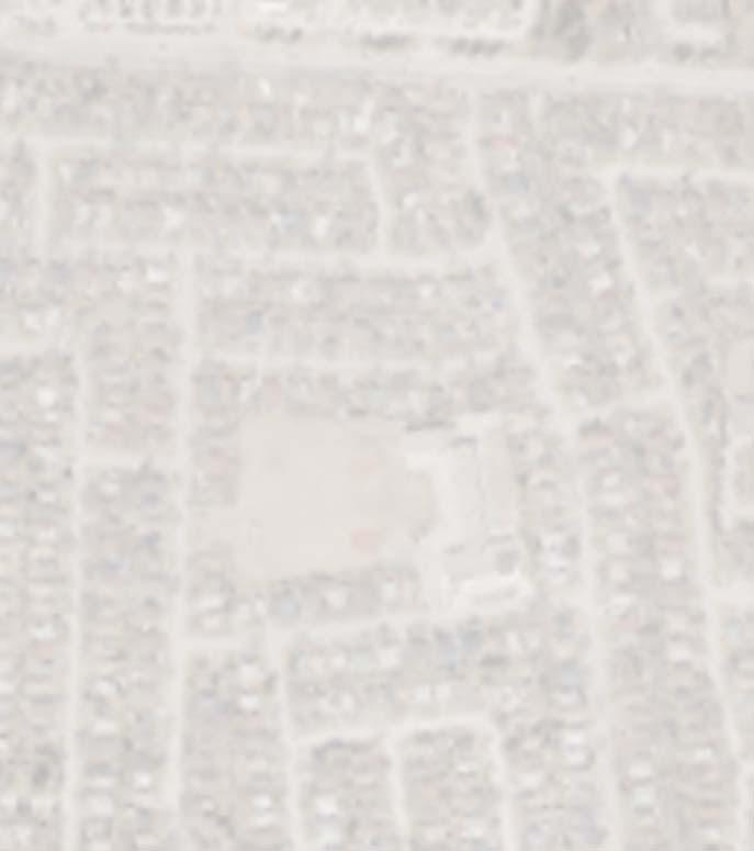


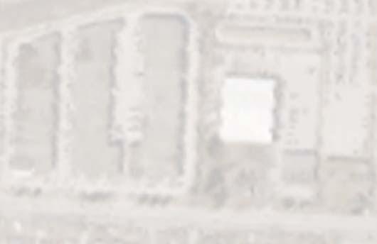


6 C D E A 8800 Dufferin Street, Suite 200 Vaughan, ON L4K 0C5... p: f: KROSNO CREEK DIVERSION PROJECT PROPERTY REQUIRED FOR CONVEYANCE OF THE REGULATORY FLOW PROJECT No. SCALE: 1:4000 DATE: SEPTEMBER 2013 DESIGNED BY: ET DRAWN BY: CAD CHECKED BY: SH CHECKED BY: FIGURE No. 4-1
7 City of Pickering Krosno Creek Diversion Project TMIG Project Cost Estimate Reconstructed Channel to convey Regulatory Storm Approx 25 m top width plus buffers Item No. Spec. Code Item Description Unit Quantity Unit Price Total Notes 1 Property Acquisition LS 1.0 $ 14,200, $ 14,200, All property on one side of the existing channel is required. 46 properties required if channel is constructed to the east of the existing channel 2 Channel Reconstruction m $ 2, $ 2,125, Including grading and landscape restoration 3 Bridges each 4.0 $ 1,000, $ 4,000, Bridges to span the channel at Bayly, Morden, Reytan and Alyssum 4 General Contingencies (20 %) LS 1 $ 4,065, $ 4,065, TOTAL COST $ 24,390,000.00
8
9 Krosno Creek Flood Reduction Project PROJECT FILE REPORT CITY OF PICKERING Appendix G2 Enhanced Stormwater Management Controls TMIG THE MUNICIPAL INFRASTRUCTURE GROUP LTD
10
11 City of Pickering Krosno Creek Diversion Project TMIG Project PCSWMM Model Output Enhanced Stormwater Management Controls Downtown Pickering Intensification, 5 mm retention, 100 Year Post to Pre, where Pre is max 50% impervious Maximum Flow Rate Location Conduit Drainage Area (ha) Hazel Highway _ Bayly Street Weir Flow KC_CJ44_HC Culvert Flow KC_CJ Total Flow ADD Downstream Bayly Street KC_CJ Morden Lane Weir Flow KC_CJ37_HC Culvert Flow KC_CJ Total ADD Reytan Boulevard Weir Flow KC_CJ29_HC Culvert Flow KC_CJ Total ADD Alyssum Street Weir Flow KC_CJ25_HC Culvert Flow KC_CJ Total ADD Sandy Beach Road North Culvert Weir Flow KC_CJ20_HC Culvert Flow KC_CJ Total ADD Confluence with East Tributa KC_CA Sandy Beach Road South Culvert Weir Flow KC_CJ7_HC Culvert Flow KC_CJ Total ADD Outlet to Frenchman's Bay KC_CJ
12 City of Pickering Krosno Creek Diversion Project TMIG Project PCSWMM Model Output Enhanced Stormwater Management Controls Downtown Pickering Intensification, 5 mm retention, 100 Year Post to Pre, where Pre is max 50% impervious Maximum Hydraulic Grade Line (m) Location Node Hazel Sandy Beach Road North Culvert - Downstream KC_J Sandy Beach Road North Culvert - Upstream KC_J Alyssum Street Culvert - Downstream KC_J Alyssum Street Culvert - Upstream KC_J Reytan Boulevard Culvert - Downstream KC_J Reytan Boulevard Culvert - Upstream KC_J Morden Lane Culvert - Downstream KC_J Morden Lane Culvert - Upstream KC_J Bayly Street Culvert - Downstream KC_J Bayly Street Culvert -Upstream KC_J Highway 401 / CNR Culverts - Downstream KC_J Highway 401 / CNR Culverts - Upstream flood damages incurred
13 City of Pickering Krosno Creek Diversion Project TMIG Project PCSWMM Model Output Enhanced Stormwater Management Controls Downtown Pickering Intensification, 5 mm retention, 100 Year Post to Pre, where Pre is max 50% impervious Pickering Town Centre Storage Summary Storm Event Peak Flow to Storage Node Peak Flow from Storage Node Maximum Storage Volume Maximum Water Level Hazel Node / Conduit
14 Downtown SWM and Diversion Study TMIG Project Flood Damage Estimates Enhanced SWM Controls in Downtown Pickering Storm Event Buildings Impacted Flood Damages* 2 2 $70, $193, $825, $1,750, $1,802, $1,866,600 Regional 65 $1,963,500 Average Annual Damages Existing Average Annual Damages Reduction in Annual Flood Damages $239,401 $390,931 $151,530 * Damages Calculated as 30% of the Assessed Value of all Properties where buildings are partially or entirely within the flood plain
15 Krosno Creek Flood Reduction Project PROJECT FILE REPORT CITY OF PICKERING Appendix G3 Culvert Improvements TMIG THE MUNICIPAL INFRASTRUCTURE GROUP LTD
16
17 City of Pickering Krosno Creek Diversion Project TMIG Project PCSWMM Model Output Culvert Upgrades Twin 3 m box culverts at Alyssum, Reytan and Morden Maximum Flow Rate Location Conduit Drainage Area (ha) Hazel Highway _ Bayly Street Weir Flow KC_CJ44_HC Culvert Flow KC_CJ Total Flow ADD Downstream Bayly Street KC_CJ Morden Lane Weir Flow KC_CJ37_HC Culvert Flow KC_CJ Total ADD Reytan Boulevard Weir Flow KC_CJ29_HC Culvert Flow KC_CJ Total ADD Alyssum Street Weir Flow KC_CJ25_HC Culvert Flow KC_CJ Total ADD Sandy Beach Road North Culvert Weir Flow KC_CJ20_HC Culvert Flow KC_CJ Total ADD Confluence with East Tributa KC_CA Sandy Beach Road South Culvert Weir Flow KC_CJ7_HC Culvert Flow KC_CJ Total ADD Outlet to Frenchman's Bay KC_CJ
18 City of Pickering Krosno Creek Diversion Project TMIG Project PCSWMM Model Output Culvert Upgrades Twin 3 m box culverts at Alyssum, Reytan and Morden Maximum Hydraulic Grade Line (m) Location Node Hazel Sandy Beach Road North Culvert - Downstream KC_J Sandy Beach Road North Culvert - Upstream KC_J Alyssum Street Culvert - Downstream KC_J Alyssum Street Culvert - Upstream KC_J Reytan Boulevard Culvert - Downstream KC_J Reytan Boulevard Culvert - Upstream KC_J Morden Lane Culvert - Downstream KC_J Morden Lane Culvert - Upstream KC_J Bayly Street Culvert - Downstream KC_J Bayly Street Culvert -Upstream KC_J Highway 401 / CNR Culverts - Downstream KC_J Highway 401 / CNR Culverts - Upstream flood damages incurred
19 City of Pickering Krosno Creek Diversion Project TMIG Project PCSWMM Model Output Culvert Upgrades Twin 3 m box culverts at Alyssum, Reytan and Morden Pickering Town Centre Storage Summary Storm Event Peak Flow to Storage Node Peak Flow from Storage Node Maximum Storage Volume Maximum Water Level Hazel Node / Conduit
20 Downtown SWM and Diversion Study TMIG Project Flood Damage Estimates Culvert Upgrades (Alyssum, Reytan & Morden) Storm Event Buildings Impacted Flood Damages* 2 1 $35, $70, $100, $131, $222, $251,500 Regional 7 $222,500 Average Annual Damages Existing Average Annual Damages Reduction in Annual Flood Damages $46,271 $390,931 $344,660 * Damages Calculated as 30% of the Assessed Value of all Properties where buildings are partially or entirely within the flood plain
21 City of Pickering Krosno Creek Diversion Project TMIG Project Cost Estimate Culvert Upgrades Twin 3.0 m x 1.8 m Concrete Box Culverts at Alyssum, Reytan and Morde Item No. Spec. Code Item Description Unit Quantity Unit Price Total Notes 1 2 x 3.0m x 1.8m Concrete Box Culvert Depth - Less than 5.0m (Morden Crossing) m 23.0 $ 12, $ 276, x 3.0m x 1.8m Concrete Box Culvert Depth - Less than 5.0m (Raytan Crossing) m 27.0 $ 12, $ 324, x 3.0m x 1.8m Concrete Box Culvert Depth - Less than 5.0m (Alyssum Crossing) m 23.0 $ 12, $ 276, Headwalls on upstream and downstream end of each culvert each 6.0 $ 30, $ 180, Utility Relocation, Traffic Control and General Contingencies (30 %) LS 1.0 $ 316, $ 316, TOTAL COST $ 1,372, Cost Estimates xls
22
23 Krosno Creek Flood Reduction Project PROJECT FILE REPORT CITY OF PICKERING Appendix G4 Diversion Alternatives TMIG THE MUNICIPAL INFRASTRUCTURE GROUP LTD
24
25 Potential Diversion Route Properties Route Route Description Route Length (m) Minimum Slope (m) Minimum Depth 1 (m) Maximum Pipe Size 2 Full Flow Capacity (m 3 /s) 3 1 Pickering Parkway, West to Pine Creek % m diameter concrete pipes 4, Bayly Street, West to Pine Creek % m diameter concrete pipe Bayly Street, East to Sandy Beach Road, south to Krosno Creek % m wide x 0.9 m high concrete box Morden Lane, south on Reytan Boulevard to Krosno Creek % m wide x 1.2 m high concrete box Morden Lane, south on Krosno Boulevard, east on Alyssum to Krosno Creek % m wide x 1.5 m high concrete box measured from existing ground to diversion invert Based on 0.6 m minimum structural cover as per Ontario Provincial Standard Specifications. This is a deviation from City of Pickering standards (1.8 m cover) Based on free flow conditions, ignoring tailwater elevation and potential surcharging Circular pipe is required for tunnelling under Liverpool Road Twin pipes as per FBSWMMP


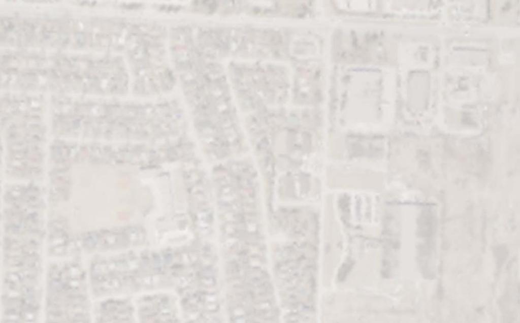
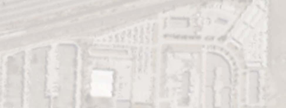
26 1 - Pickering Parkway, West to Pine Creek A FUTURE OPTIONAL SWM POND LOCATION 2 - Bayly Street, West to Pine Creek 3 - Bayly Street, East to Sandy Beach Road, south to Krosno Creek C 4 - Morden Lane, South on Reytan Boulevard to Krosno Creek 5 - Morden Lane, South on Krosno Boulevard, West on Alyssum to Krosno Creek D E D 8800 Dufferin Street, Suite 200 Vaughan, ON L4K 0C5... p: f: KROSNO CREEK DIVERSION PROJECT POTENTIAL DIVERSION ROUTES PROJECT No. SCALE: 1:5000 DATE: SEPTEMBER 2013 DESIGNED BY: ET DRAWN BY: CAD CHECKED BY: SH CHECKED BY: FIGURE No. 4-2
27 Diversion Alignment 1: Pickering Parkway to Pine Creek Liverpool Road Average Pipe Slope: 0.30% Maximum Diversion Sewer Height: 2.4 m
28 Diversion Alignment 2: Bayly Street to Pine Creek Liverpool Road Average Pipe Slope: 0.15% Maximum Diversion Sewer Height: 1.8 m
29 Diversion Alignment 3: Bayly Street Sandy Beach Road Krosno Creek Intersection of Bayly & Sandy Beach Existing Ground Invert Obvert Min Cover Average Pipe Slope: 0.30% Maximum Diversion Sewer Height: 0.9 m
30 Diversion Alignment 4: Morden Lane Reytan Boulevard Krosno Creek Invert Obvert Min Cover Existing Ground Average Pipe Slope: 0.30% Maximum Diversion Sewer Height: 1.2 m
31 Diversion Alignment 5: Morden Lane Krosno Boulevard Alyssum Street Krosno Creek 85 Intersection of Krosno Blvd & Reytan Intersection of Krosno Blvd & Alyssum Existing Ground Invert Obvert Minimum Cover Average Pipe Slope: 0.25% Maximum Diversion Sewer Height: 1.5 m
32
33 Krosno Creek Flood Reduction Project PROJECT FILE REPORT CITY OF PICKERING Appendix G5 Pickering Parkway Diversion to Pine Creek TMIG THE MUNICIPAL INFRASTRUCTURE GROUP LTD
34
35 City of Pickering Krosno Creek Diversion Project TMIG Project PCSWMM Model Output Pickering Parkway Diversion to Pine Creek Twin 2400 mm Diameter Sewers Maximum Flow Rate Location Conduit Drainage Area (ha) Hazel Highway _ Bayly Street Weir Flow KC_CJ44_HC Culvert Flow KC_CJ Total Flow ADD Downstream Bayly Street KC_CJ Morden Lane Weir Flow KC_CJ37_HC Culvert Flow KC_CJ Total ADD Reytan Boulevard Weir Flow KC_CJ29_HC Culvert Flow KC_CJ Total ADD Alyssum Street Weir Flow KC_CJ25_HC Culvert Flow KC_CJ Total ADD Sandy Beach Road North Culvert Weir Flow KC_CJ20_HC Culvert Flow KC_CJ Total ADD Confluence with East Tributa KC_CA Sandy Beach Road South Culvert Weir Flow KC_CJ7_HC Culvert Flow KC_CJ Total ADD Outlet to Frenchman's Bay KC_CJ
36 City of Pickering Krosno Creek Diversion Project TMIG Project PCSWMM Model Output Pickering Parkway Diversion to Pine Creek Twin 2400 mm Diameter Sewers Maximum Hydraulic Grade Line (m) Location Node Hazel Sandy Beach Road North Culvert - Downstream KC_J Sandy Beach Road North Culvert - Upstream KC_J Alyssum Street Culvert - Downstream KC_J Alyssum Street Culvert - Upstream KC_J Reytan Boulevard Culvert - Downstream KC_J Reytan Boulevard Culvert - Upstream KC_J Morden Lane Culvert - Downstream KC_J Morden Lane Culvert - Upstream KC_J Bayly Street Culvert - Downstream KC_J Bayly Street Culvert -Upstream KC_J Highway 401 / CNR Culverts - Downstream KC_J Highway 401 / CNR Culverts - Upstream flood damages incurred
37 City of Pickering Krosno Creek Diversion Project TMIG Project PCSWMM Model Output Pickering Parkway Diversion to Pine Creek Twin 2400 mm Diameter Sewers Diversion Flow Summary Storm Event Peak Flow to Storage / Junction Node Peak Flow from Storage / Junction Node Maximum Storage Volume Maximum Water Level Flow in Diversion Sewers Flow in Highway 401 Cuvlert Hazel Node / Conduit D2 34_1
38 Downtown SWM and Diversion Study TMIG Project Flood Damage Estimates Pickering Parkway Diversion to Pine Creek Storm Event Buildings Impacted Flood Damages* 2 5 $162, $686, $1,688, $1,838, $1,866, $1,932,700 Regional 62 $1,866,600 Average Annual Damages Existing Average Annual Damages Reduction in Annual Flood Damages $448,283 $390,931 -$57,352 * Damages Calculated as 10% of the Assessed Value of all Properties where buildings are partially or entirely within the flood plain
39 City of Pickering Krosno Creek Diversion Project TMIG Project Cost Estimate Pickering Parkway Diversion to Pine Creek 650 m Twin 2400 mm diam concrete pipe Item No. Spec. Code Item Description Unit Quantity Unit Price Total Notes 1 Storm Sewer Dia. 2.4m, Installed by Open Cut construction m $ 6, $ 3,780, Quantity reflects twin diversion sewers 2 Storm Sewer Dia. 2.4m, Installed by Tunnelling m $ 10, $ 7,000, Chambers / Headwalls at inlet / outlet each 2 $ 30, $ 60, SWM Pond LS 1 $ 4,000, $ 4,000, A design has not been prepared for the SWM pond. The cost of $4 Million was the high limit of the cost of a pond from the FBSWMMP 5 Utility Relocation, Traffic Control and General Contingencies (20 % of Diversion Costs) LS 1 $ 2,168, $ 2,168, TOTAL COST $ 17,008, Cost Estimates xls
40
41 Krosno Creek Flood Reduction Project PROJECT FILE REPORT CITY OF PICKERING Appendix G6 Pickering Parkway Complete Diversion to Pine Creek + Culvert Improvements in Krosno and Pine Creeks TMIG THE MUNICIPAL INFRASTRUCTURE GROUP LTD
42
43 City of Pickering Krosno Creek Diversion Project TMIG Project PCSWMM Model Output Complete Diversion to Pine Creek (Twin 2.4 m Diameter Sewers) Combined with Culvert Improvements (Twin 3.0 m x 1.8 m Box Culverts at Morden, Reytan and Alyssum) Maximum Flow Rate Location Conduit Drainage Area (ha) Hazel Highway _ Bayly Street Weir Flow KC_CJ44_HC Culvert Flow KC_CJ Total Flow ADD Downstream Bayly Street KC_CJ Morden Lane Weir Flow KC_CJ37_HC Culvert Flow KC_CJ Total ADD Reytan Boulevard Weir Flow KC_CJ29_HC Culvert Flow KC_CJ Total ADD Alyssum Street Weir Flow KC_CJ25_HC Culvert Flow KC_CJ Total ADD Sandy Beach Road North Culvert Weir Flow KC_CJ20_HC Culvert Flow KC_CJ Total ADD Confluence with East Tributa KC_CA Sandy Beach Road South Culvert Weir Flow KC_CJ7_HC Culvert Flow KC_CJ Total ADD Outlet to Frenchman's Bay KC_CJ
44 City of Pickering Krosno Creek Diversion Project TMIG Project PCSWMM Model Output Complete Diversion to Pine Creek (Twin 2.4 m Diameter Sewers) Combined with Culvert Improvements (Twin 3.0 m x 1.8 m Box Culverts at Morden, Reytan and Alyssum) Maximum Hydraulic Grade Line (m) Location Node Hazel Sandy Beach Road North Culvert - Downstream KC_J Sandy Beach Road North Culvert - Upstream KC_J Alyssum Street Culvert - Downstream KC_J Alyssum Street Culvert - Upstream KC_J Reytan Boulevard Culvert - Downstream KC_J Reytan Boulevard Culvert - Upstream KC_J Morden Lane Culvert - Downstream KC_J Morden Lane Culvert - Upstream KC_J Bayly Street Culvert - Downstream KC_J Bayly Street Culvert -Upstream KC_J Highway 401 / CNR Culverts - Downstream KC_J Highway 401 / CNR Culverts - Upstream
45 City of Pickering Krosno Creek Diversion Project TMIG Project PCSWMM Model Output Complete Diversion to Pine Creek (Twin 2.4 m Diameter Sewers) Combined with Culvert Improvements (Twin 3.0 m x 1.8 m Box Culverts at Morden, Reytan and Alyssum) Pickering Town Centre Storage Summary Storm Event Peak Flow to Storage Node Peak Flow from Storage Node Maximum Storage Volume Maximum Water Level Hazel Node / Conduit
46 City of Pickering Krosno Creek Diversion Project TMIG Project Cost Estimate Complete Flooding Solution, Independent of Highway 401 Culvert Restrictions Pickering Parkway Diversion to Pine Creek Culvert Improvements Flood Proofing remaining vulnerable homes Item No. Spec. Code Item Description Unit Quantity Unit Price Total Notes 1 Diversion Sewers on Pickering Parkway + SWM Pond west of Liverpool Road LS 1 $ 13,008, $ 13,008, Total Cost, including contingencies, from Pickering Parkway Diversion Alternative, less $4Million for SWM Pond at end of diversion 2 Culvert Improvements at Morden, Retyan and Alyssum LS 1 $ 1,372, $ 1,372, Total Cost, including contingencies, from Culvert Upgrades Alternative 3 Pine Creek Improvements to lower tailwater and accommodate increased flows LS 1 $ 15,980, $ 15,980, Radom Street & Hwy 401 culvert replacements plus channel modifications upstream of Highwy 401. Cost, including contingencies, taken from Sept 2007 MMM Report 4 Flood Proofing for Remaining Structures each $ 10, $ - 5 TOTAL COST $ 30,360,800.00
47 Krosno Creek Flood Reduction Project PROJECT FILE REPORT CITY OF PICKERING Appendix G7 Krosno Boulevard Relief Sewer TMIG THE MUNICIPAL INFRASTRUCTURE GROUP LTD
48
49 City of Pickering Krosno Creek Diversion Project TMIG Project PCSWMM Model Output Krosno Boulevard Relief Sewer 3.0 m wide x 1.5 m high concrete box sewer Maximum Flow Rate Location Conduit Drainage Area (ha) Hazel Highway _ Bayly Street Weir Flow KC_CJ44_HC Culvert Flow KC_CJ Total Flow ADD Downstream Bayly Street KC_CJ Morden Lane Weir Flow KC_CJ37_HC Culvert Flow KC_CJ Total ADD Reytan Boulevard Weir Flow KC_CJ29_HC Culvert Flow KC_CJ Total ADD Alyssum Street Weir Flow KC_CJ25_HC Culvert Flow KC_CJ Total ADD Sandy Beach Road North Culvert Weir Flow KC_CJ20_HC Culvert Flow KC_CJ Total ADD Confluence with East Tributa KC_CA Sandy Beach Road South Culvert Weir Flow KC_CJ7_HC Culvert Flow KC_CJ Total ADD Outlet to Frenchman's Bay KC_CJ
50 City of Pickering Krosno Creek Diversion Project TMIG Project PCSWMM Model Output Krosno Boulevard Relief Sewer 3.0 m wide x 1.5 m high concrete box sewer Maximum Hydraulic Grade Line (m) Location Node Hazel Sandy Beach Road North Culvert - Downstream KC_J Sandy Beach Road North Culvert - Upstream KC_J Alyssum Street Culvert - Downstream KC_J Alyssum Street Culvert - Upstream KC_J Reytan Boulevard Culvert - Downstream KC_J Reytan Boulevard Culvert - Upstream KC_J Morden Lane Culvert - Downstream KC_J Morden Lane Culvert - Upstream KC_J Bayly Street Culvert - Downstream KC_J Bayly Street Culvert -Upstream KC_J Highway 401 / CNR Culverts - Downstream KC_J Highway 401 / CNR Culverts - Upstream flood damages incurred
51 City of Pickering Krosno Creek Diversion Project TMIG Project PCSWMM Model Output Krosno Boulevard Relief Sewer 3.0 m wide x 1.5 m high concrete box sewer Diversion Flow Summary Storm Event Peak Flow to Intake Peak Flow in Diversion Sewer Peak Flow in Krosno Creek (Culvert) Peak Flow in Krosno Creek (Weir) Total Flow Continuing in Krosno Creek Hazel Node / Conduit KC_J37 D1 KC_CJ37 KC_CJ37_HC
52 City of Pickering Krosno Creek Diversion Project TMIG Project PCSWMM Model Output Krosno Boulevard Relief Sewer 3.0 m wide x 1.5 m high concrete box sewer Pickering Town Centre Storage Summary Storm Event Peak Flow to Storage Node Peak Flow from Storage Node Maximum Storage Volume Maximum Water Level Hazel Node / Conduit
53 Downtown SWM and Diversion Study TMIG Project Flood Damage Estimates Krosno Boulevard Relief Sewer Storm Event Buildings Impacted Flood Damages* 2 0 $0 5 2 $70, $100, $131, $222, $222,500 Regional 34 $1,074,500 Average Annual Damages Existing Average Annual Damages Reduction in Annual Flood Damages $31,874 $390,931 $359,057 * Damages Calculated as 10% of the Assessed Value of all Properties where buildings are partially or entirely within the flood plain
54 City of Pickering Krosno Creek Diversion Project TMIG Project Cost Estimate Krosno Boulevard Relief Sewer 660 m 3.0 x 1.5 Concrete Box Item No. Spec. Code Item Description Unit Quantity Unit Price Total Notes 1 3.0m x 1.5m Concrete Box Sewer Depth - Less than 5.0m m $ 5, $ 3,828, Storm Sewer MH (every 90m) m 8.0 $ 30, $ 240, Headwalls inlet /outlet each 2.0 $ 30, $ 60, Utility Relocation, Traffic Control and General Contingencies (40 %) LS 1 $ 1,651, $ 1,651, Higher contingency related to potenital conflicts with sanitary services to houses along the route TOTAL COST $ 5,779, Cost Estimates xls
MEMO. Schedule 'B' Class Environmental Assessment and Preliminary Design Lakeview Boulevard Improvements Culvert Assessment.
 MEMO Schedule 'B' Class Environmental Assessment and Preliminary Design Lakeview Boulevard Improvements Culvert Assessment February 15, 2017 As per the preferred Lakeview Boulevard alignment provided by
CHAPTER 5 CULVERT DESIGN
 CHAPTER 5 CULVERT DESIGN HYDRAULICS OF CULVERTS There are two major types of culvert flow: 1) flow with inlet control, and 2) flow with outlet control. For each type, different factors and formulas are
Stormwater Management Pond Design Brief. Greely Village Centre - Commercial Phase - Ultimate Conditions - - City of Ottawa -
 Stormwater Management Pond Design Brief Greely Village Centre - Commercial Phase - Ultimate Conditions - - City of Ottawa - December 2008 Ref: 647-07 J.F. Sabourin and Associates Inc. Water Resources and
APPENDIX J HYDROLOGY AND WATER QUALITY
 APPENDIX J HYDROLOGY AND WATER QUALITY J-1 Technical Report on Airport Drainage, Northern Sector Airport and Ordinance Creek Watershed / Preliminary Creek Constructed Natural Channel Culvert J-2 Preliminary
HY-8 Version 7.2 Build Date January 17, Federal Highway Administration.
 HY-8 Version 7.2 Build Date January 17, 2012 Federal Highway Administration http://www.fhwa.dot.gov/engineering/hydraulics/software/hy8/index.cfm SIMPLE Simple to use Use for simple culverts and bridges
Stormwater Management Report for the Macri Dixon Condo Block
 for the Macri Dixon Condo Block Town of Milton February 2017 JFSA Ref. No.: 1287-15 Prepared for : Prepared by : David Schaeffer Engineering Ltd. 52 Springbrook Drive, Ottawa, ON K2S 1B9 tel.: 613.836.3884,
Indiana LTAP Road Scholar Core Course #10 Culvert Drainage. Presented by Thomas T. Burke, Jr., PhD, PE Christopher B. Burke Engineering, Ltd.
 Indiana LTAP Road Scholar Core Course #10 Culvert Drainage Presented by Thomas T. Burke, Jr., PhD, PE Christopher B. Burke Engineering, Ltd. Objectives Review culvert shapes, end sections, and materials
Technical Report Culvert A Hydraulic Analysis
 DATE: November 3, 2011 Technical Report Culvert A Hydraulic Analysis TO: FROM: RE: Jim Reiser, P.E. Project Manager Parsons Brinckerhoff, Inc. Kurt Killian, P.E., CFM Parsons Brinckerhoff, Inc. Design
CITY OF ROSEVILLE DESIGN STANDARDS
 CITY OF ROSEVILLE DESIGN STANDARDS Section 1 Purpose and Definitions 1-1 Purpose PD 1 1-2 Design Practice PD 1 1-3 Definitions PD 1 Section 2 General Requirements 2-1 Plans by an Appropriate Engineer GR
19.1 Problem: Maximum Discharge
 19.1 Problem: Maximum Discharge In partially full channel having an equilateral triangular cross section, the rate of discharge is Q = KAR/3 in which K is a constant, A flow area, R is the hydraulic mean
CHAPTER 4 SPALDING COUNTY, GEORGIA 4.0 CULVERT DESIGN
 SPALDING COUNTY, GEORGIA CHAPTER 4 4.0 CULVERT DESIGN... 4-1 4.1 INTRODUCTION... 4-1 4.2 SYMBOLS AND DEFINITIONS... 4-1 4.3 ENGINEERING DESIGN CRITERIA... 4-2 4.3.1 FREQUENCY FLOOD... 4-2 4.3.2 VELOCITY
Stormwater Level of Service Study - Phase 2 Flooding Adjacent to Rock Creek
 Stormwater Level of Service Study - Phase 2 Flooding Adjacent to Rock Creek City of Fairway, Kansas Fairway Stormwater Level of Service Study - Phase 2 Project No. 108200 Revision 1 12/6/2018 Stormwater
WELCOME PTH 59N - PTH 101 INTERCHANGE FUNCTIONAL DESIGN STUDY PUBLIC INFORMATION SESSION MONDAY, JUNE 13, :00 P.M. - 8:00 P.M.
 WELCOME - PTH 1 INTERCHANGE FUNCTIONAL DESIGN STUDY PUBLIC INFORMATION SESSION MONDAY, JUNE 13, 11 4:00 P.M. - 8:00 P.M. PROJECT STUDY AREA 1 Wenzel Street PR 2 Pritchard Farm Farm Road Road McGregor Farm
Chapter 11. Culverts and Bridges Design Checklist for Culvert Design
 Yes No N/A Design Requirements I. GENERAL DESIGN GUIDELINES Chapter 11. Culverts and Bridges A. Culvert design is in accordance with the Culverts chapter of Volume 2 of the UDFCD Manual for additional
Culvert Design An Overview of the NYS Highway Design Manual Chapter 8
 Seventeenth Statewide Conference on Local Bridges Culvert Design An Overview of the NYS Highway Design Manual Chapter 8 Tuesday, October 25, 2011 Training Session: Culvert Design, Analysis - talk 2 Presented
Design Criteria. Design Criteria
 F Design Criteria Design Criteria Ministry of Transportation Ministère des Transports DESIGN CRITERIA Page: 1 of 13 WORK PROJECT NO. N/A GO Bloomington Station TYPE OF PROJECT LOCATION Bloomington Road
June 13, 2016 Tom Garigen Re: Myrtle Beach Golf and Yacht Club Drainage assessment
 INFRASTRUCTURE & REGULATION DIVISION- STORMWATER DEPARTMENT 4401 Privetts Road Conway, South Carolina 29526 Post Office Box 1236 Conway, South Carolina 29528-1236 Phone: (843) 915-5160 Fax: (843) 365-2208
City of Guelph. Hanlon Creek Business Park Stormwater Management Report Ponds 1, 2, 3 and 4
 City of Guelph Hanlon Creek Business Park Stormwater Management Report Ponds 1, 2, 3 and 4 City of Guelph Hanlon Creek Business Park Stormwater Management Report Ponds 1, 2, 3 and 4 Prepared by: AECOM
APPENDIX B HYDRAULIC DESIGN DATA FOR CULVERTS
 TM 5-820-4/AFM 88-5, Chap 4 APPENDIX B HYDRAULIC DESIGN DATA FOR CULVERTS B-1. General. a. This appendix presents diagrams, charts, coefficients and related information useful in design of culverts. The
General Information for Culvert Design
 Design Manual Chapter 2 - Stormwater 2E - Culvert Design 2E-1 General Information for Culvert Design A. Introduction A culvert is a conduit under an embankment that transports stormwater from one side
Evaluating Surge Potential in CSO Tunnels
 14 Evaluating Surge Potential in CSO Tunnels Karen E. Ridgway Tunnels are being proposed to control combined sewer overflow (CSO) in numerous cities in the United States and Canada. The tunnels are intended
 Dam Modification Report Stingy Run Fly Ash Reservoir Appendix E Spillway System Design Calculations E1: Spillway/Energy Dissipater Design for 100-year Event CHE8273 8 September 4, 2014 Written by: CJW
CLEANING, INSPECTION, AND TESTING OF SEWERS
 CLEANING, INSPECTION, AND TESTING OF SEWERS PART 1 - GENERAL 1.01 SECTION INCLUDES A. Cleaning, Inspecting, and Testing Sanitary Sewers B. Cleaning, Inspecting, and Testing Storm Sewers C. Cleaning and
The Basics of Culvert and Inlet Design
 PDHonline Course C619 (8 PDH) The Basics of Culvert and Inlet Design Jerry D. Morrow, PE 2013 PDH Online PDH Center 5272 Meadow Estates Drive Fairfax, VA 22030 6658 Phone & Fax: 703 988 0088 www.pdhonline.org
APPENDIX L. Design Criteria
 APPENDIX L Design Criteria DRAFT PRELIMINARY DESIGN CRITERIA Page 1 of 18 APPROVALS MANAGER, ENGINEERING CITY OF HAMILTON MANAGER, ENGINEERING REGION OF HALTON DATE This Design Criteria for the New East-West
Storm Damage Floating Culverts & Other Inlet Issues
 Storm Damage Floating Culverts & Other Inlet Issues Mark Bailey, PE - Hydraulic Manager, INDOT Dale Sedler, PE - Sr. Hydraulic Engineer, INDOT Road School 2016 What causes a culvert to float? 1. Accumulation
Hospital Link Project Project Update November 2017
 Hospital Link Project Project Update November 2017 General The project provides a link from Riverside Drive and the Transitway to the Hospital Link Road. Construction is well underway. Read on for important
South Burlington Multi-Site Stormwater Infrastructure Assessment Site No. 2 Bartlett Bay Road Culvert
 South Burlington Multi-Site Stormwater Infrastructure Assessment Site No. 2 Bartlett Bay Road Culvert Assessment of Culvert Capacity and Recommendations for Improvements Prepared for: Tom DiPietro Deputy
TM /AFM 88-5, Chap Underground hydraulic design Inlets UFC - Drainage In Areas Other Than Airfields
 sults of laboratory research concerning soil infiltration through pipe joints and the effectiveness of gasketing tapes for waterproofing joints and seams are available. 3 6. Underground hydraulic design.
Appendix D: Planning Level Cost Calculator
 Appendix D: Planning Level Cost Calculator Network Costs by Facility Type Facility Type Total Miles of Facility Total Number of Intersections Cost per feature or per mile Total Cost Bicycle Boulevard 52.14
PENNDRAIN.rep. HEC-RAS Version May 2005 U.S. Army Corp of Engineers Hydrologic Engineering Center 609 Second Street Davis, California
 HEC-RAS Version 3.1.3 May 2005 U.S. Army Corp of Engineers Hydrologic Engineering Center 609 Second Street Davis, California X X XXXXXX XXXX XXXX XX XXXX X X X X X X X X X X X X X X X X X X X XXXXXXX XXXX
APPENDIX C SANITARY SEWER PEAK DESIGN FACTOR
 PPENDIX C SNITRY SEWER PEK DESIGN FCTOR ll gravity sewers will be designed to accommodate the peak flow from the contributing drainage area. The peak flow will be computed using the appropriate peaking
Modelling of Pressurised Pipes within InfoWorks ICM and CS
 Modelling of Pressurised Pipes within InfoWorks ICM and CS 1. Introduction Correctly modelling pressurised pipes, variously described as forcemains or rising mains, can be one of the more difficult aspects
1. In most economical rectangular section of a channel, depth is kept equal to
 Objective questions:- 1. In most economical rectangular section of a channel, depth is kept equal to a. One-fourth of the width b. Three times the hydraulic radius c. Hydraulic mean depth d. Half the width
Rue des Trappistes Culvert Replacement and Road Reconstruction PUBLIC ENGAGEMENT SUMMARY October 2017
 Rue des Trappistes Culvert Replacement and Road Reconstruction PUBLIC ENGAGEMENT SUMMARY October 2017 Background The culvert at Rue des Trappistes and Westendorf Coulee needs to be replaced as it is at
OFFICE OF STRUCTURES MANUAL FOR HYDROLOGIC AND HYDRAULIC DESIGN CHAPTER 13 CULVERTS APRIL 2011
 OFFICE OF STRUCTURES MANUAL FOR HYDROLOGIC AND HYDRAULIC DESIGN CHAPTER 13 CULVERTS APRIL 2011 APRIL 2011 Chapter 13 Culverts Table of Contents Foreword.3 13.1 Introduction.. 4 13.2 Policy 6 13.3 Passage
FY STATEWIDE TRANSPORTATION IMPROVEMENT PROGRAM New Jersey Department of Transportation Projects
 Cape May-Lewes Ferry 00377A 00377A This project will provide for the rehabilitation of the approach roads and signage for the Cape May- Lewes ferry. Other roadside features will be upgraded to meet present
SAWS QA/QC CHECKLIST WATER ADJUSTMENT/RELOCATION PROJECTS
 SAWS QA/QC CHECKLIST WATER ADJUSTMENT/RELOCATION PROJECTS Project Name: SAWS Water Job No.: CSJ No. (if applicable): Date: AWS Consultant: PROJECT INFORMATION N/A Yes No Joint Bid (COSA/TxDOT) N/A Yes
Section 10 - Hydraulic Analysis
 Section 10 - Hydraulic Analysis Methodology Documentation Functionality Summary Sizing Methodology Fixed/Resize Combined Flow Storm: Sizing as per d/d Structures.dat Storm vs. Sanitary Methodology HGL/EGL
Low Gradient Velocity Control Short Term Steep Gradient Channel Lining Medium-Long Term Outlet Control Soil Treatment Permanent [1]
![Low Gradient Velocity Control Short Term Steep Gradient Channel Lining Medium-Long Term Outlet Control Soil Treatment Permanent [1]](/thumbs/80/80811988.jpg "Low Gradient Velocity Control Short Term Steep Gradient Channel Lining Medium-Long Term Outlet Control Soil Treatment Permanent [1]") Check Dams DRAINAGE CONTROL TECHNIQUE Low Gradient Velocity Control Short Term Steep Gradient Channel Lining Medium-Long Term Outlet Control Soil Treatment Permanent [1] [1] Though not generally considered
Check Dams DRAINAGE CONTROL TECHNIQUE Low Gradient Velocity Control Short Term Steep Gradient Channel Lining Medium-Long Term Outlet Control Soil Treatment Permanent [1] [1] Though not generally considered
HEC 26 Aquatic Organism Passage Design Manual Evolution & Application
 HEC 26 Aquatic Organism Passage Design Manual Evolution & Application Sven Leon, P.E., Hydraulics Engineer Federal Highway Administration 2015 Alaska Fish Passage Meeting October 13 14, 2015 VTRC, Juneau,
APPENDIX D COST SUMMARY TABLES
 APPENDIX D COST SUMMARY TABLES Section 1 Between Route 50 and Evergreen Mills Road 3850 linear feet of one 12 foot wide additional lane in southbound direction of Rte 606; from north side of Rte 50 to
Lecture 10 : Sewer Appurtenances
 1 P age Module 8 : Sewer Appurtenances Lecture 10 : Sewer Appurtenances 2 P age The structures, which are constructed at suitable intervals along the sewerage system to help its efficient operation and
Information for File # SEW
 Information for File #2014-02744-SEW Applicant: Minnesota Department of Transportation (MnDOT), District 3; c/o Mr. Robert Nibbe Corps Contact: Sarah Wingert, U.S. Army Corps of Engineers, 180 5 th Street
Culvert Design for Low and High Gradient Streams in the Midwest. Dale Higgins, Hydrologist Chequamegon-Nicolet National Forest
 Culvert Design for Low and High Gradient Streams in the Midwest Dale Higgins, Hydrologist Chequamegon-Nicolet National Forest Overview Culvert Design Considerations Hydraulic Terms Culvert Impacts Low
APPENDIX A STRUCTURE DESCRIPTIONS AND RATING CURVES
 3 4 5 6 7 8 9 0 3 APPENDIX A STRUCTURE DESCRIPTIONS AND RATING CURVES Kissimmee River Vol December 005 Version Draft 4 3 4 5 6 7 8 9 0 3 4 5 6 7 8 9 0 3 4 5 6 7 8 9 30 3 3 33 34 35 36 37 38 39 40 4 4 43
Project Report for Marsh Creek and Albion River Instream Fish Barrier Removal Flynn Creek Road, CR 135, M.P. 8.1 and 8.3
 Project Report for Marsh Creek and Albion River Instream Fish Barrier Removal Flynn Creek Road, CR 135, M.P. 8.1 and 8.3 Project Title: Marsh Creek and Albion River Instream Fish Barrier Removal, Flynn
APPENDIX C. Fluvial and Tidal Hydraulics Report
 APPENDIX C Fluvial and Tidal Hydraulics Report BUENA VISTA LAGOON ENHANCEMENT PROJECT FLUVIAL AND TIDAL HYDRAULICS ANALYSES Prepared for: SANDAG 401 B Street, Suite 800 San Diego, California 92101 Contact:
Picture Spring Branch Hydrologic and Hydraulic Analysis Report. Prepared for: Anne Arundel County. Final
 Picture Spring Branch Hydrologic and Hydraulic Analysis Report Prepared for: Anne Arundel County Final Date: November 30, 2017 Picture Spring Branch Hydrologic and Hydraulic Analysis Report November 30,
FINAL REPORT. Yonkers Creek Migration Barrier Removal Project Wonderstump Road Del Norte County. Submitted By:
 FINAL REPORT Yonkers Creek Migration Barrier Removal Project Wonderstump Road Del Norte County Submitted By: Del Norte County Community Development Department Yonkers Creek Migration Barrier Removal Project
Fish Passage Planning and Design
 Fish Passage Planning and Design Culvert Fishway Planning and Design Guidelines Part I Design Drawings for Fishway Projects Ross Kapitzke James Cook University School of Engineering and Physical Sciences
Presented by Fred Halterman, URS Jennie Agerton, URS
 Presented by Fred Halterman, URS Jennie Agerton, URS What is Eco Friendly Culvert Design? Culvert design that: Maintains connectivity for aquatic organism migration Maintains connectivity for gene flow
Bridge Failures in Alberta
 Introduction Bridge Failures in Alberta Bridges are inspected for three primary reasons safety of bridge system maintenance of bridges management of bridge system Inventory or management of the system
2010 STANDARD SPECIFICATIONS STANDARD DRAWINGS
 CITY OF REDMOND, OREGON 2010 STANDARD SPECIFICATIONS STANDARD DRAWINGS TABLE OF CONTENTS SECTION 1 TRENCHES TITLE 1-1 Utility Trench 1-2 Water Line & Sewer Line Separation 1-3 RR X-ING Single/Joint Use
Stream Crossings I: Engineering and Design Approaches to Provide Fish Passage at Culvert Slipline Projects in Connecticut
 University of Massachusetts - Amherst ScholarWorks@UMass Amherst International Conference on Engineering and Ecohydrology for Fish Passage International Conference on Engineering and Ecohydrology for Fish
Pensacola Beach. BOARD OF COUNTY COMMISSIONERS Special Meeting
 Pensacola Beach Congestion Management Plan BOARD OF COUNTY COMMISSIONERS Special Meeting Board Chambers Suite 100 Ernie Lee Magaha Government Building - First Floor 221 Palafox Place http://www.myescambia.com/pensacola-beach/congestion-management-plan
East Downtown Tax Increment Reinvestment Zone (TIRZ) No. 15 Infrastructure Assessment Study
 No. 15 Infrastructure Assessment Study") East Downtown Tax Increment Reinvestment Zone (TIRZ) No. 15 Infrastructure Assessment Study Houston, TX Technical Memorandum April 15 th, 2009 Prepare by: 2950 North Loop West, Ste. 900 Houston, TX 77092
East Downtown Tax Increment Reinvestment Zone (TIRZ) No. 15 Infrastructure Assessment Study Houston, TX Technical Memorandum April 15 th, 2009 Prepare by: 2950 North Loop West, Ste. 900 Houston, TX 77092
Washington State Fish Passage Barrier Removal Projects. Casey Kramer, PE WSDOT State Hydraulics Engineer
 Washington State Fish Passage Barrier Removal Projects Casey Kramer, PE WSDOT State Hydraulics Engineer 2014 National Hydraulic Engineering Conference Iowa City, IA August 20 th, 2014 WSDOT Fish Passage
FY 2016 TRANSPORTATION ALTERNATIVES PROGRAM PROJECT SELECTION
 AGENDA ITEM #8: FY 2016 TRANSPORTATION ALTERNATIVES PROGRAM PROJECT SELECTION The Transportation Alternatives Program (TAP) created by MAP-21 requires that 50% of the program funds received by the state
City of Roseville Section 13 Design Standards. _Bikeways January 2016 SECTION 13 BIKEWAYS
 SECTION 13 BIKEWAYS 13-1 GENERAL The City of Roseville bikeway standards are designed to insure that transportation and recreational bikeways are constructed in a manner that would provide a safe and comfortable
CTH M HIGHWAY PROJECT CTH Q to STH 113
 CTH M HIGHWAY PROJECT CTH Q to STH 113 PUBLIC INFORMATIONAL MEETING #3 Wednesday, May 25, 2005 Town of Westport Administration Building 5387 Mary Lake Road 6:00 p.m. to 8:00 p.m. PUBLIC INFORMATIONAL MEETING
Section 5: Pond Outlets
 Section : Pond Outlets Defining and calculating pond outlet devices 8 Minutes Press Space, PageDown, or Click to advance. Press PageUp to reverse. Esc to exit. Right-Click for other options. Outlets Introduction
USING A LABYRINTH WEIR TO INCREASE HYDRAULIC CAPACITY. Dustin Mortensen, P.E. 1 Jake Eckersley, P.E. 1
 USING A LABYRINTH WEIR TO INCREASE HYDRAULIC CAPACITY Dustin Mortensen, P.E. 1 Jake Eckersley, P.E. 1 Plum Creek Floodwater Retarding Structure No. 6 is located in an area of Kyle, Texas, that is currently
TRANSPORTATION ALTERNATIVES PROGRAM: SELECTED PROJECTS AND FUNDING ALLOCATIONS
 ITEM #9: TRANSPORTATION ALTERNATIVES PROGRAM: SELECTED PROJECTS AND FUNDING ALLOCATIONS The Transportation Alternatives Program (TAP) created by MAP-21 requires that 50% of the program funds received by
WMS 8.4 Tutorial Hydraulics and Floodplain Modeling HY-8 Modeling Wizard Learn how to model a culvert using HY-8 and WMS
 v. 8.4 WMS 8.4 Tutorial Hydraulics and Floodplain Modeling HY-8 Modeling Wizard Learn how to model a culvert using HY-8 and WMS Objectives Define a conceptual schematic of the roadway, invert, and downstream
Plan B Dam Breach Assessment
 Plan B Dam Breach Assessment Introduction In support of the Local Sponsor permit applications to the states of Minnesota and North Dakota, a dam breach analysis for the Plan B alignment of the Fargo-Moorhead
City of Madison, East Johnson Street North Baldwin Street to First Street Local Street Dane County
 City of Madison, East Johnson Street North Baldwin Street to First Street Local Street Dane County Public Involvement Meeting Thursday, April 28, 2016 6 to 8 P.M. Lapham Elementary School 1045 E. Dayton
Existing conditions of each bridge and repair plan are presented in Table
 2.2.2.5 Drainage Structure (1) Bridge Along the concerned section of this project road, there are 4 constructed bridges. The carriageway widths of existing bridges are designed to fit with existing road
Project Completion Abstract Fish Passage Activity ( Engineering Activities)
") Project Completion Abstract Fish Passage Activity ( Engineering Activities) SUBMIT COMPLETED FORM TO DISTRICT MANAGER AND FIA ADMINISTRATOR AFTER PROJECT COMPLETION SECTION A GENERAL INFORMATION Recipient:
Project Completion Abstract Fish Passage Activity ( Engineering Activities) SUBMIT COMPLETED FORM TO DISTRICT MANAGER AND FIA ADMINISTRATOR AFTER PROJECT COMPLETION SECTION A GENERAL INFORMATION Recipient:
The District Municipality of Muskoka 70 Pine Street Bracebridge ON P1L 1N3
 Public Information Centre Summary Report Muskoka Road 15 (Santa s Village Road) Transportation Improvements from the Beaver Creek Bridge to the Entrance of Santa s Village The District Municipality of
Outlet Structures T-12
 Description This section provides guidance and details for outlet structures for use primarily with BMPs utilizing sedimentation, (i.e., extended detention basins (EDBs), retention ponds, and constructed
Poor pavement condition Substandard Intersections. / Substandard bike/pedestrian/transit accommodations. Driveway access Environmental concerns
 Public Informational Meeting University Avenue (Allen Boulevard Segoe Road) March 23, 2011 City of Madison City of Middleton Village of Shorewood Hills Dane County Existing Roadway Conditions Poor pavement
JAP Additional Information Sheet
 JAP Additional Information Sheet Block 15: Purpose and Need The USACE purpose of the project is to provide a safe and reliable whitewater park for the recreational public in a city park, which will provide
Driveway Design Criteria
 Design Manual Chapter 5 - Roadway Design 5L - Access Management 5L-4 Driveway Design Criteria A. General For efficient and safe operations, access drives and minor public street intersections can be improved
Culvert Design Basics
 PDHonline Course C287 (4 PDH) Culvert Design Basics Instructor: George E. Thomas, PE 2012 PDH Online PDH Center 5272 Meadow Estates Drive Fairfax, VA 22030-6658 Phone & Fax: 703-988-0088 www.pdhonline.org
Access requests to County streets and roadways are processed through one of the following methods:
 13.1 GENERAL APPLICATION PROCESS Access requests to County streets and roadways are processed through one of the following methods: A. Planned Developments may set general locations for access points.
ADDENDA B Hydrologic and Hydraulic (H&H) Study Guidance 2019
 Study Guidance 2019") 09/25/2018 DRAFT FEMA Region I PA H&H Study ADDENDA B Hydrologic and Hydraulic (H&H) Study Guidance 2019 Region I Federal Emergency Management Agency (FEMA) Public Assistance Hydrologic and Hydraulic (H&H)
09/25/2018 DRAFT FEMA Region I PA H&H Study ADDENDA B Hydrologic and Hydraulic (H&H) Study Guidance 2019 Region I Federal Emergency Management Agency (FEMA) Public Assistance Hydrologic and Hydraulic (H&H)
Hospital Link Project Project Update September 2017
 Hospital Link Project Project Update September 2017 General The project provides a link from Riverside Drive and the Transitway to the Hospital Link Road. Construction is well underway. Read on for important
BC Ministry of Forests. March Fish Stream Crossing Guidebook. Forest Practices Code of British Columbia.
 FRST 557 Lecture 7c Bridges and Culverts: Water Velocity and Discharge Lesson Background and Overview: The previous two lessons presented methods for estimating water volume flow at a particular site and
APPENDIX A STRUCTURE DESCRIPTIONS AND RATING CURVES. Lake Okeechobee & EAA Vol 3 A-i December 2005 Version 1 Draft 4
 1 1 1 1 1 1 1 1 0 1 0 1 0 APPENDIX A STRUCTURE DESCRIPTIONS AND RATING CURVES Lake Okeechobee & EAA Vol A-i December 00 1 1 1 1 1 1 1 1 0 1 from the drainage area served, under a design head of. feet pool
In Collaboration with: City of Belton Cass County FHWA Johnson County KDOT MoDOT City of Olathe City of Overland Park
 In Collaboration with: City of Belton Cass County FHWA Johnson County KDOT MoDOT City of Olathe City of Overland Park I. Background During the Johnson County Board of County Commissioner s (JCBOCC) meeting
FDOT Treasure Coast Traffic Report
 July 6, 2018 Barbara Kelleher, 954 777 4090 Barbara.Kelleher@dot.state.fl.us FDOT Treasure Coast Traffic Report July 6 through July 13, 2018 TREASURE COAST Construction and maintenance related lane closures
Improving Road Safety for North Eastern State Roads of India A Case Study
 Improving Road Safety for North Eastern State Roads of India A Case Study North Eastern States Portugal Debasis Chakrabarty, Transportation Engineer Key figures of North Eastern States Road Project Total
!!!!!!!!!!!!!!!!!! Metro!Denver!MTD!Governance!Committee! October!23,!2013!!9:00!AM!to!10:00!AM! Denver!Regional!Council!of!Governments!
 MetroDenverMTDGovernanceCommittee October23,2013 9:00AMto10:00AM DenverRegionalCouncilofGovernments MeetingRecord MetroDenverMTDGovernanceCommittee October23,2013 9:00AM Agenda: 9:00AM Welcome&Introductions
Small Area Study U.S. Route 220 and VA Route 615 Intersection. Bath County, Virginia
 Small Area Study U.S. Route 220 and VA Route 615 Intersection Bath County, Virginia Prepared by the Central Shenandoah Planning District Commission Final Report February 2018 Table of Contents 1. INTRODUCTION...
STRUCTURE S-65 PURPOSE SPILLWAY OPERATION
 STRUCTURE S-65 This structure is a reinforced concrete, gated spillway with discharge controlled by three cable operated, vertical lift gates, and a reinforced concrete lock structure with two pairs of
FY 2006 TRANSPORTATION CAPITAL PROGRAM
 Eden Lane Bridge over Whippany River NS9908 The existing structure was built in 1972 as a temporary single-span structure. The bridge consists of simply supported steel acrow panel trusses and is supported
City of Margate, Florida. Neighborhood Traffic Management Manual
 City of Margate, Florida Neighborhood Traffic Management Manual Table of Contents Page No. I. INTRODUCTION... 1 II. TRAFFIC CALMING REQUEST AND PROCESSING PROCEDURES... 2 1. COMPLETE AND SUBMIT PROJECT
JACKTOWN ACRES FLOOD MITIGATION IMPROVEMENTS ANALYSIS
 JACKTOWN ACRES FLOOD MITIGATION IMPROVEMENTS ANALYSIS SITUATE IN: NORTH HUNTINGDON TOWNSHIP WESTMORELAND COUNTY, PENNSYLVANIA PREPARED FOR: North Huntingdon Township 11279 Center Highway North Huntingdon,
Fish Passage Culvert Assessment for Cahilty Creek Watershed FIA Project #
 Fish Passage Culvert Assessment for Cahilty Creek Watershed FIA Project # 4602004 Prepared for Weyerhaeuser Company Ltd. Jason Ladyman R.P.F. 1550 Mission Flats Road PO Box 40 Kamloops BC V2C 5K3 Prepared
Operation and Maintenance Manual. First Defense and First Defense High Capacity. Vortex Separator for Stormwater Treatment
 Operation and Maintenance Manual First Defense and First Defense High Capacity Vortex Separator for Stormwater Treatment Page 2 Page 3 Table of Contents I. First Defense by Hydro International 3 First
APPENDIX C VEGETATED EMERGENCY SPILLWAY. VERSION 1.0 March 1, 2011
 APPENDIX C VEGETATED EMERGENCY SPILLWAY VERSION 1.0 March 1, 2011 [NOTE: Could use a better photo more clearly showing the emergency spillway in the context of the dam.] SECTION C-1: DESCRIPTION OF PRACTICE
CALIFORNIA SALMONID STREAM HABITAT RESTORATION MANUAL APPENDIX IX-A CULVERT CRITERIA FOR FISH PASSAGE INTRODUCTION
 APPENDIX IX-A STATE OF CALIFORNIA RESOURCES AGENCY DEPARTMENT OF FISH AND GAME CULVERT CRITERIA FOR FISH PASSAGE For habitat protection, ecological connectivity should be a goal of stream-road crossing
APPENDIX 2 LAKESHORE ROAD TRANSPORTATION REVIEW STUDY EXECUTIVE SUMMARY
 APPENDIX 2 LAKESHORE ROAD TRANSPORTATION REVIEW STUDY EXECUTIVE SUMMARY Appendix 2 City of Mississauga Lakeshore Road FINAL REPORT Transportation Review Study December 2010 EXECUTIVE SUMMARY Study Purpose
INGHAM COUNTY ROAD DEPARTMENT AUSTIN E. CAVANAUGH ADMINISTRATION BUILDING 301 Bush Street, P.O. Box 38, Mason, MI
 INGHAM COUNTY ROAD DEPARTMENT AUSTIN E. CAVANAUGH ADMINISTRATION BUILDING 301 Bush Street, P.O. Box 38, Mason, MI 48854-0038 March 27, 2018 William M. Conklin, P.E. Managing Director FOR IMMEDIATE RELEASE:
I-10 AT SCENIC LOOP RD. Open House
 I-10 AT SCENIC LOOP RD Open House General Information I-10 At Scenic Loop Rd KENDALL COUNTY OPEN HOUSE June 30, 2015 Currey Creek Baptist Church 35 Cascade Cavern 5:00 7:00 Boerne, TX 78015 2 Public Meeting
Fish Passage Assessment Report Mare Brook Culverts
 Fish Passage Assessment Report Mare Brook Culverts Fish Passage Assessment Component of Mare Brook Watershed Assessment and Community Engagement Project Prepared for: FB Environmental Associates 97A Exchange
City of Gainesville Transportation/Roadway Needs PROJECT SUMMARY
 A1 Roadway Resurfacing $23,846,000 TYPE: Preservation of existing system Roadway resurfacing A2 Signal Replacement $6,000,000 TYPE: Preservation of existing system Replace traffic signals. B1 W 6th St
City of West Des Moines PAVEMENT MANAGEMENT SYSTEM
 City of West Des Moines PAVEMENT MANAGEMENT SYSTEM 12/11/2018 Municipal Street Seminar (11-14-2018) JEFF NASH 1 City Background Information: - West Des Moines current census Population is around 66,000
TECHNICAL MEMORANDUM 002 EMORANNO. 001
 TECHNICAL MEMORANDUM 002 EMORANNO. 001 To: Jack Synder, P.E. EES Consulting From: Mort McMillen, P.E. Paul Larson, SE Date: October 13, 2010 Project: Cc: Taylor Bowen Subject: Technical Memorandum (TM)