ALTERNATIVES ANALYSIS EXECUTIVE SUMMARY
|
|
|
- Scarlett Jackson
- 5 years ago
- Views:
Transcription


1 West Valley Connector Corridor ALTERNATIVES ANALYSIS EXECUTIVE SUMMARY FINAL September 2014 Ontario International Airport Ontario Mills Rancho Cucamonga Metrolink Station Kaiser Permanente PARSONS
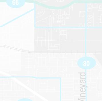
2 EXECUTIVE SUMMARY The purpose of the Alternatives Analysis of Route 61, as it began in early 2013, was to evaluate alternatives for the introduction of premium transit service along the Holt Boulevard Corridor between the City of Pomona in Los Angeles County and the Cities of Montclair, Ontario, Rancho Cucamonga, and Fontana in San Bernardino County; and to identify the alternatives that best serve local transportation needs. Omnitrans Route 61 and Route 66 run east-west in the West Valley. Based on input from Omnitrans, the five cities along the corridor, and other stakeholders over the course of the AA study, a hybrid alignment alternative was developed that includes portions of Route 61 and a portion of Route 66 on Foothill Boulevard. This hybrid alignment is referred to as the West Valley Connector Corridor as shown in Figure Ex-1. The West Valley Connector serves a wider range of major destinations/activity centers and generates higher ridership than either of the individual corridors alone. Outreach Process Omnitrans stakeholder outreach occurred throughout the AA process in multiple forms, primarily through monthly meetings with the Project Development Team (PDT) comprised of representatives from all of the local jurisdictions traversed by the West Valley Connector Corridor and other affiliated agencies and businesses. The purpose of the PDT was to review all technical work and provide input on the preferred transit solution. The PDT includes staff representatives from the following: City of Fontana City of Montclair City of Ontario City of Pomona City of Rancho Cucamonga County of San Bernardino Foothill Transit Kaiser Permanente Los Angeles County Metropolitan Transportation Authority (LA Metro) Los Angeles World Airports (LAWA) Omnitrans San Bernardino Associated Governments (SANBAG) Southern California Association of Governments (SCAG) Southern California Regional Rail Authority (SCRRA/Metrolink) Simon Group (Ontario Mills) In May and June, 2014, Omnitrans conducted public outreach activities for the West Valley Connector Corridor project. The purpose of the outreach activities was to explain the purpose and objectives of the project, and provide a range of opportunities to answer questions and collect comments from the public. Project Goal and Objectives As determined by the PDT, the project goal of the West Valley Connector Corridor Alternatives Analysis (AA) study is to increase transit ridership in the corridor by providing a transit alternative that is more competitive with the automobile. The supporting objectives to achieve that goal include: Support city/community stakeholder goals and plans Respond to population, employment and travel demand growth Implement Omnitrans System-wide Transit Corridors Plan for the San Bernardino Valley Provide premium transit service Improve transit amenities and facilities to provide greater passenger comfort and safety OMNITRANS WEST VALLEY CONNECTOR ALTERNATIVE ANALYSIS REPORT 1
3 Increase transit travel speed and reduce travel time/delay Improve mobility and better serve multiple destinations Reduce vehicle miles of travel (VMT) Minimize negative impacts to traffic operations Improve pedestrian and bicycle access to transit Facilitate economic development and TOD opportunities Figure Ex-1: Recommended Alternative; West Valley Connector Rapid Service Existing Conditions Route 61 is the highest ridership route in Omnitrans system as shown in Figure Ex-2, providing more than 1.86 million boardings in 2012 and approximately 6,100 boardings per average weekday. Route 66 also has high ridership, providing more than one million boardings in 2012 and approximately 3,500 boardings per average weekday. Route 61 and Route 66 provide vital links with connecting transit lines. Existing traffic conditions in the two corridors vary with some areas experiencing congestion; however, the majority of the streets in the corridor experience low levels of traffic congestion. Low levels of bus stop amenities are also prevalent along both routes. 2 OMNITRANS WEST VALLEY CONNECTOR ALTERNATIVE ANALYSIS REPORT


4 Figure Ex-2: Omnitrans Annual Ridership by Route There are many key activity centers within the project corridor that serve as major trip generators. These are distributed across the corridor, as illustrated in Figure Ex-3. Figure Ex-3: West Valley Connector Corridor Trip Attractors and Activity Centers OMNITRANS WEST VALLEY CONNECTOR ALTERNATIVE ANALYSIS REPORT 3
5 AA Process and Conceptual Alternatives Conceptual and detailed alternatives were analyzed in a multi-step screening process for the introduction of premium transit service and to best serve local transportation needs. This process leads to a project definition with the most appropriate improvements for the corridor. Bus Rapid Transit (BRT) is a premium transit service that includes the development of coordinated improvements to a bus transit system s infrastructure, equipment, operations, and technology to provide a faster, more attractive, high quality, high capacity bus service. BRT is not a single type of transit improvement; rather, it encompasses a range of potential improvements, including buses using mixed flow or various types of dedicated lanes, enhanced stations, transit signal improvements including synchronization and transit signal priority, and improved bus service on city arterial streets. Definition of Alternatives Alternatives were developed based on consultations with Omnitrans, City staff and the project development team (PDT). The basic characteristics of each alternative considered and analyzed for the Route 61/Holt Boulevard Corridor and subsequently for the West Valley Connector Corridor are summarized below in Table Ex-4, with more detailed descriptions and corresponding figures provided in the AA Report. Alternative Local Bus Stops Route 61 headway BRT Headway BRT Stations Miles of Dedicated Lanes (2-way) Total Buses/Hour Route 61 Alignment No build TSM A B C D E F G H I J K West Valley Connector/Hybrid Alignment L M N Table Ex-4: Characteristics of the Initial Set of Alternatives 4 OMNITRANS WEST VALLEY CONNECTOR ALTERNATIVE ANALYSIS REPORT
6 Alternatives Evaluation An alternatives evaluation process was developed in coordination with Omnitrans and the project development team (PDT). This evaluation process was developed to identify the alternatives that best address the project Goals and Objectives identified in Section 1.3. The five main categories of evaluation are as follows: Ridership and performance Capital costs O&M costs Cost effectiveness Financial viability Opening year ridership results, based on 2015 model year projections of the alternatives are presented in Figure Ex-5 and summarized based on type of service on the preferred West Valley Connector Alignment station locations. Hybrid alignments L, M, and N (combining portions of the Holt Boulevard and Foothill Boulevard corridors) generate the highest total ridership, indicating significant ridership gains by using Foothill Boulevard instead of San Bernardino Avenue. Figure Ex-5: Opening Year Ridership Results 16,000 14,000 12,000 10,000 8,000 6,000 4,000 2,000 9,600 No Build (existing Rt. 61/66) Existing Daily Ridership 11,756 TSM (improved Rt. 61/66) 12,480 Rapid Bus Slim BRT 3.5 miles ded. lanes 13,360 13,430 Full BRT 6.5 miles ded. lanes Based on the ridership and performance evaluation, significant ridership gains occur without dedicated BRT lanes, and marginal benefits occur based on the inclusion of dedicated lanes. Ridership gains of approximately 50% of these numbers are generated in 2035 ridership forecasts. Conceptual capital costs are presented in Figure Ex-6 based on the sbx Green Line experience. O&M costs are presented in Figure Ex-7. O&M for the Rapid bus is the lowest of the build alternative, and provides a lower O&M cost than the TSM alternative. The cost effectiveness evaluation shown in Figure Ex-8 indicates that Rapid Bus option provides the lowest O&M cost of all build alternatives and the highest cost effectiveness per rider, without the need for OMNITRANS WEST VALLEY CONNECTOR ALTERNATIVE ANALYSIS REPORT 5
7 substantial investment in dedicated bus lanes. This indicates that the best performing alternative is a Rapid bus service rather than a larger BRT investment. Figure Ex-6: Capital Cost Comparison $300,000,000 Capital Costs $250,000,000 $200,000,000 $212,000,000 $242,000,000 $150,000,000 $100,000,000 $50,000,000 $ $ $13,000,000 No Build TSM (existing local (improved Rt. Rt. 61/66) 61/66) $21,132,255 Rapid Bus Slim BRT Full BRT Figure Ex-7: Annual O&M Cost Comparison Annual O&M Cost (millions) $16.00 $14.00 $12.00 $10.00 $10.14 $14.84 $12.30 $13.68 $13.68 $8.00 $6.00 $4.00 $2.00 $ No Build (existing Rt. 61/66) TSM (improved Rt. 61/66) Rapid Slim BRT Full BRT 6 OMNITRANS WEST VALLEY CONNECTOR ALTERNATIVE ANALYSIS REPORT
8 $7.00 $6.00 $5.00 $4.00 $3.00 $2.00 $1.00 $ $3.41 No Build (existing local Rt. 61/66) Total (Capital and O&M) Cost per Rider $4.23 TSM (improved Rt. 61/66) $3.88 $5.40 $5.75 Rapid Bus Slim BRT Full BRT Figure Ex-8: Total Cost per Rider Based on the results of this evaluation and the need for transit improvements in this corridor, a reduced cost Rapid bus service with the preferred stations and alignment of Alternative N, is the most appropriate to be carried forward for consideration and further development. Findings from the Evaluation Based on the comprehensive technical evaluation and public/stakeholder input, the following key findings are presented: Limited stop Rapid bus service would increase the corridor ridership by 30% to 12,480 per day in the existing condition and is forecasted to grow to 18,790 daily riders by A limited stop Rapid service provides the most cost-effective service of the build alternatives. The preferred alignment is shown in Figure Ex-7. Recommended Alternative Based on these findings, the recommended alternative is a modified low-cost version of Alternative L. This alternative continues local Route 61 and Route 66 service at 60-minute headways plus 10-minute Rapid bus service in mixed flow operation with 27 enhanced stations. The Rapid bus service would also benefit from Transit Signal Priority (TSP) applications in the corridor that would speed up the service and make it more attractive and more efficient. Local service on the portions of Route 61 and 66 not covered by the Rapid alignment would be equilibrated to the demand on those portions of the route, with likely headways of 30 minutes for Route 61 and 20 minute for Route 66. OMNITRANS WEST VALLEY CONNECTOR ALTERNATIVE ANALYSIS REPORT 7
 branding of premium transit service. Figure Ex-8 is a typical Rapid Bus station concept.")
9 Figure Ex-7: Recommended Alternative; West Valley Connector Rapid Service The relatively low cost Rapid service is proposed to use typical 40-foot vehicles that are branded to reflect Omnitrans San Bernardino Valley Express (sbx) branding of premium transit service. Figure Ex-8 is a typical Rapid Bus station concept. Figure Ex-8: Recommended Rapid Bus Station Concept Project Cost Estimates and Recommended Funding Strategy Capital cost estimates for the Rapid option are based on the sbx Green Line BRT experience and reflect the lower level of amenities provided at stations compared to the sbx Green Line. The conceptual capital and O&M cost estimates are shown in Table Ex-9 and Ex-10. Capital funding for this project is shown in 8 OMNITRANS WEST VALLEY CONNECTOR ALTERNATIVE ANALYSIS REPORT
10 Table Ex-11; all of the required capital funding is currently available. The net increase in operations and maintenance costs will be funded by existing operations and maintenance funding sources including potential savings found from restructuring west valley routes in OmniConnects Short Range Transit Plan, with no net increase in Omnitrans operations and maintenance funding resulting in an possible cost neutral improvement in service. Capital Costs 27 stations (48 stops) $10,998,255 Transit signal priority $1,725,000 Vehicles (7 new vehicles) $4,200,000 Rebranding of 23 vehicles $134,550 Design and Professional services $3,180,814 Contingency $4,230,814 Total $24,469,433 Table Ex-9: Rapid Bus Conceptual Cost Estimate O&M Costs Existing Route 61/66 Costs $ 6,171,174 Costs of rapid bus and shadow service $ 7,431,288 Increase in O&M cost $1,260,114 Table Ex-10: Rapid Bus Conceptual O&M Estimate Potential Capital Funding Sources Value of Mid-Valley Land $21,000,000 Mid-Valley funds already programmed for construction $4,000,000 Ontario Mills Mall Station improvement funds $800,000 City Permit/Plan Check Fee Waivers $50,000 Total Funding Available $25,850,000 Table Ex-12: Rapid Bus Conceptual Funding Sources In the future, as additional funding becomes available, Omnitrans will consider implementing the following additional improvements in the corridor: Phase 2: 60-foot articulated sbx buses approximate cost $25 million Phase 3: Dedicated BRT lanes on Holt Blvd. in Ontario approximate cost $50 million (as recommended in Ontario s Holt Blvd. Streetscape and Mobility Plan, 2013.) o 6 station upgrades o 3.5 miles of dedicated, center-running BRT lanes and streetscape improvements o Site work/utilities o Additional ROW The Haven Avenue corridor is also a high priority for premium transit service in conjunction with the City of Rancho Cucamonga s development plans along the corridor. A future extension of the Rapid line or a connecting line along Foothill Boulevard/Fifth Street to connect to the sbx Green Line in the City of San Bernardino will provide additional network connectivity as identified in Omnitrans Systemwide Plan. OMNITRANS WEST VALLEY CONNECTOR ALTERNATIVE ANALYSIS REPORT 9
Bus Rapid Transit Plans
 Twin Cities Region Bus Rapid Transit Plans ULI Minnesota Workshop Connecting Bus Rapid Transit to the Community December 15, 2009 John Levin Director of Service Development Metro Transit Metropolitan Area
Purpose and Need. Chapter Introduction. 2.2 Project Purpose and Need Project Purpose Project Need
 Chapter 2 Purpose and Need 2.1 Introduction The El Camino Real Bus Rapid Transit (BRT) Project (Project) would make transit and other transportation improvements along a 17.6-mile segment of the El Camino
Spring Lake Park Mounds View North Oaks. Arden Hills. Shoreview. Roseville. Little Canada. Falcon Heights SNELLING. Lilydale. West Saint Paul 35E
 Coon Rapids Blaine Spring Lake Park Mounds View rth Oaks In 2011, Metro Transit embarked on the Arterial 494 Minnetonka Maple Grove Plymouth Hopkins Brooklyn Park New Hope Golden Valley Louis Park Edina
Arterial Transitway Corridors Study. Ave
 Arterial Transitway Corridors Study Ave January 2012 Arterial Transitway Corridors Study Overview Corridor Features and Demographics 11 study corridors, 95 route miles 86,000 daily rides and half of existing
South King County High-Capacity Transit Corridor Study
 HIGH-CAPACITY TRANSIT CORRIDOR STUDY South King County Corridor South King County High-Capacity Transit Corridor Study Corridor Report August 2014 South King County High Capacity Transit Corridor Report
Metropolitan Council Transportation Committee
 Nicollet-Central Transit Alternatives Metropolitan Council Transportation Committee August 2013 Project Purpose (approved by Policy Advisory Committee 10/25/2012) The purpose is to improve transit connectivity,
ROUTES 55 / 42 / 676 BUS RAPID TRANSIT LOCALLY PREFERRED ALTERNATIVE
 ROUTES 55 / 42 / 676 BUS RAPID TRANSIT LOCALLY PREFERRED ALTERNATIVE April, 2012 1 INTRODUCTION The need for transit service improvements in the Routes 42/55/676 corridor was identified during the Southern
PURPOSE AND NEED SUMMARY 54% Corridor Need 1. Corridor Need 2. Corridor Need 3. Corridor Need 4. Corridor Need 5
 SUMMARY PURPOSE AND NEED Chapel Hill Transit ridership has increased Buses operate every 4 minutes and have standing room only Exceeding seated capacity by 12% Corridor Need 1 by more than 20 percent between
Arterial Transitway Corridors Study
 Arterial Transitway Corridors Study February 2012 Arterial Transitway Corridors Study Overview Corridor Features and Demographics 11 study corridors, 95 route miles Routes: 86,000 daily rides and half
Presentation of Staff Draft March 18, 2013 COUNTYWIDE TRANSIT CORRIDORS FUNCTIONAL MASTER PLAN
 Presentation of Staff Draft March 18, 2013 COUNTYWIDE TRANSIT CORRIDORS FUNCTIONAL MASTER PLAN Public Outreach Fall 2011: Two community meetings/open houses Fall 2012: Three community meetings/open houses
Community Task Force July 25, 2017
 Community Task Force July 25, 2017 Welcome and Introductions Project Partners Regional Transportation District (RTD) Colorado Department of Transportation (CDOT) Denver Regional Council of Governments
Cedar Avenue Transitway/ METRO Red Line Implementation Plan Update. Metropolitan Transportation Committee July 27, 2015
 Cedar Avenue Transitway/ METRO Red Line Implementation Plan Update Metropolitan Transportation Committee July 27, 2015 Purpose of Cedar Avenue Transitway Previous IPU August 2011 Review current transit
El Camino Real Bus Rapid Transit Conceptual Engineering. Los Altos Council Workshop January 24, 2012
 El Camino Real Bus Rapid Transit Conceptual Engineering Los Altos Council Workshop January 24, 2012 Agenda Introduction Growth in the El Camino Real Corridor Benefits of BRT El Camino Real BRT Decision
Scottsdale Road/Rural Road Alternatives Analysis (AA) Study. Arizona ITE/IMSA Spring Conference March 7, 2012
 Study. Arizona ITE/IMSA Spring Conference March 7, 2012") Scottsdale Road/Rural Road Alternatives Analysis (AA) Study Arizona ITE/IMSA Spring Conference March 7, 2012 Study Location and Duration Primary Study Corridor (major focus of effort) Rural Road and Scottsdale
Scottsdale Road/Rural Road Alternatives Analysis (AA) Study Arizona ITE/IMSA Spring Conference March 7, 2012 Study Location and Duration Primary Study Corridor (major focus of effort) Rural Road and Scottsdale
Bus Rapid Transit ALTERNATIVES ANALYSIS. Open House
 Bus Rapid Transit ALTERNATIVES ANALYSIS Open House June 23, 2015 Open House Meeting Agenda Agenda Introductions What is BRT? Project Goals Study Tasks Next steps Discussion PVTA Bus Rapid Transit Study
Afeasibility study to evaluate bus rapid transit service in the East-West Corridor connecting major employment and activity centers between downtown
 East-West Bus Rapid Transit Feasibility Study Update and Recommended Locally Preferred Alternative (LPA) Summary City of Wauwatosa, Transportation Affairs Committee June 2016 Afeasibility study to evaluate
North Coast Corridor:
 North Coast Corridor: Connecting People, Transportation & Environment Legislative Hearing: 11.8.10 1 North Coast Corridor Region s Lifeline A Regional Strategy Mobility, Economy & Environment North Coast
Gratiot Avenue Transit Study Tech Memo #4: Ridership
 Gratiot Avenue Transit Study Tech Memo #4: Ridership 5/31/2016 Table of Contents 1 INTRODUCTION... 3 PROJECT DESCRIPTION... 3 2 TECH MEMO #4 OVERVIEW... 5 METHODOLOGY... 5 3 THE ALTERNATIVES AND POTENTIAL
6 Screen 3 Analysis and Results
 6 Screen 3 Analysis and Results Introduction This chapter documents the results of the Screen 3 (final) evaluation and screening process. This chapter contains the following elements: Description of the
Chapter 3 BUS IMPROVEMENT CONCEPTS
 Chapter 3 BUS IMPROVEMENT CONCEPTS The purpose of this chapter is to describe potential bus improvement strategies and potential impacts or implications associated with BRT implementation within the existing
Arlington County 10-Year Transit Development Plan & Premium Transit Network Briefing. May 2016
 Arlington County 10-Year Transit Development Plan & Premium Transit Network Briefing May 2016 Overview 10-Year Transit Development Plan Premium Transit Network Columbia Pike service concept Premium amenities
Operational Comparison of Transit Signal Priority Strategies
 Operational Comparison of Transit Signal Priority Strategies Revision Submitted on: November, 0 Author: Adriana Rodriguez, E.I Assistant Engineer Parsons Brinckerhoff 0 South Orange Avenue, Suite 00 Orlando,
In station areas, new pedestrian links can increase network connectivity and provide direct access to stations.
 The Last Mile Planning for Pedestrians Planning around stations will put pedestrians first. Making walking to stations safe and easy is important; walking will be a part of every rapid transit Accessible
EL CAMINO REAL BUS RAPID TRANSIT (BRT) PROJECT
 PROJECT") Agenda Item #4.2 EL CAMINO REAL BUS RAPID TRANSIT (BRT) PROJECT VTA BOARD WORKSHOP MAY 1, 2015 ABOUT THIS PRESENTATION CONTEXT Existing conditions and planning for growth WHAT IS THE PROJECT? Project alternatives
Agenda Item #4.2 EL CAMINO REAL BUS RAPID TRANSIT (BRT) PROJECT VTA BOARD WORKSHOP MAY 1, 2015 ABOUT THIS PRESENTATION CONTEXT Existing conditions and planning for growth WHAT IS THE PROJECT? Project alternatives
Bus Rapid Transit on Silicon Valley s El Camino Real: Working Together to Create a Grand Boulevard Steven Fisher
 Bus Rapid Transit on Silicon Valley s El Camino Real: Working Together to Create a Grand Boulevard Steven Fisher Senior Transportation Planner Santa Clara Valley Transportation Authority San Jose, CA How
Providence Downtown Transit Connector STAKEHOLDER MEETING #2. Stakeholder Meeting #1 October 24, 2016
 Providence Downtown Transit Connector STAKEHOLDER MEETING #2 Stakeholder Meeting #1 October 24, 2016 February 2017 1 AGENDA 1 DTC Goals and Expectations 2 Street Design Concepts 3 Potential Benefits and
4. ENVIRONMENTAL IMPACT ANALYSIS 9. TRANSPORTATION AND TRAFFIC
 4. ENVIRONMENTAL IMPACT ANALYSIS 9. TRANSPORTATION AND TRAFFIC 4.9.1 INTRODUCTION The following section addresses the Proposed Project s impact on transportation and traffic based on the Traffic Study
Appendix A-2: Screen 1 Alternatives Report
 Appendix A-2: Screen 1 Alternatives Report SCREEN 1 ALTERNATIVES REPORT Western & Ashland Corridors Bus Rapid Transit (BRT) Project Prepared for Chicago Transit Authority 567 West Lake Street Chicago,
North Hollywood to Pasadena BRT Corridor Technical Study. Eco-Rapid Transit/Orange Line Development Authority March 8, 2017
 North Hollywood to Pasadena BRT Corridor Technical Study Eco-Rapid Transit/Orange Line Development Authority March 8, 2017 Agenda 1. Background 2. Corridor Review 3. Key Challenge 4. Preliminary BRT Alignments
CITY OF LOS ANGELES INTER-DEPARTMENTAL CORRESPONDENCE
 CITY OF LOS ANGELES INTER-DEPARTMENTAL CORRESPONDENCE Date: May 9, 2017 To: Honorable City Council c/o City Clerk, Room 395, City Hall Attention: Honorable Mike Bonin, Chair, Transportation Committee From:
David Jickling, Public Transportation Director Regional Transportation Commission, Washoe County
 David Jickling, Public Transportation Director Regional Transportation Commission, Washoe County Virginia Street Resort corridor connecting University of Nevada, Reno Downtown Truckee River Strip Casinos
Swift Bus Rapid Transit. June DeVoll, Community Transit & Tom Hingson, Everett Transit
 Swift Bus Rapid Transit June DeVoll, Community Transit & Tom Hingson, Everett Transit October 22, 2013 Swift Washington State s First BRT is almost 4 years old Everett Transit Everett Transit College Station
I-35W Solutions Alliance Project Update July 13, 2017
 Title I-35W Solutions Alliance Project Update July 13, 2017 Evaluating the potential for Bus Rapid Transit and MnPASS Express Lanes in the southwest Metro, Investigating options for improved bus service
Basalt Creek Transportation Refinement Plan Recommendations
 Basalt Creek Transportation Refinement Plan Recommendations Introduction The Basalt Creek transportation planning effort analyzed future transportation conditions and evaluated alternative strategies for
Wilshire Boulevard Bus Rapid Transit Project
 Los Angeles County Metropolitan Transportation Authority Wilshire Boulevard Bus Rapid Transit Project COMMUNITY MEETINGS November 2008 Agenda Introduction Proposed Project Overview Participating Agencies
Crenshaw Transit Corridor Study. Working Group Meetings March 2009
 Crenshaw Transit Corridor Study Working Group Meetings March 2009 1 Concepts to Think About Today Alternatives and Design Options Grade Separation Analysis Supplemental Inglewood Alignment Analysis Evaluation
Locally Preferred Alternative Report May 27, North-South Corridor Study
 Locally Preferred Alternative Report May 27, 2016 North-South Corridor Study i Table of Contents 1. Executive Summary... 4 2. Introduction... 6 2.1 Project Overview... 6 2.2 Project Process... 8 2.3 Project
Supplemental Information Item #F3 MANAGEMENT PLAN. Fiscal Year
 Supplemental Information Item #F3 MANAGEMENT PLAN Fiscal Year 2015-2016 May 6, 2015 Table of Contents I. Executive Summary... 2 Omnitrans Vision... 5 Omnitrans Mission Statement... 5 II. Strategic Initiatives...
Aurora Corridor to E Line
 Aurora Corridor to E Line Jack Whisner Transit Planner, Service Development King County Metro Transit Seattle, Washington jack.whisner@kingcounty.gov 206-477-5847 King County Metro Transit Part of general
Arterial Transitway Corridors Study. Sept. 26, 2011
 Arterial Transitway Corridors Study Sept. 26, 2011 Purpose of Study Study 11 urban corridors in Minneapolis, St. Paul and surrounding communities Develop service and facilities plan to improve Transit
. ' motion. APPLtlDK.L - L"iLC_t1GLR 201b APPENDIX 7 TECHNICAL MEMOS
 . ' motion APPLtlDK.L - L"iLC_t1GLR 201b APPENDIX 7 TECHNICAL MEMOS The nmotion program will provide a large number of benefits for Middle Tennessee. This document presents selected benefits and other
Countywide Transit Corridors Functional Master Plan
 Countywide Transit Corridors Functional Master Plan Makeover Montgomery II May 10, 2014 Master Plan Status Begun: August 2011 Planning Board Approved Draft Plan: July 2013 Council Approved Final Plan:
Memorandum. Fund Allocation Fund Programming Policy/Legislation Plan/Study Capital Project Oversight/Delivery Budget/Finance Contract/Agreement Other:
 Memorandum Date: November 20, 2017 To: Transportation Authority Board From: Eric Cordoba Deputy Director Capital Projects Subject: 12/5/17 Board Meeting: San Francisco Freeway Corridor Management Study
ADOT Statewide Bicycle and Pedestrian Program Summary of Phase IV Activities APPENDIX B PEDESTRIAN DEMAND INDEX
 ADOT Statewide Bicycle and Pedestrian Program Summary of Activities APPENDIX B PEDESTRIAN DEMAND INDEX May 24, 2009 Pedestrian Demand Index for State Highway Facilities Revised: May 29, 2007 Introduction
TABLE OF CONTENTS FIGURES TABLES. Executive Summary Report: BLUE LINE
 TABLE OF CONTENTS 1.0 INTRODUCTION... 1 1.1 Blue Line Project Goals... 1 1.2 Corridor Travel Demand... 2 1.2.1 Market Analysis... 2 1.2.2 Existing Transit Operations... 2 2.0 RECOMMENDED ALTERNATIVE...
Title. Metropolitan Council Transportation Committee December 12, Brad Larson Metro District MnDOT
 Title Metropolitan Council Transportation Committee December 12, 2016 Evaluating the potential for Bus Rapid Transit and MnPASS Express Lanes in the southwest Metro Brad Larson Metro District MnDOT Background
Executive Summary Route 30 Corridor Master Plan
 Route Corridor Master Plan Project Overview The Route Corridor Master Plan is a coordinated multimodal transportation and land use plan for the entire stretch of Route through East Whiteland Township,
Interim Transit Ridership Forecast Results Technical Memorandum
 Interim Transit Ridership 401 South Jackson Street Seattle, WA 98104-2826 September 2012 Table of Contents 1 INTRODUCTION... 1-1 1.1 Project Background... 1-1 2 RIDERSHIP FORECASTS... 2-1 2.1 System Ridership
WHITE PAPER: TRANSIT SERVICE FOR SOUTH SHAGANAPPI
 9/27/2012 TRANSIT PLANNING WHITE PAPER: TRANSIT SERVICE FOR SOUTH SHAGANAPPI 2012 Calgary Transit 1 Table of Contents Purpose... 3 Area of Change... 3 Background... 3 Access to destinations... 5 Connecting
Item B1 November 19, 2009
 November 19, 2009 Planning and Development Department Land Use Planning Division DATE: November 19, 2009 STAFF REPORT TO: FROM: SUBJECT: Members of the Transportation Commission Elizabeth Greene Senior
Better Market Street. Engineering, Maintenance & Safety Committee (EMSC) February 28, 2018
 February 28, 2018") Better Market Street Engineering, Maintenance & Safety Committee (EMSC) February 28, 2018 1 Market Street Market Street - San Francisco by rulenumberone2 2 Market Street is the... City s busiest pedestrian
Better Market Street Engineering, Maintenance & Safety Committee (EMSC) February 28, 2018 1 Market Street Market Street - San Francisco by rulenumberone2 2 Market Street is the... City s busiest pedestrian
Eliminate on-street parking where it will allow for a dedicated bus only lane %
 Traffic Dashboard Priorities Survey Responses Introduction 1) Are you familiar with bus rapid transit (BRT)? a. No, BRT is new to me. 597 23.5% b. I ve heard of BRT, but I don t know much about it. 1,136
Durham Region Long Term Transit Strategy
 Durham Region Long Term Transit Strategy An adaptive, safe, reliable, frequent, accessible and desirable transit system that shapes and connects Durham Region and beyond in an economically and environmentally
ALTERNATIVES SCREENING REPORT
 VAN NESS AVENUE BUS RAPID TRANSIT (BRT) ALTERNATIVES SCREENING REPORT Revised Draft, 3/28/08 San Francisco County Transportation Authority 1 Introduction The San Francisco County Transportation Authority
Kennedy Plaza and Providence Downtown Transit Connector PUBLIC MEETING. Stakeholder Meeting #1 October 24, 2016
 Kennedy Plaza and Providence Downtown Transit Connector PUBLIC MEETING Stakeholder Meeting #1 October 24, 2016 May 2017 1 WHAT IS THE DTC? 1.5 mile corridor between Providence Station and the Hospital
CENTRAL AND EAST CORRIDORS
 HIGH-CAPACITY TRANSIT STUDY CENTRAL AND EAST CORRIDORS SEPTEMBER 2014 CORRIDOR REPORT: I-405 BUS RAPID TRANSIT HIGH-CAPACITY TRANSIT CORRIDOR STUDY I-405 Bus Rapid Transit Corridor Sound Transit Central/East
WELCOME BUS RAPID TRANSIT PUBLIC MEETING. MEETING TIME: 5 p.m. - 8 p.m.
 WELCOME BUS RAPID TRANSIT PUBLIC MEETING MEETING TIME: 5 p.m. - 8 p.m. Milwaukee County in conjunction with the Federal Transit Administration is hosting today s meeting to give the public an opportunity
Main-McVay Transit Study: Phase 2 Options Definition and High Level Constraints Evaluation
 Main-McVay Transit Study: Phase 2 Options Definition and High Level Constraints Evaluation APRIL 2016 A collaborative study between: For Additional Information or to Comment If you would like additional
Standing Committee on Policy and Strategic Priorities
 POLICY REPORT Report Date: January 15, 2019 Contact: Steve Brown Contact No.: 604.873.9733 RTS No.: 12955 VanRIMS No.: 08-2000-20 Meeting Date: January 30, 2019 TO: FROM: SUBJECT: Standing Committee on
Pocatello Regional Transit Master Transit Plan Draft Recommendations
 Pocatello Regional Transit Master Transit Plan Draft Recommendations Presentation Outline 1. 2. 3. 4. What is the Master Transit Plan? An overview of the study Where Are We Today? Key take-aways from existing
Circulation in Elk Grove includes: Motor vehicles, including cars and trucks
 Circulation, as it is used in this General Plan, refers to the many ways people and goods move from place to place in Elk Grove and the region. Circulation in Elk Grove includes: Motor vehicles, including
SMART 1 Public Meeting #1. February 24, 2016
 SMART 1 Public Meeting #1 February 24, 2016 Agenda Who is the SMTC? SMART 1 project overview Syracuse Metropolitan Transportation Council An Introduction: Who we are & what we do What is an MPO? A Metropolitan
Practicing what we preach in POMONA! Daryl Grigsby, Public Works Director, City of Pomona, California
 Practicing what we preach in POMONA! Daryl Grigsby, Public Works Director, City of Pomona, California Who lives in Pomona? 150,000 people: Young average age 26, 34% under 18 years old, and only 6.5% over
Washington Metropolitan Area Transit Authority Board Action/Information Summary. MEAD Number:
 Washington Metropolitan Area Transit Authority Board Action/Information Summary Action Information MEAD Number: 100962 Resolution: Yes No TITLE: Bicycle and Pedestrian Access Improvements Study PURPOSE:
Frequently Asked Questions (FAQ)
") Frequently Asked s (FAQ) Study Process... 2 Rapid Transit Service and Operations... 5 Public Consultation... 8 Business Impacts... 8 Design and Property Impacts... 9 Construction Impacts...12 Traffic,
Frequently Asked s (FAQ) Study Process... 2 Rapid Transit Service and Operations... 5 Public Consultation... 8 Business Impacts... 8 Design and Property Impacts... 9 Construction Impacts...12 Traffic,
Preliminary Transportation Analysis
 Preliminary Transportation Analysis Goals of a Robust, Multimodal Transportation Network Safe Accessible/Connected Efficient Comfortable Context-Sensitive Motor Vehicle: Continue to analyze the data to
Wellington Public Transport Spine Study
 Wellington Public Transport Spine Study Study purpose Feasibility study Options for a high quality, high frequency PT system Key action from Ngauranga to Airport Corridor Plan (2008) Long-term outlook
VOLUME 5 Technology and Option Evaluation
 VICTORIA REGIONAL RAPID TRANSIT Victoria / West Shore Link VOLUME 5 Technology and Option Evaluation August 2011 Prepared for BC Transit by SNC-Lavalin Inc McElhanney Consulting Services Ltd Errata 1.
DON MILLS-EGLINTON Mobility Hub Profile
 Mobility Hub Profile Dundas Don Mills-Eglinton West-Bloor Anchor Hub Gateway Hub N MOBILITY HUBS: Places of connectivity between regional and rapid transit services, where different modes of transportation
EXECUTIVE SUMMARY... vii 1 STUDY OVERVIEW Study Scope Study Area Study Objectives
 Contents EXECUTIVE SUMMARY... vii 1 STUDY OVERVIEW... 1-1 1.1 Study Scope... 1-1 1.2 Study Area... 1-1 1.3 Study Objectives... 1-3 2 EXISTING CONDITIONS... 2-1 2.1 Existing Freeway Conditions... 2-4 2.1.1
Final Study Recommendations AMES TRANSIT FEASIBILITY STUDY. For Public Review and Comment. October Ames Transit Feasibility Study
 AMES TRANSIT FEASIBILITY STUDY Final Study Recommendations For Public Review and Comment October 2007 Meeting Agenda Existing Service Future Service Transit Feasibility Study Study Purpose/Goals Methodology
Midtown Corridor Alternatives Analysis
 Midtown Corridor Alternatives Analysis Ridership Forecast Methodology and Results December 2013 Prepared by the SRF Consulting Group Team for Table of Contents Introduction... 1 Methodology... 1 Assumptions...
Seattle Transit Master Plan
 Seattle Transit Master Plan Seattle City Council Transportation Committee Briefing July 26, 2011 Seattle Department of Transportation In Association with: URS Corporation SVR DKS Associates The Underhill
Tulsa Metropolitan Area LONG RANGE TRANSPORTATION PLAN
 Tulsa Metropolitan Area LONG RANGE TRANSPORTATION PLAN Indian Nations Council of Governments August 2005 CONTACTING INCOG In developing the Destination 2030 Long Range Transportation Plan, INCOG s Transportation
Kansas City Area Transportation Authority. Downtown Transit Improvement Vision 2/11/15
 Kansas City Area Transportation Authority Downtown Transit Improvement Vision 2/11/15 Today s Meetings Downtown Transit Vision Long Term Vision for Downtown Bus Service Priorities for Short Term Implementation
San Jose Transportation Policy
 San Jose Transportation Policy Protected Intersections in LOS Policies to Support Smart Growth Presented by: Manuel Pineda City of San Jose Department of Transportation Bay Area Map San Francisco Oakland
Key objectives of the survey were to gain a better understanding of:
 3 COMMUNITY INPUT Community input is an essential part of corridor studies. For the SR 87 corridor study, VTA staff conducted an extensive online survey of people living and commuting along the corridor.
Greater Cleveland Regional Transit Authority
 Greater Cleveland Regional Transit Authority Transit Priority Corridor Initiatives West 25 th Street /East 105 th /East 93 rd Streets June 20, 2017 Presented to: Planning & Development Committee Greater
Technical Working Group November 15, 2017
 Technical Working Group November 15, 2017 Welcome and Introductions Project Partners Regional Transportation District (RTD) Colorado Department of Transportation (CDOT) Denver Regional Council of Governments
Washington DC Section of ITE Project Briefing
 Washington DC Section of ITE Project Briefing November 5, 2015 Renée Hamilton, VDOT, Deputy District Administrator I-66 Outside the Beltway Improvement Area Project Location Virginia 2 Purpose and Need
MOBILITY WORKSHOP. Joint City Council and Transportation Commission May 5, 2014
 MOBILITY WORKSHOP Joint City Council and Transportation Commission May 5, 2014 Review of General Plan M-1 Develop world-class transit system M-3 Maintain/enhance pedestrian-oriented City M-4 Create comprehensive
Moving Cambridge. City of Cambridge Transportation Master Plan Public Consultation Centre. March 7, :00 8:00 PM.
 City of Cambridge Transportation Master Plan Public Consultation Centre March 7, 2018 5:00 8:00 PM Region of Waterloo City of Cambridge Transportation Master Plan Public Consultation Centre March 7, 2018
MCTC 2018 RTP SCS and Madera County RIFP Multi-Modal Project Eval Criteria GV13.xlsx
 MCTC 8 RTP SCS and Madera County RIFP Multi-Modal Project Eval Criteria GV.xlsx Madera County Transportation Commission Regional Transportation Plan / Sustainable Communities Strategy Multi-Modal Project
ACTION: SELECT PREFERRED LIGHT RAIL ALIGNMENT FOR PHASE 2 OF THE EXPOSITION CORRIDOR TRANSIT PROJECT
 6.h DATE: APRIL 2, 2009 TO: FROM: BOARD OF DIRECTORS RICHARD D. THORPE CHIEF EXECUTIVE OFFICER ACTION: SELECT PREFERRED LIGHT RAIL ALIGNMENT FOR PHASE 2 OF THE EXPOSITION CORRIDOR TRANSIT PROJECT RECOMMENDATION
 MEMORANDUM - CITY OF PASADENA Department Of Transportation DATE: OCTOBER 21, 2008 TO: ENVIRONMENTAL ADVISORY COMMISSION FROM: ~ FRED C. DOCK, DIRECTOR OF TRANSPORTATION SUBJECT: UPDATE ON DEPT. OF TRANSPORTATION
BRT for Berkeley A Proposal for Consideration
 BRT for Berkeley A Proposal for Consideration CITY OF BERKELEY STAFF PROPOSAL FOR A LOCALLY PREFERRED ALTERNATIVE OF THE EAST BAY BUS RAPID TRANSIT PROJECT SEPTEMBER 8, 2009 Table of Contents Executive
Westside Transportation Access Needs Assessment - Short and Long Term Improvements
 ABSTRACT The Los Angeles County Metropolitan Transportation Authority (MTA) adopted the 2001 Long Range Transportation Plan (LRTP), which sets out the County s transportation investments for the next 20-25
North Shore Transportation Improvement Strategy
 North Shore Transportation Improvement Strategy Preliminary, Near-term Recommendation 2016 April Transportation Improvement Strategy (TIS) Comprehensive and Analytical A multi-modal transportation strategy
Sixth Line Development - Transit Facilities Plan
 Memorandum Date: November 13, 2012 To: From: c.c. Subject: Rob Freeman (Freeman Planning) Kevin Phillips Sixth Line Development - Transit Facilities Plan 33016631 This memo was prepared to review the transit
Corridor Advisory Group and Task Force Meeting #10. July 27, 2011
 Corridor Advisory Group and Task Force Meeting #10 July 27, 2011 1 Agenda Recap CAG/TF #9 Public Meeting #2 Summary Single Mode Alternatives Evaluation Results Next Steps 2 3 CAG/TF #9 Recap CAG /TF #9
Public Event 1 Community Workshops
 Public Event 1 Community Workshops Nov. 24 & Dec. 3, 2016 Welcome Workshop Purpose We re looking to you for ideas and insights to help guide future transportation infrastructure planning in the Park Lawn
Executive Summary BEYOND THE B-LINE: RAPID TRANSIT LINE PHASE II - COMMERCIAL DRIVE WEST. Final Draft December 13, Appendix B BROADWAY/LOUGHEED
 BEYOND THE B-LINE: BROADWAY/LOUGHEED RAPID TRANSIT LINE PHASE II - COMMERCIAL DRIVE WEST Appendix B Executive Summary Final Draft December 13, 1999 UMA Lloyd Lindley Davidson Yuen Simpson Architects BROADWAY/LOUGHEED
Southwest Bus Rapid Transit (SW BRT) Functional Planning Study - Executive Summary January 19 LPT ATTACHMENT 2.
 Functional Planning Study - Executive Summary January 19 LPT ATTACHMENT 2.") Southwest Bus Rapid Transit (SW BRT) Functional Planning Study - Executive Summary 2011 January 19 1 of 19 Introduction This executive summary presents the results of the Southwest Bus Rapid Transit (SW
Southwest Bus Rapid Transit (SW BRT) Functional Planning Study - Executive Summary 2011 January 19 1 of 19 Introduction This executive summary presents the results of the Southwest Bus Rapid Transit (SW
Arterial Transitway Corridors Study
 Arterial Transitway Corridors Study April 2012 Prepared by with SRF Consulting Group, Inc. Kimley-Horn and Associates, Inc. Connetics Transportation Group Luken Architecture CR Planning April 2012 Final
Governance and Priorities Committee Report For the July 2, 2015 Meeting
 CITY OF VICTORIA For the July 2, 2015 Meeting To: Governance and Priorities Committee Date: From: Subject: Brad Dellebuur, A/Assistant Director, Transportation and Parking Services Executive Summary The
4 Ridership Growth Study
 Clause 4 in Report No. 15 of Committee of the Whole was adopted, without amendment, by the Council of The Regional Municipality of York at its meeting held on November 16, 2017. 4 Ridership Growth Study
Calgary Transit Route 302 Southeast BRT Year One Review June
 Calgary Transit Route 302 Southeast BRT Year One Review 2011 June Calgary Transit Route 302 Southeast BRT: Year One Review 2011 April Table of Contents 1.0 Executive Summary... 1 2.0 Introduction... 3
MEETING Agenda. Introductions. Project Overview. Key Study Components. Alternative Station Concepts. Preferred Station Concept. Next Steps.
 City GARLAND Council ROADVISION Briefing STUDY VISION STUDY Dallas, TX April 8, 2010 1 1 MEETING Agenda Introductions Project Overview Key Study Components Alternative Station Concepts Preferred Station
Capital and Strategic Planning Committee. Item III - B. April 12, WMATA s Transit-Oriented Development Objectives
 Capital and Strategic Planning Committee Item III - B April 12, 2018 WMATA s Transit-Oriented Development Objectives Page 24 of 76 Washington Metropolitan Area Transit Authority Board Action/Information
WELCOME TO OPEN HOUSE # 1 June 14, 2017
 Langstaff Road Weston Road to Highway 7 Class Environmental Assessment Study WELCOME TO OPEN HOUSE # 1 June 14, 2017 Please sign in and join our mailing list Purpose of Open House #1 & Study Area York