CITY OF PITTSBURGH. City of Pittsburgh Active Transportation Profile REGIONAL ACTIVE TRANSPORTATION PLAN FOR SOUTHWESTERN PENNSYLVANIA
|
|
|
- Doreen Golden
- 5 years ago
- Views:
Transcription

1 REGIONAL ACTIVE TRANSPORTATION PLAN FOR SOUTHWESTERN PENNSYLVANIA 1
2 2


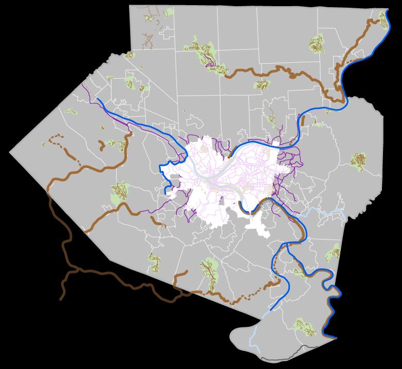

3 ACTIVE TRANSPORTATION AT A GLANCE Trails & Bike Routes 270 miles 28 miles 41 miles 24 miles 3

4 F A C I L I T I E S Facility Metrics Facilities 2017 Miles of sidewalk (inventoried) Miles of local on-road bike route Miles of protected bike lanes 2.3 Miles of bike lanes 31.8 Miles of sharrows 36.6 Miles of trail 69.1 Miles of rail-trail or separated paths 27.7 Miles of trail in regional parks & recreation areas 41.4 Miles of navigable waterway 24 Miles of designated PA Water Trail 24 Land + PA Water Trail Highlights Trail Functional Classification Total Miles Miles in County Great Allegheny Passage (Three Rivers Heritage Trail) Regional Arterial Nine Mile Run Trail Local Steel Valley Trail Community Collector Three Rivers Heritage Trail Community Arterial Ohio River Water Trail Regional Arterial Support Facilities 2017 Bike Facilities 451 Bike racks (inventoried) 399 Bike repair stations 2 Bike share stations 50 Trail parking and/or access points 73 Boat launches (source: PA Fish & Boat Commission) 11 State/Federal (PFBC, State Parks, PGC or COE) 0 Local government 3 Source: Private SPC GIS; ownership inventories as of 12/31/17 unless otherwise noted 8 Chartiers Creek Water Trail (Ohio River Water Trail) Regional Arterial Three Rivers Water Trail Community Arterial Trail + Bike Organizations Organization County Focus Allegheny Trail Alliance Great Allegheny Passage BikePGH Bike transportation + trail improvement Frick Park Nine Mile Run Trail Friends of the Riverfront Three Rivers Heritage Trail, Three Rivers Water Trail Source: SPC GIS; inventories as of 12/31/17 unless otherwise noted Ohio River Trail Council Pittsburgh Bike Share Riverlife Steel Valley Trail Council Ohio River Water Trail Healthy Ride Pittsburgh waterfronts Steel Valley Trail 4
 695 Buses Equipped")

 Washington County Transportation Authority (Freedom) Lenzner Coach Lines (Lenzner) Mid Mon")
 Port Authority of Allegheny County (PAAC) County Character Land Use Development Patterns High Density 0%")
5 COMMUNITY CONTEXT Port Authority of Allegheny County / Pittsburgh Port Authority of Allegheny County System Type Urban Total Passengers 62,753,783 Senior Passengers 4,957,590 Current Fleet Size (Motor Bus) 695 Buses Equipped with Bike Racks 695 Community Transportation System Type Community Transportation Total Shared-Ride Trips 1,016, Trips 655,609 Pennsylvania Public Transportation Performance Report Fiscal Year Transit Operators Butler County Transit Authority (BCTA) Butler Transit Authority (BTA) Fayette Area Coordinated Bus Transportation (FACT) Washington County Transportation Authority (Freedom) Lenzner Coach Lines (Lenzner) Mid Mon Valley Transit Authority (MMVTA) New Castle Transit Authority (NCTA) Westmoreland County Transit Authority (WCTA) Port Authority of Allegheny County (PAAC) County Character Land Use Development Patterns High Density 0% 100% Low Density 5


6 PLANNING Infrastructure Projects Private Development 6 Project Project Location Allegheny Circle Phase 2 Northside Allegheny Commons Park Renovation Northside Arsenal 201 Butler and 40th Street Lawrenceville East Liberty Transit Center East Liberty GAP to the Point Downtown Gateway at Murray Forward Squirrel Hill Heinz Buildings Redevelopment Northside Homewood Pedestrian, Student & Transit Connectivity Project Homewood I-579 Cap Urban Connector Project Hill District/ Downtown Joncaire Street Multimodal Project Oakland Nine Mile Run Phase 3 Swisshelm Park Pittsburgh Bike Facilities Downtown Produce Terminal Redevelopment Project Strip District South Side Flats Neighborhood Street South Side Flats Susquehanna Street Phase 2 Homewood Washington Blvd Multimodal Path Highland Park Streetscape Sidewalks Ped-Bike Improvements Bike Lane or Route Trail or Pathway Transit


7 P L A N N I N G PennDOT Connects SR 4084, East Ohio Street Bike lanes were integrated into this roadway reconstruction and bridge preservation project through consultation with various community groups, bike advocacy groups, and the City of Pittsburgh. Safety The dedicated bike lanes on East Ohio Street between S.R (East Street) and Chestnut Street were incorporated into the project within the existing roadway/curb footprint by minimally reducing the lanes and median widths as well as some minor lane reassignments. Forbes Avenue Enhancement Traffic signal and pedestrian/cyclist safety enhancements are being installed at a number of intersections on Forbes Avenue in the Oakland and Squirrel Hill neighborhoods in the City of Pittsburgh including South Craig Street, Hamburg Hall, Morewood Avenue, Beeler Street and Margaret Morrison Street. Accessibility The scope of work for the project includes the complete rehabilitation and replacement of all signal equipment to meet current city standards, new pedestrian countdown signals, fully compliant ADA ramps on all intersection legs, and new reflective pedestrian crosswalks and stop bars. This Complete Streets project is a partnership between PennDOT, Carnegie Mellon University and the Oakland Transportation Management Association. 7

 North Shore, Strip")


8 P L A N N I N G Bicycle/Pedestrian Counts + Trends Three Rivers Heritage Trail Downtown Pittsburgh Pedestrian Counts: April 21-23, ,873 People walking + biking 2014 Annual Estimate (Source: Pittsburgh Downtown Partnership) North Shore, Strip District + Eliza Furnace Trails (Source: SPC) North Shore Trail July 22-August 22, 2016 Daily average: 493 Busiest day of week: Sunday Strip District Trail July 12-26, 2016 Daily average: 310 Busiest day of week: Saturday Eliza Furnace Trail June 21-July 20, 2016 Daily average: 1,119 Busiest day of week: Sunday Penn Avenue Protected Bike Lane (Source: Pittsburgh Downtown Partnership) 8


9 P L A N N I N G Census Commute Mode Data Census Commute Mode Comparison for SPC Counties: Source: US Census Bureau, American Community Survey 5-Year Estimates 10.0% 9.0% 8.0% 7.0% 6.0% 5.0% 4.0% 3.0% 2.0% 1.0% 0.0% ALCO ARCO BECO BUCO FACO GRCO INCO LACO WACO WECO For Allegheny County, including the City of Pittsburgh Transit On Foot On Bike City of Pittsburgh: & % 11.1% Means of Transportation to Work Total Commuters 141, ,299 On bike 1.2% 1.7% 1.7% On foot 11.8% 11.1% By transit 19.5% 17.0% Commute Mode City of Pittsburgh 9
10 PLANNING City Planning + Land Use Controls County Plans & Land Use Controls Department of Mobility + Infrastructure (DOMI) Active Transportation Document Title PLANS Comprehensive Plan Open Space, Greenways & Trails Plan Bicycle/Pedestrian or AT Plan Open Space PGH (2013): Open Space, Parks and Recreation Plan Bicycle Plan (1999): update in progress MOVEPGH, Citywide Multi-Modal Transportation Master Plan Other Plans or Studies related to AT Citywide Step Plan: under development Urban Redevelopment Authority of Pittsburgh The Urban Redevelopment Authority (URA) of Pittsburgh is the City of Pittsburgh's economic development agency. URA goals are to create jobs, increase the city's tax base, and improve the vitality of businesses, neighborhoods, and the city's livability as a whole. URA projects often include elements that improve biking and walking infrastructure. Port Authority of Allegheny County Mobility Plan: under development Uptown EcoInnovation District Plan (2017) BikePGH LAND USE CONTROLS Subdivision and/or Land The Department is responsible for the transportation of people and goods throughout the City of Pittsburgh, and for managing the operation of and access to the public right-of-way (the sidewalks, curbs, streets, and bridges that make up the city s transportation network). Subdivision Regulations and City of Pittsburgh Zoning Code (1958, updated 1999) Pittsburgh Riverfront Zoning: under development PGH Complete Streets Ordinance Right-of-Way Procedures Policy Zoning Ordinance Transit Oriented Development Guidelines BikePGH works on behalf of the Pittsburgh community to make the city safe, accessible and friendly to bicycle transportation. Major programmatic focuses are centered on advocacy, community engagement and education. Pittsburgh Bike Share Pittsburgh Bike Share owns and operates the Healthy Ride bike-sharing system. Their staff runs day-to-day operations of Healthy Ride including bike maintenance, station planning, and all communications. POLICIES Complete Streets Policy Right-of-Way Policy 10 Neighborhood Planning for Biking + Walking Bloomfield Neighborhood Vision Plan Crafton-Ingram Thrive: An Implementable Comprehensive Plan Northside Neighborhood Connections

 Program survey to identify the level of")

 program.")


11 PROGRAMS & POLICIES Current Programs, Policies + Designations 1 Safe Routes to Schools In spring 2017, SPC administered a Safe Routes to School (SRTS) Program survey to identify the level of participation and/or interest in the SRTS program. Based on the responses that were received: 0 School Districts currently participate in a Safe Routes to School (SRTS) program. Bicycle Friendly Communities City of Pittsburgh 1 Complete Streets Policy 1 Trail Towns 0 River Towns 0 Walk Friendly Communities 0 WalkWorks City of Pittsburgh 0 School Districts are interested in learning more about funding opportunities for creating a Safe Routes to School (SRTS) program Downtown Pittsburgh Bicycle Friendly Universities Chatham University Carnegie Mellon University Bicycle Friendly Businesses Bike Friendly Businesses -certified by BikePGH 11
FAYETTE COUNTY. Fayette County Active Transportation Profile REGIONAL ACTIVE TRANSPORTATION PLAN FOR SOUTHWESTERN PENNSYLVANIA
 REGIONAL ACTIVE TRANSPORTATION PLAN FOR SOUTHWESTERN PENNSYLVANIA 1 2 ACTIVE TRANSPORTATION AT A GLANCE Trails + Bike Routes 4 miles 73 miles 130 miles 90 miles Parkland Parkland Trail Off Street Trail
ALLEGHENY COUNTY. Allegheny County Active Transportation Profile REGIONAL ACTIVE TRANSPORTATION PLAN FOR SOUTHWESTERN PENNSYLVANIA
 REGIONAL ACTIVE TRANSPORTATION PLAN FOR SOUTHWESTERN PENNSYLVANIA 1 2 ACTIVE TRANSPORTATION AT A GLANCE Trails + Bike Routes 123 miles 132 miles 281 miles 75 miles 3 FACILITIES Facility Metrics (not including
ALLEGHENY COUNTY. Allegheny County Active Transportation Profile 2017 REGIONAL ACTIVE TRANSPORTATION PLAN FOR SOUTHWESTERN PENNSYLVANIA
 REGIONAL ACTIVE TRANSPORTATION PLAN FOR SOUTHWESTERN PENNSYLVANIA 1 2 ACTIVE TRANSPORTATION AT A GLANCE Trails + Bike Routes 123miles 132 miles 281 miles 75 miles 3 FACILITIES Facility Metrics (not including
CITY OF COCOA BEACH 2025 COMPREHENSIVE PLAN. Section VIII Mobility Element Goals, Objectives, and Policies
 CITY OF COCOA BEACH 2025 COMPREHENSIVE PLAN Section VIII Mobility Element Goals, Objectives, and Policies Adopted August 6, 2015 by Ordinance No. 1591 VIII MOBILITY ELEMENT Table of Contents Page Number
San Jose Transportation Policy
 San Jose Transportation Policy Protected Intersections in LOS Policies to Support Smart Growth Presented by: Manuel Pineda City of San Jose Department of Transportation Bay Area Map San Francisco Oakland
TRANSPORTATION TRAINING TOPICS. April 6, 2010
 TRANSPORTATION TRAINING TOPICS April 6, 2010 Roles of Transportation Providers Context and Policy Makers Division of Transportation and Traffic Other City Operations Other Transportation Operators CMA
Bicycle and Pedestrian Plans and Improvements
 Bicycle and Pedestrian Plans and Improvements Presented to the City Council By Randle Harwood, Planning and Development, and Richard Zavala, Parks and Community Services September 24, 2013 Purpose Review
Michael Parmer, Management Aide, City Manager's Office
 P139 STAFF REPORT f CITY NL- NAGER' S OFFICE RANCHO Date: C;UCAMONGA To: From: Subject: Mayor and Members of the City Council John R. Gillison, City Manager Michael Parmer, Management Aide, City Manager's
CITY MANUALS AND STANDARDS REVIEW
 GEORGETOWN SIDEWALK MASTER PLAN CITY MANUALS AND STANDARDS REVIEW RESOURCES AND STANDARDS As part of the Master Plan process, a review and evaluation of current City documents and policies relevant to
C C C
 C-012-001 Thank you for your support for the creation of new public space and nonmotorized access between downtown and the waterfront through the Overlook Walk, the East-West Connections, and the Promenade.
IMPLEMENTATION STRATEGIES
 GEORGETOWN SIDEWALK MASTER PLAN 34% of funding is dedicated to Downtown Overlay District sidewalks 28% of funding is recommended within 1/4 mile of Southwestern University 26% of funding is recommended
ADA Transition Plan. City of Gainesville FY19-FY28. Date: November 5, Prepared by: City Of Gainesville Department of Mobility
 ADA Transition Plan FY19-FY28 Date: November 5, 2018 Prepared by: City Of Gainesville Department of Mobility 1.0 INTRODUCTION 1.1 BACKGROUND The federal statute known as the Americans with Disabilities
Living Streets Policy
 Living Streets Policy Introduction Living streets balance the needs of motorists, bicyclists, pedestrians and transit riders in ways that promote safety and convenience, enhance community identity, create
Hennepin County Bicycle and Pedestrian Planning
 Hennepin County Bicycle and Pedestrian Planning 1 Value of bicycle and sidewalk systems Safety Livability Mobility Health Personal Finances Economic Sustainability Clean Air Recreation Parking and congestion
Corpus Christi Metropolitan Transportation Plan Fiscal Year Introduction:
 Introduction: The Safe, Accountable, Flexible, Efficient Transportation Equity Act: A Legacy for Users (SAFETEA-LU) has continued the efforts started through the Intermodal Surface Transportation Efficiency
EXECUTIVE SUMMARY. Vision
 Vision Walking and bicycling in Salt Lake City will be safe, convenient, comfortable, and viable transportation options that connect people to places, foster recreational and economic development opportunities,
Bicycle and Pedestrian Connectivity Study Phase 2
 Connectivity Study Phase 2 Process PROCESS OUTCOMES Phase Prepared By STEP I Public Participation and Outreach 1. RTP Outreach activities, and development of the Bike and Ped Task Force Phase 1 2011 OCPC
Omaha s Complete Streets Policy
 Omaha s Complete Streets Policy (Adopted August 2015) VISION To create great places and enhance our quality of life, the City of Omaha will provide safe, accessible streets for all users. Complete Streets
CITY OF PORTSMOUTH PLANNING DEPARTMENT
 CITY OF PORTSMOUTH PLANNING DEPARTMENT MEMORANDUM TO: JOHN P. BOHENKO, CITY MANAGER FROM: JULIET T.H. WALKER, PLANNING DIRECTOR SUBJECT: BICYCLE / PEDESTRIAN PLAN PROGRESS UPDATE DATE: 3/13/2018 Background
Bicycle and Pedestrian Chapter TPP Update Overview. TAB September 20, 2017
 Bicycle and Pedestrian Chapter TPP Update Overview TAB September 20, 2017 Bicycling & Walking in the Twin Cities Where are we now? The Bike-Pedestrian system Current trends New developments Where are we
ACTIVE TRANSPORTATION
 ACTIVE TRANSPORTATION Mobility 2040 Supported Goals Improve the availability of transportation options for people and goods. Support travel efficiency measures and system enhancements targeted at congestion
SR-203 Sidewalks and Town-Wide Mobility Improvements. Town Council Presentation September 7, 2016
 SR-203 Sidewalks and Town-Wide Mobility Improvements Town Council Presentation September 7, 2016 SR-203 Sidewalks and Town- Wide Mobility Improvements SR-203 Sidewalks and Appurtenances Town-Wide Mobility
Plant City Walk-Bike Plan
 Plant City Walk-Bike Plan Plant City Commute Mode Share 2.2% 1.4% 2.9% Drove alone 10.2% Carpooled Public transportation (0.1%) Walked Used a Bike (0.4%) 82.9% Taxicab, motorcycle, or other means Worked
City of Novi Non-Motorized Master Plan 2011 Executive Summary
 City of Novi Non-Motorized Master Plan 2011 Executive Summary Prepared by: February 28, 2011 Why Plan? Encouraging healthy, active lifestyles through pathway and sidewalk connectivity has been a focus
Perryville TOD and Greenway Plan
 Perryville TOD and Greenway Plan Greenway Glossary Pathway: A bicycle and pedestrian path separated from motorized vehicular traffic by an open space, barrier or curb. Multi-use paths may be within the
Proposed. City of Grand Junction Complete Streets Policy. Exhibit 10
 Proposed City of Grand Junction Complete Streets Policy Exhibit 10 1 City of Grand Junction Complete Streets Policy Vision: The Complete Streets Vision is to develop a safe, efficient, and reliable travel
SR 2108-A12/SR 2308-A02 Forbes Avenue Betterment and SR 2108-A13 Forbes Avenue Corridor Improvements. July 17, 2017
 SR 2108-A12/SR 2308-A02 Forbes Avenue Betterment and SR 2108-A13 Forbes Avenue Corridor Improvements July 17, 2017 Agenda Welcome Ralph Horgan, CMU Overview of Projects Feedback and Proposed Improvements
Non-Motorized Transportation 7-1
 Non-Motorized Transportation 7-1 Transportation facilities no longer mean just accommodating a vehicle powered by a combustion engine. Pedestrian and non-motorized facilities are important modes of travel
o n - m o t o r i z e d transportation is an overlooked element that can greatly enhance the overall quality of life for the community s residents.
 N o n - m o t o r i z e d transportation is an overlooked element that can greatly enhance the overall quality of life for the community s residents. 84 Transportation CHAPTER 11 INTRODUCTION Transportation
ACTIVE TRANSPORTATION/NONMOTORIZED TRANSPORTATION
 ACTIVE TRANSPORTATION/NONMOTORIZED TRANSPORTATION BACKGROUND Active transportation, also known as nonmotorized transportation, is increasingly recognized as an important consideration when planning and
Complete Streets Successes, Opportunities, and Challenges
 Complete Streets Successes, Opportunities, and Challenges Juliet Walker, Transportation Planner, City of Portsmouth Rob Houseman, Director of Planning and Development, Town of Wolfeboro Chris Parker, Director
COMPLETE STREETS A STEP FORWARD ITE District 10/FSITE Annual Meeting November 3, 2015
 COMPLETE STREETS A STEP FORWARD 2015 ITE District 10/FSITE Annual Meeting November 3, 2015 About Lakeland Incorporated: 1885 Population: 100,728 Area: Approx. 75 sq. mi Major Employers: Publix, Lakeland
Appendix C 3. Bicycle / Pedestrian Planning
 Appendix C 3. Bicycle / Pedestrian Planning BICYCLE/PEDESTRIAN PLANNING 2005 Master Plan GOAL: Provide for safe and convenient bicycle and pedestrian circulation throughout the City. Develop a city-wide
Chapter 2. Bellingham Bicycle Master Plan Chapter 2: Policies and Actions
 Chapter 2 Bellingham Bicycle Master Plan Chapter 2: Policies and Actions Chapter 2: Policies and Actions The Bicycle Master Plan provides a road map for making bicycling in Bellingham a viable transportation
MASTER BICYCLE AND PEDESTRIAN PLAN
 VILLAGE OF NORTHBROOK MASTER BICYCLE AND PEDESTRIAN PLAN DRAFT PLAN OPEN HOUSE May 2, 2018 AGENDA 1. Community Engagement 2. Vision and Goals 3. General Structure of Plan 4. Recommendations Overview 5.
EXECUTIVE DIRECTIVE NO. 20. Issue Date: July 1, 2011
 ANTONIO R. VILLARAIGOSA MAYOR EXECUTIVE DIRECTIVE NO. 20 Issue Date: July 1, 2011 SUBJECT: Implementation of the 2010 Bicycle Plan It is no secret that the quality of life in Los Angeles is directly influenced
GIS Based Data Collection / Network Planning On a City Scale. Healthy Communities Active Transportation Workshop, Cleveland, Ohio May 10, 2011
 The Purpose of GIS Based Network Planning GIS Based Data Collection / Network Planning Healthy Communities Active Transportation Conference Tuesday, May 10, 2011 10:00 AM Norman Cox, LLA, ASLA. Ann Arbor,
Bicycle Pedestrian Master Plan Pre Bid Meeting Portsmouth, NH August 15, 2013
 Bicycle Pedestrian Master Plan Pre Bid Meeting Portsmouth, NH August 15, 2013 2005 Master Plan GOAL: Provide for safe and convenient bicycle and pedestrian circulation throughout the City. Develop a city
MAG Town of Cave Creek Bike Study Task 6 Executive Summary and Regional Significance Report
 Page 1 MAG Town of Cave Creek Bike Study Task 6 Executive Summary and Regional Significance Report August 1, 2012 MAG Project #481 Page 2 Task 6 Executive Summary and Regional Significance Report Introduction
Draft MOBILITY ELEMENET. Community Meeting May 22, 2013
 Draft MOBILITY ELEMENET Community Meeting May 22, 2013 Agenda Presentation Ira Brown New Mobility Paradigm Movement of People Implementation Q&A Ira Brown and Dave Roseman Small Group Discussion at Each
APPENDIX A BICYCLE, PEDESTRIAN, AND TRANSIT ASSESSMENT WORKSHEET. B. Subdivision/Site Development Plan/Grading Permit Name and Number:
 APPENDIX A BICYCLE, PEDESTRIAN, AND TRANSIT ASSESSMENT WORKSHEET I. GENERAL INFORMATION A. Project name: B. Subdivision/Site Development Plan/Grading Permit Name and Number: C. Project address: D. Project
GOAL 2A: ESTABLISH AND MAINTAIN A SAFE, CONVENIENT, AND EFFICIENT MULTI-MODAL TRANSPORTATION SYSTEM TO MOVE PEOPLE AND GOODS THROUGHOUT THE CITY.
 2. TRANSPORTATION ELEMENT The purpose of this element is to assist in establishing an adequate transportation system within the City and to plan for future motorized and non-motorized traffic circulation
Physical Implications of Complete Streets Policies
 Presentation Overview Physical Implications of Complete Norm Cox, ASLA, LLA Landscape Architect Ann Arbor, Michigan, 10:45 to Noon What Are Complete Streets? What Matters to Bicyclists and Pedestrians
CHAPTER 1 INTRODUCTION
 CHAPTER 1 INTRODUCTION Chapter Table of Contents THE 2017 HOUSTON BIKE PLAN 1-1 HOUSTON BIKEWAYS PROGRAM 1-2 HISTORY OF BICYCLE PLANNING IN HOUSTON 1-3 BICYCLE LEVEL OF COMFORT 1-3 EXISTING PLANS, PROGRAMS
RESOLUTION NO ?? A RESOLUTION OF THE CITY OF NEPTUNE BEACH ADOPTING A COMPLETE STREETS POLICY
 RESOLUTION NO. 2018-?? A RESOLUTION OF THE CITY OF NEPTUNE BEACH ADOPTING A COMPLETE STREETS POLICY WHEREAS, safe, convenient, and accessible transportation for all users is a priority of the City of Neptune
CITY OF BLOOMINGTON COMPLETE STREETS POLICY
 CITY OF BLOOMINGTON COMPLETE STREETS POLICY POLICY OBJECTIVE: The City of Bloomington will enhance safety, mobility, accessibility and convenience for transportation network users of all ages and abilities,
Thank you for this opportunity to discuss with you how we can work together to make our streets more complete.
 Thank you for this opportunity to discuss with you how we can work together to make our streets more complete. 1 2 3 Thank you for this opportunity to discuss with you how we can work together to make
Broward Boulevard Gateway Implementation Project, Downtown Walkability Analysis, & Joint Development Initiative (JDI)
") Broward Boulevard Gateway Implementation Project, Downtown Walkability Analysis, & Joint Development Initiative (JDI) City of Fort Lauderdale ~ Commission Conference July 10, 2012 Page 1 of 15 A Multi-Agency
Broward Boulevard Gateway Implementation Project, Downtown Walkability Analysis, & Joint Development Initiative (JDI) City of Fort Lauderdale ~ Commission Conference July 10, 2012 Page 1 of 15 A Multi-Agency
CONNECTING PEOPLE TO PLACES
 CONNECTING PEOPLE TO PLACES 82 EAST BENCH MASTER PLAN 07 Introduction The East Bench transportation system is a collection of slow moving, treelined residential streets and major arteries that are the
NM-POLICY 1: Improve service levels, participation, and options for non-motorized transportation modes throughout the County.
 Transportation PRINCE WILLIAM COUNTY 2008 COMPREHENSIVE PLAN NON-MOTORIZED PLAN CONTENTS Goals, Policies, and Action Strategies Table 4 (Bike Facility Classifications and Descriptions) Table 5 (Bike Facility
 Time of Change We Are Growing We Are An Attractive Place To Live We Are Age Diverse + Living Longer 50000 40000 30000 20000 10000 0 2010 Census Job Density Housing Sheds Transit Sheds The Project FUNDING
5. RUNNINGWAY GUIDELINES
 5. RUNNINGWAY GUIDELINES These guidelines should be considered collectively when making runningway decisions. A runningway is the linear component of the transit system that forms the right-of-way reserved
Executive Summary Route 30 Corridor Master Plan
 Route Corridor Master Plan Project Overview The Route Corridor Master Plan is a coordinated multimodal transportation and land use plan for the entire stretch of Route through East Whiteland Township,
TOWN OF PORTLAND, CONNECTICUT COMPLETE STREETS POLICY
 TOWN OF PORTLAND, CONNECTICUT COMPLETE STREETS POLICY I. VISION, GOALS & PRINCIPLES VISION To improve the streets of Portland making them safer and more accessible for all users including pedestrians,
Walkable Community Workshops
 Presented by: Larry McAuliffe Manager, Research Unit, Planning Division New York Metropolitan Transportation Council NYSMPO Conference 2008 Walkable Community Workshops Discussion Topics: I. NYMTC in the
Bicycle-Pedestrian Master Plan: Chapters 3 and 4 Distribution
 Bicycle-Pedestrian Master Plan: Chapters 3 and 4 Distribution Finksburg Planning and Citizens Council March 22, 2018 Overview Progress Citizen Outreach Vision Chapter 3 - Existing Conditions Chapter 4
Environment and Public Works Committee Presentation
 Mixed Use Centers Complete Streets Guidelines Project Environment and Public Works Committee Presentation December 10, 2008 Project Objectives: Conduct an inter-departmental and agency process to study
City of Jacksonville Mobility Fee Update
 City of Jacksonville Mobility Fee Update 2017 Preliminary Analysis May 3, 2017 Carnival Cruise lines photo credit Presentation Overview Public Outreach Process Pedestrian and Bicycle Master Plan Study
Chapter 9: Pedestrians and Bicyclists
 Chapter 9: Pedestrians and Bicyclists Walking and bicycling are essential modes of transportation. These modes allow people to travel without contributing to congestion and air pollution, to access other
Eastern PA Trail Summit October 1, 2018
 Eastern PA Trail Summit October 1, 2018 WHO WE ARE + WHY + WE RE * HERE * * * * * * Session Goals: Discuss how to coordinate planning and design in small, urbanized towns Consider how to develop alternative
City of Gainesville Transportation/Roadway Needs PROJECT SUMMARY
 A1 Roadway Resurfacing $23,846,000 TYPE: Preservation of existing system Roadway resurfacing A2 Signal Replacement $6,000,000 TYPE: Preservation of existing system Replace traffic signals. B1 W 6th St
Land Use and Transportation Town Hall September 17, 2018
 Land Use and Transportation Town Hall September 17, 2018 Welcome! Tonight s Agenda: 7:00-7:30 OVERVIEW PRESENTATIONS 7:30-8:15 BREAKOUT SESSIONS 8:15 - End TOWN HALL CITIZEN S TIME Purpose of Tonight s
Section 5: Bike and Pedestrian
 Section 5: Bike and Pedestrian Existing Conditions: One defining feature of Glynn County appreciated by both residents and visitors is the extensive sidewalk and bike path system. The City of Brunswick,
TRANSPORTATION & MOBILITY
 TRANSPORTATION & MOBILITY ROADWAY SYSTEM There are approximately 40 miles of roadways in Manitou Springs. For planning purposes, roadways are typically assigned a functional classification which defines
TRANSPORTATION & ACCESS
 STATE OF CENTER CITY PHILADELPHIA TRANSPORTATION & ACCESS Matt Stanley Center City is well-positioned at the center of an extensive, multi-modal transportation system. It is located just seven miles from
West Dimond Blvd Upgrade Jodhpur Street to Sand Lake Road
 West Dimond Blvd Jodhpur St to Sand Lake CSS Transportation Project Summary Municipality of Anchorage Project # 05 005 Project Manager: John Smith, P.E. (MOA PM&E) Project Administrator: Julie Makela,
Solana Beach Comprehensive Active Transportation Strategy (CATS)
") Solana Beach Comprehensive Active Transportation Strategy (CATS) 3.0 Goals & Policies The Solana Beach CATS goals and objectives outlined below were largely drawn from the Solana Beach Circulation Element
Solana Beach Comprehensive Active Transportation Strategy (CATS) 3.0 Goals & Policies The Solana Beach CATS goals and objectives outlined below were largely drawn from the Solana Beach Circulation Element
Goodlettsville Bicycle and Pedestrian Plan Executive Summary
 Goodlettsville Bicycle and Pedestrian Plan July 2010 In Cooperation with the Nashville Area Metropolitan Planning Executive Organization Summary Introduction Progressive and forward thinking communities
TULSA CITY COUNCIL CAPITAL IMPROVEMENT PROGRAM TASK FORCE MEETING JANUARY
 CITY OF TULSA BICYCLE & PEDESTRIAN INFRASTRUCTURE TULSA CITY COUNCIL CAPITAL IMPROVEMENT PROGRAM TASK FORCE MEETING JANUARY 31, 2013 CITY OF TULSA ENGINEERING SERVICES DEPARTMENT CITY OF TULSA ADA TRANSITION
Chapter 5 Future Transportation
 Chapter 5 Future Transportation The Future Land Use Plan identifies the desired land use designations. The land uses desired for Crozet depend, in large part, on the success of the transportation system,
Duwamish Way-finding and CTR Report
 V. North Tukwila When the North Tukwila Manufacturing and Industrial Center was designated in 1992 as part of the region s land use and transportation plan, the plan called for the area to set a light-rail
Applications for Funding
 Coordinated Call for Projects Second Cycle of OBAG, TLC and PBTF Funding Applications for Funding As of The following table lists the applications for funding available through the Coordinated Call for
2. TRANSPORTATION ELEMENT.
 2. TRANSPORTATION ELEMENT. The purpose of this element is to assist in establishing an adequate transportation system within the City and to plan for future motorized and non-motorized traffic circulation
Active Transportation Access to Transit
 Active Transportation Access to Transit Introduction COMO Connect customers access transit service in many ways, including walking, bicycling, riding in a car and being dropped off, and directly boarding
Bicycle Master Plan Goals, Strategies, and Policies
 Bicycle Master Plan Goals, Strategies, and Policies Mobilizing 5 This chapter outlines the overarching goals, action statements, and action items Long Beach will take in order to achieve its vision of
San Mateo County Comprehensive Bicycle and Pedestrian Plan Open House
 San Mateo County Comprehensive Bicycle and Pedestrian Plan Open House October 28, 2010 Presented to San Mateo County residents and interested parties by Lauren Ledbetter, Alta Planning + Design Matt Haynes,
SANTA CLARA COUNTYWIDE BICYCLE PLAN August 2008
 SANTA CLARA COUNTYWIDE BICYCLE PLAN August 2008 To assist VTA and Member Agencies in the planning, development and programming of bicycle improvements in Santa Clara County. Vision Statement To establish,
Goal 3: Foster an environment of partnerships and collaboration to connect our communities and regions to one another.
 Non-Motorized Transportation Plan (NMTP) Draft Vision, Goal and,, Tri-County Regional Planning Commission (TCRPC) Purpose The purpose of the Tri-County Regional Planning Commission (TCRPC) Non-Motorized
Watertown Complete Streets Prioritization Plan. Public Meeting #1 December 14, 2017
 Watertown Complete Streets Prioritization Plan Public Meeting #1 December 14, 2017 Goals for Public Meeting Overview of MassDOT Complete Streets Funding Program Educate the community on Complete Streets
GIS Based Non-Motorized Transportation Planning APA Ohio Statewide Planning Conference. GIS Assisted Non-Motorized Transportation Planning
 The Purpose of GIS Assisted Network GIS Assisted Non-Motorized Transportation 2011 APA Ohio Statewide Conference Friday, 10:45 AM to Noon Focus on near-term projects wwwgreenwaycollabcom The purpose of
CONNECTIVITY PLAN. Adopted December 5, 2017 City of Virginia Beach
 CONNECTIVITY PLAN Adopted December 5, 2017 City of Virginia Beach CONTENTS 1.0 Background & Purpose... 2 2.0 Existing Inventory & Analysis... 3 ViBe District Existing Walking Conditions... 4 3.0 ViBe District
A Complete Streets Policy for Saratoga Springs. Presented By: Shared Access Saratoga
 A Complete Streets Policy for Saratoga Springs Presented By: Shared Access Saratoga April 17, 2012 Agenda 1. Introduction to Complete Streets (CS) 2. Shared Access Saratoga 3. Why is CS Important 4. What
Downtown Naples Mobility and Connectivity Study. Naples City Council Presentation January 2017
 Downtown Naples Mobility and Connectivity Study Naples City Council Presentation January 2017 Agenda 1. Introduction 2. Scope Review 3. Project Schedule 4. Existing Conditions 5. Public Charrette 6. Mobility
City of Atlanta-MARTA Sales Tax Referendum Draft Project List. Atlanta City Council Work Session May 19, 2016
 1 City of Atlanta-MARTA Sales Tax Referendum Draft Project List Atlanta City Council Work Session May 19, 2016 2 SB 369 - MARTA Sales tax for up to 0.50% is allowed in the City of Atlanta for MARTA Purpose
2018 Pedestrian and Bicycle and Safe Routes to School Application for Funding Page 1 of 31
 2018 Pedestrian and Bicycle and Safe Routes to School Application for Funding Page 1 of 31 2018 Pedestrian and Bicycle and Safe Routes to School Application for Funding Part 1: General Information Funding
TOWN OF WILLIAMSTON, SC BICYCLE AND PEDESTRIAN MASTER PLAN TOWN OF WILLIAMSTON, SC BICYCLE AND PEDESTRIAN MASTER PLAN
 TOWN OF WILLIAMSTON, SC BICYCLE AND PEDESTRIAN MASTER PLAN Americans Want Choices 55% of Americans would rather drive less & walk more. Transit use is growing faster than population or highway travel.
Multi Modal Transit Access Plan KIPDA ID # 239. Project Type: STUDY
 Multi Modal Transit Access Plan KIPDA ID # 239 Project Type: STUDY Description: In conjunction with the results from Project Gobility and the Transit LOS Analysis, TARC seeks to examine the possibilities
AGENDA ITEM NO. 5b HCAOG TAC meeting of May 8, 2014
 Humboldt County Association of Governments Eureka, CA, 95501 AGENDA ITEM NO. 5b HCAOG TAC meeting of May 8, 2014 DATE: May 1, 2014 TO: HCAOG Technical Advisory Committee (TAC) FROM:, SUBJECT: Letters of
Annual Complete Streets Report. July 1, 2016 to June 30, 2017
 Annual Complete Streets Report July 1, 2016 to June 30, 2017 I am pleased to provide the attached Annual Complete Streets Report for Fiscal Year 2017. The report captures the efforts of the Baltimore City
5 CIRCULATION AND STREET DESIGN
 5 CIRCULATION AND STREET DESIGN This chapter describes circulation and streetscape improvements proposed for the Northwest Chico Specific Plan Area. It includes detailed design specifications for existing
Bicycle Lanes Planning, Design, Funding South Mountain Partnership Trails Workshop Roy Gothie PennDOT Statewide Bicycle Pedestrian Coordinator
 Bicycle Lanes Planning, Design, Funding 2018 South Mountain Partnership Trails Workshop Roy Gothie PennDOT Statewide Bicycle Pedestrian Coordinator Policy Changes: BOP Bicycle Policy Changes The OLD Way
City of Birmingham Draft Multi-modal Transportation Plan
 City of Birmingham Draft Multi-modal Transportation Plan City Commission Public Hearing Monday, November 25, 2013 7:30 pm Norman Cox, PLA, ASLA The Greenway Collaborative, Inc. Ann Arbor, Michigan The
Brian D. Hare, P.E. Bureau of Design PennDOT PA APA Annual Conference Investing in a Sustainable Future October 5, 2009
 Brian D. Hare, P.E. Bureau of Design PennDOT 2009 PA APA Annual Conference Investing in a Sustainable Future October 5, 2009 1 What is Smart Transportation? Photographer: heyjude. Used through license
RapidRide Roosevelt Seat Sea t t le t le Depa De r pa t r men men t of Sept T an r sp an or sp t or a t t a ion
 RapidRide Roosevelt Seattle Bicycle Advisory Board 1 Our mission, vision, and core values Mission: deliver a high-quality transportation system for Seattle Vision: connected people, places, and products
In station areas, new pedestrian links can increase network connectivity and provide direct access to stations.
 The Last Mile Planning for Pedestrians Planning around stations will put pedestrians first. Making walking to stations safe and easy is important; walking will be a part of every rapid transit Accessible
 COMPLETE STREETS CHECKLIST City of Philadelphia The City of Philadelphia's Complete Streets policies are designed ensure that city streets are safe, comfortable and convenient for people of all ages and
Clackamas County Comprehensive Plan
 ROADWAYS The County s road system permits the movement of goods and people between communities and regions, using any of a variety of modes of travel. Roads provide access to virtually all property. They
PEDESTRIAN ACTION PLAN
 ATTACHMENT 2 CITY OF SANTA MONICA PEDESTRIAN ACTION PLAN CITY OF SANTA MONICA PEDESTRIAN ACTION PLAN This page intentionally left blank EXECUTIVE SUMMARY CHAPTER 1 EXECUTIVE SUMMARY Setting the Stage
Agenda. Overview PRINCE GEORGE S PLAZA METRO AREA PEDESTRIAN PLAN
 PRINCE GEORGE S PLAZA METRO AREA PEDESTRIAN PLAN May 28, 2008 Agenda Welcome and introductions Project overview and issue identification Planning context and strengths Design challenges and initial recommendations
RZC Appendix 8A Marymoor Subarea Street Requirements
 RZC Appendix 8A Marymoor Subarea Street Requirements For additional design details for Marymoor Subarea infrastructure, refer to the 2017 Marymoor Subarea Infrastructure Planning Report. STREET REQUIREMENTS