11/7/2012 Wednesday Wx: Partly Cloudy 60F Winds: Winds NNW knots; Waves 2-5' (increasing offshore) at 6 seconds
|
|
|
- Victor Cummings
- 5 years ago
- Views:
Transcription
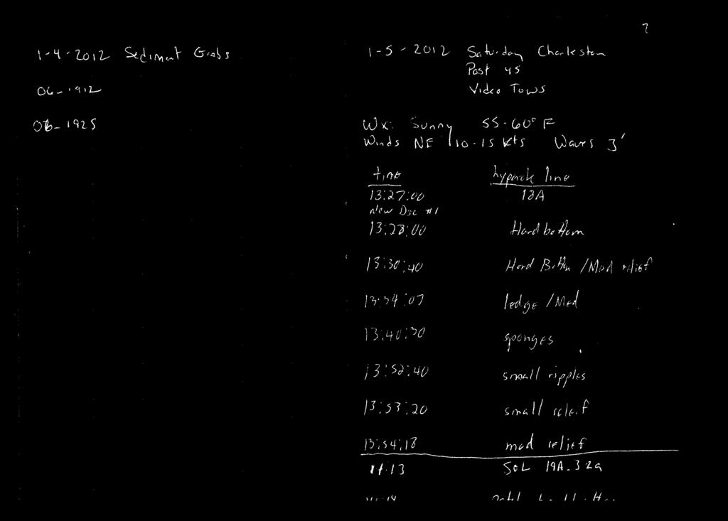
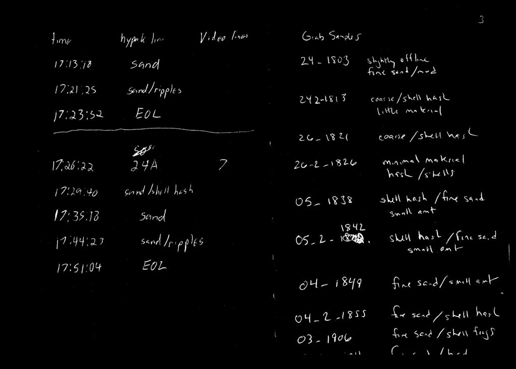
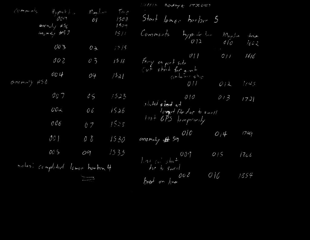
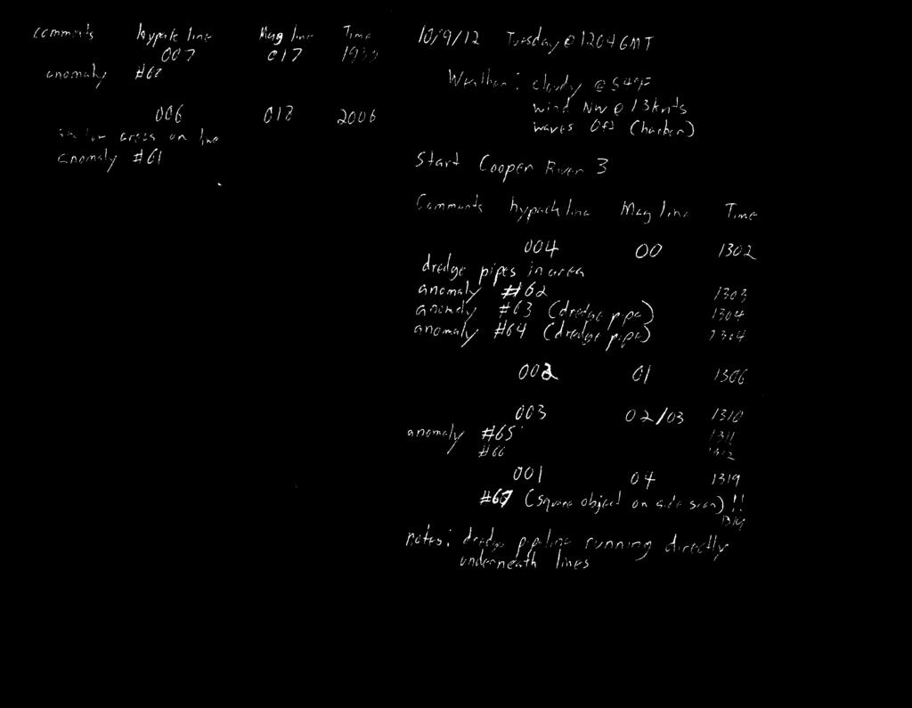
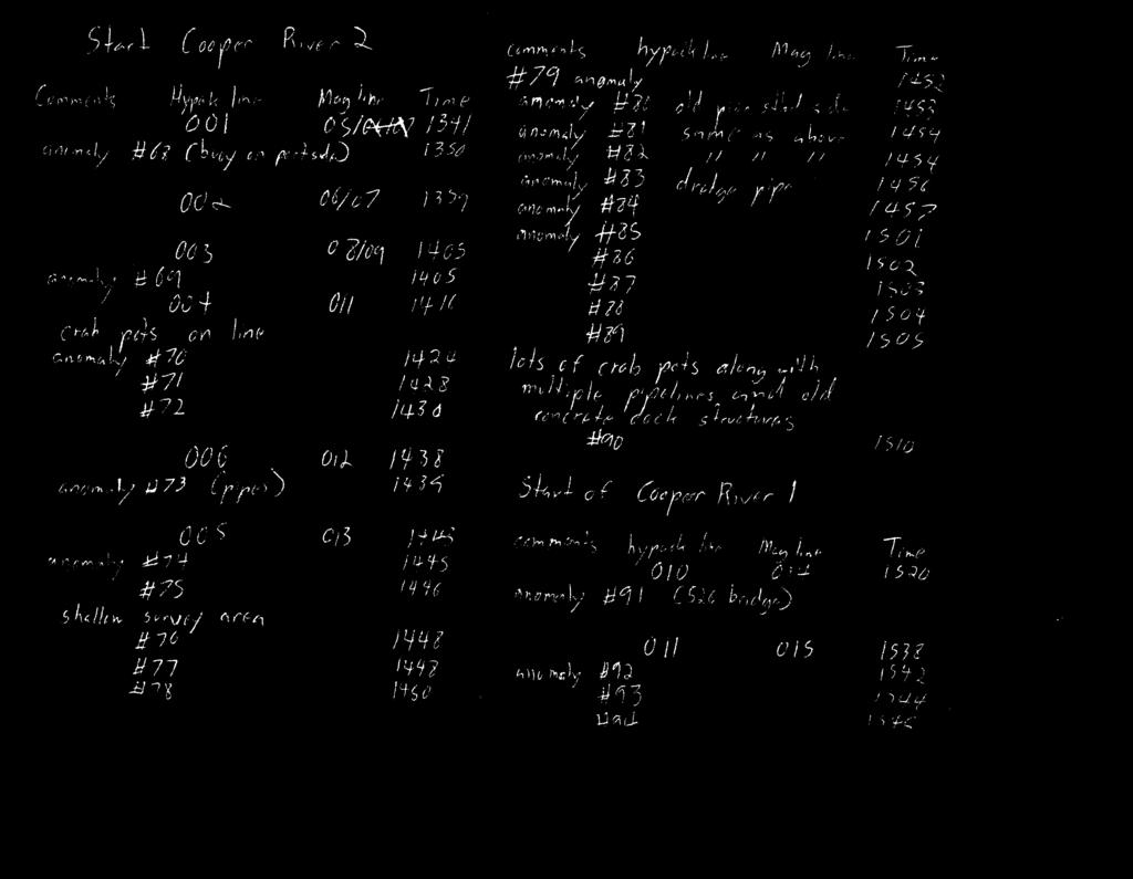
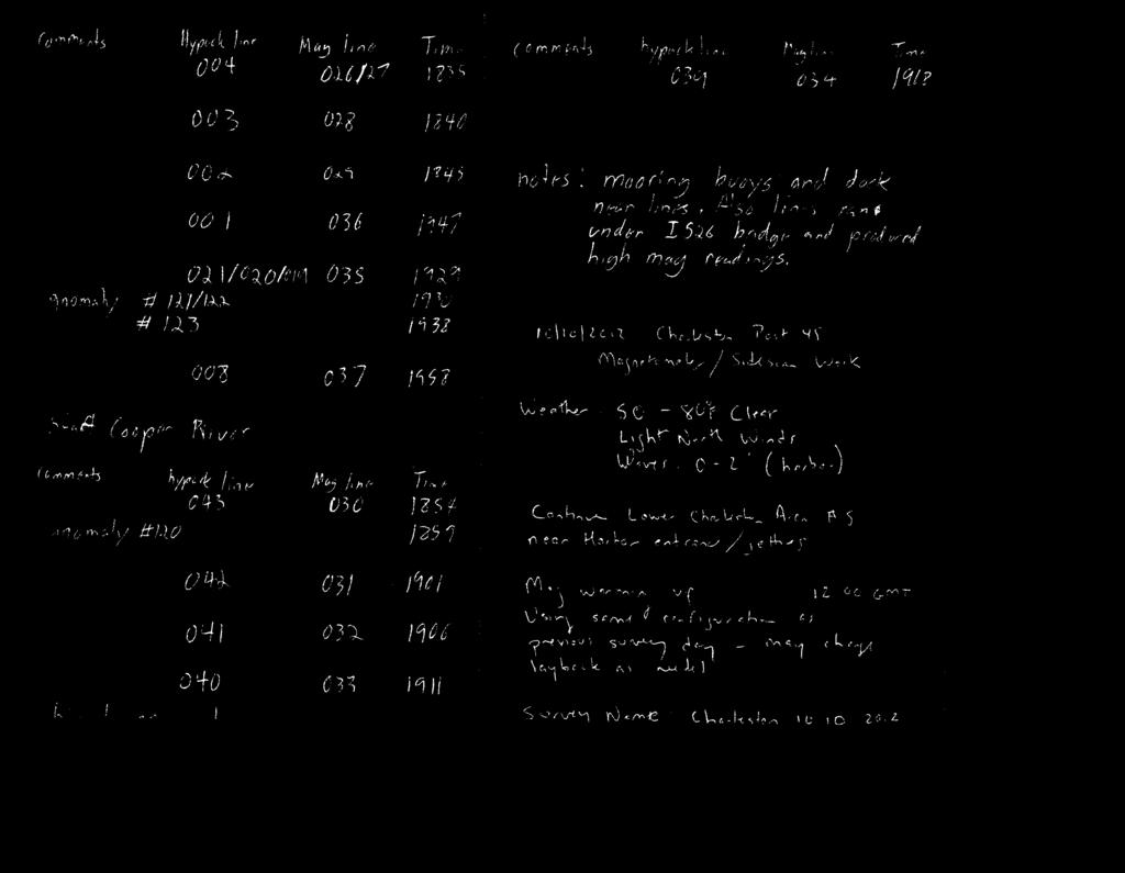
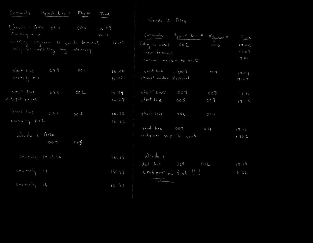
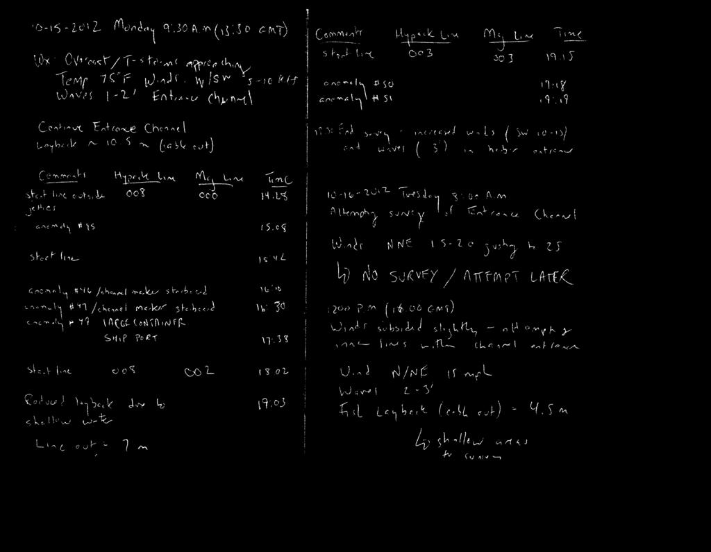
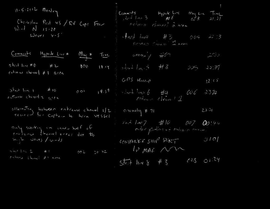
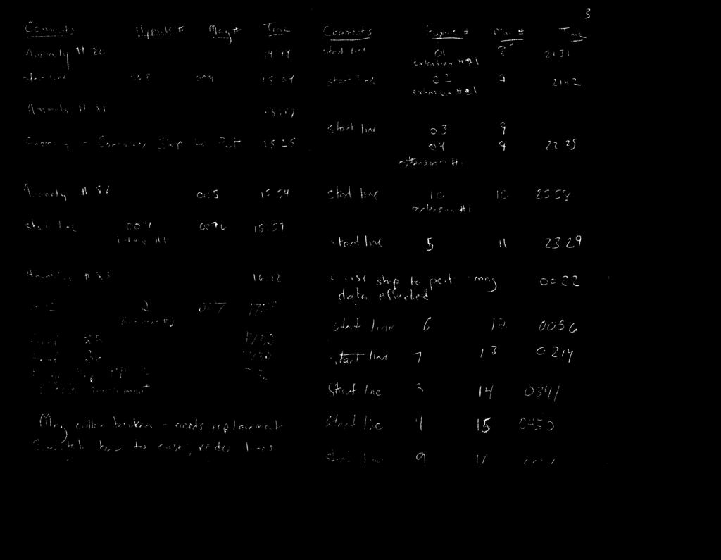
1 11/5/2012 Monday Wx: Partly Cloudy Air Temperature 65F Winds: NNE mph; Waves 6 seconds Entrance Channel 1/2 Completed 2 CHIRP lines down center as best R/V Cape Fear could steer in strong crosswinds/chop. Completed 15/21 20 m spacing as best R/V Cape Fear Could steer in strong crosswinds/chop/darkness. Mapped from noon to 4:00 a.m. 11/6/2012 Tuesday Wx: Overcast/Rainy Air Temperature: 50F Winds NNE mph, Waves 6 seconds No work completed during day - conditions poor for data collection. Remated sidescan towfish - cable connection, backed up data, organized survey plan for following period. 11/7/2012 Wednesday Wx: Partly Cloudy 60F Winds: Winds NNW knots; Waves 2-5' (increasing offshore) at 6 seconds Completed Entrance Channel 1/2 all sidescan/mag work. Completed Extension Channel 1 EXCEPT Line 8 sidescan/mag work. Winds and waves decreased throughout the day, before increasing again overnight to 22 knots in the Extension Channel areas. Could not risk sidescan/magnetometer going down again. Suspended survey at 1:30 a.m. and pulled gear. 11/8/2012 Thursday Wx: Partly Cloudy 63F Winds: NW knots, Waves 2-4' (increasing 6 seconds Completed CHIRP Entrance Channel centerline through Entrance Channel Areas 1/2. Completed CHIRP single line through survey grid in Channel Extension Area 1 Completed CHIRP six (6) 100 meter spacing lines in Channel Extension Area 3; Need to complete three tie lines in Extension Channel Area 3 Completed CHIRP single line through survey grid in Channel Extension Area 2 Poor sea conditions made it difficult for R/V Cape Fear to maintain steady course on planned lines. Did not completed lower priority tielines. Moved inshore and out of channel to ODMDS where conditions improved Completed ODMDS Hardbottom Area #1 Need to complete centerline through Channel Extension Areas 1/2 Need to complete Line 8 in Channel Extension Area 1 Need to complete sidescan/mag/single beam in Channel Extension Area 3 11/9/2012 Friday Wx: Sunny/Clear 45-70F Winds NW knots early; dropped to light and variable by early afternoon and continued through overnight period.. Waves: 1-3' Completed ODMDS Hardbottom Area #2 Completed ODMDS Hardbottom Area #3
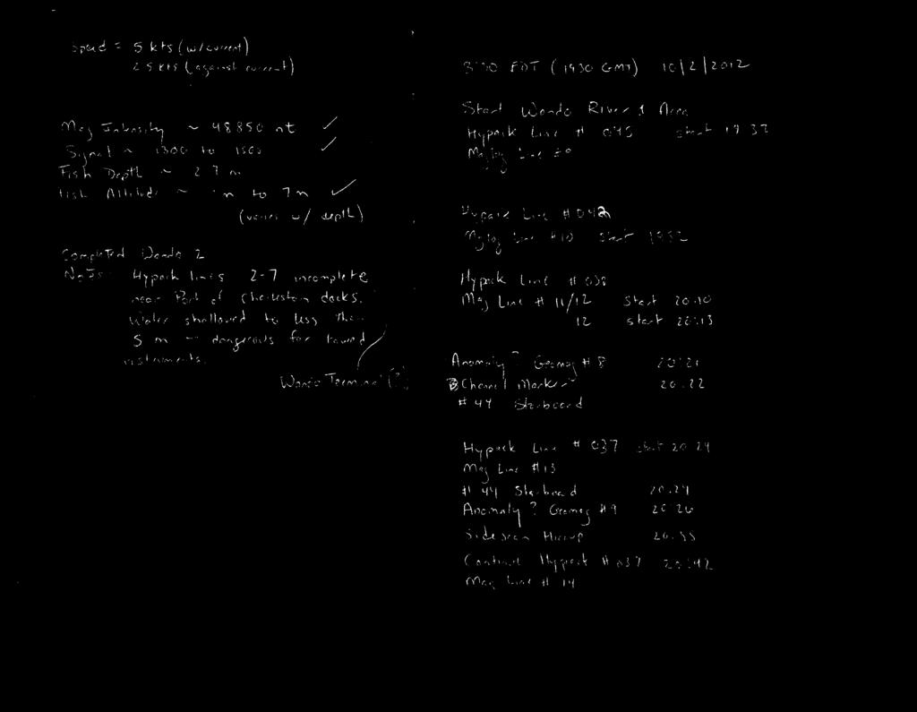
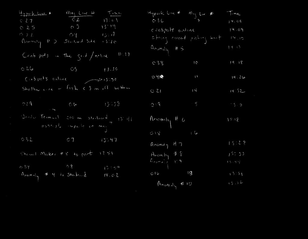
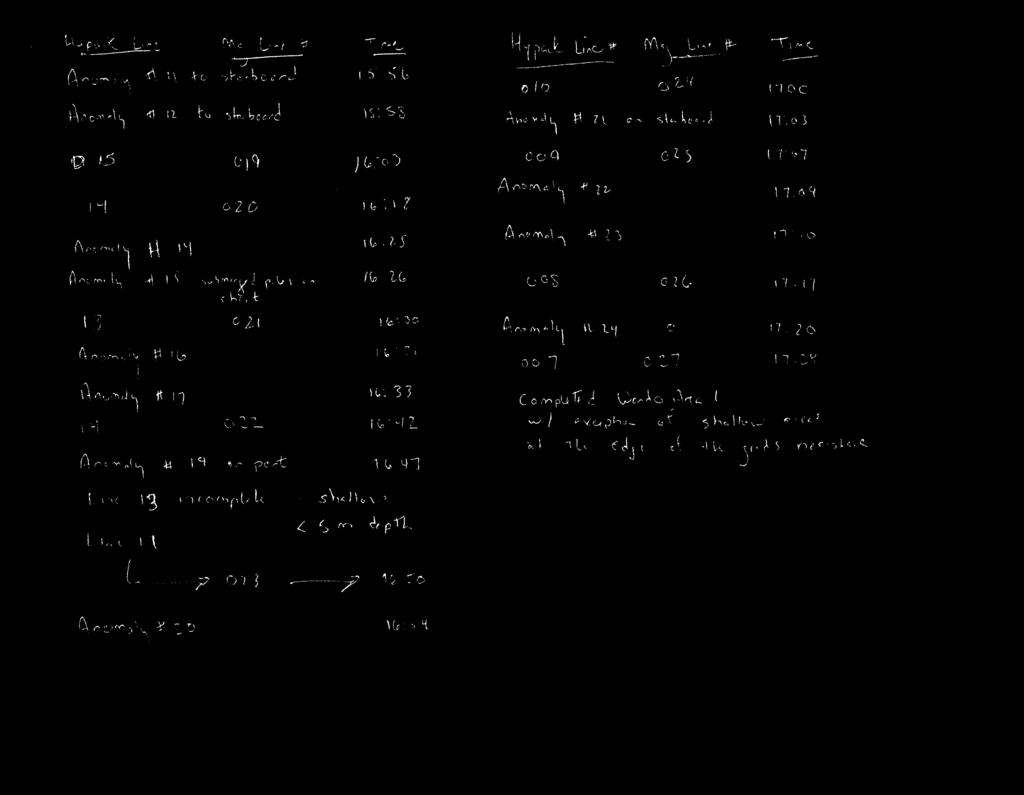
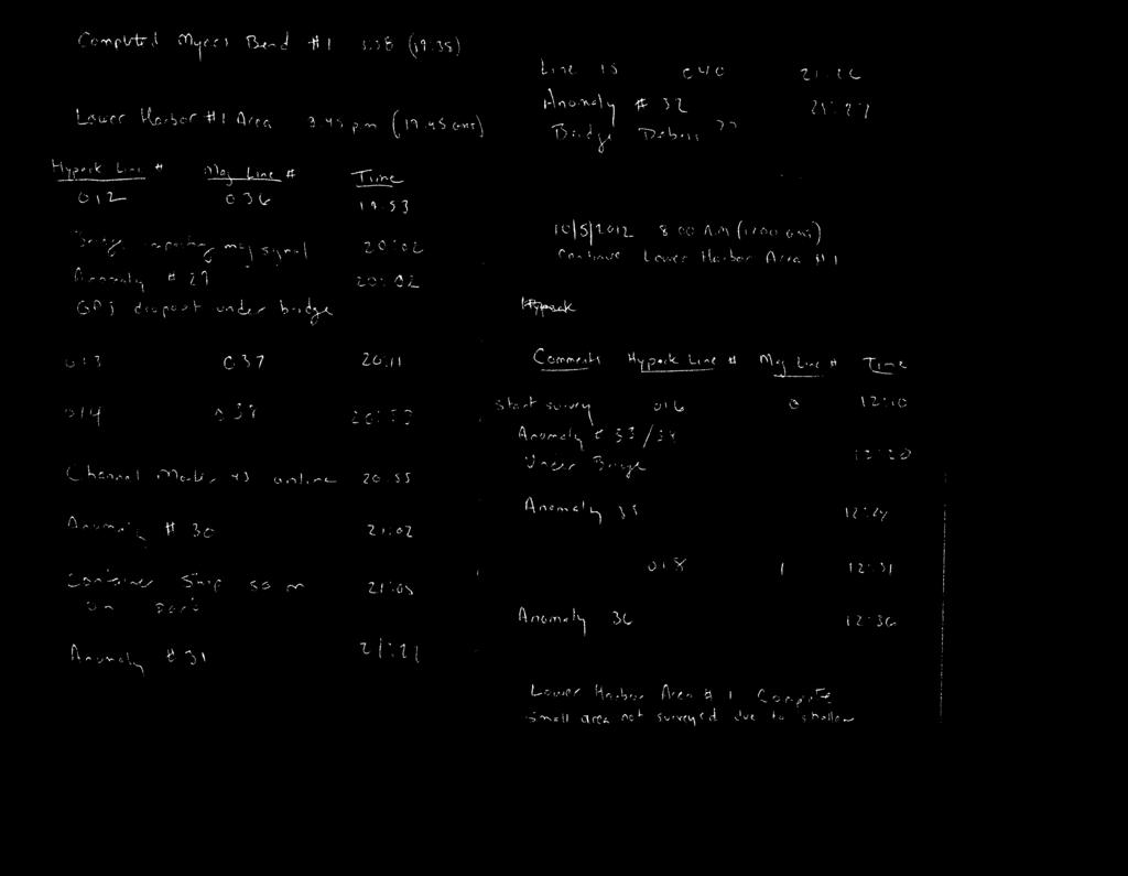
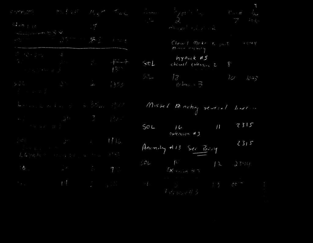
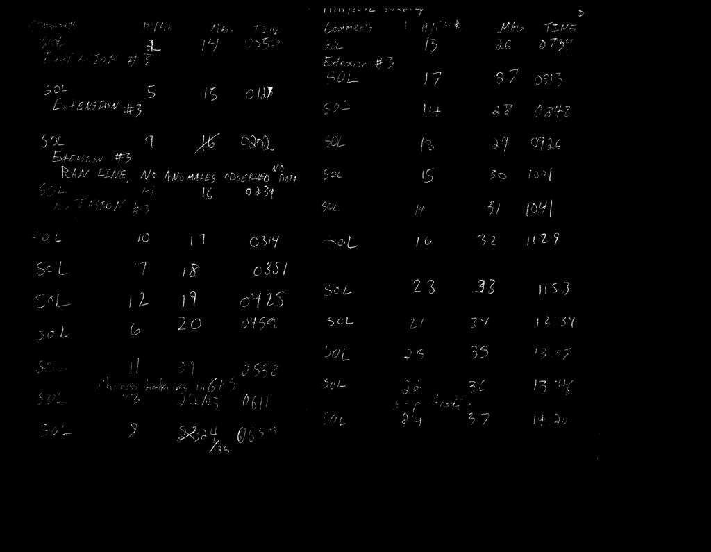
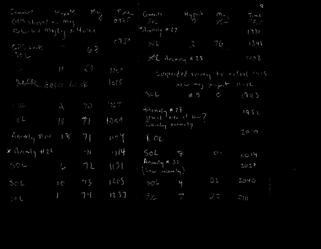
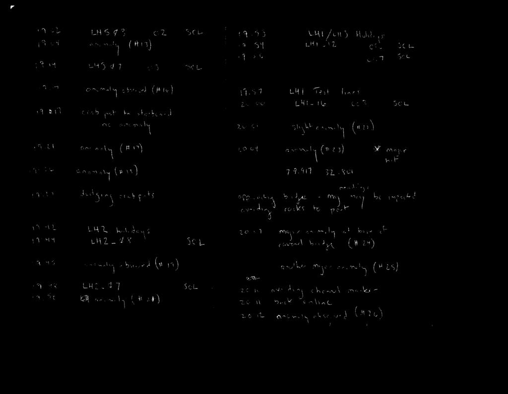
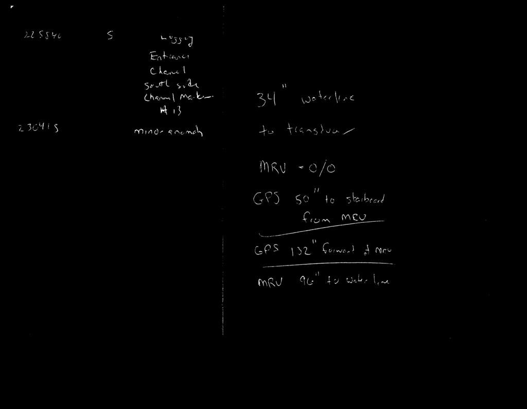
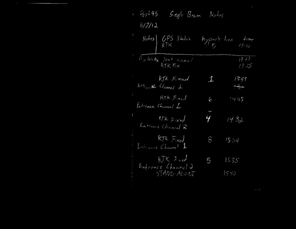
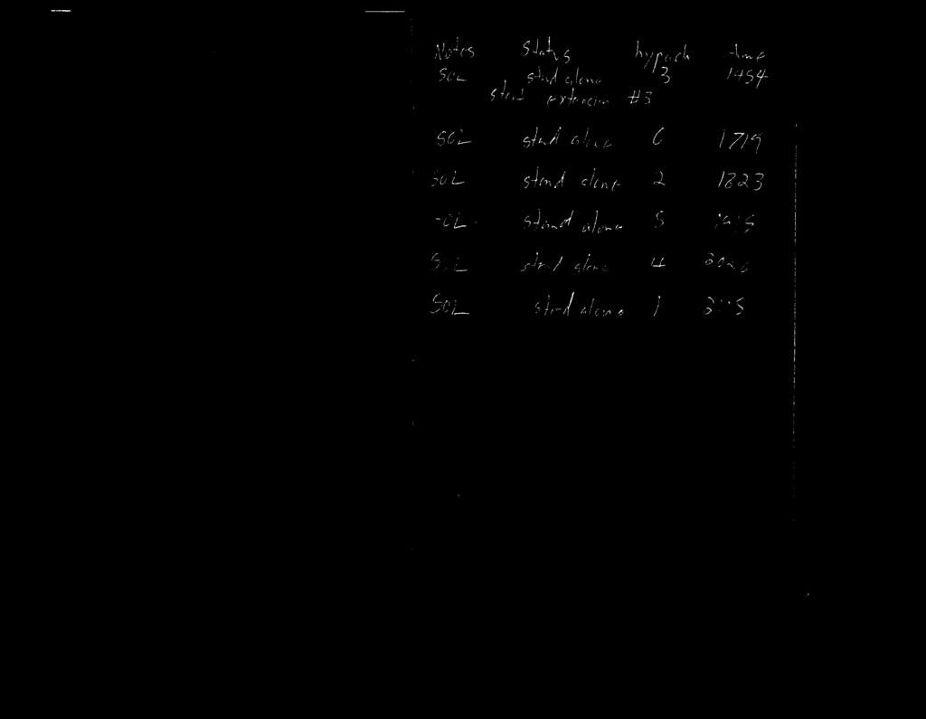
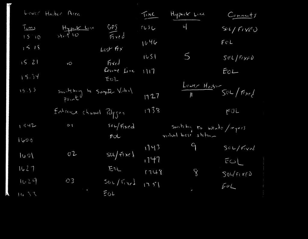
2 Note: Although conditions are ideal, sidescan data display is showing intermittent data dropouts across all four channels. Data drops are causing bottom track and overall backscatter retrun display to degrade as well. Possible problem with cable? Problem is variable and does not readily coincide with any quick heave, ptich, roll motions. Fish has been running for 30 plus hours consecutively. Also, topside unit and or TPU has frozen at least twice during this period and required a reboot of either or both units. Wait and see - check connection at daybreak. Possibly run sidescan off wire rope through A- frame to release pressure. Also, remove depressor wing if easily removed. 11/10/2012 Saturday Wx: Sunny/Clear Temperature 50-70F Winds: Light and variable; waves 1-2' Completed ODMS Hardbottom Area #3. Sidescan having power/connection issues. Possible data cable or pigtail problem? Continuing to run with intermittent data drops. Data still coming through, but not bottom tracking well still and overall data quality is poor, but believe it to still be usable. Pulled CHIRP/Sidescan for transit to Extension Channel #2. Re-deployed CHIRP. Collected subbottom data in Extension Channel #2. While on deck, restabilized wet connection at sidescan towfish data cable interface to improve data quality. Pulled CHIRP and re-deployed sidescan and magnetometer in Extension Area #3 to conduct magnetometer/sidescan/single beam data collection. When attempted to powerup sidescan, the TPU amber lights did not go out, indicating an error in the start-up process. After several hours of troubleshooting, found sidescan cable to have short at approximately 1200 (1700 GMT) causing it to become non operational. Required suspening operations for three hours while a fix was achieved. Sidescan repaired and running again at 6:00 (2300 GMT). Lost several hours of prime survey weather. 11/11/2012 Sunday Wx: Sunny/Partly Cloudy Temp 50-72F Winds ENE 7-12 kts; waves 2-3' early then 3-5' late. Completed Extension Channel #3 magnetometer/sidescan Note: Could not maintain cell link with virtual base station. All singlebeam data are acquired with DGPS with a standing tide already applied. This will need to be re-applied with NOAA tide gauge data in post processing. Also, attempted to log raw GPS data to be used in post-processing. Data cards filled quickly and may or may not work. Also attempted to record directly to PC via serial port. Completed Extension Channel #2 magnetometer/sidescan. Transited to ODMDS to being Cultural Resources Area #1 11/12/2012 Monday Wx: Sunny/Partly Cloudy Temp 50-72F Winds East knots early then southeast 7-12 kts; waves 4-5' early then 4-6' late Restarted survey after refueling and swapping out captains. Conditions remain poor for surveying 4-6' short period seas with SE winds 7-12 knots. Completed ODMDS Cultural Resources Area #1. Poor sea conditions made it difficult for R/V
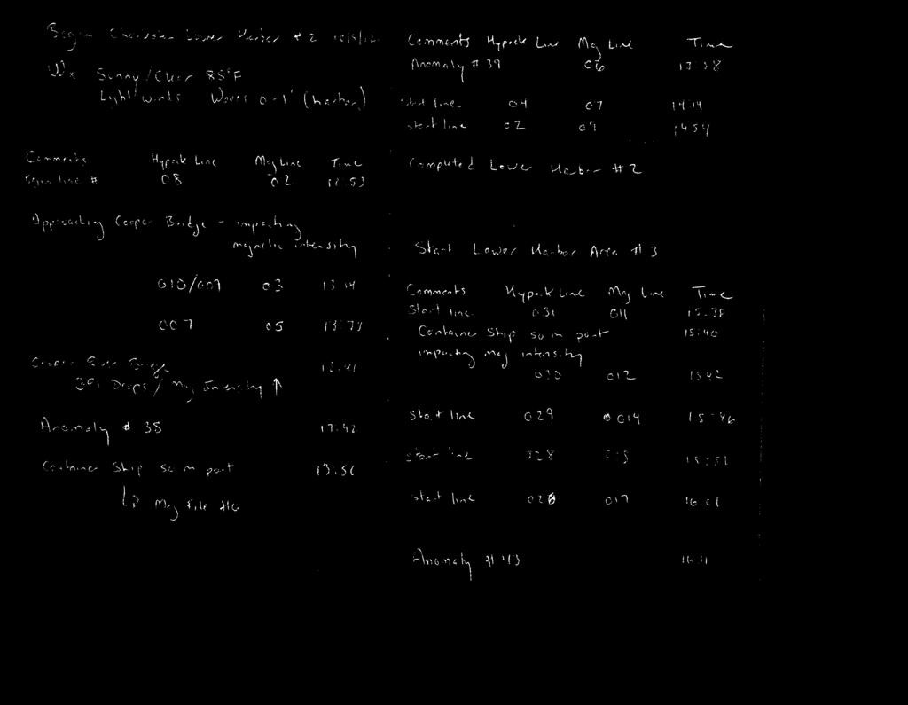
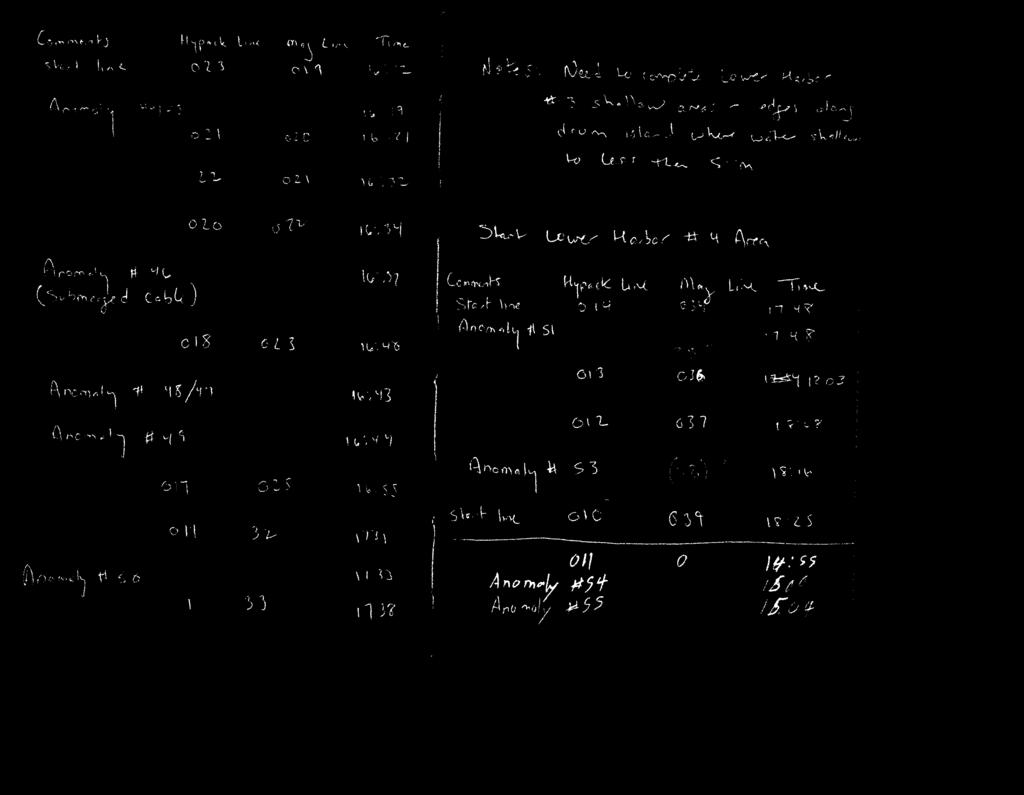
3 Cape Fear to maintain steady course on planned lines. 2: (GMT( Restarted survey after refueling and swapping out captains. Conditions remain poor for surveying 4-6' short period seas with SE winds 7-12 knots. 5:30 (22:30 GMT) Completed ODMDS Cultrual Resources Area #1 Started ODMDS Cultural Resources Area #2 Seas 4-6' with with winds SE 7-12 knots diminishing to light and variable overnight. Swells dropped to /13/2012 Tuesday Wx: Sunny/Partly Cloudy Temp 50-72F Winds ENE 7-12 kts; waves 2-3' early then 3-5' late. Completed: ODMDS Cultural Resources #2 ODMDS Cultural Resources #3 Notes: No CHIRP Tie Lines...weather window closing. Light winds early, then frontal boundary passage. Winds turned NNE knots. Not redeploying CHIRP at this time
4
5
6
7
8
9
10
11
12
13
14
15
16
17
18
19
20
21
22
23
24
25

26
27
28
29
30
31

32
33
34
35
36
37
38

39
40
41
42

43
44

45

46

47
48

49

50
51
52
53
54

55
56
57
58
59
60
61

62
63

64
65

66

67
68

69
70

71
72
73
74

75

76
77

78

79

80

81

82
83

84

85
86
87

88

89
90

91
92

93
94

95
96 Post 45 survey Areas Old Block name Entrance Channel 2 Channel Extension 1 Channel Extension 2 Channel Extension 3 Entrance Channel 1 Lower Harbor 5 Lower harbor 4 Lower Harbor 1 Lower Harbor 2 Wando River 1 Wando River 2 Myers Bend 2 Myers Bend 1 Cooper River 3 Cooper River 2 Cooper River 1 Cooper River ODMDS HardboDom ODMDS HardboDom 2 ODMDS HardboDom 3 ODMDS Survey 1 ODMDS Survey 2 New Block Name Entrance Channel 1 Entrance Channel 1 Entrance Channel 1 Entrance Channel 1 Entrance Channel 2 Lower Harbor 1 Lower Harbor 2 Lower Harbor 4 Lower Harbor 5 Wando River 1 Wando River 2 Myers Bend 1 Myers Bend 2 Cooper River 1 Cooper River 2 Cooper River 3 Cooper River 3 ODMDS HardboDom ODMDS HardboDom 2 ODMDS HardboDom 3 ODMDS Survey 1 ODMDS Survey 2
WIND IN KNOTS, WAVE HEIGHTS IN METERS. NO SEA STATE GIVEN IF WAVES LESS THAN 3M.
 DATE ISSUED: 14/08/2015 FORECAST VALID FROM 132200 TO 142200 UTC: IN KNOTS, WAVE HEIGHTS IN METERS. NO SEA STATE GIVEN IF WAVES LESS THAN 3M. GALE WARNINGS: ============== 1 / 13 1. TRISTAN: SW 35 in the
Recommended operating guidelines (ROG) for sidescan Sidescan sonar ROG in wrapper.doc English Number of pages: 9 Summary:
 for sidescan Sidescan sonar ROG in wrapper.doc English Number of pages: 9 Summary:") Title: Author(s): Document owner: Recommended operating guidelines (ROG) for sidescan sonar Dave Long (BGS) Dave Long (BGS) Reviewed by: Janine Guinan (MI) 07/09/07 Workgroup: MESH action: 2.1 Version:
Title: Author(s): Document owner: Recommended operating guidelines (ROG) for sidescan sonar Dave Long (BGS) Dave Long (BGS) Reviewed by: Janine Guinan (MI) 07/09/07 Workgroup: MESH action: 2.1 Version:
Deploying the TCM-1 Tilt Current Meter in an Inverted (Hanging) Orientation By: Nick Lowell, Founder & President
 Orientation By: Nick Lowell, Founder & President") Lowell Instruments Application Note #TCMA Deploying the TCM-1 Tilt Current Meter in an Inverted (Hanging) Orientation By: Nick Lowell, Founder & President 1 Introduction The TCM-1 Tilt Current Meter (TCM)
Lowell Instruments Application Note #TCMA Deploying the TCM-1 Tilt Current Meter in an Inverted (Hanging) Orientation By: Nick Lowell, Founder & President 1 Introduction The TCM-1 Tilt Current Meter (TCM)
THE CHALLENGES OF A LARGE-AREA BATHYMETRIC SURVEY
 THE CHALLENGES OF A LARGE-AREA BATHYMETRIC SURVEY Agenda: - Introduction - Tender - Project Planning - Survey - Processing - Delivery - Conclusion 2 Introduction We know less of the oceans at our feet,
14/10/2013' Bathymetric Survey. egm502 seafloor mapping
 egm502 seafloor mapping lecture 10 single-beam echo-sounders Bathymetric Survey Bathymetry is the measurement of water depths - bathymetry is the underwater equivalent of terrestrial topography. A transect
Private Bag X097, Pretoria, 0001 Tel: + 27 (0) USSD: *120*7297#
 USSD: *120*7297#") Private Bag X097, Pretoria, 0001 Tel: + 27 (0) 12 367 6000 www.weathersa.co.za USSD: *120*7297# FQZA31 FAPR 241330 SECURITE: ========= WEATHER BULLETIN FOR THE HIGH SEAS FOR METAREA VII. ISSUED BY THE
Private Bag X097, Pretoria, 0001 Tel: + 27 (0) 12 367 6000 www.weathersa.co.za USSD: *120*7297# FQZA31 FAPR 241330 SECURITE: ========= WEATHER BULLETIN FOR THE HIGH SEAS FOR METAREA VII. ISSUED BY THE
REPORT OF INITIAL SURVEY OF AN UNKNOWN BARGE OFF OF CEDAR POINT, SANDUSKY, OHIO. July 26-27, Submitted to Cleveland Underwater Explorers, Inc.
 REPORT OF INITIAL SURVEY OF AN UNKNOWN BARGE OFF OF CEDAR POINT, SANDUSKY, OHIO July 26-27, 2008 Submitted to Cleveland Underwater Explorers, Inc. By Jack Papes SUBJECT Report of Initial survey of an unknown
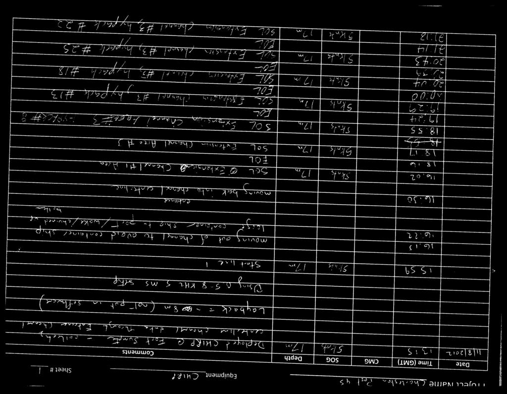
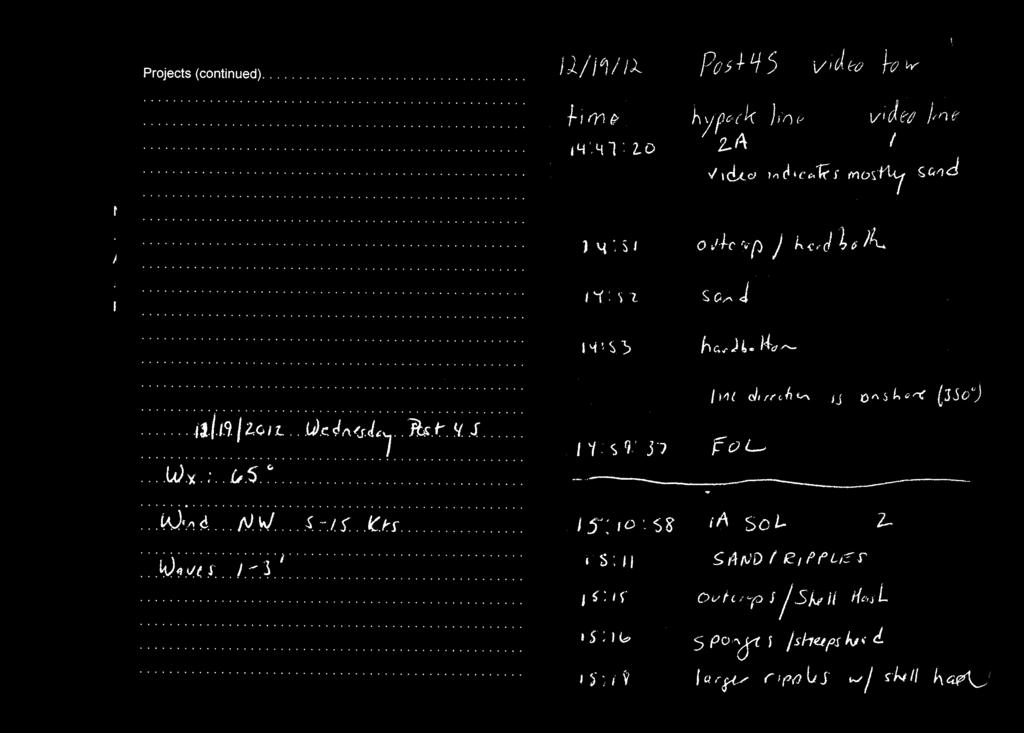
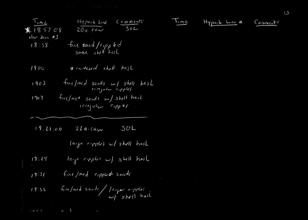
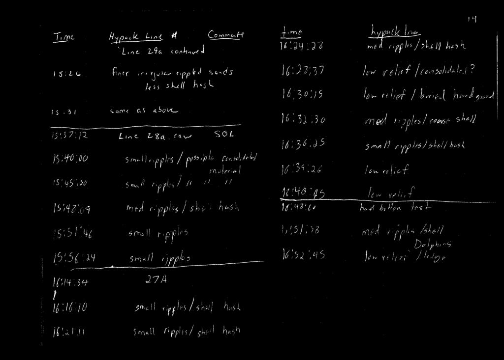
Coastal Wave Studies FY13 Summary Report
 DISTRIBUTION STATEMENT A. Approved for public release; distribution is unlimited. Coastal Wave Studies FY13 Summary Report Jeffrey L. Hanson US Army Corps of Engineers, Field Research Facility 1261 Duck
Meeting the Challenges of the IHO and LINZ Special Order Object Detection Requirements
 Meeting the Challenges of the IHO and LINZ Special Order Object Detection Requirements Erik Hammerstad Kongsberg Maritime P. O. Box 111, N-3191 Horten, Norway erik.oscar.hammerstad@kongsberg.com Abstract
Pilotage. Planning for pilotage
 Pilotage Planning for pilotage Being one step ahead of the game is key to effective pilotage. Only then will you know what to expect and what s lurking around the next bend. It s useful to construct a
DUKC Chart Overlay. Presentation to IHO TWL and DQ Working Groups Wollongong, March 2014
 DUKC Chart Overlay Presentation to IHO TWL and DQ Working Groups Wollongong, March 2014 Outline Who is OMC? DUKC description & methodology. DUKC Chart Overlay concept. Chart Overlay application example.
Fleming County High School Flemingsburg, KY 41041
 Fleming County High School Flemingsburg, KY 41041 Date Mon 08/15/2016 Job # Prepared By Clay Barton 6:00 AM:70 F Drizzle Wind: 1 MPH NE Precipitation:.01'' Humidity: 95% Weather 12:00 PM:81 F Light Rain
Table of Contents Seabird 9Plus CTD Components and Overview... 2 CTD Deployment\Recovery Procedure... 7
 Seabird CTD overview and Deployment Standard Operating Procedures (SOPs) Gordon Furey P&O Maritime Table of Contents Seabird 9Plus CTD Components and Overview... 2 CTD Deployment\Recovery Procedure...
A Remote-sensing Survey of Key West Harbor and Approaches,
 A Remote-sensing Survey of Key West Harbor and Approaches, 2003-2004 Magnetometers Ready to be Deployed, Key West Harbor, December, 2003 Prepared by: Corey Malcom Mel Fisher Maritime Heritage Society 200
Field and Laboratory Investigation of High-Speed Ferry Wake Impacts in New York Harbor
 Field and Laboratory Investigation of High-Speed Ferry Wake Impacts in New York Harbor Michael S. Bruno, Brian J. Fullerton, Raju Datla, Peter A. Rogowski Center for Maritime Systems, Davidson Lab., Stevens
Weather and Sea Conditions: 3 day mariner forecast
 Update:- Wednesday 03 rd May 2017 Weather and Sea Conditions: 3 day mariner forecast Wednesday 03 rd May 2017 Weather Warning General Situation Weather Wind Visibility Sea Swell Nil A weak area of high
National Maritime Center
 National Maritime Center Providing Credentials to Mariners (Sample Examination) Page 1 of 5 Choose the best answer to the following Multiple Choice Questions. 1. (The following questions are based on Chart
 Side 1 av 7 Home > Diving Equipment > Side Scan Sonar > Imagenex Sidescan Sonar > Yellowfin Yellowfin Sidescan Sonar Magnetometers Side Scan Sonar Cameras Storm Cases Interferometric & Sidescan Equipment
CALCASIEU SALINITY STRUCTURES. HYDRODYNAMIC MODELING (To Support Design of Salinity Barriers)
") CALCASIEU SALINITY STRUCTURES HYDRODYNAMIC MODELING (To Support Design of Salinity Barriers) Presentation Overview 1 2 3 4 5 Project Overview and CEA Circulation Modeling Vessel Hydrodynamics Modeling
CALCASIEU SALINITY STRUCTURES HYDRODYNAMIC MODELING (To Support Design of Salinity Barriers) Presentation Overview 1 2 3 4 5 Project Overview and CEA Circulation Modeling Vessel Hydrodynamics Modeling
Sontek RiverSurveyor Test Plan Prepared by David S. Mueller, OSW February 20, 2004
 Sontek RiverSurveyor Test Plan Prepared by David S. Mueller, OSW February 20, 2004 INTRODUCTION Sontek/YSI has introduced new firmware and software for their RiverSurveyor product line. Firmware changes
Weather questions. Question 1 (1 Mark) State what information is included in a cyclone warning.
 State what information is included in a cyclone warning.") Question 1 (1 Mark) Weather questions State what information is included in a cyclone warning. Question 2 (1 Mark) In which direction do winds travel around a high pressure system in the southern hemisphere?
Question 1 (1 Mark) Weather questions State what information is included in a cyclone warning. Question 2 (1 Mark) In which direction do winds travel around a high pressure system in the southern hemisphere?
Troubleshooting Basics: Profiling CTDs
 Technical Note Troubleshooting Basics: Profiling CTDs Methods for Diagnosing Erratic and Unreasonable Data Greg Ikeda, October 2018 Introduction Any CTD or sensor may eventually exhibit data spikes and
El Toro Around Oahu: Complete!!
 El Toro Around Oahu: Complete!! Dear Friends, Our family is humbled by the many, generous donations to the National Parkinson Foundation in memory of my Dad, Jim Denzer. As promised, I have sailed an El
Daily Field Log. Julian Day: 181 client: LDEO
 Julian Day: 181 client: LDEO Sunday-June 29, 2008 1700 departure Depart Manzanilla, Mexico, for study area. Preparing, enroute, for operation. 1930 drill Fire fighting and abandon ship drill 2400 transit
Search Techniques. Contents
 Search Techniques Contents Overview... 2 1. Developing the Search Plan... 2 1.1 Search Planning Sequence... 2 2. Search Terminology... 3 3. Search Patterns... 6 4. Searching and GPS... 8 5. Search Protocols...
Citizen Science Based Survey GBR Far North Dive Trip 2016 April 18-26
 Citizen Science Based Survey GBR Far North Dive Trip 2016 April 18-26 Chris Roelfsema Karen Johnson Douglas Stetner Trevor Baerenger Peran Brady May 2016 GBR Far North Citizen Science Trip 5 May 2016 1
Back to Basics JUNIOR CRUISE
 Background Summer 2011 the junior sailing program at American Yacht Club was almost over, but the sailors still wanted a final sailing event without a racing component. Jr. Commodore Becca Quirke and Peter
2005 ABC. Chapter 3 Part 2. Navigating with ATON's. Revision to D-13 Local Notes. Instructor Notes for Mike Brough. Mike Brough
 2005 ABC Chapter 3 Part 2 Navigating with ATON's Revision to D-13 Local Notes Instructor Notes for Mike Brough Mike Brough June 24 2008 June 24 2008 Slide 1 June 24 2008 New graphics Navigating on Water
Advantages of Using Combined Bathymetry and Side Scan Data in Survey Processing T.M. Hiller, L.N. Brisson
 Advantages of Using Combined Bathymetry and Side Scan Data in Survey Processing T.M. Hiller, L.N. Brisson EdgeTech, West WareHam MA, USA EdgeTech 6205 Combined Bathymetric and Side Scan Sonar EdgeTech
An Integrated Marine Gradiometer Array System (MGA)
") An Integrated Marine Gradiometer Array System (MGA) For Detection and Location of Chemical and Conventional UXO/MEC in Shallow to Deep Marine and Freshwater Environments Introduction Tetra Tech EC, Inc.
An Integrated Marine Gradiometer Array System (MGA) For Detection and Location of Chemical and Conventional UXO/MEC in Shallow to Deep Marine and Freshwater Environments Introduction Tetra Tech EC, Inc.
SURF BREAK INFORMATION
 SURF BREAK INFORMATION SWELL INTERVALS / PERIODS: ANYTHING ABOVE 10/11SECS FOR ALL BREAKS MEANS LONGER PERIOD GROUND SWELL, WHICH STARTS PRODUCING BETTER, CLEANER AND BIGGER, MORE POWERFUL WAVES! SHORT
WeatherStation Monitoring for Industrial marine Applications
 WeatherStation Monitoring for Industrial marine Applications PB200 WeatherStation Instrument Applications: Industrial marine weather monitoring Features: True and Apparent Wind Speed and Direction Barometric
Predicting Oceanside 01/27
 Predicting Oceanside 01/27 Oceanside requires smoother W or SW winds at 10-18 mph and rain free window. Marine buoys should be at 15 kts and airport winds at 10. Recently, a cold front has moved through
Sample questions from the Alertness and Attitude units of the Driving Theory syllabus. Alertness and Attitude
 Sample questions from the Alertness and Attitude units of the Driving Theory syllabus. Alertness and Attitude Click the writing to listen. Type X next to the correct answers. If correct, the X will turn
Marine Renewables Industry Association. Marine Renewables Industry: Requirements for Oceanographic Measurements, Data Processing and Modelling
 Marine Renewables Industry Association Marine Renewables Industry: Requirements for Oceanographic Measurements, Data Processing and Modelling October 2009 Table of Contents 1. Introduction... 1 2. Measurements
Methods for Standardizing the U.S. West Coast Groundfish Trawl Survey
 Methods for Standardizing the U.S. West Coast Groundfish Trawl Survey Aimee Keller, Victor Simon and Beth Horness Northwest Fisheries Science Center Fisheries Resource Analysis and Monitoring Division
ScanFish Katria. Intelligent wide-sweep ROTV for magnetometer surveys
 ScanFish Katria Intelligent wide-sweep ROTV for magnetometer surveys User-friendly control and monitoring software solution The ScanFish Katria comes with the ScanFish III Flight software, which is an
ATON System Workshop
 ATON System Workshop ATON System: Real-time current measurements from Coast Guard navigation buoys in ports, bays and the coastal ocean Aid-to-Navigation = ATON ATON System Workshop Outline: Overview of
Sensor Platform Project Marine Trials Bidders Conference. Fundy Ocean Research Center for Energy fundyforce.ca
 Sensor Platform Project Marine Trials Bidders Conference Fundy Ocean Research Center for Energy fundyforce.ca 1 Project Team FORCE OceanWorks International Preliminary Design, Operational Procedures Murray
Data Collection and Processing: Elwha Estuary Survey, February 2013
 Data Collection and Processing: Elwha Estuary Survey, February 2013 Ian Miller, WA Sea Grant Olympic Peninsula Field Office, 1502 E. Lauridsen Blvd #82, Port Angeles, WA 98362 immiller@u.washington.edu
MARINERS BRIEFING NEW ENGLAND SURVEY ACTIVITY CONTACT. RODNEY AVILA FISHERIES LIAISON Phone:
 NEW ENGLAND SURVEY ACTIVITY MARINERS BRIEFING DATE OF NOTICE: 20 NOVEMBER 2018 NOTICE NO. 013 OVERVIEW ABOUT THE WIND FARMS These briefings are intended to update mariners on marine operations for the
Measurement of vertical motions of bulk carriers navigating in port entrance channels
 HYDROGRAPHIC CONFERENCE Technical Awareness Seminar 2007 Cape Town, 19 21 June 2007 Measurement of vertical motions of bulk carriers navigating in port entrance channels J Moes CSIR, PO Box 320, Stellenbosch,
MARINERS BRIEFING NEW ENGLAND SURVEY ACTIVITY CONTACT. RODNEY AVILA FISHERIES LIAISON Phone:
 NEW ENGLAND SURVEY ACTIVITY MARINERS BRIEFING DATE OF NOTICE: 16 OCTOBER 2018 NOTICE NO. 003 OVERVIEW ABOUT THE WIND FARMS These briefings are intended to update mariners on marine operations for the Revolution
Isaacs Kidd Mid water Trawl
 2007 Standard Operating Procedures of Isaacs Kidd Mid water Trawl NAKARET YASOOK APINANT TARADOL TAWEESAK TIMKRUB NARONG REUNGSIVAKUL SOMBOON SIRIRAKSOPHON SOUTHEAST ASIAN FISHERIES DEVELOPMENT CENTER
The Wave Glider: A Mobile Buoy Concept for Ocean Science. 009 Liquid Robotics Inc.
 The Wave Glider: A Mobile Buoy Concept for Ocean Science 009 Liquid Robotics Inc. J. Manley & T. Richardson: Liquid Robotics Inc. DBCP XXV Paris September 28, 2009 1 Wave Glider Overview Unique Two Part
Mapping the Sea Bottom Using RTK GPS and Lead-Line in Trabzon Harbor
 Mapping the Sea Bottom Using RTK GPS and Lead-Line in Trabzon Harbor Arzu ERENER and Ertan GÖKALP, Turkey Key Words: Real-Time Kinematic GPS, Lead Line, Roll Effect, Hydrographic surveys. SUMMARY The harbor
CC Scouts SA. Leader Notes. Cub Sailing
 CC Scouts SA Leader Notes Cub Sailing Welcome to Cub Sailing at Glenelg Adventurous Activity Centre Dear Cub Leader, We are very pleased to offer you cub sailing at Glenelg. You can book this activity
NATIONAL MARINE RESEARCH VESSELS
 NATIONAL MARINE RESEARCH VESSELS VESSEL CHARTER GUIDELINES 2018-2019 1. INTRODUCTION The Marine Institute operates the national marine research fleet (RV Celtic Explorer and RV Celtic Voyager) on behalf
FULL SCALE MEASUREMENT OF DYNAMIC SHIP MOTIONS AND SQUAT
 FULL SCALE MEASUREMENT OF DYNAMIC SHIP MOTIONS AND SQUAT Mr. Gary Rolph Chief Hydrographic Surveyor Port of Brisbane Corporation Mr. Peter Rumball Surveyor Port of Brisbane Corporation Dr. Terry O'Brien
NAV-COM OFFICER PREP FOR SEA CHECKLIST
 NAV-COM OFFICER o Radars are on and functioning properly o Both GPS units are on and functioning properly o Chart Plotter is on and functioning properly o VHF radios are on and functioning properly o VHF
IMCA DP Station Keeping Bulletin 04/18 November 2018
 DP STATION KEEPING BULLETIN IMCA DP Station Keeping Bulletin 04/18 November 2018 The following event trees have been compiled from recent reports received by IMCA. The originators granted IMCA permission
You must stop your. pass with caution on the port side of vessel "B" The vessel moving upstream against the current
 BK NUM ANS QUESTION ANSWER A ANSWER B ANSWER C ANSWER D ILLUST 1 1 C 1 2 B INLAND ONLY You are navigating in a narrow channel and must remain in the channel for safe operation. Another vessel is crossing
ENVIRONMENT AGENCY GREAT OUSE AND 100 FT DRAIN QUARTERLY BATHYMETRIC SURVEY DECEMBER 2013 SITE SURVEY REPORT NO. H6787
 ENVIRONMENT AGENCY GREAT OUSE AND 100FT DRAIN QUARTERLY BATHYMETRIC SURVEY DECEMBER 2013 NO. H6787 LONGDIN & BROWNING (SURVEYS) LIMITED CHERRY TREE HOUSE CARMARTHEN ROAD SWANSEA SA1 1HE H6787 1 Measured
National Maritime Center
 National Maritime Center Providing Credentials to Mariners (Sample Examination) Page 1 of 5 Choose the best answer to the following Multiple Choice Questions. 1. The following questions are based on Chart
Cable Grid Testing 2018 Panama City Beach Trawl Diving and TED Testing
 NOAA FISHERIES Cable Grid Testing 2018 Panama City Beach Trawl Diving and TED Testing TIII Evaluation with NEFSC Flounder Trawl TII Evaluation with Kites TI Video Documentation Nicholas Hopkins 7/20/2018
Anemometry. Anemometry. Wind Conventions and Characteristics. Anemometry. Wind Variability. Anemometry. Function of an anemometer:
 Anemometry Anemometry Function of an anemometer: Measure some or all of the components of the wind vector In homogeneous terrain, vertical component is small express wind as -D horizontal vector For some
Visiting Lake Macquarie
 Visiting Lake Macquarie Lake Macquarie is the largest coastal salt water lake in Australia and is a prime boating destination for both small and large vessels. Many sailing regattas and fishing activities
Installation, Compensation and Maintenance Instructions for. RITCHIE Compasses. Made In U.S.A
 Installation, Compensation and Maintenance Instructions for RITCHIE Compasses Made In U.S.A All Magnetic Compasses are vulnerable to magnetic interference, which will produce errors, called deviation.
Challenges in determining water surface in airborne LiDAR topobathymetry. Amar Nayegandhi, Dewberry 15 th Annual JALBTCX Workshop, June 11 th 2014
 Challenges in determining water surface in airborne LiDAR topobathymetry Amar Nayegandhi, Dewberry 15 th Annual JALBTCX Workshop, June 11 th 2014 Why topobathy LiDAR? Complements acoustic (multi-beam sonar)
Evaluation of the Klein HydroChart 3500 Interferometric Bathymetry Sonar for NOAA Sea Floor Mapping
 Evaluation of the Klein HydroChart 3500 Interferometric Bathymetry Sonar for NOAA Sea Floor Mapping Yuhui Ai, Straud Armstrong and Dean Fleury L-3 Communications Klein Associates, Inc. 11 Klein Dr. Salem,
AN OFFSHORE TIDE GAUGE
 AN OFFSHORE TIDE GAUGE by Toshio Y a m a d a and Kinji I w a d a Hydrographic Department of Japan 1. INTRODUCTION Between October and December 1970 the Hydrographic Department of Japan carried out jointly
Advanced Sea Kayak Leader Assessment Notes
 Advanced Sea Kayak Leader Assessment Notes Technical Syllabus Part A - Personal Paddling Skills Through the blending of their body, boat and blade positions, the paddler must be able to skilfully control
FIELD MEASUREMENTS OF SURFACE SUSPENDED SEDIMENT CONCENTRATION IN THE YANGTZE ESTUARY, CHINA
 International Conference on Estuaries and Coasts November 9-11, 2003, Hangzhou, China FIELD MEASUREMENTS OF SURFACE SUSPENDED SEDIMENT CONCENTRATION IN THE YANGTZE ESTUARY, CHINA Qing HE, Zhiying YU, Yuanye
National Maritime Center
 National Maritime Center Providing Credentials to Mariners (Sample Examination) Page 1 of 19 Choose the best answer to the following multiple choice questions. NO reference materials are authorized for
FINAL REPORT DERELICT FISHING GEAR IDENTIFICATION AND REMOVAL PROJECT PORT SUSAN
 1900 W. NICKERSON, STE. 207 SEATTLE, WASHINGTON 98119-1650, U.S.A. TELEPHONE: (206) 285-3480 TELEFAX: (206) 283-8263 E-Mail : jjune@nrccorp.com (corporate) FINAL REPORT DERELICT FISHING GEAR IDENTIFICATION
Characterization of Boundary-Layer Meteorology During DISCOVER-AQ
 Characterization of Boundary-Layer Meteorology During DISCOVER-AQ Daniel M. Alrick and Clinton P. MacDonald Sonoma Technology, Inc. Gary A. Morris St. Edward s University for Texas Air Quality Research
Preliminary Wake Wash Impact Analysis Redwood City Ferry Terminal, Redwood City, CA
 Technical Memorandum Preliminary Wake Wash Impact Analysis Redwood City Ferry Terminal, Redwood City, CA 1. Introduction The following preliminary wake wash impact analysis was initiated by the Port of
Universal Valve Company Inc
 Universal Valve Company Inc 800-223-0741 www.universalvalve.com 1975-FA34 (Air Tower Troubleshooting Manual) Overview This manual has been arranged as a tool for diagnosing, and repairing Free Air Universal
Historical Analysis of Montañita, Ecuador for April 6-14 and March 16-24
 Historical Analysis of Montañita, Ecuador for April 6-14 and March 16-24 Prepared for the ISA by Mark Willis and the Surfline Forecast and Science Teams Figure 1. Perfect Right- hander at Montañita, Ecuador
St. Augustine Yacht Club Founded 1873
 St. Augustine Yacht Club Founded 1873 Commodore s Cup Sunday, November 12 th, 2017 Notice of Race 1. Rules Races will be governed by The Racing Rules of Sailing (RRS); the prescriptions of the United States
Panel Discussion on unmanned Hydrography
 Panel Discussion on unmanned Hydrography Overview Why bother General Types Autonomous Underwater Vehicle (AUV) Remotely Operated Vehicle (ROV) Unmanned Surface Vessels (USV) TerraSond s Experiences AUV
For the love of the Vineyard and the sea Think Sail MV
 Youth Summer sailing syllabus For the love of the Vineyard and the sea Think Sail MV Racing Seamanship Gold Vondée Silver Volvo Bronze Sail Martha s Vineyard Youth sailing syllabus Clipper Swordfish Mackerel
Using Sonar for Navigation
 Using Sonar for Navigation By Steve Dashew We spend a lot of time cruising in remote areas, where charts tend to be out-of-date or nonexistent. For years we've been thinking about using sonar for navigation
MAC Transit Advisories as of April 30, 2018
 MAC Transit Advisories as of April 30, 2018 The Mariners Advisory Committee for the Bay and River Delaware was established in October 1964. Its members and associate members are mainly comprised of master
NT09-21 Cruise Report SURUGA-BAY Cable Laying Experiment / VBCS Function Test
 NT09-21 Cruise Report SURUGA-BAY Cable Laying Experiment / VBCS Function Test December 2009 Table of Contents 1. Overview 2. Schedule 3. Dive Summary 4. Concluding Remarks 1. Overview A unique development
WMB-160F Multi-beam Fishing System
 WMB-160F Multi-beam Fishing System Take away the guess work and see what s REALLY below your boat! Seven Systems in One 2 WMB-160F WMB-160F Screen Shots The WMB-160F is a multi-beam sonar that has been
DUXBURY WAVE MODELING STUDY
 DUXBURY WAVE MODELING STUDY 2008 Status Report Duncan M. FitzGerald Peter S. Rosen Boston University Northeaster University Boston, MA 02215 Boston, MA 02115 Submitted to: DUXBURY BEACH RESERVATION November
Coda cx1 Thermal Cycle Test Procedure
 Coda cx1 Thermal Cycle Test Procedure CDL 1-TP07-0200:0209 MIT Ref. 85-01050.04 Revision 2.0 8 th June 2004 CDL 1-TP07-0200:0209 Contents 1 Introduction... 1 1.1 Activity Description... 1 2 Requirements...
Wind Project Siting & Resource Assessment
 Wind Project Siting & Resource Assessment David DeLuca, Project Manager AWS Truewind, LLC 463 New Karner Road Albany, NY 12205 ddeluca@awstruewind.com www.awstruewind.com AWS Truewind - Overview Industry
BIBBY POLARIS MULTI PURPOSE DIVE SUPPORT & OFFSHORE CONSTRUCTION VESSEL
 BIBBY POLARIS MULTI PURPOSE DIVE SUPPORT & OFFSHORE CONSTRUCTION VESSEL Saturation & Air Diving Support Structure Installation Flexible, Flowline & Umbilical Installation Inspection, Repair & Maintenance
3 Solutions Found for Irish Research Vessels. A CTD Davit design
 3 Solutions Found for Irish Research Vessels A CTD Davit design A Vibration Damping Solution Managing mooring chain on a small vessel Bill Dwyer, P&O Maritime Services Ltd Celtic Voyager & Celtic Explorer
The optimal position of a sidescan sonar towfish fixed to a shellfish vessel for very shallow surveys an experiment in the Dutch Wadden Sea
 Title: Author(s): Document owner: The optimal position of a sidescan sonar towfish fixed to a shellfish vessel for very shallow surveys an experiment in the Dutch Wadden Sea Ronnie van Overmeeren (TNO)
EXPEDITION ADVENTURE PART 2: HIGHER RESOLUTION RANGE SEISMIC IMAGING TO LOCATE A SUNKEN PIRATE SHIP OFF ILE ST MARIE.
 EXPEDITION ADVENTURE PART 2: HIGHER RESOLUTION RANGE SEISMIC IMAGING TO LOCATE A SUNKEN PIRATE SHIP OFF ILE ST MARIE. Jakob B.U. Haldorsen, and Douglas E. Miller, Schlumberger-Doll Research, Ridgefield,
COXSWAIN NAVIGATION EXERCISES AUS197 NAME:
 COXSWAIN NAVIGATION EXERCISES AUS197 NAME: A deviation card is supplied at the end of this file. Check the answers Question 1 Using any chart (or use the AUS 197 extract) to: 1. Identify a distance of
Rising Tide Oyster Company 2.0 Acre Bellamy Site Marine Aquaculture License Application
 Rising Tide Oyster Company 2.0 Acre Bellamy Site Marine Aquaculture License Application Joshua and Jessica Carloni 264 Swain Road Barrington, N.H. 03825 Summary This is an amendment to our existing license
 ON SHIPS OF 200 GRT/500 GT OR MORE Assessment Sheets Enclosure (1) to CG-543 Policy Letter 11-07 ASSESSMENT NO. OICNW-1-1A COMPETENCE: Plan and conduct a passage and determine position KNOWLEDGE, UNDERSTANDING
Sonar Bathymetry: Waquoit Bay NERR
 Sonar Bathymetry: Waquoit Bay NERR Determining the Functional Shallow Water Limitation for an Arrival Based Sonar Frederick A. Hegg Teledyne Benthos, Inc. 49 Edgerton Drive North Falmouth, MA 02556 fhegg@teledyne.com
For-hire Data Collection. Gulf of Mexico Fishery Management Council Red Snapper For-hire Advisory Panel December 2-3, 2014 Tampa, FL
 For-hire Data Collection Gulf of Mexico Fishery Management Council Red Snapper For-hire Advisory Panel December 2-3, 2014 Tampa, FL Southeast Region Recreational Surveys MRIP For-hire Survey APAIS/CHTS
Earth s oceans covers 71 % _ of the planet s surface. In reality, Earth s ocean waters are all. interconnected as part of a single large global ocean.
 Ocean Motion Met 101: Introduction to the World's Oceans Produced by The COMET Program Geography: Name Pd. Earth s oceans covers 71 % _ of the planet s surface. In reality, Earth s ocean waters are all
Nearshore Dredged Material Placement Pilot Study at Noyo Harbor, CA
 1 Nearshore Dredged Material Placement Pilot Study at Noyo Harbor, CA Noyo Cove N 2011 National Conference on Beach Preservation Technology 9-11, February 2011 Lihwa Lin, Honghai Li, Mitchell Brown US
REPORT OF IN HOUSE WORKSHOP ON BENTHIC HABITAT MAPPING ON BOARD M.V. SEAFDEC 2
 REPORT OF IN HOUSE WORKSHOP ON BENTHIC HABITAT MAPPING ON BOARD M.V. SEAFDEC 2 17 19 September 2012 TD/RP/163 REPORT OF IN HOUSE WORKSHOP ON BENTHIC HABITAT MAPPING ON BOARD M.V. SEAFDEC 2 17 19 September
Navigation for Offshore Sailing
 Navigation for Offshore Sailing This new ship here, is fitted according to the reported increase of knowledge among mankind. Namely, she is cumbered, end to end, with bells and trumpets and clocks and
Tutorial for the. Total Vertical Uncertainty Analysis Tool in NaviModel3
 Tutorial for the Total Vertical Uncertainty Analysis Tool in NaviModel3 May, 2011 1. Introduction The Total Vertical Uncertainty Analysis Tool in NaviModel3 has been designed to facilitate a determination
Welcome to FACS spring Thaw Sail Plan, June 3 to June If any omissions or changes are requested please notify Bruce Powell
 Welcome to FACS spring Thaw Sail Plan, June 3 to June 8 2007. If any omissions or changes are requested please notify Bruce Powell We have one couple looking for experienced skipper to sail with them.
Optimizing Sound Speed Profiling to Meet TPU Requirements using a CAST Gauge
 Optimizing Sound Speed Profiling to Meet TPU Requirements using a CAST Gauge (Computer Aided Sound speed Technology) Derrick R. Peyton, Steven Smyth, Arnold Furlong ODIM Brooke Ocean Jonathan Beaudoin
The Basics of Victory Sailing II
 The Basics of Victory Sailing II Torrey Pines Sailing Club Sailing from Island Palms Marina on Shelter Island San Diego, CA Visit us at our web site 1 Boating Safety Safety First Life jacket Suntan lotion
West Coast Anchorages
 West Coast Anchorages This document aims to catalogue a number of anchorages along the West Coast of Tasmania where shelter may be sought. In addition the degree of protection from the wind, and holding
Wind Turbine Shuttle. Ferdinand van Heerd
 Wind Turbine Shuttle Ferdinand van Heerd Contents Introduction Concept Resistance Seakeeping Vessel motion compensation system Hoisting motion compensation system Landing the wind turbine Workability Efficiency
Selecting Flow Metering Sites And Evaluating Data
 Insert Slide Title Here Selecting Flow Metering Sites And Evaluating Data Patrick L. Stevens, PE Luis Mijares PStevens2@Idexcorp.com LMijares@Idexcorp.com ADS Environmental Services Strategy for Selecting
Implementation and Effect of Major Oil Recovery System Exercises
 Implementation and Effect of Major Oil Recovery System Exercises by Svein Edward Kjellsen Senior Executive Officer Norwegian Pollution Control Authority Commercial Services Unit Implementation and Effect