Concept Alternatives Analysis Summary
|
|
|
- Elijah Weaver
- 5 years ago
- Views:
Transcription

1 DRAFT Concept Alternatives Analysis Summary for the Washington Street Complete Streets Redesign submitted to City Of Hoboken submitted by The RBA Group April 3, 2014
2 TABLE OF CONTENTS Chapter 1: Introduction... 2 Chapter 2: Overview... 5 Chapter 3: Design Choices Chapter 4: Concept Alternatives List of Exhibits Materials and Performance Located in Chapter 3 Lighting Surfacing Auxiliary Furnishings Green Infrastructure Concept Design Alternatives Located in Chapter 4 Concept A 1-Way Cycle Track, Downtown & Uptown Corner Enhancement Opportunities Concept B Bike Lanes, Downtown & Uptown Corner Enhancement Opportunities Concept C Pedestrian & Transit, Downtown & Uptown Corner Enhancement Opportunities, Downtown & Uptown S:\Project\J Hoboken Redesign-Washington St\Task Concept Design\Draft Concept Alternatives Analysis Report\Report Draft.docx Page 1
3 Chapter 1: Introduction In 2010, Washington Street was designated as one of the top 10 Great Streets by the American Planning Association. Washington Street is a place already celebrated and valued by residents and visitors. The intent of redesigning Washington Street is to rehabilitate the existing infrastructure and build on the street s assets. The concept alternatives have been developed to preserve the character and charm of an outstanding historic venue while: introducing measures to improve pedestrian safety, bicycling accommodation, and traffic flow; cleaning-up and refreshing the street furnishings; providing additional or improved amenities; and defining and reinforcing a unique identity or brand through a consistently applied aesthetic. This report presents three design concepts and a range of streetscape elements to provide guidance to City decision-makers in selecting a preferred design concept and aesthetic or style. The alternatives and options are intended to spur discussion and vet ideas by the City officials and staff and by the public in upcoming meetings. All facilities and streetscape elements presented, and each of the three scenarios, comply with current federal and state standards and, regardless of choice, would bring Washington Street up to date with the N.J. Department of Transportation s Roadway Design Manual and consistent with the design guidelines of the National Association of City Transportation Officials ( NACTO ), the American Association of State Highway and Transportation Officials ( AASHTO ), the Manual on Uniform Traffic Control Devices ( MUTCD ), and the Americans with Disabilities Act Guidelines for Public Rights of Way ( PROWAG ). A Guiding Vision Development of the concept alternatives was based on findings described in the Existing Conditions Report. A review of complementary initiatives, such as the Bicycle and Pedestrian Plan and the Hoboken Green Infrastructure Strategic Plan, provided insight into Hoboken s priorities and direction. The Vision for Washington Street expressed during public workshops, stakeholder meetings, interviews, and in surveys was equally important in guiding the design approach. The Vision for Washington Street below summarizes the results of public outreach and describes key characteristics befitting a Great Street. This Vision represents the goals and objectives that guided concept development. S:\Project\J Hoboken Redesign-Washington St\Task Concept Design\Draft Concept Alternatives Analysis Report\Report Draft.docx Page 2
4 The Vision Washington Street will be: an economic engine that supports local business and attracts visitors and residents, a walkable and bike-friendly street where there is mutual respect for all users, safe for pedestrians, convenient for accessing bus transit, well-connected to surrounding neighborhoods, public destinations and the waterfront, a model Green Street with trees and vegetation, and Washington Street will provide: efficient traffic flow and convenient parking, innovative technologies for the safety and convenience of the traveling public, places for art, social interaction, and recreation, opportunities to promote and display city history and historic architecture, state of the art strategies to address stormwater and mitigate flooding Exhibits The report narrative references a set of exhibits that were developed to describe options and will be mounted on display boards to be presented at upcoming meetings with stakeholders and the public (images of the exhibits are included in this report). The exhibits will be presented first to the City for discussion and vetting, and then to the public to solicit input on a pallet of styles and design concepts. They will also be posted on the project Website. List of Exhibits Design Aesthetics and Visual Preferences Shows examples of three different styles for street furnishings and finishes, each of which would define a distinct aesthetic - the look and feel of Washington Street. The contrasting styles of Romantic, Craft, and Sleek are presented to spur discussion of visual preferences. Materials and Performance Shows examples of types of street furnishings and finishes to consider within the context of the overall preferred aesthetic. These will be presented to City officials and staff for discussing preferences. S:\Project\J Hoboken Redesign-Washington St\Task Concept Design\Draft Concept Alternatives Analysis Report\Report Draft.docx Page 3
5 1. Lighting 2. Surfacing 3. Auxiliary Furnishings 4. Green Infrastructure Concept Design Alternatives o Concept A 1-Way Cycle Track, Downtown & Uptown Corner Enhancement Opportunities o Concept B Bike Lanes, Downtown & Uptown Corner Enhancement Opportunities o Concept C Pedestrian & Transit, Downtown & Uptown Corner Enhancement Opportunities, Downtown & Uptown S:\Project\J Hoboken Redesign-Washington St\Task Concept Design\Draft Concept Alternatives Analysis Report\Report Draft.docx Page 4
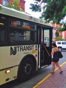
6 Chapter 2 - Overview Complete Streets Complete Streets are designed for everyone all users, modes, and ability levels balancing the needs of drivers, pedestrians, bicyclists, transit vehicles, emergency responders and goods movement. The redesign of Washington Street is intended to advance and put into practice the City of Hoboken s Complete Streets policy adopted in The three concept alternatives presented in this report have been developed with Complete Streets as a core, guiding principle. Each design alternative improves multimodal functionality, balancing competing needs for access, safety, and vehicular travel in a heavily traveled commercial and residential corridor. Complete Streets does not prescribe a one-size-fits-all design, but requires consideration of the context and sensitivity to existing character, design elements, destinations and uses. The context of Washington Street is complex. There are various ways to allocate the physical space of the roadway and sidewalk right-of-way to different travel modes, activities, and purposes. However, the combination of facilities and streetscape elements has limitations based on specific requirements for physical space. Each of the three concepts presented in this report achieve efficiency in the use of the available physical space while accommodating the competing interests of pedestrians, bicyclists, transit users and vehicular travel. They share many features and design approaches. Their differences are a result of the types of facilities selected for each mode. Vehicular uses include parking and loading, critical to businesses, their customers, visitors, and residents. In addition, businesses need physical space for purposes such as sidewalk advertising and outdoor seating for dining. Bicyclists require parking facilities. Pedestrian-friendly environments include places for resting. Transit users require places to wait and queue for busses. Each concept alternative takes these needs into account, but the types and combinations of facilities vary. The report names each of the three concept alternatives for ease in referring to them. The names are based on differences that result from the facilities introduced to accommodate different roadway users. However, they share many facilities in common and they all result in a more Complete Street. Pedestrian safety remains a priority for each concept and achieves significant improvements in accommodating pedestrians. The concepts also vary based on changes in land use and context along Washington Street, which is primarily commercial to the south (Downtown) and residential to the north (Uptown). Typical blocks and intersections showing details and dimensions are illustrated on each conceptual plan. S:\Project\J Hoboken Redesign-Washington St\Task Concept Design\Draft Concept Alternatives Analysis Report\Report Draft.docx Page 5

7 o Concept A 1-Way Cycle Track, Downtown & Uptown o Concept B Bike Lanes, Downtown & Uptown o Concept C Pedestrian & Transit, Downtown & Uptown A Corner Enhancement Opportunities exhibit is provided for each concept. This further illustrates potential design features within the sidewalk/pedestrian realm. These exhibits can be found in Chapter 4. Design Choices In addition to functionality, the Washington Street redesign must take into consideration the aesthetic character of streetscape elements. Their design must be cohesive to create a coherent look and feel while complementing Washington Street s historic architecture and eclectic charm. The neighborhood context and important nearby destinations such as the Hudson River Waterfront Walkway are also factors that may influence design choices. This report is intended to spur discussion and guide future decisions in the selection of a style that will define a unique brand or identity for Washington Street. The brand is conveyed through the type, functionality and appearance of streetscape elements and surfaces. Selection of a family of furnishings and surfaces with complementary characteristics (e.g. benches, trash receptacles, streetlights, bus shelters, pavement treatments and crosswalks) ensure a unique, recognizable and authentic appearance throughout the corridor. Together, these elements contribute to the overall integrity of the Washington Street character. Three distinct and contrasting styles are presented in an exhibit, Design Aesthetics and Visual Preferences, which will be used at upcoming meetings with City representatives and the public to generate discussion of visual preferences for Washington Street. The public will be given an opportunity to vote on visual preferences based on these choices. S:\Project\J Hoboken Redesign-Washington St\Task Concept Design\Draft Concept Alternatives Analysis Report\Report Draft.docx Page 6
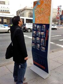
8 Romantic emulates or suggests a historic character from the 19 th century, much like the existing streetlights; examples range from stock elements (often seen in other places) to custom designed authentic furnishings that are replicas from a specific time period. Craft contemporary, pleasing and artful styles developed by artists and designers. Sleek conveying a modern look and feel that is often minimalist, and which, because of its sleek character is sometimes used in conjunction with architecture that is more visually complex with ornate or detailed features. Streetscape Inventory & Evaluation The first step in the selection of furnishing and surfaces is to evaluate the type, style, condition and location of existing streetscape elements. The evaluation should take into account how well they serve users as well as how they contribute to the look and feel of the street. This report includes a photographic inventory organized as a chart to illustrate the process City staff might adopt in deciding whether to keep, remove, refurbish, relocate, replace, or regulate streetscape elements. The report also presents a pallet of furnishings and surface treatments options to consider within the context of the overall aesthetic selected. These are displayed in the Materials and Performance Exhibits in Chapter 3, Design Choices. Wayfinding While Hoboken Terminal and the 14 th Street Ferry Terminal have formalized systems of interrelated signs, there is no such structured wayfinding system that serves the greater City of Hoboken. For wayfinding to be most effective, its elements should be part of a system they should consider streets beyond Washington Street. This system might include: Gateway elements could welcome people into Hoboken first at main portals of entry for motorists and train passengers. Directional signs can point out what s coming up ahead and/or indicate where to turn. Pedestrian-oriented elements comprised of you are here maps and other information The needs of motorists, pedestrians, and bicyclists should be considered during the development of a wayfinding system. Important destinations can be grouped into five types: Washington Street Transit stations/portals S:\Project\J Hoboken Redesign-Washington St\Task Concept Design\Draft Concept Alternatives Analysis Report\Report Draft.docx Page 7

9 Parking garages Institutions (hospitals, universities) Waterfront Promenade/Parks The pink and blue lines on the map below represent possible primary routes for a system of wayfinding elements that could serve both motorists and pedestrians along these routes. Secondary routes intersecting Washington Street connect people to major destinations. Secondary routes should also host wayfinding elements, continuing the process of navigating people to destinations. S:\Project\J Hoboken Redesign-Washington St\Task Concept Design\Draft Concept Alternatives Analysis Report\Report Draft.docx Page 8
10 Next Steps The objective of project next steps is to arrive at a consensus as to the concept that will be advanced as the preferred alternative. The selection will be based on discussion and vetting of the conceptual plans and alternatives at a meeting with City staff and officials. The exhibit boards referenced in this report will be presented to spur discussion of concept alternatives, visual preferences, styles and streetscape elements. A public meeting and other outreach activities and events will then be held where the exhibits will be displayed (with the exception of the Materials and Performance exhibits for review by City technical staff only). Attendees will be provided with an opportunity to vote on the three styles presented in the Design Aesthetic and Visual Preferences exhibit and to comment on the three concept design alternatives. Based on the selection of a preferred concept, The RBA Group will develop a final concept, incorporating comments or recommendations from the review process. The preferred concept will be further illustrated through supplemental graphics and cross sections. An Estimate of Probable Cost and a Project Implementation and Phasing Plan will be prepared to support advancing the conceptual plans. The final concept plan will be presented to the City Council along with the estimated costs and proposed project phasing. S:\Project\J Hoboken Redesign-Washington St\Task Concept Design\Draft Concept Alternatives Analysis Report\Report Draft.docx Page 9
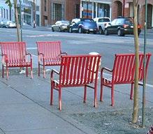
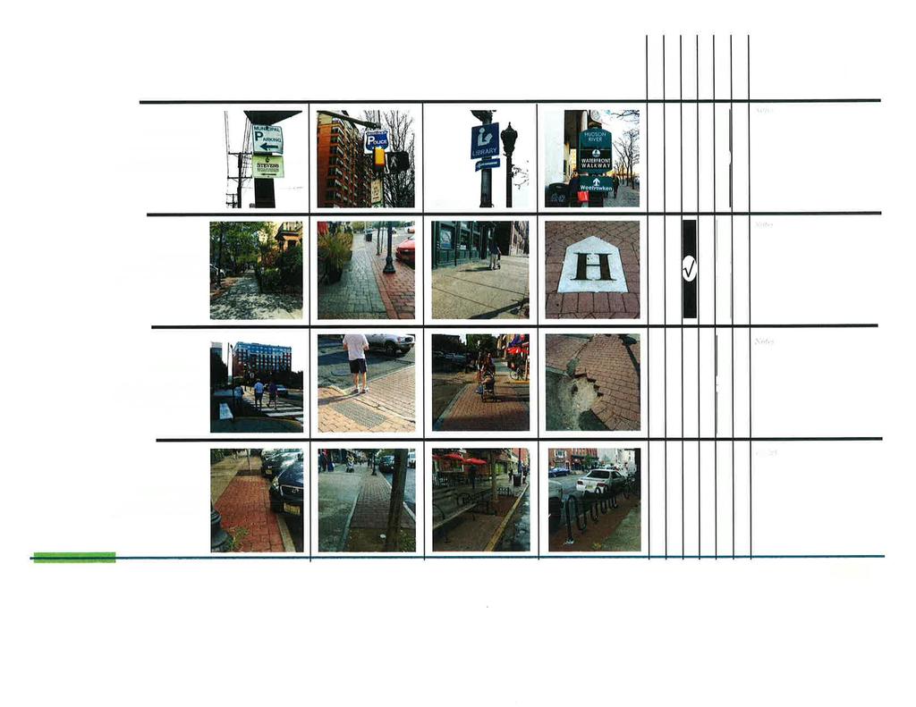
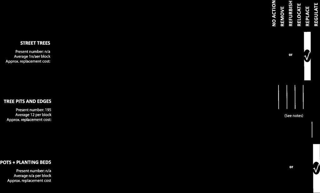
11 Chapter 3: Design Choices Streetscape Inventory & Evaluation Washington Street is complicated and lively, interesting and fun. It is considered one of America s great streets. Important to that distinction is that the space of the street is framed by handsome brickfront buildings, 4 to 5 stories tall; making for a building height to street width ratio around 1:2+; a fine urban room that is comfortable, pedestrian oriented, human scaled, and yet urban environment. How the urban room of the street is furnished should make Hoboken s, block structure, scale, building traditions, grit, and history more vivid. The intention is to ensure that the experience of Washington Street is not diluted by an arbitrary collection of elements or an appropriated catalogue aesthetic. The selections of street furnishings and utility components should add-up to an authentically Hoboken-centric ensemble. Today s Hobokenites and visitors see street surfaces, sidewalks, crosswalks, street lights, signal masts, signal boxes, parking signs, wayfinding signs, benches, and bus shelters that are often worn, broken or obsolete. Additionally, café seating, sidewalk merchandising, sandwich boards, private fencing, news boxes, bike parking and street signs can sometimes create unwelcome clutter. Though each of these issues has an individual remedy, an overall approach is necessary to contribute to the integrity of the city s public realm and to the experience of the street. Other considerations to be accommodated in discussion of street furnishings include the innovative potential of community message kiosks, bike share pods, pop-up plazas, shop-front public art, curbside rain-gardens, stormwater inlets, and solar waste bins. The look of Washington Street, its identity as a recognizable, memorable place, is a product of its vital streetlife shops, flats, and restaurants, set in short walkable city blocks of brickfront walls with cafes and entryways framed by 19th century ironwork. Some elements in the present family of street furnishings are repetitive and conspicuous and are, for better or worse, also part of Hoboken s brand or identity. An inventory of streetscape elements resulted in the following counts: 205 Pedestrian Lights 69 Benches 11 Bus Shelters 54 Trash Receptacles 49 Bike Racks 195 Tree Pits 75,502 SF Paver Surface Area (crosswalks = 19,016 SF; sidewalk ramps = 10,743 SF; Amenity Strips= 45,743 SF) 209,737 SF Concrete Sidewalks S:\Project\J Hoboken Redesign-Washington St\Task Concept Design\Draft Concept Alternatives Analysis Report\Report Draft.docx Page 10
12 2,198 LF Blue Stone Pavers (xwalks) 5,600 SF Hexagonal Asphalt Pavers 4 Message Boards (kiosks) (2 Boards between 5th&6th Streets, 2 boards between 1st&2nd Streets) 7 Pay Phone/internet (Near 11th & Wash.; Near 6th & Wash.; Near 3rd & Wash.; 2 between 1st&2nd St.; Near Newark & Wash.; Near Observer Hwy & Wash.) 6 Cobra head Lights The Streetscape Inventory & Evaluation Chart that follows and the snapshots are intended to be a reference as the City selects products, commissions designers, specifies materials and considers bids from vendors and contractors. This chart, or one similar to it, can be used as a tool in the decision-making process, and addresses the following elements. Pedestrian Lights Benches Bus shelters Trash Receptacles Bike Racks Street Signals Sandwich Boards Sidewalk Merchandising & Displays Wayfinding Sidewalks Crosswalks Amenity Strip Street Trees Tree Pits and Edges Pots and Planting Beds The four Materials and Performance exhibits that follow the chart show examples of types of street furnishings and finishes that might be considered within the context of the overall preferred aesthetic. These examples are intended to support discussion by City staff during the process of identifying preferred concept alternatives and styles. S:\Project\J Hoboken Redesign-Washington St\Task Concept Design\Draft Concept Alternatives Analysis Report\Report Draft.docx Page 11
13

14
15
16

17 S:\Project\J Hoboken Redesign-Washington St\Task Concept Design\Draft Concept Alternatives Analysis Report\Report Draft.docx Page 16

18 S:\Project\J Hoboken Redesign-Washington St\Task Concept Design\Draft Concept Alternatives Analysis Report\Report Draft.docx Page 17

19 S:\Project\J Hoboken Redesign-Washington St\Task Concept Design\Draft Concept Alternatives Analysis Report\Report Draft.docx Page 18
20 S:\Project\J Hoboken Redesign-Washington St\Task Concept Design\Draft Concept Alternatives Analysis Report\Report Draft.docx Page 19
21 Chapter 4: Concept Alternatives Methodology and Design Approach The redesign of Washington Street should improve safety and aesthetic experience. It should create new facilities for multi-modal travel while preserving the efficiency of what is already there. It should blend the environmental sensitivities of the current day with the infrastructure of over a century past. It should do all these things while supporting economic growth, enhancing a sense of place, contributing to local culture, providing for comfortable travel and access to public transportation, providing parking, providing loading, reducing the urban heat island effect, and ensuring that all users can travel safely regardless of their physical capacity. The redesign of Washington Street should have a coherence that is logical and legible as much in the mind as in the physical space of the street. How does one make something that can do all these things? The redesign of Washington Street is multi-dimensional (having many goals) and has many solutions, none optimal for every goal. To generate comprehensive solutions, the RBA design team began by distinguishing between design ideas and design concepts. Design ideas are viewed as singular and focused on a specific goal, while design concepts are viewed as comprehensive, adapted to context, and working within a system. For example, each of a bike lane, parallel parking, or a bus bulb-out is considered a design idea. When these ideas are integrated within the specific context of Washington Street and modified to suit their own systemic interrelationships, they become a design concept. In the design process for Washington Street, the RBA team generated a matrix of design ideas as a first step toward comprehensive design concepts. Design ideas were categorically assembled for bike facilities, pedestrian crossings, transit circulation, traffic signals, parking, loading, and green infrastructure. Ideas were sketched to scale on base mapping as a means of visual communication and an initial exploration of contextual suitability. The concepts generated from this process were evaluated and three alternatives were selected for more detailed analysis and development. The following Concept Comparison Table compares the three concepts based on their distinguishing characteristics and features, and highlights benefits and impacts. S:\Project\J Hoboken Redesign-Washington St\Task Concept Design\Draft Concept Alternatives Analysis Report\Report Draft.docx Page 20
22 Downtown Elements in Common Concept A 1-Way Cycle Track Concept B Bike Lanes Concept C Pedestrian & Transit Roadway Maintains existing cartway and curb Maintains existing cartway and curbing Maintains existing cartway width alignment Curbed refuge islands offset from existing Installs new curb extension bulb-out at all intersections curb Traffic Signals Pedestrian Crossings Transit New signals and pedestrian countdown heads Curbed refuge islands Shorter crossing length High visibility crosswalks New ADA curb ramps Maintains far side transit stops Provides painted roadway pavement in transit area Separates bike facilities from transit New signals and pedestrian countdown heads Painted bulb-outs Shorter crossing length High visibility crosswalks New ADA curb ramps Maintains far side transit stops Provides painted roadway pavement in transit New signals and pedestrian countdown heads Full curb extension bulb-outs at intersections Shorter crossing length High visibility crosswalks New ADA curb ramps Maintains far side transit stops Provides bus bulb-outs Reduces conflicts between transit riders and pedestrians Parking Maintains parking totals Maintains parallel parking Maintains existing dimensions Eliminates double parking opportunity Maintains parking totals Maintains parallel parking Widens parking width to 9 Maintains parking totals Maintains parallel parking Widens parallel parking to 9 with a 5 buffer between travel lane Double parking/loading opportunity remains Loading Designated parking spaces to be used as loading zones during specific, regulated times Designated parking spaces to be used as loading zones during specific, regulated times Allows existing double parking for loading purposes Designated parking spaces to be used as loading zones during specific, regulated times Landscape Increases all existing tree pits to proposed HSTC dimensions with tree guard fencing Opportunity for landscaping within refuge islands Increases all existing tree pits to proposed HSTC dimensions with tree guard fencing Increases all existing tree pits to proposed HSTC dimensions with tree guard fencing Opportunity for landscaping within bulb-outs S:\Project\J Hoboken Redesign-Washington St\Task Concept Design\Draft Concept Alternatives Analysis Report\J466900_Concepts A,B,C_Table.docx Page 21
23 Elements in Common Concept A 1-Way Cycle Track Concept B Bike Lanes Concept C Pedestrian & Transit Utilities/Infrastructure Maintains existing inlets Maintains existing inlets Requires new inlets at proposed curb Requires new inlets at intersections in extension bulb-outs coordination with proposed refuge islands and elevated cycle track Bike Facilities 6 wide one-way cycle track Elevated to sidewalk level 5 bike lane None indicated Provides space to accommodate bike lanes/sharrows Provides space for bike parking within bulb-outs Constructability/Cost Moderate cost Required sidewalk expansion and construction of curbed refuge islands Low cost No built elements, all roadway improvements are painted Moderate to high cost Requires sidewalk expansion and construction of curb extension bulbouts S:\Project\J Hoboken Redesign-Washington St\Task Concept Design\Draft Concept Alternatives Analysis Report\J466900_Concepts A,B,C_Table.docx Page 22
24 Uptown Elements in Common Concept A 1-Way Cycle Track Concept B Bike Lanes Concept C Pedestrian & Transit Roadway Maintains existing cartway and curb alignment Provides 11 travel lane Curbed refuge islands offset from existing curb Maintains existing cartway and curbing Provides 11 travel lane Maintains existing cartway width Provides 11 travel lane Installs new curb extension bulb-out at all intersections Traffic Signals New signals and pedestrian countdown heads New signals and pedestrian countdown heads New signals and pedestrian countdown heads Pedestrian Crossings Curbed refuge islands Shorter crossing length High visibility crosswalks New ADA curb ramps Painted bulb-outs Shorter crossing length High visibility crosswalks New ADA curb ramps Full curb extension bulb-outs at intersections Shorter crossing length High visibility crosswalks New ADA curb ramps Transit Maintains far side transit stops Provides painted roadway pavement in transit area Separates bike facilities from transit Maintains far side transit stops Constructed bus bulb-out Provides painted roadway pavement in transit Maintains far side transit stops Provides bus bulb-outs Reduces conflicts between transit riders and pedestrians Parking Reverse angle back-in parking on west side Angle parking changed to parallel on east side Maintains existing angled dimensions Eliminates double parking opportunity Maintains parking totals Maintains stall dimensions Reverses angle to back-in only parking Reverse angle back-in only parking Maintains existing angled dimensions with a 4 buffer to travel lane Double parking/loading opportunity remains Loading Designated parking spaces to be used as loading zones during specific, regulated times Designated parking spaces to be used as loading zones during specific, regulated times Allows existing double parking for loading purposes Designated parking spaces to be used as loading zones during specific, regulated times Landscape Increases all existing tree pits to proposed HSTC dimensions with tree guard fencing Opportunity for landscaping within refuge islands Increases all existing tree pits to proposed HSTC dimensions with tree guard fencing Increases all existing tree pits to proposed HSTC dimensions with tree guard fencing Opportunity for landscaping within bulb-outs S:\Project\J Hoboken Redesign-Washington St\Task Concept Design\Draft Concept Alternatives Analysis Report\J466900_Concepts A,B,C_Table.docx Page 23
25 Elements in Common Concept A 1-Way Cycle Track Concept B Bike Lanes Concept C Pedestrian & Transit Utilities/Infrastructure Maintains existing inlets Requires new inlets at intersections in coordination with proposed refuge islands and elevated cycle track Maintains most existing inlets Requires new inlets at bus bulb-outs Requires new inlets at proposed curb extension bulb-outs Bike Facilities 5 wide one-way cycle track 3 wide buffer At grade with roadway 4 bike lane None indicated Provides space to accommodate bike lanes/sharrows Provides space for bike parking within bulb-outs Constructability/Cost Moderate cost Requires construction of curbed refuge islands Low cost Minimum build (bus bulb-outs) Other roadway improvements are painted Moderate to high cost Requires sidewalk expansion and construction of curb extension bulbouts S:\Project\J Hoboken Redesign-Washington St\Task Concept Design\Draft Concept Alternatives Analysis Report\J466900_Concepts A,B,C_Table.docx Page 24
26 S:\Project\J Hoboken Redesign-Washington St\Task Concept Design\Draft Concept Alternatives Analysis Report\Report Draft.docx Page 25

27 S:\Project\J Hoboken Redesign-Washington St\Task Concept Design\Draft Concept Alternatives Analysis Report\Report Draft.docx Page 26

28 S:\Project\J Hoboken Redesign-Washington St\Task Concept Design\Draft Concept Alternatives Analysis Report\Report Draft.docx Page 27

29 S:\Project\J Hoboken Redesign-Washington St\Task Concept Design\Draft Concept Alternatives Analysis Report\Report Draft.docx Page 28
30 S:\Project\J Hoboken Redesign-Washington St\Task Concept Design\Draft Concept Alternatives Analysis Report\Report Draft.docx Page 29

31 S:\Project\J Hoboken Redesign-Washington St\Task Concept Design\Draft Concept Alternatives Analysis Report\Report Draft.docx Page 30
Vision: Traditional hamlet with an attractive business/pedestrian friendly main street connected to adjacent walkable neighborhoods
 N D. Focus Area II Vision: Traditional hamlet with an attractive business/pedestrian friendly main street connected to adjacent walkable neighborhoods Transit Road Focus Area II is located in the Hamlet
Streetscape: Core Shopping District
 Streetscape: Core Shopping District DRAFT DRAFT DRAFT May 00 Core Shopping District: Phase Blue Island s Core Shopping District is located along Western Avenue, between Grove and Union Streets. Streetscape
Typical Cross Section: DOWNTOWN (Observer Highway - 8th Street)
") Typical Cross Section: DOWNTOWN (Observer Highway - 8th Street) DRAFT SEPTEMBER 23, 14 1 Washington Street Typical Block Downtown Typical Block: DOWNTOWN (Observer Highway - 8th Street) New crosswalks
Typical Cross Section: DOWNTOWN (Observer Highway - 8th Street) DRAFT SEPTEMBER 23, 14 1 Washington Street Typical Block Downtown Typical Block: DOWNTOWN (Observer Highway - 8th Street) New crosswalks
Broad Street Bicycle Boulevard Design Guidelines
 Broad Street Bicycle Boulevard Design Guidelines Building from the strategies introduced in the 2013 Bicycle Transportation Plan and community input received thus far, City Transportation Staff have identified
CONNECTIVITY PLAN. Adopted December 5, 2017 City of Virginia Beach
 CONNECTIVITY PLAN Adopted December 5, 2017 City of Virginia Beach CONTENTS 1.0 Background & Purpose... 2 2.0 Existing Inventory & Analysis... 3 ViBe District Existing Walking Conditions... 4 3.0 ViBe District
Bicycle and Pedestrian Advisory Committee (BPAC) November 21, 2013
 November 21, 2013") Bicycle and Pedestrian Advisory Committee (BPAC) November 21, 2013 OVERALL LAND USE CONCEPT Overall Broadway Valdez District: 95.5 acres (35.1 acres right-of ways + 60.4 acres developable land) Plan Subareas:
Bicycle and Pedestrian Advisory Committee (BPAC) November 21, 2013 OVERALL LAND USE CONCEPT Overall Broadway Valdez District: 95.5 acres (35.1 acres right-of ways + 60.4 acres developable land) Plan Subareas:
APPENDIX A: Complete Streets Checklist DRAFT NOVEMBER 2016
 APPENDIX A: Complete Streets Checklist DRAFT NOVEMBER 2016 Complete Streets Checklist MetroPlan Orlando s Complete Streets Checklist is an internal planning tool for staff to further implementation of
A CHANGING CITY. of Edmonton, it is essential that it reflects the long-term vision of the City.
 A CHANGING CITY By the year 2040, Edmonton will be home to more than 1 million people. To accommodate growth and support a healthy and compact city, we need a new approach to development/redevelopment
Executive Summary Route 30 Corridor Master Plan
 Route Corridor Master Plan Project Overview The Route Corridor Master Plan is a coordinated multimodal transportation and land use plan for the entire stretch of Route through East Whiteland Township,
Omaha s Complete Streets Policy
 Omaha s Complete Streets Policy (Adopted August 2015) VISION To create great places and enhance our quality of life, the City of Omaha will provide safe, accessible streets for all users. Complete Streets
STEERING COMMITTEE MEETING June 17, Streetscape Overview Burlington Comprehensive Master Plan
 STEERING COMMITTEE MEETING June 17, 2015 Streetscape Overview Burlington Comprehensive Master Plan 1 Introduction Slide This slide show was presented to the Burlington Steering Committee on June 17, 2015
Tonight is for you. Learn everything you can. Share all your ideas.
 Strathcona Neighbourhood Renewal Draft Concept Design Tonight is for you. Learn everything you can. Share all your ideas. What is Neighbourhood Renewal? Creating a design with you for your neighbourhood.
Proposed. City of Grand Junction Complete Streets Policy. Exhibit 10
 Proposed City of Grand Junction Complete Streets Policy Exhibit 10 1 City of Grand Junction Complete Streets Policy Vision: The Complete Streets Vision is to develop a safe, efficient, and reliable travel
MARTIN LUTHER KING JR. WAY
 OCTOBER 2011 40 Vision and Goals The Martin Luther King, Jr. Way Illustrative Master Plan that follows has been developed through a process of community involvement. It expresses a long term vision for
Exhibit 1 PLANNING COMMISSION AGENDA ITEM
 Exhibit 1 PLANNING COMMISSION AGENDA ITEM Project Name: Grand Junction Circulation Plan Grand Junction Complete Streets Policy Applicant: City of Grand Junction Representative: David Thornton Address:
Living Streets Policy
 Living Streets Policy Introduction Living streets balance the needs of motorists, bicyclists, pedestrians and transit riders in ways that promote safety and convenience, enhance community identity, create
MAG Town of Cave Creek Bike Study Task 6 Executive Summary and Regional Significance Report
 Page 1 MAG Town of Cave Creek Bike Study Task 6 Executive Summary and Regional Significance Report August 1, 2012 MAG Project #481 Page 2 Task 6 Executive Summary and Regional Significance Report Introduction
FONTAINE AVENUE STUDY Final Report
 FONTAINE AVENUE STUDY Final Report March 28, 2005 FONTAINE AVENUE STUDY City of Charlottesville March 28, 2005 Renaissance Planning Group Kenneth Schwartz, FAIA, AICP Director of Design Leigh Wilkerson,
BROOKLAND Multi-Modal Transportation & Streetscape Study* NE Washington, DC
 BROOKLAND Multi-Modal Transportation & Streetscape Study* NE Washington, DC The study s goal is to create a multi-modal transportation and streetscape design plan to increase transportation efficiency,
WHITE STREET/ ENGLISH PLAZA STREETSCAPE IMPROVEMENT PROJECT
 WHITE STREET/ ENGLISH PLAZA STREETSCAPE IMPROVEMENT PROJECT 1 Project Goals 1 Improved Safety: Lighting, Multi-Modal Circulation, Emergency Access, Tripping Hazards; Stormwater 4 Environmental Performance:
EXECUTIVE SUMMARY. Vision
 Vision Walking and bicycling in Salt Lake City will be safe, convenient, comfortable, and viable transportation options that connect people to places, foster recreational and economic development opportunities,
STONY PLAIN ROAD STREETSCAPE
 Jasper Place Revitalization Strategy: Vision The people involved in the Jasper Place Revitalization Strategy envision: Goal 1: Feeling safe in our community Create a community where feeling safe is common--where
WELCOME. Purpose of the Open House. Update you on the project. Present a draft recommended plan. Receive your input
 WELCOME Purpose of the Open House The Town of Smiths Falls has initiated the Beckwith Street Redevelopment Plan that includes the preparation of a streetscape functional design for the renewal of Beckwith
PUBLIC REALM MASTER PLAN
 WESTSHORE BUSINESS DISTRICT PUBLIC REALM MASTER PLAN MASTER PLAN COMMITTEE MEETING MARCH 20, 2013 WESTSHORE BUSINESS DISTRCT PUBLIC REALM MASTER PLAN MACRO-SCALE CONCEPT: A PUBLIC REALM FRAMEWORK DEFINED
S T A T I O N A R E A P L A N
 The Circulation and Access Plan describes vehicle, pedestrian, and transit improvements recommended within the Concept Plan. In order to create and sustain a vibrant business district that provides pedestrian-friendly
NJDOT Complete Streets Checklist
 Background The New Jersey Department of Transportation s Complete Streets Policy promotes a comprehensive, integrated, connected multi-modal network by providing connections to bicycling and walking trip
HARRISON STREET/OAKLAND AVENUE COMMUNITY TRANSPORTATION PLAN
 HARRISON STREET/OAKLAND AVENUE Community Workshop #4: Draft Plan Review December 3, 2009 D E S I G N, C O M M U N I T Y & E N V I R O N M E N T INTRODUCTIONS Key Project Staff: Alisa Shen, Project Manager,
NEWMARKET UPHAM S CORNER
 SOUTH STATION Planning Initiative NEWMARKET UPHAM S CORNER COLUMBIA ROAD (P) FOUR CORNERS/GENEVA Working Advisory Group (WAG) Meeting #5 TALBOT AVENUE MORTON STREET BLUE HILL AVE/CUMMINS HWY (P) RIVER
Agenda. Overview PRINCE GEORGE S PLAZA METRO AREA PEDESTRIAN PLAN
 PRINCE GEORGE S PLAZA METRO AREA PEDESTRIAN PLAN May 28, 2008 Agenda Welcome and introductions Project overview and issue identification Planning context and strengths Design challenges and initial recommendations
Make Lincoln Highway an economically vibrant corridor that is safe, efficient, and beautiful for local residents and visitors.
 Lincoln Highway Streetscape Plan Stakeholder Workshop #2 Handout Contents Introduction and Project Vision Planning Principles Specific Recommendations including a Proposed Typical Roadway Section Renderings
Item to be Addressed Checklist Consideration YES NO N/A Required Description Complete Streets Guidelines
 Passaic County Complete Streets Checklist - Concept Development Project Name Item to be Addressed Checklist Consideration YES NO N/A Required Description Complete Streets Guidelines Existing Plans Have
Guthriesville Village Manual of Written & Graphic Design Guidelines
 Exhibit B Revisions: May 23, June 21, July 20, September 20, & October 9, 2012 Updated: December 13, 2012; June 27, 2013; February 7, 2014 Outline of Contents: 1. Purpose and Applicability 2. Overall Form
THE ALAMEDA CONCEPT DESIGN COMMUNITY MEETING 3. A Plan for The Beautiful Way JANUARY 28, 2010
 CONCEPT DESIGN COMMUNITY MEETING 3 JANUARY 28, 2010 AGENDA INTRODUCTION COMMUNITY INPUT ROADWAY STUDIES STREETSCAPE DESIGN STATIONS DISCUSSION SUMMARY AND DISCUSSION NEXT STEPS CLOSE INTRODUCTION SCHEDULE
COMPLETE STREETS PLANNER S PORTFOLIO
 COMPLETE STREETS PLANNER S PORTFOLIO ISSUE 3 APRIL 2016 PLANNER S PORTFOLIO COMPLETE STREETS 1 2 6 10 14 OVERVIEW MATURE NEIGHBORHOODS GROWING SUBURBS CENTRAL PLACES ACTIVITY CORRIDORS Planner s Portfolio
PRINCE GEORGE S PLAZA METRO AREA PEDESTRIAN PLAN
 PRINCE GEORGE S PLAZA METRO AREA PEDESTRIAN PLAN May 28, 2008 Agenda Welcome and introductions Project overview and issue identification Planning context and strengths Design challenges and initial recommendations
Obey Creek PEDESTRIAN CIRCULATION EAST WEST PARTNERS PEDESTRIAN CIRCULATION CREEK SIDE LANE SLIP STREET SCOTT MURRAY MAIN STREETS EAST/WEST
 THE VILLAGE AT PEDESTRIAN CIRCULATION MAIN STREETS NORTH/SOUTH MAIN STREETS EAST/WEST SLIP STREET CREEK SIDE LANE PEDESTRIAN CIRCULATION DESCRIPTION: Circulation through the downtown of is organized by
Community Meeting February 27, 2007 Dorchester Avenue Transportation & Streetscape Improvements Action Plan February 27, 2007
 Community Meeting Tonight s Agenda 6:00 Introductions South Boston/Dot Ave Improvement Study Background 6:15 Consultant Introductions Review of Scope and Schedule Review of Proposed Corridor Wide Guidelines
Environment and Public Works Committee Presentation
 Mixed Use Centers Complete Streets Guidelines Project Environment and Public Works Committee Presentation December 10, 2008 Project Objectives: Conduct an inter-departmental and agency process to study
Ocean Park Boulevard Green Street Project Alternatives & Trade Offs
 Planning Commission March 4, 2009 Ocean Park Boulevard Green Street Project Alternatives & Trade Offs Purpose of Tonight s Meeting Review concept plans and options Provide input on alternatives and trade-offs
Elm Street Business District: Streetscape and Signage Plan
 Winnetka Preliminary Streetscape & Signage Village Council Presentation 1 Elm Street Business District: Streetscape and Signage Plan VILLAGE OF WINNETKA DOWNTOWN MASTER PLAN VILLAGE COUNCIL PRESENTATION
CURBSIDE ACTIVITY DESIGN
 5 CURBSIDE ACTIVITY DESIGN This chapter provides design guidance for separated bike lanes adjacent to curbside activities including parking, loading and bus stops. Typical configurations are presented
INDOT Complete Streets Guideline & Policy
 INDOT Complete Streets Guideline & Policy INTRODUCTION The Complete Streets guidelines build upon multiple efforts and promote a multimodal transportation system that is integrated and sustains land use
East Burke Transportation, Safety and Capacity Improvements
 East Burke Transportation, Safety and Capacity Improvements The purpose of this project is to increase mobility and improve safety for pedestrians, cyclists, and motor vehicles along VT Route 114 in the
Telegraph Avenue Complete Streets DRAFT Recommendations. Oakland Public Works Department September 11 and 13, 2014 Open Houses
 Telegraph Avenue Complete Streets DRAFT Recommendations Oakland Public Works Department September 11 and 13, 2014 Open Houses Presentation Overview What are complete streets? What problem are we trying
14 TH STREET TRANSPORTATION & STREETSCAPE DESIGN STUDY PLAN B PLAN B TRANSPORTATION & STREETSCAPE RECOMMENDATIONS
 14 TH STREET TRANSPORTATION & STREETSCAPE DESIGN STUDY PLAN B PLAN B TRANSPORTATION & STREETSCAPE RECOMMENDATIONS 141 Symbols Recommendations - Southern End of 14th Street Study Area Streetscape Each icon
o n - m o t o r i z e d transportation is an overlooked element that can greatly enhance the overall quality of life for the community s residents.
 N o n - m o t o r i z e d transportation is an overlooked element that can greatly enhance the overall quality of life for the community s residents. 84 Transportation CHAPTER 11 INTRODUCTION Transportation
5 CIRCULATION AND STREET DESIGN
 5 CIRCULATION AND STREET DESIGN This chapter describes circulation and streetscape improvements proposed for the Northwest Chico Specific Plan Area. It includes detailed design specifications for existing
REGIONAL BICYCLE AND PEDESTRIAN DESIGN GUIDELINES
 REGIONAL BICYCLE AND PEDESTRIAN DESIGN GUIDELINES November 16, 2011 Deb Humphreys North Central Texas Council of Governments Bicycle and Pedestrian Advisory Committee Snapshot of the Guide 1. Introduction
Corpus Christi Metropolitan Transportation Plan Fiscal Year Introduction:
 Introduction: The Safe, Accountable, Flexible, Efficient Transportation Equity Act: A Legacy for Users (SAFETEA-LU) has continued the efforts started through the Intermodal Surface Transportation Efficiency
TRAVEL PLAN: CENTRAL EUROPEAN UNIVERSITY CAMPUS REDEVELOPMENT PROJECT TRAVEL PLAN. Central European University Campus Redevelopment Project.
 TRAVEL PLAN Central European University Campus Redevelopment Project Page 1 Table of Contents Introduction... 3 Background... 7 Building Users... 7 Transportation in Community Consultation... 7 Summary
CITY OF COCOA BEACH 2025 COMPREHENSIVE PLAN. Section VIII Mobility Element Goals, Objectives, and Policies
 CITY OF COCOA BEACH 2025 COMPREHENSIVE PLAN Section VIII Mobility Element Goals, Objectives, and Policies Adopted August 6, 2015 by Ordinance No. 1591 VIII MOBILITY ELEMENT Table of Contents Page Number
PEDESTRIAN CIRCULATION & STREETSCAPE DESIGN
 CHAPTER 4 Chapter 4 Pedestrian Circulation & Trails PEDESTRIAN CIRCULATION & STREETSCAPE DESIGN In recent years, the City has constructed new sidewalks and enhanced existing ones in the downtown with brick
RESOLUTION NO ?? A RESOLUTION OF THE CITY OF NEPTUNE BEACH ADOPTING A COMPLETE STREETS POLICY
 RESOLUTION NO. 2018-?? A RESOLUTION OF THE CITY OF NEPTUNE BEACH ADOPTING A COMPLETE STREETS POLICY WHEREAS, safe, convenient, and accessible transportation for all users is a priority of the City of Neptune
PEDESTRIAN ACTION PLAN
 ATTACHMENT 2 CITY OF SANTA MONICA PEDESTRIAN ACTION PLAN CITY OF SANTA MONICA PEDESTRIAN ACTION PLAN This page intentionally left blank EXECUTIVE SUMMARY CHAPTER 1 EXECUTIVE SUMMARY Setting the Stage
CONNECTING PEOPLE TO PLACES
 CONNECTING PEOPLE TO PLACES 82 EAST BENCH MASTER PLAN 07 Introduction The East Bench transportation system is a collection of slow moving, treelined residential streets and major arteries that are the
City of Darlington Beautification Report
 City of Darlington Beautification Report Approved by the City of Darlington Beautification Board February 2016 The New Downtown Darlington has seen many changes during the past decade with the rehabilitation
complete streets design and construction standards public primer City of Edmonton
 complete streets design and construction standards public primer City of Edmonton introduction Complete Streets are streets for everyone: people who walk, wheel, bike, take transit, or drive. They are
Chapter 2: Standards for Access, Non-Motorized, and Transit
 Standards for Access, Non-Motorized, and Transit Chapter 2: Standards for Access, Non-Motorized, and Transit The Washtenaw County Access Management Plan was developed based on the analysis of existing
5. Automobile Circulation, Wayfinding and Signage
 5. Automobile Circulation, Wayfinding and Signage Policy: The City Center should have a balanced, safe, and interconnected circulation system that provides expanded travel opportunities for transit, pedestrian,
Technical Working Group November 15, 2017
 Technical Working Group November 15, 2017 Welcome and Introductions Project Partners Regional Transportation District (RTD) Colorado Department of Transportation (CDOT) Denver Regional Council of Governments
ROUTE 81 CORRIDOR STUDY DESIGN CONCEPTS
 RT 81 Corridor Study CLINTON ROUTE 81 CORRIDOR STUDY DESIGN CONCEPTS View north on High Street, with potential improvements to the streetscape Draft Recommendations November 8 th, 2018 TOWN OF CLINTON
Chapter 3: Multi-Modal Circulation and Streetscapes
 CHAPTER 3: MULTI-MODAL CIRCULATION AND STREETSCAPES Chapter 3: Multi-Modal Circulation and Streetscapes Overview Streetscape improvements have already been completed for Depot Street between Main Avenue
COWETA HIGH SCHOOL AND EAST HIGHWAY 51
 COWETA HIGH SCHOOL AND EAST HIGHWAY 51 Lack of sidewalks along Ben Lumpkin Rd. Lack of crosswalks and ramps at intersection. Hwy 51 is wide to cross as a pedestrian. No ADA compliance or connection to
Sandwich Pedestrian/Bicycle Planning
 Sandwich Pedestrian/Bicycle Planning Improved Pedestrian and Bicycle Connections with the Cape Cod Canal Multi-use Path February 2014 Table of Contents Introduction... 1 Background... 1 Study Goals...
City of Novi Non-Motorized Master Plan 2011 Executive Summary
 City of Novi Non-Motorized Master Plan 2011 Executive Summary Prepared by: February 28, 2011 Why Plan? Encouraging healthy, active lifestyles through pathway and sidewalk connectivity has been a focus
Richmond Connects Visioning Update
 Richmond Connects Visioning Update To date there have been four elements of the visioning process: Vision20 Night at Byrd Theatre on May 3rd Advisory Committee Meeting on May 12 th Public Visioning Workshop
Caltrans Sloat Boulevard Pedestrian Safety Project Response to Community Questions, Comments & Concerns
 Caltrans Sloat Boulevard Pedestrian Safety Project Response to Community Questions, Comments & Concerns Revised: May 10, 2016 The California Department of Transportation (Caltrans) is planning various
Complete Streets. Designing Streets for Everyone. Sarnia
 Complete Streets Designing Streets for Everyone Sarnia Complete Streets ~ Sarnia ~ 2018 Introduction Our City is made up of a network of streets that we use to go for a walk, cycle to work, drive to the
Ann Arbor Downtown Street Plan
 1 Ann Arbor Downtown Street Plan Public Workshop #1 We know that. 2 Public right-of-way (streets, sidewalks, and alleys) make up 30% of the total District area of downtown. Streets need to provide mobility
Community Task Force November 15, 2017
 Community Task Force November 15, 2017 Welcome and Introductions Project Partners Regional Transportation District (RTD) Colorado Department of Transportation (CDOT) Denver Regional Council of Governments
Southview Blvd & 3 rd Avenue Improvement Project. Public Open House December 4, to 7pm
 Southview Blvd & 3 rd Avenue Improvement Project Public Open House December 4, 2014 5 to 7pm Southview Blvd & 3 rd Avenue Public Information Meeting Agenda Presentation 5:30 to 6:15 pm Purpose of Project
4 GENERIC COST ESTIMATING TOOL
 4 GENERIC COST ESTIMATING TOOL Table 4-1 presents a generic cost estimating tools that can serve as a conceptual planning tool for local jurisdictions to estimate the costs of pedestrian improvements.
Observations and Ideas: Toomer s Corner Streetscape Improvements
 Observations and Ideas: Toomer s Corner Streetscape Improvements AUBURN DOWNTOWN MASTER PLAN planning downtown s future August 26, 2013 Observations: Vertical Clutter at Corners 6 3 7 5 9 2 8 4 1 Excess
Governance and Priorities Committee Report For the July 2, 2015 Meeting
 CITY OF VICTORIA For the July 2, 2015 Meeting To: Governance and Priorities Committee Date: From: Subject: Brad Dellebuur, A/Assistant Director, Transportation and Parking Services Executive Summary The
Commerce Street Complete Street Project from Good Latimer Expressway to Exposition Avenue
 Commerce Street Complete Street Project from Good Latimer Expressway to Exposition Avenue T A N Y A B R O O K S A S S I S T A N T D I R E C T O R M O B I L I T Y P L A N N I N G M O B I L I T Y A N D S
C C C
 C-012-001 Thank you for your support for the creation of new public space and nonmotorized access between downtown and the waterfront through the Overlook Walk, the East-West Connections, and the Promenade.
COMPLETE STREETS POLICY Exhibit A to Ordinance
 CITY OF WENATCHEE COMPLETE STREETS POLICY Exhibit A to Ordinance 2016-24 Prepared and Reviewed By: City of Wenatchee Community & Economic Development Department City of Wenatchee Public Works Department
Henderson Ave. Complete Streets Project
 Henderson Ave. Complete Streets Project Meeting Purpose To finalize conceptual components of project prior to proceeding with preliminary engineering www.dallascompletestreets.wordpress.com MeetingAgenda
Aurora Urban Street Standards For Transit Oriented Developments and Urban Centers
 Aurora Urban Street Standards For Transit Oriented Developments and Urban Centers I. Purpose These standards will be applied to create a safe, comfortable, pleasant and pedestrian-friendly multi-modal
MASTER BICYCLE AND PEDESTRIAN PLAN
 VILLAGE OF NORTHBROOK MASTER BICYCLE AND PEDESTRIAN PLAN DRAFT PLAN OPEN HOUSE May 2, 2018 AGENDA 1. Community Engagement 2. Vision and Goals 3. General Structure of Plan 4. Recommendations Overview 5.
Ocean Park Boulevard Streetscape Improvement Project Alternatives & Trade Offs
 City Council Study Session January 27, 2009 Ocean Park Boulevard Streetscape Improvement Project Alternatives & Trade Offs Scope of Work Purpose of Tonight s Meeting Review work to date and direct staff
Mainstreet Master Plan Land Use
 Mainstreet Master Plan 04 Land Use Top Recommendations Active Uses: Promote active ground-floor uses such as retail, restaurants, galleries and personal services with interactive storefronts for Mainstreet
Ocean Park Boulevard Green Street Project Community Workshop
 Ocean Park Boulevard Green Street Project Community Workshop 2.2.10 Project Objectives Community Priority: reclaim OPB for public open space. Build upon LUCE principles; neighborhood enhancement, connectivity,
AMATS Complete Streets Policy
 AMATS Complete Streets Policy Table of Contents: Section 1. Definition of Complete Streets Section 2. Principles of Complete Streets Section 3. Complete Streets Policy Section 4. Consistency Section 5.
NM-POLICY 1: Improve service levels, participation, and options for non-motorized transportation modes throughout the County.
 Transportation PRINCE WILLIAM COUNTY 2008 COMPREHENSIVE PLAN NON-MOTORIZED PLAN CONTENTS Goals, Policies, and Action Strategies Table 4 (Bike Facility Classifications and Descriptions) Table 5 (Bike Facility
95 th Street Corridor Transportation Plan. Steering Committee Meeting #2
 95 th Street Corridor Transportation Plan Steering Committee Meeting #2 February 18, 2015 PURPOSE OF THE MEETING Update Steering Committee Present Community/Stakeholder Survey Results Present Transportation
Chapter 2. Bellingham Bicycle Master Plan Chapter 2: Policies and Actions
 Chapter 2 Bellingham Bicycle Master Plan Chapter 2: Policies and Actions Chapter 2: Policies and Actions The Bicycle Master Plan provides a road map for making bicycling in Bellingham a viable transportation
Chapter 4 TOOLBOX AND SAMPLE BIKE BOULEVARD LAYOUT
 Chapter 4 TOOLBOX AND SAMPLE BIKE BOULEVARD LAYOUT OVERVIEW This chapter describes a cohesive set of strategies to create a bicycle boulevard, namely to make streets safer and more efficient for bicycle
TOWN OF PORTLAND, CONNECTICUT COMPLETE STREETS POLICY
 TOWN OF PORTLAND, CONNECTICUT COMPLETE STREETS POLICY I. VISION, GOALS & PRINCIPLES VISION To improve the streets of Portland making them safer and more accessible for all users including pedestrians,
Non-Motorized Transportation 7-1
 Non-Motorized Transportation 7-1 Transportation facilities no longer mean just accommodating a vehicle powered by a combustion engine. Pedestrian and non-motorized facilities are important modes of travel
UNIVERSITY AVENUE CORRIDOR REDESIGN. January 8, 2017 PUBLIC OPEN HOUSE
 January 8, 2017 PUBLIC OPEN HOUSE COLLABORATIVE COMMUNITY-BASED DESIGN IS THE FOUNDATION TO A SUCCESSFUL PROJECT AGENDA FOR TONIGHT 1 INTRODUCTIONS 2 WHY ARE WE HERE PROJECT NEED 3 SCHEDULE & GOALS 4 OPEN
Welcome! Public Open House on UBC s Transportation Plan
 1 Welcome! Public Open House on UBC s Transportation Plan Public open house hours: to When it comes to on-campus transportation, what do you think is working well and what are some opportunities for improvement?
MnDOT Implementation of Complete Streets Policy. January 2014
 MnDOT Implementation of Complete Streets Policy January 2014 1 Prepared by Minnesota Department of Transportation 395 John Ireland Boulevard Saint Paul, Minnesota 55155-1899 Phone: 651-296-3000 Toll-Free:
Planning Guidance in the 2012 AASHTO Bike Guide
 Planning Guidance in the 2012 AASHTO Bike Guide Presentation by: RJ Eldridge Peter Lagerwey August 22, 2012 WEBINAR 2: PLANNING GUIDANCE IN THE 2012 AASHTO BIKE GUIDE Today s Webinar Significant Updates
FOCUS AREA 1 - Alberta Avenue Pocket Park 3 (121 Ave and 92 St)
") FOCUS AREA 1 - Alberta Avenue Pocket Park 3 (121 Ave and 92 St) New benches Plant evergreen trees Widen existing sidewalk from 1.5m to 1.8m Marked crosswalk 1.8m wide sidewalk Add pedestrian oriented lights
FOCUS AREA 1 - Alberta Avenue Pocket Park 3 (121 Ave and 92 St) New benches Plant evergreen trees Widen existing sidewalk from 1.5m to 1.8m Marked crosswalk 1.8m wide sidewalk Add pedestrian oriented lights
Bicycle Master Plan Goals, Strategies, and Policies
 Bicycle Master Plan Goals, Strategies, and Policies Mobilizing 5 This chapter outlines the overarching goals, action statements, and action items Long Beach will take in order to achieve its vision of
El Centro Mobility Hub
 The El Centro drive shed comprises a major portion of the El Centro downtown area, which is well served by bus routes. The proposals intend to promote use of public transit through improvements and enhancements
Austin Avenue Bridges Project. Public Meeting Summary
 Austin Avenue Bridges Project Public Meeting Summary June 29, 2016 Red Table Safety and Connectivity Notes: 1. Would like to see forensic report evaluations 2. What is the lifespan? 3. Extend safety considerations
Complete Streets Successes, Opportunities, and Challenges
 Complete Streets Successes, Opportunities, and Challenges Juliet Walker, Transportation Planner, City of Portsmouth Rob Houseman, Director of Planning and Development, Town of Wolfeboro Chris Parker, Director
Active Transportation Facility Glossary
 Active Transportation Facility Glossary This document defines different active transportation facilities and suggests appropriate corridor types. Click on a facility type to jump to its definition. Bike