RE: Minor Betterments Projects near William Walker Elementary
|
|
|
- Scott McDonald
- 5 years ago
- Views:
Transcription
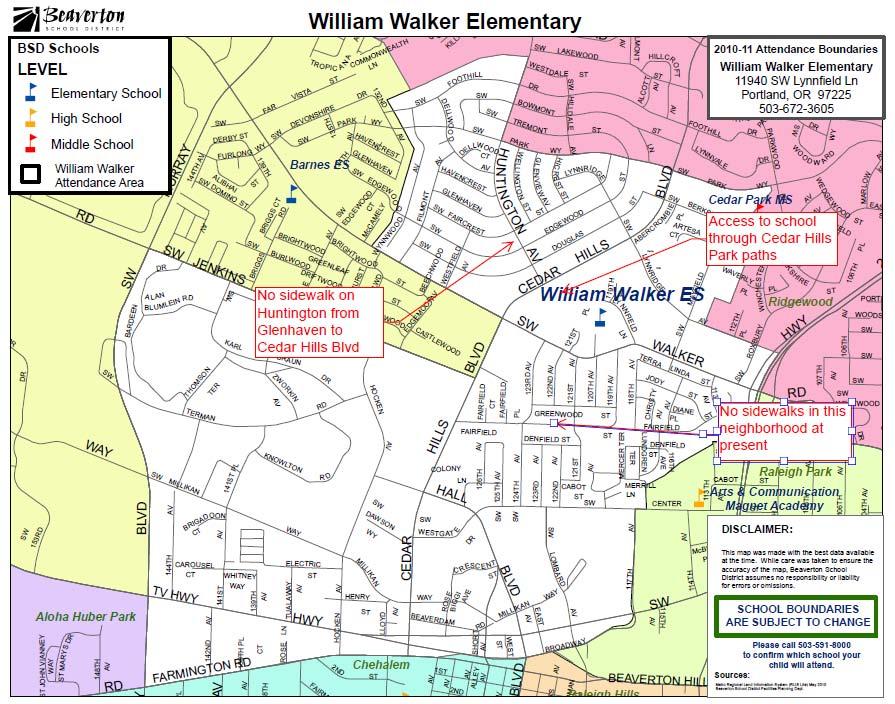
1 Washington County Department of Land Use and Transportation Operations & Maintenance Division Attn: Minor Betterments Program Coordinator 1400 SW Walnut Street, MS 51 Hillsboro, OR June 10 th, 2011 RE: Minor Betterments Projects near William Walker Elementary To Whom It May Concern: The William Walker Parent Teacher Club (PTC) has learned of several proposed minor betterments projects in the school boundary. We wish to support these betterments because improved pedestrian safety and walkability will result. William Walker currently provides bus service provided to over 560 students because of the low walkability in our feeder neighborhoods, as well as several unsafe road crossings. We strongly support the proposed projects. Adding sidewalks and improving safety of our neighborhood is important both for access to school for encouraging pupils to walk safely in their neighborhoods out of school hours. In addition, improving the sidewalks can help foster school and neighborhood community. Right now, some parents cannot attend evening events because it is not safe for them to walk to school. Projects that we have been made aware of and that have our endorsement include: Adding sidewalks to SW 123 rd, and SW 124 th between Walker Rd and Center St Adding sidewalks to SW Fairfield and SW 119 th between Cedar Hills Blvd and Walker Rd Adding sidewalks to SW Huntington between Cedar Hills Blvd and SW Glenhaven These specific projects would have significant impact in creating safe walking paths to school for neighborhood children and their families. Best regards, Lynn Santelmann President William Walker PTC President
2
3
4
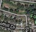
5 Washington County Department of Land Use and Transportation Operations & Maintenance Division Attn: Minor Betterments Program Coordinator 1400 SW Walnut Street, MS 51 Hillsboro, OR June 30 th, 2011 To Whom It May Concern: I am writing in support of proposed minor betterment projects in my area relating to sidewalks being added to commonly used neighborhood routes. The specific projects that I am writing in support of are: SW Huntington Ave (project #206) SW Butner Road (between Murray Rd and Cedar Hills Blvd) SW 123 rd and 124 th (between Center Street and Walker Rd) SW Fairfield and 119 th (between Cedar Hills Blvd and Walker Rd) Attached are some supporting notes and project detail pages related to the above projects including insight and information into why I feel these particular projects stand out as good candidates. I have also solicited letters of support for the projects from various local community groups including: CPO1 Connecting Neighborhoods Subcommittee William Walker Elementary School PTC Cedar Hills Home Owners Association These groups have sent their letters of support directly to the county separate to this packet. I would like to take this opportunity to thank Washington County for providing the minor betterments forum for community involvement in improving the connectivity and walkability of our neighborhoods. Thank you for your time and efforts in review of the proposals submitted and for your commitment to improving our neighborhoods. Best regards, Barbara Dusicka SW Foothill Dr Portland, OR Dusicka@gmail.com
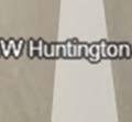
6 Project # 206: Sidewalk Addition to SW Huntington Copy of Initial Online Submission Road name: SW Huntington Ave Nearest intersection at one end: SW Glenhaven St Nearest intersection at the other end: SW Cedar Hills Blvd Which side of the street is the project on?: East,West Description of the project: Add sidewalks on one or both sides of the street to this approx. 1400ft section of SW Huntington Ave. (Or even temporary solution of clearly designated/painted pedestrian area on side of road.) Additional Detail of Project How will the project benefit the community?: SW Huntington is immediately opposite the entrance to Cedar Hills park and is used as overflow parking when the park gets busy for events (which I imagine it would do more so when the $6,025,000 redevelopment project that THPRD is planning is complete). Not only is Huntington used for access to the park, it is also a major access point for the neighborhood for people walking to the nearby Cedar Hills shopping complex and is a convenient walking path towards the local grade school (William Walker) which can be accessed through Cedar Hills Park. Because of its convenience as a major access point, Huntington has lots of vehicle traffic as well as pedestrians and because the road is so wide, most vehicles tend to exceed the speed limit. Adding a sidewalk to this section of SW Huntington would benefit the community by providing a safer walking path beside this busy street and would encourage more people to walk rather than drive to the nearby mall. Requestor name: Barbara Dusicka Address: SW Foothill Dr Portland, OR Phone: (503) E mail: dusicka@gmail.com


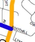
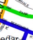
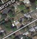
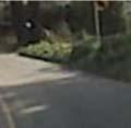
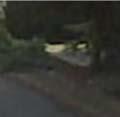
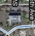
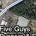
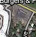
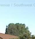
7 Street Classification and Background SW Huntington is a major neighborhood route for the Cedar Hills area (per Washingtonn County plan). Local traffic coming from or to Beaverton or the local Cedar Hills Mall often uses Huntington as an access point. There is frequently a back up of cars turning left on to Huntington from Cedar Hills Blvd as a result of this. Huntington is not only a major neighborhood route for cars, pedestrians also use this street in greater numbers than other neighborhood streets. People walk to the mall or to the shopping strip which starts at Walker and continues down Cedar Hills Blvd and also walk down Huntington to access Cedar Hills Park (which is scheduled for a major construction effortt in the coming years ($6,000,000 bond project with THPRD). Local schools bus routes also travel and drop off children on this section of Huntington. PARK SCHOOL PARK SCHOOL SHOPPING MALLL SCHOOL Because of the width of the street and the fact that Huntington slopes down from Cedar Hills and from Glenhaven to a low point at Edgewood, vehicles tend to speed on this section of street. The slope also can createe visibility issues for pedestrians, particularly between Faircrest and Glenhaven.
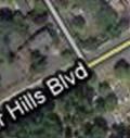
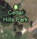
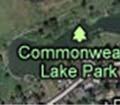
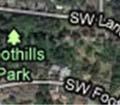
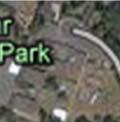
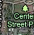
8 Connectivity Benefits There are three streets exiting the Cedar Hills neighborhood in the direction of the Cedar Hills Mall and Shopping area. Two (Filmont and Westfield) have no sidewalks and exit onto Walker Rd, which itself has no sidewalks. The third is Huntington, which exits on to Cedar Hills Blvd close to Rite Aid and a short walk from the other shops and mall areas. Huntington is also immediately adjacent to Cedar Hills Park which is a THPRD park with tennis courts and picnic areas and is scheduled for a major renovation to add a water park and other sports amenities. There is a path that runs from Cedar Hills Blvd opposite Huntington, through the park, to William Walker Elementary school. Completing the sidewalk on Huntington would allow for a connection point for pedestrians out of the neighborhood in the direction of the shops. As well as connecting a large neighborhood area with a safe walk route to the shops, it would provide safer access to the park and school for neighborhood families. Affected Communities and Organizations: Improving neighborhood connectivity in this location would have positive effects for multiple agencies including: Beaverton School District (William Walker Elementary, Arts and Communication Magnet Academy, walk to school safety for kids, and potential ability to save money on buses) THPRD (Cedar Hills Park redevelopment parking overflow and access from neighborhood) Washington County (Neighborhood access road, pedestrian access to shops and park for county residents) Cedar Hills HOA (as above) CPO1 connections (as above) If the sidewalk project is completed, a flow on project could be a pedestrian controlled intersection on Cedar Hills Blvd at Huntington that would provide direct access to the Cedar Hills park and William Walker elementary school from the neighborhood. This intersection would significantly enhance benefits seen by the agencies above as well as potential benefits to safety and traffic flow which may benefit the City of Beaverton (who has annexed Cedar Hills Blvd itself).
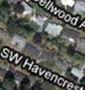
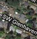
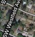
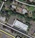
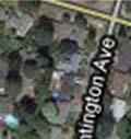
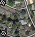
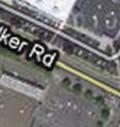
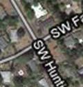
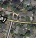
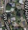
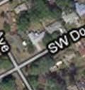
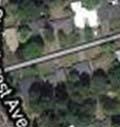
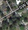
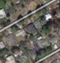
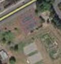
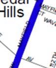
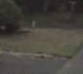
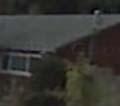
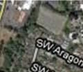
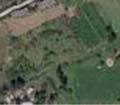
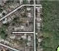
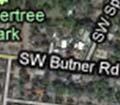
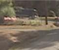
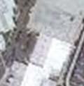
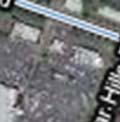
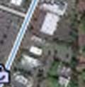
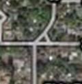
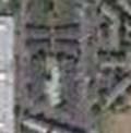
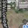
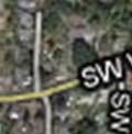
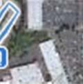
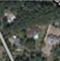
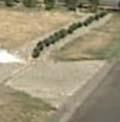
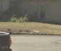
9 Additional Photos and Maps: Aerial view of affected area of Huntington. Note that North of Glenhaven the neighborhood (including Huntington) has complete sidewalks on both sides of the street. The section between Glenhaven and Cedar Hills Blvd is the only incomplete section of sidewalk onn Huntington and would provide a safe exit point from the neighborhood. Other streets exiting the neighborhood to Cedar Hills Blvd (e.g. Westfield) are also lacking sidewalks with the exception of Park Way, which is not oriented as a direct route to the mall or park area for most homes in the neighborhood.


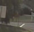


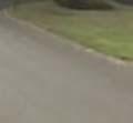


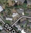
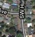
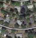
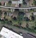
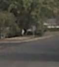
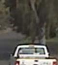
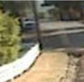
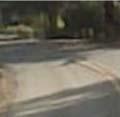
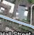
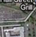
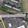
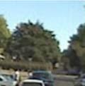
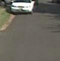
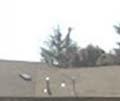
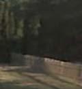
10 View facing south on Huntington from top of rise between Glenhaven and Faircrest. View facing south on Huntington from bottom of hill near Edgewood.


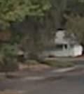


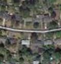
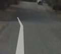
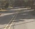
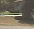
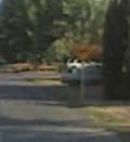
11 North of Glenhaven where sidewalks on Huntington are complete.
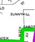
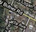
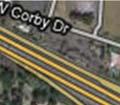
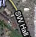
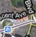
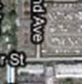
12 Project: Sidewalk on SW Butner Rd from Murray Rd to Cedar Hills Blvd Road names: SW Butner Rd Nearest intersection at one end: Murray Rd Nearest intersection at the other end: Cedar Hills Blvd Which side of the street is the project on?: North and South Description of the project: Define off road pedestrian paths wide enough for a stroller on one or both sides of the street to improve safety and connectivity of neighborhood to shopping mall and Sunset Transit Center. Additional Detail of Project How will the project benefit the community?: SW Butner Rd is narrow curving and busy raised speed limit road that sees both high levels of pedestrian and vehicle activity. It is a school bus route and provides a link from the neighborhood to both the Sunset Transit Center and the shopping area on Barnes and Cedar Hills Blvd. Safety on Butner Road is an issue. I have personally seen school children by vehicle traffic and have seen many near misses as drivers either do not see pedestrians and cut too close, or swing wide into oncoming traffic rounding a corner. Some sections of Butner Road already have pedestrian paths separated from the road in people s front yards. Extending this network of trails such that there is a safe and continuous path for pedestrians separate from the road would hugely improve the safety of this busy road. Affected Communities and Organizations: Improving neighborhood connectivity in this location would have positive effects for multiple agencies including: Trimet (Improved pedestrian access to Sunset Transit Center) Washington County (Neighborhood access road, pedestrian access to shops and transit for county residents) Cedar Hills HOA (as above) CPO1 connections (as above)
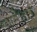
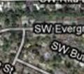
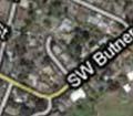
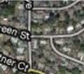
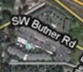
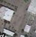
13 Additional Photos and Maps:


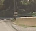


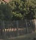
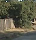
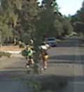
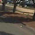
14 Some sections of the road have wide grass shoulders where pedestrians can safely walk. More clearly marking these as county easementss would make people comfortable using them without feeling like they weree intruding on private property: In some areas (left hand side of picture below) a path for pedestrians is clear to see this would be ideal to implement continuously along the length: In some areas on the road, homeowner plantings in the county right of way force pedestrians onto the main carriageway:
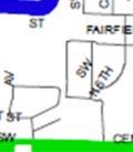
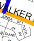
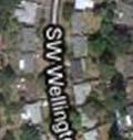
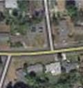
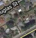
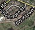
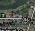
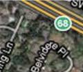
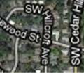
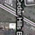
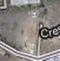
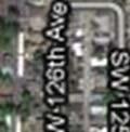
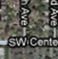
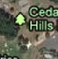
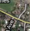
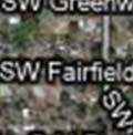
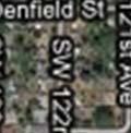
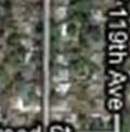
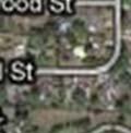
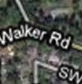
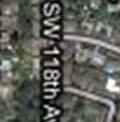
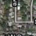
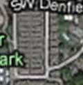
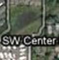
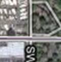
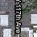
15 Project: Sidewalk on SW 123 rd &124 th Between SW Center St and SW Walker Rd Sidewalk on SW Fairfield and SW 119 th from Cedar Hills Blvd to SW Walker Rd Road names: SW 123 rd & SW 124 th ; SW Fairfield and SW 119th Nearest intersection at one end: SW Center St; SW Cedar Hills Blvd Nearest intersection at the other end: SW Walker Rd Which side of the street is the project on?: East and West of 123 rd, 124 th and 119 th, North and South of SW Fairfield. Description of the project: Add sidewalks on one or both sides of the street to the high pedestrian neighborhood routes in the neighborhood. Additional Detail of Project How will the project benefit the community?: SW 123 rd and 124 th are a part of the neighborhood route in the area and provide connection between shopping, transit center, parks, and residential neighborhood. These streets run down the middle of a high pedestrian traffic area. SW Fairfield is the east west connector that ties these to the shopping complex and SW 119th provides walking access from the neighborhood towards William Walker elementary. In combination, these sidewalks significantly improve connectivity and pedestrian safety between multiple facilities in an area with high population density (cluster of apartment complexes on Center Street) and in which many pedestrians are already active accessing shopping and transit. SW 123 rd connects the northern part of the neighborhood down to the transit center via 124 th and also provides connection in the direction of Cedar Hills Park and shopping. SW 124 th has slightly heavier pedestrian traffic as it is the main collector for the neighborhood for pedestrian access to the Beaverton Transit Center and is a walking route for people going from the transit center to the heart of the Cedar Hills shopping complex. SW Fairfield is the east west connector that ties these two streets to the Cedar Hills shopping complex and shops along Cedar Hills Blvd. SW 119 th is a north south street which intersects Walker Road near an existing safe crossing point (SW Lynnfield) for access to William Walker elementary school and Cedar Hills park (which is slated for a $6million restoration bond project in the next 2 years).


 THPRD")
")
")
16 Street Classification and Background All four streets for which sidewalks are requested are designated as neighborhood routes for the Cedar Hills area (per Washington County plan). The streets are usedd both by local traffic as well as cars seeking to avoid street lights and traffic on Walker and Cedar Hills Blvd. All these streets have had speed bumps added as a traffic calming method and all, especially SW 124 th and SW Fairfield between Cedar Hills Blvd. and 124 th, have regular pedestrian activity. These streets are also part of local school bus routes. PARK SCHOOL SHOPPING MALLL SCHOOL SCHOOL TRANSITT CENTER Affected Communities and Organizations: Improving neighborhood connectivity in this location would have positive effects for multiple agencies including: Beaverton School District (William Walker Elementary, Arts and Communication Magnet Academy, walk to school safety for kids, and potential ability to save money on buses) THPRD (Cedar Hills Park redevelopment parking overflow and accesss from neighborhood) Trimet (Improved and safer pedestrian access to Beaverton Transit Center) Washington County (Neighborhood access road, pedestrian access to shops and park for county residents) Cedar Hills HOA (as above) CPO1 connections (as above)


17 Additional Photos and Maps:


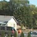


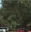


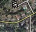
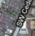
18 Facing North up SW 124 th from SW Center Street: Facing east on SW Fairfield from Cedar Hills Blvd: SW 119 th at Walker Rd Intersection with lighted pedestrian crossing access to school visible in top left
19
20
21
22
23
24
25
Tigard Tigard Transit Center
 Tigard Tigard Transit Center Tigard Transit Center Tigard The Tigard Transit Center focus area is located in the City of Tigard. It is situated in the City of Tigard s downtown and is 4.5 miles from the
SAFE ROUTES TO SCHOOL
 SAFE ROUTES TO SCHOOL Forest Ridge Elementary School Existing Conditions and ACTION PLAN > Oak Creek - Franklin Joint School District Table of Contents CONTEXT Enrollment Boundaries
Rehabilitating First- and Last- Mile Connections
 Rehabilitating First- and Last- Mile Connections Sept 18, 2017 Rail~ Volution Jeff Owen Senior Planner Active Transportation TriMet, Planning & Policy Portland, Oregon owenj@trimet.org 503-962-5854 Outline
Washington County SW Beaverton-Hillsdale Hwy. & SW Scholls Ferry Rd.
 Washington County SW Beaverton-Hillsdale Hwy. & SW Scholls Ferry Rd. SW Beaverton-Hillsdale Hwy. & SW Scholls Ferry Rd. Washington County The SW Beaverton-Hillsdale Hwy & SW Scholls Ferry Rd. focus area
Agenda. Overview PRINCE GEORGE S PLAZA METRO AREA PEDESTRIAN PLAN
 PRINCE GEORGE S PLAZA METRO AREA PEDESTRIAN PLAN May 28, 2008 Agenda Welcome and introductions Project overview and issue identification Planning context and strengths Design challenges and initial recommendations
If a person walks within this focus area, these are examples of the places he or she could walk to or from:
 Portland Hillsdale Hillsdale Portland The Hillsdale focus area is located in the City of Portland. It is situated approximately three miles from the City of Portland s downtown, 5.5 miles from the City
SAFE ROUTES TO SCHOOL
 SAFE ROUTES TO SCHOOL Edgewood Elementary School Existing Conditions and ACTION PLAN > Oak Creek - Franklin Joint School District Table of Contents CONTEXT Enrollment Boundaries Enrollment
5 CIRCULATION AND STREET DESIGN
 5 CIRCULATION AND STREET DESIGN This chapter describes circulation and streetscape improvements proposed for the Northwest Chico Specific Plan Area. It includes detailed design specifications for existing
Safe Routes to School: Creating an Action Plan Template
 odot25m Page 1 4/13/2016-1 - Safe Routes to School: Creating an Action Plan Template Note: This document can be protected to prevent unintended changes to the form. If you wish to protect the template,
Town of Mooresville, North Carolina Neighborhood Traffic Calming and Control Device Policy
 Town of Mooresville, North Carolina Neighborhood Traffic Calming and Control Device Policy Adopted January 6, 2014 Town of Mooresville Development Services Department TOWN OF MOORESVILLE NEIGHBORHOOD TRAFFIC
Bikeway action plan. Bicycle Friendly Community Workshop March 5, 2007 Rochester, MN
 Bikeway action plan Summary The was held on March 5, 2007 at the Rochester Mayo Civic Center. The workshop was hosted by Rochester-Olmsted County Planning Department in collaboration with the League of
Safe Routes to School: Creating an Action Plan Template
 odot25m Page 1 4/13/2016-1 - Safe Routes to School: Creating an Action Plan Template Note: This document can be protected to prevent unintended changes to the form. If you wish to protect the template,
AGENDA REPORT. Issue: Discussion of potential improvements on Barnwell Road at Niblick Drive
 AGENDA REPORT To: From: By: Honorable Mayor and City Council Members Warren Hutmacher, City Manager Tom Black, Public Works Director Date: March 23, 2016 Agenda: March 28, 2016 WORK SESSION AGENDA: Barnwell
ADA Transition Plan. City of Gainesville FY19-FY28. Date: November 5, Prepared by: City Of Gainesville Department of Mobility
 ADA Transition Plan FY19-FY28 Date: November 5, 2018 Prepared by: City Of Gainesville Department of Mobility 1.0 INTRODUCTION 1.1 BACKGROUND The federal statute known as the Americans with Disabilities
West Dimond Blvd Upgrade Jodhpur Street to Sand Lake Road
 West Dimond Blvd Jodhpur St to Sand Lake CSS Transportation Project Summary Municipality of Anchorage Project # 05 005 Project Manager: John Smith, P.E. (MOA PM&E) Project Administrator: Julie Makela,
Corporate. Report COUNCIL DATE: May 25, 1998 NO: R1500 REGULAR COUNCIL. TO: Mayor & Council DATE: April 27, 1998
 R1500 : Traffic Safety at 25 Avenue and 128 Street Intersection Corporate NO: R1500 Report COUNCIL DATE: May 25, 1998 REGULAR COUNCIL TO: Mayor & Council DATE: April 27, 1998 FROM: General Manager, Engineering
City of Elizabeth City Neighborhood Traffic Calming Policy and Guidelines
 City of Elizabeth City Neighborhood Traffic Calming Policy and Guidelines I. Purpose: The City of Elizabeth City is committed to ensure the overall safety and livability of residential neighborhoods. One
Table #6 VISION CHARACTERISTICS
 Table #6 VISION White Flint is a place to live, work, play, shop, and walk with sufficient density to encourage quality redevelopment. Vibrant streets and consistent streetscapes are important. CHARACTERISTICS
PRINCE GEORGE S PLAZA METRO AREA PEDESTRIAN PLAN
 PRINCE GEORGE S PLAZA METRO AREA PEDESTRIAN PLAN May 28, 2008 Agenda Welcome and introductions Project overview and issue identification Planning context and strengths Design challenges and initial recommendations
Corpus Christi Metropolitan Transportation Plan Fiscal Year Introduction:
 Introduction: The Safe, Accountable, Flexible, Efficient Transportation Equity Act: A Legacy for Users (SAFETEA-LU) has continued the efforts started through the Intermodal Surface Transportation Efficiency
City of Davis East Covell Corridor Plan
 Community Open House #2 January 22, 2014 6:00 8:00 p.m. Veterans Memorial Center, Club Room City of Davis Introduction The (ECCP) is a taking a comprehensive look at the existing transportation systems
Cherry Creek Transportation and Land Use Forum September 25, 2013 Meeting Summary
 Cherry Creek Transportation and Land Use Forum September 25, 2013 Meeting Summary I. LEAD-IN TO SMALL GROUP DISCUSSION, POLLING AND STEERING COMMITTEE/TECHNICAL TASK FORCE DISCUSSION The meeting began
10.0 CURB EXTENSIONS GUIDELINE
 10.0 CURB EXTENSIONS GUIDELINE Road Engineering Design Guidelines Version 1.0 March 2017 City of Toronto, Transportation Services City of Toronto Page 0 Background In early 2014, Transportation Services
CITY OF KASSON TRANSPORTATION ALTERNATIVES KASSON SAFE ROUTES TO SCHOOL
 ve ha 8t G B A Mantorville Ave N 240th Ave 16th St NE 11th Ave NE K-M HIGH SCHOOL SUNRISE TRAIL TO MANTORVILLE MNTH 57 SUNSET TRAIL TO MANTORVILLE NE PARK 16TH ST NE TRAIL K-M ELEMENTARY SCHOOL K-M MIDDLE
Board Policy Statement Transportation of Pupils Approved on June 1, 2015
 Board Policy Statement 3541.00 - Transportation of Pupils Approved on June 1, 2015 The Board of Education shall provide for the transportation of children in accordance with Connecticut General Statutes.
Hillsboro Tanasbourne Town Center
 Hillsboro Tanasbourne Town Center Tanasbourne Town Center Hillsboro The Tanasbourne Town Center focus area is located in the City of Hillsboro. It is situated approximately six miles from the City of Hillsboro
122 Avenue: 107 Street to Fort Road
 : 107 Street to Fort Road November 24, 2015 4:30 8:00 p.m. Meeting Purpose Summarize project work completed to date Share results of public input from Phase 1 Share the draft concept plan and proposed
COWETA HIGH SCHOOL AND EAST HIGHWAY 51
 COWETA HIGH SCHOOL AND EAST HIGHWAY 51 Lack of sidewalks along Ben Lumpkin Rd. Lack of crosswalks and ramps at intersection. Hwy 51 is wide to cross as a pedestrian. No ADA compliance or connection to
Corridor Vision Workshop Summary James Madison Elementary February 22,2018
 Corridor Vision Workshop Summary James Madison Elementary February 22,2018 WHY DEVELOP THIS STUDY? Ogden City is planning for better connectivity and access to jobs and housing. Working with area partners,
TRAFFIC ACTION PLAN. Laurie Meadows Neighborhood CITY OF SAN MATEO
 TRAFFIC ACTION PLAN Laurie Meadows Neighborhood CITY OF SAN MATEO Draft January 2017 Table of Contents Introduction... 2 The Traffic Forum Process... 5 Neighborhood Traffic Issues... 7 Neighborhood Recommendations
GIS Based Data Collection / Network Planning On a City Scale. Healthy Communities Active Transportation Workshop, Cleveland, Ohio May 10, 2011
 The Purpose of GIS Based Network Planning GIS Based Data Collection / Network Planning Healthy Communities Active Transportation Conference Tuesday, May 10, 2011 10:00 AM Norman Cox, LLA, ASLA. Ann Arbor,
CONNECTING PEOPLE TO PLACES
 CONNECTING PEOPLE TO PLACES 82 EAST BENCH MASTER PLAN 07 Introduction The East Bench transportation system is a collection of slow moving, treelined residential streets and major arteries that are the
CITY OF COCOA BEACH 2025 COMPREHENSIVE PLAN. Section VIII Mobility Element Goals, Objectives, and Policies
 CITY OF COCOA BEACH 2025 COMPREHENSIVE PLAN Section VIII Mobility Element Goals, Objectives, and Policies Adopted August 6, 2015 by Ordinance No. 1591 VIII MOBILITY ELEMENT Table of Contents Page Number
West Capitol Avenue Road Rehabilitation and Safety Enhancement Project
 West Capitol Avenue Road Rehabilitation and Safety Enhancement Project Stakeholder Focus Group Meeting #2 Tuesday, August 28, 2018 7:00 8:00 a.m. West Sacramento City Hall 1110 West Capitol Avenue, West
5 Circulation & Parking
 5 Circulation & Parking Downtown Parking & Circulation Strategy. Downtown Wayne has a somewhat disconnected system of local public streets to connect downtown with the residential neighborhoods, and primary
2018 Transportation Alternatives Program (TAP) Application Presentation to Palm Beach TPA BRANT BRIDGE CONNECTION LOOP EXTENSION ON CARL BOLTER DR
 Application Presentation to Palm Beach TPA BRANT BRIDGE CONNECTION LOOP EXTENSION ON CARL BOLTER DR") 2018 Transportation Alternatives Program (TAP) Application Presentation to Palm Beach TPA BRANT BRIDGE CONNECTION LOOP EXTENSION ON CARL BOLTER DR Project Location N N Connecting South Delray Beach Existing
2018 Transportation Alternatives Program (TAP) Application Presentation to Palm Beach TPA BRANT BRIDGE CONNECTION LOOP EXTENSION ON CARL BOLTER DR Project Location N N Connecting South Delray Beach Existing
7/23/2017 VIA . Michael Hanebutt City of Sacramento Community Development Department 300 Richards Boulevard, 3 rd Floor Sacramento, CA 95811
 7/23/2017 VIA EMAIL Michael Hanebutt City of Sacramento Community Development Department 300 Richards Boulevard, 3 rd Floor Sacramento, CA 95811 RE: 65 th Street Apartments (DR17-220) Dear Mr. Hanebutt:
Westgate/Belvedere Homes Community Redevelopment Agency. Belvedere Heights. Streetlights & Sidewalks Improvements Project.
 Westgate/Belvedere Homes Community Redevelopment Agency Belvedere Heights Streetlights & Sidewalks Improvements Project Phase II TPA 2018 Transportation Alternatives Program (TAP) BTPAC Presentation Thursday,
How Policy Drives Mode Choice in Children s Transportation to School
 How Policy Drives Mode Choice in Children s Transportation to School Physical Activity through Active Transportation Ruth L. Steiner 2011 Technical Conference and Exhibit Lake Buena Vista, FL April 3-6,
TRAFFIC CALMING GUIDE FOR TORONTO CITY OF TORONTO TRANSPORTATION SERVICES DIVISION
 TRAFFIC CALMING GUIDE FOR TORONTO CITY OF TORONTO TRANSPORTATION SERVICES DIVISION CITY OF TORONTO TRANSPORTATION SERVICES DIVISION 2016 TRAFFIC CALMING GUIDE FOR TORONTO TABLE OF CONTENTS Introduction
Development of Arlington County s Marked Crosswalk Guidelines. Jon Lawler, P.E. Design Engineer Arlington County, VA
 Development of Arlington County s Marked Crosswalk Guidelines Jon Lawler, P.E. Design Engineer Arlington County, VA April 13, 2015 Transportation System Users Residents Estimated 215,000 in 2014 Lowest
Non-motorized Transportation Planning Resource Book Mayor s Task Force on Walking and Bicycling City of Lansing, Michigan Spring 2007 pg.
 Non-motorized Transportation Planning Resource Book pg. 105 of 158 Non-motorized Transportation Planning Resource Book pg. 106 of 158 Non-motorized Transportation Planning Resource Book pg. 107 of 158
In station areas, new pedestrian links can increase network connectivity and provide direct access to stations.
 The Last Mile Planning for Pedestrians Planning around stations will put pedestrians first. Making walking to stations safe and easy is important; walking will be a part of every rapid transit Accessible
City of Wayzata Comprehensive Plan 2030 Transportation Chapter: Appendix A
 A1. Functional Classification Table A-1 illustrates the Metropolitan Council s detailed criteria established for the functional classification of roadways within the Twin Cities Metropolitan Area. Table
Complete Streets Process and Case Study: Taft / McMillian Two-Way Street Conversion Cincinnati, Ohio. Traffic Engineering Workshop June 4, 2014
 Complete Streets Process and Case Study: Taft / McMillian Two-Way Street Conversion Cincinnati, Ohio Traffic Engineering Workshop June 4, 2014 Complete Streets Streets that enable safe access for users
complete streets design and construction standards public primer City of Edmonton
 complete streets design and construction standards public primer City of Edmonton introduction Complete Streets are streets for everyone: people who walk, wheel, bike, take transit, or drive. They are
City of Margate, Florida. Neighborhood Traffic Management Manual
 City of Margate, Florida Neighborhood Traffic Management Manual Table of Contents Page No. I. INTRODUCTION... 1 II. TRAFFIC CALMING REQUEST AND PROCESSING PROCEDURES... 2 1. COMPLETE AND SUBMIT PROJECT
CHAPTER 16 PEDESTRIAN FACILITIES DESIGN AND TECHNICAL CRITERIA TABLE OF CONTENTS
 CHAPTER 16 PEDESTRIAN FACILITIES DESIGN AND TECHNICAL CRITERIA TABLE OF CONTENTS Section Title Page 16.1 General... 16-1 16.1.1 AASHTO Reference... 16-1 16.1.2 ADA Requirements... 16-1 16.2 Sidewalks...
MONTGOMERY COUNTY SCHOOL DISTRICT COMPREHENSIVE STUDENT PICK-UP / DROP-OFF PROCEDURE CHANGES
 MONTGOMERY COUNTY SCHOOL DISTRICT COMPREHENSIVE STUDENT PICK-UP / DROP-OFF PROCEDURE CHANGES In an effort to provide a safer transportation environment, the Montgomery County School District Police Department
MASTER BICYCLE AND PEDESTRIAN PLAN
 VILLAGE OF NORTHBROOK MASTER BICYCLE AND PEDESTRIAN PLAN DRAFT PLAN OPEN HOUSE May 2, 2018 AGENDA 1. Community Engagement 2. Vision and Goals 3. General Structure of Plan 4. Recommendations Overview 5.
Plainfield Gateway. Plainfield Context
 Plainfield Gateway The western arm of The Campus, much like the Thomas Street Placita eastern arm, must connect residents and workers from the western side of the neighborhood to The Campus and the activity
Classification Criteria
 SCHEDULE D TO RECOMMENDED OFFICIAL PLAN AMENDMENT NO. 40 SCHEDULE C-4 Road Criteria Criteria Traffic Service Objective Land Service/Access Typical Daily Traffic Volume Flow characteristics Travel Speed
Belvedere Heights Streetlights & Sidewalks Improvements Project
 Westgate/Belvedere Homes Community Redevelopment Agency Belvedere Heights Streetlights & Sidewalks Improvements Project Phase I MPO 2017 Transportation Alternatives Program (TAP) BTPAC Special Workshop
Southwest Bus Rapid Transit (SW BRT) Functional Planning Study - Executive Summary January 19 LPT ATTACHMENT 2.
 Functional Planning Study - Executive Summary January 19 LPT ATTACHMENT 2.") Southwest Bus Rapid Transit (SW BRT) Functional Planning Study - Executive Summary 2011 January 19 1 of 19 Introduction This executive summary presents the results of the Southwest Bus Rapid Transit (SW
Southwest Bus Rapid Transit (SW BRT) Functional Planning Study - Executive Summary 2011 January 19 1 of 19 Introduction This executive summary presents the results of the Southwest Bus Rapid Transit (SW
Complete Streets Successes, Opportunities, and Challenges
 Complete Streets Successes, Opportunities, and Challenges Juliet Walker, Transportation Planner, City of Portsmouth Rob Houseman, Director of Planning and Development, Town of Wolfeboro Chris Parker, Director
Community Transportation Plan
 Community Transportation Plan Appendix A: Traffic Calming CITY OF DECATUR COMMUNITY TRANSPORTATION PLAN Appendix A: City of Decatur City-wide Residential Traffic Calming Program Process & Procedures The
Vision: Traditional hamlet with an attractive business/pedestrian friendly main street connected to adjacent walkable neighborhoods
 N D. Focus Area II Vision: Traditional hamlet with an attractive business/pedestrian friendly main street connected to adjacent walkable neighborhoods Transit Road Focus Area II is located in the Hamlet
CITY OF WEST LAKE HILLS. Forest View Neighborhood Traffic Calming Study
 CITY OF WEST LAKE HILLS 901 South Mopac Expressway Building V, Suite 220 Austin, Texas 78746 Texas P.E. Firm Registration No. F-929 Klotz Associates Final Report Submittal: March 20, 2015 Revised Final
Safe Routes to School: Munroe Elementary Walk Audit Report. Image: Drexel, Barrell & Co.
 Safe Routes to School: Munroe Elementary Walk Audit Report Image: Drexel, Barrell & Co. April 12, 2016 OVERVIEW As part of the 2014/2015 Denver Safe Routes to School (SRTS) Program, WalkDenver coordinated
Southside Road. Prepared for: City of St. John s Police & Traffic Committee. Prepared by: City of St. John s Traffic Division
 Southside Road Prepared for: City of St. John s Police & Traffic Committee Prepared by: City of St. John s Traffic Division January 2007 Southside Road - Traffic Report Page 1 of 9 BACKGROUND: th At the
Illustrated Principles of Good Planning
 Illustrated Principles of Good Planning The Miami 21 Zoning Code incorporates time-tested planning principles into the zoning regulations of our City. These are principles that make for better neighborhoods,
Complete Streets. Designing Streets for Everyone. Sarnia
 Complete Streets Designing Streets for Everyone Sarnia Complete Streets ~ Sarnia ~ 2018 Introduction Our City is made up of a network of streets that we use to go for a walk, cycle to work, drive to the
ENFIELD BOARD OF EDUCATION ENFIELD, CONNECTICUT
 1 2 3 4 5 6 7 8 9 10 11 12 13 14 15 16 17 18 19 20 21 22 23 24 25 26 27 28 29 30 31 32 33 34 35 36 37 38 39 40 41 42 43 44 45 46 47 48 49 50 ENFIELD BOARD OF EDUCATION ENFIELD, CONNECTICUT TRANSPORTATION
ROUTE 81 CORRIDOR STUDY DESIGN CONCEPTS
 RT 81 Corridor Study CLINTON ROUTE 81 CORRIDOR STUDY DESIGN CONCEPTS View north on High Street, with potential improvements to the streetscape Draft Recommendations November 8 th, 2018 TOWN OF CLINTON
County of Greenville South Carolina. Traffic Calming Program Neighborhood Traffic Education Program and Speed Hump Program
 County of Greenville South Carolina Traffic Calming Program Neighborhood Traffic Education Program and Speed Hump Program (rev) August 2008 I. PURPOSE The potential negative impacts from vehicular traffic
EXECUTIVE SUMMARY. Vision
 Vision Walking and bicycling in Salt Lake City will be safe, convenient, comfortable, and viable transportation options that connect people to places, foster recreational and economic development opportunities,
Traffic Calming Policy
 Article I. Purpose and Goal. The purpose of this policy is to establish criteria and procedures the City will use to evaluate requests for, and if appropriate, implement traffic calming measures. Neighborhood
CITY MANUALS AND STANDARDS REVIEW
 GEORGETOWN SIDEWALK MASTER PLAN CITY MANUALS AND STANDARDS REVIEW RESOURCES AND STANDARDS As part of the Master Plan process, a review and evaluation of current City documents and policies relevant to
1 st and 2 nd Street Couplet FAQ s
 1 st and 2 nd Street Couplet FAQ s Q. Will the proposed roundabout at Flume/2nd/1 st Streets affect access to businesses nearby?... 2 Q. What if the project isn t received well by the community after construction?...
River Road Healthy Neighborhood Walkabout October 15, 2016
 River Road Healthy Neighborhood Walkabout October 15, 2016 Conversation and Questions: A. What are the best things about your neighborhood? B. In what areas does your neighborhood need improvement? C.
Environment and Public Works Committee Presentation
 Mixed Use Centers Complete Streets Guidelines Project Environment and Public Works Committee Presentation December 10, 2008 Project Objectives: Conduct an inter-departmental and agency process to study
11/3/2017 VIA . RE: River Oaks Phase 2 (P17-051)
") 11/3/2017 VIA EMAIL Ethan Meltzer, Assistant Planner City of Sacramento Community Development Department 300 Richards Blvd., 3 rd Floor Sacramento, CA 98811 RE: River Oaks Phase 2 (P17-051) Dear Mr. Meltzer:
11/3/2017 VIA EMAIL Ethan Meltzer, Assistant Planner City of Sacramento Community Development Department 300 Richards Blvd., 3 rd Floor Sacramento, CA 98811 RE: River Oaks Phase 2 (P17-051) Dear Mr. Meltzer:
Residential Traffic Calming Program Guide. Town of Ashland, Virginia
 Residential Traffic Calming Program Guide Town of Ashland, Virginia August 1, 2006 TABLE OF CONTENTS A. INTRODUCTION... 1 B. GOALS... 1 C. CRITERIA... 1 D. IDENTIFYING NEIGHBORHOOD TRAFFIC CONCERNS...
CURRENT ORIGINAL REFERENCE SECTIONS. (Typical Section) (Typical Section) The Parade Island Bay : Concept Option Summary Sheets.
 (Typical Section) The Parade Island Bay : Concept Option Summary Sheets.") ORIGINAL (Typical Section) CURRENT (Typical Section) 3,900 3,000 2,000 1,500 3,100 1,600 3,100 1,500 2,000 2,500 3,900 3,000 1,800 600 2,000 3,000 3,000 2,000 600 1,800 2,500 Existing Planting Traffic
ORIGINAL (Typical Section) CURRENT (Typical Section) 3,900 3,000 2,000 1,500 3,100 1,600 3,100 1,500 2,000 2,500 3,900 3,000 1,800 600 2,000 3,000 3,000 2,000 600 1,800 2,500 Existing Planting Traffic
NEIGHBORHOOD TRAFFIC CALMING POLICY
 NEIGHBORHOOD TRAFFIC CALMING POLICY I. PURPOSE The City of Kent continually strives to strengthen and protect its neighborhoods by improving the quality of life in residential areas. Traffic conditions
RECOMMENDATION: Approve traffic calming projects as recommended by the Neighborhood Traffic Calming Committee (NTCC) on the following streets:
 on the following streets:") June 24, 2003 TO: FROM: SUBJECT: The County Board of Arlington, Virginia Ron Carlee, County Manager Approval of Traffic Calming Projects RECOMMENDATION: Approve traffic calming projects as recommended
June 24, 2003 TO: FROM: SUBJECT: The County Board of Arlington, Virginia Ron Carlee, County Manager Approval of Traffic Calming Projects RECOMMENDATION: Approve traffic calming projects as recommended
Malvern Borough Local Traffic Calming
 Malvern Borough Local Traffic Calming Purpose: To address speeding and high volume cut-through traffic on Malvern Borough owned residential streets. Traffic Calming Measures: Traffic Calming Measures (TCM)
Ann Arbor Downtown Street Plan
 1 Ann Arbor Downtown Street Plan Public Workshop #1 We know that. 2 Public right-of-way (streets, sidewalks, and alleys) make up 30% of the total District area of downtown. Streets need to provide mobility
Driveway Design Criteria
 Design Manual Chapter 5 - Roadway Design 5L - Access Management 5L-4 Driveway Design Criteria A. General For efficient and safe operations, access drives and minor public street intersections can be improved
Walkability Audit Scores and Comments Lacey, Tumwater, and Olympia, WA September 2012
 Walkability Audit Scores and Comments Lacey, Tumwater, and Olympia, WA September 2012 The U.S. Environmental Protection Agency (EPA) provided technical assistance to Thurston Regional Planning Commission
Norfolk Tide LRT System Weaving Transit in Downtown Norfolk
 Rail-Volution 2010 Weaving Transit into Existing Communities Norfolk Tide LRT System Weaving Transit in Downtown Norfolk Dan Meyers, AICP URS, Planning Manager Minneapolis, Minnesota Norfolk Tide LRT Alignment
Nanaimo Transportation Master Plan. Phase 1 Consultation Summary
 Nanaimo Transportation Master Plan Phase 1 Consultation Summary Transportation Advisory Committee Meeting Wednesday December 12, 2012 Agenda Study Update Phase 1 Consultation Process Phase 1 Consultation
NEWMARKET UPHAM S CORNER
 SOUTH STATION Planning Initiative NEWMARKET UPHAM S CORNER COLUMBIA ROAD (P) FOUR CORNERS/GENEVA Working Advisory Group (WAG) Meeting #5 TALBOT AVENUE MORTON STREET BLUE HILL AVE/CUMMINS HWY (P) RIVER
THE PHILADELPHIA COMPLETE. an overview
 THE PHILADELPHIA COMPLETE STREETS DESIGN HANDBOOK an overview WHAT ARE COMPLETE STREETS? Complete Streets are streets designed to accommodate all users, from pedestrians to drivers Complete Streets provide
ACTION TRANSMITTAL No
 Transportation Advisory Board of the Metropolitan Council of the Twin Cities DATE: August 25, 2016 TO: FROM: ACTION TRANSMITTAL No. 2016-47 Technical Advisory Committee TAC Funding and Programming Committee
Northeast 65 th Street Vision Zero Project Proposals From A Roosevelt High School Student Joe Mangan
 Northeast 65 th Street Vision Zero Project Proposals From A Roosevelt High School Student Joe Mangan PROPOSALS: 1. Extend raised cycle tracks down 65 th Street Northeast. Please do not consider any other
Improvements Infrastructure Gap Assessment and Improvements Street Striping
 Infrastructure Project Proposal The federal-aid Safe Routes to School program funds infrastructure/engineering projects that fall into two categories: Design (available only to School Development Authority
Heaven or Hell? Designing the impact of autonomous vehicles on cities and suburbs
 Heaven or Hell? Designing the impact of autonomous vehicles on cities and suburbs Ellen Dunham-Jones Professor of Architecture Director, MS in Urban Design Georgia Institute of Technology We don t know
Duwamish Way-finding and CTR Report
 V. North Tukwila When the North Tukwila Manufacturing and Industrial Center was designated in 1992 as part of the region s land use and transportation plan, the plan called for the area to set a light-rail
WELCOME. Thank you for joining us at the Second Public Workshop for the Carlsbad Pedestrian Master Plan. We look forward to receiving your feedback.
 City of Carlsbad Pedestrian Master Plan: WELCOME WELCOME Please Sign In Provide Input at Flip Charts Review Boards Presentation of Draft Plan Thank you for joining us at the Second Public Workshop for
Town of Bethlehem. Planning Assessment. Bethlehem Town Board
 Town of Bethlehem US 9W Corridor Transportation Planning Assessment Presented e to: Bethlehem Town Board June 2009 Overview Study Background Route 9W Corridor Conditions and Improvements Selkirk Bypass
Tonight is for you. Learn everything you can. Share all your ideas.
 Strathcona Neighbourhood Renewal Draft Concept Design Tonight is for you. Learn everything you can. Share all your ideas. What is Neighbourhood Renewal? Creating a design with you for your neighbourhood.
TRAFFIC CALMING POLICY & PROCEDURES
 TRAFFIC CALMING POLICY & PROCEDURES AS ADOPTED BY MONTCLAIR TOWNSHIP COUNCIL AUGUST 4, 2009 TABLE OF CONTENTS 1. INTRODUCTION... 2 Purpose... 2 Traffic Calming Definition... 2 Statement Of Township Council
NAPIER AVENUE PEDESTRIAN AND BICYCLE PLAN
 NAPIER AVENUE PEDESTRIAN AND BICYCLE PLAN Prepared By: DRAFT: 1/17/1 WHAT ARE WALKABILITY AUDITS AND WHY ARE THEY IMPORTANT? Walkability is important for a community and everyone benefits from walking.
City of Edinburg Department of Public Works 415 W. University Dr. Edinburg, TX (956) SPEED HUMPS INSTALLATION POLICY
 SPEED HUMPS INSTALLATION POLICY") City of Edinburg Department of Public Works 415 W. University Dr. Edinburg, TX 78541 (956) 388-8210 SPEED HUMPS INSTALLATION POLICY A. GENERAL Speed humps are an effective and appropriate device for safely
City of Edinburg Department of Public Works 415 W. University Dr. Edinburg, TX 78541 (956) 388-8210 SPEED HUMPS INSTALLATION POLICY A. GENERAL Speed humps are an effective and appropriate device for safely
Student Pedestrian Safety Fiddlers Canyon Elementary Community Council 2012
 Student Pedestrian Safety Fiddlers Canyon Elementary Community Council 2012 Introduction Fiddlers Canyon Elementary students must cross North Wedgewood Lane and Fiddlers Canyon Drive in order to come to
Chapter 4.3 Enterprise Elementary. Volusia County MPO. March Page 7.0
 Chapter 4.3 Enterprise Elementary Enterprise, FL Volusia County MPO March 2008 Page 7.0 Volusia County MPO Bicycle and Pedestrian School Safety Review Study Introduction Enterprise Elementary School is
Chapter 5. Complete Streets and Walkable Communities.
 Chapter 5. Complete Streets and Walkable Communities. 5.1 Description of Complete Streets. Cities throughout the world, and specifically the United States, are coming to embrace a new transportation and
Orange Center Elementary School
 Drag and drop pic and stretch/crop to the limits of the blue rectangle (delete this text box) Orange Center Elementary School Drag and drop pic and stretch/crop to the limits of the blue rectangle (delete
Traffic Impact Memorandum. May 22, 2018
 BISHOP PROFESSIONAL DEVELOPMENT BUILDING Proposed Land-use Change & Parking Modification 3601 SW 31st Street Topeka, Kansas 66614 CFS Project No. 185077 Traffic Impact Memorandum May 22, 2018 Prepared