CITY OF SEBASTOPOL CITY COUNCIL STAFF REPORT
|
|
|
- Audrey Lane
- 5 years ago
- Views:
Transcription
1 Agenda Item Number: _ CITY OF SEBASTOPOL CITY COUNCIL STAFF REPORT Meeting Date: October 30, 2018 To: From: Subject: Recommendation: Funding: Honorable Mayor and City Councilmembers Engineering Manager Henry J. Mikus Informational Item - To provide background information on the History of the Bicycle/Pedestrian Master Plan, explanation of the new bicycle lane markings, and describe Traffic Code considerations related to enforcement. Information presentation only, no action requested. Currently Budgeted: Yes No JX_ N/A Net General Fund Cost: N/A Amount: N/A Background: The City of Sebastopol has been conducting a process, with duration of a decade, to enhance safety and tourism by providing bicycle lane markings along both City-owned streets, and State Highways through the City. Establishment of an integrated bicycle lane system has been a long-term and high priority goal of the Sebastopol City Council, as formally set forth in several documents including, most importantly, the Sebastopol Bicycle & Pedestrian Master Plan which is included in the Sonoma County Bicycle & Pedestrian Master Plan. Initially, bike lanes on locally-owned streets, as a City project, were added in November 2017, and bicycle markings along SR 116 have been part of a Caltrans repaving project that began in August 2018 and is nearly complete. The last street section to be done is Bodega Avenue, where striping for bicycles is waiting for repaving and other improvements that are part of a partially grant-funded five-year set of capital projects. The SR 116 work, which includes Gravenstein Highway North, Healdsburg Avenue, N Main Street, S Main Street, Petaluma Avenue, Gravenstein Highway South, and a block of McKinley Street, has resulted both in changes to vehicular lane alignments and striping, and new types of bicycle specific markings. As a result, the City Council asked that staff prepare a report to discuss the following: History of the Sebastopol Bicycle & Pedestrian Master Plan, including timeframe for original discussion and adoption of the Plan. Amendments to the Plan. Description of Bike Lanes (to include graphics/diagrams of what markings mean) General Information and Regulations Related to Correct Use of bike lanes and parking regulations related to bike lanes Discussion: Bicycle Lane planning began in 2006 on a regional basis as the Sonoma County Transportation Authority (SCTA) initiated a County-wide Bicycle & Pedestrian Master Plan. The companion Sebastopol Bicycle & Pedestrian Master Plan was completed in The next step was completion of a Sebastopol Bicycle Lane Feasibility Study in 2011, which included Caltrans participation and input as the State of California is the owner, and ultimate arbiter, of SR 116 technical matters. The City Plan was amended in Page 1 of 2
2 Agenda Item Number:_ 2014 to include many items discussed in the Feasibility Study, which in turn was the basis for the actual bicycle lanes designs. The SR 116 design was substantially done by a AECOM in 2015, and the locally owned streets designs were 100% done by W-Trans in All SR 116 design work has involved indepth reviews, comments, and required approvals by Caltrans' District 4 technical staff. It should be noted that through our own City review process, it was recognized that the initial SR 116 design did not incorporate several provisions shown in the 2014 amended Bicycle & Pedestrian Master Plan. As a consequence, the Sebastopol City Council hired W-trans to review and append the SR 116 design to properly reflect the Bicycle & Pedestrian Master Plan and to be respectful of the citizen input and comments made during the formulation of the Plan, its amendment, and the Study. This was done during 2017 and the revised design was what Caltrans utilized as the basis for their paving and striping project. The 2011 Feasibility Study is a key document as it included numerous robust analyses and discussions by the City and Caltrans of some potentially problematic highway sections, where considerable thought and conversation was given to different alternative alignments to choose the overall most effective and safest layout. For example, the Petaluma Avenue one-way section northbound, and the section of N Main Street just south of Healdsburg Avenue were examined in depth, with the conclusions and reasoning laid out in the study. The new striping designs were also formulated using the following regulations and standards: NACTO (National Association of City Transportation Officials) "Urban Bikeway Design Guide" Caltrans "Traffic Manual Chapter 6 - Markings" "California Vehicle Code" Three Feet for Safety Act (adopted as California Vehicle Code section 21760) California "Manual on Uniform Traffic Control Devices for Streets and Highways" (MUTCD) The new markings are different in both layout, and coloring. The green-painted areas are the most obvious new feature, and are intended to: Promote the multi-modal nature of a corridor. Increase the visibility of bicyclists. Discourage illegal parking in the bike lane. When used in conflict areas, raise motorist and bicyclist awareness to potential areas of conflict. Increase bicyclist comfort though clearly delineated space. Increase motorist yielding behavior. Help reduce bicycle conflicts with turning motorists. Steve Weinberger, W-Trans Principal, will be giving a presentation (copy attached) about our City's new bicycle lanes that includes discussion of what the new markings mean and how they are to be used. Lieutenant Greg Devore, Sebastopol Police, will be giving a briefing on what the new bicycle and lane markings will mean for motorists from a compliance and enforcement perspective. Recommendation: That the City Council hear and accept this report and the presentations. Attachments: List of California Vehicle Code violations common to bike lanes Police Department Presentation/ Powerpoint W-Trans Presentation/ Powerpoint Page 2 of 2
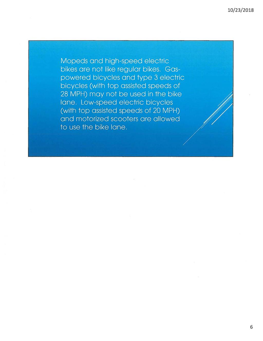
3 California Vehicle Code violations common to bike lanes: CVC No person shall drive a motor vehicle in a bicycle lane except as follows: To park where parking is permitted. To enter or leave the roadway. To prepare for a turn within a distance of 200 feet from the intersection. CVC No person may stop, stand, sit, or loiter upon the bike lane if it impedes or blocks the normal and reasonable movement of any bicyclist. No person may place or park any bicycle, vehicle, or any other object upon the bike lane unless the placement or parking is necessary for safe operation. eve 2120s. On a roadway with a bike lane, bicyclists traveling slower than traffic must use the bike lane except when making a left turn, passing, avoiding hazardous conditions, or approaching a place where a right turn is authorized. Cyclists moving as fast as traffic can ride in the traffic lane. CVC Ride with traffic. Bicyclists must travel in the direction of traffic while using the bike lane. CVC No pedestrian shall proceed along a bicycle path or lane where there is an adjacent adequate pedestrian facility. Skateboarders, skaters, and non-motorized scooter riders are pedestrians. Mopeds and high-speed electric bikes are not like regular bikes. Gas-powered bicycles and type 3 electric bicycles (with top assisted speeds of 28 mph) may not be used in the bike lane. Low-speed electric bicycles (with top assisted speeds of 20 mph) and motorized scooters are allowed to use the bike lane.
4 10/23/2018 1
5 10/23/2018 2
6 10/23/2018 3
7 10/23/2018 4
8 10/23/2018 5
9 10/23/2018 6
10 Timeline of Bike Lane Planning and Installation SCTA initiates Countywide Bicycle & Pedestrian Master Plan Sebastopol Bicycle & Pedestrian Master Plan completed. Most streets in question on the bike plan show "Further Study Needed." Sebastopol Bike Lane Feasibility Study initiated. Public workshops and Council presentation completed. May Sebastopol Bike Lane Feasibility Study completed NACTO (National Association of City Transportation Officials) published the Urban Bikeway Design Guide which provides technical guidance on over twenty different bicycle infrastructure designs. These include buffered bike lanes, cycle tracks, bike boxes, colored pavement guidance and several other treatments Three Feet for Safety Act adopted (California Vehicle Code section 21760) Caltrans endorsed the NACTO Urban Street Design Guide and Urban Bikeway Design Guide as valuable toolkits for designing and constructing safe, attractive local streets and bike facilities Sebastopol Bicycle & Pedestrian Master Plan updated. Bike lanes shown for SR City initiates design of SR116 bike lanes with AECOM. May % Design Plans completed Caltrans informs the City that they are planning on repaving SR116. August 2017-City retains W-Trans to update SR116 bike lane design. Staff report indicates: "... City staff reviewed the AECOM design and noticed that in some areas the design varied greatly from the recommended lane geometrics as envisioned in the Sebastopol Bicycle and Pedestrian Plan." January SR116 Design Plans completed after reviews by Caltrans. February Caltrans converts W-Trans plans into their format. August Paving begins. September Striping begins. Bike Plan Planning Issues Bike Lane Installation Goals The City's primary goal was to complete bike lanes without road widening to make the project more practical for the shorter term. Petaluma Avenue The Bike Lane Feasibility Study presented options for Petaluma Avenue between the Joe Rodota Trail crossing and the south end of the couplet. The City and Caltrans chose to reduce the cross section to one lane northbound to maintain parking on both sides of the street. (Parking would have had to be eliminated to maintain both existing State Route 116 Bike Lanes 1

11 lanes.) It should be noted that the same capacity was maintained at the bottleneck for the corridor, the intersection of Sebastopol Avenue/Petaluma Avenue. North Main Street The Bike Lane Feasibility Study presented options for North Main Street between the High School Road traffic signal and Wilton Avenue. The City and Caltrans chose to reduce the cross section to one lane southbound to maintain parking on the east side of the street. (Parking would have had to be eliminated to maintain both existing lanes.) It should be noted that the same capacity was maintained at the bottleneck for the corridor, the intersection of Bodega Avenue/Main Street and a similar capacity occurs at North Main Street/McKinley Avenue. Bike Lane Features Colored Pavement (per NACTO Guidelines) Colored pavement within a bicycle lane increases the visibility of the facility, identifies potential areas of conflict, and reinforces priority to bicyclists in conflict areas and in areas with pressure for illegal parking. Colored pavement can be utilized either as a corridor treatment along the length of a bike lane. Color can be applied along the entire length of bike lane or cycle track to increase the overall visibility of the facility. Consistent application of color across a bikeway corridor is important to promote clear understanding for all users. On SR116, the colored bike lanes have been used at bus stops, longer intersection crossings (such as Covert Lane) and right-turn lane crossovers (such as Petaluma Avenue approaching Sebastopol Avenue). Also used in Rohnert Park (Expressway at US101), Windsor (Old Redwood Highway), Petaluma (Lakeville) and Santa Rosa (many new locations Citywide). NACTO Colored Pavement Benefits... Promotes the multi-modal nature of a corridor. Increases the visibility of bicyclists. Discourages illegal parking in the bike lane. State Route 116 Bike Lanes 2

12 When used in conflict areas, raises motorist and bicyclist awareness to potential areas of conflict. Increases bicyclist comfort though clearly delineated space. Increases motorist yielding behavior. Helps reduce bicycle conflicts with turning motorists. Typical Applications Within bike lanes or cycle tracks. Across turning conflict areas such as vehicle right turn lanes. Across intersections. particularly through wide or complex intersections where the bicycle path may be unclear. Across driveways and Stop or Yield-controlled cross-streets. Where typical vehicle movements frequently encroach into bicycle space, such as across ramp-style exits and entries where the prevailing speed of turning traffic at the conflict point is low enough that motorist yielding behavior can be expected. Color may be applied along an entire corridor, with gaps in coloring to denote crossing areas. Facility designers should match coloring strategy to desired design outcomes of projects. May not be applicable for crossings in which bicycles are expected to yield right of way, such as when the street with the bicycle route has Stop or Yield control at an intersection. Buffered Bike Lanes (per NACTO Guidelines) Buffered bike lanes are conventional bicycle lanes paired with a designated buffer space separating the bicycle lane from the adjacent motor vehicle travel lane and/or parking lane. On SR116, the buffered bike lanes have been used on several locations including South Main Street, Petaluma Avenue and Gravenstein Highway North. Buffered Bike Lane Benefits Provides greater separation between motor vehicles and bicyclists. State Route 116 Bike Lanes 3

13 Provides space for bicyclists to pass another bicyclist without encroaching into the adjacent motor vehicle travel lane. Encourages bicyclists to ride outside of the door zone when buffer is between parked cars and bike lane. Provides a greater space for bicycling without making the bike lane appear so wide that it might be mistaken for a travel lane or a parking lane. Appeals to a wider cross-section of bicycle users. Encourages bicycling by contributing to the perception of safety among users of the bicycle network. Typical Applications Anywhere a standard bike lane is being considered. On streets with high travel speeds, high travel volumes, and/or high amounts of truck traffic. On streets with extra lanes or extra lane width. Special consideration should be given at transit stops to manage bicycle & pedestrian interactions. Two-Stage Turn Queue Box (per NACTO Guidelines) Two-stage turn queue boxes offer bicyclists a safe way make left turns at multi-lane signalized intersections from a right side cycle track or bike lane, or right turns from a left side cycle track or bike lane. Two-stage turn queue boxes may also be used at unsignalized intersections to simplify turns from a bicycle lane or cycle track, as for example, onto a bicycle boulevard. At midblock crossing locations, a two-stage turn queue box may be used to orient bicyclists properly for safe crossings. Multiple positions are available for queuing boxes, depending on intersection configuration. In Sebastopol, this was used at the intersection of Petaluma Avenue/McKinley Avenue. Advance Yield Markings (aka Shark's Teeth) An advanced yield line, also called Shark's teeth, is a type of marking used to inform drivers of the point where they need to yield and give priority to conflicting vehicle or pedestrian traffic at an uncontrolled intersection where vehicles do not have a stop sign or traffic signal. State Route 116 Bike Lanes 4

14 Construction/Installation Sequencing of Installation The sequence of striping improvements has not been ideal. Temporary markings were placed to follow the old striping geometrics; when the layouts for the new markings were put down there were multiple conflicts with the old alignments. The green markings were installed before the bike lanes were striped with white paint as two paint colors could not be applied next to each other at the same time. Bike markings and cross hatch markings were the last elements to be installed. Construction Difficulties Some striping was not laid per plans, so the City and W-Trans have been informing Caltrans of these issues and have been troubleshooting as they have come up. State Route 116 Bike Lanes 5

15 DESIGN AND IMP~EMENJjAT ON OF SR 116 Bl t NES Sebastopol City G:~wncil October 30, 2018 IMPORTANCE OF BIKE LANES FOR SEBASTOPOL \((, Safety- Among 67 California cities with 2,501-10,000 residents, Sebastopol ranked: 3,ct worst in injury collisions involving bicyclists 9th worst among bicyclists < 15 years old 5th worst in injury collisions related to speeding Mobility Options Enhanced mobility for non-vehicle owners and non-drivers, including children National studies show that over 50% of people are interested in bicycling but are afraid to do so, primarily because of traffic Greenhouse Gas Emissions Reduction Transportation emissions in Sonoma County increased by 9% from Transportation responsible for 59% of all GHG emissions Public Health Approximately 1/3 of students in Sonoma County are overweight or obese.
16 STATE-LEVEL SUPPORT FOR BICYCLING 2012: NACTO (National Association of City Transportation Officials) published the Urban Bikeway Design Guide which provides technical guidance on over 20 different bicycle infrastructure designs. 2013: Three Feet for Safety Act adopted (California Vehicle Code Section 21760). 2014: Caltrans endorsed the NACTO Urban Street Design Guide and Urban Bikeway Design Guide. SEBASTOPOL BIKE PLANNING MILESTONES 2006: SCTA initiates Countywide Bicycle & Pedestrian Master Plan. 2008: Sebastopol Bicycle & Pedestrian Master Plan completed. Most streets in question on the bike plan show "Further Study Needed." 2010: Sebastopol Bike Lane Feasibility Study initiated. Public workshops and Council presentation completed. 2011: Sebastopol Bike Lane Feasibility Study completed. 2012: NACTO Urban B1keway Design 2013 Three Feet for Safety Act 2014: Caltrans endorses NACTO Guide 2014: Sebastopol Bicycle & Pedestrian Master Plan updated. Bike lanes shown for SR : City initiates design of SR116 bike lanes with AECOM. 2015: 95% Design Plans completed.

17 ~5 SEBASTOPOL BICYCLE AND PEDESTRIAN MASTER PLAN / -.\ SEBASTOPOL BIKE PATHS AND BIKE LANES
18 SEBASTOPOL BIKE PATHS AND BIKE LANES IMPLEMENTATION OF SR116 BIKE LANES 2016: Aug. 2017: Jan. 2018: Feb. 2018: Aug. 2018: Sept. 2018: Caltrans informs City of plans to repave SR116. City retains W-Trans to update SR116 bike lane design, incorporating incorporate the current best design practices. SR116 Design Plans completed after review by Caltrans. Caltrans converts W-Trans plans into their format. Paving begins. Striping begins.
19 KEV BIKE LANE PLANNING ISSUES Bike Lane Installation Goal: Avoid road widening to enable short-term implementation Balance Needs for Bicycle Safety/ Access, Vehicular Circulation, and On-Street Parking Petaluma Avenue (between Joe Rodota Trail crossing and south end of couplet): City and Caltrans chose to reduce from 2 travel lanes to 1 to maintain on-street parking on both sides of the street. North Main Street (between High School Road traffic signal and Wilton Avenue): City and Caltrans chose to reduce from 2 travel lanes to 1 in southbound direction to maintain parking on east side of the street. PETALUMA AVENUE JOE RODOTA TRAIL TO SOUTH END OF COUPLET r 'Wffl.n.lC"." ' I! ' ;( l!,.'.:.: '._,.L ,,--,--~ ~10 reduce from 2 travel lanes to 1, retain on-street par.king on both sides ~~~.,.,.,.,,._, I \ J / t b---4 '"""" f ft -,,; j r \ ; \ \ f \. l :\ '11 ;
20 '~(11 NORTH MAIN STREET HIGH SCHOOL ROAD TO WILTON AVENUE \{(12 reduce from 2 travel lanes to 1 in SB direction, retain parking on east side snowstrfft

21 \{(13 BIKE LANE FEATURES USED ALONG SR116 Treatments include (NACTO guidelines): Colored Pavement Buffered Bike Lanes Two-Stage Turn Queue Box Adva need Yield Markings
22 COLORED PAVEMENT - BENEFITS Increases the visibility of bicyclists. Discourages illegal parking in the bike lane. Raises motorist and bicyclist awareness to potential areas of conflict. Increases bicyclist comfort though clearly delineated space. Increases motorist yielding behavior. Helps reduce bicycle conflicts with turning motorists. COLORED PAVEMENT - TYPICAL APPLICATIONS \{(1 Within bike lanes or cycle tracks. Across turning conflict areas such as vehicle right turn lanes. '. Across intersections. Across driveways and Stop or Yieldcontrolled cross-streets. Along an entire corridor, with gaps in coloring to denote crossing areas.
23

24 BUFFERED BIKE LANES - BENEFITS \((,a Provides separation between motor vehicles and bicyclists. Provides space for bicyclists to pass another bicyclist. Encourages bicyclists to ride outside of the door zone. Helps prevent bike lane from being mistaken for a travel lane or parking lane. Increases perception of safety and encourages bicycling by wider range of users.
25 BUFFERED BIKE LANES - TYPICAL APPLICATIONS \q:,, Anywhere a standard bike lane is being considered. On streets with high travel speeds, high travel volumes, and/or high amounts of truck traffic. On streets with extra la.nes or extra lane width. Special consideration should be given at transit stops to manage bicycle & pedestrian interactions. Locations on SR 116: Several locations 111, l11d1r,, 1 outh M ' tr,. 1 i, t. 1, 111 1,; Av, ;111 H c1r11 I <;r:1\11--11,t, in I l1nl1w 111 r-11,rtli ~21
26
27 TWO-STAGE TURN QUEUE BOX Provides designated space for bicyclists to make left turns Often from a right-side bike lane or cycle track, especially if demand for turning is high Location on SR 116: Petaluma Avenue/McKinley Avenue intersection.
28 '((21 ADVANCED YIELD MARKINGS ("SHARK'S TEETH") Assists pedestrians at uncontrolled intersection crossings Requires drivers to yield to pedestrians ahead of the crosswalk (generally between feet) Helps prevent "multiple threat" collisions on multi-lane roadways Installed at 16 locations along SR116. ~28
29 CALIFORNIA VEHICLE CODE & BIKE LANES CA Vehicle Code Section (bl (bl No person may place or park any bicycle, vehicle, or any other object upon any bikeway or bicycle path or trail which impedes or blocks the normal and reasonable movement of any bicyclist.... CA Vehicle Code Section 21209(al No person shall drive a motor vehicle in a bicycle lane established on a roadway pursuant to Section except as follows: ( 1) To park where parking is permitted. (2) To enter or leave the roadway. (3) To prepare for a turn within a distance of 200 feet from the intersection. Vehicles may use bicycle lanes to pass a vehicles that is waiting a left-turn. QUESTIONS?
Cycle Track Design Best Practices Cycle Track Sections
 Design Best Practices Sections It is along street segments where the separation and protection methods of cycle tracks offer more comfort than conventional bicycle lanes, and are more attractive to a wide
Active Transportation Facility Glossary
 Active Transportation Facility Glossary This document defines different active transportation facilities and suggests appropriate corridor types. Click on a facility type to jump to its definition. Bike
Bicycle Facilities Planning
 Bicycle Facilities Planning Overview Types of Cyclists Purpose for Riding Types of Facilities Bike Lanes Bicycle Boulevards Cycle Tracks Intersections Signals Signing and Marking Discussion Types of Bicyclists
TABLE OF CONTENTS. Executive Summary
 Executive Summary Background... ES-1 Pedestrian Network... ES-2 Bikeway Network... ES-2 Collision History... ES-2 Public Input... ES-4 Conclusions and Recommendations... ES-4 1. Introduction and Setting
Appendix 3 Roadway and Bike/Ped Design Standards
 Appendix 3 Roadway and Bike/Ped Design Standards OTO Transportation Plan 2040 4/20/2017 Page A3-1 Adopted Standards The adopted OTO Design Standards and Major Thoroughfare Plan are contained herein.
FEDERAL HIGHWAY ADMINISTRATION APPLICATION
 FEDERAL HIGHWAY ADMINISTRATION APPLICATION REQUEST FOR PERMISSION TO EXPERIMENT WITH A BICYCLE BOX INTERSECTION TREATMENT Submitted by: City of Columbus Department of Public Service Date: June 26, 2009
CITY OF SIGNAL HILL Cherry Avenue Signal Hill, CA
 CITY OF SIGNAL HILL 2175 Cherry Avenue Signal Hill, CA 90755-3799 AGENDA ITEM TO: HONORABLE MAYOR AND MEMBERS OF THE CITY COUNCIL FROM: STEVE MYRTER, P. E. DIRECTOR OF PUBLIC WORKS SUBJECT: SPRING STREET
Off-road Trails. Guidance
 Off-road Trails Off-road trails are shared use paths located on an independent alignment that provide two-way travel for people walking, bicycling, and other non-motorized users. Trails specifically along
Richmond-Adelaide Cycle Tracks
 Public Drop-In Event Richmond-Adelaide Cycle Tracks June 25, 2018 12:00 p.m. 3:00 p.m. 4:30 p.m. 7:30 p.m. Metro Hall, Rotunda 55 John Street 1 Purpose of Event In Scope Communicate an update about the
Broad Street Bicycle Boulevard Design Guidelines
 Broad Street Bicycle Boulevard Design Guidelines Building from the strategies introduced in the 2013 Bicycle Transportation Plan and community input received thus far, City Transportation Staff have identified
REGIONAL BICYCLE AND PEDESTRIAN DESIGN GUIDELINES
 REGIONAL BICYCLE AND PEDESTRIAN DESIGN GUIDELINES November 16, 2011 Deb Humphreys North Central Texas Council of Governments Bicycle and Pedestrian Advisory Committee Snapshot of the Guide 1. Introduction
Welcome! San Jose Avenue Open House August 25, 2015
 Welcome! San Jose Avenue Open House August 25, 2015 Vision Zero The City and County of San Francisco adopted Vision Zero San Francisco Vision Zero High Injury Network as a policy in 2014, committing an
Coquitlam Cross-town Bike Route Improving Bicycle Facilities in a Mature Suburban Environment
 Coquitlam Cross-town Bike Route Improving Bicycle Facilities in a Mature Suburban Environment Sarah Rocchi, Vice-President, Projects, Opus International Consultants (Main Presenter) Catherine Mohoruk,
CITY OF OTTAWA ROADWAY MODIFICATION APPROVAL UNDER DELEGATED AUTHORITY
 RMA-2015-ATM-038 CITY OF OTTAWA ROADWAY MODIFICATION APPROVAL UNDER DELEGATED AUTHORITY DATE: April 22, 2015 SUBJECT Approval of Roadway Modifications Recommended through an Area Traffic Management Study
G AT E WAY PLAN. Community BRIEFING KIT GATEWAY BIKE
 G AT E WAY PLAN GATEWAY BIKE Community BRIEFING KIT PLAN August 2016 TABLE OF CONTENTS INTRODUCTION... 1 THE BENEFITS OF A BIKEABLE COMMUNITY... 2 ECONOMY...2 SAFETY...3 HEALTH...3 HOUSEHOLD SPENDING...3
SAN FRANCISCO MUNICIPAL TRANSPORTATION AGENCY
 THIS PRINT COVERS CALENDAR ITEM NO. : 12 DIVISION: Sustainable Streets BRIEF DESCRIPTION: SAN FRANCISCO MUNICIPAL TRANSPORTATION AGENCY Approving various bicycle improvements and traffic modifications
Chapter 2. Bellingham Bicycle Master Plan Chapter 2: Policies and Actions
 Chapter 2 Bellingham Bicycle Master Plan Chapter 2: Policies and Actions Chapter 2: Policies and Actions The Bicycle Master Plan provides a road map for making bicycling in Bellingham a viable transportation
CURBSIDE ACTIVITY DESIGN
 5 CURBSIDE ACTIVITY DESIGN This chapter provides design guidance for separated bike lanes adjacent to curbside activities including parking, loading and bus stops. Typical configurations are presented
Appendix T CCMP TRAIL TRAFFIC & TRANSPORTATION DESIGN STANDARD
 Appendix T CCMP 3.3.4 TRAIL TRAFFIC & TRANSPORTATION DESIGN STANDARD 3.3.4 Trail Traffic and Transportation Design Multi-use trails have certain design standards, which vary depending on the agency that
Simulation Analysis of Intersection Treatments for Cycle Tracks
 Abstract Simulation Analysis of Intersection Treatments for Cycle Tracks The increased use of cycle tracks also known as protected bike lanes has led to investigations of how to accommodate them at intersections.
Bicycle Master Plan Goals, Strategies, and Policies
 Bicycle Master Plan Goals, Strategies, and Policies Mobilizing 5 This chapter outlines the overarching goals, action statements, and action items Long Beach will take in order to achieve its vision of
2.0 LANE WIDTHS GUIDELINE
 2.0 LANE WIDTHS GUIDELINE Road Engineering Design Guidelines Version 2.0.1 May 2018 City of Toronto, Transportation Services City of Toronto Page 0 Background In early 2014, Transportation Services initiated
APPENDIX A: Complete Streets Checklist DRAFT NOVEMBER 2016
 APPENDIX A: Complete Streets Checklist DRAFT NOVEMBER 2016 Complete Streets Checklist MetroPlan Orlando s Complete Streets Checklist is an internal planning tool for staff to further implementation of
HARRISON STREET/OAKLAND AVENUE COMMUNITY TRANSPORTATION PLAN
 HARRISON STREET/OAKLAND AVENUE Community Workshop #4: Draft Plan Review December 3, 2009 D E S I G N, C O M M U N I T Y & E N V I R O N M E N T INTRODUCTIONS Key Project Staff: Alisa Shen, Project Manager,
Improving Cyclist Safety at the Dundas Street West and Sterling Road Intersection
 STAFF REPORT ACTION REQUIRED Improving Cyclist Safety at the Dundas Street West and Sterling Road Intersection Date: August 17, 2012 To: From: Wards: Reference Number: Public Works and Infrastructure Committee
Solana Beach Comprehensive Active Transportation Strategy (CATS)
") Solana Beach Comprehensive Active Transportation Strategy (CATS) 3.0 Goals & Policies The Solana Beach CATS goals and objectives outlined below were largely drawn from the Solana Beach Circulation Element
Solana Beach Comprehensive Active Transportation Strategy (CATS) 3.0 Goals & Policies The Solana Beach CATS goals and objectives outlined below were largely drawn from the Solana Beach Circulation Element
Los Altos Hills Town Council - June 18, 2015 Palo Alto City Council June 22, AGENDA ITEM #2.B Presentation
 Los Altos Hills Town Council - June 18, 2015 Palo Alto City Council June 22, 2015 AGENDA ITEM #2.B Presentation Previous Presentations Los Altos Hills Town Council in May 2014 and February 2015 Palo Alto
NJDOT Complete Streets Checklist
 Background The New Jersey Department of Transportation s Complete Streets Policy promotes a comprehensive, integrated, connected multi-modal network by providing connections to bicycling and walking trip
Planning Guidance in the 2012 AASHTO Bike Guide
 Planning Guidance in the 2012 AASHTO Bike Guide Presentation by: RJ Eldridge Peter Lagerwey August 22, 2012 WEBINAR 2: PLANNING GUIDANCE IN THE 2012 AASHTO BIKE GUIDE Today s Webinar Significant Updates
City of San Diego Vision Zero Draft Strategic Plan FY 2017
 City of San Diego Vision Zero Draft Strategic Plan FY 2017 Engineering Objective: To develop and implement a strategy that employs best planning, design and engineering practices. Background: Over the
Guidance. ATTACHMENT F: Draft Additional Pages for Bicycle Facility Design Toolkit Separated Bike Lanes: Two-Way to One-Way Transitions
 ATTACHMENT F: Draft Additional Pages for Bicycle Facility Design Toolkit Separated Bike Lanes: Two-Way to One-Way Transitions This treatment provides a transition from two-way separated bike lanes to one-way
Appendix C. TRAFFIC CALMING PROGRAM TOOLBOX
 Appendix C. TRAFFIC CALMING PROGRAM TOOLBOX PHASE I...2 Do Not Enter Sign...3 One-Way Sign...4 Turn Prohibition...5 Pavement Markings...6 Speed Monitoring Trailer...7 Neighborhood Speed Watch...8 Police
TRANSPORTATION TRAINING TOPICS. April 6, 2010
 TRANSPORTATION TRAINING TOPICS April 6, 2010 Roles of Transportation Providers Context and Policy Makers Division of Transportation and Traffic Other City Operations Other Transportation Operators CMA
MEMORANDUM. Date: 9/13/2016. Citywide Crosswalk Policy
 MEMORANDUM Date: 9/13/2016 Re: Citywide Crosswalk Policy Foreword Through the s Circulation Element and Complete Streets Policy, it is the City s goal to promote walking trips and provide safe facilities
4.11 Transportation and Traffic
 4.11.1 Introduction This section evaluates whether implementation of the Russian River Estuary Management Project (Estuary Management Project) would result in potential adverse impacts related to transportation
2. Vision & Goals. Vision. Santa Rosa is a community where walking and bicycling are comfortable and convenient for people of all ages and abilities.
 2. Vision & Goals Overview The goals of the Santa Rosa Bicycle and Pedestrian Master Plan Update reflect the priorities expressed by the community throughout the public outreach phase of this Plan Update.
NM-POLICY 1: Improve service levels, participation, and options for non-motorized transportation modes throughout the County.
 Transportation PRINCE WILLIAM COUNTY 2008 COMPREHENSIVE PLAN NON-MOTORIZED PLAN CONTENTS Goals, Policies, and Action Strategies Table 4 (Bike Facility Classifications and Descriptions) Table 5 (Bike Facility
Appendix A: Crosswalk Policy
 Appendix A: Crosswalk Policy Appendix A: Crosswalk Policy Introduction This citywide Crosswalk Policy is aimed at improving pedestrian safety and enhancing pedestrian mobility by providing a framework
City of Charlottesville Bicycle and Pedestrian Master Plan Update
 City of Charlottesville Bicycle and Pedestrian Master Plan Update September 17, 2014 I. Welcome and meeting overview II. Project status update III. Network overview IV. Break-out groups Pedestrian Network
102 Avenue Corridor Review
 February 26, 2015 102 Avenue Corridor Review Transportation Association of Canada Road Safety Engineering Award Submission for the City of Edmonton Introduction Transportation Association of Canada Road
10.0 CURB EXTENSIONS GUIDELINE
 10.0 CURB EXTENSIONS GUIDELINE Road Engineering Design Guidelines Version 1.0 March 2017 City of Toronto, Transportation Services City of Toronto Page 0 Background In early 2014, Transportation Services
City of Albert Lea Policy and Procedure Manual 4.10 ALBERT LEA CROSSWALK POLICY
 4.10 ALBERT LEA CROSSWALK POLICY PURPOSE: Pedestrian crosswalks are an integral part of our transportation infrastructure. To be effective and promote safety, marked crosswalks must be installed after
Central Avenue Bikeway Traffic and Safety Impact Assessment
 FEBRUARY 2018 Lead Agency: San Diego Association of Governments (SANDAG) 401 B Street, Suite 800 San Diego, CA 92101 Contact: Chris Carterette, AICP, Project Manager 619.699.7319 chris.carterette@sandag.org
Toronto and East York Community Council. Director, Transportation Services, Toronto and East York District
 No Turn on Red Regulations STAFF REPORT ACTION REQUIRED Date: June 1, 2010 To: From: Toronto and East York Community Council Director, Transportation Services, Toronto and East York District Wards: Trinity
Implementing Complete Streets in Ottawa. Project Delivery Process and Tools Complete Streets Forum 2015 October 1, 2015
 Implementing Complete Streets in Ottawa October 1, 2015 The Essentials Complete Streets Implementation Framework will become part of the routine delivery of City transportation projects Approach uses every
Madison Urban Area and Dane County. Bicycle Transportation Plan Summary. September Introduction. Bicycle Plan Scope and Planning Process
 Bicycle Transportation Plan Summary Madison Urban Area and Dane County Introduction September 2000 Bicycling is an important mode of transportation in the Madison urban area and countywide that is available
Caltrans Sloat Boulevard Pedestrian Safety Project Response to Community Questions, Comments & Concerns
 Caltrans Sloat Boulevard Pedestrian Safety Project Response to Community Questions, Comments & Concerns Revised: May 10, 2016 The California Department of Transportation (Caltrans) is planning various
Potential Bicycle Facility on Bayou Street Mobile, Alabama
 Potential Bicycle Facility on Bayou Street Mobile, Alabama By Richard A. Hall, P.E. Prepared For Mobile Downtown Alliance Hall Planning & Engineering, Inc. March 28, 2018 Introduction Review of the February
Traffic Safety Plan Second Avenue
 Traffic Safety Plan Second Avenue April 2017 City of Greater Sudbury Roads & Transportation Services Division Overview Overview... 2 1.0 Project Overview... 4 2.0 Pedestrian Safety... 4 2.1 Current Infrastructure...
CITY OF LOMITA CITY COUNCIL REPORT
 CITY OF LOMITA CITY COUNCIL REPORT TO: FROM: City Council Ryan Smoot, City Manager Item No. SCH 12 PREPARED BY: Mark A. McAvoy, P.E., Public Works Director/City Engineer MEETING DATE: August 1, 2017 SUBJECT:
On Road Bikeways Part 1: Bicycle Lane Design
 On Road Bikeways Part 1: Bicycle Lane Design Presentation by: Nick Jackson Bill Schultheiss, P.E. September 04, 2012 FOLLOW THE CONVERSATION ON TWITTER Toole Design Group is live tweeting this webinar
Cyclists and Bikeways: What s your match? A guide to bikeway options for a variety of cyclists
 Cyclists and Bikeways: What s your match? guide to bikeway options for a variety of cyclists The workshop and this resource were made possible by funding from the Province of Ontario via the Ministry of
Broad Street Bicycle Boulevard City Council Study Session Summary
 Broad Street Bicycle Boulevard City Council Study Session Summary Overview: On August 15 th, 2017, a City Council Study Session was held to invite community input and request City Council guidance on a
Summary: Mercer County Princeton Avenue & Spruce Street Study January 2009
 Summary: Several recent studies have assessed potential development and redevelopment opportunities in the Mercer Crossing area of Trenton, Ewing, and Lawrence. This Princeton Avenue and Spruce Street
Pedestrian & Bicycle Safety Innovations & Applications
 Pedestrian & Bicycle Safety Innovations & Applications County Engineers Association of Maryland Spring, 2017 Conference May 25, 2017 George Branyan Pedestrian Program Coordinator District Department of
PEDESTRIAN ACTION PLAN
 ATTACHMENT 2 CITY OF SANTA MONICA PEDESTRIAN ACTION PLAN CITY OF SANTA MONICA PEDESTRIAN ACTION PLAN This page intentionally left blank EXECUTIVE SUMMARY CHAPTER 1 EXECUTIVE SUMMARY Setting the Stage
What Is a Complete Street?
 Session 5 Charleen Zimmer, AICP, Zan Associates May 5-7, 2010 What Is a Complete Street? May 2010 5-1 Not a Complete Street More of a Complete Street May 2010 5-2 Benefits of Complete Streets Safety for
Chapter 3 DESIGN SPECIFICATIONS
 Brampton PathWays Planning and Design Guidelines 27 Chapter 3 DESIGN SPECIFICATIONS 3.1 CLASS 1 MULTI-USE PATH Off-road multi-use trails are the backbone of the Brampton PathWays Network. They are typically
5. RUNNINGWAY GUIDELINES
 5. RUNNINGWAY GUIDELINES These guidelines should be considered collectively when making runningway decisions. A runningway is the linear component of the transit system that forms the right-of-way reserved
Public Works Committee Meeting Richard E. Mastrangelo Council Chamber November 20, 2017
 Public Works Committee Meeting Richard E. Mastrangelo Council Chamber November 20, 2017 Purpose of Meeting Why are we here? Project Recap/Updates Project Limits/Segments Road Diet Concept Lessons Learned
Bike San Mateo County San Mateo County Bicycle Plan Recommendations August 30, 2010
 Policy and Procedures Develop and Implement a Complete Streets Policy to comply with DD-64-R1 and AB1358 Commencing January 1, 2011, AB1358 requires that the legislative body of a city or county, upon
City of Seattle Edward B. Murray, Mayor
 City of Seattle Edward B. Murray, Mayor Department of Transportation Scott Kubly, Director Eastlake Community Council 117 E Louisa St. #1 Seattle, WA 98102-3278 January 28, 2016 RE: Roosevelt to Downtown
Agenda. Overview PRINCE GEORGE S PLAZA METRO AREA PEDESTRIAN PLAN
 PRINCE GEORGE S PLAZA METRO AREA PEDESTRIAN PLAN May 28, 2008 Agenda Welcome and introductions Project overview and issue identification Planning context and strengths Design challenges and initial recommendations
Bicyclist Signing Guidelines
 Bicyclist Signing Guidelines April, 2009 1 Introduction This paper describes the Montana Department of Transportation s (MDT) current practices related to bicyclist safety and signing issues and presents
Bowman-Melton Associates, Inc. june 2011
 2011 dallas bike plan ADDENDUM Bowman-Melton Associates, Inc. Complete Streets Initiative Design and policy guidance june 2011 2 2011 Dallas Bike Plan Complete Streets Initiative Design and Policy Guidance
CITY OF SARATOGA SPRINGS PEDESTRIAN CROSSING TOOLBOX
 CITY OF SARATOGA SPRINGS PEDESTRIAN CROSSING TOOLBOX This toolbox is to be used to guide pedestrian crossing improvements within the City of Saratoga Springs. Details for each crossing type are provided.
Chapter 2: Standards for Access, Non-Motorized, and Transit
 Standards for Access, Non-Motorized, and Transit Chapter 2: Standards for Access, Non-Motorized, and Transit The Washtenaw County Access Management Plan was developed based on the analysis of existing
CITY OF LOS ANGELES INTER-DEPARTMENTAL MEMORANDUM
 CITY OF LOS ANGELES INTER-DEPARTMENTAL MEMORANDUM Date: April 1, 219 To: Honorable City Council c/o City Clerk, Room 395, City Hall Attention: Honorable Mike Bonin, Chair, Transportation Committee From:
Complete Streets: Policy to Pavement
 Complete Streets: Policy to Pavement Darby Watson AICP ASLA LEED AP August 2, 2012 City of Pasadena Agenda Introductions Complete Streets Policy Planning for All Modes Design and Implementation Integration
Northbound San Jose Avenue & I-280 Off-Ramp Road Diet Pilot Project
 Project Overview Fed by a two-lane Interstate-280 (I-280) off-ramp, high vehicular volumes and speeds are longstanding issues along San Jose Avenue. Residents in the surrounding neighborhoods have expressed
Small Town & Rural Multimodal Networks
 Small Town & Rural Multimodal Networks Fred Young, PLA Andrea Clinkscales, AICP, PMP Alta Planning + Design Funding Partners Project Team Existing Design Guidance AASHTO Flexibility Guide 2004 AASHTO Bike
Appendix A. Knoxville TPO Greenway Signage Guidelines. Appendix A: Knoxville TPO Greenway Signage Guidelines Knox to Oak Ridge Greenway Master Plan
 Appendix A Knoxville TPO Greenway Signage Guidelines 75 Overview: Adequate signing and marking are essential on shared-use paths, especially to alert bicyclists to potential conflicts and to convey regulatory
Chapter VISION, MISSION, AND GOALS AND OBJECTIVES. Vision. Mission. Goals and Objectives CONNECTING COMMUNITIES ACROSS THE ST.
 VISION, MISSION, AND GOALS AND OBJECTIVES Chapter 3 The Plan s vision, mission, and goals and objectives were developed through a series of interactive exercises with the Citizens Advisory Committee (CAC)
4.1 CONTEXT. The existing terrain and sight conditions will affect available sight lines and approach speeds of bicyclists and motorists.
 4 INTERSECTION DESIGN This chapter provides key principles that should be used to develop and evaluate design approaches and treatments that will result in intersections that support all ages and abilities
Dowling/Beaty Cycling Route
 Public Meeting #2 Dowling/Beaty Cycling Route May 17, 2017 6:00 p.m. 8:00 p.m. Parkdale Public Library - Auditorium 1303 Queen Street West How to Participate Share your questions, ideas and concerns We
C/CAG. Sunnybrae Elementary School Walking and Bicycling Audit. San Mateo-Foster City School District JUNE 2013
 Sunnybrae Elementary School Walking and Bicycling Audit JUNE 2013 San Mateo-Foster City School District C/CAG City/County Association of Governments of San Mateo County SUNNYBRAE ELEMENTARY SCHOOL WALKING
ADVISORY BICYCLE LANES REALITY VERSUS DESIGN GUIDANCE
 Michael Williams 0 ADVISORY BICYCLE LANES REALITY VERSUS DESIGN GUIDANCE Michael Williams (Corresponding author) Alta Planning + Design SE Grand Avenue Portland, OR Email: michaelwilliams@altaplanning.com
EXECUTIVE SUMMARY. Vision
 Vision Walking and bicycling in Salt Lake City will be safe, convenient, comfortable, and viable transportation options that connect people to places, foster recreational and economic development opportunities,
General Plan Circulation Element Update Scoping Meeting April 16, 2014 Santa Ana Senior Center, 424 W. 3rd Street, Santa Ana, CA 92701
 General Plan Circulation Element Update Scoping Meeting April 16, 2014 Santa Ana Senior Center, 424 W. 3rd Street, Santa Ana, CA 92701 Meeting Agenda 1. Purpose of Scoping Meeting 2. Project Overview 3.
Downey Road. Transportation Improvement Study
 Downey Road Transportation Improvement Study Workshop 2 Participant Handbook Workshop 1 May 18 and 19, 2016 Workshop 2 June 23 and 28, 2016 Prepared By: City of Guelph Paradigm Transportation Solutions
Environment and Public Works Committee Presentation
 Mixed Use Centers Complete Streets Guidelines Project Environment and Public Works Committee Presentation December 10, 2008 Project Objectives: Conduct an inter-departmental and agency process to study
CONNECTING PEOPLE TO PLACES
 CONNECTING PEOPLE TO PLACES 82 EAST BENCH MASTER PLAN 07 Introduction The East Bench transportation system is a collection of slow moving, treelined residential streets and major arteries that are the
INTRODUCTION. The focus of this study is to reduce congestion and improve mobility for all modes of transportation. Figure ES-1 Study Corridor Map
 INTRODUCTION The I-280 Corridor Study is a highway planning study led by Santa Clara VTA, in partnership with the City of Cupertino and in coordination with other stakeholders in the study area. The study
North Avenue Corridor Study
 North Avenue Corridor Study Advisory Committee Meeting #6 July 1, 2014 Agenda Concept Revisions based on Advisory Committee feedback Review of New Concept Scoring & Costs Concept Discussion/Questions Voting:
Zlatko Krstulich, P.Eng. City of O9awa
 Zlatko Krstulich, P.Eng. City of O9awa 1. Introduction to the Ontario Traffic Manual Series 2. What is OTM Book 18: Bicycle Facilities? 3. Study / Committee Team Members 4. Brief overview of the content
CRESTON ROAD COMPLETE AND SUSTAINABLE STREETS CORRIDOR PLAN
 CRESTON ROAD COMPLETE AND SUSTAINABLE STREETS CORRIDOR PLAN Preferred Plan Community Presentation September 27, 2017 City of El Paso de Robles in partnership with: Local Government Commission, W-Trans,
CITY OF KASSON TRANSPORTATION ALTERNATIVES KASSON SAFE ROUTES TO SCHOOL
 ve ha 8t G B A Mantorville Ave N 240th Ave 16th St NE 11th Ave NE K-M HIGH SCHOOL SUNRISE TRAIL TO MANTORVILLE MNTH 57 SUNSET TRAIL TO MANTORVILLE NE PARK 16TH ST NE TRAIL K-M ELEMENTARY SCHOOL K-M MIDDLE
Dr. M.L. King, Jr. Street North Complete Streets Resurfacing Opportunities HOUSING, LAND USE, AND TRANSPORTATION COMMITTEE MARCH 22, 2018
 Dr. M.L. King, Jr. Street North Complete Streets Resurfacing Opportunities HOUSING, LAND USE, AND TRANSPORTATION COMMITTEE MARCH 22, 2018 What s Happening The City plans to mill and resurface Dr. M.L.
SAN FRANCISCO MUNICIPAL TRANSPORTATION AGENCY
 THIS PRINT COVERS CALENDAR ITEM NO.: 10.3 DIVISION: Sustainable Streets BRIEF DESCRIPTION: SAN FRANCISCO MUNICIPAL TRANSPORTATION AGENCY Approving various traffic and parking modifications on Bay Street
ACTIVE TRANSPORTATION/NONMOTORIZED TRANSPORTATION
 ACTIVE TRANSPORTATION/NONMOTORIZED TRANSPORTATION BACKGROUND Active transportation, also known as nonmotorized transportation, is increasingly recognized as an important consideration when planning and
CONNECTIVITY PLAN. Adopted December 5, 2017 City of Virginia Beach
 CONNECTIVITY PLAN Adopted December 5, 2017 City of Virginia Beach CONTENTS 1.0 Background & Purpose... 2 2.0 Existing Inventory & Analysis... 3 ViBe District Existing Walking Conditions... 4 3.0 ViBe District
Multimodal Through Corridors and Placemaking Corridors
 68 Multimodal Through Corridors and Placemaking Corridors Corridors have different functions in a region. Some corridors are used to get smoothly and rapidly through a region or to get quickly to major
Proposed Bridge Street East Bicycle Lanes Public Open House Thursday, April 27, 2017
 WELCOME Proposed Bridge Street East Bicycle Lanes Public Open House Thursday, April 27, 2017 Purpose of the Open House The purpose of this Open House is to gain public input on the bicycle lanes proposed
Developed by: The American Traffic Safety Services Association (ATSSA) 15 Riverside Parkway, Suite 100 Fredericksburg, VA
 15 Riverside Parkway, Suite 100 Fredericksburg, VA") Addendum Developed by: The American Traffic Safety Services Association (ATSSA) 15 Riverside Parkway, Suite 100 Fredericksburg, VA 22406-1022 800-272-8772 This material is based upon work supported by
Addendum Developed by: The American Traffic Safety Services Association (ATSSA) 15 Riverside Parkway, Suite 100 Fredericksburg, VA 22406-1022 800-272-8772 This material is based upon work supported by
City of Wilsonville 5 th Street to Kinsman Road Extension Project
 City of Wilsonville 5 th Street to Kinsman Road Walking Tour & Neighborhood Workshop Summary Report Public Outreach Overview On July 18 th, 2017, the City of Wilsonville hosted a neighborhood walking tour
General Design Factors
 Chapter 3: 3-1.0 Introduction General Design Factors Mn/DOT s goals include encouraging and accommodating safe bicycling. From a design perspective, these goals are achieved by first having an understanding
Santa Clara I-280 CORRIDOR STUDY
 Santa Clara I-280 CORRIDOR STUDY OCTOBER 2017 PREPARED BY: 1.1 Background The I-280 Corridor Study within Santa Clara County is a high-level highway planning study led by the Santa Clara VTA, in partnership
Welcome. If you have any questions or comments on the project, please contact:
 Welcome This drop-in public open house is intended to provide information about the Bay Street bike lanes project. This project proposes a dedicated cycling facility along Bay Street between Aberdeen Avenue
Chair and Members of Transportation Standing Committee. Bruce Zvaniga, P.Eng., Director, Transportation and Public Works
 P.O. Box 1749 Halifax, Nova Scotia B3J 3A5 Canada Item No. 12.1.1 Transportation Standing Committee December 7, 2017 TO: Chair and Members of Transportation Standing Committee SUBMITTED BY: ORIGINAL SIGNED
Item No Halifax Regional Council January 16, 2018 January 30, 2018
 P.O. Box 1749 Halifax, Nova Scotia B3J 3A5 Canada Item No. 9.2.1 Halifax Regional Council January 16, 2018 January 30, 2018 TO: Mayor Savage and Members of Halifax Regional Council Original Signed SUBMITTED