CRESTON ROAD COMPLETE AND SUSTAINABLE STREETS CORRIDOR PLAN
|
|
|
- Raymond Blake
- 6 years ago
- Views:
Transcription


1 CRESTON ROAD COMPLETE AND SUSTAINABLE STREETS CORRIDOR PLAN Preferred Plan Community Presentation September 27, 2017 City of El Paso de Robles in partnership with: Local Government Commission, W-Trans, Michael Baker International, and North Coast Engineering Funded by a Caltrans Sustainable Transportation Planning Grant
2 AGENDA 2 6:30-6:40 Open House 6:40-6:50 Introduction by Mayor Martin, introduce staff and consultant team 6:50-7:00 Review May Weeklong Outreach Event 7:00-7:10 Review Alternatives from May Open House 7:10-7:40 Review Preferred-Preliminary Plan Details 7:40-7:55 Break to Review Design Prints 7:55-8:00 What s next? 8:00-9:00 Public questions/comments 9:00 Adjourn

 will utilize a public process that engages residents,")

3 PROJECT BACKGROUND 3 study funded through Caltrans Sustainable Transportation Planning grant study area includes Creston Road between S River Road and Niblick Road (1.9 miles) will utilize a public process that engages residents, property owners, and other stakeholders (schools) plan will address safety, access, and mobility for all modes of transportation including walking, bicycling, transit, and motor vehicles
4 STUDY AREA Creston Road (1.9 miles) South River Road to Niblick Road 4


5 COMPLETE STREETS safe, comfortable, convenient 5 whether you re cycling, driving, walking, or taking transit


6 COMPLETE STREETS safe, comfortable, convenient 6 whether you re an older adult, disabled, or young
7 PROJECT SCHEDULE 7 May 8-11 Weeklong community engagement events September 27 Present preferred alternative to community January 2018 Final Plan
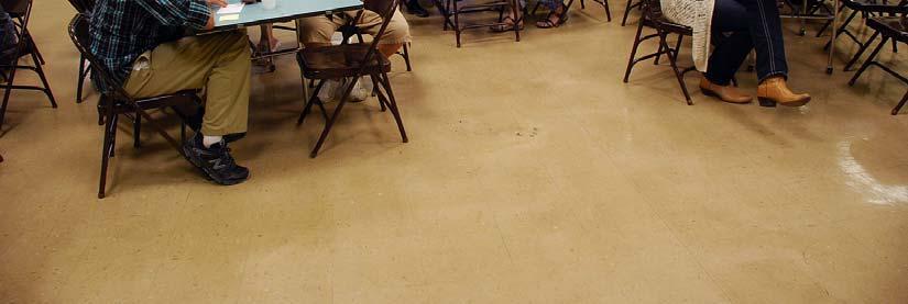
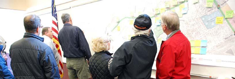
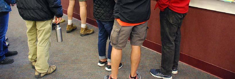
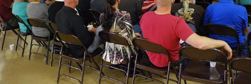
8 COMMUNITY ENGAGEMENT 8
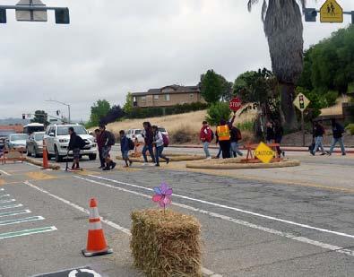
9 WEEKLONG COMMUNITY ENGAGEMENT overview of engagement events May Two Community Workshops Three Stakeholder Meetings Temporary Pop- Up Installation at Lewis Middle School Walkability Assessment Open Studio Hours


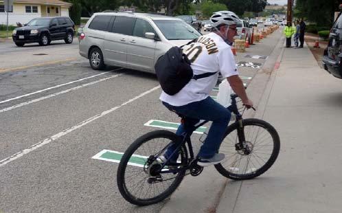
10 WEEKLONG COMMUNITY ENGAGEMENT walkability assessment 10

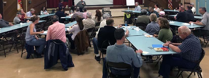
11 WEEKLONG COMMUNITY ENGAGEMENT opening community workshop 11


12 WEEKLONG COMMUNITY ENGAGEMENT opening community workshop 12 vision Fresh pavement and striping Free/smooth traffic flow with least amount of barriers or obstacles possible Adequate capacity to handle current and future traffic 2 lanes of travel in each direction Safe crossings and signals for pedestrians Continuous sidewalks on both sides Bike lanes on both sides More trees


13 WEEKLONG COMMUNITY ENGAGEMENT opening community workshop 13 values Family-Oriented Sense of Community Wine and Weather Accessible Small Rural Town Amenities History


14 WEEKLONG COMMUNITY ENGAGEMENT stakeholder meetings 14 Lewis Middle School leadership class

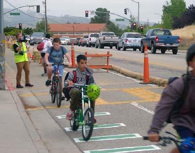
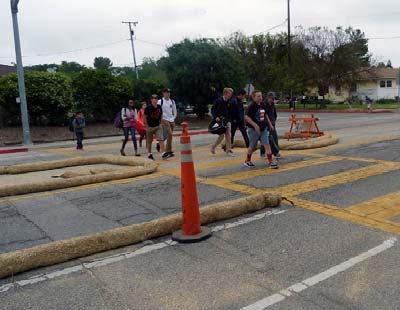
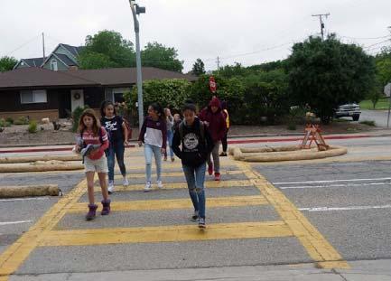
15 WEEKLONG COMMUNITY ENGAGEMENT pop-up installation 15

16 WEEKLONG COMMUNITY ENGAGEMENT open studio hours 16

17 WEEKLONG COMMUNITY ENGAGEMENT closing workshop 17
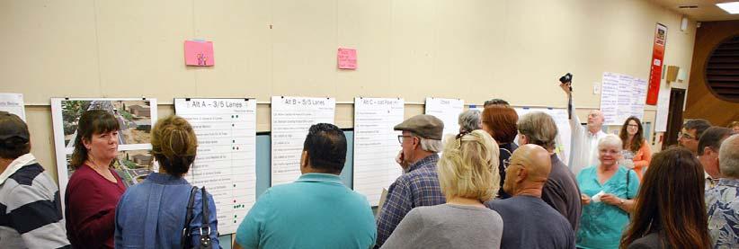
18 SUMMARY OF DEVELOPED ALTERNATIVES 18
19 SUMMARY OF DEVELOPED ALTERNATIVES three alternatives 19 A Three-Five B Five-Five C Just Pave It (+)


20 SUMMARY OF DEVELOPED ALTERNATIVES the three-five 20 A Three-Five Five lanes from S River to Elm Three lanes from Elm to Rolling Hills Five lanes from Rolling Hills to Niblick Protected Bikeways Medians where feasible Install sidewalks where gaps exist Widen sidewalks at school locations Enhanced crosswalks at uncontrolled locations
21 SUMMARY OF DEVELOPED ALTERNATIVES the three-five 21 A Three-Five Five lanes from S River to Elm Three lanes from Elm to Rolling Hills Five lanes from Rolling Hills to Niblick Protected Bikeways Medians where feasible Install sidewalks where gaps exist Widen sidewalks at locations Enhanced crosswalks at uncontrolled locations

22 SUMMARY OF DEVELOPED ALTERNATIVES the five-five 22 B Five-Five Five lanes through entire corridor Bike lanes Install sidewalks where gaps exist Enhanced crosswalks at uncontrolled locations
23 SUMMARY OF DEVELOPED ALTERNATIVES the five-five 23 B Five-Five Five lanes through entire corridor Bike lanes Install sidewalks where gaps exist Enhanced crosswalks at uncontrolled locations
24 SUMMARY OF DEVELOPED ALTERNATIVES just pave it (+) 24 C Just Pave It (+) Lanes remain as-is on corridor Existing bike lanes to remain Install sidewalks where gaps exist Upgraded signage


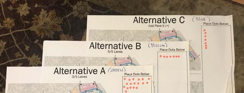
25 WEEKLONG COMMUNITY ENGAGEMENT results of polling A 56% B 22% C 22% 18 18/32 7/32 7/32
26 A WEEKLONG COMMUNITY ENGAGEMENT results of polling 26 Improvement Positive Against Total 1. Restripe from 2 Lanes to 3 Lanes Traffic Signal at Walnut Flashing Beacon and Curb Extensions at Trigo A. Striped Buffered Bike lanes B. Protected Bikeways A. Flashing Beacon and Median at Ivy B. HAWK Signal at Ivy Wider Sidewalk in School Areas Flashing Beacon and Median at Orchard Connect Centennial Trail to Schools Create Trail between Rolling Hills and Centennial Trail A. Traffic Signal at Rolling Hills B. Roundabout at Rolling Hills Landscaping on Existing Medians Expand to 5 Lanes south of Lana 2-1 1
27 B WEEKLONG COMMUNITY ENGAGEMENT results of polling 27 Improvement Positive Against Total 13. Widen Capital Hill Area to 5 Lanes 14. Maintain Existing Striped Bike Lanes 15. Traffic Signal at Walnut and Realign with Bolen 16. HAWK at Trigo 17. HAWK at Ivy 18. Widen School Zone Segment to 5 Lanes 19. HAWK at Orchard 20. Traffic Signal at Rolling Hills 21. Widen section south of Lana to 5 Lanes
28 C WEEKLONG COMMUNITY ENGAGEMENT results of polling 28 Improvement Positive Against Total 22. Keep Existing Lanes 23. Maintain Existing Bike Lanes 24. Traffic Signal at Walnut 25. Flashing Beacon at Trigo 26. HAWK at Ivy 27. Traffic Signal at Rolling Hills
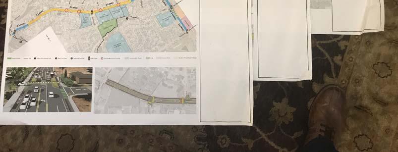
29 COMMUNITY PREFERRED ALTERNATIVE 29
30 30 COMMUNITY PREFERRED ALTERNATIVE
31 31 COMMUNITY PREFERRED ALTERNATIVE

32 COMMUNITY PREFERRED ALTERNATIVE 32
33 33 COMMUNITY PREFERRED ALTERNATIVE

34 COMMUNITY PREFERRED ALTERNATIVE 34

35 COMMUNITY PREFERRED ALTERNATIVE 35

36 COMMUNITY PREFERRED ALTERNATIVE 36

37 COMMUNITY PREFERRED ALTERNATIVE 37

38 COMMUNITY PREFERRED ALTERNATIVE 38
39 39 COMMUNITY PREFERRED ALTERNATIVE

40 COMMUNITY PREFERRED ALTERNATIVE 40


41 COMMUNITY PREFERRED ALTERNATIVE Walnut Drive Realignment Alternative 41
42 COMMUNITY PREFERRED ALTERNATIVE 42
43 43 COMMUNITY PREFERRED ALTERNATIVE

44 COMMUNITY PREFERRED ALTERNATIVE 44

45 COMMUNITY PREFERRED ALTERNATIVE 45
46 46 COMMUNITY PREFERRED ALTERNATIVE

47 COMMUNITY PREFERRED ALTERNATIVE 47

48 COMMUNITY PREFERRED ALTERNATIVE 48
49 49 COMMUNITY PREFERRED ALTERNATIVE
50 COMMUNITY PREFERRED ALTERNATIVE 50
51 51 COMMUNITY PREFERRED ALTERNATIVE

52 COMMUNITY PREFERRED ALTERNATIVE 52

53 COMMUNITY PREFERRED ALTERNATIVE 53
54 COMMUNITY PREFERRED ALTERNATIVE 54
55 55 COMMUNITY PREFERRED ALTERNATIVE

56 COMMUNITY PREFERRED ALTERNATIVE 56

57 COMMUNITY PREFERRED ALTERNATIVE 57
58 COMMUNITY PREFERRED ALTERNATIVE 58
59 59 COMMUNITY PREFERRED ALTERNATIVE

60 COMMUNITY PREFERRED ALTERNATIVE 60

61 COMMUNITY PREFERRED ALTERNATIVE 61
62 62 COMMUNITY PREFERRED ALTERNATIVE

63 COMMUNITY PREFERRED ALTERNATIVE 63

64 64 COMMUNITY PREFERRED ALTERNATIVE


65 EXISTING CONDITIONS cross-section view looking eastbound at Shannon Hill Road 65


66 COMMUNITY PREFERRED ALTERNATIVE cross-section view looking eastbound at Shannon Hill Road 66


67 EXISTING CONDITIONS cross-section view looking westbound at Ivy Street in front of Lewis Middle School 67


68 COMMUNITY PREFERRED ALTERNATIVE cross-section view looking westbound at Ivy Street in front of Lewis Middle School 68


69 EXISTING CONDITIONS cross-section view looking westbound at Creston Road and Rolling Hills Road 69


70 COMMUNITY PREFERRED ALTERNATIVE cross-section view looking westbound at Creston Road and Rolling Hills Road 70


71 EXISTING CONDITIONS cross-section view looking northbound at Pifer Elementary School 71


72 COMMUNITY PREFERRED ALTERNATIVE cross-section view looking northbound at Pifer Elementary School 72
73 COMMUNITY PREFERRED ALTERNATIVE results of traffic analysis 73 Acceptable intersection operation with preferred alternative Including the roundabout at Rolling Hills Decreased delay at stop-controlled side streets with the center turn lane Pedestrian crossing volumes accommodated at uncontrolled crossings: high-visibility crosswalk Median Curb extensions Flashing beacons (RRFB)
74 COMMUNITY INPUT ACTIVITY 74


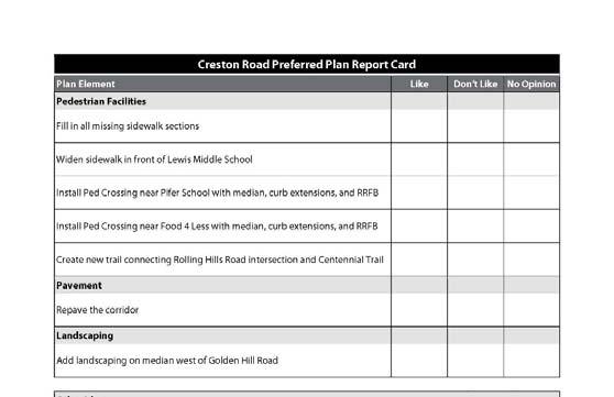
75 COMMUNITY INPUT ACTIVITY 75
Agenda. Overview PRINCE GEORGE S PLAZA METRO AREA PEDESTRIAN PLAN
 PRINCE GEORGE S PLAZA METRO AREA PEDESTRIAN PLAN May 28, 2008 Agenda Welcome and introductions Project overview and issue identification Planning context and strengths Design challenges and initial recommendations
Watertown Complete Streets Prioritization Plan. Public Meeting #1 December 14, 2017
 Watertown Complete Streets Prioritization Plan Public Meeting #1 December 14, 2017 Goals for Public Meeting Overview of MassDOT Complete Streets Funding Program Educate the community on Complete Streets
City of Sammamish. Welcome. Issaquah-Fall City Road Improvements Project Phase I Design: 242nd Avenue SE to Klahanie Drive SE
 Welcome Welcome to the third community meeting for the Issaquah-Fall City Road Improvements Project. AGENDA 6:00 p.m. Welcome and sign-in 6:10 p.m. Presentation 6:50 p.m. Open house Learn about the roadway
California Department of Transportation, District 4. Sloat Boulevard Project Skyline Blvd. to 19 th Ave. Community Update January 13, 2016
 California Department of Transportation, District 4 Sloat Boulevard Project Skyline Blvd. to 19 th Ave. Community Update January 13, 2016 Agenda Welcome and introductions Project overview, history and
PRINCE GEORGE S PLAZA METRO AREA PEDESTRIAN PLAN
 PRINCE GEORGE S PLAZA METRO AREA PEDESTRIAN PLAN May 28, 2008 Agenda Welcome and introductions Project overview and issue identification Planning context and strengths Design challenges and initial recommendations
UPTOWN REGIONAL BIKE CORRIDORS PROJECT SAN DIEGO ASSOCIATION OF GOVERNMENTS
 UPTOWN REGIONAL BIKE CORRIDORS PROJECT SAN DIEGO ASSOCIATION OF GOVERNMENTS SUMMARY REPORT: COMMUNITY UPDATE MEETING February 6, 2014 6 8:30 p.m. Roosevelt Middle School Library 3366 Park Blvd, San Diego
Prince George s County plans, policies, and projects
 Prince George s County plans, policies, and projects Over 250 projects for trails, bikeways, designated bike lanes and sidewalk construction Trail projects that improve access to Metro Sidewalk and trail
Los Altos Hills Town Council - June 18, 2015 Palo Alto City Council June 22, AGENDA ITEM #2.B Presentation
 Los Altos Hills Town Council - June 18, 2015 Palo Alto City Council June 22, 2015 AGENDA ITEM #2.B Presentation Previous Presentations Los Altos Hills Town Council in May 2014 and February 2015 Palo Alto
West Capitol Avenue Road Rehabilitation and Safety Enhancement Project
 West Capitol Avenue Road Rehabilitation and Safety Enhancement Project Stakeholder Focus Group Meeting #2 Tuesday, August 28, 2018 7:00 8:00 a.m. West Sacramento City Hall 1110 West Capitol Avenue, West
PRESS RELEASE San Joaquin Council of Governments
 PRESS RELEASE San Joaquin Council of Governments For Immediate Release February 23, 2018 Contact: Nicole Gorham, 235-0582 gorham@sjcog.org SJCOG Board Awards $19.63 Million in Measure K Bicycle, Pedestrian,
Proposed. City of Grand Junction Complete Streets Policy. Exhibit 10
 Proposed City of Grand Junction Complete Streets Policy Exhibit 10 1 City of Grand Junction Complete Streets Policy Vision: The Complete Streets Vision is to develop a safe, efficient, and reliable travel
Council Agenda Report
 Council Agenda Report From: Subject: Dick McKinley, Public Works Director Ditas Esperanza, Capital Projects Engineer Creston Road Corridor: Preferred Alternative Plan, Active Transportation Program (ATP)
Active Transportation Facility Glossary
 Active Transportation Facility Glossary This document defines different active transportation facilities and suggests appropriate corridor types. Click on a facility type to jump to its definition. Bike
2014/2015 BIKE ROUTE PLAN 83 AVENUE PROTECTED BIKE LANE
 About the Project The City of Edmonton is planning a major bike route on the southside of Edmonton. The Strathcona Bike Route will connect the communities of Strathcona, Garneau and the University area,
El Camino Real Specific Plan. TAC/CAC Meeting #2 Aug 1, 2018
 El Camino Real Specific Plan TAC/CAC Meeting #2 Aug 1, 2018 Land Use Alternatives Goals and Tradeoffs Parks & open space Housing Retail & services Civic spaces Parking Community gathering spaces 3 Alternatives
Henderson Ave. Complete Streets Project
 Henderson Ave. Complete Streets Project Meeting Purpose To finalize conceptual components of project prior to proceeding with preliminary engineering www.dallascompletestreets.wordpress.com MeetingAgenda
Beach Cities Living Streets Design Manual and Aviation Boulevard Multimodal Corridor Plan
 Beach Cities Living Streets Design Manual and Aviation Boulevard Multimodal Corridor Plan AGENDA 1 Introductions & Project Scope 2 Public Outreach Recap 3 Living Streets Design Manual 4 Aviation Boulevard
IBI Group November 5, 2012
 IBI Group Agenda Session 1 3:00 PM Welcome / Sign in 3:10 PM Presentation 3:30 PM Questions? 3:35 PM World Café Discussion 4:45 PM Report on top 3 ideas 4:50 PM Next Steps 5:00 PM Adjourn 2 Agenda Session
Tonight is for you. Learn everything you can. Share all your ideas.
 Strathcona Neighbourhood Renewal Draft Concept Design Tonight is for you. Learn everything you can. Share all your ideas. What is Neighbourhood Renewal? Creating a design with you for your neighbourhood.
95 th Street Corridor Transportation Plan. Steering Committee Meeting #2
 95 th Street Corridor Transportation Plan Steering Committee Meeting #2 February 18, 2015 PURPOSE OF THE MEETING Update Steering Committee Present Community/Stakeholder Survey Results Present Transportation
Memo. Introduction. Memphis STP Pedestrian Sidewalk Project
 Memo Memphis STP Pedestrian Sidewalk Project To: Kyle Wagenshutz, City of Memphis From: Matthew Berkow, Collin Chesston, and Anne Eshleman, Alta Planning + Design Date: June 2014 Re: Photo Inventory Introduction
Caltrans Sloat Boulevard Pedestrian Safety Project Response to Community Questions, Comments & Concerns
 Caltrans Sloat Boulevard Pedestrian Safety Project Response to Community Questions, Comments & Concerns Revised: May 10, 2016 The California Department of Transportation (Caltrans) is planning various
2014/2015 BIKE ROUTE PLAN 83 AVENUE PROTECTED BIKE LANE
 About the Project 2014/2015 BIKE ROUTE PLAN The City of Edmonton is planning a major bike route on the south side of Edmonton. This bike route is one part of a plan to provide citizens with transportation
BD RESOLUTION NO RESOLUTION ADOPTING THE VISION ZERO RAMP INTERSECTION STUDY PHASE 1
 BD00 RESOLUTION NO. - RESOLUTION ADOPTING THE VISION ZERO RAMP INTERSECTION STUDY PHASE [NTIP PLANNING] FINAL REPORT WHEREAS, The Vision Zero Ramp Intersection Study Phase was recommended by Commissioner
Bikeway action plan. Bicycle Friendly Community Workshop March 5, 2007 Rochester, MN
 Bikeway action plan Summary The was held on March 5, 2007 at the Rochester Mayo Civic Center. The workshop was hosted by Rochester-Olmsted County Planning Department in collaboration with the League of
Existing Pedestrian Conditions. PSAC February 8, 2011
 Existing Pedestrian Conditions PSAC February 8, 2011 Contents 1. Project Background & Goals 2. Pedestrian Activity: Where people walk 3. Pedestrian Safety: The conditions people face Project Background
Dr. M.L. King, Jr. Street North Complete Streets Resurfacing Opportunities HOUSING, LAND USE, AND TRANSPORTATION COMMITTEE MARCH 22, 2018
 Dr. M.L. King, Jr. Street North Complete Streets Resurfacing Opportunities HOUSING, LAND USE, AND TRANSPORTATION COMMITTEE MARCH 22, 2018 What s Happening The City plans to mill and resurface Dr. M.L.
Appendix D: Planning Level Cost Calculator
 Appendix D: Planning Level Cost Calculator Network Costs by Facility Type Facility Type Total Miles of Facility Total Number of Intersections Cost per feature or per mile Total Cost Bicycle Boulevard 52.14
SAN FRANCISCO MUNICIPAL TRANSPORTATION AGENCY
 THIS PRINT COVERS CALENDAR ITEM NO. : 12 DIVISION: Sustainable Streets BRIEF DESCRIPTION: SAN FRANCISCO MUNICIPAL TRANSPORTATION AGENCY Approving various bicycle improvements and traffic modifications
Transportation Planning Division
 Transportation Planning Division Presentation Outline Study Tasks Recap of Previous Meetings Data Collected Focus Areas within Study Limits Design Principles Tool Box Recommended Concepts Schedule Moving
Omaha s Complete Streets Policy
 Omaha s Complete Streets Policy (Adopted August 2015) VISION To create great places and enhance our quality of life, the City of Omaha will provide safe, accessible streets for all users. Complete Streets
SAN FRANCISCO MUNICIPAL TRANSPORTATION AGENCY
 THIS PRINT COVERS CALENDAR ITEM NO.: 10.3 DIVISION: Sustainable Streets BRIEF DESCRIPTION: SAN FRANCISCO MUNICIPAL TRANSPORTATION AGENCY Approving various traffic and parking modifications on Bay Street
TOWN OF MORAGA MORAGA WAY AND CAMINO PABLO/CANYON ROAD IMPROVEMENTS Town Council Meeting March 13, 2019
 TOWN OF MORAGA MORAGA WAY AND CAMINO PABLO/CANYON ROAD IMPROVEMENTS Town Council Meeting March 13, 2019 1 Edric Kwan, Public Works Director Josh Peterman, Principal, Fehr and Peers Shawn Knapp, Senior
Southview Blvd & 3 rd Avenue Improvement Project. Public Open House December 4, to 7pm
 Southview Blvd & 3 rd Avenue Improvement Project Public Open House December 4, 2014 5 to 7pm Southview Blvd & 3 rd Avenue Public Information Meeting Agenda Presentation 5:30 to 6:15 pm Purpose of Project
» Draft Recommendations» Discussion» Next Steps. Plan for Walking and Biking
 SAC Meeting Plan #3 for September Walking and 12, Biking 2018 » Draft Recommendations» Discussion» Next Steps Plan for Walking and Biking » Stakeholder and Public Outreach» Background data collection and
Freeway ramp intersection study
 Freeway ramp intersection study Supporting Vision Zero: Zero traffic deaths in San Francisco by 2024 Study Goals: Primary Improve Safety Improve Accessibility Secondary Provide Efficient Circulation Accommodate
El Paso County 2040 Major Transportation Corridors Plan
 El Paso County 2040 Major Transportation Corridors Plan Connect-our-County Online Transportation User Survey Preliminary Results June 24, 2010 Years of Residence 2. How many years have you LIVED HERE?
Pine Hills Road Pedestrian/Bicycle Safety Study Board of County Commissioners Work Session
 Pine Hills Road Pedestrian/Bicycle Safety Study Board of County Commissioners Work Session February 20, 2018 Meeting Agenda Study Overview Existing Conditions Access Management Potential Gateway Features
Perryville TOD and Greenway Plan
 Perryville TOD and Greenway Plan Greenway Glossary Pathway: A bicycle and pedestrian path separated from motorized vehicular traffic by an open space, barrier or curb. Multi-use paths may be within the
REGIONAL BICYCLE AND PEDESTRIAN DESIGN GUIDELINES
 REGIONAL BICYCLE AND PEDESTRIAN DESIGN GUIDELINES November 16, 2011 Deb Humphreys North Central Texas Council of Governments Bicycle and Pedestrian Advisory Committee Snapshot of the Guide 1. Introduction
Bicycle Facilities Planning
 Bicycle Facilities Planning Overview Types of Cyclists Purpose for Riding Types of Facilities Bike Lanes Bicycle Boulevards Cycle Tracks Intersections Signals Signing and Marking Discussion Types of Bicyclists
Columbia Pike Implementation Team (CPIT) Meeting
 Meeting") Columbia Pike Implementation Team (CPIT) Meeting November 30, 2010 Agenda Introductions / Purpose of Meeting Review of project goals Multimodal project: 10% street design between the curbs Discussion Multimodal
Columbia Pike Implementation Team (CPIT) Meeting November 30, 2010 Agenda Introductions / Purpose of Meeting Review of project goals Multimodal project: 10% street design between the curbs Discussion Multimodal
FOCUS AREA 1 - Alberta Avenue Pocket Park 3 (121 Ave and 92 St)
") FOCUS AREA 1 - Alberta Avenue Pocket Park 3 (121 Ave and 92 St) New benches Plant evergreen trees Widen existing sidewalk from 1.5m to 1.8m Marked crosswalk 1.8m wide sidewalk Add pedestrian oriented lights
FOCUS AREA 1 - Alberta Avenue Pocket Park 3 (121 Ave and 92 St) New benches Plant evergreen trees Widen existing sidewalk from 1.5m to 1.8m Marked crosswalk 1.8m wide sidewalk Add pedestrian oriented lights
Executive Summary Route 30 Corridor Master Plan
 Route Corridor Master Plan Project Overview The Route Corridor Master Plan is a coordinated multimodal transportation and land use plan for the entire stretch of Route through East Whiteland Township,
Walkability Audit Cities of Olympia, Tumwater and Lacey, Washington. Next Steps Memorandum September FINAL
 Walkability Audit Cities of Olympia, Tumwater and Lacey, Washington Memorandum September 2012 - FINAL 1. INTRODUCTION The U.S. Environmental Protection Agency (EPA) selected the Thurston Regional Planning
Item No. 14 Town of Atherton
 Item No. 14 Town of Atherton CITY COUNCIL STAFF REPORT CONSENT AGENDA TO: THROUGH: FROM: HONORABLE MAYOR AND CITY COUNCIL GEORGE RODERICKS, CITY MANAGER MICHAEL KASHIWAGI, COMMUNITY SERVICES DIRECTOR MARTY
City of Wilsonville 5 th Street to Kinsman Road Extension Project
 City of Wilsonville 5 th Street to Kinsman Road Walking Tour & Neighborhood Workshop Summary Report Public Outreach Overview On July 18 th, 2017, the City of Wilsonville hosted a neighborhood walking tour
Ocean Park Boulevard Streetscape Improvement Project Alternatives & Trade Offs
 City Council Study Session January 27, 2009 Ocean Park Boulevard Streetscape Improvement Project Alternatives & Trade Offs Scope of Work Purpose of Tonight s Meeting Review work to date and direct staff
Presentation Starts at 5:30 PM
 Presentation Starts at 5:30 PM Public Meeting #1 September 22, 2016 Purpose of Study Conceptual Complete Streets Study on South Carson Street 5 th Street to Roland Drive Approximately 2.5 miles Consider
Draft North Industrial Area-Wide Traffic Plan
 Summary of North Industrial and Hudson Bay Industrial Recommended Improvements Table 1. Summary of s Item Location 1 2 3 4 5 6 7 8 9 10 11 12 Millar Ave north of 51st St Super 8 Motel back lane 400 Block
50 Avenue S.W. Corridor Study Glenmore Aquatic Centre Drop-In Event
 Project overview The City of Calgary is conducting a transportation corridor study of 5 Avenue S.W., between Crowchild Trail and 4A Street S.W. In 29, it was reclassified as a Parkway under the Calgary
City of El Cerrito San Pablo Avenue Specific Plan. Capital Improvement Program
 City of El Cerrito San Pablo Avenue Specific Plan Capital Improvement Program May 2015 San Pablo Avenue Intersection Improvements San Pablo Avenue and Hill Street/Eastshore Boulevard Background Existing
Ocean Park Boulevard Green Street Project Community Workshop
 Ocean Park Boulevard Green Street Project Community Workshop 2.2.10 Project Objectives Community Priority: reclaim OPB for public open space. Build upon LUCE principles; neighborhood enhancement, connectivity,
Environment and Public Works Committee Presentation
 Mixed Use Centers Complete Streets Guidelines Project Environment and Public Works Committee Presentation December 10, 2008 Project Objectives: Conduct an inter-departmental and agency process to study
Board-Approved Funding Awards for Cycle 4 Active Transportation Grant Program Projects (in Order of Project Rankings) Approved on
 Approved on") CAPITAL Large Category Projects Board-Approved Funding Awards for Cycle 4 Active Transportation Grant Program Projects (in Order of Project Rankings) Approved on 07-27-18 1 La Mesa University Ave Pedestrian
CAPITAL Large Category Projects Board-Approved Funding Awards for Cycle 4 Active Transportation Grant Program Projects (in Order of Project Rankings) Approved on 07-27-18 1 La Mesa University Ave Pedestrian
Pre-Construction Meeting
 Pre-Construction Meeting Wednesday, March 21 Drop-in from 5 9pm Please visit displays for project information, talk to staff, and ask questions! Edmonton.ca/SouthsideBikeRoutes Objectives & Project Scope
Public Workshop #2. September 14, 2016
 Public Workshop #2 September 14, 2016 Agenda Welcome Project Overview Where We Have Been Alternatives for State Street Land Use Street Design Next Steps 2 Project Overview Create a Vibrant State Street
Citywide Sidewalk and Crosswalk Programs
 Citywide Sidewalk and Crosswalk Programs Council Meeting October 20, 2015 Presented by Rita Hu and Jamal Mahmoud Program Goals Implement the City s comprehensive plan. Provide pedestrian with safe walking
MEASURE B AND MEASURE BB Annual Program Compliance Report Reporting Fiscal Year AGENCY CONTACT INFORMATION
 MEASURE B AND MEASURE BB Annual Program Compliance Report Reporting Fiscal Year 2016-2017 AGENCY CONTACT INFORMATION Agency Name: City of Livermore Date: 12/4/2017 Primary Point of Contact Name: Debbie
NJDOT Complete Streets Checklist
 Background The New Jersey Department of Transportation s Complete Streets Policy promotes a comprehensive, integrated, connected multi-modal network by providing connections to bicycling and walking trip
MAG Town of Cave Creek Bike Study Task 6 Executive Summary and Regional Significance Report
 Page 1 MAG Town of Cave Creek Bike Study Task 6 Executive Summary and Regional Significance Report August 1, 2012 MAG Project #481 Page 2 Task 6 Executive Summary and Regional Significance Report Introduction
PEDESTRIAN SAFETY ASSESSMENT SR 934/NORMANDY DRIVE AND 71 Street
 PEDESTRIAN SAFETY ASSESSMENT SR 934/NORMANDY DRIVE AND 71 Street PRESENTED BY MISLEIDYS LEON TRAFFIC SAFETY PROGRAM ENGINEER FLORIDA DEPARTMENT OF TRANSPORTATION (FDOT) BACKGROUND In response to citizen
Roosevelt Estates Neighborhood Improvements
 Roosevelt Estates Neighborhood Improvements Transportation Alternatives Application May 5 th, 2016 Qualifying Activities Construction of on-road and off-road trail facilities for pedestrians, bicyclists,
COMPLETE STREETS PLANNER S PORTFOLIO
 COMPLETE STREETS PLANNER S PORTFOLIO ISSUE 3 APRIL 2016 PLANNER S PORTFOLIO COMPLETE STREETS 1 2 6 10 14 OVERVIEW MATURE NEIGHBORHOODS GROWING SUBURBS CENTRAL PLACES ACTIVITY CORRIDORS Planner s Portfolio
AGENDA ITEM NO. 5b HCAOG TAC meeting of May 8, 2014
 Humboldt County Association of Governments Eureka, CA, 95501 AGENDA ITEM NO. 5b HCAOG TAC meeting of May 8, 2014 DATE: May 1, 2014 TO: HCAOG Technical Advisory Committee (TAC) FROM:, SUBJECT: Letters of
CHAPTER 3: Vision Statement and Goals
 Davidson Walks & Rolls: Active Transportation Master Plan CHAPTER 3 Contents: Overview Vision Statement Measurable Goals Public Outreach CHAPTER 3: Vision Statement and Goals Overview The vision statement
Fort Defiance Industrial Area Traffic Circulation Study Task Assignment MPD
 Fort Defiance Industrial Area Traffic Circulation Study Task Assignment MPD 029-13 Executive Summary March 14, 2014 Arizona Department of Transportation TABLE OF CONTENTS Page STUDY PURPOSE AND NEED...
Trial Restriping Project. October 21, 2010
 Arastradero Road Trial Restriping Project P t C t ti C it O t hm ti N 1 Post Construction Community Outreach Meeting No. 1 October 21, 2010 Agenda Staff Introductions Project Background Project Status
Ocean Park Boulevard Green Street Project Alternatives & Trade Offs
 Planning Commission March 4, 2009 Ocean Park Boulevard Green Street Project Alternatives & Trade Offs Purpose of Tonight s Meeting Review concept plans and options Provide input on alternatives and trade-offs
City of Seattle Edward B. Murray, Mayor
 City of Seattle Edward B. Murray, Mayor Department of Transportation Scott Kubly, Director Eastlake Community Council 117 E Louisa St. #1 Seattle, WA 98102-3278 January 28, 2016 RE: Roosevelt to Downtown
Welcome. If you have any questions or comments on the project, please contact:
 Welcome This drop-in public open house is intended to provide information about the Bay Street bike lanes project. This project proposes a dedicated cycling facility along Bay Street between Aberdeen Avenue
F L E T C H E R A V E N U E
 Jan. 29, 2014 Introduction F L E T C H E R A V E N U E FDOT Local Agency Program (LAP) Project FPN: 428214-1-58-01 CIP 63090 Hillsborough County, Traffic Engineering, PWD Stake holders and partners are
Public Works Committee Meeting Richard E. Mastrangelo Council Chamber November 20, 2017
 Public Works Committee Meeting Richard E. Mastrangelo Council Chamber November 20, 2017 Purpose of Meeting Why are we here? Project Recap/Updates Project Limits/Segments Road Diet Concept Lessons Learned
Toronto and East York Community Council. Director, Transportation Services, Toronto and East York District
 No Turn on Red Regulations STAFF REPORT ACTION REQUIRED Date: June 1, 2010 To: From: Toronto and East York Community Council Director, Transportation Services, Toronto and East York District Wards: Trinity
City of Birmingham Draft Multi-modal Transportation Plan
 City of Birmingham Draft Multi-modal Transportation Plan City Commission Public Hearing Monday, November 25, 2013 7:30 pm Norman Cox, PLA, ASLA The Greenway Collaborative, Inc. Ann Arbor, Michigan The
Broad Street Bicycle Boulevard Design Guidelines
 Broad Street Bicycle Boulevard Design Guidelines Building from the strategies introduced in the 2013 Bicycle Transportation Plan and community input received thus far, City Transportation Staff have identified
Foothill Expressway Improvements Between El Monte and San Antonio
 Foothill Expressway Improvements Between El Monte and San Antonio June 29, 2017 - Los Altos Community Meeting Introduction Project Background Agenda Visit Stations: Provide Input and Ask Questions Reconvene:
Guidance. ATTACHMENT F: Draft Additional Pages for Bicycle Facility Design Toolkit Separated Bike Lanes: Two-Way to One-Way Transitions
 ATTACHMENT F: Draft Additional Pages for Bicycle Facility Design Toolkit Separated Bike Lanes: Two-Way to One-Way Transitions This treatment provides a transition from two-way separated bike lanes to one-way
1.0 EXECUTIVE SUMMARY
 1.0 EXECUTIVE SUMMARY The Active Transportation Plan is a guide to accomplish the Town s vision for developing a network of sidewalks, on-road bicycle facilities, and trails that allow for safe and convenient
CITY OF MINNEAPOLIS 26 th St E/W & 28 th St E/W Protected Bikeway. Open House - February 2017
 CITY OF MINNEAPOLIS 26 th St E/W & 28 th St E/W Protected Bikeway Open House - February 2017 2/27/2017 1 Purpose of Meeting Inform: Provide an overview of the project Opportunity to gather feedback/input/observations
Measure A Pedestrian & Bicycle Program Update. April 4, 2019 Board of Directors Agenda Item #10 (b)
") Measure A Pedestrian & Bicycle Program Update April 4, 2019 Board of Directors Agenda Item #10 (b) Overview Program background Program allocations & delivery status Feature Project: California Drive Roundabout
Measure A Pedestrian & Bicycle Program Update April 4, 2019 Board of Directors Agenda Item #10 (b) Overview Program background Program allocations & delivery status Feature Project: California Drive Roundabout
NOTES FROM JUNIOR COUNCIL ORIENTATION SESSION HELD ON MONDAY, JANUARY 22, 2018, AT 3:30 PM IN COUNCIL CHAMBERS, CITY HALL
 CITY OF KAMLOOPS Junior Council Meeting Agenda March 12, 2018, at 3:30 pm in Council Chambers, 7 Victoria Street West, Kamloops, BC Page 1. APPROVAL OF THE AGENDA 2. MINUTES Attachment Recommendation:
Why invest in the 1 Street S.W. Corridor?
 Why invest in the 1 Street S.W. Corridor? This project is an investment in the Beltline Community and Calgary s economy. It is anticipated that The City s investment along this corridor will help with
Municipal Class EA To Address Traffic Congestion On The Ontario Street Corridor (Grand Bend) Public Information Meeting June 4, 2018
 Public Information Meeting June 4, 2018") Municipal Class EA To Address Traffic Congestion On The Ontario Street Corridor (Grand Bend) Public Information Meeting June 4, 2018 Background Agenda Traffic Study Update Class EA Alternatives Bridge
Municipal Class EA To Address Traffic Congestion On The Ontario Street Corridor (Grand Bend) Public Information Meeting June 4, 2018 Background Agenda Traffic Study Update Class EA Alternatives Bridge
Houma-Thibodaux Metropolitan Planning Organization STP<200K Funding Application APPLICATION
 APPLICATION HOUMA-THIBODAUX METROPOLITAN PLANNING ORGANIZATION (HTMPO) FOR SURFACE TRANSPORTATION PROGRAM (STP
What Is a Complete Street?
 Session 5 Charleen Zimmer, AICP, Zan Associates May 5-7, 2010 What Is a Complete Street? May 2010 5-1 Not a Complete Street More of a Complete Street May 2010 5-2 Benefits of Complete Streets Safety for
Knox Street Complete Streets Project
 Knox Street Complete Streets Project Meeting Purpose Get community feedback on two conceptual street design options Meeting Agenda Presentation (20 minutes) Project background and schedule Summary of preferences
WELCOME. Thank you for joining us at the Second Public Workshop for the Carlsbad Pedestrian Master Plan. We look forward to receiving your feedback.
 City of Carlsbad Pedestrian Master Plan: WELCOME WELCOME Please Sign In Provide Input at Flip Charts Review Boards Presentation of Draft Plan Thank you for joining us at the Second Public Workshop for
MASTER BICYCLE AND PEDESTRIAN PLAN
 VILLAGE OF NORTHBROOK MASTER BICYCLE AND PEDESTRIAN PLAN DRAFT PLAN OPEN HOUSE May 2, 2018 AGENDA 1. Community Engagement 2. Vision and Goals 3. General Structure of Plan 4. Recommendations Overview 5.
C/CAG. Sunnybrae Elementary School Walking and Bicycling Audit. San Mateo-Foster City School District JUNE 2013
 Sunnybrae Elementary School Walking and Bicycling Audit JUNE 2013 San Mateo-Foster City School District C/CAG City/County Association of Governments of San Mateo County SUNNYBRAE ELEMENTARY SCHOOL WALKING
Wood and Cortland Neighborhood Greenways
 Wednesday, May 25 th, 2016 Wood and Cortland Neighborhood Greenways Alderman Hopkins 2 nd Ward Alderman Waguespack 32 nd Ward Mike Amsden, AICP Assistant Director of Transportation Planning David Smith,
COMMUNITY MEETING AGENDA
 COMMUNITY MEETING AGENDA Welcome and Introductions SAFE Presentation Project Presentation Priorities Feedback Next Steps Q&A Santa Cruz Avenue Corridor Study 1 Santa Cruz Avenue Corridor Study Community
ALBERTA AVENUE WHAT WE HEARD REPORT BUILDING GREAT NEIGHBOURHOODS
 ALBERTA AVENUE WHAT WE HEARD REPORT BUILDING GREAT NEIGHBOURHOODS FEBRUARY 2019 EXECUTIVE SUMMARY Starting in 2019, Alberta Avenue will see the replacement and enhancement of its aging collector and local
AGENDA REPORT. Issue: Discussion of potential improvements on Barnwell Road at Niblick Drive
 AGENDA REPORT To: From: By: Honorable Mayor and City Council Members Warren Hutmacher, City Manager Tom Black, Public Works Director Date: March 23, 2016 Agenda: March 28, 2016 WORK SESSION AGENDA: Barnwell
Solana Beach Comprehensive Active Transportation Strategy (CATS)
") Solana Beach Comprehensive Active Transportation Strategy (CATS) 3.0 Goals & Policies The Solana Beach CATS goals and objectives outlined below were largely drawn from the Solana Beach Circulation Element
Solana Beach Comprehensive Active Transportation Strategy (CATS) 3.0 Goals & Policies The Solana Beach CATS goals and objectives outlined below were largely drawn from the Solana Beach Circulation Element
GARLAND ROAD/GASTON AVENUE/ GRAND AVENUE INTERSECTION IMPROVEMENT STUDY
 MEETING OF AFFECTED PROPERTY OWNERS AND STAKEHOLDERS GARLAND ROAD/GASTON AVENUE/ GRAND AVENUE INTERSECTION IMPROVEMENT STUDY CSJ 0009-02-067 Meeting Agenda 1 2 3 4 5 6 7 8 9 10 Opening Remarks State Representative
Design Guidelines. Overview. Design Vision for Yellow Brick Road
 Design Guidelines Overview This section presents the design vision for the Yellow Brick Road network. The Yellow Brick Road is envisioned to be an interconnected network of safe and secure roadways where
N. Frederick Street to N. Manchester Street
 November 20, 2014 N. Frederick Street to N. Manchester Street Goals and Summary, November 2007 Map, December 2007 Bicycle Element, July 2008 Pedestrian Element, July 2008 Demand and System Management,
North Shore Transportation Improvement Strategy
 North Shore Transportation Improvement Strategy Preliminary, Near-term Recommendation 2016 April Transportation Improvement Strategy (TIS) Comprehensive and Analytical A multi-modal transportation strategy
DEPARTMENT OF ENVIRONMENTAL SERVICES. North Harrison Street (Lee Highway to Little Falls Road) Comparative Analysis. Prepared for:
 Comparative Analysis. Prepared for:") DEPARTMENT OF ENVIRONMENTAL SERVICES North Harrison Street (Lee Highway to Little Falls Road) Comparative Analysis Prepared for: Arlington County Department of Environmental Services 2100 Clarendon Boulevard,
DEPARTMENT OF ENVIRONMENTAL SERVICES North Harrison Street (Lee Highway to Little Falls Road) Comparative Analysis Prepared for: Arlington County Department of Environmental Services 2100 Clarendon Boulevard,