List of Tables. Appendix
|
|
|
- Brett Cobb
- 6 years ago
- Views:
Transcription


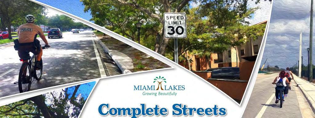
1 Complete Streets Program
2 Table of Contents Introduction... 1 Review of Plans and Policies... 2 Public Involvement and Project Prioritization... 3 Project Prioritization Matrix... 5 Complete Streets Components... 6 Miami Lakes Complete Streets Design Standards... 4 Pavement Markings... 5 Bike Facilities... 6 Greenscaping... 9 Street Typology Thoroughfare Feeder Road Civic Street Local Street Town Initiatives and Economic Opportunities Safe Routes to School Concepts NW 151/NW 153 Street Corridor Overview NW 151/NW 153 Street Civic Street Proposed Concept (A-1) NW 151/NW 153 Street Civic Street Proposed Concept (A-2) NW 60 Avenue Corridor Overview NW 60 Avenue Feeder Road Proposed (B-1) NW 60 Avenue Feeder Road Proposed (B-2) NW 60 Avenue Feeder Road Proposed (B-3) NW 79 Avenue Corridor Overview NW 79 Avenue Local Residential Proposed (C-1) NW 79 Avenue Local Residential Proposed (C-2) NW 79 Avenue Local Residential Proposed (C-3) i
3 Opinion of Probable Construction Cost Estimates Appendix A: Miami Lakes Roadway Inventory Appendix B: Public Workshop Presentation, October 23, Appendix C: Prioritization Matrix List of Figures Figure 1: Public workshop presentation... 3 Figure 2: Town staff providing an update on recently completed projects... 4 Figure 3: Draft concept plans of current roadway projects within the Town... 4 Figure 4: Interactive GIS mapping station... 4 Figure 5: Prioritization matrix... 5 Figure 6: Complete Street Cross Section Elements... 6 Figure 7: Sample Crosswalk Markings... 5 Figure 8: Sharrow... 6 Figure 9: Sharrow with green background... 6 Figure 10: Buffered Bike Lane - Striping... 7 Figure 11: Barrier Separated Bike Lane Delineators/Flexposts... 7 Figure 12: Green striping in a conflict zone... 8 Figure 13: Bike Box... 9 Figure 14: Town of Miami Lakes greenscaping examples Figure 15: Town of Miami Lakes Street Typology Map Figure 16: Sample Thoroughfare Corridors Figure 17: Town of Miami Lakes Thoroughfare Map Figure 18: Thoroughfare Cross Section Design Standard Figure 19: Sample Feeder Corridors Figure 20: Town of Miami Lakes Feeder Road Map Figure 21: Feeder Road Cross Section Design Standard Figure 22: Sample Civic Corridors Figure 23: Town of Miami Lakes Civic Street Map Figure 24: Civic Street Cross Section Design Standard Figure 25: Sample Local Commercial and Residential Corridors Figure 26: Town of Miami Lakes Local Commercial Street Map Figure 27: Local Commercial Street Cross Section Design Standard Figure 28: Town of Miami Lakes Local Residential Street Map Figure 29: Local Residential Street Cross Section Design Standard ii
4 Figure 30: Town of Miami Lakes Complete Streets Target Areas and Popular Locations Figure 31: Town of Miami Lakes School Corridors Figure 32: Concept Design Corridors Figure 33: NW 151/NW 153 Street Proposed Cross Section and Concept Rendering Figure 34: Civic Street - NW 151/NW 153 Street Proposed Concept (A-1) Figure 35: Civic Street - NW 151/NW 153 Street Proposed Concept (A-2) Figure 36: NW 60 Avenue Proposed Cross Section and Concept Rendering Figure 37:NW 60 Avenue Proposed (B-1) Figure 38: NW 60 Avenue Proposed (B-2) Figure 39: NW 60 Avenue Proposed (B-3) Figure 40: NW 79 Avenue Proposed Cross Section and Concept Rendering Figure 41: NW 79 Avenue Proposed (C-1) Figure 42: NW 79 Avenue Proposed (C-2) Figure 43: NW 79 Avenue Proposed (C-3) List of Tables Table 1: Street Typology Characteristics Table 2: NW 151/NW 153 Street Recommended Improvement Summary Table 3: NW 60 Avenue Recommended Improvement Summary Table 4: NW 79 Avenue Recommended Improvement Summary Appendix Appendix A Miami Lakes Roadway Inventory Appendix B Public Workshop Presentation, October 23, 2017 Appendix C Prioritization Matrix iii
5 INTRODUCTION The Town of Miami Lakes Complete Streets Program provides recommended street design improvements specific to the Town of Miami Lakes roadways. Complete Streets are infrastructure enhancements that implement additional pedestrian and bike improvements to give all users a greater share of the right-of-way. The specific improvements can vary from pavement markings to new physical barriers built between travel lanes and bicycle and pedestrian pathways. Ultimately the improvements are focused on increasing safety of users while not compromising traffic flow. The recommendations provided within this document are consistent with and build upon the foundation of the Miami-Dade County Complete Streets Design Guidelines program. The proposed design guidelines are customized to fit the context of the Town of Miami Lakes street typology and provide multimodal roadway improvements that take into consideration all users. Preparation of the Town of Miami Lakes Complete Streets Program was made possible through funding from the Miami-Dade Transportation Planning Organization (Miami-Dade TPO). To help execute this project, the Town of Miami Lakes partnered with the engineering and planning consulting firm, Kimley-Horn and Associates, Inc. As emphasized in the Miami-Dade County Complete Streets Guidelines, Complete Streets provide several benefits across areas like public health, equitable travel, environmental sustainability, and community safety. By designing streets to prioritize additional modes of transportation, Complete Streets provide more residents access to jobs, entertainment, and points of interest within the community. While improving access is key, the improvements also ensure residents that the emphasis on mobility is shifting from focus on the motor vehicle to a healthier, sustainable, and safer means of travel. This document provides an overview of Complete Streets components, presents existing conditions of the identified roadway typologies within the Town, and provides examples of what improvements are most applicable for implementation for each roadway type. Roadway typologies identified within this document take into consideration roadway volumes, existing roadway geometry and speeds, as well as adjacent land uses. Concept designs are provided for select roadway corridors within the Town detailing recommended improvements to be considered during design that take into consideration the Complete Streets guidelines. 1
6 Review of Plans and Policies Previous applicable planning efforts and policies performed and adopted by the Town of Miami Lakes were reviewed and incorporated into the development of the Town s Complete Streets guidelines. The following is an overview of the plans reviewed and summary of how they were applied. Greenways and Trails Master Plan The Town s Greenways and Trails Master Plan focuses on the development of a network of offroad shared use paths (for bicycling, walking, in-line skating, etc.), as well as a network of on-road facilities including bike lanes on major thoroughfares and neighborhood greenways on low-speed, low-volume streets. The facility type recommendations provided within the Greenways and Trails Master Plan were incorporated into the development of the typical sections and street typology designations. Beautification Master Plan The Town s Beautification Master Plan provided recommendations and guidelines for the beautification of roadway features such as, Town gateways, major roadways and intersections, neighborhood roads, cul-de-sacs, and underpasses. The Complete Streets components recommended for the Town prioritizes the preservation of trees and landscaped buffers as well as provides spacing for transit facilities, furnishings, and street and pedestrian scaled lighting. Miami Lakes Strategic Plan, The Town s Strategic Plan includes the Town s Vision, Mission Statement, and Guiding Principles as well as outlines the Goals and Objectives identified by staff to be programmed within the Town s annual Work Plan. The Strategic Plan s goals supported through the implementation of the Complete Street guidelines include: Enhanced Mobility Easier Vehicular and Non-Vehicular Transportation Enhance Signature Beauty and Park Landscaping Enhance Economic Development and Community Hubs Town s Comprehensive Master Plan The design guidelines outlined within the Town s Complete Streets Program complements the Town s Comprehensive Master Plan vision to create safe and convenient non-motorized transportation to connect communities, recreational parks, schools, office parks, and businesses. 2
. Sidewalk recommendations for roadways within the Town were incorporated into the development of the typical sections and street typology designations.")
7 ADA Sidewalk Master Plan Recommended design elements follow the guidelines and regulations detailed in the 2010 Standards for Accessible Design in response to the Americans with Disabilities Act of 1990 (ADA). Sidewalk recommendations for roadways within the Town were incorporated into the development of the typical sections and street typology designations. Newly constructed or altered street level pedestrian walkways must contain curb ramps or other sloped areas at intersections to streets, roads, or highways to comply with ADA standards. PUBLIC INVOLVEMENT AND PROJECT PRIORITIZATION The Town hosted a public workshop at Town Hall on October 23, 2017 to provide an opportunity for the public to review the proposed Complete Streets recommendations and offer feedback on project prioritization prior to finalizing the guidelines. At the workshop, an interactive presentation led by Town staff and the consultant team was provided detailing the Complete Streets elements and the recommended roadway typology classifications. The meeting was attended by members of the public, Town Commission members, Town staff, and the Town Manager. The presentation slides presented at the workshop are provided in Appendix B. Figure 1: Public workshop presentation In addition to the presentation, three (3) workstations were setup at the meeting that allowed the public to review current and proposed roadway improvement projects integrating the Complete Streets elements, submit feedback using a dynamic interactive geographic information systems (GIS) mapping program, as well as submit recommendations on how the Town should prioritize future Complete Streets improvement projects by ranking prioritization criteria. Photos taken during the workshop are provided on the following pages. 3


8 Figure 2: Town staff providing an update on recently completed projects Figure 3: Draft concept plans of current roadway projects within the Town Figure 4: Interactive GIS mapping station 4


9 Project Prioritization Matrix A project prioritization matrix was developed to assist the Town in gathering information from the public on the criteria most important to them on how project funding should be prioritized or distributed for future roadway projects. There were ten (10) prioritization criteria categories established for participants to rank in order from 1 to 10 (1 being the most important and 10 being the least important). The prioritization exercise allowed the public an opportunity to experience the challenges sometimes faced by Town staff during project selection and budgeting. While completing the exercise, participants expressed difficulty in ranking the criteria as they felt all listed criteria was important. The following is an outline of the prioritization criteria the public was asked to rank. Added Mobility Options Project includes multiple mode types. Low Cost Project has a low project cost required to complete the project. Safety Proposed project increases safety for all users. Fills a Gap in the Network Project makes connections between existing facilities. Social Equity Allows for or enhances equal opportunities for all users. Economic Development Placemaking Creates a sense of place and allows opportunities for economic growth. Propensity for Use Project will be used by the most number of people. Improved Comfort/Quality of Existing Facilities Makes existing facilities more comfortable for users. Health Increases opportunities to make healthier choices. Feasibility Ability to complete the project timely or in conjunction with another project. Figure 5: Prioritization matrix Of the completed forms submitted, propensity for use, safety, feasibility, fills a gap in the network, and added mobility options were the top five ranked criteria. Low project cost was ranked sixth, though important was not the main priority expressed by participants as they demonstrated that investments in projects that benefit the most people and improve safety are the highest priority. Through discussions at the meeting, the assumption was made that if the feasibility of the project s construction and the ability to integrate Complete Streets elements into the design of other projects is considered lower project cost may also be able to be achieved. A copy of the Prioritization Matrix distributed at the workshop is provided in Appendix C. 5

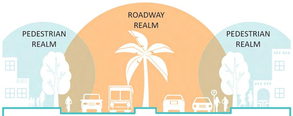
10 COMPLETE STREETS COMPONENTS Complete Streets are streets designed to focus on safety and access for all users, of all ages and abilities. The Miami-Dade County Complete Streets Design Guidelines list the following components associated with the roadway and pedestrian realms to be considered by communities wanting to develop or redesign their streets to be multimodal. Roadway Realm Bike lanes Bus lanes/transit lanes Turn lanes Parking lanes Through lanes Landscaping Pavement markings Pedestrian Realm Sidewalks Street trees Benches/Furnishings Bike racks Lighting Figure 6: Complete Street Cross Section Elements Source: Miami-Dade County Complete Streets Design Guidelines, Figure 2-1 Cross-section elements 6
11 Many of the existing standards and guidelines available at the federal and state levels provide guidance on Complete Streets and their design. The most relevant of those standards and guides are: The American Association of State Highway and Transportation Officials (AASHTO) A Policy on Geometric Design of Highways and Streets (the Green Book ) The Manual of Uniform Minimum Standards for Design, Construction, and Maintenance for Streets and Highways (the Florida Greenbook ) The Manual on Uniform Traffic Control Devices (MUTCD) FDOT Plans Preparation Manual (PPM) Americans with Disabilities Act (ADA) Standards for Accessible Design Miami-Dade County Public Works Manual Miami Lakes Complete Streets Design Standards The following Complete Street elements were selected as priority components by the Town of Miami Lakes to be included in the design of roadways within the Town. This section provides examples of the selected elements that were incorporated into the typical cross sections for each roadway typology outlined in this document. The priority Complete Streets components for the Town of Miami Lakes include: Pavement markings o Crosswalks o Shared lane markings (Sharrows) Bike facilities o Buffered bike lanes o Green bike lanes o Bike boxes Sidewalks/Shared use paths Greenscaping Other design elements that should be incorporated into the design and construction of roadways within the Town of Miami Lakes, that contribute to the safety and connectivity of Complete Streets and multimodal amenities include ADA enhancements, curb extensions, pedestrian refuges, and mid-block crossings. Design standards and guidance on how and when these elements should be incorporated into roadway improvements are provided in the references outlined in the previous section. Aesthetically pleasing amenities that also provide functional use and value to a corridor that are part of the Complete Streets approach include street lighting, benches, bike racks, and wayfinding. These features assist roadway users in navigating the corridor while also providing 4
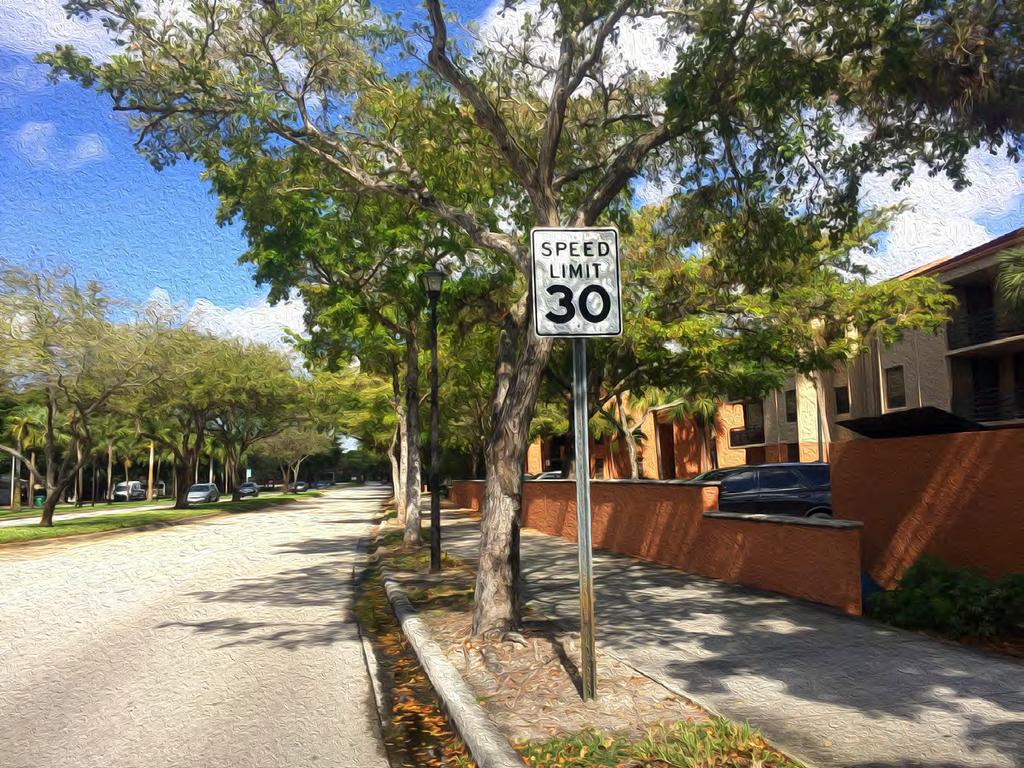
12 supportive amenities to the activities that occur within the right-of-way. Transit access and amenities to support transit use is also important. Types of transit amenities and components that should be incorporated into new designs or redevelopment projects include bus landings, bus shelters, as well as sidewalk connections from the transit facilities to adjacent destinations. Pavement Markings Pavement markings provide users within the right-of-way information regarding the rules of the road by giving lane boundaries, guides for turning, crosswalk locations, and warnings of potential hazards. Pavement markings work in conjunction with road signs and traffic signals to give users a clear picture of the roadway characteristics. Crosswalks Crosswalks are a critical part of the pedestrian network. A crosswalk is the portion of a roadway designated for pedestrians to use in crossing the street. Crosswalks within the Town of Miami Lakes should be clearly marked using materials or markings that provide a visual contrast with the surface of the street. Two crosswalk marking patterns commonly used are illustrated in Figure 7. Figure 7: Sample Crosswalk Markings US Department of Transportation, Federal Highway Administration, Designing Sidewalks and Trails for Access (Figure 4-41 and 4-21) Newly constructed or altered street level pedestrian walkways must contain curb ramps or other sloped areas at intersections to streets, roads, or highways to comply with ADA standards. 5


13 Shared Lane Markings (Sharrows) Sharrows are utilized on roads to indicate that a bicyclist is permitted to use the entire traffic lane when there are no exclusive facilities present. Figure 8 is an image of a sharrow. Use cases for sharrows include the following: Figure 8: Sharrow Roadways with low volumes and low speeds Roadways with traffic signals that are timed for average bike speeds To enhance the appearance of sharrows added along a corridor, some communities are opting to add a green box or background behind the sharrow emblem as shown in Figure 9. Figure 9: Sharrow with green background Source: Miami-Dade County Complete Streets Guidelines For additional information on different pavement marking applications, refer to the Miami-Dade County Complete Streets Design Guidelines, National Association of City Transportation Officials (NACTO) Urban Bikeway Design Guide, and the FDOT Plans Preparation Manual. Bike Facilities Buffered Bike Lanes Buffered bike lanes provide additional separation from vehicular traffic by implementing a striped buffer between the lanes. Using pavement striping instead of a raised curb gives users the ability to pass each other and greater overall freedom entering and exiting the facility. Opportunities to implement buffered bike lanes include the following: High-speed arterials where more separation provides greater user comfort Commercial areas where users are continuously entering and exiting the facility Transit stops with increased bike and pedestrian traffic 6

.")
14 Figure 10: Buffered Bike Lane - Striping Source: Miami-Dade County Complete Streets Guidelines Traffic delineators or flexposts within the buffered bike lane can also be used to separate the bike lane from the vehicle travel lane, as shown in Figure 11. Figure 11: Barrier Separated Bike Lane Delineators/Flexposts Source: City of Tucson, AZ Green Bike Lanes Green thermoplastic paint can be used in a striped pattern to identify conflict zones with traffic or can be implemented along the entire length of the facility. Figure 12 is an example of the green striping used in a conflict zone from the FDOT Plans Preparation Manual (PPM). Uses for green bike lanes are as follows: Where the bike lane and a right-turning movement conflict Where the bike lane and a dedicated bus bay conflict Where the bike lane and a vehicle merge lane conflict Areas of high volume traffic and low visibility 7
15 Figure 12: Green striping in a conflict zone Source: FDOT Plans Preparation Manual Vol. 1 Ch. 8 Bike Boxes Bike boxes are an intersection treatment that provide space for bicyclist to queue in a more visible location and may help facilitate turning movement. It is directly attached to the bike lanes and is typically the same color as the bike lanes. Figure 13 is an example of a bike box from the National Association of City Transportation Officials (NACTO). 8
 Greenscaping Greenscaping is the implementation of street trees, shrubbery,")
16 Typical use cases for bike boxes include the following: Signalized intersections with high volumes of bicyclists Where extra protection for bikes making left turns are needed or when a specific bike route requires a left turn Figure 13: Bike Box Source: National Association of City Transportation Officials (NACTO) Greenscaping Greenscaping is the implementation of street trees, shrubbery, planters, and other vegetation along the transportation network. Greenery plays a critical role in the quality and usefulness of any multimodal facility. Adding landscaping has environmental benefits such as providing shade, carbon dioxide absorption, and supporting natural ecosystems. Greenscaping also creates a more aesthetically pleasing environment and a greater sense of place. When designing, it is important to consider the space required for all types of greenery. Types of plants and their locations should be selected early in the design process so that space can be set aside for them in the design. The addition of trees to the streetscape provides environmental benefits through increased air filtration and ecosystem habitat, all while creating a more inviting sidewalk environment with increased shade coverage. Trees create living and nesting places for birds, helping add biodiversity to urban environments while creating a more natural environment for all. 9


17 The following figures provide several examples of how the Town has used trees and landscaping to provide shade along their corridors as well as create natural buffers between the sidewalk and travel lanes. Figure 14: Town of Miami Lakes greenscaping examples Reference to the Town of Miami Lakes Greenways and Trails Master Plan and Beautification Master Plan should be made for more information on the specifications and standards for greenscaping and open space within the Town. 10
18 STREET TYPOLOGY The existing roadways within the Town of Miami Lakes were inventoried and categorized based on an adaptation of the typologies established in the Miami-Dade County Complete Streets Design Guidelines. Roadway characteristics reviewed included number of lanes, speed limit, average daily traffic (ADT), and right-of-way width. The designation of a preferred Complete Streets typical section for each roadway type establishes a unified standard for all roadways within the Town of Miami Lakes and provides guidance on the type of roadway enhancements that are desired to be implemented to meet the goals and initiatives of the Town. The roadways within the Town were grouped into the following street typology categories: Thoroughfare Feeder Road Civic Street Local Roads o Local Commercial o Local Residential Table 1 is a summary of the roadway characteristics for each of the identified street typologies. Table 1: Street Typology Characteristics Average Right-of-Way Width Street Type Number of Lanes Direction of Flow Target Speed Average Daily Traffic Thoroughfare way mph ,000 Rare Feeder Road or 2 way mph ,000-25,000 Rare Civic Street or 2 way mph 50 3,000-15,000 Yes Local Commercial 1 1 or 2 way mph 70 NA Rare Local Residential 1 1 or 2 way mph 50 < 6,000 Yes On-Street Parking This section provides descriptions of each street typology, the specific design guidelines associated with the street typologies, and maps indicating the location of the designated roadways. Figure 15 is a map illustrating the designated street typologies for each roadway within the Town. For a complete list of roadways within the Town of Miami Lakes along with the identified typology designation, refer to Appendix A. 11

19 Figure 15: Town of Miami Lakes Street Typology Map 12

20 Thoroughfare A Thoroughfare is a regionally significant roadway providing connections between cities and districts, as well as connections across barriers such as freeways and waterways. The corridor supports movement of large volumes of people and accommodates longer trips. This roadway type has the widest right-of-way of the four identified typologies. Characteristics of a Thoroughfare may include: Connects cities and districts Provides connections across barriers (e.g. freeways, waterways) Supports movement of large volumes of people, accommodates longer trips Transit stops Raised, often landscaped medians Sidewalks, with separation from travel lanes by landscaping or adjacent shared-use path Bike lanes Examples of existing Thoroughfares within the Town are provided in Figure 16. Figure 16: Sample Thoroughfare Corridors NW 87 th Avenue (Southbound) (Note: Existing wall can restrict expansion of sidewalk and the addition of other Complete Streets improvements.) Red Road (Northbound) Figure 17 is a map of the roadways designated as Thoroughfares within the Town. Figure 18 is the recommended typical section for the designated roadways. Suggested alternatives to the dimensions of the recommended complete streets elements associated with the street typology are provided in the subsequent table. 13

21 Figure 17: Town of Miami Lakes Thoroughfare Map 14
22 Figure 18: Thoroughfare Cross Section Design Standard RIGHT-OF-WAY VEHICULAR REALM PEDESTRIAN REALM A B C D E RIGHT-OF-WAY LANES TRAVEL LANE MEDIAN (incl C&G) BIKE LANE SIDEWALK/SHARED-USE PATH CURB & GUTTER OPTION 1 100' 4-Divided 11' 18' 7' BUFFERED 10' 2' OPTION 2 80' 4-Divided 11' 12' 4' 6' 2' OPTION 3 80' 4-Undivided 11' NONE 4' 12' 2' 15

23 Feeder Road A Feeder Road is a key roadway that connects Thoroughfares and Civic Streets to provide access between urban centers and neighborhoods. Characteristics of a Feeder Road may include: Connections between urban centers and neighborhoods Connections to Thoroughfares and Civic Streets Transit stops Raised, often landscaped medians Sidewalks, with separation from travel lanes by landscaping or adjacent shared-use path Bike lanes or shared lane markings Examples of existing Feeder roadways within the Town are provided in Figure 19. Figure 19: Sample Feeder Corridors NW 82 nd Avenue (Southbound) NW 60 th Avenue (Northbound) Figure 20 is a map of the roadways designated as Feeders within the Town. Figure 21 is the recommended typical section for the designated roadways. Suggested alternatives to the dimensions of the recommended complete streets elements associated with the street typology are provided in the subsequent table. 16

24 Figure 20: Town of Miami Lakes Feeder Road Map 17
25 Figure 21: Feeder Road Cross Section Design Standard RIGHT-OF-WAY VEHICULAR REALM PEDESTRIAN REALM A B C D H E RIGHT-OF-WAY LANES TRAVEL LANE MEDIAN (incl C&G) BIKE LANE PEDESTRIAN BUFFER SIDEWALK/SHARED-USE CURB & GUTTER OPTION 1 80' 4-Divided 11' 12' 4' 0 6' 2' OPTION 2 80' 4-Undivided 11' NONE 4' 2' 10' 2' OPTION 3 70' 4-Undivided 10' NONE SHARROW 3' 10' 2' OPTION 4 70' 2-Undivided 11' NONE 7' BUFFERED 3' 12' 2' NOTE: Where recommended, pedestrian buffers should be within the pedestrian realm, between the curb and sidewalk/shared-use path. 18

26 Civic Street A Civic Street is a pedestrian-oriented street in shopping and entertainment destinations which provides access to businesses and institutional facilities. Civic Streets are intended to provide balance between the needs of people passing through as well as the needs of those who live and work along the street. Characteristics of a Civic Street may include: Serves local traffic Connects commercial areas and neighborhoods Prioritizes local activity Allows for through movement On-street parking Sidewalks Bike lanes or shared lane marking Examples of existing Civic roadways within the Town are provided in Figure 22. Figure 22: Sample Civic Corridors Main Street (Westbound) NW 151 st Street (Westbound) Figure 23 is a map of the roadways designated as Civic roadways within the Town. Figure 24 is the recommended typical section for the designated roadways. Suggested alternatives to the dimensions of the recommended complete streets elements associated with the street typology are provided in the subsequent table. 19

27 Figure 23: Town of Miami Lakes Civic Street Map 20
28 Figure 24: Civic Street Cross Section Design Standard RIGHT-OF-WAY VEHICULAR REALM PEDESTRIAN REALM A B G D H E RIGHT-OF-WAY LANES TRAVEL LANE ON-STREET PARKING BIKE LANE PEDESTRIAN BUFFER SIDEWALK/SHARED-USE CURB & GUTTER OPTION 1 70' 2-Undivided 10' 8' ON-STREET PARKING SHARROW 5' 10' 2' OPTION 2 70' 2-Undivided 11' NO ON-STREET PARKING 7' BUFFERED 5' 10' 2' OPTION 3 80' 2-Undivided 11' 8' ON-STREET PARKING 7' BUFFERED 2' 10' 2' OPTION 4 80' 4-Divided 11' NO ON-STREET PARKING (12' Median) SHARROW 2' 8' 2' NOTE: For roadways without on-street parking, sharrows should be placed in the outside travel lane (lane closest to the curb). 21

29 Local Street Local Streets have low vehicle volumes and traffic speeds compared to the other roadway typologies. Two local street types have been identified for the Town of Miami Lakes; Local Residential and Local Commercial. The characteristics for these two roadway types are provided below. Local Commercial Street Supplemental streets that provide secondary means of vehicular service Focus on commercial delivery and loading/unloading of goods Connections to transit Sidewalks Separated bike lanes Local Residential Street Local streets with low vehicle volumes and low speeds Primarily provides connections to residential neighborhoods. May provide access to parks, schools or institutional facilities as well as local retail and services Little to no striping necessary Sidewalks Shared-lane markings along streets designated to have on-street facility by Town s Greenways and Trails Master Plan Examples of existing local residential and commercial roadways within the Town are provided in Figure 25. Figure 25: Sample Local Commercial and Residential Corridors NW 77 th Court (Southwest bound) - Commercial NW 79 th Avenue (Southbound) Residential Maps of the roadways designated as local commercial (Figure 26) and local residential (Figure 28) roadways are provided. Recommended typical sections for the designated roadways are provided in Figure 27 and Figure 29. Suggested alternatives to the dimensions of the recommended complete streets elements associated with the street typologies are provided in the subsequent tables. 22

30 Figure 26: Town of Miami Lakes Local Commercial Street Map 23
31 Figure 27: Local Commercial Street Cross Section Design Standard RIGHT-OF-WAY VEHICULAR REALM PEDESTRIAN REALM A B D H E F RIGHT-OF-WAY LANES TRAVEL LANE BIKE LANE PEDESTRIAN BUFFER SIDEWALK VALLEY GUTTER ROW BUFFER OPTION 1 70' 2-Undivided 12' 8' SEPARATED 4' 6' 2' 3' OPTION 2 70' 2-Undivided 12' 8' SEPARATED 2' 8' 2' 3' OPTION 3 70' 2-Undivided 12' 7' BUFFERED 4' 8' 2' 2' NOTE: The right-of-way (ROW) buffer represents areas along the corridor that may have constraints and could restrict adding or widening recommended amenities due to existing fences, utilities or trees. 24
32 Figure 28: Town of Miami Lakes Local Residential Street Map 25
33 Figure 29: Local Residential Street Cross Section Design Standard RIGHT-OF-WAY VEHICULAR REALM PEDESTRIAN REALM A B D H E RIGHT-OF-WAY LANES TRAVEL LANE BIKE LANE PEDESTRIAN BUFFER SIDEWALK VALLEY GUTTER OPTION 1 50' 2-Undivided 10' SHARROW* 7' 6' 2' *NOTE: Sharrows will be recommended for roadways that are identified to have on-street facilities in the Town s Greenways and Trails Master Plan. 26
34 TOWN INITIATIVES AND ECONOMIC OPPORTUNITIES During the development of the street typology and roadway enhancements, attention was made towards the roadways within the Town s identified Complete Streets target areas around major destinations. The goal of these areas is to enhance the multimodal network and connectivity. To accomplish this goal, Complete Streets design standards should be applied as new projects or opportunities for development and redevelopment occur. Roadway enhancements within the strategic planning districts and around major destinations should be focused on walkability and enhanced multimodal connections for all users along the roadway. The Town s target areas are areas identified by the Town as: Opportunities for investment and redevelopment Places of interest along the corridors Underutilized land such a parking lots or vacant parcels Areas to encourage developers to build with a focus on multimodal access Locations identified as major destinations are locations that provide the community with recreational, commercial, retail, dining, entertainment, or government services. Identified popular and major destinations in Miami Lakes include the following: Miami Lakes West Park Provides pavilions, a basketball court, lighted walking path, and a playground. The site also includes the Mary Collins Community Center. Park Centre Shops - Provides shopping and business services for the Miami Lakes Business Park West and surrounding areas. Royal Oaks Shopping Center - Provides shopping and business services in Miami Lakes. Cypress Village Shopping Center - Includes a mix of restaurants and retail stores. Town Hall and Main Street - Main Street, the centerpiece of Miami Lakes Town Center, is an open-air mall in the center of Miami Lakes offering a mix of uses. Royal Oaks Park - Multipurpose-use park with athletic fields, playground, picnic pavilions, exercise/bike trail, butterfly garden, and concession stand. Park also includes the Roberto Alonso Community Center. Miami Lakes Optimist Park - Multipurpose-use park with athletic fields, outdoor basketball courts, outdoor tennis courts, walking path, picnic pavilions, and batting cages with lighting. Site includes a marina for fishing and the Boundless Playground. Windmill Gate Shopping - Provides mix of restaurants and retail and is adjacent to the community's regional library. Implementation of the recommended Complete Streets elements supports objectives under the following goals from the Town s Strategic Plan, A map of the identified target areas and major destinations is provided in Figure 30. Enhance Mobility Enhance Economic Development & Community Hubs Enhance Signature Beauty and Park Landscape 27
35 Figure 30: Town of Miami Lakes Complete Streets Target Areas and Popular Locations 28


36 Safe Routes to School One of the Miami Lakes Complete Streets goals is to design and develop neighborhoods that can facilitate children walking and biking safely to school in Miami Lakes by implementing capital projects that support development of safe routes to school. Florida s Safe Routes to School (SRTS) program focuses on helping communities address their school transportation needs and encourage more students to walk or cycle to school. It strives to enable and encourage children in grades Kindergarten through High School, including those with disabilities, to walk and bike to school; to make walking and biking to school safer and more appealing, and to facilitate the planning, development, and implementation of projects that will improve safety and reduce traffic, fuel consumption, and improve air quality in the vicinity of schools. In addition to encouraging more children to walk or cycle to school, the program also seeks to address the safety needs of children already walking or biking in less than ideal conditions. Projects may include planning, design, and construction of infrastructure-related projects that will substantially improve the ability of students to walk and bicycle to school. The following types of projects are eligible under Florida Guidelines for funding: Pedestrian Facilities: Includes new sidewalks and other pathways, sidewalk widening and sidewalk gap closures, all on the public right of way. Short pedestrian bridges may be able to be funded. Improvements to routes leading to bus stops. Bicycle Facilities: Includes bicycle parking facilities such as bike racks, shelters and bike lockers on school grounds. These may be purchased for placement on public school property, but not on private property. Traffic Control Devices: Includes new or upgraded marked crosswalks, pavement markings, traffic signs and signals, flashing beacons, bicycle-sensitive signal actuation devices, pedestrian countdown signals, pedestrian activated signal upgrades, and all other pedestrian and bicycle related traffic control devices. Figure 31 provides a map of high priority school corridors within the Town of Miami Lakes. All call for applications are done in September of each year and the completed applications are due by December 29. For more information regarding the Safe Routes to School funding and program please visit 29

37 Figure 31: Town of Miami Lakes School Corridors 30
38 CONCEPTS To demonstrate how the proposed Complete Streets cross section can be modified and applied to existing roadways within the Town, three (3) corridors were selected by Town staff to have concept designs created. The three corridors selected are listed below and illustrated in Figure 32: NW 151/NW 153 Street NW 60 Avenue NW 79 Avenue Identified improvements and constraints are listed for each segment of the corridors and planning level construction cost estimates are provided at the end of this section. For a complete list of roadways and their typology designation refer to Appendix A. 31
39 Figure 32: Concept Design Corridors NW 79 Avenue NW 151/NW 153 Street NW 60 Avenue 32
40 NW 151/NW 153 Street Corridor Overview The NW 151/NW 153 Street corridor is categorized as a Civic roadway. Civic roadways are defined by the Miami Lakes Complete Streets Guidelines as pedestrian-oriented streets in shopping and entertainment areas that provide access to businesses and institutional facilities. The existing land uses along the corridor consist of office complexes. Buildings are setback from the road by large parking lots with limited pedestrian connections between the existing sidewalks, transit stops, and businesses. There are currently no existing bike facilities along the corridor and bus stops have limited amenities. The corridor is located within the Town s target area and is intended to be redeveloped with higher density mixed use developments. Table 2 is a summary table of the recommended improvements identified for the corridor and Figure 33 illustrates the proposed cross section with conceptual rendering for the corridor. Detailed concept plans of the recommendations are provided on the subsequent pages. Table 2: NW 151/NW 153 Street Recommended Improvement Summary NW 151 Street/153 Street Existing Proposed Right-of-Way Width 60-80' 60-80' Roadway Right-of-Way Number of Lanes 2 2 Lane Width 14.5' 11' Intersection and Drway Radii < 40' 15-25' Bike Facility Bike Lane/Sharrow No Buffered 7' Left Side Sidewalk ( 8') Shared Use Path (>8') 8' 8' Pedestrian Facilities Right Side Sidewalk ( 8') 0' 8' Shared Use Path (>8') Transit Bus Pads

41 Figure 33: NW 151/NW 153 Street Proposed Cross Section and Concept Rendering

42 NW 151/NW 153 Street Civic Street Proposed Concept (A-1) Figure 34: Civic Street - NW 151/NW 153 Street Proposed Concept (A-1) Design Key Overall Corridor Improvements 1 Bus stop landing added Travel lanes reduced from 14.5 to 11 2 Midblock crossing added Provided a 4 bike lane 3 Additional right-of-way required to Intersection radii reduced (average reduction construct sidewalk due to right-of-way between feet) constraints and existing tree line ADA detectable warning surfaces should be installed 4 Additional of crosswalk at all roadway crossings in addition to proper 5 Existing sidewalk, no changes ramping

43 NW 151/NW 153 Street Civic Street Proposed Concept (A-2) Figure 35: Civic Street - NW 151/NW 153 Street Proposed Concept (A-2) Design Key Overall Corridor Improvements 1 Bus stop landing added Travel lanes reduced from 14.5 to 11 2 Midblock crossing added Provided a 4 bike lane 3 Additional right-of-way required to Intersection radii reduced (average reduction construct sidewalk due to right-of-way between feet) constraints and existing tree line ADA detectable warning surfaces should be installed 4 Additional of crosswalk at all roadway crossings in addition to proper 5 Existing sidewalk, no changes ramping
44 NW 60 Avenue Corridor Overview The NW 60 Avenue corridor is categorized as a Feeder roadway. Feeder roadways are defined by the Miami Lakes Complete Streets Guidelines as roadways that connect Thoroughfares and Civic Streets providing access between urban centers and neighborhoods. The existing land uses along the corridor consist of office complexes. Buildings are setback from the road by large parking lots with limited pedestrian connections between the existing sidewalks, transit stops, and businesses. There are currently no existing bike facilities along the corridor and bus stops have limited amenities. The corridor is located within the Town s target area and is intended to be redeveloped with higher density mixed use developments. Table 3 is a summary table of the recommended improvements identified for the corridor and Figure 36 illustrates the proposed cross section and concept rendering for the corridor. Detailed concept plans of the recommendations are provided on the subsequent pages. Table 3: NW 60 Avenue Recommended Improvement Summary Roadway Right-of-Way NW 60 Avenue Existing Proposed Right-of-Way Width 70' 70' Number of Lanes 2 2 Lane Width 14.5' 11' Intersection and Driveway Radii < 30' 15-25' Bike Facility Bike Lane/Sharrow No No Left Side Pedestrian Facilities Sidewalk ( 8') Shared Use Path (>8') Right Side Sidewalk ( 8') Shared Use Path (>8') 8' 8' 0' 10' Transit Bus Pads

45 Figure 36: NW 60 Avenue Proposed Cross Section and Concept Rendering 38
 3 Midblock")
46 NW 60 Avenue Feeder Road Proposed (B-1) Design Key Overall Corridor Improvements 1 Bus stop landing added Travel lanes reduced from 14.5 to 11 2 Additional right-of-way required to construct sidewalk due Intersection radii reduced (average reduction between to right-of-way constraints and existing tree line feet) 3 Midblock crossing added ADA detectable warning surfaces should be installed at all roadway crossings in addition to proper ramping Figure 37:NW 60 Avenue Proposed (B-1)
 3 Midblock")
47 NW 60 Avenue Feeder Road Proposed (B-2) Design Key Overall Corridor Improvements 1 Bus stop landing added Travel lanes reduced from 14.5 to 11 2 Additional right-of-way required to construct sidewalk due Intersection radii reduced (average reduction between to right-of-way constraints and existing tree line feet) 3 Midblock crossing added ADA detectable warning surfaces should be installed at all roadway crossings in addition to proper ramping Figure 38: NW 60 Avenue Proposed (B-2)
 3 Midblock")
48 NW 60 Avenue Feeder Road Proposed (B-3) Design Key Overall Corridor Improvements 1 Bus stop landing added Travel lanes reduced from 14.5 to 11 2 Additional right-of-way required to construct sidewalk due Intersection radii reduced (average reduction between to right-of-way constraints and existing tree line feet) 3 Midblock crossing added ADA detectable warning surfaces should be installed at all roadway crossings in addition to proper ramping Figure 39: NW 60 Avenue Proposed (B-3)
49 NW 79 Avenue Corridor Overview The NW 79 Avenue corridor is categorized as a Local Residential roadway. Local Residential roadways are defined by the Miami Lakes Complete Streets Guidelines as roadways that primarily serve local trips and provide access to residential neighborhoods, parks, schools or institutional facilities. The roadways have low vehicle volumes and low traffic speeds. The existing land uses along the corridor consist of single family residential homes, with connections to Bob Gram Education Center and the Royal Oaks Plaza. There are currently no existing bike facilities along the corridor and bus stops have limited amenities. There are constraints along the corridor due to existing trees and residential walls/fences that impact sidewalk expansion opportunities. The corridor is located within a designated school corridor. Table 4 is a summary table of the recommended improvements identified for the corridor and Figure 40 illustrates the proposed cross section and concept rendering for the corridor. Detailed concept plans of the recommendations are provided on the subsequent pages. Table 4: NW 79 Avenue Recommended Improvement Summary Roadway Right-of-Way NW 79 Avenue Existing Proposed Right-of-Way Width 60' 60' Number of Lanes 2 2 Lane Width 12' 12' Intersection and Driveway Radii < 50' 15-25' Bike Facility Bike Lane/Sharrow No Yes Left Side Pedestrian Facilities Sidewalk ( 8') Shared Use Path (>8') Right Side Sidewalk ( 8') Shared Use Path (>8') 5' 5' 5' 5' (8' near school) Transit Bus Pads

50 Figure 40: NW 79 Avenue Proposed Cross Section and Concept Rendering 43

51 NW 79 Avenue Local Residential Proposed (C-1) Design Key 1 Existing ROW constraints due to trees and adjacent property features inhibits sidewalk expansions 2 Bus stop landing added 3 Right-of-way constraints inhibit sidewalk expansion north of NW 160th Terrace due to existing residential wall along segment 4 Added standard crosswalk markings to existing textured crosswalk 5 Propose expanding existing sidewalk adjacent to school to 8. Additional ROW may be required due to existing tree line 6 Propose addition of crosswalk markings Overall Corridor Improvements Green sharrows added the full length of the corridor Intersection radii reduced (average reduction between feet) ADA detectable warning surfaces should be installed at all roadway crossings in addition to proper ramping Figure 41: NW 79 Avenue Proposed (C-1)

52 NW 79 Avenue Local Residential Proposed (C-2) Design Key 1 Existing ROW constraints due to trees and adjacent property features inhibits sidewalk expansions 2 Bus stop landing added 3 Right-of-way constraints inhibit sidewalk expansion north of NW 160th Terrace due to existing residential wall along segment 4 Added standard crosswalk markings to existing textured crosswalk 5 Propose expanding existing sidewalk adjacent to school to 8. Additional ROW may be required due to existing tree line 6 Propose addition of crosswalk markings Overall Corridor Improvements Green sharrows added the full length of the corridor Intersection radii reduced (average reduction between feet) ADA detectable warning surfaces should be installed at all roadway crossings in addition to proper ramping Figure 42: NW 79 Avenue Proposed (C-2)

53 NW 79 Avenue Local Residential Proposed (C-3) Design Key 1 Existing ROW constraints due to trees and adjacent property features inhibits sidewalk expansions 2 Bus stop landing added 3 Right-of-way constraints inhibit sidewalk expansion north of NW 160th Terrace due to existing residential wall along segment 4 Added standard crosswalk markings to existing textured crosswalk 5 Propose expanding existing sidewalk adjacent to school to 8. Additional ROW may be required due to existing tree line 6 Propose addition of crosswalk markings Overall Corridor Improvements Green sharrows added the full length of the corridor Intersection radii reduced (average reduction between feet) ADA detectable warning surfaces should be installed at all roadway crossings in addition to proper ramping Figure 43: NW 79 Avenue Proposed (C-3)
54 OPINION OF PROBABLE CONSTRUCTION COST ESTIMATES As part of the concept design for the three corridors preliminary planning level opinion of probable construction cost estimates were developed. The proposed modified Complete Streets cross sections for each corridor are provided with the cost estimates. The construction cost estimates provide pay items for roadway, signing, and marking enhancements. The cost estimates do not include estimates for replacement of existing signs, design, permitting, survey, Geotech, construction observation services, right-of-way acquisition, or landscaping. 47
55 NW 151/153 Street (Civic Street) ITEM NUMBER DESCRIPTION UNIT QTY. UNIT PRICE TOTAL COST ROADWAY PAY ITEMS MILLING EXIST ASPH PAVT, 3" AVG DEPTH SY 3706 $ 4.00 $ 14, SUPERPAVE ASPHALTIC CONCRETE, TRAFFIC C TN 1631 $ $ 141, ASPHALT CONCRETE FRICTION COURSE, TRAFFIC C, FC-12.5, PG TN 816 $ $ 70, CONCRETE CURB & GUTTER, TYPE F LF 3225 $ $ 71, SIDEWALK, CONCRETE, 4" THICK SY 4204 $ $ 164, DETECTABLE WARNINGS SF 816 $ $ 21, PEFORMANCE TURF, SOD SY 3127 $ 3.16 $ 9, ROADWAY SUBTOTAL $ 494, SIGNING AND PAVEMENT MARKING PAY ITEMS SINGLE POST SIGN, F&I GM, <12 SF EA 18 $ $ 7, THERMOPLASTIC, STD, WHITE, SOLID 12" LF 344 $ 1.84 $ THERMOPLASTIC, STD, WHITE, SOLID, 24" LF 614 $ 3.50 $ 2, THERMOPLASTIC, STD, WHITE, MESSAGE EA 18 $ $ 1, THERMOPLASTIC, STD, WHITE, ARROW EA 25 $ $ 1, THERMOPLASTIC, STD, YELLOW, SOLID, 18" LF 100 $ 2.39 $ THERMOPLASTIC, STD-OP, WHITE, SOLID, 6" GM 2 $ 4, $ 6, THERMOPLASTIC, STD-OP, YELLOW, SOLID, 6" GM 1 $ 4, $ 2, SIGNING AND MARKING SUBTOTAL $ 22, SUB TOTAL $ 517, CONTINGENCY LS 15% - $ 77, GRAND TOTAL $ 595, Kimley-Horn and Associates, Inc. has no control over the cost of labor, materials, equipment, or services furnished by others, or over methods of determining price, or over competitive bidding or market conditions. Any and all professional opinions as to costs reflected herein, including but not limited to professional opinions as to the costs of construction materials, are made on the basis of professional experience and available data. Kimley-Horn and Associates, Inc. cannot and does not guarantee or warrant that proposals, bids, or actual costs will not vary from the professional opinions of costs shown herein. 48
56 NW 60 th Avenue (Feeder Road) ITEM NUMBER DESCRIPTION UNIT QTY. UNIT PRICE TOTAL COST ROADWAY PAY ITEMS CONCRETE CURB & GUTTER, TYPE F LF 4,070 $ $ 90, SIDEWALK, CONCRETE, 4" THICK SY 5063 $ $ 198, DETECTABLE WARNINGS SF 1360 $ $ 36, PEFORMANCE TURF, SOD SY 8000 $ 3.16 $ 25, ROADWAY SUBTOTAL $ 350, SUB TOTAL $ 350, CONTINGENCY LS 15% - $ 52, GRAND TOTAL $ 403, Kimley-Horn and Associates, Inc. has no control over the cost of labor, materials, equipment, or services furnished by others, or over methods of determining price, or over competitive bidding or market conditions. Any and all professional opinions as to costs reflected herein, including but not limited to professional opinions as to the costs of construction materials, are made on the basis of professional experience and available data. Kimley-Horn and Associates, Inc. cannot and does not guarantee or warrant that proposals, bids, or actual costs will not vary from the professional opinions of costs shown herein. 49
57 NW 79 th Avenue (Local Residential) ITEM NUMBER DESCRIPTION UNIT QTY. UNIT PRICE TOTAL COST ROADWAY PAY ITEMS MILLING EXIST ASPH PAVT, 3" AVG DEPTH SY 3954 $ 4.00 $ 15, SUPERPAVE ASPHALTIC CONCRETE, TRAFFIC C TN 1740 $ $ 151, ASPHALT CONCRETE FRICTION COURSE, TRAFFIC C, FC-12.5, PG TN 791 $ $ 67, CONCRETE CURB & GUTTER, TYPE F LF 2740 $ $ 61, VALLEY GUTTER - CONCRETE LF 3500 $ $ 70, SIDEWALK, CONCRETE, 4" THICK SY 4775 $ $ 186, DETECTABLE WARNINGS SF 600 $ $ 16, PEFORMANCE TURF, SOD SY 7733 $ 3.16 $ 24, ROADWAY SUBTOTAL $ 594, SIGNING AND PAVEMENT MARKING PAY ITEMS SINGLE POST SIGN, F&I GM, <12 SF EA 11 $ $ 4, THERMOPLASTIC, STD, WHITE, SOLID 12" LF 175 $ 1.84 $ THERMOPLASTIC, STD, WHITE, SOLID, 24" LF 440 $ 3.50 $ 1, THERMOPLASTIC, STD, WHITE, ARROW EA 14 $ $ THERMOPLASTIC, STD, YELLOW, SOLID, 18" LF 225 $ 2.39 $ THERMOPLASTIC, STD-OP, WHITE, SOLID, 6" GM 1.84 $ 4, $ 7, THERMOPLASTIC, STD-OP, YELLOW, SOLID, 6" GM 0.65 $ 4, $ 2, SIGNING AND MARKING SUBTOTAL $ 18, SUB TOTAL $ 612, CONTINGENCY LS 15% - $ 91, GRAND TOTAL $ 704, Kimley-Horn and Associates, Inc. has no control over the cost of labor, materials, equipment, or services furnished by others, or over methods of determining price, or over competitive bidding or market conditions. Any and all professional opinions as to costs reflected herein, including but not limited to professional opinions as to the costs of construction materials, are made on the basis of professional experience and available data. Kimley-Horn and Associates, Inc. cannot and does not guarantee or warrant that proposals, bids, or actual costs will not vary from the professional opinions of costs shown herein. 50
58 APPENDIX A: MIAMI LAKES ROADWAY INVENTORY
59 Street Name Typology Segment Length in Miles ABERDEEN WAY Local Residential 0.28 ALAMANDA AVE Local Residential 0.29 ARDOCH PL Local Residential 0.16 ARDOCH RD Local Residential 0.20 BALGOWAN RD Local Residential 0.38 BALLANTRAE CT Local Residential 0.05 BAMBOO CT Local Residential 0.03 BAMBOO ST Local Residential 0.36 BEDLINGTON RD Local Residential 0.59 BERWICK WAY Local Residential 0.05 BIG CYPRESS CT Local Residential 0.08 BIG CYPRESS DR Local Residential 0.44 BOTTLE BRUSH DR Local Residential 0.21 BRAEMAR CT Local Residential 0.03 BRECKNESS PL Local Residential 0.26 BRIAR PATCH PL Local Residential 0.19 BRIDGE END RD Local Residential 0.19 BULL RUN RD Civic Street 0.67 BURNSIDE WAY Local Residential 0.05 CAIRNRYAN CT Local Residential 0.04 CASSIA PL Local Residential 0.08 CEDAR CT Local Residential 0.12 COCONUT AVE Local Residential 0.07 COCONUT CT Local Residential 0.07 COMMERCE WAY Feeder Road 0.91 COTTON TAIL RD Local Residential 0.10 COW PEN RD Civic Street 0.48 CROOKED PALM CT Local Residential 0.03 CROOKED PALM LN Local Residential 0.12 CROOKED PALM PL Local Residential 0.04 CROOKED PALM TER Local Residential 0.14 CROWN GATE CT Local Residential 0.04 CROWN GATE DR Local Residential 0.15 CROWN GATE PL Local Residential 0.04 CYPRESS CT Local Residential 0.31 DADE PINE AVE Local Residential 0.41 DADE PINE CT Local Residential 0.11 DALKEITH LN Local Residential 0.05 DORNOCH ROUND Local Residential 0.04
60 DUNBARTON PL Local Residential 0.34 DUNDEE TER Local Residential 0.43 DUNOON CT Local Residential 0.17 DURNFORD DR Local Residential 0.34 E LOCH ISLE DR Local Residential 0.14 E TROON CIR Local Residential 0.27 EAGLE NEST LN Civic Street 0.51 EGAN LN Local Residential 0.21 ENGLISH RD Local Residential 0.07 FAIRWAY DR Local Residential 0.47 FALKIRK PL Local Residential 0.06 FEARN DR Local Residential 0.07 FINTRY PL Local Residential 0.08 FITZPATRICK RD Local Residential 0.09 FOX DEN CT Local Residential 0.13 GAGE PL Local Residential 0.13 GARVOCK PL Local Residential 0.06 GLENCAIRN LN Local Residential 0.07 GLENCAIRN RD Local Residential 0.33 GLENCAIRN TER Local Residential 0.18 GLENEAGLE DR Local Residential 0.55 GLENNY TER Local Residential 0.03 GOVERNORS SQUARE BLVD Local Commercial 0.12 GREENTREE LN Local Residential 0.05 HALDIMAND PL Local Residential 0.05 HARRIS PL Local Residential 0.22 HARRIS TER Local Residential 0.03 HOLLY RD Local Residential 0.29 HUTCHINSON RD Local Residential 0.12 JACARANDA LN Local Residential 0.41 JACK RABBIT LN Local Residential 0.19 KILMARNOCK DR Local Residential 0.20 KINGSMOOR WAY Local Residential 0.39 KIPPFORD CT Local Residential 0.06 LAKE BLUE DR Local Residential 0.26 LAKE CANDLEWOOD CT Local Residential 0.53 LAKE CHAMPLAIN TER Local Residential 0.14 LAKE CHILDS CT Local Residential 0.26 LAKE CLAIRE CT Local Residential 0.15 LAKE COMO TER Local Residential 0.12 LAKE CRESCENT PL Local Residential 0.22
61 LAKE GENEVA RD Local Residential 0.08 LAKE GEORGE CT Local Residential 0.23 LAKE JUNE RD Local Residential 0.09 LAKE LURE CT Local Residential 0.26 LAKE PATRICIA DR Local Residential 0.50 LAKE PLACID CT Local Residential 0.13 LAKE SARANAC AVE Local Residential 0.23 LAKE SUCCESS PL Local Residential 0.10 LAUREL LN Local Residential 0.14 LEANING PINE DR Local Residential 0.47 LEMON TREE LN Local Residential 0.08 LEWIS RD Local Residential 0.15 LOCH NESS CT Local Residential 0.04 LOCH NESS DR Local Residential 0.99 LOCH NESS LN Local Residential 0.07 MAHOGANY CT Local Residential 0.38 MAIN ST Civic Street 0.59 MAPLE TER Local Residential 0.19 MARGINADA CT Local Residential 0.09 MEADOW WALK Civic Street 0.09 MENTEITH PL Local Residential 0.09 MENTEITH TER Local Residential 0.43 MIAMI LAKES DR Feeder Road 0.57 MIAMI LAKES DR E Feeder Road 0.13 MIAMI LAKEWAY N Feeder Road 1.42 MIAMI LAKEWAY S Feeder Road 1.60 MILK WAGON LN Local Residential 0.31 MONTROSE RD Feeder Road 0.30 MOULTRIE PL Local Residential 0.15 N LOCH ISLE DR Local Residential 0.11 N MIAMI LAKEWAY Feeder Road 0.02 NEW BARN RD Civic Street 0.36 NW 138TH ST Local Residential 0.59 NW 138TH TER Local Residential 0.11 NW 139TH LN Local Residential 0.04 NW 139TH ST Local Commercial 0.36 NW 139TH ST Local Residential 0.15 NW 139TH TER Local Residential 0.29 NW 140TH LN Local Residential 0.19 NW 140TH ST Local Residential 0.15 NW 140TH TER Local Residential 0.15
62 NW 141ST LN Local Residential 0.12 NW 141ST TER Local Residential 0.27 NW 142ND LN Local Residential 0.22 NW 142ND ST Local Commercial 0.37 NW 142ND ST Local Residential 0.34 NW 143RD ST Local Residential 0.40 NW 143RD TER Local Residential 0.30 NW 144TH ST Local Residential 0.21 NW 144TH TER Local Residential 0.31 NW 145TH LN Local Residential 0.20 NW 145TH ST Local Residential 0.33 NW 145TH TER Local Residential 0.24 NW 146TH LN Local Residential 0.22 NW 146TH ST Feeder Road 0.25 NW 146TH ST Local Commercial 0.17 NW 146TH TER Local Residential 0.22 NW 147TH LN Local Residential 0.25 NW 147TH TER Local Residential 0.23 NW 148TH ST Local Commercial 0.17 NW 148TH ST Local Residential 0.24 NW 148TH TER Local Residential 0.49 NW 149TH TER Local Residential 0.49 NW 150TH ST Local Residential 0.15 NW 150TH TER Local Residential 0.35 NW 151ST ST Civic Street 0.27 NW 151ST ST Local Residential 0.10 NW 151ST TER Local Residential 0.20 NW 152ND LN Local Residential 0.20 NW 152ND ST Local Residential 0.25 NW 152ND TER Local Residential 0.25 NW 153RD ST Civic Street 0.15 NW 153RD TER Local Residential 0.49 NW 154TH ST Feeder Road 2.83 NW 154TH TER Local Residential 0.20 NW 155TH ST Local Residential 0.26 NW 156TH TER Local Residential 0.38 NW 157TH TER Local Residential 0.25 NW 158TH ST Local Commercial 0.26 NW 158TH TER Local Residential 0.41 NW 159TH ST Feeder Road 0.26 NW 159TH TER Local Residential 0.46
63 NW 160TH ST Local Residential 0.03 NW 160TH TER Local Residential 0.33 NW 161ST TER Local Residential 0.54 NW 162ND ST Local Residential 0.77 NW 162ND TER Local Residential 0.59 NW 163RD ST Local Commercial 0.26 NW 163RD ST Local Residential 0.37 NW 163RD TER Local Residential 0.66 NW 164TH ST Local Residential 1.03 NW 164TH TER Local Residential 0.25 NW 165TH ST Local Residential 0.46 NW 165TH TER Local Commercial 0.26 NW 165TH TER Local Residential 0.68 NW 166TH ST Local Residential 0.24 NW 166TH TER Local Residential 1.78 NW 167TH ST Feeder Road 1.75 NW 167TH ST Local Residential 0.44 NW 167TH TER Local Residential 0.66 NW 168TH LN Local Residential 0.20 NW 168TH ST Local Residential 0.53 NW 168TH TER Local Residential 0.46 NW 169TH ST Feeder Road 0.05 NW 169TH ST Local Residential 0.14 NW 169TH TER Local Residential 1.00 NW 170TH ST Feeder Road 1.23 NW 57TH AVE Thoroughfare 1.78 NW 57TH CT Civic Street 0.07 NW 57TH CT Local Commercial 0.21 NW 58TH AVE Local Commercial 0.38 NW 58TH CT Local Commercial 0.23 NW 59TH AVE Feeder Road 0.75 NW 59TH AVE Local Commercial 0.22 NW 59TH CT Civic Street 0.07 NW 60TH AVE Civic Street 0.12 NW 60TH AVE Feeder Road 0.79 NW 64TH AVE Local Residential 0.24 NW 6600 BLOCK Civic Street 0.01 NW 67TH AVE Civic Street 0.66 NW 67TH AVE Feeder Road 1.15 NW 70TH AVE Local Residential 0.02 NW 70TH CT Local Residential 0.03
64 NW 71ST AVE Local Residential 0.03 NW 71ST CT Local Residential 0.03 NW 72ND AVE Local Residential 0.04 NW 72ND CT Local Residential 0.03 NW 72ND PL Local Residential 0.03 NW 73RD AVE Local Residential 0.03 NW 73RD CT Local Residential 0.02 NW 73RD PL Local Residential 0.02 NW 74TH AVE Local Residential 0.21 NW 77TH AVE Feeder Road 0.84 NW 77TH AVE Local Commercial 0.56 NW 77TH CT Feeder Road 1.22 NW 77TH CT Local Commercial 1.23 NW 77TH PATH Local Residential 0.38 NW 77TH PL Local Residential 0.53 NW 78TH AVE Local Commercial 0.50 NW 78TH AVE Local Residential 0.18 NW 78TH CT Local Residential 0.18 NW 78TH PL Local Residential 0.22 NW 79TH AVE Local Residential 0.84 NW 79TH CT Civic Street 0.30 NW 79TH CT Local Residential 0.25 NW 79TH PL Local Residential 0.15 NW 80TH AVE Local Commercial 0.15 NW 80TH AVE Local Residential 0.04 NW 80TH CT Local Residential 0.11 NW 81ST AVE Local Residential 0.11 NW 81ST CT Local Residential 0.25 NW 82ND AVE Feeder Road 1.00 NW 82ND AVE Local Commercial 0.20 NW 82ND CT Local Residential 0.52 NW 82ND PL Local Residential 0.37 NW 83RD AVE Local Residential 0.61 NW 83RD CT Local Residential 0.57 NW 83RD PASS Local Residential 0.04 NW 83RD PATH Local Residential 0.18 NW 83RD PL Local Residential 0.91 NW 84TH AVE Local Residential 0.27 NW 84TH CT Local Residential 0.53 NW 84TH PATH Local Residential 0.14 NW 84TH PL Local Residential 0.08
65 NW 85TH AVE Local Residential 0.19 NW 85TH CT Local Residential 0.16 NW 86TH CT Local Residential 0.46 NW 87TH AVE Thoroughfare 2.00 NW 87TH CT Local Residential 0.64 NW 87TH PL Local Residential 0.43 NW 88TH AVE Local Residential 0.27 NW 88TH CT Local Residential 0.42 NW 88TH PATH Local Residential 0.14 NW 88TH PL Local Residential 0.60 NW 89TH AVE Local Residential 0.89 NW 89TH CT Local Residential 0.37 NW 89TH PL Local Residential 0.43 NW 90TH AVE Local Residential 0.21 NW 90TH CT Local Residential 0.13 NW 91ST AVE Local Residential 0.21 NW 91ST CT Local Residential 0.48 NW 92ND AVE Local Residential 0.53 OAK LN Civic Street 0.21 OAK LN Feeder Road 0.28 OAK WALK Local Residential 0.05 ORCHID DR Local Residential 0.31 PALMETTO FRONTAGE RD Local Residential 0.31 PALMETTO PALM AVE Local Residential 0.27 PARKINSONIA DR Local Residential 0.18 PENT PL Local Residential 0.19 POINCIANA CT Local Residential 0.29 QUEEN PALM TER Local Residential 0.14 RAVENWOOD PL Local Residential 0.06 REDNOCK LN Local Residential 0.19 ROSEWOOD RD Local Residential 0.18 ROYAL PALM AVE Local Residential 0.03 ROYAL PALM CT Local Residential 0.04 ROYAL PALM LN Local Residential 0.05 S LOCH ISLE DR Local Residential 0.14 S PRESTWICK PL Local Residential 0.13 SABAL DR Local Residential 0.67 SAWMILL LN Local Residential 0.05 SEAGRAPE TER Local Residential 0.11 SHADOW CT Local Residential 0.05 SHARPECROFT CT Local Residential 0.05
66 SHARPECROFT DR Local Residential 0.14 SILVER OAK DR Local Residential 0.18 SIMMONS ST Local Residential 0.11 STONEHAVEN RD Local Residential 0.26 TABEBUIA LN Local Residential 0.16 TORPHIN PL Local Residential 0.08 TURKEY RUN TER Local Residential 0.05 TURNBERRY DR Local Residential 0.25 TURNBULL DR Local Residential 0.19 TURTLE ROCK TER Local Residential 0.04 TWIN SABAL DR Local Residential 0.27 W LOCH ISLE DR Local Residential 0.16 W PRESTWICK PL Local Residential 0.36 W TROON CIR Local Residential 0.38 WHITE OAK DR Local Residential 0.26 WILLOW CREEK DR Local Residential 0.10 WILLOW LN Local Residential 0.23 WINDMILL GATE RD Local Residential 0.25 WOOD WALK Local Residential 0.08
67 APPENDIX B: PUBLIC WORKSHOP PRESENTATION, OCTOBER 23, 2017
68
69 Agenda u u u u u Project Overview What is a Complete Street Miami Lakes Street Typologies Public Input Meeting Wrap-up
70 Project Overview u u u u u u Project Objective Review of past studies and current policies Roadway inventory Development of Miami Lakes specific roadway typology Develop Miami Lakes Complete Streets Guidelines Develop sample concept designs and cost estimates
71 What is a Complete Street? u Infrastructure enhancements that use additional pedestrian and bike improvements to give ALL users a greater share of the right-of-way Designing for all modes of transportation, all people, all ages, regardless of physical ability Physical barriers between travel lanes and pedestrian/bicycle pathways Pavement markings u Focus: increasing safety without compromising traffic flow Sustainable modes of travel Alternative ways to access to jobs, entertainment, and points of interest

72 County Complete Streets Focuses on safety and access for all users, of all ages and abilities. u Provides policy and guidance to all parties involved in street design projects u Supports the development of streets that are safe for all users, with consistency in policy and design across all street projects in the County u Champions innovative designs which treat all people equally whether they are walking, bicycling, taking transit, or using an automobile.
73 Safer People, Safer Streets
74 Safer People, Safer Streets
75 Safer People, Safer Streets u Recognizes that the way we design our streets impacts the behavior of street users Safety of all users as the fundamental theme Guide users through physical and environmental cues Manage speed Encourage walking, bicycling, and public transit use Embrace the unique place characteristics around the street
76 Cross-Section Elements

77 Examples in Miami-Dade SW 27 th Avenue - Before

78 Examples in Miami-Dade SW 27 th Avenue - After


79 Examples in Miami-Dade SW 57 th Ave Before

80 Examples in Miami-Dade Red Road After
81 How Are Streets Categorized? u Roadway typologies developed from County s Complete Streets Guidelines Modified to be Miami Lakes specific u Factors Functional classification system Existing roadway characteristics Land uses
82 Miami Lakes Roadway Typologies u Thoroughfare u Feeder Road u Civic Street u Local Roads Local Commercial Local Residential

83 School Corridors Overview

84 Complete Streets Target Areas Major Destinations Overview

85 Street Typology Overview

86 Thoroughfare Provides connections to different areas of the County Provides connections across barriers (e.g. freeways, waterways) Supports movement of large volumes of people, accommodates longer trips
87 Thoroughfare RIGHT-OF-WAY VEHICULAR REALM PEDESTRIAN REALM A B C D E RIGHT-OF-WAY LANES TRAVEL LANE MEDIAN (incl C&G) BIKE LANE SIDEWALK/SHARED-USE PATH CURB & GUTTER OPTION 1 100' 4-Divided 11' 18' 7' BUFFERED 10' 2' OPTION 2 80' 4-Divided 11' 12' 4' 6' 2' OPTION 3 80' 4-Undivided 11' NONE 4' 12' 2'

88 Feeder Road Connections between urban centers and neighborhoods Connections to Thoroughfares and Civic Streets
89 Feeder Road RIGHT-OF-WAY VEHICULAR REALM PEDESTRIAN REALM A B C D H E RIGHT-OF-WAY LANES TRAVEL LANE MEDIAN (incl C&G) BIKE LANE PEDESTRIAN BUFFER SIDEWALK/SHARED-USE CURB & GUTTER OPTION 1 80' 4-Divided 11' 12' 4' 0 6' 2' OPTION 2 80' 4-Undivided 11' NONE 4' 2' 10' 2' OPTION 3 70' 4-Undivided 10' NONE SHARROW 3' 10' 2' OPTION 4 70' 2-Undivided 11' NONE 7' BUFFERED 3' 12' 2'

90 Civic Street Prioritizes local activity Serves commercial areas and neighborhoods Higher pedestrian activity
91 Civic Street RIGHT-OF-WAY VEHICULAR REALM PEDESTRIAN REALM A B G D H E RIGHT-OF-WAY LANES TRAVEL LANE ON-STREET PARKING BIKE LANE PEDESTRIAN BUFFER SIDEWALK/SHARED-USE CURB & GUTTER OPTION 1 70' 2-Undivided 10' 8' ON-STREET PARKING SHARROW 5' 10' 2' OPTION 2 70' 2-Undivided 11' NO ON-STREET PARKING 7' BUFFERED 5' 10' 2' OPTION 3 80' 2-Undivided 11' 8' ON-STREET PARKING 7' BUFFERED 2' 10' 2' OPTION 4 80' 4-Divided 11' NO ON-STREET PARKING (12' Median) SHARROW 2' 8' 2'

92 Local Commercial Street Provides a short link between two streets Serves commercial and industrial uses May have higher truck traffic
93 Local Commercial Street RIGHT-OF-WAY VEHICULAR REALM PEDESTRIAN REALM A B D H E F RIGHT-OF-WAY LANES TRAVEL LANE BIKE LANE PEDESTRIAN BUFFER SIDEWALK VALLEY GUTTER ROW BUFFER OPTION 1 70' 2-Undivided 12' 8' SEPARATED 4' 6' 2' 3' OPTION 2 70' 2-Undivided 12' 8' SEPARATED 2' 8' 2' 3' OPTION 3 70' 2-Undivided 12' 7' BUFFERED 4' 8' 2' 2'

94 Local Residential Street Local streets with low vehicle volumes and slow speeds Primary function of serving local trips May provide access to parks, schools or institutional facilities as well as local retail and services Almost exclusively serves local traffic
APPENDIX A: Complete Streets Checklist DRAFT NOVEMBER 2016
 APPENDIX A: Complete Streets Checklist DRAFT NOVEMBER 2016 Complete Streets Checklist MetroPlan Orlando s Complete Streets Checklist is an internal planning tool for staff to further implementation of
Omaha s Complete Streets Policy
 Omaha s Complete Streets Policy (Adopted August 2015) VISION To create great places and enhance our quality of life, the City of Omaha will provide safe, accessible streets for all users. Complete Streets
Agenda. Overview PRINCE GEORGE S PLAZA METRO AREA PEDESTRIAN PLAN
 PRINCE GEORGE S PLAZA METRO AREA PEDESTRIAN PLAN May 28, 2008 Agenda Welcome and introductions Project overview and issue identification Planning context and strengths Design challenges and initial recommendations
NJDOT Complete Streets Checklist
 Background The New Jersey Department of Transportation s Complete Streets Policy promotes a comprehensive, integrated, connected multi-modal network by providing connections to bicycling and walking trip
CITY OF COCOA BEACH 2025 COMPREHENSIVE PLAN. Section VIII Mobility Element Goals, Objectives, and Policies
 CITY OF COCOA BEACH 2025 COMPREHENSIVE PLAN Section VIII Mobility Element Goals, Objectives, and Policies Adopted August 6, 2015 by Ordinance No. 1591 VIII MOBILITY ELEMENT Table of Contents Page Number
Living Streets Policy
 Living Streets Policy Introduction Living streets balance the needs of motorists, bicyclists, pedestrians and transit riders in ways that promote safety and convenience, enhance community identity, create
CHAPTER 16 PEDESTRIAN FACILITIES DESIGN AND TECHNICAL CRITERIA TABLE OF CONTENTS
 CHAPTER 16 PEDESTRIAN FACILITIES DESIGN AND TECHNICAL CRITERIA TABLE OF CONTENTS Section Title Page 16.1 General... 16-1 16.1.1 AASHTO Reference... 16-1 16.1.2 ADA Requirements... 16-1 16.2 Sidewalks...
PRINCE GEORGE S PLAZA METRO AREA PEDESTRIAN PLAN
 PRINCE GEORGE S PLAZA METRO AREA PEDESTRIAN PLAN May 28, 2008 Agenda Welcome and introductions Project overview and issue identification Planning context and strengths Design challenges and initial recommendations
TOWN OF PORTLAND, CONNECTICUT COMPLETE STREETS POLICY
 TOWN OF PORTLAND, CONNECTICUT COMPLETE STREETS POLICY I. VISION, GOALS & PRINCIPLES VISION To improve the streets of Portland making them safer and more accessible for all users including pedestrians,
5 CIRCULATION AND STREET DESIGN
 5 CIRCULATION AND STREET DESIGN This chapter describes circulation and streetscape improvements proposed for the Northwest Chico Specific Plan Area. It includes detailed design specifications for existing
Proposed. City of Grand Junction Complete Streets Policy. Exhibit 10
 Proposed City of Grand Junction Complete Streets Policy Exhibit 10 1 City of Grand Junction Complete Streets Policy Vision: The Complete Streets Vision is to develop a safe, efficient, and reliable travel
REGIONAL BICYCLE AND PEDESTRIAN DESIGN GUIDELINES
 REGIONAL BICYCLE AND PEDESTRIAN DESIGN GUIDELINES November 16, 2011 Deb Humphreys North Central Texas Council of Governments Bicycle and Pedestrian Advisory Committee Snapshot of the Guide 1. Introduction
COWETA HIGH SCHOOL AND EAST HIGHWAY 51
 COWETA HIGH SCHOOL AND EAST HIGHWAY 51 Lack of sidewalks along Ben Lumpkin Rd. Lack of crosswalks and ramps at intersection. Hwy 51 is wide to cross as a pedestrian. No ADA compliance or connection to
NM-POLICY 1: Improve service levels, participation, and options for non-motorized transportation modes throughout the County.
 Transportation PRINCE WILLIAM COUNTY 2008 COMPREHENSIVE PLAN NON-MOTORIZED PLAN CONTENTS Goals, Policies, and Action Strategies Table 4 (Bike Facility Classifications and Descriptions) Table 5 (Bike Facility
Active Transportation Facility Glossary
 Active Transportation Facility Glossary This document defines different active transportation facilities and suggests appropriate corridor types. Click on a facility type to jump to its definition. Bike
CONNECTIVITY PLAN. Adopted December 5, 2017 City of Virginia Beach
 CONNECTIVITY PLAN Adopted December 5, 2017 City of Virginia Beach CONTENTS 1.0 Background & Purpose... 2 2.0 Existing Inventory & Analysis... 3 ViBe District Existing Walking Conditions... 4 3.0 ViBe District
Appendix 3 Roadway and Bike/Ped Design Standards
 Appendix 3 Roadway and Bike/Ped Design Standards OTO Transportation Plan 2040 4/20/2017 Page A3-1 Adopted Standards The adopted OTO Design Standards and Major Thoroughfare Plan are contained herein.
Executive Summary Route 30 Corridor Master Plan
 Route Corridor Master Plan Project Overview The Route Corridor Master Plan is a coordinated multimodal transportation and land use plan for the entire stretch of Route through East Whiteland Township,
ACTIVE TRANSPORTATION
 ACTIVE TRANSPORTATION Mobility 2040 Supported Goals Improve the availability of transportation options for people and goods. Support travel efficiency measures and system enhancements targeted at congestion
City of Novi Non-Motorized Master Plan 2011 Executive Summary
 City of Novi Non-Motorized Master Plan 2011 Executive Summary Prepared by: February 28, 2011 Why Plan? Encouraging healthy, active lifestyles through pathway and sidewalk connectivity has been a focus
Multimodal Through Corridors and Placemaking Corridors
 68 Multimodal Through Corridors and Placemaking Corridors Corridors have different functions in a region. Some corridors are used to get smoothly and rapidly through a region or to get quickly to major
MAG Town of Cave Creek Bike Study Task 6 Executive Summary and Regional Significance Report
 Page 1 MAG Town of Cave Creek Bike Study Task 6 Executive Summary and Regional Significance Report August 1, 2012 MAG Project #481 Page 2 Task 6 Executive Summary and Regional Significance Report Introduction
Appendix T CCMP TRAIL TRAFFIC & TRANSPORTATION DESIGN STANDARD
 Appendix T CCMP 3.3.4 TRAIL TRAFFIC & TRANSPORTATION DESIGN STANDARD 3.3.4 Trail Traffic and Transportation Design Multi-use trails have certain design standards, which vary depending on the agency that
Broad Street Bicycle Boulevard Design Guidelines
 Broad Street Bicycle Boulevard Design Guidelines Building from the strategies introduced in the 2013 Bicycle Transportation Plan and community input received thus far, City Transportation Staff have identified
Chapter 2: Standards for Access, Non-Motorized, and Transit
 Standards for Access, Non-Motorized, and Transit Chapter 2: Standards for Access, Non-Motorized, and Transit The Washtenaw County Access Management Plan was developed based on the analysis of existing
Off-road Trails. Guidance
 Off-road Trails Off-road trails are shared use paths located on an independent alignment that provide two-way travel for people walking, bicycling, and other non-motorized users. Trails specifically along
CONNECTING PEOPLE TO PLACES
 CONNECTING PEOPLE TO PLACES 82 EAST BENCH MASTER PLAN 07 Introduction The East Bench transportation system is a collection of slow moving, treelined residential streets and major arteries that are the
PUBLIC REALM MASTER PLAN
 WESTSHORE BUSINESS DISTRICT PUBLIC REALM MASTER PLAN MASTER PLAN COMMITTEE MEETING MARCH 20, 2013 WESTSHORE BUSINESS DISTRCT PUBLIC REALM MASTER PLAN MACRO-SCALE CONCEPT: A PUBLIC REALM FRAMEWORK DEFINED
Item No. 14 Town of Atherton
 Item No. 14 Town of Atherton CITY COUNCIL STAFF REPORT CONSENT AGENDA TO: THROUGH: FROM: HONORABLE MAYOR AND CITY COUNCIL GEORGE RODERICKS, CITY MANAGER MICHAEL KASHIWAGI, COMMUNITY SERVICES DIRECTOR MARTY
GIS Based Non-Motorized Transportation Planning APA Ohio Statewide Planning Conference. GIS Assisted Non-Motorized Transportation Planning
 The Purpose of GIS Assisted Network GIS Assisted Non-Motorized Transportation 2011 APA Ohio Statewide Conference Friday, 10:45 AM to Noon Focus on near-term projects wwwgreenwaycollabcom The purpose of
Vision: Traditional hamlet with an attractive business/pedestrian friendly main street connected to adjacent walkable neighborhoods
 N D. Focus Area II Vision: Traditional hamlet with an attractive business/pedestrian friendly main street connected to adjacent walkable neighborhoods Transit Road Focus Area II is located in the Hamlet
STEERING COMMITTEE MEETING June 17, Streetscape Overview Burlington Comprehensive Master Plan
 STEERING COMMITTEE MEETING June 17, 2015 Streetscape Overview Burlington Comprehensive Master Plan 1 Introduction Slide This slide show was presented to the Burlington Steering Committee on June 17, 2015
HARRISON STREET/OAKLAND AVENUE COMMUNITY TRANSPORTATION PLAN
 HARRISON STREET/OAKLAND AVENUE Community Workshop #4: Draft Plan Review December 3, 2009 D E S I G N, C O M M U N I T Y & E N V I R O N M E N T INTRODUCTIONS Key Project Staff: Alisa Shen, Project Manager,
Solana Beach Comprehensive Active Transportation Strategy (CATS)
") Solana Beach Comprehensive Active Transportation Strategy (CATS) 3.0 Goals & Policies The Solana Beach CATS goals and objectives outlined below were largely drawn from the Solana Beach Circulation Element
Solana Beach Comprehensive Active Transportation Strategy (CATS) 3.0 Goals & Policies The Solana Beach CATS goals and objectives outlined below were largely drawn from the Solana Beach Circulation Element
Bicycle and Pedestrian Advisory Committee (BPAC) November 21, 2013
 November 21, 2013") Bicycle and Pedestrian Advisory Committee (BPAC) November 21, 2013 OVERALL LAND USE CONCEPT Overall Broadway Valdez District: 95.5 acres (35.1 acres right-of ways + 60.4 acres developable land) Plan Subareas:
Bicycle and Pedestrian Advisory Committee (BPAC) November 21, 2013 OVERALL LAND USE CONCEPT Overall Broadway Valdez District: 95.5 acres (35.1 acres right-of ways + 60.4 acres developable land) Plan Subareas:
Transportation Planning Division
 Transportation Planning Division Presentation Outline Study Tasks Recap of Previous Meetings Data Collected Focus Areas within Study Limits Design Principles Tool Box Recommended Concepts Schedule Moving
Chapter 5 Future Transportation
 Chapter 5 Future Transportation The Future Land Use Plan identifies the desired land use designations. The land uses desired for Crozet depend, in large part, on the success of the transportation system,
EXECUTIVE SUMMARY. Vision
 Vision Walking and bicycling in Salt Lake City will be safe, convenient, comfortable, and viable transportation options that connect people to places, foster recreational and economic development opportunities,
Chapter 3: Multi-Modal Circulation and Streetscapes
 CHAPTER 3: MULTI-MODAL CIRCULATION AND STREETSCAPES Chapter 3: Multi-Modal Circulation and Streetscapes Overview Streetscape improvements have already been completed for Depot Street between Main Avenue
FOCUS AREA 1 - Alberta Avenue Pocket Park 3 (121 Ave and 92 St)
") FOCUS AREA 1 - Alberta Avenue Pocket Park 3 (121 Ave and 92 St) New benches Plant evergreen trees Widen existing sidewalk from 1.5m to 1.8m Marked crosswalk 1.8m wide sidewalk Add pedestrian oriented lights
FOCUS AREA 1 - Alberta Avenue Pocket Park 3 (121 Ave and 92 St) New benches Plant evergreen trees Widen existing sidewalk from 1.5m to 1.8m Marked crosswalk 1.8m wide sidewalk Add pedestrian oriented lights
RESOLUTION NO ?? A RESOLUTION OF THE CITY OF NEPTUNE BEACH ADOPTING A COMPLETE STREETS POLICY
 RESOLUTION NO. 2018-?? A RESOLUTION OF THE CITY OF NEPTUNE BEACH ADOPTING A COMPLETE STREETS POLICY WHEREAS, safe, convenient, and accessible transportation for all users is a priority of the City of Neptune
Report. Typical Sections. City of Middleton, WI
 Report Typical Sections City of Middleton, WI December 2006 Report for City of Middleton, Wisconsin Typical Sections repared by: Traffic Associates LLC and STRAND ASSOCIATES, INC. 910 West Wingra Drive
El Centro Mobility Hub
 The El Centro drive shed comprises a major portion of the El Centro downtown area, which is well served by bus routes. The proposals intend to promote use of public transit through improvements and enhancements
Ocean Park Boulevard Green Street Project Alternatives & Trade Offs
 Planning Commission March 4, 2009 Ocean Park Boulevard Green Street Project Alternatives & Trade Offs Purpose of Tonight s Meeting Review concept plans and options Provide input on alternatives and trade-offs
Item to be Addressed Checklist Consideration YES NO N/A Required Description Complete Streets Guidelines
 Passaic County Complete Streets Checklist - Concept Development Project Name Item to be Addressed Checklist Consideration YES NO N/A Required Description Complete Streets Guidelines Existing Plans Have
Perryville TOD and Greenway Plan
 Perryville TOD and Greenway Plan Greenway Glossary Pathway: A bicycle and pedestrian path separated from motorized vehicular traffic by an open space, barrier or curb. Multi-use paths may be within the
COMPLETE STREETS PLANNER S PORTFOLIO
 COMPLETE STREETS PLANNER S PORTFOLIO ISSUE 3 APRIL 2016 PLANNER S PORTFOLIO COMPLETE STREETS 1 2 6 10 14 OVERVIEW MATURE NEIGHBORHOODS GROWING SUBURBS CENTRAL PLACES ACTIVITY CORRIDORS Planner s Portfolio
 COMPLETE STREETS CHECKLIST City of Philadelphia The City of Philadelphia's Complete Streets policies are designed ensure that city streets are safe, comfortable and convenient for people of all ages and
City of Margate, Florida. Neighborhood Traffic Management Manual
 City of Margate, Florida Neighborhood Traffic Management Manual Table of Contents Page No. I. INTRODUCTION... 1 II. TRAFFIC CALMING REQUEST AND PROCESSING PROCEDURES... 2 1. COMPLETE AND SUBMIT PROJECT
ADA Transition Plan. City of Gainesville FY19-FY28. Date: November 5, Prepared by: City Of Gainesville Department of Mobility
 ADA Transition Plan FY19-FY28 Date: November 5, 2018 Prepared by: City Of Gainesville Department of Mobility 1.0 INTRODUCTION 1.1 BACKGROUND The federal statute known as the Americans with Disabilities
Exhibit 1 PLANNING COMMISSION AGENDA ITEM
 Exhibit 1 PLANNING COMMISSION AGENDA ITEM Project Name: Grand Junction Circulation Plan Grand Junction Complete Streets Policy Applicant: City of Grand Junction Representative: David Thornton Address:
GIS Based Data Collection / Network Planning On a City Scale. Healthy Communities Active Transportation Workshop, Cleveland, Ohio May 10, 2011
 The Purpose of GIS Based Network Planning GIS Based Data Collection / Network Planning Healthy Communities Active Transportation Conference Tuesday, May 10, 2011 10:00 AM Norman Cox, LLA, ASLA. Ann Arbor,
City of Gainesville Transportation/Roadway Needs PROJECT SUMMARY
 A1 Roadway Resurfacing $23,846,000 TYPE: Preservation of existing system Roadway resurfacing A2 Signal Replacement $6,000,000 TYPE: Preservation of existing system Replace traffic signals. B1 W 6th St
Watertown Complete Streets Prioritization Plan. Public Meeting #1 December 14, 2017
 Watertown Complete Streets Prioritization Plan Public Meeting #1 December 14, 2017 Goals for Public Meeting Overview of MassDOT Complete Streets Funding Program Educate the community on Complete Streets
Figure 4-10: Pedestrian Improvements Types of Potential Station Area Improvements - Place-Making Improvements
 INCORPORATE FEATURE PAVIN IN CROSSWALK AND INTERSECTION FIELDS Identifies high-priority pedestrian areas and create a station identity through colorful and interesting patterns ADD CURB EXTENSIONS Extending
See Figure 38, Existing Nonmotorized Connections.
 Nonmotorized Connections Existing Nonmotorized Connections Pedestrian, vehicle and bike traffic access and movements are confined primarily to Penny Drive on campus. Due to the steep slope along the length
Morristown, NJ Complete Streets Policy
 Morristown, NJ Complete Streets Policy Introduction A Complete Street is defined as a means to provide safe access for all users by designing and operating a comprehensive, integrated, connected multi-modal
Anne Arundel County BICYCLE, PEDESTRIAN, TRANSIT ASSESSMENT GUIDELINES
 Anne Arundel County BICYCLE, PEDESTRIAN, TRANSIT ASSESSMENT GUIDELINES December 2018 TABLE OF CONTENTS I. Executive Summary 3 II. When Is A Bicycle Pedestrian Transit Assessment (BPTA) Required? 4 III.
City of Albert Lea Policy and Procedure Manual 4.10 ALBERT LEA CROSSWALK POLICY
 4.10 ALBERT LEA CROSSWALK POLICY PURPOSE: Pedestrian crosswalks are an integral part of our transportation infrastructure. To be effective and promote safety, marked crosswalks must be installed after
Safe Streets. City of Lake Forest Park. March 21, 2017
 Safe Streets City of Lake Forest Park March 21, 2017 1 01 WELCOME 2 Agenda WELCOME WHAT IS THIS PROJECT? CONTEXT DRAFT CITYWIDE PROJECTS EXERCISE INTRODUCTION 3 02 WHAT IS THIS PROJECT? 4 WHAT IS THIS
CITY OF SARATOGA SPRINGS PEDESTRIAN CROSSING TOOLBOX
 CITY OF SARATOGA SPRINGS PEDESTRIAN CROSSING TOOLBOX This toolbox is to be used to guide pedestrian crossing improvements within the City of Saratoga Springs. Details for each crossing type are provided.
Tonight is for you. Learn everything you can. Share all your ideas.
 Strathcona Neighbourhood Renewal Draft Concept Design Tonight is for you. Learn everything you can. Share all your ideas. What is Neighbourhood Renewal? Creating a design with you for your neighbourhood.
Duwamish Way-finding and CTR Report
 V. North Tukwila When the North Tukwila Manufacturing and Industrial Center was designated in 1992 as part of the region s land use and transportation plan, the plan called for the area to set a light-rail
Bicycle Master Plan Goals, Strategies, and Policies
 Bicycle Master Plan Goals, Strategies, and Policies Mobilizing 5 This chapter outlines the overarching goals, action statements, and action items Long Beach will take in order to achieve its vision of
complete streets design and construction standards public primer City of Edmonton
 complete streets design and construction standards public primer City of Edmonton introduction Complete Streets are streets for everyone: people who walk, wheel, bike, take transit, or drive. They are
WELCOME. Thank you for joining us at the Second Public Workshop for the Carlsbad Pedestrian Master Plan. We look forward to receiving your feedback.
 City of Carlsbad Pedestrian Master Plan: WELCOME WELCOME Please Sign In Provide Input at Flip Charts Review Boards Presentation of Draft Plan Thank you for joining us at the Second Public Workshop for
First Mile, Last Mile: Plans for all Shapes and Sizes. Hannah Lindelof, Principal Planner San Francisco Bay Area Rapid Transit September 18, 2017
 First Mile, Last Mile: Plans for all Shapes and Sizes Hannah Lindelof, Principal Planner San Francisco Bay Area Rapid Transit September 18, 2017 BART Station Access Policy Goals A. Safer, Healthier, Greener.
CITY OF ANN ARBOR TRAFFIC CALMING PROGRAM PROCESS OVERVIEW. Petitioner defines the project area limits and gathers petition signatures.
 CITY OF ANN ARBOR TRAFFIC CALMING PROGRAM PROCESS OVERVIEW Step 1: Petition Petitioner defines the project area limits and gathers petition signatures. 50% of addresses within the project area must sign
This page intentionally left blank.
 This page intentionally left blank. COMMUNITY Coweta Community Overview Coweta Coweta, a residential community located in Wagoner County, is a suburb of Tulsa situated southeast of the metropolitan area
INDEX. Geometric Design Guide for Canadian Roads INDEX
 Acceleration lane, see Lanes, Acceleration Access, 8.1 Access Management and Functional Classification 8.2 Access Management by Design Classification 8.3 Access Configuration 8.4 Building Set-Back Guidelines
SRTS IMPLEMENTATION COSTS
 SRTS IMPLEMENTATION COSTS What Is a Estimate? A cost estimate establishes the anticipated budget required to implement the actions (the improvement projects and programs) identified in your School Travel
Prince George s County plans, policies, and projects
 Prince George s County plans, policies, and projects Over 250 projects for trails, bikeways, designated bike lanes and sidewalk construction Trail projects that improve access to Metro Sidewalk and trail
TOWN OF CHAPEL HILL POLICY AND PROCEDURES FOR TRAFFIC CALMING MEASURES
 TOWN OF CHAPEL HILL POLICY AND PROCEDURES FOR TRAFFIC CALMING MEASURES (Adopted by the Town Council on June 30, 2004) (Revised December 6, 2010) (Revised February 8, 2016) POLICY AND PROCEDURES FOR TRAFFIC
Planning Guidance in the 2012 AASHTO Bike Guide
 Planning Guidance in the 2012 AASHTO Bike Guide Presentation by: RJ Eldridge Peter Lagerwey August 22, 2012 WEBINAR 2: PLANNING GUIDANCE IN THE 2012 AASHTO BIKE GUIDE Today s Webinar Significant Updates
Chapter 2. Bellingham Bicycle Master Plan Chapter 2: Policies and Actions
 Chapter 2 Bellingham Bicycle Master Plan Chapter 2: Policies and Actions Chapter 2: Policies and Actions The Bicycle Master Plan provides a road map for making bicycling in Bellingham a viable transportation
CITY MANUALS AND STANDARDS REVIEW
 GEORGETOWN SIDEWALK MASTER PLAN CITY MANUALS AND STANDARDS REVIEW RESOURCES AND STANDARDS As part of the Master Plan process, a review and evaluation of current City documents and policies relevant to
Trail Feasibility. 1. Introduction FINAL. October What s inside?
 VOLUSIA COUNTY MPO CITY OF PORT ORANGE FINAL Trail Feasibility October 2006 What s inside? 1 Introduction 2 Project Purpose & Scope 3 Physical Inventory & Assessment of Right-of- Way 4 Trail Concept Plan
NEWMARKET UPHAM S CORNER
 SOUTH STATION Planning Initiative NEWMARKET UPHAM S CORNER COLUMBIA ROAD (P) FOUR CORNERS/GENEVA Working Advisory Group (WAG) Meeting #5 TALBOT AVENUE MORTON STREET BLUE HILL AVE/CUMMINS HWY (P) RIVER
54 th Avenue North Complete Streets Concept Plan
 54 th Avenue North Complete Streets Concept Plan June 2018 TABLE OF CONTENTS Introduction and Purpose...1 Existing Conditions...5 Stakeholder and Public Outreach...15 Preferred Options West Segment...19
City of Jacksonville Mobility Fee Update
 City of Jacksonville Mobility Fee Update 2017 Preliminary Analysis May 3, 2017 Carnival Cruise lines photo credit Presentation Overview Public Outreach Process Pedestrian and Bicycle Master Plan Study
DRAFT. System Components. Greenway Trails. Introduction. Trail Types. Zebulon Greenway Master Plan
 5 System Components Wakefield Street Photo Simulation showing Sharrows Introduction The Master Plan identifies various system components that, together, create a comprehensive greenway system. These components
C C C
 C-012-001 Thank you for your support for the creation of new public space and nonmotorized access between downtown and the waterfront through the Overlook Walk, the East-West Connections, and the Promenade.
COMPLETE STREETS POLICY Exhibit A to Ordinance
 CITY OF WENATCHEE COMPLETE STREETS POLICY Exhibit A to Ordinance 2016-24 Prepared and Reviewed By: City of Wenatchee Community & Economic Development Department City of Wenatchee Public Works Department
AMATS Complete Streets Policy
 AMATS Complete Streets Policy Table of Contents: Section 1. Definition of Complete Streets Section 2. Principles of Complete Streets Section 3. Complete Streets Policy Section 4. Consistency Section 5.
Arlington s Master Transportation Plan
 Arlington s Master Transportation Plan The Master Transportation Plan (MTP) Adopted in eight parts Goals & Policies element and MTP Map adopted in 2007 Bicycle, Pedestrian and Demand and Systems Management
Oakland Pedestrian Master Plan Oakland Pedestrian Plan Draft Recommendations Chapter Outline
 EISEN LETUNIC T R A N S P O R T A T I O N, ENVIRO N M E N TA L A N D URBAN PLANNIN G MEMORANDUM To Oakland Pedestrian Plan Technical Advisory Committee & Pedestrian Advisory Group From Victoria Eisen Date
Bicycle Boulevards and Neighborhood Greenways
 Bicycle Boulevards and Neighborhood Greenways Traffic Safety is Improving for Everyone 90 80 70 60 50 40 30 20 10 0 PORTLAND: TOTAL TRAFFIC FATALITIES 1986-2008 1986 1987 1988 1989 1990 1991 1992 1993
Ocean Park Boulevard Streetscape Improvement Project Alternatives & Trade Offs
 City Council Study Session January 27, 2009 Ocean Park Boulevard Streetscape Improvement Project Alternatives & Trade Offs Scope of Work Purpose of Tonight s Meeting Review work to date and direct staff
Appendix D: Planning Level Cost Calculator
 Appendix D: Planning Level Cost Calculator Network Costs by Facility Type Facility Type Total Miles of Facility Total Number of Intersections Cost per feature or per mile Total Cost Bicycle Boulevard 52.14
SAN FRANCISCO MUNICIPAL TRANSPORTATION AGENCY
 THIS PRINT COVERS CALENDAR ITEM NO. : 12 DIVISION: Sustainable Streets BRIEF DESCRIPTION: SAN FRANCISCO MUNICIPAL TRANSPORTATION AGENCY Approving various bicycle improvements and traffic modifications
CRESTON ROAD COMPLETE AND SUSTAINABLE STREETS CORRIDOR PLAN
 CRESTON ROAD COMPLETE AND SUSTAINABLE STREETS CORRIDOR PLAN Preferred Plan Community Presentation September 27, 2017 City of El Paso de Robles in partnership with: Local Government Commission, W-Trans,
Appendix A: Crosswalk Policy
 Appendix A: Crosswalk Policy Appendix A: Crosswalk Policy Introduction This citywide Crosswalk Policy is aimed at improving pedestrian safety and enhancing pedestrian mobility by providing a framework
Roadway Classification Design Standards and Policies. Pueblo, Colorado November, 2004
 Roadway Classification Design Standards and Policies Pueblo, Colorado November, 2004 Table of Contents Page Chapter 1. General Provisions 1.1 Jurisdiction 3 1.2 Purpose and Intent 3 1.3 Modification 3
This page intentionally left blank.
 This page intentionally left blank. COMMUNITY Glenpool Community Overview Glenpool Glenpool is a city of nearly 12,000 residents located in Tulsa County southwest of Tulsa and Jenks. The city is growing
7/23/2017 VIA . Michael Hanebutt City of Sacramento Community Development Department 300 Richards Boulevard, 3 rd Floor Sacramento, CA 95811
 7/23/2017 VIA EMAIL Michael Hanebutt City of Sacramento Community Development Department 300 Richards Boulevard, 3 rd Floor Sacramento, CA 95811 RE: 65 th Street Apartments (DR17-220) Dear Mr. Hanebutt:
City of Charlottesville Bicycle and Pedestrian Master Plan Update
 City of Charlottesville Bicycle and Pedestrian Master Plan Update September 17, 2014 I. Welcome and meeting overview II. Project status update III. Network overview IV. Break-out groups Pedestrian Network
DEPARTMENT OF ENVIRONMENTAL SERVICES. North Harrison Street (Lee Highway to Little Falls Road) Comparative Analysis. Prepared for:
 Comparative Analysis. Prepared for:") DEPARTMENT OF ENVIRONMENTAL SERVICES North Harrison Street (Lee Highway to Little Falls Road) Comparative Analysis Prepared for: Arlington County Department of Environmental Services 2100 Clarendon Boulevard,
DEPARTMENT OF ENVIRONMENTAL SERVICES North Harrison Street (Lee Highway to Little Falls Road) Comparative Analysis Prepared for: Arlington County Department of Environmental Services 2100 Clarendon Boulevard,
PEDESTRIAN ACTION PLAN
 ATTACHMENT 2 CITY OF SANTA MONICA PEDESTRIAN ACTION PLAN CITY OF SANTA MONICA PEDESTRIAN ACTION PLAN This page intentionally left blank EXECUTIVE SUMMARY CHAPTER 1 EXECUTIVE SUMMARY Setting the Stage
10.0 CURB EXTENSIONS GUIDELINE
 10.0 CURB EXTENSIONS GUIDELINE Road Engineering Design Guidelines Version 1.0 March 2017 City of Toronto, Transportation Services City of Toronto Page 0 Background In early 2014, Transportation Services
Bicycle and Pedestrian Chapter TPP Update Overview. TAB September 20, 2017
 Bicycle and Pedestrian Chapter TPP Update Overview TAB September 20, 2017 Bicycling & Walking in the Twin Cities Where are we now? The Bike-Pedestrian system Current trends New developments Where are we