2016 RSTP & CMAQ. Funding the transportation priorities of the Richmond region. Richmond Regional Transportation Planning Organization
|
|
|
- Anis Fisher
- 5 years ago
- Views:
Transcription


1 2016 & CMAQ the transportation priorities of the Richmond region Richmond Regional Transportation Planning Organization $160 Million for regional transportation priorities in FY17-FY22.

2 Regional Introduction Transportation Projects Map Richmond Regional Transportation Planning Organization ii
3 Page Contents Title Introduction Regional Transportation Projects Map... ii Regional Transportation Planning Process... iv Regional of the Transportation Improvement Program... v Regional Surface Transportation Program Bicycle and Pedestrian Projects Trolley Line Trail... 2 Courthouse to Courthouse Trail - Charles City County Laburnum Avenue Sidewalk Parham Road Signal and Sidewalk Project... 5 Highway Projects Dundas Road Bridge Replacement Route 10 Widening (Bermuda Triangle Rd to Meadowville Rd)... 7 Route 10 Widening (Route 1 to I-95)... 8 Route 10 Widening (Whitepine Road to Frith Lane)... 9 Route 360 Widening (Lonas Pkwy to Castle Rock Rd) Hockett Road Intersection Realignment at Route Atlee Road Extension Cedar Lane Realignment Mechanicsville Tpk Widening & Lee Davis Rd Intersection Pole Green Road Widening and Complete Street (PE-Only)...15 Studley Road and Rural Point Road Roundabout Dabbs House Road Complete Street...17 Sadler Road Relocation and Complete Street Three Chopt Rd Complete Street Carter-Gallier New Road Huguenot Trail Widening Commerce Road Complete Street Deepwater Terminal Road Extension Jahnke Road Complete Street Mayo Bridge Rehabilitation over the James River Congestion Mitigation & Air Quality Improvement Program Bicycle and Pedestrian Projects Azalea Avenue at Richmond-Henrico Turnpike Complete Streets Ridgefield Parkway Sidewalk Bike Share Program - City of Richmond Highway Projects Route 360 & Spring Run Intersection Creighton Road and Cold Harbor Road Intersection Route 33 & Ashland Road Intersection Parham Road and Patterson Avenue Intersection Intermodal Projects Richmond Marine Terminal GO Green Operator Program Transit Projects CNG Bus Purchase Replacement of Rolling Stock CNG Buses Main Street Station (Phase III) Transportation Demand Management Projects Henrico County Automated Traffic Management System City of Richmond Automated Traffic Management System City of Richmond Employee Trip Reduction Program RideFinders Ride Sharing Services Allocation Resolution & Tables Summary Resolution of Allocation Allocations Approved on Month DD, YYYY CMAQ Allocations Approved on Month DD, YYYY...51 Intermodal Projects Intermodal Transfer Improvements Planning Study Projects 288/Commonwealth Ctr Pkwy & Bailey Bridge Connector IMR I-64/Ashland Rd Interchange IMR Transit Development Plan Richmond Regional Transportation Planning Organization iii

4 Regional Transportation Page TitlePlanning Process Public Input New Applicant Projects Applications due in November. Candidate Projects Existing Projects given priority. TPO Advisory Committees Regional Long-Range Transportation Plan Local Priorities Selected by local governing body. Ongoing Review of Existing Projects TPO staff meet regularly with VDOT staff and local transportation staff to review the progress of projects (changes to scope, schedule, or cost estimates) and to address any unfunded balances. Staff Review & Recommendation Analysis and competitive scoring based on scope, impact, schedule, cost estimates, and public support. Technical Advisory Committee Review staff recommendations. Applicant locality may advocate or provide additional information. Priority Transportation Projects of the Richmond region Staff Presentation to CTB Member CTB Consultation Balances regional strategy with statewide plans and strategies. Statewide Transportation Planning Documents Statewide Transportation Programming Documents Commonwealth Transportation Board Regional Priority Transportation Projects Projects Funded with Regional Allocations Richmond Regional Transportation Planning Organization Board votes to select regional priorities and to allocate limited regional funding. Created: April 2014 Richmond Regional Transportation Planning Organization Public input General Public VDOT Consultation Commonwealth Transportation Board Regional Priorities Transportation Planning Organization TPO Advisory Committee TPO staff Local governing body Local transportation staff Richmond Regional Transportation Planning Organization iv
5 Regional of the Transportation Page Title Improvement Program Regional for Transportation This report details the $160 million of regional transportation funds allocated by the Richmond Regional Transportation Planning Organization (RRTPO) on [date to be determined]. The RRTPO is the federally-designated forum for regional transportation decision-making, planning, and programming for the Richmond region. It s board is the only transportation organization in the region that includes elected officials from all nine of the Region s localities. In addition, policymakers from regional, state, and federal transportation The RRTPO board is the agencies sit on the board. only transportation The RRTPO allocations include $113 million of organization in the Regional Surface Transportation Program funds and Richmond region $47 million of Congestion that includes elected Mitigation and Air Quality funds. Funds from these two officials from all nine of transportation programs are provided by the federal the Region s localities. government to empower locally-elected officials to cooperatively determine the future of transportation in their region. Although the federal funds are provided to and administered by the state, the project selection and allocation decisions for expenditures are performed by locally-elected officials organized as a regional council known as a metropolitan planning organization or a transportation planning organization. The allocation decisions taken by the RRTPO are submitted to the Commonwealth Transportation Board and included in the FY17-FY22 Six-Year Improvement Program. Program The Surface Transportation Program provides states and regions with flexible federal funding that may be used for a wide variety of highway and transit projects. Regional Surface Transportation Program () funds are automatically suballocated to regional metropolitan planning organizations within the State. investments in the Richmond region support passenger and freight movement along the region s surface transportation systems. The funds can be used to preserve and improve the conditions and performance on highways, bridge and tunnel projects Spending under these on any public road, regional programs pedestrian and bicycle infrastructure, and transit is determined by capital projects. CMAQ Program locally-elected officials meeting The Congestion Mitigation and Air Quality (CMAQ) together as a regional program provides federal transportation body. funding for transportation projects and programs that help improve air quality and reduce traffic congestion. The federal government provides CMAQ funds to the Commonwealth of Virginia, a portion of which must be used on projects and programs selected by a regional agency of locallyelected officials known as a metropolitan planning organization. Projects must be located in areas that do not meet the National Ambient Air Quality Standards for ozone, carbon monoxide, or particulate matter (nonattainment areas) and for former nonattainment areas that are now in compliance (maintenance areas). Richmond Regional Transportation Planning Organization v

6 Regional Surface <<Proj_Title_TPO>> Transportation Program Richmond Regional Transportation Planning Organization 1
 running through the Town of Ashland and is constructed on the former Trolley Line that transported passengers from Ashland to Richmond until around 1930.")
7 Bicycle and Trolley Pedestrian Line Trail Projects UPC: Construct Trolley Line Trail as part of the East Coast Greenway in Ashland The Trolley Line Trail is the southern trail segment of the East Coast Greenway (ECG) running through the Town of Ashland and is constructed on the former Trolley Line that transported passengers from Ashland to Richmond until around The ECG is a 2,900 mile trail which was designated by the White House in 2000 as one of twenty National Millennium Trails across the United States. The designated ECG trail enters Ashland at the northern corporate limits along an off-road, paved trail, known as the Rail Side Trail that parallels the CSX mainline. Near Randolph-Macon College, the trail becomes an on-road segment paralleling the railroad tracks until reaching the Trolley Line Trail in the southern part of the town where the trail continues into the Gwalthmey Church area in Hanover County. Preliminary Engineering (PE) $60,000 FY17 Right-of-way (RW) Construction (CN) $1,040,000 FY18 Regional from RRTPO $- $1,100,000 $- $- Richmond Regional Transportation Planning Organization 2

8 Courthouse to Courthouse Trail - Charles City County UPC: 97688, Construct extension from Virginia Capital Trail in Charles City County to New Kent County The Courthouse to Courthouse Trail is a north-south spur of the recently completed Virginia Capital Trail. The Charles City spur is approximately 6.5 miles in length and would extend from the Charles City Court House, which is bypassed by the Capital Trail, to the New Kent County line. The spur would extend along existing Route 155 or Courthouse Road. This trail spur not only provides an offshoot for interested cyclists looking to explore the County, but it would also cross in front of Charles City County s Middle School and High School. This connection would facilitate a safe route to school for cyclist and pedestrians able to access the Capital Trail. Project Phases (97688) Estimated Cost Schedule Preliminary Engineering (PE) $300,000 Underway Right-of-way (RW) $1,000,000 FY20 Construction (CN) $2,431,549 FY21 Project Phases (106296) Estimated Cost Schedule Preliminary Engineering (PE) $400,000 FY20 Right-of-way (RW) Construction (CN) Regional from RRTPO $351,300 $- $1,000,000 $ $- $- $400,000 $- Richmond Regional Transportation Planning Organization 3

9 Laburnum Avenue Sidewalk UPC: New Project #1 Construct a sidewalk along Laburnum Avenue from Mechanicsville Turnpike to Bolling Road This sidewalk improvement would complete a missing pedestrian link along Laburnum Avenue in Henrico County. The improvement would be a five foot sidewalk, approximately 1,500 feet long. The project also includes curb and gutter improvements, as well as new transit amenities at the two transit stops located in the project area. The link will also provide a safer connection between several nearby neighborhoods and the commercial corridor along Route 360. Preliminary Engineering (PE) $128,000 FY17 Right-of-way (RW) Construction (CN) $653,000 FY18 Regional from RRTPO $- $292,930 $- New CMAQ $488,070 * $- $- $- * Funds indicated as Past for this newly funded project reflect the reallocation of unspent funds from projects that were completed under budget (closeout funds). Richmond Regional Transportation Planning Organization 4

10 Parham Road Signal and Sidewalk Project UPC: New Project #7 Construct new sidewalk from the entrance of J.R Tucker High School to Old Parham Road in Henrico County This project would provide for the construction of approximately half-a-mile of sidewalk on the south side of N. Parham Road between Homeview Drive and Old Parham Road and the north side of N. Parham between Homeview Drive and the entrance of J.R. Tucker High School. This sidewalk will be five-feet wide and include a new signal will be installed at Homeview Drive and N. Parham Road and a signal replacement N. Parham Road and Skipwith Road. Both signals will include pedestrian accommodations. This project is fully-funded with a combination of funds and other funds identified by Henrico County. Preliminary Engineering (PE) $830,000 Right-of-way (RW) $550,000 Construction (CN) $3,615,000 Regional from RRTPO New Project #7 $- $- $3,125,000 $1,870,000 Richmond Regional Transportation Planning Organization 5

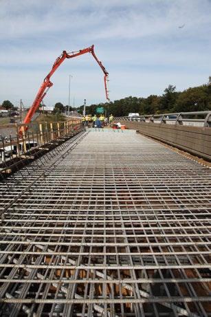
11 Dundas Highway Road Bridge Projects Replacement UPC: New Project #8 Replace bridge on Dundas Road in Chesterfield County The Dundas Road Bridge in Chesterfield County has a sufficiency rating of 34 which would rank the bridge condition as poor, and in need of rehabilitation. The bridge also provides a key link between Bensley Elementary School and a nearby high-density residential area, but lacks appropriate pedestrian facilities. This project would allow the bridge to improve structural integrity while also providing much needed pedestrian facilities. This bridge is also being funded with $3 million in revenue-sharing resources. Preliminary Engineering (PE) $1,000,000 FY17 Right-of-way (RW) $1,000,000 FY19 Construction (CN) $4,000,000 FY20 Regional from RRTPO New Project #8 $- $- $3,000,000 $3,000,000 Richmond Regional Transportation Planning Organization 6

12 Route 10 Widening (Bermuda Triangle Rd to Meadowville Rd) UPC: Widen West Hundred Road and improve intersection with Meadowville Road/Old Bermuda Road in Chesterfield County Chesterfield County has Two projects in various stages of planning, design and construction for the Route 10 corridor from US Route 1 to Meadowville Road. This project will widen this section of West Hundred Road from four-lanes to eight-lanes and will include improvements at the Meadowville Road/Old Bermuda Hundred Road intersection. Preliminary Engineering (PE) $2,400,000 Complete Right-of-way (RW) $9,300,000 Underway Construction (CN) $38,800,000 FY19 Regional from RRTPO $5,218,800 $70,000 $17,921,645 $6,411,580 Richmond Regional Transportation Planning Organization 7
 with a volume that is projected to increase to 48,000 vehicles per day by 2049; the")
13 Route 10 Widening (Route 1 to I-95) UPC: Widen West Hundred Road from Jefferson Davis Highway to I-95 in Chesterfield County The section of West Hundred Road between Bermuda Triangle and Meadowville Road is a congested four-lane, divided roadway carrying approximately 37,000 vehicles per day (2014) with a volume that is projected to increase to 48,000 vehicles per day by 2049; the current level of service during the peak period is C with a forecasted level of service of F. Preliminary Engineering (PE) $800,000 Underway Right-of-way (RW) $3,000,000 FY17 Construction (CN) $4,200,000 FY10 Regional from RRTPO $500,000 $- $3,500,000 $4,000,000 Richmond Regional Transportation Planning Organization 8

14 Route 10 Widening (Whitepine Road to Frith Lane) UPC: Widen Iron Bridge Road from Whitepine Road to Frith Lane in Chesterfield County This project will widen Route 10 to six lanes between Whitepine Road and Frith Lane through the Route 288/Route 10 interchange. Chesterfield County completed the section of Route 10 from east of Frith Lane to Greenyard Road using county bond funds. Preliminary Engineering (PE) $1,600,000 FY18 Right-of-way (RW) $2,500,000 FY20 Construction (CN) $11,100,000 FY21 Regional from RRTPO $- $- $9,670,000 $- Richmond Regional Transportation Planning Organization 9

15 Route 360 Widening (Lonas Pkwy to Castle Rock Rd) UPC: Widen eastbound Hull Street Road from Lonas Parkway to Castle Rock Road in Chesterfield County This project will improve the vertical alignment and add a third lane to Route 360 eastbound between Lonas Parkway and Castle Rock Road. A previous phase of this project was funded by the TPO as well. This phase will complete a ten-mile long, six-lane Principal Arterial that connects Chippenham Parkway, Route 288 and extends to western Chesterfield. This project is fully funded. Preliminary Engineering (PE) $960,000 FY17 Right-of-way (RW) $1,200,000 FY19 Construction (CN) $4,240,000 FY20 Regional from RRTPO $- $960,000 $5,440,000 $- Richmond Regional Transportation Planning Organization 10

16 Hockett Road Intersection Realignment at Route 250 UPC: Relocate Hockett Road and make intersection improvements at Route 250 Goochland County The realignment of the road will align Hockett Road with Ashland Road at an existing signalized intersection on Broad Street Road. The project will involve the construction of approximately 0.25 miles of roadway. The funding for the PE phase of the project coming from the County s Secondary Six-Year Plan allocations, while the majority of the needed right-of-way has been donated from a property owner. The TPO funding allocation will complete the construction phase of the project. In July 2013, the Goochland County Board of Supervisors selected the relocation of a segment of Hockett Road as a priority for the County s Secondary Six-Year Plan. This project is being administered by Goochland County. Preliminary Engineering (PE) $395,000 FY17 Right-of-way (RW) $5,000 FY18 Construction (CN) $1,500,000 FY19 Regional from RRTPO $500,000 $- $1,000,000 $400,000 Richmond Regional Transportation Planning Organization 11

17 Atlee Road Extension UPC: Extend Atlee Road to connect with Atlee Station Road in Hanover County The Atlee Road Extension would connect Atlee Road and Atlee Station Road, extending the existing north terminus of Atlee Road approximately two-tenths of a mile northwest. This road extension would create a north-south link that would parallel I-95, but nested in the secondary arterial network of Hanover County. The project would also include pedestrian accommodations. Preliminary Engineering (PE) $1,133,500 Complete Right-of-way (RW) $2,824,800 Underway Construction (CN) $13,474,314 FY17 Regional from RRTPO $4,416,600 $- $2,014,000 $11,505,642 Richmond Regional Transportation Planning Organization 12

18 Cedar Lane Realignment UPC: Realign Cedar Lane with US 1 in Hanover County Cedar Lane s intersection with US Route 1 is skewed, meaning that the angle limits sight distance and the alignment is not at right-angles. This Hanover County project will realign Cedar Lane approximately 500 feet north of the current intersection with US Route 1 and will add a traffic signal at the intersection. The area surrounding this intersection is designated on the county s comprehensive plan for commercial, office/service and limited industrial uses. Improving the alignment addresses safety concerns at the intersection and will address a needed transportation solution that is difficult for private development interests to resolve. Preliminary Engineering (PE) $513,000 Underway Right-of-way (RW) $1,244,000 Underway Construction (CN) $3,988,000 FY18 Regional from RRTPO $2,000,000 $- $934,000 $3,001,000 Richmond Regional Transportation Planning Organization 13

19 Mechanicsville Tpk Widening & Lee Davis Rd Intersection UPC: Widen Route 360 and improve intersection at Lee Davis in Hanover County Hanover County is working to increase capacity along the Route 360 corridor between I-295 and Walnut Grove Road, which will consist of four projects to widen the roadway from four to six/eight lanes between I-295 and Walnut Grove and realign Bell Creek Road. CMAQ funding is being allocated to this project for the addition of turn lanes and medians. Preliminary Engineering (PE) $1,285,000 Complete Right-of-way (RW) $4,992,000 Underway Construction (CN) $10,487,000 FY19 Regional from RRTPO $4,754,854 $352,073 $5,387, CMAQ $656,000 $352,073 $2,687,927 $2,573,146 Richmond Regional Transportation Planning Organization 14

20 Pole Green Road Widening and Complete Street (PE-Only) UPC: New Project #9 Construct capacity improvement to Pole Green Road from Bell Creek Road to Rural Point Road in Hanover County Hanover County has requested funding for the preliminary engineering phase of a widening project for Pole Green Road. This widening is approximately 1.5 miles long and would include bike and pedestrian facilities. It would also extend an existing four-lane section, which currently ends at Bell Creek Road. This funding would allow for the completion of preliminary engineering to 60 percent plans and would well position this project for future funding applications. Preliminary Engineering (PE) $1,200,000 FY18 Right-of-way (RW) $4,650,000 Construction (CN) $10,750,000 Regional from RRTPO New Project #9 $- $- $720,000 $- Richmond Regional Transportation Planning Organization 15

21 Studley Road and Rural Point Road Roundabout UPC: Construct a roundabout at intersection of Studley Road and Rural Point Road in Hanover County Studley Road and Rural Point Road are two-lane roads that intersect on a severe skew which contributes to the high proportion of angle crashes at this location. Thru traffic on Studley Road and school traffic generated by Rural Point Elementary School, which abuts the intersection, results in significant delay on Rural Point Road during the morning and afternoon peak periods. Approximately 50 school bus trips pass through the intersection daily throughout the school year. To address the safety and congestion issues at the intersection, a roundabout is proposed. Bicycle and pedestrian accommodations will be considered as part of the project. Preliminary Engineering (PE) $302,000 Underway Right-of-way (RW) $151,000 FY16 Construction (CN) $1,795,000 FY19 Regional from RRTPO $591,500 $- $1,120,000 $116,800 Richmond Regional Transportation Planning Organization 16


22 Dabbs House Road Complete Street UPC: Widen, realign and improve Dabbs House Road as a complete street from Nine Mile Road to Creighton Road in Henrico County Dabbs House Road is classified as an urban collector providing access between Nine Mile Road and Creighton Road in eastern Henrico County. This project will widen and realign a 1.3 mile section, add necessary turn lanes and install a five-foot sidewalk. These improvements will address current deficiencies including poor alignment issues, intersection flow issues and a lack of pedestrian accommodations. Preliminary Engineering (PE) $1,750,000 Complete Right-of-way (RW) $2,564,920 Underway Construction (CN) $8,974,823 FY17 Regional from RRTPO $3,808,743 $4,300,000 $- $5,181,000 Richmond Regional Transportation Planning Organization 17

23 Sadler Road Relocation and Complete Street UPC: 60934, Construct safety and capacity improvements to Sadler Road from Cedar Branch Court to Cedar Grove Road in Henrico County This project will improve a 1.8 mile section of Sadler Road from a two-lane road to a combination of a four-lane undivided roadway and an improved two-lane facility with sidewalks. Sadler Road is classified as an urban collector roadway providing access between W. Broad Street and Nuckols Road in the Innsbrook area of northwestern Henrico. Traffic volumes on Sadler Road are 2,700 vehicles per day (2010); the narrow roadway with poor alignment has no pedestrian accommodations. Project Phases (60934) Estimated Cost Schedule Preliminary Engineering (PE) $2,500,000 Underway Right-of-way (RW) Construction (CN) Project Phases (104148) Estimated Cost Schedule Preliminary Engineering (PE) Right-of-way (RW) $4,600,000 FY17 Construction (CN) $11,170,000 FY21 Regional from RRTPO $1,426,943 $- $- $1,073, $4,002,800 $- $5,600,000 $6,167,244 Richmond Regional Transportation Planning Organization 18

24 Three Chopt Rd Complete Street UPC: 50525, Widen and improve Three Chopt Road as a complete street from Barrington Hill Drive to Cox Road in Henrico County Three Chopt Road is a minor arterial providing access from Cary Street in the City of Richmond to Lauderdale Rd in western Henrico County. These two connected projects will widen an approximately two-mile portion of Three Chopt Road, between Barrington Hill Drive and Gaskins Road, from two lanes to a four-lane divided highway and includes significant improvements to the intersection of Three Chopt Road and Gaskins Road. The project will also add pedestrian accommodations. Project Phases (50525) Estimated Cost Schedule Preliminary Engineering (PE) Right-of-way (RW) $900,000 Underway Construction (CN) $6,346,321 FY18 Project Phases (50529) Estimated Cost Schedule Preliminary Engineering (PE) Right-of-way (RW) $126,000 Underway Construction (CN) $6,772,000 FY18 Regional from RRTPO $6,938,321 $308,000 $- $ $6,772,000 $126,000 $- $- Richmond Regional Transportation Planning Organization 19
 to a new location at the Virginia State Police Head Quarters cross-over.")
25 Carter-Gallier New Road UPC: 8216 Construct Carter-Gallier Road as a new road from Anderson Highway to Luck Stone Road in Powhatan County This Powhatan County project will relocate the Page Road intersection with Anderson Highway (Route 60) to a new location at the Virginia State Police Head Quarters cross-over. The project is included in the County s Thoroughfare Plan and will also include the construction of a new road, Carter-Gallier Road, with Luck Stone Road. Preliminary Engineering (PE) $1,280,000 Complete Right-of-way (RW) $2,508,508 Underway Construction (CN) $3,171,886 FY17 Regional from RRTPO 8216 $4,151,000 $2,328,901 $- $227,776 Richmond Regional Transportation Planning Organization 20

26 Huguenot Trail Widening UPC: Widen Huguenot Trail from Route 288 to the Powhatan County Line. Powhatan County has requested funding to fully-fund the construction phase of the Huguenot Trail widening, allowing this project to advance to completion. The Huguenot Trail widening consists of widening the existing two-lane road section to four-lanes, as well as replacing the bridge over Bernard s Creek. The entire road section is 1.2 miles between the interchange at Route 288 and the Powhatan County/Chesterfield County line. The design will also increase safety throughout the corridor by improving geometric deficiencies and intersection alignments. Preliminary Engineering (PE) $2,300,000 FY12 Right-of-way (RW) $2,495,000 FY14 Construction (CN) $13,383,424 FY17 Regional from RRTPO $838,300 $- $4,647,420 $12,692,704 Richmond Regional Transportation Planning Organization 21

27 Commerce Road Complete Street UPC: Reconstruct Commerce Road as a complete street in the City of Richmond The Commerce Road Improvements will include roadway reconstruction including protected turn lanes, improved entrance curb radii for industrial traffic, as well as segregated bicycle and pedestrian facilities, street lighting and bridge replacement in the corridor from Bells Road to Bellemeade Road. Improvements will also include enhanced signalized turn lanes and reconfiguration of some entrances to improve corridor access management. Preliminary Engineering (PE) $2,092,072 Complete Right-of-way (RW) $600,000 Underway Construction (CN) $11,768,333 FY19 Regional from RRTPO $- $- $2,050,000 $13,610,411 Richmond Regional Transportation Planning Organization 22

28 Deepwater Terminal Road Extension UPC: Extend Deepwater Terminal Road to Goodes Street in City of Richmond This construction project will extend Deepwater Terminal Road to Goodes Street, a distance of approximately 0.70 miles improving access to the Port of Richmond. Currently, goods travelling to the port are limited by the 14-foot clearance restrictions of Bells Road passing under I-95. Accessing the port from Commerce Road by Goodes Street provides a second point of access to the port with a 21-foot vertical clearance under the interstate. The increased vertical clearance is necessary to accommodate over-size or project cargo opportunities for the Richmond Marine Terminal. The existing and future industrial businesses along Deepwater Terminal will also benefit from having a secondary means of accessing their businesses. Preliminary Engineering (PE) Right-of-way (RW) Construction (CN) Regional from RRTPO $- $- $1,750,000 $- Richmond Regional Transportation Planning Organization 23

29 Jahnke Road Complete Street UPC: Reconstruct Jahnke Road as a complete street in the City of Richmond This project will improve traffic safety and flow, as well as enhance multimodal options within a 1.25 mile stretch of Jahnke Road, between Forest Hill Avenue and Blakemore Road. The project will include a variety of pedestrian-oriented improvements including a five-foot sidewalk on the southern side and an eight-foot multi-use path on the northside. Additional improvements will include turn lanes at key intersections and a new signal at Forestview School Drive, which serves as the entrance to Elizabeth Redd Elementary School. Safety enhancements will also be implemented where CSX Railroad crosses over Jahnke Road. Preliminary Engineering (PE) $2,000,000 Complete Right-of-way (RW) $2,000,000 Underway Construction (CN) $9,699,321 FY18 Regional from RRTPO $5,330,200 $- $7,300, CMAQ $1,081,900 $- $- $- Richmond Regional Transportation Planning Organization 24

30 Mayo Bridge Rehabilitation over the James River UPC: Rehabilitate Mayo Bridge (Route 360) over the James River in the City of Richmond The Mayo Bridge was constructed in 1913 and has a VDOT scored bridge sufficiency rating of 35.8 which would rank the bridge condition as poor. The bridge is in need of replacement, but until funding is secured for replacement the City is working to secure the funding for major rehabilitation which is projected to cost $10 million. The proposed rehabilitation includes reconstructing the deck and approaches; repairing all delaminated concrete from under the arch and spandrel beams, pier caps, columns and abutments; and repairing or replacing portions of the parapets. Preliminary Engineering (PE) $500,000 FY17 Right-of-way (RW) Construction (CN) $5,500,000 FY20 Regional from RRTPO $- $- $6,000,000 $- Richmond Regional Transportation Planning Organization 25


31 Intermodal Transfer Improvements UPC: New Project #2 Construct a series of improvements at the Richmond Marine Terminal This improvement is composed of three independent projects that will aid in the re-development of the Richmond Marine Terminal (RMT). These improvements are necessary to improve site operations and provide the ability for increased freight movement at RMT. These improvements include the re-paving of the north wharf area, where the TPO-funded harbor crane will operate. Also included is the repairing of dilapidated rail crossings at the five key cross points, along and adjacent to Deepwater Terminal Road within the port. The final improvement is the replacement of fenders along the wharf wall, which facilitate cargo transfer and will increase safety during that transfer process. Preliminary Engineering (PE) Right-of-way (RW) Construction (CN) $2,050,000 FY17 Regional from RRTPO New Project #2 $- $2,050,000 $- $- Richmond Regional Transportation Planning Organization 26

32 288/Commonwealth Planning Ctr Pkwy Study & Bailey Projects Bridge Connector IMR UPC: New Project #3 Analyze alternatives for interchange improvements at Route 288 and Bailey Bridge Road in Chesterfield A detailed Interchange Modification Report will be conducted to evaluate proposed improvements to the Route 288/Commonwealth Center Parkway interchange which are needed to address the congested Route 288/Route 360 Interchange area. The evaluation will include the proposed Bailey Bridge Connector. Implementation of these improvements requires VDOT approval of the Interchange Modification Report. Preliminary Engineering (PE) $500,000 FY17 Right-of-way (RW) Construction (CN) Regional from RRTPO New Project #3 $500,000 * $- $- $- * Funds indicated as Past for this newly funded project reflect the reallocation of unspent funds from projects that were completed under budget (closeout funds). Richmond Regional Transportation Planning Organization 27

33 I-64/Ashland Rd Interchange IMR UPC: New Project #4 Analyze alternatives for interchange of I-64 and Route 623 in Goochland A detailed Interchange Modification Report is needed to identify viable alternatives for the upgrade of the I-64 interchange at Ashland Road. An IMR must be completed prior to a change in interstate access and must go through a transportation planning process. Work from this IMR will then be incorporated into the other phases of developing interchange improvements and will provide future guidance on how to proceed. Preliminary Engineering (PE) $400,000 FY17 Right-of-way (RW) Construction (CN) Regional from RRTPO New Project #4 $309,709 $90,291 $- $- Richmond Regional Transportation Planning Organization 28


34 Transit Development Plan UPC: N Assess and enhance the future transit system for GRTC Transit Development Plans (TDP) are required by the state in order for transit agencies to appropriately assess and plan for the future development of the existing transit system. TDP s are necessary to identify needs, assess existing resources, and develop recommendations for the enhancement of the transit system. Typically, TDP s have a six-year outlook. Currently GRTC s service encompasses the City of Richmond, Henrico County, Chesterfield County, and an express route to the City of Petersburg. This TDP update process will begin in July 2016 and is anticipated to take up to 18 months. Preliminary Engineering (PE) $155,700 FY17 Right-of-way (RW) Construction (CN) Regional from RRTPO N $- $155,700 $- $- Richmond Regional Transportation Planning Organization 29
35 This page was intentionally left blank & CMAQ Allocations Richmond Regional Transportation Planning Organization 30
36 Congestion Mitigation <<Proj_Title_TPO>> & Air Quality Improvement Program CMAQ Richmond Regional Transportation Planning Organization 31

37 Azalea Avenue at Richmond-Henrico Turnpike Complete Streets CMAQ UPC: Install pedestrian, transit, and safety improvements to Azalea Ave at Richmond- Henrico Turnpike in Henrico County The project will provide sidewalks in an area with a significant amount of pedestrian activity; in addition to sidewalks, it will also provide crosswalks and pedestrian signals at two intersections where none currently exist. This project will also provide improved access to three GRTC bus stops, which will facilitate transit use. With the installation of curb and gutter and restriping of the lane markings on Richmond-Henrico Turnpike, an exclusive right-turn lane will be installed for southbound traffic. Preliminary Engineering (PE) $130,000 Underway Right-of-way (RW) $85,000 FY17 Construction (CN) $1,400,000 FY19 Regional from RRTPO CMAQ $130,000 $85,000 $1,400,000 $- Richmond Regional Transportation Planning Organization 32

38 Bicycle Ridgefield and Pedestrian Parkway Sidewalk Projects CMAQ UPC: Construct a sidewalk along Ridgefield Parkway from Pump Road to Falconbridge Drive in Henrico County This project will provide a sidewalk along one side of a one-mile section of Ridgefield Parkway, which the Henrico County Major Thoroughfare Plan designates as a minor arterial roadway. Ridgefield Parkway is located in a residential area and the sidewalk will provide a connection to Deep Run Park, complete the sidewalk network along this three-mile section of Ridgefield Parkway, and complete the connection to Godwin High School on Pump Road. Preliminary Engineering (PE) $175,000 Underway Right-of-way (RW) $100,000 FY17 Construction (CN) $325,000 FY19 Regional from RRTPO CMAQ $175,000 $100,000 $325,000 $- Richmond Regional Transportation Planning Organization 33

. Phase one of this project was advertised in mid- 2015.")

39 Bike Share Program - City of Richmond CMAQ UPC: Install phases one and two of Bike Share stations The City of Richmond has develop a two-phase approach to the implementation of its Bike Share program. This first phase would be implemented in the urban core of downtown, while the second phase would follow, extending into residential and commercial areas (The Fan, Scott s Addition) and tying into new bike and pedestrian infrastructure (The Capital Trail). Phase one of this project was advertised in mid Providing shared bicycles for a fee allows those working, living, or visiting Richmond s urban core to choose biking as an option for trips. Bike sharing provides a simple and affordable means of moving about the urban core of a city, minimizing the need to rely on a motor vehicle while simultaneously complementing other modes of travel. Bike sharing can also expand the footprint or attractiveness of the Richmond Region s bus transit by eliminating the need for some transfers, or providing enhanced access to transit. Preliminary Engineering (PE) $200,000 Underway Right-of-way (RW) Construction (CN) $2,800,000 FY16 Regional from RRTPO CMAQ $2,146,050 $853,950 $- $- Richmond Regional Transportation Planning Organization 34
 and dual right turn lanes on Spring Run Road.")
40 Route 360 Highway & Spring Projects Run Intersection CMAQ UPC: Improve intersection at Spring Run and Hull Street Road in Chesterfield County This project will construct dual left turn lanes on Hull Street Road (Route 360) and dual right turn lanes on Spring Run Road. The dual left and right turn lanes will allow turning traffic to clear the intersection with Hull Street more quickly, which will reduce the travel delay to the through movement of traffic on Hull Street Road. Preliminary Engineering (PE) $300,000 FY17 Right-of-way (RW) $540,000 FY18 Construction (CN) $2,760,000 FY21 Regional from RRTPO CMAQ $- $- $3,600,000 $- Richmond Regional Transportation Planning Organization 35

41 Creighton Road and Cold Harbor Road Intersection CMAQ UPC: Install a roundabout at the Creighton Road and Cold Harbor Road Intersection This improvement would install a one-lane roundabout at the intersection of Creighton Road and Cold Harbor Road in Hanover County. Currently this location is structured as a standard four-approach intersection and lacks adequate turn lanes. As traffic volumes have increased due to the location s proximity and access to I-295 the intersection s level of service has deteriorated, particularly during peak travel hours. Conversion of this interchange to a roundabout will increase throughput, reduce delays, and have considerably less right-of-way impacts than adding turn lanes to the current four-approach structure. Preliminary Engineering (PE) $1,211,000 Complete Right-of-way (RW) $1,729,000 Underway Construction (CN) $3,826,00 FY20 Regional from RRTPO CMAQ $6,438,900 $- $1,927,000 $86,734 Richmond Regional Transportation Planning Organization 36
 and Ashland Road in Hanover County This project will widen the approach on US Route 33 and add turning lanes at the intersection of Ashland Road (Route 623).")
42 Route 33 & Ashland Road Intersection CMAQ UPC: Improve intersection at Mountain Road (Rt. 33) and Ashland Road in Hanover County This project will widen the approach on US Route 33 and add turning lanes at the intersection of Ashland Road (Route 623). Traffic volumes and accident history at this location have made this project a priority for the county as this road is routinely used as a commuter route to access commercial areas between western Hanover and Henrico. Preliminary Engineering (PE) $1,750,000 Complete Right-of-way (RW) $2,800,158 Underway Construction (CN) $3,950,000 FY17 Regional from RRTPO CMAQ $5,800 $- $2,093,098 $5,644,484 Richmond Regional Transportation Planning Organization 37
 in Henrico County, in order to accommodate the high volume of vehicles travelling these two corridors.")
43 Parham Road and Patterson Avenue Intersection CMAQ UPC: Improve intersection at Parham Road and Patterson Ave in Henrico County This project will improve the intersection of two heavily traveled roads, Parham Road and Patterson Avenue (Route 6) in Henrico County, in order to accommodate the high volume of vehicles travelling these two corridors. Dual left-turn lanes will be installed on Patterson Avenue s eastbound and westbound approaches to the intersection, as well as on Parham Road s northbound approach. Additional improvements include grass medians and a reduced-access point at the median on Paterson Avenue s eastbound approach. All of these improvements will facilitate increased movement through the intersection, while also making the intersection safer. Preliminary Engineering (PE) $2,400,000 Underway Right-of-way (RW) $5,000,000 FY17 Construction (CN) $6,600,000 FY19 Regional from RRTPO CMAQ $2,400,000 $- $6,550,000 $50,000 Richmond Regional Transportation Planning Organization 38
 program at the Richmond Marine Terminal (RMT) modeled after the VPA program currently in place in the Hampton Roads region.")
44 Richmond Marine Intermodal Terminal GO Projects Green Operator Program CMAQ UPC: Implement Green Operator Program at the Richmond Marine Terminal The Virginia Port Authority (VPA) has established a Green Operator (GO) program at the Richmond Marine Terminal (RMT) modeled after the VPA program currently in place in the Hampton Roads region. This program is a comprehensive statewide multi-modal program that includes dray trucks, short and long-haul railroad, cargo-handling equipment and marine vessel sectors. This program incentivizes RMT partners to move toward clean diesel technologies. These incentives are necessary to improve air quality. Preliminary Engineering (PE) Right-of-way (RW) Construction (CN) $1,543,052 Underway Regional from RRTPO CMAQ $1,043,052 $250,000 $250,000 $- Richmond Regional Transportation Planning Organization 39
 vehicles, which provide transit from the Richmond International Airport Terminal to the airport s satellite parking facilities.")

45 CNG Transit Bus Projects Purchase CMAQ UPC: New Project #5 Purchase of buses for transportation travels from parking areas to the main terminal The Capital Region Airport Commission (CRAC) current shuttle bus program consists of nine Compress Natural Gas (CNG) vehicles, which provide transit from the Richmond International Airport Terminal to the airport s satellite parking facilities. The CRAC has requested an additional six vehicles to expand the fleet to 15 vehicles. Available CMAQ resources do not allow the full funding of this request but CRAC-specific close outs have been identified in the partial funding of this request. The shortfall would be covered by non-regional resources. Preliminary Engineering (PE) Right-of-way (RW) Construction (CN) $140,000 FY17 Regional from RRTPO New Project #5 CMAQ $140,000 * $- $- $- * Funds indicated as Past for this newly funded project reflect the reallocation of unspent funds from projects that were completed under budget (closeout funds). Richmond Regional Transportation Planning Organization 40
 vehicles.")

46 Replacement of Rolling Stock CNG Buses CMAQ UPC: New Project #6 Replacement of GRTC rolling stock with compressed natural gas vehicles The Greater Richmond Transit Company (GRTC) current bus replacement program encourages the replacement of diesel-fueled rolling stock with Compressed Natural Gas (CNG) vehicles. The conversion strategy in favor of CNG results in a more economical and environmentally-sound regional transit fleet. The TPO s contribution will fund the local-level funding gap that results in replacing diesel-fueled vehicles with an alternative fuels vehicle. These funds will help replace 29 transit vehicles. Preliminary Engineering (PE) Right-of-way (RW) Construction (CN) $589,291 FY18 Regional from RRTPO New Project #6 CMAQ $- $- $589,291 $- Richmond Regional Transportation Planning Organization 41

47 Main Street Station (Phase III) CMAQ UPC: Restore Train Shed of Main Street Station The restoration of Main Street Station (MSS) is a TPO Regional Transportation Priority Project which includes three phases. December 2003 marked the conclusion of the first phase, which coincided with the ending of a 28-year hiatus of having rail service into the city s central business district. Phase two of the project was completed in September 2007 and included the purchase of the remainder of the MSS property and the rehabilitation of the head house. These two phases, with a total investment of $39.3M, were funded primarily by federal funds with other funding by the city and $2M in TPO CMAQ allocations. The development schedule for Phase 3 is targeted for completion in 2017 and includes the restoration of the train shed, development of the seaboard buildings and other improvements in support of the proposed Broad Street Bus Rapid Transit project. Preliminary Engineering (PE) Right-of-way (RW) Construction (CN) $41,903,806 Regional from RRTPO CMAQ $17,006,200 $2,439,579 $ $6,000,000 $2,014,304 $546,117 $14,041,673 Richmond Regional Transportation Planning Organization 42
 investments include the evaluation and upgrade of equipment and communication technology resulting in an integrated signal system which can be managed from")
48 Henrico Transportation County Automated Demand Traffic Management Management Projects System CMAQ UPC: Install intelligent transportation system coordinating traffic signals in Henrico County Automated Traffic Management System (ATMS) investments include the evaluation and upgrade of equipment and communication technology resulting in an integrated signal system which can be managed from a central location/operations center enabling response to transportation issues in real-time. Preliminary Engineering (PE) $1,425,000 Underway Right-of-way (RW) Construction (CN) $7,101,621 FY18 Regional from RRTPO CMAQ $2,395,200 $- $5,617,900 $- Richmond Regional Transportation Planning Organization 43
49 City of Richmond Automated Traffic Management System CMAQ UPC: , Install intelligent transportation system coordinating traffic signals in the City of Richmond The TPO previously funded the installation of Automated Traffic Management Systems (ATMS) investments including signal-timing coordination, battery back-up, pedestrian count-down signals, and closed-circuit television throughout Richmond s central business district. These projects fund the installation for the rest of the City north of the James River (UPC ), followed by those portions of the City south of the river (UPC ). By evaluating and upgrading equipment and communication technology, these projects will create an integrated signal system that allows for remote traffic monitoring and real-time incident response from a central operations center. Project Phases (100498) Estimated Cost Schedule Preliminary Engineering (PE) $1,532,000 Complete Right-of-way (RW) Construction (CN) $9,778,090 Underway Project Phases (105890) Estimated Cost Schedule Preliminary Engineering (PE) $1,000,000 FY18 Right-of-way (RW) Construction (CN) $5,312,350 FY20 Regional from RRTPO CMAQ $9,204,000 $1,822,200 $- $283, CMAQ $- $- $6,312,000 $- Richmond Regional Transportation Planning Organization 44
50 City of Richmond Employee Trip Reduction Program CMAQ UPC: T1811 Fund the Richmond Employee Trip Reduction Program for City employees The City of Richmond Employee Trip Reduction Program (RETRP) began in January 2004 to encourage City employees to use alternative forms of transportation in an effort to reduce the dependency on automobiles, reduce the demand for parking and improve the air quality in the region. Since its inception, the program has provided 1,263,109 bus and vanpool trips reducing automobile travel, demand for parking and improving the air quality. The participation in the program is closely monitored with detailed computerized monthly reports of swipecards usage. Preliminary Engineering (PE) $2,696,500 Right-of-way (RW) Construction (CN) Regional from RRTPO T1811 CMAQ $2,651,000 $250,000 $250,000 $- Richmond Regional Transportation Planning Organization 45

51 RideFinders Ride Sharing Services CMAQ UPC: T203 Fund RideFinders ride-sharing services program throughout the Region As the Richmond Region s travel demand management agency, the RRTPO allocates funding to support programs that manage travel demand by providing travelers with travel choices, such as work location, route, time, and mode in a more cost-effective manner than building more capacity. the RideFinders division of GRTC Transit System provides carpool and vanpool services throughout the region and is a key element of the TPO s efforts to reduce travel demand by daily commuters. Preliminary Engineering (PE) $12,481,817 Right-of-way (RW) Construction (CN) Regional from RRTPO CMAQ $11,910,800 $503,308 $503,308 T203 $704,000 $- $- $- Richmond Regional Transportation Planning Organization 46
52 Allocation Summary Resolution & Tables of Allocation Richmond Regional Transportation Planning Organization 47
53 Allocations <<Proj_Title_TPO>> Approved on Month DD, YYYY Project Description UPC Actual Other Allocated Sources Previous Projected Allocations* Allocations* Total of Total Exist/ Cost Previous Allocations Other FY17- Allocations* New Estimate Previous Previous CMAQ Other (Non- FY17 FY18 FY19 FY20 FY21 FY22 (FY17-FY22) FY22 (PPF ) (TPO) CMAQ (TPO) FY17-FY22 TPO) (Amount) Ashland - Trolley line trail II Exist 1,100, ,100, ,100, ,100,000 SUBTOTALS: 1,100, ,100, ,100,000 Charles City County Rt 155: VA capital trail ex t: Rt 5 to Lott - Cary Rd Ex ist 3,731, , , , , ,000, ,351,300 Rt 155 capital trail spur from Lott Cary Rd - to New Kent CL Ex ist 400, , , ,000 SUBTOTALS: - 325, , , ,400, ,751,300 Chesterfield County - Rt 10 w idening: Rt 1 to I Ex ist 8,000, ,000-4,000, ,500, ,500, ,000,000 Rt 10 w iden to 6 lanes: Whitepine Rd to - Frith Ln Ex ist 15,100, ,600,000-2,500,000 2,570,000 3,000,000 9,670, ,670,000 Rt 360 EB w idening: Lonas Pkw y to - Castle Rock Rd Ex ist 6,400, ,000-1,200,000 3,000,000 1,240,000-6,400, ,400,000 Rt 10 w iden to 8 lanes from Bermuda - Triangle Rd to Meadowville Rd Ex ist 50,500,000 5,218,800-6,411,580 70,000-3,575,000 2,630,000 5,735,645 5,981,000 17,991, ,622,025 - Dundas Road Bridge Replacement New 6,000, , ,000,000-3,000,000-2,400,000 6,000, /Commonw ealth Ctr Pkw y & Bailey - Bridge Connector IMR New 500, , ,000 SUBTOTALS: 1,030,000 1,600,000 4,775,000 11,630,000 12,545,645 8,981,000 40,561,645-2,400,000 60,192,025 Goochland County Hockett Road intersection realignment at - Rt Ex ist 1,900, , , ,000, ,000, ,900,000 - I-64/Ashland Rd Interchange IMR New 400, , , , ,000 SUBTOTALS: 90,291-1,000, ,090, ,300,000 Greater Richmond Transit Company - Transit Dev elopment Plan New 155, , , ,700 SUBTOTALS: 155, , ,700 Hanover County Rt 360/Lee Dav is Rd: Intersection - improv ements Ex ist 16,764,000 4,754, ,000 2,573, ,073-4,667, , ,740,000 3,040,000-16,764,046 Rt 606 (Studley Rd) roundabout at Rural - Point Rd Ex ist 1,795, , , , , ,120, ,827,680 - Atlee Rd extension Exist 17,696,000 4,416,600-10,638,423 2,014, ,014, ,219 17,936,242 - Cedar Ln/Rt 1 intersection realignment Ex ist 5,745,000 2,000,000-3,001, , , ,935,000 - Pole Green Road Widening (PE-Only ) New 720, , , ,000 SUBTOTALS: 3,267,063 1,873,010 4,667, , ,528,000 3,040, ,219 43,182,968 Richmond Regional Transportation Planning Organization 48
54 Project Description UPC Actual Other Allocated Sources Previous Projected Allocations* Allocations* Total of Total Exist/ Cost Previous Allocations Other FY17- Allocations* New Estimate Previous Previous CMAQ Other (Non- FY17 FY18 FY19 FY20 FY21 FY22 (FY17-FY22) FY22 (PPF ) (TPO) CMAQ (TPO) FY17-FY22 TPO) (Amount) Henrico County Dabbs House Rd improv ements: Nine - Mile Rd to Creighton Rd Ex ist 13,289,743 3,808,700-5,181,000 4,300, ,300, ,289,700 Sadler Road improv ements from Dominion - Blv d to Cedar Branch Ct: Phase 1 (RW & Ex ist 15,770,000 4,002,800-6,167,244-4,880, , ,600, ,770,044 CN) Three Chopt Rd improv ements from - Barrington Hill Dr to Cox Rd (RW & CN) Ex ist 7,246,321 6,938, , , ,246,321 Three Chopt Rd improv ements from Cox - Rd to Gaskins Rd (RW & CN) Ex ist 6,898,000 6,772, , , ,898,000 - Laburnum Avenue Sidewalk New 781, , , , ,000 - Parham Road Sidewalk and Signals New 4,955, ,000 2,724,000 3,125,000-1,830,000 4,955,000 SUBTOTALS: 5,026,930 4,880,000 1,121,000 2,724, ,751,930-1,830,000 48,940,065 Powhatan County Carter Gallier Rd (former Page Rd) from - Rt 60 to 0.5 mile to Luck Stone Rd 8216 Ex ist 6,870,750 4,151, ,776 2,328, ,328, ,289 6,967,966 - Huguenot Trail w idening (Rte. 711) New 18,178, ,300-1,863,531-2,000,000 2,647, ,647,420-10,829,097 18,178,348 SUBTOTALS: 2,328,901 2,000,000 2,647, ,976,321-11,089,386 25,146,314 Port of Virginia - RMT - Intermodal Transfer Improvements New 2,050, ,050, ,050, ,050,000 SUBTOTALS: 2,050, ,050, ,050,000 City of Richmond - Main Street Station (Phase III) Ex ist 41,903,806 17,006,200 6,000,000 14,041,637 2,014, , ,560,421 2,439,579-42,047,837 Commerce Rd improv ements: Bells Rd to - Bellmeade Rd Ex ist 14,460, ,610,411-2,050, ,050, ,660,411 Deepw ater Terminal Rd ex tension: - Deepwater Terminal Rd to Goodes St Ex ist ,750,000 1,750, ,750,000 Jahnke Rd improv ements from Blakemore - Rd to Forest Hill Av e Ex ist 13,699,321 5,330,200 1,081, ,458-4,200,000 3,100, ,300, ,028,558 May o Bridge (Rt 360) Rehabilitation ov er - James River Ex ist 6,000, , ,500,000 4,000,000-6,000, ,000,000 SUBTOTALS: 2,514,304 6,796,117 3,100,000 1,500,000 4,000,000 1,750,000 19,660, ,486,806 Regionwide - Regionw ide ,977, ,061 1,116,013 1,971,139 3,118,730 9,309,055 15,977,998 8,072,905-24,050,903 SUBTOTALS: - 463,061 1,116,013 1,971,139 3,118,730 9,309,055 15,977,998 8,072,905-24,050,903 TPO TOTAL ALLOCATION REQUEST (MM/DD/YYYY) CTB Allocation for Richmond Area TPO (4/18/2016) Fed Only (80%) State Match (20%) Funds Remaining $ 17,563,189 $ 17,937,188 $ 18,627,360 $ 19,420,139 $ 19,664,375 $ 20,040, ,252,306 $ 17,563,189 $ 17,937,188 $ 18,627,360 $ 19,420,139 $ 19,664,375 $ 20,040, ,252,306 $ 14,050,551 $ 14,349,750 $ 14,901,888 $ 15,536,111 $ 15,731,500 $ 16,032,044 90,601,845 $ 3,512,638 $ 3,587,438 $ 3,725,472 $ 3,884,028 $ 3,932,875 $ 4,008,011 22,650,461 $ - $ - $ - $ - $ - $ - - NOTE: * Actual and projected allocations consist of 80% federal funds and 20% state match (prov ided by VDOT) - Cost estimates from PCES (VDOT's project cost estimating sy stem) or prov ided by local jurisdictions. PPF: Past, Present, and Future - Schedule provided by PCES or by local jurisdictions. - Other funding from PCES/SYIP. - Previous or CMAQ funding from TPO tracking sheets & CMAQ Allocations Richmond Regional Transportation Planning Organization 49
55 2017 & CMAQ Allocations Richmond Regional Transportation Planning Organization 50
56 CMAQ Allocations <<Proj_Title_TPO>> Approved on Month DD, YYYY CMAQ Project Description UPC Actual Other Allocated Sources Previous Projected CMAQ Allocations* Allocations* Total CMAQ of Total Exist/ Cost Previous Allocations Other Allocations* New Estimate Previous Previous Other (Non- FY17 FY18 FY19 FY20 FY21 FY22 (FY17-FY22) FY17-FY22 (PPF ) CMAQ (TPO) (TPO) FY17-FY22 TPO) (Amount) Chesterfield County Rt 360 intersection improv ements at - Spring Run Rd Ex ist 3,600, , ,000-1,900, ,000 3,600, ,600,000 SUBTOTALS: - 300, ,000-1,900, ,000 3,600, ,600,000 Capital Region Airport Commission - CNG Bus Purchase New 675, , ,000 SUBTOTALS: ,000 Greater Richmond Transit Company - Replacement of Rolling Stock CNG Buses New 589, , , ,291 SUBTOTALS: - 589, , ,291 Hanover County Rt 33/Ashland Rd: Intersection - improv ements Rt 360/Lee Dav is Rd: Intersection - improv ements Ex ist 8,500,158 5,800-5,644,484-2,093, ,093, ,743, Ex ist 16,764, ,000 4,754,900 2,573, ,073-1,000, ,000 1,187,927-3,040,000 5,740,000-16,764,046 - Creighton Rd/Cold Harbor Rd Roundabout Exist 7,381,463 6,438,900-86, ,000, ,000-1,927, ,452,634 SUBTOTALS: 352,073 2,093,098 1,000,000 1,500,000 2,114,927-7,060,098 5,740,000-32,960,062 Henrico County ATMS (Automated Traffic Management - System) phase 2: Countywide Ex ist 8,526,621 2,395, ,975,802 1,138,790 2,503, ,617, ,013,100 Azalea Av e pedestrian & signal - improv ements at Rich-Henrico Tnpk Ex ist 1,615, , ,000-1,000, , ,485, ,615,000 Ridgefield Pkw y sidew alk (north side of - the roadw ay ): Pump Rd to Falconbridge Ex ist 600, , , , , ,000 Dr Rt 6/Parham Rd intersection - improv ements Ex ist 14,000,000-2,400,000 50, ,000,000 2,100,000 1,900,000 1,550,000 6,550, ,000,000 SUBTOTALS: 185,000 2,300,802 3,138,790 5,003,308 1,900,000 1,550,000 14,077, ,228,100 Richmond Regional Transportation Planning Organization 51
57 Project Description UPC Actual Other Allocated Sources Previous Projected CMAQ Allocations* Allocations* Total CMAQ of Total Exist/ Cost Previous Allocations Other Allocations* New Estimate Previous Previous Other (Non- FY17 FY18 FY19 FY20 FY21 FY22 (FY17-FY22) FY17-FY22 (PPF ) CMAQ (TPO) (TPO) FY17-FY22 TPO) (Amount) Port of Virginia - Green Operator Program Exist 1,543,052 1,043, , , , ,543,052 SUBTOTALS: 250, , , ,543,052 City of Richmond - Main Street Station (Phase III) Ex ist 41,903,806 17,006,200 6,000,000 14,041,637 2,439, ,439,579 2,560,421-42,047,837 Signal sy stem: East, north, and w est of - City Ex ist 6,312, ,220,000 2,750,000 1,092,000 1,250,000-6,312, ,312,000 - Employee trip reduction program T1811 Exist n/a 2,651, , , , ,151,000 - Bike share system: citywide Exist 3,000,000 2,146, , , ,000,000 - ITS signal sy stem: South of James Riv er Ex ist 11,310,090 9,204, ,988 1,822, ,822, ,310,188 SUBTOTALS: 5,365,729 1,470,000 2,750,000 1,092,000 1,250,000-11,927,729 2,560,421-65,821,025 RideFinders - Air pollution reduction program T203 Exist On-Going 12,400, , , , ,006, ,110,616 SUBTOTALS: 503, , ,006, ,110,616 Regionwide - Regionw ide ,072, , , ,945 1,056,881 5,811,808 8,072,905 15,977,998-24,050,903 SUBTOTALS: - 241, , ,945 1,056,881 5,811,808 8,072,905 15,977,998-24,050,903 TPO TOTAL ALLOCATION REQUEST (MM/DD/YYYY) CTB CMAQ Allocation for Richmond Area TPO (4/18/2016) Fed CMAQ Only (80%) State Match (20%) Funds Remaining $ 6,656,110 $ 7,747,779 $ 7,904,781 $ 8,082,253 $ 8,221,808 $ 8,221,808 46,834,539 $ 6,656,110 $ 7,747,779 $ 7,904,781 $ 8,082,253 $ 8,221,808 $ 8,221,808 46,834,539 $ 5,324,888 $ 6,198,223 $ 6,323,825 $ 6,465,802 $ 6,577,446 $ 6,577,446 37,467,631 $ 1,331,222 $ 1,549,556 $ 1,580,956 $ 1,616,451 $ 1,644,362 $ 1,644,362 9,366,908 $ - $ - $ - $ - $ - $ - - NOTE: - Cost estimates from PCES (VDOT's project cost estimating sy stem) or prov ided by local jurisdictions. - Schedule provided by PCES or by local jurisdictions. - Other funding from PCES/SYIP. - Previous or CMAQ funding from TPO tracking sheets. * Actual and projected allocations consist of 80% federal CMAQ funds and 20% state match (prov ided by VDOT) PPF: Past, Present, and Future 2017 & CMAQ Allocations Richmond Regional Transportation Planning Organization 52
58 This page was intentionally left blank & CMAQ Allocations Richmond Regional Transportation Planning Organization 53
59 This page was intentionally left blank & CMAQ Allocations Richmond Regional Transportation Planning Organization 54


60 Ashland Charles City Chesterfield Goochland Hanover Henrico New Kent Powhatan Richmond The Richmond Regional Transportation Planning Organization is the federally-designated forum for regional transportation decision-making, planning, and programming, which allocated $160 million for regional transportation projects in The agency s board is the only transportation organization in the Richmond region that includes elected officials from all nine of the Region s localities. Policymakers from regional, state, and federal transportation agencies also sit on the board. The RRTPO is comprised of the City of Richmond, Town of Ashland, and all or part of the Counties of Charles City, Chesterfield, Goochland, Hanover, Henrico, New Kent, and Powhatan. Prepared by the Richmond Regional Planning District Commission 9211 Forest Hill Ave, Suite 200 Richmond, Virginia, Phone: (804) Fax: (804) The RRTPO is staffed by the Richmond Regional Planning District Commission, an intergovernmental agency that facilitates collaboration among the nine local jurisdictions in the Richmond region.
2017 RSTP & CMAQ. Funding the transportation priorities of the Richmond region. Richmond Regional Transportation Planning Organization
 2017 RSTP & CMAQ the transportation priorities of the Richmond region Richmond Regional Transportation Planning Organization $164 Million for regional transportation priorities in FY18-FY23. Regional Introduction
Chapter 5 Future Transportation
 Chapter 5 Future Transportation The Future Land Use Plan identifies the desired land use designations. The land uses desired for Crozet depend, in large part, on the success of the transportation system,
TRASBURG RANSPORTATION
 TRASBURG RANSPORTATION LAN DEVELOPED BY THE TRANSPORTATION PLANNING DIVISION OF THE VIRGINIA DEPARTMENT OF TRANSPORTATION IN COOPERATION WITH THE U.S. DEPARTMENT OF TRANSPORTATION, FEDERAL HIGHWAY ADMINISTRATION
DRAFT BUENA VISTA 2020 TRANSPORTATION PLAN
 DRAFT BUENA VISTA 2020 TRANSPORTATION PLAN DEVELOPED BY THE TRANSPORTATION PLANNING DIVISION OF THE VIRGINIA DEPARTMENT OF TRANSPORTATION IN COOPERATION WITH THE U.S. DEPARTMENT OF TRANSPORTATION, FEDERAL
CHAPTER 5 TRANSPORTATION GOAL
 CHAPTER 5 TRANSPORTATION GOAL Create and sustain a transportation system that meets the demands for existing and future traffic; skillfully integrates existing and planned development; and provides a safe
Route 29 Solutions Projects
 Route 29 Solutions Route 29 Solutions Projects www.route29solutions.org October 10, 2014 Route 29 Widening to Six Lanes Albemarle County This project will widen a 1.8-mile segment of Route 29 from four
Basalt Creek Transportation Refinement Plan Recommendations
 Basalt Creek Transportation Refinement Plan Recommendations Introduction The Basalt Creek transportation planning effort analyzed future transportation conditions and evaluated alternative strategies for
Arterial Management Plan for US Route 250 and State Route 623
 Arterial Management Plan for US Route 250 and State Route 623 June 25, 2014 Brad Shelton, AICP Access Management and Traffic Impact Analysis Programs Manager Transportation and Mobility Planning Division
ARTINSVILLE ENRY OUNTY REA RANSPORTATION TUDY
 ARTINSVILLE ENRY OUNTY REA RANSPORTATION TUDY DEVELOPED BY THE TRANSPORTATION AND MOBILITY PLANNING DIVISION OF THE VIRGINIA DEPARTMENT OF TRANSPORTATION IN COOPERATION WITH THE U.S. DEPARTMENT OF TRANSPORTATION,
ARRENTON RANSPORTATION
 ARRENTON RANSPORTATION LAN DEVELOPED BY THE TRANSPORTATION PLANNING DIVISION OF THE VIRGINIA DEPARTMENT OF TRANSPORTATION IN COOPERATION WITH THE U.S. DEPARTMENT OF TRANSPORTATION, FEDERAL HIGHWAY ADMINISTRATION
Regional Transportation Needs Within Southeastern Wisconsin
 Regional Transportation Needs Within Southeastern Wisconsin #118274 May 24, 2006 1 Introduction The Southeastern Wisconsin Regional Planning Commission (SEWRPC) is the official areawide planning agency
Legislative Update. Frederick County Fall Staunton District. Interstate 81 - Exit 300 at Interstate 66 Southbound Acceleration Lane Extension
 Interstate 81 - Exit 300 at Interstate 66 Southbound Acceleration Lane Extension Application ID 1643 Northern Shenandoah Valley Regional Commission (NSVRC) $3,437,423 This project extends the Interstate
Bluffdale/ UDOT South High-T Intersection Project Type Operations
 Bluffdale/ UDOT 14600 South High-T Intersection Project Type Operations 14600 South and Redwood Road $ 600,000 $ 550,000 This project is to install a new High-T intersection at Redwood Road and 14600 South
City of Gainesville Transportation/Roadway Needs PROJECT SUMMARY
 A1 Roadway Resurfacing $23,846,000 TYPE: Preservation of existing system Roadway resurfacing A2 Signal Replacement $6,000,000 TYPE: Preservation of existing system Replace traffic signals. B1 W 6th St
MCTC 2018 RTP SCS and Madera County RIFP Multi-Modal Project Eval Criteria GV13.xlsx
 MCTC 8 RTP SCS and Madera County RIFP Multi-Modal Project Eval Criteria GV.xlsx Madera County Transportation Commission Regional Transportation Plan / Sustainable Communities Strategy Multi-Modal Project
Project Description Form 8EE
 Project Description Form 8EE Basic Project Information Submitting Jurisdiction/Agency: Town of Dumfries Project Title: Route 1 (Fraley Blvd) Widening: Brady's Hill Road to Dumfries Road Project Location:
Circulation in Elk Grove includes: Motor vehicles, including cars and trucks
 Circulation, as it is used in this General Plan, refers to the many ways people and goods move from place to place in Elk Grove and the region. Circulation in Elk Grove includes: Motor vehicles, including
2045 Long Range Transportation Plan. Summary of Draft
 2045 Long Range Transportation Plan Summary of Draft Fredericksburg Area Metropolitan Planning Organization The George Washington Region includes the City of Fredericksburg and the counties of Caroline,
Route 245 over Broad Run. The recently replaced bridge links The Plains and other communities in northern Fauquier to Interstate 66.
 28 VIRGINIA DEPARTMENT OF TRANSPORTATION \\ CULPEPER DISTRICT Route 245 over Broad Run. The recently replaced bridge links The Plains and other communities in northern Fauquier to Interstate 66. PROJECT
Sliding Hill Road - Widening (UPC )
") Sliding Hill Road - Widening (UPC 104957) Scored HB 2 Application Project Application ID: 434 General Project Information Project Title Sliding Hill Road - Widening (UPC 104957) Principal Improvement Highway
Sliding Hill Road - Widening (UPC 104957) Scored HB 2 Application Project Application ID: 434 General Project Information Project Title Sliding Hill Road - Widening (UPC 104957) Principal Improvement Highway
Los Altos Hills Town Council - June 18, 2015 Palo Alto City Council June 22, AGENDA ITEM #2.B Presentation
 Los Altos Hills Town Council - June 18, 2015 Palo Alto City Council June 22, 2015 AGENDA ITEM #2.B Presentation Previous Presentations Los Altos Hills Town Council in May 2014 and February 2015 Palo Alto
Route 7 Corridor Study
 Route 7 Corridor Study Executive Summary Study Area The following report analyzes a segment of the Virginia State Route 7 corridor. The corridor study area, spanning over 5 miles in length, is a multi
Washington DC Section of ITE Project Briefing
 Washington DC Section of ITE Project Briefing November 5, 2015 Renée Hamilton, VDOT, Deputy District Administrator I-66 Outside the Beltway Improvement Area Project Location Virginia 2 Purpose and Need
Rio Mills Rd/Berkmar Dr Extended Connection
 SMART SCALE Application Rio Mills Rd/Berkmar Dr Extended Connection Status: Scored ID: F2-0000001408-R02 General Point of Contact Information Point of Contact Name Kevin McDermott Point of Contact Phone
PEDESTRIAN ACTION PLAN
 ATTACHMENT 2 CITY OF SANTA MONICA PEDESTRIAN ACTION PLAN CITY OF SANTA MONICA PEDESTRIAN ACTION PLAN This page intentionally left blank EXECUTIVE SUMMARY CHAPTER 1 EXECUTIVE SUMMARY Setting the Stage
County of Fairfax, Virginia. Department of Transportation
 Fairfax County Parkway History 2 Planning began 50 years ago 1960s Washington s Regional Transportation Plan Recommends improved north/south travel Construct Capital Beltway and outer beltway Outer beltway
Funding Sources Appendix I. Appendix I. Funding Sources. Virginia Beach Bikeways and Trails Plan 2011 Page I-1
 Funding Sources Virginia Beach Bikeways and Trails Plan 2011 Page I-1 Funding Sources Federal and state agencies provide funding for local bikeway and trail projects. Descriptions follow for programs that
CITY OF COCOA BEACH 2025 COMPREHENSIVE PLAN. Section VIII Mobility Element Goals, Objectives, and Policies
 CITY OF COCOA BEACH 2025 COMPREHENSIVE PLAN Section VIII Mobility Element Goals, Objectives, and Policies Adopted August 6, 2015 by Ordinance No. 1591 VIII MOBILITY ELEMENT Table of Contents Page Number
WEST AND SOUTH WEST RING ROAD DOWNSTREAM TRAFFIC IMPACTS
 Page 1 of 9 EXECUTIVE SUMMARY Alberta Transportation ( AT ) is preparing to construct the final sections of the Calgary Ring Road. This includes the South West Ring Road ( SWRR ) (from Lott Creek Blvd
Highway 49, Highway 351 and Highway 91 Improvements Feasibility Study Craighead County
 Highway 49, Highway 351 and Highway 91 Improvements Feasibility Study Craighead County Executive Summary March 2015 Highway 49, Highway 351 and Highway 91 Improvements Feasibility Study Craighead County
CONNECTING PEOPLE TO PLACES
 CONNECTING PEOPLE TO PLACES 82 EAST BENCH MASTER PLAN 07 Introduction The East Bench transportation system is a collection of slow moving, treelined residential streets and major arteries that are the
4. ENVIRONMENTAL IMPACT ANALYSIS 9. TRANSPORTATION AND TRAFFIC
 4. ENVIRONMENTAL IMPACT ANALYSIS 9. TRANSPORTATION AND TRAFFIC 4.9.1 INTRODUCTION The following section addresses the Proposed Project s impact on transportation and traffic based on the Traffic Study
APPENDIX G: INTERSECTION NEEDS AT OKEECHOBEE BOULEVARD
 APPENDIX G: INTERSECTION NEEDS AT OKEECHOBEE BOULEVARD INTERSECTION NEEDS AT SR 7 and OKEECHOBEE BOULEVARD SR 7 Extension Project Development and Environment (PD&E) Study From Okeechobee Boulevard (SR
Clackamas County Comprehensive Plan
 ROADWAYS The County s road system permits the movement of goods and people between communities and regions, using any of a variety of modes of travel. Roads provide access to virtually all property. They
Appendix C. NORTH METRO STATION AREA TRAFFIC IMPACT STATEMENT 88th Avenue Station
 Appendix C NORTH METRO STATION AREA TRAFFIC IMPACT STATEMENT 88th Avenue Station Prepared for: Regional Transportation Department and URS Corporation as part of the North Metro EIS David Evans and Associates,
TRANSPORTATION & MOBILITY
 TRANSPORTATION & MOBILITY ROADWAY SYSTEM There are approximately 40 miles of roadways in Manitou Springs. For planning purposes, roadways are typically assigned a functional classification which defines
5. RUNNINGWAY GUIDELINES
 5. RUNNINGWAY GUIDELINES These guidelines should be considered collectively when making runningway decisions. A runningway is the linear component of the transit system that forms the right-of-way reserved
Solana Beach Comprehensive Active Transportation Strategy (CATS)
") Solana Beach Comprehensive Active Transportation Strategy (CATS) 3.0 Goals & Policies The Solana Beach CATS goals and objectives outlined below were largely drawn from the Solana Beach Circulation Element
Solana Beach Comprehensive Active Transportation Strategy (CATS) 3.0 Goals & Policies The Solana Beach CATS goals and objectives outlined below were largely drawn from the Solana Beach Circulation Element
City of Hamilton s Transportation Master Plan (TMP) Public Consultation 3 December 2015
 Public Consultation 3 December 2015") City of Hamilton s Transportation Master Plan (TMP) Public Consultation 3 December 2015 McPhail Transportation Planning Services Ltd. AGENDA 6:00 7:00 pm Viewing Boards / Q & A with the Team 7:00 7:50
City of Hamilton s Transportation Master Plan (TMP) Public Consultation 3 December 2015 McPhail Transportation Planning Services Ltd. AGENDA 6:00 7:00 pm Viewing Boards / Q & A with the Team 7:00 7:50
Roads and Vehicular Traffic Design Principles. Roads and Vehicular Traffic Recommendations
 CIRCULATION AND PARKING roads and vehicular traffic The Campus Master Plan updates the campus transportation network through a multi-modal approach that encourages walking and biking while improving vehicular
City of Wayzata Comprehensive Plan 2030 Transportation Chapter: Appendix A
 A1. Functional Classification Table A-1 illustrates the Metropolitan Council s detailed criteria established for the functional classification of roadways within the Twin Cities Metropolitan Area. Table
Chapter 7. Transportation. Transportation Road Network Plan Transit Cyclists Pedestrians Multi-Use and Equestrian Trails
 Chapter 7 Transportation Transportation Road Network Plan Transit Cyclists Pedestrians Multi-Use and Equestrian Trails 7.1 TRANSPORTATION BACKGROUND The District of Maple Ridge faces a number of unique
FI-2 I-66 Between Route 29, Lee Highway and Route 15, James Madison Highway
 TRANSPORTATION PLAN INTENT Transportation is the key to the economic and social development of Prince William County and especially to the I 66/Route 29 Sector Plan area. This includes transportation for
Governor s Transportation Vision Panel
 Office of Governor Kate Brown Governor s Transportation Vision Panel JLA Public Involvement Project Overview The is a yearlong effort to develop a series of recommendations for the Governor that address
FY STATEWIDE TRANSPORTATION IMPROVEMENT PROGRAM New Jersey Department of Transportation Projects
 ROUTE/ Project ID No. TIP No. Electrical Load Center Replacement - North 04324 04324 This project will provide for the betterment of the existing highway lighting facilities located along Routes 3, 17
Houma-Thibodaux Metropolitan Planning Organization STP<200K Funding Application APPLICATION
 APPLICATION HOUMA-THIBODAUX METROPOLITAN PLANNING ORGANIZATION (HTMPO) FOR SURFACE TRANSPORTATION PROGRAM (STP
Phone: Fax: Project Reference No. (to be filled out by MassHighway):
:") Massachusetts Highway Department District 3 Project Need Form (PNF) This form is intended to provide preliminary information about the proposed project. It is not expected that all information that is
Massachusetts Highway Department District 3 Project Need Form (PNF) This form is intended to provide preliminary information about the proposed project. It is not expected that all information that is
JONESBORO HIGHWAY 63 HIGHWAY 18 CONNECTOR STUDY
 JONESBORO HIGHWAY 63 HIGHWAY 18 CONNECTOR STUDY Craighead County May 2007 JONESBORO HIGHWAY 63 HIGHWAY 18 CONNECTOR STUDY Craighead County May 2007 Prepared by Planning and Research Division Arkansas State
STREET AND HIGHWAY PLAN
 STREET AND HIGHWAY PLAN Introduction The street and highway system in the Winston-Salem Urban Area consists of thousands of miles of traffic carrying facilities, ranging from short local residential streets
NM-POLICY 1: Improve service levels, participation, and options for non-motorized transportation modes throughout the County.
 Transportation PRINCE WILLIAM COUNTY 2008 COMPREHENSIVE PLAN NON-MOTORIZED PLAN CONTENTS Goals, Policies, and Action Strategies Table 4 (Bike Facility Classifications and Descriptions) Table 5 (Bike Facility
APPENDIX D: SACRAMENTO URBAN AREA TRANSPORTATION PRIORITIES
 1 County County County County 2 Yolo Arterial Roadway Collector Roadway Urban Residential Street Rural Residential Roadway I-80 / U.S. 50 Bus/Carpool Lanes in both directions Richards Blvd PM Yol 80 0.237
City of Bartow Comprehensive Plan. Transportation Element
 City of Bartow 2030 Comprehensive Plan Amended through January 7, 2013 TRANSPORTATION ELEMENT GOAL: IT SHALL BE A GOAL OF THE CITY OF BARTOW TO PROVIDE A SAFE AND EFFICIENT MULTI-MODAL TRANSPORTATION SYSTEM
Staunton. Transportation Plan. Transportation Planning Division. Virginia Department of Transportation
 2020 Transportation Plan Developed for the Transportation Planning Division of the Virginia Department of Transportation in cooperation with the U.S. Department of Transportation, Federal Highway Administration
Goodlettsville Bicycle and Pedestrian Plan Executive Summary
 Goodlettsville Bicycle and Pedestrian Plan July 2010 In Cooperation with the Nashville Area Metropolitan Planning Executive Organization Summary Introduction Progressive and forward thinking communities
Non-Motorized Transportation 7-1
 Non-Motorized Transportation 7-1 Transportation facilities no longer mean just accommodating a vehicle powered by a combustion engine. Pedestrian and non-motorized facilities are important modes of travel
A. LETTERS OF SUPPORT ON THE WYTHE CREEK ROAD WIDENING PROJECT
 ITEM #19: CORRESPONDENCE OF INTEREST A. LETTERS OF SUPPORT ON THE WYTHE CREEK ROAD WIDENING PROJECT Attached are five letters to Mayor Hunt of Poquoson in support of the Wythe Creek Road widening project.
Main-McVay Transit Study: Phase 2 Options Definition and High Level Constraints Evaluation
 Main-McVay Transit Study: Phase 2 Options Definition and High Level Constraints Evaluation APRIL 2016 A collaborative study between: For Additional Information or to Comment If you would like additional
INTERMODAL TRANSPORTATION PLAN
 INTRODUCTION INTERMODAL TRANSPORTATION PLAN Effective intermodal transportation implies a public policy for actively decreasing the demand for automobile trips and consequently reducing automobile related
Houma-Thibodaux Metropolitan Planning Organization STP<200K Funding Application APPLICATION
 APPLICATION HOUMA-THIBODAUX METROPOLITAN PLANNING ORGANIZATION (HTMPO) FOR SURFACE TRANSPORTATION PROGRAM (STP
Shockoe Bottom Preliminary Traffic and Parking Analysis
 Shockoe Bottom Preliminary Traffic and Parking Analysis Richmond, Virginia August 14, 2013 Prepared For City of Richmond Department of Public Works Prepared By 1001 Boulders Pkwy Suite 300, Richmond, VA
FY 2016 TRANSPORTATION ALTERNATIVES PROGRAM PROJECT SELECTION
 AGENDA ITEM #8: FY 2016 TRANSPORTATION ALTERNATIVES PROGRAM PROJECT SELECTION The Transportation Alternatives Program (TAP) created by MAP-21 requires that 50% of the program funds received by the state
Lynchburg District Update
 Lynchburg District Update Virginia Statewide Bicycle and Pedestrian Advisory Committee Spring Meeting May 16 th, 2017 David Cook Transportation Planner, VDOT Lynchburg District Table of Contents Active
section 4 Existing Conditions, Issues, and Options
 section 4 Existing Conditions, Issues, and Options 4.0 Existing Conditions, Issues, and Options This section analyzes each segment of the corridor on a street to street basis. Each segment is discussed
Dulles Area Transportation Association. October 11, Susan Shaw, P.E., Megaprojects Director Virginia Department of Transportation
 Dulles Area Transportation Association October 11, 2017 Susan Shaw, P.E., Megaprojects Director Virginia Department of Transportation Transform 66: Outside the Beltway 2 Project Overview Multimodal improvements
In station areas, new pedestrian links can increase network connectivity and provide direct access to stations.
 The Last Mile Planning for Pedestrians Planning around stations will put pedestrians first. Making walking to stations safe and easy is important; walking will be a part of every rapid transit Accessible
INNER LOOP EAST. AIA Rochester Annual Meeting November 13, 2013 TRANSFORMATION PROJECT. Bret Garwood, NBD Erik Frisch, DES
 INNER LOOP EAST TRANSFORMATION PROJECT AIA Rochester Annual Meeting November 13, 2013 Bret Garwood, NBD Erik Frisch, DES Why? We are building a city that encourages walking, biking and enjoying the outdoor
Dr. M.L. King, Jr. Street North Complete Streets Resurfacing Opportunities HOUSING, LAND USE, AND TRANSPORTATION COMMITTEE MARCH 22, 2018
 Dr. M.L. King, Jr. Street North Complete Streets Resurfacing Opportunities HOUSING, LAND USE, AND TRANSPORTATION COMMITTEE MARCH 22, 2018 What s Happening The City plans to mill and resurface Dr. M.L.
APPENDIX 2 LAKESHORE ROAD TRANSPORTATION REVIEW STUDY EXECUTIVE SUMMARY
 APPENDIX 2 LAKESHORE ROAD TRANSPORTATION REVIEW STUDY EXECUTIVE SUMMARY Appendix 2 City of Mississauga Lakeshore Road FINAL REPORT Transportation Review Study December 2010 EXECUTIVE SUMMARY Study Purpose
Madison Urban Area and Dane County. Bicycle Transportation Plan Summary. September Introduction. Bicycle Plan Scope and Planning Process
 Bicycle Transportation Plan Summary Madison Urban Area and Dane County Introduction September 2000 Bicycling is an important mode of transportation in the Madison urban area and countywide that is available
New Measure A Expenditure Categories DEFINITIONS OF ELIGIBLE EXPENDITURES Adopted March 8, 2007
 New Measure A Expenditure Categories DEFINITIONS OF ELIGIBLE EXPENDITURES Adopted March 8, 2007 City Street and County Road Maintenance Program The preservation and keeping of public street and road rights-of-way
Portland International Airport Bicycle and Pedestrian Plan (October 2003) Staff Acknowledgements
 Staff Acknowledgements") Portland International Airport Bicycle and Pedestrian Plan (October 2003) Staff Acknowledgements Scott King, Senior Aviation Planner Jason Gately, Senior Aviation Planner Preston Beck, Associate Planner
Portland International Airport Bicycle and Pedestrian Plan (October 2003) Staff Acknowledgements Scott King, Senior Aviation Planner Jason Gately, Senior Aviation Planner Preston Beck, Associate Planner
Intersection Traffic Control Feasibility Study
 Intersection Traffic Control Feasibility Study CSAH 9 at CSAH 60 (185th Avenue) Prepared For: Dakota County Transportation Department Western Service Center 14955 Galaxie Avenue, 3rd Floor Apple Valley,
WELCOME TO OPEN HOUSE # 1 June 14, 2017
 Langstaff Road Weston Road to Highway 7 Class Environmental Assessment Study WELCOME TO OPEN HOUSE # 1 June 14, 2017 Please sign in and join our mailing list Purpose of Open House #1 & Study Area York
Transform 66 Project February 4, 2016 Partnering Conference Michigan Department of Transportation American Council of Engineering Companies
 Transform 66 Project February 4, 2016 Partnering Conference Michigan Department of Transportation American Council of Engineering Companies Susan Shaw, PE, CCM, DBIA Megaprojects Director Northern Virginia
West Dimond Blvd Upgrade Jodhpur Street to Sand Lake Road
 West Dimond Blvd Jodhpur St to Sand Lake CSS Transportation Project Summary Municipality of Anchorage Project # 05 005 Project Manager: John Smith, P.E. (MOA PM&E) Project Administrator: Julie Makela,
San Francisco s Capital Plan & the Mayor s Transportation Task Force 2030: Funding the next steps for transportation
 San Francisco s Capital Plan & the Mayor s Transportation Task Force 2030: Funding the next steps for transportation San Francisco Capital Needs In 2006, the Mayor and Board of Supervisors approved San
Fairfax County Parkway Widening Fairfax County
 Get Involved VDOT representatives will review and evaluate information received as a result of this meeting. Please fill out the comment sheet provided in this brochure if you have any comments or questions.
Access Management Regulations and Standards
 Access Management Regulations and Standards Efficient highway operation Reasonable property access Concept of Access Management The way to manage access to land development while simultaneously preserving
City of Fairfax, Virginia City Council Work Session
 City of Fairfax, Virginia City Council Work Session Agenda Item # City Council Meeting 12a 9/8/2015 TO: FROM: SUBJECT: ISSUE(S): SUMMARY: FISCAL IMPACT: RECOMMENDATION: ALTERNATIVE COURSE OF ACTION: RESPONSIBLE
Town of Bethlehem. Planning Assessment. Bethlehem Town Board
 Town of Bethlehem US 9W Corridor Transportation Planning Assessment Presented e to: Bethlehem Town Board June 2009 Overview Study Background Route 9W Corridor Conditions and Improvements Selkirk Bypass
State Highway 44/State Street High Capacity Corridor
 Background State Highway 44/State Street runs from I-84 in Canyon County through parts of the cities of Middleton, Star, Eagle, and Garden City to downtown Boise. It is a commuter route from several communities
TRANSPORTATION ALTERNATIVES PROGRAM: SELECTED PROJECTS AND FUNDING ALLOCATIONS
 ITEM #9: TRANSPORTATION ALTERNATIVES PROGRAM: SELECTED PROJECTS AND FUNDING ALLOCATIONS The Transportation Alternatives Program (TAP) created by MAP-21 requires that 50% of the program funds received by
Project Description Form 6V
 Project Description Form 6V Basic Project Information Submitting Jurisdiction/Agency: Prince William County Project Title: Route 15 Widening: Route 55 to south of RR tracks & Construct RR Overpass Project
CITY OF LOMITA CITY COUNCIL REPORT
 CITY OF LOMITA CITY COUNCIL REPORT TO: FROM: City Council Ryan Smoot, City Manager Item No. SCH 12 PREPARED BY: Mark A. McAvoy, P.E., Public Works Director/City Engineer MEETING DATE: August 1, 2017 SUBJECT:
o n - m o t o r i z e d transportation is an overlooked element that can greatly enhance the overall quality of life for the community s residents.
 N o n - m o t o r i z e d transportation is an overlooked element that can greatly enhance the overall quality of life for the community s residents. 84 Transportation CHAPTER 11 INTRODUCTION Transportation
Executive Summary June 2015
 Executive Summary June 2015 Highway 112 Corridor Study Benton and Washington Counties Executive Summary June 2015 Prepared by Transportation Planning and Policy Division Arkansas State Highway and Transportation
ACTIVE TRANSPORTATION/NONMOTORIZED TRANSPORTATION
 ACTIVE TRANSPORTATION/NONMOTORIZED TRANSPORTATION BACKGROUND Active transportation, also known as nonmotorized transportation, is increasingly recognized as an important consideration when planning and
TRANSPORTATION TRAINING TOPICS. April 6, 2010
 TRANSPORTATION TRAINING TOPICS April 6, 2010 Roles of Transportation Providers Context and Policy Makers Division of Transportation and Traffic Other City Operations Other Transportation Operators CMA
Attached for your reference please find project updates on ongoing VDOT construction projects in Southampton County.
 SOUTHAMPTON COUNTY BOARD OF SUPERVISORS Regular Session i July 25, 2016 6. HIGHWAY MATTERS A. PLAN PROJECT UPDATES Attached for your reference please find project updates on ongoing VDOT construction projects
State Highway 16 Kuna-Mora Road to Ada/Gem County Line
 Background Update! (February 2018): This project has been partially funded; see below. State Highway 16 is the main commuter route from Gem County to the Treasure Valley. An increase in traffic and accidents
Project Update May 2018
 Project Update May 2018 Dakota County, in cooperation with the City of Lakeville, is planning to reconstruct 202 nd Street West (County Road 50) from Holyoke Avenue to Cedar Avenue (County Road 23). 202
AGENDA ITEM NO. 5b HCAOG TAC meeting of May 8, 2014
 Humboldt County Association of Governments Eureka, CA, 95501 AGENDA ITEM NO. 5b HCAOG TAC meeting of May 8, 2014 DATE: May 1, 2014 TO: HCAOG Technical Advisory Committee (TAC) FROM:, SUBJECT: Letters of
Southwest Bus Rapid Transit (SW BRT) Functional Planning Study - Executive Summary January 19 LPT ATTACHMENT 2.
 Functional Planning Study - Executive Summary January 19 LPT ATTACHMENT 2.") Southwest Bus Rapid Transit (SW BRT) Functional Planning Study - Executive Summary 2011 January 19 1 of 19 Introduction This executive summary presents the results of the Southwest Bus Rapid Transit (SW
Southwest Bus Rapid Transit (SW BRT) Functional Planning Study - Executive Summary 2011 January 19 1 of 19 Introduction This executive summary presents the results of the Southwest Bus Rapid Transit (SW
GRTC Bus Rapid Transit: Semi-Final Design Phase Public Meetings: October 26 & 27, 2015
 GRTC Bus Rapid Transit: Semi-Final Design Phase Public Meetings: October 26 & 27, 2015 Welcome! Meeting Agenda Project update presentation Up to 15 minutes for Pulse Q&A about project design. (Please reserve
Chapter 6 Transportation Plan
 Chapter 6 Transportation Plan Transportation Plan Introduction Chapter 6 Transportation Plan Transportation Plan Introduction This chapter describes the components of Arvada s transportation system, comprised
WYDOT DESIGN GUIDES. Guide for. NHS Arterial (Non-Interstate)
") WYDOT DESIGN GUIDES Guide for NHS Arterial (Non-Interstate) 2014 GUIDE FOR NATIONAL HIGHWAY SYSTEM (NHS) HIGHWAYS (NHS ARTERIALS, Non-Interstate) PRESERVATION REHABILITATION RECONSTRUCTION INTRODUCTION
WYDOT DESIGN GUIDES Guide for NHS Arterial (Non-Interstate) 2014 GUIDE FOR NATIONAL HIGHWAY SYSTEM (NHS) HIGHWAYS (NHS ARTERIALS, Non-Interstate) PRESERVATION REHABILITATION RECONSTRUCTION INTRODUCTION
Public Information and Participation Comments
 Two public meetings were held in December. The first meeting was December 6, 2011 at Mary Ellen Henderson Middle School and had 36 public attendees. The second meeting was on December 14, 2011 at the Arlington
STATION #3 INITIAL ALTERNATIVES
 www.dot.il.gov www.eisenhowerexpressway.com STATIO #3 IHB RR Heavy Rail Transit (HRT) High capacity transit mode serving urban areas:» Steel wheeled, high performance electric powered rail vehicles» Right-of-way
Viewing SMART SCALE Application
 Viewing SMART SCALE Application Route 15 Whites Ferry Road to Points of Rock Bridge Project Status: Submitted Organization: Loudoun County Project ID: 3593 Submitted: 08/06/2018 @ 3:18PM by Bob Brown Created:
WYDOT DESIGN GUIDES. Guide for. Non-NHS State Highways
 WYDOT DESIGN GUIDES Guide for Non-NHS State Highways 2014 GUIDE FOR Non-NATIONAL HIGHWAY SYSTEM (Non-NHS) STATE HIGHWAYS PRESERVATION REHABILITATION RECONSTRUCTION INTRODUCTION This Guide is directed to