ECOLOGICAL ASSESSMENT OF INNER LONG POINT BAY
|
|
|
- Judith Jacobs
- 5 years ago
- Views:
Transcription


1 ECOLOGICAL ASSESSMENT OF INNER LONG POINT BAY Kurt Oldenburg Fisheries Ecology Supervisor Lake Erie Management Unit Port Dover Janice M. Gilbert A/SW Zone Ecologist On Parks Canada/Ontario Agreement Respecting the Great Lakes Ecosystem
2 Canada/Ontario Agreement Vision healthy, prosperous and sustainable Great Lakes Basin Ecosystem for present and future generations Principles: Ecosystem Approach, Free Exchange of Information, Precautionary Principle, Science-based Management, Public and Stakeholder Participation, Pollution Reduction, Prevention, Rehabilitation ANNEX 3: LAKE AND BASIN SUSTAINABILITY Goal 1: Encourage and enhance Great Lakes sustainability to achieve social, economic and aquatic ecosystem well-being. Goal 2: Improve water quality Goal 3: Conserve and protect aquatic ecosystems, species and genetic diversity Goal 4: Reduce the threat of aquatic invasive species to Great Lakes aquatic ecosystems and species.
3 ASSESSMENT PARTNERS: Bird Studies Canada, Ryan Archer: Marsh Bird and Anuran surveys, Gap analysis McMaster University, Dr. Pat Chow Fraser and Sarah Thomasen M.Sc. candidate: Zooplankton diversity and community composition Long Point Waterfowl Research Centre/ Western University, Dr. Scott Petrie: Nick Bartok, M.Sc. Candidate: Least bittern numbers and habitat selection Robin Churchill, M.Sc. Candidate: distribution and abundance of submerged aquatic vegetation and Dreissenid mussels Scott Gillingwater, SAR biologist: herpetofaunal surveys University of Guelph, Kelly McNichols: Eastern Pondmussel recovery strategy lead Turkey Point and Middle Marsh Hunt Clubs Canadian Wildlife Service
4 LEMU ASSESSMENT COMPONENTS Wetlands, Nearshore and Tributaries: Fish diversity, community composition, and habitat type Water (temperature, dissolved oxygen, conductivity, ph depth, turbidity, chlorophyll a, BOD, total P, SRP, TKN, NH 3 /NH 4, Cl -, DIC, DOC, NO 2 /NO 3,TSS) Sediment (C/N ratio, ph, total Kjeldahl N, total P, % sand, silt, clay, OM) Aquatic macro-invertebrate diversity and community composition Vegetation diversity, community composition, bathymetry Wildlife presence SAR and IAS Impacts
5 ASSESSMENT OBJECTIVES Ecosystem approach Address knowledge gaps Provide baseline conditions Identify key impacts/pressures due to anthropogenic activities Identify beneficial management practices within coastal wetland complexes

6 SAMPLING LOCATIONS


7 Assessment Highlights: Diversity of Habitats

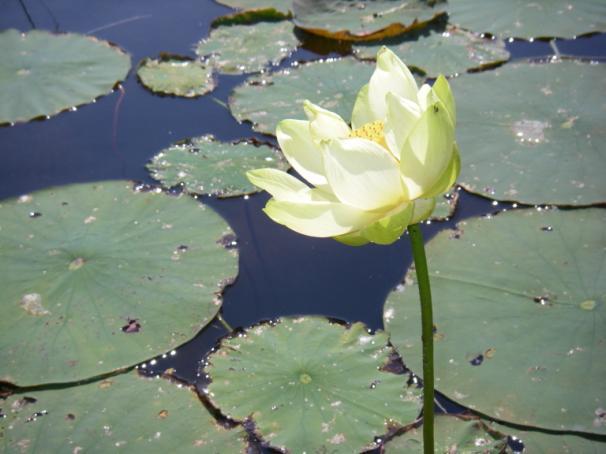
8 Phragmites australis subsp. australis

9 Assessment Highlights: High biodiversity


10 Assessment Highlights: Species at Risk Endangered Eastern Fox Snake Spotted Turtle Pugnose Shiner Eastern Pondmussel Threatened Lake Chubsucker Spotted Gar Fowler s Toad Blanding s Turtle Eastern Fox Snake Least Bittern Special Concern Monarch butterfly Grass Pickerel Warmouth Northern Ribbon Snake Northern Map Turtle Snapping Turtle Bald Eagle Black Tern Spotted Turtle Eastern Pondmussel Blanding s Turtle
11 Fish Community Study 2007: Nearshore seining throughout LPB Most sites visited 3 occasions: early, mid and late summer 2008: Crown Marsh and Bluffs Area studied: seining, trawling and trap 2009: Turkey Point, Crown Marsh and Bluffs Area studied: seining, trawl, dip and fyke, electrofish and trap
12 Results Over 60,000 fish sampled (~53 K in 2007 Seining) Total of 50 species Shannon-Weiner biodiversity index overall = Lake Erie Nearshore study in Mean H = ; East H = 1.04
13 Species at Risk Common Name Scientific Name Status % of Total Catch pugnose shiner Notropis anogenus END 1.74 grass pickerel Esox americanus vermiculatus SC 0.12 lake chubsucker Erimyzon sucetta THR 0.07 warmouth Lepomis gulosus SC 0.01
14 SAR fish capture locations

15
16 Relative Abundance Common Name Scientific Name % of Total Catch brook silverside Labidesthes sicculus blacknose shiner Notropis heterolepis spottail shiner Notropis hudsonius 9.34 banded killifish Fundulus diaphanus 7.93 emerald shiner Notropis atherinoides 6.59 pumpkinseed Lepomis gibbosus 6.13 blackchin shiner Notropis heterodon 5.19 largemouth bass Micropterus salmoides 4.73 yellow perch Perca flavescens 3.36 bluntnose minnow Pimephales notatus 2.59 round goby Neogobius melanostomus 1.75 pugnose shiner Notropis anogenus 1.74 bluegill Lepomis macrochirus 1.15
17
18 Shannon H Biodiversity Biodiversity (Shannon H) per site 2007 (All sites) Site
19
20 Similarity Site Cluster Analysis Paired Group Bray- Curtis analysis Coph Corr: Seining sites with similar effort (early, mid, late summer)
21 Site Cluster Analysis
22 Substrate Sand Silt Clay Gravel 2007 Seining All Sites Species vs substrate
23 Water Chemistry Seining All Sites Watertem ORP ph DO Water Chemistry vs species
24 Site Vegetation Wildcele Muskgras Bulrush Common P Bladderw Pond lil Stiff ar Sago pon Algae Common Cattail r Wild ric slough g Seining All Sites Vegetation vs species
25 Recommended Next Steps: Further assessments required on anthropogenic impacts: 1) Big Creek sediment quality, loading, dispersement 2) shoreline habitat use and development impacts on turtles/snakes (Scott Gillingwater) 3) water quality at key locations along Big Creek (Dr. Stewart Sweeney OMAFRA, Paul Gagnon LPCA) 4) hydrological study in CWS Big Creek WR (Dr. Pat Chow Fraser McMaster, Jeff Robinson CWS) 5) investigating barriers to Dreissenid invasion into interior wetlands (Kelly McNichols U of Guelph) Collation of Assessment/Research into one document; to include Best Bets summary chapter
26 Projects continuing: IJC Upper Great Lakes Water Level Change Impacts: Lake Erie Project (Env Ca./DFO) Env. Ca support for wetland/nearshore data analysis and report


, Cara Adriene")


,")
, Brianne")
,Long")
27 Acknowledgements Kathleen Ryan (Field assistant, ), Lindsay Bennett (Field assistant, ), Dana Cofell (Field assistant, 2009), Cara Adriene (volunteer, Long Point Conservation Authority, 2009), Darren Jacobs (volunteer, Rondeau Prov. Park, 2009), LEMU staff Heather Whitford, Tina Werner, Gord Ives, Tom McDougall, Larry Witzel, Dixie Greenwood, Wyatt Hall, Chris, Tim, Travis ), Danny Bernard (Canadian Wildlife Service), Brianne Fennema (Stewardship Rangers, ),Long Point Provincial Park, Long Point Conservation Authority
2014 Threatened and Endangered Fish Survey of. East Loon Lake and West Loon Lake. Lake County, Illinois
 2014 Threatened and Endangered Fish Survey of East Loon Lake and West Loon Lake Lake County, Illinois Prepared by Integrated Lakes Management 120 LeBaron St. Waukegan, IL 60085. Chris Ryan Chris Rysso
Great Lakes Coastal Wetland Communities: Vulnerabilities to Climate Change and Response to Adaptation Strategies
 Great Lakes Coastal Wetland Communities: Vulnerabilities to Climate Change and Response to Adaptation Strategies CCAF Wetlands Study Investigators: Susan Doka Fisheries & Oceans, Great Lakes Lab for Fisheries
Student Worksheet: River Health and Indicator Species
 1 Student Worksheet: River Health and Indicator Species Mink frogs (Lithobates septentrionalis). Credit: Allan G. Austin Activity 1: Biodiversity and Indicator Species Watch the videothe Importance of
Assessment of Nearshore Fish Populations in Lake Ripley, Jefferson County, Wisconsin
 Assessment of Nearshore Fish Populations in Lake Ripley, Jefferson County, Wisconsin 2012 Assessment of Nearshore Fish Populations in Lake Ripley, Jefferson County, Wisconsin Contributors: David Marshall,
Lake St. Clair Fish Community and Fishery
 Lake St. Clair Fish Community and Fishery Megan Belore Ontario Ministry of Natural Resources and Forestry Mike Thomas Michigan Department of Natural Resources Fish Community Fish Community Mixture of warm
Minnow and Small Fish Assemblages Of Pewaukee Lake, Wisconsin
 Minnow and Small Fish Assemblages Of Pewaukee Lake, Wisconsin Wisconsin Lutheran College, Biology Dept. Technical Bulletin 09, December 29, 2006 Prepared by Benjamin Bondow, William Hudzinski, Matthew
Thunder Bay River Assessment Appendix. Appendix 2
 Appendix 2 Known past and present fish distributions in the River system. Distribution of fishes were compiled from Bailey et al. (2003) and from records located at the Michigan Department of Natural Resources
Crooked Lake Oakland County (T4N, R9E, Sections 3, 4, 9) Surveyed May James T. Francis
 Surveyed May James T. Francis") Michigan Department of Natural Resources Status of the Fishery Resource Report No. 2004-1, 2004 Crooked Lake Oakland County (T4N, R9E, Sections 3, 4, 9) Surveyed May 2002 James T. Francis Environment Crooked
Michigan Department of Natural Resources Status of the Fishery Resource Report No. 2004-1, 2004 Crooked Lake Oakland County (T4N, R9E, Sections 3, 4, 9) Surveyed May 2002 James T. Francis Environment Crooked
SUMMARY REPORT FOR LAKE ST. MALO FISHERIES ASSESSMENT. Prepared for the St. Malo and District Wildlife Association
 SUMMARY REPORT FOR LAKE ST. MALO FISHERIES ASSESSMENT Prepared for the St. Malo and District Wildlife Association Presented by August 25, 2014 Study dates thus far: Date Tasks February 16 Fishing derby;
Tittabawassee River Assessment. Miles. Gladwin Smallwood Impoundment. Harrison. Clare. Midland. Mt. Pleasant. St. Louis. Saginaw.
 Warmouth Lepomis gulosus feeding - clear lakes and impoundments and very low-gradient streams - abundant aquatic vegetation - silt-free water - mucky substrate often covered with organic debris spawning
Fisheries Results and Impact Analysis
 City of Kingston Environmental Assessment Third Crossing of the Cataraqui River Fisheries Results and Impact Analysis Prepared for: J. L. Richards & Associates Ltd. Prepared by: Bowfin Environmental Consulting
MISSISSIPPI MAKEOVER A Plan for Restoration, Just Around the Bend
 MISSISSIPPI MAKEOVER A Plan for Restoration, Just Around the Bend Interim Report Card 2013 Project coordinated by the Dakota County Soil and Water Conservation District and sponsored by the Minnesota Pollution
Fish Assessment for Sanctuary Pond October 10, 2005
 83 Ambrogio Dr, Suite K Gurnee, IL 60030 8847-244-6662 847-244-0261 fax www.lakesmanagement.com Fish Assessment for Sanctuary Pond October 10, 2005 Prepared For: Dr. Mike Sands Executive Director Liberty
Status of Lake Erie s Western Basin Fish Populations: Trends and Environmental Conditions
 Status of Lake Erie s Western Basin Fish Populations: Trends and Environmental Conditions Jeff Tyson Ohio Department of Natural Resources Ohio Division of Wildlife Status of the Lake Erie s Western Basin
Canadian Manuscript Report of Fisheries and Aquatic Sciences 2777 SURVEY OF THE FISH ASSEMBLAGES OF ST. LAWRENCE ISLANDS NATIONAL PARK IN 2005
 Canadian Manuscript Report of Fisheries and Aquatic Sciences 2777 2006 SURVEY OF THE FISH ASSEMBLAGES OF ST. LAWRENCE ISLANDS NATIONAL PARK IN 2005 by N.E. Mandrak, J. Barnucz and D. Marson Great Lakes
LAKE RIPLEY FISHERY REPORT AND MANAGEMENT RECOMMENDATIONS (2009)
") LAKE RIPLEY FISHERY REPORT AND MANAGEMENT RECOMMENDATIONS (2009) I. Value and Role of Fisheries Fisheries play a central role in maintaining a healthy lake ecosystem through their interactions with other
LAKE RIPLEY FISHERY REPORT AND MANAGEMENT RECOMMENDATIONS (2009) I. Value and Role of Fisheries Fisheries play a central role in maintaining a healthy lake ecosystem through their interactions with other
Michigan Dept. of Natural Resources Status of the Fishery Resource Report Page 1
 Michigan Dept. of Natural Resources 2014-197 Status of the Fishery Resource Report Page 1 Otter Lake Lapeer and Genesee Counties, T9,10N/R8,9E/ Sections 1,6,7,36 Flint River Watershed, Last surveyed 2014
Rouge Fish Surveys
 Rouge Fish Surveys 2011-16 Friends of the Rouge January 2017 Partially funded by the Areas of Concern Program Office of the Great Lakes (OGL), DEQ Additional data provided by MDNR and MDEQ Fall 2016 Sampling
Fisheries and Lake Management Planning. CAP Mtg Nov21,2012 Brett Tregunno Aquatic Biologist, Kawartha Conservation
 Fisheries and Lake Management Planning CAP Mtg Nov21,2012 Brett Tregunno Aquatic Biologist, Kawartha Conservation Outline Aquatic Habitat Types Fish Communities Significance of Resource Current Management
Fish Survey of Arctic Lake (ID # ), Scott County, Minnesota in 2012
, Scott County, Minnesota in 2012") Snapping Turtle from Arctic Lake, September 2012 Fish Survey of Arctic Lake (ID #70-0085), Scott County, Minnesota in 2012 Survey Dates: September 18-20, 2012 MnDNR Permit Number: 18362 Prepared for: Shakopee
Snapping Turtle from Arctic Lake, September 2012 Fish Survey of Arctic Lake (ID #70-0085), Scott County, Minnesota in 2012 Survey Dates: September 18-20, 2012 MnDNR Permit Number: 18362 Prepared for: Shakopee
Lake LeAnn 2018 Fish Survey
 Lake LeAnn 2018 Fish Survey June 21, 2018 Prepared for: Lake LeAnn Property Owners Association Prepared by: ADVANCED ECOLOGICAL MANAGEMENT 22071 7 Mile Road Reed City, MI 49677 Table of Contents 1.0 INTRODUCTION...
FACT SHEET I. LOCATION
 STEAMBOAT ISLAND HABITAT REHABILITATION AND ENHANCEMENT PROJECT (HREP) SCOTT COUNTY, IOWA, UPPER MISSISSIPPI RIVER RESTORATION-ENVIRONMENTAL MANAGEMENT PROGRAM ROCK ISLAND DISTRICT FACT SHEET I. LOCATION
Fish faunal changes in Otsego Lake s Shadow Brook watershed following application of best management practices
 Fish faunal changes in Otsego Lake s Shadow Brook watershed following application of best management practices Ryan J. Reynolds 1, Joseph C. Lydon 2 and John R. Foster 3 Abstract: This study was conducted
Sampling the fish community of Big Creek, Norfolk County, Ontario, 2008
 Sampling the fish community of Big Creek, Norfolk County, Ontario, 2008 S. Marson, D. Marson, L. Bouvier, and N.E. Mandrak Central and Arctic Region Fisheries and Oceans Canada P.O. Box 5050, 867 Lakeshore
HURON RIVER WATERSHED
 Brown bullhead (Ameiurus nebulosus) feeding - larger streams and rivers, lakes and impoundments - clear cool water with little clayey silt - moderate amounts of aquatic vegetation - sand, gravel, or muck
Michigan Dept. of Natural Resources Status of the Fishery Resource Report Page 1. Weber Lake Cheboygan County, T34N, R3W, Sec.
 Michigan Dept. of Natural Resources 2012-143 Status of the Fishery Resource Report Page 1 Weber Lake Cheboygan County, T34N, R3W, Sec. 31 Neal Godby, Fisheries Biologist Environment Weber Lake is a 28.5-acre
Fish Communities in Five West Coast Spring-fed Rivers. Brandon Simcox, Eric Johnson, Amanda Schworm, Bill Pouder
 Fish Communities in Five West Coast Spring-fed Rivers Brandon Simcox, Eric Johnson, Amanda Schworm, Bill Pouder Project Overview FWC/SWFWMD partnership 3-yr funded project (thru June 2017) 5 spring-fed
feeding - clear moderate-sized shallow streams with moderate vegetation spawning - nests in gravel, sand, or hard rock substrate
 orthern longear sunfish (Lepomis peltastes) feeding - clear moderate-sized shallow streams with moderate vegetation - rocky substrates - little to no current spawning - nests in gravel, sand, or hard rock
Onondaga Lake Fishery: 2011 Fact Sheet
 October, 2011 Onondaga County Department of Water Environment Protection SUNY College of Environmental Science and Forestry Joanne M. Mahoney, County Executive Tom Rhoads, P.E., Commissioner Onondaga Lake
Conewago Creek Initiative. Fish Survey Report for the Conewago Creek
 Conewago Creek Initiative Fish Survey Report for the Conewago Creek A compilation of historic fish survey data from 97, 973, 7, for three locations along the Conewago Creek Prepared by Kristen Kyler for
Michigan Department of Natural Resources Status of the Fishery Resource Report Page 1
 Michigan Department of Natural Resources 29-72 Status of the Fishery Resource Report Page 1 Hart's Lake Calhoun County, T2S R8W S7 Surveyed June and August 28 Kregg Smith, Fisheries Biologist Environment
Transforming Chadwick Lake
 Transforming Chadwick Lake Chadwick Lake has been going through a process of renovation over the past two years. Management of the area began with a vision statement of producing an ecosystem comprised
Cedar Lake Comprehensive Survey Report Steve Hogler and Steve Surendonk WDNR-Mishicot
 Cedar Lake- 2006 Comprehensive Survey Report Steve Hogler and Steve Surendonk WDNR-Mishicot ABSTRACT Cedar Lake is a 142 acre lake located in the southwest corner of Manitowoc County. It is a seepage lake
LAKE PLEASANT Steuben County 2006 Fish Management Report. Larry A. Koza Assistant Fisheries Biologist
 LAKE PLEASANT Steuben County 2006 Fish Management Report Larry A. Koza Assistant Fisheries Biologist Fisheries Section Indiana Department of Natural Resources Division of Fish and Wildlife I.G.C.-South,
2011 Status of Major Stocks. Lake Erie Management Unit March 2012
 211 Status of Major Stocks Lake Erie Management Unit March 212 The Lake Erie Management Unit of the Ontario Ministry of Natural Resources is responsible for managing the fishery resources of the Ontario
Archer Lake 2011 Survey Report Prepared by Brian Gunderman
 Archer Lake 211 Survey Report Prepared by Brian Gunderman Introduction Archer Lake is a 64 acre lake located about miles southeast of the city of Coldwater. Archer Lake is part of the Coldwater-Marble
2014 Island Lake Survey June 13 th, 2014 Andrew Plauck District Fisheries Biologist Report Prepared 4 March 2015
 2014 Island Lake Survey June 13 th, 2014 Andrew Plauck District Fisheries Biologist Report Prepared 4 March 2015 BACKGROUND - A fish survey was requested due to a moderately severe winterkill in Island
BA1 BA2 BA3 BA4 BA5 BA6 CP1 CP2 CP3 CP4 CP5 CP6
 Table 1: Results of fish collections within or adjacent to the Boyne Secondary Plan Area conducted by C. Portt and Associates. Station locations are provided in Figure 1. Stations BA1-BA6 were collected
Elk Lake, Antrim and Grand Traverse counties T. 28, 29 N., R. 8, 9 W., Sec. many. Lake surveys. began at 40 feet
 Elk Lake, Antrim and Grand Traverse counties T. 28, 29 N., R. 8, 9 W., Sec. many Physical and chemical data surveyed August 1931 Temperature ( F) Secchi disk (feet) 9. 6 Surface 74 Bottom 45 PH 8.0 Thermocline
Methods for Evaluating Shallow Water Habitat Restoration in the St. Clair River
 Methods for Evaluating Shallow Water Habitat Restoration in the St. Clair River Objectives Document fish use of restoration sites Spawning Presence of larvae, juvenile, and adult fish Quantify differences
Rat Cove and Brookwood Point littoral fish survey, 2002
 Rat Cove and Brookwood Point littoral fish survey, 2 Katie Wayman 1 INTRODUCTION During the summer of 2, efforts to monitor the Otsego Lake littoral fish community continued with trap netting at both Rat
EcoLogic Memorandum. TO: Ben Brezell; EDR FROM: Mark Arrigo RE: Possible Impacts of Dredging Snooks Pond DATE: 6/4/07
 EcoLogic Memorandum TO: Ben Brezell; EDR FROM: Mark Arrigo RE: Possible Impacts of Dredging Snooks Pond DATE: 6/4/07 Background EDR P.C. (EDR) has been contracted by a landowner to assess the feasibility
Current Status and Management Recommendations for the Fishery in the Cloverleaf Chain of Lakes
 Current Status and Management Recommendations for the Fishery in the Cloverleaf Chain of Lakes Jason Breeggemann Senior Fisheries Biologist Wisconsin Department of Natural Resources Outline DNR fisheries
LAKE DIANE Hillsdale County (T8-9S, R3W, Sections 34, 3, 4) Surveyed May Jeffrey J. Braunscheidel
 Surveyed May Jeffrey J. Braunscheidel") Michigan Department of Natural Resources Status of the Fishery Resource Report No. 2003-4, 2003 LAKE DIANE Hillsdale County (T8-9S, R3W, Sections 34, 3, 4) Surveyed May 2001 Jeffrey J. Braunscheidel Environment
Michigan Department of Natural Resources Status of the Fishery Resource Report No. 2003-4, 2003 LAKE DIANE Hillsdale County (T8-9S, R3W, Sections 34, 3, 4) Surveyed May 2001 Jeffrey J. Braunscheidel Environment
Goldfish Removal Millar s Pond. Resort Municipality of Whistler
 Goldfish Removal Millar s Pond Resort Municipality of Whistler Site Specific Removal of goldfish will differ per site Millar s Pond Amphibians present Pond is isolated from other waterbodies presence of
Conewago Creek Initiative
 Conewago Creek Initiative The Conewago Creek Revisited Fish Survey Report A compilation of historic fish survey data from 197, 1973, 7, 1, and 15 for three locations along the Conewago Creek Prepared by
Fisheries Survey of Saratoga Lake
 Fisheries Survey of Saratoga Lake 7- Mark D. Cornwell Kevin Poole State University of New York College of Agriculture & Technology Department of Fisheries & Wildlife Cobleskill, NY ABSTRACT: This survey
Delaware River Seine Survey: 2012 Sampling Summary
 Delaware River Seine Survey: 2012 Sampling Summary Fish and Wildlife employees pull in the seine net From June 18 to November 21, 2012, biologists conducted the Delaware River Seine Survey. Over the course
Columbia Lake Dam Removal Project
 Columbia Lake Dam Removal Project The Columbia Lake dam located 1/4 mile upstream of the Paulins Kill River's confluence with the Delaware River in Knowlton Township, Warren County has been proposed for
Cat Island Chain Restoration
 Cat Island Chain Restoration 1820s Fox River Military Road Map to Fort Howard 1845 Chart of Green Bay & Fox River Cat Island Chain - 1938 Cat Island Brown County Aerial Photography, 1938 Historic Western
Digital ESF. SUNY College of Environmental Science and Forestry. Devon Shaw. Joe Rubenstein. Shane Currey. Andrew Koch
 SUNY College of Environmental Science and Forestry Digital Commons @ ESF Cranberry Lake Biological Station Environmental and Forest Biology 2017 Session A, 2017 First Place: Changes in activity levels
DRIPPING SPRINGS LAKE 5 YEAR LAKE MANAGEMENT PLAN
 DRIPPING SPRINGS LAKE 5 YEAR LAKE MANAGEMENT PLAN FISHERIES DIVISION CENTRAL REGION OKLAHOMA DEPTMENT OF WILDLIFE CONSERVATION PREPARED BY: DANNY BOWEN OCTOBER 2013 1 Background Dripping Springs Lake impounds
Fish Community. Fish Habitat, Streams and Rivers
 Clear, Ston(e)y and White Lake Plan Fish Community The lakes support a cool/warm water fishery including muskellunge, walleye, largemouth and smallmouth bass, yellow perch, pumpkinseed, rockbass, blue
Tahquamenon River Assessment Appendix
 DNR DEPARTMENT OF NATURAL RESOURCES MICHIGAN STATE OF MICHIGAN DEPARTMENT OF NATURAL RESOURCES SR45 Appendix February 2008 Tahquamenon River Assessment Appendix James R. Waybrant and Troy G. Zorn www.michigan.gov/dnr/
Fisheries Survey of White Rapids Flowage, Marinette County Wisconsin during Waterbody Identification Code
 Fisheries Survey of White Rapids Flowage, Marinette County Wisconsin during 25 Waterbody Identification Code 6343 Michael Donofrio Fisheries Supervisor Wisconsin Department of Natural Resources Peshtigo,
EXECUTIVE SUMMARY FISH COMMUNITY AND HABITAT EXISTING CONDITIONS REPORT
 EXECUTIVE SUMMARY FISH COMMUNITY AND HABITAT EXISTING CONDITIONS REPORT First Mining Gold (First Mining) has completed a comprehensive Fish Community and Habitat Existing Conditions Report which has utilized
Canadian Manuscript Report of Fisheries and Aquatic Sciences Fish Assemblage Surveys of Rondeau Bay, Ontario:
 Canadian Manuscript Report of Fisheries and Aquatic Sciences 2773 2006 Fish Assemblage Surveys of Rondeau Bay, Ontario: 2004 2005 By Amy Edwards, Jason Barnucz, and Nicholas E. Mandrak Great Lakes Laboratory
Quemahoning Reservoir
 Pennsylvania Fish & Boat Commission Biologist Report Quemahoning Reservoir Somerset County May 2011 Trap Net, Gill Net and Electrofishing Survey Quemahoning Reservoir is an 899 acre impoundment located
Minnesota Department of Natural Resources Division of Fish and Wildlife Section of Fisheries. Stream Survey Report. Three Mile Creek 2011
 Minnesota Department of Natural Resources Division of Fish and Wildlife Section of Fisheries Stream Survey Report Three Mile Creek 2011 By Joseph D. Stewig Montrose Area Fisheries Office TABLE OF CONTENTS
Co-operative Freshwater Ecology Unit 2004 Program
 Co-operative Freshwater Ecology Unit 2004 Program Nordic Fish Survey (2003 + 2004) A survey of fish communities present in 25 Sudbury lakes was performed using the international standard Nordic Method.
Annex B SUPPLEMENTAL INFORMATION. Table of Contents. Scientific Names of Select Plants and Animals. Fish species collected in Curwensville Lake
 Annex B SUPPLEMENTAL INFORMATION Table of Contents Scientific Names of Select Plants and Animals Fish species collected in Curwensville Lake Alternative Plans Percentage of Future Years with Drawdowns
(/ Neshanic River - FIBI023 "! 3 1. ø ø 52 3 ø 57 9 FIBI023
 Neshanic River - FIBI023 Drainage Area of FIBI023: 23.1 Square Miles Surface Water Quality Classification of FIBI023: FW2-NT ø 52 3 ø 57 9 Neshanic River (/ 20 2 FIBI023 % #S Neshanic River Back Brook
Chagrin River TMDL Appendices. Appendix F
 Appendix F The following are excerpts from the Eastern Brook Trout Joint Venture s Conservation Strategy (Working Draft v.6), Conserving the Eastern Brook Trout: Strategies for Action Found at: http://www.easternbrooktrout.org/constrategy.html
Oxbows and Sloughs: Wisconsin s Forgotten Lakes
 University of Massachusetts - Amherst ScholarWorks@UMass Amherst International Conference on Engineering and Ecohydrology for Fish Passage International Conference on Engineering and Ecohydrology for Fish
Pennsylvania Fish & Boat Commission Biologist Report. Wilmore Dam. Cambria County. May 2011 Trap Net, Electrofishing and Hoop Net Survey
 Pennsylvania Fish & Boat Commission Biologist Report Wilmore Dam Cambria County May 2011 Trap Net, Electrofishing and Hoop Net Survey Wilmore Dam is a 195 acre impoundment located in central Cambria County
THE GANANOQUE RIVER WATERSHED COMMUNITY STEWARDSHIP PROJECT: PHASE 1
 THE GANANOQUE RIVER WATERSHED COMMUNITY STEWARDSHIP PROJECT: PHASE 1 A PARTNERSHIP PROJECT LED BY THE ALGONQUIN TO ADIRONDACKS CONSERVATION ASSOCIATION 2008-2009 Gananoque River Watershed Lower Beverley
Site 4 PEESHOO. Approx. Head = 10 m Design Flow = 70 m 3 /s Capacity = 6 MW. Peeshoo. Kabinakagami River. Rogers Road HWY 11.
 Kabinakagami River Site 4 PEESHOO Rogers Road Peeshoo Approx. Head = 10 m Design Flow = 70 m 3 /s Capacity = 6 MW N 0 2 4 6 HWY 11 Kilometers Site 4 - PEESHOO Looking Downstream Looking Downstream Site
SKIATOOK LAKE MANAGEMENT PLAN
 SKIATOOK LAKE MANAGEMENT PLAN Background Skiatook Lake impounds Hominy Creek, 5 miles west of Skiatook in Osage County, Oklahoma (Figure 1). Skiatook Lake covers 10,540 surface acres and was constructed
Friends of the Detroit River Habitat Restoration Project Update
 Friends of the Detroit River Habitat Restoration Project Update 11 Beneficial Use Impairments (BUIs) were originally identified to be associated with the Detroit River: 1. Restrictions on fish and wildlife
FACT SHEET MCGREGOR LAKE RESTORATION HABITAT PROJECT POOL 10, UPPER MISSISSIPPI RIVER, WISCONSIN ENVIRONMENTAL MANAGEMENT PROGRAM
 FACT SHEET MCGREGOR LAKE RESTORATION HABITAT PROJECT POOL 10, UPPER MISSISSIPPI RIVER, WISCONSIN ENVIRONMENTAL MANAGEMENT PROGRAM LOCATION McGregor Lake is located within a mid-river island in Pool 10
Fisheries Review with Respect to Stormwater Management for Milton/Navan Road Property
 Fax: 613.935.6295 Mr. Jean-Luc Rivard 3223701 CANADA INC. 98 rue Lois Gatineau, QC J8Y 3R7 July 23, 2014 Re.: Fisheries Review with Respect to Stormwater Management for Milton/Navan Road Property Mr. Rivard:
Oklahoma Ecological Services Field Office U.S. Fish and Wildlife Service Tulsa, Oklahoma. Jonna Polk, Field Supervisor
 Oklahoma Ecological Services Field Office U.S. Fish and Wildlife Service Tulsa, Oklahoma Jonna Polk, Field Supervisor October 4, 2017 USFWS Mission Statement Working with others to conserve, protect and
DFO Request for Review - Miller Paving Limited, Carden Quarry, Nov. 16, 2015.
 DFO Request for Review - Miller Paving Limited, Carden Quarry, Nov. 16, 2015. Section D: Description of the Aquatic Environment Upstream of Site The northeast boundary of the property is along the Kirkfield
COMMUNITY WATERSHED PROJECT
 SABINE RED RIVER COMMUNITY WATERSHED PROJECT A Watershed Approach to Aquatic Resources Do you have a stake in the water, the wildlife, the use of the land? Help us do for fish what was done for ducks*.
Fall 2017: Problem Set 3 (DUE Oct 26; 50 points)
") ESS 445 Introduction to Fisheries Science and Management: Biology, Ecology, Management, and Conservation of North American Freshwater Fishes and Aquatic Ecosystems Fall 2017: Problem Set 3 (DUE Oct 26;
ESS 445 Introduction to Fisheries Science and Management: Biology, Ecology, Management, and Conservation of North American Freshwater Fishes and Aquatic Ecosystems Fall 2017: Problem Set 3 (DUE Oct 26;
LOUISIANA DEPARTMENT OF WILDLIFE & FISHERIES
 LOUISIANA DEPARTMENT OF WILDLIFE & FISHERIES OFFICE OF FISHERIES INLAND FISHERIES SECTION PART VI B WATERBODY MANAGEMENT PLAN SERIES LAKE FIELDS-LAKE LONG COMPLEX WATERBODY EVALUATION & RECOMMENDATIONS
NEVADA DEPARTMENT OF WILDLIFE STATEWIDE FISHERIES MANAGEMENT
 NEVADA DEPARTMENT OF WILDLIFE STATEWIDE FISHERIES MANAGEMENT FEDERAL AID JOB PROGRESS REPORTS F-2-52 216 CHIMNEY RESERVOIR WESTERN REGION NEVADA DEPARTMENT OF WILDLIFE, FISHERIES DIVISION JOB PROGRESS
SOONER LAKE MANAGEMENT PLAN
 SOONER LAKE MANAGEMENT PLAN Background Lake Sooner impounds Greasy Creek, 15 miles south of Ponca City in Noble and Pawnee Counties, Oklahoma (Figure 1). The Grease Creek basin that Sooner Lake impounds
Canon Envirothon Wildlife Curriculum Guidelines
 Canon Envirothon Wildlife Curriculum Guidelines Please note: the resources in this document are web links and require an internet connection to access them. Key Point 1: Knowledge of Wild Birds, Mammals
Target Fish Communities and the MA Water Policy
 Target Fish Communities and the MA Water Policy Todd Richards MA Division of Fisheries and Wildlife Todd.Richards@state.ma.us MA Water Policy (2004) Principle: Protect Fish and Wildlife Habitat Recommendation:
Michigan Department of Natural Resources Status of the Fishery Resource Report Page 1
 Michigan Department of Natural Resources 2007-33 Status of the Fishery Resource Report Page 1 Grand Sable Lake Alger County, T49N, R14W, Sec. Many Lake Superior watershed, last year surveyed 2004 James
Caro Impoundment, Tuscola County
 Caro Impoundment is a 200 acre impoundment of the Cass River located one mile south of the Village of Caro in Tuscola County. Caro Dam, originally constructed in 1906 for water supply to Michigan Sugar
The ESA and Activities Under the Drainage Act
 The ESA and Activities Under the Drainage Act Drainage Superintendents Course Friday, March 9 th, 2018 Kathleen Buck, Management Biologist Aylmer District, MNRF Presentation Outline Species at Risk (SAR)
DRAFT TECHNICAL MEMORANDUM
 DRAFT TECHNICAL MEMORANDUM From: File No.: 213.001 Re: Beaux Arts Village Shoreline - 2016 Introduction The Washington Academy of Beaux Arts (WABA) completed shoreline habitat restoration at three locations
WFC 50 California s Wild Vertebrates Jan. 11, Inland Waters (Lakes and Streams) Lisa Thompson
 Lisa Thompson") Inland Waters: Lakes and Streams WFC 50 11 January 2011 Lisa Thompson Fisheries Extension Specialist Wildlife, Fish, & Conservation Biology Department University of California, Davis Take home messages
Inland Waters: Lakes and Streams WFC 50 11 January 2011 Lisa Thompson Fisheries Extension Specialist Wildlife, Fish, & Conservation Biology Department University of California, Davis Take home messages
MINNESOTA DEPARTMENT OF NATURAL RESOURCES DIVISION OF FISHERIES AND WILDLIFE. Gamefish Assessment Report
 Minnesota DNR F-29-R(P) Area F312 February 1, 2013 MINNESOTA DEPARTMENT OF NATURAL RESOURCES DIVISION OF FISHERIES AND WILDLIFE Gamefish Assessment Report Spring Gamefish Assessment on the Mississippi
NURSERY POND Fish Management Report. Jason C. Doll Assistant Fisheries Biologist
 NURSERY POND 2004 Fish Management Report Jason C. Doll Assistant Fisheries Biologist FISHERIES SECTION INDIANA DEPARTMENT OF NATURAL RESOURCES DIVISION OF FISH AND WILDLIFE I.G.C. South, Room W273 402
The Fish Fauna of Cranberry Bog, Town of Burlington, Otsego County, N.Y.
 80 The Fish Fauna of Cranberry Bog, Town of Burlington, Otsego County, N.Y. Steven M. Foster* ABSTRACT In June 1995 a baseline fish survey of Cranberry Bog was conducted in order to identify the species
Status of the Lake Erie Fish Community Jeff Tyson, Ohio Division of Wildlife
 Status of the Lake Erie Fish Community 2010 Jeff Tyson, Ohio Division of Wildlife Status of the Lake Erie Fish Community 2010 Physical Environment/Fish Community West to east gradient in depth, temperature,
Management Plan for Rock Lake, Lake Mills
 Management Plan for Rock Lake, Lake Mills Jefferson County Land and Water Conservation Department Rock Lake Improvement Association Joint Rock Lake Committee 2006 The preparation of this publication was
An Assessment of the Fish Community in Lake Acworth
 An Assessment of the Fish Community in Lake Acworth By John Damer Fisheries Biologist Georgia Department of Natural Resources Wildlife Resources Division Fisheries Section Calhoun, GA 30701 July 2008 Introduction
NJ DIVISION OF FISH AND WILDLIFE Bureau of Freshwater Fisheries
 NJ DIVISION OF FISH AND WILDLIFE Bureau of Freshwater Fisheries 2015 Warmwater Reproduction Checks (Shoreline Seining) Alloway Lake (Salem) A seining survey was completed at Alloway Lake (120 acres) on
Waubee Lake Kosciusko County Fish Management Report 2006
 Waubee Lake Kosciusko County Fish Management Report 2006 Jed Pearson, fisheries biologist Fisheries Section Indiana Department of Natural Resources Division of Fish and Wildlife I.G.C.-South, Room W273
NEVADA DEPARTMENT OF WILDLIFE STATEWIDE FISHERIES MANAGEMENT
 NEVADA DEPARTMENT OF WILDLIFE STATEWIDE FISHERIES MANAGEMENT FEDERAL AID JOB PROGRESS REPORTS F-20-52 2016 RYE PATCH RESERVOIR WESTERN REGION NEVADA DEPARTMENT OF WILDLIFE, FISHERIES DIVISION ANNUAL PROGRESS
4.14 Aquatic Life and Essential Fish Habitat
 Alternative D Alternative D would have virtually identical impacts on WHPAs as discussed for Alternative A. The Alternative D footprint overlaps no private wells and is within 150 feet of 18 private wells.
First Nations Fish Habitat Program Discussion Workbook
 First Nations Fish Habitat Program Discussion Workbook The First Nations Fish Habitat Program is a joint initiative of the Centre for Indigenous Environmental Resources (CIER) and The Southern Chiefs Organization
Appendix 1. Analyses of 52 lakes in south-central Ontario, Canada to study the relationship of
 1 APPENDICES Appendix 1. Analyses of 52 lakes in south-central Ontario, Canada to study the relationship of environmental factors, symmetrical spatial structure, and asymmetrical spatial structure on fish
Allegheny Parker. Credit: Timothy Wertz, PFBC
 Pennsylvania Fish & Boat Commission 2012 Annual Summary Allegheny River @ Parker. Credit: Timothy Wertz, PFBC In this issue. Pennsylvania s Wildlife Action Plan Mussels of the Susquehanna River Fishes
ADOPT-A-STREAM WATERSHED APPROACH COMMUNITY-BASED STEWARDSHIP. Nova Scotia Salmon Association March 2005
 ADOPT-A-STREAM A WATERSHED APPROACH TO COMMUNITY-BASED STEWARDSHIP Nova Scotia Salmon Association March 2005 This manual is a revised and updated version of the 1994 Adopt-a-Stream manual that was prepared
2011 Haha Lake Northern Pike Control
 2011 Haha Lake Northern Pike Control Prepared By: Christin Davis Ministry of Forests, Lands, and Natural Resource Operations #401-333 Victoria Street Nelson, BC V1L 4K3 Summary In 2005, northern pike (Esox