Pickerel River Fish Habitat Assessment
|
|
|
- Fay Hines
- 5 years ago
- Views:
Transcription


1 Pickerel River Fish Habitat Assessment
2 Executive Summary The Eastern Georgian Bay Stewardship Council (EGBSC) received funding from Environment and Climate Change Canada to carry out a 32-month project to assess spawning, nursery, rearing, and foraging habitat in eight tributaries to eastern Georgian Bay, which included the Pickerel River. Fish habitat assessments were focused on Walleye, Lake Sturgeon, and Sucker species, between the river mouths and the first major spawning area or barrier to fish passage. During the 2017 spawning season, EGBSC visited Trestle Gully (17 times), Horseshoe Falls (16 times), Bailey Bridge (18 times), and Squaw Rapids (16) between April 18 and June 20. Basic water chemistry measurements (water temperature, dissolved oxygen, ph, conductivity) were recorded on all site visits (with the exception of April 21 and 24 at Trestle Gully) and were generally within the expected range for Canadian Shield waters. Several stations were set up at each spawning bed to measure water velocity and water level fluctuations. All water velocity measurements were under 1.5 m/s and would likely not limit Walleye, Lake Sturgeon, or Sucker movement throughout the spawning beds. At Horseshoe Falls, the main flow in the rapids could not be safely measured. Regardless, based on visual observations throughout the spring, it is reasonable to assume that Horseshoe Falls presents a barrier to fish passage. Water levels fluctuated considerably at all sites throughout the spawning and egg incubation periods. Fluctuations appeared to be most dramatic at Squaw Rapids and Bailey Bridge, with egg mats found out of water or partially out of water on more than one occasion. Despite these fluctuations, no eggs were observed stranded at any of the spawning beds. Fish observations were limited to Redhorse Sucker species scales on shore, and a dead Walleye, both found at Squaw Rapids. No night surveys were conducted on the Pickerel River in Based on egg mat deposition, it appears that Sucker either do not use these spawning beds, or do so in very small numbers. This is to be expected given the limited presence of finer substrate (i.e., sand, gravel) at the spawning beds. In terms of Walleye egg deposition, egg counts were very low at Trestle Gully, slightly higher at Squaw Rapids, and much higher (but still considered low) at Bailey Bridge (no egg mats set at Horseshoe Falls). While these egg count totals may be indicative of very small spawning populations, it is also possible that a significant amount of spawning activity was missed due to fluctuating water levels and limited safe access to much of the spawning beds in order to install egg mats. Plankton samples were taken during the time when fry would likely be hatching. These composite samples were visually compared to samples collected from the other tributaries being assessed in 2017 Naiscoot River and Key River. The Pickerel River downstream of the spawning beds was considered to have good plankton production. In the fall of 2017, seven transects were measured across the Bailey Bridge spawning bed with the intent of better understanding depth and substrate. All of the transects had at least some substrate considered ideal for Walleye, Lake Sturgeon, and/or Sucker spawning, and at the appropriate depth. EGBSC was unable to measure transects across the other three spawning beds. Instead, a qualitative approach was taken at Trestle Gully and Squaw Rapids in which the substrate that could be seen from the banks was described. At Trestle Gully, the most upstream area (main section of rapids) is predominantly made up i
3 of bedrock and large boulders. Below the main section of rapids is an area with cobble and small boulders as the dominant substrate, followed by an area with small and large boulders as the predominant substrate. At Squaw Rapids, large boulders were the dominant substrate, with cobble and small boulders being the next dominant substrate types. To assess nursery, rearing, and foraging habitat available downstream of the spawning beds, seventeen (17) underwater surveys were conducted. Bathymetry, side scan sonar data, and aerial photography were also collected. Based on these surveys, there appeared to be diverse substrate in the nearshore area including bedrock, boulders, cobble, gravel, sand, clay, and silt. Density of aquatic vegetation ranged from absent to abundant. Areas with no vegetation or sparse vegetation could potentially provide habitat for different life stages than areas with moderate to abundant vegetation. Fewer than half of the surveys had wood structure to provide habitat and cover for fish. Overall, the shorelines of the Pickerel River downstream of the spawning beds to Highway 69 are largely natural (86% natural, 14% altered). Some of the observed alterations included train and highway bridges, mown grass close to the shoreline, docks, compacted soil and disturbed vegetation at Crown land campsites, and boat launches. Overall, EGBSC s assessment confirmed that there is suitable habitat for Walleye and Lake Sturgeon in the Pickerel River. Fish and egg observations likely did not capture the full extent of spawning activity at the spawning beds investigated. Whether Walleye and/or Lake Sturgeon spawn at Horseshoe Falls is still unclear as the site was very difficult to monitor due to water depth and velocity. Limited spawning substrate ideal for Sucker was observed at these sites, however, Sucker eggs were found at Bailey Bridge indicating some degree of Sucker spawning is taking place at that location. As a result of this assessment, EGBSC recommends future investigations into Lake Sturgeon spawning on the Pickerel River. No Lake Sturgeon or Lake Sturgeon eggs were observed during the assessment. However, members of Henvey Inlet First Nation indicated that Lake Sturgeon do in fact spawn in the Pickerel River and can be seen moving upstream past Bailey Bridge. Furthermore, substrate and water depths at Trestle Gully, Bailey Bridge, and Squaw Rapids (Horseshoe Falls could not be assessed) appear to be favourable for Lake Sturgeon spawning. A more focused monitoring effort later in May and into June, as water temperatures rise, is recommended. EGBSC also recommends further, detailed analysis of the side scan sonar data to supplement the observations from underwater surveys. EGBSC does not recommend any habitat restoration at these sites. ii
4 Table of Contents Executive Summary... i Project Overview and Methodologies... 1 Background Information... 3 Spring Spawning Assessments... 6 Water Chemistry... 6 Water Velocity Water Level Fluctuations Aerial Photographs Fish Observations Egg Deposition Plankton Sampling Spawning Bed Measurements Nursery, Rearing, and Foraging Habitat Underwater Surveys Shoreline Characteristics Discussion and Recommendations Acknowledgements References Appendix A Water Chemistry Appendix B Water Level and Velocity Appendix C Visual Observations Appendix D Transect Data Appendix E Bathymetry Maps Appendix F Shoreline Photos iii
5 Project Overview and Methodologies In 2015, the Eastern Georgian Bay Stewardship Council (EGBSC) received funding from Environment and Climate Change Canada to carry out a 32-month project to assess spawning, nursery, rearing, and foraging habitat in eight tributaries to eastern Georgian Bay, within the Parry Sound District. Lake Sturgeon, Walleye, and Sucker species have been experiencing varying levels of decline in parts of eastern Georgian Bay. Accordingly, fish habitat assessments were focused on these species with the goals of: (1) determining whether there is sufficient habitat available; and (2) identifying and prioritizing opportunities for restoration. Assessments were carried out between the river mouths and the first major spawning area or barrier to fish passage. EGBSC formed a collaborative working group to aid in the development of a field protocol for data collection. This group consisted of: Arunas Liskauskas, Dave Gonder, Chris Davis, and Stephen James Upper Great Lakes Management Unit, Ministry of Natural Resources and Forestry Scott Finucan Ministry of Natural Resources and Forestry Greg Mayne Environment and Climate Change Canada Karl Schiefer Aquatic Biologist consultant and EGBSC member David Bywater Environmental Scientist, Georgian Bay Biosphere Reserve David Sweetnam Executive Director, Georgian Bay Forever Two main protocols were considered for this project. The first was the Ontario Stream Assessment Protocol (OSAP), which is a standardized method of measuring and collecting field data in the province of Ontario. This protocol is applicable to wadeable streams. The rivers being considered in this project were non-wadeable. Nevertheless, components of the OSAP protocol were used when assessing spawning beds in late summer and fall. The other protocol considered for tributary classification was the Rosgen Classification system. This protocol is often used in stream restoration projects. However, the Rosgen Classification system was designed based on U.S. rivers and may not be appropriate for central Ontario rivers. Consequently, the Rosgen Classification was not used. EGBSC completed broad habitat surveys on each river Shebeshekong, Seguin, Magnetawan, Shawanaga, Key, Pickerel, Naiscoot, Sucker Creek to record the location and evaluate the amount and quality of habitat available. During assessments, EGBSC also considered whether there were habitat limitations from human or natural stressors and identified any potential restoration opportunities. As part of the broad habitat assessments, the following information was collected on each river: Basic water quality parameters (ph, conductivity, dissolved oxygen) Water temperature Water velocity Water level fluctuations Aerial photographs Underwater photographs and videos 1
6 Substrate type General size of habitat Accessibility of spawning areas during different flow regimes Potential limitations or indicators of stress Opportunity for restoration For the assessments, EGBSC used a combination of methods to collect data and brought in standardized protocols where possible. The project advisory team helped guide the technical aspects of this project to ensure the data collected was not only valuable but useable for other work and reports. To collect high quality imagery of the sites, EGBSC purchased and used a DJI Phantom 3 Advanced quadcopter. Three software programs were used as part of this project. Pix4D was used to create orthomosaics from the drone photography. Reefmaster was used to map bathymetry and side scan sonar data that was collected using a Lowrance unit. Finally, QGIS 2.18 was used for mapping. In addition to gathering field data, EGBSC also collected background information and local knowledge when possible. The information that can be shared is provided in the Background Information section. 2

7 Background Information The Pickerel River is located north of the Key River and south of the French River (Figure 1). It extends from its headwaters in the Loring and Restoule area of the Almaguin Highlands in the northern part of Parry Sound District, to Georgian Bay. The Pickerel River falls within the Pickerel River quaternary watershed draining an area of 1,052 km 2 (Figure 2). The river and its watershed are situated in the ancestral and traditional territory of the Anishinabek people. Figure 1. Location of the area of study on the Pickerel River in relation to Parry Sound, Pointe au Baril, and Britt 3

8 Figure 2. Pickerel River quaternary watershed Several Ministry of Natural Resources and Forestry (MNRF) reports were found pertaining to the lower Pickerel River, the focal area for this study. A 1979 report written by Kujala details spawning habitat improvements at Bailey Bridge, between Squaw rapids and Kidd s Landing. Prior to 1968, the north side of the island at Bailey Bridge was a spawning site for a large number of Walleye. In 1968, Ontario Hydro built a road across the river at this site. A bridge was constructed on the south side of the island and the north side was filled in with rock which acted as a "spill dam" during the spring freshet. Walleye continued to spawn here, but as the spring freshet receded, eggs were left exposed. In 1978, the Ministry upgraded the old hydro road to a forest access road. At this time, work was undertaken to enhance the site for Walleye spawning. A four-foot culvert was sunk in the fill on the north side to provide a continuous flow of water during the Walleye egg incubation period. Rock and large boulders were set downstream to provide appropriate spawning substrate. The site was inspected during the Walleye spawning period of 1979, however, no Walleye were seen. This was attributed to the extremely high water that spring. Mr. Kujala contended that the physical features of the rehabilitated site were conducive to successful Walleye spawning and incubation. In 1988, 144 sites were netted from July 28 to August 29 on the lower Pickerel River. As a result of this effort, it was concluded that these waters contained low levels of sport fish. Walleye, Smallmouth Bass, Largemouth Bass, Northern Pike, and Muskellunge were not abundant (8.2% of biomass captured). Thurston (1988) stated that the percentage of sport fish caught was indicative of an unhealthy and unbalanced fish community. Age class distribution for Walleye and Smallmouth Bass indicated that recruitment had been poor in most years. Thurston (1988) suggested that effort would have to be directed at finding the factors adversely affecting spawning success for Walleye and Smallmouth Bass. 4
9 Moreover, he recommended planting Walleye fingerlings in the short term and commencing coarse fish removal to remove Northern Redhorse Sucker, Channel Catfish, Brown Bullhead, Gar, Bowfin, and possibly Black Crappie. Trap netting took place on the lower Pickerel River again in Again, Thurston (1991) reported an unbalanced fish community (very low ratio of sport fish to other species). Black Crappie, Northern Redhorse Sucker, and Brown Bullhead were abundant. Smallmouth Bass were moderately abundant with strong 1987 and 1988 year classes. Largemouth Bass, Northern Pike, Muskellunge, and Walleye were present in low abundance. While Walleye were found in low abundance, it was believed that there was a low exploitation rate and good reproduction as indicated by an even distribution of young fish (<6 years), and fairly well represented older age classes. 5

10 Spring Spawning Assessments In 2017, EGBSC studied four spawning bed sites upstream of Highway 69 on the Pickerel River Trestle Gully, Horseshoe Falls, Bailey Bridge, and Squaw Rapids (Figure 3). EGBSC began spring field work on the Pickerel River on April 18 and ended on June 20. During this period, spawning beds were visited approximately every three to four days, whenever possible. Towards the end of the Walleye and Sucker spawning period (end of May, early June), site visits were less frequent. In total, Trestle Gully was visited seventeen (17) times, Horseshoe Falls was visited sixteen (16) times, Bailey Bridge was visited eighteen (18) times, and Squaw Rapids was visited sixteen (16) times. Figure 3. Location of Trestle Gully, Horseshoe Falls, Bailey Bridge, and Squaw Rapids spawning beds Water Chemistry A YSI PROPLUS metre was used to measure basic water quality parameters on each site visit water temperature, dissolved oxygen, conductivity, and ph. These parameters were selected because of the influence they can have on fish and fish activity, and to see if the levels recorded indicated any potential issues. Water temperature is extremely important to fish. Aside from water velocity, water temperature is the main stimulus for spawning. For Walleye, spawning males begin to move towards spawning areas when water temperatures reach 2 to 5 C. Spawning takes place through a variety of temperatures, but peak 6
11 spawning typically occurs at 7 to 8 C (Kerr et al., 1997). Conversely, spawning activity typically ceases once water temperatures reach 10 to 11 C (Kerr et al., 1997). For Sucker species, spawning takes place between 10 and 16 C (Hasnain et al., 2010). For Lake Sturgeon, main spawning activity occurs between 13 and 18 C (Scott & Crossman, 1998). Water temperature also influences the speed and success of egg incubation. Optimal water temperature for egg incubation is 12.2 C for Walleye, 14.5 C for Lake Sturgeon, 15 C for White Sucker, and 12.5 C for Longnose Sucker (Hasnain et al., 2010). Fish require dissolved oxygen to breathe. Fast flowing, cold water has higher dissolved oxygen concentrations than slow moving, warm water. Cold water can hold more oxygen as it rolls through rapids, which incorporates air from the atmosphere into the water. Dissolved oxygen is typically highest in early spring and declines as water temperatures increase and velocity slows. The ph of water refers to how alkaline or acidic the water is, and is ranked on a scale of 0 to 14. ph will influence how soluble and available nutrients and heavy metals are in a system. ph can also influence fish health and reproductive success. In general, Walleye do best in waterbodies with a ph ranging between 6.0 and 9.0. Reproductive success can be jeopardized at ph levels below 6.0. Conductivity measures the ability of water to pass an electrical current and is influenced by geology. For example, a clay substrate will have a high conductivity because of a greater amount of ions in the water. Rivers within the Parry Sound District typically have low conductivity, but conductivity can be significantly affected by stormwater runoff, and a sudden increase or decrease can indicate issues in a waterbody. For complete water chemistry data, refer to Appendix A. Trestle Gully As illustrated in Figure 4, water temperature at Trestle Gully increased fairly consistently from 4.1 C on April 18 to 17.3 C on June 20. Only one slight drop in temperature was observed from April 29 (6.7 C) to May 3 (6.4 C). Dissolved oxygen levels dropped steadily throughout the study period. The highest level was recorded on April 18 (13.9 mg/l) and reached a low of mg/l on June 20. Between April 18 and June 20, all ph levels recorded at Trestle Gully were above 6.0. ph levels ranged from 6.71 to 7.32 with one spike up to 9.96 on May 20. Overall, the ph readings are mildly acidic and typical for Canadian Shield watersheds. Figure 4 illustrates changes in temperature, dissolved oxygen, and ph over the spawning and egg incubation periods. ph remained relatively stable, while temperature and dissolved oxygen followed a typical pattern for spring. Conductivity was also recorded between April 18 and June 20 (Figure 5). Conductivity was fairly consistent throughout the study period, fluctuating between a low of 56.3 us/cm on May 20 and a high of 68.2 us/cm on June 8. 7
12 Conductivity (us/cm) Water Chemistry at Trestle Gully (Spring 2017) Temperature ( C) DO (mg/l) ph Figure 4. Water temperature ( C), dissolved oxygen (mg/l), and ph measurements taken at Trestle Gully in spring 2017 Conductivity at Trestle Gully (Spring 2017) Figure 5. Conductivity measurements (us/cm) taken at Trestle Gully in spring 2017 Horseshoe Falls Water temperature at Horseshoe Falls increased steadily from 5.1 C on April 21 to 19.1 C on June 20 (Figure 6). Alike Trestle Gully, one small drop in temperature was observed from April 29 (7.9 C) to May 3 (7.3 C). Dissolved oxygen levels dropped fairly consistently throughout the study period. The highest level was recorded on April 24 (14.10 mg/l) and the lowest level of 9.38 mg/l was recorded on June 20. All ph levels recorded at Horseshoe Falls were above 6.0. The highest ph level was 7.57 on June 20 and 8
13 the lowest ph recorded was 6.76 on May 11. The ph readings are mildly acidic and typical for Canadian Shield watersheds. Figure 6 illustrates changes in temperature, dissolved oxygen, and ph over the spawning and egg incubation periods. ph remained relatively stable, while temperature and dissolved oxygen followed a typical pattern for spring. Conductivity was recorded between April 21 and June 20 at Horseshoe Falls (Figure 7). Conductivity was fairly consistent throughout the study period, fluctuating between a low of 56.1 us/cm on May 20 and a high of 61.6 us/cm on April Water Chemistry at Horseshoe Falls (Spring 2017) Temperature ( C) DO (mg/l) ph Figure 6. Water temperature ( C), dissolved oxygen (mg/l), and ph measurements taken at Horseshoe Falls in spring
14 Conductivity (us/cm) 70 Conductivity at Horseshoe Falls (Spring 2017) Figure 7. Conductivity measurements (us/cm) taken at Horseshoe Falls in spring 2017 Bailey Bridge Water temperature at Bailey Bridge increased from 6.7 C on April 18 to 21.0 C on June 20 (Figure 8). Small drops in temperature were observed several times throughout the spawning period with the largest drop recorded between April 29 (9.6 C) and May 3 (8.3 C). Dissolved oxygen levels dropped fairly consistently throughout the study period. The highest level was recorded on April 21 (13.43 mg/l) and the lowest level of 7.77 mg/l was recorded on June 20. All ph levels recorded at Bailey Bridge were above 6.0 ranging from 6.32 to The ph readings are mildly acidic and typical for Canadian Shield watersheds. Figure 8 illustrates changes in temperature, dissolved oxygen, and ph over the spawning and egg incubation periods. ph remained relatively stable, while temperature and dissolved oxygen followed a typical pattern for spring with some fluctuation. Conductivity was recorded between April 18 and June 20. Conductivity held fairly steady throughout the study period with the exception of a significant spike up to 91.5 us/cm on June 8 (Figure 9). All other conductivity measurements were below 34.0 us/cm. 10
15 Conductivity (us/cm) Water Chemistry at Bailey Bridge (Spring 2017) Temperature ( C) DO (mg/l) ph Figure 8. Water temperature ( C), dissolved oxygen (mg/l), and ph measurements taken at Bailey Bridge in spring Conductivity at Bailey Bridge (Spring 2017) Figure 9. Conductivity measurements (us/cm) taken at Bailey Bridge in spring
16 Squaw Rapids Water temperature at Squaw Rapids increased fairly consistently from 6.0 C on April 21 to 20.3 C on June 20 (Figure 10). Similar to Trestle Gully and Horseshoe Falls, only one small drop in temperature was observed from April 29 (9.5 C) to May 3 (8.3 C). Dissolved oxygen levels dropped consistently throughout the study period. The highest level was recorded on April 21 (13.58 mg/l) and the lowest level of 7.70 mg/l was recorded on June 20. All ph levels recorded at Squaw Rapids were above 6.0. The highest ph level was 6.76 on June 8 and the lowest ph recorded was 6.14 on May 14. The ph readings are mildly acidic and typical for Canadian Shield watersheds. Figure 10 illustrates changes in temperature, dissolved oxygen, and ph over the spawning and egg incubation periods. ph remained relatively stable, while temperature and dissolved oxygen followed a typical pattern for spring. Conductivity was recorded between April 21 and June 20. Conductivity was fairly consistent throughout the study period, fluctuating within a fairly narrow range of 28.0 us/cm (May 3) to 33.5 us/cm (June 20) (Figure 11) Water Chemistry at Squaw Rapids (Spring 2017) Temperature ( C) DO (mg/l) ph Figure 10. Water temperature ( C), dissolved oxygen (mg/l), and ph measurements taken at Squaw Rapids in spring
17 Conductivity (us/cm) Conductivity at Squaw Rapids (Spring 2017) Figure 11. Conductivity measurements (us/cm) taken at Squaw Rapids in spring 2017 Water Velocity Water velocity has an influence on fish spawning. Species such as Walleye spawn in areas of fast-moving water, during the spring freshet. Walleye prefer velocities less than 2.0 m/s (Kerr et al., 1997). Lake Sturgeon generally spawn in conditions with a minimum velocity of 0.5 m/s to a maximum of 1.5 m/s (Golder Associates Ltd., 2011), and White Sucker typically spawn in velocities ranging from 0.14 m/s to 0.9 m/s (Twomey et al., 1984). Water velocity is typically high during the spawning period and declines over time. Water velocity was measured with a Marsh McBirney Flo-mate 2000 flow meter to investigate whether there were areas where the flow would be too fast for fish to swim through. Mean velocity was measured at 60% of the water depth. Trestle Gully Three stations were established at Trestle Gully to collect information on water velocity and water level fluctuations from April 18 to June 20 (Figure 12). 13

18 Figure 12. Water velocity (2 and 3) and depth stations (1) at Trestle Gully For safety reasons, water velocity could only be measured at Trestle Gully on two site visits April 27 and April 29. Velocity at station 2 was 0.77 m/s on April 27 and 0.71 m/s on April 29. Velocity at station 3 was 0.71 m/s on April 29. None of the velocities recorded would prevent fish from accessing or spawning at the site. Horseshoe Falls Two stations were established at Horseshoe Falls to collect information on water velocity and water level fluctuations from April 21 to June 20 (Figure 13). Velocity measurements recorded at station 2 are displayed in Figure
 1.2 1.0 0.8 0.6 0.4 0.2 0.0 Figure 14.")
19 Water velocity (m/s) Figure 13. Water velocity (2) and depth stations (1) at Horseshoe Falls 1.4 Horseshoe Falls Water Velocity Measurements (Spring 2017) Figure 14. Water velocity measurements at Horseshoe Falls in spring

20 The water velocity station at Horseshoe Falls was located above the rapids. The main flow in the rapids was not safely accessible with the flow meter. Accordingly, the water velocity measurements at Horseshoe Falls are only intended to show change over the spawning and egg incubation period and do not reflect the actual velocities that fish entering or moving through the rapids would face. Bailey Bridge Four stations were established at Bailey Bridge to collect information on water velocity and water level fluctuations from April 18 to June 20 (Figure 15). Velocity measurements recorded at both stations are displayed in Figure 16. Figure 15. Water velocity (1 and 3) and depth stations (2 and 4) at Bailey Bridge 16
21 Water velocity (m/s) 0.9 Bailey Bridge Water Velocity Measurements (Spring 2017) Station 1 Station 3 Figure 16. Water velocity measurements at Bailey Bridge in spring 2017 At station 1, the highest velocity recorded was 0.82 m/s on April 27 (highest overall velocity for both stations) and the lowest velocity recorded was 0.05 m/s on May 20. The highest velocity recorded at station 3 was 0.80 m/s on April 18, while the lowest velocity recorded was 0.01 m/s on May 20. Starting on May 11, stations 1 and 3 began following a similar trend in water velocity fluctuations. None of the velocities recorded at either station would prevent fish from accessing or spawning at the site. Squaw Rapids Three stations were established at Squaw Rapids to collect information on water velocity and water level fluctuations from April 21 to June 20 (Figure 17). Velocity measurements recorded at all stations are displayed in Figure

22 Figure 17. Water velocity (1 and 3) and depth stations (2) at Squaw Rapids. Stations 1a and 1b were located further instream of station 1 as water levels diminished. Stations 3a-3c were located further instream of station 3 as water levels diminished. 18
23 Water velocity (m/s) 1.6 Squaw Rapids Water Velocity Measurements (Spring 2017) Station 1 Station 1a Station 1b Station 3 Station 3a Station 3b Station 3c Figure 18. Water velocity measurements at Squaw Rapids in spring 2017 Due to fluctuating water levels, the original flow stations (1 and 3) had to be relocated several times over the study period as they went dry. As water levels decreased, the stations had to be moved further instream to areas with flow. Accordingly, it is difficult to identify trends in velocity over the study period. None of the velocities recorded at any of the stations would prevent fish from accessing or spawning at the site. Water Level Fluctuations Water levels were recorded at several stations (Figures 12, 13, 15, and 17) to understand how they change throughout spawning and egg incubation, and how they change along the spawning bed. Typically, when the spring freshet begins, water levels are high. Water levels subsequently decline over the following months. If water levels decline rapidly after the spawning period, deposited eggs may be left out of water and will not hatch. Complete water level and velocity data can be found in Appendix B. Trestle Gully At Trestle Gully, water level fluctuated a considerable amount throughout the study period. The largest increase occurred between April 27 and May 3, and the largest decrease occurred between June 8 and June 20, also the longest time period between site visits. Figure 19 illustrates the changes in water level from April 18 to June
24 Change in water level (cm) Change in water level (cm) Water Level Fluctuation at Trestle Gully (Spring 2017) Figure 19. Water level fluctuations at Trestle Gully. Measurements on the first site visit served as the benchmark against which future measurements were compared (i.e., water level up or down compared to the first site visit). Horseshoe Falls At Horseshoe Falls, water level decreased after the first site visit, rose from April 29 to May 3, and then decreased again for the most part until June 20. Figure 20 illustrates the changes in water level from April 21 to June Water Level Fluctuation at Horseshoe Falls (Spring 2017) Figure 20. Water level fluctuations at Horseshoe Falls. Measurements on the first site visit served as the benchmark against which future measurements were compared (i.e., water level up or down compared to the first site visit). 20
25 Change in water level (cm) Bailey Bridge Stations 2 and 4 at Bailey Bridge followed a similar pattern of water level fluctuation. Additionally, this pattern was very similar to that of Horseshoe Falls. Figure 21 illustrates the changes in water level from April 18 to June 20 (measurements began at station 4 on April 24). 60 Water Level Fluctuation at Bailey Bridge (Spring 2017) Station 2 Station 4 Figure 21. Water level fluctuations at Bailey Bridge measured at stations 2 and 4. Measurements on the first site visit served as the benchmark against which future measurements were compared (i.e., water level up or down compared to the first site visit). Squaw Rapids Water level at Squaw Rapids fluctuated greatly over the spawning and egg incubation periods. This was apparent based on the need to relocate water velocity stations on several occasions. Figure 22 illustrates the changes in water level from April 21 to June
26 Change in water level (cm) Water Level Fluctuation at Squaw Rapids (Spring 2017) Figure 22. Water level fluctuations at Squaw Rapids. Measurements on the first site visit served as the benchmark against which future measurements were compared (i.e., water level up or down compared to the first site visit). Aerial Photographs An important component of the spawning bed assessments was taking a series of drone photographs during the spawning and egg incubation period to help evaluate how the spawning area changed throughout the spring freshet. During each visit, weather permitting, EGBSC staff flew a drone to capture photos of the spawning bed. Multiple photos were taken during each flight and then stitched together using Pix4D software to create an orthomosaic showing the entire spawning bed for each visit. The following orthomosaics illustrate changes in water levels at each of the spawning beds over the spawning and egg incubation periods. The images show that the spawning beds remained underwater, which is crucial for successful egg incubation. There were no observations of eggs being stranded out of water. 22


27 Trestle Gully April 24, 2017 April 29, 2017 unable to fly drone 23


28 May 3, 2017 May 8,


29 May 17, 2017 unable to fly drone May 24,


30 May 28, 2017 May 31, 2017 unable to fly drone 26


31 June 8, 2017 unable to fly drone June 20,


32 Horseshoe Falls April 24, 2017 April 27, 2017 unable to fly drone 28


33 April 29, 2017 unable to fly drone May 3,


34 May 8, 2017 May 11, 2017 unable to fly drone 30


35 May 14, 2017 unable to fly drone May 17, 2017 unable to fly drone 31


36 May 24, 2017 May 28,


37 May 31, 2017 unable to fly drone June 8, 2017 unable to fly drone 33


38 June 20, 2017 unable to fly drone Bailey Bridge April 18,


39 April 24, 2017 April 29, 2017 unable to fly drone 35

40 May 3,


41 May 8, 2017 May 11, 2017 unable to fly drone 37

42 May 20,


43 May 24,


44 May 28, 2017 May 31, 2017 unable to fly drone 40

45 June 8,


46 June 15, 2017 June 20, 2017 unable to fly drone 42


47 Squaw Rapids April 24, 2017 May 3,


48 May 8, 2017 May 11, 2017 unable to fly drone 44


49 May 14, 2017 May 17,


50 May 20, 2017 May 24,


51 May 28, 2017 May 31, 2017 unable to fly drone 47


52 June 8, 2017 June 20, 2017 unable to fly drone Fish Observations No fish were observed during regular daytime site visits at Trestle Gully, Horseshoe Falls, or Bailey Bridge. At Squaw Rapids, Redhorse Sucker scales were seen on the left bank amongst the boulders on May 24 (Figure 23). Also at Squaw Rapids, a dead Walleye was found at the upstream end of the rapids on the left bank. No night surveys were conducted on the Pickerel River in

53 Figure 23. Redhorse Sucker scales found at Squaw Rapids on May 24, 2017 Egg Deposition Trestle Gully EGBSC set two egg mats at Trestle Gully to help assess the amount, type, and location of egg deposition (Figure 24). Egg mats were placed on a small, accessible portion of the spawning bed, and therefore, only represent a very small portion of the entire spawning area. No eggs were counted on any of the egg mats at any time throughout the study period. Based on size, eggs could be differentiated between Walleye and Sucker species, but it was not possible to identify the Sucker eggs to species level. Had Lake Sturgeon eggs been deposited, they would have also been distinguishable by size and colour. The egg mats were installed on April 27 and reset on April 29. After being reset on April 29, the egg mats were not safely accessible again until June 20 (see Appendix C for more detail). Egg deposition on the mats was very low. A total of eighty-six (86) Walleye eggs were counted (sixty-six (66) on egg mat 1, twenty (20) on egg mat 2) and no Sucker eggs were observed. 49

54 Figure 24. Location of egg mats installed at Trestle Gully in 2017 Horseshoe Falls No egg mats could be set at Horseshoe Falls due to the depth and velocity of the water. The banks of the channel below the falls are steeply sloped and not conducive to egg mat placement. Entering the water to attempt to find an area to install egg mats would not have been safe during the spring. Bailey Bridge Seven egg mats were set at Bailey Bridge at different times throughout the study period to help assess the amount, type, and location of egg deposition (Figure 25). Egg mats were only placed on a small, accessible portion of the spawning bed, and therefore, only represent a small portion of the entire spawning area. Based on size, eggs could be differentiated between Walleye and Sucker species, but it was not possible to identify the Sucker eggs to species level. Had Lake Sturgeon eggs been deposited, they would have also been distinguishable by size and colour. 50
 Sucker eggs were counted.")
55 Figure 25. Location of egg mats installed at Bailey Bridge in 2017 The egg mats were installed at various times throughout the study period (see Appendix C for complete egg mat details). Overall, egg deposition on the mats was low. From April 18 to June 15, a total of 9,374 Walleye eggs and only sixty-seven (67) Sucker eggs were counted. By far, egg mat 2 had the greatest total number of Walleye eggs (8,001). Egg mat 6 had the greatest total number of Sucker eggs (forty-two (42)). After egg mats were reset on April 29, water levels rose and rendered most of the mats inaccessible until May 14. Accordingly, there was a period of over two weeks when egg mats could not be checked and counted. Squaw Rapids Nine egg mats were set at Squaw Rapids at different times throughout the study period to help assess the amount, type, and location of egg deposition (Figure 26). Egg mats were only placed on a small, accessible portion of the spawning bed, and therefore, only represent a small portion of the entire spawning area. Based on size, eggs could be differentiated between Walleye and Sucker species, but it was not possible to identify the Sucker eggs to species level. Had Lake Sturgeon eggs been deposited, they would have also been distinguishable by size and colour. 51

56 Figure 26. Location of egg mats installed at Squaw Rapids in 2017 The egg mats were installed at various times throughout the study period. Egg deposition on the mats was higher than at Trestle Gully, but much lower than at Bailey Bridge. From April 21 to June 20, a total of 667 Walleye eggs were counted. No Sucker eggs were seen on any of the egg mats. Egg mat 1 had the greatest total number of Walleye eggs (379). In addition to eggs counted on the egg mats, a small number of Walleye eggs were observed in the substrate on the left bank on May 20. As with Bailey Bridge, after egg mats were reset on April 29, water levels rose and rendered most of the mats inaccessible for an extended period of time (see Appendix C for complete egg mat details). Some of the mats were not able to be found again until much later, or in some cases, at all. Accordingly, there was a period of time when several egg mats could not be checked and counted. In 2017, egg mats were set at a total of seven spawning areas on three rivers Naiscoot River (two spawning beds), Pickerel River (three spawning beds), and Key River (two spawning beds). Table 1 compares the total Walleye and Sucker egg counts for these sites. Table 1. Comparison of egg mat totals at all spawning beds assessed in 2017 Naiscoot River Key River Pickerel River Eggs Naiscoot Dam Harris Branch Ludgate Portage Lake Outlet Trestle Gully Bailey Bridge Squaw Rapids Walleye ,840 7, , Sucker

57 Plankton Sampling Once eggs incubate and hatch, fish enter their larval stage. Larval Walleye have limited mobility and typically move by drifting with water flow and wave action. Shortly after hatching, Walleye need to feed on zooplankton to ensure survival, growth, and development. The availability of zooplankton is a major factor in surviving this life stage. To help evaluate the amount of zooplankton downstream of the Pickerel River spawning beds, EGBSC conducted several plankton tows using a 12 diameter, 153 micron plankton net. EGBSC did not identify and count the zooplankton in the samples. Only a visual observation of the samples could be made and compared with the two other rivers sampled in Trestle Gully Three samples were taken downstream of Trestle Gully on May 24 and June 8. Each time, the three samples were combined to create one composite sample (Figures 27 and 28). Based on the composite samples, the waters downstream of Trestle Gully can be described as having good plankton production. In fact, downstream of Trestle Gully appeared to have the best plankton production of the four areas sampled on the Pickerel River. Figure 27. Trestle Gully composite plankton sample (May 24, 2017) 53
 Horseshoe Falls As with Trestle Gully, three samples")
.")
58 Figure 28. Trestle Gully composite plankton sample (June 8, 2017) Horseshoe Falls As with Trestle Gully, three samples were taken downstream of Horseshoe Falls on May 24 and June 8. Each time, the three samples were combined to create one composite sample (Figures 29 and 30). The waters downstream of Horseshoe Falls can be described as having good plankton production. Figure 29. Horseshoe Falls composite plankton sample (May 24, 2017) 54
 Bailey Bridge Downstream of Bailey Bridge, three")
.")
59 Figure 30. Horseshoe Falls composite plankton sample (June 8, 2017) Bailey Bridge Downstream of Bailey Bridge, three plankton samples were taken on May 24 and June 8. Each time, the three samples were combined to create one composite sample (Figures 31 and 32). Based on the composite samples, the waters downstream of Bailey Bridge can be described as having good plankton production. Figure 31. Bailey Bridge composite plankton sample (May 24, 2017) 55
 Squaw Rapids As with the other three sites, three plankton samples")
.")
60 Figure 32. Bailey Bridge composite plankton sample (June 8, 2017) Squaw Rapids As with the other three sites, three plankton samples were taken downstream of Squaw Rapids on May 24 and June 8. A composite sample was created both times by combining the three samples into one (Figures 33 and 34). Based on the composite samples, the waters downstream of Squaw Rapids can be considered to have good plankton production. Figure 33. Squaw Rapids composite plankton sample (May 24, 2017) 56

61 Figure 34. Squaw Rapids composite plankton sample (June 8, 2017) 57
62 Spawning Bed Measurements Reproductive success for Walleye, Lake Sturgeon, and White Sucker is optimized when water depth, velocity, and appropriately sized substrate are present at the same location within a spawning area. The optimal substrate size for Walleye egg incubation ranges from gravel (0.2 to 6.4 cm) to cobble (6.4 to 25 cm) (Kerr et al., 1997). The optimal substrate size for Lake Sturgeon ranges from 10 to 60 cm in diameter (Golder Associates Ltd., 2011). White Sucker spawn on a clean bottom of coarse sand to gravel ranging from 2 to 16 mm in size (Twomey et al., 1984). Optimal depth for spawning Walleye ranges from 30 to 100 cm (Kerr et al., 1997) and 10 to 200 cm for Lake Sturgeon spawning (Golder Associates Ltd., 2011). In the fall of 2017, transects were measured across the Bailey Bridge spawning bed with the intent of identifying areas ideal for spawning for Walleye, Lake Sturgeon, and Sucker species. EGBSC used some of the methods from the Ontario Stream Assessment Protocol (developed by MNRF) to complete the transects. Along each transect, six points were measured for depth and substrate type, based on the width (taken at bankfull) of each transect. In addition to depth and substrate, any aquatic vegetation was noted at each point, and shoreline vegetation was recorded at each transect. Depth was recorded with a metre stick and substrate was estimated with the aid of a grid marked at 10 cm increments. Transects were completed later in the season, when it was safe to wade across the spawning bed; because of this, only depth and substrate information was collected. Any velocity data collected would not have been the same as during the spawning season. Therefore, the analysis of ideal spawning habitat is based on depth and substrate only. Wading across the spawning beds at Trestle Gully, Horseshoe Falls, and Squaw Rapids was not possible due to water depth, velocity, or both. Therefore, transects could not be safely measured across these spawning beds. Instead, a qualitative approach was taken in which the substrate that could be seen from the banks was described. Depth measurements at bankfull were not possible without being able to stretch a tape measure across the entire channel. Furthermore, any velocity data collected would not have been the same as during the spawning season. Trestle Gully As water levels diminished over the summer and into the fall, more substrate at Trestle Gully became visible. Figure 35 outlines the substrate observed in three sections of Trestle Gully. The most upstream area, the main section of rapids, is predominantly made up of bedrock and large boulders (dashed white line). Below the main section of rapids, the yellow dashed line delineates an area with cobble and small boulders as the dominant substrate. Finally, the area outlined by the red dashed line has small and large boulders as the predominant substrate. Figure 36 exemplifies this transition from mainly cobble and small boulders to small and large boulders as the dominant substrate. Limited substrate suitable for Sucker was observed at Trestle Gully. 58

63 Figure 35. Spawning bed at Trestle Gully. Dashed white line indicates area of primarily bedrock and large boulder substrate. Dashed yellow line shows an area of primarily cobble and small boulders. Red dashed line highlights an area of primarily small and large boulders. 59

64 Figure 36. View of Trestle Gully showing the transition along the left bank from primarily cobble and small boulders to primarily small and large boulders Horseshoe Falls Due to the morphology of this site, water depth and velocity in the fall were still such that the substrate could not be seen from the banks. Furthermore, water velocity prohibited snorkelling the site. As such, EGBSC was unable to collect any additional information on substrate at Horseshoe Falls. Bailey Bridge EGBSC completed seven transects across the spawning bed, spaced roughly 6 m apart (Figures 37 and 38). In total, across the seven transects, forty-two (42) points were measured for depth and substrate. For Walleye, 90% of the points met the optimal depth and 93% of the points had at least some of the optimal substrate type. Overall, 88% of the points measured (37 of the 42) had both the ideal depth and the ideal substrate size. For Lake Sturgeon, 100% of the points measured fell into the optimal depth range, and 95% of the points had at least some substrate in the optimal substrate range. Overall, 95% of the points measured met both depth and optimal substrate for Lake Sturgeon. For White Sucker, EGBSC was unable to find the ideal depth for spawning in any of the literature searched. As a result, habitat for White Sucker was only based on ideal substrate type and size. Very few of the points measured at Bailey Bridge were ideal for White Sucker. Only 19% of the points measured had the ideal substrate (8 of the 42 points). White Sucker substrate was found at three points on transects 1 and 2, and one point on transects 3 and 4. 60

65 This evaluation was based on identifying ideal spawning habitat only. It does not indicate the actual amount of spawning, as fish will spawn in areas without ideal substrate. In addition, the ideal habitat has only been measured at certain points along the transect lines, and therefore does not represent the entire spawning bed. The measurements are a sample of the spawning bed and serve as an indicator of potential site limitations. Complete transect data is provided in Appendix D. Figure 37. Spawning bed measurement transects at Bailey Bridge. Green dots indicate points with ideal depth and at least some ideal substrate for Walleye, Lake Sturgeon, and/or Sucker spawning. Figure 38. Measuring bankfull width and depths along transect 3 61

66 Squaw Rapids As water levels diminished over the summer and into the fall, more substrate at Squaw Rapids became visible. Substrate visible from the left bank was recorded. Overall, large boulders were the dominant substrate at Squaw Rapids with cobble and small boulders being the next dominant substrate types. Large and small boulders make up the overwhelming majority of the substrate at the upper end of the rapids (Figures 39 and 40). More cobble and a small amount of gravel appears further down the rapids; however, small and large boulders are still present in these areas as well. Limited substrate suitable for Sucker was observed at Squaw Rapids. Figure 39. Example of large and small boulders dominating the substrate at the upper end of Squaw Rapids 62

67 Figure 40. Example of large and small boulders dominating the substrate at the upper end of Squaw Rapids 63
68 Nursery, Rearing, and Foraging Habitat Until they become mobile, newly hatched fry of most riverine spawning species are dispersed largely according to water currents. In lake environments, wind-driven current can be a major factor in dispersing fry. Accordingly, the availability of nursery habitat in the downstream (or down-wind) vicinity of spawning sites is an important factor in reproductive success. EGBSC completed surveys downstream of Bailey Bridge, Horseshoe Falls, and Trestle Gully to determine if there is habitat nursery, rearing, and foraging for Walleye, Lake Sturgeon, and Sucker fry. To assess nursery, rearing, and foraging habitat, EGBSC combined bathymetry and side scan sonar data, as well as, underwater survey data. The purpose of the underwater surveys was to help ground truth what was being displayed from the sonar data. In addition, EGBSC compared the length of natural shoreline (unaltered) downstream of the spawning beds to the length of altered shoreline. Natural shorelines are critical for maintaining water quality and fish habitat. Natural shorelines help to slow runoff from roads, houses, and other areas of development, improving water filtration and filtering nutrients before they reach the watercourse. Natural vegetation along watercourses helps to create shade and moderate temperature. Natural debris (branches, leaves, etc.) that fall into the water are a source of food for aquatic insects, which in turn, are a source of food for certain fish, such as White Sucker. There were a number of challenges associated with gathering and interpreting the data collected. First, there is very little information on nursery, rearing, and foraging habitat for Sucker species. More information is available for Walleye and Lake Sturgeon, but it is quite vague. For example, adult Walleye are described as being found between 2 to 10 m depth, this wide range makes it challenging to focus in on specific habitat. EGBSC focused survey efforts in the nearshore area at depths of approximately 1.5 m. Second, once eggs hatch, the larvae drift downstream, according to currents and wind. It is not possible to say how far the larvae drift, and this distance would vary river by river. Third, side scan sonar data was collected to help identify the type of substrate present in the river and identify areas with vegetation and boulders (.sl2 files are available upon request). However, in some areas, interpretation of the side scan data was very difficult making it challenging to discern between different types of substrate. In the areas where the substrate was not clear, that information was not used in determining fish habitat due to a lack of confidence in interpretation. Finally, the fourth challenge was integrating all of the data collected. Underwater Surveys Underwater videos were taken by snorkelling for 100 m approximately every 1 km, using a GoPro camera. In total, EGBSC carried out seventeen (17) underwater surveys between Bailey Bridge and Highway 69. Each survey location has been identified in Figure 41. Bathymetry maps are presented in Appendix E. 64

69 Figure 41. Underwater survey locations downstream of Bailey Bridge, Horseshoe Falls, and Trestle Gully For each underwater survey, types of substrate and aquatic vegetation, as well as, abundance of aquatic vegetation and woody debris (sticks, branches, logs) were recorded. Aquatic vegetation and woody debris offer cover for fish at various life stages and provide cover for predatory fish to ambush their prey. Classifications and definitions of abundance are detailed in Table 2. Each of the underwater surveys is summarized in Table 3. Table 2. Definitions of aquatic vegetation and wood structure abundances Abundance Sparse Moderate Abundant Aquatic vegetation Observed in small, inconsistent patches Observed consistently along the substrate, camera moves easily through the area Consistent and thick, difficult to move camera through the area Wood structure 1-2 branches or sticks 2 logs and/or several branches or sticks (<10) >3 logs and/or >10 branches Table 3. Summary of findings from underwater surveys (MS = main stem, TG = Trestle Gully, HF = Horseshoe Falls, BB = Bailey Bridge) Survey Substrate Wood Structure Aquatic Vegetation Notes MS - 1 Bedrock Absent (none visible) Sparse Appears to be a lot of algae on surface of water did not swim, observations from boat 65
70 Survey Substrate Wood Structure Aquatic Vegetation Notes MS - 2 Bedrock Absent (none visible) Sparse Foul smell, appears to be blue-green algae did not swim, observations from boat MS - 3 Mainly cobble, some small Sparse Sparse and large gravel, sand MS - 4 Bedrock to start then sand Absent Moderate and clay (where vegetation starts) MS % bedrock, 20% cobble Absent Sparse and sand with some silt and clay MS - 6 Bedrock with some Moderate Sparse A few logs right at shore boulders to start, last 1/2 sand with some clay and silt, ended with bedrock MS - 7 All bedrock except for Sparse Sparse some patches of sand and a bit of clay and silt at end MS - 8 Started rocky (large & small boulders), transitioned to sand/silt/clay mix Sparse Sparse MS - 9 Rocky, sand/silt/clay, then back to rocky Absent Sparse Dark (poor visibility) due to the angle of the sun at this time of day Absent Abundant Poor visibility due to dense vegetation Absent Abundant Dense vegetation throughout entire survey MS - 10 Muck, clay, and sand and silt mix MS - 11 Muck, clay bar where there is no vegetation MS - 12 Muck Absent Abundant Very dense vegetation TG - 1 First section - silty clay Abundant Moderate Lots of logs, good structure. with some sand Second Yellow Perch, Smallmouth section - bedrock, boulder, Bass, Black Stripe Shiners, then cobble and boulder Pumpkinseed or Blue Gill. TG - 2 HF - 1 Part bedrock, part muck with heavy vegetation, a couple patches of cobble and boulder Mainly bedrock with boulder and cobble Moderate BB - 1 Sand, gravel, cobble, large boulders BB - 2 Boulders Absent (none visible) Moderate Absent Sparse At transition from bedrock to vegetated shoreline, lots of cobble. Sparse Sparse Absent (none visible) Deep and dark, poor visibility The following list of aquatic vegetation (submergent, emergent, and floating) was recorded from the surveys: Common Cattail, Water Smartweed, White Water Lily, Bulrush spp., Canada Waterweed, Potamogeton spp., Floating Heart, Coontail, Tapegrass, Pickerelweed, Bladderwort, Soft Stem Bulrush, 66

71 Yellow Pond Lily, and Bur Reed. White Water Lily, Bulrush spp., and Water Smartweed were the most dominant species observed. Shoreline Characteristics Along each of the underwater surveys, shoreline characteristics were also recorded and photographed. The Pickerel River, downstream of Squaw Rapids to Highway 69, has a predominantly natural shoreline (86% natural, 14% altered) (Figures 42-44). Observed alterations included train and highway bridges, mown grass close to the shoreline, docks, compacted soil and disturbed vegetation at Crown land campsites, and boat launches. The natural shoreline along the surveys consisted mainly of bedrock with forest set back, low lying forest, pockets of wetland, and flooded alders. Photos of the shoreline from each survey can be found in Appendix F. It is important to note that surveys did not cover the entire length of the shoreline, therefore, they do not represent all possible alterations or types of natural shoreline. Figure 42. Natural and altered shoreline downstream of Squaw Rapids and Bailey Bridge 67
 surveys.")

72 Figure 43. Natural and altered shoreline downstream of Horseshoe Falls Figure 44. Natural and altered shoreline downstream of Trestle Gully Shoreline substrate was also recorded and photographed for each of the seventeen (17) surveys. Only the shoreline substrate that was visible was recorded. Table 4 lists the shoreline characteristics for each survey. Table 4. Shoreline characteristics along the underwater surveys (MS = main stem, TG = Trestle Gully, HF = Horseshoe Falls, BB = Bailey Bridge) Survey MS - 1 MS - 2 Shoreline Characteristics Gently sloping bedrock Bedrock shoreline with some sloping areas and some areas with cliffs 68
73 MS - 3 MS - 4 MS - 5 MS - 6 MS - 7 MS - 8 MS - 9 MS - 10 MS - 11 MS - 12 TG - 1 TG - 2 HF - 1 BB - 1 BB - 2 Sloping bedrock Sloping bedrock gives way to vegetated shoreline Sloping bedrock Bedrock, short break in bedrock, vegetated shoreline then back to bedrock Sloping bedrock and docks Boulders along shoreline (some cobble), switches to bedrock cliff then vegetated shoreline Bedrock steeply sloped toward water's edge, moves to mixed shore of part vegetation and part boulders/bedrock Flooded meadow with forested fringe, first time in 13 years it has been flooded Wetland backed by forest Low-lying flooded forest Sloping bedrock giving way to vegetated shoreline and then back to bedrock Sloping bedrock Sloped bedrock shoreline to start, alternates between bedrock and vegetated shoreline approaching falls Boulders and cobble along first section, boulders give way to more cobble and then sandy beach Starts as bedrock cliffs, closer to spawning bed it changes to gradually sloped bedrock In addition to substrate, shoreline vegetation that could be identified was recorded for each survey (Table 5). No terrestrial or aquatic invasive species were observed in the survey locations. Table 5. Shoreline vegetation observed along the underwater surveys (MS = main stem, HB = Harris branch, NB = Naiscoot branch) Survey MS - 1 MS - 2 MS - 3 MS - 4 MS - 5 MS - 6 MS - 7 MS - 8 MS - 9 MS - 10 MS - 11 MS - 12 TG - 1 TG - 2 HF - 1 Shoreline Vegetation Ash spp., Cedar, Maple spp., Juniper, Jack Pine, Goldenrod spp., Aster spp., Buttonbush, Spruce, Sumac, Grass spp. Juniper, White Pine, Cedar, Grass spp., Red Pine, Red Oak, Meadowsweet, Lowbush Blueberry, Goldenrod spp., Ash spp., Trembling Aspen Juniper, Cedar, Sumac, Ash spp., Grass spp., Red Pine, White Pine, Moss, Meadowsweet, Goldenrod spp., Sumac, White Birch, Maple spp. saplings, Trembling Aspen White Pine, White Birch, Red Oak, Juniper, Meadowsweet, Aster spp., Goldenrod spp., Grass spp., Red Pine, Lichen, Maple spp., Sweet Gale, Royal Fern, Ash spp. Meadowsweet, Cedar, Juniper, Jack Pine, Red Pine, Ash spp., Goldenrod spp., Aster spp., Cherry spp., Winterberry Moss, Lichen, Juniper, Grass spp., Red Pine, White Pine, Red Oak, Maple spp., Meadowsweet, Ash spp., Aster spp., Birch spp., Cedar Sumac, Juniper, Goldenrod spp., White Pine, White Birch, Jack Pine, Meadowseeet, Wild Red Raspberry, Cedar White Pine, Red Oak, White Birch, Ash spp., Maple spp., Sweet Gale, Cedar, Juniper, Silver Maple, Fern spp., Aster spp., Buttonbush White Pine, White Cedar, Goldenrod spp., Maple spp. saplings, Meadowsweet, Cardinal Flower, Buttonbush, Sweet Gale Silver Maple, White Cedar, White Pine, Buttonbush Maple spp., Red Oak, Buttonbush, Ash spp. Silver Maple, mature and sapling trees Ash spp., Cedar, Red Pine, Black Spruce, Virginia Creeper, Sedge spp., Meadowsweet, Winterberry, Royal Fern, Aster spp., Joe-Pye Weed, Cardinal Flower, Maple spp., Sumac, Juniper Meadowsweet, Juniper, Sumac, Jack Pine, Trembling Aspen, Red Oak, White Pine, Grass spp., Ash spp., Maple spp. Juniper, White Pine, Maple spp., Grass spp. 69
74 BB - 1 BB - 2 Red Oak, White Pine, Sweet Fern, Maple spp., Sumac Cedar, White Pine, Maple spp., Juniper 70
75 Discussion and Recommendations Water chemistry measurements that were monitored (water temperature, dissolved oxygen, ph, and conductivity) were generally normal and typical of what one would expect from a Canadian Shield watershed. One spike in ph was recorded at Trestle Gully on May 20, up to At Bailey Bridge, a considerable spike in conductivity was recorded on June 8 (91.5 us/cm). Aside from these two abnormal measurements, there were no other indications of water quality having any adverse effects on fish spawning or egg incubation. All of the spawning beds experienced considerable water level fluctuations throughout the spawning and egg incubation periods. Fluctuations appeared to be most dramatic at Squaw Rapids and Bailey Bridge with egg mats found out of water or partially out of water on more than one occasion. Bailey Bridge and Squaw rapids are fed by the Pickerel River with a dam upstream of Squaw Rapids at the outlet of Dollars Lake. Trestle Gully and Horseshoe Falls are fed by the French River. Water fluctuations did not appear to impact the spawning beds at Trestle Gully or Horseshoe Falls. Despite more pronounced fluctuations at Bailey Bridge and Squaw Rapids, no eggs were observed stranded. Water velocities did not exceed 1.5 m/s for any of the readings at any of the spawning beds. At Horseshoe Falls, the main flow in the rapids was not safely accessible with a flow meter due to the slope of the banks. Accordingly, EGBSC was unable to get an accurate picture of the water velocity at Horseshoe Falls. Nevertheless, based on visual observations throughout the spring, it is reasonable to say that Horseshoe Falls presents a barrier to fish passage. There is no reason to believe that water velocity at the other sites would impede movement of fish throughout each of the spawning beds. No night surveys were conducted on the Pickerel River. Species observed during regular monitoring were recorded. Walleye eggs were seen in the substrate (not on an egg mat), Redhorse Sucker species scales were found on shore, and a dead Walleye was found at the upstream end of Squaw Rapids. No other visual observations were made aside from egg mat counts. Egg counts were very low at Trestle Gully, slightly higher at Squaw Rapids, and much higher (but still considered low) at Bailey Bridge. Sucker eggs were only found in extremely low numbers at Bailey Bridge. While these egg count totals may be indicative of very small spawning populations, it is also possible that a significant amount of spawning activity was missed for two reasons. First, water levels dropped at all sites up until April 29, at this point, egg mats were set or moved further instream to remain in the main area of flow. After April 29, water levels increased considerably following several large rain events. Most of the egg mats set prior to these rain events became inaccessible for roughly two or more weeks. Some were not found again until the end of the spring field work. Therefore, there may have been more eggs deposited on the mats than were able to be counted. Second, the depth and water velocity at these spawning beds greatly limited the areas in which egg mats could be installed. Because EGBSC staff wade into the channel and manually weigh the egg mats down with rocks, there is a limit to the areas that can be safely monitored using this technique. Downstream of the spawning beds to the Highway 69 bridge, the majority of the shoreline is natural, although there are some lodges/cottage resorts and a trailer park with boat launches. Underwater surveys revealed a variety of substrate, sparse wood structure, and a sparse to moderate abundance of vegetation overall. Furthermore, plankton samples indicated good plankton production downstream of 71
76 the spawning beds, particularly Trestle Gully. No obvious stressors or limiting factors were identified with regard to nursery, rearing, or foraging habitat. In summary, the Pickerel River appears to have adequate habitat for the various life stages of the species of concern in this study. An exception to this may be appropriately sized spawning habitat for Sucker species. Substrate at Trestle Gully, Bailey Bridge, and Squaw Rapids (Horseshoe Falls could not be assessed) is quite coarse with limited smaller sized substrate (i.e., gravel, sand). The number of eggs counted on egg mats seemed low given the presence of ideally sized substrate and water depths, however, it is acknowledged that egg mats were placed in only a small fraction of the total spawning bed areas. As a result of this assessment, EGBSC recommends future investigations into Lake Sturgeon spawning in the Pickerel River. No Lake Sturgeon or Lake Sturgeon eggs were observed during the assessment. However, members of Henvey Inlet First Nation indicated that Lake Sturgeon do in fact spawn in the Pickerel River and can be seen moving upstream, past Bailey Bridge. Furthermore, substrate and water depths at Trestle Gully, Bailey Bridge, and Squaw Rapids (Horseshoe Falls could not be assessed) appear to be favourable for Lake Sturgeon spawning. A more focused monitoring effort later in May and into June, as water temperatures rise, is recommended. EGBSC also recommends further, detailed analysis of the side scan sonar data to supplement the observations from underwater surveys and provide more indepth insights into nursery, rearing, and foraging habitat (.sl2 files available upon request). EGBSC is not recommending any habitat restoration work at any of these sites. 72

77 Acknowledgements We would like to sincerely thank Henvey Inlet First Nation for assisting us with all of our questions regarding directions and details on spawning areas in the Pickerel River. We would also like to thank Henvey Inlet First Nation for allowing us to park and launch our boat without charge. We would like to thank members of the collaborative working group for their technical expertise, and assistance with equipment, contacts, communications, and field work: Arunas Liskauskas, Dave Gonder, Chris Davis, and Stephen James Upper Great Lakes Management Unit, Ministry of Natural Resources and Forestry Scott Finucan Ministry of Natural Resources and Forestry Greg Mayne Environment and Climate Change Canada Karl Schiefer Aquatic Biologist consultant and EGBSC member David Bywater Environmental Scientist, Georgian Bay Biosphere Reserve David Sweetnam Executive Director, Georgian Bay Forever We would like to thank our funders, as this project would not have been possible without them. 73
78 References Golder Associates Ltd. (2011). Recovery strategy for Lake Sturgeon (Acipenser fulvescens) Northwestern Ontario, Great Lakes-Upper St. Lawrence River and Southern Hudson Bay-James Bay populations in Ontario. Ontario Recovery Strategy Series. Peterborough, ON: Ontario Ministry of Natural Resources. Hasnain, S.S., Minns, K.C., & Shuter, B.J. (2010). Key ecological temperature metrics for Canadian freshwater fishes. Retrieved from Kerr, S.J., Corbett, B.W., Hutchinson, N.J., Kinsman, D., Leach, J.H., Puddister, D., et al. (1997). Walleye habitat: a synthesis of current knowledge with guidelines for conservation. Peterborough, ON: Percid Community Synthesis Walleye Habitat Working Group, OMNR. Kujala, K.H. (1979). Bailey bridge pickerel spawning bed improvement Pickerel River, Blair Township, The Parry Sound District. Internal Report. Ontario Ministry of Natural Resources. Scott, W.B., & Crossman, E.J. (1998). Freshwater fishes of Canada. Oakville, ON: Galt House Publications Ltd. Thurston, L. (1988). Results of the 1986 Trap Net Survey on the Pickerel River watershed. Internal Report. Ontario Ministry of Natural Resources. Thurston, L.D.W. (1991). Summary of the 1990 trap net survey on the lower Pickerel River (Blair, Mowat and Henvey Townships). Internal Report. Ontario Ministry of Natural Resources. Twomey, K.A., Williamson, K.L., & Nelson, P.C. (1984). Habitat suitability index models and instream flow suitability curves: White Sucker. Washington, DC: U.S. Fish and Wildlife Service. 74
79 Appendix A Water Chemistry Water Chemistry Trestle Gully, 2017 Date Time Temperature ( C) DO (mg/l) DO (%) ph Conductivity 18-Apr-17 2: Apr-17 4: Apr-17 2: May-17 10: May-17 10: May-17 12: May-17 12: May-17 2: May-17 1: May-17 4: May-17 12: May-17 12: Jun-17 3: Jun-17 12: Jun-17 11: Water Chemistry Horseshoe Falls, 2017 Date Time Temperature ( C) DO (mg/l) DO (%) ph Conductivity 21-Apr-17 3: Apr-17 3: Apr-17 3: Apr-17 1: May-17 1: May-17 1: May-17 2: May-17 12: May-17 2: May-17 1: May-17 3: May-17 12: May-17 12: Jun-17 2: Jun-17 11: Jun-17 12: Water Chemistry Bailey Bridge, 2017 Date Time Temperature ( C) DO (mg/l) DO (%) ph Conductivity 18-Apr-17 4: Apr-17 1: Apr-17 2: Apr-17 2: Apr-17 12: May-17 12: May-17 12:
80 11-May-17 1: May-17 11: May-17 1: May-17 12: May-17 2: May-17 11: May-17 11: Jun-17 2: Jun-17 11: Jun-17 2: Jun-17 1: Water Chemistry Squaw Rapids, 2017 Date Time Temperature ( C) DO (mg/l) DO (%) ph Conductivity 21-Apr-17 1: Apr-17 12: Apr-17 1: Apr-17 10: May-17 11: May-17 11: May-17 1: May-17 10: May-17 12: May-17 11: May-17 1: May-17 10: May-17 10: Jun-17 1: Jun-17 10: Jun-17 1:
81 21-Apr Apr Apr Apr Apr Apr Apr Apr Apr Apr May May May May May May May May May May May May May May May May May May May May May May May May May May May May May May May Jun Jun Jun Jun Jun Jun Jun Jun Jun Jun Jun Jun Jun Jun Jun Jun Jun Jun Jun Jun-17 Water Temperature ( C) Pickerel River Hourly Temperature ( C) Taken at Horshoe Falls From April 21, June 20, 2017 Note: Temperature logger found out of water on June 20. The drastic temperature fluctuations that begin around June 13 may be the result of the temperature logger being out of water and recording air temperature rather than water temperature. 77
82 Appendix B Water Level and Velocity Water Level Data Trestle Gully, 2017 Benchmark Date Depth (cm) 1 18-Apr Apr Apr May May May May May May May May May Jun Jun Jun Water Level Data Horseshoe Falls, 2017 Benchmark Date Depth (cm) 1 21-Apr Apr Apr Apr May May May May May May May May May Jun Jun Jun Water Level Data Bailey Bridge, 2017 Benchmark Date Depth (cm) 2 18-Apr Apr Apr Apr Apr May
83 2 08-May May May May May May May May Jun Jun Jun Apr Apr Apr May May May May May May May May May Jun Jun Jun Water Level Data Squaw Rapids, 2017 Benchmark Date Depth (cm) 2 21-Apr Apr Apr Apr May May May May May May May May May Jun Jun Jun Velocity Data (m/s) Trestle Gully, 2017 Date Station 2 Station 4 27-Apr Apr
84 Velocity Data (m/s) Horseshoe Falls, 2017 Date Station 2 24-Apr Apr Apr May May May May May May May May May Jun Jun Velocity Data (m/s) Bailey Bridge, 2017 Date Station 1 Station 3 18-Apr Apr Apr Apr Apr May May May May May May May May May Jun Jun Velocity Data (m/s) Squaw Rapids, 2017 Date Station 1 Station 1a Station 1b Station 3 Station 3a Station 3b Station 3c 21-Apr Apr Apr Apr May May May May May May May May
85 31-May Jun Jun
86 Appendix C Visual Observations Visual Observations Squaw Rapids, 2017 Date Observation Method Fish Species 20-May-17 Visual (day) 8 Walleye eggs instream 24-May-17 Visual (day) Redhorse Sucker species scales 28-May-17 Visual (day) Dead Walleye at upstream end of rapids Egg Mat Counts Trestle Gully, 2017 Egg Mat Date Set Date Counted Sucker Eggs Walleye Eggs Notes 1 27-Apr Apr on back of mat, some smelt 2 27-Apr Apr on back of mat, smelt eggs too 1 or 2 29-Apr Jun pulled TOTAL 0 86 Egg Mat Counts Bailey Bridge, 2017 Egg Mat Date Set Date Counted Sucker Eggs Walleye Eggs Notes 1 18-Apr Apr-17 n/a n/a forgot to count 1 18-Apr Apr " grid used, moved US slightly 1 24-Apr Apr Apr Apr ,828 4" grid used, eggs on back but not as dense 2 21-Apr Apr ,055 4" grid used 2 24-Apr Apr eggs on bottom not counted 2 27-Apr Apr full mat count, some smelt eggs 2 29-Apr May-17 n/a n/a water levels too high 2 29-Apr May-17 n/a n/a water levels too high 2 29-Apr May-17 n/a n/a still can't see - missing? 3 18-Apr Apr looked but did not see any eggs 3 21-Apr Apr half out of water when checked, not reset 4 24-Apr Apr walleye eggs 4 27-Apr Apr full mat count 4 29-Apr May-17 n/a n/a water levels too high 4 29-Apr May-17 n/a n/a water levels too high 4 29-Apr May-17 n/a n/a still can't see - missing? 4 29-Apr May sucker eggs 5 24-Apr Apr flipped over when reset - walleye 5 27-Apr Apr full mat count - walleye 5 29-Apr May-17 n/a n/a water levels too high 5 29-Apr May-17 n/a n/a water levels too high 5 29-Apr May-17 n/a n/a still can't see - missing? 5 29-Apr May sucker eggs 5 14-May May May May May May May May same eggs described above 5 28-May May May Jun
87 6 24-Apr Apr did not count bottom side eggs, moved instream 6 27-Apr Apr full mat count 6 29-Apr May-17 n/a n/a water levels too high 6 29-Apr May-17 n/a n/a water levels too high 6 29-Apr May-17 n/a n/a still can't see - missing? 6 29-Apr May walleye eggs 6 14-May May reset ~2m US 6 17-May May reset ~3m DS 6 20-May May May May several small, delicate unknown eggs break easily when touched 6 28-May May some small unidentified eggs, possibly cyprinid 6 31-May Jun Jun Jun Jun Jun totally out of water, huge drop in water level 7 03-May May reset but poor location, unable to get a good spot right now 7 08-May May reset DS ~5m 7 11-May May May May May May May May May May same eggs described above 7 28-May May same as above, fewer though 7 31-May Jun Jun Jun Jun Jun totally out of water, huge drop in water level TOTAL 27 9,414 Egg Mat Counts Squaw Rapids, 2017 Egg Mat Date Set Date Counted Sucker Eggs Walleye Eggs Notes 1 24-Apr Apr on back of mat - walleye 1 27-Apr Apr walleye eggs, 131 on back 1 29-Apr May-17 n/a n/a water levels too high 1 29-Apr May-17 n/a n/a water levels too high 2 24-Apr Apr roughly equivalent on bottom side - walleye 2 27-Apr Apr-17 n/a n/a couldn't find 2 27-Apr May-17 n/a n/a water levels too high 2 27-Apr May-17 n/a n/a water levels too high 2 17-May May reset at same location , walleye 2 20-May May-17 n/a n/a cannot get at due to flows, still there 2 20-May May-17 n/a n/a too deep 2 20-May May-17 n/a n/a can see but cannot get to 2 20-May Jun
88 2 05-Jun Jun Jun Jun reset further US, ~5m DS of campfire, adjacent to lg rock in 3 24-Apr Apr-17 water 3 27-Apr Apr walleye eggs 3 29-Apr May-17 n/a n/a water levels too high 3 29-Apr May-17 n/a n/a water levels too high 4 03-May May just US of location set on May 3, walleye 4 08-May May walleye eggs 4 11-May May found dry, all walleye eggs, reset ~3-4m further instream 4 14-May May reset ~4.5 m US 4 17-May May walleye eggs, reset at same spot ~1m instream 5 03-May May May May May May May Jun out of water 6 08-May May walleye eggs 6 11-May May found dry, reset further instream 6 14-May May found out of water 7 14-May May walleye egg, mat out of water 8 17-May May reset at same location 8 20-May May-17 n/a n/a assumed missing, flow up, reset 8 24-May May-17 n/a n/a mat missing, reset 8 28-May May out of water, reset slightly US and instream 8 31-May Jun found out of water, reset further instream ~1m 8 05-Jun Jun Jun Jun May May May May May Jun found 1/2 out of water, reset ~1m instream 9 05-Jun Jun TOTAL
 6.41 0.70 0 100% sm b/cobble none (5) 8.24 0.40 0 100% cobble/gravel none (6) 10.07 0.")
89 Appendix D Transect Data Transect 1 Depth (m) Point Bankfull Present Particle sizes Aquatic vegetation present (1) % lg b, 20% cobble/gravel none (2) % lg b none (3) % sm b/cobble none (4) % sm b/cobble none (5) % cobble/gravel none (6) % lg b, 80% gravel/sand none Walleye Point 1 Point 2 Point 3 Point 4 Point 5 Point 6 Optimal depth (m) Optimal substrate (cm) * * * * * Lake Sturgeon Optimal depth (m) Optimal substrate (cm) * * * * Sucker species Optimal depth (m) Optimal substrate (cm) * * * *mixed substrate, some optimal 85
 7 0.84 0 100% cobble none (5) 9 0.88 0 80% cobble/gravel, 20% lg b none (6) 11 0.")
90 Transect 2 Point Depth (m) Bankfull Present Particle sizes Aquatic vegetation present 30% lg b, 30% sm b, 20% cobble, 20% gravel none (1) (2) % sm b/cobble none (3) % sm b/cobble none (4) % cobble none (5) % cobble/gravel, 20% lg b none (6) % soil, 30% lg b, 20% sm b, 10% cobble terrestrial veg Walleye Point 1 Point 2 Point 3 Point 4 Point 5 Point 6 Optimal depth (m) Optimal substrate (cm) * * * * * Lake Sturgeon Optimal depth (m) Optimal substrate (cm) * * * Sucker species Optimal depth (m) Optimal substrate (cm) * * * *mixed substrate, some optimal 86
 5.7 0.70 0 90% cobble, 10% sm b none (4) 8 0.60 0 80% cobble, 10% lg b, 10% sm b none (5) 10.3 0.")
91 Transect 3 Point Depth (m) Bankfull Present Particle sizes Aquatic vegetation present 70% cobble, 10% lg b, 10% sm b, 10% gravel none (1) (2) % cobble, 10% lg b, 20% sm b none (3) % cobble, 10% sm b none (4) % cobble, 10% lg b, 10% sm b none (5) % cobble, 30% sm b, 10% lg b terrestrial veg (6) % cobble, 10 % lg b, 10% sm b, 10% soil terrestrial veg Walleye Point 1 Point 2 Point 3 Point 4 Point 5 Point 6 Optimal depth (m) Optimal substrate (cm) * * * * * * Lake Sturgeon Optimal depth (m) Optimal substrate (cm) * * * * * Sucker species Optimal depth (m) Optimal substrate (cm) * *mixed substrate, some optimal Transect 4 Depth (m) Point Bankfull Present Particle sizes Aquatic vegetation present (1) % lg b, 40% cobble, 20% sm b none (2) % lg b, 40% sm b, 20% cobble none (3) % lg b, 20% sm b none 87
 0.3-1.0 Optimal substrate (cm) 0.2-25 * * * * Lake Sturgeon Optimal depth (m) 0.1-2.")
92 (4) % lg b, 20% sm b none (5) % cobble, 30% lg b, 20% sm b, 10% gravel none (6) % lg b, 50% cobble none Walleye Point 1 Point 2 Point 3 Point 4 Point 5 Point 6 Optimal depth (m) Optimal substrate (cm) * * * * Lake Sturgeon Optimal depth (m) Optimal substrate (cm) * * * * * * Sucker species Optimal depth (m) Optimal substrate (cm) * *mixed substrate, some optimal Transect 5 Depth (m) Point Bankfull Present Particle sizes Aquatic vegetation present (1) % cobble none (2) % cobble, 30% lg b, 20% sm b none (3) % cobble, 10% lg b, 10% sm b none (4) % cobble, 30% lg b, 10% sm b none (5) % cobble, 10% lg b, 10% sm b none (6) % cobble, 20% lg b none Walleye Point 1 Point 2 Point 3 Point 4 Point 5 Point 6 Optimal depth (m) Optimal substrate (cm) * * * * * Lake Sturgeon 88
 Point Bankfull Present Particle sizes Aquatic vegetation present (1) 1.4 0.23 0 60% cobble/gravel, 40% lg b none (2) 4.2 0.")
93 Optimal depth (m) Optimal substrate (cm) * * * * * Sucker species Optimal depth (m) Optimal substrate (cm) *mixed substrate, some optimal Transect 6 Depth (m) Point Bankfull Present Particle sizes Aquatic vegetation present (1) % cobble/gravel, 40% lg b none (2) % cobble, 10% sm b none (3) % lg b, 40% cobble, 40% sm b none (4) % cobble none (5) % cobble none (6) % cobble/gravel, 20% sm b none Walleye Point 1 Point 2 Point 3 Point 4 Point 5 Point 6 Optimal depth (m) Optimal substrate (cm) * * * * Lake Sturgeon Optimal depth (m) Optimal substrate (cm) * * * Sucker species Optimal depth (m) Optimal substrate (cm) *mixed substrate, some optimal 89
 11.6 0.65 0 90% cobble, 10% sm b none (5) 14.9 0.58 0 50% cobble, 30% lg b, 20% sm b none (6) 18.2 0.")
94 Transect 7 Depth (m) Point Bankfull Present Particle sizes Aquatic vegetation present (1) % lg b, 40% sm b, 20% cobble none (2) % cobble, 10% lg b, 10% sm b none (3) % cobble none (4) % cobble, 10% sm b none (5) % cobble, 30% lg b, 20% sm b none (6) % lg b, 20% sm b, 20% cobble none Walleye Point 1 Point 2 Point 3 Point 4 Point 5 Point 6 Optimal depth (m) Optimal substrate (cm) * * * * * Lake Sturgeon Optimal depth (m) Optimal substrate (cm) * * * * Sucker species Optimal depth (m) Optimal substrate (cm) *mixed substrate, some optimal 90

95 91


96 Appendix E Bathymetry Maps Pickerel River downstream of Bailey Bridge (map produced in ReefMaster) Pickerel River downstream of Bailey Bridge and Horseshoe Falls (map produced in ReefMaster) 92
 Falls")
 93")
97 Pickerel River downstream of Horseshoe Falls (map produced in ReefMaster) Pickerel River downstream of Horseshoe Falls and Trestle Gully (map produced in ReefMaster) 93

98 Appendix F Shoreline Photos Underwater Surveys shoreline photos Survey 1 94


99 Survey 2 95


100 Survey 3 96


101 Survey 4 97


102 Survey 5 98


103 Survey 6 99


104 Survey 7 100


105 Survey 8 101

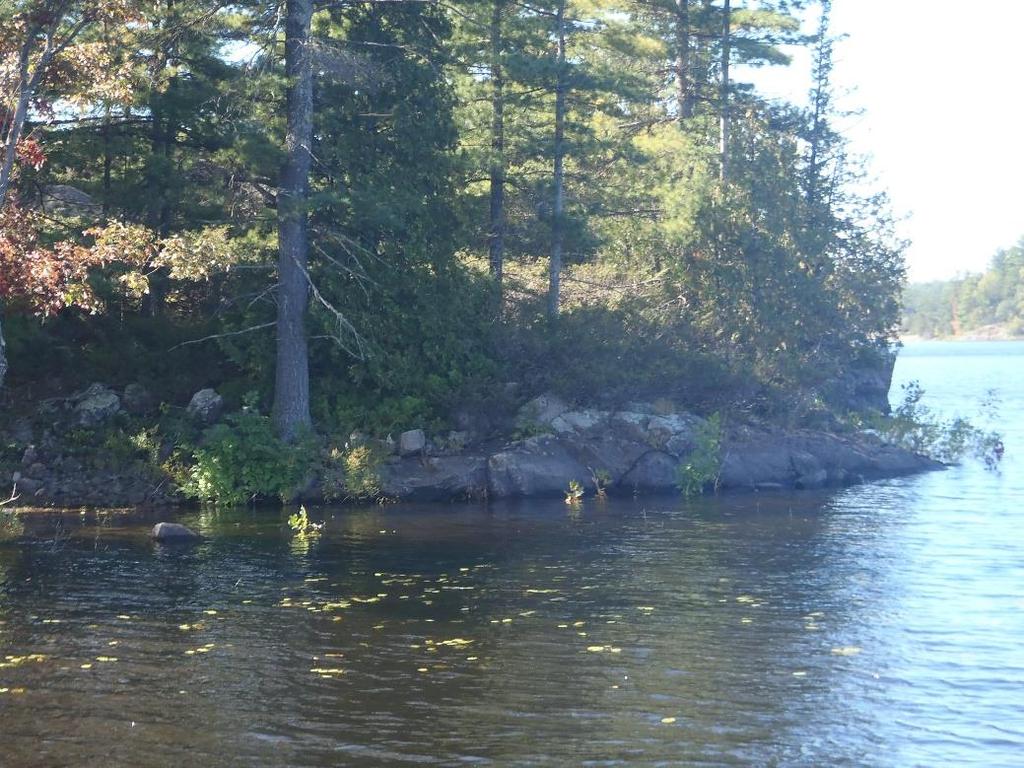
106 Survey 9 102


107 Survey


108 Survey


109 Survey


110 Horseshoe Falls Survey 1 106


111 Trestle Gully Survey 1 107


112 Trestle Gully Survey 2 108


113 Bailey Bridge Survey 1 109


114 Bailey Bridge Survey 2 110
Jason Blackburn, Paul Hvenegaard, Dave Jackson, Tyler Johns, Chad Judd, Scott Seward and Juanna Thompson
 Alberta Conservation Association (ACA) Date: 2014-2015 Project Name: Owl River Walleye and Aquatic Habitat Assessment Fisheries Program Manager: Peter Aku Project Leader: Tyler Johns Primary ACA staff
FISH COMMUNITIES AND FISHERIES OF THE THOUSAND ISLANDS AND MIDDLE CORRIDOR
 St. Lawrence River Discussion Paper FISH COMMUNITIES AND FISHERIES OF THE THOUSAND ISLANDS AND MIDDLE CORRIDOR Issues Below is a synopsis of fish community issues and proposed management approaches. More
Fish Community. Fish Habitat, Streams and Rivers
 Clear, Ston(e)y and White Lake Plan Fish Community The lakes support a cool/warm water fishery including muskellunge, walleye, largemouth and smallmouth bass, yellow perch, pumpkinseed, rockbass, blue
LAKE DIANE Hillsdale County (T8-9S, R3W, Sections 34, 3, 4) Surveyed May Jeffrey J. Braunscheidel
 Surveyed May Jeffrey J. Braunscheidel") Michigan Department of Natural Resources Status of the Fishery Resource Report No. 2003-4, 2003 LAKE DIANE Hillsdale County (T8-9S, R3W, Sections 34, 3, 4) Surveyed May 2001 Jeffrey J. Braunscheidel Environment
Michigan Department of Natural Resources Status of the Fishery Resource Report No. 2003-4, 2003 LAKE DIANE Hillsdale County (T8-9S, R3W, Sections 34, 3, 4) Surveyed May 2001 Jeffrey J. Braunscheidel Environment
SUMMARY REPORT FOR LAKE ST. MALO FISHERIES ASSESSMENT. Prepared for the St. Malo and District Wildlife Association
 SUMMARY REPORT FOR LAKE ST. MALO FISHERIES ASSESSMENT Prepared for the St. Malo and District Wildlife Association Presented by August 25, 2014 Study dates thus far: Date Tasks February 16 Fishing derby;
Current Status and Management Recommendations for the Fishery in the Cloverleaf Chain of Lakes
 Current Status and Management Recommendations for the Fishery in the Cloverleaf Chain of Lakes Jason Breeggemann Senior Fisheries Biologist Wisconsin Department of Natural Resources Outline DNR fisheries
Michigan Dept. of Natural Resources Status of the Fishery Resource Report Page 1. Weber Lake Cheboygan County, T34N, R3W, Sec.
 Michigan Dept. of Natural Resources 2012-143 Status of the Fishery Resource Report Page 1 Weber Lake Cheboygan County, T34N, R3W, Sec. 31 Neal Godby, Fisheries Biologist Environment Weber Lake is a 28.5-acre
Go Home Bay Walleye Re-introduction Project
 Eastern Georgian Bay Stewardship Council www.helpourfisheries.com Go Home Bay Walleye Re-introduction Project Eastern Georgian Bay Stewardship Council July 27, 2010 Walleye summer fingerlings planted in
Caro Impoundment, Tuscola County
 Caro Impoundment is a 200 acre impoundment of the Cass River located one mile south of the Village of Caro in Tuscola County. Caro Dam, originally constructed in 1906 for water supply to Michigan Sugar
Michigan Department of Natural Resources Status of the Fishery Resource Report Page 1
 Michigan Department of Natural Resources 2007-33 Status of the Fishery Resource Report Page 1 Grand Sable Lake Alger County, T49N, R14W, Sec. Many Lake Superior watershed, last year surveyed 2004 James
Fisheries Management Zone 10:
 Fisheries Management Zone 10: Lake Trout Operational Objectives and Management Photo Credit: www.jamessmedleyoutdoors.com 2 FMZ 10: Lake Trout Operational Objectives and Management Lake trout are the second
MINNESOTA DEPARTMENT OF NATURAL RESOURCES DIVISION OF FISHERIES AND WILDLIFE. Gamefish Assessment Report
 Minnesota DNR F-29-R(P) Area F312 February 1, 2013 MINNESOTA DEPARTMENT OF NATURAL RESOURCES DIVISION OF FISHERIES AND WILDLIFE Gamefish Assessment Report Spring Gamefish Assessment on the Mississippi
Columbia Lake Dam Removal Project
 Columbia Lake Dam Removal Project The Columbia Lake dam located 1/4 mile upstream of the Paulins Kill River's confluence with the Delaware River in Knowlton Township, Warren County has been proposed for
JadEco, LLC PO BOX 445 Shannon, IL 61078
 Introduction: With the assistance of Lake Holiday staff and volunteers, we were able to conduct an AC electrofishing survey on May 8, 27. Water temperatures were 2.3 C (8.5 F) and water clarity was decent
Fisheries Survey of White Rapids Flowage, Marinette County Wisconsin during Waterbody Identification Code
 Fisheries Survey of White Rapids Flowage, Marinette County Wisconsin during 25 Waterbody Identification Code 6343 Michael Donofrio Fisheries Supervisor Wisconsin Department of Natural Resources Peshtigo,
Nechako white sturgeon are an Endangered Species
 Nechako white sturgeon are an Endangered Species There are likely less than 350 Nechako white sturgeon, and historically there were over 5000 in the Nechako Watershed. Endangered as per the Species at
Dauphin Lake Fishery. Status of Walleye Stocks and Conservation Measures
 Dauphin Lake Fishery Status of Walleye Stocks and Conservation Measures Date: December, 21 Dauphin Lake Fishery Status of Walleye Stocks and Conservation Measures Background: Walleye stocks in Dauphin
SKIATOOK LAKE MANAGEMENT PLAN
 SKIATOOK LAKE MANAGEMENT PLAN Background Skiatook Lake impounds Hominy Creek, 5 miles west of Skiatook in Osage County, Oklahoma (Figure 1). Skiatook Lake covers 10,540 surface acres and was constructed
Cedar Lake Comprehensive Survey Report Steve Hogler and Steve Surendonk WDNR-Mishicot
 Cedar Lake- 2006 Comprehensive Survey Report Steve Hogler and Steve Surendonk WDNR-Mishicot ABSTRACT Cedar Lake is a 142 acre lake located in the southwest corner of Manitowoc County. It is a seepage lake
Fraser River. FISH SURVEY AND MANAGEMENT INFORMATION Jon Ewert - Aquatic Biologist (Hot Sulphur Springs)
") Fraser River FISH SURVEY AND MANAGEMENT INFORMATION Jon Ewert - Aquatic Biologist (Hot Sulphur Springs) General Information: The Fraser River is a highly diverse river offering many transitions in habitat
Fraser River FISH SURVEY AND MANAGEMENT INFORMATION Jon Ewert - Aquatic Biologist (Hot Sulphur Springs) General Information: The Fraser River is a highly diverse river offering many transitions in habitat
Eastern Georgian Bay Stewardship Council
 Eastern Georgian Bay Stewardship Council Who / What is the Eastern Geo. Bay Stewardship Council? MNR s community, volunteer, environmental program called the Ontario Stewardship Program Supported by but
Results of the 2015 nontidal Potomac River watershed Smallmouth Bass Young of Year Survey
 Results of the 2015 nontidal Potomac River watershed Smallmouth Bass Young of Year Survey Natural reproduction of smallmouth bass in the nontidal Potomac River mainstem has been assessed annually since
Brook Trout Life Cycle and Habitat
 Brook Trout Life Cycle and Habitat Directions: 1. As you watch this slide show, watch for vocabulary terms we learned today. The first time they appear, you will see them in RED! (not redd!) 2. At the
I Region I Area I DOW Number / County I DOW Lake Name I Acreage I
 LAKE MANAGEMENT PLAN 814 Bp I Region I Area I DOW Number / County I DOW Lake Name I Acreage I I I # I f 2 Duluth F213 690036 St Louis Salo DOW:149 Plan: 137 Long Range Goal: Manage for walleye with a gillnet
MEMORANDUM Comfort Lake-Forest Lake Watershed District
 MEMORANDUM Comfort Lake-Forest Lake Watershed District To: Board of Managers Date: December 7, 2016 From: Mike Kinney Subject: 2016 Watercraft Inspections and AIS Report Summaries Watercraft Inspection
1 INTRODUCTION AND SUMMARY
 December 10, 2012 Pacific Booker Minerals 1702 1166 Alberni Street Vancouver, British Columbia V6E 3Z3 Erik Tornquist Executive VP and COO Dear Mr. Erik Tornquist: 1 INTRODUCTION AND SUMMARY This letter
Steelhead Society of BC. Thompson River Watershed Restoration and Enhancement Project #4 Nicola River Bank Stabilization and Enhancement Project
 Steelhead Society of BC Presents: Thompson River Watershed Restoration and Enhancement Project #4 Nicola River Bank Stabilization and Enhancement Project Application for Funding December 2013 1.0 BACKGROUND
2017 Lake Winnebago Bottom Trawling Assessment Report
 217 Lake Winnebago Bottom Trawling Assessment Report Adam Nickel, Winnebago System Gamefish Biologist, March 218 There were several highlights from the 217 Lake Winnebago bottom trawling survey, including
CARL BLACKWELL LAKE MANAGEMENT PLAN
 CARL BLACKWELL LAKE MANAGEMENT PLAN Background Lake Carl Blackwell impounds Stillwater Creek, 10 miles west of Stillwater in Payne County, Oklahoma (Figure 1). The lake covers 3,370 surface acres and was
Alcona Dam Pond Alcona County (T25N, R5E, Sections various) Surveyed June 6-12 and September 16, 2003
 Surveyed June 6-12 and September 16, 2003") Michigan Department of Natural Resources Status of the Fishery Resource Report No. 2004-6, Year 2004 Alcona Dam Pond Alcona County (T25N, R5E, Sections various) Surveyed June 6-12 and September 16, 2003
Michigan Department of Natural Resources Status of the Fishery Resource Report No. 2004-6, Year 2004 Alcona Dam Pond Alcona County (T25N, R5E, Sections various) Surveyed June 6-12 and September 16, 2003
Comprehensive Fisheries Survey of High Falls Reservoir, Marinette County Wisconsin during 2004 and Waterbody Identification Code
 Comprehensive Fisheries of High Falls Reservoir, Marinette County Wisconsin during 2004 and 2005 Waterbody Identification Code 540600 Justine Hasz Senior Fisheries Biologist Wisconsin Department of Natural
Water Habitat Model. Outcome: Materials: Teacher Instructions: : Identify the components of an animal habitat..
 Water Habitat Model Outcome: 4-1-03: Identify the components of an animal habitat.. Materials: Shoe boxes (1 per student) Art supplies: Glue and/or tape Paint and brushes for the background Plasticine/clay
Quemahoning Reservoir
 Pennsylvania Fish & Boat Commission Biologist Report Quemahoning Reservoir Somerset County May 2011 Trap Net, Gill Net and Electrofishing Survey Quemahoning Reservoir is an 899 acre impoundment located
NEVADA DEPARTMENT OF WILDLIFE STATEWIDE FISHERIES MANAGEMENT
 NEVADA DEPARTMENT OF WILDLIFE STATEWIDE FISHERIES MANAGEMENT FEDERAL AID JOB PROGRESS REPORTS F-20-52 2016 Lake Tahoe Rainbow Trout Study WESTERN REGION NEVADA DEPARTMENT OF WILDLIFE, FISHERIES DIVISION
STUDY PERFORMANCE REPORT
 STUDY PERFORMANCE REPORT State: Michigan Project No.: F-80-R-4 Study No.: 702 Title: Effects of sediment traps on Michigan river channels Period Covered: October 1, 2002 to September 30, 2003 Study Objectives:
Assessment of Elizabeth Lake as a Potential Candidate for Stocking
 Assessment of Elizabeth Lake as a Potential Candidate for Stocking Region 1, Nanaimo West Coast Planning Unit Ministry of Water, Land and Air Protection Prepared by: Laura Cassin Scott Silvestri 2002 1.0
Minnesota Department of Natural Resources Division of Fish and Wildlife Section of Fisheries. Stream Survey Report. Luxemburg Creek.
 Minnesota F-29-R(P)-24 Area 315 Study 3 March 2016 Minnesota Department of Natural Resources Division of Fish and Wildlife Section of Fisheries Stream Survey Report Luxemburg Creek 2015 Mark Pelham Sauk
EcoLogic Memorandum. TO: Ben Brezell; EDR FROM: Mark Arrigo RE: Possible Impacts of Dredging Snooks Pond DATE: 6/4/07
 EcoLogic Memorandum TO: Ben Brezell; EDR FROM: Mark Arrigo RE: Possible Impacts of Dredging Snooks Pond DATE: 6/4/07 Background EDR P.C. (EDR) has been contracted by a landowner to assess the feasibility
RIVER CONONISH INVERTEBRATE SURVEY Dr Kjersti Birkeland
 RIVER CONONISH INVERTEBRATE SURVEY 26 Dr Kjersti Birkeland Background The Cononish, the upper reaches of the River Dochart, should be very important for spring salmon but surveys by the Tay District Salmon
Appendix A Photo Set
 Appendix A Photo Set Fish Habitat Inventory, Mattamy Richmond Lands, Spring 2009 Submitted To: Susan Murphy Mattamy Homes 123 Huntmar Drive Ottawa, Ontario K2S 1B9 KILGOUR & ASSOCIATES LTD. 1500 Bank Street,
Big Spring Creek Habitat Enhancement and Fishery Management Plans
 Big Spring Creek Habitat Enhancement and Fishery Management Plans November 5, 2012 Big Spring Events and Activities Center Newville, PA Charlie McGarrell Regional Habitat Biologist Pennsylvania Fish and
Fish Passage Culvert Assessment for Cahilty Creek Watershed FIA Project #
 Fish Passage Culvert Assessment for Cahilty Creek Watershed FIA Project # 4602004 Prepared for Weyerhaeuser Company Ltd. Jason Ladyman R.P.F. 1550 Mission Flats Road PO Box 40 Kamloops BC V2C 5K3 Prepared
Know Your River Conwy Salmon & Sea Trout Catchment Summary
 Know Your River Conwy Salmon & Sea Trout Catchment Summary Introduction This report describes the status of the salmon and sea trout populations in the Conwy catchment. Bringing together data from rod
SOONER LAKE MANAGEMENT PLAN
 SOONER LAKE MANAGEMENT PLAN Background Lake Sooner impounds Greasy Creek, 15 miles south of Ponca City in Noble and Pawnee Counties, Oklahoma (Figure 1). The Grease Creek basin that Sooner Lake impounds
FISHERIES BLUE MOUNTAINS ADAPTATION PARTNERSHIP
 FISHERIES A warming climate, by itself, substantially affects the hydrology of watersheds in the Blue Mountains. Among the key hydrologic changes projected under all scenarios for the 2040s and beyond
Manual of Fisheries Survey Methods II: with periodic updates. Chapter 22: Guidelines for Sampling Warmwater Rivers with Rotenone
 Manual of Fisheries Survey Methods II: with periodic updates : Guidelines for Sampling Warmwater Rivers with Rotenone P. W. Seelbach, G. L. Towns, and D. D. Nelson Suggested citation: Seelbach, Paul W.,
EXECUTIVE SUMMARY FISH COMMUNITY AND HABITAT EXISTING CONDITIONS REPORT
 EXECUTIVE SUMMARY FISH COMMUNITY AND HABITAT EXISTING CONDITIONS REPORT First Mining Gold (First Mining) has completed a comprehensive Fish Community and Habitat Existing Conditions Report which has utilized
Introduction: JadEco, LLC PO BOX 445 Shannon, IL 61078
 Introduction: was contacted to collected data on the fishery for Lake Holiday. AC Electroshocking was conducted at 2 locations on September 28, 2015. Fish population data was collected for a total of 100
Estimating Summer Steelhead Escapement using Redd Surveys: What have we learned and where do we go? Jim Ruzycki Oregon Department of Fish & Wildlife
 Estimating Summer Steelhead Escapement using Redd Surveys: What have we learned and where do we go? Jim Ruzycki Oregon Department of Fish & Wildlife Spawner Abundance for the John Day Summer Steelhead
Crooked Lake Oakland County (T4N, R9E, Sections 3, 4, 9) Surveyed May James T. Francis
 Surveyed May James T. Francis") Michigan Department of Natural Resources Status of the Fishery Resource Report No. 2004-1, 2004 Crooked Lake Oakland County (T4N, R9E, Sections 3, 4, 9) Surveyed May 2002 James T. Francis Environment Crooked
Michigan Department of Natural Resources Status of the Fishery Resource Report No. 2004-1, 2004 Crooked Lake Oakland County (T4N, R9E, Sections 3, 4, 9) Surveyed May 2002 James T. Francis Environment Crooked
Study Update Tailrace Slough Use by Anadromous Salmonids
 Study Update Tailrace Slough Use by Anadromous Salmonids Goals and Objectives Identify what anadromous salmonids use the tailrace slough by: Life Stage (Juvenile, migrating and spawning adults) Timing
NORTHWEST SCIENCE AND INFORMATION
 Science and Information Branch NORTHWEST SCIENCE AND INFORMATION Aquatics Update 2002-1 Fall Walleye Index Netting (FWIN) and Trap Netting Summary for Niobe Lake, 2000 by T. Cano Introduction Since 1981,
STEELHEAD SURVEYS IN OMAK CREEK
 STEELHEAD SURVEYS IN OMAK CREEK 2002 Annual Report Prepared by Chris Fisher John Arterburn Colville Confederated Tribes Fish and Wildlife Department P.O. Box 150 Nespelem, WA 99155 Prepared for Project
Fish Survey of Arctic Lake (ID # ), Scott County, Minnesota in 2012
, Scott County, Minnesota in 2012") Snapping Turtle from Arctic Lake, September 2012 Fish Survey of Arctic Lake (ID #70-0085), Scott County, Minnesota in 2012 Survey Dates: September 18-20, 2012 MnDNR Permit Number: 18362 Prepared for: Shakopee
Snapping Turtle from Arctic Lake, September 2012 Fish Survey of Arctic Lake (ID #70-0085), Scott County, Minnesota in 2012 Survey Dates: September 18-20, 2012 MnDNR Permit Number: 18362 Prepared for: Shakopee
MIDDLE FORK RESERVOIR Wayne County 2004 Fish Management Report. Christopher C. Long Assistant Fisheries Biologist
 MIDDLE FORK RESERVOIR Wayne County 2004 Fish Management Report Christopher C. Long Assistant Fisheries Biologist FISHERIES SECTION INDIANA DEPARTMENT OF NATURAL RESOURCES DIVISION OF FISH AND WILDLIFE
Minnesota Department of Natural Resources Division of Fish and Wildlife Section of Fisheries. Stream Survey Report. Three Mile Creek 2011
 Minnesota Department of Natural Resources Division of Fish and Wildlife Section of Fisheries Stream Survey Report Three Mile Creek 2011 By Joseph D. Stewig Montrose Area Fisheries Office TABLE OF CONTENTS
Notebooks or journals for drawing and taking notes
 Title: Have to Have a Habitat Grade Level: 5 th -8 th grade Topic: Trout Habitat Background: The following chart lists the ideal conditions for trout habitat. Dissolved Oxygen: > 7 mg/l ph: 5.5-7 Next
Upper/Lower Owl Creek Reservoir
 Upper/Lower Owl Creek Reservoir Schuylkill County 2018 Largemouth Bass Survey Upper Owl Creek Reservoir and Lower Owl Creek Reservoir are 67-acre and 26-acre impoundments, respectively, created by two
2014 Winnebago System Walleye Report
 1986 1988 199 1992 1994 1996 1998 2 22 24 26 28 21 212 214 Number of YOY WAE / Trawl 214 Winnebago System Walleye Report Adam Nickel, Winnebago Gamefish Biologist, 18 March 215 The spring rush of 215 will
NURSERY POND Fish Management Report. Jason C. Doll Assistant Fisheries Biologist
 NURSERY POND 2004 Fish Management Report Jason C. Doll Assistant Fisheries Biologist FISHERIES SECTION INDIANA DEPARTMENT OF NATURAL RESOURCES DIVISION OF FISH AND WILDLIFE I.G.C. South, Room W273 402
Know Your River Conwy Salmon & Sea Trout Catchment Summary
 Know Your River Conwy Salmon & Sea Trout Catchment Summary Introduction This report describes the status of the salmon and sea trout populations in the Conwy catchment. Bringing together data from rod
MISSISSIPPI MAKEOVER A Plan for Restoration, Just Around the Bend
 MISSISSIPPI MAKEOVER A Plan for Restoration, Just Around the Bend Interim Report Card 2013 Project coordinated by the Dakota County Soil and Water Conservation District and sponsored by the Minnesota Pollution
Report prepared for: Prepared by: January 2002 BEAK Ref
 AQUATIC ENVIRONMENTAL STUDY KANATA WEST CONCEPT PLAN Report prepared for: ROBINSON CONSULTANTS Prepared by: BEAK INTERNATIONAL INCORPORATED 14 Abacus Road Brampton, Ontario L6T 5B7 January 2002 BEAK Ref.
RECREATIONAL PONDS AND LAKES
 RECREATIONAL PONDS AND LAKES POND ECOLOGY AQUATIC PLANTS & FISH F.S. Conte Department of Animal Science University of California Davis Photos By Flickr AQUATIC PLANTS POND HEALTH Chemical Recycling Oxygen
Booklet translated by SREJ at CSDC 1
 Name: Gr. : Booklet translated by SREJ at CSDC 1 This is the beginning of a new project about Aquaculture. Before we start, I would like to see what you already know about the subject. Write all the words
NEVADA DEPARTMENT OF WILDLIFE STATEWIDE FISHERIES MANAGEMENT
 NEVADA DEPARTMENT OF WILDLIFE STATEWIDE FISHERIES MANAGEMENT FEDERAL AID JOB PROGRESS REPORTS F-20-48 2012 RYE PATCH RESERVOIR WESTERN REGION NEVADA DEPARTMENT OF WILDLIFE, FISHERIES DIVISION JOB PROGRESS
Status of Lake Erie s Western Basin Fish Populations: Trends and Environmental Conditions
 Status of Lake Erie s Western Basin Fish Populations: Trends and Environmental Conditions Jeff Tyson Ohio Department of Natural Resources Ohio Division of Wildlife Status of the Lake Erie s Western Basin
Onondaga Lake Fishery: 2011 Fact Sheet
 October, 2011 Onondaga County Department of Water Environment Protection SUNY College of Environmental Science and Forestry Joanne M. Mahoney, County Executive Tom Rhoads, P.E., Commissioner Onondaga Lake
Warmwater Fisheries Assessments 2014
 NJDEP Division of Fish and Wildlife Bureau of Freshwater Fisheries Warmwater Fisheries Assessments 2014 New Jersey has over 400 impoundments open to the general public for fishing and thousands more in
(Revised February,2005) CULVERTS, BRIDGES, AND FORDS
 CULVERTS, BRIDGES, AND FORDS") GUIDE TO STREAM CROSSINGS (Revised February,2005) CULVERTS, BRIDGES, AND FORDS Culverts, bridges, and fords are all methods used to cross-streams. Culverts are the most common stream crossing structure.
GUIDE TO STREAM CROSSINGS (Revised February,2005) CULVERTS, BRIDGES, AND FORDS Culverts, bridges, and fords are all methods used to cross-streams. Culverts are the most common stream crossing structure.
Klamath Lake Bull Trout
 Klamath Lake Bull Trout Existing Populations The Klamath Lake Bull Trout SMU is comprised of seven existing populations and four populations classified as extinct or functionally extinct (Table 189). Populations
REC 6 FISHERIES HABITAT EVALUATION
 REC 6 FISHERIES HABITAT EVALUATION 1.0 EXECUTIVE SUMMARY Analysis of fisheries habitat for recreational angling opportunities was completed by reviewing the results of the CAWG 1, Characterize Stream and
Aquatic Organism Passage at Road-Stream Crossings CHUCK KEEPORTS FOREST HYDROLOGIST ALLEGHENY NATIONAL FOREST WARREN, PENNSYLVANIA
 Aquatic Organism Passage at Road-Stream Crossings CHUCK KEEPORTS FOREST HYDROLOGIST ALLEGHENY NATIONAL FOREST WARREN, PENNSYLVANIA TOPICS COVERED Aquatic Organism Passage (AOP) Benefits of AOP Crossings
Minnesota Department of Natural Resources Division of Fish and Wildlife Section of Fisheries. Stream Survey Report. Cold Spring Creek.
 Minnesota F-29-R(P)-24 Area 315 Study 3 March 2015 Minnesota Department of Natural Resources Division of Fish and Wildlife Section of Fisheries Stream Survey Report Cold Spring Creek 2014 Mark Pelham Montrose
MINISTRY OF ENVIRONMENT ENVIRONMENTAL STEWARDSHIP DIVISION FISH AND WILDLIFE BRANCH. Horsefly River Angling Management Plan
 MINISTRY OF ENVIRONMENT ENVIRONMENTAL STEWARDSHIP DIVISION FISH AND WILDLIFE BRANCH Horsefly River Angling Management Plan January 30 th, 2006 Area/Fishery Description The Horsefly River watershed provides
Field survey of the fish populations of the lower Ngaruroro River
 Field survey of the fish populations of the lower Ngaruroro River Glenn Maclean March 2014 HBRC Publication No. 4873 Report No. RM16-54 CMB 93, RD 2, Owhango 3990 E glenn@technicallytrout.co.nz W www.technicallytrout.co.nz
Thunder Bay River Assessment Appendix. Appendix 2
 Appendix 2 Known past and present fish distributions in the River system. Distribution of fishes were compiled from Bailey et al. (2003) and from records located at the Michigan Department of Natural Resources
NORTH RIVER FISH KILL PRELIMINARY REPORT 2014 SUMMARY
 NORTH RIVER FISH KILL PRELIMINARY REPORT 2014 SUMMARY A fish kill on Nor River was reported to e 1-800 Environmental emergency number on August 9, 2014. Representatives from e PEI Department of Environment,
Florida Seagrass Integrated Mapping and Monitoring Program
 Florida Seagrass Integrated Mapping and Monitoring Program - 2004 The following document is composed of excerpts taken from the 2011 publication, Seagrass Integrated Mapping and Monitoring for the State
BIG TWIN LAKE Kalkaska County (T28N, R05W, Section 18, and T28N, R06W, Section 13) Surveyed May 1999
 Surveyed May 1999") Michigan Department of Natural Resources Status of the Fishery Resource Report No. 2001-1, Year 2001 BIG TWIN LAKE Kalkaska County (T28N, R05W, Section 18, and T28N, R06W, Section 13) Surveyed May 1999
Michigan Department of Natural Resources Status of the Fishery Resource Report No. 2001-1, Year 2001 BIG TWIN LAKE Kalkaska County (T28N, R05W, Section 18, and T28N, R06W, Section 13) Surveyed May 1999
021 Deer Management Unit
 021 Deer Management Unit Geographic Location: Deer Management Unit (DMU) 021 is 1,464 square miles in size and is located in the central Upper Peninsula (UP). This DMU is dominated by publicly owned land
UTAH LAKE JUNE SUCKER
 UTAH LAKE JUNE SUCKER PROCEDURE: Activity Game: UTAH LAKE JUNE SUCKER GAME Instructions: 1. Hand out one Utah Lake Card per student. 2. Select one area of the gym to be Utah Lake and another to be Provo
NEVADA DEPARTMENT OF WILDLIFE STATEWIDE FISHERIES MANAGEMENT
 NEVADA DEPARTMENT OF WILDLIFE STATEWIDE FISHERIES MANAGEMENT FEDERAL AID JOB PROGRESS REPORTS F-20-52 2016 LAKE TAHOE WESTERN REGION NEVADA DEPARTMENT OF WILDLIFE, FISHERIES DIVISION ANNUAL PROGRESS REPORT
Restoration of Spawning Habitat for Native Fish in the Central Great Lakes
 Restoration of Spawning Habitat for Native Fish in the Central Great Lakes D. H. B E N N I O N 1, E. R O S E M A N 1, B. M A N N Y 1, G. K E N N E D Y 1, J. B O A S E 2, J C R A I G 1 1 U S G S - G R E
Abundance of Steelhead and Coho Salmon in the Lagunitas Creek Drainage, Marin County, California
 scanned for KRIS Abundance of Steelhead and Coho Salmon in the Lagunitas Creek Drainage, Marin County, California Prepared for: Marin Municipal Water District 220 Nellen Drive Corte Madera, California
Managing Chesapeake Bay s Land Use, Fish Habitat, and Fisheries: Studies. Jim Uphoff & Margaret McGinty, Fisheries Service
 Managing Chesapeake Bay s Land Use, Fish Habitat, and Fisheries: Positive Image and or Negative Graphic Case Studies Jim Uphoff & Margaret McGinty, Fisheries Service Maryland Fisheries Service has been
LAKE TANEYCOMO 2011 ANNUAL LAKE REPORT
 LAKE TANEYCOMO 211 ANNUAL LAKE REPORT Shane Bush Fisheries Management Biologist Missouri Department of Conservation Southwest Region March 1, 212 EXECUTIVE SUMMARY Lake Taneycomo was formed by the construction
LAKE MANAGEMENT PLAN
 LAKE MANAGEMENT PLAN Region 1 Area Park Rapids D.O.W. Number 29-185 County Hubbard D.O.W. Lake Name Big Sand Lake Class 22 Acreage 1,635 GIS 465 littoral LONG RANGE GOALS: Maintain or improve the quality
Site 4 PEESHOO. Approx. Head = 10 m Design Flow = 70 m 3 /s Capacity = 6 MW. Peeshoo. Kabinakagami River. Rogers Road HWY 11.
 Kabinakagami River Site 4 PEESHOO Rogers Road Peeshoo Approx. Head = 10 m Design Flow = 70 m 3 /s Capacity = 6 MW N 0 2 4 6 HWY 11 Kilometers Site 4 - PEESHOO Looking Downstream Looking Downstream Site
APPENDIX 2.1 Lake Sturgeon - Mitigation and Enhancement
 APPENDIX 2.1 Lake Sturgeon - Mitigation and This page is intentionally left blank. Lake Sturgeon Mitigation and As a provincial crown corporation providing electric energy and natural gas service, Manitoba
HUBBARD LAKE Alcona County (T27N, R7E; T28N, R7E) Surveyed May and September Tim A. Cwalinski
 Surveyed May and September Tim A. Cwalinski") Michigan Department of Natural Resources Status of the Fishery Resource Report No. 2003-1, 2003 HUBBARD LAKE Alcona County (T27N, R7E; T28N, R7E) Surveyed May and September 1996 Tim A. Cwalinski Environment
Michigan Department of Natural Resources Status of the Fishery Resource Report No. 2003-1, 2003 HUBBARD LAKE Alcona County (T27N, R7E; T28N, R7E) Surveyed May and September 1996 Tim A. Cwalinski Environment
STREAM CLASSIFICATION AND MAPPING. Prepared For. MacMillan Bloedel Ltd. Menzies Bay Division BOX 6000, Campbell River V9W 5E1.
 STREAM CLASSIFICATION AND MAPPING OF STREAMS IN MENZIES AND OYSTER BAY Prepared For MacMillan Bloedel Ltd. Menzies Bay Division BOX 6000, Campbell River V9W 5E1 September 1998 a a North Island Biological
Current projects for Fisheries Research Unit of Minnesota Department of Natural Resources
 Current projects for Fisheries Research Unit of Minnesota Department of Natural Resources MAJOR RESOURCE ISSUES IN THE DIVISION OF FISHERIES Status of Fish Populations To effectively manage fish populations,
STREAM SURVEY File form No..
 scanned for KRIS THE RESOURCES AGENCY OF CALIFORNIA California Department of Fish and Game STREAM SURVEY File form No.. Date: September 4, 1969. NAME: North Fork Schooner Gulch Creek COUNTY: Mendocino.
Kawartha Lakes Fisheries. Dan Taillon Peterborough District Mike Rawson Kawartha Lakes Fisheries Assessment Unit
 Kawartha Lakes Fisheries Dan Taillon Peterborough District Mike Rawson Kawartha Lakes Fisheries Assessment Unit Presentation Outline State of the Kawartha Lakes Fishery Index netting data Angler creel
Data Report : Russian River Basin Steelhead and Coho Salmon Monitoring Program Pilot Study
 Data Report 1999-1: Russian River Basin Steelhead and Coho Salmon Monitoring Program Pilot Study Sonoma County Water Agency 215 West College Avenue Santa Rosa, California 951 Prepared by David Cook Senior
2015 Winnebago System Walleye Report
 215 Winnebago System Walleye Report Adam Nickel, Winnebago Gamefish Biologist, March 216 As winter passes in the rear view mirror, it won t be long until the spring rush of the 216 walleye run is here.
Youngs Creek Hydroelectric Project (FERC No. P 10359)
") Youngs Creek Hydroelectric Project (FERC No. P 10359) Resident Trout Monitoring Plan Annual Report 2010 Survey and Results of Pre Project Monitoring Prepared by: September 2010 Overview The Public Utility
Youngs Creek Hydroelectric Project (FERC No. P 10359) Resident Trout Monitoring Plan Annual Report 2010 Survey and Results of Pre Project Monitoring Prepared by: September 2010 Overview The Public Utility
Refined Designated Uses for the Chesapeake Bay and Tidal Tributaries
 A-1 appendixa Refined Designated Uses for the Chesapeake Bay and Tidal Tributaries BACKGROUND Federal water quality standards regulations establish that states must specify appropriate water uses to be
COA-F17-F-1343 YEAR END REPORT
 DAVE MARSHALL SALMON RESERVE RESTORATION, MAINTENANCE, AND UPGRADES YEAR END REPORT Prepared for: Fish and Wildlife Compensation Program Prepared by: Edith Tobe, RPBio, Executive Director Box 1791, Squamish,