Post Hurricane-Irma ecological assessments
|
|
|
- Elisabeth Powers
- 5 years ago
- Views:
Transcription
1 Post Hurricane-Irma ecological assessments Nicholas G. Aumen US Geological Survey On behalf of many scientists April 25, 2018
2 Caveats and comments The Science Coordination Group sponsored a meeting on post-irma studies on 9/27/2017; approximately 100 individuals participated I have tried to focus on actual observations and data Much important information had to be eliminated or condensed due to presentation time constraints Any errors of omission or commission are mine and mine alone Numerous individuals, agencies, and academic institutions contributed information to this presentation Many thanks to all of those who took time out of their busy schedules to pull together and share this information!

3 Category mph winds >8 ft storm surge HURRICANE IRMA CROSSES FLORIDA ON 10 SEPTEMBER 2017 (Evelyn Gaiser, FIU)

4 Irma s path and lateral extent of hurricaneforce winds Sept. 10, 2017 Miles Meyer, FWS
 Maximum storm tide computed by the ADCIRC model (http://nccera.renci.")
5 Coastal Emergency Risks Assessment models and data from staff gauges throughout the Everglades suggest a 3+ meter storm surge (courtesy of Keqi Zhang, FIU) Maximum storm tide computed by the ADCIRC model (
 or positive (exhumation of hard substratum) effects on ecological recovery of")
6 Sept 12, 2017 Hx Irma Irma resulted in an enormous amount of sediment transport that can have negative (burial) or positive (exhumation of hard substratum) effects on ecological recovery of reefs.
7 Kissimmee River restoration area Starvation Slough (130 cfs, 5/30/17) Starvation slough (7200 cfs, 9/13/2017) 7
8 Impacts Periods of low DO for 2 months below 2 mg/l Largemouth bass, bluegill, and other sunfish were negatively affected Largemouth bass in particular were almost non-existent in surveys conducted after Irma On the other hand, bluegill numbers were very high post-irma, possibly benefitting from increased floodplain area and refugia The invasive West Indian marsh grass may have been reduced by prolonged deep water and high flows during Irma

9 Hurricane Irma Seiche in Lake Okeechobee Lake Okeechobee Stage Time Series Stage (ft NGVD) L005 LZ40 S131-T S133-T S2-T S352-H Sat 09 0:00:00 Sun 10 0:00:00 Mon 11 0:00:00 September 2017 Tue 12 0:00:00 9


10 Lake Okeechobee Impacts from Hurricane Irma S191 Resuspended Lake Sediment Taylor Creek/Nubbin Slough Inflows S191 Lake Okeechobee 10


11 St. Lucie Estuary Dead oysters from monitoring site in middle fork Dying oyster 11


12 Impacts of Hurricane Irma New Pass in Estero Bay New Pass Coastal re-sculpting at New Pass on Estero Bay Photographs provided by: James Douglass, PhD Assistant Professor, Florida Gulf Coast University 12
 Ft.")
13 Caloosahatchee Estuary Local Basin Watershed Discharges (No Lake Okeechobee Releases) Ft. Myers Beach Sanibel Island Photographs taken September 18,
14 Everglades Stormwater Treatment Areas STAs treated ~200,000 ac-ft inflows associated with Hurricane Irma STA water depths after Hurricane Irma are above target but not as high as June depths Average Water Depth (ft) Water Depths (9/17/2017) EAV Cells SAV Cells Normal Target STA-1E STA-1W STA-2 STA-3/4 STA-5/6 Includes preliminary data 14


15 Impacts from Hurricane Irma Biscayne Bay / Card Sound Typical seagrass patch Patches of Seagrass ripped from roots and floating into Biscayne Bay from Card Sound Photographs taken September 20, 2017 Floating Flotsam 15


 <-2.5 0.0 2.5 5.")
16 Everglades Water Depth Maps Hurricane Irma Pre-Irma: 09/08/2017 Rotenberger/ Holeyland EAA WCA-1 Post-Irma: 09/12/2017 Rotenberger/ Holeyland EAA WCA-1 WCA-2 WCA-2 Big Cypress Big Cypress WCA-3 WCA-3 ENP ENP Water Depth (feet) < >15 Below Ground Above Ground 16


17 Flood waters - Highest on record - new bridges allowed emergency ops

18 Flood waters - Highest on record - new bridges allowed emergency ops Photo: E. Gaiser


19 Wood Stork Colony, WCA-3A Hurricane Damage 857 stork nests, May 2017 Irma damage to colony 19
20 Florida Bay Prior to the storm s passage there was no standing water between the Key Largo Interagency Science Center and Pelican Key in Florida Bay. (photo courtesy of Tom Frankovich, FIU)

21 Florida Bay Prior to the storm s passage there was no standing water between the Key Largo Interagency Science Center and Pelican Key in Florida Bay. (photo courtesy of Tom Frankovich, FIU)


22 Storm Deposit - Up to 10 cm of Gulf of Mexico mud ~ 100 years of forest accumulation Mud deposit 3 x P Photos: J. Briehgraupt Mangrove soil

23 Shark River We are tracking over 200 fish throughout the Everglades and documenting impacts on their movements and feeding behavior. (photo courtesy of Jennifer Rehage, FIU)
24 Impacts of Hurricane Irma on the Everglades What was the extent of the storm surge? Mangroves significantly attenuated the >6 ft storm surge and trapped a storm deposit up to 10 km inland. We need to measure the extent of this deposit to improve storm surge models. The storm deposit should facilitate forest recovery as it did after H. Wilma, and improve the forest s resilience to saltwater intrusion. What was the impact of storm winds? The riverine forest was defoliated while the scrub forest remained intact. Windrows apparent throughout the marsh. Over $150k in replacement costs requested to FEMA and funding agencies. What was the impact of rainfall/runoff? We are assessing impacts of massive rainfall and runoff on water quality and coastal algal bloom dynamics. Our consumer array should help track effects of the storm on mortality, behavior and feeding.
25 Offshore reefs Joanna Walczak, DEP Joss Voss, HBOI
26 Initial results Large slabs of Anastasia reef flipped over, killing thousands of Gorgonian corals Tires and other debris washed offshore Nearshore Staghorn coral patch scoured badly; none of the large coral colonies on the St. Lucie reef are alive anymore (already impacted by disease) NOAA, FDEP, FWC, and others are coordinating a Florida Reef Tractwide assessment of storm injury and coral disease status Water quality samples are being collected monthly at 115 sites from Port of Miami to St. Lucie Inlet

27
28 Input from ECISMA (Everglades Cooperative Invasive Species Management Area) Tegus hunkered down. Even with high water levels, the population seems intact. May be starting early brumation Post-Irma debris movement may cause invasive plants and animals to appear in new areas. ECISMA may try to monitor debris storage sites Evidence that citizens surrendered invasive species pets pre-irma knowing that they could not take them to shelters or on an evacuation Defoliation may increase visibility of invasive exotic species
29 Impacts on Snail Kites A total of 48 nests failed due to Irma; 44 of these nests in Lake Okeechobee, the others in WMAs and WCAs The nests were determined to be failed by a UF survey crew They estimated they observed about 25% fewer kites than on previous visit on Sept. 6 Lots of dead willow and cattail, which are where nests were located Very high lake levels likely exacerbating impacts
30 Summary Irma had significant ecological impacts, not unexpected from a storm of this magnitude Major surge on SW coast and in Lake Okeechobee Surge on SW coast caused mangrove canopy damage, but deposited significant amounts of new sediment inland Hurricanes are a natural feature of south Florida and are a part of ecological succession. But, do human impacts affect the way the Everglades responds to natural events?
31 Source information South Florida Water Management District ( Evelyn Gaiser and colleagues, Florida International University Marla Hamilton, Miles Meyer, US Fish and Wildlife Service James Douglass, Florida Gulf Coast University Joanna Walczak, Florida Department of Environmental Protection Joss Voss, Harbor Branch Oceanographic Institute Everglades Cooperative Invasive Species Management Area
Indian River Lagoon: Lessons, Challenges and Opportunities
 Indian River Lagoon: Lessons, Challenges and Opportunities Upper Chain of Lakes Lake Kissimmee Kissimmee River Indian River Lagoon Caloosahatchee Estuary Lake Okeechobee St. Lucie Estuary Mark Perry, Executive
Plan 6 Project. Stop the destructive discharges to the Northern Estuaries and Restore the River of Grass. Upper Chain of Lakes.
 Upper Chain of Lakes Plan 6 Project Lake Kissimmee Kissimmee River Indian River Lagoon Stop the destructive discharges to the Northern Estuaries and Restore the River of Grass Caloosahatchee Estuary Lake
Collaborative. City of Stuart. September 7, Mark Perry, Executive Director Oceanographic Society. Upper Chain of Lakes
 Lake Okeechobee Collaborative Upper Chain of Lakes Lake Kissimmee Indian River Lagoon City of Stuart September 7, 2016 Kissimmee River Caloosahatchee Estuary Lake Okeechobee St. Lucie Estuary Everglades
US Sugar Land Purchase, River of Grass Project, SugarHill Sector Plan, Amendment 1
 US Sugar Land Purchase, River of Grass Project, SugarHill Sector Plan, Amendment 1 Rivers Coalition September 24, 2014 Upper Chain of Lakes Lake Kissimmee Kissimmee River Caloosahatchee Estuary Lake Okeechobee
Impacts of Freshwater Releases from Lake Okeechobee on Sanibel Island and the Coastal Waters of Lee County
 Photo by Sanibel Captiva Conservation Foundation The freshwater plume extends out of Redfish Pass into the Gulf of Mexico on July 10, 2013. The freshwater plume is clearly visible in the Gulf of Mexico
FLORIDA BAY: AN ECOSYSTEM ON THE BRINK
 E V E R G L A D E S R E S T O R A T I O N F A C T S H E E T FLORIDA BAY: AN ECOSYSTEM ON THE BRINK Background T he Florida Bay estuary is located at the southern edge of the Everglades ecosystem at the
Florida s Freshwater Fisheries. Mike S. Allen Mark W. Rogers Galen Kaufman. Chris M. Horton
 Evaluating Effects of Climate Change on Florida s Freshwater Fisheries Mike S. Allen Mark W. Rogers Galen Kaufman Chris M. Horton Methods Two parts: 1. Literature review to evaluate nationwide implications
Python Management in South Florida
 Python Management in South Florida ECISMA Summit - July 25 th 26 th, 2017 Evan Freeman, Interagency Python Management Coordinator Florida Fish and Wildlife Conservation Commission Michael Kirkland, Scientist
Kissimmee River Channelization
 Environmental Restoration ti Update Phil Flood, South Florida Water Management District Presentation Overview Kissimmee River Restoration Everglades Stormwater Treatment Areas Comprehensive Everglades
The Storm Surge Hazard 2018 TS-8 Tropical Meteorology 2
 The Storm Surge Hazard 2018 TS-8 Tropical Meteorology 2 Daniel Noah National Weather Service Tampa Bay daniel.noah@noaa.gov Tropical Cyclone Storm Surge Is a large dome of water, often 50 to 100 miles
AGENCY/ORGANIZATION OFFICE/DIVISION SECTION/SUBSECTION ACTIONS (Related to Coral Reefs) Natural Resources Planning and Management Division
 Natural Resources Planning and Management Division") AGENCY/ORGANIZATION OFFICE/DIVISION SECTION/SUBSECTION ACTIONS (Related to Coral Reefs) Broward County Environmental Protection and Growth Department Natural Resources Planning and Division Broward County
AGENCY/ORGANIZATION OFFICE/DIVISION SECTION/SUBSECTION ACTIONS (Related to Coral Reefs) Broward County Environmental Protection and Growth Department Natural Resources Planning and Division Broward County
Marine Ecosystems. Aquatic Ecosystems Section 2
 Marine Ecosystems Marine ecosystems are located mainly in coastal areas and in the open ocean. Organisms that live in coastal areas adapt to changes in water level and salinity. Organisms that live in
Montserrat. Wise practices for coping with. i b bea n Se a
 Wise practices for coping with Montserrat Car i b bea n Se a Fisheries Division, Montserrat Physical Planning Department, Montserrat University of Puerto Rico, Sea Grant College Program Caribbean Development
Conservation and Restoration Florida s Coastal Marshes: An Overview of MESS. Jeff Beal, Kent Smith, Erin McDevitt, Maria Merrill
 Conservation and Restoration Florida s Coastal Marshes: An Overview of MESS Jeff Beal, Kent Smith, Erin McDevitt, Maria Merrill FWC s MESS: -Marine/Estuarine Subsection -within Aquatic Habitat Conservation
Historical and planned changes in the south Florida ecosystem 1
 FA127 Historical and planned changes in the south Florida ecosystem 1 Alex Score and Charles Jacoby 2 The core of the south Florida ecosystem is a unique watershed, the Kissimmee Okeechobee Everglades
Essential Fish Habitat: An overview of the consultation requirement for the American Association of Port Authorities
 Essential Fish Habitat: An overview of the consultation requirement for the American Association of Port Authorities National Marine Fisheries Service, Southeast Regional Office Habitat Conservation Division,
Coastal management has lagged behind the growth in population leading to problems with pollution
 Fifty percent of the population of the industrialized world lives within 100 km of a coast. Coastal management has lagged behind the growth in population leading to problems with pollution and natural
Project Webpage:
 Project Webpage: http://nature.ly/marinesatlanticbightera Coastal Data and Full Metadata: http://easterndivision.s3.amazonaws.com/marine/sab MA/SABMACoastalEcosystems.zip Coastal Chapter: http://easterndivision.s3.amazonaws.com/marine/sab
Staying in Tune with South Florida s Water Cycle for Scientists, Managers, and Policy Makers in 5 Minutes per Week
 Staying in Tune with South Florida s Water Cycle for Scientists, Managers, and Policy Makers in 5 Minutes per Week Robert Sobczak (Big Cypress Nat l Pres), Todd Hopkins (FWS), Kevin Kotun (Everglades National
Sea Level Rise in South Florida: Causes, Consequences and Opportunities
 Sea Level Rise in South Florida: Causes, Consequences and Opportunities Dr. Todd A. Crowl Director, Institute of Water & the Environment Director, Southeast Environmental Research Center Co-Founder, Sea
Figure 1 Location Map
 Figure 1 Location Map Project Features Map Modified Water Deliveries to Everglades National Park and C-111 Projects (f) w 0:: o_ Bis::ayne Bay Flori~ Bay Figure 2. C-111 and MWD Project Features "'"' SlOHTINGS
National Marine Fisheries Service, Habitat Conservation Division:
 National Marine Fisheries Service, Habitat Conservation Division: Essential Fish Habitat, South East Florida Coral Reef Initiative and Land- Based Sources of Pollution effects on Critical Fisheries Habitats
APPENDIX H LAKE OKEECHOBEE FLOOD ROUTINES
 1 2 3 APPENDIX H LAKE OKEECHOBEE FLOOD ROUTINES 1 2 3 4 5 6 7 8 9 10 11 12 13 14 15 16 17 18 19 20 21 22 23 24 25 26 27 28 29 30 31 32 33 34 35 36 37 38 39 40 41 42 43 44 45 LAKE OKEECHOBEE FLOOD ROUTINGS
consulting engineers and scientists
 consulting engineers and scientists Coastal Processes Presented by: January 9, 2015 Varoujan Hagopian, P.E. F.ASCE Senior Consultant, Waterfront Engineer Living Shoreline Workshop Lets Remember Why We
Istokpoga Newswire Article Index
 Newswire Article Index Issue Year Month Page Article Name Author 38 2008 November 1-2 NEEPP - Northern Everglades & Estuaries Protection Program Bert Galloway, President FOI 38 2008 November 2-3 What s
Warm-up # 7 A day 5/17 - B day 5/18 UPDATE YOUR TABLE OF CONTENTS
 Warm-up # 7 A day 5/17 - B day 5/18 UPDATE YOUR TABLE OF CONTENTS Question: List all examples of surface water on Earth. Answer: Rivers and streams, lakes and reservoirs, (ponds) wetlands, estuaries and
THE ROLE OF NATURE: UNDERSTANDING HOW NATURAL FEATURES CONTRIBUTE TO COASTAL RISK REDUCTION. Denise Reed, Chief Scientist
 THE ROLE OF NATURE: UNDERSTANDING HOW NATURAL FEATURES CONTRIBUTE TO COASTAL RISK REDUCTION Denise Reed, Chief Scientist The Water Institute of the Gulf is a not-for-profit, independent research institute
Types of Freshwater Ecosystems. Streams originate from underground water. Rivers form when streams join together. Freshwater Biome
 Definition Streams originate from underground water sources Types of Freshwater Ecosystems Streams Rivers Rivers form when streams join together Freshwater Lakes Ponds Basic Characteristics Directional
Oceans Humans both depend on it and threaten it with their activities
 Oceans Humans both depend on it and threaten it with their activities Oceans Water covers nearly ¾ of the Earth s surface More than 50% of the world s population lives within an hour of the coast Oceans
Nature Foundation Marine Park, Reef & Marine Research Assessments Post Hurricane Irma
 Nature Foundation Marine Park, Reef & Marine Research Assessments Post Hurricane Irma Melanie Meijer zu Schlochtern Project Officer Nature Foundation St Maarten 24 November 2017 - ongoing Hurricane Irma
LOXAHATCHEE RIVER WATER QUALITY AND BIOLOGICAL MONITORING TASK 2: FINAL REPORT ASSESSMENT OF LOXAHATCHEE RIVER OYSTER MAPPING & RECRUITMENT
 LOXAHATCHEE RIVER WATER QUALITY AND BIOLOGICAL MONITORING TASK 2: FINAL REPORT ASSESSMENT OF 2007-2008 LOXAHATCHEE RIVER OYSTER MAPPING & RECRUITMENT In Partial Fulfillment of Agreement No. 4600001281
South Florida Algal Bloom Sampling Results July
 South Florida Algal Bloom Sampling Results July Sample Date Samples Collected By Samples Analyzed By Sampling Location (Latitude and Longitude) Depth (Meters) Algae ID (Type of Blue Green Algae) Microcystin
FL Fish and Wildlife Conservation Commission Fish and Wildlife Research Institute
 FL Fish and Wildlife Conservation Commission Fish and Wildlife Research Institute It s not the destination, it s the journey. Scientist version: It s the journey, destination, and what you do when you
WHAT ARE ECOSYSTEMS? Dr. V. N. Nayak Professor of Marine Biology (Retd)
") WHAT ARE ECOSYSTEMS? Dr. V. N. Nayak Professor of Marine Biology (Retd) An ECOSYSTEM is an interacting system of plant, animals, and humans and the surrounding environment. An ecosystem contains living
WHAT ARE ECOSYSTEMS? Dr. V. N. Nayak Professor of Marine Biology (Retd) An ECOSYSTEM is an interacting system of plant, animals, and humans and the surrounding environment. An ecosystem contains living
Geographic Response Plan Map: EFL-13NW AB 608 AB 5 1 AB 68 ") 770. !Å Heliport [ Historical!Å Site!(RSeagrass! Manatee
 770. !Å Heliport [ Historical!Å Site!(RSeagrass! Manatee") ! 27 30'0"N 80 22'30"W! Geographic Response Plan Map: EFL-13NW [k Indian River - Vero Beach to Ft. Pierce Aquatic Preserve Ft. Pierce State Park [k J a c k I s l a n d 80 18'45"W [\ 27 30'0"N ]^607A ")
! 27 30'0"N 80 22'30"W! Geographic Response Plan Map: EFL-13NW [k Indian River - Vero Beach to Ft. Pierce Aquatic Preserve Ft. Pierce State Park [k J a c k I s l a n d 80 18'45"W [\ 27 30'0"N ]^607A ")
CALCASIEU SALINITY STRUCTURES. HYDRODYNAMIC MODELING (To Support Design of Salinity Barriers)
") CALCASIEU SALINITY STRUCTURES HYDRODYNAMIC MODELING (To Support Design of Salinity Barriers) Presentation Overview 1 2 3 4 5 Project Overview and CEA Circulation Modeling Vessel Hydrodynamics Modeling
CALCASIEU SALINITY STRUCTURES HYDRODYNAMIC MODELING (To Support Design of Salinity Barriers) Presentation Overview 1 2 3 4 5 Project Overview and CEA Circulation Modeling Vessel Hydrodynamics Modeling
CMS Modeling of the North Coast of Puerto Rico
 CMS Modeling of the North Coast of Puerto Rico PRESENTED BY: Dr. Kelly Rankin Legault, Ph.D., P.E. 1 Dr. Alfredo Torruella, Ph.D. 2 1 USACE Jacksonville District 2 University of Puerto Rico October 2016
Climate Change Impacts to KSC Launch Complex
 Climate Change Impacts to KSC Launch Complex Presented to: 2010 International Workshop on Environment and Energy By: John Shaffer NASA Environmental Management Branch Kennedy Space Center Hurricane Season
Oxbows and Sloughs: Wisconsin s Forgotten Lakes
 University of Massachusetts - Amherst ScholarWorks@UMass Amherst International Conference on Engineering and Ecohydrology for Fish Passage International Conference on Engineering and Ecohydrology for Fish
Dear Future Leaders, Your help is greatly appreciated, Mary Ann Conrad Jensen Beach Elementary School Teacher
 TEACHER S EDITION Dear Future Leaders, As you carefully look at the cover of this book, you will realize how fortunate we are to live in such a beautiful place surrounded with rivers, oceans, and lakes.
FISHERIES BLUE MOUNTAINS ADAPTATION PARTNERSHIP
 FISHERIES A warming climate, by itself, substantially affects the hydrology of watersheds in the Blue Mountains. Among the key hydrologic changes projected under all scenarios for the 2040s and beyond
St Kitts. Wise practices for coping with
 Wise practices for coping with St Kitts Caribbean Sea Department of the Environment, St Kitts Fisheries Division, St Kitts Physical Planning and Development Division, St Kitts University of Puerto Rico,
2008 Florida Alligator Hunting Survey Report
 2008 Florida Alligator Hunting Survey Report The Alligator Management Program of the Florida Fish and Wildlife Conservation Commission surveyed alligator hunters that were permitted in 2008 to gather information
The Sand Beaches of New Hampshire and Maine
 The Sand Beaches of New Hampshire and Maine Beach Preservation and Erosion Control Photographs provided by Joe Kelly and Steve Adams Cover photo: Reid State Park, ME Introduction The sand beaches of New
Nevis. Wise practices for coping with
 Wise practices for coping with Nevis Caribbean Sea Nevis Historical and Conservation Society Department of Physical Planning, Natural Resources and Environment, Fisheries Division University of Puerto
Florida panther conservation challenges. Darrell Land, Florida Fish and Wildlife Conservation Commission
 Florida panther conservation challenges Darrell Land, Florida Fish and Wildlife Conservation Commission Map from Young and Goldman 1946 depicting Puma distribution in North and Central America Former and
MISSISSIPPI MAKEOVER A Plan for Restoration, Just Around the Bend
 MISSISSIPPI MAKEOVER A Plan for Restoration, Just Around the Bend Interim Report Card 2013 Project coordinated by the Dakota County Soil and Water Conservation District and sponsored by the Minnesota Pollution
Coastal Environments Oceanographic and Engineering Expertise
 Coastal Environments Oceanographic and Engineering Expertise Coastal Environments La Jolla, CA www.coastalenvironments.com 14 May 2004 CE Ref. No. 04-05 EcoSystems Management Associates, Inc. Carlsbad,
Table of Contents. The Effects Above Water Glossary Chapter One Disaster Strikes Chapter Two The Effects Under Water...
 By Victoria Fortune Table of Contents Chapter One Disaster Strikes... 1 Chapter Two The Effects Under Water... 2 Chapter Three The Effects Above Water... 4 Glossary... 6 2009 2012 Wireless Generation,
Florida Seagrass Integrated Mapping and Monitoring Program
 Florida Seagrass Integrated Mapping and Monitoring Program - 2004 The following document is composed of excerpts taken from the 2011 publication, Seagrass Integrated Mapping and Monitoring for the State
MARSH DEGRADATION AT THE MOUTH OF MOORE CREEK
 MARSH DEGRADATION AT THE MOUTH OF MOORE CREEK Hunter Winstanley, Department of Earth Sciences, University of South Alabama, Mobile, AL 36688. E-Mail: hcw501@jaguar1.usouthal.edu. Moore Creek is located
Fish Texas AQUATIC ECOSYSTEMS
 27 Additionally, healthy aquatic communities in Texas rivers, reservoirs and estuaries provide unparalleled recreational opportunities to millions of Texans. Our fresh and saltwater environments vary from
STATUS REPORT FOR THE SUBMERGED REEF BALL TM ARTIFICIAL REEF SUBMERGED BREAKWATER BEACH STABILIZATION PROJECT FOR THE GRAND CAYMAN MARRIOTT HOTEL
 August 23 STATUS REPORT FOR THE SUBMERGED REEF BALL TM ARTIFICIAL REEF SUBMERGED BREAKWATER BEACH STABILIZATION PROJECT FOR THE GRAND CAYMAN MARRIOTT HOTEL performed by Lee E. Harris, Ph.D., P.E. Consulting
Haitian Curriculum Fourth Grade Science Lesson Plan Coral Reefs in Haiti
 Haitian Curriculum Fourth Grade Science Lesson Plan Coral Reefs in Haiti Content/Theme: Coral Reefs in Haiti/Ecosystems Grade: Fourth Primary Benchmark: SC.4.L.17.4 Recognize ways plants and animals, including
EcoLogic Memorandum. TO: Ben Brezell; EDR FROM: Mark Arrigo RE: Possible Impacts of Dredging Snooks Pond DATE: 6/4/07
 EcoLogic Memorandum TO: Ben Brezell; EDR FROM: Mark Arrigo RE: Possible Impacts of Dredging Snooks Pond DATE: 6/4/07 Background EDR P.C. (EDR) has been contracted by a landowner to assess the feasibility
Earth Month 2017 Recap
 Your Southeast Florida Coral Reef Initiative has been busy in the last six months raising awareness for our reefs, and designing the future of our objectives for the next several years. The spring team
APPENDIX A OPERATIONAL STRATEGY PART 1 G-3273 CONSTRAINT RELAXATION/S-356 FIELD TEST AND S-357N REVISED OPERATIONAL STRATEGY (INCREMENT 1.1 AND 1.
 Appendix A Operational Strategy APPENDIX A OPERATIONAL STRATEGY PART 1 G-3273 CONSTRAINT RELAXATION/S-356 FIELD TEST AND S-357N REVISED OPERATIONAL STRATEGY (INCREMENT 1.1 AND 1.2) PART 2 INCREMENT 1 VERSUS
Peninsular Florida Landscape Conservation Cooperative. Priority Resources Marine/Estuarine
 Peninsular Florida Landscape Conservation Cooperative Priority Resources Marine/Estuarine Draft Priority Resources Sub Resources Salt Marsh Mangrove Coral Seagrass Selected Classification systems Cooperative
UPPER BEACH REPLENISHMENT PROJECT RELATED
 ASSESSMENT OF SAND VOLUME LOSS at the TOWNSHIP of UPPER BEACH REPLENISHMENT PROJECT RELATED to the LANDFALL OF HURRICANE SANDY - PURSUANT TO NJ-DR 4086 This assessment is in response to Hurricane Sandy
Green crabs: invaders in the Great Marsh Featured scientist: Alyssa Novak from the Center for Coastal Studies/Boston University
 Name Green crabs: invaders in the Great Marsh Featured scientist: Alyssa Novak from the Center for Coastal Studies/Boston University Research Background: Marshes are areas along the coast that flood with
Hydrologic Feasibility of Storm Surge Barriers
 Hydrologic Feasibility of Storm Surge Barriers Malcolm J. Bowman, School of Marine and Atmospheric Sciences State University of New York, Stony Brook, NY. Presented at Against the Deluge: Storm Surge Barriers
Restoration of Intertidal Oyster Reefs Affected by Boating Activity in Mosquito Lagoon, Florida
 Restoration of Intertidal Oyster Reefs Affected by Boating Activity in Mosquito Lagoon, Florida Andrea Barber, University of Central Florida Dr. Linda Walters, University of Central Florida Anne Birch,
Challenges of Florida Panther Conservation. Presented by: Darrell Land, Florida Panther Team Leader
 Challenges of Florida Panther Conservation Presented by: Darrell Land, Florida Panther Team Leader Panthers are Florida s largest cat and adults range in size from 60 to > 160 pounds Florida Panthers have
National Oceanic and Atmospheric Administration (NOAA)/ Mulberry Phosphate Trustee Council September 12, 2013
/ Mulberry Phosphate Trustee Council September 12, 2013") OYSTER REEF CREATION PROJECT DESIGN AND IMPLEMENTATION IN HILLSBOROUGH BAY, FLORIDA TAMPA BAY REGIONAL PLANNING COUNCIL AGENCY ON BAY MANAGEMENT MEETING National Oceanic and Atmospheric Administration
OYSTER REEF CREATION PROJECT DESIGN AND IMPLEMENTATION IN HILLSBOROUGH BAY, FLORIDA TAMPA BAY REGIONAL PLANNING COUNCIL AGENCY ON BAY MANAGEMENT MEETING National Oceanic and Atmospheric Administration
Ecosystem extinction in the ocean
 Ecosystem extinction in the ocean Jeremy Jackson Scripps Institution of Oceanography and Smithsonian Tropical Research Institute Rachel Carson asked two simple questions about the effects of dangerous
Restoration of the Nisqually River Delta and increased rearing opportunities for salmonids
 Western Washington University Western CEDAR Salish Sea Ecosystem Conference 2014 Salish Sea Ecosystem Conference (Seattle, Wash.) May 2nd, 8:30 AM - 10:00 AM Restoration of the Nisqually River Delta and
Beach Coastal ecology PROGRAM FOR GRADES Beach. Coastal Fishing
 Coastal ecology PROGRAM FOR GRADES 9-12 Beach Beach Seine Students explore the high energy surf zone using a seine net to sift and sort critters. They will learn about behavioral and structural adaptations
Marine Environments. Copyright 2011 LessonSnips
 Marine Environments I must go down to the seas again, for the call of the running tide Is a wild call and a clear call that may not be denied Excerpt from a poem by John Masefield Continents and islands
Deadman s Island Appreciation for past, present and future. Project Manager- Heather Reed Ecological Consulting Services Inc.
 Deadman s Island Appreciation for past, present and future Project Manager- Heather Reed Ecological Consulting Services Inc. Deadman s Island Rare Gem 1743 1698 1742 18 th Century Used by the Spanish and
Another essential characteristic of boat channel geography is the form and spacing of channel
 Another essential characteristic of boat channel geography is the form and spacing of channel segments.some channels are simple, and others are complex. The channel systems include: finger canals or basins;
What are the threats to the oceans? Consequences. Four examples. Tuna
 Conservation of the marine environment Dr. Katrina Mangin Department of Ecology and Evolutionary Biology mangin@email.arizona.edu What are the threats to the oceans? Over-fishing & over-harvesting Climate
Shore - place where ocean meets land Coast - refers to the larger zone affected by the processes that occur at this boundary.
 Waves, Beaches, and Coasts Shore - place where ocean meets land Coast - refers to the larger zone affected by the processes that occur at this boundary. Waves: energy moving through water The height of
RE: Hurricane Matthew Beach Damage Assessment and Recommendations [CSE 2416]
![RE: Hurricane Matthew Beach Damage Assessment and Recommendations [CSE 2416]](/thumbs/83/87675702.jpg "RE: Hurricane Matthew Beach Damage Assessment and Recommendations [CSE 2416]") October 25, 2016 Iris Hill Town Administrator Town of Edisto Beach 2414 Murray St Edisto Beach SC 29438 RE: Hurricane Matthew Beach Damage Assessment and Recommendations [CSE 2416] Dear Iris, Hurricane
October 25, 2016 Iris Hill Town Administrator Town of Edisto Beach 2414 Murray St Edisto Beach SC 29438 RE: Hurricane Matthew Beach Damage Assessment and Recommendations [CSE 2416] Dear Iris, Hurricane
DELAWARE S VULNERABLE COASTAL AREAS. DELAWARE INLAND BAYS and DELAWARE BAY RECONNAISSANCE STUDY
 DELAWARE S VULNERABLE COASTAL AREAS and the DELAWARE INLAND BAYS and DELAWARE BAY RECONNAISSANCE STUDY Kimberly K. McKenna, PG Delaware Dept. of Natural Resources & Environmental Control Division of Watershed
VIMS CCRM Coastal Management Decision Tools. Decision Tree for Undefended Shorelines and Those with Failed Structures
 VIMS CCRM Coastal Management Decision Tools Decision Tree for Undefended Shorelines and Those with Failed Structures Center for Coastal Resources Management Virginia Institute of Marine Science Gloucester
Delaware Chapter Surfrider Foundation - Indian River Inlet Monitoring
 Delaware Chapter Surfrider Foundation - Indian River Inlet Monitoring In 2012, the Delaware Surfrider Foundation Chapter formed the Surf Quality and Access Committee to focus on issues such as surf spot
Aquatic Plant Management and Importance to Sport Fisheries
 Aquatic Plant Management and Importance to Sport Fisheries Presentation to Michigan Inland Lakes Convention May 2014 Mike Maceina Professor Emeritus School of Fisheries, Aquaculture, and Aquatic Sciences
Controlling Coastal erosion
 Controlling Coastal erosion Coastal Erosion Rates in the U.S. Coastal Erosion and Stabilization Economic pressures demanding the stabilization of beaches and coastlines are immense Coastal Erosion and
East Central Florida Region Matt Culver, Brevard County James Gray, Indian River County Jim Oppenbourn, St. Lucie County Kathy Fitzpatrick, Martin
 James Gray, Indian River County January 14, 2015 East Central Florida Region Matt Culver, Brevard County James Gray, Indian River County Jim Oppenbourn, St. Lucie County Kathy Fitzpatrick, Martin County
SALINITY. It's the amount of dissolved salts the water contains.
 AQUATIC ECOSYSTEMS SALINITY The types of organisms in an aquatic ecosystem depend upon the water s Salinity. It's the amount of dissolved salts the water contains. Salinity determines the two main aquatic
Longshore Bar Creation: a viable option for seagrass restoration?
 Longshore Bar Creation: a viable option for seagrass restoration? Lindsay M. Cross, Tampa Bay Estuary Program Holly Greening, Tampa Bay Estuary Program Michael Seifert, Tampa Port Authority Susan Burtnett,
Minnesota Department of Natural Resources Division of Fish and Wildlife Section of Fisheries. Stream Survey Report. Cold Spring Creek.
 Minnesota F-29-R(P)-24 Area 315 Study 3 March 2013 Minnesota Department of Natural Resources Division of Fish and Wildlife Section of Fisheries Stream Survey Report Cold Spring Creek 2012 Mark Pelham Montrose
Examples of estuaries include bays, sounds, salt marshes, mangrove forests, mud flats, swamps, inlets, and sloughs.
 An estuary is a partially enclosed body of water where incoming seawater is mixed with fresh water coming from the land. Examples of estuaries include bays, sounds, salt marshes, mangrove forests, mud
Lake Okeechobee Aquatic Plant Management Interagency Task Force Meeting Proceedings
 Lake Okeechobee Aquatic Plant Management Interagency Task Force Meeting Proceedings The following individuals attended the Lake Okeechobee Aquatic Plant Management Interagency Task Force meeting on Wednesday,
Ghost (net) Busters. Ghost Net Retrieval. Time to complete lesson: minutes
 Busters. Ghost Net Retrieval. Time to complete lesson: minutes") Ghost (net) Busters Ghost Net Retrieval Time to complete lesson: 20-30 minutes Purpose of module: This module allows students to simulate the removal of a derelict fishing net from a model coral reef.
Ghost (net) Busters Ghost Net Retrieval Time to complete lesson: 20-30 minutes Purpose of module: This module allows students to simulate the removal of a derelict fishing net from a model coral reef.
Good Mooring to You! Jensen Beach Mooring Field. Kathy Fitzpatrick, P.E. Coastal Engineer, Martin County
 Good Mooring to You! Kathy Fitzpatrick, P.E. Coastal Engineer, Martin County Penny Cutt Regional Manager, Coastal Systems International Mooring Field Advantages Provide a safe and secure anchorage at a
Determining coral reef impacts associated with boat anchoring and user activity
 Determining coral reef impacts associated with boat anchoring and user activity Protect Our Reefs Grant Interim Report October 1, 2008 March 31, 2009 Donald C. Behringer 1, Thomas K. Frazer 1, Robert A.
Beach. Coastal Fishing
 Coastal Discoveries PROGRAM FOR GRADES 6-8 Beach Beach Seine Students explore the high energy surf zone using seine nets to sift and sort organisms. They will learn about functions of producers, consumers,
Total Suspended Solids, Stable Flow, and Wet Weather Event Monitoring in the Unnamed Tributary to the Grand River Watershed.
 Total Suspended Solids, Stable Flow, and Wet Weather Event Monitoring in the Unnamed Tributary to the Grand River Watershed December 2004 The Cadmus Group, Inc. Grand Valley State University Annis Water
LITTLE LAGOON & LITTLE LAGOON PASS: RESEARCH UPDATES & DIRECTIONS
 LITTLE LAGOON & LITTLE LAGOON PASS: RESEARCH UPDATES & DIRECTIONS Bret M. Webb, PhD, PE, DCE Professor Department of Civil, Coastal, and Environmental Engineering October 19, 2017 LLPS Meeting Acknowledgments
UNDERSTANDING YOUR ESTUARY Level IA- ESTUARY SEARCH
 UNDERSTANDING YOUR ESTUARY Level IA- ESTUARY SEARCH Kakagon/Bad River Sloughs, a Lake Superior estuary located on the Bad River Reservation near Ashland, WI. GOAL Select one Wisconsin estuary to study
Sussex County, DE Preliminary Study Overview
 Sussex County, DE Preliminary Study Overview Coastal study scope: 102 miles of entire County shoreline Revised 102 panels for coastal study Riverine study scope: 14 streams, 67.1 miles, within the Nanticoke
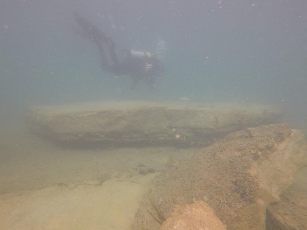
MAHS Field School 2018 Pickles Reef Florida Keys National Marine Sanctuary
 MAHS Field School 2018 Pickles Reef Florida Keys National Marine Sanctuary MAHS returned to Pickles Reef in June of 2018 to hold its annual field school. Pickles Reef lies about 6 miles from Key Largo
Municipal Adaptation to Sea Level Rise in Saco Bay, Ogunquit, and Seabrook
 Municipal Adaptation to Sea Level Rise in Saco Bay, Ogunquit, and Seabrook Changing Environments Symposium Bowdoin College October 24, 2009 Climate Change Adaptation Panel 1:45 to 3:00 PM Jonathan T. Lockman,
Evaluation of June 9, 2014 Federal Emergency Management Agency Flood Insurance Study for Town of Weymouth, Norfolk, Co, MA
 Evaluation of June 9, 2014 Federal Emergency Management Agency Flood Insurance Study for Town of Weymouth, Norfolk, Co, MA Prepared For: Woodard & Curran 95 Cedar Street, Suite 100 Providence, RI 02903
Today: Coastal Issues and Estuaries
 Today: Coastal Issues and Estuaries Coastal issues Human effect on coastlines What is an estuary Why are they so important? Circulation of water in estuary Environmental issues Coastal Issues: Problem
Coastal Sediment Transport Modeling Ocean Beach & San Francisco Bight, CA
 1 Coastal Sediment Transport Modeling Ocean Beach & San Francisco Bight, CA Honghai Li and Lihwa Lin Engineering Research and Development Center U.S. Army Corps of Engineers Frank Wu, Lisa Andes, and James
CHAPTER 281 INFLUENCE OF NEARSHORE HARDBOTTOM ON REGIONAL SEDIMENT TRANSPORT
 CHAPTER 281 INFLUENCE OF NEARSHORE HARDBOTTOM ON REGIONAL SEDIMENT TRANSPORT Paul C.-P. Lin, Ph.D., P.E. 1 and R. Harvey Sasso, P.E. 2 ABSTRACT The influence of nearshore hardbottom on longshore and cross-shore
Update on Sediment Assessment
 Florida s Mercury TMDL Project Update on Sediment Assessment Lori Balinsky, Paul Blair, Keith Davie, Mike Eckles, Peter Folland, Chris Green, Shannon Gerardi, Pam Novak and Tom Seal Florida DEP Watershed
Habitat Fact Sheets. Rocky habitats are dominated by seaweeds and often mussels, which rely on the rocks for attachment.
 Habitat Fact Sheets Habitats in the Gulf of Maine serve many important roles for the environment and for humans as well. These include: cycling nutrients, filtering pollution, trapping sediments, storing