GREAT VALLEY / ROUTE 29 MULTIMODAL STUDY
|
|
|
- Damon Stanley
- 5 years ago
- Views:
Transcription


1 GREAT VALLEY / ROUTE 29 MULTIMODAL STUDY in cooperation with Delaware Valley Regional Planning Commission Chester County Planning Commission East Whiteland Township Southeastern Pennsylvania Transportation Authority Pennsylvania Department of Transportation Engineering District 6 0 Private sector representatives prepared by Whitman, Requardt & Associates, LLP with Lotus Environmental Consulting, LLC March 2014
2
3 ACKNOWLEDGEMENTS Support in developing this plan was provided by an active group of stakeholders. The project team would like to thank the members of the Study Advisory Committee for their contributions to the Great Valley/Route 29 Multimodal Study. The Transportation Management Association of Chester County (TMACC) is a non profit created in 1992 by the Pennsylvania Department of Transportation. TMACC s charter is to serve as liaison between public sector transportation agencies and the private sector on transportation issues affecting the Chester County business community. TMACC membership is comprised of over 100 companies from numerous business sectors who share a philosophy of civic and environmental responsibility, and who understand the importance of a healthy transportation infrastructure system in the success of their business. The mission of TMACC is to foster cooperation between the public and private sectors of Chester County to identify, evaluate, and analyze significant transportation issues; and to serve a leadership role in the development and implementation of solutions that are broad based, cost effective, and timely.
4
5 CONTENTS Executive Summary... 1 Introduction... 4 The Great Valley/Route 29 Corridor... 4 Prior Studies/References... 6 Study Process... 7 Roadway Jurisdiction and Characteristics... 7 Existing Traffic and Safety Review... 9 Existing Pedestrian and Bicycle Facilities Existing Transit Future Development Environmental Constraints Public Involvement Corridor Options and Conceptual Improvements Facility Types Issues and Alternatives Route Swedesford Road Crossing Norfolk Southern Railroad High Capacity and Convenience Transit Recommended Multimodal Improvements Route Swedesford Road Signalized Intersection Crossings Unsignalized Crossings Sidewalks and Paths Corridor Wide Bicycle Network New Roadway Links Summary of Recommendations Implementation Project Priorities and Phasing Planning Level Estimates of Probable Cost Phasing of Improvements Measures of Success Issues for East Whiteland Township Comprehensive Plan Update Appendix: Project Information to Help Set Priorities Page i
6 FIGURES 1 Study area Existing bus routes and stops Locations of future development/redevelopment Cultural resources Environmental constraints mapping Responses to TMACC online survey Sidewalk priority based on distance Route 29 at bridge over US Alternative locations for pedestrian/bicycle crossing of Norfolk Southern Railroad Recommended study area multimodal improvements Route 29 shared use path Proposed cross section of Swedesford Road Cedar Hollow Road at Chester Valley Trail Bicycle network Potential new connections to the Chester Valley Trail Recommended improvements US 202 to US 30 west of Route Recommended improvements US 202 to US 30 east of Route Recommended improvements Swedesford Road area Recommended improvements Great Valley Parkway area TABLES 1 Roadway jurisdictions and characteristics Smart Transportation typology Volumes at PA Turnpike ramp to Route Route 29 crash summary, Highest daily ridership bus stops in the Great Valley study area Summary of recommended improvements Planning level estimates of probable cost Page ii
7 EXECUTIVE SUMMARY What is the purpose of the study? Great Valley is identified in the Delaware Valley Regional Planning Commission s (DVRPC s) Connections 2040 Long Range Plan as one of two suburban centers in Chester County that are focus areas for growth and development. The concept of Centers is the cornerstone of Connections Great Valley is already one of the largest concentrations of office and light industrial space in the Philadelphia region and is one of the most significant employment centers in the area, with over 20,000 employees. At present there is an extraordinary amount of planned development in Great Valley: 4.3 million square feet of office, 1.6 million square feet of retail, 475 hotel rooms, and 750 residential units, representing $1.2 billion of potential private investment. The densities and mixed uses inherent within a growing Center can enhance the feasibility of walking, bicycling, and public transportation as alternatives to the automobile. However at present Great Valley is nearly completely dependent on the automobile and lacks basic infrastructure for other modes. Stakeholders in the project area have acknowledged that a transition is imminent. Nationally, demographics and development types are changing as a new creative class seeks walkable, mixed use communities that offer alternatives to driving. Large single use office parks must adapt to remain competitive. Some major property owners in the Great Valley marketplace are concerned about the long term viability of suburban office parks to attract and retain younger workers and the companies that employ them. To address these changing transportation needs, the Great Valley/Route 29 Multimodal Study has developed a program of improvements designed to: Convert PA Route 29 from a high speed autooriented corridor to a multimodal corridor that is walkable, bikeable, and conveniently served by transit. Encourage transit use for work trips. Promote active transportation (walking and bicycling) trips between destinations within the office park, as well as to/from adjacent neighborhoods. Connect to the Chester Valley Trail for both transportation and recreation purposes. How was this plan prepared? The plan received input from a wide variety of sources, including previous planning study reports, public involvement, data provided by municipal, transportation, and planning agencies, and extensive field views and explorations. A Study Advisory Committee including the Transportation Management Association of Chester County (TMACC), DVRPC, the Chester County Planning Commission (CCPC), East Whiteland Township, Southeastern Pennsylvania Transportation Authority (SEPTA), legislative representation, and private sector representatives provided direction for the study. Conversations were held with selected major stakeholders including municipal officials, property owners/developers, and employers. Public input was solicited through a series of public workshops and an online survey. The study used GIS data from CCPC. Traffic data used for this study were from previous studies conducted by others for development or for road projects. Pennsylvania Department of Transportation staff provided traffic signal plans and crash data, and major improvement concepts were reviewed with PennDOT at the alternatives stage. What is in the plan? The plan provides: An assessment of the need for multimodal facilities Guidance for determining where sidewalks should be provided and priority locations Recommendations for improving street crossings for pedestrians Recommendations for pedestrian and bicycle facilities along Route 29 and along Swedesford Road, with background on issues and alternatives Recommendations for types of bicycle facilities on other roads in the corridor Recommendations for improved transit facilities and access Potential new street links Page 1
8 What will it cost? The recommended multimodal improvements include many individual projects, ranging in cost from very low ($3,500) to high (possibly $4 million) in estimated construction cost (2013 dollars) plus right of way. The improvements will need to be phased over a number of years. A phased program should be developed that puts individual improvement projects into short term (1 5 years), medium term (6 10 years), and long term (10+ years) time frames. Private funding through developer contributions should be sought as appropriate. How will the plan be implemented? TMACC intends to form a coalition including representatives of the municipalities, SEPTA, CCPC, and private stakeholders. The coalition will determine priorities for implementation. This report provides several criteria for prioritizing projects and evaluates each of the recommended multimodal improvements with respect to these criteria. An evaluation matrix is provided that will assist decision makers in determining where and when to allocate resources for multimodal improvements. The coalition should begin by prioritizing low cost projects that can be implemented within the next two years, in order to demonstrate progress and build momentum for further improvements. The priorities for implementation should be aimed at serving the highest demand travel paths and improving safety. Initially the priority should be placed on pedestrian facilities in order to serve the most people. Examples of pedestrian projects that should be considered for priority implementation are: Signing and marking modifications at the Route 29/Matthews Road intersection to improve driver yielding behavior at the Chester Valley Trail (CVT) crossing (this is a temporary measure until physical modifications at the southeast corner can be completed) Unsignalized pedestrian crossing provisions on Liberty Boulevard at Desmond Hotel/Wawa Pedestrian crossing provisions at the Route 29 traffic signals at Wyeth Drive, Swedesford Road and Liberty Boulevard (all Route 29 signals should eventually have crossing provisions). Sidewalks on East Swedesford Road from Route 29 to Penn State Great Valley, with an eventual sidewalk extension to Cedar Hollow Road A shared use path on Route 29 between Swedesford Road and Matthews Road, which is the initial section of a proposed 1.7 mile path along Route 29 A sidewalk/crossing connection on West Liberty/Liberty Boulevard from Old Morehall Road to the Desmond Hotel At most locations, installing a pedestrian crossing will require that some sidewalks already be present or be constructed along with the crossing improvement. For bicycle facilities, priority should be given to projects that make important connections and can be accomplished in the shorter term with relatively low cost. Examples of such projects are: Bicycle lanes on Liberty Boulevard and Valley Stream Parkway Shared use path on the north side of Swedesford Road from Route 29 to Valley Stream Parkway Improved/widened internal shared use path along the rear of properties between Liberty Boulevard and Valley Stream Parkway, with new formal connections to both streets Bus shelters with concrete pads are an example of an easily implemented improvement for transit riders. Page 2
9 What are the next steps? East Whiteland Township will soon prepare an update of the Township Comprehensive Plan. The comprehensive plan should include recommendations from the multimodal study in its transportation section. The plan should also examine changes to land use and zoning in the Great Valley/Route 29 corridor that will promote mixed use. Going forward, the zoning and land development approval process should require new development to provide a pedestrian, bicycle and transit connectivity plan with provisions for implementing or contributing toward connectivity improvements. TMACC and its coalition partners should coordinate to develop a strategy for pursuing funding for short term priority projects, including grant applications, private contributions, and capital budget allocations. The East Whiteland and Tredyffrin Joint Transportation Authority could be reactivated to pursue financing for selected projects. TMACC should seek to have selected proposed Great Valley trails incorporated into The Circuit, a planned regional network of more than 750 miles of walking and biking trails. The Circuit Coalition Steering Committee would need to approve the change. Being an official Circuit Trail would give a proposed trail some standing when applying for financial assistance and help build the constituency for the trail. Because the multimodal plan will be implemented over many years by a variety of parties, it is important to monitor the results of the effort using objective measures to track success. Some measures should track the progress of implementation, such as linear feet of new sidewalks or bicycle lanes, or number of intersections upgraded with pedestrian crossings. Other measures should be aimed at tracking the impact of the multimodal facilities and policies on the way people travel. In summary, the Great Valley/Route 29 Multimodal Study frames a new way of thinking about transportation in one of the region s most important centers. Implementing the projects recommended by this plan will help keep the marketplace competitive, promote sustainability, and make Great Valley an even better place to live, work, and visit. Page 3

10 INTRODUCTION The Great Valley/Route 29 Corridor TMACC received a PennDOT grant to conduct a multimodal study of PA Route 29 and the surrounding Great Valley marketplace. As shown in Figure 1, the central spine of the corridor is PA Route 29 from US 30 to Phoenixville Pike, and the area of focus extends east west roughly between PA Route 401 and Cedar Hollow Road. The study area is primarily in East Whiteland Township, with small parts extending into Charlestown and Tredyffrin Townships. Willistown Township north of US 30 is at the far edge of the study area. Great Valley is home of one of the largest concentrations of office and light industrial space in the Philadelphia region and is one of the most significant employment centers in the area, with over 20,000 employees. Beginning in the 1970s and 1980s, Great Valley was developed In the style of the day, largely as single use, low density office, light industrial, and flex space, with relatively limited retail and hotel uses and residential areas on the fringes. Roadways did not include sidewalks, and today sidewalks are limited to very few frontages of more recent development. Figure 1: Study area Page 4
11 These circumstances explain the study area s nearly complete dependence on the private automobile. TMACC s travel demand management (TDM) programs have sought for 16 years to reduce that dependence through public private partnerships, shifting trips to transit, carpooling, and off peak hours through the use of flex time and compressed work weeks. Yet an overall lack of sidewalks, pedestrian crossings, bicycle facilities, and transit amenities in Great Valley erodes TDM efforts by TMACC and significantly reduces safety and accessibility for all transportation modes. Traffic congestion and traditional adherence to autoonly level of service measures have resulted in wide roads designed for weekday AM and PM peak hours. Route 29 carries 22,000 to 28,000 cars a day, with a great deal of that traffic during rush hours due to the overwhelmingly employment oriented land uses along the road. Those peak hours require four or more through lanes and extensive turn lanes to maintain auto capacity, which makes travel for pedestrians and bicyclists challenging. Although the roads are busy during the ten peak hours per week, they are less so the remaining 94% of the time. Only about 1% of Great Valley employees use transit for their work trips. The bulk of the corridor is served by two bus routes: SEPTA s 205 (Paoli to Phoenixville via Great Valley) and 206 (Paoli to Great Valley). SEPTA s Route 204 (Paoli to Eagleview via Exton) serves US 30 and the Uptown Worthington retail site. All three SEPTA bus routes provide access to the Paoli Station on SEPTA s Paoli Thorndale regional rail line. Plans are being developed to transform the Paoli Station into a major regional multimodal transportation center. The future of bus Routes 204 and 205 is uncertain as these routes face a loss of funding after completion of the US Route 202 reconstruction project. Even as this is happening, there is an extraordinary amount of planned development in the study area: 4.3 million square feet of office, 1.6 million square feet of retail, 475 hotel rooms, and 750 residential units, representing $1.2 billion of potential private investment. Since the announcement that the Pennsylvania Turnpike was going to construct the Route 29 E ZPass interchange, four corporate headquarters (Endo, Ricoh, CubeSmart, and Meridian Bank) have relocated to Great Valley. Stakeholders in the project area have acknowledged that a transition is imminent. Nationally, demographics and development types are changing as a new creative class seeks what land use strategist, developer, researcher and author Christopher Leinberger calls walkable urbanism. Large single use office parks must adapt to remain competitive. Some major property owners in the Great Valley marketplace are concerned about the long term viability of suburban office parks to attract younger workers. Corporations today are looking for high performance buildings with technology and innovative workspaces not the typical cubicles. The under 30 workforce does not always go to the office because computers and wireless internet allow them to work anywhere. Younger workers are also more likely to use transit, if available, because they can use the travel time to work or use electronic devices. These workers also want activities and social opportunities to be available close by preferably within walking distance of their homes or workplaces. These trends will result in denser places and introduction of building types other than office, e.g. multi family residential, cultural and community oriented space. The focus of this multimodal study is on providing for pedestrian, bicycle, and transit travel for trips within the Great Valley study area, which will enable a greater proportion of non auto trips as these land use changes take place. For Great Valley to be competitive in attracting future workers and the companies that employ them, buildings need to be walkable, scalable, and sustainable. The East Whiteland Township comprehensive plan will be updated following this study and will examine how land use and land development requirements might be changed to address those issues. Stakeholders expressed concepts such as the following to address the challenges facing Great Valley: Connect non auto travel modes to employers Penn State, Siemens, Vanguard, Microsoft, etc. Once auto commuters arrive in Great Valley, they should be able to circulate without using a car. Create villages without becoming a city. Establish focal points connected by pedestrian paths. Create third places in Great Valley separate from the two usual social environments of home and the workplace, where people can meet and socialize. The only place now is Wegmans. Page 5
12 Enable people to get from the Paoli Station (a nearby connection to SEPTA s regional rail network) to Great Valley without driving. Attract more choice riders to transit, i.e., riders who have other available travel options. Provide amenities at bus stops and pedestrian connections to access them. Change the development process so that planning for transit service occurs from the very beginning and require transit oriented design. Buildings should face pedestrian and transit access. Allow mixed use and residential uses that will generate transit riders in both directions between Paoli and Great Valley to allow more efficient transit service and increased passenger revenue. In 20 years, it would be ideal to see the bus run down Route 29 and have the sidewalks in place so people can really walk. That would allow really efficient transit service. Because transit is competing against free parking and expressways connecting to Route 29, pay attention to details that affect convenience and attractiveness of transit. Enhance the transit user s experience: e.g. coaches with Wi Fi and bicycle racks, bus priority, or bus rapid transit. Prior Studies/References The Great Valley/Route 29 Multimodal Study is built upon previous planning studies. Relevant plans, studies and other resources that were examined during this study included: East Whiteland Township Parks and Recreation Plan, URDC, The Patriots Path Plan, URDC, Adopted by East Whiteland Township March 10, 2010; adopted by Malvern Borough December 15, 2009; adopted by Tredyffrin Township February 22, Traffic Impact Study Pennsylvania Turnpike Proposed PA 29 E ZPass Slip Ramp Interchange project. KCI Technologies, Inc., Phoenixville Main Line Passenger Rail Assessment (Green Line). Gannett Fleming, SEPTA Bus Stop Design Guidelines. DVRPC, SEPTA board leave data for Route 204 (manual count November 29, 2012), Route 205 (manual count June 11, 2012), and Route 206 (Automatic Passenger Count data, fall 2012) Design Manual Part 2, Pennsylvania Department of Transportation (Publication 13; incorporates the Smart Transportation Guidebook, DVRPC, PennDOT, NJDOT, 2008). AASHTO Guide for the Development of Bicycle Facilities, 4th Edition, Paoli Trail Connections: Making Paoli More Walkable and Connecting to the Chester Valley Trail, Tredyffrin Township, April Page 6
13 STUDY PROCESS The principles, themes, and tools of PennDOT s Smart Transportation Initiative provide a framework for the study. In fact, one of the principles, Plan for alternative transportation modes, is the core of the study. The process began with an examination of existing roadway, traffic, pedestrian, bicycle, and transit conditions. Table 1: Roadway jurisdictions and characteristics Roadway Jurisdiction and Characteristics The jurisdiction of study area roadways is germane since jurisdiction will affect the approval process for improvements along that roadway as well as maintenance responsibilities. Roadways are grouped by jurisdiction (state, township, private) in Table 1 below, along with road characteristics that will affect the type and design of improvements. State Roadways of main focus for multimodal improvements State Route 2011 Average Daily Traffic Speed Limit Through Lanes PennDOT Functional Class Route 29 SR minor arterial minor arterial Route30 to Swedesford Rd 25,000 4 Swedesford Rd to Atwater 22,000 4 Atwater to Phoenixville Pk 15,000 4 north of Phoenixville Pk 9,700 2 Swedesford Rd SR 1002 urban collector major collector east of Cedar Hollow Rd 9, Route 29 to Cedar Hollow Rd 10, US 202 ramps to Route 29 13, Route 401 to US 202 ramps 9, US 30 SR , other principal arterial CCPC major arterial Route 401 SR , minor arterial minor arterial Cedar Hollow Rd south of US 202 SR , local road minor collector Other state roadways State Route 2011 Average Daily Traffic Speed Limit Through Lanes PennDOT Functional Class Yellow Springs Rd SR , urban collector minor collector Whitehorse Rd SR , urban collector major collector Phoenixville Pk SR , minor arterial major collector Charlestown Rd SR , urban collector major collector CCPC Page 7
14 Table 1: Roadway jurisdictions and characteristics (continued) Township roadways Jurisdiction Speed Limit (if posted) Through Lanes Functional Class (Chester County Planning Commission) Matthews Rd East Whiteland Twp 2 4 minor collector Liberty Blvd East Whiteland Twp 4 local distributor Valley Stream Pkwy East Whiteland Twp 4 local distributor Great Valley Pkwy East Whiteland Twp 25 4 local Flat Rd East Whiteland Twp 2 local General Warren Blvd East Whiteland Twp 2 local General Warren Blvd Charlestown Twp 2 local Warner Ln Charlestown Twp 2 local Cedar Hollow Rd north of US 202 Tredyffrin Twp 2 minor collector Lee Boulevard East Whiteland Twp 2 local Old Morehall Road East Whiteland Twp 20 2 local Private Roadways intersecting Route 29 Wyeth Dr Hanson Dr Lindenwood Dr South Atwater Dr (future roadway) North Atwater Drive West Liberty Blvd (roadway is expected to be dedicated to East Whiteland Township when development is complete) The function of a roadway, combined with the land use context, determines the design criteria that are appropriate for that roadway. The methods for determining land use context and road typology are fully described in PennDOT s Smart Transportation Guidebook, which is available at The Guidebook s design criteria for each road typology in each land use context are incorporated in PennDOT s design manuals. These criteria will therefore apply to any project that requires PennDOT approval. The context and road typology for roads within the Great Valley study area are shown in Table 2. Page 8
15 Table 2: Smart Transportation typology Roadway Land Use Context Smart Transportation Road Typology Route 29 Suburban Corridor Community Arterial Swedesford Rd (between US 202 ramps and Cedar Hollow Rd) Swedesford Rd (west of US 202 ramps and east of Cedar Hollow Rd) Suburban Corridor Suburban Neighborhood Community Collector Community Collector US 30 Suburban Corridor Community Arterial Route 401 Suburban Neighborhood Community Arterial Cedar Hollow Rd Suburban Neighborhood Neighborhood Collector Yellow Springs Rd Suburban Neighborhood Neighborhood Collector Whitehorse Rd Suburban Neighborhood Community Collector Phoenixville Pk Suburban Corridor Community Collector Charlestown Rd Rural Community Collector Wyeth Dr Hanson Dr Lindenwood Dr Matthews Rd Liberty Blvd West Liberty Blvd Valley Stream Pkwy Great Valley Pkwy Flat Rd South Atwater Dr North Atwater Dr General Warren Blvd Warner Ln Lee Blvd Old Morehall Rd Local Local Local Neighborhood Collector Neighborhood Collector Neighborhood Collector Neighborhood Collector Neighborhood Collector Neighborhood Collector Local Local Local Community Collector Local Local Existing Traffic and Safety Review TRAFFIC VOLUMES Route 29 carries 22,000 to 28,000 cars a day 1, with a great proportion of that traffic during the AM and PM Daily Traffic Volume Estimates, Chester County Planning Commission Map Series, data source PennDOT, peak hours due to the overwhelmingly employmentoriented land uses along the road. Intersection traffic data available for this study came from traffic counts conducted in June 2012 at all signalized intersections on Route 29 as well as at the US 202 interchange ramps. At the time, construction was in progress on US 202 from Mill Lane to east of North Valley Road (SR 202 Section 320). The Pennsylvania Turnpike s Route 29 E ZPass interchange was not yet open. Further, in July 2012, PennDOT Page 9
16 began work on a project to widen Route 29 to provide an additional northbound and southbound through lane between Yellow Springs Road and Phoenixville Pike/Charlestown Road and intersection turn lane improvements (SR 0029 Section AL2). Traffic patterns after completion of all construction projects can be expected to differ somewhat from June 2012 counts due to removal of construction constraints, addition of the new interchange with the Turnpike, and enhanced capacity on US 202 and on Route 29 north of Atwater. The Synchro traffic analysis model provided by PennDOT for the corridor south of Valley Stream Parkway reflects traffic volume projections from various traffic studies for developments that are currently not built out, such as Uptown Worthington and Atwater. The Synchro traffic analysis model was compared with the volumes counted in 2012 at each intersection peak hour directional volumes are significantly lower than the traffic analysis model, particularly in the area from Liberty Boulevard south where through volumes are between 20% and 80% lower. The Pennsylvania Turnpike E ZPass only interchange at Route 29 opened in December February 2013 hourly ramp volumes provided by the Pennsylvania Turnpike Commission were compared with the traffic study projections. E ZPass data show that 70% of weekday traffic using the interchange is oriented to and from the east on the Turnpike. A spot traffic count was conducted at the intersection of the Turnpike ramp and Route 29 to determine the direction of Turnpike traffic on Route 29. The count revealed that 80% of AM peak ramp exits and 80% of PM peak ramp entries are oriented to the south on Route 29. AM entries and PM exits are evenly divided north and south. Table 3 shows total ramp entry and exit volumes at Route 29. Table 3: Volumes at PA Turnpike ramp to PA Route 29 Traffic Study Projection Year 2018 E ZPass data Feb minute count, April 2013 AM Peak Hour Exiting Turnpike Entering Turnpike PM Peak Hour Exiting Turnpike Entering Turnpike The Turnpike interchange is an asset for the Route 29/Great Valley corridor. It provides direct access to the northern part of the corridor so those trips don t need to travel on Route 29 further south. South of the interchange, the availability of an alternative to US 202 will reduce the amount of increase that would otherwise occur to peak directional traffic as development occurs. CRASH HISTORY PennDOT provided a three year history of all recorded crashes on Route 29 between 2009 and All crashes were analyzed to determine any patterns or problem locations, in particular crashes involving pedestrians and bicycles. There were no reported pedestrian or bicycle crashes along Route 29 in the study area in those three years. Of the 58 total reported crashes illustrated in Table 4, none resulted in fatalities, but 40% resulted in injury. All but three of the 58 crashes occurred at intersections. The highest number of crashes occurred at Route 29 and Matthews Road. Page 10
17 Table 4: Route 29 crash summary, Location Number of Crashes US 30 5 Wyeth Dr 4 Matthews Rd 13 Swedesford Rd 6 Liberty Blvd 10 Valley Stream Pkwy 2 Great Valley Pkwy 3 N Atwater Dr/General Warren Blvd 2 Yellow Springs Rd 5 Whitehorse Rd 1 State Rd 4 Route 29 midblock between Flat Rd and Atwater Route 29 midblock north (east) of Morehall Rd Total 58 A significant portion of the crashes at signals on Route 29 (45%) involved a driver running a red light. These crashes were not concentrated in peak traffic periods but occurred at all times of day. Overall for the 2.5 mile corridor, the crash rate per million vehicle miles traveled (a standard safety measure) is slightly lower than the statewide average for an urban divided roadway that has access from intersecting streets and driveways. TRAFFIC SIGNALS Traffic signals on Route 29 are grouped in two coordinated systems. The signals from US 30 to Valley Stream Parkway are interconnected, and the system also includes three other signals off Route 29 (at West Swedesford Road and West Liberty Boulevard, at East Swedesford Road and Liberty Boulevard/US 202 ramps, and at Matthews Road, Foundry Way and US 202 ramps). A second system on Route 29 includes the five intersections at the northern end of the corridor from the Pennsylvania Turnpike ramp to Phoenixville Pike, plus the signal at Phoenixville Pike and Warner Lane. Between the two systems, the signal at Great Valley Parkway is not connected. A new signal is planned at South Atwater Drive/Flat Road at such time 2 1 as development warrants it. The Great Valley Parkway signal and future South Atwater Drive/Flat Road signal should be connected to the systems north and/or south to complete the interconnection along Route 29. The signals on Route 29 are characterized by protected only left turn phases, and many intersections have double left turn lanes on one or more approaches. Side streets are split phased (each direction runs separately) at six of the 12 signals on Route 29. The multiple phases increase wait times and affect the time that can be made available to pedestrian crossings. East Whiteland Township is considering use of traffic adaptive signal control on Route 29. Traffic adaptive operation allows phase times and sequence to vary according to real time traffic demand. The Township has installed a traffic adaptive signal system on a portion of Route 401. However, no funding is in place for traffic control improvements on Route 29. Existing Pedestrian and Bicycle Facilities Great Valley was not designed with pedestrians or bicyclists in mind. Sidewalks do not exist along streets except for some frontages of the most recently built developments. Sidewalks that exist within developments generally connect buildings with parking lots, not with the street. This study included a comprehensive inventory of pedestrian facilities, including presence or absence of curb ramps at crosswalks. At the majority of crosswalks, curb ramps do not exist. Of the curb ramps that do exist, about half are not compliant with current Americans with Disabilities Act (ADA) guidelines. Many of the traffic signals do not provide for pedestrian crossings and in fact have signs prohibiting pedestrian crossings, including signals at bus stops. The need for safe pedestrian crossings at intersections was the most frequently voiced concern by the public. The major pedestrian and bicycle facility in the study area is the Chester Valley Trail (CVT). A signalized pedestrian crosswalk is provided for the CVT crossing of Route 29 at Matthews Road. However, the Route 29 northbound right turn is not signalized and trail users report problems crossing the channelized right turn yield movement. Driver yielding behavior is poor. Although a fence limits sight distance at the eastern ramp of the crossing, enough sight distance is available if drivers are looking for pedestrians. However, drivers are often focused instead on traffic and whether they will need to yield to motor vehicles. Page 11


18 The lack of sidewalks on Great Valley Parkway is typical of roads within the corporate center. This marked crosswalk has no curb ramps and does not connect to sidewalks. There are No Pedestrian Crossing signs on all four corners of Route 29 and Swedesford Road. Page 12


19 On northbound Route 29, there is no advance warning of the Chester Valley Trail crossing. Existing signs and markings at the CVT crossing of Route 29. The pedestrian s view looking south. The Great Valley Corporate Center properties south of Valley Stream Parkway provide a number of internal asphalt pathways that allow walking between buildings. The paths are about five feet wide and intended for pedestrians only. One such path is located in the landscaped area between Liberty Boulevard and Valley Stream Parkway. It runs from the Desmond Hotel to Ricoh at 70 Valley Stream Parkway and connects to the rear parking lots of the buildings along one side of each street. Atwater provides a recreational asphalt path to an internal park area and a path that connects to the Cedar Hollow Inn parking lot on Yellow Springs Road. Page 13


20 Recreational asphalt path at Atwater. No paths extend to Route 29. There are no roadways in the study area with marked bicycle facilities. Route 29 has shoulders at least eight feet wide on both sides, although at many intersections the shoulder becomes a right turn lane. The portion of Cedar Hollow Road in the study area also has shoulders. On other roadways, bicyclists generally must ride in a travel lane. This includes heavily travelled roads such as US 30, Route 401 and Swedesford Road. Existing Transit As of fall 2013 the Great Valley/Route 29 corridor is served by three SEPTA bus routes that originate at the Paoli Station: Routes 204, 205, and 206. Approximately 1% of Great Valley employees ride transit, based on a comparison of ridership data provided by SEPTA with Great Valley employment. Routes and stops are shown in Figure 2. Figure 2: Existing bus routes and stops Page 14
21 Bus Route 204 operates from Eagleview to Paoli Station, serving Lionville and Exton. Service operates Monday through Friday from 6:30 am to 9:00 pm with 15 trips in each direction. Route 204 also provides Saturday and Sunday service with shorter service hours and about half the number of trips. Route 204 operates along US 30 with a diversion at Route 29 to serve the stop in the Uptown Worthington development. Bus Route 205 operates Monday through Friday. It provides six AM peak trips from Paoli Station to Great Valley between 6:30 am and 8:30 am and six PM trips from Great Valley to Paoli Station between 3:30 pm and 5:50 pm. Bus Route 205 runs from Paoli to Cedar Hollow Road and Matthews Road, serves the Uptown Worthington bus stop, then proceeds north on Route 29 to General Warren Commons. Two of the six trips continue north to Phoenixville. In addition, there are three AM express buses from Phoenixville to Paoli Station and three PM peak express buses from Paoli Station to Phoenixville. The ridership to Phoenixville is not meeting SEPTA s minimum operating ratio requirements. SEPTA has proposed a change to the routing of Route 205 in its FY 2015 Annual Service Plan that would discontinue service to Phoenixville and add service to Chesterbrook in Tredyffrin Township. Bus Route 206, operated by SEPTA s Frontier Division, operates Monday through Friday. It provides 14 trips from Paoli Station to Great Valley between 6:30 am and 3:30 pm and 18 trips from Great Valley to Paoli Station between 6:45 am and 6:00 pm. Bus Route 206 travels west on US 30 and north on Route 29, turns onto Liberty Boulevard and travels to Swedesford Road, travels east on Swedesford Road to an internal stop within the Unisys site, then returns west on Swedesford Road and turns north on Valley Stream Parkway. Bus Route 206 then continues north on Route 29 to Great Valley Parkway, where it travels around the loop of the western side of Great Valley Corporate Center, then follows the reverse path on its return to Paoli Station. TRANSIT FUNDING Bus Route 206 is funded through SEPTA s operating budget. Routes 205 and 204 are funded with congestion mitigation funding as part of PennDOT s reconstruction and widening of US 202, Section 300. After the roadway construction is completed, those bus routes will need to be funded from SEPTA s operating budget in order to be maintained. SEPTA s minimum operating ratios will serve as the criteria for maintaining service. In addition, preserving SEPTA s bus operations serving Great Valley is dependent on receiving sufficient funding to operate the entire regional transit system, because otherwise SEPTA may have to consider service cuts. SEPTA has proposed changes in the FY 2015 Annual Service Plan to the routings of Routes 205 and 206 to improve efficiency and ridership. RIDERSHIP Table 5: Highest daily ridership bus stops in the Great Valley study area Boarding and leaving data by stop for bus Routes 204, 205, and 206 was obtained from year 2012 ride check data provided by SEPTA. Route 206, operated by SEPTA, has Automatic Passenger Count (APC) equipment tied into GPS that counts passenger boards and leavings by trip and by stop. Routes 204 and 205 are contract services and ride checks are done manually. The daily ridership is given in one way trips. More people ride the bus to work in the morning than return on the bus in the evening. The daily ridership is estimated at 400 trips to/from stops in the study area, 85% of which ride Route 206. Table 5 below shows the highest ridership stops. The two busiest stops within the study area are at Unisys and at Valley Stream Parkway/Swedesford Road. The ridership of bus Route 206 at Paoli Station is provided for comparison. Route Direction Stop ID Stop On Off Total 206 B 1874 Paoli Station B 1866 Unisys W Valley Stream Pkwy & Swedesford Rd W Morehall Rd & Wyeth Dr E Great Valley Pkwy & Morehall Rd Page 15
22 Table 5: Highest daily ridership bus stops in the Great Valley study area (continued) Route Direction Stop ID Stop On Off Total 206 B Great Valley Pkwy & Tech EOL W Great Valley Pkwy & W Liberty Blvd & Morehall Rd E Valley Stream Pkwy & 40 Bldg W 2290 Lancaster & Lincoln Court Shop Ctr E Liberty Blvd & Desmond Hotel E 2317 Lancaster & Lincoln Court Shop Ctr W Cedar Hollow Rd and Vanguard Blvd B Swedesford Rd & Trinity Corp B Swedesford Rd & Chesterfield Pkwy W General Warren Blvd & Otis Dr B Uptown Worthington W 2289 Lancaster & Conestoga Rd E 2318 Lancaster & Conestoga Rd W General Warren Blvd & Otis Dr BUS STOP SIGNS Some of the existing bus stop signs display routes that have been discontinued (e.g. the Route 306, the Beeline). In addition, there are bus stop signs where the stop has been discontinued, and there are stops within the Great Valley Corporate Center where signs are missing. SEPTA plans to replace the signs with outdated routes or cover up the discontinued routes; this is a separate effort that will not wait for a comprehensive sign replacement. SEPTA is in the process of installing new bus stop signs system wide. The signs will include the Stop ID Number, which riders can use to obtain the times of the next four scheduled buses at that stop. SEPTA is installing the new signs in the City of Philadelphia first, and there are 13,500 stops system wide. Therefore, it is likely that the new bus stop signs in the Great Valley study area may not be installed for more than a year. Within the Great Valley Corporate Center, Liberty Property Trust made custom bus stop signs using SEPTA information. All stops should have signs with the new SEPTA sign information, including those within Great Valley Corporate Center. If Liberty Property Trust chooses to install updated signs, those signs do not need to wait until SEPTA s signing project reaches Great Valley. Liberty Property Trust should continue to coordinate with SEPTA to insure that those signs are up to date and compliant. BUS STOP LOCATIONS While SEPTA rules allow for stopping at locations other than signed bus stops, that arrangement is not preferred. Operators have some discretion to stop based on safety considerations. However, it can potentially create inconsistencies when a passenger is picked up or dropped off by one operator and not by another at the same location. SEPTA tries to avoid placing bus stops in right turn lanes. PennDOT sees these stops as creating potential safety issues due to the merge and weave conditions created by a bus pulling away from the curb or shoulder while another vehicle is passing. When practical, SEPTA tries to respect this PennDOT preference. When new right turn or deceleration lanes are added, it reduces the number of options for siting bus stops. The Valleybrooke Corporate Center on Lindenwood Drive does not have a convenient bus stop. Patrons must either use the stops on Route 29 at Wyeth Drive or the stop at Uptown Worthington. It is not possible to walk to the eastbound Route 206 bus stop (to Paoli) Page 16
23 on Route 29 because the Chester Valley Trail installed a barrier fence that blocks walking south to the bus stop. The southbound shoulder of Route 29 approaching Lindenwood Drive was recently converted to a right turn lane to reduce conflicts because right turns were being made both from the travel lane and from the shoulder. Adding a bus stop for Lindenwood Drive will require consideration of the right turn issue, either locating the stop far enough north of the intersection or converting back to a shoulder with a bulb out at the bus stop. Currently most rider destinations are within the office park, not directly on Route 29. The hotels at Valley Stream Parkway don t have large numbers of staff or food service. The Desmond Hotel on Liberty Boulevard does have a number of transit riders; SEPTA was asked for Saturday service, which they cannot afford to provide. Route 205 serves a call center in the General Warren Commons. A number of workers from Philadelphia make a reverse commute. BUS STOP FACILITIES An inventory was conducted of Great Valley bus stops. The inventory noted what features were present at each stop. The basic features should include a bus stop sign, paved landing, and sidewalk access. Additional features such as bench, shelter, lighting, and other amenities improve the comfort of the waiting passenger. In 2012, DVRPC published SEPTA Bus Stop Design Guidelines. The purpose of the report was to provide municipalities in the SEPTA service area, local developers, and other local partners with a consistent set of guidelines for designing surface transit stops. A high quality stop is one that is well connected to the neighborhood or community it serves, accommodates the needs of all transit passengers safely and comfortably, and permits efficient and cost effective transit operations. Of 45 stops, only 11 have a paved landing and only four have sidewalk access. As noted earlier, some of the signs have outdated information. SEPTA does not construct, install, or maintain bus shelters on properties for which it does not have control, such as the curbside bus stops in Great Valley. Liberty Property Trust, the owner of the Great Valley Corporate Center, has installed shelters with benches at seven bus stops, all of which were replaced by Liberty Property Trust in Each shelter is equipped with solar lighting and is constructed of recycled materials. DISCOUNTED FARE PROGRAMS The Federal Tax Code (132F) allows employees to receive up to $245 per month of income that is spent on a transit commute tax free. It is up to employers to offer this as an employee benefit. SEPTA s Commuter s Choice program includes the Compass discount program and the RideECO benefit offered through DVRPC. Under the Compass discount fare program SEPTA provides a 5% discount, with an employer match of 5% that provides an employee benefit of 10% reduced fare. The employee s portion can also be paid with pre tax income to reduce the cost further. DVRPC administers the RideECO program, an employer offered benefit that allows commuters to use pre tax dollars to pay for their commute on transit. The biggest users of RideECO are mediumsized companies of 100 to 150 employees. Any discounted fare program requires some effort from the employer to administer. If the employer s administrators do not ride transit, they may not see the value of this effort. CORPORATE SHUTTLES Several of the large area employers run shuttles to take employees to and from the Paoli Station. Vanguard participates in SEPTA s Compass reduced fare program, but many employees use it to take transit to shuttle pickup points (such as Paoli Station), not all the way to the Vanguard campus. An estimated 200 Vanguard employees commute by Amtrak or SEPTA and are picked up by shuttle. Vanguard runs shuttles to: Paoli Station Strafford Station Norristown Transportation Center Pottstown via US 422 Between buildings at Great Valley, upon making a reservation Page 17


24 Route 205 eastbound on General Warren Boulevard. There is no sidewalk or paved landing at the bus stop. Route 206 on Great Valley Parkway. There are good amenities but no sidewalks. Route 205 westbound at Valley Creek Route 206 eastbound on Route 29 opposite Wyeth Drive. Shelter, bench, Parkway opposite hotel. Sign only. and paved landing but no sidewalk and no crossing of Route 29. No crossing of Route 29. Route 204 westbound, just west of Route 29. Sign only. No crossing of US 30. Route 205 and 204 on Foundry Lane. Good sidewalk access and lighting. No shelter or other amenities. Page 18

25 The shuttle from the Norristown Transportation Center to the Vanguard campus is operated as a congestion management strategy for the US 202, Section 300 project. As that project moves to completion, it is possible that the partial funding from PennDOT for that service could be terminated. It is unclear whether the company will decide to maintain the service under its own auspices once the project funding ends. Corporate shuttles provide direct and convenient service for employees. On the other hand, there can be redundancy between these services and SEPTA Routes 204, 205, and 206. Vanguard in particular has campus security requirements that prevent SEPTA from taking public transit routes onto its internal road network because it would bring members of the public into secure areas. Future Development A number of future development projects were noted by stakeholders. The locations described below are illustrated in Figure Charlestown Township approved a Traditional Neighborhood Development (TND) zone at Devault Village. Residential development is underway with a mix of single family and townhomes. Eli Kahn is developing Pickering Crossing (76 townhomes) and Orleans Builders is developing Spring Oak Farm (68 single family houses and 116 units of twins and townhouses). Neighborhood commercial can also be developed in the TND zone. 2. Eli Kahn is developing retail commercial in the General Warren Commons, to include 25,000 square feet (sf) of retail and a 128 room hotel. 3. Atwater was approved for 2.6 million sf of office. After Endo was completed, Atwater can add another 2.1 million sf of office in the future. Trammell Crow is considering residential, neighborhood commercial, and hotel development instead of office on the south side of the quarry. The Township approved a residential zoning overlay which could replace one million sf of office with 800 to 900 residential units. 4. Liberty Property Trust is planning for redevelopment of the Route 29 and Great Valley Parkway area. Redevelopment could include demolishing seven one story buildings comprising 800,000 sf and replacing them with 2.5 million sf of mixed use development. 5. Plans for the Rubino properties, which consist of approximately 160 acres located north of US 202 and west of West Liberty Boulevard, are unknown. 6. A new 205,000 sf office for Vanguard is now being constructed on Old Morehall Road. 7. Brandywine Realty Trust has the ability to add 800,000 sf of office to its site on Swedesford Road. 8. Trinity Corporate Center (125,000 sf of office) on Swedesford Road is proposed for redevelopment by Scheidler Group, Alliance Partners. 9. Uptown Worthington is approved for a maximum of 450,000 sf of office, 753 multifamily residential units, 240 hotel rooms, and an additional 745,000 sf of retail. As of 2013, construction is beginning on the first 252 residential units. 10. Vanguard acquired the former Wyeth/Pfizer site with 500,000 sf of office and the ability to expand by an additional 400,000 sf. Figure 3: Locations of future development/redevelopment Page 19

26 Some of the development is redevelopment of formerly occupied space, and some new development will shift existing employees to new space rather than adding new jobs. However, there is potential for 1,200 new residential units and 15,000+ new employees with what is known now. Many stakeholders have expressed the preference that Route 29 should not be widened further. Instead, future traffic increases should be moderated by increased transit use and by mixed use development forms that promote a higher proportion of internal trips and trips by active transportation (biking and walking). Environmental Constraints To better understand opportunities for transportation improvements, this section outlines the methodologies and results for studies to confirm, identify, and delineate key natural, cultural, and socioeconomic resources in the project study area. The level of resource investigation varies, and both desktop review and field identification were utilized. The level of information collected for each resource is commensurate with the importance of the resource in the decision making process and pertinent requirements of other regulations. NATURAL RESOURCES Surface Water Resources Identification of surface water resources was completed through review of USGS topographic mapping as well as GIS Historic Stream data created by the Pennsylvania Department of Environmental Protection (PADEP). Additional GIS data sources investigated included PADEP Chapter 93 Designations, Pennsylvania Fish and Boat Commission (PFBC) data for Approved Trout Waters, Class A Wild Trout Streams, Natural Trout Waters, and the PFBC website to identify Special Regulation waters. Surface waters were field verified for accuracy. All streams associated with Valley Creek and Little Valley Creek along Route 29 are listed as EV (Exceptional Value) in Chapter 93 Water Quality Standards of the Pennsylvania Code. The streams are also listed by the PFBC as Natural Reproduction Trout Waters. The main stem of Valley Creek and Little Valley Creek are also designated as Catch and Release Trout Waters by the PFBC. They are open to fishing year round. A small tributary to Pickering Creek is located in the study area north of the Pennsylvania Turnpike, and it is listed as HQ TSF (High Quality Trout Stocking). The implication of the surface water designations may affect the level of environmental permitting and construction timing for proposed activities. The stream resources might be impacted through the construction of significant features along Route 29 or through new road extensions. Proposed improvements could require new bridges over Valley Creek, Little Valley Creek, or other tributaries. Any new stream crossings would require a US Army Corps of Engineers Section 404 and PADEP Chapter 105 permits, but likely not qualify for PADEPs general permits due to the size of the watershed. Such projects would also require individual National Pollutant Discharge Elimination System (NPDES) permits, a program to reduce pollution due to stormwater runoff, because of discharges to waters with a designated or existing use of High Quality or Exceptional Value pursuant to 25 Pa. Code Chapter 93. Construction timing may be affected by the designation of wild trout waters, which is restricted October 1 through December 31. Valley Creek at Old Morehall Road Floodplains and Flood Hazard Areas Floodplain information was gathered through coordination with the Federal Emergency Management Agency (FEMA) and the utilization of the Digital Flood Insurance Rate Map Database for Pennsylvania. Based upon review of the FEMA data it was determined that Valley Creek, Tributary to Valley Creek, and Little Valley Creek are located in a flood hazard area. The streams are located in a Zone A flood hazard area, which is defined as subject to inundation by the 1 percent annual chance flood event (100 year floodplain) generally determined Page 20
27 using approximate methodologies. Because detailed hydraulic analyses have not been performed, no Base Flood Elevations (BFEs) or flood depths are shown. Detailed analysis of the flood limits would occur should design require new or extended structures over the existing streams. A detailed analysis would provide for accurate depiction of the 100 year flood elevation and the project would be required to have no impact, or no significant impact, to that determined elevation. Such flood analyses would be required for all actions where stream encroachments (bridges, culverts) would be required to implement a phase of the project. Wetlands There were some U.S. Fish and Wildlife Service (USFWS) National Wetland Inventory (NWI) wetlands identified in the study area. The wetland areas were located in the floodplain areas of Valley Creek. A significant wetland area was noted along Valley Creek in the Cedar Hollow Preserve on the east side of the study area. Other potential wetland areas were identified in the study area based on the location of hydric soils mapping and through limited field investigation. The limits of the potential wetlands were field sketched using aerial photographs. No formal delineation was conducted. It has also been determined that the wetlands in the project study area are associated with Exceptional Value streams, and therefore would be given an Exceptional Value (EV) designation based on the PADEP Chapter definitions, subsections iii: Wetlands that are located in or along the floodplain of the reach of a wild trout stream or waters listed as exceptional value under Chapter 93 (relating to water quality standards) and the floodplain of streams tributary thereto, or wetlands within the corridor of a watercourse or body of water that has been designated as a National wild or scenic river in accordance with the Wild and Scenic Rivers Act of 1968 (16 U.S.C.A ) or designated as wild or scenic under the Pennsylvania Scenic Rivers Act (32 P. S ). The Exceptional Value (EV) designation of these wetlands would result in the requirement of an individual NPDES permit should the wetlands be impacted under any phase of the project. Federal and state agencies may also require higher mitigation ratios for impacts to EV wetlands. Based upon the limited field investigation, it does not appear that large wetland systems exist in the Route 29 corridor. However, detailed investigation would need to be conducted in the high potential areas of the Valley Creek and Little Valley Creek floodplain. Similar to stream resources discussed earlier, potential wetland habitat may be most affected by the construction of significant activities such as a shared use trail along Route 29 or any road improvements that would cross over Valley Creek or other waters. The wetland impacts would also require US Army Corps of Engineers Section 404 and PADEP Chapter 105 permits and would be permitted along with any stream impacts. Vegetation and Wildlife There is no significant wildlife habitat located in the project study area based on review of aerial mapping, parcel information, and field investigations. Generally, the land use is dominated by commercial, industrial, and residential uses. There is some open space and wooded land associated with the Valley Creek Park and Cedar Hollow Preserve. There are no Pennsylvania Game Commission (PGC) game lands based on review of PGC GIS data. It is not anticipated that the proposed improvements would require any significant coordination with resource agencies with jurisdiction over wildlife resources. Threatened and Endangered Species A preliminary review of threatened and endangered (T&E) species was conducted utilizing the Pennsylvania Natural Diversity Inventory (PNDI) Environmental Review Tool. Based on the results of the query (which was limited to the immediate area of Route 29), potential impacts to sensitive species under the jurisdiction of US Fish and Wildlife Service (USFWS) were noted and would require detailed review of the project from the agency. Review of the potential habitat in areas not adjacent to Route 29 was conducted using the PNDI County Natural Heritage Inventory Map. One habitat site, identified as the Church Road Quarry Site, is located east of the Atwater quarry lake and Atwater Drive. The site is noted for a small population of a plant species of concern which occurs in a disturbed area, and would be under the jurisdiction of the Pennsylvania Department of Conservation and Natural Resources (PA DCNR). The site could be affected by improvements associated with any trail in Page 21


28 this vicinity or with improvements along Atwater Drive. Detailed T&E species reviews would be required for any proposed action of the project that would require permit review by a state or federal agency. One specific detailed review may be the evaluation of wetlands as potential habitat for the federal and state listed bog turtle. These evaluations may need to occur for wetlands with a temporary or permanent impact. It is anticipated that further coordination would occur with resource agencies during the design phase of project features to evaluate potential impacts to T&E species. Typically, impacts to species may be mitigated through avoidance or impact minimization efforts coordinated through the resource agencies. In some cases, surveys may be requested to determine presence or absence of a species. Final concurrence on T&E species would be required from the appropriate resource agency prior to submitting a permit application for the proposed work. Farmlands There are no farmlands located along Route 29 in the study area. There were farm parcels identified in the northern limits of the study area, north of the Pennsylvania Turnpike, and along Whitehorse Road and Charlestown Pike. It is not anticipated that the proposed improvements would require any significant coordination related to farmlands. CULTURAL RESOURCES Historic Structures and Properties The Pennsylvania Historical and Museum Commission s (PHMC s) Cultural Resource Geographical Information System (CRGIS) has been reviewed to determine the presence of structures or properties that are listed in or are eligible for the National Register (NR) of Historic Places. As illustrated in Figure 4, the following properties were identified in the study area: 1. Pennsylvania Turnpike (NR Eligible) 2. Spring Mill Farm (NR Eligible) 3. Chester Valley Grange (NR Eligible) 4. Saint Peters Church (NR Listed) 5. William T. Andrews Property (NR Eligible) 6. Chester Valley Industrial Track Bridge (NR Eligible) 7. Trenton Cut Off (NR Eligible) Figure 4: Cultural resources Saint Peters Church In addition, the portion of the study area within Tredyffrin Township falls within the Tredyffrin Historic District (NR Listed). Proposed improvements along the Atwater Drive loop may impact the Saint Peters Church site. Just east of the study area, the William T. Andrews Property or David Detweiler House may be affected by a proposed north south trail which is part of the Patriot s Path plan adopted in 2010 by Tredyffrin and East Whiteland Townships. The Patriots Page 22
29 Path is illustrated later in this report in Figure 10 on page 38. Should any phase of a proposed project require a state or federal permit, such as a US Army Corps of Engineers Section 404 and/or PADEP Chapter 105 permit, cultural resources would be evaluated under Section 106 of the National Historic Preservation Act of 1966 (NHPA). There would be some determination made as to whether the proposed action is the type of activity that could affect historic properties. If so, the project information and resource assessment would be provided to the Pennsylvania State Historic Preservation Officer/Tribal Historic Preservation Officer (SHPO/THPO) to consult with during the process. If it is determined that the project has no potential to affect historic properties, there are no further Section 106 obligations. Should it be determined that the proposed action would have an effect on a historic resource, then there would be a consultation process to resolve adverse effects with the SHPO/THPO and others, who may include Indian tribes and organizations, local governments, permit or license applicants, and members of the public. The final concurrences related to the historic properties would be required in the supporting documentation for any permit activity. Archaeology There were no listed or eligible archaeological sites in the project study area based on review of the PA SHPO CRGIS. Therefore, it is not anticipated that archaeological resources would be impacted by the study recommendations. PARKS AND RECREATIONAL FEATURES Parkland The most significant park resources in the study area include Valley Creek Park along Route 29, the East Whiteland Township Ecology Park and park complex along Conestoga Road, and the Cedar Hollow Road Park along Cedar Hollow Road along the east limits of the study area. There are numerous local neighborhood parks, preserved lands, and open space areas in the study limits. Trails and Bicycle Routes The most significant trail resource in the study area is the Chester Valley Trail (CVT). There are also numerous trails that have been established on recreational and community parcels located in the study limits. The CVT is maintained by the Chester County Parks and Recreation Department. The fully accessible trail is paved and feet wide in an approximately 66 foot wide right of way. Crosswalks are provided at street crossings. Unsignalized crossings include features to warn and regulate motorists and to slow trail users approaching the crossings. The present trail runs from just east of Foundry Way in Uptown Worthington west toward the East Whiteland Township municipal complex. Phase 2 of the CVT, extending east to King of Prussia, was under construction at the time of this study and is expected to be completed in spring of The portion from Uptown Worthington to Old Eagle School Road in Tredyffrin was opened to the public in January Parks, trails and bicycle paths used for recreation purposes are typically protected from development that would otherwise change their use to a nonrecreational use. The proposed improvements under this plan are designed to enhance these recreational features, and not intended to convert to a nonrecreational land use. However, it is important to note that the development of paths, bicycle lanes, and roadways that would convert public park lands would require analysis, and possibly impact mitigation and minimization efforts. POTENTIAL SENSITIVE WASTE SITES Many potential sensitive waste sites are identified in the study area based on review of PADEP and US Environmental Protection Agency (EPA) GIS data. Databases evaluated included PADEP Storage Tank Locations, Waste Sites or Operations, Cleanup Locations, as well as the US EPA Registered Facilities database. The area was also field investigated to identify potential sensitive waste sites or operations that may impact the project area but are not identified in PADEP or US EPA data bases. The impacts of potential sensitive waste sites on the proposed actions of the plan typically affect those actions involving the purchase of right of way or excavation of potentially contaminated soils for problem properties. The sites identified as PADEP cleanup locations typically represent the greatest concern, as they may be associated with a contaminant spill or leak and may be under some level of remediation. Based upon the review of potential sensitive waste sites there are some areas of concern, mostly along the developed corridors of Route 29 and US 30. These properties would be fully evaluated should a project action be located in the vicinity of these sites. The evaluation process would be Page 23

30 completed during design and would fully investigate the current condition of a suspect property, identifying the potential impact of the site on the proposed project. Figure 5: Environmental constraints mapping Figure 5 shows composite mapping of environmental constraints in the study area. Page 24

31 Public Involvement At the start of the project, a Study Advisory Committee was established consisting of representatives of TMACC, DVRPC, CCPC, East Whiteland Township, SEPTA, and major property owners/developers. The SAC met four times over the course of the project. September 14, 2012 project initiation and visioning January 10, 2013 van/walking tour August 9, 2013 concept improvements review October 23, 2013 review of draft report and implementation plan Three public workshops were held within the Great Valley Corporate Center. Workshops were held on December 14, 2012 to explain the study purpose and goals and to obtain public input on needs and vision May 2, 2013 to present improvement concepts and alternatives and obtain feedback September 12, 2013 to present improvement recommendations In addition to meetings, listening tour phone interviews were conducted with several other stakeholder representatives identified by TMACC, including adjacent municipalities, major employers, and Penn State Great Valley. In these interviews comments were prompted by asking questions such as: What things do you like about the Great Valley/Route 29 corridor now? What should the Great Valley/Route 29 corridor be like in the future? What land uses would you like to see within walking biking distance of your workplace? What transportation improvements will help create the corridor you want to work and/or live in? Additional public input was obtained through an online survey of Great Valley employees conducted in March 2013 by TMACC, which obtained 281 responses. As illustrated in Figure 6, a significant finding of the survey was that while only 5% of respondents regularly walk or bicycle to a destination during the workday, half of all respondents would walk or bicycle, at least in good weather, if a good route were available. TMACC maintained a project blog throughout the study, GoGreatValley.wordpress.com, which posted stories related to the study, results of the survey, and public meeting presentations. Page 25

32 Figure 6: Responses to TMACC online survey PENNDOT COORDINATION The DVRPC project manager acted as a liaison with PennDOT throughout the study. After initial concepts and alternatives were identified, a coordination meeting was held with PennDOT Engineering District 6 0 in order to understand their requirements and to obtain comments on the initial improvement concepts. The following general guidance was provided with respect to Route 29: Minimum lane width is 11 feet. Shoulders must be provided, except where right turn lanes are present. Signalized pedestrian crossings should have timings that fit within the normal signal cycle time if possible. No trees are permitted within the clear zone (an unobstructed roadside area that enables a driver to stop safely or regain control of a vehicle that has accidentally left the roadway), either in the median or at the side of the roadway. Low landscaping that does not create an obstruction for errant vehicles is permitted. Where needed, barriers separating shared use paths from travel lanes must have a minimum height of 42 inches. Given the guidelines for travel lanes and shoulders, Route 29 cannot be significantly narrowed for purposes of adding pedestrian and bicycle facilities. Page 26
33 CORRIDOR OPTIONS AND CONCEPTUAL IMPROVEMENTS To create a successful transportation network, especially for bicycling and walking, two things are needed: (1) destinations to walk or bicycle to, and (2) connections to get there. Existing land use conditions were mapped to gain an understanding of likely destinations and where pedestrian connections are most needed under current conditions. Pedestrian trips are most often a distance of one half mile or less. Figure 7 indicates areas of highest demand for pedestrian trips based on existing land use. The first priority areas for sidewalk are within ¼ mile of both transit and retail destinations. Second priority areas are within ¼ mile of transit and within ½ mile of retail. Third priority areas are within ¼ mile of transit or within ½ mile of retail. The future addition of retail development within the office centers in the northern half of the corridor will raise the priority for sidewalks in those areas. A bicyclist can cover about four times the distance a pedestrian can in the same amount of time, so the entire study area is within the range of a bicycle trip. Facility Types After establishing where connections should be provided for the safety and convenience of pedestrians and bicyclists, the most suitable type of facility must be selected for each connection. The improvement proposals in this report use the following terms: Sidewalk: A portion of the street right of way, located beyond the curb or edge of roadway pavement, that is intended for use by pedestrians. Shoulder: A portion of the roadway adjacent to the motor vehicle travel lane that accommodates stopped vehicles and emergency use. Bicyclists are permitted to use the shoulder and are required to ride in the direction of traffic. A shoulder of five feet or greater width serves the experienced, confident cyclist well. Casual, less confident riders may be unwilling to use shoulders on roadways with higher motor vehicle traffic volumes and/or speeds. Shared lane: A roadway lane that may be legally used by both bicyclists and motor vehicles. Roadways with low traffic volumes and speeds (say 25 mph or less) often provide no special provisions for bicyclists. On higher volume, higher speed roads, where space constraints don t allow separate bicycle lanes, shared lanes with a wide outside lane may be appropriate. Casual, less confident riders may be unwilling to use shared lanes on anything but a low volume, low speed street. Bicycle lane: A portion of the roadway that has been designated for preferential or exclusive use by bicyclists by pavement markings, and, if used, by signs. A bicycle lane is intended for one way travel in the direction of traffic. A bicycle lane serves the experienced, confident cyclist well; casual, less confident riders may be unwilling to use bicycle lanes on roadways with higher motor vehicle traffic volumes and/or speeds. Shared use path: A path physically separated from motor vehicle traffic by an open space or barrier. It can be within the roadway right of way or an independent right of way. A shared use path may be used by pedestrians, bicyclists, skaters, wheelchair users, joggers, and other forms of active transportation. Most shared use paths are designed for two way travel. The Chester Valley Trail, for example, is a shared use path. Sidepath: A shared use path located immediately adjacent to and parallel to the roadway. Sidepaths are best used where intersections and driveways are infrequent because intersection and driveway crossings can create safety concerns. The most serious issue involves conflicts between bicycles and turning motorists who are not expecting or looking for cyclists traveling in the wrong direction from their point of view. Issues and Alternatives During the process of identifying multimodal improvements several issues emerged that involved examination of options. Location for pedestrian/bicycle facilities along Route 29 Swedesford Road Pedestrian crossings at unsignalized locations Crossing the barrier formed by the Norfolk Southern Railroad High convenience transit Page 27


34 Figure 7: Sidewalk priority based on distance ROUTE 29 Examination of study area pedestrian destinations indicates that pedestrian facilities should be provided on both sides of Route 29 from US 30 to Valley Stream Parkway, and on at least one side from Valley Stream Parkway to the northern end of the study area. The issue of what type of facility and on which side of Route 29 was then reviewed. A previous study, the Patriots Path Plan, examined this same area. The Patriots Path is a proposed trail network in East Whiteland Township, Tredyffrin Township, and Malvern Borough. A primary objective is to connect three locall park and open space sites of significance in the Revolutionary War. The Chester Valley Trail forms the east west spine of this network and there are three north south links in the Great Valley area. Route 29 from US 30 to Valley Creek Park is a Patriots Path route. As adopted by all three municipalities, the Patriots Path was planned ass a recreational route that can be used by families and children. Therefore, the Great Valley/ /Route 29 study has proposed an off road, sharedd use path along Route 29 suitable for this group. At the same time, however, Route 29 bicycle facilities shouldd serve bicyclists who are riding for transportation. The location and design of the path along Route 29 will differ from what is shown in the Patriots Path report because of updated bicycle facility guidelines adopted by PennDOT. The Patriots Path report showed areas with a two way path in the existing shoulder of Route 29 immediately adjacent to a travel Page 28

 side.")

35 lane with no separation or barrier. This design is longer permitted. Two way riding requires a separation from the travel lane or a barrier. A separation would require widening, while installing a barrier would result in the loss of the shoulder function for vehicles that is required for an arterial roadway. Existing paved shared use path east side of Route 29 between Wyeth Drive and Matthews Road The path location is affected by two major physical constraints: the bridge over US 202 and the topography between Valley Stream Parkway and Valley Creek Park. The Route 29 bridge over US 202 was completed in It has shoulders on both sides and a five footwide sidewalk on the west (southbound) side. Due to the high cost of widening the bridge or building a parallel structure, multimodal improvements must be accommodated within the existing bridge width. Alternatives examined included bicycle lanes and sidewalks on both sides, a raised shared use path, and a shared use path separated by a barrier. As indicated earlier, a shared use path is the type of facility that best suits the function of the Patriots Path. The east (northbound) side is preferred for several reasons. An east side path provides the most convenient route between concentrated office populations and major existing retail destinations. Using the east side takes advantage of an existing completed path segment south of Matthews Road. Finally, loss of the existing shoulder to create the path is better accommodated on the northbound side because there are three northbound travel lanes vs. two southbound lanes. See Figure 8 for details. Figure 8: Route 29 at bridge over US 202 Page 29


36 Route 29 north of Valley Stream Parkway has a high rock embankment on the east side. Further north on the east side is the township s Valley Creek Park, and the land elevation there is well below the roadway. A large utility pole line runs along the east side of Route 29. Keeping the shared use path on the east side of Route 29 north of Valley Stream Parkway was judged to have high impact on the park and also to be more costly. The path should be located west of Route 29 in this area. The topography on the west side of Route 29 was examined to determine whether a logical route exists other than immediately adjacent to Route 29, in order to minimize construction and impacts. Options were examined both along the west side of Route 29 and along Old Morehall Road, which runs 500 feet west of and roughly parallel to Route 29. High rock embankment on east side of Route 29 north of Valley Stream Parkway East side of Route 29 at Valley Creek Park Valley Creek under Route 29 viewed from Valley Creek Park Old Morehall Road alternatives Old Morehall Road is a 24 foot wide, two lane township roadway. Some sections have guiderail because of steep slopes next to the road. Old Morehall Road was considered as a route for the shared use path because of several advantages. It is posted for a 20 mph speed limit. It offers a calmer, more pleasant environment. The grades are flatter than the grades along Route 29 and so create an easier route for path users. It avoids difficult construction along Route 29. However, like Route 29, Old Morehall Road crosses Valley Creek. There is also a second culvert crossing and two houses are located near the road edge. Options examined for Old Morehall Road included: Widen the roadway for bicycle lanes and construct sidewalks on the east side. This would require bridge and culvert widening. Construct a sidewalk on the east side and a separate pedestrian bridge over Valley Creek. Reconstruct the curve on Old Morehall Road to correct vertical and horizontal sight distance limitations. Bicycles would share the road. Restrict Old Morehall Road traffic to one way northbound in the 24 foot wide section from the new Vanguard office driveway to Lapp Road; use half of the road north of the Vanguard driveway for two way pedestrian and bicycle travel, forming the Patriots Path. This option would require a roadway extension of Lapp Road east to Route 29 to accommodate the southbound direction of traffic. A Lapp Road extension for pedestrian and bicycle travel with a new signal on Route Page 30


37 29 is proposed in any event. Preliminary traffic analysis shows that the signalized intersections could accommodate the diverted traffic associated with this option. Old Morehall Road alternative: Widen for bicycle lanes and construct sidewalks Landscaping Some stakeholders have expressed a desire that Route 29 evolve into a parkway type environment with trees and landscaping to make it visually attractive and more enjoyable to drive. Discussions with PennDOT on this issue indicate that trees will not be permitted within the clear zone, even with guiderail. The medians and buffers at the roadside can be landscaped with grass and low shrubs. In the future, portions of the Great Valley corridor could develop with a building type, density, and proximity to the roadway that changes the character of that portion of the corridor. If a lower speed limit became appropriate, the issue of street trees might be revisited. Old Morehall Road alternative: In the 24 foot wide section, convert traffic to one way northbound in the northbound lane and use southbound lane for a shared use pedestrian and bicycle path. Selected location for shared use path The Study Advisory Committee reviewed these options and preferred the shared use path location along the west side of Route 29 for the segment between Valley Stream Parkway and Great Valley Parkway. A direct and visible path is most suitable for serving bicycle trips made for transportation, aside from the path s recreational use. The shared use path must switch from the east side of Route 29 to the west side at some point between Swedesford Road and Valley Stream Parkway. The west side has fewer driveways, no utility pole line and appears to be the easier side for construction; therefore this study shows the path crossing to the west side of Route 29 at Swedesford Road. West Chester Pike, Newtown Township, Delaware County Page 31

38 SWEDESFORD ROAD Swedesford Road east of Route 29 is a five lane divided road with no shoulder and typically no right of way outside the roadway. This portion of Swedesford Road is a main desire line for pedestrian travel, both for properties along Swedesford Road itself and properties along Liberty Boulevard, Valley Stream Parkway, or Chesterfield Parkway, which intersect Swedesford Road. Pedestrian facilities should be provided on both sides of East Swedesford Road from Route 29 to Cedar Hollow Road. Right of way acquisition or easements will be required in order to build those facilities. The traffic signals at Liberty Boulevard and at Valley Stream Parkway should be modified with crosswalks and pedestrian signals. Options investigated for Swedesford Road east of Route 29 included: Restriping the 12 lanes to a 10 inside lane and a 14 outside lane, along with constructing sidewalks on both sides. Widening Swedesford Road for bicycle lanes and constructing sidewalks on both sides. Constructing a shared use path on the north side and a sidewalk on the south side. Constructing a shared use path on the south side and a sidewalk on the north side. Based on stakeholder input, traveler convenience, and cost, the locally preferred option for Swedesford Road east of Route 29 is a shared use path on the north side and sidewalk on the south side. The north side path should tie into internal paths within Great Valley Corporate Center. West of Route 29, Swedesford Road passes through the US 202 interchange. Providing bicycle facilities along West Swedesford Road itself will create serious challenges with conflicting interchange ramp movements. Other route options for bicycle accommodation in this area will likely be safer. The plan should aim to get pedestrians and bicyclists to Route 29 via the Chester Valley Trail or some other east west route. Pedestrian crossing of Swedesford Road An additional issue discovered on Swedesford Road is a pedestrian crossing demand in the vicinity of the Shoppes at Great Valley. This location is 800 feet from the nearest signal at Route 29, so even if pedestrian crossings were provided at the signal most people would not use a crossing at Route 29. Pedestrians cross Swedesford Road at various locations depending on their origin and destination because there is no walkway on either side of the roadway to provide access to a common crossing point. Penn State Great Valley currently has masters studies classes between 6:00 pm and 9:00 pm. Students work during the day and have to get to class during the evening rush hour. Many students work in the area, e.g. at Vanguard or at Lockheed in King of Prussia. The evening students arrive after 5:00 pm and want to get something to eat before class. The destinations where food is available are not particularly walkable. Furthermore, at 5:00 pm even driving to destinations such as Wawa can involve long delays. Students walk to the Shoppes at Great Valley through Penn State s parking lot, over a berm, across Swedesford Road, and through the Shoppes parking lot. Penn State Great Valley plans to start a daytime undergraduate engineering design program in the fall of Starting at about 40 students, it may eventually grow to 150 to 200 students. The students will normally be enrolled at Abington or Brandywine campus; two days per week they will be brought by bus to Great Valley in the morning and picked up in the evening. This is because Penn State will only build one engineering center, at Great Valley. The students will not have access to cars and there is no food service on campus. Therefore the number of pedestrians crossing Swedesford Road can be expected to increase. Pedestrian crossing Swedesford Road Page 32


39 Area of pedestrian crossing demand on Swedesford Road A logical location for a crossing is east of the Shoppes at Great Valley driveway. A left turn lane was constructed in the median area but left turns are not permitted. The median could be restored to provide a pedestrian refuge area for a crossing of Swedesford Road. In order to provide an unsignalized crossing, the existing speed limit of 45 mph would need to be reduced by PennDOT to 35 mph. This is a reasonable change because the speed limit on Swedesford Road west of Route 29 is 35 mph and the speed limit east of Cedar Hollow Road is 40 mph. Trinity Corporate Center access In the PM peak period it is difficult to make a left turn exit from an unsignalized driveway to Swedesford Road. Many properties in the area, such as the Shoppes at Great Valley and Unisys, have an alternative driveway that leads to a signalized intersection on Swedesford Road. The Trinity Corporate Center on the south side of Swedesford Road, on the other hand, has no access to a signal. Furthermore, the great majority of driveway traffic from the Center wants to turn left toward Route 29 and the US 202 ramps. Some drivers turn right onto Swedesford Road and then make a U turn to proceed west. Because the Trinity Corporate Center is proposed for redevelopment, this is an opportune time to address site access. The adjacent property has a driveway at the Valley Stream Parkway signal. A connection to this signalized driveway from the Trinity Corporation site for exit only appears to be feasible. An easement for shared use of this driveway would be needed and should be explored. CROSSING NORFOLK SOUTHERN RAILROAD A Norfolk Southern Railroad branch line runs east to west across the southern end of the study area. In the Great Valley study area, there are only two crossings of the railroad. The railroad crosses over US 30 just east of Route 29. The underpass has two travel lanes in each direction separated by piers and Jersey barrier. There is a fivefoot wide sidewalk in each direction under the bridge itself but no sidewalk along US 30 connecting to it. There is no lighting in this area. US 30 is signed as Share the Road. Westbound US 30 approaching railroad underpass Pedestrian s view toward oncoming westbound traffic Page 33

40 Eastbound US 30 approaching railroad underpass. In the short term the US 30 underpass can be improved by constructing sidewalk extensions to Old Lincoln Highway and Route 29 and adding lighting and possibly sidewalk barrier in the underpass. Bicyclists would still need to share the road. This option was preferred by the Patriots Path task force due to its relative ease of implementation. The other railroad crossing is a narrow underpass on Cedar Hollow Road north of Industrial Boulevard. This underpass has no sidewalks and is only wide enough for one direction of vehicle travel at a time. To make it possible to walk or bicycle from Paoli to Great Valley or from Malvern to Great Valley, a better crossing of the railroad is recommended. Four alternatives for a possible crossing were identified and are illustrated in Figure Abandoned tunnel under the track south of US 30 opposite Route 29. This is the location identified in the Patriots Path report. There is an existing tunnel that has been filled in. If reopened, the tunnel would emerge on the south side at the General Warren Inne. Pedestrians and bicyclists would then travel to Malvern via Old Lancaster Road and Old Lincoln Highway. 2. New tunnel under the track just east of the existing bridge over US 30. A tunnel at this location would to connect to existing sidewalk on the north side along Foundry Lane leading to Wegmans. On the south side, the tunnel would emerge to US 30 and connect via a new path on the north side of US 30 to the signalized intersection of Old Lincoln Highway. 3. New bridge over the track. The track elevation is usually above or level with the adjacent land. However, at Location 3 in Figure 9 the land elevation on the south side is well suited to a bridge. On the north side is an abandoned rail spur, currently owned by PennDOT, that formerly led to the old Worthington Steel site. A bridge in this area could be feasible but more detailed investigation is needed. A vertical clearance of 23 feet is required over the track. 4. New tunnel under the track at Cedar Hollow Road. The Paoli Chester Valley Trail Connector study, which was underway at the time of this project, is addressing this area. For the near term, the connector will have to cross the railroad in the narrow underpass. In the future, it is possible that the underpass could be widened to allow two way traffic; the improved underpass would include the width needed for the connector. An alternative would be a separate pedestrian tunnel for the connector. Crossing locations 1 and 2 facilitate travel between Great Valley and Malvern, while crossing locations 3 and 4 facilitate travel between Great Valley and Paoli. Further investigation and coordination with Norfolk Southern will need to be conducted to select the most feasible crossing(s). In the short term, the US 30 underpass should be improved. HIGH CAPACITY AND CONVENIENCE TRANSIT Comments were received from transit riders from surveys and the public meetings. Riders asked for extended evening service hours, better coordination with Paoli Station train times, and walkways to bus stops. For Great Valley to reach its potential without creating unacceptable traffic congestion, better quality transit service is needed. The conundrum is that because revenue needs to cover a minimum percentage of operating costs, ridership demand needs to be demonstrated before SEPTA can offer new service. For example, comments from the public received during this study asked for transit service later in the evening. SEPTA previously ran a later bus on Route 206 but it was not supported by demand. Additional fiscal support through public private partnerships would assist in this regard, along with corporate marketing and other incentives for and support of transit use. Page 34


41 Figure 9: Alternative locations for pedestrian/bicyclee crossing of Norfolk Southern Railroad Future development will inevitably increase travel demands and place pressure on the transportation system. If roads are continually widened for vehicle level of service and ample free parking is provided at destinations, there is little incentivee for people to switch their travel habits. Before any road widening for added vehicle capacity, benefits that would result from investing those same funds in transit service or other multimodal improvements should be considered. Green Line The physical feasibility of a potential passenger light rail link from Phoenixville to Paoli the so called Green Line was studied in The Phoenixville concluded that the project was feasible although costly. Agency review comments made on the 2008 Green Line draft report indicate that the costs were underestimated. It was also noted thatt future analyses should evaluate other modal alternatives (such as Main Line Passenger Rail Assessment report improved bus service) and evaluate/document whether a rail alternativee is the preferable alternative. A very high demand must be demonstrated in order to justify the cost of a new light rail line, and the project would need to garner support and compete for funding with other projects. The line has no current standing in the DVRPC Connections 2040 regional plan, the regional Transportation Improvement Program, or the SEPTA FY 2014 FY 2015 Capital Program. The Route 205 bus, which provided expresss peak period bus service between the Paoli Station and Phoenixville at the time of this study, did not have sufficient ridership to Phoenixville to meet SEPTA s minimum operating ratio. Most of the transit demand for Great Valley is oriented to Paoli Station. Light rail or bus rapid transit (BRT) in a dedicated lane or right of way should not be precluded as a long term vision. However, for the foreseeable future other options should be pursued that can be achieved in the shorter term, such as service enhancements, public or privatee shuttles, and/or transit signal priority, to make the transit connection between Paoli Station and Great Valley more attractive to commuters. Page 35
42 Page 36 Great Valley / Route 29 Multimodal Study

43 RECOMMENDED MULTIMODAL IMPROVEMENTS After consideration of alternatives and stakeholder input the Study Advisory Committee preferred the improvements described in this section and shown in Figure 10, known as locally preferred alternative. As new development occurs in Great Valley or as other opportunities arise, it is possible that one or more of the alternative concepts described in the previous section may become more desirable or feasible and could be reconsidered. Route 29 A shared use path is proposed on one side of Route 29 through the study area. See Figure 11. From US 30 to Valley Stream Parkway, a sidewalk should also be provided on the opposite side. The shared use path should be located on the east side of Route 29 from US 30 to Swedesford Road, cross Route 29 on the north side of Swedesford Road, and proceed along the west side of Route 29. Pedestrian crossings should be added to existing traffic signals. Detailed descriptions of proposed crossings at each signal are provided later in this report. A new traffic signal will be needed on Route 29 at Valley Creek Park that will allow crossing of Route 29 to access the park. On the bridge over US 202, the northbound travel lanes should be narrowed to 11 feet and a 42 inch minimum height barrier installed to separate the path from the travel lane. East side of Route 29 at bridge over US 202 Pedestrian demand along Route 29 between Valley Stream Parkway and North Atwater Drive can be accommodated by the shared use path. A separate sidewalk is not proposed along Route 29 in this section. The buildings on North Atwater Drive and on General Warren Boulevard are far from Route 29, so the travel distance from these offices to the retail centers south of Matthews Road is over two miles. Any daytime trips not made by car would likely be made by bicycle or bus. At the northern end of the study area, a sidewalk should be provided on the east side of Route 29 from North Atwater Drive to Phoenixville Pike, connecting Devault Village with Atwater and General Warren Commons. The current PennDOT widening project is constructing a sidewalk on the east side under the Pennsylvania Turnpike bridge from Yellow Springs Road to Whitehorse Road. TRAIL TO PHOENIXVILLE The Candy Line is a proposed conversion of Norfolk Southern Railroad s currently unused Devault Phoenixville line into a non motorized walking and biking trail. This same Norfolk Southern right of way has been proposed for the northern segment of the Green Line light rail line discussed previously. Some rail crossings of roadways have been removed, including the crossing of Route 29. The line is rail banked, not abandoned. This line extends north of the Great Valley/Route 29 corridor study area. However, it should be considered as part of an overall multimodal access plan for the corridor. The group promoting the Candy Line, SCP Rails to Trails (Schuylkill/Charlestown/Phoenixville), has presented preliminary plans to Schuylkill and Charlestown Townships, Phoenixville Borough, and the Phoenixville Area Regional Planning Commission. All have been in support of the idea and its potential to link the Schuylkill River and Chester Valley Trails. Phoenixville Borough has supported further investigation into making the route a rails to trails or rails with trails project in conjunction with the proposed Green Line rail plan. SCP Rails to Trails is investigating cost of right of way and construction. The Candy Line trail could function as a bicycle commuter path to Great Valley to help alleviate traffic on Route 29. It also could provide a safe routes to school corridor, a way to improve healthy lifestyles in the region, a linking trail between two major backbone trails in the region, and as an infrastructure improvement to the area which can have lasting positive effect on the surrounding communities. Page 37


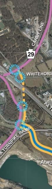


44 Figure 10: Recommended study area multimodal improvements Page 38

45 Figure 11: Route 29 shared use path

46 Figure 11: Route 29 shared use path (continued)

47 The potential for future transit service (either rail or bus rapid transit) on the Devault Phoenixville right of way should not be precluded. The right of way may not be wide enough to support adequate separation of rail and trail uses. Furthermore, past experience indicates that it is unlikely rail service would be reestablished once the corridor is converted to trail use. Therefore, the corridor should be carefully studied to determine the best use for the right of way. If the Green Line concept does not advance due to insufficient projected ridership, costs, or other issues, implementation of the Candy Line as a trail can still improve non motorized transportation in the area. Swedesford Road As shown in Figure 12, a shared use path is proposed on the north side of Swedesford Road from Route 29 to Cedar Hollow Road. Intersection adjustments will be needed at path crossings of Liberty Boulevard, Valley Stream Parkway, and Chesterfield Parkway. The north side path should tie into internal paths within Great Valley Corporate Center. A sidewalk is proposed on the south side of Swedesford Road from Route 29 to Cedar Hollow Road. Crosswalks and pedestrian signals should be added to the traffic signals at Liberty Boulevard/US 202 ramps and at Valley Stream Parkway/Swedesford Square driveway. The signal at Swedesford and Cedar Hollow Roads is already being modified with pedestrian signals. An unsignalized pedestrian crossing with median refuge, active warning devices, and signing is recommended for Swedesford Road at the Shoppes at Great Valley. A reduction in the speed limit to 35 mph is recommended in conjunction with the new crossing. Unsignalized crossing: Valley Stream Parkway at Chester Valley Trail. Crossing is angled so pedestrians face direction of oncoming traffic. Figure 12: Proposed cross section of Swedesford Road Page 41

. Recommendations by intersection are described below. Route 29 and US 30 Currently: No crossings. Recommended: Crossings on the west, north, and south legs.")
48 Signalized Intersection Crossings At present, pedestrian crossings of Route 29 are only provided at Matthews Road (for the Chester Valley Trail), at Liberty Boulevard, and at Great Valley Parkway. Crossings should be provided at all signalized intersections except the Pennsylvania Turnpike ramp signal, where there are no pedestrian destinations. Pedestrian signals and crosswalks are already being constructed at intersections included in PennDOT s widening project of Route 29 north of North Atwater Drive/General Warren Boulevard (SR 0029 section AL2). Recommendations by intersection are described below. Route 29 and US 30 Currently: No crossings. Recommended: Crossings on the west, north, and south legs. The north crosswalk will need special treatment of the high volume yield controlled right turn from westbound US 30 to northbound Route 29. Prohibit pedestrian crossing of the east leg of US 30, which has a high volume conflict with double left turns from Route 29. Route 29 and Wyeth Drive/Hanson Road Currently: Crossing of the Wyeth Drive east leg only. Recommended: Crossings on the north, west, and east legs. Route 29 and Matthews Road/Lindenwood Drive Currently: Crossings of the south leg of Route 29 (Chester Valley Trail) and the east leg. Recommended: Retain crossings on south and east legs. Add crossing of the west leg when a sidewalk is extended north of Matthews Road to Swedesford Road. Improve the Chester Valley Trail crossing at the southeast corner with an island modification in accordance with Smart Transportation design, to improve visibility of pedestrian crossing and slow the right turn movement. Add advance warning signs, high visibility crosswalk signs, and identification signing for the CVT. Additional improvements could include automatic pedestrian detection at the right turn yield and actuation of advance warning flashers for northbound right turn traffic. As a temporary measure until physical improvements are made, install an advance warning sign and upgrade signs and markings at the crossing to promote better driver yielding behavior. Looking north on Route 29 approaching Chester Valley Trail crossing. Boulder, Colorado right turn yield at signalized intersection PennDOT R10 15R sign, 7th and Pine Streets, Philadelphia Page 42

49 Route 29 and Swedesford Road Currently: No crossings. Recommended: Crossings on the north, west, and east legs. Island modification at the northwest corner to improve visibility of the pedestrian crossing and slow the right turn movement. Looking at southbound Route 29 high speed right turn lane to Swedesford Road. An island modification is proposed here. Route 29 and Liberty Boulevard/West Liberty Boulevard Currently: Crossings on the north leg (not ADA compliant) and east leg. Recommended: Crossings on the north, west, and east legs, with curb ramps for ADA compliance. West Liberty Boulevard and Old Morehall Road Currently: Crossings on the north, west, and south legs (not ADA compliant). Recommended: Crossings on the north, west and south legs, with curb ramps for ADA compliance. Change the Old Morehall Road southbound approach from three lanes (left only, through only, and right only) to two lanes (shared left and through, right only) and modify the northwest corner island to create an improved pedestrian crossing. Route 29 and Valley Stream Parkway/hotel driveway Currently: No crossings. Recommended: Crossings on all legs. The southern crossing of Route 29 would walk with the hotel driveway signal phase. Route 29 and Great Valley Parkway Currently: Crossings of north, east, and west legs. Recommended: Crossings on all legs. Route 29 and Flat Road/South Atwater Drive Currently: Not signalized, but will be signalized when development occurs on South Atwater Drive. The signal has been designed and received a PennDOT permit. Recommended: Crossings on all legs. Route 29 and PA Turnpike Ramp/quarry driveway Currently: No crossings. Recommended: No crossings of Route 29. At such time as a sidewalk or pedestrian facility is constructed along Route 29 in this area, crossing of the east and/or west legs would be provided. Route 29 and General Warren Boulevard/North Atwater Drive Currently: No crossings. Recommended: Crossings on all legs. Proposed retail development in General Warren Commons will generate demand for pedestrian crossings of Route 29. Route 29 and Yellow Springs Road As of 2013: Crossings of north and east legs. This intersection is being reconstructed under PennDOT project SR 0029 section AL2, providing crossings of the south, north, and west legs. The east leg may have been excluded because an embankment and a residence on the northeast corner would require right of way for an ADA crossing. Recommended: All legs. The east leg should be crossed because a sidewalk is being constructed along the east side of Route 29 from Yellow Springs Road to Whitehorse Road, and the Route 29 undercrossing of the Turnpike will provide a pedestrian walkway only on the east side of Route 29. The east side of Route 29 will eventually become a walking route between Devault Village development and Atwater. Route 29 and Whitehorse Road Currently: Crossings of all legs (north, south, and east). This intersection will be reconstructed under PennDOT project SR 0029 section AL2. The new intersection will provide crossing of the east leg (Whitehorse Road) only. This is because just to the south, the Route 29 Page 43

50 undercrossing of the Turnpike will provide a pedestrian walkway on the east side of Route 29 only. Recommended: East leg only. Route 29, Phoenixville Pike, and Charlestown Road Currently: This intersection is being reconstructed under PennDOT project SR 0029 section AL2. The new intersection will provide crossings of the north, east, and west legs. The south leg crossing is prohibited. Recommended: In the long term, crossings of all legs. Future pedestrian demand will be created by the Devault Village development and the potential Candy Line trail along the rail right of way to Phoenixville. The south leg crossing can be used to continue west through the rail undercrossing of the Turnpike to the General Warren Commons area and office/industrial uses along Phoenixville Pike. Swedesford Road and Liberty Boulevard Currently: No crossings. Recommended: Crossings of all legs. Swedesford Road and Valley Stream Parkway Currently: No crossings. Recommended: Crossings of all legs. Swedesford Road and Cedar Hollow Road Currently: Construction is underway that will change this intersection from a T intersection to a four way intersection and add pedestrian crossings to the south and west legs. Recommended: Crossings of the south and west legs. Swedesford Road and West Liberty Boulevard Currently: No crossings. Recommended: No crossings. There is no reason to cross here unless pedestrians are walking on Swedesford Road through the US 202 interchange ramps. Instead, establish safer east west routes for pedestrians from neighborhoods to Route 29, e.g. via the Chester Valley Trail or the Lapp Road connector described below. US 30 and Old Lincoln Highway Currently: No crossings. Recommended: Crossings on the north, south, and east legs. These crossings will serve potential new bus stops at the intersection and an eventual sidewalk improvement along US 30 to Route 29. SIGNAL SYSTEM IMPROVEMENTS East Whiteland Township is pursuing a traffic adaptive signal control system on Route 29. Because the side streets are split phased (the east and west legs run separately), the amount of time available to Route 29 and to left turns from Route 29 is restricted. At Valley Stream Parkway, the left turn lane was lengthened to 900 feet to accommodate left turn queues. As development occurs, traffic volumes may increase to the numbers projected in the prior traffic studies and perhaps more. A number of stakeholders have expressed a desire that Route 29 not be widened for more travel lanes. Provision of multimodal travel options and mixed use development can reduce the amount of traffic growth. Traffic control technologies should also be used to move traffic as efficiently as possible. Unsignalized Crossings LIBERTY BOULEVARD AT DESMOND HOTEL AND WAWA Pedestrians have been observed crossing at this location at all times of day. An unsignalized crossing with crosswalk and high visibility pedestrian warning signs is recommended. The wide median provides a refuge area and does not need to be modified. Liberty Boulevard currently does not have a posted speed limit; a speed limit of 35 mph or less should be posted. Pedestrian from Desmond Hotel crossing Liberty Boulevard to Wawa Page 44
51 SWEDESFORD ROAD AT PENN STATE / SHOPPES AT GREAT VALLEY At many times of day traffic volumes are low enough that pedestrians cross this wide road with few traffic conflicts. However, making this crossing during peak periods is problematic. Because traffic volumes and speeds on Swedesford Road are higher than on Liberty Boulevard, more provisions are needed in order to make it safer to cross. The speed limit should be lowered to 35 mph. A pedestrian refuge should be constructed in the existing unused left turn lane, angled so that pedestrians are facing the direction of oncoming traffic. In addition to high visibility crosswalk markings and signing, a flashing device or Rapid Rectangular Flashing Beacon (RRFB) that operates only when activated by a pedestrian should be placed at the crossing. Finally, a sidewalk needs to be installed along Swedesford Road so that pedestrians have easy access to the crossing. FOUNDRY WAY AT CHESTER VALLEY TRAIL The Chester Valley Trail crosses Foundry Way near the driveway to Wegmans. A crosswalk is striped and a bicycle warning sign is posted for inbound traffic, but trail users report that drivers lack awareness of the trail crossing. Improved signing and markings are needed to make it clear that drivers are to yield to people crossing on the CVT. FOUNDRY WAY AT WEGMANS DRIVEWAY/CARNEGIE BOULEVARD This intersection is all way stop controlled. It becomes busy with turning movements to and from the stores. The pedestrian crossing of Foundry Way is wide and inhospitable. Foundry Way is striped with three approach lanes in each direction, although the all way stop allows left turns to be made easily without dedicated left turn lanes. It is recommended that the Foundry Way approaches be reduced to two lanes and a median refuge be constructed for the pedestrian crossing. Cedar Hollow Road Some members of the public have noted that when the CVT Phase 2 is open they intend to use it to commute by bicycle. Cedar Hollow Road connects the CVT with the offices at Swedesford Road, and so an increased demand by bicyclists can be anticipated on Cedar Hollow Road. Cedar Hollow Road is a two lane roadway that has shoulders for most of its length. The segment without shoulders can be improved to provide provisions for bicycles as described below. VICINITY OF MATTHEWS ROAD Figure 13 illustrates a proposed improvement on Cedar Hollow Road to make a connection for bicyclists from the Chester Valley Trail north to where shoulders already exist on Cedar Hollow Road. The CVT crosses Cedar Hollow Road approximately 450 feet south of Matthews Road. About halfway between Matthews Road and the CVT is a bridge over Little Valley Creek. The shoulder on Cedar Hollow Road disappears in the vicinity of Matthews Road and the bridge in order to stripe three travel lanes. There is a five foot wide sidewalk on the east side of the Cedar Hollow Road bridge over Little Valley Creek. The bridge is approximately 40 feet wide including the sidewalk and is currently striped with two southbound lanes and one northbound lane. The second southbound lane is dropped as a left turn lane at the Vanguard Boulevard signal 800 feet south of the bridge. Continuous shoulders should be provided on Cedar Hollow Road from the CVT north. The CVT Phase 2 Project is constructing a trail crossing that includes a median refuge island and speed warning flashers. Shoulders exist on Cedar Hollow Road at the trail, but the bridge over Little Valley Creek will be striped with one southbound lane, two northbound lanes, and no shoulders. The second northbound lane is dropped as a left turn lane for Matthews Road. The recommendations include: Restripe the bridge over Little Valley Creek with one lane in each direction plus five footwide shoulders. At the intersection of Matthews Road and Cedar Hollow Road, widen the east side of Cedar Hollow Road between the park driveway and the existing shoulder to provide a continuous shoulder. Widen the west side of Cedar Hollow Road north of Matthews Road to shift the existing southbound right turn lane to the right of a new bicycle lane through the intersection. Construct a sidewalk from Cedar Hollow Park to the existing sidewalk at the bridge over Little Valley Creek. Extend the sidewalk south to the CVT to create a continuous sidewalk Page 45

52 from the park to the CVT. The new sidewalk would be outside the existing paved road. This project would fill the gap on Cedar Hollow Road between the CVT and the area with existing shoulders so that pedestrians and bicyclists from the CVT can travel north to Cedar Hollow Park and to the Great Valley Corporate Center at Swedesford Road. Figure 13: Cedar Hollow Road at Chester Valley Trail Page 46
53 Sidewalks and Paths The need for sidewalks is based on proximity to retail and commercial destinations and bus stops. People are most likely to walk to destinations within one half mile. In general, sidewalks should eventually be installed along most streets in the commercial area. The volume and speed of traffic should be considered when prioritizing sidewalk links. At the time a commercial property is redeveloped, a sidewalk needs to be installed along the street frontage. Incentives could be considered to encourage property owners/developers to extend new sidewalks to connect to existing sidewalks. CONNECTING SIDEWALK LINKS Sidewalks should be provided to connect building entrances with the nearest pedestrian facility and also with the nearest bus stops for both arriving and departing trips. The location of walkways will be specific to each building. Most buildings have several entrances. The details of topography can affect where and how pedestrian connections are best located. Therefore, specific connections for all individual buildings are not included in this report. Determining where these connections should go will require a site walk and meetings with the facilities manager who will be able to provide a site plan and information on site conditions that would affect the location of a new path. Connecting links to building entrances should be built by property owners over time, particularly as sidewalks are added on roadways that enable people in those buildings to walk to more destinations. Examples of locations where sidewalk links are recommended for existing observed pedestrian demand follow. Lindenwood Drive Valleybrooke Corporate Center employees walk to Wawa and Wegmans despite lack of sidewalks on Lindenwood Drive. A sidewalk should be installed for 200 feet from Route 29 in the conflict area where traffic stacks in two lanes at the signal. Completion of sidewalk links to the offices beyond that 200 foot zone could be done at the time of a redevelopment or by the property owner at their discretion. Desmond Hotel There is a strong demand for walking between the Desmond Hotel and the Wawa on the opposite side of Liberty Boulevard. A sidewalk should be constructed from the hotel entrance to Liberty Boulevard along the west side of the main driveway. In addition, a sidewalk should be added along Liberty Boulevard from the hotel driveway to the existing bus stop and shelter just east of the driveway Morehall Road Two office buildings are located on the west side of Route 29 near the Chester Valley Trail, but separated from the trail by a creek. The flood plain of Little Valley Creek separates the offices from Route 29. The only crossing is a bridge over the creek at Hanson Road, which leads to Route 29 opposite Wyeth Drive at the traffic signal. A sidewalk should be provided on the north (entrance) side of Hanson Road and a path to the buildings should be developed through the large parking lot. The sidewalk on Hanson Road should be continued north on Route 29 to the bus stop located approximately 175 feet north of the intersection. A connection from these offices to the CVT is also possible, as described later. Wegmans area The SEPTA bus stop on Route 29 is located approximately halfway between Wyeth Drive and Matthews Road because of roadway and intersection constraints. Bus patrons can walk to the existing shared use path on the east side of Route 29, but there is no direct connection from the path to the retail stores. A new link should traverse the slope between the path and the Wegmans parking lot to connect to the stores. NEW PEDESTRIAN/BICYCLE CONNECTIONS Lapp Road west of the office center is a 20 foot wide residential road that ends at Wilburdale Road. It appears that Lapp Road formerly continued east but was removed and the entry barricaded. Within the office center, the other end of this road section can be seen. Because the route is already graded, it would be relatively simple to construct a paved path for pedestrians and bicyclists only not for motor vehicles. This path would provide a connection to work for some residents. Also, in conjunction with an extension of Lapp Road east to Route 29, it would provide residents with a pedestrian/bicycle route to Valley Creek Park. Page 47


54 Lapp Road connection in Corporate Center Lapp Road connection at Wilburdale Road IMPROVEMENT TO EXISTING PATHS IN OFFICE CENTER The internal trails in the office center are appropriate for recreation and for pedestrian connections between nearby buildings. They are less well suited to joint use by pedestrians and cyclists. In particular, two areas of internal trails could be upgraded to provide a transportation route serving more than just the adjacent buildings. 1. The trail located between and roughly parallel to Liberty Boulevard and Valley Stream Parkway that runs behind the buildings currently functions as a recreational path with benches spaced at intervals. The path is connected to the individual buildings, often through the parking lots. While it can be used to walk to other buildings along the trail, it was not built to be a transportation link outside the immediate area. The trail ends at the rear of the Desmond Hotel and the only connection to a street is at the driveway to 55 Valley Stream Parkway. Parts of the trail are used as a route by cyclists to get to the office buildings; in particular employees at Siemens cited this trail as a shortcut to get from Route 29 to the Siemens offices. However the trail is sharply curved and relatively narrow at five to six feet in width. 2. A trail through the 1001 Cedar Hollow Road property runs parallel to the road, branching off the north side of the road before it curves north toward Swedesford Road and connecting to Swedesford Road at the southeast corner of the signalized intersection of Swedesford and Cedar Hollow Road. This path can be an attractive bicycle connection to Swedesford Road because it avoids the multi lane portion of Cedar Hollow Road with multiple office driveways and heavier peak hour traffic. The trail entry at both ends needs to be reconstructed with a flatter grade and the trail should be widened to at least eight feet. Existing steep path from Siemens down to private ball field, from which it is an easy walk to Valley Creek Park Page 48
.")


55 Internal paths in Great Valley Corporate Center can be widened to function as shared use paths Local residents also use Corporate Center internal paths for recreation Corridor Wide Bicycle Network A bicycle network for Great Valley will result from the combination of recommendations in this study and facilities recommended in prior or other ongoing studies (e.g. Patriots Path, Candy Line, Paoli CVT Connector). The network will be a combination of offstreet and on street facilities to serve a variety of users. An overview of the proposed bicycle network is shown in Figure 14. The Patriots Path Valley Creek segment in East Whiteland Township is approximately 1.25 miles west of the Cedar Hollow segment in Tredyffrin Township. The Valley Creek segment ends at Valley Creek Park and the Cedar Hollow segment ends at the intersection of St. Johns Road and Church Road. A 12 foot wide paved trail was proposed in the Patriots Path Plan to connect the northern ends of both segments. The path would cross Church Road and enter the Atwater site, travel south around the quarry lake and turn south to follow the Atwater property line next to the Saint Peter s Church property. The trail would proceed south and west through the Atwater property east of Great Valley Corporate Center to connect to a trail into Valley Creek Park. Trammell Crow, owner of the Atwater site, would determine the exact routing of the path in conjunction with a development plan for the property south of the quarry lake. A paved path should also continue west along the south side of the quarry to connect to Route 29 and the intersection of Flat Road and South Atwater Drive. Stairs from rear parking lot of 1 Country View Road down to Valley Creek Park Page 49


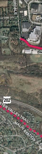


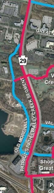


56 Figure 14: Bicycle network Page 50


57 CONNECTIONS TO THE CHESTER VALLEY TRAIL Morehall Road offices currently have a connection to the CVT via a stairway to the Down East trail head. Making this connection suitable for bicyclists would enable better use of the trail for recreation or commuting by employees at Morehall Road. The CVT is not, however, the shortest route for trips from this office to the retail complex along Matthews Road. Hanson Road is shorter than any potential route using the CVT for those trips. 6. Access to the CVT is possible from the rear parking lot of 100 Lindenwood Drive. This is signed as not an entrance because the parking lot is for offices, not for the trail. Chester Valley Trail west of Route 29 Some neighborhoods are located adjacent to the CVT, yet for residents to use it they sometimes need to drive to a trail head. The following are suggested neighborhood connections to the CVT. These might be shown on trail maps as trail connections with no parking or might not be publicized at all. Because these are proposed for the benefit of neighborhoods, the residents of each neighborhood should be consulted to determine whether they desire a connection and where it should be located. Potential connections are shown in Figure 15 and described below. 1. A connection to the CVT from some point on Hillside Drive in the Old Swedesford Road neighborhood to allow these residents to get to the CVT and the retail complex without using Swedesford Road through the US 202 interchange. This would be signed no outlet. 2. A connection to the CVT from the Chester Valley Knoll neighborhood at some point along Deer Run Lane or Doe Lane, possibly opposite Fawn Circle. 3. A bicycle/pedestrian only connection between Beth Circle and Beth Lane to make the existing CVT Winding Way trail head accessible to more residents of the Down East neighborhood. 4. Bicycle directional signing on Swedesford Road at Malin Station Road/Elbow Lane to the existing trail heads off Malin Station Road and Winding Way. This provides an alternative for cyclists (or pedestrians) to get to/from Route 29 via the CVT without traveling on Swedesford Road through the US 202 interchange. Chester Valley Trail connection at rear of 100 Lindenwood Drive. 7. A connection to the CVT from the parking lot at 300 Lindenwood Drive would serve transportation and recreational purposes for people working in Valleybrooke Corporate Center. In addition, a connection here could double as the connection to the CVT for the Hillside Drive neighborhood (mentioned earlier) if a bicycle/pedestrian only connection were established from Hillside Drive to Lindenwood Drive. Page 51


58 Looking down embankment from 300 Lindenwood Drive parking lot. The Down East trail head is on the opposite side of the Chester Valley Trail. 8. (not shown) The main complex of Vanguard at Matthews Road and Cedar Hollow Road is located immediately on the Chester Valley Trail but has no direct connections to it. The property is secure and gated. There are no sidewalks along the vehicle driveway that crosses the CVT. An understandable security concern is that connections that enable Vanguard employees to get to the trail would potentially allow any trail user to enter the site. However, Vanguard employees have expressed a desire to use the CVT. It is recommended that consideration be given to establishing convenient pedestrian and bicycle connections to the CVT that direct everyone past a security point. Security signing would be placed at the CVT ends of the connections. Other measures, such as automatic detection, could also be utilized for security. Figure 15: Potential new connections to the Chester Valley Trail Page 52

59 New Roadway Links The current road network concentrates traffic on Route 29. At the outset of the study, one of the potential strategies for accommodating future traffic growth was to look for new additions to the street network that could improve connectivity and provide alternative routes. After examining the constraints of streams, steep slopes, quarries, parks, and residential areas, it appears that a major new addition to the north south street network will not be feasible. However some new road links are recommended. Note that this study does not provide analysis of future traffic conditions, either with or without potential new roadway links. Furthermore, this study does not recommend any changes to time of day and truck restrictions in the vicinity of Flat Road. LAPP ROAD Lapp Road should be extended from Old Morehall Road to Route 29 opposite the driveway to Valley Creek Park. This will provide a second access to the Great Valley Corporate Center, which is planned for significant growth. In addition, the new traffic signal on Route 29 will allow employees of the Corporate Center, as well as users of the pedestrian and bicycle path, to cross Route 29 to access Valley Creek Park. FLAT ROAD TO LEE BOULEVARD CONNECTOR A new road link is recommended between Flat Road and Lee Boulevard. This will provide an alternate route between Great Valley Corporate Center and the west on Phoenixville Pike. Right of way will need to be acquired to establish the new roadway. A specific location for this connector is not determined. FLAT ROAD TO GREAT VALLEY PARKWAY CONNECTOR Significant redevelopment is proposed for the Great Valley Parkway area. If existing office buildings are removed for redevelopment, the opportunity exists to create a new roadway connector from Great Valley Parkway to Flat Road. This would provide an alternative access to Route 29 at the future Flat Road signal. WARNER LANE Norfolk Southern tracks cross Warner Lane less than 100 feet from Phoenixville Pike. In the 1980s the crossing was upgraded and crossing protection installed. Warner Lane traffic is stopped 150 feet from Phoenixville Pike with a second set of signals so that traffic does not stop on the tracks. The track is now inactive and the crossing of Route 29 has been removed. The Warner Lane crossing impacts congestion because it requires extra start up time and extra signal clearance time every cycle, and school buses legally must stop at the tracks even when the light is green. Charlestown Township has applied to Norfolk Southern to suspend the crossing of Warner Lane so that buses are not required to stop at the tracks. Charlestown does not have funds to remove the tracks, second signal, and railroad flasher, and is proposing using signs to minimize cost. While this is helpful, revision of the traffic signal would optimize traffic operations. Railroad crossing on Warner Lane Page 53
60 Summary of Recommendations The locally preferred improvement recommendations described in this study are listed in Table 6 and illustrated in Figures The travel mode(s) that benefit are indicated with icons representing pedestrians, bicyclists, transit (bus) riders, and motor vehicle drivers. Table 6: Summary of recommended improvements ROUTE 29 SHARED USE PATH Alignment shown in Figure 11 on pages 39 and 40. Initial priority section is Patriots Path from US 30 to Valley Creek Park. Path at northern end of study area is on inactive Norfolk Southern Railroad right of way to Phoenixville ( Candy Line or Green Line ). NOTE: Bicycles have the option of travelling on the shared use path (two way) or on the roadway shoulder (in the direction of traffic) Incorporate into The Circuit trail network. ROUTE 29 SIDEWALKS From US 30 to Valley Stream Parkway on side without shared use path. From Atwater to Phoenixville Pike, east side of Route 29. EAST SWEDESFORD ROAD SHARED USE PATH North side from Route 29 to Cedar Hollow Road. Construct driveway adjustments and side street adjustments for safe path crossings. EAST SWEDESFORD ROAD SIDEWALKS South side from Route 29 to Cedar Hollow Road. OTHER SIDEWALK CONNECTIONS Sidewalks should eventually be installed on most streets in the commercial area. Connections recommended due to observed demand and/or public comment: Desmond Hotel front door to corner of Liberty Boulevard (crossing to Wawa) and to Desmond bus stop Wegmans area add missing link of sidewalk on Wyeth Drive between Route 29 and Holiday Inn Express driveway; add a sidewalk along hotel driveway; add direct connection from shared use path along Route 29 (between Wyeth and Matthews) to Wegmans Hanson Road north side to Route 29 (or parallel pedestrian bridge) Great Valley Parkway (west) between Route 29 and Great Valley Parkway loop Lindenwood Drive south side for 200 feet from Route 29 (traffic stacking area at signal) West Liberty/Liberty Boulevard from Old Morehall Road to Desmond Hotel US 30 from Route 29 to Old Lincoln Highway, with improved lighting under the railroad bridge and pedestrian crosswalks and signals at US 30/Old Lincoln Highway Systematically connect buildings to the nearest bus stops with paved walkways, starting with the busiest stops Page 54
61 Table 6: Summary of recommended improvements (continued) BUS STOPS New stops should be located and designed in accordance with the 2012 SEPTA Bus Stop Design Guidelines. Stops where boardings normally occur should include a shelter and bench. New stop(s) on Chesterfield Parkway. Such new stops are dependent on a rerouting of SEPTA Route 205, which will require review and approval by SEPTA. New stops on US 30 at Old Lincoln Highway. New stops here are dependent upon adding provisions for pedestrian crossing at the signal. Potential new stops on Route 29 at Wawa/Lindenwood Drive. New stops in Uptown Worthington when developed. Paved landings, shelters, benches at existing bus stops. The highest boarding stops should get priority for shelters. Shelters would need to be installed and maintained by a municipality, developer, or third party advertising company in conjunction with the SEPTA determined bus stop location. Suggested priority shelter locations: Great Valley Parkway and Morehall Road at driveway to Building 9 Great Valley Parkway and Technology Drive Great Valley Parkway General Warren Boulevard at Otis Drive Swedesford Road at Trinity Corporate Center Uptown Worthington OTHER SHARED USE PATHS Lapp Road extension east of Old Morehall Road to Route 29. Neighborhood path connector from residential West Lapp Road to Lapp Road in Corporate Center (provides neighborhood connection through Corporate Center roads to Valley Creek Park via proposed Lapp Road extension to Route 29). Along Industrial Boulevard from Cedar Hollow Road and continuing west along the south side of Norfolk Southern to US 30 at Old Lincoln Highway. Along Industrial Boulevard from Cedar Hollow Road, then bridging over Norfolk Southern and continuing north and west to Uptown Worthington. IMPROVED INTERNAL PATHS IN GREAT VALLEY CORPORATE CENTER Between Liberty Boulevard at Desmond and Valley Stream Parkway at Siemens. Between Cedar Hollow Road at the south side of the 1001 Cedar Hollow Road property and the intersection of Cedar Hollow Road and Swedesford Road. Page 55
62 Table 6: Summary of recommended improvements (continued) SIGNALIZED INTERSECTION PEDESTRIAN CROSSINGS At least one crosswalk for crossing Route 29 at all signals except the Pennsylvania Turnpike ramp and Whitehorse Road. A detailed list is provided on pages 42 through 44. The first priorities for new crossings are the signals at Wyeth Drive and Swedesford Road. Island modification at the Chester Valley Trail signalized crossing of Route 29 at Matthews Road to improve safety at the northbound right turn lane. In the short term, improve signs and markings to promote better driver yielding behavior. Develop an official trail name sign for Chester Valley Trail to be used at all street crossings of the CVT to raise driver awareness of this regionally significant trail. UNSIGNALIZED INTERSECTION PEDESTRIAN CROSSINGS Liberty Boulevard at Desmond/Wawa: In conjunction with crossing design, post a speed limit of 35 mph or less. Swedesford Road at the Shoppes at Great Valley/Penn State: Because Swedesford Road is a state roadway, this crossing depends on a reduction in speed limit to 35 mph or less and is subject to PennDOT approval. Additional studies are needed. Foundry Way at Carnegie Drive (Wegmans): Eliminate left turn lanes on Foundry Way at all way stop intersection to construct pedestrian refuge islands. Foundry Way at Chester Valley Trail: Improve signing at existing trail crossing. CHESTER VALLEY TRAIL CONNECTIONS New neighborhood connections to the CVT will depend on the desire of the residents of each particular neighborhood. Possible connections include: From the Chester Valley Knoll neighborhood at some point along Deer Run Lane or Doe Lane, possibly opposite Fawn Circle. Bicycle/pedestrian only connection between Beth Circle and Beth Lane Bicycle directional signing on Swedesford Road at Malin Station Road/Elbow Lane to the existing Malin Station and Down East trail heads Morehall Road offices via Down East Trailhead Rear parking lot of 100 Lindenwood Drive. Parking lot at 300 Lindenwood Drive. This connection for the office center can double as a connection to the CVT from the Hillside Drive neighborhood by establishing a bicycle/pedestrian only connection from Hillside Drive to Lindenwood Drive. PEDESTRIAN/BICYCLE CONNECTION ACROSS NORFOLK SOUTHERN RAILROAD (STUDY) Determine feasibility of alternative grade separated crossings described on page 34 and illustrated in Figure 9 on page 35, and select preferred crossing(s). Page 56
63 Table 6: Summary of recommended improvements (continued) OTHER IMPROVEMENTS Cedar Hollow Road at Matthews Road: Minor construction and restriping from Chester Valley Trail across Little Valley Creek Bridge to north of Matthews Road in order to provide continuous shoulders for bicycle travel from CVT north. Construct a sidewalk from CVT to Cedar Hollow Park. Shown on pages Old Morehall Road: Construct a sidewalk on the east side with a separate pedestrian bridge over Valley Creek. Bicyclists would share the travel lanes. Reconstruct the roadway at the existing curve to correct vertical and horizontal sight distance, improving safety. Stripe bicycle lanes on Liberty Boulevard and on Valley Stream Parkway. Provide bicycle racks at retail and office locations. ROAD CONNECTIONS/TRAFFIC IMPROVEMENTS Chesterfield Parkway extension to Swedesford Road at Cedar Hollow Road (in progress). Lapp Road extension from Old Morehall Road to a new signal at Route 29. New road connecting Great Valley Parkway to Flat Road (location to be determined). New road from Flat Road to Lee Boulevard/Spring Mill Road to connect to Phoenixville Pike (location to be determined). Trinity Corporate Center exit to Swedesford Road: Developer should seek an easement to existing Swedesford Square driveway to allow Trinity Corporate Center traffic to exit at the Valley Stream Parkway signal to turn left onto Swedesford Road. Warner Lane/Phoenixville Pike signal revision after railroad crossing is suspended. OPTIONS TO ENHANCE TRANSIT SERVICE BETWEEN PAOLI STATION AND GREAT VALLEY (STUDY) Bus priority signals for shorter travel time Enhanced vehicles with improved comfort and technology for riders Cooperative shuttle service BEST USE OF NORFOLK SOUTHERN DEVAULT PHOENIXVILLE LINE RIGHT OF WAY (STUDY) Transit and trail alternatives Page 57


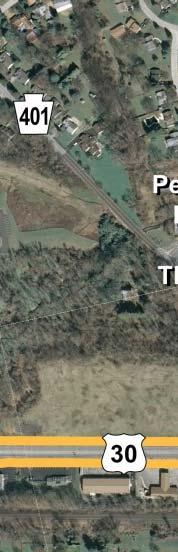
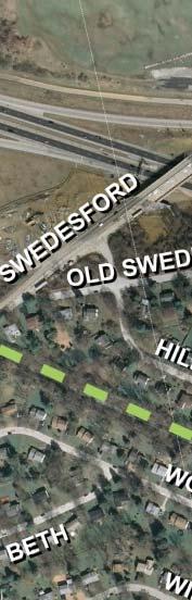
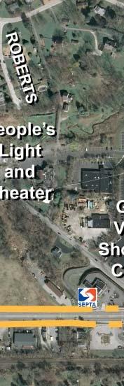

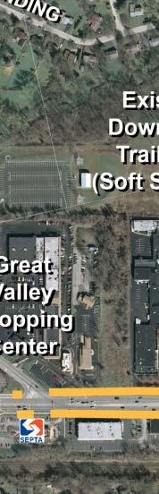
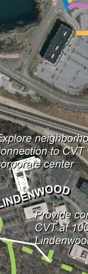


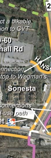
64 Figure 16: Recommended improvements US 202 to US 30 west of Route 29 Page 58


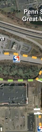


65 Figure 17: Recommended improvements US 202 to US 30 east of Route 29 Notes: New bus stops in Uptown Worthington to be evaluated by SEPTA based on future development activity, collaboration with the developer and fiscal and operating benefits and constraints. New bus stops on US 30 at Old Lincoln Highway are contingen on adding provisions for pedestrian crossing at the traffic signal. Page 59


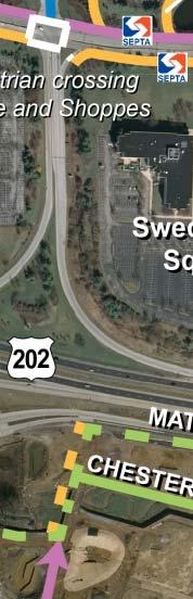
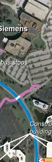

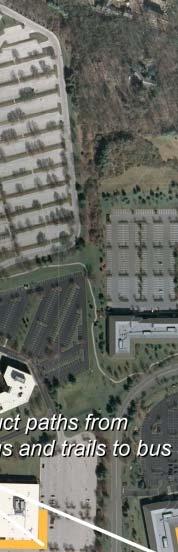


66 Figure 18: Recommended improvements Swedesford Road area Note: New bus stops on Chesterfield Parkway are dependent on a rerouting of SEPTA Route 205, which will need additional vetting before approved. Page 60


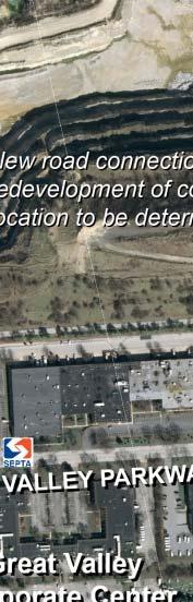


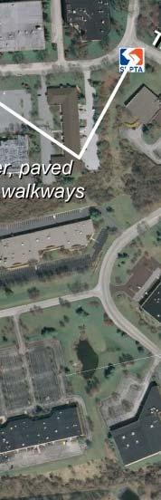


67 Figure 19: Recommended improvements Great Valley Parkway area Page 61
Executive Summary Route 30 Corridor Master Plan
 Route Corridor Master Plan Project Overview The Route Corridor Master Plan is a coordinated multimodal transportation and land use plan for the entire stretch of Route through East Whiteland Township,
Paoli Road Improvement Feasibility Study
 Paoli Road Improvement Feasibility Study & Public Participation Project March 24, 2015 Prepared for: Tredyffrin Township Prepared by: McMahon Associates, Inc. with Town Planning Partnership, LLC Glackin
Proposed. City of Grand Junction Complete Streets Policy. Exhibit 10
 Proposed City of Grand Junction Complete Streets Policy Exhibit 10 1 City of Grand Junction Complete Streets Policy Vision: The Complete Streets Vision is to develop a safe, efficient, and reliable travel
ACTIVE TRANSPORTATION
 ACTIVE TRANSPORTATION Mobility 2040 Supported Goals Improve the availability of transportation options for people and goods. Support travel efficiency measures and system enhancements targeted at congestion
ACTIVE TRANSPORTATION/NONMOTORIZED TRANSPORTATION
 ACTIVE TRANSPORTATION/NONMOTORIZED TRANSPORTATION BACKGROUND Active transportation, also known as nonmotorized transportation, is increasingly recognized as an important consideration when planning and
CITY OF COCOA BEACH 2025 COMPREHENSIVE PLAN. Section VIII Mobility Element Goals, Objectives, and Policies
 CITY OF COCOA BEACH 2025 COMPREHENSIVE PLAN Section VIII Mobility Element Goals, Objectives, and Policies Adopted August 6, 2015 by Ordinance No. 1591 VIII MOBILITY ELEMENT Table of Contents Page Number
Corpus Christi Metropolitan Transportation Plan Fiscal Year Introduction:
 Introduction: The Safe, Accountable, Flexible, Efficient Transportation Equity Act: A Legacy for Users (SAFETEA-LU) has continued the efforts started through the Intermodal Surface Transportation Efficiency
Solana Beach Comprehensive Active Transportation Strategy (CATS)
") Solana Beach Comprehensive Active Transportation Strategy (CATS) 3.0 Goals & Policies The Solana Beach CATS goals and objectives outlined below were largely drawn from the Solana Beach Circulation Element
Solana Beach Comprehensive Active Transportation Strategy (CATS) 3.0 Goals & Policies The Solana Beach CATS goals and objectives outlined below were largely drawn from the Solana Beach Circulation Element
Perryville TOD and Greenway Plan
 Perryville TOD and Greenway Plan Greenway Glossary Pathway: A bicycle and pedestrian path separated from motorized vehicular traffic by an open space, barrier or curb. Multi-use paths may be within the
Living Streets Policy
 Living Streets Policy Introduction Living streets balance the needs of motorists, bicyclists, pedestrians and transit riders in ways that promote safety and convenience, enhance community identity, create
CITY OF BLOOMINGTON COMPLETE STREETS POLICY
 CITY OF BLOOMINGTON COMPLETE STREETS POLICY POLICY OBJECTIVE: The City of Bloomington will enhance safety, mobility, accessibility and convenience for transportation network users of all ages and abilities,
About the Wilmington Downtown Circulation Study
 About the Wilmington Downtown Circulation Study Part of the Wilmington i Initiatives partnership Wilmington Area Planning Council City of Wilmington Delaware Department of Transportation Delaware Transit
5. RUNNINGWAY GUIDELINES
 5. RUNNINGWAY GUIDELINES These guidelines should be considered collectively when making runningway decisions. A runningway is the linear component of the transit system that forms the right-of-way reserved
Chapter 5 Future Transportation
 Chapter 5 Future Transportation The Future Land Use Plan identifies the desired land use designations. The land uses desired for Crozet depend, in large part, on the success of the transportation system,
Transportation Master Plan Advisory Task Force
 Transportation Master Plan Advisory Task Force Network Alternatives & Phasing Strategy February 2016 BACKGROUND Table of Contents BACKGROUND Purpose & Introduction 2 Linking the TMP to Key Council Approved
MARKET/JFK VISION ZERO PILOT PROJECT FEBRUARY 2019 EVALUATION REPORT
 MARKET/JFK VISION ZERO PILOT PROJECT FEBRUARY 2019 EVALUATION REPORT WHY IS THIS PROJECT IMPORTANT? Market Street and JFK Boulevard in Center City are key east-west corridors in the core business district.
1.0 EXECUTIVE SUMMARY
 1.0 EXECUTIVE SUMMARY The Active Transportation Plan is a guide to accomplish the Town s vision for developing a network of sidewalks, on-road bicycle facilities, and trails that allow for safe and convenient
Chapter 7. Transportation. Transportation Road Network Plan Transit Cyclists Pedestrians Multi-Use and Equestrian Trails
 Chapter 7 Transportation Transportation Road Network Plan Transit Cyclists Pedestrians Multi-Use and Equestrian Trails 7.1 TRANSPORTATION BACKGROUND The District of Maple Ridge faces a number of unique
EXECUTIVE SUMMARY. Vision
 Vision Walking and bicycling in Salt Lake City will be safe, convenient, comfortable, and viable transportation options that connect people to places, foster recreational and economic development opportunities,
Basalt Creek Transportation Refinement Plan Recommendations
 Basalt Creek Transportation Refinement Plan Recommendations Introduction The Basalt Creek transportation planning effort analyzed future transportation conditions and evaluated alternative strategies for
TRAFFIC IMPACT ANALYSIS
 TRAFFIC IMPACT ANALYSIS FOR THE CHAMPAIGN UNIT#4 SCHOOL DISTRICT PROPOSED HIGH SCHOOL (SPALDING PARK SITE) IN THE CITY OF CHAMPAIGN Final Report Champaign Urbana Urbanized Area Transportation Study 6/24/2014
Brian D. Hare, P.E. Bureau of Design PennDOT PA APA Annual Conference Investing in a Sustainable Future October 5, 2009
 Brian D. Hare, P.E. Bureau of Design PennDOT 2009 PA APA Annual Conference Investing in a Sustainable Future October 5, 2009 1 What is Smart Transportation? Photographer: heyjude. Used through license
TOWN OF PORTLAND, CONNECTICUT COMPLETE STREETS POLICY
 TOWN OF PORTLAND, CONNECTICUT COMPLETE STREETS POLICY I. VISION, GOALS & PRINCIPLES VISION To improve the streets of Portland making them safer and more accessible for all users including pedestrians,
Chapter 2. Bellingham Bicycle Master Plan Chapter 2: Policies and Actions
 Chapter 2 Bellingham Bicycle Master Plan Chapter 2: Policies and Actions Chapter 2: Policies and Actions The Bicycle Master Plan provides a road map for making bicycling in Bellingham a viable transportation
Clackamas County Comprehensive Plan
 ROADWAYS The County s road system permits the movement of goods and people between communities and regions, using any of a variety of modes of travel. Roads provide access to virtually all property. They
CONNECTING PEOPLE TO PLACES
 CONNECTING PEOPLE TO PLACES 82 EAST BENCH MASTER PLAN 07 Introduction The East Bench transportation system is a collection of slow moving, treelined residential streets and major arteries that are the
Non-Motorized Transportation 7-1
 Non-Motorized Transportation 7-1 Transportation facilities no longer mean just accommodating a vehicle powered by a combustion engine. Pedestrian and non-motorized facilities are important modes of travel
Exhibit 1 PLANNING COMMISSION AGENDA ITEM
 Exhibit 1 PLANNING COMMISSION AGENDA ITEM Project Name: Grand Junction Circulation Plan Grand Junction Complete Streets Policy Applicant: City of Grand Junction Representative: David Thornton Address:
Goal 3: Foster an environment of partnerships and collaboration to connect our communities and regions to one another.
 Non-Motorized Transportation Plan (NMTP) Draft Vision, Goal and,, Tri-County Regional Planning Commission (TCRPC) Purpose The purpose of the Tri-County Regional Planning Commission (TCRPC) Non-Motorized
Circulation in Elk Grove includes: Motor vehicles, including cars and trucks
 Circulation, as it is used in this General Plan, refers to the many ways people and goods move from place to place in Elk Grove and the region. Circulation in Elk Grove includes: Motor vehicles, including
Madison Urban Area and Dane County. Bicycle Transportation Plan Summary. September Introduction. Bicycle Plan Scope and Planning Process
 Bicycle Transportation Plan Summary Madison Urban Area and Dane County Introduction September 2000 Bicycling is an important mode of transportation in the Madison urban area and countywide that is available
Develop a Multi-Modal Transportation Strategy (Theme 6)
") DEVELOP A MULTI-MODAL TRANSPORTATION STRATEGY (THEME 6) WHY IS THIS THEME ADDRESSED? Develop a Multi-Modal Transportation Strategy (Theme 6) Statement of Ideal Reduce resident and visitor reliance on single
DEVELOP A MULTI-MODAL TRANSPORTATION STRATEGY (THEME 6) WHY IS THIS THEME ADDRESSED? Develop a Multi-Modal Transportation Strategy (Theme 6) Statement of Ideal Reduce resident and visitor reliance on single
Chapter 9: Pedestrians and Bicyclists
 Chapter 9: Pedestrians and Bicyclists Walking and bicycling are essential modes of transportation. These modes allow people to travel without contributing to congestion and air pollution, to access other
TRANSPORTATION TRAINING TOPICS. April 6, 2010
 TRANSPORTATION TRAINING TOPICS April 6, 2010 Roles of Transportation Providers Context and Policy Makers Division of Transportation and Traffic Other City Operations Other Transportation Operators CMA
APPENDIX A: Complete Streets Checklist DRAFT NOVEMBER 2016
 APPENDIX A: Complete Streets Checklist DRAFT NOVEMBER 2016 Complete Streets Checklist MetroPlan Orlando s Complete Streets Checklist is an internal planning tool for staff to further implementation of
City of Gainesville Transportation/Roadway Needs PROJECT SUMMARY
 A1 Roadway Resurfacing $23,846,000 TYPE: Preservation of existing system Roadway resurfacing A2 Signal Replacement $6,000,000 TYPE: Preservation of existing system Replace traffic signals. B1 W 6th St
Complete Streets Process and Case Study: Taft / McMillian Two-Way Street Conversion Cincinnati, Ohio. Traffic Engineering Workshop June 4, 2014
 Complete Streets Process and Case Study: Taft / McMillian Two-Way Street Conversion Cincinnati, Ohio Traffic Engineering Workshop June 4, 2014 Complete Streets Streets that enable safe access for users
NJDOT Complete Streets Checklist
 Background The New Jersey Department of Transportation s Complete Streets Policy promotes a comprehensive, integrated, connected multi-modal network by providing connections to bicycling and walking trip
Route 7 Corridor Study
 Route 7 Corridor Study Executive Summary Study Area The following report analyzes a segment of the Virginia State Route 7 corridor. The corridor study area, spanning over 5 miles in length, is a multi
Planning Guidance in the 2012 AASHTO Bike Guide
 Planning Guidance in the 2012 AASHTO Bike Guide Presentation by: RJ Eldridge Peter Lagerwey August 22, 2012 WEBINAR 2: PLANNING GUIDANCE IN THE 2012 AASHTO BIKE GUIDE Today s Webinar Significant Updates
Regional Transportation Needs Within Southeastern Wisconsin
 Regional Transportation Needs Within Southeastern Wisconsin #118274 May 24, 2006 1 Introduction The Southeastern Wisconsin Regional Planning Commission (SEWRPC) is the official areawide planning agency
Los Altos Hills Town Council - June 18, 2015 Palo Alto City Council June 22, AGENDA ITEM #2.B Presentation
 Los Altos Hills Town Council - June 18, 2015 Palo Alto City Council June 22, 2015 AGENDA ITEM #2.B Presentation Previous Presentations Los Altos Hills Town Council in May 2014 and February 2015 Palo Alto
Bicycle and Pedestrian Facilities Toolbox (Excerpt from Figure 3.1)
") Appendix B Neighborhood Connections Summaries This Appendix is a supplement to the information presented in Chapter 3 Connect People. The Appendix includes a summary or profile for each of the proposed
Appendix B Neighborhood Connections Summaries This Appendix is a supplement to the information presented in Chapter 3 Connect People. The Appendix includes a summary or profile for each of the proposed
Highway 49, Highway 351 and Highway 91 Improvements Feasibility Study Craighead County
 Highway 49, Highway 351 and Highway 91 Improvements Feasibility Study Craighead County Executive Summary March 2015 Highway 49, Highway 351 and Highway 91 Improvements Feasibility Study Craighead County
Exit 13/Golden Triangle Study FREQUENTLY ASKED QUESTIONS
 FREQUENTLY ASKED QUESTIONS How will you improve traffic in the Golden Triangle? One main goal of this study is to examine the current traffic patterns of the area and propose ways to improve the traffic.
NM-POLICY 1: Improve service levels, participation, and options for non-motorized transportation modes throughout the County.
 Transportation PRINCE WILLIAM COUNTY 2008 COMPREHENSIVE PLAN NON-MOTORIZED PLAN CONTENTS Goals, Policies, and Action Strategies Table 4 (Bike Facility Classifications and Descriptions) Table 5 (Bike Facility
Active Transportation Infrastructure Investment A Business Case
 Active Transportation Infrastructure Investment A Business Case In 2016, the Real Estate Foundation awarded the Capital Regional District a $50,000 grant for Shifting Gears: Land Use Change through Active
City of Novi Non-Motorized Master Plan 2011 Executive Summary
 City of Novi Non-Motorized Master Plan 2011 Executive Summary Prepared by: February 28, 2011 Why Plan? Encouraging healthy, active lifestyles through pathway and sidewalk connectivity has been a focus
Multimodal Through Corridors and Placemaking Corridors
 68 Multimodal Through Corridors and Placemaking Corridors Corridors have different functions in a region. Some corridors are used to get smoothly and rapidly through a region or to get quickly to major
2.0 Existing Conditions
 20 2.0 Existing Conditions 2.1 Land Use, Future Growth Patterns, Physical Barriers Geographic Overview Sutter County s land use pattern is characterized by extensive agricultural areas, significant natural
Transportation 6. A. Transit Center Circulation and Access. 1. Transit Center Circulation
 Transportation 6 This chapter describes the transportation system in and around the Hillsdale Station Area, with a focus on the Transit Center at the relocated Hillsdale Caltrain Station. The transportation
2015 Florida Main Street Annual Conference. Complete Streets Equal Stronger Main Streets
 WHAT ARE COMPLETE STREETS? CASE STUDIES COMPLETING YOUR MAIN STREET 2015 Florida Main Street Annual Conference St. Petersburg, Florida August 19, 2015 WHAT ARE COMPLETE STREETS? CASE STUDIES COMPLETING
MnDOT Implementation of Complete Streets Policy. January 2014
 MnDOT Implementation of Complete Streets Policy January 2014 1 Prepared by Minnesota Department of Transportation 395 John Ireland Boulevard Saint Paul, Minnesota 55155-1899 Phone: 651-296-3000 Toll-Free:
ADA Transition Plan. City of Gainesville FY19-FY28. Date: November 5, Prepared by: City Of Gainesville Department of Mobility
 ADA Transition Plan FY19-FY28 Date: November 5, 2018 Prepared by: City Of Gainesville Department of Mobility 1.0 INTRODUCTION 1.1 BACKGROUND The federal statute known as the Americans with Disabilities
SECTION 1 - TRAFFIC PLANNING
 SECTION 1 - TRAFFIC PLANNING 1.1 TRAFFIC OPERATIONS 1.1.1 Roadway Functional Classification The Multnomah County Comprehensive Framework Plan s Policy 34: Trafficways and the Functional Classification
RESOLUTION NO ?? A RESOLUTION OF THE CITY OF NEPTUNE BEACH ADOPTING A COMPLETE STREETS POLICY
 RESOLUTION NO. 2018-?? A RESOLUTION OF THE CITY OF NEPTUNE BEACH ADOPTING A COMPLETE STREETS POLICY WHEREAS, safe, convenient, and accessible transportation for all users is a priority of the City of Neptune
Rochester Area Bike Sharing Program Study
 roc bike share Rochester Area Bike Sharing Program Study Executive Summary ~ January 2015 JANUARY 2015 8484 Georgia Avenue, Suite 800 Silver Spring, MD 20910 3495 Winton Pl., Bldg E, Suite 110 Rochester,
Purpose and Need. Chapter Introduction. 2.2 Project Purpose and Need Project Purpose Project Need
 Chapter 2 Purpose and Need 2.1 Introduction The El Camino Real Bus Rapid Transit (BRT) Project (Project) would make transit and other transportation improvements along a 17.6-mile segment of the El Camino
West Dimond Blvd Upgrade Jodhpur Street to Sand Lake Road
 West Dimond Blvd Jodhpur St to Sand Lake CSS Transportation Project Summary Municipality of Anchorage Project # 05 005 Project Manager: John Smith, P.E. (MOA PM&E) Project Administrator: Julie Makela,
Working Group Meeting
 Working Group Meeting February 6, 2018 Parks and Natural Resources Operations Building Transportation Analysis Draft Policy Framework Agenda 7:05 pm Welcome 7:10 pm Follow-up from Previous Meetings Schedule
Central Freeway and Octavia Circulation Study
 Central Freeway and Octavia Circulation Study Final Report Plans and Programs Committee San Francisco County Transportation Authority September 18, 2012 Presentation Outline Background and Study Purpose
SANTA CLARA COUNTYWIDE BICYCLE PLAN August 2008
 SANTA CLARA COUNTYWIDE BICYCLE PLAN August 2008 To assist VTA and Member Agencies in the planning, development and programming of bicycle improvements in Santa Clara County. Vision Statement To establish,
North Coast Corridor:
 North Coast Corridor: Connecting People, Transportation & Environment Legislative Hearing: 11.8.10 1 North Coast Corridor Region s Lifeline A Regional Strategy Mobility, Economy & Environment North Coast
Welcome. Background. Goals. Vision
 Welcome The formal Public Information Centre (PIC) for the Transportation Master Plan How We GO will be held in early 2017. At that time we will present the recommended transportation system for Niagara
Southwest Bus Rapid Transit (SW BRT) Functional Planning Study - Executive Summary January 19 LPT ATTACHMENT 2.
 Functional Planning Study - Executive Summary January 19 LPT ATTACHMENT 2.") Southwest Bus Rapid Transit (SW BRT) Functional Planning Study - Executive Summary 2011 January 19 1 of 19 Introduction This executive summary presents the results of the Southwest Bus Rapid Transit (SW
Southwest Bus Rapid Transit (SW BRT) Functional Planning Study - Executive Summary 2011 January 19 1 of 19 Introduction This executive summary presents the results of the Southwest Bus Rapid Transit (SW
University of Victoria Campus Cycling Plan Terms of Reference. 1.0 Project Description
 University of Victoria Campus Cycling Plan Terms of Reference 1.0 Project Description The Campus Cycling Plan, a first for the University, will provide a comprehensive and coordinated approach to support
Highway 217 Corridor Study. Phase I Overview Report
 Highway 217 Corridor Study Phase I Overview Report November 3, 24 BACKGROUND AND OVERVIEW Study purpose The Highway 217 Corridor Study is developing multi-modal transportation solutions for traffic problems
Bicycle and Pedestrian Chapter TPP Update Overview. TAB September 20, 2017
 Bicycle and Pedestrian Chapter TPP Update Overview TAB September 20, 2017 Bicycling & Walking in the Twin Cities Where are we now? The Bike-Pedestrian system Current trends New developments Where are we
Transportation Impact Study for Abington Terrace
 Transportation Impact Study for Abington Terrace Abington Township, Montgomery County, PA Sandy A. Koza, P.E., PTOE PA PE License Number PE059911 Prepared by McMahon Associates, Inc. 425 Commerce Drive,
ROUTES 55 / 42 / 676 BUS RAPID TRANSIT LOCALLY PREFERRED ALTERNATIVE
 ROUTES 55 / 42 / 676 BUS RAPID TRANSIT LOCALLY PREFERRED ALTERNATIVE April, 2012 1 INTRODUCTION The need for transit service improvements in the Routes 42/55/676 corridor was identified during the Southern
MAG Town of Cave Creek Bike Study Task 6 Executive Summary and Regional Significance Report
 Page 1 MAG Town of Cave Creek Bike Study Task 6 Executive Summary and Regional Significance Report August 1, 2012 MAG Project #481 Page 2 Task 6 Executive Summary and Regional Significance Report Introduction
Bicycle and Pedestrian Advisory Committee (BPAC) November 21, 2013
 November 21, 2013") Bicycle and Pedestrian Advisory Committee (BPAC) November 21, 2013 OVERALL LAND USE CONCEPT Overall Broadway Valdez District: 95.5 acres (35.1 acres right-of ways + 60.4 acres developable land) Plan Subareas:
Bicycle and Pedestrian Advisory Committee (BPAC) November 21, 2013 OVERALL LAND USE CONCEPT Overall Broadway Valdez District: 95.5 acres (35.1 acres right-of ways + 60.4 acres developable land) Plan Subareas:
PEDESTRIAN ACTION PLAN
 ATTACHMENT 2 CITY OF SANTA MONICA PEDESTRIAN ACTION PLAN CITY OF SANTA MONICA PEDESTRIAN ACTION PLAN This page intentionally left blank EXECUTIVE SUMMARY CHAPTER 1 EXECUTIVE SUMMARY Setting the Stage
Contents. Champaign-Urbana Mass Transit District Stop Placement Guidelines
 Contents Champaign-Urbana Mass Transit District Introduction... 1 Stop Spacing... 2 Rural... 2 Low Density Suburban... 2 General Urban... 2 Urban Core... 2 Operational Safety... 3 Stop Placement... 4 Nearside
Prepared For: Shieldbay Developments Inc. c/o Matson, McConnell Ltd. 2430A Bloor Street West Toronto, Ontario M6S 1P9.
 Prepared For: Shieldbay Developments Inc. c/o Matson, McConnell Ltd. 2430A Bloor Street West Toronto, Ontario M6S 1P9 Prepared By: URS Canada Inc. 4 th Floor, 30 Leek Crescent Richmond Hill, Ontario L4B
SNCC Demographic Trends
 Employment Population SNCC Demographic Trends In 1970 the SNCC population was 10,040, accounting for roughly 3% of the County population In 2015, SNCC grew to 60,567 people, roughly 11% of the County population
Eastern PA Trail Summit October 1, 2018
 Eastern PA Trail Summit October 1, 2018 WHO WE ARE + WHY + WE RE * HERE * * * * * * Session Goals: Discuss how to coordinate planning and design in small, urbanized towns Consider how to develop alternative
Governance and Priorities Committee Report For the July 2, 2015 Meeting
 CITY OF VICTORIA For the July 2, 2015 Meeting To: Governance and Priorities Committee Date: From: Subject: Brad Dellebuur, A/Assistant Director, Transportation and Parking Services Executive Summary The
Washington DC Section of ITE Project Briefing
 Washington DC Section of ITE Project Briefing November 5, 2015 Renée Hamilton, VDOT, Deputy District Administrator I-66 Outside the Beltway Improvement Area Project Location Virginia 2 Purpose and Need
Preliminary Transportation Analysis
 Preliminary Transportation Analysis Goals of a Robust, Multimodal Transportation Network Safe Accessible/Connected Efficient Comfortable Context-Sensitive Motor Vehicle: Continue to analyze the data to
Roadway Classification Design Standards and Policies. Pueblo, Colorado November, 2004
 Roadway Classification Design Standards and Policies Pueblo, Colorado November, 2004 Table of Contents Page Chapter 1. General Provisions 1.1 Jurisdiction 3 1.2 Purpose and Intent 3 1.3 Modification 3
AMATS Complete Streets Policy
 AMATS Complete Streets Policy Table of Contents: Section 1. Definition of Complete Streets Section 2. Principles of Complete Streets Section 3. Complete Streets Policy Section 4. Consistency Section 5.
WEST AND SOUTH WEST RING ROAD DOWNSTREAM TRAFFIC IMPACTS
 Page 1 of 9 EXECUTIVE SUMMARY Alberta Transportation ( AT ) is preparing to construct the final sections of the Calgary Ring Road. This includes the South West Ring Road ( SWRR ) (from Lott Creek Blvd
Plant City Walk-Bike Plan
 Plant City Walk-Bike Plan Plant City Commute Mode Share 2.2% 1.4% 2.9% Drove alone 10.2% Carpooled Public transportation (0.1%) Walked Used a Bike (0.4%) 82.9% Taxicab, motorcycle, or other means Worked
State Road 54/56 Tampa Bay s Northern Loop. The Managed Lane Solution Linking I-75 to the Suncoast Parkway
 State Road 54/56 Tampa Bay s Northern Loop The Managed Lane Solution Linking I-75 to the Suncoast Parkway SUNCOAST PARKWAY Both I 75 and the Suncoast Parkway are planning, or in the process of constructing,
FUNDING SOURCES CHAPTER 6
 CHAPTER 6 6.1 BICYCLE 6.1.1 Local 6.1.2 Regional 6.1.3 State 6.1.4 Federal 6.1.5 Public Facilities 6.1.6 Bicycle Registration and Licensing Fees 6.1.7 Summary Table 6.1 of Bicycle Funding Sources 6 2 6.2
Environment and Public Works Committee Presentation
 Mixed Use Centers Complete Streets Guidelines Project Environment and Public Works Committee Presentation December 10, 2008 Project Objectives: Conduct an inter-departmental and agency process to study
This page intentionally left blank.
 This page intentionally left blank. COMMUNITY Coweta Community Overview Coweta Coweta, a residential community located in Wagoner County, is a suburb of Tulsa situated southeast of the metropolitan area
3.9 Recreational Trails and Natural Areas
 3.9 Recreational Trails and Natural Areas 3.9.1 Introduction Parks and other recreational facilities such as trails, bicycle routes, and open space are important community resources. This section discusses
Physical Implications of Complete Streets Policies
 Presentation Overview Physical Implications of Complete Norm Cox, ASLA, LLA Landscape Architect Ann Arbor, Michigan, 10:45 to Noon What Are Complete Streets? What Matters to Bicyclists and Pedestrians
Chapter 2: Standards for Access, Non-Motorized, and Transit
 Standards for Access, Non-Motorized, and Transit Chapter 2: Standards for Access, Non-Motorized, and Transit The Washtenaw County Access Management Plan was developed based on the analysis of existing
City of Hamilton s Transportation Master Plan (TMP) Public Consultation 3 December 2015
 Public Consultation 3 December 2015") City of Hamilton s Transportation Master Plan (TMP) Public Consultation 3 December 2015 McPhail Transportation Planning Services Ltd. AGENDA 6:00 7:00 pm Viewing Boards / Q & A with the Team 7:00 7:50
City of Hamilton s Transportation Master Plan (TMP) Public Consultation 3 December 2015 McPhail Transportation Planning Services Ltd. AGENDA 6:00 7:00 pm Viewing Boards / Q & A with the Team 7:00 7:50
State Highway 44/State Street High Capacity Corridor
 Background State Highway 44/State Street runs from I-84 in Canyon County through parts of the cities of Middleton, Star, Eagle, and Garden City to downtown Boise. It is a commuter route from several communities
Agenda. Overview PRINCE GEORGE S PLAZA METRO AREA PEDESTRIAN PLAN
 PRINCE GEORGE S PLAZA METRO AREA PEDESTRIAN PLAN May 28, 2008 Agenda Welcome and introductions Project overview and issue identification Planning context and strengths Design challenges and initial recommendations
3.0 Future Conditions
 3.0 Future Conditions In order to be able to recommend appropriate improvements to the transportation system of the Town, it is important to first understand the nature and volume of traffic that is expected
5.0 Roadway System Plan
 Southwest Boise Transportation Study Page 16 5.0 Roadway System Plan The Roadway System Plan outlines roadway improvements in the Initial Study Area. It forecasts future deficiencies on the arterial system,
This page intentionally left blank.
 This page intentionally left blank. COMMUNITY Glenpool Community Overview Glenpool Glenpool is a city of nearly 12,000 residents located in Tulsa County southwest of Tulsa and Jenks. The city is growing
DRAFT MOVING FORWARD RHODE ISLAND BICYCLE MOBILITY PLAN 2018 PREPARED FOR PREPARED BY IN ASSOCIATION WITH
 RHODE ISLAND MOVING FORWARD BICYCLE MOBILITY PLAN 2018 PREPARED FOR PREPARED BY IN ASSOCIATION WITH T AF CHAPTER 1 D R INTRODUCTION CHAPTER 3 ARTICULATES VISION Bicycling is safe, fun and practical in
 Time of Change We Are Growing We Are An Attractive Place To Live We Are Age Diverse + Living Longer 50000 40000 30000 20000 10000 0 2010 Census Job Density Housing Sheds Transit Sheds The Project FUNDING
Sixth Line Development - Transit Facilities Plan
 Memorandum Date: November 13, 2012 To: From: c.c. Subject: Rob Freeman (Freeman Planning) Kevin Phillips Sixth Line Development - Transit Facilities Plan 33016631 This memo was prepared to review the transit