TRANSBAY JOINT POWERS AUTHORITY
|
|
|
- Mark Scott
- 5 years ago
- Views:
Transcription
1 THIS STAFF REPORT COVERS CALENDAR ITEM NO.: 8 FOR THE MEETING OF: April 19, 2007 TRANSBAY JOINT POWERS AUTHORITY BRIEF DESCRIPTION: This staff report provides the status of a planning feasibility study for a future pedestrian connection tunnel between the Transbay Transit Center and the BART/MUNI Metro stations on Market Street. SUMMARY: The TJPA is conducting a study of the feasibility and estimated construction cost for a new pedestrian connection tunnel along one of the following four alternative alignments. Beale Street (Alternative 1) Fremont Street (Alternative 2) First Street (Alternative 3) Ecker Place (Alternative 4) Estimated construction costs vary for each alignment, with the Beale Street and Ecker Place alignments expected to cost less than the Fremont Street or First Street alignments due to the shorter total length of the tunnel structures. There is currently no funding identified for inclusion of the pedestrian connection tunnel in Phase 1 of the Transbay Transit Center Program. Consequently, it remains a design option that would be implemented during the Caltrain Downtown Extension project in Phase 2 of the Transbay Transit Center Program, as originally envisioned in the Final Environmental Impact Statement/ Environmental Impact Report (FEIS/EIR). If adequate funding is secured, construction of the pedestrian connection tunnel appears technically feasible along any of the four alignments studied. A study report with input from City and regional stakeholders is planned for consideration by the TJPA Board at its May 2007 meeting. REPORT: FEIS/EIR Consideration of a Pedestrian Connection Tunnel The Locally Preferred Alternative (LPA) that was adopted during the preparation of the FEIS/EIR included a design option for a pedestrian connection tunnel below Fremont Street between the train mezzanine level of the new Transit Center and the mezzanine level of the existing BART/MUNI Metro Embarcadero Station, as part of the Caltrain Downtown Extension Project. The tunnel was assumed to be approximately 800 feet long, and cost approximately $45 million to construct. The FEIS/EIR indicated that a pedestrian tunnel to Market Street would provide a sheltered passenger connection for transferring passengers between AC Transit bus service, Caltrain and Greyhound at the Transit Center, and the BART/MUNI Metro underground rail lines on Market Street. The pedestrian tunnel is not anticipated to substantially affect street level MUNI bus operations, although the potential exists for bus movements and public traffic on the adjacent
2 streets to experience fewer pedestrian conflicts and delays at intersections due to reduced pedestrian volumes at surface crosswalks. The FEIS/EIR also assumed that in addition to transferring passengers, many patrons of the new Transit Center would find the pedestrian connection tunnel a convenient pathway to cross Mission and Market streets in a weather-sheltered environment away from street traffic. In summary, the principal objectives of the pedestrian connector tunnel are to: provide a direct intermodal connection for passengers transferring between the Transit Center, principally riders of Caltrain, AC Transit, WestCAT, Golden Gate Transit, SamTrans, Greyhound and the BART/MUNI Metro systems reduce passenger walking times during passenger transfers provide safe pedestrian passage under Mission and Market streets reduce pedestrian traffic congestion at surface crosswalks The Final EIS/EIR indicates that the availability of funding to construct the pedestrian connection tunnel as an issue to be resolved as the Transit Center Program proceeds. As detailed programming and concept planning for the Transbay Transit Center Program was underway, it was determined that the there was not available funding to include the pedestrian connection tunnel within Phase 1 of the Program. Should adequate funding be secured, the pedestrian connection tunnel could be included in either Phase 1 or Phase 2 of the Transbay Transit Center Program. Current Planning Feasibility Study The TJPA is currently underway with a planning feasibility study for the pedestrian connection tunnel. The following four alternative alignments are being studied. 1. Beale Street alignment connecting to the Embarcadero Station (Alternative 1) 2. Fremont Street alignment connecting to the Embarcadero Station (Alternative 2) 3. First Street alignment connecting to the Montgomery Station (Alternative 3) 4. Ecker Place alignment connecting to the Montgomery Station (Alternative 4) Each of the alignments will require that existing buried utilities be relocated in order to allow for construction of an approximately 30-foot wide tunnel structure in a cut-and-cover construction operation. The estimated cost of construction within each alignment varies depending upon the extent of utility relocation required, and the total length of the tunnel structure. The Beale Street alignment (Alternative 1) has the shortest potential length of 900 linear feet of tunnel connecting to the Embarcadero Station, if constructed during Phase 2 when the below ground train box is currently planned to be constructed. If the Beale Street tunnel alignment were constructed during Phase 1, an additional 300 foot length of tunnel would be required to extend the tunnel to the main lobby of the new Transit Center between First and Fremont streets. The Fremont Street alignment (Alternative 2) is approximately 1,100 linear feet in length including a segment below Market Street connecting to the Embarcadero Station. The Fremont Street alignment is more costly than the Beale Street alignment due to greater expected length and cost of tunnel structure.
3 The First Street alignment (Alternative 3) has the longest potential length of approximately 1,400 linear feet of tunnel connecting to the Montgomery Station. It is expected to have the highest total construction cost, due to the length of tunnel and greater utility relocation costs compared to the other alternatives. The Ecker Place alignment (Alternative 4) has a total length of approximately 1,400 linear feet of tunnel connecting to the Montgomery Station. There is the potential to route the tunnel through a proposed private development project along First Street between Mission and Stevenson streets that, if feasible, could incorporate a length of tunnel of approximately 380 linear feet into the private development project, reducing the total length of tunnel to be constructed by the TJPA to approximately 1,020 linear feet. Engineering feasibility analyses are still underway for the Ecker Place alignment to identify and estimate necessary utility relocation. TJPA and PMPC staff have met with the affected stakeholders to review the alternative alignments. Included in these informational meetings were BART, Municipal Transportation Agency (MTA), Caltrain, AC Transit, the Department of City Planning, and the Redevelopment Agency. Staff will continue to work with the stakeholders through further development and refinement of the connector concept. The planning feasibility study is scheduled to be completed in May 2007, and will document the evaluation of the alternatives considering: utility relocation and construction costs construction phasing potential passenger use safety and security issues recommendations for project implementation RECOMMENDATION: This is an informational item. No action by the TJPA Board is required at this time. ENCLOSURES: 1. PowerPoint presentation of status report.

4 BART/Muni Metro Pedestrian Connector Study Progress Report 19 April 2007 AGENDA Background Stakeholders Objectives Scope of Work Alternative Tunnel Alignments Alternatives Evaluation Summary of Construction Costs Findings and Recommendations 1
5 Background MTC studies and FEIS/EIR included in the Locally Preferred Alternative: A design option for a pedestrian connection from the train mezzanine underneath Fremont Street to the BART Embarcadero Station approximately 800 feet long is estimated to cost $45.3 million. The decision for this connection versus sidewalks depends in part on available project funding. (Source: FEIS/EIR, LPA, p. 15) Stakeholders Working group: San Francisco Municipal Transportation Agency Bay Area Rapid Transit Alameda-Contra Costa Transit District Peninsula Corridor Joint Powers Board San Francisco Planning Department San Francisco Redevelopment Agency Transbay Joint Powers Authority Program Management/Program Controls Consultant Utility agencies: DPW, SFPUC, SFFD, PG&E, Comcast, and AT&T 2
6 Objectives Provide a direct intermodal connection for passengers transferring between BART/Muni Metro, Caltrain, AC Transit, WestCAT SamTrans, Golden Gate Transit and Greyhound Provide convenient connection for passengers carrying luggage Accommodate special needs of elderly and disabled passengers Reduce travel time during passenger transfers Provide safe passage under Mission Street and reduce pedestrian traffic congestion at surface sidewalks Study Scope of Work Update estimate of transfer passengers Study alternative tunnel alignments Analyze construction cost, schedule and phasing Recommend implementation plan 3

7 Alternative Connector Alignments Embarcadero Montgomery St. Transit Center Alternative Connector Alignments 4

8 Typical Tunnel Section United Airlines Tunnel Chicago O Hare Airport 5
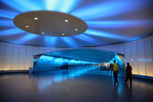
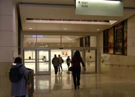
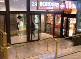
9 Pedestrian Tunnel Detroit Metro Airport Powell St./Westfield Entrance 6
10 Alternative 1 Beale St. Phase 1 Direct connection to Embarcadero Metro Station If included in Phase 1 Tunnel Length: 1,212 If included in Phase 2 Tunnel Length: 900 Available ROW Width: 82.5 Estimated Cost: $ 8M Utility Relocation $ 65M Construction $ 32M Other Project Costs $105M Total Cost Alternative 2 Fremont St. Connection to Embarcadero Metro Station Tunnel Length: 1,100 Available ROW Width: 82.5 Estimated Cost: $ 9M Utility Relocation $ 85M Construction $ 38M Other Project Costs $132M Total Cost 7
11 Alternative 3 First St. Connection to Montgomery Metro Station Tunnel Length: 1,400 Available ROW Width: 82.5 Estimated Cost: $ 31M Utility Relocation $ 98M Construction $ 58M Other Project Costs $187M Total Cost Alternative 4 Ecker Place (Partial) Connection to Montgomery Metro Station Tunnel Length: 1,020 Available ROW Width: Varies Estimated Cost: $ 18M Utility Relocation $ 72M Construction $ 40M Other Project Costs $130M Total Cost 8
12 Alternatives Evaluation Discussion Points Working Group Input Potential Use Safety & Security Utility and ROW Constraints Schedule/Phasing Summary Construction Cost (in $ Millions) Alignment 1 Beale St. Alignment 2 Fremont St. Alignment 3 First St. Alignment 4 Ecker Pl. Utility Relocation Tunnel Construction Other Project Costs TOTAL Lowest Cost Highest Cost

13 Next Steps Complete Alternatives Evaluation Present Study Report Recommend Implementation Plan 10
SAN FRANCISCO MUNICIPAL TRANSPORTATION AGENCY
 THIS PRINT COVERS CALENDAR ITEM NO.: 13 DIVISION: Sustainable Streets BRIEF DESCRIPTION: SAN FRANCISCO MUNICIPAL TRANSPORTATION AGENCY Endorsing the Planning Department s 2014 Update to the conceptual
Better Market Street Project. Project Update January 15, 2015
 Better Market Street Project Project Update January 15, 2015 Better Market Street Project Area Limits Market Street 2.2 Miles Mission Street Better Market Street Schedule Market Street City s busiest transit
FALL 2014 WORKSHOPS TAKEAWAYS
 SFMTA WORKSHOP FEEDBACK The SFMTA and partner agencies are continuing to utilize feedback from the Fall 2014 workshops to inform priorities and next steps for the Embarcadero Enhancement Project. Throughout
TRANSIT CENTER DISTRICT. Public Realm
 TRANSIT CENTER DISTRICT Public Realm TJPA CAC December 13, 2016 Today s Presentation Public Realm Projects for opening of TTC + SF Public Works + TTC Public Realm improvements in Rincon/Transit District
Vision to Action Community Coalition February 14, 2014 Briefing
 Vision to Action Community Coalition February 14, 2014 Briefing Transportation and Transit Planning & Mass Transit Operations Strategic Growth Area Office Brian S. Solis Transportation & Transit Manager
Better Market Street Project Update. Urban Forestry Council September 17, 2014
 Better Market Street Project Update Urban Forestry Council September 17, 2014 Project Area Limits Better Market Street Schedule Market Street City s busiest transit corridor Over 85 buses per hour 14 surface
SAN FRANCISCO MUNICIPAL TRANSPORTATION AGENCY
 THIS PRINT COVERS CALENDAR ITEM NO. : 10.5 DIVISION: Sustainable Streets BRIEF DESCRIPTION: SAN FRANCISCO MUNICIPAL TRANSPORTATION AGENCY SUMMARY: The South Van Ness and Mission Intersection Improvements
Providence Downtown Transit Connector STAKEHOLDER MEETING #2. Stakeholder Meeting #1 October 24, 2016
 Providence Downtown Transit Connector STAKEHOLDER MEETING #2 Stakeholder Meeting #1 October 24, 2016 February 2017 1 AGENDA 1 DTC Goals and Expectations 2 Street Design Concepts 3 Potential Benefits and
The Bay Bridge Corridor Congestion Study
 Bay Bridge Corridor Congestion Study Tony Bruzzone, Arup TJPA Board Nov 1, 2010 Funded by AC Transit/Federal Transit Administration (FTA) Contracted with the Transbay Joint Powers Authority (TJPA) Stakeholders:
Bus Rapid Transit ALTERNATIVES ANALYSIS. Open House
 Bus Rapid Transit ALTERNATIVES ANALYSIS Open House June 23, 2015 Open House Meeting Agenda Agenda Introductions What is BRT? Project Goals Study Tasks Next steps Discussion PVTA Bus Rapid Transit Study
SAN FRANCISCO MUNICIPAL TRANSPORTATION AGENCY
 THIS PRINT COVERS CALENDAR ITEM NO. : 10.3 DIVISION: Sustainable Streets Division BRIEF DESCRIPTION: SAN FRANCISCO MUNICIPAL TRANSPORTATION AGENCY Approving traffic and parking modifications to install
California Department of Transportation, District 4. Sloat Boulevard Project Skyline Blvd. to 19 th Ave. Community Update January 13, 2016
 California Department of Transportation, District 4 Sloat Boulevard Project Skyline Blvd. to 19 th Ave. Community Update January 13, 2016 Agenda Welcome and introductions Project overview, history and
Item B1 November 19, 2009
 November 19, 2009 Planning and Development Department Land Use Planning Division DATE: November 19, 2009 STAFF REPORT TO: FROM: SUBJECT: Members of the Transportation Commission Elizabeth Greene Senior
ROUTES 55 / 42 / 676 BUS RAPID TRANSIT LOCALLY PREFERRED ALTERNATIVE
 ROUTES 55 / 42 / 676 BUS RAPID TRANSIT LOCALLY PREFERRED ALTERNATIVE April, 2012 1 INTRODUCTION The need for transit service improvements in the Routes 42/55/676 corridor was identified during the Southern
Van Ness Avenue BRT Overview and Scoping Process. Geary BRT CAC January 8, 2009
 Van Ness Avenue BRT Overview and Scoping Process Geary BRT CAC January 8, 2009 VAN NESS AVENUE S ROLE Identified in Prop K for BRT treatment Muni 47 and 49; 19 operates on Polk 20,000 daily riders on Van
REDWOOD CITY STREETCAR - ALTERNATIVES ANALYSIS
 REDWOOD CITY STREETCAR - ALTERNATIVES ANALYSIS The purpose of this document is to ennumerate the analysis of alternatives for a streetcar along the Broadway Corriodor of Redwood City. The six alternatives
Southwest Bus Rapid Transit (SW BRT) Functional Planning Study - Executive Summary January 19 LPT ATTACHMENT 2.
 Functional Planning Study - Executive Summary January 19 LPT ATTACHMENT 2.") Southwest Bus Rapid Transit (SW BRT) Functional Planning Study - Executive Summary 2011 January 19 1 of 19 Introduction This executive summary presents the results of the Southwest Bus Rapid Transit (SW
Southwest Bus Rapid Transit (SW BRT) Functional Planning Study - Executive Summary 2011 January 19 1 of 19 Introduction This executive summary presents the results of the Southwest Bus Rapid Transit (SW
Union City General Plan Update
 Union City General Plan Update General Plan Advisory Committee (July 18, 2018) Introduction and Circulation Diagram 1. Concern over Whipple Road widening, particularly how it would impact the small lots
GEARY CORRIDOR BUS RAPID TRANSIT Environmental Analysis. Special Intersections: Preliminary Concepts
 GEARY CORRIDOR BUS RAPID TRANSIT Environmental Analysis Special Intersections: Preliminary Concepts April 2, 2009 FILLMORE: Existing Conditions 3 lanes in underpass, 2 lanes in service road (each direction)
Vehicular and Pedestrian Access to Herndon Metrorail Station. Robert B. Boxer, Director John Stuart, Clark Nexen October 28, 2015
 Vehicular and Pedestrian Access to Herndon Metrorail Station Robert B. Boxer, Director John Stuart, Clark Nexen Project Location The project is located in the Town of Herndon along Herndon Parkway between
Rebuilding Highway 7 Town Centre Boulevard to Sciberras Road
 Rebuilding Highway 7 Town Centre Boulevard to Sciberras Road Project Status Update Presentation to City of Markham Development Services Committee October 22, 2013 Presentation Outline Background Status
FOLSOM-HOWARD STREETSCAPE OVERVIEW
 FOLSOM-HOWARD STREETSCAPE OVERVIEW SoMa residents should have the same kinds of amenities that other neighborhoods have. The Folsom- Howard Streetscape Project will make SoMa more livable by making it
SAN FRANCISCO MUNICIPAL TRANSPORTATION AGENCY
 THIS PRINT COVERS CALENDAR ITEM NO. : 11 DIVISION: Sustainable Streets BRIEF DESCRIPTION: SAN FRANCISCO MUNICIPAL TRANSPORTATION AGENCY Approving traffic modifications on Twin Peaks Boulevard between Christmas
Better Market Street. Engineering, Maintenance & Safety Committee (EMSC) February 28, 2018
 February 28, 2018") Better Market Street Engineering, Maintenance & Safety Committee (EMSC) February 28, 2018 1 Market Street Market Street - San Francisco by rulenumberone2 2 Market Street is the... City s busiest pedestrian
Better Market Street Engineering, Maintenance & Safety Committee (EMSC) February 28, 2018 1 Market Street Market Street - San Francisco by rulenumberone2 2 Market Street is the... City s busiest pedestrian
SAN FRANCISCO MUNICIPAL TRANSPORTATION AGENCY
 THIS PRINT COVERS CALENDAR ITEM NO.: 11 DIVISION: Transit Services BRIEF DESCRIPTION: SAN FRANCISCO MUNICIPAL TRANSPORTATION AGENCY Approving the installation of traffic and parking modifications along
Memorandum. Fund Allocation Fund Programming Policy/Legislation Plan/Study Capital Project Oversight/Delivery Budget/Finance Contract/Agreement Other:
 Memorandum Date: November 20, 2017 To: Transportation Authority Board From: Eric Cordoba Deputy Director Capital Projects Subject: 12/5/17 Board Meeting: San Francisco Freeway Corridor Management Study
Municipal Class EA To Address Traffic Congestion On The Ontario Street Corridor (Grand Bend) Public Information Meeting June 4, 2018
 Public Information Meeting June 4, 2018") Municipal Class EA To Address Traffic Congestion On The Ontario Street Corridor (Grand Bend) Public Information Meeting June 4, 2018 Background Agenda Traffic Study Update Class EA Alternatives Bridge
Municipal Class EA To Address Traffic Congestion On The Ontario Street Corridor (Grand Bend) Public Information Meeting June 4, 2018 Background Agenda Traffic Study Update Class EA Alternatives Bridge
OneBayArea Grant Application
 OneBayArea Grant Application ER Taylor Elementary School Safe Routes to School Project Submitted by the San Francisco Department of Public Works To the San Francisco County Transportation Authority April
CITIZENS ADVISORY COMMITTEE
 DRAFT MINUTES CITIZENS ADVISORY COMMITTEE Wednesday, September 7, 2016 Special Meeting 1. Committee Meeting Call to Order Chair Waddling called the meeting to order at 6:07 p.m. CAC members present were
SAN FRANCISCO MUNICIPAL TRANSPORTATION AGENCY
 THIS PRINT COVERS CALENDAR ITEM NO. : 10.2 DIVISION: Sustainable Streets BRIEF DESCRIPTION: SAN FRANCISCO MUNICIPAL TRANSPORTATION AGENCY Adopting Conceptual Proposal for Streetscape Improvements to Broadway,
Circulation in Elk Grove includes: Motor vehicles, including cars and trucks
 Circulation, as it is used in this General Plan, refers to the many ways people and goods move from place to place in Elk Grove and the region. Circulation in Elk Grove includes: Motor vehicles, including
Community Task Force March 14, 2018
 Community Task Force March 14, 2018 Welcome and Introductions Project Partners Regional Transportation District (RTD) City of Aurora Colorado Department of Transportation (CDOT) Denver Regional Council
Central Jersey Transportation Forum. March 2007
 Central Jersey Transportation Forum March 2007 Feasibility Analysis of BRT on Dinky Right of Way from Princeton Station to Alexander Rd. in West Windsor (west of Rt. 1) Study spurred by Princeton University's
Comments EXECUTIVE SUMMARY
 Comments 1. Under any Alternatives, MCDOT should provide better at-grade pedestrian crossing of Georgia Avenue and Forest Glen Road, including improved crosswalks with wider medians and adequate signal
San Jose Transportation Policy
 San Jose Transportation Policy Protected Intersections in LOS Policies to Support Smart Growth Presented by: Manuel Pineda City of San Jose Department of Transportation Bay Area Map San Francisco Oakland
TRANSPORTATION COMMISSION Agenda Staff Report
 TRANSPORTATION COMMISSION Agenda Staff Report Agenda Item No. 5.a DATE: JULY 31, 2014 TO: FROM: SUBJECT: TRANSPORTATION COMMISSION COMMUNITY DEVELOPMENT DEPARTMENT - PLANNING DRAFT OLYMPIC CORRIDOR PREFERRED
DRAFT MINUTES. CITIZENS ADVISORY COMMITTEE June 25, 2014 MEETING
 DRAFT MINUTES CITIZENS ADVISORY COMMITTEE June 25, 2014 MEETING 1. Committee Meeting Call to Order The meeting was called to order by Chair Glenn Davis at 6:10 p.m. CAC members present were Myla Ablog,
EBOTS Phase 2 Outreach Summary
 EBOTS Phase 2 Outreach Summary Introduction The Emeryville-Berkeley-Oakland Transit Study (EBOTS) project team conducted several outreach activities between March 2014 and May 2014 to evaluate ideas for
Feasibility Study. Expo-Downtown Bicycle Connector
 Feasibility Study Expo-Downtown Bicycle Connector May 2017 Table of Contents Introduction... 2 Project Goals... 2 Study Scope... 2 Community Engagement... 3 Project Description... 6 Considerations... 6
Governance and Priorities Committee Report For the July 2, 2015 Meeting
 CITY OF VICTORIA For the July 2, 2015 Meeting To: Governance and Priorities Committee Date: From: Subject: Brad Dellebuur, A/Assistant Director, Transportation and Parking Services Executive Summary The
Addendum to Mitigated Negative Declaration
 Addendum Date: Case No.: 2014.1499E Project Title: (MDSP) - Mission Valencia Green Gateway Streetscape Project Original: 2008.1075, MDSP Mitigated Negative Declaration Project Sponsor: Charlie Ream, San
TRANSIT PLANNING for LARGE EVENT VENUES
 SFMTA Municipal Transportation Agency Image: Crosswalk of California Street and Grant Avenue 06 19 2014 SAN FRANCISCO, CALIFORNIA OVERVIEW Differences from conventional transit planning Unique opportunities
Geary Corridor Bus Rapid Transit: Staff-Recommended Alternative
 Geary Corridor Bus Rapid Transit: Staff-Recommended Alternative Urban Forestry Council January 24, 2014 SAN FRANCISCO COUNTY TRANSPORTATION AUTHORITY SAN FRANCISCO MUNICIPAL TRANSPORTATION AGENCY Today
Fitting Light Rail through Well-established Communities
 Fitting Light Rail through Well-established Communities San Francisco 2008 Michael D. Madden Chief, Project Development, Maryland Transit Administration Project Setting Located inside the Capital Beltway
SAN FRANCISCO MUNICIPAL TRANSPORTATION AGENCY
 THIS PRINT COVERS CALENDAR ITEM NO.: 10.2 DIVISION: Sustainable Streets BRIEF DESCRIPTION: SAN FRANCISCO MUNICIPAL TRANSPORTATION AGENCY Approving various routine parking and traffic modifications. SUMMARY:
BD RESOLUTION NO RESOLUTION ADOPTING THE VISION ZERO RAMP INTERSECTION STUDY PHASE 1
 BD00 RESOLUTION NO. - RESOLUTION ADOPTING THE VISION ZERO RAMP INTERSECTION STUDY PHASE [NTIP PLANNING] FINAL REPORT WHEREAS, The Vision Zero Ramp Intersection Study Phase was recommended by Commissioner
CHAPTER 3. Transportation and Circulation
 CHAPTER 3 Transportation and Circulation 3.0 TRANSPORTATION AND CIRCULATION This chapter evaluates traffic circulation, transit, parking, pedestrian, bicycle, and rail operational conditions in the Project
Portland International Airport Bicycle and Pedestrian Plan (October 2003) Staff Acknowledgements
 Staff Acknowledgements") Portland International Airport Bicycle and Pedestrian Plan (October 2003) Staff Acknowledgements Scott King, Senior Aviation Planner Jason Gately, Senior Aviation Planner Preston Beck, Associate Planner
Portland International Airport Bicycle and Pedestrian Plan (October 2003) Staff Acknowledgements Scott King, Senior Aviation Planner Jason Gately, Senior Aviation Planner Preston Beck, Associate Planner
Main-McVay Transit Study: Phase 2 Options Definition and High Level Constraints Evaluation
 Main-McVay Transit Study: Phase 2 Options Definition and High Level Constraints Evaluation APRIL 2016 A collaborative study between: For Additional Information or to Comment If you would like additional
Welcome to the McKenzie Interchange Project Open House!
 Welcome to the McKenzie Interchange Project Open House! Purpose of Open House To provide you with information regarding the project and for you to have the opportunity to share your input on design concepts.
Mission Bay Loop (MBL) Public Meeting
 Public Meeting") Mission Bay Loop (MBL) Public Meeting La Scuola Internazionale di San Francisco, November 18, 2014 Frequently Asked Questions 1. When would construction have to start before the SFMTA loses TIGER funds?
Mission Bay Loop (MBL) Public Meeting La Scuola Internazionale di San Francisco, November 18, 2014 Frequently Asked Questions 1. When would construction have to start before the SFMTA loses TIGER funds?
SFMTA SAN FRANCISCO MUNICIPAL TRANSPORTATION AGENCY
 SFMTA SAN FRANCISCO MUNICIPAL TRANSPORTATION AGENCY VAN NESS BUS RAPID TRANSIT PROJECT UPDATE PRESENTATION TO SFMTA BOARD OF DIRECTORS RELEASE OF DRAFT ENVIRONMENTAL IMPACT STATEMENT / REPORT 10 18 2011
Transportation 6. A. Transit Center Circulation and Access. 1. Transit Center Circulation
 Transportation 6 This chapter describes the transportation system in and around the Hillsdale Station Area, with a focus on the Transit Center at the relocated Hillsdale Caltrain Station. The transportation
FROM: CITY MANAGER DEPARTMENT: PLANNING AND COMMUNITY ENVIRONMENT DATE: OCTOBER 4, 2004 CMR:432:04
 TO: HONORABLE CITY COUNCIL FROM: CITY MANAGER DEPARTMENT: PLANNING AND COMMUNITY ENVIRONMENT DATE: OCTOBER 4, 2004 CMR:432:04 SUBJECT: FINANCE COMMITTEE RECOMMENDATION TO ADOPT TRANSPORTATION STRATEGIC
Methodology for Determining Pedestrian Activity Factors
 Where People Walk: Methodology for Determining Pedestrian Activity Factors Part I: Background on the WalkFirst Project The goal of the WalkFirst project is to improve walking conditions in San Francisco,
Appendix A-2: Screen 1 Alternatives Report
 Appendix A-2: Screen 1 Alternatives Report SCREEN 1 ALTERNATIVES REPORT Western & Ashland Corridors Bus Rapid Transit (BRT) Project Prepared for Chicago Transit Authority 567 West Lake Street Chicago,
McKenzie Interchange Project Fall 2015 Engagement. Appendix 2: Engagement Materials and Feedback Form
 Fall 2015 Engagement Appendix 2: Engagement Materials and Feedback Form Welcome to the McKenzie Interchange Project Open House! Purpose of Open House To provide you with information regarding the project
Outreach Approach RENEW SF served as the primary liaison with the North Beach community; the Chinatown. Executive Summary
 Executive Summary Executive Summary The Columbus Avenue Neighborhood Transportation Study s objective is to identify changes to transportation infrastructure and policies that could enhance the livability
Executive Summary Route 30 Corridor Master Plan
 Route Corridor Master Plan Project Overview The Route Corridor Master Plan is a coordinated multimodal transportation and land use plan for the entire stretch of Route through East Whiteland Township,
SUBJECT Memorandum of Understanding to Complete a Caltrain Grade Separation Study for the Whipple Avenue Crossing
 REPORT To the Honorable Mayor and City Council From the City Manager October 1, 2018 SUBJECT Memorandum of Understanding to Complete a Caltrain Grade Separation Study for the Whipple Avenue Crossing RECOMMENDATION
TRAVEL PLAN: CENTRAL EUROPEAN UNIVERSITY CAMPUS REDEVELOPMENT PROJECT TRAVEL PLAN. Central European University Campus Redevelopment Project.
 TRAVEL PLAN Central European University Campus Redevelopment Project Page 1 Table of Contents Introduction... 3 Background... 7 Building Users... 7 Transportation in Community Consultation... 7 Summary
Dumbarton Transportation Corridor Study. Board of Directors December 6, 2017
 Dumbarton Transportation Corridor Study Board of Directors December 6, 2017 Two Bridges 2 Challenges Regional context, many stakeholders Consensus on use of the SamTrans-owned rail ROW Consensus on highway
COMMUNITY MEETING August 23, 2018
 COMMUNITY MEETING August 23, 2018.. 1 Agenda Welcome & Introduction Project Background & Purpose Project Overview Q & A Stations Charleston / Meadow Palo Alto City-Wide Tunnel Ideas No Longer Considered
Geary Bus Rapid Transit Project
 Geary Bus Rapid Transit Project Urban Forestry Council Planning and Funding Committee Meeting September 13, 2016 SAN FRANCISCO COUNTY TRANSPORTATION AUTHORITY SAN FRANCISCO MUNICIPAL TRANSPORTATON AGENCY
Welcome. If you have any questions or comments on the project, please contact:
 Welcome This drop-in public open house is intended to provide information about the Bay Street bike lanes project. This project proposes a dedicated cycling facility along Bay Street between Aberdeen Avenue
South King County High-Capacity Transit Corridor Study
 HIGH-CAPACITY TRANSIT CORRIDOR STUDY South King County Corridor South King County High-Capacity Transit Corridor Study Corridor Report August 2014 South King County High Capacity Transit Corridor Report
Chapter 3 BUS IMPROVEMENT CONCEPTS
 Chapter 3 BUS IMPROVEMENT CONCEPTS The purpose of this chapter is to describe potential bus improvement strategies and potential impacts or implications associated with BRT implementation within the existing
District 6 & Citywide Non-Transit Project Delivery Status Report
 District 6 & Citywide Non-Transit Project Delivery Status Report Prop K and Non-Prop K Active Projects October 23, 2012 SAN FRANCISCO COUNTY TRANSPORTATION AUTHORITY SAN FRANCISCO COUNTY TRANSPORTATION
Public Information Meeting
 Richmond Highway (U.S. Route 1) Corridor Improvements Public Information Meeting Tuesday, April 18, 2017 Mount Vernon High School 8515 Old Mt. Vernon Road, Alexandria, VA 22309 Amanda Baxter, VDOT, Special
Eliminate on-street parking where it will allow for a dedicated bus only lane %
 Traffic Dashboard Priorities Survey Responses Introduction 1) Are you familiar with bus rapid transit (BRT)? a. No, BRT is new to me. 597 23.5% b. I ve heard of BRT, but I don t know much about it. 1,136
City of Gainesville Transportation/Roadway Needs PROJECT SUMMARY
 A1 Roadway Resurfacing $23,846,000 TYPE: Preservation of existing system Roadway resurfacing A2 Signal Replacement $6,000,000 TYPE: Preservation of existing system Replace traffic signals. B1 W 6th St
Community Task Force July 25, 2017
 Community Task Force July 25, 2017 Welcome and Introductions Project Partners Regional Transportation District (RTD) Colorado Department of Transportation (CDOT) Denver Regional Council of Governments
Item Description: Presentation and Discussion: Berkeley Rapid Transit Locally Preferred Alternative
 Office of the City Manager Meeting Date: April 29, 2010 Item Number: 1 Item Description: Presentation and Discussion: Berkeley Rapid Transit Locally Preferred Alternative Staff report, resolution, and
In station areas, new pedestrian links can increase network connectivity and provide direct access to stations.
 The Last Mile Planning for Pedestrians Planning around stations will put pedestrians first. Making walking to stations safe and easy is important; walking will be a part of every rapid transit Accessible
FINAL REPORT DECEMBER 2011
 FINAL REPORT DECEMBER 2011 AKNOWLEDGEMENTS SFMTA Staff Erin Miller, Project Manager Timothy Papandreou Jerry Robbins Pamela Stone Mike Sallaberry Chris Dimeling Emily Drennen Suzanne Chen-Harding San
CITY OF COCOA BEACH 2025 COMPREHENSIVE PLAN. Section VIII Mobility Element Goals, Objectives, and Policies
 CITY OF COCOA BEACH 2025 COMPREHENSIVE PLAN Section VIII Mobility Element Goals, Objectives, and Policies Adopted August 6, 2015 by Ordinance No. 1591 VIII MOBILITY ELEMENT Table of Contents Page Number
ABOUT THIS STUDY The Tenderloin-Little Saigon Community-Based Transportation Plan
 ABOUT THIS STUDY The Tenderloin-Little Saigon Community-Based Transportation Plan The Greater Tenderloin Community Study Milestones October Community based organizations (Tenderloin Housing Clinic and
APPENDIX 2 LAKESHORE ROAD TRANSPORTATION REVIEW STUDY EXECUTIVE SUMMARY
 APPENDIX 2 LAKESHORE ROAD TRANSPORTATION REVIEW STUDY EXECUTIVE SUMMARY Appendix 2 City of Mississauga Lakeshore Road FINAL REPORT Transportation Review Study December 2010 EXECUTIVE SUMMARY Study Purpose
Paoli Road Improvement Feasibility Study
 Paoli Road Improvement Feasibility Study & Public Participation Project March 24, 2015 Prepared for: Tredyffrin Township Prepared by: McMahon Associates, Inc. with Town Planning Partnership, LLC Glackin
Topics To Be Covered. Summarize Tier 2 Council Direction Discuss Mill and Ash Alternatives Next Steps
 Topics To Be Covered Summarize Tier 2 Council Direction Discuss Mill and Ash Alternatives Next Steps Tier 2 Council Direction Dismiss Bus Rapid Transit along the Union Pacific Railroad Dismiss Bus Rapid
Feasibility Study of Pedestrian Crossings Along Route 7, East of Cascades Parkway and West of Dranesville Road. October 3, 2017
 Feasibility Study of Pedestrian Crossings Along Route 7, East of Cascades Parkway and West of Dranesville Road October 3, 2017 Study Area (area within a ¼-mile radius of the study intersections) Route
Montgomery Road Project Stakeholder Focus Group Meeting # 1 January 29, 2014
 Stakeholder Focus Group (SFG) Meeting #1: The first SFG meeting for the Montgomery Road Study was held on at the Montgomery Village Hall, 200 N. River Street, in Montgomery, Illinois from 2:00-4:00 PM.
SETTINGS AND OPPORTUNITIES MOBILITY & ACCESS
 7 mobility & access how do people use el camino what is it like to drive on el camino/to park along el camino what is the pedestrian experience like what is the role of transit along the corridor what
Implementing Complete Streets in Ottawa. Project Delivery Process and Tools Complete Streets Forum 2015 October 1, 2015
 Implementing Complete Streets in Ottawa October 1, 2015 The Essentials Complete Streets Implementation Framework will become part of the routine delivery of City transportation projects Approach uses every
ADA Transition Plan. City of Gainesville FY19-FY28. Date: November 5, Prepared by: City Of Gainesville Department of Mobility
 ADA Transition Plan FY19-FY28 Date: November 5, 2018 Prepared by: City Of Gainesville Department of Mobility 1.0 INTRODUCTION 1.1 BACKGROUND The federal statute known as the Americans with Disabilities
APPENDIX A: Complete Streets Checklist DRAFT NOVEMBER 2016
 APPENDIX A: Complete Streets Checklist DRAFT NOVEMBER 2016 Complete Streets Checklist MetroPlan Orlando s Complete Streets Checklist is an internal planning tool for staff to further implementation of
Freeway ramp intersection study
 Freeway ramp intersection study Supporting Vision Zero: Zero traffic deaths in San Francisco by 2024 Study Goals: Primary Improve Safety Improve Accessibility Secondary Provide Efficient Circulation Accommodate
Telegraph Avenue Complete Streets DRAFT Recommendations. Oakland Public Works Department September 11 and 13, 2014 Open Houses
 Telegraph Avenue Complete Streets DRAFT Recommendations Oakland Public Works Department September 11 and 13, 2014 Open Houses Presentation Overview What are complete streets? What problem are we trying
Living Streets Policy
 Living Streets Policy Introduction Living streets balance the needs of motorists, bicyclists, pedestrians and transit riders in ways that promote safety and convenience, enhance community identity, create
Americans with Disabilities Act Transition Plan for Public Right-of-Way Improvements
 Americans with Disabilities Act Transition Plan for Public Right-of-Way Improvements Prepared by: Public Works Department Engineering Division October 2015 Table of Contents Section I Introduction.. 3
Funded Safe Routes to Transit Projects
 Funded Safe Routes to Transit s CYCLE 1 AC Transit Bicycle arking lan $100,000 C BART BART C2 Railcar Reconfiguration $581,000 C City of Albany, City of El Cerrito El Cerrito/Albany Ohlone Greenway Safety
ALTERNATIVES ANALYSIS EXECUTIVE SUMMARY
 West Valley Connector Corridor ALTERNATIVES ANALYSIS EXECUTIVE SUMMARY FINAL September 2014 Ontario International Airport Ontario Mills Rancho Cucamonga Metrolink Station Kaiser Permanente PARSONS EXECUTIVE
122 Avenue: 107 Street to Fort Road
 : 107 Street to Fort Road November 24, 2015 4:30 8:00 p.m. Meeting Purpose Summarize project work completed to date Share results of public input from Phase 1 Share the draft concept plan and proposed
Arterial Transitway Corridors Study. Ave
 Arterial Transitway Corridors Study Ave January 2012 Arterial Transitway Corridors Study Overview Corridor Features and Demographics 11 study corridors, 95 route miles 86,000 daily rides and half of existing
A Survey of Planning, Design, and Education for Bikeways and Bus Routes on Urban Streets
 A Survey of Planning, Design, and Education for Bikeways and Bus Routes on Urban Streets, Community & Economic Development Agency, Transportation Services Division (510) 238-3983 bikeped@oaklandnet.com
CURBSIDE ACTIVITY DESIGN
 5 CURBSIDE ACTIVITY DESIGN This chapter provides design guidance for separated bike lanes adjacent to curbside activities including parking, loading and bus stops. Typical configurations are presented
5. RUNNINGWAY GUIDELINES
 5. RUNNINGWAY GUIDELINES These guidelines should be considered collectively when making runningway decisions. A runningway is the linear component of the transit system that forms the right-of-way reserved
Complete Street Analysis of a Road Diet: Orange Grove Boulevard, Pasadena, CA
 Complete Street Analysis of a Road Diet: Orange Grove Boulevard, Pasadena, CA Aaron Elias, Bill Cisco Abstract As part of evaluating the feasibility of a road diet on Orange Grove Boulevard in Pasadena,
SAN FRANCISCO MUNICIPAL TRANSPORTATION AGENCY
 THIS PRINT COVERS CALENDAR ITEM NO: 10.2 DIVISION: Sustainable Streets BRIEF DESCRIPTION: SAN FRANCISCO MUNICIPAL TRANSPORTATION AGENCY Approving various routine parking and traffic modifications. SUMMARY:
Public Comment Meeting Geary BRT Project Draft Environmental Impact Statement/Report
 Public Comment Meeting Geary BRT Project Draft Environmental Impact Statement/Report Open House and Opportunity to Provide Comments Public comments can be submitted to the court reporter stationed in the