Shasta Lake Walks sl walks 2012 FINAL.indd 1 11/28/2012 7:22:48 AM
|
|
|
- Bryce Phelps
- 6 years ago
- Views:
Transcription


1 Shasta Lake Walks sl walks 2012 FINAL.indd 1 11/28/2012 7:22:48 AM
2 Greetings! Greetings! The City of Shasta Lake is pleased to be part of the regional effort to encourage our citizens to walk as part of a healthy lifestyle. We know you will enjoy walking in Shasta Lake, and with the variety of walking paths and trails available, you are sure to find one to suit your needs. On the Churn Creek Trail, you will see an impressive array of wildlife. The route through Windsor Estates boasts tremendous views of the Central Sacramento Valley and Lassen Peak. You will see many active types of recreation while walking around Margaret V. Polf Park and you will be able to view a working community garden within the Hazelwood subdivision. The City has been successful in obtaining several rounds of Caltrans funding for Safe Routes to School to build sidewalks. Sidewalks were recently completed along Montana Avenue and Cabello Street. We encourage students to use these sidewalks when walking to Central Valley High School and Shasta Lake School. You will find several miles of dirt trails with stunning views of the Sacramento River and nearby mountains that lead up to Shasta Dam. Some of these trailheads are just a short distance from home for many of us. Take a hike on these trails to see how the City of Shasta Lake is so close to so much beauty and can be connected to world class attractions such as the Sundial Bridge and Shasta Dam. Trails and other safe walking routes are great resources in our community for all of us to enjoy while we improve our health. Grab your water bottle, hit the trail, and walk Shasta Lake! sl walks 2012 FINAL.indd 2 11/28/2012 7:22:48 AM
3 Walking Tips 1. Before you start a walking program, check with your doctor if you have a health or safety concern. 2. Warm up and cool down with five minutes of slow walking and some light stretching to prevent injuries and increase flexibility. 3. Wear comfortable, sturdy shoes with good arch support, a firm heel, and plenty of room for your toes. 4. Walk briskly, but make sure you can maintain a conversation while walking. Stop if you feel pain, severe fatigue, light-headedness, dizziness or significant shortness of breath. 5. Set goals to walk for a specified amount of time rather than distance. An average pace of brisk walking is one mile in minutes. Beginners should strive for a 30-minute permile pace. 6. Work up to minutes a day, five days a week of walking or other moderate physical activity. Several short walks a day (10-20 minutes) can be as effective in improving and maintaining health as one long walk. 7. Drink water before you feel thirsty, as well as during and after exercise. 8. Fuel your body with a healthy diet that includes plenty of fruits, vegetables and whole grains. 9. For more walking opportunities, visit This Shasta Lake Walks guide is offered free to encourage physical activity and enjoyment of our beautiful area. This guide is made possible from Caltrans, Safe Routes to School funding. Neither Shasta Lake City, ENPLAN, Shasta Lake Heritage & Historical Society, or the County of Shasta endorse or assume responsibility or liability for the condition of any of the locations or programs described in this guide. sl walks 2012 FINAL.indd 3 11/28/2012 7:22:48 AM

4 Safety Tips for Walkers 1. If there is no sidewalk, walk facing traffic so you can see oncoming vehicles. 2. Protect yourself from the sun with a hat, sunscreen and sunglasses with both UVA and UVB protection. 3. Dress to be seen. Light or brightly colored clothing makes it easier for drivers to see pedestrians during the daytime. 4. When dark, wear reflective clothing/tape on your shoes, cap or jacket. 5. Cross only at corners or marked crosswalks. 6. When crossing in a crosswalk, pay extra attention. Being in a crosswalk does not protect pedestrians from being hit by a motor vehicle. 7. Carry personal identification in case of emergency. 8. Listen to your instincts and be willing to vary your route if you sense you re in danger. 9. Beware of dogs. If they re threatening, don t run away or throw things at them. If necessary, give them a command such as, No! Go home! or Down! or Sit! 10. Find a partner - there s safety in numbers. sl walks 2012 FINAL.indd 4 11/28/2012 7:22:48 AM

5 Margaret V. Polf Regional Park 1 Walking Route Start anywhere on the path. Public access is at Shasta Dam Boulevard and Sacramento Street. Paved trail loops around the sports field and leads into another loop west of field. Dirt paths located to the west of sports field include BMX bike track. Distance.75 mile loop Terrain.75 mile paved path around sports field with dirt paths adjacent to west side of park. Adjacent Neighborhood Neighborhoods located southeast of park can access trail from Rose Avenue. About the Route This park is a regional park where many community-wide events are held. Park offers restrooms, drinking fountains, playground/tot lot, sports fields, and BMX bike track. Trails are partially shaded. sl walks 2012 FINAL.indd 5 11/28/2012 7:22:57 AM

6 Downtown 2 Walking Route Start on any portion of the paved route. Plenty of parking is available at/near Clair Engle Park. Distance.5 mile Terrain Slight incline heading west along sidewalk and bike lane on Shasta Dam Boulevard Adjacent Neighborhood Neighborhoods surround the downtown area About the Route Route offers services and restaurants. It also passes by the Veteran s Memorial, a nice place to take a rest or wander through native vegetation planted by the Shasta Lake Garden Project. Shasta Dam Boulevard is known as the cutoff road to Kennett. Sidewalks continue along Shasta Dam Boulevard eastbound, with several crosswalks over the boulevard, so walk can easily be extended. Kennett was a city, now covered by the lake as a result of the Shasta Dam. Clair Engle Park offers a drinking fountain, benches and a skateboard park. sl walks 2012 FINAL.indd 6 11/28/2012 7:23:05 AM
 Adjacent Neighborhood Hazelwood, Oakridge, Coeur d Alene 3 About the Route All-weather track was constructed in 2005.")
7 Central Valley High School Track Walking Route To access the track, use pedestrian gate located off Ashby Road. Distance.25 mile (one lap) Adjacent Neighborhood Hazelwood, Oakridge, Coeur d Alene 3 About the Route All-weather track was constructed in Track is made of recycled rubber tires to absorb impact, making it a comfortable surface for a gentle walk or jog. Track is available after school hours, until sunset, when not used for school events. sl walks 2012 FINAL.indd 7 11/28/2012 7:23:13 AM

8 Hazelwood/Oakridge 4 Walking Route Access from Ashby Road at Woodley Avenue, or at any point along the route. This route winds through Hazelwood and Oakridge subdivisions. Distance 1.1 miles Terrain Moderate hills, sidewalks Adjacent Neighborhood Hazelwood, Oakridge, Coeur d Alene About the Route Enjoy this neighborhood walk admiring foothills to the north and Shasta Bally to the west. A 50-plot community garden backs up to Hazelwood. The public can view the garden off Woodley Avenue, near Ashby Road. To extend this walk, use the Central Valley High School Track. See map 3. sl walks 2012 FINAL.indd 8 11/28/2012 7:23:21 AM

9 Churn Creek Trail 5 Walking Route Access from Pine Grove Avenue or the Windsor Estates neighborhood. On Pine Grove, begin at gate on south side of road just east of Churn Creek bridge, the trail is not marked. Starting from Windsor, access trail at gate on west side of Avington Way between Quigley Court and Stafford Drive. Walk down hill toward the creek and head north (right). Gates along route restrict motorized vehicles. Distance 2 miles (round trip) Terrain Unimproved natural trail requiring sturdy walking shoes. Standing water on trail during rainy season. Short steep hill at entry/exit at Windsor neighborhood. Adjacent Neighborhood Windsor Estates, Coeur d Alene About the Route Walk along shaded, beautiful, historic Churn Creek. Known for gold mining, the creek offers abundant wildlife. Native plants can be spotted along the walking trail, offering a true nature experience. sl walks 2012 FINAL.indd 9 11/28/2012 7:23:29 AM

10 Shasta Lake Wal sl walks 2012 FINAL.indd 10 11/28/2012 7:23:31 AM

11 lks Trail Overview sl walks 2012 FINAL.indd 11 11/28/2012 7:23:33 AM

12 Windsor Estates 6 Walking Route Take Autumn Harvest Way off Cascade Boulevard to access this walk. Distance Route 1:.5 mile loop Route 2: 1.25 mile loop Terrain Sidewalks, a steep hill on Wandsworth About the Route This walk can be started anywhere in the neighborhood. The map depicts two routes of varying distances. View the beauty of Lassen Peak and the other hills and mountains to the east. This is a great place to see the sunrise and sunset. Walkers can also connect to the Churn Creek Trail from the gate located on Avington Way between Quigley Court and Stafford Drive. See map 5. sl walks 2012 FINAL.indd 12 11/28/2012 7:23:42 AM

13 Shasta Gateway Industrial Park 7 Walking Route Start this walk on Ashby Road or anywhere along loop depicted on map. Distance 1 mile Terrain Sidewalks, wide dirt path Adjacent Neighborhood No neighborhoods are linked to the park. Ideal walk for business park employees on their breaks. About the Route The Shasta Gateway Industrial Park was developed by the city in 1992, shortly after the city s incorporation. A grant was obtained to fund construction of the businesses incubator, the first building in the park. The incubator building provides space for new businesses to start and expand. sl walks 2012 FINAL.indd 13 11/28/2012 7:23:50 AM
14 Sacramento Ditch, Hornbeck, Flanagan, Walking Route Access these trails from Shasta Dam or several roads off Lake Boulevard such as Flanagan Road, Walker Mine Road and Quartz Hill Road. Distance 9.3 miles on FB, 4 miles on Hornbeck, 11.8 miles on Sacramento Ditch trails, 2.5 miles one way to Chamise Peak from Flanagan Trailhead; approximately 25 miles one way from Ribbon Bridge to Shasta Dam Parking lot, 9 miles Sacramento River Rail Trail from Shasta Dam to Sacramento River Trail. Terrain Mostly gentle rolling dirt path, some climbing to Chamise Peak. Paved trail on west side of river. Adjacent Neighborhood Neighborhoods/housing off Lake Boulevard About the Route Great views from Chamise Peak and nice river and mountain views along the trails. Hornbeck Trail follows the path of a historic mining railroad that was rediscovered and developed by local historian Chuck Hornbeck, community volunteers and BLM on the east side of the Sacramento River. The rail line was used in the early 1900s to haul quartz used as flux for nearby copper smelting at Kennett (now under Shasta Lake). The Sacramento Rail Trail along the west side of the river follows the old rail line, complete with a railroad tunnel, along Keswick Reservoir. Majority of trail is flat with a section between Keswick Dam and Keswick Boat Launch that is very hilly. sl walks 2012 FINAL.indd 14 11/28/2012 7:23:50 AM

15 , Chamise & Sacramento Rail Trails 8 sl walks 2012 FINAL.indd 15 11/28/2012 7:23:51 AM

16 Walking Rou Walking (or bicycling) to school brings many benefits to a healthy weight, improving concentration and learning, Sidewalks were recently completed along two roads to a School. Montana Avenue from Shasta Dam Boulevard to Street from Shasta Dam Boulevard to Vallecito Street al encouraged to use these sidewalk routes to get to schoo Shasta Dam Boulevard, making it safer and easier for re skateboard park, grocery store, and many other busines If your child lives too far away from school to walk, cons school so he/she can walk and get some exercise befor Safe Routes to School Program, the Sheriff s Citizen Vo have supported a Walking Wednesday Program from th encourage parents to drop off their child off to walk four monitored by the City and Citizen Volunteer Patrols. Stu it reduces traffic in front of the school, making it safer an more information, contact the Safe Routes to School pro sl walks 2012 FINAL.indd 16 11/28/2012 7:23:53 AM

17 utes to School 9 students, including being physically active, maintaining and making a connection with the community. access Central Valley High School and Shasta Lake o Vallecito Street now has sidewalks, and Cabello lso has sidewalks. Students walking to school are ol. Sidewalks and bike lanes were also added to esidents to get to the community center, park and sses and restaurants. sider dropping him/her off a few blocks away from re school starts. For the past several years, The olunteer Patrol Program and the City of Shasta Lake he ballpark at Vallecito Street and Montana Avenue to blocks to Shasta Lake School. The route is signed and udents get recognition and prizes for participating and nd easier for children to walk and bike to school. For ogram at or visit sl walks 2012 FINAL.indd 17 11/28/2012 7:23:55 AM


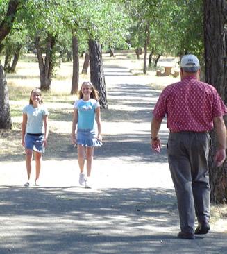
18 Enjoy walking in our city A family enjoying Margaret V. Polf Regional Park Veteran s Memorial on Shasta Dam Boulevard Students use new sidewalks on Cabello Street Safe Routes to School, Walking Wednesdays sl walks 2012 FINAL.indd 18 11/28/2012 7:23:58 AM


 RABA (Redding")

 245-6457 Sheriff s Office: 245-6096")

19 Contacts Call the City of Shasta Lake at (530) for: Powerline issues Hazards/other safety issues Illegal dumping Park and Community Center use Park and Recreation Commission Animal control Air Quality Management District: Fire Department: (non-emergency) RABA (Redding Area Bus Authority): Shasta Lake Gateway Community Residents Garden: Health and Human Services, Public Health (Safe Routes to School Program) Sheriff s Office: (non-emergency) Partners Shasta Lake Heritage & Historical Society August 2012 sl walks 2012 FINAL.indd 19 11/28/2012 7:24:02 AM


20 Health and Human Services, Public Health 2650 Breslauer Way Redding, CA sl walks 2012 FINAL.indd 20 11/28/2012 7:24:02 AM
Greetings! Walking Tips
 Shasta Lake Walks Greetings! Walking Tips Greetings! The City of Shasta Lake is pleased to be part of the regional effort to encourage our citizens to walk as part of a healthy lifestyle. We know you will
Physical Activity. Assessment Why Physical Activity Is Important? Background Information Tips: Walking Steps Tips: Walking Minutes Goals
 Physical Activity Assessment Why Physical Activity Is Important? Background Information Tips: Walking Steps Tips: Walking Minutes Goals Assessment Walking Next, we will talk about physical activity. Before
2.0 Existing Conditions
 20 2.0 Existing Conditions 2.1 Land Use, Future Growth Patterns, Physical Barriers Geographic Overview Sutter County s land use pattern is characterized by extensive agricultural areas, significant natural
Physical Activity. Assessment Why Physical Activity Is Important? Background Information Tips: Walking Steps Tips: Walking Minutes Goals
 Physical Activity Assessment Why Physical Activity Is Important? Background Information Tips: Steps Tips: Minutes Goals 34 Assessment Next, we will talk about physical activity. Before getting started,
This guide will help you find some of the best parks, trails and walking areas in Ruidoso, Ruidoso Downs, Alto, Capitan, Carrizozo and Mescalero.
 Table of Contents How to Use the Guide...3 Other Information...4 Pedestrian Safety Considerations...5 Walking Tips...6 Walking with Your Pets...7 Trail Information Ruidoso Cedar Creek Fitness Trail...
Staying Physically Active
 Session 3 Assessment Background Background Information Information Things Things That That Get Get in in the the Way Way of of Physical Physical Activity Activity to to Get Get on on Track Track Goals
12/4/2016 VIA . RE: Grocery Outlet Del Paso (DR16-328)
") 12/4/2016 VIA EMAIL Ethan Meltzer, Assistant Planner City of Sacramento Community Development Department 300 Richards Blvd, 3 rd Floor Sacramento, CA 95811 RE: Grocery Outlet Del Paso (DR16-328) Dear Mr.
12/4/2016 VIA EMAIL Ethan Meltzer, Assistant Planner City of Sacramento Community Development Department 300 Richards Blvd, 3 rd Floor Sacramento, CA 95811 RE: Grocery Outlet Del Paso (DR16-328) Dear Mr.
US 278 Corridor Concept Presentation. Avondale Estates Intersection Improvement/Roundabout and Road Diet Feasibility Study March 19, 2015
 US 278 Corridor Concept Presentation Avondale Estates Intersection Improvement/Roundabout and Road Diet Feasibility Study March 19, 2015 Thanks to our Partners Atlanta Regional Commission Georgia Department
Walking Audit Supporting Information
 Walking Audit Supporting Information Planning to do a walking audit of your streets? Here s some helpful suggestions to help get you started. 1. Preparing for your audit Decide where you want to walk.
3/10/2016 VIA th Street, Suite 203 Sacramento, CA
 3/10/2016 VIA EMAIL Arwen Wacht, Associate Planner City of Sacramento Community Development Department 300 Richards Boulevard, 3 rd Floor Sacramento, CA 95811 RE: Natomas Fountains (P16-012) Dear Ms. Wacht:
5/7/2013 VIA . RE: University Village Safeway Expansion (P13-019)
") 5/7/2013 VIA EMAIL David Hung, Associate Planner Community Development Department, Current Planning Division City of Sacramento 300 Richards Boulevard, 3 rd Floor Sacramento, CA 95811 RE: University Village
5/7/2013 VIA EMAIL David Hung, Associate Planner Community Development Department, Current Planning Division City of Sacramento 300 Richards Boulevard, 3 rd Floor Sacramento, CA 95811 RE: University Village
64% UNSAFE and. Where can features be added to improve the street for bicyclists?
 BICYCLING Where can features be added to improve the street for bicyclists? Due to its proximity to neighborhoods, downtown and the waterfront, many people bike Niagara Street to get to where they need
REDEVELOPMENT OPPORTUNITY! FOR SALE
 SALE PRICE: Contact Agent LOT SIZE: 0.31 Acres BUILDING SIZE: 2,830 SF YEAR BUILT: 1906 ZONING: CBD Central Business District CROSS STREETS: 2nd Street South PROPERTY OVERVIEW This offering is for the
10/30/2012 VIA
 10/30/2012 VIA EMAIL David Hung, Associate Planner Community Development Department, Current Planning Division City of Sacramento 300 Richards Blvd., 3 rd Floor Sacramento, CA 95811 RE: The Cannery On-Site
Cross Street Corridor Non-Motorized Enhancement Project Project Description
 Cross Street Corridor Non-Motorized Enhancement Project Project Description A cooperative study of the Cross Street neighborhood was completed in May 2002 by the City of Ypsilanti, the Depot Town Downtown
Fill in the rating for each section. Total up the ratings to see how your neighbourhood scores overall for walkability.
 WALKABILITY CHECKLIST How walkable is your community? Everyone benefits from walking and other forms of active transportation. These benefits include: improved fitness, cleaner air, reduced risks of certain
Gravel Bike Guide Haywood County
 Gravel Bike Guide Haywood County Haywood County is an ideal place for bicycling on gravel roads, because 37% or 129,994 acres of Haywood County is federal property, including portions of the Pisgah National
In the Interest of Safety: Transit Safety Slide Reference Guide
 In the Interest of Safety: Transit Safety Slide Reference Guide Slide T-1: In the Interest of Safety: Transit Safety Welcome to In the Interest of Safety: Transit Safety. Suggested Opening: Thank you for
 www.chestercountyhospital.org 610-738-2542 1 MOVING MORE Around CCH Fern Hill Medical Campus Did You Know If you walk around the perimeter of Fern Hill s surrounding parking lots, it is 947 steps If you
WALKABILITY CHECKLIST How walkable is your community?
 WALKABILITY CHECKLIST How walkable is your community? Everyone benefits from walking and other forms of active transportation. These benefits include: improved fitness, cleaner air, reduced risks of certain
Androscoggin River Trail Access Sites. Mahoosucs. 168 miles from its source at Lake Umbagog to Merrymeeting Bay
 Androscoggin River Trail Access Sites Mahoosucs 168 miles from its source at Lake Umbagog to Merrymeeting Bay Trail Under Construction More than 40 Public Access Sites Available Androscoggin River Watershed
Complete Streets. Designing Streets for Everyone. Sarnia
 Complete Streets Designing Streets for Everyone Sarnia Complete Streets ~ Sarnia ~ 2018 Introduction Our City is made up of a network of streets that we use to go for a walk, cycle to work, drive to the
8/31/2016 VIA . RE: Freeport Arco Fuel Station (P16-039)
") 8/31/2016 VIA EMAIL Garrett Norman, Assistant Planner City of Sacramento Community Development Department 300 Richards Boulevard, 3 rd Floor Sacramento, CA 95811 RE: Freeport Arco Fuel Station (P16-039)
8/31/2016 VIA EMAIL Garrett Norman, Assistant Planner City of Sacramento Community Development Department 300 Richards Boulevard, 3 rd Floor Sacramento, CA 95811 RE: Freeport Arco Fuel Station (P16-039)
Use this guide to learn more about walkability and how you can make your community safer to walk
 Walkability Guide Do You Enjoy Walking In Your Community? Use this guide to learn more about walkability and how you can make your community safer to walk 2 About This Guide Circulate San Diego believes
Section 5: Bike and Pedestrian
 Section 5: Bike and Pedestrian Existing Conditions: One defining feature of Glynn County appreciated by both residents and visitors is the extensive sidewalk and bike path system. The City of Brunswick,
WEST CAMPUS COGENERATION FACILITY CONSTRUCTION TRAFFIC PLAN. Madison, Wisconsin 53726
 WEST CAMPUS COGENERATION FACILITY CONSTRUCTION TRAFFIC PLAN The West Campus Cogeneration Facility (WCCF) Construction Traffic Plan covers work associated with the WCCF project. This work includes: WCCF
Androscoggin River Trail Access Sites. Mahoosucs. 168 miles from its source at Lake Umbagog to Merrymeeting Bay
 Androscoggin River Trail Access Sites Mahoosucs 168 miles from its source at Lake Umbagog to Merrymeeting Bay Trail Under Construction More than 40 Public Access Sites Available Androscoggin River Watershed
9/21/2016 VIA . RE: The Knot (DR16-270)
") 9/21/2016 VIA EMAIL Garrett Norman, Assistant Planner City of Sacramento Community Development Department 300 Richards Boulevard, 3 rd Floor Sacramento, CA 95811 RE: The Knot (DR16-270) Dear Mr. Norman:
9/21/2016 VIA EMAIL Garrett Norman, Assistant Planner City of Sacramento Community Development Department 300 Richards Boulevard, 3 rd Floor Sacramento, CA 95811 RE: The Knot (DR16-270) Dear Mr. Norman:
Calaveras Big Trees State Park--South Grove Loop
 Copyright 1999 by Jeff Robinson. You are free to use and reproduce this description for personal, not-for-profit, and not-forbusiness use. Any reproduction other than for personal use, including businesses,
Molalla HEAL MAPPS Community Report
 Molalla HEAL MAPPS Community Report This report was collaboratively generated by Beret Halverson, Oregon State University Extension, Clackamas County, OR and D. John, K. Gunter, and L. Etuk, Oregon State
DRAFT. System Components. Greenway Trails. Introduction. Trail Types. Zebulon Greenway Master Plan
 5 System Components Wakefield Street Photo Simulation showing Sharrows Introduction The Master Plan identifies various system components that, together, create a comprehensive greenway system. These components
This meeting was conducted on March 30, 2017 (4 7 pm) at City Hall Community Room, Redding, CA.
 at City Hall Community Room, Redding, CA.") Workshop Summary This meeting was conducted on March 30, 2017 (4 7 pm) at City Hall Community Room, Redding, CA. MEETING UROSE AND OVERVIEW On Thursday, March 30, 2017 approximately 150 community members
Workshop Summary This meeting was conducted on March 30, 2017 (4 7 pm) at City Hall Community Room, Redding, CA. MEETING UROSE AND OVERVIEW On Thursday, March 30, 2017 approximately 150 community members
Streets. Safe for Pedestrians 20% 2nd 5,000. Are We People-Friendly?
 Streets Safe for Pedestrians 20% Pedestrian deaths account for more than of all traffic-related fatalities in California each year. 600 More than people are killed and another 13,000 are injured every
Corpus Christi Metropolitan Transportation Plan Fiscal Year Introduction:
 Introduction: The Safe, Accountable, Flexible, Efficient Transportation Equity Act: A Legacy for Users (SAFETEA-LU) has continued the efforts started through the Intermodal Surface Transportation Efficiency
MASTER BICYCLE AND PEDESTRIAN PLAN
 VILLAGE OF NORTHBROOK MASTER BICYCLE AND PEDESTRIAN PLAN DRAFT PLAN OPEN HOUSE May 2, 2018 AGENDA 1. Community Engagement 2. Vision and Goals 3. General Structure of Plan 4. Recommendations Overview 5.
COMMUNITY INPUT REPORT
 Where is the most important place for you to walk or bicycle to in Virginia? Collection Spots (1) Mesabi Family YMCA (2) Virginia Public Library (3) Mesabi Range College (4) Mesabi Recreation (5) The Shop
7/23/2017 VIA . Michael Hanebutt City of Sacramento Community Development Department 300 Richards Boulevard, 3 rd Floor Sacramento, CA 95811
 7/23/2017 VIA EMAIL Michael Hanebutt City of Sacramento Community Development Department 300 Richards Boulevard, 3 rd Floor Sacramento, CA 95811 RE: 65 th Street Apartments (DR17-220) Dear Mr. Hanebutt:
-Lexington Mayor, Jim Gray
 DWIN Ride on over to Lexington, and enjoy some of the most beautiful countryside anywhere. Our trails and major roadway bike lanes have helped achieve bronze-level status from the League of American Bicyclists,
ACTIVE TRANSPORTATION Active Community Checklist
 ACTIVE TRANSPORTATION Active Community Checklist Safe, accessible spaces to walk, hike, bike and play is an important part of building strong, healthy and active communities for residents and visitors.
Prevent Pedestrian Crashes:
 Prevent Pedestrian Crashes: Parents and Caregivers of Elementary School Children Elementary school children are very active and impulsive. Although they are learning and growing, school-age children 10
Non-Motorized Transportation 7-1
 Non-Motorized Transportation 7-1 Transportation facilities no longer mean just accommodating a vehicle powered by a combustion engine. Pedestrian and non-motorized facilities are important modes of travel
5 Transit & Traffic. Overview
 5 Transit & Traffic Overview Montgomery Place s roadways and overall traffic circulation are unique in the city due to the narrow streets and avenues with boulevards; however, no sidewalks or curbs in
Bikeability Checklist
 Bikeability Checklist How bikeable is your community? Riding a bike is fun! Bicycling is a great way to get around and to get your daily dose of physical activity. It's good for the environment, and it
11/3/2014 VIA . WALKSacramento has reviewed the Stockton and T Mixed-Use project at 3675 T Street in the
 11/3/2014 VIA EMAIL Antonio Ablog Planning Department City of Sacramento 300 Richards Boulevard Sacramento, CA 95811 RE: Design Review for Stockton and T Mixed-Use (P14-042) Dear Mr. Ablog: WALKSacramento
August 26 th Bike Pittsburgh presents. Southside Riverfront Park 1 S. 18th St. (Under the Birmingham Bridge)
") Bike Pittsburgh presents August 26 th 2018 Southside Riverfront Park 1 S. 18th St. (Under the Birmingham Bridge) 7am 8am 9am 10am START TIMES 62 Mile BikePGH Challenge 40 Mile Alco Parking Grand Tour 25
Bike Pittsburgh presents August 26 th 2018 Southside Riverfront Park 1 S. 18th St. (Under the Birmingham Bridge) 7am 8am 9am 10am START TIMES 62 Mile BikePGH Challenge 40 Mile Alco Parking Grand Tour 25
CITY OF ELKO BICYCLE AND PATHWAY PLAN
 CITY OF ELKO BICYCLE AND PATHWAY PLAN INTRODUCTION: The City of Elko is intended to provide the basic framework for the development of a functional bicycle and pathway system for the community with connections
11/28/2016 VIA
 11/28/2016 VIA EMAIL Ethan Meltzer, Assistant Planner City of Sacramento Community Development Department 300 Richards Blvd., 3 rd Floor Sacramento, Ca 95811 RE: Natomas Corporate Center Commercial Building
9/22/2014 VIA . RE: Butano Apartments Pre App (PAMP )
") 9/22/2014 VIA EMAIL Surinder Singh, Senior Planner Planning and Environmental Review Division Sacramento County 827 7th Street, Second Floor RE: Butano Apartments Pre App (PAMP2014-00012) Dear Mr. Singh:
9/22/2014 VIA EMAIL Surinder Singh, Senior Planner Planning and Environmental Review Division Sacramento County 827 7th Street, Second Floor RE: Butano Apartments Pre App (PAMP2014-00012) Dear Mr. Singh:
Public Meeting #1 Comment Summary
 Public Meeting #1 Comment Summary October 2017 The Westerly Creek to Toll Gate Creek Trail Connector project s first public meeting was held on October 17, 2017 at EcoTech Institute in Aurora. This meeting
... Participant Guide
 ... Participant Guide Welcome! Congratulations on taking the first step to a healthier you! We hope this program will help you make physical activity a regular part of your everyday life. Why walk? We
FOCUS AREA 1 - Alberta Avenue Pocket Park 3 (121 Ave and 92 St)
") FOCUS AREA 1 - Alberta Avenue Pocket Park 3 (121 Ave and 92 St) New benches Plant evergreen trees Widen existing sidewalk from 1.5m to 1.8m Marked crosswalk 1.8m wide sidewalk Add pedestrian oriented lights
FOCUS AREA 1 - Alberta Avenue Pocket Park 3 (121 Ave and 92 St) New benches Plant evergreen trees Widen existing sidewalk from 1.5m to 1.8m Marked crosswalk 1.8m wide sidewalk Add pedestrian oriented lights
River Road Healthy Neighborhood Walkabout October 15, 2016
 River Road Healthy Neighborhood Walkabout October 15, 2016 Conversation and Questions: A. What are the best things about your neighborhood? B. In what areas does your neighborhood need improvement? C.
WALK- AND bike-friendly TURLOCK
 WALK- AND bike-friendly TURLOCK Ideas to Encourage Walking and Biking Benefits to the COMMUNITY Get Connected People who walk and bike have many more opportunities for casual interactions with friends
Where We Live Matters
 Where We Live Matters Creating Healthy Neighborhoods Daniel Morris, MS, PhD Oregon Health Authority daniel.s.morris@state.or.us 1 Aerial photo I was asked to talk today about how our environment is promoting
What are the greatest challenges for the Route 9 Corridor? Number of responses received by category
 12 All Responses Unemployment Construction Lack of activities Lack of businesses Sanitation/Maintenance Joblessness Accidents on Route and Memorial Drive Joblessness Homeless Construction Making friends
CML s 91 st Annual Conference June 18 21, 2013 Vail, Colorado. Why a Campaign? Learn More. City of Brush! 6/13/2013
 REVITALI ZE Your Community with LiveWell Colorado s HEAL Cities & Towns Campaign CML s 91 st Annual Conference June 18 21, 2013 Vail, Colorado Vicky Quinlin, Council Member, Brush! Monty Torres, City Administrator,
wodonga PATHWAYS Connecting you to health and activity
 wodonga PATHWAYS Connecting you to health and activity CONTENTS SAFETY TIPS 7 BIKE HIRE 8 GATEWAY ISLAND/BELVOIR PARK 10 TRAIN STATION LINK/HOUSE CREEK 12 LOGIC LOOP/WEST WODONGA 14 BIRALLEE PARK 16 FELLTIMBER
Community Open House December 13, A project of the Green Infrastructure Center, supported by Skeo Solutions
 Community Open House December 13, 2011 A project of the Green Infrastructure Center, supported by Skeo Solutions Project Background The Green Infrastructure Center, Inc. (GIC) was formed in 2006 to help
Plan Peoria AZ Public Workshop #1 April Day # Green, Red, or Yellow Category: (Public Safety, Transportation, Parks and Recreation, Natural Envi
 Plan Peoria AZ Public Workshop #1 April 24-26 Day # Green, Red, or Yellow Category: (Public Safety, Transportation, Parks and Recreation, Natural Environment, Land Use, Economic Development) Mapping Exercise
Florida Coalition CTST COMMUNITY TRAFFIC SAFETY TEAMS COLLEGE OF MEDICINE
 CTST Florida Coalition COMMUNITY TRAFFIC SAFETY TEAMS COLLEGE OF MEDICINE How to Choose Your Lifelong Community A Transportation Checklist What Is a Lifelong Community? You might be more familiar with
City of Novi Non-Motorized Master Plan 2011 Executive Summary
 City of Novi Non-Motorized Master Plan 2011 Executive Summary Prepared by: February 28, 2011 Why Plan? Encouraging healthy, active lifestyles through pathway and sidewalk connectivity has been a focus
6/14/2013 VIA . Evan Compton, Associate Planner Community Development Department City of Sacramento 300 Richards Blvd Sacramento, CA 95814
 6/14/2013 VIA EMAIL Evan Compton, Associate Planner Community Development Department City of Sacramento 300 Richards Blvd RE: Sacramento Natural Foods Co-Op (P13-025) Dear Mr. Compton: WALKSacramento appreciates
12/13/2018 VIA
 12/13/2018 VIA EMAIL Daniel Abbes, Assistant Planner City of Sacramento community Development Department 300 Richards Blvd., 3 rd Floor Sacramento, CA 95811 RE: Bruceville Apartments (P18-073) Dear Mr.
Austin Avenue Bridges Project. Public Meeting Summary
 Austin Avenue Bridges Project Public Meeting Summary June 29, 2016 Red Table Safety and Connectivity Notes: 1. Would like to see forensic report evaluations 2. What is the lifespan? 3. Extend safety considerations
MSU Extension Publication Archive. Scroll down to view the publication.
 MSU Extension Publication Archive Archive copy of publication, do not use for current recommendations. Up-to-date information about many topics can be obtained from your local Extension office. Walking
CONNECTIVITY PLAN. Adopted December 5, 2017 City of Virginia Beach
 CONNECTIVITY PLAN Adopted December 5, 2017 City of Virginia Beach CONTENTS 1.0 Background & Purpose... 2 2.0 Existing Inventory & Analysis... 3 ViBe District Existing Walking Conditions... 4 3.0 ViBe District
Project Fact Sheet July, 2018
 BELLEVUE AND SYRINGA BIKE SKILLS PARKS Project Fact Sheet July, 2018 Bike parks construction expected to start in August, 2018 After completing a competitive bid process, the City has accepted a bid from
5 CIRCULATION AND STREET DESIGN
 5 CIRCULATION AND STREET DESIGN This chapter describes circulation and streetscape improvements proposed for the Northwest Chico Specific Plan Area. It includes detailed design specifications for existing
EXECUTIVE SUMMARY. Vision
 Vision Walking and bicycling in Salt Lake City will be safe, convenient, comfortable, and viable transportation options that connect people to places, foster recreational and economic development opportunities,
Introduction. North 12 th Complete Street Project Overview
 Introduction On Wednesday, March 1, 2017, the City of Sacramento, in partnership with Sacramento Regional Transit District and the Sacramento Housing and Redevelopment Agency, hosted a community outreach
Table of Contents Introduction. 2 Purpose of the Plan...2 The Benefits of Walking and Bicycling...3 Vision and Goals of the Plan...
 BICYCLE AND This plan was created through a grant from the Healthy Communities Program with the cooperation of the City of Cynthiana, Cynthiana Main Street, Cynthiana-Harrison County-Berry Joint Planning
TRANSPORTATION TRAINING TOPICS. April 6, 2010
 TRANSPORTATION TRAINING TOPICS April 6, 2010 Roles of Transportation Providers Context and Policy Makers Division of Transportation and Traffic Other City Operations Other Transportation Operators CMA
8/1/2018 VIA . Darcy Goulart City of Rancho Cordova Planning Department 2729 Prospect Park Drive Rancho Cordova, CA 95670
 8/1/2018 VIA EMAIL Darcy Goulart City of Rancho Cordova Planning Department 2729 Prospect Park Drive Rancho Cordova, CA 95670 RE: Towne Place Suites by Marriott Hotel (DD9806) Dear Ms. Goulart: WALKSacramento
Explore the outdoors in Shelby County
 Explore the outdoors in Shelby County Oak Mountain Trail GPS: 33.283831-86.865238 Trail Location: Address: Oak Mountain State Park Trail 200 Terrace Drive Pelham, AL 35124 Type of Trail: Walking, Mountain
Heartwood Forest, in Sandridge, Hertfordshire, is a place where everyone can find space, peace, wildlife and miles of beautiful woodland to explore.
 Heartwood Forest Accessibility Statement September 2016 Purpose: This accessibility statement outlines the available facilities and access information for Heartwood Forest. Welcome We, the Woodland Trust,
Bicycle Safety Skills
 Bicycle Safety Skills Presented by: MassBike Cape and Islands Chapter MassBike John Fallender December 20, 2010 Cape & Islands Chapter 1 Welcome to Cape Cod 2 Bikes are vehicles? What does that mean? That
Handbook. Mountain Brook Parks and Recreation Bethune Drive Mountain Brook, AL
 Mountain Brook Parks and Recreation Handbook Mountain Brook Parks and Recreation 3698 Bethune Drive Mountain Brook, AL 35223 www.mtnbrook.org 1 2 Mountain Brook Parks and Recreation Handbook This handbook
Montco 2040 Implementation Grant Program Award Summary
 Municipality Montco 2040 Implementation Grant Program - 2017 Award Summary Support Downtowns Walk/Bike Montco Name of Project Business Parks Total Project Cost Grant Award Schwenksville Main Street Pedestrian
Table #6 VISION CHARACTERISTICS
 Table #6 VISION White Flint is a place to live, work, play, shop, and walk with sufficient density to encourage quality redevelopment. Vibrant streets and consistent streetscapes are important. CHARACTERISTICS
Fitting Light Rail through Well-established Communities
 Fitting Light Rail through Well-established Communities San Francisco 2008 Michael D. Madden Chief, Project Development, Maryland Transit Administration Project Setting Located inside the Capital Beltway
PRICE TAGS. Issue 36. July 7, Vanishing
 PRICE TAGS Issue 36 July 7, 2004 Vanishing Two adjacent lots on Radcliffe Avenue The most expensive house in B.C. is on Radcliffe Avenue in West Vancouver; it just sold for $17 million. But an equally
Public Feedback Comments Appendix G. Appendix G. Public Feedback Comments. Virginia Beach Bikeways and Trails Plan 2011 Page G-1
 Public Feedback Comments Virginia Beach Bikeways and Trails Plan 2011 Page G-1 This is a complete collection to date of responses to the feedback survey which was used at public open houses in December
TRANSPORTATION & MOBILITY
 TRANSPORTATION & MOBILITY ROADWAY SYSTEM There are approximately 40 miles of roadways in Manitou Springs. For planning purposes, roadways are typically assigned a functional classification which defines
10/8/2014 VIA . RE: CVS Pharmacy (P13-002) Revised August 2014
 Revised August 2014") 10/8/2014 VIA EMAIL David Hung, Associate Planner Community Development Department, Current Planning Division City of Sacramento 300 Richards Boulevard, 3 rd Floor Sacramento, CA 95811 RE: CVS Pharmacy
10/8/2014 VIA EMAIL David Hung, Associate Planner Community Development Department, Current Planning Division City of Sacramento 300 Richards Boulevard, 3 rd Floor Sacramento, CA 95811 RE: CVS Pharmacy
in the St. Croix Valley
 in the Parks Your Guide to in the St. Croix Valley Our parks and trails are fun places to PowerUp! Explore the amazing, family-friendly parks and trails, right here in the St. Croix River Valley. Use this
Chapter 5. Complete Streets and Walkable Communities.
 Chapter 5. Complete Streets and Walkable Communities. 5.1 Description of Complete Streets. Cities throughout the world, and specifically the United States, are coming to embrace a new transportation and
Pattullo Bridge Replacement Project Community Connections Phase 2 Consultation. Appendix 3: Open House Display Boards
 Replacement Project Community Connections Phase 2 Consultation Appendix 3: Open House Display Boards November 2016 Welcome! Welcome to the Replacement Project Public Open House We Want to Hear from You
Monroe Street Reconstruction Business Focus Group Notes July 18, 2016, HotelRED
 Monroe Street Reconstruction Business Focus Group Notes July 18, 2016, HotelRED Total participants: 31 Focus Group Conversation #1: During this exercise, participants talked in small table groups in response
City Birmingham Multi-Modal Transportation Plan Visioning Workshop Results Meeting
 City Birmingham Multi-Modal Transportation Plan Visioning Workshop Results Meeting Monday, January 28, 2013 7:30 PM, City Hall Norman Cox, PLA, ASLA. Ann Arbor, Michigan. www.greenwaycollab.com Community
July 5, Arthur R. Ware, Jr. Elementary School 2017 Safe Routes to School Walkabout Report
 July 5, 2017 Arthur R. Ware, Jr. Elementary School 2017 Safe Routes to School Walkabout Report 1 Walkabout Report Introduction On April 28, 2017, City, School, and SAWMPO staff met to conduct a Safe Routes
Executive Summary Route 30 Corridor Master Plan
 Route Corridor Master Plan Project Overview The Route Corridor Master Plan is a coordinated multimodal transportation and land use plan for the entire stretch of Route through East Whiteland Township,
Topics. Be Safe Refuel Your Body Dress Appropriately Know The Event Prevent Accidents Know Your Agenda
 Safety Guidelines Topics Be Safe Refuel Your Body Dress Appropriately Know The Event Prevent Accidents Know Your Agenda BE SAFE Obey Traffic Laws Always Use The Sidewalk Watch For Cars Watch For Trains
CLOSED. Highlights of the Final Concept Design:
 The final Concept Design is the result of many months of listening, learning, creating, balancing, and understanding different needs and viewpoints, as well as incorporating technical requirements and
Safe Routes to School Action Plan Aberdeen, Idaho
 Background Aberdeen, Idaho is a largely agricultural community of nearly 2,000 people and is located in the southeast portion of the state on the western edge of American Falls Reservoir. The community
FAYETTE COUNTY. Fayette County Active Transportation Profile REGIONAL ACTIVE TRANSPORTATION PLAN FOR SOUTHWESTERN PENNSYLVANIA
 REGIONAL ACTIVE TRANSPORTATION PLAN FOR SOUTHWESTERN PENNSYLVANIA 1 2 ACTIVE TRANSPORTATION AT A GLANCE Trails + Bike Routes 4 miles 73 miles 130 miles 90 miles Parkland Parkland Trail Off Street Trail
QUILCENE COMPLETE STREETS - SITE ANALYSIS PAVED IN RIGHT-OF-WAY GRAVEL IN RIGHT-OF-WAY STRUCTURES
 US BANK PENINSULA FOODS QUILCENE THEATRE POST OFFICE QUILCENE COMMUNITY CENTER LANDSCAPE IN RIGHT-OF-WAY RIGHT-OF-WAY PAVED IN RIGHT-OF-WAY GRAVEL IN RIGHT-OF-WAY STRUCTURES QUILCENE COMPLETE STREETS -
FINAL RACE INSTRUCTIONS
 DATE TIME EVENT LOCATION Friday, January 20 3:00 pm 7:00 pm Health & Fitness Expo Pasadena Convention Center, Hall A & B Saturday, January 21 10:00 am 5:00 pm Health & Fitness Expo Pasadena Convention
Parental Responsibilities
 Bicycle riding is a fun way to exercise and enjoy the outdoors. To remain safe on Illinois roads, bicyclists must obey the same traffic safety laws that govern vehicle drivers. No amount of bicycle safety
8 Bicycle and Pedestrian Facilities
 8 Bicycle and Pedestrian Facilities 8.1 Existing Facilities The facilities available to walkers and bikers are diverse in the rural ACOG area. Walking and biking are, by their nature, localized modes of
Fun Run Event Leader Kit
 Fun Run Event Leader Kit This kit is intended to help you organize and lead a Miata Fun Run. This set of documents is compiled from suggestions, ideas and common-sense feedback drawn from SAMOA members,