Boston Region MPO Congestion Management Process. Performance-Based Planning for Efficiency, Mobility, and Safety
|
|
|
- Ann Page
- 5 years ago
- Views:
Transcription


1 Boston Region MPO Congestion Management Process Performance-Based Planning for Efficiency, Mobility, and Safety
2 BOSTON REGION MPO CONGESTION MANAGEMENT PROCESS Performance-Based Planning for Efficiency, Mobility, and Safety Project Manager Ryan Hicks Project Principal Efi Pagitsas Authors Ariel Godwin Ryan Hicks Contributors Hiral Gandhi Seth Asante Elizabeth M. Moore Data Collection and Analysis Hiral Gandhi Steven Andrews Eric Howard Geographic Information Systems Ryan Hicks Ariel Godwin Mark Scannell Mary McShane David Knudsen Kathy Jacob Graphics Kate Parker-O Toole Jane M. Gillis Kim Noonan The preparation of this document was funded in part by the Federal Highway Administration and Federal Transit Administration of the U.S. Department of Transportation. The contents of this report do not necessarily reflect the official views or policies of the U.S. DOT. Central Transportation Planning Staff Directed by the Boston Region Metropolitan Planning Organization. The MPO is composed of state and regional agencies and authorities, and local government
3 Introduction FEDERAL REQUIREMENTS Metropolitan areas with populations over 200,000 known as transportation management areas (TMAs) since 1991 have been required by the federal government to have an ongoing Congestion Management Process (CMP). In TMAs that are designated as ozone or carbon monoxide nonattainment areas, transportation projects that add significant single-occupant-vehicle carrying capacity cannot be programmed for federal funding unless the need for the project is analyzed and demonstrated by the CMP. Since the EPA has designated the Boston region as a nonattainment area for ozone, the CMP is especially significant for the future of transportation in the region. 1 THE BOSTON REGION MPO S CONGESTION MANAGEMENT PROCESS The Boston Region MPO has funded a Congestion Management Process (CMP) under various names. Initially the Boston Region MPO called it the Congestion Management System (CMS), a term used by the federal legislation, the Intermodal Surface Transportation Efficiency Act (ISTEA) of Then for several years the MPO referred to it as the Mobility Monitoring System (MMS). Since March 2009, based on the name convention used in SAFETEA-LU and more recently MAP-21(the current federal surface transportation legislation), the MPO has referred to it as the Congestion Management Process. Over the years, additional facilities and services have been included in the monitoring process, and methods for the collection and analysis of data have been improved. In addition, since 1995, this process has become increasingly integrated with the MPO s planning processes and has become more Web-based. 1 Environmental Protection Agency, Currently Designated Nonattainment Areas for All Criteria Pollutants as of April 21, 2011, available online at (accessed June 14, 2011). CTPS 1
4 Boston Region MPO Congestion Management Process The CMP is an ongoing program. Its purpose is to develop strategies for the management of congestion based on data acquired through system performance monitoring, and to move those strategies into the implementation stage by providing decision makers in the region with information on and recommendations for the improvement of transportation system performance. The recommendations of the CMP have an impact on the MPO s Long-Range Transportation Plan (LRTP), the Unified Planning Work Program (UPWP), and the Transportation Improvement Program (TIP). SOURCES OF CONGESTION Congestion occurs when a transportation facility or service (for example, a roadway segment, intersection, interchange, or transit vehicle) experiences a demand in terms of vehicles or transit passengers that exceeds the space available. This results in problems such as a reduction in roadway capacity, travel speed, bus seats, standing space on buses or trains, and bicycle racks or parking spaces for motor vehicles at rapid transit or commuter rail parking lots. However, in transportation planning, the term congestion typically refers to roadways and is the result of a variety of causes, usually grouped in the following four categories: Bottlenecks that occur at intersections, interchanges, and other locations where processing capacity is reduced due to traffic signals; to traffic merging, diverging, or weaving across lanes; or to special events, such as sporting events, festivals, conventions, and concerts Weather events, such as snow storms Temporary capacity-reducing roadway conditions, such as work zones Crashes and other incidents that either partially block roadways or cause passing motorists to slow down The national distribution of these causes, as reported by the FHWA, is shown in Figure INT-1. Nationally, 60% of all congestion is nonrecurring; it is caused by traffic incidents, bad weather, work zones, poor signal timing, and special events. The remaining 40% of congestion is recurring congestion, and is usually caused by bottlenecks. 2 Boston Region MPO
5 Introduction Poor signal timing (5%) Special events (5%) Inclement weather (15%) Bottlenecks (40%) * Work zones (10%) Traffic incidents (25%) FIGURE INT-1: Distribution of the Sources of Congestion 2 Although it is not clear how the Boston region congestion pattern compares to the national pattern, it is useful to note several specific features that influence congestion management and the quantity and duration of congestion in this region: Boston has a higher density of destinations and population than most U.S. central cities, increasing the potential for congestion from roadway traffic approaching the center, although it also has a rich transit system that serves that area. In addition to radial travel toward Boston, the region experiences significant travel towards satellite high-employment centers, resulting in circumferential travel and reversecommuting patterns, mostly done by automobile. The region is home to several large event venues, such as stadiums, that generate considerable traffic. The region is home to many tourist attractions, generating considerable visitor traffic in the public transit system and the pedestrian network, as well as on roadways. This region is a mature urban area, where many roadways follow patterns and designs that were laid out prior to the era of automobile use and in a time of much 2 Source: Federal Highway Administration, (accessed January 16, 2012). Ctps 3
6 Boston Region MPO Congestion Management Process lower population density, making infrastructure changes impossible in many locations. Natural barriers in the region (for example, rivers, coastline, and some hills) present challenges to mobility. Snow and ice have a significant influence on the region s roadways during the winter months. However, the Boston region also has some strengths that present unique opportunities for the management of congestion: The region has an extensive and well-used public transit network, consisting of rapid transit, commuter rail, bus lines, and commuter ferries to transit stations. The region s municipalities have a growing interest in bicycle accommodation, including lanes, multi-use paths, and streets that are retrofitted with bicycle lanes and share the road markings. The pedestrian-friendly old-city urban design, transit availability, and the high population and employment density of dense urban areas such as Boston, Cambridge, and Brookline make the urban core of the region very walkable at all times of the day. COMPARING THE BOSTON REGION TO OTHER REGIONS Boston is one of the older major cities in the United States, located along the Atlantic Ocean. The Boston region is also at the northern end of the Northeast Corridor, which extends southwest to Washington, D.C. The Northeast Corridor goes through several large, dense metropolitan areas along the East Coast that are connected by intercity rail and bus transit. According to the 2010 U.S. census, the total population for this region is over 44 million people. For a better understanding of congestion management issues in a broader context, it is useful to compare the Boston region to other large metropolitan regions in the United States. Boston has characteristics similar to those of other East Coast cities. The Urban Core subregion is very dense, and many residents in this part of the region rely less on single-occupancy-vehicle travel than residents of other parts of the MPO region, due to the availability of convenient public transportation service. The Boston region also consists of some dense suburbs (inside of I-95). Further out, the Boston region has newer suburbs, which rely more on single-occupancy-vehicle commutes because of the lower densities these areas typically have. More commuters in those areas have circumferential work trips, which are often only feasible by automobile. 4 Boston Region MPO
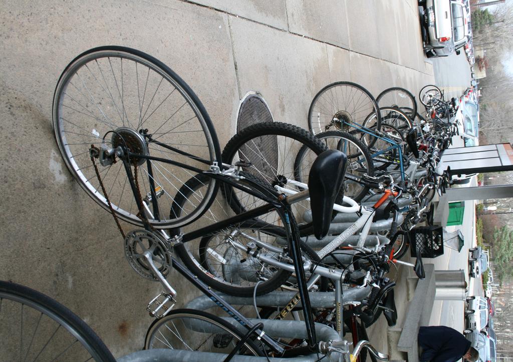
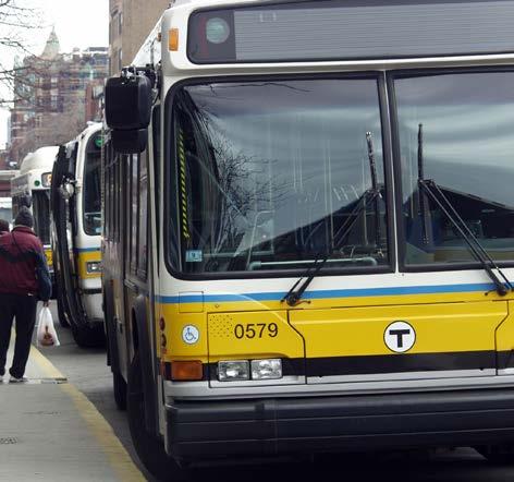
7 Roadway Congestion Introduction INRIX, a company that provides traffic information, travel services, and applications and tools for traffic management, also periodically develops a National Traffic Scorecard. 3 The current ScoreCard, published in April 2012, ranked the Boston region as having the tenth-highest roadway congestion in the nation over the previous 12 months. This ranking is slightly higher than Miami s (12.8) and slightly lower than Chicago s (13.3). Boston has a lower INRIX index than many other Northeastern urban areas, such as New York, Bridgeport, and Washington, D.C., but has a higher INRIX index than Philadelphia, Baltimore, and Providence. According to the Texas Transportation Institute s 2010 Urban Mobility Report, in terms of the total number of hours of travel delay experienced by auto commuters, the Boston region was ranked tenth in the nation (119 million hours in 2009) worse than the Atlanta region (112 million hours) and better than the San Francisco-Oakland region (121 million hours). 4 In terms of the total number of hours of truck delay, the Boston region was ranked twelfth in the nation (6.2 million hours in 2009). This is better than the San Francisco Oakland region (6.8 million hours) and slightly worse than the Seattle region (6.2 million hours). Public Transit 5 The Boston region s public transit system is a key function of the region s transportation network, and without it, automobile congestion would be significantly worse. The most recent available average numbers of weekday unlinked transit passenger trips taken are about 762,400 on the rapid transit system, 370,600 on the bus system, 133,300 on the commuter rail system, and 4,372 on commuter ferries. 6 The entire MBTA system provides slightly over 1.2 million trips per weekday. 3 INRIX Traffic Scorecard, April 2012 (accessed online June 25, 2012). 4 Texas Transportation Institute, Urban Mobility Report, Because the American Public Transit Association distinguishes between heavy rail and light rail, statistics for the MBTA s rapid transit system separate the Green Line and Mattapan High-Speed Line from the Blue, Orange, and Red lines. However, in the remainder of this report, MBTA rapid transit is generally treated as a single system. 6 American Public Transportation Association, APTA 2011 Q3 Ridership Report, December Ctps 5
8 Boston Region MPO Congestion Management Process Comparison of Public Transit Services According to the American Public Transit Association, public transit services in Boston compare to those of other metro regions as follows. The MBTA s commuter rail system is the fifth busiest in the nation, with slightly higher ridership than Philadelphia s system (SEPTA) and much lower ridership than Chicago s main system (METRA) and the three systems in the greater New York City region (New Jersey Transit, Long Island Railroad, and MTA). Together, the Green Line and Mattapan High-Speed Line constitute by far the busiest light rail transit system in the United States, with an average of 232,000 weekday boardings. This ridership has 60,000 more weekday boardings than San Francisco s Municipal Railway, which is the second-busiest light rail system in the United States. 7 The Blue, Orange, and Red lines, with an average of 530,400 weekday boardings for all three lines combined, constitute the fourth-busiest heavy rail rapid transit system in the United States, significantly more heavily used than the San Francisco Bay Area Rapid Transit (BART) system, and less heavily used than the rapid transit systems of New York, Washington, D.C., and Chicago. The MBTA bus system is the seventh-busiest system in the nation, with 370,600 weekday boardings, just behind that of Washington, D.C., and ahead of San Francisco s Municipal Railway Service. Other Modes According to U.S. Census Bureau, for the years 2005 to 2009 an estimated 98,463 residents of the Boston Region MPO area commuted to work by walking, and 15,695 bicycled to work. 8 These statistics do not include trips taken by foot and by bicycle for purposes other than commuting. Census estimates show that about 36% of workers in the MPO region commute by means other than driving alone. When comparing the Boston region to other regions, Metropolitan Statistical Areas (MSAs), which are defined by the U.S. Office of Management and Budget and used by the U.S. Census Bureau and other U.S. government agencies for statistical purposes, provide a useful approximation of the boundary of the urban area. Although MSAs do not necessarily have the same boundaries as MPO regions, they are similar in that they cover an urban area that extends beyond city limits; in addition, data at the MSA level are readily available from the Census Bureau. Compared to other large MSAs with over 7 8 United States Census Bureau. American Community Survey data (last accessed June 14, 2011). United States Census Bureau, American Community Survey data (accessed June 14, 2011). 6 Boston Region MPO
9 Introduction one million workers, the Boston MSA, with a mode share of commuting by foot of 5.0%, ranks second only to the New York City MSA. In terms of the percentage of workers who commute by bicycle, the Boston MSA ranks sixth, with a mode share of 0.8%. This is a higher percentage than the New York City, Philadelphia, Washington, D.C., and Baltimore MSAs, but lower than the percentage in the MSAs of San Francisco, Seattle, Minneapolis, Phoenix, and Portland, Oregon. In terms of the percentage of workers who commute by carpooling, the Boston MSA ranks twenty-third among large MSAs (8.1% of workers carpool, slightly higher than the New York City MSA and lower than the Philadelphia, Baltimore, and Washington, D.C., MSAs). THE CONGESTION MANAGEMENT PROCESS The process model for congestion management recommended by the federal government provides an outline for an objectives-driven, performance-based approach consisting of eight actions: 9 1. Develop regional objectives. 2. Define the CMP network. 3. Develop multimodal performance measures. 4. Collect data and monitor system performance. 5. Analyze congestion problems and needs. 6. Identify and assess strategies. 7. Program and implement strategies. 8. Evaluate strategy effectiveness. Figure INT-2 shows how this model is used by the Boston Region MPO, and also shows the connections between the CMP and other elements in the MPO s transportation planning process. 9 Federal Highway Administration, Congestion Management Process: A Guidebook (Technical report no. FHWA-HEP ), April 2011, p. 9. Ctps 7

10 Boston Region MPO Congestion Management Process FIGURE INT-2 Boston Region Congestion Management Process 8 Boston Region MPO
11 Links between the CMP and Other Planning Elements Introduction The CMP interacts with many elements of the transportation planning process. The essential functional elements of an MPO are indicated in orange in Figure INT-2, which shows how the Boston Region MPO views the integration of the CMP with the overall metropolitan planning process, as shown by Links A, B, C, and D. These linkages are described in detail below. Links A, B, and C show that the CMP is integrated with the LRTP, TIP and UPWP Develop CMP Objectives, Define CMP Network, Identify and Assess Strategies, and Evaluate Strategy Effectiveness are steps in the Congestion Management Process that relate directly to the following elements of the LRTP: visions and policies, application area, needs assessment, and strategy development and evaluation. CMP performance monitoring is used in the needs assessments for the LRTP. The Identify and Assess Strategies section of this document identifies possible strategies that may be implemented. These strategies are mentioned in greater detail later in this document. This section also provides input into the UPWP for corridor studies and other planning studies, and, indirectly, into UPWP study recommendations for the LRTP. Some of the recommendations yielded by CMP monitoring of roadway, transit, and bicycle/pedestrian transportation studies for the UPWP have to do with: Pedestrian access to transit Bicycle and pedestrian access to community centers Safety and operations programs for signalized intersections Bottleneck studies Arterial coordination The entire CMP program is funded through the UPWP. The latest CMP work program was updated to include monitoring of vehicle occupancy for future HOV system planning and transportation demand management, the evaluation of additional intersections for needs assessment for the LRTP, and the evaluation of projects and strategies evaluations for an improved objectives-driven, performance-based approach. Programming and Implementing Strategies relates to the CMP influence in the selection of projects for funding in the TIP. Monitoring data from the CMP are used in the evaluation of potential TIP projects and their prioritization for funding. Evaluate Strategy Effectiveness evaluates the impacts or results of implementing the strategies in the Boston region. This step receives input from TIP projects that have been implemented in order to monitor their strategy effectiveness, which, in turn, feeds Ctps 9
12 Boston Region MPO Congestion Management Process into management and operations and other CMP recommendations for future LRTPs. This step has not been implemented in its fullest, although the MPO has recently funded the study TIP Project Impacts, Before After Evaluations, completed in October The following section describes some of the CMP-recommended studies that resulted in evaluations of improvement strategies. Many of the recommendations from these studies are already in various stages of design, implementation, and construction. Multimodal Subarea Studies The Lower North Shore Transportation Improvement Study, 2000 MetroWest Subregional Area Study, 2000 Traffic Congestion in the SouthWest Advisory Planning Subregion, 2002 Transportation Improvement Study of Routes 1A, 114, and 107, and Other Major Roadways in Downtown Salem, 2005 Mid North Shore Subregional Transportation Study, 2006 Belmont, Lexington, Waltham Subarea Study, 2009 Expressway Planning and Operations Studies Feasibility Analysis of Safety and Operational Improvements at 11 Route 128 Interchanges, 2003 I-93/Southeast Expressway/Route 3 Braintree Split, 2006 Safety and Operational Improvements for the I-93/Route 24 Interchange, 2007 Newton Corner Rotary Study Phase II, 2009 Alewife Traffic Operations and Access Study Phase II, 2009 Freeway Bottlenecks, 2009 Freeway Bottlenecks, 2011 Corridor Planning and Operations Studies Route 138 Corridor Planning Study, 2001 Route 53 Corridor Transportation Plan, 2003 Route 28 Corridor Study, 2008 Route 60 Mobility Study: Malden and Medford, 2009 Route 126 Corridor Improvements Study, Boston Region MPO
13 Arterial Intersections Traffic Operations Studies Signalized Intersection Study North Suburban Planning Council, 2001 Signalized Intersection Study Minuteman Advisory Group on Interlocal Coordination, 2001 Introduction Signalized Intersections Study SouthWest Advisory Planning Committee, 2001 Signalized Intersections Study South Shore Coalition, 2001 Signalized Intersections Study MetroWest, 2001 Congested Intersection Study Three Rivers Interlocal Council, 2002 Signalized and Unsignalized Intersections Study North Shore Task Force, 2003 Safety and Operational Improvements at Selected Intersections, 2008 Arterial Traffic Signal Improvements and Coordination, 2010 Transit Planning and Operations MBTA Bus Route 66 Arterial Improvement Study, 2001 MBTA Transit Signal Priority Study: Arborway Corridor, 2008 MBTA Route 1 Transit Signal Priority Study, 2011 Strategic Visioning for MBTA Bus Service, 2011 Studies for Various Modes of Travel MassHighway Park-and-Ride Lot Status and Recommendations, 2003 Improving Pedestrian and Bicyclist Access to Selected Transit Stations, 2005 Link D: CMP Connections with Regional Concept of Transportation Operations and Boston Region Intelligent Transportation Systems (ITS) Architecture The current LRTP, Paths to a Sustainable Region (endorsed in September 2011), includes management and operations (M&O) and ITS considerations by regional corridor. 10 The M&O strategies are consistent with CMP findings and with the needs and strategies identified in the current LRTP. The following activities have been undertaken: 10 Boston Region Metropolitan Planning Organization, Long-Range Transportation Plan, Paths to a Sustainable Region, Chapter 4, "Transportation System Operations and Management," endorsed September 22, MassDOT, Regional Transportation Operations Strategy, Boston Metropolitan Region, March Ctps 11
14 Boston Region MPO Congestion Management Process The MPO s Transportation Improvement Program (TIP) for federal fiscal years includes funding for ITS projects along I-95 and I-495, including expansion of fiber-optic cable, CCTV (closed-circuit television), VMS (variable message signs), wireless sensor networks, and other communications infrastructure. The CMP has recommended several TSP (transit signal priority) studies in the region, and funding has been identified for them. Several TSP studies have already been performed, and the MBTA is considering recommendations for implementation. Data from CMP monitoring, and from the MBTA s service planning forms the basis for a strategy assessment of bus transit-signal priority. The MPO staff has participated in a statewide effort to assess costs associated with maintaining and operating the existing Federal Aid Highway System in the Boston region. MPO staff and MPO member agency representatives have participated in ITS architecture updates since the first Metro Boston Early Deployment Plan for Intelligent Vehicle Highway System (IVHS) was completed in It is expected that MPO member agency representatives and staff will participate as stakeholders in MassDOT s ITS Implementation Plan. MPO staff has participated in a survey, managed by MassDOT Office of Transportation Planning (OTP), of an electronic data-sharing program. MPO staff is participating in the City of Boston led effort to integrate transportation data from a variety of sources, including CCTV and traffic detection systems, into a dynamic database system. CMP staff is making progress toward switching roadway speed monitoring to vendor-provided speed data collected from various digital sources. The UPWP has included studies on arterial and corridor traffic signal improvements, including arterial signal coordination. The TIP has called for technology and communications upgrades for the traffic control center of the City of Boston, which is a member of the MPO. In 2010, the MPO proposed that its Clean Air and Mobility program should fund a traffic-signal retiming program for the City of Newton. The LRTP s visions and goals include support for ITS technology. CMP staff has recommended that the current LRTP incorporate ITS communication and technology needs and strategies from MassDOT s draft report 12 Boston Region MPO
15 about the Metropolitan Boston 2010 Regional Transportation Operations Strategy. 11 Introduction The eight steps of the Boston Region MPO's Congestion Management Process are described in detail in this document. 11 MassDOT, Regional Transportation Operations Strategy, Boston Metropolitan Region, March Ctps 13
Measuring and Communicating Mobility:
 Measuring and Communicating Mobility: The District Mobility Project Stephanie Dock, District Department of Transportation TRB Transportation Issues in Major Cities Committee May 2, 2017 Deconstructing
Regional Transportation Needs Within Southeastern Wisconsin
 Regional Transportation Needs Within Southeastern Wisconsin #118274 May 24, 2006 1 Introduction The Southeastern Wisconsin Regional Planning Commission (SEWRPC) is the official areawide planning agency
Tulsa Metropolitan Area LONG RANGE TRANSPORTATION PLAN
 Tulsa Metropolitan Area LONG RANGE TRANSPORTATION PLAN Indian Nations Council of Governments August 2005 CONTACTING INCOG In developing the Destination 2030 Long Range Transportation Plan, INCOG s Transportation
Clackamas County Comprehensive Plan
 ROADWAYS The County s road system permits the movement of goods and people between communities and regions, using any of a variety of modes of travel. Roads provide access to virtually all property. They
5. Pedestrian System. Accomplishments Over the Past Five Years
 5. Pedestrian System Accomplishments Over the Past Five Years The Alamo Area Metropolitan Planning Organization (MPO) and its partner agencies recognize the importance of improving pedestrian mobility.
Corpus Christi Metropolitan Transportation Plan Fiscal Year Introduction:
 Introduction: The Safe, Accountable, Flexible, Efficient Transportation Equity Act: A Legacy for Users (SAFETEA-LU) has continued the efforts started through the Intermodal Surface Transportation Efficiency
CITY OF COCOA BEACH 2025 COMPREHENSIVE PLAN. Section VIII Mobility Element Goals, Objectives, and Policies
 CITY OF COCOA BEACH 2025 COMPREHENSIVE PLAN Section VIII Mobility Element Goals, Objectives, and Policies Adopted August 6, 2015 by Ordinance No. 1591 VIII MOBILITY ELEMENT Table of Contents Page Number
North Coast Corridor:
 North Coast Corridor: Connecting People, Transportation & Environment Legislative Hearing: 11.8.10 1 North Coast Corridor Region s Lifeline A Regional Strategy Mobility, Economy & Environment North Coast
Transportation Master Plan Advisory Task Force
 Transportation Master Plan Advisory Task Force Network Alternatives & Phasing Strategy February 2016 BACKGROUND Table of Contents BACKGROUND Purpose & Introduction 2 Linking the TMP to Key Council Approved
2. Context. Existing framework. The context. The challenge. Transport Strategy
 Transport Strategy Providing quality connections Contents 1. Introduction 2. Context 3. Long-term direction 4. Three-year priorities 5. Strategy tree Wellington City Council July 2006 1. Introduction Wellington
Maryland State Highway Mobility Report. Morteza Tadayon
 Maryland State Highway Mobility Report Morteza Tadayon Background Mobility is a Key Performance Area (KPA) in the SHA Business Plan SHA adopts a performance based approach Monitors Highway System to identify
EXECUTIVE SUMMARY... vii 1 STUDY OVERVIEW Study Scope Study Area Study Objectives
 Contents EXECUTIVE SUMMARY... vii 1 STUDY OVERVIEW... 1-1 1.1 Study Scope... 1-1 1.2 Study Area... 1-1 1.3 Study Objectives... 1-3 2 EXISTING CONDITIONS... 2-1 2.1 Existing Freeway Conditions... 2-4 2.1.1
Mobility and Congestion
 Technical Memorandum Mobility and Congestion Prepared for: Prepared by: September 25, 2013 1 Table of Contents 1. Introduction... 1 2. Congestion Forecasting Process... 1 2.1 Mobility and Congestion Terms...
92% COMMUTING IN THE METRO. Congested Roadways Mode Share. Roadway Congestion & Mode Share
 COMMUTING IN THE METRO Roadway Congestion & Mode Share The majority of major roadways in Greater Des Moines are without congestion and have underutilized capacity. This surplus capacity could be used for
North Shore Transportation Improvement Strategy
 North Shore Transportation Improvement Strategy Preliminary, Near-term Recommendation 2016 April Transportation Improvement Strategy (TIS) Comprehensive and Analytical A multi-modal transportation strategy
Arnold Hinojosa
 Policy Analysis of the Mass Transit Challenges Facing Rapidly Growing Southern and Western Cities and How These Challenges Can Be Addressed Using the Model Set by Chicago Arnold Hinojosa ahinojosa@kentlaw.edu
ROUTES 55 / 42 / 676 BUS RAPID TRANSIT LOCALLY PREFERRED ALTERNATIVE
 ROUTES 55 / 42 / 676 BUS RAPID TRANSIT LOCALLY PREFERRED ALTERNATIVE April, 2012 1 INTRODUCTION The need for transit service improvements in the Routes 42/55/676 corridor was identified during the Southern
Chapter 7. Transportation. Transportation Road Network Plan Transit Cyclists Pedestrians Multi-Use and Equestrian Trails
 Chapter 7 Transportation Transportation Road Network Plan Transit Cyclists Pedestrians Multi-Use and Equestrian Trails 7.1 TRANSPORTATION BACKGROUND The District of Maple Ridge faces a number of unique
IMPLEMENTATION OF CHARTING PROGRESS TO 2040: Guiding the Boston Region s Transportation Investments MPO Outreach FFY 2016
 GET INVOLVED To identify a transportation need: Visit the LRTP Needs Assessment online at www.ctps.org/lrtp_needs or send an email to publicinformation@ctps.org. charting progress to 2040 To suggest a
SANTA CLARA COUNTYWIDE BICYCLE PLAN August 2008
 SANTA CLARA COUNTYWIDE BICYCLE PLAN August 2008 To assist VTA and Member Agencies in the planning, development and programming of bicycle improvements in Santa Clara County. Vision Statement To establish,
ADOT Statewide Bicycle and Pedestrian Program Summary of Phase IV Activities APPENDIX B PEDESTRIAN DEMAND INDEX
 ADOT Statewide Bicycle and Pedestrian Program Summary of Activities APPENDIX B PEDESTRIAN DEMAND INDEX May 24, 2009 Pedestrian Demand Index for State Highway Facilities Revised: May 29, 2007 Introduction
3 ROADWAYS 3.1 CMS ROADWAY NETWORK 3.2 TRAVEL-TIME-BASED PERFORMANCE MEASURES Roadway Travel Time Measures
 ROADWAYS Approximately 6 million trips are made in the Boston metropolitan region every day. The vast majority of these trips (80 to percent, depending on trip type) involve the use of the roadway network
Moving Cambridge. City of Cambridge Transportation Master Plan Public Consultation Centre. March 7, :00 8:00 PM.
 City of Cambridge Transportation Master Plan Public Consultation Centre March 7, 2018 5:00 8:00 PM Region of Waterloo City of Cambridge Transportation Master Plan Public Consultation Centre March 7, 2018
San Mateo County Comprehensive Bicycle and Pedestrian Plan Open House
 San Mateo County Comprehensive Bicycle and Pedestrian Plan Open House October 28, 2010 Presented to San Mateo County residents and interested parties by Lauren Ledbetter, Alta Planning + Design Matt Haynes,
Purpose and Need. Chapter Introduction. 2.2 Project Purpose and Need Project Purpose Project Need
 Chapter 2 Purpose and Need 2.1 Introduction The El Camino Real Bus Rapid Transit (BRT) Project (Project) would make transit and other transportation improvements along a 17.6-mile segment of the El Camino
MASTER BICYCLE AND PEDESTRIAN PLAN
 VILLAGE OF NORTHBROOK MASTER BICYCLE AND PEDESTRIAN PLAN DRAFT PLAN OPEN HOUSE May 2, 2018 AGENDA 1. Community Engagement 2. Vision and Goals 3. General Structure of Plan 4. Recommendations Overview 5.
Sustainable Transportation Planning in the Portland Region
 Sustainable Transportation Planning in the Portland Region Jennifer Dill, Ph.D. Associate Professor School of Urban Studies & Planning jdill@pdx.edu http://web.pdx.edu/~jdill/ Outline Elements of a sustainable
MCTC 2018 RTP SCS and Madera County RIFP Multi-Modal Project Eval Criteria GV13.xlsx
 MCTC 8 RTP SCS and Madera County RIFP Multi-Modal Project Eval Criteria GV.xlsx Madera County Transportation Commission Regional Transportation Plan / Sustainable Communities Strategy Multi-Modal Project
Rochester Downtown Bicycle Study 2009
 Rochester Downtown Bicycle Study 2009 Relationship of ROCOG Long Range Transportation Plan to Rochester Comprehensive Plan Regional Long Range Transportation Plan (LRTP) is prepared under the auspices
SMART 1 Public Meeting #1. February 24, 2016
 SMART 1 Public Meeting #1 February 24, 2016 Agenda Who is the SMTC? SMART 1 project overview Syracuse Metropolitan Transportation Council An Introduction: Who we are & what we do What is an MPO? A Metropolitan
City of Hamilton s Transportation Master Plan (TMP) Public Consultation 3 December 2015
 Public Consultation 3 December 2015") City of Hamilton s Transportation Master Plan (TMP) Public Consultation 3 December 2015 McPhail Transportation Planning Services Ltd. AGENDA 6:00 7:00 pm Viewing Boards / Q & A with the Team 7:00 7:50
City of Hamilton s Transportation Master Plan (TMP) Public Consultation 3 December 2015 McPhail Transportation Planning Services Ltd. AGENDA 6:00 7:00 pm Viewing Boards / Q & A with the Team 7:00 7:50
PRELIMINARY DRAFT FIRST AMENDMENT TO VISION 2050: A REGIONAL LAND USE AND TRANSPORTATION PLAN FOR SOUTHEASTERN WISCONSIN
 PRELIMINARY DRAFT FIRST AMENDMENT TO VISION 2050: A REGIONAL LAND USE AND TRANSPORTATION PLAN FOR SOUTHEASTERN WISCONSIN ESTABLISHING TARGETS FOR FEDERAL PERFORMANCE MEASURES: HIGHWAY SAFETY SOUTHEASTERN
The CMP Network BACKGROUND ROADWAY NETWORK
 The CMP Network BACKGROUND Generally speaking, the Congestion Management Process is applied to the Boston Region MPO area. This region includes 101 cities and towns in eastern Massachusetts, within a radius
Exhibit 1 PLANNING COMMISSION AGENDA ITEM
 Exhibit 1 PLANNING COMMISSION AGENDA ITEM Project Name: Grand Junction Circulation Plan Grand Junction Complete Streets Policy Applicant: City of Grand Junction Representative: David Thornton Address:
5. RUNNINGWAY GUIDELINES
 5. RUNNINGWAY GUIDELINES These guidelines should be considered collectively when making runningway decisions. A runningway is the linear component of the transit system that forms the right-of-way reserved
We believe the following comments and suggestions can help the department meet those goals.
 The Honorable Secretary Anthony Foxx The Secretary of Transportation United States Department of Transportation 1200 New Jersey Avenue, SE Washington, DC 20590 August 30, 2013 Dear Secretary Foxx, Thank
Preliminary Transportation Analysis
 Preliminary Transportation Analysis Goals of a Robust, Multimodal Transportation Network Safe Accessible/Connected Efficient Comfortable Context-Sensitive Motor Vehicle: Continue to analyze the data to
Corridor Advisory Group and Task Force Meeting #10. July 27, 2011
 Corridor Advisory Group and Task Force Meeting #10 July 27, 2011 1 Agenda Recap CAG/TF #9 Public Meeting #2 Summary Single Mode Alternatives Evaluation Results Next Steps 2 3 CAG/TF #9 Recap CAG /TF #9
Circulation in Elk Grove includes: Motor vehicles, including cars and trucks
 Circulation, as it is used in this General Plan, refers to the many ways people and goods move from place to place in Elk Grove and the region. Circulation in Elk Grove includes: Motor vehicles, including
Preliminary Review of the T-REX Southeast Corridor Highway and Light Rail Transit Project
 Preliminary Review of the T-REX Southeast Corridor Highway and Light Rail Transit Project DRCOG Congestion Mitigation Program White Paper 07-1 (February 16, 2007) On time and under budget! Festivities
AMATS Complete Streets Policy
 AMATS Complete Streets Policy Table of Contents: Section 1. Definition of Complete Streets Section 2. Principles of Complete Streets Section 3. Complete Streets Policy Section 4. Consistency Section 5.
WALKNBIKE DRAFT PLAN NASHVILLE, TENNESSEE EXECUTIVE SUMMARY NASHVILLE, TENNESSEE
 NASHVILLE, TENNESSEE EXECUTIVE SUMMARY Executive Summary A world-class multi-modal transportation system is essential to a vibrant city and better quality of life. -Mayor Barry The WalknBike plan aims
BICYCLE FACILITIES & PROGRAMS
 CHAPTER 5 BICYCLE FACILITIES & PROGRAMS This component reviews existing bicycle facilities and issues associated with bicycling in the region. The chapter also presents the regional bicycle route system
Washington DC Section of ITE Project Briefing
 Washington DC Section of ITE Project Briefing November 5, 2015 Renée Hamilton, VDOT, Deputy District Administrator I-66 Outside the Beltway Improvement Area Project Location Virginia 2 Purpose and Need
A Survey of Planning, Design, and Education for Bikeways and Bus Routes on Urban Streets
 A Survey of Planning, Design, and Education for Bikeways and Bus Routes on Urban Streets, Community & Economic Development Agency, Transportation Services Division (510) 238-3983 bikeped@oaklandnet.com
WHITE PAPER: TRANSIT SERVICE FOR SOUTH SHAGANAPPI
 9/27/2012 TRANSIT PLANNING WHITE PAPER: TRANSIT SERVICE FOR SOUTH SHAGANAPPI 2012 Calgary Transit 1 Table of Contents Purpose... 3 Area of Change... 3 Background... 3 Access to destinations... 5 Connecting
The Route 29 Corridor Study was initiated at the request of Virginia s Commonwealth
 CHAPTER 2: Study Background and approach The Route 29 Corridor Study was initiated at the request of Virginia s Commonwealth Transportation Board in response to requests from members of the General Assembly
ROADSOADS CONGESTION HAMPTON SYSTEMYSTEM MANAGEMENT. Part II Roadway Congestion Analysis Mitigation Strategies and Evaluation
 HAMPTON ROADSOADS CONGESTION MANAGEMENT SYSTEMYSTEM Part II Roadway Congestion Analysis Mitigation Strategies and Evaluation Presented by: Dwight Farmer, PE Deputy Executive Director, Transportation April
Appendix T 1: Additional Supporting Data
 Appendix T 1: Additional Supporting Data Project Delivery Delays with the implementation of the 2000 TIP became apparent early in the decade. In response to direction among policy officials, ARC began
Santa Clara I-280 CORRIDOR STUDY
 Santa Clara I-280 CORRIDOR STUDY OCTOBER 2017 PREPARED BY: 1.1 Background The I-280 Corridor Study within Santa Clara County is a high-level highway planning study led by the Santa Clara VTA, in partnership
Bicycle and Pedestrian Planning in a Historically Car-Centric Culture: A Focus on Connectivity, Safety, & Accessibility
 Bicycle and Pedestrian Planning in a Historically Car-Centric Culture: A Focus on Connectivity, Safety, & Accessibility Kate Horton and Zylavian Watley Transportation Planners Memphis MPO Date: October
Bus Rapid Transit Plans
 Twin Cities Region Bus Rapid Transit Plans ULI Minnesota Workshop Connecting Bus Rapid Transit to the Community December 15, 2009 John Levin Director of Service Development Metro Transit Metropolitan Area
Performance Criteria for 2035 Long Range Transportation Plan
 Minimizing Impacts on Natural, Historic, Cultural or Archeological Resources 2035 LRTP Weighting Factor: 7% Objective 1.1: Use appropriate planning and design criteria to protect and enhance the built
Philadelphia Bus Network Choices Report
 Philadelphia Bus Network Choices Report JUNE 2018 SEPTA Table of Contents Executive Summary...7 What if transit gave us more freedom?... 8 What is this report?... 8 The main conclusions... 9 What is happening
FROM: CITY MANAGER DEPARTMENT: PLANNING AND COMMUNITY ENVIRONMENT DATE: OCTOBER 4, 2004 CMR:432:04
 TO: HONORABLE CITY COUNCIL FROM: CITY MANAGER DEPARTMENT: PLANNING AND COMMUNITY ENVIRONMENT DATE: OCTOBER 4, 2004 CMR:432:04 SUBJECT: FINANCE COMMITTEE RECOMMENDATION TO ADOPT TRANSPORTATION STRATEGIC
MONTGOMERY COUNTY PLANNING DEPARTMENT THE MARYLAND-NATIONAL CAPITAL PARK AND PLANNING COMMISSION
 MONTGOMERY COUNTY PLANNING DEPARTMENT THE MARYLAND-NATIONAL CAPITAL PARK AND PLANNING COMMISSION MCPB Item No. 4 Date: 04-17-14 2014 Mobility Assessment Report José Dory, Senior Planner, Functional Planning
Best Southwest Transportation Committee. North Central Texas Council of Governments Transportation Department
 Best Southwest Transportation Committee North Central Texas Council of Governments Transportation Department The The Regional Regional Veloweb Veloweb Review Review NCTCOG Bicycle and Pedestrian Program
I-105 Corridor Sustainability Study (CSS)
") I-105 Corridor Sustainability Study (CSS) Metro Streets and Freeways Subcommittee March 21, 2019 Gary Hamrick Cambridge Systematics, Inc. I-105 CSS Project History & Background Funded by Caltrans Sustainable
I-105 Corridor Sustainability Study (CSS) Metro Streets and Freeways Subcommittee March 21, 2019 Gary Hamrick Cambridge Systematics, Inc. I-105 CSS Project History & Background Funded by Caltrans Sustainable
Building Community Partnerships for Mobility:
 Building Community Partnerships for Mobility: San Francisco 2008 Presented by: Cynthia Hoyle, AICP Transportation Planning Consultant Champaign-Urbana Mass Transit District Background The Heartland Champaign-Urbana,
Guidelines for Providing Access to Public Transportation Stations APPENDIX C TRANSIT STATION ACCESS PLANNING TOOL INSTRUCTIONS
 APPENDIX C TRANSIT STATION ACCESS PLANNING TOOL INSTRUCTIONS Transit Station Access Planning Tool Instructions Page C-1 Revised Final Report September 2011 TRANSIT STATION ACCESS PLANNING TOOL INSTRUCTIONS
Arterial Transitway Corridors Study. Ave
 Arterial Transitway Corridors Study Ave January 2012 Arterial Transitway Corridors Study Overview Corridor Features and Demographics 11 study corridors, 95 route miles 86,000 daily rides and half of existing
Madison Urban Area and Dane County. Bicycle Transportation Plan Summary. September Introduction. Bicycle Plan Scope and Planning Process
 Bicycle Transportation Plan Summary Madison Urban Area and Dane County Introduction September 2000 Bicycling is an important mode of transportation in the Madison urban area and countywide that is available
Regional Bicycle Barriers Study
 Regional Bicycle Barriers Study Executive Summary Background and Purpose The 2040 Transportation Policy Plan (TPP) sets policies for planning and investment direction in the transportation system in the
Congestion Reducing Activities. Toby Carr GDOT Director of Planning April 10, 2014
 Congestion Reducing Activities Toby Carr GDOT Director of Planning April 10, 2014 GDOT Performance Dashboard Congestion Congestion Relief Strategies 511 HEROS RTOP Highway Emergency Response Operators
Chapter 2. Bellingham Bicycle Master Plan Chapter 2: Policies and Actions
 Chapter 2 Bellingham Bicycle Master Plan Chapter 2: Policies and Actions Chapter 2: Policies and Actions The Bicycle Master Plan provides a road map for making bicycling in Bellingham a viable transportation
WELCOME TO OPEN HOUSE # 1 June 14, 2017
 Langstaff Road Weston Road to Highway 7 Class Environmental Assessment Study WELCOME TO OPEN HOUSE # 1 June 14, 2017 Please sign in and join our mailing list Purpose of Open House #1 & Study Area York
CITY OF BLOOMINGTON COMPLETE STREETS POLICY
 CITY OF BLOOMINGTON COMPLETE STREETS POLICY POLICY OBJECTIVE: The City of Bloomington will enhance safety, mobility, accessibility and convenience for transportation network users of all ages and abilities,
Key objectives of the survey were to gain a better understanding of:
 3 COMMUNITY INPUT Community input is an essential part of corridor studies. For the SR 87 corridor study, VTA staff conducted an extensive online survey of people living and commuting along the corridor.
Everett Transit Action Plan. Community Open House November 16, 2015
 Everett Transit Action Plan Community Open House Everett has a great location, but getting around the city and into surrounding communities is a problem for all ages Many Voices, One Future: The Everett
FHWA s Strategic Agenda for Pedestrian and Bicycle Transportation. Purdue Road School March 8, 2017
 FHWA s Strategic Agenda for Pedestrian and Bicycle Transportation Purdue Road School March 8, 2017 1 Strategic Agenda for Pedestrian and Bicycle Transportation Provides a framework for organizing FHWA
What is the problem? Transportation Safety Planning Purdue Road School. 42,636 Fatalities. Nearly 3M Injuries. Over 4M PDO crashes
 Transportation Safety Planning Purdue Road School March 29, 2006 What is the problem? 42,636 Fatalities Nearly 3M Injuries Over 4M PDO crashes $230B Cost to the Nation Trends in Motor Vehicle Fatality
TRANSPORTATION & MOBILITY
 TRANSPORTATION & MOBILITY ROADWAY SYSTEM There are approximately 40 miles of roadways in Manitou Springs. For planning purposes, roadways are typically assigned a functional classification which defines
Governor s Transportation Vision Panel
 Office of Governor Kate Brown Governor s Transportation Vision Panel JLA Public Involvement Project Overview The is a yearlong effort to develop a series of recommendations for the Governor that address
Chapter 9: Pedestrians and Bicyclists
 Chapter 9: Pedestrians and Bicyclists Walking and bicycling are essential modes of transportation. These modes allow people to travel without contributing to congestion and air pollution, to access other
BUILDING THE CASE FOR TRAVEL OPTIONS IN WASHING TON COUNTY. Image: Steve Morgan. Image: Steve Morgan
 BUILDING THE CASE FOR TRAVEL OPTIONS IN WASHING TON COUNTY Image: Steve Morgan Image: Steve Morgan Image: TriMet Image: TriMet WHAT ARE TRAVEL OPTIONS PROGRAMS? Travel options programs encourage residents,
Dear City Council Members,
 From: Bob Kenyon [mailto: ] Sent: Monday, February 08, 2016 10:20 AM To: City Clerk Subject: Please prioritize Caltrain and a complete transit network Thank you for prioritizing bringing BART to San Jose
National Capital Region Congestion Report
 NATIONAL CAPITAL REGION TRANSPORTATION PLANNING BOARD National Capital Region Congestion Report 4th Quarter 2015 Metropolitan Washington Council of Governments 777 North Capitol Street, N.E., Suite 300,
An Assessment of Potential Greenhouse Gas Emissions Reductions from Proposed On Street Bikeways
 An Assessment of Potential Greenhouse Gas Emissions Reductions from Proposed On Street Bikeways Through the Sustainable Bethlehem Initiative, the Town of Bethlehem has identified both the improvement of
Chapter 5 Future Transportation
 Chapter 5 Future Transportation The Future Land Use Plan identifies the desired land use designations. The land uses desired for Crozet depend, in large part, on the success of the transportation system,
JONESBORO HIGHWAY 63 HIGHWAY 18 CONNECTOR STUDY
 JONESBORO HIGHWAY 63 HIGHWAY 18 CONNECTOR STUDY Craighead County May 2007 JONESBORO HIGHWAY 63 HIGHWAY 18 CONNECTOR STUDY Craighead County May 2007 Prepared by Planning and Research Division Arkansas State
I-25 PEL: CO Springs Denver South Connection. Presentation to Castle Rock Town Council
 I-25 PEL: CO Springs Denver South Connection Presentation to Castle Rock Town Council June 20, 2017 An Important Corridor to Colorado Links the state s two major metropolitan areas and communities between
Building a bike friendly Chicago
 CASE STUDY Miovision Scout Building a bike friendly Chicago How video data is moving Chicago forward Chicago 2020 Becoming the Most Bike-Friendly City in the United States In 2011, Mayor Rahm Emanuel set
Moving Ahead. (Community Engagement) Chapter Three
 Chapter Three") 3 Community Chapter Three Moving Ahead (Community Engagement) engagement provided an exciting opportunity to engage Redwood City residents, workers, and business owners people who walk, bike, take transit,
3 Community Chapter Three Moving Ahead (Community Engagement) engagement provided an exciting opportunity to engage Redwood City residents, workers, and business owners people who walk, bike, take transit,
2010 Pedestrian and Bicyclist Special Districts Study Update
 2010 Pedestrian and Bicyclist Special Districts Study Update Pedestrian and Bicyclist Special Districts Program Overview H-GAC s Special Districts Program aims to provide strategic investments in pedestrian
PEDESTRIAN ACTION PLAN
 ATTACHMENT 2 CITY OF SANTA MONICA PEDESTRIAN ACTION PLAN CITY OF SANTA MONICA PEDESTRIAN ACTION PLAN This page intentionally left blank EXECUTIVE SUMMARY CHAPTER 1 EXECUTIVE SUMMARY Setting the Stage
Webinar- Importance of Multi- Modal Transit Connections and Fare Policy for Regional Transit Mobility & Equity
 Webinar- Importance of Multi- Modal Transit Connections and Fare Policy for Regional Transit Mobility & Equity Thomas Marchwinski Metro North RR (Previously with NJ Transit) Importance of Multi-Modal Transit
Roadways. Roadways III.
 Introduction 97 Roadway Design Principles 98 Safe Speeds 99 Optimizing of Street Space 00 Minimum Lane Widths in the City of Boston 02 Design Features that Reduce Operating Speeds 05 Travel Lanes Transit
Highway 217 Corridor Study. Phase I Overview Report
 Highway 217 Corridor Study Phase I Overview Report November 3, 24 BACKGROUND AND OVERVIEW Study purpose The Highway 217 Corridor Study is developing multi-modal transportation solutions for traffic problems
RESOLUTION NO ?? A RESOLUTION OF THE CITY OF NEPTUNE BEACH ADOPTING A COMPLETE STREETS POLICY
 RESOLUTION NO. 2018-?? A RESOLUTION OF THE CITY OF NEPTUNE BEACH ADOPTING A COMPLETE STREETS POLICY WHEREAS, safe, convenient, and accessible transportation for all users is a priority of the City of Neptune
About the Active Transportation Alliance
 About the Active Transportation Alliance Chicagoland s voice for better biking, walking and transit Founded 1985 7,000 members, ~33 full time staff Serve Chicago metro region 1 More Cars, More Driving
TABLE OF CONTENTS. Executive Summary
 Executive Summary Background... ES-1 Pedestrian Network... ES-2 Bikeway Network... ES-2 Collision History... ES-2 Public Input... ES-4 Conclusions and Recommendations... ES-4 1. Introduction and Setting
PERFORMANCE ANALYSIS of The Draft 2015 CLRP
 Item 9 PERFORMANCE ANALYSIS of The Draft CLRP Presentation to the Transportation Planning Board September 16, CLRP Performance Analysis 1 What is the Long-Range Transportation Plan (CLRP)? The CLRP identifies
Multimodal Transportation Plan
 Multimodal Transportation Plan The Multimodal Transportation Plan will accommodate MILLENIALS ARE DRIVING LESS. WE CANNOT BUILD OUR WAY all modes of transportation by keeping pedestrians, OUT OF CONGESTION.
INFRASTRUCTURE: Using the Grid to Create a more Self-Sustaining Downtown. Studio Spring 2013
 EMERGENT FUTURES The San Diego Section of the American Society of Civil Engineers (ASCE) released a new report, the 2012 San Diego County Infrastructure Report Card. Since the last San Diego Report Card
Typical Rush Hour Commute. PennyforTransportation.com
 Typical Rush Hour Commute In the News Overview of the Plan Collaborative plan with projects in every community Prioritizing connectivity and congestion relief Dedicated transportation-specific funding;
Chapter 2 Current and Future Conditions
 Chapter 2 Current and Future Conditions 2.1 An Overview of Ottawa s Transportation System The City of Ottawa is home to about 870,700 people. The city covers an area of 2,760 square kilometres of which
BOSTON REGION METROPOLITAN PLANNING ORGANIZATION
 PLANNING ORGANIZATIO BOSTON REGION MPO NMETROPOLITAN BOSTON REGION METROPOLITAN PLANNING ORGANIZATION Stephanie Pollack, MassDOT Secretary and CEO and MPO Chair Karl H. Quackenbush, Executive Director,
Goals, Objectives, and Policies
 Goals, Objectives, and Policies ADVISORY GROUP INPUT PUBLIC INPUT SNS PREVIOUS STUDIES RBPP Goals Vision Statement Southern Nevada will develop a safe, connected, and convenient walking and bicycling system
Complete Streets Policies in Charlotte
 Complete Streets Policies in Charlotte Complete Streets Peer Exchange Baton Rouge, LA January 19, 2016 Norm Steinman, AICP Charlotte DOT Changing what we do to change what will happen 1. Inventory of Conditions
Central Freeway and Octavia Circulation Study
 Central Freeway and Octavia Circulation Study Final Report Plans and Programs Committee San Francisco County Transportation Authority September 18, 2012 Presentation Outline Background and Study Purpose