Appendix B-5: Public Information Centre #5 Summary Report
|
|
|
- Jeffrey Wright
- 5 years ago
- Views:
Transcription


1 Appendix B-5: Public Information Centre #5 Summary Report PREPARED BY


2 Public Information Centre #5 Summary December 9-14, 2017 and January 24, 2018 London s Bus Rapid Transit System Prepared for the Corporation of the City of London by IBI Group and WSP March 14, 2018
3 IBI GROUP LONDON S BUS RAPID TRANSIT SYSTEM PUBLIC INFORMATION CENTRE #5 SUMMARY: DECEMBER 9-14, 2017 AND JANUARY 24, 2018 Prepared for the Corporation of the City of London Document Control Page CLIENT: PROJECT NAME: REPORT TITLE: IBI REFERENCE: VERSION: the Corporation of the City of London London s Bus Rapid Transit System Public Information Centre #5 Summary: December 9-14, 2017 and January 24, 2018 DIGITAL MASTER: ORIGINATOR: REVIEWER: AUTHORIZATION: Hailey McWilliam Marianne Alden, MCIP, RPP, Brian Hollingworth, P. Eng. Brian Hollingworth, P. Eng. CIRCULATION LIST: HISTORY: Version 1.0 February 2018 Version 2.0 March 2018
4 IBI GROUP LONDON S BUS RAPID TRANSIT SYSTEM PUBLIC INFORMATION CENTRE #5 SUMMARY: DECEMBER 9-14, 2017 AND JANUARY 24, 2018 Prepared for the Corporation of the City of London Table of Contents 1 Introduction Key Findings Public Information Centre Dates and Locations Public Information Centre #5 Promotion Summary Participation Where do you Live/Work/Attend School Map Information Presented Summary of Key Input from Interactive Display Boards PIC Comment Summary Stop Features Comments from the Public s from the Public Summary List of Exhibits Exhibit Bus Rapid Transit Network... 1 Exhibit 1-2 Individuals Viewing PIC Exhibits... 2 Exhibit 5-1 Live/Work/Attend School Map... 5 Exhibit 6-1 Public Information Display Boards... 5 Exhibit 7-1 Key Findings from the Interactive Display Boards for Public Information Centre #5 (December 2017)... 6 Exhibit 7-2 Key Findings from the Interactive Display Boards for Public Information Centre #5 (January 2018)... 7 Exhibit 8-1 Stop Feature Survey Results - December 9-14,
5 IBI GROUP LONDON S BUS RAPID TRANSIT SYSTEM PUBLIC INFORMATION CENTRE #5 SUMMARY: DECEMBER 9-14, 2017 AND JANUARY 24, 2018 Prepared for the Corporation of the City of London Table of Contents (continued) Exhibit 8-2 Stop Feature Survey Results - January 24, Exhibit 9-1 Public Comments Exhibit 9-2 Focus Area Public Comments Exhibit s Received Exhibit s Received List of Appendices Appendix A Facebook Ads Appendix B Instagram Ads Appendix C Posters Appendix D PIC 5 Display Boards Appendix E PIC 5 Presentation Appendix F Comment Sheets Appendix G Comment Sheets Questions and Responses Appendix H Focus Area Comment Sheets Appendix I s March 14, 2018 ii
 planning for the Bus Rapid Transit (BRT) System.")
6 IBI GROUP LONDON S BUS RAPID TRANSIT SYSTEM PUBLIC INFORMATION CENTRE #5 SUMMARY: DECEMBER 9-14, 2017 AND JANUARY 24, 2018 Prepared for the Corporation of the City of London 1 Introduction The City of London and their consultants, IBI Group and WSP, are undertaking the pre-transit Project Assessment Process (TPAP; Ontario Regulation 231/08) planning for the Bus Rapid Transit (BRT) System. The Project Team hosted seven sessions of the 5 th Public Information Centre between December 9 and 14, 2017, and two encore events on January 24, 2018 as part of the ongoing consultation with the public. The purpose of Public Information Centre (PIC) #5 was to obtain feedback from the public that will aid in the evaluation of the Bus Rapid Transit corridor design options. The 24-km bus rapid transit (BRT) network (Error! Reference source not found.) as defined in the Rapid Transit Master Plan, was approved by London s City Council on July 25, Exhibit Bus Rapid Transit Network *Based on public feedback, additional Rapid Transit stops are being considered at Capulet Lane and at Victoria Street on Richmond Street. 1
 period.")
7 IBI GROUP LONDON S BUS RAPID TRANSIT SYSTEM PUBLIC INFORMATION CENTRE #5 SUMMARY: DECEMBER 9-14, 2017 AND JANUARY 24, 2018 Prepared for the Corporation of the City of London PIC #5 was a drop-in open house with a formal presentation and question and answer (Q&A) period. An independent facilitator moderated the December PICs question and answer period, and City staff moderated the Q&A on January 24 th. During the open house period, attendees had the opportunity to view preliminary design options for the BRT network (Exhibit 1-2), ask questions, and provide input. Members of the Project Team were available to collect feedback and answer questions throughout the events. Exhibit 1-2 Individuals Viewing PIC Display Boards 2 Key Findings A number of comments and questions were raised at the PIC. Of the feedback received, recurring themes included: The presentation was well-done and informative There were varying opinions on centre-running verses curb-side running Rapid Transit There is a risk that BRT may become obsolete Recurring questions included: How will the dedicated transit lanes impact emergency services/snow removal? What, where and how will bike lanes work? How will local transit be integrated with BRT? When and how will property owners learn about potential impacts and property acquisition process? When will construction begin? 2
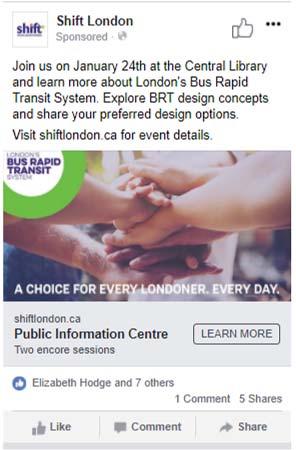
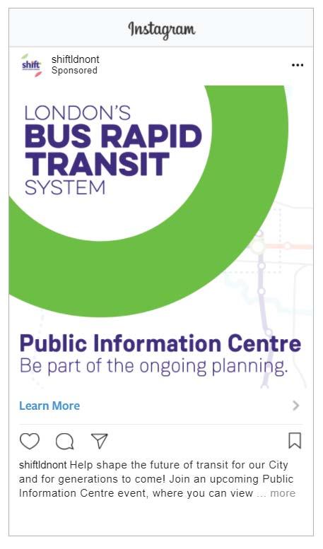
8 IBI GROUP LONDON S BUS RAPID TRANSIT SYSTEM PUBLIC INFORMATION CENTRE #5 SUMMARY: DECEMBER 9-14, 2017 AND JANUARY 24, 2018 Prepared for the Corporation of the City of London What is the plan to reduce delays at train crossing? A full summary of the comments received through comment sheets submitted at PIC 5 and through is included in Section 8 and Section 9. 3 Public Information Centre Dates and Locations Seven PICs were held from December 9, 2017 to December 14, Two encore events were held on January 24, The same information was presented at all the PICs. The PICs were held at the following times and locations: 1. December 9, :00am 12:00pm at the Central Library 2. December 9, 2017, 1:30pm 4:30pm at the Central Library 3. December 12, 2017, 2:00pm 6:00pm at Aeolian Hall 4. December 13, 2017, 5:30pm 8:30pm at Oakridge Secondary School 5. December 13, :00pm 9:00pm at Ivey Spencer Leadership Centre 6. December 14, :00am 2:00pm at the Central Library 7. December 14, :00pm 8:00pm at Four Points by Sheraton 8. January 24, :00am 2:00pm at the Central Library 9. January 24, :00pm 7:00pm at the Central Library 4 Notification of Public Information Centre #5 A variety of notification methods were used to inform Londoners of the PIC events. Online Notification of the PIC was posted on the Shift website ( which is accessible to all external stakeholders and members of the public. The Notice of Public Information Centre #5 was also ed to those on the public mailing list by the City on December 1, 2017, January 11, 2018, and January 23, Social Media / Radio Announcements were made on Shift s Facebook, Twitter and Instagram pages. Ads were also placed on Facebook (Appendix A) and Instagram (Appendix B) and ran from December 1, 2017 to December 14, 2017 and January 19 24, The PIC was advertised on local radio stations from December 4, 2017 to December 9, Posters and Signs Posters (Appendix C) advertising the PIC were placed at the following locations: Boyle Memorial Community Centre; Byron Optimist Community Centre; Carling Heights Optimist Community Centre; 3
9 IBI GROUP LONDON S BUS RAPID TRANSIT SYSTEM PUBLIC INFORMATION CENTRE #5 SUMMARY: DECEMBER 9-14, 2017 AND JANUARY 24, 2018 Prepared for the Corporation of the City of London Civic Gardens; Earl Nichols Recreation Centre; East Lions Artisan Centre; Hamilton Road Seniors' Centre and Community Centre; Kinsmen Recreation Centre; Kiwanis Seniors' Community Centre; Lambeth Community Centre; Medway Community Centre; North London Optimist Community Centre; South London Community Centre; Springbank Gardens Community Centre; Stoney Creek Community Centre; Stronach Community Recreation Centre; Dearness Home; City Hall; and All London Public Libraries. Mobile signs advertising the December PIC events were placed at the following locations around the City of London: McKillop Park; Ross Park; Gartshore Park; and Greenway Park. The PIC started in an open-house format with a presentation and question and answer period scheduled an hour after the PIC began. An independent facilitator moderated the December PIC events and the question and answer period. City staff moderated the January 24 th PIC events. The presentation and question and answer period lasted approximately an hour in length and was followed by another hour of the open-house format. Members of the Project Team were available to answer questions and address concerns during the open-house segment of the PIC. There were a number of interactive display boards for the public to engage in. The interactive boards included: Where do you live/work/attend school map Richmond Street North from Oxford to University: Thoughts Richmond Row from Central to Oxford: Thoughts Wellington Road Base Line to Bradley: Thoughts Wellington Road Curve: Thoughts Oxford Street from Platt s Lane to Wharncliffe Thoughts A summary of public comments, arranged by display board, are in Section 7. 4

10 IBI GROUP LONDON S BUS RAPID TRANSIT SYSTEM PUBLIC INFORMATION CENTRE #5 SUMMARY: DECEMBER 9-14, 2017 AND JANUARY 24, 2018 Prepared for the Corporation of the City of London 5 Participation A total of 555 individuals signed-in at the December PIC events. Mayor Matt Brown and a number of members of City Council attended the PIC events. Members of the Project Team were available to facilitate the understanding of information presented at the PIC events. A total of 234 people signed-in at the two PIC encore events hosted on January 24, Acting Mayor, Councillor Hubert, and some Councillors also attended the January 24 th PIC. 5.1 Where do you Live/Work/Attend School Map Upon registering at the welcome desk, participants were given coloured dots to place on the map, depicting where they live (red dot), work (yellow dot) and attend school (blue dot) (Exhibit 5-1). Exhibit 5-1 Live/Work/Attend School Map The map illustrates that PIC attendees included residents, employees and students from all areas of the City. 5
11 IBI GROUP LONDON S BUS RAPID TRANSIT SYSTEM PUBLIC INFORMATION CENTRE #5 SUMMARY: DECEMBER 9-14, 2017 AND JANUARY 24, 2018 Prepared for the Corporation of the City of London 6 Information Presented The display boards were organized in a manner which effectively presented project information. The display boards listed in Exhibit 6-1 were on display at the PIC and can be viewed in full in Appendix D. A PowerPoint was used during the presentation component of the PIC. The PowerPoint is included in Appendix E. Exhibit 6-1 Public Information Display Boards 1. Welcome Board 2. Approved Bus Rapid Transit Network 3. TPAP 4. Project Process 5. What is Bus Rapid Transit 6. We Want Your Input 7. Where do you Live/Work/Attend School? 8. What We Heard During the RTMP Review Period 9. City-wide benefits of Bus Rapid Transit 10. BRT Specifications 11. Electric Buses 12. Accessing Median Stops 13. Integration with Local Transit 14. Integration with Cycling 15. What is New Mobility? 16. Role of BRT in New Mobility 17. Focus Areas 18. ITS 19. Changes to Traffic Circulation 20. Centre-running vs. Curb-running 21. Transit Lane Options 22. Heritage and Archaeology 23. Natural Environment Map 24. Natural Environment 25. Next Steps 33. Richmond Street North: Thoughts 34. Richmond Row: Options 35. Richmond Row Design Board 36. Richmond Row Comparison 37. Richmond Row: Thoughts 38. Richmond Street North and Richmond Row: Traffic 39. Richmond Street North and Richmond Row: Traffic Impacts 40. Richmond Street North and Richmond Row Traffic Impacts #2 41. Downtown Design Board 42. Dundas Street 43. Dundas Street Design Board 44. East Turnaround 45. Wellington Baseline to Bradley: Options 46. Wellington Road Design Board 47. Wellington Curb vs. Centre: Comparison 48. Wellington Baseline to Bradley: Thoughts 49. South Turnaround 50. Wellington Road Curve: Options 51. Wellington Road Curve Design Board 52. Wellington Road Curve: Comparison 53. Wellington Road Curve: Thoughts 54. Oxford Street from Platt s Lane to Wharncliffe Road: Options 5
12 IBI GROUP LONDON S BUS RAPID TRANSIT SYSTEM PUBLIC INFORMATION CENTRE #5 SUMMARY: DECEMBER 9-14, 2017 AND JANUARY 24, 2018 Prepared for the Corporation of the City of London 26. Stay Connected 27. North Turnaround 28. Western University 29. Richmond Street North: Options 30. Richmond Street Design Board #1 31. Richmond Street Design Board #2 32. Richmond Street North: Comparison 55. Oxford Street Design Board 56. Oxford Street from Platt s Lane to Wharncliffe Road: Comparison 57. Oxford Street from Platt s Lane to Wharncliffe Road: Thoughts 58. West Turnaround 7 Summary of Key Input from Interactive Display Boards Exhibit 7-1 and Exhibit 7-2 summarize the key input received from the interactive display boards for all Public Information Centre #5 events. These comments are provided based on text written on sticky notes. Exhibit 7-1 Key Findings from the Interactive Display Boards for Public Information Centre #5 (December 2017) INTERACTIVE DISPLAY BOARDS TOPIC Richmond Street North from Oxford to University KEY THOUGHTS Cyclist connections Heritage impacts Protect as many trees as possible Centre-running has best functionality Prefer Option 1 Richmond Row from Central to Oxford Delivery space required Traffic impacts Emergency vehicles Where will the snow go? Pedestrian crossing distances Minimize property impacts Plant more trees Consultation with BIAs/Neighbourhood groups Cost is same without tunnel? Can HOV lanes be considered? Why route through Western University? What about the CPR tracks? 6
13 IBI GROUP LONDON S BUS RAPID TRANSIT SYSTEM PUBLIC INFORMATION CENTRE #5 SUMMARY: DECEMBER 9-14, 2017 AND JANUARY 24, 2018 Prepared for the Corporation of the City of London INTERACTIVE DISPLAY BOARDS TOPIC KEY THOUGHTS Curb-running buses may get stuck behind taxis and delivery trucks Do not install raised medians Will BRT buses accommodate bicycles? Distances between stops is too great Traffic Impacts to Victoria Park Downtown Couplet Cyclist connections Wellington Baseline to Bradley Wellington Road Curve Will cyclists be able to use BRT lanes? Centre-running makes most sense Curb-running is less disruptive Cyclist connections Traffic backs up at Commissioners and Wellington I prefer Option 1 Heritage impacts Oxford Street from Platt's Lane to Wharncliffe Road Expropriation budget No comments received Exhibit 7-2 Key Findings from the Interactive Display Boards for Public Information Centre #5 (January 2018) INTERACTIVE DISPLAY BOARDS TOPIC Richmond Street North from Oxford to University KEY THOUGHTS Remove the rail lines (3 comments) Project is not worth losing property frontage and trees (2 comments) Minimize tree impacts (2 comments) Expropriate property Removing trees reduces oxygen levels Younger trees produce more oxygen than very old trees I m excited for the reduction drivers and therefore in emissions I am excited for the reduction in traffic The loss of trees and property is worth it for extra traffic lanes Where will you put everything? 7
14 IBI GROUP LONDON S BUS RAPID TRANSIT SYSTEM PUBLIC INFORMATION CENTRE #5 SUMMARY: DECEMBER 9-14, 2017 AND JANUARY 24, 2018 Prepared for the Corporation of the City of London INTERACTIVE DISPLAY BOARDS TOPIC Richmond Row from Central to Oxford KEY THOUGHTS The time savings for traffic is not worth taking the extra property frontage Richmond and Oxford is very busy Road widening is required Bike lanes needed (2 comments) Option 1 will work better (2 comments) Will the Victoria Park entrance be restored? Improving transit will add to London s emerging innovation culture Centre-running is preferred Downtown Couplet Wellington Baseline to Bradley Wellington Road Curve There should be a stop between Central and Oxford No comments received. Drivers are already doing U-turns Looking forward to the cycle track No lefts mean that people will divert to High Street and Ridout (3 comments) #6 bus gone? (2 comments) I prefer Option 2 High Street area property values will decline due to traffic Too many houses will be taken out Loss of houses and trees for a minimal gain Lots of property impacts when there is green space that remains untouched in 2/3 options Too many trees will be taken down Have the local traffic impacts been studied at High Street and Ridout? Snow removal costs for BRT lanes Oxford Street from Platt's Lane to Wharncliffe Road Is the retaining wall from the Church being considered with the same weight as property impact? Do not cut down our trees (2 comments) I prefer Option 2 (2 comments) I prefer Option 1 Do not bring buses into the residential area of Capulet Lane What about Byron? What expansions will occur? Plant 3 trees for every 1 cut down 8
15 IBI GROUP LONDON S BUS RAPID TRANSIT SYSTEM PUBLIC INFORMATION CENTRE #5 SUMMARY: DECEMBER 9-14, 2017 AND JANUARY 24, 2018 Prepared for the Corporation of the City of London INTERACTIVE DISPLAY BOARDS TOPIC KEY THOUGHTS Reduce the number of trees that will be cut Plant more trees to absorb CO2 emissions Heritage property north side of Platt s Lane I do not want this increase in traffic so close to the children s park at Capulet Lane The school buses disembark at the intersection of Capulet Lane and Capulet Walk. 8 PIC Comment Summary The following sections summarize the public comments received at both the December 2017 and January 24 th, 2018, PIC events. 8.1 Stop Features At the PIC, Londoners had the opportunity to provide input that will aid in the design of the BRT stops. A survey was handed out at the sign in desk asking attendees to select three features they considered most important. The list of features included: Fully enclosed shelter; Partially enclosed shelter; Benches; Leaning bars; Rapid Transit arrival information; Connecting bus arrival information; Heating; Wi-Fi; Charging station for mobile phones; Area map with landmarks; and Other. The Project Team received 234 surveys during the December PIC events. Overall, 21% of respondents identified Rapid Transit bus arrival information, 19% identified connecting bus arrival information, and 16% identified a fully enclosed shelter as the top three most important stop features. The two least popular features were the leaning bar and the charging station for mobile devices, which were both only identified as an important feature by 2% of respondents. The results from the December PICs are presented in Exhibit
16 IBI GROUP LONDON S BUS RAPID TRANSIT SYSTEM PUBLIC INFORMATION CENTRE #5 SUMMARY: DECEMBER 9-14, 2017 AND JANUARY 24, 2018 Prepared for the Corporation of the City of London Exhibit 8-1 Stop Feature Survey Results - December 9-14, 2017 Stop Features Total Responses Rapid Transit bus arrival information 145 Connecting bus arrival information 133 Fully enclosed shelter 112 Benches 81 Partially enclosed shelter 63 Area map with landmarks 57 Heating 43 Wi-Fi 38 Leaning bars 14 Charging station for mobile phones 12 At the January PIC events, 91 surveys were submitted. For the top three features, 21% of respondents identified Rapid Transit bus arrival information, 20% identified connecting bus arrival information, and 13% identified a fully-enclosed shelter. The results are presented in Exhibit 8-2. Exhibit 8-2 Stop Feature Survey Results - January 24, 2018 Stop Features Total Responses Rapid Transit bus arrival information 59 Connecting bus arrival information 55 Fully enclosed shelter 35 Benches 33 Partially enclosed shelter 32 Area map with landmarks 18 Heating 12 Leaning bars 12 Wi-Fi 11 Charging station for mobile phones 8 9 Comments from the Public The public were encouraged to submit comments by filling out the comment sheets provided at the PIC events. Those who provided contact information were added to the project contact list to receive future notifications relating to the project. In total, 193 comment forms were submitted to the Project Team during the December PIC events. A total of 71 comment forms were submitted during the two events held on January 24, 2018 and 3 comment forms were sent to the Project Team via after the PIC, during the public comment period (January 24 February 7, 2018). Exhibit 9-1 Public Comments summarizes all written comments/concerns received. All comment forms are available in Appendix F. The Project Team responded to 10
17 IBI GROUP LONDON S BUS RAPID TRANSIT SYSTEM PUBLIC INFORMATION CENTRE #5 SUMMARY: DECEMBER 9-14, 2017 AND JANUARY 24, 2018 Prepared for the Corporation of the City of London project specific questions received via comments sheets if contact information was provided. A table of the questions received and the responses sent is available in Appendix G. Exhibit 9-1 Public Comments HOW OFTEN DO YOU USE TRANSIT IN LONDON? (DECEMBER 2017) 60 Often (31%) 79 Sometimes (42%) 51 Never (27%) HOW OFTEN DO YOU USE TRANSIT IN LONDON? (JANUARY 2018) 26 Often (36%) 30 Sometimes (42%) 16 Never (22%) PLEASE PROVIDE YOUR THOUGHTS ON THE MATERIALS PRESENTED TODAY (CENTRAL LIBRARY - DECEMBER 9, 2017) Interesting and informative material (9 comments) Effective materials (8 comments) The presentation was well done (6 comments) The staff were helpful (4 comments) Great visualizations (2 comments) Use centre-running BRT lanes and avoid mixed traffic (2 comments) This is long overdue (2 comments) I would like a noise barrier along Wellington Road from Frank Place to Moore Street (2 comments) Sunningdale is not connected to this system and therefore we will not use it Update the traffic simulation What is the goal of Rapid Transit? Concern about property impacts I am opposed to LRT Concerns about construction Do not like the UWO route, I would prefer that the bus continue on Richmond Street Would be nice if the boards showing the various options referred back to each other Extend pedestrian signal times Intelligent discussion Question was not addressed 11
18 IBI GROUP LONDON S BUS RAPID TRANSIT SYSTEM PUBLIC INFORMATION CENTRE #5 SUMMARY: DECEMBER 9-14, 2017 AND JANUARY 24, 2018 Prepared for the Corporation of the City of London It was interesting to see the options Make sure the eastern route extends to the airport With improved frequency and BRT, I would hope to use public transit more frequently CPR crossing is a major issue I am concerned with expropriation of land and how shaking will be minimized Let s get this project implemented and operational ASAP I want truthful facts Richmond Street is going to be a mess for cars, trucks and commercial tenants I would like a park and ride at the north terminal I am concerned with the destruction of trees on Richmond This seems like a reasonable proposal to mitigate the problems of a growing city Misleading I wanted to see projections of expected ridership This will ruin Richmond Street The facilitator really helped make this productive This plan is flawed if its goal is to remove drivers This provides an economical option to driving for many Londoners This is a waste of money There is no justification to widen Richmond to accommodate 4 lanes of general traffic BRT will be a good addition to London s transit system Be cautious of scope creep I am concerned about single lane flow in a 4 lane system Service all areas of London I feel we have not been able to speak our minds DO YOU HAVE ANY QUESTIONS THAT WERE NOT ANSWERED TODAY? Will BRT improve my transit service? (4 comments) More dialogue on local transit integration (2 comments) Will the system be designed to be readily converted to LRT? (2 comments) What, where, and how will bike lanes work? (2 comments) Where and when will expropriation occur? (2 comments) When will construction occur? (2 comments) Is property expropriation part of the $500 million cost? How will fares work? Please consider Presto. How are we engaging with the actual LTC ridership? Why don t you address the health benefits of walking? 12
19 IBI GROUP LONDON S BUS RAPID TRANSIT SYSTEM PUBLIC INFORMATION CENTRE #5 SUMMARY: DECEMBER 9-14, 2017 AND JANUARY 24, 2018 Prepared for the Corporation of the City of London Underground station for central hub? Why can t two car lanes be provided on all of Richmond Street? What is the projected cost of BRT? Has the City considered above ground and below-ground alternatives to BRT? Does the commute time published include the time on the local bus? Are there going to be safe storage areas for bicycles? What will the service hours be? Can I use my seniors pass on BRT? What is the total amount of money going to IBI? How will the CPR crossing be addressed? What happens if funds are not committed by the Federal and Provincial governments? How will you work with affected neighbourhoods to minimize traffic impacts? What options are in the plan to expand routes? PLEASE PROVIDE YOUR THOUGHTS ON THE MATERIALS PRESENTED TODAY (AEOLIAN HALL DECEMBER 12, 2017) Information was presented well (2 comments) Informative material Missing maps BRT is not looking forward enough Would like more information on local transit integration with BRT at stops and hubs With the current plan, I will not be able to park in front of my home Show how buses are better than cars There are no statistics on transit riders This will make traffic worse DO YOU HAVE ANY QUESTIONS THAT WERE NOT ANSWERED TODAY? What are the parking arrangements? (2 comments) Why hasn t a real life mock-up of Richmond Street been done? How will BRT service times work? How will consultation continue after implementation? How will you excite those that oppose the project? Will there be Wi-Fi in shelters and on the buses? Can we bring sample buses to the City to show the public? PLEASE PROVIDE YOUR THOUGHTS ON THE MATERIALS PRESENTED TODAY (OAKRIDGE DECEMBER 13, 2017) 13
20 IBI GROUP LONDON S BUS RAPID TRANSIT SYSTEM PUBLIC INFORMATION CENTRE #5 SUMMARY: DECEMBER 9-14, 2017 AND JANUARY 24, 2018 Prepared for the Corporation of the City of London Very good presentation (2 comments) Good diagrams Was given a questionnaire regarding transit stops but it sounded like these designs are already done I am glad I came to the presentation. I am a senior and do not adjust easily to change. I can now see and understand the need for a transit system like BRT. The bus doesn t go where I want to go Appreciated hearing more detail about the project DO YOU HAVE ANY QUESTIONS THAT WERE NOT ANSWERED TODAY? No questions received. PLEASE PROVIDE YOUR THOUGHTS ON THE MATERIALS PRESENTED TODAY (IVEY SPENCER DECEMEBER 13, 2017) Staff were very helpful (2 comments) From listening to comments and concerns, I think many people do not realize this plan is the beginning plan for moving people years in the future I am concerned about my property being expropriated I think the disadvantages of the plan outweigh the advantages. We should pause and reconsider Richmond Street will become very congested and it will result in overflow to residential areas Please ask the citizens for their vote on the final plan before implementation Nice brochures but no details as to actual costs regarding labour, buses etc. This project would appear to be pushed through regardless I opt for centre-running, which looks safer for pedestrians Great displays More coverage on BRT system If buses ran every 10 minutes, you wouldn t need to spend any money on changes to roads, expropriation etc. Putting a curb between north and southbound lanes is a waste and will impede emergency vehicles Cabs stopping on Richmond Street will slow traffic to a crawl I am not convinced London requires BRT. I am concerned about construction for 10 years There should be an alternative to BRT considering an elevated system of Rapid Transit Let s get BRT on the road DO YOU HAVE ANY QUESTIONS THAT WERE NOT ANSWERED TODAY? Where will parking spots be lost? (2 comments) How will property expropriation work? 14
21 IBI GROUP LONDON S BUS RAPID TRANSIT SYSTEM PUBLIC INFORMATION CENTRE #5 SUMMARY: DECEMBER 9-14, 2017 AND JANUARY 24, 2018 Prepared for the Corporation of the City of London If we leave the present system intact how much will ridership go up? Why was LRT ruled out for London? Will BRT be a P3 partnership? Who will own/run BRT? Who will cover cost overruns? Will there be other buses on Richmond Street besides BRT? If so, will there by laybys for buses to pull in so as not to block traffic? Do you think this plan will ease congestion on Wonderland Road? How much will this cost? How much will taxes go up? How will delivery drivers deal with Richmond Street changes? Will the Old North neighbourhood have to deal with an increase in traffic on side roads? Where are the double left lanes in the plan? What priority will BRT have at signalized intersections? PLEASE PROVIDE YOUR THOUGHTS ON THE MATERIALS PRESENTED TODAY (CENTRAL LIBRARY DECEMBER 14, 2017) Very good presentation and materials (4 comments) Detailed and easy to follow (3 comments) Very informative (3 comments) I support this plan (2 comments) Centre-running BRT is my preference (2 comments) CPR crossing makes Rapid Transit less rapid Park and rides are important Boarding the bus in a centre median is very dangerous Dividing streets impedes emergency vehicles and snow removal Contradictory information Please do more to communicate how BRT may be a preferred option for many who now commute via personal vehicle The 6 lane proposal for Richmond Street is alarming Materials are very comprehensive I would have liked to see the full Clarence Street run particularly next to Victoria Park I do not believe we need to add extra lanes of traffic, as the idea is to reduce the number of vehicles on the road Good that you got an outside facilitator Good use of simulations Rapid transit stops should be extremely visibly Added more detail which creates more possible issues 15
22 IBI GROUP LONDON S BUS RAPID TRANSIT SYSTEM PUBLIC INFORMATION CENTRE #5 SUMMARY: DECEMBER 9-14, 2017 AND JANUARY 24, 2018 Prepared for the Corporation of the City of London I am concerned that any option for Richmond Street north of Oxford Street that does not include 4 vehicle lanes will create significant traffic issues There should be a info session at Western Fanshawe students live near Fanshawe and Western students live near Western - BRT won t help Sounds like were becoming Little Toronto Thank you for taking Clarence Street my thoughts too. DO YOU HAVE ANY QUESTIONS THAT WERE NOT ANSWERED TODAY? How will local transit be integrated? (2 comments) How much study has been done on the collapse of ground/soil and replacing old deteriorating infrastructure? What is shift s relationship to LTC? Who sets shift s budget and management structure? Who does shift report to and how? Is peer review part of the process? How can we make the 2 traffic lane proposal as efficient as possible? Why eastbound across the river between Wharncliffe and Ridout? Why not existing eastbound bridge? What property impacts will result from expropriation? What about cycle lanes from Downtown to Old East? Will LTC consider letting passengers off between stops at night for safety reasons? How can any solution not address our level rail crossing issues? Will arrival times be guaranteed? PLEASE PROVIDE YOUR THOUGHTS ON THE MATERIALS PRESENTED TODAY (FOUR POINTS BY SHERATON DECEMBER 14, 2017) Great information (2 comments) Everything was explained very well (2 comments) I prefer centre-running BRT (2 comments) We re excited for expanded bike lanes (2 comments) Great presentation More trees and plantings around BRT stations to improve travel experience More info is needed about when things are going to be moving I think this is a poorly thought-out plan too expensive for London I look forward to driving with reduced traffic with BRT and increased accessibility and times to travel to entertainment etc. with a late ride home BRT should be in the curb lane there would be less pedestrian accidents. People shouldn t have to walk across 2 lanes to get on a bus. The people of London should decide the lane in which Rapid Transit will be placed DO YOU HAVE ANY QUESTIONS THAT WERE NOT ANSWERED TODAY? 16
23 IBI GROUP LONDON S BUS RAPID TRANSIT SYSTEM PUBLIC INFORMATION CENTRE #5 SUMMARY: DECEMBER 9-14, 2017 AND JANUARY 24, 2018 Prepared for the Corporation of the City of London Why doesn t the BRT service Wonderland and Southdale? Is electric powered buses a requirement? How is the CPR crossing being handled? What bicycle parking will be available for BRT transit users? How permanent is the route, given that developers may increase density near BRT stations? Why was this project forced on the people of London? PLEASE PROVIDE YOUR THOUGHTS ON THE MATERIALS PRESENTED TODAY (CENTRAL LIBRARY JANUARY 24, 2018) MORNING Good materials (2 comments) Well done (2 comments) Poor alternatives The plan is trying to make Downtown the focus of London again, those days are gone. I m not certain this plan address our major transportation issues The cost is too high Snow is a big concern No information on mobility scooter accommodation Increased traffic on High Street resulting in property value loss. I rely on bus service and I consider this a waste of money, a great inconvenience in the construction phase. I expect businesses to be pressured financially. I am considering moving out of the City rather than paying for all the increased taxes BRT should not have employees or and office. It should not be at this point of progress based on partial analysis of traffic Let s do this! We re in top 10 biggest cities in Canada lets act like it It appears from the diagrams that taking out the west side of the Wellington curve makes the most sense so why is there also thoughts of taking out the east side? 10 years is a long time for this project, which will have lots of problems Kind of same-old, same-old We should have gone with LRT The information is a lot to take in which is good that it is comprehensive, but could be easier to find relevant info. Would love an info session for riders more specifically. I fully support BRT, including the original tunnel under the railway Nice displays No handouts for public to take home and study 17
24 IBI GROUP LONDON S BUS RAPID TRANSIT SYSTEM PUBLIC INFORMATION CENTRE #5 SUMMARY: DECEMBER 9-14, 2017 AND JANUARY 24, 2018 Prepared for the Corporation of the City of London I appreciate the displays and the opportunity to speak to those involved with the project Can t wait for the new system! BRT should cross at Queens Ave to Wharncliffe, then up to Western Road and on west side of University campus. Avoid CPR tracks on Richmond Vehicles should be electric Well organized Please spare the trees. We will be losing our Forest City designation. Very informative DO YOU HAVE ANY QUESTIONS THAT WERE NOT ANSWERED TODAY? Why isn t there going to be a referendum on this issue? (2 comments) Will anyone contact us regarding our property? (2 comments) Why is there no west bound on Queens Ave? How much will the cost overruns be? What kind of education do you plan to explain the benefits of Rapid Transit so that more people will take the bus and get out of their cars? Why not one way north of Waterloo and one way south on St. George? Will the #6 bus still run? Why no curbside running option? How will traffic on High Street and Ridout be impacted? Has there been a survey on local traffic impact? Who is going to pay when businesses are closed during construction delays, and cost overruns? Why did Londoners not have a real opportunity to participate in decision making? Where are the City maintenance going to put the snow? Are we going to have diesel buses or hybrid buses or electric buses? When will a decision on centre vs. curb-side be made? Why use one-way streets in the wrong direction? What is the expected increase of Londoners that are going to use BRT in 10 years? How are you going to persuade people to use buses when it is not a popular option today? PLEASE PROVIDE YOUR THOUGHTS ON THE MATERIALS PRESENTED TODAY (CENTRAL LIBRARY JANUARY 24, 2018) AFTERNOON Very organized and professional (14 comments) I never use London transit since I m from St. Thomas and there is no vehicle parking Feeling better about the proposal still concerned about the system not extending to the airport 18
25 IBI GROUP LONDON S BUS RAPID TRANSIT SYSTEM PUBLIC INFORMATION CENTRE #5 SUMMARY: DECEMBER 9-14, 2017 AND JANUARY 24, 2018 Prepared for the Corporation of the City of London I was pleased to hear of the many benefits that BRT will provide beyond a slight increase in travel time for buses. I am impressed bike routes will be considered. I think the dissemination of this material will be a major hurdle, as many vocal Londoners are misinformed The sickest point of view Increase passengers from 2015 to now. Some routes already changes and they were much better and easy access to somewhere I am happy different options of the road designs are being looked at. Looks like it will be a good design, which can be adapted or expandable in the future Good materials Ensure snow removal at stops and on paths to stops Option 1 works best for me Excellent improvement of communication Transit options well explained and chances for feedback were plentiful. The City needs better transit. I hope now that Council has approved BRT the routes and infrastructure changes reflect the needs and wants of an informed public Not for or against this DO YOU HAVE ANY QUESTIONS THAT WERE NOT ANSWERED TODAY? What is considered heritage property? Focus area comment sheets were provided at the PIC events in addition to the general comment sheets to obtain feedback from the public on the design of five key areas of the BRT network. Richmond Street north of Oxford Street; Richmond Street north of Central Avenue; Wellington Road from Base Line Road to Bradley Avenue; Wellington Road south of the Thames to Base Line Road; and Oxford Street West from Platt s Lanes to Wharncliffe Road. Exhibit 9-1 Public Comments summarizes all written comments/concerns received on the focus area comment sheets. All comment forms are available in Appendix H. Exhibit 9-2 Focus Area Public Comments RICHMOND STREET OPTIONS: OXFORD STREET TO UNIVERSITY WHICH OPTION DO YOU MOST PREFER AND WHY? Option 1 (2 comments) Sunningdale as north hub. 2 lanes no expansion of car lanes. Bicycle lanes on all routes. All terminals to be located at the malls, not in their lots. Need to prioritize Pride of Place. What is proposed, ridership, cost of use, net operating cost impact? 19
26 IBI GROUP LONDON S BUS RAPID TRANSIT SYSTEM PUBLIC INFORMATION CENTRE #5 SUMMARY: DECEMBER 9-14, 2017 AND JANUARY 24, 2018 Prepared for the Corporation of the City of London Option 1, but remove the right-turn lanes. The less road widening the better. Only need to convert the two middle lanes to BRT-only Will there be enough park n ride hubs for people at each end of line? Option 4 although it will hurt Richmond Street, it will keep the Old North neighbourhood fairly intact Option 3 lowest cost option to maintain 4 general traffic lanes 2 centre lanes, 2 lanes of traffic because more residential Old North feel is maintained, less expressway like barrier through residential area and Western University Area, encourage more pedestrian traffic and pedestrian friendliness, centre BRT lanes won t make Old North residents feel they have people waiting on their front lawns Option 2 or Option 1. I believe it is better to have only 1 lanes of traffic each way. The whole idea is to have less cars. Also it is important to not take down too many trees and not take out properties. Option 2 would be safer for pedestrians and cyclists, although where is the cycling lane? Option 1 requires fewer trees to be taken down. We don t need too many lanes because more people will be taking bus and we don t need more lanes for cars Option 2 best compromise between the need for BRT and cars to somehow co-exist. Fewest trees cute; more front yard space maintained Option 3 at a minimum / Option 4 least disruptive to Richmond traffic Option 2 safest I prefer Option 1 or 2 because they seem more consistent with the purpose of BRT to shift people from cars to transit. Given this laudable aim, it seems contrary and indeed nonsensical so construct a system that allows continued freedom will come at the expense of homeowners along one of London s more gracious neighbourhoods whose destruction will entail a loss for the City as a whole My preference is for Option 1 centre-lane BRT designated lanes seem most efficient and safe, less need for road widening than 3 or 4 or for Option 2, which would require less road widening and tree destruction at intersections WHICH OPTION DO YOU LEAST PREFER AND WHY? 6 lanes #2 and #4 Option 4 Options 1 and 2 destroy most other streets from a residential perspective Option 1 constricts general traffic Option 3 or 4 we do not need more lanes of traffic. The idea is to have less cars, not more Option 3 too many trees will be taken away too many lanes, we need less cars, not more Option 3 more trees and property taken with the R.R. overpass on Adelaide and the widened space for vehicles on Wharncliffe at the R.R overpass these streets will provide N/S spaces for cars which formerly might have been on Richmond Option 1 and 2 reduction to 1 lane each way will have an impact to traffic. This will get worse as the City grows in the north and the plan has to take this into account. The 20
27 IBI GROUP LONDON S BUS RAPID TRANSIT SYSTEM PUBLIC INFORMATION CENTRE #5 SUMMARY: DECEMBER 9-14, 2017 AND JANUARY 24, 2018 Prepared for the Corporation of the City of London statement that other improvements to traffic flow will improve flow and that other alternate routes will be improved doesn t have credibility with me Option 3 and 4 for the reasons stated above. Furthermore the systemic improvements in mobility as a result of the shift process may well remove me need for 4 vehicular lanes on Richmond I am absolutely against either Option 3 or 4. The destruction of trees and property necessitated by either of these options would outweigh the benefits of BRT (which I otherwise support). Additionally, I don t see why either option is necessary given the measures taken by the BRT planners to enhance both Adelaide and Wharncliffe/Western Road as viable north/south routes and the efforts of UWO to reduce cut through traffic from Sarnia Road to Richmond. These measures will eventually reduce traffic RICHMOND STREET OPTIONS: CENTRAL AVENUE TO OXFORD STREET WHICH OPTION DO YOU MOST PREFER AND WHY? #1, Centre-lane is best Neither Curbside to prevent pedestrians from being hit by cars I am tired of tie up traffic between Pall Mall Street and Oxford Street. CPR can interpret the bus schedules. I am tired of delayed area and CPR brings very slow. Oxford Street and Richmond is one of worst traffic jam zone in London and it put more traffic jam and CPR interruption during peak hour. More pollution is answer WHICH OPTION DO YOU LEAST PREFER AND WHY? #2 Both Not worth to build tunnel because of a lot of pipes under street. Computers control traffic light signals and train light signals which would help to trains and vehicles move WELLINGTON ROAD OPTIONS: BASE LINE ROAD TO BRADLEY AVENUE WHICH OPTION DO YOU MOST PREFER AND WHY? No comments received WHICH OPTION DO YOU LEAST PREFER AND WHY? No comments received WELLINGTON CURVE OPTIONS: SOUTH OF THAMES RIVER TO BASE LINE ROAD WHICH OPTION DO YOU MOST PREFER AND WHY? Option 2 the other two options shift the buses. The centre options works for me, as I have developing mobility issues; I m hoping to see how pedestrians, especially those with mobility issues will have ease of access to the new routes Option 1 has much less impact to St. Andrew Memorial Anglican Church, including the old church/parish hall building next door. That building provides services to the community My concern is the public parking spaces being eliminated on King Street. [Redacted text] with very limited parking spaces for guests. As well, there is two funeral homes that use public parking on King Street 21
28 IBI GROUP LONDON S BUS RAPID TRANSIT SYSTEM PUBLIC INFORMATION CENTRE #5 SUMMARY: DECEMBER 9-14, 2017 AND JANUARY 24, 2018 Prepared for the Corporation of the City of London I m very strongly against BRT General comment: plans needs to be abandoned and rethought. Not rapid transit at all, if serious should be elevated electromagnetic system. Business plan is an airy fairy plan and should be redone and use real numbers. Start over Option 2 - lengthen curve will improve sightlines currently as you head north, there is a blind spot Option 3 affects properties on one side only. Nobody uses that park anyways This is a very important project. I would just ask you to save as many trees as possible Option 1 is the most preferred option for my property. With this option, it will have least disruption for 2 businesses which are customer oriented and need a lot of parking. If any other option is selected we will lose all tenants and the businesses will be ruined Option 1 I would prefer my property be purchased as the other options will mean an extensive reduction in my property, and require living with months or years of construction Curve is very dangerous. It is time to change now. BRT will add new 2 lanes. Curve will change dangerous to smooth Option 1 our home would be affected by a total acquisition, however I would prefer this to years of construction, additional (noisy) bus traffic and partial acquisition WHICH OPTION DO YOU LEAST PREFER AND WHY? Options 2 and 3 (2 comments) This is a ridiculous proposal None of the 3 options take into account cyclists don t take space with landscaping: put it towards cycling! Less maintenance cost to City in long run and improved health for residents Option 3 More traffic light signals zone Option 3 has the greatest impacts to the church property, as well as Gartshore Park OXFORD STREET WEST OPTIONS: PLATT S LANE TO WHARNCLIFFE ROAD WHICH OPTION DO YOU MOST PREFER AND WHY? Your Wellington Street corridor is totally unworkable and destructive to commercial areas None. We need mini buses more often eventually all small buses will be self-driving and people will use smartphones to get a mini-bus None. Why not simply change the bus routes so that buses are running N-S or E-W on the major roads. BRT seems to be an expensive option that offers no benefits to a large part of the City. The City has expanded so that now the major shopping areas are on the outskirts in standalone buildings. A car is needed. What is there Downtown that I would need a BRT for? Option 1 mixed use least cost and easiest to go back to normal when BRT fails None, make your turnaround in Byron. As usual, Byron gets left out of the picture Option 2 while I understand trees, property, etc. are important, if we are going to do this right, it should be done to make the BRT the fastest and most efficient 22
29 IBI GROUP LONDON S BUS RAPID TRANSIT SYSTEM PUBLIC INFORMATION CENTRE #5 SUMMARY: DECEMBER 9-14, 2017 AND JANUARY 24, 2018 Prepared for the Corporation of the City of London This plan is a waste of money considering the advances in technology this plan is outdated before there will be a shovel in the ground. Look what s going on in south Michigan that is what planning is about. Look at how technology is being developed to make transit better. The future is just around the corner Other lanes are keeping and new added lanes for BRT will be nice. Oxford and Wharncliffe Rd N traffic jam is increasing fast since 1980s WHICH OPTION DO YOU LEAST PREFER AND WHY? BRT gross waste of money. This will obliterate Downtown and Richmond St. North This BRT would be great for 1970, but now it is too late. Your population projections are nonsense Dedicated lanes makes no sense financially Byron needs access to Talbot Centre on Southdale and Colonel Talbot. Please extend to Talbot Centre Option 2 the point of rapid transit is to by-pass stopped traffic. To merge all traffic will cause buses to be delayed when stuck in the general traffic. It will also create a bottleneck, furthering the delays Don t bring additional bus traffic into the residential area of Capulet Lane and Capulet Walk Least preferred would be LRT. Thankfully that is not happening. BRT will be an archaic form of municipal transit by the time this project is shovel ready. Where are the bike lanes? No left turn between Platt s Lane and Wharncliffe Road N. U-turn zone will put lane and traffic light signals 10 s from the Public A total of 68 s were received over the December Public Information Centre #5 comment period, which was open from December 9, 2017 to January 15, A summary of the s received is provided in Exhibit All s can be found in Appendix I. Exhibit s Received SUMMARY OF S RECEIVED DECEMBER 9 TH JANUARY 15 TH Questions regarding impacts to property/business (8 s) The BRT system is not forward-thinking thinking enough (7 s) This money could be spent on a better traffic light control system, railway overpasses, improved bus stop pull offs and additional bus routes for far less money (4 s) I am totally against this plan because bus use will not increase and traffic will become worse (3 s) The BRT system will cater to students and not London residents (3 s) Please consider connecting BRT to high-speed rail (2 s) Hold a referendum regarding this project (2 s) I prefer Option 1 along Wellington Road (2 s) 23
30 IBI GROUP LONDON S BUS RAPID TRANSIT SYSTEM PUBLIC INFORMATION CENTRE #5 SUMMARY: DECEMBER 9-14, 2017 AND JANUARY 24, 2018 Prepared for the Corporation of the City of London I am supportive of transit and like how your team has implemented the project so far. Can you meet with me to discuss how bikes could be incorporated into the BRT design? Autonomous vehicles should be allowed to use dedicated BRT lanes When will a noise wall be built? The BRT system should not run down Richmond Street There are not enough buses on the road right now. The current routes are busy and get bogged down by rush hour traffic Implement curb-side running BRT down Wellington Road to minimize impacts to small businesses and prevent traffic problems that will be caused by U-turns Public feedback is expressed on social media these days. I will attend a PIC to see what is proposed Implement BRT without reducing current road capacity. Look at cities in Europe and Asia for inspiration Provided responses to BRT stops features survey I prefer centre-running BRT Please construct idling bays on Capulet Lane Since the BRT system will not service Sunningdale and Adelaide, I do not support it Question regarding current LTC operations The London Plan is written in evasive political terms. Who came up with the idea of BRT? Will this be a make work project? Do not proceed with this plan because of the destruction it will cause to Richmond Street and Wellington Road I would like to know how BRT will impact the basic human functions of housing, transportation, commercial and/or businesses and the physical environment How will property expropriation work? I strongly support BRT. The proposed rapid transit routes, improved frequency on connecting routes, and planned upgrades to other city infrastructure will make my life easier Please implement the centre-running BRT with 2 general traffic lanes in each direction on Richmond Street north of Oxford Please review impacts to residents accesses on King Street I am opposed to the cost of this project. Fix current transit problem by adding frequency on some routes and taking away others Make city employees ride the BRT Extend the BRT service to areas that are currently without LTC service Please explain how BRT will impact traffic in the Old North area Please fix line work to make drawings easier to read How will emergency vehicles stop on King Street with the BRT lanes running in both direction? 24
31 IBI GROUP LONDON S BUS RAPID TRANSIT SYSTEM PUBLIC INFORMATION CENTRE #5 SUMMARY: DECEMBER 9-14, 2017 AND JANUARY 24, 2018 Prepared for the Corporation of the City of London Consider implementing a horseshoe over the CPR tracks Park and rides should be implemented at each terminal Have you considered having one dedicated flexible lane? When are the Public Information Centres? Insert space into the road, sidewalk, bridge designs for snow storage How many cars will fit in the northbound left hand turn lane on Richmond Street at Oxford? How many Western University and Fanshawe College students remain in London after graduation? The proposed system will not service factory workers who work in outlying areas The plan for dedicated lanes on Richmond Street will destroy Old North The proposed BRT system will impact my small business by only allowing right-in/right out traffic You should ask the public if they want BRT or to simply improve the LTC I do not believe the public s input has changed the design at all. Many people need public transit that will not be serviced by the BRT Time savings are too minimal and not worth the expense The LRT or BRT system should be elevated above the City Reorganize the north BRT route to run along Wharncliffe Road Main terminal should be between Richmond and Wellington to integrate with rail and intercity bus Are the buses electric, gas, or diesel? I am under the impression that there has not been a lot of thought given to how the existing routes will interface with BRT to maintain and grow ridership I would like to meet with a representative in person to discuss impacts to my business A total of 20 s were received over the January Public Information Centre #5 comment period, which was open from January 24, 2018 to February 7, A summary of the s received is provided in Exhibit All s can be found in Appendix H. Exhibit s Received SUMMARY OF S RECEIVED JANUARY 24 TH FEBRUARY 7 TH This plan is unneeded and should be put on hold. All we need is fewer stops, more bus pullovers, more express buses, better signal timing, etc. (4 s) Comment sheet submission (2 s) Questions regarding impacts to property We should get the federal government to restrict the times of service of CP There was no information about cost per passenger at the PIC and no pilot project was announced The information I received at the PIC was very helpful and appreciated 25
32 IBI GROUP LONDON S BUS RAPID TRANSIT SYSTEM PUBLIC INFORMATION CENTRE #5 SUMMARY: DECEMBER 9-14, 2017 AND JANUARY 24, 2018 Prepared for the Corporation of the City of London The presentation was disappointing because it was unclear which decisions the team was seeking input on I would like information regarding the anticipated construction timeline I would like separated bike lanes included in the system Since the buses will still be help up at the CP crossing, the system will not be rapid Can you send me information related to automobile use after a rapid transit system has been built in comparable jurisdictions? Please send me a map of the BRT route through Western University and what is the timeline for BRT to go into effect? If my property is expropriated I will be against this project Snow hinders pedestrians and every effort should be made to clear sidewalks after snowfall events. If this was done less people would need cars Preserve one side of Wellington Road and get developers opinions on the potential redevelopment of the properties on the other side of Wellington Road Submission of feedback from Old East Village community 11 Summary The PIC events were well-attended with representation from all areas for the city. The Project Team received input from the public that will aid in the evaluation of design options of the BRT network. Feedback was received through surveys and comment sheets at the PIC events, as well as through s sent to the Rapid Transit account (shift@london.ca) and Project Team members. Comments and questions still largely focused on the rationale of the project, which was approved by City Council on July 25, Some input was received on specific alignment and design issues. Input received will be used to refine design concepts and identify mitigation measures. Comments will also inform the evaluation of design alternatives. 26
33 London's Bus Rapid Transit System Public Information Centre #5 Summary Prepared for The Corporation of the City of London by IBI Group and WSP, 2018

34
35

36
37

38
39

40
41 London's Bus Rapid Transit System Public Information Centre #5 Summary Prepared for The Corporation of the City of London by IBI Group and WSP, 2018
42

43
44

45

46

47
48 London's Bus Rapid Transit System Public Information Centre #5 Summary Prepared for The Corporation of the City of London by IBI Group and WSP 2018
49 London s Bus Rapid Transit System Public Information Centre 7 opportunities to explore, share input and ask questions. Pick the one that works for you! December 9, 2017 Central Library 251 Dundas St. Open House from 9am 12pm Presentation at 10am Open House from 1:30 4:30pm Presentation at 2:30pm December 12, 2017 Aeolian Hall 795 Dundas St. Open House from 2 6pm Presentation at 3pm December 13, 2017 Oakridge Secondary School 1040 Oxford St. W. Open House from 5:30 8:30pm Presentation at 6:30pm December 13, 2017 Ivey Spencer Leadership Centre 551 Windermere Rd. Open House from 6 9pm Presentation at 7pm December 14, 2017 Downtown, Central Library 251 Dundas St. Open House from 11am 2pm Presentation at 12pm December 14, 2017 Four Points by Sheraton 1150 Wellington Rd. S. Open House from 5 8pm Presentation at 6pm If you require special accomodation, please contact the Rapid Transit Office at shift@london.ca or ext shiftlondon.ca Additional events will be offered Jan 24, 2018

50 Public Information Centre 2 Encore Sessions This is another opportunity to explore, learn, and ask questions. Review BRT corridor design concepts and tell us your preferred options. January 24, 2017 Central Library, 251 Dundas St. Open House from 11am 2pm Presentation at 12pm Open House from 4 7pm Presentation at 5pm Your feedback will aid in the evaluation of the Bus Rapid Transit design options. If you require special accomodation, please contact the Rapid Transit Office at shift@london.ca or shiftlondon.ca Information and materials available online
51 London's Bus Rapid Transit System Public Information Centre #5 Summary Prepared for The Corporation of the City of London by IBI Group and WSP 2018
52 London s Bus Rapid Transit System public information centre WELCOME!

53 Approved BRT Network City of London has committed $130 million toward our estimated $500 million Bus Rapid Transit Network. To move forward, London is seeking approximately $370 million from federal and provincial partners. 24 km network $12.8 million annual operating cost 35 BRT stops 28 articulated buses 1.18 benefit-cost ratio $724.4 million in transportation, environmental and economic benefits over the project lifespan (to year 2050)


54 Transit Project Assessment Process Matters of Provincial importance must be considered, following Ontario Regulation 231/08. Matters of Provincial importance include: Park, conservation reserve or protected area Extirpated, endangered, threatened, or species of special concern and their habitat Wetland, woodland, habitat of wildlife or other natural heritage area Area of natural or scientific interest Stream, creek, river or lake containing fish and their habitats Area or region of surface water or groundwater, or other important hydrological features Areas that may be impacted by a known or suspected on- or off-site source of contamination such as a spill, a gasoline outlet, an open or closed landfill site, etc. Protected heritage property and cultural heritage landscapes Archaeological resources and areas of potential archaeological interest Constitutionally protected Aboriginal or treaty rights and areas of concern


55 Project Process Planning for Rapid Transit is completed in stages: The 1 st stage was the Rapid Transit Master Plan. The Rapid Transit Master Plan defined the rapid transit network, including: Which streets Bus Rapid Transit will run along in dedicated lanes Bus Rapid Transit technology Stop locations The Rapid Transit Master Plan was approved by Council on July 25, day Public Review period was held August 4 to September 18, 2017 The 2 nd stage is the Transit Project Assessment Process. The Transit Project Assessment Process (TPAP) is a focused Environmental Assessment study that applies to Public Transit projects. During the TPAP we will: Develop and evaluate design alternatives Consider positive and negative impacts Identify mitigation measures Conduct public consultation The draft Environmental Project Report will be presented to Council before starting the formal TPAP 6-month process. After the TPAP, the City will complete detailed design before construction can begin. We Are Here


 Service frequency: North and East corridors: every 5 minutes South and West corridors: every 10 minutes Integration")
56 What is Bus Rapid Transit? Dedicated Lanes: Ensure reliable service Avoid delays to auto traffic caused by bus boardings/alightings Flexibility to accommodate and optimize benefits of future modes (such as driverless vehicles) Context sensitive designs to create pedestrian friendly downtown zones Respect heritage constraints Design Features: Wellington Road at Base Line Road. This picture does not represent a final design. Accessible Pedestrian and cycling connections Real time information Attractive shelters Integrated design with surrounding community London s Bus Rapid Transit System Spacing of Stops: Average spacing is 740 metres (walking half-way will take 5 to 7 minutes) Service frequency: North and East corridors: every 5 minutes South and West corridors: every 10 minutes Integration with local services: Rapid Transit does not replace the current LTC bus system Combined transit service will increase by 35% between 2015 and Increasing specialized transit service by 35,000 hours from 2016 to 2019.


57 BRT Vehicle Specifications Can carry up to 4,500 passengers every hour in each direction Vehicles are high capacity, accessible and offer comfortable seating Vehicles run primarily in dedicated lanes, but also have the flexibility to operate in mixed-traffic Mercedes-Benz Smart Bus Geneva Cologne Los Angeles


58 Electric Buses Electric bus technology is improving and more systems are starting to use them, including systems in Canada. Winnipeg Transit 400+ km Depending on the model, electric buses can travel more than 400 km on a single charge $ Electric buses cost approximately 20% more than standard buses but are cheaper to maintain and operate 0 The amount of point-source emissions that are produced by electric buses

59 City-wide Benefits of Bus Rapid Transit Smarter Traffic Flow Shorter commute times and less gridlock city-wide by introducing new smart signals that respond to traffic. Keeping Our City Affordable Saving almost $300 million in road widening costs, which will allow us to build other community infrastructure. Better Transit for Everyone BRT plus local transit will have a combined service increase of 35%. More Ways to Commute Almost 40% of our future population and 60% of jobs will be within walking distance of BRT. Cleaner Air Support a more sustainable and resilient community by reducing greenhouse gas emissions by more than 230,000 tonnes.

60 What we heard during the Rapid Transit Master Plan Public Review Period RTMP Public Review Period August 4 September 18, ,802 visits to the Master Plan webpage 1,693 Unique page views You told us: Cycling facilities are important to you. You want to provide input on the Bus Rapid Transit stop design. You asked us: What impact will there be to my property? How will local transit be integrated with Rapid Transit? How will we safely access the median Bus Rapid Transit stops? What are the impacts to automobile traffic and parking? You noted: Rapid Transit is essential for London s future success given that comparable cities like Kitchener-Waterloo are building these systems. Any new development should be transit supportive near stops. Transit should be considered in land use planning and urban design. You can view the Rapid Transit Master Plan at

61 Focus Areas The following areas are being reviewed in detail. We are developing and evaluating design options to minimize impacts. We want your input on the design options.

62 We Want Your Input! Review the design alternatives and tell us what s important to you in the design of these areas of the approved BRT Network: Richmond North of Oxford Street Richmond Row Dundas Street from Ontario Street to Highbury Avenue Wellington Road, south of the Thames Oxford Street West from Platt s Lane to Wharncliffe Road Turnarounds: North East South West Safety and Accessibility Natural Environment Cultural and Built Heritage Representatives from the Project Team are available to answer your questions and collect your feedback. Please also submit comments using the forms provided. King Street east of Talbot Street. This picture does not represent a final design.


63 Next Steps in the Process Compile feedback from December and January public engagement events. Refine design and complete evaluation of design options to identify Technically Preferred Design. Present Technically Preferred Design to stakeholders, advisory groups, and the public in 2018 for feedback. Present the draft Environmental Project Report to Council. Initiate the 6-month Transit Project Assessment Process (TPAP) with additional consultation and opportunities for your input. Publish the final Environmental Project Report and start the 30-day public review period. Written objections on matters of Provincial importance can be made to the Minister of Environment and Climate Change during this period. We Are Here

64 Stay Connected What do you think? The Rapid Transit project team wants to hear your thoughts on the information presented today! Let us know by: Completing a comment sheet and putting it into the comment box Talking with a project team representative ing us at shift@london.ca You can also stay up to date by following us on the social media accounts below. Jennie Ramsay, P.Eng. Project Director, Rapid Transit City of London Tel (519) jaramsay@london.ca City of London PO Box 5035 London, Ontario Canada N6A 4L9 Brian Hollingworth, P.Eng. Director, IBI Group City of London Tel (519) bhollingworth@ibigroup.com IBI Group Suite Oxford Street West London, Ontario Canada N6H 1T3


 is a technology to maintain the BRT schedule.")
65 City-wide Intelligent Transportation Systems (ITS) will reduce congestion and shorten commute times for all commuters on buses and in personal vehicles. Implementing a smart signal system will move our traffic system into the next century. Transit Signal Priority (TSP) Intelligent Transportation Systems Intelligent traffic cameras will see and respond to traffic as it happens. Signal information will be coordinated through a central high-tech hub. Current and future traffic patterns will be managed by continuously adjusting to changing volumes. Transit signal priority (TSP) is a technology to maintain the BRT schedule. This can be achieved through: Passive TSP: signals are timed to provide a green wave for BRT Active TSP: signals will adjust to give a green light to BRT when behind schedule Wonderland Road North & Sarnia Road

66 Changes to Traffic Circulation with Centrerunning BRT A B C A At signalized intersections, traffic will be able to cross the BRT lanes and make right or left turns. B At unsignalized minor streets and driveways, traffic will only be able to make a right-turn in or out. Traffic will not be able to cross the BRT lanes. C Traffic that today turns left out of an unsignalized minor street or driveway will instead turn right and U-Turn at the next signalized intersection. U-turns will use dedicated left-turn lanes and a protected signal. Along Rapid Transit Streets, moving people will be the highest priority. Dedicated, centre-running lanes provide the most reliable transit service. At signalized intersections, traffic movements will stay the same as today. At unsignalized streets and driveways, traffic will not be able to cross the centrerunning BRT lanes. Emergency vehicles will be able to use BRT lanes.
67 Centre-running vs. Curb-side BRT Lanes CENTRE-RUNNING VS CURB-SIDE Property Impacts Impacts at signalized intersections with dedicated left-turn lanes Less impacts at signalized intersections than centre Impacts at midblock with 1.5 metre centre raised island More impacts midblock with 3.0 metre centre two-way left-turn lane Streetscape Impacts More opportunity for plants / public art between Rapid Transit stops Less opportunity for plants and public art between Rapid Transit stops Transit Service More reliable Rapid Transit with much less interaction with turning / stopping vehicles Less reliable rapid transit due to interaction with turning vehicles and curb-side stopping Local transit stops more frequently than Rapid Transit Local buses use mixed traffic curb lane Local transit stops more frequently than Rapid Transit, meaning more bus bays to allow BRT buses to pass Local buses use the curb-side BRT lane Traffic Operations Unsignalized side streets and driveways are accessed by protected U-turns at signalized intersections. Unsignalized side streets and driveways are accessed from centre two-way left-turn lane Requires all left-turns to occur at signalized intersections Traffic Safety Safer with fewer conflict points More conflict points than centre-running Emergency vehicles use centre transit lanes Emergency vehicles use regular lanes


68 Transit Lane Options Centre-running Transit Dedicated transit lanes in the centre of the road Platforms in the centre of the road at signalized intersections Centre raised island restricts left-turns into and out of unsignalized side streets and driveways Curb-side running Transit Dedicated transit lanes on outside lanes of the road Platforms on the side of the road at signalized intersections Two-way left-turn lane to accommodate left-turns at unsignalized side streets and driveways In general, centre-running transit is preferred: Reliable Highest quality and most reliable Rapid Transit service Safe Fewer conflict points between traffic and transit Walkable More opportunities for streetscaping in between Rapid Transit stops Permanent Dedicated transit lanes and stops in the centre of the road are less susceptible to change and seen as more permanent.
69 Integration with Local Transit Increased service on local transit routes that connect to BRT stops. That means rapid transit buses every 5 to 10 minutes and connecting local transit every 10 to 20 minutes during rush hours. Rapid Transit 12 buses per hour Local Transit Connections 6 buses per hour In most cases, local transit routes that duplicate BRT routes will be minimized. In cases where a local route does align with Rapid Transit, the local routes will use the traffic lanes and curb-side bus stops, as they do today. BRT Local Bus In Downtown London, local bus routes will use the same dedicated transit lanes and the same bus stops as rapid transit. Downtown Local Bus Local Bus and Rapid Transit Stop BRT On roadways with dedicated curb-side BRT lanes, local buses will use the curb-side BRT lane but will pull into bus bays to serve local transit stops, allowing BRT buses to pass. Local Bus BRT Local Bus Stop Combined transit service will increase by 35% between 2015 and %


70 Integration with Cycling Cycling is a flexible and cost-effective way to address first and last mile connections. Safe and convenient routes to access Rapid Transit stops will be important to maximize the number of people who can reach the system easily. London ON Bikes - Proposed Cycling Network Supporting Strategies Provide BRT vehicles with a bike rack. Provide safe and well-marked access to stops. Prioritize constructing cycling routes that connect to stops, when possible. Coordinate the construction with cycling projects or protect for future construction, when possible. Incorporate a mix of short and long-term bike options at stops where space allows. At stops with limited space, provide bike parking nearby.


71 Accessing Median Stops 1 Jane arrives at her stop and pushes the push to walk button 2 and waits to cross the street. 3 When the walk sign goes on, Jane crosses one direction of traffic to get to the westbound platform her direction of travel. 4 Jane gets to the stop platform and walks toward the boarding area. 5 She checks the next bus arrival information and sees that her bus will arrive in 3 minutes. 6 Great! That s enough time for her to pay for her fare before she boards the bus. 7 Jane waits for her bus on the bench in the platform shelter. 8 Shortly after, her bus arrives, and she s on her way.
 for some areas to determine the potential for resources Heritage Cultural Heritage screening is being undertaken to identify")

72 Archaeology & Heritage Completed Work Archaeology Heritage Stage 1 Archaeological Assessment is being updated for the approved BRT network. Cultural Heritage Constraints Report completed. Ongoing Work Archaeology Stage 2 Archaeological Assessment (test pits) for some areas to determine the potential for resources Heritage Cultural Heritage screening is being undertaken to identify potential heritage properties Next Steps Archaeology Stage 1 / Stage 2 Archaeological Assessment will be prepared and submitted to the London Advisory Committee on Heritage and Ministry of Tourism, Culture and Sport. Heritage A Cultural Heritage Screening report will be prepared and presented to the London Advisory Committee on Heritage. You can review the Archaeology & Cultural Heritage Features mapping in the booklet provided.


73 Natural Environment Completed Work Updated natural heritage features mapping for approved BRT network Completed three-season survey of 7 sensitive sites Meetings with Upper Thames River Conservation Authority Meetings with Ministry of Natural Resources and Forestry Ongoing Work Providing input to evaluation of design options Mitigation measures will be identified for the technically preferred options and documented in the Environmental Project Report Next Steps Environmental Impact Study will be presented to the Environmental and Ecological Planning Advisory Committee in early 2018 You can review the Natural Heritage Features mapping in the booklet provided.


 Supports provincially,")
74 Natural Environment Medway Creek Mud Creek 4 terrestrial Species at Risk Realignment and enhancement of Mud Creek as part of the Mud Creek Subwatershed Environmental Assessment is being planned SITE 3 Thames River at University Sensitive river valley Northeastern extent of Medway Valley Heritage Forest Environmentally Significant Area Many terrestrial and aquatic Species at Risk Kentucky Coffeetree found near Site 4 Kentucky Coffeetree is a Threatened species in Ontario One of 16 Species at Risk that may occur around Site 4 Thames River at Wellington Rd Queens Ave Bridge over Thames River 3 terrestrial and 8 aquatic species at risk known to occur around Site 2 An expansion to the Wellington Road bridge is proposed at Site 5. Site 5 hosts eight aquatic and four terrestrial Species at Risk. Exeter Road Westminister Ponds / Pond Mills ESA Monarch butterfly caterpillar observed on Common Milkweed near Site 7 The Monarch is listed as a species of Special Concern Meadow habitats may provide nesting or foraging habitat for Eastern Meadowlark, a Threatened species in Ontario Largest natural area in the City of London (approx 250 ha) Supports provincially, regionally and locally rare plant and animal species.


75 New Mobility What is New Mobility? New travel choices that are made possible by new technologies such as ride-sharing, driverless vehicles and mobility as a service. Example: Uber and Lyft Innovative business models for ride-sharing made possible by advancements in smart phone technology Example: Driverless Taxis Driverless taxis are likely to be cheaper than taxis are today and will change the personal economics of transportation choice. Example: Mobility-as-a-Service A single mobile application where all mobility options are available in one place. For example, you could get a car share, rent a bike, pay for transit, or hail and pay for a taxi all from one application. The future of mobility won t require you to choose between being a driver or riding transit, it will allow you to do what makes most sense for any given trip. Traditional Mobility New Mobility

76 New Mobility What is the role of BRT in New Mobility? Rapid Transit is the backbone of a transportation system that can quickly and reliably move high volumes of people. Even when cars are driverless, transit vehicles will still be needed to move high volumes of people. In the future, BRT lanes may be used to move high-occupancy driverless transit vehicles. How many people can one lane of traffic move every hour? It depends on the mode: Exclusive lanes for buses or other high-capacity vehicles will still be needed in the future 4,500 2,400 1,800 1,200 Buses or AV buses only Private AVs or AV buses Private Cars & Buses Private AVs only Private Cars only

77 North Turnaround Shared Local / Rapid Transit Terminal Options 1. Expand Existing Transit Terminal or, Relocate Transit Terminal to: 2. South of Hillview Boulevard, East Side; 3. Sunnyside Drive; or, 4. South of Hillview Boulevard, West Side Rapid Transit On-Street Option 5. Maintain existing transit terminal for local services, and operate BRT services in an on-street loop Option 1: Option 2: Option 3: Option 4: Option 5: Benefits Low cost Most balanced walking distance to area developments Best facilitates transfers from local to rapid transit services Reasonable walking distance to area developments Best facilitates transfers from local to rapid transit services Best facilitates transfers from local to rapid transit services Acceptable walking distance to area developments Best facilitates transfers from local to rapid transit services Low cost Least impact on developable property Challenges Occupies highlydesirable developable area Displaces 5-10 existing parking spaces Close proximity to busy FanshawePark Road / Streetintersection High cost High cost Occupies highlydesirable developable area Displaces existing parking spaces (est.) Restricts left-turn movements at intersection for general traffic Poor walking distance to area developments Displaces 5-10 existing parking spaces (est.) Restricts left-turn movements at intersection for general traffic High cost Occupies highlydesirable developable area Displaces 5-10 existing parking spaces (est.) Restricts left-turn movements at intersection for general traffic Least convenient passenger transfers between local and rapid transit services Significant out-of-way travel and additional travel time for rapid transit services

78 Western University The proposed Rapid Transit route through Western University would connect Richmond Street with Western Road, supporting a reduction of car traffic on the Western University campus.
Public Information Centre #5 Summary December 9-14, 2017 and January 24, 2018 London s Bus Rapid Transit System
 Public Information Centre #5 Summary December 9-14, 2017 and January 24, 2018 London s Bus Rapid Transit System by IBI Group and WSP February 15, 2018 Document Control Page CLIENT: PROJECT NAME: REPORT
Frequently Asked Questions (FAQ)
") Frequently Asked s (FAQ) Study Process... 2 Rapid Transit Service and Operations... 5 Public Consultation... 8 Business Impacts... 8 Design and Property Impacts... 9 Construction Impacts...12 Traffic,
Frequently Asked s (FAQ) Study Process... 2 Rapid Transit Service and Operations... 5 Public Consultation... 8 Business Impacts... 8 Design and Property Impacts... 9 Construction Impacts...12 Traffic,
Appendix A-K Public Information Centre 2 Materials
 Appendix A-K Public Information Centre 2 Materials Our Rapid Transit Initiative Make an impact on the future of transit Join the discussion on Rapid Transit in London You re invited to a Public Information
Downtown London Member Survey Regarding BRT. May 8, 2017
 Downtown London Member Survey Regarding BRT May 8, 2017 Table Of Contents 1 Description of the Research 3 Objectives 4 Methodology Profile of Respondents 5 6 2 Summary 9 3 Detailed Results Unaided Opinion
LONDON s. system TRANSFORMING THE WAY LONDON MOVES
 LONDON s system TRANSFORMING THE WAY LONDON MOVES TRANSFORMING The WAY LONDON MOVES London is Canada s largest urban centre without a modern rapid transit system. That s about to change, with a vision
In station areas, new pedestrian links can increase network connectivity and provide direct access to stations.
 The Last Mile Planning for Pedestrians Planning around stations will put pedestrians first. Making walking to stations safe and easy is important; walking will be a part of every rapid transit Accessible
NORTH TURNAROUND. Recommended Design: Expand the existing transit terminal
 NORTH TURNAROUND Recommended Design: Expand the existing transit terminal Feedback from stakeholders and the public: Make it easy to transfer between local and Rapid Transit service Why is this design
Appendix B-6: Open House Summary Report
 Appendix B-6: Open House Summary Report PREPARED BY Open House Summary February 28 March 3, 2018 London s Bus Rapid Transit System Prepared for the Corporation of the City of London by IBI Group and WSP
DRAFT ENVIRONMENTAL PROJECT REPORT. April 23, 2018
 P A R T N E R ' S P R E S E N T A T I O N DRAFT ENVIRONMENTAL PROJECT REPORT April 23, 2018 P A R T N E R ' S P R E S E N T A T I O N Recent recap July 2017: City Council approves Rapid Transit Master
Governance and Priorities Committee Report For the July 2, 2015 Meeting
 CITY OF VICTORIA For the July 2, 2015 Meeting To: Governance and Priorities Committee Date: From: Subject: Brad Dellebuur, A/Assistant Director, Transportation and Parking Services Executive Summary The
Hamilton Transportation Master Plan Public Consultation. Public Information Centre One Summary
 Hamilton Transportation Master Plan Public Consultation Public Information Centre One Summary Table of Contents Introduction 1 Purpose 2 What Was Presented 2 Who Came to the Meeting 2 The Breakout Sessions
TRANSPORTATION NEEDS ASSESSMENT
 TRANSPORTATION NEEDS ASSESSMENT A travel demand analysis was carried out to determine the operational issues and the potential benefit that adding traffic capacity would have on the road network. All the
McKenzie Interchange Project Fall 2015 Engagement. Appendix 2: Engagement Materials and Feedback Form
 Fall 2015 Engagement Appendix 2: Engagement Materials and Feedback Form Welcome to the McKenzie Interchange Project Open House! Purpose of Open House To provide you with information regarding the project
Bus Riders of Saskatoon Meeting with City of Saskatoon Utility Services Department October 23, :30pm 2:30pm th Street West, Saskatoon
 Bus Riders of Saskatoon Meeting with City of Saskatoon Utility Services Department October 23, 2014 1:30pm 2:30pm 301 24 th Street West, Saskatoon Bus Riders of Saskatoon Members: Marianne, Chief and Sarina
Southwest Bus Rapid Transit (SW BRT) Functional Planning Study - Executive Summary January 19 LPT ATTACHMENT 2.
 Functional Planning Study - Executive Summary January 19 LPT ATTACHMENT 2.") Southwest Bus Rapid Transit (SW BRT) Functional Planning Study - Executive Summary 2011 January 19 1 of 19 Introduction This executive summary presents the results of the Southwest Bus Rapid Transit (SW
Southwest Bus Rapid Transit (SW BRT) Functional Planning Study - Executive Summary 2011 January 19 1 of 19 Introduction This executive summary presents the results of the Southwest Bus Rapid Transit (SW
TRAVEL PLAN: CENTRAL EUROPEAN UNIVERSITY CAMPUS REDEVELOPMENT PROJECT TRAVEL PLAN. Central European University Campus Redevelopment Project.
 TRAVEL PLAN Central European University Campus Redevelopment Project Page 1 Table of Contents Introduction... 3 Background... 7 Building Users... 7 Transportation in Community Consultation... 7 Summary
The following notes describe comments received that were written/drawn on maps by workshop participants.
 Stakeholder Workshop Additional Feedback Received Maps and Comment Forms October 5, 2016 The following notes describe comments received that were written/drawn on maps by workshop participants. MAP 1 MAP
Light Rail Transit in North Central Calgary Open House and Workshop Summary. Summer 2013
 Light Rail Transit in North Central Calgary Open House and Workshop Summary Summer 2013 Engaging Calgarians on NC LRT The City of Calgary is working to improve transportation choices that will connect
to the Public Information Centre for the Downtown Traffic Study
 to the Public Information Centre for the Downtown Traffic Study City of Sault Ste. Marie July 25, 2018 Purpose of Study Determine if changes to one-way corridors can enhance downtown s character and spaces
Welcome to the McKenzie Interchange Project Open House!
 Welcome to the McKenzie Interchange Project Open House! Purpose of Open House To provide you with information regarding the project and for you to have the opportunity to share your input on design concepts.
Chair Jim Wideman and Members of the Planning and Works Committee. Recommended Intersection Modifications at Mill Street and Ottawa Street
 Report: E-4-009 Region of Waterloo Transportation and Environmental Services Rapid Transit To: Chair Jim Wideman and Members of the Planning and Works Committee Date: January 8, 04 File Code: A0-30/PW
Public Information Centre
 WELCOME Public Information Centre Father Tobin Road Lougheed Middle School - Library Wednesday November 7, 2012 7:00 p.m.to 9:00 p.m. Please sign in Neighbourhood Traffic Calming Guide Background The City
Welcome. Welcome to the second open house on the Downtown Transportation Study.
 Welcome 1 Welcome to the second open house on the Downtown Transportation Study. The purpose of this meeting is to: Recap the study objectives Summarize feedback to date Present information on the alternatives
Tonight is for you. Learn everything you can. Share all your ideas.
 Strathcona Neighbourhood Renewal Draft Concept Design Tonight is for you. Learn everything you can. Share all your ideas. What is Neighbourhood Renewal? Creating a design with you for your neighbourhood.
Tunnel Reconstruction South 5 th Street Association October 16, 2018
 Tunnel Reconstruction South 5 th Street Association October 16, 2018 Reconstructing the Tunnel 2 Service During Tunnel Reconstruction April 2019 through July 2020 3 Projected Cross River Travel Paths of
City of Hamilton s Transportation Master Plan (TMP) Public Consultation 3 December 2015
 Public Consultation 3 December 2015") City of Hamilton s Transportation Master Plan (TMP) Public Consultation 3 December 2015 McPhail Transportation Planning Services Ltd. AGENDA 6:00 7:00 pm Viewing Boards / Q & A with the Team 7:00 7:50
City of Hamilton s Transportation Master Plan (TMP) Public Consultation 3 December 2015 McPhail Transportation Planning Services Ltd. AGENDA 6:00 7:00 pm Viewing Boards / Q & A with the Team 7:00 7:50
City of Davis East Covell Corridor Plan
 Community Open House #2 January 22, 2014 6:00 8:00 p.m. Veterans Memorial Center, Club Room City of Davis Introduction The (ECCP) is a taking a comprehensive look at the existing transportation systems
CITY OF HAMILTON PLANNING AND ECONOMIC DEVELOPMENT DEPARTMENT Transportation Planning and Parking Division
 CITY OF HAMILTON PLANNING AND ECONOMIC DEVELOPMENT DEPARTMENT Transportation Planning and Parking Division TO: Chair and Members Public Works Committee COMMITTEE DATE: June 18, 2018 SUBJECT/REPORT NO:
CHAIR AND MEMBERS STRATEGIC PRIORITIES AND POLICY COMMITTEE MEETING ON MARCH 20, 2019
 TO: FROM: SUBJECT: CHAIR AND MEMBERS STRATEGIC PRIORITIES AND POLICY COMMITTEE MEETING ON MARCH 20, 2019 KELLY SCHERR, P.ENG., MBA, FEC MANAGING DIRECTOR, ENVIRONMENTAL & ENGINEERING SERVICES AND CITY
Public Event 1 Community Workshops
 Public Event 1 Community Workshops Nov. 24 & Dec. 3, 2016 Welcome Workshop Purpose We re looking to you for ideas and insights to help guide future transportation infrastructure planning in the Park Lawn
Moving Cambridge. City of Cambridge Transportation Master Plan Public Consultation Centre. March 7, :00 8:00 PM.
 City of Cambridge Transportation Master Plan Public Consultation Centre March 7, 2018 5:00 8:00 PM Region of Waterloo City of Cambridge Transportation Master Plan Public Consultation Centre March 7, 2018
Major Bike Routes 102 Avenue Workshop April 21, 2015
 Major Bike Routes 102 Avenue Workshop April 21, 2015 Our Purpose Today Provide context on how Major Bike Routes fit into Edmonton s future Share information on what we heard in our last phase, and how
Bus rapid transit network
 Bus rapid transit network Why we re here Help fine tune the Council-approved design for the BRT network, brought forward May 8, 2018 Provide feedback on the draft Environmental Project Report, which outlines
Welcome! Public Open House on UBC s Transportation Plan
 1 Welcome! Public Open House on UBC s Transportation Plan Public open house hours: to When it comes to on-campus transportation, what do you think is working well and what are some opportunities for improvement?
Peterborough Council on Aging
 Peterborough Council on Aging Discussion paper series #4, 2015 Transportation Transportation, including accessible and affordable public transport is a key factor influencing active aging. in particular,
Prepared For: Shieldbay Developments Inc. c/o Matson, McConnell Ltd. 2430A Bloor Street West Toronto, Ontario M6S 1P9.
 Prepared For: Shieldbay Developments Inc. c/o Matson, McConnell Ltd. 2430A Bloor Street West Toronto, Ontario M6S 1P9 Prepared By: URS Canada Inc. 4 th Floor, 30 Leek Crescent Richmond Hill, Ontario L4B
Centennial Neighbourhoods Transportation Management Plan Summary of Phase 1 Consultation. Overview of Issues
 1 Centennial Neighbourhoods Transportation Management Plan Summary of Phase 1 Consultation The Centennial Neighbourhoods Transportation Management Plan (CNTMP) is being undertaken to support the Secondary
A CHANGING CITY. of Edmonton, it is essential that it reflects the long-term vision of the City.
 A CHANGING CITY By the year 2040, Edmonton will be home to more than 1 million people. To accommodate growth and support a healthy and compact city, we need a new approach to development/redevelopment
Transportation Assessment
 Transportation Assessment Midtown Open House February 10, 2018 Overview Midtown in Focus Overview & Purpose of Today Transportation Assessment overview Summary of Transportation work to date Review & Analysis
CHAIR AND MEMBERS CIVIC WORKS COMMITTEE MEETING ON JANUARY 10, 2017
 TO: FROM: SUBJECT: CHAIR AND MEMBERS CIVIC WORKS COMMITTEE MEETING ON JANUARY 10, 2017 KELLY SCHERR, P.ENG., MBA, FEC MANAGING DIRECTOR ENVIRONMENTAL & ENGINEERING SERVICES AND CITY ENGINEER QUEENS AVENUE
Lee s Summit Road Improvement Study Public Open House June 7, 2007 Summary of Comment Card Responses
 Lee s Summit Road Improvement Study Public Open House June 7, 2007 Summary of Comment Card Responses Introduction At the Lee s Summit Road Improvement Study Public Open House held Thursday, June 7, 2007
Scope of the Transit Priority Project
 Transit Planning Committee #1 March 19, 2015 Scope of the Transit Priority Project Review of the 2010 plan Analysis of Transit Priority Measures Preliminary plans for rapid transit Recommendations for
Changes to Traffic Circulation with Centrerunning
 Changes to Traffic Circulation with Centrerunning BRT A B C A B C At signalized intersections, traffic will be able to cross the BRT lanes and make right or left turns. At unsignalized minor streets and
Appendix K: Traffic Analysis July 2017
 Appendix K: Traffic Analysis July 2017 Table of Contents 1 INTRODUCTION AND BACKGROUND... 5 1.1 Route Description and Study Area... 5 1.1.1 South-West Route... 5 1.1.2 North-East Route... 6 1.1.3 Downtown
Transportation Master Plan Advisory Task Force
 Transportation Master Plan Advisory Task Force Network Alternatives & Phasing Strategy February 2016 BACKGROUND Table of Contents BACKGROUND Purpose & Introduction 2 Linking the TMP to Key Council Approved
2. Context. Existing framework. The context. The challenge. Transport Strategy
 Transport Strategy Providing quality connections Contents 1. Introduction 2. Context 3. Long-term direction 4. Three-year priorities 5. Strategy tree Wellington City Council July 2006 1. Introduction Wellington
North Turnaround. Option 3: Best facilitates transfers from local to rapid transit services. High cost
 North Turnaround Shared Local / Rapid Transit Terminal Options 1. Expand Existing Transit Terminal or, Relocate Transit Terminal to: 2. South of Hillview Boulevard, East Side; 3. Sunnyside Drive; or, 4.
South Park Street Bicycle Lane Improvements. Public Engagement. November 2017
 South Park Street Bicycle Lane Improvements Public Engagement November 2017 South Park Street Bicycle Lane Improvements WHAT WE HEARD REPORT Introduction To improve safety and bicycle route continuity
What is the status of the CPR Yards Crossing Study?
 September 2015 Project Advisory Committee (PAC) Sectors RESIDENTS Centennial Community Improvement Association Dufferin Residents Association of Winnipeg William Whyte Residents Association LOCAL BUSINESS
a) receiving of legal advice subject to solicitor client privilege and labour relations regarding contract negotiations
 receiving of legal advice subject to solicitor client privilege and labour relations regarding contract negotiations") Regional Municipality of Waterloo Planning and Works Committee Agenda Tuesday, April 4, 2017 9:30 a.m. (Following Closed Session) Regional Council Chamber 150 Frederick Street, Kitchener Media Release:
Regional Municipality of Waterloo Planning and Works Committee Agenda Tuesday, April 4, 2017 9:30 a.m. (Following Closed Session) Regional Council Chamber 150 Frederick Street, Kitchener Media Release:
BETHEL ROAD AND SEDGWICK ROAD CORRIDOR STUDY
 DRAFT PLAN City Council Meeting August 14, 2017 STUDY AREA Sedgwick Corridor State Route 160, principal arterial with Class 3 access management designation, commuter and freight route, connection to SR
Appendix B Workshop Materials
 Appendix B Workshop Materials Public Event 1 Community Workshops Nov. 24 & Dec. 3, 2016 Welcome Workshop Purpose We re looking to you for ideas and insights to help guide future transportation infrastructure
WELCOME! Please complete a comment sheet as we value your feedback. 4 pm to 8 pm. September 15, Hosted by: AECOM on behalf of City of Calgary
 WELCOME! Thank you for attending our open house. There will be no formal presentation today so please take the time to read the boards. If you have any questions, please do not hesitate to approach one
HIGHBURY AVENUE/HAMILTON ROAD INTERSECTION IMPROVEMENTS PUBLIC INFORMATION CENTRE 1 MAY 14, 2015
 HIGHBURY AVENUE/HAMILTON ROAD INTERSECTION IMPROVEMENTS Municipal Class Environmental Assessment PUBLIC INFORMATION CENTRE 1 MAY 14, 2015 ACCESSIBILITY Under the Accessibility Standards 2015 for Customer
WELCOME TO OPEN HOUSE # 1 June 14, 2017
 Langstaff Road Weston Road to Highway 7 Class Environmental Assessment Study WELCOME TO OPEN HOUSE # 1 June 14, 2017 Please sign in and join our mailing list Purpose of Open House #1 & Study Area York
The Vine: Mill Plain Bus Rapid Transit Project Open House Summary August 2018
 The Vine: Mill Plain Bus Rapid Transit Project Open House Summary August 2018 Page 2 Table of Contents Background 3 Public involvement 4 Open house overview 5 Notification 6 Comment summary 7 Next steps
Why do we need a Gondola?
 Why do we need a Gondola? Volume Translink buses serve 25,000 transit trips a day on and off Burnaby Mountain. To serve this volume, a bus leaves the bus loop at the top of the mountain every 90 seconds
Planning Regionally With Transit
 Planning Regionally With Transit Nathan Coats Director of Operations CTAA Expo 2015 Tampa Began 1992. Serves eastern Cache County to Preston, ID. Population- 115,000 34 bus fleet, 26 fixed route buses;
Climate Change Action Plan: Transportation Sector Discussion Paper: Cycling
 Climate Change Action Plan: Transportation Sector Discussion Paper: Cycling ontario.ca/climatechange Contents 1. Minister of Transportation s message... 3 2. Introduction... 5 3. Sector Overview and Support
Downtown BRT Corridor Alternatives Review: 1 st, 2 nd, 3 rd and 4 th Avenue. Bus Rapid and Conventional Transit Planning and Design Services
 Downtown BRT Corridor Alternatives Review: 1 st, 2 nd, 3 rd and 4 th Avenue Bus Rapid and Conventional Transit Planning and Design Services City of Saskatoon February 2018 Project Team HDR Corporation
WELCOME. Purpose of the Open House. Update you on the project. Present a draft recommended plan. Receive your input
 WELCOME Purpose of the Open House The Town of Smiths Falls has initiated the Beckwith Street Redevelopment Plan that includes the preparation of a streetscape functional design for the renewal of Beckwith
Building a Toronto that Moves
 Building a Toronto that Moves Image courtesy of the City of Toronto Setting Election Priorities for Walking, Cycling & Public Transit Toronto is a fast-paced, dynamic city. It s a city that moves except
CHAIR AND MEMBERS CIVIC WORKS COMMITTEE MEETING ON SEPTEMBER 25, 2018
 TO: FROM: SUBJECT: CHAIR AND MEMBERS CIVIC WORKS COMMITTEE MEETING ON SEPTEMBER 25, 2018 KELLY SCHERR, P.ENG., MBA, FEC MANAGING DIRECTOR ENVIRONMENTAL AND ENGINEERING SERVICES AND CITY ENGINEER DOWNTOWN
Mumford Terminal Replacement Opportunities Neighbourhood Open House. we are here. PHASE 2 Identifying and Evaluating Candidate Sites
 Welcome Replacement Opportunities Neighbourhood Open House. AGENDA PURPOSE 1. REVIEW the information boards 2. DISCUSS aspects of the project with the project team 3. SHARE your thoughts on replacement
WEST AND SOUTH WEST RING ROAD DOWNSTREAM TRAFFIC IMPACTS
 Page 1 of 9 EXECUTIVE SUMMARY Alberta Transportation ( AT ) is preparing to construct the final sections of the Calgary Ring Road. This includes the South West Ring Road ( SWRR ) (from Lott Creek Blvd
APPENDIX 2 LAKESHORE ROAD TRANSPORTATION REVIEW STUDY EXECUTIVE SUMMARY
 APPENDIX 2 LAKESHORE ROAD TRANSPORTATION REVIEW STUDY EXECUTIVE SUMMARY Appendix 2 City of Mississauga Lakeshore Road FINAL REPORT Transportation Review Study December 2010 EXECUTIVE SUMMARY Study Purpose
Pattullo Bridge Replacement Project Community Connections Phase 2 Consultation. Appendix 3: Open House Display Boards
 Replacement Project Community Connections Phase 2 Consultation Appendix 3: Open House Display Boards November 2016 Welcome! Welcome to the Replacement Project Public Open House We Want to Hear from You
REPORT. RECOMMENDATION: 1. That the report on Pilot Results Free Transit for Seniors, dated October 25, 2012, from Oakville Transit be received.
 REPORT MEETING DATE: NOVEMBER 15, 2012 FROM: Oakville Transit DATE: October 25, 2012 SUBJECT: Pilot Results - Free Transit for Seniors LOCATION: Town Wide WARD: Town wide Page 1 RECOMMENDATION: 1. That
Richmond, Adelaide and Simcoe Street Pilot Cycle Tracks. Special Report: Opinions of Property Representatives & Drivers
 Richmond, Adelaide and Simcoe Street Pilot Cycle Tracks Public Consultation Summary Special Report: Opinions of Property Representatives & Drivers Prepared by: Jason Diceman, Sr. Public Consultation Coordinator
Public Consultation Centre
 Region of Waterloo Transportation Master Plan Update Public Consultation Centre See the Information Package on how to contact the Project Team and complete the Comment Sheet www.regionofwaterloo.ca/en/exploring-the-region/transportation-master-plan.aspx
Current Travel Needs and Operating Conditions (See pages 4 9 of the Discussion Guide)
") Phase 1 Consultation: Understanding the Need Feedback Form Thank you for participating in this phase of planning for the George Massey Tunnel Replacement. Your feedback is important to us. Input received
Phase 1 Consultation: Understanding the Need Feedback Form Thank you for participating in this phase of planning for the George Massey Tunnel Replacement. Your feedback is important to us. Input received
4 DISRUPTION MANAGEMENT PLAN HIGHWAY 7 RAPIDWAY CONSTRUCTION BETWEEN BAYVIEW AVENUE AND WARDEN AVENUE TOWNS OF MARKHAM AND RICHMOND HILL
 4 DISRUPTION MANAGEMENT PLAN HIGHWAY 7 RAPIDWAY CONSTRUCTION BETWEEN BAYVIEW AVENUE AND WARDEN AVENUE TOWNS OF MARKHAM AND RICHMOND HILL The Transportation Services Committee recommends the adoption of
Draft North Industrial Area-Wide Traffic Plan
 Summary of North Industrial and Hudson Bay Industrial Recommended Improvements Table 1. Summary of s Item Location 1 2 3 4 5 6 7 8 9 10 11 12 Millar Ave north of 51st St Super 8 Motel back lane 400 Block
Calgary Transit Route 302 Southeast BRT Year One Review June
 Calgary Transit Route 302 Southeast BRT Year One Review 2011 June Calgary Transit Route 302 Southeast BRT: Year One Review 2011 April Table of Contents 1.0 Executive Summary... 1 2.0 Introduction... 3
PURPOSE AND NEED SUMMARY 54% Corridor Need 1. Corridor Need 2. Corridor Need 3. Corridor Need 4. Corridor Need 5
 SUMMARY PURPOSE AND NEED Chapel Hill Transit ridership has increased Buses operate every 4 minutes and have standing room only Exceeding seated capacity by 12% Corridor Need 1 by more than 20 percent between
Public Information and Participation Comments
 Two public meetings were held in December. The first meeting was December 6, 2011 at Mary Ellen Henderson Middle School and had 36 public attendees. The second meeting was on December 14, 2011 at the Arlington
WELCOME Public Information Centre
 WELCOME Public Information Centre Fernforest Drive Brampton Soccer Centre Community Room #2 Tuesday January 19, 2016 6:30 p.m.to 9:00 p.m. Please sign in Neighbourhood Traffic Calming Guide Background
Rhode Island Moving Forward Long-Range Transportation Plan 2040 Municipal Roundtable Providence County
 Rhode Island Moving Forward Long-Range Transportation Plan 2040 Municipal Roundtable Providence County www.planri.com PlanRI2040@gmail.com Municipal Roundtable Meeting Summary Date/time: Location: Tuesday,
Public Event 1 Community Workshops
 Public Event 1 Community Workshops Nov. 24 & Dec. 3, 2016 Welcome Workshop Purpose We re looking to you for ideas and insights to help guide future transportation infrastructure planning in the Park Lawn
Welcome. If you have any questions or comments on the project, please contact:
 Welcome This drop-in public open house is intended to provide information about the Bay Street bike lanes project. This project proposes a dedicated cycling facility along Bay Street between Aberdeen Avenue
CONNECTING PEOPLE TO PLACES
 CONNECTING PEOPLE TO PLACES 82 EAST BENCH MASTER PLAN 07 Introduction The East Bench transportation system is a collection of slow moving, treelined residential streets and major arteries that are the
APPENDIX D. May 22, 2002 Open House Summary and Materials
 APPENDIX D May 22, 2002 Open House Summary and Materials TH 36 Partnership Study Open House May 22, 2002 Summary of Survey Responses 1. If no new crossing of the St. Croix River is built (e.g. the existing
Fairview and Main Local Streets Improvement Plan
 PIM#2 Summary Report Meeting Format Date & Time: Location: Address: Prepared By: Community Open House August 11, 2016 5:30 p.m. 7:30 p.m. Red Lion Hotel 1800 W. Fairview Avenue, Boise Stephanie Borders,
Pre-Plan Consultation Summary
 Transportation Master Plan Pre-Plan Consultation Summary Thursday July 7, 2011 Presentation ti Outline Consultation Objectives Scope of Consultation Who Responded? What did we hear? How well did we connect?
Hamilton Transportation Master Plan. Public Information Centre Three Summary
 Hamilton Transportation Master Plan Public Information Centre Three Summary Table of Contents Introduction 1 Purpose 1 What was Presented? 1 Key Questions: Town Hall Polling 2 Comment Sheet Feedback 10
McKenzie Interchange Project Spring 2016 Comment Period. Appendix 1: Display Boards and Feedback Form
 McKenzie Interchange Project Spring 2016 Comment Period Appendix 1: Display Boards and Feedback Form August 2016 Welcome to the McKenzie Interchange Project Information Session! Purpose of this Information
Chapter 7. Transportation. Transportation Road Network Plan Transit Cyclists Pedestrians Multi-Use and Equestrian Trails
 Chapter 7 Transportation Transportation Road Network Plan Transit Cyclists Pedestrians Multi-Use and Equestrian Trails 7.1 TRANSPORTATION BACKGROUND The District of Maple Ridge faces a number of unique
Proposed Bridge Street East Bicycle Lanes Public Open House Thursday, April 27, 2017
 WELCOME Proposed Bridge Street East Bicycle Lanes Public Open House Thursday, April 27, 2017 Purpose of the Open House The purpose of this Open House is to gain public input on the bicycle lanes proposed
North Coast Corridor:
 North Coast Corridor: Connecting People, Transportation & Environment Legislative Hearing: 11.8.10 1 North Coast Corridor Region s Lifeline A Regional Strategy Mobility, Economy & Environment North Coast
Chapter 5. Complete Streets and Walkable Communities.
 Chapter 5. Complete Streets and Walkable Communities. 5.1 Description of Complete Streets. Cities throughout the world, and specifically the United States, are coming to embrace a new transportation and
Terwillegar Drive Expressway Draft Concept Plan
 Terwillegar Drive Expressway Draft Concept Plan Anthony Henday Drive to Whitemud Drive November 28 5:00-8:00 p.m. December 1 10:00 a.m. - 3:00 p.m. Let s Talk Today you can: Learn about the new direction
Community Task Force November 15, 2017
 Community Task Force November 15, 2017 Welcome and Introductions Project Partners Regional Transportation District (RTD) Colorado Department of Transportation (CDOT) Denver Regional Council of Governments
Project Launch Community Meeting 1 Summary
 ConsumersNext: Planning for People and Business at Sheppard and Victoria Park Project Launch Community Meeting 1 Summary Participants Listening to the Overview Presentation Prepared for the City of Toronto
Table of Contents. London BRT Transit Project Assessment Process Draft Environmental Project Report
 Table of Contents Commitments and Future Work... 2-37 2 Project Description... 2-1 Design Criteria... 2-1 Rapid Transit Corridors... 2-1 Rapid Transit Vehicles... 2-2 Streetscape Elements... 2-2 Rapid
1 st and 2 nd Street Couplet FAQ s
 1 st and 2 nd Street Couplet FAQ s Q. Will the proposed roundabout at Flume/2nd/1 st Streets affect access to businesses nearby?... 2 Q. What if the project isn t received well by the community after construction?...
Complete Streets. Designing Streets for Everyone. Sarnia
 Complete Streets Designing Streets for Everyone Sarnia Complete Streets ~ Sarnia ~ 2018 Introduction Our City is made up of a network of streets that we use to go for a walk, cycle to work, drive to the
Byron Avenue. Public Meeting. Thursday June 16, Traffic Calming Design Sherbourne Road to Island Park Drive
 Byron Avenue Traffic Calming Design Sherbourne Road to Island Park Drive Public Meeting Thursday June 16, 2016 Our Lady of Fatima Parish 153 Woodroffe Avenue 6 9pm 1 Project Summary Area Projects Background
Technical Working Group November 15, 2017
 Technical Working Group November 15, 2017 Welcome and Introductions Project Partners Regional Transportation District (RTD) Colorado Department of Transportation (CDOT) Denver Regional Council of Governments
Tunnel Reconstruction Brooklyn CB 1 August 14, 2018
 Tunnel Reconstruction Brooklyn CB 1 August 14, 2018 Reconstructing the Tunnel 2 Service During Tunnel Reconstruction April 2019 through July 2020 3 Projected Cross River Travel Paths of Customers The Service
City of Seattle Edward B. Murray, Mayor
 City of Seattle Edward B. Murray, Mayor Department of Transportation Scott Kubly, Director Eastlake Community Council 117 E Louisa St. #1 Seattle, WA 98102-3278 January 28, 2016 RE: Roosevelt to Downtown