Chicago Park District Lakefront Trail Counts
|
|
|
- Liliana Rosemary Peters
- 5 years ago
- Views:
Transcription

1 Chicago Park District Lakefront Trail Counts
2
3 Dear Friends, The Active Transportation Alliance and the Chicago Park District are pleased to release this report on Lakefront Trail usage.. Chicagoans know how well utilized the Lakefront Trail is and what an asset it is to our city, but until now, we have been lacking concrete data to demonstrate just how many people depend on the trail for transportation and recreation. This report represents the most in-depth user count to date along Chicago s Lakefront Trail. This project was a tremendous opportunity for both the Active Transportation Alliance and the Chicago Park District to show how many peoplee the trail serves every day and demonstrate the importance of investing in its future. Our counts revealed that at its busiest points, the trail is used by nearly 3, people on peak days. The data in this report will guide future trail improvements and make the case for additional funding and investment to create a safer, more convenient and more accessiblee trail for all users. The report also details needed trail improvements and contains specific recommendations to address trail safety and congestion issues, and improve trail design and access. The Active Transportation Alliance and the Chicago Park District have a long history of working together to improve the Lakefront Trail. We look forward too continuing that partnership to provide a better Lakefront Trail for the residents of Chicago. Sincerely, Active Transportationn Alliance Chicago Park District

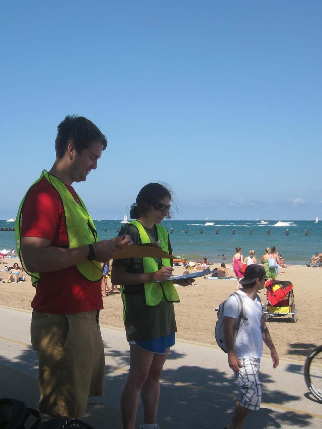
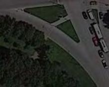
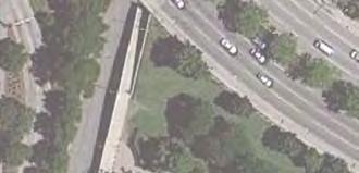
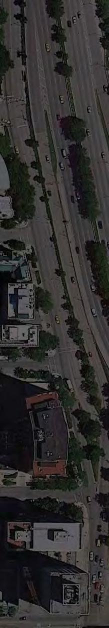
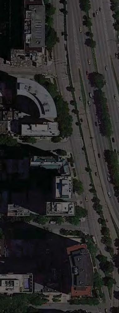
4 Chicago Park District Lakefront Trail Counts Presented by Active Transportation Alliance, June 7, 211 COVER: Bicyclists heading north on the Lakefront Trail FACING: Lakefront Trail counters at North Ave. Beach
5 Contents 1 Introduction 3 Introduction & Background 4 Key Findings 5 Counting Locations 6 Data Summary 8 2 Methodology 9 Data Gathering 1 Notes and Exceptions Hour Estimates 12 3 Recommendations 13 Trail access and Along-the-Trail Improvements 14 Trail Design 17 Additional Research Opportunities 19 Bicycle Parking Demand 2 4 Conclusion 21 5 Counts by Location 23
6 1 Introduction Introduction and Background 4 Key Findings 5 Counting Locations 6 Data Summary 8


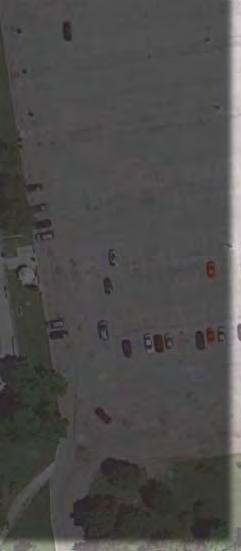
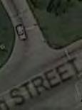
7 Introduction and Background Introduction The Chicago Lakefront Trail welcomes residents and visitors to Chicago s lakefront from Ardmore St. on the North Side to 71st St. on the South Side. On any given day you find people training for marathons, parents with children in strollers, tourists on rental bikes, couples on in-line skates, teens on skateboards, and thousands of other people using the trail for commuting, training or just taking a leisurely stroll. Many of Chicago s major parks, beaches and cultural institutions are located just steps off the trail. People use the Lakefront Trail for a variety of purposes on every kind of non-motorized vehicle. Over its 18.5-mile length, there are approximately 5 access points for entering and exiting the trail. This study focuses on 26 of these access points and five points along the trail. The Active Transportation Alliance studied each of these 31 locations during summer 21 by counting bicycle, pedestrian and other users entering or using the trail. This report documents these access points and the number of users by type at each location. A full listing of the locations studied can be found on page 6, a definition for each user type can be found on page 1 and the actual counts can be found in the appendix. Lakefront Trail users in the Lincoln Park neighborhood. Background The Chicago Park District has been consistently making improvements to the Lakefront Trail to accommodate additional users and improve safety, traffic flow and access. However, there has not been a full count of users accessing and utilizing the trail in the past decade. In the past 12 years, two studies have been conducted to assess the number of users along the Lakefront Trail. One study in 1999 counted users at the Diversey Pkwy. access point and the other study, conducted in 23, covered access points in the downtown area at Randolph St., Jackson Blvd., Balbo Ave. and Roosevelt Rd. No comprehensive count of the Lakefront Trail has been conducted recently. The Chicago Park District can use these counts for many different purposes. For example, it can use the data to obtain grant funding for future projects, leverage sponsorships, and justify maintenance, improvements and encouragement programs at various locations along the trail. The Lakefront Trail allows thousands of users to enjoy Chicago's lakefront. 4 LAKEFRONT TRAIL COUNTS

8 Chicago Lakefront Trail Counts Key Findings A Lakefront Trail counter recording data at the North Ave. underpass. The high volume of users along the Lakefront Trail supports additional improvements such as the completion of the lakefront park system from the Evanston border to Hollywood Ave., 71st St. to 95th St., the Navy Pier Flyover and upgrades to underpasses and overpasses at places where there are few users such as 35th, 63rd and 67th streets. At the busiest points along the trail, average daily traffic during the summer is nearly 3, people per day. 1 On a typical summer weekend day, more than 7, people access the trail; more the 6, access the trail on a typical summer weekday. 2 The south section of the trail has significantly fewer users than the north section. While this points to a strong need to improve accessibility and connectivity on this section of trail, it is also important to understand that user volumes are impacted by proximal residential density as well as differences in large-park space availability. The trail should be open at all times of the day because people travel on it at all hours and because it s an integral part of Chicago s bicycle transportation network. Overall, 7 percent of people who accessed the trail were pedestrians, 29 percent were on bikes and 1 percent were other users. 3 On weekdays, about 35 percent of trail users rode a bike, while only 25 percent of weekend trail users rode a bike. It can be assumed that a significant portion of people use the trail to commute to work. Based on the number of bikes seen along the trail and ridden by beach-goers, the Chicago Park District needs to create additional bike parking at its beaches and playing fields. The share of bikes on the trail is highest during typical weekday commute times. Thus, the trail is a primary transportation corridor for bicycle commuters. Of the access points counted, Ardmore Ave., Fullerton Ave. and the North Ave. underpass see the highest volume of cyclists on weekday mornings. The highest volume of cyclists on weekday evenings occur at the following access points: 11th St., Fullerton Ave. and Monroe St. 1. These counts were taken between the access points on a typical summer day with no large special events. 2. These numbers are based on counts taken at 26 of the 5+ access points on the trail and should be considered an extremely conservative estimate. 3. Other users include in-line skaters, skateboarders and people on scooters. INTRODUCTION 5
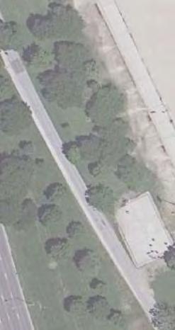
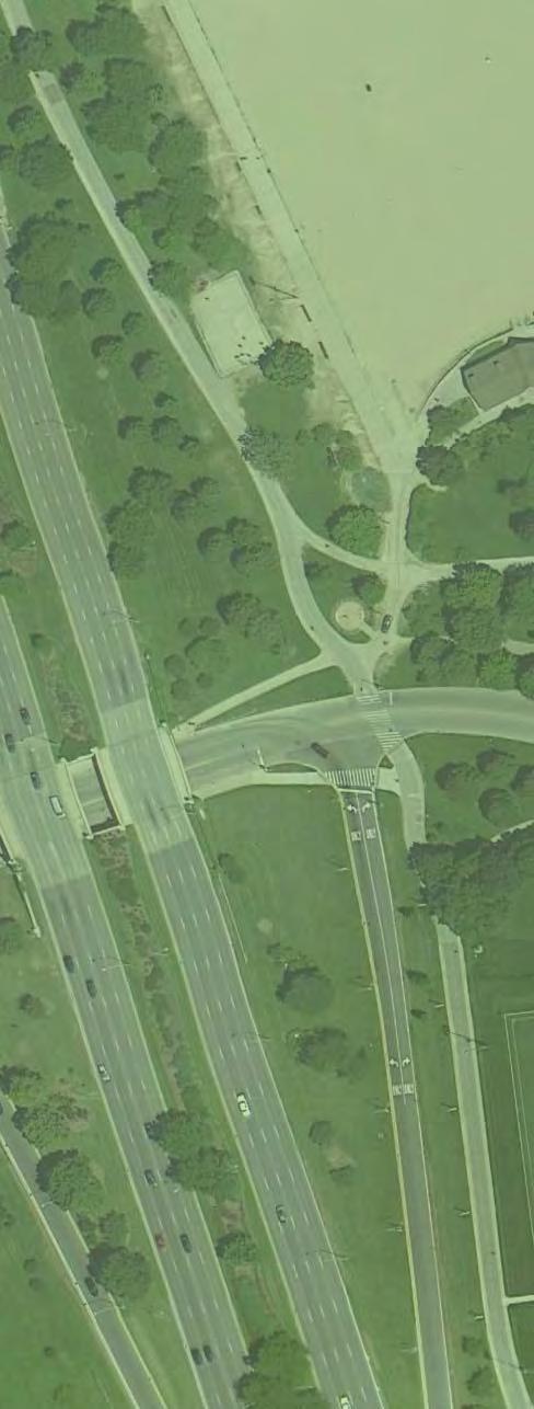
9 Counting Locations Access Points with Counters Ardmore Ave. Bryn Mawr Ave. Foster Ave. Lawrence Ave. Montrose Ave. Irving Park Rd. Belmont Ave. Fullerton Pkwy. North Ave. pedestrian bridge North Ave. underpass Oak St. Ohio St. underpass Illinois St. Monroe St. Jackson Blvd. Balbo Ave. 11th St. 31st St. 35th St. Oakwood Blvd. 47th St. Promontory Point 57th St. 63rd St. 67th St. Points Along the Trail with Counters South of Montrose Ave. South of Fullerton Ave. Between Oak St. and North Ave. South of McFettridge Dr. North of Promontory Point 6 LAKEFRONT TRAIL COUNTS


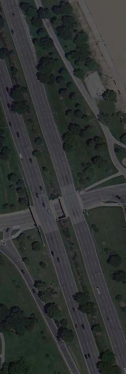
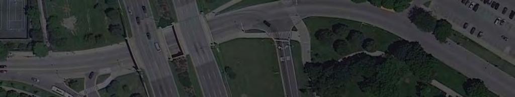
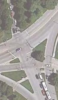
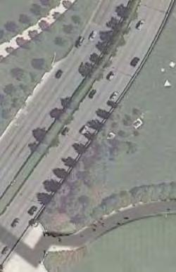
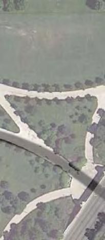
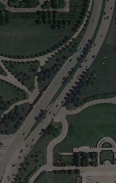
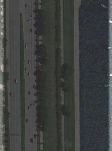
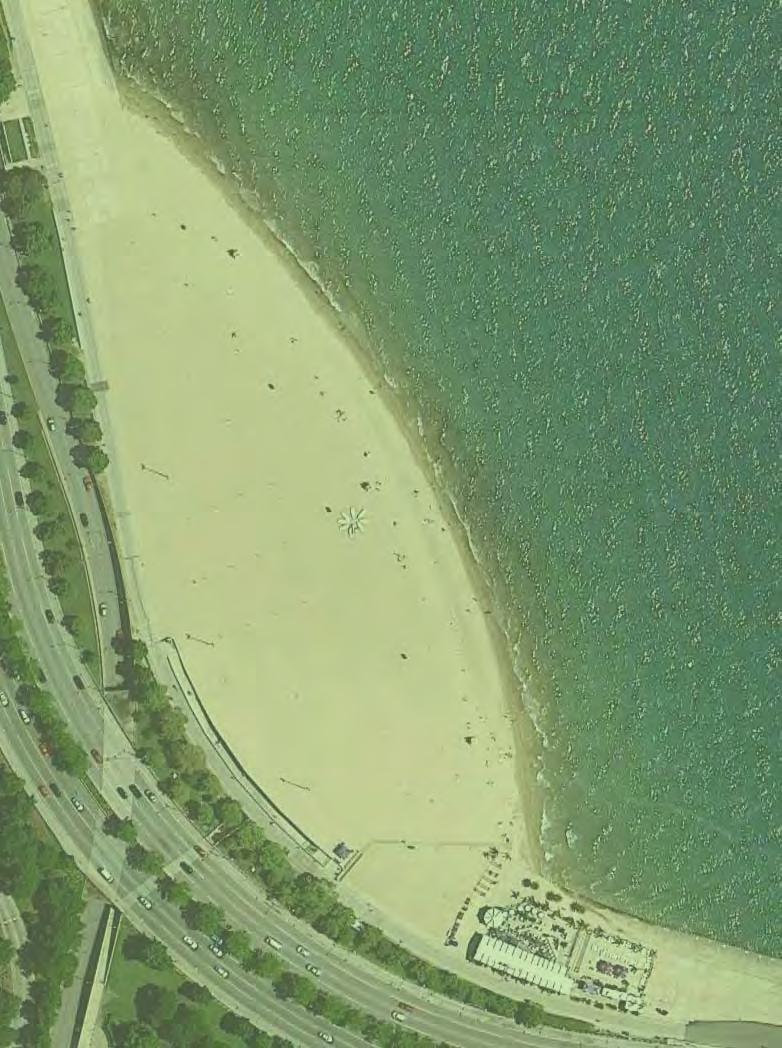
10 N LAKEFRONT TRAIL Count Locations This map shows counter locations along the Lakefront Trail. INTRODUCTION 7
11 Data Summary Counts were conducted on Sunday, August 22, 21 from 1 to 4 p.m. and Tuesday, August 24, 21 from 6 to 9 a.m. and 4 to 7 p.m. A select number of counts were conducted on other days. A full report, including exact counting location and user counts for each location, can be found in the appendix. Based on the data gathered, the following summary statements can be made: Usage by For pedestrians, weekend afternoons are the most popular time to access the trail. Weekdays have noticeably fewer pedestrians accessing the trail. For cyclists, weekend afternoons are only a slightly more popular time to bike than weekday evenings. The per-hour rate of cyclists accessing the trail between 5 p.m. and 6:3 p.m. on weekdays is similar to the per-hour rate of cyclists accessing the trail between 1 p.m. and 4 p.m. on weekends. An average of more than 1,2 to 1,6 cyclists per-hour access the trail during these times. The peak time for pedestrians along the trail is 5:45 p.m. to 7 p.m. on a weekday The peak time for cyclists along the trail is weekend afternoons from 2:15 to 4 p.m. Mode Share More than half the people that accessed the trail from Jackson St., Monroe St., 11th St., Illinois St. and Ardmore Ave. were cyclists. Ardmore Ave., 11th St. and Fullerton Ave. are the most popular locations to enter the trail for cyclists. During peak times, an average of more than 15 cyclists per-hour used each of these access points. Usage by Location Oak St., the North Ave. pedestrian bridge, the Ohio St. underpass and Fullerton Ave. are the most popular locations to enter the trail. During peak times, an average of more than 575 pedestrians and 1 bikes per-hour used each of these access points. The 35th St. and 67th St. access points had the fewest users, demonstrating the need for improved access to the trail from these access points. The south portion of the trail south of the 11th St. access point has significantly less traffic than the north Total Users Approximately 4, people entered the trail on weekday mornings from 6 to 9 a.m. at the access points studied. Approximately 11,4 people entered the trail on weekday evenings from 4 to 7 p.m. at the access points studied. Approximately 18,7 people entered the trail on weekend afternoons from 1 to 4 p.m. at the access points studied. Trip Purpose Based on usage by time, mode share and location the following conclusions can be drawn about trip purpose: The Lakefront Trail is used as a primary route for workforce bike commuters. Weekday pedestrian usage peaks after people return home from work. Pedestrians are less likely to use the Lakefront Trail as a transportation network and more likely to use it as an area for recreation. 8 LAKEFRONT TRAIL COUNTS
12 2 Methodology Data Gathering 1 Notes and Exceptions Hour Estimates 12

13 Data Gathering Approximately 5 volunteers and Active Trans staff members gathered data for the Lakefront Trail Counts Counts were conducted manually by volunteers recruited and trained by the Active Transportation Alliance. One or more volunteers were stationed at each location on Sunday afternoon, August 22nd, 21 from 1 to 4 p.m., and Tuesday, August 24th, 21, from 6 to 9 a.m. and 4 to 7 p.m. The counters captured what is thought to be the peak weekend and weekday times. In certain locations, counters were stationed at the location on a different day after August 24th. Data was gathered on a typical summer weekend afternoon as well as a typical weekday morning and afternoon, in which there were few large special events that would show a significant spike in traffic. The majority of this data was gathered on Sunday, August 22nd, from 1 to 4 p.m., and Tuesday, August 24th, from 6 to 9 a.m. and 4 to 7 p.m. Weather on both of these days was sunny and warm in the high 7s or low 8s. Weekend afternoon, weekday morning and evening time periods were chosen because they are expected to be the periods with the highest traffic volumes. Weekend afternoon users are assumed to be mostly leisure trail users, beach- and park-goers, athletes and tourists. The weekday periods, on the other hand, capture commuters and are likely to have fewer tourists. Additional surveying would need to be conducted to show that these times are indeed peak traffic. Counts were tracked in 15 minute increments over a three-hour period for the following three user types: PEDESTRIANS People running, walking or using a wheelchair or a stroller BICYCLISTS People using a bicycle, whether it s a tandem, a unicycle, a tricycle or a recumbent OTHERS People using in-line skates, skateboards or a scooter The counts were completed manually by volunteers using a tally sheet. Two sample counting sheets are in the appendix; one for counting that was conducted at each access point, and another for counting completed along the trail. For counting conducted at access points, volunteers counted all people entering the trail through the access point on foot, bicycle or other non-motorized vehicle. They did not count people entering in automobiles or exiting the trail. For counting conducted along the trail, volunteers counted all people who passed in front of them traveling on the trail. This data also tracked direction of travel by user type. It is assumed that counts will be higher if there was a large special event taking place on that day, and lower if the weather had been rainy, cloudy or cooler. 1 LAKEFRONT TRAIL COUNTS
14 Notes and Exceptions Double Counts The following location was counted by two volunteers simultaneously. This location was expected to have extremely high traffic volumes so two counters were used to ensure a higher level of accuracy. The data from each counter in the following location was averaged. Other locations with multiple counters divided the traffic by mode or direction to ensure a higher level of accuracy. LOCATION North Ave. pedestrian bridge access point DAY AND TIME All days and time periods Counter Errors The following locations have lower than expected pedestrian counts due to counter misinterpretation. Counters at these locations only counted pedestrians who entered the access point and continued along the trail, and not all pedestrians that entered using the access point. These counts were not adjusted to reflect the error, but should be viewed as a significantly more conservative estimate. LOCATION Ardmore Ave. access point Jackson Blvd. access point DAY AND TIME Sunday afternoon, 1-2 p.m. Weekend afternoon, all hours Missing Data Some locations were not counted for a complete 3-hour period. These omissions were generally due to human error such as the need for a restroom break or an extremely late counter. The following locations do not have complete counts. Full day estimates were adjusted to account for the missing data. LOCATION DAY MISSING 15 MINUTE TIME INCREMENTS 63rd St. access point Weekday morning 6, 6:15, 6:3, 6:45, 7 a.m. Ardmore Ave. access Weekday morning 8 a.m. point Foster Ave. access Weekday evening 6:3, 6:45 p.m. point Belmont Ave. access Weekend afternoon 1 p.m. point Between Oak St. and Weekend afternoon 1:, 1:15, 1:3 p.m. North Ave. along the trail North of Promontory Point Weekday evening 4:45 p.m. Alternative Counting Date Select locations were surveyed on a day other than the one listed above. The following locations were surveyed on a different day. All locations listed below were surveyed after the initial counting day. Most counts were completed in the first half of September. Due to the later time of year, these counts and subsequent estimates are likely to be lower than if they were conducted on the initial counting day. LOCATION 67th St. access point 63rd St. access point 35th St. access point 11th St. underpass access point Balbo Ave. access point Illinois St. access point Irving Park Rd. access point Wilson Ave. access point Lawrence Ave. access point Foster Ave. access point DAY AND TIME Weekend afternoon, weekday morning and evening Weekday evening Weekend morning, weekday evening Weekday evening Weekday evening Weekday evening Weekend afternoon, weekday morning and evening Weekend afternoon, weekday morning and evening Weekday evening Weekday morning and evening METHODOLOGY 11
15 24 Hour Estimates Counts during these 3-hour time periods were used to make estimates for the number of users on the trail during a 24-hour period. The National Bicycle and Pedestrian Documentation Project, a joint effort of Alta Planning and Design and the Institute of Transportation Engineers Pedestrian and Bike Council, assembled a best practices method for estimating daily user counts for multi-use paths in urban areas. Their method was used for calculating the number of users over a 24-hour period. This method takes the total users over a 1-hour period and calculates a 24-hour estimate based on the average percent of trail users for the given time of day and day of the week. It is assumed that each hour of each day has a different share of users. A complete description of the methodology is available at in a document called NBPD Adjustment Factors. It was assumed that 5 percent of all trail users travel on the trail while it is closed after 11 p.m. Daily 24-hour estimates include the number of users that travel on the trail while it is closed. 12 LAKEFRONT TRAIL COUNTS
16 3 Recommendations Trail Access and Along-the-Trail Improvements 14 Trail Design 17 Additional Research Opportunities 19 Bicycle Parking Demand 2

17 Trail Access and Along-the-Trail Improvements Extend the Lakefront Trail north to the Evanston border. Based on the high number of bicycles accessing the trail at peak commuting times, Ardmore Ave. is a collector point for bike commuters coming from the north and northwest. The numbers collected clearly show that there are a large number of bicycle commuters who live north of the northernmost point of the Lakefront Trail and access it as soon as possible. Almost 3 people access the trail on bike from this location during weekday morning commute hours. The access point at Ardmore Ave. is less than ideal due to the heavy traffic on Sheridan Rd. and because Ardmore Ave. is a one-way street with a contra-flow bike lane between Sheridan Rd. and Kenmore St. Bike traffic in this area is only expected to increase due to the planned addition of a bike lane on Granville Ave. If the Lakefront Trail could be extended north to the Evanston border, bicycle commuters from the north may be able to avoid these obstacles and have additional access points that are safer and more convenient. Lakefront Trail users safely cross Lake Shore Drive by using the North Ave. pedestrian bridge. Upgrade the lighting between Diversey Pkwy. and Fullerton Ave. Lighting is a very high priority between Diversey Pkwy. and Fullerton Ave. due to the heavy use in this area. The high volume of weekday evening traffic along the trail at these entrances reinforces the need for on-trail lighting in this area. A count along the trail was not completed between these two locations. However, there were approximately 1, users traveling south along the trail just south of Montrose Ave., and 2,9 users traveling north along the trail just south of Fullerton Ave. between 4 and 7 p.m. When the time changes in the fall, sunset comes during the heaviest bicycle commute times plunging cyclists into complete darkness in this heavily-trafficked area. Upgrade the trail to the standard design between Ardmore Ave. and Foster Ave. The number of trail users who access the trail from Ardmore Ave. (estimated 3,634 to 4,79 on weekdays and 3,339 on weekend days) shows the significant use of the trail in this area. Yet the trail is in sub-standard condition. The current design leads to poor drainage and trail damage, and there is no dedicated lighting on the trail in this area. Appropriate trail re-design at Fullerton Ave., which will be part of the forthcoming revetment project, is critical due to the heavy use in this area. An estimated 3,352 to 6,825 people on weekdays and 7,816 people on weekend days use this access point, and an estimated 23,96 people on weekend days and 2,774 to 29,853 people on weekdays pass by this area. It is essential that the trail routing facilitates north/south travel as well as safe access to the trail in both directions. The redesign must also allow for congregation at the water fountain and of the gathering of groups of trail users before entering the trail. Upgrade the Oak St. Beach to facilitate free-flow transportation along the trail The Oak St. Beach area is one of the most congested areas of the Lakefront Trail. This is an ideal area to offer intuitive design that separates users and facilitates free-flow transportation uses along the trail. If a wooden boardwalk, for example, was constructed on the east side of the Lakefront Trail in this area that had easy access from the Oak St. underpass and easy access to the beach and concession facilities, a tremendous amount of foot traffic could be diverted from the paved Lakefront Trail, reducing congestion and conflicts between users. 14 LAKEFRONT TRAIL COUNTS


18 Trail Access and Along-the-Trail Improvements cont. Reconfiguring the underpass to guide beach-goers directly to the beach and trail users onto the trail will also reduce congestion in this area. Currently, everyone who uses the Oak St. underpass exits the underpass directly onto the trail, causing congestion and creating potential conflicts between beach-goers and trail users. Allowing people to directly access the beach without walking on the trail will decrease congestion in this area. Construct downtown trail access points similar to the one at 11th St. The 11th St. access to the trail has had the desired effect of being a high-usage access point for the trail, most often used by commuters working in or near the Loop. Additional Loop access points of similar construction may also have a similar affect. An estimated 895 weekend users and 1,397 to 5,431 weekday users access the trail at this location. This is a more than 5 percent increase in users compared to Re-design the 67th St. access to the trail to be safer and more inviting A redesign of the Oak St. Beach access point would create a more efficient flow of trail users. Re-design the Oak St. bend to prevent water on the trail. The Oak St. bend re-design needs to continue to be in the forefront of discussions on trail improvement. The current design facilitates water on the trail during rough water and the area sees very high trail usage. An estimated 22,254 to 23,14 people on weekdays and 19,715 people on weekend days travel along the trail near this area. Despite the density of residents in very close proximity to the Lakefront Trail at this location, the 67th St. access to the trail has few users because of the poor and intimidating design of the crossing. Based on the counts, less than 1 people use this access point every day. Other nearby access points have 5 or more users per day, and most access points have more than 1, users per day. The closest density equivalency on the south side is the 57th St. underpass, which receives very high usage. Before the installation of the 57th St. underpass, trail users at 57th St. had to overcome the intimidation of crossing Lake Shore Drive at a dangerous and busy intersection. Now that the underpass has been built, access is unencumbered and well used. If access to the Lakefront Trail at 67th St. were made inviting by a well designed underpass or bridge, it is likely that usage would increase exponentially. Continue work with the Navy Pier Flyover to implement this project as soon as possible The Navy Pier Flyover is much needed due to the heavy traffic in this area, much of which is headed to Navy Pier and not onto the trail. Counts conducted do not reflect the high volume of pedestrians crossing the Lakefront Trail, as most counters counted only trail users and not tourists visiting attractions located adjacent to the trail. The Lakefront Trail near Navy Pier presents many obstacles to trail users. RECOMMENDATIONS 15
19 Trail Access and Along-the-Trail Improvements cont. Replace the 35th St. bridge with one that better connects the neighborhood and the trail Even though the City of Chicago on-street network signage routes cyclists to use the 35th St. bridge, the 35th St. access to the trail has few users because of the many sets of stairs, set-back entrance to the bridge on the west side, antiquated design of the bridge itself and extended distance from the eastern drop off point to the actual Lakefront Trail. Based on the counts, less than 1 people use this access point every day. Other nearby access points have 5 or more users per day, and most access points have more than 1, users per day. The planned CDOT bridge replacement at 35th St. is badly needed and should proceed as quickly as possible. Address parking issues at the 63rd St. access point The fact that residences are an extended distance from the 63rd St. access point and the fact that both parking lots to the east and west of Lake Shore Drive now have paid parking make the access point at 63rd St. less desirable. Although revenue is generated through paid parking, at this particular location, this has served as a significant deterrent to Lakefront Trail usage in spite of an appropriately designed underpass. These factors most likely account for the low usage numbers at this access point compared to access points with a similar set of amenities at other points along the trail. An estimated 832 people on weekend days and 233 to 536 people on weekdays access the trail from this point. This user count far exceeds the 67th St. access point, the closest counted access point counter to the south, but is significantly lower than the 57th St. access point, which is the closest access point counted to the north. Carefully consider construction projects that add conflict points to the trail. Any construction projects that add conflict points to the Lakefront Trail should be carefully considered. The Northerly Island Framework Plan, for example, is appropriate in not considering adding a permanent access point south of Solidarity Drive. With almost 7 weekend users per peak hour and 55 weekday users per peak hour utilizing the Lakefront Trail in this area, intentionally creating a conflict point would be counterproductive to the Lakefront Trail s use as a north/south transportation corridor. The South Side has significant challenges to overcome to increasing usage when compared to the North Side of Chicago. Access points at 71st St., 67th St. and Marquette Rd. are poorly designed and intimidating. The trail design between 71st St. and 67th St. is substandard and does not have the look of a multi-use trail. This section of the trail looks like a sidewalk and is viewed as such by potential trail users. This area either needs to have the golf course fence moved eastward and have the standard trail design installed or the Lakefront Trail should be moved to the east side of the golf course with appropriate access created to the new trail routing. If the Lakefront Trail extended to Calumet Park and Indiana, along with appropriate access points and extended on-street routing between 71st St. and Calumet Park, the flow of traffic to the Lakefront Trail would be greatly increased in part due to its increased viability as a commuting route for area residents. While the North Side has Lake Shore Drive as an intimidating barrier between many potential Lakefront Trail users and the trail, the South Side has not only Lake Shore Drive but train tracks and, although it may seem counter-intuitive, large city parks as additional barriers. While large city parks can have the advantage of feeding recreational users to the additional recreational space along the Lakefront, the parks also serve as a buffer between residential areas and the Lakefront Trail transportation corridor. In addition, when large city parks are closer to residential areas, the need to travel to the lakefront for recreational space is reduced. This is not a recommendation to try to mimic the North Side as the different areas of the Lakefront and the Lakefront Trail reflect their different geographic characters. The recommendation is to do the best job that can be done to make the most of the Lakefront Trail that is allowed by the given circumstances. 16 LAKEFRONT TRAIL COUNTS


20 Trail Design Street Connectivity The Park District should work with CDOT to make appropriate connections between the city s on-street bike route network and Lakefront Trail access points. Signage and Trail Markings The Park District recently updated some of the trail signage, including mile markings with consistent design standards. Signage should continue to be upgraded along the trail by adding directional signs with distance and destination names along the trail and at access points. Street names should also be added to each access point and as on-trail pavement markings Re-striping or adding striping where missing on the trail to separate northbound and southbound users, maintaining the ontrail address markers and adding street names to the addresses will help guide users along the trail. For striping and markings along the trail, the park district should use thermoplastic, which lasts longer and does not wear away as easily as other pavement marking materials. An example of standard trail design. Congestion There are many reasons why a potential Lakefront Trail user may or may not become such a user. If traffic on the Lakefront Trail is extremely heavy or if the likelihood of a reckless user is perceived to be high, the potential user may opt to avoid certain sections of the Lakefront Trail during these times, even if the trail provides the most uninterrupted transportation corridor. This can often be the case during the summer between Belmont Ave. and the Loop. Separating trail user types through intuitive design (such as the creation of a board walk at Oak St. Beach) will help to reduce Lakefront Trail congestion. Many conflicts occur between beach-goers, runners, walkers, bikers and other users due to their pace of travel, intended destination or places where they choose to gather. Using a trail design that guides people from the access points to the beach or park on a separate path, creating meeting places, water fountains and concessions near the trail, but with enough space for people to gather without blocking on the trail, will relieve congestion. The trail should be designed so that people traveling along the trail will intuitively use the path farther from the access point, while people who want to stop to meet up with friends or enter or exit the trail can do so without creating congestion on the trail. Trail congestion can negatively affect trail users' perceived safety. RECOMMENDATIONS 17

21 Trail Design cont. Weather and Environmental Conditions Weather can also play a role in potential trail users decision to utilize the trail at certain points. If the trail design leaves areas unprotected to the east, for example between Ohio St. and Diversey Pkwy., and the wind is out of the Northeast, a potential trail user may opt to utilize the street network until Belmont Ave. to avoid battling the wind on their commute north. With the current trail design south of Fullerton Ave. and at the Oak St. bend, users are discouraged from utilizing the Lakefront Trail during times that water is washing over the trail surface. During the winter, ice creates a deterrent in these same areas. Appropriate routing of the trail south of Fullerton Ave. with the revetment project will eliminate the lake water washing over the trail in this area. It is unclear as to the appropriate solution for the Oak St. bend. Additional careful study needs to be conducted to determine the best solution to this problem. Water washing over the Lakefront Trail south of Fullerton Ave. 18 LAKEFRONT TRAIL COUNTS
22 Additional Research Opportunities Use Nearby Population and Jobs to Measure Trail Accessibility It is assumed that people are most likely to use the access point that is closest to where they live or work. However, sometimes a trail user will choose a different access point because it is in better condition, safer or easier to find. Comparing population within a short distance, perhaps a quarter mile of the access point to actual usage of the access point will indicate how accessible an access point is perceived relative to other access points in the surrounding area, or in other areas with similar populations. Developing an indicator with population, jobs and number of users at an access point will be helpful in prioritizing improvements to the trail. Conduct Annual Lakefront Trail Traffic Counts A count of the same and/or additional access points and points along the trail should be conducted annually. Repeating the count regularly will allow the Chicago Park District to track changes in traffic volumes and show how improvements affect the number of users. 24-Hour Count A full day count should be taken at several locations. The full day estimates made in this report were based on data collected from trails all over the country. Due to the unique nature of the Lakefront Trail, a full day count on a weekend and weekday should be used to show traffic volumes and calculate an adjustment factor for the existing counts. Conducting counts overnight, after 11 p.m., will shed light on usage of the trail after it is officially closed for the day. The Lakefront Trail is part of Chicago s bicycle transportation network, which also includes on-street bike lanes that are open 24 hours. Closing the trail, which is a significant portion of this network, between 11 p.m. and 6 a.m. is a considerable hindrance for those who travel by bicycle or may consider traveling by bicycle late at night or early in the morning. The additional counts should be conducted at a similar time of year and day to the counts in this report. Weather conditions should be similar, too. Additional information such as origin/ destination, age, gender, or bike helmet use could be gathered as well. Additional survey takers would need to be enlisted for this more detailed information. For each significant improvement to the Lakefront Trail such as the new 35th St. bridge, a new count should be completed both before and after the improvement project. These counts will show the changes in use. RECOMMENDATIONS 19
, which published its new Bicycle Parking Guidelines in 21.")
23 Bicycle Parking Demand Determining bike parking demand remains more an art than a science. The best available guidance comes from the Association of Pedestrian and Bicycle Professionals (APBP), which published its new Bicycle Parking Guidelines in 21. For land uses such as parks, stadiums and beaches, the guidelines recommend providing bike parking for 2 percent of expected daily attendance. But determining expected attendance at the many and varied lakefront destinations proves challenging. Because people use the Lakefront Trail both for recreation and transportation, modeling parking demand on a census of trail users who may or may not stop during their trip seems problematic. While some users participate in programmed activities with an established number of participants, many other users stop for unprogrammed recreational time. Many trail users never stop at all or not long enough to bother locking up. An alternative and perhaps better method for determining bike parking demand indeed the method used previously along the Lakefront Trail is to survey actual usage of bike parking facilities. Such a survey provides the best data when conducted multiple times during periods of peak usage perhaps both weekday evenings, and weekend days in the summer when the greatest demand is expected. Some considerations for conducting a bike parking demand assessment along the Lakefront trail include: An example of a bicycle parking facility in Grant Park. What to Count 1. Date and time: Demand will fluctuate over time, so counts should be done periodically based on time slots, e.g., hourly recordings of each location. 2. Number of existing bike racks/capacity: One rack may park two, four, six, or 12 bikes so the rack s intended capacity must be noted. 3. Number of bikes locked to existing racks: When parking is scarce, bicyclists will routinely overload bike racks beyond their intended capacity this behavior provides a critical data point for assessing demand! 4. Number of bikes locked to other nearby objects: When parking is scarce, bicyclists will often lock up to sign poles, fences, railings, etc. Scan a radius of 15 feet around the location for such bikes. Survey Tips Reschedule surveys in the event of cold and/or rainy weather or even a forecast of such weather as this can negatively influence bicycling. Conduct the survey multiple times. Three surveys of the same location will provide more accurate data than one. Conduct weeknight surveys over a 3 to 4 hour period, such as 4 to 8 p.m. Conduct weekend surveys over a 6 to 8 hour period, such as 1 a.m. to 6 p.m. If aware of specific windows of time when usage seems much greater count during those times! Rotate staff so no one counts longer than 2 hours. Fatigue may result in less accurate data. 2 LAKEFRONT TRAIL COUNTS
24 Conclusion 4

25 Conclusions A Lakefront Trail counter interacts with trail users at the Museum Campus underpass. Some important information can be gleaned from the Lakefront Trail usage observed in this study: The Lakefront Trail is used as a transportation network as well as a recreational resource. Access numbers reveal that many bicycle commuters overcome the confusion and risk the dangers of accessing the trail at Ardmore Ave. (the northernmost point of the Lakefront Trail) to avoid using the on-street network to commute to work. The addition of the 11th St. access to the South Loop has encouraged commuters to use this entrance point to the Loop. By adding more access points to the Loop like this one, similar gains in bicycle commuting traffic should be expected. Improving the physical nature of the Lakefront Trail and the facilities along the trail will very likely increase use of the Lakefront Trail. This is evident on the South Side. Even though usage on the South Side is significantly lower than usage on the North Side, activity on the Lakefront Trail has dramatically risen as the trail has been upgraded to the design standard. Here are points for improvement: Upgrading the underpasses and overpasses identified in this report. Upgrading to the trail design standard (including drainage and lighting) in places that do not currently meet the standard. Designing underpasses and overpasses with intuitive designs that create fewer conflict points and congestion. Engineering the trail to be less susceptible to weather. Partnering with CDOT to improve on-street accessibility and increase safety at intersections near the trail. The Lakefront Trail is used as transportation corridor at all times of the day and night. To include the trail in the 11 p.m. to 6 a.m. times that the city parks are closed is to reduce the effectiveness of its use as a part of the city s bicycle transportation network. Trail users will and do use the Lakefront Trail for transportation between 11 p.m. and 6 a.m., and it is our recommendation that in order to increase both day and night time use, it become official park district policy that the Lakefront Trail be officially open 24 hours a day, 365 days a year. The remarkable number of Lakefront Trail users is also a clear mandate, in and of itself, for the addition of more miles of multi-use trails along Chicago s Lakefront beyond the current park district boundaries. While the current design standard for the Lakefront Trail is significantly wider than most multi-use trails around the country, the trail still suffers from extreme congestion for much of the warm-weather months and near gridlock during the heaviest usage times. Although this report focuses on potential improvements that can be made along the Lakefront Trail, it should also be noted that the Lakefront Trail is a highly valued asset. Many thousands of people use it daily, and it sets the City of Chicago apart as a first class city. 22 LAKEFRONT TRAIL COUNTS
26 Counts by Location 5


")
27 N COUNT LOCATION ARDMORE AVENUE ACCESS POINT SHERIDAN ROAD devon peterson bryn mawr foster lawrence montrose irving park addison belmont diversey fullerton armitage north division chicago kinzie madison harrison roosevelt 16th cermak 26th 31st 35th pershing 43rd 47th 51st garfield 59th 63th marquette 71st Count Locations (1 counter) ARDMORE AVENUE LAKEFRONT PATH 24 LAKEFRONT TRAIL COUNTS
28 Ardmore Ave. Access Point August 21 Estimated Daily Weekend Users: 3339 Estimated Daily Weekday Users: 3634 to 479 Data Collected WEEKEND 1-4 P.M. Bicyclists 4 Pedestrians 386 Other 9 8 Ardmore Ave. Weekend Afternoon : pm 1:15 pm 1:3 pm 1:45 pm 2: pm 2:15 pm 2:3 pm 2:45 pm 3: pm 3:15 pm 3:3 pm 3:45 pm WEEKDAY 6-9 A.M. Bicyclists 294 Pedestrians 141 Other Ardmore Ave. Weekday Morning 6: am 6:15 am 6:3 am 6:45 am 7: am 7:15 am 7:3 am 7:45 am 8: am 8:15 am 8:3 am 8:45 am WEEKDAY 4-7 P.M. Bicyclists 276 Pedestrians 342 Other Ardmore Ave. Weekday Evening 4: pm 4:15 pm 4:3 pm 4:45 pm 5: pm 5:15 pm 5:3 pm 5:45 pm 6: pm 6:15 pm 6:3 pm 6:45 pm NOTES Weekend afternoon pedestrian counts from 1:pm to 2:pm are extremely conservative due to counter error. No data available for weekday morning between 8: am and 8:15 am. COUNTS BY LOCATION 25


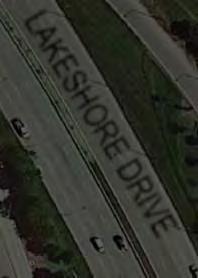
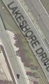
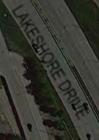
29 N COUNT LOCATION BRYN MAWR AVENUE ACCESS POINT LAKEFRONT PATH devon peterson bryn mawr foster lawrence montrose irving park addison belmont diversey fullerton armitage north division chicago kinzie madison harrison roosevelt 16th cermak 26th 31st 35th pershing 43rd 47th 51st garfield 59th 63th marquette 71st Count Locations (1 counter) BRYN MAWR AVENUE LAKESHORE DRIVE LAKESHORE DRIVE 26 LAKEFRONT TRAIL COUNTS
30 Bryn Mawr Ave. Access Point August 21 Estimated Daily Weekend Users: 336 Estimated Daily Weekday Users: 783 to 1522 Data Collected WEEKEND 1-4 P.M. Bicyclists 133 Pedestrians 663 Other Bryn Mawr Ave. Weekend Afternoon 1: pm 1:15 pm 1:3 pm 1:45 pm 2: pm 2:15 pm 2:3 pm 2:45 pm 3: pm 3:15 pm 3:3 pm 3:45 pm WEEKDAY 6-9 A.M. Bicyclists 29 Pedestrians 67 Other Bryn Mawr Ave. Weekday Morning 6: am 6:15 am 6:3 am 6:45 am 7: am 7:15 am 7:3 am 7:45 am 8: am 8:15 am 8:3 am 8:45 am WEEKDAY 4-7 P.M. Bicyclists 63 Pedestrians 197 Other 1 3 Bryn Mawr Ave. Weekday Evening : pm 4:15 pm 4:3 pm 4:45 pm 5: pm 5:15 pm 5:3 pm 5:45 pm 6: pm 6:15 pm 6:3 pm 6:45 pm NOTES COUNTS BY LOCATION 27


31 N COUNT LOCATION FOSTER AVENUE ACCESS POINT LAKESHORE DRIVE LAKESHORE EDRIVE DRIVE LAKEFRONT PATH devon peterson bryn mawr foster lawrence montrose irving park addison belmont diversey fullerton armitage north division chicago kinzie madison harrison roosevelt 16th cermak 26th 31st 35th pershing 43rd 47th 51st garfield 59th 63th marquette 71st Count Locations (1 counter) FOSTER AVENUE 28 LAKEFRONT TRAIL COUNTS
32 Foster Ave. Access Point August 21 Estimated Daily Weekend Users: 1642 Estimated Daily Weekday Users: 192 Data Collected WEEKEND 1-4 P.M. Bicyclists 119 Pedestrians 27 Other Foster Ave. Weekend Afternoon 1: pm 1:15 pm 1:3 pm 1:45 pm 2: pm 2:15 pm 2:3 pm 2:45 pm 3: pm 3:15 pm 3:3 pm 3:45 pm WEEKDAY 6-9 A.M. Bicyclists N/A Pedestrians N/A Other N/A 1.2 Foster Ave. Weekday Morning : am 6:15 am 6:3 am 6:45 am 7: am 7:15 am 7:3 am 7:45 am 8: am 8:15 am 8:3 am WEEKDAY 4-7 P.M. Bicyclists 71 Pedestrians 96 Other Foster Ave. Weekday Evening 4: pm 4:15 pm 4:3 pm 4:45 pm 5: pm 5:15 pm 5:3 pm 5:45 pm 6: pm 6:15 pm 6:3 pm 6:45 pm NOTES No data available for weekday morning or weekday evening after 6:3 pm. Weekday evening data collected in early September 21. COUNTS BY LOCATION 29


33 N COUNT LOCATION LAWRENCE AVENUE ACCESS POINT MARINE DRIVE LAKESHORE DRIVE LAKESHORE DRIVE devon peterson bryn mawr foster lawrence montrose irving park addison belmont diversey fullerton armitage north division chicago kinzie madison harrison roosevelt 16th cermak 26th 31st 35th pershing 43rd 47th 51st garfield 59th 63th marquette 71st Count Locations (1 counter) LAWRENCE AVENUE LAKEFRONT PATH 3 LAKEFRONT TRAIL COUNTS
34 Lawrence Ave. Access Point August 21 Estimated Daily Weekend Users: 966 Estimated Daily Weekday Users: 67 to 953 Data Collected WEEKEND 1-4 P.M. Bicyclists 99 Pedestrians 125 Other 6 35 Lawrence Ave. Weekend Afternoon : pm 1:15 pm 1:3 pm 1:45 pm 2: pm 2:15 pm 2:3 pm 2:45 pm 3: pm 3:15 pm 3:3 pm 3:45 pm WEEKDAY 6-9 A.M. Bicyclists 63 Pedestrians 55 Other 12 Lawrence Ave. Weekday Morning : am 6:15 am 6:3 am 6:45 am 7: am 7:15 am 7:3 am 7:45 am 8: am 8:15 am 8:3 am 8:45 am WEEKDAY 4-7 P.M. Bicyclists 38 Pedestrians 65 Other 1 12 Lawrence Ave. Weekday Evening : pm 4:15 pm 4:3 pm 4:45 pm 5: pm 5:15 pm 5:3 pm 5:45 pm 6: pm 6:15 pm 6:3 pm 6:45 pm NOTES Weekday evening data collected in early September 21. COUNTS BY LOCATION 31


35 N COUNT LOCATION WILSON AVENUE ACCESS POINT MARINE DRIVE LAKESHORE DRIVE LAKESHORE DRIVE LAKEFRONT PATH devon peterson bryn mawr foster lawrence montrose irving park addison belmont diversey fullerton armitage north division chicago kinzie madison harrison roosevelt 16th cermak 26th 31st 35th pershing 43rd 47th 51st garfield 59th 63th marquette 71st Count Locations (1 counter) WILSON AVENUE 32 LAKEFRONT TRAIL COUNTS
36 Wilson Ave. Access Point August 21 Estimated Daily Weekend Users: 764 Estimated Daily Weekday Users: 816 to 115 Data Collected WEEKEND 1-4 P.M. Bicyclists 7 Pedestrians 82 Other Wilson Ave. Weekend Afternoon 1: pm 1:15 pm 1:3 pm 1:45 pm 2: pm 2:15 pm 2:3 pm 2:45 pm 3: pm 3:15 pm 3:3 pm 3:45 pm WEEKDAY 6-9 A.M. Bicyclists 56 Pedestrians 4 Other Wilson Ave. Weekday Morning 6: am 6:15 am 6:3 am 6:45 am 7: am 7:15 am 7:3 am 7:45 am 8: am 8:15 am 8:3 am 8:45 am WEEKDAY 4-7 P.M. Bicyclists 61 Pedestrians 21 Other Wilson Ave. Weekday Evening 4: pm 4:15 pm 4:3 pm 4:45 pm 5: pm 5:15 pm 5:3 pm 5:45 pm 6: pm 6:15 pm 6:3 pm 6:45 pm NOTES Data for all time periods collected in early September 21. COUNTS BY LOCATION 33


37 N COUNT LOCATION MONTROSE AVENUE ACCESS POINT LAKESHORE DRIVE LAK LAKESHORE DRIVE LAKEFRONT PATH devon peterson bryn mawr foster lawrence montrose irving park addison belmont diversey fullerton armitage north division chicago kinzie madison harrison roosevelt 16th cermak 26th 31st 35th pershing 43rd 47th 51st garfield 59th 63th marquette 71st Count Locations (1 counter) MONTROSE AVENUE MARINE DRIVE 34 LAKEFRONT TRAIL COUNTS
38 Montrose Ave. Access Point August 21 Estimated Daily Weekend Users: 1718 Estimated Daily Weekday Users: 198 to 1487 Data Collected WEEKEND 1-4 P.M. Bicyclists 168 Pedestrians 241 Other 35 Montrose Ave. Weekend Afternoon : pm 1:15 pm 1:3 pm 1:45 pm 2: pm 2:15 pm 2:3 pm 2:45 pm 3: pm 3:15 pm 3:3 pm 3:45 pm WEEKDAY 6-9 A.M. Bicyclists 77 Pedestrians 59 Other 14 Montrose Ave. Weekday Morning : am 6:15 am 6:3 am 6:45 am 7: am 7:15 am 7:3 am 7:45 am 8: am 8:15 am 8:3 am 8:45 am WEEKDAY 4-7 P.M. Bicyclists 82 Pedestrians 169 Other 4 3 Montrose Ave. Weekday Evening : pm 4:15 pm 4:3 pm 4:45 pm 5: pm 5:15 pm 5:3 pm 5:45 pm 6: pm 6:15 pm 6:3 pm 6:45 pm NOTES COUNTS BY LOCATION 35


39 N COUNT LOCATION IRVING PARK ROAD ACCESS POINT MARINE DRIVE LAKESHORE DRIVE LAKESHORE DRIVE LAKEFRONT PATH devon peterson bryn mawr foster lawrence montrose irving park addison belmont diversey fullerton armitage north division chicago kinzie madison harrison roosevelt 16th cermak 26th 31st 35th pershing 43rd 47th 51st garfield 59th 63th marquette 71st Count Locations (1 counter) IRVING PARK ROAD RECREATION DRIVE 36 LAKEFRONT TRAIL COUNTS
40 Irving Park Rd. Access Point August 21 Estimated Daily Weekend Users: 722 Estimated Daily Weekday Users: 13 to 131 Data Collected WEEKEND 1-4 P.M. Bicyclists 58 Pedestrians 113 Other Irving Park Rd. Weekend Afternoon 1: pm 1:15 pm 1:3 pm 1:45 pm 2: pm 2:15 pm 2:3 pm 2:45 pm 3: pm 3:15 pm 3:3 pm 3:45 pm WEEKDAY 6-9 A.M. Bicyclists 36 Pedestrians 125 Other 25 Irving Park Rd. Weekday Morning : am 6:15 am 6:3 am 6:45 am 7: am 7:15 am 7:3 am 7:45 am 8: am 8:15 am 8:3 am 8:45 am WEEKDAY 4-7 P.M. Bicyclists 48 Pedestrians 171 Other 4 35 Irving Park Rd. Weekday Evening : pm 4:15 pm 4:3 pm 4:45 pm 5: pm 5:15 pm 5:3 pm 5:45 pm 6: pm 6:15 pm 6:3 pm 6:45 pm NOTES Data for all time periods collected in early September 21. COUNTS BY LOCATION 37


41 SHERIDAN ROAD N COUNT LOCATION BELMONT AVENUE ACCESS POINT LAKESHORE DRIVE LAKESHORE D DRIVE LAKEFRONT PATH devon peterson bryn mawr foster lawrence montrose irving park addison belmont diversey fullerton armitage north division chicago kinzie madison harrison roosevelt 16th cermak 26th 31st 35th pershing 43rd 47th 51st garfield 59th 63th marquette 71st Count Locations (1 counter) BELMONT HARBOR BELMONT AVENUE 38 LAKEFRONT TRAIL COUNTS
42 Belmont Ave. Access Point August 21 Estimated Daily Weekend Users: 24 Estimated Daily Weekday Users: 123 to 2117 Data Collected WEEKEND 1-4 P.M. Bicyclists 137 Pedestrians 296 Other Belmont Ave. Weekend Afternoon 1: pm 1:15 pm 1:3 pm 1:45 pm 2: pm 2:15 pm 2:3 pm 2:45 pm 3: pm 3:15 pm 3:3 pm 3:45 pm WEEKDAY 6-9 A.M. Bicyclists 57 Pedestrians 92 Other 12 Belmont Ave. Weekday Morning : am 6:15 am 6:3 am 6:45 am 7: am 7:15 am 7:3 am 7:45 am 8: am 8:15 am 8:3 am 8:45 am WEEKDAY 4-7 P.M. Bicyclists 15 Pedestrians 248 Other 1 4 Belmont Ave. Weekday Evening : pm 4:15 pm 4:3 pm 4:45 pm 5: pm 5:15 pm 5:3 pm 5:45 pm 6: pm 6:15 pm 6:3 pm 6:45 pm NOTES No data available for weekend afternoon before 1:15 pm. COUNTS BY LOCATION 39


")
43 N COUNT LOCATION FULLERTON PARKWAY ACCESS POINT LAKESHORE DRIVE LAKEFRONT PATH devon peterson bryn mawr foster lawrence montrose irving park addison belmont diversey fullerton armitage north division chicago kinzie madison harrison roosevelt 16th cermak 26th 31st 35th pershing 43rd 47th 51st garfield 59th 63th marquette 71st Count Locations (2 counters) FULLERTON PARKWAY 4 LAKEFRONT TRAIL COUNTS
44 Fullerton Pkwy. Access Point August 21 Estimated Daily Weekend Users: 7816 Estimated Daily Weekday Users: 3352 to 6825 Data Collected WEEKEND 1-4 P.M. Bicyclists 452 Pedestrians 1,395 Other Fullerton Pkwy. Weekend Afternoon 1: pm 1:15 pm 1:3 pm 1:45 pm 2: pm 2:15 pm 2:3 pm 2:45 pm 3: pm 3:15 pm 3:3 pm 3:45 pm WEEKDAY 6-9 A.M. Bicyclists 153 Pedestrians 261 Other 1 4 Fullerton Pkwy. Weekday Morning : am 6:15 am 6:3 am 6:45 am 7: am 7:15 am 7:3 am 7:45 am 8: am 8:15 am 8:3 am 8:45 am WEEKDAY 4-7 P.M. Bicyclists 329 Pedestrians 81 Other 4 14 Fullerton Pkwy. Weekday Evening : pm 4:15 pm 4:3 pm 4:45 pm 5: pm 5:15 pm 5:3 pm 5:45 pm 6: pm 6:15 pm 6:3 pm 6:45 pm NOTES COUNTS BY LOCATION 41


45 N COUNT LOCATION NORTH AVENUE (PEDESTRIAN BRIDGE) ACCESS POINT LAKESHORE DRIVE devon peterson bryn mawr foster lawrence montrose irving park addison belmont diversey fullerton armitage north division chicago kinzie madison harrison roosevelt 16th cermak 26th 31st 35th pershing 43rd 47th 51st garfield 59th 63th marquette 71st Count Locations (1 counter) LAKEFRONT PATH PEDESTRIAN OVERPASS 42 LAKEFRONT TRAIL COUNTS
46 North Ave. Pedestrian Bridge Access Point August 21 Estimated Daily Weekend Users: 8364 Estimated Daily Weekday Users: 221 to 5515 Data Collected WEEKEND 1-4 P.M. Bicyclists 233 Pedestrians 1,756 Other 3 25 North Ave. Pedestrian Bridge Weekend Afternoon : pm 1:15 pm 1:3 pm 1:45 pm 2: pm 2:15 pm 2:3 pm 2:45 pm 3: pm 3:15 pm 3:3 pm 3:45 pm WEEKDAY 6-9 A.M. Bicyclists 28 Pedestrians 245 Other 1 3 North Ave. Pedestrian Bridge Weekday Morning : am 6:15 am 6:3 am 6:45 am 7: am 7:15 am 7:3 am 7:45 am 8: am 8:15 am 8:3 am 8:45 am WEEKDAY 4-7 P.M. Bicyclists 128 Pedestrians 812 Other 6 14 North Ave. Pedestrian Bridge Weekday Evening : pm 4:15 pm 4:3 pm 4:45 pm 5: pm 5:15 pm 5:3 pm 5:45 pm 6: pm 6:15 pm 6:3 pm 6:45 pm NOTES Due to the high user volume, this access point was counted by two individuals and the counts were averaged. COUNTS BY LOCATION 43


47 INNER LAKESHORE DRIVE N COUNT LOCATION NORTH AVENUE (UNDERPASS) ACCESS POINT EUGENIE STREET LAKESHORE DRIVE LAKEFRONT PATH devon peterson bryn mawr foster lawrence montrose irving park addison belmont diversey fullerton armitage north division chicago kinzie madison harrison roosevelt 16th cermak 26th 31st 35th pershing 43rd 47th 51st garfield 59th 63th marquette 71st Count Locations (1 counter) NORTH AVENUE 44 LAKEFRONT TRAIL COUNTS
48 North Ave. Underpass Access Point August 21 Estimated Daily Weekend Users: 535 Estimated Daily Weekday Users: 2552 to 5349 Data Collected WEEKEND 1-4 P.M. Bicyclists 184 Pedestrians 441 Other 7 14 North Ave. Underpass Weekend Afternoon : pm 1:15 pm 1:3 pm 1:45 pm 2: pm 2:15 pm 2:3 pm 2:45 pm 3: pm 3:15 pm 3:3 pm 3:45 pm WEEKDAY 6-9 A.M. Bicyclists 64 Pedestrians 94 Other 1 35 North Ave. Underpass Weekday Morning : am 6:15 am 6:3 am 6:45 am 7: am 7:15 am 7:3 am 7:45 am 8: am 8:15 am 8:3 am 8:45 am WEEKDAY 4-7 P.M. Bicyclists 141 Pedestrians 313 Other 5 12 North Ave. Underpass Weekday Evening : pm 4:15 pm 4:3 pm 4:45 pm 5: pm 5:15 pm 5:3 pm 5:45 pm 6: pm 6:15 pm 6:3 pm 6:45 pm NOTES COUNTS BY LOCATION 45


49 N COUNT LOCATION OAK STREET ACCESS POINT INNER LAKESHORE DRIVE LAKESHORE DRIVE LAKESHORE D D DRIVE LAKEFRONT PATH LAK devon peterson bryn mawr foster lawrence montrose irving park addison belmont diversey fullerton armitage north division chicago kinzie madison harrison roosevelt 16th cermak 26th 31st 35th pershing 43rd 47th 51st garfield 59th 63th marquette 71st Count Locations (2 counters) STAIRS OAK STREET INNER LAKESHORE DRIVE 46 LAKEFRONT TRAIL COUNTS
50 Oak St. Access Point August 21 Estimated Daily Weekend Users: Estimated Daily Weekday Users: 1898 to 4637 Data Collected WEEKEND 1-4 P.M. Bicyclists 233 Pedestrians 2,648 Other 1 35 Oak St. Weekend Afternoon : pm 1:15 pm 1:3 pm 1:45 pm 2: pm 2:15 pm 2:3 pm 2:45 pm 3: pm 3:15 pm 3:3 pm 3:45 pm WEEKDAY 6-9 A.M. Bicyclists 22 Pedestrians 29 Other 4 3 Oak St. Weekday Morning : am 6:15 am 6:3 am 6:45 am 7: am 7:15 am 7:3 am 7:45 am 8: am 8:15 am 8:3 am 8:45 am WEEKDAY 4-7 P.M. Bicyclists 19 Pedestrians 599 Other 6 7 Oak St. Weekday Evening : pm 4:15 pm 4:3 pm 4:45 pm 5: pm 5:15 pm 5:3 pm 5:45 pm 6: pm 6:15 pm 6:3 pm 6:45 pm NOTES COUNTS BY LOCATION 47


51 N COUNT LOCATION OHIO STREET (UNDERPASS) ACCESS POINT INNER LAKESHORE DRIVE ONTARIO STREET LAKESHORE DRIVE LAKESHORE DRIVE DRIVE DRIVE LAKEFRONT PATH devon peterson bryn mawr foster lawrence montrose irving park addison belmont diversey fullerton armitage north division chicago kinzie madison harrison roosevelt 16th cermak 26th 31st 35th pershing 43rd 47th 51st garfield 59th 63th marquette 71st Count Locations (1 counter) STAIRS OHIO STREET GRAND AVENUE 48 LAKEFRONT TRAIL COUNTS
52 Ohio St. Underpass Access Point August 21 Estimated Daily Weekend Users: 5729 Estimated Daily Weekday Users: 227 to 749 Data Collected WEEKEND 1-4 P.M. Bicyclists 144 Pedestrians 1,215 Other 5 14 Ohio St. Underpass Weekend Afternoon : pm 1:15 pm 1:3 pm 1:45 pm 2: pm 2:15 pm 2:3 pm 2:45 pm 3: pm 3:15 pm 3:3 pm 3:45 pm WEEKDAY 6-9 A.M. Bicyclists 45 Pedestrians 24 Other 2 3 Ohio St. Underpass Weekday Morning : am 6:15 am 6:3 am 6:45 am 7: am 7:15 am 7:3 am 7:45 am 8: am 8:15 am 8:3 am 8:45 am WEEKDAY 4-7 P.M. Bicyclists 177 Pedestrians 1,14 Other 3 16 Ohio St. Underpass Weekday Evening : pm 4:15 pm 4:3 pm 4:45 pm 5: pm 5:15 pm 5:3 pm 5:45 pm 6: pm 6:15 pm 6:3 pm 6:45 pm NOTES COUNTS BY LOCATION 49


53 VE N COUNT LOCATION ILLINOIS STREET ACCESS POINT LAKESHORE DRIVE LAKESHORE DRIVE LAKEFRONT PATH ILLINOIS STREET devon peterson bryn mawr foster lawrence montrose irving park addison belmont diversey fullerton armitage north division chicago kinzie madison harrison roosevelt 16th cermak 26th 31st 35th pershing 43rd 47th 51st garfield 59th 63th marquette 71st Count Locations (1 counter) STAIRS 5 LAKEFRONT TRAIL COUNTS
54 Illinois St. Access Point August 21 Estimated Daily Weekend Users: 1541 Estimated Daily Weekday Users: 727 to 857 Data Collected WEEKEND 1-4 P.M. Bicyclists 265 Pedestrians 12 Other Illinois St. Weekend Afternoon 1: pm 1:15 pm 1:3 pm 1:45 pm 2: pm 2:15 pm 2:3 pm 2:45 pm 3: pm 3:15 pm 3:3 pm 3:45 pm WEEKDAY 6-9 A.M. Bicyclists 27 Pedestrians 63 Other 14 Illinios St. Weekday Morning : am 6:15 am 6:3 am 6:45 am 7: am 7:15 am 7:3 am 7:45 am 8: am 8:15 am 8:3 am 8:45 am WEEKDAY 4-7 P.M. Bicyclists 85 Pedestrians 62 Other 16 Illinois St. Weekday Evening : pm 4:15 pm 4:3 pm 4:45 pm 5: pm 5:15 pm 5:3 pm 5:45 pm 6: pm 6:15 pm 6:3 pm 6:45 pm NOTES Weekday evening data collected in early September 21. COUNTS BY LOCATION 51


55 LAKESHORE DRIVE LAKEFRONT PATH N COUNT LOCATION MONROE STREET ACCESS POINT devon peterson bryn mawr foster lawrence montrose irving park addison belmont diversey fullerton armitage north division chicago kinzie madison harrison roosevelt 16th cermak 26th 31st 35th pershing 43rd 47th 51st garfield 59th 63th marquette 71st Count Locations (1 counter) MONROE STREET 52 LAKEFRONT TRAIL COUNTS
56 Monroe St. Access Point August 21 Estimated Daily Weekend Users: 2163 Estimated Daily Weekday Users: 646 to 243 Data Collected WEEKEND 1-4 P.M. Bicyclists 37 Pedestrians 188 Other Monroe St. Weekend Afternoon 1: pm 1:15 pm 1:3 pm 1:45 pm 2: pm 2:15 pm 2:3 pm 2:45 pm 3: pm 3:15 pm 3:3 pm 3:45 pm WEEKDAY 6-9 A.M. Bicyclists 28 Pedestrians 51 Other Monroe St. Weekday Morning 6: am 6:15 am 6:3 am 6:45 am 7: am 7:15 am 7:3 am 7:45 am 8: am 8:15 am 8:3 am 8:45 am WEEKDAY 4-7 P.M. Bicyclists 31 Pedestrians 95 Other 7 7 Monroe St. Weekday Evening : pm 4:15 pm 4:3 pm 4:45 pm 5: pm 5:15 pm 5:3 pm 5:45 pm 6: pm 6:15 pm 6:3 pm 6:45 pm NOTES COUNTS BY LOCATION 53


 JACKSON")
57 N COUNT LOCATION JACKSON DRIVE ACCESS POINT LAKESHORE DRIVE LAKEFRONT PATH devon peterson bryn mawr foster lawrence montrose irving park addison belmont diversey fullerton armitage north division chicago kinzie madison harrison roosevelt 16th cermak 26th 31st 35th pershing 43rd 47th 51st garfield 59th 63th marquette 71st Count Locations (1 counter) JACKSON DRIVE 54 LAKEFRONT TRAIL COUNTS
58 Jackson Dr. Access Point August 21 Estimated Daily Weekend Users: 638 Estimated Daily Weekday Users: 363 to 197 Data Collected WEEKEND 1-4 P.M. Bicyclists 133 Pedestrians 16 Other 3 25 Jackson Dr. Weekend Afternoon : pm 1:15 pm 1:3 pm 1:45 pm 2: pm 2:15 pm 2:3 pm 2:45 pm 3: pm 3:15 pm 3:3 pm 3:45 pm WEEKDAY 6-9 A.M. Bicyclists 7 Pedestrians 38 Other 7 Jackson Dr. Weekday Morning : am 6:15 am 6:3 am 6:45 am 7: am 7:15 am 7:3 am 7:45 am 8: am 8:15 am 8:3 am 8:45 am WEEKDAY 4-7 P.M. Bicyclists 149 Pedestrians 32 Other 7 25 Jackson Dr. Weekday Evening : pm 4:15 pm 4:3 pm 4:45 pm 5: pm 5:15 pm 5:3 pm 5:45 pm 6: pm 6:15 pm 6:3 pm 6:45 pm NOTES Weekend afternoon pedestrian counts are extremely conservative due to counter error. COUNTS BY LOCATION 55


")
59 N COUNT LOCATION BALBO AVENUE ACCESS POINT LAKESHORE DRIVE LAKEFRONT PATH devon peterson bryn mawr foster lawrence montrose irving park addison belmont diversey fullerton armitage north division chicago kinzie madison harrison roosevelt 16th cermak 26th 31st 35th pershing 43rd 47th 51st garfield 59th 63th marquette 71st Count Locations (1 counter) BALBO AVENUE 56 LAKEFRONT TRAIL COUNTS
60 Balbo Ave. Access Point August 21 Estimated Daily Weekend Users: 86 Estimated Daily Weekday Users: 476 to 14 Data Collected WEEKEND 1-4 P.M. Bicyclists 23 Pedestrians 167 Other 2 4 Balbo Ave. Weekend Afternoon : pm 1:15 pm 1:3 pm 1:45 pm 2: pm 2:15 pm 2:3 pm 2:45 pm 3: pm 3:15 pm 3:3 pm 3:45 pm WEEKDAY 6-9 A.M. Bicyclists 1 Pedestrians 49 Other 14 Balbo Ave. Weekday Morning : am 6:15 am 6:3 am 6:45 am 7: am 7:15 am 7:3 am 7:45 am 8: am 8:15 am 8:3 am 8:45 am WEEKDAY 4-7 P.M. Bicyclists 55 Pedestrians 169 Other 16 3 Balbo Ave. Weekday Evening : pm 4:15 pm 4:3 pm 4:45 pm 5: pm 5:15 pm 5:3 pm 5:45 pm 6: pm 6:15 pm 6:3 pm 6:45 pm NOTES Weekday evening data collected in early September 21. COUNTS BY LOCATION 57


61 N COUNT LOCATION MUSEUM CAMPUS (UNDERPASS) ACCESS POINT COLUMBUS DRIVE devon peterson bryn mawr foster lawrence montrose irving park addison belmont diversey fullerton armitage north division chicago kinzie madison harrison roosevelt 16th cermak 26th 31st 35th pershing 43rd 47th 51st garfield 59th 63th marquette 71st Count Locations (1 counter) LAKEFRONT PATH LAKESHORE DRIVE DRIVE LAKESHORE DRIVE ROOSEVELT ROAD 58 LAKEFRONT TRAIL COUNTS
62 11th St. (Museum Underpass) Access Point August 21 Estimated Daily Weekend Users: 895 Estimated Daily Weekday Users: 1397 to 5431 Data Collected WEEKEND 1-4 P.M. Bicyclists 15 Pedestrians 59 Other th St. (Museum Underpass) Weekend Afternoon : pm 1:15 pm 1:3 pm 1:45 pm 2: pm 2:15 pm 2:3 pm 2:45 pm 3: pm 3:15 pm 3:3 pm 3:45 pm WEEKDAY 6-9 A.M. Bicyclists 65 Pedestrians 18 Other th St.(Museum Underpass) Weekday Morning 6: am 6:15 am 6:3 am 6:45 am 7: am 7:15 am 7:3 am 7:45 am 8: am 8:15 am 8:3 am 8:45 am WEEKDAY 4-7 P.M. Bicyclists 752 Pedestrians 157 Other th Street (Museum Underpass) Weekday Evening : pm 4:15 pm 4:3 pm 4:45 pm 5: pm 5:15 pm 5:3 pm 5:45 pm 6: pm 6:15 pm 6:3 pm 6:45 pm NOTES Weekday evening data collected in early September 21. COUNTS BY LOCATION 59


63 N COUNT LOCATION 31st STREET ACCESS POINT LAKESHORE DRIVE LAKESHORE DRIVE ACCESS ROAD LAKEFRONT PATH devon peterson bryn mawr foster lawrence montrose irving park addison belmont diversey fullerton armitage north division chicago kinzie madison harrison roosevelt 16th cermak 26th 31st 35th pershing 43rd 47th 51st garfield 59th 63th marquette 71st Count Locations (1 counter) 31st STREET WATCH FOR PEOPLE GOING OVER HILL 6 LAKEFRONT TRAIL COUNTS
64 31st St. Access Point August 21 Estimated Daily Weekend Users: 1567 Estimated Daily Weekday Users: 95 to 822 Data Collected WEEKEND 1-4 P.M. Bicyclists 122 Pedestrians 245 Other st St. Weekend Afternoon : pm 1:15 pm 1:3 pm 1:45 pm 2: pm 2:15 pm 2:3 pm 2:45 pm 3: pm 3:15 pm 3:3 pm 3:45 pm WEEKDAY 6-9 A.M. Bicyclists 42 Pedestrians 7 Other 3 31st St. Weekday Morning : am 6:15 am 6:3 am 6:45 am 7: am 7:15 am 7:3 am 7:45 am 8: am 8:15 am 8:3 am 8:45 am WEEKDAY 4-7 P.M. Bicyclists 56 Pedestrians 82 Other st St. Weekday Evening 4: pm 4:15 pm 4:3 pm 4:45 pm 5: pm 5:15 pm 5:3 pm 5:45 pm 6: pm 6:15 pm 6:3 pm 6:45 pm NOTES COUNTS BY LOCATION 61


65 N COUNT LOCATION 35th STREET ACCESS POINT LAKESHORE DRIVE LAKESHORE DRIVE devon peterson bryn mawr foster lawrence montrose irving park addison belmont diversey fullerton armitage north division chicago kinzie madison harrison roosevelt 16th cermak 26th 31st 35th pershing 43rd 47th 51st garfield 59th 63th marquette 71st Count Locations (2 counters) LAKEFRONT PATH 35th STREET LAKE PARK AVENUE 62 LAKEFRONT TRAIL COUNTS
66 35th St. Access Point August 21 Estimated Daily Weekend Users: 8 Estimated Daily Weekday Users: 73 to 117 Data Collected WEEKEND 1-4 P.M. Bicyclists 4 Pedestrians 14 Other th St. Weekend Afternoon 1: pm 1:15 pm 1:3 pm 1:45 pm 2: pm 2:15 pm 2:3 pm 2:45 pm 3: pm 3:15 pm 3:3 pm 3:45 pm WEEKDAY 6-9 A.M. Bicyclists 3 Pedestrians 6 Other th St. Weekday Morning : am 6:15 am 6:3 am 6:45 am 7: am 7:15 am 7:3 am 7:45 am 8: am 8:15 am 8:3 am 8:45 am WEEKDAY 4-7 P.M. Bicyclists 3 Pedestrians 12 Other th St. Weekday Evening 4: pm 4:15 pm 4:3 pm 4:45 pm 5: pm 5:15 pm 5:3 pm 5:45 pm 6: pm 6:15 pm 6:3 pm 6:45 pm NOTES Weekend morning and weekday evening data collected in early September 21. COUNTS BY LOCATION 63


67 N COUNT LOCATION OAKWOOD BOULEVARD ACCESS POINT devon peterson bryn mawr foster lawrence montrose irving park addison belmont diversey fullerton armitage north division chicago kinzie madison harrison roosevelt 16th cermak 26th 31st 35th pershing 43rd 47th 51st garfield 59th 63th marquette 71st Count Locations (1 counter) LAKESHORE DRIVE LAKEFRONT PATH LAKESHORE DRIV DRIVE UNOFFICIAL PATH OAKWOOD BOULEVARD 64 LAKEFRONT TRAIL COUNTS
68 Oakwood Blvd. Access Point August 21 Estimated Daily Weekend Users: 1974 Estimated Daily Weekday Users: 234 to 968 Data Collected WEEKEND 1-4 P.M. Bicyclists 59 Pedestrians 47 Other Oakwood Blvd. Weekend Afternoon 1: pm 1:15 pm 1:3 pm 1:45 pm 2: pm 2:15 pm 2:3 pm 2:45 pm 3: pm 3:15 pm 3:3 pm 3:45 pm WEEKDAY 6-9 A.M. Bicyclists 14 Pedestrians 15 Other 3.5 Oakwood Blvd.Weekday Morning : am 6:15 am 6:3 am 6:45 am 7: am 7:15 am 7:3 am 7:45 am 8: am 8:15 am 8:3 am 8:45 am WEEKDAY 4-7 P.M. Bicyclists 21 Pedestrians 142 Other 3 3 Oakwood Blvd. Weekday Evening : pm 4:15 pm 4:3 pm 4:45 pm 5: pm 5:15 pm 5:3 pm 5:45 pm 6: pm 6:15 pm 6:3 pm 6:45 pm NOTES COUNTS BY LOCATION 65


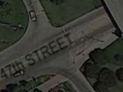


69 N COUNT LOCATION 47th STREET ACCESS POINT LAKEFRONT PATH devon peterson bryn mawr foster lawrence montrose irving park addison belmont diversey fullerton armitage north division chicago kinzie madison harrison roosevelt 16th cermak 26th 31st 35th pershing 43rd 47th 51st garfield 59th 63th marquette 71st Count Locations (1 counter) 47th STREET LAKESHORE DRIVE LAKESHORE DRIVE 66 LAKEFRONT TRAIL COUNTS
70 47th St. Access Point August 21 Estimated Daily Weekend Users: 336 Estimated Daily Weekday Users: 581 to 42 Data Collected WEEKEND 1-4 P.M. Bicyclists 36 Pedestrians 44 Other 12 47th St. Weekend Afternoon : pm 1:15 pm 1:3 pm 1:45 pm 2: pm 2:15 pm 2:3 pm 2:45 pm 3: pm 3:15 pm 3:3 pm 3:45 pm WEEKDAY 6-9 A.M. Bicyclists 25 Pedestrians 47 Other th St. Weekday Morning 6: am 6:15 am 6:3 am 6:45 am 7: am 7:15 am 7:3 am 7:45 am 8: am 8:15 am 8:3 am 8:45 am WEEKDAY 4-7 P.M. Bicyclists 3 Pedestrians 42 Other th St. Weekday Evening 4: pm 4:15 pm 4:3 pm 4:45 pm 5: pm 5:15 pm 5:3 pm 5:45 pm 6: pm 6:15 pm 6:3 pm 6:45 pm NOTES COUNTS BY LOCATION 67


 55th STREET 68")
71 SOUTH SHORE DRIVE N COUNT LOCATION PROMONTORY POINT ACCESS POINT LAKESHORE DRIVE LAKEFRONT PATH devon peterson bryn mawr foster lawrence montrose irving park addison belmont diversey fullerton armitage north division chicago kinzie madison harrison roosevelt 16th cermak 26th 31st 35th pershing 43rd 47th 51st garfield 59th 63th marquette 71st Count Locations (1 counter) 55th STREET 68 LAKEFRONT TRAIL COUNTS
72 Promontory Point Access Point August 21 Estimated Daily Weekend Users: 3377 Estimated Daily Weekday Users: 1421 to 2812 Data Collected WEEKEND 1-4 P.M. Bicyclists 143 Pedestrians 651 Other Promontory Point Weekend Afternoon 1: pm 1:15 pm 1:3 pm 1:45 pm 2: pm 2:15 pm 2:3 pm 2:45 pm 3: pm 3:15 pm 3:3 pm 3:45 pm WEEKDAY 6-9 A.M. Bicyclists 32 Pedestrians 141 Other 3 3 Promontory Point Weekday Morning : am 6:15 am 6:3 am 6:45 am 7: am 7:15 am 7:3 am 7:45 am 8: am 8:15 am 8:3 am 8:45 am WEEKDAY 4-7 P.M. Bicyclists 19 Pedestrians 37 Other Promontory Point Weekday Evening 4: pm 4:15 pm 4:3 pm 4:45 pm 5: pm 5:15 pm 5:3 pm 5:45 pm 6: pm 6:15 pm 6:3 pm 6:45 pm NOTES COUNTS BY LOCATION 69


73 57th STREET LAKEFRONT PATH N COUNT LOCATION 57th STREET ACCESS POINT SOUTH SHORE DRIVE LAKESHORE DRIVE devon peterson bryn mawr foster lawrence montrose irving park addison belmont diversey fullerton armitage north division chicago kinzie madison harrison roosevelt 16th cermak 26th 31st 35th pershing 43rd 47th 51st garfield 59th 63th marquette 71st Count Locations (1 counter) 56th STREET 7 LAKEFRONT TRAIL COUNTS
74 57th St. Access Point August 21 Estimated Daily Weekend Users: 244 Estimated Daily Weekday Users: 1155 to 1995 Data Collected WEEKEND 1-4 P.M. Bicyclists 126 Pedestrians 453 Other th St. Weekend Afternoon : pm 1:15 pm 1:3 pm 1:45 pm 2: pm 2:15 pm 2:3 pm 2:45 pm 3: pm 3:15 pm 3:3 pm 3:45 pm WEEKDAY 6-9 A.M. Bicyclists 28 Pedestrians 17 Other th St. Weekday Morning 6: am 6:15 am 6:3 am 6:45 am 7: am 7:15 am 7:3 am 7:45 am 8: am 8:15 am 8:3 am 8:45 am WEEKDAY 4-7 P.M. Bicyclists 123 Pedestrians 219 Other 4 57th St. Weekday Evening : pm 4:15 pm 4:3 pm 4:45 pm 5: pm 5:15 pm 5:3 pm 5:45 pm 6: pm 6:15 pm 6:3 pm 6:45 pm NOTES COUNTS BY LOCATION 71


")


75 N COUNT LOCATION 63rd STREET (HAYES DRIVE) ACCESS POINT LAKESHORE DRIVE devon peterson bryn mawr foster lawrence montrose irving park addison belmont diversey fullerton armitage north division chicago kinzie madison harrison roosevelt 16th cermak 26th 31st 35th pershing 43rd 47th 51st garfield 59th 63th marquette 71st Count Locations (2 counters) LAKEFRONT PATH HAYES DRIVE 72 LAKEFRONT TRAIL COUNTS
76 63rd St. Access Point August 21 Estimated Daily Weekend Users: 832 Estimated Daily Weekday Users: 536 to 233 Data Collected WEEKEND 1-4 P.M. Bicyclists 56 Pedestrians 135 Other rd St. Weekend Afternoon : pm 1:15 pm 1:3 pm 1:45 pm 2: pm 2:15 pm 2:3 pm 2:45 pm 3: pm 3:15 pm 3:3 pm 3:45 pm WEEKDAY 6-9 A.M. Bicyclists 4 Pedestrians 47 Other 14 63rd St. Weekday Morning : am 6:15 am 6:3 am 6:45 am 7: am 7:15 am 7:3 am 7:45 am 8: am 8:15 am 8:3 am 8:45 am WEEKDAY 4-7 P.M. Bicyclists 16 Pedestrians 23 Other rd St. Weekday Evening : pm 4:15 pm 4:3 pm 4:45 pm 5: pm 5:15 pm 5:3 pm 5:45 pm 6: pm 6:15 pm 6:3 pm 6:45 pm NOTES Weekday evening data collected in early September 21. No data available for weekday morning before 7:15 am. COUNTS BY LOCATION 73


77 LAKESHORE DRIVE OGLESBY AVENUE N COUNT LOCATION 67th STREET ACCESS POINT MARQUETTE DRIVE LA LAKEFRONT PATH devon peterson bryn mawr foster lawrence montrose irving park addison belmont diversey fullerton armitage north division chicago kinzie madison harrison roosevelt 16th cermak 26th 31st 35th pershing 43rd 47th 51st garfield 59th 63th marquette 71st Count Locations (1 counter) 67th STREET 74 LAKEFRONT TRAIL COUNTS
78 67th St. Access Point August 21 Estimated Daily Weekend Users: 21 Estimated Daily Weekday Users: 113 to 76 Data Collected WEEKEND 1-4 P.M. Bicyclists 1 Pedestrians 4 Other th St. Weekend Afternoon : pm 1:15 pm 1:3 pm 1:45 pm 2: pm 2:15 pm 2:3 pm 2:45 pm 3: pm 3:15 pm 3:3 pm 3:45 pm WEEKDAY 6-9 A.M. Bicyclists 2 Pedestrians 12 Other th St. Weekday Morning : am 6:15 am 6:3 am 6:45 am 7: am 7:15 am 7:3 am 7:45 am 8: am 8:15 am 8:3 am 8:45 am WEEKDAY 4-7 P.M. Bicyclists 5 Pedestrians 8 Other th St. Weekday Evening 4: pm 4:15 pm 4:3 pm 4:45 pm 5: pm 5:15 pm 5:3 pm 5:45 pm 6: pm 6:15 pm 6:3 pm 6:45 pm NOTES Data for all time periods collected in early September 21. COUNTS BY LOCATION 75


79 N COUNT LOCATION Count Locations (2 counters) MONTROSE AVENUE ALONG THE TRAIL COUNT LAKESHORE DRIVE LAKESHORE DRIVE MONTROSE AVENUE LAKEFRONT PATH devon peterson bryn mawr foster lawrence montrose irving park addison belmont diversey fullerton armitage north division chicago kinzie madison harrison roosevelt 16th cermak 26th 31st 35th pershing 43rd 47th 51st garfield 59th 63th marquette 71st MARINE DRIVE 76 LAKEFRONT TRAIL COUNTS
80 South of Montrose Along the Trail August 21 Estimated Daily Weekend Users: 1223 Estimated Daily Weekday Users: to 1561 Data Collected WEEKEND 1-4 P.M. Bicyclists 2,189 Pedestrians 651 Other South of Montrose Along the Trail-Total : pm 1:15 pm 1:3 pm 1:45 pm 2: pm 2:15 pm 2:3 pm 2:45 pm 3: pm 3:15 pm 3:3 pm 3:45 pm WEEKEND 1-4 P.M. Bicyclists 1,25 Pedestrians 383 Other South of Montrose Along the Trail-Northbound : pm 1:15 pm 1:3 pm 1:45 pm 2: pm 2:15 pm 2:3 pm 2:45 pm 3: pm 3:15 pm 3:3 pm 3:45 pm WEEKEND 1-4 P.M. Bicyclists 939 Pedestrians 268 Other South of Montrose Along the Trail-Southbound : pm 1:15 pm 1:3 pm 1:45 pm 2: pm 2:15 pm 2:3 pm 2:45 pm 3: pm 3:15 pm 3:3 pm 3:45 pm NOTES COUNTS BY LOCATION 77
81 South of Montrose Along the Trail August 21 Estimated Daily Weekend Users: 1223 Estimated Daily Weekday Users: to 1561 Data Collected WEEKDAY 6-9 A.M. Bicyclists 1,154 Pedestrians 516 Other South of Montrose Along the Trail-Total : am 6:15 am 6:3 am 6:45 am 7: am 7:15 am 7:3 am 7:45 am 8: am 8:15 am 8:3 am 8:45 am WEEKDAY 6-9 A.M. Bicyclists 311 Pedestrians 264 Other South of Montrose Along the Trail-Northbound 6: am 6:15 am 6:3 am 6:45 am 7: am 7:15 am 7:3 am 7:45 am 8: am 8:15 am 8:3 am 8:45 am WEEKDAY 6-9 A.M. Bicyclists 843 Pedestrians 252 Other 7 14 South of Montrose Along the Trail-Southbound : am 6:15 am 6:3 am 6:45 am 7: am 7:15 am 7:3 am 7:45 am 8: am 8:15 am 8:3 am 8:45 am NOTES 78 LAKEFRONT TRAIL COUNTS
82 South of Montrose Along the Trail August 21 Estimated Daily Weekend Users: 1223 Estimated Daily Weekday Users: to 1561 Data Collected WEEKDAY 4-7 P.M. Bicyclists 1,788 Pedestrians 81 Other South of Montrose Along the Trail-Total : pm 4:15 pm 4:3 pm 4:45 pm 5: pm 5:15 pm 5:3 pm 5:45 pm 6: pm 6:15 pm 6:3 pm 6:45 pm WEEKDAY 4-7 P.M. Bicyclists 1,195 Pedestrians 424 Other South of Montrose Along the Trail-Northbound 4: pm 4:15 pm 4:3 pm 4:45 pm 5: pm 5:15 pm 5:3 pm 5:45 pm 6: pm 6:15 pm 6:3 pm 6:45 pm WEEKDAY 4-7 P.M. Bicyclists 593 Pedestrians 377 Other South of Montrose Along the Trail-Southbound 4: pm 4:15 pm 4:3 pm 4:45 pm 5: pm 5:15 pm 5:3 pm 5:45 pm 6: pm 6:15 pm 6:3 pm 6:45 pm NOTES COUNTS BY LOCATION 79

83 N COUNT LOCATION Count Locations (2 counters) FULLERTON PARKWAY ALONG THE TRAIL COUNT LAKESHORE DRIVE LAKEFRONT PATH devon peterson bryn mawr foster lawrence montrose irving park addison belmont diversey fullerton armitage north division chicago kinzie madison harrison roosevelt 16th cermak 26th 31st 35th pershing 43rd 47th 51st garfield 59th 63th marquette 71st FULLERTON PARKWAY 8 LAKEFRONT TRAIL COUNTS
84 South of Fullerton Along the Trail August 21 Estimated Daily Weekend Users: 2396 Estimated Daily Weekday Users: 2774 to Data Collected WEEKEND 1-4 P.M. Bicyclists 3,196 Pedestrians 2,343 Other South of Fullerton Along the Trail-Total : pm 1:15 pm 1:3 pm 1:45 pm 2: pm 2:15 pm 2:3 pm 2:45 pm 3: pm 3:15 pm 3:3 pm 3:45 pm WEEKEND 1-4 P.M. Bicyclists 1,585 Pedestrians 1,171 Other South of Fullerton Along the Trail-Northbound 1: pm 1:15 pm 1:3 pm 1:45 pm 2: pm 2:15 pm 2:3 pm 2:45 pm 3: pm 3:15 pm 3:3 pm 3:45 pm WEEKEND 1-4 P.M. Bicyclists 1,611 Pedestrians 1,172 Other South of Fullerton Along the Trail-Southbound 1: pm 1:15 pm 1:3 pm 1:45 pm 2: pm 2:15 pm 2:3 pm 2:45 pm 3: pm 3:15 pm 3:3 pm 3:45 pm NOTES COUNTS BY LOCATION 81
85 South of Fullerton Along the Trail August 21 Estimated Daily Weekend Users: 2396 Estimated Daily Weekday Users: 2774 to Data Collected WEEKDAY 6-9 A.M. Bicyclists 1,434 Pedestrians 1,115 Other South of Fullerton Along the Trail-Total 6: am 6:15 am 6:3 am 6:45 am 7: am 7:15 am 7:3 am 7:45 am 8: am 8:15 am 8:3 am 8:45 am WEEKDAY 6-9 A.M. Bicyclists 295 Pedestrians 542 Other South of Fullerton Along the Trail-Northbound 6: am 6:15 am 6:3 am 6:45 am 7: am 7:15 am 7:3 am 7:45 am 8: am 8:15 am 8:3 am 8:45 am WEEKDAY 6-9 A.M. Bicyclists 1,139 Pedestrians 573 Other 9 16 Souith of Fullerton Along the Trail-Southbound : am 6:15 am 6:3 am 6:45 am 7: am 7:15 am 7:3 am 7:45 am 8: am 8:15 am 8:3 am 8:45 am NOTES 82 LAKEFRONT TRAIL COUNTS
86 South of Fullerton Along the Trail August 21 Estimated Daily Weekend Users: 2396 Estimated Daily Weekday Users: 2774 to Data Collected WEEKDAY 4-7 P.M. Bicyclists 2,748 Pedestrians 2,228 Other South of Fullerton Along the Trail-Total : pm 4:15 pm 4:3 pm 4:45 pm 5: pm 5:15 pm 5:3 pm 5:45 pm 6: pm 6:15 pm 6:3 pm 6:45 pm WEEKDAY 4-7 P.M. Bicyclists 1,718 Pedestrians 1,79 Other South of Fullerton Along the Trail-Northbound : pm 4:15 pm 4:3 pm 4:45 pm 5: pm 5:15 pm 5:3 pm 5:45 pm 6: pm 6:15 pm 6:3 pm 6:45 pm WEEKDAY 4-7 P.M. Bicyclists 1,3 Pedestrians 1,149 Other South of Fullerton Along the Trail-Southbound 4: pm 4:15 pm 4:3 pm 4:45 pm 5: pm 5:15 pm 5:3 pm 5:45 pm 6: pm 6:15 pm 6:3 pm 6:45 pm NOTES COUNTS BY LOCATION 83


87 N COUNT LOCATION Count Locations (2 locations) OAK STREET ALONG THE TRAIL COUNT ELM STREET LAKESHORE DRIVE DRIVE LAKESHORE DRIVE LAKEFRONT PATH devon peterson bryn mawr foster lawrence montrose irving park addison belmont diversey fullerton armitage north division chicago kinzie madison harrison roosevelt 16th cermak 26th 31st 35th pershing 43rd 47th 51st garfield 59th 63th marquette 71st CEDAR STREET BELLEVUE PLACE OAK STREET INNER LAKESHORE DRIVE 84 LAKEFRONT TRAIL COUNTS
88 Between Oak St. and North Ave. Along the Trail August 21 Estimated Daily Weekend Users: Estimated Daily Weekday Users: 2314 to Data Collected WEEKEND 1-4 P.M. Bicyclists 2,858 Pedestrians 1,721 Other 115 Between Oak St. and North Ave. Along the Trail-Total : pm 1:15 pm 1:3 pm 1:45 pm 2: pm 2:15 pm 2:3 pm 2:45 pm 3: pm 3:15 pm 3:3 pm 3:45 pm WEEKEND 1-4 P.M. Bicyclists 1,455 Pedestrians 95 Other Between Oak St. and North Ave. Along the Trail-Northbound 1: pm 1:15 pm 1:3 pm 1:45 pm 2: pm 2:15 pm 2:3 pm 2:45 pm 3: pm 3:15 pm 3:3 pm 3:45 pm WEEKEND 1-4 P.M. Bicyclists 1,43 Pedestrians 771 Other Between Oak St. and North Ave. Along the Trail-Southbound 1: pm 1:15 pm 1:3 pm 1:45 pm 2: pm 2:15 pm 2:3 pm 2:45 pm 3: pm 3:15 pm 3:3 pm 3:45 pm NOTES No data collected 1:-1:3pm northbound and 1-1:15pm southbound COUNTS BY LOCATION 85
89 Between Oak St. and North Ave. Along the Trail August 21 Estimated Daily Weekend Users: Estimated Daily Weekday Users: 2314 to Data Collected WEEKDAY 6-9 A.M. Bicyclists 1,435 Pedestrians 1,399 Other 31 Between Oak St. and North Ave. Along the Trail-Total : am 6:15 am 6:3 am 6:45 am 7: am 7:15 am 7:3 am 7:45 am 8: am 8:15 am 8:3 am 8:45 am WEEKDAY 6-9 A.M. Bicyclists 284 Pedestrians 637 Other 16 8 Between Oak St. and North Ave. Along the Trail-Northbound : am 6:15 am 6:3 am 6:45 am 7: am 7:15 am 7:3 am 7:45 am 8: am 8:15 am 8:3 am 8:45 am WEEKDAY 6-9 A.M. Bicyclists 1,151 Pedestrians 762 Other Between Oak St. and North Ave. Along the Trail-Southbound 6: am 6:15 am 6:3 am 6:45 am 7: am 7:15 am 7:3 am 7:45 am 8: am 8:15 am 8:3 am 8:45 am NOTES 86 LAKEFRONT TRAIL COUNTS
90 Between Oak St. and North Ave. Along the Trail August 21 Estimated Daily Weekend Users: Estimated Daily Weekday Users: 2314 to Data Collected WEEKDAY 4-7 P.M. Bicyclists 2,249 Pedestrians 1,492 Other 74 Between Oak St. and North Ave. Along the Trail-Total : pm 4:15 pm 4:3 pm 4:45 pm 5: pm 5:15 pm 5:3 pm 5:45 pm 6: pm 6:15 pm 6:3 pm 6:45 pm WEEKDAY 4-7 P.M. Bicyclists 1,383 Pedestrians 712 Other Between Oak St. and North Ave. Along the Trail-Northbound : pm 4:15 pm 4:3 pm 4:45 pm 5: pm 5:15 pm 5:3 pm 5:45 pm 6: pm 6:15 pm 6:3 pm 6:45 pm WEEKDAY 4-7 P.M. Bicyclists 866 Pedestrians 78 Other Between Oak St. and North Ave. Along the Trail-Southbound : pm 4:15 pm 4:3 pm 4:45 pm 5: pm 5:15 pm 5:3 pm 5:45 pm 6: pm 6:15 pm 6:3 pm 6:45 pm NOTES COUNTS BY LOCATION 87

")


91 N COUNT LOCATION Count Locations (1 counter) McFETRIDGE DRIVE ALONG THE TRAIL COUNT McFETRIDGE DRIVE devon peterson bryn mawr foster lawrence montrose irving park addison belmont diversey fullerton armitage north division chicago kinzie madison harrison roosevelt 16th cermak 26th 31st 35th pershing 43rd 47th 51st garfield 59th 63th marquette 71st MUSEUM CAMPUS DRIVE LAKEFRONT PATH 88 LAKEFRONT TRAIL COUNTS
92 South of McFetridge Along the Trail August 21 Estimated Daily Weekend Users: 8299 Estimated Daily Weekday Users: 696 to 7554 Data Collected WEEKEND 1-4 P.M. Bicyclists 1,718 Pedestrians 221 Other South of McFetridge Along the Trail-Total 1: pm 1:15 pm 1:3 pm 1:45 pm 2: pm 2:15 pm 2:3 pm 2:45 pm 3: pm 3:15 pm 3:3 pm 3:45 pm WEEKEND 1-4 P.M. Bicyclists 88 Pedestrians 118 Other South of McFetridge Along the Trail-Northbound 1: pm 1:15 pm 1:3 pm 1:45 pm 2: pm 2:15 pm 2:3 pm 2:45 pm 3: pm 3:15 pm 3:3 pm 3:45 pm WEEKEND 1-4 P.M. Bicyclists 838 Pedestrians 13 Other 2 12 South of McFetridge Along the Trail-Southbound : pm 1:15 pm 1:3 pm 1:45 pm 2: pm 2:15 pm 2:3 pm 2:45 pm 3: pm 3:15 pm 3:3 pm 3:45 pm NOTES COUNTS BY LOCATION 89
93 South of McFetridge Along the Trail August 21 Estimated Daily Weekend Users: 8299 Estimated Daily Weekday Users: 696 to 7554 Data Collected WEEKDAY 6-9 A.M. Bicyclists 538 Pedestrians 311 Other 6 6 South of McFetridgeAlong the Trail-Total : am 6:15 am 6:3 am 6:45 am 7: am 7:15 am 7:3 am 7:45 am 8: am 8:15 am 8:3 am 8:45 am WEEKDAY 6-9 A.M. Bicyclists 31 Pedestrians 162 Other 4 South of McFetridge Along the Trail-Northbound : am 6:15 am 6:3 am 6:45 am 7: am 7:15 am 7:3 am 7:45 am 8: am 8:15 am 8:3 am 8:45 am WEEKDAY 6-9 A.M. Bicyclists 237 Pedestrians 149 Other 6 35 South of McFetridge Point Along the Trail-Southbound : am 6:15 am 6:3 am 6:45 am 7: am 7:15 am 7:3 am 7:45 am 8: am 8:15 am 8:3 am 8:45 am NOTES 9 LAKEFRONT TRAIL COUNTS
94 South of McFetridge Along the Trail August 21 Estimated Daily Weekend Users: 8299 Estimated Daily Weekday Users: 696 to 7554 Data Collected WEEKDAY 4-7 P.M. Bicyclists 956 Pedestrians 322 Other South of McFetridge Along the Trail-Total : pm 4:15 pm 4:3 pm 4:45 pm 5: pm 5:15 pm 5:3 pm 5:45 pm 6: pm 6:15 pm 6:3 pm 6:45 pm WEEKDAY 4-7 P.M. Bicyclists 455 Pedestrians 168 Other 6 8 South of McFetridge Along the Trail-Northbound : pm 4:15 pm 4:3 pm 4:45 pm 5: pm 5:15 pm 5:3 pm 5:45 pm 6: pm 6:15 pm 6:3 pm 6:45 pm WEEKDAY 4-7 P.M. Bicyclists 51 Pedestrians 154 Other 11 7 South of McFetridge Along the Trail-Southbound : pm 4:15 pm 4:3 pm 4:45 pm 5: pm 5:15 pm 5:3 pm 5:45 pm 6: pm 6:15 pm 6:3 pm 6:45 pm NOTES COUNTS BY LOCATION 91
 PROMONTORY POINT")


95 SOUTH SHORE DRIVE N COUNT LOCATION Count Locations (1 counter) PROMONTORY POINT ALONG THE TRAIL COUNT LAKESHORE DRIVE LAKEFRONT PATH devon peterson bryn mawr foster lawrence montrose irving park addison belmont diversey fullerton armitage north division chicago kinzie madison harrison roosevelt 16th cermak 26th 31st 35th pershing 43rd 47th 51st garfield 59th 63th marquette 71st 55th STREET 92 LAKEFRONT TRAIL COUNTS
96 North of Promontory Point Along the Trail August 21 Estimated Daily Weekend Users: 6569 Estimated Daily Weekday Users: 5915 to 6138 Data Collected WEEKEND 1-4 P.M. Bicyclists 998 Pedestrians 541 Other North of Promontory Point Along the Trail-Total : pm 1:15 pm 1:3 pm 1:45 pm 2: pm 2:15 pm 2:3 pm 2:45 pm 3: pm 3:15 pm 3:3 pm 3:45 pm WEEKEND 1-4 P.M. Bicyclists 454 Pedestrians 26 Other 13 6 North of Promontory Point Along the Trail-Northbound : pm 1:15 pm 1:3 pm 1:45 pm 2: pm 2:15 pm 2:3 pm 2:45 pm 3: pm 3:15 pm 3:3 pm 3:45 pm WEEKEND 1-4 P.M. Bicyclists 544 Pedestrians 281 Other 12 8 North of Promontory Point Along the Trail-Southbound : pm 1:15 pm 1:3 pm 1:45 pm 2: pm 2:15 pm 2:3 pm 2:45 pm 3: pm 3:15 pm 3:3 pm 3:45 pm NOTES COUNTS BY LOCATION 93
97 North of Promontory Point Along the Trail August 21 Estimated Daily Weekend Users: 6569 Estimated Daily Weekday Users: 5915 to 6138 Data Collected WEEKDAY 6-9 A.M. Bicyclists 35 Pedestrians 45 Other North of Promontory Point Along the Trail-Total 6: am 6:15 am 6:3 am 6:45 am 7: am 7:15 am 7:3 am 7:45 am 8: am 8:15 am 8:3 am 8:45 am WEEKDAY 6-9 A.M. Bicyclists 159 Pedestrians 151 Other 25 North of Promontory Point Along the Trail-Northbound : am 6:15 am 6:3 am 6:45 am 7: am 7:15 am 7:3 am 7:45 am 8: am 8:15 am 8:3 am 8:45 am WEEKDAY 6-9 A.M. Bicyclists 191 Pedestrians 254 Other 5 3 North of Promontory Point Along the Trail-Southbound : am 6:15 am 6:3 am 6:45 am 7: am 7:15 am 7:3 am 7:45 am 8: am 8:15 am 8:3 am 8:45 am NOTES 94 LAKEFRONT TRAIL COUNTS
98 North of Promontory Point Along the Trail August 21 Estimated Daily Weekend Users: 6569 Estimated Daily Weekday Users: 5915 to 6138 Data Collected WEEKDAY 4-7 P.M. Bicyclists 596 Pedestrians 415 Other North of Promontory Point Along the Trail-Total 4: pm 4:15 pm 4:3 pm 4:45 pm 5: pm 5:15 pm 5:3 pm 5:45 pm 6: pm 6:15 pm 6:3 pm 6:45 pm WEEKDAY 4-7 P.M. Bicyclists 295 Pedestrians 233 Other North of Promontory Point Along the Trail-Northbound 4: pm 4:15 pm 4:3 pm 4:45 pm 5: pm 5:15 pm 5:3 pm 5:45 pm 6: pm 6:15 pm 6:3 pm 6:45 pm WEEKDAY 4-7 P.M. Bicyclists 31 Pedestrians 182 Other North of Promontory Point Along the Trail-Southbound 4: pm 4:15 pm 4:3 pm 4:45 pm 5: pm 5:15 pm 5:3 pm 5:45 pm 6: pm 6:15 pm 6:3 pm 6:45 pm NOTES No data available for sounthbound between 4:45 pm and 5: pm. COUNTS BY LOCATION 95
99 Lakefront Path Counts (Access Points) Instructions Mark each person with a tick mark only as they enter the lakefront path. Date and : (circle time) Sunday, Aug. 22, 21: 1 p.m.- 2 p.m.; 2 p.m. - 3 p.m.; 3 p.m.- 4 p.m. Tuesday, Aug. 24, 21: 6 a.m.- 7 a.m.; 7 a.m.- 8 a.m.; 8 a.m.- 9 a.m. 4 p.m.- 5 p.m.; 5 p.m.- 6 p.m.; 6 p.m.- 7 p.m. Location: Weather Conditions: -15 minutes Pedestrian Includes wheelchairs, Segways, runners Bike Includes handpedal bikes and recumbents Other Includes skateboarders, in-line skaters, razor scooters 15-3 minutes 3-45 minutes 45-6 minutes Total 96 LAKEFRONT TRAIL COUNTS
100 Lakefront Trail Counts (Along the trail Counts) Instructions Mark each person with a tick mark as they pass along the lakefront path. Date and : (circle time) Sunday, Aug. 22, 21: 1 p.m. - 2 p.m.; 2 p.m. - 3 p.m.; 3 p.m. - 4 p.m. Tuesday, Aug. 24, 21: 6 a.m. - 7 a.m.; 7 a.m. - 8 a.m.; 8 a.m. - 9 a.m. 4 p.m. - 5 p.m.; 5 p.m. - 6 p.m.; 6p.m. - 7 p.m. Location: Weather Conditions: -15 minutes Pedestrian Includes wheelchairs, Segways, runners Northbound: Bike Includes handpedal bikes and recumbents Northbound: Other Includes skateboarders, in-line skaters, razor scooters Northbound: Southbound: Southbound: Southbound: 15-3 minutes Northbound: Northbound: Northbound: Southbound: Southbound: Southbound: 3-45 minutes Northbound: Northbound: Northbound: Southbound: Southbound: Southbound: 45-6 minutes Northbound: Northbound: Northbound: Southbound: Southbound: Southbound: Total Northbound: Southbound: Northbound: Southbound: Northbound: Southbound: COUNTS BY LOCATION 97
101 Lakefront s FAQ Thank you for volunteering with Active Transportation Alliance! You should have received your volunteer location. If you have not received your location, please contact Carolyn Helmke Carolyn@activetrans.org. Your volunteer captain will be giving you a short training before the count begins on how to do the official count and record your data. Below are a few definitions and FAQs to help you make counting easier. If you are counting at an ACCESS POINT, you will ONLY be counting people coming into the trail, not exiting. You will be counting three separate categories: Bikes, Pedestrians, or other. Please see below for definitions. If you are counting ALONG THE TRAIL, you will be counting people going NORTH and SOUTH and trying to keep them in three categories if possible. It may be too busy to distinguish. What should I bring to volunteer? -A watch or cell phone with easy to see clock -Water, sports drink and snacks -Sunglasses, Hat, Sunscreen -Comfortable clothes and shoes -Folding chair if you want to sit down while counting Who will I be counting? ALL People ENTERING the lakefront trail or people going along the trail, depending on where you have been assigned to count. Who is a pedestrian? Anyone traveling on the lakefront trail on foot, people in wheelchairs, babies in strollers with walking or running parents, Segway Who is a bicyclist? Anyone on a bicycle, tricycle, unicycle, tandem bike, recumbent (sitting down) bike. Who falls into the other category? Anyone on rollerblades, a skateboard, razor scooter. FAQs for counters Each map with data (or does this go above?) ABOVE 98 LAKEFRONT TRAIL COUNTS
102

103 9 West Hubbard Street Suite 42 Chicago, IL T F info@activetrans.org North Fairbanks Court Chicago, IL T
2009 Bike Counts Project. Chicago Department of Transportation Division of Project Development Bicycle Program
 2009 Bike Counts Project Chicago Department of Transportation ASHLAND AVE 1600 W DAMEN AVE 2000 W WESTERN AVE 2400 W CALIFORNIA AVE 2800 W KEDZIE AVE 3200 W PULASKI RD 4000 W CENTRAL PARK AVE 3600 W CICERO
PEDESTRIAN ACTION PLAN
 ATTACHMENT 2 CITY OF SANTA MONICA PEDESTRIAN ACTION PLAN CITY OF SANTA MONICA PEDESTRIAN ACTION PLAN This page intentionally left blank EXECUTIVE SUMMARY CHAPTER 1 EXECUTIVE SUMMARY Setting the Stage
2014 Fishers Trail Count
 2014 Fishers Trail Count July 2014 Table of Contents Introduction...1 Trail Count Locations...3 Ellipse Parkway at Holland Drive...4 Lantern Road at Sunblest Boulevard...5 126th Street at Cumberland Road...6
CONNECTING PEOPLE TO PLACES
 CONNECTING PEOPLE TO PLACES 82 EAST BENCH MASTER PLAN 07 Introduction The East Bench transportation system is a collection of slow moving, treelined residential streets and major arteries that are the
TRANSPORTATION & MOBILITY
 TRANSPORTATION & MOBILITY ROADWAY SYSTEM There are approximately 40 miles of roadways in Manitou Springs. For planning purposes, roadways are typically assigned a functional classification which defines
Hennepin County Bicycle and Pedestrian Planning
 Hennepin County Bicycle and Pedestrian Planning 1 Value of bicycle and sidewalk systems Safety Livability Mobility Health Personal Finances Economic Sustainability Clean Air Recreation Parking and congestion
NM-POLICY 1: Improve service levels, participation, and options for non-motorized transportation modes throughout the County.
 Transportation PRINCE WILLIAM COUNTY 2008 COMPREHENSIVE PLAN NON-MOTORIZED PLAN CONTENTS Goals, Policies, and Action Strategies Table 4 (Bike Facility Classifications and Descriptions) Table 5 (Bike Facility
MASTER BICYCLE AND PEDESTRIAN PLAN
 VILLAGE OF NORTHBROOK MASTER BICYCLE AND PEDESTRIAN PLAN DRAFT PLAN OPEN HOUSE May 2, 2018 AGENDA 1. Community Engagement 2. Vision and Goals 3. General Structure of Plan 4. Recommendations Overview 5.
EUCLID AVENUE PARKING STUDY CITY OF SYRACUSE, ONONDAGA COUNTY, NEW YORK
 EUCLID AVENUE PARKING STUDY CITY OF SYRACUSE, ONONDAGA COUNTY, NEW YORK CITY OF SYRACUSE DEPARTMENT OF PUBLIC WORKS 1200 CANAL STREET EXTENSION SYRACUSE, NEW YORK 13210 DRAFT REPORT DATE: November 13,
4 Goals, Objectives & Actions
 Chapter4 4 This chapter presents goals, objectives, and recommended actions to support the vision of making Overland Park a safer and easier place to ride a bicycle. 35 4.1 Recommendations Structure The
TRANSPORTATION & MOBILITY VISIONING MEETING. August 23 24, 2017
 TRANSPORTATION & MOBILITY VISIONING MEETING August 23 24, 2017 Project Team 1999 South Lakefront Framework Plan In 1999, the Chicago Park District authorized framework plans for three historic parks: Jackson,
o n - m o t o r i z e d transportation is an overlooked element that can greatly enhance the overall quality of life for the community s residents.
 N o n - m o t o r i z e d transportation is an overlooked element that can greatly enhance the overall quality of life for the community s residents. 84 Transportation CHAPTER 11 INTRODUCTION Transportation
US287 Asset Inventory Loveland. Figure 6-1 Loveland Bridges and Traffic Signals
 Chapter 6: City of Loveland US287 extends for approximately 13.1 miles through the City of Loveland. Between the northern City boundary and 29 th Street, the road is labeled Garfield Avenue, before transitioning
SAFE ROUTES TO SCHOOL
 SAFE ROUTES TO SCHOOL Forest Ridge Elementary School Existing Conditions and ACTION PLAN > Oak Creek - Franklin Joint School District Table of Contents CONTEXT Enrollment Boundaries
City of Novi Non-Motorized Master Plan 2011 Executive Summary
 City of Novi Non-Motorized Master Plan 2011 Executive Summary Prepared by: February 28, 2011 Why Plan? Encouraging healthy, active lifestyles through pathway and sidewalk connectivity has been a focus
CITY OF COCOA BEACH 2025 COMPREHENSIVE PLAN. Section VIII Mobility Element Goals, Objectives, and Policies
 CITY OF COCOA BEACH 2025 COMPREHENSIVE PLAN Section VIII Mobility Element Goals, Objectives, and Policies Adopted August 6, 2015 by Ordinance No. 1591 VIII MOBILITY ELEMENT Table of Contents Page Number
Winnipeg Walk Bike Projects Downtown Tire Talk - Summary
 Winnipeg Walk Bike Projects Downtown Tire Talk - Summary Downtown Projected Bike Lane System Connecting The Forks to the Exchange District (Fort Street, Garry Street & The Forks to Assiniboine Connection)
4 MOBILITY PLAN. Mobility Plan Objectives. Mobility Context. 1. Integrate with Local and Regional Transit Improvements
 Harbor Mixed Use CHAPTER Transit Corridor 4: Mobility Plan 4 MOBILITY PLAN Mobility Plan Objectives The Harbor Corridor Plan seeks to expand and improve the ways that people move along and through the
2017 Florida Commuter Transportation Summit
 2017 Florida Commuter Transportation Summit Building Bicycle Friendly Universities Ron Fuller, Assistant Director Transportation and Parking Services University of Florida Achieving the Silver Level a
The Traffic Monitoring Guide: Counting Bicyclists and Pedestrians. APBP 2017 June 28: 11:15am-12:45pm
 The Traffic Monitoring Guide: Counting Bicyclists and Pedestrians APBP 2017 June 28: 11:15am-12:45pm 2 Presentation Organization Why count bicyclists and pedestrians? Why report count data? What resources
Tuesday, September 25 th Mount Holly Municipal Complex 400 East Central Avenue 5:30pm to 7:30pm. Activity Stations o Where do you Live?
 Meeting Information Overview The public workshop for the Mount Holly Comprehensive Bicycle Plan occurred on September 25, 2018. The drop-in workshop allowed attendees to participate in a series of interactive
Chicago Department of Transportation Bikeways - Year in Review
 Chicago Department of Transportation 2015 - Year in Review -protected bike lane on Division Street east of Damen Avenue Table of Contents 2015 Achievements 01 Barrier- Bike Lanes 03 07 11 - Bike Lanes
Exhibit 1 PLANNING COMMISSION AGENDA ITEM
 Exhibit 1 PLANNING COMMISSION AGENDA ITEM Project Name: Grand Junction Circulation Plan Grand Junction Complete Streets Policy Applicant: City of Grand Junction Representative: David Thornton Address:
Bicycle Parking Analysis: California State University, Fullerton
 Bicycle Parking Analysis: California State University, Fullerton Fall 2006 Bicycle Parking Analysis: California State University, Fullerton Fall 2006 Report Author: John Carroll Department of Geography,
Bikeway action plan. Bicycle Friendly Community Workshop March 5, 2007 Rochester, MN
 Bikeway action plan Summary The was held on March 5, 2007 at the Rochester Mayo Civic Center. The workshop was hosted by Rochester-Olmsted County Planning Department in collaboration with the League of
City of Davis East Covell Corridor Plan
 Community Open House #2 January 22, 2014 6:00 8:00 p.m. Veterans Memorial Center, Club Room City of Davis Introduction The (ECCP) is a taking a comprehensive look at the existing transportation systems
MTP BICYCLE ELEMENT UPDATE. November 2017
 MTP BICYCLE ELEMENT UPDATE November 2017 TIME FOR AN UPDATE Bicycle Element adopted in July 2008 Almost 10 years old Many planned facilities have been implemented 10 years more experience in planning,
General Design Factors
 Chapter 3: 3-1.0 Introduction General Design Factors Mn/DOT s goals include encouraging and accommodating safe bicycling. From a design perspective, these goals are achieved by first having an understanding
Brown Line Capacity Expansion Project Supplemental Service Strategy for Construction-Related Three-Track Operation
 Brown Line Capacity Expansion Project Supplemental Service Strategy for Construction-Related Three-Track Operation February 14, 2007 Description of the Brown Line Reconstruction Project and Customer Impact
Perryville TOD and Greenway Plan
 Perryville TOD and Greenway Plan Greenway Glossary Pathway: A bicycle and pedestrian path separated from motorized vehicular traffic by an open space, barrier or curb. Multi-use paths may be within the
Typical Rush Hour Commute. PennyforTransportation.com
 Typical Rush Hour Commute In the News Overview of the Plan Collaborative plan with projects in every community Prioritizing connectivity and congestion relief Dedicated transportation-specific funding;
MAG Town of Cave Creek Bike Study Task 6 Executive Summary and Regional Significance Report
 Page 1 MAG Town of Cave Creek Bike Study Task 6 Executive Summary and Regional Significance Report August 1, 2012 MAG Project #481 Page 2 Task 6 Executive Summary and Regional Significance Report Introduction
the Chicago Streetcar
 the Chicago Streetcar, Executive Director jck@chicagostreetcar.com 312-810-1525 June 2014 Sustainable prosperity depends on our region s success in reducing congestion by promoting transportation options
SAFE ROUTES TO SCHOOL
 SAFE ROUTES TO SCHOOL Edgewood Elementary School Existing Conditions and ACTION PLAN > Oak Creek - Franklin Joint School District Table of Contents CONTEXT Enrollment Boundaries Enrollment
Agenda. Overview PRINCE GEORGE S PLAZA METRO AREA PEDESTRIAN PLAN
 PRINCE GEORGE S PLAZA METRO AREA PEDESTRIAN PLAN May 28, 2008 Agenda Welcome and introductions Project overview and issue identification Planning context and strengths Design challenges and initial recommendations
EXECUTIVE SUMMARY. Vision
 Vision Walking and bicycling in Salt Lake City will be safe, convenient, comfortable, and viable transportation options that connect people to places, foster recreational and economic development opportunities,
APPENDIX A: Complete Streets Checklist DRAFT NOVEMBER 2016
 APPENDIX A: Complete Streets Checklist DRAFT NOVEMBER 2016 Complete Streets Checklist MetroPlan Orlando s Complete Streets Checklist is an internal planning tool for staff to further implementation of
Comments EXECUTIVE SUMMARY
 Comments 1. Under any Alternatives, MCDOT should provide better at-grade pedestrian crossing of Georgia Avenue and Forest Glen Road, including improved crosswalks with wider medians and adequate signal
Solana Beach Comprehensive Active Transportation Strategy (CATS)
") Solana Beach Comprehensive Active Transportation Strategy (CATS) 3.0 Goals & Policies The Solana Beach CATS goals and objectives outlined below were largely drawn from the Solana Beach Circulation Element
Solana Beach Comprehensive Active Transportation Strategy (CATS) 3.0 Goals & Policies The Solana Beach CATS goals and objectives outlined below were largely drawn from the Solana Beach Circulation Element
National Bicycle and Pedestrian Documentation Project INSTRUCTIONS
 National Bicycle and Pedestrian Documentation Project INSTRUCTIONS The National Documentation Project (NBPD) is an annual bicycle and pedestrian count and survey effort sponsored by the Institute of Transportation
Eliminate on-street parking where it will allow for a dedicated bus only lane %
 Traffic Dashboard Priorities Survey Responses Introduction 1) Are you familiar with bus rapid transit (BRT)? a. No, BRT is new to me. 597 23.5% b. I ve heard of BRT, but I don t know much about it. 1,136
Chapter 2. Bellingham Bicycle Master Plan Chapter 2: Policies and Actions
 Chapter 2 Bellingham Bicycle Master Plan Chapter 2: Policies and Actions Chapter 2: Policies and Actions The Bicycle Master Plan provides a road map for making bicycling in Bellingham a viable transportation
25th Avenue Road Diet Project A One Year Evaluation. Transportation Fund for Clean Air Project #05R07
 25th Avenue Road Diet Project A One Year Evaluation Transportation Fund for Clean Air Project #05R07 Submitted by: The San Francisco Municipal Transportation Agency Dan Provence May 22, 2009 EXECUTIVE
Moving Cambridge. City of Cambridge Transportation Master Plan Public Consultation Centre. March 7, :00 8:00 PM.
 City of Cambridge Transportation Master Plan Public Consultation Centre March 7, 2018 5:00 8:00 PM Region of Waterloo City of Cambridge Transportation Master Plan Public Consultation Centre March 7, 2018
US287 Asset Inventory Fort Collins. Figure 5-1 Fort Collins Bridges and Traffic Signals
 Chapter 5: City of Fort Collins US287 through Fort Collins is known as College Avenue, runs for approximately 9.25 miles, and bisects the City north to south. Within the City, US287 is a principal arterial.
Chapter 7. Transportation. Transportation Road Network Plan Transit Cyclists Pedestrians Multi-Use and Equestrian Trails
 Chapter 7 Transportation Transportation Road Network Plan Transit Cyclists Pedestrians Multi-Use and Equestrian Trails 7.1 TRANSPORTATION BACKGROUND The District of Maple Ridge faces a number of unique
Active Transportation Facility Glossary
 Active Transportation Facility Glossary This document defines different active transportation facilities and suggests appropriate corridor types. Click on a facility type to jump to its definition. Bike
Chapter 3 DESIGN SPECIFICATIONS
 Brampton PathWays Planning and Design Guidelines 27 Chapter 3 DESIGN SPECIFICATIONS 3.1 CLASS 1 MULTI-USE PATH Off-road multi-use trails are the backbone of the Brampton PathWays Network. They are typically
Baseline Survey of New Zealanders' Attitudes and Behaviours towards Cycling in Urban Settings
 Baseline Survey of New Zealanders' Attitudes and Behaviours towards Cycling in Urban Settings Highlights 67% of urban New Zealanders, 18 years of age or more own or have access to a bicycle that is in
Welcome! San Jose Avenue Open House August 25, 2015
 Welcome! San Jose Avenue Open House August 25, 2015 Vision Zero The City and County of San Francisco adopted Vision Zero San Francisco Vision Zero High Injury Network as a policy in 2014, committing an
This page intentionally left blank.
 This page intentionally left blank. COMMUNITY Glenpool Community Overview Glenpool Glenpool is a city of nearly 12,000 residents located in Tulsa County southwest of Tulsa and Jenks. The city is growing
INTERMODAL TRANSPORTATION PLAN
 INTRODUCTION INTERMODAL TRANSPORTATION PLAN Effective intermodal transportation implies a public policy for actively decreasing the demand for automobile trips and consequently reducing automobile related
Pennsylvania Avenue (CR 484) Design Alternatives Study
 Design Alternatives Study") MEMORANDUM Pennsylvania Avenue (CR 484) Design Alternatives Study Prepared for: APRIL 2016 Prepared By TABLE OF CONTENTS Project Background... 2 Previous Concept... 2 Existing Conditions... 4 New Alternatives...
MEMORANDUM Pennsylvania Avenue (CR 484) Design Alternatives Study Prepared for: APRIL 2016 Prepared By TABLE OF CONTENTS Project Background... 2 Previous Concept... 2 Existing Conditions... 4 New Alternatives...
Hamilton Transportation Master Plan Public Consultation. Public Information Centre One Summary
 Hamilton Transportation Master Plan Public Consultation Public Information Centre One Summary Table of Contents Introduction 1 Purpose 2 What Was Presented 2 Who Came to the Meeting 2 The Breakout Sessions
Our vision for Chicago s bike network focuses on three types of routes:
 Bikeways for All In recent years, bicycling in Chicago has been transformed from a fringe activity to a mainstream mode of transportation, thanks in large part to investments made by city leaders in new
Bicycle Facilities Planning
 Bicycle Facilities Planning Overview Types of Cyclists Purpose for Riding Types of Facilities Bike Lanes Bicycle Boulevards Cycle Tracks Intersections Signals Signing and Marking Discussion Types of Bicyclists
Dowling/Beaty Cycling Route
 Public Meeting #2 Dowling/Beaty Cycling Route May 17, 2017 6:00 p.m. 8:00 p.m. Parkdale Public Library - Auditorium 1303 Queen Street West How to Participate Share your questions, ideas and concerns We
Creating walkable, bikeable and transit-supportive communities in Halton
 Creating walkable, bikeable and transit-supportive communities in Halton By presenting current research and best practices, the information in this paper is meant to support and broaden discussion on how
ACTIVE TRANSPORTATION
 ACTIVE TRANSPORTATION Mobility 2040 Supported Goals Improve the availability of transportation options for people and goods. Support travel efficiency measures and system enhancements targeted at congestion
Instructions for Counting Pedestrians at Intersections. September 2014
 Instructions for Counting Pedestrians at Intersections September 2014 Purpose This document introduces the concept of the pedestrian count and provides instructions for performing a manual intersection
Chapter VISION, MISSION, AND GOALS AND OBJECTIVES. Vision. Mission. Goals and Objectives CONNECTING COMMUNITIES ACROSS THE ST.
 VISION, MISSION, AND GOALS AND OBJECTIVES Chapter 3 The Plan s vision, mission, and goals and objectives were developed through a series of interactive exercises with the Citizens Advisory Committee (CAC)
5 Circulation & Parking
 5 Circulation & Parking Downtown Parking & Circulation Strategy. Downtown Wayne has a somewhat disconnected system of local public streets to connect downtown with the residential neighborhoods, and primary
AGENDA ITEM G-2 Public Works
 AGENDA ITEM G-2 Public Works STAFF REPORT City Council Meeting Date: 12/6/2016 Staff Report Number: 16-214-CC Regular Business: Approve the Oak Grove University Crane Bike Improvement Concept Plan, authorize
Active Transportation Access to Transit
 Active Transportation Access to Transit Introduction COMO Connect customers access transit service in many ways, including walking, bicycling, riding in a car and being dropped off, and directly boarding
WALK- AND bike-friendly TURLOCK
 WALK- AND bike-friendly TURLOCK Ideas to Encourage Walking and Biking Benefits to the COMMUNITY Get Connected People who walk and bike have many more opportunities for casual interactions with friends
CONNECTIVITY PLAN. Adopted December 5, 2017 City of Virginia Beach
 CONNECTIVITY PLAN Adopted December 5, 2017 City of Virginia Beach CONTENTS 1.0 Background & Purpose... 2 2.0 Existing Inventory & Analysis... 3 ViBe District Existing Walking Conditions... 4 3.0 ViBe District
Table of Contents Introduction. 2 Purpose of the Plan...2 The Benefits of Walking and Bicycling...3 Vision and Goals of the Plan...
 BICYCLE AND This plan was created through a grant from the Healthy Communities Program with the cooperation of the City of Cynthiana, Cynthiana Main Street, Cynthiana-Harrison County-Berry Joint Planning
TRAVEL PLAN: CENTRAL EUROPEAN UNIVERSITY CAMPUS REDEVELOPMENT PROJECT TRAVEL PLAN. Central European University Campus Redevelopment Project.
 TRAVEL PLAN Central European University Campus Redevelopment Project Page 1 Table of Contents Introduction... 3 Background... 7 Building Users... 7 Transportation in Community Consultation... 7 Summary
RICHMOND BICYCLE AND PEDESTRIAN PLAN. September 2014 Prepared by the Midcoast Council of Governments
 2578 RICHMOND BICYCLE AND PEDESTRIAN PLAN September 2014 Prepared by the Midcoast Council of Governments Introduction Bicycle and pedestrian activity is an important factor of a successful village center.
2010 Pedestrian and Bicyclist Special Districts Study Update
 2010 Pedestrian and Bicyclist Special Districts Study Update Pedestrian and Bicyclist Special Districts Program Overview H-GAC s Special Districts Program aims to provide strategic investments in pedestrian
SETTINGS AND OPPORTUNITIES MOBILITY & ACCESS
 7 mobility & access how do people use el camino what is it like to drive on el camino/to park along el camino what is the pedestrian experience like what is the role of transit along the corridor what
City of Gainesville Transportation/Roadway Needs PROJECT SUMMARY
 A1 Roadway Resurfacing $23,846,000 TYPE: Preservation of existing system Roadway resurfacing A2 Signal Replacement $6,000,000 TYPE: Preservation of existing system Replace traffic signals. B1 W 6th St
Improve the livability of our streets by
 Pedestrian and Traffic Calming Policy March 2018 2 of 6 Neighborhood Traffic Calming Policy The City of Aspen continually strives to protect multimodal function while maintaining a high standard of safety.
NJDOT Complete Streets Checklist
 Background The New Jersey Department of Transportation s Complete Streets Policy promotes a comprehensive, integrated, connected multi-modal network by providing connections to bicycling and walking trip
Proposed White Flint Separated Bike Lane Network September 2015
 Proposed White Flint Separated Bike Lane Network September 2015 Abstract This report includes a proposed separated bike lane network for the White Flint Sector Plan area. Separated bike lanes create a
LINCOLNWOOD POLICE DEPARTMENT
 LINCOLNWOOD POLICE DEPARTMENT 6900 N. Lincoln Avenue, Lincolnwood, IL 60712 (847) 673-2167 Robert LaMantia Chief of Police September 19, 2017 Illinois Department of Transportation Traffic Operations Bureau
Living Streets Policy
 Living Streets Policy Introduction Living streets balance the needs of motorists, bicyclists, pedestrians and transit riders in ways that promote safety and convenience, enhance community identity, create
Bicycle Demand Forecasting for Bloomingdale Trail in Chicago
 Bicycle Demand Forecasting for Bloomingdale Trail in Chicago Corresponding Author: Zuxuan Deng Arup Water Street, New York, NY 000 zuxuan.deng@arup.com Phone:.. Fax:..0 Matthew Sheren Arup Water Street,
6.0 PEDESTRIAN AND BICYCLE FACILITIES 6.1 INTRODUCTION 6.2 BICYCLE DEMAND AND SUITABILITY Bicycle Demand
 6.0 PEDESTRIAN AND BICYCLE FACILITIES 6.1 INTRODUCTION Bicycle and pedestrian travel along and in the vicinity of the corridor is part of the vision of Somerset and Hunterdon counties and the integrated
Plant City Walk-Bike Plan
 Plant City Walk-Bike Plan Plant City Commute Mode Share 2.2% 1.4% 2.9% Drove alone 10.2% Carpooled Public transportation (0.1%) Walked Used a Bike (0.4%) 82.9% Taxicab, motorcycle, or other means Worked
Pattullo Bridge Replacement Project Community Connections Phase 2 Consultation. Appendix 3: Open House Display Boards
 Replacement Project Community Connections Phase 2 Consultation Appendix 3: Open House Display Boards November 2016 Welcome! Welcome to the Replacement Project Public Open House We Want to Hear from You
Corpus Christi Metropolitan Transportation Plan Fiscal Year Introduction:
 Introduction: The Safe, Accountable, Flexible, Efficient Transportation Equity Act: A Legacy for Users (SAFETEA-LU) has continued the efforts started through the Intermodal Surface Transportation Efficiency
CITY OF ALPHARETTA DOWNTOWN MASTER PLAN TRAFFIC EVALUATION
 CITY OF ALPHARETTA DOWNTOWN MASTER PLAN TRAFFIC EVALUATION June 2015 CITY OF ALPHARETTA DOWNTOWN MASTER PLAN TRAFFIC EVALUATION Introduction The Alpharetta Downtown Master Plan was developed in the fall
City of Memphis On-Street Parking Modification Guidelines
 City of Memphis Effective Date: December 1, 2013 Bicycle/Pedestrian Program 125 N. Main Street Memphis, TN 38103 (901) 576-6710 www.bikepedmemphis.com City of Memphis Executive Summary It is current practice
Blue Ribbon Commission Report Recommendations on Pedestrian and Bicycle Infrastructure Improvements
 Recommendations on Pedestrian and Bicycle Infrastructure Improvements July 2017 Plan Development: Our committee consisted of seven individuals appointed by the Mayor and Village Board. Those members included:
Toronto Complete Streets Guidelines
 88 90 5.1 Cycling Design Principles 92 5.2 Context-sensitive Cycling Facilities 96 5.3 Key Cycling Elements Cycling infrastructure provides choice in how people are able to move around the city. Cyclists
Standing Committee on Policy and Strategic Priorities. Potential Granville Bridge Connector Public Engagement
 ADMINISTRATIVE REPORT Report Date: January 22, 2019 Contact: Paul Storer Contact No.: 604.873.7693 RTS No.: 12877 VanRIMS No.: 08-2000-20 Meeting Date: January 30, 2019 TO: FROM: SUBJECT: Standing Committee
Duwamish Way-finding and CTR Report
 V. North Tukwila When the North Tukwila Manufacturing and Industrial Center was designated in 1992 as part of the region s land use and transportation plan, the plan called for the area to set a light-rail
EXECUTIVE SUMMARY. The primary challenges identified are:
 1 EXECUTIVE SUMMARY This report summarizes the recommendations for improving cycling infrastructure at the University of Saskatchewan. This report is a follow-up to the recommendations made in the 2013
PRINCE GEORGE S PLAZA METRO AREA PEDESTRIAN PLAN
 PRINCE GEORGE S PLAZA METRO AREA PEDESTRIAN PLAN May 28, 2008 Agenda Welcome and introductions Project overview and issue identification Planning context and strengths Design challenges and initial recommendations
Final Sidewalk Feasibility Study
 Garfield Drive From Anastasia Drive to Elizabeth Place City of South Daytona July 23, 2009 Final Sidewalk Feasibility Study Prepared for: Prepared by: Final Sidewalk Feasibility Study Garfield Drive 2
Conducting Bicycle and Pedestrian Counts in Your Community: Count Manager Training. MnDOT and MDH Bicycle and Pedestrian Counting Initiative 2015
 Conducting Bicycle and Pedestrian Counts in Your Community: Count Manager Training MnDOT and MDH Bicycle and Pedestrian Counting Initiative 2015 Objectives 1. Understand what the Bike/Ped Count Program
CITY OF BLOOMINGTON COMPLETE STREETS POLICY
 CITY OF BLOOMINGTON COMPLETE STREETS POLICY POLICY OBJECTIVE: The City of Bloomington will enhance safety, mobility, accessibility and convenience for transportation network users of all ages and abilities,
Bicycle Master Plan Goals, Strategies, and Policies
 Bicycle Master Plan Goals, Strategies, and Policies Mobilizing 5 This chapter outlines the overarching goals, action statements, and action items Long Beach will take in order to achieve its vision of
15 April CAMPUS MASTER PLAN UPATE F o c us G r o up M o b ility
 15 April 2016 CAMPUS MASTER PLAN UPATE F o c us G r o up M o b ility AGENDA What We Heard Campus Framework & Open Space Network Mobility Approach Supporting the Pedestrian Environment Mobility & Sustainability
Madison Urban Area and Dane County. Bicycle Transportation Plan Summary. September Introduction. Bicycle Plan Scope and Planning Process
 Bicycle Transportation Plan Summary Madison Urban Area and Dane County Introduction September 2000 Bicycling is an important mode of transportation in the Madison urban area and countywide that is available
Governance and Priorities Committee Report For the July 2, 2015 Meeting
 CITY OF VICTORIA For the July 2, 2015 Meeting To: Governance and Priorities Committee Date: From: Subject: Brad Dellebuur, A/Assistant Director, Transportation and Parking Services Executive Summary The
Corridor Vision Workshop Summary James Madison Elementary February 22,2018
 Corridor Vision Workshop Summary James Madison Elementary February 22,2018 WHY DEVELOP THIS STUDY? Ogden City is planning for better connectivity and access to jobs and housing. Working with area partners,
summary of issues and opportunities
 1 summary of issues and opportunities EXECUTIVE SUMMARY CHAPTER 2: HISTORY - 3: LAND USE This first chapter is an overview of lessons learned from analysis of the existing conditions on El Camino as well
Memorandum. Exhibit 60 SSDP To: Jenny Bailey, Senior Planner. From: Bill Schultheiss, P.E. (WA. P.E. #46108) Date: June 20, 2017
 Date: June 20, 2017") Memorandum To: Jenny Bailey, Senior Planner From: Bill Schultheiss, P.E. (WA. P.E. #46108) Date: June 20, 2017 Re: East Lake Sammamish Trail, Segment 2B Review King County has asked Toole Design Group
Memorandum To: Jenny Bailey, Senior Planner From: Bill Schultheiss, P.E. (WA. P.E. #46108) Date: June 20, 2017 Re: East Lake Sammamish Trail, Segment 2B Review King County has asked Toole Design Group