A Plan for The Beautiful Way NOVEMBER 16, 2009
|
|
|
- Melvyn Bishop
- 5 years ago
- Views:
Transcription

1 COMMUNITY VISION WORKSHOP NOVEMBER 16, 2009
2 AGENDA INTRODUCTION COMMUNITY INPUT REVIEW AND SURVEY RESULTS VISIONING IMAGERY SMALL GROUP VISIONING SESSION NEXT STEPS CLOSE
3 SCHEDULE
4 COMMUNITY SURVEY 198 responses 81 online 117 written
5 SURVEY RESULTS 1 AS A RESIDENT, BUSINESS OR PROPERTY OWNER ON OR NEAR, HOW IMPORTANT ARE THESE ISSUES TO YOU? Pedestrian Environment Building Condition and Character 1% 1% 1% 0% 8% 8% 27% 35% 54% 61% Condition of the Street Available Uses and Services Bicycle Access and Parking Traffic Transit Service 1% 1% 7% 6% 1% 2% 6% 2% 1% 1% 16% 16% 15% 24% 24% 44% 42% 33% 40% 30% 37% 36% 36% 34% 30% Don't Know Not at all Somewhat Very Extremely 0% 10% 20% 30% 40% 50% 60% 70% Percentage of Total Responses
6 2 THINKING ABOUT HOW THE AREA COULD BE IMPROVED, PLEASE RATE THE IMPORTANCE OF THE FOLLOWING SUGGESTED IMPROVEMENTS. Attract More/New Businesses Improved Street Crossings More Street Trees Litter Control More Outdoor Seating Bike Lanes Street Lighting Planted Medians Straightening Race St./Alameda Intersection Additional Parking 2% 1% 6% 2% 1% 7% 1% 2% 1% 0% 1% 3% 1% 3% 3% 2% 2% 3% 2% 6% 9% 21% 15% 13% 19% 20% 15% 19% 19% 19% 21% 15% 60% 28% 57% 36% 44% 39% 43% 34% 40% 36% 36% Don't Know 35% 40% Not at all Important 28% 39% Not So Important 34% Somewhat Important 31% 38% Very Important 0% 10% 20% 30% 40% 50% 60% 70% Percentage of Total Responses
7 3 OTHER NEIGHBORHOOD AREAS AND SHOPPING DISTRICTS YOU ENJOY. Willow Glen 38.4% Other (Total) 23.7% Santana Row 22.7% The Alameda Area - As Is/No Change 7.6% Downtown San Jose 4.0% San Jose's Japantown 3.5% 0% 10% 20% 30% 40% 50% Percentage of Total Responses
8 3 OTHER NEIGHBORHOOD AREAS WRITE-INS Los Gatos 19.1% Castro Street - Mountain View 19.1% Pacific Street - Santa Cruz 14.9% Mountain View 10.6% Downtown Redwood City 6.4% Downtown Palo Alto 6.4% Saratoga 4.3% 0% 5% 10% 15% 20% 25% Percentage of "Other" Responses
9 SUMMARY OF KEY ISSUES PEDESTRIAN SAFETY Crossing, lighting VEHICULAR TRAFFIC Excessive speed, cut-through traffic BICYCLE FACILITIES IMAGE / IDENTITY Sense of place, historic character AS LOCAL AND REGIONAL DESTINATION STREETSCAPE Trees, medians, furnishings
10 ELEMENTS TECHNICAL ELEMENTS BEING DISCUSSED WITH DOT AND AGENCY WORKSHOP ELEMENTS IMPROVED STREET CROSSINGS ROADWAY FUNCTIONALITY TRAFFIC CALMING RACE ST. INTERSECTION TRANSIT STREET TREES LIGHTING PUBLIC GATHERING SPACES BIKE FACILITIES PARKING GATEWAYS

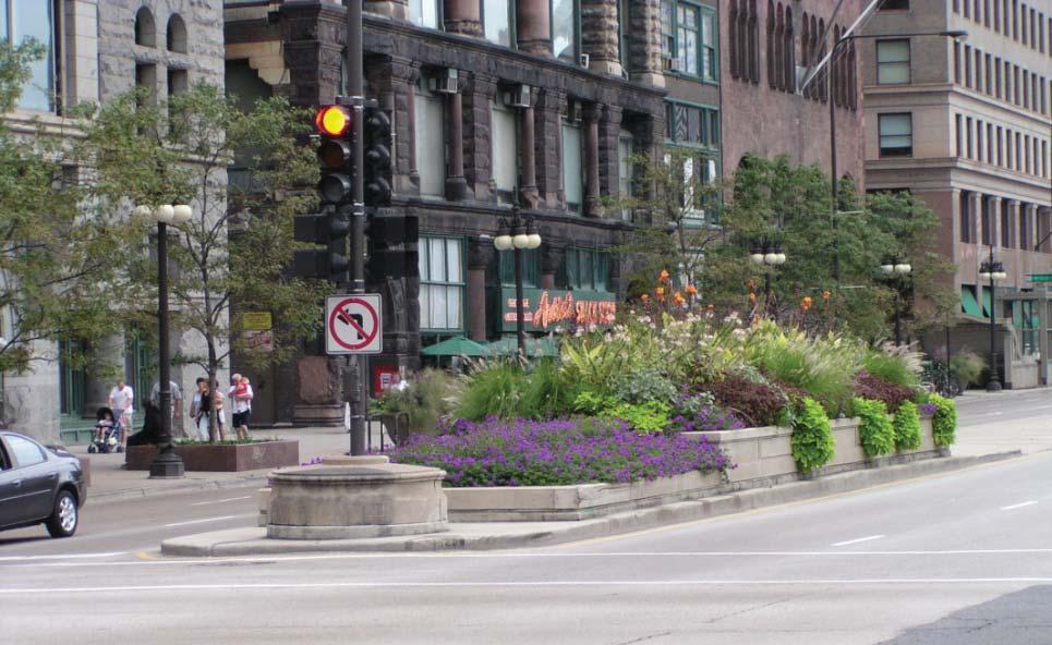
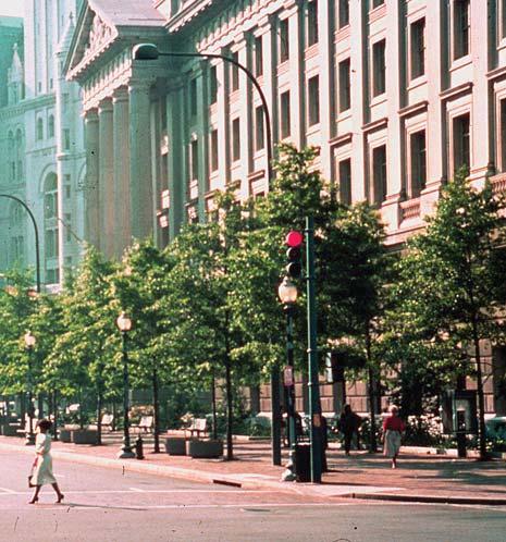
11 GREAT STREETS


12 AIX EN PROVENCE, FRANCE
13 OMOTESANDO, TOKYO

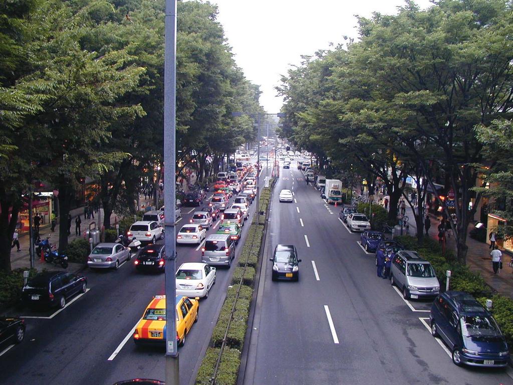
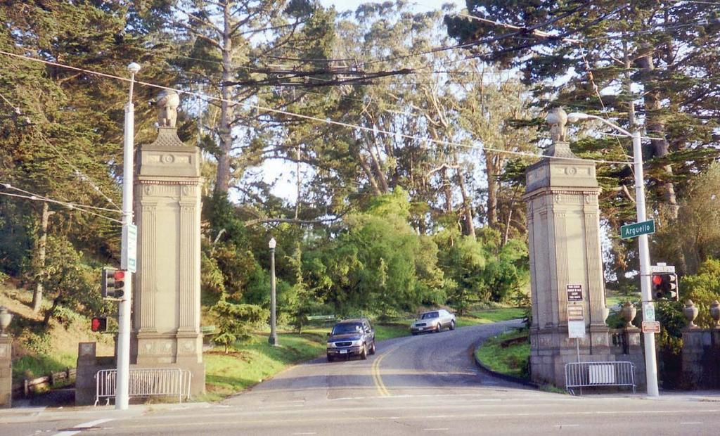
14 IMAGEGALLERY EMBARCADARO STREET, SAN FRANCISCO

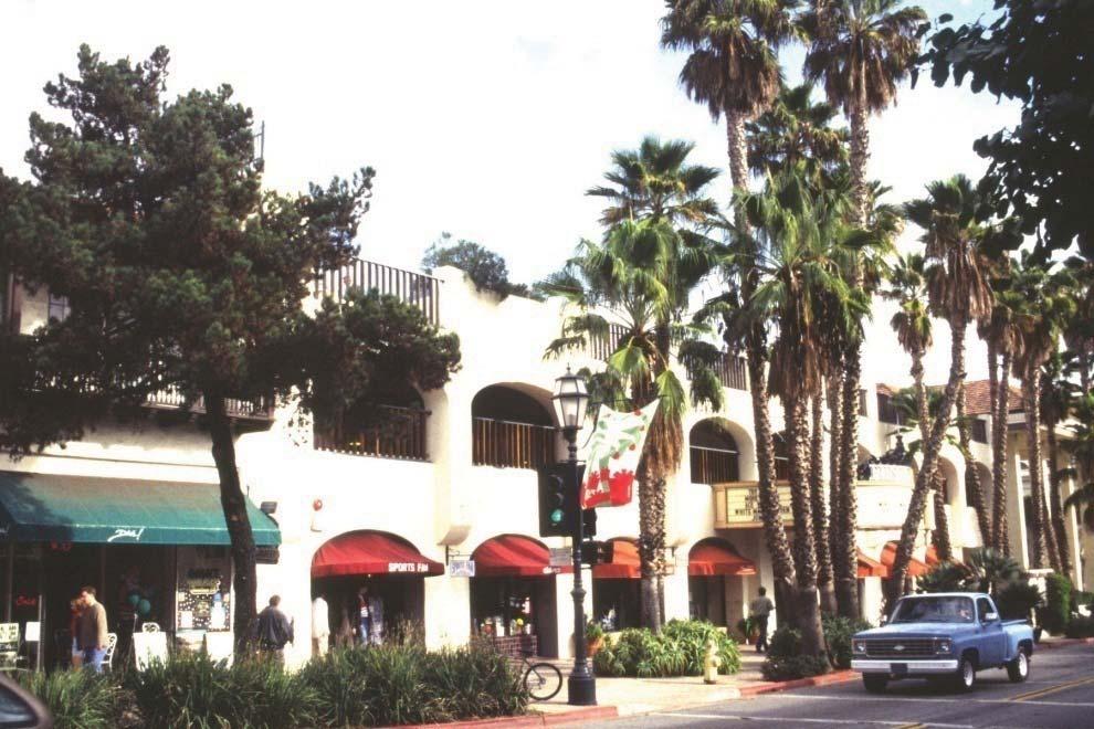
15 IMAGEGALLERY WILLOW GLEN, SAN JOSE

16 IMAGEGALLERY SANTANA ROW, SAN JOSE
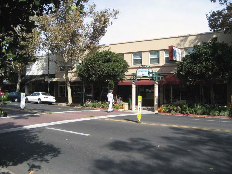
17 LOS GATOS NEED FULL SCREEN IMAGE

18 THIS IMAGE MAY CHANGE
19 STREET ELEMENTS IMPROVED STREET CROSSINGS PLANTING LIGHTING PUBLIC GATHERING SPACES BIKE LANES & PARKING PARKING IMPROVEMENTS GATEWAYS


20 IMPROVED STREET CROSSINGS


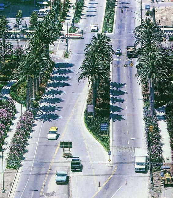
21 PLANTING MEDIAN AND STREET TREES


22 LIGHTING PEDESTRIAN AND STREET


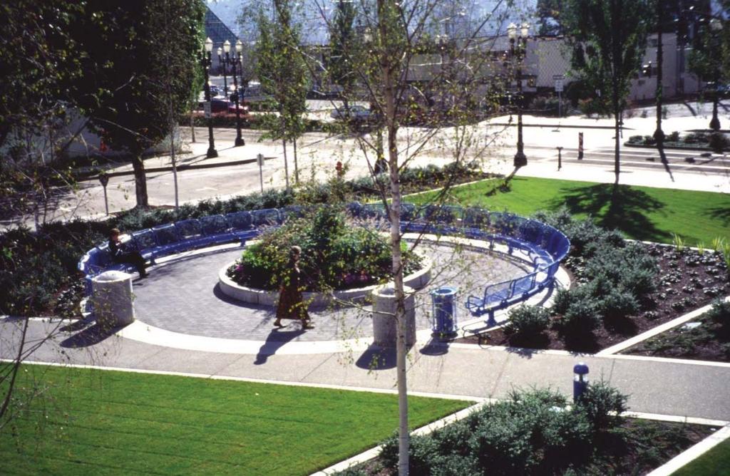
23 PUBLIC GATHERING SPACES


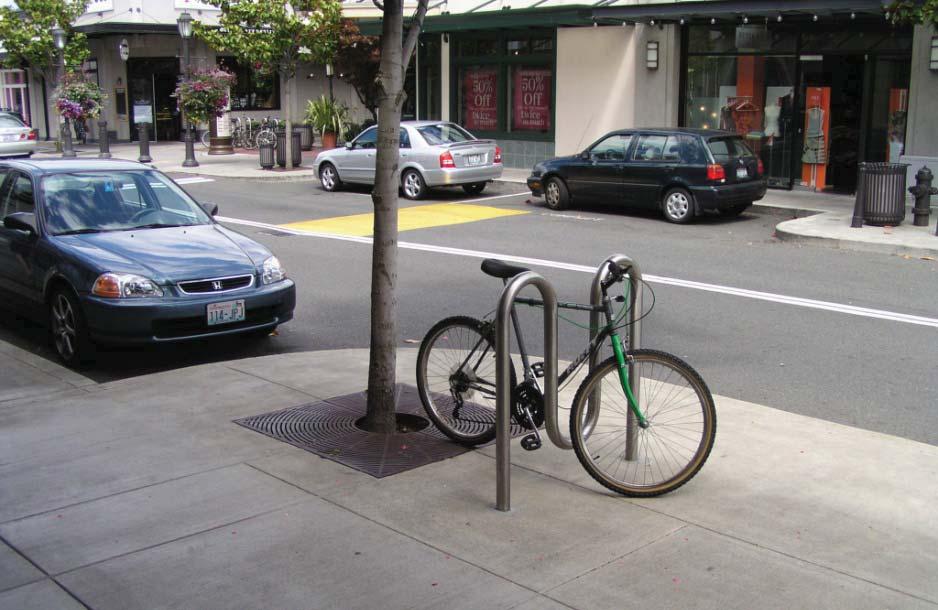
24 BIKE LANES AND BIKE PARKING

25 PARKING IMPROVEMENTS


26 PEDESTRIAN ACCESS TO PARKING LOTS BEHIND BUSINESSES

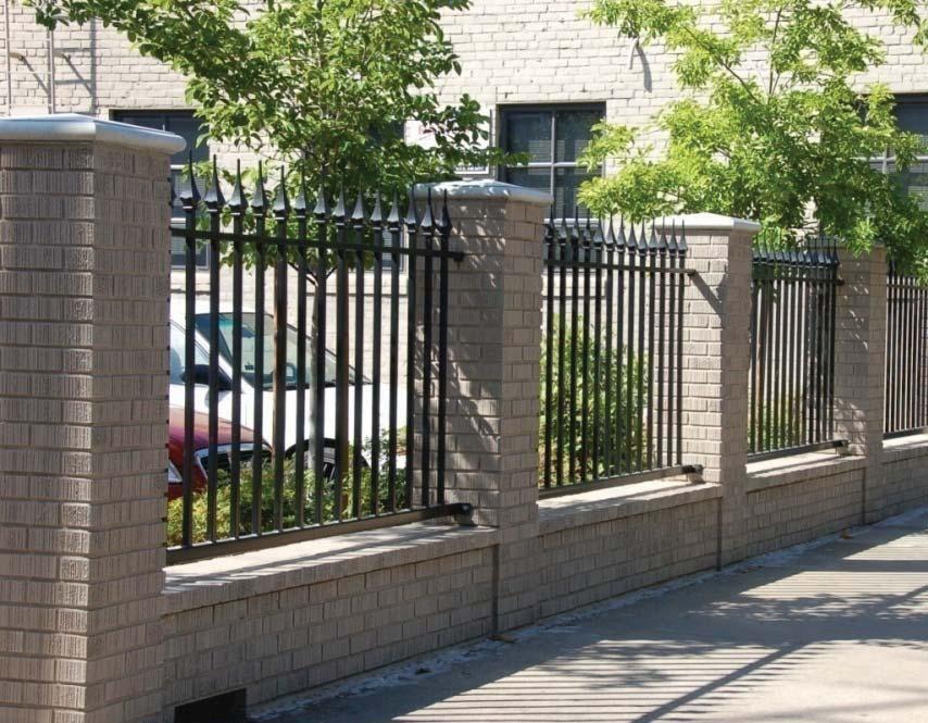
27 GATEWAYS
28 SMALL GROUP VISIONING SESSION 1 STREET ELEMENTS IMPROVED STREET CROSSINGS STREET TREES LIGHTING Pedestrian and Street BIKE Lanes & Parking PUBLIC GATHERING SPACES PARKING Structure & Improvements GATEWAYS 2 REPORT BACK SMALL GROUPS SUMMARIZE FINDINGS, CHOOSE GROUP LEADER AND REPORT BACK TO OVERALL GROUP


29 SMALL GROUP VISIONING SESSION SYMBOLS IMPROVED PEDESTRIAN CROSSING SYMBOL COLORS TO BE UPDATED BIKE LANES STREET TREES BIKE RACKS PEDESTRIAN LIGHTING GATEWAY STREET LIGHTING PARKING STRUCTURE PUBLIC GATHERING SPACE PARKING IMPROVEMENTS

30 EXAMPLE COMMUNITY PLAN
31 NEXT STEPS CONCEPTUAL STUDIES NEXT COMMUNITY MEETING JANUARY 28, 2010 APEX STRATEGIES
THE ALAMEDA CONCEPT DESIGN COMMUNITY MEETING 3. A Plan for The Beautiful Way JANUARY 28, 2010
 CONCEPT DESIGN COMMUNITY MEETING 3 JANUARY 28, 2010 AGENDA INTRODUCTION COMMUNITY INPUT ROADWAY STUDIES STREETSCAPE DESIGN STATIONS DISCUSSION SUMMARY AND DISCUSSION NEXT STEPS CLOSE INTRODUCTION SCHEDULE
Memo. Ocean Avenue Corridor Design Project Public Workshop #2 Summary
 Ocean Avenue Corridor Design Project Public Workshop #2 Summary The second public workshop for the Ocean Avenue Corridor Design Project was held on Wednesday, May 14, 2014 from, 6 to 8 pm at Lick Wilmerding
Ann Arbor Downtown Street Plan
 1 Ann Arbor Downtown Street Plan Public Workshop #1 We know that. 2 Public right-of-way (streets, sidewalks, and alleys) make up 30% of the total District area of downtown. Streets need to provide mobility
Ocean Park Boulevard Streetscape Improvement Project Alternatives & Trade Offs
 City Council Study Session January 27, 2009 Ocean Park Boulevard Streetscape Improvement Project Alternatives & Trade Offs Scope of Work Purpose of Tonight s Meeting Review work to date and direct staff
McLean Main Street Public Forum Follow-up
 McLean Main Street Public Forum Follow-up Sponsored & Hosted by John W. Foust, Dranesville District Supervisor McLean Planning Committee Fairfax County Office of Community Revitalization and Reinvestment
Monterey Road Complete Streets
 Monterey Road Complete Streets Complete Street Objectives Improve livability and economic vitality Enhance pedestrian environment Accommodate bicyclists safely Reduce noise and air pollution Create attractive,
STONY PLAIN ROAD STREETSCAPE
 Jasper Place Revitalization Strategy: Vision The people involved in the Jasper Place Revitalization Strategy envision: Goal 1: Feeling safe in our community Create a community where feeling safe is common--where
WELCOME Mission-Geneva Transportation Study
 WELCOME Mission-Geneva Transportation Study Study Process and Schedule 2005 2006 Oct Nov Dec Jan Feb Mar Apr May Jun Jul Aug Sept Oct Task 2 Develop Outreach Plan Task 3 Document Existing Conditions/ Prioritize
Vision: Traditional hamlet with an attractive business/pedestrian friendly main street connected to adjacent walkable neighborhoods
 N D. Focus Area II Vision: Traditional hamlet with an attractive business/pedestrian friendly main street connected to adjacent walkable neighborhoods Transit Road Focus Area II is located in the Hamlet
EL CAMINO REAL BUS RAPID TRANSIT (BRT) PROJECT
 PROJECT") Agenda Item #4.2 EL CAMINO REAL BUS RAPID TRANSIT (BRT) PROJECT VTA BOARD WORKSHOP MAY 1, 2015 ABOUT THIS PRESENTATION CONTEXT Existing conditions and planning for growth WHAT IS THE PROJECT? Project alternatives
Agenda Item #4.2 EL CAMINO REAL BUS RAPID TRANSIT (BRT) PROJECT VTA BOARD WORKSHOP MAY 1, 2015 ABOUT THIS PRESENTATION CONTEXT Existing conditions and planning for growth WHAT IS THE PROJECT? Project alternatives
Town of Ashland. Downtown Planning Initiative 2 nd Community Workshop. March 29, Presented by:
 Town of Ashland Downtown Planning Initiative 2 nd Community Workshop Presented by: March 29, 2018 Agenda Tonight Review project & goals Recap 1st workshop (September 18, 2017) Present design alternatives
Miami Health District
 Miami Health District Streetscapes, Gateways, and Signage Basis of Design Report Study Miami Partnership Meeting July 21, 2008 Gannett Fleming EDAW The Corradino Group Sponsored by the Miami Partnership:
San Jose Transportation Policy
 San Jose Transportation Policy Protected Intersections in LOS Policies to Support Smart Growth Presented by: Manuel Pineda City of San Jose Department of Transportation Bay Area Map San Francisco Oakland
MARTIN LUTHER KING JR. WAY
 OCTOBER 2011 40 Vision and Goals The Martin Luther King, Jr. Way Illustrative Master Plan that follows has been developed through a process of community involvement. It expresses a long term vision for
Ocean Park Boulevard Green Street Project Alternatives & Trade Offs
 Planning Commission March 4, 2009 Ocean Park Boulevard Green Street Project Alternatives & Trade Offs Purpose of Tonight s Meeting Review concept plans and options Provide input on alternatives and trade-offs
Purpose and Need. Chapter Introduction. 2.2 Project Purpose and Need Project Purpose Project Need
 Chapter 2 Purpose and Need 2.1 Introduction The El Camino Real Bus Rapid Transit (BRT) Project (Project) would make transit and other transportation improvements along a 17.6-mile segment of the El Camino
Community Task Force July 25, 2017
 Community Task Force July 25, 2017 Welcome and Introductions Project Partners Regional Transportation District (RTD) Colorado Department of Transportation (CDOT) Denver Regional Council of Governments
A Guide to Great Streets: The Basics. September 25, 2009
 A Guide to Great Streets: The Basics September 25, 2009 Streets are more than connectors, they are the city 2 Streets are the glue that hold a city together 3 Streets are the means in which a city is perceived
A CHANGING CITY. of Edmonton, it is essential that it reflects the long-term vision of the City.
 A CHANGING CITY By the year 2040, Edmonton will be home to more than 1 million people. To accommodate growth and support a healthy and compact city, we need a new approach to development/redevelopment
APPENDIX A. Outreach Summary
 APPENDIX A Outreach Summary COUNTYWIDE TRANSPORTATION PLAN Summary of Public Outreach and Engagement To gather an understanding of the transportation issues and priorities throughout the county, and inform
COWETA HIGH SCHOOL AND EAST HIGHWAY 51
 COWETA HIGH SCHOOL AND EAST HIGHWAY 51 Lack of sidewalks along Ben Lumpkin Rd. Lack of crosswalks and ramps at intersection. Hwy 51 is wide to cross as a pedestrian. No ADA compliance or connection to
Beach Cities Living Streets Design Manual and Aviation Boulevard Multimodal Corridor Plan
 Beach Cities Living Streets Design Manual and Aviation Boulevard Multimodal Corridor Plan AGENDA 1 Introductions & Project Scope 2 Public Outreach Recap 3 Living Streets Design Manual 4 Aviation Boulevard
Commerce Street Complete Street Project from Good Latimer Expressway to Exposition Avenue
 Commerce Street Complete Street Project from Good Latimer Expressway to Exposition Avenue T A N Y A B R O O K S A S S I S T A N T D I R E C T O R M O B I L I T Y P L A N N I N G M O B I L I T Y A N D S
PUBLIC REALM MASTER PLAN
 WESTSHORE BUSINESS DISTRICT PUBLIC REALM MASTER PLAN MASTER PLAN COMMITTEE MEETING MARCH 20, 2013 WESTSHORE BUSINESS DISTRCT PUBLIC REALM MASTER PLAN MACRO-SCALE CONCEPT: A PUBLIC REALM FRAMEWORK DEFINED
Lincoln Avenue Road Diet Trial
 Lincoln Avenue Road Diet Trial Data Collection Report June 1, 2015 Department of Transportation Table of Contents I. Introduction...... 3 II. Data Collection Methodology & Results...... 5 A. Traffic Volume
MASONIC AVENUE STREET DESIGN STUDY Community Workshop 2. Masonic Ave Street Design Study Community Workshop 2 August 10, 2010
 Masonic Ave Street Design Study Community Workshop 2 August 10, 2010 Introduction MASONIC AVENUE STREET DESIGN STUDY Community Workshop 2 SF Municipal Transportation Agency Javad Mirabdal, Project Manager
El Camino Real Bus Rapid Transit Conceptual Engineering. Los Altos Council Workshop January 24, 2012
 El Camino Real Bus Rapid Transit Conceptual Engineering Los Altos Council Workshop January 24, 2012 Agenda Introduction Growth in the El Camino Real Corridor Benefits of BRT El Camino Real BRT Decision
Tonight is for you. Learn everything you can. Share all your ideas.
 Strathcona Neighbourhood Renewal Draft Concept Design Tonight is for you. Learn everything you can. Share all your ideas. What is Neighbourhood Renewal? Creating a design with you for your neighbourhood.
San Mateo County Comprehensive Bicycle and Pedestrian Plan Open House
 San Mateo County Comprehensive Bicycle and Pedestrian Plan Open House October 28, 2010 Presented to San Mateo County residents and interested parties by Lauren Ledbetter, Alta Planning + Design Matt Haynes,
FONTAINE AVENUE STUDY Final Report
 FONTAINE AVENUE STUDY Final Report March 28, 2005 FONTAINE AVENUE STUDY City of Charlottesville March 28, 2005 Renaissance Planning Group Kenneth Schwartz, FAIA, AICP Director of Design Leigh Wilkerson,
Upper Market Street Bike Lane Project
 Upper Market Street Bike Lane Project 17th Street to Octavia Boulevard 6 30 2010 SAN FRANCISCO, CALIFORNIA Agenda San Francisco & Sustainable Transportation Project Goals Outreach & Coordination Project
COMMUNITY MEETING AGENDA
 COMMUNITY MEETING AGENDA Welcome and Introductions SAFE Presentation Project Presentation Priorities Feedback Next Steps Q&A Santa Cruz Avenue Corridor Study 1 Santa Cruz Avenue Corridor Study Community
CONNECTIVITY PLAN. Adopted December 5, 2017 City of Virginia Beach
 CONNECTIVITY PLAN Adopted December 5, 2017 City of Virginia Beach CONTENTS 1.0 Background & Purpose... 2 2.0 Existing Inventory & Analysis... 3 ViBe District Existing Walking Conditions... 4 3.0 ViBe District
Speed Limits Study and Proposal. Public Input Session: 8/14/13
 Speed Limits Study and Proposal Public Input Session: 8/14/13 Why is Decatur a unique place for this project? First Community Transportation Plan in the nation with a Health Impact Assessment. Strong sense
2014/2015 BIKE ROUTE PLAN 83 AVENUE PROTECTED BIKE LANE
 About the Project 2014/2015 BIKE ROUTE PLAN The City of Edmonton is planning a major bike route on the south side of Edmonton. This bike route is one part of a plan to provide citizens with transportation
Community Meeting February 27, 2007 Dorchester Avenue Transportation & Streetscape Improvements Action Plan February 27, 2007
 Community Meeting Tonight s Agenda 6:00 Introductions South Boston/Dot Ave Improvement Study Background 6:15 Consultant Introductions Review of Scope and Schedule Review of Proposed Corridor Wide Guidelines
EL CAMINO REAL BUS RAPID TRANSIT PROJECT
 EL CAMINO REAL BUS RAPID TRANSIT PROJECT Would upgrade the current 522 Rapid Bus to BRT status by making changes to El Camino Real and The Alameda that make transit FAST, FREQUENT AND RELIABLE and make
WELCOME. Purpose of the Open House. Update you on the project. Present a draft recommended plan. Receive your input
 WELCOME Purpose of the Open House The Town of Smiths Falls has initiated the Beckwith Street Redevelopment Plan that includes the preparation of a streetscape functional design for the renewal of Beckwith
Plant City Walk-Bike Plan
 Plant City Walk-Bike Plan Plant City Commute Mode Share 2.2% 1.4% 2.9% Drove alone 10.2% Carpooled Public transportation (0.1%) Walked Used a Bike (0.4%) 82.9% Taxicab, motorcycle, or other means Worked
Bikeway action plan. Bicycle Friendly Community Workshop March 5, 2007 Rochester, MN
 Bikeway action plan Summary The was held on March 5, 2007 at the Rochester Mayo Civic Center. The workshop was hosted by Rochester-Olmsted County Planning Department in collaboration with the League of
MASTER BICYCLE AND PEDESTRIAN PLAN
 VILLAGE OF NORTHBROOK MASTER BICYCLE AND PEDESTRIAN PLAN DRAFT PLAN OPEN HOUSE May 2, 2018 AGENDA 1. Community Engagement 2. Vision and Goals 3. General Structure of Plan 4. Recommendations Overview 5.
2014/2015 BIKE ROUTE PLAN 83 AVENUE PROTECTED BIKE LANE
 About the Project The City of Edmonton is planning a major bike route on the southside of Edmonton. The Strathcona Bike Route will connect the communities of Strathcona, Garneau and the University area,
CLOSED. Highlights of the Final Concept Design:
 The final Concept Design is the result of many months of listening, learning, creating, balancing, and understanding different needs and viewpoints, as well as incorporating technical requirements and
Expansion of Bike Share within San Jose supports the City's ambitious mode shift goals to have 15% of commute trips completed by bicycles by 2040.
 COUNCIL AGENDA: 12/01/15 ITEM: 4 CITY OF SAN JOSE CAPITAL OF SILICON VALLEY TO: HONORABLE MAYOR AND CITY COUNCIL SUBJECT: BAY AREA BIKE SHARE EXPANSION Memorandum FROM: Jim Ortbal DATE: Approved Date irftt/ls'
Austell Road Access Management Plan Public Meeting February 17, 2009
 Austell Road Access Management Plan Public Meeting February 17, 2009 Laraine Vance: Dan Cohen: Cobb DOT Project Manager Pond & Company Planning Director 1 Access Management What is Access Management? The
San Mateo County Bicycle and Pedestrian Advisory Committee
 San Mateo County Bicycle and Pedestrian Advisory Committee January 19, 2017 Emma Shlaes, Policy Manager About SVBC Mission Our purpose is to create a healthy community, environment, and economy through
City of Wilsonville 5 th Street to Kinsman Road Extension Project
 City of Wilsonville 5 th Street to Kinsman Road Walking Tour & Neighborhood Workshop Summary Report Public Outreach Overview On July 18 th, 2017, the City of Wilsonville hosted a neighborhood walking tour
MAKE YOUR PLACE IN CHANNELSIDE
 MAKE YOUR PLACE IN CHANNELSIDE INTRODUCTION PROJECT LIMITS Channelside Drive from Cumberland Ave to Kennedy Boulevard EXISTING CONDITIONS EXISTING CONDITIONS CHANNELSIDE DRIVE FROM E. CUMBERLAND AVENUE
Moving Ahead. (Community Engagement) Chapter Three
 Chapter Three") 3 Community Chapter Three Moving Ahead (Community Engagement) engagement provided an exciting opportunity to engage Redwood City residents, workers, and business owners people who walk, bike, take transit,
3 Community Chapter Three Moving Ahead (Community Engagement) engagement provided an exciting opportunity to engage Redwood City residents, workers, and business owners people who walk, bike, take transit,
5 CIRCULATION AND STREET DESIGN
 5 CIRCULATION AND STREET DESIGN This chapter describes circulation and streetscape improvements proposed for the Northwest Chico Specific Plan Area. It includes detailed design specifications for existing
NEWMARKET UPHAM S CORNER
 SOUTH STATION Planning Initiative NEWMARKET UPHAM S CORNER COLUMBIA ROAD (P) FOUR CORNERS/GENEVA Working Advisory Group (WAG) Meeting #5 TALBOT AVENUE MORTON STREET BLUE HILL AVE/CUMMINS HWY (P) RIVER
Northbound San Jose Avenue & I-280 Off-Ramp Road Diet Pilot Project
 Project Overview Fed by a two-lane Interstate-280 (I-280) off-ramp, high vehicular volumes and speeds are longstanding issues along San Jose Avenue. Residents in the surrounding neighborhoods have expressed
SURVEY minutes to complete this questionnaire. Your feedback will help the City determine a future design for Ocean Avenue and Geneva Avenue. Thanks!
 OCEAN AVENUE CORRIDOR DESIGN ROJECT WORSHO #4 Thank you for your interest in the Ocean Avenue Corridor Design project. lease take a few SURVEY minutes to complete this questionnaire. Your feedback will
Environment and Public Works Committee Presentation
 Mixed Use Centers Complete Streets Guidelines Project Environment and Public Works Committee Presentation December 10, 2008 Project Objectives: Conduct an inter-departmental and agency process to study
UNIVERSITY AVENUE CORRIDOR REDESIGN. January 8, 2017 PUBLIC OPEN HOUSE
 January 8, 2017 PUBLIC OPEN HOUSE COLLABORATIVE COMMUNITY-BASED DESIGN IS THE FOUNDATION TO A SUCCESSFUL PROJECT AGENDA FOR TONIGHT 1 INTRODUCTIONS 2 WHY ARE WE HERE PROJECT NEED 3 SCHEDULE & GOALS 4 OPEN
@ FRIENDLY ACRES COMMUNITY MEETING
 @ FRIENDLY ACRES COMMUNITY MEETING April 18, 2017 INTRODUCTIONS City of Redwood City TJKM, GATES + Associates Interns Translators AGENDA Presentation Livable Neighborhood Streets Project Background Highlight
Replace century-old sewer & water pipes Pedestrian-scale sidewalk lighting
 PROJECT OVERVIEW The Masonic Avenue Streetscape Project is an effort to improve safety for everyone travelling on Masonic Avenue between Geary Boulevard and Fell Street. This project will bring a variety
Corridor Vision Workshop Summary James Madison Elementary February 22,2018
 Corridor Vision Workshop Summary James Madison Elementary February 22,2018 WHY DEVELOP THIS STUDY? Ogden City is planning for better connectivity and access to jobs and housing. Working with area partners,
Knox Street Complete Streets Project
 Knox Street Complete Streets Project Meeting Purpose Get community feedback on two conceptual street design options Meeting Agenda Presentation (20 minutes) Project background and schedule Summary of preferences
San Tomas Expressway
 Implementation Plan San Tomas Expressway Roads and Airports Department August 19, 2003 Implementation Plan San Tomas Expressway County of Santa Clara Roads and Airports Department 101 Skyport Drive San
FOR INFORMATION ONLY
 9 Date: August 6, 2012 Current Meeting: August 16, 2012 Board Meeting: September 6, 2012 BOARD MEMORANDUM TO: THROUGH: FROM: SUBJECT: Santa Clara Valley Transportation Authority Congestion Management Program
El Camino Real Specific Plan. TAC/CAC Meeting #2 Aug 1, 2018
 El Camino Real Specific Plan TAC/CAC Meeting #2 Aug 1, 2018 Land Use Alternatives Goals and Tradeoffs Parks & open space Housing Retail & services Civic spaces Parking Community gathering spaces 3 Alternatives
CITY OF COCOA BEACH 2025 COMPREHENSIVE PLAN. Section VIII Mobility Element Goals, Objectives, and Policies
 CITY OF COCOA BEACH 2025 COMPREHENSIVE PLAN Section VIII Mobility Element Goals, Objectives, and Policies Adopted August 6, 2015 by Ordinance No. 1591 VIII MOBILITY ELEMENT Table of Contents Page Number
SAN FRANCISCO MUNICIPAL TRANSPORTATION AGENCY
 THIS PRINT COVERS CALENDAR ITEM NO. : 10.2 DIVISION: Sustainable Streets BRIEF DESCRIPTION: SAN FRANCISCO MUNICIPAL TRANSPORTATION AGENCY Adopting Conceptual Proposal for Streetscape Improvements to Broadway,
Austin Avenue Bridges Project. Public Meeting Summary
 Austin Avenue Bridges Project Public Meeting Summary June 29, 2016 Red Table Safety and Connectivity Notes: 1. Would like to see forensic report evaluations 2. What is the lifespan? 3. Extend safety considerations
Monroe Street Reconstruction Business Focus Group Notes July 18, 2016, HotelRED
 Monroe Street Reconstruction Business Focus Group Notes July 18, 2016, HotelRED Total participants: 31 Focus Group Conversation #1: During this exercise, participants talked in small table groups in response
Mission-Geneva Transportation Study Community Workshop 2 July 8, 2006
 Community Workshop 2 July 8, 2006 Small Group Workbook 1 Basic Improvements on Mission Street Streetscape. Pedestrian-scale lighting; landscaping; community art on utility boxes; more (possibly unique)
FOLSOM-HOWARD STREETSCAPE OVERVIEW
 FOLSOM-HOWARD STREETSCAPE OVERVIEW SoMa residents should have the same kinds of amenities that other neighborhoods have. The Folsom- Howard Streetscape Project will make SoMa more livable by making it
Minnesota Street Properties Community Workshop Planning for Design 3/17/2016
 Minnesota Street Properties Community Workshop Planning for Design Minnesota Street Properties: Community Workshop Agenda 1. Introduction 2. Analysis of previous community workshop 3. What UCSF is able
VTA Development Review Program Annual Report for 2015
 VTA Development Review Program Annual Report for 2015 Web Version May 13, 2016 Presentation Outline I. Background II. Data Snapshot a. Development Review Activity for 2015 b. Select Projects Under Construction
Downtown Naples Mobility and Connectivity Study. Naples City Council Presentation January 2017
 Downtown Naples Mobility and Connectivity Study Naples City Council Presentation January 2017 Agenda 1. Introduction 2. Scope Review 3. Project Schedule 4. Existing Conditions 5. Public Charrette 6. Mobility
BID Strategy Group and Stakeholders Meeting. April 17, 2018
 BID Strategy Group and Stakeholders Meeting April 17, 2018 Agenda Meeting Objectives Background Short-Term Improvements Long-Term Study Goals Data Review Schedule & Next Steps Open House April 17, 2018
Henderson Ave. Complete Streets Project
 Henderson Ave. Complete Streets Project Meeting Purpose To finalize conceptual components of project prior to proceeding with preliminary engineering www.dallascompletestreets.wordpress.com MeetingAgenda
Elm Street Business District: Streetscape and Signage Plan
 Winnetka Preliminary Streetscape & Signage Village Council Presentation 1 Elm Street Business District: Streetscape and Signage Plan VILLAGE OF WINNETKA DOWNTOWN MASTER PLAN VILLAGE COUNCIL PRESENTATION
Community Task Force March 14, 2018
 Community Task Force March 14, 2018 Welcome and Introductions Project Partners Regional Transportation District (RTD) City of Aurora Colorado Department of Transportation (CDOT) Denver Regional Council
Foothill Expressway Improvements Between El Monte and San Antonio
 Foothill Expressway Improvements Between El Monte and San Antonio June 29, 2017 - Los Altos Community Meeting Introduction Project Background Agenda Visit Stations: Provide Input and Ask Questions Reconvene:
Welcome! San Jose Avenue Open House August 25, 2015
 Welcome! San Jose Avenue Open House August 25, 2015 Vision Zero The City and County of San Francisco adopted Vision Zero San Francisco Vision Zero High Injury Network as a policy in 2014, committing an
Ocean Park Boulevard Green Street Project Community Workshop
 Ocean Park Boulevard Green Street Project Community Workshop 2.2.10 Project Objectives Community Priority: reclaim OPB for public open space. Build upon LUCE principles; neighborhood enhancement, connectivity,
GARLAND ROAD/GASTON AVENUE/ GRAND AVENUE INTERSECTION IMPROVEMENT STUDY
 MEETING OF AFFECTED PROPERTY OWNERS AND STAKEHOLDERS GARLAND ROAD/GASTON AVENUE/ GRAND AVENUE INTERSECTION IMPROVEMENT STUDY CSJ 0009-02-067 Meeting Agenda 1 2 3 4 5 6 7 8 9 10 Opening Remarks State Representative
Introduction. Who is WILMAPCO. Why are walkable communities important
 Walkable Community Workshops Round 1 April 2005 SPONSORED BY WILMAPCO AND CCOBH CITY OF NEW CASTLE EDGEMOOR GARDENS CIVIC ASSOCIATION WITH FUNDING BY DELAWARE DEPARTMENT OF TRANSPORTATION AND THE DELAWARE
MASONIC AVENUE STREET DESIGN STUDY Community Workshop 3. Masonic Ave Street Design Study Community Workshop 3 September 30, 2010
 Masonic Ave Street Design Study Community Workshop 3 September 30, 2010 Introduction MASONIC AVENUE STREET DESIGN STUDY Community Workshop 3 SF Municipal Transportation Agency Javad Mirabdal, Project Manager
Mainstreet Master Plan Land Use
 Mainstreet Master Plan 04 Land Use Top Recommendations Active Uses: Promote active ground-floor uses such as retail, restaurants, galleries and personal services with interactive storefronts for Mainstreet
City of Birmingham Draft Multi-modal Transportation Plan
 City of Birmingham Draft Multi-modal Transportation Plan City Commission Public Hearing Monday, November 25, 2013 7:30 pm Norman Cox, PLA, ASLA The Greenway Collaborative, Inc. Ann Arbor, Michigan The
Community Task Force November 15, 2017
 Community Task Force November 15, 2017 Welcome and Introductions Project Partners Regional Transportation District (RTD) Colorado Department of Transportation (CDOT) Denver Regional Council of Governments
Palou Complete Street Project Barneveld Avenue to Crisp Road Project overview and concept design Community Meeting #2 May 13, 2015
 Palou Complete Street Project Barneveld Avenue to Crisp Road Project overview and concept design Community Meeting #2 May 13, 2015 Agenda Welcome and introductions Project overview, history and goals Concept
Draft Traffic Calming Policy Paper
 Draft Traffic Calming Policy Paper What is Traffic Calming The term traffic calming is defined differently throughout the United States. The Institute of Transportation Engineers, an international educational
Bicycle Master Plan Goals, Strategies, and Policies
 Bicycle Master Plan Goals, Strategies, and Policies Mobilizing 5 This chapter outlines the overarching goals, action statements, and action items Long Beach will take in order to achieve its vision of
Citizen Advisory Group Meeting #8 May 5, Welcome. Today s meeting will focus on: Land Use & Transportation CHARLOTTEPLANNING.
 Citizen Advisory Group Meeting #8 May 5, 2010 Welcome. Today s meeting will focus on: Land Use & Transportation CHARLOTTEPLANNING.ORG Meeting Agenda Handouts: o Meeting Agenda o Summary of East Seventh
About the study. North Milwaukee Ave. Key goals of this study are to: Achieve Vision Zero* by. Harmonize the space and improve walkability
 About the study Key goals of this study are to: North Milwaukee Avenue is a local and regional street for multiple modes of transportation. It is officially zoned and functions as a pedestrian street southeast
Kingwood Area Mobility Study. Lake Houston Redevelopment Authority (TIRZ #10)
") Kingwood Area Mobility Study Lake Houston Redevelopment Authority (TIRZ #10) Steering Committee Meeting #3 Date: May 27, 2014 Introductions/Remarks Steering Committee Project/Consultant Team GOALS & MOE
Kingwood Area Mobility Study Lake Houston Redevelopment Authority (TIRZ #10) Steering Committee Meeting #3 Date: May 27, 2014 Introductions/Remarks Steering Committee Project/Consultant Team GOALS & MOE
Bicycle and Pedestrian Advisory Committee (BPAC) November 21, 2013
 November 21, 2013") Bicycle and Pedestrian Advisory Committee (BPAC) November 21, 2013 OVERALL LAND USE CONCEPT Overall Broadway Valdez District: 95.5 acres (35.1 acres right-of ways + 60.4 acres developable land) Plan Subareas:
Bicycle and Pedestrian Advisory Committee (BPAC) November 21, 2013 OVERALL LAND USE CONCEPT Overall Broadway Valdez District: 95.5 acres (35.1 acres right-of ways + 60.4 acres developable land) Plan Subareas:
Living Streets Policy
 Living Streets Policy Introduction Living streets balance the needs of motorists, bicyclists, pedestrians and transit riders in ways that promote safety and convenience, enhance community identity, create
REDEVELOPMENT OPPORTUNITY! FOR SALE
 SALE PRICE: Contact Agent LOT SIZE: 0.31 Acres BUILDING SIZE: 2,830 SF YEAR BUILT: 1906 ZONING: CBD Central Business District CROSS STREETS: 2nd Street South PROPERTY OVERVIEW This offering is for the
VAN AKEN DISTRICT CONNECTIONS PLAN COMMUNITY MEETING #1 June 20, 2016 SMITHGROUP JJR WSP PARSONS BRINCKERHOFF STUDIO GRAPHIQUE
 VAN AKEN DISTRICT CONNECTIONS PLAN COMMUNITY MEETING #1 June 20, 2016 SMITHGROUP JJR WSP PARSONS BRINCKERHOFF STUDIO GRAPHIQUE 01 02 03 04 05 06 Project Overview + Goals RMS Development District-wide Connections
Introduction. North 12 th Complete Street Project Overview
 Introduction On Wednesday, March 1, 2017, the City of Sacramento, in partnership with Sacramento Regional Transit District and the Sacramento Housing and Redevelopment Agency, hosted a community outreach
Average Delay/Vehicle (sec/veh) Signalized. Unsignalized Intersection
 Signalized. Unsignalized Intersection") Attachment: Traffic Analysis Results Traffic simulation modeling analysis was completed for Santa Cruz Ave from Alameda De Las Pulgas to Junipero Serra Blvd. Analysis was performed for existing conditions
Attachment: Traffic Analysis Results Traffic simulation modeling analysis was completed for Santa Cruz Ave from Alameda De Las Pulgas to Junipero Serra Blvd. Analysis was performed for existing conditions
NEW TOWN RETAIL PRECINCT UPGRADE
 The City of Hobart is seeking feedback from the community on the streetscape concept for the New Town Retail Precinct upgrade project. The concept designs have been developed by the City of Hobart in response
Executive Summary Route 30 Corridor Master Plan
 Route Corridor Master Plan Project Overview The Route Corridor Master Plan is a coordinated multimodal transportation and land use plan for the entire stretch of Route through East Whiteland Township,
Berkeley Strategic Transportation Plan A-76
 Berkeley Strategic Transportation Plan A-76 Appendices 1. A Team Effort 2. Where We ve Been A-11 Berkeley Strategic Transportation Plan Alameda County Transportation Plan Alameda County will be served
Land Use and Transportation Town Hall September 17, 2018
 Land Use and Transportation Town Hall September 17, 2018 Welcome! Tonight s Agenda: 7:00-7:30 OVERVIEW PRESENTATIONS 7:30-8:15 BREAKOUT SESSIONS 8:15 - End TOWN HALL CITIZEN S TIME Purpose of Tonight s