HIA Working Group Meeting #4 September 27, 2017
|
|
|
- Merilyn Watson
- 5 years ago
- Views:
Transcription


1 HIA Working Group Meeting #4 September 27, 2017
2 Icebreaker
3 Agenda US-1 Corridor Study Update Health Indicator Assessment Station Demonstration Area Assessment Preliminary Recommendations Discussion Next Steps
4 US 1 Corridor Study Update
5 US-1 Corridor Study Timeline Spring 2017 Summer-Fall 2017 Winter 2018 Spring 2018 Project Research Public Outreach / Analysis Final Report Public Outreach

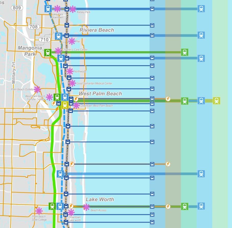
6 Indiantown Rd Jupiter Study Area Limits Camino Real to Indiantown Rd 6 Sections, 14 Cities Section 1: Boca Raton Section 2: Delray Beach, Boynton Beach, Gulf Stream Section 3: Hypoluxo, Lantana, Lake Worth Section 4: West Palm Beach Section 5: Riviera Beach, Lake Park, North Palm Beach Section 6: Juno Beach, Jupiter, Palm Beach Gardens PGA Blvd Northlake Blvd Blue Heron Blvd Okeechobee Blvd Southern Blvd Forest Hill Blvd Lake Worth Rd Lantana Rd Boynton Beach Blvd Atlantic Ave Juno Beach Palm Beach Gardens North Palm Beach Lake Park Riviera Beach West Palm Beach Lake Worth Lantana Hypoluxo Boynton Beach Gulf Stream Delray Beach Yamato Rd Glades Rd Camino Real Boca Raton 6
7 US 1 Transit Services Today Service Characteristics Hours of Operation Route 1 5:20 AM 10:00 PM (Weekday) 6:20 AM 10:00 PM (Saturday) 8:20 AM 6:30 PM (Sunday) The Bolt 2-Hour Weekday Service End Points Boca Raton to Palm Beach Gardens Boca Raton to West Palm Beach # of Stops 443 Stops (5.5 stops/mile) 22 Stops (0.4 stops/mile) Frequency 20 Minutes (Weekday*/Saturday) 30 Minutes (Sunday) 20 Minutes* *At bolts stops, there is one bus every 10 minutes


8 US 1 Transit Services Today Service Characteristics
 3.")

9 Current Route 1 Trips Top Origin-Destination Pairs 1. West Palm Beach Lake Worth 2. West Palm Beach (internal) 3. West Palm Beach Palm Beach Gardens 4. West Palm Beach Riviera Beach 4. Boca Raton - Delray Beach 75% of the Trips are less than 15 miles Source: 2015 PalmTran Origin Destination (OD) Survey

10 Highest Ridership Stops Stop ID Stop Name Avg. Weekday Boardings 602 WPB ITC Dixie Lucerne Ave Dixie 2nd Ave N Quadrille Evernia St E Camino Dixie Hwy Gardens Mall Sears Trm Blue Heron Blvd SB Quadrille Banyan Blvd Federal Hwy/NE 6 th SE 1 st St Federal Boynton Bch Blvd Federal Boynton Bch Blvd th St 81 Source: PalmTran March 2017 APC Data
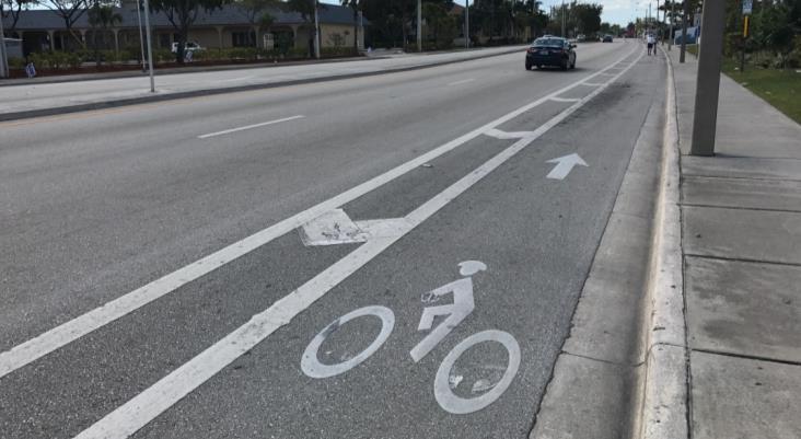
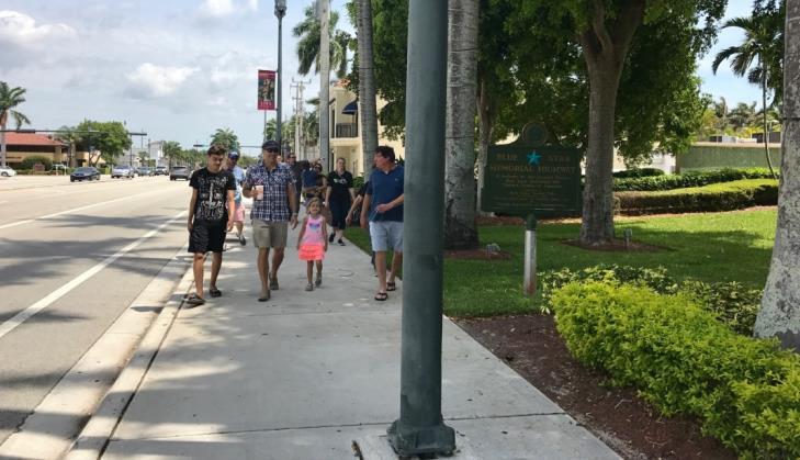

11 Continuous Bike and Pedestrian Facilities


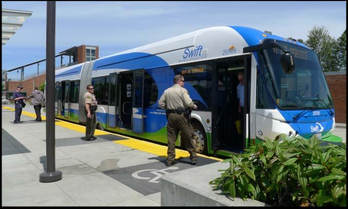
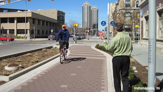
12 Enhanced Transit Source: Kittelson and Associates

13 Indiantown Rd PGA Blvd Northlake Blvd Blue Heron Blvd Okeechobee Blvd Southern Blvd Forest Hill Blvd Lake Worth Rd Lantana Rd Boynton Beach Blvd Atlantic Ave Yamato Rd Glades Rd Jupiter Juno Beach Palm Beach Gardens North Palm Beach Lake Park Riviera Beach West Palm Beach Lake Worth Lantana Hypoluxo Boynton Beach Gulf Stream Delray Beach Boca Raton Conceptual Stop Locations Major Cross Street Bus Transfer >60 Bus Riders / Day Bolt Stop Connection to Rail Proximity to Destination W 12th St W Blue Heron Blvd Park Ave Northlake Blvd Northlake Blvd/Prosperity Farms Rd Lighthouse Dr/Prosperity Farms Rd Yacht Club Dr Harbour Isles/Prosperity Farms Rd
14 Key Findings High transit ridership Critical pedestrian/bicycling safety issue, especially at night Employment corridor Redevelopment occurring Concentrations of lower income, lower education populations Concentrations of transit-dependent and minority populations


15 Key Findings 1. High transit ridership 2. Critical pedestrian/bicycling safety issue, especially at night 3. Employment corridor 4. Redevelopment occurring 5. Concentrations of lower income, lower education populations 6. Concentrations of transit-dependent and minority populations Corridor Needs/ Goals 1. Improve access to jobs and education 2. Improve access to health and community services 3. Improve multimodal mobility 4. Improve safety for pedestrians and cyclists 5. Support development / redevelopment along corridor
16 US 1 Health Impact Assessment
 2018 and Beyond Evaluation & Follow Up Winter 2017")
17 US-1 Health Impact Assessment Spring-Summer 2017 Summer 2017 We are here Spring 2017 Screening Scoping Assessment Fall-Winter 2017 Decision Making & Recommendations Denotes Working Group Meeting (5) 2018 and Beyond Evaluation & Follow Up Winter 2017 Reporting
18 US-1 HIA Goal The goal of the study is to better understand the impacts of the potential US-1 multimodal improvements on the overall health of the communities that would be served by this proposed transit investment. This would include potential impacts of improvements on: Access to jobs and education Access to health and community services Improved multimodal mobility Improved safety for pedestrians and cyclists Development / redevelopment along corridor


19 US-1 HIA Pathway Diagram Exercise
20 Health Indicators Long List Pathway Diagram Exercise during Working Group Meeting #1 Strongest Relationships to Goals and Outcomes Long List Indicators Short List Indicators Data Availability Primary Indicators Final Pathway Diagram


21 Health Indicator Short List Primary Indicator
22 Primary Health Indicators
23 Primary Health Indicators Access to health care and healthy food Mental Health / Depression Chronic Illness (diabetes, hypertension, asthma) Access to educational facilities Quality of Life / Social Interaction Transit ridership / mode split Access to jobs Preventative Health Care Visits Obesity Bike and Pedestrian Crash Rates Taxable land value
24 Primary Health Indicators Access to health care and healthy food Mental Health / Depression Chronic Illness (diabetes, hypertension, asthma) Access to educational facilities Quality of Life / Social Interaction Transit ridership / mode split Access to jobs Preventative Health Care Visits Obesity Bike and Pedestrian Crash Rates Taxable land value
 Lack of access to transportation reduces health care utilization among children, seniors, low-income people, and people with")
 missed a health care visit or did not schedule a visit during the preceding year because of transportation restrictions.")
25 Access to Health Care and Healthy Food High quality public transportation increases access to healthy food sources, especially for physically or economically disadvantaged (Victoria Transport Policy Institute, 2010) Lack of access to transportation reduces health care utilization among children, seniors, low-income people, and people with disabilities. (Statistic Brain, 2017) 4% of U.S. children (3.2 million in total) missed a health care visit or did not schedule a visit during the preceding year because of transportation restrictions. (Statistic Brain, 2017) Percentage of adults NOT reporting a physical checkup in past year US 1 Corridor MSA Florida U.S. 26.5% 29.5% 29.7% 31.8%

26 Indiantown Rd Jupiter Food Pantries Food pantry locations received from United Way Palm Beach County PGA Blvd Northlake Blvd Blue Heron Blvd Okeechobee Blvd Southern Blvd Forest Hill Blvd Juno Beach Palm Beach Garden North Palm Beach Lake Park Riviera Beach West Palm Beach Lake Worth Rd Lantana Rd Boynton Beach Blvd Atlantic Ave Lake Worth Lantana Hypoluxo Boynton Beach Gulf Stream Delray Beach Yamato Rd Glades Rd Camino Real Boca Raton

27 Disability Percentage of population age that was disabled in 2013 US 1 Corridor MSA Florida U.S. 7.7% 7.5% 10.0% 10.1%
28 Vulnerable Population Analysis
 Obesity rate (31.1%) Bike/Ped Inj/Fat per Mile (3.8) West Palm Beach High transit-dependent households High population with median household income lower than 50% AMI Bike/Ped Inj/Fat per Mile (3.")
29 Indiantown Rd Jupiter Vulnerable Populations Boynton Beach High percentage of racial & ethnic minorities population Food desert Hypertension rate (45.5%) Lake Worth Depression rate (18.7%) Obesity rate (31.1%) Bike/Ped Inj/Fat per Mile (3.8) West Palm Beach High transit-dependent households High population with median household income lower than 50% AMI Bike/Ped Inj/Fat per Mile (3.1) Multimodal Mode Split: 10.0% Riviera Beach Hypertension (45.6%) Obesity: 34.1% Asthma: 9.7% Lake Park Obesity: 33.0% Multimodal Mode Split: 9.4% Asthma: 9.3% Racial + Ethnic Minorities PGA Blvd Northlake Blvd Blue Heron Blvd Okeechobee Blvd Southern Blvd Forest Hill Blvd Lake Worth Rd Lantana Rd Boynton Beach Blvd Atlantic Ave Yamato Rd 38% (County Avg) 50% Glades Rd 51% - 75% 76% - 100% Camino Real Juno Beach Palm Beach Gardens North Palm Beach Lake Park Riviera Beach West Palm Beach Lake Worth Lantana Hypoluxo Boynton Beach Gulf Stream Delray Beach Boca Raton 29
30 Health Indicators Assessment
31 Primary Health Indicators Health Indicator Direction Magnitude Likelihood Distribution Access to health care and healthy food Positive Low Likely Mental Health / Depression Positive Low Possible Relatively higher affect on transit dependent communities, children, seniors, people with disabilities, high opportunity for improvement in Boynton Beach and Riviera Beach Relatively higher affect on low-income, transit dependent communities Chronic Illness (diabetes, hypertension, asthma) Positive High Possible Relatively higher affect on transit dependent, and low walkability communities; choice riders Physical Activity / Obesity Positive Medium Likely Bike and Pedestrian Injury / Fatalities Positive High Possible Taxable Land Value Positive Medium Possible Relatively higher affect on low-income, transit dependent communities Affect the whole corridor, high opportunity for improvement in high speed areas Where development and redevelopment is most likely, areas of low land value, where supportive land use policy exists, some displacement mitigation may be needed
32 Preliminary Demonstration Areas


33 Demonstration Areas Three station areas Vacant and underutilized land, no near term development, vulnerable populations, high transit dependent population, and near existing or proposed transit. Evaluate how each health indicator performs Trend scenario (where current development patterns continue) Sustainable land use scenario (where land uses develop to support transit use)


34 Station Area Concepts Mobility Land Use Community Design

35 Mobility: Enhance the existing transportation network to promote good walking, bicycling, and driving connections to transit Source: Dan Burden

36 Land Use: Concentrate a mix of complementary, well integrated land uses within walking distance of the transit station.


37 Community Design: Use urban design to enhance the community identity of the station area and to make it an attractive, safe, and walkable place


38 Three Demonstration Areas US NE 20 th Street (Boca Raton) US Palm Beach Lake Blvd (West Palm Beach) US W 13 th Street (Riviera Beach)
39 Three Demonstration Areas Cross Street No Near Term Develop Vulnerable Population Vacant, Municipal Owned, or Underutilized Parcels High Households without Access to a Car Short Distance to Other Proposed or Existing Transit NE 20th St x x x x Palm Beach Lakes Blvd x x x x W 13th St x x x x x

40 Indiantown Rd Jupiter Demonstration Area US 1 at NE 20 th St in Boca Raton PGA Blvd Northlake Blvd Blue Heron Blvd Juno Beach Palm Beach Garden North Palm Beach Lake Park Riviera Beach Okeechobee Blvd Southern Blvd Forest Hill Blvd West Palm Beach Lake Worth Rd Lantana Rd Boynton Beach Blvd Atlantic Ave Lake Worth Lantana Hypoluxo Boynton Beach Gulf Stream Delray Beach Yamato Rd Glades Rd Camino Real Boca Raton
41 Existing Conditions (Street Network) Limited street network; Limited full intersections N
42 Existing Conditions (Figure Ground) Very large blocks; Mostly single use Downtown Block Dimensions Typical City Block West Palm Beach, FL Portland, OR N 200
43 Existing Conditions (Land Uses) Parking drive aisles acting as streets to allow alternative routes NE 5th Ave N

44 Existing Conditions (Under-Utilization) Parcels that are under-utilized & could serve as catalyst redevelopment opportunities N

45 US 1 at NE 20 th St Short-Term Plan Reconnect The Network Formalize some parking aisles as streets Front Buildings on Priority Streets Infill redevelopment with smaller footprints surrounded by green space Facilitate Street Crossings Mix Uses N
46 Short Term Plan (Street Network) New street connections More intersections N

47 Short Term Plan (Figure Ground) Create smaller blocks Begin to build up density in new development blocks N

48 US 1 at NE 20 th St Long-Term Plan Connected green space network Front buildings on priority streets Focus on infill redevelopment that capitalizes on connectivity, walkability Potential roundabout Improved street network connectivity Stepping up residential uses to buffer existing neighborhoods N
49 Long Term Plan (Street Network) New street connections More intersections N

50 Long Term Plan (Figure Ground) Break-up bigger blocks; Utilize new open space areas to compliment new development blocks Shorter trips can happen internally, off main road N
51 US 1 at NE 20 th Street Indicator Assessment Indicators Economic Development / Redevelopment Quality of Life/Social Cohesion Obesity Rate Metric Scenarios Type Unit Existing Short Term Long Term Housing density (dwelling unit per acre) Employees (amount) 370 3,400 2,600 Housing units (amount) Public streets linking north-south direction (linear ft) 10,400 11,600 15,100 Public streets linking east-west direction (linear ft) 5,400 6,500 9,300 Peak hour trips generated (traffic volume generated during peak hour) (trips) 630 4,500 3,100 Overall street connectivity (amount of intersections) Publicly accessible parks and open space (acres) Diversity of land use types per building (amt) Diversity of housing types (amt) Average block size (acres) Ability to allow land-use changes (amount of blocks) Average block perimeter (walkability) (linear feet) 2,400 1,800 1,000 Streets w/ ped/bike facilites (linear feet) 6,500 9,900 12,100 Streets w/ fronting uses/street trees (linear feet) 0 3,300 9,400 Streets w/ 30 mph or less (amount) Ped/Bike Fatality/Injury Percentage of network with high potential for ped/bike incidents (no bike lanes, high speeds) Percentage of network with low potential for ped/bike incidents (bike lanes, lower speeds) (percentage) 30% 20% 15% (percentage) 70% 80% 85%


52 Indiantown Rd Jupiter Demonstration Area US 1 at Palm Beach Lake Blvd in West Palm Beach PGA Blvd Northlake Blvd Blue Heron Blvd Juno Beach Palm Beach Garden North Palm Beach Lake Park Riviera Beach Okeechobee Blvd Southern Blvd West Palm Beach Forest Hill Blvd Lake Worth Rd Lantana Rd Boynton Beach Blvd Atlantic Ave Lake Worth Lantana Hypoluxo Boynton Beach Gulf Stream Delray Beach Yamato Rd Glades Rd Boca Raton Camino Real
53 US 1 at Palm Beach Lake Blvd Short-Term Plan Opportunity to develop medical village around Good Samaritan, increase walkability for patients Front Buildings on Priority Streets Infill redevelopment with smaller parcels for green space Mix Uses


54 US 1 at Palm Beach Lake Blvd Long-Term Plan Opportunity to develop medical village around Good Samaritan, increase walkability for patients Front Buildings on Priority Streets Infill redevelopment with smaller parcels for green space Mix Uses
55 Indiantown Rd Jupiter Demonstration Area US 1 at W 13 th Street in Riviera Beach PGA Blvd Northlake Blvd Blue Heron Blvd Juno Beach Palm Beach Garden North Palm Beach Lake Park Riviera Beach Okeechobee Blvd Southern Blvd Forest Hill Blvd West Palm Beach Lake Worth Rd Lantana Rd Boynton Beach Blvd Atlantic Ave Lake Worth Lantana Hypoluxo Boynton Beach Gulf Stream Delray Beach Yamato Rd Glades Rd Camino Real Boca Raton
56 US 1 at W 13th Street Short-Term Plan Opportunity to connect US 1 BRT station with Tri-Rail Coastal Link station Front Buildings on Priority Streets Infill redevelopment Connected green space network Mix Uses


57 US 1 at W 13th Street Long-Term Plan Opportunity to connect US 1 BRT station with Tri-Rail Coastal Link station (E-W) Front Buildings on Priority Streets Focus on infill redevelopment Expand green space network Greater variety of Uses
58 Preliminary Recommendations
59 Preliminary Recommendations HIA Goal Areas 1. Access to jobs and education 2. Access to health and community services 3. Improved multimodal mobility 4. Improved safety for pedestrians and cyclists 5. Development / redevelopment along corridor


60 Preliminary Recommendations Access to jobs and education Examples Promote transit use at job training resources along US 1 Match transit service schedules with diverse worker types/schedules (e.g. shift workers)


61 Preliminary Recommendations Access to health and community services Examples Locate stations near health care services and community services Encourage development of mixed-use community hubs with health/community services/recreational services near transit stations


62 Preliminary Recommendations Improved multimodal mobility Examples Incorporate bikeshare stations as part of new transit hubs Prioritize sidewalk and crosswalk improvements at station areas


63 Preliminary Recommendations Safety for pedestrians and cyclists Examples Implement education, enforcement, and engineering solutions at high crash locations Consider speed limit re-evaluation at high speed segments along US 1

 to encourage transit")
64 Preliminary Recommendations Development / redevelopment along corridor Examples Preserve existing affordable/attainable housing along US 1 Incentivize developers (streamlined permitting, assistance in planning) to encourage transit supportive developments
65 Recommendations Exercise
66 Recommendations Exercise Split up into groups: 1. Access to jobs and education 2. Access to health and community services 3. Improved multimodal mobility 4. Improved safety for pedestrians and cyclists 5. Development / redevelopment along corridor
67 Recommendations Exercise Develop recommended actions to advance positive health outcomes as part of the US 1 Corridor Study. Recommendations are: Responsive to predicted impacts Interdisciplinary Specific and actionable Can be monitored Technically and politically feasible
68 Recommendations Exercise Recommendations may include: Educations / marketing strategies Transit operations strategies Monitoring and evaluation strategies Developing synergy with existing efforts Mitigations to prevent negative outcomes
69 Recommendations Exercise
70 Next Steps
71 Next Steps Finalize Recommendations Transit Alternative Evaluation with HIA indicators Write Report Next meeting: November 29 th


72 Thank You! us1pbcorridorstudy.com US 1 Corridor Survey:
Agenda. US-1 Corridor Study and HIA Update. Pathway Diagram / Primary Indicators. Research Questions. Linking Multimodal Improvements to Indicators
 Icebreaker Agenda US-1 Corridor Study and HIA Update Pathway Diagram / Primary Indicators Research Questions Linking Multimodal Improvements to Indicators Vulnerable Populations US-1 Corridor Study Vision
HIA Working Group Meeting #5 November 29, 2017
 HIA Working Group Meeting #5 November 29, 2017 ICEBREAKER Agenda US-1 Corridor Study Update Health Indicator Assessment Update Station Demonstration Area Assessment HIA Recommendations Discussion + Exercise
Transit Initiatives 1
 Transit Initiatives 1 TPA Transit Overview Capital Projects Transit Planning Initiatives Challenges Tri-Rail Layover Facility, New Boca Station Northern Layover Facility $28.7 M; Completion in 2023 Boca
TPA Committee Meetings May 2018
 TPA Committee Meetings May 2018 Purpose Develop a comprehensive plan to identify multimodal improvements for all users of the roadway and evaluate the potential for a premium express bus service Overview
DRAFT HEALTH IMPACT ASSESSMENT. PALM BEACH Transportation Planning Agency
 DRAFT HEALTH IMPACT ASSESSMENT PALM BEACH Transportation Planning Agency TABLE OF CONTENTS 5 Executive Summary 11 Introduction 13 What Are Health Impact Assessments? 14 Why Conduct an HIA on US 1? 15
Project Website: Palm Beach TPA s Website:
 The US-1 Multimodal Corridor Study is a Palm Beach Transportation Planning Agency (TPA) Priority Project that was conducted in 2017-2018 to identify multimodal improvements along US-1 in Palm Beach County
Health Impact Assessment Working Group Meeting #3
 Health Impact Assessment Working Group Meeting #3 January 31, 2018 Casselberry City Hall Multi-Purpose Room Introductions and Icebreaker 2 Agenda SR 436 Transit Corridor Study Update Primary Indicator
Transit-Driven Complete Streets
 Questions: Type questions into the box at bottom of webinar panel. Panelists for today s webinar: Nimotalai Azeez, Program Associate with the National Complete Streets Coalition Rich Weaver, Director of
Downtown Naples Mobility and Connectivity Study. Naples City Council Presentation January 2017
 Downtown Naples Mobility and Connectivity Study Naples City Council Presentation January 2017 Agenda 1. Introduction 2. Scope Review 3. Project Schedule 4. Existing Conditions 5. Public Charrette 6. Mobility
Turnpike Projects in Palm Beach County. Palm Beach TPA Update September 20, 2018
 Turnpike Projects in Palm Beach County Palm Beach TPA Update September 20, 2018 Agenda Background Funded Projects Future Project Status Widenings Interchanges Express Lanes Phasing 2 Background 45 Miles
CITY OF COCOA BEACH 2025 COMPREHENSIVE PLAN. Section VIII Mobility Element Goals, Objectives, and Policies
 CITY OF COCOA BEACH 2025 COMPREHENSIVE PLAN Section VIII Mobility Element Goals, Objectives, and Policies Adopted August 6, 2015 by Ordinance No. 1591 VIII MOBILITY ELEMENT Table of Contents Page Number
City of Gainesville Transportation/Roadway Needs PROJECT SUMMARY
 A1 Roadway Resurfacing $23,846,000 TYPE: Preservation of existing system Roadway resurfacing A2 Signal Replacement $6,000,000 TYPE: Preservation of existing system Replace traffic signals. B1 W 6th St
Access BART: TOD and Improved Connections. October 29, 2008
 Access BART: TOD and Improved Connections October 29, 2008 1 Access BART Study Goals Evaluate at the system-level land use and access scenarios to optimize ridership Identify station clusters that provide
APPENDIX G: INTERSECTION NEEDS AT OKEECHOBEE BOULEVARD
 APPENDIX G: INTERSECTION NEEDS AT OKEECHOBEE BOULEVARD INTERSECTION NEEDS AT SR 7 and OKEECHOBEE BOULEVARD SR 7 Extension Project Development and Environment (PD&E) Study From Okeechobee Boulevard (SR
In station areas, new pedestrian links can increase network connectivity and provide direct access to stations.
 The Last Mile Planning for Pedestrians Planning around stations will put pedestrians first. Making walking to stations safe and easy is important; walking will be a part of every rapid transit Accessible
Central Avenue Corridor Study FPID Number:
 Central Avenue Corridor Study FPID Number: 437932-1-18-01 City Commission Presentation 1 March 27, 2018 Meeting Agenda 1. Introductions 2. Project Overview 3. Opportunity for Economic Development 4. Healthy
Arterial Transitway Corridors Study. Ave
 Arterial Transitway Corridors Study Ave January 2012 Arterial Transitway Corridors Study Overview Corridor Features and Demographics 11 study corridors, 95 route miles 86,000 daily rides and half of existing
Health Impact Assessment Working Group Meeting #2
 Health Impact Assessment Working Group Meeting #2 October 18, 2017 LYNX Central Station LYNX Board Room Introductions and Icebreaker 2 Agenda SR 436 Transit Corridor Study Update HIA Pathway Diagram /
Greater Cleveland Regional Transit Authority
 Greater Cleveland Regional Transit Authority Transit Priority Corridor Initiatives West 25 th Street /East 105 th /East 93 rd Streets June 20, 2017 Presented to: Planning & Development Committee Greater
Illustrated Principles of Good Planning
 Illustrated Principles of Good Planning The Miami 21 Zoning Code incorporates time-tested planning principles into the zoning regulations of our City. These are principles that make for better neighborhoods,
Bottineau Transitway Health Impact Assessment Summary
 December 2013 Hennepin County Bottineau Transitway Health Impact Assessment Summary Prepared by Crystal Myslajek Overview of the Bottineau Transitway The Bottineau Transitway (METRO Blue Line extension)
Living Streets Policy
 Living Streets Policy Introduction Living streets balance the needs of motorists, bicyclists, pedestrians and transit riders in ways that promote safety and convenience, enhance community identity, create
Welcome. Background. Goals. Vision
 Welcome The formal Public Information Centre (PIC) for the Transportation Master Plan How We GO will be held in early 2017. At that time we will present the recommended transportation system for Niagara
Beach Cities Living Streets Design Manual and Aviation Boulevard Multimodal Corridor Plan
 Beach Cities Living Streets Design Manual and Aviation Boulevard Multimodal Corridor Plan AGENDA 1 Introductions & Project Scope 2 Public Outreach Recap 3 Living Streets Design Manual 4 Aviation Boulevard
US 19 PEDESTRIAN AND BICYCLE SAFE ACCESS
 US 19 PEDESTRIAN AND BICYCLE SAFE ACCESS TO TRANSIT CORRIDOR STUDY A JOINT EFFORT OF THE FLORIDA DEPARTMENT OF TRANSPORTATION AND FORWARD PINELLAS (F.K.A. PINELLAS COUNTY METROPOLITAN PLANNING ORGANIZATION)
Metropolitan Council Transportation Committee
 Nicollet-Central Transit Alternatives Metropolitan Council Transportation Committee August 2013 Project Purpose (approved by Policy Advisory Committee 10/25/2012) The purpose is to improve transit connectivity,
Welcome. If you have any questions or comments on the project, please contact:
 Welcome This drop-in public open house is intended to provide information about the Bay Street bike lanes project. This project proposes a dedicated cycling facility along Bay Street between Aberdeen Avenue
LIST OF PRIORITY PROJECTS FY TPA Committee Meetings & Board Review September 2018
 LIST OF PRIORITY PROJECTS FY 2020-2024 TPA Committee Meetings & Board Review September 2018 MISSION To collaboratively plan, prioritize, and fund the transportation system. El Rio Trail Boca Raton, May
Community Task Force July 25, 2017
 Community Task Force July 25, 2017 Welcome and Introductions Project Partners Regional Transportation District (RTD) Colorado Department of Transportation (CDOT) Denver Regional Council of Governments
ACTIVE TRANSPORTATION
 ACTIVE TRANSPORTATION Mobility 2040 Supported Goals Improve the availability of transportation options for people and goods. Support travel efficiency measures and system enhancements targeted at congestion
Chapter 5 Future Transportation
 Chapter 5 Future Transportation The Future Land Use Plan identifies the desired land use designations. The land uses desired for Crozet depend, in large part, on the success of the transportation system,
SR 693 (Pasadena Avenue) Corridor Study from Shore Drive South to 66 th Street
 Corridor Study from Shore Drive South to 66 th Street") Welcome and Introduction Sign-in and comment sheets Restrooms and exits Meeting agenda and timeline Meeting goals / expectations Provide input to guide study recommendations Actively participate throughout
Welcome and Introduction Sign-in and comment sheets Restrooms and exits Meeting agenda and timeline Meeting goals / expectations Provide input to guide study recommendations Actively participate throughout
RESOLUTION NO ?? A RESOLUTION OF THE CITY OF NEPTUNE BEACH ADOPTING A COMPLETE STREETS POLICY
 RESOLUTION NO. 2018-?? A RESOLUTION OF THE CITY OF NEPTUNE BEACH ADOPTING A COMPLETE STREETS POLICY WHEREAS, safe, convenient, and accessible transportation for all users is a priority of the City of Neptune
STUDY ADVISORY COMMITTEE. October 8, 2015
 STUDY ADVISORY COMMITTEE October 8, 2015 Study Purpose evaluate the long-term transportation strategies and investments needed to sustain the county s economic health and quality of life in the coming
Proposed. City of Grand Junction Complete Streets Policy. Exhibit 10
 Proposed City of Grand Junction Complete Streets Policy Exhibit 10 1 City of Grand Junction Complete Streets Policy Vision: The Complete Streets Vision is to develop a safe, efficient, and reliable travel
Technical Working Group November 15, 2017
 Technical Working Group November 15, 2017 Welcome and Introductions Project Partners Regional Transportation District (RTD) Colorado Department of Transportation (CDOT) Denver Regional Council of Governments
May 10, 2013 Meredith Cruz, (561) Palm Beach County Traffic Report May 10 through May 17, 2013
 Palm Beach County Traffic Report May 10 through May 17, 2013") May 10, 2013 Meredith Cruz, (561) 641-6440 mcruz@corradino.com Palm Beach County Traffic Report May 10 through May 17, 2013 Palm Beach County Palm Beach County traffic will be affected this week by ongoing
May 10, 2013 Meredith Cruz, (561) 641-6440 mcruz@corradino.com Palm Beach County Traffic Report May 10 through May 17, 2013 Palm Beach County Palm Beach County traffic will be affected this week by ongoing
CITY OF DELRAY BEACH. Overview Map. Commuter Mode of Choice QUICK FACTS. 47 Median Age. 65,804 Residents. 29.1% Traditionally Underserved
 CITY OF $51,829 Median Income 291% Traditionally Underserved 438% Growth from 2010 859% HS/GED 345% Bachelors 27,041 Households 620% Labor Force Lake Okeechobee Delray Beach Palm Beach County Commuter
We believe the following comments and suggestions can help the department meet those goals.
 The Honorable Secretary Anthony Foxx The Secretary of Transportation United States Department of Transportation 1200 New Jersey Avenue, SE Washington, DC 20590 August 30, 2013 Dear Secretary Foxx, Thank
Westgate/Belvedere Homes Community Redevelopment Agency. Belvedere Heights. Streetlights & Sidewalks Improvements Project.
 Westgate/Belvedere Homes Community Redevelopment Agency Belvedere Heights Streetlights & Sidewalks Improvements Project Phase II TPA 2018 Transportation Alternatives Program (TAP) BTPAC Presentation Thursday,
Chapter 2. Bellingham Bicycle Master Plan Chapter 2: Policies and Actions
 Chapter 2 Bellingham Bicycle Master Plan Chapter 2: Policies and Actions Chapter 2: Policies and Actions The Bicycle Master Plan provides a road map for making bicycling in Bellingham a viable transportation
Planning Study SR 976. Project Advisory Team Meeting May 24, 2017
 ` SR 976 BIRD ROAD/SW 40TH STREET FROM SR 821/HEFT TO SR 5/US-1 Miami-Dade County, Florida FPID No.: 434845-4-22-01 Planning Study Project Advisory Team Meeting May 24, 2017 1 Agenda Introductions Project
PEDESTRIAN ACTION PLAN
 ATTACHMENT 2 CITY OF SANTA MONICA PEDESTRIAN ACTION PLAN CITY OF SANTA MONICA PEDESTRIAN ACTION PLAN This page intentionally left blank EXECUTIVE SUMMARY CHAPTER 1 EXECUTIVE SUMMARY Setting the Stage
Pinellas County Safety Initiatives
 Florida Department of TRANSPORTATION Pinellas County Safety Initiatives Whit Blanton, FAICP Pinellas County MPO A Distinctive County A unique geography Multi-jurisdictional Key demographics seniors and
WELCOME. Stakeholder Involvement Group Meeting #2 Round Lake Public Works October 24, 2018
 WELCOME Stakeholder Involvement Group Meeting #2 Round Lake Public Works October 24, 2018 MEETING AGENDA 1. Welcome and Introductions 2. Study Progress Update 3. Problem Statement 4. Technical Analysis
Vision: Traditional hamlet with an attractive business/pedestrian friendly main street connected to adjacent walkable neighborhoods
 N D. Focus Area II Vision: Traditional hamlet with an attractive business/pedestrian friendly main street connected to adjacent walkable neighborhoods Transit Road Focus Area II is located in the Hamlet
OCALA/MARION TPO CITY OF BELLEVIEW CORRIDOR PLAN STUDY PRESENTATION TO THE BELLEVIEW CITY COMMISSION JANUARY 25, :00 PM
 OCALA/MARION TPO CITY OF BELLEVIEW CORRIDOR PLAN STUDY PRESENTATION TO THE BELLEVIEW CITY COMMISSION JANUARY 25, 2016 6:00 PM STUDY AREA Ocala/Marion TPO US-441 Corridor Study 2 Ocala/Marion TPO US-441
City of Davenport CitiBus Public Transportation Study. April 2015
 City of Davenport CitiBus Public Transportation Study April 2015 Overview Project Background Key Findings CitiBus Service Allocation Policy Discussion 2 Project Background 3 About CitiBus Operates 17 routes
BETHEL ROAD AND SEDGWICK ROAD CORRIDOR STUDY
 DRAFT PLAN City Council Meeting August 14, 2017 STUDY AREA Sedgwick Corridor State Route 160, principal arterial with Class 3 access management designation, commuter and freight route, connection to SR
Corridor Vision Workshop Summary James Madison Elementary February 22,2018
 Corridor Vision Workshop Summary James Madison Elementary February 22,2018 WHY DEVELOP THIS STUDY? Ogden City is planning for better connectivity and access to jobs and housing. Working with area partners,
Afeasibility study to evaluate bus rapid transit service in the East-West Corridor connecting major employment and activity centers between downtown
 East-West Bus Rapid Transit Feasibility Study Update and Recommended Locally Preferred Alternative (LPA) Summary City of Wauwatosa, Transportation Affairs Committee June 2016 Afeasibility study to evaluate
Belvedere Heights Streetlights & Sidewalks Improvements Project
 Westgate/Belvedere Homes Community Redevelopment Agency Belvedere Heights Streetlights & Sidewalks Improvements Project Phase I MPO 2017 Transportation Alternatives Program (TAP) BTPAC Special Workshop
Bus Rapid Transit Plans
 Twin Cities Region Bus Rapid Transit Plans ULI Minnesota Workshop Connecting Bus Rapid Transit to the Community December 15, 2009 John Levin Director of Service Development Metro Transit Metropolitan Area
Perryville TOD and Greenway Plan
 Perryville TOD and Greenway Plan Greenway Glossary Pathway: A bicycle and pedestrian path separated from motorized vehicular traffic by an open space, barrier or curb. Multi-use paths may be within the
Eliminate on-street parking where it will allow for a dedicated bus only lane %
 Traffic Dashboard Priorities Survey Responses Introduction 1) Are you familiar with bus rapid transit (BRT)? a. No, BRT is new to me. 597 23.5% b. I ve heard of BRT, but I don t know much about it. 1,136
El Centro Mobility Hub
 The El Centro drive shed comprises a major portion of the El Centro downtown area, which is well served by bus routes. The proposals intend to promote use of public transit through improvements and enhancements
I-35W Solutions Alliance Project Update July 13, 2017
 Title I-35W Solutions Alliance Project Update July 13, 2017 Evaluating the potential for Bus Rapid Transit and MnPASS Express Lanes in the southwest Metro, Investigating options for improved bus service
Town of Bethlehem. Planning Assessment. Bethlehem Town Board
 Town of Bethlehem US 9W Corridor Transportation Planning Assessment Presented e to: Bethlehem Town Board June 2009 Overview Study Background Route 9W Corridor Conditions and Improvements Selkirk Bypass
Priority 1: Ala Wai Pedestrian and Bicycle Safety and Mobility Project
 Priority 1: Ala Wai Pedestrian and Bicycle Safety and Mobility Project The full application can be found here: http://www.oahumpo.org/wp-content/uploads/2015/05/alawai_application.pdf Description The Ala
The best indicator of an individual s and expanding access to parks and open space.
 Health & Wellness Create a Safe and Healthy Built Environment Artist s rendering, 2014 Health is important to Loveland residents, and stakeholders see the many strong connections between quality of life,
A CHANGING CITY. of Edmonton, it is essential that it reflects the long-term vision of the City.
 A CHANGING CITY By the year 2040, Edmonton will be home to more than 1 million people. To accommodate growth and support a healthy and compact city, we need a new approach to development/redevelopment
2015 Florida Main Street Annual Conference. Complete Streets Equal Stronger Main Streets
 WHAT ARE COMPLETE STREETS? CASE STUDIES COMPLETING YOUR MAIN STREET 2015 Florida Main Street Annual Conference St. Petersburg, Florida August 19, 2015 WHAT ARE COMPLETE STREETS? CASE STUDIES COMPLETING
Pocatello Regional Transit Master Transit Plan Draft Recommendations
 Pocatello Regional Transit Master Transit Plan Draft Recommendations Presentation Outline 1. 2. 3. 4. What is the Master Transit Plan? An overview of the study Where Are We Today? Key take-aways from existing
Financial Project ID No(s).: and ETDM No(s).: and 14181
.: and ETDM No(s).: and 14181") Palm Beach Metropolitan Planning Organization (MPO) Presentation I-95 at Boynton Beach Boulevard Interchange and I-95 at Gateway Boulevard Interchange Project Development and Environment Study Palm Beach
Palm Beach Metropolitan Planning Organization (MPO) Presentation I-95 at Boynton Beach Boulevard Interchange and I-95 at Gateway Boulevard Interchange Project Development and Environment Study Palm Beach
Rhode Island Moving Forward Long-Range Transportation Plan 2040 Municipal Roundtable Newport County
 Rhode Island Moving Forward Long-Range Transportation Plan 2040 Municipal Roundtable Newport County www.planri.com PlanRI2040@gmail.com Municipal Roundtable Meeting Summary Date/time: Location: Wednesday,
North Coast Corridor:
 North Coast Corridor: Connecting People, Transportation & Environment Legislative Hearing: 11.8.10 1 North Coast Corridor Region s Lifeline A Regional Strategy Mobility, Economy & Environment North Coast
Providence Downtown Transit Connector STAKEHOLDER MEETING #2. Stakeholder Meeting #1 October 24, 2016
 Providence Downtown Transit Connector STAKEHOLDER MEETING #2 Stakeholder Meeting #1 October 24, 2016 February 2017 1 AGENDA 1 DTC Goals and Expectations 2 Street Design Concepts 3 Potential Benefits and
Central Jersey Transportation Forum. March 2007
 Central Jersey Transportation Forum March 2007 Feasibility Analysis of BRT on Dinky Right of Way from Princeton Station to Alexander Rd. in West Windsor (west of Rt. 1) Study spurred by Princeton University's
El Camino Real Specific Plan. TAC/CAC Meeting #2 Aug 1, 2018
 El Camino Real Specific Plan TAC/CAC Meeting #2 Aug 1, 2018 Land Use Alternatives Goals and Tradeoffs Parks & open space Housing Retail & services Civic spaces Parking Community gathering spaces 3 Alternatives
Sixth Line Development - Transit Facilities Plan
 Memorandum Date: November 13, 2012 To: From: c.c. Subject: Rob Freeman (Freeman Planning) Kevin Phillips Sixth Line Development - Transit Facilities Plan 33016631 This memo was prepared to review the transit
I-105 Corridor Sustainability Study (CSS)
") I-105 Corridor Sustainability Study (CSS) Metro Streets and Freeways Subcommittee March 21, 2019 Gary Hamrick Cambridge Systematics, Inc. I-105 CSS Project History & Background Funded by Caltrans Sustainable
I-105 Corridor Sustainability Study (CSS) Metro Streets and Freeways Subcommittee March 21, 2019 Gary Hamrick Cambridge Systematics, Inc. I-105 CSS Project History & Background Funded by Caltrans Sustainable
Sistrunk Corridor DOTMOCRACY SUMMARY
 DOTMOCRACY SUMMARY The TOUCH initiative is a true collaborative working with multi- sector community organizations and agencies to reduce tobacco use and exposure to secondhand smoke, improve access to
Progress Table GreenStep HIA Best Practices
 Executive Summary The HIA will guide the City of Marshall and the GreenStep Committee in prioritizing its involvement in the Minnesota GreenStep Cities Program to advance best practices that leverage improving
Plant City Walk-Bike Plan
 Plant City Walk-Bike Plan Plant City Commute Mode Share 2.2% 1.4% 2.9% Drove alone 10.2% Carpooled Public transportation (0.1%) Walked Used a Bike (0.4%) 82.9% Taxicab, motorcycle, or other means Worked
Agenda. Overview PRINCE GEORGE S PLAZA METRO AREA PEDESTRIAN PLAN
 PRINCE GEORGE S PLAZA METRO AREA PEDESTRIAN PLAN May 28, 2008 Agenda Welcome and introductions Project overview and issue identification Planning context and strengths Design challenges and initial recommendations
Healthy Built Environments Cowlitz-Wahkiakum County, Washington
 Healthy Built Environments Cowlitz-Wahkiakum County, Washington Bringing Back Active Transportation and Health Presented By Dan Burden, Blue Zones, LLC Livability/Health and the role of Place, Walkability
 Community and Business Outreach November 2015 Goal #1: Improve safety in the corridor Goal #2: Make a more livable corridor Goal #3: Improve mobility for all Data Collection Alternatives Recommendations
Samish-Maple-Ellis Corridor Pedestrian & Bicycle Safety Improvements. Bellingham City Council March 26, 2018
 1 Samish-Maple-Ellis Corridor Pedestrian & Bicycle Safety Improvements Bellingham City Council March 26, 2018 2009 Samish Way Urban Village Street Plans Multiple Plans Adopted by City Council 2009 Samish
Albany Shaker Road Corridor Study Public Meeting # 2
 Albany Shaker Road Corridor Study Public Meeting # 2 Scope / Meeting Purpose This project is a CDTC Linkage Study. The Linkage Program is designed to implement the adopted planning and investment principles
CHAPTER 7.0 IMPLEMENTATION
 CHAPTER 7.0 IMPLEMENTATION Achieving the vision of the Better Streets Plan will rely on the ability to effectively fund, build and maintain improvements, and to sustain improvements over time. CHAPTER
Executive Summary Route 30 Corridor Master Plan
 Route Corridor Master Plan Project Overview The Route Corridor Master Plan is a coordinated multimodal transportation and land use plan for the entire stretch of Route through East Whiteland Township,
2018 Transportation Alternatives Program (TAP) Application Presentation to Palm Beach TPA BRANT BRIDGE CONNECTION LOOP EXTENSION ON CARL BOLTER DR
 Application Presentation to Palm Beach TPA BRANT BRIDGE CONNECTION LOOP EXTENSION ON CARL BOLTER DR") 2018 Transportation Alternatives Program (TAP) Application Presentation to Palm Beach TPA BRANT BRIDGE CONNECTION LOOP EXTENSION ON CARL BOLTER DR Project Location N N Connecting South Delray Beach Existing
2018 Transportation Alternatives Program (TAP) Application Presentation to Palm Beach TPA BRANT BRIDGE CONNECTION LOOP EXTENSION ON CARL BOLTER DR Project Location N N Connecting South Delray Beach Existing
Goals, Objectives, and Policies
 Goals, Objectives, and Policies ADVISORY GROUP INPUT PUBLIC INPUT SNS PREVIOUS STUDIES RBPP Goals Vision Statement Southern Nevada will develop a safe, connected, and convenient walking and bicycling system
Bridgewater Complete Streets Prioritization Plan and Pedestrian Safety Assessment
 Bridgewater Complete Streets Prioritization Plan and Pedestrian Safety Assessment Presented by Luciano Rabito Manager of Complete Streets Presented to Bridgewater, MA Wednesday, April 26, 2017 6:30 P.M.
Preliminary Transportation Analysis
 Preliminary Transportation Analysis Goals of a Robust, Multimodal Transportation Network Safe Accessible/Connected Efficient Comfortable Context-Sensitive Motor Vehicle: Continue to analyze the data to
Chapter 14 PARLIER RELATIONSHIP TO CITY PLANS AND POLICIES. Recommendations to Improve Pedestrian Safety in the City of Parlier (2014)
") Chapter 14 PARLIER This chapter describes the current status and future plans for biking and walking in the City of Parlier. RELATIONSHIP TO CITY PLANS AND POLICIES The Parlier General Plan is the primary
Chapter 14 PARLIER This chapter describes the current status and future plans for biking and walking in the City of Parlier. RELATIONSHIP TO CITY PLANS AND POLICIES The Parlier General Plan is the primary
City of Novi Non-Motorized Master Plan 2011 Executive Summary
 City of Novi Non-Motorized Master Plan 2011 Executive Summary Prepared by: February 28, 2011 Why Plan? Encouraging healthy, active lifestyles through pathway and sidewalk connectivity has been a focus
Dr. M.L. King, Jr. Street North Complete Streets Resurfacing Opportunities HOUSING, LAND USE, AND TRANSPORTATION COMMITTEE MARCH 22, 2018
 Dr. M.L. King, Jr. Street North Complete Streets Resurfacing Opportunities HOUSING, LAND USE, AND TRANSPORTATION COMMITTEE MARCH 22, 2018 What s Happening The City plans to mill and resurface Dr. M.L.
54 th Avenue North Complete Streets Concept Plan
 54 th Avenue North Complete Streets Concept Plan June 2018 TABLE OF CONTENTS Introduction and Purpose...1 Existing Conditions...5 Stakeholder and Public Outreach...15 Preferred Options West Segment...19
North Avenue Corridor Study
 North Avenue Corridor Study City Council October 6, 2014 Presentation Outline Project Initiation & Process Corridor Conditions & Issues Vision & Goals Concept Development - Development/Evaluation Implementation
North Shore Transportation Improvement Strategy
 North Shore Transportation Improvement Strategy Preliminary, Near-term Recommendation 2016 April Transportation Improvement Strategy (TIS) Comprehensive and Analytical A multi-modal transportation strategy
Moving Cambridge. City of Cambridge Transportation Master Plan Public Consultation Centre. March 7, :00 8:00 PM.
 City of Cambridge Transportation Master Plan Public Consultation Centre March 7, 2018 5:00 8:00 PM Region of Waterloo City of Cambridge Transportation Master Plan Public Consultation Centre March 7, 2018
Evan Johnson, Tindale Oliver & Associates. Alan Danaher, P.E., PTOE, AICP, PTP
 To: Copies: From: Evan Johnson, Tindale Oliver & Associates Matt Muller, RTS Jesus Gomez, RTS Alan Danaher, P.E., PTOE, AICP, PTP Date: January 14, 2014 Subject: Ridership Projections Gainesville Streetcar
Measuring and Communicating Mobility:
 Measuring and Communicating Mobility: The District Mobility Project Stephanie Dock, District Department of Transportation TRB Transportation Issues in Major Cities Committee May 2, 2017 Deconstructing
Community Task Force March 14, 2018
 Community Task Force March 14, 2018 Welcome and Introductions Project Partners Regional Transportation District (RTD) City of Aurora Colorado Department of Transportation (CDOT) Denver Regional Council
Item to be Addressed Checklist Consideration YES NO N/A Required Description Complete Streets Guidelines
 Passaic County Complete Streets Checklist - Concept Development Project Name Item to be Addressed Checklist Consideration YES NO N/A Required Description Complete Streets Guidelines Existing Plans Have
APPENDIX A: Complete Streets Checklist DRAFT NOVEMBER 2016
 APPENDIX A: Complete Streets Checklist DRAFT NOVEMBER 2016 Complete Streets Checklist MetroPlan Orlando s Complete Streets Checklist is an internal planning tool for staff to further implementation of
CONNECTING PEOPLE TO PLACES
 CONNECTING PEOPLE TO PLACES 82 EAST BENCH MASTER PLAN 07 Introduction The East Bench transportation system is a collection of slow moving, treelined residential streets and major arteries that are the
Community Task Force November 15, 2017
 Community Task Force November 15, 2017 Welcome and Introductions Project Partners Regional Transportation District (RTD) Colorado Department of Transportation (CDOT) Denver Regional Council of Governments
Highway Transitway Corridor Study
 Highway Transitway Corridor Study CTS Research Conference May 21, 2014 1 2030 Transportation Policy Plan Transitway modes on highways: Highway bus rapid transit (BRT), plan identified 6 total Highway BRT