Executive Summary June 2015
|
|
|
- Derek Bennett
- 5 years ago
- Views:
Transcription


1 Executive Summary June 2015

 complies with all civil rights provisions of")

, P. O.")
2 Highway 112 Corridor Study Benton and Washington Counties Executive Summary June 2015 Prepared by Transportation Planning and Policy Division Arkansas State Highway and Transportation Department In Cooperation with Federal Highway Administration This report was funded in part by the Federal Highway Administration, U.S. Department of Transportation. The views and opinions of the authors expressed herein do not necessarily state or reflect those of the U.S. Department of Transportation. ARKANSAS STATE HIGHWAY AND TRANSPORTATION DEPARTMENT NOTICE OF NONDISCRIMINATION The Arkansas State Highway and Transportation Department (Department) complies with all civil rights provisions of federal statutes and related authorities that prohibit discrimination in programs and activities receiving federal financial assistance. Therefore, the Department does not discriminate on the basis of race, sex, color, age, national origin, religion or disability, in the admission, access to and treatment in the Department s programs and activities, as well as the Department s hiring or employment practices. Complaints of alleged discrimination and inquiries regarding the Department s nondiscrimination policies may be directed to EEO/DBE Section Head (ADA/504/Title VI Coordinator), P. O. Box 2261, Little Rock, AR 72203, (501) , (Voice/TTY 711), or the following address: EEO/DBE_Section_Head@ahtd.ar.gov Free language assistance for the Limited English Proficient individuals is available upon request. This notice is available from the ADA/504/Title VI Coordinator in large print, on audiotape and in Braille. AHTD:TPP:MPP:DPB:06/16/2015
3 Introduction Highway 112, part of the Arkansas Primary Highway Network (APHN), is a two-lane highway that parallels Interstate 49 on the west in the Northwest Arkansas Regional Transportation Study (NARTS) area. It traverses through or near several environmentally sensitive areas, including the Cave Springs Recharge Area. The posted speed limit ranges from 30 to 55 miles per hour, with several areas of reduced advisory speeds located throughout the corridor. It is the only continuous north-south route west of Interstate 49 in the NARTS area, serving local and regional traffic between Fayetteville and Bentonville. Due to the rapid growth in the northwest Arkansas region, concerns have been raised by local officials that existing Highway 112 may not adequately handle increased traffic volumes. Highway 112 serves as the only major north-south route west of Interstate 49, making it crucial for regional mobility. At the request of the Northwest Arkansas Regional Planning Commission (NWARPC), the Arkansas State Highway Commission passed Minute Order , which authorized a study of Highway 112 from Fayetteville to Bentonville, a total length of approximately 20 miles. The study area is shown in Figure ES-1. Purpose and Need The purpose of this study is to determine the feasibility of improvements to Highway 112 from Fayetteville to Bentonville to address capacity and safety needs. Existing Conditions With the exception of the northernmost portion of Highway 112, the corridor has two 10-foot lanes and no. Due to the continuing development in the area, much of the route is transitioning from a rural to an urban setting. The southern portion of the study area has the highest traffic volumes with approximately 14,000 vehicles per day (vpd) south of Drake Street and 20,100 vpd at the Interstate 49 interchange. Much of the peak traffic is related to the University of Arkansas, which is located south of the study area. Highway 112 south of Drake Street is also a Razorback Transit bus route. 1

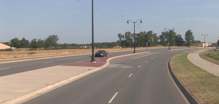
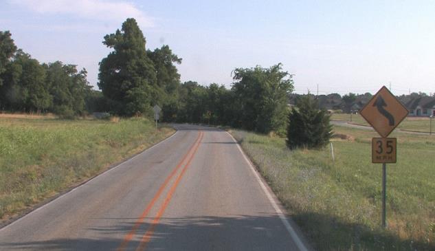
4 2 Figure ES-1 Study Area
5 Lengthy queues are typical at the Drake Street signal, particularly during the evening peak period. The City of Fayetteville is planning to widen Van Asche to four travel lanes in order to improve east-west travel. As a result, additional traffic growth in the near future is expected on Highway 112 in northern Fayetteville. The remainder of the study area has traffic volumes ranging from 5,000 to 10,000 vpd. With the completion of a portion of the Springdale Bypass from Interstate 49 to Highway 112, additional traffic is expected in the study area north of Highway 412. In the Cave Springs area, Highway 112 experiences congestion due to heavy volumes turning left onto Highway 264 East during the morning peak period. In the Bentonville area, between Ozark Acres Drive and Elk Road, significant queues are experienced due to school related traffic and the lack of turn lanes. Traffic Analysis Growth trends based on historical annual average daily traffic (ADT) as well as the 2035 NARTS Travel Demand Model (TDM) were used to develop traffic projections in the study area. In addition to considering potential road improvements, the TDM incorporates projected demographic and land use changes to aid in traffic forecasting. Existing and projected traffic volumes for the area are shown in Figure ES-2. The traffic operation performance of a roadway can be described by its level of service (LOS). The 2010 Highway Capacity Manual defines LOS as a quality measure to describe traffic conditions that may include speed, travel time, delay, freedom to maneuver, traffic interruptions, and comfort. Generally, LOS C or better is considered acceptable for rural roadways while LOS D or better is considered acceptable for urban roadways. Because the Highway 112 corridor is located within an urbanized area, LOS D is considered acceptable. Most of Highway 112 currently operates at LOS D and will worsen to LOS E or F for year 2035 traffic. This indicates that most of Highway 112 operates at an acceptable LOS, but will worsen to an unacceptable LOS for future traffic. Table ES-1 shows the LOS for current and future year traffic volumes. 3

6 4 Figure ES-2 Existing and Projected Traffic
7 Table ES-1 Traffic Analysis Summary Segment Description Facility Type Janice Ave. to Truckers Dr. (LM 0.71 to LM 2.41) Truckers Dr. to Greathouse Springs Rd. (LM 2.41 to LM 5.01) Greathouse Springs Rd. to Hwy. 412 (LM 5.01 to LM 7.97) Hwy. 412 to Har-Ber Ave. (LM 7.97 to LM 9.11) Har-Ber Ave. to Scott St. (LM 9.11 to LM 10.38) Scott St. to Hale Ave. (LM to LM 10.95) Hale Ave. to East Ave. (LM 0.00 to LM 3.26) East Ave. to Hwy. 264 East (LM 3.26 to LM 3.50) Hwy. 264 East to Hwy. 264 West (LM 3.50 to LM 3.85) Hwy. 264 West to Wallis Rd. (LM 3.85 to LM 4.91) Wallis Rd. to Ozark Acres Dr. (LM 4.91 to LM 7.22) Ozark Acres Dr. to H St. (LM 7.22 to M 8.80) Two 11-foot lanes, no Two 10-foot lanes, no Two 10-foot lanes, no Two 10-foot lanes, no Two 10-foot lanes, no Two 10-foot lanes, no Two 10-foot lanes, no Two 10-foot lanes, no Two 10-foot lanes, two-foot Two 10-foot lanes, no Two 10-foot lanes, no Two 10-foot lanes, no 2015 Weighted ADT 2035 Weighted ADT* ,600 25,000 F F 7,700 25,400 D F 6,600 18,800 D E 5,000 15,100 C E 6,700 19,400 D E 6,900 26,700 E F 5,800 14,000 D E 5,600 11,400 D E 9,400 16,900 E F 5,900 13,600 D E 5,800 15,900 D F 5,500 16,000 D F *Traffic projections were estimated through an iterative process involving the NARTS TDM, vehicle count trends, and engineering judgment. 5
8 Safety Analysis A crash analysis in the study area was conducted using 2010, 2011 and 2012 data, the three most recent years for which data is available. Table ES-2 summarizes the crash analysis, and Figure ES-3 shows the crash locations. Of the 274 crashes that occurred during the three-year period on Highway 112, none were fatal. There were seven serious injury crashes, 30 minor injury crashes, 42 possible injury crashes, and 195 property damage only (PDO) crashes. Of the 274 crashes, there were 105 rear-end crashes, 79 single vehicle crashes, 65 angle crashes, 18 sideswipe crashes, six head-on collisions, and one backing crash. Most of the single vehicle crashes occurred at curves. Most of the segment crash rates were relatively close to the statewide averages for similar facilities. However, the crash rate and KA crash rate in Segment 1 was noticeably higher than the statewide averages. On all other segments, the KA crash rate was lower than the statewide averages. One-hundred forty-six (53 percent) crashes occurred in Segment 1, which included three of the seven KA crashes. The Drake Street intersection alone had 13 crashes during the study period. 6
9 Other Considerations Metropolitan Transportation Plan The study area is located in the NARTS planning region. The 2035 Northwest Arkansas Regional Transportation Plan identified various improvement projects along Highway 112 from Fayetteville to Bentonville. The 2014 Northwest Arkansas Regional Bicycle and Pedestrian Master Plan included most of Highway 112 in the study area as a bicycle route. Land Use and Transportation Local land use and access management policies have a significant impact on sustainability and reliability of the transportation system. An efficient local roadway network that provides an adequate system of minor arterial and connector streets would relieve traffic demands on the State Highway System. This type of local connectivity mostly benefits the local population by allowing them to avoid congestion as well as accommodating other road users. 7
10 Segment Description Year Janice Ave. to Truckers Dr. 3 (LM 0.71 to LM 2.41) Truckers Dr. to Greathouse Springs Rd. 3 (LM 2.42 to LM 5.01) Greathouse Springs Rd. to Hwy (LM 5.02 to LM 7.97) Hwy. 412 to East Ave. 4 (LM 7.98 to LM and LM 0.00 to LM 3.26, Sec. 2) East Ave. to Hwy. 264 West 4 (LM 3.27 to LM 3.85) Hwy. 264 West to Wallis Rd. 4 (LM 3.86 to LM 4.91) Wallis to H St. 4 (LM 4.92 to LM 8.80) Table ES-2 Crash Rates Weighted ADT Crashes/ KA Crashes Crash Rate 1 Statewide Average Crash Rate KA Crash Rate 2 Statewide Average KA Crash Rate ,700 38/ ,200 45/ ,300 63/ Avg. 12, / ,900 7/ ,700 8/ ,000 9/ Avg. 6, / ,700 10/ ,700 5/ ,200 14/ Avg. 5, / ,900 11/ ,000 12/ ,700 12/ Avg. 5, / ,900 2/ ,700 0/ ,900 3/ Avg. 7, / ,300 1/ ,000 1/ ,800 1/ Avg. 5, / ,300 12/ ,500 9/ ,200 11/ Avg. 4, / Crash rates are expressed in the number of crashes per million vehicle miles (MVM) traveled. 2 KA crash rates are expressed in the number of crashes per 100 MVM. 3 Statewide average crash rate or KA crash rate for urban facilities. 4 Statewide average crash rate or KA crash rate for rural facilities. 8

11 9 Figure ES-3 Crash Locations
12 Description of Alternatives Based on an evaluation of the existing conditions and traffic and safety analyses, areas of need were identified and an improvement alternative was evaluated. The total estimated costs for the improvement alternative, in 2015 dollars, includes preliminary engineering, right of way acquisition, utility relocation, construction, and construction engineering. No-Action Alternative The No-Action Alternative includes no capacity or geometric improvements on the existing highway. Adverse impacts will occur due to increased traffic demand on the system resulting in more congestion, increased travels times, reduced speeds and increased safety concerns. Improvement Alternative The Improvement Alternative would widen Highway 112 to four travel lanes, improve geometry, and provide access management. Strategies to manage access such as adequate driveway spacing, a raised median, and deceleration lanes will be necessary to maximize operations and safety through this corridor. Highway 112 currently has four travel lanes with a raised median in the northernmost portion of the study area (from 41 st Street to Highway 12). The portion south of the study area from Highway 112 Spur to Deane Street that was recently improved also has four travel lanes with a raised median. This alternative would also realign selected locations of Highway 112 to improve safety and mobility, as shown in Figure ES-4. The total estimated cost for this alternative ranges from $108.8 million to $134 million. The estimated construction cost ranges from $85.7 million to $107.6 million. 10
13 Cave Springs Area Alignment Options There are three proposed options (see Figure ES-5) for the study area near Cave Springs. Option A involves widening Highway 112 to four travel lanes using the existing alignment within the Cave Springs area while realigning the Highway 264 West and Highway 112 intersection at a total estimated cost of $9.7 million, of which $7.4 million are construction costs. Option B and Option C would construct a bypass with four travel lanes around the Cave Springs area and a connection to existing Highway 264 East (Lowell Avenue). o Option B has a total estimated cost of $16.0 million, of which $13.2 million are construction costs. o Option C has a total estimated cost of $31.2 million, of which $25.9 million are construction costs. Lillard Lane Alignment Options There are three proposed options (see Figure ES-6) for the Bentonville portion of the study area. Option A involves widening existing Highway 112 to four travel lanes, with realignments near Scoggins Road and Windmill Road, at a total estimated cost of $11.1 million, of which $8.8 million are construction costs. Option B would encompass the same improvements as Option A, but construct a new location route with four travel lanes from Gator Boulevard to just south of the Highway 12 intersection. Option B has a total estimated cost of $15.0 million, of which $12.3 million are construction costs. Option C would construct a new location route with four travel lanes from Lillard Lane to south of 41 st Street. Option C has a total estimated cost of $14.1 million, of which $11.7 million are construction costs. 11

14 12 Figure ES-4 Improvement Alternative

15 Figure ES-5 Cave Springs Area Alignment Options 13

16 Figure ES-6 Lillard Lane to Highway 12 Alignment Options 14
17 Analysis of Alternatives Widening Highway 112 to four travel lanes would improve the traffic operations to an acceptable LOS for current and future traffic volumes. Table ES-3 shows the LOS for the No-Action Alternative and Improvement Alternative. Table ES-3 Levels of Service (No-Action and Improvement Alternatives) Segment Description Janice Ave. to Truckers Dr. (LM 0.71 to LM 2.41) Truckers Dr. to Greathouse Springs Rd. (LM 2.41 to LM 5.01) Greathouse Springs Rd. to Hwy. 412 (LM 5.01 to LM 7.97) Hwy. 412 to Har-Ber Ave. (LM 7.97 to LM 9.11) Har-Ber Ave. to Scott St. (LM 9.11 to LM 10.38) Scott St. to Hale Ave. (LM to LM 10.95) Hale Ave. to East Ave. (LM 0.00 to LM 3.26) East Ave. to Hwy. 264 East (LM 3.26 to LM 3.50) Hwy. 264 East to Hwy. 264 West (LM 3.50 to LM 3.85) Hwy. 264 West to Wallis Rd. (LM 3.85 to LM 4.91) Wallis Rd. to Ozark Acres Dr. (LM 4.91 to LM 7.22) Ozark Acres Dr. to H St. (LM 7.22 to LM 8.80) No-Action Improvement Alternative F F B C D F B C D E A B C E B C D E B C E F B D D E A C D E B 1,2,3 D 1 C 2 B 3 E F B 1,2,3 D 1 C 2 B 3 D E B 1,2,3 D 1 C 2 B 3 D F A B D F A C Note: LOS analyses were not performed for individual intersections. Further analyses will be performed if individual improvement projects are identified. This is particularly the case for the current Highway 412 intersection, which may have significant impacts on future traffic operations. 1 LOS for Option A. 2 LOS for Option B and C on existing alignment. 3 LOS for Option B and C on bypass. Based on the analysis, Highway 112 would operate at an acceptable LOS for current and future traffic volumes under all build options. 15
18 Environmental Constraints The environmental constraints for this study include historical structures, cemeteries, springs, and habitats for several federally listed endangered species which are shown in Figure ES-7. The study area also crosses nine regulated floodplains. Impacts to these features should be minimized. One significant environmentally sensitive area near the Highway 112 corridor is the Cave Springs Recharge Area. Due to the karst topography and continued development in the area, the Cave Springs Area Karst Resource Conservation Study (CSAKRC), led by the United States Fish and Wildlife Service, is underway to determine what conservation efforts are appropriate to protect threatened and endangered species in the area. Any further studies or potential projects to Highway 112 should consider recommendations from the CSAKRC study once it is complete. 16

19 17 Figure ES-7 Environmental Constraints
20 Conclusions Highway 112 is the only major north-south route in the NARTS area west of Interstate 49. When combined with other major corridors, it is an important part of the regional mobility network. Development in the area is causing congestion at various locations that will continue to increase in future years. Based on the traffic and safety analyses, improvements to Highway 112 are needed to better accommodate anticipated traffic growth and improve safety. This study identified one feasible improvement alternative, which includes various options along the route. The estimated costs for the improvement alternative are shown in Table ES-5. Table ES-4 Cost Estimates Segment Description 1 Cost Construction (million dollars) Total Cost 2 (million dollars) Janice Ave. to Truckers Dr. (LM 0.71 to LM 2.41) Truckers Dr. to Greathouse Springs Rd. (LM 2.41 to LM 5.01) Greathouse Springs Rd. to Hwy. 412 (LM 5.01 to LM 7.97) Hwy. 412 to Scott St. (LM 7.97 LM 10.38) Scott St. to Hale St. (LM to LM 10.95) $7.1 $9.4 $17.3 $21.2 $8.5 $11.1 $13.1 $16.1 $4.5 $ Hale St. to Wallis Rd. (LM 0.00 to LM 4.91) Option A $19.2 ($7.4) 4 $25.0 ($9.7) 4 Option B $25.0 ($16.0) 4 $31.3 ($13.2) 4 Option C $37.6 ($25.9) 4 $46.4 ($31.2) Wallis Rd. to Hwy. 12 (LM 4.91 to LM 8.80) Option A $16.0 ($8.8) 4 $ ($ ) 4 Option B $19.5 ($12.3) 4 $24.2 ($15.0) 4 Option C $18.9 ($11.7) 4 $23.3 ($14.1) 4 Notes: 1 All improvements consist of widening Highway 112 to four travel lanes with either a flush paved or raised median. 2 Total Cost includes construction, right-of-way, utility relocation, preliminary and construction engineering (2015 dollars). 3 Total cost will likely be higher due to right-of-way constraints in highly developed area. 4 Costs within parentheses represent the Cave Springs area and Lillard Lane to Highway 12 alignment costs. 18
21 Due to the potential impacts to the Cave Springs Recharge Area, any potential improvement projects along Highway 112 should consider recommendations from the CSAKRC study once it is complete. In addition, consideration should be given for implementing access management strategies along Highway 112 in order to preserve corridor capacity and protect transportation investments. Furthermore, due to the high costs associated with improving Highway 112, cost sharing arrangements with local jurisdictions should be explored. At a minimum, possible removal of existing highways from the State Highway System should be considered. 19

22
Highway 49, Highway 351 and Highway 91 Improvements Feasibility Study Craighead County
 Highway 49, Highway 351 and Highway 91 Improvements Feasibility Study Craighead County Executive Summary March 2015 Highway 49, Highway 351 and Highway 91 Improvements Feasibility Study Craighead County
JONESBORO HIGHWAY 63 HIGHWAY 18 CONNECTOR STUDY
 JONESBORO HIGHWAY 63 HIGHWAY 18 CONNECTOR STUDY Craighead County May 2007 JONESBORO HIGHWAY 63 HIGHWAY 18 CONNECTOR STUDY Craighead County May 2007 Prepared by Planning and Research Division Arkansas State
Way. Roundabout (FUNCTIONING AS A ROUNDABOUT) Driving the
 Driving the") (FUNCTIONING AS A ROUNDABOUT) Roundabouts are becoming more common across the U.S. as a way to improve traffic flow and reduce serious accidents. But for drivers who have never used a roundabout, it can
(FUNCTIONING AS A ROUNDABOUT) Roundabouts are becoming more common across the U.S. as a way to improve traffic flow and reduce serious accidents. But for drivers who have never used a roundabout, it can
Highway 111 Corridor Study
 Highway 111 Corridor Study June, 2009 LINCOLN CO. HWY 111 CORRIDOR STUDY Draft Study Tea, South Dakota Prepared for City of Tea Sioux Falls Metropolitan Planning Organization Prepared by HDR Engineering,
INTERSTATE 540 IMPROVEMENT STUDY
 INTERSTATE 540 IMPROVEMENT STUDY WASHINGTON COUNTY AND BENTON COUNTY APRIL, 2006 INTERSTATE 540 IMPROVEMENT STUDY WASHINGTON COUNTY AND BENTON COUNTY April, 2006 Prepared by Parsons Transportation Group
Transportation Improvement Study
 Transportation Improvement Study City of Searcy White County November 2008 Transportation Improvement Study City of Searcy White County November 2008 Prepared by: Planning and Research Division Arkansas
ARKANSAS SAFE ROUTES TO SCHOOL PROGRAM APPLICATION FOR WALKING SCHOOL BUS AND BICYCLE TRAIN FUNDING Application Instructions
 Application Instructions This is an electronic application. Simply fill out your response in each input box (as you type the box will expand and carriage return). You can input your answers online and
Town of Bethlehem. Planning Assessment. Bethlehem Town Board
 Town of Bethlehem US 9W Corridor Transportation Planning Assessment Presented e to: Bethlehem Town Board June 2009 Overview Study Background Route 9W Corridor Conditions and Improvements Selkirk Bypass
WELCOME TO OPEN HOUSE # 1 June 14, 2017
 Langstaff Road Weston Road to Highway 7 Class Environmental Assessment Study WELCOME TO OPEN HOUSE # 1 June 14, 2017 Please sign in and join our mailing list Purpose of Open House #1 & Study Area York
Route 7 Corridor Study
 Route 7 Corridor Study Executive Summary Study Area The following report analyzes a segment of the Virginia State Route 7 corridor. The corridor study area, spanning over 5 miles in length, is a multi
Chapter 4 Traffic Analysis
 Chapter 4 Traffic Analysis PURPOSE The traffic analysis component of the K-68 Corridor Management Plan incorporates information on the existing transportation network, such as traffic volumes and intersection
Intersection Traffic Control Feasibility Study
 Intersection Traffic Control Feasibility Study CSAH 9 at CSAH 60 (185th Avenue) Prepared For: Dakota County Transportation Department Western Service Center 14955 Galaxie Avenue, 3rd Floor Apple Valley,
2045 Long Range Transportation Plan. Summary of Draft
 2045 Long Range Transportation Plan Summary of Draft Fredericksburg Area Metropolitan Planning Organization The George Washington Region includes the City of Fredericksburg and the counties of Caroline,
METHODOLOGY. Signalized Intersection Average Control Delay (sec/veh)
") Chapter 5 Traffic Analysis 5.1 SUMMARY US /West 6 th Street assumes a unique role in the Lawrence Douglas County transportation system. This principal arterial street currently conveys commuter traffic
Chapter 5 Traffic Analysis 5.1 SUMMARY US /West 6 th Street assumes a unique role in the Lawrence Douglas County transportation system. This principal arterial street currently conveys commuter traffic
M-58 HIGHWAY ACCESS MANAGEMENT STUDY Mullen Road to Bel-Ray Boulevard. Prepared for CITY OF BELTON. May 2016
 M-58 HIGHWAY ACCESS MANAGEMENT STUDY Prepared for CITY OF BELTON By May 2016 Introduction Missouri State Highway 58 (M-58 Highway) is a major commercial corridor in the City of Belton. As development has
5.0 Roadway System Plan
 Southwest Boise Transportation Study Page 16 5.0 Roadway System Plan The Roadway System Plan outlines roadway improvements in the Initial Study Area. It forecasts future deficiencies on the arterial system,
APPENDIX G: INTERSECTION NEEDS AT OKEECHOBEE BOULEVARD
 APPENDIX G: INTERSECTION NEEDS AT OKEECHOBEE BOULEVARD INTERSECTION NEEDS AT SR 7 and OKEECHOBEE BOULEVARD SR 7 Extension Project Development and Environment (PD&E) Study From Okeechobee Boulevard (SR
Route 28 (South Orleans Road)/Route 39 (Harwich Road)/Quanset Road Intersection
/Route 39 (Harwich Road)/Quanset Road Intersection") TRAFFIC FEASIBILITY STUDY Route 28 (South Orleans Road)/Route 39 (Harwich Road)/Quanset Road Intersection Orleans, Massachusetts Prepared for: Town of Orleans Prepared by: Fay, Spofford & Thorndike, LLC
TRAFFIC FEASIBILITY STUDY Route 28 (South Orleans Road)/Route 39 (Harwich Road)/Quanset Road Intersection Orleans, Massachusetts Prepared for: Town of Orleans Prepared by: Fay, Spofford & Thorndike, LLC
TRAFFIC IMPACT ANALYSIS
 TRAFFIC IMPACT ANALYSIS FOR THE CHAMPAIGN UNIT#4 SCHOOL DISTRICT PROPOSED HIGH SCHOOL (SPALDING PARK SITE) IN THE CITY OF CHAMPAIGN Final Report Champaign Urbana Urbanized Area Transportation Study 6/24/2014
DUNBOW ROAD FUNCTIONAL PLANNING
 DUNBOW ROAD FUNCTIONAL PLANNING Final Report August 3, 216 #31, 316 5th Avenue NE Calgary, AB T2A 6K4 Phone: 43.273.91 Fax: 43.273.344 wattconsultinggroup.com Dunbow Road Functional Planning Final Report
Access Management Regulations and Standards
 Access Management Regulations and Standards January 2014 Efficient highway operation Reasonable property access Concept of Access Management The way to manage access to land development while preserving
Recommended Roadway Plan Section 2 - Land Development and Roadway Access
 Recommended Roadway Plan Section 2 - Land Development and Roadway Access SECTION 2 Land Development and Roadway Access 2.1 Land Use and Access Management The Federal Highway Administration (FHWA) defines
City of Wayzata Comprehensive Plan 2030 Transportation Chapter: Appendix A
 A1. Functional Classification Table A-1 illustrates the Metropolitan Council s detailed criteria established for the functional classification of roadways within the Twin Cities Metropolitan Area. Table
MCTC 2018 RTP SCS and Madera County RIFP Multi-Modal Project Eval Criteria GV13.xlsx
 MCTC 8 RTP SCS and Madera County RIFP Multi-Modal Project Eval Criteria GV.xlsx Madera County Transportation Commission Regional Transportation Plan / Sustainable Communities Strategy Multi-Modal Project
Project Update May 2018
 Project Update May 2018 Dakota County, in cooperation with the City of Lakeville, is planning to reconstruct 202 nd Street West (County Road 50) from Holyoke Avenue to Cedar Avenue (County Road 23). 202
Chapter 5 Future Transportation
 Chapter 5 Future Transportation The Future Land Use Plan identifies the desired land use designations. The land uses desired for Crozet depend, in large part, on the success of the transportation system,
TRAFFIC IMPACT STUDY COMPREHENSIVE UPDATE TOWN OF THOMPSON S STATION, TENNESSEE PREPARED FOR: THE TOWN OF THOMPSON S STATION
 TRAFFIC IMPACT STUDY COMPREHENSIVE UPDATE TOWN OF THOMPSON S STATION, TENNESSEE PREPARED FOR: THE TOWN OF THOMPSON S STATION Transportation Consultants, LLC 1101 17 TH AVENUE SOUTH NASHVILLE, TN 37212
TRANSPORTATION FACILITY PLANNING Waugh Chapel Road Maytime Drive to New Market Lane
 July 24, 2018 TRANSPORTATION FACILITY PLANNING Waugh Chapel Road Maytime Drive to New Market Lane DPWandYOU.com Making a difference, together Meeting Agenda Purpose of the project Overview of work conducted
Traffic Impact Analysis Walton Acres at Riverwood Athletic Club Clayton, NC
 Traffic Impact Analysis Walton Acres at Riverwood Athletic Club Clayton, NC 1. TABLE OF CONTENTS INTRODUCTION...1 1.1. Site Location and Study Area...1 1.2. Proposed Land Use and Site Access...2 1.3.
Clackamas County Comprehensive Plan
 ROADWAYS The County s road system permits the movement of goods and people between communities and regions, using any of a variety of modes of travel. Roads provide access to virtually all property. They
Corridor Studies. LA 415 and LA 73
 Corridor Studies LA 415 and LA 73 Project Approach for Both Corridors 1. Data Collection 2. Data Summary 3. Traffic Analysis 4. Micro-Simulation modeling 5. Generation of alternatives 6. Modeling alternatives
CITY OF FRANKLIN, TENNESSEE. Columbia Avenue. Widening & Improvements Project. Public Meeting May 16, 2017
 CITY OF FRANKLIN, TENNESSEE Columbia Avenue Widening & Improvements Project Public Meeting May 16, 2017 Agenda 6:00 6:30 Formal Presentation 6:30 8:00 Town Hall Forum City of Franklin Columbia Avenue Alternatives
Evaluation of M-99 (Broad Street) Road Diet and Intersection Operational Investigation
 Road Diet and Intersection Operational Investigation") Evaluation of M-99 (Broad Street) Road Diet and Intersection Operational Investigation City of Hillsdale, Hillsdale County, Michigan June 16, 2016 Final Report Prepared for City of Hillsdale 97 North Broad
Evaluation of M-99 (Broad Street) Road Diet and Intersection Operational Investigation City of Hillsdale, Hillsdale County, Michigan June 16, 2016 Final Report Prepared for City of Hillsdale 97 North Broad
City of Homewood Transportation Plan
 City of Homewood Transportation Plan Prepared for: City of Homewood, Alabama Prepared by: Skipper Consulting, Inc. May 2007 TABLE OF CONTENTS INTRODUCTION... 1 BACKGROUND INFORMATION... 1 EXISTING TRANSPORTATION
Reams Road RCA Study. Board of County Commissioners Public Hearing
 Reams Road RCA Study Board of County Commissioners Public Hearing April 24, 2018 Presentation Overview Study Overview Existing Conditions Development of Alternatives Preferred Alternative Public Involvement
4.0 ACCESS CONTROL PLAN - SH 14 (JEFFERSON STREET/RIVERSIDE AVENUE)
") 4.1 Existing Conditions Roadway Physical Characteristics Typical Sections Jefferson Street 4.0 ACCESS CONTROL PLAN - SH 14 (JEFFERSON STREET/RIVERSIDE AVENUE) The existing typical cross-section for SH
4.1 Existing Conditions Roadway Physical Characteristics Typical Sections Jefferson Street 4.0 ACCESS CONTROL PLAN - SH 14 (JEFFERSON STREET/RIVERSIDE AVENUE) The existing typical cross-section for SH
EXISTING (2006) CONDITIONS
 CONDITIONS") Section 2 EXISTING (2006) CONDITIONS This section provides a description of the existing transportation system in the study area and a comprehensive analysis of existing traffic operations and crash history.
Section 2 EXISTING (2006) CONDITIONS This section provides a description of the existing transportation system in the study area and a comprehensive analysis of existing traffic operations and crash history.
I-395 Express Lanes Northern Extension Project Crystal City Civic Association September 21, 2016
 I-395 Express Lanes Northern Extension Project Crystal City Civic Association September 21, 2016 Mike Snare, PE, Project Manager Virginia Department of Transportation GEC Michelle Holland, Megaprojects
4. ENVIRONMENTAL IMPACT ANALYSIS 9. TRANSPORTATION AND TRAFFIC
 4. ENVIRONMENTAL IMPACT ANALYSIS 9. TRANSPORTATION AND TRAFFIC 4.9.1 INTRODUCTION The following section addresses the Proposed Project s impact on transportation and traffic based on the Traffic Study
Glenn Avenue Corridor Traffic Operational Evaluation
 Glenn Avenue Corridor Traffic Operational Evaluation PREPARED FOR: THE CITY OF AUBURN PREPARED BY: DECEMBER 2007 Glenn Avenue Corridor Study--Auburn, Alabama TABLE OF CONTENTS Introduction... 1 Background
Roundabout Feasibility Memorandum
 Roundabout Feasibility Memorandum To From Gwen Pipkin Bill Howell Date June 18, 2013 Subject Roundabout Feasibility Study SR 29 PD&E Study From Oil Well Road to SR 82 Collier County, FL FPID 417540-1-22-01
APPENDIX 2 LAKESHORE ROAD TRANSPORTATION REVIEW STUDY EXECUTIVE SUMMARY
 APPENDIX 2 LAKESHORE ROAD TRANSPORTATION REVIEW STUDY EXECUTIVE SUMMARY Appendix 2 City of Mississauga Lakeshore Road FINAL REPORT Transportation Review Study December 2010 EXECUTIVE SUMMARY Study Purpose
INTRODUCTION THOROUGHFARE SYSTEM CLASSIFICATIONS
 INTRODUCTION The thoroughfare plan will assist public officials in the development of a specialized system for efficient and safe movement of vehicular traffic while minimizing potential conflicts with
Preliminary Engineering Study
 Preliminary Engineering Study Open House # 2 June 6, 2018 PREPARED FOR: PREPARED BY: Agenda Background and status of preliminary engineering study County Road 26 design summary County Road 63 design summary
Safety Emphasis Areas & Safety Project Development Florida Department of Transportation District Seven Tampa Bay
 Safety Emphasis Areas & Safety Project Development Florida Department of Transportation District Seven Tampa Bay Stephen L. Benson, AICP, CNU-A FDOT District Seven Safety Office Presentation Overview Safety
Durham Region Long Term Transit Strategy
 Durham Region Long Term Transit Strategy An adaptive, safe, reliable, frequent, accessible and desirable transit system that shapes and connects Durham Region and beyond in an economically and environmentally
TRASBURG RANSPORTATION
 TRASBURG RANSPORTATION LAN DEVELOPED BY THE TRANSPORTATION PLANNING DIVISION OF THE VIRGINIA DEPARTMENT OF TRANSPORTATION IN COOPERATION WITH THE U.S. DEPARTMENT OF TRANSPORTATION, FEDERAL HIGHWAY ADMINISTRATION
ARTINSVILLE ENRY OUNTY REA RANSPORTATION TUDY
 ARTINSVILLE ENRY OUNTY REA RANSPORTATION TUDY DEVELOPED BY THE TRANSPORTATION AND MOBILITY PLANNING DIVISION OF THE VIRGINIA DEPARTMENT OF TRANSPORTATION IN COOPERATION WITH THE U.S. DEPARTMENT OF TRANSPORTATION,
TRAFFIC STUDY GUIDELINES Clarksville Street Department
 TRAFFIC STUDY GUIDELINES Clarksville Street Department 9/1/2009 Introduction Traffic studies are used to help the city determine potential impacts to the operation of the surrounding roadway network. Two
PRELIMINARY DRAFT FIRST AMENDMENT TO VISION 2050: A REGIONAL LAND USE AND TRANSPORTATION PLAN FOR SOUTHEASTERN WISCONSIN
 PRELIMINARY DRAFT FIRST AMENDMENT TO VISION 2050: A REGIONAL LAND USE AND TRANSPORTATION PLAN FOR SOUTHEASTERN WISCONSIN ESTABLISHING TARGETS FOR FEDERAL PERFORMANCE MEASURES: HIGHWAY SAFETY SOUTHEASTERN
#!! "$% ##! &! # '#! % $ #!
 Executive Summary US Highway 16 (US 16) is the primary corridor connecting Rapid City to the Black Hills region. It serves a growing population of commercial and residential traffic, as well as seasonal
Project Overview. Rolling Road Widening Fairfax County. Get Involved. Design Public Hearing. Contact Information
 Get Involved VDOT representatives will review and evaluate information received as a result of this meeting. Please fill out the comment sheet provided in this brochure if you have any comments or questions.
City of Gainesville Transportation/Roadway Needs PROJECT SUMMARY
 A1 Roadway Resurfacing $23,846,000 TYPE: Preservation of existing system Roadway resurfacing A2 Signal Replacement $6,000,000 TYPE: Preservation of existing system Replace traffic signals. B1 W 6th St
DRAFT. Corridor study. Honeysuckle Road. October Prepared for the City of Dothan, AL. Prepared by Gresham, Smith and Partners
 DRAFT Corridor study Honeysuckle Road October 2017 Prepared for the City of Dothan, AL Prepared by TABLE OF CONTENTS SECTION I... 1 STUDY SUMMARY... 1 INTRODUCTION... 1 CONCLUSIONS... 5 SECTION II... 7
TRANSPORTATION & MOBILITY
 TRANSPORTATION & MOBILITY ROADWAY SYSTEM There are approximately 40 miles of roadways in Manitou Springs. For planning purposes, roadways are typically assigned a functional classification which defines
Parks Highway: MP Lucus Road to Big Lake Road
 2 Purpose and Need 2.1 Corridor History The Parks Highway is a 324-mile long Rural Interstate Highway that extends from its intersection with the Glenn Highway north to Fairbanks, Alaska. The Parks Highway
Improving Mobility Without Building More Lanes
 Improving Mobility Without Building More Lanes By Mike Salisbury and Will Toor July 2017 Copyright 2017 by Southwest Energy Efficiency Project. All rights reserved. Photo: Courtesy of the Denver Post Anyone
I-395 Express Lanes Northern Extension Project Public Hearings
 I-395 Express Lanes Northern Extension Project Public Hearings Susan Shaw, PE, Megaprojects Director Virginia Department of Transportation Amanda Baxter, Special Projects Manager Virginia Department of
Los Altos Hills Town Council - June 18, 2015 Palo Alto City Council June 22, AGENDA ITEM #2.B Presentation
 Los Altos Hills Town Council - June 18, 2015 Palo Alto City Council June 22, 2015 AGENDA ITEM #2.B Presentation Previous Presentations Los Altos Hills Town Council in May 2014 and February 2015 Palo Alto
4 DISRUPTION MANAGEMENT PLAN HIGHWAY 7 RAPIDWAY CONSTRUCTION BETWEEN BAYVIEW AVENUE AND WARDEN AVENUE TOWNS OF MARKHAM AND RICHMOND HILL
 4 DISRUPTION MANAGEMENT PLAN HIGHWAY 7 RAPIDWAY CONSTRUCTION BETWEEN BAYVIEW AVENUE AND WARDEN AVENUE TOWNS OF MARKHAM AND RICHMOND HILL The Transportation Services Committee recommends the adoption of
Operational Comparison of Transit Signal Priority Strategies
 Operational Comparison of Transit Signal Priority Strategies Revision Submitted on: November, 0 Author: Adriana Rodriguez, E.I Assistant Engineer Parsons Brinckerhoff 0 South Orange Avenue, Suite 00 Orlando,
Defining Purpose and Need
 Advanced Design Flexibility Pilot Workshop Session 4 Jack Broz, PE, HR Green May 5-6, 2010 Defining Purpose and Need In your agency s project development process, when do design engineers typically get
I-95 Express Lanes Fredericksburg Extension (Fred Ex) Public Hearing. September 25, 2017
 Public Hearing. September 25, 2017") I-95 Express Lanes Fredericksburg Extension (Fred Ex) Public Hearing September 25, 2017 Purpose of Tonight s Meeting Provide information and gain public input: Draft Environmental Assessment (EA) Design
I-95 Express Lanes Fredericksburg Extension (Fred Ex) Public Hearing September 25, 2017 Purpose of Tonight s Meeting Provide information and gain public input: Draft Environmental Assessment (EA) Design
Basalt Creek Transportation Refinement Plan Recommendations
 Basalt Creek Transportation Refinement Plan Recommendations Introduction The Basalt Creek transportation planning effort analyzed future transportation conditions and evaluated alternative strategies for
Route 460 West Corridor Study
 Route 460 West Corridor Study Bedford County, Virginia Villamont Church Rd (698) Botetourt County U 460 Villamont Rd (698) Camp Jaycee Rd (697) Mountain View Church Rd (607) Goose Creek Valley Rd (695)
Northwest Corridor Project Interchange Modification, Interchange Justification and System Analysis Report Reassessment (Phase I)
") Northwest Corridor Project Interchange Modification, Interchange Justification and System Analysis Report Reassessment (Phase I) Introduction The Georgia Department of Transportation (GDOT) prepared a
Northwest Corridor Project Interchange Modification, Interchange Justification and System Analysis Report Reassessment (Phase I) Introduction The Georgia Department of Transportation (GDOT) prepared a
DEPARTMENT OF ENVIRONMENTAL SERVICES. North Harrison Street (Lee Highway to Little Falls Road) Comparative Analysis. Prepared for:
 Comparative Analysis. Prepared for:") DEPARTMENT OF ENVIRONMENTAL SERVICES North Harrison Street (Lee Highway to Little Falls Road) Comparative Analysis Prepared for: Arlington County Department of Environmental Services 2100 Clarendon Boulevard,
DEPARTMENT OF ENVIRONMENTAL SERVICES North Harrison Street (Lee Highway to Little Falls Road) Comparative Analysis Prepared for: Arlington County Department of Environmental Services 2100 Clarendon Boulevard,
Scottsdale Road/Rural Road Alternatives Analysis (AA) Study. Arizona ITE/IMSA Spring Conference March 7, 2012
 Study. Arizona ITE/IMSA Spring Conference March 7, 2012") Scottsdale Road/Rural Road Alternatives Analysis (AA) Study Arizona ITE/IMSA Spring Conference March 7, 2012 Study Location and Duration Primary Study Corridor (major focus of effort) Rural Road and Scottsdale
Scottsdale Road/Rural Road Alternatives Analysis (AA) Study Arizona ITE/IMSA Spring Conference March 7, 2012 Study Location and Duration Primary Study Corridor (major focus of effort) Rural Road and Scottsdale
Project Description Form 8EE
 Project Description Form 8EE Basic Project Information Submitting Jurisdiction/Agency: Town of Dumfries Project Title: Route 1 (Fraley Blvd) Widening: Brady's Hill Road to Dumfries Road Project Location:
FM 471 PROJECT. OPEN HOUSE FM 471 (Culebra Road) from SH 211 to Old FM 471 Medina and Bexar Counties. FM 471 Project
 from SH 211 to Old FM 471 Medina and Bexar Counties. FM 471 Project") FM 471 PROJECT OPEN HOUSE FM 471 (Culebra Road) from SH 211 to Old FM 471 Medina and Bexar Counties January 24, 2018 Project Location 2 Proposed Improvements Improvements include: Expansion of FM 471 from
FM 471 PROJECT OPEN HOUSE FM 471 (Culebra Road) from SH 211 to Old FM 471 Medina and Bexar Counties January 24, 2018 Project Location 2 Proposed Improvements Improvements include: Expansion of FM 471 from
Oldham County Major Thoroughfare Plan
 Prepared for: Oldham County Planning & Zoning Commission Prepared by: December 2003 Table of Contents I. INTRODUCTION...1 A. Contents of Report...1 B. Purpose of Study...2 C. Related Project Documents...2
RAISED MEDIAN EFFECTIVENESS
 RAISED MEDIAN EFFECTIVENESS William E. Frawley, AICP Texas A&M Transportation Institute Access Management Overview Set of Tools to Help Improve Safety and Protect Public Investments in Roadways Balances
3 ROADWAYS 3.1 CMS ROADWAY NETWORK 3.2 TRAVEL-TIME-BASED PERFORMANCE MEASURES Roadway Travel Time Measures
 ROADWAYS Approximately 6 million trips are made in the Boston metropolitan region every day. The vast majority of these trips (80 to percent, depending on trip type) involve the use of the roadway network
Performance Criteria for 2035 Long Range Transportation Plan
 Minimizing Impacts on Natural, Historic, Cultural or Archeological Resources 2035 LRTP Weighting Factor: 7% Objective 1.1: Use appropriate planning and design criteria to protect and enhance the built
EXECUTIVE SUMMARY OF CALEDON TRANSPORTATION NEEDS STUDY
 EXECUTIVE SUMMARY OF CALEDON TRANSPORTATION NEEDS STUDY The Caledon Transportation Needs Study has been undertaken as a joint project by the Town of Caledon and the Region of Peel to determine the existing
Safety and Design Alternatives for Two-Way Stop-Controlled Expressway Intersections
 Safety and Design Alternatives for Two-Way Stop-Controlled Expressway Intersections Thomas H. Maze Center for Transportation Research and Education Iowa State University 2901 South Loop Drive, Suite 3100
Preliminary Transportation Analysis
 Preliminary Transportation Analysis Goals of a Robust, Multimodal Transportation Network Safe Accessible/Connected Efficient Comfortable Context-Sensitive Motor Vehicle: Continue to analyze the data to
Van Ness Avenue BRT Overview and Scoping Process. Geary BRT CAC January 8, 2009
 Van Ness Avenue BRT Overview and Scoping Process Geary BRT CAC January 8, 2009 VAN NESS AVENUE S ROLE Identified in Prop K for BRT treatment Muni 47 and 49; 19 operates on Polk 20,000 daily riders on Van
Modal Interrelationships: A bicycle lane is proposed between Harrington Ave and Swanns Station Rd.
 DRAFT PROJECT PAGE July 12, 2007 Main St / Broadway Rd (SR 1579) Project Statement Project Recommendation: From Avent Ferry Rd (NC 42) to the Harnett County line, Broadway Rd/Main St is recommended to
ACCESS MANAGEMENT PLAN: BLUFFTON PARKWAY BLUFFTON PARKWAY: PHASE FOUR TOWN OF BLUFFTON & BEAUFORT COUNTY, SC
 ACCESS MANAGEMENT PLAN: BLUFFTON PARKWAY BLUFFTON PARKWAY: PHASE FOUR TOWN OF BLUFFTON & BEAUFORT COUNTY, SC Prepared for: Beaufort County & Town of Bluffton Prepared by: SRS ENGINEERING, LLC 801 Mohawk
Transportation Corridor Studies: Summary of Recommendations
 Transportation Corridor Studies: Summary of Recommendations Route 4 Corridor Study: Route 10 Corridor Study: Route 44 Corridor Study: Route 175 Corridor Study: Route 5/15 Corridor Study: Rentschler Field
FI-2 I-66 Between Route 29, Lee Highway and Route 15, James Madison Highway
 TRANSPORTATION PLAN INTENT Transportation is the key to the economic and social development of Prince William County and especially to the I 66/Route 29 Sector Plan area. This includes transportation for
3.9 - Transportation and Traffic
 Transportation and Traffic 3.9 - Transportation and Traffic This section describes the potential transportation and traffic effects of project implementation on the project site and its surrounding area.
Public Information Meeting. Orange Camp Road. Dr. Martin Luther King Jr. Beltway to I-4. Presented by: Volusia County August 2, 2018
 Public Information Meeting Orange Camp Road Dr. Martin Luther King Jr. Beltway to I-4 Presented by: Volusia County August 2, 2018 1 Project Goals To improve the operations and safety for Orange Camp Road
5858 N COLLEGE, LLC N College Avenue Traffic Impact Study
 5858 N COLLEGE, LLC nue Traffic Impact Study August 22, 2016 Contents Traffic Impact Study Page Preparer Qualifications... 1 Introduction... 2 Existing Roadway Conditions... 5 Existing Traffic Conditions...
CHAPTER THREE MOBILITY
 CHAPTER THREE MOBILITY 70 MAJOR THOROUGHFARES Operations. The City of Ames is served by a combination of federal, state and local highways/streets that are interlinked in creating a regional and inter-city
BETHEL ROAD AND SEDGWICK ROAD CORRIDOR STUDY
 DRAFT PLAN City Council Meeting August 14, 2017 STUDY AREA Sedgwick Corridor State Route 160, principal arterial with Class 3 access management designation, commuter and freight route, connection to SR
MOUNTAIN HOUSE SPECIFIC PLAN I 9.1 INTRODUCTION ASSUMPTIONS TRANSPORTATION FACILITIES TRANSPORTATION IMPROVEMENTS PHASING 9.
 CHAPTER NINE: TRANSPORTATION AND CIRCULATION 9.1 INTRODUCTION 9.1 9.2 ASSUMPTIONS 9.1 9.3 TRANSPORTATION FACILITIES 9.1 9.4 TRANSPORTATION IMPROVEMENTS PHASING 9.3 LIST OF FIGURES LIST OF TABLES Figure
I-395 Express Lanes Northern Extension Project Fairlington Citizens Association September 12, 2016
 I-395 Express Lanes Northern Extension Project Fairlington Citizens Association September 12, 2016 Susan Shaw, PE, Megaprojects Director, Virginia Department of Transportation Amanda Baxter, Special Projects
Project Description Form 6V
 Project Description Form 6V Basic Project Information Submitting Jurisdiction/Agency: Prince William County Project Title: Route 15 Widening: Route 55 to south of RR tracks & Construct RR Overpass Project
Access Location, Spacing, Turn Lanes, and Medians
 Design Manual Chapter 5 - Roadway Design 5L - Access Management 5L-3 Access Location, Spacing, Turn Lanes, and Medians This section addresses access location, spacing, turn lane and median needs, including
Technical Memorandum TRAFFIC IMPACT STUDY. RIDLEY ROAD CONVENIENCE STORE Southampton County, VA. Prepared for: Mr. David Williams.
 Technical Memorandum TRFFIC IMPCT STUDY RIDLEY ROD CONVENIENCE STORE Southampton County, V Prepared for: Mr. David Williams By: Charles Smith, P.E., PTOE EPR Charlottesville, V July 2014 1 TBLE OF CONTENTS
MONTGOMERY COUNTY PLANNING DEPARTMENT THE MARYLAND-NATIONAL CAPITAL PARK AND PLANNING COMMISSION
 MONTGOMERY COUNTY PLANNING DEPARTMENT THE MARYLAND-NATIONAL CAPITAL PARK AND PLANNING COMMISSION MCPB Item No. 3 Date: 01-19-12 Worksession: Countywide Transit Corridors Functional Master Plan Larry Cole,
Geometric Categories as Intersection Safety Evaluation Tools
 Geometric Categories as Intersection Safety Evaluation Tools John R. Campbell Ayres Associates N19 W24075 Riverwood Drive, Suite 300 Waukesha, WI 53188 campbellj@ayresassociates.com Keith K. Knapp Engineering
Circulation in Elk Grove includes: Motor vehicles, including cars and trucks
 Circulation, as it is used in this General Plan, refers to the many ways people and goods move from place to place in Elk Grove and the region. Circulation in Elk Grove includes: Motor vehicles, including
Staunton. Transportation Plan. Transportation Planning Division. Virginia Department of Transportation
 2020 Transportation Plan Developed for the Transportation Planning Division of the Virginia Department of Transportation in cooperation with the U.S. Department of Transportation, Federal Highway Administration
Mark Malone, P.E. SD DOT
 Mark Malone, P.E. SD DOT SD10 Grading & Surfacing From 8 th Ave W to 8 th Ave E 1 mile plus transition lengths Complete Urban Reconstruction Grading, C&G, Storm Sewer, Sidewalk, Concrete Surfacing Railroad
Arterial Management Plan for US Route 250 and State Route 623
 Arterial Management Plan for US Route 250 and State Route 623 June 25, 2014 Brad Shelton, AICP Access Management and Traffic Impact Analysis Programs Manager Transportation and Mobility Planning Division
Tonight we will be discussing accidents
 Good evening PRAG members WELCOME BACK SAFETY ON HANA HIGHWAY NEAR PAIA Tonight we will be discussing accidents Safety is a Top Priority One of the top priority Goals and objectives of this project is
Introduction...pg. 1. Study Area...pg. 1. Study Purpose and Need...pg. 2. Study Coordination and Development... pg. 3. Public Involvement...pg.
 Table of Contents Introduction...pg. 1 Study Area...pg. 1 Study Purpose and Need...pg. 2 Study Coordination and Development... pg. 3 Public Involvement...pg. 4 Evaluation of Alternatives...pg. 4 Preferred