BAYVIEW DRIVE & BIG BAY POINT ROAD
|
|
|
- Ethan Nelson
- 5 years ago
- Views:
Transcription
 733-9037 Fax: (705) 733-1520 info@cctatham.")
1 BAYVIEW DRIVE & BIG BAY POINT ROAD City of Barrie DRAFT FINAL prepared by: C.C. Tatham & Associates Ltd. 41 King Street, Unit 4 Barrie, ON L4N 6B5 Tel: (705) Fax: (705) info@cctatham.com prepared for City of Barrie CCTA File
2 TABLE OF CONTENTS Executive Summary i 1 Introduction Multi-Modal Active Transportation Master Plan Class EA Phases 3 & 4 of the Class EA Study 5 2 Existing Conditions & Traffic Operations Assessment Existing Conditions Traffic Operations Assessment 7 3 Design Alternatives Bayview Drive (Little Avenue to Big Bay Point Road) Big Bay Point Road (Bayview Drive to Huronia Road) Other Considerations 17 4 Project Environments Physical Environment Natural Environment Social Environment Cultural/ Heritage Environment Economic Environment 30 5 Evaluation of Design Alternative Concepts Impacts to Physical Environment Impacts to Natural Environment Impacts to Cultural/Heritage Environment 32
3 5.4 Impacts to Social & Economic Environments Assessment of Design Alternatives Impact Mitigation 35 6 Stakeholder Consultation - PIC Purpose Notification Public Information Centre Public & Agency Comments 43 7 Evaluation of Design Alternatives Evaluation Selection of the Preferred Design Alternative AODA Requirements Sidewalks Consideration for Public Comments Impact Mitigation Land Acquisition Construction Costs Storm Water Management Watermain Assessment Sanitary Sewers 61 8 Completion of the Municipal Class EA Process Phases 1 & 2 - The City of Barrie MMATMP Phase Phase 4 62
4 APPENDICES Appendix A: Notice of Study Commencement Appendix B: Background Information Appendix C: Railway Crossing Assessment Appendix D: Traffic Operations Assessment Appendix E: Stormwater Management Analysis Appendix F: Geotechnical Investigation Appendix G: Natural Heritage Impact Assessment Report Appendix H: Traffic Noise Impact Report Appendix I: Archaeological Report (Stage 1) Appendix J: Construction Costs Appendix K: Design Alternatives Concept Drawings Appendix L: Public Information Centre 2 Appendix M: First Nations Consultation Appendix N: Preferred Design Alternative
5 LIST OF TABLES Table 1: Active Transportation Measures 2 Table 2: MMATMP Recommended Improvements 2031 Horizon 4 Table 3: Recommended Intersection Improvements Table 4: Recommended Intersection Improvements Table 5: Design Alternative Comparison 18 Table 6: Assessment of Design Alternatives Bayview Drive 38 Table 7: Assessment of Design Alternatives Big Bay Point Road 40 Table 8: Evaluation of Design Alternatives Bayview Drive 45 Table 9: Evaluation of Design Alternatives Big Bay Point Road 47 Table 10: Sidewalk Widths Empirical Review 50 Table 11: Public Comments & Responses 52 Table 12: Agency Comments & Responses 53 Table 13: Summary of Major Concerns & Responses 55 Table 14: Summary of Mitigation Measures 56 Table 15: Land Acquisition for Preferred Design Alternatives 58 Table 16: Preliminary Estimate of Construction Costs Preferred Design Alternatives 59
6 LIST OF FIGURES Figure 1: Municipal Class EA Process 64 Figure 2: Preferred Road Network (2031) 65 Figure 3: Preferred Cycling, Pathway & Trails Network (2031) 66 Figure 4: Preferred Sidewalk Network (2031) 67 Figure 5: Preferred Road Network (2051) 68 Figure 6: Study Limits 69 Figure 7: Existing Conditions 70 Figure 8: Existing Road Profile Bayview Drive 71 Figure 9: Existing Road Profile Big Bay Point Road 72 Figure 10: 2015 Traffic Volumes 73 Figure 11: 2021 Traffic Volumes 74 Figure 12: 2031 Traffic Volumes 75 Figure 13: Existing Intersection Configurations 76 Figure 14: Proposed Intersection Configurations Figure 15: Proposed Intersection Configurations Figure 16: Bayview Drive Design Alternatives Cross Sections 79 Figure 17: Bayview Drive Design Alternatives Concept Plans 80 Figure 18: Big Bay Point Road Design Alternatives Cross Sections 83 Figure 19: Big Bay Point Road Design Alternatives Concept Plans 85 Figure 20: Preferred Design Alternative Bayview Drive (Cross Section) 89 Figure 21: Preferred Design Alternative Bayview Drive (Concept Plan) 90 Figure 22: Preferred Design Alternative Big Bay Point Road (Cross Section) 91 Figure 23: Preferred Design Alternative Big Bay Point Road (Concept Plan) 92
7 Executive Summary In January 2014 the City of Barrie completed the City of Barrie Multi-Modal Active Transportation Master Plan (MMATMP). The study was completed in accordance with the planning and design process as outlined in the Municipal Engineers Association Municipal Class Environmental Assessment (EA) document (October 2000, amended 2007 and 2011). For Master Plans, the study is required to complete Phase 1 (Identification of Problem/Opportunity) and Phase 2 (Alternative Solutions) of the Class EA process. The City s MMATMP was conducted so as to satisfy the requirements of Phases 1 and 2 for the projects recommended through the Master Plan process, including the recommended improvements to Bayview Drive and Big Bay Point Road. The MMATMP identified Bayview Drive and Big Bay Point Road as key transportation corridors and recommended several transportation infrastructure improvements for each respective road. The purpose of this Municipal Class Environmental Assessment is to consider the transportation improvements recommended in the MMATMP as follows: Bayview Drive (Little Avenue to Big Bay Point Road) widen to 3-lanes with bicycle lanes; and Big Bay Point Road (Bayview Drive to Huronia Road) widen to 7-lanes with buffered bicycle lanes A number of alternative design concepts were developed to implement the solution, based on the recommended road cross-sections presented in the MMATMP. To mitigate impacts of the road widenings, modifications to the standards were considered, including reducing the lane widths, providing a sidewalk on one side only, reducing the boulevard widths and in some cases shifting the centreline of the road (all with the intent of reducing the overall road footprint and hence impacts). The design alternatives reflect varying options to implement the preferred solution in consideration of traffic operations, road users and safety, whilst minimizing the resulting impacts. The design alternatives were assessed in terms of the impacts to the various environments as well as the potential to mitigate such impacts. The primary impacts identified relate to impacts to the adjacent properties. Impacts to the natural environment associated with the proposed improvements can be mitigated through the design and implementation process. Through the evaluation and public consultation process, the design alternatives presented to the public at PIC 2 were slightly modified for each road in order to further minimize impacts to existing commercial and residential properties. Page i
8 The following summarizes the recommended preferred design alternatives: Bayview Drive two 3.5 m vehicle lanes one north and one south; continuous 4.2 m two-way left turning lane; 1.5 m bicycle lanes on both sides of the street; variable boulevard widths; and 1.8 m sidewalk on west side only. Big Bay Point Road four 3.5 m vehicle lanes two west and two north; continuous 4.2 m two-way left turning lane; 1.5 m bicycle lanes with 0.5 m buffer on both sides of the street; variable boulevard widths; 1.8 m sidewalk on south side only. The recommended preferred design alternatives resolve existing and future traffic capacity issues through 2031 within the study area by increasing the number of lanes (and hence capacity), minimize impacts to adjacent properties, improve active transportation alternatives through implementation of bicycle lanes and sidewalks, and improve intersection operations through the addition of exclusive turn lanes (where necessary). While the MMATMP identified Big Bay Point Road for widening to a 7-lane cross-section (and the widening of Bayview Drive to 5-lanes by 2051), such improvements are predicated on the implementation of an interchange at Highway 400 in conjunction with the Harvie Road/Big Bay Point Road crossing. Given that the interchange is not expected to be completed as part of the crossing, the additional lanes on Big Bay Point Road are not required through This is consistent with the findings of the Harvie Road/Big Bay Point Road Crossing EA which recommends that the crossing will be designed to accommodate an ultimate 7-lane configuration that is compatible with a future interchange and Highway 400 widening, but be constructed for 5-lanes in the interim. The Harvie Road/Big Bay Point Road Crossing study notes that the 7-lane crossing may not be required should the highway interchange not be constructed. The preferred design alternatives will be presented to General Committee of Council for consideration. If endorsed by Council, the Phases 3 & 4 Environmental Study Report (ESR) will be placed on public record for the mandatory 30 calendar day public review period. A Notice of Study Completion will be posted on the City s website and in the local newspapers. Members of the public, stakeholders, special Page ii
9 interest groups and external agencies who have expressed an interest and a desire to stay involved will also be provided with a copy of the Notice. If concerns are raised during the review period which cannot be resolved in discussion with the Corporation of the City of Barrie, a person may request that the Minister of the Environment make an order for the project to comply with Part II of the Environmental Assessment Act (referred to as a Part II Order), which addresses individual environmental assessments. Requests must be received by the Minister at the address below within thirty (30) days of publication of the notice of Study Completion. A copy of the request must also be sent to the City. If no request is received, the project may proceed to Phase 5 Implementation (design and construction). The Honourable Glen Murray Minister of the Environment and Climate Change 77 Wellesley Street West, 11 th Floor, Ferguson Block Toronto, Ontario M7A 2T5 Page iii
10 1 Introduction 1.1 Multi-Modal Active Transportation Master Plan In January 2014 the City of Barrie completed the City of Barrie Multi-Modal Active Transportation Master Plan (MMATMP). The study was completed in accordance with the planning and design process as outlined in the Municipal Engineers Association Municipal Class Environmental Assessment (EA) document (October 2000, amended 2007 and 2011), as illustrated in Figure 1. For Master Plans, the study is required to complete Phase 1 (Identification of Problem/Opportunity) and Phase 2 (Alternative Solutions) of the Class EA process. The City s MMATMP was conducted so as to satisfy the requirements of Phases 1 and 2 for the projects recommended through the Master Plan process, including the recommended improvements to Bayview Drive and Big Bay Point Road. The Opportunity Statement, as presented in the City s MMATMP, is as follows: The City of Barrie needs a transportation system that will accommodate growth to 2031 and beyond. An opportunity exists to plan a transportation system which: is safe, efficient and accessible with choices in mobility; fosters the use and development of a sustainable transportation network; provides a public transit system that can offer a real alternative to private automobile use; and provides a network of on-road and off-road pedestrian and cycling facilities that allow the use of active transportation modes as an alternative to the automobile. 1 To address the Opportunity Statement, multi-modal transportation network alternatives were established based on future modal share targets. The alternatives solutions, with the respective modal share targets, are noted below. 1. Do nothing (Active Transportation: <6%; Transit: <2.6%); 2. Low/existing modal share (Active Transportation: 6%; Transit: 2.6%); 3. Medium modal share (Active Transportation: 12%; Transit: 7%); and 4. High modal share (Active Transportation: 20%; Transit 12%). Following the completion of Phases 1 and 2 of the Class EA, the MMATMP identified Alternative 3: Medium Modal Share as the preferred alternative. 1 City of Barrie Multi-Modal Active Transportation Master Plan. Genivar/WSP Global, Markham, ON (January 2014) Page 1
11 The proposed multi-modal transportation network developed based on the targets of the medium modal share alternative, and recommended in the MMATMP as the preferred solution, is illustrated in Figure 2 through Figure 4. The proposed network, as illustrated in the noted figures, reflects the ultimate conditions for 2031 horizon. The figures illustrate the Total Number of Vehicle Lanes (Figure 2), the Cycling, Pathway & Trail Network (Figure 3), and the Sidewalk Network (Figure 4). With respect to active transportation, the MMATMP identified a set of preferred active transportation measures that were used in developing/improving the citywide active transportation network. In January 2015, the City prepared an update to the Infill Sidewalk Policy which further refined MMATMP recommendations with respect to the sidewalk network. The active transportation measures, as recommended in the MMATMP, are summarized in Table 1. It is noted that the recommendations for the sidewalk network have been revised to reflect the City s updated Infill Sidewalk Policy. Table 1: Active Transportation Measures Area Sidewalk Network 1 Cycling/Pathway Network 2 Annexed Lands Citywide Pre-2010 Barrie all roads to have sidewalks on both sides (not including short cul-de-sacs of less than approximately 14 homes) arterial and collector roads to have sidewalks on both sides new sidewalks on arterial/collector roads to have a width of 2.0 m sidewalks on local streets should have a width of 1.5 m local roads will have at least one sidewalk (not including short cul-de-sacs of less than approximately 14 homes) local roads that function as arterial or collector roads to have sidewalks on both sides roads fronting schools to have sidewalks on both sides from the school property to a logical termination point to maintain network connectivity and maintainability (approx. 250 m). Sidewalk construction to terminate at logical locations to ensure network connectivity and maintainability integrated pathway network maximum on-road network mesh width: 1,000 to 1,500 metres arterial roads and 4+ lane collector roads will have buffered bicycle lanes constructed if road is being widened or reconstructed; regular bicycle lanes or multi-use paths are to be implemented if no widening is required collector roads with 2 or 3 lanes will have regular bicycle lanes addition of pathways in major park corridors ideal maximum on-road network mesh width: 1,000 to 1,500 metres, adjusted where physical constraints exist 1 Recommendations for the Sidewalk Network reflect measures presented in the MMATMP, refined as per the City s updated Infill Sidewalk Policy. 2 Recommendations for the Cycling/Pathway Network reflect measures presented in the MMATMP. Page 2
12 While the 2031 horizon year is the key planning horizon in the MMATMP, a 2051 scenario was also considered which identified corridors which could potentially exceed capacity beyond 2031 and thus require additional vehicle lanes. The preferred road network for 2051, as presented in the MMATMP, is provided in Figure Harvie Road/Big Bay Point Road Crossing of Highway 400 EA In October 2015, the City of Barrie completed a Municipal Class EA to consider the proposed Harvie Road/Big Bay Point crossing of Highway 400. The study identified the following Preferred Design Alternative for the Harvie Road/Big Bay Point Road crossing: crossing over Highway 400; buffered bicycle lanes and sidewalks on both sides of the road; interim 5-lane cross-section with ultimate 7-lane cross-section between Bryne Drive and Bayview Drive; and protection of land for a potential future highway interchange. The Harvie Road/Big Bay Point crossing is currently in design and is to be commissioned by the end of The crossing will be designed to accommodate an ultimate 7-lane configuration that is compatible with a future interchange and Highway 400 widening, but will be constructed for 5-lanes in the interim. The study notes that the 7-lane crossing may not be required should the highway interchange not be constructed. The potential future interchange would be subject to a separate Phase 3 & 4 Class EA. The City of Barrie Staff Report for the Harvie Road/Big Bay Point Road Crossing EA is provided in Appendix B. 1.2 Class EA The MMATMP identified Bayview Drive and Big Bay Point Road as key transportation corridors and recommended several transportation infrastructure improvements for each respective road (as illustrated in Figure 2 through Figure 4). The purpose of this Municipal Class Environmental Assessment is to consider the transportation improvements recommended for the following road sections: Bayview Drive Little Avenue to Big Bay Point Road (approximately 1.4 km); and Big Bay Point Road Bayview Drive to Huronia Road (approximately 1.3 km). The study area limits are illustrated in Figure 6. The recommended improvements for the respective sections of Bayview Drive and Big Bay Point Road are summarized in Table 2. Page 3
13 Table 2: MMATMP Recommended Improvements 2031 Horizon Road Section Bayview Drive Little Ave. to Big Bay Point Rd. Big Bay Point Road Bayview Ave. to Huronia Rd 1 TWLTL - two-way left turn lane (centre turn lane) Road Network 3-lane profile: 1 lane per direction + TWLTL 1 ; urbanization (curb & gutter) 7-lane profile: 3 lanes per direction + Continuous Median; urbanization (curb & gutter) Cycling, Pathway & Trail Network Bicycle Lanes Buffered Bicycle Lanes Sidewalk Network Sidewalks on both sides of road Sidewalks on both sides of road It is noted that beyond the 2031 horizon year, the MMATMP identified the potential for further widening of Bayview Drive to a 5-lane profile; however, this is only identified as a potential need beyond As such, a 5-lane profile on Bayview Drive will not be evaluated as part of this Municipal Class EA; however, a 5-lane concept has been included for information purposes. The ultimate 7-lane crosssection on Big Bay Point Road and future 5-lane cross-section on Bayview Drive are in response to the Harvie Road/Big Bay Point Road crossing and proposed future Highway 400 interchange. Regardless as to the timing of the interchange, the Harvie Road/Big Bay Point Road crossing (currently in the design stage and scheduled for commission in 2020) will require improvements to Bayview Drive and Big Bay Point Road. In order to move forward with the implementation of the noted transportation improvements, the City of Barrie has initiated Phases 3 and 4 of the Municipal Class Environmental Assessment process, recognizing that the City s MMATMP fulfilled the requirements of Phases 1 and 2 (the Notice of Study Commencement is provided in Appendix A). While improvements to the cycling and sidewalk networks would typically be classified as a Schedule A+ project (provided such are constructed within the existing right-of-way), the improvements to the road network are intended to increase the road capacity and thus require a Schedule B or C undertaking, based on the overall cost of the work. A Schedule B process is applicable when the construction value is less than $2.3 million, whereas a Schedule C process applies when the value exceeds $2.3 million. Given the length of the road segments and extent of the widening anticipated, it is likely that the road widening improvements would require a Schedule C. As such, the City is proceeding with a Schedule C undertaking (which requires completion of Phases 3 and 4). By including the bicycle lane and sidewalk improvements in the Schedule C process, the City is ensuring that additional opportunity for public and agency review of the manner of implementing all of the noted improvements is provided. Furthermore, this approach allows for several improvements to be assessed concurrently (i.e. road widening, bike lanes, Page 4
14 improved/new sidewalks, watermain and stormwater management upgrades, etc.) rather than as separate projects. The Class EA includes a traffic operations assessment. The traffic analysis was conducted to confirm the need for the improvements identified in the MMATMP and further identify intersection improvements along the study corridor required to accommodate traffic volumes in the area through the 2031 horizon year. In conjunction with the proposed transportation improvements along Bayview Drive and Big Bay Point Road, additional infrastructure improvements have also been proposed in consideration of existing conditions and age of infrastructure (i.e. new trunk watermain on Bayview Drive, replacement of local watermains as part of renewal and stormwater drainage assessment). While not directly related to the proposed transportation improvements, the infrastructure needs (both new and renewal) have been considered in parallel. 1.3 Phases 3 & 4 of the Class EA Study The MMATMP was endorsed by Council on December 2, 2013 under Motion 13-G-289 (included as part of Staff Report ENG and provided in Appendix B). The recommended motion notes that the six Infrastructure Master Plans (Water Supply, Water Storage and Distribution, Wastewater Treatment, Wastewater Collection, Drainage and Stormwater Management, and Multi-Modal Active Transportation) related to growth from be approved so that staff may complete the public consultation process in accordance with the Municipal Class Environmental Assessment Process. The steps to complete Phases 3 and 4 of the Municipal Class EA process are identified in Figure 1. Following endorsement of the MMATMP (and thus the preferred solution contained therein) by Council and at the direction of Council, the study has proceeded to Phase 3 of the Municipal Class EA process, which involved the development of design alternatives for the preferred solution. The design alternatives have been assessed in consideration of their potential impacts to the various environments, and a recommended design concept will be identified at the conclusion of Phase 3. The development and assessment of the design alternatives will be presented for review by the public and agencies at a Public Information Centre (PIC). Appropriate notification will precede the PIC. Following consideration of comments and concerns received, a preferred design alternative concept will be identified and recommended to Council. Upon endorsement of such by Council, Phase 3 of the Class EA process will be completed. Phase 4 is the documentation of the planning and consultation process and methodology employed throughout the study, culminating with the preparation of the final Phases 3 and 4 report. Upon completion, this report will be placed on public record for a period of 30 days to allow for further public and stakeholder review and comment. A Notice of Completion will be published to inform the public and stakeholders of the study completion and opportunity for further review. Page 5
15 2 Existing Conditions & Traffic Operations Assessment 2.1 Existing Conditions The existing conditions for the study area roads are documented below (as they relate to the proposed transportation improvements and study objectives). Photos of the existing conditions are provided in Figure 7. The existing road profiles of Bayview Drive and Big Bay Point Road are illustrated in Figure 8 and Figure 9, respectively Bayview Drive (Little Avenue to Big Bay Point Road) As per the City of Barrie Official Plan 2, Bayview Drive is classified as a major collector road. From Big Bay Point Road to Little Avenue, the road has a 2-lane rural cross section with paved shoulders and open drainage ditches bordering both sides of the road. There is a 1.2 metre concrete sidewalk on the west side of the road extending from Little Avenue to the south approximately 380 metres (serving the Allandale Recreation Centre and Innisdale Secondary School). To the south of Big Bay Point Road (south of the study area), Bayview Drive has a 5-lane urban cross section with two lanes per direction, a continuous centre turn lane, sidewalks and curb and gutter. The posted speed limit through the study area is 50 km/h and hence a design speed of 70 km/h has been assumed (posted speed limit + 20 km/h). Bayview Drive maintains a fairly flat vertical alignment with a slight horizontal S curve to the south of Mollard Court. The existing right-of-way along Bayview Drive width is approximately 26.0 metres Big Bay Point Road (Bayview Drive to Huronia Road) Big Bay Point Road is an arterial road with a 2-lane rural cross-section between Bayview Drive and Huronia Road. The road maintains a 2-lane rural cross section to the west of Bayview Drive; whereas to the east of Huronia Road, Big Bay Point Road widens to provide a 5-lane urban cross section. Big Bay Point Road has a posted speed limit of 50 km/h and a design speed of 70 km/h (posted speed limit + 20 km/h). While Big Bay Point Road maintains a straight horizontal alignment, the vertical alignment varies throughout the study area. The existing ROW width along Big Bay Point Road is approximately 30.0 metres Barrie Railway (BRY) The Barrie Railway (BRY) is a short-line rail operation providing limited freight service to customers in the City of Barrie and the Town of Innisfil. A spur of the BRY runs parallel to Big Bay Point Road from immediately east of Welham Road to Fairview Drive, abutting Big Bay Point Road to the north. The 2 The City of Barrie Official Plan. City of Barrie Planning Services Department. Office Consolidated March Page 6
16 railway tracks cross Bayview Drive and Welham Road immediately north of Big Bay Point Road. With respect to train operations, the spur line has not seen regular for several years; however, the spur has recently been used to store rail cars. The railway grade crossings do not currently have active warning systems in place (i.e. the crossings are demarcated by warning signs only; there are no gates, lights or bells). Additional details with respect to the railway crossings are provided in the Bayview Drive & Big Bay Point Road Class EA Phases 3 & 4 Technical Memorandum: Railway Assessment 3 conducted for the Bayview Drive and Welham Road grade crossings. The railway assessment is provided in full in Appendix C Existing Traffic Volumes Existing traffic volumes were determined from weekday AM and PM peak hour turning movement counts provided by the City of Barrie for each of the subject intersections. Data from several turning movement counts conducted between 2011 and 2015 was provided for consideration. The resulting 2015 volumes are illustrated in Figure 10 (where necessary, the count data was balanced and factored to reflect 2015 conditions). 2.2 Traffic Operations Assessment Objectives In support of the Class EA study, a traffic operations assessment was conducted to review the existing and future operations of the study area road network and to confirm the transportation improvements required to ensure acceptable operations through the 2031 horizon period. In this respect, the traffic assessment has examined both midblock operations and intersection operations to confirm the overall lane provision required and further identify the need for additional turn lanes at the key intersections. The assessment has also included a review of the operations at select access points (i.e. uncontrolled side streets and/or driveways serving high trip generating land-uses) for the purpose of identifying the need for greater intersection controls (signal vs stop), additional turn lanes and/or turn restrictions. The findings of the traffic operations assessment have been used as the basis for the development of the design alternative concepts for the preferred solution. The traffic operations report, Bayview Drive & Big Bay Point Road Class EA Phases 3 & 4 Technical Memorandum: Traffic Operations 3 Class EA Phases 3 & 4 Technical Memorandum: Railway Assessment. C.C. Tatham & Associates Ltd. January Page 7
17 Assessment 4 is provided in Appendix D, whereas the key findings are summarized in the following sections Traffic Growth Traffic projections for the 2021 and 2031 horizon years were established based on the existing traffic volumes, historical and projected employment and population growth for the City, available average daily traffic data and traffic projections from the City s EMME transportation model. It is noted that the City s traffic model projections considered completion of the Harvie Road/Big Bay Point Road crossing over Highway 400 by the 2016 horizon year and implementation of a partial interchange with Highway 400 by the 2021 horizon. Based on discussions with the City, the Harvie Road/Big Bay Point Road overpass is anticipated to be completed by the 2020 horizon year, whereas the Highway 400 interchange will not be completed within the study horizon period. It is understood that Highway 400 must be widened prior to construction of the proposed interchange. MTO has advised that the required widening is not within their 5 year capital plan and it remains unclear as to when such works will be scheduled. Nonetheless, it is anticipated that the widening of Highway 400 and subsequent implementation of the interchange will occur beyond the 2031 study horizon. As such, the growth rates established for the traffic operations assessment were adjusted to consider the growth associated with the Harvie Road/Big Bay Point Road crossing but not the growth attributed to the implementation of the Highway 400 interchange. In consideration of the historical and projected growth (i.e. EMME projections, population/employment projections etc.) for the area, and the timing of the planned infrastructure improvements noted above (i.e. Harvie Road/Big Bay Point crossing), the following growth rates have been applied to traffic volumes on the study area road network: Bayview Drive 1.5% per annum (2015 to 2031) Big Bay Point Road 11.5% per annum (2015 to 2021) 1.5% per annum (2021 to 2031) Little Avenue, Welham Road & Huronia Road 1.5% per annum 4 Class EA Phases 3 & 4 Technical Memorandum: Traffic Operations Assessment. C.C. Tatham & Associates Ltd. January Page 8
18 It is noted that the above growth rates were compounded annually. Additional details are provided in the traffic operations memo (Appendix D). Additional consideration was also given to the impact that the new Harvie Road/Big Bay Point Road crossing would have on the traffic patterns at the intersections of Big Bay Point Road with Bayview Drive and Huronia Road, recognizing that the crossing over Highway 400 will provide an alternate east-west route to Mapleview Drive (i.e. a portion of motorists will utilize the new crossing to travel east-west rather than travel to/from the south on Bayview Drive or Huronia Road to Mapleview Drive). To account for this, the through movements and turning movements at the noted intersections were adjusted accordingly to account for the expected change in travel patterns. The 2021 and 2031 traffic volumes are provided in Figure 11 and Figure 12. The future volumes are based on the existing volumes, adjusted to reflect the noted growth rates. It is noted that the overall growth in traffic on Big Bay Point Road through 2031 is in the order of 123%, or 5.1% per annum (2015 to 2031). The overall growth on Bayview Drive through 2031 is in the order of 27% to 31%, or 1.5% to 1.6% per annum Intersection Operations The following intersections have been included in the traffic operations assessment (the existing intersection configurations and controls are illustrated in Figure 13): Major Intersections 1. Little Avenue & Bayview Drive; 2. ; 3. Welham Road & Big Bay Point Road; and 4. Huronia Road & Big Bay Point Road Minor Intersections/Driveways 5. Innisdale Secondary School North Access & Bayview Drive; 6. Innisdale Secondary School South Access & Bayview Drive; 7. Mollard Court/The Source (north access) & Bayview Drive; and 8. The Source (south access) & Bayview Drive. The intersection operations were assessed for the 2015 (existing conditions), 2021 and 2031 horizon periods. Based on the projected traffic volumes and the existing intersection configurations and control, the operations at the intersections of Big Bay Point Road with Bayview Drive, Welham Road and Huronia Road will begin to experience poor overall operating conditions (LOS E or F) in 2021, with the overall intersections and/or several individual movements operating well above capacity (v/c > 1.0) Page 9
19 with long delays. By 2031, all three signalized intersections along Big Bay Point Road will be in a state of failure during the PM peak hour. The rapid deterioration of the operations at these intersections is attributed to the substantial increase in east-west traffic volumes along Big Bay Point Road resulting from the Harvie Road/Big Bay Point Road crossing. By contrast, the intersection of Bayview Drive with Little Avenue will continue to provide acceptable overall operations through Unlike Big Bay Point Road, Bayview Drive is not expected to experience the same growth in traffic volumes and thus the intersection operations at Little Avenue are not impacted to the same degree. With respect to the unsignalized intersections and driveways on Bayview Drive, all are expected to provide good operations (LOS C or better) with average delays during the AM and PM peak hours, through the 2031 horizon. It is noted that the assessment did not consider all of the driveway/access points on Bayview Drive and Big Bay Point Road recognizing that most of these are relatively low volume driveways Intersection Improvements In considering the results of the operational analysis detailed in the traffic operations assessment, several intersection improvements were recommended to ensure that the subject intersections can accommodate the projected traffic volumes in 2021 and When considering potential intersection improvements, priority was given to the implementation of exclusive turn lanes and optimization of traffic signal timing plans. Where such improvements were not sufficient, consideration was given to the implementation of additional through lanes. The recommended improvements for each horizon year are summarized in Table 3 and Table 4. The resulting intersection configurations for 2021 and 2031 are illustrated in Figure 14 and Figure 15, respectively Road Section Operations Recognizing that the capacity at an intersection is typically lower than the mid-block capacity of a road section, it can be inferred that the capacity, and hence operations, of a road system is effectively dictated by its intersections. The poor operating conditions expected at the study area intersections in 2021 and 2031 given the existing lane configurations indicate that the road network would require additional lane capacity Road Section Improvements Bayview Drive The need for left turn lanes on Bayview Drive to serve its intersections with the Innisdale Secondary School access points (north and south), Mollard Court and the south access to The Source were reviewed in consideration of MTO warrants for exclusive left turn lanes at unsignalized intersections on a two-lane undivided highway. In considering the 2021 and 2031 projected traffic volumes, a design Page 10
20 Table 3: Recommended Intersection Improvements 2021 Intersection Bayview Dr. & Little Ave. Bayview Dr. & Big Bay Point Rd. Welham Rd. & Big Bay Point Rd. Huronia Rd. & Big Bay Point Rd. Recommended Improvements Maintain existing configuration and optimize signal timing. North approach: 5-lane profile (SBTR, SBT, SBL & 2 NB receiving lanes) South approach: 5-lane profile (NBTR, NBT, NBL & 2 SB receiving lanes) East approach: 6-lane profile (WBR, 2 WBT, WBL & 2 EB receiving lanes) West approach: 6-lane profile (EBR, 2 EBT, EBL & 2 WB receiving lanes) Provide advance green phase for all left turn movements North approach: 3-lane profile (SBTR, SBL & 1 NB receiving lane) South approach: 4-lane profile (NBR, NBT, NBL & 1 SB receiving lane) East approach: 5-lane profile (WBTR, WBT, WBL & 2 EB receiving lanes) West approach: 5-lane profile (EBTR, EBT, EBL & 2 WB receiving lanes) Provide advance green phase for EB & WB left turn movements North approach: 3-lane profile (SBTR, SBL & 1 NB receiving lanes) South approach: 4-lane profile (NBR, NBT, NBL & 1 SB receiving lane) East approach: 5-lane profile (WBTR, WBT, WBL & 2 EB receiving lanes) West approach: 6-lane profile (EBR, 2 EBT, EBL & 2 WB receiving lanes) Provide advance green phase for EB left turn movement Page 11
21 Table 4: Recommended Intersection Improvements 2031 Road Section Bayview Dr. & Little Ave. Bayview Dr. & Big Bay Point Rd. Welham Rd. & Big Bay Point Rd. Huronia Rd. & Big Bay Point Rd. Recommended Improvements Maintain existing configuration and optimize signal timing. North approach: maintain configuration as per 2021 improvements but widen to balance proposed double left turn lane on south approach. South approach: widen to 6-lane profile to accommodate northbound double left turn lanes. East/West approaches: maintain configuration as per 2021 improvements. Install left turn signal heads to provide protected control of NB double left and opposing SB left turn movements. Maintain configuration as per 2021 improvements. North approach: widen to a 4-lane profile to accommodate exclusive right turn lane, exclusive through lane, exclusive left turn lane. South approach: maintain configuration as per 2021 improvements. East approach: widen from a 5-lane to a 6-lane profile to accommodate 2 exclusive through lanes and an exclusive right turn lane. West approach: maintain configuration as per 2021 improvements. speed of 70 km/h and MTO left turn warrants, exclusive left turn lanes are warranted at each of the noted intersections in In considering the warranted left turn lanes, and further considering the existing left turn lanes at the intersections with Little Avenue (northbound left) and Big Bay Point Road (southbound left), it is recommended that Bayview Drive be reconstructed to a 3-lane profile with a continuous centre turn lane from Little Avenue to Big Bay Point Road, consistent with the recommendations published in the MMATMP. In addition to addressing the warranted left turn lane requirements at the noted intersections, the introduction of a continuous centre turn lane will also improve access to the remaining driveways along Bayview Drive (i.e. all driveways will essentially be served by a left turn lane). Furthermore, the through capacity on Bayview Drive will be increased without constructing additional through lanes in each direction. Big Bay Point Road With the implementation of the Harvie Road crossing over Highway 400, Big Bay Point Road is expected to experience a substantial increase in traffic volumes. To accommodate these volumes, significant additional through capacity is required. The MMATMP recommended that Big Bay Point Road be widened to an ultimate 7-lane cross-section by This recommended cross-section was predicated on the completion of the Harvie Road overpass and implementation of a partial interchange at Highway 400 by As previously noted, MTO has advised that the required widening of Page 12
22 Highway 400 to accommodate the partial interchange is not within their 5 year capital plan and it remains unclear as to when such works will be scheduled. It is anticipated that the widening of Highway 400 and subsequent implementation of the interchange will occur beyond the 2031 study horizon. Upon review of the projected 2021 and 2031 traffic volumes (which consider the overpass but do not include the provision of the interchange), and considering the recommended intersection improvements noted in Table 3 and Table 4, a 5-lane cross section consisting of two through lanes per direction and a continuous two-way left turn lane is recommended by 2021 to accommodate the initial increase of traffic associated with the completion of the Harvie Road/Big Bay Point Road crossing. The inclusion of a two-way left turn will increase the capacity of each through lane. In 2031, the key intersections will continue to provide acceptable operations when considering the recommended intersection improvements and a 5-lane cross-section. As such, the 5-lane cross-section recommended for the 2021 horizon can be maintained through the 2031 horizon Summary The traffic operations assessment was completed in order to confirm the widening requirements along Bayview Drive and Big Bay Point Road to accommodate traffic volumes through The assessment also identified potential intersection improvements along Bayview Drive and Big Bay Point Road through the study area. In addition to several intersection improvements, the assessment confirmed the need for the following road section improvements to ensure that the road system provides adequate capacity through 2031: 3-lane profile on Bayview Drive (1 lane per direction + TWLTL); and 5-lane profile on Big Bay Point Road (2 lanes per direction + TWLTL). While the recommendation of a 5-lane cross section on Big Bay Point Road through 2031 differs from the 7-lane recommendation provided in the MMATMP, it is noted that the widening of Highway 400 and subsequent construction of the Harvie Road/Big Bay Point Road interchange (which was considered in the MMATMP) is not anticipated within the 2031 study horizon. Thus the additional traffic volumes and impacts associated with such have not been considered. Page 13
23 3 Design Alternatives As illustrated in Figure 6, the study area has been defined to include Bayview Drive from Little Avenue to Big Bay Point Road and Big Bay Point Road from Bayview Drive to Huronia Road. The study area also includes the lands abutting the length of each road section recognizing that such could be impacted through the improvement strategy. Photographs of the existing conditions along Bayview Drive and Big Bay Point Road are illustrated in Figure 7. Design alternatives have been prepared for each road section in consideration of the recommendations in the MMATMP and the findings of the traffic operations assessment conducted in association with the Class EA Phases 3 and 4 study. The design alternatives for each road segment are discussed in detail in the following sections. A comparison of the design alternatives is provided in Table Bayview Drive (Little Avenue to Big Bay Point Road) The following design alternatives have been developed for Bayview Drive. It is noted that the 3-lane design alternatives considered in the assessment can be constructed within the existing right-of-way. The exception being some minor property requirements necessary to accommodate the proposed intersection improvements identified in the traffic operations assessments. The intersection improvements are common to all alternatives. The cross-sections for the Bayview Drive design alternatives are provided in Figure 16, whereas the plan drawing is provided in Figure Design Alternative 1: 3-Lane Cross Section with Bicycle Lanes and Sidewalk This alternative considers the urbanization and widening of Bayview Drive to 3-lanes of vehicular traffic from Little Avenue to Big Bay Point Road. Regular bike lanes are recommended along the entire length of road with a sidewalk proposed along the west side of the road. Under this alternative, the road would be widened to a 14.8 metre width (measured curb face to curb face) consisting of two 3.5 metre vehicular travel lanes (one per direction), a 4.2 metre continuous twoway left turn lane and 1.8 metre bicycle lanes. The 1.8 metre bicycle lane width includes the additional width provided by the gutter (0.3 metres). Thus the actual paved width of the road will be 14.2 metres. Other infrastructure improvements include a 2.9 metre boulevard (measured from back of curb to front of sidewalk) and 2.0 metre sidewalk on the west side of the road. The east side of the road will consist of a 5.6 metre boulevard. Page 14
24 3.1.2 Design Alternative 2: Reduced 3-Lane Cross Section with Bicycle Lanes and Sidewalks Design Alternative 2 is similar to Alternative 1 but considers reduced vehicular lane, bike lane and boulevard widths. In this alternative the existing centre line of the road is shifted to the west to allow for sidewalks on both sides of the road. The road would be widened to a 13.8 metre width (measured curb face to curb face) consisting of two 3.3 metre vehicular travel lanes (one per direction), a 4.2 metre continuous two way left turn lane and 1.5 metre bicycle lanes (1.2 metre bicycle lane metre gutter), for a total asphalt surface width of 13.2 metres. A 2.0 metre sidewalk is proposed on both sides of the road with a 2.4 metre boulevard on the west side and a 2.9 metre boulevard on the east side of the road Future Design Concept: 5-Lane Concept for consideration of Future Growth As previously noted, the MMATMP identifies a potential need for additional capacity on Bayview Drive beyond As such, a 5-lane concept has been developed to illustrate the potential future impacts should a 5-lane cross section be required beyond The cross-section design elements of this concept reflect the updated standard road cross-section for a 5-lane arterial road with buffered bike lanes, developed in co-ordination with the City of Barrie as part of the MMATMP. The road would be widened to 22.8 metres, consisting of four 3.5 metre vehicular lanes (2 lanes per direction) a 4.2 metre continuous two-way left turn lane, 1.8 metre bicycle lanes with a 0.5 metre buffer, 2.0 metre sidewalks on both sides of the road with 2.9 metre boulevards. This concept would require widening the existing right-of-way to a width of 34.0 metres. 3.2 Big Bay Point Road (Bayview Drive to Huronia Road) While the MMATMP recommends a 7-lane cross section on Big Bay Point Road through 2031, the results of the traffic operations assessment indicate that a 5-lane cross section would accommodate the projected volumes for the 2031 horizon year. As previously noted, the construction of the Harvie Road/Big Bay Point Road interchange (which was considered in the MMATMP by 2021) is not anticipated within the 2031 study horizon. Regardless, the design alternatives for Big Bay Point Road consider 5-lane and 7-lane cross sections, thus providing equal consideration for the recommendations provided in the MMATMP and the traffic operations assessment conducted for Phases 3 and 4 of this Class EA. In developing the design alternatives for Big Bay Point Road, further consideration was given to the existing BRY corridor abutting Big Bay Point Road to the north. The rail line right-of-way presents a significant constraint to the implementation of the proposed improvements, recognizing that the rail corridor cannot be encroached upon if the rail line is to remain in place. While the City has indicated that the rail line is to remain, one design alternative has been developed to consider the scenario whereby the rail line is decommissioned and removed. Page 15
25 The details for each design alternative are provided below. The cross-sections are illustrated in Figure 18, whereas the plan drawing is provided in Figure Design Alternative A: 7-Lane Cross Section with Buffered Bicycle Lanes This alternative incorporates the recommended improvements presented in the MMATMP with Big Bay Point Road widened to a 7-lane profile with buffered bike lanes. A raised median is proposed with left turn lanes provided at the signalized intersections and some driveways. Sidewalks are proposed on both sides of the road. The cross-section design elements of this alternative reflect the updated standard road cross-sections for an arterial road, developed in co-ordination with the City of Barrie as part of the MMATMP. The standard design elements include: 3.5 metre vehicular lanes; 4.2 metre median/left turn lane; 1.8 metre bicycle lanes (includes 0.3 metre gutter which is considered part of the bicycle lane as per the MMATMP); 0.5 metre bicycle lane buffers; 2.9 metre boulevards; 2.0 metre sidewalks; and 0.5 metre setbacks from back of sidewalk to property line. Under this alternative, Big Bay Point Road would be widened to a width of 29.8 metres (measured curb face to curb face) consisting of six 3.5 metre vehicular travel lanes (three per direction), a 4.2 metre raised median with left turn lanes provided at the main intersections, 1.8 metre bicycle lanes with 0.5 metre buffer lanes. Other infrastructure improvements include 2.9 metre boulevards (measured from back of curb to front of sidewalk) and 2.0 metre sidewalks on both sides of the road. The resulting right-of-way width for this option is 41.0 metres. This option considers widening on both sides of the road and requires removal of the existing BRY spur line abutting Big Bay Point Road to the north Design Alternative B: Reduced 7-Lane Cross Section with Buffered Bicycle Lanes This alternative assumes that the rail line spur abutting Big Bay Point Road to the north will remain, thus recognizing and protecting for the potential re-introduction of rail service along the spur line. As such, all of the proposed widening required to incorporate the 7-lane cross section with buffered bike lanes will occur to the south. In recognition of this and to reduce the property impacts to the south, Alternative B considers reduced bike lane and boulevard widths and does not include provision of a sidewalk on the north side of Big Bay Point Road. Under Design Alternative B, the existing centre line of the road will shift approximately 5.2 metres to the south. While reducing bike lane widths to 1.5 metres (i.e. 1.2 m lane m curb) will only reduce the proposed road width by 0.6 metres when compared to Alternative A, the elimination of the proposed sidewalk on the north side of the road and the reduced boulevard widths on the south side reduce the overall right-of-way requirement to 37.2 metres. Page 16
26 3.2.3 Design Alternative C: 5-Lane Cross Section with Buffered Bicycle Lanes Design Alternative C considers the widening of Big Bay Point Road to a 5-lane cross section (as per the recommendations of the traffic operations assessment) with a continuous two-way left turn lane and buffered bicycle lanes. This alternative assumes that the existing rail corridor to the north will remain in place. Thus the north property line is respected and all proposed widening occurs to the south. The cross-section design elements of this alternative reflect the updated standard road cross-section for a 5-lane arterial road with buffered bike lanes, developed in co-ordination with the City of Barrie as part of the MMATMP. The road would be widened to 22.8 metres, consisting of four 3.5 metre vehicular lanes (2 lanes per direction) a 4.2 metre continuous two-way left turn lane, 1.8 metre bicycle lanes with a 0.5 metre buffer, 2.0 metre sidewalks on both sides of the road with 2.9 metre boulevards. This resulting right-of-way width for this design alternative is 34.0 metres Design Alternative D: Reduced 5-Lane Cross Section with Buffered Bicycle Lanes This design alternative is similar to Design Alternative C in that it considers a 5-lane cross section with buffered bicycle lanes and assumes that the existing rail corridor is to remain in place. However, Design Alternative D further considers reduced boulevard widths and does not provide a sidewalk on the north side of Big Bay Point Road. While the road would be widened to a width of 22.8 metres (as per the City s standard 5-lane cross section with buffered bicycle lanes and consistent with Design Alternative C), the reduced boulevard widths and elimination of the proposed sidewalk on the north side of the road allows the proposed improvements to occur within the existing right-of-way (±30 metres to 35.8 metres). 3.3 Other Considerations Curb Face Sidewalks As part of the design alternatives, new sidewalks may be implemented or existing sidewalks relocated (i.e. where road widening requires such). In areas where new or relocated sidewalk may have severe property implications, consideration will be given to the implementation of a 2.5 metre curb face sidewalk in order to limit property impacts. Curb face sidewalks are not a desired solution as they eliminate the boulevard and snow storage; however, they are acceptable for implementation where constraints exist (i.e. where proximity to an existing building cannot accommodate a reasonable setback). Page 17
27 Table 5: Design Alternative Comparison Design Alternative # of Lanes Alt. 1 3 Alt. 2 3 Future Concept 5 Alt. A 7 Alt. B 7 Alt. C 5 Alt. D 5 Lane m Boulevard Bicycle Lane 1 Widths (m) Sidewalk 2 Pavement 3 ROW 4 Bayview Drive (Little Avenue to Big Bay Point Road) m 1.8 m (6) m (west side only) m ± m Median 5 TWLTL 3.3 ± m 1.5 m 13.8 m TWLTL 4.2 m 2.5 m (6) 26.3 m m 2.3 m 22.8 m 34.0 m TWLTL 4.2 m 2.5 m (6) Big Bay Point Road (Bayview Drive to Huronia Road) m m m m 2.9 m 2.3 m 2.0 m 29.8 m 41.0 m Raised m 2.0 m 2.9 m 2.3 m m 2.3 m 1 Bike lane width includes 0.3m gutter and, where recommended, a 0.5m buffer 2 Sidewalks on both sides unless otherwise noted 3 Pavement width measured from curb face to curb face 4 Doesn t include ROW width at some intersections and daylighting triangles 5. Raised concrete median or TWLTL (Two-way Left Turn Lane) 6 Curb face sidewalk to be implemented as deemed appropriate 2.0 m (south side only) m (6) m (6) (south side only) 29.2 m 37.2 m Raised 22.8 m 22.8 m m ± m TWLTL TWLTL Page 18
28 4 Project Environments A description of the study area has been developed considering the design alternative concepts and the following environments: physical environment; natural environment social environment; cultural/heritage environment; and economic environment. 4.1 Physical Environment Storm System Bayview Drive Bayview Drive is currently a rural road cross section, with paved shoulders and open ditches. There are two (2) major watercourse crossings and three (3) minor crossings that convey flow across the municipal road and outlet to tributaries of Whiskey Creek. Bayview Drive is categorized as a collector road, and culvert crossings must convey the 25-year storm without overtopping the crown of the road. While this criterion applies to minor culvert crossings, the two major watercourse crossings require 100-year conveyance capacity as per the City s approved Whiskey Creek Master Drainage Plan. There are no specific water quality controls in place for the runoff that is generated from the existing road surface; however, the roadside ditches do provide some measure of water quality control through filtration/settling mechanisms. Big Bay Point Road Big Bay Point Road currently has a rural road cross section with gravel shoulders and ditches. The ditch system on Big Bay Point Road between Bayview Drive and Welham Road drains to a low point located at approximately 131 Big Bay Point Road and is diverted via the Cowden Woods stormwater channel through to the stormwater channel in the Ellis Natural Area, which discharges into a SWM pond (LV-2) before entering a tributary of Lovers Creek. Although there is a substantial drainage area for this outlet on the north side of Big Bay Point Road (approximately 15 ha), the railway line acts as a berm, causing drainage to back up behind it. Discharge to Big Bay Point Road is controlled by one 600 mm diameter corrugated steel pipe (CSP) culvert. Page 19
29 East of Welham Road, the ditch system is connected to the existing storm sewer system at Huronia Road, which proceeds 180 meters eastwards along Big Bay Point Road, where it turns northwards and is routed through Huronia North Park to Whiskey Creek. The complete stormwater management analysis is provided in Appendix E Sanitary System There are existing sanitary sewers, manholes and services throughout the study area. In conjunction with the implementation of the recommended improvements, the sanitary system will be reviewed for structural needs to further identify any required improvements to be implemented at that time. It is understood that the City s Wastewater Collection Master Plan did not identify any capacity issues in the area, nor did it analyze local sewers. It is noted that these works will not have bearing on the evaluation and/or assessment of the design alternatives considered. Improvements to the sanitary sewers will be identified through completion of a conditions assessment to be conducted by the City at a future date Watermain Utilities There are existing watermains and water service along the entire length of Bayview Drive and Big Bay Point Road. The City s Water Storage and Distribution Master Plan recommended a new trunk watermain on Bayview Drive between Little Avenue and Big Bay Point Road. Furthermore, replacement of existing local watermains may be required as dictated by current infrastructure age and condition. As with the sanitary system, this requirement will not have bearing on the Class EA study being undertaken. Upon identification of the preferred design alternatives, an appropriate watermain alignment will be identified in consideration of the existing watermain alignment and relevant design standards. The electrical distribution system consists of overhead supply lines along the entire length of both Bayview Drive and Big Bay Point Road. The overhead powerlines are located on the east side of Bayview Drive and along the north side of Big Bay Point Road. There are underground gas lines on Bayview Drive and Big Bay Point Road. On Bayview Drive, the gas line is located 4.5 metres inside the existing right-of-way on the east side of the road. The gas line along Big Bay Point Road is located approximately 3.7 metres inside of the existing right-of-way on the south side of the road. There is also telephone and cable services, both aerial and underground, located along Bayview Drive and Big Bay Point Road. Page 20
30 Existing utilities are to be relocated as necessary in order to accommodate the proposed transportation improvements. It is noted that the extent of utility relocation will be determined by final design. The proposed road widening and the placement of new sidewalk will impact the relocation of overhead and underground utilities. Through final design, these impacts may be mitigated based on positioning of sidewalk, use of curb face sidewalk, reduced boulevard widths, etc Street Lighting LED street lighting requirements are to be considered. The street light design must be coordinated with PowerStream as LED street lighting requires reduced pole spans or provision of separate street light poles Sidewalk System There is a 1.2 metre concrete sidewalk on the west side of the road extending from Little Avenue to the south approximately 380 metres (serving the Allandale Recreation Centre and Innisdale Secondary School). There are no sidewalks on Big Bay Point Road through the study area Driveway Access There are 23 driveways along Bayview Drive and 21 driveways along Big Bay Point Road. These driveways serve the existing commercial and industrial development in the area. There is also a private residential road access serving the Tamarack Woods townhouse development on the east side of Bayview Drive, immediately south of Little Avenue Lane Width The through lane width along the study area road network must accommodate vehicles of different types and sizes, travelling in the same direction, whereas the centre lane width (where provided) must accommodate vehicles turning in opposite directions (and therefore should be wider to allow opposing vehicles to see beyond the other). The Bayview Drive alternative design solutions as previously presented, include consideration for 3.3 and 3.5 metre through lanes. For Big Bay Point Road, all of the design alternatives consider 3.5 metre through lanes due to the relatively high volume of truck traffic. In considering traffic operations, the capacity of a through lane increases with its width - a wider lane can accommodate more traffic 5. As such, a 3.5 metre lane will have a higher capacity than a 3.3 metre lane, all else being equal. Safety also increases with lane width, up to a width of 3.7 metres (beyond which no further improvements are realized). 5 Geometric Design Guide for Canadian Roads. Transportation Association of Canada, September Page 21
31 To investigate the implications of a reduced lane width on Bayview Drive (recognizing 3.5 metres is a standard lane width in the City of Barrie), the intersection operational analyses was revisited for the 2031 conditions (considered the peak horizon) to reflect 3.3 metre lanes. Despite the reduced lane widths, the overall intersection operations on Bayview Drive and levels of service remain acceptable with nominal increases in the average intersection delays during the critical PM peak hour. The centre turn lanes should typically be wider than the through lane with a desired minimum width of 4.0 metres to provide sufficient opportunity for motorists to see beyond an opposing turning vehicle, thus ensuring the way is clear prior to completing a turn. Centre turn lane widths of less than 4.0 metres can be considered where constraints exist; however, the centre turn lane should be no less than 3.5 metres. At 3.5 metres, opposing vehicles may be directly opposite one another, thereby restricting the driver s viewpoint beyond the opposing vehicle. With a wider turn lane, the vehicles can be staggered, thus allowing increased visibility and hence increased safety for turning vehicles. The proposed design alternatives consider a 4.2 metre centre median/continuous centre turn lane which exceeds the desired minimum width of 4.0 metres. It is noted that a 4.2 metre median/continuous centre turn lane will accommodate a 3.0 metre dedicated left turn with a 1.2 metre raised centre median at signalized intersections. Centre medians are typically implemented at intersection with cross-sections of 5 lanes or greater in order to accommodate traffic signals and to improve the overall safety of the intersection. A median width of 1.2 metres is considered sufficient to accommodate traffic signal pole requirements Railway Crossings There are two railway grade crossings in the study area. A spur of the BRY abuts Big Bay Point Road to the north, from east of Welham Road to west of Bayview Drive. The spur crosses Welham Road and Bayview Drive, immediately north of Big Bay Point Road. The railway crossings are passive (i.e. no active warning systems are present). While the spur line has not seen regular use for several years, it has recently been used to store rail cars. The conclusions of the railway crossing assessment are summarized below (the detailed assessment is provided in Appendix C). Railway Assessment General Recommendations The detailed grade crossing field safety assessments conducted for the Bayview Drive and Welham Road grade crossings identified several deficiencies with respect to the grade crossing surface, available sightlines, signage and pavement markings. Recommendations have been made to address each of the identified deficiencies. Many of the required improvements can be attributed to a lack of ongoing maintenance that would otherwise be present if the line was in regular use (i.e. clear sight lines, clean flangeways, sign maintenance, etc.). It is expected that a comprehensive assessment of the full length of the spur would be required prior to re-introducing rail traffic. It is noted that the Grade Crossing Regulations are unclear with respect to the required maintenance of grade crossings that experience infrequent use. At the very least, it should be expected that all deficiencies identified as Category A must be rectified prior to the re-introduction of regular rail traffic to the spur line. Page 22
32 Furthermore, should train activity be re-introduced after November 2021, all deficiencies identified as Category B must also be resolved prior to resumption of rail service. It is noted that the safety assessment of the Bayview Drive and Welham Road grade crossings covers physical features which may affect road and rail user safety and it has sought to identify potential safety hazards and deficiencies with respect to the Grade Crossing Standards. However, no guarantee is made that every deficiency has been identified. Furthermore, if all the recommendations in this assessment were to be addressed, this would not confirm that the crossing is safe ; rather, adoption of the recommendations should improve the level of safety at the facility. It is noted that train whistling was not otherwise addressed at this crossing. Grade Crossing Warning Systems A warning system without gates (i.e. bells & lights) is recommended at both the Bayview Drive and Welham Road crossings. Gates are not warranted at this time. Given the proximity of the railway crossings to the signalized intersections with Big Bay Point Road, the warning systems implemented at the subject crossings would be required to coordinate with the traffic signals of the adjacent intersection to ensure that vehicle movements at the intersection that would otherwise conflict with the rail crossing would receive a red (i.e. stop) signal. It is noted that grade crossings warning systems are not required to address existing conditions given the infrequent use of the rail line; however, re-introduction of regular rail service along the spur (0.57 trains per day, or 4 trains per week) would warrant a warning system at the Bayview Drive crossing. While the Welham Road crossing would not warrant a warning system until 2031 based on the projected traffic volumes and assumed train activity; such would be recommended regardless in order to mitigate sight line constraints. All improvements noted within this report are to be confirmed during the detailed design stage Preliminary Geotechnical Investigation A preliminary geotechnical investigation 6 was conducted by Peto MacCallum Ltd. for Bayview Drive and Big Bay Point Road (the complete geotechnical review is provided in Appendix F). Bayview Drive For Bayview Drive, the investigation concluded that the existing asphalt thickness ranges from 110 to 170 mm, the granular base ranges from 120 to 170 mm and the granular subbase ranges from 170 to 200 mm. The total thickness on Bayview Drive was found to be in the range of 460 to 530 mm. For a collector road, the City s MMATMP recommends the following structures: 6 Preliminary Geotechnical Investigation Class EA Phase 3 & 4 for Improvements. Peto MacCallum Ltd. January Page 23
33 HL1 40 mm HL4 or HL8 100 mm Granular A 150 mm; and Granular B 400 mm. Big Bay Point Road On Big Bay Point Road, the existing asphalt thickness ranges from 110 to 140 mm, the granular base ranges from 140 to 150 mm and the granular subbase ranges from 160 to 190 mm. The total thickness on Big Bay Point Road was found to be in the range of 420 to 470 mm. For an arterial road, the City s MMATMP recommends the following structures: HL1 40 mm HL4 or HL8 100 mm Granular A 150 mm; and Granular B 500 to 600 mm. Summary The investigation concludes that the existing pavement structure along both roads is relatively thin. With the projected traffic volumes, the existing pavement structure would exceed its service life in 2031 and full reconstruction would be recommended. It is noted that the MMATMP, which reviewed the existing design standards for local, collector and arterial streets, recommended that the pavement design for collector and arterial roads consider a service lives of 60 and 45 years, respectively. 4.2 Natural Environment An Environmental Impact Study of the preferred solution was completed by Azimuth Environmental Consulting for the Bayview Drive and Big Bay Point transportation improvements entitled Natural Environmental Impact Assessment: 7. A summary of their findings is provided below, whereas the corresponding report is provided in Appendix G. 7 Natural Environmental Impact Assessment Report. Azimuth Environmental Consulting, Inc., February Page 24
34 4.2.1 Land Use The study area consists of Bayview Drive and Big Bay Point Road and their respective right-of-ways. Adjacent land-uses consist predominantly of commercial and industrial development. Lackie s Bush is a natural forested area located east of Bayview Drive, opposite Innisdale Secondary School Vegetation Wetlands The majority of the vegetation communities identified in the study area are communities resulting from or maintained by anthropogenic based disturbance associated with their placement in the City of Barrie. The vegetation existent around the commercial and industrial establishments is mainly composed by manicured lawn with scattered ornamental trees and shrubs. None of the Ecological Land Classification communities or vegetative species documented are of federal or provincial conservation concern. Two wetland communities have been identified within the study area associated with the main branch of Whiskey Creek. There is a marsh along the Whiskey Creek (MAM2-2), situated on the east site of Bayview Drive; and a riparian wetland situated on the west side of Bayview Drive Wildlife Habitat Mammals Species documented to occur on site during field survey include Eastern Cottontail (Sylvilagus floridanus), Eastern Chipmunk (Tamias striatus), Red Squirrel (Sciurus vulgaris), Grey Squirrel (Sciurus carolinensis), Raccoon (Procyon lotor), White-tailed Deer (Odocoileus virginianus), Red Fox (Vulpes fulva) and Coyote (Canus latrans). These species are not of federal, provincial or regional conservation concern. Birds A total of 38 species of birds have been recorded within or adjacent to the study. Of note, Eastern Wood-Pewee is listed as a species of Special Concern. Data from the Ontario Breeding Bird Atlas (OBBA) for the area indicates 110 species of bird. Avian Species at Risk (SAR) are identified within the OBBA data for the area. Amphibians Whiskey Creek and its associated wetlands were surveyed in 5 different stations for two different studies conducted in 2007 and There were no calling anuran amphibians observed during Page 25
35 amphibian surveys conducted for other projects within the general area, with the exception of one occasion where 5 Wood Frogs were observed Species at Risk (SAR) Particular care was taken during the field work to determine if habitat for any federally or provincially designated species, notably Species at Risk (as identified by the Committee on the Status of Species at Risk in Ontario) was present on site. Based on a review of background data the following species have potential to occur within the Midhurst District, specifically in proximity to the study area and were thus considered in our assessment: Mammals: Little Brown Myotis (Myotis lucifugus), Northern Myotis (Myotis septrentionalis), and Eastern Small-footed Bat (Myotis leibii); Reptiles and Amphibians: Blanding s Turtle (Emydoidea blandingii), Eastern Ribbonsnake (Thamnophis sauritus), Eastern Musk Turtle (Sternotherus odoratus), Milksnake (Lampropeltis triangulum), and Snapping Turtle (Chelydra serpentina); Birds: Bank Swallow (Riparia riparia), Barn Swallow (Hirundo rustica), Bobolink (Doliichonyx oryzivorus), Canada Warbler (Wilsonia carolinus), Chimney Swift (Chaetura pelagica), Common Nighthawk (Chordeiles minor), Eastern Meadowlark (Sturnella magna), Eastern Wood-pewee (Contopus virens), Henslow s Sparrow (Ammodramus henslowii), Olive-sided Flycatcher (Contopus cooperi), Red-headed Woodpecker (Melanerpes erythrocephalus), and Wood Thrush (Hylocichla mustelina); Plants and Lichens: Butternut (Juglans cinerea); and, Insects: Monarch Butterfly (Danaus plexippus). The noted Species at Risk and their preferred habitat were screened to determine whether there is potentially suitable habitat on the subject properties for these species Fish Habitat The study area includes two watercourse crossings within the Whiskey Creek watershed, both of which are located on Bayview Drive in the City of Barrie. Whiskey Creek is referred to in the Lake Simcoe Regional Conservation Authority Barrie Area Sub-Watershed Plan (2012) as a cold water system flowing through sandy loam soils with moderate to high infiltration rates. Whiskey Creek is located entirely within the limits of the City of Barrie, and is predominantly surrounded by urban land use. Nonetheless, sections of Whiskey Creek host Brook Trout (Salvelinus fontinalis) with evidence that Brook Trout are successfully spawning and surviving in the system due to contributions of groundwater that moderate the water temperatures. Shallow groundwater influences have historically been observed within the central portion of the watershed in the Lackie's Bush area, and from the park downstream to the confluence of Lake Simcoe. Fish sampling studies confirm the presence of various age classes, including juvenile young of the year (yoy) and adults at Huronia Road, in Willoughby Page 26
36 Park, at Yonge Street, and downstream in Minets Point Park. Flow conditions are permanent from Lackie's Bush downstream to Lake Simcoe, with intermittent and ephemeral conditions occurring upstream of Lackie's Bush owing to several factors including urban influences and stormwater management systems, as well as reductions in groundwater contribution upstream of Lackie's Bush. Several barriers to fish movement occur in the system at both the lower and upper portion of Lackie's Bush (at Huronia Road and Bayview Drive respectively), with the most significant barrier occurring at the rear of The Source property fronting Bayview Drive. This hardened barrier includes a series of gabion basket step system tiers that function to convey flow, but creates a permanent and impassable barrier to fish. Historical fish sampling in Whiskey Creek upstream of Bayview Drive did not capture fish, therefore Bayview Drive forms the transition zone from intermittent and ephemeral flow to permanent, and indirect to direct fish habitat. While Whiskey Creek is managed as a coldwater system, temperature data records suggest that thermal degradation has occurred in the system over time Water Crossings Tributary of Whiskey Creek The first order tributary watercourse crosses Bayview Drive at approximately 249 Bayview Drive. Drainage crosses the roadway through a 35 m long, 1.2m diameter corrugated steel pipe (CSP) culvert. Ephemeral drainage originates from the woodlot west of Highway 400 and flows from west to east under Fairview Road via drainage swales before entering a channelized ditch between two commercial developments on the west side of Bayview Drive. Flow discharges into Lackie s Bush on the east side of Bayview Drive and enters the main branch of Whiskey Creek approximately 115 m east of the road. This tributary is an ephemeral system that flows in response to storm events and following spring snow melt. Drainage is within low lying swales and there is no substrate present. This crossing is considered indirect fish habitat (i.e. no fish habitat present, but flow contributes downstream to direct fish habitat in Lackie's Bush), and flows ephemerally, predominantly in response to storm events. Despite the absence of fish at the crossing, fish habitat sensitivity is considered low. Whiskey Creek Main Branch The main branch of Whiskey Creek flows beneath Bayview Drive at approximately 315/323 Bayview Drive via 32.7 m twin 1.6 m x 1.1 m corrugated steel pipe arch (CSPA) culverts, that transition below grade to a 20.7 m long, 3.6 m wide x 1.8 m high open bottom cast in place box culvert. The combined length of both culvert types is 53.4 m). At the downstream side to the east of Bayview Drive the culverts are perched. Page 27
37 At the culvert, the creek channel is approximately 1m wide. On the upstream west of Bayview Drive the channel flows through a defined vegetated corridor consisting of herbaceous growth and small shrubs. At the downstream side of the culvert, the creek flows through a thick vegetated buffer for approximately 30m, where it then meanders and braids through an open meadow with abundant herbaceous vegetation and scarce shrub and tree vegetation. Substrate is composed mostly of silt and sand, but there are areas of gravel and cobble substrates at the downstream end of the culvert (contributed from the roadside shoulder). In the summer months, the channel is limited to isolated pools and is dry in most areas. This crossing flows on an intermittent basis, and functions as indirect fish habitat (meaning no fish directly occur at Bayview Drive, but flow contributes to areas of direct fish habitat downstream in Lackie's Bush). Despite the absence of fish at this crossing, drainage contributes to fish habitat downstream, therefore fish habitat sensitivity is considered Low. 4.3 Social Environment Property Impacts Noise Property impacts have been considered from the acquisition of land at the following locations: land adjacent to the proposed right-of-way on Bayview Drive and Big Bay Point Road; land adjacent to the proposed right-of-way on roads intersecting with Bayview Drive and Big Bay Point Road (i.e. to accommodate intersection improvements); and daylighting triangles to improve sight lines at the study area intersections. It is noted that the adjacent properties are mostly industrial with some commercial uses. As such, there are potential impacts to the access points and parking lots serving these properties, particularly along Big Bay Point Road where property requirements will be greatest. All property impacts will be further reviewed during the detailed design stage, to confirm the exact property requirements along the right-of-way. A noise impact assessment was completed by R. Bouwmeester & Associates to determine the potential impacts of the road improvements on the surrounding area. The findings of the Traffic Noise Impact Study 8 are provided below, whereas the detailed report is provided in Appendix H. The proposed improvements will not result in an increase in sound levels that would otherwise warrant noise mitigation under the noise policies and protocol established by the MOECC and MTO for 8 Traffic Noise Impact Study: Proposed Road Widening Municipal Class EA Bayview Drive/Big Bay Point Road. R. Bouwmeester & Associates. January Page 28
38 provincial highway and freeway construction projects. The acoustic implications of the design alternatives are acoustically acceptable. No noise mitigation measures are required. 4.4 Cultural/ Heritage Environment A Stage 1 archaeological assessment 9 of the Bayview Drive and Big Bay Point Road study area was undertaken by Archeoworks Inc. in support of the proposed improvements. For Big Bay Point Road, it is noted that the archaeological assessment focused on the 7-lane design alternatives (Alternative A and B), recognizing that these alternatives will have the greatest potential impacts to the cultural/heritage environment given the right-of-way requirements of the 7-lane cross-sections. The impacts of the 5-lane design alternatives (Alternatives C and D) will be equal to or less than those associated with the 7-lane design alternatives. The Stage 1 assessment identified elevated potential for the recovery of archaeological significant materials within the study corridor. A detailed review revealed that the study corridor has undergone significant development since 1954, with disturbances and physiographic features of no or low archaeological potential identified. However, portions of the study area exhibited neither extensively disturbed conditions nor physical features that would otherwise suggest no or low archaeological potential. As such, these areas are considered to retain archaeological potential. The Stage 1 Assessment recommends a Stage 2 Archaeological Assessment be conducted to further assess those areas considered to retain archaeological potential and also confirm those lands evaluated as having no or low potential. Typically, a Stage 2 assessment would be completed prior to evaluating the various design alternatives; however, in this specific circumstance the findings of the Stage 1 assessment are considered adequate with respect to evaluating the potential impacts of each alternative on the cultural environment, recognizing that the specific parcels of land identified for Stage 2 assessment are the same for each alternative and only vary in size based on the footprint of each alternative. As such, the alternatives with a larger overall footprint will have the greatest potential to impact the cultural environment as they have a larger Stage 2 requirement. Conversely it is impossible for an alternative with a smaller footprint and hence smaller Stage 2 requirement to have a greater impact on the cultural environment than an alternative with a greater Stage 2 requirement. This approach is considered conservative in that it assumes that the alternative with the greatest Stage 2 requirement has the greatest potential to impact the cultural environment; whereas it is considered far more likely that the impact to the cultural environment will be the same for all alternatives. Regardless, the alternatives with the greatest Stage 2 requirements will in no way have a lesser impact on the cultural environment than those alternatives with a lesser Stage 2 requirement. It is noted that the specific Stage 2 requirements will be confirmed upon identification of the preferred design alternative, and a Stage 2 Assessment completed at that time. The Stage 1 Assessment is provided in Appendix I. 9 Stage 1 Archaeological Assessment for the Transportation Improvements Phase 3 & 4 Muncipal Class EA. Archeoworks Inc, February Page 29
39 With respect to built heritage resources and cultural heritage landscapes, a review of the City s inventoried heritage properties, cultural heritage points and cultural trails did not identify any built heritage resources or cultural heritage landscapes within the study area. Furthermore, the Criteria for Evaluating Potential for Built Heritage Resources and Cultural Heritage Landscapes screening tool checklist has also been reviewed, the results of which indicate that a Cultural Heritage Evaluation Report is not required (the completed checklist is provided in Appendix I). 4.5 Economic Environment The impact to the economic environment has considered the anticipated costs associated with construction, maintenance and property acquisition for the various design alternatives. The construction costs have been determined using the cost information provided by the City of Barrie, which considers costs associated with the removal of the existing infrastructure and reconstruction of the road (i.e. asphalt, curb & gutter, sidewalk, storm sewers, etc). Miscellaneous costs are also considered such as insurance, traffic control, street lights, utility etc.). Additional details regarding the construction costs are provided in Appendix J. The property acquisition costs are based on land values provided by the City that are based on the existing zoning/land-use. The following land values have been considered: Industrial: $215/m 2 ($20/ft 2 ); Residential: $270/m 2 ($25/ft 2 ); and Commercial: $375/m 2 ($35/ft 2 ). Page 30
40 5 Evaluation of Design Alternative Concepts This chapter will discuss the evaluation of the design alternative concepts as previously described, the results of which are considered preliminary given the need to solicit agency and public input. The evaluation is descriptive or qualitative in nature allowing for a comparative evaluation of the pros and cons associated with each design alternative. The evaluation is focussed on the ability of the design alternatives to adequately address the problem statement and, in doing so, provide a solution that is consistent with the recommendations of the MMATMP. In completing the evaluation, a number of criteria were considered as outlined below. Physical Environment traffic operations cycling operations transit operations pedestrian operations municipal services utilities driveway grades driveway operations railway corridor Natural Environment fisheries/aquatic impacts wildlife/terrestrial impacts species at risk Social Environment property/development impacts aesthetics noise impacts construction impacts Cultural/Heritage Environment archaeological & heritage impacts heritage impacts First Nations impacts Economic Environment construction costs maintenance costs land acquisition costs vegetation impacts land use Page 31
41 5.1 Impacts to Physical Environment With respect to the physical environment of the study area, consideration has been given to the extent to which each design alternative satisfies the recommendations provided in the MMATMP and the traffic operations assessment. Consideration is also given to the existing utility and service infrastructure along Bayview Drive and Big Bay Point Road (i.e. hydro poles, utility pedestals, natural gas pipelines, etc.) and the potential relocation of such. Given the extent of the proposed widening (particularly along Big Bay Point Road), grading impacts to adjacent properties and driveways has also been considered. 5.2 Impacts to Natural Environment The natural environment impact assessment concluded that from a natural sciences perspective, none of the proposed alternatives are expected to impose significant environmental impacts to the key natural heritage features and functions, provided that the recommended mitigation activities are implemented during the detailed design phase (i.e. there are no non-mitigable impacts). Furthermore, the impacts to the natural environment are considered to be similar across all design alternatives for each respective road. It is noted that the Whiskey Creek main branch and tributary crossings on Bayview Drive are considered to provide indirect fish habitat (i.e. fish habitats are present downstream). Given the proposed work at the crossings under both design alternatives (i.e. culvert lengthening), a submission to DFO under a Request for Review is warranted to ensure compliance with the Federal Fisheries Act. 5.3 Impacts to Cultural/Heritage Environment While most of the study area corridor consists of lands with no or low archaeological potential, the Stage 1 Assessment did identify some areas for further investigation. In consideration of this, the impacts to the cultural and heritage environment will be based on the findings of the Stage 1 Assessment and the extent to which each respective alternative impacts the lands considered to retain archaeological potential. A Stage 2 Assessment will be completed upon identification of the preferred design alternative. 5.4 Impacts to Social & Economic Environments The acquisition of property impacts both the social and economic environments. Each of the design alternatives is discussed by road section in order to better evaluate the social and economic impacts. Property acquisition and constructions costs have been determined based on information provided by the City. With respect to the construction costs, detailed worksheets are provided in Appendix J. Page 32
42 5.4.1 Bayview Drive (Little Avenue to Big Bay Point Road) Design Alternative 1 would provide a 3-lane cross-section with regular (non-buffered) bike lanes and a 2.0 metre sidewalk on the west side. This alternative maintains the existing centre line and can be accommodated within the existing 26.0 metre right-of-way; however, the paved road width would increase from 10.0 metres (existing width) to 14.8 metres. While there are nominal property requirements, the widening of the road platform, implementation of a sidewalk on the west side of Bayview Drive and the associated grading requirements will impact several of the existing driveways along the road. The greatest impacts are expected on the west side of Bayview Drive, recognizing that there is no sidewalk proposed for the east side of Bayview Drive. Problem areas are to be confirmed as part of final design. Design Alternative 2 considers a reduced 3-lane profile with regular bike lanes and sidewalks on both sides of Bayview Drive. This alternative would reduce the proposed paved road width from 14.8 metres to 13.8 metres by reducing the vehicle lane widths to the City of Barrie minimum standard of 3.3 metres and reducing the bike lane widths to the minimum standard of 1.5 metres. The boulevard on the west side would be reduced to 2.4 metres. Similar to Design Alternative 1, Alternative 2 can be accommodated within the existing right-of-way, however, in order to accommodate the proposed sidewalk on the east side, the centre line would be shifted to the west by 1.0 metre. This alternative will have slightly greater impacts to the existing driveways on the west side of the road recognizing that the proposed curb line will shift 0.5 metres to the west when compared to Design Alternative 1. There will also be greater impacts to the driveways on the east side of Bayview Drive given the proposed 2.0 metre sidewalk. The Future Design Concept considers the potential requirements along Bayview Drive beyond 2031, as identified in the MMATMP. This alternative considers a 5-lane profile with buffered bike lanes. The wider cross-section would require a right-of-way of 34.0 metres. This design concept maintains the existing centre line and widens equally on both sides of the road. The impacts to the adjacent properties on both sides of Bayview Drive are far greater under this option given the increased road platform and right-of-way requirements. The topography on the east side of Bayview Drive beyond the existing right-of-way would require significant grading and/or retaining walls. Beyond impacts to the existing driveways, there would also be impacts to the parking lots serving these properties. It is noted that the intent of this design concept is to illustrate future requirements along Bayview Drive Big Bay Point Road (Bayview Drive to Huronia Road) Design Alternative A would provide a 7-lane cross section (3 travel lanes per direction and a raised centre median/left turn lane) with buffered bicycle lanes and 2.0 metre sidewalks on both sides of Big Bay Point Road. The proposed cross section requires a right-of-way width of 41.0 metres. This alternative assumes that the existing railway corridor to the north will be removed, allowing the existing centre line to be maintained and widening to occur equally on both sides of the road. The road allowance would require widening along the entire road section. Given the extent of the proposed Page 33
43 widening under this alternative, there would be extensive impacts to the existing driveways serving the adjacent commercial/industrial properties. It is noted that Big Bay Point Road is not centred within the existing right-of-way, thus the property requirements on the north side of the road are greater than the south side under this alternative. Design Alternative B proposes a 7-lane cross section with reduced bike lane and boulevard widths. A 2.0 metre sidewalk is proposed on the south side only. The reduced widths and elimination of the sidewalk on the north side reduce the right-of-way requirement to 37.2 metres. In this option the railway corridor is maintained, resulting in the centre line shifting 5.2 metres to the south in order to respect the existing north property line. Removing the sidewalk on the north side of the road reduces the impacts to the driveways and parking lots serving the properties to the north of Big Bay Point Road (east of Welham Road). However, in respecting the north property line the impacts to the properties south of Big Bay Point Road are more significant than those under Alternative A. Design Alternative C proposes a 5-lane cross-section (2 travel lanes per direction and a continuous two-way left turn lane) with buffered bike lanes and sidewalks on both sides of Big Bay Point Road. This option also respects the existing north property line, assuming that the rail corridor will remain in place. A centre line shift of 3.8 metres to the south is proposed under this option. Alternative C has been designed to City standards with no reduction in the cross-sectional elements. The impacts to the driveways located south of the road will be significant. Design Alternative D proposes a 5-lane cross-section with buffered bike lanes and a sidewalk on the south side of Big Bay Point Road. By eliminating the proposed sidewalk to the north of the road and reducing the boulevard widths where necessary, Alternative D can be accommodated within the existing right-of-way. A centre line shift of 2.0 metres to the south is proposed under this option. While accommodated within the existing right-of-way, Alternative D will still impact driveways to the north (east of Welham Road) and south recognizing that the curb line will be shifted towards the existing property line. However, the property impacts of Alternative D are less significant than the other design alternatives for Big Bay Point Road. 5.5 Assessment of Design Alternatives An assessment of the potential impacts (as noted above) is provided in Table 6 and Table 7. The plan drawings for each road, reflecting their respective design alternatives, are provided in Appendix K Preliminary Assessment The assessment results were discussed with the City following receipt of comments from the public (via the Public Information Centre held on Wednesday March 2, 2016 and further referenced in Chapter 6). Page 34
44 5.6 Impact Mitigation The Class EA guidelines indicate that significant features and impacts should be avoided where possible. However, where they cannot be avoided, every effort should be made to mitigate the adverse impacts. Construction activities involving the removal of vegetation and existing structures should be restricted from occurring between the April 1 and July 31 in accordance with the Migratory Birds Convention Act, and the Migratory Birds Regulations, to avoid impacting migratory birds, nests and eggs during the breeding season. Given the thermal classification of Whiskey Creek as a coldwater system, fisheries timing restrictions apply for this project in order to protect fish habitat during construction. Accordingly, all construction activities occurring in-water are to be completed in accordance with cold water fisheries timing restrictions (mandated by MNRF) as follows: No in-water work from October 1 to June 30, to protect aquatic habitat during the spring and fall spawning period, (i.e. construction is permitted from July 1 to September 30 in any given year). It is acknowledged that the crossings do not provide direct habitat for fish; therefore, MNRF may grant timing leniency depending upon the construction mitigation plan proposed by the contractor during the construction stage. Should mitigation for sediment and erosion control combined with flow control strategies be sufficient to warrant the project as low risk to fish and fish habitat, then MNRF may permit culvert works to occur outside of the coldwater timing window indicated above. Fish removal will not be required for the proposed construction activities due to the absence of fish at Bayview Drive culverts. To minimize the potential for environmental impacts, the project should be completed over a continuous construction schedule to minimize the duration of work in proximity to the watercourse, and overall project length to minimize risks to natural environmental features associated with construction. It should be noted that the absence of a protected species within the study area does not indicate that they will never occur within the area. Given the dynamic character of the natural environment, there is a constant variation in habitat use. Care should be taken in the interpretation of presence of species of concern. Changes to policy, or the natural environment, could result in shifts, removal, or addition of new areas to the list of areas currently considered being Key Natural Heritage features. This report is intended as a point in time assessment of the potential to impact Species at Risk; not to provide long term clearance for Species at Risk. While there is no expectation that the assessment should change significantly, it is the responsibility of the proponent to ensure that they are not in contravention of the ESA at the time that site works are undertaken. A review of the assessment provided in this report by a qualified person should be sufficient to provide appropriate advice at the time of the onset of future site works. The completion of an on-site preconstruction meeting with the Construction Administrator Page 35
45 by a qualified biologist will assist in ensuring that all involved are aware of the potential for SAR within the specified areas and the necessity for action. In advance of any vegetation clearing or earth works (i.e. clearing or grubbing), the development limits approved in the Plan should be established in relation to natural heritage features to be protected and erect a hoarding fence along the surveyed limits to prevent inadvertent encroachment into these areas. Should culvert works occur when flow is present, then works must occur in the absence of flow, and appropriate flow controls be implemented around the active work area in combination with sediment and erosion controls to ensure that sediment transport does not occur downstream. Flow quantity and quality must be maintained at all times around the work area to protect downstream aquatic habitat conditions. Diligent application of sediment and erosion controls will be required for all construction activities occurring around the two drainage areas and natural areas. All construction activities occurring in or around drainage areas must be completed using best management practices (BMP's) to minimize extent of accidental or unavoidable impacts to fish habitat, and alleviate the risk of sediment entering Whiskey Creek. All sediment and erosion controls are to be maintained until vegetation has been reestablished to sufficiently stabilize disturbed soils. All areas disturbed during construction are to be restored immediately following the development. Site restoration will include immediate site stability methods (erosion control blankets, silt fencing, as needed) and revegetation efforts of all excavated and erodible soils, using a layer of topsoil and type of soil guard (i.e. geotextile), to minimize the potential for erosion to Whiskey Creek. All disturbed areas will at that time be revegetated with native trees and shrubs combined with a native seed mix. The restoration of the riparian wetland should follow the guidelines suggested by the regulatory agency. All maintenance activities required during construction must be conducted 30m away from any drainage areas that discharge to Whiskey Creek to prevent accidental spillage of deleterious substances that may harm the aquatic environment. It is recommended that all construction activities be monitored to ensure fish habitat protection measures are functioning properly, including the installation and maintenance of sediment and erosion controls. The work area is directly connected hydraulically to Whiskey Creek therefore every effort will be required to ensure that sediment and erosion control measures are functioning as intended. The following monitoring strategy is recommended for implementation throughout the project: Sediment and erosion control measures are to be monitored by the Contract Administrator/retained inspector after installation and before the initiation of construction; All silt controls are to be inspected daily, and deficiencies corrected immediately. Page 36
46 All silt controls are to be monitored during and following rain events; Photographs are to be collected of the work area prior to, and during construction; A qualified fisheries biologist is to be available onsite to complete periodic inspection at the two drainage areas Onsite monitoring post construction periodically during the dry summer period to assess channel stability; Periodic channel inspection following high water events and high precipitation events, to monitor the stability of the channel, substrate, and banks; and Inspection of all tree and shrub plantings throughout the course of the growing season to determine plant success within all areas planted within the contract. Tree or shrub mortality should be examined, and lost specimens replaced as deemed required by the City. All construction activities should be monitored by City staff, the CA, or retained biologist, to ensure that drainage area protection measures are installed as proposed, and functioning as intended. Photographic documentation will be collected of existing conditions, during critical stages of construction, and after construction is completed. Copies may be provided to the LSRCA upon request. Should archaeological/heritage remains be found during site preparation or construction, the Ministry of Culture should be notified immediately and an appropriate course of action established. Further archaeological investigation will be required should the construction activities associated with the proposed road improvements extend beyond the assessed limits of the study corridor. Page 37
47 Table 6: Assessment of Design Alternatives Bayview Drive Evaluation Criteria How Criteria is Being Assessed Design Alternative 1: 3-Lane Cross Section w/bicycle Lanes; Sidewalk on West Side Only Design Alternative 2: Reduced 3-Lane Cross Section w/bicycle Lanes; Sidewalk on East & West Side Traffic Operations Impact to intersection operations & road capacity (based on results of Traffic Operations Assessment) Improved lane capacity and access to adjacent properties due to implementation of continuous TWLTL Improved access to adjacent properties due to implementation of continuous TWLTL Reduced lane widths slightly reduces potential capacity Cycling Operations Impact to cycling facilities along study corridor Provides cycling facilities designed to desired standards as per MMATMP recommendations Provides cycling facilities designed to minimum standards (narrow lanes) Transit Operations Impact to transit service Transit infrastructure to remain as currently exists; left turn traffic no longer impacts buses Transit infrastructure to remain as currently exists; left turn traffic no longer impacts buses Pedestrian Operations Impact to pedestrian facilities along study corridor Wider & continuous sidewalk to be provided on west side of road. Wider & continuous sidewalk to be provided on both sides of road Physical Environment Municipal Services (Water, Stormwater & Sanitary systems) Upgrades New watermain to be included with proposed works same for all alternatives Upgrades to existing storm water management system included with proposed works. No significant difference between alternatives Opportunity to upgrade existing sanitary same for all alternatives New watermain to be included with proposed works same for all alternatives Upgrades to existing storm water management system included with proposed works. No significant difference between alternatives Opportunity to upgrade existing sanitary same for all alternatives Utilities Impact to utilities (i.e. relocation) Full relocation of utilities required. Relocation of underground utilities required. Limited relocation of overhead utilities to accommodate intersection improvements Driveway Grades Impact to driveway grades as a result of required road widening Slight to moderate impact to driveways serving properties abutting Bayview Drive to the west Moderate impact to driveways serving properties abutting Bayview Drive to east and west Driveway Operations Impact to driveway operations No significant difference between alternatives No significant difference between alternatives Railway Corridor Impact to BRY corridor/crossings No significant difference between alternatives No significant difference between alternatives Natural Environment Fisheries/ Aquatic Impacts Wildlife/ Terrestrial Impacts Impact to fish habitat, if applicable, and other aquatic features within the study area Culvert extensions will cause minor alteration to fish habitats or aquatic features same for all alternatives All other impacts to fisheries are fully mitigable Culvert extensions will cause minor alteration to fish habitats or aquatic features same for all alternatives All other impacts to fisheries are fully mitigable Impact to wildlife species within study area Minimal impacts to wildlife same for all alternatives Minimal impacts to wildlife same for all alternatives Page 38
48 Evaluation Criteria How Criteria is Being Assessed Design Alternative 1: 3-Lane Cross Section w/bicycle Lanes; Sidewalk on West Side Only Design Alternative 2: Reduced 3-Lane Cross Section w/bicycle Lanes; Sidewalk on East & West Side Species at Risk Impact on SAR s and endangered species No species at risk within study corridor. No negative impacts same for all alternatives No species at risk within study corridor. No negative impacts same for all alternatives Natural Environment Vegetation Impacts Land use Impact to vegetation communities on adjacent properties (i.e. trees, shrubs, plants, etc.) Impact of proposed works on surrounding land use (i.e. are improvements consistent with surrounding land-uses) No federal or provincially rare species or vegetation communities were identified within the development footprint. No negative impacts same for all alternatives Improvements consistent with existing land use. No negative impacts same for all alternatives No federal or provincially rare species or vegetation communities were identified within the development footprint. No negative impacts same for all alternatives Improvements consistent with existing land use. No negative impacts same for all alternatives Property/ Development Impacts Impacts to property based on widening of road platform and/or ROW Least impact to adjacent properties (811 m 2 ) Greatest impact to adjacent properties (849 m 2 ) Additional property impacts at signalized intersections to accommodate sidewalks on both sides of road Social Environment Aesthetics Visual impacts Greatest opportunity to enhance aesthetics due to desired boulevard width Limited opportunity to enhance aesthetics due to reduced boulevard width Noise Impacts Impacts to residents/businesses during construction phase. Future impacts to residents/businesses (as per Noise Assessment) No significant difference between alternatives No significant difference between alternatives Construction Impacts Impacts to adjacent properties through construction phase No significant difference between alternatives No significant difference between alternatives Cultural Heritage Environment Economic Environment Archaeological & Heritage Impacts Built Heritage Resources & Cultural Heritage Landscapes Construction Costs Impacts to the cultural and heritage features as per the results of the Stage 1 Archaeological Assessment completed for the study corridor Impacts to built heritage and cultural heritage landscapes as per a review of the City s inventoried heritage properties/ cultural heritage points/cultural trails and application of MTCS screening tools. Costs to construct individual alternatives Limited areas identified as retaining archaeological potential Stage II assessment required. Impacts to the cultural and heritage environment are similar for all design alternatives No impact to built heritage resources or cultural heritage landscapes Similar cost to construct. $5,300/m x1,400m = $7,420,000 Cost does not include design or contingency costs Maintenance Costs Future maintenance requirements No significant difference between alternatives Land Acquisition Costs Total land acquisition costs Similar land acquisition costs: $184, m 2 x $215/m 2 = $139,000 (Industrial land) 151m 2 x $270/m 2 = $41,000 (Residential land) 12m 2 x $375/m 2 = $4,700 (Commercial land) Limited areas identified as retaining archaeological potential Stage II assessment required. Impacts to the cultural and heritage environment are similar for all design alternatives No impact to built heritage resources or cultural heritage landscapes Similar cost to construct. $5,325/m x 1,400m = $7,455,000 Cost does not include design or contingency costs Slightly reduced lane widths but additional sidewalk No significant difference between alternatives Similar land acquisition costs: $190, m 2 x $215/m 2 = $154,000 (Industrial land) 118m 2 x $270/m 2 = $32,000 (Residential land) 12m 2 x $375/m 2 = $4,700 (Commercial land) Legend Negative Impact Positive Impact Neutral Impact Greatest Least Least Greatest Page 39
49 Table 7: Assessment of Design Alternatives Big Bay Point Road Evaluation Criteria How Criteria is Being Assessed Design Alternative A: 7-Lane Cross Section w/buffered Bicycle Lanes Design Alternative B: Reduced 7-Lane Cross Section w/buffered Bicycle Lanes Design Alternative C: 5-Lane Cross Section w/buffered Bicycle Lanes Design Alternative D: Reduced 5-Lane Cross Section w/buffered Bicycle Lanes Traffic Operations Impact to intersection operations & road capacity (based on results of Traffic Operations Assessment) 7-lanes provide ample capacity. Will accommodate traffic demands beyond Satisfies MMATMP recommendation 7-lanes provide ample capacity. Will accommodate traffic demands beyond Satisfies MMATMP recommendation 5-lanes provide adequate capacity. Will accommodate traffic demands to 2031 as per Traffic Operations Assessment 5-lanes provide adequate capacity. Will accommodate traffic demands to 2031 as per Traffic Operations Assessment Cycling Operations Impact to cycling facilities along study corridor Provides cycling facilities designed to desired standards as per MMATMP recommendations Provides cycling facilities designed to minimum standards (narrow lanes) Provides cycling facilities designed to desired standards as per MMATMP recommendations Provides cycling facilities designed to desired standards as per MMATMP recommendations Transit Operations Impact to transit service Transit infrastructure to remain as currently exists; 7-lane profile mitigates delays by providing 2 additional lanes per direction for vehicles to navigate around stopped buses. Transit infrastructure to remain as currently exists; 7-lane profile mitigates delays by providing 2 additional lanes per direction for vehicles to navigate around stopped buses. Transit infrastructure to remain as currently exists; 5-lane profile mitigates delays by providing 1 additional lane per direction for vehicles to navigate around stopped buses. Transit infrastructure to remain as currently exists; 5-lane profile mitigates delays by providing 1 additional lane per direction for vehicles to navigate around stopped buses. Pedestrian Operations Impact to pedestrian facilities along study corridor Continuous sidewalk to be provided on both sides of the road as per MMATMP Continuous sidewalk to be provided on south side only Continuous sidewalk to be provided on both sides of the road as per MMATMP Continuous sidewalk to be provided on south side only Physical Environment Stormwater Management System Municipal Services (Water & Sanitary systems) Extent of SWM upgrades Upgrades Greatest SWM requirements Watermain replacement as needed; to be included with proposed works same for all alternatives Opportunity to upgrade existing sanitary same for all alternatives Second greatest SWM requirements (reduced bike lane widths and sidewalk on one side of road) Watermain replacement as needed; to be included with proposed works same for all alternatives Opportunity to upgrade existing sanitary same for all alternatives Second least SWM requirements Watermain replacement as needed; to be included with proposed works same for all alternatives Opportunity to upgrade existing sanitary same for all alternatives Least SWM requirements (sidewalk on one side of road only slightly reduces requirements) Watermain replacement as needed; to be included with proposed works same for all alternatives Opportunity to upgrade existing sanitary same for all alternatives Utilities Impact to utilities (i.e. relocation) Full relocation of utilities required Relocation of underground utilities required. Limited relocation of overhead utilities/support poles. Full relocation of utilities required Relocation of underground utilities required. Limited relocation of overhead utilities/support poles. Driveway Grades Impact to driveway grades as a result of required road widening Greatest impact to adjacent driveways Second greatest impact to adjacent driveways Second least impact to adjacent driveways Least impact to adjacent driveways Driveway Operations Impact to driveway operations Raised median restricts turning movements at most driveways Raised median restricts turning movements at most driveways Continuous TWLTL improves operations at adjacent driveways Continuous TWLTL improves operations at adjacent driveways Railway Corridor Impact to BRY corridor Requires complete removal of BRY corridor No impact to BRY corridor No impact to BRY corridor No impact to BRY corridor Natural Environment Fisheries/ Aquatic Impacts Wildlife/ Terrestrial Impacts Impact to fish habitat, if applicable, and other aquatic features within the study area No impacts to fish habitats or aquatic features No impacts to fish habitats or aquatic features No impacts to fish habitats or aquatic features No impacts to fish habitats or aquatic features Impact to wildlife species within study area No impacts to wildlife No impacts to wildlife No impacts to wildlife No impacts to wildlife Page 40
50 Evaluation Criteria How Criteria is Being Assessed Design Alternative A: 7-Lane Cross Section w/buffered Bicycle Lanes Design Alternative B: Reduced 7-Lane Cross Section w/buffered Bicycle Lanes Design Alternative C: 5-Lane Cross Section w/buffered Bicycle Lanes Design Alternative D: Reduced 5-Lane Cross Section w/buffered Bicycle Lanes Species at Risk Impact on SAR s and endangered species No species at risk within study corridor. No negative impacts No species at risk within study corridor. No negative impacts No species at risk within study corridor. No negative impacts No species at risk within study corridor. No negative impacts Natural Environment Vegetation Impacts Land use Impact to vegetation communities on adjacent properties (i.e. trees, shrubs, plants, etc.) Impact of proposed works on surrounding land use (i.e. are improvements consistent with surrounding land-uses) No federal or provincially rare species or vegetation communities were identified within the development footprint. Improvements consistent with existing land use. No negative impacts No federal or provincially rare species or vegetation communities were identified within the development footprint. Improvements consistent with existing land use. No negative impacts No federal or provincially rare species or vegetation communities were identified within the development footprint. Improvements consistent with existing land use. No negative impacts No federal or provincially rare species or vegetation communities were identified within the development footprint. Improvements consistent with existing land use. No negative Social Environment Property/ Development Impacts Aesthetics Noise Impacts Impacts to property based on widening of road platform and/or ROW Does not include railway corridor requirements (City owned) Visual impacts Impacts to residents during construction phase. Future impacts to residents (as per Noise Assessment) Second greatest impact to adjacent properties (5192 m 2 ) Optimal opportunity to enhance aesthetics due to maximum boulevard width No significant difference between alternatives Greatest impact to adjacent properties (6,162 m 2 ) Limited opportunity to enhance aesthetics due to reduced boulevard width No significant difference between alternatives Second least impact to adjacent properties (3,694 m 2 ) Optimal opportunity to enhance aesthetics due to maximum boulevard width No significant difference between alternatives Least impact to adjacent properties (284 m 2 ) Limited opportunity to enhance aesthetics due to reduced boulevard width No significant difference between alternatives Cultural Heritage Environment Economic Environment Construction Impacts Archaeological & Heritage Impacts Built Heritage Resources & Cultural Heritage Landscapes Construction Costs Impacts to adjacent properties through construction phase Impacts to the cultural and heritage features as per the results of the Stage 1 Archaeological Assessment completed for the study corridor Impacts to built heritage and cultural heritage landscapes as per a review of the City s inventoried heritage properties/ cultural heritage points/cultural trails and application of MTCS screening tools. Costs to construct individual alternatives No significant difference between alternatives Limited areas identified as retaining archaeological potential Stage II assessment required. Second least impact to areas identifies as retaining archaeological potential No impact to built heritage resources or cultural heritage landscapes Greatest cost to construct. $7,635/m x 1,240m = $9,467,400 Cost does not include design or contingency costs No significant difference between alternatives Limited areas identified as retaining archaeological potential Stage II assessment required. Greatest impact to areas identified as retaining archaeological potential No impact to built heritage resources or cultural heritage landscapes Second greatest cost to construct. $7,425/m x1,240m = $9,207,000 Cost does not include design or contingency costs No significant difference between alternatives Limited areas identified as retaining archaeological potential Stage II assessment required. Second greatest impact to areas identified as retaining archaeological potential No impact to built heritage resources or cultural heritage landscapes Least cost to construct similar to Alternative D. $6,875/m x 1,240m = $8,525,000 Cost does not include design or contingency costs No significant difference between alternatives Limited areas identified as retaining archaeological potential Stage II assessment required. Least impact to areas identified as retaining archaeological potential No impact to built heritage resources or cultural heritage landscapes Least cost to construct similar to Alternative C. $6,785/m x 1,240m = $8,413,400 Cost does not include design or contingency costs Maintenance Costs Future maintenance requirements Greatest cost to maintain Second greatest cost to maintain Second least cost to maintain Least cost to maintain Land Acquisition Costs Total land acquisition costs (Does not include City owned railway corridor requirements) Second greatest land acquisition costs 5,192m 2 x $215/m 2 = $1,116,000 (Industrial land) Greatest land acquisition costs 6,162m 2 x $215/m 2 = $1,325,000 (Industrial land) Second least land acquisition costs 3,694m 2 x $215/m 2 = $792,000 (Industrial land) Least land acquisition costs 284m 2 x $215/m 2 = $61,000 (Industrial land) Legend Negative Impact Positive Impact Neutral Impact Greatest Least Least Greatest Page 41
51 6 Stakeholder Consultation - PIC Purpose The purpose of Public Information Centre 2 was to: review the preferred solution as identified in the City s MMATMP; present the design concept alternatives under consideration to implement the preferred solution; identify potential environmental impacts; seek input and comments for consideration in the selection of the final preferred design alternative; and provide opportunities for the public to ask questions. 6.2 Notification In accordance with the Municipal Class EA guidelines, a notification of Public Information Centre 2 was issued inviting stakeholder comment and input. Notices were directed to the project stakeholders including the public, appropriate review agencies and special interest groups. Notification included: ads published in the Barrie Examiner on two separate occasions preceding the public information centre; and letters and comment sheets mailed to review agencies, special interest groups and property owners directly affected advising of the open house. Copies of the notices and distribution list are provided in Appendix L First Nations Consultation The City of Barrie recognizes the significance of First Nations and Aboriginal people s concerns with respect to the impact of development on lands to which they may have claim and/or that may contain cultural and historical resources associated with their history. Understanding the importance of the First Nations and Aboriginal people as a stakeholder group, and in accordance with the requirements set forth under the Municipal Class EA process, the City of Barrie has made every effort to ensure the appropriate agencies and groups have been notified of the proposed works and invited to engage as part of the public consultation process. All correspondence related to consultation with First Nations and Aboriginal people as it relates to this study are included in Appendix M. Page 42
52 6.3 Public Information Centre 2 Public Information Centre 2 was held on Wednesday March 2, 2016 from 4:00 PM to 7:00 PM at the Southshore Community Centre in the City of Barrie and was attended by 11 individuals. No formal presentation was made but rather people were welcome to drop in during the above hours to review the materials and ask questions. Representatives from the City of Barrie, and the consultant project team were in attendance to answer any questions and provide assistance as necessary. Various display boards were prepared for viewing by the public. Display boards addressed the following: study purpose and introduction which described the reasoning behind the undertaking; the Municipal Class EA process and those tasks relevant to this study; a review of the preferred solution for the study area as identified in the MMATMP; design alternative concepts and typical cross-sections; assessment of the design alternatives; aerial mapping of the study area with alternative design concept overlays for each road section (showing property impacts); the remaining steps to completion; and who to contact for additional information. The draft Phases 3 & 4 report was also made available to all interested agencies and the public to review online at on February 18, Copies of the draft report were also made available for review at the City of Barrie Clerk s Office and Engineering Department, as well as at the Barrie Public Library s Downtown and Painswick branches. Input was received from stakeholders via the comment sheets provided. The completed comment sheets were received by the City prior to, during and shortly after PIC2. It was requested that all comment sheets be returned to the City by March 23, Public & Agency Comments All public and agency comments received have been included in Appendix L. Page 43
53 7 Evaluation of Design Alternatives 7.1 Evaluation It is recognized that some of the evaluation criteria are more important than others in the overall assessment. For each alternative, the individual evaluation criteria have been assigned a degree of impact relative to the existing conditions, as previously presented in Table 6 and Table 7 (red circles reflect negative impacts; empty circle reflects no impacts; and green circles reflect positive impacts. The various design alternatives have been evaluated based on the associated positive or negative impacts each has on the physical, natural, social, archaeological/cultural heritage and economic environments, available mitigation measures, and comments received from the public and external agencies. The resulting evaluation tables are presented in Table 8 and Table 9. It is noted that the evaluation reflects the associated positive or negative impacts in relation to the existing conditions. 7.2 Selection of the Preferred Design Alternative The preferred design alternative is that which has the greatest overall positive impact. In some areas, minor modifications to the design alternative have been introduced (eg. adjustment of sidewalk width and/or location, boulevard width, etc.) in an attempt to respond to public comment and mitigate impacts to abutting properties. The overall intent of each alternative has been maintained. The preferred design alternative for the implementation of the proposed transportation improvements is summarized below for Bayview Drive and Big Bay Point Road and presented in Figure 20 through Figure 23 (the plan drawings are provided in Appendix N). The preferred design alternative has also been noted in the evaluation tables (Table 8 through Table 9) to provide a comparison between the initial design alternative concepts considered and the preferred design alternative Bayview Drive Design Alternative 1 with minor modifications was identified as the preferred design for Bayview Drive (refer to Figure 20 and Figure 21, or to the larger plan drawings provided in Appendix N). The cross-section elements of Design Alternative 1 have been maintained, with the exception of a reduction in sidewalk width from 2.0 metres to 1.8 metres. This reduction in sidewalk width, although relatively minor, allows for additional boulevard allocation along the west side of the road to further facilitate utility relocation, low impact design stormwater management features and snow storage. It is noted that the reduced sidewalk width, while narrower than the recommended width provided in the MMATMP, exceeds the 1.5 metre minimum width requirement as per the Accessibility for Ontarians with Disabilities Act (further discussion on sidewalk width is provided in Section 7.3). Page 44
54 Table 8: Evaluation of Design Alternatives Bayview Drive Evaluation Criteria How Criteria is Being Assessed Design Alternative 1: 3-Lane Cross Section w/bicycle Lanes; Sidewalk on West Side Only Design Alternative 2: Reduced 3-Lane Cross Section w/bicycle Lanes; Sidewalk on East & West Side Preferred Design Alternative (Alternative 1 + Minor Modifications) Traffic Operations Impact to intersection operations & road capacity (based on results of Traffic Operations Assessment) Desired lane width (3.5m) maintained for through lanes Continuous TWLTL width (4.2m) maintained to accommodate adjacent driveways and truck traffic Cycling Operations Impact to cycling facilities along study corridor Provides cycling facilities designed to desired standards as per MMATMP recommendations. Transit Operations Impact to transit service Pedestrian Operations Impact to pedestrian facilities along study corridor Continuous sidewalk on west side only Sidewalk width reduced to 1.8 metres; however, exceeds minimum permitted width (1.5m) under AODA. Physical Environment Municipal Services (Water, Stormwater & Sanitary systems) Upgrades Utilities Impact to utilities (i.e. relocation) Full relocation of utilities required Driveway Grades Impact to driveway grades as a result of required road widening No sidewalk on east side reduces impact to driveway grades to the east Driveway Operations Impact to driveway operations Railway Corridor Impact to BRY corridor/crossings Natural Environment Fisheries/ Aquatic Impacts Wildlife/ Terrestrial Impacts Impact to fish habitat, if applicable, and other aquatic features within the study area Impact to wildlife species within study area Page 45
55 Evaluation Criteria How Criteria is Being Assessed Design Alternative 1: 3-Lane Cross Section w/bicycle Lanes; Sidewalk on West Side Only Design Alternative 2: Reduced 3-Lane Cross Section w/bicycle Lanes; Sidewalk on East & West Side Preferred Design Alternative (Alternative 1 + Minor Modifications) Species at Risk Impact on SAR s and endangered species Natural Environment Vegetation Impacts Land use Impact to vegetation communities on adjacent properties (i.e. trees, shrubs, plants, etc.) Impact of proposed works on surrounding land use (i.e. are improvements consistent with surrounding land-uses) Property/ Development Impacts Impacts to property based on widening of road platform and/or ROW Sidewalk on west side only reduces property impacts/requirements on east side Social Environment Aesthetics Noise Impacts Visual impacts Impacts to residents/businesses during construction phase. Future impacts to residents/businesses (as per Noise Assessment) Maximized boulevard widths will provide greater opportunity to improve aesthetics Construction Impacts Impacts to adjacent properties through construction phase Cultural Heritage Environment Archaeological & Heritage Impacts Built Heritage Resources & Cultural Heritage Landscapes Impacts to the cultural and heritage features as per the results of the Stage 1 Archaeological Assessment completed for the study corridor Impacts to built heritage and cultural heritage landscapes as per a review of the City s inventoried heritage properties/ cultural heritage points/cultural trails and application of MTCS screening tools. Economic Environment Construction Costs Costs to construct individual alternatives Maintenance Costs Future maintenance requirements Land Acquisition Costs Total land acquisition costs Legend Negative Impact Positive Impact Neutral Impact Greatest Least Least Greatest Page 46
56 Table 9: Evaluation of Design Alternatives Big Bay Point Road Evaluation Criteria How Criteria is Being Assessed Design Alternative A: 7-Lane Cross Section w/buffered Bicycle Lanes Design Alternative B: Reduced 7-Lane Cross Section w/buffered Bicycle Lanes Design Alternative C: 5-Lane Cross Section w/buffered Bicycle Lanes Design Alternative D: Reduced 5-Lane Cross Section w/buffered Bicycle Lanes Preferred Design Alternative (Alternative D + Minor Modifications) Traffic Operations Impact to intersection operations & road capacity (based on results of Traffic Operations Assessment) Provides adequate capacity through 2031 Vehicle lane widths (3.5m) consistent with MMATMP Cycling Operations Impact to cycling facilities along study corridor Provides cycling facilities as per MMATMP recommendations Transit Operations Impact to transit service Additional through lane mitigates impact of stopped buses on through traffic Physical Environment Pedestrian Operations Stormwater Management System Municipal Services (Water & Sanitary systems) Impact to pedestrian facilities along study corridor Extent of SWM upgrades Upgrades Continuous sidewalk on south side only Sidewalk width reduced to 1.8 metres; however, exceeds minimum permitted width (1.5m) under AODA. 5-lane cross-section eases SWM requirements Elimination of sidewalk to north provides increased opportunity of LID features Utilities Impact to utilities (i.e. relocation) Limits relocation requirements for overhead utilities Driveway Grades Impact to driveway grades as a result of required road widening Reduced cross-section features mitigate impacts to adjacent driveways Driveway Operations Impact to driveway operations Continuous TWLTL replaces raised centre median. Railway Corridor Impact to BRY corridor BRY corridor to remain Natural Environment Fisheries/ Aquatic Impacts Wildlife/ Terrestrial Impacts Impact to fish habitat, if applicable, and other aquatic features within the study area Impact to wildlife species within study area Page 47
57 Evaluation Criteria How Criteria is Being Assessed Design Alternative A: 7-Lane Cross Section w/buffered Bicycle Lanes Design Alternative B: Reduced 7-Lane Cross Section w/buffered Bicycle Lanes Design Alternative C: 5-Lane Cross Section w/buffered Bicycle Lanes Design Alternative D: Reduced 5-Lane Cross Section w/buffered Bicycle Lanes Preferred Design Alternative (Alternative D + Minor Modifications) Species at Risk Impact on SAR s and endangered species Natural Environment Vegetation Impacts Land use Impact to vegetation communities on adjacent properties (i.e. trees, shrubs, plants, etc.) Impact of proposed works on surrounding land use (i.e. are improvements consistent with surrounding land-uses) Social Environment Property/ Development Impacts Aesthetics Noise Impacts Impacts to property based on widening of road platform and/or ROW Does not include railway corridor requirements (City owned) Visual impacts Impacts to residents during construction phase. Future impacts to residents (as per Noise Assessment) Majority of works contained to existing ROW Minor property requirements at intersections to accommodate turn lanes Reduced boulevard width on south side limits opportunity for enhanced aesthetics Construction Impacts Impacts to adjacent properties through construction phase Cultural Heritage Environment Archaeological & Heritage Impacts Built Heritage Resources & Cultural Heritage Landscapes Impacts to the cultural and heritage features as per the results of the Stage 1 Archaeological Assessment completed for the study corridor Impacts to built heritage and cultural heritage landscapes as per a review of the City s inventoried heritage properties/ cultural heritage points/cultural trails and application of MTCS screening tools. Least area identified for Stage II assessment Construction Costs Costs to construct individual alternatives The cost to construct is slightly less due to sidewalk on south side only Economic Environment Maintenance Costs Land Acquisition Costs Future maintenance requirements Total land acquisition costs (Does not include City owned railway corridor requirements) Lowest cost to maintain when compared to other design alternatives Lowest property acquisition costs as majority of works contained to existing ROW Legend Negative Impact Positive Impact Neutral Impact Greatest Least Least Greatest Page 48
58 To reduce impacts to properties on the east side of Bayview Drive, including Lackies Bush, no sidewalk is to be implemented on the east side of at this time, with the exception of a short sidewalk segment extending from Little Avenue to Tamarack Road (approximately 70 metres) to serve the existing Tamarack Woods residential development. This section of Bayview Drive currently experiences high pedestrian traffic as is evident by the worn pathway between Tamarack Road and Little Avenue. A Level 2 Pedestrian Crossing and short sections of sidewalk at specific locations (i.e. in proximity to existing bus stops) along the east side of Bayview Drive may be considered during the detailed design stage (i.e. to serve bus patrons exiting buses and wishing to cross the road). With respect to the vehicular and bicycle infrastructure, all lanes will be designed to reflect the standards provided in the MMATMP as follows: vehicular travel lanes 3.5 metres; continuous two-way left turn lane 4.2 metres; bicycle lanes 1.8 metres (1.5 metre bicycle lane metre gutter) Big Bay Point Road Design Alternative D with minor modifications was identified as the Preferred Design Alternative for Big Bay Point Road (refer to Figure 22 and Figure 23, or to the larger plan drawings provided in Appendix N). Under the Preferred Design Alternative, Big Bay Point Road will be constructed to a 5-lane profile with 3.5 metre travel lanes (two lanes per direction), a 4.2 metre continuous two-way left turn lane and 1.8 metre bicycle lanes (1.5 metre bicycle lane metre gutter) with a 0.5 metre buffer. These lane widths reflect the 5-lane cross-section elements provided in the City s MMATMP. Reducing the lane widths along Big Bay Point Road is not recommended given the projected increase in traffic and the existing commercial vehicle mix. Furthermore, the Preferred Design Alternative considers a continuous two-way left turn lane rather than a raised centre median, thus improving access to the adjacent commercial properties. In order to reduce impacts to the adjacent properties, no sidewalk has been considered on the north side of the road. The short sidewalk segment on the north side of Big Bay Point Road (west of Huronia Road) recommended under Design Alternative D has been eliminated. The sidewalk on the south side of Big Bay Point Road has been reduced to a width of 1.8 metres. A Level 2 Pedestrian Crossing and short sections of sidewalk at specific locations (i.e. in proximity to existing bus stops) along the north side of Big Bay Point Road may be considered during the detailed design stage (i.e. to serve bus patrons exiting buses and wishing to cross the road). Page 49
59 7.3 AODA Requirements Sidewalks As previously noted, the Preferred Design Alternative for both roads includes reducing the sidewalk width from 2.0 metres to 1.8 metres. Prior to considering this reduction as part of the preferred solution, a review was conducted to confirm the minimum sidewalk width requirements associated with the Accessibility for Ontarian with Disabilities Act and to further identify requirements in place in other municipalities. A summary of the review findings are provided in Table 10. Table 10: Sidewalk Widths Empirical Review Legislation/Municipal Guidelines Minimum Sidewalk Width Government of Ontario AODA (Legislation) 1,500 mm (minimum clear width) City of Toronto Accessibility Design Guidelines (2004) City of Hamilton Pedestrian Mobility Plan (2013) City of Mississauga Facility Accessibility Design Standards (2015) City of Burlington Accessibility Design Standards (2011) City of Ottawa Accessibility Design Standards (2011) City of London Facility Accessibility Design Standards (2007) City of Oakville Universal Design Standards for Town Facilities (2015) City of Markham Accessibility Design Guidelines (2011) 1,675 mm minimum recommended 1,800 mm minimum along local, collector and arterial roads in areas considered urban general 1,830 mm preferred minimum for primary accessibility routes 1,500 mm clear width for exterior routes 1,830 mm preferred minimum for primary accessibility routes 1,500 mm clear width for exterior routes 1,800 mm minimum where criteria for exception exists, 1,200 mm clear width with passing areas of 1,800 mm x 2,000 mm every 30 metres 1,830 mm minimum 1,500 mm minimum clear width if less than 1,800 mm, accessible path requires 1,800mm x 1,800mm passing area every 30 metres 1,500 mm minimum clear width can be reduced to 1,200 mm minimum where constraints exist but must have 1,830 mm x 1,830 mm passing areas every 50 metres or less Page 50
60 As indicated in the review, several municipalities implement a minimum recommended sidewalk width that exceeds the AODA requirement. Similarly, a preferred minimum width in the order of 1,800 mm is common. In consideration of the minimum requirements set out in AODA and the minimum preferred widths adopted by several municipalities, a sidewalk width of 1,800 mm (1.8 metres) is considered appropriate with respect to the Preferred Design Alternatives recommended for Bayview Drive and Big Bay Point Road. 7.4 Consideration for Public Comments Table 11 and Table 12 provide a summary of the key comments received for which a response was provided explaining how the preferred design alternative addresses specific issues/concerns, whereas Table 13 provides a summary of the major concerns and identifies how the preferred design alternative has addressed such. A table containing all public comments and responses is provided in Appendix L. Page 51
61 Table 11: Public Comments & Responses ID Road Public Comments Response 2 Bayview Drive Removal of the rail spur may affect future commercial/industrial development opportunities, once removed lost forever. 5 lanes on Bayview would put traffic very close to our office. 3 Bayview Drive Alternative 2 the sidewalk on the west side will be very close to our parking lots (240 and 250 Bayview Drive), needs to be addressed. Alternative 3 this would eliminate considerable parking at virtually all our buildings on Bayview, creating serious issues, not practical. 4, 5, & 6 Big Bay Point Road Alternative D - no issues. Alternative C - don't see need of sidewalk on north side of road and no pedestrian traffic to the businesses. Alternative A/B - A the median will prevent left turn by customers and suppliers into our property when heading east, transports make regular deliveries. Also with A this takes property away disrupting existing shipping and receiving. 7 Big Bay Point Road We do not have a large set back from our building to Big Bay Point Road. Do not want to lose any property due to the widening of the road or the addition of sidewalks. 8 Big Bay Point Road We require the ongoing ability to safely and efficiently access the loading docks at our manufacturing facility. The increased traffic flow, tendency for increased traffic speeds, difficulties for trucks trying to access our loading docks, and additional traffic safety issues that will result from the additional live lanes being proposed are all major concerns. The attachment illustrates a typical truck backing into one of the two loading docks. Currently we have 5 such deliveries/pickups a day which will double based on current forecasts. A preferred concept would be for only two active lanes with a centre turn lane and a non-active shoulder lane. Currently trucks are able to stop on the shoulder not impacting traffic flow until they start to back into the loading dock. With all the alternatives the city is proposing the trucks would need to stop and hold up traffic on a live lane prior to crossing into the other lanes as they reverse in. Having a non-live lane allowing the trucks to pull over out of traffic flow until they back in would be desirable if not essential from a safety standpoint. The non-active shoulder lane being available for trucks and use by bicycles could be a possibility as the trucks drive forward onto it and do not need to back onto it. Reduced speed limits would also be recommended. A preferred concept would be for only two active lanes with a centre turn lane and a non-active shoulder lane. Currently trucks are able to stop on the shoulder not impacting traffic flow until they start to back into the loading dock. With all the alternatives the city is proposing the trucks would need to stop and hold up traffic on a live lane prior to crossing into the other lanes as they reverse in. Having a non-live lane allowing the trucks to pull over out of traffic flow until they back in would be desirable if not essential from a safety standpoint. The non-active shoulder lane being available for trucks and use by bicycles could be a possibility as the trucks drive forward onto it and do not need to back onto it. Reduced speed limits would also be recommended. 9 Big Bay Point Road Preferred if widen on both sides. All pedestrian traffic is currently on the south side. No rail vehicles on line in the 17 years we have been here. This would cause minimal effects to the properties on the south side of Big Bay Point Road. Design Alternative D was identified as the Preferred Design Alternative for Big Bay Point Road and will not impact the rail spur the rail spur will remain. The 5-lane concept on Bayview Drive was provided for information purposes only with the intent of illustrating the impacts of a 5-lane crosssection should such be required beyond The 5-lane concept was not evaluated as part of the EA process. The Preferred Design Alternative for Bayview Drive considers a 3-lane cross-section (Design Alternative 1) Design Alternative 1 has been identified as the Preferred Design Alternative for Bayview Drive. The sidewalks will be setback 0.5 metres from the property line as per City of Barrie standards. The 5-lane concept on Bayview Drive was provided for information purposes only with the intent of illustrating the impacts of a 5-lane crosssection should such be required beyond The 5-lane concept was not evaluated as part of the EA process. Design Alternative D was identified as the Preferred Design Alternative for Big Bay Point Road. The Preferred Design Alternative does not include sidewalks on the north side of Big Bay Point Road and also replaces the raised centre median with a continuous two-way left turn lane (TWLTL). The provision of the continuous TWLTL will improve access to the adjacent properties. The Preferred Design Alternative does not require any property acquisition with the exception of minor requirements at intersections to establish appropriate daylight triangles. A minor taking is also required across one property (130 Big Bay Point Road) to establish a right-ofway consistent with the adjacent properties; however, this property requirement will not impact parking. Design Alternative D was identified as the Preferred Design Alternative for Big Bay Point Road. The Preferred Design Alternative does not include sidewalks on the north side of Big Bay Point Road. The Preferred Design Alternative does not require any property acquisition for the subject property with the exception of a minor requirement on the south east corner of the property at the intersection with Huronia Road to establish an appropriate daylight triangle. Alternative D had been identified as the Preferred Design Alternative of Big Bay Point Road. The Preliminary Preferred Design Alternative (Alternative D) would include the following mitigating measures: - No sidewalk on north side - 5 lanes with painted bicycle lanes and a two way left hand turn lane (no raised median) - Removal of open ditches adjacent to road platform creating a level boulevard to property line - Relocation of overhead hydro/utility poles on north side of road from Huronia Road to west property line of #124 Big Bay Point Road which will facilitate trucking manoeuvres to the site Other mitigating measures/considerations to date: - The City has developed and assessed potential options for an on-site solution including the truck turning templates to illustrate optional truck manoeuvres to the existing loading bays with one bay and two bays in use. With the current condition the truck manoeuvres block both lanes (east and west bound) starting with a lay by on the north shoulder and encroaching to the south shoulder. - The north edge of the new road platform (including bicycle path) will be just north of the existing overhead hydro/utility poles. - Using similar manoeuvres (assuming the most northerly lane as a lay by) with the proposed 5 Lane Alternative cross section would result in both west bound lanes being block and encroaching south to the two way left hand turn lane. - The additional lanes will provide more than double the capacity over the existing condition which should benefit truck manoeuvres to the site. - The Highway 400 overpass connection of Harvie Road/Big Bay Point Road is projected to increase weekday peak traffic volumes. Big Bay Point Road is an existing arterial road with a 2-lane rural cross-section between Huronia Road and Bayview Drive with a 750 vehicle per lane capacity. The traffic volumes on Big Bay Point Road will exceed the available lane capacity by 2021 with volumes more than doubling the available capacity by An interchange at Highway 400 and Harvie Road/Big Bay Point Road is anticipated sometime beyond the 2031 time horizon and will be subject to future Environmental Assessment. - In the event of a site plan proposal, property acquisition will be taken for a 41m R.O.W. as per the Official Plan Amendment 40. Design Alternative D was identified as the Preferred Design Alternative for Big Bay Point Road. The Preferred Design Alternative does not include sidewalks on the north side of Big Bay Point Road and also replaces the raised centre median with a continuous two-way left turn lane (TWLTL). The provision of the continuous TWLTL will improve access to the adjacent properties. The rail spur is to remain; however, the Preferred Design Alternative does not require any property acquisition with the exception of minor requirements at intersections to establish appropriate daylight triangles. Page 52
62 ID Road Public Comments Response 10 Big Bay Point Road Preferred if widen on both sides. All pedestrian traffic is currently on the south side. Lands to the north are unused and undeveloped. This would cause minimal effects to the properties on the south side of Big Bay Point Road. Widening to the south will take away a lot of my parking area and seriously impact my property value. 15 Bayview Drive & Big Bay Point Road Road network should match existing and planned connecting roadway. This is an industrial/commercial area and the option should reflect optimized commercial traffic flow. Supporting business logistics helps businesses grow. Design Alternative D was identified as the Preferred Design Alternative for Big Bay Point Road. The Preferred Design Alternative does not include sidewalks on the north side of Big Bay Point Road and also replaces the raised centre median with a continuous two-way left turn lane (TWLTL). The provision of the continuous TWLTL will improve access to the adjacent properties. The rail spur is to remain; however, the Preferred Design Alternative does not require any property acquisition to the south with the exception of minor requirements at intersections to establish appropriate daylight triangles. These property requirements will not impact parking areas. Design Alternative D was identified as the Preferred Design Alternative for Big Bay Point Road. The Preferred Design Alternative is a 5-lane cross-section providing two-lanes of travel per direction and a continuous two-way left turn lane (TWLTL). The provision of the continuous TWLTL will improve access to the adjacent properties. The cross-section will match the existing cross-section of Big Bay Point Road, east of Huronia Road. To the west of Little Avenue, the cross-section will match the proposed cross-section being considered under a separate study (Harvie Road/Hwy 400 crossing). Table 12: Agency Comments & Responses ID # Agency Comment Response 17 Curve Lake First Nations Notify immediately if any bones, remains evidence of a native burial site or any Archaeological are unearthed. The comment is acknowledged. A Stage I assessment has been completed and a Stage II assessment will be completed prior to construction for areas identified as retaining archaeological potential within the footprint of the Preferred Design Alternative. Additional archaeological assessment will be conducted as required. Any evidence of remains or other archaeological items of significance discovered during construction will trigger the appropriate legislative protocols including notification of all relevant stakeholders. 18 Ministry of Aboriginal Affairs Address change notification. Comment acknowledged address has been updated in the project files. 19 Barrie Fire and Emergency Services Support solutions that do not include lane barriers or centre medians. Centre median structures narrow road width, make emergency responses difficult for large fire trucks. A multi-lane approach or wide traffic lane surface providing ample space for traffic to pull out of the way of fire apparatus is preferred. 20 Infrastructure Ontario IO obligates proponents to complete all due diligence for any realty activity on IO managed lands and this should be incorporated into all project timelines. Please remove IO from the circulation list for this project if MOI owned lands are not anticipated to be impacted. In the future please send only electronic copies of notices for any projects impacting IO managed lands to : Keith.Noronha@infrastructureontario.ca 21 Lake Simcoe Region Conservation Authority LSRCA provided comments with respect to the Stormwater Management technical memo in a letter dated March 24, The letter and comments are provided in full in Appendix L of the ESR. 22 Ministry of Environment and Climate Change Address change notification. Please also note that for class environmental assessment matters, we would only like to receive Notices of Completion. Other notices should still be sent to the ministry's Design Alternative 1 has been identified as the Preferred Design Alternative for Bayview Drive. The Preferred Design Alternative is a 3-lane cross section providing one lane of travel per direction and a continuous two-way left turn lane (TWLTL). Design Alternative D was identified as the Preferred Design Alternative for Big Bay Point Road. The Preferred Design Alternative is a 5-lane cross-section providing two-lanes of travel per direction and a continuous two-way left turn lane (TWLTL). The provision of a continuous TWLTL and bicycle lanes on both roads will provide additional space for vehicles to pull over to make room for emergency vehicles to navigate through traffic. The overall transportation improvements will also increase capacity of the road, thus relieving congestion conditions. The travel lanes and TWLTL will be constructed to standard width (3.5 metre through lane and 4.2 metre TWLTL). Raised centre medians will only be constructed at intersections where deemed necessary (i.e. to support traffic signal infrastructure/masts). The City has reviewed MPAC and Land Assessment database and does not anticipate that any MOI owned lands will be impacted. As requested, the City will remove IO from the circulation list for this project. The City respectfully requested that IO notify the City if IO acquires any new lands within the study area. The comments provided by LSRCA have been addressed through follow-up meetings and revision of the Stormwater Management technical memo. The revised SWM memo is provided in Appendix E, including a response letter outlining how each of the LSRCA comments have been addressed. The response to LSRCA comments has been reviewed by LSRCA. Comment acknowledged. Address change has been updated and future notices will be directed to the appropriate offices as requested. Page 53
63 ID # Agency Comment Response Central Region and Barrie District office, as appropriate. 23 Ministry of Tourism, Culture and Sport Draft ESR does not mention built heritage resources or cultural heritage landscapes. It is unclear whether the Criteria for Evaluating Potential for Built Heritage Resources & Cultural Heritage Landscapes screening tool, or any other rationale, has been applied in excluding built heritage impacts from consideration. It appears that the archaeological assessment has not proceeded to Stage 2, and such survey work is discussed only as a future requirement for construction. Where technical studies such as archaeological surveys are required for alternatives under consideration in an environmental assessment process, they should be carried out early enough in the process that their results can be incorporated in the evaluation of those alternatives and the selection of a preferred alternative. The Draft ESR has been revised to include consideration for built heritage resources and cultural heritage landscapes. It is noted that a review of the City s inventoried heritage properties, cultural heritage points and cultural trails did not identify any built heritage resources or cultural heritage landscapes within the study area. Furthermore, the Criteria for Evaluating Potential for Built Heritage Resources and Cultural Heritage Landscapes screening tool checklist has also been reviewed, the results of which indicate that a Cultural Heritage Evaluation Report is not required. The Draft ESR has been updated to document the process by which the built heritage resources and cultural heritage landscapes have been considered. The approach employed in evaluating the potential impacts of each alternative on the cultural environment considers the results of the Stage 1 assessment and the amount of land identified for Stage 2 assessment under each alternative. The rationale to this approach recognizes that the specific parcels of land identified for Stage 2 assessment are the same for each alternative and only vary in size based on the footprint of each alternative. Thus it is impossible (in this circumstance) for an alternative with a smaller Stage 2 requirement to have a greater impact on the cultural environment than an alternative with a greater Stage 2 requirement, recognizing that the same specific parcels of land have been identified for Stage 2 assessment under both alternatives. Our approach is considered conservative in that it assumes that the alternative with the greatest Stage 2 requirement has the greatest potential to impact the cultural environment. This is a worst case scenario given that it is far more likely that the impact to the cultural environment will be the same for all alternatives. As noted in the Stage 1 Assessment, the areas identified for Stage 2 review are nearly identical for each alternative (in fact, the Stage 2 area is such that a single set of test-pits would be sufficient to evaluate all of the design alternatives). At any rate, the alternatives with the greatest Stage 2 requirements will in no way have a lesser impact on the cultural environment than those alternatives with a lesser Stage 2 requirement. The Draft ESR has been revised to provide a clearer explanation of how the impacts to the cultural environment have been considered and evaluated. It is further noted that upon identification of the preferred solution, the Stage 1 assessment will be reviewed to confirm the Stage 2 requirements. At such time, the Stage 2 assessment will be completed as is required prior to construction. 24 Simcoe County District School Board Signalized pedestrian crossings at intersections and pedestrian cross over at 231 Bayview Drive. All signalized intersections will be equipped with pedestrian signal heads and push buttons. No mid-block pedestrian crossings have been considered at this time; however, pedestrian movements at 231 Bayview Drive will be monitored on an ongoing basis to establish the need and timing for a signalized pedestrian crossing at this location. 25 & 26 Simcoe Muskoka Catholic District School Board Our school board only has St Michael the Archangel in the vicinity of this improvement area. Location just east of Huronia on Big Bay Point Road if 7 lane is chosen, how will this tie into roadway east of Huronia? Will 7 lanes be too difficult for students to cross opposite sides of Big Bay Point (across from each other). Safety and congestion will be a concern. Board is interested in understanding any transportation impacts to bus routes, walking areas and access to schools. Request proposed changes and project timelines (re bus scheduling), traffic control measures and road closures during construction. Design Alternative D was identified as the Preferred Design Alternative for Big Bay Point Road. The Preferred Design Alternative is a 5-lane cross-section providing two-lanes of travel per direction and a continuous two-way left turn lane (TWLTL). Buffered bicycle lanes will also be provided. The cross-section will match the existing cross-section of Big Bay Point Road, east of Huronia Road. The improvements are intended to accommodate future traffic growth along this corridor, thus alleviating congestion. As the project progresses to the detailed design and construction phase, project timelines traffic plans will be established. The local school boards and their transportation providers will be notified of the construction activities in advance. Page 54
64 Table 13: Summary of Major Concerns & Responses Concern Proximity of vehicular lanes and sidewalks to property line given already minimal setbacks. Raised median with 7-lane options will negatively impact driveway operations by restricting turning movements. Also undesirable with respect to emergency response services. Loss of property will negatively impact parking supply and driveway operations (i.e. shipping & receiving areas) Property acquisition to the south of Big Bay Point Road when rail corridor sits unused Access to loading docks requires trucks to stop on shoulder of Big Bay Point Road prior to backing into property, blocking traffic in both directions. Road widening and increased traffic will make this worse. Preferred Design Alternative Solution The Preferred Design Alternatives for Big Bay Point Road and Bayview Drive will maintain a 0.5 metre setback from property line to sidewalk, as is consistent with City of Barrie standards. Boulevard widths have been maximized to the extent possible to increase distance between edge of road and property line. The Preferred Design Alternatives have sought to minimize impacts to adjacent property, with limited property acquisition required. The vertical profile of the road will be adjusted where necessary and feasible in order to minimize property impacts. The Preferred Design Alternative for Big Bay Point Road does not include a raised centre median. Thus access to adjacent properties will not be restricted. The Preferred Design Alternative includes a continuous two-way left turn lane that will ultimately improve access to adjacent properties. With respect to emergency response services, the proposed improvements will result in a wider cross-section that will facilitate the movements of emergency vehicles through traffic. The Preferred Design Alternatives for Big Bay Point Road and Bayview Drive will not require any property, with the exception of minor acquisition at intersections to establish daylight triangles. Additional property will also be required to accommodate the provision of additional turn lanes at the intersections of Bayview Drive with Big Bay Point Road and Little Avenue; however, the property taking will in these areas will not impact parking areas. Alternative D had been identified as the Preferred Design Alternative of Big Bay Point Road. While the Preferred Design Alternative respects the existing rail corridor to the north, it does not require any property acquisition to the south. With the exception of minor property requirements required at intersections to establish appropriate daylight triangles, the Preferred Design Alternative will be constructed within the existing right-of-way. It is noted that the property requirements for the daylight triangles are consistent for all of the alternatives considered. Alternative D had been identified as the Preferred Design Alternative of Big Bay Point Road. The Preliminary Preferred Design Alternative (Alternative D) would include the following mitigating measures: No sidewalk on north side5 lanes with painted bicycle lanes and a two way left hand turn lane (no raised median) Removal of open ditches adjacent to road platform creating a level boulevard to property line Relocation of overhead hydro/utility poles on north side of road from Huronia Road to west property line of #124 Big Bay Point Road which will facilitate trucking manoeuvres to the site Page 55
65 7.5 Impact Mitigation The Municipal Class EA guidelines recommend that significant features and impacts should be avoided where possible. However, where they cannot be avoided, every effort should be made to mitigate the adverse impacts. Manners in which impacts are to be mitigated, either in the development of the alternatives, or as part of the detail design and implementation, are noted in Error! Not a valid bookmark self-reference Monitoring Monitoring objectives include: monitoring of individual measures and issues (i.e. erosion and sedimentation control, waste handling and storage); monitoring of overall effectiveness of control measures; and ongoing identification of areas of potential concern. City of Barrie and/or their designated construction inspectors will make regular visits to the work site to ensure mitigation measures described in this report and in the subsequent contract document provisions are carried out effectively. The timing and frequency of these visits will coincide with the schedule of the construction operations and will be adjusted to reflect the sensitivity of site concerns and the development of unforeseen environmental problems during and after construction. The inspectors will use a standardized inspection report form, which will detail any concerns, and further actions required. A copy of the form is to be provided to the contract administrator and contractor with noted action items to be signed off as completed. During short-term and long-term intervals of construction activity, the project site will be regularly monitored to ensure all environmental protection measures are operating effectively. Table 14: Summary of Mitigation Measures Impacts To Mitigating Measures Safety Provide sidewalks and pedestrian crossings. Follow Ontario Traffic Manual for proper signing and pavement markings. Impact on Road Capacity Ontario Traffic Manual shall be followed to ensure safe lane During Construction closures/ temporary conditions. Major Services/ Utility Conflicts Coordinate with utility companies in identifying services and possible conflicts and relocation strategies. Page 56
66 Impacts To Mitigating Measures Vegetation Revegetation of disturbed areas with native seed mix immediately following final grading. Delineate tree/vegetation protection areas using construction fencing. Minimize site clearing activities. Minimize road dedication. Groundwater Resources Delineate and properly prepare refuelling areas to prevent soil contamination due to fuel spills. Identify and protect groundwater upwelling/source areas from contamination and flow disturbance. Water Quality/ Stormwater Management Provision for spill control in construction contract. Fast, accurate reporting of spill to Ministry of the Environment. Pollution prevention and source control by best management land use practices and best management stormwater practices. Equipment maintenance and refuelling away from watercourses. Temporary stockpiling of materials away from watercourses. Implementation of erosion and sedimentation controls and regular monitoring and reporting of maintenance after every major rainfall event. Revegetation of disturbed areas immediately following final grading. Development of a stormwater quality management plan to minimize entry of contaminants into storm sewers. On-going coordination/consultation with local conservation authority Noise Reduce traffic congestion. Archaeological/ Cultural Heritage Resources If archaeological or cultural heritage features are encountered during construction, work will cease immediately and the Ministry of Tourism, Culture & Sport is to be contacted at (416) or toll-free at (866) Property Impacts grading consider mitigation through engineering solutions such as raising/lowering the road profile, constructing retaining walls, grade onto private property (as appropriate), etc. Impact on Existing Residents/ Businesses Notify public agencies and adjacent owners of construction scheduling. Ensure access is maintained as well as garbage, recycling and green bin pickup. In addition to the site specific monitoring requirements, an audit of environmental performance for the project may be undertaken. Such an audit may include: Page 57
67 the review of long-term effectiveness of mitigation measures; the review of inspection reports, notes and the resolution of noted concerns; the review of comments and concerns received from regulatory agencies and public interest groups and how these issues were addressed; and recommended modifications to mitigation measures or procedures as required. 7.6 Land Acquisition Implementation of the preferred design alternative will require the acquisition of lands to accommodate the road improvements, primarily at intersections to accommodate exclusive turn lanes. The cost of such land was considered during the evaluation of the economic environment. The property requirements were established through a review of the existing property line vs the proposed property line associated with the preferred design alternative. The land value (i.e. cost per m 2 ) was provided by the City and is based on the existing land use (i.e. commercial or residential). Table 15 provides a summary of the land requirements and costs. It is noted that the total area required for implementation of the Preferred Design Alternatives is greater than the requirement originally identified during the evaluation of the preliminary design alternatives. The additional requirements reflect the following: Bayview Drive: property requirements on southeast corner of Bayview Drive & Little Avenue and northwest corner of were increased to accommodate a future 5-lane profile Big Bay Point Road: property requirements on the northeast corner of Big Bay Point Road & Huronia Road were increased in order to accommodate right turn lane and 2.9 m boulevard, whereas the property requirements on the southwest corner were increased to accommodate an appropriate daylighting triangle Table 15: Land Acquisition for Preferred Design Alternatives Land Use Land Value Bayview Drive Big Bay Point Road Area Cost Area Cost Residential $270/m m 2 $78,800 - Commercial/ Institutional $375/m 2 13 m 2 $4, m 2 $55,125 Industrial $215/m 2 1,182 m 2 $254, m 2 $72,900 Total 1,487 m 2 $337, m 2 $128,025 Page 58
68 The total property acquisition costs for the project are estimated at $465,800. It is noted that the property requirements are considered preliminary at this time and will be updated during detailed design. 7.7 Construction Costs Preliminary construction costs estimates have been prepared for the preferred design alternatives based on cost data provided by the City and estimates related to the proposed stormwater management improvements (estimates based on typical tender costs). Table 16 provides a preliminary estimate of construction costs for the ultimate road improvements by road section. Table 16: Preliminary Estimate of Construction Costs Preferred Design Alternatives Cross-Section 3 lanes + bike lanes 5 lanes + buffered bike lanes Cost per metre 1 Bayview Drive Big Bay Point Road Length Cost Length Cost $5,300 1,400 m $7,420, $6, ,240 m $8,432,000 Design (20%) $1,484,000 $1,686,400 Contingency (25%) $1,855,000 $2,108,000 Subtotal $10,759,000 $12,226,400 Non-Recoverable HST (1.76%) $189,400 $215,200 Total Reconstruction Cost $10,948,400 $12,441,600 1 Cost per metre has been rounded to nearest $100 It is noted that the preliminary cost per metre estimates include anticipated costs associated with utility relocation and estimated costs for implementation of the recommended SWM system. The estimates also include costs associated with removal of the existing infrastructure and reconstruction of the road to reflect the preferred design (including bicycle lanes, sidewalks, etc.). Design and contingency costs have been included as separate line items (i.e. not in the cost per metre) and are included in the total cost. It is noted that the estimate does not include the costs associated with property acquisition or works associated with the proposed watermain. Additional details regarding the breakdown of the construction cost is provided in Appendix J. Page 59
69 7.8 Storm Water Management A preliminary assessment of the SWM system has been completed and included in full in Appendix E. The results of the SWM assessment are summarized below Enhanced Low Impact Development (LID) Road Cross-Section (Bioretention) Bio-swales consisting of a trapezoidal channel with a bottom width of 0.1 m, a top width of 1.0 m and 3:1 side slopes overlaying a 1.5 m deep filter bed with 1 m depth of filter media and 0.5 m depth of gravel wrapped in filter fabric have been sized for the Bayview Drive ROW. This bio-swale configuration requires a total length of 806 m to provide the control volume required for Bayview Drive. The width of the bio-swale (1 m) corresponds to half of the ROW width, allowing space for utility corridors. On Big Bay Point Road, the north ROW is the only available area for the implementation of bio-swales, due to the proposed sidewalk located in the south ROW of the preferred option. Bio-swales consisting of a triangular channel with a top width of 1.2 m and 3:1 side slopes overlaying a 1.5 m deep filter bed with 1m depth of filter media and 0.5 m depth of gravel wrapped in filter fabric have been sized for the Big Bay Point Road ROW. This bio-swale configuration requires a total length of 730 m to provide the control volume required for Big Bay Point Road. The width of the bio-swale (1.2 m) corresponds to less than half of the available ROW width, allowing space for a utility corridor. The infiltration volumes provided by the conceptual bio-swales satisfy both the Enhanced level water quality volumes and LSRCA s volume control requirement for linear developments, demonstrating that it appears to be feasible to meet the requirements. It is noted that both Bayview Drive and Big Bay Point Road may undergo future widening (i.e. beyond 2031), thus the bio-swales would need to be relocated to accommodate the future widening. As such, the bioswales become a less desirable option in terms of cost (i.e. short life span due to future road widening). Conversely, an exfiltration pipe system would not require relocation under a future widening scenario and may be preferred for this reason. Should an exfiltration pipe system be considered, a hydrogeological investigation will be required at the detailed design stage to confirm the infiltration capacity of native site soils OGS Units The inclusion of OGS units as part of a treatment train is recommended based on the untested nature of LID facilities within the right-of-way in Barrie; however, the use of both OGS units and LID facilities is not required on Bayview Drive if the LID facilities perform adequately. On Big Bay Point Road, the LID facilities are located on the north side of the ROW, and will only capture half of the drainage from the ROW, therefore the use of OGS units is recommended to provide water quality control for drainage from the opposite side of the road. This can be resolved at the detail design stage. Page 60
70 7.8.3 Oversized Storm Sewers The SWM system must be designed so that the 100-year storm post-development peak flow rates match the existing conditions flow rates. While LSRCA allows the LID infiltration volume to be included as part of the peak flow control calculation, the SWM system will require oversized storm sewers along both Bayview Drive and Big Bay Point Road in order to provide adequate quantity control of runoff Summary The existing rural road cross section along Big Bay Point Road and Bayview Drive will be converted to urbanized road sections complete with storm sewer, curb and gutter as part of the proposed road improvements. While a preliminary assessment of the SWM system has been completed with a recommended SWM plan; a complete storm sewer design should be performed to confirm all required storm pipe sizes throughout the project limits. Water quantity controls should be provided through a combination of pipe storage, LID bioretention storage and pond retrofit opportunities. Water quality controls should be provided using a combination of OGS units with upstream LID controls and/or perforated pipe systems to provide additional water quality control and promote infiltration. The portions of the proposed development that extend into LSRCA regulated area will require a permit from LSRCA prior to construction. Environmental Compliance Approval from MOECC will be required for all components of the stormwater system. 7.9 Watermain Assessment In conjunction with the proposed transportation improvements, a new 400mm trunk watermain is proposed along Bayview Drive whereas the existing local watermains may be replaced in parallel as part of planned infrastructure renewal. A watermain assessment is currently in progress in consideration of the preferred design alternative recommended in this study. The assessment will identify a preferred alignment for the watermains along each road and will illustrate such in plan and profile drawings alongside the preferred design alternatives Sanitary Sewers Similar to the watermain works, the local sanitary sewers are to be replaced as necessary. As previously noted, the City is to conduct a conditions assessment of the existing local sewers. Any necessary improvements to the sanitary sewers will be identified through completion of this assessment and completed in conjunction with the proposed works. Page 61
71 8 Completion of the Municipal Class EA Process As previously discussed, the process to complete the Bayview Drive and Big Bay Point Road Class Environmental Assessment is detailed in Figure Phases 1 & 2 - The City of Barrie MMATMP 8.2 Phase Phase 4 The City of Barrie s Multi-Modal Active Transportation Master Plan was completed in accordance with the planning and design process as outlined in the Municipal Engineers Association Municipal Class Environmental Assessment (EA) document (October 2000, amended 2007 and 2011). The MMATMP was conducted so as to satisfy the requirements of Phases 1 and 2 for the projects recommended through the Master Plan process, including the recommended improvements to Bayview Drive and Big Bay Point Road. Thus the MMATMP represents the completion of Phases 1 and 2 of the Class EA process. Phase 3 of the Class EA process has developed alternative design concepts for the preferred solution identified in the MMATMP (i.e. it addressed various road designs to implement the preferred solution). This report addressed Phases 3 & 4 and has documented the completion of the following: Phase 3: Alternative Design Concepts for Preferred Solutions Task 1: Identify alternative design concepts for preferred solution Task 2: Detail inventory of natural, social & economic environment Task 3: Identify impact of alternative designs on environment & mitigating measures Task 4: Evaluate alternative designs Task 5: Identify recommended design alternatives Phase 4 has documented the process and methodology employed throughout the study through the preparation of the Phases 3 and 4 Report. The City mailed an information package on November 10, 2016 (provided in Appendix L) to the appropriate review agencies and those members of the public who indicated their desire to be kept informed of the progress of the study. The mail-out identifies the preferred design alternatives contained herein and provides notification that the recommendations of this study will be presented to General Committee on November 28, Upon approval by City Council, a Notice of Completion will be filed and published to inform the public and stakeholders of the Page 62
72 study completion. The report will be placed on the public record for a period of 30-days to allow for further public and stakeholder review and comment. If concerns are raised, which cannot be resolved in discussion with the Corporation of the City of Barrie, the Minister of the Environment and Climate Change may be requested, subsequent to the filing of a Notice of Completion by the City of Barrie, to make an order for the project to comply with Part II of the Environmental Assessment Act (referred to as a Part II Order), which addresses individual Environmental Assessments. A Part II Order must be filed within Thirty (30) calendar days of the City of Barrie filing a Notice of Completion and must be done so, in writing, to the Minister of the Environment and Climate Change at the address below: The Ministry/Minister of the Environment and Climate Change 77 Wellesley St West, 11th Floor Toronto, ON M7A 2T5 Fax: DRAFT Authored by: David Perks, PTP Transportation Planner Reviewed by: Michael Cullip, P.Eng. Director, Manager Transportation & Municipal Engineering. Page 63
73 PHASE 1 PROBLEM OR OPPORTUNITY PHASE 2 PHASE 3 PHASE 4 PHASE 5 ALTERNATIVE SOLUTIONS ALTERNATIVE DESIGN CONCEPTS FOR PREFERRED SOLUTION ENVIRONMENTAL STUDY REPORT IMPLEMENTATION 1. Identify problem or opportunity 1. Identify alternative solution to problem or opportunity Approved may proceed 1. Identify alternative design concepts for preferred solution 1. Complete environmental study report (ESR) 1. Complete contract drawings & tender documents 2. Discretionary public consultation to review problem or opportunity Select Schedule Schedule A / A+ 2. Detail inventory of natural, social & economic environment 2. Environmental study report (ESR) placed on public record 2. Proceed to construction & operation Determine applicability of master plan approach 2. Inventory natural, social & economic environment 3. Identify impact of alternative solutions on the environment & mitigating measures 4. Evaluate alternative solutions: identify recommended solutions Order* granted, proceed with individual EA or abandon project If no order*, may proceed Opportunity for order* request to Minister within 30 days of notification 3. Identify impact of alternative designs on environment & mitigating measures 4. Evaluate alternative designs: identify recommended design 5. Consult review agencies & previously interested & directly affected public Notice of completion to review agencies & public Copy of notice of completion to MOE-EA branch 3. Opportunity to request Minister within 30 days of notification to request an order* Optional formal mediation 3. Monitor for environmental provisions & commitments 5. Consult review agencies & public re: problem or opportunity & alternative solutions 6. Select preferred solution Review & confirm choice of schedule Notice of completion to review agencies & public Schedule B Schedule C Individual EA 6. Select preferred design Review environmental significance & choice of schedule 7. Preliminary finalization of preferred design Discretionary public consultation to review preferred design Order* granted, proceed as per Minister s direction or abandon project Matter referred to mediation Order* denied with or without Minister s conditions * Indicates possible events Indicates mandatory events Indicates probable events Mandatory public contact points Decision points on choice of schedule Optional Part II order, Class EA Phases 3 & 4 Report Municipal Class EA Process 1 Figure
 Figure")
74 EA Study Area, Class EA Phases 3 & 4 Report City of Barrie Road Network 2031 (as per the MMATMP) Figure 2
")
75 EA Study Area, Class EA Phases 3 & 4 Report City of Barrie Cycling, Trails & Pathway Network 2031 (as per the MMATMP) Figure 3
")
76 EA Study Area, Class EA Phases 3 & 4 Report City of Barrie Sidewalk Network 2031 (as per the MMATMP) Figure 4
 Figure")
77 EA Study Area, Class EA Phases 3 & 4 Report City of Barrie Road Network 2051 (as per the MMATMP) Figure 5


78 N source: STUDY AREA source: Google Earth, Class EA Phases 3 & 4 Report Figure Study Limits 6

 Innisdale Heights")


")


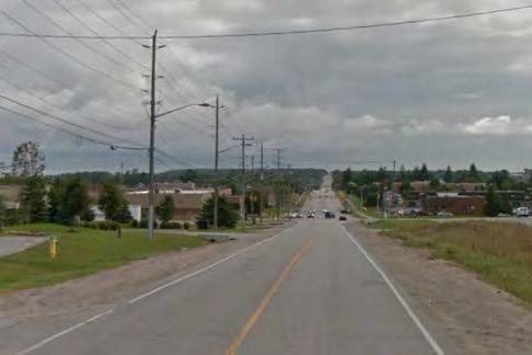


79 Bayview Dr looking S from Little Ave Bayview Dr looking N from Innisdale Heights (north access) Bayview Dr looking S from Innisdale Heights (north access) Bayview Dr looking N from Innisdale Heights (south access) Bayview Dr looking S from Innisdale Heights (south access) Bayview Dr looking N from Mollard Ct / The Source Bayview Dr looking S from Mollard Ct / The Source Bayview Dr looking N from The Source (south access) Bayview Dr looking S towards Big Bay Point Rd Bayview Dr looking N from Big Bay Point Rd Big Bay Point Rd looking W from Bayview Dr Big Bay Point Rd looking E from Bayview Dr Big Bay Point Rd looking W from 131 Big Bay Point Rd Big Bay Point Rd looking E from 131 Big Bay Point Rd Big Bay Point Rd looking W from Welham Rd Big Bay Point Rd looking E from Welham Rd Big Bay Point Rd looking W from 120 Big Bay Point Rd Big Bay Point Rd looking E from 120 Big Bay Point Rd Big Bay Point Rd looking E towards Huronia Rd Big Bay Point Rd looking W from Huronia Rd source: Class EA Phases 3 & 4 Report Figure Existing Conditions 7

80 , Class EA Phases 3 & 4 Report Existing Road Profile Bayview Drive 8 Figure

81 , Class EA Phases 3 & 4 Report Existing Road Profile Big Bay Point Road 9 Figure
82 Bayview Drive (255) (347) Huronia Road (28) (143) (83) 17 (43) (244) 408 (479) 148 (62) 484 (348) (369) 406 (22) 44 (453) 255 (283) (64) 207 (207) (282) (86) Little Avenue (269) (576) Welham Road 100 Weekday AM Peak Hour (100) Weekday PM Peak Hour (366) (177) (314) (439) (116) (458) (21) (188) (157) 198 (122) (100) (34) (43) 23 (44) (42) (186) (86) 73 (72) (453) Big Bay Point Road (455) Big Bay Point Road (413) 438 (691) 88 (85) 671 (660) 671 (660) 73 (63) 713 (563) 713 (563) 124 (97) 784 (582) (461) 441 (9) 16 (656) 466 (656) 466 (43) 74 (806) 374 (806) 374 (88) 30 (979) 389 (398) (557) (642) (54) 102 (216) (308) (101) (56) 72 (105) (29) (205) (76) 67 (107) (299) (251) (326) (152) (360) (625) (339) (657) Bayview Drive Welham Road Huronia Road, Class EA Phases 3 & 4 Report Figure 2015 Traffic Volumes 10
83 Bayview Drive (279) (380) Huronia Road (31) (156) (91) 19 (47) (266) 446 (524) 162 (68) 529 (381) (404) 444 (24) 48 (495) 279 (310) (70) 226 (226) (309) (94) Little Avenue (294) (629) Welham Road 100 Weekday AM Peak Hour (100) Weekday PM Peak Hour (418) (194) (379) (488) (127) (574) (92) (154) (171) 217 (134) (109) (37) (47) 25 (48) (132) (153) (93) 80 (79) (1066) Big Bay Point Road (1045) Big Bay Point Road (913) 1135 (1478) 72 (70) 1289 (1269) 1289 (1269) 80 (69) 1335 (1162) 1335 (1162) 101 (79) 1303 (1071) (1212) 1026 (102) 84 (1261) 895 (1261) 895 (47) 81 (1424) 795 (1424) 795 (250) 95 (1328) 674 (1007) (1153) (1028) (103) 195 (320) (252) (83) (61) 79 (115) (32) (224) (146) 129 (117) (245) (206) (327) (167) (379) (656) (371) (568) Bayview Drive Welham Road Huronia Road, Class EA Phases 3 & 4 Report Figure 2021 Traffic Volumes 11
84 Bayview Drive (323) (441) Huronia Road (36) (182) (106) 22 (54) (309) 518 (608) 188 (79) 614 (442) (469) 515 (28) 55 (574) 323 (359) (81) 263 (263) (358) (109) Little Avenue (341) (730) Welham Road 100 Weekday AM Peak Hour (100) Weekday PM Peak Hour (485) (225) (464) (566) (148) (712) (107) (179) (199) 251 (155) (127) (43) (55) 29 (56) (178) (177) (109) 93 (92) (1237) Big Bay Point Road (1212) Big Bay Point Road (1035) 1318 (1716) 84 (81) 1496 (1473) 1496 (1473) 93 (80) 1549 (1348) 1549 (1348) 118 (92) 1491 (1219) (1406) 1190 (118) 98 (1463) 1038 (1463) 1038 (55) 94 (1653) 922 (1653) 922 (336) 128 (1495) 765 (1168) (1338) (1147) (120) 226 (372) (293) (96) (71) 92 (133) (37) (260) (170) 149 (136) (284) (239) (379) (193) (440) (761) (430) (660) Bayview Drive Welham Road Huronia Road, Class EA Phases 3 & 4 Report Figure 2031 Traffic Volumes 12
85 Little Ave. 1 Major Intersections Little Ave. & Bayview Dr. 2. Bayview Dr. & Big Bay Point Rd. 3. Welham Rd. & Big Bay Point Rd. 4. Huronia Rd. & Big Bay Point Rd. Mollard Ct. 7 Minor Intersections/Driveways 8 5. Innisdale Secondary School (north access) & Bayview Dr. 6. Innisdale Secondary School (south access) & Bayview Dr. 7. Mollard Ct./The Source & Bayview Dr. 8. The Source (south access) & Bayview Dr Signal Control Stop Control, Class EA Phases 3 & 4 Report Existing Intersection Configurations 13 Figure
86 Little Ave. 1 Major Intersections Little Ave. & Bayview Dr. 2. Bayview Dr. & Big Bay Point Rd. 3. Welham Rd. & Big Bay Point Rd. 4. Huronia Rd. & Big Bay Point Rd. Mollard Ct. 7 Minor Intersections/Driveways 8 5. Innisdale Secondary School (north access) & Bayview Dr. 6. Innisdale Secondary School (south access) & Bayview Dr. 7. Mollard Ct./The Source & Bayview Dr. 8. The Source (south access) & Bayview Dr Signal Control Stop Control, Class EA Phases 3 & 4 Report Proposed Intersection Configurations Figure
 & Bayview Dr. 6. Innisdale Secondary School (south access) & Bayview Dr. 7. Mollard Ct./The Source & Bayview Dr. 8. The Source (south access) & Bayview Dr.")
87 Little Ave. 1 Major Intersections Little Ave. & Bayview Dr. 2. Bayview Dr. & Big Bay Point Rd. 3. Welham Rd. & Big Bay Point Rd. 4. Huronia Rd. & Big Bay Point Rd. Mollard Ct. 7 Minor Intersections/Driveways 8 5. Innisdale Secondary School (north access) & Bayview Dr. 6. Innisdale Secondary School (south access) & Bayview Dr. 7. Mollard Ct./The Source & Bayview Dr. 8. The Source (south access) & Bayview Dr Signal Control Stop Control, Class EA Phases 3 & 4 Report Proposed Intersection Configurations Figure
88 Ring Rd source: Google Earth, Class EA Phases 3 & 4 Report Bayview Drive Design Alternatives Cross Sections 16 Figure

89 Ring Rd source: Google Earth, Class EA Phases 3 & 4 Report Bayview Drive: Design Alternative 1 Plan View Figure 17a

90 Ring Rd source: Google Earth, Class EA Phases 3 & 4 Report Bayview Drive: Design Alternative 2 Plan View Figure 17b

91 Ring Rd source: Google Earth, Class EA Phases 3 & 4 Report Bayview Drive: Future Design Concept Plan View Figure 17c
92 Ring Rd source: Google Earth, Class EA Phases 3 & 4 Report Big Bay Point Road Design Alternatives Cross Sections Figure 18a
93 Ring Rd source: Google Earth, Class EA Phases 3 & 4 Report Big Bay Point Road Design Alternatives Cross Sections Figure 18b

94 Ring Rd source: Google Earth, Class EA Phases 3 & 4 Report Big Bay Point Road: Design Alternative A Plan View Figure 19a

95 Ring Rd source: Google Earth, Class EA Phases 3 & 4 Report Big Bay Point Road: Design Alternative B Plan View Figure 19b

96 Ring Rd source: Google Earth, Class EA Phases 3 & 4 Report Big Bay Point Road: Design Alternative C Plan View Figure 19c

97 Ring Rd source: Google Earth, Class EA Phases 3 & 4 Report Big Bay Point Road: Design Alternative D Plan View Figure 19d
98 Ring Rd source: Google Earth, Class EA Phases 3 & 4 Report Preferred Design Alternative Bayview Drive (Cross-Section) 20 Figure
 21")
99 Ring Rd source: Google Earth, Class EA Phases 3 & 4 Report Preferred Design Alternative Bayview Drive (Concept Plan) 21 Figure
100 Ring Rd source: Google Earth, Class EA Phases 3 & 4 Report Preferred Design Alternative Big Bay Point Road (Cross-Section) 22 Figure
 23")
101 Ring Rd source: Google Earth, Class EA Phases 3 & 4 Report Preferred Design Alternative Big Bay Point Road (Concept Plan) 23 Figure
Bistro 6. City of Barrie. Traffic Impact Study for Pratt Hansen Group Inc. Type of Document: Final Report. Project Number: JDE 1748
 City of Barrie Traffic Impact Study for Pratt Hansen Group Inc. Type of Document: Final Report Project Number: JDE 1748 Date Submitted: June 12 th, 2017 06/12/17 John Northcote, P.Eng. Professional License
DUNBOW ROAD FUNCTIONAL PLANNING
 DUNBOW ROAD FUNCTIONAL PLANNING Final Report August 3, 216 #31, 316 5th Avenue NE Calgary, AB T2A 6K4 Phone: 43.273.91 Fax: 43.273.344 wattconsultinggroup.com Dunbow Road Functional Planning Final Report
Welcome to the Open House
 Leslie Street Between 19 th Avenue and Stouffville Road Addendum to Class Environmental Assessment Study Welcome to the Open House Please sign in at the front desk. March 28, 2017 Richmond Green Sports
9 Leeming Drive Redevelopment Ottawa, ON Transportation Brief. Prepared By: Stantec Consulting Ltd.
 9 Leeming Drive Redevelopment Ottawa, ON Transportation Brief Prepared By: Stantec Consulting Ltd. TIA GUIDELINES CHECKLIST Report Context Municipal Address Comment: Section 1.1 Location relative to major
WELCOME TO OPEN HOUSE # 1 June 14, 2017
 Langstaff Road Weston Road to Highway 7 Class Environmental Assessment Study WELCOME TO OPEN HOUSE # 1 June 14, 2017 Please sign in and join our mailing list Purpose of Open House #1 & Study Area York
Sixth Line Development - Transit Facilities Plan
 Memorandum Date: November 13, 2012 To: From: c.c. Subject: Rob Freeman (Freeman Planning) Kevin Phillips Sixth Line Development - Transit Facilities Plan 33016631 This memo was prepared to review the transit
Welcome to the Public Meeting. Red Hill Business Park South Transportation Master Plan Addendum. December 4, :00 p.m. to 8:00 p.m.
 Welcome Welcome to the Transportation Master Plan Addendum December 4, 2012 6:00 p.m. to 8:00 p.m. Please sign-in Background PIC#1 Public Information Centre #1 (PIC#1) was held on June 25, 2012. Feedback
CITY OF VAUGHAN EXTRACT FROM COUNCIL MEETING MINUTES OF OCTOBER 30, 2012
 CITY OF VAUGHAN EXTRACT FROM COUNCIL MEETING MINUTES OF OCTOBER 30, 2012 Item 31, Report No. 39, of the Committee of the Whole, which was adopted without amendment by the Council of the City of Vaughan
TRANSPORTATION NEEDS ASSESSMENT
 TRANSPORTATION NEEDS ASSESSMENT A travel demand analysis was carried out to determine the operational issues and the potential benefit that adding traffic capacity would have on the road network. All the
Prepared For: Shieldbay Developments Inc. c/o Matson, McConnell Ltd. 2430A Bloor Street West Toronto, Ontario M6S 1P9.
 Prepared For: Shieldbay Developments Inc. c/o Matson, McConnell Ltd. 2430A Bloor Street West Toronto, Ontario M6S 1P9 Prepared By: URS Canada Inc. 4 th Floor, 30 Leek Crescent Richmond Hill, Ontario L4B
COUNTY ROAD 22 HORSESHOE VALLEY ROAD. Municipal Class Environmental Assessment. simcoe.ca
 OCTOBER 2014 Municipal Class Environmental Assessment COUNTY ROAD 22 HORSESHOE VALLEY ROAD Project A Truck Climbing Lanes Project B Intersection Improvements simcoe.ca CORPORATE COMMUNICATIONS DEPARTMENT
New Peterborough Regional Health Centre Road Network Improvements Environmental Study Report Addendum
 City of Peterborough New Peterborough Regional Health Centre Road Network Improvements Environmental Study Report Addendum Prepared by: AECOM 300 Water Street 905 668 9363 tel Whitby, ON, Canada L1N 9J2
Southcote Road Improvements Class Environmental Assessment Study
 1 Southcote Road Improvements Class Environmental Assessment Study Public Information Centre #1 May 24, 2018 Study Area 2 3 Welcome The Ancaster Transportation Master Plan (2011) outlined a long range
Casablanca Boulevard & GO Station Access
 Casablanca Boulevard & GO Station Access Class Environmental Assessment STAKEHOLDER WORKSHOP Thursday September 27th, 2018 5:30PM 8:00PM 1 WORKSHOP PURPOSE Provide an overview of the Design Alternatives
List of Display Boards
 List of Display Boards Welcome Introduction Municipal Class Environmental Assessment (EA) Process Need and Justification for an Interchange Alternatives for Evaluation Vertical and Horizontal Alignments
Municipal Class EA To Address Traffic Congestion On The Ontario Street Corridor (Grand Bend) Public Information Meeting June 4, 2018
 Public Information Meeting June 4, 2018") Municipal Class EA To Address Traffic Congestion On The Ontario Street Corridor (Grand Bend) Public Information Meeting June 4, 2018 Background Agenda Traffic Study Update Class EA Alternatives Bridge
Municipal Class EA To Address Traffic Congestion On The Ontario Street Corridor (Grand Bend) Public Information Meeting June 4, 2018 Background Agenda Traffic Study Update Class EA Alternatives Bridge
Design Criteria. Design Criteria
 F Design Criteria Design Criteria Ministry of Transportation Ministère des Transports DESIGN CRITERIA Page: 1 of 13 WORK PROJECT NO. N/A GO Bloomington Station TYPE OF PROJECT LOCATION Bloomington Road
OTTAWA TRAIN YARDS PHASE 3 DEVELOPMENT CITY OF OTTAWA TRANSPORTATION IMPACT STUDY. Prepared for:
 OTTAWA TRAIN YARDS PHASE 3 DEVELOPMENT CITY OF OTTAWA TRANSPORTATION IMPACT STUDY Prepared for: The Ottawa Train Yards Inc. 223 Colonnade Road South, Suite 212 Nepean, Ontario K2E 7K3 January 17, 2012
4. ENVIRONMENTAL IMPACT ANALYSIS 9. TRANSPORTATION AND TRAFFIC
 4. ENVIRONMENTAL IMPACT ANALYSIS 9. TRANSPORTATION AND TRAFFIC 4.9.1 INTRODUCTION The following section addresses the Proposed Project s impact on transportation and traffic based on the Traffic Study
Appendix O. Assessment of Bicycle Facility Alternatives
 Appendix O Assessment of Bicycle Facility Alternatives FINAL ASSESSMENT OF CROSS-SECTION ELEMENTS Lakeshore Road, from Mississaga Street to Dorval Drive Town of Oakville Submitted to: Town of Oakville
Recommended Roadway Plan Section 2 - Land Development and Roadway Access
 Recommended Roadway Plan Section 2 - Land Development and Roadway Access SECTION 2 Land Development and Roadway Access 2.1 Land Use and Access Management The Federal Highway Administration (FHWA) defines
City of Wayzata Comprehensive Plan 2030 Transportation Chapter: Appendix A
 A1. Functional Classification Table A-1 illustrates the Metropolitan Council s detailed criteria established for the functional classification of roadways within the Twin Cities Metropolitan Area. Table
Glenn Avenue Corridor Traffic Operational Evaluation
 Glenn Avenue Corridor Traffic Operational Evaluation PREPARED FOR: THE CITY OF AUBURN PREPARED BY: DECEMBER 2007 Glenn Avenue Corridor Study--Auburn, Alabama TABLE OF CONTENTS Introduction... 1 Background
INDUSTRIAL BUILDING 3009 HAWTHORNE ROAD CITY OF OTTAWA TRANSPORTATION OVERVIEW REVISED. Prepared for: Canada Inc.
 INDUSTRIAL BUILDING 3009 HAWTHORNE ROAD CITY OF OTTAWA TRANSPORTATION OVERVIEW REVISED Prepared for: 7849648 Canada Inc. Octiober 1, 2015 114-598 Overview_2.doc D. J. Halpenny & Associates Ltd. Consulting
AIRPORT ROAD ENVIRONMENTAL ASSESSMENT
 WELCOME TO PUBLIC INFORMATION CENTRE #1 AIRPORT ROAD ENVIRONMENTAL ASSESSMENT From Braydon Boulevard/Stonecrest Drive to Countryside Drive November 23, 2017 6:30 PM 8:30 PM Please sign in and fill out
The proposed development is located within 800m of an existing Transit Station where infill developments and intensification are encouraged.
 Stantec Consulting Ltd. 1331 Clyde Avenue, Suite 4 Ottawa ON K2C 3G4 Tel: (613) 722-442 Fax: (613) 722-2799 May 14, 213 File: 1638823 Robinson Park Development Corp. 5699 Power Road Ottawa, ON, K1G 3N4
Welcome. If you have any questions or comments on the project, please contact:
 Welcome This drop-in public open house is intended to provide information about the Bay Street bike lanes project. This project proposes a dedicated cycling facility along Bay Street between Aberdeen Avenue
Corporate. Report COUNCIL DATE: June 26, 2006 NO: C012 COUNCIL-IN-COMMITTEE. TO: Mayor & Council DATE: June 22, 2006
 Corporate NO: C012 Report COUNCIL DATE: June 26, 2006 COUNCIL-IN-COMMITTEE TO: Mayor & Council DATE: June 22, 2006 FROM: General Manager, Engineering FILE: 0410-20(MoT/Gate) SUBJECT: Surrey Response on
TRASBURG RANSPORTATION
 TRASBURG RANSPORTATION LAN DEVELOPED BY THE TRANSPORTATION PLANNING DIVISION OF THE VIRGINIA DEPARTMENT OF TRANSPORTATION IN COOPERATION WITH THE U.S. DEPARTMENT OF TRANSPORTATION, FEDERAL HIGHWAY ADMINISTRATION
APPENDIX 2 LAKESHORE ROAD TRANSPORTATION REVIEW STUDY EXECUTIVE SUMMARY
 APPENDIX 2 LAKESHORE ROAD TRANSPORTATION REVIEW STUDY EXECUTIVE SUMMARY Appendix 2 City of Mississauga Lakeshore Road FINAL REPORT Transportation Review Study December 2010 EXECUTIVE SUMMARY Study Purpose
Solana Beach Comprehensive Active Transportation Strategy (CATS)
") Solana Beach Comprehensive Active Transportation Strategy (CATS) 3.0 Goals & Policies The Solana Beach CATS goals and objectives outlined below were largely drawn from the Solana Beach Circulation Element
Solana Beach Comprehensive Active Transportation Strategy (CATS) 3.0 Goals & Policies The Solana Beach CATS goals and objectives outlined below were largely drawn from the Solana Beach Circulation Element
Intersection Traffic Control Feasibility Study
 Intersection Traffic Control Feasibility Study CSAH 9 at CSAH 60 (185th Avenue) Prepared For: Dakota County Transportation Department Western Service Center 14955 Galaxie Avenue, 3rd Floor Apple Valley,
South Street Campus Lands Development. City of London TRANSPORTATION IMPACT ASSESSMENT
 South Street Campus Lands Development City of London TRANSPORTATION IMPACT ASSESSMENT TW1387 South Street Campus Lands Development City of London TRANSPORTATION IMPACT ASSESSMENT May 2013 South Street
Classification Criteria
 SCHEDULE D TO RECOMMENDED OFFICIAL PLAN AMENDMENT NO. 40 SCHEDULE C-4 Road Criteria Criteria Traffic Service Objective Land Service/Access Typical Daily Traffic Volume Flow characteristics Travel Speed
MEDICAL/OFFICE BUILDING 1637 BANK STREET OTTAWA, ONTARIO TRANSPORTATION OVERVIEW. Prepared for:
 MEDICAL/OFFICE BUILDING 1637 BANK STREET OTTAWA, ONTARIO TRANSPORTATION OVERVIEW Prepared for: 2434984 Ontario Inc. 13-5510 Canotek Road Ottawa, Ontario K1J 9J5 June 4, 2015 115-613 Report_2.doc D. J.
TRAFFIC CALMING GUIDE FOR TORONTO CITY OF TORONTO TRANSPORTATION SERVICES DIVISION
 TRAFFIC CALMING GUIDE FOR TORONTO CITY OF TORONTO TRANSPORTATION SERVICES DIVISION CITY OF TORONTO TRANSPORTATION SERVICES DIVISION 2016 TRAFFIC CALMING GUIDE FOR TORONTO TABLE OF CONTENTS Introduction
Los Altos Hills Town Council - June 18, 2015 Palo Alto City Council June 22, AGENDA ITEM #2.B Presentation
 Los Altos Hills Town Council - June 18, 2015 Palo Alto City Council June 22, 2015 AGENDA ITEM #2.B Presentation Previous Presentations Los Altos Hills Town Council in May 2014 and February 2015 Palo Alto
HILTON GARDEN INN HOTEL HOTEL EXPANSION 2400 ALERT ROAD, OTTAWA TRANSPORTATION BRIEF. Prepared for:
 HILTON GARDEN INN HOTEL HOTEL EXPANSION 2400 ALERT ROAD, OTTAWA TRANSPORTATION BRIEF Prepared for: Bona Building & Management Co. Ltd. Place Vanier, 333 North River Road Vanier, Ontario K1L 8B9 October
102 Avenue Corridor Review
 February 26, 2015 102 Avenue Corridor Review Transportation Association of Canada Road Safety Engineering Award Submission for the City of Edmonton Introduction Transportation Association of Canada Road
WEST AND SOUTH WEST RING ROAD DOWNSTREAM TRAFFIC IMPACTS
 Page 1 of 9 EXECUTIVE SUMMARY Alberta Transportation ( AT ) is preparing to construct the final sections of the Calgary Ring Road. This includes the South West Ring Road ( SWRR ) (from Lott Creek Blvd
Report Purpose To seek Council s approval of the Wye Road Functional Planning Study (January 2015).
.") COUNCIL MEETING Meeting Date: March 10, 2015 Agenda Item #: 13.1 Wye Road Functional Planning Study (January 2015) Report Purpose To seek Council s approval of the Wye Road Functional Planning Study (January
COUNCIL MEETING Meeting Date: March 10, 2015 Agenda Item #: 13.1 Wye Road Functional Planning Study (January 2015) Report Purpose To seek Council s approval of the Wye Road Functional Planning Study (January
APPENDIX G: INTERSECTION NEEDS AT OKEECHOBEE BOULEVARD
 APPENDIX G: INTERSECTION NEEDS AT OKEECHOBEE BOULEVARD INTERSECTION NEEDS AT SR 7 and OKEECHOBEE BOULEVARD SR 7 Extension Project Development and Environment (PD&E) Study From Okeechobee Boulevard (SR
WELCOME PTH 59N - PTH 101 INTERCHANGE FUNCTIONAL DESIGN STUDY PUBLIC INFORMATION SESSION MONDAY, JUNE 13, :00 P.M. - 8:00 P.M.
 WELCOME - PTH 1 INTERCHANGE FUNCTIONAL DESIGN STUDY PUBLIC INFORMATION SESSION MONDAY, JUNE 13, 11 4:00 P.M. - 8:00 P.M. PROJECT STUDY AREA 1 Wenzel Street PR 2 Pritchard Farm Farm Road Road McGregor Farm
REPORT CONCURRENCE. City Manager. The General Manager concurs with the recommendation of this report.
 COUNCIL REPORT Report No. ENG 08-018 Executive Committee Date: May 0, 018 File No: 5400-1 To: From: Subject: Mayor and Council Purvez Irani, Senior Transportation Engineer Bluejay Street Road Improvements
Improving Cyclist Safety at the Dundas Street West and Sterling Road Intersection
 STAFF REPORT ACTION REQUIRED Improving Cyclist Safety at the Dundas Street West and Sterling Road Intersection Date: August 17, 2012 To: From: Wards: Reference Number: Public Works and Infrastructure Committee
JONESBORO HIGHWAY 63 HIGHWAY 18 CONNECTOR STUDY
 JONESBORO HIGHWAY 63 HIGHWAY 18 CONNECTOR STUDY Craighead County May 2007 JONESBORO HIGHWAY 63 HIGHWAY 18 CONNECTOR STUDY Craighead County May 2007 Prepared by Planning and Research Division Arkansas State
Alberta Highway 881. Corridor Management Plan. Session Forum 1 - Highways. Tri-Party Transportation Conference Moving Alberta Into the Future
 Tri-Party Transportation Conference Moving Alberta Into the Future Alberta Highway 881 Corridor Management Plan Lac La Biche to Anzac Session Forum 1 - Highways March 2017 INTRODUCTION + 241 km long, 2
Appendix A. Road Classification Review of Outstanding Issues and Proposed Classifications (All Wards) Staff Report Road Classification System
 Staff Report Road Classification System") Appendix A Road Classification Review of Outstanding Issues and Proposed Classifications (All Wards) Staff Report 2000 A.1 of A.10 A.2 of A.10 STAFF REPORT January 26, 2000 To: From: Works Committee Barry
Appendix A Road Classification Review of Outstanding Issues and Proposed Classifications (All Wards) Staff Report 2000 A.1 of A.10 A.2 of A.10 STAFF REPORT January 26, 2000 To: From: Works Committee Barry
QUICKIE C STORE AND GAS BAR 1780 HERON ROAD OTTAWA, ONTARIO TRANSPORTATION BRIEF. Prepared for:
 QUICKIE C STORE AND GAS BAR 1780 HERON ROAD OTTAWA, ONTARIO TRANSPORTATION BRIEF Prepared for: Quickie Convenience Stores Larny Holdings Ltd. c/o PBC Group April 15, 2015 115-615 Report_1.doc D. J. Halpenny
EXECUTIVE SUMMARY OF CALEDON TRANSPORTATION NEEDS STUDY
 EXECUTIVE SUMMARY OF CALEDON TRANSPORTATION NEEDS STUDY The Caledon Transportation Needs Study has been undertaken as a joint project by the Town of Caledon and the Region of Peel to determine the existing
Project Description Form 8EE
 Project Description Form 8EE Basic Project Information Submitting Jurisdiction/Agency: Town of Dumfries Project Title: Route 1 (Fraley Blvd) Widening: Brady's Hill Road to Dumfries Road Project Location:
Chapter 3 DESIGN SPECIFICATIONS
 Brampton PathWays Planning and Design Guidelines 27 Chapter 3 DESIGN SPECIFICATIONS 3.1 CLASS 1 MULTI-USE PATH Off-road multi-use trails are the backbone of the Brampton PathWays Network. They are typically
Clackamas County Comprehensive Plan
 ROADWAYS The County s road system permits the movement of goods and people between communities and regions, using any of a variety of modes of travel. Roads provide access to virtually all property. They
Americans with Disabilities Act Transition Plan for Public Right-of-Way Improvements
 Americans with Disabilities Act Transition Plan for Public Right-of-Way Improvements Prepared by: Public Works Department Engineering Division October 2015 Table of Contents Section I Introduction.. 3
REDEVELOPMENT TRAFFIC IMPACT STUDY
 REDEVELOPMENT TRAFFIC IMPACT STUDY For Wendy s Parker, Colorado January 215 Prepared for: Sterling Design Associates, LLC 29 W. Littleton Boulevard #3 Littleton, Colorado 812 Prepared by: 1233 Airport
OFFICE/RETAIL DEVELOPMENT 1625 BANK STREET OTTAWA, ONTARIO TRANSPORTATION BRIEF. Prepared for: Canada Inc.
 OFFICE/RETAIL DEVELOPMENT 1625 BANK STREET OTTAWA, ONTARIO TRANSPORTATION BRIEF Prepared for: 9402209 Canada Inc. December 15, 2015 115-625 Report_2.doc D. J. Halpenny & Associates Ltd. Consulting Transportation
REPORT. Engineering and Construction Department
 REPORT COMMUNITY SERVICES COMMITTEE MEETING DATE: JUNE 11, 2013 FROM: Engineering and Construction Department DATE: May 24, 2013 SUBJECT: Great Lakes Boulevard Mini Roundabout LOCATION: Great Lakes Boulevard
CONNECTIVITY PLAN. Adopted December 5, 2017 City of Virginia Beach
 CONNECTIVITY PLAN Adopted December 5, 2017 City of Virginia Beach CONTENTS 1.0 Background & Purpose... 2 2.0 Existing Inventory & Analysis... 3 ViBe District Existing Walking Conditions... 4 3.0 ViBe District
West Dimond Blvd Upgrade Jodhpur Street to Sand Lake Road
 West Dimond Blvd Jodhpur St to Sand Lake CSS Transportation Project Summary Municipality of Anchorage Project # 05 005 Project Manager: John Smith, P.E. (MOA PM&E) Project Administrator: Julie Makela,
Tonight is an opportunity to learn about the Study and ask questions of the Study Team members.
 Exhibit 1 Welcome Second Open House Tonight is an opportunity to learn about the Study and ask questions of the Study Team members. A first Public Open House was held on September 18th, 2013 which presented
4 DISRUPTION MANAGEMENT PLAN HIGHWAY 7 RAPIDWAY CONSTRUCTION BETWEEN BAYVIEW AVENUE AND WARDEN AVENUE TOWNS OF MARKHAM AND RICHMOND HILL
 4 DISRUPTION MANAGEMENT PLAN HIGHWAY 7 RAPIDWAY CONSTRUCTION BETWEEN BAYVIEW AVENUE AND WARDEN AVENUE TOWNS OF MARKHAM AND RICHMOND HILL The Transportation Services Committee recommends the adoption of
Chapter 4 Traffic Analysis
 Chapter 4 Traffic Analysis PURPOSE The traffic analysis component of the K-68 Corridor Management Plan incorporates information on the existing transportation network, such as traffic volumes and intersection
NEW YORK CENTRAL PARK SUBDIVISION BLAIS STREET/ST-PIERRE STREET EMBRUN, ONTARIO TRAFFIC IMPACT STUDY. Prepared for:
 NEW YORK CENTRAL PARK SUBDIVISION BLAIS STREET/ST-PIERRE STREET EMBRUN, ONTARIO TRAFFIC IMPACT STUDY Prepared for: Solidex Holdings Limited & Investissement Maurice Lemieux Investments Attn: Mr. Anthony
James M. Moore, Director of Planning & Building Services, Town of Fairfax. Victory Village Senior Housing Development Traffic Study
 Traffic Study To: From: James M. Moore, Director of Planning & Building Services, Town of Fairfax David Parisi, PE, TE, Parisi Transportation Consulting Date: October 14, 216 Subject: Victory Village Senior
FAIRFIELD INN & SUITES HOTEL 135 THAD JOHNSON PRIVATE OTTAWA TRANSPORTATION BRIEF. Prepared for:
 FAIRFIELD INN & SUITES HOTEL 135 THAD JOHNSON PRIVATE OTTAWA TRANSPORTATION BRIEF Prepared for: Bona Building & Management Co. Ltd. Place Vanier, 333 North River Road Vanier, Ontario K1L 8B9 August 12,
MEETING FACILITY 2901 GIBFORD DRIVE CITY OF OTTAWA TRANSPORTATION BRIEF. Prepared for: Holiday Inn Express 2881 Gibford Drive Ottawa, ON K1V 2L9
 MEETING FACILITY 2901 GIBFORD DRIVE CITY OF OTTAWA TRANSPORTATION BRIEF Prepared for: Holiday Inn Express 2881 Gibford Drive Ottawa, ON K1V 2L9 December 18, 2012 112-566 Brief_1.doc D. J. Halpenny & Associates
TRANSPORTATION IMPACT STUDY
 Dundas MEP Developments Inc. City of Toronto 219 and 231 Dundas Street East, Proposed Mixed-Use Development TRANSPORTATION IMPACT STUDY 9782/2 April 216 LEA Consulting Ltd. Consulting Engineers & Planners
2.0 LANE WIDTHS GUIDELINE
 2.0 LANE WIDTHS GUIDELINE Road Engineering Design Guidelines Version 2.0.1 May 2018 City of Toronto, Transportation Services City of Toronto Page 0 Background In early 2014, Transportation Services initiated
METHODOLOGY. Signalized Intersection Average Control Delay (sec/veh)
") Chapter 5 Traffic Analysis 5.1 SUMMARY US /West 6 th Street assumes a unique role in the Lawrence Douglas County transportation system. This principal arterial street currently conveys commuter traffic
Chapter 5 Traffic Analysis 5.1 SUMMARY US /West 6 th Street assumes a unique role in the Lawrence Douglas County transportation system. This principal arterial street currently conveys commuter traffic
HIGHBURY AVENUE/HAMILTON ROAD INTERSECTION IMPROVEMENTS PUBLIC INFORMATION CENTRE 1 MAY 14, 2015
 HIGHBURY AVENUE/HAMILTON ROAD INTERSECTION IMPROVEMENTS Municipal Class Environmental Assessment PUBLIC INFORMATION CENTRE 1 MAY 14, 2015 ACCESSIBILITY Under the Accessibility Standards 2015 for Customer
Roadway Classification Design Standards and Policies. Pueblo, Colorado November, 2004
 Roadway Classification Design Standards and Policies Pueblo, Colorado November, 2004 Table of Contents Page Chapter 1. General Provisions 1.1 Jurisdiction 3 1.2 Purpose and Intent 3 1.3 Modification 3
City of Hamilton s Transportation Master Plan (TMP) Public Consultation 3 December 2015
 Public Consultation 3 December 2015") City of Hamilton s Transportation Master Plan (TMP) Public Consultation 3 December 2015 McPhail Transportation Planning Services Ltd. AGENDA 6:00 7:00 pm Viewing Boards / Q & A with the Team 7:00 7:50
City of Hamilton s Transportation Master Plan (TMP) Public Consultation 3 December 2015 McPhail Transportation Planning Services Ltd. AGENDA 6:00 7:00 pm Viewing Boards / Q & A with the Team 7:00 7:50
Implementing Complete Streets in Ottawa. Project Delivery Process and Tools Complete Streets Forum 2015 October 1, 2015
 Implementing Complete Streets in Ottawa October 1, 2015 The Essentials Complete Streets Implementation Framework will become part of the routine delivery of City transportation projects Approach uses every
Figure 1: East West Connector Alignment Alternatives Concept Drawing
 Page 2 of 9 Figure 1: East West Connector Alignment Alternatives Concept Drawing The Montebello Drive extension will run north south and connect Wilsonville Road to the Boones Ferry Road to Brown Road
INDUSTRIAL BUILDING 1660 COMSTOCK ROAD CITY OF OTTAWA TRANSPORTATION OVERVIEW. Prepared for:
 INDUSTRIAL BUILDING 1660 COMSTOCK ROAD CITY OF OTTAWA TRANSPORTATION OVERVIEW Prepared for: Simluc Contractors Limited 2550 Blackwell Street, Ottawa K1B 5R1 October 18, 2013 113-584 Overview_1.doc D. J.
Highway 56 Traffic Study Rymal Road to Cemetery Road
 January 31, 2018 6:00 pm 8:00 pm Highway 56 Traffic Study Rymal Road to Cemetery Road City of Hamilton Public Meeting 2 2 Purpose of Public Meeting To review and obtain public input and comments on the
5 REQUEST FOR GRADE-SEPARATED PEDESTRIAN UNDERPASS CROSSINGS OF LESLIE STREET AND ST. JOHN S SIDEROAD TOWN OF AURORA
 5 REQUEST FOR GRADE-SEPARATED PEDESTRIAN UNDERPASS CROSSINGS OF LESLIE STREET AND ST. JOHN S SIDEROAD TOWN OF AURORA The Transportation Services Committee recommends the adoption of the recommendations
5.0 Roadway System Plan
 Southwest Boise Transportation Study Page 16 5.0 Roadway System Plan The Roadway System Plan outlines roadway improvements in the Initial Study Area. It forecasts future deficiencies on the arterial system,
2. NORTEL CARLING CAMPUS EXPANSION - PROPOSED MODIFICATIONS TO MOODIE DRIVE (REGIONAL ROAD 59) AND HIGHWAY 417 INTERCHANGE
 AND HIGHWAY 417 INTERCHANGE") 2. NORTEL CARLING CAMPUS EXPANSION - PROPOSED MODIFICATIONS TO MOODIE DRIVE (REGIONAL ROAD 59) AND HIGHWAY 417 INTERCHANGE COMMITTEE RECOMMENDATIONS AS AMENDED That Council approve: 1. The endorsement
2. NORTEL CARLING CAMPUS EXPANSION - PROPOSED MODIFICATIONS TO MOODIE DRIVE (REGIONAL ROAD 59) AND HIGHWAY 417 INTERCHANGE COMMITTEE RECOMMENDATIONS AS AMENDED That Council approve: 1. The endorsement
Walmart (Store # ) 60 th Street North and Marion Road Sioux Falls, South Dakota
 60 th Street North and Marion Road Sioux Falls, South Dakota") Walmart (Store #4865-00) 60 th Street North and Marion Road Sioux Falls, South Dakota Prepared for: Wal-Mart Stores, Inc. Bentonville, Arkansas Prepared by: Kimley-Horn and Associates, Inc. ã2013 Kimley-Horn
Walmart (Store #4865-00) 60 th Street North and Marion Road Sioux Falls, South Dakota Prepared for: Wal-Mart Stores, Inc. Bentonville, Arkansas Prepared by: Kimley-Horn and Associates, Inc. ã2013 Kimley-Horn
3.2.2 Proposed Road Network within Phase 1B Lands
 3.2.2 Proposed Road Network within Phase 1B Lands Figure 3.1 also shows the proposed road network within the Premier Gateway Phase 1B Employment Area lands, which features two collector roads providing
Appendix G: Future Conditions Traffic Analysis Memorandum
 ppendix G: Future Conditions Traffic nalysis Memorandum Prepared by: Bolton & Menk, Inc. Riverfront Drive Corridor Study ǀ T42.867 ppendix MEMORNDUM Date: pril, 27 To: Paul Vogel From: Ross B. Tillman,
General Plan Circulation Element Update Scoping Meeting April 16, 2014 Santa Ana Senior Center, 424 W. 3rd Street, Santa Ana, CA 92701
 General Plan Circulation Element Update Scoping Meeting April 16, 2014 Santa Ana Senior Center, 424 W. 3rd Street, Santa Ana, CA 92701 Meeting Agenda 1. Purpose of Scoping Meeting 2. Project Overview 3.
Welcome. The Brooklin Secondary Plan and Transportation Master Plan are collectively referred to as the Brooklin Study.
 Welcome The Town of Whitby is undertaking a study to prepare a Secondary Plan and Transportation Master Plan to guide and manage growth in the Brooklin area. The Brooklin Secondary Plan and Transportation
SECTION 1 - TRAFFIC PLANNING
 SECTION 1 - TRAFFIC PLANNING 1.1 TRAFFIC OPERATIONS 1.1.1 Roadway Functional Classification The Multnomah County Comprehensive Framework Plan s Policy 34: Trafficways and the Functional Classification
Arterial Management Plan for US Route 250 and State Route 623
 Arterial Management Plan for US Route 250 and State Route 623 June 25, 2014 Brad Shelton, AICP Access Management and Traffic Impact Analysis Programs Manager Transportation and Mobility Planning Division
Traffic Study North Shore School District 112
 Traffic Study North Shore School District 112 Proposed Expansion of Northwood Junior High School Prepared By: May 1, 2015 1. Introduction Kenig, Lindgren, O Hara, Aboona, Inc. (KLOA, Inc.) has been retained
Appendix C. NORTH METRO STATION AREA TRAFFIC IMPACT STATEMENT 88th Avenue Station
 Appendix C NORTH METRO STATION AREA TRAFFIC IMPACT STATEMENT 88th Avenue Station Prepared for: Regional Transportation Department and URS Corporation as part of the North Metro EIS David Evans and Associates,
Road Alterations - Wellington Street East, Church Street, and Front Street Intersection
 REPORT FOR ACTION Road Alterations - Wellington Street, Church Street, and Front Street Intersection Date: November 1, 2016 To: Toronto and York Community Council From: Director, Public Realm Section,
BLUE SEA VILLAGE MER BLEUE 2159 MER BLEUE ROAD OTTAWA, ONTARIO TRANSPORTATION IMPACT ASSESSMENT. Prepared for: Ontario Limited.
 BLUE SEA VILLAGE MER BLEUE 2159 MER BLEUE ROAD OTTAWA, ONTARIO TRANSPORTATION IMPACT ASSESSMENT Prepared for: 2534189 Ontario Limited April 6, 2018 117-668 TIA Report_2.doc D. J. Halpenny & Associates
Highway 49, Highway 351 and Highway 91 Improvements Feasibility Study Craighead County
 Highway 49, Highway 351 and Highway 91 Improvements Feasibility Study Craighead County Executive Summary March 2015 Highway 49, Highway 351 and Highway 91 Improvements Feasibility Study Craighead County
CITY OF WEST LAKE HILLS. Forest View Neighborhood Traffic Calming Study
 CITY OF WEST LAKE HILLS 901 South Mopac Expressway Building V, Suite 220 Austin, Texas 78746 Texas P.E. Firm Registration No. F-929 Klotz Associates Final Report Submittal: March 20, 2015 Revised Final
TRAFFIC IMPACT STUDY CRITERIA
 Chapter 6 - TRAFFIC IMPACT STUDY CRITERIA 6.1 GENERAL PROVISIONS 6.1.1. Purpose: The purpose of this document is to outline a standard format for preparing a traffic impact study in the City of Steamboat
Traffic Impact Study, Premier Gold Mines Limited, Hardrock Property
 Traffic Impact Study, Premier Gold Mines Limited, Hardrock Property Prepared for: Premier Gold Mines Limited Prepared by: Stantec Consulting Ltd. November 2014
Brian McHugh, Buckhead Community Improvement District. SUBJECT: Wieuca Road at Phipps Boulevard Intersection Improvements Project
 MEMO TO: FROM: Brian McHugh, Buckhead Community Improvement District Jagan Kaja, AICP, WSP Parsons Brinckerhoff SUBJECT: Wieuca Road at Phipps Boulevard Intersection Improvements Project DATE: October
TABLE OF CONTENTS TABLE OF CONTENTS... I APPENDICES... III LIST OF EXHIBITS... V LIST OF TABLES... VII LIST OF ABBREVIATED TERMS...
 TABLE OF CONTENTS TABLE OF CONTENTS... I APPENDICES... III LIST OF EXHIBITS... V LIST OF TABLES... VII LIST OF ABBREVIATED TERMS... IX 1 INTRODUCTION... 1 1.1 Project Overview... 1 1.2 Analysis Scenarios...
State Street and Pierce Park Lane Intersection Concept Report
 State Street and Pierce Park Lane Intersection Prepared for September 2017 Prepared by CITATION Parametrix. 2017. State Street & Pierce Park Lane Intersection. Prepared by Parametrix, Boise, ID. September
Transportation Impacts: Toronto York Spadina Subway Extension
 STAFF REPORT ACTION REQUIRED Transportation Impacts: Toronto York Spadina Subway Extension Date: June 6, 2011 To: From: Wards: Reference Number: North York Community Council Director, Transportation Services
Fieldgate. Traffic Impact Study Proposed Retail Commercial and Residential Development Thompson Road and Louis St. Laurent Avenue Town of Milton
 Fieldgate Traffic Impact Study Proposed Retail Commercial and Residential Development Thompson Road and Louis St. Laurent Avenue Town of Milton September 214 September 23 214 Ms Debbie Pacchiarotti Our
Donahue Drive Corridor Traffic Operational Evaluation
 Donahue Drive Corridor Traffic Operational Evaluation PREPARED FOR: THE CITY OF AUBURN PREPARED BY: JANUARY 2007 Donahue Drive Corridor Study--Auburn, Alabama TABLE OF CONTENTS Introduction... 1 Background