Investigation of Submarine Springs and other Karst Features in Coastal Regions of the SWFWMD
|
|
|
- Abel Robinson
- 5 years ago
- Views:
Transcription

1 Investigation of Submarine Springs and other Karst Features in Coastal Regions of the SWFWMD by David J. DeWitt, P.G. Southwest Florida Water Management District January 2004 FDEP Q- Meeting Clearwater Florida
2 PURPOSE Address persistent suggestions that an untapped potential water supply source may exist along the coastal margins of the District by identifying and locating possible offshore submarine springs. OBJECTIVES - Locate submarine springs in the Gulf coastal margin of the SWFWMD. - Characterize spring locations, ie. distance offshore, water depth, etc. - Describe spring vent geometry and flow characteristics relative to water depth, tidal stage, visible boil or flow at surface etc. - Collect water quality data from spring vents through tidal cycles.

3 Crescent Beach Spring Crystal Beach Spring SWFWMD Study Area from Kincaid, T.R. 1999, Morphologic and Fractal Characterization of Saturated Karstic Caves. Ph.D. Dissertation, University of Wyoming
4 Miles N
5 Radon concentrations from Gulf of Mexico water samples (Fanning, K., L. Torres, and J.A. Breland, II Ra-226 and Rn-222 along Florida s coasts, In Symposium on Natural Radiation and Technologically Enhanced Natural Radiation in Florida, pp , Florida Chap. Health Physics Society)

6 Upper Floridan Aquifer Potentiometric Surface 0 predevelopment surface 10 May 1998 surface GULF OF MEXICO
7 METHODS - Compile existing information on submarine springs - Conduct inquiries with other government agencies, local SCUBA divers and offshore fishing charters to identify unpublished spring locations - Analysis of GIS aerial photos to locate existing offshore springs and identify similar photographic features for possible spring locations. - Field reconnaissance and data collection at offshore spring sites.
8

9


10 Tampa Bay Spot < >

11 N

12

13 St. Petersburg Marina


14

15 Postcard illustration of the historical St. Petersburg waterfront showing the piers in Tampa Bay with bathhouses supplied by artesian wells.

16

17 CRYSTAL BEACH SPRING 1000 ft.


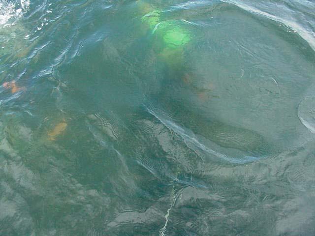
18 SWFWMD GIS 1999

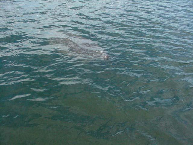
 Surface boil, Crystal Beach Spring")
19 Low altitude aerial photo of the Crystal Beach submarine spring (from Surface boil, Crystal Beach Spring photo taken in December of 2001.


20 from Divers Explore Cave s Secrets, by Edie Gross St. Petersburg Times, published May 3, 1998 from M. Garman, Karst Ecosystem Spotlight: Crystal Beach Springs, Florida, National Speleological Society North American Biospeleology Newsletter, No. 47, March 1999.

21
22

23

24
25 SPRING VENTS
26 Sept. 17, 2003 Discharge Measurement Data from Crystal Beach Spring measurement grid (top) and the contoured velocity data (bottom) resulting in a reported net instantaneous discharge of cfs or 14.7 mgd.

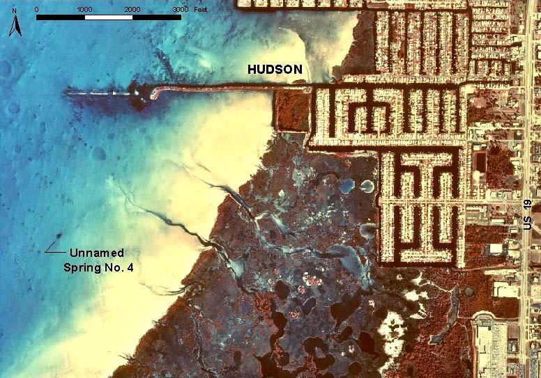
27 1999 aerial orthophoto of the Howard Park spring offshore of Tarpon Springs, northern Pinellas County

28
29 Cave map diagram of the Howard Park submarine spring, by Mike Emanuel (source,
30
31

32 N Feet ( from )
33 Nov- 2001: WATER QUALITY PROFILE, UNNAMED SPRING No. 4, PASCO COUNTY D.O. ph DEPTH (ft) SP COND (ms/cm) TEMP deg-c

34
35 Miles Cedar Island Spring HUDSON N
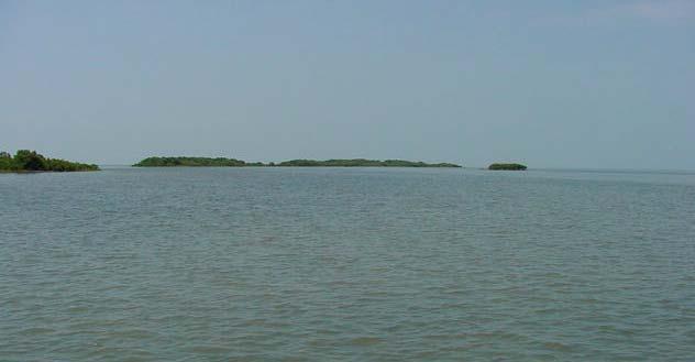
36 Close up aerial images of Cedar Island Spring offshore of Hudson, Pasco County Miles N
37 Nov- 2001: WATER QUALITY PROFILE, CEDAR ISLAND SPRING-EAST, PASCO COUNTY DEPTH (ft) DEPTH (ft) TEMP deg-c ph COND us/cm D.O. mg/l ~ 25 feet tagged depth SP COND (x 1000)

38
39 Close up view of the Jewfish Hole offshore spring offshore of Aripeka, Pasco County Feet N
40 0 April-2002: WATER QUALITY PROFILE, THE JEWFISH HOLE, PASCO COUNTY DEPTH (ft) TEMP ph COND D.O SP COND (x 1000) TEMP deg-c
41 Hernando County possible spring/sink karst features Pine Island Beach N Miles
42 Miles N Apparent karst features north of Pine Island, offshore Hernando County

43 CITRUS CO. HERNANDO CO.

44 N 1 MILE St. Martins River St. Martins Keys Little Homosassa River Maya Spring

45

46


47 St Martins- Maya Spring < visual inspection of vent Water-quality profiling with YSI datasonde >

48 35

49

50
51 Large Submarine Sink Features in the Gulf of Mexico Offshore of the SWFWMD
52 Upper Floridan Aquifer Potentiometric Surface 0 predevelopment surface 10 May 1998 surface
53 Schematic profile of the "Big Freshwater Spring" located offshore of Pinellas County. (unpublished sketch by William L. Wilson, based on a dive performed on July 27, 1991.)
54 Profile diagram of the Amberjack Hole, located in the Gulf of Mexico 32 miles offshore of Sarasota (by Curt Bowen, 1993).

55 Profile of Green Banana Sink, located in the Gulf of Mexico 50 miles offshore of Sarasota (from Underwater Speleology, Volume 21, Number 5, September/October 1994)

56 THINGS LEFT TO DO - Publish report on preliminary data and results - Conduct discharge measurements at flowing sites - Additional water-quality profiling and data collection - Continue search for additional potential sites - Work with other researchers on remote sensing techniques
Produce the most accurate discharge estimate possible by measuring a series point velocities within a selected submerged passage cross- section. METHO
 MAKING DISCHARGE MEASUREMENTS WITHIN SUBMERGED CONDUITS PRESENTED BY: PETE BUTT KARST ENVIRONMENTALSERVICES, INC. Produce the most accurate discharge estimate possible by measuring a series point velocities
Florida LAKEWATCH Expanding to the Coast? CITIZEN'SCIENCE'SINCE'1986'
 Florida LAKEWATCH Expanding to the Coast? CITIZEN'SCIENCE'SINCE'1986' Founder of Florida LAKEWATCH Dr. Daniel E. Canfield Jr. (1986) Lake Santa Fe 214 / 63 ( ) ( ) ( ) ( 0215 Florida LAKEWATCH Started
Mechanisms and Characteristics of High-Speed Reef Rip Current
 Mechanisms and Characteristics of High-Speed Reef Rip Current Ryuichiro Nishi, Mario P. de Leon, Kouji Horinouchi,Akira Ohtani, Nicholas C. Kraus, and Julianti K. Manu Many people utilize beaches, but
WALTON COUNTY NRDA ARTIFICIAL REEF PROGRAM
 WALTON COUNTY NRDA ARTIFICIAL REEF PROGRAM Melinda Gates Lauren Floyd Kathryn Brown Beau Suthard, PG Franky Stankiewicz Walton County - Coastal Resource Liaison APTIM - Senior Marine Biologist APTIM -
Passage Key Inlet, Florida; CMS Modeling and Borrow Site Impact Analysis
 Passage Key Inlet, Florida; CMS Modeling and Borrow Site Impact Analysis by Kelly R. Legault and Sirisha Rayaprolu PURPOSE: This Coastal and Hydraulics Engineering Technical Note (CHETN) describes the
What is Project Baseline?
 What is Project Baseline? A global network of highly skilled and organized SCUBA divers who are creating a lasting visual legacy of underwater conditions in oceans, lakes, rivers, springs, and caves all
1.0 PURPOSE AND NEED
 1.0 PURPOSE AND NEED 1.0 PURPOSE OF AND NEED FOR THE PROPOSED ACTION 1.1 INTRODUCTION The National Environmental Policy Act (NEPA) of 1969, as amended (42 United States Code Section 4321 et seq.); the
STATUS REPORT FOR THE SUBMERGED REEF BALL TM ARTIFICIAL REEF SUBMERGED BREAKWATER BEACH STABILIZATION PROJECT FOR THE GRAND CAYMAN MARRIOTT HOTEL
 August 23 STATUS REPORT FOR THE SUBMERGED REEF BALL TM ARTIFICIAL REEF SUBMERGED BREAKWATER BEACH STABILIZATION PROJECT FOR THE GRAND CAYMAN MARRIOTT HOTEL performed by Lee E. Harris, Ph.D., P.E. Consulting
Citrus, Hernando, and Pasco Coastal Hazard Analysis. Flood Risk Review Meeting Citrus, Hernando, and Pasco Counties, Florida December 14, 2017
 Citrus, Hernando, and Pasco Coastal Hazard Analysis Flood Risk Review Meeting Citrus, Hernando, and Pasco Counties, Florida December 14, 2017 Introductions Risk MAP Project Team FEMA Region IV RAMPP (study
Imagine that you can see a side view of a wave as it approaches a beach. Describe how the wave changes as the wave approaches the beach.
 Geology 101 Name Reading Guide for Ch. 19: Shores and Coastal Processes (p. 612) Waves, Currents, and Tides (p. 614) Waves and Currents (p. 614) Imagine that you can see a side view of a wave as it approaches
Volume and Shoreline Changes along Pinellas County Beaches during Tropical Storm Debby
 Volume and Shoreline Changes along Pinellas County Beaches during Tropical Storm Debby Ping Wang and Tiffany M. Roberts Coastal Research Laboratory University of South Florida July 24, 2012 Introduction
SPRINGS INITIATIVE MONITORING NETWORK ANNUAL REPORT ( )
") SPRINGS INITIATIVE MONITORING NETWORK ANNUAL REPORT (2001-2006) Debra Harrington and Gary Maddox FDEP Groundwater Protection WATERSHED MONITORING MEETING October, 2008 INTEGRATED SPRING ASSESSMENTS IDENTIFY
SPRINGS INITIATIVE MONITORING NETWORK ANNUAL REPORT (2001-2006) Debra Harrington and Gary Maddox FDEP Groundwater Protection WATERSHED MONITORING MEETING October, 2008 INTEGRATED SPRING ASSESSMENTS IDENTIFY
Inlet Management Study for Pass-A-Grille and Bunces Pass, Pinellas County, Florida
 Inlet Management Study for Pass-A-Grille and Bunces Pass, Pinellas County, Florida Final Report Submitted By Ping Wang, Ph.D., Jun Cheng Ph.D., Zachary Westfall, and Mathieu Vallee Coastal Research Laboratory
SFM mapping of coastal erosion at Point Woronzof. Gennady Gienko, PhD Department of Geomatics, UAA
 SFM mapping of coastal erosion at Point Woronzof Gennady Gienko, PhD Department of Geomatics, UAA ggienko@alaska.edu POINT WORONZOF Point Woronzof bluff 135 ft elevation Point Woronzof bluff Pt. Woronzof
UMass Boston Waterfront at a glance
 UMass Boston Waterfront at a glance Fox Point Pavilion Over the years, the Fox Point Landing has been a rest area, an outdoor classroom and a general meeting place for students, staff and faculty of the
Eelgrass Survey Reporting Form 2222 Channel Road Newport Beach, CA Eelgrass (Zostera marina) Survey
 Survey") Eelgrass Survey Reporting Form 2222 Channel Road Newport Beach, CA 92660 Eelgrass (Zostera marina) Survey Survey Date: July 19th, 2013 Report Date: July 26 th, 2013 Prepared by: Coastal Resources Management,
Eelgrass Survey Reporting Form 2222 Channel Road Newport Beach, CA 92660 Eelgrass (Zostera marina) Survey Survey Date: July 19th, 2013 Report Date: July 26 th, 2013 Prepared by: Coastal Resources Management,
Artificial Reef Uses. Mitigation Shore Protection Scientific Studies Habitat Creation Conservation Economic Stimulus Diver Attractions
 Artificial Reef Uses Mitigation Shore Protection Scientific Studies Habitat Creation Conservation Economic Stimulus Diver Attractions Barbados Study The Relationship between Diver Experience Levels and
Long Term Success and Future Approach of the Captiva and Sanibel Islands Beach Renourishment Program
 2017 National Conference on Beach Preservation Technology February 8-10, 2017; Stuart, Florida Long Term Success and Future Approach of the Captiva and Sanibel Islands Beach Renourishment Program Thomas
Florida Waterfront Home
 Florida Waterfront Home Waterfront Home on the Withlacoochee River On Florida s Beautiful Nature Coast Single Family Home, Corporate Retreat or Joint Ownership Fishing Resort Dedicated Website: www.yankeetownrealestate.com
CORTEZ GROINS RECONSTRUCTION PROJECT FEASIBILITY STUDY AND 2012 HURRICANE SEASON IMPACTS
 Charlie Hunsicker Manatee County Natural Resources Department & Thomas P. Pierro, P.E., D.CE Coastal Planning & Engineering, Inc. 1 Project Location Cortez Beach is located on the west coast of Florida
The In-store C-card Printer (ISCP)
") The In-store C-card Printer (ISCP) Take control of your student s C-cards Print them at your facility today! Another first from SDI-TDI-ERDI You can brand your facility globally with the new Dealer logo
The In-store C-card Printer (ISCP) Take control of your student s C-cards Print them at your facility today! Another first from SDI-TDI-ERDI You can brand your facility globally with the new Dealer logo
EXPEDITION ADVENTURE PART 2: HIGHER RESOLUTION RANGE SEISMIC IMAGING TO LOCATE A SUNKEN PIRATE SHIP OFF ILE ST MARIE.
 EXPEDITION ADVENTURE PART 2: HIGHER RESOLUTION RANGE SEISMIC IMAGING TO LOCATE A SUNKEN PIRATE SHIP OFF ILE ST MARIE. Jakob B.U. Haldorsen, and Douglas E. Miller, Schlumberger-Doll Research, Ridgefield,
Doug Leeper, Senior Environmental Scientist Resource Conservation and Development Department Southwest Florida Water Management District
 February 4, 2003 MEMORANDUM TO: FROM: SUBJECT: File Doug Leeper, Senior Environmental Scientist Resource Conservation and Development Department Southwest Florida Water Management District Proposed minimum
Point LaBarbe/McGulpin Point Response April 2 May 8, 2018 Regional Response Team 3 Meeting November, 2018
 Point LaBarbe/McGulpin Point Response April 2 May 8, 2018 Regional Response Team 3 Meeting November, 2018 TJ Mangoni District Response Advisory Team Supervisor Ninth Coast Guard District 216-214-4285 Summary
VIDEO TRANSCRIPT. A Proposal to Expand the Flower Garden Banks National Marine Sanctuary An interview with Sanctuary Superintendent, G.P.
 VIDEO TRANSCRIPT A Proposal to Expand the Flower Garden Banks National Marine Sanctuary An interview with Sanctuary Superintendent, G.P. Schmahl (Opening scene of Flower Garden Banks National Marine Sanctuary
High Definition Laser Scanning (HDS) Underwater Acoustic Imaging and Profiling
 Underwater Acoustic Imaging and Profiling") High Definition Laser Scanning (HDS) Underwater Acoustic Imaging and Profiling Images at Depth: The Use of Acoustic Imaging on Large River Crossings A Case Study AGENDA Background of project Review of
High Definition Laser Scanning (HDS) Underwater Acoustic Imaging and Profiling Images at Depth: The Use of Acoustic Imaging on Large River Crossings A Case Study AGENDA Background of project Review of
Snorkeling The Florida Keys By Brad Bertelli
 Snorkeling The Florida Keys By Brad Bertelli Islamorada snorkeling aboard the Happy Cat in Robbie's Marina Snorkeling from the shore is not the norm in the Florida Keys. Vacationers buy their equipment
Mitsui Engineering & Shipbuilding Co., LTD. Kenji NAGAHASHI
 Mitsui Engineering & Shipbuilding Co., LTD. Kenji NAGAHASHI kenji_nagahashi@mes.co.jp Contents 1. Underwater Robots produced by MES 2. Future Concept 2 Image of Underwater Works Research Vessel Communication
Another essential characteristic of boat channel geography is the form and spacing of channel
 Another essential characteristic of boat channel geography is the form and spacing of channel segments.some channels are simple, and others are complex. The channel systems include: finger canals or basins;
CALL FOR OFFERS - MONDAY, AUG. 31 st Redevelopment Opportunity PRIME ATLANTIC BEACH CORNER 3 BLOCKS TO THE OCEAN
 CALL FOR OFFERS - MONDAY, AUG. 31 st Redevelopment Opportunity PRIME ATLANTIC BEACH CORNER 3 BLOCKS TO THE OCEAN 104 ATLANTIC BEACH CAUSEWAY ATLANTIC BEACH, NORTH CAROLINA, 28512 Morehead City Atlantic
Summary Report for Sarasota Bay
 Summary Report for Sarasota Bay Contacts: Jay Leverone, Sarasota Bay Estuary Program Jon Perry and Rene Janneman, Sarasota County Greg Blanchard, Manatee County Kristen Kaufman, Southwest Florida Water
Collaborative. City of Stuart. September 7, Mark Perry, Executive Director Oceanographic Society. Upper Chain of Lakes
 Lake Okeechobee Collaborative Upper Chain of Lakes Lake Kissimmee Indian River Lagoon City of Stuart September 7, 2016 Kissimmee River Caloosahatchee Estuary Lake Okeechobee St. Lucie Estuary Everglades
DOD Legacy Project No Contract No. HQ Dr. Paul Ayers, Emine Fidan, Mary Beth Iannuzzi University of Tennessee
 Habitat Mapping for Aquatic Species at Risk on Military Installations using GPS based Underwater Video DOD Legacy Project No. 15 776 Contract No. HQ0034 15 2 0012 Dr. Paul Ayers, Emine Fidan, Mary Beth
Lee E. Harris, Ph.D., P.E. Assoc. Professor of Ocean Engineering. Doug Bowlus and Ashley Naimaster Ocean Engineering Graduate Students
 FLORIDA TECH OCEAN ENGINEERING PROFESSOR LEE HARRIS AND HIS GRADUATE STUDENTS ASSIST WITH POST-HURRICANE IVAN CORAL REEF RESTORATION IN THE CAYMAN ISLANDS Lee E. Harris, Ph.D., P.E. Assoc. Professor of
What You ll Learn. Image credit, Bryan Fluech
 What You ll Learn 1. Useful information on scalloping regulations, safety, and handling practices 2. Basic biology and life history of the bay scallop 3. How bay scallop populations are monitored in Florida
Name Class Date. Subtracting Rational Numbers
 1 Name Class Date Subtracting Integers Connection: Rational Numbers Essential question: How do you subtract rational numbers? CC.7.NS.1c EXPLORE Subtracting Rational Numbers 2-3 video tutor A The temperature
CLEARWATER COMPREHENSIVE BOATING PLAN PUBLIC OUTREACH MEETING 2. December 16, 2015
 CLEARWATER COMPREHENSIVE BOATING PLAN PUBLIC OUTREACH MEETING 2 December 16, 2015 Introduction Project Team City of Clearwater Bill Morris Director of Marine and Aviation Kyle Brotherton Planning and Development
Tanya M. Beck. Kelly Legault. Research Physical Scientist Coastal & Hydraulics Lab, ERDC Vicksburg, MS
 Inlet And Adjacent Shoreline Processes at Cascading Time Scales Using the Coastal Modeling System and GenCade Tanya M. Beck Research Physical Scientist Coastal & Hydraulics Lab, ERDC Vicksburg, MS Kelly
RSA Efforts in the Tampa Bay Area
 RSA Efforts in the Tampa Bay Area Presentation to the RSA Regional Peer Exchange April 29, 2008 -- Little Rock, Arkansas Peter Hsu, PE, Florida Department of Transportation District 7 Overview Introduction
JIMAR PFRP ANNUAL REPORT FOR FY 2006
 JIMAR PFRP ANNUAL REPORT FOR FY 2006 P.I./Sponsor Name: Michael P. Seki and Jeffrey J. Polovina Project Proposal Title: Oceanographic Characterization of the American Samoa Longline Fishing Grounds for
Ivan-like hurricane storm surge simulations for Tampa Bay, FL with 3-D and 2-D models
 Ivan-like hurricane storm surge simulations for Tampa Bay, FL with 3-D and 2-D models R.H. Weisberg and L. Zheng Storm Surge Workshop St. Pete Beach 2/11/09 Potential for Tampa Bay area inundation is large
page - Laboratory Exercise #5 Shoreline Processes
 page - Laboratory Exercise #5 Shoreline Processes Section A Shoreline Processes: Overview of Waves The ocean s surface is influenced by three types of motion (waves, tides and surface currents). Shorelines
ISOTOPIC AND CHEMICAL CHARACTERISATION OF COASTAL AND SUBMARINE KARSTIC GROUNDWATER DISCHARGES IN SOUTHERN TURKEY (12570/R0)
") ISOTOPIC AND CHEMICAL CHARACTERISATION OF COASTAL AND SUBMARINE KARSTIC GROUNDWATER DISCHARGES IN SOUTHERN TURKEY (1257/R) N. Nur OZYURT C. Serdar BAYARI Hacettepe University Dept. Of Geological Engineering
ISOTOPIC AND CHEMICAL CHARACTERISATION OF COASTAL AND SUBMARINE KARSTIC GROUNDWATER DISCHARGES IN SOUTHERN TURKEY (1257/R) N. Nur OZYURT C. Serdar BAYARI Hacettepe University Dept. Of Geological Engineering
Population workforce, and employment in Florida :
 University of South Florida Scholar Commons College of Business Publications College of Business 1-1-2000 Population workforce, and employment in Florida : 1999-2000 University of South Florida. Center
Environmental. Effects of Dredging
 Envi~onmental Effects of Dredging Technical Notes THE VALUE OF GRAVEL DISPOSAL MOUNDS IN RIVER SIDE CHANNELS FOR FRESHWATER MUSSELS PURPOSE: This note provides information on the value of gravel disposal
Diver The Work
 Diver Divers carry out a range of tasks underwater, either inshore (such as rivers or lochs) or offshore (sea and ocean), depending on the type of diving and what industry they work in. This could include
US Sugar Land Purchase, River of Grass Project, SugarHill Sector Plan, Amendment 1
 US Sugar Land Purchase, River of Grass Project, SugarHill Sector Plan, Amendment 1 Rivers Coalition September 24, 2014 Upper Chain of Lakes Lake Kissimmee Kissimmee River Caloosahatchee Estuary Lake Okeechobee
San Diego Coastal Ocean Observing System
 California Clean Beaches Initiative San Diego Coastal Ocean Observing System WWW.SDCOOS.ORG Presentation to Imperial Beach City Council August 3, 2005 Eric J. Terrill, Ph.D. Scripps Institution of Oceanography
Didemnum. The first 5 years at Edmonds, WA. Tunicate Control Efforts by Volunteer Recreational Divers focused on Didemnum cf lahillei
 Didemnum The first 5 years at Edmonds, WA Tunicate Control Efforts by Volunteer Recreational Divers focused on Didemnum cf lahillei Bruce Higgins Volunteer Coordinator Edmonds Underwater Park, Edmonds
Modeling Sediment Transport Along the Upper Texas Coast
 Modeling Sediment Transport Along the Upper Texas Coast David B. King Jr. Jeffery P. Waters William R. Curtis Highway 87 roadbed, Jefferson County Galveston District Corps Sabine Pass to San Luis Pass
LITTLE LAGOON & LITTLE LAGOON PASS: RESEARCH UPDATES & DIRECTIONS
 LITTLE LAGOON & LITTLE LAGOON PASS: RESEARCH UPDATES & DIRECTIONS Bret M. Webb, PhD, PE, DCE Professor Department of Civil, Coastal, and Environmental Engineering October 19, 2017 LLPS Meeting Acknowledgments
g) Use the map compass to provide the general locality of the knoll on the chart.
 Use the map compass to provide the general locality of the knoll on the chart.") The horizontal scale (x axis) of your cross-section/profile is the linear map distance between point A and point B on the map (or between X and Y and Z). It conforms to the map scale. In other words, the
The horizontal scale (x axis) of your cross-section/profile is the linear map distance between point A and point B on the map (or between X and Y and Z). It conforms to the map scale. In other words, the
Appendix E Cat Island Borrow Area Analysis
 Appendix E Cat Island Borrow Area Analysis ERDC/CHL Letter Report 1 Cat Island Borrow Area Analysis Multiple borrow area configurations were considered for Cat Island restoration. Borrow area CI1 is located
Summary of SCUBA Diving Operations Conducted From R/V Fulmar Fiscal Year 2010
 Summary of SCUBA Diving Operations Conducted From R/V Fulmar Fiscal Year 2010 Prepared by Chad King Monterey Bay National Marine Sanctuary November 10, 2010 Unit or Line Office Primary Diving Mission/Task:
AGE GROUP: Men s and Women s open and master s. Depending on interest we could have separate divisions such open and possibly 30+.
 The 2 nd annual College Alumni Invitational Water Polo Tournament will be held on Saturday/ Sunday, February 22-23, 2014 at the Long Center in Clearwater, FL with a golf tournament held in conjunction
Review of drowning case from Crystal Lake and the discovery of the victim 9 years after the drowning
 Review of drowning case from Crystal Lake and the discovery of the victim 9 years after the drowning g 1 Crystal Lake is a freshwater lake in Northwestern Michigan s Benzie county It is spring fed and
HISTORICAL DEVELOPMENT OF SOUTHWEST FLORIDA WATERWAYS The Boating Geography of Southwest Florida Before Coastal Development
 Lemon (Volume 1) Gasparilla Gasparilla Boca Grande Gasparilla The "Cut Off" Boca Nueva (Little Gasparilla ) Devilfish Key Cayo Pelau Gasparilla to San Carlos (45 miles) HISTORICAL DEVELOPMENT OF SOUTHWEST
Beach Renourishment in Jacksonville
 Beach Renourishment in Jacksonville Kevin Bodge, PhD, P.E. - Olsen Associates, Inc. 1978 Oct 2004 2000 2016 2011 Oct 2016 Coastal Duval County, FL Nassau Sound Blount Island Ft. George Inlet St. Johns
I. Introduction. Lesson title: How does pressure effect a scuba diver at different depths?
 I. Introduction Lesson title: How does pressure effect a scuba diver at different depths? Grade level audience: Regents Chemistry 11th Grade Lesson overview: Students have been introduced to the definition
SALINITY AND DISSOLVED OXYGEN IN THE MISSISSIPPI RIVER GULF OUTLET NAVIGATION CHANNEL AND IN ADJACENT SURFACE WATERS,
 SALINITY AND DISSOLVED OXYGEN IN THE MISSISSIPPI RIVER GULF OUTLET NAVIGATION CHANNEL AND IN ADJACENT SURFACE WATERS, 2008-2012 Southeast Louisiana Flood Protection Authority-East Coastal Advisory Committee
The Storm Surge Hazard 2018 TS-8 Tropical Meteorology 2
 The Storm Surge Hazard 2018 TS-8 Tropical Meteorology 2 Daniel Noah National Weather Service Tampa Bay daniel.noah@noaa.gov Tropical Cyclone Storm Surge Is a large dome of water, often 50 to 100 miles
SMOOTH HAMMERHEAD SHARK (HHS)
") SMOOTH HAMMERHEAD SHARK (HHS) (Sphyrna zygaena) HHS1 1. FISHERY SUMMARY Smooth hammerhead sharks (Sphyrna zygaena) are not currently managed under the QMS. No assigned fishing allowances exist. However,
SMOOTH HAMMERHEAD SHARK (HHS) (Sphyrna zygaena) HHS1 1. FISHERY SUMMARY Smooth hammerhead sharks (Sphyrna zygaena) are not currently managed under the QMS. No assigned fishing allowances exist. However,
UNDERWATER BRIDGE INSPECTION REPORT STRUCTURE NO CSAH NO. 9 OVER THE BLUE EARTH RIVER DISTRICT 7 - BLUE EARTH COUNTY
 UNDERWATER BRIDGE INSPECTION REPORT STRUCTURE NO. 07542 CSAH NO. 9 OVER THE BLUE EARTH RIVER DISTRICT 7 - BLUE EARTH COUNTY PREPARED FOR THE MINNESOTA DEPARTMENT OF TRANSPORTATION BY COLLINS ENGINEERS,
EVALUATION OF BEACH EROSION UP-DRIFT OF TIDAL INLETS IN SOUTHWEST AND CENTRAL FLORIDA, USA. Mohamed A. Dabees 1 and Brett D.
 EVALUATION OF BEACH EROSION UP-DRIFT OF TIDAL INLETS IN SOUTHWEST AND CENTRAL FLORIDA, USA Mohamed A. Dabees 1 and Brett D. Moore 1 The paper discusses the analysis of up-drift beach erosion near selected
A Preliminary Review of Beach Profile and Hardbottom Interactions
 A Preliminary Review of Beach Profile and Hardbottom Interactions Douglas W. Mann, P.E., D.CE. CB&I A World of Solutions Presentation Goal Lead to a better understanding of the challenges regarding the
COASTAL ENVIRONMENTS. 454 lecture 12
 COASTAL ENVIRONMENTS Repeated movement of sediment & water constructs a beach profile reflecting the balance between average daily or seasonal wave forces and resistance of landmass to wave action Coasts
Understanding Offshore Wind s Enhanced Peak Load Coincidence for East Coast Transmission Systems
 WINDPOWER 2013 Conference Chicago, May 8, 2013 Understanding Offshore Wind s Enhanced Peak Load Coincidence for East Coast Transmission Systems Bruce Bailey, Ph.D. President/CEO Co Authors: Whitney Wilson,
FOR INFORMATION ONLY. Gold Coast Seaway Channel Scour and Rock Wall Stability Investigation. R.B doc December 2011
 A part of BMT in Energy and Environment Gold Coast Seaway Channel Scour and Rock Wall Stability Investigation R.B18625.001.00.doc December 2011 Gold Coast Seaway Channel Scour and Rock Wall Stability Investigation
Echo Sounder Evaluation of XBT Drop Rate off the coast of Florida
 Echo Sounder Evaluation of XBT Drop Rate off the coast of Florida Lockheed Martin Sippican Grant Johnson Engineering Project Manager Ocean Products 9/22/2010 1 Introduction New fall rate evaluation approach
WELCOME TO THE CLUB HERE, YOU WILL EXPERIENCE THE VERY ESSENCE OF THE FLORIDA KEYS AND BE IMMERSED IN THE TIMELESS BOATING TRADITIONS OF THE REEF.
 THE MARINA WELCOME TO THE CLUB HERE, YOU WILL EXPERIENCE THE VERY ESSENCE OF THE FLORIDA KEYS AND BE IMMERSED IN THE TIMELESS BOATING TRADITIONS OF THE REEF. The distinct Ocean Reef Club harbor leads
NERC GEOPHYSICAL EQUIPMENT FACILITY LOAN 904 SCIENTIFIC REPORT
 NERC GEOPHYSICAL EQUIPMENT FACILITY LOAN 904 SCIENTIFIC REPORT M. Disney, N. MacBean Department of Geography, University College London, Pearson Building, Gower Street, London, WC1E 6BT. Tel. 020 7679
A Computational Assessment of Gas Jets in a Bubbly Co-Flow 1
 A Computational Assessment of Gas Jets in a Bubbly Co-Flow 1 Melissa Fronzeo*, 1 Michael Kinzel 1 The Pennsylvania State University, University Park, PA, USA Abstract In this effort, Computational Fluid
2018 Class 2A District 8 Swimming and Diving Championships Florida High School Athletic Association
 2018 Class 2A District 8 Swimming and Diving Championships Florida High School Athletic Association Location: Swimming: Diving: The Long Center Clearwater High School 1501 N. Belcher Rd. 540 S. Hercules
Texas passes, longshore transport, hurricanes, beach erosion and sea level
 Texas passes, longshore transport, hurricanes, beach erosion and sea level Richard L. Watson, Ph.D. (361) 749-4152 Field work can be strange! 120,000 years of sea level Years each zone exposed above S/L
UNDERWATER ARCHAEOLOGY Pickles Reef Florida Keys National Marine Sanctuary
 UNDERWATER ARCHAEOLOGY Pickles Reef Florida Keys National Marine Sanctuary MAHS Survey and Field School 2011 MAHS returned to Florida in June of 2011 to continue a survey of Pickles Reef begun in 2010.
Effectiveness of Beach Nourishment in Response to Sea Level Rise
 2014 FSBPA Annual Conference Effectiveness of Beach Nourishment in Response to Sea Level Rise Navarre Beach Santa Rosa County July 18, 2005 Lovers Key Lee County April 23, 2012 South County St. Lucie County
Assessment of Elizabeth Lake as a Potential Candidate for Stocking
 Assessment of Elizabeth Lake as a Potential Candidate for Stocking Region 1, Nanaimo West Coast Planning Unit Ministry of Water, Land and Air Protection Prepared by: Laura Cassin Scott Silvestri 2002 1.0
Ocean Exploration and Human Impact. By: Carly Coupal, Logan Hoeppner, and Sydney McMichael
 Ocean Exploration and Human Impact By: Carly Coupal, Logan Hoeppner, and Sydney McMichael Scuba Divers Scuba divers are people that wear underwater suits and have air tanks called an breathing apparatus
Pinellas County Metropolitan Planning Organization (MPO) 2014 Crash Data Report
 2014 Crash Data Report") Pinellas County Metropolitan Planning Organization (MPO) 2014 Crash Data Report MPO Board July 8, 2015 2 Crash Data Collection Motorcycle drove between stopped cars, ran a red light and collided with a
Pinellas County Metropolitan Planning Organization (MPO) 2014 Crash Data Report MPO Board July 8, 2015 2 Crash Data Collection Motorcycle drove between stopped cars, ran a red light and collided with a
UNDERWATER BRIDGE INSPECTION REPORT STRUCTURE NO CSAH NO. 7 OVER THE SNAKE RIVER DISTRICT 1 - PINE COUNTY
 UNDERWATER BRIDGE INSPECTION REPORT STRUCTURE NO. 58506 CSAH NO. 7 OVER THE SNAKE RIVER DISTRICT 1 - PINE COUNTY PREPARED FOR THE MINNESOTA DEPARTMENT OF TRANSPORTATION BY COLLINS ENGINEERS, INC. JOB NO.
Collect marine debris around the coral reef areas surrounding Ao Nang and Phi Phi National Park.
 Dive Against Debris Survey PROJECTS ABROAD THAILAND By: Diego Fernandez Raboso. Field Coordinator 1. Introduction 2. Study area 3. Methodology 4. Results 5. Conclusions 1.Introduction The aims of the Dive
2013 FEDERAL STORM RESPONSE
 2013 FEDERAL STORM Presented to the Florida Shore & Beach Association Sep 26, 2013 Presented by: COL Alan Dodd Commander, Jacksonville District September 2013 THE COLLABORATION 2 THE PROGRAM 3 THE STORMS
2014 Global Underwater Discovery
 2014 Global Underwater Discovery The oceans make up 70% of the Earth's surface, yet our knowledge of the biodiversity and functioning of marine ecosystems is relatively scarce. A new relationship between
KIWANIS Florida District
 KIWANIS Florida District Date: 3/12/2009 2007-08 Club Award Winners Aktion Club Sponsorship Barbara Pyle Awards to be presented to Aktion Club Sarasota Brooksville St. Andrews, Panama City Builders Club
April 7, Prepared for: The Caribbean Disaster Emergency Response Agency Prepared by: CEAC Solutions Co. Ltd.
 April 7, 2006 Prepared for: The Caribbean Disaster Emergency Response Agency Prepared by: Introduction CEAC Solutions Co. Ltd was commissioned in May 2005 to prepare coastal beach erosion hazard maps for
Wind Blow-out Hollow Generated in Fukiage Dune Field, Kagoshima Prefecture, Japan
 R. Nishi Wind Blow-out Hollow Generated in Fukiage Dune Field, Kagoshima Prefecture, Japan Ryuichiro Nishi, Li Elikson and Myokhin PREFACE A sand dune is vulnerable to severe waves and wind. Therefore,
New Jersey Coastal Zone Overview. The New Jersey Beach Profile Network (NJBPN) 3 Dimensional Assessments. Quantifying Shoreline Migration
 3 Dimensional Assessments. Quantifying Shoreline Migration") New Jersey Coastal Zone Overview The New Jersey Beach Profile Network (NJBPN) Objectives Profile Locations Data Collection Analyzing NJBPN Data Examples 3 Dimensional Assessments Methodology Examples Quantifying
New Jersey Coastal Zone Overview The New Jersey Beach Profile Network (NJBPN) Objectives Profile Locations Data Collection Analyzing NJBPN Data Examples 3 Dimensional Assessments Methodology Examples Quantifying
SHORE TOUR "Diving from the shore in the north and south of the western area of Cuba
 SHORE TOUR SHORE TOUR "Diving from the shore in the north and south of the western area of Cuba Day 1 Arrival at the José Martí International Airport in Havana. Day 2 Getting the Camper RV. Scuba diving
Beach Wizard: Development of an Operational Nowcast, Short-Term Forecast System for Nearshore Hydrodynamics and Bathymetric Evolution
 Beach Wizard: Development of an Operational Nowcast, Short-Term Forecast System for Nearshore Hydrodynamics and Bathymetric Evolution Ad Reniers Civil Engineering and Geosciences, Delft University of Technology
ARGO Incident. Marine Safety Unit Toledo, OH U.S. Coast Guard Sector Detroit, MI Ohio Environmental Protection Agency
 ARGO Incident Marine Safety Unit Toledo, OH U.S. Coast Guard Sector Detroit, MI Ohio Environmental Protection Agency ARGO Background: Built 1911, sunk in 1937 (78 yrs ago), 120ft x 35ft x 12ft with 4 to
LOXAHATCHEE RIVER WATER QUALITY AND BIOLOGICAL MONITORING TASK 2: FINAL REPORT ASSESSMENT OF LOXAHATCHEE RIVER OYSTER MAPPING & RECRUITMENT
 LOXAHATCHEE RIVER WATER QUALITY AND BIOLOGICAL MONITORING TASK 2: FINAL REPORT ASSESSMENT OF 2007-2008 LOXAHATCHEE RIVER OYSTER MAPPING & RECRUITMENT In Partial Fulfillment of Agreement No. 4600001281
Dive Beneath The Sun By R. Cameron Cooke READ ONLINE
 Dive Beneath The Sun By R. Cameron Cooke READ ONLINE If you are searching for the ebook Dive Beneath the Sun by R. Cameron Cooke in pdf format, then you've come to faithful site. We furnish the full edition
Task 16: Impact on Lummi Cultural Properties
 Gateway Pacific Terminal Vessel Traffic and Risk Assessment Study Task 16: Impact on Lummi Cultural Properties Prepared for Pacific International Terminals, Inc. Prepared by The Glosten Associates, Inc.
Ontario Underwater Explorers SCUBA Club. Safety and Fun in Diving Since DIVE SCHEDULE
 Ontario Underwater Explorers SCUBA Club Safety and Fun in Diving Since 1965 2018 DIVE SCHEDULE Thanks to ALL previous Dive Directors for their input to this ongoing Dive Schedule A Special Thanks to: Cris
Marine Debris from Land to Sea: Holistic Characterization, Reduction and Education Efforts in New Hampshire
 Marine Debris from Land to Sea: Holistic Characterization, Reduction and Education Efforts in New Hampshire ABSTRACT Over time, the focus of marine debris research and work has shifted away from simply
Harborside El Jobean Beach & Yacht Club River Beach Drive Port Charlotte FL LiveHarborside.com
 I S E V I D E N T I N T H E D E TA I L S Harborside El Jobean Beach & Yacht Club 14550 River Beach Drive Port Charlotte FL 33953 LiveHarborside.com 941-421-0620 Resort-style Living Condominiums and Villas
Protecting the Lost Colony of Roanoke with Innovative Shoreline Stabilization Solutions
 Protecting the Lost Colony of Roanoke with Innovative Shoreline Stabilization Solutions Matthew Starr, PG Jeff Tabar, PE, D.CE Corbitt Kerr, PhD, PE February 8, 2018 Agenda 1 Lost Colony History 2 Project
CONDITION ASSESSMENT REPORT
 CONDITION ASSESSMENT REPORT ALAMEDA ISLES PROPERTY ASSOCIATION - SMALL CRAFT HARBOR PREPARED BY: 564 AVALON PARK BLVD. E., SUITE 1 # 111 ORLANDO, FLORIDA 88 C.O.A. # 876 SCES Job No.: 106.05-15 MAY 015
QUALIFICATIONS OF GRADUATES
 NAUI Forensic Diver Course 828-329-9911 scubanaui@gmail.com OVERVIEW This is a continuing education certification course directed towards Certified Scuba Divers with Advanced Training who desire greater
Florida stone crab, Menippe mercenaria, and gulf stone crab, M. adina
 Florida stone crab, Menippe mercenaria, and gulf stone crab, M. adina Stone crabs are found from North Carolina south around peninsular Florida to the Yucatan Peninsula and Belize and throughout the Bahamas