Executive Summary Introduction... 3 Project Description... 3 Previous/Ongoing Work... 4 Defining the Study Area Data Collection...
|
|
|
- Maria Carson
- 5 years ago
- Views:
Transcription
1


2 The Delaware Valley Regional Planning Commission is dedicated to uniting the region s elected officials, planning professionals, and the public with a common vision of making a great region even greater. Shaping the way we live, work, and play, DVRPC builds consensus on improving transportation, promoting smart growth, protecting the environment, and enhancing the economy. We serve a diverse region of nine counties: Bucks, Chester, Delaware, Montgomery, and Philadelphia in Pennsylvania; and Burlington, Camden, Gloucester, and Mercer in New Jersey. DVRPC is the federally designated Metropolitan Planning Organization for the Greater Philadelphia Region leading the way to a better future. The symbol in our logo is adapted from the official DVRPC seal and is designed as a stylized image of the Delaware Valley. The outer ring symbolizes the region as a whole while the diagonal bar signifies the Delaware River. The two adjoining crescents represent the Commonwealth of Pennsylvania and the State of New Jersey. DVRPC is funded by a variety of funding sources including federal grants from the U.S. Department of Transportation s Federal Highway Administration (FHWA) and Federal Transit Administration (FTA), the Pennsylvania and New Jersey departments of transportation, as well as by DVRPC s state and local member governments. The authors, however, are solely responsible for the findings and conclusions herein, which may not represent the official views or policies of the funding agencies. DVRPC fully complies with Title VI of the Civil Rights Act of 1964 and related statutes and regulations in all programs and activities. DVRPC s website ( may be translated into multiple languages. Publications and other public documents can be made available in alternative languages and formats, if requested. For more information, please call (215) ii
3 Table of Contents Executive Summary... 1 C H A P T E R 1 Introduction... 3 Project Description... 3 Previous/Ongoing Work... 4 Defining the Study Area... 5 C H A P T E R 2 Data Collection... 7 C H A P T E R 3 The Public Outreach Effort C H A P T E R 4 Recommended Improvements C H A P T E R 5 Conclusion Figures and Tables Figure 1: Project Study Area... 5 Figure 2: Locations of Bike/Ped Counts... 8 Figure 3: Bicycle Level of Service on Select Roads... 9 Figure 4: Pedestrian Level of Service on Select Roads Figure 5: Bike/Ped Crashes in the Collegeville Study Area ( ) Figure 6: Recommended Sidewalk Enhancements Figure 7: Recommended Perkiomen Trail/Main Street Enhancements Figure 8: Recommended Perkiomen Trail/Route 29 (north) Enhancements Figure 9: Recommended Perkiomen Trail/Route 29 (south) Enhancements Figure 10: Potential Trail Connections Figure 11: Recommended On-Road Bicycle Network Figure 12: Bicyclists May Use Full Lane Sign Figure 13: Bicycle Lanes on Arcola Road Figure 14: Shared Lane Marking Figure 15: Proposed Roadway Configuration for Main Street Figure 16: Example of Bicycle Wayfinding Signage i
4 Table 1: Bicycle Volumes at Select Locations... 7 Table 2: Pedestrian Volumes at Select Locations... 8 Table 3: Study Area Bike/Ped Crashes Table 4: Bicycle and Pedestrian Crash Locations Table 5: Highest-Rated User Comments Table 6: On-Road Bicycle Facilities ii
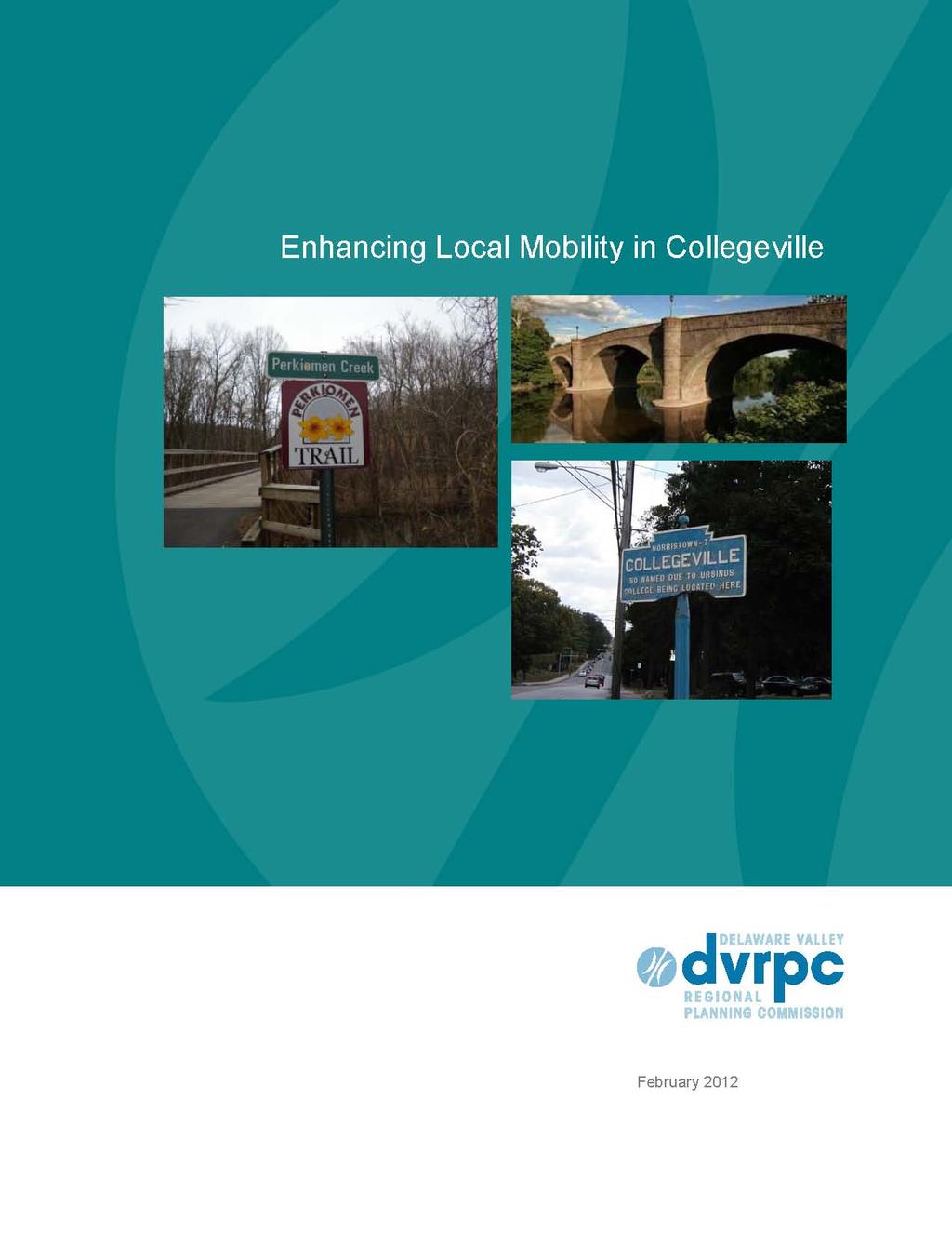
5 Executive Summary Enhancing Local Mobility in Collegeville is a Fiscal Year 2011 DVRPC project with two primary purposes: 1. Enhance bicycle and pedestrian access to parks, multi-use trails, Ursinus College, and the town s Main Street shopping district. 2. Improve bicycle and pedestrian access to and through Collegeville and throughout the greater Collegeville area. This report summarizes data relevant to bicycle and pedestrian safety and accommodations, including previous reports that have touched on these topics. A public outreach process was conducted to establish local priorities and key points of interest. This process and the resulting comments are summarized with recommendations to improve the bicycle and pedestrian environment in the extended study area. Some of these recommendations are: Close sidewalk gaps throughout the study area Improve Perkiomen Trail crossings at Main Street and Route 29 Establish Main Street as the primary on-road bicycle facility in the Collegeville area Improve access to the Perkiomen Trail Work with adjacent municipalities to establish on-road bicycle facilities with consistent signage By combining the recommendations made in this report with others made in Montgomery County s Collegeville Open Space Plan and Collegeville Revitalization Plan, a template for improving the bike/ped environment in the Collegeville area and how to fit that into greater initiatives will emerge. 1
6 2 Enhancing Local Mobility in Collegeville
7 C H A P T E R 1 Introduction Project Description Enhancing Local Mobility in Collegeville is a Fiscal Year 2011 DVRPC project with two primary purposes: 1. Enhance bicycle and pedestrian access to parks, multi-use trails, Ursinus College, and the Main Street shopping district. 2. Improve bicycle and pedestrian access to and through Collegeville and throughout the greater Collegeville area. To accomplish these tasks, the project consists of several components. These are: A review of previous work completed in the study area that relates to bicycle and pedestrian safety and accommodations The collection and analysis of relevant data such as automated bicycle and pedestrian counts, Level-of-Service (LOS) studies, and crash analysis Visits to the study area to document existing conditions Consultation with Collegeville s Pedestrian Safety Task Force and other stakeholders for assistance with data collection, testing the public website, and reviewing memos and drafts A project website that allows site visitors to comment on a variety of issues related to walkability and bikeability Chapter 1 summarizes some of the previous work that informed this project and defines the project study area. Chapter 2 reviews relevant data collected for this project. This includes bicycle and pedestrian crash information, automated counts of non-motorized users, and a bicycle and pedestrian LOS analysis on Collegeville road segments. Chapter 3 summarizes the online public outreach process and reviews comments made by site visitors to the Enhancing Local Mobility in Collegeville project website. Chapter 4 provides recommendations geared toward improving bicycle and pedestrian safety and accommodations in and around Collegeville. These recommendations are based on previous work that has been done in the study area, the existing conditions and relevant data, as well as public input. 3
8 The Appendix contains information about funding sources available for bicycle and pedestrian related projects. Previous/Ongoing Work The Collegeville Open Space Plan and the Collegeville Revitalization Plan both make recommendations to improve safety and accommodations for bicyclists and pedestrians in Collegeville. These reports informed some of the recommendations made here. The Collegeville Open Space Plan deals more explicitly with increased access to open space, while the Collegeville Revitalization Plan provides suggestions to invigorate the Main Street commercial district and other commercial locations throughout the borough. Combined recommendations include: Develop gateways along the Perkiomen Trail and other destinations to make them more attractive Develop plazas and small pocket parks in and around Main Street Improve overall pedestrian connectivity by closing gaps in the sidewalk network and enhancing sidewalk facilities Enhance connections to Main Street and other shopping areas by using signage and improved sidewalks Calm traffic on appropriate streets (Main Street, Route 29, Gravel Pike) Along with these plans, two ongoing projects have the potential to impact the bicycle and pedestrian environment in Collegeville. The Collegeville Main Street Revitalization project seeks to enhance the pedestrian experience on Main Street by completing curb, sidewalk, landscape, and lighting improvements between 1st Avenue and 4th Avenue. This project is currently in the construction phase. Simultaneously, the Office of Transportation Operations Management at DVRPC is currently undertaking the retiming of traffic signals along Ridge Pike. The intersection of Ridge Pike and Route 29 is a key focal point. Crossing times at the intersection will be increased to enhance pedestrian safety, but there will not be a pedestrian-only crossing phase. These projects speak to the need (and desire) for increased activity, revitalization, and improved bicycle and pedestrian access in Collegeville. Several of the recommendations made in this report echo those made in these earlier documents. 4 Enhancing Local Mobility in Collegeville
9 Defining the Study Area Initially, the project study area was limited to Collegeville Borough. After several field visits and discussions with the stakeholder group, the study area was expanded to include neighboring municipalities in order to better evaluate non-motorized use in a larger context. Figure 1 depicts Collegeville Borough and the expanded study area. Also included are bicycle facilities (multi-use trails and on-road bicycle routes designated in the Montgomery County Transportation Plan) as well as attractions in the Collegeville area. Figure 1: Project Study Area Source: DVRPC, 2011 The expanded study area incorporates some of the major attractions in the region, including Evansburg State Park, the Skippack Trail, Providence Town Center, and the Pfizer campus. This necessitated adding portions of several neighboring municipalities, including Trappe Borough, Upper and Lower Providence townships, and Perkiomen and Skippack townships. Representatives from these municipalities were added to the stakeholder group to assist in reviewing memos and other documents and testing the project website prior to its launch. 5
10 Summary Points Enhancing Local Mobility in Collegeville is a DVPRC project whose purpose is to develop recommendations for improving the bicycle and pedestrian environment in the Collegeville area. The project includes data analysis and public outreach. Previous work includes the Collegeville Open Space Plan and the Collegeville Revitalization Plan, both done by the Montgomery County Planning Commission. Both of these reports recommend ways to improve non-motorized safety and access in the borough. Construction and signal timing projects that will impact pedestrian safety are currently underway in the borough. The study area is centered on Collegeville Borough and the Main Street commercial district but includes adjacent municipalities in the Perkiomen Valley. 6 Enhancing Local Mobility in Collegeville
11 C H A P T E R 2 Data Collection For this project, three different types of data were collected and evaluated: 1. Automated bicycle and pedestrian counts on select Collegeville roadways, sidewalks, and on the Perkiomen Trail 2. Bicycle and pedestrian level of service grades on select Collegeville roadways 3. Bicycle and pedestrian crash volumes and location information in the expanded study area Additionally, there were two field visits in which existing conditions were documented and road geometries were verified. Bicycle and Pedestrian Counts In cooperation with DVRPC s Travel Monitoring unit, several locations in the borough were selected for automated bicycle and pedestrian counts. Bicycle counts were conducted with pneumatic tubes, similar to those used for vehicular counts. Pedestrian counts were conducted with infrared counters, which detect heat emitted by pedestrians. Tables 1 and 2 list the locations and volumes of cyclists and pedestrians counted over the course of a week, as well as the dates the counts were conducted. The count numbers represent the total number of users in the entire week-long counting period. Figure 2 depicts the locations and volumes on a map of the borough. Table 1: Bicycle Volumes at Select Locations Location From To Count Dates Bicycle Count (both directions) Perkiomen Trail Route 29 Main Street 11/30 12/7 70 Main Street 3rd Avenue 4th Avenue 11/17 11/23 40 Main Street 4th Avenue 5th Avenue 11/17 11/ th Avenue Clayhor Street Main Street 11/30 12/7 8 Source: DVRPC, 2011 Table 1 lists the total volume of cyclists counted over week-long time periods in November and December, The number of cyclists on the Perkiomen Trail (70, both directions) exceeds users on the borough s streets. Main Street saw 40 cyclists between 3rd and 4th Avenues and 30 between 4th and 5th Avenues, while 8th Avenue saw a low number of cyclists (eight). These are very low numbers, although that may be explained by weather conditions. Table 2 lists the locations and volumes of the pedestrian counts conducted for this project. 7
12 Table 2: Pedestrian Volumes at Select Locations Location Side (if applicable) From To Count Dates Pedestrian Count Main Street West Sidewalk 3rd 4th 11/15 11/22 1,930 Main Street West Sidewalk 4th 5th 11/15 11/22 1,849 Main Street East Sidewalk 3rd 4th 11/15 11/22 1,697 Main Street East Sidewalk 4th 5th 11/15 11/22 1,497 Perkiomen Trail N/A Main 1st 11/30 12/7 604 Perkiomen Trail N/A 2nd Main 11/30 12/ th Avenue West Sidewalk Clayhor Main 11/30 12/7 176 Source: DVRPC, 2011 The west sidewalk of Main Street saw the highest volumes of pedestrians, 1,930 for the week (approximately 275 per day), while the east sidewalk of Main Street saw slightly less pedestrian activity (240 pedestrians per day). The Perkiomen Trail saw around 85 pedestrians daily (both directions, north of Main Street) and 75 daily pedestrians in both directions south of Main Street. Fifth Avenue saw the lowest volume, with only 25 pedestrians per day for the week. Figure 2: Locations of Bike/Ped Counts Source: DVRPC, Enhancing Local Mobility in Collegeville
13 Level of Service Unlike automobile level-of-service, which evaluates the efficiency of throughput on roads, Bicycle Level of Service (BLOS) and Pedestrian Level of Service (PLOS) use factors such as roadway geometry, speed, and traffic volume to score roads on how comfortable they are for bicyclists or pedestrians. BLOS and PLOS use similar inputs, but these inputs can be weighed differently. For example, on-street parking is considered beneficial for pedestrians because it provides an added buffer from moving traffic. For bicyclists, however, the presence of on-street parking presents a potentially dangerous condition, with cars pulling out of parking spots and dooring (when a cyclist is hit by a stopped car opening a door) as potential hazards for bicyclists. Figures 3 and 4 on the following pages depict streets in Collegeville Borough where BLOS and PLOS scores were developed. Scores were only generated for roadways in Collegeville, not for neighboring municipalities. Figure 3: Bicycle Level of Service on Select Roads Source: DVRPC,
14 Figure 3 depicts BLOS grades on major streets in Collegeville Borough. BLOS scores were generally favorable, particularly on 6th and 8th Avenues. These streets feature wider cartways with relatively low speeds and traffic volumes, translating into more comfortable environments for bicyclists. Park Avenue, which has a low speed limit but higher traffic volumes, received a score of B. Clayhor Road, 5th Avenue, and 9th Avenue all received a grade of C, largely due to higher traffic volumes. Main Street and Route 29 received grades of D or below, due to higher speeds and traffic volumes. Figure 4: Pedestrian Level of Service on Select Roads Source: DVRPC, 2011 Figure 4 depicts PLOS grades on major streets in Collegeville. Several borough streets received a B grade, including Clayhor Street and 3rd and 6th Avenues. Most streets in the borough received a grade of C, including most of Main Street, 8th Avenue, and parts of Route 29. A small segment of Route 29 received a D. Route 29 north of Main Street was not graded because it lacks sidewalks, a requirement for pedestrian level of service grades. 10 Enhancing Local Mobility in Collegeville
15 Bicycle and Pedestrian Crash Data Staff reviewed PennDOT crash data between 2005 and 2009 to determine the volume of crashes between motor vehicles and bicycles or pedestrians that took place in Collegeville and the expanded study area. Table 3 lists the number of crashes that took place in Collegeville Borough and the expanded study area. It should be noted that there is a tendency to underreport crashes, particularly bicycle- and pedestrian-related incidents. Table 3: Study Area Bike/Ped Crashes Pedestrian-Related Bicycle-Related Total Collegeville Borough Expanded Study Area Total Source: PennDOT, 2011 There were five bicycle or pedestrian related crashes reported in Collegeville Borough between 2005 and 2009, three pedestrian and two bicycle incidents, all of which took place on Main Street or on Route 29. In the expanded study area there were 21 reported bicycle and pedestrian related crashes, with significantly fewer bicycle crashes. Figure 5 on the following page depicts the distribution of vehicular, bicycle, and pedestrian crashes that took place in the entire study area. 11
16 Figure 5: Bike/Ped Crashes in the Collegeville Study Area ( ) Source: PennDOT, 2011 In the study area, the majority of bicycle- and pedestrian-related crashes took place along Ridge Pike/Main Street in both Collegeville and surrounding municipalities. Table 4 lists the locations of all the bicycle-and pedestrian-related crashes and the number of incidents that took place there. Table 4: Bicycle and Pedestrian Crash Locations Pedestrian Crashes Bicycle Crashes Main Street/Ridge Pike 10 Main Street/Ridge Pike 3 Pottstown Bypass 2 Route 29 2 Wartman Road 2 Daniel Drive 1 Gravel Pike/Route 29 2 Route Lewis Road 1 Linfield Trappe Road 1 Total 20 6 Source: PennDOT, Enhancing Local Mobility in Collegeville
17 Of the 26 total bicycle and pedestrian crashes, almost half took place along Main Street/Ridge Pike. One crash occurred at the intersection of Main Street and Route 29. Four crashes took place along Route 29. There were several other locations that had more than one bike or pedestrian crash. These included PA 113, where two incidents occurred adjacent to the intersection with Borough Line Road (between Trappe and Upper Providence). The Pottstown Bypass in Upper Providence saw two bicycle crashes, and Wartman Street in Perkiomen Township saw one bicycle- and one pedestrian-related crash between 2005 and Summary Points The fieldwork and data collection for this project yielded several conclusions: The bicycle and pedestrian counts conducted in November and December of 2010 indicate fairly low volumes of cyclists on the Perkiomen Trail as well as in Collegeville Borough. Pedestrian activity was significantly higher, particularly along Main Street at midday and late night/early morning hours. BLOS and PLOS evaluations indicate that borough streets, with the exception of Main Street and Route 29, are generally hospitable to pedestrians and bicyclists. There are some sidewalk gaps, however, on Ninth and Eighth Avenues, and parts of Park Avenue and Third Avenue, which make the network incomplete. The Ridge Pike/Main Street corridor had crash volumes significantly higher than any other roadways in the study area. Four of the five incidents in Collegeville and half of all incidents in the expanded study area took place somewhere along Ridge Pike. It should be noted that counts conducted during more hospitable weather conditions would likely yield significantly higher numbers of cyclists and pedestrians. During the two field visits, which were conducted on warm, sunny days, morning and midday activity on the trail was significant. 13
18 14 Enhancing Local Mobility in Collegeville
19 C H A P T E R 3 The Public Outreach Effort The Enhancing Local Mobility in Collegeville website was created to solicit public ideas to improve bicycle and pedestrian safety and accommodations in and around Collegeville Borough. The site was modeled after previous successful DVRPC outreach initiatives in Mercer County, New Jersey, and along the Route 30 corridor in Delaware and Montgomery counties and the City of Philadelphia. The purpose of this website was to have local residents comment on locations that are deficient or need improvement in bicycle and pedestrian safety and accessibility. Users were also asked to comment on locations that are attractive for walking and bicycling. Visitors could like or dislike comments to see which recommendations rated highest among local residents. To ensure that the site received significant traffic, DVRPC staff and project stakeholders initiated a promotional campaign that included Internet and print media. Several local papers carried articles about the project, including the Pottstown Mercury, the Spring-Ford Register, and The Phoenix. Summary of User Comments Visitors to the project website could comment on the bikeability and walkability of locations in and around the borough. They could also rate comments left by other users, using a like or dislike function expressing agreement or disagreement. This function was intended to prevent excessive redundancy in comments and to build a set of recommendations that had larger consensus within the community. Overall, there were 80 unique comments made on the site, with 235 likes and only one dislike in reference to those comments. Even with the like/dislike functionality, some comments were redundant. Similar user recommendations were combined to develop a better sense of locations and improvements that may have more support in the community. Table 5 lists the recommendations that had the most likes among all user comments. Table 5: Highest-Rated User Comments User Comment Likes' Provide sidewalks on 3rd Avenue south of Main Street 28 Improve intersection of Main Street and the Perkiomen Trail 25 Install bicycle facilities along Main Street 15 Create alternative access points to the Perkiomen Trail 12 Improve creek access south of Main Street 10 Improve the Perkiomen Trail crossing over Route 29 (north of Main Street) 8 Source: DVRPC,
20 The highest-rated comment was the recommendation to provide sidewalks along 3rd Avenue south of Main Street. This is a small segment of sidewalk, but it connects Main Street to Collegeville Park, a crucial pedestrian link. The next highest-rated comment recommends improving the intersection of Main Street and the Perkiomen Trail. This is a difficult, poorly marked location, but the upcoming plaza project, which will add parking and improve the trailhead north of Main Street, should mitigate some user concerns at this intersection. The suggestion of adding bicycle facilities to Main Street and Ridge Pike was also highly rated, although bicycle lanes, share the road markings, and a multi-use path for both cyclists and pedestrians in place of the sidewalk were all mentioned as possible improvements. The concept of creating additional trail access points was also highly rated, although different locations were cited as possibilities. The idea of creating access from the Perkiomen Trail to the Perkiomen Creek and improving the trail s crossing over Route 29 north of Main Street were also rated highly by site users. It is also informative to look at specific locations where there was a concentration of user comments. Three locations and their corresponding comments stand out. 1. Around the intersection of Main Street and the Perkiomen Trail Improve bicycle and pedestrian signals and signage at the intersection Install wayfinding signage about Collegeville attractions Enhance trailhead information north and south of Main Street Improve landscaping around the trail as it approaches Main Street Develop a pocket park east of the trailhead on Main Street 2. Main Street between 3rd and 5th Avenues Traffic calming is necessary to reduce speeding, improve compliance, and enhance non-motorized user safety Bicycle facilities should be installed along Main Street/Ridge Pike (this comment was made throughout the corridor) Improve pedestrian access to Collegeville Park via 3rd and 4th Avenues 3. The intersection of the Perkiomen Trail and Route 29 north of Main Street Enhance pedestrian crossing at Route 29 and the Perkiomen Trail via improved signalization or other means Improve bicycle and pedestrian access along 9th Avenue Improve access and wayfinding signage to Hunsberger s Woods along Route Enhancing Local Mobility in Collegeville
21 Of the 80 comments made on the outreach website, almost half made some mention of Main Street/Ridge Pike. This indicates the importance of this corridor throughout the study area and confirms what was established during the data collection phase of this report, that Main Street is the most used and most problematic location for pedestrians and cyclists. Summary Points There were 80 unique comments made and 235 likes on the Enhancing Local Mobility in Collegeville website. The most-liked comment recommended putting sidewalks on 3rd Avenue south of Main Street connecting to Collegeville Park, while the second most-liked comment recommended improving the Main Street/Perkiomen Trail crossing. The intersection of the Main Street/Perkiomen Trail crossing had several comments in close proximity to each other. These dealt with improving signalization and signage as well as beautifying the location, among other things. Of the 80 comments made on the website, approximately half made some reference to conditions on Main Street/Ridge Pike. 17
22 18 Enhancing Local Mobility in Collegeville
23 C H A P T E R 4 Recommended Improvements This section provides recommendations on ways to improve the bicycle and pedestrian environment in the Collegeville area. These recommendations fall into three categories: 1. Sidewalk network improvements 2. Perkiomen Trail improvements Improve trail crossings with key intersections Establish alternative access points to the trail throughout the study area 3. On-road bicycle network recommendations Establish designated on-road facilities enabling cyclists access to local attractions Establish connector segments where signage will direct cyclists to on-road facilities, attractions, and open space The recommendations made in this section reflect previous work that has been done in the study area, fieldwork conducted by DVRPC staff, analysis of relevant data, and user comments from the public outreach portion of this project. Sidewalk Network Improvements Figure 6 (on the following page) depicts the locations in the study area that were cited by visitors to the outreach website to be missing links in the sidewalk network. Visits to the project study area verified that these are signficant gaps and should be considered priorities. 19
24 Figure 6: Recommended Sidewalk Enhancements Source: DVRPC, rd Avenue adjacent to Collegeville Park As noted in Chapter 3, this comment received the most likes on the public outreach website. Building sidewalks at this location would connect Main Street to Collegeville Park, a crucial link that is currently nonexistent. This location was also cited in the Collegeville Open Space Plan as a major gap in the sidewalk network. 2. Ridge Pike, east of the Perkiomen Creek to Level Road The Main Street/Ridge Pike Bridge has a sidewalk on its north side but the walkway terminates just a few yards beyond the creek. Sidewalks, particularly on the north side of Ridge Pike, are needed to connect communities on the east side of the Perkiomen Creek to the Main Street commercial district. Crossings at Level Road, Cross Keys Road, and Pechins Mill Road should be improved to allow people coming from south of Ridge Pike access to the sidewalk and the bridge. 20 Enhancing Local Mobility in Collegeville
25 3. 9th Avenue from Main Street to Route 29 This is an attractive street that would benefit greatly from sidewalks, allowing pedestrians to walk from Main Street to the Perkiomen Trail, and creating an alternative access point. There is limited roadway capacity on this segment so it may only be possible to add sidewalks to one side of the roadway, but it would close an important gap in the borough s sidewalk network. 4. Route 29, south of Park Avenue The Perkiomen Trail s crossing over Route 29 in this location is problematic, and the location is made more difficult by the lack of sidewalks south of Park Avenue. Adding sidewalks would improve trail access from neighborhoods in this area and begin to make Route 29 more pedestrian-friendly. Perkiomen Trail Crossing Improvements The Perkiomen Trail is the most significant bike/ped facility in Collegeville and the Perkiomen Valley. The trail itself is pleasant and provides good access to the surrounding area, but there are several locations, specifically crossings with major arterials, which are problematic for trail users and could be improved. These crossings are important because they serve as gateways into the borough, and trail users coming upon one of them may choose to turn around rather than enter the borough because of perceived safety risks. This section provides aerial photos of each location annotated with recommendations meant to improve connections between the trail and streets. The intersection of the Perkiomen Trail and Main Street The location that users on the Enhancing Local Mobility in Collegeville outreach website consider most problematic is the Perkiomen Trail s crossing over Main Street. While there were no reported bicycle- or pedestrian-related crashes at this location between 2005 and 2009, site users indicated that the location is hazardous for pedestrians and cyclists. Fieldwork also highlighted the difficulty in crossing this intersection due to poor signalization and unclear signage. Site visitors pointed out a few other issues related to this location. A map of the intersection and recommended improvements are located in Figure 7. 21
26 Figure 7: Recommended Perkiomen Trail/Main Street Enhancements Source: DVRPC, 2011 Figure 7 depicts the Perkiomen Trail s crossing over Main Street in Collegeville. Users commented on several aspects of this intersection, most notably the signalization at the crossing and the lack of wayfinding signage along the trail approaching the intersection. Some potential improvements are listed below and refer to Figure Beautify the trail s approach to Collegeville from south of Main Street; perhaps institute an adopt-a-trail program to work with local businesses to clean and maintain portions of the trail 2. Install signage at the southern intersection of the Perkiomen Trail and Main Street 3. Install wayfinding signage at the trailhead that will be constructed in the lot on the north side of Main Street 4. Install pedestrian countdown timers at the intersection 5. Turn the lot east of the intersection into a small pocket park to enhance this gateway into the borough Because of its location and function as a gateway into the borough, on the trail and on Main Street, improvements at this location should be prioritized. The enhanced trailhead and new signalization due to the Ridge Pike Signal Improvement Project may improve conditions somewhat, but there are other opportunities to improve the safety of this intersection and enhance the visibility of Main Street to trail users. 22 Enhancing Local Mobility in Collegeville
27 The Perkiomen Trail s crossing over Route 29 north of Main Street The Perkiomen s crossing over Route 29 north of Main Street is also problematic for trail users. Because this is a location where southbound trail users may turn around rather than enter Collegeville, it is important to consider some potential improvements. Figure 8 depicts the Perkiomen Trail s current crossing over Route 29. Currently, the location is served by a mid-block crossing and ped xing painted onto the road notifying drivers that there may be pedestrians crossing ahead. Some recommended improvements are annotated in Figure 8 and described below. Figure 8: Recommended Perkiomen Trail/Route 29 (north) Enhancements Source: DVRPC, Install a push-button activated signal at the location of the current crosswalk this would only stop traffic on Route 29 when activated by a trail user attempting to cross 2. Enhance access and signage to Hunsberger s Woods, north of the crossing, either along Route 29 or through a more clearly defined (and protected) path 3. Provide wayfinding signage on the north side of the trail for users coming into the borough 4. Install yield-to-pedestrian channelizing devices on Route 29 to make yield responsibilities clear to drivers 23
28 This is another location which should serve as a gateway into and out of the borough. Improving the perception of safety of the crossing is crucial to enable trail users to more easily enter Collegeville on the Perkiomen Trail. The Perkiomen Trail s crossing over Route 29 south of Main Street The Perkiomen Trail s crossing on Route 29 south of Main Street is also problematic for trail users. The location serves as the southern gateway into the borough. While the volume of user comments adjacent to this location was not as high as some other locations, fieldwork indicated that this location is difficult to navigate. Figure 9 depicts this location and recommendations are described below. Figure 9: Recommended Perkiomen Trail/Route 29 (south) Enhancements Source: DVRPC, 2011 Currently, a traffic light allows users to cross Route 29 and then proceed along Route 29 for about 200 feet before resuming travel on the trail. While there are not many options for improving the crossing itself, there are other ways to improve this location. Some potential enhancements are: 24 Enhancing Local Mobility in Collegeville
29 1. Install sidewalks along Route 29 south of the trail 2. Improve the Clayhor Road crossing over Park Avenue for cyclists and pedestrians who want to get to the trail 3. Improve trail access points to the shopping centers along Route 29 and bicycle accommodations in those shopping centers 4. Provide clearer signage directing northbound trail users to attractions in Collegeville Borough The recommended improvements at this location are incremental, but will help improve amenities on the trail as well as access to Collegeville from the Perkiomen Trail. Establish Alternative Access Points to the Perkiomen Trail The Perkiomen Trail serves as the main spine for non-motorized travel through the Collegeville area, but at times it is not very well integrated into the surrounding area. The priority enhancements cited above improve trail access and links between the trail and borough, but there are additional opportunities to better link the trail to Collegeville and its environs. Figure 10 depicts these connections. The additional access points recommended in Figure 10 are as follows: 1. Link to residential developments in Perkiomen Township The first recommended improvement to Perkiomen Trail access is north of Collegeville in Perkiomen Township. Aerial imagery indicates that there is a well-worn path adjacent to a creek running through several housing developments. This link would provide residents of these developments with more direct, off-road access to the trail. The feasibility of this connection would have to be studied, given the potentially sensitive environment surrounding the creek, but there is some flexibility in designing the alignment. This trail connector, if desirable, could even be extended to Trappe Road to further enhance access. 2. Connection to current paper street that links to 5th Avenue in Collegeville Borough There is a paper street which cuts through a wooded area connecting the trail to 5th Avenue, adjacent to (but not actually on) the Ursinus campus. During two visits to the trail, staff found that the paper street, while covered in broken rock and not currently traversable by bike, is frequently used by walkers seeking alternative access to the trail. Improved surface material, trail lighting, and proper signage could create a formal link between Collegeville and the trail. This connection was mentioned in the Collegeville Open Space Plan as a potential connection to the Perkiomen Trail. 3. Creek access in Upper Providence Township and Collegeville Borough One of the more liked comments on the website recommended creating a trail link to the Perkiomen Creek, south of Main Street in Collegeville Borough. The access point would have to come toward the southern part of the study area before the trail moves west of Route 29, making the connection difficult. The feasibility of this trail link would have to be studied, but aerial imagery again indicates that there are some informal pathways in this area and some clearings that may be far enough from the creek to install a path. The Collegeville Open Space Plan made 25
30 a similar recommendation by suggesting a set of pathways along the creek. Providing more direct creek access could stimulate trail use. Figure 10: Potential Trail Connections Source: DVRPC, Enhancing Local Mobility in Collegeville
31 Establish an On-Road Bicycle Network While the Perkiomen Trail is the main non-motorized facility through the study area, the lack of on-road bicycle facilities and accompanying signage prevent trail users from exploring the neighborhoods beyond the trail. According to Pennsylvania law (Title 75, Chapter 35, Section 3501), any roadway where bicycle use is not expressly forbidden (such as a highway) is suitable for bicycle usage. However, selecting preferred facilities and marking them accordingly is important to promote safer cycling and allow drivers to know where they may be more likely to encounter bicyclists. The following recommendations for the development of a designated onroad network will complement the multi-use trail network already in place. Two different types of on-road bicycle facilities are recommended: 1. Proposed on-road facilities these are roadways where designated on-road facilities are preferable to facilitate bicycle travel on roads that may otherwise be unsuitable for cyclists. Determining the appropriate facility type may require further study of road geometry, traffic volumes, and other factors. 2. Proposed connectors these are smaller, more bicycle-friendly roads that connect designated facilities or attractions where appropriate signage is recommended to guide cyclists to destinations. Bicycle-specific striping is not necessary. Figure 11 on the following page illustrates the recommended on-road bicycle network, connections to the regional trail system, and the sidewalk enhancements recommended earlier in this chapter. Fieldwork, road geometries, and previous studies in the region informed these choices. Local attractions such as schools, shopping centers, and business parks are also included on the map, as these locations play a part in determining key roadways. 27
32 Figure 11: Recommended On-Road Bicycle Network Source: DVRPC, 2011 In addition to the on-road facilities proposed here, there is an existing bicycle lane on a ½ mile segment of Arcola Road extending from the Perkiomen Trail west to the Pfizer campus. Table 6 displays each of the roadways selected for the on-road network, the type of proposed facility, as well as the limits and length of the segment. 28 Enhancing Local Mobility in Collegeville
 Proposed facility Campus Drive to Trappe Road 2.10 C Clayhor Road Connector West 3rd Avenue to Park Avenue 1.34 D Evansburg Road Connector Ridge Pike to Germantown Pike 0.")
33 Table 6: On-Road Bicycle Facilities Map ID Name Facility Type Limits Length (miles) A Arcola Road Existing facility Cider Mill Road to Campus Drive 0.57 B Arcola Road (proposed) Proposed facility Campus Drive to Trappe Road 2.10 C Clayhor Road Connector West 3rd Avenue to Park Avenue 1.34 D Evansburg Road Connector Ridge Pike to Germantown Pike 0.50 E Glenwood Avenue Connector Wartman Road to Ridge Pike 1.11 F Level Road Proposed facility Arcola Road to Ridge Pike 1.94 G Main Street/Ridge Pike Proposed facility Eagleville Road to Township Line Road 6.52 H Mill Road/Collegeville Road Connector Evansburg Road to Skippack Trail 3.22 I Park Avenue Connector 5th Avenue to Clayhor Road 0.63 J Route 113 Proposed facility Route 29 to 2nd Avenue 4.77 Connectors 6.80 Proposed facilities Total mileage Source: DVRPC, 2011 As evidenced in Table 6, there are approximately 22 miles of proposed segments in the recommended bicycle network. For the 10 miles of connectors (C, E, H, and I on Figure 11) only proper signage is recommended. The connectors were selected for their ability to connect different parts of the area. For example, the Mill Road/Collegeville Road connector joins Evansburg State Park to Skippack Village via the Skippack Trail, while Clayhor Road connects the recommended facility on Trappe Road to the Perkiomen Trail. Figure 12 depicts the Bicycle May Use Full Lane sign, approved for use in the Manual for Uniform Traffic Control Devices (MUTCD). This sign is preferable to the more typical Share the Road sign because it more clearly elucidates the rights of cyclists to travel in the road. Figure 12: Bicyclists May Use Full Lane Sign Source, MUTCD,
.")
34 For the four road segments (roughly 15 miles) that are proposed as designated bicycle facilities, more enhanced treatments should be considered. Arcola Road On Arcola Road, there are already bicycle lanes connecting the Perkiomen Trail to the Pfizer campus located on Troutman Drive (the bike lane is shown in Figure 13). These lanes could be extended west from their current end point to Providence Town Center. This would enable trail users to use protected lanes to visit the shops there, which will become an even more important destination with future expansion. Figure 13: Bicycle Lanes on Arcola Road Source: Google Maps, 2011 The current roadway configuration west of the Pfizer campus has sufficient width to allow for bicycle lanes, although some special consideration must be given to the intersection of Arcola Road and Route 29, which could prove hazardous without proper signage and signalization. Countdown timers and a leading bicycle phase that allows cyclists to cross Route 29 ahead of vehicular traffic may mitigate the dangers at this intersection. In conjunction with installation of these lanes, it is important to ensure that there is adequate bicycle parking at Providence Town Center, and that bicycle and pedestrian circulation within the development is an ongoing consideration Level Road/Evansburg Road For the segment of Level Road extending from Arcola Road to Ridge Pike, shared lane markings, or sharrows accompanied by the Bicyclists May Use Full Lane sign in Figure 12 are appropriate. Figure 14 depicts a shared lane marking. 30 Enhancing Local Mobility in Collegeville
 necessitate some type of")
35 Figure 14: Shared Lane Marking Source: Level Road is not wide enough to accommodate bicycle lanes in this segment, but the relatively high vehicle counts (over 5,000 vehicles per day in both directions) necessitate some type of designated facility. Providing sharrows and designating Level Road a bicycle route (via signs similar to the one shown in Figure 12) would improve access to Evansburg State Park and to Main Street/Ridge Pike. This would connect to Evansburg Road (a proposed connector) and improve access through Evansburg State Park, Skippack Village, and the Skippack Trail. Main Street/Ridge Pike As evidenced by the volume of user comments about this corridor on the public outreach website, crash statistics, and fieldwork in the study area, Main Street/Ridge Pike appears to be the most difficult location for cyclists to navigate. Through the borough, Main Street is generally one 13- foot lane in each direction with a two-way left turn lane, except for the segment between 3rd and 4th Avenues, where there is a small stretch of on-street parking and no turning median. The Collegeville Revitalization Plan proposed a bike-only path extending from the Perkiomen Trail west along Walnut Street as an alternative to providing facilities along Main Street. While this mitigates the concerns of mixing bicycles with traffic along Main Street, it does not provide direct access to Main Street, and acquiring the necessary easements could be a lengthy and expensive process. Since Main Street has a couple of different configurations, different treatments are needed. For the segment of Main Street between the Perkiomen Trail and 4th Avenues, the presence of onstreet parking along Main Street precludes bicycle lanes. Sharrows, accompanied by signage that indicates that cyclists may use the full lane, however, may be used in this segment. For Main Street west of 4th Avenue, the roadway can be reconfigured to include two 5-foot bicycle lanes. This could be done by narrowing travel lanes to 10 feet and keeping the 10-foot 31

36 two-way left turn lane, or narrowing (or eliminating) the center turning lane and widening the travel lanes. Figure 15 illustrates the first potential configuration. Figure 15: Proposed Roadway Configuration for Main Street Source: VDOT, 2010 The implementation of bicycle lanes may be coordinated with other traffic-calming measures. The borough has improved pedestrian crossing conditions further east along Main Street by providing bump-outs at key intersections. While it may be attractive to repeat these treatments between 4th and 9th Avenues, curb extensions can hinder bicycle travel along Main Street and will be significantly more expensive than a bicycle lane. Simply narrowing the traffic lanes and reducing the speed limit may have greater impact. Removing the two-way left turn lane (but installing turning bays) and installing a narrow planted median in its place would also be possible and better complement bicycle lanes. If curb extensions are preferable, then it is necessary to ensure that they would not encroach upon a bicycle lane. The road is wide in this stretch, however, and it may be possible to use both curb extensions and a bicycle lane if the two-way left turn lane was significantly reduced or eliminated. Outside of the Main Street district in Collegeville, the width and configuration of this corridor vary. To the east, the roadway widens to 60 feet toward the intersection with Route 29 and then narrows on the bridge crossing over the Perkiomen Creek and remains approximately 40-foot throughout the rest of the eastern portion of the study area, and the roadway continues as a four lane-arterial to the east. West of Collegeville, Ridge Pike remains approximately 40 feet wide with one lane in each direction and different turning lane configurations; sometimes the lane is in the middle, sometimes there is a right turning lane. Both east and west of the Main Street shopping district, there appears to be the space necessary to adopt the configuration depicted in Figure 15. This does require, however, removing one lane of traffic and the impacts of this would need to be evaluated. 32 Enhancing Local Mobility in Collegeville
37 Route 113 Route 113 is a two-lane road with significant traffic volumes. According to DVRPC traffic counts, some segments of this road have annual average daily traffic (AADT) counts above 10,000 vehicles per day. Parts of the southern portion of this segment (south of Mennonite Road) have 5-foot shoulders, although that is not consistent along the segment. As currently configured, cartway width on Route 113 does not allow for bicycle lanes and sharrows may not be sufficient, considering present traffic volumes. Purchasing additional rightof-way may prove unduly expensive; however, providing on-road facilities in this corridor would directly connect residents in the study area to Phoenixville Borough (and vice versa). One alternative is to utilize Trappe Road/7th Avenue, roughly half a mile west of Route 113, as a connector route. This is a narrower road (around 20 feet in most places) but has lower traffic volumes and a more attractive cycling atmosphere. It provides a connection to Phoenixville Borough, similar to that offered by Route 113. Summary Improvements to Perkiomen Trail crossings with Main Street and Route 29 are pivotal to improving the perception of safety along the trail and in Collegeville Borough. Creating alternative access points could stimulate trail usage and add open space opportunities. Establishing on-road facilities to complement the trail network and provide enhanced connections to local attractions is a priority; inter-municipal cooperation is necessary to coordinate signage and maintenance. 33
38 34 Enhancing Local Mobility in Collegeville
39 C H A P T E R 5 Conclusion Enhancing Local Mobility in Collegeville is a Fiscal Year 2011 DVRPC project recommending ways to improve bicycle and pedestrian safety and accommodations in Collegeville Borough and adjacent municipalities in the Perkiomen Valley. The recommendations made in this report fall into three general categories; sidewalk improvements, improvements to Perkiomen Trail crossings and access, and establishing on-road facilities to complement existing trails and local attractions. While all of the recommendations in the chapter are intended to improve safety and accommodations for pedestrians and cyclists, some key priorities are: Complete sidewalk gaps Completing the sidewalk gaps listed in Chapter 4 (3rd Street adjacent to Collegeville Park, along Ridge Pike west of the Perkiomen Creek, along 9th Avenue between Main Street and Route 29, and along Route 29 south of Park Avenue) are crucial to improve pedestrian safety and accessibility. Improving access to open space opportunities such as Collegeville Park and the Perkiomen Trail will make walking a more attractive option for community residents. Improve trail crossings most notably at Main Street and at Route 29 north of Main Street These locations should be gateways into and out of the borough. While improvements are planned for the Main Street crossing, improving the northern Route 29 crossing is a priority; installing a push-button activated signal and in-ground channelizing device would help cyclists, pedestrians, and drivers alike. Establish Main Street as a bicycle facility As Collegeville s main thoroughfare develops, the need to establish a seamless connection between the Perkiomen Trail and Main Street grows. Establishing a bicycle lane on Main Street would calm traffic and give cyclists on the trail a safe way to visit Collegeville s growing roster of businesses. Improve access the Perkiomen Trail The Perkiomen Trail is a key spine for bicycle and pedestrian travel in the area. Creating new access points would allow more people in the area the opportunity to use it. Work with adjacent municipalities to establish regional bicycle facilities The facilities proposed in this report cross municipal boundaries and require multi-municipal cooperation to come to fruition. Numerous resources are already shared between these municipalities, and this cooperation can extend to develop on-road facilities to help cyclists move 35
 may prove difficult, working to develop a local wayfinding system so that users can more easily access attractions would make cycling")
40 more safely through the area. While establishing more dedicated facilities (such as bike lanes) may prove difficult, working to develop a local wayfinding system so that users can more easily access attractions would make cycling a more attractive mode. Figure 16 depicts one example of a simple sign that can be used locally to direct cyclists and pedestrians to various attractions. Simultaneously, municipalities should work together to improve bicycle parking in the area. Figure 16: Example of Bicycle Wayfinding Signage Source: City of Gresham, Oregon, 2011 Collegeville Borough and the Perkiomen Valley are unique places, with remarkable recreational opportunities in Evansburg State Park and the Perkiomen and Skippack Trails. With an environment that is already favorable to non-motorized users, simple investments in consistent signage combined with more pronounced efforts, like bicycle lanes on Main Street and improvements in key trail crossings, will make bicycling and walking in the area easier and more attractive. 36 Enhancing Local Mobility in Collegeville

41 APPENDIX A
42 2
43 Funding Sources The following are federal, state, and local funding sources and programs that can be used for the planning and construction of pedestrian and bicycle infrastructure. Several of the sources listed can assist in local business development and open space initiatives as well. Bikes Belong Eligibility: Federal, state, regional, county, and municipal agencies, nonprofits, organizations whose mission is expressly related to bicycle advocacy Purpose: To fund bicycle facilities and paths that encourage facility, education, and capacity building Terms: $10,000 or less Deadline: Quarterly Contact: Bikes Belong Coalition Phone: website: Business in Our Sites Eligibility: Pennsylvania municipalities, municipal authorities, redevelopment/industrial development agencies, private developers Purpose: To empower communities to attract businesses by helping them build an inventory of ready sites Terms: Grants may not exceed 50 percent of the total amount of financing provided or $5 million (whichever is less). Site must be previously utilized property or undeveloped property that is planned and zoned for development. Private developers are only eligible for loans, not grants Deadline: Continual Contact: Pennsylvania Department of Community and Economic Development Customer Service Center Phone: website: Certified Local Governments Grant Program (CLG) Eligibility: Limited to Certified Local Governments Purpose: To promote and protect historic properties and planning for historic districts Terms: Grants up to 60 percent of project costs Deadline: Annually Contact: Pennsylvania Bureau of Historic Preservation Phone: website: A -1
44 Claneil Foundation Eligibility: Southeastern Pennsylvania local governments, nonprofits Purpose: Grants for building arts, education, environment and community development Terms: Grants range from $1,000 to $290,000 for building renovation, conferences, consulting, land acquisition and development; must submit letter of intent Deadline: Continual Contact: Chanel Foundation Inc. Phone: Community Transportation Development Fund (CTDF) Eligibility: Nonprofit transit providers, public agencies, local and state governments and community organizations Purpose: To promote better transportation options Terms: Low-interest loans of up to $150,000 per recipient and 75 percent of the total project cost; there are several funding options that require a one-time service fee Deadline: Varies Contact: Community Transportation Association of America Phone: website: Competitive Congestion Mitigation & Air Quality Program (CMAQ) Eligibility: Public agencies, incorporated private firms, nonprofits, local and county governments Purpose: For projects that contribute to the attainment of the Clean Air Act standards by reducing emissions from highway resources Terms: 80 percent of costs Deadline: Varies Contact: Delaware Valley Regional Planning Commission (DVRPC) Phone: website: Conservation/Sound Land Use Grants Eligibility: Pennsylvania local governments Purpose: To encourage conservation planning and sound land use practices Terms: Grant funding for 50 percent of project cost Deadline: Varies Contact: Pennsylvania Department of Community and Economic Development Phone: website: A -2
45 Elm Street Program Eligibility: Pennsylvania local governments, redevelopment authorities, nonprofit economic development organizations, other nonprofits, BIDs, neighborhood improvement districts Purpose: Provides grants for planning, technical assistance, and physical improvements to residential and mixed-use areas in proximity to central business districts Terms: Maximum $50,000 for administrative grants; maximum $250,000 for development projects and loans Deadline: Varies Contact: Pennsylvania Department of Community and Economic Development Phone: 866-GO-NEWPA ( ) website: Home Town Streets /Safe Routes to School (HTS/SRS) Eligibility: Federal or state agencies, Pennsylvania county or local governments, school districts, nonprofits Purpose: To encourage the reinvestment in and redevelopment of downtowns and establish safe walking routes for children commuting to school Terms: 80 percent of total costs Deadline: Varies Contact: Delaware Valley Regional Planning Commission (DVRPC) Phone: website: Liquid Fuels Tax Program Eligibility: Pennsylvania local governments Purpose: Provides funds for any road-related activity Terms: Vary Deadline: Annually Contact: Pennsylvania Department of Transportation, District 6-0 Phone: website: Pennsylvania Infrastructure Bank Eligibility: Pennsylvania local governments and contractors Purpose: To provide low-cost financing to municipalities and contractors for eligible transportation improvements Terms: Low-interest loans from $50,000 to $3.9 million through a revolving loan fund for implementation Deadline: Continual Contact: Pennsylvania Department of Transportation (PennDOT) Phone: website: A -3
46 Kodak American Greenways Grants Eligibility: Local, regional, or statewide nonprofits, public agencies and community organizations Purpose: Provides grants to stimulate planning and the design of greenways in communities Terms: Maximum grant amount is $2,500 Deadline: Annually Contact: The Conservation Fund Phone: website: Land Use Planning and Technical Assistance Program (LUPTAP) Eligibility: Pennsylvania cities, boroughs, townships, counties or multi-municipal entities Purpose: For the purpose of developing and strengthening community planning and management capabilities Terms: 50 percent of total costs; $100,000 maximum per fiscal year Deadline: Continual Contact: Pennsylvania Department of Community and Economic Development, Southeast Regional Office Phone: website: Local Government Academy Multi-Municipal Planning Grants Eligibility: Two or more Pennsylvania local governments Purpose: Encourages the development of multi-municipal plans as authorized by the Pennsylvania Municipalities Planning Code Terms: Grants up to $7,500 Deadline: Bi-annually Contact: Local Government Academy Phone: website: Montgomery County Community Revitalization Program Eligibility: Targeted areas in Montgomery County Purpose: To invest and stabilize older boroughs and townships in Montgomery County Terms: Required match between 10 and 25 percent; revitalization plans must be completed prior Deadline: Annually Contact: Montgomery County Planning Commission Phone: website: A -4
47 PECO Green Regions Eligibility: Municipalities in Bucks, Chester, Delaware, Montgomery, and Philadelphia counties Purpose: To protect, acquire, and enhance open space Terms: Grants of up to $10,000 Deadline: Bi-annually Contact: Natural Lands Trust Phone: website: Recreational Trails Program Eligibility: Pennsylvania county and municipal governments, state and federal agencies, private organizations Purpose: Provide grants for developing and maintaining recreational trails and trail-related facilities Terms: Required 50 percent match Deadline: Annually Contact: Pennsylvania Department of Conservation and Natural Resources Phone: PA-PARKS ( ) website: Surface Transportation Program (STP) Eligibility: State and local governments Purpose: Provide funding that can be used on any federal-aid highways, bridge projects, public roads, transit capital projects, and intra- and inter-city bus terminals Terms: Vary Deadline: Varies Contact: County Planning Transportation Department Transit Research & Demonstration Program Eligibility: Pennsylvania local governments, transit operators, universities, and transit organizations Purpose: To fund innovative projects that improve the attractiveness of public transit Terms: Grants for 80 percent of funding with a 20 percent local match Deadline: Continual Contact: Pennsylvania Department of Transportation, Transit Research and Demonstration Program Phone: website: A -5
48 Transportation and Community Development Initiative (TCDI) Eligibility: Eligible municipalities Purpose: Support local planning projects to improve transportation and encourage redevelopment Terms: Grants up to $100,000 for single projects and $125,000 for multi-municipal projects; 20 percent local match required Deadline: Every two years Contact: Delaware Valley Regional Planning Commission (DVRPC) Phone: website: Transportation Enhancements Program (TE) Eligibility: Pennsylvania local governments, counties, state or federal agencies, nonprofits Purpose: For the funding of nontraditional projects designed to enhance the transportation experience, to mitigate the impacts of transportation facilities on communities and the environment, and to enhance community character through transportation-related improvements Terms: 80 to 90 percent of costs can be funded Deadline: Varies Contact: Delaware Valley Regional Planning Commission (DVRPC) Phone: website: A -6
49 Publication Title: Enhancing Local Mobility in Collegeville Publication Number: Date Published: February 2012 Geographic Area Covered: Collegeville Borough, Trappe Borough, Upper Providence Township, Lower Providence Township, Skippack Township, Montgomery County Key Words: bicycle, pedestrian, bike lane, trail, sidewalks, crosswalks Abstract: This report recommends ways to improve bicycle and pedestrian safety and accommodations in the Collegeville area. Staff Contact: Dan Nemiroff Transportation Planner (215) Delaware Valley Regional Planning Commission 190 N. Independence Mall West, 8th Floor Philadelphia PA Phone: (215) Fax: (215) Internet:

50
Burlington County Bicycle Level of Service Study
 Burlington County Bicycle Level of Service Study June 2013 The Delaware Valley Regional Planning Commission is dedicated to uniting the region s elected officials, planning professionals, and the public
Broad Street Bicycle Boulevard Design Guidelines
 Broad Street Bicycle Boulevard Design Guidelines Building from the strategies introduced in the 2013 Bicycle Transportation Plan and community input received thus far, City Transportation Staff have identified
Executive Summary Route 30 Corridor Master Plan
 Route Corridor Master Plan Project Overview The Route Corridor Master Plan is a coordinated multimodal transportation and land use plan for the entire stretch of Route through East Whiteland Township,
East Burke Transportation, Safety and Capacity Improvements
 East Burke Transportation, Safety and Capacity Improvements The purpose of this project is to increase mobility and improve safety for pedestrians, cyclists, and motor vehicles along VT Route 114 in the
NM-POLICY 1: Improve service levels, participation, and options for non-motorized transportation modes throughout the County.
 Transportation PRINCE WILLIAM COUNTY 2008 COMPREHENSIVE PLAN NON-MOTORIZED PLAN CONTENTS Goals, Policies, and Action Strategies Table 4 (Bike Facility Classifications and Descriptions) Table 5 (Bike Facility
COMPLETE STREETS PLANNER S PORTFOLIO
 COMPLETE STREETS PLANNER S PORTFOLIO ISSUE 3 APRIL 2016 PLANNER S PORTFOLIO COMPLETE STREETS 1 2 6 10 14 OVERVIEW MATURE NEIGHBORHOODS GROWING SUBURBS CENTRAL PLACES ACTIVITY CORRIDORS Planner s Portfolio
Paoli Road Improvement Feasibility Study
 Paoli Road Improvement Feasibility Study & Public Participation Project March 24, 2015 Prepared for: Tredyffrin Township Prepared by: McMahon Associates, Inc. with Town Planning Partnership, LLC Glackin
CONNECTING PEOPLE TO PLACES
 CONNECTING PEOPLE TO PLACES 82 EAST BENCH MASTER PLAN 07 Introduction The East Bench transportation system is a collection of slow moving, treelined residential streets and major arteries that are the
Make Lincoln Highway an economically vibrant corridor that is safe, efficient, and beautiful for local residents and visitors.
 Lincoln Highway Streetscape Plan Stakeholder Workshop #2 Handout Contents Introduction and Project Vision Planning Principles Specific Recommendations including a Proposed Typical Roadway Section Renderings
Borough of Danville, PA Traffic Calming Program Guidelines
 Borough of Danville, PA Traffic Calming Program Guidelines Adopted by Borough Council on 1 INTRODUCTION Speeding Traffic is a major concern in the Borough of Danville because of its detrimental impacts
Safe Streets. City of Lake Forest Park. March 21, 2017
 Safe Streets City of Lake Forest Park March 21, 2017 1 01 WELCOME 2 Agenda WELCOME WHAT IS THIS PROJECT? CONTEXT DRAFT CITYWIDE PROJECTS EXERCISE INTRODUCTION 3 02 WHAT IS THIS PROJECT? 4 WHAT IS THIS
Executive Summary Introduction Methodology...3 Level of Service (LOS) Analysis...4. Study Location... 5
 Analysis...4. Study Location... 5") The Delaware Valley Regional Planning Commission is dedicated to uniting the region s elected officials, planning professionals, and the public with a common vision of making a great region even greater.
The Delaware Valley Regional Planning Commission is dedicated to uniting the region s elected officials, planning professionals, and the public with a common vision of making a great region even greater.
Appendix T CCMP TRAIL TRAFFIC & TRANSPORTATION DESIGN STANDARD
 Appendix T CCMP 3.3.4 TRAIL TRAFFIC & TRANSPORTATION DESIGN STANDARD 3.3.4 Trail Traffic and Transportation Design Multi-use trails have certain design standards, which vary depending on the agency that
Chapter 2: Standards for Access, Non-Motorized, and Transit
 Standards for Access, Non-Motorized, and Transit Chapter 2: Standards for Access, Non-Motorized, and Transit The Washtenaw County Access Management Plan was developed based on the analysis of existing
Goodlettsville Bicycle and Pedestrian Plan Executive Summary
 Goodlettsville Bicycle and Pedestrian Plan July 2010 In Cooperation with the Nashville Area Metropolitan Planning Executive Organization Summary Introduction Progressive and forward thinking communities
City of Charlottesville Bicycle and Pedestrian Master Plan Update
 City of Charlottesville Bicycle and Pedestrian Master Plan Update September 17, 2014 I. Welcome and meeting overview II. Project status update III. Network overview IV. Break-out groups Pedestrian Network
Perryville TOD and Greenway Plan
 Perryville TOD and Greenway Plan Greenway Glossary Pathway: A bicycle and pedestrian path separated from motorized vehicular traffic by an open space, barrier or curb. Multi-use paths may be within the
Vision: Traditional hamlet with an attractive business/pedestrian friendly main street connected to adjacent walkable neighborhoods
 N D. Focus Area II Vision: Traditional hamlet with an attractive business/pedestrian friendly main street connected to adjacent walkable neighborhoods Transit Road Focus Area II is located in the Hamlet
Proposed. City of Grand Junction Complete Streets Policy. Exhibit 10
 Proposed City of Grand Junction Complete Streets Policy Exhibit 10 1 City of Grand Junction Complete Streets Policy Vision: The Complete Streets Vision is to develop a safe, efficient, and reliable travel
5 Circulation & Parking
 5 Circulation & Parking Downtown Parking & Circulation Strategy. Downtown Wayne has a somewhat disconnected system of local public streets to connect downtown with the residential neighborhoods, and primary
Lincoln Highway Streetscape Plan Concept Plan
 Lincoln Highway Streetscape Plan Concept Plan November 14, 2014 Introduction This report provides a summary of conceptual transportation, land use, and design recommendations in the Lincoln Highway Streetscape
5 CIRCULATION AND STREET DESIGN
 5 CIRCULATION AND STREET DESIGN This chapter describes circulation and streetscape improvements proposed for the Northwest Chico Specific Plan Area. It includes detailed design specifications for existing
Duwamish Way-finding and CTR Report
 V. North Tukwila When the North Tukwila Manufacturing and Industrial Center was designated in 1992 as part of the region s land use and transportation plan, the plan called for the area to set a light-rail
PEDESTRIAN ACTION PLAN
 ATTACHMENT 2 CITY OF SANTA MONICA PEDESTRIAN ACTION PLAN CITY OF SANTA MONICA PEDESTRIAN ACTION PLAN This page intentionally left blank EXECUTIVE SUMMARY CHAPTER 1 EXECUTIVE SUMMARY Setting the Stage
Chapter 3: Multi-Modal Circulation and Streetscapes
 CHAPTER 3: MULTI-MODAL CIRCULATION AND STREETSCAPES Chapter 3: Multi-Modal Circulation and Streetscapes Overview Streetscape improvements have already been completed for Depot Street between Main Avenue
Chapter 3 DESIGN SPECIFICATIONS
 Brampton PathWays Planning and Design Guidelines 27 Chapter 3 DESIGN SPECIFICATIONS 3.1 CLASS 1 MULTI-USE PATH Off-road multi-use trails are the backbone of the Brampton PathWays Network. They are typically
Solana Beach Comprehensive Active Transportation Strategy (CATS)
") Solana Beach Comprehensive Active Transportation Strategy (CATS) 3.0 Goals & Policies The Solana Beach CATS goals and objectives outlined below were largely drawn from the Solana Beach Circulation Element
Solana Beach Comprehensive Active Transportation Strategy (CATS) 3.0 Goals & Policies The Solana Beach CATS goals and objectives outlined below were largely drawn from the Solana Beach Circulation Element
Montco 2040 Implementation Grant Program Award Summary
 Municipality Montco 2040 Implementation Grant Program - 2017 Award Summary Support Downtowns Walk/Bike Montco Name of Project Business Parks Total Project Cost Grant Award Schwenksville Main Street Pedestrian
TOWN OF PORTLAND, CONNECTICUT COMPLETE STREETS POLICY
 TOWN OF PORTLAND, CONNECTICUT COMPLETE STREETS POLICY I. VISION, GOALS & PRINCIPLES VISION To improve the streets of Portland making them safer and more accessible for all users including pedestrians,
Tonight is for you. Learn everything you can. Share all your ideas.
 Strathcona Neighbourhood Renewal Draft Concept Design Tonight is for you. Learn everything you can. Share all your ideas. What is Neighbourhood Renewal? Creating a design with you for your neighbourhood.
APPENDIX A: Complete Streets Checklist DRAFT NOVEMBER 2016
 APPENDIX A: Complete Streets Checklist DRAFT NOVEMBER 2016 Complete Streets Checklist MetroPlan Orlando s Complete Streets Checklist is an internal planning tool for staff to further implementation of
Active Transportation Facility Glossary
 Active Transportation Facility Glossary This document defines different active transportation facilities and suggests appropriate corridor types. Click on a facility type to jump to its definition. Bike
APPENDIX 2 LAKESHORE ROAD TRANSPORTATION REVIEW STUDY EXECUTIVE SUMMARY
 APPENDIX 2 LAKESHORE ROAD TRANSPORTATION REVIEW STUDY EXECUTIVE SUMMARY Appendix 2 City of Mississauga Lakeshore Road FINAL REPORT Transportation Review Study December 2010 EXECUTIVE SUMMARY Study Purpose
Bicycle and Pedestrian Facilities Toolbox (Excerpt from Figure 3.1)
") Appendix B Neighborhood Connections Summaries This Appendix is a supplement to the information presented in Chapter 3 Connect People. The Appendix includes a summary or profile for each of the proposed
Appendix B Neighborhood Connections Summaries This Appendix is a supplement to the information presented in Chapter 3 Connect People. The Appendix includes a summary or profile for each of the proposed
Exhibit 1 PLANNING COMMISSION AGENDA ITEM
 Exhibit 1 PLANNING COMMISSION AGENDA ITEM Project Name: Grand Junction Circulation Plan Grand Junction Complete Streets Policy Applicant: City of Grand Junction Representative: David Thornton Address:
DRAFT - CITY OF MEDFORD TRANSPORTATION SYSTEM PLAN Roadway Cross-Sections
 Roadway Cross-Sections Medford s roadway cross-section standards apply to new and reconstructed roads. The crosssections take into consideration roadway function and operational characteristics, including
MAG Town of Cave Creek Bike Study Task 6 Executive Summary and Regional Significance Report
 Page 1 MAG Town of Cave Creek Bike Study Task 6 Executive Summary and Regional Significance Report August 1, 2012 MAG Project #481 Page 2 Task 6 Executive Summary and Regional Significance Report Introduction
Prince George s County plans, policies, and projects
 Prince George s County plans, policies, and projects Over 250 projects for trails, bikeways, designated bike lanes and sidewalk construction Trail projects that improve access to Metro Sidewalk and trail
Item No. 14 Town of Atherton
 Item No. 14 Town of Atherton CITY COUNCIL STAFF REPORT CONSENT AGENDA TO: THROUGH: FROM: HONORABLE MAYOR AND CITY COUNCIL GEORGE RODERICKS, CITY MANAGER MICHAEL KASHIWAGI, COMMUNITY SERVICES DIRECTOR MARTY
C C C
 C-012-001 Thank you for your support for the creation of new public space and nonmotorized access between downtown and the waterfront through the Overlook Walk, the East-West Connections, and the Promenade.
ACTIVE TRANSPORTATION
 ACTIVE TRANSPORTATION Mobility 2040 Supported Goals Improve the availability of transportation options for people and goods. Support travel efficiency measures and system enhancements targeted at congestion
o n - m o t o r i z e d transportation is an overlooked element that can greatly enhance the overall quality of life for the community s residents.
 N o n - m o t o r i z e d transportation is an overlooked element that can greatly enhance the overall quality of life for the community s residents. 84 Transportation CHAPTER 11 INTRODUCTION Transportation
Chapter 7. Transportation. Transportation Road Network Plan Transit Cyclists Pedestrians Multi-Use and Equestrian Trails
 Chapter 7 Transportation Transportation Road Network Plan Transit Cyclists Pedestrians Multi-Use and Equestrian Trails 7.1 TRANSPORTATION BACKGROUND The District of Maple Ridge faces a number of unique
CITY OF COCOA BEACH 2025 COMPREHENSIVE PLAN. Section VIII Mobility Element Goals, Objectives, and Policies
 CITY OF COCOA BEACH 2025 COMPREHENSIVE PLAN Section VIII Mobility Element Goals, Objectives, and Policies Adopted August 6, 2015 by Ordinance No. 1591 VIII MOBILITY ELEMENT Table of Contents Page Number
This page intentionally left blank.
 This page intentionally left blank. COMMUNITY Coweta Community Overview Coweta Coweta, a residential community located in Wagoner County, is a suburb of Tulsa situated southeast of the metropolitan area
Dr. M.L. King, Jr. Street North Complete Streets Resurfacing Opportunities HOUSING, LAND USE, AND TRANSPORTATION COMMITTEE MARCH 22, 2018
 Dr. M.L. King, Jr. Street North Complete Streets Resurfacing Opportunities HOUSING, LAND USE, AND TRANSPORTATION COMMITTEE MARCH 22, 2018 What s Happening The City plans to mill and resurface Dr. M.L.
Bicycle Master Plan Goals, Strategies, and Policies
 Bicycle Master Plan Goals, Strategies, and Policies Mobilizing 5 This chapter outlines the overarching goals, action statements, and action items Long Beach will take in order to achieve its vision of
Agenda. Overview PRINCE GEORGE S PLAZA METRO AREA PEDESTRIAN PLAN
 PRINCE GEORGE S PLAZA METRO AREA PEDESTRIAN PLAN May 28, 2008 Agenda Welcome and introductions Project overview and issue identification Planning context and strengths Design challenges and initial recommendations
Lee s Summit Road Improvement Study Public Open House June 7, 2007 Summary of Comment Card Responses
 Lee s Summit Road Improvement Study Public Open House June 7, 2007 Summary of Comment Card Responses Introduction At the Lee s Summit Road Improvement Study Public Open House held Thursday, June 7, 2007
CITY MANUALS AND STANDARDS REVIEW
 GEORGETOWN SIDEWALK MASTER PLAN CITY MANUALS AND STANDARDS REVIEW RESOURCES AND STANDARDS As part of the Master Plan process, a review and evaluation of current City documents and policies relevant to
Implementing Complete Streets in Ottawa. Project Delivery Process and Tools Complete Streets Forum 2015 October 1, 2015
 Implementing Complete Streets in Ottawa October 1, 2015 The Essentials Complete Streets Implementation Framework will become part of the routine delivery of City transportation projects Approach uses every
City of Novi Non-Motorized Master Plan 2011 Executive Summary
 City of Novi Non-Motorized Master Plan 2011 Executive Summary Prepared by: February 28, 2011 Why Plan? Encouraging healthy, active lifestyles through pathway and sidewalk connectivity has been a focus
REGIONAL BICYCLE AND PEDESTRIAN DESIGN GUIDELINES
 REGIONAL BICYCLE AND PEDESTRIAN DESIGN GUIDELINES November 16, 2011 Deb Humphreys North Central Texas Council of Governments Bicycle and Pedestrian Advisory Committee Snapshot of the Guide 1. Introduction
Chapter 2. Bellingham Bicycle Master Plan Chapter 2: Policies and Actions
 Chapter 2 Bellingham Bicycle Master Plan Chapter 2: Policies and Actions Chapter 2: Policies and Actions The Bicycle Master Plan provides a road map for making bicycling in Bellingham a viable transportation
Non-Motorized Transportation 7-1
 Non-Motorized Transportation 7-1 Transportation facilities no longer mean just accommodating a vehicle powered by a combustion engine. Pedestrian and non-motorized facilities are important modes of travel
FEDERAL HIGHWAY ADMINISTRATION APPLICATION
 FEDERAL HIGHWAY ADMINISTRATION APPLICATION REQUEST FOR PERMISSION TO EXPERIMENT WITH A BICYCLE BOX INTERSECTION TREATMENT Submitted by: City of Columbus Department of Public Service Date: June 26, 2009
Comments EXECUTIVE SUMMARY
 Comments 1. Under any Alternatives, MCDOT should provide better at-grade pedestrian crossing of Georgia Avenue and Forest Glen Road, including improved crosswalks with wider medians and adequate signal
CITY OF BLOOMINGTON COMPLETE STREETS POLICY
 CITY OF BLOOMINGTON COMPLETE STREETS POLICY POLICY OBJECTIVE: The City of Bloomington will enhance safety, mobility, accessibility and convenience for transportation network users of all ages and abilities,
Cycle Track Design Best Practices Cycle Track Sections
 Design Best Practices Sections It is along street segments where the separation and protection methods of cycle tracks offer more comfort than conventional bicycle lanes, and are more attractive to a wide
Outreach Approach RENEW SF served as the primary liaison with the North Beach community; the Chinatown. Executive Summary
 Executive Summary Executive Summary The Columbus Avenue Neighborhood Transportation Study s objective is to identify changes to transportation infrastructure and policies that could enhance the livability
2014/2015 BIKE ROUTE PLAN 83 AVENUE PROTECTED BIKE LANE
 About the Project The City of Edmonton is planning a major bike route on the southside of Edmonton. The Strathcona Bike Route will connect the communities of Strathcona, Garneau and the University area,
DEPARTMENT OF ENVIRONMENTAL SERVICES. North Harrison Street (Lee Highway to Little Falls Road) Comparative Analysis. Prepared for:
 Comparative Analysis. Prepared for:") DEPARTMENT OF ENVIRONMENTAL SERVICES North Harrison Street (Lee Highway to Little Falls Road) Comparative Analysis Prepared for: Arlington County Department of Environmental Services 2100 Clarendon Boulevard,
DEPARTMENT OF ENVIRONMENTAL SERVICES North Harrison Street (Lee Highway to Little Falls Road) Comparative Analysis Prepared for: Arlington County Department of Environmental Services 2100 Clarendon Boulevard,
Summary: Mercer County Princeton Avenue & Spruce Street Study January 2009
 Summary: Several recent studies have assessed potential development and redevelopment opportunities in the Mercer Crossing area of Trenton, Ewing, and Lawrence. This Princeton Avenue and Spruce Street
Winnipeg Walk Bike Projects Downtown Tire Talk - Summary
 Winnipeg Walk Bike Projects Downtown Tire Talk - Summary Downtown Projected Bike Lane System Connecting The Forks to the Exchange District (Fort Street, Garry Street & The Forks to Assiniboine Connection)
Appendix 3 Roadway and Bike/Ped Design Standards
 Appendix 3 Roadway and Bike/Ped Design Standards OTO Transportation Plan 2040 4/20/2017 Page A3-1 Adopted Standards The adopted OTO Design Standards and Major Thoroughfare Plan are contained herein.
Omaha s Complete Streets Policy
 Omaha s Complete Streets Policy (Adopted August 2015) VISION To create great places and enhance our quality of life, the City of Omaha will provide safe, accessible streets for all users. Complete Streets
Chapter 5 Future Transportation
 Chapter 5 Future Transportation The Future Land Use Plan identifies the desired land use designations. The land uses desired for Crozet depend, in large part, on the success of the transportation system,
APPENDIX D LEVEL OF TRAFFIC STRESS METHODOLOGY
 APPENDIX D LEVEL OF TRAFFIC STRESS METHODOLOGY 01 WHAT IS LEVEL OF TRAFFIC STRESS? When people bicycle on roadways, they encounter varying levels of stress from traffic. A quiet residential street with
FOCUS AREA 1 - Alberta Avenue Pocket Park 3 (121 Ave and 92 St)
") FOCUS AREA 1 - Alberta Avenue Pocket Park 3 (121 Ave and 92 St) New benches Plant evergreen trees Widen existing sidewalk from 1.5m to 1.8m Marked crosswalk 1.8m wide sidewalk Add pedestrian oriented lights
FOCUS AREA 1 - Alberta Avenue Pocket Park 3 (121 Ave and 92 St) New benches Plant evergreen trees Widen existing sidewalk from 1.5m to 1.8m Marked crosswalk 1.8m wide sidewalk Add pedestrian oriented lights
Bikeway action plan. Bicycle Friendly Community Workshop March 5, 2007 Rochester, MN
 Bikeway action plan Summary The was held on March 5, 2007 at the Rochester Mayo Civic Center. The workshop was hosted by Rochester-Olmsted County Planning Department in collaboration with the League of
Complete Street Analysis of a Road Diet: Orange Grove Boulevard, Pasadena, CA
 Complete Street Analysis of a Road Diet: Orange Grove Boulevard, Pasadena, CA Aaron Elias, Bill Cisco Abstract As part of evaluating the feasibility of a road diet on Orange Grove Boulevard in Pasadena,
INDOT Complete Streets Guideline & Policy
 INDOT Complete Streets Guideline & Policy INTRODUCTION The Complete Streets guidelines build upon multiple efforts and promote a multimodal transportation system that is integrated and sustains land use
Chapter 5. Complete Streets and Walkable Communities.
 Chapter 5. Complete Streets and Walkable Communities. 5.1 Description of Complete Streets. Cities throughout the world, and specifically the United States, are coming to embrace a new transportation and
Classification Criteria
 SCHEDULE D TO RECOMMENDED OFFICIAL PLAN AMENDMENT NO. 40 SCHEDULE C-4 Road Criteria Criteria Traffic Service Objective Land Service/Access Typical Daily Traffic Volume Flow characteristics Travel Speed
TRANSPORTATION COMMISSION Agenda Staff Report
 TRANSPORTATION COMMISSION Agenda Staff Report Agenda Item No. 5.a DATE: JULY 31, 2014 TO: FROM: SUBJECT: TRANSPORTATION COMMISSION COMMUNITY DEVELOPMENT DEPARTMENT - PLANNING DRAFT OLYMPIC CORRIDOR PREFERRED
Bicycle and Pedestrian Plans and Improvements
 Bicycle and Pedestrian Plans and Improvements Presented to the City Council By Randle Harwood, Planning and Development, and Richard Zavala, Parks and Community Services September 24, 2013 Purpose Review
NEWMARKET UPHAM S CORNER
 SOUTH STATION Planning Initiative NEWMARKET UPHAM S CORNER COLUMBIA ROAD (P) FOUR CORNERS/GENEVA Working Advisory Group (WAG) Meeting #5 TALBOT AVENUE MORTON STREET BLUE HILL AVE/CUMMINS HWY (P) RIVER
» Draft Recommendations» Discussion» Next Steps. Plan for Walking and Biking
 SAC Meeting Plan #3 for September Walking and 12, Biking 2018 » Draft Recommendations» Discussion» Next Steps Plan for Walking and Biking » Stakeholder and Public Outreach» Background data collection and
Bicycle and Pedestrian Connectivity Study. Old Colony Planning Council
 Bicycle and Pedestrian Connectivity Study Old Colony Planning Council Outline Why consider bike/peds in road designs? Why are measures needed? Connecting Land Use with Transportation Evaluation Tools:
Overview. Illinois Bike Summit IDOT Complete Streets Policy Presentation. What is a Complete Street? And why build them? And why build them?
 Overview Illinois Bike Summit IDOT Complete Streets Policy Presentation Aren Kriks, P.E. District One Bicycle Coordinator and Bureau of Programming Project Engineer History of Complete Streets IDOT Policy
Item to be Addressed Checklist Consideration YES NO N/A Required Description Complete Streets Guidelines
 Passaic County Complete Streets Checklist - Concept Development Project Name Item to be Addressed Checklist Consideration YES NO N/A Required Description Complete Streets Guidelines Existing Plans Have
Route 7 Corridor Study
 Route 7 Corridor Study Executive Summary Study Area The following report analyzes a segment of the Virginia State Route 7 corridor. The corridor study area, spanning over 5 miles in length, is a multi
Off-road Trails. Guidance
 Off-road Trails Off-road trails are shared use paths located on an independent alignment that provide two-way travel for people walking, bicycling, and other non-motorized users. Trails specifically along
Columbia Pike Implementation Team (CPIT) Meeting
 Meeting") Columbia Pike Implementation Team (CPIT) Meeting November 30, 2010 Agenda Introductions / Purpose of Meeting Review of project goals Multimodal project: 10% street design between the curbs Discussion Multimodal
Columbia Pike Implementation Team (CPIT) Meeting November 30, 2010 Agenda Introductions / Purpose of Meeting Review of project goals Multimodal project: 10% street design between the curbs Discussion Multimodal
FLORIDA DEPARTMENT OF TRANSPORTATION DISTRICT 7 DISTRICT WIDE BICYCLE/PEDESTRIAN ACCESS TO TRANSIT SAFETY ASSESSMENT AND IMPROVEMENT PLAN
 FLORIDA DEPARTMENT OF TRANSPORTATION DISTRICT 7 DISTRICT WIDE BICYCLE/PEDESTRIAN ACCESS TO TRANSIT SAFETY ASSESSMENT AND IMPROVEMENT PLAN TRANSIT SAFETY ASSESSMENT SR 55/US 19 AT 80 TH AVE N DRAFT JUNE
City of Seattle Edward B. Murray, Mayor
 City of Seattle Edward B. Murray, Mayor Department of Transportation Scott Kubly, Director Eastlake Community Council 117 E Louisa St. #1 Seattle, WA 98102-3278 January 28, 2016 RE: Roosevelt to Downtown
CITY OF SAINT JOHN TRAFFIC CALMING POLICY
 CITY OF SAINT JOHN TRAFFIC CALMING POLICY VERSION: 1.0 April 10, 2012 Pedestrians, Cyclists and Motorists Sharing Street Spaces CONTENTS INTRODUCTION... 3 POLICY GOAL... 3 POLICY OBJECTIVES... 3 GUIDING
Public Works Committee Meeting Richard E. Mastrangelo Council Chamber November 20, 2017
 Public Works Committee Meeting Richard E. Mastrangelo Council Chamber November 20, 2017 Purpose of Meeting Why are we here? Project Recap/Updates Project Limits/Segments Road Diet Concept Lessons Learned
PRINCE GEORGE S PLAZA METRO AREA PEDESTRIAN PLAN
 PRINCE GEORGE S PLAZA METRO AREA PEDESTRIAN PLAN May 28, 2008 Agenda Welcome and introductions Project overview and issue identification Planning context and strengths Design challenges and initial recommendations
CITY OF ELKO BICYCLE AND PATHWAY PLAN
 CITY OF ELKO BICYCLE AND PATHWAY PLAN INTRODUCTION: The City of Elko is intended to provide the basic framework for the development of a functional bicycle and pathway system for the community with connections
Bicycle and Pedestrian Chapter TPP Update Overview. TAB September 20, 2017
 Bicycle and Pedestrian Chapter TPP Update Overview TAB September 20, 2017 Bicycling & Walking in the Twin Cities Where are we now? The Bike-Pedestrian system Current trends New developments Where are we
Board of Supervisors February 27, 2017
 : Traffic Analysis Results & Draft Conceptual Plan Board of Supervisors February 27, 2017 Transportation Solutions Building Better Communities Presentation Overview Background Summary of Traffic Analysis
Report. Typical Sections. City of Middleton, WI
 Report Typical Sections City of Middleton, WI December 2006 Report for City of Middleton, Wisconsin Typical Sections repared by: Traffic Associates LLC and STRAND ASSOCIATES, INC. 910 West Wingra Drive
Saskatchewan Drive Roadway Rehabilitation and Shared-Use Path Widening
 Saskatchewan Drive Roadway Rehabilitation and Shared-Use Path Widening We are here today to present the draft plan for the Saskatchewan Drive Roadway Rehabilitation and Shared-Use Path Widening project
STONY PLAIN ROAD STREETSCAPE
 Jasper Place Revitalization Strategy: Vision The people involved in the Jasper Place Revitalization Strategy envision: Goal 1: Feeling safe in our community Create a community where feeling safe is common--where
5. RUNNINGWAY GUIDELINES
 5. RUNNINGWAY GUIDELINES These guidelines should be considered collectively when making runningway decisions. A runningway is the linear component of the transit system that forms the right-of-way reserved
CHAPTER 3: Vision Statement and Goals
 Davidson Walks & Rolls: Active Transportation Master Plan CHAPTER 3 Contents: Overview Vision Statement Measurable Goals Public Outreach CHAPTER 3: Vision Statement and Goals Overview The vision statement
Living Streets Policy
 Living Streets Policy Introduction Living streets balance the needs of motorists, bicyclists, pedestrians and transit riders in ways that promote safety and convenience, enhance community identity, create
Memorandum. Sunday, July 13, Saturday, July 19, 2014
 Memorandum To: David Lowin, Brooklyn Bridge Park Corporation From: Daniel Schack, AICP, PTP Date: Re: Brooklyn Bridge Park Pier 5/6 Loop Road Traffic Study Project No: 14-01-2407 At the request of Brooklyn
FONTAINE AVENUE STUDY Final Report
 FONTAINE AVENUE STUDY Final Report March 28, 2005 FONTAINE AVENUE STUDY City of Charlottesville March 28, 2005 Renaissance Planning Group Kenneth Schwartz, FAIA, AICP Director of Design Leigh Wilkerson,