Stakeholders Advisory Working Groups (SAWGs) Bridge and Bike / Pedestrian SAWG (#15)
|
|
|
- Tamsyn Underwood
- 5 years ago
- Views:
Transcription

 Tappan Zee")

1 Presentation Bridge and Bike / Pedestrian SAWG (#15) Tappan Zee Bridge/I-287 Corridor Project December 8, 2009
 for Bicycle and Pedestrian")


2 Slide 1. This is the title slide for the Tappan Zee Bridge Joint Stakeholders Advisory Working Groups (SAWGs) for Bicycle and Pedestrian Facilities on December 8, Slide 2. Tonight's meeting is to provide an overview of the project, where we are in the process, where we've been, and how bike/ped accommodations fit into the process. We will also look at how other bridges domestically and internationally accommodate bike/ped facilities. Finally, we will be forming a bike/ped advisory panel, which will meet a few times in early 2010 to provide advice and feedback to the project team. Slide 3. One of the outcomes of scoping was to provide non-motorized transportation across the Hudson River. At this stage, we are still in the process of defining the best way for that to occur


3 Slide 4. The project is proposing a replacement Tappan Zee Bridge with either a dual level or single level configuration. Bike/ped facilities are assumed on all configurations. We have yet to determine whether a path will be provided on one side or both sides of the proposed bridge. Slide 5. The Brooklyn Bridge's bike/ped facility connects to major trip generation areas. Slide 6. The bike/ped advisory panel will consist of stakeholders such as representatives from municipalities adjacent to the river, bike and ped groups, and county planning departments. There will be two to three meetings in early 2010 and we want those meetings to be small, focused, and productive. During these meetings we'll focus on the number of paths on the bridge (one or two), widths of paths, and logical termini of the paths


4 Slide 7. The Bay Bridge in San Francisco is being reconstructed with a new bike/ped on the south side. This is a rendering of the future path. Slide 8. The 9A Hudson River Greenway is one of the pre-eminent bike paths in the state. It is heavily used, as many of you know, for both recreational and commuting purposes. Slide 9. Alternative Analysis Process. A quick overview of our scoping process. Over the past 6 years we have evaluated various elements or solutions to the needs of the corridor and river crossing, resulting in the Bridge and Transit mode recommendations presented in the fall of


5 Slide 10. Scoping Process for reports includes the Scoping Summary Report, Scoping Comments Report, Transmit Mode Selection Report, and Alternatives Analysis for Bridge Rehabilitation and Replacement Report. Slide 11. Transit Alternatives. Slide 12. Possible Bridge Configurations and Single Level Options


6 Slide 13. Possible Bridge Configurations and Dual Level Options. Slide 14. This slide is the Walkway over the Hudson, a shared use path and a New State Park. On its opening day, 40,000 people crossed it. Slide 15. NYSDOT has built hundreds of miles of paved shared use paths and trailways throughout the Hudson Valley. This slide shows the South County Trailway in Elmsford in Westchester County


7 Slide 16. Outside major cities there are a few bike lanes in the Hudson Valley. Slide 17. NYSDOT has signed many bicycle routes in NYS. This is River Road in the Nyack area, signed as a NYS Bicycle Route 9; sections of it are also Hudson Valley Greenway Trail. NYS Bicycle Route 9 is signed from NYC to Montreal. Slide 18. By NYS Law, bicyclists and pedestrians have the right to share the road (at Raymond Avenue, Poughkeepsie)


8 Slide 19. There are many pedestrian facilities, and sidewalks are important possible connectors for the bridge. This project is a NYSDOT project - Raymond Avenue in Poughkeepsie. This project is a good example of high-level pedestrian design. It includes traffic calming, colored crosswalks, protected median areas, decorative lighting and high visibility signage. Slide 20. There are a number of possible pedestrian connections in Nyack and Tarrytown, including the Long Path, Riverwalk and many sidewalks including Route 9 and Route 119 in Tarrytown and River Road, Broadway, and Franklin Street in Nyack. Slide 21. Bicycle and pedestrian trips can be extended on buses and the new Bus Rapid Transit vehicles will have bicycle racks


9 Slide 22. Bicycle and pedestrian trips can also be extended on commuter rail in Tarrytown using Metro-North. Slide 23. Example of Signage and Wayfinding. Slide 24. Bicycle parking at Transit Stations


10 Slide 25. Questions: see below. Slide 26. There are several types of nonmotorized facilities near the bridge in Rockland, NY. Route 59 is proposed as part of other projects to become a signed shared roadway. Route 9W is a shared roadway already used by experienced cyclists that is proposed by other projects to become a signed shared roadway. The Long Trail is primarily used by hikers, but is used on some portions by mountain bikers. River Road and Piermont Avenue form NYSDOT's signed shared NY State Bike Route 9 and some segments in Piermont and South Nyack are signed as the Hudson River Greenway. The Esposito Trail is a shared use path. South Broadway is a local street connecting Interchange 10 to Main Street in Nyack with continuous sidewalks on both sides. Slide 27. Route 9W is a state highway with narrow shoulders that has over 30 average hourly users on weekends near Main Street in Nyack despite there being no signed bike route on Route 9W in this area. The Esposito Trail is a shared use path that connects farther south to the Old Erie Path and Hader Park Trail. The Esposito Trail uses an old railroad right-of-way and an abandoned railway bridge over the Thruway next to the Route 9W bridge. River Road is signed as NY Bike Route 9, and is heavily used by long-distance cyclists. Just north of the Tappan Zee Bridge, River Road becomes Piermont Avenue and is signed as the Hudson River Greenway Trail at the South Nyack border. NY Bike Route 9 continues north into downtown Nyack and joins US Route 9W farther north
 signed shared roadway; materials: paved;")


11 Slide 28. Route 9W: type: shared roadway (proposed by others) signed shared roadway; materials: paved; users: 33 per hour at Main Street on an average weekend; width: 12 to 20 foot lanes; owner: NYSDOT. Slide 29. Esposito Trail: type: shared use path; materials: gravel and paved; users: 31 per hour on an average weekend; width: 12 feet; owner: Village of South Nyack. Slide 30. River Road: type: signed shared roadway; materials: paved; users: 208 an hour at Station Lane on an average weekend; width: 10 to 15 foot lanes; owner: Rockland County


12 Slide 31. US Route 9 is a shared roadway that is proposed as part of other projects to become a signed shared roadway. NY Route 119 is proposed by other projects to connect to White Plains using a signed shared roadway. The Old Croton Aqueduct is a shared use trail. The River Walk has been completed in some places, and is proposed as part of the other projects to connect Tarrytown to Irvington underneath the Tappan Zee Bridge. Routes 9 and 119 have continuous sidewalks in this area that are used by local residents and workers for walking. Slide 32. River Walk is a shared use path proposed as part of other projects to connect Yonkers to Peekskill along the Hudson River. Several sections are complete, including parts in Yonkers, Irvington, Tarrytown, and Croton-on- Hudson. A portion has recently been completed that allows access from Van Wart Avenue just south of the bridge in Tarrytown. The Old Croton Aqueduct runs from the New York City border to the New Croton Dam. It is primarily used by local residents for recreation. Route 9 is already used by experienced long-distance cyclists, and is proposed as part of other projects to become a signed shared roadway. Slide 33. River Walk: type: shared use path; materials: paved; users: not available; width: 8 feet; owner: Westchester County
: type: shared roadway (proposed by others) signed shared roadway; materials: paved;")

13 Slide 34. Route 9 (Broadway): type: shared roadway (proposed by others) signed shared roadway; materials: paved; users: 52 at Route 119 as an average volume per hour; width: 11 to 12 foot lanes; owner: NYSDOT. Slide 35. Route 119: type: shared roadway (proposed by others) signed shared roadway; materials: paved; users: 52 at Route 9 as average volume per hour; owner: NYSDOT. Slide 36. Questions (see minutes)


14 Slide 37. We will be covering what has been done (or is being done) for bikes/peds on other bridges in the world. We'll then talk about what is happening locally on the 287 Corridor that could impact future bike/ped decisions. The major questions we need to answer are: number of paths (0 for no build, 1 side, 2 sides); width of the path (1 bike = 5 feet, bi-directional bikes = 10 feet, pedestrians = 5 feet); logical termini: where should we connect at ends of the bridge? This slide shows the George Washington Bridge. The shared use path is 10 feet wide and it exists on both sides of the bridge. However, note that the poles are within the 10 foot space, thereby really only providing six to seven feet of space for bikes/peds (called a shyway). This is an example of something we would not do for the TZB. Slide 38. The Woodrow Wilson Bridge crosses the Potomac and connects Maryland with Virginia on I-95. It was rebuilt and opened in It provides a shared use path on one side of the bridge, which is 12 feet wide. Note the belvederes (walk-outs). The shared use path is slightly lower than the travel lanes, which may impact the safety and security of bike/ped users. Slide 39. The eastern span of the Oakland Bay Bridge is under construction. The shared use path is proposed to be 15.5 feet wide, with belvederes for look outs. As this bridge is expected to be used by commuters, the bike lane is called out via a solid line. This begs the question for the TZB: who are the expected users? What uses and who do we need to design for? Do we need space set aside for fast and slow bikers? Do we need to differentiate space for commuters versus recreational users?


15 Slide 40. The Brooklyn Bridge is a heavily used commuter connection because it connects two dense areas. It is also a major tourist draw. The width of the shared use path varies between 10 and 16 feet and it is painted to show where the different users should be. As anyone who uses this path would indicate, it is too narrow for the demand by bikers and pedestrians alike. Would bike/peds on the TZB be commuters? The bridge is 3.1 miles long and the areas on either side are not employment generators. Slide 41. Cooper River Bridge in Charleston, South Carolina went with a single shared use path that is 12 feet wide. Slide 42. The proposed Columbia River Crossing in Oregon is an interesting case study. As shown on the left, a variety of single level and dual level option are under consideration. The photo on the right shows the ped/bike/roller blade path on the bottom level. But this presents safety concerns: can I be seen at night if I am using this facility?


16 Slide 43. Erasmus Bridge in Rotterdam, the Netherlands, shows attributes for the disabled: colors are easy to see for the visually impaired and they are texturally different. Slide 44. Shows a wide range of different types of ped/bike facilities. Slide 45. There are two existing facilities and one proposed on the Rockland Landing that bring us to the Broadway Bridge. At this time, we envision the Broadway Bridge being the logical termini on the Rockland side. But should we connect to all three facilities? One?
. Slide 48.")

17 Slide 46. There are two existing facilities and two proposed on the Westchester Landing that bring us to the South Broadway Bridge. At this time, we envision the South Broadway bridge being the logical termini on the Westchester side. But should we connect to all facilities? One? Two? Slide 47. Questions (see minutes). Slide 48. This will be discussed more in the advisory panel meetings, but it is important to show that bike/ped facilities on the bridge are not being built in a vacuum. There are implications for the decisions regarding the bike/ped path as the ROW at the landing is very tight, with residential properties quite close to the existing ROW. Constraints on the Rockland side include: NYSTA Maintenance Facility, Limited ROW, South Broadway Clearance, Interchange 10 Modifications, Grade issues, CRT Portal


18 Slide 49. The slide shows some of the constraints. Slide 50. The same issues pertain to the Westchester Landing. Topography is also an issue as the bridge lands 120 feet above the Metro-North Hudson Line tracks. Constraints on the Westchester side include: proposed Broadway Station, proposed Tarrytown Connector, toll plaza, limited ROW on north, construction staging, NYSTA maintenance facilities, Troop T Headquarters. Slide 51. The slide shows some of the constraints


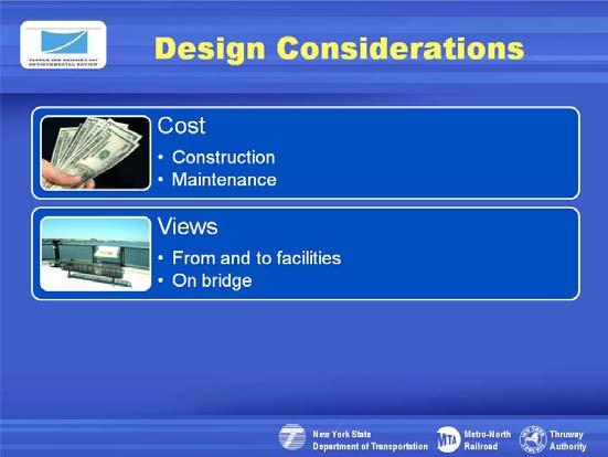
19 Slide 52. Ultimately to decide on the ped/bike path, we will be utilizing the following design considerations. Slide 53. Ultimately to decide on the ped/bike path, we will be utilizing the following design considerations. Slide 54. Ultimately to decide on the ped/bike path, we will be utilizing the following design considerations

20 Slide 55. We want your help to deliberate on the important questions surrounding bike/ped facilities on (and accessing) the bridge. We will then be taking your comments/recommendations into account during the design stages of the project. Slide 56. We look forward to working with you on this and would like to open the floor to questions for the project team
the New Transit Systems in the Tappan Zee Bridge/I287 Corridor
 the New Transit Systems in the Tappan Zee Bridge/I287 Corridor Russell Robbins Transportation Planning Manager NYSDOT-Tappan Zee Bridge/I-287 Corridor Project Tarrytown, N.Y. New Transit Systems in the
Non-Motorized Transportation 7-1
 Non-Motorized Transportation 7-1 Transportation facilities no longer mean just accommodating a vehicle powered by a combustion engine. Pedestrian and non-motorized facilities are important modes of travel
TRANSPORTATION COMMISSION Agenda Staff Report
 TRANSPORTATION COMMISSION Agenda Staff Report Agenda Item No. 5.a DATE: JULY 31, 2014 TO: FROM: SUBJECT: TRANSPORTATION COMMISSION COMMUNITY DEVELOPMENT DEPARTMENT - PLANNING DRAFT OLYMPIC CORRIDOR PREFERRED
TRANSPORTATION & MOBILITY
 TRANSPORTATION & MOBILITY ROADWAY SYSTEM There are approximately 40 miles of roadways in Manitou Springs. For planning purposes, roadways are typically assigned a functional classification which defines
Chapter 5 Future Transportation
 Chapter 5 Future Transportation The Future Land Use Plan identifies the desired land use designations. The land uses desired for Crozet depend, in large part, on the success of the transportation system,
C C C
 C-012-001 Thank you for your support for the creation of new public space and nonmotorized access between downtown and the waterfront through the Overlook Walk, the East-West Connections, and the Promenade.
Chapter 3 DESIGN SPECIFICATIONS
 Brampton PathWays Planning and Design Guidelines 27 Chapter 3 DESIGN SPECIFICATIONS 3.1 CLASS 1 MULTI-USE PATH Off-road multi-use trails are the backbone of the Brampton PathWays Network. They are typically
5. RUNNINGWAY GUIDELINES
 5. RUNNINGWAY GUIDELINES These guidelines should be considered collectively when making runningway decisions. A runningway is the linear component of the transit system that forms the right-of-way reserved
Agenda. Overview PRINCE GEORGE S PLAZA METRO AREA PEDESTRIAN PLAN
 PRINCE GEORGE S PLAZA METRO AREA PEDESTRIAN PLAN May 28, 2008 Agenda Welcome and introductions Project overview and issue identification Planning context and strengths Design challenges and initial recommendations
Physical Implications of Complete Streets Policies
 Presentation Overview Physical Implications of Complete Norm Cox, ASLA, LLA Landscape Architect Ann Arbor, Michigan, 10:45 to Noon What Are Complete Streets? What Matters to Bicyclists and Pedestrians
DRAFT - CITY OF MEDFORD TRANSPORTATION SYSTEM PLAN Roadway Cross-Sections
 Roadway Cross-Sections Medford s roadway cross-section standards apply to new and reconstructed roads. The crosssections take into consideration roadway function and operational characteristics, including
section 4 Existing Conditions, Issues, and Options
 section 4 Existing Conditions, Issues, and Options 4.0 Existing Conditions, Issues, and Options This section analyzes each segment of the corridor on a street to street basis. Each segment is discussed
Connecting cyclists to work. Syracuse Metropolitan Transportation Council
 Connecting cyclists to work Syracuse Metropolitan Transportation Council Overview Prepared at request: NYS Department of Transportation (NYSDOT) Project Achievements Target group Purpose Process Recommendations
Lee s Summit Road Improvement Study Public Open House June 7, 2007 Summary of Comment Card Responses
 Lee s Summit Road Improvement Study Public Open House June 7, 2007 Summary of Comment Card Responses Introduction At the Lee s Summit Road Improvement Study Public Open House held Thursday, June 7, 2007
APPENDIX A: Complete Streets Checklist DRAFT NOVEMBER 2016
 APPENDIX A: Complete Streets Checklist DRAFT NOVEMBER 2016 Complete Streets Checklist MetroPlan Orlando s Complete Streets Checklist is an internal planning tool for staff to further implementation of
2.0 Existing Conditions
 20 2.0 Existing Conditions 2.1 Land Use, Future Growth Patterns, Physical Barriers Geographic Overview Sutter County s land use pattern is characterized by extensive agricultural areas, significant natural
Proposed Bridge Street East Bicycle Lanes Public Open House Thursday, April 27, 2017
 WELCOME Proposed Bridge Street East Bicycle Lanes Public Open House Thursday, April 27, 2017 Purpose of the Open House The purpose of this Open House is to gain public input on the bicycle lanes proposed
Lynchburg District Update
 Lynchburg District Update Virginia Statewide Bicycle and Pedestrian Advisory Committee Spring Meeting May 16 th, 2017 David Cook Transportation Planner, VDOT Lynchburg District Table of Contents Active
Outreach Approach RENEW SF served as the primary liaison with the North Beach community; the Chinatown. Executive Summary
 Executive Summary Executive Summary The Columbus Avenue Neighborhood Transportation Study s objective is to identify changes to transportation infrastructure and policies that could enhance the livability
Previous Transit Studies MTTF MEETING #
 Previous Transit Studies MTTF MEETING #4 2013-03-22 Agenda Project timeline Final transit recommendation (2011) Transit planning and development (2002 2011) Moving forward (2011 2013) 2 Project Timeline
Saskatchewan Drive Roadway Rehabilitation and Shared-Use Path Widening
 Saskatchewan Drive Roadway Rehabilitation and Shared-Use Path Widening We are here today to present the draft plan for the Saskatchewan Drive Roadway Rehabilitation and Shared-Use Path Widening project
Fitting Light Rail through Well-established Communities
 Fitting Light Rail through Well-established Communities San Francisco 2008 Michael D. Madden Chief, Project Development, Maryland Transit Administration Project Setting Located inside the Capital Beltway
Chapter 2: Standards for Access, Non-Motorized, and Transit
 Standards for Access, Non-Motorized, and Transit Chapter 2: Standards for Access, Non-Motorized, and Transit The Washtenaw County Access Management Plan was developed based on the analysis of existing
PRINCE GEORGE S PLAZA METRO AREA PEDESTRIAN PLAN
 PRINCE GEORGE S PLAZA METRO AREA PEDESTRIAN PLAN May 28, 2008 Agenda Welcome and introductions Project overview and issue identification Planning context and strengths Design challenges and initial recommendations
Watertown Complete Streets Prioritization Plan. Public Meeting #1 December 14, 2017
 Watertown Complete Streets Prioritization Plan Public Meeting #1 December 14, 2017 Goals for Public Meeting Overview of MassDOT Complete Streets Funding Program Educate the community on Complete Streets
Active Transportation Facility Glossary
 Active Transportation Facility Glossary This document defines different active transportation facilities and suggests appropriate corridor types. Click on a facility type to jump to its definition. Bike
Duwamish Way-finding and CTR Report
 V. North Tukwila When the North Tukwila Manufacturing and Industrial Center was designated in 1992 as part of the region s land use and transportation plan, the plan called for the area to set a light-rail
MAG Town of Cave Creek Bike Study Task 6 Executive Summary and Regional Significance Report
 Page 1 MAG Town of Cave Creek Bike Study Task 6 Executive Summary and Regional Significance Report August 1, 2012 MAG Project #481 Page 2 Task 6 Executive Summary and Regional Significance Report Introduction
CONCERNS / CHALLENGES
 CONCERNS / CHALLENGES Time frame Transit Pedestrian Access & Comfort Bicycle Access & Comfort Neighborhood Spillover Public Info & Signange Connection to Downtown Physical Contraints of site 0-5 years
NEWMARKET UPHAM S CORNER
 SOUTH STATION Planning Initiative NEWMARKET UPHAM S CORNER COLUMBIA ROAD (P) FOUR CORNERS/GENEVA Working Advisory Group (WAG) Meeting #5 TALBOT AVENUE MORTON STREET BLUE HILL AVE/CUMMINS HWY (P) RIVER
43 rd Avenue, Skillman Avenue Protected Bike Lanes
 43 rd Avenue, Skillman Avenue Protected Bike Lanes Presented to Queens Community Board 2 Transportation Committee - November 6, 2017 43 rd Avenue, Skillman Avenue: Presentation Overview Background Project
Long List of Level 1 Alternatives
 New York State Thruway Authority MTA Metro-North Railroad Long List of Level 1 Alternatives Tappan Zee Bridge/I-287 Environmental Review June 8, 2003 Long List of Alternatives Alternative No. Title Description
Prince George s County plans, policies, and projects
 Prince George s County plans, policies, and projects Over 250 projects for trails, bikeways, designated bike lanes and sidewalk construction Trail projects that improve access to Metro Sidewalk and trail
Balancing Operation & Safety for Motorized and Non-Motorized Traffic
 Balancing Operation & Safety for Motorized and Non-Motorized Traffic Brian Willham, PE, PTOE Iowa Director - MOVITE June 30, 2014 Learning Objectives: When & Why should we measure the performance of complete
Downtown BRT Corridor Alternatives Review: 1 st, 2 nd, 3 rd and 4 th Avenue. Bus Rapid and Conventional Transit Planning and Design Services
 Downtown BRT Corridor Alternatives Review: 1 st, 2 nd, 3 rd and 4 th Avenue Bus Rapid and Conventional Transit Planning and Design Services City of Saskatoon February 2018 Project Team HDR Corporation
TxDOT Bicycle Tourism Trails Study Update. April 2017 BAC Meeting April 10, 2017
 AGENDA ITEM 6 TxDOT Bicycle Tourism Trails Study Update April 2017 BAC Meeting April 10, 2017 Agenda Approval of interim products o Present study vision statement, goals, and study objectives o Present
and older adults and people with disabilities still face barriers when using the pedestrian network and public transportation.
 Background Afterthe1980Olympics,theLakePlacid/NorthElbacommunityadoptedaneconomicstrategy ofdevelopingandmarketingeventstoincreaseareatourism.thisstrategyhasbeenvery successful.overrecentyearsthevolumeofvisitorshasincreased,andthelengthofthe
Montclair s Complete Streets Experience
 Presented by: Hon. Jerry Fried, Mayor Montclair Township About Montclair Six square miles Six commuter rail stations Four local bus routes (NJ Transit) Two private commuter bus routes Five business districts
Bicycle and Pedestrian Facilities Toolbox (Excerpt from Figure 3.1)
") Appendix B Neighborhood Connections Summaries This Appendix is a supplement to the information presented in Chapter 3 Connect People. The Appendix includes a summary or profile for each of the proposed
Appendix B Neighborhood Connections Summaries This Appendix is a supplement to the information presented in Chapter 3 Connect People. The Appendix includes a summary or profile for each of the proposed
Chapter 7 Nonmotorized Facilities
 Chapter 7 Nonmotorized Facilities What is in this chapter? This chapter discusses existing and proposed pedestrian and bicycle facilities referred to as nonmotorized facilities along the SR 520 corridor.
Walkable Community Workshops
 Presented by: Larry McAuliffe Manager, Research Unit, Planning Division New York Metropolitan Transportation Council NYSMPO Conference 2008 Walkable Community Workshops Discussion Topics: I. NYMTC in the
ACTIVE TRANSPORTATION/NONMOTORIZED TRANSPORTATION
 ACTIVE TRANSPORTATION/NONMOTORIZED TRANSPORTATION BACKGROUND Active transportation, also known as nonmotorized transportation, is increasingly recognized as an important consideration when planning and
What Is a Complete Street?
 Session 5 Charleen Zimmer, AICP, Zan Associates May 5-7, 2010 What Is a Complete Street? May 2010 5-1 Not a Complete Street More of a Complete Street May 2010 5-2 Benefits of Complete Streets Safety for
Welcome to the Sellwood Bridge Project Open House!
 Welcome to the Sellwood Bridge Project Open House! 5:30 7:30 pm Please sign in here Information stations and project staff are located throughout the room. Goals for Tonight s Meeting: Learn how the Preferred
Appendix C. Bicycle Route Signage
 Appendix C Bicycle Route Signage This page intentionally left blank. APPENDIX C - BICYCLE ROUTE AND WAYFINDING SIGNAGE Bicycle route signs are wayfinding signs that guide bicyclists along preferred, designated
Hennepin Avenue Reconstruction Washington Avenue to 12 th Street
 CITY OF MINNEAPOLIS Hennepin Avenue Reconstruction Washington Avenue to 12 th Street April 2016 1 Upcoming Opportunities Public Meeting #2 April 25, 2016 Minneapolis Central Library Doty Board Room Repeat
City of Madison: 2017 Capital Budget Capital Improvement Plan
 Capital Improvement Plan Project Summary Bikeways Program 779,000 751,000 630,000 670,000 703,000 703,000 Cannonball Path 210,000 - - 730,000 - - Cap City Trail 1,140,000-360,000 - - 910,000 Ice Age Junction
City of Seattle Edward B. Murray, Mayor
 City of Seattle Edward B. Murray, Mayor Department of Transportation Scott Kubly, Director Eastlake Community Council 117 E Louisa St. #1 Seattle, WA 98102-3278 January 28, 2016 RE: Roosevelt to Downtown
MASTER BICYCLE AND PEDESTRIAN PLAN
 VILLAGE OF NORTHBROOK MASTER BICYCLE AND PEDESTRIAN PLAN DRAFT PLAN OPEN HOUSE May 2, 2018 AGENDA 1. Community Engagement 2. Vision and Goals 3. General Structure of Plan 4. Recommendations Overview 5.
Traffic Improvements for the Transit Oriented Development District (TODD) Meriden Public Library March 11, 2014
 Meriden Public Library March 11, 2014") Traffic Improvements for the Transit Oriented Development District (TODD) Meriden Public Library March 11, 2014 Project Overview Coordinate roadway improvements with other major projects HUB Flood Control
Traffic Improvements for the Transit Oriented Development District (TODD) Meriden Public Library March 11, 2014 Project Overview Coordinate roadway improvements with other major projects HUB Flood Control
Environmental Assessment Findings & Recommendations. Public Hearing November 13, 2014
 Environmental Assessment Findings & Recommendations Public Hearing November 13, 2014 Welcome! Welcome and Introductions Project and Environmental Assessment Overview Public Comments Adjourn Purpose of
Circulation in Elk Grove includes: Motor vehicles, including cars and trucks
 Circulation, as it is used in this General Plan, refers to the many ways people and goods move from place to place in Elk Grove and the region. Circulation in Elk Grove includes: Motor vehicles, including
Pedestrian, Bicycle and Traffic Calming Strategic Implementation Plan. January 18, 2011
 Pedestrian, Bicycle and Traffic Calming Strategic Implementation Plan January 18, 2011 Tonight s Agenda Receive update on project Provide feedback on two policy issues Complete Streets Policy Project Prioritization
Long Island Rail Road Expansion Project Floral Park to Hicksville
 Long Island Rail Road Expansion Project Floral Park to Hicksville Final Environmental Impact Statement Appendix 1-D Complete Streets Policy Checklist April 2017 0902ML PIN: Project Location: 18A-4 Floral
NJDOT Complete Streets Checklist
 Background The New Jersey Department of Transportation s Complete Streets Policy promotes a comprehensive, integrated, connected multi-modal network by providing connections to bicycling and walking trip
Appendix 3 Roadway and Bike/Ped Design Standards
 Appendix 3 Roadway and Bike/Ped Design Standards OTO Transportation Plan 2040 4/20/2017 Page A3-1 Adopted Standards The adopted OTO Design Standards and Major Thoroughfare Plan are contained herein.
Item to be Addressed Checklist Consideration YES NO N/A Required Description Complete Streets Guidelines
 Passaic County Complete Streets Checklist - Concept Development Project Name Item to be Addressed Checklist Consideration YES NO N/A Required Description Complete Streets Guidelines Existing Plans Have
122 Avenue: 107 Street to Fort Road
 : 107 Street to Fort Road November 24, 2015 4:30 8:00 p.m. Meeting Purpose Summarize project work completed to date Share results of public input from Phase 1 Share the draft concept plan and proposed
In station areas, new pedestrian links can increase network connectivity and provide direct access to stations.
 The Last Mile Planning for Pedestrians Planning around stations will put pedestrians first. Making walking to stations safe and easy is important; walking will be a part of every rapid transit Accessible
REGIONAL BICYCLE AND PEDESTRIAN DESIGN GUIDELINES
 REGIONAL BICYCLE AND PEDESTRIAN DESIGN GUIDELINES November 16, 2011 Deb Humphreys North Central Texas Council of Governments Bicycle and Pedestrian Advisory Committee Snapshot of the Guide 1. Introduction
Project Description Form 6V
 Project Description Form 6V Basic Project Information Submitting Jurisdiction/Agency: Prince William County Project Title: Route 15 Widening: Route 55 to south of RR tracks & Construct RR Overpass Project
FEDERAL HIGHWAY ADMINISTRATION APPLICATION
 FEDERAL HIGHWAY ADMINISTRATION APPLICATION REQUEST FOR PERMISSION TO EXPERIMENT WITH A BICYCLE BOX INTERSECTION TREATMENT Submitted by: City of Columbus Department of Public Service Date: June 26, 2009
2014/2015 BIKE ROUTE PLAN 83 AVENUE PROTECTED BIKE LANE
 About the Project The City of Edmonton is planning a major bike route on the southside of Edmonton. The Strathcona Bike Route will connect the communities of Strathcona, Garneau and the University area,
Orinda Bicycle, Trails and Walkways Master Plan
 Orinda Bicycle, Trails and Walkways Master Plan Public Meeting October 15, 2008 Presented by: Ian Moore, Alta Lauren Ledbetter, Alta Bruce Wolff, Alta Introductions City of Orinda Monica Pacheco, Assistant
Town of Bethlehem. Planning Assessment. Bethlehem Town Board
 Town of Bethlehem US 9W Corridor Transportation Planning Assessment Presented e to: Bethlehem Town Board June 2009 Overview Study Background Route 9W Corridor Conditions and Improvements Selkirk Bypass
South Carolina Department of Transportation. Engineering Directive
 South Carolina Department of Transportation Engineering Directive Directive Number: ED-22 Effective: December 16, 2009 Subject: References: Purpose: This Directive Applies to: Considerations for Bicycle
San Jose Transportation Policy
 San Jose Transportation Policy Protected Intersections in LOS Policies to Support Smart Growth Presented by: Manuel Pineda City of San Jose Department of Transportation Bay Area Map San Francisco Oakland
Scarlett Road Bridge & Road Improvements Lambton Park Community School - Gymnasium Tuesday November 28 th, 2017
 Scarlett Road Bridge & Road Improvements Lambton Park Community School - Gymnasium Tuesday November 28 th, 2017 PROJECT LOCATION 2 SCARLETT ROAD BRIDGE Constructed in 1912, the bridge carries 4 active
3.9 Recreational Trails and Natural Areas
 3.9 Recreational Trails and Natural Areas 3.9.1 Introduction Parks and other recreational facilities such as trails, bicycle routes, and open space are important community resources. This section discusses
SAN FRANCISCO MUNICIPAL TRANSPORTATION AGENCY
 THIS PRINT COVERS CALENDAR ITEM NO. : 10.3 DIVISION: Sustainable Streets Division BRIEF DESCRIPTION: SAN FRANCISCO MUNICIPAL TRANSPORTATION AGENCY Approving traffic and parking modifications to install
Construction Specifications Manual
 Isle of Wight County Pedestrian and Bicycle Master Plan Construction Specifications Manual Adopted August 20, 2009 Introduction The Isle of Wight County Pedestrian and Bicycle Facilities Master Plan was
Bikeways Network and Facilities
 Findings from the bicycle survey showed a high bicycle use and demand for on and off road bikeway facilities. Currently, the City has 185 miles of bike lanes, 40 miles of signed routes to connect the network
Bicycle and Pedestrian Connectivity Study. Old Colony Planning Council
 Bicycle and Pedestrian Connectivity Study Old Colony Planning Council Outline Why consider bike/peds in road designs? Why are measures needed? Connecting Land Use with Transportation Evaluation Tools:
Basalt Creek Transportation Refinement Plan Recommendations
 Basalt Creek Transportation Refinement Plan Recommendations Introduction The Basalt Creek transportation planning effort analyzed future transportation conditions and evaluated alternative strategies for
Multi Modal Transit Access Plan KIPDA ID # 239. Project Type: STUDY
 Multi Modal Transit Access Plan KIPDA ID # 239 Project Type: STUDY Description: In conjunction with the results from Project Gobility and the Transit LOS Analysis, TARC seeks to examine the possibilities
Public Works Committee Meeting Richard E. Mastrangelo Council Chamber November 20, 2017
 Public Works Committee Meeting Richard E. Mastrangelo Council Chamber November 20, 2017 Purpose of Meeting Why are we here? Project Recap/Updates Project Limits/Segments Road Diet Concept Lessons Learned
CHAPTER 3: Vision Statement and Goals
 Davidson Walks & Rolls: Active Transportation Master Plan CHAPTER 3 Contents: Overview Vision Statement Measurable Goals Public Outreach CHAPTER 3: Vision Statement and Goals Overview The vision statement
Pennsylvania Avenue (CR 484) Design Alternatives Study
 Design Alternatives Study") MEMORANDUM Pennsylvania Avenue (CR 484) Design Alternatives Study Prepared for: APRIL 2016 Prepared By TABLE OF CONTENTS Project Background... 2 Previous Concept... 2 Existing Conditions... 4 New Alternatives...
MEMORANDUM Pennsylvania Avenue (CR 484) Design Alternatives Study Prepared for: APRIL 2016 Prepared By TABLE OF CONTENTS Project Background... 2 Previous Concept... 2 Existing Conditions... 4 New Alternatives...
Southwest Bus Rapid Transit (SW BRT) Functional Planning Study - Executive Summary January 19 LPT ATTACHMENT 2.
 Functional Planning Study - Executive Summary January 19 LPT ATTACHMENT 2.") Southwest Bus Rapid Transit (SW BRT) Functional Planning Study - Executive Summary 2011 January 19 1 of 19 Introduction This executive summary presents the results of the Southwest Bus Rapid Transit (SW
Southwest Bus Rapid Transit (SW BRT) Functional Planning Study - Executive Summary 2011 January 19 1 of 19 Introduction This executive summary presents the results of the Southwest Bus Rapid Transit (SW
Overview. Illinois Bike Summit IDOT Complete Streets Policy Presentation. What is a Complete Street? And why build them? And why build them?
 Overview Illinois Bike Summit IDOT Complete Streets Policy Presentation Aren Kriks, P.E. District One Bicycle Coordinator and Bureau of Programming Project Engineer History of Complete Streets IDOT Policy
CHAPTER 1 INTRODUCTION
 CHAPTER 1 INTRODUCTION Chapter Table of Contents THE 2017 HOUSTON BIKE PLAN 1-1 HOUSTON BIKEWAYS PROGRAM 1-2 HISTORY OF BICYCLE PLANNING IN HOUSTON 1-3 BICYCLE LEVEL OF COMFORT 1-3 EXISTING PLANS, PROGRAMS
LANCASTER CITY BICYCLE NETWORK
 LANCASTER CITY BICYCLE NETWORK Downtown Merchants Meeting Wednesday, July 19, 2017 http://www.lancasteratp. DOWNTOWN WALKABILITY ANALYSIS What changes can be made, in the least amount of time, and for
Improvements Infrastructure Gap Assessment and Improvements Street Striping
 Infrastructure Project Proposal The federal-aid Safe Routes to School program funds infrastructure/engineering projects that fall into two categories: Design (available only to School Development Authority
Shared Use Facili es. Mul -Use Trails. Chapter 3 Design Elements BICYCLE/PEDESTRIAN MULTI USE TRAILS
 Shared Use Facili es "Shared Use" or "Mul -Use" facili es are those where bicyclists share a facility with pedestrians and other non-motorized modes of travel such as equestrians, cross country skiers,
City of Wilsonville 5 th Street to Kinsman Road Extension Project
 City of Wilsonville 5 th Street to Kinsman Road Walking Tour & Neighborhood Workshop Summary Report Public Outreach Overview On July 18 th, 2017, the City of Wilsonville hosted a neighborhood walking tour
Pattullo Bridge Replacement Project Community Connections Phase 2 Consultation. Appendix 3: Open House Display Boards
 Replacement Project Community Connections Phase 2 Consultation Appendix 3: Open House Display Boards November 2016 Welcome! Welcome to the Replacement Project Public Open House We Want to Hear from You
2014/2015 BIKE ROUTE PLAN 83 AVENUE PROTECTED BIKE LANE
 About the Project 2014/2015 BIKE ROUTE PLAN The City of Edmonton is planning a major bike route on the south side of Edmonton. This bike route is one part of a plan to provide citizens with transportation
ROUTE 81 CORRIDOR STUDY DESIGN CONCEPTS
 RT 81 Corridor Study CLINTON ROUTE 81 CORRIDOR STUDY DESIGN CONCEPTS View north on High Street, with potential improvements to the streetscape Draft Recommendations November 8 th, 2018 TOWN OF CLINTON
NOTICE OF AVAILABILITY/NOTICE OF COMMENT PERIOD OF A DRAFT EIR/EIS/EIS FOR PUBLIC REVIEW AND HEARINGS
 Tahoe Transportation District 128 Market Street, Suite 3F Stateline, NV 89449 Phone: (775) 589-5500 www.tahoetransportation.org Federal Highway Administration 650 Capitol Mall, Suite 4-100 Sacramento,
Living Streets Policy
 Living Streets Policy Introduction Living streets balance the needs of motorists, bicyclists, pedestrians and transit riders in ways that promote safety and convenience, enhance community identity, create
Riverside Drive Complete Streets Project 3 rd Community Meeting. March 26, 2015
 Riverside Drive Complete Streets Project 3 rd Community Meeting March 26, 2015 Providing Feedback Sign-In with contact information for future updates Complete questionnaire provided tonight Complete comment
Bike Tarrytown Work Plan
 Bike Tarrytown Work Plan July 14, 2017 Mission To improve the economy, health, environment and quality of life in Sleepy Hollow and Tarrytown by fostering bike culture, creating better infrastructure and
Bluffdale/ UDOT South High-T Intersection Project Type Operations
 Bluffdale/ UDOT 14600 South High-T Intersection Project Type Operations 14600 South and Redwood Road $ 600,000 $ 550,000 This project is to install a new High-T intersection at Redwood Road and 14600 South
Bicycle & Pedestrian Plan
 4 Bicycle & Pedestrian Plan This chapter describes current bicycle and pedestrian facilities within Benton County, forecasts future needs for these modes of transportation, lists current policies and necessary
West Capitol Avenue Road Rehabilitation and Safety Enhancement Project
 West Capitol Avenue Road Rehabilitation and Safety Enhancement Project Stakeholder Focus Group Meeting #2 Tuesday, August 28, 2018 7:00 8:00 a.m. West Sacramento City Hall 1110 West Capitol Avenue, West
CURBSIDE ACTIVITY DESIGN
 5 CURBSIDE ACTIVITY DESIGN This chapter provides design guidance for separated bike lanes adjacent to curbside activities including parking, loading and bus stops. Typical configurations are presented
Houma-Thibodaux Metropolitan Planning Organization STP<200K Funding Application APPLICATION
 APPLICATION HOUMA-THIBODAUX METROPOLITAN PLANNING ORGANIZATION (HTMPO) FOR SURFACE TRANSPORTATION PROGRAM (STP
Sixth Line Development - Transit Facilities Plan
 Memorandum Date: November 13, 2012 To: From: c.c. Subject: Rob Freeman (Freeman Planning) Kevin Phillips Sixth Line Development - Transit Facilities Plan 33016631 This memo was prepared to review the transit
Active Transportation on the Rise
 Integrated Approaches to Shared-Use Paths Doug Sarkkinen, PE Windi Shapley, PE Mandi Roberts, AICP, PLA Why? Biking and walking are important active transportation options. Shared-use paths are critical
APPENDIX 2 LAKESHORE ROAD TRANSPORTATION REVIEW STUDY EXECUTIVE SUMMARY
 APPENDIX 2 LAKESHORE ROAD TRANSPORTATION REVIEW STUDY EXECUTIVE SUMMARY Appendix 2 City of Mississauga Lakeshore Road FINAL REPORT Transportation Review Study December 2010 EXECUTIVE SUMMARY Study Purpose