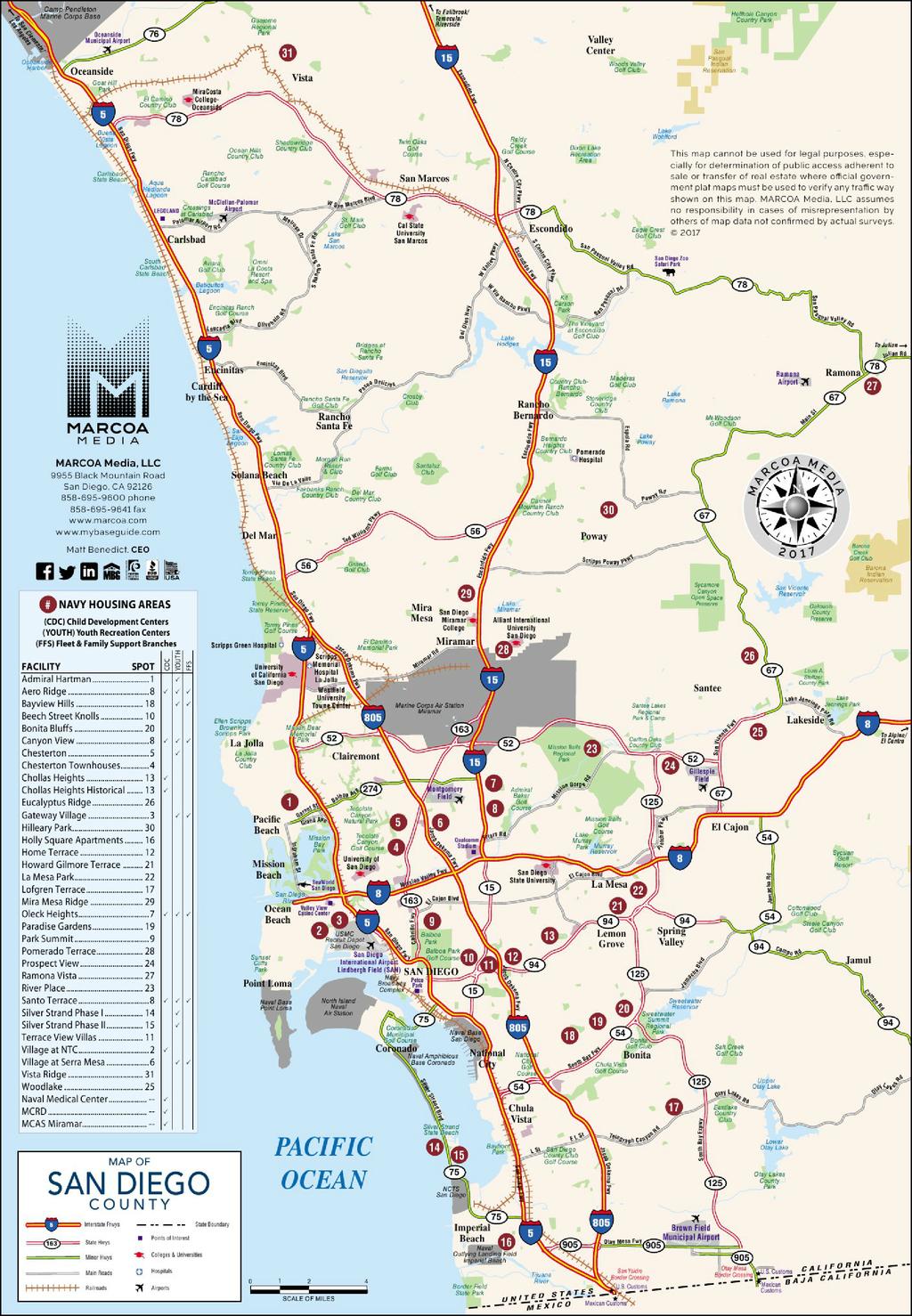
Naval Base Coronado. Figure 1. Naval Base Coronado location in the region
|
|
|
- Antony Warren Gilbert
- 5 years ago
- Views:
Transcription
.")
1 Naval Base Coronado Naval Base Coronado (NBC) is a hub for US naval activity and provides a shore-based platform for helicopters, aircraft carriers, SEAL Teams, and other ashore and afloat commands. NBC provides access to a comprehensive quantity of ground, sea, air, and undersea operational and training space. NBC is comprised of eight Navy installations (Table 1). These eight separate installations encompass more than 57,000 acres and make NBC the largest command in the southwest. A significant number of employees at NBC include engineers and mechanics. Table 1. List of installations comprising Naval Base Coronado Naval Base Coronado Installations: Naval Air Station North Island Coronado (NASNI) Naval Amphibious Base Coronado (NAB) Fleet Readiness Center Southwest at North Island Naval Outlying Landing Field, Imperial Beach (NOLF) Naval Auxiliary Landing Field San Clemente Island (NALF SCI) Silver Strand Training Complex South Coronado (SSTC-South) Camp Michael Monsoor Mountain Warfare Training Center La Posta* Camp Morena La Posta* Remote Training Site Warner Springs (RTSWS)* Notes: *Installation not discussed in this profile. Figure 1. Naval Base Coronado location in the region NBC supports more than 30,000 military and civilian personnel who utilize three airfields, three ports, multiple training ranges, and more than 1,400 buildings. NBC accommodates 23 squadrons, two aircraft carriers, four SEAL teams, Coastal Riverine squadrons, and other air, surface, and subsurface commands. The NBC installations in San Diego County are in the southern portion of the county, along Coronado Island (Figure 2). For this Report, Naval Air Station North Island Coronado (NASNI), Naval Amphibious Base Coronado (NAB), Silver Strand Training Complex-South Coronado (SSTC), and Naval Outlying Landing Field, Imperial Beach (NOLF) will be the only associated installations analyzed (Figure 2). Military Personnel Commuting Patterns The Navy provides on and off-base government housing options for military and civilian employees. Government housing options include temporary lodging, family housing, unaccompanied ( bachelor ) housing, and public-private venture housing on and off-base. Aircraft carriers and ships also serve as a living option for sailors, although the Department of Defense discourages using ships as a housing option. The rest of the military and civilian personnel live in one of the 20 off-base Navy affiliated housing areas (see Appendix A) or in housing options provided within the region or in neighboring counties. There is Lincoln Military Housing on Silver Strand and on NASNI. A majority of commuters to any of the NBC installations reside in the City of San Diego, followed by the City of Chula Vista, and the City of Coronado (Table 2). MMAS Briefing Book 1

2 Table 2. Commute origin of Naval Base Coronado Figure 2. Naval Base Coronado vicinity map Commute Origin Percent of Commuters City of San Diego 47% South San Diego County 32% East San Diego County 12% Riverside County 4% North San Diego County 3% Los Angeles County 1% Other 2% Total Responses 1784 Source: icommute Survey Results, July 2016 Notes: *Other includes other California Counties with less than 1%, out of state, and international zip codes. Figure 3. Commute mode to Naval Base Coronado Drive Alone 93% Carpool 7% Bike/Walk 9% Motorcycle 8% Vanpool 3% 3% Work from Home 1% Source: icommute Survey Results, July 2016 Notes: Total of 1774 Survey Responses with 34 responding other. Other not included in percentages above. Adds to more than 100% to account for multimodal trips. The primary commute mode for employees to NBC is driving alone. About 86% of military personnel drive alone for a portion of their trip or their entire trip (Figure 3). Commuters choose to drive alone due to the need for scheduling flexibility. There are several Park & Ride lots throughout San Diego County where commuters can meet to carpool, vanpool, or access transit services (see Appendix B). There are 58 registered icommute vanpools that commute to NBC 1. 12% of military personnel for NBC travel a portion of their trip or their entire trip by vanpool. Very few commuters bike, walk, or take transit to work. Interstate 5 (I-5) and State Route (SR 75) are major routes for NBC commuters. These routes experience heavy congestion particularly in the peak morning and afternoon hours. SR 75 experiences heavy congestion partially from long delays at major intersections with Orange Avenue, and partially from the volume of commute traffic. SR 75 connects the Cities of Imperial Beach and Coronado along the Silver Strand and provides connection to the NBC facilities in Coronado and Imperial Beach. Mobility Programs There are several mobility programs throughout the region, and icommute works closely with NBC to encourage alternative commute options. These commute options include carpool, vanpool, bike, transit, telework and shared mobility. The federal Transportation Incentive Program (TIP) and the Vanpool Program subsidy allows vanpool and transit users to commute for little to no cost, and icommute continues to encourage more federal employees to take advantage of these programs. All NBC facilities have vanpool participation and there is an abundance of parking available on base. MMAS Briefing Book 2

3 Golf carts are allowed to be driven throughout the City of Coronado, except for SR 75. There is an abundance of parking throughout Naval Base Coronado. There is also an electric vehicle station on the installation. A mobility report card identifying programs and complementing infrastructure projects that support access to NBC has been developed (see Appendix C). Some programs have policy restrictions or contractual agreements to allow services in a military installation or City; those programs are outlined to the respective jurisdictions in the mobility report card. Naval Air Station North Island Coronado (NASNI) Base Overview Naval Air Station North Island Coronado (NASNI) is a naval air station located on the northern end of Coronado Island (Figure 2). To the east, the installation is bordered by the Pacific Ocean, and to the west and north, it is bordered by the San Diego Bay. To the south, the installation borders the residential areas of the City of Coronado. The installation is host to 23 aviation squadrons and 80 tenant commands and activities. The installation has its own police and fire departments and military security stations. It has its own commissary, Navy Exchange, and housing units. There are several large factory-like buildings on base that comprise the Naval Aviation Depot, which is the largest aerospace employer in San Diego and employs approximately 3,300 civilians. This center includes shift work between the hours of 0600 and NASNI has over 230 aircraft stationed on its airfield and is homeport to two aircraft carriers. Additionally, the base is home to the Navy's only Deep Submergence Rescue Vehicles. With all the ships in port, the population of NASNI is nearly 35,000 active duty military, military reserves, and civilian personnel. Figure 4. Naval Air Station North Island existing connectivity Existing Connectivity Freeway/Roadway Network Interstate 5 (I-5) and State Route 75 (SR 75) are the two major freeways military personnel can use to access NASNI via transit, driving, carpooling, and vanpooling (Figure 4). I-5 connects with SR 75 at the San Diego-Coronado Bay Bridge in the City of San Diego and at Palm Avenue in Imperial Beach. SR 75 passes through the City of Coronado as Orange Avenue and extends the length of the Silver Strand, turning into Palm Avenue in Imperial Beach. SR 75 is 13 miles long and is the only road into and out of Coronado Island. There are MMAS Briefing Book 3
4 no carpool lanes along SR 75 or the portions of I-5 that join to SR 75. Due to the limiting access roads to NASNI, the City of Coronado streets experiences a significant amount of congestion during the morning and evening peak hours. MTS Route 901 provides a stop on base at the NASNI Center, located near the Main Gate of NASNI (Figure 4). This route has stops in Downtown San Diego, the City of Coronado (including along the Silver Strand), the City of Imperial Beach, and the community of Otay Mesa. Military personnel can use MTS Route 901 to connect to MTS Route 904, which travels along Orange Avenue and portions of the Silver Strand to connect people from Coronado City Hall to the Coronado Ferry Landing. MTS Route 901 can also be used to connect to bus routes in Downtown San Diego, Imperial Beach, or Otay Mesa. The City of Coronado subsidizes fares, increased frequencies, and extended hours for MTS Route 904 during the summer. The Coronado Ferry is a 15-minute ride across the San Diego Bay between Downtown San Diego and the City of Coronado 2 (Figure 4). It has three stops in total the Broadway Pier, Convention Center, and the Coronado Ferry Landing. Commuters ride free during early commuter hours between 5:40 a.m. - 8:50 a.m. and receive a return ticket to use that afternoon. People are allowed to bring their bikes on board the ferry. Additionally, the City of Coronado has Discover Coronado shuttles on Orange Avenue from the Ferry Landing to the Hotel Del Coronado which mainly caters to tourists. NASNI has an internal bus shuttle that connects central locations on base to the NASNI Center, where personnel can transfer to MTS Route This shuttle is available to all military, civilian and contractor personnel. It provides internal service between the Main Gate, carrier piers, air terminal, hangars, Fleet Readiness Center, and Navy Exchange, and only connects to the activity centers on the east side of the base. The shuttle operates on a continuous loop on weekdays from 5:30 a.m.to 7 a.m. and 2:30 p.m. to 4 p.m. Active Transportation NASNI employment areas are scattered throughout the installation, and each hangar is not comfortably within walking distance from the main gate. The City of Coronado is mostly residential with substantial sidewalks and one-way roads with very low speed limits. The posted speed limits the main entry and exit gates on 3 rd and 4 th Street is 30 mph. Within the City of Coronado, there are Class II bike facilities without buffers along 1 st Street, 6 th Street, and Glorietta Boulevard. A Class IV separated bicycle facility is provided on the east side of SR 75, known as the Bayshore Bikeway. There are no sidewalks on SR 75 (Silver Strand), but pedestrians frequently use the Bayshore Bikeway along this corridor. The Bayshore Bikeway is a regional corridor that, once completed, will extend 24 miles around San Diego Bay 4. The Bayshore Bikeway connects the City of Imperial Beach to the City of Coronado via a bike path along the Silver Strand. Bike facilities connect the Coronado Ferry Landing to NASNI. The Main Gate and Gate 2 are the only gates in close proximity to bike facilities. Gate Access NASNI has three access gates (Gate 1, Gate 2, and Gate 5). Unlike most other military installations, the majority of employees and civilians employed at NASNI cannot afford to live in the City of Coronado, so a significant number of challenges relate to throughput in and out of NASNI through the City of Coronado streets. Gate 1 (Main Gate) The Gate 1, also known as the Main Gate, is on the south side of NASNI. Vehicles enter the Main Gate via Stockdale Boulevard, which is an extension of Coronado s 3 rd Street (Figure 5). There are five inbound lanes that are used for general passenger car inspections and a separate inspection facility for trucks entering NASNI 5. Vehicles exit Main Gate from McCain Road, which has three outbound lanes and turns into Coronado s 4 th Street at Alameda Boulevard. There is also a separate pedestrian entrance located on 4 th Street, which is used primarily by transit riders. Pedestrians and people biking are not allowed to enter on 3 rd Street. The gate is open 24/7 daily 6. The Main Gate is the closest gate to the visitor center and NBC Headquarters. The Main Gate also provides access to commercial, recreational, and clinic facilities on base. The gate is adjacent to the NASNI Center, providing access to MTS Route 921. From the Main Gate, military personnel can use the internal road network of NASNI to access other important on-base locations such as training facilities and the NASNI Air Terminal. MMAS Briefing Book 4


5 Pedestrian entrance and exit facilities at the Main Gate are available. The pedestrian access at the Main Gate is located along McCain Blvd/4 th Street. There are signs that inform pedestrians that pedestrians are prohibited on 3 rd Street and that they need to enter using 4 th Street. However, there are no signs to guide them to the pedestrian facilities for the Main Gate. Figure 5. Naval Air Station North Island Main Gate & Gate 2 vicinity map During the morning peak period, traffic queues onto 3 rd Street and during extreme conditions can queue all the way to SR 75 and onto I-5 (see Appendix D). Although, there are five inbound lanes open, there are times when some lanes are queued back to the intersection of Alameda Boulevard and 3 rd Street while other lanes have relatively small queues. 3 rd street has free flow while traffic on Alameda Boulevard is stop controlled. During the morning peak, vehicles trying to continue south on Alameda Boulevard can have a difficult time finding a gap in 3 rd Street traffic to cross 3 rd Street. During the afternoon peak period, the traffic exiting the base onto 4 th Street exceeds the lane capacity creating delays and queues. Queues are regular along 4 th Street between NASNI and the San Diego Coronado Bay Bridge (see Appendix D). Exiting traffic queues from Orange Avenue and 4 th Street onto the base along McCain Boulevard. Gate 2 Gate 2 is on the south side of NASNI. Gate 2 has two inbound lanes and two outbound lanes (Figure 5). Vehicles enter and exit Gate 2 via Quary Road, which is an extension of Coronado s 1 st Street. The gate is open 24/7 6 and can be accessed by vehicles and pedestrians. There is also a pedestrian entrance located on the north side of the gate. Gate 2 provides direct access to the Commissary NEX (military grocery store), Navy Exchange, and other commercial/industrial land uses. From Gate 2, military personnel can use the internal road network of NASNI to access on-base locations such as training buildings, administrative buildings, and military resources. Pedestrians are allowed to enter at Gate 2, but it is not clearly dictated where they need to enter. There are no sidewalks on one side of 2 nd Street leading up to Gate 2, and the sidewalks on the other side terminate before reaching the gate. MMAS Briefing Book 5


6 During the morning peak, one of the outbound lanes temporarily becomes a third inbound lane to alleviate traffic queues at Gate 2. Traffic along Alameda Boulevard has a free movement and traffic along 1st Street/Quay Road is stop controlled. During the morning peak, all westbound traffic from 1st Street entering Gate 2 has to stop at the intersection and wait for gaps in the free flow traffic entering the gate from northbound Alameda Boulevard. This causes traffic to back up from the gate to the intersection of 1 st Street and E Avenue. In addition, when traffic queues for the Main Gate start backing up beyond military property, people start detouring to get to Gate 2 and often do so by turning down residential streets and alleys. The City posted signs to restrict these movements during the peak periods, but they are not always effective in preventing vehicles from making the maneuvers. During the afternoon peak period, queues for vehicles exiting the base regularly back up from the intersection of Orange Avenue and 1 st Street to the gatehouse. Adjacent streets are also affected by military personnel leaving Coronado in the afternoon. Gate 5 Gate 5 is located on the southwest side of NASNI (Figure 6). Gate 5 has one inbound lane and one outbound lane. There is a truck storage and inspection area located on the south side of the facility which is used for special deliveries. Vehicles enter and exit Gate 5 via Sherman Road, which has access provided from a driveway located at the termination of Coronado s Ocean Boulevard. The gate is open 24/7 6 and can be accessed by vehicles, trucks, pedestrians, and people biking. Figure 6. Naval Air Station North Island Gate 5 vicinity map Gate 5 provides direct access to Sea N Air Golf Course, navy onbase housing, and the NASNI Air Terminal. From Gate 5, military personnel can use the internal road network of the base to access other on-base resources such as training, administrative, and commercial facilities. During the morning peak, there is a high traffic volume entering NASNI through Gate 5. In order to accommodate the incoming vehicles, Gate 5 turns the outbound lane to a second inbound lane, making the gate have no outbound lanes. Thus, during the morning peak, the gate becomes an entrance only. If a vehicle is headed outbound or is denied entry and has to exit, the guards have to clear the inbound vehicles out of the outbound lane while the vehicle waits to exit. MMAS Briefing Book 6

7 During the afternoon hours, vehicles exiting NASNI through Gate 5 get delayed at the intersection of Ocean Boulevard and Ocean Drive either waiting for a gap in traffic to make a left turn or waiting for pedestrians to cross. In addition, there is general confusion at the cul-desac with vehicles queued waiting to enter, vehicles exiting freely, vehicles turning around at the end of the road, and vehicles parking. Goods Movement I-5 and SR 75 serve as major freight and goods movement corridors for NASNI and the region. Goods transported to the facility and between the facility and other bases use these corridors. In addition, goods arrive from ships docked at the piers. Trucks are used to move the material from the ships to their final destinations. Goods arriving and leaving the facility are directed to use the Main Gate and Gate 5. Due to the high volumes of vehicles, SR 75 continues to see high levels of traffic congestion and several intersections operate at a low level of service, especially during peak hours. This congestion not only causes poor access to NASNI, but also impedes trucks trying to access I-5 and leave Coronado Island. Jet fuel and explosives are restricted from being transported across the San Diego Coronado Bay Bridge. Trucks transporting these types of goods must travel along the Silver Strand and into Imperial Beach to access other freight corridors such as the I-5. Access to I-5 is critical for the flow of goods to and from NASNI. Naval Amphibious Base (NAB) Base Overview Naval Amphibious Base (NAB) is located in the City of Coronado, south of the main residential and commercial portions of the City (Figure 2). To the east and south, the installation is bordered by the San Diego Bay. To the west, the installation is bordered by the Pacific Ocean. The amphibious base includes 5,500 yards of Pacific Ocean and bayside beachfront for training 7. NAB is approximately 1,000 acres in size and is composed of the Main Base, training beaches, California Least Tern preserve, enlisted family housing, and state park. SR-75 separates NAB into ocean and bayside areas. Figure 7. Naval Amphibious Base existing connectivity There are about 381 temporary lodging and bachelor units on NAB that can accommodate up to 2,560 military and civilian employees 8. There also are 43 family housing units on NAB 8. Lincoln Military Housing Silver Strand is located south of NAB. Existing Connectivity Freeway/Roadway Network Silver Strand Boulevard (SR 75) is the only major corridor that military personnel can use to leave or enter NAB (Figure 7). From the northeast, commuters take SR 75 to cross the Coronado Bridge into the City of Coronado onto Orange Avenue to reconnect to SR 75 south. Cars making a left-turn onto Orange Avenue from SR 75 experience a spillover queue onto the bridge. From the South, SR 75 connects to I-5 via SR 75 (Palm Ave) which also experiences significant congestion during the morning and afternoon peak periods. The City of Coronado is implementing adaptive signals technology to MMAS Briefing Book 7
. This route has a stop outside of Gate 7 and Gate 11 along Silver Strand Boulevard.")
8 improve access onto NAB. NAB is adjacent to the cities of Coronado and Imperial Beach and other major arterials and freeways. MTS Route 901 is the only bus route that provides transit service to and from NAB (Figure 7). This route has a stop outside of Gate 7 and Gate 11 along Silver Strand Boulevard. There is no internal shuttle on NAB to help military personnel get between the ocean and bayside areas. There also is no shuttle between NAB and NASNI even though there are some trips between installations due to work tasks or military personnel living on one installation and working at the other. Active Transportation NAB is a small enough facility for walking or biking to support internal circulation; however, access to this base is very limited. Additionally, there is no bike infrastructure on-base. SR 75 (Silver Strand) has a posted speed limit of 45 MPH. A Class IV separated bicycle facility is provided on the east side of SR 75, known as the Bayshore Bikeway. There are no sidewalks on SR 75 (Silver Strand), but pedestrians frequently use the Bayshore Bikeway along this corridor. The Bayshore Bikeway runs along the east side of Silver Strand Boulevard adjacent to the bayside area of NAB (Figure 7). Gate Access There are four gates to access NAB. The main focus gates for this profile to address commutes are Gate 7 (Bayside Gate) and Gate 11 (Oceanside Gate). Gate 7 (Bayside Gate) Gate 7 (Bayside Gate) is located along Guadalcanal Road on the side of the base near the San Diego Bay (Figure 8). Vehicles enter and exit on Guadalcanal Road from the intersection with Strand Way. Strand Way is a short two-lane roadway that connects with Silver Strand Boulevard (State Route 75) on both ends with signalized intersections. The Bayside Gate provides one inbound lane and two outbound lanes. There is an additional exit for military personnel at the north end of Strand Way at Tarawa Road (Gate 1), which is only open in the afternoon peak. The Bayside Gate is open 24/7 6 and can be accessed by vehicles and pedestrians. The Bayside Gate provides a separate truck entrance and inspection area off Tulagi Road from its intersection with Strand Way (Gate 4). Figure 8. Naval Amphibious Base gates vicinity map MMAS Briefing Book 8
9 The Bayside Gate is in close proximity to temporary lodging facilities and several parking lots. Using the facility s internal roadway network allows military personnel to access the piers, Navy Exchange, on-base barracks, swimming pool complex, training facilities, and on base commercial/industrial buildings. The Bayside Gate experiences heavy congestion during morning commute hours as military personnel enter NAB (see Appendix D). Vehicles entering NAB via the Bayside Gate queue along both directions of Strand Way and along the southbound direction of Silver Strand Boulevard. Strand Way and Silver Strand Boulevard sees moderate traffic during afternoon commute hours. Gate 11 (Oceanside Gate) Gate 11 (Oceanside Gate) is located along Tawara Blvd near the intersection of Silver Strand Blvd and Tawara Blvd (Figure 8). The Oceanside Gate provides two inbound lanes and two outbound lanes. The gate is open 24/7 6 and can be accessed by vehicles, pedestrians, and people biking. The Oceanside Gate provides entrance to the ocean area of NAB, west of Silver Strand Blvd, which includes Naval Sea Systems Command Headquarters, retail buildings, parking lots, training facilities, and other Navy related land uses. During the morning peak period, queues primarily remain on Navy property but occasionally extend onto Silver Strand Boulevard and block the bus stop and pedestrian crosswalk at the intersection (see Appendix D). Queues extend beyond the roadway capacity leading to the Oceanside Gate and spill onto Silver Strand Boulevard. Most the queues are from the north for vehicles making a southbound right turn. On occasion, the queue for the northbound left turn pocket on Silver Strand Boulevard exceeds its capacity. During the afternoon queues, vehicles exiting the base queue beyond the length of Tarawa Road. Queues extend from the signalized intersection of Tarawa Road and Silver Strand Boulevard into the base. This traffic congestion spills into the internal roadway network of NAB. In general, Tawara Road, the road leading to the gate for people entering or exiting NAB is very congested during the morning and afternoon peak periods. Oceanside Gate also has inadequate pedestrian and bike facilities. There are several driveways that cross the pedestrian path-of-travel along Tawara Road. There also are no crosswalks to cross Tawara Road at any point before or after the gate and no indication of where people biking should enter. Silver Strand Training Complex (SSTC) Base Overview Silver Strand Training Complex (SSTC) is located along the southern end of the City of Coronado, north of the City of Imperial Beach, and west of SR 75 (Figure 2). The Pacific Ocean and the San Diego Bay border the facility on its west and east side. SSTC is over 500 acres in size and provides a training environment for the Navy, Marines, and the military s special forces to train for waterborne approaches and critical urban warfare. The Navy has plans to expand its Special Warfare Command facilities at SSTC. The expansion, referred to as Naval Base Coronado Coastal Campus, includes over 20 projects and over one million square feet. The expansion will take approximately ten years to complete and over 3,000 military personnel from the Special Warfare Command at the current NAB location will be moved gradually to the Coastal Campus at SSTC. MMAS Briefing Book 9

10 Existing Connectivity Freeway/Roadway Network I-5 and SR 75 are the two major Figure 9. Silver Strand Training Complex existing connectivity freeways military personnel use to access SSTC (Figure 9). Military personnel travelling on I- 5 can take the Palm Avenue exit and head west towards SSTC. Palm Avenue is the beginning portion of SR 75 in the south. SR 75 and Palm Avenue become two separate facilities as people head westbound and pass 9 th Street. SR 75 continues towards the City of Coronado while Palm Avenue continues westbound. Palm Avenue is a major corridor for military personnel to reach the facility s gate. I-5 and SR 75 are major corridors used for transit, driving, carpool, and vanpool. However, there are no carpool lanes along SR 75 or the portions of the I-5 that join to SR 75. The MTS Blue Line Trolley stops at the Palm Avenue Trolley Station, which is over two miles from the base s gate (Figure 9). MTS Routes 933 and 934 both have a stop that is less than a half-mile from the SSTC Front Gate. MTS Routes 933 and 934 loop around Imperial Beach, travelling along Palm Avenue and Imperial Beach Boulevard. These routes connect to the Iris Avenue Center where there are multiple buses personnel can use to reach other locations in the region. Active Transportation Several bike facilities in the surrounding community help connect SSTC to destinations and other transportation options such as MTS Bus routes and the Blue Line Trolley. (Figure 9). SR 75 (Silver Strand) has a posted speed limit of 45 MPH. A Class IV separated bicycle facility is provided on the east side of SR 75, known as the Bayshore Bikeway. There are no sidewalks on SR 75 (Silver Strand), but pedestrians frequently use the Bayshore Bikeway along this corridor. The Bayshore Bikeway runs along the east side of Silver Strand Boulevard adjacent to the bayside area of NAB (Figure 9). There are bike routes (without markings or striping) that share the roadway with motor vehicles on Seacoast Drive, 7 th Street, Connecticut Street, and 13 th Street. The posted speed limits along these corridors is 25 MPH. Military personnel can use these facilities to travel north of the base into the City of Coronado or south into the City of Imperial Beach. There are also west-east bike routes (without markings or striping) that share the roadway with motor vehicles on portions of Palm Avenue, portions of Elm Avenue and Imperial Beach Boulevard. A small portion of Palm Avenue includes a Class II bike lane (without a buffer); this street has some traffic calming measures and a posted speed limit of 35 MPH. MMAS Briefing Book 10

11 Gate Access SSTC has two gates of access. The Front Gate is located on the southside of SSTC along Hooper Boulevard, north of Palm Avenue. This gate is encouraged to have limited access because the spillover queueing affects the adjacent residential neighborhoods. An additional gate was recently built in August 2018 with support from the Defense Access Road Program at the north end of SSTC at Hooper Boulevard along SR 75. Figure 10. Silver Strand Training Complex gates vicinity map Front Gate The Front Gate is located on the southside of SSTC along Hooper Boulevard, north of Palm Avenue (Figure 10). The gate has one inbound lane and one outbound lane. The gate provides access to training facilities on base. Upon exiting the gate, military personnel enter the City of Imperial Beach. The area of Imperial Beach adjacent to the gate is primarily residential with pockets of commercial and institutional land uses. The area also has been identified as an existing / planned smart growth opportunity area (see Appendix D). The roads leading to the gate experience moderate to heavy congestion during peak commute hours (see Appendix D). Seacoast Drive, Palm Avenue, and other local streets leading to the gate experience minimal traffic delays during the morning peak, but heavier congestion during the afternoon peak hours as military personnel leave the base. New Gate North of SSTC The Front Gate is located on the northside of SSTC along Hooper Boulevard, north of Palm Avenue (Figure 11) and is the main encourage point of access from SR 75. This location is just south of Coronado Cays residences on Silver Strand. It is bordered by the San Diego Bay to the east and the Pacific Ocean to the West. MMAS Briefing Book 11

12 Naval Outlying Landing Field (NOLF) Base Overview Naval Outlying Landing Field Imperial Beach (NOLF) is located in the City of Imperial Beach, near the U.S.-Mexico border (Figure 2). NOLF is surrounded by the Tijuana River Wildlife Refuge to the west, Tijuana River Valley to the south, the City of San Diego to the east, and the City of Imperial Beach to the north. The Tijuana River Wildlife Refuge and Tijuana River Valley are natural preserves and mostly open land. The City of Imperial Beach and the City of San Diego surrounding NOLF are primarily densely populated residential areas with some commercial and industry space. NOLF is about 1,204 acres with 270 acres leased for agricultural purposes and 284 acres for wildlife refuge 9. The airfield provides training for the Pacific Fleet helicopter squadrons based at NASNI 11. It provides a venue within which the Navy helicopter squadrons can train intensely without interfering with the fixed wing and other helicopter air operations that are part of NASNI s daily activities. In recent years, there have been more than 200,000 takeoffs and landings at NOLF each year. Approximately 900 personnel work on the base, and about 850 of them are civilian employees. Existing Connectivity Freeway/Roadway Network SR 75 is a major corridor north of the base that connects to I-5 east of the base (Figure 11). SR 75 connects the cities of Imperial Beach and Coronado and Downtown San Diego. There are several Park and Ride lots along I- 5 where commuters can meet to carpool, vanpool, or access transit services (see Appendix A). Figure 11. Naval Outlying Landing Field Imperial Beach existing connectivity Satellite Boulevard and Iris Avenue connect NOLF to areas in the east. 13 th Street is an arterial connecting the City of Imperial Beach to the base. The Blue Line Trolley stops at Iris Avenue Station and Palm Avenue Station, which are over two miles from the base s gate. MTS Routes 933 and 934 create a loop around the City of Imperial Beach and the portions of the City of San Diego to the east of 13 th Street. These routes connect the surrounding residential neighborhoods to NOLF base. There are several stops along Iris Avenue, Satellite Boulevard, and 13 th Street that bring passengers close to the base s entrance. MTS Route 901 brings passengers from the cities of Imperial Beach and Coronado, and Downtown San Diego to stops within a couple blocks of the base gate. MMAS Briefing Book 12

13 Active Transportation There is a Class II bike lane with a striped buffer on 13 th Street which provides direct access to Gate 12. The posted speed limit on this street is 30 MPH. The adjacent community is mostly residential with substantial sidewalks. Additionally, there are bike routes (without markings or striping) that share the roadway with motor vehicles on Seacoast Drive, 7 th Street, Connecticut Street, and 13 th Street that help connect NOLF to areas of Imperial Beach. The posted speed limits along these corridors is 25 MPH. There are also west-east bike routes (without markings or striping) that share the roadway with motor vehicles on portions of Palm Avenue, portions of Elm Avenue and Imperial Beach Boulevard. A small portion of Palm Avenue includes a Class II bike lane (without a buffer); this street has some traffic calming measures and a posted speed limit of 35 MPH. Gate Access NOLF has one access gate (Gate 12). Gate 12 Gate 12 is located on the north side of NOLF near the intersection of 13 th Street and Iris Avenue (Figure 12). The gate has two inbound and one outbound lanes. There also is a separate truck entrance and inspection area. The gate provides access to vehicles, trucks, and pedestrians. Figure 12. Naval Outlying Landing Field Imperial Beach Gate 12 vicinity map The gate provides access to several parking lots, the Imperial Beach Commissary, Imperial Beach Main Navy Exchange, and various other commercial and industrial land uses within the base. Upon leaving the gate, military personnel have access to residential housing and open space parks with some education, commercial, and office buildings. Traffic is generally very heavy on pay days (usually the 1st and the 15th of the month). The major retail center at NOLF attracts active and retired military personnel and their families that live in the area during these days. MMAS Briefing Book 13
14 During the morning peak, the pedestrian gate is closed, requiring pedestrians to use the vehicle travel lane to get their credentials checked to enter NOLF. After the morning peak, the pedestrian gate re-opens. Bus stops are located near the gate, but no crosswalks are provided to cross 13th Street or Iris Avenue. The gate experiences minor to medium congestion traveling west along 13 th Street, traveling east on Iris Avenue / Satellite Boulevard and east on Grove Avenue / Halo Street during morning peak commute hours. I-5 and SR-75 experience no congestion at the morning commute hours (see Appendix D). During the afternoon peak hours, the gate experiences more significant congestion along 13 th Avenue and Grove Avenue / Halo Street. SR-75 experiences heavy traffic in the east direction in the afternoon. Goods Movement I-5 and SR 75 serve as major freight and goods movement corridors for NOLF and the region. Goods transported to the facility and between the facility and other bases use these corridors. Goods arriving and leaving the facility are directed to use the separate truck lane at Gate 12. However, it has been observed that the truck entrance is often closed and trucks need to wait for a guard to open it up. This delay sometimes interferes with movement at the intersection. SR 75 experiences significant traffic congestion and several intersections operate at a low level of service, especially during peak hours. This congestion not only causes poor access to NOLF, but also impedes trucks trying to access the other installations of NBC. Trucks transporting jet fuels and explosives travel along the SR 75 in Imperial Beach to access other freight corridors such as I-5. MMAS Briefing Book 14
15 Summary of Challenges for Naval Base Coronado Traffic / Connectivity Due to the limited access roads into NASNI, the City of Coronado streets experience congestion during the morning and evening peak hours SR 75 experiences traffic congestion from both the east (from I-5) and south (from Silver Strand) access corridors during peak hours Congestion on I-5 impacts access to SR 75 SR 75 needs signal upgrades and re-timing Gate queueing onto local streets Vehicular traffic to NASNI utilizing local street network deteriorates pavement conditions Congestion on local streets generated by military and civilian employees commuting to and traveling in between installations of NBC (e.g. Naval Air Station North Island, Naval Amphibious Base Coronado, NOFL) Congestion delays access to NASNI and trucks trying to access I-5 Coronado. Resident complaints about traffic noise in early mornings (5 a.m. to 6 a.m.) Limited traffic calming solutions on 3 rd Street and 4 th Street while maintaining traffic throughput Poor traffic flow at the intersections of 3 rd Street and Alameda Avenue, and 4 th Street and Alameda Avenue Gate 5 converts the outbound lane to a second inbound lane during the AM peak which limits vehicle egress Vehicles exiting NASNI through Gate 5 are delayed at the intersection of Ocean Boulevard and Ocean Drive due to limited gaps in traffic to make a left turn or waiting for pedestrians to cross. The City of Coronado posts signs to restrict detour movements off of 3 rd Street and 4 th Street during the peak periods, but they are not always effective in preventing vehicles from making the maneuvers without heavy enforcement operations Lack of traffic signal synchronization for outbound traffic from NASNI and along Palm Avenue The left turn signal on Orange Avenue from SR 75 does provide enough capacity to meet the morning peak demands, which leaves significant queuing onto the SR 75 (Coronado Bridge) Imperial Beach is a predominately a residential community with many residents commuting to other cities for employment Issues balancing people walking and biking with cars on SR 75 under Caltrans standards Traffic and movement of goods occurs between NOLF and NAB/NASNI since some inflatables and large equipment are stored at NOLF SR 75 could be impacted by sea level rise Navy is planning to grow by 17,000-20,000 new military personnel Mobility Most bike facilities are shared with motor vehicles No shuttle between NAB and NASNI to accommodate trips between installations due to work tasks or military personnel living on one installation and working at the other Local bus delays due to congestion in the City of Coronado during peak periods There is a lack of efficient internal circulation options on base Low ridership on MTS Route 901 and NASNI internal bus shuttle The NASNI internal shuttle only serves trips on the east side of the base Those who take MTS Route 901 would prefer to walk rather than taking the internal shuttle No shuttle between NAB and NASNI No transit access to new SSTC gate The main streets for entry and exit are on 3 rd and 4 th street one-way streets, and there are no priority lanes for alternative commutes (transit or bike) Pedestrians and people biking are not allowed to enter on 3 rd Street Limited bicycle access to gates except the Main Gate and Gate 2 MMAS Briefing Book 15
16 No wayfinding for pedestrians from 3 rd Street to the pedestrian access point at the Main There are some shared government cars available on base, but not a major program so there is some dependency on personal vehicles. The ferry no longer serves NASNI directly. Vehicles entering NAB via the Bayside Gate queue along both directions of Strand Way and along the southbound direction of Silver Strand Boulevard There are no sidewalks on SR 75 (Silver Strand) Long commute distance for most employees does not make biking a reasonable option No bike infrastructure on-base Limited shared government cars available on base Limited transit options from north San Diego cities (e.g. Escondido and other cities along I-15) Other Coordination challenges between the Navy and local jurisdictions Limited affordable housing options in nearby communities Unpredictable staff schedules limit their ability to utilize schedule-based mobility services like transit and vanpool Goods such as jet fuel and explosives must travel along Silver Strand Boulevard as they are not allowed on the San Diego- Coronado Bridge Parking restrictions on NASNI are only possible with effective alternative commuting options for access and internal circulation Congestion issues are affecting civilian employee retention There is only one electric vehicle charger on-base, and it is restricted to charging two cars at a time Egress volumes at back gate to NOLF Coastal Campus needs to be maintained MMAS Briefing Book 16
17 Relevant Projects & Programs for Naval Base Coronado Existing Planned Projects & Programs Relevant to Naval Air Station North Island (NASNI) Existing Planned Projects & Programs Relevant to Naval Air Station North Island (NASNI) Facility Silver Strand Boulevard Alameda Boulevard H Avenue B Avenue D Avenue Ocean Boulevard Citywide Fourth Street Project Extents Orange Avenue to Avenida Las Arenas Ocean Boulevard to First Street Olive Avenue to First Street Ynez Place to First Street First Street to Tenth Street NAS North Island to RD Dada Place east of Orange Avenue Improvement Type Active Active Active Active Active Active Active Roadway Subcategory Project Improvement Bicycle Bicycle Bicycle Bicycle Bicycle Bicycle Roadway/ Pedestrian/ Bicycle Traffic Class II bike lanes on southbound Silver Strand Boulevard with enhanced intersection crossings to connect to Silver Strand bike path. Class II bike lanes along Alameda Boulevard with High Visibility Activated Crossings (HAWK) signals at the intersections at Third and Fourth Street Class II bike lanes along H Avenue with High Visibility Activated Crossings (HAWK) signals at the intersections at Third and Fourth Street Class II bike lanes along B Avenue with High Visibility Activated Crossings (HAWK) signals at the intersections at Third and Fourth Street Class III bike route along D Avenue with Shared Lane Bicycle Markings (Sharrows) and intersection improvements such as enhanced crosswalks at Third and Fourth Street Class III bike route with Shared Lane Bicycle Markings (Sharrows) Wayfinding Sign Plan for Citywide active transportation programs Speed table east of Orange Avenue on Fourth Street Source City of Coronado Bike Plan / Bicycle Master Plan (2011) City of Coronado Bike Plan / Bicycle Master Plan (2011) City of Coronado Bike Plan / Bicycle Master Plan (2011) City of Coronado Bike Plan / Bicycle Master Plan (2011) City of Coronado Bike Plan / Bicycle Master Plan (2011) City of Coronado Bike Plan / Bicycle Master Plan (2011) City of Coronado Capital Improvement Program (CIP) (2016) City of Coronado Capital Improvement MMAS Briefing Book 17
18 Facility Fourth Street 10th Street Fourth Street Route 910 Route 639 Existing Planned Projects & Programs Relevant to Naval Air Station North Island (NASNI) Project Extents at Alameda Boulevard at Alameda Boulevard A Ave, C Ave and Pomona Street Coronado to Downtown San Diego Otay to North Island C= Conventional Highway F= Freeway Improvement Type Roadway Roadway Roadway Subcategory Project Improvement Traffic Intersection Intersection Rapid Rapid ML = Managed Lanes T = Toll Road Traffic signal at intersection (exit to NAS North Island) Analyze geometric configurations of the irregular intersection of Tenth Street and Alameda Boulevard to determine if the intersection can be reconfigured to enhance pedestrian crossing and calm traffic speeds on Alameda Boulevard. Project includes bulb-outs at Fourth Street at A Avenue, C Avenue and Pomona Street (south side only). In design, set for construction FY Connection from Coronado to Downtown San Diego Connection from Otay Iris Trolley Station to North Island via Imperial Beach and Silver Strand, Coronado Source Program (CIP) (2016) City of Coronado Capital Improvement Program (CIP) (2016) City of Coronado Capital Improvement Program (CIP) (2016) City of Coronado Capital Improvement Program (CIP) (2016) Plan (2015) Plan (2015) R = Reversible Lanes OPS = Operational Improvements MMAS Briefing Book 18
19 Existing Planned Projects & Programs Relevant to Naval Amphibious Base (NAB) Existing Planned Projects & Programs Relevant to Naval Amphibious Base (NAB) Facility 13th Avenue Silver Strand Boulevard I-5 Silver Strand Bike Path I-805 I-5 Project Extents Bayshore Bike path to Tower Road/Iris Ave Orange Avenue to Avenida Las Arenas San Ysidro to Downtown San Diego San Ysidro to Imperial Beach San Ysidro to Imperial Beach San Ysidro to Imperial Beach Improvement Type Active Active Active Subcategory Project Improvement Bicycle Bicycle Pedestrian Class II Bike lanes connecting the Bayshore Bikeway to the Imperial Beach airbase Class II bike lanes on southbound Silver Strand Boulevard with enhanced intersection crossings to connect to Silver Strand bike path. Add Pedestrian Over Crossing (POC) Americans with Disabilities Act (ADA) upgrades Active Bicycle Bayshore Bikeway Connection Active Active Bicycle Bicycle Tarawa Road Active Bicycle Bicycle signals SR-905 to Palomar St SR-905 to SR-54 Bayshore Bikeway Connection (Border Access) Bayshore Bikeway Connection (Imperial Beach Connector) Freeway Lanes Add two managed lanes ( 8F to 8F + 2ML) Freeway Lanes Add 2 Managed Lanes to 8 Freeway Lanes (8F to 8F + 2ML) Route 510 Trolley Blue Line Rail Grade Separation Route 639 Route 510 Otay to North Island Palomar St to 12th & Imperial Rapid Trolley Connection from Otay Iris Trolley Station to North Island via Imperial Beach and Silver Strand, Coronado Phase I - Blue Line Frequency Enhancements and rail grade separations at 28th St, 32nd St, E St, H St Palomar St, and Source Imperial Beach Capital Improvement Program (CIP) (2016) City of Coronado Bike Plan / Bicycle Master Plan (2011) Caltrans District System Management Plan (DSMP) (2016) Plan (2015) Plan (2015) Plan (2015) City of Coronado Bike Plan / Bicycle Master Plan (2011) Plan (2015) Plan (2015) Plan (2015) Plan (2015) Plan (2015) MMAS Briefing Book 19
20 Facility Existing Planned Projects & Programs Relevant to Naval Amphibious Base (NAB) Project Extents Improvement Type Subcategory Project Improvement Blue/Orange Track Connection at 12th/Imperial Source Route 562 Routes 640A/640B Route 510 San Ysidro to Kearny Mesa San Ysidro to Palomar University City to Downtown San Diego UTC to Route 510 COASTER Connection UTC to San Route 540 Ysidro via downtown C= Conventional Highway F= Freeway Trolley Rapid Trolley Trolley Trolley ML = Managed Lanes T = Toll Road Phase I - Connection from San Ysidro to Kearny Mesa via Chula Vista via Highland Ave/4th Ave, National City Southeast San Diego, Mid-City, and Mission Valley Route 640A: I-5 - San Ysidro to Old Town Center via City College; 640B: I-5 Iris Trolley/Palomar to Kearny Mesa va Chula Vista, National City and City College Blue line extension to University City providing public transportation in coastal San Diego County. Increased frequencies and front door access to Naval Base San Diego at 32nd St UTC COASTER Connection (extension of Route 510) Blue Line Express UTC to San Ysidro via downtown Plan (2015) Plan (2015) Plan (2015) Plan (2015) Plan (2015) R = Reversible Lanes OPS = Operational Improvements MMAS Briefing Book 20
21 Existing Planned Projects & Programs Relevant to Silver Strand Training Complex (SSTC) Existing Planned Projects & Programs Relevant to Silver Strand Training Complex (SSTC) Project Improvement Facility Subcategory Project Improvement Source Extents Type 13th Avenue I-5 I-805 I-5 Route 639 Routes 640A/640B Route 510 Route 562 San Ysidro to Imperial Beach San Ysidro to Imperial Beach San Ysidro to Imperial Beach Bayshore Bike path to Tower Road/Iris Ave San Ysidro to Downtown San Diego SR-905 to Palomar St SR-905 to SR-54 Otay to North Island San Ysidro to Palomar Palomar St to 12th & Imperial San Ysidro to Kearny Mesa Active Bicycle Bayshore Bikeway Connection Active Bicycle Bayshore Bikeway Connection (Border Access) Active Active Active Bicycle Bicycle Pedestrian Bayshore Bikeway Connection (Imperial Beach Connector) Class II Bike lanes connecting the Bayshore Bikeway to the Imperial Beach airbase Add Pedestrian Over Crossing (POC) Americans with Disabilities Act (ADA) upgrades Freeway Lanes Add two managed lanes ( 8F to 8F + 2ML) Freeway Lanes Rapid Rapid Trolley Trolley Add 2 Managed Lanes to 8 Freeway Lanes (8F to 8F + 2ML) Connection from Otay Iris Trolley Station to North Island via Imperial Beach and Silver Strand, Coronado Route 640A: I-5 - San Ysidro to Old Town Center via City College; 640B: I-5 Iris Trolley/Palomar to Kearny Mesa va Chula Vista, National City and City College Phase I - Blue Line Frequency Enhancements and rail grade separations at 28th St, 32nd St, E St, H St Palomar St, and Blue/Orange Track Connection at 12th/Imperial Phase I - Connection from San Ysidro to Kearny Mesa via Chula Vista via Highland Ave/4th Ave, National City Southeast San Diego, Mid-City, and Mission Valley Imperial Beach Capital Improvement Program (CIP) (2016) Caltrans District System Management Plan (DSMP) (2016) MMAS Briefing Book 21
22 Existing Planned Projects & Programs Relevant to Silver Strand Training Complex (SSTC) Project Improvement Facility Subcategory Project Improvement Source Extents Type University Blue line extension to University City providing City to public transportation in coastal San Diego Route 510 Trolley Downtown County. Increased frequencies and front door San Diego access to Naval Base San Diego at 32nd St Route 510 UTC to COASTER Connection Trolley UTC COASTER Connection (extension of Route 510) Route 510 Trolley Blue Line Rail Grade Separation UTC to San Route 540 Ysidro via downtown C= Conventional Highway F= Freeway Trolley ML = Managed Lanes T = Toll Road Blue Line Express UTC to San Ysidro via downtown R = Reversible Lanes OPS = Operational Improvements MMAS Briefing Book 22
23 Existing Planned Projects & Programs Relevant to Naval Outlying Landing Field Imperial Beach (NOLF) Existing Planned Projects & Programs Relevant to Naval Outlying Landing Field Imperial Beach (NOLF) Project Improvement Facility Subcategory Project Improvement Source Extents Type 13th Avenue I-5 I-805 I-5 Route 639 Routes 640A/640B Route 510 Route 562 Route 510 San Ysidro to Imperial Beach San Ysidro to Imperial Beach Bayshore Bike path to Tower Road/Iris Ave San Ysidro to Downtown San Diego SR-905 to Palomar St SR-905 to SR-54 Otay to North Island San Ysidro to Palomar Palomar St to 12th & Imperial San Ysidro to Kearny Mesa University City to Downtown San Diego Active Bicycle Bayshore Bikeway Connection Active Active Active Bicycle Bicycle Pedestrian Bayshore Bikeway Connection (Imperial Beach Connector) Class II Bike lanes connecting the Bayshore Bikeway to the Imperial Beach airbase Add Pedestrian Over Crossing (POC) Americans with Disabilities Act (ADA) upgrades Freeway Lanes Add two managed lanes ( 8F to 8F + 2ML) Freeway Lanes Rapid Rapid Trolley Trolley Trolley Add 2 Managed Lanes to 8 Freeway Lanes (8F to 8F + 2ML) Connection from Otay Iris Trolley Station to North Island via Imperial Beach and Silver Strand, Coronado Route 640A: I-5 - San Ysidro to Old Town Center via City College; 640B: I-5 Iris Trolley/Palomar to Kearny Mesa va Chula Vista, National City and City College Phase I - Blue Line Frequency Enhancements and rail grade separations at 28th St, 32nd St, E St, H St Palomar St, and Blue/Orange Track Connection at 12th/Imperial Phase I - Connection from San Ysidro to Kearny Mesa via Chula Vista via Highland Ave/4th Ave, National City Southeast San Diego, Mid-City, and Mission Valley Blue line extension to University City providing public transportation in coastal San Diego County. Increased frequencies and front door access to Naval Base San Diego at 32nd St Imperial Beach Capital Improvement Program (CIP) (2016) Caltrans District System Management Plan (DSMP) (2016) MMAS Briefing Book 23
24 Existing Planned Projects & Programs Relevant to Naval Outlying Landing Field Imperial Beach (NOLF) Facility Project Improvement Extents Type Subcategory Project Improvement Source Route 510 UTC to UTC COASTER Connection (extension of COASTER Trolley Route 510) Connection Route 510 Trolley Blue Line Rail Grade Separation UTC to San Route 540 Ysidro via downtown C= Conventional Highway F= Freeway Trolley ML = Managed Lanes T = Toll Road Blue Line Express UTC to San Ysidro via downtown R = Reversible Lanes OPS = Operational Improvements MMAS Briefing Book 24
25 References 1 icommute Registered Vanpool County for FY Kimley-Horn and Associates, Inc. (2013). Naval Base Coronado Entry Control Facility Study NBC Quarterly Bachelor Housing Utilization Plan (April 2010) 9 Appendix Appendix A. Navy Affiliated Housing Areas Appendix B. icommute Park & Ride Map Appendix C. NBC Mobility Report Card Appendix D. Google Traffic Maps MMAS Briefing Book 25
26 Appendix A. Navy Affiliated Housing Areas MMAS Briefing Book DRAFT NBC APPENDIX
27
28 Appendix B. icommute Park & Ride Map MMAS Briefing Book DRAFT NBC APPENDIX


 MENIFEE PERRIS icommute program.")
29 79 southern riverside SAN JACINTO Riverside County Park & Ride lots are maintained by the F PERRIS Riverside County Transportation Commission (RCTC), unless G otherwise noted. For more information visit IE511.org (Full San Diego region Park & Ride map on reverse) TRANSIT PARKING SPACES TEMECULA C LOCATION EN A TR L AV H E HEMET A United Methodist Church Margarita Rd 71 B Orchard Christian Fellowship Moraga Rd 105 C Rancho Community Church**** Rancho Community Way Park & Ride Park & Ride lots are free, conveniently located throughout COLLIER AVE L L AKE ELSINORE the region, and offer a great place to meet carpool or vanpool partners. This map provides a locator tool for approximately K DEXTER AVE 90 Park & Ride lots in the San Diego region and in southern I D Winchester* Winchester Rd 87 E Promenade Mall** Winchester Rd 75 Riverside County. The map also has information about each lot s features, including the number of parking spaces, bike M 74 lockers, and transit connections. Leave your solo commute J behind and find an alternative way to get to work and to many GRAND AVE SAN JACINTO F park and go ORANGE Mt. San Jacinto College*** 1499 N State St other destinations around San Diego County. 79 SCOTT RD icommute 27 More information about Park & Ride lots is available through the San Diego Association of Governments () MENIFEE PERRIS icommute program. icommute assists commuters by H South Perris Station 1304 Case Road 74 providing carpool and ridematching services, a subsidized 215 RD 24 vanpool program, transit solutions, the Guaranteed Ride TE R G Downtown Perris Station C St and 4th St K Dexter* Dexter Ave ES CH IN for more information is a free phone and web service that consolidates the MURRIETA N LAKE ELSINORE Grand Grand Ave 511sd.com/iCommute or call 511 and say icommute 15 The View Church Bradley Rd J and pedestrian safety program support for schools. Visit W MENIFEE I Home program, regional support for biking, and bike San Diego region s transportation information into a one- 79 E D 50 Shepherd of Life Grand Ave 50 CA L conditions, incidents, and driving times; schedule, route, and fare information for San Diego public transportation services; commuter services; and biking information. The 511 service is A available 24 hours a day, seven days a week at M 511sd.com, by calling 511, or by downloading the 511 San D AR IT M HO AR 186 B NC stop resource. 511 provides current information on: traffic D IA R G Outlet Center Collier Ave RA RN IFO AR L PROM ENAD E MALL LOOP C TEM TEMECUL A PKW LA ECU Diego mobile app, available for ios and Android. Y 79 MURRIETA N Promise Lutheran Church Madison Ave 46 Last modified: May 2016 RIVERSIDE * Not an RCTC lot ** Not an RCTC lot; permit required. Call (951) *** Permit required. Call (951) SA N D I EGO **** Not an RCTC lot. No overnight parking. vanpool MIS SIO D NR CAMP PENDLETON A vanpool brings five or more people together to share the costs of getting to work in a van or SUV. It s like a carpool, CA only bigger! Vanpool participants generally pay less than M IN 76 O D EL R E Y $100 per month to get to work, and multiple vehicle options are available. Visit RedesignYourCommute.com to learn my favorite morning meeting 76 more. GO P H E R CANYON RD 35 V I S TA W AY OCEANSIDE LV D ST 78 VISTA ES C O N D ID O AV E L L EGE B O CO ES 44 REA L RN 5 SS I E E L C A M I NO MI BA guaranteed ride home N 73 AV 34 ESCONDIDO SAN MARCOS EL BAR N W Y RD 69 HAM North San Diego Region Park & Ride Location 11 DR ND CO ES D V BL 5 E ID carpool, vanpool, take transit, walk, or bike to work in legend US TR CI E AV CARLSBAD SS I O PK AY MI NOR T E AD W N BRO 78 With Guaranteed Ride Home (GRH), commuters who 33 DEER SPRIN GS RD VA LL EY P O F E L IC Y KW (Full San Diego region shown on reverse) 64 VE ITA A Direct Access Ramp (DAR) 3 San Diego County have a built-in safety net. In case of emergency or unscheduled overtime, the GRH L A C O S TA A V E MILE S V IA RA 32 program will get you home for free. To find out more, N visit 511sd.com/iCommute. 0 CH O P K WY 81 0 NORTH CALIFORNIA DEPARTMENT OF TRANSPORTATION CALIFORNIA DEPARTMENT OF TRANSPORTATION ENCINITAS 62 EN C I N I TA S B LV D san diego regional Southern Riverside Park & Ride Location 15 SAN TA FE DR Note: When displaying the signature in color form, the "C" is to be Turquoise PMS (Pantone Matching System) #326, the "t" is to be Blue PMS # 299, the logo type is to be black K ILOME TE R S 3 4 park & ride map


30 MIS SION R D CES S PA CA M IN 8 Lemon Grove Ave at High St 43 9 I-805 at Sweetwater Rd SR 78 at Broadway Lemon Grove Ave at Lincoln St I-8 at Taylor St I-15 at SR I-805 at Governor Dr NOR T E EL M CARLSBAD I SS I O BAR N PK W 30 Y 38 RD 69 HAM San Diego Park & Ride Location 11 DR 5 L VA E I-8 at Murray Dr I-805 at Mira Mesa Blvd & Vista Sorrento Pkwy SR 54 at Washington Ave Carmel Mountain Rd at Rancho Carmel Dr 125 SAN TA FE DR 28 SR 94 at Potrero Post Office I-8 at Japatul Valley Rd 25 A N EL IJ O SOL ANA BEACH C I N I TA S B LV D DAY ST NA RD O RD RA NC HO BER E SR 54 at Jamacha Blvd I-8 at Lake Jennings Park Rd I-5 at Gilman Dr I-5 at SR 78 & Moreno St SR 78 at College Blvd (North) Telegraph Canyon Rd at Paseo Del Rey* Bancroft Dr at Grossmont Blvd Severin Dr at Bancroft Dr East Valley Pkwy at Citrus Ave I-15 at Rancho Bernardo Rd SR 78 at Barham Dr* 89 Sweetwater Springs Blvd at Austin Dr North Magnolia Ave at Alexander Way* Mission Ave at Frontier Dr SR 67 at Dye Rd* I-15 at Scripps Poway Pkwy SR 67 at Poway Rd I-805 at Children s Way Caliente Ave Westfield North County Shopping Center** 76 8 HIGH ST 12 5 LEMON GROVE SW EET 59 RD TER WA LE Y 8 GO by BIKE to close the gaps in your commute. Secure 41 bike parking facilities are available throughout the region to make your trip a little easier. They keep your bike safe GROSSMONT BLVD 25 check the list on this map. There is no fee to use bike 54 sign up for bike parking or get more information on bike parking facilities just a small, refundable deposit. To commuting, visit 511sd.com/iCommute J A M A C HA R D TripPlanner RD CORONADO NATIONAL CIT Y WASHINGTON AVE AL PA R A D I S E V ES To find out which Park & Ride lots have bike parking, C KS MU AK E U N I V E R S I T Y AV E JA 22 N B LV D E B LV D 35 EL CA JO 805 TAYLOR ST AV MAPLEVIEW ST 10 O SR 67 at Day St 8 17 O DE RD D WAY L O I DS RD while you take transit or share a ride to work. RE 78 CHILDRE N S 8 FO EL CAJON AT E R ETW S W E G S B LV D S P R IN 63 SAN DIEGO O W 125 LA MESA O T DR 27 IO N G IS S B R IVE 2 72 BANCR O F Encinitas Blvd at Calle Magdelena* R SK Y LINE D T H S T R A V O CA D ON D R Carmel Mountain Rd at Stoney Creek Rd* GOVERNOR DR R 57 SANTEE M 88 MIR AM AR RD 805 TI AL Carmel Mountain Rd at Paseo Cardiel* I E 53 M AV SEE I-15 at Rancho Peñasquitos Blvd HILLERY DR NE 51 secure bike parking 6 S PS P O WAY P K W Y G Twin Peaks Rd at Budwin Ln* RD AY IN 48 SCR I P POW RD O EA S TAY L AK ES RD T H ST Find the best way to get where you need to go by 50 comparing multiple transportation choices in one place. TELEGRAPH CANYON RD Just enter your starting point and destination in TripPlanner and click Let s Go! It s that easy. Trip Planner compares CHUL A VISTA carpool, vanpool, transit, walk, and bike options, while 94 calculating time, cost, calories burned, and emissions estimates. 5 *Park & Ride parking Monday-Friday, 5:30 a.m. - 6 p.m. only **Park & Ride parking Monday-Friday only Tap & Ride Tap & Ride COUNT Y OF SAN DIEGO SABRE SPRINGS PKWY H I-5 at Birmingham Dr 77 CO C 47 visit 511sd.com/compass for more information. L OS 50 A D PO RD WAY N N JE D KE R LA RK PA SR 76 at Sweetgrass Ln* ES B LV GE 46 SO R T RE N M 42 B LV D 48 D RA 106 EY SR MAGN OLIA AVE I-8 at Los Coches Rd GILMAN DR 41 LL O VA Albertsons and select Vons stores in San Diego County or AK RANCHO CARMEL DR M TN RD 76 PE R LV R AY D SR 78 at College Blvd (South) Your transit ride is even easier with Compass Card the smart card for transit passes. Get your Compass Card at ER D 39 IN E 111 board the bus, Rapid, Trolley, COASTER, or SPRINTER. DY E R D POWAY RG 7 Oakes Rd at El Norte Pkwy* Mission Gorge Rd at Big Rock Dr TE M 38 DEL MAR U N TA I N R D DE MO SR 94 at Avocado Blvd CA RM EL BLACK 37 money on gas, and ease the stress of your daily commute. Park at a transit station or Park & Ride lot and get on 26 EL RD RM EY A C ALL V 11 Severin Dr at Murray Dr NO Taking public transportation helps you beat traffic, save TW 41 I-15 at Gopher Canyon Rd 61 MI K ILOME TE R S 15 CA AV 4 81 O P K WY R I-15 at Mountain Meadow Rd BIRMING HAM DR CH O 34 I-15 at Deer Springs Rd EN 62 3 transit N 33 NORTH 1 L 115 ENCINITAS N S I-5 at La Costa Ave ITA 1 0 AV E V RA MILE S F E L IC O L A C O S TA A V E WY IA 32 SR 78 at Sunset Dr & Seaview Pl I-15 at El Norte Pkwy K YP LE Direct Access Ramp (DAR) 0 ID Poway Rd at Sabre Springs Pkwy up-to-date Park & Ride lot information. ESCONDIDO SAN MARCOS ND CO ES D V BL 16 Visit Caltrans at dot.ca.gov/dist11 to find the most legend US TR CI E AV 45 NO 78 AY SR 67 at Mapleview St RE 44 AD W N BRO 10 MO ST HPark & Ride lot locations and amenities change periodically. BL VD 50 Information on this map is accurate as of May HA I-5 at Carmel Valley Rd & Sorrento Valley Rd 33 DEER SPRIN GS RD AC 7 5 VISTA M 176 E JA I-15 at Mira Mesa Blvd AV B 6 SS I MI LE M GR ON OV EA V 43 N Maxson St at Barnes St O 5 park & ride map 73 ES C O N D ID O AV E 102 V I S TA W AY Carmel Mountain Rd at Freeport Rd D 4 OCEANSIDE LV 30 L L EGE B Felicita Ave at Escondido Blvd 35 P H E R CANYON RD CO 3 REA L 30 E L C A M I NO SR 67 at Riverford Rd & Woodside Ave ST 2 GO ES 45 RN SR 94 at Sweetwater Springs Blvd 76 BA 1 76 O D EL R E ING PA R K BIK TRA 46 CAMP PENDLETON Y NSI T EP ARK ING san diego region park & ride lots CALTRANS LOT # 19 IMPERIAL BEACH AMERIC TAT E S O F UNITED S MEXICO A 29
31 Appendix C. Naval Base Coronado Mobility Report Card MMAS Briefing Book DRAFT NBC APPENDIX


 lanes on SR 75 Freeway Network Parking Carshare Limited government fleet No current programs No current programs Parking On-Demand")
 No current programs Prohibited per City policy No current")
32 MOBILITY OPTIONS Mobility Report Card Naval Base Coronado How is it supported in the following areas: On Base City of Coronado City of Imperial Beach What infrastructure projects are related? Walking/Biking NASNI - Activity centers (e.g. hangars) are far apart/spread out NAB, SSTC, NOLF - Activity centers are walkable/bikeable; however gate access options are limited Substantial sidewalks and low speed limits. No sidewalks on Silver Strand. Bayshore Bikeway Class II bike lanes on 1st St., 6th St., & Glorietta Blvd. Class III bike route on Alameda St Substantial sidewalks. No sidewalks on Silver Strand. Bayshore Bikeway Intermittent Class III bike routes along local streets Class II bike lanes on 13th St. and intermittent Class II bike lanes on Palm Avenue Active Transportation Local Roads Public No transit services on base MTS Route 901, 904 Ferry MTS Blue Line Trolley MTS Routes 901, 933, & 934 Infrastructure Microtransit Internal shuttle on NASNI No current service No current service Local Roads Carpool & Vanpool Vanpool subsidy with TIPS icommute Vanpool Program No designated parking spaces for carpool or vanpool No existing High Occupancy Vehicle (HOV) lanes on SR 75 No existing High Occupancy Vehicle (HOV) lanes on SR 75 Freeway Network Parking Carshare Limited government fleet No current programs No current programs Parking On-Demand Rideshare Waze Carpool Uber, Lyft with Security Clearance Waze Carpool Uber, Lyft Waze Carpool Uber, Lyft Local Roads Curbside Designation Bikeshare Lime permitted on base Prohibited per City policy Lime Electric Bike & Scootershare Neighborhood Electric Vehicles (NEVs) No current programs Prohibited per City policy No current programs No current programs No current programs No current programs Active Transportation Local Roads Active Transportation Local Roads Active Transportation Local Roads Other High supply of parking Limited Electric Vehicle charging Smart Growth Opportunity Areas infrastructure (SGOAs): Downtown Coronado and Some goods movement prohibited Ferry Landing from using Coronado Bay Bridge and Limited street parking close to base instead limited to Silver Strand access SGOAs: Palm Avenue & Seacoast Drive and Palm Avenue & 9th St. Traffic Signal Synchronization to base Parking Electric Vehicle Charging Infrastructure
33 Appendix D. Google Traffic Maps MMAS Briefing Book DRAFT NBC APPENDIX

34 9/4/2018 Google Maps Map data 2018 Google 1000 ft Typical tra c Fast Slow S M T W T F S Wednesday, 6:00 AM 8 AM 12 PM 4 PM 8 PM 1/1
35 9/4/2018 Google Maps Map data 2018 Google 1000 ft Typical tra c Fast Slow S M T W T F S Thursday, 3:40 PM 8 AM 12 PM 4 PM 8 PM 1/1

36 9/4/2018 Google Maps Map data 2018 Google 200 ft Typical tra c Fast Slow S M T W T F S Thursday, 7:00 AM 8 AM 12 PM 4 PM 8 PM 1/1
37 9/4/2018 Google Maps Map data 2018 Google 200 ft Typical tra c Fast Slow S M T W T F S Thursday, 2:55 PM 8 AM 12 PM 4 PM 8 PM 1/1

38 8/21/2018 Naval Outlying Landing Field Imperial Beach - Google Maps Naval Outlying Landing Field Imperial Beach Map data 2018 Google 1000 ft Typical tra c Fast Slow S M T W T F S Monday, 8:00 AM 8 AM 12 PM 4 PM 8 PM 1/1

39 8/21/2018 Naval Outlying Landing Field Imperial Beach - Google Maps Naval Outlying Landing Field Imperial Beach Map data 2018 Google 1000 ft Typical tra c Fast Slow S M T W T F S Thursday, 4:10 PM 8 AM 12 PM 4 PM 8 PM 1/1
NASNI. With all the ships in port, the population of NASNI is nearly 35,000 active duty military, military reserves, and civilian personnel.
 Naval Base Coronado Naval Base Coronado (NBC) is a hub for US naval activity and provides a shore-based platform for helicopters, aircraft carriers, SEAL Teams, and other ashore and afloat commands. NBC
Naval Base San Diego. NBSD 32 nd Street Facility. Base Overview. Figure 1. Naval Base San Diego location in the region
 Naval Base San Diego Naval Base San Diego (NBSD) is comprised of the following campuses: 32nd Street Facility Naval Base (known as NBSD), Broadway Complex in Downtown San Diego, and the Naval Medical Center
Circulation in Elk Grove includes: Motor vehicles, including cars and trucks
 Circulation, as it is used in this General Plan, refers to the many ways people and goods move from place to place in Elk Grove and the region. Circulation in Elk Grove includes: Motor vehicles, including
Solana Beach Comprehensive Active Transportation Strategy (CATS)
") Solana Beach Comprehensive Active Transportation Strategy (CATS) 3.0 Goals & Policies The Solana Beach CATS goals and objectives outlined below were largely drawn from the Solana Beach Circulation Element
Solana Beach Comprehensive Active Transportation Strategy (CATS) 3.0 Goals & Policies The Solana Beach CATS goals and objectives outlined below were largely drawn from the Solana Beach Circulation Element
Mission Bay Loop (MBL) Public Meeting
 Public Meeting") Mission Bay Loop (MBL) Public Meeting La Scuola Internazionale di San Francisco, November 18, 2014 Frequently Asked Questions 1. When would construction have to start before the SFMTA loses TIGER funds?
Mission Bay Loop (MBL) Public Meeting La Scuola Internazionale di San Francisco, November 18, 2014 Frequently Asked Questions 1. When would construction have to start before the SFMTA loses TIGER funds?
4 MOBILITY PLAN. Mobility Plan Objectives. Mobility Context. 1. Integrate with Local and Regional Transit Improvements
 Harbor Mixed Use CHAPTER Transit Corridor 4: Mobility Plan 4 MOBILITY PLAN Mobility Plan Objectives The Harbor Corridor Plan seeks to expand and improve the ways that people move along and through the
EXECUTIVE SUMMARY... vii 1 STUDY OVERVIEW Study Scope Study Area Study Objectives
 Contents EXECUTIVE SUMMARY... vii 1 STUDY OVERVIEW... 1-1 1.1 Study Scope... 1-1 1.2 Study Area... 1-1 1.3 Study Objectives... 1-3 2 EXISTING CONDITIONS... 2-1 2.1 Existing Freeway Conditions... 2-4 2.1.1
North Coast Corridor:
 North Coast Corridor: Connecting People, Transportation & Environment Legislative Hearing: 11.8.10 1 North Coast Corridor Region s Lifeline A Regional Strategy Mobility, Economy & Environment North Coast
Purpose and Need. Chapter Introduction. 2.2 Project Purpose and Need Project Purpose Project Need
 Chapter 2 Purpose and Need 2.1 Introduction The El Camino Real Bus Rapid Transit (BRT) Project (Project) would make transit and other transportation improvements along a 17.6-mile segment of the El Camino
CHAPTER 3. Transportation and Circulation
 CHAPTER 3 Transportation and Circulation 3.0 TRANSPORTATION AND CIRCULATION This chapter evaluates traffic circulation, transit, parking, pedestrian, bicycle, and rail operational conditions in the Project
Berkeley Strategic Transportation Plan A-76
 Berkeley Strategic Transportation Plan A-76 Appendices 1. A Team Effort 2. Where We ve Been A-11 Berkeley Strategic Transportation Plan Alameda County Transportation Plan Alameda County will be served
TRANSPORTATION TRAINING TOPICS. April 6, 2010
 TRANSPORTATION TRAINING TOPICS April 6, 2010 Roles of Transportation Providers Context and Policy Makers Division of Transportation and Traffic Other City Operations Other Transportation Operators CMA
C C C
 C-012-001 Thank you for your support for the creation of new public space and nonmotorized access between downtown and the waterfront through the Overlook Walk, the East-West Connections, and the Promenade.
MCTC 2018 RTP SCS and Madera County RIFP Multi-Modal Project Eval Criteria GV13.xlsx
 MCTC 8 RTP SCS and Madera County RIFP Multi-Modal Project Eval Criteria GV.xlsx Madera County Transportation Commission Regional Transportation Plan / Sustainable Communities Strategy Multi-Modal Project
Northbound San Jose Avenue & I-280 Off-Ramp Road Diet Pilot Project
 Project Overview Fed by a two-lane Interstate-280 (I-280) off-ramp, high vehicular volumes and speeds are longstanding issues along San Jose Avenue. Residents in the surrounding neighborhoods have expressed
INFRASTRUCTURE: Using the Grid to Create a more Self-Sustaining Downtown. Studio Spring 2013
 EMERGENT FUTURES The San Diego Section of the American Society of Civil Engineers (ASCE) released a new report, the 2012 San Diego County Infrastructure Report Card. Since the last San Diego Report Card
Appendix T-2: Transportation Facilities Inventory
 Appendix T-2: Transportation Facilities Inventory Roads, Highways and Bridges The Georgia Department of Transportation (GDOT) maintains centerline mile measures for all counties in Georgia based on functional
KEARNY MESA COMMUNITY PLAN UPDATE
 KEARNY MESA COMMUNITY PLAN UPDATE January 18, 2018 SUBCOMMITTEE MEETING Mobility Concepts and Urban Design Presentation Outline Mobility Concepts: Multimodal Planning Toolbox Presentation and Activities
Bicycle Facilities Planning
 Bicycle Facilities Planning Overview Types of Cyclists Purpose for Riding Types of Facilities Bike Lanes Bicycle Boulevards Cycle Tracks Intersections Signals Signing and Marking Discussion Types of Bicyclists
SOLANA BEACH BICYCLE TRANSPORTATION PLAN SECOND ADDENDUM
 SOLANA BEACH BICYCLE TRANSPORTATION PLAN SECOND ADDENDUM Prepared by the City of Solana Beach January 2005 Introduction In June of 1993, the Solana Beach City Council adopted a Bikeway Master Plan as directed
TRANSPORTATION & MOBILITY
 TRANSPORTATION & MOBILITY ROADWAY SYSTEM There are approximately 40 miles of roadways in Manitou Springs. For planning purposes, roadways are typically assigned a functional classification which defines
ROADSOADS CONGESTION HAMPTON SYSTEMYSTEM MANAGEMENT. Part II Roadway Congestion Analysis Mitigation Strategies and Evaluation
 HAMPTON ROADSOADS CONGESTION MANAGEMENT SYSTEMYSTEM Part II Roadway Congestion Analysis Mitigation Strategies and Evaluation Presented by: Dwight Farmer, PE Deputy Executive Director, Transportation April
Board-Approved Funding Awards for Cycle 4 Active Transportation Grant Program Projects (in Order of Project Rankings) Approved on
 Approved on") CAPITAL Large Category Projects Board-Approved Funding Awards for Cycle 4 Active Transportation Grant Program Projects (in Order of Project Rankings) Approved on 07-27-18 1 La Mesa University Ave Pedestrian
CAPITAL Large Category Projects Board-Approved Funding Awards for Cycle 4 Active Transportation Grant Program Projects (in Order of Project Rankings) Approved on 07-27-18 1 La Mesa University Ave Pedestrian
2018 Transportation Survey October 17, Prepared by:
 Transportation Survey October 17, Prepared by: Overview Methodology Systemwide results Strengths/Weaknesses by mode Importance of possible improvements Conclusions Methodology 500 Chittenden County residents
TRAFFIC IMPACT ANALYSIS
 TRAFFIC IMPACT ANALYSIS FOR THE CHAMPAIGN UNIT#4 SCHOOL DISTRICT PROPOSED HIGH SCHOOL (SPALDING PARK SITE) IN THE CITY OF CHAMPAIGN Final Report Champaign Urbana Urbanized Area Transportation Study 6/24/2014
Downtown BRT Corridor Alternatives Review: 1 st, 2 nd, 3 rd and 4 th Avenue. Bus Rapid and Conventional Transit Planning and Design Services
 Downtown BRT Corridor Alternatives Review: 1 st, 2 nd, 3 rd and 4 th Avenue Bus Rapid and Conventional Transit Planning and Design Services City of Saskatoon February 2018 Project Team HDR Corporation
Chapter 2: Standards for Access, Non-Motorized, and Transit
 Standards for Access, Non-Motorized, and Transit Chapter 2: Standards for Access, Non-Motorized, and Transit The Washtenaw County Access Management Plan was developed based on the analysis of existing
CONNECTING PEOPLE TO PLACES
 CONNECTING PEOPLE TO PLACES 82 EAST BENCH MASTER PLAN 07 Introduction The East Bench transportation system is a collection of slow moving, treelined residential streets and major arteries that are the
Santa Clara I-280 CORRIDOR STUDY
 Santa Clara I-280 CORRIDOR STUDY OCTOBER 2017 PREPARED BY: 1.1 Background The I-280 Corridor Study within Santa Clara County is a high-level highway planning study led by the Santa Clara VTA, in partnership
CITY OF COCOA BEACH 2025 COMPREHENSIVE PLAN. Section VIII Mobility Element Goals, Objectives, and Policies
 CITY OF COCOA BEACH 2025 COMPREHENSIVE PLAN Section VIII Mobility Element Goals, Objectives, and Policies Adopted August 6, 2015 by Ordinance No. 1591 VIII MOBILITY ELEMENT Table of Contents Page Number
Where We Live and Work Today
 San Diego Forward: The 2019-2050 Regional Plan Network Concepts Transportation Committee Item 4 October 19, 2018 Where We Live and Work Today 2018 2 2019 Regional Plan Transportation Committee Item 4 October
Existing Transportation System
 < Open for Additional Text Transportation System Existing Transportation System This section describes vehicular transportation associated with Children s. transportation are described in a separate section
Speed Limits Study and Proposal. Public Input Session: 8/14/13
 Speed Limits Study and Proposal Public Input Session: 8/14/13 Why is Decatur a unique place for this project? First Community Transportation Plan in the nation with a Health Impact Assessment. Strong sense
Employment 8,881 17,975 9,094. Households 18,990 31,936 12,946
 This section describes the future transportation environment of the UW Tacoma campus and surrounding area. A description of the future conditions on campus in terms of the street system, traffic and intersection
Providence Downtown Transit Connector STAKEHOLDER MEETING #2. Stakeholder Meeting #1 October 24, 2016
 Providence Downtown Transit Connector STAKEHOLDER MEETING #2 Stakeholder Meeting #1 October 24, 2016 February 2017 1 AGENDA 1 DTC Goals and Expectations 2 Street Design Concepts 3 Potential Benefits and
WELCOME. Stakeholder Involvement Group Meeting #2 Round Lake Public Works October 24, 2018
 WELCOME Stakeholder Involvement Group Meeting #2 Round Lake Public Works October 24, 2018 MEETING AGENDA 1. Welcome and Introductions 2. Study Progress Update 3. Problem Statement 4. Technical Analysis
Transportation 6. A. Transit Center Circulation and Access. 1. Transit Center Circulation
 Transportation 6 This chapter describes the transportation system in and around the Hillsdale Station Area, with a focus on the Transit Center at the relocated Hillsdale Caltrain Station. The transportation
See Figure 38, Existing Nonmotorized Connections.
 Nonmotorized Connections Existing Nonmotorized Connections Pedestrian, vehicle and bike traffic access and movements are confined primarily to Penny Drive on campus. Due to the steep slope along the length
TECHNICAL MEMORANDUM. Introduction
 TECHNICAL MEMORANDUM To: From: John M. Welsh Chris Furlong AHC, Inc. Andrew T. Smith, P.E. Edward Y. Papazian, P.E. Kimley-Horn and Associates, Inc. Date: July 6, 2017 Subject: 200 9 th reet South Redevelopment
CPC Parking Lot Riverside Drive. Transportation Rationale
 CPC Parking Lot Transportation Rationale Prepared By: NOVATECH Suite 200, 240 Michael Cowpland Drive Ottawa, Ontario K2M 1P6 September 2015 Novatech File: 114093 Ref: R-2015-153 Table of Contents 1.0 INTRODUCTION...
1 st and 2 nd Street Couplet FAQ s
 1 st and 2 nd Street Couplet FAQ s Q. Will the proposed roundabout at Flume/2nd/1 st Streets affect access to businesses nearby?... 2 Q. What if the project isn t received well by the community after construction?...
HENDERSON DEVELOPMENT 213, 217, 221, 221 ½, 223 HENDERSON AVENUE and 65 TEMPLETON STREET OTTAWA, ONTARIO TRANSPORTATION OVERVIEW.
 HENDERSON DEVELOPMENT 213, 217, 221, 221 ½, 223 HENDERSON AVENUE and 65 TEMPLETON STREET OTTAWA, ONTARIO TRANSPORTATION OVERVIEW Prepared for: 2294170 Ontario Inc. February 2, 2017 117-652 Report_1.doc
City of Wayzata Comprehensive Plan 2030 Transportation Chapter: Appendix A
 A1. Functional Classification Table A-1 illustrates the Metropolitan Council s detailed criteria established for the functional classification of roadways within the Twin Cities Metropolitan Area. Table
Americans with Disabilities Act Transition Plan for Public Right-of-Way Improvements
 Americans with Disabilities Act Transition Plan for Public Right-of-Way Improvements Prepared by: Public Works Department Engineering Division October 2015 Table of Contents Section I Introduction.. 3
Clackamas County Comprehensive Plan
 ROADWAYS The County s road system permits the movement of goods and people between communities and regions, using any of a variety of modes of travel. Roads provide access to virtually all property. They
LSC TRANSPORTATION CONSULTANTS, INC. 516 North Tejon Street Colorado Springs, CO (719) FAX (719)
 FAX (719)") LSC TRANSPORTATION CONSULTANTS, INC. 516 North Tejon Street Colorado Springs, CO 80903 (719) 633-2868 FAX (719) 633-5430 E-mail: lsc@lsccs.com May 15, 2009 Mr. Davis Farrar Western Slope Consulting, LLC
LSC TRANSPORTATION CONSULTANTS, INC. 516 North Tejon Street Colorado Springs, CO 80903 (719) 633-2868 FAX (719) 633-5430 E-mail: lsc@lsccs.com May 15, 2009 Mr. Davis Farrar Western Slope Consulting, LLC
1.0 INTRODUCTION 1.1 PURPOSE OF THIS REPORT
 1.0 INTRODUCTION This chapter provides an overview of the purpose, authorization and focus of this Recirculated Draft Environmental Impact Report (EIR), an identification of the Lead Agency, an outline
o n - m o t o r i z e d transportation is an overlooked element that can greatly enhance the overall quality of life for the community s residents.
 N o n - m o t o r i z e d transportation is an overlooked element that can greatly enhance the overall quality of life for the community s residents. 84 Transportation CHAPTER 11 INTRODUCTION Transportation
4. ENVIRONMENTAL IMPACT ANALYSIS 9. TRANSPORTATION AND TRAFFIC
 4. ENVIRONMENTAL IMPACT ANALYSIS 9. TRANSPORTATION AND TRAFFIC 4.9.1 INTRODUCTION The following section addresses the Proposed Project s impact on transportation and traffic based on the Traffic Study
Waterford Lakes Small Area Study
 Waterford Lakes Small Area Study Existing Traffic Conditions PREPARED FOR: ORANGE COUNTY PUBLIC WORKS DEPARTMENT TRAFFIC ENGINEERING DIVISION ORLANDO, FLORIDA PREPARED WITH: INWOOD CONSULTING ENGINEERS
Downtown Naples Mobility and Connectivity Study. Naples City Council Presentation January 2017
 Downtown Naples Mobility and Connectivity Study Naples City Council Presentation January 2017 Agenda 1. Introduction 2. Scope Review 3. Project Schedule 4. Existing Conditions 5. Public Charrette 6. Mobility
Highway 217 Corridor Study. Phase I Overview Report
 Highway 217 Corridor Study Phase I Overview Report November 3, 24 BACKGROUND AND OVERVIEW Study purpose The Highway 217 Corridor Study is developing multi-modal transportation solutions for traffic problems
Typical Rush Hour Commute. PennyforTransportation.com
 Typical Rush Hour Commute In the News Overview of the Plan Collaborative plan with projects in every community Prioritizing connectivity and congestion relief Dedicated transportation-specific funding;
12/4/2016 VIA . RE: Grocery Outlet Del Paso (DR16-328)
") 12/4/2016 VIA EMAIL Ethan Meltzer, Assistant Planner City of Sacramento Community Development Department 300 Richards Blvd, 3 rd Floor Sacramento, CA 95811 RE: Grocery Outlet Del Paso (DR16-328) Dear Mr.
12/4/2016 VIA EMAIL Ethan Meltzer, Assistant Planner City of Sacramento Community Development Department 300 Richards Blvd, 3 rd Floor Sacramento, CA 95811 RE: Grocery Outlet Del Paso (DR16-328) Dear Mr.
West Dimond Blvd Upgrade Jodhpur Street to Sand Lake Road
 West Dimond Blvd Jodhpur St to Sand Lake CSS Transportation Project Summary Municipality of Anchorage Project # 05 005 Project Manager: John Smith, P.E. (MOA PM&E) Project Administrator: Julie Makela,
TRAFFIC ACTION PLAN. Laurie Meadows Neighborhood CITY OF SAN MATEO
 TRAFFIC ACTION PLAN Laurie Meadows Neighborhood CITY OF SAN MATEO Draft January 2017 Table of Contents Introduction... 2 The Traffic Forum Process... 5 Neighborhood Traffic Issues... 7 Neighborhood Recommendations
Bay to Bay Boulevard Complete Streets Project
 Bay to Bay Boulevard Complete Streets Project Dale Mabry Highway to Bayshore Boulevard February 08, 2018 Photo Source: Tampa Bay Times Alessandra Da Pra Meeting Format Introduction Resurfacing Information
MOBILITY WORKSHOP. Joint City Council and Transportation Commission May 5, 2014
 MOBILITY WORKSHOP Joint City Council and Transportation Commission May 5, 2014 Review of General Plan M-1 Develop world-class transit system M-3 Maintain/enhance pedestrian-oriented City M-4 Create comprehensive
AGENDA ITEM G-2 Public Works
 AGENDA ITEM G-2 Public Works STAFF REPORT City Council Meeting Date: 12/6/2016 Staff Report Number: 16-214-CC Regular Business: Approve the Oak Grove University Crane Bike Improvement Concept Plan, authorize
JONESBORO HIGHWAY 63 HIGHWAY 18 CONNECTOR STUDY
 JONESBORO HIGHWAY 63 HIGHWAY 18 CONNECTOR STUDY Craighead County May 2007 JONESBORO HIGHWAY 63 HIGHWAY 18 CONNECTOR STUDY Craighead County May 2007 Prepared by Planning and Research Division Arkansas State
Welcome! San Jose Avenue Open House August 25, 2015
 Welcome! San Jose Avenue Open House August 25, 2015 Vision Zero The City and County of San Francisco adopted Vision Zero San Francisco Vision Zero High Injury Network as a policy in 2014, committing an
Table #6 VISION CHARACTERISTICS
 Table #6 VISION White Flint is a place to live, work, play, shop, and walk with sufficient density to encourage quality redevelopment. Vibrant streets and consistent streetscapes are important. CHARACTERISTICS
DRAFT BUENA VISTA 2020 TRANSPORTATION PLAN
 DRAFT BUENA VISTA 2020 TRANSPORTATION PLAN DEVELOPED BY THE TRANSPORTATION PLANNING DIVISION OF THE VIRGINIA DEPARTMENT OF TRANSPORTATION IN COOPERATION WITH THE U.S. DEPARTMENT OF TRANSPORTATION, FEDERAL
Draft North Industrial Area-Wide Traffic Plan
 Summary of North Industrial and Hudson Bay Industrial Recommended Improvements Table 1. Summary of s Item Location 1 2 3 4 5 6 7 8 9 10 11 12 Millar Ave north of 51st St Super 8 Motel back lane 400 Block
CITY OF LOS ANGELES INTER-DEPARTMENTAL MEMORANDUM
 CITY OF LOS ANGELES INTER-DEPARTMENTAL MEMORANDUM Date: April 1, 219 To: Honorable City Council c/o City Clerk, Room 395, City Hall Attention: Honorable Mike Bonin, Chair, Transportation Committee From:
Memorandum. Sunday, July 13, Saturday, July 19, 2014
 Memorandum To: David Lowin, Brooklyn Bridge Park Corporation From: Daniel Schack, AICP, PTP Date: Re: Brooklyn Bridge Park Pier 5/6 Loop Road Traffic Study Project No: 14-01-2407 At the request of Brooklyn
Southwest Bus Rapid Transit (SW BRT) Functional Planning Study - Executive Summary January 19 LPT ATTACHMENT 2.
 Functional Planning Study - Executive Summary January 19 LPT ATTACHMENT 2.") Southwest Bus Rapid Transit (SW BRT) Functional Planning Study - Executive Summary 2011 January 19 1 of 19 Introduction This executive summary presents the results of the Southwest Bus Rapid Transit (SW
Southwest Bus Rapid Transit (SW BRT) Functional Planning Study - Executive Summary 2011 January 19 1 of 19 Introduction This executive summary presents the results of the Southwest Bus Rapid Transit (SW
SECTION 1 - TRAFFIC PLANNING
 SECTION 1 - TRAFFIC PLANNING 1.1 TRAFFIC OPERATIONS 1.1.1 Roadway Functional Classification The Multnomah County Comprehensive Framework Plan s Policy 34: Trafficways and the Functional Classification
Regional Transportation Needs Within Southeastern Wisconsin
 Regional Transportation Needs Within Southeastern Wisconsin #118274 May 24, 2006 1 Introduction The Southeastern Wisconsin Regional Planning Commission (SEWRPC) is the official areawide planning agency
3.0 PROJECT DESCRIPTION
 The following section of the Draft EIR contains a description of the proposed Elk Grove Boulevard/SR 99 Interchange Modification project, consistent with the requirements of CEQA Guidelines Section 15124.
Alaskan Way, Promenade, and Overlook Walk Final EIS
 I-065-001 As described in Section 3.7.2 of the Draft EIS, the loss of on-street and off-street parking may require drivers to park off-street or travel farther to find available on-street or off-street
Classification Criteria
 SCHEDULE D TO RECOMMENDED OFFICIAL PLAN AMENDMENT NO. 40 SCHEDULE C-4 Road Criteria Criteria Traffic Service Objective Land Service/Access Typical Daily Traffic Volume Flow characteristics Travel Speed
Traffic Impact Memorandum. May 22, 2018
 BISHOP PROFESSIONAL DEVELOPMENT BUILDING Proposed Land-use Change & Parking Modification 3601 SW 31st Street Topeka, Kansas 66614 CFS Project No. 185077 Traffic Impact Memorandum May 22, 2018 Prepared
Existing Transportation System
 < Please Open Page for Additional Text Transportation System Existing Transportation System This section describes vehicular transportation associated with Children s. Pedestrian and other nonmotorized
TRAFFIC ACTION PLAN. North Central Neighborhood CITY OF SAN MATEO
 TRAFFIC ACTION PLAN North Central Neighborhood CITY OF SAN MATEO Draft February 2017 Table of Contents Introduction... 1 The Traffic Forum Process... 4 Neighborhood Traffic Issues... 6 Neighborhood Recommendations
APPENDIX G: INTERSECTION NEEDS AT OKEECHOBEE BOULEVARD
 APPENDIX G: INTERSECTION NEEDS AT OKEECHOBEE BOULEVARD INTERSECTION NEEDS AT SR 7 and OKEECHOBEE BOULEVARD SR 7 Extension Project Development and Environment (PD&E) Study From Okeechobee Boulevard (SR
Short-Term Enhancements Improvements to keep Austin moving. MetroRapid
 Short-Term Enhancements Improvements to keep Austin moving Long-Term Investments Projects to support our future Mobility Hubs MetroRapid MetroRail MetroExpress Commuters Connectors Circulators Project
SETTINGS AND OPPORTUNITIES MOBILITY & ACCESS
 7 mobility & access how do people use el camino what is it like to drive on el camino/to park along el camino what is the pedestrian experience like what is the role of transit along the corridor what
List of Attachments. Location Map... Site Plan... City of Lake Elsinore Circulation Element... City of Lake Elsinore Roadway Cross-Sections...
 List of Attachments Exhibits Location Map... Site Plan... City of Lake Elsinore Circulation Element... City of Lake Elsinore Roadway Cross-Sections... Existing Lane Geometry and Traffic Controls... Existing
APPENDIX D: SACRAMENTO URBAN AREA TRANSPORTATION PRIORITIES
 1 County County County County 2 Yolo Arterial Roadway Collector Roadway Urban Residential Street Rural Residential Roadway I-80 / U.S. 50 Bus/Carpool Lanes in both directions Richards Blvd PM Yol 80 0.237
Bellevue Downtown Association Downtown Bike Series
 Bellevue Downtown Association Downtown Bike Series Meeting 2 Franz Loewenherz Andreas Piller Kyle Potuzak Chris Long October 26, 2017 Today s Agenda: 1) Meeting Purpose 2) 9/28 Meeting Recap 3) Candidate
Appendix C. NORTH METRO STATION AREA TRAFFIC IMPACT STATEMENT 88th Avenue Station
 Appendix C NORTH METRO STATION AREA TRAFFIC IMPACT STATEMENT 88th Avenue Station Prepared for: Regional Transportation Department and URS Corporation as part of the North Metro EIS David Evans and Associates,
Key objectives of the survey were to gain a better understanding of:
 3 COMMUNITY INPUT Community input is an essential part of corridor studies. For the SR 87 corridor study, VTA staff conducted an extensive online survey of people living and commuting along the corridor.
Active Transportation Facility Glossary
 Active Transportation Facility Glossary This document defines different active transportation facilities and suggests appropriate corridor types. Click on a facility type to jump to its definition. Bike
C/CAG. Sunnybrae Elementary School Walking and Bicycling Audit. San Mateo-Foster City School District JUNE 2013
 Sunnybrae Elementary School Walking and Bicycling Audit JUNE 2013 San Mateo-Foster City School District C/CAG City/County Association of Governments of San Mateo County SUNNYBRAE ELEMENTARY SCHOOL WALKING
SAN DIEGO FORWARD THE REGIONAL PLAN CONTENTS LAND USE / TRANSPORTATION / BENEFITS / IMPLEMENTATION / OUR FUTURE
 JANUARY 2016 SAN DIEGO FORWARD THE REGIONAL PLAN CONTENTS LAND USE / TRANSPORTATION / BENEFITS / IMPLEMENTATION / OUR FUTURE vision: to provide innovative mobility choices and planning to support a sustainable
Draft MOBILITY ELEMENET. Community Meeting May 22, 2013
 Draft MOBILITY ELEMENET Community Meeting May 22, 2013 Agenda Presentation Ira Brown New Mobility Paradigm Movement of People Implementation Q&A Ira Brown and Dave Roseman Small Group Discussion at Each
City of Gainesville Transportation/Roadway Needs PROJECT SUMMARY
 A1 Roadway Resurfacing $23,846,000 TYPE: Preservation of existing system Roadway resurfacing A2 Signal Replacement $6,000,000 TYPE: Preservation of existing system Replace traffic signals. B1 W 6th St
2.0 Existing Conditions
 20 2.0 Existing Conditions 2.1 Land Use, Future Growth Patterns, Physical Barriers Geographic Overview Sutter County s land use pattern is characterized by extensive agricultural areas, significant natural
Public Information and Participation Comments
 Two public meetings were held in December. The first meeting was December 6, 2011 at Mary Ellen Henderson Middle School and had 36 public attendees. The second meeting was on December 14, 2011 at the Arlington
How To Encourage More Efficient Transportation in Brazilian Cities
 How To Encourage More Efficient Transportation in Brazilian Cities Todd Litman Victoria Transport Policy Institute Presented Seminar on Discouraging The Use Of Cars São Paulo, Brazil 3 September 2013 Creating
MEMORANDUM. Sutter Street Bicycle Lanes, Stockton, CA SF
 MEMORANDUM Date: To: From: Subject: PURPOSE Anthony J. Lopes, Siegfried Engineering Christine Carey & Matthew Ridgway, Fehr & Peers Sutter Street Bicycle Lanes, Stockton, CA SF09-0468 The City of Stockton
New Seward and 36 th Avenue Intersection Conceptual Design
 University of Alaska Anchorage New Seward and 36 th Avenue Intersection Conceptual Design Prepared By: Zaid S. Hussein Dana Menendez Galen Jones Civil Engineering Department Prof. Osama Abaza CE A404 Highway
Transportation Impact Study for Abington Terrace
 Transportation Impact Study for Abington Terrace Abington Township, Montgomery County, PA Sandy A. Koza, P.E., PTOE PA PE License Number PE059911 Prepared by McMahon Associates, Inc. 425 Commerce Drive,
EXECUTIVE SUMMARY: TRANSIT-ORIENTED DEVELOPMENT IN SMITHS FALLS, ONTARIO; A COMPARISON BETWEEN TWO SITES
 EECUTIVE SUMMARY: TRANSIT-ORIENTED DEVELOPMENT IN SMITHS FALLS, ONTARIO; A COMPARISON BETWEEN TWO SITES Topic and Purpose In 2007, the Mayor of Ottawa s Task Force on Transportation suggested adding a
5/7/2013 VIA . RE: University Village Safeway Expansion (P13-019)
") 5/7/2013 VIA EMAIL David Hung, Associate Planner Community Development Department, Current Planning Division City of Sacramento 300 Richards Boulevard, 3 rd Floor Sacramento, CA 95811 RE: University Village
5/7/2013 VIA EMAIL David Hung, Associate Planner Community Development Department, Current Planning Division City of Sacramento 300 Richards Boulevard, 3 rd Floor Sacramento, CA 95811 RE: University Village
Focused Traffic Analysis for the 200 Nellen Avenue Project
 March 13, 2017 Mr. Phil Boyle Town of Corte Madera 300 Tamalpais Drive Corte Madera, CA 94976-0159 Focused Traffic Analysis for the 200 Nellen Avenue Project Dear Mr. Boyle; W-Trans has completed a focused
BEAR CREEK PARK AND RIDE
 BEAR CREEK PARK AND RIDE 7760 178th Pl NE, Redmond, WA 98052 700 Average weekday transit boardings 283 Parking spaces Owned by King County Metro Served by Sound Transit and King County Metro Bear Creek
PEDESTRIAN ACTION PLAN
 ATTACHMENT 2 CITY OF SANTA MONICA PEDESTRIAN ACTION PLAN CITY OF SANTA MONICA PEDESTRIAN ACTION PLAN This page intentionally left blank EXECUTIVE SUMMARY CHAPTER 1 EXECUTIVE SUMMARY Setting the Stage
Traffic Study North Shore School District 112
 Traffic Study North Shore School District 112 Proposed Expansion of Northwood Junior High School Prepared By: May 1, 2015 1. Introduction Kenig, Lindgren, O Hara, Aboona, Inc. (KLOA, Inc.) has been retained