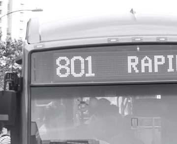
Short-Term Enhancements Improvements to keep Austin moving. MetroRapid
|
|
|
- Christopher Weaver
- 5 years ago
- Views:
Transcription


1
2 Short-Term Enhancements Improvements to keep Austin moving Long-Term Investments Projects to support our future Mobility Hubs MetroRapid MetroRail MetroExpress Commuters Connectors Circulators Project Connect Project Connect is the Central Texas high-capacity transit plan that will create real, tangible transit projects that offer an alternative to mindnumbing traffic congestion. It s not about a single train or bus route, but a robust transit system that improves travel into, out of and around Central Austin from the surrounding region. It will provide options that build upon one another and create a system to move more people, more quickly. The end result will connect residents, businesses, schools, services, and shopping through a high-capacity transit network. MetroRapid The MetroRapid Short-Term Enhancements flipbook provides an overview of locations and transit improving projects that intend to encourage more riders and move more people through the same space. The projects cover small infrastructure improvements, policy changes, and technology upgrades. Key Terms TPL TSP Transit Priority Lane High Capacity Transit


3 What are MetroRapid Short-Term Enhancements? What are MetroRapid Short-Term Enhancements? The MetroRapid enhancements are a set of shortterm, location specific projects that are designed to help improve the transit service. Projects focus on service, infrastructure and technology improvements that speed up trips, increase reliability, enhance the passenger experience and implement key safety treatments. MetroRapid Short-Term Enhancements have been evaluated on 7 potential benefits to transit riders and the overall transit system shown in the graphic to the right. The evaluation focused on a high level assessment on whether the benefit could be observed, or not. Benefits not observed in projects are faded on the following project sheets. Low Cost Projects that have low capital cost. Faster Travel Times Quicker and more reliable service Faster Implementation Projects implemented on a - year time frame. A full prioritization evaluation will be completed in the final step of this Project Connect planning process. The evaluation will consider detailed metrics and utilize input gathered from public feedback received online, at community events and in coordination with the Multimodal Community Advisory Committee mittee An optimized transit system that is efficient and reliable is beneficial to users s and can be beneficial to the city as awh whole. The short-term enhancements ents are key to keeping Austin moving in the short term, and setting tin the stage for potential tial long-term investments nts also being studied in Project Connect. Safety Crosswalk, sidewalks and bicycle facilities improvements. More People Carrying Capacity Move more passengers efficiently. Station Connectivity and Access Multimodal options to get to and from stations. Station Amenities Modified stations that will provide riders with better protection from the elements.


4 What are MetroRapid Short-Term Enhancements? MetroRapid Short-Term Enhancements Each MetroRapid enhancement has been evaluated to have a low and high set of project options. The low or high option refer to general costs of implementation, benefits to riders, and value to transit system operations. The following short-term enhancements have been identified for MetroRapid and discussed further in the following pages. Guadalupe St Burnet Rd E 8th St E MLK Jr Blvd W Anderson Ln N Lamar Blvd 8 E 45th St 5 W Braker Ln Airpot Blvd 5 8 W 9th St Guadalupe St!(!( E Dean Keeton St E MLK Jr Blvd The Drag - Guadalupe St. and MLK Jr. Blvd. to 9th St. Improves transit system operations through transit priority treatments. Adds pedestrian and bicycle safety enhancements. 4 Guadalupe St./Lavaca St./ MLK Jr. Blvd. Adds transit priority treatments and pedestrian safety enhancements that reduce delays, provide safety and move more people. Capitol Station Adds pedestrian and station amenities. Austin History Center Station Improves system reliability by reducing bus stacking. Adds pedestrian and bicycle safety treatments. N Lamar Blvd W 6th St W 5th St W Cesar Chavez St 6 5 4!( Lavaca St!( Guadalupe St San Jacinto Blvd W 5th St E 8th St E 7th St E th St Guadalupe St. and Lavaca St. Improves transit system operations by extending transit priority lanes to Cesar Chavez St. and activating Transit Signal Priority. South st St. Bridge Adds transit priority treatments that reduce delays and help move more people over the bridge. Chinatown Station Adds pedestrian safety treatments, station amenities, and improves transit system connectivity. Legend Roads MetroRapid Route * Station Area Projects * Transit Priority Projects S st St S Congress St N 8 Crestview Intersection Improves transit congestion issues around the station by reducing conflicts between automobiles, transit vehicles, bicycles and pedestrians. 4
 Dedicated bus lanes that allow transit to")


5 MetroRapid Short-Term Enhancement Examples MetroRapid Short-Term Enhancement Examples Transit Priority Lanes (TPL) Dedicated bus lanes that allow transit to bypass traffic. MetroRapid Station Modifications Retrofitting station roofs to better protect people from the elements. Contraflow Lane Dedicated transit lanes that flow in the opposite direction of current traffic. This treatment is typically used on one-way streets. Improved Sidewalks & Crosswalks Highly visible striped crosswalks and improved sidewalks add safety and accessibility. Peak Hour Reversible Vehicle Lane Reversible lanes are vehicle lanes in which the direction of travel can be changed to maximize available roadway space during peak travel times. Bike Box/Improved Bicycle Facilities Bike boxes allow cyclists a safe and visible way to get ahead of queuing traffic during a red traffic signal phase. Improving and adding bicycle facilities encourages multimodal transportation. 5


6 MetroRapid Enhancement Projects Example Solutions MetroRapid Short-Term Enhancement Examples Queue Jump Signal Allows buses to quickly travel through congested intersections by providing transit-only signal cycle before a green signal is given to general purpose traffic. Bus Only Markings Highly visible painting, or markings in lanes that designate usage. Pedestrian Hybrid Beacon Provides pedestrians and bicyclists safe crossing at non-signalized intersections such as mid-block crossings. Transit Signal Priority (TSP) Allows buses to have an earlier and/or longer green signal to maintain frequencies and on-time performance. Don t Block the Box Striping Highly visible striping discourages motorist from obstructing intersections. Fines and ticketing are policy enforcement strategies that may accompany signage and striping if deemed necessary. Grade Separation Grade separation of transportation infrastructure commonly includes elevated structures or tunneling to reduce potential conflicts with street-level transportation and/or pedestrians. 6
7 The Drag - Guadalupe St. and MLK Jr. Blvd. to 9th St. The Drag - Guadalupe St. and MLK Jr. Blvd. to 9th St. The Drag is a section of Guadalupe Street between MLK Jr. Boulevard and 9th Street. The corridor is very active due to its proximity to the University of Texas and numerous restaurants and retail shops. The City of Austin recently completed a corridor study for this area that recommends a variety of treatments that improve conditions for transit, bicyclists and pedestrians. The short-term enhancement goals are to optimize transit operations through The Drag corridor, improve MetroRapid station amenities and enhance pedestrian and bicycle safety. Project at a Glance Key Considerations: Improve transit travel time, frequency and reliability. Proposed relocation of UT Dean Keeton and West Mall MetroRapid Stations. Protect people from the elements and improve customer experience. Location Map 74 W 9th St. Project Recommendation: 44 UV 60 5 UV 90 The low short-term enhancement option best satisfies the goals of improving transit operations and customer experience. 8 W 6th St. 969 UV 0 UV 7 W 7th St. 5 o MetroRapid Routes W Dean Keeton St. tin Luther King Jr. Blvd. Guadalupe St. W 4th St. W st St. W nd St. Project Area N Not to scale 7


8 The Drag - Guadalupe St. and MLK Jr. Blvd. to 9th St. The Drag - Guadalupe St. and MLK Jr. Blvd. to 9th St. The low option addresses pedestrian and bicycle safety and improvements to MetroRapid stations. The low option is recommended for implementation. Project Benefits: Transit Time Savings Transit efficiency and reliability would be improved through the corridor. Safety Highly visible pedestrian and bicycle infrastructure improvements. Project Cost Approximately: $850,000 to $950,000. Site Plan - Guadalupe St. and W Dean Keeton St. Site Plan - Guadalupe St. and UT West Mall Project Implementation Within approximately 6 months. Station Connectivity & Access Project does not address connectivity or access. Station Amenities Improved customer experience at stations. More People Carrying Capacity Project does not increase the movement of people through the corridor Modified shelters include a new roof, improved lighting and additional seating. Station Painted and Buffered Modification Bike Lanes Buffered and painted bike lanes provide a highly visible delineation between vehicles and cyclists. Crosswalk Restriping and Pedestrian Scramble Provides a signal phase for crossing pedestrians, and restriping add visibility 8


9 The Drag - Guadalupe St. and MLK Jr. Blvd. to 9th St. The Drag - Guadalupe St. and MLK Jr. Blvd. to 9th St. The high option improves station connectivity and pedestrian safety. The option is consistent with the preferred alternative from the City of Austin s Guadalupe Corridor Study. Project Benefits: Transit Time Savings Transit efficiency and reliability would be significantly improved by TPLs. Site Plan - Guadalupe Street and W Dean Keeton Street 4 4 Safety Improvements will increase pedestrian and bicycle crossing visibility. Site Plan - Guadalupe Street and UT West Mall Project Cost Approximately: $,700,000 to $,00,000. Project Implementation Approximately years. 4 4 Station Connectivity & Access Relocated stations would provide improved access and could encourage increased ridership in the area. Station Amenities Relocated stations would feature modified roof, improved lighting and additional seating. More People Carrying Capacity Potential improved transit efficiency and frequency could help move more people through the Drag at existing service levels. Station Relocation and Modification Stations consolidated to dedicated locations. Buffered and Painted Bike Lanes Reduces conflicts between transit, automobile, and bicycle traffic. 4 Painted TPLs Clear marking discourages automobile use. Crosswalk Restriping and Pedestrian Scramble Provides a signal phase for crossing pedestrians, and restriping add visibility 9
10 This page intentionally blank. 0
11 N MetroRapid Guadalupe St./Lavaca St. at MLK Jr. Blvd. Guadalupe St./Lavaca St. at MLK Jr. Blvd.: Overview Congestion at the intersection of MLK Jr. Boulevard and Guadalupe/Lavaca streets is some of the most heavy in downtown. Short-term enhancement goals are to improve transit travel times for MetroRapid, MetroExpress, and MetroLocal buses while mitigating impacts to vehicle traffic. Currently, buses traveling north on Lavaca Street must wait for a transit only signal to make a left turn. During high volume traffic periods, buses experience long delays and may miss multiple traffic signal cycles due to the lack of capacity for left turns on to MLK Jr. Boulevard. Project at a Glance Key Considerations: Clearly mark lanes for buses only. Improve overall congestion at the intersection. Enforcement of Don t Block the Box intersections UV 60 5 UV Location Map Guadalupe St. Project Recommendation: The high option best satisfies the goals of improving transit travel times by routing buses from Lavaca Street on to 8th street and utilizing a contraflow lane to travel north on Guadalupe Street through the MLK Jr. Boulevard intersection. Additionally, the option improves pedestrian and bicycle safety while balancing costs. UV 7 UV 0 Martin Luther King Jr. Blvd. 5 o MetroRapid Routes W. 8th St. Guadalupe St. Lavaca St. Project Area Not to scale


12 Guadalupe St./Lavaca St. at MLK Jr. Blvd Guadalupe St./Lavaca St. at MLK Jr Blvd: Low The low option improves transit travel time and bus stacking issues through the intersection and enhances pedestrian and bicycle safety. Site Plan Project Benefits: Transit Time Savings Improved intersection throughput Safety Improvements increase pedestrian and bicycle visibility. Project Cost Approximately: $80,000 to $80, Project Implementation Approximately 6 months or less. Station Connectivity & Access Project does not address connectivity or access. Station Amenities Project does not address station improvements. More People Carrying Capacity Project does not increase the movement of people through the corridor Painted TPL Clear marking discourages automobile use Don t Block the Box Striping Discourages intersection obstruction. 4 Crosswalk 5 Restriping Increased safety for pedestrians Painted Bicycle Lane Painted lanes encourage bicycle lane use by adding safety. Traffic signal timing adjustment Recalibrated signal phases would optimize intersection operations.


13 Guadalupe St/Lavaca St at MLK Jr Blvd Guadalupe St./Lavaca St. at MLK Jr Blvd: High The high option utilizes a contraflow lane and traffic signal timing adjustments to improve transit operations. The high option is recommended for implementation. Project Benefits: Site Plan Transit Time Savings Significant time savings improvements during peak-hour congestion. Safety Restriped highly visible pedestrian crossings and bicycle lanes will enhance safety for users. 6 Project Cost Approximately: $485,000 to $585,000. Project Implementation Approximately years. Station Connectivity & Access Consolidated station location improves access to multiple transit routes. Station Amenities Relocated station would feature modified roof, improved lighting and additional seating. More People Carrying Capacity Improved transit efficiency and frequency would move more people through the intersection at existing service levels. Contraflow Bus-Only Lane Bus-only lane improves transit operations through MLK Jr Blvd intersection. Traffic Signal Timing Adjustment Recalibrated signal phases would optimize intersection operations. Don t Block the Box Striping Discourages intersection obstruction. Crosswalk Restriping Increased safety for pedestrians. Relocated Transit Stations Northbound MetroRapid Musuem Station and MetroLocal Station 609/7th moved to 8th Street Painted Bicycle Lane Painted lanes encourage bicycle lane use by adding safety.


14 Guadalupe St./Lavaca St. at MLK Jr. Blvd. Guadalupe St./Lavaca St. at MLK Jr. Blvd.: Traffic Analysis The high option would include a reroute of northbound buses onto 8th Street and the utilization of a contraflow bus-lane on Guadalupe Street traveling north to MLK Jr. Blvd. This option was compared with existing conditions based on expected traffic flow changes for both general purpose automobile and bus. The graph below shows the combined travel times through the Guadalupe St./Lavaca St. and MLK Jr. Blvd. intersections. The analysis found that the morning periods saw a % increase in the time buses would spend at the intersection. However, the afternoon bus travel time decreased approximately 90 seconds. Notably, automobile traffic analyzed in the scenario remained unchanged from existing conditions. Combined Peak Hour Travel Time - Guadalupe St./Lavaca St. at MLK jr. Blvd Minutes: Seconds :4 :09 :55 :40 :6 : 0:57 0:4 A.M - Peak P.M - Peak Combined A.M/P.M. - Peak 0:8 0:4 0:00 Existing - Auto High Option - Auto Existing - Bus High Option - Bus Existing Combined - Auto/Bus High Option Combined - Auto/Bus 4
15 N MetroRapid Capitol Station Capitol Station: Overview The Capitol Stations are located on Guadalupe Street and Lavaca Street between th and th Streets. The stations are within the Uptown/Capitol District of the Downtown Austin Plan and they are a short walk from the State Capitol. Short-term enhancement goals are to improve pedestrian and bicycle safety around the station and enhance station amenities. Project at a Glance Key Considerations: Improve pedestrian and bicycle safety and visibility at the busy downtown station. Protect people from the elements and improve customer experience. UV 60 5 UV Location Map Project Recommendation: Only one option is outlined for Capitol Station. The low option satisfies the goals of improving safety for pedestrians and bicyclists and enhancing customer experience UV 0 UV 7 o Guadalupe St. W th St. MetroRapid Routes W th St. Lavaca St. Colorado St. W. th St. Project Area Not to scale 5


16 Capitol Station Capitol Station: Low The low option is the only short-term enhancement option recommended for Capitol Station. Project Benefits: Transit Time Savings This project does not address transit time saving. Site Plan Safety Improvements will increase pedestrian crossing and bicycle visibility. Project Cost Approximately: $50,000 to 50,000. Project Implementation Within approximately 6 months. Station Connectivity & Access Project does not address connectivity or access. Existing MetroRapid Stations N Station Amenities Improved customer experience at stations. More People Carrying Capacity Project does not increase the movement of people through the corridor Crosswalk Restriping Increased safety for pedestrians. Station Modifications Modified shelters include a new roof, improved lighting and additional seating. See page 5. Bike Box Painting Allows bicyclists safer turning movements through intersections by skipping automobile queue. 6

17 N MetroRapid Austin History Center Austin History Center: Overview Located on Guadalupe Street and Lavaca Street between at 8th Street, the stations are centrally located in downtown and serve numerous cultural, performing arts and public park destinations. Short-term enhancement goals include improving pedestrian and bicycle connections and enhancing station amenities. Project at a Glance Key Considerations: Improve pedestrian and bicycle safety and visibility at the busy downtown station. Protect people from the elements and improve customer experience. 60 UV 60 5 UV Location Map W. 0th St. Project Recommendation: Only one option is outlined for the Austin History Center Stations. The low option satisfies the goals of improving safety for pedestrians and bicyclists and enhancing customer experience W 9th St. UV 0 5 UV 7 o MetroRapid Routes Guadalupe St. W 8th St. Lavaca St. Colorado St. Project Area Not to scale 7


18 Austin History Center Austin History Center: Low The low option is the only short-term enhancement option recommended for the Austin History Center Station. Site Plan Project Benefits: Transit Time Savings Project does not address transit time savings. Safety Improvements will increase pedestrian crossing and bicycle visibility. Project Cost Approximately: $50,000 to $50,000. Project Implementation Within approximately 6 months. N Station Connectivity & Access Project does not address connectivity or access. Station Amenities Improved customer experience at stations. Crosswalk Station Restriping Increased safety for pedestrians. Modifications Modified shelters include a new roof, improved lighting and additional seating. See page 5. Bike Box Painting Allows bicyclists safer turning movements through intersection by skipping automobile queue 8 More People Carrying Capacity Project does not increase the movement of people through the corridor
 network and activating existing transit signal priority")


19 Guadalupe Street and Lavaca Street Guadalupe Street and Lavaca Street: Overview During peak travel hours, the downtown corridors experience heavy congestion, delaying transit and frustrating riders. Short-term enhancement goals are to improve transit speed and reliability through downtown Austin by completing the transit priority lane (TPL) network and activating existing transit signal priority (TSP) technology at key intersections. Currently, Guadalupe Street and Lavaca Street have TPLs from rd Street to MLK Jr. Boulevard allowing them to bypass traffic. UV 60 5 UV Location Map However, when operating in mixed-traffic on the south side of downtown, the buses become delayed. MetroRapid buses and downtown traffic signals are equipped with TSP, but are currently not granted access to extend traffic signal phases in downtown. Additionally, bicycle lanes on Guadalupe street should connect from north of rd street to Cesar Chavez Street. Martin Luther King Jr. Blvd. Project at a Glance Key Considerations: Complete TPL network Allow TSP activation when necessary at key intersections on both Lavaca Street and Guadalupe Street. Connect bicycle lanes to existing network. Project Recommendation: The high project best satisfies the goals of improving transit travel times and reliability. The high project also more adequately improves safety for bicyclists in downtown W. 5th St. 5 UV 0 UV 7 o MetroRapid Routes Guadalupe St. Lavaca St. W. th St. W. th St. W. 9th St. W. 7th St. W. 5th St. W. Cesar Chavez St. W. rd St. Project Area N Not to scale 9


20 Guadalupe Street and Lavaca Street Guadalupe Street and Lavaca Street: Low The low option meets overall project goals to improve transit travel times and reliability by extending TPLs to Cesar Chavez. Site Plan Project Benefits: Transit Time Savings Significantly improved transit travel times, frequency and reliability. Safety Improvements will increase bicycle lane visibility. Project Cost Approximately:$40,000 to $40,000. Project Implementation Within approximately 6 months. Station Connectivity & Access Project does not address connectivity or access. Station Amenities Project does not address station improvements. More People Carrying Capacity Improved transit efficiency and frequency would move more people through the intersection at existing service levels. Extend Shared Bike TPL Lanes Completes a continuous dedicated lane network through downtown. Restriping shared bike lane markings improve bicyclist visibility. Transit Signal Priority Activation Coordination with the City of Austin to allow MetroRapid TSP through downtown. 0

21 Guadalupe Street and Lavaca Street Guadalupe Street and Lavaca Street: High The high option meets overall project goals to improve transit travel times, reliability and improving safety. The high option is recommended for implementation. Project Benefits: Transit Time Savings Significantly improved transit travel times, frequency and reliability. Site Plan Safety Highly visible bicycle facilities increase awareness and safety. Project Cost Approximately: $60,000 to $60,000. Project Implementation Within approximately years. Station Connectivity & Access Project does not address connectivity or access. 4 Station Amenities Project does not address station improvements. More People Carrying Capacity Improved transit efficiency and frequency would move more people through the intersection at existing service levels. Extended and Painted TPLs Completes a continuous dedicated lane network through downtown. Bike Lane Painted 4 Relocation Improves safety by moving to a street with generally less vehicle traffic. Bicycle Lane Painted lanes encourage bicycle lane use by adding safety. TSP Activation Coordination with the City of Austin to allow MetroRapid TSP through downtown.
22 This page intentionally blank.

23 N MetroRapid South st Street Bridge South st Street Bridge: Overview The South st Street Bridge is of main north-south river crossings for downtown Austin. The bridge is important to general traffic as well as Capital Metro s MetroRapid, MetroLocal and MetroExpress buses. During peak hours the bridge, Cesar Chavez Street and Riverside Drive intersections experience heavy congestion. Northbound automobiles are delayed in the morning and southbound in the evening rush hours. Buses experience UV 60 5 UV Location Map the same delays until they reach existing transit priority lanes (TPLs) north of rd street. Short-term enhancement goals are to improve transit travel times and reliability over the South st Street Bridge without heavily impacting travel times of passenger vehicles. W. Cesar Chavez St. Project at a Glance Key Considerations: Install TPLs on the South st Street bridge. Explore installing a reversible lane on the bridge to add capacity during peak periods. Improve bicycle safety on the bridge. Project Recommendation: The high project best satisfies the goals of improving transit travel times and reliability. The high project also more adequately improves safety for bicyclists Riverside Dr. UV 0 UV 7 5 o MetroRapid Routes S. st St. Barton Springs Rd. Project Area Not to scale


24 South st Street Bridge South st Street Bridge: Low The low option improves bicycle safety, but marginally improves transit operations. Site Plan - North Site Plan - South Project Benefits: Transit Time Savings Potential transit time savings, however existing conditions are mostly unchanged. Safety Improvements will increase bicycle safety crossing the bridge. Project Cost Approximately: $0,000 to $0,000. Project Implementation Within approximately year. Station Connectivity & Access Project does not address connectivity or access. Station Amenities: Project does not address station improvements. More People Carrying Capacity Project does not increase the movement of people through the corridor Painted Bike Lanes Painted lanes encourage bicycle lane use by adding safety. TSP Activation Coordination with the City of Austin to allow MetroRapid TSP through downtown. 4


25 South st Street Bridge South st Street Bridge: High The high option focuses on maximizing available space available on the bridge and improving transit travel times and reliability. The high option is recommended for implementation. Project Benefits: Transit Time Savings Significant time savings improvements during peak-hour congestion. Safety Improvements will significantly increase bicycle safety crossing the bridge. Site Plan- North Site Plan - South Project Cost Approximately: $970,000 to $,70,000. Project Implementation Approximately years. 4 Station Connectivity & Access Project does not address connectivity or access. Station Amenities Project does not address station improvements. More People Carrying Capacity Improved transit efficiency and frequency would move more people over the bridge at existing service levels. Painted TPLs Allows transit vehicles to bypass congestion on the bridge and move more people. Bike Lanes Moved Off-Street Dedicated lanes add safety. 4 Peak-Hour Reversible General Purpose Lane A center running, peak-hour, reversible lane for automobiles would be implemented to mitigate vehicle congestion. The lane would move people north into downtown in A.M. hours and south during the peak P.M. hours. Transit Queue Jump Allows buses their own signal phase to turn left at Riverside Dr. 5


26 South st Street Bridge South st Street Bridge: Traffic Analysis The high option is expected to decrease transit travel times by over minutes and 0 seconds. The peak-hour reversible general purpose lane would largely mitigate the effects of adding TPLs to the sides of the bridge. Automobile traffic crossing the bridge would experience minimal travel time increases. Minutes: Seconds South st Street Bridge Travel Time 6:00 4:48 :6 A.M P.M :4 Combined A.M/P.M. : 0:00 Existing - Auto High Option - Auto Existing - Bus High Option - Bus Existing Combined - Auto/Bus High Option Combined - Auto/Bus 6
27 Chinatown Station Chinatown Station: Overview The Chinatown Station serves the MetroRapid 80 bus route and is located at North Lamar Boulevard and Kramer Lane. Short-term enhancement goals include addressing pedestrian and bicycle safety deficiencies near the north and southbound stations and to improve transit connectivity. 44 UV 60 5 UV UV 0 Location Map The Chinatown Station is located within the project boundaries of the North Lamar Corridor Improvement Project. The plan recommends pedestrian safety improvements and station relocation. Short-term enhancements would be implemented in accordance with the adopted North Lamar Corridor Improvement Project. W Braker Ln. N. Lamar Blvd. Project at a Glance Key Considerations: Lamar Corridor at Chinatown Station is 4 lanes wide and dangerous for pedestrians to cross. Potential station relocation would connect MetroRapid to MetroLocal Bus routes stop at Braker Lane. Station modifications would better protect transit users from weather. Sidewalk and other corridor improvements would be implemented in accordance with the North Lamar Corridor Improvement Project. Project Recommendation: The low project best satisfy the goals of improving pedestrian and bicycle safety near the MetroRapid Chinatown Stations while balancing potential costs and overall benefits. UV 7 5 o MetroRapid Routes Kramer Ln. Project Area N Not to scale 7

28 Chinatown Station Chinatown Station: Low The low option improves access and safety for pedestrians and bicyclists and enhances station amenities. The low option is recommended for implementation. Site Plan Project Benefits: Transit Time Savings Project does not significantly improve transit travel times. Safety Increased safety for pedestrians. Project Cost Approximately: $60,000 to $460,000. Some project costs may overlap with North Lamar Investment Corridor Project. Project Implementation Less than year. Station Modifications Modified shelters include a new roof, improved lighting and additional seating. See page 5. Pedestrian Hybrid Beacon Provides a signalized crossing phase for pedestrians MetroRapid Stations N Station Connectivity & Access Adding sidewalks improve station access. Station Amenities Improved customer experience at stations. Sidewalk Improvements Sidewalks on the east side of North Lamar would meet pedestrian accessibility standards and provide safe paths to transit stations Proposed 8 More People Carrying Capacity Project does not increase the movement of people through the corridor

29 Chinatown Station Chinatown Station: High The high option improves connectivity between MetroRapid and Local bus service, improves bicycle connections and pedestrian safety.. Site Plan Project Benefits: Transit Time Savings Project does not significantly improve transit travel times. Safety Removes existing mid-block station and adds highly visible safety enhancements. 4 Project Cost Approximately: $,000,000 to $,00,000. Some project costs may overlap with North Lamar Investment Corridor Project. Project Implementation Within approximately years. Station Connectivity & Access Station relocation enables convenient transfers to local routes. Also, adding sidewalks improve station access. Station Amenities Improved customer experience at stations. Station Relocation and Modification Relocation of stations provides better connectivity to local bus routes 9 and 75. See page 5. 4 Bike Box Painting Allows bicyclists safer turning movements through intersection by skipping automobile queue N Sidewalk Improvements Sidewalks on the east side of North Lamar would meet pedestrian accessibility standards and provide safe paths to transit stations. Crosswalk Restriping Increased safety for pedestrians. More People Carrying Capacity Project does not increase the movement of people through the corridor 9
30 This page intentionally blank. 0
31 N MetroRapid Crestview Intersection Crestview Intersection: Overview The Crestview MetroRapid Stations are located at the intersection of two major arterials North Lamar Boulevard and Airport Boulevard. Additionally, MetroRail and freight rail track crosses Lamar Boulevard parallel to Airport Boulevard at-grade. The complex intersection experiences regular vehicle congestion throughout the day and especially at peak times. Short-term enhancement goals are to improve transit and traffic flows in the Crestview Station area and improve pedestrian safety. Capital Metro is currently studying multiple railroad and vehicle grade separation solutions at the Crestview intersection area that include: rail-over-road or rail-under-road projects. Project at a Glance Key Considerations: Key pedestrian safety improvements. Potential grade separation of MetroRail and freight rail from auto traffic. Adjustments to rail signal timing and gates. Optimize intersection efficiency 44 UV 60 5 UV Location Map N. Lamar Blvd. W. St. Johns Ave. Project Recommendation: At this time, the low project best satisfies the goals of improving transit travel times and improving pedestrian safety at the Crestview Station intersection. Capital Metro will continue to explore grade separated solutions should funding become available. UV 0 5 UV 7 o Justin Ln. MetroRapid Routes Airport Blvd. Project Area Not to scale

32 Crestview Intersection Crestview Intersection: Low The low option addresses the need for more efficient traffic throughputs and providing increased safety for pedestrians. The low option is recommended for implementation. Site Plan Project Benefits: Transit Time Savings Adjustments to traffic and rail signals would improve intersection efficiency. Safety Pedestrian islands provide increased safety when crossing the roadways or to the transit station. Project Cost Approximately: $6,900,000 to $7,400,000. Project Implementation Approximately 6 months. N Station Connectivity & Access Improved access through pedestrian safety enhancements. Station Amenities Project does not address station improvements. Rail Signal Timing/ Gate Control Railroad signals and gates would be reconfigured to properly raise and lower for commuter rail trains. Existing gates operate in a manner consistent with freight rail operations and remain down for an extended amount of time causing traffic delays. Pedestrian Safety Pedestrian islands provide increased safety when crossing roadways or to the transit station. More People Carrying Capacity Project does not increase the movement of people through the corridor Traffic Signal Timing Adjustments Recalibrated signal phases would optimize intersection operations.

33 Crestview Intersection Crestview Intersection: High The high option recommends below-grade (roadover-rail) separation of vehicle and railroad traffic to significantly improve traffic flow. Additionally, pedestrian safety enhancements are recommended. Site Plan Project Benefits: Transit Time Savings Significant time savings improvements from intersection reconfiguration. Safety Pedestrian islands provide increased safety when crossing the roadways or to the transit station. 4 4 Project Cost Approximately: $50,000,000 to $60,000,000. Project Implementation Approximately 5 years or more. N Station Connectivity & Access Improved access through pedestrian safety enhancements. Station Amenities Project does not address station improvements. More People Carrying Capacity Project does not increase the movement of people through the corridor Pedestrian Grade Separation Reconfiguration of the intersection reduces conflict between automobiles, transit, bicyclists and pedestrians. 4 Additional Traffic Signals New signals to facilitate traffic crossing. Safety Pedestrian islands provide increased safety when crossing roadways or to the transit station. Traffic Signal Timing Adjustments Recalibrated signal phases would optimize intersection operations.


34 Additional Information Want to learn more? Go to to read more about the work we re doing through Project Connect. Tell us what you think, take the Phase Survey! Additional Project Connect briefing books: High Capacity Transit 0 briefing book Investments program briefing book and project flip books Enhancement program briefing book and project flip books Project Connect Funding and Financing briefing book


35 Led by Capital Metro with support from the City of Austin. Prepared by AECOM, Nelson\Nygaard Consulting Associates, and Alliance Transportation Group with support from Bronner Group and Robin O Connell Design


36
DRAFT INVESTMENT CORRIDORS
 DRAFT INVESTMENT CORRIDORS Mode Studied ID CORRIDOR / ROADWAY FROM TO EXISTING CMTA ROUTES CORRIDOR TYPE PRIORITY STREET COMMUTER ELECTRIC EXPRESS LIGHT METRO RAPID RIGHT-OF-WAY PRESERVATION SHUTTLE STREETCAR
Bicycle Facilities Planning
 Bicycle Facilities Planning Overview Types of Cyclists Purpose for Riding Types of Facilities Bike Lanes Bicycle Boulevards Cycle Tracks Intersections Signals Signing and Marking Discussion Types of Bicyclists
MoPac South: Impact on Cesar Chavez Street and the Downtown Network
 MoPac South: Impact on Cesar Chavez Street and the Downtown Network Prepared by: The University of Texas at Austin Center for Transportation Research Prepared for: Central Texas Regional Mobility Authority
2014/2015 BIKE ROUTE PLAN 83 AVENUE PROTECTED BIKE LANE
 About the Project 2014/2015 BIKE ROUTE PLAN The City of Edmonton is planning a major bike route on the south side of Edmonton. This bike route is one part of a plan to provide citizens with transportation
Section 1 - North Lamar: Tech Ridge to US 183
 Section 1 - North Lamar: to US 183 Segment is part of 2016 Mobility Bond Program Segment is owned by TxDOT ALIGNMENT AND CONNECTIVITY Further study for connection between P&R and N Lamar Blvd Section 1
CONNECTING PEOPLE TO PLACES
 CONNECTING PEOPLE TO PLACES 82 EAST BENCH MASTER PLAN 07 Introduction The East Bench transportation system is a collection of slow moving, treelined residential streets and major arteries that are the
Enhancements Short-term improvements to keep Austin moving. Mobility Hubs
 Enhancements Short-term improvements to keep Austin moving. Investments Long-term projects to support our future. Mobility Hubs MetroRapid MetroRail MetroExpress Commuters Connectors Circulators Project
Active Transportation Facility Glossary
 Active Transportation Facility Glossary This document defines different active transportation facilities and suggests appropriate corridor types. Click on a facility type to jump to its definition. Bike
Welcome. If you have any questions or comments on the project, please contact:
 Welcome This drop-in public open house is intended to provide information about the Bay Street bike lanes project. This project proposes a dedicated cycling facility along Bay Street between Aberdeen Avenue
Southside Pilot Proposal
 To improve bicycle access and mobility to UC Berkeley, Downtown Berkeley, and the Southside area, a pilot project could include a two-way parking-protected cycle track. Turn pockets and island bus stops
Bus Rapid Transit Plans
 Twin Cities Region Bus Rapid Transit Plans ULI Minnesota Workshop Connecting Bus Rapid Transit to the Community December 15, 2009 John Levin Director of Service Development Metro Transit Metropolitan Area
MOBILITY WORKSHOP. Joint City Council and Transportation Commission May 5, 2014
 MOBILITY WORKSHOP Joint City Council and Transportation Commission May 5, 2014 Review of General Plan M-1 Develop world-class transit system M-3 Maintain/enhance pedestrian-oriented City M-4 Create comprehensive
Watertown Complete Streets Prioritization Plan. Public Meeting #1 December 14, 2017
 Watertown Complete Streets Prioritization Plan Public Meeting #1 December 14, 2017 Goals for Public Meeting Overview of MassDOT Complete Streets Funding Program Educate the community on Complete Streets
2014/2015 BIKE ROUTE PLAN 83 AVENUE PROTECTED BIKE LANE
 About the Project The City of Edmonton is planning a major bike route on the southside of Edmonton. The Strathcona Bike Route will connect the communities of Strathcona, Garneau and the University area,
KEARNY MESA COMMUNITY PLAN UPDATE
 KEARNY MESA COMMUNITY PLAN UPDATE January 18, 2018 SUBCOMMITTEE MEETING Mobility Concepts and Urban Design Presentation Outline Mobility Concepts: Multimodal Planning Toolbox Presentation and Activities
Eliminate on-street parking where it will allow for a dedicated bus only lane %
 Traffic Dashboard Priorities Survey Responses Introduction 1) Are you familiar with bus rapid transit (BRT)? a. No, BRT is new to me. 597 23.5% b. I ve heard of BRT, but I don t know much about it. 1,136
Providence Downtown Transit Connector STAKEHOLDER MEETING #2. Stakeholder Meeting #1 October 24, 2016
 Providence Downtown Transit Connector STAKEHOLDER MEETING #2 Stakeholder Meeting #1 October 24, 2016 February 2017 1 AGENDA 1 DTC Goals and Expectations 2 Street Design Concepts 3 Potential Benefits and
In station areas, new pedestrian links can increase network connectivity and provide direct access to stations.
 The Last Mile Planning for Pedestrians Planning around stations will put pedestrians first. Making walking to stations safe and easy is important; walking will be a part of every rapid transit Accessible
C C C
 C-012-001 Thank you for your support for the creation of new public space and nonmotorized access between downtown and the waterfront through the Overlook Walk, the East-West Connections, and the Promenade.
5. RUNNINGWAY GUIDELINES
 5. RUNNINGWAY GUIDELINES These guidelines should be considered collectively when making runningway decisions. A runningway is the linear component of the transit system that forms the right-of-way reserved
WELCOME. Stakeholder Involvement Group Meeting #2 Round Lake Public Works October 24, 2018
 WELCOME Stakeholder Involvement Group Meeting #2 Round Lake Public Works October 24, 2018 MEETING AGENDA 1. Welcome and Introductions 2. Study Progress Update 3. Problem Statement 4. Technical Analysis
Corpus Christi Metropolitan Transportation Plan Fiscal Year Introduction:
 Introduction: The Safe, Accountable, Flexible, Efficient Transportation Equity Act: A Legacy for Users (SAFETEA-LU) has continued the efforts started through the Intermodal Surface Transportation Efficiency
TRAFFIC ACTION PLAN. North Central Neighborhood CITY OF SAN MATEO
 TRAFFIC ACTION PLAN North Central Neighborhood CITY OF SAN MATEO Draft February 2017 Table of Contents Introduction... 1 The Traffic Forum Process... 4 Neighborhood Traffic Issues... 6 Neighborhood Recommendations
Roadways. Roadways III.
 Introduction 97 Roadway Design Principles 98 Safe Speeds 99 Optimizing of Street Space 00 Minimum Lane Widths in the City of Boston 02 Design Features that Reduce Operating Speeds 05 Travel Lanes Transit
TRAFFIC IMPACT ANALYSIS
 TRAFFIC IMPACT ANALYSIS FOR THE CHAMPAIGN UNIT#4 SCHOOL DISTRICT PROPOSED HIGH SCHOOL (SPALDING PARK SITE) IN THE CITY OF CHAMPAIGN Final Report Champaign Urbana Urbanized Area Transportation Study 6/24/2014
City of Gainesville Transportation/Roadway Needs PROJECT SUMMARY
 A1 Roadway Resurfacing $23,846,000 TYPE: Preservation of existing system Roadway resurfacing A2 Signal Replacement $6,000,000 TYPE: Preservation of existing system Replace traffic signals. B1 W 6th St
Washington DC Section of ITE Project Briefing
 Washington DC Section of ITE Project Briefing November 5, 2015 Renée Hamilton, VDOT, Deputy District Administrator I-66 Outside the Beltway Improvement Area Project Location Virginia 2 Purpose and Need
North Shore Transportation Improvement Strategy
 North Shore Transportation Improvement Strategy Preliminary, Near-term Recommendation 2016 April Transportation Improvement Strategy (TIS) Comprehensive and Analytical A multi-modal transportation strategy
Broad Street Bicycle Boulevard Design Guidelines
 Broad Street Bicycle Boulevard Design Guidelines Building from the strategies introduced in the 2013 Bicycle Transportation Plan and community input received thus far, City Transportation Staff have identified
Designing Streets for Transit. Presentation to NACTO Designing Cities Kevin O Malley Managing Deputy Commissioner 10/24/2014
 Designing Streets for Transit Presentation to NACTO Designing Cities Kevin O Malley Managing Deputy Commissioner 10/24/2014 Chicago -- Streets for Transit TODAY Jeffery Jump Transit Signal Priority Central
Executive Summary Route 30 Corridor Master Plan
 Route Corridor Master Plan Project Overview The Route Corridor Master Plan is a coordinated multimodal transportation and land use plan for the entire stretch of Route through East Whiteland Township,
Mission-Geneva Transportation Study Community Workshop 2 July 8, 2006
 Community Workshop 2 July 8, 2006 Small Group Workbook 1 Basic Improvements on Mission Street Streetscape. Pedestrian-scale lighting; landscaping; community art on utility boxes; more (possibly unique)
Sandwich Pedestrian/Bicycle Planning
 Sandwich Pedestrian/Bicycle Planning Improved Pedestrian and Bicycle Connections with the Cape Cod Canal Multi-use Path February 2014 Table of Contents Introduction... 1 Background... 1 Study Goals...
4 MOBILITY PLAN. Mobility Plan Objectives. Mobility Context. 1. Integrate with Local and Regional Transit Improvements
 Harbor Mixed Use CHAPTER Transit Corridor 4: Mobility Plan 4 MOBILITY PLAN Mobility Plan Objectives The Harbor Corridor Plan seeks to expand and improve the ways that people move along and through the
MASTER BICYCLE AND PEDESTRIAN PLAN
 VILLAGE OF NORTHBROOK MASTER BICYCLE AND PEDESTRIAN PLAN DRAFT PLAN OPEN HOUSE May 2, 2018 AGENDA 1. Community Engagement 2. Vision and Goals 3. General Structure of Plan 4. Recommendations Overview 5.
ALTERNATIVES TO BE CONSIDERED
 ALTERNATIVES TO BE CONSIDERED EXISTING CONDITIONS (BASE CASE) In order to evaluate and understand the potential benefits and impacts of introducing downtown transit improvements in Providence, a Base Case
Solana Beach Comprehensive Active Transportation Strategy (CATS)
") Solana Beach Comprehensive Active Transportation Strategy (CATS) 3.0 Goals & Policies The Solana Beach CATS goals and objectives outlined below were largely drawn from the Solana Beach Circulation Element
Solana Beach Comprehensive Active Transportation Strategy (CATS) 3.0 Goals & Policies The Solana Beach CATS goals and objectives outlined below were largely drawn from the Solana Beach Circulation Element
Princeton Avenue and Spruce Street Transportation and Site Access Enhancements Project
 Princeton Avenue and Spruce Street Transportation and Site Access Enhancements Project Mercer County Planning Division AECOM Transportation (formerly DMJM Harris) January 29, 2009 Agenda Project Status
El Camino Real Specific Plan. TAC/CAC Meeting #2 Aug 1, 2018
 El Camino Real Specific Plan TAC/CAC Meeting #2 Aug 1, 2018 Land Use Alternatives Goals and Tradeoffs Parks & open space Housing Retail & services Civic spaces Parking Community gathering spaces 3 Alternatives
Geary Corridor Bus Rapid Transit
 Geary Corridor Bus Rapid Transit Near-term Improvements Update SAN FRANCISCO COUNTY TRANSPORTATION AUTHORITY SAN FRANCISCO MUNICIPAL TRANSPORTATION AGENCY Phasing Packages Phase 1 Near-term: Delivers project
Preliminary Transportation Analysis
 Preliminary Transportation Analysis Goals of a Robust, Multimodal Transportation Network Safe Accessible/Connected Efficient Comfortable Context-Sensitive Motor Vehicle: Continue to analyze the data to
Cycle Track Design Best Practices Cycle Track Sections
 Design Best Practices Sections It is along street segments where the separation and protection methods of cycle tracks offer more comfort than conventional bicycle lanes, and are more attractive to a wide
Working Group Meeting
 Working Group Meeting February 6, 2018 Parks and Natural Resources Operations Building Transportation Analysis Draft Policy Framework Agenda 7:05 pm Welcome 7:10 pm Follow-up from Previous Meetings Schedule
Welcome! Thank you for joining us today for a Geary Rapid project open house. Geary Rapid Project. SFMTA.com/GearyRapid
 Welcome! Thank you for joining us today for a Geary Rapid project open house. Get the most out of this event: 1. Sign in and get your feedback sheet 2. Visit project information stations hosted by project
Bus Queue Jump (Lane) Utilization: A case study in Calgary, AB Canada Muhammad Asim P.Eng, M.Sc. The City of Calgary
 Utilization: A case study in Calgary, AB Canada Muhammad Asim P.Eng, M.Sc. The City of Calgary") Bus Queue Jump (Lane) Utilization: A case study in Calgary, AB Canada Muhammad Asim P.Eng, M.Sc. The City of Calgary 1 Presentation Outline Introduction to Calgary Transit Background of the Project (why
Bus Queue Jump (Lane) Utilization: A case study in Calgary, AB Canada Muhammad Asim P.Eng, M.Sc. The City of Calgary 1 Presentation Outline Introduction to Calgary Transit Background of the Project (why
Duwamish Way-finding and CTR Report
 V. North Tukwila When the North Tukwila Manufacturing and Industrial Center was designated in 1992 as part of the region s land use and transportation plan, the plan called for the area to set a light-rail
Purpose and Need. Chapter Introduction. 2.2 Project Purpose and Need Project Purpose Project Need
 Chapter 2 Purpose and Need 2.1 Introduction The El Camino Real Bus Rapid Transit (BRT) Project (Project) would make transit and other transportation improvements along a 17.6-mile segment of the El Camino
Cherry Creek Transportation and Land Use Forum September 25, 2013 Meeting Summary
 Cherry Creek Transportation and Land Use Forum September 25, 2013 Meeting Summary I. LEAD-IN TO SMALL GROUP DISCUSSION, POLLING AND STEERING COMMITTEE/TECHNICAL TASK FORCE DISCUSSION The meeting began
Tunnel Reconstruction South 5 th Street Association October 16, 2018
 Tunnel Reconstruction South 5 th Street Association October 16, 2018 Reconstructing the Tunnel 2 Service During Tunnel Reconstruction April 2019 through July 2020 3 Projected Cross River Travel Paths of
Route 7 Corridor Study
 Route 7 Corridor Study Executive Summary Study Area The following report analyzes a segment of the Virginia State Route 7 corridor. The corridor study area, spanning over 5 miles in length, is a multi
DOWNTOWN TUPELO MAIN STREET: ROAD DIET STUDY
 DOWNTOWN TUPELO MAIN STREET: ROAD DIET STUDY Since mid-2009, RPM Transportation Consultants (RPM) has worked with the Downtown Tupelo Main Street Association to evaluate traffic conditions and potential
Chapter 7. Transportation. Transportation Road Network Plan Transit Cyclists Pedestrians Multi-Use and Equestrian Trails
 Chapter 7 Transportation Transportation Road Network Plan Transit Cyclists Pedestrians Multi-Use and Equestrian Trails 7.1 TRANSPORTATION BACKGROUND The District of Maple Ridge faces a number of unique
Agenda. Overview PRINCE GEORGE S PLAZA METRO AREA PEDESTRIAN PLAN
 PRINCE GEORGE S PLAZA METRO AREA PEDESTRIAN PLAN May 28, 2008 Agenda Welcome and introductions Project overview and issue identification Planning context and strengths Design challenges and initial recommendations
95 th Street Corridor Transportation Plan. Steering Committee Meeting #2
 95 th Street Corridor Transportation Plan Steering Committee Meeting #2 February 18, 2015 PURPOSE OF THE MEETING Update Steering Committee Present Community/Stakeholder Survey Results Present Transportation
APPENDIX A: Complete Streets Checklist DRAFT NOVEMBER 2016
 APPENDIX A: Complete Streets Checklist DRAFT NOVEMBER 2016 Complete Streets Checklist MetroPlan Orlando s Complete Streets Checklist is an internal planning tool for staff to further implementation of
Dr. M.L. King, Jr. Street North Complete Streets Resurfacing Opportunities HOUSING, LAND USE, AND TRANSPORTATION COMMITTEE MARCH 22, 2018
 Dr. M.L. King, Jr. Street North Complete Streets Resurfacing Opportunities HOUSING, LAND USE, AND TRANSPORTATION COMMITTEE MARCH 22, 2018 What s Happening The City plans to mill and resurface Dr. M.L.
Arlington Public Schools Thomas Jefferson Site Evaluation Transportation Networks. Thomas Jefferson Working Group Meeting #6 November 10, 2014
 Arlington Public Schools Thomas Jefferson Site Evaluation Transportation Networks Thomas Jefferson Working Group Meeting #6 November 10, 2014 2 3 INTRODUCTION 4 Goal of our work: Identify and assess multi-modal
Highway 217 Corridor Study. Phase I Overview Report
 Highway 217 Corridor Study Phase I Overview Report November 3, 24 BACKGROUND AND OVERVIEW Study purpose The Highway 217 Corridor Study is developing multi-modal transportation solutions for traffic problems
Draft North Industrial Area-Wide Traffic Plan
 Summary of North Industrial and Hudson Bay Industrial Recommended Improvements Table 1. Summary of s Item Location 1 2 3 4 5 6 7 8 9 10 11 12 Millar Ave north of 51st St Super 8 Motel back lane 400 Block
Kennedy Plaza and Providence Downtown Transit Connector PUBLIC MEETING. Stakeholder Meeting #1 October 24, 2016
 Kennedy Plaza and Providence Downtown Transit Connector PUBLIC MEETING Stakeholder Meeting #1 October 24, 2016 May 2017 1 WHAT IS THE DTC? 1.5 mile corridor between Providence Station and the Hospital
CITY OF OTTAWA ROADWAY MODIFICATION APPROVAL UNDER DELEGATED AUTHORITY
 RMA-2015-ATM-038 CITY OF OTTAWA ROADWAY MODIFICATION APPROVAL UNDER DELEGATED AUTHORITY DATE: April 22, 2015 SUBJECT Approval of Roadway Modifications Recommended through an Area Traffic Management Study
City of Wilsonville 5 th Street to Kinsman Road Extension Project
 City of Wilsonville 5 th Street to Kinsman Road Walking Tour & Neighborhood Workshop Summary Report Public Outreach Overview On July 18 th, 2017, the City of Wilsonville hosted a neighborhood walking tour
Bikeway action plan. Bicycle Friendly Community Workshop March 5, 2007 Rochester, MN
 Bikeway action plan Summary The was held on March 5, 2007 at the Rochester Mayo Civic Center. The workshop was hosted by Rochester-Olmsted County Planning Department in collaboration with the League of
PEDESTRIAN ACTION PLAN
 ATTACHMENT 2 CITY OF SANTA MONICA PEDESTRIAN ACTION PLAN CITY OF SANTA MONICA PEDESTRIAN ACTION PLAN This page intentionally left blank EXECUTIVE SUMMARY CHAPTER 1 EXECUTIVE SUMMARY Setting the Stage
Item Description: Presentation and Discussion: Berkeley Rapid Transit Locally Preferred Alternative
 Office of the City Manager Meeting Date: April 29, 2010 Item Number: 1 Item Description: Presentation and Discussion: Berkeley Rapid Transit Locally Preferred Alternative Staff report, resolution, and
Vision. Goals and Objectives. Walking
 Vision Walking and biking is an accepted and valued part of everyday life in Portsmouth. People of all ages and abilities include walking and biking as part of their daily activities which helps to make
Contents. Champaign-Urbana Mass Transit District Stop Placement Guidelines
 Contents Champaign-Urbana Mass Transit District Introduction... 1 Stop Spacing... 2 Rural... 2 Low Density Suburban... 2 General Urban... 2 Urban Core... 2 Operational Safety... 3 Stop Placement... 4 Nearside
ROADSOADS CONGESTION HAMPTON SYSTEMYSTEM MANAGEMENT. Part II Roadway Congestion Analysis Mitigation Strategies and Evaluation
 HAMPTON ROADSOADS CONGESTION MANAGEMENT SYSTEMYSTEM Part II Roadway Congestion Analysis Mitigation Strategies and Evaluation Presented by: Dwight Farmer, PE Deputy Executive Director, Transportation April
Roads and Vehicular Traffic Design Principles. Roads and Vehicular Traffic Recommendations
 CIRCULATION AND PARKING roads and vehicular traffic The Campus Master Plan updates the campus transportation network through a multi-modal approach that encourages walking and biking while improving vehicular
Broad Street Bicycle Boulevard City Council Study Session Summary
 Broad Street Bicycle Boulevard City Council Study Session Summary Overview: On August 15 th, 2017, a City Council Study Session was held to invite community input and request City Council guidance on a
41st Avenue B-Line Kerrisdale Village Street Improvements
 1. WELCOME! 41st Avenue B-Line Kerrisdale Village Improvements Public Open House Please sign in so we can provide updates and information on construction The City of Vancouver is working with TransLink
City of Novi Non-Motorized Master Plan 2011 Executive Summary
 City of Novi Non-Motorized Master Plan 2011 Executive Summary Prepared by: February 28, 2011 Why Plan? Encouraging healthy, active lifestyles through pathway and sidewalk connectivity has been a focus
LOOP 360 IMPROVEMENT STUDY
 LOOP 360 IMPROVEMENT STUDY Overview and Preliminary Analysis August 2015 1 STUDY PROCESS 2 Study Background Loop 360 serves a wide range of users, including residents, businesses, bicyclists, and commuters
WEST AND SOUTH WEST RING ROAD DOWNSTREAM TRAFFIC IMPACTS
 Page 1 of 9 EXECUTIVE SUMMARY Alberta Transportation ( AT ) is preparing to construct the final sections of the Calgary Ring Road. This includes the South West Ring Road ( SWRR ) (from Lott Creek Blvd
CITY OF COCOA BEACH 2025 COMPREHENSIVE PLAN. Section VIII Mobility Element Goals, Objectives, and Policies
 CITY OF COCOA BEACH 2025 COMPREHENSIVE PLAN Section VIII Mobility Element Goals, Objectives, and Policies Adopted August 6, 2015 by Ordinance No. 1591 VIII MOBILITY ELEMENT Table of Contents Page Number
ALTERNATIVE A ONLY. Right Turn Only. BOTH ALTERNATIVES on southbound Mission from 23rd St to 25th St and on northbound Mission from 20th St to 23rd St
 Proposal Detail: 22nd on southbound Mission from on both sides of Mission from to 23rd from at northbound Mission and 22nd St and at at northbound Mission and 23rd St Reconfigure Lanes ONLY No Parking
1. Operate along freeways, either in regular traffic lanes, in high-occupancy vehicle (HOV) lanes, or along the shoulders.
 lanes, or along the shoulders.") Most decisions about whether or not to use transit involve time and cost, and most transit services are slower than travel by private vehicle. However, when transit is faster or nearly as fast as travel
Most decisions about whether or not to use transit involve time and cost, and most transit services are slower than travel by private vehicle. However, when transit is faster or nearly as fast as travel
MCA Member Meeting: Tysons Update. Fairfax County Department of Transportation November 13, 2017
 MCA Member Meeting: Tysons Update Fairfax County Department of Transportation November 13, 2017 Presentation Overview Balancing Land Use and Transportation How Are We Doing? Studies and Projects Neighborhood
Outreach Approach RENEW SF served as the primary liaison with the North Beach community; the Chinatown. Executive Summary
 Executive Summary Executive Summary The Columbus Avenue Neighborhood Transportation Study s objective is to identify changes to transportation infrastructure and policies that could enhance the livability
COMPLETE STREETS PLANNER S PORTFOLIO
 COMPLETE STREETS PLANNER S PORTFOLIO ISSUE 3 APRIL 2016 PLANNER S PORTFOLIO COMPLETE STREETS 1 2 6 10 14 OVERVIEW MATURE NEIGHBORHOODS GROWING SUBURBS CENTRAL PLACES ACTIVITY CORRIDORS Planner s Portfolio
Richmond-Adelaide Cycle Tracks
 Public Drop-In Event Richmond-Adelaide Cycle Tracks June 25, 2018 12:00 p.m. 3:00 p.m. 4:30 p.m. 7:30 p.m. Metro Hall, Rotunda 55 John Street 1 Purpose of Event In Scope Communicate an update about the
FEDERAL HIGHWAY ADMINISTRATION APPLICATION
 FEDERAL HIGHWAY ADMINISTRATION APPLICATION REQUEST FOR PERMISSION TO EXPERIMENT WITH A BICYCLE BOX INTERSECTION TREATMENT Submitted by: City of Columbus Department of Public Service Date: June 26, 2009
Dowling/Beaty Cycling Route
 Public Meeting #2 Dowling/Beaty Cycling Route May 17, 2017 6:00 p.m. 8:00 p.m. Parkdale Public Library - Auditorium 1303 Queen Street West How to Participate Share your questions, ideas and concerns We
US 41 COMPLETE STREETS CORRIDOR PLANNING STUDY from University Parkway to Whitfield Avenue
 41 US 41 COMPLETE STREETS CORRIDOR PLANNING STUDY from University Parkway to Whitfield Avenue EXECUTIVE SUMMARY DRAFT FEBRUARY 2019 Project Overview The US 41 Complete Streets Corridor Planning Study,
ALTERNATIVES ANALYSIS EXECUTIVE SUMMARY
 West Valley Connector Corridor ALTERNATIVES ANALYSIS EXECUTIVE SUMMARY FINAL September 2014 Ontario International Airport Ontario Mills Rancho Cucamonga Metrolink Station Kaiser Permanente PARSONS EXECUTIVE
CHAPTER 1 INTRODUCTION
 CHAPTER 1 INTRODUCTION Chapter Table of Contents THE 2017 HOUSTON BIKE PLAN 1-1 HOUSTON BIKEWAYS PROGRAM 1-2 HISTORY OF BICYCLE PLANNING IN HOUSTON 1-3 BICYCLE LEVEL OF COMFORT 1-3 EXISTING PLANS, PROGRAMS
Bicycle Master Plan Goals, Strategies, and Policies
 Bicycle Master Plan Goals, Strategies, and Policies Mobilizing 5 This chapter outlines the overarching goals, action statements, and action items Long Beach will take in order to achieve its vision of
4 DISRUPTION MANAGEMENT PLAN HIGHWAY 7 RAPIDWAY CONSTRUCTION BETWEEN BAYVIEW AVENUE AND WARDEN AVENUE TOWNS OF MARKHAM AND RICHMOND HILL
 4 DISRUPTION MANAGEMENT PLAN HIGHWAY 7 RAPIDWAY CONSTRUCTION BETWEEN BAYVIEW AVENUE AND WARDEN AVENUE TOWNS OF MARKHAM AND RICHMOND HILL The Transportation Services Committee recommends the adoption of
Caltrans Sloat Boulevard Pedestrian Safety Project Response to Community Questions, Comments & Concerns
 Caltrans Sloat Boulevard Pedestrian Safety Project Response to Community Questions, Comments & Concerns Revised: May 10, 2016 The California Department of Transportation (Caltrans) is planning various
Arlington County 10-Year Transit Development Plan & Premium Transit Network Briefing. May 2016
 Arlington County 10-Year Transit Development Plan & Premium Transit Network Briefing May 2016 Overview 10-Year Transit Development Plan Premium Transit Network Columbia Pike service concept Premium amenities
Northbound San Jose Avenue & I-280 Off-Ramp Road Diet Pilot Project
 Project Overview Fed by a two-lane Interstate-280 (I-280) off-ramp, high vehicular volumes and speeds are longstanding issues along San Jose Avenue. Residents in the surrounding neighborhoods have expressed
Hennepin County Bicycle and Pedestrian Planning
 Hennepin County Bicycle and Pedestrian Planning 1 Value of bicycle and sidewalk systems Safety Livability Mobility Health Personal Finances Economic Sustainability Clean Air Recreation Parking and congestion
TRANSPORTATION IMPROVEMENT STRATEGY
 TRANSPORTATION IMPROVEMENT STRATEGY A Vision for Staten Island North Shore November 2016 1 EXISTING CONDITIONS Transit Conditions MTA Bus Staten Island Railroad Peak Directional Traffic Volume (per hour)**:
Transportation 6. A. Transit Center Circulation and Access. 1. Transit Center Circulation
 Transportation 6 This chapter describes the transportation system in and around the Hillsdale Station Area, with a focus on the Transit Center at the relocated Hillsdale Caltrain Station. The transportation
Overview. Illinois Bike Summit IDOT Complete Streets Policy Presentation. What is a Complete Street? And why build them? And why build them?
 Overview Illinois Bike Summit IDOT Complete Streets Policy Presentation Aren Kriks, P.E. District One Bicycle Coordinator and Bureau of Programming Project Engineer History of Complete Streets IDOT Policy
Complete Street Analysis of a Road Diet: Orange Grove Boulevard, Pasadena, CA
 Complete Street Analysis of a Road Diet: Orange Grove Boulevard, Pasadena, CA Aaron Elias, Bill Cisco Abstract As part of evaluating the feasibility of a road diet on Orange Grove Boulevard in Pasadena,
COWETA HIGH SCHOOL AND EAST HIGHWAY 51
 COWETA HIGH SCHOOL AND EAST HIGHWAY 51 Lack of sidewalks along Ben Lumpkin Rd. Lack of crosswalks and ramps at intersection. Hwy 51 is wide to cross as a pedestrian. No ADA compliance or connection to
El Centro Mobility Hub
 The El Centro drive shed comprises a major portion of the El Centro downtown area, which is well served by bus routes. The proposals intend to promote use of public transit through improvements and enhancements
EXECUTIVE SUMMARY. Vision
 Vision Walking and bicycling in Salt Lake City will be safe, convenient, comfortable, and viable transportation options that connect people to places, foster recreational and economic development opportunities,
San Pablo High Treatment applied incrementally at each N + ++
 Transit Improvements T1 Further study options for creation or designation of segregated transit lanes along San Pablo, including options for restrictions during a limited number of peak travel hours and