Transportation Advisory Committee Meeting Notice & Agenda
|
|
|
- Elisabeth Butler
- 5 years ago
- Views:
Transcription

1 Transportation Advisory Committee Meeting Notice & Agenda Wednesday, November 7, :00 p.m. to 5:30 p.m. King Street Meeting Room 100 North King Street Hendersonville, NC Meeting Called to Order... Renee Kumor 2. Public Input... Renee Kumor 3. Approval of Meeting Minutes September 5, Renee Kumor New Business 4. Complete Streets Consideration for SPOT Ranked Projects... Matthew Cable (45 min) 5. Transportation Projects Preliminary Review... Matthew Cable (5 min) 6. Chairman Comments... Renee Kumor (5 min) 7. Municipal Representative Updates... Municipal Representatives (5 min) 8. NCDOT Projects Update... NCDOT Representative (5 min) 9. FBRMPO: Upcoming Meeting Items... Matthew Cable (5 min) 10. Important Dates... Matthew Cable (5 min) 2013 Proposed TAC Meeting Dates: March 6, June 5, September 5, and November Adjournment... Renee Kumor CHAIRMAN Jim Crafton Phone: craftonj@morrisbb.net VICE-CHAIRMAN Renee Kumor Phone: rkumor@morrisbb.net STAFF Matthew Cable Phone: mcable@hendersoncountync.org Henderson County believes it is the right of all citizens to participate. All persons with disabilities that need auxiliary aid should contact the Secretary to the Planning Board at (828) , at least 48 hours prior to the meeting.
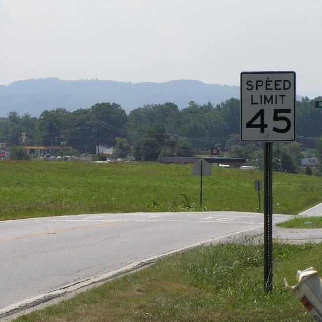
2 Henderson County TRANSPORTATION ADVISORY COMMITTEE September 5, 2012 The Transportation Advisory Committee met September 5, 2012 at 4:00 p.m. in the King Street Meeting Room at 100 North King Street, Hendersonville. Members present were Chairman Jim Crafton; David Jones, at-large; Renee Kumor, at-large; Keith Maddox, at-large; Robert Vickery, Town of Laurel Park; and Bo Ferguson (representing Steve Caraker) City of Hendersonville. Members not in attendance were Steve Caraker, City of Hendersonville; Don Farr, Village of Flat Rock; Eddie Henderson, Town of Fletcher; Roger Snyder, Town of Mills River; Commissioner Mike Edney; and Commissioner Bill O Connor. Henderson County Staff members included Matthew Cable, Transportation Planner. Steve Cannon, NCDOT District Engineer was also present. Mr. Crafton called the meeting to order at 4:00 p.m. New Business: Mr. Crafton opened the meeting by asking if any members of the audience wished to provide public comment. Ms. Kumor read a letter from Mr. Stan Kumor regarding the safety of the intersection of Howard Gap Road and North Clear Creek Road. Mr. Cannon explained that the Howard Gap Road improvements scheduled to let in February included realignment with the addition of a left turn lane at North Clear Creek. Mr. Cannon said, given the concerns expressed in the letter, it would be appropriate to provide additional mowing and safety signs in the interim and that NCDOT would explore these measures. Approval of Minutes: Ms. Kumor made a motion to approve of the minutes of the March 7, 2012 meeting. Mr. Maddox seconded the motion and all members voted in favor. New Business Continued: Ecusta Rail Trail Planning Study. Mr. Cable gave a brief review of the Ecusta Rail Trail Planning Study presented at the previous TAC meeting. Chairman Comments. Mr. Crafton discussed the importance of improving relations with the Board of Commissioners. To this end, Mr. Crafton informed the committee that it is his goal to begin providing the Board of Commissioners with reports about the activities undertaken by the TAC. NCDOT Update. Mr. Cannon provided the following project updates: Upward Road is 61% complete. The anticipated completion date is August, 2013 Howard Gap Section B (Fletcher to Brookside Camp Road intersection) has been awarded and construction should begin soon. NC Highway 191 will be resurfaced from US Highway 25 to Mountain Road over a six week period this fall. NCDOT is currently replacing the crosspipes in this section of NC Highway 191. Little River Road bridge has been delayed for a redesign, at the request of the County, in light of other design concerns related to recent bridge projects in the Village of Flat Rock. Erkwood/Shepherd Street intersection with Greenville Highway public meeting should be occurring in the next few months. 1
3 Henderson County TRANSPORTATION ADVISORY COMMITTEE September 5, 2012 The remainder of the meeting focused on staff reported information and updates to the committee. Mr. Cable provided an update on the NCDOT 2040 Transportation Plan, Blue Ridge Bike Plan, Crab Creek Community Club Meeting, and TEAAS Crash Data Software. He provided a revised copy of the TAC s Draft Work Plan and explained its purposes being to anticipate needed action at the MPO level. Finally, Mr. Cable provided a quick review of the SPOT 2.0 Rankings. There being no further business, the meeting adjourned at 5:15 p.m. Jim Crafton, Chairman Henderson County Transportation Advisory Committee 2
4 Complete Street Cross Section Quick Comparison Tables Type of 2 Lane Street Speeds Table 1: Two-Lane Street Segments Bike Lanes Sidewalks Parking/ Transit Sharrows Rural Road Varied Y Y N Y Y Urban/Suburban Main Street Low (Generally < 35 mph) Y Y Y Y N Rural Village Main Street Low (Generally < 35 mph) N Y Y Y N Rural Avenue Low (Generally < 35 mph) Y Y N N N Local/Subdivision Street: Residential Multi- Use Path Low (Generally < 35 mph) Y Y Y Y N Notes Noted difference from Rural Village Main Street: Bike Lane Width Prescribed Noted difference from Urban/Suburban Main Street: Bike Lane Width Prescribed Noted difference from Urban/Suburban Avenue: Access (not included), Green Widths, and Speeds Local/Subdivision Street: Office, Commercial and Industrial Low (Generally < 35 mph) N Y Y N N Type of 4 Lane Street Urban/Suburban Parkway Rural Parkway Urban/Suburban Boulevard Rural Boulevard Speeds Moderate (35 mph +) to High Moderate (35 mph +) to High Moderate (35 mph to 55 mph) Moderate (35 mph to 55 mph) Table 2: Four-Lane Street Segments Bike Lanes Sidewalks Parking/ Transit Sharrows Multi -Use Path N N N N Y N N N N Y Y Y N N N Y Y N N N Urban/Suburban Avenue Low (Generally > 35 mph) Y Y Y Y N Notes Noted difference from Rural Parkway: Median (smaller) Noted difference from Rural Parkway: Median (larger) Noted difference from Rural Boulevard: Median (smaller) and Green (smaller) Noted difference from Urban/Suburban Boulevard: Median (larger) and Green (larger) Noted difference from Rural Avenue: Access (included), Green Widths, and Speeds
5 Street Cross-sections and Guidelines The following pages illustrate street cross-sections for each street type. The purpose of the illustrations is to provide a general understanding of the intended spatial relationships of the various street components for each street type. These illustrations serve as a diagram of one or more Dimensional guidelines are provided for the appropriate combinations of street types with subarea type. The guidelines provide ranges that conditions. These cross-sections should not be used in isolation. Consideration of the context and the elements discussed previously in this guideline document must be brought into the decision making process, as described in Chapter 2. Please also note that all pavement markings and placement of pavement markings should follow the North Carolina Complete Streets Planning and Design Guidelines 69 Chapter 4


6 RURAL ROAD PLAN VIEW With Bike With Multi-Use Path KEY ELEMENTS May function as an arterial, collector or local route, but with a range of speeds. A road outside of cities and towns serving a range of traf c levels in a country setting. Paved shoulders can be used to provide bicycles and pedestrians accommodation. Multi-use paths separated from the roadway may be appropriate treatment for bicycle and pedestrian accommodations. Accommodates bus facilities including turnouts as appropriate. Public transit stops and shelters should be clearly marked and placed within the right of way. STREET CROSS-SECTION ZONES : Sidewalks on rural roads are rare. If sidewalk is provided it should be placed outside of the clear zone. The landscaped area along the edge of a roadway and could include grass, landscaping or trees (as permitted). Serves as drainage conveyance. A zone for bicyclists separate from vehicular traf c. The primary travel way for vehicles. : A zone for pedestrians and bicyclists in a multi-use path separate from the motor vehicle zone. Please see for more details. Land uses are typically set back from the street. This zone may also consist of natural vegetation. Not all traf c control devices shown Chapter 4 86 North Carolina Complete Streets Planning and Design Guidelines

7 RURAL ROAD ILLUSTRATIVE STREET CROSS-SECTION With Bike With Multi-Use Path Development / Natural Sidewalk Green Green Shoulder Bicycle Shoulder Clear Motor Vehicle STREET COMPONENT DIMENSIONAL GUIDELINES Countryside Sidewalk 5 minimum Green Bicycle Motor Vehicle Paved Shoulder Motor Vehicle Green Shoulder Shoulder Clear Green Shoulder Multi-Use Path Multi-Use Path 4-6 bicycle lanes See note (see note 3) Development / Natural NOTES 1. Green zone is the grassed roadway shoulder and the ditch or ll slope. At intersections and intermediate locations it may include hardscaping to provide connectivity to pedestrian/bicycle/transit amenities. 2. The green zone and the shoulder for resurfacing, restoration, and rehabilitation (R-R-R) work on high-speed rural roads should be a minimum of 15 in width. The green zone and the shoulder for new construction work on high-speed rural roads should be 30 in width. 3. A 4 paved shoulder without standard bicycle markings is commonly used in the place of bicycle lanes. A steep grade may require a slightly wider paved shoulder. On rural roads with lower access densities, higher speeds, and higher volumes, a separate multi-use path could be considered to provide pedestrians and bicycles accommodation. 4. In typical rural settings the roadway shoulder provides the pedestrian walking area. 5. If sidewalk is deemed appropriate, it should be located behind the ditch and outside of the clear zone. North Carolina Complete Streets Planning and Design Guidelines 87 Chapter 4


8 URBAN/SUBURBAN MAIN STREET PLAN VIEW KEY ELEMENTS STREET CROSS-SECTION ZONES With Shared Vehicle With Bicycle May function as an arterial, collector or local street. May function as a collector serving as a primary thoroughfare for traf c circulation in a limited area. May function as a local street for an outlying business district. Designed to carry vehicles at low speeds. A destination street for a city or town, serving as a center of civic, social and commercial activity. : The pedestrian walk area is of suf cient width to allow pedestrians to walk safely and comfortably. Pedestrians are the priority on a main street. Consists of the area between the sidewalk zone and curb. Includes street trees and other landscaping, as well as interspersed street furnishings and pedestrian-scale lighting in a hardscaped amenity zone. Serves substantial pedestrian traf c as well as transit and bicycles. Characterized by wide sidewalks, crosswalks and pedestrian amenities, due to emphasis on pedestrian travel. Bicycle lanes are allowed but typically not necessary on these streets due to lower speeds and volumes and the desire to keep pedestrian crossing distances to a minimum. : Accommodates on-street parking and transit stops. Width and layout may vary. : A zone for bicyclists separate from vehicular traf c. The primary travel way for vehicles. A shared vehicle zone has mixed traf c (cars, trucks, buses and bicycles). Development should be pedestrian-oriented with narrow setbacks and an active street environment. Not all traf c control devices shown Chapter 4 70 North Carolina Complete Streets Planning and Design Guidelines

9 URBAN/SUBURBAN MAIN STREET ILLUSTRATIVE STREET CROSS-SECTION Development Sidewalk Green Parking / Transit STREET COMPONENT DIMENSIONAL GUIDELINES Central Business District Urban Center / Suburban Center Suburban Corridor / Urban Residential / Suburban Residential Shared Vehicle Sidewalk in high volume pedestrian areas in high volume pedestrian areas in high volume pedestrian areas Green Motor Vehicle Bicycle Parking / Transit Parking /Transit Green (see note 4) Sidewalk Motor Vehicle / Shared Vehicle (see note 4) (see note 4) Bicycle Development 6 lanes (see note 4) 6 lanes (see note 4) 6 lanes (see note 4) NOTES 1. Sidewalk zone should typically extend to the front of buildings. Sidewalks are the most important element on a main street, because pedestrians are the priority. Therefore, the sidewalk width should typically be at least 10, unobstructed. 2. Green zone may include hardscaping, landscaping, street trees, lighting, and related pedestrian/bicycle/transit amenities. Hardscaping (with street trees in appropriatelydesigned planters) is typical for access to on-street parking and transit. 3. Parking is expected on main streets. Parking zone dimension may vary depending upon type of parking provided. Angle parking is allowed, preferably reverse angle parking. Angle parking will require a wider dimension than shown. 4. Shared lanes are the preferred treatment, due to the low speeds. In this case, travel lanes should be 13 to allow for maneuvering and opening car doors. Shared lane markings can be used on streets < 35 mph. If bicycle lane is provided, it should be 6 wide, and motor vehicle lane should be narrowed to 10. North Carolina Complete Streets Planning and Design Guidelines 71 Chapter 4


10 RURAL VILLAGE MAIN STREET PLAN VIEW KEY ELEMENTS STREET CROSS-SECTION ZONES With Shared Vehicle With Bicycle May function as an arterial, collector or local street. Could function as an arterial in rural communities. May function as a collector serving as a primary thoroughfare for traf c circulation in a limited area. May function as a local street for an outlying business district. Designed to carry vehicles at low speeds. Bicycle lanes are allowed but typically not necessary on these streets, due to lower speeds and volumes and the desire to keep pedestrian crossing distances to a minimum. A destination for a rural village serving as a center of civic, social and commercial activity. Serves substantial pedestrian traf c as well as transit and bicycles. Includes wide sidewalks, crosswalks and pedestrian facilities due to the emphasis on pedestrian travel. : The pedestrian walk area is of suf cient width to allow pedestrians to walk safely and comfortably. Pedestrians are priority on a main street. This zone consists of the area between the sidewalk zone and curb. It includes street trees and other landscaping, as well as interspersed street furnishings and pedestrian-scale lighting in a hardscaped amenity zone. : Accommodates on-street parking and transit stops. Parking zone widths and layout may vary. A zone for bicyclists separate from vehicular traf c. The primary travel way for vehicles. A shared vehicle zone has mixed traf c (cars, trucks, buses, and bicycles). Development should be pedestrian-oriented with narrow setbacks and an active street environment. Not all traf c control devices shown Chapter 4 72 North Carolina Complete Streets Planning and Design Guidelines
 Rural")
11 RURAL VILLAGE MAIN STREET ILLUSTRATIVE STREET CROSS-SECTION With Shared Vehicle With Bicycle Development Sidewalk Green Parking / Transit Shared Vehicle Motor Vehicle Bicycle Parking / Transit Green Sidewalk Development STREET COMPONENT DIMENSIONAL GUIDELINES Sidewalk Green Parking /Transit Motor Vehicle/ Shared Vehicle Bicycle Rural Village lanes (see note 4) Rural Developed lanes (see note 4) NOTES 1. Sidewalk zone should typically extend to the front of the building. Sidewalks are the most important element on a main street, because pedestrians are the priority. Therefore, the sidewalk width should typically be at least 10 unobstructed. 2. Green zone may include hardscaping, landscaping, street trees, lighting, and related pedestrian /bike /transit amenities. Hardscaping (with street trees in appropriatelydesigned planters) is typical, for access to on-street parking and transit. 3. Parking is expected on main streets. Parking zone dimensions vary depending upon the type of parking provided. Angle parking is allowed, preferably reverse angle parking. Angle parking will require a wider dimension than shown. 4. Shared lanes are the preferred treatment, due to the low speeds. In this case, travel lanes should be 13 wide to allow for maneuvering and opening car doors. Shared lane markings can be used on streets < 35 mph. If a bicycle lane is provided, it should be 6 wide, and the motor vehicle lane should be narrowed to 10. North Carolina Complete Streets Planning and Design Guidelines 73 Chapter 4

 and on-street bicycle facilities. May have on-street parking.")


12 RURAL AVENUE PLAN VIEW With Curb and Gutter Without Curb and Gutter, with Bicycle KEY ELEMENTS May function as an arterial, collector or local, route, but generally at low to moderate speeds and volumes. A rural street serving a range of traf c levels within and between various area types. Characterized by wide sidewalks (scaled to the surrounding land uses) and on-street bicycle facilities. May have on-street parking. Transit stops, shelters and other amenities are located along the roadway, preferably within the right of way. STREET CROSS - SECTION ZONES : The pedestrian walk area is of suf cient width to allow pedestrians to walk safely and comfortably. The landscaped or hardscaped area along the edge of a street. On avenues this zone should include grass, landscaping, trees in planting strips or, in some cases, hardscaped amenity zones. Pedestrian or decorative lighting may be provided when appropriate for adjacent land uses. Accommodation for bicyclists in a zone separate from the motor vehicle zone. INSERT NEW PICTURE The primary travel way for motor vehicles. In a rural avenue without curb and gutter, the green zone would be relied on for drainage conveyance. Development should be oriented towards the street with good functional and visual connection to the street. Not all traf c control devices shown Chapter 4 76 North Carolina Complete Streets Planning and Design Guidelines

13 RURAL AVENUE ILLUSTRATIVE STREET CROSS - SECTION Development Sidewalk STREET COMPONENT DIMENSIONAL GUIDELINES Rural Village Rural Developed NOTES 5-8 Green Sidewalk Bicycle Motor Vehicle Green Motor Vehicle Shoulder Shoulder Clear 1. Sidewalk zone should typically be a minimum unobstructed width of 6. In areas that are currently or are planned to be pedestrian-oriented or mixed-use development, 8 wide unobstructed sidewalks can be provided. 2. Green zone may include landscaping, street trees, lighting, street furniture, hardscaping in some circumstances and related pedestrian/bike/transit amenities. 8 minimum green zone is preferred, to allow for separation between pedestrians and vehicles, and space for street trees. 3. For areas outside of towns and communities, wider green zones of 10 to 12 are preferred where street trees are provided. 4. Parking is an option on avenues. Parking zone dimensions vary depending upon the type of parking provided. Angle parking is allowed, preferably reverse angle parking. Angle parking will require a wider dimension than shown bicycle lanes are the preferred treatment. Steep grades may call for wider bike lanes. If bicycle lanes are not possible, shared lanes may be allowed. For a shared lane, the outside lane should be a minimum of 14 wide. Shared lane markings can be used on streets < 35 mph, with either shared lane or standard lane dimensions. 6. In the shared vehicle zone and the bicycle zone, the gutter pan is not considered part of the lane width or the bicycle lane width. 7. Bicycle lanes located next to on-street parking should be a minimum of 5 wide (generally, the combined dimension for parking and a bicycle lane should be at least 13 from the face of the curb). 8. Avenues may or may not include a center turn lane with intermittent landscaped islands. Avenues typically do not include a continuous median, but it may be allowed in some circumstances. 9. Pedestrian lighting should be considered adjacent to development. North Carolina Complete Streets Planning and Design Guidelines 77 Chapter 4 Bicycle bicycle lanes lanes (see notes 2 and 3) (see notes 5, 6 & 7) 4-12 (see notes 2 and 3) 8-10 Green Bicycle 4-6 bicycle lanes (see notes 5, 6 & 7) Sidewalk Development Motor Vehicle lanes


14 LOCAL / SUBDIVISION STREET: RESIDENTIAL PLAN VIEW KEY ELEMENTS STREET CROSS-SECTION ZONES * The discussion of local streets begins on page 59. Chapter 4 90 North Carolina Complete Streets Planning and Design Guidelines

15 LOCAL / SUBDIVISION STREET: RESIDENTIAL ILLUSTRATIVE STREET CROSS-SECTION STREET COMPONENT DIMENSIONAL GUIDELINES NOTES North Carolina Complete Streets Planning and Design Guidelines 91 Chapter 4


16 LOCAL / SUBDIVISION: OFFICE, COMMERCIAL AND INDUSTRIAL PLAN VIEW KEY ELEMENTS STREET CROSS-SECTION ZONES Chapter 4 92 North Carolina Complete Streets Planning and Design Guidelines

17 LOCAL / SUBDIVISION: OFFICE, COMMERCIAL AND INDUSTRIAL ILLUSTRATIVE STREET CROSS-SECTION STREET COMPONENT DIMENSIONAL GUIDELINES NOTES North Carolina Complete Streets Planning and Design Guidelines 93 Chapter 4


18 URBAN/SUBURBAN PARKWAY PLAN VIEW KEY ELEMENTS STREET CROSS - SECTION ZONES With Curb and Gutter With Shoulder Most often functions as an arterial designed with control of access to carry vehicles at moderate to high speeds. Urban or suburban thoroughfare often characterized by landscaping or natural vegetation along roadsides and medians. Land uses are set back from the street and are typically not oriented toward the parkway. : A zone for pedestrians and bicyclists in a multi-use path separate from the motor vehicle zone. Please see for more details. Consists of a planting strip with trees to separate the multi-use path zone from the motor vehicle zone. On parkways, typically includes a clear zone. Pedestrian and bicycle traf c usually provided for on separate multi-use paths ideally located adjacent to the facility. The primary travel way for motor vehicles. Convenient access to off-street transit stations, stops and park-and-ride lots. Trailer and semitrailer truck traf c is frequently present. A landscaped zone located between the travel lanes as a center median. Deep setbacks due to the typically auto-oriented nature of the street. Access to this zone is limited and controlled. Chapter 4 82 North Carolina Complete Streets Planning and Design Guidelines

19 URBAN/SUBURBAN PARKWAY ILLUSTRATIVE STREET CROSS - SECTION With Curb and Gutter With Shoulder STREET COMPONENT DIMENSIONAL GUIDELINES NOTES North Carolina Complete Streets Planning and Design Guidelines 83 Chapter 4


20 RURAL PARKWAY PLAN VIEW Without Multi-Use Path With Multi-Use Path KEY ELEMENTS Most often functions as an arterial designed with control of access to carry vehicles at moderate to high speeds. Rural thoroughfare often characterized by landscaping or natural vegetation along roadsides and medians. Land uses are set back from the street and are typically not oriented toward the parkway. Pedestrian and bicycle traf c usually provided on separate multi-use paths ideally located adjacent to the facility. Convenient access to on-street transit facilities and off-street stations and park and ride lots. Large truck traf c may be present. STREET CROSS - SECTION ZONES Consists of a planting strip with trees to separate the multi-use path zone from the motor vehicle zone. A portion of the green zone is the roadway shoulder. Parkways typically include a clear zone. The primary travel way for through vehicles. A rural parkway would typically not have curb and gutter, and therefore the green zone would be relied on for drainage conveyance. A landscaped zone located between the travel lanes in the center of the street. A wide median would be needed for drainage conveyance. : A zone for pedestrians and bicyclists in a multi-use path separate from the motor vehicle zone. Please see for more details. NEED PHOTO Deep setbacks due to the typically auto-oriented nature of the street. Access to this zone is limited and controlled. Chapter 4 84 North Carolina Complete Streets Planning and Design Guidelines

21 RURAL PARKWAY ILLUSTRATIVE STREET CROSS - SECTION Without Multi-Use Path With Multi-Use Path STREET COMPONENT DIMENSIONAL GUIDELINES NOTES North Carolina Complete Streets Planning and Design Guidelines 85 Chapter 4


22 URBAN / SUBURBAN BOULEVARD PLAN VIEW Without Side Median and With Parking/ Transit With Side Median and Parking/Transit KEY ELEMENTS Most often functions as an arterial designed to carry vehicles at moderate speeds. Thoroughfare characterized by multiple lanes and including a street median. Wide sidewalks and on-street bicycle lanes are necessary to accommodate pedestrians and bicyclists due to higher speeds and higher traf c volumes for motor vehicles. Transit stops and shelters may be located within the right of way, requiring connections to sidewalks. On-street parking is not required. It is allowed where appropriate, but rare due to the nature of the street. If provided, parking should typically be placed on a separate, parallel frontage street separated with a side median. STREET CROSS-SECTION ZONES : The pedestrian walk area is of suf cient width to allow pedestrians to walk safely and comfortably. This zone serves to separate the sidewalk from the vehicles. This zone contains landscaping and trees or, in some circumstances, hardscape treatments. : Accommodates on-street parking and transit pull-outs. Parking on the street is rare, but may be separated from the motor vehicle zone by side medians. Width and layout may vary depending on the type of parking provided. A zone for bicyclists separate from vehicular traf c. The primary travel way for motor vehicles. A landscaped zone located between the travel lanes as a center median or as side medians that separate one-way parallel lanes. Median zones should consider provision for turn bays at intersections. May include hardscaping at pedestrian crossings. Not all traf c control devices shown Building setbacks vary but are typically deeper than on avenues. Building frontage may not always be directed to the street but physical connections to the street from building entrances are important. Chapter 4 78 North Carolina Complete Streets Planning and Design Guidelines

 8-10 8-10 Bicycle 4-6 lanes (see notes 3 and 4) 4-6 lanes (see notes 3 and 4) Motor Vehicle")


23 URBAN / SUBURBAN BOULEVARD ILLUSTRATIVE STREET CROSS-SECTION Without Side Median and With Parking/ Transit With Side Median and Parking / Transit Development Sidewalk Green/ Parking/ Transit Bicycle Motor Vehicle STREET COMPONENT DIMENSIONAL GUIDELINES Central Business District Urban Center / Suburban Center Suburban Corridor / Urban Residential / Suburban Residential NOTES Sidewalk Green in high volume 6-8 pedestrian areas in high volume 6-8 pedestrian areas in high volume pedestrian areas 6-8 Center Median Parking /Transit Motor Vehicle Bicycle Side Median Motor Vehicle Parking/Transit Green Sidewalk Development lanes (see notes 3 and 4) Bicycle 4-6 lanes (see notes 3 and 4) 4-6 lanes (see notes 3 and 4) Motor Vehicle Center Median Side Median 1. Sidewalk zone should typically be a minimum unobstructed width of 6. In areas that are currently or are planned to be pedestrian-oriented or mixed-use development, minimum 8 wide unobstructed sidewalks should be provided. 2. Green zone may include landscaping, street trees, lighting, street furniture, and related pedestrian/bike/transit amenities. 8 minimum green zone is preferred, to allow for separation between pedestrians and vehicles, and space for street trees bicycle lanes are the preferred treatment. Steep grades may call for wider bike lanes. If bicycle lanes are not possible, shared lanes may be allowed. For a shared lane, the outside lane should be a minimum of 14 wide. Shared lane markings can be used on streets < 35 mph, with either shared lane or standard lane dimensions. 4. The gutter pan is not considered part of the bicycle lane width. Bicycle lanes located next to parking should be a minimum of 5 or 6 wide. 5. The gutter pan is not considered part of the motor vehicle lane width in most circumstances. 6. Median zone requirements vary depending upon appropriate treatment (hardscape, landscape, drainage, curb and gutter, or street trees). Though the median width may vary, the median will typically be 17 6, to allow for a turn lane and pedestrian refuge at intersections. The minimal 8 width will allow for landscaping and pedestrian refuge at appropriate locations. A 30 wide median should be provided to accommodate double left turn lanes when multi-modal analysis con rms the need. 7. Continuous two-way left turn lanes are not permitted on a boulevard. 8. Parking/transit stop zone is rare, but is allowed where appropriate North Carolina Complete Streets Planning and Design Guidelines 79 Chapter 4


24 RURAL BOULEVARD PLAN VIEW KEY ELEMENTS STREET CROSS - SECTION ZONES With Shared Vehicle With Separate Bicycle Most often functions as an arterial designed to carry vehicles at moderate speeds. Thoroughfare characterized by multiple lanes and including a street median. Wide sidewalks and on-street bicycle lanes are necessary to accommodate pedestrians and bicyclists due to higher speeds and higher traf c volumes for motor vehicles. Building setbacks will typically be deeper than on avenues. Transit stops and shelters may be located within the right of way, requiring connections to sidewalks. : The pedestrian walk area is of suf cient width to allow pedestrians to walk safely and comfortably. This zone serves to separate the sidewalk from the vehicles. This zone contains landscaping and trees or, in some circumstances, hardscape treatments. The green zone may be wider if providing an intermittent parking / transit zone. Accommodation for bicyclists either in a separate zone or within the shared vehicle zone. On-street parking is not required. It is allowed where appropriate, but rare due to the nature of the street and adjacent land uses. The primary travel way for vehicles. A shared vehicle zone has mixed traf c (cars, trucks, buses and bicycles). A landscaped zone located between the travel lanes as a center median. Median zones should consider provision of turn bays at intersections. The median zone may include hardscaping at pedestrian crossings. Building setbacks vary, but are typically deeper than avenues. Building frontage may not always be directed to the street, but physical connections to the street from building entrances are important. Chapter 4 80 North Carolina Complete Streets Planning and Design Guidelines


25 RURAL BOULEVARD ILLUSTRATIVE STREET CROSS - SECTION With Shared Vehicle With Separate Bicycle STREET COMPONENT DIMENSIONAL GUIDELINES NOTES North Carolina Complete Streets Planning and Design Guidelines 81 Chapter 4
 and on-street bicycle facilities.")


26 URBAN / SUBURBAN AVENUE PLAN VIEW With Shared Vehicle With Bicycle KEY ELEMENTS May function as an arterial or collector, but generally at low to moderate speeds. An urban street serving a range of traf c levels within and between various area types. Characterized by wide sidewalks (scaled to the surrounding land uses) and on-street bicycle facilities. May have on-street parking. Transit stops, shelters and other amenities are located along the street, preferably within the right of way. STREET CROSS-SECTION ZONES Sidewalk : The pedestrian walk area is of suf cient width to allow pedestrians to walk safely and comfortably. Green : The landscaped or hardscaped area along the edge of a street. On avenues, this zone should include grass, landscaping, and shade trees in planting strips or, in some cases, hardscaped amenity zones. Pedestrian or decorative lighting may be provided when appropriate for adjacent land uses. Parking/Transit : On-street parking is optional and should be considered in relation to providing convenient access to adjacent land uses. Parking zone width and layout may vary. Bicycle : Accommodation for bicyclists in a zone separate from the motor vehicle zone. Chapter 4 Not all traf c control devices shown Motor Vehicle/Shared Vehicle : The primary travel way for vehicles. A shared vehicle zone has mixed traf c (cars, trucks, buses and bicycles). Access : A landscaped zone or turning zone located between the travel lanes as a center median or turn lane. Avenues typically do not include a continuous median. Development : Development should be oriented toward the street with good functional and visual connection to the street. 74 North Carolina Complete Streets Planning and Design Guidelines

27 URBAN / SUBURBAN AVENUE ILLUSTRATIVE STREET CROSS-SECTION Development Sidewalk Green Parking/Transit STREET COMPONENT DIMENSIONAL GUIDELINES Central Business District Urban Center / Suburban Center Suburban Corridor Urban Residential / Suburban Residential NOTES Shared Vehicle Sidewalk in high volume pedestrian areas in high volume pedestrian areas in high volume pedestrian areas Green North Carolina Complete Streets Planning and Design Guidelines 75 Chapter 4 Access Parking /Transit Motor Vehicle Motor Vehicle/ Shared Vehicle (see notes 4 & 5) (see notes 4 & 5) (see notes 4 & 5) Bicycle Parking/Transit Bicycle Green 4-6 lanes (see notes 4, 5 and 6) 4-6 lanes (see notes 4, 5 and 6) 4-6 lanes (see notes 4, 5 and 6) Sidewalk Development Access (see note 7) (see note 7) (see note 7) 1. Sidewalk zone should typically be a minimum unobstructed width of 6. In areas that are currently or are planned to be pedestrian-oriented or mixed-use development, minimum 8 10 wide unobstructed sidewalks should be provided to allow for higher pedestrian priority and potential extension to the development zone. 2. Green zone may include landscaping, street trees, lighting, street furniture, hardscaping in some circumstances, and related pedestrian / bike/ transit amenities. 8 minimum green zone is preferred, to allow for separation between pedestrians and vehicles, and space for street trees. 3. Parking is an option on avenues. Parking zone dimension may vary depending upon type of parking provided. Angle parking is allowed, preferably reverse angle parking. Angle parking will require a wider dimension than shown bicycle lanes are the preferred treatment. Steep grades may call for wider bicycle lanes. If bicycle lanes are not possible, shared lanes may be allowed. For a shared lane, the outside lane should be a minimum of 14 wide. Shared lane markings can be used on streets <35 mph, with either shared lane or standard lane dimensions. 5. In the shared vehicle zone and the bicycle zone, the gutter pan is not considered part of the lane width or the bicycle lane width. 6. Bicycle lanes located next to on-street parking should be a minimum of 5 or 6 wide (generally, the combined dimension for parking and bicycle lane should be at least 13 from the face of curb). 7. Avenues may or may not include a center turn lane with intermittent landscaped islands. Avenues typically do not include a continuous median, but it may be allowed in some circumstances. 8. Pedestrian lighting should be considered at mid-block crossings, near transit stops, commercial areas, mixed-use areas or other locations where nighttime pedestrian activity is likely.


28 MULTI-USE PATH PLAN VIEW KEY ELEMENTS Multi-use path can be provided as part of a parkway, rural road or greenway. Link multi-use paths (especially greenway trails) to make connections between homes, parks, schools, and shopping districts. Shade trees are recommended. Provide a green zone of 3-6 on either side of the path. Pedestrian lighting should be considered in more urban environments. PATH CROSS-SECTION ZONES : Buffer and offset for trees and other vegetation. This zone is a planting strip used to create lateral offset from edge of the multiuse path to trees and other objects. : A zone for pedestrians and bicyclists in a multi-use path separate from the motor vehicle zone. Please see for more details. Chapter 4 88 North Carolina Complete Streets Planning and Design Guidelines

29 MULTI-USE PATH ILLUSTRATIVE PATH CROSS-SECTION North Carolina Complete Streets Planning and Design Guidelines 89 Chapter 4
30 Henderson County Planning Department Henderson County Transportation Advisory Committee Meeting Wednesday, November 7, 2012 Presentation by: Matthew Cable, AICP, Transportation Planner
31 Complete Streets Consideration for SPOT Ranked Projects (Travel Lanes: 2) Henderson County Planning Department
32 Blythe Street (NC 191 to Hwy64) Description CTP: Add turn lanes, widen shoulder and improve geometrics LRTP: N/A SPOT: Add turn lanes, widen shoulder and improve geometrics Lanes: 2 Henderson County Planning Department
33 Brickyard Rd (US 64 to NC 280) Description CTP: N/A LRTP: N/A SPOT: Construct 24' paved roadway with 6' grass shoulders to Terry's Gap Road Lanes: 2 Henderson County Planning Department
34 Butler Bridge Rd (Jeffries Rd to Fox Hill Rd) Description CTP: N/A LRTP: N/A SPOT: Straighten Road Lanes: 2 Henderson County Planning Department
35 Fruitland Rd (US 64 to Sugar St) Description CTP: Add turn lanes, widen shoulders, and improve geometrics as appropriate LRTP: N/A SPOT: Add turn lanes, widen shoulders, and improve geometrics as appropriate Lanes: 2 Henderson County Planning Department
36 Highland Lake Rd (NC 225 to US 176) Description CTP: N/A LRTP: N/A SPOT: Construct 24' paved roadway with 4' paved shoulders and 6' grass shoulders Lanes: 2 Henderson County Planning Department
37 Hooper Lane (NC 191 to Jeffries Rd) Description CTP: N/A LRTP: N/A SPOT: Paving, bridge approach realignment Lanes: 2 Henderson County Planning Department
38 Kanuga Rd (US 25 Bus to Little River Rd) Description CTP: Add turn lanes, widen shoulders and improve geometrics LRTP: Resurface and widen to include bike lanes SPOT: Improve geometrics and align as needed Lanes: 2 Henderson County Planning Department
39 Little River Rd (Kanuga Rd to US 25) Description CTP: N/A LRTP: N/A SPOT: Resurface, widen and add bike lanes Lanes: 2 Henderson County Planning Department
40 Fanning Bridge Rd Ext. (New Route) Description CTP: N/A LRTP: N/A SPOT: Road extension Lanes: 2 Henderson County Planning Department
41 Rutledge Dr (Brookdale Ave to NC 225) Description CTP: N/A LRTP: N/A SPOT: Construct bicycle lanes and geometric improvements Lanes: 2 Henderson County Planning Department
42 Rutledge Rd (Fanning Bridge Rd to Buncombe Co.) Description CTP: N/A LRTP: Widen to 10' lanes, improve geometrics, add lanes to accommodate bikes SPOT: Widen to 10' lanes, improve geometrics, add lanes to accommodate bikes Lanes: 2 Henderson County Planning Department
43 State St (Hebron Rd to Kanuga Rd) Description CTP: Add turn lanes, widen shoulder and improve geometrics LRTP: N/A SPOT: Add turn lanes, widen shoulder and improve geometrics Lanes: 2 Henderson County Planning Department
44 White St (US 25 Bus to Kanuga Rd) Description CTP: Construct 3-lane connector; intersection realignment/ improvements at US 25B/176 LRTP: Realignment/improvements SPOT: Construct 3-lane connector; intersection realignment, and improvements at NC 225/US 176 Lanes: 2 (3 lane connection) Henderson County Planning Department
45 Complete Streets Consideration for SPOT Ranked Projects (Intersection Improvement) Henderson County Planning Department
46 NC 280 Intersection (Parsonage Rd) Description CTP: N/A LRTP: N/A SPOT: Intersection improvements Henderson County Planning Department
47 Complete Streets Consideration for SPOT Ranked Projects (Travel Lanes: 3?) Henderson County Planning Department
48 Old Airport Rd/Mills Gap Rd (US 25 to Hoopers Creek Rd) Description CTP: Widen to 3 lanes, widen shoulder and improve geometrics LRTP: N/A SPOT: Widen and improvements Lanes: 3? Henderson County Planning Department
49 US 64 (Blythe St. to Daniel Dr.) Description CTP: Add TWLTL; possible multi-lanes LRTP: Widen to 3 lanes SPOT: Widening and improvements Lanes: 3? Henderson County Planning Department
 Henderson County Planning")
50 Complete Streets Consideration for SPOT Ranked Projects (Travel Lanes: 4) Henderson County Planning Department
51 Butler Bridge Rd (US 25 to NC 280) Description CTP: Widen to 4 lanes with median LRTP: Safety Upgrades SPOT: Widen to 4 lanes with median Lanes: 4 Henderson County Planning Department
52 NC 191 (N of Hwy 280 to Bunc.) Description CTP: N/A LRTP: N/A SPOT: Widen to multilanes Lanes: 4? Henderson County Planning Department
53 NC 191 (Balfour Pkwy to US 25) Description CTP: Add center turn lane LRTP: Intersection improvements, bike lanes and sidewalks SPOT: Widen to multi-lanes Lanes: 4? Henderson County Planning Department
54 NC 191 (NC 280 to Balfour Pkwy) Description CTP: Widen to 4 lanes with median LRTP: Widen to 4 lanes with median and paved shoulders SPOT: Widen to multi-lanes Lanes: 4? Henderson County Planning Department
55 US 25 (S. Main St to US 176) Description CTP: N/A LRTP: N/A SPOT: Widen bridge # 143 to 5 lanes Lanes: 5 Henderson County Planning Department


56 Questions? Henderson County Planning Department
57 LRTP LRTP SPOT 2.0 SPOT STIP FY Construction Total Cost FY Facility From To CTP ID Prioritization in CTP CTP Description Project # Tier LRTP Description LRTP Estimate Ranking Score SPOT Description 2018 Begins/Ends 2012 Forward Howard Gap Road (SR 1006) US 64 US 25 C09B Highest Priority Widen to 4 lanes with median; geometric improvements R-5207 Tier 1 Widening, turn lanes, and bridge replacements from Jackson Rd to US NA NA R-5207B 2012/? Howard Gap Road (SR 1006) US 64 US 25 C09A Highest Priority Widen to 4 lanes with median; geometric improvements R-5207 Tier 1 Widening, turn lanes, and bridge replacements from Jackson Rd to US NA NA R-5207A 2013/? I-26 US 25 (Exit 54) US 64 C01A Highest Priority Widen to 6 lanes I-4400 Tier II Widen to 6 lanes or other appropriate treatment I-4400A 2020/? I-26 US 25 Business NC 280 C01C Highest Priority Widen to 6 lanes I-4400 Tier II Widen to 6 lanes or other appropriate treatment I-4400C 2020/? I-26 US 64 US 25 Business C01B Highest Priority Widen to 6 lanes I-4400 Tier II Widen to 6 lanes or other appropriate treatment I-4400B 2020/? Shepherd St (SR 1779)/Airport Rd NC 225 (Greenville Hwy) Tracy Grove Rd (SR 17C20 NA Align w/ Erkwood; New Hope Rd; add TLs, widen shoulder & improu-5105 Tier 1 NA NA NA U /? Upward Road (SR 1783) US 176 US 25 Business C04 NA Widen to 4 lanes with median R-4430 Tier 1 NA NA NA NA R-4430?/ US 25 I 26 NC 225 (Greenville HigC02 Lower Priority Upgrade to 4-lanes R-0505 Tier I Ungrade to Freeway NA NA R-0505?/ US 64 Buncombe Street Blythe St C13A Medium Priority Add TWLTL; possible multi-lanes R-4428 Tier 1 Widen to 3 lanes NA NA U-4428?/ Erkwood Dr (SR 1164) Kanuga Rd (SR 1127) NC 225 (Greenville HigC29 NA Align w/ Shepard; add turn lanes, widen shoulder and improve geometrics U-5105 Tier 1 Intersection improvement NA NA U /? Balfour Parkway NC 191 US 64 C03 Highest Priority Construct 4 lane expressway None Tier III Construct new 4 lane expressway lane expressway NA NA NA Blythe St (SR 1180) NC 191 US 64 C24 NA Add turn lanes, widen shoulder and improve geometrics as appropriate NA NA NA NA Add turn lanes, widen shoulder and improve geometrics NA NA NA NC 191 NC 280 NC 146 NA NA NA NA NA NA NA Widen to multi-lanes NA NA NA Brickyard Rd US 64 NC 280 NA NA NA NA NA NA NA Construct 24' paved roadway with 6' grass shoulders to Terry's Gap Road NA NA NA Butler Bridge Road US 25 NC 280 C12 NA Widen to 4 lanes with median None Tier III Safety Upgrades Widen to 4 lanes with median NA NA NA Butler Bridge Road Jeffries Road Fox Hill Rd NA NA NA NA NA NA NA Straighten road NA NA NA Fruitland Rd (SR 1574) US 64 South of Sugar St (SR 1C37 NA Add turn lanes, widen shoulder and improve geometrics as appropriate NA NA NA NA Add turn lanes, widen shoulder and improve geometrics as appropriate NA NA NA Highland Lake Rd NC 225 US 176 NA NA NA NA NA NA NA Construct 24' paved roadway with 4' paved shoulders and 6' grass shoulders NA NA NA Hooper Lane NC 191 Jeffries Road NA NA NA NA NA NA NA Paving, bridg epproach relignment NA NA NA I-26 NC 280 I-40 (Buncombe Count C01D Highest Priority Widen to 6 lanes NA NA NA NA Widen to 6 lanes NA NA NA Kanuga Road (SR 1127) US 25 Bus (Church Street) Little River Road (SR 1 C28 Highest Priority Add turn lanes, widen shoulder and improve geometrics as appropriate NA Tier III Resurface and widen to include bike lanes Improve geometrics and align as needed NA NA NA Little River Road Kanuga Rd (SR 1127) US 25 NA NA NA NA NA NA NA Resurce, wien and bike lanes NA NA NA NC 191 Balfour Parkway US 25 C14 Lower Priority Add TWLTL R-2588B Tier II & Ti Intersection imprpvements, bike lanes and sidewalks Widen to multi-lanes NA NA NA NC 191 NC 280 Balfour Parkway C05 Medium Priority Widen to 4 lanes with median R-2588A Tier II Widen to 4 lanes with median and paved shoulders Widen to multi-lanes NA NA NA NC 280 Intersection improvementsna NA NA NA NA NA NA NA NA Intersection Improvements NA NA NA New Route - Fanning Bridge Road Dogwood Terrace US 25 NA NA NA NA NA NA NA Fanning Bridge Road Extension NA NA NA Old Airport Road/Mills Gap Road US 25 Hoopers Creek Road (SC32 Medium Priority Widen to 3 lanes; widen shoulder and improve geometrics as appropriate NA NA NA NA Widening and improvements NA NA NA Rutledge Drive (Flat Rock) Brookdale Ave NC 225 (Greenville HigNA NA NA NA NA NA NA Construct Bicycle Lanes and construct geometric improvements NA NA NA Rutledge Road Fanning Bridge Rd Extension Buncombe County LineNA NA NA NA NA Widen to 10' lanes, improve geometrics and add lanes to accommodate bikes Widen to 10', Improve Geometrics and lanes to accommodate bikes NA NA NA State St Hebron Rd (SR 1172 Kanuga Road (SR 1127C27 NA Add turn lanes, widen shoulder and improve geometrics as appropriate NA NA NA NA Add turn lanes, widen shoulder and improve geometrics NA NA NA US 25 South Main US 176 NA NA NA NA NA NA NA Widen Bridge # 143 to 5 lanes NA NA NA US 64 Blythe St Daniel Drive C13B Medium Priority Add TWLTL; possible multi-lanes None Tier II Widen to 3 lanes Widening and improvements NA NA NA White Street US 25 Bus Kanuga Road (SR 1127C19 Highest Priority Construct 3-lane connector; intersection realignment/improvements at US 25B/ NA Tier II Realignment/improvements Construct 3-Lane Connector; Intersection realignment, and Improvements at NC 225/U NA NA NA Berkeley Rd (SR 1508/1511) N Main St (SR 1503 US 25 Business C23 NA Add turn lanes - possibly TWLTL - widen shoulder and improve geometrics NA NA NA NA NA NA NA NA NA Cummings Rd (SR 1171) US 64 Hebron Rd (SR 1171) C34 NA Add turn lanes, widen shoulder and improve geometrics as appropriate NA NA NA NA NA NA NA NA NA Duncan Hill Rd (SR 1525) / Signal US 64 N Main St (SR 1503) C22 NA Add turn lanes - possibly TWLTL - widen shoulder and improve geometrics NA NA NA NA NA NA NA NA NA Fanning Bridge Rd (SR 1358) US 25 NC 280 C36 NA Add turn lanes, widen shoulder and improve geometrics as appropriate NA NA NA NA NA NA NA NA NA Fanning Bridge Road (SR 1358) US 25 NC 280 C10 Lower Priority Construct 4-lane median facility w/new RR grade separation NA NA NA NA NA NA NA NA NA Hebron Rd (SR 1172) Lake Ave State St C26 NA Add turn lanes, widen shoulder and improve geometrics as appropriate NA NA NA NA NA NA NA NA NA Hoopers Creek Rd (SR 1553) Mills Gap Rd (SR 1551) Terry's Gap Rd (SR 156C33 NA Add turn lanes, widen shoulder and improve geometrics as appropriate NA NA NA NA NA NA NA NA NA Howard Gap Road (SR 1006) Upward Road (SR 1783) US 64 C09C Highest Priority Widen to 4 lanes with median; geometric improvements NA NA NA NA NA NA NA NA NA Lake Ave Blythe St Hebron Rd (SR 1171) C25 NA Add turn lanes, widen shoulder and improve geometrics as appropriate NA NA NA NA NA NA NA NA NA NC 191 NC 280 Blue Ridge Parkway (B C06 Medium Priority Widen to 4 lanes with median NA NA NA NA NA NA NA NA NA NC 225 (Greenville Hwy) US 176 / US 25 Bus Erkwood Dr (SR 1164) C17 NA Add turn lanes, widen shoulder and improve geometrics; possible multi-lanes NA NA NA NA NA NA NA NA NA NC 225 (Greenville Hwy) W Blue Ridge Rd (SR 1812) Little River Rd (SR 112C18 NA Add turn lanes, widen shoulder and improve geometrics as appropriate NA NA NA NA NA NA NA NA NA NC 280 NC 191 (N int with NC 280) Transylvania County linc07 NA Convert TWLTL to median and general acces control NA NA NA NA NA NA NA NA NA Old Cane Creek Rd (SR 1541) Fanning Bridge Rd Extension Cane Creek Rd (SR 154C31 NA Pave road and shoulder; upgrade road including widened lanes NA NA NA NA NA NA NA NA NA Sugarloaf Road (SR 1734) US 64 Pace Road (SR 1726) C30 Lower Priority Add turn lanes, widen shoulder and improve geometrics as appropriate NA NA NA NA NA NA NA NA NA Tracy Grove Rd (SR 1793) Airport Rd (SR 1755) Dana Rd (SR 1525) C21 NA Add turn lanes, widen shoulder and improve geometrics as appropriate NA NA NA NA NA NA NA NA NA US 176 NC 225 (Greenville Highway) Shepherd Street (SR 17 C16 Medium Priority Access management and spot intersection improvements NA NA NA NA NA NA NA NA NA US 64 Howard Gap Rd (SR 1006) Fruitland Road (SR 157C08 NA Convert TWLTL to median NA NA NA NA NA NA NA NA NA US 64 South Rugby Road (SR 1312) Banner Farm Road (SR C11 Highest Priority Widen to 4 lanes with median NA NA NA NA NA NA NA NA NA US 64 Banner Farm Road (SR 1314) Brickyard Rd C13D Medium Priority Add TWLTL; possible multi-lanes NA NA NA NA NA NA NA NA NA US 64 Daniel Dr South Rugby Road (SR C13C Medium Priority Add TWLTL; possible multi-lanes NA NA NA NA NA NA NA NA NA US 64 Fruitland Rd (SR 1574) Gilliam Rd (SR 1577) C15 NA Add TWLTL NA NA NA NA NA NA NA NA NA West Blue Ridge Rd (SR 1812) NC 225 (Greenville Hwy) Roper Rd (SR 1807) C35 NA Add turn lanes, widen shoulder and improve geometrics as appropriate NA NA NA NA NA NA NA NA NA Green Yellow Purple STIP Listed Project SPOT Ranked Project CTP Projects Not in LRTP, SPOT or STIP
Appendix 3 Roadway and Bike/Ped Design Standards
 Appendix 3 Roadway and Bike/Ped Design Standards OTO Transportation Plan 2040 4/20/2017 Page A3-1 Adopted Standards The adopted OTO Design Standards and Major Thoroughfare Plan are contained herein.
Active Transportation Facility Glossary
 Active Transportation Facility Glossary This document defines different active transportation facilities and suggests appropriate corridor types. Click on a facility type to jump to its definition. Bike
Multimodal Through Corridors and Placemaking Corridors
 68 Multimodal Through Corridors and Placemaking Corridors Corridors have different functions in a region. Some corridors are used to get smoothly and rapidly through a region or to get quickly to major
NORTH HIGHLAND LAKE ROAD PROJECT
 NORTH HIGHLAND LAKE ROAD PROJECT The purpose of this special newsletter is to inform the residents of Flat Rock about the facts concerning the proposed N. Highland Lake Road Project and clarify some misconceptions.
CONTEXT SENSITIVE STREETS STANDARDS COMMITTEE
 CONTEXT SENSITIVE STREETS STANDARDS COMMITTEE February 23, 2015 Prepared by: Denise Chaplick, AICP City Jacksonville Bicycle and Pedestrian Coordinator Source: NCDOT Complete Streets Planning and Design
What Is a Complete Street?
 Session 5 Charleen Zimmer, AICP, Zan Associates May 5-7, 2010 What Is a Complete Street? May 2010 5-1 Not a Complete Street More of a Complete Street May 2010 5-2 Benefits of Complete Streets Safety for
Aurora Urban Street Standards For Transit Oriented Developments and Urban Centers
 Aurora Urban Street Standards For Transit Oriented Developments and Urban Centers I. Purpose These standards will be applied to create a safe, comfortable, pleasant and pedestrian-friendly multi-modal
5 CIRCULATION AND STREET DESIGN
 5 CIRCULATION AND STREET DESIGN This chapter describes circulation and streetscape improvements proposed for the Northwest Chico Specific Plan Area. It includes detailed design specifications for existing
NJDOT Complete Streets Checklist
 Background The New Jersey Department of Transportation s Complete Streets Policy promotes a comprehensive, integrated, connected multi-modal network by providing connections to bicycling and walking trip
Recommended Roadway Plan Section 2 - Land Development and Roadway Access
 Recommended Roadway Plan Section 2 - Land Development and Roadway Access SECTION 2 Land Development and Roadway Access 2.1 Land Use and Access Management The Federal Highway Administration (FHWA) defines
339 New Leicester Highway, Suite 140 Asheville. NC Long-Range Transportation Plan Transportation Improvement Program Highway
 339 New Leicester Highway, Suite 140 Asheville. NC 28806 www.fbrmpo.org Long-Range Transportation Plan Transportation Improvement Program Highway Planning Bicycle and Pedestrian Planning Transit Planning
STREET AND HIGHWAY PLAN
 STREET AND HIGHWAY PLAN Introduction The street and highway system in the Winston-Salem Urban Area consists of thousands of miles of traffic carrying facilities, ranging from short local residential streets
DRAFT - CITY OF MEDFORD TRANSPORTATION SYSTEM PLAN Roadway Cross-Sections
 Roadway Cross-Sections Medford s roadway cross-section standards apply to new and reconstructed roads. The crosssections take into consideration roadway function and operational characteristics, including
APPENDIX A: Complete Streets Checklist DRAFT NOVEMBER 2016
 APPENDIX A: Complete Streets Checklist DRAFT NOVEMBER 2016 Complete Streets Checklist MetroPlan Orlando s Complete Streets Checklist is an internal planning tool for staff to further implementation of
INDEX. Geometric Design Guide for Canadian Roads INDEX
 Acceleration lane, see Lanes, Acceleration Access, 8.1 Access Management and Functional Classification 8.2 Access Management by Design Classification 8.3 Access Configuration 8.4 Building Set-Back Guidelines
Classification Criteria
 SCHEDULE D TO RECOMMENDED OFFICIAL PLAN AMENDMENT NO. 40 SCHEDULE C-4 Road Criteria Criteria Traffic Service Objective Land Service/Access Typical Daily Traffic Volume Flow characteristics Travel Speed
Chapter 5 Future Transportation
 Chapter 5 Future Transportation The Future Land Use Plan identifies the desired land use designations. The land uses desired for Crozet depend, in large part, on the success of the transportation system,
To Description County Division. US 25/US 70 - Widening (Marshall) from North Main Street (US 25/US70 Bus) to Brush Creek Rd (SR 1143)
 from North Main Street (US 25/US70 Bus) to Brush Creek Rd (SR 1143)") nt Name Rank B150857 Bike and Ped improvement s to include Signal and Crossing treatments US 25 US 25/70 SR 1601 Deringer Drive/US 25/US70/Stu dent Dropoff Way improvements to include Signal - Crosswalk
nt Name Rank B150857 Bike and Ped improvement s to include Signal and Crossing treatments US 25 US 25/70 SR 1601 Deringer Drive/US 25/US70/Stu dent Dropoff Way improvements to include Signal - Crosswalk
WELCOME. Thank you for joining us at the Second Public Workshop for the Carlsbad Pedestrian Master Plan. We look forward to receiving your feedback.
 City of Carlsbad Pedestrian Master Plan: WELCOME WELCOME Please Sign In Provide Input at Flip Charts Review Boards Presentation of Draft Plan Thank you for joining us at the Second Public Workshop for
complete streets design and construction standards public primer City of Edmonton
 complete streets design and construction standards public primer City of Edmonton introduction Complete Streets are streets for everyone: people who walk, wheel, bike, take transit, or drive. They are
TRANSPORTATION COMMISSION Agenda Staff Report
 TRANSPORTATION COMMISSION Agenda Staff Report Agenda Item No. 5.a DATE: JULY 31, 2014 TO: FROM: SUBJECT: TRANSPORTATION COMMISSION COMMUNITY DEVELOPMENT DEPARTMENT - PLANNING DRAFT OLYMPIC CORRIDOR PREFERRED
Dr. M.L. King, Jr. Street North Complete Streets Resurfacing Opportunities HOUSING, LAND USE, AND TRANSPORTATION COMMITTEE MARCH 22, 2018
 Dr. M.L. King, Jr. Street North Complete Streets Resurfacing Opportunities HOUSING, LAND USE, AND TRANSPORTATION COMMITTEE MARCH 22, 2018 What s Happening The City plans to mill and resurface Dr. M.L.
Alberta Infrastructure HIGHWAY GEOMETRIC DESIGN GUIDE AUGUST 1999
 Alberta Infrastructure HIGHWAY GEOMETRIC DESIGN GUIDE AUGUST 1999,1'(; A ACCELERATION Data on acceleration from stop D-29 Effects of grade D-35 Intersections D-97, D-99 Lanes D-97, F-5, F-7, F-15, F-21,
NEWMARKET UPHAM S CORNER
 SOUTH STATION Planning Initiative NEWMARKET UPHAM S CORNER COLUMBIA ROAD (P) FOUR CORNERS/GENEVA Working Advisory Group (WAG) Meeting #5 TALBOT AVENUE MORTON STREET BLUE HILL AVE/CUMMINS HWY (P) RIVER
COMPLETE STREETS PLANNER S PORTFOLIO
 COMPLETE STREETS PLANNER S PORTFOLIO ISSUE 3 APRIL 2016 PLANNER S PORTFOLIO COMPLETE STREETS 1 2 6 10 14 OVERVIEW MATURE NEIGHBORHOODS GROWING SUBURBS CENTRAL PLACES ACTIVITY CORRIDORS Planner s Portfolio
Complete Streets: Planning, Policy & Performance
 Complete Streets: Planning, Policy & Performance Tell Us About Your CS Experiences Successes Hardships Funding Politics Safety Not every street needs to be complete, but every mode needs a complete network.
Guidance. ATTACHMENT F: Draft Additional Pages for Bicycle Facility Design Toolkit Separated Bike Lanes: Two-Way to One-Way Transitions
 ATTACHMENT F: Draft Additional Pages for Bicycle Facility Design Toolkit Separated Bike Lanes: Two-Way to One-Way Transitions This treatment provides a transition from two-way separated bike lanes to one-way
Geometric Design Tables
 Design Manual Chapter 5 - Roadway Design 5C - Geometric Design Criteria 5C-1 Geometric Design Tables A. General The following sections present two sets of design criteria tables - Preferred Roadway Elements
Chapter 3: Multi-Modal Circulation and Streetscapes
 CHAPTER 3: MULTI-MODAL CIRCULATION AND STREETSCAPES Chapter 3: Multi-Modal Circulation and Streetscapes Overview Streetscape improvements have already been completed for Depot Street between Main Avenue
Modal Interrelationships: A bicycle lane is proposed between Harrington Ave and Swanns Station Rd.
 DRAFT PROJECT PAGE July 12, 2007 Main St / Broadway Rd (SR 1579) Project Statement Project Recommendation: From Avent Ferry Rd (NC 42) to the Harnett County line, Broadway Rd/Main St is recommended to
Citizen Advisory Group Meeting #8 May 5, Welcome. Today s meeting will focus on: Land Use & Transportation CHARLOTTEPLANNING.
 Citizen Advisory Group Meeting #8 May 5, 2010 Welcome. Today s meeting will focus on: Land Use & Transportation CHARLOTTEPLANNING.ORG Meeting Agenda Handouts: o Meeting Agenda o Summary of East Seventh
REGIONAL BICYCLE AND PEDESTRIAN DESIGN GUIDELINES
 REGIONAL BICYCLE AND PEDESTRIAN DESIGN GUIDELINES November 16, 2011 Deb Humphreys North Central Texas Council of Governments Bicycle and Pedestrian Advisory Committee Snapshot of the Guide 1. Introduction
FM 1092/Murphy Road Access Management Study Pulic Meeting #1. Wednesday, August 31, :00 p.m. 8:00 p.m.
 FM 1092/Murphy Road Access Management Study Pulic Meeting #1 Wednesday, August 31, 2011 6:00 p.m. 8:00 p.m. Introductions Agency Partners H-GAC Missouri City TxDOT Introductions Consulting Team In Association
Morristown, NJ Complete Streets Policy
 Morristown, NJ Complete Streets Policy Introduction A Complete Street is defined as a means to provide safe access for all users by designing and operating a comprehensive, integrated, connected multi-modal
Off-road Trails. Guidance
 Off-road Trails Off-road trails are shared use paths located on an independent alignment that provide two-way travel for people walking, bicycling, and other non-motorized users. Trails specifically along
Town of Leland Street Design Guidelines
 Town of Leland Street Design Guidelines Prepared for: Town of Leland February 2018 Table of Contents 1 Introduction... 1 2 Street Network Plans and Policies... 3 2.1 Relevant Plans and Policies...3 2.2
Multimodal Design Guidance. October 23, 2018 ITE Fall Meeting
 Multimodal Design Guidance October 23, 2018 ITE Fall Meeting Introductions Jessica Wilson TDOT Multimodal Division Office of Multimodal Planning Program Supervisor Jessica.L.Wilson@tn.gov Ali Hangul TDOT
Chapter 4 On-Road Bikeways
 Chapter 4: 4-1.0 Introduction On-Road Bikeways This chapter provides guidelines to help select and design safe on-road bikeways. On-road bikeways include bicycle lanes, shared lanes, shoulders, and wide
SECTION 14: LANDSCAPING AND BEAUTIFICATION
 SECTION 14: LANDSCAPING AND BEAUTIFICATION RULE 14.1 GENERAL PROVISIONS 14.1.1 The rules and guidelines contained in this section have been established to provide proper guidelines for the beautification
Chapter 3 DESIGN SPECIFICATIONS
 Brampton PathWays Planning and Design Guidelines 27 Chapter 3 DESIGN SPECIFICATIONS 3.1 CLASS 1 MULTI-USE PATH Off-road multi-use trails are the backbone of the Brampton PathWays Network. They are typically
Report. Typical Sections. City of Middleton, WI
 Report Typical Sections City of Middleton, WI December 2006 Report for City of Middleton, Wisconsin Typical Sections repared by: Traffic Associates LLC and STRAND ASSOCIATES, INC. 910 West Wingra Drive
Draft Local Input Points for Division Needs Transportation Projects
 2018 Local Input for Transportation Projects FRENCH BROAD RIVER METROPOLITAN PLANNING ORGANIZATION SEPTEMBER 28, 2018 INTRODUCTION The Strategic Transportation Investments (STI) law governs the process
Pedestrian and Bicycle Design Guidelines
 REGIONAL BICYCLE AND PEDESTRIAN STUDY A Strategic Vision for Walking and Bicycling in the Greater Nashville Region Pedestrian and Bicycle Design Guidelines Technical Memorandum 8 November 2009 TABLE OF
October 2004 REVISIONS (2) SUPERELEVATION DEVELOPMENT 11.3(2)
 SUPERELEVATION DEVELOPMENT 11.3(2)") October 2004 REVISIONS (2) Chapter 11 HORIZONTAL ALIGNMENT SUPERELEVATION DEVELOPMENT 11.3(2) Chapter 12 VERTICAL ALIGNMENT VERTICAL CURVES PASSING SIGHT DISTANCE 12.5(2) VERTICAL CURVES STOPPING SIGHT
October 2004 REVISIONS (2) Chapter 11 HORIZONTAL ALIGNMENT SUPERELEVATION DEVELOPMENT 11.3(2) Chapter 12 VERTICAL ALIGNMENT VERTICAL CURVES PASSING SIGHT DISTANCE 12.5(2) VERTICAL CURVES STOPPING SIGHT
STEERING COMMITTEE MEETING June 17, Streetscape Overview Burlington Comprehensive Master Plan
 STEERING COMMITTEE MEETING June 17, 2015 Streetscape Overview Burlington Comprehensive Master Plan 1 Introduction Slide This slide show was presented to the Burlington Steering Committee on June 17, 2015
SECTION 1 - TRAFFIC PLANNING
 SECTION 1 - TRAFFIC PLANNING 1.1 TRAFFIC OPERATIONS 1.1.1 Roadway Functional Classification The Multnomah County Comprehensive Framework Plan s Policy 34: Trafficways and the Functional Classification
This Chapter sets forth the minimum design, technical criteria and specifications to be used in the preparation of all roadway plans.
 4.1 GENERAL This Chapter sets forth the minimum design, technical criteria and specifications to be used in the preparation of all roadway plans. These Roadway Standards are for new construction and modification
Appendix B - Street Sections
 Appendix B - Street Sections 6TH STREET CORRIDOR PLAN STREET SECTIONS The street sections in Appendix B include recommended improvements to streets for North Glenwood. They include existing conditions
Implementation challenge 2: Is there room for Complete Streets? Does street classification enable Complete Streets?
 Implementation challenge 2: Is there room for Complete Streets? Does street classification enable Complete Streets? 1 Do we have to widen roads to fit everything? 2 There s room; it needs to be recaptured
Figure 5-1 Complete Street Zones. Roadside. May include frontage, pedestrian throughway, furnishings and curbside areas.
 Design Guidelines 5 The design guidelines presented in this section provide descriptions related to the form and function of the four Complete Streets zones: roadside, parking, roadways and lanes, median,
7/23/2017 VIA . Michael Hanebutt City of Sacramento Community Development Department 300 Richards Boulevard, 3 rd Floor Sacramento, CA 95811
 7/23/2017 VIA EMAIL Michael Hanebutt City of Sacramento Community Development Department 300 Richards Boulevard, 3 rd Floor Sacramento, CA 95811 RE: 65 th Street Apartments (DR17-220) Dear Mr. Hanebutt:
Item to be Addressed Checklist Consideration YES NO N/A Required Description Complete Streets Guidelines
 Passaic County Complete Streets Checklist - Concept Development Project Name Item to be Addressed Checklist Consideration YES NO N/A Required Description Complete Streets Guidelines Existing Plans Have
On Road Bikeways Part 1: Bicycle Lane Design
 On Road Bikeways Part 1: Bicycle Lane Design Presentation by: Nick Jackson Bill Schultheiss, P.E. September 04, 2012 FOLLOW THE CONVERSATION ON TWITTER Toole Design Group is live tweeting this webinar
WYDOT DESIGN GUIDES. Guide for. Non-NHS State Highways
 WYDOT DESIGN GUIDES Guide for Non-NHS State Highways 2014 GUIDE FOR Non-NATIONAL HIGHWAY SYSTEM (Non-NHS) STATE HIGHWAYS PRESERVATION REHABILITATION RECONSTRUCTION INTRODUCTION This Guide is directed to
Access Location, Spacing, Turn Lanes, and Medians
 Design Manual Chapter 5 - Roadway Design 5L - Access Management 5L-3 Access Location, Spacing, Turn Lanes, and Medians This section addresses access location, spacing, turn lane and median needs, including
10.0 CURB EXTENSIONS GUIDELINE
 10.0 CURB EXTENSIONS GUIDELINE Road Engineering Design Guidelines Version 1.0 March 2017 City of Toronto, Transportation Services City of Toronto Page 0 Background In early 2014, Transportation Services
Access Management in the Vicinity of Intersections
 Access Management in the Vicinity of Intersections FHWA-SA-10-002 Technical Summary Photo: Ralph Bentley (used with permission) 0 Access Management is: The design, implementation and management of entry
Long Island Rail Road Expansion Project Floral Park to Hicksville
 Long Island Rail Road Expansion Project Floral Park to Hicksville Final Environmental Impact Statement Appendix 1-D Complete Streets Policy Checklist April 2017 0902ML PIN: Project Location: 18A-4 Floral
CURBSIDE ACTIVITY DESIGN
 5 CURBSIDE ACTIVITY DESIGN This chapter provides design guidance for separated bike lanes adjacent to curbside activities including parking, loading and bus stops. Typical configurations are presented
Phone: Fax: Project Reference No. (to be filled out by MassHighway):
:") Massachusetts Highway Department District 3 Project Need Form (PNF) This form is intended to provide preliminary information about the proposed project. It is not expected that all information that is
Massachusetts Highway Department District 3 Project Need Form (PNF) This form is intended to provide preliminary information about the proposed project. It is not expected that all information that is
5/31/2016 VIA . Arwen Wacht City of Sacramento Community Development Department 300 Richards Blvd., 3 rd Floor Sacramento, CA 95811
 5/31/2016 VIA EMAIL Arwen Wacht City of Sacramento Community Development Department 300 Richards Blvd., 3 rd Floor Sacramento, CA 95811 RE: El Pollo Loco (P16-028) Dear Ms. Wacht: WALKSacramento has reviewed
County of Greenville South Carolina. Traffic Calming Program Neighborhood Traffic Education Program and Speed Hump Program
 County of Greenville South Carolina Traffic Calming Program Neighborhood Traffic Education Program and Speed Hump Program (rev) August 2008 I. PURPOSE The potential negative impacts from vehicular traffic
Roadway Design Manual
 Roadway Design Manual Manual Notice Archive by Texas Department of Transportation (512) 302-2453 all rights reserved Manual Notice 2009-1 From: Manual: Mark A. Marek, P.E Roadway Design Manual Effective
INDOT Complete Streets Guideline & Policy
 INDOT Complete Streets Guideline & Policy INTRODUCTION The Complete Streets guidelines build upon multiple efforts and promote a multimodal transportation system that is integrated and sustains land use
This page intentionally left blank.
 This page intentionally left blank. COMMUNITY Coweta Community Overview Coweta Coweta, a residential community located in Wagoner County, is a suburb of Tulsa situated southeast of the metropolitan area
Driveway Design Criteria
 Design Manual Chapter 5 - Roadway Design 5L - Access Management 5L-4 Driveway Design Criteria A. General For efficient and safe operations, access drives and minor public street intersections can be improved
City of Seattle Edward B. Murray, Mayor
 City of Seattle Edward B. Murray, Mayor Department of Transportation Scott Kubly, Director Eastlake Community Council 117 E Louisa St. #1 Seattle, WA 98102-3278 January 28, 2016 RE: Roosevelt to Downtown
WYDOT DESIGN GUIDES. Guide for. NHS Arterial (Non-Interstate)
") WYDOT DESIGN GUIDES Guide for NHS Arterial (Non-Interstate) 2014 GUIDE FOR NATIONAL HIGHWAY SYSTEM (NHS) HIGHWAYS (NHS ARTERIALS, Non-Interstate) PRESERVATION REHABILITATION RECONSTRUCTION INTRODUCTION
WYDOT DESIGN GUIDES Guide for NHS Arterial (Non-Interstate) 2014 GUIDE FOR NATIONAL HIGHWAY SYSTEM (NHS) HIGHWAYS (NHS ARTERIALS, Non-Interstate) PRESERVATION REHABILITATION RECONSTRUCTION INTRODUCTION
David Hung, Associate Planner City of Sacramento Community Development Department 300 Richards Boulevard, 3 rd Floor Sacramento, CA
 June 13, 2016 VIA EMAIL David Hung, Associate Planner City of Sacramento Community Development Department 300 Richards Boulevard, 3 rd Floor Sacramento, CA 959811 RE: Fire Station 14 (DR16-128) Dear Mr.
Bicycle and Pedestrian Facilities Toolbox (Excerpt from Figure 3.1)
") Appendix B Neighborhood Connections Summaries This Appendix is a supplement to the information presented in Chapter 3 Connect People. The Appendix includes a summary or profile for each of the proposed
Appendix B Neighborhood Connections Summaries This Appendix is a supplement to the information presented in Chapter 3 Connect People. The Appendix includes a summary or profile for each of the proposed
RZC Appendix 8A Marymoor Subarea Street Requirements
 RZC Appendix 8A Marymoor Subarea Street Requirements For additional design details for Marymoor Subarea infrastructure, refer to the 2017 Marymoor Subarea Infrastructure Planning Report. STREET REQUIREMENTS
CHAPTER 16 PEDESTRIAN FACILITIES DESIGN AND TECHNICAL CRITERIA TABLE OF CONTENTS
 CHAPTER 16 PEDESTRIAN FACILITIES DESIGN AND TECHNICAL CRITERIA TABLE OF CONTENTS Section Title Page 16.1 General... 16-1 16.1.1 AASHTO Reference... 16-1 16.1.2 ADA Requirements... 16-1 16.2 Sidewalks...
City of Sammamish. Welcome. Issaquah-Fall City Road Improvements Project Phase I Design: 242nd Avenue SE to Klahanie Drive SE
 Welcome Welcome to the third community meeting for the Issaquah-Fall City Road Improvements Project. AGENDA 6:00 p.m. Welcome and sign-in 6:10 p.m. Presentation 6:50 p.m. Open house Learn about the roadway
General Design Factors
 Chapter 3: 3-1.0 Introduction General Design Factors Mn/DOT s goals include encouraging and accommodating safe bicycling. From a design perspective, these goals are achieved by first having an understanding
MOVING PASSAIC COUNTY
 MOVING PASSAIC COUNTY COMPLETE STREETS GUIDELINES OCTOBER 2012 Prepared By: Passaic County Department of Planning and Economic Development with assistance from Parsons Brinckerhoff PASSAIC COUNTY COMPLETE
Chapter 2: Standards for Access, Non-Motorized, and Transit
 Standards for Access, Non-Motorized, and Transit Chapter 2: Standards for Access, Non-Motorized, and Transit The Washtenaw County Access Management Plan was developed based on the analysis of existing
Bike San Mateo County San Mateo County Bicycle Plan Recommendations August 30, 2010
 Policy and Procedures Develop and Implement a Complete Streets Policy to comply with DD-64-R1 and AB1358 Commencing January 1, 2011, AB1358 requires that the legislative body of a city or county, upon
This chapter describes the proposed circulation system and transportation alternatives associated with
 5.0 Circulation 5.1 OVERVIEW This chapter describes the proposed circulation system and transportation alternatives associated with West Landing, and summarize the information contained in the Existing
01. VICINITY OF GREENBRAE POC: EXISTING CONDITIONS
 01. VICINITY OF GREENBRAE POC: EXISTING CONDITIONS Existing Bus Stop Existing US101 On-ramp Existing POC Old Redwood Highway Rich Street City ROW Environmental Study Limit Industrial Way NO DESIGNATED
Physical Implications of Complete Streets Policies
 Presentation Overview Physical Implications of Complete Norm Cox, ASLA, LLA Landscape Architect Ann Arbor, Michigan, 10:45 to Noon What Are Complete Streets? What Matters to Bicyclists and Pedestrians
Appendix T CCMP TRAIL TRAFFIC & TRANSPORTATION DESIGN STANDARD
 Appendix T CCMP 3.3.4 TRAIL TRAFFIC & TRANSPORTATION DESIGN STANDARD 3.3.4 Trail Traffic and Transportation Design Multi-use trails have certain design standards, which vary depending on the agency that
Zebulon Multimodal Transportation Plan Update
 Zebulon Multimodal Transportation Plan 2035 Update March 2014 This page intentionally left blank. Table of Contents Section 1: Introduction... 1-1 Study Purpose: Updating the Existing Plan... 1-1 Study
PUBLIC REALM MASTER PLAN
 WESTSHORE BUSINESS DISTRICT PUBLIC REALM MASTER PLAN MASTER PLAN COMMITTEE MEETING MARCH 20, 2013 WESTSHORE BUSINESS DISTRCT PUBLIC REALM MASTER PLAN MACRO-SCALE CONCEPT: A PUBLIC REALM FRAMEWORK DEFINED
Columbia Pike Implementation Team (CPIT) Meeting
 Meeting") Columbia Pike Implementation Team (CPIT) Meeting November 30, 2010 Agenda Introductions / Purpose of Meeting Review of project goals Multimodal project: 10% street design between the curbs Discussion Multimodal
Columbia Pike Implementation Team (CPIT) Meeting November 30, 2010 Agenda Introductions / Purpose of Meeting Review of project goals Multimodal project: 10% street design between the curbs Discussion Multimodal
C C C
 C-012-001 Thank you for your support for the creation of new public space and nonmotorized access between downtown and the waterfront through the Overlook Walk, the East-West Connections, and the Promenade.
9/25/2018. Multi-Modal Level of Service (MMLOS) Bianca Popescu, Transportation Planner
 Bianca Popescu, Transportation Planner") Multi-Modal Level of Service (MMLOS) Bianca Popescu, Transportation Planner 1 What is MMLOS? Is this a nice place to walk? Is this a nice place to bike? Is transit convenient? Bottom line - Are there options
Multi-Modal Level of Service (MMLOS) Bianca Popescu, Transportation Planner 1 What is MMLOS? Is this a nice place to walk? Is this a nice place to bike? Is transit convenient? Bottom line - Are there options
Bicycle and Pedestrian Advisory Committee (BPAC) November 21, 2013
 November 21, 2013") Bicycle and Pedestrian Advisory Committee (BPAC) November 21, 2013 OVERALL LAND USE CONCEPT Overall Broadway Valdez District: 95.5 acres (35.1 acres right-of ways + 60.4 acres developable land) Plan Subareas:
Bicycle and Pedestrian Advisory Committee (BPAC) November 21, 2013 OVERALL LAND USE CONCEPT Overall Broadway Valdez District: 95.5 acres (35.1 acres right-of ways + 60.4 acres developable land) Plan Subareas:
2011 Capital Projects University Area - Community Council Priority List Municipality of Anchorage
 2011 Capital Projects University Area - Community Council Priority List Municipality of Anchorage 2 Project Management and Engineering Projects on 40th Ave Extension - Lake Otis Pkwy to Dale St $18,103,000
Broad Street Bicycle Boulevard Design Guidelines
 Broad Street Bicycle Boulevard Design Guidelines Building from the strategies introduced in the 2013 Bicycle Transportation Plan and community input received thus far, City Transportation Staff have identified
BICYCLE LEVEL OF SERVICE for URBAN STREETS. Prepared by Ben Matters and Mike Cechvala. 4/16/14 Page 1
 BICYCLE LEVEL OF SERVICE for URBAN STREETS Prepared by Ben Matters and Mike Cechvala 4/16/14 Page 1 Introduction The methodology used for the Bicycle (BLOS) analysis is from the Highway Capacity Manual
State Road 54/56 Tampa Bay s Northern Loop. The Managed Lane Solution Linking I-75 to the Suncoast Parkway
 State Road 54/56 Tampa Bay s Northern Loop The Managed Lane Solution Linking I-75 to the Suncoast Parkway SUNCOAST PARKWAY Both I 75 and the Suncoast Parkway are planning, or in the process of constructing,
Agenda. Overview PRINCE GEORGE S PLAZA METRO AREA PEDESTRIAN PLAN
 PRINCE GEORGE S PLAZA METRO AREA PEDESTRIAN PLAN May 28, 2008 Agenda Welcome and introductions Project overview and issue identification Planning context and strengths Design challenges and initial recommendations
5/7/2013 VIA . RE: University Village Safeway Expansion (P13-019)
") 5/7/2013 VIA EMAIL David Hung, Associate Planner Community Development Department, Current Planning Division City of Sacramento 300 Richards Boulevard, 3 rd Floor Sacramento, CA 95811 RE: University Village
5/7/2013 VIA EMAIL David Hung, Associate Planner Community Development Department, Current Planning Division City of Sacramento 300 Richards Boulevard, 3 rd Floor Sacramento, CA 95811 RE: University Village
CONNECTIVITY PLAN. Adopted December 5, 2017 City of Virginia Beach
 CONNECTIVITY PLAN Adopted December 5, 2017 City of Virginia Beach CONTENTS 1.0 Background & Purpose... 2 2.0 Existing Inventory & Analysis... 3 ViBe District Existing Walking Conditions... 4 3.0 ViBe District
Make Lincoln Highway an economically vibrant corridor that is safe, efficient, and beautiful for local residents and visitors.
 Lincoln Highway Streetscape Plan Stakeholder Workshop #2 Handout Contents Introduction and Project Vision Planning Principles Specific Recommendations including a Proposed Typical Roadway Section Renderings
West Dimond Blvd Upgrade Jodhpur Street to Sand Lake Road
 West Dimond Blvd Jodhpur St to Sand Lake CSS Transportation Project Summary Municipality of Anchorage Project # 05 005 Project Manager: John Smith, P.E. (MOA PM&E) Project Administrator: Julie Makela,
RURAL HIGHWAY SHOULDERS THAT ACCOMMODATE BICYCLE AND PEDESTRIAN USE (TxDOT Project ) June 7, Presented by: Karen Dixon, Ph.D., P.E.
 June 7, Presented by: Karen Dixon, Ph.D., P.E.") RURAL HIGHWAY SHOULDERS THAT ACCOMMODATE BICYCLE AND PEDESTRIAN USE (TxDOT Project 0-6840) June 7, 2016 Presented by: Karen Dixon, Ph.D., P.E., TTI Team: Kay Fitzpatrick, Raul Avelar, & Subasish Das Project
RURAL HIGHWAY SHOULDERS THAT ACCOMMODATE BICYCLE AND PEDESTRIAN USE (TxDOT Project 0-6840) June 7, 2016 Presented by: Karen Dixon, Ph.D., P.E., TTI Team: Kay Fitzpatrick, Raul Avelar, & Subasish Das Project
Brian D. Hare, P.E. Bureau of Design PennDOT PA APA Annual Conference Investing in a Sustainable Future October 5, 2009
 Brian D. Hare, P.E. Bureau of Design PennDOT 2009 PA APA Annual Conference Investing in a Sustainable Future October 5, 2009 1 What is Smart Transportation? Photographer: heyjude. Used through license
Who is Toole Design Group?
 2018 AASHTO Bike Guide Status Update NCHRP 15 60 Amalia Leighton Cody, PE, AICP & Kenneth Loen, PE Washington APWA October 4, 2018 Who is Toole Design Group? TDG is a full service engineering, planning
Cycle Track Design Best Practices Cycle Track Sections
 Design Best Practices Sections It is along street segments where the separation and protection methods of cycle tracks offer more comfort than conventional bicycle lanes, and are more attractive to a wide