Environmental Report Card FOR LOS ANGELES COUNTY
|
|
|
- Clinton Preston
- 6 years ago
- Views:
Transcription

1 2015 Environmental Report Card FOR LOS ANGELES COUNTY AUTHORS EDITORS Mark Gold Stephanie Pincetl Felicia Federico CONTRIBUTING AUTHORS Anuradha Singh Olivia Jenkins Flora Zepeda Torres Samuel Hirsch Jeffrey Wolf Alycia Cheng Institute of the Environment and Sustainability Funded by the Goldhirsh Foundation
2 QUALITY

3 Overview In Los Angeles, we often focus on what s wrong with the region. The traffic is miserable. The price of property and rents are high. And the Lakers are a disaster. Unfortunately, we don t focus on what makes the region such a great place to live. We have unbelievable weather. A person can surf, hike, bike and ski on the same day. The region s unparalleled cultural diversity has led to an endless variety of arts and music opportunities, and food choices that can satisfy any palate, just to name a few of the benefits. With that in mind, the authors would not trade the LA region for the winters of the northeast and the rust belt, the flatlands and humidity of the southeast, or the dreariness of the northwest. We love L.A., which makes assessing the environmental quality of life for the region very difficult. We used indicators comparing our megacity to far less developed and diverse regions of the country, perhaps not the most apt approach. However, the indicators we used captured important quality of life issues and were developed by others that analyzed numerous extensive data sources to arrive at their metrics. 79

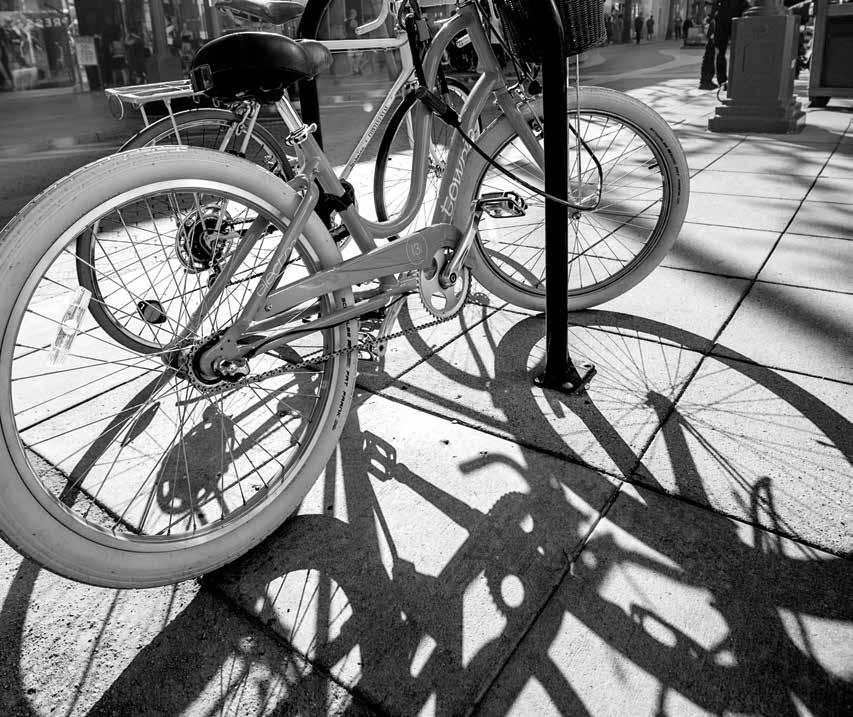
4 Community Acessibility Ready access to work, stores, and services by walking, biking, or public transportation enhances urban life and supports efforts toward a carbon-neutral city. The region was developed during a period of inexpensive fossil fuels, abundant land resources and water, and cheap building materials. While the metropolitan region is one of the densest in the United States, labeled dense sprawl, most of the region still depends on the automobile for transportation, impacting the quality of life, as well as creating air pollution and GHG emissions. Public transportation and bicycle infrastructure have historically been fiscally constrained due to tax reduction initiatives passed since However, the 2008 passage of the county-wide half cent sales tax -Measure R, the Traffic Relief and Rail Expansion Ordinance, have invigorated public transportation improvements. Public transit use and bicycle use have been increasing, albeit slowly, but public transit infrastructure investments are clearly changing real estate dynamics across the region. An evolution is taking place. Zoning laws still stand in the way of dramatic changes enabling more walkable and transit friendly neighborhoods, as does historic NIMBYism. Despite these entrenched patterns, there is a slow evolution that this report card will begin to track over time. Data We evaluated access to shops and services, bike friendliness, and access to public transportation using the Walk Score, Bike Score TM and Transit Score ratings developed by the company Walk Score ( for cities throughout LA County 56. All scores are on a scale from Walk Score ratings measures walkability based on walking routes to destinations such as grocery stores, schools, parks, restaurants, and retail. Scores have been calculated for approximately 2,500 of the largest US cities. Transit Score ratings are a measure of how well a location is served by public transit, based on data released in a 80
, and distance to the nearest stop on the route. Bike Score measures bike accessibility on a scale from 0-100 based on bike infrastructure, topography, destinations and road connectivity.")
5 standard format by public transit agencies. Transit Scores ratings are calculated by assigning a usefulness value to nearby transit routes based on the frequency, type of route (rail, bus, etc.), and distance to the nearest stop on the route. Bike Score measures bike accessibility on a scale from based on bike infrastructure, topography, destinations and road connectivity. For a given location, a Bike Score is calculated by measuring bike infrastructure (lanes, trails, etc.), hills, destinations and road connectivity, and the number of bike commuters. Findings The 141 Walk Score-rated cities with a population 200,000 or greater gave an average Walk Score of 47. The highest is 88 for New York City, followed by 84 for San Francisco. The average Walk Score for the City of Los Angeles was 64 with neighborhoods like Downtown LA, Koreatown, Westlake, Hollywood and Mid City scoring very well. (Table 39, Fig 62). The average WalkScore for the city of Long Beach was 66. (Table 39, Fig 63). Of the listed cities, the highest Walk Scores were in Santa Monica. No listed city scored in the Walker s Paradise (90-100) and only Santa Monica scored in the next tier of Very Walkable (70-89). Six cities scored less than 50, putting them in the Car Dependent category, in which most or all errands required a car.(table 39) Transit Scores were only available for four of the largest 20 cities. Santa Monica and Pasadena were rated Excellent Transit, the second highest ranking. Los Angeles and Glendale were rated Good Transit and Some Transit respectively.(table 39) Scoring Legend Score Walk Score Transit Score Bike Score WALKER'S PARADISE Daily errands do not require a car VERY WALKABLE Most errands can be accomplished on foot SOMEWHAT WALKABLE Some errands can be accomplished on foot CAR-DEPENDENT Most errands require a car CAR-DEPENDENT Almost all errands require a car RIDER S PARADISE World-class public transportation EXCELLENT TRANSIT Transit is convenient for most trips GOOD TRANSIT Many nearby public transportation options SOME TRANSIT A few nearby public transportation options MINIMAL TRANSIT It is possible to get on a bus BIKER S PARADISE Daily errands can be accomplished on bike VERY BIKEABLE Biking is convenient for most trips BIKEABLE Some bike infrastructure SOMEWHAT BIKEABLE Minimal bike infrastructure SOMEWHAT BIKEABLE Minimal bike infrastructure Table 39: WalkScores, TransitScores and BikeScores for Selected Cities and Neighborhoods in L.A. County City Walk Score Transit Score Bike Score Burbank 66 Carson 49 Compton 59 Culver City 73 Downey 54 El Monte 56 Glendale Hawthorne 64 Inglewood 64 Lancaster 25 Long Beach Los Angeles Norwalk 56 Palmdale 21 Pasadena Pomona 48 Santa Clarita 33 Santa Monica South Gate 61 Torrance 61 West Covina 41 LOS ANGELES NEIGHBORHOODS Downtown Koreatown Westlake Hollywood Mid City No. Hollywood South L.A San Pedro Sun Valley Northridge Sylmar Pac. Palisades Figure 62: Los Angeles Walk Score Figure 63: Long Beach Walk Score 81
6 Bike Scores were only available for Los Angeles and Long Beach, both of which were rated Bikeable, but none of the LA neighborhoods were in the Very Bikeable range despite a large increase in city bike lane mileage in recent years. (Table 39) Data Limitations These three measures are trademarked methodologies that are not fully transparent to the public. Scores were only available by city, not for the County as a whole, and not for unincorporated areas of the County. Bike Scores are only available where bike infrastructure data was available from the city. Transit Scores are only available where local agencies provided open data through a GTFS feed. Some scores include attributes that cannot be addressed by city planning or individual action, such as the hilliness of a neighborhood as part of the Bike Score. Although obviously important information for prospective residents who intend to bike to work, this aspect of the score will not change with time. There is not a clear schedule for updates, although they have been occurring approximately every 18 months. The County of Los Angeles is a late comer to many of these issues, and complicating this assessment is that there are 88 different cities ranging from very small to quite large, dense to dominated by single family neighborhoods. The County has no land use authority over these individual cities, thus any changes must be initiated one city at a time. 82
7 Commute Times and Modes of Transportation to Work Commute times and mode of transportation to work are linked to many aspects of urban life including accessibility of public transportation and proximity of housing to jobs. While the previous indicator looked at accessibility measures from a neighborhood perspective, this indicator looks at outcomes from a population perspective, namely: how are people actually getting to work and how long does it take? While land use is the responsibility of cities, the county s Metropolitan Transit Authority provides bus and rail transit to much of the region. There are also individual city transit authorities such as the Santa Monica Big Blue Bus, LADOT s DASH and Commuter Express services, the Culver CityBus, Foothill Transit, Long Beach Transit, and Torrance Transit. Thus the region has a complex transportation network, including city and county streets, state and federal freeways, and private railroads. Data We used data from the 2013 American Community Survey 1-year estimates for Los Angeles County. Reports were generated using the advanced search option in the US Census Bureau American FactFinder 57. We looked at the percent of County workers (16 years and over) who drove alone, carpooled, or took public transportation. We also looked at the mean travel time to work. Results were compared to those from the year survey and from the 2005 survey, which was the earliest year we could find with these data. Findings Approximately 90% of those surveyed indicated that they traveled to work by one of the three modes of transportation: drove alone, carpooled, or took public transportation. (Table 40) The overwhelming majority, 73%, drove alone. Ten percent carpooled and 7% took public transportation. (Table 40) The mean travel time to work was 30 minutes. Only 7.5% of the public commuted less than 10 minutes a day while 22.6% of the workforce commutes over 45 minutes to work. The mean time for public transportation was 75% greater than that for driving alone, and 54.7% of mass transit commuters take over 45 minutes to get to work. (Table 40) These results differed by only percentage points from 2012 results, well within the margin of error for the estimates. Compared to 2005, the number of carpoolers was 2% lower in 2013 (which is greater than the margin of error but less than the percent imputed value for means of transportation to work, which was 2.4% in 2005 and 8.6% in 2013). Differences in all other values were within the margins of error for the estimates. Data Limitations These data do not provide further details on the mode of transportation for the 10% of survey respondent who did not travel to work by one of the three modes of transportation listed. We hope to provide information on the percent of people biking and walking to work in future report cards. Due to time and resource limitations, we were unable to research data on mode of transportation for years prior to 2005, to provide a greater context for examining commuting patterns. Table 40: Los Angeles County Travel Times and Modes of Transportation to Work, Source: ACS Total Car, truck, or van drove alone Car, truck, or van carpooled Public transportation (excl. taxicab) Estimate MoE Estimate MoE Estimate MoE Estimate MoE Workers 16 years and over 4,492,244 +/-21,728 3,264,307 +/-21, ,897 +/-12, ,794 +/-8,038 Less than 10 minutes 7.5% +/ % +/ % +/ % +/ to 14 minutes 11.2% +/ % +/ % +/ % +/-0.7 TRAVEL TIME TO WORK 15 to 19 minutes 13.8% +/ % +/ % +/ % +/ to 24 minutes 14.4% +/ % +/ % +/ % +/ to 29 minutes 5.5% +/ % +/ % +/ % +/ to 34 minutes 17.3% +/ % +/ % +/ % +/ to 44 minutes 7.7% +/ % +/ % +/ % +/ to 59 minutes 10.0% +/ % +/ % +/ % +/ or more minutes 12.6% +/ % +/ % +/ % +/-1.6 Mean travel time to work (min) / / / /

8 Park Access and Quality Neighborhood parks contribute to the quality of urban life by providing opportunities for sociability, access to nature, outdoor recreation and enjoyment of green spaces. Measures of park access and quality aim to quantify and combine multiple attributes into a single index that can be used to compare neighborhoods. The results may inform municipal decisions on land use, community development, and public resource allocation, as well as individuals decisions on where to live. Data We used measures of park access and quality created by two different organizations, as follows: The Trust for Public Land has developed a ParkScore that incorporates multiple attributes, including aspects of park size, services and walking distance (see methodology graphic). Publically accessible park and open space data was obtained from City, County, State and Federal agencies. Scores are given on a scale of 1-100, as well as on a scale of 1-5 benches. ParkScore is only available at the city-level at this time, and the Cities of LA and Long Beach are the only ones within LA County that have been scored. The data are publically available on the ParkScore website % ACREAGE MEDIAN PARK SIZE (16.5%) PARK ACRES AS % OF CITY ACRES (16.5%) 33 % SERVICE & INVESTMENT + + = SPENDING PER RESIDENT (16.5%) + PLAYGROUNDS PER 10,000 RESIDENTS (16.5%) The Trust for Public Land ParkScore Methodology GreenInfo Network has developed a ParkIndex 59 rating based on a scale of This tool assesses census tracts or block groups based on the extent to which it is close to parks. ParkIndex ratings have been calculated for all neighborhoods and cities throughout Los Angeles County, but are currently in a pre-release draft version. We received 33 WALK OF % ACCESS PERCENTAGE OF POPULATION LIVING WITHIN A TEN-MINUTE A PUBLIC PARK 100 % PARKSCORE permission to include the ratings for LA County as a whole, as well as for the cities of Los Angeles and Long Beach, effective Oct Both methodologies include areas such as county beaches and National Forests in their definitions of park.. 84
9 Table 41: ParkScores and ParkIndex Scores for the Cities of Los Angeles and Long Beach Source: Trust for Public Land GreenInfo Network ParkScore Rank Index Score Long Beach 54 24/60 41 Los Angeles 42 45/60 28 Findings A Park Score has been calculated by the Trust for Public Land for 60 cities within the US, and range from a high of 82 (Minneapolis) to a low of 26 (Fresno). The City of Long Beach was ranked 24th out of 60 with a Park Score of 54.0 (3 out of 5 benches ). Areas with a very high need for parks are largely in North Long Beach near the LA River. (Table 41, Fig 64) The City of Los Angeles was ranked 45th out of 60, with a Park Score of 42.0 (2 out of 5 benches ). Areas with a very high need for parks include downtown LA, South LA, East LA, and the Van Nuys area of the San Fernando Valley. (Table 41, Fig 65) The average ParkIndex rating calculated by GreenInfo Network across all jurisdictions within Los Angeles County is 34. The City of Long Beach average ParkIndex rating was 41, above the County average. (Table 41) The City of Los Angeles average ParkIndex rating was 28, below the County average. (Table 41) Data Limitations The current park access metrics are based largely on the distance to the park and the size of the park, but do not reflect programs, safety or natural resources in the park. Further, they have been developed for use nation-wide and do not reflect differences among cities or regions. For example, current indices do not take into consideration whether a city has a large single family dwelling stock, with each dwelling having an individual yard, or predominantly multiple family apartment buildings. Park access needs are qualitatively different for those different circumstances, and suggest prioritizing new parks in neighborhoods that lack absolute access to open space. While we recognize the current park indicators represent a huge effort to quantify this important amenity, we believe the methodologies require further refinement to reflect the needs of neighborhoods and nuances among park types themselves. 85
 determines where there are gaps in park availability, and 2) constructs a demographic profile to identify gaps with the most urgent need for parkland.")
10 Figure 64: City of Los Angeles 2014 ParkScore Map. Source: TPL The Trust for Public Land ParkScore index analyzes public access to existing parks and open space. The analysis incorporates a twostep approach: 1) determines where there are gaps in park availability, and 2) constructs a demographic profile to identify gaps with the most urgent need for parkland. Park gaps are based on a dynamic 1/2 mile service area (10 minute walking distance) for all parks. In this analysis, service areas use the street network to determine walkable distance - streets such as highways, freeways, and interstates are considered barriers. Demographic profiles are based on 2013 Forecast block groups provided by Esri to determine park need for percentage of population age 19 and younger, percentage of households with income less than 75% of city median income (Los Angeles less than $35,000), and population density (people per acre). The combined level of park need result shown on the large map combines the three demographic profile results and assigns the following weights: 50% = Population density (people per acre) 25% = Percentage of population < age 19 25% = Percentage of households with income less than $35,000 Areas in red show a very high need for parks. Very High Park Need High Park Need Moderate Park Need Parks with Public Access Other Parks and Open Space Half Mile Park Service Areas Cemetery University Industrial Waterbodies miles Special thanks to the following data providers: Los Angeles, Esri.Information on this map is provided for purposes of discussion and visualization only. Map created by The Trust for Public Land on April 14, TPL, The Trust for Public Land, and The Trust for Public Land logo are trademarks of The Trust for Public Land. Copyright 2014 The Trust for Public Land. Table 42: ParkScore Index Calculation, City of Los Angeles. Source: TPL Rank (out of 60) Population Acreage (Max 40) Services and Investment (Max 40) Access (Max 40) Raw Score (Max 120) ParkScore (Max 100) 45 3,857, Median Park Size Park Land as % of City Area Spending per Resident Playgrounds per 10,000 Residents 9 (Max 20) 16 (Max 20) 6 (Max 20) 1 (Max 20) 86
 determines where there are gaps in park availability, and 2) constructs a demographic profile to identify gaps with the most urgent need for parkland.")
11 Figure 65: City of Long Beach 2014 ParkScore Map. Source: TPL The Trust for Public Land ParkScore index analyzes public access to existing parks and open space. The analysis incorporates a twostep approach: 1) determines where there are gaps in park availability, and 2) constructs a demographic profile to identify gaps with the most urgent need for parkland. Park gaps are based on a dynamic 1/2 mile service area (10 minute walking distance) for all parks. In this analysis, service areas use the street network to determine walkable distance - streets such as highways, freeways, and interstates are considered barriers. Demographic profiles are based on 2013 Forecast block groups provided by Esri to determine park need for percentage of population age 19 and younger, percentage of households with income less than 75% of city median income (Long Beach less than $35,000), and population density (people per acre). The combined level of park need result shown on the large map combines the three demographic profile results and assigns the following weights: 50% = Population density (people per acre) 25% = Percentage of population < age 19 25% = Percentage of households with income less than $35,000 Areas in red show a very high need for parks. Very High Park Need High Park Need Moderate Park Need Parks with Public Access Other Parks and Open Space Half Mile Park Service Areas Cemetery University Industrial Waterbodies miles Special thanks to the following data providers: Long Beach, Esri.Information on this map is provided for purposes of discussion and visualization only. Map created by The Trust for Public Land on April 14, TPL, The Trust for Public Land, and The Trust for Public Land logo are trademarks of The Trust for Public Land. Copyright 2014 The Trust for Public Land. Table 43: ParkScore Index Calculation, City of Long Beach. Source: TPL Rank (out of 60) Population Acreage (Max 40) Services and Investment (Max 40) Access (Max 40) Raw Score (Max 120) ParkScore (Max 100) , Median Park Size Park Land as % of City Area Spending per Resident Playgrounds per 10,000 Residents 5 (Max 20) 10 (Max 20) 18 (Max 20) 2 (Max 20) 87
12 Community Environmental Health The California Office of Environmental Health Hazard Assessment (OEHHA) has developed a methodology for identifying environmental exposures from multiple media pathways, and for characterizing the vulnerabilities of exposed populations, through a tool called Cal EnviroScreen (version 2.0, effective August, 2014) 60. CalEnviroScreen produces a composite score and ranks all California census tracks relative to each other. CalEnviroScreen is primarily designed to assist OEHHA in carrying out its environmental justice mission to conduct its activities in a manner that ensures the fair treatment of all Californians, including minority and low-income populations. Data We used the CalEnviroScreen 2.0 calculated Pollution Burden and Overall Score as indicators of Community Environmental Health. While some individual components of the Pollution Burden score overlap with other indicators in this Report Card, we believe the cumulative nature of this measure, as well as its spatial treatment of waste-related facilities, provide a unique contribution to the report card. Figure 66 depicts the components and relative weightings. The overall CalEnviroScreen score was calculated from the Pollution Burden and Population Characteristics groups of indicators by multiplying the two scores. Since each group has a maximum score of 10, the maximum CalEnviroScreen Score is 100. Both scores are mapped using decile categories of percentile values by census tract, based on scores across the entire state of California. Populations are based on 2010 census values. Higher scores (redder color) indicate poorer environmental quality and greater vulnerability. Findings Census tracts with the highest percentiles of Pollution Burden and Overall EnviroScreen Scores are Figure 66: CalEnviroScreen 2.0 Scoring Methodology Pollution Burden Ozone Concentrations PM2.5 Concentrations Diesel PM Emissions Pesticide Use Toxic Releases from Facilities Traffic Density Drinking Water Contaminants Cleanup Sites (1/2) Groundwater Threats (1/2) Hazardous Waste (1/2) Impaired Water Bodies (1/2) Solid Waste Sites and Facilities (1/2) Population Characteristics Children and Elderly Low Birthweight Asthma Emergency Room Visits Educational Attainment Linguistic Isolation Poverty Unemployment x = widespread across the southern half of Los Angeles County, the area with the lowest income. As expected, these tracts correspond to major transportation corridors and industrial areas. They include tracts near the ports, south LA, Downtown LA, East LA, much of the San Gabriel Valley, and the Pacoima-San Fernando area. (Tables 44 and 45, Fig 67 & 68) Twenty-one percent of the County s population lives in census tracts ranking in the top (worst) 10% of Pollution Burden scores within the State, and over 80% of the County s population lives in census tracts ranking in the top half of Pollution Burden scores within the State (Table 1, Figure 2). Only 2% of the population lives in areas ranking in the lowest 10% of Pollution Burden scores. (Table 44, Fig 67) Over 19% of the County s population lives in census tracts ranking in the top (worst) 10% of Overall EnviroScreen CalEnviroScreen Score scores within the State, and over 70% of the County s population lives in census tracts ranking in the top half of Overall EnviroScreen scores within the State (Table 2, Figure 3). Under 4% of the population lives in areas ranking in the lowest 10% of Overall scores. (Table 45, Fig 68) Data Limitations CalEnviroScreen provides a relative ranking of communities based on a selected group of available datasets, through the use of a summary score. This score is not an expression of health risk. Further, as a comparative screening tool, the results do not provide a basis for determining when differences between scores are significant in relation to public health or the environment. Accordingly, the tool is not intended to be used as a health or ecological risk assessment for a specific area or site. 88


13 Table 44: Percentile Category of Pollution Burden Score Population Percent of Population ,785 2% ,149 2% ,351 2% ,657 4% ,370 7% ,107,576 11% ,467,345 15% ,705,513 17% ,856,652 18% ,086,724 21% Total 10,052,122 Figure 67: CalEnviroScreen 2.0 Pollution Burden by Census Tract PERCENTILE 1-10% 11-20% 21-30% 31-40% 41-50% 51-60% 61-70% 71-80% 81-90% % miles Table 45: Percentile Category of Overall CalEnviroScreen Score Population Percent of Population , % , % , % , % , % , % ,206, % ,344, % ,775, % (highest) 1,926, % Total 10,052,122 Figure 68: CalEnviroScreen 2.0 Overall Scores by Census Tract SCORES LOWEST HIGHEST miles 89

14 Grade for Environmental Quality of Life = C+ Based on the indicators we analyzed alone, the region would get a C grade or worse for environmental quality of life. However, there are many aspects of the region s quality of life that have improved dramatically over the last two decades. There have been substantial investments in parks through Proposition 12 and County Measure A, and through efforts from the Trust for Public Land, People for Parks, Amigos de Los Rios, North East Trees, Los Angeles Neighborhood Land Trust, and local and state conservancies and the Los Angeles Conservation Corps. Even measures like LA s stormwater bond, Proposition O, have added greatly to parks in a region surrounded by beaches and mountains. Public mass transportation has improved dramatically with Federal investments and Measure R funds catalyzing numerous far-reaching projects. The vast majority of residents in the region live within walking distance of public transportation. City walkability is a challenge in many areas, but programs like Mayor Garcetti s Great Streets, and efforts in numerous coastal cities give one optimism that communities are becoming more welcoming to pedestrians. And the miles of bike lanes have increased greatly over the last five years as activists and CicLAvia have brought widespread awareness to the need for more bikeable communities. But despite these numerous regional and local improvements in quality of life metrics, the region s traffic if often untenable and far too many people are living in areas with low EnviroScreen scores: a strong sign of poor environmental health in many communities. As such, the environmental quality of life score is a C+. 90
15 UCLA Institute of the Environment and Sustainability La Kretz Hall, Suite 300 Box Los Angeles, CA Tel: (310) Fax: (310)
MCTC 2018 RTP SCS and Madera County RIFP Multi-Modal Project Eval Criteria GV13.xlsx
 MCTC 8 RTP SCS and Madera County RIFP Multi-Modal Project Eval Criteria GV.xlsx Madera County Transportation Commission Regional Transportation Plan / Sustainable Communities Strategy Multi-Modal Project
INFRASTRUCTURE: Using the Grid to Create a more Self-Sustaining Downtown. Studio Spring 2013
 EMERGENT FUTURES The San Diego Section of the American Society of Civil Engineers (ASCE) released a new report, the 2012 San Diego County Infrastructure Report Card. Since the last San Diego Report Card
ADOT Statewide Bicycle and Pedestrian Program Summary of Phase IV Activities APPENDIX B PEDESTRIAN DEMAND INDEX
 ADOT Statewide Bicycle and Pedestrian Program Summary of Activities APPENDIX B PEDESTRIAN DEMAND INDEX May 24, 2009 Pedestrian Demand Index for State Highway Facilities Revised: May 29, 2007 Introduction
Chapter 14 PARLIER RELATIONSHIP TO CITY PLANS AND POLICIES. Recommendations to Improve Pedestrian Safety in the City of Parlier (2014)
") Chapter 14 PARLIER This chapter describes the current status and future plans for biking and walking in the City of Parlier. RELATIONSHIP TO CITY PLANS AND POLICIES The Parlier General Plan is the primary
Chapter 14 PARLIER This chapter describes the current status and future plans for biking and walking in the City of Parlier. RELATIONSHIP TO CITY PLANS AND POLICIES The Parlier General Plan is the primary
DON MILLS-EGLINTON Mobility Hub Profile
 Mobility Hub Profile Dundas Don Mills-Eglinton West-Bloor Anchor Hub Gateway Hub N MOBILITY HUBS: Places of connectivity between regional and rapid transit services, where different modes of transportation
Multimodal Transportation Plan
 Multimodal Transportation Plan The Multimodal Transportation Plan will accommodate MILLENIALS ARE DRIVING LESS. WE CANNOT BUILD OUR WAY all modes of transportation by keeping pedestrians, OUT OF CONGESTION.
AAMPO Regional Transportation Attitude Survey
 AAMPO Regional Transportation Attitude Survey Traditionally Underserved Populations helping organizations make better decisions since 1982 2018 Submitted to the AAMPO By: ETC Institute 725 W. Frontier
NEWMARKET CENTRE Mobility Hub Profile
 Mobility Hub Profile Dundas Newmarket West-Bloor Centre Anchor Hub Gateway Hub N MOBILITY HUBS: Places of connectivity between regional and rapid transit services, where different modes of transportation
Westside Transportation Access Needs Assessment - Short and Long Term Improvements
 ABSTRACT The Los Angeles County Metropolitan Transportation Authority (MTA) adopted the 2001 Long Range Transportation Plan (LRTP), which sets out the County s transportation investments for the next 20-25
Kevin Manaugh Department of Geography McGill School of Environment
 Kevin Manaugh Department of Geography McGill School of Environment Outline Why do people use active modes? Physical (Built environment) Factors Psychological Factors Empirical Work Neighbourhood Walkability
San Mateo County Comprehensive Bicycle and Pedestrian Plan Open House
 San Mateo County Comprehensive Bicycle and Pedestrian Plan Open House October 28, 2010 Presented to San Mateo County residents and interested parties by Lauren Ledbetter, Alta Planning + Design Matt Haynes,
SUMMARY OF TRANSPORTATION INVESTMENTS
 Santa Cruz County 2016 Measure D: Transportation Improvement Expenditure Plan - Approved by over 2/3 of Santa Cruz County voters on November 8, 2016 - Overview Measure D, the 2016 Transportation Improvement
DON MILLS-SHEPPARD Mobility Hub Profile
 DON MILLS-SHEPPARD Mobility Hub Profile Dundas Don Mills-Sheppard West-Bloor Anchor Hub Gateway Hub N MOBILITY HUBS: Places of connectivity between regional and rapid transit services, where different
Connecting Sacramento: A Trip-Making and Accessibility Study
 Connecting Sacramento: A Trip-Making and Accessibility Study Study Overview and Highlights July 2017 Purpose of this study Local governments and transportation agencies often make challenging decisions
Transportation Master Plan Advisory Task Force
 Transportation Master Plan Advisory Task Force Network Alternatives & Phasing Strategy February 2016 BACKGROUND Table of Contents BACKGROUND Purpose & Introduction 2 Linking the TMP to Key Council Approved
City of Novi Non-Motorized Master Plan 2011 Executive Summary
 City of Novi Non-Motorized Master Plan 2011 Executive Summary Prepared by: February 28, 2011 Why Plan? Encouraging healthy, active lifestyles through pathway and sidewalk connectivity has been a focus
Typical Rush Hour Commute. PennyforTransportation.com
 Typical Rush Hour Commute In the News Overview of the Plan Collaborative plan with projects in every community Prioritizing connectivity and congestion relief Dedicated transportation-specific funding;
APPENDIX E BIKEWAY PRIORITIZATION METHODOLOGY
 APPENDIX E BIKEWAY PRIORITIZATION METHODOLOGY INTRODUCTION The network of bikeways recommended in the Bicycle Master Plan is extensive and is likely to be only partially completed during the 25-year life
Pocatello Regional Transit Master Transit Plan Draft Recommendations
 Pocatello Regional Transit Master Transit Plan Draft Recommendations Presentation Outline 1. 2. 3. 4. What is the Master Transit Plan? An overview of the study Where Are We Today? Key take-aways from existing
2010 Pedestrian and Bicyclist Special Districts Study Update
 2010 Pedestrian and Bicyclist Special Districts Study Update Pedestrian and Bicyclist Special Districts Program Overview H-GAC s Special Districts Program aims to provide strategic investments in pedestrian
Magnolia Place. Traffic Impact Analysis. Prepared for: City of San Mateo. Prepared by: Hexagon Transportation Consultants, Inc.
 Magnolia Place Traffic Impact Analysis Prepared for: City of San Mateo Prepared by: Hexagon Transportation Consultants, Inc. Updated January 4, 2010 Table of Contents 1. Introduction...1 2. Existing Conditions...6
Rail Station Fact Sheet University of Dallas Station
 Rail Station Fact Sheet University of Dallas Station Station Overview University of Dallas Station is located on John Carpenter Freeway and west of Loop 12 across from the University of Dallas in Irving.
4. ENVIRONMENTAL IMPACT ANALYSIS 9. TRANSPORTATION AND TRAFFIC
 4. ENVIRONMENTAL IMPACT ANALYSIS 9. TRANSPORTATION AND TRAFFIC 4.9.1 INTRODUCTION The following section addresses the Proposed Project s impact on transportation and traffic based on the Traffic Study
Urban planners have invested a lot of energy in the idea of transit-oriented
 DOES TRANSIT-ORIENTED DEVELOPMENT NEED THE TRANSIT? D A N I E L G. C H AT M A N Urban planners have invested a lot of energy in the idea of transit-oriented developments (TODs). Developing dense housing
Chapter 5. Complete Streets and Walkable Communities.
 Chapter 5. Complete Streets and Walkable Communities. 5.1 Description of Complete Streets. Cities throughout the world, and specifically the United States, are coming to embrace a new transportation and
CHAPTER 7.0 IMPLEMENTATION
 CHAPTER 7.0 IMPLEMENTATION Achieving the vision of the Better Streets Plan will rely on the ability to effectively fund, build and maintain improvements, and to sustain improvements over time. CHAPTER
May 12, 2016 Metro Potential Ballot Measure Issue Brief: Local Return
 Summary: Local return is an important revenue source for cities to maintain their local transportation infrastructure. Most cities use their local return to operate small bus systems and repave streets,
I-105 Corridor Sustainability Study (CSS)
") I-105 Corridor Sustainability Study (CSS) Metro Streets and Freeways Subcommittee March 21, 2019 Gary Hamrick Cambridge Systematics, Inc. I-105 CSS Project History & Background Funded by Caltrans Sustainable
I-105 Corridor Sustainability Study (CSS) Metro Streets and Freeways Subcommittee March 21, 2019 Gary Hamrick Cambridge Systematics, Inc. I-105 CSS Project History & Background Funded by Caltrans Sustainable
CITY OF COCOA BEACH 2025 COMPREHENSIVE PLAN. Section VIII Mobility Element Goals, Objectives, and Policies
 CITY OF COCOA BEACH 2025 COMPREHENSIVE PLAN Section VIII Mobility Element Goals, Objectives, and Policies Adopted August 6, 2015 by Ordinance No. 1591 VIII MOBILITY ELEMENT Table of Contents Page Number
1.0 INTRODUCTION 1.1 PURPOSE OF THIS REPORT
 1.0 INTRODUCTION This chapter provides an overview of the purpose, authorization and focus of this Recirculated Draft Environmental Impact Report (EIR), an identification of the Lead Agency, an outline
Chapter 13 ORANGE COVE
 Chapter 13 ORANGE COVE This chapter describes the current status and future plans for biking and walking in the City of Orange Cove. RELATIONSHIP TO CITY PLANS AND POLICIES The Orange Cove General Plan
CONNECTING PEOPLE TO PLACES
 CONNECTING PEOPLE TO PLACES 82 EAST BENCH MASTER PLAN 07 Introduction The East Bench transportation system is a collection of slow moving, treelined residential streets and major arteries that are the
What s Health Got to Do With It? Health and Land Use Planning
 What s Health Got to Do With It? Health and Land Use Planning CANDACE RUTT, PH.D. EXECUTIVE DIRECTOR APRIL 13 TH, 2016 Planning and Public Health Planning + Public Health Healthy Communities Healthier
Rail Station Fact Sheet Downtown Carrollton Station
 Rail Station Fact Sheet Downtown Carrollton Station Station Overview Downtown Carrollton Station is located at East Belt Line Road and Broadway Street near the historic Downtown Carrollton Square. The
Pedestrian Activity Criteria. PSAC March 8, 2011
 Pedestrian Activity Criteria PSAC March 8, 2011 Contents 1. Project Overview a) Revised schedule of PSAC hearings 2. Pedestrian Activity: Where walking is important a) Existing conditions (revisions based
ACTIVE TRANSPORTATION
 ACTIVE TRANSPORTATION Mobility 2040 Supported Goals Improve the availability of transportation options for people and goods. Support travel efficiency measures and system enhancements targeted at congestion
EXECUTIVE DIRECTIVE NO. 20. Issue Date: July 1, 2011
 ANTONIO R. VILLARAIGOSA MAYOR EXECUTIVE DIRECTIVE NO. 20 Issue Date: July 1, 2011 SUBJECT: Implementation of the 2010 Bicycle Plan It is no secret that the quality of life in Los Angeles is directly influenced
WALKNBIKE DRAFT PLAN NASHVILLE, TENNESSEE EXECUTIVE SUMMARY NASHVILLE, TENNESSEE
 NASHVILLE, TENNESSEE EXECUTIVE SUMMARY Executive Summary A world-class multi-modal transportation system is essential to a vibrant city and better quality of life. -Mayor Barry The WalknBike plan aims
TR NEWS. Public Health and Transportation. Innovation, Intervention, and Improvements NUMBER 299 SEPTEMBER OCTOBER 2015
 TR NEWS NUMBER 299 SEPTEMBER OCTOBER 2015 Public Health and Transportation Innovation, Intervention, and Improvements Public Health and Transportation Measuring the Health Benefits of Walking and Bicycling
Rail Station Fact Sheet DFW Airport North Station* (*station under construction with anticipated start of service in late 2018)
") Rail Station Fact Sheet DFW Airport North Station* (*station under construction with anticipated start of service in late 018) Station Overview DFW Airport North Station will be located on DFW nternational
Rail Station Fact Sheet DFW Airport North Station* (*station under construction with anticipated start of service in late 018) Station Overview DFW Airport North Station will be located on DFW nternational
Measuring and Communicating Mobility:
 Measuring and Communicating Mobility: The District Mobility Project Stephanie Dock, District Department of Transportation TRB Transportation Issues in Major Cities Committee May 2, 2017 Deconstructing
Pedestrian Project List and Prioritization
 To: Kyle Wagenschutz, City of Memphis CC: From: Anne Conlon and John Cock, Alta Planning + Design Date: December, 2014 Re: Project List Development (Task 3.1-3.2) and Project List Prioritization (Task
NORTH YORK CENTRE Mobility Hub Profile
 Mobility Hub Profile Dundas North York West-Bloor Centre Anchor Hub Gateway Hub N MOBILITY HUBS: Places of connectivity between regional and rapid transit services, where different modes of transportation
Rail Station Fact Sheet CentrePort/DFW Airport Station
 Rail Station Fact Sheet CentrePort/DFW Airport Station Station Overview CentrePort/DFW Airport Station is located by Statler Boulevard at Breezewood Drive in Fort Worth. Free shuttles connect the station
Briefing Paper #1. An Overview of Regional Demand and Mode Share
 2011 Metro Vancouver Regional Trip Diary Survey Briefing Paper #1 An Overview of Regional Demand and Mode Share Introduction The 2011 Metro Vancouver Regional Trip Diary Survey is the latest survey conducted
About the Active Transportation Alliance
 About the Active Transportation Alliance Chicagoland s voice for better biking, walking and transit Founded 1985 7,000 members, ~33 full time staff Serve Chicago metro region 1 More Cars, More Driving
Notes to Benefit-Cost Analysis
 Executive Summary Project Matrix Current Status/ Problem to Be Addressed University Avenue not user friendly or safe for cars, pedestrians, bicyclists, or bus riders. Notes to Benefit-Cost Analysis Change
Practicing what we preach in POMONA! Daryl Grigsby, Public Works Director, City of Pomona, California
 Practicing what we preach in POMONA! Daryl Grigsby, Public Works Director, City of Pomona, California Who lives in Pomona? 150,000 people: Young average age 26, 34% under 18 years old, and only 6.5% over
DUNDAS WEST-BLOOR Mobility Hub Profile
 Mobility Hub Profile Dundas West-Bloor Anchor Hub Gateway Hub N MOBILITY HUBS: Places of connectivity between regional and rapid transit services, where different modes of transportation come together
92% COMMUTING IN THE METRO. Congested Roadways Mode Share. Roadway Congestion & Mode Share
 COMMUTING IN THE METRO Roadway Congestion & Mode Share The majority of major roadways in Greater Des Moines are without congestion and have underutilized capacity. This surplus capacity could be used for
Frequently asked questions about how the Transport Walkability Index was calculated are answered below.
 Transport Walkability Index The Transport Walkability Index is a relative indicator of how well the built environment in different areas supports walking for transport. The index is frequently used in
Regional Transportation Needs Within Southeastern Wisconsin
 Regional Transportation Needs Within Southeastern Wisconsin #118274 May 24, 2006 1 Introduction The Southeastern Wisconsin Regional Planning Commission (SEWRPC) is the official areawide planning agency
South King County High-Capacity Transit Corridor Study
 HIGH-CAPACITY TRANSIT CORRIDOR STUDY South King County Corridor South King County High-Capacity Transit Corridor Study Corridor Report August 2014 South King County High Capacity Transit Corridor Report
Perryville TOD and Greenway Plan
 Perryville TOD and Greenway Plan Greenway Glossary Pathway: A bicycle and pedestrian path separated from motorized vehicular traffic by an open space, barrier or curb. Multi-use paths may be within the
Regional Bicycle Barriers Study
 Regional Bicycle Barriers Study Executive Summary Background and Purpose The 2040 Transportation Policy Plan (TPP) sets policies for planning and investment direction in the transportation system in the
PUBLIC OPINION STRATEGIES
 PUBLIC OPINION STRATEGIES National Association of REALTORS The key findings from a national survey of 1,000 adults conducted October 5, 7, 9-10, 2007. 07574 Methodology Public Opinion Strategies is pleased
Strategic Plan for Active Mobility Phase I: Bicycle Mobility
 Strategic Plan for Active Mobility Phase I: Bicycle Mobility City of Corpus Christi February 9, 2016 Jeff Pollack, AICP Transportation Planning Director Vision Active Mobility Plan Vision The metropolitan
2. Context. Existing framework. The context. The challenge. Transport Strategy
 Transport Strategy Providing quality connections Contents 1. Introduction 2. Context 3. Long-term direction 4. Three-year priorities 5. Strategy tree Wellington City Council July 2006 1. Introduction Wellington
5.13 Soledad. Demographic Profile. Disadvantaged Communities. Safety Profile
 5.13 Soledad Demographic Profile The City of Soledad is a small town in the Salinas Valley with 26,065 people, as reported by the California Department of Finance 2017 data. Soledad is a relatively young,
COLUMBUS AVENUE NEIGHBORHOOD TRANSPORTATION STUDY
 COLUMBUS AVENUE NEIGHBORHOOD TRANSPORTATION STUDY Pedestrian Survey Findings Survey Main Findings: Transit and walking are the main two modes used by both visitors and residents of the area, regardless
2011 Countywide Attitudinal and Awareness Survey Results
 2011 Countywide Attitudinal and Awareness Survey Results Purpose of Study Establish baseline for measuring future performance Identify perceptions about transportation system, issues, priorities Assess
Rail Station Fact Sheet UNT Dallas Station
 Rail Station Fact Sheet UNT Dallas Station Station Overview UNT Dallas Station is located on the east side of University Hills Boulevard in Dallas. t is connected by a walking path to the University of
MASTER BICYCLE AND PEDESTRIAN PLAN
 VILLAGE OF NORTHBROOK MASTER BICYCLE AND PEDESTRIAN PLAN DRAFT PLAN OPEN HOUSE May 2, 2018 AGENDA 1. Community Engagement 2. Vision and Goals 3. General Structure of Plan 4. Recommendations Overview 5.
FACTS AND FIGURES: MAKING THE CASE FOR COMPLETE STREETS IN LEE COUNTY
 FACTS AND FIGURES: MAKING THE CASE FOR COMPLETE STREETS IN LEE COUNTY Safety: Close to 5,000 pedestrians and bicyclists die each year on U.S. roads, and more than 70,000 are injured. [Mean Streets, Surface
Transportation 2040 Update: Eudora Public Input As of June 1, 2017
 Transportation 2040 Update: Eudora Public Input As of June 1, 2017 Overview... 1 Survey Responses... 2 Overview The Lawrence Douglas County Metropolitan Planning Organization (MPO) is updating our long
Community & Transportation Preferences Survey
 Community & Transportation Preferences Survey Webinar: August 5, 2015 Hugh Morris, AICP, LEED Realtor.org Jennifer Dill, Ph.D. trec.pdx.edu 1 Introduction National Association of Realtors Over 1,000,000
AMENDING MOTION: Mobility Plan - Pedestrians and Disadvantaged Communities
 I MOVE that the Council: AMENDING MOTION: Mobility Plan - Pedestrians and Disadvantaged Communities 1. INSTRUCT the Department of City Planning to amend the proposed Mobility Plan to include the following;
Nanaimo Transportation Master Plan. Phase 1 Consultation Summary
 Nanaimo Transportation Master Plan Phase 1 Consultation Summary Transportation Advisory Committee Meeting Wednesday December 12, 2012 Agenda Study Update Phase 1 Consultation Process Phase 1 Consultation
Flyaway Bus: GIS Analysis on Current and Potential Ridership, Revenue, and Prospective Stations
 ProfessorBarry Waite & Bonnie Shrewsbury Flyaway Bus: GIS Analysis on Current and Potential Ridership, Revenue, and Prospective Stations 1. Abstract The Flyaway Bus is a long distance non-stop shuttle
2015 Florida Main Street Annual Conference. Complete Streets Equal Stronger Main Streets
 WHAT ARE COMPLETE STREETS? CASE STUDIES COMPLETING YOUR MAIN STREET 2015 Florida Main Street Annual Conference St. Petersburg, Florida August 19, 2015 WHAT ARE COMPLETE STREETS? CASE STUDIES COMPLETING
National Community and Transportation Preferences Survey. September 2017
 National Community and Transportation Preferences Survey September Executive Summary - Overview The Community and Transportation Preferences Survey echoes many of the major findings from the previous surveys.
 Time of Change We Are Growing We Are An Attractive Place To Live We Are Age Diverse + Living Longer 50000 40000 30000 20000 10000 0 2010 Census Job Density Housing Sheds Transit Sheds The Project FUNDING
Philadelphia Bus Network Choices Report
 Philadelphia Bus Network Choices Report JUNE 2018 SEPTA Table of Contents Executive Summary...7 What if transit gave us more freedom?... 8 What is this report?... 8 The main conclusions... 9 What is happening
Appendix B: Benefit-Cost Analysis
 Appendix B: Benefit-Cost Analysis RE-CONNECTING CLEVELAND: PATHWAYS TO OPPORTUNITY RE-CONNECTING CLEVELAND: PATHWAYS TO OPPORTUNITY [this page intentionally blank] RE-CONNECTING CLEVELAND: PATHWAYS TO
Capital Bikeshare 2011 Member Survey Executive Summary
 Capital Bikeshare 2011 Member Survey Executive Summary Prepared by: LDA Consulting Washington, DC 20015 (202) 548-0205 June 14, 2012 EXECUTIVE SUMMARY Overview This report presents the results of the 2012
Purpose and Need. Chapter Introduction. 2.2 Project Purpose and Need Project Purpose Project Need
 Chapter 2 Purpose and Need 2.1 Introduction The El Camino Real Bus Rapid Transit (BRT) Project (Project) would make transit and other transportation improvements along a 17.6-mile segment of the El Camino
Plant City Walk-Bike Plan
 Plant City Walk-Bike Plan Plant City Commute Mode Share 2.2% 1.4% 2.9% Drove alone 10.2% Carpooled Public transportation (0.1%) Walked Used a Bike (0.4%) 82.9% Taxicab, motorcycle, or other means Worked
1999 On-Board Sacramento Regional Transit District Survey
 SACOG-00-009 1999 On-Board Sacramento Regional Transit District Survey June 2000 Sacramento Area Council of Governments 1999 On-Board Sacramento Regional Transit District Survey June 2000 Table of Contents
Active Travel and Exposure to Air Pollution: Implications for Transportation and Land Use Planning
 Active Travel and Exposure to Air Pollution: Implications for Transportation and Land Use Planning Steve Hankey School of Public and International Affairs, Virginia Tech, 140 Otey Street, Blacksburg, VA
METROPOLITAN TRANSPORTATION PLAN OUTREACH: INTERACTIVE MAP SUMMARY REPORT- 10/03/14
 METROPOLITAN TRANSPORTATION PLAN OUTREACH: INTERACTIVE MAP SUMMARY REPORT- 10/03/14 INTRODUCTION This document summarizes the results of the online interactive mapping exercise implemented by MIG for the
5. Pedestrian System. Accomplishments Over the Past Five Years
 5. Pedestrian System Accomplishments Over the Past Five Years The Alamo Area Metropolitan Planning Organization (MPO) and its partner agencies recognize the importance of improving pedestrian mobility.
Walkable Retail: When Old Becomes New Again Part 1
 Walkable Retail: When Old Becomes New Again Part 1 By Erin Talkington, Vice President, and Jacob Ross, Associate You have probably read the following headline thousands of times, perhaps this year alone:
Fixed Guideway Transit Outcomes on Rents, Jobs, and People and Housing
 Fixed Guideway Transit Outcomes on Rents, Jobs, and People and Housing Arthur C. Nelson, Ph.D., ASCE, FAICP Professor of Planning and Real Estate Development University of Arizona 1 Changing Transportation
Tulsa Metropolitan Area LONG RANGE TRANSPORTATION PLAN
 Tulsa Metropolitan Area LONG RANGE TRANSPORTATION PLAN Indian Nations Council of Governments August 2005 CONTACTING INCOG In developing the Destination 2030 Long Range Transportation Plan, INCOG s Transportation
Dear City Council Members,
 From: Bob Kenyon [mailto: ] Sent: Monday, February 08, 2016 10:20 AM To: City Clerk Subject: Please prioritize Caltrain and a complete transit network Thank you for prioritizing bringing BART to San Jose
Spatial Patterns / relationships. Model / Predict
 Human Environment Spatial Patterns / relationships Model / Predict 2 3 4 5 6 Comparing Neighborhoods with high Quality of Life & health Overlap matrix NPUs with high NH & NQoL SEC High QoL High Health
Coolest Cities Results Summary
 Coolest Cities Results Summary About Coolest Cities Canada s six largest urban areas provide homes and jobs for almost 15 million people, nearly half of our population. Transporting these citizens to and
Complete Street Analysis of a Road Diet: Orange Grove Boulevard, Pasadena, CA
 Complete Street Analysis of a Road Diet: Orange Grove Boulevard, Pasadena, CA Aaron Elias, Bill Cisco Abstract As part of evaluating the feasibility of a road diet on Orange Grove Boulevard in Pasadena,
Fast Affordable Sustainable Transportation
 Fast Affordable Sustainable Transportation Bay Area October 2017 PC: Dllu Waking up from our traffic nightmare Transportation in the Bay Area has reached a crisis point. There is grinding congestion on
POTENTIAL SANTA CLARA COUNTY TRANSPORTATION MEASURE
 POTENTIAL SANTA CLARA COUNTY TRANSPORTATION MEASURE OVERALL DRAFT EXPENDITURE PLAN TRANSIT/Mode Shift Millions % BART to Downtown San Jose/Santa Clara* 1,400 23% Caltrain Capacity & Safety 1,014 17% Mass
Memorandum. Drive alone
 Memorandum To: Cc: From: Kimberly Kerr, Assistant Chief Administrative Officer Natalie Porter, PE, TE Shawna Purvines Claudia Wade, PE Michael Schmitt, AICP CTP, PTP Re: Technical Memorandum #2: Model
PEDESTRIAN ACTION PLAN
 ATTACHMENT 2 CITY OF SANTA MONICA PEDESTRIAN ACTION PLAN CITY OF SANTA MONICA PEDESTRIAN ACTION PLAN This page intentionally left blank EXECUTIVE SUMMARY CHAPTER 1 EXECUTIVE SUMMARY Setting the Stage
Metro Bike/Bus Interface Study
 Metro Bike/Bus Interface Study Agenda 1. Background & Process 2. Corridors & Metrics 3. General Findings 4. Training Recommendations 5. Design Guidelines 6. Questions L.A. County Bus Service LA Metro 1,433
Exceeding expectations: The growth of walking in Vancouver and creating a more walkable city in the future through EcoDensity
 Exceeding expectations: The growth of walking in Vancouver and creating a more walkable city in the future through EcoDensity Melina Scholefield, P. Eng. Manager, Sustainability Group, City of Vancouver
NASHUA REGIONAL PLANNING COMMISSION REGIONAL BICYCLE AND PEDESTRIAN PLAN
 NASHUA REGIONAL PLANNING COMMISSION REGIONAL BICYCLE AND PEDESTRIAN PLAN June, 2005 Prepared by the Nashua Regional Planning Commission 2005 NRPC Regional Bicycle and Pedestrian Plan- JUNE 2005 ACKNOWLEDGEMENTS
Ann Arbor Downtown Street Plan
 1 Ann Arbor Downtown Street Plan Public Workshop #1 We know that. 2 Public right-of-way (streets, sidewalks, and alleys) make up 30% of the total District area of downtown. Streets need to provide mobility
Webinar: The Association Between Light Rail Transit, Streetcars and Bus Rapid Transit on Jobs, People and Rents
 Portland State University PDXScholar TREC Webinar Series Transportation Research and Education Center (TREC) 11-15-2016 Webinar: The Association Between Light Rail Transit, Streetcars and Bus Rapid Transit
A Matter of Fairness: ROCOG s Environmental Justice Protocol. What is Mobility Limitation?
 No Person Left Behind What is Mobility Limitation? What is the Access Limitation? Environmental Justice population should be provided adequate mobility & access to meet their needs; Identify acceptable
5/31/2016 VIA . Arwen Wacht City of Sacramento Community Development Department 300 Richards Blvd., 3 rd Floor Sacramento, CA 95811
 5/31/2016 VIA EMAIL Arwen Wacht City of Sacramento Community Development Department 300 Richards Blvd., 3 rd Floor Sacramento, CA 95811 RE: El Pollo Loco (P16-028) Dear Ms. Wacht: WALKSacramento has reviewed
METRO Light Rail: Changing Transit Markets in the Phoenix Metropolitan Area
 METRO Light Rail: Changing Transit Markets in the Phoenix Metropolitan Area Abhishek Dayal, AICP Planner III, METRO Light Rail Phoenix, AZ BACKGROUND Transit in the Phoenix Region Transit services in the