CONTENTS EXECUTIVE SUMMARY. 1 SUMMARY OF EXISTING CONDITIONS Issues and Observations Public Meeting (December 2005) 1
|
|
|
- Neil Conley
- 5 years ago
- Views:
Transcription
1
2
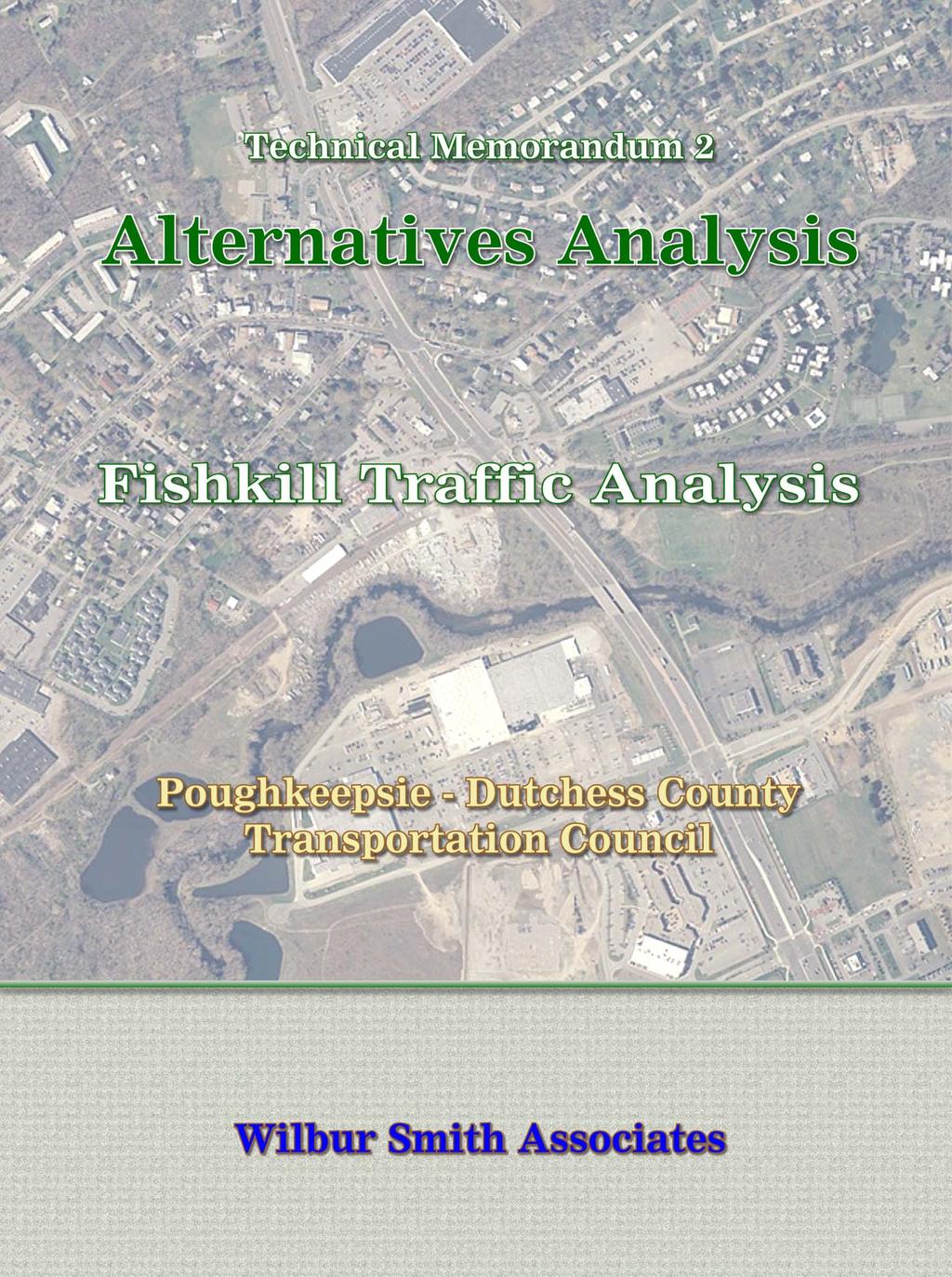
3 CONTENTS CHAPTER PAGE EXECUTIVE SUMMARY ES-1 1 SUMMARY OF EXISTING CONDITIONS Issues and Observations Public Meeting (December 2005) 1 2 LIST OF POTENTIAL IMPROVEMENT STRATEGIES Traffic Signal Coordination Traffic Calming Local Road Connections Traffic Signalization Sight Distance Other Traffic Improvement Strategies 8 3 APPLICATIONS AND IMPACTS OF IMPROVEMENT STRATEGIES Route 52 between Jackson Street and I Route 52/Cedar Hill Intersection Colonial Avenue/Shirley Avenue section Rapalje Road section Broad Street-Smith Street-Elm Street section Luyster Place-Cary Avenue-Weston Avenue section Sight Distance Improvements 19 4 SUMMARY OF MEETINGS AND NEXT STEPS Steering Committee Meeting (February 2006) Meeting with Village of Fishkill (February 2006) Advisory Committee Meeting (March 2006) Public Meeting (June 2006) Next Steps 25 APPENDIX OF TABLES
4 TABULATIONS TABLE PAGE 1.1 ISSUES AND OBSERVATIONS COMPARISON OF TRAFFIC CALMING STRATEGIES TRAFFIC IMPROVEMENT STRATEGIES COLONIAL /SHIRLEY AVENUE NEIGHBORHOOD SIGHT DISTANCE MITIGATION 19
5 ILLUSTRATIONS FIGURE NUMBER FOLLOWS PAGE 3.1 Traffic Signal Coordination along Route Suggested Improvement Strategy - Route 52/Cedar Hill Road Traffic Improvement Strategies Colonial/Shirley Neighborhood Rapalje Road Full Enhancement Alternative Rapalje Road Speed Hump, Speed Table, Choker Rapalje Road Neckdown Rapalje Road Right-in/Right-out Rapalje Road Half-Closure Rapalje Road Dead-End Broad/Smith/Elm Section Full Enhancement Alternative Broad/Smith/Elm Section Neckdown Broad/Smith/Elm Section Speed Table, Choker, Speed Hump Broad/Smith/Elm Section Raised Intersection Broad/Smith/Elm Section Half Closures Broad/Smith/Elm Section Dead-End Broad/Smith/Elm Section Diagonal Diverter Broad/Smith/Elm Section One-Way Luyster/Cary/Weston Section Half Closure/Speed Hump Luyster/Cary/Weston Section Neckdown Luyster/Cary/Weston Section Speed Table, Choker, Speed Hump 17
6 3.21 Luyster/Cary/Weston Section Raised Intersection Luyster/Cary/Weston Section Dead-End Luyster/Cary/Weston Section Dead-End Luyster/Cary/Weston Section One-Way 18

7 EXECUTIVE SUMMARY The Development of Traffic Improvement Strategies is the third step of the overall planning process and follows the existing conditions analysis and identification of congestion, safety, and local circulation issues in the analysis area. To gain a better understanding of the analysis area, six specific neighborhoods/locations were studied and are listed below: Route 52 between Jackson Street and I-84 Route 52/Cedar Hill Road intersection Colonial Avenue-Shirley Avenue section Rapalje Road section Broad Street-Smith Street-Elm Street section Luyster Place-Cary Avenue-Weston Avenue section The Alternatives Technical Memorandum summarizes the potential traffic improvement strategies by each of the neighborhood/corridor areas. The traffic improvement strategies consider a number of techniques in addressing the identified deficiencies. Some of those techniques are: Traffic Signal Coordination Traffic Calming Traffic Signalization Roadway Geometry One-way conversion Sight Distance Right-in/Right-out Local road connections These strategies were presented at meetings of the Advisory and Steering Committees in March A set of preferred strategies identified at those meetings by the Committees was presented at the public meeting held on March 28, Page ES-1
8 CHAPTER 1 SUMMARY OF EXISTING CONDITIONS 1.1 Issues and Observations An Existing Conditions Technical Memorandum was prepared in December 2005 to identify traffic operations, safety, and speeding issues in the Village of Fishkill. The existing conditions analysis showed a number of issues and supporting observations which are highlighted in Table 1.1 below. Table 1.1 Issues and Observations Issues Observations Congestion/Delays 11 of 15 intersections operate at LOS D or worse Speeding on Residential Streets Travel speed on Rapalje Road exceeds posted speed limit Cut-Through Traffic CR 34 (Jackson Street) at Route 52 via Florence/Weston to Cary/Luyster Route 52 to Route 9 via Jackson Street/Broad Street/Elm Street Route 52 to Route 9 via Rapalje Road Route 9 to Route 52 via Church Street Safety Issues Crash Rate at 10 of 15 locations exceeds the Statewide Rate High percentage of rear-end and angle crashes due to congestion in the analysis area The above issues form a basis to develop improvement strategies for consideration in the next phase of the study. 1.2 Public Meeting (December 2005) The first public meeting on this project was held on December 14, 2005 at the Fishkill Elementary School in the Village of Fishkill. The purpose of this meeting was to present the findings of the Existing Conditions analysis and receive input from the neighborhood and the residents of the Village. The following is a list of key issues raised by the residents in the Village: Speeding on Rapalje Road. Intersection geometry at Route 52/Rapalje Road. Poorly timed traffic signals on Route 52 west of Route 9. Left turn movements on Route 52 at Colonial and Shirley Avenue. Signage on Route 52 in the Village area. Truck traffic in the Route 52 corridor. A summary of the meeting comments made at the December meeting will be provided in the Final Report. Page 1
9 CHAPTER 2 LIST OF POTENTIAL IMPROVEMENT STRATEGIES This chapter lists traffic improvement strategies that were considered to mitigate the issues identified in the existing conditions analysis and by residents at the December public meeting. The goal prior to the conduct of this study was to identify issues and potential solutions that are most effective at addressing local issues while not degrading the performance of the overall transportation system. Issues identified at the conclusion of the existing conditions study were speeding, cut-through traffic, congestion, and safety. 2.1 Traffic Signal Coordination Traffic signal coordination is a method of establishing relationships between adjacent traffic signals. The principle of traffic signal coordination is to maximize the vehicles moving and minimize stops and delays. This is accomplished by keeping vehicles in platoons or groups that move down the street arriving at a green light at each downstream intersection. Signal coordination is designed at a travel speed such that vehicles traveling at that speed arrive at a green light at each intersection in that system. In addition, by keeping vehicles in groups or platoons, there is more opportunity for the side-street movements at stop-controlled intersections to enter the main street. If properly designed and installed, coordinated traffic signals can reduce traffic delays, travel times, risk of crashes, and vehicle emissions in a corridor. Several engineering studies have indicated that traffic signal coordination can show a reduction in travel time and delay between 10 and 20 percent after implementation. 2.2 Traffic Calming Traffic Calming refers to various design features and strategies such as changes in street alignment, installation of barriers, and other physical measures intended to reduce vehicle traffic speeds and volumes on a particular roadway. Traffic Calming projects can range from minor modifications of an individual street to comprehensive redesign of a road network. The general objectives for the application of Traffic Calming measures include: To reduce vehicular speeds, or reduce vehicular volumes; To promote safe and pleasant conditions for motorists, bicyclists, pedestrians, and residents; To improve the environment and livability of neighborhood streets; To discourage use of residential streets by cut through vehicular traffic from outside the neighborhood; and, To encourage citizen involvement in the Traffic Calming process by incorporating the preferences and requirements of the citizens. Traffic Calming methods are highly beneficial to non-motorized modes and are generally self enforcing. Traffic Calming techniques have to be applied with a consideration for the entire network, in order to prevent the shift of problems from one area to another. Page 2


10 H H H H H Technical Memorandum #2 Alternatives Technical Memorandum Some Traffic Calming measures that were identified in order to mitigate the problems in the Village of Fishkill are described below: Speed Reduction Devices These techniques are mainly applied to reduce speed on residential streets with minor volume reduction benefits: Speed Humps: These are rounded, raised pavement devices placed across roadway. Speed humps are typically 12' long (in the direction of travel), 3"- 4" high, parabolic shaped, with a design speed of mph. They are most effective if used in a series with appropriate signage. Some of the drawbacks which may result from their application include increase of noise traversing the device, potential increase in emergency vehicle response time, and maintenance issues during winter. Speed Tables: These are raised, flat-topped pavement devices that are long enough for the entire wheelbase of a passenger car to rest on top. Speed tables are typically 3"- 4" high, 22' long (in the direction of travel), consisting of 6' ramps at each end and a 10' flat top and a design speed of mph. These are less susceptible to the drawbacks of speed humps such as increasing emergency response times and winter maintenance issues. They also improve safety for pedestrians and bicyclists. Raised Intersections: These are flat raised areas covering entire intersections, with ramps on all approaches and are often constructed with brick or other textured materials on the flat section and ramps. Raised intersections typically rise to the sidewalk level. They are more effective where there are existing sidewalks. In addition to reducing speeds, these devices make the entire intersection pedestrian friendly. Some of the drawbacks include the cost of drainage modifications and the increase of emergency response times. Raised Crosswalks: Raised crosswalks are basically speed tables outfitted with crosswalk markings and signage to channelize pedestrian crossings. Their primary purpose is to enhance pedestrian safety by elevating the pedestrians and slowing vehicle speeds. Neckdowns/Bumpouts: These devices provide a physical reduction of road width at intersections. The primary purpose besides reducing speed is to provide a refuge for pedestrians and shorten the roadway crossing distance for pedestrians at this location. These devices are effective in slowing down turning vehicles thus reducing speeds at the entry points to the roadway. Maintenance problems are a known drawback in the application of these devices. Such devices are currently in use on Route 52 Page 3


11 H H Technical Memorandum #2 Alternatives Technical Memorandum between CR 34 (Jackson Street) and Route 9. Chokers: These devices provide a physical reduction of road width between intersections through the use of curb extensions. Chokers can be designed to allow one travel lane in each direction or the roadway can be narrowed further to allow travel in only one direction at a time. Volume Reduction Devices These techniques are mainly applied to reduce volume of cut through traffic on residential streets with minor speed reduction benefits: Half Closures: These devices are barriers that block travel in one direction for a short distance on an otherwise two-way street, thus only allowing vehicles into or out of the street at that location. While they reduce traffic volume substantially, they have no impact on the movement of emergency vehicles. These may have a less than desirable impact on transit/bus services. However, these devices may significantly impact travel patterns within a neighborhood. Diagonal Diverters: These are barriers placed diagonally across an intersection, blocking through traffic movements. They are usually staggered to create circuitous routes through neighborhoods to reduce traffic volumes. These devices can restrict vehicle access while maintaining pedestrian and bicycle access. Some drawbacks to using these devices are that they also restrict emergency vehicle access as well as create maintenance issues. Cul-de-sacs (Road Closures): These are barriers placed across a street to close the street completely to through traffic, usually leaving only sidewalks or bicycle paths open. Cul-de-sacs should be constructed in conjunction with full closures. This technique is predominantly used to reduce traffic volumes. This effect of closure can also be attained with bollards in the event that there is a lack of right of way required to design a cul-de-sac. These devices will definitely restrict emergency vehicle access, and may also shift the traffic volumes onto other streets. Page 4
12 Summary of Traffic Calming Measures It is important we recognize the application of Traffic Calming measures is part of a diverse program which considers the effects of these devices on an area-wide basis. This is necessary in order to verify that the application of Traffic Calming measures would not be the cause for shifting the traffic problems to another area. A successful Traffic Calming program also needs community participation in order to truly understand the existing traffic related concerns. Designing Traffic Calming features to mitigate the actual existing problems will maximize the success of a Traffic Calming program. A comparison of the Traffic Calming strategies is made in Table 2.1. The following summarizes the comparisons by key criteria: Speed Reduction This criterion is defined by the percent reduction in speed after the installation of traffic calming devices. Higher the reduction in speed higher is the benefit. Speed humps, speed tables, and half-closures are effective speed reduction measures. Cul-de-sacs have low benefit in speed reduction. Volume Reduction This criterion is defined by the percent reduction in traffic volume after the installation of traffic calming devices. Higher the reduction in traffic volume higher is the benefit. Half-closures, diagonal diverters, and cul-de-sacs are most effective volume reduction measures. Raised intersections and crosswalks are not effective speed reduction. Crash Reduction This criterion is defined by the percent reduction in crashes after the installation of traffic calming devices. Higher the reduction in crashes higher is the benefit. Speed humps and speed tables are effective crash reduction measures. Cul-de-sacs have low benefit in crash reduction. Environment This criterion is defined by the impact on environment (noise, pollution) due to the installation of traffic calming devices. Minimal impact to environment relates to a higher benefit. Volume reduction measures have less negative impact on the environment than speed reduction measures because they do not increase noise and pollution. Local Impact This criterion is defined by the impact on local travel patterns after installation of traffic calming devices. Minimal impact to local travel patterns relates to a higher benefit. The speed reduction devices have high benefit because they reduce travel speeds on local streets while maintaining the traffic flow. The volume reduction techniques have a low benefit because they affect local travel patterns. System Impact This criterion is defined by the impact on the overall system and regional travel patterns after installation of traffic calming devices. Minimal impact to regional travel patterns relates to a higher benefit. Contrary to the local impact, the volume reduction measures have higher benefit to the overall system because they divert or reduce traffic volumes from the local streets. Page 5
13 Enforcement This criterion is defined by the need for local enforcement to prevent traffic violations after installation of traffic calming devices. Less enforcement relates to a higher benefit. Half closures require strict enforcement and monitoring by the local police departments. Emergency Response This criterion is associated with the impact on emergency responders (fire, police, ambulance) after installation of traffic calming devices. Minimal impact to emergency response activities relates to a higher benefit. Neckdowns and chokers have a high benefit to emergency responders. Cul-de-sacs have a low benefit because closure of streets limits access to the emergency personnel. Maintenance/Cost Problems This criterion is associated with maintenance activities and associated cost in conducting these activities after installation of a traffic calming device. Minimal maintenance and cost relates to a higher benefit. Speed humps and tables have high benefit relative to this criterion because they require less maintenance. Neckdowns and chokers pose maintenance issues because maintenance vehicles have tough time maneuvering during snow plowing. Construction Cost per device This criterion is defined by the cost of constructing the traffic calming device. Low cost relates to a higher benefit. Raised intersections, diagonal diverters, and cul-de-sacs have higher construction costs per device than other measures. Table 2.1 indicates a high benefit for those measures where the construction per device is low. Page 6

14 Table 2.1 Comparison of Traffic Calming Strategies Source: Wilbur Smith Associates based on ITE s Traffic Calming Handbook Benefit High Medium Low Page 7
15 2.3 Local Road Connections Improving the local road connections by connecting certain roads would significantly improve travel within the community. Improved local connectivity would also make it easier to get to the village or town center, supporting revitalization efforts. This scenario improves local road connections and could help reduce traffic congestion or increase pedestrian/bicycle activity by providing pedestrian/bicycle specific connections on certain local roads. 2.4 Traffic Signalization Traffic signals are installed to control vehicular and pedestrian flow. Traffic signal can be installed provided the standard warrant guidelines for installation as written in the Manual of Uniform Traffic Control Devices (MUTCD) are met. Traffic signals are efficient in controlling various traffic movements at an intersection and therefore, optimize the intersection capacity. The intersection capacity is associated with the amount of green time provided to each traffic movement at that intersection. 2.5 Sight Distance The safe operation of an intersection requires the consideration of three primary elements: the driver, the vehicle, and the roadway. Sight distance requirements are based on a combination of the three elements, the driver s ability relates to reaction time of the driver at an intersection, the type of vehicle defines its braking and maneuverability at an intersection, and the roadway influences the speed of a vehicle. 2.6 Other Traffic Improvement Strategies One-way Conversion: Converting existing two-way streets to one-way in configuration can eliminate or reduce cut-through traffic. Roadway signage is normally used to designate one-way streets. Initially, enforcement may be required to monitor the usage of these streets. Right-in/Right-out: Right-in/right-out channelization is used to control left-turn movements into and out of the roadway. Right-in/right-out channelization has been used to improve operations and safety by placing islands or devices that force drivers to enter or exit a location with a right turn movement, eliminating left turns, and reducing conflicts. The effective implementation of this strategy depends on the size and design of islands. The right-in/right-out channelization reduces the frequency and severity of conflicts but requires enforcement in order to ensure consistent compliance. Turn Lanes: Turn lanes provide additional capacity and storage area at intersections. Specifically, on major roadways, turn lanes provide storage area for left turn movements waiting for an available gap on opposing traffic stream. They also provide an opportunity for motorists traveling through the intersection to bypass the left turning traffic. On side streets, turn lanes reduce the amount of waiting time and provide opportunities for right turners to pass the left turning traffic waiting to exit the intersection. Page 8
16 CHAPTER 3 APPLICATIONS AND IMPACTS OF IMPROVEMENT STRATEGIES This chapter details the specific applications and impacts of the improvement strategies on the various sections in the study area. The following is a list of the sections where one or more improvement strategies were considered: Route 52 between Jackson Street and I-84 Route 52/Cedar Hill Road intersection Colonial Avenue-Shirley Avenue section Rapalje Road section Broad Street-Smith Street-Elm Street section Luyster Place-Cary Avenue-Weston Avenue section A Public Meeting was held on March 28 th, 2006 to present preferred alternatives for each of the above sections. The preferred alternatives were agreed upon by the Steering and Advisory Committee members. Each section below details the alternatives presented at the Public Meeting in the summary section. 3.1 Route 52 between Jackson Street and I-84 Traffic Signal Coordination There is an opportunity to coordinate the existing traffic signals at Route 52/Jackson Street and Route 52/Blodgett Road with the traffic signals at the I-84 Eastbound and Westbound ramps. Based on the traffic signal spacing between these locations, traffic signal coordination should improve traffic flow on Route 52. However, a more detailed engineering study would be required to determine appropriate signal coordination parameters and timing plans. Figure 3.1 shows the locations where traffic signal coordination is proposed along Route 52. The traffic signal coordination alternative was presented at the Public Meeting. The benefits achieved due to traffic signal coordination on Route 52 between I-84 and Jackson Street is to manage traffic flow efficiently in the corridor, provide gaps and opportunities for the sidestreet movements to enter the major street, and potentially reduce the risk of crashes on Route 52. This strategy improves the overall system. 3.2 Route 52/Cedar Hill Road Intersection The results of the existing conditions analysis indicated that congestion was the primary issue at this intersection. The Cedar Hill Road approach (left and right turn movements) operates at poor levels of service (LOS F) during the A.M. and P.M. peak hour periods. Based on a review of traffic signal warrants, the Route 52/Cedar Hill Road intersection meets the criteria for a traffic signal. However, the intersection has poor vertical geometry on the Route 52 approaches to the intersection. A detailed investigation and an engineering study may be required to further substantiate the installation of the traffic signal. Page 9
17 As an alternate strategy, the Cedar Hill Road approach may be re-striped to two approaching lanes (separate left and right). This lane arrangement will provide the right turning movements from Cedar Hill Road to Route 52 to have their own lane and not impacted by the delay on the left turn movements. Figure 3.2 represents the suggested improvement strategy at this location. With separate approach lanes on Cedar Hill Road, the right turn level of service will improve from LOS F to LOS C. Table A-1 (included in the appendix) shows the anticipated levels of service and delay by movement at the Route 52/Cedar Hill Road intersection. The traffic improvement strategy to provide separate turn lanes on Cedar Hill Road was presented at the Public Meeting. The benefits achieved are reduction in waiting time and queues for the right turn movements on Cedar Hill Road. This strategy has a system benefit. 3.3 Colonial Avenue-Shirley Avenue Section The Colonial Avenue-Shirley Avenue neighborhood section consists of approximately 180 households and has only two roads to enter and exit from Route 52. During the peak hour periods, traffic is typically backed up on Route 52 from the Route 9 intersection. The primary issue in this section is the proximity of the two intersections on Route 52 and the limited access and egress points onto Route 52. Currently, there are no left turn lanes on Route 52 at these locations. As stated in the Public Meeting in December 2005, through traffic on Route 52 frequently bypasses the left turning traffic at these locations and there is inadequate space for the through vehicles to maneuver around the left turning vehicles and creates an issue with safety. In March 2006, a public meeting was held to present traffic improvement strategies for each of the five neighborhoods. The original proposal included a traffic signal at Shirley Avenue, right-in/right out at Colonial Avenue, ad a paved bicycle/pedestrian path to the Fishkill Plaza at the end of the Village Commons. There was strong opposition from many of those present so we developed/evaluated additional options and collected additional data to address concerns over the level of service for left turn movements and the overall access from Route 52. A Public Meeting was held on June 5, 2006 in the Village Hall and all residents in the neighborhood were invited to participate in this meeting. Ten different strategies were developed for this Colonial Avenue/Shirley Avenue neighborhood. Page 10
18 Table 3.1 lists the various strategies presented at the public meeting. Figure 3.3 shows the various strategies graphically. Table 3.1 Traffic Improvement Strategies Colonial/Shirley Neighborhood No. Type of Strategy 1 Do Nothing (Null) 2a 2b 3a 3b 4a 4b Right-in/Right-out on Colonial Avenue Right-in/Right-out on Shirley Avenue Left turn pocket on Route 52 into Colonial Avenue Left turn pocket on Route 52 into Shirley Avenue Combination of 2a and 3b Combination of 2b and 3a 5 Continuous center turn lane on Route 52 between Colonial Avenue and Shirley Avenue 6a Signal at Route Shirley Avenue intersection with Right-in/Right-out at Colonial Avenue 6b Signal at Route Colonial Avenue intersection with Right-in/Right-out at Shirley Avenue Source: Wilbur Smith Associates As indicated in Table 3.2, these ten strategies could be undertaken independently or in combination. For Strategies 6a and 6b, the traffic signal can be installed at Colonial Avenue or Shirley Avenue provided that the other location is a right-in/right out intersection. This is a requirement to meet the traffic signal warrants at these locations. Traffic signal warrant analysis was conducted at the Route 52/Colonial Avenue/Shirley Avenue intersections assuming that one location has the traffic signal and the other is a right-in/right out location. Traffic count data for a 24-hr period was obtained at Route 52, Colonial Avenue, and Shirley Avenue. Traffic signal warrant analysis was conducted based on the Manual of Traffic Control Devices (MUTCD) standards and guidelines for three traffic volume related warrants namely the Eight Hour, Four Hour, and the Peak Hour Volume Warrants. Based on the results of the warrant analysis, the three traffic volume related warrants are met at the Route 52/Colonial/Shirley intersection. Page 11
19 Pros and Cons of Strategies - The pros and cons of each of the strategies identified in Table 3.2 are listed below: Do Nothing (1) does not have any pros or cons since there are no changes recommended. Right-In/Right-Out (2a and 2b) would eliminate left turn movements from the major and minor streets but may have some property impacts on the minor street relative to the construction of a physical island. Left turn pocket (3a and 3b) would provide a storage area for vehicles to queue on the major street but may have property impacts to construct it. 4a and 4b are combination options which include 2a, 2b, 3a, and 3b. Continuous Center Turn Lane (4a and 4b) is similar to the left turn pocket strategy except that it may introduce a high potential for sideswipe accidents and more property impacts depending on the length of the center turn lane section. Signalization (6a and 6b) reduces congestion, eliminates sight line issues, and reduces travel speeds but increases the potential for rear end accidents. Table A-2 provides a tabular presentation of the pros and cons associated with each strategy. Pros and Cons of Location - The pros and cons associated with the application of each of these strategies at Colonial Avenue and Shirley Avenue are listed below: Right-In/Right Out would eliminate left turn delay at Colonial Avenue or Shirley Avenue but divert traffic to the other street for left turn movements. Under 2a (right-in/right out at Colonial Avenue), Shirley Avenue will get additional traffic of about 300 vehicles on a daily basis. Under 2b (right-in/right out at Shirley Avenue), Colonial Avenue will get additional traffic of about 500 vehicles on a daily basis. Left turn pocket and Continuous Center Lane do not have any traffic diversions but would provide storage for the left turn movements and allow through traffic to pass by the left turners. Continuous Center Lane would extend the entire length on Route 52 between Colonial Avenue and Shirley Avenue and therefore may increase the potential for sideswipe accidents. Both these strategies may have impact to residential property along Route 52 and the side street. To determine the amount of property impact, a detailed survey and engineering review should be undertaken. Traffic Signalization at Colonial Avenue or Shirley Avenue requires the other street to become a Right-In/Right-Out location in order to meet the traffic signal warrants. If the Colonial Avenue or Shirley Avenue intersection with Route 52 is signalized, left turn movements will be diverted from the other location. Page 12
20 Table A-3 provides a tabular presentation of the pros and cons associated with the application of these strategies at Colonial Avenue and Shirley Avenue. The traffic improvement strategies listed above were presented to the Public in a meeting held on June 5, Public comment and input relative to the preference of the above strategies was received at that meeting. All of the above proposals (except the Do Nothing ) for Colonial Avenue and Shirley Avenue provide overall system improvement but some of the options have property impacts and/or diversion of traffic within the neighborhood. 3.4 Rapalje Road Section The primary issues on Rapalje Road are the vehicular speeds and traffic volumes. Existing conditions analysis identified travel speeds to be 10 miles per hour higher than the 85 th percentile speed. The roadway is approximately 35 feet wide and provides the opportunity for motorists to speed on this section. A number of concerns were expressed by residents on vehicular speed and noise in this section in the December Public Meeting. In addition, there is cut-through traffic from Route 52 to Route 9 on Rapalje Road. This traffic volume is approximately 150 and 200 vehicles per hour during the A.M. and P.M. peak hour periods respectively. The full-enhancement of Rapalje Road cross-section consists of providing sidewalks, streetscape, and a reduced pavement width. This primarily addresses the speeding issue in this section. A speed table is also provided along Rapalje Road to reduce vehicular speeds. This option is anticipated to enhance the safety of pedestrians and may reduce cut-through traffic in this section. A potential reduction in cut-through traffic on Rapalje Road would create a negative impact on the Route 9/Route 52 intersection. This was the preferred option by the Advisory and Steering Committees. Based on the public meeting in March, the residents along Rapalje Road requested that a left turn prohibition be provided from Route 52 to Rapalje Road to address the cut-through traffic from Main Street. The left-turn prohibition on Route 52 is included in this strategy. Figure 3.4 shows the full-enhancement alternative. The following page shows a photo-simulation of before and after cross section on Rapalje Road. Placement of a speed reduction device such as a speed table, speed hump, or a choker. These measures are typically placed at mid-block locations to reduce speeds and can be used for pedestrian crossings. Figure 3.5 shows this alternative. Placement of a neckdown at a mid-block location to reduce vehicular speeds on Rapalje Road. Specifically, the neckdowns reduce cross section of the roadway to provide a narrow width for pedestrian crossing. However, curbing is required where neckdowns are placed on the roadway. Figure 3.6 shows this alternative. Right-in/right-out treatment at the Route 52/Rapalje Road intersection. This alternative prohibits left turn movements from Route 52 to Rapalje Road and from Rapalje Road to Route 52. Therefore, it addresses the congestion issue identified in the traffic analysis relative to left turn movements. Figure 3.7 shows this alternative. Page 13


21 Half-closure treatment at the Route 52/Rapalje Road intersection. This alternative is anticipated to reduce cut-through traffic from Route 52 to Route 9 via Rapalje Road because all entering movements are prohibited at the Route 52/Rapalje Road intersection. Specifically, traffic arriving from the east on Route 52 is forced to use the Route 9/Route 52 and Route 9/Rapalje Road intersections. Figure 3.8 shows this alternative. Dead-end on Rapalje Road on the Route 9 side. This alternative would restrict Rapalje Road traffic to be local and force cut-through traffic to the Route 9/Route 52 intersection. Figure 3.9 shows this alternative. Rapalje Road - Before Rapalje Road - After Page 14
22 The six alternatives for the Rapalje Road section were analyzed to determine the traffic impacts associated with those improvement strategies and a summary is detailed below by key intersections in the vicinity of this section: Route 9/Route 52 Half closure and dead end treatments have the worst traffic impact at the Route 9/Route 52 intersection because they prohibit cut-through traffic on Rapalje Road. Rightin/right-out has a minor impact on the Route 9/Route 52 intersection. The remaining options have no impact. Route 9/Rapalje Road The dead-end option has a positive impact since the intersection does not exist under this option. The remaining options have minor or no impact. Route 52/Rapalje Road Right-in/right out has a positive impact at the Route 52/Rapalje Road intersection because it prohibits left turn movements from Rapalje Road to Route 52. The remaining options have minor or no impact. Table A-4 highlights the anticipated levels of service during the P.M. peak hour period associated with the six alternatives for the Rapalje Road section. The traffic improvement strategy to provide a full enhancement of Rapalje Road with sidewalks, streetscape, and a reduced pavement width along with a speed reduction device was presented at the Public Meeting. The benefits achieved are reduction in travel speeds and potentially cut-through traffic on Rapalje Road. This strategy has a local impact because it is anticipated to affect travel patterns on Rapalje Road and not the adjacent roadway system (Route 9, Route 52). Property impacts may occur on Rapalje Road with installation of sidewalks and streetscape elements. 3.5 Broad Street-Smith Street-Elm Street section The primary issue on this section is the cut-through traffic from Route 52 and Jackson Street to Route 9 via Broad Street, Smith Street, and Elm Street. The existing conditions analysis identified these routing patterns from Route 52 and Jackson Street via Broad Street and Smith Street to Elm Street. The full-enhancement of the Broad Street-Smith Street-Elm Street section consists of installing pavement striping and marking on Broad Street, Smith Street, and Elm Street to improve visibility in this section. A right-in/right out treatment at the Route 52/Cary Avenue intersection. Re-define the Smith Street/Elm Street and Broad Street/Jackson Street intersections by providing an all-way stop sign. An engineering study should be undertaken to support the installation of an all-way stop sign at the Broad Street/Jackson Street and Elm Street/Smith Street intersections. Broad Street would also have a speed table to reduce travel speeds. This alternative is anticipated to improve travel in the local street network and not create an impact to the overall system. This alternative was preferred by the Advisory and Steering Committees and is shown in Figure Page 15
23 Placement of neckdowns at mid-block and intersection locations. These measures are anticipated to reduce vehicular speeds on Broad Street, Smith Street, and Jackson Street. Figure 3.11 shows this alternative. Placement of speed tables, chokers, or speed humps at mid-block locations to reduce vehicular speeds on Broad Street and Cary Avenue. Figure 3.12 shows this alternative. Installation of raised intersections at the Jackson Street/Broad Street and Smith Street/Broad Street locations. Raised intersections reduce speeds and could potentially reduce cut-through traffic in this corridor. However, the grade along Smith Street is not conducive for the placement of this device. The pedestrian activity is also minimal in this section. Figure 3.13 shows this alternative. Half closures at the Jackson Street/Broad Street and Smith Street/Broad Street locations. Half Closures are volume reduction devices and are installed to eliminate cut-through traffic in this corridor. In this corridor, half closures will have an impact on access at the United Methodist Church on Smith Street. Figure 3.14 shows this alternative. Dead-ends on Cary Avenue, Smith Street, and Broad Street locations. Full-closures would eliminate cut-through traffic on Cary Avenue, Broad Street, and Smith Street. However, installation of these devices may have a significant local impact to access and circulation specifically on Broad Street and Smith Street. Figure 3.15 shows this alternative. Placement of a diagonal diverter at the Smith Street/Broad Street intersection to prohibit cutthrough traffic from Cary Avenue to Elm Street. The placement of this device would prohibit through traffic movements on Broad Street. Figure 3.16 shows this alternative. Conversion of Cary Avenue as a one-way street towards Route 52. This alternative eliminates traffic movements from Route 52 to Cary Avenue. Figure 3.17 shows this alternative. The eight alternatives for the Cary/Jackson/Smith/Broad section were analyzed to determine the traffic impacts associated with those improvement strategies and a summary is detailed below by key intersections in the vicinity of this section: Route 52/Jackson Street Half closures, dead-ends, and the diagonal diverter have a positive traffic impact at the Route 52/Jackson Street intersection because they prohibit cut-through traffic in the corridor. The remaining alternatives have minor or no impact at the Route 52/Jackson Street intersection. Route 9/Route 52 - Half closures, dead-ends, and the diagonal diverter have a negative traffic impact at the Route 9/Route 52 intersection because cut-through traffic is diverted from local streets to Route 52 and the Route 9/Route 52 intersection. The remaining alternatives have minor or no impact at the Route 52/Jackson Street intersection. Page 16
24 Route 9/Elm Street, Route 52/Cary Avenue, Route 52/Church Street, and Route 52/Broad Street intersections have minor or no traffic impacts in the Broad Street-Smith Street-Elm Street section. Table A-5 shows the anticipated levels of service during the P.M. peak hour period in the Broad Street-Smith Street-Elm Street section. The traffic improvement strategy is to increase visibility in the Broad Street, Smith Street, and Elm Street sections of the neighborhood. In addition, this strategy modifies the Smith Street/Elm Street and Broad Street/Jackson Street intersections. Placement of speed reduction devices such as speed tables along Broad Street will reduce travel speeds. This strategy was presented at the Public Meeting. The benefits achieved are potential reduction in both travel speeds and cut-through traffic in these sections. These benefits would be realized more at a local level (Broad Street, Cary Avenue, Jackson Street). Traffic diversions may occur to Route 52 if the speed tables impact travel on Broad Street (system impact). 3.6 Luyster Place-Cary Avenue-Weston Avenue section The primary issue on this section is the cut-through traffic from Jackson Street to Route 52 via Florence Avenue and Weston Avenue to Cary Avenue, Wood Place, and Luyster Place. The existing conditions analysis identified these routing patterns from Route 52 and Jackson Street via Broad Street-Smith Street-Elm Street. Half closures at the Wood Place/Luyster Place and Cary Avenue/Weston Avenue intersections. Half closures at these locations would prohibit traffic movements from Jackson Street to Cary Avenue and Luyster Place, thereby eliminating cut-through traffic. In addition, speed humps will be provided along Florence Avenue and Weston Avenue to reduce travel speeds. This alternative was preferred by the Advisory and Steering Committees. Figure 3.18 shows this alternative. Placement of neckdowns at mid-block and intersection locations. Locations where such devices could be placed are Florence Avenue, Weston Avenue, Cary Avenue, and Luyster Place. In addition, the neckdowns are suggested at the minor street approaches on Jackson Street/Florence Avenue/Rosilia Lane and the Jackson Street/Weston Avenue/Health Center driveway intersections. These devices are anticipated to reduce travel speeds in these sections. Figure 3.19 shows this alternative. Placement of speed tables, speed humps, and chokers at mid-block locations along Florence Avenue, Weston Avenue, Wood Place, Cary Avenue, and Luyster Place. These devices are anticipated to reduce travel speeds in these sections. Figure 3.20 shows this alternative. Installation of raised intersections at the Florence Avenue/Wood Place, Weston Avenue/Cary Avenue, and Wood Place/Luyster Place intersections. These intersections currently have STOP control and therefore, there is effective speed control measure at the intersection. The placement of these devices may involve significant cost. Figure 3.21 shows this alternative. Page 17
25 Installation of dead-ends on Cary Avenue, Luyster Place, and Wood Place (on the Florence Avenue side) locations. Full-closures would eliminate cut-through traffic on Cary Avenue and Luyster Place. However, installation of these devices may have a significant local impact to access and circulation specifically on Wood Place. Figure 3.22 shows this alternative. Dead-end on Cary Avenue and Luyster Place is on the Route 52 side. This alternative will improve traffic operations at the Route 52/Cary Avenue intersection and eliminates the Route 52/Lusyter Place intersection. Figure 3.23 shows this alternative. Conversion of Cary Avenue and Luyster Place as a one-way street away from Route 52. This alternative eliminates movements from Cary Avenue and Luyster Place to Route 52. Figure 3.24 shows this alternative. The seven alternatives for the Luyster/Cary/Jackson/Florence section were analyzed to determine traffic impacts associated with the improvement strategies and a summary is detailed below by key intersections in the vicinity of this section: Route 52/Jackson Street Half-closures and dead-ends have a minor impact because of the diversion of cut-through traffic to the Route 52/Jackson Street intersection. The remaining alternatives have no impact. Route 52/Luyster Place/Shopping Center Half closures and dead-ends have a positive traffic impact on the Luyster Place approach because of the diversion of cut-through traffic to the Route 52/Jackson Street intersection. Dead-end on Luyster Place on the Route 52 side and conversion of Luyster Place as a one-way street removes exiting movements on Luyster Place at the Route 52 intersection. The remaining alternatives have no impact. Route 52/Cary Avenue - Half closures and dead-ends have a positive traffic impact on the Cary Avenue approach because of the diversion of cut-through traffic to the Route 52/Jackson Street intersection. Dead-end on Cary Avenue on the Route 52 side and conversion of Cary Avenue as a one-way street removes exiting movements on Cary Avenue at the Route 52 intersection. The remaining alternatives have no impact. Jackson Street/Weston Avenue Due to half-closures, dead-ends, and one-way conversions of Cary Avenue and Luyster Place, traffic remains on Jackson Street and therefore, there is a negative traffic impact on the Weston Avenue eastbound approach. The remaining alternatives have no impact. Jackson Street/Florence Avenue/Rosilia Lane Similar to the Weston Avenue approach, Florence Avenue approach also has a negative traffic impact because traffic remains on Jackson Street due to half-closures, dead-ends, and one-way conversions of Cary Avenue and Luyster Place. The remaining alternatives have no impact. Table A-6 shows the anticipated levels of service during the P.M. peak hour period in the Luyster Place-Cary Avenue-Weston Avenue section. Page 18
26 The traffic improvement strategy is to eliminate cut-through traffic from Jackson Street to Route 52 by providing partial closures on Luyster Place and Cary Avenue at Weston Avenue. In addition, a speed reduction device was suggested on Florence Avenue and Weston Avenue. This strategy was presented at the Public Meeting. The benefits achieved are reduction in cut-through traffic and travel speeds in these sections. The partial closures have an overall system effect due to the diversion of approximately 100 vehicle trips from the local streets to the Route 52/Jackson Street intersection. Local impact may be apparent with traffic diverting within the neighborhood. Partial closures may have property impacts at the intersections. 3.7 Sight Distance Improvements Based on the existing conditions analysis, there were a number of locations identified along Route 52 and Jackson Street that have poor and limited sight distance from the side street approaches. Table 3.2 identifies those locations along with specific issues that would require attention in order to improve sight lines. Table 3.2 Sight Distance Mitigation Sight Distance Restrictions and Strategies Roadway Intersection Looking Left Looking Right Strategies/Considerations Route 52 Jackson Street At Luyster Pl. Large trees Large trees Trees can be removed At Cary Ave. (Southbound) Large trees and bushes None Removal impact residential property At Broad Street Large tree within the channelization island None Tree can be removed. At Rapalje Road None Small trees Removal impacts residential property Large tree near Removal impacts residential At Colonial Ave. Two large trees and bushes utility boxes property on the east side Removal impacts residential At Weston Ave. None Bushes property Removal impacts residential At Florence Ave. None Tree and fence property Source: Wilbur Smith Associates As outlined in Table 3.3, sight distance can be improved at the above locations by removal of trees and bushes but at many locations there are property impacts which need to be considered. Page 19
27 CHAPTER 4 SUMMARY OF MEETINGS AND NEXT STEPS This chapter outlines the next steps for the project leading to the preparation of a Final Report. Prior to the preparation of this report, the Advisory and Steering Committee meetings were held in February and March, A Public Meeting to present the preferred strategies from the Advisory and Steering Committee meeting was also held in March Steering Committee Meeting (February 2006) A Steering Committee meeting was held on February 24, 2006 at the PDCTC offices to present improvement strategies for each of the neighborhood areas. As discussed in Chapter 2, these strategies included Traffic Calming, intersection improvement, traffic signalization and traffic signal coordination. The committee had questions and comments on the traffic improvement strategies presented at the meeting: Some of those comments are presented below: In general, the committee did not favor some of the Traffic Calming strategies such as raised intersections, diagonal diverters, dead-ends, etc. or cul-de-sac, due to cost and local issues particularly lack of exiting sidewalks and the nature of the neighborhoods. Route 52 corridor traffic signal coordination The committee supported the strategy of traffic signal coordination along Route 52 between the I-84 Ramps and Jackson Street. The committee recognized this to be a short term improvement strategy. Cedar Hill Road The committee supported the idea of separate turn lanes on the Cedar Hill Road approach to reduce delay on Cedar Hill Road. Traffic signalization was discussed at the intersection as an operational improvement but was perceived to potentially cause a safety issue. Colonial-Shirley The committee did not support the idea of closing access at Shirley Avenue on Route 52. A right-in-right out option was suggested on the Shirley Avenue approach. A separate left turn lane on Route 52 at Colonial Avenue was supported by the committee. The idea of providing a traffic signal at the Route 52/Colonial Avenue required further study. The intersection currently does not meet traffic signal warrants. NYSDOT proposed to conduct traffic counts on Colonial Avenue to investigate eight-hour warrants. The committee also indicated that the Colonial-Shirley area will see future development which may necessitate the need for a traffic signal. The committee agreed that traffic signalization should be pursued with further study. The committee also discussed the possibility of providing paved pedestrian/bicycle connection to the Fishkill Plaza. The committee felt that there should be an engineering study to discuss specific issues at that location. Rapalje Road The committee supported the use of speed reduction devices on Rapalje Road. They also suggested that the cross-section of Rapalje Road should be reduced in width and the street may be enhanced with sidewalks and other amenities. Page 20
CONTENTS EXECUTIVE SUMMARY 1
 CONTENTS CHAPTER PAGE EXECUTIVE SUMMARY 1 1 ISSUES AND PURPOSE OF THE ANALYSIS 2 1.1 Background 2 1.2 Analysis Area 2 1.3 Issues and Observations 3 1.4 Project and Public Meetings 3 2 LIST OF PREFERRED
Appendix C. TRAFFIC CALMING PROGRAM TOOLBOX
 Appendix C. TRAFFIC CALMING PROGRAM TOOLBOX PHASE I...2 Do Not Enter Sign...3 One-Way Sign...4 Turn Prohibition...5 Pavement Markings...6 Speed Monitoring Trailer...7 Neighborhood Speed Watch...8 Police
Town of Mooresville, North Carolina Neighborhood Traffic Calming and Control Device Policy
 Town of Mooresville, North Carolina Neighborhood Traffic Calming and Control Device Policy Adopted January 6, 2014 Town of Mooresville Development Services Department TOWN OF MOORESVILLE NEIGHBORHOOD TRAFFIC
TOWN OF HALTON HILLS TRAFFIC CALMING PROTOCOL. Page 1 of 25
 TOWN OF HALTON HILLS TRAFFIC CALMING PROTOCOL Page 1 of 25 PROCESS FOR INSTALLATION OF TRAFFIC CALMING DEVICES The Process for Installation of Traffic Calming Devices has been prepared to provide an objective
City of Elizabeth City Neighborhood Traffic Calming Policy and Guidelines
 City of Elizabeth City Neighborhood Traffic Calming Policy and Guidelines I. Purpose: The City of Elizabeth City is committed to ensure the overall safety and livability of residential neighborhoods. One
Broad Street Bicycle Boulevard Design Guidelines
 Broad Street Bicycle Boulevard Design Guidelines Building from the strategies introduced in the 2013 Bicycle Transportation Plan and community input received thus far, City Transportation Staff have identified
Neighborhood Traffic Calming Guidelines
 Neighborhood Traffic Calming Guidelines ADOPTED BY THE CITY COUNCIL OF ARROYO GRANDE BY RESOLUTION NO. 2016-4718 ON APRIL 12, 2016 COMMUNITY DEVELOPMENT DEPARTMENT ENGINEERING DIVISION 300 East Branch
City of Vallejo Traffic Calming Toolbox
 City of Vallejo Traffic Calming Toolbox June 1, 2013 Final Table of Contents Introduction... 1 Non-Physical Devices... 3 High-Visibility Crosswalk... 3 In Pavement Lighted Crosswalk... 4 Rapid Flashing
3.1 TRAFFIC CALMING PROCESS SUMMARY
 SECTION 3 3.0 TRAFFIC CALMING 3.1 TRAFFIC CALMING PROCESS SUMMARY Traffic calming is a means in which to reduce speeds and minimize vehicular traffic on local neighborhood streets. Citizen involvement
City of Wayzata Comprehensive Plan 2030 Transportation Chapter: Appendix A
 A1. Functional Classification Table A-1 illustrates the Metropolitan Council s detailed criteria established for the functional classification of roadways within the Twin Cities Metropolitan Area. Table
TOWN OF PAYSON TRAFFIC CALMING MANUAL
 TOWN OF PAYSON TRAFFIC CALMING MANUAL APPROVED BY THE PAYSON TOWN COUNCIL SEPTEMBER 6, 2007 TOWN OF PAYSON TRAFFIC CALMING POLICY 1.0 Introduction Traffic Calming involves retrofitting physical devices
MEMORANDUM TERESA MCCLISH, COMMUNITY DEVELOPMENT DIRECTOR SUBJECT: CONSIDERATION OF DRAFT NEIGHBORHOOD TRAFFIC CALMING GUIDELINES
 MEMORANDUM TO: FROM: BY: TRAFFIC COMMISSION TERESA MCCLISH, COMMUNITY DEVELOPMENT DIRECTOR MATT HORN, CITY ENGINEER SUBJECT: CONSIDERATION OF DRAFT NEIGHBORHOOD TRAFFIC CALMING GUIDELINES DATE: MARCH 28,
VILLAGE OF NILES TRAFFIC CALMING POLICY
 INTRODUCTION There is increasing interest across the country in developing new strategies to reduce the speed and amount of traffic in residential neighborhoods. Measurement of speeds, traffic volumes,
Table of Contents Introduction...1. A. Background B. Introduction to Traffic Calming Devices Purpose Statement...
 Borough of Brentwood February 23, 2010 Neighborhood Traffic Calming FINAL Program Table of Contents Neighborhood Traffic Calming Program 192-01 Introduction...1 A. Background... 1 B. Introduction to Traffic
Prepared By: Town of Waxhaw Traffic Calming Policy
 Policy For Resolutions for Town Meetings Prepared By: Town Manager Michael McLaurin Director Greg Mahar CPD Waxhaw N.C. Community Planning &Development Administrative Department Department: Date Approved
ALLEY 24 TRAFFIC STUDY
 ALLEY 24 TRAFFIC STUDY in City of Frostburg, Maryland January 2013 3566 Teays Valley Road Hurricane, WV Office: (304) 397-5508 www.denniscorporation.com Alley 24 Traffic Study January 2013 Frostburg, Maryland
DEPARTMENT OF PUBLIC WORKS Carroll County, Maryland
 DEPARTMENT OF PUBLIC WORKS Carroll County, Maryland Prepared by the Bureau of Engineering 225 North Center Street, Room 221, Westminster, MD 21157 (410) 386-2157 e-mail: trafficcalming@ccg.carr.org http://ccgovernment.carr.org/trafficcalming
TRAFFIC CALMING POLICY NEWTOWN TOWNSHIP DELAWARE COUNTY, PA
 TRAFFIC CALMING POLICY NEWTOWN TOWNSHIP DELAWARE COUNTY, PA September 2014 1 TABLE OF CONTENTS INTRODUCTION... 3 PURPOSE AND GOALS... 3 DEFINITIONS... 4 APPLICABILITY... 5 ELIGIBLE STREETS... 5 LOCATION
TRAFFIC CALMING TOOLBOX
 TRAFFIC CALMING TOOLBOX Traffic control devices are those official signs and striping placed in the public right-of-way and recognized by the public such as STOP signs, curve warning signs, centerline
County of Greenville South Carolina. Traffic Calming Program Neighborhood Traffic Education Program and Speed Hump Program
 County of Greenville South Carolina Traffic Calming Program Neighborhood Traffic Education Program and Speed Hump Program (rev) August 2008 I. PURPOSE The potential negative impacts from vehicular traffic
M-58 HIGHWAY ACCESS MANAGEMENT STUDY Mullen Road to Bel-Ray Boulevard. Prepared for CITY OF BELTON. May 2016
 M-58 HIGHWAY ACCESS MANAGEMENT STUDY Prepared for CITY OF BELTON By May 2016 Introduction Missouri State Highway 58 (M-58 Highway) is a major commercial corridor in the City of Belton. As development has
Traffic Circulation Study for Neighborhood Southwest of Mockingbird Lane and Airline Road, Highland Park, Texas
 ARIZONA TEXAS NEW MEXICO OKLAHOMA February 13, 2015 Mr. Meran Dadgostar P.E., R.S. Town of Highland Park 4700 Drexel Dr. Highland Park, Texas 75205 Re: Traffic Circulation Study for Neighborhood Southwest
TRAFFIC CALMING GUIDE FOR TORONTO CITY OF TORONTO TRANSPORTATION SERVICES DIVISION
 TRAFFIC CALMING GUIDE FOR TORONTO CITY OF TORONTO TRANSPORTATION SERVICES DIVISION CITY OF TORONTO TRANSPORTATION SERVICES DIVISION 2016 TRAFFIC CALMING GUIDE FOR TORONTO TABLE OF CONTENTS Introduction
Community Transportation Plan
 Community Transportation Plan Appendix A: Traffic Calming CITY OF DECATUR COMMUNITY TRANSPORTATION PLAN Appendix A: City of Decatur City-wide Residential Traffic Calming Program Process & Procedures The
Traffic Circulation & Pedestrian Safety Study
 Lyons Township High School North Campus La Grange, Illinois Parking Lot Vaughan Building N Main Building Prepared for: Prepared by: July 23, 2015 Contents List of Figures, iii 1. Introduction...1 2. Existing
TOWN OF CHAPEL HILL POLICY AND PROCEDURES FOR TRAFFIC CALMING MEASURES
 TOWN OF CHAPEL HILL POLICY AND PROCEDURES FOR TRAFFIC CALMING MEASURES (Adopted by the Town Council on June 30, 2004) (Revised December 6, 2010) (Revised February 8, 2016) POLICY AND PROCEDURES FOR TRAFFIC
Caltrans Sloat Boulevard Pedestrian Safety Project Response to Community Questions, Comments & Concerns
 Caltrans Sloat Boulevard Pedestrian Safety Project Response to Community Questions, Comments & Concerns Revised: May 10, 2016 The California Department of Transportation (Caltrans) is planning various
POLICY: TRAFFIC CALMING
 2006 MAY REFERENCE: COUNCIL APPROVED BY COUNCIL MAY 23, 2006 CITY OPERATIONS - NO. 608 POLICY: TRAFFIC CALMING A. All requests for traffic calming within the City shall be considered in accordance with
Borough of Danville, PA Traffic Calming Program Guidelines
 Borough of Danville, PA Traffic Calming Program Guidelines Adopted by Borough Council on 1 INTRODUCTION Speeding Traffic is a major concern in the Borough of Danville because of its detrimental impacts
Glenn Avenue Corridor Traffic Operational Evaluation
 Glenn Avenue Corridor Traffic Operational Evaluation PREPARED FOR: THE CITY OF AUBURN PREPARED BY: DECEMBER 2007 Glenn Avenue Corridor Study--Auburn, Alabama TABLE OF CONTENTS Introduction... 1 Background
County of Spartanburg South Carolina
 County of Spartanburg South Carolina Traffic Calming Program June 2012 (Revised/Program on Hold) PURPOSE The potential negative impacts from vehicular traffic on residential roads have been a longstanding
5. RUNNINGWAY GUIDELINES
 5. RUNNINGWAY GUIDELINES These guidelines should be considered collectively when making runningway decisions. A runningway is the linear component of the transit system that forms the right-of-way reserved
Appendix T CCMP TRAIL TRAFFIC & TRANSPORTATION DESIGN STANDARD
 Appendix T CCMP 3.3.4 TRAIL TRAFFIC & TRANSPORTATION DESIGN STANDARD 3.3.4 Trail Traffic and Transportation Design Multi-use trails have certain design standards, which vary depending on the agency that
Town of Southwest Ranches Neighborhood Traffic Calming Program
 Town of Southwest Ranches The provides residents an opportunity to present a concern for traffic safety with respect to observed volume and speeds on neighborhood streets and a formal method to study and
Truck Climbing Lane Traffic Justification Report
 ROUTE 7 (HARRY BYRD HIGHWAY) WESTBOUND FROM WEST MARKET STREET TO ROUTE 9 (CHARLES TOWN PIKE) Truck Climbing Lane Traffic Justification Report Project No. 6007-053-133, P 101 Ι UPC No. 58599 Prepared by:
Tonight is for you. Learn everything you can. Share all your ideas.
 Strathcona Neighbourhood Renewal Draft Concept Design Tonight is for you. Learn everything you can. Share all your ideas. What is Neighbourhood Renewal? Creating a design with you for your neighbourhood.
Shockoe Bottom Preliminary Traffic and Parking Analysis
 Shockoe Bottom Preliminary Traffic and Parking Analysis Richmond, Virginia August 14, 2013 Prepared For City of Richmond Department of Public Works Prepared By 1001 Boulders Pkwy Suite 300, Richmond, VA
CITY OF ROCK HILL, SOUTH CAROLINA. Neighborhood Traffic Calming Program A Policy for Use of Traffic Calming on Local (Residential) Streets
 Streets") CITY OF ROCK HILL, SOUTH CAROLINA Neighborhood Traffic Calming Program A Policy for Use of Traffic Calming on Local (Residential) Streets I. Statement of Purpose: This program provides a process and a
CITY OF ROCK HILL, SOUTH CAROLINA Neighborhood Traffic Calming Program A Policy for Use of Traffic Calming on Local (Residential) Streets I. Statement of Purpose: This program provides a process and a
City of Tamarac, Florida Traffic Calming Policy
 City of Tamarac, Florida Traffic Calming Policy Temp. Reso. 12614 Exhibit 1 I. Introduction: The City of Tamarac recognizes that the conditions of residential streets can greatly affect neighborhood livability
MUTCD Part 6G: Type of Temporary Traffic Control Zone Activities
 MUTCD Part 6G: Type of Temporary Traffic Control Zone Activities 6G.01 Typical Applications Each temporary traffic control (TTC) zone is different. Many variables, such as location of work, highway type,
Neighborhood Traffic Calming Policy & Guidelines
 Policy & Guidelines Town of Lantana 500 Greynolds Circle Lantana, FL 33462-4594 Index Topic Page Introduction 3 Definitions 4 Objectives 5 Policies 5 Process 6 Phases of Traffic Calming Study 7 Rating
Military Road Safety Improvements
 Military Road Safety Improvements 26 th Road North to 31 st Street North SUMMARY OF DATA REVIEW AND PRELIMINARY RECOMMENDATIONS Prepared for: Department of Environmental Services Traffic Engineering and
RESIDENTIAL TRAFFIC CALMING PROGRAM
 RESIDENTIAL TRAFFIC CALMING PROGRAM CITY OF ALEXANDRIA, KENTUCKY Prepared For: Safety & Public Works Departments 1 Table of Contents CITY OF ALEXANDRIA... 3 RESIDENTIAL TRAFFIC CALMING PROGRAM... 3 INTRODUCTION...
City of Vestavia Hills Traffic Calming Policy for Residential Streets
 City of Vestavia Hills Traffic Calming Policy for Residential Streets PURPOSE: The purpose of the Traffic Calming Policy for Residential Streets is to address safety concerns related to vehicular traffic
Traffic Calming Policy Manual
 Traffic Calming Policy Manual What is Traffic Calming? Speeding and unsafe driving habits are a major concern throughout communities in the United States. The Town of Summerville is no exception with neighborhoods
Chapter 4 TOOLBOX AND SAMPLE BIKE BOULEVARD LAYOUT
 Chapter 4 TOOLBOX AND SAMPLE BIKE BOULEVARD LAYOUT OVERVIEW This chapter describes a cohesive set of strategies to create a bicycle boulevard, namely to make streets safer and more efficient for bicycle
City of Charlottesville Traffic Calming Handbook
 City of Charlottesville Traffic Calming Handbook July 2008 CITY OF CHARLOTTESVILLE NEIGHBORHOOD DEVELOPMENT SERVICES Telephone: (434)970-3182 Fax: (434) 970-3359 Introduction The City of Charlottesville
Chapter 2: Standards for Access, Non-Motorized, and Transit
 Standards for Access, Non-Motorized, and Transit Chapter 2: Standards for Access, Non-Motorized, and Transit The Washtenaw County Access Management Plan was developed based on the analysis of existing
Residential Traffic Calming Program Guide. Town of Ashland, Virginia
 Residential Traffic Calming Program Guide Town of Ashland, Virginia August 1, 2006 TABLE OF CONTENTS A. INTRODUCTION... 1 B. GOALS... 1 C. CRITERIA... 1 D. IDENTIFYING NEIGHBORHOOD TRAFFIC CONCERNS...
Traffic Calming SECTION 1, CHAPTER Introduction What is Traffic Calming?
 SECTION 1, CHAPTER 6 Traffic Calming 6.1 Introduction 6.1.1 What is Traffic Calming? Traffic calming deals with neighborhood traffic issues comprehensively using the three E s, Education, Enforcement,
Traffic Impact Analysis Walton Acres at Riverwood Athletic Club Clayton, NC
 Traffic Impact Analysis Walton Acres at Riverwood Athletic Club Clayton, NC 1. TABLE OF CONTENTS INTRODUCTION...1 1.1. Site Location and Study Area...1 1.2. Proposed Land Use and Site Access...2 1.3.
City of Cape Coral Traffic Calming. City Council May 16,
 City of Cape Coral Traffic Calming City Council May 16, 2016 1 In This Presentation Why Traffic Calming? What is Traffic Calming? Examples Traffic Calming in the City of Cape Coral How to develop a Traffic
A plan for improved motor vehicle access on Railroad Avenue in Provincetown
 A plan for improved motor vehicle access on Railroad Avenue in Provincetown February 2011 A plan for improved motor vehicle access on Railroad Avenue in Provincetown INTRODUCTION AND PROBLEM IDENTIFICATION
TRAFFIC IMPACT STUDY And A TRAFFIC SIGNAL WARRANT ANALYSIS FOR A SENIOR LIVING AND APARTMENT DEVELOPMENT
 TRAFFIC IMPACT STUDY And A TRAFFIC SIGNAL WARRANT ANALYSIS FOR A SENIOR LIVING AND APARTMENT DEVELOPMENT DEERFIELD TOWNSHIP, WARREN COUNTY, OHIO Nantucket Circle and Montgomery Road () Prepared for: ODLE
CITY OF COCONUT CREEK IMPLEMENTATION GUIDELINES FOR TRAFFIC CALMING
 CITY OF COCONUT CREEK IMPLEMENTATION GUIDELINES FOR TRAFFIC CALMING I. Introduction: The City of Coconut Creek recognizes that the conditions of residential streets can greatly affect neighborhood livability;
City of Lee s Summit, Missouri
 City of Lee s Summit, Missouri 1 of 10 ADOPTED MARCH 2008 TABLE OF CONTENTS I. INTRODUCTION II. NEIGHBORHOOD TRAFFIC STUDY III. EDUCATION IV. ENFORCEMENT V. ENGINEERING TRAFFIC CALMING TREATMENTS a. Background
REGIONAL BICYCLE AND PEDESTRIAN DESIGN GUIDELINES
 REGIONAL BICYCLE AND PEDESTRIAN DESIGN GUIDELINES November 16, 2011 Deb Humphreys North Central Texas Council of Governments Bicycle and Pedestrian Advisory Committee Snapshot of the Guide 1. Introduction
EXHIBIT R1. Neighborhood Cul-de-Sac Implementation
 Neighborhood Cul-de-Sac Implementation The traffic study conducted for the Talaria project analyzed the amount of project traffic expected to use local, residential streets immediately north of the project
Off-road Trails. Guidance
 Off-road Trails Off-road trails are shared use paths located on an independent alignment that provide two-way travel for people walking, bicycling, and other non-motorized users. Trails specifically along
TRANSPORTATION ANALYSIS REPORT US Route 6 Huron, Erie County, Ohio
 TRANSPORTATION ANALYSIS REPORT US Route 6 Huron, Erie County, Ohio December 12, 2012 Prepared for: The City of Huron 417 Main Huron, OH 44839 Providing Practical Experience Technical Excellence and Client
Corporate. Report COUNCIL DATE: May 25, 1998 NO: R1500 REGULAR COUNCIL. TO: Mayor & Council DATE: April 27, 1998
 R1500 : Traffic Safety at 25 Avenue and 128 Street Intersection Corporate NO: R1500 Report COUNCIL DATE: May 25, 1998 REGULAR COUNCIL TO: Mayor & Council DATE: April 27, 1998 FROM: General Manager, Engineering
CITY OF SAINT JOHN TRAFFIC CALMING POLICY
 CITY OF SAINT JOHN TRAFFIC CALMING POLICY VERSION: 1.0 April 10, 2012 Pedestrians, Cyclists and Motorists Sharing Street Spaces CONTENTS INTRODUCTION... 3 POLICY GOAL... 3 POLICY OBJECTIVES... 3 GUIDING
City of Margate, Florida. Neighborhood Traffic Management Manual
 City of Margate, Florida Neighborhood Traffic Management Manual Table of Contents Page No. I. INTRODUCTION... 1 II. TRAFFIC CALMING REQUEST AND PROCESSING PROCEDURES... 2 1. COMPLETE AND SUBMIT PROJECT
CITY OF LOS ANGELES INTER-DEPARTMENTAL MEMORANDUM
 CITY OF LOS ANGELES INTER-DEPARTMENTAL MEMORANDUM Date: April 1, 219 To: Honorable City Council c/o City Clerk, Room 395, City Hall Attention: Honorable Mike Bonin, Chair, Transportation Committee From:
Windy Ridge Elementary School
 Windy Ridge Elementary School SCHOOL ROUTE PLAN For WINDY RIDGE ELEMENTARY SCHOOL LOCATION 54 ORANGE COUNTY Prepared for: ORANGE COUNTY SCHOOL ASSESSMENT PROGRAM ORANGE COUNTY PUBLIC WORKS Traffic Engineering
BOARD OF COUNTY COMMISSIONERS CLAY COUNTY
 - 1 - BOARD OF COUNTY COMMISSIONERS Stephanie C. Kopelousos County Manager And Clerk of the Board www.claycountygov.com CLAY COUNTY Public Works Traffic Control Division 5 Esplanade Ave. Green Cove Springs,
City of Port St. Lucie Neighborhood Traffic Calming Policy City of Port St. Lucie Neighborhood Traffic Calming Policy Adopted June 26, 2017
 City of Port St. Lucie Neighborhood Traffic Calming Policy Adopted June 26, 2017 INTRODUCTION The City of Port St. Lucie is committed to ensuring the overall safety and livability of residential neighborhoods.
Southside Road. Prepared for: City of St. John s Police & Traffic Committee. Prepared by: City of St. John s Traffic Division
 Southside Road Prepared for: City of St. John s Police & Traffic Committee Prepared by: City of St. John s Traffic Division January 2007 Southside Road - Traffic Report Page 1 of 9 BACKGROUND: th At the
A Residential Guide to Neighborhood Speed Enforcement
 A Residential Guide to Neighborhood Speed Enforcement City of Delaware, Ohio A Residential Guide to Neighborhood Speed Enforcement Introduction: The perception of speeding on local streets is probably
PURPOSE OF PROGRAM... 2 GOALS / OBJECTIVES OF THE PROGRAM... 2
 NEIGHBORHOOD TRAFFIC MANAGEMENT PROGRAM Table of Contents Page PURPOSE OF PROGRAM... 2 GOALS / OBJECTIVES OF THE PROGRAM... 2 THE PROCESS Step 1 Education and Enforcement... 4 Step 2 Engineering Study
Public Information Centre
 WELCOME Public Information Centre Father Tobin Road Lougheed Middle School - Library Wednesday November 7, 2012 7:00 p.m.to 9:00 p.m. Please sign in Neighbourhood Traffic Calming Guide Background The City
CURBSIDE ACTIVITY DESIGN
 5 CURBSIDE ACTIVITY DESIGN This chapter provides design guidance for separated bike lanes adjacent to curbside activities including parking, loading and bus stops. Typical configurations are presented
TRAFFIC IMPACT ANALYSIS
 TRAFFIC IMPACT ANALYSIS FOR THE CHAMPAIGN UNIT#4 SCHOOL DISTRICT PROPOSED HIGH SCHOOL (SPALDING PARK SITE) IN THE CITY OF CHAMPAIGN Final Report Champaign Urbana Urbanized Area Transportation Study 6/24/2014
II. EXISTING NEIGHBORHOODS
 TABLE OF CONTENTS Page I. INTRODUCTION Purpose... 1-1 How To Use This Document... 1-1 Goals and Objectives....... 1-2 History of the Policy.... 1-3 For Further Assistance... 1-6 Policy Revisions......
CITY OF WEST LAKE HILLS. Forest View Neighborhood Traffic Calming Study
 CITY OF WEST LAKE HILLS 901 South Mopac Expressway Building V, Suite 220 Austin, Texas 78746 Texas P.E. Firm Registration No. F-929 Klotz Associates Final Report Submittal: March 20, 2015 Revised Final
Date: April 4, Project #: Re: A Street/Binford Street Traffic/Intersection Assessment
 To: Peter Cavanaugh General Electric From: David Bohn, PE Ryan White, PE Date: April 4, 217 Project #: 13421. Re: / Traffic/Intersection Assessment Consistent with the Cooperation Agreement between the
Memorandum. Sunday, July 13, Saturday, July 19, 2014
 Memorandum To: David Lowin, Brooklyn Bridge Park Corporation From: Daniel Schack, AICP, PTP Date: Re: Brooklyn Bridge Park Pier 5/6 Loop Road Traffic Study Project No: 14-01-2407 At the request of Brooklyn
NEIGHBORHOOD TRAFFIC CALMING POLICY
 NEIGHBORHOOD TRAFFIC CALMING POLICY I. PURPOSE The City of Kent continually strives to strengthen and protect its neighborhoods by improving the quality of life in residential areas. Traffic conditions
Appendix A: Crosswalk Policy
 Appendix A: Crosswalk Policy Appendix A: Crosswalk Policy Introduction This citywide Crosswalk Policy is aimed at improving pedestrian safety and enhancing pedestrian mobility by providing a framework
Traffic Calming Policy
 Article I. Purpose and Goal. The purpose of this policy is to establish criteria and procedures the City will use to evaluate requests for, and if appropriate, implement traffic calming measures. Neighborhood
CITY OF OTTAWA ROADWAY MODIFICATION APPROVAL UNDER DELEGATED AUTHORITY
 RMA-2015-ATM-038 CITY OF OTTAWA ROADWAY MODIFICATION APPROVAL UNDER DELEGATED AUTHORITY DATE: April 22, 2015 SUBJECT Approval of Roadway Modifications Recommended through an Area Traffic Management Study
Interstate Route 77 / US Route 62 / State Route 687 (Fulton Road) Transportation Improvement Project. Prepared September 6, 2017
 Transportation Improvement Project. Prepared September 6, 2017") EODOT Project: ODOT Project: STA-IR 77-.50; PID 00290 Interstate Route 77 / US Route 62 / State Route 687 (Fulton Road) Transportation Improvement Project Summary of Public Comments Received and Responses
EODOT Project: ODOT Project: STA-IR 77-.50; PID 00290 Interstate Route 77 / US Route 62 / State Route 687 (Fulton Road) Transportation Improvement Project Summary of Public Comments Received and Responses
Blair Park Traffic Calming Study
 Blair Park Traffic Calming Study Williston, Vermont Prepared for: Chittenden County Regional Planning Commission Town of Williston, Vermont Prepared by: Stantec Consulting Services Inc. 55 Green Mountain
AGENDA REPORT. Issue: Discussion of potential improvements on Barnwell Road at Niblick Drive
 AGENDA REPORT To: From: By: Honorable Mayor and City Council Members Warren Hutmacher, City Manager Tom Black, Public Works Director Date: March 23, 2016 Agenda: March 28, 2016 WORK SESSION AGENDA: Barnwell
CITY OF WEST KELOWNA COUNCIL POLICY MANUAL
 CITY OF WEST KELOWNA COUNCIL POLICY MANUAL Page 1 of 7 DEPARTMENT: Engineering Services SUBJECT: Traffic Calming Policy (Revised June 6, 2017) Policy Statement: The provision of traffic calming measures
Traffic Calming Policy
 City of Friendswood Traffic Calming Policy May 2012 Community Development Department Table of Contents Title Page Table of contents... 1 Background and History... 2 Purpose and Goals... 2 City Procedure
Vision: Traditional hamlet with an attractive business/pedestrian friendly main street connected to adjacent walkable neighborhoods
 N D. Focus Area II Vision: Traditional hamlet with an attractive business/pedestrian friendly main street connected to adjacent walkable neighborhoods Transit Road Focus Area II is located in the Hamlet
Newport City Thoroughfare Plan
 Newport City Thoroughfare Plan Summary This plan is intended to review and make recommendations for Newport City s thoroughfare network, in consideration of the full range of uses of the city s streets.
HIGHBURY AVENUE/HAMILTON ROAD INTERSECTION IMPROVEMENTS PUBLIC INFORMATION CENTRE 1 MAY 14, 2015
 HIGHBURY AVENUE/HAMILTON ROAD INTERSECTION IMPROVEMENTS Municipal Class Environmental Assessment PUBLIC INFORMATION CENTRE 1 MAY 14, 2015 ACCESSIBILITY Under the Accessibility Standards 2015 for Customer
Draft Traffic Calming Policy Paper
 Draft Traffic Calming Policy Paper What is Traffic Calming The term traffic calming is defined differently throughout the United States. The Institute of Transportation Engineers, an international educational
Princeton Avenue and Spruce Street Transportation and Site Access Enhancements Project
 Princeton Avenue and Spruce Street Transportation and Site Access Enhancements Project Mercer County Planning Division AECOM Transportation (formerly DMJM Harris) January 29, 2009 Agenda Project Status
Public Works Committee Meeting Richard E. Mastrangelo Council Chamber November 20, 2017
 Public Works Committee Meeting Richard E. Mastrangelo Council Chamber November 20, 2017 Purpose of Meeting Why are we here? Project Recap/Updates Project Limits/Segments Road Diet Concept Lessons Learned
Recommended Roadway Plan Section 2 - Land Development and Roadway Access
 Recommended Roadway Plan Section 2 - Land Development and Roadway Access SECTION 2 Land Development and Roadway Access 2.1 Land Use and Access Management The Federal Highway Administration (FHWA) defines
NEIGHBORHOOD TRAFFIC CALMING POLICY
 NEIGHBORHOOD TRAFFIC CALMING POLICY Traffic Calming is the combination of physical measures that reduce the negative effects of motor vehicle use, alter driver behavior and improve conditions for both
Citizens Handbook for Requesting Traffic Calming Devices
 Citizens Handbook for Requesting Traffic Calming Devices January 19, 2015 Table of Contents 1. PURPOSE... - 1-2. DEFINITIONS... - 2-3. GENERAL INFORMATION... - 3-3.1. ELIGIBILITY REQUIREMENTS... - 3-3.2.
ROUTE 22 CORRIDOR STUDY: CORRIDOR MANAGEMENT PLAN APPENDIX A A-12
 ROUTE 22 CORRIDOR STUDY: CORRIDOR MANAGEMENT PLAN APPENDIX A A-12 3.0 HARLEM VALLEY TRANSPORTATION PLAN Incorporates transportation systems management and safety improvements. Location: Route 22 corridor
Albany Shaker Road Corridor Study Public Meeting # 2
 Albany Shaker Road Corridor Study Public Meeting # 2 Scope / Meeting Purpose This project is a CDTC Linkage Study. The Linkage Program is designed to implement the adopted planning and investment principles
Access Location, Spacing, Turn Lanes, and Medians
 Design Manual Chapter 5 - Roadway Design 5L - Access Management 5L-3 Access Location, Spacing, Turn Lanes, and Medians This section addresses access location, spacing, turn lane and median needs, including
EUCLID AVENUE PARKING STUDY CITY OF SYRACUSE, ONONDAGA COUNTY, NEW YORK
 EUCLID AVENUE PARKING STUDY CITY OF SYRACUSE, ONONDAGA COUNTY, NEW YORK CITY OF SYRACUSE DEPARTMENT OF PUBLIC WORKS 1200 CANAL STREET EXTENSION SYRACUSE, NEW YORK 13210 DRAFT REPORT DATE: November 13,
Summary: Mercer County Princeton Avenue & Spruce Street Study January 2009
 Summary: Several recent studies have assessed potential development and redevelopment opportunities in the Mercer Crossing area of Trenton, Ewing, and Lawrence. This Princeton Avenue and Spruce Street