Conceptual Design Report for the Fabri Dam Modifications Project
|
|
|
- Winfred Lyons
- 5 years ago
- Views:
Transcription


1 Conceptual Design Report for the Fabri Dam Modifications Project Flint, Michigan Prepared For: City of Flint P.O. Box 99 Flint, MI Flint River Watershed Coalition 432 N. Saginaw St. Suite 1001 Flint MI Prepared By: Gary M. Lacy, PE Recreation Engineering and Planning. Boulder, CO (303) November, 2008
2 Table of Contents Introduction... 2 Background... 2 Economic Benefit... 6 Project Description Anticipated Use Accessibility Maintenance Costs Conclusion Appendix 1. Conceptual Cost Estimate Appendix 2. Concept Plan (303)
")
3 SECTION 1: INTRODUCTION (303)
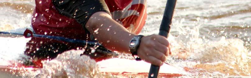
4 Introduction The Fabri Dam is located downstream from the Hamilton Dam. The structure is an inflatable dam just west of the Grand Traverse Street Bridge. The original structure was replaced in 2001 with an Obermeyer Hydro Inc. dam. Recreation Engineering and Planning was contracted to create a conceptual design to replace this dam with structures that provide a unique recreational whitewater opportunity in Flint. The purpose of this project is to modify the current configuration of the dam, facilitate reasonable fish passage and provide a recreational amenity. Similar dams in cities across the country have been converted to provide attractive recreational amenities while improving safety and the riparian environment at the site. The resulting improvements not only provide for increased safety in the river, but serve as an attraction to residents and visitors who seek whitewater for recreation, events, and competition. The net effect of such improvements results in transforming a dangerous hazard into a popular community attraction that stimulates the local economy. This report presents a conceptual plan and cost estimate for the construction of improvements to the Fabri Dam on the Flint River in Flint, Michigan. The conceptual plan consists of recreational boating improvements as well as related bank and access improvements. The proposed improvements will create a whitewater paddling amenity for the local community and a resource for the region. This site contains the physical characteristics necessary to provide the proposed recreational improvements due to gradient, flow, and its downtown location with existing associated infrastructure; including parking, restrooms and access. Background Many communities across North America are looking to their river corridors, historically centers of industry, as the heart of urban renewal plans. Rivers can serve as the catalyst for economic development, and as the dominant natural feature of communities. (303)
5 Whitewater Parks and Courses are increasingly being explored and built by communities looking to create a unique attraction and recreational opportunity of national importance. The term whitewater park is analogous to a brand name that has been generally applied to river access improvement projects all over the US. These projects are located in diverse communities, with diverse goals. The common thread among all of these projects is that elements of a public river corridor had become a liability. Whitewater parks convert river corridors and failing dams from liabilities, to amenities that provide recreational opportunities and economic stimulus. Whitewater parks are an emerging trend in North America that provides river related recreation near a population center. Whitewater parks vary in length from the longest, 1 mile, to the shortest, 1 single feature, but all meet the same goal: attracting diverse users to a single destination where they can recreate without the logistical issues involved in more traditional, point A to point B river trips. These parks can be constructed in all types of rivers and can be designed to achieve a range of different outcomes. In-stream modification, as seen in the Salida Whitewater Park, consists of a feature created with carefully placed, native boulders within the existing channel. The appropriateness of this type of improvement is based on the availability of flow, the gradient of the stream in the immediate vicinity of the drop structure, and the geotechnical makeup of the substrata of the river. (303)
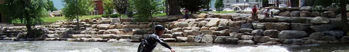
6 In-stream whitewater improvements are popular in appropriate rivers around the western US. This structure is located in Clear Creek, Golden, Colorado. Dam modification whitewater parks are also a commonly pursued option, whereby an existing dam is retrofitted with drop structures to create a whitewater course on the backside of a dam. Dam modifications, like the Rio Vista Dam shown in the photo below, serve to eliminate structural stability issues and mitigate existing navigability hazards while maintaining the existing use of the dam and not negatively impacting the floodplain. These projects are appropriate when a dam s function needs to be maintained but the downstream edge of the dam can be modified for navigation, recreation and fish passage, or when the crest of a dam can be lowered and the vertical fall of the dam can be redistributed through a longer reach. (303)

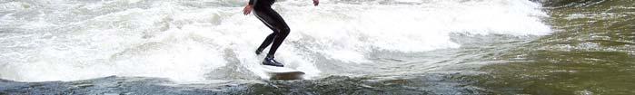
7 This whitewater park in San Marcos, Texas is an example of a dam modification project. The original crest of this dam and its diversion capabilities are maintained while the vertical drop on the back side of the dam is redistributed in a drop/pool sequence. Diverse communities ranging in population and geographic characteristics are turning to their rivers as a source of recreation, education, and local pride. Whitewater parks attract citizens of all ages and socio-economic backgrounds. The operation of these parks across the country has shown that these types of projects provide a number of benefits including new recreational opportunities, economic stimulus, enhanced aquatic habitat and environmental education opportunities. (303)

8 Economic Benefit There is substantial, empirical evidence that river access improvements can have significant, positive, economic benefits, for a local community. Whitewater Parks attract a desirable demographic of users between the ages of with disposable income and the willingness to travel in pursuit of this specific recreational activity. Golden, Colorado commissioned an economic impact study in the year 2000 for a whitewater park that was built in At the time of the study, the project was shown to have an annual economic impact of between $1.4million-$2million to the local community. This study was for a stream which has a usable season of three months. The whitewater park in Reno, Nevada has a projected economic impact of $18million over the first decade and contributes to a $9million economic impact of the, annual, three day, Reno River Festival. The Truckee River Whitewater Park at Wingfield, Reno Nevada. (303)

9 SECTION 2: SITE DESCRIPTION (303)

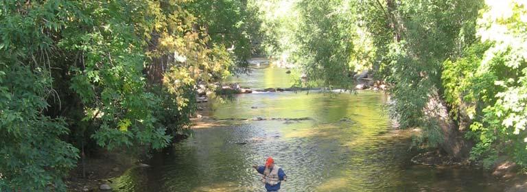
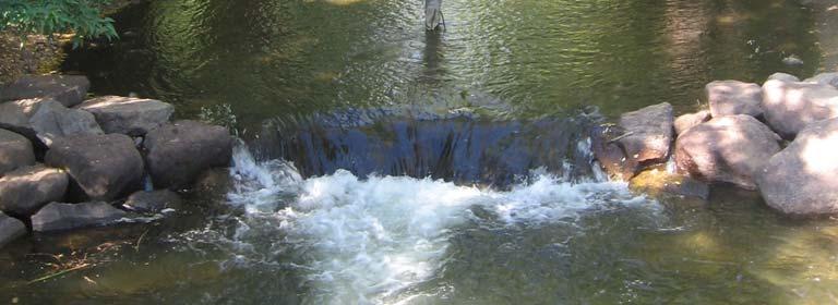
10 Fabri Dam Project area The project area is located at the existing Fabri Dam just downstream of Downtown Flint and the Hamilton Dam (source: The location for improvements is at the existing Fabri Dam located on the Flint River in Flint, Michigan. The Fabri Dam is located directly downstream from the University of Michigan, Downtown Flint and the Hamilton Dam. The precise amount of hydraulic head is variable however, site inspection has revealed sufficient vertical fall for recreational improvements. (303)
11 Monthly Mean Streamflow: USGS Flint River near Flint, MI from Jan Feb Mar Apr May Jun Jul Aug Sep Oct Nov Dec cfs month Monthly-mean flows at the proposed project site from 1932 through 2007 Source: Flows at the site vary from 1500 cubic feet per second (cfs) in the early spring to 250 cfs in mid-summer to early fall. Extreme flood flows have historically reached above 15,000 cfs in the Flint River, however flows typically peak in the range of 4,000 cfs. This historic flow data suggests that the project would be useable 12 months a year, weather permitting. Use of similar projects typically follows the hydrograph. When flows are higher more experienced users will use the facility; when flows are lower during the summer months less experienced users and bank-based users will frequent the site. (303)
12 Peak streamflows at the proposed project site (source: waterdata.usgs.gov, station USGS Flint River Near Flint, Michigan). (303)
")
13 SECTION 3: PROJECT DESCRIPTION (303)

14 Project Description Conceptual Design for Fabri Dam Modifications A full-page version of this drawing is available in Appendix 2. This plan illustrates the proposed layout of the suggested improvements at the Fabri Dam. The general layout provides for five whitewater features located in the main channel of the river. Each feature would consist of a drop structure with approximately one to two feet of head. The first three structures would be located upstream of the existing dam and two drop structures locate at and below the existing dam. The hydraulic fall redistributed through a longer reach allowing for a more gradual transition along the Flint River. The existing Obermeyer inflatable dam can be relocated upstream to the first drop structure. This will allow control of the upstream water surface elevation and preserve the existing flat-water amenity and aesthetics. A modular whitewater feature can be installed in concert with (303)

15 the relocated Obermeyer Dam to create an adjustable whitewater feature. Adjustability will facilitate use by a wide cross section of recreational users. The West Plains Diversion in Pueblo Colorado was modified for fish passage, safety and recreation in Typical profile of a dam modification. The hydraulic fall is redistributed through a longer reach. (303)


16 Selective bank access improvements on both banks, including egress and ingress points as well as seating areas and augmentation of existing trails, should also be included in the project. Bank and access improvements can improve safety, connect the public to the river and create vibrancy in an urban core. (303)


17 SECTION 4: ANTICIPATED USE (303)
18 Anticipated Use This project will serve many users and purposes. The site will be designed to be an attraction to recreational users. The character of the features created by each of the drop structures will evolve as the flow rates at the site increase and decrease throughout the year. At lower flows the park will provide recreation opportunities for less experienced river users as well as intermediate and Paddlers at the Pueblo expert users who come to the site for fitness and practice. Whitewater Park At higher flows of over 1000 cfs the more powerful whitewater features will create a regional draw for intermediate and expert users while not preventing the use of the project by inexperienced users. The design can also accommodate upstream fish passage. Future design phases will need to consider the specific needs of critical local fish species. Generally, the proposed grade control structures can provide short sections of both higher velocity flow and velocity shelters to facilitate upstream fish movement. (303)
19 Whitewater Parks can provide diverse experiences along rivers. (303)


20 SECTION 5: ACCESSABILITY SECTION 6: MAINTENANCE SECTION 7: Accessibility The site is immediately accessible through the existing downtown area and trails. Access points would be constructed both upstream and downstream of the whitewater features to allow for ingress and egress to and from the river. Maintenance In-stream improvements are virtually maintenance-free following the first year. Regular inspections should be scheduled to evaluate any significant erosion during the first year and every year thereafter. Tree, ice and woody debris will be passed in the course of normal flows, but should be removed if suspended during high-use times as they represent an immediate in-stream hazard. Maintenance of the existing banks and adjacent park areas will require typical park maintenance for parking areas, restrooms, etc. Costs See the attached cost estimate. Normally, the bulk of this cost is in construction of in-channel improvements. In-stream drops and pools should be constructed, along with any related paths/ access ways, during low-flow periods. Reduction in rock costs through donated or stored rock can have a significant impact on the total cost of the project. COSTS (303)

21 Future Work If the City decides to go forward with this project, future tasks include but are not necessarily limited to: Detail Design Flood/Fluid Modeling Permit Applications Construction and Bid Documents Construction Phase Services SECTION 8: These tasks are categorized in Design and Construction Phase Services, as listed in the attached cost estimate. It is recommended that the design team open a dialogue with related planning and government agencies as soon as possible following the decision to proceed, as it is often imperative that these stakeholders be included in the design process. Boulder Creek FUTURE WORK (303)


22 SECTION 9: Before and After in the Salida, Colorado Whitewater Park CONCLUSION (303)
23 Conclusion Cost effective, recreational safety improvements can be made at the Fabri Dam site. These improvements will remove an existing hazard as well as provide a recreational amenity that will attract recreational users and their families from the region to downtown Flint. The proposed improvements will preserve the base of the existing dam while redistributing the head through a longer reach of the Flint River. The hydraulics formed by the whitewater structures will be user friendly and are not intended to create hazardous conditions for inexperienced users. Many communities have found that whitewater parks not only provide solutions to safety issues, but also draw residents as well as visitors to the river, thus providing an economic driver for the local community. Similar improvements have had enormous impacts on the quality of life and local economies of communities throughout the country. REP s $170,000 whitewater park in Golden, Colorado has had an estimated 1.7 to 2 million dollar per year impact on the local economy. Similar estimates have been made for our parks in Breckenridge and Vail. Another project, a two-channel whitewater park on the Truckee River at Wingfield Island in Reno, Nevada, has transformed a neglected and denuded section of downtown into a revitalized urban greenway with walking paths, shaded riverside seating, and picnic areas all surrounded by world-class whitewater. Just like the cities mentioned above, Flint has the potential to create a world-class recreational amenity that could benefit the entire community. For these reasons REP recommends including recreational improvements in the modification of the Fabri Dam. (303)
24 Appendix 1. Conceptual Cost Estimate Item # Description Flint Michigan-Fabri Dam Cost Estimate 11/4/2008 Estimated Quantity Unit Unit Price Item Total Price 1 Mobilization L.S. L.S. $50,000 $50,000 2 Dewater (During low-flow) open Oberemyer gates, construct coffer dams and area pumping. L.S. L.S. $260,000 $260,000 3 Demo/remove existing Obermeyer Gates-leave concrete abutment walls and concrete base. L.S. L.S. $160,000 $160,000 4 Grouted rock drop structures: 4A (Drop #1) reconfigured Obermeyer gate, with grouted rock abutments L.S. cubic yards grouted rock & reconfiguration of Obermeyer L.S. $215,000 4B 1,300 cubic yards grouted rock $180 $234,000 Drop # 2 4C 4D 4E Drop # 3 Drop #4-At Dam Face Drop #5 1, ,000 cubic yards grouted rock cubic yards grouted rock cubic yards grouted rock $180 $234,000 $180 $108,000 $180 $180,000 5 Offset Current Deflectors (4) 1,200 cubic yards grouted rock $180 $216,000 (303)
25 6 Boulder edge and terracing 3,500 LF $160 $560,000 7 Large Random Boulders 40 L.S. $400 $16,000 8 miscellaneous heavy Equipment cost/hour 300 hours $180 $54,000 9 landscape restoration and miscellaneous signage, put-ins, take-outs and trails L.S. hours $240,000 $240,000 Subtotal $2,527, Contingency 25% $631, Design and Permitting 16% $404,320 Total $3,563,070 Itemized costs: Grouted Rock costs per cubic yard Heavy equipment cost/hour Large Random Boulders $180 $180 $400 (303)
26 Appendix 2. Concept Plan (303)

27 (303)
Conceptual Design Report for the Hamilton Dam Modifications Project. Flint, Michigan. Prepared For: City of Flint P.O. Box 99 Flint, MI
 Conceptual Design Report for the Hamilton Dam Modifications Project Flint, Michigan Prepared For: City of Flint P.O. Box 99 Flint, MI 48501-0099 Flint River Watershed Coalition 432 N. Saginaw St. Suite
CONCEPTUAL PLANNING REPORT CONCEPTUAL MASTER PLAN WHITEWATER COURSE BARREN RIVER BOWLING GREEN, KENTUCKY
 CONCEPTUAL PLANNING REPORT CONCEPTUAL MASTER PLAN WHITEWATER COURSE BARREN RIVER BOWLING GREEN, KENTUCKY PREPARED BY: RECREATION ENGINEERING AND PLANNING 485 ARAPAHOE AVE. BOULDER, CO 80302 303-545-5883
JAP Additional Information Sheet
 JAP Additional Information Sheet Block 15: Purpose and Need The USACE purpose of the project is to provide a safe and reliable whitewater park for the recreational public in a city park, which will provide
Colorado Avenue Dam Proposed Paddle Trail Improvements Preliminary Design Report Deschutes River, Bend, Oregon
 Colorado Avenue Dam Proposed Paddle Trail Improvements Preliminary Design Report Deschutes River, Bend, Oregon Prepared For: Bend Metro Park and Recreation District 799 SW Colombia Street Bend, Oregon
GRAND RAPIDS RESTORATION GRAND RAPIDS REVITALIZATION
 GRAND RAPIDS RESTORATION RETURNING THE RAPIDS TO THE GRAND WHY IS THIS PLACE CALLED GRAND RAPIDS? We have been asking for over 100- years, where are the rapids? WHY IS THIS PLACE CALLED GRAND RAPIDS? compare
Focus. Cumberland Whitewater Park. Cumberland Whitewater Park. Read 20 point Comic Sans MS from rear of room. A free flowing natural artificial course
 Cumberland Whitewater Park Cumberland Whitewater Park Focus Read 20 point Comic Sans MS from rear of room 1 Cumberland Whitewater Park by Robert B. Kauffman, Ph.D. Proposed site A free flowing natural
Appendix G Whitewater Recreation Flow Study Plan
 Appendix G Whitewater Recreation Flow Study Plan Study Plan Whitewater Recreation Flow Study Grandfather Falls Hydroelectric Project FERC Project No. 1966 March 2013 An Integrys Energy Group Company Section
OPPORTUNITIES & CONSTRAINTS
 OPPORTUNITIES & CONSTRAINTS Grand Rapids Restoration August 2012 We have inherited the past; we can create the future Unknown TABLE OF CONTENTS ES-1 ES-1...... BACKGROUND CONCEPTUAL PLAN ES-2... OPPORTUNITIES
Of the following, which best describes you?
 Summary of Downtown Des Moines Dam Debate April 26 th, 2016 The following are the responses we heard from participants in the Dam Debate cohosted by the Register and the Des Moines Area Metropolitan Planning
Stevens Creek Corridor
 O F F I C E O F T H E D I R E C T O R O F P U B L I C W O R K S Stevens Creek Corridor Creek Restoration Project Volume Three Project Update: Creek Photos, Before & After BY GAIL SEEDS - PROJECT MANAGER,
Blue River Restoration Project William D. Linfield, P.E.
 Blue River Restoration Project William D. Linfield, P.E. 1 2 3 4 5 Blue River Restoration Project BUILDING BRIDGES BETWEEN COMMUNITIES IN COOPERATION WITH THE NATIONAL FOREST FOUNDATION Building Bridges
USING A LABYRINTH WEIR TO INCREASE HYDRAULIC CAPACITY. Dustin Mortensen, P.E. 1 Jake Eckersley, P.E. 1
 USING A LABYRINTH WEIR TO INCREASE HYDRAULIC CAPACITY Dustin Mortensen, P.E. 1 Jake Eckersley, P.E. 1 Plum Creek Floodwater Retarding Structure No. 6 is located in an area of Kyle, Texas, that is currently
STRUCTURE S-65 PURPOSE SPILLWAY OPERATION
 STRUCTURE S-65 This structure is a reinforced concrete, gated spillway with discharge controlled by three cable operated, vertical lift gates, and a reinforced concrete lock structure with two pairs of
PROJECT OVERVIEW PROJECT AREA. FAHCE Fish Habitat Restoration Plan EIR
 PROJECT OVERVIEW PROJECT AREA FISH AND AQUATIC HABITAT COLLABORATIVE EFFORT (FAHCE) Fish Habitat Restoration Plan Project Area PROJECT OVERVIEW DOCUMENTS A Settlement Agreement Regarding Water Rights of
Exhibit 1 PLANNING COMMISSION AGENDA ITEM
 Exhibit 1 PLANNING COMMISSION AGENDA ITEM Project Name: Grand Junction Circulation Plan Grand Junction Complete Streets Policy Applicant: City of Grand Junction Representative: David Thornton Address:
County of Orange Resources and Development Management Department Harbors, Beaches and Parks. Strategic Plan. HBP Strategic Plan Workshop 1.
 County of Orange Resources and Development Management Department Harbors, Beaches and Parks Strategic Plan HBP Strategic Plan Workshop 1 v18 PRESENTATION OUTLINE Harbors, Beaches & Parks (HBP) History
Tonight is for you. Learn everything you can. Share all your ideas.
 Strathcona Neighbourhood Renewal Draft Concept Design Tonight is for you. Learn everything you can. Share all your ideas. What is Neighbourhood Renewal? Creating a design with you for your neighbourhood.
Applying Engineering Solutions to the Science of Invasive Aquatic Species Control Asian Carp and Sea Lamprey. Bill Holman, P.E. Stanley Consultants
 Applying Engineering Solutions to the Science of Invasive Aquatic Species Control Asian Carp and Sea Lamprey Bill Holman, P.E. Stanley Consultants Sea Lamprey: Great Lakes Invader Lake Superior Sea Lamprey
FINAL REPORT. Yonkers Creek Migration Barrier Removal Project Wonderstump Road Del Norte County. Submitted By:
 FINAL REPORT Yonkers Creek Migration Barrier Removal Project Wonderstump Road Del Norte County Submitted By: Del Norte County Community Development Department Yonkers Creek Migration Barrier Removal Project
COMPARISON OF FIXED & VARIABLE RATES (25 YEARS) CHARTERED BANK ADMINISTERED INTEREST RATES - PRIME BUSINESS*
 CHARTERED BANK ADMINISTERED INTEREST RATES - PRIME BUSINESS*") COMPARISON OF FIXED & VARIABLE RATES (25 YEARS) Fixed Rates Variable Rates FIXED RATES OF THE PAST 25 YEARS AVERAGE RESIDENTIAL MORTGAGE LENDING RATE - 5 YEAR* (Per cent) Year Jan Feb Mar Apr May Jun Jul
COMPARISON OF FIXED & VARIABLE RATES (25 YEARS) Fixed Rates Variable Rates FIXED RATES OF THE PAST 25 YEARS AVERAGE RESIDENTIAL MORTGAGE LENDING RATE - 5 YEAR* (Per cent) Year Jan Feb Mar Apr May Jun Jul
City of Wilsonville 5 th Street to Kinsman Road Extension Project
 City of Wilsonville 5 th Street to Kinsman Road Walking Tour & Neighborhood Workshop Summary Report Public Outreach Overview On July 18 th, 2017, the City of Wilsonville hosted a neighborhood walking tour
Route 79/Davol Street Corridor Study
 Route 79/Davol Street Corridor Study Fall River, MA Public Information Meeting #2 November 21, 2013 Fall River Heritage State Park Fall River, MA Agenda Welcome and Introductions Overview of Study Process
Searsville Dam Removal
 Searsville Dam Removal A unique opportunity for all Presented by the Beyond Searsville Dam Coalition San Francisquito Creek flows into the San Francisco Bay near the Palo Alto Airport and Golf Course seen
Trout Unlimited Comments on the Scope of Environmental Impact Statement for the Constitution Pipeline Project, Docket No. PF12-9
 October 9, 2012 Kimberly D. Bose, Secretary Federal Energy Regulatory Commission 888 First Street, NE, Room 1A Washington, DC 20426 RE: Trout Unlimited Comments on the Scope of Environmental Impact Statement
The approach of CanoeKayak BC Whitewater (CKBC-WW) to River Access issues is driven by the organizational Mission Statement:
 to River Access issues is driven by the organizational Mission Statement:") CanoeKayak BC - Whitewater DRAFT RIVER ACCESS POLICY For Comment The approach of CanoeKayak BC Whitewater (CKBC-WW) to River Access issues is driven by the organizational Mission Statement: Provide structure
CanoeKayak BC - Whitewater DRAFT RIVER ACCESS POLICY For Comment The approach of CanoeKayak BC Whitewater (CKBC-WW) to River Access issues is driven by the organizational Mission Statement: Provide structure
Little Spokane River Stream Gage Report: Deadman Creek, Dragoon Creek, and the West Branch of the Little Spokane River
 Little Spokane River Stream Gage Report: Deadman Creek, Dragoon Creek, and the West Branch of the Little Spokane River June 2010 Spokane County Conservation District N. 210 Havana St. Spokane, WA 99202
 Time of Change We Are Growing We Are An Attractive Place To Live We Are Age Diverse + Living Longer 50000 40000 30000 20000 10000 0 2010 Census Job Density Housing Sheds Transit Sheds The Project FUNDING
Coquitlam/Buntzen Project Water Use Plan
 Coquitlam/Buntzen Project Water Use Plan Temperature Monitoring Lower Coquitlam River Project Year 3 Report Reference: COQMON#6 Study Period: March 2008 April 2009 Report Date: April 2009 Trow Associates
Initial Study Report Whitewater Boating
 Initial Study Report Whitewater Boating Prospect No. 3 Hydroelectric Project FERC Project No. P-2337 PacifiCorp May 2015 South Fork of the Rogue River, 2007 Reproduced with permission from Peter Gandesbery,
Lower Coquitlam River Project Water Use Plan. Temperature Monitoring Lower Coquitlam River Project Year 2 Report
 Lower Coquitlam River Project Water Use Plan Temperature Monitoring Lower Coquitlam River Project Year 2 Report COQMON#6 Temperature Monitoring Study Lower Coquitlam River Study Period: Year 2-2007 Report
Iowa Department of Natural Resources Iowa Water Trails Grant Program
 Iowa Department of Natural Resources Iowa Water Trails Grant Program Submitted by the City of Story City in conjunction with the Skunk River Paddlers and the Story County Conservation Board Tuesday, January
Blue River Restoration Project
 Blue River Restoration Project Blue River Restoration Project BUI LDI NG BRI DGES BETWEEN COMMUNI TI ES I N COOPERATI ON WI TH THE NATI ONAL FOREST FOUNDATI ON The Blue River Restoration project is an
Eulachon: State of the Science and Science to Policy Forum
 Eulachon: State of the Science and Science to Policy Forum August 27, 2015 Robert Anderson Eulachon Recovery Coordinator National Marine Fisheries Service FCRPS, Dams, and Water Management in the Columbia
FISH PASSAGE ALTERNATIVES ANALYSIS ON PENNYPACK CREEK AT VERREE ROAD DAM AND ROOSEVELT BOULEVARD DAM PHILADELPHIA, PENNSYLVANIA
 FISH PASSAGE ALTERNATIVES ANALYSIS ON PENNYPACK CREEK AT VERREE ROAD DAM AND ROOSEVELT BOULEVARD DAM PHILADELPHIA, PENNSYLVANIA Prepared for: One Parkway, 10 th Floor 1515 Arch Street Philadelphia, PA
PROJECT TO INSTALL LARGE WOOD HABITAT STRUCTURES IN THE CARMEL RIVER USING CALIFORNIA DEPARTMENT OF FISH AND GAME GRANT FUNDS
 PROJECT TO INSTALL LARGE WOOD HABITAT STRUCTURES IN THE CARMEL RIVER USING CALIFORNIA DEPARTMENT OF FISH AND GAME GRANT FUNDS The Monterey Peninsula Water Management District (MPWMD), in cooperation with
Interlake Tunnel WRA Board Workshop. August 25, 2014
 Interlake Tunnel WRA Board Workshop August 25, 2014 1 Agenda Introduction Project Description Background Concept of tunnel operations Engineering and analysis performed to date Preliminary modeling results
Hydraulic Modeling of Stream Enhancement Methods
 Hydraulic Modeling of Stream Enhancement Methods Matthew J. Curry John J. Levitsky Abstract Development within watersheds increases the amounts of runoff causing stream erosion and degradation of stream
Pennsylvania Avenue (CR 484) Design Alternatives Study
 Design Alternatives Study") MEMORANDUM Pennsylvania Avenue (CR 484) Design Alternatives Study Prepared for: APRIL 2016 Prepared By TABLE OF CONTENTS Project Background... 2 Previous Concept... 2 Existing Conditions... 4 New Alternatives...
MEMORANDUM Pennsylvania Avenue (CR 484) Design Alternatives Study Prepared for: APRIL 2016 Prepared By TABLE OF CONTENTS Project Background... 2 Previous Concept... 2 Existing Conditions... 4 New Alternatives...
CHAPTER X: PORTAGES AROUND DAMS
 CHAPTER X: PORTAGES AROUND DAMS A. General Description Portages are land routes used by paddlers to transport their boats to and from a launch area or between access sites. Often located along water bodies
Healthy River$ Economic Impact of the Huron River. Elizabeth Riggs Michigan Watershed Summit 28 March 2018
 Healthy River$ Economic Impact of the Huron River Elizabeth Riggs Michigan Watershed Summit 28 March 2018 Founded in 1965, HRWC protects and restores the river for healthy and vibrant communities. A
CHAPTER 4 DESIRED OUTCOMES: VISION, GOALS, AND OBJECTIVES
 CHAPTER 4 DESIRED OUTCOMES: VISION, GOALS, AND OBJECTIVES Vision One of the first steps in developing this Plan was articulating a vision - a clear statement of what the Plan strives to achieve and what
Understanding the Impacts of Culvert Performance on Stream Health
 Understanding the Impacts of Culvert Performance on Stream Health Kristin Thomas Aquatic Ecologist Michigan Trout Unlimited Transportation and the Environment Conference 12/5/2018 Importance of adequately
TO: FROM: SUBJECT: RECOMMENDATION REPORT SUMMARY BOARD AUTHORITY
 February 8, 2018 TO: Park Board Chair and Commissioners FROM: General Manager Vancouver Board of Parks and Recreation SUBJECT: Douglas Park Playground Replacement - Construction Contract RECOMMENDATION
Chadbourne Dam Repair and Fish Barrier
 Chadbourne Dam Repair and Fish Barrier Final Report for the Western Native Trout Initiative Prepared by: Carol Endicott Yellowstone Cutthroat Trout Conservation Biologist Montana Fish, Wildlife & Parks
East Burke Transportation, Safety and Capacity Improvements
 East Burke Transportation, Safety and Capacity Improvements The purpose of this project is to increase mobility and improve safety for pedestrians, cyclists, and motor vehicles along VT Route 114 in the
PROFILE OF SACRAMENTO RIVER, FREEPORT TO VERONA, CALIFORNIA,
 PROFILE OF SACRAMENTO RIVER, FREEPORT TO VERONA, CALIFORNIA, FLOOD OF FEBRUARY 1986 By J.C. Blodgett and J.B. Lucas U.S. GEOLOGICAL SURVEY Open-File Report 88-82 CO CM I m r-h CM Sacramento, California
RLRC COMMUNITIES EAST GRAND FORKS AREA CHARACTER THE RED LAKE RIVER & THE RED RIVER OF THE NORTH CONFLUENCE EAGLE POINT BOAT LAUNCH DESIGN
 AREA CHARACTER THE RED LAKE RIVER & THE RED RIVER OF THE NORTH CONFLUENCE EAGLE POINT BOAT LAUNCH DESIGN DESIGN DETAILS 135 AREA CHARACTER East Grand Forks a city of 7,501 people is located across the
North Coast Corridor:
 North Coast Corridor: Connecting People, Transportation & Environment Legislative Hearing: 11.8.10 1 North Coast Corridor Region s Lifeline A Regional Strategy Mobility, Economy & Environment North Coast
PEDESTRIAN ACTION PLAN
 ATTACHMENT 2 CITY OF SANTA MONICA PEDESTRIAN ACTION PLAN CITY OF SANTA MONICA PEDESTRIAN ACTION PLAN This page intentionally left blank EXECUTIVE SUMMARY CHAPTER 1 EXECUTIVE SUMMARY Setting the Stage
OKANAGAN RIVER RESTORATION INITIATIVE - FAQ
 OKANAGAN RIVER RESTORATION INITIATIVE - FAQ Initiative background: The health of the q awsitk w (Okanagan River) has been severely impacted by the channelization works that occurred in the mid-1950 s.
ROUTES 55 / 42 / 676 BUS RAPID TRANSIT LOCALLY PREFERRED ALTERNATIVE
 ROUTES 55 / 42 / 676 BUS RAPID TRANSIT LOCALLY PREFERRED ALTERNATIVE April, 2012 1 INTRODUCTION The need for transit service improvements in the Routes 42/55/676 corridor was identified during the Southern
Fossil Creek Native Fish Repatriation 2009 Implementation Plan Arizona Game and Fish Department
 Fossil Creek Native Fish Repatriation 2009 Implementation Plan Arizona Game and Fish Department MONITORING: Annual monitoring is conducted for each species stocked, typically during late summer or early
River ride exposes Reno s scenic side, also her flaws
 River ride exposes Reno s scenic side, also her flaws Benjamin Spillman, bspillman@rgj.com 5:34 p.m. PDT June 21, 2016 Buy Photo The Truckee River from Reno to USA Parkway represents a confluence of nature
Road Alterations - Wellington Street East, Church Street, and Front Street Intersection
 REPORT FOR ACTION Road Alterations - Wellington Street, Church Street, and Front Street Intersection Date: November 1, 2016 To: Toronto and York Community Council From: Director, Public Realm Section,
FISH PASSAGE IMPROVEMENT in California s Watersheds. Assessments & Recommendations by the Fish Passage Forum
 FISH PASSAGE IMPROVEMENT in California s Watersheds Assessments & Recommendations by the Fish Passage Forum FISH PASSAGE IMPROVEMENT in California s Watersheds The mission of the Fish Passage Forum is
CONNECTICUT RIVER WATERSHED COUNCIL The River Connects Us
 CONNECTICUT RIVER WATERSHED COUNCIL The River Connects Us Upper Valley: P.O. Box 206, Saxtons River, VT 05154 Electronic Filing UNITED STATES OF AMERICA FEDERAL ENERGY REGULATORY COMMISSION Grafton Hydro,
Rochester Area Bike Sharing Program Study
 roc bike share Rochester Area Bike Sharing Program Study Executive Summary ~ January 2015 JANUARY 2015 8484 Georgia Avenue, Suite 800 Silver Spring, MD 20910 3495 Winton Pl., Bldg E, Suite 110 Rochester,
Estimated on-the-ground start and end dates: 1 June October 2018
 A. Applicant Information Name of Organization: U.S. Army Corps of Engineers, Carlyle Lake 801 Lake Road, Carlyle, IL 62231 Contact Information: Robert Wilkins, Operations Manager, (618) 594-2484, Robert.Wilkins@usace.army.mil
Obey Creek PEDESTRIAN CIRCULATION EAST WEST PARTNERS PEDESTRIAN CIRCULATION CREEK SIDE LANE SLIP STREET SCOTT MURRAY MAIN STREETS EAST/WEST
 THE VILLAGE AT PEDESTRIAN CIRCULATION MAIN STREETS NORTH/SOUTH MAIN STREETS EAST/WEST SLIP STREET CREEK SIDE LANE PEDESTRIAN CIRCULATION DESCRIPTION: Circulation through the downtown of is organized by
Welcome. Thank you for your interest in the Lewis & Clark Viaduct Concept Study
 Welcome Thank you for your interest in the Lewis & Clark Viaduct Concept Study Please use the arrows in the upper left hand corner to navigate through the presentation. Use the envelope icon to ask a question
Community Open House December 13, A project of the Green Infrastructure Center, supported by Skeo Solutions
 Community Open House December 13, 2011 A project of the Green Infrastructure Center, supported by Skeo Solutions Project Background The Green Infrastructure Center, Inc. (GIC) was formed in 2006 to help
Las Tunas Downtown Revitalization City Council Study Session. December 1, :00 p.m. Live Oak Park Community Center
 Las Tunas Downtown Revitalization City Council Study Session December 1, 2015 7:00 p.m. Live Oak Park Community Center AGENDA 2 Provide downtown context. Confirm project goals. Analyze three design concepts.
Living Streets Policy
 Living Streets Policy Introduction Living streets balance the needs of motorists, bicyclists, pedestrians and transit riders in ways that promote safety and convenience, enhance community identity, create
The Economic Importance of Recreational River Use to the City of Calgary
 The Economic Importance of Recreational River Use to the City of Calgary Prepared by: Calgary River Users Alliance May 20, 2016 The Economic Importance of Recreational River Use to the City of Calgary
Riverside Drive Complete Streets Project 3 rd Community Meeting. March 26, 2015
 Riverside Drive Complete Streets Project 3 rd Community Meeting March 26, 2015 Providing Feedback Sign-In with contact information for future updates Complete questionnaire provided tonight Complete comment
Section 5: Bike and Pedestrian
 Section 5: Bike and Pedestrian Existing Conditions: One defining feature of Glynn County appreciated by both residents and visitors is the extensive sidewalk and bike path system. The City of Brunswick,
Ellis Y. Byeon, PE Bryan VanderGheynst, PE 1
 Ellis Y. Byeon, PE Bryan VanderGheynst, PE 1 Background Information: City of Trenton, Mercer County Assunpink Creek, Pond Run and Delaware River Lower 2.5 miles of the Assunpink Creek Lower 0.6 miles of
Follow this and additional works at:
 University of Massachusetts Amherst ScholarWorks@UMass Amherst International Conference on Engineering and Ecohydrology for Fish Passage International Conference on Engineering and Ecohydrology for Fish
FISHERIES BLUE MOUNTAINS ADAPTATION PARTNERSHIP
 FISHERIES A warming climate, by itself, substantially affects the hydrology of watersheds in the Blue Mountains. Among the key hydrologic changes projected under all scenarios for the 2040s and beyond
Third Street Bridge & Corridor Project
 Third Street Bridge & Corridor Project Preparation for the FY2018 budget to commence October 1, 2017, includes funding to address a project that has been considered since 1994. The Third Street bridge
Item 5.1 TRANSIT DAY 2018 BUDGET PRESENTATION. Public Works Department TRANSIT
 Item 5.1 DAY 2018 BUDGET PRESENTATION Looking Back 2017 accomplishments Comparing with other GTHA agencies 10 year strategy recap HSR Today Strategy year 3 Operating budget Looking Ahead 2018 priorities
Water Resources Report RKLD Annual Meeting July 30, 2016
 Water Resources Report RKLD Annual Meeting 2016 July 30, 2016 Topics Hydrology Report Indianford Dam trash rack cleanout performance Experimental Project update Review of PAS project Twin floods- 1 to
SARASOTA BAY ESTUARY PROGRAM OYSTER HABITAT MONITORING RESULTS: YEAR 1. Jay R. Leverone
 SARASOTA BAY ESTUARY PROGRAM OYSTER HABITAT MONITORING RESULTS: YEAR 1 by Jay R. Leverone Mote Marine Laboratory 1600 Ken Thompson Parkway Sarasota, Fl 34236 to Gary Raulerson Sarasota Bay Estuary Program
LESOTHO HIGHLANDS DEVELOPMENT AUTHORITY
 LESOTHO HIGHLANDS DEVELOPMENT AUTHORITY FLOW RELEASES DOWNSTREAM OF THE LESOTHO HIGHLANDS WATER PROJECT (LHWP) STRUCTURES (April 2003 to September 2003) TOWER ON MALIBAMATŠO RIVER @ KAO MARCH 2004 OPERATIONS,
Hospital Link Project Project Update September 2017
 Hospital Link Project Project Update September 2017 General The project provides a link from Riverside Drive and the Transitway to the Hospital Link Road. Construction is well underway. Read on for important
Presented to Idaho Washington Aquifer Collaborative February 11, Spokane River Project License
 Presented to Idaho Washington Aquifer Collaborative February 11, 2014 Spokane River Project License Contact Speed Fitzhugh, Spokane River License Manager Telephone - (509) 495-4998 Email - speed.fitzhugh@avistacorp.com
Central Oregon Intergovernmental Council
 Central Oregon Intergovernmental Council Regional Transit Master Plan (RTMP) Technical Advisory Committee Kick-Off Meeting May 16, 2012 Meeting Agenda Project Orientation Presentation of Survey Results
Progress Report on the Design and Planning of an Infrastructure Improvement Project for the Sunnyside TIF District (Phase II)
") Presentation to the CNRC Board of Directors Regular Meeting March 11, 2015 1 Agenda Preferred Alternate Refinement for University Avenue, 3rd Street, and Beverly Avenue Intersection Improvements validate
Presentation to the CNRC Board of Directors Regular Meeting March 11, 2015 1 Agenda Preferred Alternate Refinement for University Avenue, 3rd Street, and Beverly Avenue Intersection Improvements validate
HOOPA DESIGN FAIR 4. IMPLEMENTATION PHASES & FUNDING
 4. IMPLEMENTATION PHASES & FUNDING HOOPA DESIGN FAIR 4-1 4. IMPLEMENTATION PHASES & FUNDING Phase One Development 1. Implementation The Conceptual Plan recommends five concept elements to revitalize downtown
Thoreau Path Master Plan Final Draft. prepared for: The Boston Redevelopment Authority West End Community November 2007
 Thoreau Path Master Plan Final Draft prepared for: The Boston Redevelopment Authority West End Community November 2007 Introduction Carol R. Johnson Associates ( CRJA ) was retained by the Boston Redevelopment
Executive Summary. Map 1. The Santa Clara River watershed with topography.
 Santa Clara River Steelhead Trout: Assessment and Recovery Opportunities December 2005 Prepared By: Matt Stoecker and Elise Kelley, Ph.D. University of California, Santa Barbara Prepared For: The Santa
Kennedy Plaza and Providence Downtown Transit Connector PUBLIC MEETING. Stakeholder Meeting #1 October 24, 2016
 Kennedy Plaza and Providence Downtown Transit Connector PUBLIC MEETING Stakeholder Meeting #1 October 24, 2016 May 2017 1 WHAT IS THE DTC? 1.5 mile corridor between Providence Station and the Hospital
J.A. and Kathryn Albertson Family Foundation Boise Whitewater Park Ph II User Group Meeting 01/23/2018 Presented by: John Tensen P.E.
 J.A. and Kathryn Albertson Family Foundation Boise Whitewater Park Ph II User Group Meeting 01/23/2018 Presented by: John Tensen P.E., Project Manager Kelly Burrows, Development Coordinator Morton McMillen,
Applying Engineering Solutions to the Science of Protection and Enhancement of Aquatic Environments. Bill Holman, P.E. Stanley Consultants
 Applying Engineering Solutions to the Science of Protection and Enhancement of Aquatic Environments Bill Holman, P.E. Stanley Consultants Project Development PHASE STAGE TASKS PURPOSE I II III Investigation
Welcome to the Sellwood Bridge Project Open House!
 Welcome to the Sellwood Bridge Project Open House! 5:30 7:30 pm Please sign in here Information stations and project staff are located throughout the room. Goals for Tonight s Meeting: Learn how the Preferred
COASTAL RAIL TRAIL ROSE CREEK BIKEWAY PROJECT COMMUNITY WORKSHOP #2 AUGUST 15, 2013
 COASTAL RAIL TRAIL ROSE CREEK BIKEWAY PROJECT COMMUNITY WORKSHOP #2 AUGUST 15, 2013 CHRIS CARTERETTE, AICP PROJECT MANAGER Chris.Carterette@sandag.org Direct: 619-699.7319 REGIONAL PLANNING BACKGROUND
MR. DAVID DALE, SES, PE, PMP DIRECTOR, US
 Olmsted Locks & Dam Inland Waterways Users Board MR. DAVID DALE, SES, PE, PMP DIRECTOR, Programs Great Lakes and Ohio River Division 02 December 2015 US Army Corps of Engineers Agenda Status Project Overview/BLUF
APPENDIX J HYDROLOGY AND WATER QUALITY
 APPENDIX J HYDROLOGY AND WATER QUALITY J-1 Technical Report on Airport Drainage, Northern Sector Airport and Ordinance Creek Watershed / Preliminary Creek Constructed Natural Channel Culvert J-2 Preliminary
Culvert Design for Low and High Gradient Streams in the Midwest. Dale Higgins, Hydrologist Chequamegon-Nicolet National Forest
 Culvert Design for Low and High Gradient Streams in the Midwest Dale Higgins, Hydrologist Chequamegon-Nicolet National Forest Overview Culvert Design Considerations Hydraulic Terms Culvert Impacts Low
Hydrological Condition Report including the issues of High Flow Fluctuation in Chiang Saen
 Hydrological Condition Report including the issues of High Flow Fluctuation in Chiang Saen Technical Symposium for ESCIR and MRC on Social Impact Assessment in River Basin Management Sothea KHEM, HENG
State Route 28 Shared Use Path & Safety/Stormwater Enhancements Public Information Meeting
 State Route 28 Shared Use Path & Safety/Stormwater Enhancements Public Information Meeting Thursday, March 30, 2017 4-7 p.m. Presentation at 5:30 p.m. The Chateau at Incline Village 955 Fairway Blvd. Incline
Napa County Fairgrounds Opportunity Analysis. RCH Group A. Plescia & Co. Fair & Exposition Planning Consultants. September 8, 2016.
 Napa County Fairgrounds Opportunity Analysis September 8, 2016 Prepared by: RCH Group A. Plescia & Co. Fair & Exposition Planning Consultants Our Goal / Objective Goal Our primary objective is to evaluate
LIFE HISTORY DIVERSITY AND RESILIENCE
 LIFE HISTORY DIVERSITY AND RESILIENCE SPRING CHINOOK IN THE WILLAMETTE RIVER BASIN Kirk Schroeder Brian Cannon Luke Whitman Paul Olmsted Oregon Department of Fish and Wildlife Corvallis Research Lab Thanks
Bicycle Friendly Niagara Falls
 Bicycle Friendly Niagara Falls STAKEHOLDER COMMITTEE MEETING 2 SUPPORTED BY THE OATH COMMUNITY FUND AT THE COMMUNITY FOUNDATION FOR GREATER BUFFALO Develop a Bicycle Master Plan to document the city s
UNITED STATES OF AMERICA FEDERAL ENERGY REGULATORY COMMISSION. Morrisville Water & Light FERC No. P-2629 Morrisville Project Green River Development
 UNITED STATES OF AMERICA FEDERAL ENERGY REGULATORY COMMISSION Morrisville Water & Light FERC No. P-2629 Morrisville Project Green River Development AMERICAN WHITEWATER AND VERMONT PADDLERS CLUB MOTION
STONY PLAIN ROAD STREETSCAPE
 Jasper Place Revitalization Strategy: Vision The people involved in the Jasper Place Revitalization Strategy envision: Goal 1: Feeling safe in our community Create a community where feeling safe is common--where
Presented by Fred Halterman, URS Jennie Agerton, URS
 Presented by Fred Halterman, URS Jennie Agerton, URS What is Eco Friendly Culvert Design? Culvert design that: Maintains connectivity for aquatic organism migration Maintains connectivity for gene flow
Atlantic Coast of Long Island, Jones Inlet to East Rockaway Inlet, Long Beach Island, NY Construction Update
 Atlantic Coast of Long Island, Jones Inlet to East Rockaway Inlet, Long Beach Island, NY Construction Update June 2016 US Army Corps of Engineers Project Purpose Three specific damage mechanisms of coastal
WELCOME Mission-Geneva Transportation Study
 WELCOME Mission-Geneva Transportation Study Study Process and Schedule 2005 2006 Oct Nov Dec Jan Feb Mar Apr May Jun Jul Aug Sept Oct Task 2 Develop Outreach Plan Task 3 Document Existing Conditions/ Prioritize
NEVADA SLOT MACHINES: HISTORICAL HOLD PERCENTAGE VARIATIONS ANNUAL AND MONTHLY HOLD PERCENTAGES, CENTER FOR GAMING RESEARCH, NOVEMBER 2017
 NEVADA SLOT MACHINES: HISTORICAL HOLD PERCENTAGE VARIATIONS ANNUAL AND MONTHLY HOLD PERCENTAGES, 2004-2017 CENTER FOR GAMING RESEARCH, NOVEMBER 2017 Executive Summary Hold percentage the portion of money