The False Creek Watershed Society
|
|
|
- Derrick Foster
- 6 years ago
- Views:
Transcription

1 The False Creek Watershed Society


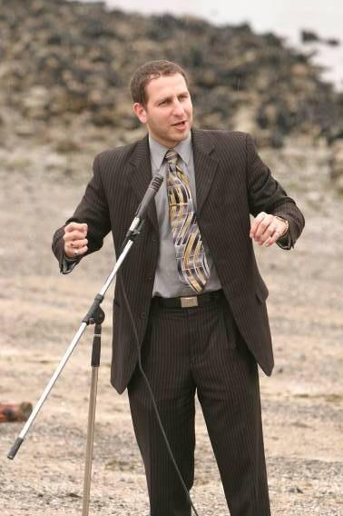
2 My original inspiration for co-founding FCWS was: Fin Donnelly - swam the full length of the Fraser River in both 1995 and 2000 to call attention to its water issues - did Spirit of the Salmon Swims around the Lower Mainland on BC Rivers Day in between - founded The Rivershed Society of BC - currently MP Port Coquitlam /New Westminster He said: This is what I can do to make our water healthier. What can you do? I took this question to heart.

3 I also knew that Vancouver had not always looked like it did today


4 The Lower Mainland as it would have been viewed by Captain George Vancouver 1792 An artist s depiction

5 Map Vancouver in the 1850s from a book by Bruce Macdonald


6 North end of Hemlock Street at False Creek 1886


7 North end of 6 th Ave W. and False Creek 1902

8 7 th Ave E. and Main False Creek in 1889

9 Seventh Ave W. and Spruce looking over False Creek to NW in late 1800s

10 Seventh Ave W. and Spruce looking over False Creek to NW in 2007

11 Once my watershed looked like this: There were over 50 salmon-bearing creeks in Vancouver then


12 What happened to these streams? As the land was cleared and more people built there - some streams gradually filled with debris and garbage. Some were so large like China Creek a sewer pipe was built to handle the flow of water. China Creek was once 16 km. long and drained the land all the way from 45 th and Renfrew to False Creek.


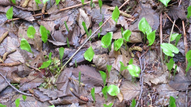
13 Today the area surrounding my watershed looks like this: Pacific Spirit Park 2011
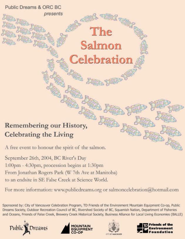
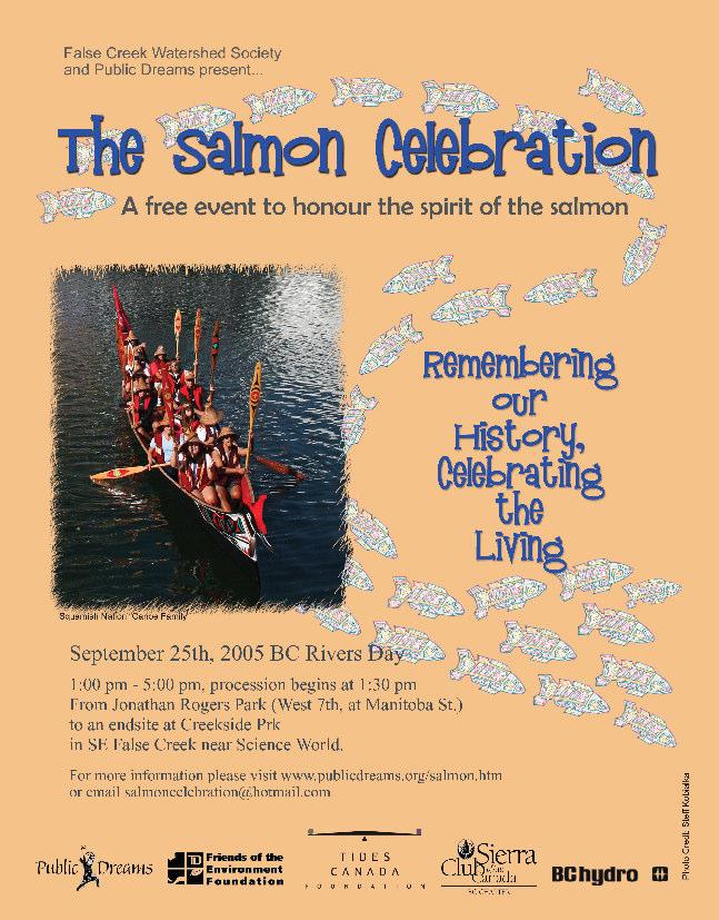
14


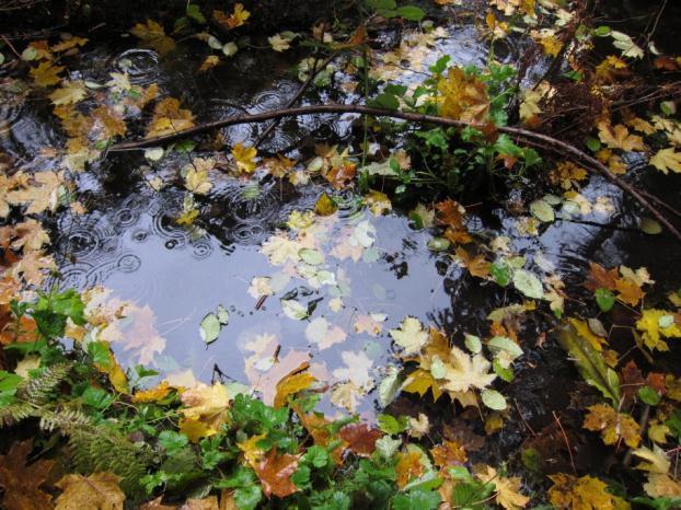
15 Jericho Beach Park Summer 2010 Eel grass, Garry Point, Richmond Fall 2010 Coho returning to Brothers Creek, West Vancouver 2009

16 Trail to Wreck Beach from NW Marine Drive Spring 2012


17 Charleson Park South False Creek Spring 2012


18 But most of Vancouver looks like this: False Creek Looking North Spring 2012


19 and this: Downtown Vancouver early 21 st century

20 So how can we influence the hearts and minds of the people who live in our city to understand more about water issues surrounding our area?
21 In 2005 the False Creek Watershed Society was founded Our first undertaking was to have a Rivers Day event in Vancouver. From we created and produced The Salmon Celebration Remembering our History, Celebrating the Living. It was an event that brought people together to celebrate our water systems and learn about what happened here yesterday and today and what could happen tomorrow.
22
23
24

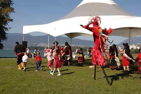
25 What did the event look like? 2004
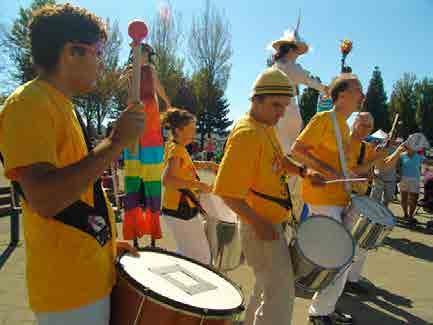
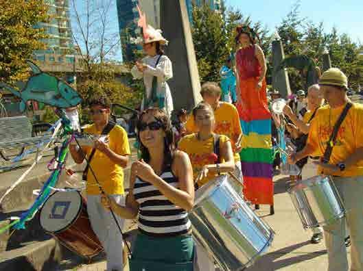
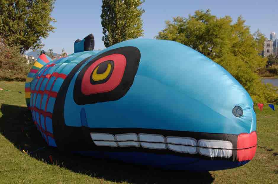
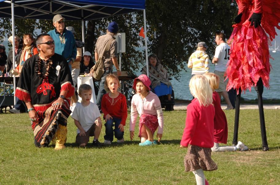
26 2005
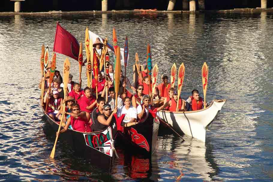
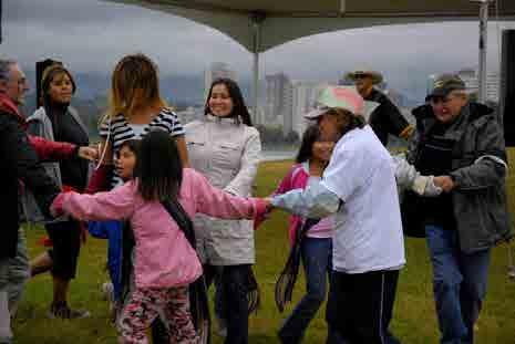
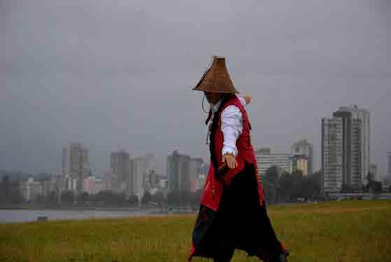
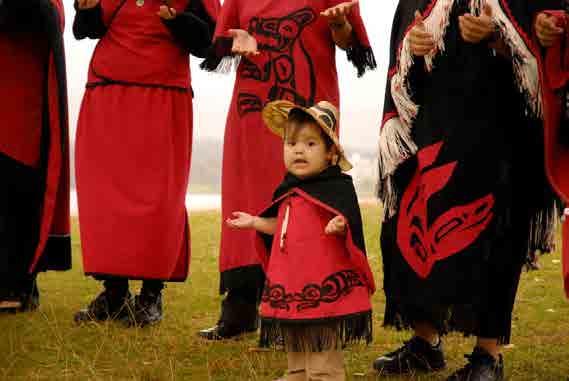
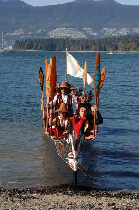
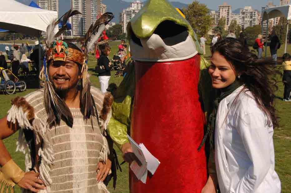
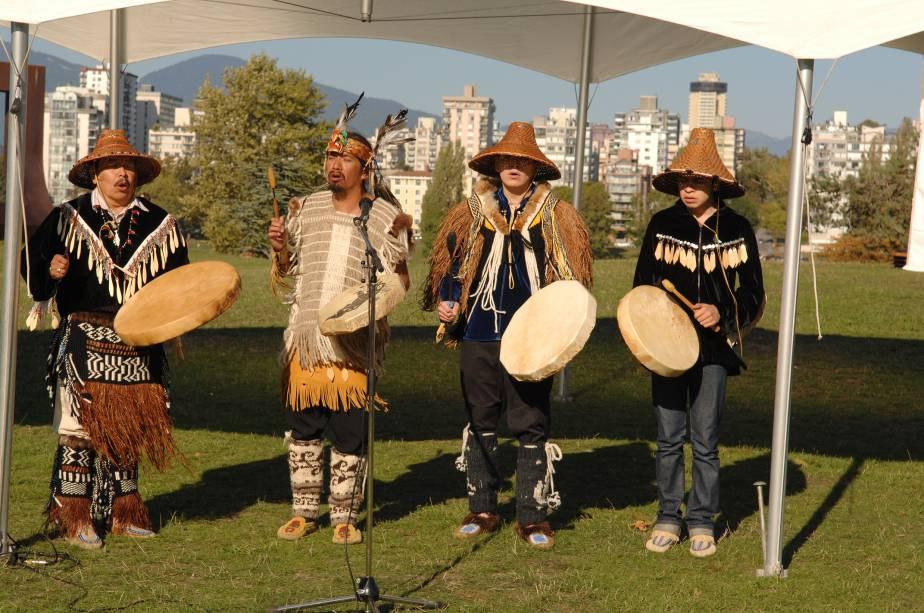
27 2006

")
28 2007 (the only time it rained!)
29
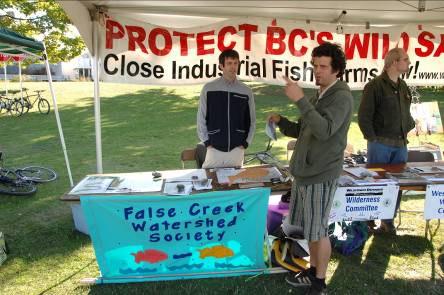
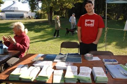
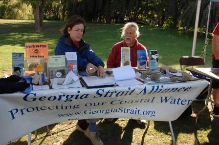
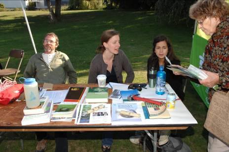
30 2008
31 2009

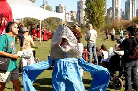
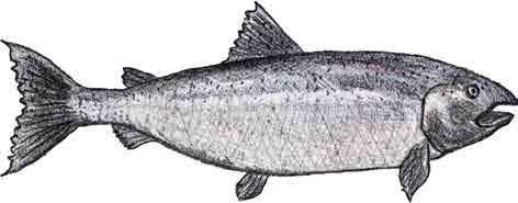
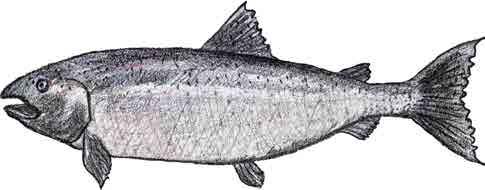
32 Every year we had: Celebration


33 Arts and crafts and parades

34 First Nations participation
35
36
37
38 Environmental group tables
39 Through creating and producing the Salmon Celebration we: 1) Learned the history 2) Learned the issues 3) Connected with other watershed and sustainability groups 4) Engaged with and engaged the public and learned a great deal more about:
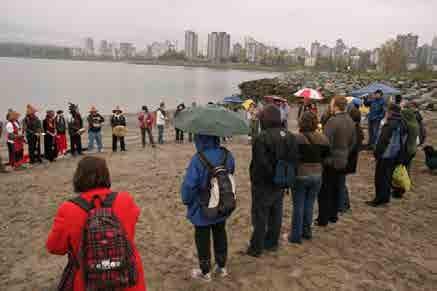
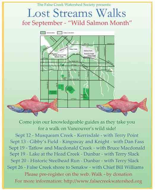
40 Salmon

41 First Nations

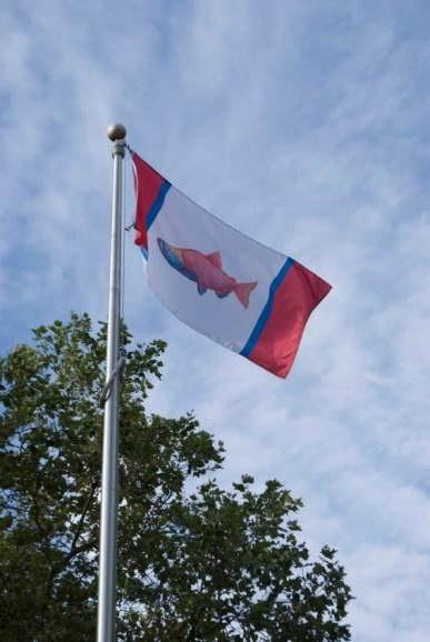
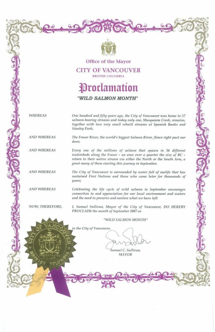
42 and local water and ecosystem issues
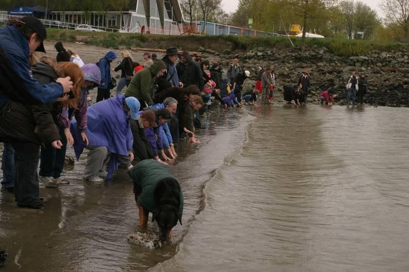
43 Interspiritual Gathering From we created and produced an event for Earth Day - The Interspiritual Gathering a blessing for the salmon fry as they go to the sea It was an event where spiritual leaders and First Nations spoke about the meaning of fish in their faith. Then we all gathered at the water s edge to give our blessings to the millions of salmon fry that were making their way to the ocean at that time of year.
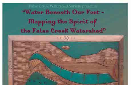
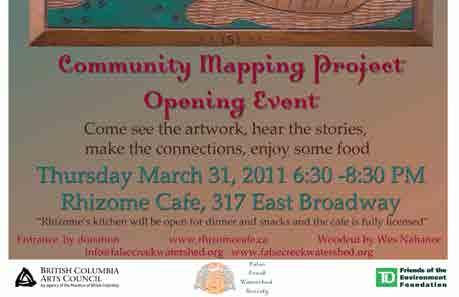
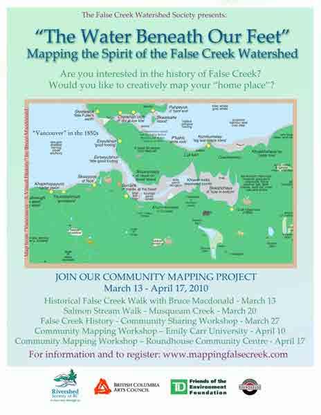
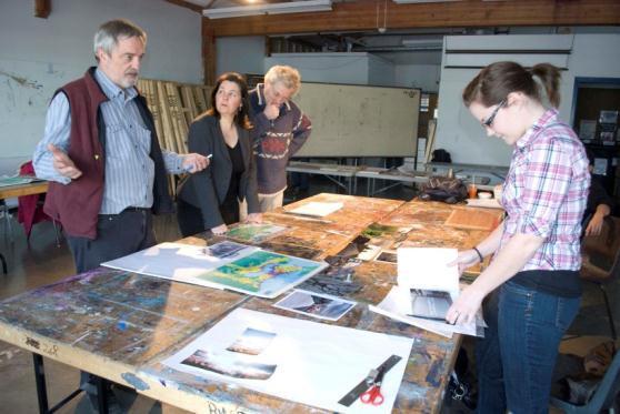
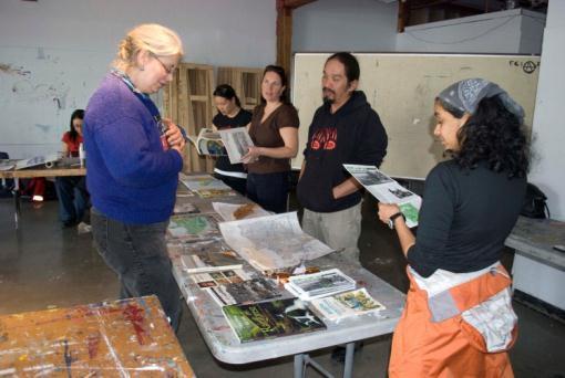
44
45 2008
46
47
48 Lost Streams Walks From we produced 3 years of Lost Streams Walks Local historians took people on walks through the city streets, in parks and along the water s edge to talk about the streams and creeks which used to flow in Vancouver. Walks included: Musqueam Creek, Lake of the Head Creek, Collingwood Creek, Tatlow and Macdonald Creek, Brewery Creek, Gibson s Creek, Middens by the Fraser River, the ancient village of Senakw and many more
49

50 September as Wild Salmon Month in Vancouver Since 2005 we have encouraged the City of Vancouver to declare September Wild Salmon Month For last 2 years City Hall has been flying the salmon flag in honour of Salmon Month. The first year they flew the flag we had a ceremony to honour salmon month and the flag.
51
52 Community Mapping Project In 2010 & 2011 we created and produced a Community Mapping Project for the False Creek Watershed People came together to learn about the history, to tell stories and contribute their visual story of what this area meant to them. The results are on view
53

54 Mapping Workshops Storytelling Workshop

55 Our present event 2012

56 Some other activities FCWS has been involved in: We are involved in educational projects We produce a newsletter We attend BC Rivershed Society Forums annually We have community tables at many local events We speak at other workshops/ gatherings We have speakers annually our AGM We attend city consultations Rivershed Society of BC Forum Chehalis 2007

57 In 2005 we created a historical brochure about the False Creek Watershed. Over 1500 have been handed out so far.

58 for example We support the work of other Non-profits in our watershed

59 St. George s Creek Blueway daylighting a city street

60 Gibby s Field bringing an empty lot and an old stream bed from Gibson s Creek back to life as a greenspace and a park.

61 Lost Creek Fen supporting the creation of a small wetland at the mouth of where Brewery Creek would have entered False Creek
62 What are some of the physical issues in the False Creek watershed and beyond that we can influence? Street runoff / Sewers Pocket Marshes Shoreline habitat Beach health Forage fish habitat: eg. surf smelts and herring More biodiversity and native plantings

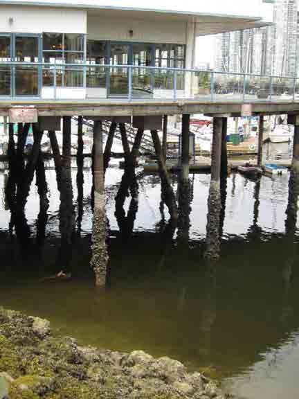
63 Street runoff At present most of our city streets look like this.


64 Water including any pollutants, runs off the street into nearby sewers which then enter ocean and fish habitat. There is no filtration of pollutants.

65 Bioswales Water can be brought through plants and stones for filtration by a very simple method. Bioswales are landscape elements designed to remove silt and pollution from surface runoff water This bioswale was constructed on Cambie Street when the city beautified the sidewalks after the construction of the Canada Line. We would like to encourage the inclusion of bioswales for every new sidewalk


66 Sewers / Yellow fish Yellow fish kits are available for groups to paint the fish stencil on the sidewalk to let people know that all drains lead to fish We would like to encourage groups to paint a yellow fish on every sewer in Vancouver or. All drains lead to fish All drains also lead to frogs

67 have the city stamp this on the drains. All drains lead to fish habitat a sewer cover found on Cambie and 17th

68 Sidewalk fish stamp Vancouver now has its own fish stamp. Whenever you see a new sidewalk being constructed, make sure to ask for the fish stamp, especially where there once was a stream.

69 Pocket Marshes Douglas Park was once a beaver meadow with an old stream running through it. Today it is a grassy park which gets very waterlogged in the winter rains. The soil underneath is clay which causes the water to pool above. The solution for the engineering department has been to put in drains and sewer pipes. We would like to see some pocket marshes growing on the edge of the park to help absorb the water instead of engineered drains.


70 Sewers in the field at Douglas Park

Big Boat")

71 Shoreline Habitat Presently False Creek is lined with: 1)Big Boat Marinas 2)Small boat marinas 3)Houseboats

72 4) Boulders 5) Piers

73 and lots of Rip-rap - rock or other material used to armour shorelines against erosion


74 Riprap is not conducive to sealife. But plants and animals do gradually return to the shoreline. We would like to encourage less use of Riprap and the establishment of more natural areas.


75 Beach health Sand for Vancouver s beaches was brought here from afar. Rumour says it came from Hawaii! Not much sealife lives in this sand


76 Low tide at Jericho Beach shows more sealife


77 Forage fish/surf smelts/herring Forage fish are small fish that are food for larger fish species. Surf smelts, Sand lance and herring used to spawn on Vancouver s beaches not long ago. There are only 2 surf smelt spawning beaches left in Vancouver. They are at Brockton Point


78 Wreck Beach is mostly a natural beach.and Wreck Beach


79 Wreck Beach is fed by a real creek and shaded by forest vegetation. Surf smelts need shade and gravel beaches to spawn.

80 This is the habitat where surf smelts spawn - gravelly beaches with lots of shade.


81 Herring There was news a few years ago of herring spawning on Habitat Island in SE False Creek Dr. Jonn Matsen will speak about possibilities for herring to return to False Creek in his talk


82 Native planting Many front yards and boulevards are covered with grass..


83 These areas could have more plant biodiversity especially since the European chafer beetle lives in lawns and crows dig up the grass to eat them.


84 Gardens and boulevards like this are healthier for water systems, birds and bees. They provide oxygen and beauty!

, Rosa Nootkatensis (Wild")
")
85 Native plants are easy to care for, drought and pest resistant Spirea douglasii (hardhack), Mahonia (Oregon grape), Rosa Nootkatensis (Wild Nootka Rosa) Ribes Circinnatum (flowering red currant) Symphoricarpos alba (snowberry)
,")
 There are")

86 Aruncus (goatsbeard), Thimbleberry, Salix (willow) There are more species listed on our website:
87
RESTORING 400 ACRES OF TIDAL MARSH IN THE SNOHOMISH RIVER DELTA
 RESTORING 400 ACRES OF TIDAL MARSH IN THE SNOHOMISH RIVER DELTA Marya Moses, Danny Moses, Neil Moses, and Robert Moses fish on Tulalip Bay, near the mouth of the Snohomish River Estuary. QWULOOLT IS A
Puget Sound Shorelines. Waves and coastal processes. Puget Sound shorelines: Effects of beach armoring
 Puget Sound Shorelines Puget Sound shorelines: Effects of beach armoring Waves and coastal processes Factors affecting wave energy hitting the coast Processes transporting sediment along coastlines What
Warm-up # 7 A day 5/17 - B day 5/18 UPDATE YOUR TABLE OF CONTENTS
 Warm-up # 7 A day 5/17 - B day 5/18 UPDATE YOUR TABLE OF CONTENTS Question: List all examples of surface water on Earth. Answer: Rivers and streams, lakes and reservoirs, (ponds) wetlands, estuaries and
Ecology of Place: What salmon need Eric Beamer Skagit River System Cooperative. November 2010
 Ecology of Place: What salmon need Eric Beamer Skagit River System Cooperative November 2010 Acknowledgements NOAA Fisheries NW Fisheries Science Center Tim Beechie George Pess Correigh Greene Talk overview
Parts and Pieces The Story of Chicago and Lake Michigan
 Parts and Pieces The Story of Chicago and Lake Michigan You may draw pictures to show what each part of this history might have looked like. Draw your pictures next to the words. You also may cut these
WHAT ARE ECOSYSTEMS? Dr. V. N. Nayak Professor of Marine Biology (Retd)
") WHAT ARE ECOSYSTEMS? Dr. V. N. Nayak Professor of Marine Biology (Retd) An ECOSYSTEM is an interacting system of plant, animals, and humans and the surrounding environment. An ecosystem contains living
WHAT ARE ECOSYSTEMS? Dr. V. N. Nayak Professor of Marine Biology (Retd) An ECOSYSTEM is an interacting system of plant, animals, and humans and the surrounding environment. An ecosystem contains living
ADOPT-A-STREAM WATERSHED APPROACH COMMUNITY-BASED STEWARDSHIP. Nova Scotia Salmon Association March 2005
 ADOPT-A-STREAM A WATERSHED APPROACH TO COMMUNITY-BASED STEWARDSHIP Nova Scotia Salmon Association March 2005 This manual is a revised and updated version of the 1994 Adopt-a-Stream manual that was prepared
COA-F17-F-1343 YEAR END REPORT
 DAVE MARSHALL SALMON RESERVE RESTORATION, MAINTENANCE, AND UPGRADES YEAR END REPORT Prepared for: Fish and Wildlife Compensation Program Prepared by: Edith Tobe, RPBio, Executive Director Box 1791, Squamish,
CHAPTER 4 DESIRED OUTCOMES: VISION, GOALS, AND OBJECTIVES
 CHAPTER 4 DESIRED OUTCOMES: VISION, GOALS, AND OBJECTIVES Vision One of the first steps in developing this Plan was articulating a vision - a clear statement of what the Plan strives to achieve and what
Alaska - Day 3: Ketchikan (Day 2 was at sea)
") Alaska - Day 3: Ketchikan (Day 2 was at sea) Arrival in Port of Ketchikan. Two views. Disembarking for a day of exploring Ketchikan and taking excursions. View of Star Princess cruise ship from shore.
Alaska - Day 3: Ketchikan (Day 2 was at sea) Arrival in Port of Ketchikan. Two views. Disembarking for a day of exploring Ketchikan and taking excursions. View of Star Princess cruise ship from shore.
Friends of the Detroit River Habitat Restoration Project Update
 Friends of the Detroit River Habitat Restoration Project Update 11 Beneficial Use Impairments (BUIs) were originally identified to be associated with the Detroit River: 1. Restrictions on fish and wildlife
The Salmon Circle of Life
 The Salmon Circle of Life for millions of years the wild salmon has helped nourish the plant and animal life of the temperate rain forest. Born in the streams and rivers of the forest, the salmon travels
Lagoon Spawning Bed Rehabilitation
 Lagoon Spawning Bed Rehabilitation September 2011 Bowen Island B.C. Rebuilding the Spawning bed in the freshwater Lagoon at the Public Causeway, Crippen Regional Park Page 2 of 13 Bowen Island Lagoon Spawning
Firth Creek Habitat Enhancement Project 1993
 Firth Creek Habitat Enhancement Project 1993 A. R. Langston December 1993 PWFWCP Report No. 77 The Peace/Williston Fish & Wildlife Compensation Program is a cooperative venture of BC Hydro and the provincial
Fish Community. Fish Habitat, Streams and Rivers
 Clear, Ston(e)y and White Lake Plan Fish Community The lakes support a cool/warm water fishery including muskellunge, walleye, largemouth and smallmouth bass, yellow perch, pumpkinseed, rockbass, blue
Booklet translated by SREJ at CSDC 1
 Name: Gr. : Booklet translated by SREJ at CSDC 1 This is the beginning of a new project about Aquaculture. Before we start, I would like to see what you already know about the subject. Write all the words
Habitat Development: Habitat Boulders Lawson Pier Foreshore Enhancement
 Habitat Development: Habitat Boulders Improve the existing habitat by stabilising beach sediments. Increase biodiversity by creating new habitats and colonisation opportunities. Loose cobble is unstable;
Nechako white sturgeon are an Endangered Species
 Nechako white sturgeon are an Endangered Species There are likely less than 350 Nechako white sturgeon, and historically there were over 5000 in the Nechako Watershed. Endangered as per the Species at
Salmon Biology Station
 Salmon Biology Station OBJECTIVES: Students learn: Wild salmon are indicator species and keystone species whose survival is connected to the health of the watershed. o Riparian salmon need trees and trees
At Home on the Elbow River. -Ours to share-
 At Home on the Elbow River -Ours to share- Living in the shed You are part of the Elbow River Watershed. The Elbow River and its tributaries drain over 1,200 km² of land. The source of the Elbow River
Brook Trout Life Cycle and Habitat
 Brook Trout Life Cycle and Habitat Directions: 1. As you watch this slide show, watch for vocabulary terms we learned today. The first time they appear, you will see them in RED! (not redd!) 2. At the
What was the historic coaster fishery like?
 1 of 6 1/30/2012 12:25 PM Home About Topics Contact Us Fishing Calendar Fish ID Tips FAQs Hack Noyes Research Vessel Is it a unique strain long lost from Wisconsin's shoreline? Fisheries Reports Tributaries
Understanding Today s Environmental Issues and the Oregon Stewardship Guidelines. David Phipps GCSAA NW Field Staff
 Understanding Today s Environmental Issues and the Oregon Stewardship Guidelines David Phipps GCSAA NW Field Staff My Roots Northwest Landscape Industries 1986-1990 The Oregon Golf Club 1990-2000 Stone
Where Animals and Plants Are Found
 About Animals and Plants What I Need to Know Many different animals and plants live on Earth. The animals and plants live in different places and make up parts of different ecosystems. In an ecosystem,
SALMON WORD SEARCH Find the hidden words (up/down, across, diagonal).
.") ALEVIN CHINOOK CHUM COHO COMMERCIAL CULTURE ECOSYSTEM ENDANGERED ENVIRONMENT EROSION ESTUARY FERTILIZE FINGERLING FRESHWATER FRY GENERATION Commercial Migrate Endangered Predator Ecosystem Pollutant Species
ALEVIN CHINOOK CHUM COHO COMMERCIAL CULTURE ECOSYSTEM ENDANGERED ENVIRONMENT EROSION ESTUARY FERTILIZE FINGERLING FRESHWATER FRY GENERATION Commercial Migrate Endangered Predator Ecosystem Pollutant Species
Minnesota TREK MINNESOTA TRAIL SELF-GUIDED TOUR 6TH - 8TH GRADE. Minnesota Trek 6 8th grades 1
 Minnesota TREK MINNESOTA TRAIL SELF-GUIDED TOUR 6TH - 8TH GRADE Minnesota Trek 6 8th grades 1 Welcome to the MINNESOTA ZOO Minnesota Trek Self-Guided Tour USE THE MINNESOTA TREK TO HELP YOU LEARN HOW...
Steelhead Society of BC. Thompson River Watershed Restoration and Enhancement Project #4 Nicola River Bank Stabilization and Enhancement Project
 Steelhead Society of BC Presents: Thompson River Watershed Restoration and Enhancement Project #4 Nicola River Bank Stabilization and Enhancement Project Application for Funding December 2013 1.0 BACKGROUND
Lakelse Sockeye Recovery Program
 Lakelse Sockeye Recovery Program The Ninth Annual BC Interior Stewardship Workshop May 7 th and 8 th, 2013 DFO North Coast Resource Restoration Unit Presentation Overview History/background Stock and habitat
River-Lab Grade 3 (RL3) Route Green & Yellow Deep River Pool Trail Guide
 Route Green & Yellow Deep River Pool Trail Guide") River-Lab Grade 3 (RL3) Route Green & Yellow Deep River Pool Trail Guide Route Green & Yellow Deep River Pool Trail Route Sequence Deep Pool Habitat Observation Marsh Habitat Observation Riffles Habitat
River-Lab Grade 3 (RL3) Route Green & Yellow Deep River Pool Trail Guide Route Green & Yellow Deep River Pool Trail Route Sequence Deep Pool Habitat Observation Marsh Habitat Observation Riffles Habitat
SPLASH Guardian Patch Program
 SPLASH Guardian Patch Program Stewardship, Preservation, Local, Arts, Sustainability, Heritage. The Mermaid Society SMTX is a grassroots community organization that brings together like-spirited community
Summer Visitors Play in Martha's Vineyard and Nantucket
 Summer Visitors Play in Martha's Vineyard and Nantucket Welcome to This Is America with VOA Learning English. This week on our program, we tell you about two islands in Massachusetts, in the New England
INDEPENDENCE SEAPORT MUSEUM ACTIVITY PACKET
 INDEPENDENCE SEAPORT MUSEUM ACTIVITY PACKET Grades 6-8 Dear Teacher: We are so excited that you scheduled a visit to the Independence Seaport Museum with your class! To complement your students visit to
Managing Woodlands for Wisconsin s Coastal Trout Streams
 Protecting Water Quality and Stream Habitat 1 in Wisconsin streams in Lake Superior (left) and Lake Michigan (right) watersheds. Watershed boundaries ONE-THIRD OF WISCONSIN S TROUT STREAMS FLOW INTO LAKE
Project Completion Abstract Fish Passage Activity ( Engineering Activities)
") Project Completion Abstract Fish Passage Activity ( Engineering Activities) SUBMIT COMPLETED FORM TO DISTRICT MANAGER AND FIA ADMINISTRATOR AFTER PROJECT COMPLETION SECTION A GENERAL INFORMATION Recipient:
Project Completion Abstract Fish Passage Activity ( Engineering Activities) SUBMIT COMPLETED FORM TO DISTRICT MANAGER AND FIA ADMINISTRATOR AFTER PROJECT COMPLETION SECTION A GENERAL INFORMATION Recipient:
Managing for Diversity
 Managing for Diversity Pacific Salmon Treaty Workshop: Stanford University, 15 November 2007 John D. Reynolds Tom Buell BC Leadership Chair in Salmon Conservation Department of Biology Simon Fraser University,
Minnesota Department of Natural Resources Division of Fish and Wildlife Section of Fisheries. Stream Survey Report. Cold Spring Creek.
 Minnesota F-29-R(P)-24 Area 315 Study 3 March 2013 Minnesota Department of Natural Resources Division of Fish and Wildlife Section of Fisheries Stream Survey Report Cold Spring Creek 2012 Mark Pelham Montrose
Beaches of the Delaware Estuary
 Beaches of the Delaware Estuary Woodland Beach Bombay Hook Fortescue Bivalve Thompsons Beach Moores Beach Reeds Beach Port Mahon Pickering Kitts Hummock Bowers Beach Big Stone Beach Town Bank Slaughter
the little boy 1 a good boy 1 then you give 1 is about me 1 was to come 1 old and new 1 that old man 1 what we know 1 not up here 1 in and out 1
 the little boy 1 a good boy 1 is about me 1 then you give 1 was to come 1 old and new 1 what we know 1 that old man 1 in and out 1 not up here 1 good for you 1 down at work 1 with his cat 1 it was new
Great Bay National Estuarine Research Reserve Field Notes Summer 2010 Welcome
 Great Bay National Estuarine Research Reserve Field Notes Summer 2010 Welcome Welcome to the spring edition of Field Notes, a newsletter just for our Great Bay Community Land Stewards. Spring certainly
Water of the Rogue Valley
 Water of the Rogue Valley An Activity Book for Grades 3-5 Welcome! You are about to embark on a journey of exploration. Your adventure begins at school and continues at North Mountain Park. This workbook
O U T D O O R E D U C A T I O N :
 O U T D O O R E D U C A T I O N : Jonginenge offers safe, exciting and educational experiences for schools. Learners work in small groups and participate in practical tasks, environmental education and
Marine Environments. Copyright 2011 LessonSnips
 Marine Environments I must go down to the seas again, for the call of the running tide Is a wild call and a clear call that may not be denied Excerpt from a poem by John Masefield Continents and islands
THE RESOURCES AGENCY OF CALIFORNIA Department of Fish and Game STREAM SURVEY
 File form No.. Date: 4/1/73. NAME: Maacama Creek COUNTY: Sonoma. STREAM SECTION: FROM: Maacama Creek Ranch TO: Chalk Hill Rd. Bridge LENGTH: 1.5 mi.. Bridge OTHER NAMES: Weather - Clear & Sunny RIVER SYSTEM:
FORESTS AND FINS INTRODUCTORY LESSON
 FORESTS AND FINS INTRODUCTORY LESSON OVERVIEW: Students will discuss benefits of the forests for humans and salmon, then have the opportunity to work in pairs to read about two stages of the life cycle
THE GREAT SALMON RECOVERY HOAX. Having faithfully attended the Salmon Recovery Forum meetings for over a
 THE GREAT SALMON RECOVERY HOAX Having faithfully attended the Salmon Recovery Forum meetings for over a decade, and despite all the effort, as near as I can tell, we have recovered nothing. Lots of money
The Salmonid Species. The Salmonid Species. Definitions of Salmonid Clans. The Salmonid Species
 The Salmonid Species The Salmonid Species N. American salmon (2 more Asian species) Chinook ( King ) Coho ( Silver ) Sockeye Chum ( Dog ) Pink ( Humpy ) Sea-run trout Steelhead, Cutthroat, Dolly Varden
STREAM SURVEY File form No..
 scanned for KRIS THE RESOURCES AGENCY OF CALIFORNIA California Department of Fish and Game STREAM SURVEY File form No.. Date: September 4, 1969. NAME: North Fork Schooner Gulch Creek COUNTY: Mendocino.
2016 Conservation Stamp, Esther Semple. Dr. Brian Riddell, Pacific Salmon Foundation, Vancouver, B.C. Contacts:
 2016 Conservation Stamp, Esther Semple Dr. Brian Riddell, Pacific Salmon Foundation, Vancouver, B.C. Contacts: briddell@psf.ca 604-664-7664 www.marinesurvivalproject.com 2 Our Work www.psf.ca Grant Making:
Marine Ecosystems. Aquatic Ecosystems Section 2
 Marine Ecosystems Marine ecosystems are located mainly in coastal areas and in the open ocean. Organisms that live in coastal areas adapt to changes in water level and salinity. Organisms that live in
Students Saving Salmon
 Emily McLaughlin Sta. Maria Students Saving Salmon Salmon aren t generally considered cute. Being fish, they lack a soft fur coating and obviously can t walk on land. Too often animal protection and preservation
Community Open House December 13, A project of the Green Infrastructure Center, supported by Skeo Solutions
 Community Open House December 13, 2011 A project of the Green Infrastructure Center, supported by Skeo Solutions Project Background The Green Infrastructure Center, Inc. (GIC) was formed in 2006 to help
Cat Island Chain Restoration
 Cat Island Chain Restoration 1820s Fox River Military Road Map to Fort Howard 1845 Chart of Green Bay & Fox River Cat Island Chain - 1938 Cat Island Brown County Aerial Photography, 1938 Historic Western
X.B WETLANDS ROGUE RIVER ESTUARY
 X.B WETLANDS ROGUE RIVER ESTUARY The Rogue River has a drainage area of 5,100 square miles, yet the estuary of the Rogue River is one of the smallest in Oregon, measuring approximately 1,880 acres during
Coastal management has lagged behind the growth in population leading to problems with pollution
 Fifty percent of the population of the industrialized world lives within 100 km of a coast. Coastal management has lagged behind the growth in population leading to problems with pollution and natural
STREAM CLASSIFICATION AND MAPPING. Prepared For. MacMillan Bloedel Ltd. Menzies Bay Division BOX 6000, Campbell River V9W 5E1.
 STREAM CLASSIFICATION AND MAPPING OF STREAMS IN MENZIES AND OYSTER BAY Prepared For MacMillan Bloedel Ltd. Menzies Bay Division BOX 6000, Campbell River V9W 5E1 September 1998 a a North Island Biological
ROUTE 2. Bateau Channel. Topographic Map 31 C/8 Navigation Charts 1438/39 Reference Maps
 Topographic Map 31 C/8 Navigation Charts 1438/39 Reference Maps ROUTE 2 Bateau Channel The shoreline marshes of the Bateaux Channel team with life. Wetlands provide breeding habitat for amphibians, fish
Wetland Recovery and Salmon Population Resilience: A Case Study in Estuary Ecosystem Restoration
 Wetland Recovery and Salmon Population Resilience: A Case Study in Estuary Ecosystem Restoration Daniel L. Bottom NOAA NW Fisheries Science Center, Newport, OR Kim K. Jones, Trevan J. Cornwell, Staci Stein
SCIENCE AND TECHNOLOGY: CANADA COAST TO COAST
 ACTIVITY DESCRIPTION: This activity shows the abundance of water in and around Canada. By identifying and labeling a number of water bodies and courses, students realize the magnitude of Canada s water
Big Spring Creek Habitat Enhancement and Fishery Management Plans
 Big Spring Creek Habitat Enhancement and Fishery Management Plans November 5, 2012 Big Spring Events and Activities Center Newville, PA Charlie McGarrell Regional Habitat Biologist Pennsylvania Fish and
UNIT 4E. SALMON SUPPLEMENTAL INFORMATION
 UNIT 4E. SALMON SUPPLEMENTAL INFORMATION In the STUDENT HANDOUTS/TEACHER PAGES Section of this unit, we have provided you with a host of information from various sources to supplement not only this unit,
Swift Current Creek Watershed
 Swift Current Creek Watershed Watershed Boundary Gross drainage area 3939 km 2 973,343 acres Gross creek length 230 km 143 miles Primary water source for 20 000 people Major source of water base recreation
OCEANS. Main Ideas. Lesson 2: Ocean Currents Ocean Currents help distribute heat around Earth.
 Oceans Chapter 10 OCEANS Main Ideas Lesson 2: Ocean Currents Ocean Currents help distribute heat around Earth. Lesson 3: The Ocean Shore The shore is shaped by the movement of water and sand. OCEANS SO
Examples of estuaries include bays, sounds, salt marshes, mangrove forests, mud flats, swamps, inlets, and sloughs.
 An estuary is a partially enclosed body of water where incoming seawater is mixed with fresh water coming from the land. Examples of estuaries include bays, sounds, salt marshes, mangrove forests, mud
Invasion of the Lionfish
 READTHEORY Name Date Invasion of the Lionfish The lionfish is one of the most dangerous fish in the Atlantic Ocean. Its body is covered with poisonous spines that can cause a very painful sting if you
CREEK WEEK ART/SCIENCE MENTORING PROJECTS TEACHER PACKET Contents
 CREEK WEEK ART/SCIENCE MENTORING PROJECTS TEACHER PACKET Contents Overview Art Selection Criteria and Process Student & Teacher/ Contact Information for Art Submission Everyone is Welcome to be a Part
Tittabawassee River Assessment. Miles. Gladwin Smallwood Impoundment. Harrison. Clare. Midland. Mt. Pleasant. St. Louis. Saginaw.
 Warmouth Lepomis gulosus feeding - clear lakes and impoundments and very low-gradient streams - abundant aquatic vegetation - silt-free water - mucky substrate often covered with organic debris spawning
Oregon Hatchery Research Quest
 Oregon Hatchery Research Quest 132 The Oregon Coast Book, 2015 16 Edition Use this map to help you solve the following Quest! Quest Partners Lincoln County School District!! www.lincoln.k12.or.us District
TESTIMONY OF THE COLUMBIA RIVER TREATY TRIBES BEFORE PACIFIC FISHERIES MANAGEMENT COUNCIL
 Agenda Item E.2.f Supplemental Tribal Report April 2012 TESTIMONY OF THE COLUMBIA RIVER TREATY TRIBES BEFORE PACIFIC FISHERIES MANAGEMENT COUNCIL April 2, 2012 Seattle, WA Good day Mr. Chairman and members
WELCOME! TOWN CENTRE PARK INFORMATION SESSION WHAT IS HAPPENING? GOALS FOR TODAY. TOWN STAY CONNECTED WITH US! #1 INFORM WE ARE HERE
 1 WELCOME! Thank you for coming to the Information Session! Please provide us with your comments and ideas. We will use your input to inform the visioning process and creation of the framework for the
Eastern Shore Islands Area of Interest Community Newsletter
 Eastern Shore Islands Area of Interest Community Newsletter Fall 2018 1ỊNTRODUCTION In addition to information on our Fisheries and Oceans Canada (DFO) website, we have now created a seasonal, community
First Nations Fish Habitat Program Discussion Workbook
 First Nations Fish Habitat Program Discussion Workbook The First Nations Fish Habitat Program is a joint initiative of the Centre for Indigenous Environmental Resources (CIER) and The Southern Chiefs Organization
Video zone How wolves change rivers
 Video zone How wolves change rivers Tasks Instructions Do the preparation task first. Then watch the video and do the exercise. You can also read the transcript. Preparation task Match the definitions
Nothing So Constant as Change
 Nothing So Constant as Change By Ron Schaper Dynamic Environments 1) Lake Levels 2) Beach Size 3) Cliff Erosion 4) Beach and Cliff Plant Communities 1) Lake Levels (Michigan/Huron) More than 20,000 years
Adapting to Climate Change In Coastal Environments
 Adapting to Climate Change In Coastal Environments Peter Nimmrichter, P.Eng. AMEC Earth and Environmental, Mississauga, Ontario 19/11/2007 1 The Great Lakes Watershed The Great Lakes cover an area of 244,160
COMMUNITY SERVICES COMMITTEE OPEN MEETING
 COMMUNITY SERVICES COMMITTEE OPEN MEETING Date : Location : Thursday, August 11, 2016, 12:00 p.m. Second Floor Committee Room, City Hall, Fredericton Pages 1. Committee Membership Councillor Steven Hicks,
Indian River Lagoon: Lessons, Challenges and Opportunities
 Indian River Lagoon: Lessons, Challenges and Opportunities Upper Chain of Lakes Lake Kissimmee Kissimmee River Indian River Lagoon Caloosahatchee Estuary Lake Okeechobee St. Lucie Estuary Mark Perry, Executive
Animals. Animals and Habitat Project
 Animals Animals and Habitat Project Explore, Investigate and Enjoy! This project is to help you learn about animals, how they are similar, how they are different and the many different habitats that they
Three point plan to addressing land use and habitat loss impacts on Chesapeake Bay tidal fish and shellfish
 Three point plan to addressing land use and habitat loss impacts on Chesapeake Bay tidal fish and shellfish 1. Establish Principles for Protection of Chesapeake Bay Fish and Shellfish The Fisheries GIT
LIFE HISTORY DIVERSITY AND RESILIENCE
 LIFE HISTORY DIVERSITY AND RESILIENCE SPRING CHINOOK IN THE WILLAMETTE RIVER BASIN Kirk Schroeder Brian Cannon Luke Whitman Paul Olmsted Oregon Department of Fish and Wildlife Corvallis Research Lab Thanks
Reduction in Biological Diversity Section 4.1 p Section 4.3 p
 Reduction in Biological Diversity Section 4.1 p. 57-65 Section 4.3 p. 72-78 Review Ecological Diversity A variety of ecosystems (mountains, forests, deserts) and how they interact together. Community Diversity
Map 8: Ayrshire Coast: Ardrossan North Bay to Stevenston Pier Map Content Descriptions
 Map 8: Ayrshire Coast: Ardrossan North Bay to Stevenston Pier Map Content Descriptions 1. Built Heritage and Archaeology A total of twenty four sites were recorded in the area covered by Map 8. Of these
feeding - clear moderate-sized shallow streams with moderate vegetation spawning - nests in gravel, sand, or hard rock substrate
 orthern longear sunfish (Lepomis peltastes) feeding - clear moderate-sized shallow streams with moderate vegetation - rocky substrates - little to no current spawning - nests in gravel, sand, or hard rock
Of the Salmon and For the Salmon
 Of the Salmon and For the Salmon for millions of years the wild salmon has helped nourish the plant and animal life of the temperate rain forest. Born in the streams and rivers of the forest, the salmon
Regulations. Grabbling season May 1 July 15; only wooden structures allowed.
 Sardis Reservoir 218 REEL FACTS Keith Meals, Arthur Dunn, Stanley Turner Fisheries Biologists keithm@mdwfp.state.ms.us, ArthurD@mdwfp.state.ms.us, StanleyT@mdwfp.state.ms.us General Information: Sardis
OKANAGAN RIVER RESTORATION INITIATIVE - FAQ
 OKANAGAN RIVER RESTORATION INITIATIVE - FAQ Initiative background: The health of the q awsitk w (Okanagan River) has been severely impacted by the channelization works that occurred in the mid-1950 s.
Friends of the Island Fox
 Friends of the Island Fox a Program of the Channel Islands Park Foundation, a 501 (c) (3) public benefit org. 1901 Spinnaker Drive, Ventura CA 93001 (805) 288-4123 or admin@islandfox.org Visit us at www.islandfox.org
Islands Trust, Fort Street, Victoria, BC V8R 1H8 Phone:
 1 www.islandstrust.bc.ca Islands Trust, 200-1627 Fort Street, Victoria, BC V8R 1H8 Phone: 250-405-5151 Sharing Our Shorelines xxxxxxxxxxxx.ca We play an important role in the protection and preservation
Barnegat Bay-Friendly Golf Course Certification Program
 Barnegat Bay-Friendly Golf Course Certification Program Businesses for a Better Barnegat Bay Thank you for your interest in becoming a Certified, Barnegat Bay-Friendly Golf Course. This American Littoral
T E R P R E T I V E W A L K I N CONNECTION TO LAND
 R O Y T. B I S H O P I N T E R P R E T I V E W A L K CONNECTION TO LAND Members of the Confederated Tribes of the Grand Ronde still live in the area, and are directly descended from the Clackamas people
Upstreampaddle 25.South arm of the Brunswick River, Simpson s Creek drains the freshwater swamp lands of Tyagarah Nature Reserve, 750 hectares. Furthe
 Upstreampaddle 24 The Brunswick River is a shorter length river on the coastal plain of Northern New South Wales. The areas of interest to canoeists are: the reach from the town of Mullumbimby down to
Ups and Downs in an Estuary
 Ups and Downs in an Estuary Whooping Crane Dilemma Modified from Texas Aquatic Science and Estuaries in the Balance Curriculum TEKS 6.2 E; 6.3 C; 6.12 E; 7.2 E; 7.3 C; 7.5 A; 7.8 A; 7.13 A; 8.2 E; 8.3
Okanagan Sockeye Reintroduction
 Okanagan Sockeye Reintroduction Backgrounder Elders accounts, and other forms of Traditional Ecological Knowledge (TEK) tell us that many species of salmon once came into the Okanagan Valley and tell us
Nowhere Else on Earth
 Chapter 7: Salmon: A story of mystery, barbecues, food coloring and hope A. Salmon Scavenger Hunt Focus: survival needs; interactions between organisms and the environment; sustaining healthy ecosystems;
History of the Tallebudgera Beach Outdoor Education School
 DIARY ANSWERS History of the Tallebudgera Beach Outdoor Education School P4 Access the Beach School website to complete this page: www.thebeachschool.eq.edu.au About Our School > History of our School
1. Eating wild salmon is healthy for you and healthy for our environment. But this fishery will only continue to exist with help from you.
 Save Our Wild Salmon: It s Up to You Notes to Accompany PowerPoint Presentation by Barbara Hawkins, Education Director Central Coast Women for Fisheries, Inc. 1. Eating wild salmon is healthy for you and
Pacific Region Contaminants Atlas
 Western Washington University Western CEDAR Salish Sea Ecosystem Conference 2016 Salish Sea Ecosystem Conference (Vancouver, BC) Pacific Region Contaminants Atlas Rob Knight Community Mapping Network,
UNIT 7: FISH INTRODUCTION. UNIT OVERVIEW Engage
 UNIT 7: FISH INTRODUCTION There are many animals some large and impressive, some small and well hidden that serve as important indicators for the health of their environment. In this unit, we have chosen
Canada s Natural Systems. Canadian Geography 1202
 Canada s Natural Systems Canadian Geography 1202 Canada s Natural Systems Natural System: A system found in nature Here are the four natural systems that we will explore in the next few weeks 1. Canada
WEST VANCOUVER STREAMKEEPER SOCIETY PRESIDENT S REPORT ON BEHALF OF THE DIRECTORS MAY 10, 2012
 WEST VANCOUVER STREAMKEEPER SOCIETY PRESIDENT S REPORT ON BEHALF OF THE DIRECTORS MAY 10, 2012 Meetings Previous AGM on May 12, 2011 Members Meetings held on September 29 and January 19 Social evening
11426 Moorage Way P.O. Box 368 LaConner, WA Phone: Fax:
 Skagit River System Cooperative 11426 Moorage Way P.O. Box 368 LaConner, WA 98257-368 Phone: 36-466-7228 Fax: 36-466-447 www.skagitcoop.org BULL TROUT USE OF SWINOMISH RESERVATION WATERS Eric Beamer, Rich