September Williams Ashland OR
|
|
|
- Silvia George
- 5 years ago
- Views:
Transcription

1 September Williams Ashland OR
2 Contents: Welcome Course Description Course Mileage Aid Station Summary Crew Information Drop bags Pacers Medical Directions to the Start Race Weekend Schedule

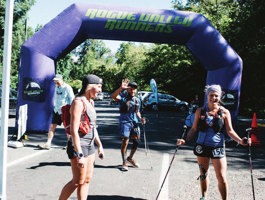
3 Welcome! Thank you for committing to the eighth annual Pine to Palm 100 Mile Endurance Run. This race is rugged and remote, however we put together an amazing team of volunteers to help make you feel confident and keep you safe while traversing the Siskiyou Crest from Williams to Ashland. This race was developed to showcase a scenic ridge system on the Oregon and California border that contains ancient forests, high elevation meadows, spectacular peaks, and line Race Managements pockets. It is a wild and less seen region of the west and we think that is what makes this point to point course a real jewel. We run a homegrown, old school race mixed with the pomp and circumstance of a middle school bake sale. In all honesty, we ll recognize the greatness it takes to step on the starting line and ensure an enthusiastic finish with all the regalia and chocolate milk such an endeavor respects. Take in the views, breathe some fresh air, try a banana with peanut butter and M&M s, and kick up a little dirt. You ll love our event and we ll save a spot for you next year. That s a promise!
4 Course Description Start to Obrien Creek - You will begin the race on paved road for approximately 2 miles, whereupon you will enter the Greyback TH off of Rock Creek Rd and begin the 4,000 plus foot ascent of the mountain on rugged, unrefined trail. There may be a few trees to hop over but that pales in comparison to the number that were taken out. There are no other trails to get confused with on this section. When you summit the peak, take in the views, you can see Wagner Butte in the distance where you will curse the RD some 75 miles later. After quickly dropping off the summit to the south you will run through Windy Pass and cruise on a beautiful trail for a mile before taking a large switchback onto the Obrien Creek Trail. Do not continue into the meadow and onto the boundary trail toward Oregon National Caves and the Red Buttes Wilderness. This will be marked and know that you are making a large and rapid descent for the next 3 miles. After popping off the trail and entering the parking area, look to the right for a small trail, do not continue down the road, the trail will lead you further along O Brien Creek to the AS, about one mile down. Obrien Creek to Seattle Bar- You will exit the AS and continue on a very old FS road for a couple miles to a 3- way intersection of graded dirt road. You will run straight, onto Carberry Creek Rd down a wide, windy dirt road toward Steamboat Ranch. This section is long and downhill, save your quads! After passing Steamboat Ranch AS some 5 miles later, continue on the Carberry Creek Rd another 3 miles untill you hit pavement and enter the Applegate Recreation Area. After a half mile there will be a well- marked, small turn off the asphalt onto a deer trail that will take you to a very old access road. If you continue on the road to a stop sign you missed the turn. Turn past the gate and run marker to marker into California. You may run past a couple worn campsites before hopping onto the 1050 dirt road, running over the bridge and up to an intersection with Upper Applegate Rd, turn left here back into Oregon and onto the Seattle Bar AS. Seattle Bar to Squaw lakes Leaving the Seattle Bar AS, you travel across a grassy field, along Applegate Lake and under an overpass before popping out on Manzanita Creek Road and the parking area for the Stein Butte Summit TH. Take the trail up the switchback and onto the ridge toward Stein Butte. The trail is steep and climbs almost 2,500ft in the heat of the day. It is exposed and dry, take your time and pace yourself the 6 miles to the AS. The AS is located at the end of the single- track just down from the turn- off to Stein Butte Summit. Refresh and energize as you run an old logging road, up and down and across the ridge for almost 5 miles. After that, look for a turn to the left and signage to the Summit Lakes trail. This trail drops rapidly in just a mile to Squaw Lakes. Run through the parking area and onto a lake trail where you will be guided to the AS. From here you run around Squaw lakes, 2.5 miles. Its glorious, try jumping in to cool off before hitting the AS one last time on your way out.
5 Squaw Lakes to Dutchman Peak After circling the lake, runners will be guided to jump on the French Gulch Rd and head west, down the dirt road approximately 1 mile to Kilgore Gulch Rd where they will turn right onto an old two track dirt road. This road is rough and climbs a couple miles to the Little Greyback Trailhead. Look for flagging on your right as you approach the three way intersection, the trail and water only AS are hidden up to the right. Take this trail as it ascends the shoulder of Little Greyback, the views of Elliott Ridge to the south and Squaw Lakes below begin to grow over the next couple miles. You will follow flagging onto a FS road for a mile as you make your way to Hanley Gap AS. From the AS you will run an out and back to the summit of Squaw Peak, retrieving your pin flag before continuing on a FS road for 7 miles to the Squaw Creek Gap AS. Make a right turn out of the AS onto Beaver Creek RD/20Rd and begin your climb to Dutchman Peak. The road is frequently traveled and will have race traffic but it is wide. Stay on the shoulder facing traffic and wind your way to a 5 way intersection after approximately 3 miles. Take the turn to the left, not the hairpin turn to the left and continue on the 20rd, it is well marked. The trail will level out here for a mile or so before ascending once again. After that, look for signage onto the 800 rd on your left. This is for runners only, as it switchbacks up to the Dutchman Peak access road. In the saddle turn left and head up to the lookout and AS. There may be runners coming down from the lookout and out the access road to Jackson Gap. Make sure you visit the AS first. Dutchman Peak to Grouse Gap - Once at the AS retrace your steps back down to the saddle and continue straight and level on the access road to Jackson Gap. You will enter the parking area for Dutchman Peak at Jackson Gap where you are allowed to car crew and pick up pacers. From here, follow the 20 road east towards Mt Ashland for a mile before keeping an eye or two out for a sharp right turn off the 20 road down to sheep camp springs and the PCT. About 100 yards down the hill, take a left onto the PCT and follow approximately 5 miles to Siskiyou Gap. The trail has minimal climbs here and descends for the most part. The trail is rocky and technical around Red Mountain so pay attention and stay alert. The PCT will be minimally marked and at times cross the 20 road, that is where we will have flagging. Once you have made it to Siskiyou Gap AS, continue on the PCT another 6.5 miles. The trail will climb over a thousand feet during this stretch, but the trail is very nice and well marked to the AS. Grouse Gap to the Finish. You will exit the AS and double back on the 20 road from the direction you just came for 1 mile. After topping out on the road look for signage on your right to the Split Rock Trail. This trail follows the ridge over McDonald Peak (it is rocky and technical but the trail is abundantly marked and it has no deviations) to the intersection of the Wagner Butte Trail / Wagner Glade Trail. Here you will be directed to grab a pin flag at the butte, continue straight the two miles to the summit where surprises abound. After retrieving your flag retrace your steps back 2 miles to the intersection with the Glade trail. Turn left here and descend rapidly to the Weasel Creek AS. Once you are on the 2060 road, it is a flat to downhill 5 miles on a closed FS dirt road to a water only AS and left turn at the 300 road ( Hitt Rd.) Take
6 this FS road approximately a mile to a clearing where a trail picks up on your left, it will descend rapidly to town. You will follow this trail over two miles with the town of Ashland below you. Once you exit the trail onto pavement, make your way around the gate and past the houses on Hitt RD to Strawberry Lane and turn right down the hill. Following flagging to Alnutt St and turn left. This will pop you onto Nutley St. Continue down the hill to Lithia Park and Winburn Way. Flagging All flagging is BLUE AND ORANGE PAIRED TOGETHER WITH 3M REFLECTIVE TAPE AT NIGHT MILEAGE Section Total Start line to Rock Creek AS (water only) Rock Creek AS to O Brien Creek O Brien Creek to Steamboat Ranch Steamboat Ranch to Seattle Bar Seattle Bar to Stein Butte Stein Butte to Squaw Lakes 6 41 Squaw Lakes Loop Squaw Lakes outbound to French Gulch (water only) French Gulch to Hanley Gap 5 52 Hanley Gap to Squaw Creek Gap (includes summit) Squaw Creek Gap to Dutchman Peak Dutchman Peak to Siskiyou Gap Siskiyou Gap to Grouse Gap Grouse gap to Weasel Creek Weasel Creek to Hitt Rd (water only) Hitt Rd to Lithia Park (FINISH!) This is the culmination of 7 years planning, marking, a number of GIS specialists and countless Garmin files. Even after all that, the mountains do a magnificent job of hiding trail while weary legs skew speed/distance/elevation calculations of the best, fresh minds. These numbers are very accurate and provide a baseline for a very, very, very long run through the woods. Don t worry, we ll let you know when it s over.

7


8
9 Pine to Palm 100 Mile Endurance Run, September 9-10, 2017 Communication Aid Stations in Yellow Aid Station (Location) Mileage Surface Next First Last Runner Aid Station Crew Drop Pacers Runner Cut-Off INBOUND Captain Bags Start 0 paved road/trail 4.5 Koerner Yes No No Rock Creek (water only) 4.5 trail 10 No No No O'Brien Creek 14.5 trail/old dirt road 7 Jim Clover No Yes No Steamboat Ranch 21.5 dirt road 7 Jessie Harrower No No No Seattle Bar 28.5 dirt road/trail :00 AM 2:00 PM Scott Wolfe Yes Yes No Stein Butte 35 trail 6 Neil Olsen No No No Squaw Lakes 1st 41 trail :30 PM 6:30 PM Tracie Stubbs Yes Yes No Squaw Lakes 2nd 43.5 trail 3.5 Tracie Stubbs Yes Yes No French Gulch (water only) 47 old dirt road/trail 5 No No No Hanley Gap (Squaw Peak) 52 old dirt road/trail 7.5 2:30 PM 10:30 PM Rob Cain Yes Yes No Squaw Creek Gap 59.5 dirt road 6.5 Ken Loftus No No No Dutchman Peak 66 dirt road 7.5 6:00 PM 2:00 AM Jim Dole Yes Yes Yes Siskiyou Gap 73.5 trail 6.5 Ralph Hirt No No No Grouse Gap 80 trail 10 9:00 PM 7:30 AM Daniel Newberry Yes Yes Yes Weasel Creek 90 trail/dirt road :00 PM 1:00 PM Justin Loftus No Yes No Hitt Rd Gate (water only) 95.5 dirt road 5 No No No Finish (Lithia Park, Ashland Oregon) trail/paved road 12:00 AM 4:00 PM Koerner Yes Yes No
10 Driving Directions for Pine to Palm Crew Start to Seattle Bar From the start at the Williams Grange you will follow the Murphy- Williams Hwy north 6 miles to Hwy 238 and the town of Provolt. From here you will turn right and follow 238 east approximately 10 miles through the towns of Applegate and Ruch. Once in Ruch you will turn right and head south on Upper Applegate Rd for approximately 16 miles to the Applegate Reservoir. Once you reach the reservoir it is 5 miles to a T with Jackson County Rd 777. From here you will turn left and follow JC mile to Seattle Bar. Seattle Bar to Squaw Lakes You will retrace JC mile west to Upper Applegate RD and turn right, north, and follow this 5 miles to the dam. The road across the dam is French Gulch Rd, turn right. Follow French Gulch Rd approximately 1 mile until the road bends and turns into Squaw Creek Rd. The road will turn to dirt and become a little rough. Stay on the road for 5 miles until you read the aid and Squaw Lake. Squaw Lakes to Hanley Gap Follow crew directions from Squaw Lakes to Dutchman Peak. When you make the turn onto Rd. 20/Beaver Creek Rd. follow for approximately 3.7 miles. There will be a right hand turn only onto Rd Cross the bridge and there will be a sign for Squaw Peak 5 miles. Follow all the way up the hill to the aid station. Squaw Lakes to Dutchman Peak Once again, you will back track down Squaw Creek Rd/French Gulch Rd and over the dam to Upper Applegate Rd. From here turn right, north, and proceed approximately 7 miles when you will turn right onto Beaver Creek Rd/Siskiyou Summit Rd/Hwy 20. If you cross the bridge and enter Mckee you have gone too far. You will now follow this road for 17 miles to the Siskiyou Summit and the Dutchman Peak parking area at Jackson Gap. The AS is almost two miles from the parking area, although I will allow car crewing from there if you do not want to make the trip up to the fire lookout. Your runner will be well taken care up there. Dutchman Peak to Siskiyou Gap You will leave Jackson Gap and head east on the 20 road to Wrangle Gap (1.6 miles,) follow the 20 road by taking a slight right, continuing 3.4 miles to the Siskiyou Gap AS. This last stretch contains the most cautious driving. There is a hundred yard stretch of exposed rock you will travel over, so go slow. I have seen it done in every car imaginable, but ragged/worn tires or faster speeds will leave little for chance a long way from home. Siskiyou Gap to Grouse Gap Continue on the 20 road east once more for approximately 4 miles to the Grouse Gap AS. Grouse Gap to Finish
11 From the Grouse Gap aid station continue east on Rd. 20 towards Mt. Ashland Ski Area Parking lot, 3 miles. You will then continue on the Mt Ashland Ski Rd to I- 5. Heading north on I- 5 follow signs to Ashland and Siskiyou Blvd and onwards to Lithia Park. Drop Bags We have multiple drop bag locations (8.) Enough that you would be able to run this race without crew and still be afforded the personal luxuries that you have become accustomed to in training. They must be dropped off at Pacifica on Friday night between 3:30-7:30. Please be sure to have your lights for night running ready to go at Squaw Lakes. Drop bags will be returned to the finish at Pioneer Hall for you to retrieve. It is your responsibility to reclaim your gear before you go home. Pacers Pacers are allowed to begin at Dutchman Peak. A pacer s job is to help their runner accomplish his or her goals, and to display good trail etiquette and uphold the principles of the event. Pacers can start at Dutchman Peak (66m). Normal pacer options are as follows: - run to the finish (mile 66, 34 miles to finish) - run from Dutchman Peak to Grouse Gap (mile 66-80, ~14 miles) - run from Grouse Gap to the Finish (mile 80, 20 miles to finish) Pacers must be on foot (no mountain bikes.) One pacer per runner with exception/discretion of the RD. Runners with pacers should still carry their own gear (no Leadville muling). Pacers are welcome to graze at aid stations but we expect you to come prepared with the essentials anyone would bring on a long trail run. Please leave the GUs for the runners and bring your own supply if you need them. Directions to the Start After you enter the town of Williams (don t blink or you just might miss it,) the Williams Hwy will split at a gas station/convenience store. You will make the left turn off the HWY, past the gas station onto East Fork Rd. Follow this just past the 3 mile marker where you turn right onto Rock Creek Rd, and enter BLM land. You will travel approximately one mile up this road looking for the left hand turn onto Glade Fork Rd. It is a rather large turnout and another Y intersection. The start will be a half mile up this road at the Rock Quarry. If you are coming from Pacifica, exit the grounds and turn left (south) onto Watergap Rd. Follow this around to the stop sign at the Williams HWY. Turn right, and follow the HWY south into Williams where the directions above will guide you.

12
13 Medical The serious stuff. This year we will suspend the weighing and recording of runners at various checkpoints. Current research has not supported the use of weight in assessment of conditions, such as Exercise- Associated Hypnotremia, that we see in events of this nature, so will not be part of the protocol for the race this year. Medical Staff will focus on how the runners look and feel at the aid stations in their assessment. Please remember, medical staff is there to help you on your journey, so please respect their inquiries and assessment if they feel it is necessary to keep you, and other runners, safe. In this section we will do a general review of what is expected of you and what you may expect while participating as a medical volunteer for the Pine to Palm 100 Mile Endurance Run. Please understand the information provided to you here is not all- encompassing and is provided as a courtesy to give you a heads- up on what to expect. We are relying on your skills and clinical judgment to address issues that are not covered in these pages. The major conditions you are likely to see P2P participants experiencing along the course will involve their feet, their stomachs and their musculoskeletal system. This includes blisters, nausea/vomiting, dehydration, exhaustion, and muscle pain. Although it is not as common, we also have to be watchful for more major issues, most notably hyponatremia and renal failure. The runners have been instructed that they are ultimately responsible for getting themselves to the finish line in one piece. This means they are instructed to carry with them, or have crew/drop- bag access to the things they need. For example, albuterol if they are asthmatic, an epi pen if they are allergic to bees, tape or blister supplies if they are dealing with major blisters, a glucose monitor if they are diabetic, etc. However, we will provide these things for them as we can. If what they need is beyond our means, we will have them transported to the nearest hospital, at their expense. If any runner is transported or directed to the hospital, the aid station captain and the medical director should be notified immediately. If intravenous treatment is required, the runner is immediately removed from the race. IV therapy should be limited to 2 liters of normal saline; if 2 liters is not adequate, the runner should be transported to a hospital. Any runner that requires IV solutions, splinting of an injury or any other detailed medical attention, a record sheet must be completed. This record will allow you to document care given and record vitals which may be compared to their baseline vitals on their wristband and can also be sent with them in the case they are transported to the hospital. Any runner who receives intravenous or intramuscular medications from unauthorized personnel, such as family members, crew, etc. is automatically disqualified from continuing the race. The best guide in evaluation of the runners is to check his/her ability to logically communicate and make judgments. As mentioned before, when they are weighing in, we are given a brief moment to watch how they are doing in general. You may also want keep alert to the surroundings and watch the runners as they are getting assistance from their crew. If you find a runner is lacking sufficient judgment or may be mentally exhausted and unable to demonstrate sound judgment, require them to rest. It is not uncommon to see runners experiencing nausea, vomiting, and fatigue as they come in to an aid station.
14 They may only need a few minutes to sit, during which you can monitor their vitals and ask them a few questions such as how much water have you taken in? How much salt have you had? When s the last time you peed?. Keep in mind that this rest time may be accompanied with orthostatic hypotension due to slowing of the heart rate with a dilated vascular bed. This alone SHOULD NOT BE cause for disqualification but should be evaluated carefully. We strongly discourage smoking by medical or aid station personnel, family members, and crew, especially in the immediate vicinity of the runners. It not only can be noxious to participants, it creates a fire danger. Smoking should only be done in the confines of private vehicles and not within wooded or forested areas. Race Weekend Schedule Friday Pacifica Garden, Williams, OR. 3:30pm- 7pm - Packet pickup. Receive your goody bag, bib, and race tee. 5pm- 7pm - Pasta dinner. One meal included for each registered runner. Crews, pacers, and family are welcome to join and can purchase a meal ticket at the door. 5:30pm - Race Briefing from the race director and medical volunteers. 7:30 Drop bags are picked up for delivery to AS. Saturday Glade Fork Rd Quarry, Williams, OR 5am - Packet pickup resumes at Start line staging area. 6am - Race starts! Sunday Lithia Park, Ashland OR 6am - 24 hour cutoff for sub 24 hour buckles. 4pm mile / 34 hour cutoff, race ends. Race awards and finishers meal. 5pm Shuttle leaves to take runners back to Pacifica to retrieve parked cars.
Welcome to the 3 day Leadville Stage Race!
 Welcome to the 3 day Leadville Stage Race! This Year marks the 23rd anniversary of the first Leadville Trail 100 mountain bike race. We are excited to have you join us for the second year of this challenge.
2017 Relay Team Handbook
 2017 Relay Team Handbook Race Date: April 23, 2017 (Updated 4/05/17) PRESENTED BY Welcome to the Mt. Si Relay 2017 This booklet contains important information for the 34th Annual Mt. Si Relay, April 23,
GORGE GRAVEL GRINDER 9:00 am - April 7 th The Dalles, Oregon
 GORGE GRAVEL GRINDER 9:00 am - April 7 th The Dalles, Oregon Introduction The Gorge Gravel Grinder is where it all started. Located in The Dalles this eastern Oregon location is the best known for its
IMPORTANT UPDATES (07/26/2017) New Course Guides for 2017! Skratch Labs now being served at Aid Stations
 New Course Guides for 2017! Skratch Labs now being served at Aid Stations") HALF MARATHON COURSE GUIDE IMPORTANT UPDATES (07/26/2017) New Course Guides for 2017! Skratch Labs now being served at Aid Stations RACE DAY CHECKLIST PRE-RACE PREPARATION Review the shuttle and parking
HALF MARATHON COURSE GUIDE IMPORTANT UPDATES (07/26/2017) New Course Guides for 2017! Skratch Labs now being served at Aid Stations RACE DAY CHECKLIST PRE-RACE PREPARATION Review the shuttle and parking
Commitment like this is hard to find. Thank you for riding with us in Leadville!
 Welcome to the 3 day Leadville Stage Race! This Year marks the 23rd anniversary of the first Leadville Trail 100 mountain bike race. We are excited to have you join us for the second year of this challenge.
29th Running of the Ouachita Trail 50 Endurance Run April 13, 2019 Race Information
 29th Running of the Ouachita Trail 50 Endurance Run April 13, 2019 Race Information The Basics Location: Starting Time: Packets: Race Detail Maumelle Park, Little Rock, Arkansas, Pavilion # 8 (see map
HURL ELKHORN 50K RUN AID STATIONS COURSE MARKINGS
 HURL ELKHORN 50K RUN AID STATIONS The race starts and finishes at Crystal Creek Campground, where primitive camping is available. The race starts at 7:00 am. The finish cut off time is 9:00 pm. No drop
10K COURSE GUIDE IMPORTANT UPDATES (08/23/2017)
") 10K COURSE GUIDE IMPORTANT UPDATES (08/23/2017) New Course Guides for 2017! New Start & Finish Locations On-Course Nutrition Information Pacer, crew and spectator information RACE DAY CHECKLIST PRE-RACE
10K COURSE GUIDE IMPORTANT UPDATES (08/23/2017) New Course Guides for 2017! New Start & Finish Locations On-Course Nutrition Information Pacer, crew and spectator information RACE DAY CHECKLIST PRE-RACE
RACE INSTRUCTIONS PLEASE READ CAREFULLY
 RACE INSTRUCTIONS PLEASE READ CAREFULLY 1 WELCOME TO THE NORTH FACE RACE TO THE TOP OF VERMONT AND MVP HEALTH CARE RUN FOR FUN Thank you for registering for the North Face Race To The Top Of Vermont and
Fish Lake Team Relay Course Information 2016
 Fish Lake Team Relay Course Information 2016 Fish Lake Team Relay Course Information 2016 The Fish Lake Team Relay begins at Fish Lake Lodge on the shores of beautiful Fish Lake located in Sevier County,
Eligibility: You must have completed at least one 100 Mile TRAIL RUN or a qualifying 50 Miler (see website for 50 mile qualifying events).
.") Cruel Jewel 100 Mile Course Description The Cruel Jewel 100 is a 108 mile foot race deep with in the beautiful Chattahoochee National Forest of the North Georgia Mountains. It consists of 95 miles of trails,
Cruel Jewel 100 Mile Course Description The Cruel Jewel 100 is a 108 mile foot race deep with in the beautiful Chattahoochee National Forest of the North Georgia Mountains. It consists of 95 miles of trails,
Fish Lake Team Relay Course Information
 Fish Lake Team Relay Course Information Fish Lake Team Relay Course Information The Fish Lake Team Relay begins at Fish Lake Lodge on the shores of beautiful Fish Lake located in Sevier County, Utah. The
2017 Crew Manual Alternate Route Race Day - February 18, 2017
 2017 Crew Manual Alternate Route Race Day - February 18, 2017 Crew Rules Crewing is a privilege not a right at this race. We ask that you follow these simple rules to help keep our race safe and enjoyable
Runners Manual. May 22, JMTR2010 v0413
 Runners Manual May 22, 2010 1 2 Introduction: Welcome to the fifth running of the Jemez Mountain Trail Runs. The races take place in the Jemez Mountains surrounding Los Alamos, NM. Three race distances
IMPORTANT UPDATES New Course Guides for 2018!
 10K COURSE GUIDE IMPORTANT UPDATES New Course Guides for 2018! TABLE OF CONTENTS RACE DAY CHECKLIST 3 COURSE MAP 4 COURSE DESCRIPTION 4 COURSE RATING, ELEVATION PROFILE & PACE CHART 5 CUTOFF POLICY 5 TURN-BY-TURN
Trail and Driving Directions
 Trail and Driving Directions GETTING TO THE START: FROM CADILLAC: Follow M-55 west from US131 for 20.9 miles to the corner of M-37 and M-55 FROM THE INTERSECTION OF M-55 AND M-37: Head west on M-55 2.7
To Benefit the Wachusett Mountain Race Team!
 To Benefit the Wachusett Mountain Race Team! Handbook Outline: Race Overview & Events Schedule....3 Leg 1: 5-mile Run... 4 Leg 2: Scenic Bike Race.....5 Leg 3: Summit Climb......6 Leg 4: Ski Run...7 Application.....8
Gravel Bike Guide Haywood County
 Gravel Bike Guide Haywood County Haywood County is an ideal place for bicycling on gravel roads, because 37% or 129,994 acres of Haywood County is federal property, including portions of the Pisgah National
COURSE GUIDE MARATHON IMPORTANT UPDATES. (07/26/2017) New Course Guides for 2017! Skratch Labs now being served at Aid Stations
 New Course Guides for 2017! Skratch Labs now being served at Aid Stations") MARATHON COURSE GUIDE IMPORTANT UPDATES (07/26/2017) New Course Guides for 2017! Skratch Labs now being served at Aid Stations RACE DAY CHECKLIST PRE-RACE PREPARATION Review the shuttle and parking information
MARATHON COURSE GUIDE IMPORTANT UPDATES (07/26/2017) New Course Guides for 2017! Skratch Labs now being served at Aid Stations RACE DAY CHECKLIST PRE-RACE PREPARATION Review the shuttle and parking information
Explore the outdoors in Shelby County
 Explore the outdoors in Shelby County Oak Mountain Trail GPS: 33.283831-86.865238 Trail Location: Address: Oak Mountain State Park Trail 200 Terrace Drive Pelham, AL 35124 Type of Trail: Walking, Mountain
Calaveras Big Trees State Park--South Grove Loop
 Copyright 1999 by Jeff Robinson. You are free to use and reproduce this description for personal, not-for-profit, and not-forbusiness use. Any reproduction other than for personal use, including businesses,
2016 Double Chubb Runner s Guide
 2016 Double Chubb Runner s Guide Start Time: 7:30 AM Double Chubb 25K & 50K Trail Runs Date: Saturday, April 16, 2016 18th Annual Location: West Tyson County Park 131 N. Outer Rd East, Eureka, Missouri
The 11 th Annual Pinhoti 100 November 3 th and 4 th, 2018 Runners Manual. Pine Glen Camp Heflin AL to Sylacauga AL
 The 11 th Annual Pinhoti 100 November 3 th and 4 th, 2018 Runners Manual Pine Glen Camp Heflin AL to Sylacauga AL Runner Information and Instructions Schedule of Events Friday November 2nd Packet Pick
IMPORTANT UPDATES (07/10/2017) Skratch Labs now being served at Aid Station Course pending final approval Pacer, crew and spectator information
 Skratch Labs now being served at Aid Station Course pending final approval Pacer, crew and spectator information") IMPORTANT UPDATES (07/10/2017) Skratch Labs now being served at Aid Station Course pending final approval Pacer, crew and spectator information MARATHON COURSE GUIDE RACE DAY CHECKLIST PRE-RACE PREPARATION
IMPORTANT UPDATES (07/10/2017) Skratch Labs now being served at Aid Station Course pending final approval Pacer, crew and spectator information MARATHON COURSE GUIDE RACE DAY CHECKLIST PRE-RACE PREPARATION
June 1, :00 A.M.
 Race Information Welcome to the North Fork Trail Race! This is the information you will need to be ready to run the race. Information on registration, the course, aid stations, area lodging and more can
May 19, 2018 RADIO OPERATIONS PLAN
 PACIFIC CREST TRAIL 50 MILE RUN May 19, 2018 RADIO OPERATIONS PLAN Run Website - http://www.pct50.com/ Race Director - John Martinez Communications Coordinator - Craig Williams W6CAW. 619-806-4146 craig@craigwilliams.com
2018 Kathmandu Coast to Coast - Race Safety Briefing (Compulsory Section to attend)
") 2018 Kathmandu Coast to Coast - Race Safety Briefing (Compulsory Section to attend) These notes are current at time of email additional safety messages will be given at the pre-race safety briefings at
2018 Kathmandu Coast to Coast - Race Safety Briefing (Compulsory Section to attend) These notes are current at time of email additional safety messages will be given at the pre-race safety briefings at
MARATHON COURSE GUIDE
 MARATHON COURSE GUIDE IMPORTANT UPDATES (08/23/2017) New Course Guides for 2017! New Start & Finish Locations On-Course Nutrition Information Pacer, crew and spectator information RACE DAY CHECKLIST PRE-RACE
OPSF Participant Guide 2019
 OPSF Participant Guide 2019 TABLE OF CONTENTS Welcome Organization History Location Schedule of Events Friday, March 22, 2019 Saturday, March 23, 2019 Race Rules Parking Race Information Start Times Distances
Pah Rah Mountain Range
 Pah Rah Mountain Range The Pah Rah Mountain Range is located east of the city of Sparks, and parallels Vista Boulevard. The mountain range originates at Interstate 80, and terminates at Pyramid Lake. Most
2016 North Country Trail Relay Updated Event Instructions Jan 2016
 Welcome to the 2016 North Country Trail Relay (NCTR). organized by Bev Chesebro and Doug Bostian The race is run on the North Country National Scenic Trail, which is a footpath that one day will stretch
Big Dam Bridge th Anniversary Ride September 22-24, Athlete Guide
 Big Dam Bridge 100-11th Anniversary Ride September 22-24, 2016 - Athlete Guide Packet Pick up and Expo times: The BDB100 Packet pick-up and vendor expo are at the Little Rock Statehouse Convention Center
COURSE GUIDE MARATHON IMPORTANT UPDATES (06/23/2017) New Course Guides for 2017! New Aid Station & Updated Route Pacer, crew and spectator information
 New Course Guides for 2017! New Aid Station & Updated Route Pacer, crew and spectator information") MARATHON COURSE GUIDE IMPORTANT UPDATES (06/23/2017) New Course Guides for 2017! New Aid Station & Updated Route Pacer, crew and spectator information TABLE OF CONTENTS RACE DAY CHECKLIST 3 COURSE MAP
MARATHON COURSE GUIDE IMPORTANT UPDATES (06/23/2017) New Course Guides for 2017! New Aid Station & Updated Route Pacer, crew and spectator information TABLE OF CONTENTS RACE DAY CHECKLIST 3 COURSE MAP
Welcome to the zwitty ultra guide to running the styr labs badwater 135 ultramarathon As fast as you possibly can!!!
 Welcome to the zwitty ultra guide to running the styr labs badwater 135 ultramarathon As fast as you possibly can!!! (OVERVIEW MAP) Section 8: lone pine to finish (122.4-134.2): this section is 11.8 miles.
Runners Manual. May 21, JMTR2011 v0427
 Runners Manual May 21, 2011 1 2011 Sponsors Atomic City Road Runners Cross Roads Bible Church 2 Introduction: Welcome to the sixth running of the Jemez Mountain Trail Runs. The races take place in the
IMPORTANT UPDATES (05/01/2015) New Course Guides for 2015! Course pending final approval Pacer, crew and spectator information
 New Course Guides for 2015! Course pending final approval Pacer, crew and spectator information") 10K COURSE GUIDE IMPORTANT UPDATES (05/01/2015) New Course Guides for 2015 Course pending final approval Pacer, crew and spectator information RACE DAY CHECKLIST PRE- RACE PREPARATION Review the shu,le
10K COURSE GUIDE IMPORTANT UPDATES (05/01/2015) New Course Guides for 2015 Course pending final approval Pacer, crew and spectator information RACE DAY CHECKLIST PRE- RACE PREPARATION Review the shu,le
Runner and Spectator Guide 2018
 r Runner and Spectator Guide 2018 GOODYEAR HALF MARATHON AND 10K WWW.AKRONMARATHON.ORG INFORMATION PROVIDED IN THIS GUIDE IS NOT FINAL. FINAL INFORMATION WILL BE PROVIDED 2 WEEKS PRIOR TO THE RACE DATE.
IMPORTANT UPDATES (06/23/2017) New Course Guides for 2017! New Aid Station & Updated Route Pacer, crew and spectator information
 New Course Guides for 2017! New Aid Station & Updated Route Pacer, crew and spectator information") GORE-TEX 50 MILE COURSE GUIDE IMPORTANT UPDATES (06/23/2017) New Course Guides for 2017! New Aid Station & Updated Route Pacer, crew and spectator information TABLE OF CONTENTS RACE DAY CHECKLIST 3 COURSE
GORE-TEX 50 MILE COURSE GUIDE IMPORTANT UPDATES (06/23/2017) New Course Guides for 2017! New Aid Station & Updated Route Pacer, crew and spectator information TABLE OF CONTENTS RACE DAY CHECKLIST 3 COURSE
SCHEDULE: Friday, October 20
 Welcome to the second annual Moran Constitutional Relay! We hope the information in this packet will answer many of the questions that you and other runners may have, but we've surely overlooked something,
Runner & Crew Handbook
 Never Summer 100K Runner & Crew Handbook Start : Gould Community Center, Gould, CO. Distance : 64.2 Miles with 13,000ft of vertical gain and 13,000ft of descent. Max Elevation : 11,852 Min Elevation :
RACE BOOK. Revised 05/12/18. Round California Enduro Series Snow Summit Mountain Resort Enduro Big Bear Lake, CA July 28 th July 29 th, 2018
 RACE BOOK Revised 05/12/18 Round 5 2018 California Enduro Series Snow Summit Mountain Resort Enduro Big Bear Lake, CA July 28 th July 29 th, 2018 Crafts and Cranks Crafts and Crank is a bike race and beer
Trail Notes Local Mountain Bike Areas
 Trail Notes Local Mountain Bike Areas Campus Recreation 875 Perimeter Drive MS 1230 Moscow. Idaho 83844-1230 Ph: 208.885.6810 Rentals: 208.885.6170 Fax: 208.885.6879 uidaho.edu/outdoorprogram 1 Table of
IMPORTANT UPDATES (07/26/2016) New Course Guides for 2016! Tailwind Endurance Fuel now being served at Aid Stations
 New Course Guides for 2016! Tailwind Endurance Fuel now being served at Aid Stations") MARATHON RELAY COURSE GUIDE IMPORTANT UPDATES (07/26/2016) New Course Guides for 2016! Tailwind Endurance Fuel now being served at Aid Stations RACE DAY CHECKLIST PRE- RACE PREPARATION Review the shu,le
MARATHON RELAY COURSE GUIDE IMPORTANT UPDATES (07/26/2016) New Course Guides for 2016! Tailwind Endurance Fuel now being served at Aid Stations RACE DAY CHECKLIST PRE- RACE PREPARATION Review the shu,le
WC-50 Ultra Trail Marathon 50 Mile / 50 Kilometer Endurance Trail Races Updated on 10/11/2017*
 WC-50 Ultra Trail Marathon 50 Mile / 50 Kilometer Endurance Trail Races Updated on 10/11/2017* COURSE MAP: 50 Kilometer Lap -- 0.8 Mile Parade Lap to Start -- -- 10.2 miles, repeated 3 times -- 0.10: Enter
Thursday, July 13 6pm 7:30pm Race Director Meet & Greet at the Firkin & Fox Pub, On Deck
 SCHEDULE OF EVENTS DATE, TIME, EVENT, LOCATION, REMARKS Thursday, July 13 6pm 7:30pm Race Director Meet & Greet at the Firkin & Fox Pub, On Deck Friday, July 14 9am 3pm Packet Pick-up Legislative Grounds
2017 Racer Manual Desert RATS mtb Classic
 2017 Racer Manual Desert RATS mtb Classic May 13, 2017 Fruita, CO Hello Racers and Crews! We can t wait to see all of you this May - hopefully with fresh legs and a powerful spirit, ready to start the
ADJUSTING TO, FOLLOWING, AND MEETING URBAN TRAFFIC
 Lesson 4 Student Notes 1 ADJUSTING TO, FOLLOWING, AND MEETING URBAN TRAFFIC 1. What two main factors make city driving difficult? There are more cars, buses, trucks, and pedestrians per mile. City hazards
IMPORTANT UPDATES (07/26/2016) New Course Guides for 2016! Tailwind Endurance Fuel now being served at Aid Stations
 New Course Guides for 2016! Tailwind Endurance Fuel now being served at Aid Stations") 50K COURSE GUIDE IMPORTANT UPDATES (07/26/2016) New Course Guides for 2016! Tailwind Endurance Fuel now being served at Aid Stations RACE DAY CHECKLIST PRE- RACE PREPARATION Review the shu,le and parking
50K COURSE GUIDE IMPORTANT UPDATES (07/26/2016) New Course Guides for 2016! Tailwind Endurance Fuel now being served at Aid Stations RACE DAY CHECKLIST PRE- RACE PREPARATION Review the shu,le and parking
The Battle at Bristol Mountain. Athlete Guide
 2017 The Battle at Bristol Mountain Athlete Guide What: An Epic Trail Running Festival Where: Bristol Mountain Ski Resort When: July 28 30 Who: produced by YellowJacket Racing Why: Why Not Day 1 Friday
Updated Race Weekend Agenda:
 Greetings runners, There s a lot of VERY important information here, so please, please, please read this entire note. First off, we re looking forward to seeing all in Flagstaff! We hope you re looking
TOP TEN RULES AT BADWATER 135
 TOP TEN RULES AT BADWATER 135 ALL of the Race Rules are important and must be followed! (See Badwater Magazine and Badwater.com for ALL the rules!) HIGH-VISIBILITY CLOTHING REQUIREMENTS: ALL support crew
RACE DESCRIPTION: COURSE MAP:
 RACE DESCRIPTION: The fifth annual Time Laps 24 Hour Relay Race puts your endurance to the test as you and your team race around the clock. This lap-based relay race challenges teams to earn as many points
Safety Plan. Aspen Backcountry Marathon 8/27/11. City of Aspen Special Events
 Safety Plan Aspen Backcountry Marathon 8/27/11 City of Aspen Special Events INTRODUCTION The purpose of this Plan is to set forth organization, responsibilities, and procedures for the safe conduct of
Race Bible for PEAKS TO PRAIRIE ADVENTURE RACE April 30, 2017 The 39th Annual Peaks to Prairie Adventure Race!
 Race Bible for PEAKS TO PRAIRIE ADVENTURE RACE www.peakstoprairie.org April 30, 2017 The 39th Annual Peaks to Prairie Adventure Race! The event will begin at 8:00a.m. for all tri athletes and 8:30am for
Iron Girl Clermont. Sprint Triathlon, Super Sprint Triathlon, & 5K Fun Run Clermont, FL. *Information as of 9/12/14
 * Iron Girl Clermont Sprint Triathlon, Super Sprint Triathlon, & 5K Fun Run 09.21.14 Clermont, FL *Information as of 9/12/14 Welcome Letter On behalf of Iron Girl, I wish to welcome you to the 2014 Iron
RACE DESCRIPTION: COURSE MAP:
 RACE DESCRIPTION: The fifth annual Time Laps 24 Hour Relay Race puts your endurance to the test as you and your team race around the clock. This lap-based relay race challenges teams to earn as many points
Falls Lake Trail (A part of the NC Mountains-to-Sea Trail) East to West
 East to West") Falls Lake Trail (A part of the NC Mountains-to-Sea Trail) East to West Section 1 (Falls of the Neuse Rd to Raven Ridge Rd) 0.0 mi Parking area of the Tailrace Fishing Area, just below the dam, off Falls
Falls Lake Trail (A part of the NC Mountains-to-Sea Trail) East to West Section 1 (Falls of the Neuse Rd to Raven Ridge Rd) 0.0 mi Parking area of the Tailrace Fishing Area, just below the dam, off Falls
Event History: Kevin Tilton Steve Peterson Paul Young
 Event History: Northfield enters its fifth year as part of the Western Mass. Athletic Club (WMAC) snowshoe series. Northfield has served as a regional qualifier for the USSSA national championship and
Macutagon Creek to Russell s Landing
 Day Trips Macutagon Creek to Russell s Landing Manitouwadge Public Consultation Committee Canoe Route #13 #13 MACUTAGON CREEK TO RUSSELL S LANDING This route is suitable to all levels of paddlers but due
2017 Temple to Temple Relay Race Bible
 Brigham Young University-Idaho Student Activities 2017 Temple to Temple Relay Race Bible (As of May 25, 2017) The Temple to Temple Relay is a team running event that starts at the church immediately west
2015 Brown County Epic Mountain Bike Festival General Information
 2015 Brown County Epic Mountain Bike Festival General Information Brown County Epic Registration Information * Changes in 2015 Epic Rides will take place on Saturday! Demos on Saturday and Sunday Registration
LAKE TAHOE peopleforbikes.org/e-bikes
 emtb ADVENTURE MAPS LAKE TAHOE peopleforbikes.org/e-bikes OVERVIEW Lake Tahoe is an iconic destination for mountain biking. With crystal blue waters surrounded by mountain peaks on all sides, the area
Banff-Jasper Relay Course Description March 17, 2005
 Banff-Jasper Relay Course Description March 17, 2005 The course description is general, although the distances are reasonably precise. The object is to give teams a sense of the conditions they will meet
14th Annual Mount Cheaha 50K The Race to The Top of Alabama
 14th Annual Mount Cheaha 50K The Race to The Top of Alabama Race Instructions Welcome to the 14th Annual Mount Cheaha 50K!!! Are you Tough enough? This is truly a beautiful course with everything a trail
TOP TEN RULES AT STYR Labs BADWATER 135
 TOP TEN RULES AT STYR Labs BADWATER 135 ALL of the Race Rules are important and must be followed! (See Badwater Magazine and Badwater.com for ALL the rules!) HIGH-VISIBILITY CLOTHING REQUIREMENTS: ALL
The Weekend Warrior. VeloSano Training Guide
 VeloSano Training Guide The Weekend Warrior By Dr. Michael Schaefer This guide includes suggestions for training for the VeloSano Bike to cure event of your chosen distance. If you are new to bicycling,
2017 Big Woods Brown County Epic Mountain Bike Festival General Information
 2017 Big Woods Brown County Epic Mountain Bike Festival General Information Brown County Epic Registration Information Registration Includes: Free commemorative t-shirt Epic rides of up to 100 miles with
2016 Brown County Epic Mountain Bike Festival General Information
 2016 Brown County Epic Mountain Bike Festival General Information Brown County Epic Registration Information *2016 Epic Rides will take place on Saturday again this year. Event camping offered Thursday
RACE 13.1 WILMINGTON, NC 2016 ATHLETE GUIDE
 RACE 13.1 WILMINGTON, NC 2016 ATHLETE GUIDE A. General Information a. About Race 13.1 b. Race Rules & Regulations B. Packet Pick-up a. When & Where b. Packet Pick-up for Someone Else c. Virtual Race Bag
TWIN PEAKS 2017 Race Book. (photo by Greg Hardesty)
") TWIN PEAKS 2017 Race Book (photo by Greg Hardesty) Table of Contents Introduction... 3 Schedule of Events... 4 Race Check-in & Bib Pickup (2 options!)... 4 Pre Race Dinner... 4 Host Hotel... 4 2017 Sponsors...
TWIN PEAKS 2017 Race Book (photo by Greg Hardesty) Table of Contents Introduction... 3 Schedule of Events... 4 Race Check-in & Bib Pickup (2 options!)... 4 Pre Race Dinner... 4 Host Hotel... 4 2017 Sponsors...
2018 Athlete Guide. September 8, Coconino/Kaibab National Forests Flagstaff, AZ
 2018 Athlete Guide September 8, 2018 Coconino/Kaibab National Forests Flagstaff, AZ Welcome, Athletes! BlueWolf Events proudly presents the 2018 CenturyLink Barn Burner MTB Race. Not only will you love
COURSE GUIDE 50 MILE IMPORTANT UPDATES. (07/26/2017) New Course Guides for 2017! Skratch Labs now being served at Aid Stations
 New Course Guides for 2017! Skratch Labs now being served at Aid Stations") 50 MILE COURSE GUIDE IMPORTANT UPDATES (07/26/2017) New Course Guides for 2017! Skratch Labs now being served at Aid Stations RACE DAY CHECKLIST PRE-RACE PREPARATION Review the shuttle and parking information
50 MILE COURSE GUIDE IMPORTANT UPDATES (07/26/2017) New Course Guides for 2017! Skratch Labs now being served at Aid Stations RACE DAY CHECKLIST PRE-RACE PREPARATION Review the shuttle and parking information
2018 East Canyon Marathon 26.2/13.1/10K/5K. Runners Guide
 2018 East Canyon Marathon 26.2/13.1/10K/5K Runners Guide 1 Index Introduction.3 Sponsors.4 Race Agenda.5 Parking....5 Course Maps 6-7 o Full Marathon..6 o Half Marathon. 7 o 10K/5K.... 7 o More Races 8
Course Maps Preliminary Version Awaiting final confirmation of construction on Rt. 100 June 19 Version
 Course Maps 2018 Preliminary Version Awaiting final confirmation of construction on Rt. 100 June 19 Version LEG #1- TRAIL MAP DESCRIPTION The runner lucky enough to start the race for their team immediately
Massawepie Trek Center Scouting s Adirondacks High Adventure Base Camp Do You Have What It Takes? 2018 Treks
 Massawepie Trek Center Scouting s Adirondacks High Adventure Base Camp Do You Have What It Takes? 2018 Treks Young men and women can test their skills on one of the 10 High Adventure Treks in the beautiful
When on the road When turning When avoiding hazards. This is NOT a straight line: This is NOT a straight line: This is NOT a straight line:
 RIDE IN A STRAIGHT LINE When on the road When turning When avoiding hazards This is NOT a straight line: This is NOT a straight line: This is NOT a straight line: STAY TOGETHER No more than bike length
Runners Manual May 24, 2014
 Runners Manual May 24, 2014 1 2 Introduction: Welcome to the ninth running of the Jemez Mountain Trail Runs (JMTR). In the summer of 2011 the Las Conchas fire burnt much of the terrain that the original
Bicycle Safety and Etiquette
 Bicycle Safety and Etiquette Mary Bridge Children s Courage could not take place without the support and coordination of numerous local communities and agencies. Please obey these general rules and respect
MAPLEDURHAM TEN RUNNERS INFORMATION Sunday 2nd December 2018
 MAPLEDURHAM TEN RUNNERS INFORMATION Sunday 2nd December 2018 Welcome to the Mapledurham Ten 2018. This is the first of three runs in our Winter Trail Series. The Mapledurham Ten course is mixed terrain
There are some nice views on the way up the back of falls but the nicest view is the sign for Trapyard drinks and the knowledge that the worst is
 Peaks Challenge Falls Creek 2016 - was a sweet ride. We had a ball from the first cup of black tea at Cairns Airport until we picked up our bike bags in the same location 3 days later. For me peaks challenge
RUNNING ROUTES In the Corinth, MS area
 RUNNING ROUTES In the Corinth, MS area Below are a few running routes in Corinth and the surrounding area. Read through them and see which of them appeal to you. Let me say quickly that it s up to you
Tour de Wyoming 2015 Route Overview:
 Tour de Wyoming 2015 Route Overview: Route Overview: Gather in Sundance on July 11 Day 1 (July 12): Sundance to Newcastle via Upton Day 2 (July 13): Newcastle to Custer via Wind Cave NP Day 3 (July 14):
Pleasant Creek Trail Run 45K/30K/15K 2018 Participant Packet Do the Loop
 45K/30K/15K 2018 Participant Packet Do the Loop V2.0 note the start/finish of the event has changed to the park playground (just north of the original location) any changes to the participant packet as
Dec 10-11, The Hitchcock Experience 13.1, 50 and 100 Mile Endurance Runs. Greater Omaha Area Trail Runners (G.O.A.T.z)
") Dec 10-11, 2016 The Hitchcock Experience 13.1, 50 and 100 Mile Endurance Runs Greater Omaha Area Trail Runners (G.O.A.T.z) Web Facebook Twitter Instagram 2016 Hitchcock Experience 13.1, 50 and 100 Mile
Dec 10-11, 2016 The Hitchcock Experience 13.1, 50 and 100 Mile Endurance Runs Greater Omaha Area Trail Runners (G.O.A.T.z) Web Facebook Twitter Instagram 2016 Hitchcock Experience 13.1, 50 and 100 Mile
Timing: 2 days Grade: AD- / Moderate snow slopes some steep climbing - Beginner suitable
 PERUVIAN ANDES ADVENTURES CLIMB VALLUNARAJU 5686m (18655 ft) Timing: 2 days Grade: AD- / Moderate snow slopes some steep climbing - Beginner suitable Eli & Rolando Morales & the Peruvian Andes Dog (Cholo)
2018 Neerim/Noojee 5M s Race Details
 2018 Neerim/Noojee 5M s Race Details We will meet at 8.00 am on Sunday 4th March 2018 at. Neerim South picnic area, corner of Main Neerim Road and Neerim East Road. Park in front of Neerim South Primary
ELK VALLEY ULTRA RACER HANDBOOK PRESENTED BY STAG LEAP RUNNING CO. JULY 29, 2017 FERNIE, BC
 ELK VALLEY ULTRA RACER HANDBOOK JULY 29, 2017 FERNIE, BC PRESENTED BY STAG LEAP RUNNING CO. TABLE OF CONTENTS WELCOME PAGE 3 GETTING READY PAGES 3 4 o Accommodation Discounts o Can t Race? o Change to
Detailed Descriptions and Maps of Woodside s Nature Trails
 Detailed Descriptions and Maps of Woodside s Nature Trails Access Mill Road Trail Park along Anderson Mill road. Signs on West Pleasant Colony and Anderson Mill road clearly point to the beginning of the
Broaddus Loop. Lufkin & Angelina County Bicycle Route. Total Miles:
 Lufkin & Angelina County Bicycle Route Total Miles: 72.6 www.visitlufkin.com Route Directions: Segment Distance Direction of Total Distance Road Traveled (miles) Turn (miles) Start Lufkin High School
Runner and Spectator Guide 2018
 r Runner and Spectator Guide 2018 8K AND 1 MILE WWW.AKRONMARATHON.ORG INFORMATION PROVIDED IN THIS GUIDE IS NOT FINAL. FINAL INFORMATION WILL BE PROVIDED 2 WEEKS PRIOR TO THE RACE DATE. SCHEDULE OF EVENTS:
State Meet Saturday, November 5 th, 2016 Cave Creek Golf Course, Phoenix walkjogrun.net and search for N 19th Ave, Phoenix, AZ 85023
 Saturday, November 5 th, 2016 Cave Creek Golf Course, Phoenix walkjogrun.net and search for 15202 N 19th Ave, Phoenix, AZ 85023 Bus leaves at 6:00 AM Girls run at 8:55 PM but must report at 8:40 PM Boys
Pacing Pat at the 2007 Western States 100-Mile
 Pacing Pat at the 2007 Western States 100-Mile I had the honor of crewing and pacing my buddy Pat Perry at Western States, this year. I also got to go to training camp with him. He paid my way both times.
Ranch Riding Adventure with Julie Goodnight. What to Expect
 Ranch Riding Adventure with Julie Goodnight C Lazy U Guest Ranch Granby, Colorado Thank you for your interest in our special ranch riding weekend. It s a fabulous program for adult riders of all levels
May 8 th, 2015 May 9 th, :00 p.m. 7:00 p.m.
 May 8 th, 2015 May 9 th, 2015 7:00 p.m. 7:00 p.m. RACE DESCRIPTION: Put your strength and endurance to the test at the second annual Time Laps 24 Hour Relay Race. This lap-based relay race challenges teams
2014 USA Cycling Mt. Bike Marathon National Championships Operation Plan
 Operations Plan 2014 USA Cycling Mt. Bike Marathon National Championships Operation Plan Overview. 3 Trail Construction.4 Event Communications. 5 Medical Plan. 6 Crowd Control.7 Parking.8 Onsite Facilities...9
Falls Lake Trail (A part of the NC Mountains-to-Sea Trail) East to West
 East to West") Falls Lake Trail (A part of the NC Mountains-to-Sea Trail) East to West Section 1 (Falls of the Neuse Rd to Raven Ridge Rd) 0.0 mi Parking area of the Tailrace Fishing Area, just below the dam, off Falls
Falls Lake Trail (A part of the NC Mountains-to-Sea Trail) East to West Section 1 (Falls of the Neuse Rd to Raven Ridge Rd) 0.0 mi Parking area of the Tailrace Fishing Area, just below the dam, off Falls
5K COURSE GUIDE IMPORTANT UPDATES (02/01/2019)
") 5K COURSE GUIDE IMPORTANT UPDATES (02/01/2019) TABLE OF CONTENTS RACE DAY CHECKLIST 3 COURSE MAP 4 COURSE DESCRIPTION 4 COURSE RATING, ELEVATION PROFILE & PACE CHART 5 CUTOFF POLICY 5 TURN-BY-TURN DIRECTIONS
5K COURSE GUIDE IMPORTANT UPDATES (02/01/2019) TABLE OF CONTENTS RACE DAY CHECKLIST 3 COURSE MAP 4 COURSE DESCRIPTION 4 COURSE RATING, ELEVATION PROFILE & PACE CHART 5 CUTOFF POLICY 5 TURN-BY-TURN DIRECTIONS
Helmet Check. Bike Check (A,B,C, Quick, Hand)
") Helmet Check Eyes Should be able to see edge of visor Ears Y of chin strap should fit just below ears Yawn Should be able to feel chin strap when yawning Snug Adjust fit around circumference of head using
Helmet Check Eyes Should be able to see edge of visor Ears Y of chin strap should fit just below ears Yawn Should be able to feel chin strap when yawning Snug Adjust fit around circumference of head using
BRR Leg 25 (4.3 miles, Moderate)
") BRR Leg 25 (4.3 miles, Moderate) Min 2290 Max 2492 Ascent +287 Descent -244 0.0 EZ 24 (Bakersville Fire Dept.) 0.0 Cross bridge 0.0 L Route 226 4.3 Red Hill Baptist Church, on L (EZ 25) Leg Notes: 226
BRR Leg 25 (4.3 miles, Moderate) Min 2290 Max 2492 Ascent +287 Descent -244 0.0 EZ 24 (Bakersville Fire Dept.) 0.0 Cross bridge 0.0 L Route 226 4.3 Red Hill Baptist Church, on L (EZ 25) Leg Notes: 226
RACE 13.1 CHARLESTON, SC 2017 ATHLETE GUIDE
 RACE 13.1 CHARLESTON, SC 2017 ATHLETE GUIDE Haven t registered yet? Click here to register! A. General Information a. About Race 13.1 b. Race Rules & Regulations B. Packet Pick-up a. When & Where b. Packet