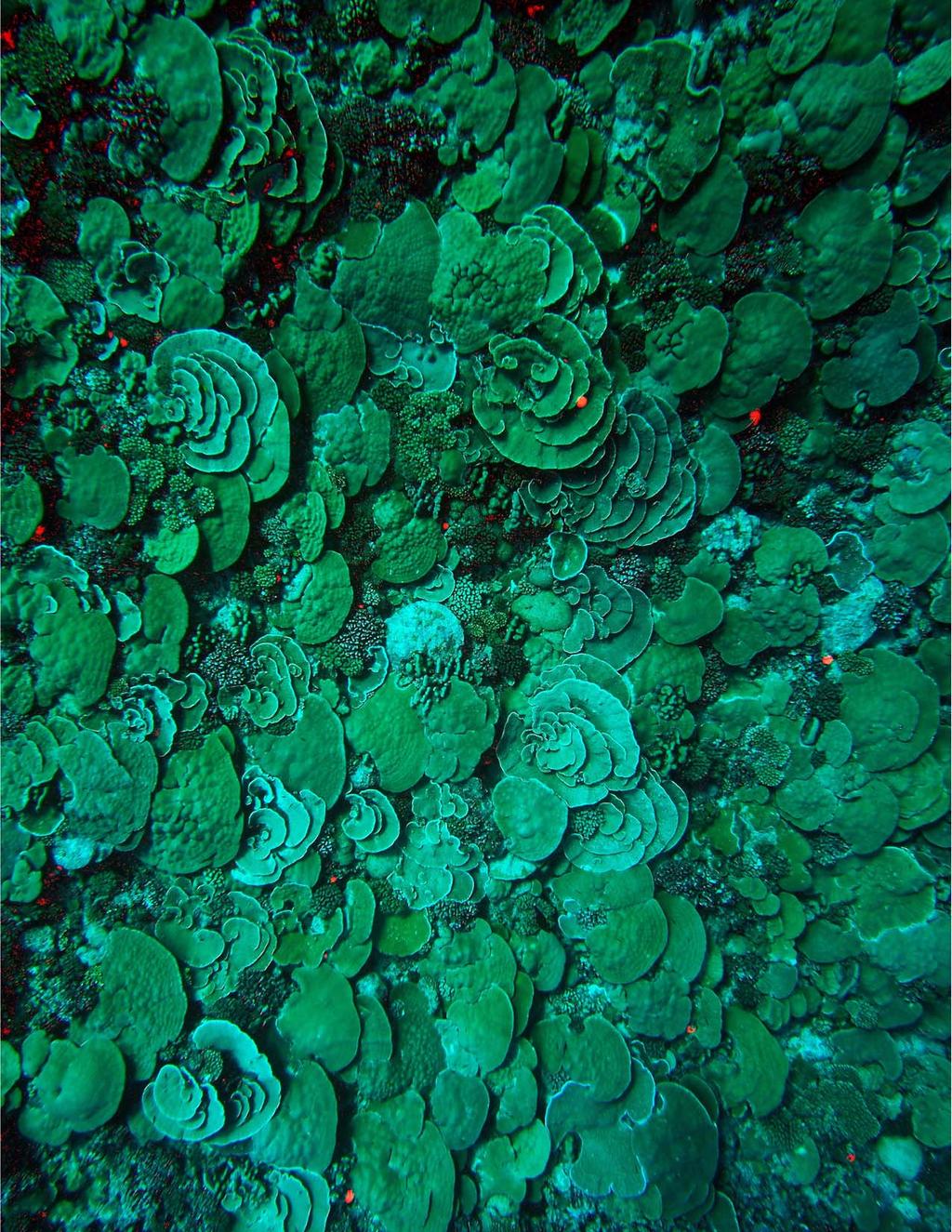
Front cover: Aerial view of Rangiroa atoll. Photo by Andrew Bruckner.
|
|
|
- Valentine Wood
- 6 years ago
- Views:
Transcription

1
2 Front cover: Aerial view of Rangiroa atoll. Photo by Andrew Bruckner. Back Cover: Fore reef location off the northeast end of Rangiroa with unusually high cover of living coral. At m the reef was dominated by Porties lobata, foliaceous Montipora and other taxa. Photo by Andrew Bruckner. Khaled bin Sultan Living Oceans Foundation 8181 Professional Place Landover, MD, USA Philip G. Renaud, Executive Director This report was developed as one component of the Global Reef Expedition: French Polynesia research project to meet one of the requirements of the research permit under Agreement between KSLOF and Présidence de La Polynésie française, Ministére en Charge de la Recherche and Délégation à la Recherche. March 30, Citation: Global Reef Expedition: Tuamotu Archipelago, French Polynesia. Field Report. Bruckner, A.W. (2014). Khaled bin Sultan Living Oceans Foundation, Landover MD. 16 pp. The Khaled bin Sultan Living Oceans Foundation (KSLOF) was incorporated in California as a 501(c)(3), public benefit, Private Operating Foundation in September KSLOF headquarters are in Washington DC. The Living Oceans Foundation is dedicated to the conservation and restoration of oceans of the world, and champions their preservation through research, education, and a commitment to Science Without Borders. For more information, visit and Also on Facebook: Twitter:
3 Executive Summary Between March 8, 2013 March 23, 2013, the Khaled bin Sultan Living Oceans Foundation conducted a research mission to Rangiroa Atoll, French Polynesia as part of the Global Reef Expedition. The research focused on coral reefs surrounding Moorea and Rangiroa. The project was conducted in partnership with the University of Queensland, with involvement of scientists from Le Centre de Recherches Insulaires et Observatoire de l Environnement de Polynésie Française (CRIOBE), University of Maine, Nova Southeastern University, University of the Azores, University of the Philippines, Wildlife Marine, and West Palm Beach Television (WPBT) Public Broadcasting System (PBS). The objectives of the mission were to: 1) identify and characterize shallow marine habitats and develop habitat and bathymetric maps: 2) evaluate the composition, structure and health of coral reefs using a standardized assessment protocol; 3) evaluate threats affecting coral and fish populations, the extent of degradation, patterns of recovery from hurricanes and other acute disturbances, and overall resilience to these stressors; 4) quantify the loss of coral skeleton since the 1998 bleaching event and patterns of recovery within the lagoon; 5) quantify the abundance and grazing intensity of herbivorous reef fish; and 5) assess the status of shark populations. Groundtruthing: A total of 2113 sq km of WorldView 2 satellite imagery was acquired. To characterize shallow marine habitats, 137 videos (drop cameras) and 703,224 depth soundings were taken across Rangiroa Atoll, covering a distance of 320 km. Coral Reef Assessments: Detailed coral assessments, including 181 Fish transects, 336 benthic surveys, 90 coral assessments and phototransects were completed in 34 locations around Rangiroa atoll, from 5-30 m depth. This included an assessment of 11,617 corals. Coral Reef Research: Sediment samples were collected from the lagoon and fore reef around Rangiroa (n=69) and the fore reef of Moorea (n=3). Stationary video cameras (10/dive) were deployed in 4 sites around Rangiroa to characterize patterns of herbivory. Shark populations were assessed along ten 400m belt transects in Rangiroa. A total of 16 sharks were identified. Reef shark abundances were variable, although densities of all reef shark species were highest in the reef passes. Here the whitetip reef shark was numerically dominant, followed by the grey reef shark then the blacktip reef shark. The silvertip shark is not commonly sighted on coral reefs. However three individuals were sighted in the Avatoru Pass, at a level of abundance equivalent to that of grey reef sharks. Coral recruits were assessed in four locations on the fore reef and one lagoonal site. Recruits were dominated by Pocilloporids, but also included Acropora spp, Montipora spp. and Porites spp. Recruit densities varied from 8 to 39.2 recruits per m 2. A total of 114 colonies of massive Porites were surveyed at Tivaru in March 2013 to evaluate changes that occurred since the 1998 bleaching event. The colonies (0.6m to 7.1m in diameter) had 71.0% live tissue, and less than 1% recently dead, exposed skeleton, as compared to 32.5% live tissue and 24.6% recently dead in This study demonstrated unprecedented post-bleaching recovery of large massive corals even after severe mortality. 1
4 Summary of General Findings Moorea. These reefs were devastated by a severe outbreak of COTS from , then the dead corals were broken up and removed by Hurricane Oli in After the hurricane, cover on the shallow reef was about 0.5%. During the present surveys, shallow reef (5 m) had a moderate cover (5-10%) of small Pocillopora, A. hyacinthus, Porites, branching Montipora, Psammocora, and other species, most of which were relatively small (2-12 cm in diameter ) and relatively young (2-3 years old). Much of the reef slope and deeper reef communities consisted of rubble fields, barren turf-algal covered substrates, and areas with larger massive coral skeletons (Porites lobata) in growth position. The only larger living colonies that appear to have been avoided by COTS were occasional Porites rus colonies and Pocillopora eydouxi, but cover was generally 0-5%. The largest, old Porites colonies were massive, and more flattened in deep water, generally cm diameter and up to 100 cm tall. Most were completely dead, although 20-30% had small surviving remnants ( up to 15 on some colonies) that appeared as small knobs and mounds elevated above the surrounding skeleton. On the sides and bases, a few of the remnants were resheeting, instead of growing upward. The skeletons supported from 1-2 up to dozens of recruits of other species. Recruits were also observed on the substrate, but these were far fewer in number except in shallow water (0-7 m). Recruits recorded on Porites colonies at20-30 m depth included Pocillopora, P. varians, Acanthastrea, Leptastrea, Cyphastrea, Montipora, and Acropora. Many of these were small crusts 3-10 cm diameter; Pocillopora consisted of two size classes, 1-3 cm and 8-12 cm cohorts. There was very little macroalgae on this reef, except for small patches of Lobophora and crusts of pessyonelid algae. Rangiroa General fore reef condition Coral reefs varied considerably in cover of live corals, species composition, amount of macroalgae, extent of dead corals and amount of rubble depending on exposure and depth. Fore reefs on the north coast, especially near the two channels, had lower cover, higher amounts of rubble and more dead, coralline algae encrusted skeletons than reefs on the west, south and northeast coasts. These reefs also had very high cover (20-50%) of Halimeda on deeper reef slopes, some of which formed mats cm thick. North coast reefs also had considerable amounts of recent partial mortality on Pocillopora and Acropora attributed to Drupella predation and white syndrome. A number of reefs on the west coast have unusually large boulders on the reef flat and continuing down the reef slope that were deposited during a past Tsunami. Some of the reefs on the northwest end have a lot of rubble, considerable amounts of a green sponge overgrowing coral and large patches of Millepora. South coast reefs are fairly low-relief with moderate to high cover of corals in shallow water (40-60%). Most coral consists of low-lying branching pocilloporids and acroporids and encrusting corals, with larger plates of Montipora, Porites and other species on deeper parts of the reef. The deeper reef also has large patches of Halimeda and some large areas of Caulerpa. Very low numbers of crown of thorns sea stars were identified; recent mortality was also associated with Culcita (starfish) predation. Coral recruitment At 10 m depth coral recruits were dominated by Pocillopora, but also included Acropora spp., Montipora spp. and Porites spp. Recruit densities varied from 8 to 39.2 recruits per m 2. Such densities are broadly similar to elsewhere in the Pacific, but are significantly higher than that reported in Moorea (7.9 recruits per m 2 ) a decade earlier (Penin et al. 2007). In some areas where there was considerable amounts of dead Pocillopora in growth position, very high numbers of Montipora recruits were seen within the branches. 2

5 Algal composition and cover In shallow water (0-10 m depth) crustose coralline algae (CCA) cover was high at outer reef sites, but lower in the lagoon (at Motu Nui), where turf algal cover was dominant on hard substrates. Deeper reefs vary considerably. Some have little macroalgae, while others are dominated by Halimeda and/or Caulerpa. Lagoonal reef condition Lagoonal reefs near the passes had high abundances of Porites lobata colonies in shallow water (2-5 m depth), although many had large patches of old mortality and these were colonized by small branching pocilloporids and other species. In the central parts of the lagoon, small patch reefs were identified with dense thickets of branching acroporids in shallow water, some Porites, and other species, but coral cover rapidly declined below 5 m. Many of these patch reefs had steep slopes that were mostly sand and rubble with very low coral cover. One lagoonal reef had a very high diversity of Acropora and unusually large thickets of this coral. Most was in good shape, although an outbreak of Drupella was noted, with 10-20% of the colonies showing recent mortality. Crown of thorns seastars were rare but present on several lagoonal reefs. A shallow (< 10 m deep) lagoonal patch reef at the northwestern end of Rangiroa (Tivaru) was dominated by unusually large (up to 10 m diameter) massive Porites lobata colonies. These are reported to have experienced catastrophic tissue loss during the 1998 bleaching event. These demonstrated a remarkable resistance to stress, and a remarkable capacity for recovery. These colonies showed signs of considerable resheeting and very little recent mortality. Fig. 1 Typical shallow fore reef community on the west side of Rangiroa. 3
6 Research Completed 1. Habitat mapping and groundtruthing Using multispectral satellite imagery obtained from Digital Globe WorldView 2 satellite, high resolution bathymetric maps and habitat maps are being created for shallow coral communities. Groundtruthing efforts necessary to develop these maps focused on aerial surveys of each island s coastline and adjacent shallow marine habitat, continuous bathymetry measures, drop camera analysis, characterization of sediment and hard substrates and habitat features using two acoustic sub-bottom profiling equipment (Stratabox and Hydrobox) and fine scale photo-transect surveys. Satellite imagery A total of 2113sq km of WorldView 2 (8 band) satellite imagery was acquired for this project (Table 2). The satellite images had a spatial resolution of 2-m by 2-m (i.e., each pixel covers a 4-m 2 area) enabling real-time navigate in the field to locate features of interest and to avoid dangerous features (e.g., emergent reefs). In order to navigate, the team used the scenes in conjunction with a differential GPS device (dgps). The imagery is being used in conjunction with ground truth data to create bathymetric and benthic habitat maps. Benthic Video An underwater video camera attached to a cable, called a drop-cam, was used to gather video on the benthic composition at each survey site. At each point, the drop-cam was held from the survey boat enabling it to fly along the sea floor as it records video for 15 to 60 seconds. During this time, the laptop operator watched the video in real-time and guided the drop-camp operator to raise or lower the camera. In this manner, we were able to prevent damage to marine life. The video was recorded on a ruggedized laptop, and the geographic position, time, date, boat heading, and boat speed were burned into the video. Drop-cam deployment was limited to depths above 40 m due to the limited length of the tether cable (50 m). The acquired videos are being used to create the benthic habitat maps by providing the necessary information for the development of a habitat classification scheme and training of classification models. A minimum of 30 drop-cam videos were gathered per day. Acoustic depth soundings Depth soundings were gathered along transects between survey sites using Hydrobox, a single-beam acoustic transducer, developed by Syqwest. The instrument emits 3 pings per second. Depths were estimated based on the time the return-pulse s reaches the sounder s head. Geopositional data were simultaneously acquired by the dgps unit. The estimated depth values and their geographic location were recorded in the ruggedized laptop. The soundings were used to train a water-depth derivation model, which is based on the spectral attenuation of light in the water column. The final topographic map will have the same spatial resolution as the satellite imagery. An average of 100,000 acoustic depth soundings was gathered during a full work day. Acoustic sub-bottom Profiles of the seafloor s sub-bottom were also gathered along transects using the Stratabox acoustic sounder, also developed by Syqwest. Similar to the bathymetric soundings, the sub-bottom profile emits an acoustic ping which reflects off the seafloor. However, the pulse has a lower frequency (3.5 Khz) enabling it to penetrate the seafloor. The instrument provides observations on striatal geometry beneath the seafloor along the transect lines, allowing estimates of Holocene reef-growth and sediment accumulation to be made. Geopositional data for each ping was simultaneously acquired by dgps unit; it was recorded in the SEGY file. Profiles were run shore-perpendicular to capture the geometry of the bank flanks and span a depth range of 300 m to 5 m. Total transect length varies with the slope s angle; steeper slopes resulted in shorter transect lines. 4
 Rangiroa Rangiroa 2113 137")


7 Atoll Site Mapping area (sq km) No. dropcams No. depth soundings Track length (km) Rangiroa Rangiroa Table 1. Summary of groundtruthing datasets: total area of satellite imagery acquired number of deployments of the drop camera, number of depth soundings and total distance covered by the groundtruthing team. Fig. 2. Track of the groundtruthing team and locations of drop camera deployments in Rangiroa. Groundtruthing undertaken during February 2013 (top) and during November 2012 and February 2013 (bottom). 5
8 2. General Approach of SCUBA assessments: Fish Assessments For fish, abundance and size structure was collected for over 200 species of fishes (Appendix 1), targeting species that have a major functional role on reefs or are major fisheries targets. Reef fishes were assessed along 4 m X 30 m belt transects. A T square marked in 5 cm increments was used to gauge fish size. A minimum of 6 transects were conducted by each fish diver per site. A roving survey was also completed to assess the total diversity and relative abundance (rare, common, and abundant) of reef fishes at each site. Benthic cover Cover of major functional groups (corals identified to genus, sponges, other invertebrates, and six groups of algae including macroalgae, crustose coralline algae, erect coralline algae, fine turfs, turf algae with sediment and cyanobacteria) and substrate type (hardground, sand, mud, rubble, recently dead coral, bleached coral, live coral) were assessed along 10 m transects using either recorded observations and/or photographic assessments. Recorded observations involve a point intercept method, whereas the organism and substrate was identified every 10 cm along a 10 m transects (total 100 points/transect), with a minimum of six transects examined per location. When possible surveys were done at 30, 25, 20, 15, 10 and 5 m depth Photographic assessment A 10 m long transect tape was extended along depth contours at 30, 20, 15, 10 and 5 m depth. Continuous digital still photographs were taken from of the reef substrate from a height of approximately meters above the substrate, using a one meter bar divided into 5 cm increments placed perpendicular to the transect tape as a scale bar. Approximately 20 photographs were taken per transect to allow for overlap between adjacent images with two photo transects (each 10 m in length) per depth. Images were downloaded onto a computer, and benthic community composition, coral cover and cover of other organisms and substrate type, and to determine the size (planar surface area) of corals were analyzed using Coral Point Count (CPCE) software developed by the National Coral Reef Institute (NCRI). Cover was determined by recording the benthic attribute located directly below random points (30-50 points per photograph). Planar surface area was measured by tracing the outline of individual corals. Coral assessments A combination of quantitative methods, including belt transects, point intercept transects, radial plots and quadrats were used to assess corals, fish and other benthic organisms. Five measures were recorded for corals: 1) benthic cover (point intercept, see above); 2) coral diversity and abundance (by genus, except certain common species); 3) coral size class distributions; 4) recruitment; and 5) coral condition. Additional information was collected on causes of recent mortality, including signs of coral disease and predation. Assessment of corals smaller than 4 cm was done using a minimum of five 0.25 m 2 quadrats per transect, with each quadrat located at fixed, predetermined intervals (e.g. 2, 4, 6, 8, 10 m), alternating between right and left side of the transect. Recruits were identified in both point intercept surveys and belt transects. Recruits were divided into two categories: corals up to 2 cm diameter and larger corals, cm diameter. Coral population structure and condition was assessed within belt transects (each 10 m x 1), with a minimum of two transects done per depth. Each coral, 4 cm or larger was identified (to genus at minimum) and its growth form was recorded. Visual estimates of tissue loss were recorded for each colony over 4 cm in diameter using a 1 m bar marked in 1 cm increments for scale. If the coral exhibited tissue loss, estimates of the amount of remaining tissue, percent that recently died and percent that died long ago were made based on the entire colony surface. Tissue loss was categorized as recent mortality (occurring within the last 1-5 days), transitional mortality (filamentous green algae and diatom colonization, 6-30 days) and old mortality (>30 days). 6

9 For each coral with partial or whole colony mortality, the cause of mortality is identified if possible. The diagnosis included an assessment of the type of disease, extent of bleaching, predation, competition, overgrowth or other cause of mortality. Each coral was first carefully examined to identify cryptic predators. Lesions were initially diagnosed into four categories: recent tissue loss, skeletal damage, color change, and unusual growth patterns; an individual colony could have multiple characteristics (e.g. color change and recent tissue loss). The location (apical, basal, and medial) and pattern of tissue loss (linear, annular, focal, multifocal, and coalescing) was recorded and when possible a field name was assigned. If an outbreak of coral disease was documented, sampling of the affected corals was undertaken to further characterize the disease (see below). Motile invertebrates Large motile invertebrates (urchins, octopus, lobster, large crabs, large gastropods, sea cucumbers) were identified and counted along coral belt transects and benthic point intercept surveys. In addition, one or two divers conducted timed swims at different depths to document the species diversity and abundance of sea cucumbers at each site assessed. This assessment included a documentation of the type of habitat occupied by these organisms. Islands Number of Benthic Fish Coral # corals Phototransects dive sites transects transects transects Rangiroa , Moorea Table 2. Summary of the coral reef assessments. The total number of benthic, fish and coral transects and number of corals assessed around Rangiroa and Moorea are shown. Fig. 3. In several fore reef locations an encrusting sponge was carpeting much of the substrate and overgrowing corals. Many reefs also had high cover of erect coralline algae (Halimeda). 7
10 Table 3. Coordinates of survey locations, site name, exposure and reef type. Date Lat Long site name exposure reef type 9-Mar MMRA-01 leeward fore reef 9-Mar MMRA-02 leeward fore reef 9-Mar MMRA-03 leeward fore reef 10-Mar MMRA-04 leeward fore reef 10-Mar MMRA-05 leeward fore reef 10-Mar MMRA-06 leeward fore reef 11-Mar MMRA-07 leeward fore reef 11-Mar MMRA-08 leeward fore reef 11-Mar MMRA-09 leeward fore reef 12-Mar MMRA-10 leeward fore reef 12-Mar MMRA-11 leeward fore reef 12-Mar MMRA-12 leeward fore reef 13-Mar MMRA-13 leeward fore reef 13-Mar MMRA-14 windward fore reef 13-Mar MMRA-15 leeward fore reef 14-Mar MMRA-16 windward fore reef 14-Mar MMRA-17 lagoonal patch reef 15-Mar MMRA-18 windward fore reef 15-Mar MMRA-19 windward fore reef 16-Mar MMRA-20 windward fore reef 16-Mar MMRA-21 windward fore reef 17-Mar MMRA-22 lagoonal patch reef 17-Mar MMRA-23 windward channel 18-Mar MMRA-23b windward channel 17-Mar MMRA-24 windward fore reef 18-Mar MMRA-25 windward fore reef 18-Mar MMRA-26 windward fore reef 19-Mar MMRA-27 windward fore reef 19-Mar MMRA-28 windward fore reef 19-Mar MMRA-29 windward fore reef 20-Mar MMRA-30 windward fore reef 20-Mar MMRA-31 windward fore reef 21-Mar MMMO-32 stormward fore reef 21-Mar MMMO-33 stormward fore reef 22-Mar MMMO-34 stormward fore reef 8


 and")
11 Fig. 4. Location of coral reefs examined around Rangiroa in Nov (red) and March 2013 (purple) using SCUBA. 9
 fixed to 3-pound dive weights were installed at each site and programmed to record continuously for two hours in the afternoon (13:00-16:00), when")
12 3. Coral reef research Herbivory: Field surveys of grazing intensity Grazing intensity was quantified using stationary video cameras in a total of six sites distributed across Rangiroa. Ten high-definition video cameras (GoPro Hero2) fixed to 3-pound dive weights were installed at each site and programmed to record continuously for two hours in the afternoon (13:00-16:00), when herbivory is known to be highest. Cameras were placed at least 10 m apart from any other and mounted on relatively high places of the substratum ensuring a well-lit areas dominated by grazable surfaces could be filmed. Filming resolution was adjusted to capture at least a 1m 2 field of view and the exact boundaries of this area were marked by briefly showing a gridded 1m 2 quadrat to each camera at the beginning of each recording. The 10-cm segments of the grid would serve as a size reference to estimate total fish length (TL) during video analyses. Cameras were left filming for a minimum of 70 minutes in the absence of divers. Site Dive Date Site 1 (Rangiroa forereef) Second 15 March Site 2 (Rangiroa forereef) Second 16 March Site 3 (Moto nuhi) Second 19 March Site 4 (Moto nuhi) Second 20 March Site 5 (Tiahura) Second 21 March Site 6 (Tiahura) Second 22 March Table 4. Locations of GoPro camera deployments Footage processing To minimize the time invested in data extraction while surveying a representative portion of the footage, each video will be subdivided in consecutive 3-minute intervals. Data will be extracted from 8 3-min intervals per camera (i.e. 40% of footage). To facilitate the detection of feeding events videos will be played in real time in 23-inch computer screens. Prior to data extraction the quadrats and grids filmed by each camera will be traced on an acetate sheet. Data will be extracted while observing the footage through the corresponding grid overlaid on the computer screen. The surveyor will focus on detecting feeding visits of surgeonfish, parrotfishes, and rabbitfish which sustain the grazing process on Pacific reefs. A feeding visit is defined here as the entry of an individual fish into the camera s field of view to take bites on the substratum enclosed within the quadrat boundaries. A visit terminates when the individual exited the quadrat boundaries to feed outside the quadrat while consistently moving away from it, or to exit the camera s field of view. For each feeding visit surveyors will record a) the time of entry and time of exit, b) the species (and life phase for parrotfishes), c) the estimated total length (TL), and c) the number of bites taken per visit. The TL of each visiting fish will be estimated using the grid s segments as a reference. Fig. 5. A GO-Pro video camera deployed on a shallow lagoonal reef in Rangiroa. 10

13 Shark surveys: Shark populations and large pelagic species were characterized in shallow fore reef (<10 m) and reef crest environments to get a better sense on the population structure and the role of apex predators in coral reef ecosystems. Ten reef crest surveys were conducted on the northern and eastern sides of the Rangiroa atoll, consisting of six transects conducted on the outer reef crest, and four transects in reef passes. Surveys involved swimming 400 m belt transects in 20 minutes on SCUBA, counting all sharks seen within 10 m of the line of travel. Lengths of survey transects were periodically verified with LOF boat staff and handheld GPS units. All dives were also recorded using a stereo camera rig, to allow later analysis of shark movements and sizes if required. A total of 16 sharks were sighted from four species. All sharks were from the family. Carcharhinidae, and included the blacktip reef shark (Carcharhinus melanopterus), the grey reef shark (C. amblyrhynchos), the silvertip shark (C. albimarginatus) and the whitetip reef shark (Triaenodon obesus). A fifth species, the blackfin shark, (C. limbatus), was also sighted. Transect Date Time Location Depth Viz (m) :47 NE Reef front (SE of Tiputa pass) m :28 NE Reef front (SE of Tiputa pass) m :28 NE Reef front (SE of Tiputa pass) 16 m :47 NE Reef front (SE of Tiputa pass) m :56 Avatoru pass, East side m :36 NE Reef front (650 m NW of Tiputa pass) m :00 Avatoru pass, East side m :40 Tiputa pass, east side m :19 Tiputa pass, east side m :02 Far east Rangiroa 6-15 m 30 Table 5. Summary of transects completed to assess apex predators Fig. 6. Camera unit used to document apex predators. 11

14 Fig. 7. Blacktip reef shark seen in the pass at the northwest end of RangiroaSediment collection: Sediment samples were collected using two different methods. The first method used SCUBA and concentrates on the sloped outer flanks of the reef, whilst the second employs a grab sampler to investigate the sediment composition inside the reef lagoon. At each sample station, approximately 100 ml of sediment was shoveled by hand into a 125 ml plastic bottle. Stations were selected so that no benthic life is disturbed or injured. Digital pictures of underwater landscapes surrounding the sampling site were also gathered to provide a visual record of the station. Up to ten samples were collected per day. In the lagoons, sediment is collected using a Petite Ponar Grabber. The grabber was attached to an electronic winch wound with 50m of braided polyester line. The winch was mounted on the gunnel of the small groundtruthing boat. The grabber was slowly deployed over the side of the boat until it settles on the seafloor, causing the winch line to slacken and the grab to shut. The sample was then winched back to the surface. Once the grab is retrieved, it was lifted into the boat and the sediment collected. At each deployment of the grabber, 100 ml of sediment was shoveled by hand into a 125 ml plastic bottle. A maximum of five samples were taken per day using this method. In the laboratory, the samples were rinsed with a weak bleach solution (30% bleach and 70% tap water) and allowed to set for several days. This process halts biological activity and preserves the sediments. The samples were dried in an oven at low heat (50-70 c) for 24 hours, and then analyzed using a Camsizer instrument to determine the size and shape of sediment grains. The data are being used to create sediment maps akin to the benthic habitat maps. Island Number of samples Rangiroa 69 Moorea 3 Total Table 6. Total number of sediment samples. 12
15 Coral recovery following the 1998 bleaching event: Tivaru Our partners from University of Queensland evaluated changes in reef community assemblages since the 1998 bleaching event at Tivaru In 1998, seven 5 x 5 m quadrats were surveyed within randomly chosen locations at Tivaru. Within this area, 91 randomly placed 1 m 2 quadrats were sampled to assess benthic cover. Porites substrates were categorized as either (i) living tissue, (ii) recently dead skeleton (corallite structure visible, usually colonized by filamentous algae), or (iii) old dead (corallite structure absent, grazing scars of herbivores often visible). In addition, five belt transects of approximately 6 m width and 20 m length were laid between white tarpalins that were georeferenced. Each Porites colony along each transect was designated as live coral if 80% of the tissue was 100 living; recently-dead if 19% (though typically 5%) of the tissue was living and the remainder was recently-dead; partially-dead if the extent of living tissue fell between 20-79%; and old dead if the colony simply comprised eroded substrate. In 2013, two parallel transects of 30m length and separated by 30m were laid haphazardly across the center of the site. A total of 63 quadrats (0.25m 2 ) were placed on Porites colonies adjacent to transects, and benthic cover estimated for each colony. Porites substrates were categorized as either (i) living tissue, (ii) recently dead skeleton (corallite structure visible, usually colonized by filamentous algae), or (iii) old dead (corallite structure absent, grazing scars of herbivores often visible). In addition, the longest of the five belt transects laid in 1998 was resurveyed. In addition, the condition of the substrate, crustose coralline algae, patterns of coral recruitment and condition of juvenile and adult corals at five sites at Rangiroa [four outer sites on the north coast and a site within the lagoon atoll pass, (Motu Nui)] to determine for coral recruit densities and benthic cover. Data were assessed along 10 m transects. Both recruits and benthic cover was recorded using a 25 x 25cm 2 quadrat measured at 0, 2.5, 5, 7.5 and 10m. Recruitment and benthic community structure Coral recruits were dominated by Pocilloporids, but also included Acropora spp., Montipora and Porites spp. Crustose coralline algae (CCA) cover was high at all outer-reef sites, but lower at Motu Nui, where turf algal cover was dominant in non-coral substrates. Macroalgal cover was low across all sites (<10%). 80 Outer Reef 1 Outer Reef 2 Outer Reef 3 Motu Nui 60 Percent cover Recruits per m 2 0 Coral CCA Turf Macroalgae Coral CCA Turf Macroalgae Coral CCA Turf Macroalgae Coral CCA Turf Macroalgae Outer Reef 1 Outer Reef 2 Outer Reef 3 Motu Nui 0 Fig. 8. Percent cover of coral, crustose coralline algae (CCA), turf algae and macroalgae (left) and numbers of recruits (right) observed by the UQ team at three outer sites and one lagoonal site. 13
, and temperature (resolution 0.01 C) along a depth profile (pressure with a resolution of 0.01 dbar).")
, turbidity, oxygen, temperature and wave height.")
16 Oceanographic measurements: At each survey location a temperature and salinity profile was acquired using a CastAway CTD. This instrument records a GPS position with a 10 m accuracy, derived salinity (resolution of 0.01), and temperature (resolution 0.01 C) along a depth profile (pressure with a resolution of 0.01 dbar). An assessment of current speeds and direction (Fig. 9) was also made using a Recording Doppler Current Profiler (RDCP). This instrument also recorded depth, tide, surface referred profile columns, surface current measurement, conductivity (salinity), turbidity, oxygen, temperature and wave height. Data were collected for a four day period at a site on the north coast, approximately 200 m from the pass. Fig. 9. Current data (horizontal speed) in the channel at Rangiroa over a five day period. The currents were up to 80 cm/second in the top 3-5 m depth, and drop off in deeper water. Fig. 10. A large dead Porites lobata colony at 20 m depth in Moorea. The coral was consumed by crown of thorns seastars. A high number of pocilloporid corals and other species have colonized the dead skeleton. The quadrat is 1m 2. 14

17 Appendix 1. Participants Name Institution Function Phil Renaud Khaled bin Sultan Living Oceans Foundation Executive Director Andy Bruckner Khaled bin Sultan Living Oceans Foundation Chief Scientist Brian Beck Khaled bin Sultan Living Oceans Foundation Coral Reef Ecologist Badi Samaniego University of the Philippines, Living Oceans Foundation Fellow Fish surveyor Sonia Bejarano University of Queensland, Living Oceans Foundation Fellow Fish herbivory Jeremy Kerr Nova Southeastern University, Living Oceans Foundation Fellow Groundtruthing / habitat mapping Peter Mumby University of Queensland UQ Lead Scientist Bob Steneck University of Maine Benthic ecology Sam Purkis Nova Southeastern University National Coral Reef Institute NCRI Lead Scientist Alex Dempsey Nova Southeastern University National Coral Reef Institute Benthic surveyor Jim Evans Schools Without Walls, Washington D.C C.R.E.W. teacher Maggie Nugues Le Centre de Recherches Insulaires et Observatoire de Benthic surveyor l Environnement de Polynésie Française (CRIOBE) Gaelle Quere University of Queensland Benthic surveyor Jeremy Sofonia University of Queensland Groundtruthing Marine Couraudon-Reale Independent contractor Benthic surveyor Kate Fraser Independent contractor Fish surveyor Yves-Marie Bozec University of Queensland Marine ecology Jez Roff University of Queensland Coral recruitment Will Robbins Wildlife Marine Shark biology John Ruthven Independent contractor Film producer Doug Allan Independent contractor Cameraman Ken Marks AGRRA Photo transects Nick Cautin Dive Safety Officer Diving operations Sean Hickey West Palm Beach Television (WPBT) PBS Changing Seas Cameraman Alexa Elliot West Palm Beach Television PBS Changing Seas Film producer 15
18
Reef Check Australia. Magnetic Island Season Report 2016
 Reef Check Australia Season Report 16 Reef Check Foundation Ltd. (Australia) www.reefcheckaustralia.org PO Box 134 George St Brisbane QLD 43 This report should be cited as: M. Welch, J. Salmond and J.
Oceanic Society Reef Research Team: Nicole Crane, Avigdor Abelson, Peter Nelson, Giacomo Bernardi, Michelle Paddack, Kate Crosman
 The coral reef of Tamil (Yap, FSM): Preliminary ecological assessment of reef state and fish assemblages, and potential of conservation for sustainable use Report compiled by vigdor belson, Peter Nelson
Technical and Financial Proposal
 Technical and Financial Proposal Marine Survey of Montego Bay Marine Park Assessment of Reef Health for Management Recommendations Dayne Buddo Ph.D. Marine Ecologist April 24, 2014. Marine Survey Montego
Pre and Post Dredging Coral Health Monitoring
 Pre and Post Dredging Coral Health 11/08/16 Level 31, 12 Creek St Brisbane QLD 4000 Australia 301310-09660-00-EN-REP-0003 www.advisian.com Disclaimer This report has been prepared on behalf of and for
THE REEF & MARINE AQUARIUM MAGAZINE ULTRA-HARDY FISHES. Hope Spot Wild Reefs WOW! Rated Corals Ozone Uses & Abuses
 THE REEF & MARINE AQUARIUM MAGAZINE ULTRA-HARDY FISHES Hope Spot Wild Reefs WOW! Rated Corals Ozone Uses & Abuses MAY/JUN 2018 HOPE SPOT Refuge, recovery, and optimism in the wake of catastrophic bleaching
Resort and Dive Operation Management, Marine Biology Support, Programmes and Training.
 Helen Sykes & Stuart Gow Mail: PO Box 2558 Government Buildings SUVA, Fiji Islands Tel: (679) 336 3625 or 359 2136 Email: resortsupport@connect.com.fj Resort and Dive Operation Management, Marine Biology
Back Cover: Complex Acropora community on the top of a Pinnacle off Moala, Lau Province. Photo by Anderson Mayfield.
 Front cover: An unusually large monospecific assemblage of Galaxea horrescens within a lagoonal reef in the northeastern corner of Vanua Balavu lagoon. Photo by Andrew Bruckner. Back Cover: Complex Acropora
The progression and impacts of bleaching were highly variable between species and locations:
 Executive Summary Coral Reef CPR, in partnership with Anantara Resorts and Aquafanatics and Elements Dive Centres implemented Phase III of the Holistic Approach to Reef Protection (HARP) Program between
Boulder Island Coral Survey. Project Manaia. Phase one - Final Report
 Boulder Island Coral Survey Project Manaia Phase one - Final Report Thor Jensen & Annika Dose January 2018 Content 1. Coral genera and their abundance in the bays of Boulder Island...3 2. Reef maps...5
Protect Our Reefs Grant Interim Report (October 1, 2008 March 31, 2009) Principal investigators: Donald C. Behringer and Mark J.
 Principal investigators: Donald C. Behringer and Mark J.") Investigating the role of the spotted spiny lobster (Panulirus guttatus) in the recovery of the long spined sea urchin (Diadema antillarum) on the coral reefs of the Florida Keys Protect Our Reefs Grant
Investigating the role of the spotted spiny lobster (Panulirus guttatus) in the recovery of the long spined sea urchin (Diadema antillarum) on the coral reefs of the Florida Keys Protect Our Reefs Grant
Reef Watch Guidelines
 Reef Watch Guidelines What is Reef Watch? Reef watch is a simple one-dive-one-survey method to record the health of coral reefs. The method is easily learnt and it is even easier to participate in the
OBSERVING CORALS and ALGAE:
 5 OBSERVING CORALS and ALGAE: MANTA TOW, SNORKEL SURVEY, and POINT-INTERCEPT TRANSECT A. Manta Tow Definition A manta tow survey is the observation of an underwater area of good visibility by a snorkeler
Recovery of Coral Populations at Helen Reef Atoll after a Major Bleaching Event
 Recovery of Coral Populations at Helen Reef Atoll after a Major Bleaching Event Yimnang Golbuu 1, Jay Andrew 1, Geory Mereb 1, Robert van Woesik 2 1 Palau International Coral Reef Center 2 Florida Institute
Overview. What are Corals?
 Overview Coral Reefs extend back over 500 m.y. Grow in tropical seas with normal salinity Support a great variety of plant and animal life Cover less than 0.2% of sea floor Contain about 25% of marine
Mass coral mortality under local amplification of 2 C ocean warming
 Mass coral mortality under local amplification of C ocean warming Thomas M. DeCarlo, Anne L. Cohen, George T.F. Wong, Kristen A. Davis, Pat Lohmann, Keryea Soong correspondence to: tdecarlo@uwa.edu.au
Reef Check Australia 2009 Great Barrier Reef Survey Season Report
 Reef Check Australia 2009 Great Barrier Reef Survey Season Report Supported by the Australian Government s Marine and Tropical Sciences Research Facility Project 1.1.2 Condition and trend of the Great
DOMINICA REEF FISH STATUS 2002: An Assessment of the Abundance and Species Composition of Dominican Reef Fishes. ITME Research Reports Number 13
 DOMINICA REEF FISH STATUS 2002: An Assessment of the Abundance and Species Composition of Dominican Reef Fishes. ITME Research Reports Number 13 Fall Semester 2002 Researcher: Dillon M. Green Institute
Nearshore Habitat Mapping in Puget Sound Using Side Scan Sonar and Underwater Video
 Nearshore Habitat Mapping in Puget Sound Using Side Scan Sonar and Underwater Video Dana Woodruff, Paul Farley, Amy Borde, John Southard, Ron Thom Battelle Marine Sciences Laboratory Jim Norris Marine
John Brewer Reef Sunferries-Townsville
 John Brewer Reef Sunferries-Townsville Latitude: 18 57.364S Longitude: 146 57.375E Date: 31-1-4, 1-2-4 and 24.3.4 Florent Cade 24 SITE DESCRIPTION John Brewer Reef is a mid shelf reef situated approximately
Front cover: Shallow fore reef community in Vava u. Photo by Andrew Bruckner.
 Front cover: Shallow fore reef community in Vava u. Photo by Andrew Bruckner. Back Cover: A patch reef located close to shore in the Ha apai group. Photo by Ken Marks. Khaled bin Sultan Living Oceans Foundation
14/10/2013' Bathymetric Survey. egm502 seafloor mapping
 egm502 seafloor mapping lecture 10 single-beam echo-sounders Bathymetric Survey Bathymetry is the measurement of water depths - bathymetry is the underwater equivalent of terrestrial topography. A transect
NEED FOR SUPPLEMENTAL BATHYMETRIC SURVEY DATA COLLECTION
 305 West Grand Avenue, Suite 300 Montvale, New Jersey 07645 Phone 201.930.9890 Fax 201.930.9805 www.anchorqea.com M EMORANDUM To: Caroline Kwan and Nica Klaber U.S. Environmental Protection Agency Region
Background No additional background is necessary.
 CORAL REEF ECOLOGY Concepts Coral Types HCPS III Benchmarks SC 4.1.2 SC 4.5.3 Duration 1 hour and 20 minutes Source Material PRISM MARE Vocabulary Compare Description Describe a Coral Summary Students
Baseline Assessment of Angaur Conservation area
 Baseline Assessment of Angaur Conservation area Shirley Koshiba, Randa Jonathan, Dawnette Olsudong, Joetlin Oruetamor, Geory Mereb, Kevin Polloi Palau International Coral Reef Center April 2014 PICRC Technical
Biogeographic Assessment of Florida Keys National Marine Sanctuary
 Biogeographic Assessment of Florida Keys National Marine Sanctuary NOAA National Centers for Coastal Ocean Science NOAA Florida Keys National Marine Sanctuary Florida Fish and Wildlife Commission Photos
Bonaire National Marine Park Hurricane Matthew Reef Damage Assessment
 Bonaire National Marine Park Hurricane Matthew Reef Damage Assessment Hurricane Matthew passed north of Bonaire on September 23 rd, 2016. After it passed Aruba, it decelerated, and then it slowly began
Quantitative Freshwater Mussel Survey Date Prepared: 11/20/2017
 PARTNERSHIP FOR THE DELAWARE ESTUARY Science Group Quantitative Freshwater Mussel Survey Date Prepared: 11/20/2017 Prepared By: Kurt Cheng Suggested Citation: Cheng, K. 2017. Quantitative Freshwater Mussel
Sontek RiverSurveyor Test Plan Prepared by David S. Mueller, OSW February 20, 2004
 Sontek RiverSurveyor Test Plan Prepared by David S. Mueller, OSW February 20, 2004 INTRODUCTION Sontek/YSI has introduced new firmware and software for their RiverSurveyor product line. Firmware changes
Fine-Scale Survey of Right and Humpback Whale Prey Abundance and Distribution
 DISTRIBUTION STATEMENT A. Approved for public release; distribution is unlimited. Fine-Scale Survey of Right and Humpback Whale Prey Abundance and Distribution Joseph D. Warren School of Marine and Atmospheric
Video-Based Mapping of Oyster Bottom in the Upper Piscataqua River, Sturgeon Creek, and Spruce Creek
 University of New Hampshire University of New Hampshire Scholars' Repository PREP Reports & Publications Institute for the Study of Earth, Oceans, and Space (EOS) 1-21-2009 Video-Based Mapping of Oyster
Citizen Science Based Survey GBR Far North Dive Trip 2016 April 18-26
 Citizen Science Based Survey GBR Far North Dive Trip 2016 April 18-26 Chris Roelfsema Karen Johnson Douglas Stetner Trevor Baerenger Peran Brady May 2016 GBR Far North Citizen Science Trip 5 May 2016 1
Moku o Loe, Oahu. Benthic Habitat Data: 2 m
 Moku o Loe, Oahu 21 o 26.884 N 157 o 48.548 W Management Status: Coconut Island Marine Laboratory Refuge Hawaii Area Description: Patch reef with island development. Sand and seawall shoreline. Coral and
Domain (island) wide estimates of mutton snapper (Lutjanus analis) abundance for three US Caribbean Islands based on habitat-derived densities
 wide estimates of mutton snapper (Lutjanus analis) abundance for three US Caribbean Islands based on habitat-derived densities") Domain (island) wide estimates of mutton snapper (Lutjanus analis) abundance for three US Caribbean Islands based on habitat-derived densities SEDAR REPORT # SEDAR14-AW2 Prepared May 2007 by Christopher
Domain (island) wide estimates of mutton snapper (Lutjanus analis) abundance for three US Caribbean Islands based on habitat-derived densities SEDAR REPORT # SEDAR14-AW2 Prepared May 2007 by Christopher
Figure 4, Photo mosaic taken on February 14 about an hour before sunset near low tide.
 The Impact on Great South Bay of the Breach at Old Inlet Charles N. Flagg and Roger Flood School of Marine and Atmospheric Sciences, Stony Brook University Since the last report was issued on January 31
Ghost (net) Busters. Ghost Net Retrieval. Time to complete lesson: minutes
 Busters. Ghost Net Retrieval. Time to complete lesson: minutes") Ghost (net) Busters Ghost Net Retrieval Time to complete lesson: 20-30 minutes Purpose of module: This module allows students to simulate the removal of a derelict fishing net from a model coral reef.
Ghost (net) Busters Ghost Net Retrieval Time to complete lesson: 20-30 minutes Purpose of module: This module allows students to simulate the removal of a derelict fishing net from a model coral reef.
Institute of Marine Research
 Institute of Marine Research CRUISE REPORT NO. ** R/V G.O. Sars Cruise No. 2005108 9 th June 24 th June 2005 Coral survey off Northern Norway Principal Scientist J. H. Fosså 2005 Benthic Habitat Research
Marine Conservation and Research Expedition Training, Examination and Certification Summary
 Marine Conservation and Research Expedition Training, Examination and Certification Summary Introduction This document summarizes the current training schedule and materials being used at the two Marine
Ecological Interactions in Coastal Marine Ecosystems: Rock Lobster
 Ecological Interactions in Coastal Marine Ecosystems: Rock Lobster Progress Report to 3 November Lachlan MacArthur and Glenn A. Hyndes Centre for Ecosystem Management, Edith Cowan University, 1 Joondalup
Bonefish Paradise. Robert J. Lennox 1,2, University, Ottawa, Ontario, K1S 5B6, Canada
 Bonefish Paradise Robert J. Lennox 1,2, 1 Fish Ecology and Conservation Physiology Laboratory, Department of Biology, Carleton University, Ottawa, Ontario, K1S 5B6, Canada 2 Indifly Foundation, PO Box
Keywords: marine habitat recovery, derelict fishing gear
 Marine habitat recovery after derelict fishing net removal. Jeff June*, Kyle Antonelis, Natural Resources Consultants, Inc. Seattle, WA. *Corresponding author: jjune@nrccorp.com Keywords: marine habitat
satellite image Penjalin (30th Nov - 2nd Dec 2006) N E
 N E") Page 1 Penjalin (30th Nov - 2nd Dec 2006) N E SV Infinity's anchorage rocks with fringing reef, west side Penjalin Besar bay on east side Penjalin Besar 22.1910' 22.8764' 20.5266' Penjalin Besar: beach
Page 1 Penjalin (30th Nov - 2nd Dec 2006) N E SV Infinity's anchorage rocks with fringing reef, west side Penjalin Besar bay on east side Penjalin Besar 22.1910' 22.8764' 20.5266' Penjalin Besar: beach
Experimental reestablishment of populations of the long spined sea urchin, Diadema antillarum, on two small patch reefs in the upper Florida Keys
 Principal Investigator Ken Nedimyer 212 Silver Palm Avenue Tavernier, FL 33070 phone (305) 852-4955, fax (305) 852-3500 email, sealife@terranova.net Associate Investigator Martin A. Moe, Jr. 222 Gulfview
Field Protocol for Monitoring Coral Reef Fisheries Resources in Belize
 Field Protocol for Monitoring Coral Reef Fisheries Resources in Belize Charles A. Acosta, PhD Wildlife Conservation Society Glover s Reef Marine Research Station P.O. Box 272 Dangriga, Belize and Department
Appendix Template for Submission of Scientific Information To Describe Ecologically or Biologically Significant Marine Areas
 Appendix Template for Submission of Scientific Information To Describe Ecologically or Biologically Significant Marine Areas Abstract (in less than 150 words) Coastal and marine areas: Africa Somalia has
Mitigating the impacts of an Acanthaster planci (crown-of-thorns starfish, COTS) outbreak on coral reefs in Aitutaki, Cook Islands.
 outbreak on coral reefs in Aitutaki, Cook Islands.") Mitigating the impacts of an Acanthaster planci (crown-of-thorns starfish, COTS) outbreak on coral reefs in Aitutaki, Cook Islands May, 2013 A report prepared for the Government of the Cook Islands, Aitutaki
Mitigating the impacts of an Acanthaster planci (crown-of-thorns starfish, COTS) outbreak on coral reefs in Aitutaki, Cook Islands May, 2013 A report prepared for the Government of the Cook Islands, Aitutaki
Summary of Research within Lamlash Bay No-Take Zone - Science report for COAST July
 Summary of Research within Lamlash Bay No-Take Zone - Science report for COAST July 2013 - *Picture of a spider crab (Macropodia spp) inside a plumose anemone. Taken within Lamlash Bay No-Take Zone by
STATUS OF REEFS AROUND MAGNETIC ISLAND: REEF CHECK AUSTRALIA
 STATUS OF REEFS AROUND MAGNETIC ISLAND: 2003-2006 REEF CHECK AUSTRALIA Zoë Andrews Loren Hartley Jos Hill April 2006 1 INTRODUCTION The purpose of this project was to engage Townsville community members
Jason Blackburn, Paul Hvenegaard, Dave Jackson, Tyler Johns, Chad Judd, Scott Seward and Juanna Thompson
 Alberta Conservation Association (ACA) Date: 2014-2015 Project Name: Owl River Walleye and Aquatic Habitat Assessment Fisheries Program Manager: Peter Aku Project Leader: Tyler Johns Primary ACA staff
BASELINE SURVEY, VISUAL - SITE SPECIFIC
 BASELINE SURVEY, VISUAL - SITE SPECIFIC Introduction As stated in SEPA s policy and in the Fish Farm Manual (1998), scientific data are required by SEPA in order to assess the existing condition on the
PEDRO BANK ATLANTIC AND GULF RAPID REEF ASSESSMENT (AGRRA), APRIL 18-26, 2005, SUMMARY REPORT
, APRIL 18-26, 2005, SUMMARY REPORT") PEDRO BANK ATLANTIC AND GULF RAPID REEF ASSESSMENT (AGRRA), APRIL 18-26, 2005, SUMMARY REPORT Prepared by N. Zenny, May 2005 Introduction: The very first coral reef assessment on the Pedro Bank was recently
PEDRO BANK ATLANTIC AND GULF RAPID REEF ASSESSMENT (AGRRA), APRIL 18-26, 2005, SUMMARY REPORT Prepared by N. Zenny, May 2005 Introduction: The very first coral reef assessment on the Pedro Bank was recently
ACT NOW for the future of our reefs
 Do It Yourself Kit WWW.CORALWATCH.ORG ACT NOW for the future of our reefs Rising water temperatures are a major contributor to mass coral bleaching events. Get involved in CoralWatch to monitor and protect
Eelgrass Survey Reporting Form 2222 Channel Road Newport Beach, CA Eelgrass (Zostera marina) Survey
 Survey") Eelgrass Survey Reporting Form 2222 Channel Road Newport Beach, CA 92660 Eelgrass (Zostera marina) Survey Survey Date: July 19th, 2013 Report Date: July 26 th, 2013 Prepared by: Coastal Resources Management,
Eelgrass Survey Reporting Form 2222 Channel Road Newport Beach, CA 92660 Eelgrass (Zostera marina) Survey Survey Date: July 19th, 2013 Report Date: July 26 th, 2013 Prepared by: Coastal Resources Management,
Tracking Juvenile Summer Flounder
 Tracking Juvenile Summer Flounder East Coast MARE Materials For the leader: Whiteboard Markers (different colors) For each group: Copies of student group packets Copies of student worksheet Overview Scientists
DURING ALL ACTIVITIES, MAKE SURE YOU DON T DAMAGE THE REEF OR OTHER MARINE LIFE!
 Fish surveys Long term volunteers can take part in the fish surveys. These surveys are the most complex research we do with volunteers. You have to learn a lot, but in return you will receive a lot of
SCHOOLING BEHAVIOR OF HAEMULON SPP. IN BERMUDA REEFS AND SEAGRASS BEDS
 SCHOOLING BEHAVIOR OF HAEMULON SPP. IN BERMUDA REEFS AND SEAGRASS BEDS Hillary, Department of Biology,, Worcester, MA 01610 (hisullivan@clarku.edu) Abstract Schooling behavior is common among many different
Homework 2a Bathymetric Charts [based on the Chauffe & Jefferies (2007)]
![Homework 2a Bathymetric Charts [based on the Chauffe & Jefferies (2007)]](/thumbs/73/69074241.jpg "Homework 2a Bathymetric Charts [based on the Chauffe & Jefferies (2007)]") 14 August 2008 MAR 110 HW-2a: ex1bathymetric Charts 1 2-1. BATHYMETRIC CHARTS Homework 2a Bathymetric Charts [based on the Chauffe & Jefferies (2007)] Nautical charts are maps of a region of the ocean
14 August 2008 MAR 110 HW-2a: ex1bathymetric Charts 1 2-1. BATHYMETRIC CHARTS Homework 2a Bathymetric Charts [based on the Chauffe & Jefferies (2007)] Nautical charts are maps of a region of the ocean
Environmental. Effects of Dredging
 Envi~onmental Effects of Dredging Technical Notes THE VALUE OF GRAVEL DISPOSAL MOUNDS IN RIVER SIDE CHANNELS FOR FRESHWATER MUSSELS PURPOSE: This note provides information on the value of gravel disposal
APPENDIX N. CORALS LISTING
 APPENDI N. CORALS LISTING MUNITIONS RESPONSE SITES MRS 02 AND MRS 07 PHASE 2 UNDERWATER RI/FS CULEBRA ISLAND SITE, PUERTO RICO APPENDI N. CORALS LISTING This appendix contains a copy of the NOAA Fisheries
Thierry LISON DE LOMA. CRIOBE Centre de Recherches Insulaires Observatoire de l'environnement UMS 2978 CNRS - EPHE.
 Commercial Coral Reef Fish Community Structure along an Island Gradient of Contrasting Habitat and Fishing Pressure in the Society Archipelago (French Polynesia) Thierry LISON DE LOMA CRIOBE Centre de
Cove Point Beach Restoration: Utilization of a Spawning Habitat by Horseshoe Crabs (Limulus polyphemus)
") Cove Point Beach Restoration: Utilization of a Spawning Habitat by Horseshoe Crabs (Limulus polyphemus) Paul Bushmann, Jessica Peterson, Bethany Enyeart and Deborah Smith Anne Arundel Community College
Cove Point Beach Restoration: Utilization of a Spawning Habitat by Horseshoe Crabs (Limulus polyphemus) Paul Bushmann, Jessica Peterson, Bethany Enyeart and Deborah Smith Anne Arundel Community College
Experimental Studies of Factors Affecting Coral Recruitment in La Parguera, Puerto Rico. Alina Szmant (UNCW) and Ernesto Weil (RUM)
 and Ernesto Weil (RUM)") Experimental Studies of Factors Affecting Coral Recruitment in La Parguera, Puerto Rico Alina Szmant (UNCW) and Ernesto Weil (RUM) The Problem: Regional Decline in Caribbean coral cover based on published
Experimental Studies of Factors Affecting Coral Recruitment in La Parguera, Puerto Rico Alina Szmant (UNCW) and Ernesto Weil (RUM) The Problem: Regional Decline in Caribbean coral cover based on published
Eelgrass and Macroalgae Presence/Absence Preliminary Surveys BHP Proposed Grays Harbor Potash Export Facility A Task 400
 Memorandum 40600-HS-MEM-55036 Revision 0 Date: 26 July 2018 Subject: Eelgrass and Macroalgae Presence/Absence Preliminary Surveys BHP Proposed Grays Harbor Potash Export Facility A17.0202.00 Task 400 INTRODUCTION
I. Monitoring and Adaptive Management Approach. Potential Effects, Monitoring Studies & Mitigation
 I. Monitoring and Adaptive Management Approach Define the problem or management objective. Determine potential effects of the project on indicator species. Emphasis on examining potentially negative, rather
4 Reef Watch Guidelines
 11 4 Reef Watch Guidelines Reef watch is a simple one-dive-one-survey method to record the health of a coral reef. You can easily learn the method and take part in the programme. On your dive or snorkel
Body Search and Recovery Using Sonar
 Body Search and Recovery Using Sonar Photos Mark W. Atherton Mark W. Atherton, Echoes and Images Image courtesy FBI Dive Team Images not for distribution. All photographs and drawings courtesy and Mark
STUDY REPORT W&AR-03 RESERVOIR TEMPERATURE MODEL ATTACHMENT B DON PEDRO RESERVOIR BATHYMETRIC STUDY REPORT
 STUDY REPORT W&AR-03 RESERVOIR TEMPERATURE MODEL ATTACHMENT B DON PEDRO RESERVOIR BATHYMETRIC STUDY REPORT DON PEDRO RESERVOIR BATHYMETRIC STUDY REPORT Prepared for: TURLOCK IRRIGATION DISTRICT MODESTO
Managing herbivores for their impacts on Caribbean coral reef ecosystems: A summary report for managers and practitioners
 Managing herbivores for their impacts on Caribbean coral reef ecosystems: A summary report for managers and practitioners Prepared for NOAA s Coral Reef Conservation Program Thomas C. Adam, Deron E. Burkepile,
Two types of physical and biological standards are used to judge the performance of the Wheeler North Reef 1) Absolute standards are measured against
 Absolute standards are measured against") 1 Two types of physical and biological standards are used to judge the performance of the Wheeler North Reef 1) Absolute standards are measured against fixed value at Wheeler North Reef only 2) Relative
1 Two types of physical and biological standards are used to judge the performance of the Wheeler North Reef 1) Absolute standards are measured against fixed value at Wheeler North Reef only 2) Relative
Homework 2 Bathymetric Charts [based on the Chauffe & Jefferies (2007)]
![Homework 2 Bathymetric Charts [based on the Chauffe & Jefferies (2007)]](/thumbs/75/72427079.jpg "Homework 2 Bathymetric Charts [based on the Chauffe & Jefferies (2007)]") 1 MAR 110 HW-2 - Bathy Charts Homework 2 Bathymetric Charts [based on the Chauffe & Jefferies (2007)] 2-1. BATHYMETRIC CHARTS Bathymetric charts are maps of a region of the ocean used primarily for navigation
1 MAR 110 HW-2 - Bathy Charts Homework 2 Bathymetric Charts [based on the Chauffe & Jefferies (2007)] 2-1. BATHYMETRIC CHARTS Bathymetric charts are maps of a region of the ocean used primarily for navigation
EXPEDITION ADVENTURE PART 2: HIGHER RESOLUTION RANGE SEISMIC IMAGING TO LOCATE A SUNKEN PIRATE SHIP OFF ILE ST MARIE.
 EXPEDITION ADVENTURE PART 2: HIGHER RESOLUTION RANGE SEISMIC IMAGING TO LOCATE A SUNKEN PIRATE SHIP OFF ILE ST MARIE. Jakob B.U. Haldorsen, and Douglas E. Miller, Schlumberger-Doll Research, Ridgefield,
Tonga. Laurent Vigliola (IRD COREUS Nouméa) & David Mouillot (UM2 ECOSYM Montpellier)
 & David Mouillot (UM2 ECOSYM Montpellier)") Funding : July 2013 Research project PRISTINE Tonga Project leaders Laurent Vigliola (IRD COREUS Nouméa) & David Mouillot (UM2 ECOSYM Montpellier) Objective Redefine the baseline for coral reef ecosystem
Funding : July 2013 Research project PRISTINE Tonga Project leaders Laurent Vigliola (IRD COREUS Nouméa) & David Mouillot (UM2 ECOSYM Montpellier) Objective Redefine the baseline for coral reef ecosystem
Big Bend Oyster Research
 Big Bend Oyster Research Drs. Jennifer Seavey, Bill Pine, & Peter Frederick Department of Wildlife Ecology and Conservation, Institute of Food and Agricultural Sciences, 110 Newins-Ziegler Hall, PO Box
Examples of Carter Corrected DBDB-V Applied to Acoustic Propagation Modeling
 Naval Research Laboratory Stennis Space Center, MS 39529-5004 NRL/MR/7182--08-9100 Examples of Carter Corrected DBDB-V Applied to Acoustic Propagation Modeling J. Paquin Fabre Acoustic Simulation, Measurements,
Palythoa Abundance and Coverage in Relation to Depth
 Palythoa Abundance and Coverage in Relation to Depth Foisy, Mia 02//208 Foisy, Mia Masternaut Project 02//208 Palythoa Abundance and Coverage in Relation to Depth Abstract: Palythoa abundance and coverage
Dredging/Sand Mining at the Pangaimotu/Toula Causeway Impacts on the Environment and Coastal Fisheries
 Dredging/Sand Mining at the Pangaimotu/Toula Causeway Impacts on the Environment and Coastal Fisheries by Asipeli Palaki Tupe Samani Mafile o Masi Technical and Sustainable Division Department of Environment
Sea Star Wasting Syndrome Protocols for Subtidal Surveys
 Sea Star Wasting Syndrome Protocols for Subtidal Surveys February 13, 2014 Value of Citizen Science Monitoring in the subtidal Involving citizen scientists to survey the nearshore subtidal for evidence
Ecological Processes and Coral Reef Recovery in the Florida Keys
 Final 2 October 26 Ecological Processes and Coral Reef Recovery in the Florida Keys Struan R. Smith (Bermuda Biological Station for Research, Inc., St. George s GE, Bermuda) Richard B. Aronson and Thaddeus
Near-Field Sturgeon Monitoring for the New NY Bridge at Tappan Zee. Quarterly Report July 1 September 30, 2014
 Near-Field Sturgeon Monitoring for the New NY Bridge at Tappan Zee Quarterly Report July 1 September 30, 2014 Prepared by AKRF, Inc. 7250 Parkway Drive, Suite 210 Hanover, MD 21076 for New York State Thruway
STATUS OF REEFS AROUND MAGNETIC ISLAND:
 STATUS OF REEFS AROUND MAGNETIC ISLAND: 2003-2007 REEF CHECK AUSTRALIA Zoë Andrews Loren Hartley Jos Hill Revised by Steven Prutzman Tara Swansborough Jos HIll February 2008 TABLE OF CONTENTS STATUS OF
Vieques Underwater Demonstration Project
 Vieques Underwater Demonstration Project NOAA Office of Response and Restoration National Ocean Service 2006-2007 2007 University of New Hampshire Joint Hydrographic Center 2006 Science Application International
Three Rivers Cockle Abundance Survey Report April 2016
 Three Rivers Cockle Abundance Survey Report April 16 May 16 Crown Copyright WG 2884 ISBN digital 978-1-4734-669-6 1. Introduction The annual Three Rivers Estuaries cockle abundance survey was conducted
Wade Reynolds 1 Frank Young 1,2 Peter Gibbings 1,2. University of Southern Queensland Toowoomba 4350 AUSTRALIA
 A Comparison of Methods for Mapping Golf Greens Wade Reynolds 1 Frank Young 1,2 Peter Gibbings 1,2 1 Faculty of Engineering and Surveying 2 Australian Centre for Sustainable Catchments University of Southern
Diadema antillarum (Long-spined Black Urchin)
") Diadema antillarum (Long-spined Black Urchin) Order: Diadematoida (Hollow-spined Sea Urchins) Class: Echinoidea (Sea Urchins) Phylum: Echinodermata (Starfish, Sea Urchins and Sea Cucumbers) Fig. 1. Long-spined
Diadema antillarum (Long-spined Black Urchin) Order: Diadematoida (Hollow-spined Sea Urchins) Class: Echinoidea (Sea Urchins) Phylum: Echinodermata (Starfish, Sea Urchins and Sea Cucumbers) Fig. 1. Long-spined
TART, Kona, USA 2014 Deployments
 The 24 th Annual Tag and Release Tournament (TART) took place in Kailua-Kona, Hawaii, USA on September 1-5, 2014. The televised tournament took viewers along for the week-long voyage as five boats competed
 ROV Transects of Deep Sea Coral Communities Habitat Type, Species Abundance and Diversity The teacher may choose to explore species abundance and diversity in deep sea coral communities in several different
Florida Seagrass Integrated Mapping and Monitoring Program
 Florida Seagrass Integrated Mapping and Monitoring Program - 2004 The following document is composed of excerpts taken from the 2011 publication, Seagrass Integrated Mapping and Monitoring for the State
Data Collection and Processing: Elwha Estuary Survey, February 2013
 Data Collection and Processing: Elwha Estuary Survey, February 2013 Ian Miller, WA Sea Grant Olympic Peninsula Field Office, 1502 E. Lauridsen Blvd #82, Port Angeles, WA 98362 immiller@u.washington.edu
The Population Density of Diadema antillarum at Champagne Reef at Scott s Head Soufriere Marine Reserve
 The Population Density of Diadema antillarum at Champagne Reef at Scott s Head Soufriere Marine Reserve Katy Schumann Dominica 2008 Dr. Lacher Dr. Woolley ABSTRACT: The abundance of the long-spined sea
Status of Curaçao s Reefs
 References can be found in BioNews Issue 4 Map of Curaçao. Image credit: DCNA The island of Curaçao is almost entirely surrounded by narrow fringing reef that covers an estimated area of 7.85 km2 (Vermeij,
Sea urchin density along a depth gradient at Rodney's Rock and Champagne Bay, Dominica
 Sea urchin density along a depth gradient at Rodney's Rock and Champagne Bay, Dominica Michele Felix Cassie Kalinec Julia Lemmon Carl Raetzsch A.J. Vale Andrew Woolley May 28 June 17, 2004 1 Abstract The
Marine Mammal Acoustic Tracking from Adapting HARP Technologies
 DISTRIBUTION STATEMENT A: Approved for public release; distribution is unlimited. Marine Mammal Acoustic Tracking from Adapting HARP Technologies Sean M. Wiggins and John A. Hildebrand Marine Physical
Admiralty Inlet Pilot Tidal Project FERC No Appendix C. Derelict Gear Monitoring Plan
 Appendix C Derelict Gear Monitoring Plan ADMIRALTY INLET PILOT TIDAL PROJECT FERC PROJECT NO. 12690 DERELICT GEAR MONITORING PLAN (submitted with the Final Application for a New Pilot Project License)
Oceans Humans both depend on it and threaten it with their activities
 Oceans Humans both depend on it and threaten it with their activities Oceans Water covers nearly ¾ of the Earth s surface More than 50% of the world s population lives within an hour of the coast Oceans
and found that there exist a significant overlap between the billfish resources and the exploitation activities targeting tunas and mahi mahi.
 Executive Summary Report 2016 Billfish Research in the Eastern Pacific Ocean Rosenstiel School of Marine and Atmospheric Science University of Miami January 2017 During 2016, the Eastern Pacific Ocean
Understanding shelf-break habitat for sustainable management of fisheries with spatial overlap
 Understanding shelf-break habitat for sustainable management of fisheries with spatial overlap Alan Williams Caleb Gardner Franziska Althaus Bruce Barker David Mills Final Report to the Fisheries Research
An Camus, Lochboisdale, South Uist
 An Camus, Lochboisdale, South Uist BASELINE VIDEO SURVE Y REPORT 2016 Contents 1.0 Video Survey Analysis... 3 2.0 Appendix 1. Species identified and stills extracted from raw video footage... 5 1.0 Video
A comparison of deltaic structure in forested and deforested watersheds using highresolution
 A comparison of deltaic structure in forested and deforested watersheds using highresolution bathymetric surveys Student: Willie Guerra Mentor: Kiram Lezzar Introduction Steeply sloping deltaic systems
APPENDIX 3E HYDROACOUSTIC ANALYSIS OF FISH POPULATIONS IN COPCO AND IRON GATE RESERVOIRS, CALIFORNIA NOVEMBER
 APPENDIX 3E HYDROACOUSTIC ANALYSIS OF FISH POPULATIONS IN COPCO AND IRON GATE RESERVOIRS, CALIFORNIA NOVEMBER 23 February 24 PacifiCorp Fish Resources FTR Appendix 3E.doc Hydroacoustic Analysis of Fish
Case Study 3. Case Study 3: Cebu Island, Philippines MPA Network 10
 Case studies of mpa networks Case Study 3: Cebu Island, Philippines MPA Network 10 Location and background Cebu Island in the Philippines lies in the center of the Visayan Islands, known as an area high
Determining Coral Reef Impacts Associated with Boat Anchoring and User Activity in Southeast Florida
 Determining Coral Reef Impacts Associated with Boat Anchoring and User Activity in Southeast Florida Southeast Florida Coral Reef Initiative Fishing, Diving, and Other Uses Local Action Strategy Project