ECDIS Chart Layers. And. Their Navigational Impact
|
|
|
- Primrose Francis
- 5 years ago
- Views:
Transcription
1 ECDIS Chart Layers And Their Navigational Impact 1
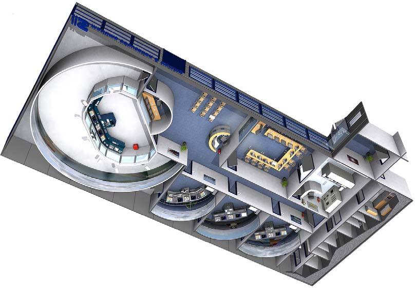
2 ONE COMPANY ONE PARTNER To the benefit of all: Added value from integrated products and services IS Value Chain Partner for the maritime industry 2

3 SYSTEM INTEGRATOR System integrator for all electronic parts: Comprehensive product portfolio IS products cover a vessel s entire life cycle System integration for own and thirt party products 3
4 MET 4


5 MET 5
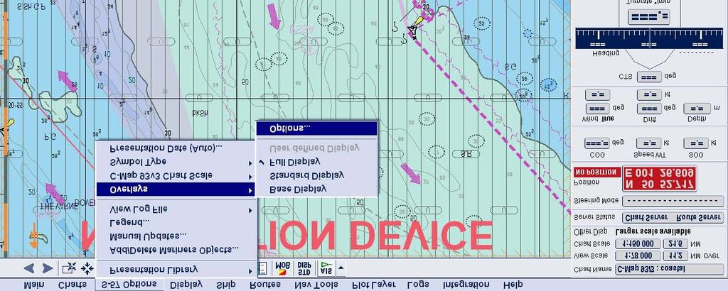
6 Topics Chart Presentation Modes Additional Chart Layers Chart Scale Navigational Impact 6
7 Topics Chart Presentation Modes Additional Chart Layers Chart Scale Navigational Impact 7
8 Chart Presentation Modes 8
9 Chart Presentation Modes Display Base: 9
10 Chart Presentation Modes Standard Display: 10
11 Chart Presentation Modes Display All: 11
12 Chart Presentation Modes 12
13 Topics Chart Presentation Modes Additional Chart Layers Chart Scale Navigational Impact 13


14 Additional Chart Layers Multilayer Object structure 14
15 Additional Chart Layers 15

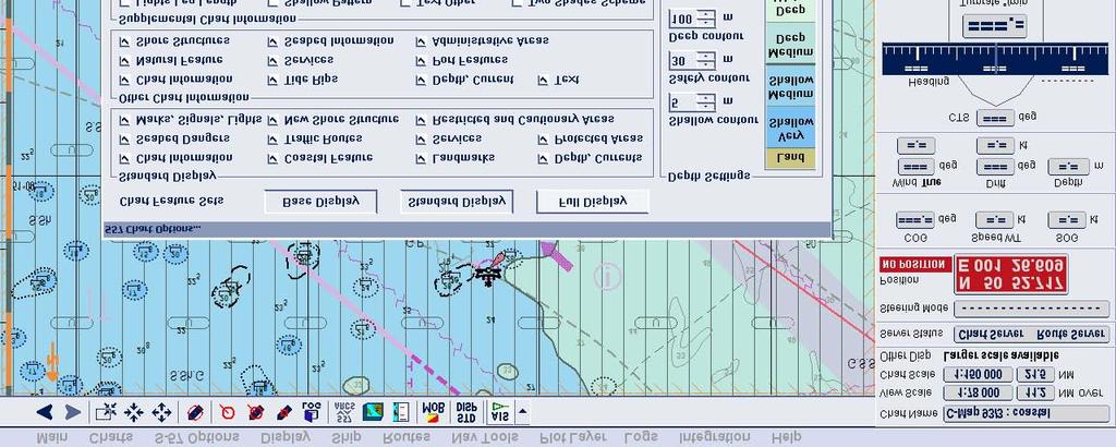
16 Additional Chart Layers 16

17 Additional Chart Layers 17

18 Additional Chart Layers Multilayer Object structure 18
 In combination with official ENCs")

19 Additional Chart Layers Admiralty Information Overlay (AIO) In combination with official ENCs it is possible to display Temporary & Preliminary Notices to Mariners as a separate overlay. 19


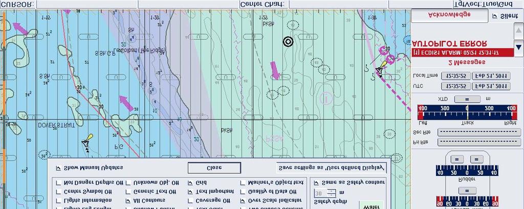
20 Additional Chart Layers Radar overlays 20


21 Additional Chart Layers Tide and current modules 21

22 Additional Chart Layers 22

23 Additional Chart Layers Safety contour 23

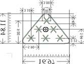
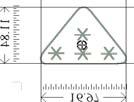
24 Additional Chart Layers Shallow Contour: 0 m Safety Contour: 1m Deep Contour: 5 m 24


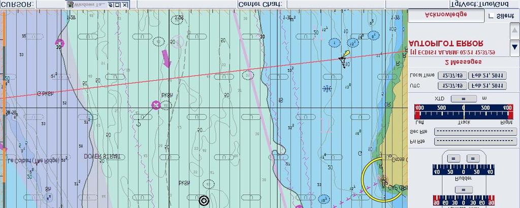
25 Additional Chart Layers Shallow Contour: 5 m Safety Contour: 10m Deep Contour: 15 m 25
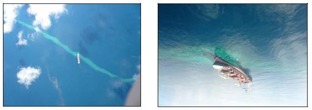
26 Default Settings according to standing orders / company standards (PassWord Secured, Restricted Access) User Profiles (Advantages/Disadvantages) Influense of chart settings during route planning / Monitoring Impact of the Chart View Function: Paper Chart / Depth setting / contours similar to a paper chart Limitations on available chart depth contours (8m input -> 10m line displayed) 26
27 Topics Chart Presentation Modes Additional Chart Layers Chart Scale Navigational Impact 27

28 Chart Scale Over scale warning Be aware: On some systems the feature Overscale indicator can be deactivated 28

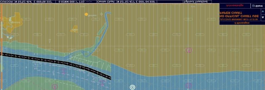
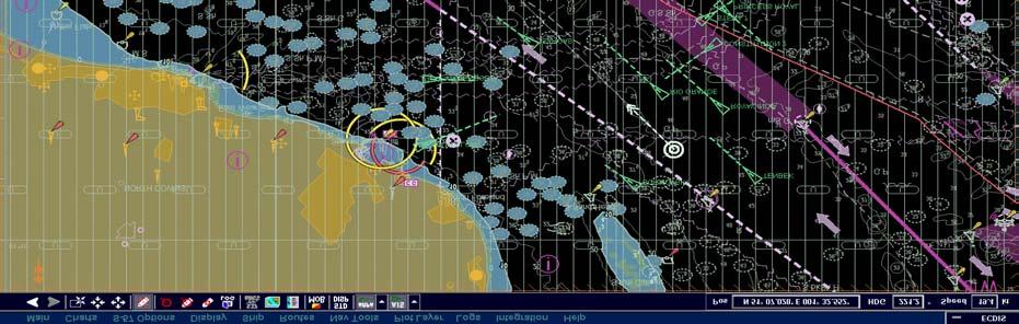
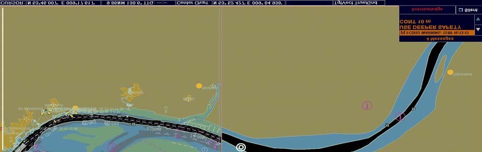
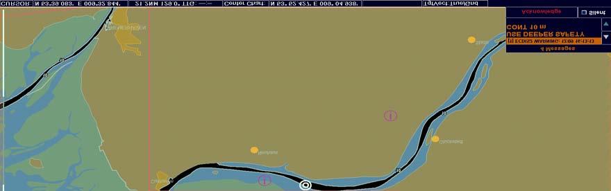
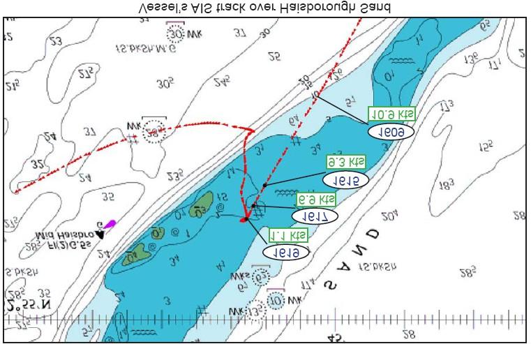
29 Chart Scale 29

30 Chart Scale 30

31 Chart Scale 31
32 Google Earth one chart without different scales Deactivation Overscale Indicator 100% ENC coverage - > all feasible scale ranges available? 32
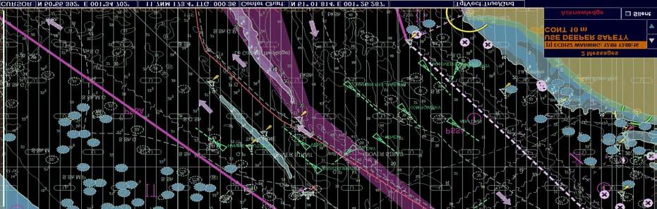
33 Topics Chart Presentation Modes Additional Chart Layers Chart Scale Navigational Impact 33

34 Navigational Impact Grounding of CV LT CORTESIA on 02. January 2008 passing English Channel west-bound. Flag: German Type: Full Container GT: t Engine: kw FPP Length: 333,99 m Draught: 11,75 m [max] Crew: Passengers 34


35 Navigational Impact 0420 Captain leaving Bridge 0428 Light Vessel reported by Look-out 0436 Course change to 237 Grounding Position 35

 Day mode Night mode (during")
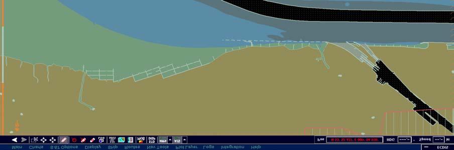
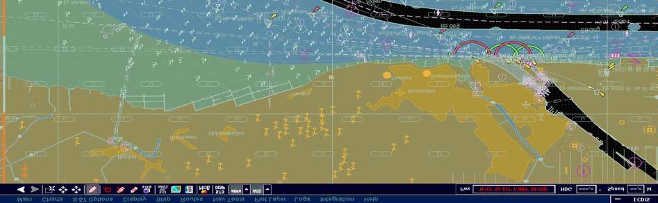
36 Navigational Impact Analysis of Error Chains The passage plane, done by the third mate was well clear of the varne bank. During grounding the shallow countour was 20m, safety countour 30 m (ships draught: 12m) Day mode Night mode (during grounding) 36
 Flag: Netherlands Type: General Cargo GT: 4 106 t Engine: 2 040 kw CPP Length: 118,40 m Draught: 5,90 m [max]")
37 Navigational Impact Grounding of the general cargo vessel CFL Performer on 12 May 2008 at 1619 (Haisborough Sand/ England / East entrance Dover Strait) Flag: Netherlands Type: General Cargo GT: t Engine: kw CPP Length: 118,40 m Draught: 5,90 m [max] Crew: 8 37
38 Navigational Impact 38

39 Navigational Impact Wrong scale settings Scale 1:

40 Navigational Impact Scale 1:
41 Navigational Impact Similar Accidents The MAIB is aware of a number of accidents in recent years in which the use or misuse of ECDIS or ECS has been identified as a contributing factor. In 2006, a ro-ro ferry ran aground after the safety contour in her ECDIS was set at 30m. This caused the chart display to be shaded blue, which serverely impeded the bridge teams ability to see that the vessel was outside the navigable channel. In January 2008, a ro-ro passenger ferry hit a submerged wreck near Dover and serverely damaged her propellers. Vessels primary means of navigation: paper charts, her deck officer relied on the vessels ECS, despite not having been trained in its use. The wreck was not shown on the ECS display due to settings applied to the system at the time.. 41

42 Navigational Impact Case Study Grounding of CV PACIFIC CHALLANGER on 09. April 2008 east of OroBay/Papua New Guinea Flag: German Type: Container GT: t Engine: kw FPP Length: 147,87 m Draught: 7,90 m [max] Crew: 19 42
43 Navigational Impact 43
44 Navigational Impact 44
45 Thank you for your attention! 45
V Complying with IHO S-52/S-63/S-64
 Model FEA-2107/2807 V.06.50 Complying with IHO S-52/S-63/S-64 The software has been upgraded to V.06.50 in accordance with the IHO standards. IHO S-52 Ed. 6.1.1 Specifications for Chart Contents and Display
Marine Accident Analysis of Collisions and Groundings: How to learn from past incidents to avoid them in the future
 Marine Accident Analysis of Collisions and Groundings: How to learn from past incidents to avoid them in the future Webinar: International Union of Marine Insurance 10 April 2018 Marine Accident Analysis
Minimum requirements. for Inland ECDIS devices in information mode and comparable chart display devices. for using Inland AIS data on board
 Protocol 2014-I-12, annex 2 Central Commission for the Navigation of the Rhine (CCNR) Minimum requirements and recommendations for Inland ECDIS devices and comparable chart display devices Minimum requirements
NAVIGATION ACCIDENTS AND THEIR CAUSES IS SHIPBOARD TECHNOLOGY A HELP OR HINDERANCE? CAPT.CLEANTHIS ORPHANOS MSc HEAD MAIC SERVICE
 NAVIGATION ACCIDENTS AND THEIR CAUSES IS SHIPBOARD TECHNOLOGY A HELP OR HINDERANCE? CAPT.CLEANTHIS ORPHANOS MSc HEAD MAIC SERVICE Shipboard Technology Radar/Arpa ECDIS GPS/DGPS/ LRIT VDR Loran Gyro compass
APPLICATION FOR PILOT EXEMPTION CERTIFICATE (PEC)
") APPLICATION FOR PILOT EXEMPTION CERTIFICATE (PEC) according to the Swedish Transport Agency s Regulations and General Advice (TSFS 2017:88) on Pilotage New application Renewal of PEC No: Supplement to
APPLICATION FOR PILOT EXEMPTION CERTIFICATE (PEC) according to the Swedish Transport Agency s Regulations and General Advice (TSFS 2017:88) on Pilotage New application Renewal of PEC No: Supplement to
Paper for consideration by ENC Working Group. Use of AU6 ENC cells as an option for Bathymetric ENCs (benc)
") Paper for consideration by ENC Working Group Use of AU6 ENC cells as an option for Bathymetric ENCs (benc) Submitted by: Alvaro Sanchez (AHS) Executive Summary: Compilation of high density bathymetric
Paper for consideration by ENC Working Group Use of AU6 ENC cells as an option for Bathymetric ENCs (benc) Submitted by: Alvaro Sanchez (AHS) Executive Summary: Compilation of high density bathymetric
DUKC Chart Overlay. Presentation to IHO TWL and DQ Working Groups Wollongong, March 2014
 DUKC Chart Overlay Presentation to IHO TWL and DQ Working Groups Wollongong, March 2014 Outline Who is OMC? DUKC description & methodology. DUKC Chart Overlay concept. Chart Overlay application example.
World Marine Offshore Torskekaj Esbjerg, Denmark
 WS30 WORLD BORA Vessel Specification MULTIPURPOSE OFFSHORE SUPPORT Suitable for transfer of crew and cargo to wind industry, crew change vessel, survey, ROV, standby, rescue and guard duties. The vessel
LP Focus. Is your ECDIS contributing to safe navigation or introducing risk? Issue 7
 LP Focus June 2018 Issue 7 Is your ECDIS contributing to safe navigation or introducing risk? Numerous groundings and near misses have occurred on ECDISequipped ships that could have been avoided but for
Nautical sub-committee
 Nautical sub-committee Accomplishments, latest work and developments Capt. Pantelis Patsoulis Nautical sub-committee INTERTANKO s most recently established subcommittee. Established from parent committee
INTERIM REPORT OF THE INVESTIGATION INTO AN INCIDENT INVOLVING MV EPSILON ON 8th FEBRUARY 2016
 INTERIM REPORT OF THE INVESTIGATION INTO AN INCIDENT INVOLVING MV EPSILON ON 8th FEBRUARY 2016 REPORT NO. MCIB/258/INTERIM (No.1 OF 2017) The Marine Casualty Investigation Board (MCIB) examines and investigates
Admiralty e-navigator
 Admiralty e-navigator Admiralty e-navigator Service e-navigation is the harmonised collection, integration, exchange, presentation and analysis of maritime information onboard and ashore by electronic
World Marine Offshore Torskekaj Esbjerg, Denmark
 WS25 WORLD SCIROCCO Vessel Specification MULTIPURPOSE OFFSHORE SUPPORT Suitable for transfer of crew and cargo to wind industry, crewchange vessel, survey, ROV, standby rescue and guard duties. The vessel
World Marine Offshore Torskekaj Esbjerg, Denmark
 Vessel Specification Suitable for transfer of crew and cargo to wind indu stry, crew change vessel, survey, ROV, standby rescue and guard duties. The vessel design is a proven concept within support vessels
Activities of KHOA on creation of S-10X test data sets and S-100 sea trial
 Activities of KHOA on creation of S-10X test data sets and S-100 sea trial Submitted by: Executive Summary: Related Documents: Related Projects: Republic Of Korea (KHOA) KHOA has been conducting a research
SAFETY NOTICE ABOUT THE RELIABLE OPERATION OF ECDIS
 IHB File No. S3/8157 CIRCULAR LETTER 33/2012 14 March 2012 THIS LETTER CONTAINS IMPORTANT INFORMATION ABOUT SAFETY OF NAVIGATION SAFETY NOTICE ABOUT THE RELIABLE OPERATION OF ECDIS Reference: a) IHB Circular
OPERATIONS SEAFARER CERTIFICATION GUIDANCE NOTE SA MARITIME QUALIFICATIONS CODE. Deck: Chart Work
 Page 1 of 6 Compiled by Approved by Chief Examiner Syllabus Committee: 26 February 2013 OPERATIONS SEAFARER CERTIFICATION GUIDANCE NOTE SA MARITIME QUALIFICATIONS CODE Deck: Chart Work Page 2 of 6 COLUMN
Grounding of the LT CORTESIA on 2 January 2008 on the Varne Bank in the English Channel
 Federal Higher Authority subordinated to the Ministry of Transport, of Transport, Building and Urban Affairs Investigation Report 01/08 Serious marine casualty Grounding of the LT CORTESIA on 2 January
Report on Vessel Casualty of Accident (Form Casualty) Instructions:
 Instructions:") Report on Vessel Casualty of Accident (Form Casualty) Tuvalu Ship Registry 10 Anson Road #25-16 International Plaza Singapore 079903 Tel: (65) 6224 2345 Fax: (65) 6227 2345 Email: info@tvship.com Website:
Report on Vessel Casualty of Accident (Form Casualty) Tuvalu Ship Registry 10 Anson Road #25-16 International Plaza Singapore 079903 Tel: (65) 6224 2345 Fax: (65) 6227 2345 Email: info@tvship.com Website:
PERFORMANCE STANDARDS FOR ELECTRONIC CHART DISPLAY AND INFORMATION SYSTEMS (ECDIS) [IMO Resolutions A.817 (19), MSC.64 (67) and MSC.
 [IMO Resolutions A.817 (19), MSC.64 (67) and MSC.") 1 PERFORMANCE STANDARDS FOR ELECTRONIC CHART DISPLAY AND INFORMATION SYSTEMS (ECDIS) [IMO Resolutions A.817 (19), MSC.64 (67) and MSC.86 (70)] (amended March 1999) Note: The IMO Performance Standards for
1 PERFORMANCE STANDARDS FOR ELECTRONIC CHART DISPLAY AND INFORMATION SYSTEMS (ECDIS) [IMO Resolutions A.817 (19), MSC.64 (67) and MSC.86 (70)] (amended March 1999) Note: The IMO Performance Standards for
Marine Incidents: Grounding of Nova Cura
 NCWG4-10.2 Paper for Consideration by NCWG Marine Incidents: Grounding of Nova Cura Submitted by: Executive Summary: Related Documents: Related Projects: Netherlands Hydrographic Office Lessons learned
TRAINING FOR TOMORROW
 32 TRAINING FOR TOMORROW In September 2012 Warsash Superyacht Academy was launched, providing superyacht crew with industry-specific training. Just months after its opening, The Crew Report paid the academy
FAST SUPPLY INTERVENTION and CREW TRANSFER VESSEL M P 6 2 5
 FAST SUPPLY INTERVENTION and CREW TRANSFER VESSEL M P 6 2 5 MAIN PARTICULARS LENGTH OVER ALL 60.68 m LENGTH WATER LINE 59.35 m BREADTH MAX 20.80 m DRAUGHT MAX 3.10 m DEPTH 6.70 m MAX SPEED 37.0 knots @
COXSWAIN NAVIGATION EXERCISES AUS197 NAME:
 COXSWAIN NAVIGATION EXERCISES AUS197 NAME: A deviation card is supplied at the end of this file. Check the answers Question 1 Using any chart (or use the AUS 197 extract) to: 1. Identify a distance of
ANNEX 24 RESOLUTION MSC.232(82) (adopted on 5 December 2006)
 (adopted on 5 December 2006)") RESOLUTION MSC.232(82) (adopted on 5 December 2006) ADOPTION OF THE REVISED PERFORMANCE STANDARDS FOR ELECTRONIC CHART DISPLAY AND INFORMATION SYSTEMS (ECDIS) THE MARITIME SAFETY COMMITTEE, RECALLING Article
RESOLUTION MSC.232(82) (adopted on 5 December 2006) ADOPTION OF THE REVISED PERFORMANCE STANDARDS FOR ELECTRONIC CHART DISPLAY AND INFORMATION SYSTEMS (ECDIS) THE MARITIME SAFETY COMMITTEE, RECALLING Article
RESOLUTION A.817(19) adopted on 23 November 1995 PERFORMANCE STANDARDS FOR ELECTRONIC CHART DISPLAY AND INFORMATION SYSTEMS (ECDIS)
 adopted on 23 November 1995 PERFORMANCE STANDARDS FOR ELECTRONIC CHART DISPLAY AND INFORMATION SYSTEMS (ECDIS)") A 19/Res.817 15 December 1996 Original: ENGLISH ASSEMBLY 19th session Agenda item 10 RESOLUTION A.817(19) adopted on 23 November 1995 PERFORMANCE STANDARDS FOR ELECTRONIC CHART DISPLAY AND INFORMATION
A 19/Res.817 15 December 1996 Original: ENGLISH ASSEMBLY 19th session Agenda item 10 RESOLUTION A.817(19) adopted on 23 November 1995 PERFORMANCE STANDARDS FOR ELECTRONIC CHART DISPLAY AND INFORMATION
Harbourmaster s Office Tamaki River. Navigation Safety Operating Requirements 2014
 Harbourmaster s Office Tamaki River Navigation Safety Operating Requirements 2014 Auckland Council Harbourmaster s Office TAMAKI RIVER Navigation Safety Operating Requirements FOREWARD The purpose of these
ACCIDENT REPORT. Muros. Report on the investigation of the. grounding of. Haisborough Sand. North Sea. 3 December 2016
 ACCIDENT REPORT Report on the investigation of the grounding of Muros Haisborough Sand North Sea 3 December 2016 M A RINE A C C I DENT INVES TIG A T ION BR A NCH SERIOUS MARINE CASUALTY REPORT NO 22/2017
MARINE NOTICE MARINE NOTICE. Marine Notice 7/2012. Guidance on ECDIS for ships calling at Australian ports 7/2012
 MARINE NOTICE MARINE 7/2012 NOTICE Marine Notice 7/2012 Guidance on ECDIS for ships calling at Australian ports This notice aims to clarify some of the emerging issues relating to the carriage requirements
NAEST(M) training Course Structure and Session Objectives. Day Introduction and enrolment
 training Course Structure and Session Objectives. Day Introduction and enrolment") NAEST(M) training Course Structure and Session Objectives Day 1 0830-0930 Introduction and enrolment 0930-1330 Effective Bridge Procedures & Rule of the Road Lecturer will go through the PowerPoint on
NAEST(M) training Course Structure and Session Objectives Day 1 0830-0930 Introduction and enrolment 0930-1330 Effective Bridge Procedures & Rule of the Road Lecturer will go through the PowerPoint on
The Maritime Law Association of Australia and New Zealand
 The Maritime Law Association of Australia and New Zealand Protecting the Environment and Promoting Safe Navigation: Australia s System of Pilotage in the Torres Strait Adam McCarthy Assistant Secretary
National Maritime Center
 National Maritime Center Providing Credentials to Mariners (Sample Examination) Page 1 of 5 Choose the best answer to the following Multiple Choice Questions. 1. (The following questions are based on Chart
Nautical Chart Challenge
 Discover Your World With NOAA Nautical Chart Challenge For as long as anyone in his family could remember, Francis Beaufort wanted to make scientific observations from the deck of a ship. In 1789 at the
ASSESSMENT. Heavy Weather Passage Challenger (Kaitaki) 24 October 2006
 24 October 2006") ASSESSMENT Heavy Weather Passage Challenger (Kaitaki) 24 October 2006 1 INTRODUCTION On 24 October 2006, the Cook Strait ferry Challenger sailed from Picton to Wellington encountering storm force conditions.
ASSESSMENT Heavy Weather Passage Challenger (Kaitaki) 24 October 2006 1 INTRODUCTION On 24 October 2006, the Cook Strait ferry Challenger sailed from Picton to Wellington encountering storm force conditions.
Presentation Library for Inland ECDIS
 Edition 2.0 1.6.2006 Standard Electronic Chart Display and Information System for Inland Navigation Inland ECDIS for Inland ECDIS In addition to the IHO-S-52 Edition 2.0 IES 20-Section 3 PresLib.doc Page
Norwegian Coastal Administration (NCA) HSSC November 2015 Busan - Republic of Korea
 HSSC November 2015 Busan - Republic of Korea") Norwegian Coastal Administration (NCA) HSSC7 9-13 November 2015 Busan - Republic of Korea Requirements relating to sector lights for Electronic Navigational Chart (ENC) Product Specifications B E Krosness
Norwegian Coastal Administration (NCA) HSSC7 9-13 November 2015 Busan - Republic of Korea Requirements relating to sector lights for Electronic Navigational Chart (ENC) Product Specifications B E Krosness
Chittagong, Bangladesh (Asia Region)
") General Information: Port Information (Asia Region) Extract of port information from Chittagong Port Authority: The Port of Chittagong is the principal Port of the People's Republic of Bangladesh. It is
General Information: Port Information (Asia Region) Extract of port information from Chittagong Port Authority: The Port of Chittagong is the principal Port of the People's Republic of Bangladesh. It is
SAMOTHRAKI. Report on the investigation of the grounding. of the oil tanker. Gibraltar 17 March 2007
 Report on the investigation of the grounding of the oil tanker SAMOTHRAKI Gibraltar 17 March 2007 Government of Gibraltar Maritime Administration Watergate House 2/8 Casemates Square Gibraltar NOTE This
ECDIS Familiarisation Training
 Chapter 4 ECDIS Familiarisation Training The convention related to the qualifications of seafarers responsible for ship operation is STCW (International Convention on Standards of Training, Certification
GUIDELINES ON OPERATIONAL INFORMATION FOR MASTERS IN CASE OF FLOODING FOR PASSENGER SHIPS CONSTRUCTED BEFORE 1 JANUARY 2014 *
 E 4 ALBERT EMBANKMENT LONDON SE1 7SR Telephone: +44 (0)20 7735 7611 Fax: +44 (0)20 7587 3210 MSC.1/Circ.1589 24 May 2018 GUIDELINES ON OPERATIONAL INFORMATION FOR MASTERS IN CASE OF FLOODING FOR PASSENGER
Rule 15 - Crossing situation
 When two power-driven vessels are crossing so as to involve risk of collision, the vessel which has the other on her own starboard side shall keep out of the way and shall, if the circumstances of the
EMPA 2017 How can the S-102 Bathymetric Surface Product improve safety in navigation and pilotage?
 EMPA 2017 How can the S-102 Bathymetric Surface Product improve safety in navigation and pilotage? Operated by the Norwegian Mapping Authority, Hydrographic Service FREEDOM TO CHOOSE Content What is the
Note to Shipbuilders, shipowners, ship Managers and Masters. Summary
 MARINE GUIDANCE NOTE MGN 301 (M+F) Manoeuvring Information on Board Ships Note to Shipbuilders, shipowners, ship Managers and Masters This note supersedes Marine Guidance Note MGN 201 (M+F) Summary The
Admiralty Leisure Folio SC5601 East Devon and Dorset Coast, Exmouth to Christchurch
 Admiralty Leisure Folio SC5601 East Devon and Dorset Coast, Exmouth to Christchurch The Notices to Mariners (NMs) listed below apply to the latest edition of SC5601 (11 th Edition) published on 24 th March
International Conference of Advanced Intelligent Maritime Safety and Technology. Original article
 A MAST 2015 International Conference of Advanced Intelligent Maritime Safety and Technology Original article Human Factors in e-navigation: a study of Dynamic NoGo Area Visualization in Electronic Nautical
Appendix 2: Presentation Library for Inland ECDIS TABLE OF CONTENTS
 Appendix 2: Presentation Library for Inland ECDIS TABLE OF CONTENTS 1. Lookup Tables... 2 2. Conditional Symbology Procedures... 2 2.1. Top marks... 2 2.2. Daymars... 2 2.3. Restricted areas... 2 2.4.
Offshore Wind Vessels. Steven Kopits Douglas-Westwood LLC
 Offshore Wind Vessels Steven Kopits Douglas-Westwood LLC Offshore Wind: Removing Market Barriers DOE Webinar July 25, 2012 1 www.dw-1.com Our business History and Office Locations Established 1990 Aberdeen,
Paper for Consideration by NIPWG. Data Quality Indicators for bathymetric data on ECDIS chart display
 NIPWG 1-18.1 rev1 Paper for Consideration by NIPWG Data Quality Indicators for bathymetric data on ECDIS chart display Submitted by: Executive Summary: Related Documents: Related Projects: BSH, SNPWG/CSPCWG
HSEMS WORKING INSTRUCTION
 HSEMS WORKING INSTRUCTION rev.: 3 1 Reference: OP-SAF-10; Bridge Management Manual 1. SCOPE To provide instructions about Electronic Chart Display and Information System (ECDIS) use and management on board
properly applied assessment in the use.1 landmarks.1 approved in-service of ECDIS is not experience The primary method of fixing required for those
 STCW Code Table A-II/3 Specification of minimum standard of for officers in charge of a navigational watch and for masters on ships of less than 500 gross tonnage engaged on near-coastal voyages Ref: https://www.edumaritime.net/stcw-code
AHO s experience on HD bathymetric ENCs
 AHO s experience on HD bathymetric ENCs ENCWG3 Wollongong 16 18 April 2018 Alvaro Sanchez DD Charting Quality Assurance, Standards and Specifications Australian Hydrographic Office Background 2016 As part
This unit is primarily aimed at learners who intend to seek employment within the maritime industry.
 General information for centres Unit title: Bridge Watchkeeping (SCQF level 7) Unit code: HW6G 47 Superclass: ZS Publication date: November 2017 Source: Scottish Qualifications Authority Version: 01 Unit
Comments on the collision between a tanker and a U.S. Navy ship in the Strait of Singapore
 Comments on the collision between a tanker and a U.S. Navy ship in the Strait of Singapore August 2017 (chronologically from bottom to top) Wed, Aug 23, 2017 at 3:05 PM Turning all deck lights on should
This direction contains the requirements for the compulsory pilotage areas within the Auckland region. This
 Harbourmaster s Direction 2-15 Pilotage Foreword This direction contains the requirements for the compulsory pilotage areas within the Auckland region. This direction updates and supersedes previous Harbourmaster
ACCIDENT AND INCIDENT SAFETY INVESTIGATIONS
 Merchant Shipping Directorate ACCIDENT AND INCIDENT SAFETY INVESTIGATIONS tice to Shipowners, Ship Operators and Managers, Masters, Owners' representatives and recognised organisations Merchant Shipping
Figure 1: The squat effect. (Top) Ship at rest. (Bottom) Ship under way.
 Ship at rest. (Bottom) Ship under way.") Under-Keel Clearance of Frigates and Destroyers in Shallow Water Tim Gourlay, Centre for Marine Science and Technology, Curtin University CMST Research Report 013-53 Abstract For RAN ships operating in
Under-Keel Clearance of Frigates and Destroyers in Shallow Water Tim Gourlay, Centre for Marine Science and Technology, Curtin University CMST Research Report 013-53 Abstract For RAN ships operating in
Isle of Man Ship Registry. Casualty Investigation Report No. CA102. 2nd December 2006
 Isle of Man Ship Registry Casualty Investigation Report No. CA102 Collision between the Tanker British Cygnet and Container ship Vera 2nd December 2006 Page 1 of 22 Contents Page No Statement of Intent
Circuit Court, E. D. Louisiana. March 6, 1886.
 459 MASON V. ERVINE AND OTHERS. 1 Circuit Court, E. D. Louisiana. March 6, 1886. 1. PILOTS BRANCH PILOTS OF THE PORT OF NEW ORLEANS. The Association of Branch Pilots of the port of New Orleans does not
WELCOME TO THE MILLENNIUM RIBBLE LINK
 WELCOME TO THE MILLENNIUM RIBBLE LINK The prestigious 5.8m project to construct the Millennium Ribble Link opened in 2002. This is the first new navigation to be built in England since the Manchester Ship
THE SYLLABUS FOR WRITTEN EXAMINATION PILOT'S FOURTH CLASS LICENCE (TEES AND HARTLEPOOL) AND
 AND") PD TEESPORT CONSERVANCY DIVISION HARBOUR MASTER'S OFFICE THE SYLLABUS FOR WRITTEN EXAMINATION IN RESPECT OF A PILOT'S FOURTH CLASS LICENCE (TEES AND HARTLEPOOL) AND PILOTAGE EXEMPTION CERTIFICATE (Issued
PD TEESPORT CONSERVANCY DIVISION HARBOUR MASTER'S OFFICE THE SYLLABUS FOR WRITTEN EXAMINATION IN RESPECT OF A PILOT'S FOURTH CLASS LICENCE (TEES AND HARTLEPOOL) AND PILOTAGE EXEMPTION CERTIFICATE (Issued
Higher National Integrative Assessment Specification. Title: Nautical Science: Integrative Assessment 1
 Higher National Integrative Assessment Specification General Information for centres This Integrative Assessment has been validated as part of the HND Nautical Science. Centres are required to develop
UNIT FOUR NAVIGATION TEXTS, TASKS AND PROJECT
 UNIT FOUR TEXTS, TASKS AND PROJECT NAVIGATION - Navigation - Anchoring, Berthing, Leaving berth and Underway - Buoyage - Loading, Discharging & Trim - Project: Pilot Reading Glossary and Practice Navigation
VESSEL EQUIPMENT LIST CLASS 1E
 GUIDANCE NOTICE VESSEL EQUIPMENT LIST CLASS 1E This Guidance Notice provides details of the Class 1E vessel equipment list required under the National Standard for Commercial Vessels (NSCV). Glossary and
The problem is not automation, the problem is communication: Autonomy, human factors and safety in the maritime domain
 The problem is not automation, the problem is communication: Autonomy, human factors and safety in the maritime domain Monitoring Navigator Navigating Automation Thomas Porathe Professor, Interaction Design
NEW SURVEY MOTOR LAUNCHES FOR THE ROYAL AUSTRALIAN NAVY
 International Hydrographic Review, Monaco, LXVI(l), January 1989 NEW SURVEY MOTOR LAUNCHES FOR THE ROYAL AUSTRALIAN NAVY by Commander John LEECH, RAN (*) INTRODUCTION By any standards the task facing the
2005 ABC. Chapter 3 Part 2. Navigating with ATON's. Revision to D-13 Local Notes. Instructor Notes for Mike Brough. Mike Brough
 2005 ABC Chapter 3 Part 2 Navigating with ATON's Revision to D-13 Local Notes Instructor Notes for Mike Brough Mike Brough June 24 2008 June 24 2008 Slide 1 June 24 2008 New graphics Navigating on Water
Plot the Path into the Harbor
 Plot the Path into the Harbor By Mary Anne Otten, Rudyard Area Schools and Joan Chadde, Michigan Technological University Subject/Grade: Grade 3 6, Math, Social Studies, Science Duration: 35 minutes Lesson
RESOLUTION MSC.161(78) (adopted on 17 May 2004) AMENDMENTS TO THE EXISTING MANDATORY SHIP REPORTING SYSTEM "THE TORRES STRAIT AND INNER ROUTE OF THE
 (adopted on 17 May 2004) AMENDMENTS TO THE EXISTING MANDATORY SHIP REPORTING SYSTEM THE TORRES STRAIT AND INNER ROUTE OF THE") MSC 78/26/Add.2 RESOLUTION MSC.161(78) REPORTING SYSTEM THE TORRES STRAIT AND INNER ROUTE OF THE GREAT BARRIER REEF THE MARITIME SAFETY COMMITTEE, RECALLING Article 28(b) of the Convention on the International
MSC 78/26/Add.2 RESOLUTION MSC.161(78) REPORTING SYSTEM THE TORRES STRAIT AND INNER ROUTE OF THE GREAT BARRIER REEF THE MARITIME SAFETY COMMITTEE, RECALLING Article 28(b) of the Convention on the International
INSTRUCTIONS FOR NAVIGATING TOPDOG
 INSTRUCTIONS FOR NAVIGATING TOPDOG TABLE OF CONTENTS Page 1: Page 2: Page 3: Page 4: Page 5: Page 6: Page 7: Page 8: Page 9: LOGGING IN I M IN TOPDOG NOW WHAT? (explanation of Home Page, League Page, Team
National Maritime Center
 National Maritime Center Providing Credentials to Mariners (Sample Examination) Page 1 of 16 Choose the best answer to the following Multiple Choice Questions. 1. On U.S. charts, you can tell if a named
Pilotage. Planning for pilotage
 Pilotage Planning for pilotage Being one step ahead of the game is key to effective pilotage. Only then will you know what to expect and what s lurking around the next bend. It s useful to construct a
ROUTEING MEASURES OTHER THAN TRAFFIC SEPARATION SCHEMES
 E 4 ALBERT EMBANKMENT LONDON SE1 7SR Telephone: +44 (0)20 7735 7611 Fax: +44 (0)20 7587 3210 SN.1/Circ.317 4 December 2012 ROUTEING MEASURES OTHER THAN TRAFFIC SEPARATION SCHEMES 1 The Maritime Safety
Qualification details
 Qualification details Title New Zealand Certificate in Maritime Operations (Level 4) with strands in Fishing and Watchkeeping Version 1 Qualification type Certificate Level 4 Credits 120 NZSCED 031705
The Implementation of the International Maritime Organization Requirements Related to Maritime English Teaching and Learning
 The Implementation of the International Maritime Organization Requirements Related to Maritime English Teaching and Learning Our presentation offers the principles of implementation of Maritime English
Technical Information
 Subject Implementation of Electronic Chart Display and Information System (ECDIS) To whom it may concern Technical Information No. TEC-1129 Date 11 September 2017 ClassNK has informed the requirements
International regulations and guidelines for maritime spatial planning related to safe distances to multiple offshore structures (e.g.
 International regulations and guidelines for maritime spatial planning related to safe distances to multiple offshore structures (e.g. wind farms) Introduction This is a summary of the most important international
Collision in restricted visibility
 August 2013 Collision in restricted visibility It was early morning and both vessels were sailing in a busy traffic separation scheme in South East Asia. The sea was calm but there were some rain showers
ADMINISTRATIVE INSTRUCTION No. STCW-14 QUALIFICATION / CERTIFICATION REQUIRED FOR OPERATION OF A DOMESTIC VESSESL
 ADMINISTRATIVE INSTRUCTION No. STCW-14 QUALIFICATION / CERTIFICATION REQUIRED FOR OPERATION OF A DOMESTIC VESSESL (Issued under section 3(5) of the Gibraltar Merchant Shipping (Safety etc.) Ordinance 1993
NIGERIAN NOTICES TO MARINERS November 2017 EDITION PUBLISHED BY THE HYDROGRAPHIC OFFICE LAGOS. Notice 01 November 2017 Supplied Gratis
 NIGERIAN NOTICES TO MARINERS November 2017 EDITION PUBLISHED BY THE HYDROGRAPHIC OFFICE LAGOS Notice 01 November 2017 Supplied Gratis November 2017 CONTENTS I II Explanatory Notes and Index Nigerian Navy
BookletChart. Sand Key to Rebecca Shoal NOAA Chart A reduced-scale NOAA nautical chart for small boaters
 BookletChart Sand Key to Rebecca Shoal NOAA Chart 11439 A reduced-scale NOAA nautical chart for small boaters When possible, use the full-size NOAA chart for navigation. Published by the National Oceanic
CERTIFICATES OF COMPETENCY IN THE MERCHANT NAVY DECK OFFICER STCW 95 OFFICER IN CHARGE OF NAVIGATIONAL WATCH REG. II/1 (UNLIMITED)
") CERTIFICATES OF COMPETENCY IN THE MERCHANT NAVY DECK OFFICER EXAMINATIONS ADMINISTERED BY THE SCOTTISH QUALIFICATIONS AUTHORITY ON BEHALF OF THE MARITIME AND COASTGUARD AGENCY STCW 95 OFFICER IN CHARGE
CERTIFICATES OF COMPETENCY IN THE MERCHANT NAVY DECK OFFICER EXAMINATIONS ADMINISTERED BY THE SCOTTISH QUALIFICATIONS AUTHORITY ON BEHALF OF THE MARITIME AND COASTGUARD AGENCY STCW 95 OFFICER IN CHARGE
 7 The Guidelines of Measures for preventing Typhoon Disaster ( Objective ) Article1 The objective of this guideline is to establish steps necessary to implement the measures for preventing typhoon
MARINE NOTICE MARINE NOTICE. Marine Notice 11/2012 Supersedes 15/2010 and 7/2012. Guidance on ECDIS for ships calling at Australian ports 11/2012
 MARINE NOTICE MARINE 11/2012 NOTICE Marine tice 11/2012 Supersedes 15/2010 and 7/2012 Guidance on ECDIS for ships calling at Australian ports This notice aims to clarify some of the emerging issues relating
Ufs. No Notices to Mariners, SWEDEN Swedish Maritime Administration.
 Ufs No 636 2017-02-02 Notices to Mariners, SWEDEN Swedish Maritime Administration Editorial office Swedish Maritime Administration Ufs 601 78 NORRKÖPING Sweden tel: 0771 630 605 e-mail: ufs@sjofartsverket.se
Appendix A Bridge Deck Section Images
 Appendix A Bridge Deck Section Images 127 128 Figure A1. Bridge deck R13, fabricated at the FHWA NDE Validation Center. Figure A2. Bridge deck R12, fabricated at the FHWA NDE Validation Center. 129 Figure
iii) Satisfactory completion of approved training in the following:
 Satisfactory completion of approved training in the following:") Enclosure (1) to NVIC 13-14 DISCUSSION OF QUALIFICATION REQUIREMENTS FOR MASTER AND OFFICER IN CHARGE OF A NAVIGATIONAL WATCH ON VESSELS OF LESS THAN 500 GT LIMITED TO NEAR-COASTAL WATERS 1. GENERAL. This
Enclosure (1) to NVIC 13-14 DISCUSSION OF QUALIFICATION REQUIREMENTS FOR MASTER AND OFFICER IN CHARGE OF A NAVIGATIONAL WATCH ON VESSELS OF LESS THAN 500 GT LIMITED TO NEAR-COASTAL WATERS 1. GENERAL. This
THE PILOT AND THE BRIDGE TEAM: AN ESSENTIAL AND COMPLEX RELATIONSHIP. CAPT. SIMON PELLETIER President
 THE PILOT AND THE BRIDGE TEAM: AN ESSENTIAL AND COMPLEX RELATIONSHIP CAPT. SIMON PELLETIER President Marine Accident Investigators' International Forum 23 rd Meeting Panama, July 2014 I appreciate this
Accident Report. Grounding Sanga Na Langa. 30 March 2006 Class C
 Accident Report Grounding Sanga Na Langa 30 March 2006 Class C REPORT NO.: 06 4041 VESSEL NAME: SANGA NA LANGA Ship Type: Certified Operating Limit: Flag: Commercial Passenger Enclosed & Inshore Limits
The LA/LB Harbors handle more than 5,500 commercial vessel arrivals per year (excluding local coastwise and Catalina Island traffic).
.") X. SMALL CRAFT For the purpose of the Los Angeles and Long Beach Harbor Safety Plan, pleasure vessels, commercial fishing vessels and sportfishing boats are designated as small craft. A. BACKGROUND: The
X. SMALL CRAFT For the purpose of the Los Angeles and Long Beach Harbor Safety Plan, pleasure vessels, commercial fishing vessels and sportfishing boats are designated as small craft. A. BACKGROUND: The
OSAKA MARTIS USER MANUAL TABLE OF CONTENTS
 OSAKA MARTIS USER MANUAL TABLE OF CONTENTS Ⅰ Ⅱ Ⅲ INTRODUCTION OPERATIONAL CONCEPT OF "Osaka MARTIS" IMPORTANT NAVIGATIONAL RULES Ⅳ COMMUNICATION 1 VHF Channels 2 Language Ⅴ PRE-ENTRY REPORT AND POSITION
PILOTAGE INFORMATION
 PILOTAGE INFORMATION Revised A PILOTAGE DIRECTIONS The Gloucester Harbour Trustees is the Competent Harbour Authority for the Gloucester Harbour under the Pilotage Act 1987 and responsible for the provision
RESOLUTION A.485(XII) adopted on 19 November 1981 TRAINING, QUALIFICATIONS AND OPERATIONAL PROCEDURES FOR MARITIME PILOTS OTHER THAN DEEP-SEA PILOTS
 adopted on 19 November 1981 TRAINING, QUALIFICATIONS AND OPERATIONAL PROCEDURES FOR MARITIME PILOTS OTHER THAN DEEP-SEA PILOTS") INTER-GOVERNMENTAL MARITIME CONSULTATIVE ORGANIZATION ASSEMBLY - 12th session Agenda item lo(b) RESOLUTION A.485(XII) adopted on 19 November 1981 IMCO RESOLUTION A.485(XII) adopted on 19 November 1981
INTER-GOVERNMENTAL MARITIME CONSULTATIVE ORGANIZATION ASSEMBLY - 12th session Agenda item lo(b) RESOLUTION A.485(XII) adopted on 19 November 1981 IMCO RESOLUTION A.485(XII) adopted on 19 November 1981
SAFE PASSAGE THE STRAITS OF MALACCA AND SINGAPORE. CF6-6.7.a the 6 th Co-Operation Forum 7-8 October 2013, Bali, Indonesia DRAFT CONTENT TEXT
 CF6-6.7.a the 6 th Co-Operation Forum 7-8 October 2013, Bali, Indonesia DRAFT CONTENT TEXT VER. 24 September 2013 SAFE PASSAGE THE STRAITS OF MALACCA AND SINGAPORE 1 INTRODUCTION Today, the Straits of
IDENTIFYING SKILL GAPS IN THE KNOWLEDGE AND TEACHING OF COLREGS
 IDENTIFYING SKILL GAPS IN THE KNOWLEDGE AND TEACHING OF COLREGS ABSTRACT Đani Mohović, Ph.D. Robert Mohović, Ph.D. Mate Barić, B.Sc. University of Rijeka Faculty of Maritime Studie Studentska 2, 51000
GUIDELINES FOR NAVIGATION UNDER THE CONFEDERATION BRIDGE
 (12/2009) GUIDELINES FOR NAVIGATION UNDER THE CONFEDERATION BRIDGE REVISION 1 DECEMBER 2009 Responsible Authority The Regional Director Marine Safety Atlantic Region is responsible for this document, including
Code Of Practice For Towage Operations In The Port of St Helier (Towage Guidelines)
") Code Of Practice For Towage Operations In The Port of St Helier (Towage Guidelines) This Code Covers The Use Of Tugs And Towage In The Port Of St Helier Page number Contents 2 Introduction 3 Communication
Code Of Practice For Towage Operations In The Port of St Helier (Towage Guidelines) This Code Covers The Use Of Tugs And Towage In The Port Of St Helier Page number Contents 2 Introduction 3 Communication
Sample Project with EPB TBM according to DIN 4085
 1 General The aim of the document is to provide information about the required input parameters and the necessary steps for the calculation of a face support pressure. This calculation is carried out under
MARINER S GUIDE TO THE FORTH
 MARINER S GUIDE TO THE FORTH INTRODUCTION 1. The Statutory Harbour Authority s area of jurisdiction on the River and Firth of Forth ( The Forth ) extends from approximately one mile west of the Isle of
Jack Hyde Memorial Navigation Contest Saturday, March 18, 2017 The Same Only Different
 Jack Hyde Memorial Navigation Contest Saturday, March 18, 2017 The Same Only Different March 17, 2018 Skippers, Mates and Crews, On behalf of the Tacoma Yacht Club let me welcome you to the running of
Ufs. No Notices to Mariners, SWEDEN Swedish Maritime Administration.
 Ufs No 588 2016-03-03 Notices to Mariners, SWEDEN Swedish Maritime Administration Editorial office Swedish Maritime Administration Ufs 601 78 NORRKÖPING Sweden tel: 0771 630 605 e-mail: ufs@sjofartsverket.se