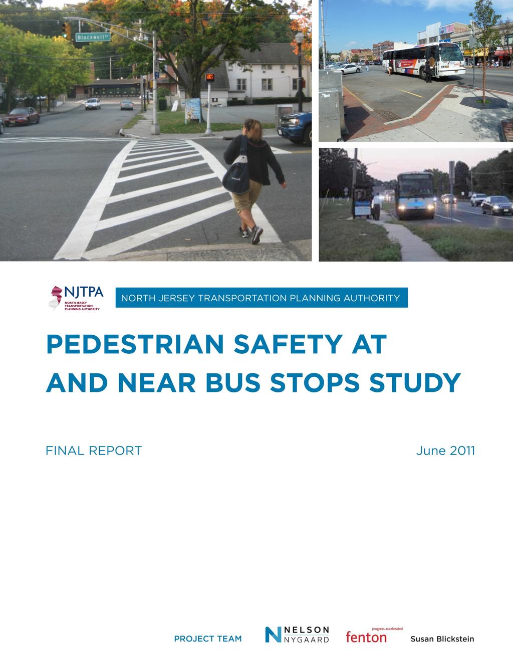
PEDESTRIAN SAFETY AT AND NEAR BUS STOPS STUDY FINAL REPORT NORTH JERSEY TRANSPORTATION PLANNING AUTHORITY. Executive Summary
|
|
|
- Charlotte Burke
- 6 years ago
- Views:
Transcription
1
2 Executive Summary INTRODUCTION Enhancing travel safety is a primary focus of the North Jersey Transportation Planning Authority (NJTPA). Under federal law, the NJTPA and other Metropolitan Planning Organizations across the country are required to Increase the safety of the transportation system for motorized and non-motorized users in all their work. This study helps meet this federal safety planning factor as it relates to pedestrian safety at or near bus stops. Of the NJTPA region s 352 crash-related deaths in 2009, 33% were pedestrians, even though walking accounts for less than 10% of all trips in the region. Among the causes are the region's density, traffic congestion, and unsafe driver and pedestrian behaviors. One of the locations where pedestrians face potential hazards from moving traffic is at the region s many bus stops. The region has a high level of bus transit ridership, with approximately 600,000 trips per day boarding at over 20,000 bus stops. As a result, the NJTPA undertook this study to identify approaches to reduce the severity and frequency of pedestrian crashes at and near bus stops in the 13-county NJTPA region. The approaches investigated encompassed all four E s associated with improving safety: education, engineering, enforcement, and evaluation. The study involved analyzing motorist and pedestrian behaviors and infrastructure needs at selected bus stop locations. It also included interviews and outreach to key stakeholders, such as local safety officials, drivers, bus riders and bus drivers. It was conducted in close collaboration with the New Jersey Division of Highway Traffic Safety (NJDHTS), the New Jersey Department of Transportation (NJDOT), and NJ TRANSIT. This study resulted in three primary products: Educational Awareness Campaign Plan -- discussed in Chapter 3 and Appendix E, this consists of three overall themes and various executions of those themes geared toward changing pedestrian and motorist behavior to be more safety conscious when traveling at and around bus stops. Bus Stop Safety Toolbox -- available on the NJTPA website ( and provided in Chapter 4, the Toolbox is a resource that elected officials, municipalities, planning board members, and citizens can use to understand how a community and implementing agencies can work together to enhance the safety and accessibility of an existing or new bus stop. Bus Stop Field Audit Reports available in Appendix D, the reports recommend physical improvements and implementation strategies, and assess their safety benefits for a small subset of bus stops within the region that have high concentrations of pedestrian injuries and fatalities within 50, 100, and 200 feet from the bus stop. These high-crash bus stop locations are in varied land use settings -- ranging from urban to suburban -- and are on county, state and local roads. The reports can be used as a valuable resource for officials and citizens in developing physical improvements at these sites. The sites are also representative of the challenges that drivers and pedestrians face at or near bus stops throughout the region. ES-1
3 The study is consistent with and supports key statewide transportation initiatives in particular, the New Jersey Comprehensive Strategic Highway Safety Plan which includes pedestrian safety as one of its eight emphasis areas. In addition, the study helps to promote the NJDOT Complete Streets Policy which seeks to develop infrastructure for all ages and abilities, including motorists, bus riders, cyclists, and pedestrians. STUDY PROCESS The first step in the study involved the analysis of Plan4Safety pedestrian crash data from the Transportation Safety Resource Center (TSRC) within the Center for Advanced Infrastructure and Transportation (CAIT), at Rutgers University. The Plan4Safety database of crash reports was analyzed to identify bus stop locations with pedestrian injuries and/or fatalities. These locations then became the focus for the study s observational and survey field audits, which informed the Study s three primary products: Education Awareness Campaign Plan, Bus Stop Safety Toolbox, and Bus Stop Field Audit Reports. In analyzing a range of bus stop locations in greater detail, the audits included the collection of data relevant to infrastructure issues and behavioral patterns. Observational field audits were conducted at a small subset of high pedestrian crash bus stops; they included bus passenger surveys, and tracking surveys of pedestrian street crossings. Additionally, the study team interviewed engineers, planners, bus operators, local police representatives and key state stakeholders such as NJ TRANSIT, NJDOT, and NJDHTS. In tandem with the bus stop field audits and stakeholder outreach, a literature review was conducted to better understand how behavioral factors and design issues contribute to pedestrian safety risk -- both in general and proximate to bus transit. A summary was compiled of best practices in pedestrian facility design and effective national and international public education campaigns (see Appendix A). With a solid understanding of key issues contributing to pedestrian safety at and around bus stops, and drawing upon the findings of the field audits -- which were compiled into seven (7) Bus Stop Field Audit Reports -- the study team developed the concise Bus Stop Safety Toolbox. The toolbox is a stand-alone document intended for use by communities and implementing agencies to improve the safety and accessibility of bus stops. It focuses mainly on design issues and physical improvements. The behavioral part of the study explored the perceptions and experiences of pedestrians and motorists who travel at and around bus stops in the northern and central New Jersey region. The study team conducted two rounds of motorist and bus rider focus groups; the first round of focus groups was held to understand how pedestrians, motorists, and bus operators interact and challenges they routinely face. Based on the first round focus group input, a draft educational awareness campaign plan was created to encourage motorists, pedestrians, and bus riders to be conscious of safety when traveling at and around bus stops. This draft educational awareness campaign plan was then discussed and improved upon through a second round of focus groups. In addition, an evaluation and monitoring methodology was developed to track how well the campaign reaches target audiences and various measures of effectiveness. The following flowchart illustrates the study process, with each step feeding into and informing subsequent steps. ES-2

4 Figure ES-0-1 Project Flowchart ES-3
5 TABLE OF CONTENTS Executive Summary... ES-1 Chapter 1. Crash Data Analysis & Site Selection Plan4Safety Methodology: Establishing the Top Pedestrian Crash Bus Stops 1-3 Crash Summary Pedestrian Crash Bus Stop Sites for Further Analysis 1-6 Final Site Selection Chapter 2. Field Audit Data Collection Data Collection Traffic Operations Bus Stop Safety Issues..2-3 Pedestrian Tracking Survey Bus Passenger Survey Bus Stop Field Audit Reports Suggested Design Improvements Provided in Bus Stop Field Audit Reports Chapter 3. Educational Campaign Plan First Round of Focus Groups PSA's Presented to First Round of Focus Groups 3-4 Key Insights from First Round of Focus Groups Motorist & Bus Rider Education Campaign Ideas Education Campaign Conclusions Recommendations from Focus Groups Media Outreach.3-11 Evaluation and Monitoring 3-12 Sample Campaign Budgets Chapter 4. Bus Stop Safety Toolbox Chapter 5. Stakeholder Input Bus Operators - Summary Of Interviews Stakeholder Interviews Law Enforcement County Planners & Engineers Chapter 6. Conclusion i
6 APPENDICES Appendix A: Literature Review Appendix B: Focus Group Recruitment Appendix C: Seven Bus Stop Field Audit Reports Appendix D: Education Campaign Concepts TABLE OF FIGURES Figure ES-1 Project Flowchart... ES-3 Figure 1-1 Dataset Filter Figure 1-2 Pedestrian Crashes at and Around Bus Stops by Land Use Type and County (Total of 1,760 crash records) Figure 1-3 Pedestrian Crashes at and Around Bus Stops by County Figure 1-4 Top 43 Crash Sites Figure 1-5 Final 11 Crash Sites Figure 2-1 Data Collection Schedule Figure 2-2 Sample Vehicle Per Lane Traffic in Bus Stop Field Audit Report Figure 2-3 Sample Pedestrian Tracking Survey in Bus Stop Field Audit Report Figure 2-4 Responses by Location Figure 2-5 Bus Rider Survey Sample.2-6 Figure 2-6 How Often Do You Take This Bus? Figure 2-7 How Did You Get To The Bus Stop Today Figure 2-8 Motorist Behavior When Bus Rider is Crossing Street Figure 2-9 US Route 9 & Fairway Lane, Old Bridge Township Bus Stop Figure 2-10 Main & Day Street, City of Orange Township NJ TRANSIT Bus Stop Figure 2-11 Suggested Design Improvements Provided in Field Audit Bus Stop Reports ii
7 Chapter 1. CRASH DATA ANALYSIS & SITE SELECTION The first step in understanding the issues and challenges facing pedestrians and motorists at and around bus stops was analyzing crash data to determine where pedestrian crashes were concentrated. The Transportation Safety Resource Center (TSRC) of the Center for Advanced Infrastructure and Transportation (CAIT), at Rutgers University, has developed and maintains a Plan4Safety database that contains a wealth of information about each crash. This dataset includes time of day, what the driver was doing before the crash, what the pedestrian was doing before the crash, and other useful information. Plan4Safety data for the NJTPA region from 2006 to mid-year 2009 was analyzed in a Geographic Information Systems (GIS) mapping tool. Bus stop locations with pedestrian crashes at a 50-, 100-, or 200- foot buffer (depending on whether the bus stop is urban, suburban, or rural) were identified. This crash data collection then informed the selection of eleven bus stop locations representing a range of land uses, roadway ownership (county, local, or state), and geographic distribution throughout the NJTPA region. These selected bus stops were analyzed in detail in the field to gain insight into the specific behaviors and/or physical design issues that may be contributing to the pedestrian crashes. Seven of these eleven bus stop locations were recommended for further analysis as Appendix D: Field Audit Bus Stop Reports. PLAN4SAFETY A primary goal of this study was to not only analyze bus stop locations that have a significant number of pedestrian crashes, but to understand the factors that contributed to the crashes, including behaviors of motorists and/or pedestrians. The New Jersey Police Crash Investigation Report is a form that police officers fill out to record crash location and physical factors that may have led to a crash. The crash report (or NJTR-1) contains fields that help explain physical factors such as the lighting condition field that tells whether it was daylight or night, and whether a street lamp was lit or not. Plan4Safety uploads the information from these crash reports to an on-line database in Excel and GIS formats for data analysis. There are four fields in the crash report that Plan4Safety identifies for analysis related to the behavioral causes of crashes: Vehicle Action/Pre-Crash Action This tells what the vehicle was doing before the crash, such as Going Straight Ahead, Passing, or Right Turn on Red. Pedestrian Action/Pre-Crash Action This tells what the pedestrian was doing before the crash, such as Crossing at marked crosswalk (intersection or midblock), Crossing/Jaywalking, or Playing in Road. This is an important field, as it tells when pedestrians are crossing at desired locations (crosswalks) and when they are acting in a dangerous manner (jaywalking). Vehicle Contributing Factor This tells what action the driver took that contributed to the crash, such as Driver Inattention, Failure to yield ROW to Vehicle/Pedestrian, or Unsafe Speed. 1-1
8 Pedestrian Contributing Factor This tells what action the pedestrian took that contributed to the crash, such as Failed to Obey Traffic Control Device, Crossing Where Prohibited, or Failure to Yield Right Of Way. Other useful data fields in the analysis include: Land Use Context Crash Date Posted Speed Alcohol Involved Severity of Injury Light Condition (Whether it was day or night, and whether street lamps were on or off) Pedestrian Location of Injury (What part of the body was injured) Traffic Control (Whether the location was signalized, un-signalized, had a stop sign, or a crossing guard) Driver Age Gender of Motorist Gender of Pedestrian First Sequence of Events (This provides information on what happened first in the crash. A second and third sequence of events is recorded, but only 383 records contain second sequence of events and 21 have third sequence data.) Plan4Safety is an excellent data resource; however, it does have limitations in that the quality of the data is only as good as the data input into the NJTR1. Some of the limitations of Plan4Safety that affected the study's ability to hone in further on crash causes were: Location Information: Of the crashes that occurred in the NJTPA region during the three-year analysis period, 38 percent of the crash records did not have longitude or latitude information, meaning the data could not be uploaded to GIS and analyzed. No ability to discern crashes involving a bus: Under vehicle type of the NJTR1, there is an option for "Bus/Large Van (9 or more seats). Thus a 40' regular transit bus is grouped in the same category as a small passenger van. A pre-crash pedestrian action option on the NJTR1 is approaching/leaving school bus. This action is biased towards school bus pick-up and drop-off locations, and does not help understand actions around NJTRANSIT bus stops. Improper NJTR1 coding: For example, under the "Vehicle Action/Pre-Crash Action" field, 13 records listed "jaywalking" when clearly a vehicle cannot jaywalk. Incomplete records: Many important fields are marked "NULL" or are simply blank. For example, the pedestrian age category only has a value for 2 out of the 1,760 crash records analyzed in this study. Other fields are complete, such as alcohol involved (100% reported) while others are partially complete, like driver age (83% reported). This issue is especially problematic for the four behavioral fields on the NJTR1. While 95% of the "Vehicle Action/Pre-Crash Action fields" and 88% of the "Vehicle 1-2
9 Contributing Factor" fields are populated, only 68% and 61% of the complementary pedestrian fields have a NULL input. Methodology: Establishing the Top Pedestrian Crash Bus Stops First Plan4Safety was queried to isolate pedestrian crashes within the 13-county NJTPA region during the period between January 2006 and June The next step was pulling out all the crash records that had geographic information, meaning that the crash could be mapped in GIS. The following step was to analyze pedestrian crashes that resulted in pedestrian injuries or fatalities. In many cases the "pedestrian" involved in the crash was actually coded as a "pedalcyclist"; this is because Plan4Safety classifies these crashes as a pedestrian even though it is actually a cyclist. Also, many of the crashes resulted in property damage only and no pedestrian was injured. After removing those NJTR1 crash records, the crashes were mapped to see if they occurred near or at a bus stop. The NJTPA region has a wide range of land uses. In urban areas, for example, people are out walking for a variety of reasons -- not necessarily just to get to and from the bus stop. In an attempt to differentiate between general pedestrian activity and bus passengers, the bus stops were buffered, in GIS, based upon their land uses. The NJTPA breaks down the region into place types, which are then categorized into an urban, suburban, or rural designation. This categorization informed the size of the buffer around the bus stop. The distances used to buffer around each bus stop, 50 for urban, 100 for suburban, and 200 for rural were determined based on capturing crashes that occurred at or near bus stops. Using a smaller buffer would miss crashes occurring near bus stops, while using a larger buffer might capture pedestrians that were not bus riders. The buffer distance was reduced for urban areas due to an assumption that there is high pedestrian activity in and around bus stops that may not involve pedestrians boarding and alighting a bus. The buffer distance for suburban and rural bus stops was greater under the assumption that pedestrian activity is generally less and pedestrian presence has a stronger relationship with boarding and alighting from a bus within this land use context. GIS was used to count the number of crashes that occurred within each bus stop buffer. The final data set for analysis included 1,760 crashes: 502 urban, 1,243 suburban and 15 rural. These crashes occurred at or near 1,250 bus stops. A graphic representation of the above methodology is shown on the next page: 1-3


10 Figure 1-1 Dataset Filter The following chart and table summarizes the crashes by land use type and county for the final list of 1,760 pedestrian crash records. 1-4
11 Figure 1-2 Pedestrian Crashes at and Around Bus Stops by Land Use Type and County (Total of 1,760 crash records)* Rural at 200' Suburban at 100' Urban at 50' *Sussex and Hunterdon had zero pedestrian crashes at and around bus stops and were not included Figure 1-3 Pedestrian Crashes at and Around Bus Stops by County and Year * County * Total Essex Bergen Hudson Union Passaic Middlesex Monmouth Morris Ocean Somerset Warren Total * 1,760 *2009 data is not a full year and only captures up to mid-year
12 Crash Summary The following provides a summary of the 1,760 pedestrian crash records analyzed: Crash Setting: 58% occurred during daylight hours 86% on a straight and level road Intersection Type: 56% at an intersection 46% occurred at a traffic signal 23% at un-signalized locations Gender: 58% of the drivers were male 50% of the pedestrians were female Alcohol & Cell Phone Usage: 5.5% involved alcohol 0.6% reported cell phone usage Pedestrian Crash Bus Stop Sites for Further Analysis The dataset was narrowed down to 45 bus stop locations based upon the number of pedestrian injuries and fatalities, injury severity, frequency along a certain corridor, and involvement of a NJTRANSIT bus. The 45 bus stop locations were also selected to capture geographic distribution throughout the NJTPA region, as well as across a variety of land use patterns/densities. For example, Warren County was included in the list of 45 sites even though the number of pedestrian crashes at the Warren County bus stop was low relative to other locations in the region. Through consultation with NJTPA staff and the Technical Advisory Committee (TAC), 11 proposed bus stop locations were selected for further in-depth analysis of behavioral and nonbehavioral issues contributing to crashes. The 45 bus stop locations are summarized in Figure 1-4, with the 11 selected bus stop locations chosen for further analysis highlighted in Figure 1-4 and mapped in Figure
13 FINAL SITE SELECTION As discussed in the remainder of this report, the 11 sites identified for further study were targeted for field audits which included pedestrian tracking surveys, bus passenger surveys, as well as observation of the bus stop design, function, and pedestrian behavior. Seven (7) of these sites subsequently became the focus of additional analysis, focusing on potential design enhancements to improve pedestrian safety. Bus Stop Field Audit Reports, provided in Appendix D, were prepared for these 7 locations. Within the appendix of these Bus Stop Field Audit Reports, crash data information is provided for each site. This includes crash year, crash type, characteristics of pedestrians and motorists involved in the crash, pre-crash pedestrian circumstance, contributing vehicle circumstance, and pre-crash vehicle action when available by the NJTR1. 1-7
14 Figure 1-4 Top 45 Pedestrian Crash Sites at and Around Bus Stops The following pedestrian crash locations are from 2006 to mid-year The highlighted locations were chosen for further analysis and represent crashes from 2006 to mid-year Crash information at these locations was revised to reflect additional information from Plan4Safety s database as the study progressed. Land Use County Municipality Bus Stop Location Pedestrian Crashes Pedestrian Fatality Bus Routes Urban BERGEN FAIRVIEW ANDERSON AVE AT WALKER ST 6 751, 159 Suburban BERGEN HACKENSACK ESSEX ST AT HUYLER ST 7 712, 780, 76, 772 Suburban BERGEN BERGENFIELD WASHINGTON AVE (SOUTH) AT NEW BRIDGE RD 6 186, 167, 753, 772 Suburban BERGEN LEONIA BROAD AVE AT FORT LEE RD 5 166, 182, 751, 755, 756 Urban BERGEN CLIFFSIDE PARK PALISADE AVE AT WINSTON DR , 156 Suburban BERGEN TEANECK STATE ST AT TEANECK RD , 167, 753, 772 Urban BERGEN FAIRVIEW ANDERSON AVE AT EDGEWATER RD 3 751, 159, 149 Suburban BERGEN TEANECK CEDAR LN AT GARRISON AVE , 157, 168, 753, 755, 772, 780 Urban BERGEN CLIFFSIDE PARK PALISADE AVE AT WALKER ST 3 181, 156, 751 Urban BERGEN FORT LEE ANDERSON AVE AT PLATEAU AVE 2 159, 149 Suburban BERGEN HACKENSACK ESSEX ST AT POLIFLY RD 2 712, 780 Suburban BERGEN TEANECK CEDAR LN AT QUEEN ANNE RD 2 175, 753, 755, 772, 780 Suburban BERGEN TEANECK CEDAR LN AT TEANECK RD 1 175, 753, 755, 772, 780 Suburban BERGEN TEANECK CEDAR LN AT LARCH AVE 1 175, 168, 753, 755, 772, 780 Suburban ESSEX NUTLEY CENTRE ST AT FRANKLIN AVE , 74 Suburban ESSEX ORANGE MAIN ST AT DAY ST 8 21, 41, 71, 73, 79, 92 Suburban ESSEX ORANGE MAIN ST AT SCOTLAND RD 6 21, 71, 73, 79 Suburban ESSEX ORANGE MAIN ST AT HICKORY ST , 71, 73, 79 Urban ESSEX IRVINGTON CHANCELLOR AVE AT STUYVESANT AVE 3 39 Suburban ESSEX ORANGE MAIN ST AT GLENWOOD AVE 3 21, 71, 73, 79 Suburban ESSEX BLOOMFIELD GROVE ST AT BLOOMFIELD AVE
15 Land Use County Municipality Bus Stop Location Pedestrian Crashes Pedestrian Fatality Bus Routes Suburban ESSEX ORANGE MAIN ST AT TONY GALENTO PLAZA 2 21, 41, 71, 73, 79 Urban ESSEX IRVINGTON SPRINGFIELD AVE AT NEW ST 2 25, 70, 375 Suburban ESSEX ORANGE MAIN ST AT PRINCE ST 1 21, 71, 73, 79 Suburban ESSEX ORANGE MAIN ST AT SOUTH CENTER ST 1 21, 71, 73, 79 Urban ESSEX NEWARK 18TH ST AT IRVINE TURNER , 5, 42 Suburban HUDSON NORTH BERGEN JFK BLVD AT 76TH ST 5 154, 88 Urban HUDSON JERSEY CITY OCEAN AVE AT UNION ST 3 6, 81 Urban HUDSON JERSEY CITY WEST SIDE AVE AT WOODLAWN AVE 2 80 Urban HUDSON JERSEY CITY GRAND ST AT MONMOUTH ST 1 1 1, 81 Urban HUDSON JERSEY CITY JFK BLVD & MANHATTAN AVE 4 2, 125, 88 Suburban MIDDLESEX PERTH AMBOY STATE ST AT FAYETTE ST 3 815, 62 Suburban MIDDLESEX OLD BRIDGE US RT 9 AT FAIRWAY LANE , 64, 67, 139 Suburban MONMOUTH HOWELL US RT 9 AT NEW FRIENDSHIP RD , 64, 67 Suburban MONMOUTH FREEHOLD US RT 9 AT ADELPHIA RD , 64, 67 Suburban MORRIS DOVER BLACKWELL ST AT BERGEN ST 8 875, 872, 877, 880 Suburban OCEAN TOMS RIVER US RT 9 AT RT 70 WEST Urban PASSAIC PASSAIC VAN HOUTEN AVE AT BROADWAY Suburban PASSAIC CLIFTON VAN HOUTEN AVE AT SPENCER AVE Suburban SOMERSET SOMERVILLE MAIN ST WEST AT SOUTH BRIDGE ST 5 114, 65, 117 Suburban UNION UNION MORRIS AVE AT CALDWELL AVE 6 114, 66, 52 Urban UNION ELIZABETH FAIRMOUNT AVE AT NEWARK AVE Suburban UNION PLAINFIELD WATCHUNG AVE AT E FRONT ST 4 986, 65, 66, 113, 114, 819, 986 Suburban UNION PLAINFIELD E FRONT ST AT TERRILL RD Suburban WARREN PHILLIPSBURG HECKMAN ST AT ANDERSON ST

16 PEDESTRIAN SAFETY AT AND NEAR BUS STOPS STUDY DRAFT FINAL REPORT Figure 1-5 Final 11 Crash Sites 1-10
17 Chapter 2. FIELD AUDIT DATA COLLECTION The primary purpose for conducting field audits at bus stops was to assess the physical conditions and the behavior of both motorists and pedestrians at and around the bus stops that impact safety. The 11 bus stop locations chosen for further analysis range from suburban locations with two bus routes to dense urban locations served by several routes. Some bus stop sites are adjacent to schools, and some locations are proximate to train stations. The study team observed conditions and collected data at each site to better understand factors unique to each community. These sites have physical characteristics similar to other places in NJTPA s region; they are in many ways representative of the challenges that drivers and pedestrians face at or near bus stops throughout the region. DATA COLLECTION Two primary forms of data collection were undertaken pedestrian tracking surveys and bus passenger surveys. In addition, traffic operations and design of the bus stops and intersections leading up to the bus stop were observed at each site. Figure 2-1 below shows the schedule of data collection and whether a tracking survey and/or passenger survey was completed. Figure 2-1 Data Collection Schedule County Municipality Bus Stop Location Date Time Tracking Survey HUDSON JERSEY CITY JFK BLVD (CR 501) and MANHATTAN AVE 8/5/2010 8:00-9:30AM X MIDDLESEX OLD BRIDGE TWP US 9 and FAIRWAY LANE 9/7/2010 5:30-6:30AM X X MONMOUTH HUDSON UNION ESSEX BERGEN PASSAIC MORRIS SOMERSET FREEHOLD TWP NORTH BERGEN TWP CITY OF ELIZABETH CITY OF NEWARK HACKENSACK CITY PASSAIC CITY DOVER TWP SOMERVILLE BOROUGH US 9 and ADELPHIA RD (CR 524) JFK BLVD (CR 501) and 76TH ST FAIRMOUNT AVE and NEWARK AVE (CR 27) 18TH ST and IRVINE TURNER ESSEX ST (CR 561) and HUYLER ST VAN HOUTEN AVE (CR 614) and BROADWAY (CR 622) BLACKWELL ST (CR 513) and BERGEN ST MAIN STREET W (NJ 28) and SOUTH BRIDGE ST ESSEX CITY OF ORANGE TWP MAIN ST and DAY ST 9/25/2010 9/7/2010 7:00-8:00AM X X 9/7/2010 2:30-4:00PM X X 9/14/2010 6:30-7:30AM X X 9/14/2010 8:00-9:00AM X X 9/15/2010 6:30-7:30AM X X 9/15/2010 8:00-9:00AM X X 9/22/2010 6:45-7:45 AM X X 9/22/2010 8:30-9:30 AM X 11:00AM- 1:00PM X X 2-2

18 Traffic Operations The circulation at each intersection was observed to understand current operational conditions and to identify opportunities for improvement. This analysis included the movements and potential conflicts between cars, buses, and pedestrians. At some sites, city or county planners provided additional data such as Average Daily Traffic counts (ADTs) and signal timings that further shed light on intersection operations and pedestrian safety. Figure 2-2 Sample Vehicle Per Lane Traffic in Freehold Bus Stop Field Audit Report Bus Stop Safety Issues Vehicle, pedestrian, and traffic operation issues impeding safety were also identified for each site as baseline conditions, as they shape the opportunities for bus stop safety recommendations. Pedestrian Tracking Survey The purpose of the pedestrian tracking survey was to assess where people were walking at the bus stop intersections. This provided insight into the level of pedestrian activity, whether pedestrians were using the crosswalk, patterns in crosswalk use, and whether jaywalking was an issue. All sites were observed during a morning peak hour (with the exception of the bus stop at JFK Boulevard and 76 th Street in North Bergen, Hudson County) to understand how pedestrians use the bus stop location. Surveyors tracked pedestrian street crossings at all legs of the intersection and recorded exactly where people crossed the street, whether at the intersection or in the crosswalk, or outside of the intersection/crosswalk. This data shows the most common crossing pattern, revealing how pedestrian desire lines coincide with marked crosswalks. One site, Main and Day Streets in the City of Orange, experienced crashes during the weekend. For 2-3

19 this reason, the tracking survey was conducted midday on a Saturday at this location. Results of the pedestrian tracking surveys can be found in Appendix D: Bus Stop Field Audit Reports. Figure 2-3 Sample Pedestrian Tracking Survey in City of Orange Bus Stop Field Audit Report 2-4
20 Bus Passenger Survey In order to understand how bus riders access bus stops, surveyors asked individuals about their walk to and from the bus stop. 1 In terms of age distribution, 16 respondents were under 18, 39 respondents were between 19 and 35, 34 respondents were between 36 and 55, and 21 respondents were over 55. Figure 2-4 below shows the date and time of fieldwork for each passenger survey undertaken, as well as the number of responses by location. Figure 2-4 Responses by Location County Municipality Bus Stop Location Fieldwork Date Middlesex Old Bridge Twp US9 and Fairway Ln 7-Sep Monmouth Freehold Twp US9 and Adelphia 7-Sep Fieldwork Time 5:30-6:30AM 7:00-8:00AM # of Responses Hudson North Bergen Twp JFK Blvd and 76th St 7-Sep 2:30-4:00PM 15 Union Essex City of Elizabeth City of Newark Fairmount Ave and Newark Ave 18th St and Irvine Turner Sep 6:30-7:30AM Sep 8:00-9:00AM 17 Bergen Hackensack City Essex St and Huyler St 15-Sep 6:30-7:30AM 14 Passaic Morris Passaic City Dover Twp Van Houten Ave and Broadway Blackwell St and Bergen St 15-Sep 8:00-9:00AM 4 22-Sep Essex City of Orange Main St and Day St 25-Sep 6:45-7:45 AM 11:00AM- 1:00PM Total Responses Surveys were conducted at all sites except for JFK Boulevard and Manhattan Avenue in Jersey City, Hudson County, and Main Street and South Bridge Street in Somerville Borough, Somerset County. 2-5
21 The survey administered to bus riders is shown below in Figure 2-5: Figure 2-5 Bus Rider Survey Sample Pedestrian Safety at and Near Bus Stop Study: Bus Passenger Survey Hello, my name is XXX and I am conducting a brief survey of NJ TRANSIT bus riders. The questionnaire is voluntary and will only take 1 minute of your time. Would you like to take the survey? (If yes): The purpose of our survey is to understand pedestrian safety getting to and from your bus stop. Surveyor to take note do not ask (circle best answer) Gender: F M Age: Under 18, 19-35,36-55, How often do you take this bus? (Daily) (1-2 times per week) (1-2 times per month) (First time user) 2. How did you get to the bus stop today? (Walked or biked) (Someone dropped me off / drove and parked) If yes, where were you dropped off/parked your car? (Transferred from another transit route) If yes, what transit route did you come from? 3. Did you use a sidewalk to access the bus stop? If Yes, What was the condition of the sidewalk? Are you comfortable walking on the sidewalk? If No, Did you walk on the roadway shoulder? Was this because the sidewalk was blocked or in poor condition? 4. Did you cross the street at the crosswalk to access the bus stop? If yes, -Did motorists stop for you at the crosswalk? -Did motorists obstruct the crosswalk when you tried to cross? If no, - Why? (GOOD) (SATISFACTORY) (POOR) (YES, ALWAYS) (SOMETIMES) (NEVER) (YES) (NO) (YES) (NO) (YES) (NO) (YES) (NO) 5. Do you find that motorists speed or are aggressive when you try to cross the street? (YES) (NO) Have you ever been left by a bus driver? If yes, (FREQUENTLY) (SOMETIMES) (NEVER) - Do you run after the bus to try and get on it? (YES) (NO) - Does this happen when you re transferring between routes? (YES) (NO) 2-6
22 Figure 2-6 How often do you take this bus? Figure 2-7 How did you get to the bus stop today? 1-2 times per month 1% 1-2 times per week 16% Dropped Off 6% Drove 1% Parked 1% Transferred 17% Daily 83% Walked 75% As shown in Figures 2-6 and 2-7, survey respondents are overwhelmingly daily bus riders who walk to the bus stop. Of those respondents who answered questions about sidewalk use, over 100 bus riders used a crosswalk to access their bus stop (98 percent of respondents), and, a large majority of these respondents were satisfied with the condition of the sidewalk, and indicated that they were always comfortable using the sidewalk. 2-7

23 Figure 2-8: 90 Motorist Behavior When Bus Rider is Crossing Street No Yes Sometimes No Response 0 Did motorists stop for you in the crosswalk? Did motorists obstruct the crosswalk? Do you find that motorists speed or are aggressive when you are crossing the street? Figure 2-8 shows a majority of motorists stopped for the bus riders while in the crosswalk. When asked about whether the motorist obstructed the crosswalk or if the bus rider has experienced motorists who are aggressive or perceive to be speeding, distinctions between yes and no were not as disparate. A major safety concern is that 44% of bus rider respondents indicated that aggressive driving behavior was a consistent problem, while another 15% reported that aggressive driving was sometimes a problem. The survey also attempted to assess bus rider/driver behavior that can contribute to crashes involving buses. Such crashes can occur when a pedestrian steps in front of a bus or trips while running after the bus after it has already pulled away from the curb. To assess such behavior, the bus passenger survey asked the frequency of being left by a bus, whether this was while making a bus transfer and whether they ran after the bus. Very few bus passengers responded to the question about whether they ran after a departing bus and so no conclusions could be drawn about the hazardous behavior of running after a departing bus. Regarding the question about being left by a bus driver, 45% indicated that this sometimes happened, 36% reported never having been left by a driver, and 19% noted that this was a common problem. Two-thirds of these respondents noted that they were not making a transfer, while the remaining third indicated they were attempting to transfer from one route to another. 2-8


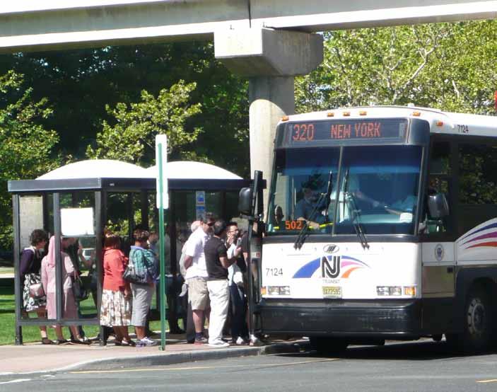
24 BUS STOP FIELD AUDIT REPORTS As part of the analysis of non-behavioral factors at each field audit site, recommendations for bus stop and bus stop intersection improvements at a site-specific level were formulated. Throughout the course of the fieldwork, certain sites out of the original 11 bus stop locations emerged as good candidates for site improvements that would be applicable to other locations in northern New Jersey. The sites that underwent additional analysis were places where bus stop activity was a significant generator of pedestrian activity and where physical improvements could likely make a difference in pedestrian crash rates. For example, U.S. Route 9 was identified early-on as a dangerous corridor for pedestrians because it serves bus commuters and is also a high-speed arterial. The two U.S. Route 9 bus stop sites studied present unique physical challenges and were also the sites of four pedestrian fatalities. Of the 11original bus stop locations, 7 were selected for development of site-specific bus stop improvements. These 7 bus stop sites were chosen based upon the number of pedestrian injuries and fatalities and are representative of bus stop safety concerns in a variety of settings: 1. Blackwell & Bergen Streets, Dover Township- Experienced one of the highest numbers of crashes and is located in a suburban downtown area. 2. Main & Day Streets, City of Orange Township- This site is in a downtown district with very high pedestrian volumes. The intersection has clearly been the focus of past safety efforts as it has curb extensions and high-visibility crosswalks. 3. Essex & Huyler/State Streets, City of Hackensack - This intersection has a unique geometry and is a major transfer point. 4. Fairmount & Newark Avenues, City of Figure 2-9: US Route 9 & Fairway Lane, Old Bridge Township NJTRANSIT bus stop Figure 2-10: Main and Day Street, City of Orange Township NJ TRANSIT bus stop Elizabeth - This site is heavily used by school children. It is also slightly skewed, meaning two of the corners are obtuse angles, which drivers can navigate at higher speeds than with a 90-degree angle. 5. U.S. Route 9 & Fairway Lane, Old Bridge Township, and 6. U.S. Route 9 & Adelphia Road, Freehold Township - There were pedestrian fatalities at both bus stop locations and they are directly adjacent to a high speed state highway th Street & Irvine Turner Boulevard, City of Newark A pedestrian fatality occurred at this site. Several bus routes serve this intersection in an active urban pedestrian area. 2-9
25 The data collected at each of these sites and subsequent recommendations have been organized and presented as Appendix D: Field Audit Bus Stop Reports. These reports can serve as a guide for municipalities and roadway owners for making safety improvements around bus stops. The site improvements identified include both feasible short-term, low-cost measures, as well as longer-term improvements for each of the seven bus stop intersections. Key insights from the audit reports are provided in the matrix below and summarized in the Bus Stop Safety Tool Box, as discussed later in this report. Figure 2-11: Suggested Design Improvements Provided in Bus Stop Field Audit Reports Improvement Type Pedestrian Scale- Lighting ADA Compliance Leading Pedestrian Interval (LPI) Signal Retiming Pedestrian Countdown Signal Heads & Fixed Signals Safety Benefit Lighting provides pedestrian visibility to the motorist during the early morning and evening commute in the winter months. In addition to safety, lighting can be a security issue. ADA compliance assists pedestrians of all ages with visual and mobility impairments in tracking the edge of intersection curbs and amount of time needed to cross for use of the intersection and bus stops without assistance. LPIs allow the most vulnerable pedestrians time to ascend and descend the curb before vehicles can begin turning movements. This provides better eye contact between pedestrians and drivers as it establishes the pedestrian further into the crosswalk. Retiming provides more Walk time for pedestrian crossing. Decreases chance the pedestrian will be caught in the crosswalk with oncoming traffic. Vehicle signals control the flow of vehicle traffic; thus it follows that pedestrian signals are needed to control the flow of pedestrian travel and provide information on when to cross. Fixed-time pedestrian signals, rather than actuated, provide a continual visual cue to drivers when pedestrians have the right of way. This also allows traffic engineers to time the intersection for all modes of travel. Countdown signals provide excellent information to pedestrians on the amount of time they have to cross the street, and are particularly beneficial to pedestrians at wide intersections where judging the crossing distance is difficult. 2-10
26 Improvement Type Stop for Pedestrian Signage Paint/Repaint Crosswalks Repaint Stop Bars Bus Stop Placement Install Bus Shelters Curb Extensions Curb Cut Closure Medians Safety Benefit Pedestrian signage draws attention of drivers to pedestrians in the crosswalk. Crosswalks show pedestrians and motorists the desired path of crossing at each leg of the intersection. Re-aligning crosswalks to be closer to 90 degrees shortens the crossing distance and reduces the pedestrian risk of exposure to motor vehicle traffic. Ladder crosswalks make the pedestrian path more visible than the two-line style. Stop bars directs motorists where to stop prior to the crosswalk. This reduces encroachment into the crosswalk as pedestrians are crossing. There are a number of advantages and disadvantages to far-side, nearside, and midblock bus stop placement highlighted in the Study's Bus Stop Safety Toolbox. Locational context is key in making a decision on placement. Bus shelters provide comfort and safety for transit riders from inclement weather. All shelters should be wheelchair accessible. Curb extensions shorten the crossing distance for pedestrians and increase the turning radius at all corners to reduce quick vehicle turns. Extensions also provide pedestrians and motorists better view of each other at an intersection. Overly wide curb cuts or driveways, especially those close to intersections, present a safety hazard to both pedestrians and motorists. A driveway should be 20 feet to handle turning vehicles in a two-way driveway. Medians shorten the crossing distance for pedestrians, with less time in the crosswalk and less exposure to motor vehicle conflicts. Medians provide refuge for those that can t safely make it across the street in one signal progression. These installations also reduce the turning geometry for motor vehicles, forcing slower turns and better eyecontact with people in the crosswalk. 2-11
27 Improvement Type Median Tips Extension of Sidewalk from Bus Stop Decrease Jughandle Turning Radii Back-In Angle Parking Safety Benefit Median tips protect the crosswalk from turning vehicles and slows turning movements. Sidewalks provide for a safe and comfortable walkway to access destinations such as employment, residence, and or shopping. Radii reduction encourages lower turning speeds for vehicles. Back-In angle parking improves safety by allowing motorists to see oncoming traffic and bicyclists when pulling out of a parking space. 2-12
28 Chapter 3. EDUCATIONAL CAMPAIGN PLAN Another important aspect of this study is the development of a plan for a public education campaign to raise awareness and influence behaviors relating to safety at or near bus stops. Education is one of the four E s, that complements engineering, enforcement, and evaluation to develop a comprehensive approach to safety-conscious planning. Not only does this public educational campaign plan present marketing concepts to encourage safe behavior at and around bus stops, but it includes methods for evaluation after the plan is implemented. Changing a person s behavior is no easy task; it is a combination of many things such as: raising awareness of an issue, clearly communicating the risks and benefits of various behaviors, providing easy-to-implement solutions and creating support networks. The public education campaign plan was designed to be part of a larger regional pedestrian education campaign that could be implemented on an ongoing basis. While there are many approaches to constructing social marketing campaigns, the common approach used for this effort relies on the trans-theoretical model of behavior change, discussed in the popular book Changing for Good (1994) and numerous other sources. It states that people move through various stages of understanding of an issue before they actually act on it. These stages include: Pre-contemplation: people do not intend to take action in the short term, usually measured as within six months. Contemplation: people plan to take action (change behavior) within the next six months. Preparation: people will take action in the next month and have a plan of action. Action: at this stage, people have made specific behavioral changes within the past six months. Maintenance: people are working at preventing relapse. This phase lasts anywhere from 6 months to 3 years. People in this phase frequently cycle through the phases above as they continue working to fully adopt new behaviors. Termination: occurs when people are sure they will not return to their old behavior. With this in mind, the overall social marketing goal for this program is to reduce the number of pedestrian injuries and fatalities that occur near bus stops in the NJTPA region. Some specific behavioral changes that need to take place in order to reach this goal include: Motorists stop for pedestrians in the crosswalk Motorists obey posted speed limit signs near bus stops and intersections; Motorists obey all other traffic laws at intersections and bus stops; Pedestrians cross at crosswalks during WALK signal cycle; Pedestrians wait for the bus at a safe distance from the curb; and, Pedestrians exercise greater caution when running to catch a bus (e.g. looking both ways, not darting from around a bus, etc.) 3-1
29 For the purposes of this campaign, the focus was on outreach designed to affect primarily motorists and pedestrians. It should be noted that some materials could be designed to provide behavior change messaging to bus operators through their ongoing training programs and other means. They are a critical third audience for any efforts to affect this issue. (Refer to bus operator interviews summaries in Chapter 5) This study conducted formative research with the target audience in order to develop a series of compelling public education concepts. Once the concepts were developed they were then tested with the target audiences to determine which would resonate most strongly. One hypothesis going into the research and development of concepts is that the majority of the audience would be in the pre-contemplation stage. That is, most do not realize that the problem is significant and are not planning any actions that might reduce injuries and/or fatalities. A second hypothesis is that most pedestrians know that when confronted with a motorist behind the wheel, they will lose. And most motorists know that if they hit a pedestrian, the consequences are significant. Thus any public education campaign does not need to tell them that, but instead should build on that common understanding. The way to tap into that understanding is to identify emotional triggers things that the audience could relate to that would cause them to stop and think about this issue in a way they may not have before. Determining the compelling emotional triggers and strategies that would be effective was a combination of previous experience in the field, the extensive literature review conducted for this project and the formative focus groups (first round) and concept testing focus groups (second round) that were conducted within northern and central New Jersey. FIRST ROUND OF FOCUS GROUPS Participants in the first round of focus groups were recruited through fliers in areas near focus group venues, postings on the popular online destination Craig s List, and at bus stops with high ridership within northern and central New Jersey. (For full details on the recruitment effort, see Appendix B). In order to screen the participants and ensure a range of demographic and economic backgrounds, those responding to the flier or online ad were directed to a survey hosted on the NJTPA web site, or were asked a series of screening questions when they called to sign up for a focus group. Each potential participant was grouped either into the bus rider group (if they identified themselves as regular riders who take the bus at least three times per week) or the motorist group (if they drove daily). Each selected participant was given a $40/hour incentive for their input. 3-2
30 The focus groups were convened at three different locations. The participants were divided based on age and demographics as follows: City of Orange Township, Essex County 3 groups October 14 th 12:00 1:00PM: Motorists (female, age 35 and older) October 14 th 5:30 6:30PM: Motorists (gender and age mixed) October 14 th 5:30 6:30PM: Pedestrians/Bus Riders (gender and age mixed) Township of Old Bridge, Middlesex County 1 group October 18 th 5:30-6:30PM: Motorists (male, age 35 and older) City of Newark, Essex County 2 groups October 20 th 5:30-6:30PM: Pedestrian/Bus Riders (gender mixed, age 35 and older) October 20 th 5:30-6:30PM: Pedestrian/Bus Riders (gender mixed, age 35 and under) The focus groups honed in on 5 major topic areas: 1. Personal behaviors while commuting 2. Interactions with bus drivers 3. Experiences on the street as a pedestrian 4. Perceptions/knowledge of the pedestrian law 5. Infrastructure suggestions Examples of questions asked of motorists include: Describe your commute --- think about it as you are talking --- think about all the situations you find yourself in during the drive --- how does it make you feel --- is there a range of emotions throughout the commute or is there one prevailing thing throughout that stands out? What activities are you doing during the commute? Where are you most cautious about pedestrians? School zones? Parking lots? What about pedestrians or other motorists make you anxious? Jaywalking? Riding bikes or scooters? Examples of questions asked of bus riders include: Think about your walk to or from the bus can you comment on how you respond to the cars --- is this something you think about a lot, are you annoyed by the cars, is it just part of the commute, etc. How responsible do you feel for your safety when you are a pedestrian? Do you feel safe from car crashes when you wait for a bus? For the full first round focus group discussion guide that includes all discussion questions, see Appendix C. 3-3
31 PSA S PRESENTED TO FIRST ROUND OF FOCUS GROUPS In addition to discussions about personal experiences and feelings about traffic safety, participants were also shown a series of four pre-existing safety Public Service Announcements (PSA) in order to gauge their emotional responses to different kinds of public service messaging. These represented a range of messengers, messages and images. Motorists were shown: I m a safe driver, by the Federal Highway Administration. This shows a male driver with a voice over explaining how safe a driver he is. During the PSA he almost hits a mother and child crossing the street while he turns without looking. Consider this a warning: Click it or Ticket, by the Bluefield, West Virginia, Police Department and WVVA-TV. This PSA addresses seatbelt use rather than pedestrian safety, but was chosen to get reactions about overt law enforcement messages and messengers. Pedestrians shouldn t need to wear stop signs to cross the street safely, by the City of Edina, Minnesota. This is a whimsical ad depicting pedestrians wearing stop signs, with 1950s sitcom-style music. Bus riders were shown: Walking can be safe, a counterpart to the Federal Highway Administration s I m a Safe Driver ad, which gives tips and reminds pedestrians to follow traffic signals. Even when you do everything right, somebody else might not, by the Collier County Sherriff s Department (Florida). This features police officers warning drivers and pedestrians to be alert in a concerned, rather than threatening way. Take a few extra steps, by the Road Traffic Authority in Melbourne, Australia, which has a softer and more proactive message, stressing that it s only a few more steps to a safe crossing. Slow down, cross safely, be alert, from the Street Smart campaign led by the District of Columbia, Maryland, and Virginia. This was shown to both motorists and bus riders. The spot depicts distraction on both the driver and pedestrians part, with a jarring graphic ending. 3-4
32 KEY INSIGHTS FROM FIRST ROUND OF FOCUS GROUPS Key insights from this first round of focus groups informed the creation of the campaign ideas. A. Commonality in Motorist and Bus Rider Reaction to PSAs Of the sample PSAs, motorists and bus riders stated that the Slow down, cross safely, be alert, Street Smart PSA was most effective. Participants cited the PSA's narrative, identification with the driver as a sympathetic character, and the fact that the piece shows mistakes of both the pedestrian and motorist. B. Contentious Relationship Between Motorist and Pedestrian There was an undercurrent of animosity between drivers and pedestrians throughout all the focus groups. Some motorists think that pedestrians have the legal advantage, and almost defy motorists to hit them: You see the people peeking out or they just don t care. They cross the street like they own the road and if you hit them it s your fault. (35 and over female motorist -East Orange) Pedestrians view the motorist as in a hurry and not paying attention to pedestrians: Vehicles don t care if you are in the way or not, the bus is in their way, not you. They will rush you off the road (Younger male bus rider -Newark) Many from both motorist and bus rider groups stated that they need to be personally responsible for their own safety since the other group appears to be reckless. As a driver you have to be very vigilant. You can t be distracted for even a second. (35 and over female motorist -East Orange) It s all on you no one else is going to look out for you. (35 and over female bus rider -East Orange) 3-5
33 C. Sympathy of Motorist Toward the Pedestrian in Regards to Infrastructure Issues that Act as a Barrier to Safety The animosity tended to come out when talking about personal experiences or initial feelings about pedestrians, but as groups began to explore the reasons for why these incidences happened, sympathy due to the infrastructure that creates shared transportation difficulties came out, especially among motorists who used to use transit more often and commuters who drive and use transit equally. I feel that if you don t have a car in New Jersey, sometimes you re treated as a second class citizen because there aren t enough walkways (35 and over female motorist -East Orange) It s not so much the drivers; it s the location of some of the stops. Towards the city they kind of make sense, but as you get further out they have bus stops without shelters, on the side of the highway just weird places to me, that I wouldn t place a bus stop. It s not safe. (Younger female pedestrian -East Orange) D. Motorist and Bus Rider Attitudes Towards Bus Drivers Without prompting, motorists and bus riders both expressed many of the same complaints about bus drivers. The complaints range from discourteous protocol towards pedestrians and critic of bus operator driving. Motorists, in particular, expressed annoyance or dread of buses, the wish to not get stuck behind them or have them pull into their lane too fast and be cut off. E. Motorist and Bus Riders are Aware of the Stop for Pedestrian in the Crosswalk Law Though a question was included in the focus group discussion guide about New Jersey s new pedestrian law, it came up unprompted in discussions with both bus riders and motorists. I stop because now I m trained that way. In Maplewood, South Orange, if you don t stop for a pedestrian, you get a ticket. It s just natural to me now. (35 and over female motorist -East Orange) The pedestrian has the right of way in the crosswalk. Some motorists get that, and some don t. (35 and over male bus rider -East Orange) F. Motorist and Bus Riders Cited Infrastructure Issues 3-6
34 Throughout the discussions, both motorists and pedestrians expressed the feeling that safety problems are directly related to various infrastructure issues, and spent the bulk of the conversation describing ideas for improvement. In particular, both motorists and bus riders expressed fear and anxiety about bus stops on off ramps and highway-like roads without nearby crosswalks nor adequate signage and lighting. Crosswalks are great. I understand I have the right of way. But you have an issue, there is no traffic light, no crosswalk, and its rush hour, and you re trying to cross the street to get to work on time. There should be a stoplight. Until that happens, it s just very dangerous. I know how fast I can run. (35 and over bus rider -Newark) It s tricky. It s dark and I m usually concentrating on what I have to do. There will be four or five traffic lights in a row. Then there will be nothing. Then there s a big apartment block that has its own bus service into the city, so a lot of the New Jersey buses and transit buses will pull into that parking area, then all of the sudden you ll have 50 people running across the street. It s scary, especially at 5:30 or 6:00 in the morning. (35 and over female motorist driving in the Meadowlands -East Orange) MOTORIST & BUS RIDER EDUCATION CAMPAIGN IDEAS Themes and insights from these as well as professional experience were used in creating and conducting behavior change campaigns to develop proposed concepts and tactical ideas for three overarching themes: (1) Solidarity, (2) Real Life Stories, and (3) Satire. The campaign ideas and tactics were developed to be flexible in order to accommodate various funding levels for media placement and online capacity. Additional outreach ideas that can work for more than one of the Frames were included, such as a Safe Jersey Commuter Pledge and Family Pep Talk. Following the development of the three campaign concepts, a second round of focus groups was conducted one with motorists and one with bus riders to get reactions to and further inform the campaign ideas. Note that these campaign concepts are meant to illustrate creative ways to get people s attention about the subject of traffic safety, and only comprise an initial impression of these messages and narratives. 3-7
35 The following is a summary of the proposed campaign ideas/themes: Solidarity Theme Preparing for the Daily Commute This campaign puts drivers in the shoes of pedestrians by framing the daily commute as a potentially dangerous experience. Commuters are shown near notoriously dangerous intersections and bus stops in full sports pads or a suit of armor (or bubble wrap, etc.). Drivers are reminded that they can make the commute less dangerous. Tag lines include Don t make Commuting a Daily Battle. We re All in This Together This campaign idea is the brightest and most optimistic of all the visual treatments. The visual is similar to wartime and Great Depression-era communications emphasizing strength and hope through unity. It provides the strongest emphasis on the solidarity frame by alerting motorists and pedestrians to be aware of each other while traveling. The New New Jersey Salute A different treatment of the We re All In This Together theme is a tongue-in-cheek visual (with people flashing a V-for-victory hand sign) paired with an audio treatment of an idea for a television spot or YouTube video. The salute, between motorist and bus rider, captures the need to communicate a share the road/shared responsibility approach to traffic safety. Real Life Stories Theme Irreversible This theme reminds drivers and bus riders of the family, friends, and coworkers of the pedestrian injured and killed and its effect on them. It also discusses the guilt on the part of the driver involved. It would highlight a person who has been killed in the past few years and throughout the campaign introduce other people who were touched by his or her death, through poster images, testimonials and even statues at bus stops. Satire Theme Here s My Card Advertisement Fictional characters Louie & Louie are entrepreneurs who dabble in insurance, law, funeral planning, and plastic surgery to capitalize on carelessness in walking or driving. They advertise their services in an outrageous way that will capture people s attention to deliver a serious message. 3-8
36 Other Concepts Family Pep Talk In a video or radio ad a Mom gives safety tips and a pep talk to a family before they head to work and school. Sports theme: Contact Sport New Jersey Devils, New York Giants, or other area athletes appear in posters and ads alongside commuters preparing for their commute with the tagline, Commuting shouldn t be a contact sport. Safe Jersey Commuter Pledge Gather real-life (hand-picked) northern New Jersey bus riders, bus drivers and motorists to talk in focus group settings about motorist and pedestrian safety issues in their daily commute, ending in an agreement to work together and also take personal responsibility for their safety and each other s. 3-9
37 EDUCATION CAMPAIGN CONCLUSIONS Despite the differences between motorist and bus rider reactions to the campaign, there are key elements of the campaign that appealed to both groups and should inform any future traffic safety campaign effort: A. Personal stories are compelling. People need to see themselves in any campaign. Irreversible got an overall positive reaction, most citing the personal, narrative aspect of the campaign. The ideas Pep Talk and Safe Jersey Commuter Pledge got an overall positive reaction because they include real or relatable people and could easily incorporate real safety tips and situations. Both motorists and bus riders in the first and second round of focus groups emphasized that real or relatable people are more persuasive than celebrities or third-party messengers. B. Over-the-top comedy will not work. Messages and tone must be consistent. Participants found themes that used humor to-relay a message confusing. The tone, whether serious or satire, has to be consistent in order for a campaign to be successful. Some focus group participants found a satiric or comedic tone offensive, citing personal experience with crashes. C. People are moved by the idea of unity and walking in another person s shoes. Motorists and drivers were moved by the theme of unity to relay a pedestrian safety message and compelled them to offer their own creative ideas. For example, one participant suggested that Safe Jersey Commuter Pledge participants could provide pedestrian safety misconceptions in thought bubbles as seen in comic magazines. Another participant suggested a narrative involving a driver almost hitting his own son due to carelessness, which emphasizes a personal link aimed at reducing pedestrian injuries and fatalities. Visual executions that received a negative reaction changed to a positive reaction when paired with narrative elements. For example, the poster idea for Don t Make Commuting a Contact Sport was confusing to most. When paired with context and description from the unity-themed Family Pep Talk theme, focus group participants had a more positive reaction to Don t Make Commuting a Contact Sport. While the serious Irreversible theme received the greatest overall approval among motorists and bus riders, We re All in this Together, Safe Jersey Commuter Pledge, and Family Pep Talk generated the most enthused positive reaction. Many participants felt a positive message of unity and looking out for each other was a refreshing take on the pedestrian safety topic. 3-10
38 RECOMMENDATIONS FROM FOCUS GROUPS The mix of campaign ideas NJTPA could execute depends on budget, staff capacity, and the preferences of the organizations communications and branding needs. Insights gained in the two rounds of focus groups provided information to make the following recommendations. A. The Satire Theme of Here s My Card Advertisement will not work for a pedestrian safety campaign. Focus group attendees did not understand the message and found the theme unpalatable in encouraging motorists and bus rider safety. B. A Real Life Stories theme resonated well among motorist and bus rider focus group attendees. The Irreversible theme received an overall approval from both groups to heighten awareness about motorist and pedestrian safety issues within the region. One small drawback of this serious messaging is its commonality among PSAs and may not get as much attention as other campaign ideas since the tone is a repeat of other messaging currently used in other regions of the country. C. A combination of the ideas in the Solidarity theme, such as We re All in This Together and Family Pep Talk, use positive messages of unity and relatable family characters. Focus group motorists and bus riders sided with this message and felt that it would stand out as a positive pedestrian safety campaign that would resonate among both motorists and riders alike. D. Focus group participants strongly suggested that the campaign use relatable people and situations in the campaign rather than celebrities. E. Focus group participants emphasized a shared responsibility approach to traffic safety. Provide campaign messaging that reminds motorists and bus riders that safety is the responsibility of everyone, because everyone is out on the road. In addition, regardless of the approach to the campaign, the campaign should be structured to include specific safety tips that are relevant to both motorists and bus riders. F. Campaign messages must be simple and to-the-point. Motorists and bus riders lead busy lives with multiple tasks throughout the day. Campaign messages must be easy to understand within seconds of attention. MEDIA OUTREACH There are a variety of media methods for campaign outreach. Since this campaign seeks to capture attention from motorists and pedestrians, varied outreach materials will be needed to create successful implementation. Motorists travel at higher speeds, their visual cues are different from a pedestrian or bus rider. Radio and billboards would have a larger impact than bus shelter posters in getting the attention of a motorist. In today s widely-used visual environment, video through YouTube and social media outlets such as Facebook, NJ lifestyle sites, and high- reach portals such as Yahoo and MSN can serve as media outreach techniques. The types of media outreach that can be developed are highly dependent on the allotted budget for education campaign implementation. For example, advertisements on digital on-line media such as Facebook or other high reach portals are more expensive than radio. Lower cost methods of outreach can be pamphlets distributed at bus stops, bus terminals, and key passenger waiting 3-11
39 areas, including rail stations, since many people transfer from rail to bus. Sample budget examples according to a $100K, $300K, and $500K budget are provided within this Chapter. Creativity in outreach methods is important. Implementation of the campaign can explore a tie-in with the region s wealth of artists. An artist competition at a professional and/or student level could explore visual ideas based on the themes provided in this Chapter. The winning art piece could be displayed as bus shelter posters and billboards to get the pedestrian safety message across while also reaching out to the public arts community. Finding community champions that will support and strengthen the campaign should be widely sought out. Overall successful implementation will be highly dependent on partnerships between NJTPA, NJDOT, NJDHTS, NJ TRANSIT, and other key stakeholders to get the message out to the public. EVALUATION AND MONITORING Measuring the impact of communications and marketing is both an art and a science. A number of different quantitative and qualitative evaluation tools are available to measure results. There is no one right way to do it. The key is to find the best methodology, approach and reporting systems that align with the priorities of the program. The most important indicator over time is achieving a reduction in the number of fatalities, crashes and related incidents that occur near bus stops. This result over time, however, is achieved by a combination of all the efforts made the environmental and physical aspects of the bus stops, road conditions, enforcement of related laws and public education efforts. To better isolate the metrics and focus on the success of the public education campaign, the following is a sample approach of the various outcomes that can be measured: Reach: What percentage of target audiences was reached? Action: What percentage of target audience took a desired action? Traction: How effectively has the branding and messaging caught on in the public domain? What is the message recall/retention post-program roll-out as compared to prior program activation? Possible corresponding qualitative and quantitative measurement approaches include: Pre- and post- target audience surveys Level of key audience participation/attendance in activities Feedback/message recall levels Real-time media measurement and monitoring Web and social media analytics (if applicable) 3-12
40 SAMPLE CAMPAIGN BUDGETS Sample budgets have been included to consider for campaign implementation should there be future funding for the public education program. Please note that these are guidelines and the actual amounts could vary depending on a variety of factors including the chosen concept, the audience or audiences, the geographic region, the production quality and others. These sample budgets were provided by Fenton Communications. Three sample budgets are provided at the following funding levels: $100,000 $300,000 $500,

41 3-14

42 3-15

43 3-16
44 Chapter 4. Bus Stop Safety Toolbox As a final piece of the non-behavioral analysis, a general Bus Stop Safety Toolbox document was produced as a reference tool for the public, local and county planners/engineers, and government officials. The toolbox synthesizes best practices information from numerous detailed reports collected during the literature review to concisely outline ways to enhance bus stop safety. The toolbox also provides references for other documents that have much more detailed design guidance, as well as information on funding sources and examples of pedestrian safety programs and transit-supportive policies. The toolbox can be used to improve an existing, or new bus stop. Key topics within the toolbox include answers to common questions about NJ TRANSIT s bus stop and shelter programs; discussion of the importance of considering safety, comfort, convenience, and accessibility when creating bus stops; the decision making process to ensure a safe bus stop; and suggested bus stop design and location techniques to ensure safety for the bus passenger and pedestrians. Specific guidelines and examples are provided for: Bus stop spacing, placement, and configuration, Signage, signals, and lighting Accessibility to the bus stop via crosswalks, sidewalks, and ADA compliance Bus stop shelter, and bench design Transit communication Public education and enforcement In addition to insertion of the Bus Stop Safety Toolbox within this Chapter, a standalone copy of the toolbox can be found at: 4-1


45 Bus Stop Safety Toolbox 1
46 About the NJTPA The North Jersey Transportation Planning Authority (NJTPA) is the federally authorized Metropolitan Planning Organization (MPO) for the 13-county northern New Jersey region. Each urbanized region of the country is required to establish an MPO in order to qualify for the receipt of federal transportation funding. The NJTPA serves a region of 6.6 million people, one of the largest MPO regions in the country. The NJTPA evaluates and approves proposed transportation improvement projects. It also provides a forum for cooperative transportation planning efforts, sponsors transportation and planning studies, assists county and city planning agencies and monitors the region s compliance with national air quality goals. The 20-member NJTPA Board of Trustees is composed of local elected officials from each of the region s 13 counties and from the region s two largest cities, Newark and Jersey City. It also includes representatives of state agencies and the Governor s office (see inside back cover). NJTPA s host agency is the New Jersey Instititute of Technology. More information about the NJTPA is available at This publication has been prepared with financing by the Federal Transit Administration and the Federal Highway Administration of the U.S. Department of Transportation. The NJTPA is solely responsible for its contents. Prepared in collaboration with: New Jersey Department of Transportation NJ TRANSIT New Jersey Department of Highway Traffic Safety Cover photo: Andrew Lisowski 2

47 TOM BLAND Introduction: Making Your Bus Stop Safe This Bus Stop Safety Toolbox was one of the products of a year-long Pedestrian Safety At and Near Bus Stops Study by the North Jersey Transportation Planning Authority to promote transit, livability, and complete streets. Bus ridership accounts for two-thirds of all transit riders, with approximately 600,000 trips per day boarding at over 20,000 marked bus stops in New Jersey. Many bus passengers board and alight from buses along busy highways and often must cross these roadways after dark or during inclement weather. The Pedestrian Safety At and Near Bus Stops Study identified approaches to reduce the severity and frequency of pedestrian crashes at and near bus stops in the 13-county NJTPA region and to improve safe pedestrian access to transit facilities. The Toolbox provides guidance for creating a new bus stop or improving an existing bus stop. A full final report of the Pedestrian Safety At and Near Bus Stops Study is available at 1


48 Benefits of a Marked Bus Stop Providing a marked bus stop with signage, bus shelter, benches, and design compliant with the Americans with Disabilities Act (ADA) is a great safety enhancement for all roadway users. It cues motorists that pedestrians may be crossing the street to access the bus stop and provides a safe place for bus riders to wait off street. Additionally, it helps bus operators to identify a waiting bus rider in advance rather than having to slow down to confirm a potential passenger. Popular Questions about NJ TRANSIT s Bus Stops and Shelter Program How do I request a bus stop? Under New Jersey law, N.J.S.A. 39:4, the power to designate bus stops first rests with the municipality, not with NJ TRANSIT. NJ TRANSIT does work closely with each municipality to provide recommendations for safe and convenient bus stop locations, which the municipal governing body may accept or reject. If the bus stop request is for a county or local road: First, a local municipality must pass a resolution or ordinance approving the site of the bus stop. If it is a county road, both the municipality and the county must pass a resolution or ordinance approving the site of the bus stop. If the bus stop request is for a state road: The municipality must send the location of the proposed bus stop to the New Jersey Department of Transportation (NJDOT) for approval. How do I move an existing bus stop? To request a stop be relocated or eliminated, contact NJ TRANSIT or your town administrator/official. NJ TRANSIT and your town administrator/official will work together to address the issue. For more information, contact NJ TRANSIT s Bus Stops and Shelters program at (973)
49 How do I go about getting a bus shelter? NJ TRANSIT s bus shelter program will arrange for, and bear the cost of installing bus shelters, including concrete pads, at legal bus stops provided that a local sponsor, public or private, will agree to accept responsibility for maintenance and liability. How do I report a bus stop sign and or bus stop shelter maintenance issue? If the location is listed as a bus stop, NJ TRANSIT will replace the bus stop sign. This will alert operators that the location is an official stop. Once a bus shelter is installed, maintenance, repairs and replacement are the responsibility of the shelter sponsor, usually the local government. In some communities, local governments have entered into agreements with advertisers to install and maintain shelters. Many shelters have the name of the party responsible for maintenance printed on the shelter. What makes for a good bus stop location? Safety, comfort, convenience, and accessibility are key factors in deciding on the location of a bus stop. When making a decision on bus stop location, consider the following: Surrounding bus stops Where is the closest bus stop? Transfer Potential How many routes serve this stop? Site Suitability Are there clear view corridors, where the bus rider can see and be seen, as a bus approaches? Physical Are there sidewalks and crosswalks that provide safe accessibility to the bus stop? Lighting Is the lighting during the evening and early morning adequate for bus rider and bus driver visibility? What are suggested bus stop design and location techniques to ensure safety for the bus passenger and pedestrians? The following provides information on bus stop spacing, placement, configuration, signage, accessibility, signals, lighting, shelters, benches, and communication. 3
50 Bus Stop Spacing Bus stop spacing depends on land use. In dense areas, more frequent stops are needed. ENVIRONMENT SPACE RANGE Typical Spacing Central Core Areas of CBDs 300 to 1000 feet 600 feet Urban Areas 500 to 1200 feet 750 feet Suburban Areas 600 to 2500 feet 1000 feet Rural Areas 650 to 2640 feet 1250 feet Source: TCRP 19, p. 18 Bus Stop Placement A bus stop can be located in three places: the near-side of an intersection, the far-side, or midblock. NJ TRANSIT recommends dimensions for each of the three placement types. Two are shown below. The dimensions include no parking zones for the bus to pull in and out of the stop. For stops with articulated buses that bend in the middle, 20 feet should be added. 4
51 There are several advantages and disadvantages (see below) of each placement type. Municipalities must carefully consider the location that best serves the bus passengers. Far-Side Stop Advantages Minimizes conflicts between right turning vehicles and buses Provides additional right turn capacity by making curb lane available for traffic Minimizes sight distance problems on approaches to intersection Encourages pedestrians to cross behind the bus Creates shorter deceleration distances for buses since the bus can use the intersection to decelerate Results in bus drivers being able to take advantage of the gaps in traffic flow that are created at signalized intersections Disadvantages May result in the intersections being blocked during peak periods by stopping buses May obscure sight distance for crossing vehicles Bus stops at the far-side stop after stopping for a red light, which interferes with traffic flow May increase number of rear-end accidents since drivers do not expect buses to stop again after stopping at the red light Could result in traffic queued into intersection when a bus is stopped in travel lane Near-Side Stop Minimizes interferences when traffic is heavy on the far side of the intersection Allows passengers to access buses closest to crosswalk Results in the width of the intersection being available for the driver to pull away from curb Eliminates the potential of double stopping Allows passengers to board and alight while the bus is stopped at a red light Provides driver with the opportunity to look for oncoming traffic, including other buses with potential passengers Increases conflicts with right-turning vehicles May result in stopped buses obscuring curbside traffic control devices and crossing pedestrians May cause sight distance to be obscured for vehicles stopped to the right of the bus May block the through lane during peak period with queuing buses Increases sight distance problems for crossing pedestrians Mid-block Stop Minimizes sight distance problems for vehicles and pedestrians May result in passenger waiting areas experiencing less pedestrian congestion Requires additional distance for noparking restrictions Encourages patrons to cross street at midblock (jaywalking) Increases walking distance for patrons crossing at intersections Source: TERP 19, Guidelines for the Location and Design of Bus Stops,

.")


 Bus Stop")
52 Bus Stop Configuration Bus stops can stop in the travel lane, on the shoulder, or in a bus bay (see below). Curbside Stop Bus Bay (with acceleration and deceleration lanes) Open Bus Bay Queue Jumper Bus Bay (with acceleration lane) NUB (or curb extension) Bus Stop Parked Car Source: TCRP 19 6


53 NJDOT Signage R " x 18" R7-107a 12" x 30" Source: MUTCD Wayfinding Signage Source: Source: Jason McHuff Signage New Jersey state law requires motorists to stop for pedestrians in the crosswalk. This signage is a low cost safety strategy that can be installed to educate drivers and remind them of the law. The sign images shown above are currently being used by NJDOT. In addition, the municipality might consider adding wayfinding signage or maps at or near the bus stop sign to guide passengers, such as those shown above from Virginia and Oregon. 7


54 Sidewalks Driveways Vehicle Impact Speed vs. Pedestrian Injury ( initial impact only) Traffic Calming Safe Accessibility to the Bus Stop Sidewalks: Provide sidewalks leading up to the bus stop. The Federal Highway Administration recommends at least 5 sidewalks in width with no obstructions such as trees or sign posts. If there is enough room, a buffer between pedestrians and vehicles, in the form of landscaping or trees, is suggested. Driveways: Consolidate driveways through an Access Management approach to reduce potential pedestrian and motorist crashes. The image on the left shows complex vehicle movements, with many driveways and conflict points between pedestrian and motorist. The image on the right consolidates the driveways to reduce the number of conflict points. Note that the sidewalk should continue across the driveway. Also, avoid driveways near intersections with bus stops to ensure bus passengers are not waiting for the bus as motorists are going in and out of an active commercial driveway. The New Jersey Department of Transportation recommends driveways no closer than 100 feet from the signalized intersection curb cut. 1 Traffic Calming: The volume and speed of traffic affects a pedestrian s feeling of safety and comfort. People walking along a high-volume road experience a fence effect, where the street is an impenetrable barrier. Traffic speed is more critical to pedestrian safety because at higher speeds, motorists are less likely to see a pedestrian or stop in time. When collisions do occur, they are more likely to result in major injury or death. A municipality interested in pursuing traffic calming measures can start by identifying high pedestrian crash locations at and near bus stops in an effort to reduce these crashes. 1 NJ State Highway Access Management Code. Title 16, Chapter 47, Page 26 8

 per lane warrants it. In addition, turn pockets can be used at intersections if intersection LOS permits it.")
55 Vehicles per lane during peak hour Ladder Crosswalks The following are traffic calming measures that can be used to reduce speeding and improve pedestrian access to bus stops: Bicycle lanes buffer pedestrians from vehicles and lowers speeds by narrowing the road. Reducing car lane widths to 10 feet decreases traveling speeds. (Note that 12 feet is needed for the right lane that is used by buses and trucks.) The road can be narrowed by extending the sidewalk or adding on-street parking. Removing a lane can reduce speeding if the Level of Service (LOS) per lane warrants it. In addition, turn pockets can be used at intersections if intersection LOS permits it. One-Way/Two-Way Conversions improves circulation for motorists and cyclists. Vehicles per lane, as shown above, provides an accurate representation of roadway use and is useful in determining potential for removing travel lanes. Ladder Crosswalks create a high-visibility path. Where medians are used, extend the median beyond the crosswalk, which provides protection from turning drivers who make tight turns. 9


 standards.")
56 Slip Lane Pedestrian Islands Pedestrian Refuge Island Midblock Crosswalks Slip Lane Pedestrian Islands at intersections with channelized right turns, when designed at a proper angle, can provide the driver with greater visibility of pedestrians and slows the motorist s speed. Pedestrian Refuge Island can be sited in locations where midblock crossings are observed. The midblock crosswalk is protected by a median with curb extensions extending through the parking lane. Midblock Crosswalks can alert the motorist to a pedestrian walking across the street midblock and improves their visibility to the driver. Raised crosswalks can enhance visibility of the pedestrian further. Curb Ramps: When an intersection undergoes renovation or reconstruction, federal law requires the corners to be upgraded to Americans with Disabilities Act (ADA) standards. 2 This includes ramps to allow people with wheelchairs, strollers, or luggage to get from sidewalk to street level, and truncated domes to alert pedestrians with visual impairments that they are about to leave the curb. Curb Extensions can be used when on-street parking is present. The curb extensions shorten the crossing distance, reduce vehicle turning speeds, and make pedestrians more visible to drivers. Generally parking lanes should be 8 feet wide and curb extensions 6 feet wide. Corner Curb Radii: Pedestrians accessing a nearby bus stop can be struck by right-turning vehicles while they are crossing in the marked crosswalk. Extending the intersection curb to provide for a tighter turn, can help decrease the number of these crash conflicts by reducing the speed of the turning vehicles and allowing for the pedestrian to see and be seen. It also shortens Curb Ramps 2 Full guidelines can be read at 10


. 3 More typically, in new construction, the appropriate turning radius is about 4.")
 to accommodate the substantial volume of turning buses and/or trucks which require a wider turning movement than a car.")

57 the crosswalk where the pedestrian spends less time in the street with less exposure to being hit by a vehicle. Nearby land uses and types of road users should be considered when designing an intersection so that curb radii are sized appropriately. Where there is an on-street parking and/or bicycle lane, curb radii can be even tighter, because the vehicles will have more room to negotiate the turn. Additionally, curb radii can, in fact, be tighter than any modern guide would allow: older and some neo-traditional cities frequently have radii of 3 to 4.6 m (10 to 15 ft). 3 More typically, in new construction, the appropriate turning radius is about 4.6 m (15 ft) for residential streets. For arterial streets, the turning radius increases to about 7.6 m (25 ft) to accommodate the substantial volume of turning buses and/or trucks which require a wider turning movement than a car. 4 See AASHTO for additional information on turning templates for various vehicles. 3, 4 Pedestrian and Bicycle Information Center, University of North Carolina Highway Research Center; Curb Extensions Curb Extensions Truck Turns at 10 Truck mph Turns at Car Turns 10 atmph 27 mph Car Turns at 27 mph Curb Radius Reduction Car Corner vs. Truck Curb Radii Turning Movement Sources: Designing Sidewalks and Trails for Access, FHWA; inset: Making Streets That Work, Seattle, 1996; 11
 suggests that one second of pedestrian walk signal time should be given for every 3.5 feet of crosswalk length.")

58 Signals Provide adequate time for pedestrians to cross the roadway. The Manual on Uniform Traffic Control Devices (MUTCD) suggests that one second of pedestrian walk signal time should be given for every 3.5 feet of crosswalk length. Recommend countdown fixed (as opposed to actuated) pedestrian signal heads at bus stop intersections. Fixed pedestrian signal heads are preferred because push buttons may break, do not tell the pedestrian if the signal box has received the request, and the automatic appearance of the WALK phase signal, regardless if the push button was pressed, alerts drivers that pedestrians might be present. If push buttons must be used, install the type that flashes or beeps to confirm that it has been pressed. In a Lead Pedestrian Interval the WALK comes on 3 to 5 seconds prior to the vehicular green. This means pedestrians are already feet into the crosswalk when the vehicle starts their turn and enables drivers to see the pedestrian. Provide a Leading Pedestrian Interval (LPI) for intersections that have pedestrian conflicts with turning vehicles. Pedestrians are given a three- to five-second head start over drivers, allowing them to establish themselves in the crosswalk. The above photographs show how a LPI works. In the photo on the left, the pedestrian WALK sign is on, but the vehicle signal remains red giving the pedestrian a four second head start in crossing. In the right image, the pedestrian is able to cross part of the intersection before the vehicle receives the green and begins turning. Once pedestrians clear the crosswalk, turning drivers are clear to go. 12


59 Source: University City Lighting Master Plan. University City District. March 2007 Lighting Install lighting at the pedestrian level for bus shelters and stops to improve safety and security. Roadway lighting for motorists is placed at feet, which does not illuminate the sidewalk. Pedestrian-scale lighting is 9-12 feet above the sidewalk. Use LED if possible as it casts off a warmer light. An initial step in assessing whether lighting changes are needed at a bus stop involves conducting a lighting inventory. Source: Peoria Multi-Modal Transportation Plan. Bus Stop Design Considerations and Options. March 2010 Bus Shelter NJ TRANSIT will, upon request, install a bus shelter, including the concrete pad. The requesting agency, be they public or private, must assume responsibility for maintenance and liability. Many transit agencies sponsor an Adopt-a-Shelter program in which those who pledge to clean and maintain a bus shelter receive community acknowledgement or transit passes. This type of community activism can be at the local level. Some transit agencies adopt ridership thresholds for installation of shelters. These thresholds can indicate to municipalities where they may consider requesting a shelter. Rural Locations: 10 boardings per day Suburban Locations: 25 boardings per day Urban Locations: 50 boardings per day If a bus shelter is appropriate, it is important to work with local leaders or businesses next to the shelter to establish responsibility for maintenance, especially for snow removal. 13


60 Source: TCRP 19 Benches A bench provides convenience for waiting transit customers, as shown above at a bus stop in the City of Orange, NJ. To provide bus stop facilities such as benches, a municipality can list seating and street furniture as a general element of their municipal or county streetscape plan. Benches can be installed without bus shelters. Source: Communication Giving passengers the most information possible allows them to plan their trips and improves bus reliability. NextBus information has become popular at some public and private systems; for example, Rutgers University uses NextBus. The system works via satellite tracking to a smartphone or computer. NJ TRANSIT has unveiled my bus service where passengers can text the bus stop number and receive information on where the bus is located. A municipality can work with NJ TRANSIT to ensure that my bus signs are installed at bus stops. An example of a bus stop with amenities is shown below. Source: CD+A for San Benito, CA 14
61 Americans with Disabilities Act (ADA) Compliance: Federally-funded transportation facilities for pedestrians must meet the requirements of ADA to ensure that transit users of all ages and abilities have equal access to transportation. In recent years the principles of ADA have been espoused into the movement called universal design. Instead of focusing on designing for people with disabilities, universal design says that design for ADA compliance means a design for all including parents with strollers, a person rolling luggage, cyclists walking bikes, and children. Transportation facilities designed to ADA standards benefit everyone. Review the street network and identify barriers to ADA compliance. Implementation of Bus Stop Design & Location Techniques A key initiative in leading up to the implementation of bus stop design and location is to incorporate pedestrian features into standard plans and designs for bus stops with cost estimates included. Land use and pedestrian crash data analysis can help inform the prioritization for bus stop needs and safety improvements. One option for implementation is to include priority locations for pedestrian improvements at and near bus stops into a long-term time frame for funding during master plan or comprehensive plan updates. Another option is a bus stop review program and checklist or safety audit assessing ADA compliance, crosswalks leading up to the bus stops, bus stop shelters, and surrounding pedestrian facilities for maintenance needs. Additionally, the NJTPA offers assistance through its half-day walkable community workshops in identifying barriers to walking and developing a report of pedestrian recommendations that can inform future investment in bus stop and pedestrian facilities. For more information on the NJTPA s workshops, visit org/plan/element/bikeped/walkable.aspx Safety Audits Adopting a plan for evaluating bus stops on a rolling basis is recommended to ensure maintenance and ADA compliance is met for bus rider comfort and safety. Bus stop checklists are commonly used to inventory bus stops and roadway characteristics in the area immediately surrounding a stop. They can be used by transit agencies to evaluate their own facilities or by local residents to assess conditions at bus stops. 15
62 These checklists typically document: Sidewalk presence and condition near the bus stop. Roadway crossing treatments near the bus stop (crosswalks, pedestrian signals, pedestrian push-buttons, pedestrian signal timing, audible warning signals). Path of access between the sidewalk and bus stop boarding area. Readability of bus stop signs. Obstructions at bus stop. Bus stop shelters and seating. At right is an example of a bus stop checklist from the Federal Highway Administration s Pedestrian Safety Guide for Transit Agencies. For additional information on these checklists, please visit, ped_transit/ped_transguide/ch1.cfm Pedestrian Crash Data Analysis Crashes can inform municipalities where roadway design or aggressive pedestrian and/or motorist behavior exists. New Jersey has an excellent resource for statewide crash data through the Transportation Safety Resource Center at Rutgers University s Plan4Safety decision support tool. The support tool maintains a database of the state s TR1 crash report since 2003 and analyzes the crash data in geospatial and tabular forms for municipalities and police departments to use and receive training free of charge. This can be a valuable tool for municipalities to understand crash trends over time and pick out hot spot crash locations. See the Federal Highway Administration s Pedestrian Facility User Guide for a detailed list of countermeasures for each type of pedestrian-vehicle crash. Physical changes to a bus stop should be paired with education and enforcement Enforcement: Enforcement is a crucial element to road safety when coupled with good roadway design. New Jersey has a Pedestrian Decoy Safety Program that involves a decoy or undercover police officer in bright plain clothes at site specific crosswalk locations. The decoy attempts to cross at the crosswalk. Motorists who do not stop for the decoy in the crosswalk are flagged by an enforcement officer 16
63 QUICK BUS STOP CHECKLIST Route Name: Location: Weather Conditions: Stop No.: PART B: Landing Area Assessment B1 Is there a landing area at least 5 feet wide and 8 feet deep adjacent to the curb/street? Yes [ ] No [ ] B2 Where is the landing area positioned in relation to the curb/street? Below street level (low ground or shoulder) [ ] Shoulder [ ] Adjacent [ ] Sidewalk [ ] Bus Bulb [ ] Off-Road/No sidewalk [ ] Other (specify) B3 What is the material of the landing area? Asphalt [ ] Dirt [ ] Gravel [ ] Concrete [ ] Grass [ ] Pavers [ ] Other (specify) B4 Are there problems with the landing area surface? Yes [ ] No [ ] If YES, rank resulting accessibility potential Not Accessible Minimally Accessible Accessible Uneven [ ] [ ] [ ] Slopes up from the street [ ] [ ] [ ] Slopes down from the street [ ] [ ] [ ] Requires stepping over drain inlet [ ] [ ] [ ] Other (specify) B5 Are there any obstacles that would limit the mobility of a wheelchair (trash receptacle, newspaper boxes, landscaping, other? Yes [ ] No [ ] If YES, describe obstruction 17

64 who educates the driver by providing a warning of crosswalk law infraction. If this infraction happens again by the driver, they receive a citation. The program is funded by the New Jersey Division of Highway Traffic Safety. Education The use of media outlets and creation of a public messaging campaign can support pedestrian safety. Transit Supportive Policies Transit-friendly development policies and zoning create communities with connected streets, mixed land uses, and walkability that encourage bus use. Partnerships with governmental agencies, organizations, community groups, and business improvement districts can develop collaborations to provide pedestrian benefits for all ages and abilities. In downtown districts, consider Tax Increment Financing to fund streetscape improvements that make bus travel more attractive. In addition, municipalities should work closely with developers to ensure that new development is pedestrian and transit-friendly. 18
65 Resources The following list of web sites and reports are resources for further design and policy guidance. Transit Cooperative Research Board (TCRB) Resources TCRP Report 19. Guidelines for the Location and Design of Bus Stops, TCRP Report 125. Guidebook for Mitigating Fixed-Route Bus-and-Pedestrian Collisions Funding & Costs Pedestrian and Bicycle Information Center: List of federal grants from the Federal Transit Administration: gov/funding/grants_financing_263.html Engineering Guidance Easter Seals Project Action. Toolkit for the assessment of bus stop accessibility and safety. Available at projectaction.easterseals.com/site/pageserver?pagename=espa_ BusStopToolkit U.S. Department of Transportation Federal Highway Administration. Pedestrian Facilities Users Guide U.S. Department of Transportation Federal Highway Administration. Designing Sidewalks and Trails for Access, Part II U.S. Department of Transportation Federal Highway Administration. Pedestrian Road Safety Guidance and Prompt Lists Enforcement & Education Guidance Moudon, Anne and Lin Lin Managing pedestrian safety I: Injury severity. Seattle: Washington State Transportation Center. National Highway Traffic Safety Administration Analyzing the first years of the ticket or click it mobilization. DOT HS U.S. Department of Transportation. Wundersitz, LN, TP Hutchinson and JE Woolley Best Practice in road safety mass media campaigns: a literature review. Adelaide: Center for Automotive Safety Research, the University of Adelaide. 19

66 New Jersey Resources Public Transit in the NJTPA Region: default.aspx Bicycle-Pedestrian Planning at NJTPA: default.aspx NJDOT Complete Streets Policy: pedsafety/complete.shtm NJ Bicycle & Pedestrian Resource Center: index.php NJ Transit Oriented Development: New Jersey Division of Highway Traffic Safety: index.html 20
Agenda. Overview PRINCE GEORGE S PLAZA METRO AREA PEDESTRIAN PLAN
 PRINCE GEORGE S PLAZA METRO AREA PEDESTRIAN PLAN May 28, 2008 Agenda Welcome and introductions Project overview and issue identification Planning context and strengths Design challenges and initial recommendations
ADOT Statewide Bicycle and Pedestrian Program Summary of Phase IV Activities APPENDIX B PEDESTRIAN DEMAND INDEX
 ADOT Statewide Bicycle and Pedestrian Program Summary of Activities APPENDIX B PEDESTRIAN DEMAND INDEX May 24, 2009 Pedestrian Demand Index for State Highway Facilities Revised: May 29, 2007 Introduction
PRINCE GEORGE S PLAZA METRO AREA PEDESTRIAN PLAN
 PRINCE GEORGE S PLAZA METRO AREA PEDESTRIAN PLAN May 28, 2008 Agenda Welcome and introductions Project overview and issue identification Planning context and strengths Design challenges and initial recommendations
Randolph Township Walkable Community Workshop Pedestrian Safety and Accessibility at the Intersection of Center Grove Road and Route 10
 2012 Randolph Township Walkable Community Workshop Pedestrian Safety and Accessibility at the Intersection of Center Grove Road and Route 10 This publication has been prepared as part of the North Jersey
FHWA Resources for Pedestrian and Bicycle Professionals
 FHWA Resources for Pedestrian and Bicycle Professionals Charlie Zegeer, UNC Highway Safety Research Center/PBIC Libby Thomas, UNC Highway Safety Research Center Dan Nabors, Vanasse Hangen Brustlin (VHB)
6.0 PEDESTRIAN AND BICYCLE FACILITIES 6.1 INTRODUCTION 6.2 BICYCLE DEMAND AND SUITABILITY Bicycle Demand
 6.0 PEDESTRIAN AND BICYCLE FACILITIES 6.1 INTRODUCTION Bicycle and pedestrian travel along and in the vicinity of the corridor is part of the vision of Somerset and Hunterdon counties and the integrated
APPENDIX A: Complete Streets Checklist DRAFT NOVEMBER 2016
 APPENDIX A: Complete Streets Checklist DRAFT NOVEMBER 2016 Complete Streets Checklist MetroPlan Orlando s Complete Streets Checklist is an internal planning tool for staff to further implementation of
1.0 EXECUTIVE SUMMARY
 1.0 EXECUTIVE SUMMARY The Active Transportation Plan is a guide to accomplish the Town s vision for developing a network of sidewalks, on-road bicycle facilities, and trails that allow for safe and convenient
1999 On-Board Sacramento Regional Transit District Survey
 SACOG-00-009 1999 On-Board Sacramento Regional Transit District Survey June 2000 Sacramento Area Council of Governments 1999 On-Board Sacramento Regional Transit District Survey June 2000 Table of Contents
About the Studio. Edward J. Bloustein School of Planning and Public Policy - Rutgers University
 About the Studio Edward J. Bloustein School of Planning and Public Policy - Rutgers University Purpose of studio: Help City of Bayonne apply for Safe Routes to School (SRTS) funding by producing a School
Chapter 2. Bellingham Bicycle Master Plan Chapter 2: Policies and Actions
 Chapter 2 Bellingham Bicycle Master Plan Chapter 2: Policies and Actions Chapter 2: Policies and Actions The Bicycle Master Plan provides a road map for making bicycling in Bellingham a viable transportation
Why Zone In on Speed Reduction?
 Learn it. Do it. Live it! SPEED REDUCTION IN THE ZONE Why Zone In on Speed Reduction? Speeding is a serious issue that plays a major role in the risk of serious injury and pedestrian fatality in a crash.
Active Transportation Facility Glossary
 Active Transportation Facility Glossary This document defines different active transportation facilities and suggests appropriate corridor types. Click on a facility type to jump to its definition. Bike
Hennepin County Pedestrian Plan Public Comment Report
 Hennepin County Pedestrian Plan Public Comment Report On May 31, 2013, the draft Hennepin County Pedestrian Plan was released for a 45-day public comment period ending July 15, 2013. The county received
MEMORANDUM. Charlotte Fleetwood, Transportation Planner
 MEMORANDUM Date: Updated August 22, 2017 To: Organization: Charlotte Fleetwood, Transportation Planner Boston Transportation Department From: Jason DeGray, P.E., PTOE, Regional Director of Engineering
PEDESTRIAN ACTION PLAN
 ATTACHMENT 2 CITY OF SANTA MONICA PEDESTRIAN ACTION PLAN CITY OF SANTA MONICA PEDESTRIAN ACTION PLAN This page intentionally left blank EXECUTIVE SUMMARY CHAPTER 1 EXECUTIVE SUMMARY Setting the Stage
The 2002 Pedestrian Safety Awareness Campaign
 The 2002 Pedestrian Safety Awareness Campaign From the Metropolitan Washington Council of Governments ABOUT THIS REPORT This report describes the 2002 Street Smart Campaign of the Metropolitan Washington
Crosswalk event overview (Saint Paul) How to organize a crosswalk event. 1. Choose a date, time and location
 How to organize a crosswalk event. 1. Choose a date, time and location") Crosswalk event overview (Saint Paul) A crosswalk event occurs when an individual or group of individuals promote pedestrian safety by demonstrating the proper use of a crosswalk. During the event, a group
Crosswalk event overview (Saint Paul) A crosswalk event occurs when an individual or group of individuals promote pedestrian safety by demonstrating the proper use of a crosswalk. During the event, a group
Welcome and Introductions Overview of the Study to Date Community Involvement Intersection Improvement Concepts Bike-Ped Recommendations ITS
 Welcome and Introductions Overview of the Study to Date Community Involvement Intersection Improvement Concepts Bike-Ped Recommendations ITS Recommendations Transit Recommendations Next Steps Inventoried
POLICY AGENDA For Elder Pedestrian Safety
 POLICY AGENDA For Elder Pedestrian Safety Older adults and people with disabilities often have mobility, cognitive, and sensory limitations that affect their behavior as pedestrians and place them at risk
Transportation Planning Division
 Transportation Planning Division Presentation Outline Study Tasks Recap of Previous Meetings Data Collected Focus Areas within Study Limits Design Principles Tool Box Recommended Concepts Schedule Moving
METROPOLITAN TRANSPORTATION PLAN OUTREACH: INTERACTIVE MAP SUMMARY REPORT- 10/03/14
 METROPOLITAN TRANSPORTATION PLAN OUTREACH: INTERACTIVE MAP SUMMARY REPORT- 10/03/14 INTRODUCTION This document summarizes the results of the online interactive mapping exercise implemented by MIG for the
CITY OF SAINT JOHN TRAFFIC CALMING POLICY
 CITY OF SAINT JOHN TRAFFIC CALMING POLICY VERSION: 1.0 April 10, 2012 Pedestrians, Cyclists and Motorists Sharing Street Spaces CONTENTS INTRODUCTION... 3 POLICY GOAL... 3 POLICY OBJECTIVES... 3 GUIDING
ACTIVE TRANSPORTATION
 ACTIVE TRANSPORTATION Mobility 2040 Supported Goals Improve the availability of transportation options for people and goods. Support travel efficiency measures and system enhancements targeted at congestion
EXECUTIVE SUMMARY. Vision
 Vision Walking and bicycling in Salt Lake City will be safe, convenient, comfortable, and viable transportation options that connect people to places, foster recreational and economic development opportunities,
SAN FRANCISCO MUNICIPAL TRANSPORTATION AGENCY
 THIS PRINT COVERS CALENDAR ITEM NO. : 10.2 DIVISION: Sustainable Streets BRIEF DESCRIPTION: SAN FRANCISCO MUNICIPAL TRANSPORTATION AGENCY Adopting Conceptual Proposal for Streetscape Improvements to Broadway,
POLICY: TRAFFIC CALMING
 2006 MAY REFERENCE: COUNCIL APPROVED BY COUNCIL MAY 23, 2006 CITY OPERATIONS - NO. 608 POLICY: TRAFFIC CALMING A. All requests for traffic calming within the City shall be considered in accordance with
Most Dangerous Roads for Walking And How States Can Make them Safer. Route 110, Long Island, New York Image by Dougtone
 Most Dangerous Roads for Walking And How States Can Make them Safer Route 110, Long Island, New York Image by Dougtone Tri-State Transportation Campaign February 2013 Introduction Key Findings More than
FLORIDA DEPARTMENT OF TRANSPORTATION DISTRICT 7 DISTRICT WIDE BICYCLE/PEDESTRIAN ACCESS TO TRANSIT SAFETY ASSESSMENT AND IMPROVEMENT PLAN
 FLORIDA DEPARTMENT OF TRANSPORTATION DISTRICT 7 DISTRICT WIDE BICYCLE/PEDESTRIAN ACCESS TO TRANSIT SAFETY ASSESSMENT AND IMPROVEMENT PLAN TRANSIT SAFETY ASSESSMENT SR 55/US 19 AT 80 TH AVE N DRAFT JUNE
CHAPTER 3: Vision Statement and Goals
 Davidson Walks & Rolls: Active Transportation Master Plan CHAPTER 3 Contents: Overview Vision Statement Measurable Goals Public Outreach CHAPTER 3: Vision Statement and Goals Overview The vision statement
Lee s Summit Road Improvement Study Public Open House June 7, 2007 Summary of Comment Card Responses
 Lee s Summit Road Improvement Study Public Open House June 7, 2007 Summary of Comment Card Responses Introduction At the Lee s Summit Road Improvement Study Public Open House held Thursday, June 7, 2007
The DC Pedestrian Master Plan
 The DC Pedestrian Master Plan September 28, 2010 George Branyan Pedestrian Program Coordinator District Department of Transportation Presentation Agenda Scope of the Plan Methodology Recommendations Implementation
Tri-State Transportation Campaign Greater Newark Conservancy Newark Complete Streets Walking Audit July 2013
 Tri-State Transportation Campaign Greater Newark Conservancy Newark Complete Streets Walking Audit July 2013 On July 22, 2013, TSTC teamed up with 40 high school student interns and their mentors from
Evaluation of the Flemington Street Smart Campaign
 Evaluation of the Flemington Street Smart Campaign June 2016 Acknowledgements Special thanks to the following for their assistance: Chief George Becker Lt. Jerry Rotella Flemington Police Department Brooke
Vallecito Elementary School. Travel Plan
 Vallecito Elementary School Travel Plan TABLE OF CONTENTS 1. PURPOSE... 1 1.1. SR2S PLANNING, IMPLEMENTATION AND MONITORING... 1 1.2. MARIN COUNTY MEASURE A... 1 2. VALLECITO ELEMENTARY SCHOOL PROFILE...
Walkable Community Workshop
 2012 Napier Academy, City of Paterson Walkable Community Workshop Pedestrian Safety and Accessibility in the Vicinity of Napier Academy Elementary This publication has been prepared as part of the North
FLETCHER AVENUE PEDESTRIAN AND BICYCLIST BEHAVIOR CHANGE FORMATIVE RESEARCH PROJECT
 FLETCHER AVENUE PEDESTRIAN AND BICYCLIST BEHAVIOR CHANGE FORMATIVE RESEARCH PROJECT EXTENT OF CHANGES IN PEDESTRIAN AND BICYCLIST ATTITUDES AND BEHAVIORS DIRECTLY AFTER A COMPLETE STREETS PROJECT IN FLORIDA
Walkable Community Workshop McGinley Square Jersey City
 2011 Walkable Community Workshop McGinley Square Jersey City In Cooperation With: Bergen Communities United Women Rising Inc. City of Jersey City Table of Contents Background... 2 Figure 1: Location of
Broad Street Bicycle Boulevard Design Guidelines
 Broad Street Bicycle Boulevard Design Guidelines Building from the strategies introduced in the 2013 Bicycle Transportation Plan and community input received thus far, City Transportation Staff have identified
APPENDIX F. Safety Planning. October 2018
 APPENDIX F Safety Planning October 2018 APPENDIX F: SAFETY PLANNING October 17, 2018 ABOUT VISUALIZE 2045 & THE TPB Visualize 2045 is the federally required long-range transportation plan for the National
o n - m o t o r i z e d transportation is an overlooked element that can greatly enhance the overall quality of life for the community s residents.
 N o n - m o t o r i z e d transportation is an overlooked element that can greatly enhance the overall quality of life for the community s residents. 84 Transportation CHAPTER 11 INTRODUCTION Transportation
OLDER PEDESTRIANS AT RISK
 OLDER PEDESTRIANS AT RISK A TEN-YEAR SURVEY AND A LOOK AHEAD August 0 The population of older adults is growing in the U.S. and in the tri-state region. According to AARP, one in three Americans is now
GIS Based Non-Motorized Transportation Planning APA Ohio Statewide Planning Conference. GIS Assisted Non-Motorized Transportation Planning
 The Purpose of GIS Assisted Network GIS Assisted Non-Motorized Transportation 2011 APA Ohio Statewide Conference Friday, 10:45 AM to Noon Focus on near-term projects wwwgreenwaycollabcom The purpose of
Tonight is for you. Learn everything you can. Share all your ideas.
 Strathcona Neighbourhood Renewal Draft Concept Design Tonight is for you. Learn everything you can. Share all your ideas. What is Neighbourhood Renewal? Creating a design with you for your neighbourhood.
Appendix A: Crosswalk Policy
 Appendix A: Crosswalk Policy Appendix A: Crosswalk Policy Introduction This citywide Crosswalk Policy is aimed at improving pedestrian safety and enhancing pedestrian mobility by providing a framework
Planning Guidance in the 2012 AASHTO Bike Guide
 Planning Guidance in the 2012 AASHTO Bike Guide Presentation by: RJ Eldridge Peter Lagerwey August 22, 2012 WEBINAR 2: PLANNING GUIDANCE IN THE 2012 AASHTO BIKE GUIDE Today s Webinar Significant Updates
Toward Zero Deaths. Regional SHSP Road Show Meeting. Virginia Strategic Highway Safety Plan. presented by
 Toward Zero Deaths Regional SHSP Road Show Meeting presented by Virginia Strategic Highway Safety Plan December 1, 2016 1 Welcome & Introductions Purpose of the Meeting Objectives & Key Outcomes Agenda»
Application of Demographic Analysis to Pedestrian Safety. Center for Urban Transportation Research University of South Florida
 Application of Demographic Analysis to Pedestrian Safety BDV25 TWO 977 30 Pei Sung Lin, Ph.D., P.E., PTOE, FITE Program Director Achilleas Kourtellis, Ph.D. Senior Research Associate CUTR, University of
10.0 CURB EXTENSIONS GUIDELINE
 10.0 CURB EXTENSIONS GUIDELINE Road Engineering Design Guidelines Version 1.0 March 2017 City of Toronto, Transportation Services City of Toronto Page 0 Background In early 2014, Transportation Services
2014 QUICK FACTS ILLINOIS CRASH INFORMATION. Illinois Emergency Medical Services for Children February 2016 Edition
 2014 QUICK FACTS ILLINOIS CRASH INFORMATION February 2016 Edition Illinois Emergency Medical Services for Children www.luhs.org/emsc Illinois Emergency Medical Services for Children TABLE OF CONTENTS
Designing for Pedestrians: An Engineering Symposium. Rutgers University March 21, 2013
 Designing for Pedestrians: An Engineering Symposium Rutgers University March 21, 2013 The Problem 2 Pedestrian Fatalities Pedestrian Fatalities by Year in US (1994-2010) 6000 5000 4000 3000 2000 1000 0
2012 QUICK FACTS ILLINOIS CRASH INFORMATION. Illinois Emergency Medical Services for Children September 2014 Edition
 2012 QUICK FACTS ILLINOIS CRASH INFORMATION September 2014 Edition Illinois Emergency Medical Services for Children www.luhs.org/emsc Illinois Emergency Medical Services for Children TABLE OF CONTENTS
Charles Brown, MPA. Complete Streets The Intersection of Health and Planning October 26, :30AM 12:30PM
 Charles Brown, MPA COMPLETE STREETS IN NEW JERSEY: A WINNING STRATEGY Complete Streets The Intersection of Health and Planning October 26, 2016 8:30AM 12:30PM Purpose Share Strategies from New Jersey s
Transportation Issues Poll for New York City
 2016-17 Transportation Issues Poll for New York City 82% support Vision Zero and reducing traffic deaths 72% on average, support more street space for children to play, protected bike lanes and other safety
Do As I Say Not As I Do: Observed Compliance vs. Stated Understanding of Pedestrian Crossing Laws in Florida
 Do As I Say Not As I Do: Observed Compliance vs. Stated Understanding of Pedestrian Crossing Laws in Florida Achilleas Kourtellis, Ph.D. July 9, 2015 CUTR Webcast Series Center for Urban Transportation
Simulation Analysis of Intersection Treatments for Cycle Tracks
 Abstract Simulation Analysis of Intersection Treatments for Cycle Tracks The increased use of cycle tracks also known as protected bike lanes has led to investigations of how to accommodate them at intersections.
BETHEL ROAD AND SEDGWICK ROAD CORRIDOR STUDY
 DRAFT PLAN City Council Meeting August 14, 2017 STUDY AREA Sedgwick Corridor State Route 160, principal arterial with Class 3 access management designation, commuter and freight route, connection to SR
NJDOT Complete Streets Checklist
 Background The New Jersey Department of Transportation s Complete Streets Policy promotes a comprehensive, integrated, connected multi-modal network by providing connections to bicycling and walking trip
RESOLUTION NO ?? A RESOLUTION OF THE CITY OF NEPTUNE BEACH ADOPTING A COMPLETE STREETS POLICY
 RESOLUTION NO. 2018-?? A RESOLUTION OF THE CITY OF NEPTUNE BEACH ADOPTING A COMPLETE STREETS POLICY WHEREAS, safe, convenient, and accessible transportation for all users is a priority of the City of Neptune
G AT E WAY PLAN. Community BRIEFING KIT GATEWAY BIKE
 G AT E WAY PLAN GATEWAY BIKE Community BRIEFING KIT PLAN August 2016 TABLE OF CONTENTS INTRODUCTION... 1 THE BENEFITS OF A BIKEABLE COMMUNITY... 2 ECONOMY...2 SAFETY...3 HEALTH...3 HOUSEHOLD SPENDING...3
EMPHASIS AREA 1: PEDESTRIANS
 EMPHASIS AREA 1: PEDESTRIANS A pedestrian is seriously injured or killed every 3 days on Toronto s roads. Pedestrian collisions involve any person that is not riding in a vehicle or on a bicycle. 26% OF
University of Victoria Campus Cycling Plan Terms of Reference. 1.0 Project Description
 University of Victoria Campus Cycling Plan Terms of Reference 1.0 Project Description The Campus Cycling Plan, a first for the University, will provide a comprehensive and coordinated approach to support
ROUTES 55 / 42 / 676 BUS RAPID TRANSIT LOCALLY PREFERRED ALTERNATIVE
 ROUTES 55 / 42 / 676 BUS RAPID TRANSIT LOCALLY PREFERRED ALTERNATIVE April, 2012 1 INTRODUCTION The need for transit service improvements in the Routes 42/55/676 corridor was identified during the Southern
Thank you for this opportunity to discuss with you how we can work together to make our streets more complete.
 Thank you for this opportunity to discuss with you how we can work together to make our streets more complete. 1 2 3 Thank you for this opportunity to discuss with you how we can work together to make
The City of Newark Pedestrian and Bicycle Safety
 The City of Newark Pedestrian and Bicycle Safety Action Plan process involved significant community outreach efforts, including four Stakeholder/Steering Committee meetings and three Public Information
Department of Transportation
 Department of Transportation I. Internal Scan The number of older drivers in the United States will double over the next 30 years. By 2030 one in five Americans will be age 65 or older. On a licensed-driver
What Is a Complete Street?
 Session 5 Charleen Zimmer, AICP, Zan Associates May 5-7, 2010 What Is a Complete Street? May 2010 5-1 Not a Complete Street More of a Complete Street May 2010 5-2 Benefits of Complete Streets Safety for
Pedestrian Safety Guide for Transit Agencies
 Pedestrian Safety Guide for Transit Agencies FDOT/FTPA/CUTR Professional Development Workshop June 15, 2010 1 Purpose Presentation Overview Bus Stop Location and Design Process/Partnership 2 Purpose Every
5. Pedestrian System. Accomplishments Over the Past Five Years
 5. Pedestrian System Accomplishments Over the Past Five Years The Alamo Area Metropolitan Planning Organization (MPO) and its partner agencies recognize the importance of improving pedestrian mobility.
Coquitlam Cross-town Bike Route Improving Bicycle Facilities in a Mature Suburban Environment
 Coquitlam Cross-town Bike Route Improving Bicycle Facilities in a Mature Suburban Environment Sarah Rocchi, Vice-President, Projects, Opus International Consultants (Main Presenter) Catherine Mohoruk,
Pedestrian Road Safety Audit
 Pedestrian Road Safety Audit Middlebrook Road From Father Hurley Boulevard to Waring Station Road December 2017 Montgomery County Department of Transportation Table of Contents 1. Introduction... 1 1.1
City of San Diego Vision Zero Draft Strategic Plan FY 2017
 City of San Diego Vision Zero Draft Strategic Plan FY 2017 Engineering Objective: To develop and implement a strategy that employs best planning, design and engineering practices. Background: Over the
The Wiggle Route in Context
 The Wiggle Route in Context In a city of hills, the Wiggle is an important route because it winds its way along the flattest streets from Market to the Panhandle, bringing residents to local parks and
Developing a Safer Cycling Strategy for the ACT ACRS Conference August 2012
 Developing a Safer Cycling Strategy for the ACT ACRS Conference 2012 Peter Strang Canberra Manager Sarah Court Transport Consultant 10 August 2012 Presentation Outline Background Data Analysis (Stage 1)
MONTCLAIR TOWNSHIP PEDESTRIAN SAFETY COMMITTEE
 + MONTCLAIR TOWNSHIP PEDESTRIAN SAFETY COMMITTEE + PEDESTRIAN SAFETY COMMITTEE CURRENT MISSION: The Committee was formed in 2013 to call attention to and eliminate unsafe conditions on Montclair streets
Pedestrian Safety Action Plan Bicycle Safety Action Plan
 Pedestrian Safety Action Plan Bicycle Safety Action Plan January 24, 2017 VISION: Safe travel for all MISSION STATEMENT: Partner with the community to plan and fund transportation projects and programs
CITY OF COCOA BEACH 2025 COMPREHENSIVE PLAN. Section VIII Mobility Element Goals, Objectives, and Policies
 CITY OF COCOA BEACH 2025 COMPREHENSIVE PLAN Section VIII Mobility Element Goals, Objectives, and Policies Adopted August 6, 2015 by Ordinance No. 1591 VIII MOBILITY ELEMENT Table of Contents Page Number
Bridgewater Complete Streets Prioritization Plan and Pedestrian Safety Assessment
 Bridgewater Complete Streets Prioritization Plan and Pedestrian Safety Assessment Presented by Luciano Rabito Manager of Complete Streets Presented to Bridgewater, MA Wednesday, April 26, 2017 6:30 P.M.
Bicycle Master Plan Goals, Strategies, and Policies
 Bicycle Master Plan Goals, Strategies, and Policies Mobilizing 5 This chapter outlines the overarching goals, action statements, and action items Long Beach will take in order to achieve its vision of
TOWN OF IRONDEQUOIT ACTIVE TRANSPORTATION PLAN
 TOWN OF IRONDEQUOIT March 2017 FINAL DRAFT: EXECUTIVE SUMMARY PREPARED FOR SUBMITTED BY IN ASSOCIATION WITH Town of Barton & Loguidice, DPC Sprinkle Consulting, Inc. 1280 Titus Avenue Rochester, New York
Complete Street Analysis of a Road Diet: Orange Grove Boulevard, Pasadena, CA
 Complete Street Analysis of a Road Diet: Orange Grove Boulevard, Pasadena, CA Aaron Elias, Bill Cisco Abstract As part of evaluating the feasibility of a road diet on Orange Grove Boulevard in Pasadena,
Dear Mr. Tweed: Sincerely, Min Zhou, P.E. Vice President
 December 17, 2012 Mr. Steve Tweed City of Long Beach, Department of Public Works Traffic & Transportation Bureau, 10 th Floor City Hall 333 West Ocean Boulevard Long Beach, CA 90802 Subject: Broadway and
5. RUNNINGWAY GUIDELINES
 5. RUNNINGWAY GUIDELINES These guidelines should be considered collectively when making runningway decisions. A runningway is the linear component of the transit system that forms the right-of-way reserved
Governance and Priorities Committee Report For the July 2, 2015 Meeting
 CITY OF VICTORIA For the July 2, 2015 Meeting To: Governance and Priorities Committee Date: From: Subject: Brad Dellebuur, A/Assistant Director, Transportation and Parking Services Executive Summary The
City of Seattle Edward B. Murray, Mayor
 City of Seattle Edward B. Murray, Mayor Department of Transportation Scott Kubly, Director Eastlake Community Council 117 E Louisa St. #1 Seattle, WA 98102-3278 January 28, 2016 RE: Roosevelt to Downtown
Walkable Community Workshop Report
 Walkable Community Workshop Report Annandale Historic District, Clinton Township, Hunterdon County June 14 th, 2010 Sponsored by: NJTPA 1 Table of Contents I. Purpose of Workshop II. III. Workshop Methodology
INTERSECTIONS AT GRADE INTERSECTIONS
 INTERSECTIONS 1 AT GRADE INTERSECTIONS INTERSECTIONS INTERSECTIONS = INTERRUPTED FACILITIES Definitions and key elements An intersection is defined as an area where two or more roadways join or cross.
TSTC s analysis of federal transportation data reveals that in the three years from 2010 through 2012:
 THE REGION S Tri-State Region KEY FINDINGS TSTC s analysis of federal transportation data reveals that in the three years from through :, pedestrians lost their lives on Connecticut, Jersey and downstate
Proposed. City of Grand Junction Complete Streets Policy. Exhibit 10
 Proposed City of Grand Junction Complete Streets Policy Exhibit 10 1 City of Grand Junction Complete Streets Policy Vision: The Complete Streets Vision is to develop a safe, efficient, and reliable travel
Executive Summary. September 3, 2014
 D Executive Summary September 3, 2014 Study Background and Purpose Citizens for Picture Rocks is a community advocacy group representing the Picture Rocks Fire Department, Pima County Sheriff s Department,
CHAIR AND MEMBERS CIVIC WORKS COMMITTEE MEETING ON APRIL 25, 2016
 TO: FROM: SUBJECT: CHAIR AND MEMBERS CIVIC WORKS COMMITTEE MEETING ON APRIL 25, 2016 JOHN BRAAM, P. ENG. MANAGING DIRECTOR, ENVIRONMENTAL & ENGINEERING SERVICES AND CITY ENGINEER SCHOOL ZONE SPEED LIMIT
Pedestrian Project List and Prioritization
 To: Kyle Wagenschutz, City of Memphis CC: From: Anne Conlon and John Cock, Alta Planning + Design Date: December, 2014 Re: Project List Development (Task 3.1-3.2) and Project List Prioritization (Task
DRAFT MOVING FORWARD RHODE ISLAND BICYCLE MOBILITY PLAN 2018 PREPARED FOR PREPARED BY IN ASSOCIATION WITH
 RHODE ISLAND MOVING FORWARD BICYCLE MOBILITY PLAN 2018 PREPARED FOR PREPARED BY IN ASSOCIATION WITH T AF CHAPTER 1 D R INTRODUCTION CHAPTER 3 ARTICULATES VISION Bicycling is safe, fun and practical in
Safer Cycling: How the City of Vancouver is Proactively Improving Cycling Safety
 Safer Cycling: How the City of Vancouver is Proactively Improving Cycling Safety Brian Patterson, MCIP, RPP Urban Systems 2015 Canadian Association of Road Safety Professionals (CARSP) Conference Session
North Shore Transportation Improvement Strategy
 North Shore Transportation Improvement Strategy Preliminary, Near-term Recommendation 2016 April Transportation Improvement Strategy (TIS) Comprehensive and Analytical A multi-modal transportation strategy
WELCOME. Stakeholder Involvement Group Meeting #2 Round Lake Public Works October 24, 2018
 WELCOME Stakeholder Involvement Group Meeting #2 Round Lake Public Works October 24, 2018 MEETING AGENDA 1. Welcome and Introductions 2. Study Progress Update 3. Problem Statement 4. Technical Analysis
REPORT ON RED-LIGHT MONITORING SYSTEMS
 REPORT ON RED-LIGHT TRAFFIC CONTROL SIGNAL MONITORING SYSTEMS Prepared by the New Jersey Department of Transportation November 2011 Executive Summary Public Law 2007, Chapter 348 (P.L. 2007, c.348), signed
From Mile Zero to Target Zero the Dawson Creek Case Study
 From Mile Zero to Target Zero the Dawson Creek Case Study Raheem Dilgir, President, TranSafe Consulting Ltd. and Kevin Henderson, Manager of Planning and Development, City of Dawson Creek Paper prepared
Woodward Hill Elementary School School Safety and Operation Review
 Address: 6082-142 nd Street Surrey, BC, V3X 1C1 Site Visit: March 7, 2011 Principal Anne Mackie Report Date: November 25, 2011 Phone: (604) 594-2408 Email: Mackie_A@sd36.bc.ca The following report is one
Chapter 5: Crossing the Street
 Chapter 5: Crossing the Street Whether walking or bicycling, a student s journey to school will more than likely require crossing one or more streets. Per the Safe Routes to School Guide, maintained by