TAHOMA to TACOMA TRAIL NETWORK. The health, equity, transportation, environmental, and economic benefits of trails in the Puyallup Watershed
|
|
|
- Gordon Casey
- 6 years ago
- Views:
Transcription

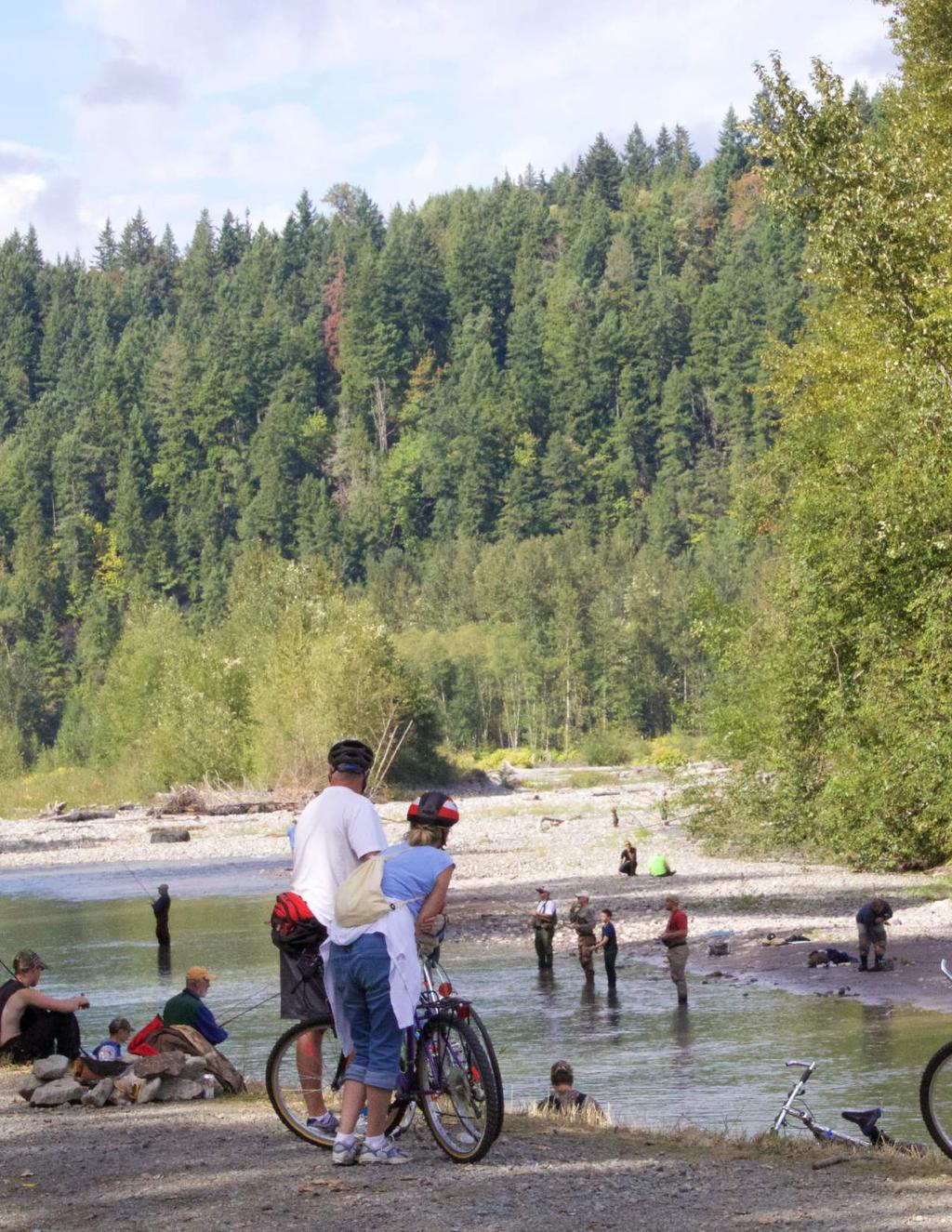
1 TAHOMA to TACOMA TRAIL NETWORK The health, equity, transportation, environmental, and economic benefits of trails in the Puyallup Watershed MARCH 2016
2 2

3 ACKNOWLEDGEMENTS TABLE of CONTENTS The Puyallup Watershed Initiative Active Transportation Community of Interest thanks our generous funding partners for their support of this project. Funding for this report was provided by Partners for Places, a Project of the Funders Network for Smart Growth and Livable Communities, and The Russell Family Foundation, as part of the Puyallup Watershed Initiative. We would also like to recognize the members of the Active Transportation Community of Interest for their unceasing work to realize the vision of the Tahoma to Tacoma Trail Network. Special thanks also to our intrepid trail photographer, Don Willott. INTRODUCTION...1 METHODS...2 MAIN ALIGNMENT... 4 Health and Equity Benefits...6 Transportation and Environmental Benefits...10 Economic and Property Value Benefits...14 PIPELINE TRAIL CONNECTOR...18 COMBINED ALIGNMENT...22 APPENDIX/SOURCES...26
4 INTRODUCTION

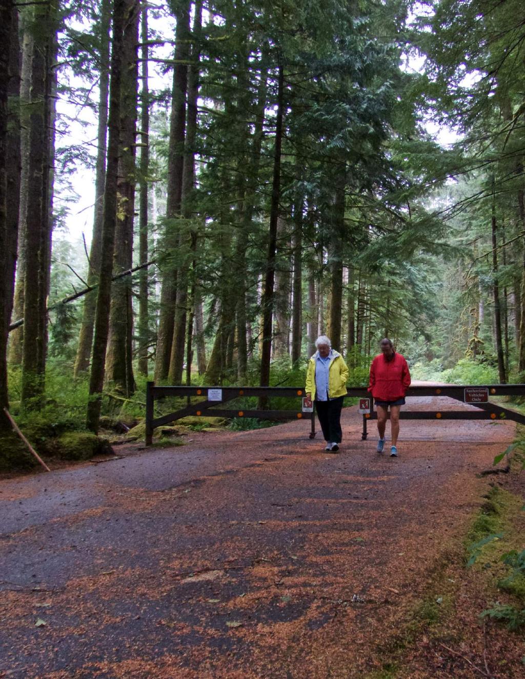
5 The vision of the Tahoma to Tacoma to Trail Network is to create a region-wide system of attractive, safe, low-stress connections for residents and visitors to the many regional and local destinations in the Puyallup Watershed. Communities from Commencement Bay to Mt. Rainier National Park will have increased access to everyday destinations, improved health, equity, economic development, and opportunities to enjoy the natural beauty of the region. This report evaluates the benefits that could be generated if two major alignments of the Tahoma to Tacoma Trail Network - the Main Alignment and Pipeline Trail - are completed. Segments of the Main Alignment exist today - including the Foothills Trail and Puyallup Riverwalk Trail - but the corridor in its entirety remains a concept and specific alignments have yet to be determined. Quantifying the potential health, equity, environmental, tourism property value, and transportation impacts of the complete corridor could focus the regional discussion around active transportation and enables communities in the Puyallup Watershed to better manage existing resources, coordinate local/regional improvements and prioritize future investments. The second alignment, the Pipeline Trail, would tie into the Main Alignment along a more southern route and serve as an important connector for the communities between Tacoma and South Hill. 1
6 METHODS DATA SOURCES This analysis estimates the health, equity, environmental, economic, tourism, transportation, and access impacts associated with bicycling and walking near the proposed trail alignments using five-year socioeconomic and travel behavior estimates generated by the U.S. Census Bureau and regional multipliers generated by the Bureau of Economic Analysis. How could a fully-constructed trail network improve the way residents and visitors experience the Puyallup Watershed? To better understand the shift in travel behavior, we looked at transportation patterns in a number of other counties that feature similar or higher levels of walking and bicycling. These counties, known as peer locations, were selected because they have similar existing and/or proposed trail networks, physical geographies, regional destinations and a mix of urban/rural communities and may also have achieved measures of success that could be considered appropriate goals or targets for the Puyallup Watershed region. Based on these characteristics, the locations selected as peer locations were: El Paso County 4.0% 3.0% 2.0% 1.0% WALK AND BICYCLE COMMUTE MODESHARE % (CO), Jefferson County (KY), Cumberland County (ME), Arlington County (VA) and Spokane County (WA). 1 At least one of the largest cities in each of these counties has received the League of American Bicyclists s Bronze or Silver level of Bicycle Friendly Community Award designation. Tacoma, the largest urban center in the Pierce County currently holds a Bronze level award designation. 2 The designation of a community as a Bicycle Friendly or Walk Friendly Community represents a significant investment in improvements to the bicycling and walking environment in 4.0 % 0.3 % 0.74 % PIERCE COUNTY PEER LOCATIONS WALK COMMUTE MODESHARE BICYCLE COMMUTE MODESHARE each community. Because of the improvements these counties have made to earn these awards, residents are (on average) more likely to bicycle in five of the peer counties than in Pierce County and more likely to walk in four of the peer counties than in Pierce County. Currently only 0.3% of the Pierce County residents bicycle to work compared to an average of 0.74% in the peer locations. 3 Similarly, only 2.7% of Pierce county residents currently walk to work compared to an average of 4.0% in the peer locations. 4 2
7 SPOKANE COUNTY PIERCE COUNTY CUMBERLAND COUNTY EL PASO COUNTY JEFFERSON COUNTY ARLINGTON COUNTY PEER COUNTIES HOW THE IMPACTS ARE CALCULATED A series of of over 50 factors derived from peer-reviewed studies and journal articles around the U.S. were applied to convert the estimated number of new bicycle and walking trips that will result from the construction of the Tahoma to Tacoma Trail Network s Main Alignment, Pipeline Alignment, and Combined Alignment. LIMITATIONS OF THE ANALYSIS The primary intent of this evaluation is to establish a clearer, more complete snapshot of how these trail alignments could improve the quality of life of residents and visitors within the Puyallup Watershed. Although the trails are likely to be constructed in segments over time, the estimates here are not intended to represent potential impacts of developing discrete segments of the trail alignments. The full benefits of developing each of these alignments is only achieved through the increased level of connectivity across a comprehensive network. As such, the benefits presented in this report correspond to the full construction of the Main Alignment, Pipeline Alignment, and Combined Alignment, respectively. As such, the benefits presented in this report correspond to the full construction of the Main Alignment, Pipeline Alignment, and/or Combined Alignment. 3
8 Commencement Bay Ruston Tacoma 16 Milton 5 Fircrest Pacific Auburn Edgewood Fife Lake Tapps 167 University Place Sumner 164 Enum Bonney Lake Steilacoom Puyallup 410 Lakewood MAIN ALIGNMENT 161 American Lake 7 South Prairie 704 Dupont PIPELINE TRAIL ALIGNMENT Wilkeson Orting Carbonado 165 Roy Eatonville TAHOMA to TACOMA TRAIL NETWORK MAIN ALIGNMENT MILES Buckley
9 LEGEND Main Alignment Pipeline Trail State Routes & Freeways National Forest Land Parks Puyallup Watershed mclaw 410 The Puyallup Watershed Initiative envisions a connected trail network from Mount Rainier to Commencement Bay. This system will link new and existing trails and allow residents and visitors to walk, bicycle, and skateboard between key local and regional destinations. The Tahoma to Tacoma Trail Network will connect local communities while showcasing our region s natural beauty, from the glacial peak of Mount Rainier to the shores of the Puget Sound. 410 Mount Rainier National Park Carbon River Entrance Ipsut Creek Campground MOUNT RAINIER NATIONAL PARK $3,225,000 per year in Transportation Benefits $93,000 per year in Environmental Benefits $8,250,000 per year in Economic Benefits one-time Property Value Benefits HOUSEHOLDS within 3 miles Approximately 62.5 in Health Benefits HOUSEHOLDS within 1/2 mile 129,562 Mount Rainier National Park Nisqually Entrance $1,391,000 per year $120,571,000 in MAIN ALIGNMENT SUMMARY 23,719 If the Main Alignment were completed today, it could provide: TOTAL BENEFITS PER YEAR $12,959,000 MILES LONG 5

10 MAIN ALIGNMENT HEALTH + EQUITY BENEFITS

11 MAIN ALIGNMENT -- HEALTH + EQUITY BENEFITS Improved community health and wellness is directly related to increased levels of physical activity. A growing body of literature has shown a strong connection between parks and trails and increased physical activity. The Main Alignment of the Tahoma to Tacoma Trail Network could dramatically increase safe and convenient opportunities for residents and visitors to walk, skateboard, bike and lead to increased frequency and duration of physical activity among Pierce County residents. 5,6,7,8 This could in turn lead to reduced risk of obesity, diabetes, heart disease, stress related health problems, and other health concerns attributed to physical inactivity. 9,10 7

12 MAIN ALIGNMENT -- HEALTH + EQUITY BENEFITS PIERCE COUNTY PROFILE The ability for all residents and visitors to safely and conveniently walk, bicycle, and skateboard is a fundamental equity measure, and translates to numerous community health and equityrelated benefits, including reduced risk of obesity, diabetes, and heart disease. 11 The following statistics provide a snapshot of the health and equity -related impacts and benefits for Pierce County. 20 % of the population is physically inactive % of Pierce County residents do not have access to exercise opportunities % of the adult population is obese 14 Diabetes costs Pierce County $322 MILLION per year 15

13 If the Main Alignment were completed today, Pierce County could see an increase of: 9,620,000 miles biked per year 9,336,000 miles walked per year 31,000 more residents getting a healthy amount of exercise $1,391,000 in total healthcare savings from walking and bicycling per year Access for 11,399 households without a vehicle within 3 miles of the trail Access for 45,640 people below the poverty line within 3 miles of the trail 9

14 MAIN ALIGNMENT TRANSPORTATION + ENVIRONMENTAL BENEFITS

15 MAIN ALIGNMENT -- TRANSPORTATION + ENVIRONMENTAL BENEFITS The Main Alignment of the Tahoma to Tacoma Trail Network would result in increased access and connections to many local and regional destinations. It would provide residents and visitors with more travel options and present a safe, comfortable, efficient, and enjoyable way for people to get around. Additionally, the Main Alignment would provide the Puyallup Watershed region with transportation-specific benefits related to reductions in the number of vehicle miles traveled (VMT). The following benefits account for reductions in the estimated costs of congestion, vehicle collisions, road maintenance, and direct household vehicle expenses, as well as the estimated environmental impact associated with vehicle emissions. 11

16 MAIN ALIGNMENT -- TRANSPORTATION + ENVIRONMENTAL BENEFITS PIERCE COUNTY PROFILE Constructing the Main Alignment of the Tahoma to Tacoma Trail Network would directly impact the following transportation and environmental considerations for residents in the Puyallup Watershed. $8,220 Average cost of operating a car per year 16 $308 Average cost of operating a bike per year Youth hit by cars while walking or biking in Tacoma from % of all local trips in Pierce County are made by walking 19

17 If the Main Alignment were completed today, Pierce County could experience: 2,781,000 Fewer miles traveled by automobiles $1,585,000 In reduced household vehicle operation costs per year $1,001,000 in reduced collision-related costs per year $93,000 in total environmental cost savings from reduced vehicle emissions per year $221,000 In reduced congestionrelated costs per year 8,041,000 lbs of CO2 Emissions Diverted 13

18 MAIN ALIGNMENT ECONOMIC + PROPERTY VALUE BENEFITS

19 MAIN ALIGNMENT -- ECONOMIC + PROPERTY VALUE BENEFITS Development of the Main alignment of the Tahoma to Tacoma Trail Network would provide residents and visitors access to local parks, regional destinations of cultural and historical significance (including Mt. Rainier National Park) and all of the everyday connections that the communities of the Puyallup Watershed make to go to work, school, shop, and play. As a growing industry and major economic driver in the region, tourism is an increasingly important basis for developing the regional trail network. An analysis of the U.S. Bureau of Economic Analysis RIMS II multipliers estimates the region can expect around $8,250,000 in tourism dollars annually as a result of constructing the Main Alignment. Additionally, the transportation and recreation amenities that the Main Alignment provides could incentivize residents and business owners to invest in property. Property value studies of similar trail systems show that nearby property owners can expect a 3.5% increase in property values, amounting to an overall increase of around $120.5 million dollars. 15

20 MAIN ALIGNMENT -- ECONOMIC + PROPERTY VALUE BENEFITS PIERCE COUNTY PROFILE The economic and property value benefits of the Main Alignment are particular to the conditions here in Pierce County, including the number of tourists the Tahoma to Tacoma Trail Network could attract, how much visitors spend, the number of tourism-related jobs created, and how much property values could increase near the alignments as a result of trail construction. The following are a few examples of the economic motivations for the construction of the Main Alignment. Visitors to Pierce County on average spent $ 88 per visit/day % of Mt. Rainier National Park visitors surveyed said that bicycling was a preferred activity for future visits 21 Tourism is the 4TH LARGEST INDUSTRY in WA State, 22 and the Tahoma to Tacoma Trail Network could be the cornerstone of the Washington Tourism Alliance s and Travel Tacoma + Pierce County s new marketing programs

21 If the Main Alignment were completed today, Pierce County could see an increase of: 94 more jobs supported by tourism-related spending in Pierce County 76,500 more visitors per year $8,250,000 more tourism dollars generated per year $120,571,000 in one-time property value growth 17
22 Commencement Bay Ruston Tacoma 16 Milton 5 Fircrest Pacific Auburn Edgewood Fife Lake Tapps 167 University Place Sumner 164 Enum Bonney Lake Steilacoom Puyallup 410 Lakewood MAIN ALIGNMENT 161 American Lake Buckley 7 South Prairie 704 Dupont PIPELINE TRAIL ALIGNMENT Wilkeson Orting Carbonado 165 Roy Eatonville TAHOMA to TACOMA TRAIL NETWORK PIPELINE TRAIL MILES
23 LEGEND Main Alignment Pipeline Trail State Routes & Freeways National Forest Land Parks Puyallup Watershed mclaw 410 The Puyallup Watershed Initiative envisions a connected trail network from Mount Rainier to Commencement Bay. This system will link new and existing trails and allow residents and visitors to walk, bicycle, and skateboard between key local and regional destinations. The Tahoma to Tacoma Trail Network will connect local communities while showcasing our region s natural beauty, from the glacial peak of Mount Rainier to the shores of the Puget Sound. 410 Mount Rainier National Park Carbon River Entrance Ipsut Creek Campground MOUNT RAINIER NATIONAL PARK PIPELINE TRAIL ALIGNMENT SUMMARY 15,730 HOUSEHOLDS within 3 miles Approximately 15.4 $1,088,000 per year in Health Benefits $2,424,000 per year in Transportation Benefits $70,000 per year in Environmental Benefits $2,033,000 per year in Economic Benefits $81,873,000 in one-time Property Value Benefits HOUSEHOLDS within 1/2 mile 105,559 Mount Rainier National Park Nisqually Entrance If the Pipeline Trail were completed today, it could provide: TOTAL BENEFITS PER YEAR $5,615,000 MILES LONG 19
24 PIPELINE TRAIL BENEFITS HEALTH + EQUITY BENEFITS If the Pipeline Trail were completed today, Pierce County could see an increase of: 2,435,000 miles biked per year 544,000 miles walked per year 3,269 more residents getting a healthy amount of exercise $1,088,000 in total healthcare savings from walking and bicycling per year Access for 12,683 households without a vehicle within 3 miles of the trail Access for 37,616 people below the poverty line within 3 miles of the trail
25 TRANSPORTATION + ENVIRONMENTAL BENEFITS If the Pipeline Trail were completed today, Pierce County could experience: 2,090,000 Fewer miles traveled by automobiles $1,191,000 In reduced household vehicle operation costs per year $167,000 In reduced congestion-related costs per year $753,000 in reduced collision-related costs per year $70,000 in total environmental cost savings from reduced vehicle emissions per year ECONOMIC + PROPERTY VALUE BENEFITS If the Pipeline Trail were completed today, Pierce County could see an increase of: 23 more jobs supported by tourism-related spending in Pierce County 25,500 more visitors per year $2,033,000 more tourism dollars generated per year $81,873,000 in one-time property value growth 6,153,000 lbs of CO2 Emissions Diverted 21
26 Commencement Bay Ruston Tacoma 16 Milton 5 Fircrest Pacific Auburn Edgewood Fife Lake Tapps 167 University Place Sumner 164 Enum Bonney Lake Steilacoom Puyallup 410 Lakewood MAIN ALIGNMENT 161 American Lake 7 South Prairie 704 Dupont PIPELINE TRAIL ALIGNMENT Wilkeson Orting Carbonado 165 Roy TAHOMA to TACOMA TRAIL NETWORK Eatonville COMBINED ALIGNMENT MILES Buckley


27 LEGEND Main Alignment Pipeline Trail State Routes & Freeways National Forest Land Parks Puyallup Watershed mclaw 410 The Puyallup Watershed Initiative envisions a connected trail network from Mount Rainier to Commencement Bay. This system will link new and existing trails and allow residents and visitors to walk, bicycle, and skateboard between key local and regional destinations. The Tahoma to Tacoma Trail Network will connect local communities while showcasing our region s natural beauty, from the glacial peak of Mount Rainier to the shores of the Puget Sound. 410 Mount Rainier National Park Carbon River Entrance Ipsut Creek Campground MOUNT RAINIER NATIONAL PARK COMBINED ALIGNMENT SUMMARY 38,046 HOUSEHOLDS within 1/2 mile 286,605 HOUSEHOLDS within 3 miles Approximately Mount Rainier National Park Nisqually Entrance 77.8 MILES LONG If the Main Alignment and Pipeline Trail Alignment were completed today, it could provide: $1,971,000 per year in Health Benefits $4,255,000 per year in Transportation Benefits $122,000 per year in Environmental Benefits $10,270,000 per year in Economic Benefits $191,120,000 in one-time Property Value Benefits TOTAL BENEFITS PER YEAR $16,618,000 23
28 COMBINED ALIGNMENT BENEFITS HEALTH + EQUITY BENEFITS If the Combined Alignment were completed today, Pierce County could see an increase of: 3,733,000 miles biked per year 1,299,000 miles walked per year 6,200 more residents getting a healthy amount of exercise $1,971,000 in total healthcare savings from walking and bicycling per year Access for 15,564 households without a vehicle within 3 miles of the trail Access for 57,023 people below the poverty line within 3 miles of the trail
29 TRANSPORTATION + ENVIRONMENTAL BENEFITS If the Combined Alignment were completed today, Pierce County could experience: 3,670,000 Fewer miles traveled by automobiles $2,091,000 In reduced household vehicle operation costs per year $293,000 In reduced congestion-related costs per year $1,321,000 in reduced collision-related costs per year $122,000 in total environmental cost savings from reduced vehicle emissions per year ECONOMIC + PROPERTY VALUE BENEFITS If the Combined Alignment were completed today, Pierce County could see an increase of: 116 more jobs supported by tourism-related spending in Pierce County 100,500 more visitors per year $10,270,000 more tourism dollars generated per year $191,120,000 in one-time property value growth 10,144,000 lbs of CO2 Emissions Diverted 25
30 PIERCE COUNTY PROFILE The following profile gives an overview of Pierce County existing health, equity, transportation, environmental, economic, and property value characteristics. The development of the Tahoma to Tacoma Trail Network would have a direct impact on these metrics. HEALTH + EQUITY PIERCE COUNTY ACTIVITY PROFILE 20 % of the population is physically inactive % of Pierce County residents do not have access to exercise opportunities % of the adult population is obese 14 Diabetes costs Pierce County $322 MILLION per year 15
31 TRANSPORTATION + ENVIRONMENTAL PIERCE COUNTY ACTIVITY PROFILE $8,220 Average cost of operating a car per year 16 ECONOMIC + PROPERTY VALUE PIERCE COUNTY ACTIVITY PROFILE Visitors to Pierce County on average spent $ 88 per visit/day 20 $308 Average cost of operating a bike per year Youth hit by cars while walking or biking in Tacoma from % of all local trips in Pierce County are made by walking % of Mt. Rainier National Park visitors surveyed said that bicycling was a preferred activity for future visits 21 Tourism is the 4TH LARGEST INDUSTRY in WA State, 22 and the Tahoma to Tacoma Trail Network could be the cornerstone of the Washington Tourism Alliance s and Travel Tacoma + Pierce County s new marketing programs 27
32 SOURCES 1. Current Bicycle Friendly Communities. The League of American Bicyclists < 2. Ibid American Community Survey 5-year estimates. U.S. Census Bureau Ibid. 5. Benefits of Greenways: A Pennsylvania Study. Pennsylvania Greenways Partnership Commission < 6. Fitzhugh, Eugene C, David R Basset Jr, Mary F Evans. Urban trails and physical activity: a natural experiment. (2010) American Journal of Preventative Medicine. 7. Librett JJ, Yore MM, Schmid TL. Characteristics of physical activity levels among trail users in a U.S. national sample. American Journal of Preventative Medicine. 31(5): November The Power of trails for promoting physical activity in communities. Active Living Research. January < PowerofTrails_0.pdf> 9. The Environmental Benefits of Bicycling and Walking. Federal Highway Administration < 10. Haskell, William L, Steven N Blair, James O Hill. Physical activity: health outcomes and importance for public health policy. Prev Med;49(4): < activelivingresearch.org/files/2_pm2009_haskell.pdf> 11. Ibid. 12. County Health Rankings & Roadmaps. University of Wisconsin Population Health Institute, Robert Wood Johnson Foundation < countyhealthrankings.org/app/washington/2015/rankings/pierce/county/outcomes/ overall/snapshot>
33 13. Ibid. 14. Ibid. 15. Pierce County, Washington County Health Calculator < countyhealthcalculator.org/location/153053/> 16. Mohn, Tanya. Pedalling to Prosperity: Biking Saves U.S. Riders Billions A Year. Forbes. May Ibid. 18. Safe Routes to School: A Comprehensive Approach to a Complicated Problem. Puyallup Watershed Initiative < uploads/2015/10/saferoutestoschool.tacoma_ pdf> 19. Spring 2014 Household Survey Public Release 3 Dataset. Puget Sound Regional Travel Study. Puget Sound Regional Council < transportation/travel-surveys/2014-household> 20. Mount Rainier National Park Visitor Study < management/upload/mora-final-report_nrss2013.pdf> 21. Ibid. 22. Tourism Means Business. Travel Tacoma + Pierce County, WA. May < 29
34
Perryville TOD and Greenway Plan
 Perryville TOD and Greenway Plan Greenway Glossary Pathway: A bicycle and pedestrian path separated from motorized vehicular traffic by an open space, barrier or curb. Multi-use paths may be within the
FACTS AND FIGURES: MAKING THE CASE FOR COMPLETE STREETS IN LEE COUNTY
 FACTS AND FIGURES: MAKING THE CASE FOR COMPLETE STREETS IN LEE COUNTY Safety: Close to 5,000 pedestrians and bicyclists die each year on U.S. roads, and more than 70,000 are injured. [Mean Streets, Surface
NASHUA REGIONAL PLANNING COMMISSION REGIONAL BICYCLE AND PEDESTRIAN PLAN
 NASHUA REGIONAL PLANNING COMMISSION REGIONAL BICYCLE AND PEDESTRIAN PLAN June, 2005 Prepared by the Nashua Regional Planning Commission 2005 NRPC Regional Bicycle and Pedestrian Plan- JUNE 2005 ACKNOWLEDGEMENTS
Lisa Quinn Executive Director
 Transforming Injury and Violence Prevention: Innovations in Policy, Practice, and Partnerships Advocating for Prevention: Enacting and Reacting to Legislation Lisa Quinn Executive Director Feet First works
BUILDING THE CASE FOR TRAVEL OPTIONS IN WASHING TON COUNTY. Image: Steve Morgan. Image: Steve Morgan
 BUILDING THE CASE FOR TRAVEL OPTIONS IN WASHING TON COUNTY Image: Steve Morgan Image: Steve Morgan Image: TriMet Image: TriMet WHAT ARE TRAVEL OPTIONS PROGRAMS? Travel options programs encourage residents,
Cascade Bicycle Club Strategic Plan
 The Greater Context Bicycling has become fundamentally important as large-scale currents of change threaten the health, economy and livability of communities throughout the United States and the world
Typical Rush Hour Commute. PennyforTransportation.com
 Typical Rush Hour Commute In the News Overview of the Plan Collaborative plan with projects in every community Prioritizing connectivity and congestion relief Dedicated transportation-specific funding;
JEFFERSON COUNTY BIKE PLAN 2010: EMPHASIS SUMMARY
 JEFFERSON COUNTY BIKE PLAN 2010: EMPHASIS SUMMARY Presented at Jefferson and Walworth County Bicycle Forum Series Summer 2011 By: Steve Grabow, Professor and Community Development Educator UW-Extension,
GRAHAM PEDESTRIAN TRANSPORTATION PLAN
 GRAHAM PEDESTRIAN TRANSPORTATION PLAN Chapter 1 I 1.1 Scope and Purpose n March of 2005, the City of Graham contracted with Greenways Incorporated (GWI) to create a Pedestrian Transportation Plan. The
Multimodal Transportation Plan
 Multimodal Transportation Plan The Multimodal Transportation Plan will accommodate MILLENIALS ARE DRIVING LESS. WE CANNOT BUILD OUR WAY all modes of transportation by keeping pedestrians, OUT OF CONGESTION.
 Time of Change We Are Growing We Are An Attractive Place To Live We Are Age Diverse + Living Longer 50000 40000 30000 20000 10000 0 2010 Census Job Density Housing Sheds Transit Sheds The Project FUNDING
Chapter 2. Bellingham Bicycle Master Plan Chapter 2: Policies and Actions
 Chapter 2 Bellingham Bicycle Master Plan Chapter 2: Policies and Actions Chapter 2: Policies and Actions The Bicycle Master Plan provides a road map for making bicycling in Bellingham a viable transportation
City of Novi Non-Motorized Master Plan 2011 Executive Summary
 City of Novi Non-Motorized Master Plan 2011 Executive Summary Prepared by: February 28, 2011 Why Plan? Encouraging healthy, active lifestyles through pathway and sidewalk connectivity has been a focus
Incorporating Health in Regional Transportation Planning
 Mayor Karl Dean, Chairman Incorporating Health in Regional Transportation Planning Leslie A. Meehan, AICP Center TRT Intervention Webinar January 29, 2013 Objectives for Today Background About the Nashville
Incorporating Health in Regional Transportation Planning
 Mayor Karl Dean, Chairman Incorporating Health in Regional Transportation Planning Leslie A. Meehan, AICP Center TRT Intervention Webinar January 29, 2013 Objectives for Today Background About the Nashville
Transportation Master Plan Advisory Task Force
 Transportation Master Plan Advisory Task Force Network Alternatives & Phasing Strategy February 2016 BACKGROUND Table of Contents BACKGROUND Purpose & Introduction 2 Linking the TMP to Key Council Approved
DRAFT MOVING FORWARD RHODE ISLAND BICYCLE MOBILITY PLAN 2018 PREPARED FOR PREPARED BY IN ASSOCIATION WITH
 RHODE ISLAND MOVING FORWARD BICYCLE MOBILITY PLAN 2018 PREPARED FOR PREPARED BY IN ASSOCIATION WITH T AF CHAPTER 1 D R INTRODUCTION CHAPTER 3 ARTICULATES VISION Bicycling is safe, fun and practical in
Creating Complete Streets to Accommodate All Users
 Creating Complete Streets to Accommodate All Users Peter Lagerwey, Toole Design Group plagerwey@tooledesign.com Brian Dougherty, Seattle DOT brian.dougherty@seattle.gov International Conference on Urban
HAMILTON BIKING PLAN OUR VISION: A BIKE FRIENDLY CITY
 HAMILTON BIKING PLAN 2015-2045 OUR VISION: A BIKE FRIENDLY CITY INTRODUCTION Biking as a travel option is experiencing a resurgence internationally and in New Zealand, growing as a familyfriendly and healthy
Transportation 2040 Update: Travel Trends. Transportation Policy Board June 9, 2016
 Transportation 2040 Update: Travel Trends Transportation Policy Board June 9, 2016 2 Today s Discussion How has travel behavior changed? How are we growing and how has that affected our travel patterns?
Health and Community Design: The Local Government Role in Promoting Active Living
 Health and Community Design: The Local Government Role in Promoting Active Living Rich Killingsworth, Director Active Living by Design National Program Office University of North Carolina School of Public
TABLES AND CHARTS 2018 UPDATE
 TABLES AND CHARTS 2018 UPDATE As of December 31, 2017 Pierce County Library System Table of Contents Assessed Values and Property Taxes... 3 Total Revenue... 6 Major Nontax Revenue Sources... 8 Major Expenditure
NACTO Designing Cities Conference Project Evaluation: Tools for Measuring Success and Building Support. October 29, 2015
 NACTO Designing Cities Conference Project Evaluation: Tools for Measuring Success and Building Support October 29, 2015 The case for evaluation: Have a social contract with City Council, staff and community
CONNECTING PEOPLE TO PLACES
 CONNECTING PEOPLE TO PLACES 82 EAST BENCH MASTER PLAN 07 Introduction The East Bench transportation system is a collection of slow moving, treelined residential streets and major arteries that are the
Economic Benefits of Bicycle and Pedestrian Facilities
 Economic Benefits of Bicycle and Pedestrian Facilities Ursula Lemanski National Park Service Rivers & Trails Program Rappahannock Rapidan Regional Commission Living Towns Workshop Village of Marshall July
Afeasibility study to evaluate bus rapid transit service in the East-West Corridor connecting major employment and activity centers between downtown
 East-West Bus Rapid Transit Feasibility Study Update and Recommended Locally Preferred Alternative (LPA) Summary City of Wauwatosa, Transportation Affairs Committee June 2016 Afeasibility study to evaluate
Regional Transportation Needs Within Southeastern Wisconsin
 Regional Transportation Needs Within Southeastern Wisconsin #118274 May 24, 2006 1 Introduction The Southeastern Wisconsin Regional Planning Commission (SEWRPC) is the official areawide planning agency
What s Health Got to Do With It? Health and Land Use Planning
 What s Health Got to Do With It? Health and Land Use Planning CANDACE RUTT, PH.D. EXECUTIVE DIRECTOR APRIL 13 TH, 2016 Planning and Public Health Planning + Public Health Healthy Communities Healthier
Vision Public Workshop: Findings
 Vision Public Workshop: Findings Long Range Transportation Plan & Bicycle Mobility Plan February 2018 Vision Workshop South Kingstown 1/23/18 Providence 1/24/18 Newport 1/31/18 Long Range Transportation
North Coast Corridor:
 North Coast Corridor: Connecting People, Transportation & Environment Legislative Hearing: 11.8.10 1 North Coast Corridor Region s Lifeline A Regional Strategy Mobility, Economy & Environment North Coast
SUPPORTING DOCUMENTATION PROPOSED TRAILS DEVELOPMENT AND IMPLEMENTATION PLAN
 SUPPORTING DOCUMENTATION PROPOSED TRAILS DEVELOPMENT AND IMPLEMENTATION PLAN Prepared For: Prepared By: Town of Rocky Mountain House Recreation, Parks and Community Services 1 INTRODUCTION 1.1 Purpose
Bicycle-Pedestrian Master Plan Update
 Bicycle-Pedestrian Master Plan Update Planning & Zoning Commission November 29, 2017 Overview Project Purpose & Scope Project History Plan Vision & Goals Chapter 5: Making Connections-Beyond the Path Next
CHAPTER 1 INTRODUCTION
 CHAPTER 1 INTRODUCTION Chapter Table of Contents THE 2017 HOUSTON BIKE PLAN 1-1 HOUSTON BIKEWAYS PROGRAM 1-2 HISTORY OF BICYCLE PLANNING IN HOUSTON 1-3 BICYCLE LEVEL OF COMFORT 1-3 EXISTING PLANS, PROGRAMS
Complete streets serve the 1/3 of Hoosiers who do not drive.
 Complete Streets Complete streets are safe, comfortable and convenient for all users, including pedestrians, bicyclists, motorists and public transit riders, regardless of age or ability. Complete streets
PEDESTRIAN ACTION PLAN
 ATTACHMENT 2 CITY OF SANTA MONICA PEDESTRIAN ACTION PLAN CITY OF SANTA MONICA PEDESTRIAN ACTION PLAN This page intentionally left blank EXECUTIVE SUMMARY CHAPTER 1 EXECUTIVE SUMMARY Setting the Stage
Take the Bus. Project Proposal AUSTRALIA. Bus Industry Confederation. Take the Bus. Bus Australia Network WARTA. BusS. Bus & Coach Association SA
 Project Proposal Bus Industry Confederation Bus Australia Network BusS Bus & Coach Association SA WARTA Bus Australia Network BusS Bus & Coach Association SA 2 Project Proposal Bus Industry Confederation
Discussion: Bicycle Benefits
 Discussion: Bicycle Benefits 3 Bicycling has increased in popularity over the last decade as Americans realize its health, transportation, and financial benefits. Cities across the United States and within
City of Birmingham Draft Multi-modal Transportation Plan
 City of Birmingham Draft Multi-modal Transportation Plan City Commission Public Hearing Monday, November 25, 2013 7:30 pm Norman Cox, PLA, ASLA The Greenway Collaborative, Inc. Ann Arbor, Michigan The
Methodology for assessing the benefits of active transportation projects EXECUTIVE SUMMARY
 C L I M AT E -S M A R T C I T I E S Methodology for assessing the benefits of active transportation projects EXECUTIVE SUMMARY Written by Eliot Rose and James Choe, ICF International For The Trust for
phoenix regional bike share program sponsorship
 phoenix regional bike share program sponsorship High visibility opportunities to promote a healthy lifestyle and sustainable transportation in the Phoenix area what is bike share? Bike share programs are
Connecting Sacramento: A Trip-Making and Accessibility Study
 Connecting Sacramento: A Trip-Making and Accessibility Study Study Overview and Highlights July 2017 Purpose of this study Local governments and transportation agencies often make challenging decisions
ACTIVE TRANSPORTATION/NONMOTORIZED TRANSPORTATION
 ACTIVE TRANSPORTATION/NONMOTORIZED TRANSPORTATION BACKGROUND Active transportation, also known as nonmotorized transportation, is increasingly recognized as an important consideration when planning and
WALK Friendly Communities: Creating Vibrant, Inclusive Places for People
 WALK Friendly Communities: Creating Vibrant, Inclusive Places for People Walkers are the indicator species for vibrant communities ~ Dr. Rodney Tolley, Director, Walk21 Imagine yourself walking safely
Complete Streets 101: The Basics
 Complete Streets 101: The Basics Michigan Municipal League - Capital Conference March 21, 2017 Chip Smith, AICP - Senior Planner - Wade Trim Inc. and City Council member City of Ann Arbor 2017 MML Capital
City of Davenport CitiBus Public Transportation Study. April 2015
 City of Davenport CitiBus Public Transportation Study April 2015 Overview Project Background Key Findings CitiBus Service Allocation Policy Discussion 2 Project Background 3 About CitiBus Operates 17 routes
Prioritizing Transportation Policy and Funding for Active Transportation, Safety, Equity and Health
 Mayor Karl Dean, Chairman Prioritizing Transportation Policy and Funding for Active Transportation, Safety, Equity and Health Leslie A. Meehan, AICP Planning and Implementing the Active Community Webinar
Active Community Design: Why Here? Why Now?
 Active Community Design: Why Here? Why Now? Chris Holm Development Review Coordinator 20 April, 2015 Sacramento, California Our environment has changed North Natomas We ve rapidly urbanize our open space
Chapter 5. Complete Streets and Walkable Communities.
 Chapter 5. Complete Streets and Walkable Communities. 5.1 Description of Complete Streets. Cities throughout the world, and specifically the United States, are coming to embrace a new transportation and
Encouragement. Chapter 4. Education Encouragement Enforcement Engineering & Facilities Evaluation & Planning. Encouragement Chapter 4
 Encouragement Education Encouragement Enforcement Engineering & Facilities Evaluation & Planning Photo above: Children show off their ribbons at the Tour de Virginia Beach. Virginia Beach Bikeways and
EXECUTIVE SUMMARY. Vision
 Vision Walking and bicycling in Salt Lake City will be safe, convenient, comfortable, and viable transportation options that connect people to places, foster recreational and economic development opportunities,
Transit-Driven Complete Streets
 Questions: Type questions into the box at bottom of webinar panel. Panelists for today s webinar: Nimotalai Azeez, Program Associate with the National Complete Streets Coalition Rich Weaver, Director of
Complete Streets: Building Momentum in Connecticut
 Complete Streets: Building Momentum in Connecticut Tri-State Transportation Campaign, 2012 What are Complete Streets? Complete Streets are safe, comfortable, and convenient for travel for everyone, regardless
Where We Live and Work Today
 San Diego Forward: The 2019-2050 Regional Plan Network Concepts Transportation Committee Item 4 October 19, 2018 Where We Live and Work Today 2018 2 2019 Regional Plan Transportation Committee Item 4 October
Proposed. City of Grand Junction Complete Streets Policy. Exhibit 10
 Proposed City of Grand Junction Complete Streets Policy Exhibit 10 1 City of Grand Junction Complete Streets Policy Vision: The Complete Streets Vision is to develop a safe, efficient, and reliable travel
Corridor Vision Workshop Summary James Madison Elementary February 22,2018
 Corridor Vision Workshop Summary James Madison Elementary February 22,2018 WHY DEVELOP THIS STUDY? Ogden City is planning for better connectivity and access to jobs and housing. Working with area partners,
TR NEWS. Public Health and Transportation. Innovation, Intervention, and Improvements NUMBER 299 SEPTEMBER OCTOBER 2015
 TR NEWS NUMBER 299 SEPTEMBER OCTOBER 2015 Public Health and Transportation Innovation, Intervention, and Improvements Public Health and Transportation Measuring the Health Benefits of Walking and Bicycling
Goals, Objectives, and Policies
 Goals, Objectives, and Policies ADVISORY GROUP INPUT PUBLIC INPUT SNS PREVIOUS STUDIES RBPP Goals Vision Statement Southern Nevada will develop a safe, connected, and convenient walking and bicycling system
OC Healthy Communities Forum. The proportion of the population that live within a half mile of a major transit access point.
 OC Healthy Communities Forum Transit Access The proportion of the population that live within a half mile of a major transit access point. Use of public transit can result in decreased greenhouse gas emissions
FINAL PLAN APPENDIX D CITY OF BERKELEY BIKE PLAN D-1
 CITY OF BERKELEY BIKE PLAN D-1 . Proposed Programs D.1. EDUCATION This appendix presents the recommended bicycle-related programs for the City of Berkeley. The recommendations are organized in four E s:
NACTO Designing Cities 2014 Dongho Chang, City Traffic Engineer October 23, 2014
 NACTO Designing Cities 2014 Dongho Chang, City Traffic Engineer October 23, 2014 Presentation overview Perspective on Safety Changing needs of our cities How Seattle is meeting those needs Challenge for
GD 0043/18 ACTIVE TRAVEL STRATEGY
 GD 0043/18 ACTIVE TRAVEL STRATEGY 2018-2021 May 2018 Minister s Introduction There is strong evidence that regular physical activity reduces the risk of a range of health conditions. The best way to increase
2. Context. Existing framework. The context. The challenge. Transport Strategy
 Transport Strategy Providing quality connections Contents 1. Introduction 2. Context 3. Long-term direction 4. Three-year priorities 5. Strategy tree Wellington City Council July 2006 1. Introduction Wellington
June 2015 REGIONAL TRANSPORTATION SNAPSHOT
 June 2015 REGIONAL TRANSPORTATION SNAPSHOT THE REGION Who are we? The Greater Toronto and Hamilton Area (GTHA), consisting of Durham Region, Halton Region, the City of Hamilton, Peel Region, the City of
Pocatello Regional Transit Master Transit Plan Draft Recommendations
 Pocatello Regional Transit Master Transit Plan Draft Recommendations Presentation Outline 1. 2. 3. 4. What is the Master Transit Plan? An overview of the study Where Are We Today? Key take-aways from existing
Appendix B: Benefit-Cost Analysis
 Appendix B: Benefit-Cost Analysis RE-CONNECTING CLEVELAND: PATHWAYS TO OPPORTUNITY RE-CONNECTING CLEVELAND: PATHWAYS TO OPPORTUNITY [this page intentionally blank] RE-CONNECTING CLEVELAND: PATHWAYS TO
TOWARDS A BIKE-FRIENDLY CANADA A National Cycling Strategy Overview
 TOWARDS A BIKE-FRIENDLY CANADA A National Cycling Strategy Overview NationalCyclingStrategFrameworkv3.indd 1 Potential for this modal shift can be found in municipalities of all sizes, in every population
Town of Superior. Superior Trails Plan
 Part 1 Base Information 1. Project Title US 36 Bikeway Extension 2. Project Start/End points or Geographic Area Provide a map with submittal, as appropriate 3. Project Sponsor (entity that will construct/
Land Use and Transportation Town Hall September 17, 2018
 Land Use and Transportation Town Hall September 17, 2018 Welcome! Tonight s Agenda: 7:00-7:30 OVERVIEW PRESENTATIONS 7:30-8:15 BREAKOUT SESSIONS 8:15 - End TOWN HALL CITIZEN S TIME Purpose of Tonight s
Hennepin County Bicycle and Pedestrian Planning
 Hennepin County Bicycle and Pedestrian Planning 1 Value of bicycle and sidewalk systems Safety Livability Mobility Health Personal Finances Economic Sustainability Clean Air Recreation Parking and congestion
Climate Change Action Plan: Transportation Sector Discussion Paper: Cycling
 Climate Change Action Plan: Transportation Sector Discussion Paper: Cycling ontario.ca/climatechange Contents 1. Minister of Transportation s message... 3 2. Introduction... 5 3. Sector Overview and Support
Active Travel and Exposure to Air Pollution: Implications for Transportation and Land Use Planning
 Active Travel and Exposure to Air Pollution: Implications for Transportation and Land Use Planning Steve Hankey School of Public and International Affairs, Virginia Tech, 140 Otey Street, Blacksburg, VA
Briefing Paper #1. An Overview of Regional Demand and Mode Share
 2011 Metro Vancouver Regional Trip Diary Survey Briefing Paper #1 An Overview of Regional Demand and Mode Share Introduction The 2011 Metro Vancouver Regional Trip Diary Survey is the latest survey conducted
Transportation Assessment
 Transportation Assessment Midtown Open House February 10, 2018 Overview Midtown in Focus Overview & Purpose of Today Transportation Assessment overview Summary of Transportation work to date Review & Analysis
CHAPTER 3: Vision Statement and Goals
 Davidson Walks & Rolls: Active Transportation Master Plan CHAPTER 3 Contents: Overview Vision Statement Measurable Goals Public Outreach CHAPTER 3: Vision Statement and Goals Overview The vision statement
Highway School, Ithaca NY
 Highway School, Ithaca NY June 1, 2009 Michael Ronkin Designing Streets for Pedestrians and Bicyclists 1 We know how to build right 6 Yet many roads are built like this 7 What is a Complete Street?
2014 Bellingham Bicycle Master Plan
 2014 Bellingham Bicycle Master Plan Acknowledgements The City of Bellingham is honored by the commitment of the numerous community members and bicycling enthusiasts who participated in the development
City of Jeffersonville Complete Streets Workshop
 City of Jeffersonville Complete Streets Workshop Planning for a Healthy Community Proudly brought to you by: WORKSHOP OVERVIEW 1. Complete Streets 101 2. Bloomington-Monroe County MPO Policy 3. Mobile
PEDALING FORWARD. A Glance at the SFMTA s Bike Program for SFMTA.COM
 PEDALING FORWARD A Glance at the SFMTA s Bike Program for 2017-2021 SFMTA.COM INTRODUCTION About This Booklet More people from all walks of life see their bicycle as a more convenient way to get where
MASTER BICYCLE AND PEDESTRIAN PLAN
 VILLAGE OF NORTHBROOK MASTER BICYCLE AND PEDESTRIAN PLAN DRAFT PLAN OPEN HOUSE May 2, 2018 AGENDA 1. Community Engagement 2. Vision and Goals 3. General Structure of Plan 4. Recommendations Overview 5.
Active Travel Strategy Dumfries and Galloway
 Active Travel Strategy Dumfries and Galloway Our Active Travel Strategy The agreed Interventions for Dumfries and Galloway Council s Local Transport Strategy includes an action to Develop an Active Travel
RESOLUTION NO ?? A RESOLUTION OF THE CITY OF NEPTUNE BEACH ADOPTING A COMPLETE STREETS POLICY
 RESOLUTION NO. 2018-?? A RESOLUTION OF THE CITY OF NEPTUNE BEACH ADOPTING A COMPLETE STREETS POLICY WHEREAS, safe, convenient, and accessible transportation for all users is a priority of the City of Neptune
FOR INFORMATION ONLY
 9 Date: August 6, 2012 Current Meeting: August 16, 2012 Board Meeting: September 6, 2012 BOARD MEMORANDUM TO: THROUGH: FROM: SUBJECT: Santa Clara Valley Transportation Authority Congestion Management Program
Lawrence Bike Share Feasibility Study
 Lawrence Bike Share Feasibility Study Stakeholder Meeting June 2016 Agenda 1. Project background 2. Bike share overview 3. How can you help? Project Background University of Kansas - KU Yellow bikes(pre
Appendix C 3. Bicycle / Pedestrian Planning
 Appendix C 3. Bicycle / Pedestrian Planning BICYCLE/PEDESTRIAN PLANNING 2005 Master Plan GOAL: Provide for safe and convenient bicycle and pedestrian circulation throughout the City. Develop a city-wide
CHAPTER 1: INTRODUCTION
 FINAL DRAFT DAVIDSON BICYCLE TRANSPORTATION PLAN CHAPTER 1 OUTLINE: Introduc tion to the Bicycle Plan Vision St atement Mea surable Goals The Plan and The Planning Proce ss The Value of Bicycle Transpor
Moving Cambridge. City of Cambridge Transportation Master Plan Public Consultation Centre. March 7, :00 8:00 PM.
 City of Cambridge Transportation Master Plan Public Consultation Centre March 7, 2018 5:00 8:00 PM Region of Waterloo City of Cambridge Transportation Master Plan Public Consultation Centre March 7, 2018
Dear City Council Members,
 From: Bob Kenyon [mailto: ] Sent: Monday, February 08, 2016 10:20 AM To: City Clerk Subject: Please prioritize Caltrain and a complete transit network Thank you for prioritizing bringing BART to San Jose
Niagara Cycling Tourism. Presented by: Susan Morin Prepared by Karine Whittingham May 5th, 2014
 Niagara Cycling Tourism Presented by: Susan Morin Prepared by Karine Whittingham May 5th, 2014 Agenda! Why Cycling Tourism! Economic Impact! Objective & Activities! Stakeholders! Product Development! Bicycle
Design Principle Active Transport
 Active Transport Definition Active transport includes non-motorised forms of transport involving physical activity, such as walking and cycling. It also includes public transport to meet longer distance
Active Transportation on the Rise
 Integrated Approaches to Shared-Use Paths Doug Sarkkinen, PE Windi Shapley, PE Mandi Roberts, AICP, PLA Why? Biking and walking are important active transportation options. Shared-use paths are critical
Downtown Investment Authority JULY 19 TH, 2017
 Downtown Investment Authority JULY 19 TH, 2017 COMMUNITY SUPPORT AND LONG-TERM PLANS Redevelopment Goal No. 1 Reinforce Downtown as the City s unique epicenter for business, history, culture, education,
CITY OF GRAND JUNCTION URBAN TRAILS COMMITTEE 2017 ANNUAL REPORT
 CITY OF GRAND JUNCTION URBAN TRAILS COMMITTEE 2017 ANNUAL REPORT INTRODUCTION INTRODUCTION Resolution No. 48 94 created the Grand Junction Trails Board in 1994 as a subcommittee of the Riverfront Commission
Exhibit 1 PLANNING COMMISSION AGENDA ITEM
 Exhibit 1 PLANNING COMMISSION AGENDA ITEM Project Name: Grand Junction Circulation Plan Grand Junction Complete Streets Policy Applicant: City of Grand Junction Representative: David Thornton Address:
Bristol City Council has produced a draft Bristol Transport Strategy document.
 Bristol Transport Strategy Summary Document Introduction Bristol City Council has produced a draft Bristol Transport Strategy document. The Strategy fills a gap in transport policy for Bristol. We have
Active Transportation Master Plan
 Prepared by: BT Engineering Inc. 100 Craig Henry Drive, Suite 201 Ottawa, Ontario K2G 5W3 June 2017 Table of Contents TABLE of CONTENTS Introduction... 1 Tourism... 2 Health... 3 Safety... 4 Environment...
Introduction Overview This document summarizes the Gateway Gold Line Bus Rapid Transit (Gold Line BRT) health impact assessment (HIA) process and reco
 health impact assessment (HIA) process and reco") Gateway Gold Line Bus Rapid Transit: A Closer Look at Health and Land Use Project Summary May 2016 Introduction Overview This document summarizes the Gateway Gold Line Bus Rapid Transit (Gold Line BRT)
Gateway Gold Line Bus Rapid Transit: A Closer Look at Health and Land Use Project Summary May 2016 Introduction Overview This document summarizes the Gateway Gold Line Bus Rapid Transit (Gold Line BRT)
Trails that Transform: The Economic Impact of Bicycle Tourism
 Trails that Transform: The Economic Impact of Bicycle Tourism September 2016 Economic Growth Summit Alta Planning + Design Nation s leading team of bicycle, pedestrian, greenways, and trails planning and
WELCOME. City of Greater Sudbury. Transportation Demand Management Plan
 WELCOME City of Greater Sudbury Transportation Demand Management Plan Public Consultation Session St. Andrew s Place, Activity Hall 111 Larch Street Wednesday September 13, 2017 6:00 to 8:00 pm Welcome
Notes to Benefit-Cost Analysis
 Executive Summary Project Matrix Current Status/ Problem to Be Addressed University Avenue not user friendly or safe for cars, pedestrians, bicyclists, or bus riders. Notes to Benefit-Cost Analysis Change
The best indicator of an individual s and expanding access to parks and open space.
 Health & Wellness Create a Safe and Healthy Built Environment Artist s rendering, 2014 Health is important to Loveland residents, and stakeholders see the many strong connections between quality of life,