Project Website: Palm Beach TPA s Website:
|
|
|
- Anis Matthews
- 5 years ago
- Views:
Transcription
1
2 The US-1 Multimodal Corridor Study is a Palm Beach Transportation Planning Agency (TPA) Priority Project that was conducted in to identify multimodal improvements along US-1 in Palm Beach County from Camino Real in the City of Boca Raton to Indiantown Road in the Town of Jupiter. This report contains an overview of the findings and recommendations of this study. More information can be found on the project website or the Palm Beach TPA s website. Project Website: Palm Beach TPA s Website: Adopted May 17, 2018 by the Palm Beach TPA Governing Board
3 Acknowledgments We extend our sincere appreciation and gratitude to the residents, business owners, elected officials, local government staff, partner agencies, Health Impact Assessment (HIA) Working Group, and stakeholders who participated in the planning process and guided the development of the US-1 Multimodal Corridor Study. Project Committee Team Palm Beach Transportation Planning Agency (TPA) Florida Department of Transportation (FDOT) - District Four Palm Tran Consultant Team Kimley-Horn & Associates Kittelson & Associates Treasure Coast Regional Planning Council (TCRPC) Everyone s time, input and energy are greatly appreciated.
4 Acronyms AMI Area Median Income OD Origin-Destination APC BCT BMI BRFSS Automated Passenger Counter Broward County Transit Body Mass Index Behavioral Risk Factor Surveillance System PE PTX QTY ROW Preliminary Engineering Palm Tran Express Quantity Right-of-Way BRT CDC Bus Rapid Transit Centers for Disease Control and Prevention RPM STP Route Performance Maximization Surface Transportation Program CEI Construction, Engineering and Inspection TCRPC Treasure Coast Regional Planning Council CIG Capital Investment Grants TDP Transit Development Plan CST ENV FDM Construction Environment FDOT Design Manual TDSP TIGER Transportation Disadvantaged Service Plan Transportation Investments Generating Economic Recovery FDOT Florida Department of Transportation TIP Transportation Improvement Program FHWA Federal Highway Administration TOD Transit Oriented Development FTA Federal Transit Administration TPA Transportation Planning Agency FY HIA MOD MOS MPH NTSP Fiscal Year Health Impact Assessment Mobility on Demand Minimum Operating Segment miles per hour New Starts Transit Program TRIP VPHPD Transportation Regional Incentive Program Vehicles per hour per direction WPB ITC West Palm Beach Intermodal Transfer Center
5 Table of Contents 7 Chapter 1. Project Overview 27 Chapter 2. Understanding the US-1 Corridor 47 Chapter 3. Public Engagement Process 65 Chapter 4. Complete Streets and Transit Improvements 165 Chapter 5. Implementation Appendices Appendix A: Health Impact Assessment (HIA) Appendix B: Transit Assessment Appendix C: Roadway
6 Chapter 1.
7 Project Overview
8 Introduction The US-1 Multimodal Corridor Study encompasses the US-1 corridor in Palm Beach County from Camino Real in the City of Boca Raton to Indiantown Road in the Town of Jupiter, a length of approximately 42 miles. US-1 is a major north-south travel corridor that traverses 14 of the county s eastern communities. The corridor serves approximately 102,000 workers and 68,000 residents. This stretch of corridor was divided into six sections. Palm Tran s highest ridership bus Route 1 and The Bolt limited stop service operate along US-1 and provide access to employment destinations such as Downtown West Palm Beach, education destinations such as Florida Atlantic University, and retail and entertainment destinations such as Downtown Delray Beach. The population is diverse, with both very low and very highincome concentrations located along it. Significant redevelopment occurring all along the corridor reflects and contributes to changing needs and desires of both existing users and those occupying these new places. The purpose of the US-1 Multimodal Corridor Study is to develop a comprehensive plan to upgrade the existing Palm Tran limited stop service to a corridor-based bus rapid transit (BRT) service as well as implement multimodal facilities that improve safety and access for all users, connecting communities along the corridor. As part of this study, a Health Impact Assessment (HIA) was conducted to understand how bicycle, pedestrian and transit improvements could increase access to jobs, education, health and community services, pedestrian and bicycle safety, and development and redevelopment along the corridor of the adjacent communities. 95 Jupiter Juno Beach Palm Beach Gardens North Palm Beach Lake Park Riviera Beach West Palm Beach Lake Worth Lantana Hypoluxo Boynton Beach Gulf Stream Delray Beach 42 Miles Multimodal facilities include a variety of complete street improvements such as bicycle lanes, shared use paths, bus stops, furnishing zones, street trees, crosswalks, pedestrian median refuge, and streetlights. These components work together to create a street with more mobility options that have been demonstrated to result in safer outcomes for all users. More general information on complete streets and be found in the Palm Beach TPA Complete Streets Design Guidelines. Boca Raton STUDY AREA Study Corridor Municipality 8 US-1 Multimodal Corridor Study
 102,000 Workers (19% of Palm Beach")


9 Jupiter Juno Beach Section 6 Study Area Demographics 68,000 Residents (13% of Palm Beach County s Residents) 102,000 Workers (19% of Palm Beach County s Jobs) Palm Beach Gardens North Palm Beach Section 5 Lake Park Riviera Beach Section 4 West Palm Beach Section 3 95 Lake Worth Lantana Hypoluxo Section 2 Boynton Beach Gulf Stream Delray Beach Section 1 PEDESTRIAN & BICYCLE SAFETY IS A CONCERN ALONG US-1 15 Fatalities, which All Occurred in Dark or Dusk (Between ) Boca Raton 82% of Bicycle Crashes Occurred in Locations with No Bicycle Lane STUDY AREA Section # Municipality 9


10 US-1 History Historically, US-1 has provided mobility for north-south trips through Palm Beach County. US-1 was designated in 1926 as The Dixie Highway, which was one of several transcontinental roads envisioned in the early days of the automobile. Development catered to the motoring public with motels, restaurants and other services designed for patrons arriving by car. Because of its transportation role, it was widened over the years to meet growing traffic demand reinforcing its autoorientation. The role of US-1 began to change in the 1970 s with the construction of Interstate 95, when it was the main road to get to and through Palm Beach County for long distance trips along the eastern seaboard and within Florida. The high number of destinations that have grown along the corridor have also increased use by pedestrians, bicyclists and transit riders. Some of the corridor s municipal leaders have started to pursue Complete Streets policies, preparing studies, redesigning networks and even reconstructing portions of US-1 that traverse their communities. The fragmented nature of these prior actions have resulted in varying approaches for accommodating walking and bicycling. Consequently, this has contributed to an inconsistent environment for active transportation and transit users. Today, US-1 is a Main Connector serving downtown areas in the eastern core of Palm Beach County. HOW DO RESIDENTS WITHIN 1/2 MILE OF US-1 GET TO WORK? 10 US-1 Multimodal Corridor Study


11 From then until now 1926 Eastern Division of The Dixie Highway The Atlantic Highway US-1 designated November 11, US-1 (Federal Highway) expanded and relocated following World War II to its current alignment Construction of I-95 in the 1970s removed most long-distance trips Today US-1 is a Main Connector serving downtown areas in the eastern core of Palm Beach County US-1 distributes people to businesses, neighborhoods, and important community destinations 11
12 Our Process The US-1 Multimodal Corridor Study was conducted by the Palm Beach Transportation Planning Agency (TPA) and it is a Priority Project in the agency s Transportation Improvement Program (TIP). The TPA values the importance of implementing the recommendations of this project and design funds have been set aside for this corridor in Fiscal Year (FY) to move forward with the improvements identified in this Study. The US-1 Multimodal Corridor Study is consistent with the goals, objectives, and values of the TPA s adopted Long Range Transportation Plan and further the TPA vision of creating a Safe, Efficient, and Connected Multimodal Transportation System. The Vision for US-1 To fully understand the opportunities and issues in connecting pedestrian and bicycle facilities as well as upgrading and expanding the existing transit service along US-1, the study team met with over 100 stakeholders and hosted a series of six workshops and six three-day charrettes over six months in each of the corridor s sub-segments. During the charrettes, community members were invited to review baseline data, study findings, walk the corridor with the study team and discuss their ideas and desires. The charrettes helped to engage a broad range of community members in the study process. The information received also served as a baseline for the study team s analysis and identification of issues and initial ideas that would respond to specific needs and reflect the context and priorities of surrounding communities. A specific aspect of the study was designed to assess and quantify the benefits of changes along the corridor. This HIA identified parts of the study area with the most acute active transportation needs and uses data to demonstrate how various solutions are likely to affect the well-being of residents, effectively incorporating health considerations into the transportation planning decision-making process. Spring 2017 Research Summer- Fall 2017 Outreach Winter 2018 Report Spring 2018 Outreach 12 US-1 Multimodal Corridor Study
13 Health Impact Assessment (HIA) A Health Impact Assessment (HIA) is a formal evaluation process that incorporates locationspecific scientific data, health expertise, and public input to assess a proposed project or policy s impact on the health of a population and the distribution of those effects within the population. The primary goal of a HIA is to identify the potential health impacts of a project or policy and encourage informed decisions related to the project that will positively influence a population s health. A HIA was conducted as part of this Study and more detailed information is available in Appendix A. A HIA outlines potential consequences for decision-makers and concludes with a set of policy and design/planning recommendations intended to minimize health risks and maximize health benefits. HIA s are based on the best available evidence, both quantitative (such as health surveys and data) and qualitative (such as interviews with stakeholders). HIA s are a useful way to ensure that health needs and opportunities are considered in policy decision-making processes. The HIA process can vary depending on the subject matter, study time that is available, and stakeholders involved. The process is generally comprised of six key stages as shown in the table below. Why Conduct the HIA on US-1? The TPA and Palm Tran were interested to know how transit, bicycle, and pedestrian improvements on the US-1 corridor could enhance the health of the adjacent communities. The timing of the US-1 HIA was advantageous and allowed the findings to directly influence not only the multimodal improvements, but also the opportunities for premium transit throughout the US-1 corridor. 6-Step HIA Process 1 Screening 2 Scoping 3 Assessment 4 Recommendations 5 Reporting Determine whether a HIA is feasible, timely, and would add value to the decision-making process. Identify the health indicators that the project will likely impact, identify the study area and affected populations, prioritize research questions, identify evidence and research methods, establish stakeholder roles, and establish a timeline for the process. Create an existing conditions profile for the study area in order to understand baseline conditions and to be able to predict change. Assess potential health impacts, including the magnitude and direction of impacts, using quantitative and qualitative research methods and data. Develop recommendations to improve the project, plan or policy s health benefits and/or to mitigate any negative health impacts. Create a written or visual documentation of the HIA results and recommendations, which take many forms including written reports, presentations, and comment letters. Communicate the results within the decision-making process. A communications plan can include media outreach and public input. 6 Monitoring and Evaluation Track the impacts of the HIA on the decision-making process, the implementation of the decision, and the impacts of the decision on health indicators. Evaluate the HIA process. 13

14 HIA Study Goals The primary goal of the US-1 HIA was to better understand the impacts of potential improvements proposed by the US-1 Multimodal Corridor Study on the overall health of the communities served by these improvements. This would include potential impacts of improvements on: Access to Jobs and Education Access to Health and Community Services Pedestrian and Bicycle Safety Development and Redevelopment Along the Corridor Health Indicators and Pathway Diagram In order to best understand the health impacts of the proposed transportation improvements on the study area, indicators were chosen to track changes in community health. A pathway diagram was used to select and refine these indicators. This exercise connected the project goals with immediate, intermediate, and long-term health outcomes. A large variety of indicators were considered initially to be included in this list through the pathway diagram exercise. Among these were transit ridership, vehicle miles traveled, air quality, and obesity rates, as well as some less common measures such as school absenteeism, insurance rates, and noise pollution. The initial list of indicators was refined into a short list based on the correlation between the indicator and the study goals and this short list was further refined into the following six primary health indicators, as shown below: Access to health care and healthy food Mental health and depression Chronic illness such as diabetes, hypertension, and asthma Obesity Bicycle and pedestrian crash rates Taxable land value & Help Address 14 US-1 Multimodal Corridor Study

15 HIA Assessment A growing body of scientific evidence has shown that the built environment can have significant effects on both physical and mental health, particularly among minority and low-income populations already burdened with disproportionate rates of illness and morbidity. The combination of lack of sufficient infrastructure (e.g., sidewalks, bicycle paths, and parks), affordable housing, and stores with access to healthy food increases the risks of both physical and mental illnesses. 1 The HIA process is driven by evidence published in the scientific and medical literature that link transportation design and operations to direct, indirect, or cumulative health impacts and benefits. The primary health indicators, identified by the HIA Working Group through the Pathway Diagram described previously, were evaluated based on the availability of data and information related to each indicator. THE HEALTH INDICATOR REFINEMENT PROCESS WAS BASED ON THE RELATIONSHIP OF INDICATORS TO THE STUDY GOALS Many items not included as primary indicators were still considered throughout the study as secondary indicators. These indicators include access to jobs and education, transit ridership and mode split, and general quality of life. With the help of the HIA Working Group, the study team created a final pathway diagram showing the immediate, intermediate, and long-term health outcomes of the proposed project improvements, shown below. US-1 HIA Pathway Diagram 1 Hood,
16 How Transit and Complete Streets Can Influence Physical Activity In partnership with the HIA Working Group, physical health indicator was obtained from the Centers for Disease Control and Prevention (CDC) 2013 Behavioral Risk Favor Surveillance System (BRFSS). This information was available on the census tract level, through a log of self-reported surveys. In order to get down to a manageable geographic segmentation, the analysis used a weighted average for the section/city along the corridor. The HIA survey reported that approximately 88% of respondents consider themselves to be in good current health, with 9% in fair current health, and 3% in poor current health. Specific physical health indicators are evaluated in the following sections. Obesity and Obesity-Related Chronic Illness Obesity is a condition in which an individual has excess body fat, quantified as a Body Mass Index or BMI of 30 or greater. 2 This body composition can be harmful to an individual s health and is often caused by social and environmental factors and/or genetic disposition. Obesity-related health conditions include diabetes, asthma and certain types of cancer some of which were also selected as primary health indicators as part of this study. 3+4 The obesity rate on the US-1 corridor is approximately 30%, estimated to affect approximately 75,000 adults in the study corridor. This prevalence of obesity is higher than county, state, and national averages. Some sections of the corridor, including Riviera Beach (34%) and Lake Park (33%), are shown to have higher obesity rates. PERCENTAGE OF ADULTS REPORTING TO BE OBESE (A BODY MASS INDEX OF 30 OR GREATER) US-1 corridor Palm Beach County Florida U.S. 30% 20% 26% 29% The diabetes rate on the US-1 corridor is approximately 14%, affecting approximately 35,000 adults in the study corridor. This prevalence of diabetes is higher than county, state, and national averages. Some sections of the corridor, including Boynton Beach, Riviera Beach, Lake Park, and Juno Beach have a higher than 14% diabetes rate. PERCENTAGE OF ADULTS EVER DIAGNOSED WITH DIABETES US-1 corridor Palm Beach County Florida U.S. 14% 11% 13% 11% The prevalence of obesity has reached epidemic proportions in the United States with the national obesity rate doubling over the past 35 years over one-third of American adults and 17% of youth in the U.S. are obese. The average American is 24 pounds heavier today than in The direct and indirect economic costs of obesity total between $190 and $215 billion annually in the U.S. 6+7 This equates to approximately 21% of healthcare costs nationwide. 2 Division of Nutrition, Physical Activity, and Obesity, National Center for Chronic Disease Prevention and Health Promotion, June Ogden, Prevalence of Childhood and Adult Obesity in the United States, , Shore, Obesity and Asthma: Location, Location, Location, APTA, Millennials & Mobility: Understanding the Millennial Mindset, Hammond, The Economic Impact of Obesity in the United States, Cawley, The Medical Care Costs of Obesity: An Instrumental Variables Approach, US-1 Multimodal Corridor Study
17 The relationship between asthma and autooriented communities has been well documented. Motor vehicles contribute to more than 50% of air pollution in urban areas and reducing automobile trips by increasing mass transit use, carpooling, walking, and bicycling can help reduce air pollution, especially in urban areas. 8 The asthma rate on the US-1 corridor is approximately 8%, estimated to affect approximately 20,000 adults. This prevalence of asthma is higher than the county average but at or below state, and national averages. Some sections of the corridor, including Riviera Beach and Lake Park (+9%) have higher asthma rates. PERCENTAGE OF ADULTS REPORTING TO HAVE ASTHMA US-1 corridor Palm Beach County Florida U.S. 8% 6% 8% 9% Enhanced Public Transit, Walking, and Biking Facilities are a Tool that can be Used to Reduce Obesity and Obesity- Related Illnesses. Health care professionals attribute a lack of physical activity, in addition to poor nutrition, as a major cause of obesity in adults. As a result, obesity rates tend to be inversely related to use of alternative modes (walking, cycling, public transit). 9 Autodependency in many urban areas similar to Palm Beach County has led to a decrease in the amount of walking and/or biking an individual does on a daily basis. Most Americans report an average of six minutes of walking per day, while public transit riders report an average of nineteen minutes of walking per day. Some research shows that transit availability can encourage an extra twenty blocks walked per month. 10 Physical activity such as walking or biking can help physically inactive populations attain the recommended level of daily physical activity and can begin to reverse the upward trend of obesity. People with safe places to walk within ten minutes of home are twice as likely to meet physical activity targets. 11 In the HIA survey, most respondents (55%) indicated that they walk less than once per week along US-1. There is much potential for improvement for the prevalence of obesity along the US-1 corridor. In order to make walking and biking more pleasant along US-1, respondents most commonly (over 50% of respondents) suggested safer pedestrian crossings, wider sidewalks, shade, separated bicycle facilities, and street furniture. 8 Friedman, Impact of Changes in Transportation and Commuting Behaviors During the 1996 Summer Olympic Games in Atlanta on Air Quality and Childhood Asthma, Litman, If Health Matters, University of Cambridge, Lack of Exercise Responsible for Twice as Many Early Deaths as Obesity, Day, Does Bus Rapid Transit Promote Walking? An Examination of New York City s Select Bus Service,
18 Mental Health and Hypertension Well-connected bicycling, walking, and transit safety and comfort features (including connected bicycle lanes, sidewalks, pedestrian crossing treatments, branded transit shelters, real-time route information boards, off-board ticketing, etc.) can contibute to increased rates of physical activity which can, in turn, contribute to lower rates of depression and anxiety issues. 12 Physical activity has also been shown to prevent mental disorders from occurring in the onset. A 2001 study showed that women who partook in little to no physical activity were twice as likely to have depressive symptoms than women with moderate to high levels. 13 The depression rate on the US-1 corridor is approximately 17% estimated to affect approximately 42,500 adults. This prevalence of depression is higher than the county average but at or below state, and national averages. Researchers have found that, compared with those who drove to work, participants who used public transportation are: 4% less likely to be overweight 34% less likely to have diabetes, and 27% less likely to have high blood pressure A 2015 study suggests that moving from a low- to high-walkability neighborhood could result in a 42% lower risk of hypertension. 14 The hypertension rate on the US-1 corridor is approximately 43% which affects 107,500 adults in the corridor. This prevalence of depression is much higher than the county, state, and national averages and serves as one of the most severe physical health issues along the corridor. Some sections of the corridor experience significantly higher hypertension rates including Delray Beach, Boynton Beach, Gulf Stream, Riviera Beach, North Palm Beach, and Juno Beach at nearly 45%. PERCENTAGE OF ADULTS EVER DIAGNOSED WITH DEPRESSION PERCENTAGE OF ADULTS EVER DIAGNOSED WITH HIGH BLOOD PRESSURE (HYPERTENSION) US-1 corridor Palm Beach County Florida U.S. US-1 corridor Palm Beach County Florida U.S. 17% 14% 17% 19% 43% 34% 35% 31% CHRONIC ILLNESSES, OBESITY, & PREVENTATIVE CARE A daily brisk 20-minute walk can reduce the risk of early death by 16-30%. Source: Lack of Exercise Responsible for Twice as Many Early Deaths or Obesity, University of Cambridge, Transit availability encourages an extra 20 blocks walked per month. Source: Lack of Exercise Responsible for Twice as Many Early Deaths or Obesity, University of Cambridge, Longer walking distances are associated with riding the BRT versus the local bus. Source: Does Bus Rapid Transit Promote Walking?, Journal of Physical Activity and Health, Bicycling has been linked to increased cognitive function and lower chances of developing depression and mental illness. Source: The Brain Science of Biking, Shape, People who walk or bicycle a less likely to develop cancer and heart disease. Source: Association between active commuting and incident cardiovascular disease, cancer, and mortality: prospective cohort study, British Medical Journal, Atkinson, The Mental Health Benefits of Walking, Kawachi, Social Ties and Mental Health, Chiu, Moving to a Highly Walkable Neighborhood and Incidence of Hypertension, US-1 Multimodal Corridor Study
19 Quality of Life Quality of life is defined by the World Health Organization as an individual's perception of their position in life in the context of the culture and value systems in which they live and in relation to their goals, expectations, standards and concerns. 15 Quality of life is affected by the degree that people have access to employment, health care, food sources, and educational facilities and that access influences the quality and quantity of lifestyle choices made. Increasing transportation choices help residents participate in the communities and gives them essential and equitable access to goods, services, education, and employment. In addition, financial prosperity affects the emotional and mental well-being of individuals. 16 Aside from providing increased mobility to the transit-dependent population along the corridor, the improvements proposed in the US-1 Multimodal Corridor Study could also provide a valuable alternative to automobile use for residents and workers which can consequently improve the quality of life in a community. The Transit and Quality of Life Survey showed that approximately 35% individuals do not feel connected to their community and neighbors. In addition, 20% of respondents have been sometimes or often unable to get to work or health care services along the US-1 corridor due to public transportation issues. These results indicate a need for respondents to have multimodal options. Research shows that high quality public transit can reduce emotional stress by improving access to education and employment activities, improving community cohesion, improving access to social and recreational activities, and reduce stress levels of commuters that no longer need to drive. 17 Researchers observed a 42% lower risk of hypertension among those who moved from low- to high-walkability neighborhood. 23 How connected do respondents feel to their community and neighbors along US-1? 15 World Health Organization, WHOQOL Instruments Description, Litman, Victoria Policy Institute), " Evaluating Public Transportation Health Benefits," Chiu, "Moving to a Highly Walkable Neighborhood and Incidence of Hypertension: A Propensity-Score Matched Cohort Study,"
20 How Transit and Complete Streets Can Influence Economic Health Transportation and land use are related at their roots. Development patterns can affect a person s travel to/from commercial and employment centers, encourage physical activity, facilitate access to services, and provide recreational opportunities. It can also present obstacles to improved health, or even contribute to negative outcomes by subjecting individuals to unsafe streets and limiting access to goods and amenities. Zoning and land use policies can help either support or inhibit healthy lifestyles within a community. Furthermore, a successful public transit system requires well-developed areas with mixed land uses and significant population density. An enhanced transit system can be a catalyst for redevelopment along the US-1 corridor. Several studies have demonstrated the ability of premium transit projects in promoting economic development all across the county. The reductions in travel time and the improvements in quality of service associated with implementation of a new enhanced transit line often get capitalized into land value, as residents and businesses are willing to pay a premium to be closer to transit stations. 18 In fact, when comparing BRT investment versus light rail, per dollar of transit investment and under similar conditions, BRT has resulted in more transit oriented development (TOD) than light rail transit or streetcars. 19 The Cleveland HealthLine BRT has catalyzed $4.3 billion in development. The tax base along the Boston Silver Line has grown by 250 percent compared to 150 percent citywide since Complete streets improvements can ensure that these station areas are walkable. This directly improves foot traffic and creates a vibrancy of place that continues to drive up land values. On an individual level, research out of the Center for Transit Oriented Development 21 suggests that the level of walkability of a neighborhood causes transportation to be more affordable. In an auto dependent environment, families spend an average of 25% of their budget on transportation. In a walkable environment, families spend an average of 9% of their budget on transportation. How Neighborhood Features Influence Transportation Costs WALKABLE ENVIRONMENT AVERAGE AMERICAN FAMILY AUTO DEPENDENT ENVIRONMENT OTHERS 59% HOUSING 32% OTHERS 49% HOUSING 32% OTHERS 43% HOUSING 32% TRANSPORTATION 9% TRANSPORTATION 19% TRANSPORTATION 25% 18 Carrigan, Social, Environmental, and Economic Impacts of BRT Systems, Hook, "More Development for Your Transit Dollar: An Analysis of 21 North American Transit Corridors. New York: Institute for Transportation and Development," Petrie,"Bus Rapid Transit Means Rapid Economic Growth," Mass Transit, Center for Transit Oriented Development, The Affordability Index Toolbox, US-1 Multimodal Corridor Study

21 How Transit and Complete Streets Can Influence Bicycle and Pedestrian Safety Transit and complete streets improvements can lead to better pedestrian and bicycle safety outcomes. Complete street practices include implementation of protected bicycle lanes, wider sidewalks, and generally more comfortable environments for active transportation. In a Portland State University before and after study, 79% of bicyclists stated that protected bicycle lanes increased the perception of safety on the street. 22 Historically underserved communities often face worse pedestrian safety outcomes compared to the entire population. A national study shows that non-white ethnicities experience a disproportionate amount of pedestrian deaths each year. Historically underserved communities often do not have the necessary complete streets infrastructure to enable safe walking and bicycling. Additionally, residents of these communities often do not have access to personal vehicles, making walking, bicycling, and transit their only means of transportation. When multimodal transportation is a necessity for everyday life, ensuring its safety is of paramount importance. In addition to making it safer, these changes also lead to more pedestrians and bicyclists. When it s safe, convenient, and comfortable, more people decide to walk or bicycle. This, in and of itself, has been seen to lead to safer bicycling and walking. When more multimodal users are on the transportation system, motorists tend to pay more attention to them and adjust their behavior, making multimodal transportation safer. 23 Dangerous by Design Report (2016) shows that non-white ethnicity pedestrian fatality rates are a disproportionate share of fatalities when compared to population 22 Monsere, Lessons from the Green Lanes: Evaluating Protected Bike Lanes in the U.S., Jacobsen, Safety in Numbers: More Walkers and Bicyclists, Safer Walking and Bicycling,
22 US-1 Community To understand significant transportation improvements to all modes of travel in palm Beach County and specifically US-1, the Palm Beach TPA Transportation Improvement Program (TIP) (FY ) was reviewed and incorporated into the analysis. US-1 TIP Projects Project # Limits Length (miles) Jurisdiction Funding Description Eve Street to S. of Harborside Drive 0.5 Delray Beach PE FY18: $275,000 CST FY20: $1,300,403 Resurfacing North of George Bush Boulevard to North of (Canal) Murano Bay Drive 4.6 Delray Beach Boynton Beach CST FY19: $7,005,000 Resurfacing 2017R507 US-1 at SE 23 rd Avenue -- Boynton Beach CST FY18: $650,000 Intersection Improvement N of Hypoluxo Road to Waterway Drive 1.4 Lake Worth- Lantana CST FY19: $2,804,768 Resurfacing Albemarle Road and Okeechobee Boulevard 1.0 West Palm Beach PE FY19: $759,000 ENV FY20: $309,000 CST FY21: $5,311,000 Convert 4L to 3L & associated multimodal improvements & th Street to 42 nd Street 1.0 West Palm Beach PE FY18: $1,280,000 Convert 4 lane roadway to 3-lane roadway with dedicated bicycle lanes and a shareduse nonmotorized trail on the west side th Street to Silver Beach Road 1.4 Riviera Beach PE FY18: $360,000 CST FY20: $834,830 Lighting US-1 over Earman River (C-17) Bridge North Palm TBD Bridge Replacement 22 US-1 Multimodal Corridor Study


23 FY 2018 THROUGH
24 TIP Projects Other TIP Projects Adjacent to US-1 Project # Road Limits Jurisdiction Funding Description th Avenue Boca Raton Road to NE 20 th Street Boca Raton PE FY19: $260,000 CST FY20: $464,022 Sidewalk Glades Road/ SR 808 SR 7 to US-1 Boca Raton CST FY 17: $8,200,000 Various Intersection Improvements Lowson Boulevard/ SW 10 th Street Military Trail to SE 6 th Avenue Delray Beach PE FY18: $5,000 CST FY20: $4,786,978 Bicycle Lanes/ Sidewalk George Bush Boulevard NE 2 nd Avenue to SR A1A (excluding Intracoastal Waterway Bridge) Delray Beach PE FY19: $510,000 CST FT21: $3,203,356 Bicycle Lanes/ Sidewalk Woolbright Road Congress Avenue to US-1 Boynton Beach CST FY21: $221,000 Resurfacing Hypoluxo Road Military Trail to US-1 Hypoluxo CST FY21: $1,400,000 Resurfacing Lantana Road I-95 to US-1 Lantana CST FY19: $500,000 Resurfacing Banyan Boulevard Tamarind Avenue to Olive Street West Palm Beach CST FY18: 1,770,000 Resurfacing Palm Beach Lakes Boulevard I-95 to US-1 West Palm Beach -- Resurfacing Spruce Street 25 th Street to 40 th Street West Palm Beach CST FY 18: 1,070,000 Urban Corridor Improvements Indiantown Road Florida Turnpike to US-1 Jupiter RRU/CST FY 19: 5,986,129 Arterial Traffic Management Systems 24 US-1 Multimodal Corridor Study
25 US-1 CORRIDOR US-1 TIP PROJECTS NEARBY TIP PROJECTS US-1 Community Projects (FY ) INDIANTOWN RD !I MILES 2ND AVE NORTH 2ND AVE SOUTH DIXIE HWY/FEDERAL HWY JCT LANTANA RD PINE ST CENTRAL BLVD HYPOLUXO RD MINER RD NE 15TH AVE BOYNTON BEACH BLVD GULFSTREAM BLVD OLD DIXIE HWY SB GEORGE BUSH BLVD SE 12TH RD TROPIC BLVD LINDELL DR WATERWAY DRIVE Resurfacing (CST FY 19) SE 23RD AVE HYPOLUXO ROAD MURANO BAY DRIVE GEORGE BUSH BOULEVARD Resurfacing (CST FY 19) 2017R507 Intersection (CST FY 18) HARBORSIDE DRIVE Resurfacing (CST FY 20) EVE STREET OCEAN DR PGA BLVD NPB DRAWBRIDGE NORTHLAKE BLVD PALMETTO DR SILVER BEACH RD Bridge Replacement (CST N/A) Lighting (CST FY 20) 11TH ST 11TH ST 59TH ST TH ST RD ST CLEMATIS ST OKEECHOBEE BLVD BELVEDERE RD ALBEMARLE RD EARMAN RIVER SILVER BEACH RD 42ND ST L to 3L w/shared-use path & bicycle lanes 25TH ST OKEECHOBEE BLVD L to 3L divided w/multimodal improvements (CST FY 21) ALBEMARLE RD GLADES RD NE MIZNER BLVD SE MIZNER BLVD CAMINO REAL FOREST HILL BLVD GREGORY RD 2ND AVE NORTH 2ND AVE SOUTH DIXIE HWY/FEDERAL HWY JCT 25
26 Chapter 2. Understanding
27 the US-1 Corridor


28 Introduction The US-1 corridor s diversity is reflected by its residential composition, user base, and land use patterns and types. Employment Inflow and Outflow Socioeconomic Context The US-1 corridor is diverse in its residents, users, and land uses. To better understand the users of the US-1 corridor, demographic and socioeconomic background research was conducted for the communities in the study corridor. The US-1 corridor is a key employment corridor Over 250,000 residents live in the study area and over 100,000 employees work in it. In total, the corridor makes up 13% of Palm Beach County residents and 19% of Palm Beach County jobs. Approximately 88,400 employees commute to a job inside the US-1 corridor, 54,200 employees commute to a job outside the US-1 corridor, and 13,600 employees live and work within the US-1 corridor. Transit and Complete Streets improvements have the potential to provide better access to jobs. 24 Bus Rapid Transit improvements enhance job access by shortening journey times WORK INFLOW / OUTFLOW 1/2 Mile of Study Corridor 88,400 Employees Coming into the Study Area to Work 13,600 Residents Live & Work in the Study Area 54,200 Residents Leaving the Study Area to Work 24 Andrew Guthrie, Economic Development Impacts of Bus Rapid Transit, (January 2016). 28 US-1 Multimodal Corridor Study


29 The US-1 corridor is racially and ethnically diverse The US-1 corridor is a racially and ethnically diverse area. Understanding this distribution ensures that planning and design alternatives consider impacts and benefits to the populations that have historically been impacted or under served. Racial and Ethnic Minorities According to the US Census Bureau ( Year Estimates) approximately 45% of the study corridor residents report they are non- White. This percentage is higher than the national average of 39%. The communities with the highest concentrations of non-white ethnicities are Riviera Beach, West Palm Beach, Lake Worth, and Boynton Beach, with some census blocks showing more than a 76% racial and ethnic minority population. Chapter 2. Understanding the US-1 Corridor 29


30 The US-1 corridor is home to many residents that have limited mobility choices Transit-dependent populations often include people that live below the poverty line and those that do not have access to a vehicle. Given the employment barriers for those unable to drive, race and poverty play an intricate role in reliance on transit. In the study corridor, approximately 33% of low income African Americans, 25% of low income Latinos, and 12% of low income Whites lack automobile access. A relatively high portion of the population does not have vehicle access. Households without Access to a Vehicle The Davises in Boynton Beach Mr. Davis (who was permanently injured in an accident 20 years ago) and his wife, who is also disabled, are grateful for their degree of independence. Because they do not own a personal vehicle, the Davises can be seen traversing the corridor with their automatic wheel chairs. They rely on Palm Tran Transit for nearly all of their daily trips: playing bingo, visiting the beach, shopping, medical appointments, and visiting nearby parks to feed the ducks. They live just two blocks from the Palm Tran stop at US-1 and 6 th Avenue, however, Mr. Davis noted that they both need to ride their wheelchairs in the bicycle lane because of the lack of continuous sidewalks and those inconsistencies create physical problems for their wheelchairs. Mr. Davis also noted that, while he is riding in the street, he has been told by local authorities to use the sidewalk or face getting a ticket. There is no sidewalk. 30 US-1 Multimodal Corridor Study


31 Low-income households can also be an indicator of the level of potentially transitdependent population that would benefit from improved service in the Corridor. Lake Worth, Riviera Beach, and West Palm Beach experienced the lowest incomes and have the most households under the poverty line, with some showing median household income less than 50% of the Area Median Income (AMI). Based on an analysis of these trends as well as other topics such as education and number of households without access to personal vehicles, the communities of Riviera Beach, West Palm Beach, Lake Worth, and Boynton Beach were identified as vulnerable populations. 25 Median Household Income Many physically and economically disadvantaged people depend on public transportation to access medical services and to obtain healthy, affordable food. 25 Todd Litman, Evaluating Public Transportation Health Benefits, (June 2010). Chapter 2. Understanding the US-1 Corridor 31

32 A community with more direct limitation in mobility are persons with disabilities. This population has unique access and mobility needs when it comes to planning transit and pedestrian infrastructure. On average, approximately 8% of the US-1 corridor has a disability of some kind. Gulf Stream and Riviera Beach show higher than average disability populations of 17% and 12%, respectively. Enhanced transit can open up access to education, employment, health care, and healthy foods for this unique population. GULFSTREAM & RIVIERA BEACH Percentage of Disabled Population DISABILITY 32 US-1 Multimodal Corridor Study

33 The US-1 corridor includes predominantly middle-aged population, with concentrations of high percentages of population with a high school degree or less Various sections along the US-1 corridor experience a median age above 65. Adults over the age of 65 often have less transportation options than younger adults, as one in five Americans over the age of 65 do not drive. 26 Populations such as Jupiter, Palm Beach Gardens, and Boynton Beach may thus be especially reliant upon transit to get to their destinations. Median Age One in five Americans over the age of 65 do not drive. 26 Judith Bell, The Transportation Prescription, (July 2009). Chapter 2. Understanding the US-1 Corridor 33


34 Many areas along the study corridor see adverse educational outcomes. Lake Worth, Riviera Beach, West Palm Beach, and Boynton Beach especially see large percentages of residents over the age of 25 without a high school degree. These populations also have a high number of households without access to a vehicle. In a similar way that transit and complete streets improvements improve access to employment, they also improve access to educational opportunities for those without access to a personal vehicle. Educational Outcomes 34 US-1 Multimodal Corridor Study

35 Vulnerable Populations This overall lack of multimodal options isolate many disadvantaged residents within a community from jobs and educational opportunities. The increased distances between housing and jobs, as well as educational opportunities, has created barriers for those disadvantaged groups. As defined in Appendix A, US-1 Multimodal Corridor Health Impact Assessment Study, those disadvantaged groups were clarified as vulnerable populations defined as those who: Live in Households without Access to Automobiles Are in Poverty Are Age 65 or Older Are Disabled Vulnerable Populations Indiantown Rd PGA Blvd Northlake Blvd Blue Heron Blvd Jupiter Juno Beach Palm Beach Gardens North Palm Beach Lake Park Riviera Beach Okeechobee Blvd West Palm Beach Southern Blvd Forest Hill Blvd Vulnerable populations are far more dependent on transit services and far more affected by the lack of pedestrian and bicycle connectivity, the spacing of stops or stations, and the overall availability and reliability of a transit service Lake Worth Rd Lantana Rd Boynton Beach Blvd Atlantic Av Glades Rd Lake Worth Lantana Hypoluxo Boynton Beach Gulf Stream Delray Beach Boca Raton Chapter 2. Understanding the US-1 Corridor 35

36 Transportation As noted, the US-1 corridor is a major population and employment corridor in Palm Beach County with a diverse population and a high need for accessible, convenient, safe, and comfortable transportation options. In order to understand the quality and quantity of the transportation system as well as how people are using it, this section describes the existing transportation conditions. It describes the system by looking at the Street Network Characteristics and Transit Conditions. Right-of-Way Street Network Characteristics The street network facilitates the traveling characteristics along US-1 which considers vehicular, walking, and bicycling conditions along the road. Right-of-Way The right-of-way through the project corridor ranges from 54 feet to 122 feet. There are some segments that typically provide very limited space within the right-of-way to accommodate the needs of pedestrians, bicyclists, transit, cars, landscaping, utilities, and parking. The purpose of the US-1 Multimodal Corridor Study is to implement continuous multimodal facilities that connect the communities along the corridor so when dealt with limited space within the right-ofway, the need for connectivity is a priority. 36 US-1 Multimodal Corridor Study

37 Laneage The laneage through the corridor is mostly a four-lane road with a few outliers. Laneage y Six-lane section from NE Mizner Boulevard to Glades Road y Four-lane one-way pair section along Okeechobee Boulevard and Lakeview Avenue y Two-lane section along 25th Street and Poinsettia Avenue from 24th Street to 25th Street y Six-lane section from Palmetto Drive to Yacht Club Drive in North Palm Beach. Chapter 2. Understanding the US-1 Corridor 37

38 Vehicular Speed Posted speeds vary throughout the corridor from 30 to 45 miles per hour. Areas with rural and suburban contexts tend to see higher posted speed limits, while areas with urban contexts, such as downtown cores, tend to see lower speed limits. The latter typically allows better bicycle and pedestrian access and encourages development of land uses such as shops and multifamily residential. The former tends to discourage bicycle and pedestrian access and encourages development of autooriented land uses. Posted Speed Limits 38 US-1 Multimodal Corridor Study

39 Vehicular Volumes The average daily traffic along the corridor varies as well. Some areas, especially in the southern part of the County, see high average daily traffic. Parts of Boca Raton see over 40,000 trips per day. Most parts of the US-1 corridor, however, see moderate traffic volumes throughout the day. Annual Average Daily Traffic Chapter 2. Understanding the US-1 Corridor 39


40 Pedestrian and Bicycle Conditions There were 321 bicycle and pedestrian crashes along the corridor between 2011 and 2016, 15 of which involved fatalities. All fatalities occurred in dark-lighted conditions and over 80% of bicycle crashes occurred in locations without a bicycle lane. 12 of the 15 fatalities were pedestrians, with concentrations of pedestrian fatalities occurring in Lake Worth and West Palm Beach. All three bicycle fatalities occurred in Boca Raton between Glades Road and Hidden Valley Boulevard. These outcomes contributed to Palm Beach County (along with the rest of South Florida) being rated as the 11 th most dangerous metro area in the United States for pedestrians. 27 Pedestrian and Bicycle Crashes Dedicated bicycle and pedestrian infrastructure is not continuous throughout the study area 27 Smart Growth America, Dangerous by Design 2016, January US-1 Multimodal Corridor Study


41 Walking and Bicycling Facility Gaps The walking and bicycling facility gaps in the corridor. It highlights where there are no sidewalks or bicycle lanes. In general, most of the corridor has sidewalks, although their quality may be inconsistent. However, there is a section between Boynton Beach and Lantana where there is no sidewalk on the west side of the road. This area has several heavily utilized transit stops, forcing transit riders to walk in the dirt on the side of the road. It also has very few locations for pedestrians to cross the street, encouraging people to take their changes in running across the street at an unsignalized location to reach their destinations. Pedestrian and Bicycling Facilities Regarding bicycling facilities, there are no bicycle lanes between Lantana and North Palm Beach along most of US-1. This creates an uncomfortable situation for bicyclists attempting to reach destinations along the corridor. During field reviews, bicyclists were observed riding along the sidewalk in many parts of the corridor, which can be dangerous for both bicyclists and pedestrians due to a lack of sufficient space to accommodate both. The US-1 corridor has pedestrian and bicyclist mobility and safety challenges While both bicycle lanes and sidewalks are provided along some segments of the corridor, neither are provided continuously. There are gaps in pedestrian and bicycle facilities along the length of the corridor. These gaps can make trips along the corridor inefficient and unsafe for bicyclists and pedestrians. Chapter 2. Understanding the US-1 Corridor 41
42 Transit Conditions Existing Service Types Palm Tran currently uses US-1 with local bus Route 1 and a limited-stop bus service designated as The Bolt. The transit service characteristics are summarized below. Route 1 runs 42 miles from Camino Real in Boca Raton to the Gardens Mall Terminal in Palm Beach Gardens. The Bolt overlay service runs 28 miles between Camino Real in Boca Raton to the West Palm Beach Intermodal Transfer Center (WPB ITC). The two services provide access to many employment centers and residential areas. There is direct service or connection to major institutional uses including Florida Atlantic University, Palm Beach Atlantic University, Palm Beach State College, Good Samaritan Medical Center, St. Mary s Hospital, and numerous city government centers. The distribution of boardings and alightings throughout the US-1 corridor is shown graphically and summarized. Local municipalites operate a series of transit services including the Boca Raton Shuttles, the Delray Beach Trolley, and the Downtown West Palm Beach Trolley the last two of which offer direct access to US-1. In addition to Route 1, Palm Tran has 17 other routes that travel along or intersect with US-1 including the Broward County Transit (BCT) Route 10 at Camino Real in Boca Raton and the Martin County Public Transit, Marty Route 20X, a limited stop service at the Garden Mall Terminal in Palm Beach Gardens. Rail in the study area includes the existing Tri- Rail Commuter Rail Service and the South Florida Regional Brightline Station in Downtown West Palm Beach. The proposed Tri-Rail Coastal Link would also have stations along the US-1 study corridor. National transit connectivity includes direct access to the Amtrak Train and Greyhound Bus service. 50% ARE Transit Dependent 28 Palm Tran Connection provides paratransit services 65% along the entire US-1 corridor. While this study did not analyze paratransit service, extension of service north of the Gardens Mall could require extensions of of complementary paratransit services. US-1 Study Area Transit Service Characteristics Route 1 riders do NOT transfer buses 28 ROUTE 1 THE BOLT TRI-RAIL Hours of Operation 5:20 AM - 10:00 PM (Weekday) 6:20 AM - 10:00 PM (Saturday) 7:00 AM - 9:00 AM (Weekday Morning) 3:00 PM - 5:00 PM (Weekday Afternoon) 4:00 AM - 11:30 PM (Weekday) 5:30 AM - 11:45 PM (Weekend) 8:20 AM - 6:30 PM (Sunday) NO WEEKEND SERVICE End Points Boca Raton to Palm Beach Gardens Boca Raton to West Palm Beach Boca Raton Station to Mangonia Park Station No. of Stops 443 Stops (5.5 Stops/Mile) 22 Stops (0.4 Stops/Mile) 6 Stations Frequency 20 Minutes (Weekdays/Saturday) 30 Minutes (Sunday) 10 Minutes* *Includes Route 1 Overlap Service Minutes (Weekday) 60 Minutes (Weekend) 28 FDOT & Palm Tran, Origin-Destination Survey, US-1 Multimodal Corridor Study
 236 3 Downtown Lake Worth (Dixie Hwy @ 2 nd Avenue N) 219 4 Downtown Boynton Beach (Federal Hwy @ Boynton Beach Blvd) 5 Downtown West Palm Beach")
43 Existing Transit Conditions 90% of Route 1 riders WALK to their Stop 2 Top Ten Route 1 Stops HIGHEST RIDERSHIP STOPS AVERAGE WEEKDAY BOARDINGS 1 West Palm Beach Intermodal Transfer Center Downtown Lake Worth (Dixie Lucerne Ave) Downtown Lake Worth (Dixie 2 nd Avenue N) Downtown Boynton Beach (Federal Boynton Beach Blvd) 5 Downtown West Palm Beach (Quadrille Evernia St) 6 Downtown Boca Raton (Dixie E Camino Real) The Gardens Mall Riviera Blue Heron Downtown West Palm Beach (Quadrille Banyan Blvd) Downtown Delray Beach (Federal SE 1 st St) 91 Chapter 2. Understanding the US-1 Corridor 43
 Survey where participants where asked for the addresses of the locations they were coming from and going to.")
44 Origin and Destinations In 2015, FDOT conducted an on-board survey on behalf of Palm Tran. Part of this included an Origin Destination (OD) Survey where participants where asked for the addresses of the locations they were coming from and going to. Using the zip codes provided, the Study Team identified origin destination pairs. Based on the survey participants, the top origin-destination pairs were: Average Trip Length 1. West Palm Beach Lake Worth 2. West Palm Beach West Palm Beach (internal) 3. West Palm Beach Palm Beach Gardens 4. West Palm Beach Riviera Beach 5. Boca Raton Delray Beach From the OD study, the Study Team was able to determine the length of transit trips on Route 1. Based on survey responses, most trips on Route 1 are 15 miles or less, indicating very few users are traveling from end to end on Route 1. Weekday Ridership - March 2017 Ridership & Passenger Load Factors Route 1, including The Bolt, carries the most passengers in the Palm Tran system. According to Palm Tran s recently adopted TDP for Fiscal Years (FY) , ridership on Route 1 accounts for 24% of the total system users. Route 1 also connects to five of the other top ten routes in the system. Palm Tran provided Automated Passenger Counter (APC) data for March From that dataset, ridership was shown to be stable and Route 1 averaged more than 7,400 boardings per weekday and The Bolt averaged 90 boardings per weekday. The data also suggested that ridership is similar during the weekdays and the weekends. Average Boardings by Hour - Weekday vs. Weekend oute 1 + Bolt Service (March 2017) 44 US-1 Multimodal Corridor Study

45 Origin-Destination Pairs from 2015 Palm Tran Survey Chapter 2. Understanding the US-1 Corridor 45
46 Chapter 3. Public
47 Engagement Process

48 Introduction The US-1 Multimodal Corridor Study began with an open streets public outreach kick-off event in May 2017 at Sanborn Square in Boca Raton that was used as an opportunity for public awareness of the project and consensus-building. The existing conditions for the project corridor related to socioeconomics and street network characteristics and transit conditions was presented to increase the project corridor for healthy community development. Workshops and open studio charrettes were conducted for more detailed engagement with the public April Health Impact Assessment Working Group Kick-Off Meeting Key Interest Groups targeted and invited to participate in public engagement process: y Elected officials y City staff y Residents y Business owners y Agency representatives y Economic development officials y Neighborhood advocates y Multimodal advocates y Educators May Open Streets Public Outreach Kick-Off Event Comment Map June October Public Survey Stakeholder/Personal Interviews Workshops Open Studio Charrettes Health Impact Assessment Working Group Meetings 2018 May Technical Advisory Committee (TAC) Meeting Citizens Advisory Committee (CAC) Meeting Bicycle/Trailways/Pedestrian Advisory Committee (BTPAC) Meeting TPA Governing Board Meeting 48 US-1 Multimodal Corridor Study

49 450+ attendees at Workshops, Open Studio Charrettes and Open Streets Event 18 Open Studio Charrette Days 6 Workshops 1 Open Streets Event 100+ interactive Priority Pyramid Responses 9 comments to info@us1pbcorridorstudy.com 260+ likes and 130+comments on online Comment Map 100+ Stakeholder Interviews 100+ survey responses 16+ personal interviews Social Media included Project Facebook Page and Instagram Chapter 3. Public Engagement Process 49

50 Workshops & Open Studio Charrettes Workshops were held on Saturdays and the open studio charrettes were held on Monday through Wednesday of the following week. The workshops included an overview presentation, group walking audit to assess the corridor and a group street design exercise. Some basic questions were asked: MON WED y What are the corridor needs and opportunities? y Who are the users? Who should be the users? y What is the role of the roadway? What should it be? The three-day open studio charrettes consisted of different activities as listed below to capture the participants desired vision for the US-1 corridor and a closing presentation on the third day. 3DAY y Build-a-Street y Priority Pyramid y Intersection Designs y Transit Characteristics y Conceptual Opportunity Area Analysis Open Studio Charrettes SAT WORK SHOPS Walkshop 50 US-1 Multimodal Corridor Study


51 Build-a-Street The Build-a-Street activity offered participants an understanding of the tradeoffs between right-of-way versus roadway features as well as a means to identify cross-section vision for critical corridors in the community. Participants created their ideal typical roadway section for specific corridors that included features they believed were most desirable. Sample Tiles Chapter 3. Public Engagement Process 51


52 3THEMES Priority Pyramid This activity asked participants to rank their top six themes out of a total of eleven. The top three themes that were consistently ranked highest based on frequency were safety, economic development/ placemaking and added mobility options. Over 120 responses were received. TOP Safety Increases safety for all users Economic Development/ Placemaking Creates a sense of place and allows opportunities for economic growth Added Mobility Options Creates a sense of place and allows opportunities for economic growth 52 US-1 Multimodal Corridor Study


53 Intersection Designs The intersection designs offered participants to share ideas on how they would like to reimagine key intersections along US-1. Tracing paper and writing materials were put on the tables with aerials of the intersections. Chapter 3. Public Engagement Process 53

54 Station Amenities Transit Characteristics This activity asked participants to rank their preference for various transit characteristics. The highest preference was for the ability to bicycle or walk safely and comfortably to a given transit location. Attendees felt strongly that a station need to be well-lit and clean with seating and shade. The dependability and speed of the transit service was also preferred. Finally, attendees felt they would be more likely to use transit if the service was well branded and included technologic aspects like real time tracking and payment methods available through their smartphone. Based on this input, the preferred amenities were combined and formed to create the typical PTX Station Module and the "narrow" PTX Station Module. TRANSIT CHARACTERISTIC PREFERENCES CHARACTERISTICS SECTION 1 SECTION 2 SECTION 3 SECTION 4 SECTION 5 SECTION 6 TOTAL WALKING/BIKING TO TRANSIT STOP SAFE, WELL-LIT TRANSIT STOP CONSISTENT ARRIVAL TIME TIME/SPEED OF SERVICE BRANDED BUS AND STATIONS REAL-TIME TRACKING APP-BASED PAYMENT METHOD NUMBER OF TRANSFERS VEHICLE BOARDING AND SEATING STOP LOCATIONS US-1 Multimodal Corridor Study


55 Typical PTX Transit Station Module Alternative Width for Narrow Right-of-Way Chapter 3. Public Engagement Process 55


56 Opportunity Areas Analysis Conceptual opportunity sites were generated for each opportunity area in a given section that was also identified as a potential PTX station location. For each opportunity area, the Study Team conducted a review of existing land use conditions, along with transit and demographic makeup. Local agency partners were interviewed and provided general input on the direction of each plan. The final concept drawings developed illustrative urban design concepts of potential future land use scenarios within roughly a half-mile area of the potential station and were presented to the public at the closing meeting. Conceptual-level TOD scenarios were generated for each PTX station location along US-1. These scenarios are not meant to indicate any approved or proposed plans but to illustrate a possible and hypothetical development scenario and to understand how transit (both existing service and proposed service) and transit-supportive development interacts with land use planning and the Complete Streets investment. 56 US-1 Multimodal Corridor Study

 LAKE WYMAN PARK N Enhance Transfer Connection at CVS with Park Space POLICE STATION N J ST Enhance pedestrian crossings LUCERNE AV N G ST S H ST LAKE WORTH")
57 Strip Mall Redeveloped into Walkable Town Center with New Streets and Intersections Green Space for Transit Station NE 24 TH ST New Connections to James Rutherford Park Multi-Lane Roundabout at Realigned NE 20 th St and US-1 JAMES RUTHERFORD PARK Pedestrian Connection to FAU NE 20 TH ST LAKE WYMAN Fronting Mixed-Use Buildings with Alleys Fronting Mixed- Use, transitioning to Residential Towards Existing Neighborhood NE 5 TH AV NE 18 TH ST NE 17 TH ST Redevelopment Occurs Incrementally; Transition Existing Parking Aisles to New Streets and Parking Lots to New Blocks NE 16 TH ST NE 20 TH STREET (FLORIDA ATLANTIC UNIVERSITY) LAKE WYMAN PARK N Enhance Transfer Connection at CVS with Park Space POLICE STATION N J ST Enhance pedestrian crossings LUCERNE AV N G ST S H ST LAKE WORTH CITY HALL Convert surface parking area to PTX station plaza LAKE AV New Park Space New Street Connection PROPOSED TRI-RAIL STATION SE COAST ST Maintain existing blocks and streets to support future redevelopment DOWNTOWN LAKE WORTH Enhance Lake Avenue streetscape to encourage connection between future rail and BRT N Chapter 3. Public Engagement Process 57
58 Stakeholder Interviews Creating a community vision is a planning step that should not be taken lightly. It requires a thoughtful approach to engaging the community and empowering stakeholders. Over 100 stakeholder interviews were held to encourage aspirational planning while understanding why decisions were made. Some basic questions were asked. y What are the major attractions along the corridor? y How would you like to see US-1 improved? y What are the major issues along the corridor? y Who is using transit? Bicycling or walking? y Where are the areas that you see the most current transit/pedestrian/ bicycle use? Where do you see this use increasing in the future? y What other issues/challenges do we need to address to encourage better multimodal mobility and access? Are these issues/opportunities specific to certain areas/segments? Beethoven is a driven entrepreneur confident in the potential of Riviera Beach. Relocating a few years ago from Connecticut to open a popular coffee shop and restaurant, he is committed to being part of a future renaissance in Riviera Beach and notes the interest of other businesses, such as leading yacht services firm Rybovich, similarly relocating to Riviera. For Beethoven, US-1 is the gateway and an opportunity to enhance business development. He dreams of more on street parking opportunities and a roundabout on 20 th street to support the walkable access to local businesses fronting the corridor. We need more people to come to Riviera Beach not through. 100INTERVIEWS 58 US-1 Multimodal Corridor Study

59 Chapter 3. Public Engagement Process 59

60 We don t have enough police officers to enforce speed limits and patrol traffic and we don t need to. Design it for walkers and bicyclists first, and things can take care of themselves. 60 US-1 Multimodal Corridor Study


61 Heather is very much interested in using public art to enhance community and public spaces. She feels that US-1 could be a canvass to express community identity beyond just a corridor to carry vehicular traffic. We also need more accessible options for lower-income families with kids in the adjacent neighborhoods and more inclusivity for the diverse populations in the area.ultimately, Riviera Beach should have the same features that are found in Boca or West Palm. Joe is a regular patron of the businesses along Clematis Street. He would prefer to ride a bicycle if it were easier and that he knew he would have dedicated, protected lanes and not have to traverse parking lots and sidewalks to arrive. Chapter 3. Public Engagement Process 61

62 Interactive Comment Map Through the project website, an interactive comment map was provided for respondents to provide spatial input on where they saw issues and opportunities for the US-1 corridor. Because a given respondent could drop their note on a specific location or address, these comments were generally very specific about a place, intersection, segment of roadway, or desire for some new aspect. There were over 130 notes and comments placed on the map and an average of two likes per comment meaning many other respondents were supportive of those comments whether or not they left their own comment. 130 RESPONSES 62 US-1 Multimodal Corridor Study

63 Quality of Life and Transit Survey Quality of life is defined by the World Health Organization as an individual s personal satisfaction with the cultural or intellectual conditions under which they live. Quality of life is affected by the degree that people have access to employment, health care, food sources, and educational facilities and that access influences the quality and quantity of lifestyle choices made. How Connected Do Respondents Feel To Their Community And Neighbors Along US-1? In an effort to gauge the population in the study area, a Quality of Life and Transit Survey was conducted. This was available via the project website, as well as through impromptu discussions and filling out the survey via an ipad with random transit riders on the bus in the various sections of the US-1 corridor. The Quality of Life and Transit Survey showed that approximately 35% individuals do not feel connected to their community and neighbors. In addition, 20% of respondents have been sometimes or often unable to get to work or health care services along the US-1 corridor due to public transportation issues. These results indicate a need for respondents to have multimodal options. Research shows that high quality public transit can reduce emotional stress by improving access to education and employment activities, improving community cohesion, improving access to social and recreational activities, and reduce stress levels of commuters that no longer need to drive. How often have you been unable to get to work or health care services along US-1 dues to public transportation issues? Pat in Lake Worth Pat offers support and outreach to transit riders at the Palm Tran Route 1 Bus Stop adajcent to the CVS at North Dixie Highway and Lucerne Avenue in downtown Lake Worth. She noted that the accumulation of garbage and the percieved lack of stewardship at many bus stops gives a negative impression of her community. She and her friend, Eileen, bring trash bags to clean up the debris at various bus stops when they are out and about. Chapter 3. Public Engagement Process 63
64 Chapter 4. Complete Streets
65 and Transit Improvements


66 Introduction The proposed improvements include bicycle and pedestrian facilities, travel lanes, and onstreet parking, if applicable. Understanding the context classification will determine key design criteria elements for US-1. The chapter is organized by the six sections. Appendix B includes the in-depth Transit Analysis and Appendix C for the roadway improvements. Context Classification When considering the existing roadway conditions, character and land uses, trends begin to emerge that tell the story of the corridor and its intended use. While the corridor has varying characteristics, some areas are more residential and others are clearly commercial cores. In order to facilitate the definition of areas based on their context, needs, and desires, FDOT has developed a Context Classification system that defines eight different character types. 8CONTEXT CLASSIFICATIONS FDOT s context classification system broadly identifies the various built environments in Florida, based on existing or future land use characteristics, development patterns, and roadway connectivity of an area. The eight context classifications provide cues as to the types of uses and user groups that will likely utilize the roadway. In FDOT projects, the roadway will be assigned a context classification(s). The context classification system is used to determine criteria in the FDOT Design Manual (FDM). 66 US-1 Multimodal Corridor Study

67 C1-Natural C2-Rural C2T-Rural Town C3R- Suburban Residential C3C- Suburban Commercial C4-Urban General C5-Urban Center C6-Urban Core Lands preserved in a natural or wilderness condition, including lands unsuitable for settlement due to natural conditions. Sparsely settled lands; may include agricultural land, grassland, woodland, and wetlands. Small concentrations of developed areas immediately surrounded by rural and natural areas; includes many historic towns. Mostly residential uses within large blocks and a disconnected or sparse roadway network. Mostly non-residential uses with large building footprints and large parking lots within large blocks and a disconnected or sparse roadway network. Mix of uses set within small blocks with a well-connected roadway network. May extend long distances. The roadway network usually connects to residential neighborhoods immediately along the corridor or behind the uses fronting the roadway. Mix of uses set within small blocks with a well-connected roadway network. Typically concentrated around a few blocks and identified as part of a civic or economic center or a community, town, or city. Areas with the highest densities and building heights, and within FDOT classified Large Urbanized Areas (population>1,000,000). Many are regional centers and destinations. Buildings have mixed uses, are built up to the roadway, and are within a well-connected roadway network. In support of FDOT s context classification guidance, the Palm Beach TPA developed a Complete Streets Design Guidelines to provide guidance to local practitioners on how to plan and design Complete Streets elements into all types of transportation and land development projects. The guide connects with FDOT s Complete Streets Initiative, which includes the Context Classification Guide. The TPA s context classification is flexible to incorporate the identified context classification for the corridor and will help ensure consistency and connectivity between state and local roads. The Complete Streets Design Guidelines includes pedestrian realm/streetside design guidance. Chapter 4. Complete Streets and Transit Improvements 67
68 Urban Core Urban Core CORRIDOR CONTEXT CLASSIFICATION Urban Center UrbanUrban General Center US-1 Corridor Context Classification Suburban Com/Res Natural! I Section 3 Hypoluxo, Lantana, + Lake Worth Urban General Urban Center Urban General Suburban Com / Res Section 2 Delray Beach, Boynton Beach, + Gulf Stream Urban General Urban Center Urban General Suburban Com / Res Urban General Urban Center Urban General Section 1 Boca Raton Suburban Com / Res Urban General Urban Center 68 US-1 Multimodal Corridor Study
69 Urban Core CORRIDOR CONTEXT CLASSIFICATION Urban Center Urban General Suburban Com/Res Natural! I Section 6 Juno Beach, Jupiter, + Palm Beach Gardens Suburban Com / Res Natural Suburban Com / Res Natural Section 5 Riviera Beach, Lake Park, + North Palm Beach Suburban Com / Res Urban General Section 4 West Palm Beach Urban Center Urban Core Urban Center Section 3 Hypoluxo, Lantana, + Lake Worth Urban General Urban Center Urban General Chapter 4. Complete Streets and Transit Improvements 69
70 Transit Assessment Methodology Alignments were developed for different aspects of the proposed US-1 premium transit service, designated the Palm Tran Express (PTX), for the purposes of the US-1 Multimodal Corridor Study. The PTX service is envisioned to run in mixed-traffic and supplement the existing Route 1 with modified headways and is planned to operate in place of the current limited stop service, The Bolt. The Bolt currently serves 12 stop pairs with three runs during each of the weekday peak travel periods. The travel market for the PTX service is expected to attract both reliant and choice transit riders with more efficient and reliable travel times due to focus on the high demand US-1 corridor location (which is not currently served by Tri-Rail) and transit priority operating conditions proposed in cooperation with Palm Tran and FDOT. This new branded service is planned to include additional rider amenities (such as on-board WiFi, real time tracking, etc.) that will further attract ridership. For the purposes of estimating service demand, this planning level alternatives analysis included: Station Locations Route Alignments: Connections between stations Service Plans: Frequency, span of service, time of day, days of week, adjustments to local service Operating Segment alignment subsegment(s) that benefit the most from premium transit The alternatives screening took a three-tiered approach, each with a more detailed analysis. The analysis tiers are summarized in the table below and explained in more detail in the subsequent appendices. Transit Analysis Tier Matrix Stations Alignments Operating Plan Operating Segment TIER 0 TIER 1 TIER 2 Identify preliminary station locations based on: major cross streets, major transfers, high ridership locations, existing The Bolt stations, and proximity to existing/ proposed rail stations and major destinations Identify potential connections between station locations and existing transfer nodes based on current ridership levels, surveyed origin-destination pairs, and US-1 corridor trip generators Refine station locations based on: underutilized/ vacant properties, area access, stakeholder input, stop spacing (1/4 1 mile), and agency input related to destination access and operating conditions Route-level ridership of alternative alignments Test alignments with 8-hour service, existing Bolt headways, revised travel time including additional stations Refine station location based on pedestrian and bicycle accessibility to concentrations of employment and 0-car households Model different headways and service hours; select preferred operating plan based on routelevel ridership and operating cost Review stop level ridership to determine most productive combination of local and premium segments 70 US-1 Multimodal Corridor Study

71 Proposed PTX Station Locations Station Locations Based on the Federal Transit Authority s (FTA) 29 spacing characteristics for BRT, the studt team identified stop pairs along the US-1 corridor with the goal of a stop every mile to one and a half miles. Stops were located on the far side of the intersection to improve operating conditions. Preliminary station locations were identified based on the following criteria: Major cross streets Major bus transfer locations Existing Route 1 stops with more than 60 boardings per day in a single direction Existing stops for The Bolt service Connections to rail including the existing Tri-Rail, Brightline, and the proposed Tri-Rail Coastal Link Proximity/connection to major destinations (e.g. beaches, colleges, universities, medical centers, and major employers) Locations were refined based on additional information received including improved proximity and station spacing related to destination access, walking and waiting conditions, proximity to near term redevelopment and a proposed relocation of transfer activity in West Palm Beach. Based on the input received, all proposed station locations were located within the study corridor, except where Route 1 deviates to serve the West Palm Beach Intermodal Transfer Center and The Gardens Mall and where an additional route deviation was proposed to serve the Bethesda Hospital East (at 26 th Ave & South Seacrest Blvd), a major employer and health care provider adjacent to the study corridor. 29 Federal Transit Administration (FTA), Planning for Transit-Supportive Development: A Practitioner's Guide, Chapter 4. Complete Streets and Transit Improvements 71
 - 10' wide PTX stations partially within Right-of-Way, Partially on Requiring an Easement Station Area Types There are also two")

72 Station Typologies Typical Site Conditions Throughout the US-1 corridor there are four (4) typical site conditions for station areas: Urban Section (curb/gutter) - 10' and 12' wide PTX stations completely within the existing US-1 ROW Urban Section (curb/gutter) - 10' wide PTX stations partially within Right-of-Way, Partially on Requiring an Easement Station Area Types There are also two types of bicycle lane configurations along the US-1 corridor - a separated and protected facility and a buffered bicycle lane. The typical site conditions were aligned with the bicycle configurations and a series of typical station typologies were generated specifically for all station locations for the PTX transit service. Rural Section (no curb/gutter) - 12' wide PTX station completely within Right-of-Way Internal Stations - PTX stations internal to a given public or private property (i.e. West Palm Beach "Tent Site," Transfer Center at The Gardens Mall, Harbourside Place, etc.) The distribution of these station types are shown in the table below, organized by each proposed PTX alignment. Silver Line - Grand Rapids, MI 72 US-1 Multimodal Corridor Study


73 NORTHBOUND AND SOUTHBOUND PTX STATION TYPES PTX YELLOW ALIGNMENT PTX BLUE ALIGNMENT PTX GREEN ALIGNMENT 10' WIDE STATIONS 10' WIDE STATION REQUIRING EASEMENTS 12' WIDE STATIONS INTERNAL STATIONS TOTAL STATION PAIRS TOTAL Typical PTX Station Area Urban Section with Buffered Bicycle Lane Urban Section with Separated Bicycle Lane Urban Section with Requiring Easement Rural Section with Separated Bicycle Lane Ranges Between 2' - 6' throughout US-1 corridor Chapter 4. Complete Streets and Transit Improvements 73
74 Operating Segment Plans The Study Team identified the minimum operating segment (MOS) to determine the portion of the study corridor that would most benefit from premium transit relative to the operating cost of providing service over various distances. Based on a review of existing Route 1 ridership, origin, and destination information, the MOS from Boynton Beach to Riviera Beach would benefit the most from premium transit. Three operating segments were created to serve the US-1 corridor: Yellow Line Boynton Beach to Riviera Beach (no mid-route layover) Blue Line Boca Raton to Riviera Beach with a midroute layover in Boynton Beach Green Line Boynton Beach to Jupiter with a midroute layover in Riviera Beach A series of alternatives were created by combining these operating segments with different service plans. In each alternative, the current local Route 1 service continues between Boca Raton and The Gardens Mall. The Study Team explored increasing the Route 1 headway from 20-minutes to 30-minutes to provide a budgetary portion of the service hours/ operating cost to operate the proposed PTX service. The following pages should the overall alignments, and some alternatives generated for each alignment. 74 US-1 Multimodal Corridor Study

75 Proposed PTX Operating Segments PTX YELLOW LINE PTX BLUE LINE PTX GREEN LINE Chapter 4. Complete Streets and Transit Improvements 75
76 CONCEPTUAL PTX ALIGNMENTS ROUTE ASSUMPTIONS ALIGNMENT ROUTE 1 Boca Raton to Gardens Mall EXISTING THE BOLT Boca Raton to WPB ITC PTX YELLOW (ALT 1) PTX YELLOW (ALT 2) ROUTE 1 PTX ROUTE 1 PTX - Boynton Beach to Riviera Beach A - Boynton Beach to Riviera Beach A PTX YELLOW (ALT 3) ROUTE 1 - PTX Boynton Beach to Riviera Beach A ROUTE LENGTH 42 mi 28 mi - 19 mi B - 19 mi B - 19 mi B STOP PAIRS 172 stops 12 stops - 19 stops C - 19 stops C - 19 stops C HEADWAY 20 min 20 min 30 min D 20 min E 30 min D 10 min F 30 min D 20 min E SPAN OF SERVICE (AM/PM/ NIGHT) SERVICE OUTCOMES DAILY BOARDINGS ANNUAL BOARDINGS 17 hrs 2 hrs (1/1/0) - 9 hrs (4/4/1) G - 9 hrs (4/4/1) G - 17 hrs H 7, Riders per Day Riders per Day Riders per Day 1,922, ,162 Riders per Year + 75,184 Riders per Year A New Premium Transit Route Alignment B Lower Premium Transit Route Length C Additional Premium Transit Stop Pairs + 126,238 Riders per Year SUMMARY OF CHANGES D Reduced Headways on Route 1 E Same Headway on Premium Transit F More Frequent Headway on Premium Transit G 7-hour increase to Span of Service H 15-hour increase to Span of Service 76 US-1 Multimodal Corridor Study

77 Proposed PTX Yellow Segment with Stop Locations Chapter 4. Complete Streets and Transit Improvements 77
78 PTX ALIGNMENTS ROUTE ASSUMPTIONS ALIGNMENT ROUTE 1 Boca Raton to Gardens Mall EXISTING THE BOLT Boca Raton to WPB ITC PTX BLUE (ALT 1) PTX BLUE (ALT 2) PTX GREEN ROUTE 1 PTX ROUTE 1 "PTX" ROUTE 1 PTX - Boca Raton to Riviera Beach A - Boca Raton to Riviera Beach A - Boca Raton to Jupiter A ROUTE LENGTH 42 mi 28 mi - 33 mi B - 33 mi B - 42 mi B STOP PAIRS 172 stops 12 stops - 30 stops C - 30 stops C - 42 stops C HEADWAY 20 min 20 min 30 min D 20 min E 30 min D 20 min E 30 min D 20 min E SPAN OF SERVICE (AM/PM/ NIGHT) SERVICE OUTCOMES DAILY BOARDINGS ANNUAL BOARDINGS 17 hrs 2 hrs (1/1/0) - 9 hrs (4/4/1) E - 13 hrs F - 9 hrs (4/4/1) E 7, Riders per Day Riders per Day + 1,205 Riders per Day 1,922, ,501 Riders per Year + 202,946 Riders per Year A New Premium Transit Route Alignment B Increased Premium Transit Route Length C Additional Premium Transit Stop Pairs + 304,038 Riders per Year SUMMARY OF CHANGES D Reduced Headways on Route 1 E Same Headway on Premium Transit, 10-Minute Headways on PTX Yellow Alignment E 7-hour increase to Span of Service F 11-hour increase to Span of Service 78 US-1 Multimodal Corridor Study

79 Proposed PTX Blue and PTX Green Segments with Stop Locations Chapter 4. Complete Streets and Transit Improvements 79
. The Orange Line began operating in 2005 in the San Fernando Valley of Los Angeles.")

80 Transit Case Study Examples ORANGE LINE LA METRO LOS ANGELES, CA The Orange Line is a Bus Rapid Transit route built and operated by the Los Angeles County Metropolitan Transportation Authority (Metro). The Orange Line began operating in 2005 in the San Fernando Valley of Los Angeles. In the planning phase, Metro projected 5,000 to 7,500 average weekday boardings in the first year of operation, growing to 22,000 average daily boardings by the year Within seven month of opening, the Orange Line met its 2020 goal of 22,000 average daily boardings. Ridership continued to increase to 28,000 average daily boardings in 2008 and has remained steady ever since. In addition to the Orange Line specific ridership achievements, the entire east-west corridor between Canoga Avenue and Tujunga Avenue has showed growth in ridership following the opening of the Orange Line. According to a 2011 project evaluation by the Federal Transit Administration, prior to construction of the Orange Line, the corridor averaged 41,580 daily boardings. Two years after opening, the corridor was transporting 62,597 average daily boardings, an increase of 51%. In 2012, a northern extension to the Orange Line was opened serving Chatsworth Station, an Amtrak intercity rail and Metrolink commuter rail station. The current system now covers 18-miles and has 18 stations, with every station connecting to perpendicularly-oriented local bus service. Eight of the stations provide Park & Ride lots, all the stations have bicycle lockers, and all the stations provide direct pedestrian access to surrounding neighborhood businesses and households. KEY FEATURES ROUTE/OPERATIONS 18-Mile Route in Dedicated Right-of-Way 15-Minute Headways Full Corridor Runtime: 42-minutes (20.7mph) 39% Faster than Local Bus Only 16% Slower than Personal Car STATIONS Stations every 1-Mile Desgined and Branded Stations Off-Board Ticketing, Proof-of-Payment MULTIMODAL CONNECTIONS Park & Rides, Commuter Rail, Heavy Rail, etc. Perpendicular Feeder Routes at Every Station Parallel Running Bicycle/Pedestrian Path Photo: Mariana Gill/EMBRAQ Brasil ORANGE LINE - LA METRO 80 US-1 Multimodal Corridor Study
 which provides transit services along the US-82 Highway Corridor between Aspen and Glenwood Springs.")

81 VELOCIRFTA RFTA ASPEN-GLENWOOD SPRINGS, CO VelociRFTA is a unique, rural Bus Rapid Transit system in Pitkin County, Colorado. It is built and operated by the Roaring Fork Transportation Authority (RFTA) which provides transit services along the US-82 Highway Corridor between Aspen and Glenwood Springs. The VelociRFTA line runs from the West Glenwood Park & Ride off Interstate 70 to the Rubey Park Transit Center in Downtown Aspen. While the alignment mostly utilizes rural roadways with few traffic concerns, 18 miles of HOV lanes were established along US-82 for use by RFTA vehicles to maintain on-time performance during peak ski season, when roads have the potential to become congested. In addition, traffic signal priority was added at select intersections prone to delays. The operations of VelociRFTA are funded by a 4/10 th cent regional sales tax approved by referendum in The design was completed and construction commenced in 2012 funded through a Federal Transit Administration Very Small Starts grant. The total cost of the project was $46.2 million, opening to the public on September 3, In the first year following the line s opening, RFTA saw an increase of 16% in system-wide ridership adding an additional 650,000 annual trips. In 2016, the system-total ridership increased an additional 5% reaching 5.1 million trips. Much of the success of the system is credited to multimodal access. Stations were placed and designed to accommodate access to the paralleling Rio Grande Trail which is also owned and maintained by RFTA. Additionally, Park & Rides, real-time information, heated and sheltered waiting areas, and clear signage makes the VelociRFTA an attractive alternative to local car owners. KEY FEATURES ROUTE/OPERATIONS 43-Mile Route in Peak Direction HOV Lanes 15-Minute Headways Full Corridor Runtime: 80-minutes (32.5 mph) 33% Faster than Local Bus 33% Slower than Personal Car STATIONS Stations every 2.25 Miles Desgined and Branded Stations Off-Board Ticketing, Proof-of-Payment Low-Floor Platforms (Local Service Routes) MULTIMODAL CONNECTIONS Park & Rides, Ski Lifts, Amtrak, etc. Parallel Running Bicycle/Pedestrian Path Photo: RFTA VELOCIRFTA - RFTA Chapter 4. Complete Streets and Transit Improvements 81

82 Section 1: Boca Raton Existing Conditions y Continuous sidewalk/bicycle facilities y Transitions from 6-lane to 4-lane y US-1 bridge across the canal at the Boca Raton/Delray Beach city limits has no bicycle lanes HIA FAST FACTS y Boca Raton Population within Corridor: 63,450 y 13% are diagnosed with diabetes y 27% are diagnosed with obesity y 8% are diagnosed with asthma Section 1 contains Roll Plot No Specific Roll Plot No. for Individual Typical Sections are listed on the following pages. 82 US-1 Multimodal Corridor Study


83 Chapter 4. Complete Streets and Transit Improvements 83


84 CITY OF BOCA RATON CONCEPTUAL OPPORTUNITY AREAS AT A GLANCE: SPANISH RIVER BLVD Town Center redevelopment with new, pedestrian-scaled streets, street-fronting buildings, and a mix of land uses including higher density residential Green/Park space as focus of redevelopment, green space should also function for stormwater management GLADES RD Realign intersection for pedestrian safety Celebrate adjacent historic neighborhood A mix of land uses including higher density residential with new street-fronting buildings DOWNTOWN BOCA A mix of land uses including higher density residential with street-fronting buildings Green/Park space as focus of redevelopment, green space should also function for stormwater management Connect to future rail with pedestrian bridge over railroad and Dixie Hwy CAMINO REAL HUB Convert surface parking area to parking garage and new park space - parking to serve the City needs and a Southern Hub for PTX. Street-fronting, mixed-use new buildings Pedestrian connection to Boca Raton Train Station along Dixie Highway Focus on intersection crossing improvements LEGEND New Street New Park Space SPANISH RIVER BLVD SPANISH RIVER BLVD GLADES RD GLADES RD PROPOSED TRI-RAIL STATION DOWNTOWN BOCA S DIXIE HWY SE 9 TH ST NE 11 TH ST E CAMINO REAL NE 3 RD ST NE 2 ND ST SANBORN SQUARE MIZNER PARK SPANISH RIVER BLVD E GLADES RD NW 2 ND AVE NE 20 TH ST NE 2 ND ST E PALMETTO PARK RD S DIXIE HWY S DIXIE HWY E CAMINO REAL Pedestrian Connection Proposed PTX Location 84 US-1 Multimodal Corridor Study New Mixed-Use New Residential New Parking Garage SE 11 TH ST CAMINO REAL HUB N

85 Strip Mall Redeveloped into Walkable Town Center with New Streets and Intersections Green Space for Transit Station NE 24 TH ST New Connections to James Rutherford Park Multi-Lane Roundabout at Realigned NE 20 th St and US-1 JAMES RUTHERFORD PARK Pedestrian Connection to FAU NE 20 TH ST LAKE WYMAN Fronting Mixed-Use Buildings with Alleys Fronting Mixed- Use, transitioning to Residential Towards Existing Neighborhood NE 5 TH AV NE 18 TH ST NE 17 TH ST NE 16 TH ST Redevelopment Occurs Incrementally; Transition Existing Parking Aisles to New Streets and Parking Lots to New Blocks N NE 15 TH TE LAKE WYMAN PARK NE 20 TH STREET (FLORIDA ATLANTIC UNIVERSITY) Chapter 4. Complete Streets and Transit Improvements 85

86 Camino Real to SE Mizner Boulevard Existing Roll Plot No feet of right-of-way Existing Edge of Pavement Proposed 108 feet of right-of-way Existing Edge of Pavement FDOT Context Classification: C5-Urban Center Existing Speed Limit: 35 mph Length: 0.3 miles Projected 2040 Max Peak Hour Traffic Volume: 1,400 vehicles per hour per direction (vphpd) Proposed Recommendations: Partial reconstruction and lane repurposing from 6L to 4L; add on-street parking and separated bicycle lanes Ongoing Efforts: The City of Boca Raton has expressed a preference for an alternate mobility strategy of converting US-1 and Dixie Highway through Downtown Boca Raton to a one-way pair concept from SW 18 th Street/Royal Palm Way to NE 8 th Street/NE Mizner Boulevard. Implementation would require conversion of the existing US-1 rightof-way into the northbound lanes of the one-way pair concept while using the County s Dixie Highway right-of-way for the southbound lanes. 86 US-1 Multimodal Corridor Study

87 SE Mizner Boulevard to NE Mizner Boulevard Roll Plot No. 1-2 Existing 80 feet of right-of-way Existing Edge of Pavement Proposed 80 feet of right-of-way Existing Edge of Pavement FDOT Context Classification: C5-Urban Center Existing Speed Limit: 35 mph Length: 0.9 miles Proposed Recommendations: Partial reconstruction (inside widening); add buffered bicycle lanes Ongoing Efforts: The City of Boca Raton has expressed a preference for an alternate mobility strategy of converting US-1 and Dixie Highway through Downtown Boca Raton to a one-way pair concept from SW 18 th Street/Royal Palm Way to NE 8 th Street/NE Mizner Boulevard. Implementation would require conversion of the existing US-1 rightof-way into the northbound lanes of the one-way pair concept while using the County s Dixie Highway right-of-way for the southbound lanes. Chapter 4. Complete Streets and Transit Improvements 87


88 NE Mizner Boulevard to Glades Road Existing Roll Plot No feet of right-of-way Existing Edge of Pavement Proposed 120 feet of right-of-way Existing Edge of Pavement FDOT Context Classification: C5-Urban Center Existing Speed Limit: 35 mph Length: 0.4 mile Projected 2040 Max Peak Hour Traffic Volume: 1,500 vphpd Proposed Recommendations: Partial reconstruction and lane repurposing from 6L to 4L; add separated bicycle lanes and furnishing zones with street trees 88 US-1 Multimodal Corridor Study


89 Glades Road to Lindell Boulevard Roll Plot No Existing 120 feet of right-of-way Existing Edge of Pavement Proposed 120 feet of right-of-way Existing Edge of Pavement FDOT Context Classification: C3-Suburban & C4-Urban General Existing Speed Limit: 45 mph Length: 4.6 miles Proposed Recommendations: Full reconstruction with two-way separated bicycle lanes on both sides and furnishing zones with street trees Chapter 4. Complete Streets and Transit Improvements 89

90 Section 2: Delray Beach, Boynton Beach and Gulf Stream Existing Conditions y Four-lane divided corridor with a one-way pair through Downtown Delray Beach y Buffered bicycle lanes from north of the Stanley Weaver Canal bridge to Gateway Boulevard y On-street parking in some places, but it is not consistent y Bicycle facility gap from Tropic Boulevard to Harbourside Drive y Sidewalk gap on the west side from George Bush Boulevard to Old Dixie Highway and NE 15 th Avenue to Pine Street HIA FAST FACTS y Boynton Beach Population: 34,400 Residents y 18% is in poverty y 46% have high hypertension y High percentage of racial and ethnic minorities y High percentage of residents over 65 years of age y Relatively high percentage of people with disabilities. Section 2 contains Roll Plot No Specific Roll Plot No. for Individual Typical Sections are listed on the following pages. 90 US-1 Multimodal Corridor Study


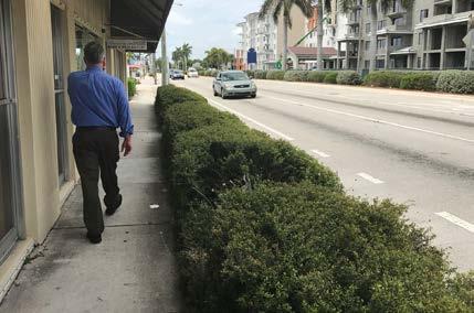
91 Chapter 4. Complete Streets and Transit Improvements 91


92 CITY OF DELRAY BEACH CONCEPTUAL OPPORTUNITY AREAS AT A GLANCE: E ATLANTIC AV LAKE IDA RD DOWNTOWN DELRAY New PTX stations located within US-1 ROW on each direction Convert existing parking lot into pocket park to facilitate connections between stations and context-sensitive design for Downtown Delray Beach Green space should also function for stormwater management Examine potential for mid-block crossings at PTX station locations LINTON BLVD Focus on intersection crossings Align crosswalks perpendicular to crossing street where appropriate Add street trees and landscape for pedestrian comfort LINDELL BLVD Town Center redevelopment with new, pedestrian-scaled streets with a mix of land uses including higher density residential and streetingfronting buildings. Green/Park space as focus of PTX stations, green space should also function for stormwater management DOWNTOWN DELRAY BEACH LINTON BLVD SE 1 ST ST LINTON BLVD ATLANTIC AVE SW 2 ND ST SW 4 TH ST SE 10 TH ST LINTON BLVD N DIXIE HWY LEGEND New Street Pedestrian Connection Proposed PTX Location New Park Space New Mixed-Use New Residential LINDELL BLVD LINDELL BLVD N LINDELL BLVD 92 US-1 Multimodal Corridor Study
 PTX should connect to existing pedestrian walk from")

93 TOWN OF GULF STREAM CONCEPTUAL OPPORTUNITY AREAS AT A GLANCE: SEACREST BLVD GULFSTREAM BLVD New PTX station located on Gulfstream Boulevard (PTX shift here to serve Bethesda Hospital on Seacrest Boulevard) PTX should connect to existing pedestrian walk from Walmart Super Center to Gulfstream Boulevard Enhance intersection crossings at Gulfstream Boulevard and US-1 GULFSTREAM BLVD WALMART SUPER CENTER N OLD DIXIE HWY GULFSTREAM BLVD GEORGE BUSH BLVD GULFSTREAM BLVD N Chapter 4. Complete Streets and Transit Improvements 93


94 CITY OF BOYNTON BEACH CONCEPTUAL OPPORTUNITY AREAS AT A GLANCE: GATEWAY BLVD Utilize portion of Intracoastal Park for new affordable housing Connect a new street parallel to US-1 on the east side Enhance crossing at Gateway Boulevard to facilitate pedestrians from retail area to park and PTX stations BOYNTON RIVERWALK Continue to breakup large parcels into walkable block sizes Enhance existing pedestrian crossing on US-1 (just south of Woolbright Rd) Redevelop shopping center as new Town Center mixed-use project with higher density residential units and street-fronting buildings Connect new park space across US-1 to Boynton Riverwalk BESTHESDA HOSPITAL Leverage existing hospital surface parking areas for new mixed-use (inc. medical with garage parking adjacent to PTX station Enhance pedestrian crossing at SE 26 th Avenue and S Seacrest Boulevard Green/Park space as focus of PTX stations, green space should also function for stormwater management LEGEND New Street Pedestrian Connection Proposed PTX Location New Park Space New Mixed-Use New Residential GATEWAY BLVD GATEWAY BLVD WOOLBRIGHT RD BOYNTON RIVERWALK BETHESDA HOSPITAL SE 26TH AV S SEACREST BLVD BETHESDA HOSPITAL INTRACOASTAL PARK S SEACREST BLVD SW 23 RD AV GATEWAY BLVD BOYNTON BEACH BLVD OCEAN AVE WOOLBRIGHT RD N 94 US-1 Multimodal Corridor Study

95 Convert NE 1 st Ave to a Shared Street Pedestrian Plaza Connecting Future Rail Station and BRT Station New Mixed-Use Development with Buildings Fronting the Street PROPOSED TRI-RAIL STATION BOYNTON BEACH BLVD NE 1 ST AVE Mid-Block Pedestrian Crossing at BRT Stations NE 5 TH ST New Mixed-Use Development with Buildings Fronting the Street E OCEAN AVE SE 4 TH ST SE 6 TH ST SE 1 ST AVE New Park/ Gateway Spaces Extend NE 5 th St for Pedestrian- Scale Blocks SE 2 ND AVE SE 2 ND AVE N DOWNTOWN BOYNTON Chapter 4. Complete Streets and Transit Improvements 95

96 Lindell Boulevard to Tropic Boulevard Existing Roll Plot No feet of right-of-way Existing Edge of Pavement Proposed 120 feet of right-of-way Existing Edge of Pavement FDOT Context Classification: C3-Suburban Existing Speed Limit: 45 mph Length: 0.8 miles Proposed Recommendations: Full reconstruction with two-way separated bicycle lanes on both sides and furnishing zones with street trees 96 US-1 Multimodal Corridor Study


97 Tropic Boulevard to SE 12 th Road Roll Plot No Existing 120 feet of right-of-way Existing Edge of Pavement Proposed 120 feet of right-of-way Existing Edge of Pavement FDOT Context Classification: C3-Suburban Existing Speed Limit: 45 mph Length: 0.6 miles Proposed Recommendations: Full reconstruction with two-way separated bicycle lanes Chapter 4. Complete Streets and Transit Improvements 97

98 US-1 NB SE 12 th Road to George Bush Boulevard Existing Roll Plot No feet of right-of-way Existing Edge of Pavement Proposed 60 feet of right-of-way Existing Edge of Pavement FDOT Context Classification: C4-Urban General & C5-Urban Center Existing Speed Limit: 35 mph Length: 2.0 miles Proposed Recommendations: Resurfacing with buffered bicycle lanes 98 US-1 Multimodal Corridor Study

99 US-1 SB SE 12 th Road to George Bush Boulevard Roll Plot No Existing 60 feet of right-of-way Existing Edge of Pavement Proposed 60 feet of right-of-way Existing Edge of Pavement FDOT Context Classification: C4-Urban General & C5-Urban Center Existing Speed Limit: 35 mph Length: 2.0 miles Proposed Recommendations: Resurfacing with buffered bicycle lanes Chapter 4. Complete Streets and Transit Improvements 99

100 US-1 SB George Bush Boulevard to Old Dixie Highway Existing Roll Plot No feet of right-of-way Existing Edge of Pavement Proposed 64 feet of right-of-way Existing Edge of Pavement Sidewalk FDOT Context Classification: C4-Urban General Existing Speed Limit: 35 mph Length: 0.1 miles Proposed Recommendations: Partial reconstruction (moving the curbs in); add separated bicycle lanes, furnishing zones with street trees and removal of parking 100 US-1 Multimodal Corridor Study

; add separated bicycle lanes, furnishing")
101 Old Dixie Highway to Gulfstream Boulevard Roll Plot No Existing 100 feet of right-of-way Existing Edge of Pavement Proposed 100 feet of right-of-way Existing Edge of Pavement FDOT Context Classification: C4-Urban General Existing Speed Limit: mph Length: 1.2 miles Proposed Recommendations: Partial reconstruction (moving the curbs in); add separated bicycle lanes, furnishing zones with street trees and removal of parking Chapter 4. Complete Streets and Transit Improvements 101


102 Gulfstream Boulevard to Boynton Beach Boulevard Existing Roll Plot No feet of right-of-way Existing Edge of Pavement Proposed 100 feet of right-of-way Existing Edge of Pavement FDOT Context Classification: C4-Urban General & C5-Urban Center Existing Speed Limit: mph Length: 2.6 miles Proposed Recommendations: Full reconstruction with furnishing zones with street trees 102 US-1 Multimodal Corridor Study


103 Boynton Beach Boulevard to NE 15 th Avenue Roll Plot No Existing 100 feet of right-of-way Existing Edge of Pavement Proposed 100 feet of right-of-way Existing Edge of Pavement FDOT Context Classification: C4-Urban General & C5-Urban Center Existing Speed Limit: 35 mph Length: 0.9 miles Proposed Recommendations: Full reconstruction with separated bicycle lanes, furnishing zones with street trees and removal of parking Chapter 4. Complete Streets and Transit Improvements 103
104 NE 15 th Avenue to Miner Road Existing Roll Plot No feet of right-of-way Existing Edge of Pavement Proposed 10-foot easement for sidewalk Existing Edge of Pavement FDOT Context Classification: C3-Suburban Existing Speed Limit: 45 mph Length: 1.1 miles Proposed Recommendations: Convert buffered bicycle lanes to separated bicycle lanes; obtain 10-foot easement for sidewalk on the west side 104 US-1 Multimodal Corridor Study
105 Chapter 4. Complete Streets and Transit Improvements 105

106 Section 3: Hypoluxo, Lantana and Lake Worth Existing Conditions y Primarily four-lane undivided roadway with no median refuge y Significant amount of pedestrian/bicyclist activity in Downtown Lake Worth y Buffered bicycle lanes in Hypoluxo y No designated bicycle lanes in Lantana or Lake Worth y Sidewalk gap on the west side y NE 15 th Avenue to Pine Street (Boynton Beach, Hypoluxo, and Lantana) y Lantana Road to Federal Highway (Lantana) y Missing crosswalks at signalized intersections y Poor access to transit stops. HIA FAST FACTS y Lake Worth Population: 43,200 Residents y Lowest average land values in corridor ($155,000) y 21% is in poverty y 19% are diagnosed with depression y 31% are diagnosed with obesity y 14% are diagnosed with diabetes y High percentage of racial and ethnic minorities y High frequency of bicycle and pedestrian fatalities (3.8/mile) Section 3 contains Roll Plot No Specific Roll Plot No. for Individual Typical Sections are listed on the following pages. 106 US-1 Multimodal Corridor Study


107 Chapter 4. Complete Streets and Transit Improvements 107


108 TOWN OF HYPOLUXO CONCEPTUAL OPPORTUNITY AREAS AT A GLANCE: MINER RD Enhance pedestrian crossings at Miner Road Connect to local grocery and residential areas LANTANA RD OCEAN RD HYPOLUXO RD MINER RD RAILROAD MINER RD MINER RD N LEGEND New Street Pedestrian Connection Proposed PTX Location New Park Space New Mixed-Use New Residential 108 US-1 Multimodal Corridor Study


109 TOWN OF LANTANA MELODY LN CROTON AV ADAM CIR LANTANA RD N 3 RD ST N OAK ST MINNESOTA ST RAILROAD PALM ST PALM ST LANTANA RD LANTANA TOWN HALL COMPLEX HYPOLUXO RD DOWNTOWN LANTANA RAILROAD MILTON ST CENTRAL BLVD HART ST STERNS ST CONCEPTUAL OPPORTUNITY AREAS AT A GLANCE: LANTANA RD Connect and add new streets and alleys to support redevelopment of existing sites and vacant properties Create new park spaces adjacent to PTX stations and along buffer between railroad and US-1 New redevelopment should be a mix of uses, including higher density residential with streetfacing buildings DOWNTOWN LANTANA Redevelop large surface parking lots incrementally as mixed-use, residential buildings with pedestrian-scale block network Connect PTX station to Lantana Town Hall Complex Incorporate green space as park and stormwater Chapter 4. Complete Streets and Transit Improvements 109


110 CITY OF LAKE WORTH CONCEPTUAL OPPORTUNITY AREAS AT A GLANCE: 10 TH AVENUE NORTH Enhance pedestrian crossings at 10 th Avenue North Create park space adjacent to southbound PTX station Maintain existing street network 6 TH AVENUE SOUTH Enhance pedestrian crossings at 6 th Avenue South Maintain existing street network Focus any new redevelopment towards PTX station areas N H ST 10 TH AV N 10 TH AVENUE NORTH 10 TH AV N 5 TH AV S LUCERNE AV LAKE AV S H ST S J ST 6 TH AV S 6 TH AV S LEGEND New Street 6 TH AVENUE SOUTH New Park Space 7 TH AV S 12 TH AV S Proposed PTX Location New Mixed-Use New Residential N 110 US-1 Multimodal Corridor Study

111 2 ND AV N Enhance Transfer Connection at CVS with Park Space POLICE STATION N J ST Enhance pedestrian crossings LUCERNE AV N G ST S H ST LAKE WORTH CITY HALL Convert surface parking area to PTX station plaza LAKE AV New Park Space New Street Connection Maintain existing blocks and streets to support future redevelopment Enhance Lake Avenue streetscape to encourage connection between future rail and BRT PROPOSED TRI-RAIL STATION SE COAST ST 1 ST AV S N DOWNTOWN LAKE WORTH Chapter 4. Complete Streets and Transit Improvements 111

112 Miner Road to Hypoluxo Road Existing Roll Plot No feet of right-of-way Existing Edge of Pavement Proposed 10-foot easement for sidewalk Existing Edge of Pavement FDOT Context Classification: C3-Suburban Existing Speed Limit: mph Length: 1.0 mile Proposed Recommendations: Convert buffered bicycle lanes to separated bicycle lanes; obtain 10-foot easement for sidewalk on the west side 112 US-1 Multimodal Corridor Study


113 Hypoluxo Road to Central Boulevard Roll Plot No. 27 Existing 62 feet of right-of-way Existing Edge of Pavement Proposed 10-foot easement for sidewalk Existing Edge of Pavement FDOT Context Classification: C3-Suburban Existing Speed Limit: 40 mph Length: 0.3 miles Projected 2040 Max Peak Hour Traffic Volume: 1,400 vphpd Proposed Recommendations: Partial reconstruction and lane repurposing from 4L to 3L; add buffered bicycle lanes, obtain 10-foot easement for sidewalk on the west side and furnishing zone with street trees Chapter 4. Complete Streets and Transit Improvements 113
114 Central Boulevard to Pine Street Existing Roll Plot No feet of right-of-way Existing Edge of Pavement Proposed Existing Edge of Pavement 10-foot easement for sidewalk FDOT Context Classification: C3-Suburban Existing Speed Limit: mph Length: 0.5 miles Projected 2040 Max Peak Hour Traffic Volume: 1,400 vphpd Proposed Recommendations: Resurfacing and lane repurposing from 4L to 3L; add conventional bicycle lanes and obtain 10-foot easement for sidewalk on the west side 114 US-1 Multimodal Corridor Study

115 Pine Street to Lantana Road Roll Plot No. 28 Existing 70 feet of right-of-way Existing Edge of Pavement Proposed Existing Edge of Pavement 70 feet of right-of-way FDOT Context Classification: C3-Suburban Existing Speed Limit: 30 mph Length: 0.3 miles Projected 2040 Max Peak Hour Traffic Volume: 1,400 vphpd Proposed Recommendations: Resurfacing and lane repurposing from 4L to 3L; add buffered bicycle lanes and furnishing zone with street trees Chapter 4. Complete Streets and Transit Improvements 115

116 Lantana Road to Dixie Highway/Federal Highway Junction Existing Roll Plot No feet of right-of-way Existing Edge of Pavement Proposed Existing Edge of Pavement 10-foot easement for sidewalk FDOT Context Classification: C3-Suburban Existing Speed Limit: 30 mph Length: 0.4 miles Projected 2040 Max Peak Hour Traffic Volume: 1,400 vphpd Proposed Recommendations: Resurfacing and lane repurposing from 4L to 3L; add conventional bicycle lanes and obtain 10-foot easement for sidewalk on the west side 116 US-1 Multimodal Corridor Study

117 Dixie Highway/Federal Highway Junction to 2 nd Avenue South Roll Plot No Existing 59 feet of right-of-way Existing Edge of Pavement Proposed Existing Edge of Pavement 59 feet of right-of-way FDOT Context Classification: C4-Urban General Existing Speed Limit: 35 mph Length: 1.5 miles Projected 2040 Max Peak Hour Traffic Volume: 1,200 vphpd Proposed Recommendations: Resurfacing and lane repurposing from 4L to 3L; add conventional bicycle lanes Chapter 4. Complete Streets and Transit Improvements 117

 and lane")
118 2 nd Avenue South to 2 nd Avenue North Existing Roll Plot No feet of right-of-way Existing Edge of Pavement Proposed 106 feet of right-of-way Existing Edge of Pavement FDOT Context Classification: C5-Urban Center Existing Speed Limit: 35 mph Length: 0.3 miles Projected 2040 Max Peak Hour Traffic Volume: 1,100-1,400 vphpd Proposed Recommendations: Partial reconstruction (inside widening) and lane repurposing from 4L to 2L plus dedicated left-turn lanes and right-turn lanes; add bus queue jump lanes, buffered bicycle lanes, on-street parking and furnishing zones with street trees 118 US-1 Multimodal Corridor Study

119 2 nd Avenue North to Gregory Road Roll Plot No Existing 60 feet of right-of-way Existing Edge of Pavement Proposed 60 feet of right-of-way Existing Edge of Pavement FDOT Context Classification: C4-Urban General Existing Speed Limit: 35 mph Length: 2.0 miles Projected 2040 Max Peak Hour Traffic Volume: 1,300-1,400 vphpd Proposed Recommendations: Resurfacing and lane repurposing from 4L to 3L; add buffered bicycle lanes Chapter 4. Complete Streets and Transit Improvements 119

120 Section 4: West Palm Beach Existing Conditions y Generally 4-lane or 5-lane undivided roadway with sidewalks and mostly no bicycle facilities. y Frequent bus stops but very few have shelters, shade, or lighting. y Frequent driveways and street crossings y West Palm Beach Brightline Station y The Tent Site HIA FAST FACTS y West Palm Beach Population: 67,400 Residents y Highest multimodal split on the corridor (10%) y 21% is in poverty y 42% have high hypertension y High percentage of racial and ethnic minorities y High percentage of transit dependent households y High frequency of bicycle and pedestrian fatalities (3.1/mile) Section 4 contains Roll Plot No Specific Roll Plot No. for Individual Typical Sections are listed on the following pages. 120 US-1 Multimodal Corridor Study


121 Chapter 4. Complete Streets and Transit Improvements 121


122 CITY OF WEST PALM BEACH CONCEPTUAL OPPORTUNITY AREAS AT A GLANCE: BELVEDERE RD Town Center redevelopment with pedestrian-scaled streets with mix of land uses including higher density residential with street-facing buildings Green/Park space at US-1 and Belvedere as gateway into local neighborhoods, green space should also function for stormwater management AVON RD PERSHING WY BELVEDERE RD ALMERIA RD BELVEDERE RD OKEECHOBEE BLVD BELVEDERE RD LAKEVIEW RD SOUTHERN BLVD Green/Park space as focus of PTX stations and areas for stormwater management Encourage a mix of land uses including higher density residential with street-fronting buildings Incorporate alleys to offset access from US-1 FOREST HILL BLVD Focus on pedestrian crossing improvements at Forest Hill Boulevard and US-1 Connect PTX stations to school with a shared-use trail on Brevard Avenue GREGORY RD / ALHAMBRA PL Town Center redevelopment with new, pedestrian-scaled streets with mix of land uses including higher density residential and streetfronting buildings Green/Park space as focus of BRT station Connect to future rail through greenways in the Town Center redevelopment SOUTHERN BV MALVERNE RD SOUTHERN BLVD FOREST HILL BV WINTERS ST MADDOCK ST BREVARD AV FOREST HILL BLVD PARKER AV SOUTHERN BLVD FOREST HILL BLVD S OLIVE AV LEGEND New Street Pedestrian Connection Proposed PTX Location 122 US-1 Multimodal Corridor Study New Park Space New Mixed-Use New Residential GEORGIA AV PROPOSED TRI-RAIL STATION GREGORY RD GREGORY RD / ALHAMBRA PL ALHAMBRA PL BREVARD AV ALHAMBRA PL GREGORY RD N
 Trolley & Ride- Share Drop-Off Architectural Gateway Opportunity QUADRILLE BLVD See Detail Below for Conceptual Transit Center")


123 Potential Stop/Dwell Location for Future Okeechobee BRT (2 Buses) Cycletrack Intersection Setback for Turning Buses LAKEVIEW AV PTX Stop/Dwell/Transfer Location (10 Bus Bays) Trolley & Ride- Share Drop-Off Architectural Gateway Opportunity QUADRILLE BLVD See Detail Below for Conceptual Transit Center Building Layout Upper Building Floors Overhang OKEECHOBEE BLVD N Cycletrack Improved Pedestrian Crossings OKEECHOBEE BLVD, US-1, LAKEVIEW AVE, AND QUADRILLE BLVD: THE TENT SITE WIDTH FOR 3 BUS LANES /- 7,000 SF TRANSIT TICKETING, RESTROOMS, OFFICES 80 PARKING SPACES PER LEVEL /- 25,000 SF GROUND FLOOR RETAIL +/- 90,000 SF OVERALL GROSS FOOTPRINT PROPOSED ROUTING OPTIONS NORTHBOUND PTX ROUTE SOUTHBOUND PTX ROUTE WEST/EASTBOUND FUTURE OKEECHOBEE BRT ALTERNATE OKEECHOBEE BRT DWELL/STOP TRANSIT CENTER + MIXED-USE/HOTEL CONCEPTUAL LAYOUT Chapter 4. Complete Streets and Transit Improvements 123

 intersection crossings at")


124 CITY OF WEST PALM BEACH CONCEPTUAL OPPORTUNITY AREAS AT A GLANCE: 46 TH ST 45 TH ST New mixed-use on vacant corner including higher density residential and street-fronting buildings Green/Park space adjacent to PTX station Pedestrian improvements at crosswalk to connect both PTX stations NORTHWOOD Existing park space as focus of PTX stations Maintain existing redevelopment efforts - buildings fronting the street Examine 24 th Street and/or Northwood Rd extension east of US-1 DOWNTOWN WEST PALM BEACH Well-designed (considering safety and urban art/ design) intersection crossings at Clematis Street and Railroad Crossing AND Clematis St and Quadrille Blvd Pedestrian and bicycle connections from PTX stations to Brightline Station 45 TH ST 44 TH ST 45TH ST 25 TH ST 24 TH ST NORTHWOOD RD NORTHWOOD PEDESTRIAN CONNECTION TO BRIGHTLINE NORTHWOOD VILLAGE PARK 23 RD ST CLEMATIS ST 45 TH ST GREENWOOD AV 25 TH ST 15 TH ST PALM BEACH LAKES BLVD FLAGLER DR FLAGLER DR DOWNTOWN WEST PALM BEACH QUADRILLE ST LEGEND New Street Pedestrian Connection Proposed PTX Location New Park Space New Mixed-Use New Residential CLEMATIS ST QUADRILLE BLVD OKEECHOBEE BLVD LAKEVIEW AV N 124 US-1 Multimodal Corridor Study

125 Redevelop Blocks into Mixed-Income, High- Density Residential for Healthcare Employees 15 TH ST 14 TH ST 13 TH ST GOOD SAMARITAN MEDICAL CENTER New Park Space for PTX Station PALM BEACH LAKES BLVD SPRUCE AV MADEIRA CT Mixed-Use Redevelopment, Fronting US-1 and PTX Stations Consider New Alleyways for Redeveloment 11 TH ST N OLIVE AV PROVIDENCIA PARK 10 TH ST Extension of Madeira Court to Neighborhood Mixed-Income, Moderate-Density Residential (e.g., Townhomes) to Transition to Existing Neighborhood N PALM BEACH LAKES BLVD / GOOD SAMARITAN MEDICAL CENTER Chapter 4. Complete Streets and Transit Improvements 125
126 Gregory Road to Forest Hill Boulevard Existing Roll Plot No feet of right-of-way Existing Edge of Pavement Proposed 80 feet of right-of-way Existing Edge of Pavement FDOT Context Classification: C4-Urban General Existing Speed Limit: 35 mph Length: 0.6 miles Projected 2040 Max Peak Hour Traffic Volume: 1,000-1,100 vphpd Proposed Recommendations: Resurfacing and lane repurposing from 4L to 3L; add buffered bicycle lanes and parking Ongoing Efforts: TCRPC is conducting a Forest Hill Boulevard Complete Streets Corridor Plan from I-95 to US US-1 Multimodal Corridor Study

127 Forest Hill Boulevard to Belvedere Road Roll Plot No Existing 80 feet of right-of-way Existing Edge of Pavement Proposed 80 feet of right-of-way Existing Edge of Pavement FDOT Context Classification: C4-Urban General Existing Speed Limit: 35 mph Length: 2.4 miles Projected 2040 Max Peak Hour Traffic Volume: 1,000-1,100 vphpd Proposed Recommendations: Resurfacing and lane repurposing from 4L to 3L; add buffered bicycle lanes Proposed Speed Limit: 30 mph Ongoing Efforts: TCRPC is conducting a Forest Hill Boulevard Complete Streets Corridor Plan. The City of West Palm Beach is conducting a South Dixie Corridor Master Plan from Albemarle Road to Okeechobee Boulevard to incorporate complete street improvements. Local Preference: The City of West Palm Beach is working with FDOT to implement a complete street project from Albemarle Road to Okeechobee Road that will provide wider sidewalks, lower vehicle speeds and sharrows to promote bicycle visibility in lieu of the proposed recommendations. Chapter 4. Complete Streets and Transit Improvements 127


128 Belvedere Road to Okeechobee Boulevard Existing Roll Plot No feet of right-of-way Existing Edge of Pavement Proposed 72 feet of right-of-way Existing Edge of Pavement Sidewalk Drive Lane Sharrow Sharrow Drive Lane Sidewalk FDOT Context Classification: C5-Urban Center Existing Speed Limit: 35 mph Length: 1.0 mile Projected 2040 Max Peak Hour Traffic Volume: 1,300 vphpd Proposed Recommendations: Full reconstruction and lane repurposing from 4L to 3L; add sharrows; add wider sidewalks on west side, add on-street parking on the east side alternating with landscape bulb-outs/street trees Proposed Speed Limit: 25 mph Ongoing Efforts: The City of West Palm Beach is conducting a South Dixie Corridor Master Plan from Albemarle Road to Okeechobee Road to incorporate complete street improvements. Local Preference: The City of West Palm Beach is working with FDOT to implement a complete street project from Albemarle Road to Okeechobee Road that will provide wider sidewalks, lower vehicle speeds and sharrows to promote bicycle visibility in lieu of the proposed recommendations. 128 US-1 Multimodal Corridor Study

129 Okeechobee Boulevard/Lakeview Avenue pair Roll Plot No. 41 Existing 62 feet of right-of-way Existing Edge of Pavement Proposed 10-foot easement Existing Edge of Pavement FDOT Context Classification: C6-Urban Core Existing Speed Limit: 35 mph Length: 0.1 miles Projected 2040 Max Peak Hour Traffic Volume: 1,700 vphpd Ongoing Efforts: The City of West Palm Beach is conducting a Mobility Plan. There is the potential for private redevelopment of The Tent Site, which is anticipated to include a multimodal terminal. Proposed Recommendations: Partial reconstruction and lane repurposing from 4L to 3L with separated bicycle lanes; obtain 10-foot easement for sidewalk and furnishing zone with street trees adjacent to redevelopment site with proposed multimodal terminal Chapter 4. Complete Streets and Transit Improvements 129

130 Okeechobee Boulevard to Clematis Street Existing Roll Plot No feet of right-of-way Existing Edge of Pavement Proposed 100 feet of right-of-way Existing Edge of Pavement FDOT Context Classification: C5-Urban Center & C6-Urban Core Existing Speed Limit: 30 mph Length: 0.5 miles Projected 2040 Max Peak Hour Traffic Volume: 1,100 vphpd Proposed Recommendations: Partial reconstruction and lane repurposing from 4L to 2L with left-turn lanes at intersections; add separated bicycle lanes 130 US-1 Multimodal Corridor Study

131 Clematis Street to 3 rd Street Roll Plot No Existing/Proposed 80 feet of right-of-way FDOT Context Classification: C6-Urban Core Length: 0.2 miles Existing Speed Limit: 30 mph The proposed typical section has no recommended changes. Chapter 4. Complete Streets and Transit Improvements 131


132 3 rd Street to N Dixie Highway/Quadrille Street Existing Roll Plot No feet of right-of-way Existing Edge of Pavement Proposed 80 feet of right-of-way Existing Edge of Pavement FDOT Context Classification: C5-Urban Center Existing Speed Limit: 30 mph Length: 0.2 miles Proposed Recommendations: Lane repurposing from 4L to 2L; add separated bicycle lanes and furnishing zones with street trees. 132 US-1 Multimodal Corridor Study

133 N Dixie Highway/Quadrille Street to 25 th Street Roll Plot No Existing 76 feet of right-of-way Existing Edge of Pavement Proposed 76 feet of right-of-way Existing Edge of Pavement FDOT Context Classification: C5-Urban Center Existing Speed Limit: 30 mph Length: 1.2 miles Projected 2040 Max Peak Hour Traffic Volume: 1,000-1,100 vphpd Proposed Recommendations: Resurfacing and lane repurposing from 4L to 3L; add buffered bicycle lanes and street trees Chapter 4. Complete Streets and Transit Improvements 133

134 24 th /25 th Street from Poinsettia Avenue to Broadway Avenue Existing Roll Plot No feet of right-of-way Existing Edge of Pavement Proposed Existing Edge of Pavement 60 feet of right-of-way FDOT Context Classification: C5-Urban Center Existing Speed Limit: 30 mph Length: 0.3 miles Proposed Recommendations: Shared-lane markings and street trees 134 US-1 Multimodal Corridor Study


135 25 th Street to 59 th Street Roll Plot No Existing 75 feet of right-of-way Existing Edge of Pavement Proposed 75 feet of right-of-way Existing Edge of Pavement FDOT Context Classification: C5-Urban Center Existing Speed Limit: 35 mph Length: 1.9 miles Projected 2040 Max Peak Hour Traffic Volume: 1,300 vphpd Proposed Recommendations: Full reconstruction and lane repurposing from 4L to 3L; add shareduse path on the west side, furnishing zones, conventional bicycle lanes, and on-street parking Ongoing Efforts: The City of West Palm Beach is preparing a Broadway Lane Elimination Study from 25 th Street to 42 nd Street to incorporate complete streets improvements. The City has received a partially-funded SUN Trail grant for a shared use path. Chapter 4. Complete Streets and Transit Improvements 135
 y North Palm Beach 4-lane divided roadway (north) y Continuous sidewalks y Mostly no bicycle facilities y Little shade on the sidewalks y Sidewalk improvements have been made")
136 Section 5: Riviera Beach, Lake Park, and North Palm Beach Existing Conditions y Riviera Beach 4-lane divided roadway y Lake Park 4-lane undivided roadway with center turns y North Palm Beach 6-lane divided roadway (south) y North Palm Beach 4-lane divided roadway (north) y Continuous sidewalks y Mostly no bicycle facilities y Little shade on the sidewalks y Sidewalk improvements have been made through Riviera Beach which includes textured crosswalks and periodic brick improvements in sidewalk HIA FAST FACTS y Riviera Beach Population: 15,600 Residents y 20% is in poverty y 46% have high hypertension y 34% are diagnosed with obesity y 10% are diagnosed with asthma y High percentage of disabled residents y Lake Park Population: 7,400 Residents y 33% are diagnosed with obesity y 9% are diagnosed with asthma y High percentage of disabled residents Section 5 contains Roll Plot No Specific Roll Plot No. for Individual Typical Sections are listed on the following pages. 136 US-1 Multimodal Corridor Study


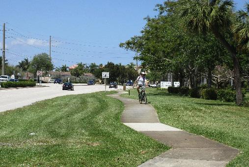
137 Chapter 4. Complete Streets and Transit Improvements 137


138 CITY OF RIVIERA BEACH CONCEPTUAL OPPORTUNITY AREAS AT A GLANCE: E 28 TH ST BLUE HERON BLVD New PTX stations located within US-1 ROW on each direction Create new park in northwest corner as gateway and stormwater management New mixed-use fronting proposed park Focus on pedestrian crossings between PTX station locations Examine new alley parallel to US-1 for loading and access management BLUE HERON BLVD E 27 TH ST BLUE HERON BLVD E 25 TH ST E 24 TH ST BARACK OBAMA HWY Redevelop Blocks into Mixed-Income, Higher Density Residential adjacent to Transit New Linear Park on 13 th to Connect Transit Areas AVENUE F New Park Space for PTX Station 14 TH ST W 13 TH CT PROPOSED TRI-RAIL STATION AVENUE H AVENUE G PARK DR 13 TH ST BOYS & GIRLS CLUB AVENUE E 12 TH ST Consider New Alleyways for Redeveloment 11 TH ST Smaller Lot, Infill, Mixed- Income Residential Neighborhood with Park Space N 13 TH STREET 138 US-1 Multimodal Corridor Study


139 TOWN OF LAKE PARK PARK AV GREENBRIAR DR PARK AV HISTORIC PROPERTIES KELSEY PARK FORESTERIA DR 3 RD ST LAKE SHORE DR EVERGREEN DR DATE PALM DR BLUE HERON BLVD PARK AVE CONCEPTUAL OPPORTUNITY AREAS AT A GLANCE: PARK AVE LEGEND New Street Pedestrian Connection Proposed PTX Location New Park Space New Mixed-Use New Residential N New redevelopment, as per Lake Park s Master Plan, should be a mix of uses, including higher density residential PTX stations at Kelsey Park and adjacent historic properties Examine adding a parallel street between US-1 and Lake Shore Drive for traffic distribution and walkability Examine adding an alley west of US-1 for fronting properties to assist with the block transition into existing neighborhoods Chapter 4. Complete Streets and Transit Improvements 139


140 VILLAGE OF NORTH PALM BEACH CONCEPTUAL OPPORTUNITY AREAS AT A GLANCE: ALT A1A Utilize portion of parking areas for new park/green space at PTX station Redevelop northeast block into mixed-use, residential fronting PTX park area Enhance pedestrian crossings NORTHLAKE BLVD Redevelop shopping center as new Town Center mixed-use project with higher density residential units and walkable block sizes Build on Olmsted Brothers legacy in Lake Park with connected park/green spaces that also function as stormwater areas. Connect to adjacent neighborhoods to the south and west LEGEND New Street Pedestrian Connection Proposed PTX Location New Park Space New Mixed-Use New Residential PARK RD NORTHLAKE BLVD NORTHLAKE BLVD 10 TH CT 10 TH ST PALMETTO DR ALT A1A NORTHLAKE BLVD NORTHLAKE BLVD N 140 US-1 Multimodal Corridor Study


141 CITY OF PALM BEACH GARDENS CONCEPTUAL OPPORTUNITY AREAS AT A GLANCE: THE GARDENS MALL PALM TRAN TRANSFER CENTER BURNS RD Enhance pedestrian crossings LAKE VICTORIA GARDENS BLVD Enhance pedestrian crossing PALM BEACH STATE COLLEGE Enhance pedestrian crossings Connect to campus buildings from PTX station THE GARDENS MALL TRANSFER CENTER Utilize portions of existing parking lot for new connection to Minsk Gardens Blvd Redevelop portions of existing parking lot for mixed-use, residential blocks with street-fronting buildings Incorporate transfer center into redevelopment PGA BLVD Enhance pedestrian crossings Add park/green space at PTX stations Utilize portion of Publix parking area for mixed-use redevelopment fronting on PTX park area THE GARDENS MALL TRANSFER CENTER PGA BLVD KEW GARDENS AV MINSK GARDENS BLVD PGA BLVD KYOTO GARDENS DR LAKE VICTORIA GARDENS BLVD PGA BOULEVARD GARDENS PKWY MINSK GARDENS BLVD N RCA BLVD LAKE VICTORIA GARDENS BLVD PGA BLVD BURNS RD PROPOSED TRI-RAIL STATION PALM BEACH STATE COLLEGE BURNS RD BURNS RD LAKE VICTORIA GARDENS BLVD PB STATE COLLEGE Chapter 4. Complete Streets and Transit Improvements 141

142 59 th Street to 11 th Street Existing Roll Plot No feet of right-of-way Existing Edge of Pavement Proposed 98 feet of right-of-way Existing Edge of Pavement FDOT Context Classification: C4-Urban General Existing Speed Limit: 35 mph Length: 0.6 miles Proposed Recommendations: Add separated bicycle lanes 142 US-1 Multimodal Corridor Study

143 11 th Street to Silver Beach Road Roll Plot No Existing 80 feet of right-of-way Existing Edge of Pavement Proposed 80 feet of right-of-way Existing Edge of Pavement FDOT Context Classification: C4-Urban General Existing Speed Limit: 35 mph Length: 1.4 miles Proposed Recommendations: Partial reconstruction (inside widening); add conventional bicycle lanes Chapter 4. Complete Streets and Transit Improvements 143
144 Silver Beach Road to Palmetto Drive Existing Roll Plot No feet of right-of-way Existing Edge of Pavement Proposed 80 feet of right-of-way Existing Edge of Pavement FDOT Context Classification: C4-Urban General Existing Speed Limit: 35 mph Length: 0.8 miles Ongoing Efforts: The Town of Lake Park is considering options for a mixed-use corridor that will enhance pedestrian, bicycle, and vehicular accessibility and connectivity. Recent proposed modifications include pedestrian and on-street parking improvements that may occur in setbacks as properties redevelop. Proposed Recommendations: Partial reconstruction with conventional bicycle lanes 144 US-1 Multimodal Corridor Study


145 Palmetto Drive to Northlake Boulevard Roll Plot No. 53 Existing 94 feet of right-of-way Existing Edge of Pavement Proposed 94 feet of right-of-way Existing Edge of Pavement FDOT Context Classification: C4-Urban General Existing Speed Limit: 35 mph Length: 0.3 miles Proposed Recommendations: Resurfacing with conventional bicycle lanes added through lane width narrowing Chapter 4. Complete Streets and Transit Improvements 145


146 Northlake Boulevard to NPB Drawbridge Existing Roll Plot No feet of right-of-way Existing Edge of Pavement Proposed 120 feet of right-of-way Existing Edge of Pavement FDOT Context Classification: C3-Suburban Existing Speed Limit: mph Length: 1.7 miles Projected 2040 Max Peak Hour Traffic Volume: 1,700 vphpd Ongoing Efforts: The Village of North Palm Beach is reviewing implementation strategies related to the Village of North Palm Beach Master Plan, which includes recommendations to reduce the lane width of US-1 from six to four lanes and add buffered bicycle lanes. The Village is also developing a zoning code to implement the Master Plan recommendations. Proposed Recommendations: Resurfacing with lane repurposing from 6L to 4L; add separated bicycle facilities and furnishing zones with street trees 146 US-1 Multimodal Corridor Study


147 NPB Drawbridge to PGA Boulevard Roll Plot No Existing 122 feet of right-of-way Existing Edge of Pavement Proposed 122 feet of right-of-way Existing Edge of Pavement FDOT Context Classification: C3-Suburban Existing Speed Limit: mph Length: 0.9 miles Ongoing Efforts: The Village of North Palm Beach is reviewing implementation strategies related to the Village of North Palm Beach Master Plan, which includes recommendations to reduce the lane width of US-1 from six to four lanes and add buffered bicycle lanes. The Village is also developing a zoning code to implement the Master Plan recommendations. Proposed Recommendations: Shoulder widening to add separated bicycle lanes; add furnishing zones with street trees Chapter 4. Complete Streets and Transit Improvements 147

148 Section 6: Juno Beach, Jupiter, and Palm Beach Gardens Existing Conditions y No existing Palm Tran service on US-1 north of PGA Boulevard y Continuous sidewalks y Conventional bicycle lanes y Passes through Jupiter Dunes Natural Area and Jupiter Ridge Natural Area y Long turn lanes y Lower density of driveways than other sections of US-1 HIA FAST FACTS y Juno Beach Population within Corridor: 4,736 y 52% have high hypertension y Palm Beach Gardens Population within Corridor: 8,259 y 27% are diagnosed with obesity y High percentage of residents over the age of 65 y Jupiter Population within Corridor: 17,533 y 25% have had a stroke y High percentage of residents over the age of 65 Section 6 contains Roll Plot No Specific Roll Plot No. for Individual Typical Sections are listed on the following pages. 148 US-1 Multimodal Corridor Study


149 Chapter 4. Complete Streets and Transit Improvements 149


150 TOWN OF JUNO BEACH CONCEPTUAL OPPORTUNITY AREAS AT A GLANCE: DONALD ROSS RD Redevelop shopping center as new Town Center mixeduse project with higher density residential units, walkable block sizes, and street-fronting buildings Incorporate green/ park space, green space should also function for stormwater management Connect to adjacent neighborhoods to the west Locate PTX station adjacent to the Loggerhead Marinelife Center and connect to new Town Center with mid-block crossing or signalize crossing SEA OATS DR DONALD ROSS RD LOGGERHEAD MARINELIFE CENTER SEMINOLE TOD New PTX station adjacent to Seminole Boulevard with mid-block crossing PTX station should connect to pedestrian walk/open space to FPL office campus Consider new mixed-use with garage parking on existing parking lots with street-fronting buildings Green/Park space as "gateway" to FPL campus DONALD ROSS RD/MARINELIFE CENTER LEGEND SEMINOLE GOLF CLUB New Street Pedestrian Connection Proposed PTX Location New Park Space New Mixed-Use New Residential FLORIDA POWER AND LIGHT OFFICE CAMPUS SEMINOLE BLVD SEMINOLE/FPL 150 US-1 Multimodal Corridor Study


151 TOWN OF JUPITER INDIANTOWN RD BREAKWATER CT COASTAL WY INDIANTOWN RD MARCINSKI RD JUPITER/HARBOURSIDE PLACE DONALD ROSS RD N ELIISON WILSON RD UNIVERSE BLVD CONCEPTUAL OPPORTUNITY AREAS AT A GLANCE: HARBOURSIDE PLACE Route new PTX path to circle through existing development, under Indiantown Road, and back onto US-1 Chapter 4. Complete Streets and Transit Improvements 151

152 PGA Boulevard to Ocean Drive Existing Roll Plot No feet of right-of-way Existing Edge of Pavement Proposed 120 feet of right-of-way Existing Edge of Pavement FDOT Context Classification: C1-Natural & C3- Suburban Existing Speed Limit: 45 mph Length: 1.2 miles Proposed Recommendations: Partial reconstruction on the east side with two-way separated bicycle lanes on the east side only; shoulder widening on the west side to add buffered bicycle lane; add furnishing zones with street trees 152 US-1 Multimodal Corridor Study


153 Ocean Drive to Indiantown Road Roll Plot No Existing 120 feet of right-of-way Existing Edge of Pavement Proposed 120 feet of right-of-way Existing Edge of Pavement FDOT Context Classification: C1-Natural & C3- Suburban Existing Speed Limit: 45 mph Length: 5.4 miles Proposed Recommendations: Shoulder widening with separated bicycle lanes; add furnishing zones with street trees Chapter 4. Complete Streets and Transit Improvements 153
154 HIA Recommendations The proposed US-1 Multimodal Corridor Study improvements could catalyze significant transportation, land use, education/enforcement and policy changes that can help address the access, health, safety, and economic challenges of the corridor. Two primary actions must take place in coordination with additional secondary recommendations from the HIA. The primary actions are summarized below and the recommended secondary recommendations can be found in Appendix A. PRIMARY RECOMMENDATIONS 1. Palm Tran, Palm Beach TPA, and other funding partners should advance Bus Rapid Transit along the US-1 corridor to implementation by funding capital and operations for the service A. Lead agency Palm Tran B. Partnering agencies Palm Beach TPA, municipalities along US-1 corridor 2. The Palm Beach TPA, FDOT, and other partnering agencies should implement Complete Streets enhancements (bicycle and pedestrian improvements) along the US-1 corridor A. Lead agency Palm Tran B. Partnering agencies FDOT and municipalities along US-1 corridor WHY? Opportunity to increase economic development and redevelopment The reductions in travel time and the improvements in quality of service associated with implementation of a new transit line [such as BRT] often get capitalized into land value, as residents and businesses are willing to pay a premium to be closer to transit stations. 30 In addition, for every dollar invested in public transportation, four dollars are generated in economic returns. 31 There are pockets of the US-1 corridor that contain large clusters of vacant and underutilized land (where building on the land is worth less than 40% of land + building) that represent opportunities to enhance the walkability and economic development around US-1 BRT stations, as demonstrated by the station demonstration area assessments at US-1 and NE 20 th Street (in Boca Raton), Palm Beach Lake Boulevard (in West Palm Beach), and W 13 th Street (in Riviera Beach). In addition, low-wage households (earning $20,000 to $35,000) living far from employment centers spend 37% of their incomes on transportation. In neighborhoods well served by public transportation, families spend an average of 9%. 30 Aileen Carrigan, Social, Environmental, and Economic Impacts of BRT Systems, (2013). 31 APTA, Open for Business: The Business Case for Investment in Public Transportation, (2015). 32 Aileen Carrigan, Social, Environmental, and Economic Impacts of BRT Systems, (2013). 33 Todd Litman, Evaluating Public Transportation Health Benefits, (2010). 34 Irwin Redlener, MD, The Growing Health Care Access Crisis for American Children, (2006). 154 US-1 Multimodal Corridor Study
155 Opportunity to increase access to healthy food sources and health care Opportunity to improve health outcomes like depression, chronic illness, and obesity Opportunity to improve cyclist and pedestrian safety Residents with greater access to supermarkets or a greater abundance of healthy foods in neighborhood food stores consume more healthy food and have lower rates of diet-related diseases than their counterparts in neighborhoods lacking food access. 32 High quality public transit increases access to healthy foods and goods, especially for physically or economically disadvantaged. 33 The vulnerable populations in Boynton Beach and Riviera Beach could greatly benefit from the addition of a BRT line by providing them faster access to the healthy food sources. Care should be taken to make sure the BRT stations placed in these areas can connect to these low food access tracts. Lack of access to transportation could reduce health care utilization among children, seniors, low-income people, and people with disabilities. In fact, 4% of US children (3.2 million in total) missed a health care visit or did not schedule a visit during the preceding year because of transportation restrictions. 34 As part of the US-1 BRT evaluation, health care access was consider and stations were placed in close proximity to major hospitals and health care clinic clusters along the corridor. Premium transit options (such as BRT) and Complete Streets improvements (such as connected sidewalks and bicycle lanes) have a high potential to affect physical activity habits, especially those of auto-oriented communities. As copious amounts of research suggests, increases in physical activity is associated with depression, diabetes, hypertension, and obesity. 35 While most Americans report an average of 6 minutes of walking per day, public transit riders report an average of 19 minutes of walking per day. 36 The enhanced nature of a BRT system also makes a difference, as BRT riders report higher average walking distances than local bus riders. 37 Research suggests that obesity, diabetes, hypertension, and obesity rates tend to be inversely related to use of alternative modes like walking, cycling, and public transit. 38 A 2001 study showed that women who partook in little to no physical activity were twice as likely to have depressive symptoms than women with moderate to high levels. Researchers have also observed a 42 percent lower risk of hypertension among those who moved from low- to high-walkability neighborhood. 39 BRT and Complete Streets improvements have the potential to decrease cyclist and pedestrian injuries and fatalities. It is assumed that these improvements would results in increased walking and biking activity. Motorists have been seen adjust their behavior in the increased presence of people walking and bicycling. 40 A research report on the SAFETY effects of protected bicycle lanes in multiple locations around the country found that 79% of cyclists found the protected bicycle lanes to increase the safety of bicycling on the street Mallory Atkinson, The Mental Health Benefits of Walking, (June 2008). 36 Todd Litman, If Health Matters, (April 2014). 37 K. Day, Does Bus Rapid Transit Promote Walking? An Examination of New York City s Select Bus Service, (2014). 38 Todd Litman, If Health Matters, (April 2014). 39 Maria Chiu, Moving to a Highly Walkable Neighborhood and Incidence of Hypertension, (2015). 40 P L Jacobsen, Safety in Numbers: More Walkers and Bicyclists, Safer Walking and Bicycling, (April, 2004). 41 Chris Monsere, Lessons from the Green Lanes: Evaluating Protected Bike Lanes in the U.S., (June 2014). Chapter 4. Complete Streets and Transit Improvements 155
156 HIA Demonstration Areas Analyzing specific target demonstration areas in more detail can help provide insights on how the new transit investment and varying land use patterns can impact community health. The HIA Working Group and Study Team selected three demonstration areas that were previously identified during the US-1 Multimodal Corridor Study as Opportunity Areas. For each demonstration area, the Study Team conducted a review of existing land use conditions, along with transit and demographic makeup and developed illustrative concepts of potential future land use scenarios within a half-mile of the potential station. Two future scenarios were developed for each target area: an interim, shortterm scenario, and longer-term development scenario. The future scenarios illustrate how access to premium transit may influence development patterns and densities. Each target demonstration area was evaluated based on how well the various health indicators perform compared to current conditions. All three demonstration areas can be found in Appendix A, the demonstration area in Boca Raton is shown on the following pages. This scenario are not meant to indicate any approved or proposed plans but to illustrate a possible and hypothetical development scenario and to understand how transit and transitsupportive development can influence the health of the community around the stations. The intersection of US-1 and NE 20 th St has potential for a major transportation infrastructure investment in the form of a two-lane roundabout on US-1 that could drastically improve operations (west of the intersection is a major entrance to Florida International University), improve street crossings, and reduce fatal bicycle and vehicular accidents. US-1 AND NE 20 TH STREET BOCA RATON DEMONSTRATION AREA Existing Conditions This area has a limited street network with a limited amount of full intersections and through streets. The land uses are primarily single-use commercial with large shopping plaza parking lots facing the roadway. In addition, NE 20 th Street creates a non-perpendicular intersection point leading to a challenging configuration of the current developable space. US-1 through this area has a wide cross section, exhibiting four 12 lanes with a wide center median, turn lanes and posted speed of 45 mph This makes for a difficult and often uncomfortable pedestrian environment through the heart of the station area. Block sizes along this sector are, on average, three times the size of standard blocks sizes with the largest blocks in the area being more than five times the size of a typical city block. This existing street network is limited by historic suburban development and automotive-centric commercial land uses. The limited intersections and an environment that encourages higher vehicular speeds have caused motorists and pedestrians to utilize parking aisles as streets to cut through the large blocks. Interim Plan In the interim scenario, NE 20 th Street could be extended through the linear parking areas across the US-1 signalized intersection to the front of the existing shopping plaza. The existing character could be carried through, creating a park in the parcel adjacent to the south of the intersection. The fronting parcels would then be developed in configuration closer to the street. Redevelopment could occur in the short-term as individual infill of properties and likely on the underutilized parcels. As redevelopment occurs, some of the parking aisles can be rebuilt as streets. This will increase connectivity, break-up the large blocks, and improve overall walkability. The redevelopment could use this opportunity to create new shared community open space areas that could encourage increased physical activity. 156 US-1 Multimodal Corridor Study


157 US-1 and NE 20 th Street: Existing Block Structure US-1 and NE 20 th Street: Existing Street Network US-1 and NE 20 th Street: Interim Block Structure US-1 and NE 20th Street: Interim Street Network Chapter 4. Complete Streets and Transit Improvements 157


158 Long-Term Plan In the long-term, as redevelopment continues, the area may see additional streets connections and new intersections. The NE 20 th Street intersection could be connected all the way through the site and reconfigured to have a roundabout to create a safer and more productive intersection. The new development block structure may incorporate shared green spaces of various sizes and may consist of a mix of uses, heights, and densities. Parking could be placed internal to the site, with street alleys serving various land uses. The additional new streets will create significantly smaller sized blocks, more typical of an urban environment, forming a more walkable development pattern. US-1 and NE 20 th Street: Long-Term Street Network US-1 and NE 20 th Street: Long-Term Street Network BRT Elmhurst Redevelopment in New York 158 US-1 Multimodal Corridor Study
159 HIA Indicator Matrix The interim and long-term illustrative scenarios were evaluated to compare how each scenario influences the outcomes of the various health indicators. The table below provides a summary of measures related to each health indicator when comparing the interim and long-term scenarios to the current conditions. The interim and long-term scenarios resulted in significant increases in housing density, street connectivity, and green space; a significant decrease in average block size, and a modest traffic volume growth compared to the population and tax base added to the community. The development of a network of slower speed roads can also result in lower potential for bicycle and pedestrian crashes. INDICATORS METRIC SCENARIOS TYPE UNIT EXISTING INTERIM LONG TERM Housing Density (dwelling unit per acre) Employees (amount) 370 3,400 2,600 Housing Units (amount) Economic Development / Redevelopment Public streets linking north-south direction Public streets linking east-west direction Peak hour trips generated (traffic volume generated during peak hour) (linear ft) 10,400 11,600 15,100 (linear ft) 5,400 6,500 9,300 (trips) 630 4,500 3,100 Overall street connectivity (amount of intersections) Publicly accessible parks and open space (acres) Quality of Life / Social Cohesion Diversity of land use types per building (amt) Diversity of housing types (amt) Average block size (acres) Ability to allow land-use changes (amount of blocks) Average block perimeter (walkability) (linear feet) 2,400 1,800 1,000 Obesity Rate Streets w/ ped bike facilities (linear feet) 6,500 9,900 12,100 Streets w/ fronting uses/street trees (linear feet) 0 3,300 9,400 Streets w/ 30mph or less (amount) Ped / Bike / Fatality / Injury Percentage of network with high potential for ped/bike incidents (no bike lanes, high speeds) Percentage of network with low potential for ped/bike incidents (bicycle lanes, lower speeds) (percentage) 30% 20% 15% (percentage) 70% 80% 85% Chapter 4. Complete Streets and Transit Improvements 159
160 Roadway Planning-Level Cost Estimate Based on cost per mile models developed by FDOT, a planning-level cost estimate was developed for roadway improvements recommended in this study. The proposed recommendations for typical sections were analyzed and matched to the most applicable cost model. Since the cost models are generic, the planning-level cost estimate is intended to be used as a budgeting tool. Cost estimates should be refined during later stages of individual project implementation. FDOT cost per mile models include the construction cost, maintenance of traffic, mobilization, and contingency. The project team added estimates for design at 15% and construction engineering and inspection (CEI) at 10%. The planning level cost estimate was developed for all 42 miles of the US-1 corridor study limits. The cost estimate for each proposed typical section recommendation was calculated separately and included in Appendix C. Below is a summary of the planning-level cost estimate for each of the six sections. SECTION # ESTIMATED CONSTRUCTION COST ESTIMATED DESIGN COST ESTIMATED CEI COST TOTAL COST ESTIMATE 1 $37,035, $5,555, $3,703, $46,294, $35,463, $5,319, $3,546, $44,329, $7,996, $1,199, $799, $9,996, $19,960, $2,994, $1,996, $24,950, $9,662, $1,449, $966, $12,077, $12,511, $1,876, $1,251, $15,639, TOTAL COST $122,630, $18,394, $12,263, $153,287, US-1 Multimodal Corridor Study

161 Transit Assessment Planning-Level Cost Estimate KCMAX Station Kansas City Photo Credit: content.mindmixer.com Based on average industry standards, a planning level cost estimate was generated to forecast both the typical station area and amenities cost and the overall cost of all stations and required buses as each PTX phase is implemented. TYPICAL STATION AREAS AND AMENITIES COST ESTIMATE TYPE UNIT PRICE QTY TOTAL TYPICAL FEATURES TYPICAL PTX STATION 1 $200, $16,800,000 TRASH/RECYCLE RECEPTACLES SEATING, BICYCLE RACKS COVERED SHELTER WITH LIGHTING (SOLAR) TICKET VENDING MACHINE (OFF-BOARD TICKETING) REAL-TIME PASSENGER/TRANSIT INFORMATION MAPS AND INTERACTIVE WAYFINDING PEDESTRIAN SCALE LIGHTING TYPICAL ENHANCED BUS (ELECTRIC) 1 $750,000 VARIES N/A EXAMPLE: 40' PROTERRA (ELECTRIC) PTX ALIGNMENTS COST ESTIMATE PTX STATIONS TOTAL COST BUSES TOTAL COST TOTAL CAPITAL COSTS PTX YELLOW 38 $7,600,000 18* $13,500,000 $21,200,000 PTX BLUE EXTENSION PTX GREEN EXTENSION *ASSUMES 25% SPARE BUS RATIO 24 $4,800,000 5* $3,750,000 $8,550, $4,400,000 7* $5,250,000 $9,650,000 TOTAL $39,400,000 Chapter 4. Complete Streets and Transit Improvements 161
162 Transit Funding Opportunities The number of traditional federal and state funding sources for fixed route, high-frequency transit service continues to be limited. Most federal funding requires a non-federal match from state or local governments. Due to funding limitations, some transportation needs may be left unmet without dedicated, local funding sources. The use of creative partnerships can enhance funding opportunities and/or financial arrangements. Potential partners may include major local or regional employers directly served by the transit system, human service agencies within the Palm Beach County, and the South Florida Regional Transportation Authority. During the Route Performance Maximization (RPM) process, Palm Tran may find it necessary to support increasing dedicated revenues to effectively operate an enhanced premium transit service. As details for improving the planned service along US-1 are confirmed, it will be critical to identify sustainable funding opportunities. As transit spending is greatly affected by annual budget and appropriation actions at the federal, state and local levels, dedicated funding will offer Palm Tran increased flexibility to fund multi-modal and flexible transportation options and to keep pace with evolving transportation, market and community trends. Local discretionary sales taxes are a common source of local tax revenue across the country. Recent increases in the levels of local sales taxes available indicate that Florida s current levels of sales taxation is consistent with other state averages. Additionally, national polling trends indicate a generalized willingness to support increased taxation (nearly 70% national pass rate) if revenues directly support transportation projects that improve mobility and that the benefits are clearly articulated. Building project champions will be perhaps the most effective way to establish a unified commitment to implement bold, high-frequency transit service development along the US-1 corridor. This effort includes providing leadership, staff support and other resources to overcome potential institutional, financial and technical complexities; discontinuities due to changing political cycles; and to ensure alignment among key stakeholders such Palm Tran, major employers and businesses along the corridor (including the local Chambers of Commerce), affected Community Redevelopment Agencies and elected officials. Once consensus on a direction to implement the service is achieved, it is highly recommended that Palm Tran establish a reputable project clearinghouse to establish and convey clear priorities, processes and timelines, including project branding, awareness and funding, to advance premium transit through the US-1 corridor. Only through the collective engagement and influence of staff, elected officials, business and industry leaders, chamber of commerce stakeholders, business merchants and the local community, can US-1 redefine itself as a sustainable, multimodal corridor. The following potential local funding opportunities that can be leveraged to assist with implementation. More detail on each opportunity can be found in Appendix B. Local Option Gas Taxes Local Option Sales Taxes Local Government Infrastructure Surtax Charter County and Regional Transportation System Surtax Ad Valorem Tax Revenues Mobility Fees Value Capture Special Assessment Districts Joint Use Development/ Participation Agreements Advertising and Lease Agreements Farebox Revenues In addition to the spectrum of local revenue options, Palm Tran can apply for state and federal transportation grants. Federal transit funding is changing dramatically as part of the most recent transportation reauthorization bill. The table on the following page shows federal and state discretionary (competitive) grant programs that would be most relevant to Palm Beach County. More detail on each opportunity can be found in Appendix B. 162 US-1 Multimodal Corridor Study
163 FEDERAL AND STATE FUNDING OPTIONS FEDERAL - BUS & BUS FACILITIES INFRASTRUCTURE INVESTMENT PROGRAM (5339 B AND C) ELIGIBLE PURPOSE/ PROJECTS Provides capital funding to replace, rehabilitate and purchase buses and related equipment and to construct bus related facilities. Funding is available to designated recipients and states that operate or allocate funding to fixed-route bus operators providing service to the public via formula allocations and competitive grants. A sub-program (under Part C) provides competitive grants for bus and bus facility projects that support low and zero-emission transit vehicles, including acquisition, construction and leasing of required supporting facilities. FEDERAL - FIXED GUIDEWAY CAPITAL INVESTMENT GRANTS (CIG) SMALL STARTS (5309) ELIGIBLE PURPOSE/ PROJECTS Small Starts represent new fixed guideway projects, extensions to existing fixed guideway systems, or corridor-based BRT projects with a total estimated capital cost of less than $300 million AND that are seeking less than $100 million in 5309 CIG program funds. FEDERAL - PILOT PROGRAM FOR TRANSIT ORIENTED DEVELOPMENT PLANNING (5309) ELIGIBLE PURPOSE/ PROJECTS Competitive program that augments CIG specifically around TOD planning to help support improving public transportation for local communities via the effective integration of land use and transportation with a transit capital investment that is seeking or recently received funding via CIG program. FEDERAL -TRANSPORTATION INVESTMENTS GENERATING ECONOMIC RECOVERY (TIGER) ELIGIBLE PURPOSE/ PROJECTS Competitive, discretionary funding opportunity for state and local entities to obtain funding for multimodal, multi-jurisdictional projects that are typically more difficult to support via traditional DOT programs. Since 2009, the program has awarded over $5.5 billion to 463 projects. Examples include roads and bridges, public transportation, ports, passenger and freight rail, and intermodal projects. FEDERAL - PUBLIC TRANSPORTATION INNOVATION (5312) ELIGIBLE PURPOSE/ PROJECTS FEDERAL - MOBILITY ON DEMAND (MOD) SANDBOX PROGRAM ELIGIBLE PURPOSE/ PROJECTS Discretionary funding opportunity to develop innovative products and services that will assist transit agencies in better meeting the needs of their customers. Part of a larger research effort at USDOT designed to support transit agencies and communities as they integrate new mobility tools such as smart phone apps, bike- and car-sharing, and demandresponsive bus and van services. MOD projects help make transportation systems more efficient and accessible, particularly for people who lack access to a car. FEDERAL - TRANSFERRING FEDERAL TRANSPORTATION FUNDS (FLEXED STP FUNDS) ELIGIBLE PURPOSE/ PROJECTS Funding from the Federal Highway Administration s (FHWA) Surface Transportation Program (STP) may be used by states and localities for a wide range of projects including highway, transit, intercity bus, bicycle and pedestrian projects. STP funds may be transferred (also referred to as flexed ) to transit agencies and local governments for eligible transit projects. STATE - PUBLIC TRANSIT SERVICE DEVELOPMENT GRANT PROGRAM ELIGIBLE PURPOSE/ PROJECTS Provides initial funding for special project involving new or innovative ways to increase service to the riding public, such as new technologies, services, routes or vehicle frequencies. Projects submitted for funding must be justified in the recipient's Transit Development Plan (TDP) or transportation disadvantaged service plan (TDSP), if applicable. STATE - COMMUTER ASSISTANCE PROGRAM (CAP) ELIGIBLE PURPOSE/ PROJECTS Established to encourage public/private partnerships to provide brokerage services to employers and individuals for carpools, van-pools, bus pools, express bus service, subscription transit service, group taxi services,heavy and light rail, and other systems designed to increase vehicle occupancy, particularly during peak travel time periods. STATE - TRANSPORTATION REGIONAL INCENTIVE PROGRAM (TRIP) ELIGIBLE PURPOSE/ PROJECTS As part of a major initiative to improve growth management planning and the provision of transportation infrastructure, the program was created in 2005 to improve regionally significant transportation facilities in "regional transportation areas". State funds are available throughout Florida to provide incentives for local governments and the private sector to help pay for critically needed projects that benefit regional travel and commerce. Funds derive from the State Transportation Trust Fund. STATE - FLORIDA NEW STARTS TRANSIT PROGRAM (NTSP) ELIGIBLE PURPOSE/ PROJECTS Established by the 2005 Legislature to assist local governments in developing and constructing fixed-guideway and BRT projects to accommodate and manage urban growth and development. Additionally, the program leverages state funds to generate local transportation revenues and secure FTA Small/New Starts funding for Florida projects. Funds may be uses for final design, ROW acquisition, and construction projects, following the guidance of FTA s 5309 Program. Chapter 4. Complete Streets and Transit Improvements 163
164 Chapter 5.
165 Implementation
166 Introduction The US-1 Multimodal Corridor Study creates a common vision to coordinate efforts and focus on shared priorities. The prioritization of proposed multimodal improvements is based on a review of the FDOT Work Program; TPA goals/objectives; and three priority tiers that account for complexity, cost, and benefit. The project termini may include multiple typical section termini based on logical groupings. y Cost rates projects by the level of financial investment that would be required as determined by the types of physical construction that would be required. y Benefit rates projects by the type of modal modifications being made such as adding new modal facilities that do not currently exist along a section of roadway or enhancing modal facilities that already exist, such as by adding a separator to an existing bicycle lane. y Complexity rates projects by the level of procedural or administrative tasks that would need to be accomplished to implement a project such as lane elimination studies, parking modifications, and environmental documentation. The following steps are recommended to move segments into implementation. 1 Coordination Continue coordination with FDOT, Palm Beach County, Municipalities and Palm Tran to leverage state and federal funding for projects Partnership Identification Identify partnership opportunities and engage project leads to work towards setting a timeline for completion based on funding 2 3 Project Phasing Identify potential funding schedules and initiate project phasing to create shovel-ready projects 166 US-1 Multimodal Corridor Study


167 Roadway modifications that recommend lane repurposing will require the following. y Locally funded traffic study to document the impact of this change to vehicular capacity and congestion levels at existing and future peak hours. Example of lane repurposing. y Documentation of targeted outreach to specific stakeholders affected by the modification (area residents and businesses). y A local community resolution of support endorsing the recommended modification. Example of separated bicycle facility and transit stop in St. Petersburg, Florida. Example of separated bicycle facility in Santa Monica, California. Chapter 5. Implementation 167
168 BENEFIT OKEECHOBEE BLVD PRIORITIZATION OF PROPOSED MULTIMODAL IMPROVEMENTS MILES TYPICAL SECTION TERMINI PROJECT TERMINI US-1 CORRIDOR US-1 TIP PROJECTS NEARBY TIP PROJECTS DESCRIPTION COMPLEXITY COST PRIORITY TIER!I 2ND AVE NORTH 2ND AVE SOUTH DIXIE HWY/FEDERAL HWY JCT LANTANA RD PINE ST CENTRAL BLVD HYPOLUXO RD MINER RD Resurfacing (CST FY 19) Lane repurposing from 4L to 2L w/turn lanes, buffered bicycle lanes, parking Lane repurposing from 4L to 3L; add conventional bicycle lanes Lane repurposing from 4L to 3L; add buffered/conventional bicycle lanes, obtain 10-foot easement for sidewalk on the west side & furnishing zone w/street trees Convert buffered bicycle lanes to separated bicycle lanes; obtain 10-foot easement for sidewalk on the west side NE 15TH AVE BOYNTON BEACH BLVD GULFSTREAM BLVD OLD DIXIE HWY SB GEORGE BUSH BLVD Resurfacing (CST FY 19) 2017R507 Intersection (CST FY 18) Add separated bicycle lanes Full reconstruction w/furnishing zones with street trees Add separated bicycle lanes Convert bicycle lanes to buffered bicycle lanes 3 SE 12TH RD TROPIC BLVD LINDELL DR Resurfacing (CST FY 20) Two-way separated bicycle lanes on both sides & furnishing zones w/street trees GLADES RD NE MIZNER BLVD SE MIZNER BLVD CAMINO REAL Lane repurposing from 6L to 4L; add separated bicycle lanes Partial reconstruction; add buffered bicycle lanes Lane repurposing from 6L to 4L; add on-street parking & separated bicycle lanes LEGEND COMPLEXITY COST BENEFIT No change to the number of existing through lanes & parking No changes to drainage or median Add new modal facilities Turn lane modifications and/or removal of parking Changes to median and/or minor curb modifications Lane elimination and/or significant additional planning process may be required Full reconstruction Turn lane modifications and/or removal of parking Improve existing facilities & adding a buffer N/A 168 US-1 Multimodal Corridor Study
169 BENEFIT PRIORITIZATION OF PROPOSED MULTIMODAL IMPROVEMENTS MILES TYPICAL SECTION TERMINI PROJECT TERMINI US-1 CORRIDOR US-1 TIP PROJECTS NEARBY TIP PROJECTS DESCRIPTION COMPLEXITY COST PRIORITY TIER INDIANTOWN RD!I Convert bike lanes to separated bicycle lanes; add furnishing zones w/street trees 2 OCEAN DR PGA BLVD NPB DRAWBRIDGE Add two-way separated bicycle lanes; shoulder widening to add buffered bicycle lane; add furnishing zones w/street trees Convert bicycle lanes to separated bicycle lanes Lane repurposing from 6L to 4L with separated lanes and Furnishing zones NORTHLAKE BLVD PALMETTO DR SILVER BEACH RD 95 11TH ST 59TH ST * Lighting (CST N/A ) Add conventional bicycle lanes Add conventional bicycle lanes Separated bicycle lanes TH ST RD ST CLEMATIS ST OKEECHOBEE BLVD BELVEDERE RD ALBEMARLE RD FOREST HILL BLVD * 4L to 3L w/shared-use path & bicycle lanes CST FY L to 3L divided w/ multimodal improvements (CST FY 21) Lane repurposing from 4L to 3L; add buffered bicycle lanes & street trees Lane repurposing from 4L to 3L; add buffered bicycle lanes & street trees Lane repurposing from 4L to 2L; add separated bicycle lanes Lane repurposing from 4L to 3L; add buffered bicycle lanes FUNDED GREGORY RD Lane repurposing from 4L to 3L; add buffered bicycle lanes 1 2ND AVE NORTH 2ND AVE SOUTH 4L to 3L w/conventional PRIORITY TIER bicycle lanes DIXIE HWY/FEDERAL HWY JCT 4L to 3L w/buffered bicycle lanes/conventional bicycle lanes 1 Build in 5-7 Years 2 Build in 7-9 Years 3 Build in 10+ years Resurfacing & obtain 6-foot easement for sidewalk on the west side HYPOLUXO RD (CST FY 19) *Source: Palm Beach TPA Draft Fiscal Year Transportation Improvement Program (TIP) Chapter 5. Implementation 169
170 Next Steps for Transit Implementation PTX Yellow (Phase 1) Benefits Transit Ridership - The PTX Yellow from Boynton Beach to Riviera Beach focuses transit services on the section of the corridor that has the highest existing ridership and contains the greatest concentration of vulnerable households. This service is estimated to add 75,000 additional riders per year over the current Bolt service. Transit Coverage - The proposed PTX Yellow stations, roughly space 1-mile apart afford a 17% increase in transit access for households and job locations over the existing Bolt. Increased Transit Frequency - The improved location of PTX stations allows the new service to access more critical locations, like schools and healthcare facilities, as compared to the current limited stop express service The Bolt. Assumptions Reduced Headway - PTX Yellow assumes that the Local Route 1 bus route would decrease frequency from 20 minutes to 30 minutes at each stop. Balancing Higher Costs - With that reduction in frequency, the premium transit service, PTX Yellow would only require an additional $287,274 in annual operating costs. PTX Blue, PTX Green (Future Phases) Benefits Transit Ridership - The PTX Blue Boca Raton to Boynton Beach extends the PTX Yellow to capture an additional high concentration of households and jobs within the southern portion of the corridor. Combine with future phase PTX Green, it is estimated an additional 229,000 riders per year would use this service compared to the existing Bolt. Transit Coverage - The future PTX Blue and PTX Green stations continue to average the 1-,mile spacing and this would result in a 138% increase in transit access for households and job locations over the existing Bolt. Increased Transit Frequency - The improved location of PTX stations allows the new service to access more critical locations, like schools and healthcare facilities, as compared to the current limited stop express service The Bolt. Assumptions Reduced Headway - PTX Blue and PTX Green assume that the Local Route 1 bus route would decrease frequency from 20 minutes to 30 minutes at each stop. Balancing Higher Costs - With that reduction in frequency, the premium transit service, the addition of PTX Blue and PTX Yellow would require an additional $1,872,000 in annual operating costs. CONCEPTUAL PTX PHASING EXISTING PTX YELLOW (PHASE ONE) PTX BLUE (PHASE TWO) PTX GREEN (PHASE THREE) ROUTE 1 BOLT ROUTE 1 PTX ROUTE 1 PTX ROUTE 1 PTX ROUTE ASSUMPTIONS ROUTE LENGTH 42 mi 28 mi - 19 mi mi* mi* STOP PAIRS 172 stops 12 stops - 19 stops stops* stops* *Incremental Additions to PTX Yellow Service NET SERVICE INCREASE OVER EXISTING ROUTE 1 LOCAL AND THE BOLT SERVICES DAILY NET INCREASE Riders Riders + 1,205 Riders ANNUAL BOARDINGS 1,922,272 1,997,456 2,125,218 2,226,310 NET INCREASE ,184 Riders + 140,368 Riders + 228,721 Riders PREMIUM TRANSIT EQUITY - ELEMENTS WITHIN A 10-MINUTE WALK OF A STATION HOUSEHOLDS & JOBS - 64,870-75,764 (17% Increase) - 123,909 (91% Increase) - 154,289 (138% Increase) SCHOOLS (K-12) (Additional Schools) (Additional Schools) (Additional Schools) MEDICAL FACILITIES (Additional Facilities) (Additional Facilities) (Additional Facilities) 170 US-1 Multimodal Corridor Study
171 Proposed PTX Phasing PTX Development Timeline (assumes expedited process) PHASE 3 PHASE 1 PHASE 2 Implementation Process Implementing a premium transit system, like the proposed PTX, is a large and complex project that requires extensive coordination at all levels of government and a concerted effort over many years to implement. There are two potential ways to implement PTX, (1) pursue a large-scale funding program such as FTA Small Starts to complete all elements at once or (2) phase-in improvements local, non-federal as funding becomes available. A key assumption in the implementation a premium transit service is the reduction in frequency of the existing Route 1 service from 20 minutes to 30 minutes. This focuses limited transit funding where it can serve the most people and allows for introduction of PTX Yellow service at a nearly cost-neutral level. Implementation of this service requires Palm Tran to further study this assumption, along with frequency and span of service for the PTX service, in order to refine the service to a supportable outcome and subsequently pursue capital funding for implementation. Small Starts Process The FTA Small Starts funding program justifies transit projects through an evaluation of mobility, environmental benefits, congestion relief, economic development, and cost effectiveness. The program justification also examines the level of local financial commitment including evidence of stable and dependable financing sources. It is recommended that Palm Tran pursue the FTA Small Starts for Phase 1 PTX Yellow. The appropriate timeline (based on an expedited process, due to the work already completed) would follow the steps shown below and summarized in the adjacent graphic. 1. Complete environmental review process including developing and reviewing alternatives, selecting locally preferred alternative (LPA), and adopting it into fiscally constrained long-range transportation plan 2. Gain commitments of all non-5309 funding 3. Complete sufficient engineering and design 4. FTA evaluation, rating, and approval: Construction Grant Agreement 5. Construction FTA Approved Project Development Submit Small Starts Application FTA Publishes New Starts Final Report FTA Project Construction Grant Agreement Preliminary Design, Engineering, and Environmental Clearance FTA Review Final Design FTA Construction Review PTX System Test PTX Service Begins Chapter 5. Implementation 171
172 HIA Monitoring Evaluation and Follow- Up As part of the Palm Beach TPA s ongoing relationships with Palm Tran, the local partners along the US-1 corridor, and the HIA Working Group, the TPA will track and document the impact of the US-1 Multimodal Corridor Study through implementation on the health indicators described in this report. The following outlines baseline numbers referencing currently-available data. These statistics should be used as a baseline for monitoring the health conditions in the communities along the US- 1 corridor in the future. 1. Access to Health 2. Physical Health Indicators 3. Bicycle and Pedestrian Injuries and Fatalities 4. Economic Health The Palm Beach TPA can also work with regional and local partners to incorporate priority recommendations from this HIA into decisions related to the Region s enhanced transit system. It is recommended that the Palm Beach TPA follow a monitoring plan that determines the following: 1. Which recommendations in this HIA have been enacted to promote and improve health along the US-1 corridor? 2. As a direct result of the US-1 HIA's Primary Recommendations, what is the evidence showing change in the overall community health along the US-1 corridor? 3. As a direct result of the US-1 HIA's Secondary Recommendations, what is the evidence showing change in the overall community health along the US-1 corridor? ACCESS TO HEALTH INDICATOR STATISTICAL AGENCY TIMING BASELINE Transit travel time along US-1 corridor Transit travel time from low health care access locations to nearest hospital /health care clusters Number of food desert tracts within 1 mile of corridor Palm Tran 2 years hours from Camino Real (Boca Raton) to The Gardens Mall (Palm Beach Gardens) Palm Tran 2 years minutes (avg. AM/PM peak) from Gateway Boulevard to Bethesda Hospital East in Boynton Beach minutes (avg. AM/PM peak) from Gregory Rd to Good Samaritan Medical Center in West Palm Beach minutes (avg. AM/PM peak) from West 13 th Street in Riviera Beach to Good Samaritan Medical Center in West Palm Beach No transit between Juno Beach and Jupiter Palm Beach TPA 5 years 5 tracts in areas of Riviera Beach and Boynton Beach 172 US-1 Multimodal Corridor Study
173 PHYSICAL HEALTH INDICATORS INDICATOR STATISTICAL AGENCY TIMING BASELINE Percentage of adults with obesity (corridor-wide) Percentage of adults with diabetes (corridor-wide) Percentage of adults with hypertension (corridor-wide) Percentage of adults with asthma (corridor-wide) Percentage of adults with depression (corridor-wide) Department of Health Annual 29.5% Department of Health Annual 14.3% Department of Health Annual 43.0% Department of Health Annual 8.4% Department of Health Annual 16.7% BICYCLE AND PEDESTRIAN SAFETY INDICATOR STATISTICAL AGENCY TIMING BASELINE Bicycle crashes (last 5 years) Pedestrian crashes (last 5 years) Bicycle and pedestrian fatalities (last 5 years) Bicycle and pedestrian fatalities occurring at night (last 5 years) Workers commuting by public transportation, walking, or biking Palm Beach TPA 3 years 135 crashes (it is recommended that future stats be normalized with bicycle exposure data) Palm Beach TPA 3 years 186 crashes (it is recommended that future stats be normalized with pedestrian exposure data) Palm Beach TPA 3 years 15 fatalities Palm Beach TPA 3 years 15 fatalities Palm Beach TPA 5 years 6.8% Pedestrian activity Palm Beach TPA 2 years No Baseline Bicyclist activity Palm Beach TPA 2 years No Baseline ECONOMIC HEALTH INDICATOR STATISTICAL AGENCY TIMING BASELINE US-1 corridor population density Palm Beach TPA 2 years 6.7 persons/acre Average taxable land value of properties immediately adjacent to the US-1 corridor Average taxable land value within one (1) mile of the US-1 corridor (excluding barrier island properties) Number of new businesses Workers commuting by transit, walking, or bicycling Household units within inclusionary zoning boundaries or Community Land Trust Palm Beach TPA 5 years $752,000/acre Palm Beach TPA 5 years $725,000/acre Palm Beach TPA and Palm Beach County Annual No baseline Palm Beach TPA 5 years 3.0% Transit 2.5% Walk 1.3% Bicycle Palm Beach County and local Community Land Trust 2 years XX Units Chapter 5. Implementation 173

174 174 US-1 Multimodal Corridor Study

175 Chapter 5. Implementation 175
Agenda. US-1 Corridor Study and HIA Update. Pathway Diagram / Primary Indicators. Research Questions. Linking Multimodal Improvements to Indicators
 Icebreaker Agenda US-1 Corridor Study and HIA Update Pathway Diagram / Primary Indicators Research Questions Linking Multimodal Improvements to Indicators Vulnerable Populations US-1 Corridor Study Vision
HIA Working Group Meeting #4 September 27, 2017
 HIA Working Group Meeting #4 September 27, 2017 Icebreaker Agenda US-1 Corridor Study Update Health Indicator Assessment Station Demonstration Area Assessment Preliminary Recommendations Discussion Next
DRAFT HEALTH IMPACT ASSESSMENT. PALM BEACH Transportation Planning Agency
 DRAFT HEALTH IMPACT ASSESSMENT PALM BEACH Transportation Planning Agency TABLE OF CONTENTS 5 Executive Summary 11 Introduction 13 What Are Health Impact Assessments? 14 Why Conduct an HIA on US 1? 15
Transit Initiatives 1
 Transit Initiatives 1 TPA Transit Overview Capital Projects Transit Planning Initiatives Challenges Tri-Rail Layover Facility, New Boca Station Northern Layover Facility $28.7 M; Completion in 2023 Boca
TPA Committee Meetings May 2018
 TPA Committee Meetings May 2018 Purpose Develop a comprehensive plan to identify multimodal improvements for all users of the roadway and evaluate the potential for a premium express bus service Overview
HIA Working Group Meeting #5 November 29, 2017
 HIA Working Group Meeting #5 November 29, 2017 ICEBREAKER Agenda US-1 Corridor Study Update Health Indicator Assessment Update Station Demonstration Area Assessment HIA Recommendations Discussion + Exercise
Perryville TOD and Greenway Plan
 Perryville TOD and Greenway Plan Greenway Glossary Pathway: A bicycle and pedestrian path separated from motorized vehicular traffic by an open space, barrier or curb. Multi-use paths may be within the
RESOLUTION NO ?? A RESOLUTION OF THE CITY OF NEPTUNE BEACH ADOPTING A COMPLETE STREETS POLICY
 RESOLUTION NO. 2018-?? A RESOLUTION OF THE CITY OF NEPTUNE BEACH ADOPTING A COMPLETE STREETS POLICY WHEREAS, safe, convenient, and accessible transportation for all users is a priority of the City of Neptune
2018 Transportation Alternatives Program (TAP) Application Presentation to Palm Beach TPA BRANT BRIDGE CONNECTION LOOP EXTENSION ON CARL BOLTER DR
 Application Presentation to Palm Beach TPA BRANT BRIDGE CONNECTION LOOP EXTENSION ON CARL BOLTER DR") 2018 Transportation Alternatives Program (TAP) Application Presentation to Palm Beach TPA BRANT BRIDGE CONNECTION LOOP EXTENSION ON CARL BOLTER DR Project Location N N Connecting South Delray Beach Existing
2018 Transportation Alternatives Program (TAP) Application Presentation to Palm Beach TPA BRANT BRIDGE CONNECTION LOOP EXTENSION ON CARL BOLTER DR Project Location N N Connecting South Delray Beach Existing
PEDESTRIAN ACTION PLAN
 ATTACHMENT 2 CITY OF SANTA MONICA PEDESTRIAN ACTION PLAN CITY OF SANTA MONICA PEDESTRIAN ACTION PLAN This page intentionally left blank EXECUTIVE SUMMARY CHAPTER 1 EXECUTIVE SUMMARY Setting the Stage
City of Novi Non-Motorized Master Plan 2011 Executive Summary
 City of Novi Non-Motorized Master Plan 2011 Executive Summary Prepared by: February 28, 2011 Why Plan? Encouraging healthy, active lifestyles through pathway and sidewalk connectivity has been a focus
CITY OF COCOA BEACH 2025 COMPREHENSIVE PLAN. Section VIII Mobility Element Goals, Objectives, and Policies
 CITY OF COCOA BEACH 2025 COMPREHENSIVE PLAN Section VIII Mobility Element Goals, Objectives, and Policies Adopted August 6, 2015 by Ordinance No. 1591 VIII MOBILITY ELEMENT Table of Contents Page Number
Bicycle Master Plan Goals, Strategies, and Policies
 Bicycle Master Plan Goals, Strategies, and Policies Mobilizing 5 This chapter outlines the overarching goals, action statements, and action items Long Beach will take in order to achieve its vision of
Chapter 2. Bellingham Bicycle Master Plan Chapter 2: Policies and Actions
 Chapter 2 Bellingham Bicycle Master Plan Chapter 2: Policies and Actions Chapter 2: Policies and Actions The Bicycle Master Plan provides a road map for making bicycling in Bellingham a viable transportation
2015 Florida Main Street Annual Conference. Complete Streets Equal Stronger Main Streets
 WHAT ARE COMPLETE STREETS? CASE STUDIES COMPLETING YOUR MAIN STREET 2015 Florida Main Street Annual Conference St. Petersburg, Florida August 19, 2015 WHAT ARE COMPLETE STREETS? CASE STUDIES COMPLETING
CITY OF DELRAY BEACH. Overview Map. Commuter Mode of Choice QUICK FACTS. 47 Median Age. 65,804 Residents. 29.1% Traditionally Underserved
 CITY OF $51,829 Median Income 291% Traditionally Underserved 438% Growth from 2010 859% HS/GED 345% Bachelors 27,041 Households 620% Labor Force Lake Okeechobee Delray Beach Palm Beach County Commuter
AMATS Complete Streets Policy
 AMATS Complete Streets Policy Table of Contents: Section 1. Definition of Complete Streets Section 2. Principles of Complete Streets Section 3. Complete Streets Policy Section 4. Consistency Section 5.
Regional Transportation Needs Within Southeastern Wisconsin
 Regional Transportation Needs Within Southeastern Wisconsin #118274 May 24, 2006 1 Introduction The Southeastern Wisconsin Regional Planning Commission (SEWRPC) is the official areawide planning agency
Solana Beach Comprehensive Active Transportation Strategy (CATS)
") Solana Beach Comprehensive Active Transportation Strategy (CATS) 3.0 Goals & Policies The Solana Beach CATS goals and objectives outlined below were largely drawn from the Solana Beach Circulation Element
Solana Beach Comprehensive Active Transportation Strategy (CATS) 3.0 Goals & Policies The Solana Beach CATS goals and objectives outlined below were largely drawn from the Solana Beach Circulation Element
Proposed. City of Grand Junction Complete Streets Policy. Exhibit 10
 Proposed City of Grand Junction Complete Streets Policy Exhibit 10 1 City of Grand Junction Complete Streets Policy Vision: The Complete Streets Vision is to develop a safe, efficient, and reliable travel
TR NEWS. Public Health and Transportation. Innovation, Intervention, and Improvements NUMBER 299 SEPTEMBER OCTOBER 2015
 TR NEWS NUMBER 299 SEPTEMBER OCTOBER 2015 Public Health and Transportation Innovation, Intervention, and Improvements Public Health and Transportation Measuring the Health Benefits of Walking and Bicycling
Transit-Driven Complete Streets
 Questions: Type questions into the box at bottom of webinar panel. Panelists for today s webinar: Nimotalai Azeez, Program Associate with the National Complete Streets Coalition Rich Weaver, Director of
GRAHAM PEDESTRIAN TRANSPORTATION PLAN
 GRAHAM PEDESTRIAN TRANSPORTATION PLAN Chapter 1 I 1.1 Scope and Purpose n March of 2005, the City of Graham contracted with Greenways Incorporated (GWI) to create a Pedestrian Transportation Plan. The
Thank you for this opportunity to discuss with you how we can work together to make our streets more complete.
 Thank you for this opportunity to discuss with you how we can work together to make our streets more complete. 1 2 3 Thank you for this opportunity to discuss with you how we can work together to make
Chapter 14 PARLIER RELATIONSHIP TO CITY PLANS AND POLICIES. Recommendations to Improve Pedestrian Safety in the City of Parlier (2014)
") Chapter 14 PARLIER This chapter describes the current status and future plans for biking and walking in the City of Parlier. RELATIONSHIP TO CITY PLANS AND POLICIES The Parlier General Plan is the primary
Chapter 14 PARLIER This chapter describes the current status and future plans for biking and walking in the City of Parlier. RELATIONSHIP TO CITY PLANS AND POLICIES The Parlier General Plan is the primary
Pocatello Regional Transit Master Transit Plan Draft Recommendations
 Pocatello Regional Transit Master Transit Plan Draft Recommendations Presentation Outline 1. 2. 3. 4. What is the Master Transit Plan? An overview of the study Where Are We Today? Key take-aways from existing
Typical Rush Hour Commute. PennyforTransportation.com
 Typical Rush Hour Commute In the News Overview of the Plan Collaborative plan with projects in every community Prioritizing connectivity and congestion relief Dedicated transportation-specific funding;
Develop a Multi-Modal Transportation Strategy (Theme 6)
") DEVELOP A MULTI-MODAL TRANSPORTATION STRATEGY (THEME 6) WHY IS THIS THEME ADDRESSED? Develop a Multi-Modal Transportation Strategy (Theme 6) Statement of Ideal Reduce resident and visitor reliance on single
DEVELOP A MULTI-MODAL TRANSPORTATION STRATEGY (THEME 6) WHY IS THIS THEME ADDRESSED? Develop a Multi-Modal Transportation Strategy (Theme 6) Statement of Ideal Reduce resident and visitor reliance on single
Health Impact Assessment Working Group Meeting #2
 Health Impact Assessment Working Group Meeting #2 October 18, 2017 LYNX Central Station LYNX Board Room Introductions and Icebreaker 2 Agenda SR 436 Transit Corridor Study Update HIA Pathway Diagram /
Pathways to a Healthy Decatur
 CHAPTER 1 Pathways to a Healthy Decatur Health is a holistic sense of spiritual, mental, and physical well-being and the absence of illness and disease - a compilation of definitions of health by community
The best indicator of an individual s and expanding access to parks and open space.
 Health & Wellness Create a Safe and Healthy Built Environment Artist s rendering, 2014 Health is important to Loveland residents, and stakeholders see the many strong connections between quality of life,
DRAFT MOVING FORWARD RHODE ISLAND BICYCLE MOBILITY PLAN 2018 PREPARED FOR PREPARED BY IN ASSOCIATION WITH
 RHODE ISLAND MOVING FORWARD BICYCLE MOBILITY PLAN 2018 PREPARED FOR PREPARED BY IN ASSOCIATION WITH T AF CHAPTER 1 D R INTRODUCTION CHAPTER 3 ARTICULATES VISION Bicycling is safe, fun and practical in
Health Impact Assessment Working Group Meeting #3
 Health Impact Assessment Working Group Meeting #3 January 31, 2018 Casselberry City Hall Multi-Purpose Room Introductions and Icebreaker 2 Agenda SR 436 Transit Corridor Study Update Primary Indicator
SANTA CLARA COUNTYWIDE BICYCLE PLAN August 2008
 SANTA CLARA COUNTYWIDE BICYCLE PLAN August 2008 To assist VTA and Member Agencies in the planning, development and programming of bicycle improvements in Santa Clara County. Vision Statement To establish,
Childhood Obesity: A Policy Perspective
 Leadership for Healthy Communities Advancing Policies to Support Healthy Eating and Active Living Childhood Obesity: A Policy Perspective Elizabeth Hinman elizabeth@leadershipforhealthycommunities.org
Chapter 5. Complete Streets and Walkable Communities.
 Chapter 5. Complete Streets and Walkable Communities. 5.1 Description of Complete Streets. Cities throughout the world, and specifically the United States, are coming to embrace a new transportation and
NASHUA REGIONAL PLANNING COMMISSION REGIONAL BICYCLE AND PEDESTRIAN PLAN
 NASHUA REGIONAL PLANNING COMMISSION REGIONAL BICYCLE AND PEDESTRIAN PLAN June, 2005 Prepared by the Nashua Regional Planning Commission 2005 NRPC Regional Bicycle and Pedestrian Plan- JUNE 2005 ACKNOWLEDGEMENTS
Bottineau Transitway Health Impact Assessment Summary
 December 2013 Hennepin County Bottineau Transitway Health Impact Assessment Summary Prepared by Crystal Myslajek Overview of the Bottineau Transitway The Bottineau Transitway (METRO Blue Line extension)
BUILDING THE CASE FOR TRAVEL OPTIONS IN WASHING TON COUNTY. Image: Steve Morgan. Image: Steve Morgan
 BUILDING THE CASE FOR TRAVEL OPTIONS IN WASHING TON COUNTY Image: Steve Morgan Image: Steve Morgan Image: TriMet Image: TriMet WHAT ARE TRAVEL OPTIONS PROGRAMS? Travel options programs encourage residents,
ACTIVE TRANSPORTATION
 ACTIVE TRANSPORTATION Mobility 2040 Supported Goals Improve the availability of transportation options for people and goods. Support travel efficiency measures and system enhancements targeted at congestion
Summary Report: Built Environment, Health and Obesity
 Research and education Built Environment Edmonton Project Summary Report: Built Environment, Health and Obesity Introduction In 2007 the Canadian Institutes of Health Research and the Heart and Stroke
MASTER BICYCLE AND PEDESTRIAN PLAN
 VILLAGE OF NORTHBROOK MASTER BICYCLE AND PEDESTRIAN PLAN DRAFT PLAN OPEN HOUSE May 2, 2018 AGENDA 1. Community Engagement 2. Vision and Goals 3. General Structure of Plan 4. Recommendations Overview 5.
 Time of Change We Are Growing We Are An Attractive Place To Live We Are Age Diverse + Living Longer 50000 40000 30000 20000 10000 0 2010 Census Job Density Housing Sheds Transit Sheds The Project FUNDING
Bus Rapid Transit Plans
 Twin Cities Region Bus Rapid Transit Plans ULI Minnesota Workshop Connecting Bus Rapid Transit to the Community December 15, 2009 John Levin Director of Service Development Metro Transit Metropolitan Area
Introduction Overview This document summarizes the Gateway Gold Line Bus Rapid Transit (Gold Line BRT) health impact assessment (HIA) process and reco
 health impact assessment (HIA) process and reco") Gateway Gold Line Bus Rapid Transit: A Closer Look at Health and Land Use Project Summary May 2016 Introduction Overview This document summarizes the Gateway Gold Line Bus Rapid Transit (Gold Line BRT)
Gateway Gold Line Bus Rapid Transit: A Closer Look at Health and Land Use Project Summary May 2016 Introduction Overview This document summarizes the Gateway Gold Line Bus Rapid Transit (Gold Line BRT)
Executive Summary Route 30 Corridor Master Plan
 Route Corridor Master Plan Project Overview The Route Corridor Master Plan is a coordinated multimodal transportation and land use plan for the entire stretch of Route through East Whiteland Township,
5. Pedestrian System. Accomplishments Over the Past Five Years
 5. Pedestrian System Accomplishments Over the Past Five Years The Alamo Area Metropolitan Planning Organization (MPO) and its partner agencies recognize the importance of improving pedestrian mobility.
CONNECTING PEOPLE TO PLACES
 CONNECTING PEOPLE TO PLACES 82 EAST BENCH MASTER PLAN 07 Introduction The East Bench transportation system is a collection of slow moving, treelined residential streets and major arteries that are the
Living Streets Policy
 Living Streets Policy Introduction Living streets balance the needs of motorists, bicyclists, pedestrians and transit riders in ways that promote safety and convenience, enhance community identity, create
SMART 1 Public Meeting #1. February 24, 2016
 SMART 1 Public Meeting #1 February 24, 2016 Agenda Who is the SMTC? SMART 1 project overview Syracuse Metropolitan Transportation Council An Introduction: Who we are & what we do What is an MPO? A Metropolitan
POLICY AGENDA For Elder Pedestrian Safety
 POLICY AGENDA For Elder Pedestrian Safety Older adults and people with disabilities often have mobility, cognitive, and sensory limitations that affect their behavior as pedestrians and place them at risk
Complete Streets Workshop Follow-up. April 27, 2011 Rockledge City Hall
 Complete Streets Workshop Follow-up April 27, 2011 Rockledge City Hall Agenda Complete Streets draft briefing presentation and sample policy language Share your Complete Streets projects and post workshop
EXECUTIVE SUMMARY. Vision
 Vision Walking and bicycling in Salt Lake City will be safe, convenient, comfortable, and viable transportation options that connect people to places, foster recreational and economic development opportunities,
CITY OF BLOOMINGTON COMPLETE STREETS POLICY
 CITY OF BLOOMINGTON COMPLETE STREETS POLICY POLICY OBJECTIVE: The City of Bloomington will enhance safety, mobility, accessibility and convenience for transportation network users of all ages and abilities,
Purpose and Need. Chapter Introduction. 2.2 Project Purpose and Need Project Purpose Project Need
 Chapter 2 Purpose and Need 2.1 Introduction The El Camino Real Bus Rapid Transit (BRT) Project (Project) would make transit and other transportation improvements along a 17.6-mile segment of the El Camino
Eastern PA Trail Summit October 1, 2018
 Eastern PA Trail Summit October 1, 2018 WHO WE ARE + WHY + WE RE * HERE * * * * * * Session Goals: Discuss how to coordinate planning and design in small, urbanized towns Consider how to develop alternative
Moving Cambridge. City of Cambridge Transportation Master Plan Public Consultation Centre. March 7, :00 8:00 PM.
 City of Cambridge Transportation Master Plan Public Consultation Centre March 7, 2018 5:00 8:00 PM Region of Waterloo City of Cambridge Transportation Master Plan Public Consultation Centre March 7, 2018
Planning Study SR 976. Project Advisory Team Meeting May 24, 2017
 ` SR 976 BIRD ROAD/SW 40TH STREET FROM SR 821/HEFT TO SR 5/US-1 Miami-Dade County, Florida FPID No.: 434845-4-22-01 Planning Study Project Advisory Team Meeting May 24, 2017 1 Agenda Introductions Project
2. Context. Existing framework. The context. The challenge. Transport Strategy
 Transport Strategy Providing quality connections Contents 1. Introduction 2. Context 3. Long-term direction 4. Three-year priorities 5. Strategy tree Wellington City Council July 2006 1. Introduction Wellington
About the Active Transportation Alliance
 About the Active Transportation Alliance Chicagoland s voice for better biking, walking and transit Founded 1985 7,000 members, ~33 full time staff Serve Chicago metro region 1 More Cars, More Driving
Bus Rapid Transit ALTERNATIVES ANALYSIS. Open House
 Bus Rapid Transit ALTERNATIVES ANALYSIS Open House June 23, 2015 Open House Meeting Agenda Agenda Introductions What is BRT? Project Goals Study Tasks Next steps Discussion PVTA Bus Rapid Transit Study
Town of Superior. Superior Trails Plan
 Part 1 Base Information 1. Project Title US 36 Bikeway Extension 2. Project Start/End points or Geographic Area Provide a map with submittal, as appropriate 3. Project Sponsor (entity that will construct/
A Selection Approach for BRT Parking Lots Nicolls Road Corridor Parking Study
 A Selection Approach for BRT Parking Lots Nicolls Road Corridor Parking Study Chirantan Kansara, P.E. Engineering Construction Design Planning 2018 ITE Northeastern District Annual Meeting Lake George,
TOWN OF PORTLAND, CONNECTICUT COMPLETE STREETS POLICY
 TOWN OF PORTLAND, CONNECTICUT COMPLETE STREETS POLICY I. VISION, GOALS & PRINCIPLES VISION To improve the streets of Portland making them safer and more accessible for all users including pedestrians,
ADOT Statewide Bicycle and Pedestrian Program Summary of Phase IV Activities APPENDIX B PEDESTRIAN DEMAND INDEX
 ADOT Statewide Bicycle and Pedestrian Program Summary of Activities APPENDIX B PEDESTRIAN DEMAND INDEX May 24, 2009 Pedestrian Demand Index for State Highway Facilities Revised: May 29, 2007 Introduction
How To Encourage More Efficient Transportation in Brazilian Cities
 How To Encourage More Efficient Transportation in Brazilian Cities Todd Litman Victoria Transport Policy Institute Presented Seminar on Discouraging The Use Of Cars São Paulo, Brazil 3 September 2013 Creating
1999 On-Board Sacramento Regional Transit District Survey
 SACOG-00-009 1999 On-Board Sacramento Regional Transit District Survey June 2000 Sacramento Area Council of Governments 1999 On-Board Sacramento Regional Transit District Survey June 2000 Table of Contents
What s Health Got to Do With It? Health and Land Use Planning
 What s Health Got to Do With It? Health and Land Use Planning CANDACE RUTT, PH.D. EXECUTIVE DIRECTOR APRIL 13 TH, 2016 Planning and Public Health Planning + Public Health Healthy Communities Healthier
DRAFT. Table of Contents. Background
 Douglas County Table of Contents Existing Infrastructure 86 Funding 89 Policy and Program Recommendations 90 Infrastructure Recommendations 92 Conclusion 95 Background Home to 4,500 residents and Baker
Pedestrian injuries in San Francisco: distribution, causes, and solutions
 Pedestrian injuries in San Francisco: distribution, causes, and solutions Presentation to the San Francisco Health Commission RAJIV BHATIA, MD, MPH DIRECTOR OF OCCUPATIONAL AND ENVIRONMENTAL HEALTH, SAN
REGIONAL BICYCLE AND PEDESTRIAN DESIGN GUIDELINES
 REGIONAL BICYCLE AND PEDESTRIAN DESIGN GUIDELINES November 16, 2011 Deb Humphreys North Central Texas Council of Governments Bicycle and Pedestrian Advisory Committee Snapshot of the Guide 1. Introduction
Route 7 Corridor Study
 Route 7 Corridor Study Executive Summary Study Area The following report analyzes a segment of the Virginia State Route 7 corridor. The corridor study area, spanning over 5 miles in length, is a multi
o n - m o t o r i z e d transportation is an overlooked element that can greatly enhance the overall quality of life for the community s residents.
 N o n - m o t o r i z e d transportation is an overlooked element that can greatly enhance the overall quality of life for the community s residents. 84 Transportation CHAPTER 11 INTRODUCTION Transportation
APPENDIX A: Complete Streets Checklist DRAFT NOVEMBER 2016
 APPENDIX A: Complete Streets Checklist DRAFT NOVEMBER 2016 Complete Streets Checklist MetroPlan Orlando s Complete Streets Checklist is an internal planning tool for staff to further implementation of
Roanoke Valley TRANSIT VISION PLAN
 Roanoke Valley TRANSIT VISION PLAN Approved September 22, 2016 PART 6: Implementation Strategies and Performance Measures PART 6: Implementation Strategies 2 CONTENTS 1.0 OVERVIEW 4 2.0 TIMELINE 4 3.0
Active Transportation Access to Transit
 Active Transportation Access to Transit Introduction COMO Connect customers access transit service in many ways, including walking, bicycling, riding in a car and being dropped off, and directly boarding
Performance Criteria for 2035 Long Range Transportation Plan
 Minimizing Impacts on Natural, Historic, Cultural or Archeological Resources 2035 LRTP Weighting Factor: 7% Objective 1.1: Use appropriate planning and design criteria to protect and enhance the built
Goal 3: Foster an environment of partnerships and collaboration to connect our communities and regions to one another.
 Non-Motorized Transportation Plan (NMTP) Draft Vision, Goal and,, Tri-County Regional Planning Commission (TCRPC) Purpose The purpose of the Tri-County Regional Planning Commission (TCRPC) Non-Motorized
APPENDIX G: INTERSECTION NEEDS AT OKEECHOBEE BOULEVARD
 APPENDIX G: INTERSECTION NEEDS AT OKEECHOBEE BOULEVARD INTERSECTION NEEDS AT SR 7 and OKEECHOBEE BOULEVARD SR 7 Extension Project Development and Environment (PD&E) Study From Okeechobee Boulevard (SR
FACTS AND FIGURES: MAKING THE CASE FOR COMPLETE STREETS IN LEE COUNTY
 FACTS AND FIGURES: MAKING THE CASE FOR COMPLETE STREETS IN LEE COUNTY Safety: Close to 5,000 pedestrians and bicyclists die each year on U.S. roads, and more than 70,000 are injured. [Mean Streets, Surface
Appendix A-2: Screen 1 Alternatives Report
 Appendix A-2: Screen 1 Alternatives Report SCREEN 1 ALTERNATIVES REPORT Western & Ashland Corridors Bus Rapid Transit (BRT) Project Prepared for Chicago Transit Authority 567 West Lake Street Chicago,
Measuring Transportation: Traffic, Mobility and Accessibility
 Measuring Transportation: Traffic, Mobility and Accessibility THIS FEATURE COMPARES THREE APPROACHES TO MEASURING TRANSPORTATION SYSTEM PERFORMANCE. TRAFFIC-BASED MEASUREMENTS EVALUATE MOTOR VEHICLE MOVEMENT;
This page intentionally left blank.
 This page intentionally left blank. COMMUNITY Glenpool Community Overview Glenpool Glenpool is a city of nearly 12,000 residents located in Tulsa County southwest of Tulsa and Jenks. The city is growing
Bicycle and Pedestrian Connectivity Study Phase 2
 Connectivity Study Phase 2 Process PROCESS OUTCOMES Phase Prepared By STEP I Public Participation and Outreach 1. RTP Outreach activities, and development of the Bike and Ped Task Force Phase 1 2011 OCPC
How Policy Drives Mode Choice in Children s Transportation to School
 How Policy Drives Mode Choice in Children s Transportation to School Physical Activity through Active Transportation Ruth L. Steiner 2011 Technical Conference and Exhibit Lake Buena Vista, FL April 3-6,
Creating Complete Streets to Accommodate All Users
 Creating Complete Streets to Accommodate All Users Peter Lagerwey, Toole Design Group plagerwey@tooledesign.com Brian Dougherty, Seattle DOT brian.dougherty@seattle.gov International Conference on Urban
Turnpike Projects in Palm Beach County. Palm Beach TPA Update September 20, 2018
 Turnpike Projects in Palm Beach County Palm Beach TPA Update September 20, 2018 Agenda Background Funded Projects Future Project Status Widenings Interchanges Express Lanes Phasing 2 Background 45 Miles
4 MOBILITY PLAN. Mobility Plan Objectives. Mobility Context. 1. Integrate with Local and Regional Transit Improvements
 Harbor Mixed Use CHAPTER Transit Corridor 4: Mobility Plan 4 MOBILITY PLAN Mobility Plan Objectives The Harbor Corridor Plan seeks to expand and improve the ways that people move along and through the
Bikeway action plan. Bicycle Friendly Community Workshop March 5, 2007 Rochester, MN
 Bikeway action plan Summary The was held on March 5, 2007 at the Rochester Mayo Civic Center. The workshop was hosted by Rochester-Olmsted County Planning Department in collaboration with the League of
Guidelines for Providing Access to Public Transportation Stations APPENDIX C TRANSIT STATION ACCESS PLANNING TOOL INSTRUCTIONS
 APPENDIX C TRANSIT STATION ACCESS PLANNING TOOL INSTRUCTIONS Transit Station Access Planning Tool Instructions Page C-1 Revised Final Report September 2011 TRANSIT STATION ACCESS PLANNING TOOL INSTRUCTIONS
OLDER PEDESTRIANS AT RISK
 OLDER PEDESTRIANS AT RISK A TEN-YEAR SURVEY AND A LOOK AHEAD August 0 The population of older adults is growing in the U.S. and in the tri-state region. According to AARP, one in three Americans is now
summary of issues and opportunities
 1 summary of issues and opportunities EXECUTIVE SUMMARY CHAPTER 2: HISTORY - 3: LAND USE This first chapter is an overview of lessons learned from analysis of the existing conditions on El Camino as well
ACTIVE TRANSPORTATION/NONMOTORIZED TRANSPORTATION
 ACTIVE TRANSPORTATION/NONMOTORIZED TRANSPORTATION BACKGROUND Active transportation, also known as nonmotorized transportation, is increasingly recognized as an important consideration when planning and
TULARE COUNTY ASSOCIATION OF GOVERNMENTS
 TULARE COUNTY ASSOCIATION OF GOVERNMENTS Workshop: Creating Bikeable, Walkable Communities Wednesday, June 7, 2017 REVIEW OF THE 2016 REGIONAL ACTIVE TRANSPORTATION PLAN TCAG - 559-623-0450 210 N. Church
Complete Street Analysis of a Road Diet: Orange Grove Boulevard, Pasadena, CA
 Complete Street Analysis of a Road Diet: Orange Grove Boulevard, Pasadena, CA Aaron Elias, Bill Cisco Abstract As part of evaluating the feasibility of a road diet on Orange Grove Boulevard in Pasadena,
Cherry Creek Transportation and Land Use Forum September 25, 2013 Meeting Summary
 Cherry Creek Transportation and Land Use Forum September 25, 2013 Meeting Summary I. LEAD-IN TO SMALL GROUP DISCUSSION, POLLING AND STEERING COMMITTEE/TECHNICAL TASK FORCE DISCUSSION The meeting began
Notes to Benefit-Cost Analysis
 Executive Summary Project Matrix Current Status/ Problem to Be Addressed University Avenue not user friendly or safe for cars, pedestrians, bicyclists, or bus riders. Notes to Benefit-Cost Analysis Change
Plant City Walk-Bike Plan
 Plant City Walk-Bike Plan Plant City Commute Mode Share 2.2% 1.4% 2.9% Drove alone 10.2% Carpooled Public transportation (0.1%) Walked Used a Bike (0.4%) 82.9% Taxicab, motorcycle, or other means Worked
LIST OF PRIORITY PROJECTS FY TPA Committee Meetings & Board Review September 2018
 LIST OF PRIORITY PROJECTS FY 2020-2024 TPA Committee Meetings & Board Review September 2018 MISSION To collaboratively plan, prioritize, and fund the transportation system. El Rio Trail Boca Raton, May
This page intentionally left blank.
 This page intentionally left blank. COMMUNITY Coweta Community Overview Coweta Coweta, a residential community located in Wagoner County, is a suburb of Tulsa situated southeast of the metropolitan area