The Basics of The New Urbanism. November 2, Smart Code
|
|
|
- Ashley Fisher
- 5 years ago
- Views:
Transcription
1 El Paso
2 and The Basics of The New Urbanism November 2, 2010


3 Development Types Growth: Traditional neighborhoods vs. sprawl Traditional: Mixed use, pedestrian friendly, varied population, dominant development style for centuries Sprawl: Sweeping aside the old, low density, disinvestment in city core

4 Components of Sprawl 1. Housing Subdivisions (pods, clusters) 2. Shopping/Strip Centers 3. Office Parks 4. Civic institutions Assumption of automotive transportation 5. Roads, roads, and more roads. What were the government sponsored causes of sprawl?


5 You can t sprawl yourself to prosperity
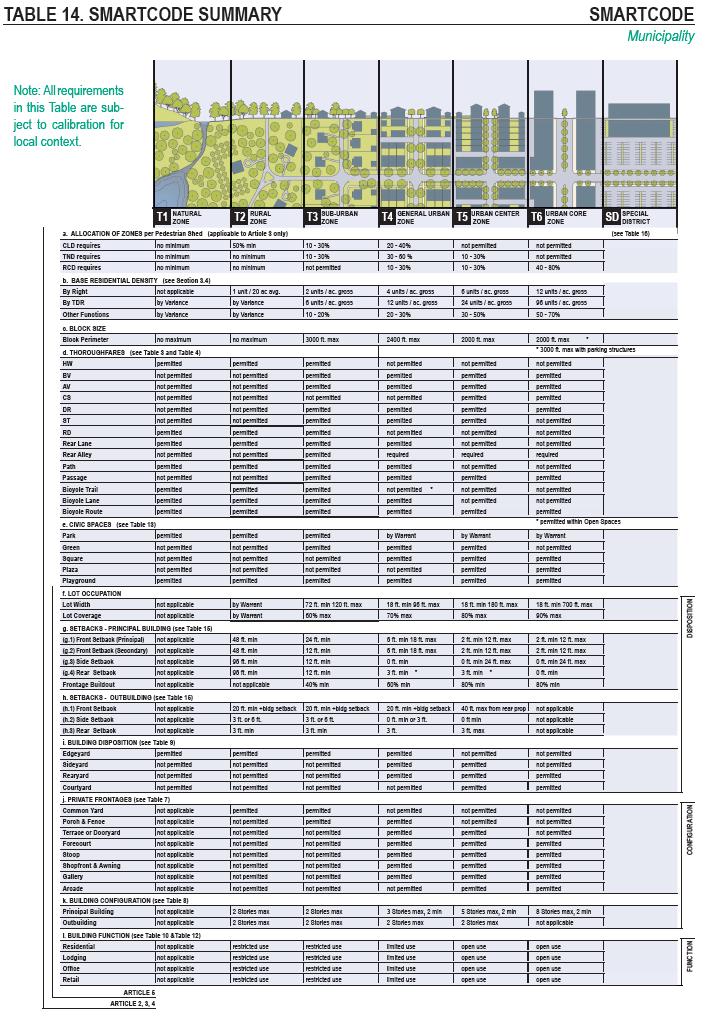
6 SmartCode

7 SmartCode
8 Physical Health Recently, there has been a growing body of evidence linking aspects of the built environment to obesity (33 52). The 20 articles that met the eligibility criteria for this review have all been published within the past 5 years. Of these 20 studies, 17 found a statistically significant relation between some aspect of the built environment and risk of obesity. Mia A. Papas, Anthony J. Alberg, Reid Ewing, Kathy J. Helzlsouer, Tiffany L. Gary, and Ann C. Klassen The Built Environment and Obesity EpidemiolRev (2007) 29(1):
9 Obesity Trends Among U.S. Adults between 1985 and 2009 Source of the data: The data shown in these maps were collected through CDC s Behavioral Risk Factor Surveillance System (BRFSS). Each year, state health departments use standard procedures to collect data through a series of telephone interviews with U.S. adults. Prevalence estimates generated for the maps may vary slightly from those generated for the states by BRFSS ( as slightly different analytic methods are used.

10 In 1990, among states participating in the Behavioral Risk Factor Surveillance System, ten states had a prevalence of obesity less than 10% and no states had prevalence equal to or greater than 15%. By 1999, no state had prevalence less than 10%, eighteen states had a prevalence of obesity between 20-24%, and no state had prevalence equal to or greater than 25%. In 2009, only one state (Colorado) and the District of Columbia had a prevalence of obesity less than 20%. Thirty-three states had a prevalence equal to or greater than 25%; nine of these states (Alabama, Arkansas, Kentucky, Louisiana, Mississippi, Missouri, Oklahoma, Tennessee, and West Virginia) had a prevalence of obesity equal to or greater than 30%.
11 Obesity Trends* Among U.S. Adults BRFSS, 1990, 1999, 2009 (*BMI 30, or about 30 lbs. overweight for 5 4 person) No Data <10% 10% 14% 15% 19% 20% 24% 25% 29% 30%
12 Obesity Trends* Among U.S. Adults BRFSS, 1985 (*BMI 30, or ~ 30 lbs. overweight for 5 4 person) No Data <10% 10% 14%
13 Obesity Trends* Among U.S. Adults BRFSS, 1986 (*BMI 30, or ~ 30 lbs. overweight for 5 4 person) No Data <10% 10% 14%
14 Obesity Trends* Among U.S. Adults BRFSS, 1987 (*BMI 30, or ~ 30 lbs. overweight for 5 4 person) No Data <10% 10% 14%
15 Obesity Trends* Among U.S. Adults BRFSS, 1988 (*BMI 30, or ~ 30 lbs. overweight for 5 4 person) No Data <10% 10% 14%
16 Obesity Trends* Among U.S. Adults BRFSS, 1989 (*BMI 30, or ~ 30 lbs. overweight for 5 4 person) No Data <10% 10% 14%

17 Obesity Trends* Among U.S. Adults BRFSS, 1990 (*BMI 30, or ~ 30 lbs. overweight for 5 4 person) No Data <10% 10% 14%
18 Obesity Trends* Among U.S. Adults BRFSS, 1991 (*BMI 30, or ~ 30 lbs. overweight for 5 4 person) No Data <10% 10% 14% 15% 19%
19 Obesity Trends* Among U.S. Adults BRFSS, 1992 (*BMI 30, or ~ 30 lbs. overweight for 5 4 person) No Data <10% 10% 14% 15% 19%
20 Obesity Trends* Among U.S. Adults BRFSS, 1993 (*BMI 30, or ~ 30 lbs. overweight for 5 4 person) No Data <10% 10% 14% 15% 19%
21 Obesity Trends* Among U.S. Adults BRFSS, 1994 (*BMI 30, or ~ 30 lbs. overweight for 5 4 person) No Data <10% 10% 14% 15% 19%
22 Obesity Trends* Among U.S. Adults BRFSS, 1995 (*BMI 30, or ~ 30 lbs. overweight for 5 4 person) No Data <10% 10% 14% 15% 19%
23 Obesity Trends* Among U.S. Adults BRFSS, 1996 (*BMI 30, or ~ 30 lbs. overweight for 5 4 person) No Data <10% 10% 14% 15% 19%
24 Obesity Trends* Among U.S. Adults BRFSS, 1997 (*BMI 30, or ~ 30 lbs. overweight for 5 4 person) No Data <10% 10% 14% 15% 19% 20%
25 Obesity Trends* Among U.S. Adults BRFSS, 1998 (*BMI 30, or ~ 30 lbs. overweight for 5 4 person) No Data <10% 10% 14% 15% 19% 20%
26 Obesity Trends* Among U.S. Adults BRFSS, 1999 (*BMI 30, or ~ 30 lbs. overweight for 5 4 person) No Data <10% 10% 14% 15% 19% 20%
27 Obesity Trends* Among U.S. Adults BRFSS, 2000 (*BMI 30, or ~ 30 lbs. overweight for 5 4 person) No Data <10% 10% 14% 15% 19% 20%
28 Obesity Trends* Among U.S. Adults BRFSS, 2001 (*BMI 30, or ~ 30 lbs. overweight for 5 4 person) No Data <10% 10% 14% 15% 19% 20% 24% 25%
29 Obesity Trends* Among U.S. Adults BRFSS, 2002 (*BMI 30, or ~ 30 lbs. overweight for 5 4 person) No Data <10% 10% 14% 15% 19% 20% 24% 25%
30 Obesity Trends* Among U.S. Adults BRFSS, 2003 (*BMI 30, or ~ 30 lbs. overweight for 5 4 person) No Data <10% 10% 14% 15% 19% 20% 24% 25%
31 Obesity Trends* Among U.S. Adults BRFSS, 2004 (*BMI 30, or ~ 30 lbs. overweight for 5 4 person) No Data <10% 10% 14% 15% 19% 20% 24% 25%
32 Obesity Trends* Among U.S. Adults BRFSS, 2005 (*BMI 30, or ~ 30 lbs. overweight for 5 4 person) No Data <10% 10% 14% 15% 19% 20% 24% 25% 29% 30%
33 Obesity Trends* Among U.S. Adults BRFSS, 2006 (*BMI 30, or ~ 30 lbs. overweight for 5 4 person) No Data <10% 10% 14% 15% 19% 20% 24% 25% 29% 30%
34 Obesity Trends* Among U.S. Adults BRFSS, 2007 (*BMI 30, or ~ 30 lbs. overweight for 5 4 person) No Data <10% 10% 14% 15% 19% 20% 24% 25% 29% 30%
35 Obesity Trends* Among U.S. Adults BRFSS, 2008 (*BMI 30, or ~ 30 lbs. overweight for 5 4 person) No Data <10% 10% 14% 15% 19% 20% 24% 25% 29% 30%
36 Obesity Trends* Among U.S. Adults BRFSS, 2009 (*BMI 30, or ~ 30 lbs. overweight for 5 4 person) No Data <10% 10% 14% 15% 19% 20% 24% 25% 29% 30%
37 Nearly 3 out of 10 El Paso children overweight (Centers for Disease Control)
38 Fundamental Rules for a Traditional Neighborhood The center Five minute walk Street network Narrow, versatile streets Mixed use Special sites for special buildings


39 Why Traffic Is Congested
40 the power of connected streets Destination Origin how do we get from here to there?
41 the power of connected streets Destination Origin how do we get from here to there?
42 the power of connected streets Destination Origin how do we get from here to there?
43 the power of connected streets Destination Origin 1 possible route
44 the power of connected streets Destination Origin add a second pair of streets to the network, and
45 the power of connected streets Destination Origin 2 possible routes
46 the power of connected streets x= 2 Destination y= 2 Origin add another street in each direction
47 the power of connected streets x= 2 Destination y= 2 Origin more possible routes
48 the power of connected streets x= 2 Destination y= 2 Origin more possible routes
49 the power of connected streets x= 2 Destination y= 2 Origin more possible routes
50 the power of connected streets x= 2 Destination y= 2 Origin more possible routes: 6 in all, without doubling back
51 the power of connected streets x= 3 Destination y= 4 Origin continue enhancing the network: 4 x 3 grid yields 35 routes
52 the power of connected streets x= 5 Destination y= 4 Origin continue enhancing the network: 5 x 4 grid yields 126 routes
53 the power of connected streets make a town, not pods. 8 x 8 grid yields 12,870 routes


54 the power of connected streets Beaufort, SC

55 Contrasts Nearby is far away Convenience store vs. the corner store Shopping center vs. main street Office park vs. main street Useless and useful open space


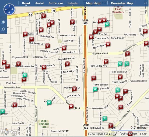
56 The House that Sprawl Built Large lot, pastoral dream Public realm vs. the private Segregation of society by income Illegal types of affordable housing Above retail, accessory dwelling units
57 Physical Creation of Society Drivers vs. Pedestrians Safe streets vs. dangerous streets Civil Defense Committee of AASHTO Nuclear event Cul-de-sac maneuver Curb radius On street parking Eyes Trees
58 American Transportation Mess Highwayless town and the townless highway Adding lanes makes traffic worse Source VTPI: Generated Traffic and Induced Travel
59 Traffic congestion tends to maintain equilibrium. Congestion reaches a point at which it constrains further growth in peakperiod trips. If road capacity increases, the number of peak-period trips also increases until congestion again limits further traffic growth. The additional travel is called generated traffic. Generated traffic consists of diverted traffic (trips shifted in time, route and destination), and induced vehicle travel (shifts from other modes, longer trips and new vehicle trips). Research indicates that generated traffic often fills a significant portion of capacity added to congested urban road. Source VTPI: Generated Traffic and Induced Travel
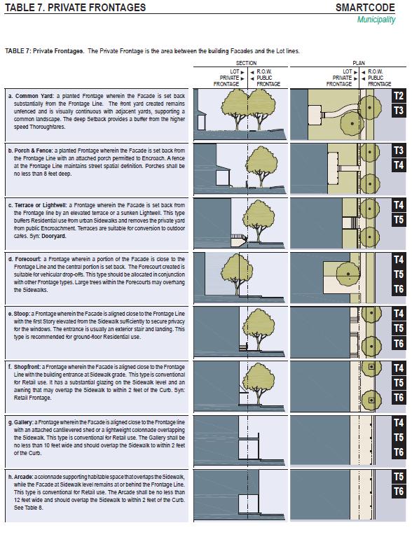
60 Teenage drivers have high rates of both fatal and nonfatal crashes compared with adult drivers. Teenagers drive less than all but the oldest people, but their numbers of crashes and crash deaths are disproportionately high. Based on crashes of all severities, the crash rate per mile driven for year-olds is 4 times the risk for drivers 20 and older. Risk is highest at age 16. The crash rate per mile driven is nearly twice as high for 16 year-olds as it is for year-olds. Insurance Institute for Highway Safety, Highway Loss Data Institute, 2010.
61 Best Practices Defined neighborhoods within pedestrian sheds (1/4 mile radius) Rural to urban transect zones Small blocks Streets for all modes of transit Appropriate building frontages Sense of enclosure

62 Defined neighborhoods within pedestrian sheds (1/4 mile radius)


63 Remcon Circle Oregon Corridor 5 Points


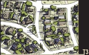
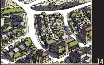
64 Rural to urban transect zones

65 Small blocks Remcon Circle, El Paso Johnson Square Area Savannah, GA

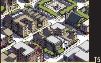
66 Streets for all modes of transit
67 SmartCode

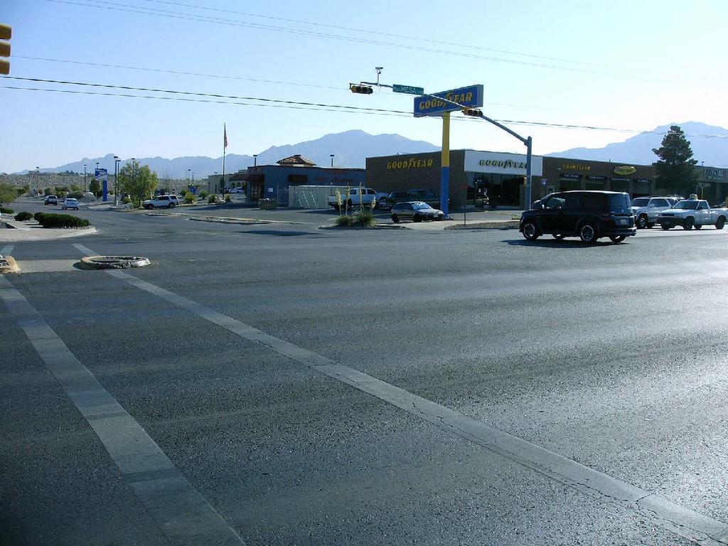
68 El Paso, TX Mesa Street.

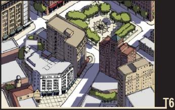
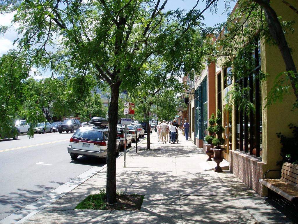
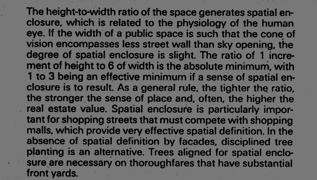
69 El Paso, TX Mesa Street.

70 El Paso, TX Mesa Street.
71 El Paso, TX Mesa Street.

72 El Paso, TX Mesa Street.

73 Appropriate building frontages

74 CONTEXT: Right tools for the right place
75 Boulder

76 Sense of enclosure

77 outdoor room Height-to-Width Ratio


78 proportion of building height to public space

79 proportion of building height to public space

80 How you can get there
81 SmartCode
82 SmartCode
Public Healthy and Community Design
 Public Healthy and Community Design Jeffery Rosenhall, MA, LCI #2312 Health Program Manager, CDPH April 24, 2017 Stairwell interventions Urban bike track Public health and planning: A Road Map Planning,
There are three major federal data sources that we evaluate in our Bicycle Friendly States ranking:
 Since the landmark Intermodal Surface Transportation Efficiency Act (ISTEA) created the Transportation Enhancements program in 1991 bicycle and pedestrian projects have been eligible for programmatic federal
2015 Florida Main Street Annual Conference. Complete Streets Equal Stronger Main Streets
 WHAT ARE COMPLETE STREETS? CASE STUDIES COMPLETING YOUR MAIN STREET 2015 Florida Main Street Annual Conference St. Petersburg, Florida August 19, 2015 WHAT ARE COMPLETE STREETS? CASE STUDIES COMPLETING
Active Community Design: Why Here? Why Now?
 Active Community Design: Why Here? Why Now? Chris Holm Development Review Coordinator 20 April, 2015 Sacramento, California Our environment has changed North Natomas We ve rapidly urbanize our open space
Creating Complete Streets to Accommodate All Users
 Creating Complete Streets to Accommodate All Users Peter Lagerwey, Toole Design Group plagerwey@tooledesign.com Brian Dougherty, Seattle DOT brian.dougherty@seattle.gov International Conference on Urban
and Rural Multimodal Networks 2017 ALTA PLANNING + DESIGN
 Small Town and Rural Multimodal Networks 2017 ALTA PLANNING + DESIGN SMALL TOWN AND RURAL MULTIMODAL NETWORKS GUIDE Why a Rural and Small Town Focused Guide? ONE SIZE DOES NOT FIT ALL. The new FHWA-endorsed
How to Develop a Pedestrian Safety Action Plan
 How to Develop a Pedestrian Safety Action Plan Course Introduction Presented by: Peter Eun FHWA RC Safety Engineer Ryan Snyder President, Ryan Snyder Associates, LLC Paul Zykofsky Director, Land Use and
Background and Goals of SRTS
 Safe Routes to School Background and Goals of SRTS Oklahoma Kick-off May 4, 2011 The Good, the Bad, and the Ugly Fewer kids are biking and walking More parents are driving 1969 2009 48% walked or biked
FACTS AND FIGURES: MAKING THE CASE FOR COMPLETE STREETS IN LEE COUNTY
 FACTS AND FIGURES: MAKING THE CASE FOR COMPLETE STREETS IN LEE COUNTY Safety: Close to 5,000 pedestrians and bicyclists die each year on U.S. roads, and more than 70,000 are injured. [Mean Streets, Surface
SUSTAINABILITY, TRANSPORT, & HEALTH. Ralph Buehler, Virginia Tech
 SUSTAINABILITY, TRANSPORT, & HEALTH Ralph Buehler, Virginia Tech Prepared for National Academies Roundtable on Science and Technology for Sustainability 6 December 2013 Overview Trends in Motorization
Pedestrian Safety at Roundabouts. Presentation to the Howard-Suamico School Board November 26, 2007
 Pedestrian Safety at Roundabouts Presentation to the Howard-Suamico School Board November 26, 2007 Roundabouts that have replaced stop signs and traffic signals have reduced the number and severity of
Proposed. City of Grand Junction Complete Streets Policy. Exhibit 10
 Proposed City of Grand Junction Complete Streets Policy Exhibit 10 1 City of Grand Junction Complete Streets Policy Vision: The Complete Streets Vision is to develop a safe, efficient, and reliable travel
Designing for Pedestrian Safety
 Designing for Pedestrian Safety Introduction to Pedestrian Safety Design and Planning Principles Presented by: Craig Allred FHWA Resource Center Technical Specialist and Michael Ronkin Owner, Designing
Safety & Convenience for All Users, in All Modes. Barbara McCann NCSL December 3, 2013
 Safety & Convenience for All Users, in All Modes Barbara McCann NCSL December 3, 2013 Safety & Convenience for All Users? Who was left out when this road was planned? Takaaki Iwabu for Raleigh News Observer
Traffic Safety Facts 2007 Data
 Traffic Safety Facts 2007 Data Bicyclists and Other Cyclists DOT HS 810 986 Bicyclists and other cyclists include riders of two-wheel nonmotorized vehicles, tricycles, and unicycles powered solely by pedals.
USDOT Bicycle and Pedestrian Safety Initiative: Safer People and Safer Streets. Barbara McCann, USDOT Office of Policy
 { USDOT Bicycle and Pedestrian Safety Initiative: Safer People and Safer Streets Barbara McCann, USDOT Office of Policy 4 Steps from policy to practice Creating multi-modal streets means: 1. Change Decision-Making
5/7/2013 VIA . RE: University Village Safeway Expansion (P13-019)
") 5/7/2013 VIA EMAIL David Hung, Associate Planner Community Development Department, Current Planning Division City of Sacramento 300 Richards Boulevard, 3 rd Floor Sacramento, CA 95811 RE: University Village
5/7/2013 VIA EMAIL David Hung, Associate Planner Community Development Department, Current Planning Division City of Sacramento 300 Richards Boulevard, 3 rd Floor Sacramento, CA 95811 RE: University Village
Design Principle Active Transport
 Active Transport Definition Active transport includes non-motorised forms of transport involving physical activity, such as walking and cycling. It also includes public transport to meet longer distance
Heaven or Hell? Designing the impact of autonomous vehicles on cities and suburbs
 Heaven or Hell? Designing the impact of autonomous vehicles on cities and suburbs Ellen Dunham-Jones Professor of Architecture Director, MS in Urban Design Georgia Institute of Technology We don t know
RESOLUTION NO ?? A RESOLUTION OF THE CITY OF NEPTUNE BEACH ADOPTING A COMPLETE STREETS POLICY
 RESOLUTION NO. 2018-?? A RESOLUTION OF THE CITY OF NEPTUNE BEACH ADOPTING A COMPLETE STREETS POLICY WHEREAS, safe, convenient, and accessible transportation for all users is a priority of the City of Neptune
Approaches. Livable Neighborhood Design. Examples. Traditional neighborhood development. CE 594 University of Wisconsin- Milwaukee
 Approaches Livable Neighborhood Design CE 594 University of Wisconsin- Milwaukee Traditional neighborhood design (TND), new urbanism, transit friendly design, transit oriented development and walkable
Mobility-Friendly Street Standards for Delaware
 Mobility-Friendly Street Standards for Delaware ABSTRACT REID EWING Fehr & Peers Associates, Inc. 3685 Mt. Diablo Blvd. Lafayette, CA 94549 r.ewing@fehrandpeers.com or Surface Transportation Policy Project
Traffic Safety. Norman W. Garrick. Wesley Marshall. University of Connecticut. University of Colorado Denver
 Traffic Safety and the Smart Growth Street Network Norman W. Garrick University of Connecticut Wesley Marshall University of Colorado Denver What Does a Smart Growth Street Network look Like? Or this?
Prioritizing Transportation Policy and Funding for Active Transportation, Safety, Equity and Health
 Mayor Karl Dean, Chairman Prioritizing Transportation Policy and Funding for Active Transportation, Safety, Equity and Health Leslie A. Meehan, AICP Planning and Implementing the Active Community Webinar
12/4/2016 VIA . RE: Grocery Outlet Del Paso (DR16-328)
") 12/4/2016 VIA EMAIL Ethan Meltzer, Assistant Planner City of Sacramento Community Development Department 300 Richards Blvd, 3 rd Floor Sacramento, CA 95811 RE: Grocery Outlet Del Paso (DR16-328) Dear Mr.
12/4/2016 VIA EMAIL Ethan Meltzer, Assistant Planner City of Sacramento Community Development Department 300 Richards Blvd, 3 rd Floor Sacramento, CA 95811 RE: Grocery Outlet Del Paso (DR16-328) Dear Mr.
Agenda. Overview PRINCE GEORGE S PLAZA METRO AREA PEDESTRIAN PLAN
 PRINCE GEORGE S PLAZA METRO AREA PEDESTRIAN PLAN May 28, 2008 Agenda Welcome and introductions Project overview and issue identification Planning context and strengths Design challenges and initial recommendations
9/22/2014 VIA . RE: Butano Apartments Pre App (PAMP )
") 9/22/2014 VIA EMAIL Surinder Singh, Senior Planner Planning and Environmental Review Division Sacramento County 827 7th Street, Second Floor RE: Butano Apartments Pre App (PAMP2014-00012) Dear Mr. Singh:
9/22/2014 VIA EMAIL Surinder Singh, Senior Planner Planning and Environmental Review Division Sacramento County 827 7th Street, Second Floor RE: Butano Apartments Pre App (PAMP2014-00012) Dear Mr. Singh:
AMATS Complete Streets Policy
 AMATS Complete Streets Policy Table of Contents: Section 1. Definition of Complete Streets Section 2. Principles of Complete Streets Section 3. Complete Streets Policy Section 4. Consistency Section 5.
About the Active Transportation Alliance
 About the Active Transportation Alliance Chicagoland s voice for better biking, walking and transit Founded 1985 7,000 members, ~33 full time staff Serve Chicago metro region 1 More Cars, More Driving
Classification Criteria
 SCHEDULE D TO RECOMMENDED OFFICIAL PLAN AMENDMENT NO. 40 SCHEDULE C-4 Road Criteria Criteria Traffic Service Objective Land Service/Access Typical Daily Traffic Volume Flow characteristics Travel Speed
ORDINANCE NO
 1 Sponsored by: Councilmembers Stan Flemming, Connie Ladenburg, and Rick Talbert 2 Requested by: Executive/Public Works and Utilities - Transportation Services 3 4 5 6 7 10 11 ORDINANCE NO. 2014-445 12
APPENDIX E Needs Assessment
 APPENDIX E Needs Assessment Active Transportation Needs Assessment Technical Background This appendix provides the technical background supporting the findings presented in Section 3 of the report. Developed
M-58 HIGHWAY ACCESS MANAGEMENT STUDY Mullen Road to Bel-Ray Boulevard. Prepared for CITY OF BELTON. May 2016
 M-58 HIGHWAY ACCESS MANAGEMENT STUDY Prepared for CITY OF BELTON By May 2016 Introduction Missouri State Highway 58 (M-58 Highway) is a major commercial corridor in the City of Belton. As development has
Plant City Walk-Bike Plan
 Plant City Walk-Bike Plan Plant City Commute Mode Share 2.2% 1.4% 2.9% Drove alone 10.2% Carpooled Public transportation (0.1%) Walked Used a Bike (0.4%) 82.9% Taxicab, motorcycle, or other means Worked
6/14/2013 VIA . Evan Compton, Associate Planner Community Development Department City of Sacramento 300 Richards Blvd Sacramento, CA 95814
 6/14/2013 VIA EMAIL Evan Compton, Associate Planner Community Development Department City of Sacramento 300 Richards Blvd RE: Sacramento Natural Foods Co-Op (P13-025) Dear Mr. Compton: WALKSacramento appreciates
GIS Based Data Collection / Network Planning On a City Scale. Healthy Communities Active Transportation Workshop, Cleveland, Ohio May 10, 2011
 The Purpose of GIS Based Network Planning GIS Based Data Collection / Network Planning Healthy Communities Active Transportation Conference Tuesday, May 10, 2011 10:00 AM Norman Cox, LLA, ASLA. Ann Arbor,
Perryville TOD and Greenway Plan
 Perryville TOD and Greenway Plan Greenway Glossary Pathway: A bicycle and pedestrian path separated from motorized vehicular traffic by an open space, barrier or curb. Multi-use paths may be within the
PEDESTRIAN ACTION PLAN
 ATTACHMENT 2 CITY OF SANTA MONICA PEDESTRIAN ACTION PLAN CITY OF SANTA MONICA PEDESTRIAN ACTION PLAN This page intentionally left blank EXECUTIVE SUMMARY CHAPTER 1 EXECUTIVE SUMMARY Setting the Stage
Access Management Benefits & Techniques. Access Management Workshop June 2, 2006
 Access Management Benefits & Techniques Access Management Workshop June 2, 2006 1 Benefits of Access Management Safety As access density increases, crash rates increase Increasing the density of access
2. Context. Existing framework. The context. The challenge. Transport Strategy
 Transport Strategy Providing quality connections Contents 1. Introduction 2. Context 3. Long-term direction 4. Three-year priorities 5. Strategy tree Wellington City Council July 2006 1. Introduction Wellington
Health and the Built Environment Presentation to the Childhood Obesity Conference
 Presentation to the Childhood Obesity Conference By Cole Runge, Principal Planner Brown County Planning Commission September 29, 2011 The built environment strongly influences physical and mental health.
City of Wayzata Comprehensive Plan 2030 Transportation Chapter: Appendix A
 A1. Functional Classification Table A-1 illustrates the Metropolitan Council s detailed criteria established for the functional classification of roadways within the Twin Cities Metropolitan Area. Table
5/31/2016 VIA . Arwen Wacht City of Sacramento Community Development Department 300 Richards Blvd., 3 rd Floor Sacramento, CA 95811
 5/31/2016 VIA EMAIL Arwen Wacht City of Sacramento Community Development Department 300 Richards Blvd., 3 rd Floor Sacramento, CA 95811 RE: El Pollo Loco (P16-028) Dear Ms. Wacht: WALKSacramento has reviewed
G AT E WAY PLAN. Community BRIEFING KIT GATEWAY BIKE
 G AT E WAY PLAN GATEWAY BIKE Community BRIEFING KIT PLAN August 2016 TABLE OF CONTENTS INTRODUCTION... 1 THE BENEFITS OF A BIKEABLE COMMUNITY... 2 ECONOMY...2 SAFETY...3 HEALTH...3 HOUSEHOLD SPENDING...3
Roundabouts are good for business
 Roundabouts are good for business What is a roundabout Rules 0f Roundabouts 1. Slow down when approaching a roundabout 2. Yield to vehicles in the roundabout 3. When clear, proceed right into the roundabout
Defining Purpose and Need
 Advanced Design Flexibility Pilot Workshop Session 4 Jack Broz, PE, HR Green May 5-6, 2010 Defining Purpose and Need In your agency s project development process, when do design engineers typically get
Complete Streets Successes, Opportunities, and Challenges
 Complete Streets Successes, Opportunities, and Challenges Juliet Walker, Transportation Planner, City of Portsmouth Rob Houseman, Director of Planning and Development, Town of Wolfeboro Chris Parker, Director
CITY OF BLOOMINGTON COMPLETE STREETS POLICY
 CITY OF BLOOMINGTON COMPLETE STREETS POLICY POLICY OBJECTIVE: The City of Bloomington will enhance safety, mobility, accessibility and convenience for transportation network users of all ages and abilities,
Report. Typical Sections. City of Middleton, WI
 Report Typical Sections City of Middleton, WI December 2006 Report for City of Middleton, Wisconsin Typical Sections repared by: Traffic Associates LLC and STRAND ASSOCIATES, INC. 910 West Wingra Drive
West Dimond Blvd Upgrade Jodhpur Street to Sand Lake Road
 West Dimond Blvd Jodhpur St to Sand Lake CSS Transportation Project Summary Municipality of Anchorage Project # 05 005 Project Manager: John Smith, P.E. (MOA PM&E) Project Administrator: Julie Makela,
ACTIVE TRANSPORTATION
 ACTIVE TRANSPORTATION Mobility 2040 Supported Goals Improve the availability of transportation options for people and goods. Support travel efficiency measures and system enhancements targeted at congestion
THE TRADITIONAL NEIGHBORHOOD AND SUBURBAN SPRAWL
 THE TRADITIONAL NEIGHBORHOOD AND SUBURBAN SPRAWL Suburban Sprawl Traditional Neighborhood Comparing the Physical Attributes, Consequences, Balance of Functions and Affordable Housing of Both Suburban Sprawl
Introduction. Who is WILMAPCO. Why are walkable communities important
 Walkable Community Workshops Round 1 April 2005 SPONSORED BY WILMAPCO AND CCOBH CITY OF NEW CASTLE EDGEMOOR GARDENS CIVIC ASSOCIATION WITH FUNDING BY DELAWARE DEPARTMENT OF TRANSPORTATION AND THE DELAWARE
7 Complete Streets & Roadway Aesthetics
 7 Complete Streets & Roadway Aesthetics 7.1 OVERVIEW Our streets lay the foundation for how we interface with travel needs, physical exercise, social exchanges and access to goods and services. They are
Department of Transportation
 Department of Transportation I. Internal Scan The number of older drivers in the United States will double over the next 30 years. By 2030 one in five Americans will be age 65 or older. On a licensed-driver
APPENDIX A BICYCLE, PEDESTRIAN, AND TRANSIT ASSESSMENT WORKSHEET. B. Subdivision/Site Development Plan/Grading Permit Name and Number:
 APPENDIX A BICYCLE, PEDESTRIAN, AND TRANSIT ASSESSMENT WORKSHEET I. GENERAL INFORMATION A. Project name: B. Subdivision/Site Development Plan/Grading Permit Name and Number: C. Project address: D. Project
A Guide to Great Streets: The Basics. September 25, 2009
 A Guide to Great Streets: The Basics September 25, 2009 Streets are more than connectors, they are the city 2 Streets are the glue that hold a city together 3 Streets are the means in which a city is perceived
Congestion Management Report
 Congestion Management Report NH 101A (Amherst St and Canal/Bridge St), NASHUA Segment Length: 2.7 miles Daily Traffic Volumes: 9,000-40,000 Analysis Period: August 2015 Number of Traffic Signals: 9 Number
Existing Pedestrian Conditions. PSAC February 8, 2011
 Existing Pedestrian Conditions PSAC February 8, 2011 Contents 1. Project Background & Goals 2. Pedestrian Activity: Where people walk 3. Pedestrian Safety: The conditions people face Project Background
Bikeway action plan. Bicycle Friendly Community Workshop March 5, 2007 Rochester, MN
 Bikeway action plan Summary The was held on March 5, 2007 at the Rochester Mayo Civic Center. The workshop was hosted by Rochester-Olmsted County Planning Department in collaboration with the League of
Illustrated Principles of Good Planning
 Illustrated Principles of Good Planning The Miami 21 Zoning Code incorporates time-tested planning principles into the zoning regulations of our City. These are principles that make for better neighborhoods,
10/30/2012 VIA
 10/30/2012 VIA EMAIL David Hung, Associate Planner Community Development Department, Current Planning Division City of Sacramento 300 Richards Blvd., 3 rd Floor Sacramento, CA 95811 RE: The Cannery On-Site
Public Health in the Public Realm: Influencing Street Design with Health in Mind Dr. David McKeown Medical Officer of Health
 Public Health in the Public Realm: Influencing Street Design with Health in Mind Dr. David McKeown Medical Officer of Health Complete Streets Forum April 23, 2010 Common Goals of Public Health and Complete
Planning Regionally With Transit
 Planning Regionally With Transit Nathan Coats Director of Operations CTAA Expo 2015 Tampa Began 1992. Serves eastern Cache County to Preston, ID. Population- 115,000 34 bus fleet, 26 fixed route buses;
9/25/2018. Multi-Modal Level of Service (MMLOS) Bianca Popescu, Transportation Planner
 Bianca Popescu, Transportation Planner") Multi-Modal Level of Service (MMLOS) Bianca Popescu, Transportation Planner 1 What is MMLOS? Is this a nice place to walk? Is this a nice place to bike? Is transit convenient? Bottom line - Are there options
Multi-Modal Level of Service (MMLOS) Bianca Popescu, Transportation Planner 1 What is MMLOS? Is this a nice place to walk? Is this a nice place to bike? Is transit convenient? Bottom line - Are there options
Discussion Paper 1 June 2014 Current State of Transportation in Burlington
 Discussion Paper 1 June 2014 Current State of Transportation in Burlington www.burlington.ca/goyourway Discussion Paper 1: Current State of Transportation in Burlington The City of Burlington is developing
DRAFT - CITY OF MEDFORD TRANSPORTATION SYSTEM PLAN Roadway Cross-Sections
 Roadway Cross-Sections Medford s roadway cross-section standards apply to new and reconstructed roads. The crosssections take into consideration roadway function and operational characteristics, including
MN Green Step Cities December 7, Hannah Pritchard, PE PTOE
 MN Green Step Cities December 7, 2016 Hannah Pritchard, PE PTOE Hannah Pritchard PE PTOE @bicyclehannah hpritchard@tooledesign.com Choose your own adventure How we got here the history of traffic engineering
Smart Growth: Residents Social and Psychological Benefits, Costs and Design Barbara Brown
 Smart Growth: Residents Social and Psychological Benefits, Costs and Design Barbara Brown By Scott Siedor 11 At the invitation of the Goodwin-Niering Center for the Environment, Barbara Brown came to Connecticut
Richard J Jackson MD, MPH, FAAP.
 We Are What We Eat And What We Build Richard J Jackson MD, MPH, FAAP HonASLA, HonAIA dickjackson@ucla.edu http://designinghealthycommunities.org/oram/ USA Today 10/20/2011 Commuting by driving is not
Development of Arlington County s Marked Crosswalk Guidelines. Jon Lawler, P.E. Design Engineer Arlington County, VA
 Development of Arlington County s Marked Crosswalk Guidelines Jon Lawler, P.E. Design Engineer Arlington County, VA April 13, 2015 Transportation System Users Residents Estimated 215,000 in 2014 Lowest
Health and Community Design: The Local Government Role in Promoting Active Living
 Health and Community Design: The Local Government Role in Promoting Active Living Rich Killingsworth, Director Active Living by Design National Program Office University of North Carolina School of Public
Prince George s County plans, policies, and projects
 Prince George s County plans, policies, and projects Over 250 projects for trails, bikeways, designated bike lanes and sidewalk construction Trail projects that improve access to Metro Sidewalk and trail
TR NEWS. Public Health and Transportation. Innovation, Intervention, and Improvements NUMBER 299 SEPTEMBER OCTOBER 2015
 TR NEWS NUMBER 299 SEPTEMBER OCTOBER 2015 Public Health and Transportation Innovation, Intervention, and Improvements Public Health and Transportation Measuring the Health Benefits of Walking and Bicycling
Non-motorized Transportation Planning Resource Book Mayor s Task Force on Walking and Bicycling City of Lansing, Michigan Spring 2007 pg.
 Non-motorized Transportation Planning Resource Book pg. 105 of 158 Non-motorized Transportation Planning Resource Book pg. 106 of 158 Non-motorized Transportation Planning Resource Book pg. 107 of 158
Overview. Illinois Bike Summit IDOT Complete Streets Policy Presentation. What is a Complete Street? And why build them? And why build them?
 Overview Illinois Bike Summit IDOT Complete Streets Policy Presentation Aren Kriks, P.E. District One Bicycle Coordinator and Bureau of Programming Project Engineer History of Complete Streets IDOT Policy
Multimodal Transportation Plan
 Multimodal Transportation Plan The Multimodal Transportation Plan will accommodate MILLENIALS ARE DRIVING LESS. WE CANNOT BUILD OUR WAY all modes of transportation by keeping pedestrians, OUT OF CONGESTION.
This page intentionally left blank.
 This page intentionally left blank. COMMUNITY Coweta Community Overview Coweta Coweta, a residential community located in Wagoner County, is a suburb of Tulsa situated southeast of the metropolitan area
Active Transportation Infrastructure Investment A Business Case
 Active Transportation Infrastructure Investment A Business Case In 2016, the Real Estate Foundation awarded the Capital Regional District a $50,000 grant for Shifting Gears: Land Use Change through Active
The North Shore Transportation Improvement Strategy and Western Richmond Terrace 1 : The Forgotten Corridor
 Elm Park Civic Association Island Voice Do Me A Faber The North Shore Transportation Improvement Strategy and Western Richmond Terrace 1 : The Forgotten Corridor Introduction Richmond Terrace is the northernmost
Contents. Champaign-Urbana Mass Transit District Stop Placement Guidelines
 Contents Champaign-Urbana Mass Transit District Introduction... 1 Stop Spacing... 2 Rural... 2 Low Density Suburban... 2 General Urban... 2 Urban Core... 2 Operational Safety... 3 Stop Placement... 4 Nearside
Childhood Obesity: A Policy Perspective
 Leadership for Healthy Communities Advancing Policies to Support Healthy Eating and Active Living Childhood Obesity: A Policy Perspective Elizabeth Hinman elizabeth@leadershipforhealthycommunities.org
9/21/2016 VIA . RE: The Knot (DR16-270)
") 9/21/2016 VIA EMAIL Garrett Norman, Assistant Planner City of Sacramento Community Development Department 300 Richards Boulevard, 3 rd Floor Sacramento, CA 95811 RE: The Knot (DR16-270) Dear Mr. Norman:
9/21/2016 VIA EMAIL Garrett Norman, Assistant Planner City of Sacramento Community Development Department 300 Richards Boulevard, 3 rd Floor Sacramento, CA 95811 RE: The Knot (DR16-270) Dear Mr. Norman:
City of Decatur, GA. Speed Limits Study and Proposal
 City of Decatur, GA Speed Limits Study and Proposal Table of Contents SUMMARY 2 HEALTH IMPACTS 5 EXAMPLES 6 ASSESSMENT 7 Current Speed Limits 7 Safe Routes To School 9 Speed Limit Enforcement 11 Accidents
Access Management Regulations and Standards
 Access Management Regulations and Standards Efficient highway operation Reasonable property access Concept of Access Management The way to manage access to land development while simultaneously preserving
Mobility and Congestion
 Technical Memorandum Mobility and Congestion Prepared for: Prepared by: September 25, 2013 1 Table of Contents 1. Introduction... 1 2. Congestion Forecasting Process... 1 2.1 Mobility and Congestion Terms...
Brian D. Hare, P.E. Bureau of Design PennDOT PA APA Annual Conference Investing in a Sustainable Future October 5, 2009
 Brian D. Hare, P.E. Bureau of Design PennDOT 2009 PA APA Annual Conference Investing in a Sustainable Future October 5, 2009 1 What is Smart Transportation? Photographer: heyjude. Used through license
Aging & Mobility: Stranded Without A Choice
 Aging & Mobility: Stranded Without A Choice Linda Bailey, Policy Analyst This report was created in cooperation with AARP. Why This Study? [Taking away someone s license] really takes away a person s independence
2010 Pedestrian and Bicyclist Special Districts Study Update
 2010 Pedestrian and Bicyclist Special Districts Study Update Pedestrian and Bicyclist Special Districts Program Overview H-GAC s Special Districts Program aims to provide strategic investments in pedestrian
EVAN GLASS. Montgomery County Council District 5
 EVAN GLASS 1. Do you support funding and advancing the Purple Line to groundbreaking as described in the Locally Yes. As a member of the recently convened Purple Line Implementation Advisory Group, I will
7/23/2017 VIA . Michael Hanebutt City of Sacramento Community Development Department 300 Richards Boulevard, 3 rd Floor Sacramento, CA 95811
 7/23/2017 VIA EMAIL Michael Hanebutt City of Sacramento Community Development Department 300 Richards Boulevard, 3 rd Floor Sacramento, CA 95811 RE: 65 th Street Apartments (DR17-220) Dear Mr. Hanebutt:
8/31/2016 VIA . RE: Freeport Arco Fuel Station (P16-039)
") 8/31/2016 VIA EMAIL Garrett Norman, Assistant Planner City of Sacramento Community Development Department 300 Richards Boulevard, 3 rd Floor Sacramento, CA 95811 RE: Freeport Arco Fuel Station (P16-039)
8/31/2016 VIA EMAIL Garrett Norman, Assistant Planner City of Sacramento Community Development Department 300 Richards Boulevard, 3 rd Floor Sacramento, CA 95811 RE: Freeport Arco Fuel Station (P16-039)
Table #6 VISION CHARACTERISTICS
 Table #6 VISION White Flint is a place to live, work, play, shop, and walk with sufficient density to encourage quality redevelopment. Vibrant streets and consistent streetscapes are important. CHARACTERISTICS
Complete Streets Accessible Networks for an Age-Friendly World
 Complete Streets Accessible Networks for an Age-Friendly World Jana Lynott, AICP Senior Strategic Policy Advisor AARP Public Policy Institute @JanaLynott What are Complete Streets? AARP Bulletin Complete
Arkansas. Arizona Connecticut Delaware Florida. Indiana. Kentucky Louisiana. Massachusetts Michigan
 State Does your state passing law have a provision regarding the distance in which a passing maneuver must be completed and the passing vehicle return to the right lane? Answer Comments/exerpts from laws
Complete Streets 101: The Basics
 Complete Streets 101: The Basics Michigan Municipal League - Capital Conference March 21, 2017 Chip Smith, AICP - Senior Planner - Wade Trim Inc. and City Council member City of Ann Arbor 2017 MML Capital
Measuring Transportation: Traffic, Mobility and Accessibility
 Measuring Transportation: Traffic, Mobility and Accessibility THIS FEATURE COMPARES THREE APPROACHES TO MEASURING TRANSPORTATION SYSTEM PERFORMANCE. TRAFFIC-BASED MEASUREMENTS EVALUATE MOTOR VEHICLE MOVEMENT;
What s Health Got to Do With It? Health and Land Use Planning
 What s Health Got to Do With It? Health and Land Use Planning CANDACE RUTT, PH.D. EXECUTIVE DIRECTOR APRIL 13 TH, 2016 Planning and Public Health Planning + Public Health Healthy Communities Healthier
Roadways. Roadways III.
 Introduction 97 Roadway Design Principles 98 Safe Speeds 99 Optimizing of Street Space 00 Minimum Lane Widths in the City of Boston 02 Design Features that Reduce Operating Speeds 05 Travel Lanes Transit
Recommended Roadway Plan Section 2 - Land Development and Roadway Access
 Recommended Roadway Plan Section 2 - Land Development and Roadway Access SECTION 2 Land Development and Roadway Access 2.1 Land Use and Access Management The Federal Highway Administration (FHWA) defines