Traffic Safety. Norman W. Garrick. Wesley Marshall. University of Connecticut. University of Colorado Denver
|
|
|
- Terence Adams
- 5 years ago
- Views:
Transcription

1 Traffic Safety and the Smart Growth Street Network Norman W. Garrick University of Connecticut Wesley Marshall University of Colorado Denver

2 What Does a Smart Growth Street Network look Like?
3 Or this?
4 Or this?
5 Or this?
6 Characterizing Street Networks Streets networks are devilishly complicated The possible variations are infinite and even subtle differences can have a huge impacts Street networks simultaneously operate at numerous geographic scales while serving many different some times conflicting functions The common descriptors are not all that good for illuminating the differences between networks


7 Twenty four Cities California Cities Study of Street Networks Does the Street Network Matters?

8 Davis, CA 14 % of people ride to work

9 Davis, CA Road Fatality Rate: 1 per 100,000


10 17.3 Road Fatality Rate for All 157 California Cities Over 40,000 number per 100,000 population 0.0


11 Road Fatality Rate for All 157 California Cities Over 40,000 number per 100,000 population


12

")

13 Risk of Fatality (Fatalities as % of Injuries) California Cities of 40,000 to 120,000
14 Chance of Pedestrian Fatality vs. Impact Speed

15 Evolution of the Street Network Pre-1950 s Post 1950 s Adapted from Stephen Marshall

16
17


18 FHA Technical Bulletin No. 7 (1938) Planning Profitable Neighborhoods


19 According to the FHA the grid layout was Monotonous Had Little Character Uneconomical Posed Safety Concerns
20 Research
21 Evolution of the Street Network

22 Characterizing the the Street Network Shape and Configuration Street Network Scale Street Network Connectivity


23 Citywide Street Network Neighborhood Street Network Grid Tree Linear Tree Grid Tributary Radial Adapted from Stephen Marshall, Streets & Patterns

24 550 Intersections per Square Mile Network Scale

25 110 Intersections per Square Mile Network Scale

26 45 Intersections per Square Mile Network Scale


27 Network Connectivity Link to Node Ratio = 1.61 Link to Node Ratio = 1.13 Link to Node Ratio = 1.16

28 Variables included in Our Safety and Travel Choice Models Street Network Properties Street Design Properties Average Total Number of Lanes Average Outside Shoulder Width Raised Median Painted Median On Street Parking Bike Lanes Raised Curbs Travel and Activity Level Distance from City Center Income Mix of Land Use


29 Safety Analysis Based on Geo coding 230,000 Accident Records in 24 California Cities

30 Safety and Travel Choice Analysis done for 1040 Census Block Groups 24 California Cities
31 versus
32 Risk of Severe Injury or Fatality* versus Chance of being Severely Injured 30% Higher Chance of being Killed 50% Higher *Given that an injury occurred

33 Odds of Dying in a Road Accident based on Intersection Density* 1 in in 500 *Given that an injury occurred

34 Does Street Network Matter for Safety? The street network plays a huge role in terms of traffic safety 1. Street density seem to be the most important factor 2. Street network configuration is also important 3. The results with respect to connectivity is a bit more complicated
35 What About Connectivity? Street patterns types that are more connected are safer Safer Less Safe Within each type of street pattern increasing connectivity measured by linkto node ratio was not correlated with improved safety


36

37 Clipping the Grid in Berkeley Very high connectivity can be a mixed blessing
38 Why Does Street Network Matter? Why does street network matter for safety? Understanding this issue is important helping us understand how to develop a new approach for designing street network Street network affects Speed control Travel mode choice and VMT Traffic distribution Speed control reduces accident severity More diverse mode choice and good traffic distribution reduces the demand for road capacity and means that we are more likely to keep the streets to a human scale
39 Design for Safety The two most important characteristics of the street network in designing for safety are 1. Dense (Fine Grained) Fabric 2. Functional Connection for walking within and between neighborhoods
40 Connected? Yes based on convention matrices


41 Functionally Connected for Walking? No. Each neighborhood is an isolated pod
42 Traffic Safety and Smart Growth The same street design features that supports traffic safety also Promote use of active transportation Reduce VMT Create value In other words, a safe street network is also a smart growth street network

43 Percentage of People Walking, Biking or Taking Transit


44 Percentage of People Walking, Biking or Taking Transit Effect of Intersection Density for Cul de sac Network


45 Percentage of People Walking, Biking or Taking Transit Effect of Intersection Density for Gridded Network
46 Street Networks for Smart Growth There is no one type of smart growth street network
47 Smart Growth Street Network? Yes
48 Smart Growth Street Network? No


49 What is a Smart Growth Street Network? No


50 Smart Growth Street Network? Yes
51 Connectivity Standards A handful of number of jurisdictions have enacted connectivity standards Connectivity standards by themselves will not necessarily produce safer communities or smart growth communities We need more focus on the issues of street network scale and functional connectivity
52 After years of ignoring the role of street network on traffic safety we are beginning to build a body of knowledge we need to embrace the complexities of the issues


53 Great cities are built on the foundation of a Great Street Network
GIS Based Data Collection / Network Planning On a City Scale. Healthy Communities Active Transportation Workshop, Cleveland, Ohio May 10, 2011
 The Purpose of GIS Based Network Planning GIS Based Data Collection / Network Planning Healthy Communities Active Transportation Conference Tuesday, May 10, 2011 10:00 AM Norman Cox, LLA, ASLA. Ann Arbor,
Presentation Summary Why Use GIS for Ped Planning? What Tools are Most Useful? How Can They be Applied? Pedestrian GIS Tools What are they good for?
 1 2 Pedestrian GIS Tools What are they good for? Pro Walk / Pro Bike 2006 Presentation Summary Why Use GIS for Ped Planning? What Tools are Most Useful? How Can They be Applied? Matt Haynes Fehr & Peers
GIS Based Non-Motorized Transportation Planning APA Ohio Statewide Planning Conference. GIS Assisted Non-Motorized Transportation Planning
 The Purpose of GIS Assisted Network GIS Assisted Non-Motorized Transportation 2011 APA Ohio Statewide Conference Friday, 10:45 AM to Noon Focus on near-term projects wwwgreenwaycollabcom The purpose of
ASSESSING THE WALKING & BIKING ENVIRONMENT
 ASSESSING THE WALKING & BIKING ENVIRONMENT M A Y 2 0 1 3 Jon Morgan WI DHS ACTIVE COMMUNITY LINE-UP Rationale Why do an audit What s involved in an audit Things to look for and consider Hitting the streets
Approaches. Livable Neighborhood Design. Examples. Traditional neighborhood development. CE 594 University of Wisconsin- Milwaukee
 Approaches Livable Neighborhood Design CE 594 University of Wisconsin- Milwaukee Traditional neighborhood design (TND), new urbanism, transit friendly design, transit oriented development and walkable
Cycling and risk. Cycle facilities and risk management
 Cycling and risk Cycle facilities and risk management Failure to recognize possibilities is the most dangerous and common mistake one can make. Mae Jemison, astronaut 6/11/2010 York Regional Council Cycling
Health and the Built Environment Presentation to the Childhood Obesity Conference
 Presentation to the Childhood Obesity Conference By Cole Runge, Principal Planner Brown County Planning Commission September 29, 2011 The built environment strongly influences physical and mental health.
Safety & Convenience for All Users, in All Modes. Barbara McCann NCSL December 3, 2013
 Safety & Convenience for All Users, in All Modes Barbara McCann NCSL December 3, 2013 Safety & Convenience for All Users? Who was left out when this road was planned? Takaaki Iwabu for Raleigh News Observer
How to Develop a Pedestrian Safety Action Plan
 How to Develop a Pedestrian Safety Action Plan Course Introduction Presented by: Peter Eun FHWA RC Safety Engineer Ryan Snyder President, Ryan Snyder Associates, LLC Paul Zykofsky Director, Land Use and
Network Preamble: CNU Statement of Principles on Transportation Networks
 Network Preamble: CNU Statement of Principles on Transportation Networks Cities and their surrounding regions are the social, cultural, and economic drivers of human civilization. Of especial importance
The Basics of The New Urbanism. November 2, Smart Code
 El Paso and The Basics of The New Urbanism November 2, 2010 Development Types Growth: Traditional neighborhoods vs. sprawl Traditional: Mixed use, pedestrian friendly, varied population, dominant development
Implementing Living Streets. Dena Belzer January 29, 2009
 Implementing Living Streets Dena Belzer January 29, 2009 February 22, 2004 Starting with Some Definitions 1.Living Streets/Complete Streets 2.Corridor Revitalization 3.Shopping Mall Reuse Living/Complete
TRANSPORTATION STANDARDS
 INTRODUCTION LOCAL STREETS ON-STREET PARKING SIDEWALKS STREET LIGHTING STREET FURNISHINGS TRAFFIC CALMING STREET TREES MEDIAN PLANTING BOULEVARD LOCATIONS VILLAGE CENTER STREET LOCATIONS RESIDENTIAL STREET
2010 Pedestrian and Bicyclist Special Districts Study Update
 2010 Pedestrian and Bicyclist Special Districts Study Update Pedestrian and Bicyclist Special Districts Program Overview H-GAC s Special Districts Program aims to provide strategic investments in pedestrian
Designed for Drivability
 Designed for Drivability cenews.com /article/10191/designed-for-drivability October 2015» Project + Technology Portfolio» Residential Vehicle flow is a critical component at the neighborhood level of design.
PEDESTRIAN ACTION PLAN
 ATTACHMENT 2 CITY OF SANTA MONICA PEDESTRIAN ACTION PLAN CITY OF SANTA MONICA PEDESTRIAN ACTION PLAN This page intentionally left blank EXECUTIVE SUMMARY CHAPTER 1 EXECUTIVE SUMMARY Setting the Stage
Complete Streets Accessible Networks for an Age-Friendly World
 Complete Streets Accessible Networks for an Age-Friendly World Jana Lynott, AICP Senior Strategic Policy Advisor AARP Public Policy Institute @JanaLynott What are Complete Streets? AARP Bulletin Complete
Data Analysis February to March Identified safety needs from reported collisions and existing travel patterns.
 Welcome! Thank you for participating in today s Valencia Bikeway Improvements workshop. Data Analysis February to March Identified safety needs from reported collisions and existing travel patterns. Initial
Bicycle and Pedestrian Connectivity Study. Old Colony Planning Council
 Bicycle and Pedestrian Connectivity Study Old Colony Planning Council Outline Why consider bike/peds in road designs? Why are measures needed? Connecting Land Use with Transportation Evaluation Tools:
Relationship Between Child Pedestrian Accidents and City Planning in Zarqa, Jordan
 112 TRANSPORTATION RESEARCH RECORD 1281 Relationship Between Child Pedestrian Accidents and City Planning in Zarqa, Jordan ADU H. AL-BALBISSI, MOHAMED T. ABOUL-ELA, AND SABAH SAMMOUR The relationship between
AND GUIDING PRINCIPLES. Boise, Idaho 1997
 USTICK CONCEPT MASTER PLAN AN AND GUIDING PRINCIPLES Boise City Comprehensiv ehensive e Plan Boise, Idaho 1997 GOALS, OBJECTIVES AND POLICIES BOISE CITY ~ NEIGHBORHOOD MASTER PLANS USTICK CONCEPT MASTER
Mayor s Pedestrian Advisory Council. Wednesday, February 15
 Mayor s Pedestrian Advisory Council Wednesday, February 15 Annual Pedestrian Fatalities 2005-2016 Year-End Pedestrian Fatalities, 2016 (CPD): 44 Year-End Pedestrian Fatalities, 2015 (CPD): 46 Year-End
Vision: Traditional hamlet with an attractive business/pedestrian friendly main street connected to adjacent walkable neighborhoods
 N D. Focus Area II Vision: Traditional hamlet with an attractive business/pedestrian friendly main street connected to adjacent walkable neighborhoods Transit Road Focus Area II is located in the Hamlet
Roadway Classification Design Standards and Policies. Pueblo, Colorado November, 2004
 Roadway Classification Design Standards and Policies Pueblo, Colorado November, 2004 Table of Contents Page Chapter 1. General Provisions 1.1 Jurisdiction 3 1.2 Purpose and Intent 3 1.3 Modification 3
Protected Bike Lanes in San Francisco Mike Sallaberry SFMTA NACTO Workshop - Chicago IL
 Protected Bike Lanes in San Francisco Mike Sallaberry SFMTA 10 14 2011 NACTO Workshop - Chicago IL San Francisco 2 nd Highest Density in the U.S. 47 square miles Mild Climate Market Population ~810,000
Regional trends in walking and biking Transport Chicago conference. June 9, 2017
 Regional trends in walking and biking Transport Chicago conference June 9, 2017 Overview CMAP & ON TO 2050 Trends in walking and biking since 2010 Findings from crash data and equity analysis Estimating
The DC Pedestrian Master Plan
 The DC Pedestrian Master Plan September 28, 2010 George Branyan Pedestrian Program Coordinator District Department of Transportation Presentation Agenda Scope of the Plan Methodology Recommendations Implementation
City Council Briefing March 18, Draft Working Ideas for Confirmation of Direction
 City Council Briefing March 18, 2014 Draft Working Ideas for Confirmation of Direction Draft Working Ideas for Confirmation of Direction Overall Study Area Regional Population Growth Plan for Today and
2015 Florida Main Street Annual Conference. Complete Streets Equal Stronger Main Streets
 WHAT ARE COMPLETE STREETS? CASE STUDIES COMPLETING YOUR MAIN STREET 2015 Florida Main Street Annual Conference St. Petersburg, Florida August 19, 2015 WHAT ARE COMPLETE STREETS? CASE STUDIES COMPLETING
Temporal and Spatial Variation in Non-motorized Traffic in Minneapolis: Some Preliminary Analyses
 Temporal and Spatial Variation in Non-motorized Traffic in Minneapolis: Some Preliminary Analyses Spencer Agnew, Jason Borah, Steve Hankey, Kristopher Hoff, Brad Utecht, Zhiyi Xu, Greg Lindsey Thanks to:
Traffic Safety Barriers to Walking and Bicycling Analysis of CA Add-On Responses to the 2009 NHTS
 Traffic Safety Barriers to Walking and Bicycling Analysis of CA Add-On Responses to the 2009 NHTS NHTS Users Conference June 2011 Robert Schneider, Swati Pande, & John Bigham, University of California
Lakeside Green Street Project Improvement. Public Works Committee February 27, 2018
 Lakeside Green Street Improvement Public Works Committee February 27, 2018 Construction of Lakeside Green Streets is currently underway Photo: Sergio Ruiz Photo: Sergio Ruiz 100% Do people biking on the
Designing for Pedestrian Safety
 Designing for Pedestrian Safety Introduction to Pedestrian Safety Design and Planning Principles Presented by: Craig Allred FHWA Resource Center Technical Specialist and Michael Ronkin Owner, Designing
Kentucky s Surface Transportation System
 Kentucky s Surface Transportation System ROAD AND BRIDGE CONDITIONS, TRAFFIC SAFETY, TRAVEL TRENDS, AND NEEDS MARCH 2018 PREPARED BY WWW.TRIPNET.ORG Founded in 1971, TRIP of Washington, DC, is a nonprofit
and Rural Multimodal Networks 2017 ALTA PLANNING + DESIGN
 Small Town and Rural Multimodal Networks 2017 ALTA PLANNING + DESIGN SMALL TOWN AND RURAL MULTIMODAL NETWORKS GUIDE Why a Rural and Small Town Focused Guide? ONE SIZE DOES NOT FIT ALL. The new FHWA-endorsed
A Guide to Great Streets: The Basics. September 25, 2009
 A Guide to Great Streets: The Basics September 25, 2009 Streets are more than connectors, they are the city 2 Streets are the glue that hold a city together 3 Streets are the means in which a city is perceived
REGIONAL BICYCLE AND PEDESTRIAN DESIGN GUIDELINES
 REGIONAL BICYCLE AND PEDESTRIAN DESIGN GUIDELINES November 16, 2011 Deb Humphreys North Central Texas Council of Governments Bicycle and Pedestrian Advisory Committee Snapshot of the Guide 1. Introduction
Pre-Plan Consultation Summary
 Transportation Master Plan Pre-Plan Consultation Summary Thursday July 7, 2011 Presentation ti Outline Consultation Objectives Scope of Consultation Who Responded? What did we hear? How well did we connect?
Community Builders Webinar Series
 Community Builders Webinar Series Wednesday, January 27, 2016: Why Everybody Talks About Transportation Safety, But Nobody Does Anything About It Jim Charlier, AICP, Charlier Associates www.charlier.org
Can A School s Location Make A Kid Fat? Arizona Department of Transportation
 Can A School s Location Make A Kid Fat? Arizona Department of Transportation Safe Routes To School Approved by Congress in 2005 $900 million to States Goal: make it safer and easier for K-8 students to
Chapter 6 Transportation Plan
 Chapter 6 Transportation Plan Transportation Plan Introduction Chapter 6 Transportation Plan Transportation Plan Introduction This chapter describes the components of Arvada s transportation system, comprised
Designing for Pedestrians: An Engineering Symposium. Rutgers University March 21, 2013
 Designing for Pedestrians: An Engineering Symposium Rutgers University March 21, 2013 The Problem 2 Pedestrian Fatalities Pedestrian Fatalities by Year in US (1994-2010) 6000 5000 4000 3000 2000 1000 0
Cultivating Senior Advocacy for Healthy & Walkable Neighborhoods. Jaime Fearer, AICP Planning & Policy Manager
 Cultivating Senior Advocacy for Healthy & Walkable Neighborhoods Jaime Fearer, AICP Planning & Policy Manager www.californiawalks.org @CaliforniaWalks Presenter Disclosures Jaime Fearer The following personal
Proposed Action, Purpose and Need Technical Memorandum
 Proposed Action, Purpose and Need Technical Memorandum MoPac (State Loop 1) Intersections, Austin District From North of Slaughter Lane to South of La Crosse Avenue CSJ: 3136-01-015 Travis County, Texas
Highway Transitway Corridor Study
 Highway Transitway Corridor Study CTS Research Conference May 21, 2014 1 2030 Transportation Policy Plan Transitway modes on highways: Highway bus rapid transit (BRT), plan identified 6 total Highway BRT
Town of Babylon Sustainable Complete Streets Policy
 Town of Babylon Sustainable Complete Streets Policy Steve Bellone, Supervisor Adopted July 14, 2010 1 Table of Contents Vision... 3 Policy Statement... 3 Definition... 3 Road Users... 4 Network... 4 Roads...
Creating Complete Streets to Accommodate All Users
 Creating Complete Streets to Accommodate All Users Peter Lagerwey, Toole Design Group plagerwey@tooledesign.com Brian Dougherty, Seattle DOT brian.dougherty@seattle.gov International Conference on Urban
UNIVERSITY AVENUE CORRIDOR REDESIGN. January 8, 2017 PUBLIC OPEN HOUSE
 January 8, 2017 PUBLIC OPEN HOUSE COLLABORATIVE COMMUNITY-BASED DESIGN IS THE FOUNDATION TO A SUCCESSFUL PROJECT AGENDA FOR TONIGHT 1 INTRODUCTIONS 2 WHY ARE WE HERE PROJECT NEED 3 SCHEDULE & GOALS 4 OPEN
I-105 Corridor Sustainability Study (CSS)
") I-105 Corridor Sustainability Study (CSS) Metro Streets and Freeways Subcommittee March 21, 2019 Gary Hamrick Cambridge Systematics, Inc. I-105 CSS Project History & Background Funded by Caltrans Sustainable
I-105 Corridor Sustainability Study (CSS) Metro Streets and Freeways Subcommittee March 21, 2019 Gary Hamrick Cambridge Systematics, Inc. I-105 CSS Project History & Background Funded by Caltrans Sustainable
Pedestrian Safety at Roundabouts. Presentation to the Howard-Suamico School Board November 26, 2007
 Pedestrian Safety at Roundabouts Presentation to the Howard-Suamico School Board November 26, 2007 Roundabouts that have replaced stop signs and traffic signals have reduced the number and severity of
An International Experience on the Safety Performance of 2+1 cross-section. Basil Psarianos Nat l Techn. Univ. Athens, Greece
 An International Experience on the Safety Performance of 2+1 cross-section Basil Psarianos Nat l Techn. Univ. Athens, Greece bpsarian@mail.ntua.gr What is a 2+1 cross-section? It s a 3 lane rural road
INNER LOOP EAST. AIA Rochester Annual Meeting November 13, 2013 TRANSFORMATION PROJECT. Bret Garwood, NBD Erik Frisch, DES
 INNER LOOP EAST TRANSFORMATION PROJECT AIA Rochester Annual Meeting November 13, 2013 Bret Garwood, NBD Erik Frisch, DES Why? We are building a city that encourages walking, biking and enjoying the outdoor
WELCOME. Traffic & Parking Commission Special Meeting May 30, Iteris, Inc. All rights reserved.
 WELCOME Traffic & Parking Commission Special Meeting May 30, 2018 WORKSHOP #2 CONCEPTS FOR IMPROVEMENT MAY 30, 2018 Agenda 1. Welcome 10 min 2. Project Presentation 25 min 3. Roundtable Dialogue 50 min
Existing Pedestrian Conditions. PSAC February 8, 2011
 Existing Pedestrian Conditions PSAC February 8, 2011 Contents 1. Project Background & Goals 2. Pedestrian Activity: Where people walk 3. Pedestrian Safety: The conditions people face Project Background
THE PHILADELPHIA COMPLETE. an overview
 THE PHILADELPHIA COMPLETE STREETS DESIGN HANDBOOK an overview WHAT ARE COMPLETE STREETS? Complete Streets are streets designed to accommodate all users, from pedestrians to drivers Complete Streets provide
Road Diets and Roundabouts
 Road Diets and Roundabouts Paul Zykofsky, AICP Local Government Commission Sacramento, CA Classic Road Diet 4 to 3 lanes San Antonio TX On-street parking Median Bike Lanes Center Turn-Lane Seattle WA Road
This page intentionally left blank.
 This page intentionally left blank. COMMUNITY Coweta Community Overview Coweta Coweta, a residential community located in Wagoner County, is a suburb of Tulsa situated southeast of the metropolitan area
MEMORANDUM. Introduction. Date: July 10, 2009 TG: To: From: cc: Subject: Terry Moore, ECONorthwest. Andrew Mortensen, Transpo Group
 MEMORANDUM Date: July 10, 2009 TG: 08164.00 To: From: cc: Subject: Terry Moore, ECONorthwest Andrew Mortensen, Transpo Group Street and Non-Motorized Connectivity This memorandum provides context to the
Illustrated Principles of Good Planning
 Illustrated Principles of Good Planning The Miami 21 Zoning Code incorporates time-tested planning principles into the zoning regulations of our City. These are principles that make for better neighborhoods,
Data Analysis February to March Identified safety needs from reported collisions and existing travel patterns.
 Welcome! Thank you for participating in today s Valencia Bikeway Improvements workshop. Data Analysis February to March Identified safety needs from reported collisions and existing travel patterns. Initial
Portland, Oregon. Salt Lake City, Utah. April 20, 2016
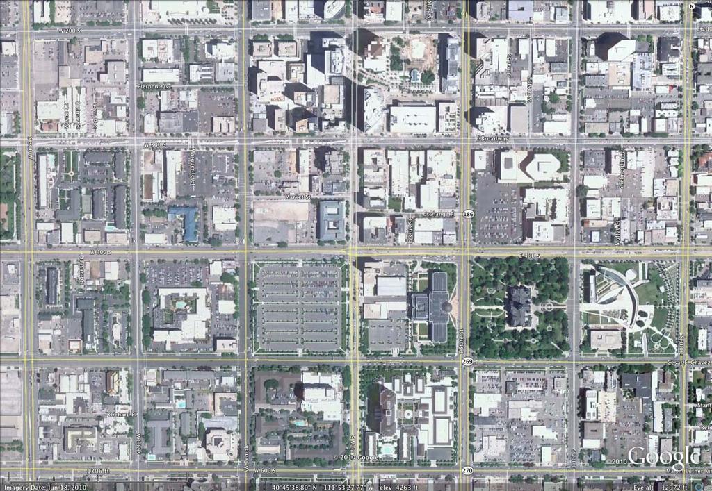
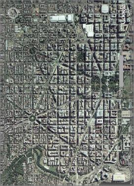
 Case Study: Does size matter? A critique of two urban block sizes and the affects on walkability Portland, Oregon Salt Lake City, Utah GoogleEarth Pro, web. 04 Apr 2016 GoogleEarth Pro, web. 04 Apr 2016
UNIT V 1. What are the traffic management measures? [N/D-13] 2. What is Transportation System Management (TSM)? [N/D-14]
![UNIT V 1. What are the traffic management measures? [N/D-13] 2. What is Transportation System Management (TSM)? [N/D-14]](/thumbs/87/95571671.jpg "UNIT V 1. What are the traffic management measures? [N/D-13] 2. What is Transportation System Management (TSM)? [N/D-14]") UNIT V 1. What are the traffic management measures? [N/D-13] Some of the well-known traffic management measures are: a) Restrictions on turning movements b) One - way streets c) Tidal - flow operations
UNIT V 1. What are the traffic management measures? [N/D-13] Some of the well-known traffic management measures are: a) Restrictions on turning movements b) One - way streets c) Tidal - flow operations
About the Active Transportation Alliance
 About the Active Transportation Alliance Chicagoland s voice for better biking, walking and transit Founded 1985 7,000 members, ~33 full time staff Serve Chicago metro region 1 More Cars, More Driving
Arlington s Master Transportation Plan
 Arlington s Master Transportation Plan The Master Transportation Plan (MTP) Adopted in eight parts Goals & Policies element and MTP Map adopted in 2007 Bicycle, Pedestrian and Demand and Systems Management
2018 AASHTO BIKE GUIDE
 2018 AASHTO BIKE GUIDE Your presenters Jessica Fields, PE Denver Office Director Sagar Onta, PE, PTOE Denver Engineering Director 35 years of combined experience street design, transportation planning,
Welcome. If you have any questions or comments on the project, please contact:
 Welcome This drop-in public open house is intended to provide information about the Bay Street bike lanes project. This project proposes a dedicated cycling facility along Bay Street between Aberdeen Avenue
RESOLUTION NO ?? A RESOLUTION OF THE CITY OF NEPTUNE BEACH ADOPTING A COMPLETE STREETS POLICY
 RESOLUTION NO. 2018-?? A RESOLUTION OF THE CITY OF NEPTUNE BEACH ADOPTING A COMPLETE STREETS POLICY WHEREAS, safe, convenient, and accessible transportation for all users is a priority of the City of Neptune
2018 AASHTO BIKE GUIDE
 2018 AASHTO BIKE GUIDE Your presenter Rob Burchfield, PE NW Regional Engineering Director 35 years of experience in traffic engineering and bicycle facility design Toole Design Group Toole Design Group
DESIGNING FOR PEDESTRIAN SAFETY. Module 1
 DESIGNING FOR PEDESTRIAN SAFETY Module 1 Instructors: 1-2 Peter Eun FHWA Resource Center Transportation Safety Engineer peter.eun@dot.gov Michael J. Cynecki, PE Lee Engineering Project Manager MCynecki@lee-eng.com
Access Location, Spacing, Turn Lanes, and Medians
 Design Manual Chapter 5 - Roadway Design 5L - Access Management 5L-3 Access Location, Spacing, Turn Lanes, and Medians This section addresses access location, spacing, turn lane and median needs, including
9/21/2016 VIA . RE: The Knot (DR16-270)
") 9/21/2016 VIA EMAIL Garrett Norman, Assistant Planner City of Sacramento Community Development Department 300 Richards Boulevard, 3 rd Floor Sacramento, CA 95811 RE: The Knot (DR16-270) Dear Mr. Norman:
9/21/2016 VIA EMAIL Garrett Norman, Assistant Planner City of Sacramento Community Development Department 300 Richards Boulevard, 3 rd Floor Sacramento, CA 95811 RE: The Knot (DR16-270) Dear Mr. Norman:
Introduction. Mode Choice and Urban Form. The Transportation Planner s Approach. The problem
 Introduction The table below shows transit s share in the urban US (all trip purposes) and the 10 urban areas where it is most popular (2008 data): Mode Choice and Urban Form Philip A. Viton April 4, 2014
Designing Complete Streets: What you need to know
 Designing Complete Streets: What you need to know Getting from this to this. Continuous sidewalk Buffer w/trees Bicycle lane Raised median Buildings close to the street Flexibility in design Design and
Key objectives of the survey were to gain a better understanding of:
 3 COMMUNITY INPUT Community input is an essential part of corridor studies. For the SR 87 corridor study, VTA staff conducted an extensive online survey of people living and commuting along the corridor.
Designing for Pedestrian Safety
 Designing for Pedestrian Safety Intersection Geometry Presented by: John LaPlante T.Y. Lin International, Inc Keith Sinclair FHWA Resource Center September 9, 2010 Learning Outcomes At the end of this
October 29, Modern traffic mitigation for development in cities: Moving beyond LOS
 Modern traffic mitigation for development in cities: Moving beyond LOS October 29, 2018 Modern traffic mitigation for development in cities: Moving beyond LOS State Smart Transportation Initiative Practical
2017 Northwest Arkansas Trail Usage Monitoring Report
 2017 Northwest Arkansas Trail Usage Monitoring Report Summary Findings: The study showed that average daily weekday bicycle volumes per study site increased by about 32% between 2015 and 2017, from 142
CONTEXT SENSITIVE STREETS STANDARDS COMMITTEE
 CONTEXT SENSITIVE STREETS STANDARDS COMMITTEE February 23, 2015 Prepared by: Denise Chaplick, AICP City Jacksonville Bicycle and Pedestrian Coordinator Source: NCDOT Complete Streets Planning and Design
Cycle Track Design Best Practices Cycle Track Sections
 Design Best Practices Sections It is along street segments where the separation and protection methods of cycle tracks offer more comfort than conventional bicycle lanes, and are more attractive to a wide
MN Green Step Cities December 7, Hannah Pritchard, PE PTOE
 MN Green Step Cities December 7, 2016 Hannah Pritchard, PE PTOE Hannah Pritchard PE PTOE @bicyclehannah hpritchard@tooledesign.com Choose your own adventure How we got here the history of traffic engineering
Telegraph Avenue Complete Streets DRAFT Recommendations. Oakland Public Works Department September 11 and 13, 2014 Open Houses
 Telegraph Avenue Complete Streets DRAFT Recommendations Oakland Public Works Department September 11 and 13, 2014 Open Houses Presentation Overview What are complete streets? What problem are we trying
5 CIRCULATION AND STREET DESIGN
 5 CIRCULATION AND STREET DESIGN This chapter describes circulation and streetscape improvements proposed for the Northwest Chico Specific Plan Area. It includes detailed design specifications for existing
Multimodal Through Corridors and Placemaking Corridors
 68 Multimodal Through Corridors and Placemaking Corridors Corridors have different functions in a region. Some corridors are used to get smoothly and rapidly through a region or to get quickly to major
Polk Streetscape Project
 What is this project? The Polk Streetscape Project is an effort to improve safety for everyone traveling on Polk Street between Union and McAllister streets. Also included in this project are paving, sewer
Bicycle Boulevards and Neighborhood Greenways
 Bicycle Boulevards and Neighborhood Greenways Traffic Safety is Improving for Everyone 90 80 70 60 50 40 30 20 10 0 PORTLAND: TOTAL TRAFFIC FATALITIES 1986-2008 1986 1987 1988 1989 1990 1991 1992 1993
THE ALAMEDA CONCEPT DESIGN COMMUNITY MEETING 3. A Plan for The Beautiful Way JANUARY 28, 2010
 CONCEPT DESIGN COMMUNITY MEETING 3 JANUARY 28, 2010 AGENDA INTRODUCTION COMMUNITY INPUT ROADWAY STUDIES STREETSCAPE DESIGN STATIONS DISCUSSION SUMMARY AND DISCUSSION NEXT STEPS CLOSE INTRODUCTION SCHEDULE
INDEX. Geometric Design Guide for Canadian Roads INDEX
 Acceleration lane, see Lanes, Acceleration Access, 8.1 Access Management and Functional Classification 8.2 Access Management by Design Classification 8.3 Access Configuration 8.4 Building Set-Back Guidelines
EXECUTIVE SUMMARY. Vision
 Vision Walking and bicycling in Salt Lake City will be safe, convenient, comfortable, and viable transportation options that connect people to places, foster recreational and economic development opportunities,
Anniedale- Tynehead NCP Best Practices in Transportation Planning Summary
 Anniedale- Tynehead NCP Best Practices in Transportation Planning Summary The City of Surrey Anniedale-Tynehead NCP Best Practices Transportation Summary This document provides a summary of the Bunt &
Built Environment Childhood Obesity Forum September 15, 2010
 Built Environment Childhood Obesity Forum September 15, 2010 TITLE Why do we have cities? Boston MA To minimize travel & maximize exchange (bring people closer together) How have we built our urban roadway
MEMORANDUM INTRODUCTION AREA DESCRIPTION. DATE: December 8, 2017
 7719 SOUTH MAIN STREET MIDVALE, UT 84047 P 801.307.3400 MEMORANDUM DATE: December 8, 2017 TO: FROM: SUBJECT: PROJECT NUMBER: 344-7517-003 PROJECT NAME: Keith Ludwig, P.E. Midvale City Lesley Burns, Midvale
Sandra Nutter, MPH James Sallis, PhD Gregory J Norman, PhD Sherry Ryan, PhD Kevin Patrick, MD, MS
 Objectively Measured Environmental Correlates of Adolescent Physical Activity Sandra Nutter, MPH James Sallis, PhD Gregory J Norman, PhD Sherry Ryan, PhD Kevin Patrick, MD, MS San Diego State University
FINAL PLAN APPENDIX D CITY OF BERKELEY BIKE PLAN D-1
 CITY OF BERKELEY BIKE PLAN D-1 . Proposed Programs D.1. EDUCATION This appendix presents the recommended bicycle-related programs for the City of Berkeley. The recommendations are organized in four E s:
Improving intersections for people that walk in Minneapolis
 Matthew Dyrdahl, AICP, LCI Bicycle and Pedestrian Coordinator Minneapolis Public Works CITY OF MINNEAPOLIS Improving intersections for people that walk in Minneapolis Transportation Bonanza February 8,
Alyssa Reynolds Rodriguez May 20, 2016 COMPLETE STREETS QUESTIONS
 Alyssa Reynolds Rodriguez May 20, 2016 COMPLETE STREETS QUESTIONS A FEW QUESTIONS Where do we put these treatments? How do we sell this to the public and business owners? How do we incorporate Complete
G AT E WAY PLAN. Community BRIEFING KIT GATEWAY BIKE
 G AT E WAY PLAN GATEWAY BIKE Community BRIEFING KIT PLAN August 2016 TABLE OF CONTENTS INTRODUCTION... 1 THE BENEFITS OF A BIKEABLE COMMUNITY... 2 ECONOMY...2 SAFETY...3 HEALTH...3 HOUSEHOLD SPENDING...3
Designing a Community for Transportation Demand Management: The Laguna West Pedestrian Pocket
 138 TRANSPORTATION RESEARCH RECORD 1321 Designing a Community for Transportation Demand Management: The Laguna West Pedestrian Pocket STEPHEN P. GORDON AND JOHN B. PEERS The field of transportation demand
CITY OF ALPHARETTA DOWNTOWN MASTER PLAN TRAFFIC EVALUATION
 CITY OF ALPHARETTA DOWNTOWN MASTER PLAN TRAFFIC EVALUATION June 2015 CITY OF ALPHARETTA DOWNTOWN MASTER PLAN TRAFFIC EVALUATION Introduction The Alpharetta Downtown Master Plan was developed in the fall
Philadelphia Bus Network Choices Report
 Philadelphia Bus Network Choices Report JUNE 2018 SEPTA Table of Contents Executive Summary...7 What if transit gave us more freedom?... 8 What is this report?... 8 The main conclusions... 9 What is happening
INTERSECTION SAFETY RESEARCH IN CRACOW UNIVERSITY OF TECHNOLOGY
 12 Marian TRACZ, Andrzej TARKO, Stanislaw GACA Cracow University of Technology INTERSECTION SAFETY RESEARCH IN CRACOW UNIVERSITY OF TECHNOLOGY 1. Trends in traffic safety in Poland Research activity in