Champaign-Urbana Pedestrian Crossing Enhancement Guidelines
|
|
|
- Ross Dickerson
- 5 years ago
- Views:
Transcription


1 Champaign-Urbana Pedestrian Crossing Enhancement Guidelines SEPTEMBER 2017 CUUATS
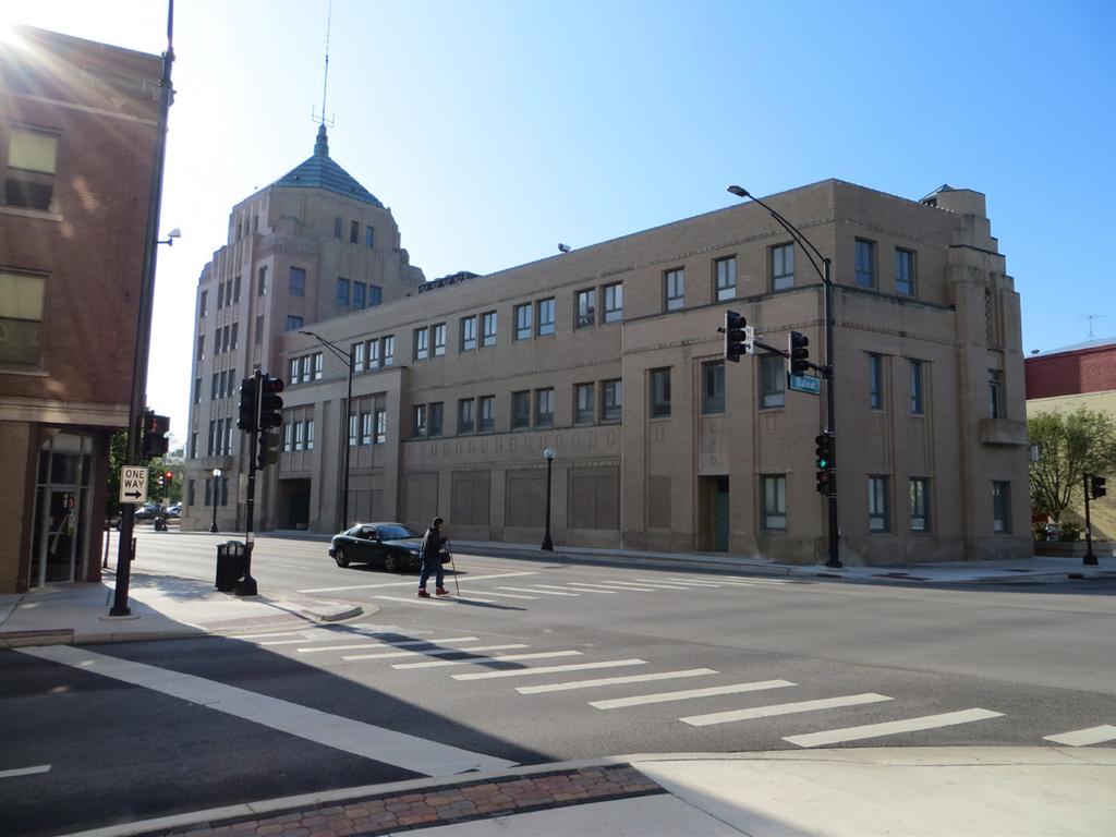
2 This document was developed for the member agencies of the Champaign-Urbana Urbanized Area Transportation Study (CUUATS), a program of the Champaign County Regional Planning Commission (CCRPC). CUUATS Policy Committee Joan Dykstra Village of Savoy, Chair C. Pius Weibel Champaign County, Vice-Chair Bradley Diel Champaign-Urbana Mass Transit District Deb Feinen City of Champaign Diane Marlin City of Urbana Craig Emberton IDOT District 5 Helen Coleman University of Illinois CUUATS Technical Committee Jeff Blue Champaign County, Chair Karl Gnadt Champaign-Urbana Mass Transit District, Vice-Chair John Cooper Champaign County Dalitso Sulamoyo Champaign County Regional Planning Commission Andrew Johnson Champaign-Urbana Mass Transit District Dave Clark City of Champaign Rob Kowalski City of Champaign Bill Gray City of Urbana Lorrie Pearson City of Urbana Bob Nelson IDOT District 5 Brian Trygg IDOT District 5 Stacey DeLorenzo University of Illinois James Sims University of Illinois Richard Helton Village of Savoy Levi Kopmann Village of Savoy CUUATS Staff Rita Morocoima-Black Planning and Community Development Director M. Sharif Ullah Transportation Engineer (former) Gabriel Lewis Transportation Planner September 2017 Cover Photos (left to right, top to bottom): University Avenue at Walnut Street in Downtown Champaign; Broadway Avenue at Walnut Street in Downtown Urbana; Denton Drive at Church Street in Savoy; and Windsor Road at Vine Street in Urbana. 2 CHAMPAIGN-URBANA PEDESTRIAN CROSSING ENHANCEMENT GUIDELINES
3 Contents CHAPTERS 1. INTRODUCTION 5 Pedestrian Crossing Needs 5 Previous Crosswalk Standards 5 Current Crosswalk Request Procedures 6 Crosswalk Installation & Safety 6 Crosswalks & Vulnerable Populations 6 Community Crosswalk Standards 6 Benefiting Agencies 7 2. CROSSING TREATMENT TOOLBOX 8 Pavement Markings 8 Signage 13 Hardscape 14 Lights & Signals CROSSING TREATMENT DECISION 19 Best Practices 19 Guidelines for Pedestrian Crossing Treatments 20 Crossing Location Evaluation Procedures & Considerations ADDITIONAL CONSIDERATIONS 32 Challenges 32 Development Effects on Pedestrians 32 Non-Infrastructure Efforts 32 Conclusion SOURCES GLOSSARY 35 CHAMPAIGN-URBANA PEDESTRIAN CROSSING ENHANCEMENT GUIDELINES 3
4 List of Figures Figure 1 University District Crosswalk Markings and Signage Guidebook 2011 Cover 5 Figure 2 Marked Crosswalk Types 9 Figure 3 Standard or Parallel Crosswalk 9 Figure 4 Continental Crosswalk 9 Figure 5 Box for Exclusive Period 9 Figure 6 Continental Crosswalk and Stop Bar Layout 10 Figure 7 Example of Stop Bars at Unsignalized Midblock Crosswalks 11 Figure 8 Bike Crossing, Crosswalk, and Stop Bar Layout 12 Figure 9 Pedestrian Crossing Ahead Sign 13 Figure 10 Pedestrian Crosswalk Sign 13 Figure 11 In-Street Pedestrian Crossing Sign 13 Figure 12 Stop Here for Pedestrians Sign 13 Figure 13 Gateway placement of In-Street Pedestrian Crossing Signs in Michigan 13 Figure 14 Combination Bike and Pedestrian Crossign Sign 14 Figure 15 Trail Crossing Sign 14 Figure 16 Ahead Sign 14 Figure 17 Diagonal Arrow Sign 14 Figure 18 Sidewalk and Curb Ramps with truncated domes 14 Figure 19 Refuge Island across Main Street in Downtown Urbana 15 Figure 20 Curb extension on Park Street in Downtown Champaign 15 Figure 21 RRFB light flashing on Windsor Road at Vine Street 16 Figure 22 RRFB Pushbutton 16 Figure 23 HAWK Signal on Bradley Avenue at the Developmental Services Center 16 Figure 24 Pedestrian countdown signal at Fourth and Green Streets 17 Figure 25 Pedestrian Scramble Phase at Green & Wright Streets 17 Figure 26 Flashing lights and crosswalk across Church Street in Savoy 18 Figure 27 NCHRP 562 Flowchart for Guidelines for Pedestrian Crossing Treatments 20 Figure 28 NCHRP 562 Worksheet 1 21 Figure 29 NCHRP 562 Worksheet 2 22 Figure 30 Crossing Location Evaluation Worksheet Figure 31 Pedestrian Crossing Treatment Flowchart 29 List of Tables Table 1 Criteria for Crossing Treatments at Uncontrolled Locations 31 4 CHAMPAIGN-URBANA PEDESTRIAN CROSSING ENHANCEMENT GUIDELINES
 were also staff for the Campus Area Transportation Study (CATS).")


5 1 Introduction Pedestrian Crossing Needs Previous Crosswalk Standards Pedestrians are legitimate users of the transportation system, and they should, therefore, be able to use this system safely. From 2000 to 2013, staff from the Champaign-Urbana Urbanized Area Transportation Study (CUUATS) were also staff for the Campus Area Transportation Study (CATS). The member agencies of CATS included the City of Champaign, City of Urbana, University of Illinois, and Champaign-Urbana Mass Transit District (CUMTD). The decision to walk usually takes into account the distance of the trip, the perceived safety of the route, and the comfort and convenience of walking versus an alternative mode. In pedestrian-friendly cities, crossing locations are treated as essential links in the pedestrian network. The Champaign-Urbana region should strive to create a convenient, connective, and continuous walking environment. As part of CATS work, the University District Crosswalk Markings and Signage guidelines was developed in 2007 and updated annually until 2011 (see Figure 1). However, there have never been any crosswalk guidelines developed for the greater Champaign-Urbana community. Transportation engineers, planners, and designers all share a responsibility to find ways for vehicles, pedestrians, and bicyclists to coexist conveniently and safely. At a starting point, roads should be designed with the premise that there will be pedestrians, that they must be able to cross the street, and that they must be able to do it safely. The design question is, How can this task best be accomplished? University of Illinois University District Crosswalk Markings and Signage 2011 Prepared by: Rita Morocoima-Black Eunah Kang Gabriel Lewis Marked crosswalks are only one of multiple tools to achieve this task, as discussed further in Chapters 2 and 3. Marking crosswalks serve two purposes: 1. They tell the pedestrian the best place to cross 2. They clarify that a legal crosswalk exists at a particular location April 2011 Figure 1: University District Crosswalk Markings and Signage Guidebook 2011 Cover CHAMPAIGN-URBANA PEDESTRIAN CROSSING ENHANCEMENT GUIDELINES 5
6 Current Crosswalk Request Procedures Marked crosswalk installation requests are analyzed on a case by case basis by the City of Champaign, City of Urbana, University of Illinois, and/or CUUATS, depending on the location of the request. These requests are made by residents and employees in the Champaign- Urbana area. In Urbana, public requests for marked crosswalks are submitted to Urbana Public Works (UPW). The requestor is asked to fill out a Traffic Issues/Concerns Request (TICR) form. UPW staff reviews the TICR form to determine if a study is needed, and if so, conducts the study to determine the level of improvement needed for the location in question. The completed study with recommendation(s) is presented to the Urbana Traffic Commission for consideration, at which point public comment can be made. Crosswalk Installation & Safety Of all road users, pedestrians have the highest risk of being in a crash with a vehicle because they are the least protected. A 2005 Federal Highway Administration (FHWA) study analyzed pedestrian safety at 1,000 marked and 1,000 unmarked crosswalks at uncontrolled locations across the United States. An uncontrolled location is an intersection without a traffic signal or all-way stop. According to that study, there was no significant difference in pedestrian crash rates at marked versus unmarked crossings under the following conditions: Two-lane roads Multi-lane roads without raised medians and with Average Daily Traffic (ADT) counts below 12,000 Multi-lane roads with raised medians and with ADTs below 15,000 For multi-lane roads with ADTs above these values, there was a significant increase in pedestrian crashes on roads with marked crosswalks, compared to roads with unmarked crosswalks. Therefore, striping a crosswalk at a location without appropriate enhancements can create a false sense of security for pedestrians, yet can decrease pedestrian safety in reality. Such a crosswalk installation could make it less safe for pedestrians than if it had either no treatment or a higher level of treatment. Crosswalks & Vulnerable Populations The 2005 FHWA study found that a greater percentage of older adults and young children chose to cross in marked crosswalks on multi-lane roads compared to twolane roads. Thus, installing a marked crosswalk at an already undesirable crossing location (e.g., wide, highvolume street) may increase the chance of a pedestrian crash occurring at such a site if a few at-risk pedestrians are encouraged to cross where other adequate crossing facilities are not provided. This explanation might be evidenced in cities nationwide by the many calls to traffic engineers from citizens who state, Please install a marked crosswalk so that we can cross the dangerous street near our house. Unfortunately, simply installing a marked crosswalk without other more substantial crossing facilities often does not result in the majority of motorists stopping and yielding to pedestrians, contrary to the expectations of many pedestrians. Community Crosswalk Standards A mechanism is needed to evaluate proposals for new crosswalks or changes to existing crosswalks that is consistent across all jurisdictions in the urbanized area. These guidelines aim to standardize and fairly determine warrants for installation of pedestrian crossing improvements. This document is intended to serve as a reference guide for CUUATS member agency staff, citizens, and developers when determining the best engineering solutions to pedestrian safety concerns, particularly with regard to the location and design of crosswalks, pedestrian signals, and other elements of pedestrian safety. 6 CHAMPAIGN-URBANA PEDESTRIAN CROSSING ENHANCEMENT GUIDELINES
7 Benefiting Agencies This document is intended to benefit the staff, residents, and employees of all CUUATS member agency jurisdictions. This document is intended to assist staff from the City of Champaign, City of Urbana, Village of Savoy, University of Illinois at Urbana-Champaign (UIUC), Champaign County (in unincorporated urban areas), and the Illinois Department of Transportation (IDOT) in addressing pedestrian safety issues, as well as public requests for pedestrian crossing improvements. This document is also intended to help staff and users of the Champaign-Urbana Mass Transit District (CUMTD) improve access to and from bus stops, which are often located at intersections or other pedestrian crossing locations. This document can also help the Champaign County Forest Preserve District (CCFPD), as pedestrians and bicyclists along its soon to be opened Kickapoo Rail Trail will cross roads between Urbana and points east to Kickapoo State Park. The Champaign and Urbana Park Districts will also indirectly benefit from these guidelines with improved pedestrian access to parks, where many residents and visitors go to walk and bike away from the roads of the urban environment. CHAMPAIGN-URBANA PEDESTRIAN CROSSING ENHANCEMENT GUIDELINES 7
8 2 Crossing Treatment Toolbox This chapter groups the pedestrian (and bicycle) crossing features that are or could be used in the Champaign- Urbana area into four categories: 1. Pavement Markings 2. Signage 3. Hardscape (i.e. physical infrastructure) 4. Lights and Signals These summaries reflect the more common treatments being used and do not include every device or treatment available. This selection of pedestrian crossing treatments is not necessarily an all-inclusive list, nor is it intended to be. Local engineers and planners should stay abreast of new and improved pedestrian crossing treatments. Consideration for pedestrian crossing treatments must always include pedestrians with disabilities, and proper accommodations must be provided to meet Americans with Disabilities Act (ADA) requirements. Crosswalk Definition Crosswalks serve as the pedestrian right-of-way across a street and thus should be designed to offer as much comfort and protection as possible. The definition of an intersection crosswalk is the extension of a sidewalk across an intersection. Crosswalks are generally defined as the portion of the roadway designated for pedestrians to use in crossing the street. Crosswalks exist at the intersection of roadways regardless of whether they are marked or unmarked (see below). Every intersection, and certain midblock locations, are legal crosswalks in Illinois, unless otherwise signed. Unmarked Crosswalks All intersections of streets with pedestrian facilities are considered unmarked crosswalks. Pedestrians are legally allowed to cross at unmarked crosswalks, unless otherwised signed. Pavement Markings Marked Crosswalks Definition Marked crosswalks use pavement markings on the street to indicate preferred locations for pedestrians to cross and help motorists identify areas to look for pedestrians. Marked crosswalks may occur at intersections or midblock locations. Marked crosswalks inform motorists of the location of a pedestrian crossing, allowing them time to lawfully stop for a crossing pedestrian; and also assure the pedestrian of the existence of a legal crosswalk at a particular location. To effectively communicate this, the crosswalk design must be easily understood, clearly visible, and incorporate realistic crossing opportunities for all pedestrians. Installation Location Guidance Crosswalks at traffic signals should be marked. Crosswalks at intersections controlled by an all-way stop can also be marked. As a general rule, member agencies should not mark crosswalks on low-volume, two-lane streets. A 2005 FHWA crosswalk study shows that there is no safety benefit for crosswalk markings on this type of street. The major exception to this general rule is marking crosswalks on low-volume, two-lane street intersections near schools and at school crossing locations, especially when adult crossing guards are stationed there. Crosswalk markings should not be used at all intersections. At uncontrolled pedestrian crossing locations, installing marked crosswalks should not be regarded as a magic cure for pedestrian safety problems. The spacing of marked crosswalks should also be considered so that they are not placed too close together. Overuse of marked crosswalks may breed 8 CHAMPAIGN-URBANA PEDESTRIAN CROSSING ENHANCEMENT GUIDELINES

.")
. Continental A crosswalk marked by wide stripes perpendicular to the direction of travel, or parallel to the curb (see Figure 4).")
9 driver disrespect for them, and a more conservative use of crosswalks generally is preferred. As with any installation of traffic control devices, the most essential tool for marked crosswalk installation is the use of engineering judgment. Engineering judgment should be used, and if possible, an engineering study performed when considering the marking of crosswalks. See Chapter 3 for more information. Types Crosswalk marking types are classified based on the system used by FHWA (see Figure 2). The two primary crosswalk types striped in the Champaign-Urbana area are: Standard Continental Figure 2: Marked Crosswalk Types (FHWA) Standard (or Parallel) A crosswalk marked by solid lines at its outer edges (see Figure 3). Continental A crosswalk marked by wide stripes perpendicular to the direction of travel, or parallel to the curb (see Figure 4). Additionally, the Manual on Uniform Traffic Control Devices (MUTCD) Figure 3B-20 illustrates this type of crosswalk used for an exclusive pedestrian phase: Box for Exclusive Period A painted marking indicating that, during the appropriate signal phase, pedestrians can cross the intersection in any direction. Figure 3: Standard or Parallel Crosswalk These crosswalk types are preferred because they are more visible to approaching vehicles and have been shown to improve yielding behavior, especially continental crosswalks. Dimensions & Details Marked crosswalks should be at least 6 wide, though they can be 10 or wider in high pedestrian areas in the University District, Downtown Champaign, or Downtown Urbana. Standard crosswalk lines consist of solid lines no less than 6 wide and no greater than 2 wide, located at least 6 feet apart. Continental crosswalk lines should be 1 wide, spaced 2 apart (see Figure 6), and should avoid vehicle wheel paths if possible. Crosswalk lines should extend the full length of crossing. According to the MUTCD, all crosswalk markings should be white. Durable crosswalk marking materials may be preferable to paint at some locations because of durability and costeffectiveness. Figure 4: Continental Crosswalk Figure 5: Box for Exclusive Period CHAMPAIGN-URBANA PEDESTRIAN CROSSING ENHANCEMENT GUIDELINES 9
10 Crosswalk / Stop Bar Layout Width of White High Visibility Continental Crosswalk: 12 inches (1 foot) Space between markings: 2 feet Distance between a crosswalk and a stop bar: minimum 6 feet 12 inch stop bar for all-way stops 24 inch stop bar for traffic signals Stop bars extend from center line to the curb Length of Crosswalk markings: From 6 feet to 18 feet depending on the locations Figure 6: Continental Crosswalk and Stop Bar Layout 10 CHAMPAIGN-URBANA PEDESTRIAN CROSSING ENHANCEMENT GUIDELINES

11 Stop Bars Stop bars are solid line pavement markings extending across a travel lane that dictate where a motorist should initially stop. This is the place motorists should look for and stop for pedestrians. Stop bars may be used to indicate the point behind which vehicles are required to stop in compliance with a STOP (MUTCD R1-1) sign or a Stop Here for Pedestrians (R1-5b) sign. Stop bars can be placed at intersections with stop control (e.g. traffic signals, stop signs). Stop bars shall be striped a minimum of 6 feet from the edge of the crosswalk at these locations. Stop bars shall be 1 foot wide at all-way stop intersections, and 2 feet wide at intersections with traffic signals. See Figures 6 and 8. Stop bars shall be placed at uncontrolled intersections and mid-block crosswalks where Stop Here for Pedestrians (R1-5b) signs are located (see Figure 7). Stop bars shall be striped a minimum of 25 feet from the edge of the crosswalk at these locations. Parking should be prohibited in the area between the stop bar and the crosswalk. Bike Crossings In the University District, bike crossings are striped where off-street bike paths cross streets. Bike crossings should use two standard white parallel lines with a bicycle stencil marked in the center of the section (see Figure 8). Bike crossings should be striped at the following locations in the University District: 1. Dorner Drive across Gregory Drive (east leg) 2. Mathews Avenue across Green Street (east leg) 3. Mathews Avenue across Gregory Drive 4. Mid-block between Green Street and Oregon Street across Mathews Avenue 5. Mid-block between Nevada Street and Gregory Drive across Goodwin Avenue 6. Sixth Street at Lorado Taft Drive (north and east legs) 7. Virginia Drive across Pennsylvania Avenue Trail Crossings Where trails, or shared-use paths, used by pedestrians and bicyclists cross roads at mid-block locations, use continental crosswalk markings with a minimum 9 feet wide markings. Trail crossing signs should also be installed (see below). Trail crossings should be striped at the following locations in the University District: 1. Boneyard Trail across Fourth Street 2. Boneyard Trail across Fifth Street 3. Boneyard Trail across Mathews Avenue 4. Boneyard Trail across Goodwin Avenue Trail crossings should also be installed at future crossings of the Kickapoo Rail Trail. Figure 7: Examples of Stop Bars at Unsignalized Midblock Crosswalks (source: MUTCD) *Refer to the text above for specific recommendations to follow. CHAMPAIGN-URBANA PEDESTRIAN CROSSING ENHANCEMENT GUIDELINES 11

12 Bike Crossing / Crosswalk / Stop Bar Layout Width of White High Visibility Continental Crosswalk: 12 inches (1 foot) Space between markings: 6 to 8 feet Distance between crosswalks and a stop bar: minimum 6 feet 12 inch white stop bar for all-way stops 24 inch white stop bar for traffic signals Distance between crosswalks and a bike crossing: minimum 3 feet Stop bars extend from center line to the curb Bike Crossing: 12 inch White Parallel Lines White Bike Stencil in the middle of the bike crossing Space between markings: 2 feet Length of the crosswalks: 6 to 18 feet Figure 8: Bike Crossing, Crosswalk, and Stop Bar Layout 12 CHAMPAIGN-URBANA PEDESTRIAN CROSSING ENHANCEMENT GUIDELINES
.")
.")


.")
13 Signage Pedestrian Crossing Signs A pedestrian warning sign (W11-2) is a diamond-shaped sign, which warns drivers to look out for pedestrians. Pedestrian crossing warning signs should always be installed in advance of mid-block crossings (W16-9p; see Figure 9). They alert road users of a pedestrian crossing point across roadways not controlled by signals or Stop signs. At non-intersection locations, markings legally establish the crosswalk. Wherever the crosswalk is striped, the W11-2 sign should be installed with a diagonal downward facing arrow plaque under it (W16-7p; see Figure 10). On major corridors like Lincoln Avenue, stop bar markings are not used; instead advance pedestrian warning signs are installed at the beginning of the road where pedestrians are expected, and pedestrian crossing warning signs are installed at each unsignalized approach to an intersection. distance, such as roadway narrowing and curb extensions. However, if these signs are installed in the future in the Champaign- Urbana area, they should only be installed at unsignalized locations on a concrete island where an island is available. The signs should be placed in front of the crosswalk instead of the center of the crosswalk. Double-backed signs should be installed, so that drivers can read the sign from both directions of the road. A gateway placement of these signs has the best safety effect, by placing a sign on the centerline, on each lane line, and at the curbs (see Figure 12). Figure 11: In-Street Pedestrian Crossing Sign Figure 9: Pedestrian Crossing Ahead Sign Figure 10: Pedestrian Crosswalk Sign Figure 12: Gateway placement of In-Street Pedestrian Crossing Signs in Michigan (Source: Roadway Safety Institute) Stop Here for Pedestrians Signs The Stop Here for Pedestrians sign (R1-5b; see Figure 13) is a square sign used at mid-block marked crosswalks. The sign should be installed in the parkway next to a stop bar a minimum of 25 feet from the edge of the crosswalk. These signs should only be installed in the Champaign-Urbana area with a white background. In-Street Pedestrian Crossing Signs In-street pedestrian crossing signs (R1-6; see Figure 11) can also be used at crosswalk locations to remind road users of the state law to stop for pedestrians in the crosswalk at an unsignalized pedestrian crossing. These signs can make the crosswalk more visible and increase driver compliance. They are more likely to be effective on two-lane, low-speed streets than on multi-lane, highspeed streets. Figure 13: Stop Here for Pedestrians Sign In-street pedestrian crossing signs have been replaced over time in the University District in Champaign- Urbana with measures to shorten the pedestrian crossing CHAMPAIGN-URBANA PEDESTRIAN CROSSING ENHANCEMENT GUIDELINES 13
 should be used on all roads where they cross shared-use trails.")
 can also be mounted below the two aforementioned signs ahead of the crossing.")


14 Trail Crossing Signs Shared-use trails should be signed at cross streets and vice versa so trail users know where they are and motorists recognize that they are crossing a trail. The Combination Bike and Pedestrian Crossing sign (W11-15; see Figure 14) should be used on all roads where they cross shared-use trails. A Trail Crossing plaque (W11-15P; see Figure 15) should be mounted below the Combination Bike and Pedestrian Crossing sign ahead of the crossing. An Ahead plaque (W16-7P; see Figure 16) can also be mounted below the two aforementioned signs ahead of the crossing. A diagonal arrow plaque (W16-9P; see Figure 17) should be mounted below the Combination Bike and Pedestrian Crossing sign at the trail crossing. Figure 14: Combination Bike and Pedestrian Crossing Sign Figure 16: Ahead Sign Figure 15: Trail Crossing Sign Figure 17: Diagonal Arrow Sign Hardscape Sidewalks Pedestrian crossings should be connected to sidewalks via curb ramps. Sidewalks are the primary circulation routes for pedestrians. Pedestrian-friendly neighborhood street design improves the safety of the walking environment, fosters trips made on foot, and facilitates better access to transit service provided in the community. Pedestrians primarily use sidewalks and they should be accessible to all users. It is important that sidewalks be provided extensively throughout the transportation network to provide pedestrians with a safe place to travel. It should be noted that all bicyclists who choose to travel on sidewalks have the same rights as pedestrians, except where prohibited, and must yield to pedestrians. Curb Ramps Curb ramps are transitions between the sidewalk and the street. They provide street and sidewalk access to pedestrians using wheelchairs. Dual ramps (see Figure 18) are desirable to direct pedestrians to the correct alignment of the crosswalk, and where possible, opposing curb ramps should align. Curb ramps should also have a detectable warning surface. Figure 18: Sidewalk and Curb Ramps with truncated domes 14 CHAMPAIGN-URBANA PEDESTRIAN CROSSING ENHANCEMENT GUIDELINES

. Refuge islands should be clear of obstructions and have adequate drainage.")
15 Median Refuge Islands A median refuge island is a concrete island in the middle of a roadway that allows pedestrians and bicyclists to cross one direction of traffic at a time. Refuge islands are primarily installed on roads where cross-traffic does not stop. Typically, refuge islands include crosswalk markings on either side of the island, and are oriented at an angle so that the person(s) crossing must look at the approaching traffic before crossing (see Figure 19). Refuge islands should be clear of obstructions and have adequate drainage. The presence of a raised median or raised crossing island is associated with a significantly lower pedestrian crash rate at multilane sites with both marked and unmarked crosswalks. Dimensions The desired width of a refuge island is 10, in order to accommodate a bicycle with a trailer. The minimum width of a refuge island should not be less than 6. The opening in the refuge island should be wide enough to accommodate two-way bicycle traffic. Detectable warning surfaces should be installed at the edges of the sidewalks and the refuge island. Engineering Refuge islands should be designed in accordance with the Americans with Disabilities Act Accessibility Guidelines for Buildings and Facilities (ADAAG) and the proposed Public Rights-of-Way Accessibility Guidelines (PROWAG). Markings High visibility continental crosswalk markings should be installed on both sides of the refuge island. Advance stop lines may be apprporiate to install on the cross street ahead of the refuge island where the users crossing are given priority. Figure 19: Refuge island across Main Street in Downtown Urbana Traffic Calming Other physical infrastructure changes can be made to streets to shorten pedestrian crossing distances, thus reducing pedestrian exposure to vehicles. Curb extensions, or bump outs, are used at some crosswalks to shorten crossing distance, increase pedestrian visibility, and improve safety at a crossing. Bump outs are often used in areas with on-street parking, where the curb is extended to a distance approximately equal to the width of a parking lane. The street narrowing caused by this device can make motorists uncomfortable, causing them to choose lower speeds. Roadway narrowing can be used to lower vehicle speeds and increase safety in pedestrian crossing areas. Narrowing can occur at selected locations along a corridor, or over the entire corridor itself. The physical and visual characteristics of the roadway narrowing encourage drivers to reduce their speeds, which can facilitate pedestrian crossings in the area. Roadway narrowing also improves the visibility of both the pedestrian crossing signs and the pedestrians themselves to the drivers. Road narrowing must consider truck volumes and access for school buses, transit buses, and emergency vehicles. Signage Follow the recommendations in Trail Crossing Signs previously discussed. Figure 20: Curb extension on Park Street in Downtown Champaign CHAMPAIGN-URBANA PEDESTRIAN CROSSING ENHANCEMENT GUIDELINES 15
. They remain dark until activated by pedestrians via pushbutton (see Figure 22), at which point they emit a bright, rapidly flashing yellow light.")


16 Lights & Signals Rectangular Rapid Flashing Beacon (RRFB) Rectangular rapid flashing beacons (RRFB) are active warning devices used to alert motorists of crossing pedestrians at uncontrolled crossings (see Figure 21). They remain dark until activated by pedestrians via pushbutton (see Figure 22), at which point they emit a bright, rapidly flashing yellow light. RRFBs are warning devices and do not themselves create a legal requirement for a vehicle to stop when they are flashing. Figure 21: RRFB light flashing on Windor Road at Vine Street RRFBs are currently located in Urbana on Windsor Road at Vine Street, as well as Springfield Avenue by the Grainger Engineering Library. Pedestrian Hybrid Beacon (HAWK Signal) The pedestrian hybrid beacon, also known as a Highintensity Activated crosswalk (or HAWK) beacon or signal, is a pedestrian activated regulatory device located on the roadside or on mast arms over midblock pedestrian crossings. The beacon head consists of two red lenses above a single yellow lens. The beacon head is dark until the pedestrian wishes to cross the street. At this point, the pedestrian pushes a button that activates the beacon. After displaying brief flashing and steady yellow intervals (during which cars must stop), the device displays a steady red indication to drivers and a WALK indication to pedestrians, allowing them to cross a major roadway while traffic is stopped. After the pedestrian phase ends, the WALK indication changes to a flashing orange hand to notify pedestrians the walk phase has ended and not to enter the crossing. The hybrid beacon displays alternating flashing red lights to drivers while pedestrians finish their crossings before once again going dark at the conclusion of the cycle. The beacon is a hybrid between a pedestrian traffic signal and a stop sign. There is a HAWK Signal on Bradley Avenue near the Developmental Services Center (see Figure 23) in Champaign. Traffic Signal The traditional tri-colored traffic signal is typically found at intersections, but can be used at mid-block crossings when traffic volumes warrant it. Figure 22: RRFB Pushbutton Figure 23: HAWK Signal on Bradley Avenue at the Developmental Services Center The investigation of the need for a traffic signal for pedestrians is described in MUTCD Warrant 4. An engineering study of traffic conditions, pedestrian characteristics, and physical characteristics of the location shall be performed to determine whether installation of a 16 CHAMPAIGN-URBANA PEDESTRIAN CROSSING ENHANCEMENT GUIDELINES

 consist of a standard pedestrian")
17 traffic control signal is justified at a particular location. This warrant shall not be applied at locations where the distance to the nearest traffic signal is less than 300 feet, unless the proposed signal will not restrict the progressive movement of vehicle traffic. The following are features related to traffic signals that can improve pedestrian crossings: Pedestrian Countdown Signals Pedestrian countdown signals (or timers) consist of a standard pedestrian signal head, with an added display showing a countdown of the remaining crossing time (see Figure 24). Specifically, these signals inform pedestrians of the number of seconds remaining in the pedestrian change interval. They indicate whether a pedestrian has time to cross the street before the signal phase ends. Countdown signals are required by the MUTCD to be installed whenever pedestrian signal heads are warranted as part of intersection signalization or reconstruction. Signals may be supplemented with audible or other messages to make crossing information accessible for all pedestrians. Leading Pedestrian Interval (LPI) Also known as advance pedestrian phase, a leading pedestrian interval phase gives pedestrians an advance walk signal before motorists get a green signal, giving the pedestrian several seconds to start walking in the crosswalk before a concurrent signal is provided to vehicles. This makes pedestrians more visible to motorists and motorists more likely to stop for them. Typical settings provide 3 to 6 seconds of advance walk time. Figure 24: Pedestrian countdown signal at Fourth and Green Streets Pedestrian Scramble Phase A pedestrian scramble, also known as a diagonal crossing or Barnes dance, is a pedestrian crossing system that stops all vehicular traffic and allows pedestrians to cross an intersection in every direction, including diagonally, at the same time (see Figure 25). The Box for Exclusive Period pavement markings are used at these locations. Four locations in Champaign-Urbana currently have pedestrian scramble phases: 1. Green Street at Goodwin Avenue 2. Green Street at Wright Street 3. Green Street at Sixth Street 4. Gregory Drive at Fourth Street Figure 25: Pedestrian Scramble Phase at Green & Wright Streets CHAMPAIGN-URBANA PEDESTRIAN CROSSING ENHANCEMENT GUIDELINES 17

18 Flashing Lights Flashing lights supplement warning signs at unsignalized intersections or mid-block crosswalks to increase pedestrian crossing visibility for motorists (see Figure 26). Street Lighting Street lighting can be installed at a pedestrian crossing to help approaching motorists see a crossing pedestrian. Crosswalk lighting should be at a vehicular scale like normal street lighting rather than a pedestrian scale that is often used along a sidewalk, to increase the ability of motorists to detect pedestrians. Figure 26: Flashing lights and crosswalk across Church Street in Savoy The 2005 FHWA crosswalk study found that adequate nighttime lighting should be provided at marked crosswalks to enhance the safety of pedestrians crossing at night. 18 CHAMPAIGN-URBANA PEDESTRIAN CROSSING ENHANCEMENT GUIDELINES
19 3 Crossing Treatment Decision The authors of the 2005 FHWA crosswalk study note that: When considering marked crosswalks at uncontrolled locations, the question should not simply be: Should I provide a marked crosswalk or not? Instead, the question should be: Is this an appropriate tool for getting pedestrians across the street? This is why this document is titled Pedestrian Crossing Enhancement Guidelines instead of just Crosswalk Guidelines. Marked crosswalks are one tool used to direct pedestrians safely across a street. In most cases, marked crosswalks are best used in combination with other treatments discussed in Chapter 2 (e.g. median refuge islands, curb extensions, traffic signals, street lighting). In general, roadways with more travel lanes, higher speeds, and a greater number of people driving, walking, and biking need extra elements to meet safety standards. Intersection design is also extremely important for the safety of pedestrians. This document should serve as guidance for retrofit crosswalk marking installations, as well as installations at new and future construction projects. Best Practices Signalized Intersections Mark crosswalks on all approaches with curb ramps, unless safety or signal-phasing concerns suggest otherwise. The MUTCD lists a walking speed of 4 feet per second for calculating pedestrian clearance intervals for traffic signals. However, NCHRP 562 recommends using pedestrian walking speeds of 3.5 feet per second for the general population, and 3 feet per second for the older and less able population when planning pedestrian crossing improvements. Pedestrian countdown signals are useful at locations with crossing distances greater than 60 feet and pedestrian clearance intervals of greater than 15 seconds or a high pedestrian volume. Especially at skewed intersections, marked crosswalks need to be kept close to the turning traffic so that pedestrians stay within the driver s line of sight. If this cannot be achieved, it is essential to stay as close as practicable. All-Way Stop Controlled Approaches Mark crosswalks on all approaches with curb ramps, unless safety concerns suggest otherwise. In the Champaign-Urbana area, this is recommended along Safe Walking Routes to K-8 schools, and can be considered at all other intersections. Especially at skewed intersections, marked crosswalks need to be kept close to the turning traffic so that pedestrians stay within the driver s line of sight. If this cannot be achieved, it is essential to stay as close as practicable. Uncontrolled Locations A crosswalk should only be installed at an uncontrolled location when sufficient demand exists to justify its installation. The location is 300 feet or more from a signalized or stop-controlled crossing location. The location has sufficient sight distance (sight distance in feet should be greater than or equal to 8 times the speed limit), and/or sight distance will be improved prior to marking the crosswalk. Trail Crossings Trail crossings should be well-lit and well-signed. At all uncontrolled at-grade trail crossings, traffic calming and signage up to 650 feet from the crossing should be considered, based on the posted or 85th percentile speed. MUTCD Table 2C-4 should be used to determine the appropriate ahead of the crossing that warning signage should be placed. CHAMPAIGN-URBANA PEDESTRIAN CROSSING ENHANCEMENT GUIDELINES 19
20 Guidelines for Pedestrian Crossing Treatments NCHRP 562 Procedure Figure 27 provides an overview of the procedure to determine an appropriate pedestrian crossing treatment for a location based on the NCHRP 562 Report, Improving Pedestrian Safety at Unsignalized Crossings. Step 1: Select Worksheet Two worksheets are available a worksheet for speeds of 35 mph or less, and a worksheet for speeds that exceed 35 mph where the community has a population of less than 10,000 or where a major transit stop exists. The first step is to select the appropriate worksheet. The speeds represent the posted or statutory speed limit or the 85th percentile speed on the major street, whichever is higher. The worksheets available are: Step 4: Estimate Approach Pedestrian Delay The average pedestrian delay equation from the Highway Capacity Manual is used to determine the approach pedestrian delay. Step 5: Select Appropriate Treatment The total pedestrian delay, along with the expected compliance, is used to determine the treatment category to consider for the site. Step 1. Select worksheet based on (1) posted or statutory speed limit or the 85 th percentile speed on the major street and (2) other conditions present: a) Worksheet 1-35 mph (55 km/h) or less b) Worksheet 2 - Exceeds 35 mph (55 km/h) or locations where the community has a less than 10,000 population or where a major transit stop is present Step 2. Does the crossing meet minimum peak-hour pedestrian volumes to be considered for a traffic control device type of treatment? Worksheet 1: 35 mph or less (see Figure 28) and Worksheet 2: exceeds 35 mph, in communities with less than 10,000 in population, or where a major transit stop exists (see Figure 29). YES Go to Step 3 NO Consider median refuge islands, curb extensions, traffic calming, etc. as feasible. No traffic control devices are recommended. Step 2: Check Minimum Pedestrian Volume The minimum pedestrian volume for a peak-hour evaluation is 20 pedestrians per hour for both directions (14 ped/h if the major road speed exceeds 35 mph). If fewer pedestrians are crossing the street, then geometric improvements (rather than signs, signals, or markings) such as traffic calming, median refuge islands, and curb extensions, are alternatives that can be considered. Step 3: Check Signal Warrant The MUTCD signal warrants are checked in Step 3 to determine whether to consider a signal at the site. The signal warrant procedures recommended in this step (which will be considered as changes to the MUTCD by the National Committee on Uniform Traffic Control Devices) more closely align the Pedestrian Signal Warrant with the 2003 Peak-Hour Signal Warrant for vehicles (with adjustment made to reflect the counting of pedestrians crossing the major roadway from both approaches rather than only the highest approach as used in the vehicle signal warrant). The worksheets include equations that can determine the minimum required number of crossing pedestrians for a given major road vehicle volume. Step 3. Does the crossing meet the warrant for a traffic signal? NO Go to Step 4 Step 4. Estimate pedestrian delay. Step 5. Select treatment based upon total pedestrian delay and expected motorist compliance. YES Warrant met, consider traffic signal if site is not within 300 ft (91 m) of another signal. Figure A-1. Flowchart for Guidelines for Pedestrian Crossing Treatments. Figure 27: NCHRP 562 Flowchart for Guidelines for Pedestrian Crossing Treatments 20 CHAMPAIGN-URBANA PEDESTRIAN CROSSING ENHANCEMENT GUIDELINES
21 WORKSHEET 1: PEAK-HOUR, 35 MPH (55 KM/H) OR LESS Analyst and Site Information Analyst: Analysis Date: Data Collection Date: Major Street: Minor Street or Location: Peak Hour: Step 1: Select worksheet (speed reflects posted or statutory speed limit or 85 th percentile speed on the major street): a) Worksheet 1 35 mph (55 km/h) or less b) Worksheet 2 exceeds 35 mph (55 km/h), communities with less than 10,000, or where major transit stop exists Step 2: Does the crossing meet minimum pedestrian volumes to be considered for a TCD type of treatment? Peak-hour pedestrian volume (ped/h), V p 2a If 2a 20 ped/h, then go to Step 3. If 2a < 20 ped/h, then consider median refuge islands, curb extensions, traffic calming, etc. as feasible. Step 3: Does the crossing meet the pedestrian volume warrant for a traffic signal? Major road volume, total of both approaches during peak hour (veh/h), V maj-s 3a Minimum signal warrant volume for peak hour (use 3a for V maj-s), SC SC = ( V 2 maj-s V maj-s )/0.75 3b OR [( a a )/0.75] If 3b < 133, then enter 133. If 3b 133, then enter 3b. 3c If 15 th percentile crossing speed of pedestrians is less than 3.5 ft/s (1.1 m/s), then reduce 3c by up to 50 percent; otherwise enter 3c. 3d If 2a 3d, then the warrant has been met and a traffic signal should be considered if not within 300 ft (91 m) of another traffic signal. Otherwise, the warrant has not been met. Go to Step 4. Step 4: Estimate pedestrian delay. Pedestrian crossing distance, curb to curb (ft), L 4a Pedestrian walking speed (ft/s), S p 4b Pedestrian start-up time and end clearance time (s), t s 4c Critical gap required for crossing pedestrian (s), t c = (L/S p) + t s OR [(4a/4b) + 4c)] 4d Major road volume, total both approaches or approach being crossed if median refuge island is present during peak hour (veh/h), V maj-d 4e Major road flow rate (veh/s), v = V maj-d/3600 OR [4e/3600] 4f Average pedestrian delay (s/person), d p = (e v tc v t c 1) / v OR [ (e 4f x 4d 4f x 4d 1) / 4f ] 4g Total pedestrian delay (h), D p = (d p V p)/3,600 OR [(4g 2a)/3600] (this is estimated delay for all pedestrians crossing the major roadway without a crossing treatment assumes 0% compliance). This calculated value can be replaced with the actual 4h total pedestrian delay measured at the site. Step 5: Select treatment based upon total pedestrian delay and expected motorist compliance. Expected motorist compliance at pedestrian crossings in region, Comp = high or low 5a Total Pedestrian Delay, D p (from 4h) and Motorist Compliance, Comp (from 5a) D p 21.3 h (Comp = high or low) OR 5.3 h D p < 21.3 h and Comp = low 1.3 h D p < 5.3 h (Comp = high or low) OR 5.3 h D p < 21.3 h and Comp = high D p < 1.3 h (Comp = high or low) Treatment Category (see Descriptions of Sample Treatments for examples) RED ACTIVE OR ENHANCED CROSSWALK Figure 28: NCHRP 562 Worksheet 1 CHAMPAIGN-URBANA PEDESTRIAN CROSSING ENHANCEMENT GUIDELINES 21
22 WORKSHEET 2: PEAK-HOUR, EXCEEDS 35 MPH (55 KM/H) Analyst and Site Information Analyst: Analysis Date: Data Collection Date: Major Street: Minor Street or Location: Peak Hour: Step 1: Select worksheet (speed reflects posted or statutory speed limit or 85 th percentile speed on the major street): a) Worksheet 1 35 mph (55 km/h) or less b) Worksheet 2 exceeds 35 mph (55 km/h), communities with less than 10,000, or where major transit stop exists Step 2: Does the crossing meet minimum pedestrian volumes to be considered for a TCD type of treatment? Peak-hour pedestrian volume (ped/h), V p 2a If 2a 14 ped/h, then go to Step 3. If 2a < 14 ped/h, then consider median refuge islands, curb extensions, traffic calming, etc. as feasible. Step 3: Does the crossing meet the pedestrian volume warrant for a traffic signal? Major road volume, total of both approaches during peak hour (veh/h), V maj-s 3a Minimum signal warrant volume for peak hour (use 3a for V maj-s), SC SC = ( V 2 maj-s V maj-s )/0.75 3b OR [( a a )/0.75] If 3b < 93, then enter 93. If 3b 93, then enter 3b. 3c If 15 th percentile crossing speed of pedestrians is less than 3.5 ft/s (1.1 m/s), then reduce 3c by up to 50 percent; otherwise enter 3c. 3d If 2a 3d, then the warrant has been met and a traffic signal should be considered if not within 300 ft (91 m) of another traffic signal. Otherwise, the warrant has not been met. Go to Step 4. Step 4: Estimate pedestrian delay. Pedestrian crossing distance, curb to curb (ft), L 4a Pedestrian walking speed (ft/s), S p 4b Pedestrian start-up time and end clearance time (s), t s 4c Critical gap required for crossing pedestrian (s), t c = (L/S p) + t s OR [(4a/4b) + 4c)] 4d Major road volume, total both approaches or approach being crossed if median refuge island is present during peak hour (veh/h), V maj-d 4e Major road flow rate (veh/s), v = (V maj-d/0.7)/3600 OR [(4e/0.7)/3600] 4f Average pedestrian delay (s/person), d p = (e v tc v t c 1) / v OR [ (e 4f x 4d 4f x 4d 1) / 4f ] 4g Total pedestrian delay (h), D p = (d p V p)/3,600 OR [(4g 2a)/3600] (this is estimated delay for all pedestrians crossing the major roadway without a crossing treatment assumes 0% compliance). This calculated value can be replaced with the actual 4h total pedestrian delay measured at the site. Step 5: Select treatment based upon total pedestrian delay and expected motorist compliance. Expected motorist compliance at pedestrian crossings in region, Comp = high or low 5a Total Pedestrian Delay, D p (from 4h) and Motorist Compliance, Comp (from 5a) D p 21.3 h (Comp = high or low) OR 5.3 h D p < 21.3 h and Comp = low D p < 5.3 h (Comp = high or low) OR 5.3 h D p < 21.3 h and Comp = high Treatment Category (see Descriptions of Sample Treatments for examples) RED ACTIVE OR ENHANCED Figure 29: NCHRP 562 Worksheet 2 22 CHAMPAIGN-URBANA PEDESTRIAN CROSSING ENHANCEMENT GUIDELINES
23 Description of NCHRP 562 Treatments The devices discussed in the Treatment Category of Figure 29 have been divided into five categories: Crosswalk: This category encompasses standard crosswalk markings and pedestrian crossing signs, as opposed to unmarked crossings. Enhanced: This category includes those devices that enhance the visibility of the crossing location and pedestrians waiting to cross. Warning signs, markings, or beacons in this category are present or active at the crossing location at all times. Active: Also called active when present, this category includes those devices designed to display a warning only when pedestrians are present or crossing the street. Red: This category includes those devices that display a circular red indication (signal or beacon) to motorists at the pedestrian location. Signal: This category pertains to traffic control signals. CHAMPAIGN-URBANA PEDESTRIAN CROSSING ENHANCEMENT GUIDELINES 23
24 Crossing Location Evaluation Procedures and Considerations This more comprehensive pedestrian crossing location evaluation procedure has been adapted from the City of Boulder, CO Pedestrian Crossing Treatment Installation Guidelines. Evaluation Steps Evaluation of an individual crossing location for potential crossing treatments in the Champaign-Urbana urbanized area should include the following four basic steps: Step 1: Identification and Description of Crossing Location Step 2: Physical Data Collection Step 3: Traffic Data Collection and Operational Observations Step 4: Apply Data to Figure 31 and Table 1 to Determine Appropriate Treatments The Crossing Location Evaluation Worksheet is included in Figure 30, which will guide municipal agency staff through these steps. A detailed discussion of each of these procedures is provided in the following text. Step 1: Identification and Description of Crossing Location a) Identify the pedestrian crossing location including the major street and specific location of the crossing (i.e. cross-street, street address, intersection path or trail, etc.). b) Determine if the crossing location connects both ends of a shared-use path. If it does, the minimum pedestrian volume requirements are not required to be met to apply the treatments prescribed in Table 1. c) Note the posted speed along the major street at the crossing location. d) Identify the existing traffic control (if any) and any existing crossing treatments (signs, markings, or physical treatments), street lighting, and curb ramps. Step 2: Physical Data Collection a) Determine the existing roadway configuration, including the number of lanes and the presence of painted or raised medians at the crossing location. b) Identify the nearest marked or protected crossing and measure the distance to this crossing. c) Measure the stopping sight distance (SSD) on all vehicular approaches to the crossing. If the SSD is less than eight times (8x) the posted speed limit (in feet), determine if improvements (such as removal of obstructions) and/or lowering of the posted speed limit are feasible means to mitigate the inadequate SSD. 24 CHAMPAIGN-URBANA PEDESTRIAN CROSSING ENHANCEMENT GUIDELINES Step 3: Traffic Data Collection and Operational Observations a) Gather or collect pedestrian crossing volumes during the peak hours of use. This will typically involve AM, mid-day, and PM peak hours. Locations near schools may only require two hours of data collection (AM and PM peak hours corresponding to school opening and closing times). All pedestrian volumes should include and differentiate between pedestrians and bicyclists and should note separately the number of young, elderly, and/or disabled pedestrians. For locations where school crossing traffic is anticipated, the volume of student pedestrians (school age pedestrians on their way to/from school) should also be separately noted. Whenever possible, pedestrian and bicycle volumes should be collected during warm weather months (late March through early November), on University of Illinois spring and fall semester class days (late March through early May, late August through early November), and during fair weather conditions to represent peak crossing activity (i.e. no snow, rain, or high winds). If K-12 school
GLOSSARY CROSSWALK. CROSSING TYPES
 CROSSWALK The part of a roadway at an intersection included within the connections of the lateral lines of the sidewalks on opposite sides of the street measured from the curbs, or in the absence of curbs
UNCONTROLLED PEDESTRIAN CROSSING GUIDELINES
 City and County of Denver UNCONTROLLED PEDESTRIAN CROSSING GUIDELINES Prepared for: Prepared by: Adopted September 2016 This page is intentionally left blank. Contents for Denver Uncontrolled Pedestrian
MEMORANDUM. Date: 9/13/2016. Citywide Crosswalk Policy
 MEMORANDUM Date: 9/13/2016 Re: Citywide Crosswalk Policy Foreword Through the s Circulation Element and Complete Streets Policy, it is the City s goal to promote walking trips and provide safe facilities
Chapter 5: Crossing the Street
 Chapter 5: Crossing the Street Whether walking or bicycling, a student s journey to school will more than likely require crossing one or more streets. Per the Safe Routes to School Guide, maintained by
City of Albert Lea Policy and Procedure Manual 4.10 ALBERT LEA CROSSWALK POLICY
 4.10 ALBERT LEA CROSSWALK POLICY PURPOSE: Pedestrian crosswalks are an integral part of our transportation infrastructure. To be effective and promote safety, marked crosswalks must be installed after
Guidance for Installation of Pedestrian Crosswalks on Michigan State Trunkline Highways
 Guidance for Installation of Pedestrian Crosswalks on Michigan State Trunkline Highways Michigan Department of Transportation July 7, 2014 Engineering Manual Preamble This manual provides guidance to administrative,
Designing for Pedestrian Safety
 Designing for Pedestrian Safety Treatments at Unsignalized Pedestrian Crossings Presented by: Charlie Zegeer PBIC Director August 17, 2010 Crossing Crashes Part 1: General Principles 3 2 Why do people
Appendix A: Crosswalk Policy
 Appendix A: Crosswalk Policy Appendix A: Crosswalk Policy Introduction This citywide Crosswalk Policy is aimed at improving pedestrian safety and enhancing pedestrian mobility by providing a framework
CITY OF SARATOGA SPRINGS PEDESTRIAN CROSSING TOOLBOX
 CITY OF SARATOGA SPRINGS PEDESTRIAN CROSSING TOOLBOX This toolbox is to be used to guide pedestrian crossing improvements within the City of Saratoga Springs. Details for each crossing type are provided.
Broad Street Bicycle Boulevard Design Guidelines
 Broad Street Bicycle Boulevard Design Guidelines Building from the strategies introduced in the 2013 Bicycle Transportation Plan and community input received thus far, City Transportation Staff have identified
Town of Windsor Pedestrian Crossing Guidelines
 Town of Windsor Pedestrian Crossing Guidelines Prepared for: Town of Windsor Engineering Department 301 Walnut Street Windsor, Colorado 80550 For More Information, please contact: Engineering Department
IMPROVING PEDESTRIAN SAFETY AT UNCONTROLLED CROSSINGS. Guidelines for Marked Crosswalks
 IMPROVING PEDESTRIAN SAFETY AT UNCONTROLLED CROSSINGS Presented by Nazir Lalani P.E. Traffex Engineers Inc. N_lalani@hotmail.com Guidelines for Marked Crosswalks Source: FHWA, Safety Effects of Marked
In response to your request for information on mid-block pedestrian crossing policies and guidelines, the following information is enclosed:
 August 18, 2016 City of Brentwood, Tennessee Mr. Kirk Bednar City Manager 5211 Maryland Way P. O. Box 788 Brentwood, Tennessee 37024 VIA ELECTRONIC MAIL Dear Mr. Bednar: In response to your request for
PEDESTRIAN SAFETY IMPROVEMENT EVALUATION GUIDELINE FOR UNCONTROLLED CROSSINGS
 PEDESTRIAN SAFETY IMPROVEMENT EVALUATION GUIDELINE FOR UNCONTROLLED CROSSINGS Traffic Safety Engineering Division Updated: April 2018 EXECUTIVE SUMMARY NDOT Traffic Safety Engineering Division developed
REGIONAL BICYCLE AND PEDESTRIAN DESIGN GUIDELINES
 REGIONAL BICYCLE AND PEDESTRIAN DESIGN GUIDELINES November 16, 2011 Deb Humphreys North Central Texas Council of Governments Bicycle and Pedestrian Advisory Committee Snapshot of the Guide 1. Introduction
Pedestrians and Bicyclists. Bruce Friedman and Scott Wainwright FHWA MUTCD Team
 Impact of the New MUTCD on Pedestrians and Bicyclists Bruce Friedman and Scott Wainwright FHWA MUTCD Team Development of the 2009 MUTCD NPA published in the Federal Register on January 2, 2008 Received
C. Best Practice Pedestrian Treatment Toolbox
 C. Best Practice Pedestrian Toolbox The Best Practice Pedestrian Toolbox presents the recommended tools in striping, signalization, signage, geometry and other categories for improving both uncontrolled
Designing for Pedestrian Safety. Alabama Department of Transportation Pre-Construction Conference May 2016
 Designing for Pedestrian Safety Alabama Department of Transportation Pre-Construction Conference May 2016 1 Designing for Pedestrians Marking Crosswalks at Signalized intersections High Visibility Markings
Active Transportation Facility Glossary
 Active Transportation Facility Glossary This document defines different active transportation facilities and suggests appropriate corridor types. Click on a facility type to jump to its definition. Bike
PEDESTRIAN CROSSING TREATMENTS
 PEDESTRIAN CROSSING TREATMENTS BEST PRACTICES Presented by: Doug Enderson, P.E., PTOE Cody Salo, P.E. 1 PRESENTER INTRODUCTIONS Doug Enderson, P.E., PTOE Ped Crossing Experience: ADA Design-Build ADA Inventory
Addendum to SDDCTEA Pamphlet 55 17: Better Military Traffic Engineering Revision 1 Effective: 24 Aug Crosswalk Guidelines
 Addendum to SDDCTEA Pamphlet 55 17: Better Military Traffic Engineering Revision 1 Effective: 24 Aug 2017 Crosswalk Guidelines Warrants for Uncontrolled Crosswalk Locations Crosswalks at Midblock Locations
Document 2 - City of Ottawa Pedestrian Crossover (PXO) Program
 Program") 40 Document 2 - City of Ottawa Pedestrian Crossover (PXO) Program OVERVIEW The City of Ottawa Pedestrian Crossover (PXO) Program provides the basis for PXO implementation in Ottawa. The program s processes
40 Document 2 - City of Ottawa Pedestrian Crossover (PXO) Program OVERVIEW The City of Ottawa Pedestrian Crossover (PXO) Program provides the basis for PXO implementation in Ottawa. The program s processes
Appendix A. Knoxville TPO Greenway Signage Guidelines. Appendix A: Knoxville TPO Greenway Signage Guidelines Knox to Oak Ridge Greenway Master Plan
 Appendix A Knoxville TPO Greenway Signage Guidelines 75 Overview: Adequate signing and marking are essential on shared-use paths, especially to alert bicyclists to potential conflicts and to convey regulatory
HAWK Signal. Pedestrian Safety. Illinois Traffic Engineering & Safety Conference Thursday, October 21, 2010
 HAWK Signal Pedestrian Safety Illinois Traffic Engineering & Safety Conference Thursday, October 21, 2010 Background Information High-intensity Activated crosswalk Developed by the City of Tuscon, AZ First
ATTACHMENT NO. 11. RRLRT No. 2. Railroad / Light Rail Transit Technical Committee TECHNICAL COMMITTEE: Busway Grade Crossings STATUS/DATE OF ACTION
 ATTACHMENT NO. 11 RRLRT No. 2 TECHNICAL COMMITTEE: TOPIC: Railroad / Light Rail Transit Technical Committee Busway Grade Crossings STATUS/DATE OF ACTION RRLRT TC Draft: 06/23/2011 RRLRT TC Approval: 06/27/2014
CROSSING GUARD PLACEMENT CONSIDERATIONS AND GAP ASSESSMENT
 CROSSING GUARD PLACEMENT CONSIDERATIONS AND GAP ASSESSMENT Many factors contribute to the need for a Crossing Guard. General federal guidance, provided by the FHWA MUTCD, states that adult crossing guards
Development of Arlington County s Marked Crosswalk Guidelines. Jon Lawler, P.E. Design Engineer Arlington County, VA
 Development of Arlington County s Marked Crosswalk Guidelines Jon Lawler, P.E. Design Engineer Arlington County, VA April 13, 2015 Transportation System Users Residents Estimated 215,000 in 2014 Lowest
Oregon Supplement to the Manual on Uniform Traffic Control Devices. Adopted July 2005 by OAR
 Oregon Supplement to the Manual on Uniform Traffic Control Devices Adopted July 2005 by OAR 734-020-0005 2003 Edition Oregon Supplement to the MUTCD Page 2 INTRODUCTION Traffic control devices installed
Hennepin County Pedestrian Plan Public Comment Report
 Hennepin County Pedestrian Plan Public Comment Report On May 31, 2013, the draft Hennepin County Pedestrian Plan was released for a 45-day public comment period ending July 15, 2013. The county received
Pedestrian Safety at Roundabouts
 Countermeasure Strategies for Pedestrian Safety Pedestrian Safety at Roundabouts Hillary Isebrands Federal Highway Administration January 6, 2016 Today s Presentation Introduction and housekeeping Audio
ROUNDABOUTS/TRAFFIC CIRCLES
 GENERAL 1. Description This standard identifies minimum requirements that shall be met for Roundabouts and Neighborhood Traffic Circles in the design and construction of elements for Arlington County Horizontal
NJDOT Complete Streets Checklist
 Background The New Jersey Department of Transportation s Complete Streets Policy promotes a comprehensive, integrated, connected multi-modal network by providing connections to bicycling and walking trip
Figure 3B-1. Examples of Two-Lane, Two-Way Marking Applications
 Figure 3B-1. Examples of Two-Lane, Two-Way Marking Applications A - Typical two-lane, two-way marking with passing permitted in both directions B - Typical two-lane, two-way marking with no-passing zones
TRAFFIC IMPACT ANALYSIS
 TRAFFIC IMPACT ANALYSIS FOR THE CHAMPAIGN UNIT#4 SCHOOL DISTRICT PROPOSED HIGH SCHOOL (SPALDING PARK SITE) IN THE CITY OF CHAMPAIGN Final Report Champaign Urbana Urbanized Area Transportation Study 6/24/2014
POTENTIAL PEDESTRIAN SAFETY IMPROVEMENT EVALUATION GUIDELINE
 POTENTIAL PEDESTRIAN SAFETY IMPROVEMENT EVALUATION GUIDELINE Traffic Safety Engineering Division Updated: August 2016 EXECUTIVE SUMMARY During the February 2015 Transportation Board meeting, Governor Brian
November 20, 2017 // 6:00 p.m. // 1 s t Floor Conference Room 301 Walnut Street, Windsor, CO AGENDA
 TOWN BOARD WORK SESSION November 20, 2017 // 6:00 p.m. // 1 s t Floor Conference Room 301 Walnut Street, Windsor, CO 80550 AGENDA GOAL of this Work Session is to have the Town Board receive information
CITY OF BEVERLY HILLS TRAFFIC AND PARKING COMMISSION
 CITY OF BEVERLY HILLS TRAFFIC AND PARKING COMMISSION TO: FROM: SUBJECT: ATTACHMENT: Traffic and Parking Commission Martha Eros, Transportation Planner Christian Vasquez, Transportation Planning Analyst
APPENDIX A: Complete Streets Checklist DRAFT NOVEMBER 2016
 APPENDIX A: Complete Streets Checklist DRAFT NOVEMBER 2016 Complete Streets Checklist MetroPlan Orlando s Complete Streets Checklist is an internal planning tool for staff to further implementation of
City of Memphis. Pedestrian Facility Design Toolkit DRAFT. January PREPARED BY: Alta Planning + Design
 City of Memphis Pedestrian Facility Design Toolkit January 2015 PREPARED BY: Alta Planning + Design DRAFT Introduction This facility design toolkit is intended to assist the City of Memphis in the selection
Attachment No. 4 Approved by National Committee Council
 Attachment No. 4 Approved by National Committee Council The Signals Technical Committee distributed a technical committee recommendation to sponsors concerning pedestrian hybrid beacons following the January
Pedestrian Crossing Facilitation Guideline Development
 Pedestrian Crossing Facilitation Guideline Development TZD Conference Melissa Barnes October, 2017 Why? Minnesota Go: Minnesota s multimodal transportations system maximizes the health of people, the environment,
C/CAG. Sunnybrae Elementary School Walking and Bicycling Audit. San Mateo-Foster City School District JUNE 2013
 Sunnybrae Elementary School Walking and Bicycling Audit JUNE 2013 San Mateo-Foster City School District C/CAG City/County Association of Governments of San Mateo County SUNNYBRAE ELEMENTARY SCHOOL WALKING
2014 FHWA Aging Road User Handbook. Recommendations to Accommodate Aging Pedestrians. Lifesaver National Conference. What is the Handbook?
 2014 FHWA Aging Road User Handbook Recommendations to Accommodate Aging Pedestrians Lifesaver National Conference March 17, 2015 Revised June 2014 1 What is the Handbook? 1998 1st Edition 2001 2nd Edition
SCOPE Application, Design, Operations,
 SCOPE Application, Design, Operations, Maintenance, etc.: Typical Traffic Control Signals Pedestrian Hybrid Beacons Emergency Vehicle One-Lane/Two-Way Facilities, Freeway Entrance Ramps, and Movable Bridges
MINNEAPOLIS PARK & RECREATION BOARD DRAFT TRAIL DESIGN STANDARDS FOR: SIGNS AND PAVEMENT MARKINGS
 MINNEAPOLIS PARK & RECREATION BOARD DRAFT TRAIL DESIGN STANDARDS FOR: SIGNS AND PAVEMENT MARKINGS October 14, 2014 CHANGE LOG Additions and changes to this document should be summarized on this page and
Broadway Street Pedestrian Safety Study Cass Street to 700 Feet North of Randall Avenue
 Broadway Street Pedestrian Safety Study Cass Street to 700 Feet North of Randall Avenue Prepared for: City of De Pere, Wisconsin Prepared by: June, 2017 Broadway Street Pedestrian Safety Study Cass Street
DISTRIBUTION: Electronic Recipients List TRANSMITTAL LETTER NO. (17-01) MINNESOTA DEPARTMENT OF TRANSPORTATION. MANUAL: Road Design English Manual
 MINNESOTA DEPARTMENT OF TRANSPORTATION. MANUAL: Road Design English Manual") DISTRIBUTION: Electronic Recipients List MINNESOTA DEPARTMENT OF TRANSPORTATION DEVELOPED BY: Design Standards Unit ISSUED BY: Office of Project Management and Technical Support TRANSMITTAL LETTER NO.
DISTRIBUTION: Electronic Recipients List MINNESOTA DEPARTMENT OF TRANSPORTATION DEVELOPED BY: Design Standards Unit ISSUED BY: Office of Project Management and Technical Support TRANSMITTAL LETTER NO.
Citywide Sidewalk and Crosswalk Programs
 Citywide Sidewalk and Crosswalk Programs Council Meeting October 20, 2015 Presented by Rita Hu and Jamal Mahmoud Program Goals Implement the City s comprehensive plan. Provide pedestrian with safe walking
PART 4 HIGHWAY TRAFFIC SIGNALS
 2016 Edition Page 111 PART 4 HIGHWAY TRAFFIC SIGNALS CHAPTER 4A. GENERAL [This is a new section. There is no corresponding section in the MUTCD.] Section 4A.100 Traffic Control Device Alternatives for
City of Vallejo Traffic Calming Toolbox
 City of Vallejo Traffic Calming Toolbox June 1, 2013 Final Table of Contents Introduction... 1 Non-Physical Devices... 3 High-Visibility Crosswalk... 3 In Pavement Lighted Crosswalk... 4 Rapid Flashing
Town of Mooresville, North Carolina Neighborhood Traffic Calming and Control Device Policy
 Town of Mooresville, North Carolina Neighborhood Traffic Calming and Control Device Policy Adopted January 6, 2014 Town of Mooresville Development Services Department TOWN OF MOORESVILLE NEIGHBORHOOD TRAFFIC
Pedestrian Crossing Guidelines 2016
 Pedestrian Crossing Guidelines 2016 Engineering Services 1.0 Introduction and Background The City of Kingston s first Pedestrian Crossing Guidelines were approved by Council in 2008 in order to provide
CITY OF SAINT JOHN TRAFFIC CALMING POLICY
 CITY OF SAINT JOHN TRAFFIC CALMING POLICY VERSION: 1.0 April 10, 2012 Pedestrians, Cyclists and Motorists Sharing Street Spaces CONTENTS INTRODUCTION... 3 POLICY GOAL... 3 POLICY OBJECTIVES... 3 GUIDING
Standards vs. Guidelines. Public Right-of Way Accessibility Guidelines (PROWAG)
") www.access-board.gov Public Right-of Way Accessibility Guidelines (PROWAG) Juliet Shoultz, P.E Transportation Systems Engineer US Access Board Standards vs. Guidelines Guidelines are developed by the Access
www.access-board.gov Public Right-of Way Accessibility Guidelines (PROWAG) Juliet Shoultz, P.E Transportation Systems Engineer US Access Board Standards vs. Guidelines Guidelines are developed by the Access
Appendix T CCMP TRAIL TRAFFIC & TRANSPORTATION DESIGN STANDARD
 Appendix T CCMP 3.3.4 TRAIL TRAFFIC & TRANSPORTATION DESIGN STANDARD 3.3.4 Trail Traffic and Transportation Design Multi-use trails have certain design standards, which vary depending on the agency that
Fundamentals of Traffic Control Devices
 Fundamentals of Traffic Control Devices Traffic Engineering & Operations October 8, 2014 Raj Ponnaluri, Angela Wilhelm, and Christopher Lewis Agenda Agenda Signs Pavement Markings Signals Traffic Operations
CHAPTER 2G. PREFERENTIAL AND MANAGED LANE SIGNS
 2011 Edition - Revision 2 Page 275 Section 2G.01 Scope CHAPTER 2G. PREFERENTIAL AND MANAGED LANE SIGNS 01 Preferential lanes are lanes designated for special traffic uses such as high-occupancy vehicles
Chapter 2: Standards for Access, Non-Motorized, and Transit
 Standards for Access, Non-Motorized, and Transit Chapter 2: Standards for Access, Non-Motorized, and Transit The Washtenaw County Access Management Plan was developed based on the analysis of existing
Pedestrian & Bicycle Safety Innovations & Applications
 Pedestrian & Bicycle Safety Innovations & Applications County Engineers Association of Maryland Spring, 2017 Conference May 25, 2017 George Branyan Pedestrian Program Coordinator District Department of
Designing for Pedestrian Safety in Washington, DC
 Designing for Pedestrian Safety in Washington, DC February 25, 2014 George Branyan Pedestrian Program Coordinator District Department of Transportation DC Journey to work mode split: 2012 Means of Transportation
PEDESTRIAN ACCOMMODATIONS DPS 201 AT ROUNDABOUTS
 PEDESTRIAN ACCOMMODATIONS DPS 201 AT ROUNDABOUTS WHY THEY WORK FOR PEDESTRIANS IF DESIGNED CORRECTLY Separated sidewalks direct peds to crosswalks Splitter island Slow speed exit Truck apron Crosswalk
Appendix B Warrants, Standards, and Guidelines for Traffic Control Devices used at Senior Citizen and Disabled Person Crossings
 Appendix B Warrants, Standards, and Guidelines for Traffic Control Devices used at Senior Citizen and Disabled Person Crossings B.1 General Minnesota Statute 169.215 and Highway Traffic Regulation 169.222
DPS 201 RECTANGULAR RAPID FLASHING BEACON (RRFB)
") DPS 201 RECTANGULAR RAPID FLASHING BEACON (RRFB) WHY? PEDESTRIANS NEED TO CROSS CASE STUDY: RRFB (ST. PETERSBURG, FL) St. Petersburg, FL Problem/Background Multi-lane, high-speed roadways Conflicts at
DPS 201 RECTANGULAR RAPID FLASHING BEACON (RRFB) WHY? PEDESTRIANS NEED TO CROSS CASE STUDY: RRFB (ST. PETERSBURG, FL) St. Petersburg, FL Problem/Background Multi-lane, high-speed roadways Conflicts at
Improving Pedestrian Safety at Unsignalized Crossings. Shawn Turner, P.E. Texas A&M Transportation Institute
 Improving Pedestrian Safety at Unsignalized Crossings Shawn Turner, P.E. Texas A&M Transportation Institute Overview of Presentation What are the issues/problems? Framework for crossing treatments Marked
Proposed changes to Massachusetts MUTCD Supplement
 Proposed changes to Massachusetts MUTCD Supplement John F. Carr National Motorists Association October 24, 2002 This document contains recommendations as to the contents of the Massachusetts MUTCD supplement
CHAPTER 1 STANDARD PRACTICES
 CHAPTER 1 STANDARD PRACTICES OBJECTIVES 1) Functions and Limitations 2) Standardization of Application 3) Materials 4) Colors 5) Widths and Patterns of Longitudinal Pavement Marking Lines 6) General Principles
Agenda. Overview PRINCE GEORGE S PLAZA METRO AREA PEDESTRIAN PLAN
 PRINCE GEORGE S PLAZA METRO AREA PEDESTRIAN PLAN May 28, 2008 Agenda Welcome and introductions Project overview and issue identification Planning context and strengths Design challenges and initial recommendations
Overview. Illinois Bike Summit IDOT Complete Streets Policy Presentation. What is a Complete Street? And why build them? And why build them?
 Overview Illinois Bike Summit IDOT Complete Streets Policy Presentation Aren Kriks, P.E. District One Bicycle Coordinator and Bureau of Programming Project Engineer History of Complete Streets IDOT Policy
5. RUNNINGWAY GUIDELINES
 5. RUNNINGWAY GUIDELINES These guidelines should be considered collectively when making runningway decisions. A runningway is the linear component of the transit system that forms the right-of-way reserved
ADA & Public Rights of Way
 ADA & Public Rights of Way Overview of Current and Up-coming Requirements FDOT Design Training Expo 2012 Orlando, FL Dean Perkins, RA - ADA Coordinator Florida Department of Transportation Office of Design,
Establishing Procedures and Guidelines for Pedestrian Treatments at Uncontrolled Locations
 1 Establishing Procedures and Guidelines for Pedestrian Treatments at Uncontrolled Locations Yan Qi Southern Illinois University Edwardsville 66th Illinois Traffic Engineering and Safety Conference Champaign,
INDOT Complete Streets Guideline & Policy
 INDOT Complete Streets Guideline & Policy INTRODUCTION The Complete Streets guidelines build upon multiple efforts and promote a multimodal transportation system that is integrated and sustains land use
Watertown Complete Streets Prioritization Plan. Public Meeting #1 December 14, 2017
 Watertown Complete Streets Prioritization Plan Public Meeting #1 December 14, 2017 Goals for Public Meeting Overview of MassDOT Complete Streets Funding Program Educate the community on Complete Streets
AGENDA ITEM F-5 Public Works
 AGENDA ITEM F-5 Public Works Recommendation STAFF REPORT City Council Meeting Date: 9/13/2016 Staff Report Number: 16-163-CC Consent Calendar: Adopt a resolution to establish a citywide crosswalk policy
General Design Factors
 Chapter 3: 3-1.0 Introduction General Design Factors Mn/DOT s goals include encouraging and accommodating safe bicycling. From a design perspective, these goals are achieved by first having an understanding
Project Team. Refined Pedestrian Crossing Toolbox. Problem Statement. Aerial of Study Corridor. Crossing Accommodations and Pedestrian Fatalities
 Project Team Refined Pedestrian Crossing Toolbox Treatments on Wide, High Speed Urban Roadways Developed as Part of the Springfield Main Street (OR 126) Safety Study Consultants Scott Mansur, P.E., P.T.O.E.
Attachment No. 13. National Committee on Uniform Traffic Control Devices RWSTC RECOMMENDATION FOLLOWING SPONSOR COMMENTS
 1 2 3 4 Attachment No. 13 5 6 7 8 9 10 11 12 13 14 15 16 17 18 19 20 21 22 23 24 25 26 27 28 29 30 31 32 33 34 35 36 37 38 39 40 41 42 43 RWSTC agenda item IV. 2 June 2011 National Committee on Uniform
Appendix 3 Roadway and Bike/Ped Design Standards
 Appendix 3 Roadway and Bike/Ped Design Standards OTO Transportation Plan 2040 4/20/2017 Page A3-1 Adopted Standards The adopted OTO Design Standards and Major Thoroughfare Plan are contained herein.
Chapter Twenty-eight SIGHT DISTANCE BUREAU OF LOCAL ROADS AND STREETS MANUAL
 Chapter Twenty-eight SIGHT DISTANCE BUREAU OF LOCAL ROADS AND STREETS MANUAL Jan 2006 SIGHT DISTANCE 28(i) Chapter Twenty-eight SIGHT DISTANCE Table of Contents Section Page 28-1 STOPPING SIGHT DISTANCE
Section 3A.04 Colors. Section 3B.10 Approach Markings for Obstructions
 Section 3A.04 Colors Markings shall be yellow, white, red, or blue, or purple. The colors for markings shall conform to the standard highway colors. Black in conjunction with one of the above colors shall
CURBSIDE ACTIVITY DESIGN
 5 CURBSIDE ACTIVITY DESIGN This chapter provides design guidance for separated bike lanes adjacent to curbside activities including parking, loading and bus stops. Typical configurations are presented
Transportation Education Series (TES) Alaska
 Alaska") Transportation Education Series (TES) Alaska - 2012 Pedestrian Crossings March 5, 2012 Anchorage AK March 6, 2012 Fairbanks AK March 7, 2012 Juneau AK Gary Katsion, P.E. Overview National Practice and
Transportation Education Series (TES) Alaska - 2012 Pedestrian Crossings March 5, 2012 Anchorage AK March 6, 2012 Fairbanks AK March 7, 2012 Juneau AK Gary Katsion, P.E. Overview National Practice and
Residential Traffic Calming Program Guide. Town of Ashland, Virginia
 Residential Traffic Calming Program Guide Town of Ashland, Virginia August 1, 2006 TABLE OF CONTENTS A. INTRODUCTION... 1 B. GOALS... 1 C. CRITERIA... 1 D. IDENTIFYING NEIGHBORHOOD TRAFFIC CONCERNS...
Abstract. Background. protected/permissive operation. Source: Google Streetview, Fairview/Orchard intersection
 ITE 2015 Western District Annual Meeting Ada County Highway District s Flashing Yellow Arrow Initiative Primary Author: Tim Curns, PE Ada County Highway District Traffic Engineer Author: Andrew Cibor,
Appendix C. TRAFFIC CALMING PROGRAM TOOLBOX
 Appendix C. TRAFFIC CALMING PROGRAM TOOLBOX PHASE I...2 Do Not Enter Sign...3 One-Way Sign...4 Turn Prohibition...5 Pavement Markings...6 Speed Monitoring Trailer...7 Neighborhood Speed Watch...8 Police
Today s presentation
 Today s presentation Introduction and housekeeping PBIC Trainings http://www.walkinginfo.org/training Next PBIC Webinar Community Approaches to Pedestrian Safety Education Gillian Hotz and David Parisi
Transportation Planning Division
 Transportation Planning Division Presentation Outline Study Tasks Recap of Previous Meetings Data Collected Focus Areas within Study Limits Design Principles Tool Box Recommended Concepts Schedule Moving
Retrofitting Urban Arterials into Complete Streets
 Retrofitting Urban Arterials into Complete Streets John N. LaPlante, P.E., P.T.O.E., T.Y. Lin International Prepared for: Illinois Traffic Engineering & Safety Conference Urbana, Illinois October 18, 2007
St. Francis Drive through the City of Santa Fe Corridor Study
 VII. ENGINEERING AND ENVIRONMENTAL EVALUATION TRAIL CONNECTIVITY In the southern portion of the Corridor there is a lack of a sidewalk, trail or bicycle facility within the right-ofway. However, the City
PEDESTRIAN ACCOMMODATIONS DPS 201 AT INTERCHANGES
 PEDESTRIAN ACCOMMODATIONS DPS 201 AT INTERCHANGES UNDERSTANDING THE ISSUES Intersections of freeway ramp terminals at crossroads are the most critical components of an interchange Challenge: balance mobility
10.0 CURB EXTENSIONS GUIDELINE
 10.0 CURB EXTENSIONS GUIDELINE Road Engineering Design Guidelines Version 1.0 March 2017 City of Toronto, Transportation Services City of Toronto Page 0 Background In early 2014, Transportation Services
Section 9A.07 Meaning of Standard, Guidance, Option, and Support
 2012 Edition Page 895 PART 9. TRAFFIC CONTROLS FOR BICYCLE FACILITIES CHAPTER 9A. GENERAL Section 9A.01 Requirements for Bicyclist Traffic Control Devices 01 General information and definitions concerning
MUTCD Part 6: Temporary Traffic Control
 MUTCD Part 6: Temporary Traffic Control OMUTCD English units are preferred. OHIO MANUAL OF UNIFORM TRAFFIC CONTROL DEVICES TABLE OF CONTENTS PREFACE INTRODUCTION TABLE OF CONTENTS PART 1. GENERAL Chapter
STREET CROSSINGS. Module 4. Part 2: Countermeasures
 STREET CROSSINGS Module 4 Part 2: Countermeasures Learning Outcomes 2 At the end of this module, you will be able to: Identify which crossing technique is appropriate Ensure oft-requested solutions (crosswalks,
Table of Contents. I. Introduction 1. II. Elements of the School Crossing Program 1
 Table of Contents Page I. Introduction 1 II. Elements of the School Crossing Program 1 a. Identifying Locations Where School Crossing Guards are Needed 1 b. The Role of the School Crossing Guard 1 c. Hiring
California Manual on Uniform Traffic Control Devices
 California Manual on Uniform Traffic Control Devices FHWA s MUTCD 2009 Edition as amended for use in California 2012 Edition State of California Business, Transportation and Housing Agency Department of
Off-road Trails. Guidance
 Off-road Trails Off-road trails are shared use paths located on an independent alignment that provide two-way travel for people walking, bicycling, and other non-motorized users. Trails specifically along
TRANSMITTAL LETTER. Revision to Publication 149, Chapter 20 (Criteria for the Design of Traffic Signal Supports) - March 2009 Edition
 - March 2009 Edition") OS-299 (7-08) TRANSMITTAL LETTER PUBLICATION: Publication 149 - Traffic Signal Design Handbook DATE: 10/14/10 SUBJECT: Revision to Publication 149, Chapter 20 (Criteria for the Design of Traffic Signal
OS-299 (7-08) TRANSMITTAL LETTER PUBLICATION: Publication 149 - Traffic Signal Design Handbook DATE: 10/14/10 SUBJECT: Revision to Publication 149, Chapter 20 (Criteria for the Design of Traffic Signal
Appendix A: Crosswalk Policy
 Appendix A: Crosswalk Policy Introduction This citywide Crosswalk Policy is aimed at improving pedestrian safety and enhancing pedestrian mobility. A comprehensive pedestrian safety strategy contains a
CHAPTER 6H. TYPICAL APPLICATIONS
 2006 Edition Page 6H-1 CHAPTER 6H. TYPICAL APPLICATIONS Section 6H.01 Typical Applications Support: Whenever the acronym TTC is used in this Chapter, it refers to temporary traffic control. Standard: The