West Orange Township. Complete Streets Concept Plan, 2015
|
|
|
- Adelia Hodge
- 5 years ago
- Views:
Transcription

1 West Orange Township Complete Streets Concept Plan, 2015

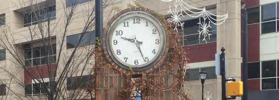
2 INTRODUCTION 1. Background 1. History 2. West Orange characteristics 3. Demographics 4. Transportation 5. Methodology 6. Overall findings 2. Creating complete streets 1. Northfield Avenue 2. Pleasant Valley Way 3. Main Street 4. Overall suggestions 5. Bicycle network 6. Policy suggestions 3. Beyond the scope 1. Shared streets 2. Visualizing the community 3. Summary Main Street in downtown West Orange


3 INTRODUCTION What are Complete Streets? o Complete Streets are streets for everyone o Enable safe access for pedestrians, bicyclists, motorists, and transit riders of all ages and abilities Are Complete Streets right for West Orange? o Improvements must be appropriate for the local context o Plan gives realistic and meaningful policy guidance for the township A complete streets design from Redmond, Washington
4 Background Creating Complete Streets Beyond the Scope BACKGROUND
5 Background History West Orange Characteristics Demographics Transportation Methodology Overall Findings HISTORY

6 HISTORY o 1700s: Oldest homes were built o 1856: Llewellyn Park established o 1863: Contemporary boundaries established o 1886: Thomas Edison arrives o Moves into Glenmont o Establishes a laboratory, factory, and movie studio. o 1940s s: Development of western suburban zone Image source: Thomas and Mina Edison in West Orange, 1902 o 1973: I-280 cuts through community


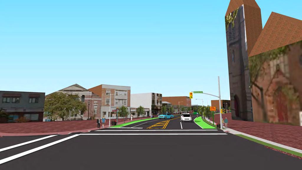
7 FUTURE DEVELOPMENT o Main Street redevelopment area o 21-acre site o Renovation of 1901 battery factory building o 610 Residential units o 18,000 sq. ft. commercial space Image source: Source: Prisim Capital Partners LLC Renderings of Main Street redevelopment area
8 Background History West Orange Characteristics Demographics Transportation Methodology Overall Findings WEST ORANGE CHARACTERISTICS
9 PHYSICAL o 44.6% of land use in West Orange is residential LAND USE LAND COVER o Nearly 30% of forest cover o Commercial services around Main Street & Northfield Avenue o More than half of residential land use is medium density Land Use Land Cover Land Use Land Cover Residential, Low Density Residential, Medium Density Residential, High Density Commercial Industrial Transportation and Infrastructure Recreation and Athletic Fields Forest Wetlands Water Sources: NJDEP, 2012, NJGIN, 2014, NJDOT, 2015


10 PHYSICAL COMMUNITY RESOURCES Community Resources Nj.com Wikipedia Sources: NJGIS, ACS, Google
11 PHYSICAL o Northfield Avenue & Main Street o Pleasant Valley Way & Eagle Rock Avenue o Southwestern corner of Northfield Avenue BUSINESS CONCENTRATION o Essex Green Shopping Center Concentration of Businesses High Low Source: Reference USA, NJGIN
12 Background History West Orange Characteristics Demographics Transportation Methodology Overall Findings DEMOGRAPHICS

13 DEMOGRAPHICS POPULATION DENSITY o Total Population: 46,425 people o Population Density: 3,836/sq. mile o 5 th most populated township in Essex County o Concentration of high population density around Main Street and southeast of Northfield Avenue Population Density / sq. mile Population Density/sq Sources: NJDEP, 2012; NJGIN, 2014; ACS, 2013

14 DEMOGRAPHICS RACE/ ETHNICITY Race/Ethnicity 1 Dot = 15 people Sources: NJDEP, 2012; NJGIN, 2014; ACS, 2013
15 DEMOGRAPHICS MEDIAN INCOME o Median income: $26,130 over $200,000 o Average median income: $87, 516 o Census tracts closest to Orange Township have low median household incomes Median Income ($) Median Income ($) 26,310-46,310 46,311-70,625 70, , , , , ,398 Source: ACS, 2013
16 DEMOGRAPHICS PERCENT IN POVERTY o Average percent in poverty o New Jersey: 10% o Essex County: 17% o West Orange: 7% o Concentrated in eastern section of West Orange Poverty Rate (%) Poverty Rate (%) No Data Source: ACS, 2013
17 DEMOGRAPHICS PERCENT WITH DISABILITY o Concentration of people with disability in: o Northwestern section o Main Street o West of Pleasant Valley Way Percent with Disability (%) Percent with Disability (% Source: ACS, 2013
18 DEMOGRAPHICS PERCENT WITH SENIORS o Median age: 40 years old o Population 65 years and older: 15% o 40% of households in West Orange have at least one person 60 years or older Percent of Households With Seniors (%) (Over 60 years old) Sources: ACS, 2013, NJGIN
19 DEMOGRAPHICS PERCENT WITH CHILDREN o Nearly ¼ of West Orange population is under 18 years old o % of children walked to school o % of children walked to school o Main reason: traffic-related dangers Percent of Households With Children (%) (Under 18 years old) Source: ACS, 2013, NJGIN
20 Background History West Orange Characteristics Demographics Transportation Methodology Overall Findings TRANSPORTATION
21 TRANSPORTATION NJ TRANSIT BUS ROUTES o NJ Transit buses operate along all major streets: o Main Street o Pleasant Valley Way o Northfield Avenue Bus Routes Bus Routes Sources: NJDEP; NJGIN, NJgeoweb
22 TRANSPORTATION CRASH DENSITY o Heavily concentrated: o Intersection of Main Street & Northfield Avenue o Intersection of I-280 & other arterial roads Crash Clusters Crash Cluster Medium Risk High Risk Very High Risk Sources: NJGIN; NJDEP; Plan4Safety
23 TRANSPORTATION ALL CRASHES o Crash locations along principal arterial roads* o NJDOT: 25% of all crashes take place at intersections * According to the most recent NJDOT data, there were 11,876 total crashes in West Orange from Only 10,630 of them are geo-coded on our map. Sources: NJGIN; NJDEP; Plan4Safety
24 TRANSPORTATION PEDESTRIAN VEHICLE CRASHES o Along major intersections o 273 total crashes from o Unmarked crosswalks, vehicle speed, lack of lighting, crosswalk distance, and angle increase risk of crashes Sources: NJGIN; NJDEP; Plan4Safety
25 TRANSPORTATION PUBLIC TRANSIT DESTINATION OF WEST ORANGE RESIDENTS Number of residents New York City 1828 Newark 997 Union County 846 Bergen County Morris County Jersey City Other Essex County Destinations Passaic County Hudson County East Orange Middlesex County 293 Other New Jersey Counties 49 Other New York and Connecticut Source: U.S. Census Bureau LODES Data. Longitudinal-Employer Household Dynamics Program
26 TRANSPORTATION WEST ORANGE MAJOR ROADS AADT COUNTS Location Cross Streets AADT Date Eagle Rock Ave Cliff St, Valley View St 13,033 1/24/12 Main St Alden St, Lakeside Ave 14,016 6/4/12 Mount Pleasant Ave Merrywood Dr, Greentree Rd 8,319 5/14/12 Northfield Ave St Cloud Pl, Ridgeway Ave 21,059 7/10/12 Pleasant Valley Way Greenwood Ave, Stanford Ave 21,259 1/11/12 Prospect Ave Eagle Rock Ave, Cannon St 19,645 4/8/14 Source: NJDOT
27 Background History West Orange Characteristics Demographics Transportation Methodology Overall Findings METHODOLOGY


28 METHODOLOGY Consulted with local stakeholders and residents Identified dangerous areas with traffic volume and crash data 19 streets were selected for further analysis and walkability audits Image source:
29 METHODOLOGY ASSESSED STREETS o Chestnut Street o Eagle Rock Avenue o Franklin Avenue o Harrison Avenue o Main Street o Mitchell Street o Mount Pleasant Avenue o Northfield Avenue o Park Avenue o Pleasant Valley Way o Prospect Avenue o Rollinson Street o Sandford Avenue o Sheridan Avenue o Valley Road o Washington Street o Wheeler Street o William Street o Woodland Avenue Source: NJGIN

30 METHODOLOGY No Instances 1-4 Instances Issues within School Zone? 5 or more Instances Issues within School Zone? Sidewalks No sidewalks or paths* If no sidewalks, add 80 points and move on to Street Crossings Sidewalks cracked/broken Sidewalks are uneven* Sidewalks blocked by lights, poles, signs, plants, vehicles* Sidewalks are not continuous* Sidewalks are interrupted by driveways Sidewalks not wide enough for two people* Intersections don t have curb ramps* Sidewalks do not have a parkway/buffer separating it from the street Existence of overgrowth Other** Image source:
31 METHODOLOGY Street Total Walkability Score Pleasant Valley Way 283 Prospect Avenue 240 Northfield Avenue 208 Wheeler Street 187 Washington Street 140 Chestnut Street 132 Harrison Avenue 129 Main Street 120 Valley Road 118 Mount Pleasant Avenue 118 Woodland Avenue 115 Park Avenue 107 Eagle Rock Avenue 96 Stanford Avenue 89 Mitchell Street 78 William Street 69 Sheridan Avenue 61 Franklin Avenue 57 Rollinson Street Scoring Chart Very Walkable: The best score; many of the elements of this street are working well and only modest adjustments will be needed in select categories, if at all Walkable: The street is generally good, but needs improvement in some areas for a better pedestrian environment Somewhat Walkable: There is a general need for improvement to improve walkability, safety and inclusivity on this street. Existing conditions may currently pose a hazard to pedestrians Not Very Walkable: The street needs a lot of work to improve walkability, safety and inclusivity and is likely a hazard to pedestrians without fixes in the near and long term Image source: Not Walkable At All: The worst score; this street is not safe to walk and has other barriers to inclusivity and comfort. Immediate attention should be paid for these streets to ensure a safer community and better quality of life for all.
32 Background History West Orange Characteristics Demographics Transportation Methodology Overall Findings OVERALL FINDINGS

33 OVERALL FINDINGS SAFETY Open utility ducts


34 OVERALL FINDINGS SAFETY Cracked and uneven sidewalks Bus stops without pedestrian infrastructure

35 OVERALL FINDINGS SAFETY Unmarked crosswalks


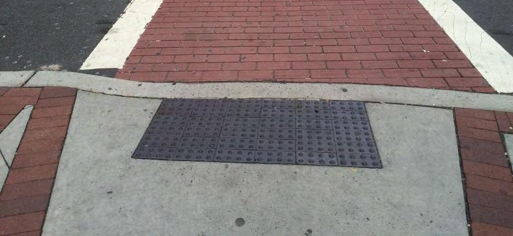
36 OVERALL FINDINGS ACCESSIBILITY Misaligned truncated domes Discontinuous sidewalks

37 OVERALL FINDINGS Accessibility ACCESSIBILITY Lack of pedestrian scale lighting

38 OVERALL FINDINGS ACCESSIBILITY Lack of bicycle infrastructure

39 OVERALL FINDINGS COMFORT & APPEAL Lack of shoulders and parkways


40 OVERALL FINDINGS COMFORT & APPEAL Out-of-order parking meters Lack of lighting

41 OVERALL FINDINGS Unmarked crossing Wide curb radius Lack of pedestrian scale lighting Wide curb radius No street trees in parkway No street trees in parkway Dangerous and confusing intersection Woodland Avenue, West Orange
42 Background Creating Complete Streets Beyond the Scope CREATING COMPLETE STREETS
43 Creating Complete Streets Northfield Avenue Pleasant Valley Way Main Street Overall Recommendations Bicycle Network Policy Recommendations NORTHFIELD AVENUE


44 NORTHFIELD AVENUE NORTHFIELD AVENUE o South side of West Orange o East west, 3.43 miles o Residential, suburban, large elevation changes Source: NJGIN

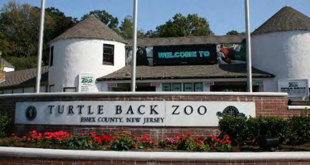
45 NORTHFIELD AVENUE NORTHFIELD AVENUE Long distances between crosswalks Wide lanes encourage speeding Northfield Avenue, near Turtleback Zoo

46 NORTHFIELD AVENUE NORTHFIELD AVENUE MAIN STREET

47 NORTHFIELD AVENUE NORTHFIELD AVENUE MAIN STREET

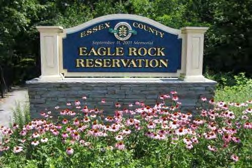
48 NORTHFIELD AVENUE Northfield Avenue, near Turtleback Zoo, before

49 NORTHFIELD AVENUE NORTHFIELD AVENUE Northfield Avenue, near Turtleback Zoo, after

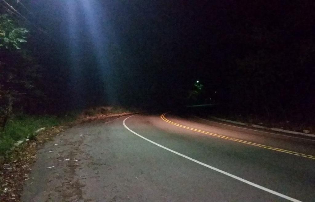
50 NORTHFIELD AVENUE Presence of overgrowth No sidewalk No shoulder Northfield Avenue, facing west near Walker Rd Northfield Avenue, just west of Pleasant Valley Way

51 NORTHFIELD AVENUE NORTHFIELD AVENUE MAIN STREET

52 NORTHFIELD AVENUE NORTHFIELD AVENUE MAIN STREET

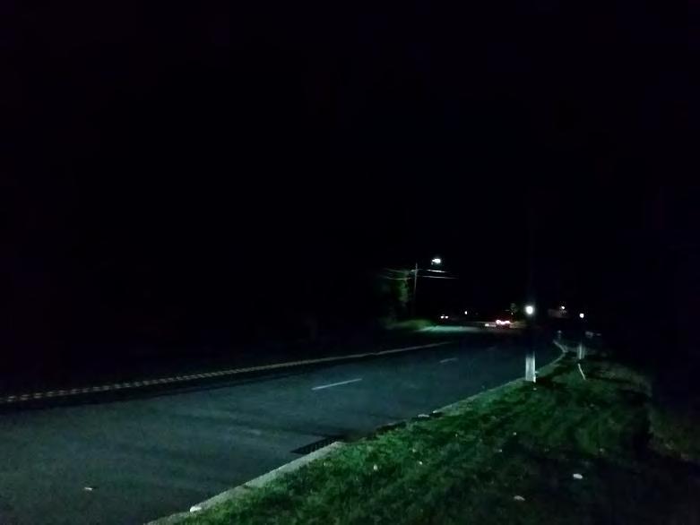
53 NORTHFIELD AVENUE No transit shelter No sidewalks Wide streets with no crosswalks NORTHFIELD AVENUE Northfield Avenue, facing west near Dogwood Rd

54 NORTHFIELD AVENUE NORTHFIELD AVENUE MAIN STREET

55 NORTHFIELD AVENUE NORTHFIELD AVENUE MAIN STREET
56 NORTHFIELD AVENUE Northfield Avenue, near Dogwood Ave, before

57 NORTHFIELD AVENUE Northfield Avenue, near Dogwood Ave, after
58 Creating Complete Streets Northfield Avenue Pleasant Valley Way Main Street Overall Recommendations Bicycle Network Policy Recommendations PLEASANT VALLEY WAY


59 PLEASANT VALLEY WAY PLEASANT VALLEY WAY o West side of West Orange o North south, 4.28 miles o Residential, suburban Source: NJGIN

60 PLEASANT VALLEY WAY No pedestrian scale lighting No bicycle infrastructure No shoulder striping Lane width determines speed Pleasant Valley Way, in front of high school

61 PLEASANT VALLEY WAY PLEASANT VALLEY WAY MAIN STREET

62 PLEASANT VALLEY WAY PLEASANT VALLEY WAY MAIN STREET

63 PLEASANT VALLEY WAY Pleasant Valley Way, north of high school, before

64 PLEASANT VALLEY WAY PLEASANT VALLEY after Pleasant Valley Way, north of high school, after

65 PLEASANT VALLEY WAY Lack of pedestrian scale lighting No sidewalks Lack of crosswalks Wide lanes encourage speeding Pleasant Valley Way, near Cunningham Dr.

66 PLEASANT VALLEY WAY PLEASANT VALLEY WAY MAIN STREET

67 PLEASANT VALLEY WAY PLEASANT VALLEY WAY MAIN STREET
68 Creating Complete Streets Northfield Avenue Pleasant Valley Way Main Street Overall Recommendations Bicycle Network Policy Recommendations MAIN STREET


69 MAIN STREET MAIN STREET o East side of West Orange o North south, 1.36 miles o Dense, urban, commercial and residential Source: NJGIN

70 MAIN STREET Lack of pedestrian scale lighting Short cross time Sidewalks blocked No shoulder Large turning radii Parking unmarked Main Street at Northfield Avenue and Valley Road

71 MAIN STREET

72 MAIN STREET MAIN STREET
73 MAIN STREET Main Street just south of Park Avenue, before

74 MAIN STREET Main Street just south of Park Avenue, after

75 MAIN STREET Lack of pedestrian scale lighting Lack of sidewalk Graffiti Cracked and uneven sidewalk No shoulder Main Street just north of Charles Street

76 MAIN STREET MAIN STREET

77 MAIN STREET

78 MAIN STREET No bus shelter or bench No street trees No street furniture High speeds Main Street in front of the Thomas Edison Park

79 MAIN STREET MAIN STREET

80 MAIN STREET MAIN STREET MAIN STREET

81 MAIN STREET MAIN STREET Main Street in front of the Thomas Edison Park, before

82 MAIN STREET Main Street in front of the Thomas Edison Park, after

83 MAIN STREET Main Street in front of the Thomas Edison Park, after

84 MAIN STREET Main Street in front of the Thomas Edison Park, after

85 MAIN STREET Main Street in front of the Thomas Edison Park, after
86 Creating Complete Streets Northfield Avenue Pleasant Valley Way Main Street Overall Recommendations Bicycle Network Policy Recommendations OVERALL RECOMMENDATIONS

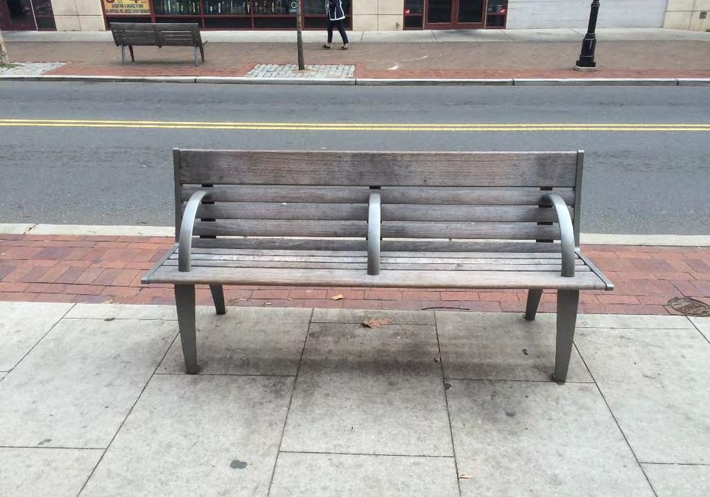
87 RECOMMENDATIONS Beautify the Community Benches Bicycle racks Bus shelter ADA-compliant curbs Decorations

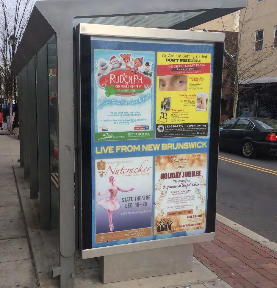
88 RECOMMENDATIONS Pedestrian scale lighting Shade trees for pedestrian comfort Wide sidewalk Albany Street, New Brunswick

89 RECOMMENDATIONS Space for local business signs Planters on the street Well-maintained infrastructure Varied materials for the buffer Raritan Avenue, Highland Park

90 WAYFINDING Image source: Attached to existing poles Standalone kiosk Attached to bus shelter

91 WAYFINDING o Key component of Complete Streets Plan o Emphasizes how walkable West Orange can be o Provides navigation assistance to pedestrians o Increases foot traffic to local businesses and attractions Image source:


92 WAYFINDING Museum in the Streets Image source: Museum in the Streets Museum in the Streets Minneapolis, MN Waterville, ME
93 Creating Complete Streets Northfield Avenue Pleasant Valley Way Main Street Overall Recommendations Bicycle Network Policy Recommendations BICYCLE NETWORK

94 BICYCLE NETWORK BICYCLE NETWORK o Benefits of cycling include: Improved physical and mental health Elevated property values Increased social and cultural interactions Expanded transportation equity Decreased congestion Reduced environmental footprint Cyclist seen on Northfield Ave during field work 9/30/15

95 BICYCLE NETWORK BICYCLE NETWORK Four Types of Cyclist by Portion of Population source: Portland, OR, DOT
96 BICYCLE NETWORK BICYCLE NETWORK o A method for comparing the ease and comfort of cycling on different roads o Level of Stress 1: the level most bicyclists can tolerate, including children and senior citizens o Level of Stress 2: the level tolerated by most adult bicyclists o Level of Stress 3: the level tolerated by the enthused & confident rider o Level of Stress 4: the level tolerated by the strong & fearless rider West Orange Level of Stress Criteria Street Width Posted Speed Limit 2-3 Lanes 4-5 Lanes 6+ Lanes 25 MPH MPH MPH Add 1 LOS for poor pavement Add 1 LOS for steep grade

97 BICYCLE NETWORK BICYCLE NETWORK

98 BICYCLE NETWORK BICYCLE NETWORK o A network of bicycle lanes and sharrows as appropriate o Includes a continuous, low-stress route allowing cycling access throughout town; the West Orange Bikeway o Integrated with community resources and major attractions o Possible expansion to include other important avenues and additional local bicycle paths o Include new bicycle-specific signage and bicycle racks

99 BICYCLE NETWORK BICYCLE NETWORK o The West Orange Bikeway connects every part of town o A mix of sharrows, bicycle lanes and protected bicycle lanes depending on the street o Level of Stress 2 or lower throughout the entire route. Two short sections are Level of Stress 3 due to a steep grade o Unique and distinct street sign toppers at every intersection of the bikeway Proposed street sign topper for West Orange Bikeway


100 BICYCLE NETWORK BICYCLE NETWORK Proposed West Orange-specific bicycle racks Proposed West Orange-specific bicycle wayfinding signage To be installed on all streets with sharrows
101 Creating Complete Streets Northfield Avenue Pleasant Valley Way Main Street Overall Recommendations Bicycle Network Policy Recommendations POLICY RECOMMENDATIONS


102 VISION ZERO VISION ZERO Vision Zero o 4 Es Engineering, Enforcement, Encouragement, Education o Zero deaths and injuries due to traffic violence o Community Design o Infrastructure o Pricing/Convenience o Education o Safety o Performance Measures Image source: la.streetsblog.org

103 VISION ZERO VISION ZERO

104 VISION ZERO VISION ZERO Safety o Year 1: 20 mph for residential streets o Years 2-5: No right turns on red at dangerous intersections o Years 6-10: 25 mph for arterial streets Image source: usa.streetsblog.org

105 VISION ZERO VISION ZERO Education o Year 1: Celebrate Vision Zero o Years 2-5: WO Pedestrian Safety Advisory Board holds annual Kids of West Orange Event o Years 6-10: Safe Routes to School representative visits schools Image source: newjerseybikewalk.org

106 VISION ZERO VISION ZERO Infrastructure o Year 1: Complete street redesign of 2 streets o Years 2-5: Pedestrian wayfinding signage o Years 6-10: Complete streets guidelines Image source: switchboard.nrdc.org
 Highway Safety Improvement Program")

107 FUNDING AND GRANTS FUNDING Federal, state and local sources include: o o o o o o o Community Development Block Grants Transportation Alternatives Program (TAP) Highway Safety Improvement Program (HSIP) NJDOT Bikeway Grant Program NJDOT Safe Streets to Transit NJDOT Centers of Place Grant Program NJDOT Bicycle and Pedestrian Local Transportation Planning Assistance Program Hud.gov, Safety.fhwa.dot.gov and NJDOT

108 Background Creating Complete Streets Beyond the Scope BEYOND THE SCOPE
109 Beyond the Scope Shared Street Visualizing the Community Summary SHARED STREET

110 SHARED STREET SHARED STREET Shared streets: traffic calmed spaces where children play, people walk, bike, and share the road with drivers Dylan Passmore, Flickr

111 SHARED STREET

112 SHARED STREET Wide curb radius WHEELER STREET o East side of West Orange o North south, less than 1/10 th mile o Dense, urban, commercial, and residential Source: NJGIN

113 SHARED STREET SHARED STREET Wheeler Street: Before

114 SHARED STREET

115 SHARED STREET

116 SHARED STREET SHARED STREET

117 SHARED STREET

118 SHARED STREET SHARED STREET

119 SHARED STREET

120 SHARED STREET

121 Beyond the Scope Shared Street Visualizing the Community Summary VISUALIZING THE COMMUNITY

122 VISUALIZING THE COMMUNITY
123

124 SUMMARY o Good opportunities to make streets safer, more accessible o Funding is available o Will require some priority-setting o Wayfinding and bicycle network support pedestrian improvements o Zoning and policy changes may help in the future o Complete Streets will improve the West Orange community for all residents
125 THANK YOU! THANK YOU!
Agenda. Overview PRINCE GEORGE S PLAZA METRO AREA PEDESTRIAN PLAN
 PRINCE GEORGE S PLAZA METRO AREA PEDESTRIAN PLAN May 28, 2008 Agenda Welcome and introductions Project overview and issue identification Planning context and strengths Design challenges and initial recommendations
About the Studio. Edward J. Bloustein School of Planning and Public Policy - Rutgers University
 About the Studio Edward J. Bloustein School of Planning and Public Policy - Rutgers University Purpose of studio: Help City of Bayonne apply for Safe Routes to School (SRTS) funding by producing a School
APPENDIX A: Complete Streets Checklist DRAFT NOVEMBER 2016
 APPENDIX A: Complete Streets Checklist DRAFT NOVEMBER 2016 Complete Streets Checklist MetroPlan Orlando s Complete Streets Checklist is an internal planning tool for staff to further implementation of
6.0 PEDESTRIAN AND BICYCLE FACILITIES 6.1 INTRODUCTION 6.2 BICYCLE DEMAND AND SUITABILITY Bicycle Demand
 6.0 PEDESTRIAN AND BICYCLE FACILITIES 6.1 INTRODUCTION Bicycle and pedestrian travel along and in the vicinity of the corridor is part of the vision of Somerset and Hunterdon counties and the integrated
PRINCE GEORGE S PLAZA METRO AREA PEDESTRIAN PLAN
 PRINCE GEORGE S PLAZA METRO AREA PEDESTRIAN PLAN May 28, 2008 Agenda Welcome and introductions Project overview and issue identification Planning context and strengths Design challenges and initial recommendations
NJDOT Complete Streets Checklist
 Background The New Jersey Department of Transportation s Complete Streets Policy promotes a comprehensive, integrated, connected multi-modal network by providing connections to bicycling and walking trip
Bikeway action plan. Bicycle Friendly Community Workshop March 5, 2007 Rochester, MN
 Bikeway action plan Summary The was held on March 5, 2007 at the Rochester Mayo Civic Center. The workshop was hosted by Rochester-Olmsted County Planning Department in collaboration with the League of
Omaha s Complete Streets Policy
 Omaha s Complete Streets Policy (Adopted August 2015) VISION To create great places and enhance our quality of life, the City of Omaha will provide safe, accessible streets for all users. Complete Streets
EXECUTIVE SUMMARY. Vision
 Vision Walking and bicycling in Salt Lake City will be safe, convenient, comfortable, and viable transportation options that connect people to places, foster recreational and economic development opportunities,
Bicycle Facilities Planning
 Bicycle Facilities Planning Overview Types of Cyclists Purpose for Riding Types of Facilities Bike Lanes Bicycle Boulevards Cycle Tracks Intersections Signals Signing and Marking Discussion Types of Bicyclists
A CHANGING CITY. of Edmonton, it is essential that it reflects the long-term vision of the City.
 A CHANGING CITY By the year 2040, Edmonton will be home to more than 1 million people. To accommodate growth and support a healthy and compact city, we need a new approach to development/redevelopment
What Is a Complete Street?
 Session 5 Charleen Zimmer, AICP, Zan Associates May 5-7, 2010 What Is a Complete Street? May 2010 5-1 Not a Complete Street More of a Complete Street May 2010 5-2 Benefits of Complete Streets Safety for
Agency Advisory Group Meeting #3 and Walk Audit Anchorage Non-Motorized Plan
 Agency Advisory Group Meeting #3 and Walk Audit Anchorage Non-Motorized Plan Friday, May 18 th Walk Audit 10:00-11:30 AM Meeting 11:30 AM 1:00 PM Municipal Planning Department, 4700 Elmore Road, Training
Safe Routes to School Action Plan Aberdeen, Idaho
 Background Aberdeen, Idaho is a largely agricultural community of nearly 2,000 people and is located in the southeast portion of the state on the western edge of American Falls Reservoir. The community
Item to be Addressed Checklist Consideration YES NO N/A Required Description Complete Streets Guidelines
 Passaic County Complete Streets Checklist - Concept Development Project Name Item to be Addressed Checklist Consideration YES NO N/A Required Description Complete Streets Guidelines Existing Plans Have
HARRISON STREET/OAKLAND AVENUE COMMUNITY TRANSPORTATION PLAN
 HARRISON STREET/OAKLAND AVENUE Community Workshop #4: Draft Plan Review December 3, 2009 D E S I G N, C O M M U N I T Y & E N V I R O N M E N T INTRODUCTIONS Key Project Staff: Alisa Shen, Project Manager,
CONNECTIVITY PLAN. Adopted December 5, 2017 City of Virginia Beach
 CONNECTIVITY PLAN Adopted December 5, 2017 City of Virginia Beach CONTENTS 1.0 Background & Purpose... 2 2.0 Existing Inventory & Analysis... 3 ViBe District Existing Walking Conditions... 4 3.0 ViBe District
Active Transportation Facility Glossary
 Active Transportation Facility Glossary This document defines different active transportation facilities and suggests appropriate corridor types. Click on a facility type to jump to its definition. Bike
PEDESTRIAN ACTION PLAN
 ATTACHMENT 2 CITY OF SANTA MONICA PEDESTRIAN ACTION PLAN CITY OF SANTA MONICA PEDESTRIAN ACTION PLAN This page intentionally left blank EXECUTIVE SUMMARY CHAPTER 1 EXECUTIVE SUMMARY Setting the Stage
Physical Implications of Complete Streets Policies
 Presentation Overview Physical Implications of Complete Norm Cox, ASLA, LLA Landscape Architect Ann Arbor, Michigan, 10:45 to Noon What Are Complete Streets? What Matters to Bicyclists and Pedestrians
Complete Streets Policy DAVID CRONIN, P.E., CITY ENGINEER
 Complete Streets Policy DAVID CRONIN, P.E., CITY ENGINEER Complete Streets City Commission adopted a Complete Streets policy in 2012 Complete Streets are road networks that are designed for all users:
City of Charlottesville Bicycle and Pedestrian Master Plan Update
 City of Charlottesville Bicycle and Pedestrian Master Plan Update September 17, 2014 I. Welcome and meeting overview II. Project status update III. Network overview IV. Break-out groups Pedestrian Network
9/25/2018. Multi-Modal Level of Service (MMLOS) Bianca Popescu, Transportation Planner
 Bianca Popescu, Transportation Planner") Multi-Modal Level of Service (MMLOS) Bianca Popescu, Transportation Planner 1 What is MMLOS? Is this a nice place to walk? Is this a nice place to bike? Is transit convenient? Bottom line - Are there options
Multi-Modal Level of Service (MMLOS) Bianca Popescu, Transportation Planner 1 What is MMLOS? Is this a nice place to walk? Is this a nice place to bike? Is transit convenient? Bottom line - Are there options
and older adults and people with disabilities still face barriers when using the pedestrian network and public transportation.
 Background Afterthe1980Olympics,theLakePlacid/NorthElbacommunityadoptedaneconomicstrategy ofdevelopingandmarketingeventstoincreaseareatourism.thisstrategyhasbeenvery successful.overrecentyearsthevolumeofvisitorshasincreased,andthelengthofthe
CONNECTING PEOPLE TO PLACES
 CONNECTING PEOPLE TO PLACES 82 EAST BENCH MASTER PLAN 07 Introduction The East Bench transportation system is a collection of slow moving, treelined residential streets and major arteries that are the
Most Dangerous Roads for Walking And How States Can Make them Safer. Route 110, Long Island, New York Image by Dougtone
 Most Dangerous Roads for Walking And How States Can Make them Safer Route 110, Long Island, New York Image by Dougtone Tri-State Transportation Campaign February 2013 Introduction Key Findings More than
Table of Contents Introduction. 2 Purpose of the Plan...2 The Benefits of Walking and Bicycling...3 Vision and Goals of the Plan...
 BICYCLE AND This plan was created through a grant from the Healthy Communities Program with the cooperation of the City of Cynthiana, Cynthiana Main Street, Cynthiana-Harrison County-Berry Joint Planning
TOWN OF PORTLAND, CONNECTICUT COMPLETE STREETS POLICY
 TOWN OF PORTLAND, CONNECTICUT COMPLETE STREETS POLICY I. VISION, GOALS & PRINCIPLES VISION To improve the streets of Portland making them safer and more accessible for all users including pedestrians,
Chapter 6: Along the Street
 Chapter 6: Along the Street This section describes the types of infrastructure that should be in place along school routes to make walking and bicycling to school safer. Sidewalks In communities with sidewalks,
Rolling Out New Bike Facilities Within the North Bethesda & White Flint Area
 Rolling Out New Bike Facilities Within the North Bethesda & White Flint Area Rolling Out New Bike Facilities Within the North Bethesda & White Flint Area Agenda Designing for all Cyclists Background on
Proposed. City of Grand Junction Complete Streets Policy. Exhibit 10
 Proposed City of Grand Junction Complete Streets Policy Exhibit 10 1 City of Grand Junction Complete Streets Policy Vision: The Complete Streets Vision is to develop a safe, efficient, and reliable travel
Roosevelt Estates Neighborhood Improvements
 Roosevelt Estates Neighborhood Improvements Transportation Alternatives Application May 5 th, 2016 Qualifying Activities Construction of on-road and off-road trail facilities for pedestrians, bicyclists,
Planning Suburban Bike Networks
 Planning Suburban Bike Networks Stacey Meekins, AICP 28 October, 2015 Bikeway design guidance Different Cyclists Have Different Needs No interest 33% Strong and Fearless 1% Enthused and Confident 7% Interested,
Monument Elementary School Trenton, NJ School Travel Plan
 Monument Elementary School Trenton, NJ School Travel Plan Prepared by Greater Mercer TMA With Assistance from Alan M. Voorhees Transportation Center; Rutgers, The State University of New Jersey and NJ
Long Island Rail Road Expansion Project Floral Park to Hicksville
 Long Island Rail Road Expansion Project Floral Park to Hicksville Final Environmental Impact Statement Appendix 1-D Complete Streets Policy Checklist April 2017 0902ML PIN: Project Location: 18A-4 Floral
ASSESSING THE WALKING & BIKING ENVIRONMENT
 ASSESSING THE WALKING & BIKING ENVIRONMENT M A Y 2 0 1 3 Jon Morgan WI DHS ACTIVE COMMUNITY LINE-UP Rationale Why do an audit What s involved in an audit Things to look for and consider Hitting the streets
REGIONAL BICYCLE AND PEDESTRIAN DESIGN GUIDELINES
 REGIONAL BICYCLE AND PEDESTRIAN DESIGN GUIDELINES November 16, 2011 Deb Humphreys North Central Texas Council of Governments Bicycle and Pedestrian Advisory Committee Snapshot of the Guide 1. Introduction
Corpus Christi Metropolitan Transportation Plan Fiscal Year Introduction:
 Introduction: The Safe, Accountable, Flexible, Efficient Transportation Equity Act: A Legacy for Users (SAFETEA-LU) has continued the efforts started through the Intermodal Surface Transportation Efficiency
Chapter 14 PARLIER RELATIONSHIP TO CITY PLANS AND POLICIES. Recommendations to Improve Pedestrian Safety in the City of Parlier (2014)
") Chapter 14 PARLIER This chapter describes the current status and future plans for biking and walking in the City of Parlier. RELATIONSHIP TO CITY PLANS AND POLICIES The Parlier General Plan is the primary
Chapter 14 PARLIER This chapter describes the current status and future plans for biking and walking in the City of Parlier. RELATIONSHIP TO CITY PLANS AND POLICIES The Parlier General Plan is the primary
FOCUS AREA 1 - Alberta Avenue Pocket Park 3 (121 Ave and 92 St)
") FOCUS AREA 1 - Alberta Avenue Pocket Park 3 (121 Ave and 92 St) New benches Plant evergreen trees Widen existing sidewalk from 1.5m to 1.8m Marked crosswalk 1.8m wide sidewalk Add pedestrian oriented lights
FOCUS AREA 1 - Alberta Avenue Pocket Park 3 (121 Ave and 92 St) New benches Plant evergreen trees Widen existing sidewalk from 1.5m to 1.8m Marked crosswalk 1.8m wide sidewalk Add pedestrian oriented lights
Chapter 2. Bellingham Bicycle Master Plan Chapter 2: Policies and Actions
 Chapter 2 Bellingham Bicycle Master Plan Chapter 2: Policies and Actions Chapter 2: Policies and Actions The Bicycle Master Plan provides a road map for making bicycling in Bellingham a viable transportation
Bellevue Downtown Association Downtown Bike Series
 Bellevue Downtown Association Downtown Bike Series Meeting 2 Franz Loewenherz Andreas Piller Kyle Potuzak Chris Long October 26, 2017 Today s Agenda: 1) Meeting Purpose 2) 9/28 Meeting Recap 3) Candidate
Steps to Conducting a Complete Streets Assessment
 Steps to Conducting a Complete Streets Assessment Familiarize yourself with Complete Streets Read through the Complete Streets Assessment Guidelines. This will give you an idea of what Complete Streets
See Figure 38, Existing Nonmotorized Connections.
 Nonmotorized Connections Existing Nonmotorized Connections Pedestrian, vehicle and bike traffic access and movements are confined primarily to Penny Drive on campus. Due to the steep slope along the length
A Matter of Fairness: ROCOG s Environmental Justice Protocol. What is Mobility Limitation?
 No Person Left Behind What is Mobility Limitation? What is the Access Limitation? Environmental Justice population should be provided adequate mobility & access to meet their needs; Identify acceptable
Bicycle and Pedestrian Connectivity Study. Old Colony Planning Council
 Bicycle and Pedestrian Connectivity Study Old Colony Planning Council Outline Why consider bike/peds in road designs? Why are measures needed? Connecting Land Use with Transportation Evaluation Tools:
Bridgewater Complete Streets Prioritization Plan and Pedestrian Safety Assessment
 Bridgewater Complete Streets Prioritization Plan and Pedestrian Safety Assessment Presented by Luciano Rabito Manager of Complete Streets Presented to Bridgewater, MA Wednesday, April 26, 2017 6:30 P.M.
The DC Pedestrian Master Plan
 The DC Pedestrian Master Plan September 28, 2010 George Branyan Pedestrian Program Coordinator District Department of Transportation Presentation Agenda Scope of the Plan Methodology Recommendations Implementation
o n - m o t o r i z e d transportation is an overlooked element that can greatly enhance the overall quality of life for the community s residents.
 N o n - m o t o r i z e d transportation is an overlooked element that can greatly enhance the overall quality of life for the community s residents. 84 Transportation CHAPTER 11 INTRODUCTION Transportation
Improvements Infrastructure Gap Assessment and Improvements Street Striping
 Infrastructure Project Proposal The federal-aid Safe Routes to School program funds infrastructure/engineering projects that fall into two categories: Design (available only to School Development Authority
5/7/2013 VIA . RE: University Village Safeway Expansion (P13-019)
") 5/7/2013 VIA EMAIL David Hung, Associate Planner Community Development Department, Current Planning Division City of Sacramento 300 Richards Boulevard, 3 rd Floor Sacramento, CA 95811 RE: University Village
5/7/2013 VIA EMAIL David Hung, Associate Planner Community Development Department, Current Planning Division City of Sacramento 300 Richards Boulevard, 3 rd Floor Sacramento, CA 95811 RE: University Village
Morristown, NJ Complete Streets Policy
 Morristown, NJ Complete Streets Policy Introduction A Complete Street is defined as a means to provide safe access for all users by designing and operating a comprehensive, integrated, connected multi-modal
OLDER PEDESTRIANS AT RISK
 OLDER PEDESTRIANS AT RISK A TEN-YEAR SURVEY AND A LOOK AHEAD August 0 The population of older adults is growing in the U.S. and in the tri-state region. According to AARP, one in three Americans is now
Tri-State Transportation Campaign Greater Newark Conservancy Newark Complete Streets Walking Audit July 2013
 Tri-State Transportation Campaign Greater Newark Conservancy Newark Complete Streets Walking Audit July 2013 On July 22, 2013, TSTC teamed up with 40 high school student interns and their mentors from
Active Transportation Access to Transit
 Active Transportation Access to Transit Introduction COMO Connect customers access transit service in many ways, including walking, bicycling, riding in a car and being dropped off, and directly boarding
Multimodal Design Guidance. October 23, 2018 ITE Fall Meeting
 Multimodal Design Guidance October 23, 2018 ITE Fall Meeting Introductions Jessica Wilson TDOT Multimodal Division Office of Multimodal Planning Program Supervisor Jessica.L.Wilson@tn.gov Ali Hangul TDOT
SAFE ROUTES TO SCHOOL
 SAFE ROUTES TO SCHOOL Forest Ridge Elementary School Existing Conditions and ACTION PLAN > Oak Creek - Franklin Joint School District Table of Contents CONTEXT Enrollment Boundaries
Non-Motorized Transportation 7-1
 Non-Motorized Transportation 7-1 Transportation facilities no longer mean just accommodating a vehicle powered by a combustion engine. Pedestrian and non-motorized facilities are important modes of travel
Chapter 2: Standards for Access, Non-Motorized, and Transit
 Standards for Access, Non-Motorized, and Transit Chapter 2: Standards for Access, Non-Motorized, and Transit The Washtenaw County Access Management Plan was developed based on the analysis of existing
Introduction. Who is WILMAPCO. Why are walkable communities important
 Walkable Community Workshops Round 1 April 2005 SPONSORED BY WILMAPCO AND CCOBH CITY OF NEW CASTLE EDGEMOOR GARDENS CIVIC ASSOCIATION WITH FUNDING BY DELAWARE DEPARTMENT OF TRANSPORTATION AND THE DELAWARE
Dr. M.L. King, Jr. Street North Complete Streets Resurfacing Opportunities HOUSING, LAND USE, AND TRANSPORTATION COMMITTEE MARCH 22, 2018
 Dr. M.L. King, Jr. Street North Complete Streets Resurfacing Opportunities HOUSING, LAND USE, AND TRANSPORTATION COMMITTEE MARCH 22, 2018 What s Happening The City plans to mill and resurface Dr. M.L.
Tonight is for you. Learn everything you can. Share all your ideas.
 Strathcona Neighbourhood Renewal Draft Concept Design Tonight is for you. Learn everything you can. Share all your ideas. What is Neighbourhood Renewal? Creating a design with you for your neighbourhood.
MOVING PASSAIC COUNTY
 MOVING PASSAIC COUNTY COMPLETE STREETS GUIDELINES OCTOBER 2012 Prepared By: Passaic County Department of Planning and Economic Development with assistance from Parsons Brinckerhoff PASSAIC COUNTY COMPLETE
Chapter 5. Complete Streets and Walkable Communities.
 Chapter 5. Complete Streets and Walkable Communities. 5.1 Description of Complete Streets. Cities throughout the world, and specifically the United States, are coming to embrace a new transportation and
Hennepin County Pedestrian Plan Public Comment Report
 Hennepin County Pedestrian Plan Public Comment Report On May 31, 2013, the draft Hennepin County Pedestrian Plan was released for a 45-day public comment period ending July 15, 2013. The county received
DOWNTOWN MIAMI PEDESTRIAN PRIORITY ZONE
 DOWNTOWN MIAMI PEDESTRIAN PRIORITY ZONE AUGUST 6, 2013 DOWNTOWN MIAMI BY THE NUMBERS more than 200,000 people live, work, and play here every day is home to more than 1,000 events each year hosts more
2.0 Existing Conditions
 20 2.0 Existing Conditions 2.1 Land Use, Future Growth Patterns, Physical Barriers Geographic Overview Sutter County s land use pattern is characterized by extensive agricultural areas, significant natural
Chapter 13 ORANGE COVE
 Chapter 13 ORANGE COVE This chapter describes the current status and future plans for biking and walking in the City of Orange Cove. RELATIONSHIP TO CITY PLANS AND POLICIES The Orange Cove General Plan
Design Guidelines. Overview. Design Vision for Yellow Brick Road
 Design Guidelines Overview This section presents the design vision for the Yellow Brick Road network. The Yellow Brick Road is envisioned to be an interconnected network of safe and secure roadways where
DEPARTMENT OF ENVIRONMENTAL SERVICES. North Harrison Street (Lee Highway to Little Falls Road) Comparative Analysis. Prepared for:
 Comparative Analysis. Prepared for:") DEPARTMENT OF ENVIRONMENTAL SERVICES North Harrison Street (Lee Highway to Little Falls Road) Comparative Analysis Prepared for: Arlington County Department of Environmental Services 2100 Clarendon Boulevard,
DEPARTMENT OF ENVIRONMENTAL SERVICES North Harrison Street (Lee Highway to Little Falls Road) Comparative Analysis Prepared for: Arlington County Department of Environmental Services 2100 Clarendon Boulevard,
TOWN OF WILLIAMSTON, SC BICYCLE AND PEDESTRIAN MASTER PLAN TOWN OF WILLIAMSTON, SC BICYCLE AND PEDESTRIAN MASTER PLAN
 TOWN OF WILLIAMSTON, SC BICYCLE AND PEDESTRIAN MASTER PLAN Americans Want Choices 55% of Americans would rather drive less & walk more. Transit use is growing faster than population or highway travel.
INDOT Complete Streets Guideline & Policy
 INDOT Complete Streets Guideline & Policy INTRODUCTION The Complete Streets guidelines build upon multiple efforts and promote a multimodal transportation system that is integrated and sustains land use
CONTRA COSTA. Countywide Bicycle and Pedestrian Plan. Executive Summary. July Contra Costa Countywide Bicycle & Pedestrian Plan
 CONTRA COSTA Countywide Bicycle and Pedestrian Plan Executive Summary July 2018 i The preparation of this report has been financed through a grant from the U.S. Department of Transportation and the Federal
MAG Town of Cave Creek Bike Study Task 6 Executive Summary and Regional Significance Report
 Page 1 MAG Town of Cave Creek Bike Study Task 6 Executive Summary and Regional Significance Report August 1, 2012 MAG Project #481 Page 2 Task 6 Executive Summary and Regional Significance Report Introduction
Multimodal Through Corridors and Placemaking Corridors
 68 Multimodal Through Corridors and Placemaking Corridors Corridors have different functions in a region. Some corridors are used to get smoothly and rapidly through a region or to get quickly to major
Traffic Impact Memorandum. May 22, 2018
 BISHOP PROFESSIONAL DEVELOPMENT BUILDING Proposed Land-use Change & Parking Modification 3601 SW 31st Street Topeka, Kansas 66614 CFS Project No. 185077 Traffic Impact Memorandum May 22, 2018 Prepared
City of Birmingham Draft Multi-modal Transportation Plan
 City of Birmingham Draft Multi-modal Transportation Plan City Commission Public Hearing Monday, November 25, 2013 7:30 pm Norman Cox, PLA, ASLA The Greenway Collaborative, Inc. Ann Arbor, Michigan The
Complete Streets. Designing Streets for Everyone. Sarnia
 Complete Streets Designing Streets for Everyone Sarnia Complete Streets ~ Sarnia ~ 2018 Introduction Our City is made up of a network of streets that we use to go for a walk, cycle to work, drive to the
About the Active Transportation Alliance
 About the Active Transportation Alliance Chicagoland s voice for better biking, walking and transit Founded 1985 7,000 members, ~33 full time staff Serve Chicago metro region 1 More Cars, More Driving
IMPLEMENTATION WORKBOOK
 Lawrence Township Bicycle and Pedestrian Planning Assistance Study IMPLEMENTATION WORKBOOK Final Action Plan - Part 2 April 2009 Prepared For: The Township of Lawrence and the New Jersey Department of
NM-POLICY 1: Improve service levels, participation, and options for non-motorized transportation modes throughout the County.
 Transportation PRINCE WILLIAM COUNTY 2008 COMPREHENSIVE PLAN NON-MOTORIZED PLAN CONTENTS Goals, Policies, and Action Strategies Table 4 (Bike Facility Classifications and Descriptions) Table 5 (Bike Facility
Classification Criteria
 SCHEDULE D TO RECOMMENDED OFFICIAL PLAN AMENDMENT NO. 40 SCHEDULE C-4 Road Criteria Criteria Traffic Service Objective Land Service/Access Typical Daily Traffic Volume Flow characteristics Travel Speed
The Wiggle Route in Context
 The Wiggle Route in Context In a city of hills, the Wiggle is an important route because it winds its way along the flattest streets from Market to the Panhandle, bringing residents to local parks and
COWETA HIGH SCHOOL AND EAST HIGHWAY 51
 COWETA HIGH SCHOOL AND EAST HIGHWAY 51 Lack of sidewalks along Ben Lumpkin Rd. Lack of crosswalks and ramps at intersection. Hwy 51 is wide to cross as a pedestrian. No ADA compliance or connection to
CHAPTER 3: Vision Statement and Goals
 Davidson Walks & Rolls: Active Transportation Master Plan CHAPTER 3 Contents: Overview Vision Statement Measurable Goals Public Outreach CHAPTER 3: Vision Statement and Goals Overview The vision statement
Transforming the. Michigan Avenue Corridor. a complete streets and transit-oriented development study Michigan State University Student Research Team
 Transforming the Michigan Avenue Corridor a complete streets and transit-oriented development study Michigan State University Student Research Team Dominic Adams Annie Fardell Jon Roberts Jeff Stivenson
Chapter 5: Crossing the Street
 Chapter 5: Crossing the Street Whether walking or bicycling, a student s journey to school will more than likely require crossing one or more streets. Per the Safe Routes to School Guide, maintained by
Designing Complete Streets: What you need to know
 Designing Complete Streets: What you need to know Getting from this to this. Continuous sidewalk Buffer w/trees Bicycle lane Raised median Buildings close to the street Flexibility in design Design and
TRAFFIC IMPACT ANALYSIS
 TRAFFIC IMPACT ANALYSIS FOR THE CHAMPAIGN UNIT#4 SCHOOL DISTRICT PROPOSED HIGH SCHOOL (SPALDING PARK SITE) IN THE CITY OF CHAMPAIGN Final Report Champaign Urbana Urbanized Area Transportation Study 6/24/2014
Montclair s Complete Streets Experience
 Presented by: Hon. Jerry Fried, Mayor Montclair Township About Montclair Six square miles Six commuter rail stations Four local bus routes (NJ Transit) Two private commuter bus routes Five business districts
5. RUNNINGWAY GUIDELINES
 5. RUNNINGWAY GUIDELINES These guidelines should be considered collectively when making runningway decisions. A runningway is the linear component of the transit system that forms the right-of-way reserved
CITY OF COCOA BEACH 2025 COMPREHENSIVE PLAN. Section VIII Mobility Element Goals, Objectives, and Policies
 CITY OF COCOA BEACH 2025 COMPREHENSIVE PLAN Section VIII Mobility Element Goals, Objectives, and Policies Adopted August 6, 2015 by Ordinance No. 1591 VIII MOBILITY ELEMENT Table of Contents Page Number
Older Pedestrians at Risk And How States Can Make it Safer and Easier for Older Residents to Walk
 Older Pedestrians at Risk And How States Can Make it Safer and Easier for Older Residents to Walk Tri-State Transportation Campaign August 2012 Introduction Key Findings 435 older pedestrians have been
CITY OF KASSON TRANSPORTATION ALTERNATIVES KASSON SAFE ROUTES TO SCHOOL
 ve ha 8t G B A Mantorville Ave N 240th Ave 16th St NE 11th Ave NE K-M HIGH SCHOOL SUNRISE TRAIL TO MANTORVILLE MNTH 57 SUNSET TRAIL TO MANTORVILLE NE PARK 16TH ST NE TRAIL K-M ELEMENTARY SCHOOL K-M MIDDLE
5. Automobile Circulation, Wayfinding and Signage
 5. Automobile Circulation, Wayfinding and Signage Policy: The City Center should have a balanced, safe, and interconnected circulation system that provides expanded travel opportunities for transit, pedestrian,
Make Lincoln Highway an economically vibrant corridor that is safe, efficient, and beautiful for local residents and visitors.
 Lincoln Highway Streetscape Plan Stakeholder Workshop #2 Handout Contents Introduction and Project Vision Planning Principles Specific Recommendations including a Proposed Typical Roadway Section Renderings
CHAPTER 16 PEDESTRIAN FACILITIES DESIGN AND TECHNICAL CRITERIA TABLE OF CONTENTS
 CHAPTER 16 PEDESTRIAN FACILITIES DESIGN AND TECHNICAL CRITERIA TABLE OF CONTENTS Section Title Page 16.1 General... 16-1 16.1.1 AASHTO Reference... 16-1 16.1.2 ADA Requirements... 16-1 16.2 Sidewalks...
Proposed White Flint Separated Bike Lane Network September 2015
 Proposed White Flint Separated Bike Lane Network September 2015 Abstract This report includes a proposed separated bike lane network for the White Flint Sector Plan area. Separated bike lanes create a
Figure 4-10: Pedestrian Improvements Types of Potential Station Area Improvements - Place-Making Improvements
 INCORPORATE FEATURE PAVIN IN CROSSWALK AND INTERSECTION FIELDS Identifies high-priority pedestrian areas and create a station identity through colorful and interesting patterns ADD CURB EXTENSIONS Extending
Planning Guidance in the 2012 AASHTO Bike Guide
 Planning Guidance in the 2012 AASHTO Bike Guide Presentation by: RJ Eldridge Peter Lagerwey August 22, 2012 WEBINAR 2: PLANNING GUIDANCE IN THE 2012 AASHTO BIKE GUIDE Today s Webinar Significant Updates