SR 77/ORACLE ROAD MULTIMODAL CORRIDOR PROFILE STUDY
|
|
|
- Jessica Watkins
- 5 years ago
- Views:
Transcription
 MMLA,I nc.")
1 & I nas s oc i at i onwi t h: Li ma&as s oc i at es ThePl anni ngcent er Har r i senvi r onment al Gr oup,i nc. Cannon&As s oc i at es ( Adi vi s i onoftr ansys t emscor por at i on) MMLA,I nc. Ri l l i t ocons ul t i nggr oup May2007 FinalReport
2
3 SR 77/ORACLE ROAD MULTIMODAL CORRIDOR PROFILE STUDY FINAL REPORT Prepared for Arizona Department of Transportation Prepared by TransCore ITS, Inc. and Morrison-Maierle, Inc. In Association With Lima & Associates The Planning Center Harris Environmental Group, Inc. TranSystems Corporation MMLA Rillito Consulting Group May 2007
4
5 TABLE OF CONTENTS Page 1. INTRODUCTION PROJECT BACKGROUND STUDY PURPOSE STUDY GOALS AND OBJECTIVES Goals Objectives STUDY OUTLINE AND PRODUCTS PUBLIC INVOLVEMENT PROCESS ACKOWLEDGMENTS PROJECT TEAM STUDIES, CONTACTS AND ISSUES ARIZONA DEPARTMENT OF TRANSPORTATION DOCUMENTS AND INFORMATION ADOT 5-Year Transportation Facilities Construction Program (FY ) Airports and Highways ADOT MoveAZ Plan - Phase I Report, August 2002, Cambridge Systematics Arizona State Highway Access Policy and Legislation Study, Lima & Associates, DMJM-Harris, March Final Design Concept Report, Shoulder Widening Tucson-Oracle Junction Highway (SR 77) River Road to Ina Road, Pima County, Arizona (Tracs No. 077 PM 072 H L, Project No. S 077-A-201), Johnson-Brittain & Associates, Revised April 30, Final Project Assessment, SR 77, Ina Road to Pusch View Lane, Project 77 PM 74 H C, ADOT Roadway Predesign Section, April Final Project Assessment, SR 77 at Hardy Road, Oro Valley (TRACS No. 077 PM 076 H C), SFC, May Location and Design Study for Tangerine Road, Avra Valley to First Avenue, SBP PE, Parsons Brinckerhoff, December Tucson-Globe-Holbrook Multimodal Corridor Profile Study Final Report and Executive Summary, Leigh, Scott, & Cleary, Inc., September 8, US 89 Access Control Study, JHK & Associates, May Initial Project Assessment, SR 77, Calle Concordia to Tangerine Road, TRACS No. 077 PM 077 H L, AZTEC Engineering, March Final Project Assessment, SR 77, Junctional Miracle Mile to Ina Road, Project 77 PM 69 H C, Roadway Predesign Section, June Final Report Page i
6 TABLE OF CONTENTS (Continued) Page 2. STUDIES, CONTACTS AND ISSUES (Continued) Final Project Assessment, SR 77, First Avenue-Tangerine Road, Project 77 PM 79 H C, Roadway Predesign Section, December Final Project Assessment, SR 77, Biosphere II Conference Center, Project 77 PN 096 H C, RS Engineering, Inc., November Final Project Assessment, SR 77, Willow Springs to Oracle, Project 77 PN 95 H C, ADOT Roadway Predesign Section, June Final Project Assessment, SR 77, Junction SR 79 to Oracle, Project 77 PN 92 H C, ADOT Roadway Predesign Section, January Final Project Assessment, SR 77 at Pinto Lane, Catalina, Project 77 PN 87 H C, Stantech Consulting, June 2, ADOT Statewide Plan Intelligent Transportation Infrastructure, ADOT Intermodal Transportation Division Technology Group, December Miscellaneous ADOT Project Assessments Oracle Highway (SR 77) Bicycle Safety Shoulders Improvement Project, Transportation Enhancement Proposal, August 23, PIMA ASSOCIATION OF GOVERNMENTS (PAG) REGIONAL PLANNING DOCUMENTS Regional Transportation Plan, as Amended, Pima Association of Governments, Adopted June 29, PAG ITS Strategic Deployment Plan, Pima Association of Governments, PAG ITS Strategic Deployment Plan Progress Update, Pima Association of Governments, February PAG Regional Plan for Bicycling, Pima Association of Governments, PAG Regional Pedestrian Plan, Pima Association of Governments, July PAG, Regional Transportation System Performance Assessment, Pima Association of Governments, PAG Transportation Improvement Program ( TIP), Pima Association of Governments PAG Intermodal Management System Study, Parsons Brinckerhoff, September CAAG REGIONAL PLANNING DOCUMENTS AND INFORMATION 2-13 Final Report Page ii
7 TABLE OF CONTENTS (Continued) Page 2. STUDIES, CONTACTS AND ISSUES (Continued) PINAL COUNTY PLANNING DOCUMENTS AND INFORMATION Pinal County Comprehensive Plan 2001, Pinal County Planning and Zoning Commission, December 6, Pinal County Transportation Plan Final Report, 2000 Update, Lima & Associates, September Southern Pinal County Regional Transportation Plan, Entranco, Inc., April TOWN OF ORO VALLEY PLANNING DOCUMENTS AND INFORMATION Focus 2020 Oro Valley General Plan and Transit Amendment, 1996, Town of Oro Valley Transit Development Plan, Fiscal Years , Town of Oro Valley, November Final Location Report, La Cañada Drive Extension, Tangerine Road to Moore Road, Curtis Lueck & Associates, July 28, Implementation of the Pedestrian and Bicycle Plan, Annual Report, Town of Oro Valley, Department of Public Works, April Traffic Impact Study for the Oro Valley Town Center Development, DMJM Harris, April Oro Valley Trails Task Force Report, Oro Valley Trails Task Force, November Traffic Impact Analysis for Rancho Vistoso Neighborhoods 3 and 4, Kimley-Horn and Associates, May Traffic Impact Study Steam Pump Ranch, Stantec Consulting, February 26, Oracle Road Corridor Study, Calle Concordia to Rancho Vistoso Boulevard, March 3, 2003, Final Draft Report CITY OF TUCSON PLANNING DOCUMENTS AND INFORMATION Oracle-South Sixth Corridor Study, Parsons Brinckerhoff, September 1991, Executive Summary and Final Report MISCELLANEOUS INFORMATION PERTINENT TO THE STUDY CORRIDOR El Tour De Tucson Route Map, Oracle Road/Linda Vista Boulevard Traffic Impact Analysis Report, Revision One, PFS Traffic Engineering, LLC, December 20, Final Report Page iii
8 TABLE OF CONTENTS (Continued) Page 2. STUDIES, CONTACTS AND ISSUES (Continued) Pusch Ridge Christian Academy Traffic Impact Analysis Report, PFS Traffic Engineering, LLC, February 8, KEY STAKEHOLDER MEETINGS Pima Association of Governments Pima County City of Tucson Arizona Department of Transportation, Tucson District Town of Oro Valley Pinal County KEY ISSUES Planned Developments Transit Issues Bike and Pedestrian Issues Access Issues SOCIOECONOMIC ENVIRONMENT EXISTING AND PROJECTED POPULATION EMPLOYMENT LEVELS TITLE VI AND ENVIRONMENTAL JUSTICE CONSIDERATIONS PHYSICAL AND NATURAL ENVIRONMENT GENERAL TOPOGRAPHY, VEGETATION, AND CHARACTER OF THE CORRIDOR WILDLIFE SPECIAL STATUS SPECIES AND HABITATS NATIONAL PARKS, MONUMENTS, AND WILDLIFE REFUGES WILD AND SCENIC RIVERS WILDERNESS AREAS UNIQUE WATERS AND SOLE SOURCE AQUIFERS LAKES, RIVERS, CREEKS, AND WETLANDS VISUAL RESOURCES Definitions of Scenic Classes 4-13 Final Report Page iv
9 TABLE OF CONTENTS (Continued) Page 4. PHYSICAL AND NATURAL ENVIRONMENT (Continued) AIR QUALITY ATTAINMENT Carbon Monoxide Ozone Particulate Matter Nitrogen Dioxide and Sulfur Dioxide BLM AREAS OF CRITICAL ENVIRONMENTAL CONCERN CULTURAL RESOURCES National Register of Historical Places (NRHP) Properties Previously Recorded Archaeological Sites Not List on the NRHP Cemeteries SECTION 4(f) LANDS Public Parks and Recreation Areas Public School Facilities NOISE QUALITY EXISTING TRANSPORTATION FACILITIES, SERVICES, AND CONDITIONS STATE MAINTAINED HIGHWAYS Functional Classification Roadway Geometrics Right-of-Way (ROW) Pavement Type and Condition Structures Drainage Terrain Posted Speed Limit Traffic Data Traffic Crash Summary SR 77 Access Points and Crashes TRANSIT SYSTEM AND SERVICE Sun Tran Transit Service Paratransit Services 5-26 Final Report Page v
10 TABLE OF CONTENTS (Continued) Page 5. EXISTING TRANSPORTATION FACILITIES, SERVICES AND CONDITIONS 5-1 (Continued) 5.3 INTERMODAL FACILITIES BICYCLE FACILITIES PEDESTRIAN FACILITIES ITS FACILITIES Traffic Signal System Other Existing ITS Facilities PLANNED AND PROGRAMMED IMPROVEMENTS Corridor Roadway Projects Alternate Mode and Other Non-Capacity Projects EXISTING AND PROJECTED NEEDS AND DEFICIENCIES ROADWAY SYSTEM Congestion Evaluation of Concept Design of Realigned Segment of Fort Lowell Road/Miracle Mile Safety Access Public Comments on Safety and Access Needs PUBLIC TRANSPORTATION Transit Workshops Technical Advisory Committee Field Review Transit Deficiencies Identified in Plans and Studies BICYCLE FACILITIES Public Open House Comments on Bicycle Related Improvement Needs PEDESTRIAN FACILITIES Open House Comments on Pedestrian Improvements BRIDGES AND DRAINAGE STRUCTURES PAVEMENT AASHTO DESIGN STANDARDS ITS SUMMARY OF CORRIDOR DEFICIENCIES 6-20 Final Report Page vi
11 7. INVESTMENT OPTIONS SUMMARY OF INVESTMENT OPTIONS TO ADDRESS CAPACITY DEFICIENCIES Development of an Alternative High-Capacity Corridor Summary of Capacity Improvement Options Along SR Micro-Simulation Analysis of GSI Alternatives Right-of-Way Implications and Costs for Widening SR 77 to Eight Lanes SUMMARY OF INVESTMENT OPTIONS TO ADDRESS NON-CAPACITY DEFICIENCIES Roadway Lighting Investment Options Pedestrian Investment Options Bicycle Facility Investment Options Transit Investment Options Bridge and Drainage Structures Investment Options ITS Investment Options Investment Options to Address AASHTO Design Deficiencies Access Control Investment Options Other Improvements OPPORTUNITIES AND CONSTRAINTS FINANCIAL OPPORTUNITIES AND CONSTRAINTS RIGHT-OF-WAY OPPORTUNITIES AND CONSTRAINTS ENVIRONMENTAL ISSUES AND CONSTRAINTS Terrain Sensitive Species and Habitats Cultural Resources Air and Noise Quality Title VI Issues Pima County Environmentally Sensitive Roadway Guidelines Pusch Ridge Wilderness Area Drainage Considerations Summary of Environmental Resources Issues 8-13 Final Report Page vii
12 TABLE OF CONTENTS (Continued) Page 9. DEFICIENCY PRIORITIZATION AND PROPOSED TRANSPORTATION PROJECTS PRIORITIZATION OF DEFICIENCIES PROPOSED IMPROVEMENT PROJECTS COST ESTIMATES PUBLIC INVOLVEMENT FIRST SERIES OF PUBLIC OPEN HOUSES TRANSIT WORKSHOPS TECHNICAL ADVISORY COMMITTEE FIELD TRIP FINAL SERIES OF PUBLIC OPEN HOUSES COMMENTS RECEIVED FROM THE TOWN OF ORO VALLEY COMMENTS RECEIVED FROM PINAL COUNTY APPENDIX A Properties Listed on the National Register of Historic Places Within Study Area APPENDIX B Previous Archaeological Surveys Within Study Area APPENDIX C Map Showing Sensitive Zones as Defined by the Sonoran Desert Conservation Plan APPENDIX D Corridor Crash Characteristics APPENDIX E Roadway Lighting Analysis Final Report Page viii
13 LIST OF EXHIBITS Page Exhibit 1-1 SR 77/ORACLE ROAD CORRIDOR STUDY AREA 1-2 Exhibit 2-1 LIST OF STUDY DOCUMENTS 2-2 Exhibit 3-1 CURRENT POPULATION STATISTICS FOR COUNTIES AND COMMUNITIES IN THE SR 77 CORRIDOR 3-1 Exhibit 3-2 FUTURE POPULATION PROJECTIONS FOR COUNTIES AND COMMUNITIES IN THE SR 77 CORRIDOR 3-2 Exhibit 3-3 LABOR FORCE STATISTICS FOR COUNTIES AND COMMUNITIES IN THE SR 77 CORRIDOR 3-2 Exhibit 3-4 SR 77 CORRIDOR MINORITY POPULATION EXCEEDING REGIONAL AVERAGE 3-4 Exhibit 3-5 SR 77 CORRIDOR ELDERLY POPULATION EXCEEDING REGIONAL AVERAGE 3-5 Exhibit 3-6 SR 77 CORRIDOR DISABLED PERSONS POPULATION EXCEEDING REGIONAL AVERAGE 3-6 Exhibit 3-7 SR 77 CORRIDOR LOW INCOME POPULATION EXCEEDING REGIONAL AVERAGE 3-7 Exhibit 3-8 AGE, DISABLED, AND LOW INCOME POPULATION DISTRIBUTION FOR AREAS WITHIN THE SR 77 CORRIDOR 3-8 Exhibit 3-9 DISTRIBUTION OF MINORITIES BY POPULATION FOR AREAS WITHIN THE SR 77 CORRIDOR 3-9 Exhibit 3-10 DISTRIBUTION OF MINORITIES BY PERCENTAGE FOR AREAS WITHIN THE SR 77 CORRIDOR 3-9 Exhibit 4-1 COMMON PLANTS ALONG THE SR 77 CORRIDOR 4-2 Exhibit 4-2 COMMON FAUNA 4-3 Exhibit 4-3 US FISH AND WILDLIFE SERVICE THREATENED AND ENDANGERED SPECIES LIST FOR PINAL AND PIMA COUNTIES, ARIZONA 4-4 Exhibit 4-4 ARIZONA GAME AND FISH DEPARTMENT SPECIAL STATUS SPECIES KNOWN TO OCCUR IN THE VICINITY OF THE CORRIDOR AREA 4-5 Exhibit 4-5 PUSCH RIDGE WILDERNESS AREA 4-6 Exhibit 4-6 DRAINAGE AND RIPARIAN AREAS 4-8 Exhibit 4-7 STREAMS AND WATER FEATURES CONTRIBUTING TO THE UPPER SANTA CRUZ RIVER WATERSHED IN THE VICINITY OF THE SR 77 CORRIDOR 4-12 Final Report Page ix
14 LIST OF EXHIBITS (Continued) Page Exhibit 4-8 USDA FOREST SERVICE SCENERY MANAGEMENT SYSTEM CLASSES IN SR 77 CORRIDOR 4-14 Exhibit 4-9 PUBLIC SCHOOLS WITHIN THE SR 77 CORRIDOR 4-19 Exhibit 4-10 NOISE ABATEMENT CRITERIA HOURLY A-WEIGHTED SOUND LEVEL IN DECIBELS (DBA) 4-20 Exhibit 5-1 ROADWAY FUNCTIONAL CLASSIFICATIONS 5-2 Exhibit 5-2 CROSS SECTION GEOMETRY ON SR Exhibit 5-3 LOCATION OF CROSS SECTION TYPES ON SR Exhibit 5-4 TYPICAL RIGHT-OF-WAY WIDTH ALONG SR Exhibit 5-5 PAVEMENT TYPE ON SR Exhibit 5-6 PAVEMENT SERVICEABILITY RATING ON SR Exhibit 5-7 BRIDGE SUFFICIENCY RATINGS 5-8 Exhibit 5-8 EXISTING SR 77 STRUCTURES 5-9 Exhibit 5-9 WATERSHED MAP FOR SR 77 PINAL COUNTY LINE TO THE TOWN OF ORACLE 5-10 Exhibit 5-10 SUMMARY OF HYDROLOGIC ANALYSIS (EXISTING CONDITIONS) 5-12 Exhibit 5-11 DISCHARGES FOR WASH CROSSINGS ON SR77 MIRACLE MILE TO PINAL COUNTY LINE 5-13 Exhibit 5-12 POSTED SPEED LIMITS ON SR Exhibit 5-13 YEAR 1992, 2002, AND FORECAST YEAR 2030 DAILY TRAFFIC VOLUMES 5-17 Exhibit 5-14 SR 77 TRAFFIC VOLUME FACTORS AND TRUCK PERCENTAGES 5-18 Exhibit 5-15 YEAR 2002 LEVELS OF CONGESTION 5-19 Exhibit 5-16 TOTAL CRASH CHARACTERISTICS 5-20 Exhibit 5-17 INTERSECTION CRASH SUMMARY 5-21 Exhibit 5-18 ROAD SEGMENT CRASH SUMMARY 5-21 Exhibit 5-19 EXISTING TRANSIT FACILITIES IN THE CORRIDOR 5-24 Exhibit 5-20 SUN TRAN LEVEL OF SERVICE AND HEADWAYS ON CORRIDOR AREA ROUTES 5-25 Exhibit 5-21 SR 77 CORRIDOR AREA BIKE COUNTS YEAR 2001 TOTAL ENTERING INTERSECTION COUNTS 5-28 Exhibit 5-22 LOCATIONS OF SIDEWALKS ON SR Exhibit 5-23 SR 77 PEDESTRIAN FACILITY ACCESSIBILITY 5-30 Exhibit 5-24 EXISTING TRAFFIC SIGNALS IN SR 77 CORRIDOR 5-31 Exhibit 5-25 SR 77/ORACLE ROAD PLANNED AND PROGRAMMED PROJECTS 5-33 Final Report Page x
15 LIST OF EXHIBITS (Continued) Page Exhibit 5-26 CORRIDOR NORTH/SOUTH ROADWAY ALREADY PLANNED AND PROGRAMMED PROJECTS 5-34 Exhibit 5-27 CORRIDOR EAST/WEST ROADWAY ALREADY PLANNED AND PROGRAMMED PROJECTS 5-36 Exhibit 5-28 CORRIDOR ALREADY PLANNED AND PROGRAMMED ALTERNATE MODE PROJECTS 5-38 Exhibit 5-29 PLANNED AND PROGRAMMED CAPACITY PROJECTS 5-40 Exhibit 5-30 PLANNED AND PROGRAMMED ALTERNATIVE MODE IMPROVEMENTS 5-41 Exhibit 6-1 SR 77 ROADWAY SEGMENTS WITH HEAVY AND SEVERE CONGESTION LEVELS 6-1 Exhibit 6-2 CORRIDOR CONGESTION DEFICIENCIES YEAR Exhibit 6-3 CORRIDOR CONGESTION DEFICIENCIES YEAR Exhibit 6-4 STUDY AREA FOR FORT LOWELL ROAD/MIRACLE MILE REALIGNMENT 6-6 Exhibit 6-5 FORT LOWELL/MIRACLE MILE REALIGNMENT ALTERNATIVE 6-7 Exhibit 6-6 CORRIDOR SAFETY DEFICIENCIES 6-9 Exhibit 6-7 SEGMENTS FOR POSSIBLE LIGHTING IMPROVEMENTS 6-10 Exhibit 6-8 CRITERIA TO IDENTIFY THE LEVEL OF NEED TO CONSOLIDATE DRIVEWAYS 6-11 Exhibit 6-9 SR 77 SEGMENTS WITHIN LEVELS OF NEED FOR DRIVEWAY CONSOLIDATION 6-11 Exhibit 6-10 LOCATION OF LEVEL 1 AND LEVEL 2 ACCESS MANAGEMENT SEGMENTS 6-12 Exhibit 6-11 MATRIX OF EXISTING TRANSIT NEEDS AND DEFICIENCIES IN CORRIDOR 6-15 Exhibit 6-12 PEDESTRIAN/BIKE ISSUES 6-17 Exhibit 6-13 BRIDGES WITH SUFFICIENCY RATINGS AT OR LESS THAN 80 PERCENT 6-18 Exhibit 6-14 EXISTING AASHTO DESIGN DEFICIENCIES FROM PROJECT ASSESSMENT REPORTS 6-20 Exhibit 6-15 AASHTO DESIGN DEFICIENCIES 6-21 Exhibit 6-16 ITS DEFICIENCIES 6-22 Exhibit 6-17 DEFICIENCIES BY SEGMENT 6-23 Final Report Page xi
16 LIST OF EXHIBITS (Continued) Page Exhibit 7-1 POTENTIAL HIGH-CAPACITY ALTERNATE CORRIDOR 7-3 Exhibit 7-2 SUMMARY OF ROADWAY CAPACITY IMPROVEMENT OPTIONS ON SR Exhibit 7-3 PORTION OF SR 77 CORRIDOR AND SIGNALIZED INTERSECTIONS INCLUDED IN THE GSI ANALYSIS 7-6 Exhibit 7-4 EIGHT-LANE URBAN SECTION CONCEPT 7-9 Exhibit 7-5 EIGHT-LANE FRINGE URBAN SECTION CONCEPT 7-10 Exhibit 7-6 SUMMARY OF POTENTIALLY IMPACT PARCELS FOR EIGHT-LANE WIDENING: AUTO MALL DRIVE TO GOLDER RANCH ROAD 7-13 Exhibit 7-7 SEGMENTS FOR POSSIBLE LIGHTING IMPROVEMENTS 7-16 Exhibit 7-8 PEDESTRIAN AND BICYCLE FACILITY IMPROVEMENT RECOMMENDATIONS 7-17 Exhibit 7-9 CONSOLIDATION OF WORKSHOP RECOMMENDATIONS (NORTH HALF OF CORRIDOR) 7-20 Exhibit 7-10 CONSOLIDATION OF WORKSHOP RECOMMENDATIONS (SOUTH HALF OF CORRIDOR) 7-21 Exhibit 7-11 BRIDGES WITH SUFFICIENCY RATINGS AT OR LESS THAN 80 PERCENT AND WHETHER THEY ARE INCLUDED IN PLANNED OR PROGRAMMED PROJECTS 7-22 Exhibit 7-12 ITS IMPROVEMENTS 7-24 Exhibit 7-13 EXISTING AASHTO DESIGN DEFICIENCIES FROM PROJECT ASSESSMENT REPORTS 7-25 Exhibit 7-14 PROPOSED CORRIDOR ACCESS MANAGEMENT CONCEPT SR 77 I-10 TO ORACLE 7-26 Exhibit 7-15 LOCATION OF LEVEL 1 AND LEVEL 2 ACCESS MANAGEMENT SEGMENTS 7-28 Exhibit 8-1 Exhibit 8-2 Exhibit 8-3 SR 77 ROW CONSTRAINTS TO ROADWAY CAPACITY IMPROVEMENTS 8-2 GENERAL OPPORTUNITIES OR CONSTRAINTS FOR ROADWAY CAPACITY IMPROVEMENTS 8-3 COMPARISON OF SR 77 SEGMENT EXISTING RIGHT-OF-WAY WIDTHS TO REQUIREMENTS FOR EIGHT-LANE OR DIAMOND LANE ALTERNATIVES 8-4 Final Report Page xii
17 LIST OF EXHIBITS (Continued) Page Exhibit 8-4 AGFD SPECIAL STATUS SPECIES THAT ARE KNOWN TO OCCUR IN THE VICINITY OF THE CORRIDOR AREA 8-6 Exhibit 8-5 PYGMY-OWL SURVEY ZONES 8-7 Exhibit 8-6 AREAS WITH POSSIBLE TITLE VI ISSUES 8-10 Exhibit 8-7 PUSCH RIDGE WILDERNESS AREA 8-12 Exhibit 9-1 LIST OF PROPOSED PROJECTS 9-3 Exhibit 9-2 COST ESTIMATES FOR CONSTRUCTION PROJECTS 9-8 Exhibit 9-3 COST COMPARISON OF WIDENING SR 77 TO EIGHT LANES AND THE USE OF GSIs 9-9 Exhibit 10-1 OVERVIEW OF SURVEY RESPONSES FROM NASH ELEMENTARY SCHOOL OPEN HOUSE MAY Exhibit 10-2 OVERVIEW OF SURVEY RESPONSES FROM ORO VALLEY TOWN HALL OPEN HOUSE MAY Exhibit 10-3 OVERVIEW OF SURVEY RESPONSES FROM CORONADO SCHOOL OPEN HOUSE MAY Exhibit 10-4 ANALYSIS OF FIRST TRANSIT WORKSHOP PARTICIPANT INPUT 10-7 Exhibit 10-5 PUBLIC COMMENTS SUBMITTED AT THE FINAL SERIES OF OPEN HOUSES Exhibit 10-6 PUBLIC COMMENTS RECORDED AT THE FINAL SERIES OF OPEN HOUSES Exhibit 10-7 PUBLIC COMMENTS SUBMITTED VIA Exhibit 10-8 COMMENTS FROM THE TOWN MANAGER OF THE TOWN OF ORO VALLEY Exhibit 10-9 COMMENTS PROVIDED ON BEHALF OF PINAL COUNTY Exhibit PINAL COUNTY OPEN SPACE AND TRAILS MASTER PLAN Final Report Page xiii
18 Final Report Page xiv
19 1. INTRODUCTION 1.1 PROJECT BACKGROUND In fulfillment of the planning requirements of the Intermodal Surface Transportation Efficiency Act, the Arizona Department of Transportation (ADOT) 1994 State Transportation Plan identified 33 transportation corridors of statewide significance as a focus of multimodal planning efforts. The corridors of statewide significance are defined as broad geographic areas through which various modes of travel provide connections for the movement of people, goods, and services. Each corridor includes one or more state highways and may include other modes of transportation such as railroads, bus routes, and pipelines. State Route 77 (SR 77), in Pinal and Pima Counties, serves as a major transportation corridor linking the Tucson metropolitan core, the suburban community of Oro Valley, sections of unincorporated Pima County, and Pinal County. The project corridor is between the I-10 interchange at Miracle Mile (milepost 68.10) and the northeast entrance to the Town of Oracle (milepost ), approximately 35 miles apart. Within the project area, SR 77 is referred to as Miracle Mile between MP and MP and Oracle Road between MP and the Pima County border. Except for the segment of Miracle Mile between I-10 and Oracle Road, SR 77 travels in a north/south direction. The project corridor extends two miles on either side of SR 77/Oracle Road and encompasses other major north/south arterials including La Cholla Boulevard, Flowing Wells Road/La Cañada Drive, Stone Avenue, First Avenue, and Campbell Avenue (up to River Road). At the southern end, the corridor boundaries extend as far south as Speedway Boulevard, an arterial that is parallel to Miracle Mile. Exhibit 1-1 shows the project location. 1.2 STUDY PURPOSE The corridor profile study is intended to provide information for establishing priorities and identifying additional improvement strategies which should be incorporated into the statewide multimodal plan. The main purposes of this study are to 1) identify issues in the SR 77 relating to established performance criteria, 2) aid the selection of priority projects for the state, as scarce resources are allocated, and 3) assist ADOT in achieving its goal of enhancing the mobility of people, goods, and services. 1.3 STUDY GOALS AND OBJECTIVES Corridor profile studies fulfill many of ADOT s planning obligations. The following goals and objectives are designed to assist in meeting these obligations Goals To resolve major planning issues prior to initiation of project programming and engineering development plans; To identify transportation right-of-way issues and potential right-of-way needs; To provide a preliminary identification of potential environmental screening issues; To identify potential Title VI issues; and To identify candidate projects that can be incorporated into the priority programming process. Final Report Page 1-1
20 Exhibit 1-1 SR 77/ORACLE ROAD CORRIDOR STUDY AREA SR 79 SR 77 # Town of Oracle PINAL COUNTY PIMA COUNTY # Catalina ORO VALLEY SR 77 STUDY AREA TUCSON Final Report Page 1-2
21 1.3.2 Objectives The primary objectives of this study are: Analyze, document, and recommend alternative transportation opportunities (including opportunities for roadway improvements, bus transit, light rail transit, bicycle, and pedestrian systems). Perform an analysis at an appropriate, economic level of detail. Coordinate the process with state, regional, local, and private interests. Provide the opportunity for public involvement at selected points during the planning process. Analyze and document environmental issues and concerns. Perform analyses of transportation alternatives. Analyze and document Environmental Justice issues as they may relate to low income and minority populations. Analyze, document, and recommend Intelligent Transportation Systems (ITS) alternatives. Develop guidelines that local government agencies may adopt for land development opportunities within and near the corridor, and which are compatible with adopted land use plans. Identify likely future development that will affect the travel demand within the corridor. Assess the effects of that development. Identify, evaluate, and prioritize potential actions to preserve and/or improve the corridor s ability to meet the existing and future travel demand. Analyze, document, and recommend road and street management actions and investment opportunities. 1.4 STUDY OUTLINE AND PRODUCTS The SR 77/Oracle Road Multimodal Corridor Profile Study is divided into five phases: Inventory and Analysis of Existing and Projected Needs and Deficiencies Identification and Analysis of Opportunities for Improvements and Feasible Investment Options Under Present and Future Scenarios Recommended Projects: Cost Estimates, Environmental Screens, Environmental Justice Considerations and Public Feedback Public Involvement Process Report Preparation The study products for this project are the following: Working Paper 1: Inventory and Analysis of Existing and Projected Needs and Deficiencies (June, 2003) Working Paper 2: Identification and Analysis of Opportunities for Improvements and Feasible Investment Options Under Present and Future Scenarios (February, 2004) Final Report Page 1-3
22 Working Paper 3: Recommended Projects: Cost Estimates, Environmental Screens, Environmental Justice Considerations and Public Feedback Working Paper 4: Draft Final Report Final Corridor Profile Report and Executive Summary 1.5 PUBLIC INVOLVEMENT PROCESS This study includes a public involvement process designed to disseminate information to the public on project activities, and solicit information from the public on transportation issues and concerns within the corridor. Public involvement activities included two transit workshops used to develop corridor transit system alternatives for consideration, and two series of public open houses to disseminate information to the public and gather feedback from the public on potential transportation system improvements. The overall public involvement process is described in Chapter 10 of this report. 1.6 ACKNOWLEDGMENTS The project team for the SR 77 Multimodal Corridor Profile Study acknowledges the participation, contribution, and information received from the following agencies: ADOT - Transportation Planning Division ADOT - Tucson District City of Tucson Central Arizona Association of Governments Pima Association of Governments Pima County Pinal County Town of Oro Valley 1.7 PROJECT TEAM The following organizations are acknowledged for their participation on the project team. TransCore ITS, Inc. Morrison-Maierle, Inc. Lima & Associates Rillito Consulting Group Harris Environmental Group The Planning Center MMLA TranSystems Corporation Final Report Page 1-4
23 2. STUDIES, CONTACTS AND ISSUES This chapter provides an overview of all planning activities within the corridor and summarizes a list of the issues identified by the study. A review of recent studies and plans pertinent to the SR 77 corridor was conducted as part of this study. A brief description of these studies and plans is included in this chapter. Information gathering meetings with key agency stakeholders also took place at the beginning of the study. Issues identified in these meetings are summarized in this chapter. The documents reviewed for this study have been grouped into the following categories, and are summarized in Exhibit 2-1: Arizona Department of Transportation documents and information PAG Regional planning documents and information CAAG regional planning documents and information Pinal County planning documents and information Town of Oro Valley planning documents City of Tucson planning documents and information Miscellaneous information pertinent to the study corridor This overview provides a brief description of each document and describes how it is relevant to the SR 77 study. Where applicable, project recommendations that are within the corridor boundaries are summarized. 2.1 ARIZONA DEPARTMENT OF TRANSPORTATION DOCUMENTS AND INFORMATION ADOT 5-Year Transportation Facilities Construction Program (FY ) Airports and Highways This five-year construction program is a budget of what the Arizona Department of Transportation expects to receive in funds from various sources for the Fiscal Years 2003 to 2007 and how these funds will be allocated to projects. Each year the program is evaluated and updated through a comprehensive review process. The projects are categorized by type of project and by county. This report provides an overview of what funded projects are planned to be conducted on state routes within the project area over the next five years (FY 2003 to 2007). The projects that are within the SR 77 study area (by category) are documented in Chapter 6 of this document ADOT MoveAZ Plan - Phase I Report, August 2002, Cambridge Systematics The Move AZ Plan is a statewide long-range transportation plan for Arizona that is currently under development. The plan consists of three phases, which are described as follows: Phase I creates a strategic direction to guide Arizona's transportation investments for the next 20 years. This process includes developing a broad mission statement and a set of clear and concise goals and objectives. A report for Phase I has been completed and is available. Final Report Page 2-1
24 Exhibit 2-1 LIST OF STUDY DOCUMENTS Arizona Department of Transportation Documents and Information 1. ADOT 5-Year Transportation Facilities Construction Program (FY ) Airports and Highways 2. ADOT MoveAZ Plan Phase I Report, August 2002, Cambridge Systematics 3. Arizona State Highway Access Policy and Legislation Study, Lima & Associates, DMJM-Harris, March Final Design Concept Report, Shoulder Widening Tucson-Oracle Junction Highway (SR77) River Road to Ina Road, Pima County, Arizona (Tracs No. 077 PM 072 H L, Project No. S 077-A- 201), Johnson-Brittain & Associates, Revised April 30, Final Project Assessment SR 77, Junction I-10 to Oracle Road, ADOT Roadway Predesign Section, October Scoping Letter SR 77, River Road to First Avenue, Project PM 74 H C, ADOT Predesign Program Management Section, June 20, Final Project Assessment, SR 77, Ina Road to Pusch View Lane, ADOT Roadway Predesign Section, April Final Report Assessment, SR 77 at Hardy Road, Oro Valley, (Tracs No. 077 PM 076 H C), SFC, May Location and Design Study for Tangerine Road, Avra Valley to First Avenue, SBP PE, Parsons Brinckerhoff, December Tucson-Globe-Holbrook Multimodal Corridor Profile Study, Leigh, Scott & Cleary, Inc., September 8, US 89 Access Control Study, JHK & Associates, May Initial Project Assessment, SR 77: Calle Concordia to Tangerine Road, Aztec, March Final Project Assessment, SR 77,Junction Miracle Mile Ina Road, Tucson Oracle Junction Highway, June 2000, ADOT 14. Final Project Assessment, SR 77, First Avenue Tangerine Road, Tucson Oracle Junction Globe Highway, December 1996, ADOT 15. Final Project Assessment, SR 77, Biosphere II Conference Center, Project 77 PN 096 H C, RS Engineering, November Final Project Assessment, SR 77, Willow Springs Oracle, Tucson Oracle Highway, ADOT, June Final Project Assessment, SR 77, Junction SR 79 to Oracle, Tucson Oracle Junction Globe Highway, ADOT, January Final Project Assessment, SR 77 at Pinto Lane, Catalina, Tucson Oracle Junction Globe Highway, ADOT, May Arizona Statewide Plan Intelligent Transportation Infrastructure, ADOT, December Miscellaneous ADOT Project Assessments (see list in text) 21. Oracle Highway (SR77) Bicycles Safety Shoulders Improvement Project, Transportation Enhancement Proposal, August 23, Arizona Transportation Board Policies, November 7, 2002, ADOT 23. ADOT Map of Suitable Bicycle Routes on the State Highway System, November ADOT State Highway System Log, Arizona Department of Transportation Data Section 25. ADOT State Highway System K, D, and T Factors, Arizona State Highway System Average Annual Daily Traffic (AADT) Volumes, 1993 through State Route 77, Oracle Road, Traffic Signal Timing, BRW, September Arizona Transportation Information Systems Map Book, ADOT, July Arizona State Transportation Plan, ADOT, December 1994 Final Report Page 2-2
25 Exhibit 2-1 LIST OF STUDY DOCUMENTS (Continued) PAG Regional Planning Documents Regional Transportation Plan, Pima Association of Governments, Adopted June 29, 2005, and amended to include the Regional Transportation Authority (RTA) projects. 2. Our Mobility A $2.1 Billion Regional Transportation Plan, PAG Regional Transportation Authority. 3. PAG Draft Transportation Improvement Program ( TIP), Pima Association of Governments 4. PAG ITS Strategic Deployment Plan, Pima Association of Governments, PAG ITS Strategic Deployment Plan Progress Update, Pima Association of Governments, February PAG Regional Plan for Bicycling, Pima Association of Governments, PAG Regional Pedestrian Plan, Pima Association of Governments, July PAG Regional Transportation System Performance Assessment, Pima Association of Governments 9. PAG Intermodal Management System Study, Parsons Brinckerhoff, September 1995 Pinal County Planning Document and Information 1. Pinal County Comprehensive Plan 2001, Pinal County Planning and Zoning Commission, December 6, Pinal County Transportation Plan Final Report, 2000 Update, Lima & Associates, September Southern Pinal County Regional Transportation Plan, Entranco, Inc., April 2003 Town of Oro Valley Planning Documents and Information 1. Focus 2020 Oro Valley General Plan, 1996, (with Transit Services Amendment adopted July 1999) 2. Transit Development Plan, Fiscal Years , Town of Oro Valley, November Final Location Report, La Cañada Drive Extension, Tangerine Road to Moore Road, Curtis Lueck & Associates, July 28, Implementation of the Pedestrian & Bicycle Plan Annual Report, Town of Oro Valley, April Traffic Impact Study for the Oro Valley Town Center Development, The WLB Group, Inc., April Oro Valley Trails Task Force Report,Oro Valley Tails Task Force, November Traffic Impact Analysis for Rancho Vistoso Neighborhoods 3 and 4, Kimley-Horn and Associates, Inc., May Traffic Impact Study Steam Pump Ranch, A Planned Area Development, Stantec Consulting, Inc., July Oracle Road Corridor Study, Calle Concordia to Rancho Vistoso Boulevard, Curtis Lueck & Associates, March 3, 2003 City of Tucson Planning Documents and Information 1. Oracle-South Sixth Corridor Study, Executive Summary and Final Report, Parsons Brinckerhoff, September 1991 Miscellaneous Information Pertinent to the Study Corridor 1. El Tour De Tucson Route Map, Oracle Road/Linda Vista Boulevard Traffic Impact Analysis Report, Revision One, PFS Traffic Engineering, LLC, December 20, Pusch Ridge Christian Academy Traffic Impact Analysis Report, PFS Traffic Engineering, LLC, February 2002 Final Report Page 2-3
26 Phase II is an ongoing public involvement process. This overlaps the other two phases and allows Arizona residents and businesses to participate in the creation of the plan. Phase III includes detailed technical analyses of transportation system needs; evaluation of policies, programs, and projects; and the creation of a final Long Range Plan. This plan relates to the SR 77 corridor profile study because information on the database, transportation system needs and the long-range plan will be used in the development of longrange transportation projects for the SR 77 corridor Arizona State Highway Access Policy and Legislation Study, Lima & Associates, DMJM-Harris, March 2001 A primary objective of the study was to develop draft access management policies to provide overall policy guidance to ADOT for managing access on State highways. Another key objective was to prepare draft Model Access Management legislation that provides the legal teeth of enacting and enforcing access management on State highways. A third objective was to develop Draft Access Management System and Standards that provide guidelines to planners and designers for implementing access management techniques. The SR 77 corridor study will use the policy guidance from this report to recommend improvements related to access within the corridor Final Design Concept Report, Shoulder Widening Tucson-Oracle Junction Highway (SR 77) River Road to Ina Road, Pima County, Arizona (Tracs No. 077 PM 072 H L, Project No. S 077-A-201), Johnson-Brittain & Associates, Revised April 30, 2002 The Final Design Concept Report (DCR) for shoulder widening on SR 77 between River Road and Ina Road was prepared by Johnson-Brittain & Associates in April The purpose of the project was to widen the shoulders for bicycle use on each side of SR 77 from River Road to Ina Road. The project will connect the bike lanes existing along SR 77 north of Ina Road to the existing bike lanes that run along River Road from Thornydale Road to First Avenue. In addition to the shoulder widening, northbound and southbound right turn lanes will be added to the Orange Grove Road intersection. The project is scheduled for construction in fiscal year 2003, using Transportation Enhancement funding and HURF revenues Final Project Assessment, SR 77, Ina Road to Pusch View Lane, Project 77 PM 74 H C, ADOT Roadway Predesign Section, April 2000 This Project Assessment was prepared to assess a pavement preservation project to mill and replace AC in driving lanes and place a ½ AR-ACFC for the full width of the roadway. Based on a field review, the original project limits were revised somewhat to MP (just south of Ina Road) to MP (just north of Pusch View Lane), a distance of 4.29 miles. At the time of the preparation of the PA, the project was not yet programmed, however it was listed in the FY ADOT Five-Year Highway Construction Program under the pavement preservation section for fiscal year This Project Assessment is relevant to the SR 77 project because it provides background information on this area of the corridor. Final Report Page 2-4
27 2.1.6 Final Project Assessment, SR 77 at Hardy Road, Oro Valley (TRACS No. 077 PM 076 H C), SFC, May, 1997 This Project Assessment was prepared for an intersection improvement at the SR 77/Hardy Road intersection in Oro Valley. The project limits begin at MP and extend through the intersection. The project scope was to install a new traffic signal at this intersection and to construct geometric improvements associated with this signal installation. The signal at this intersection has since been installed Location and Design Study for Tangerine Road, Avra Valley to First Avenue, SBP PE Parsons Brinckerhoff, December 1988 This report, prepared in 1988, examined the physical, environmental, and cost considerations for construction of a new roadway on the Tangerine Road alignment from Avra Valley Road to Interstate 10 (I-10), and the improvement of Tangerine Road between I-10 and First Avenue. At the time of the study, no funds had been programmed for any improvements in the corridor between Avra Valley Road and First Avenue. The report stated that a two-mile segment of the corridor, which provides a direct connection from First Avenue to Oracle Road, was being designed and was scheduled for construction in This report provides historic traffic data for Tangerine Road near SR Tucson-Globe-Holbrook Multimodal Corridor Profile Study Final Report and Executive Summary, Leigh, Scott & Cleary, Inc., September 8, 1998 This study, completed by Leigh, Scott and Cleary in 1998, provided an analysis of project priorities for the Tucson-Globe-Holbrook corridor, which was identified by ADOT as one of the 14 high priority transportation corridors in the state. The corridor comprises portions of two major highways, State Route 77 from Tucson to Holbrook; and US 60 from Globe to Show Low. Based on an analysis of existing traffic conditions, expected future travel demand, and project costs, areas along the corridor with capacity or other traffic engineering deficiencies were identified and a suggested implementation plan developed. The project recommendations that are located within the SR 77 study area (MP to ) are summarized as follows: Highway Projects for Capacity Deficiencies MP Add passing lanes at selected locations to allow traffic to pass slow-moving vehicles. MP Add passing lanes at selected locations where none exist to allow traffic to pass slow moving vehicles. Some downhill direction passing lanes may also be an option (i.e., this might be a four-lane cross section.). MP 74.8 Construct an interchange at Ina Road 1. MP 75.8 Construct an interchange at Magee Road 2. MP 81.8 Construct an interchange at Tangerine Road (this was excerpted from the US 89 Access Control Study Recommendations). 1 US 89 Access Control Study 2 US 89 Access Control Study Final Report Page 2-5
28 Transportation System Management Strategies SR 77 Develop an access control plan for both rural and urban portions of SR Transit Service Improvements Entire SR 77 Corridor Provide basic and later expanded intercity transit service from Tucson to Holbrook, one trip each way three times per week. Encourage rideshare, carpool, and vanpool programs. Initiate and sponsor innovative transit programs such as Share/Care mileage reimbursement for carpool trips into activity centers. Coordinate regional services so transit can be provided to persons whose trips may be funded through a variety of different funding sources. Introduce a marketing program to create an awareness of transportation services that are offered in the area, and other information about the services. Establish a five-year Transit Development Plan and Transit Advisory Committee. Pedestrian/Bicycle Facilities Consider eliminating the rumble strips to permit the use of shoulders as a bicycle facility. The report did note that these have benefits to highway safety. Traveler Services SR 77 Construct additional rest areas. In the study area, this would be between Winkelman and Oro Valley. SR 77 Implement ITS elements such as variable message displays, traffic monitoring, pavement condition monitoring, travel information kiosks at rest areas, and other developing technologies US 89 Access Control Study, JHK & Associates, May 1991 This study, performed by JHK & Associates (predecessor firm to TransCore) evaluated access problems along the 16-mile US 89 corridor (from Ina Road to Oracle Junction), and recommended planning, engineering, and administrative strategies to maintain a high degree of mobility and safety as the land within the corridor developed. Although much land use development has occurred in the 12 years since the study was conducted, many of the recommendations are still relevant to this study. Recommendations from that study that relate to the SR 77 Corridor Profile study are: Grade-Separated Intersections Future grade-separated intersections may be warranted at the intersections of SR 77 with Oracle Road, Ina Road, Magee Road and Tangerine Road. The report stated that a GSI was being considered (at the time of the report preparation) under a separate study for the Oracle Road/Orange Grove Road intersection. 3 US 89 Access Control Study Final Report Page 2-6
29 Intersection Spacing, Location, and Access Control Recommended use of divided cross section. Non-signalized intersections should be no closer than 1,200 feet. Signalized intersections should be no closer than one-half mile, preferably one mile apart. Driveways and median openings should not be allowed in the functional area of an intersection ( functional area defined as containing storage, transition, and maneuver areas) Driveways and Curb Cuts Direct access to US 89 should be discouraged unless the access is of such a significant nature as to be considered a collector roadway. Current undeveloped parcels that might have legal access to US 89, may be alternatively served by a frontage road rather than direct access. Median and Median Openings Recommend use of a divided roadway with a median rather than a five-lane cross section, with the exception of MP 86 to MP 88 (Catalina area). Provide spacing of median openings no closer than 1,200 feet and no further than one-mile intervals. Frontage Roads Provide a frontage road system in the Catalina area. Consider the establishment of a collector system using Mainsail Boulevard and Stallion Lane. An alternate to frontage roads in the Catalina area would be the construction of a bypass route from MP 84 to approximately MP 88 north of the Pima/Pinal County line. The bypass route would be primarily on Arizona State Land Department property. Signalized Intersections Proposed signalized intersection locations are: Oracle Road/ Hardy Road (MP 76.8) (This signal has been installed.) Oracle Road/ Rancho Vistoso Boulevard (MP 82.8) (This signal has been installed.) Oracle Road/ southern terminus of proposed bypass route Oracle Road/ Marshall Boulevard (MP 86.5) Oracle Road/ Edwin Road (northern terminus of proposed bypass route) Oracle Road/ Saddlebrooke Boulevard (MP 88.5) (This signal has been installed.) Oracle Road/ approximately MP 89.6 Junction US 79 /SR 77 (MP 91) Final Report Page 2-7
30 Initial Project Assessment, SR 77, Calle Concordia to Tangerine Road, TRACS No: 077 PM 077 H L, AZTEC Engineering, March 2003 This project assessment was prepared for a roadway widening project on SR 77, and was divided into two segments in order to match into a project being designed and constructed by the Town of Oro Valley to widen SR 77 to six lanes from Pusch View Lane to La Reserve. Segment 1 is from Calle Concordia (MP 77.5) to Pusch View Lane (MP 79.2). Segment 2 is from La Reserve (MP 79.8) to Tangerine Road (MP 82.0). The proposed improvements consist of symmetrically widening SR 77 from a four-lane roadway to a six-lane roadway. The widened six-lane roadway will be carried through the intersection of Tangerine Road and will then be tapered down to match the existing four-lane section. The existing rumble strip will be milled and replaced with asphaltic concrete (AC) pavement and the entire roadway will be overlaid with asphalt rubberasphalt concrete friction course (AR-ACFC). The existing raised median will remain and dual left-turn bays and dedicated right-turn bays will be added where noted in the traffic report for the project Final Project Assessment, SR 77, Junction Miracle Mile to Ina Road, Project 77 PM 69 H C, Roadway Predesign Section, June 2000 This project is a pavement preservation project in Pima County, partially within City of Tucson limits. The project limits are from MP to MP The project involves the following elements: Mill and replacing the travel lanes and turn lanes with asphaltic concrete (AC). Apply a rubber-asphalt concrete friction course (AR-ACFC) (full width). Pave the major crossroads to the end of the curb returns Final Project Assessment, SR 77, First Avenue-Tangerine Road, Project 77 PM 79 H C, Roadway Predesign Section, December 1996 This project is a pavement preservation project located on SR 77 from MP 79.2 to MP 82.2, within the Town of Oro Valley. Key elements of the project scope are: Mill and replace asphaltic concrete (AC) full-width, excluding the Cañada Del Oro Bridge. Mill and replace additional depth of existing AC in the travel lanes 50 lineal feet prior to the northbound and southbound bridge approach slabs. Place asphalt rubber-asphalt concrete friction course (AR-ACFC) on travel lanes and turn lanes. Place new AR-ACFC overlay on the Cañada Del Oro Bridge Final Project Assessment, SR 77, Biosphere II Conference Center, Project 77 PN 096 H C, RS Engineering, Inc., November 1991 This project, located at the SR 77/ Biosphere II Conference Center intersection, was an intersection improvement project to add turning lanes and acceleration/deceleration lanes at the intersection. The project begins at MP 96.4 to accommodate the added northbound through lane and exclusive right-turn lane at the intersection. It ends at MP 96.9 because of the approach channelization and pavement widening to accommodate both the southbound exclusive left-turn Final Report Page 2-8
31 lane and the northbound acceleration lane. The project also involved installation of underground conduit for a future traffic signal installation Final Project Assessment, SR 77, Willow Springs to Oracle, Project 77 PN 95 H C, ADOT Roadway Predesign Section, June 1995 This project, located on SR 77 from MP 95.8 to MP , is a pavement preservation project, which is an addition of an asphalt-rubber concrete friction course (ARACFC). In addition to the pavement preservation project, the project includes build-up shoulders with milled material, striped the roadway for new left-turn lane from MP 99.3 to MP This project is located within the SR 77 corridor area, and describes roadway and traffic engineering characteristics for this area Final Project Assessment, SR 77, Junction SR 79 to Oracle, Project 77 PN 92 H493101C, ADOT Roadway Predesign Section, January 9, 2001 This project is for the development of northbound passing lanes at various locations within the project area, which is on SR 77 from MP to MP The first passing lane location (MP to MP 92.13, is just northeast of the SR 79/SR 77 intersection. The second location extends from MP to Willow Springs Road at MP This project is relevant because it is located within the SR 77 corridor area, and describes the justification for these roadway improvements, as well as roadway and traffic engineering characteristics for this area. The project involves widening the northbound section at two locations 12 feet on the outside shoulder to provide for passing lanes. The new cross section consists of two 12-foot travel lanes, a 12- foot northbound passing lane, and two eight-foot shoulders Final Project Assessment, SR 77 at Pinto Lane, Catalina, Project 77 PN 87 H445701C, Stantec Consulting, June 2, 1997 This project is an intersection improvement project at the T-intersection of SR 77 and Pinto Lane in the Town of Catalina. It is relevant to the SR 77 corridor study because the intersection is within the project area and it describes roadway and traffic engineering characteristics of the intersection. This project involved the installation of a traffic signal and the construction of a northbound right-turn lane on SR 77 and a left-turn lane on Pinto Lane. The project also involved construction of an embankment spillway approximately 100 meters south of the intersection, and repair of pavement drainage and installation of vehicle presence loops in Pinto Lane ADOT Statewide Plan Intelligent Transportation Infrastructure, ADOT Intermodal Transportation Division Technology Group, December 2002 This plan is an update of a 1996 plan and is used to continue prioritization of ITS infrastructure on state highways. On SR 77 a Road Weather Information System is proposed on SR 77, north of Tucson. Final Report Page 2-9
32 Miscellaneous ADOT Project Assessments There were a number of Project Assessments within the study area that were not available from ADOT, however, a brief description of the work was available. These documents are summarized in the following table. Route Location SR 77, Calle Concordia to Tangerine Road TRACS Date Description of Work No. H545901C 4/25/02 Widen to six lanes SR 77 at Pinto Lane HX4601C 12/19/97 Install traffic signal SR 77, Pinal County to Oracle Junction H200801C 10/19/90 R/W Acquisition SR 77, Junction Old SR 77 H327001C 5/4/93 Intersection Improvement SR 77, Old SR 77 - San Manuel Road SR 77, Rillito Road - Oracle Road H525801C 7/2/99 RR, ARFC H381001C 6/19/95 Remove, replace the EB & WB AC on Miracle Mile Road to the Junction of Oracle Road and at all intersections to the end of the curb returns Oracle Highway (SR 77) Bicycle Safety Shoulders Improvement Project, Transportation Enhancement Proposal, August 23, 2002 This Enhancement Grant application was to construct paved bicycle safety shoulders where needed on segments of Oracle Highway between the community of Catalina to the community of Oracle (mileposts 85.8 to 101.0) and to upgrade the conditions of existing paved shoulders to improve safety for bicyclists. The proposed project was to provide six-foot paved shoulders and new bicycle safe rumble strips on two miles of SR 77 in the community of Oracle (MP 99.0 to MP 101.0). In addition, the project would replace 11.1 miles of existing rumble strip and oneinch pavement lip on Oracle Highway (from MP 87.9 to MP 99.0) with new bicycle-safe rumble strip and smooth shoulder paving. The project also includes restriping of the roadway for a 2.1- mile section within Catalina to achieve 5.5-foot paved shoulders (MP 85.8 to 87.9). The project was not approved for transportation enhancement funding, but it is useful to this project because it identifies bicycle safety issues on segments of SR 77 between the community of Catalina, Arizona, to the community of Oracle, Arizona. 2.2 PIMA ASSOCIATION OF GOVERNMENTS (PAG) REGIONAL PLANNING DOCUMENTS Regional Transportation Plan, as Amended, Pima Association of Governments, Adopted June 29, 2005 The Regional Transportation Plan, adopted by PAG in 2005, identifies planned, programmed and unfunded/planned projects for eastern Pima County. Capacity improvements, non-capacity improvements, and transit expansions are included in this plan. Many of those projects are within the project corridor. These projects are summarized in Chapter 9 of this document. The Final Report Page 2-10
33 amended Regional Transportation Plan includes the projects contained in the 2006 Regional Transportation Authority (RTA) list of projects PAG ITS Strategic Deployment Plan, Pima Association of Governments, 1996 This study provided initial recommendations for ITS implementation in the PAG planning area. Oracle Road, from Miracle Mile Road to Magee Road, was a recommended route for ITS coverage in this study, and was recommended as an initial deployment route. The recommendation was to install an advanced traffic management system (ATMS) along the route. This system was recommended to include signal interconnection, video based detection systems, CCTV camera incident management, integration of ADOT and Oro Valley traffic signals into the City of Tucson central signal control system, and field testing of a transit vehicle pre-emption system PAG ITS Strategic Deployment Plan Progress Update, Pima Association of Governments, February 1998 This study summarized accomplishments for the deployment of the recommendations contained in the 1996 ITS Strategic Deployment Plan. These accomplishments included ADOT bringing four additional signals on line with the City of Tucson s traffic control system along Oracle Road, at Rudasill Road, Orange Grove Road, Ina Road, and Magee Road PAG Regional Plan for Bicycling, Pima Association of Governments, 2000 The PAG Regional Plan for Bicycling is policy-oriented and provides AASHTO references for designing bike facilities. Included, as an attachment to the document is a map of existing, programmed and planned bikeway facilities. As of November, 2000 programmed bikeways included: Lambert Lane, La Cholla Boulevard to First Avenue Programmed bike route with striped shoulder Oracle Road, Ina Road to River Road Programmed bike route with paved shoulder Orange Grove Road, Thornydale Road to Oracle Road Programmed bike route with striped shoulder Ruthrauff Road/Wetmore Road La Cholla Boulevard to Fairview Avenue Programmed bike route with striped shoulder River Road, First Avenue to Campbell Avenue Programmed bike route with striped shoulder Planned bikeways include: Cañada del Oro Shared use path Oracle Road, River Road to Roger Road bike route with striped shoulder PAG Regional Pedestrian Plan, Pima Association of Governments, July 2000 This plan is primarily a policy plan. An attachment to the plan shows pedestrian activity areas, which include bus routes, parks, schools, and shared use paths. A shared use path is denoted on SR 77 between Wilds Road and Golder Ranch Road. Shared use paths are also noted on River Final Report Page 2-11
34 Road, east and west of SR 77 and on Lambert Lane, between La Cañada Drive and First Avenue in Oro Valley. A short shared-use path segment is also noted on Magee Road, between La Cañada Drive and Oracle Road PAG, Regional Transportation System Performance Assessment, Pima Association of Governments The PAG Regional Transportation System Performance Assessment is a brochure that is periodically issued by PAG that summarizes selected system performance measures. The document shows Average Daily Traffic (ADT) on selected highway segments. It is useful to the SR 77 study to provide background on historical trends. SR 77 study area segments include Oracle Road, Orange Grove Road to River Road, and River Road, Oracle Road to Stone Avenue. The document shows ADT growth from 1980 to 2000, in 10-year increments, as shown below: Year Oracle Road, Orange Grove Road to River Road River Road, Oracle Road to Stone Avenue ,000 8, ,000 17, ,010 38,896 This document also presents a section on intersection performance identifying the 20 busiest intersections by delay and by traffic volumes PAG Transportation Improvement Program ( TIP), Pima Association of Governments The TIP is a five-year schedule of proposed transportation improvements within the Pima County, Tucson urbanized area. Highway and transit projects that are federally funded must be included in the TIP. The TIP also includes regionally significant projects funded from nonfederal sources. Projects identified in the TIP within the corridor are identified in Chapter 9 of this document PAG Intermodal Management System Study, Parsons Brinckerhoff, September 1995 This study shows the location of intermodal facilities and provides a future plan for intermodal facilities. Intermodal facilities that are shown within or near the SR 77 corridor include: Airports La Cholla Airpark is located west of La Cañada Drive, and north of Moore Road, in Tortolita. Park-and-Ride Lots There are three park-and-ride lots located east of Oracle Road within the study area, one south of Overton Road, and two located between Orange Grove Road and River Road. There is one-park-and-ride lot located on the west side of Oracle Road, north of River Road. Other park-and-ride lots located within the corridor are on La Cañada Drive north of Ina Road, at the Tohono Tadai Transit Center, and one on Grant Road east of First Avenue, and one on Roger Road between First Avenue and Campbell Avenue. Final Report Page 2-12
35 Park-and-Ride Lots with bike lockers one is located west of Oracle Road and south of Ina Road. Truck Terminals within the SR 77 study area, there are two truck terminals on Grant Road east of Oracle Road, one truck terminal on the east side of La Cañada Drive north of Grant Road, and one truck terminal on the west side of SR 77 between Speedway Boulevard and Grant Road. Transit Center the Tohono Tadai Transit Center is located in northwest Tucson on Stone Avenue and Wetmore Road. It serves eight Sun Tran bus routes. Rail Line Facilities Rail lines are located east of I-10. The project recommendations involve strategies for developing funding and implementing projects. There were no specific projects recommended within the SR 77 corridor. 2.3 CAAG REGIONAL PLANNING DOCUMENTS AND INFORMATION No studies concerning SR 77 within the limits of this study were provided by the Central Arizona Association of Governments. 2.4 PINAL COUNTY PLANNING DOCUMENTS AND INFORMATION Pinal County Comprehensive Plan 2001, Pinal County Planning and Zoning Commission, December 6, 2001 The Comprehensive Plan provides a guide for growth and decision by the Pinal County Planning and Zoning Commission and the county Board of Supervisors concerning the growth and development. Each of the plan elements contains a series of goals, objectives, and policies used to guide public decision making. Elements include land use, natural environment, transportation, water, and area plans. One subarea, Planning Area 4B, includes the part of the SR 77 corridor that is in Pinal County The Transportation Element of the plan discusses transportation issues and goals, objectives, and policies. Transportation objectives which directly affect SR 77 are: Encourage limiting of direct access on State Highways and principal arterials to enhance and protect the capacity and safety of the transportation system and reduce potential traffic conflicts. Encourage the establishment of a scenic corridor designation and development of an overlay district for the Pinal Pioneer Parkway, SR 77 and 79, to ensure the protection of scenic views and adjoining vegetation. Other policies relevant to the corridor include: Encourage limiting access to SR 77 and SR 79 to ensure its continuance as a high-speed transportation corridor. Discourage linear or strip commercial developments along SR 77 and 79 frontages to minimize negative visual impacts and traffic circulation. Final Report Page 2-13
36 2.4.2 Pinal County Transportation Plan Final Report, 2000 Update, Lima & Associates, September 2000 This study is a long-range transportation plan for roads of regional significance in Pinal County, including Interstates 8 and 10, state routes, and major county roads. This project is relevant to the SR 77 corridor study because it contains access management recommendations by roadway classification, contains roadway classifications and recommends future projects. The study involved analyzing existing socioeconomic and transportation conditions, developing and analyzing future conditions to determine deficiencies and developing a program to identify transportation projects to correct deficiencies. SR 77 and SR 79 are functionally classified as minor arterials in the existing (Year 1999) conditions section of the plan. Other routes that are in the project corridor are classified as follows: Saddlebrooke Boulevard minor collector Biosphere Road minor collector American Avenue major collector The Transportation Plan for Pinal County consists of a Transit Element and a Street Element. The Transit Element recommends establishment of a task force to develop and maintain partnerships among human service providers, major employers, and municipalities. The task force would begin identifying the most appropriate institutional arrangement for the delivery of transit services. The Street Element includes a future functional classification system and recommended cross sections for each classification. SR 77 in Pinal County is classified as minor arterial in the future plan between SR 79 and Winkelman. SR 77 is classified as principal arterial between the Pinal County southern boundary and SR 79. SR 79 is classified as a principal arterial its entire length within Pinal County. The plan includes recommended cross sections associated with each roadway classifications. Access management recommendations are provided in the report, including driveway spacing, driveway corner clearance, and driveway location restrictions. The report also presented level of service estimates assuming three future population levels. There is one future project within the study area, which is to widen SR 79, from Oracle Junction to SR 287, to four lanes Southern Pinal County Regional Transportation Plan, Entranco, Inc., April 2003 This transportation plan was developed for Southern Pinal County, which includes the area south of Coolidge, Florence and Kelvin, and east of Casa Grande and Chuichu. Most of the land in this area is undeveloped. The goal of the project was to determine the mitigation measures necessary to ensure quality transportation as the region develops. The results of the study determined that nearly 18,000 new homes would likely be constructed in the Pinal County region, increasing population by nearly 55,000 persons. Adding to this residential development are more than 13,000 jobs. New development throughout the county could increase traffic by more than 60 percent over the next 20 years. One improvement was recommended within the study area, which is to widen SR 77, from SR 79 to Reddington Road from two to four lanes. Traffic volumes are anticipated to increase from 12,500 vpd to 16,400 vpd. Final Report Page 2-14
37 2.5 TOWN OF ORO VALLEY PLANNING DOCUMENTS AND INFORMATION Focus 2020 Oro Valley General Plan and Transit Amendment, 1996, Town of Oro Valley This General Plan is useful to the SR 77 Corridor Study because it describes the goals for the Circulation and Transportation Element of the General Plan for Oro Valley. The report talks about the following corridors and projects: Oracle Road Corridor The report discusses grade-separated interchanges (GSIs) at both Ina Road and Orange Grove Road and that they will present a financial challenge to the region. La Cañada Road Extension from Tangerine Road to Moore Road This extension is needed to provide alternative access to the Rancho Vistoso neighborhood so that Oracle Road and First Avenue are not overwhelmed by the anticipated travel demand. First Avenue Corridor This corridor is projected to be the most heavily traveled roadway within Oro Valley with the exception of Oracle Road. The report indicated that there were no funding sources available at the time to pay for needed improvements and that a combination of development impact fees and state/federal funding may be possible. La Cañada Corridor The report discussed widening La Cañada Drive from Lambert Lane to Naranja Drive (at the time of this report, design plans were being prepared). La Cholla Boulevard and Thornydale Road Pima County and Marana were seeking funding to improve these facilities. Tangerine Road Corridor La Cañada Drive to First Avenue is maintained by the Town of Oro Valley. There were on-going multi-jurisdictional discussions to plan for future expansion needs so that ADOT would maintain the full length of this state highway. Ina Road and Orange Grove Road Corridors The reports stated that Pima County and Marana are responsible for maintenance of these corridors and have plans for future expansion Transit Development Plan, Fiscal Years , Town of Oro Valley, November 2002 The Transit Development Plan calls for a balanced transit service consisting of paratransit, expanded fixed route commuter service on Oracle Road and development of a neighborhood shuttle service connecting major activity centers within Oro Valley. The Oracle Road expansion would go north of Rancho Vistoso Boulevard. This plan is relevant to the SR 77 corridor study because it provides recommendations for future transit service within the corridor study. The neighborhood circulator route would intersect Oracle Road at Rancho Vistoso Boulevard and First Avenue and would serve Oracle Road between those streets Final Location Report, La Cañada Drive Extension, Tangerine Road to Moore Road, Curtis Lueck and Associates, July 28, 1999 This study, based on a Transportation Action Plan and a comparative study of reasonable alternative alignments, provides a recommended final roadway alignment for the extension of La Cañada Drive from Tangerine Road to Moore Road. This study is relevant to the SR 77 corridor study because La Cañada Drive is within the corridor study. This extension would provide an Final Report Page 2-15
38 alternative access to the Rancho Vistoso area in northern Oro Valley. The study recommended the use of Alternative B2 for the alignment for reasons because: It does not have major property impacts on the affected properties except the Alden property, and the affected property owners indicated that they would accept this alternative due to the access advantages. The alignment is located primarily within the Town of Oro Valley jurisdictional limits. The alignment does not have major impacts on natural and riparian areas. The alternative has a reasonable planning level cost and good feasibility of cost recovery with respect to resale of right of way. It is one of the least disruptive of the alternatives on existing residences located outside the Town limits in terms of noise and other traffic related impacts. It provides one of the most direct routes between La Cañada Drive and the Rancho Vistoso Access Road Implementation of the Pedestrian and Bicycle Plan, Annual Report, Town of Oro Valley, Department of Public Works, April 2002 This report provides information as to the implementation status of the Revised Bikeway Plan that was adopted in April This document relates to the SR 77 corridor study because it describes newly implemented bike and pedestrian facilities in the study area and it discusses planned projects. Completed projects within the study area are: Copper Creek Loop: Signs have been installed along Copper Springs Tail, Copper Creek Trail and Silver Leaf Drive Arrowsmith Drive: Signings and striping were completed by the Public Works Department in the Spring of 2001 giving cyclists a connection for Rancho Vistoso to Woodburne Avenue. Moore Road: Upon completion of the newly paved portion of Moore Road west of Woodburne Avenue, bike lane striping and signage were installed. Woodburne Avenue, north of Moore Road, was signed for bikes with information directing cyclists to the path leading through Woodshade Park. Hidden Springs has been striped and signed for bicycle travel. This is the western connector from Woodshade Park heading north toward Stone Canyon and the Golf Villas. Vistoso Highlands, the northwestern-most bike route in Oro Valley, has been signed and striped. Copper Spring Trail north of Tangerine Road, now signed and soon to be striped for cyclists, makes the connection between Moore Road and Cooper Creek Loop. Proposal for Revised Striping Plan on Del Webb and Sun City: The existing bike facilities along Del Webb and Sun City were originally striped and signed on one side only. General Plan Update: Drafts for both the Circulation Element and the Bicycle/Pedestrian component have been submitted to the Planning Department for review. A Transportation Enhancement Grant proposal was submitted to PAG (Pima Association of Governments) for a half-mile segment of the proposed shared use path along the CDO behind Home Depot that had no programmed funding. Final Report Page 2-16
39 A Feasibility Study was completed on the proposed construction of the shared use path along the CDO Wash from La Cañada Drive to First Avenue and was presented to various Town Departments for their review and ownership. An Enhanced Pedestrian Safety and Crossing Evaluation Study is being conducted. Adopted Bicycle Facility Standards: A uniform standard for bicycle facilities has been proposed. Transportation Enhancement Grant: In July 2002 a grant proposal will be submitted to PAG for building the 2.7 mile path along the southern bank of the CDO Wash between La Cañada Drive and First Avenue. Pedestrian Safety Projects: The Bicycle Program Coordinator reviewed three specific areas that are potentially hazardous for pedestrians. First was the intersection north and southbound on Woodburne Avenue at Moore Road. Proposed Projects With the possibility of annexation of adjacent existing roadways, an inventory of available bike routes has been conducted and proposed additions have been mapped. Proposed roadways that are currently in design for reconstruction will all have an eight-foot multi-use lane (paved shoulder) available for cyclists. Most will also have a separate shared use path. Currently in design are Tangerine Road, First Avenue, Lambert Lane, La Cañada Drive, and Pusch View Lane. The seven-mile shared-use path along the CDO Wash and Big Wash. This project will slowly unfold as funding is available and development occurs adjacent to the washes. Proposed is a 12-foot wide paved path for cyclists, skaters and pedestrians with dirt shoulders suitable for jogging Traffic Impact Study for the Oro Valley Town Center Development, DMJM Harris, April 2002 The Oro Valley Town Center is a proposed commercial/residential development located on the east side of SR 77, between Pusch View Lane and La Reserve Drive in Oro Valley, Arizona. The planned development includes retail shopping facilities, a pharmacy/drug store, office space, restaurants, hotel, bank, convenience store, parking, and residential townhomes. The study stated that the Town of Oro Valley has plans to establish an improvement district between the property owners on the east and west sides of Oracle Road to share in the costs of improving Oracle Road. The improvements tentatively include widening Oracle Road to include widening to three lanes in each direction from Pusch View Lane to La Reserve Drive. Access to the site will be obtained by two signalized intersections, one at Pusch View Lane and one at First Avenue, and via three driveways that allow right-turn in, right-turn out movements. An internal road system will allow internal movements for both commercial and residential properties without the need to reenter Oracle Road. The Oro Valley Town Center development is expected to generate 44,000 trips per weekday. The relevant recommendations of the study are: 1. Reconstruct Oracle Road to a six-lane roadway with raised median from south leg of Pusch View Lane through the north leg of La Reserve Drive. Final Report Page 2-17
40 2. Provide a median wide enough on Oracle Road to accommodate dual left-turn lanes from Pusch View Lane to First Avenue. 3. Construct turn lanes at intersections with the Recommended Minimum Storage Lengths noted in report. 4. Improve the Pusch View Lane/Oracle Road Intersection to include the following: Dual right-turn lanes and dual left-turn lanes and a single through lane on the eastbound approach to the intersection. A right-turn lane and dual left-turn lanes on the northbound approach. A left-turn, through, and right-turn lane on the westbound approach. Dual left-run lanes and a right-turn lane on the southbound approach. 5. Improve the La Reserve Drive/Oracle Road Intersection to include the following: A left-turn lane and a right/through lane on the eastbound approach to the intersection. A left and right-turn lane on the northbound approach. Dual left-turn lanes, a through lane, and a right-turn lane on the westbound approach. A left and right-turn lane on the southbound approach. 6. Construct Driveways A, B, and C to allow ingress and egress of large and semi type trucks, with 250 feet long right-turn lanes on Oracle Road are recommended at each driveway Oro Valley Trails Task Force Report, Oro Valley Trails Task Force, November 2002 The Oro Valley Trail System is a network of unpaved trails for the shared use of hikers, mountain bicyclists, and equestrians to use for recreation and accessing land uses within the Town of Oro Valley. This report relates to the SR 77 Corridor study because it presents an overview of trails that are in proximity to the corridor and outlines a plan of future trail improvements. The report defines trails that are protected, which are trails that are legally secured. Thirty-six percent of Oro Valley's trails system is protected. An annual action plan was presented in the report. There are proposed protected trails that cross the SR 77 corridor at the Cañada del Oro Wash, Linda Vista Boulevard (#226), Calle Concordia (#A-8). There is an existing protected trail also on the Cañada del Oro Wash (#2). The Cañada del Oro Wash Trail includes a trail at the wash bottom, as well as trails along the flood walls west of La Cañada Drive and east of La Cañada Drive at Cañada del Oro Wash Bridge to Oracle Road. Recommendations for improvements to this trail included constructing pedestrian bridges to link flood wall sections, creating connectors to the Town s bike path system, constructing paved ramps under the First Avenue bridge to link the flood wall paths, and providing directional signage. Recommendations for the Linda Vista Boulevard Trail (#226) include providing a means for equestrians to increase crossing time at the Oracle Road signalized intersection, nominating the trail to the State Trails System, providing directional signing, securing an easement to create and east-west link, and constricting trail per trail standard recommendations. Final Report Page 2-18
41 Recommendations for the Calle Concordia Trail (#A-8) include providing a means for equestrians to increase the crossing time at Oracle Road and Calle Concordia, working with the Coronado National Forest to construct a parking lot at the end of Calle Concordia and the Forest Service Boundary, providing directional and information signs, and constructing the trail per trial design guidelines Traffic Impact Analysis for Rancho Vistoso Neighborhoods 3 and 4, Kimley-Horn and Associates, May, This report documents the traffic impact analysis for planned Rancho Vistoso neighborhood developments in the Town of Oro Valley. Neighborhood 3 is located west of Oracle Road between Rancho Vistoso Boulevard and Tangerine Road. Neighborhood 4 is located west of Oracle Road and south of Tangerine Road. At buildout, the development will include a hospital, regional and community commercial, and Campus Park industrial uses. The results of the study that affect the SR 77 study area are: It is recommended that cross-section recommendations for Oracle Road be reviewed at such time as an updated regional model becomes available. It is recommended that the Extension of Street C to Oracle Road be constructed at such time as traffic volumes in the vicinity of Rancho Vistoso Neighborhoods 3 and 4 warrant its provision. It is recommended that at buildout a channelized slip-right with yield traffic control be constructed on the eastbound approach of the intersection of Street A and Oracle Road Traffic Impact Study Steam Pump Ranch, Stantec Consulting, February 26, 2001 The purpose of this report is to analyze traffic impacts of a proposed Planned Area Development in Oro Valley, Arizona, adjacent to SR 77. The Planned area development will consist of a retail shopping center and hotel on approximately 42 acres. This project relates to the SR 77 Corridor study because it lies north of MP 80 on SR 77 between SR 77 and the Cañada Del Oro Wash. It has approximately 4,100 feet of frontage on SR 77. Approximately 1,200 feet south of the site is La Reserve Drive. It is anticipated that the development will generate 1,627 trips in the PM peak hour, and it is planned to have six driveways on SR 77. Three of the drives will be located at the existing median openings. Three other drives will be restricted to right-turn in, right-turn out traffic movements only. An internal road system will promote trip interaction within the site. The analysis found that five years after buildout, the Driveway 6/Rams Field Pass intersection might warrant a traffic signal. When the signal becomes warranted, the developer/owners will pay 100 percent of the cost of the traffic signal. A continuous southbound right-turn lane will be provided on SR 77 for all the driveways beginning 175 feet north of Driveway Oracle Road Corridor Study, Calle Concordia to Rancho Vistoso Boulevard, March 3, 2003, Final Draft Report This study provided corridor recommendations for a six-mile long section of SR 77. The study included the inventory and assessment of current land use and transportation conditions and approved land development and roadway improvement, updated the Oro Valley Travel Demand Model and Forecast Future Conditions, and provided recommendations on how to manage Final Report Page 2-19
42 development in the corridor and program needed improvements. A summary of the recommendations identified in this final draft report follows: 1. Access management must be maintained throughout the corridor. 2. Ongoing roadway improvements and development projects must provide sufficient capacity at intersections, median openings, and driveways to accommodate turning vehicles. 3. Work closely with PAG to aggressively implement improvements to La Cholla Boulevard as a parallel corridor, to ensure the long-term viability of Oracle Road. 4. Assess the benefit and costs of future GSIs to encourage the use of alternate routes in more detail to see if their selective use would be beneficial to preserving the Oracle Corridor. 5. An Oracle Road Oversight Committee should be established to periodically examine the state of the corridor and monitor its current and future performance. The committee should include representation from Oro Valley, Pima County, Pinal County, and ADOT. 6. Require traffic assessments for new land uses in the study section and into southern Pinal County that examine the impact on corridor operations. 7. Create a coordinating group between northern Pima County agencies and Southern Pinal County agencies to deal with mutual planning and infrastructure issues in an open and cooperative manner. 2.6 CITY OF TUCSON PLANNING DOCUMENTS AND INFORMATION Oracle-South Sixth Corridor Study, Parsons Brinckerhoff, September 1991, Executive Summary and Final Report This study investigated the feasibility of various busway and light rail transit alternatives for the Oracle Road - South Sixth Avenue Corridor, which was defined as a one-mile wide corridor between the Tucson Mall and the Tucson International Airport. In addition, the alternatives would be tested that would be compatible with busway and light rail transit alternatives that had been investigated for the Broadway Corridor Study (Phase II). The study analyzed four alternative concepts, which were: Oracle Road and South Sixth Avenue combined for light rail transit Oracle Road, South Sixth Avenue, and Broadway Boulevard combined for light rail transit Oracle Road and South Sixth Avenue combined for a busway Oracle Road, South Sixth Avenue, and Broadway Boulevard combined for a busway The study also investigated three physical alignments north of downtown to the Tucson Mall, including Oracle Road, 10 th Avenue, and Stone Avenue. Physical alignments in the southern half of the corridor were also studied. Conclusions and recommendations from the study included: Without a dedicated local funding source for public transit infrastructure, it will be difficult to develop a stable transit program that will sustain growth. Final Report Page 2-20
43 A near term transit development program should concentrate on enhancing service in the three corridors identified in the report by providing different levels of service as well as more frequent and faster service in peak periods. The three corridors identified should be given the highest priority designation as urban transit development corridors and should be specifically directed at increasing transit service. It is recommended that major transit investment corridors for the Tucson Metropolitan area use the Oracle Road alignment from Downtown to the Tucson Mall, the South Sixth Avenue alignment from downtown to the Tucson International Airport, and the Broadway Corridor Study alignment. Light rail transit, should be the long-range technology or mode chosen for these corridors. The station areas identified in the report should be formally adopted as major transit activity centers or nodes, and specific development plans and zoning should be adopted within a one-half mile radius of the identified intersection. Actions to enhance the nodes were provided. The nodes in SR 77 study area were: 1. Tucson Mall 2. Oracle Road/Roger Road 3. Oracle Road/Prince Road 4. Oracle Road/Fort Lowell Road 5. Oracle Road/Grant Road 6. Oracle Road/Speedway Boulevard 2.7 MISCELLANEOUS INFORMATION PERTINENT TO THE STUDY CORRIDOR El Tour De Tucson Route Map, 2001 El Tour De Tucson is an annual bicycle race attracting thousands of bicyclists to ride the route, which encircles Tucson. SR 77, between Ina Road and Rancho Vistoso Boulevard, has been used as part of the bike route for this bike race held each November. Although the race is held only once a year, it underscores the importance of bicycle considerations on the corridor Oracle Road/Linda Vista Boulevard Traffic Impact Analysis Report, Revision One, PFS Traffic Engineering, LLC, December 20, 1999 This traffic impact study assessed a acre site, owned by the Miller Family Trust located on the west side of Oracle Road, from Linda Vista Boulevard to Desert Sky Road with offices, a restaurant, and a drive-in bank. Notations in the report indicated that the bank use might change to a brokerage, which would affect the recommendations noted below. The property has approximately 1,300 feet of frontage along Oracle Road, and three new driveways are proposed to connect Oracle Road. Additionally, three new driveways are proposed to connect to Desert Sky Road and to Linda Vista Boulevard. The initial results of the report indicated that a third lane south bound was need along SR 77 from Desert Sky Road to Linda Vista Boulevard, to be used, initially as a right-turn lane. Along the property fronting Linda Vista Boulevard, it was recommended that the property owner should dedicate additional right-of-way and widen Linda Vista Boulevard to four lanes between Oracle Road and their site driveway. These off -site Final Report Page 2-21
44 improvements will require modifications of the traffic signal installation at Oracle Road/Linda Vista Boulevard. It was also recommended that the existing phasing of the traffic signal be altered so that eastbound and westbound Linda Vista Boulevard is served by the same phase. At Oracle Road and Desert Sky Road, consideration should be given to prohibiting the eastbound left-turn Pusch Ridge Christian Academy Traffic Impact Analysis Report, PFS Traffic Engineering, LLC, February 8, 2002 The Pusch Ridge Christian Academy is located on the east side of Oracle Road from Calle Concordia to Linda Vista Boulevard. The academy currently has 325 students, however the master plan anticipates growing through five phases to reach an enrollment of 1,200 students by about The property currently as three accesses: one is south (via easement) across the parking field of the Canyon del Oro Baptist Church to Calle Concordia. The second is a driveway connection directly to Oracle Road about 0.2 miles north of Calle Concordia. This main entrance (Academy Driveway) provides for right turn in and out of the site. There is no median opening. The third access is a driveway connection to Linda Vista Boulevard some 480 feet east of Oracle Road s east right-of-way line. Access to this driveway is seldom used and is controlled by a padlocked gate. The results of the study indicated that the planned widening of Oracle Road north of Calle Concordia would bring significant benefits to the users of this corridor. Both legs of Linda Vista Boulevard should be widened to provide three approach lanes (left/through/right). Consideration should be given to modifying the existing signal phasing so that east-west through movements occur on the same phase which is then followed by an eastwest lagging left-turn phase. The amount of traffic contributed by the academy to the east leg of Linda Vista Boulevard is relatively small. Conversely, if the northeast corner is not developed, no improvement to this leg of Linda Vista Boulevard would be required. At Oracle Road and Calle Concordia, the approaches of both legs of Calle Concordia should be widened to three lanes. On the west leg, separate left/through/right lanes would be designated. On the east leg, left/through/right lanes may be initially designated, but the potential ultimate designation would be for double left-turn lanes and one through-right turn lane. Since the volumes were dependent on the academy s trip generation rates, it was recommended that the rates be reexamined when the enrollment reaches 700 students, because the east leg of Calle Concordia need not be improved before then. If trip generation rates have not been reduced, a third lane should be added. If trip generation rates have been reduced, timing of the foregoing improvements can be delayed until warranted. 2.8 KEY STAKEHOLDER MEETINGS Information gathering meetings with personnel from key agency stakeholders along the corridor were conducted early during the study process. Information from each meeting is documented in this section Pima Association of Governments The following summarizes major comments from Pima Association of Governments representatives: Final Report Page 2-22
45 The Miracle Mile to Fort Lowell Road connection and GSI analyses are to be conducted to determine if these are reasonable projects for the future. PAG has peripheral information on developments in Pinal County and wants this study to document all known future developments there. Multimodal issues are very important. A future transit route, including a major transit facility at Tangerine Road/Oracle Road, to provide transit service from Oro Valley to Raytheon (Bus Rapid Transit or light rail) may be considered. Transit service would probably use SR 77 to Stone Avenue to the Tohono Tadai Transit Center and then provide service to Raytheon. There are many demands for and limitations on bicycle and pedestrian facilities on Oracle Road. Demographic issues regarding transit and bicycle usage should be included in the study. Addition of bike lanes to parallel collector streets is important. PAG has daily boarding maps for top 200 bus stops. Several of them occur on Oracle Road. The effects of the future connection of La Cholla Boulevard to I-10 will impact circulation on SR 77. A concern was raised about diversion of traffic from Oracle Road to La Cholla Boulevard if La Cholla Boulevard is improved to six lanes. La Cañada Drive will possibly be improved to four lanes. A future alignment extending La Cholla Boulevard to Oracle Junction should be explored. There was a discussion about alternative transit modes including light rail on Oracle Road. PAG is doing a high-capacity corridor study as part of a regional transit study. Comments from PAG s recent public participation effort as part of the RTP indicated that there is a desire for freeways and light rail Pima County The following summarizes major comments from Pima County representatives: There are many Pima County projects in the corridor. La Cholla Boulevard is a key corridor. Other important corridors include Wetmore Road/Ruthrauff Road and La Cañada Drive. There is concern about what the function of SR 77 will be. PAG s 20-year forecast for Oracle Road is 80,000-90,000 vehicles per day. The Ina Road/Oracle Road intersection is severely congested. Westbound traffic backs up almost a mile during peak periods. GSI analysis will be done on three high volume intersections (to be selected). There was discussion on widening Orange Grove Road. The Pima County Traffic Engineer indicated support for the idea of the Fort Lowell/Miracle Mile connection. First Avenue should be studied as a north-south relief valve up to Ina Road. The shoulder-widening project on SR 77 from River Road to Ina Road goes to construction soon. Final Report Page 2-23
46 There are several Transportation Enhancement projects to improve bicycle and pedestrian facilities. There is a proposed TE project from Roger Road to River Road. There are many access and pedestrian crossing safety concerns at the intersection of River Road/Oracle Road. ADOT does not have a statewide pedestrian policy. Draft policies are being developed. There is no regional north-south or east/west bike route. Oracle Road is the sensible northsouth route as indicated by the Tucson/Pima County bike community. There are 43 bus stops north of River Road. Most do not have ADOT permits and are not ADA compliant City of Tucson The following summarizes major comments from City of Tucson representatives: Access issues are very important along Oracle Road. A new Home Depot is planned to be constructed on the east side of Oracle Road between Limberlost Road and Wetmore Road. Oracle Road is on 120-second cycle. The traffic signal at the Oracle Road/Auto Mall intersection is being revised to provide eight-phase control. Transit issues are very important in the corridor. Several jurisdictions are responsible for bus transit in the corridor. The Oracle Road/Drachman Street and Speedway Boulevard/Stone Avenue signalized intersections will be redesigned for the future Stone Avenue project. Dual left-turn lanes were proposed at Speedway Boulevard/Main Avenue to encourage traffic to continue south on Oracle Road/Main Avenue to Speedway Boulevard. A bus stop program was begun within the City of Tucson. Amphitheater School District school buses stop traffic on Oracle Road. There have been public comments regarding provision of bike facilities on Oracle Road. There are concerns with trucks and roadway width. The City of Tucson is concerned with driveway and other access locations on SR 77. A diamond lane was suggested to improve transit, bicycle and access facilities. The provision of dual eastbound left-turn lanes at Flowing Wells Road/Miracle Mile should be studied. Non-standard median area street lighting on Miracle Mile should be relocated to standard location. There may be a possible consideration of making a Florida T configuration at Oracle Road/Miracle Mile/Fort Lowell Road, although there are problems with access with a Florida T. The City of Tucson has developed access management policies. Several pedestrian issues were discussed including discontinuity on Miracle Mile, pelican vs. hawk signals and quarter mile crossings. There are legal issues addressed regarding Final Report Page 2-24
47 unmarked crosswalks. Quarter mile pelican crossings were suggested. More frequent pelican crossings would cause congestion. An alternatives analysis is being conducted for transit on Oracle Road Arizona Department of Transportation, Tucson District The following issues were discussed at a meeting with ADOT Tucson District representatives: Bus stops on SR 77 from River Road to Ina Road are not currently permitted and many are not ADA-compliant. ADOT is working with Sun Tran and the Department of Public Safety to improve these conditions. The SR 77, River Road to Ina Road shoulder widening project should mitigate many of these problems. There is an enhancement project for sidewalks on Miracle Mile between I-10 and Oracle Road. Sidewalks will be constructed/improved on both sides of Miracle Mile. There is another sidewalk project on Oracle Road from Miracle Mile to Prince Road. West side sidewalk improvements including relocating lighting poles and the traffic signal pole at Fort Lowell Road/Oracle Road for ADA compliance. The slip ramp on the southwest corner of Miracle Mile/Oracle Road will be removed and a right-turn lane will be put in. This project is based on a proposal from the City of Tucson. Some driveways on Miracle Mile will be removed as part of the sidewalk project. In the Oracle Road section within the City of Tucson, the City issues all driveway permits for ADOT and they are supposed to fulfill ADOT standards for access. Since the Intergovernmental Agreement (IGA) in 1982, no permits have been provided to ADOT. There is a development plan at Limberlost Road/Oracle Road for a new Home Depot. It seems that the City of Tucson and the County wants to put traffic on SR 77 rather than onto adjoining cross streets. An example of this is that there is no left-turn arrow for north/south turns at Oracle Road and Limberlost Road because the neighbors want to minimize intrusion onto Limberlost Road. Pima County also denied access onto Chula Vista Road (south of Ina Road) from a new development, so traffic will access the development from two driveways on SR 77. This should not be the responsibility of ADOT to accommodate traffic from Pima County developments. There is a provision in the IGA with the County and City that allows ADOT to remove the permit authority with 30 days notice if rules are not followed regarding access requirements. ADOT indicated that the project should consider monorail as an alternative. Several traffic impact studies have been conducted for developments within the project corridor Town of Oro Valley The following issues were discussed at a meeting with Town of Oro Valley representatives. There is a box culvert underneath Oracle Road that is too small. It is located at approximately just south of Pusch View Lane and Oracle Road. Drainage on the east side of the road is affected. Final Report Page 2-25
48 The land use of the Willow Springs project up on SR 79 toward Florence could have a big impact on Oracle Road. The development is planned to include 15,000 homes plus businesses. The traffic being generated from the Oracle area has increased. The traffic coming into Catalina from the north is greatly increased. One of the reasons is because the San Manuel mine closed, and residents are commuting south to work. Blackhorse Run, off of Golder Ranch Road, is under construction with 540 new homes. Another Pima County development is proposed in north of Catalina with 500 homes. Eagle Crest, which is in Pinal County, is developing rapidly and 500 or more homes are anticipated to be built. Phase II of Saddlebrooke is preparing to build a development of 800 homes. It is anticipated that six years from now there will be approximately 3,000 new homes in the Catalina area. A Basha s grocery store is under development in Catalina just north of Golder Ranch Road on the east side of SR 77. They are negotiating with ADOT for a driveway access permit. Once they have the permit they will start construction. There will be small shopping complex with Basha s as an anchor, along with a fast food restaurant. Wildlife corridors are needed. Pima County has a preserve initiative which would create a connection between the Tortolita Mountains and the Catalina Mountains. There is no designated area where that connection will be, or funding for the connection. The timetable for the initiative for the western portion is being considered by the State Land Department. The eastern portion is on hold by Pima County. The first meeting for the Tangerine Road expansion from Oracle Road to First Avenue is coming up in the near future. A hospital is being built at Tangerine Road and Oracle Road. The construction starts early summer To the south major retail development at Neighborhood 4. That connection is what will be in the design. The Oro Valley Parks and Recreation Department s interest is how people are going to travel from the west side of Oracle Road to the east side to trail connections off of Oracle Road. Trail corridors are advisable to connect trails from the Canada del Oro Wash to Catalina State Park. Equestrian activated crossing buttons are desired at Oracle Road and Linda Vista. Sun Tran buses back up traffic at every light at 8:00 AM, which doesn t help capacity. It s a big problem. From Ina Road there is no place for the bus to pullover. Just north there are wide shoulders so they can pull over. The Town of Oro Valley would like to promote the use of Park-and-Ride lots. Park-and- Ride facilities could share parking lots with movie theaters, etc. The Home Depot location north of First Avenue and Oracle Road could be a potential Park and Ride location. Sidewalks are on private property. It would be preferable to have a 10- to 12-foot multiuse lane along Oracle Road. A separate bike/ped facility would also be advisable, however the available right-of-way has topographical restraints. Final Report Page 2-26
49 2.8.6 Pinal County Issues raised at the meeting with Pinal County representatives were: Willow Springs, which is north of State Route 77/79, is a 4,000 acre development with 20,000 planned homes. This development is planned to open in two years. It is unclear what the access will be to State Route 77. Saddlebrooke Ranch is a new development planned to be built. Eagle Crest, which is next to Saddlebrooke, is another development that is planned to be built. La Osa development is a 14,000 acre development. There is a planned development in the Red Rock area near Park Link Drive and I-10. The Arizona Bicycle Club uses SR 77 frequently. Copper Hills development is under construction. 2.9 KEY ISSUES Many issues were raised during the key stakeholder meetings, however, three major issues were identified for the SR 77 Corridor that need to be addressed in detail in this corridor profile analysis study. They include the impact of new developments on the corridor, transit availability and expansion on SR 77, and bicycle and pedestrian facility improvements within the corridor. Access conditions and policies in the corridor were also a general concern and are discussed in this section Planned Developments Meeting attendees were generally concerned about the impact new business and residential developments will have on the existing condition of the corridor. While capacity projects have been identified in PAG, ADOT and Pinal County five-year and long-range plans, the general consensus was that even with the implementation of these projects, there is concern that the resultant roadway network may have insufficient capacity to handle the projected travel demand in the corridor. Within the southern region of the project corridor, new businesses, such as the recent Lowe s and the planned Home Depot stores, both in the vicinity of SR 77 and Limberlost Road, were identified as access concerns. The City of Tucson is working with neighborhoods in the vicinity of these two businesses to reduce the impact of anticipated traffic associated with the businesses on the local street system. ADOT staff has indicated that this would only create additional burden on SR 77 as traffic would be encouraged to avoid the local streets and to access the businesses from Oracle Road. Many new residential and mixed-used developments are planned or being implemented in Oro Valley. Major developments in this vicinity are the Rooney Ranch and Rooney Ranch South mixed use developments, the Steam Pump Village mixed use development, Kelly Ranch, Rancho Vistoso Commercial, and Rancho Vistoso Technology Park. In addition, Black Horse Ranch is a large residential development planned in Catalina. Final Report Page 2-27
50 North of the Pima County line into Pinal County, there are four major developments that are predicted to impact capacity on SR 77. Eagle Crest Ranch is a primarily residential community with over 900 dwelling units planned along with a major grocery store and a new school. Saddlebrooke is an existing age-restricted community north of the Pima County line, just east of SR 77, which is being expanded to include an additional 769 dwelling units. Saddlebrooke Ranch is a new community planned north of the SR 77/SR 79 junction, with over 6000 dwelling units and 150 acres of commercial, industrial and resort uses. The Willow Springs community is being developed north of the SR 77/SR 79 junction. This master planned community will have over 8,500 dwelling units on 4600 acres, and 3,500 commercial and industrial employees are envisioned for the businesses at Willow Springs. Stakeholder meeting attendees were concerned about the impact the Pinal County developments would have on SR 77 in Pima County. Although primary access to the State Highway system will be to SR 79 from Willow Springs, southbound traffic will merge onto SR 77 at the SR 77/SR 79 junction Transit Issues The Transit Element of the 2030 PAG Regional Transportation Plan (The PAG Transit Study) was underway at the same time as this corridor study. The PAG Transit Study is a comprehensive examination of potential public transportation improvements through the year The results of this study were incorporated into the PAG 2030 Regional Transportation Plan as amended. Many of the public agencies stakeholders identified transit service availability as an important issue in the corridor. PAG staff indicated that the investigation of future transit services and facilities along the corridor was a primary consideration in developing the scope of work for this corridor study with ADOT. Transit alternatives to fixed route service were discussed, such as express bus and light rail. The possibility of providing an exclusive bus lane/right-turn lane along Oracle Road was also discussed. An important issue raised at the meetings is the provision of a future transit route that would serve Raytheon workers living in Oro Valley. According to PAG, there are over 900 Raytheon employees living in Oro Valley. Residents in Catalina have also expressed interest in extending transit service farther north than its current availability. Regional transit commuters today have no direct express transit service to downtown Tucson from Oro Valley. Riders must now transfer at the Tohono Tadai which adds several minutes to the commute. Northbound routes (Sun Tran Routes #16 and #62) must detour from Oracle Road at Wetmore to serve the Tohono Tadai Transit Center Bike and Pedestrian Issues Bicycle and pedestrian facilities were discussed at each of the agency stakeholder meetings. Within the City of Tucson, sidewalks (or the lack of sidewalks) were discussed as were existing bicycle facilities on SR 77. ADOT rates SR 77 as having a more suitable designation for bicycle facilities, indicating that the current condition of bike facilities is acceptable with wide Final Report Page 2-28
51 enough shoulders, and feasibility for shoulder widening where there are not wide enough shoulders. The segment of SR 77 between Roger Road and River Road still lacks a wide shoulder for bicyclists to ride on comfortably, however. A shoulder widening project is currently in process on SR 77 between River Road and Ina Road which will widen the shoulders by seven feet in both northbound and southbound directions Access Issues The SR 77 corridor exhibits practically every type and degree of access issue due to the varying roadway cross sections and different types of development through the length of the study area. Access issues include the growing traffic, need to control direct access to many driveways, leftturn vehicle conflicts, need for separation of turning movements, cross traffic conflicts, conflicts due to decelerating vehicles, and pedestrian/vehicle conflicts. Pedestrian facilities along the corridor vary from non-existent to narrow, often discontinuous sidewalks. Opportunities for pedestrians crossing the roadway are very limited. Also, sections with limited access management exhibit vehicle/pedestrian conflicts. The existing roadways have very limited opportunities to accommodate transit stops along the corridor. Access issues were identified as being very important by the participants in the key stakeholder meetings. Although not identified specifically as access issues, concerns related to pedestrian, bicyclist and transit user activities, new development plans and roadway construction and improvement projects influence the flow of traffic in the corridor, including the ability of users to access the corridor. The development of access strategies along the corridor must be guided by clear access goals, concepts, and principles. As part of this study, and to respond to the concerns regarding access issues in the corridor from the key stakeholder meetings and the other public participation activities associated with this project, a corridor access management master plan will be developed to define the access concepts and principles for the varying cross sections along the corridor for existing and future land use. Final Report Page 2-29
52
53 3. SOCIOECONOMIC ENVIRONMENT This chapter presents the socioeconomic environment along the SR 77 corridor. Included are discussions on the population and employment characteristics and projections, and Title VI and Environmental Justice Considerations. 3.1 EXISTING AND PROJECTED POPULATION The land within the corridor is divided between rural in the northeastern portion of the corridor and urban in the southern portion, within the urbanized areas of Tucson, Oro Valley, and Catalina. Exhibit 3-1 shows the current population of the counties and communities. The year 2002 total population in the two counties is approximately 1.06 million persons. Exhibit 3-1 CURRENT POPULATION STATISTICS FOR COUNTIES AND COMMUNITIES IN THE SR 77 CORRIDOR Annual Population Growth Rate Geographic Area Pinal County 116, , % Pima County 666, , % Oracle 3,043 3, % Catalina 4,864 7, % Oro Valley 6,670 34, % Tucson 405, , % Source: U.S. Census Bureau and Arizona Department of Economic Security, Population Statistics Unit Pinal County and Pima County are expected to be among the fastest growing counties in the nation. Exhibit 3-2 shows the Arizona Department of Economic Security population forecasts for select years through the year Projections for the community of Catalina were not available. The two counties are forecast to have a total population of over 1.6 million persons, an increase of 47 percent over year 2002 estimates. Oracle and Oro Valley are projected to have high growth rates through the year EMPLOYMENT LEVELS Exhibit 3-3 presents labor force data for the major communities. Unemployment rates have ranged from 1.6 percent to 6.5 percent within the corridor counties and communities within the last 10 years. 3.2 TITLE VI AND ENVIORNMENTAL JUSTICE CONSIDERATIONS Title VI of the Civil Rights Act of 1964 and related statutes assure that individuals are not excluded from participation in, denied the benefit of, or subjected to discrimination on the basis of race, color, national origin, age, sex, or disability. Executive Order on Environmental Justice directs that programs, policies, and activities not have a disproportionately high and Final Report Page 3-1
54 Exhibit 3-2 FUTURE POPULATION PROJECTIONS FOR COUNTIES AND COMMUNITIES IN THE SR 77 CORRIDOR Population Increase Geographic Area Annual Pinal County 190, , , , % 5.5% Pima County 890, ,635 1,175,967 1,442, % 1.7% Oracle 3,814 5,687 7,048 8, % 2.9% Catalina 7,414 N/A N/A N/A N/A N/A Oro Valley 34,050 39,400 51,228 68, % 2.6% Tucson 507, , , , % 0.2% Sources: U.S. Census Bureau and Arizona Department of Economic Security, Population Statistics Unit Geographic Area Exhibit 3-3 LABOR FORCE STATISTICS FOR COUNTIES AND COMMUNITIES IN THE SR 77 CORRIDOR Civilian Labor Force Total Employed Unemployment Rate Civilian Labor Force Total Employed Unemployment Rate Pinal County 45,054 42, % 72,188 68, % Pima County 328, , % 415, , % Oracle 1,209 1, % 1,665 1, % Catalina* 1,430 1, % 2,454 2, % Oro Valley 3,322 3, % 3,973 3, % Tucson 204, , % 244, , % Sources: U.S. Census Bureau and Arizona Department of Economic Security, Population Statistics Unit. *Catalina data available for Year 1991 and Year 2001 Final Report Page 3-2
55 adverse human health and environmental effect on minority and low-income populations. Alternative transportation improvements should not adversely impact such groups disproportionately. Moreover, an array of alternatives should be developed which provide transportation service to all groups. ADOT has issued the document, Guidance on Title VI and Environmental Justice, to provide information on ensuring that Title VI and Environmental Justice factors are considered in project development, Environmental Assessments, and Environmental Impact Statements. Although the document is for projects in the development and environmental stages, the general approach outlined in the document is used here to identify related issues for potential projects analyzed in the planning process. Demographic data from the 2000 Census was used to screen the populations of each jurisdiction within the SR 77 corridor and identify those areas with high minority, low income, disabled and elderly (over the age of 65) populations. Data indicating which portions of the corridor study area aggregated by census block groups exceed the PAG region averages for each category are graphically presented in Exhibits 3-4 through 3-7. Many communities within the SR 77 corridor have high populations of minorities living below the average regional low-income level. Furthermore, many of these areas have high populations of elderly persons. Therefore, Title VI and Environmental Justice factors need to be considered for transportation projects within the corridor. Data on the number and percentage of elderly, disabled and low income persons are presented in Exhibit 3-8. Persons over the age of 65 were considered elderly. Data on the number and percentage of minorities in the corridor area are presented in Exhibits 3-9 and Transportation improvement options, presented later in this document, and recommendations were screened for the possibility of disproportionately affecting minority, disabled, elderly and/or low-income populations. This is discussed in the evaluation of environmental issues and constraints for the recommended projects. Final Report Page 3-3
56 La Cholla Blvd La Canada Dr Exhibit 3-4 SR 77 CORRIDOR MINORITY POPULATION EXCEEDING REGIONAL AVERAGE SR 77 STUDY CORRIDOR PINAL COUNTY Thornydale Rd PIMA COUNTY SR 77 STUDY AREA Tangerine Rd Naranja Rd Minority Population Lambert Ln Linda Vista Rd Overton Rd Cortaro Farms Rd Census blocks in which the minority population exceeds the regional average of 38.0% Source: Pima Association of Governments U.S. Census Bureau Ina Rd Orange Grove Rd El Cam. Del Cerro Prince Rd Miracle Mile Grant Rd Speedway Blvd Final Report Page 3-4
57 La Cholla Blvd La Canada Dr Exhibit 3-5 SR 77 CORRIDOR ELDERLY POPULATION EXCEEDING REGIONAL AVERAGE SR 77 STUDY CORRIDOR PINAL COUNTY Thornydale Rd PIMA COUNTY SR 77 STUDY AREA Tangerine Rd Naranja Rd Lambert Ln Linda Vista Rd Overton Rd Cortaro Farms Rd Age 65 Years and Older Census blocks in which the population age 65 years or more exceeds the regional average of 14.1% Source: Pima Association of Governments U.S. Census Bureau Ina Rd Orange Grove Rd El Cam. Del Cerro Prince Rd Miracle Mile Grant Rd Speedway Blvd Final Report Page 3-5
58 La Cholla Blvd La Canada Dr Exhibit 3-6 SR 77 CORRIDOR DISABLED PERSONS POPULATION EXCEEDING REGIONAL AVERAGE SR 77 STUDY CORRIDOR PINAL COUNTY Thornydale Rd PIMA COUNTY SR 77 STUDY AREA Tangerine Rd Naranja Rd Lambert Ln Linda Vista Rd Overton Rd Disability Status Census blockgroups in which disabled population exceeds the regional average of 20.0% Cortaro Farms Rd Ina Rd Orange Grove Rd El Cam. Del Cerro Prince Rd Miracle Mile Grant Rd Speedway Blvd Final Report Page 3-6
59 La Cholla Blvd La Canada Dr Exhibit 3-7 SR 77 CORRIDOR LOW INCOME POPULATION EXCEEDING REGIONAL AVERAGE SR 77 STUDY CORRIDOR PINAL COUNTY Thornydale Rd PIMA COUNTY SR 77 STUDY AREA Tangerine Rd Naranja Rd Lambert Ln Linda Vista Rd Overton Rd Cortaro Farms Rd Corridor Poverty Census blockgroups in which the percent of population below the federal poverty level exceeds the regional average of 14.3% Ina Rd Orange Grove Rd El Cam. Del Cerro Prince Rd Miracle Mile Grant Rd Speedway Blvd Final Report Page 3-7
60 Exhibit 3-8 AGE, DISABLED, AND LOW-INCOME POPULATION DISTRIBUTION FOR AREAS WITHIN THE SR 77 CORRIDOR Population over Age 65 Percent over Age 65 Population Below Poverty Level Percent Below Poverty Level Disabled Percent Geographic Area Population Disabled Pinal County All 29, % 35, % 27, % Pinal County Corridor % 5, % % Pima County All 119, % 155, % 120, % Pima County - Corridor 25, % 28, % 24, % County Line to Ina Road* 10, % 7, % 2, % Ina Road to River Road* 5, % 4, % 2, % River Road to Speedway Boulevard* *Within SR 77 Corridor Study Area Sources: U.S. Census Bureau and Pima Association of Governments 9, % 17, % 19, % Final Report Page 3-8
61 Exhibit 3-9 DISTRIBUTION OF MINORITIES BY POPULATION FOR AREAS WITHIN THE SR 77 CORRIDOR White, Not African American Asian, Pacific Other Hispanic Total Minority Total Geographic Area Hispanic American Indian Islander Any Population Population Pinal County All 105,641 4,958 14,034 1,232 28,149 52,671 74, ,727 Pinal County Corridor 2, ,408 1,510 4,458 Pima County All 518,720 25,594 27,178 18, , , , ,746 Pima County Corridor 105,989 3,811 3,071 4,331 14,982 33,106 45, ,919 County Line to Ina 38, ,535 4,840 6,698 45,333 Road* Ina Road to River Road* 19, ,365 3,816 22,841 River Road to Speedway Boulevard* 48,329 3,003 2,656 2,886 12,837 25,901 35,416 83,745 *Within SR 77 Corridor Study Area Source: U.S. Census Bureau and Pima Association of Governments Exhibit 3-10 DISTRIBUTION OF MINORITIES BY PERCENTAGE FOR AREAS WITHIN THE SR 77 CORRIDOR Percentage of Race Per Area White, Asian, Total Geographic Area Not Hispanic African American American Indian Pacific Islander Other Hispanic Any Minority Population Pinal County All Pinal County - Corridor Pima County All Pima County Corridor County Line to Ina Road * Ina Road to River Road* River Road to Speedway Boulevard* *Within SR 77 Corridor Study Area Source: U.S. Census Bureau and Pima Association of Governments Race Final Report Page 3-9
62
63 4. PHYSICAL AND NATURAL ENVIRONMENT This chapter identifies the pertinent environmental characteristics of the SR 77 Corridor. It also provides a basis for an environmental screening of the corridor to identify environmental constraints. 4.1 GENERAL TOPOGRAPHY, VEGETATION, AND CHARACTER OF THE CORRIDOR The SR 77 Corridor is part of the Basin and Range physiographic province, one of the three geological provinces in Arizona. Basin and Range topography is characterized by mountain ranges that trend northeast-southwest, separated by deeply in-filled valleys. The SR 77 Corridor passes through a valley flanked by the Tortolita Mountains to the west and the Santa Catalina Mountains to the east; both are classified as metamorphic core complex ranges. The SR 77 Corridor gradually, but steadily, increases in elevation from approximately 2,300 feet at the southern terminus (Tucson) to approximately 4,200 feet (Oracle), and vegetation in the corridor changes along this elevational gradient. The southernmost portion of the corridor is surrounded by the City of Tucson. The corridor crosses the Rillito River within the city limits. Continuing north, the corridor passes through areas of native vegetation typical of the Arizona Upland Subdivision of the Sonoran Desert. This biotic community is characterized by saguaro, palo verde, mesquite, brittlebush, and various other cacti and annual species. The Towns of Oro Valley and Catalina also are located within this biotic community. At the junction of SR 77 and SR 79, the vegetation shifts to semi-desert grassland, with an increase in the abundance of mesquite. Other common plants of this biotic community include soaptree yucca and various grass species. As the corridor approaches Oracle, oak and pinyon pine trees become part of the vegetation composition. Exhibit 4-1 shows a list of the common plants along the SR 77 Corridor. Invasive, non-native plants are common along the SR 77 Corridor. The most pervasive species include buffelgrass, fountain grass, and Lehmann s lovegrass. These grasses can have many ecological ramifications, including competition with native species, change in species composition, and change in fire disturbance regime. These species are all hardy perennial bunchgrasses that fill the areas between widely-spaced native species, creating fuel for fire. These species are fire-adapted, which means that after a fire, they can dominate the landscape and exclude native Sonoran Desert species, which are not fire-adapted. This is of concern in transportation projects because vehicle traffic increases human-caused fire potential. 4.2 WILDLIFE The habitats in the corridor support numerous smaller mammals, birds, and reptiles. Exhibit 4-2 lists common fauna associated with each biotic community. 4.3 SPECIAL STATUS SPECIES AND HABITATS In the state of Arizona, there are 52 species of plants and animals that are listed as threatened or endangered by the U. S. Fish and Wildlife Service (USFWS). These species and their habitats Final Report Page 4-1
64 Exhibit 4-1 COMMON PLANTS ALONG THE SR 77 CORRIDOR Scientific Name Common Name Scientific Name Common Name Acacia constricta White-thorn acacia Larrea divaricata Creosote Acacia greggii Catclaw acacia Lycium sp. Wolfberry Acourtia nana Desert holly Lupinus sparsiflorus Lupine Agave sp. Agave Mammillaria sp. Pincushion cactus Ambrosia confertiflora Slimleaf bursage Melilotus indicus Yellow sweetclover Ambrosia deltoidea Triangle leaf bursage Mentzelia sp. Stickleaf Ambrosia dumosa White bursage Opuntia acanthocarpa Staghorn cholla Argemone gracilenta Prickle poppy Opuntia arbuscula Pencil cholla Aristida purpurea Purple three awn Opuntia bigelovii Teddybear cholla Aristida ternipes Poverty three awn Opuntia engelmannia Engelmann's prickly pear Atriplex canescens Four-wing saltbush Opuntia fulgida Jumping cholla Baccharis sarothroides Desert broom Opuntia leptocaulis Christmas cholla Baileya multiradiata Desert marigold Opuntia sp. Exotic prickly pear Brickellia coulteri Coulter's brickellbush Opuntia spinosior Cane cholla Calliandra eriophylla Fairy duster Parkinsonia florida Blue paloverde Carnegiea gigantea Saguaro Parkinsonia microphylla Foothills paloverde Celtis pallida Desert hackberry Pennisetum ciliare Buffelgrass Chorizanthe rigida Desert spiny herb Pennisetum setaceum Fountain grass Cirsium neomexicanum New Mexico thistle Phoradendron californica Mistletoe Cynodon dactylon Bermuda grass Pinus edulis Pinyon pine Datura sp. Sacred datura Porophyllum gracile Odora Dasilyrion wheeleri Sotol Prosopis velutina Velvet mesquite Ditaxis sp. Ditaxis Psilostrophe cooperi Paperflower Echinocereus sp. Hedgehog cactus Quercus sp. Oak Encelia farinosa Brittlebush Salsola iberica Russian thistle Ephedra trifurca Mormon tea Simmondsia chinensis Jojoba Ericameria laricifolia Turpentine bush Sorghum halapense Johnson grass Erionueron pulchellum Fluff grass Sphaeralcea sp. Globemallow Erodium cicutarium Filaree Sporobolis airoides Sand dropseed Euphorbia sp. Spurge Trixis californica Trixis Ferocactus wislizenii Fishhook barrel cactus Verbena gooddingii Goodding verbena Fouquieria splendens Ocotillo Zinnia pumila Desert zinnia Gutierrezia sarothrae Snakeweed Ziziphus obtusifolia Graythorn Heteropogon contortus Tanglehead Heterotheca subaxillaris Telegraph plant Hibiscus coulteri Desert hibiscus Isocoma tenuisecta Burrowweed Jatropha cardiophylla Limberbush Krameria sp. Range ratany Species in bold type are non-native, invasive species. Final Report Page 4-2
65 Biotic Community Arizona Upland Sonoran Desertscrub Semidesert Grassland * Denotes sensitive species Exhibit 4-2 COMMON FAUNA Common Fauna Mule deer, Sonoran pronghorn, javelina, jackrabbit, cottontail, Harris antelope squirrel, red-tailed hawk, mourning dove, cactus wren, lesser nighthawk, cactus mouse, Harris s Hawk, western whiptail, Sonoran desert tortoise. Black-tailed prairie dog, meadow lark, northern Aplomado falcon*, quail, red-tailed hawk, whooping crane*, rattlesnake, Sonoran desert tortoise, western yellow bat. are protected by the Endangered Species Act (ESA) of 1973, and must be considered prior to development. Consultation with the USFWS may be required if development will impact any of these species or designated critical habitat. Exhibit 4-3 (see next page) presents the combined Pinal and Pima County lists of Threatened and Endangered Species; there are 18 Listed Endangered, 5 Listed Threatened, 1 Proposed Endangered, 1 Proposed Threatened, and 3 Candidate species in these two counties. Candidate species are not offered protection under the ESA, however they should be considered in the planning process. Specific habitat requirements such as elevation or a permanent water source may exclude many of the species listed for the SR 77 Corridor. Further analysis will be required to determine which species may be impacted by construction. Note that at the time this study was being completed, the Cactus Ferruginous Pygmy Owl (CFPO) was de-listed, but there was a pending injunction request with the court to block the de-listing. The Pygmy Owl may become listed again, and impacts to the Owl should be considered. The SR 77 corridor is in a CFPO survey zone 2 where suitable, but unoccupied habitat is present. The Arizona Game and Fish Department (AGFD) Heritage Data Management System documents the known locations of special status species in the state and seven special status species were identified by AGFD that are known to occur within the vicinity of the project area. Exhibit 4-4 lists these special status species. AGFD did not offer any specific recommendations regarding these species at this time: however, these species will be addressed during the design of specific projects and mitigated for if necessary. The Heritage Data Management System can be used as a guide of potential species and habitats that have been documented in the SR 77 Corridor. It is important to note that other species may occur in the areas that have not yet been documented. 4.4 NATIONAL PARKS, MONUMENTS, AND WILDLIFE REFUGES The National Park Service (NPS) does not administer any parcels within the project area. The closest NPS land is the Tucson Mountain District of Saguaro National Park, west of I-10 at milepost 248 northwest of Tucson. There are no National Wildlife Refuges within the vicinity of the project area. 4.5 WILD AND SCENIC RIVERS A review of the Arizona Statewide Wild and Scenic Rivers Final Legislative Environmental Impact Statement (U.S. Department of Interior, Bureau of Land Management, December 1994) Final Report Page 4-3
66 Exhibit 4-3 US FISH AND WILDLIFE SERVICE THREATENED AND ENDANGERED SPECIES LIST FOR PINAL AND PIMA COUNTIES, ARIZONA LISTED ENDANGERED Common Name Scientific Name County Arizona hedgehog Echinocereus triglochidiatus Pinal var. arizonicus Cactus ferruginous pygmy owl 1 Glaucidium brasilianum cactorum Both California brown pelican Pelecanus occidentalis californicus Both Desert pupfish Cyprinodon macularius Both Gila topminnow Poeciliopsis occidentalis occidentalis Both Huachuca water umbel Lilaeopsis schaffneriana ssp. recurva Pima Jaguar Panthera onca Pima Kearney blue star Amsonia kearneyana Pima Lesser long-nosed bat Leptonycteris cursoae yerbabuenae Both Masked bobwhite Colinus virginanus ridgewayi Pima Mexican gray wolf Canis lupus baileyi Pima Nichol Turk s head cactus Echinocactus horizonthalonius Both var. nicholii Ocelot Leopardus pardalis Pima Pima pineapple cactus Coryphantha scheeri var. robustispina Pima Razorback sucker Xyrauchen texanus Pinal Sonoran pronghorn Antilocapra americana sonoriensis Pima Southwestern willow flycatcher Empidonax trailii extimus Both Yuma clapper rail Rallus longirostris yumanensis Pinal LISTED THREATENED Common Name Scientific Name County Bald eagle Haliaeetus leucocephalus Both Chiricahua leopard frog Rana chiricahuensis Pima Loach minnow Tiargoa cobitis Both Mexican spotted owl Strix occidentalis lucida Both Spikedace Meda fulgida Both PROPOSED ENDANGERED Common Name Scientific Name County Gila chub Gila intermedia Both PROPOSED THREATENED Common Name Scientific Name County Mountain plover Charadrius montanus Both CANDIDATE Common Name Scientific Name County Acuña Cactus Echinocactus erectocentrus Both var. acuñensis Sonoyta mud turtle Kinostemon sonoriense longifemorale Pima Yellow-billed cuckoo Coccyzus americanus Both 1 At the time that this study was being completed (June 2007), the Pygmy Owl was de-listed, but may become listed again. Final Report Page 4-4
67 Exhibit 4-4 ARIZONA GAME AND FISH DEPARTMENT SPECIAL STATUS SPECIES KNOWN TO OCCUR IN THE VICINITY OF THE CORRIDOR AREA Common Name Scientific Name Status Arizona metalmark Calephelis rawsonii arizonensis S (USFS) California leaf-nosed bat Macrotus californicus SC, S (BLM), WSC Thornber fishhook cactus Mammillaria thornberi SR Pima Indian mallow Abutilon parishii SC, S (USFS), SR Sonoran Desert tortoise Gopherus agassizii SC, WSC (Sonoran population) Lowland leopard frog Rana yavapaiensis SC, S (USFS), WSC Giant spotted whiptail Cnemidophorus burti SC, S (BLM), WSC stictogrammus Status Definitions WSC: Wildlife of Special Concern in Arizona. Species whose occurrence in Arizona is or may be in jeopardy, or with known perceived threats or population declines, as described by the AGFD s listing of Wildlife of Special Concern in Arizona (WSCA, in prep.) Species included in WSCA are currently the same as those in Threatened Native Wildlife in Arizona (1988). SC: Species of Concern. The terms Species of Concern or Species at Risk should be considered terms-of-art that describe the entire realm of taxa whose conservation status may be of concern to the USFWS, but neither term has official status (currently all former C2 species). S: Sensitive. Species classified as sensitive when occurring on lands managed by U.S. Forest Service (USFS) or Bureau of Land Management (BLM). SR: Salvage Restricted. Arizona Native Plant Law (1999) requires a permit for collection. found no established or suitable wild and scenic rivers within or near the SR 77 corridor. The only designated wild and scenic river in the state of Arizona is the Verde River in Yavapai and Gila counties in northern Arizona. 4.6 WILDERNESS AREAS The National Wilderness Preservation Act of 1964 protects and preserves such designated lands by prohibiting human facilities such as roads, power lines, and other development on these lands. It was enacted as a means of protecting what remains of irreplaceable natural resources. The Pusch Ridge Wilderness Area of the Coronado National Forest (CORONADO NATIONAL FOREST) (Santa Catalina Ranger District) is located just east of State Route 77, in the vicinity of Oro Valley (Exhibit 4-5). This wilderness area is among the most biologically diverse in the nation. The SR 77 Corridor includes approximately 5.5 square miles (3,565 acres) of the Pusch Ridge Wilderness Area and six square miles (3,990 acres) of the adjacent Catalina State Park. 4.7 UNIQUE WATERS AND SOLE SOURCE AQUIFERS The Arizona Department of Water Resources (ADWR) regulates groundwater use in five Active Management Areas (AMAs) in the state. These AMAs were established pursuant to the Arizona Groundwater Code (1980) which stipulates conservation requirements for municipal and agricultural water use. The Tucson AMA covers 3,866 square miles in three southeastern Final Report Page 4-5


68 Arizona counties: Pima, Pinal, and Santa Cruz, and includes the incorporated cities and towns of Tucson, South Tucson, Oro Valley, Marana, and Sahuarita. There are two groundwater subbasins in the AMA, the Avra Valley Sub-basin and the Upper Santa Cruz Sub-basin north of the Pima/Santa Cruz County line. Exhibit 4-5 PUSCH RIDGE WILDERNESS AREA Final Report Page 4-6
69 The statutory goal of the Tucson AMA is to achieve safe yield by Safe yield means that the amount of groundwater pumped from the aquifer annually must not exceed the amount that is naturally or artificially recharged. The primary water supply for the Tucson AMA is groundwater from the Upper Santa Cruz and Avra Basin Aquifer. Depth to groundwater in Tucson has declined 170 feet since 1940, creating a large cone of depression. Water usage is roughly 50 percent municipal, 30 percent agricultural and 20 percent industrial. The Upper Santa Cruz and Avra Basin Aquifer were designated as a sole source aquifer (SSA) by the U. S. Environmental Protection Agency (EPA) on 24 January 1984 (49 CFR 2948). The area covered by the aquifer is shown on the EPA Region 9 SSA Map. A sole source aquifer supplies at least 50 percent of the drinking water consumed in the area overlying the aquifer. These areas can have no alternative drinking water source(s) which could physically, legally, and economically supply all those who depend upon the aquifer for drinking water. Proposed federally financed projects which have the potential to contaminate the designated sole source aquifer are subject to EPA review, which may lead to recommendations or additional pollution prevention requirements as a condition of funding. 4.8 LAKES, RIVERS, CREEKS, AND WETLANDS The SR 77 Corridor encompasses portions of two major watersheds in southeastern Arizona, the Santa Cruz and the San Pedro rivers. A majority of the project is located within the upper Santa Cruz River watershed, and minimal portion (near Oracle, Arizona) contains tributaries of the upper San Pedro River watershed. The headwaters of the Santa Cruz River are located in the mountains of northern Sonora, Mexico. The river begins by flowing southward, then turns and flows northward, crossing the International Border into Arizona. It continues its course northward through Tubac and Tucson toward the Gila River at Casa Grande. Two main tributaries of the Santa Cruz River, the Cañada del Oro Wash and the Rillito River, are located within the SR 77 Corridor (Exhibit 4-6). The San Pedro River, like the Santa Cruz River, originates in Sonora, Mexico and flows from south to north into Arizona. It joins the Gila River at Winkelman, Arizona, after traversing northwesterly through Cochise County. A number of washes are located in the vicinity of the corridor (listed in Exhibit 4-7). According to Pima County records, the following perennial streams are located in the SR 77 Corridor: portions of Cañada del Oro Wash, Honey Bee Canyon, and Romero Canyon. Intermittent washes identified by Pima County include portions of Cañada del Oro Wash, Pima Canyon, two reaches of Romero Canyon, Santa Cruz River, and Sutherland Wash (PAG 2000). A few streams of Pinal County also are located within the corridor. In the Pinal County Comprehensive Plan, it is stated that all surface waters in Pinal County are ephemeral. An ephemeral stream is defined as A stream that flows briefly and only in direct response to local precipitation, and whose channel is always above the water table. There are two ephemeral washes in Pinal County that are located within the SR 77 Corridor: Big Wash and Twenty-seven Wash. The U.S. Army Corps of Engineers (Corps) has jurisdiction over the waters of the Final Report Page 4-7


70 Exhibit 4-6 DRAINAGES AND RIPARIAN AREAS SR 77/Oracle Road Multimodal Corridor Profile Study Final Report May 2007 Page 4-8
 SR")

71 Exhibit 4-6 DRAINAGES AND RIPARIAN AREAS (Continued) SR 77/Oracle Road Multimodal Corridor Profile Study Final Report May 2007 Page 4-9
 SR")

72 Exhibit 4-6 DRAINAGES AND RIPARIAN AREAS (Continued) SR 77/Oracle Road Multimodal Corridor Profile Study Final Report May 2007 Page 4-10
 SR 77/Oracle")

73 Exhibit 4-6 DRAINAGE AND RIPARIAN AREAS (Continued) SR 77/Oracle Road Multimodal Corridor Profile Study Final Report May 2007 Page 4-11
74 Exhibit 4-7 STREAMS AND WATER FEATURES CONTRIBUTING TO THE UPPER SANTA CRUZ RIVER WATERSHED IN THE VICINITY OF THE SR 77 CORRIDOR MAJOR TRIBUTARY Rillito River Cañada del Oro CONTRIBUTING STREAMS Pima Canyon Tanque Verde Creek Copper Hill Wash Big Wash CONTRIBUTING STREAMS, LAKES, AND SPRINGS Sabino Canyon Bear Canyon Blackman Wash Threeway Wash Cruz Wash Rainbow s End Wash Faraway Wash Copper Creek Twentynine Wash Chirreon Wash Sahuarita Wash Twentyseven Wash Twin Lakes Chalk Creek Rancheria Spring Pig Spring Carnisito Spring Honey Bee Canyon Romero Canyon Streams and water features in bold type are in the watershed, but not within the corridor. Batamote Wash Sausaulito Creek Sutherland Wash Alamo Canyon Final Report Page 4-12
75 United States. The phrase waters of the United States generally means waters used in interstate commerce. Prior to initiating projects that will disturb waters under the jurisdiction of the Corps, a jurisdictional delineation will need to be made and submitted to the Corps. 4.9 VISUAL RESOURCES Visual environmental resources are classified and managed by the USDA Forest Service Scenery Management System. The most important visual resources in the SR 77 Corridor occur within Coronado National Forest and Catalina State Park, where the Santa Catalina Mountains comprise the dominant landscape focal point. The bajada and foothills that approach the mountains are important for the attractive open expanses of native vegetation. Scenic Classes represent the relative importance of scenic resources on the Coronado National Forest. They should be used at the broad scale as the Coronado National Forest Plan is revised and refined during project level planning. Scenic Classes are the result of combining elements: the scenic attractiveness of lands (i.e., the intrinsic beauty and distinctiveness of lands within a region) and landscape visibility (i.e., who is viewing the landscape and from what distance). The Scenery Management System has seven Scenic Classes, which measure the relative importance of scenery. Coronado National Forest is comprised of the most unique landscapes in southeastern Arizona, the mountains. Additionally, the lands of Coronado National Forest are extremely visible from many different vantage points, both within and off of the forest. Therefore, Coronado National Forest lands do not include any Scenic Class 6 or 7 lands, which generally have low public value Definitions of Scenic Classes Scenic Class 1: Scenery has extremely high public value Scenic Class 2: Scenery has very high public value Scenic Class 3: Scenery has high public value Scenic Class 4: Scenery has moderately high public value Scenic Class 5: Scenery has moderate public value Within the SR 77 Corridor, visual scenery in Coronado National Forest and Catalina State Park is ranked into Scenic Classes 1 and 2 (Exhibit 4-8) AIR QUALITY ATTAINMENT Carbon Monoxide The Clean Air Act was passed in 1970, with major revision enacted in According to this act, EPA establishes limits on the concentrations of common air pollutants, called National Ambient Air Quality Standards (NAAQS). When a geographic area fails to meet the primary standards, the area is deemed a non-attainment area. In 1978, Tucson was designated as in non-attainment for carbon monoxide (CO) concentrations. Since 1984, there have been no violations of the CO NAAQS recorded, and CO is not currently considered to be a health threat in the Tucson region. This is primarily because of federally mandated tailpipe emission standards for new cars and the annual state inspection and maintenance program. As population in the region grows, however, the benefits of these programs are offset by the increase in daily Final Report Page 4-13


76 Exhibit 4-8 USDA FOREST SERVICE SCENERY MANAGEMENT SYSTEM CLASSES IN SR 77 CORRIDOR Final Report Page 4-14
77 vehicle miles traveled (VMT). On April , EPA approved Arizona s request to reclassify the Tucson region as in compliance with the national standard for CO pollution. To ensure that future violations of the CO standard do not occur, the Pima Association of Governments developed and submitted to EPA a Limited Maintenance Plan (LMP). EPA approved the LMP, effective July 10, The Tucson CO maintenance area incorporates the Tucson metropolitan region as far north as the Pima County line, and includes the SR 77 Corridor within Pima County. One of the requirements of the LMP is that PAG use microscale air quality monitoring of the top three highest volume intersections and the top three highest congested intersections in the PAG region. The intersection of Ina Road and Oracle Road, which is the highest volume intersection along SR 77, was ranked #2 in the PAG region by volume in The microscale model resulted in an eight-hour CO average concentration of 5.4 ppm. The intersection was modeled again in 2001, resulting in an eight-hour CO average of 5.8 ppm. These results are well below the NAAQS for CO of 9 ppm for an eight-hour average. The role of PDEQ in the LMP is to monitor air quality in the region and announce when CO levels exceed 85 percent of the eighthour standard Ozone Ground-level ozone concentrations have remained relatively steady, according to PDEQ, with 2001 summertime measurements approaching but not exceeding the NAAQS. When two or more of the monitoring sites exceed ppm for the one-hour average, the American Lung Association issues an ozone advisory to the public. There were no advisories issued in (The year 2001 is the most recent year for which annual air quality data have been summarized.) Particulate Matter PM 10 refers to particulate matter with an aerodynamic diameter of 10 microns or less, while PM 2.5 refers to particulate matter with an aerodynamic diameter of 2.5 microns or less. In 1999, Pima County violated the PM 10 Standard set by the EPA. After this violation, which included four exceedences of the NAAQS, PDEQ provided technical documentation that showed the exceedences to be the result of natural events. A Natural Events Action Plan (NEAP) was submitted to ADEQ and EPA in June The NEAP boundary incorporates eastern Pima County, and contains the SR 77 Corridor within Pima County. The plan allows Pima County to remain in attainment for PM 10, following the Best Available Control Measures outlined in the NEAP in an effort to protect public health and welfare on days with high ambient levels of PM 10. The highest reading in 2001 was 149 ug/m 3, which was recorded at the monitoring site located at 2498 North Geronimo Avenue (within the SR 77 Corridor). PM 2.5 has been linked to health problems including respiratory and heart conditions, and can also contribute to poor visibility and urban haze. There have been no exceedences of that NAAQS for PM Nitrogen Dioxide and Sulfur Dioxide The portion of the corridor within Pima County is in attainment for both nitrogen dioxide (NO 2 ) and sulfur dioxide (SO 2 ). NO 2 averages about 34 percent of the standard and SO 2 averages Final Report Page 4-15
78 seven percent of the standard. According to PDEQ, no significant change in the levels of these two pollutants has been seen in the past 10 years. In addition, the levels of SO 2 in the San Manuel area do not meet primary air quality standards because of a copper smelter and fugitive dust emissions in the area. The San Manuel non-attainment area is north of the SR 77 Corridor BLM AREAS OF CRITICAL ENVIRONMENTAL CONCERN There are only very scattered parcels of BLM land within the vicinity of the project area, and none contain land classified as Areas of Critical Environmental Concern (ACEC). The closest ACEC is White Canyon ACEC, approximately 40 miles from the northern terminus of the SR 77 corridor CULTURAL RESOURCES National Register of Historic Places (NRHP) Properties Ten National Register of Historic Places sites are located within the SR 77 Corridor. Appendix A contains detailed information for all National Register of Historic Places within the corridor. NRHP sites within the project area include three historic districts, two residences, a school, a materials plant, a church, a ranch, and a racetrack. These properties were nominated to the National Register of Historic Places between 1980 and Eight of the properties are located within the City of Tucson and two are located in Oracle Previously Recorded Archaeological Sites Not Listed on the NRHP Over 200 archaeological sites have been recorded within the two-mile wide SR 77 study corridor that are not currently on the National Register of Historic Places. Many of these sites are considered eligible for inclusion to the National Register of Historic Places, but adequate assessments have not been conducted at this time. The majority of sites (50.4 percent) recorded within the project area are prehistoric artifact scatters, followed by prehistoric agricultural sites (10.8 percent), historic structures/habitation sites (6.2 percent), prehistoric potential habitation sites (5.8 percent), prehistoric habitation sites (7.6 percent), historic Native American sites (3.1 percent), historic trash scatters (3.1 percent), prehistoric resource processing sites (3.1 percent), historic roads (2.4 percent), prehistoric rock art (1.9 percent), historic homesteads (1.5 percent), prehistoric burials (1.0 percent), prehistoric trash mounds (1.0 percent), historic transmission lines (0.5 percent), historic railroads (0.5 percent), prehistoric rock shelter sites (0.5 percent), and multiple component (containing both prehistoric and historic elements) sites (0.5 percent). The level of disturbance at these sites varies throughout the SR 77 Corridor, although those sites within highly developed municipal areas are more likely to exhibit greater disturbance. However, surface disturbance may not be indicative of subsurface disturbance. An archaeological site can often remain undisturbed despite significant surface damage. Archaeological testing may be required to determine if the potential for subsurface archaeological deposits exists. Following the archaeological testing, a determination regarding the site s eligibility shall occur and management tactics may include preservation, monitoring, or data recovery. Final Report Page 4-16
79 An archaeological survey is recommended prior to any ground disturbing activities related to the widening or realignment of SR 77 (that is outside of current ADOT right-of-way which has been surveyed). In instances where survey coverage is greater than 10 years old or an area has not been previously investigated, an archaeological survey is necessary before work proceeds. A listing of previous archaeological surveys within the study area is provided in Appendix B. In addition to the previously recorded sites and surveys within the SR 77 Corridor, several areas are considered highly sensitive for cultural resources (see Appendix C). These include areas near the Santa Cruz River, the Rillito River, Cañada del Oro Wash, and Big Wash. Previous archaeological research has found that floodplains and the confluences of major drainages were repeatedly occupied during the prehistoric and historic periods. The likelihood of finding archaeological sites in those areas is high. The Sonoran Desert Conservation Plan (SDCP) has labeled the area in the vicinity of these drainages as High Sensitivity for cultural resources. This encompasses the portion of SR 77 between Roger Road and River Road and most of the parcels north of Magee Road to the Pima County line. Archaeological sensitivity for the portion of the study area within Pinal County has not been delineated Cemeteries Two privately owned cemeteries are within the study corridor and require consideration. Holy Hope Cemetery (3555 North Oracle Road) and Evergreen Memorial Park (3015 North Oracle Road) are positioned along SR 77 near the junction of Miracle Mile and Oracle Road. Holy Hope Cemetery opened in 1906 and Evergreen Memorial Park opened in These institutions are more than 50 years old SECTION 4(f) LANDS If improvements identified during the course of this corridor study would require any ground disturbing activities, Section 4(f) evaluations may be necessary for each specific improvement identified. Section 4(f), of the U.S. Department of Transportation Act of 1966, states that the Federal Highway Administration may approve a transportation program or project requiring publicly-owned land of a public park, recreation area, or wildlife and waterfowl refuge of national, state or local significance, or land of a historic site of national, state, or local significance (as determined by the federal, state, or local officials having jurisdiction over the park, area, refuge, or site) only if there is no prudent or feasible alternative to using that land and the program or project includes all possible planning to minimize harm to the park, recreation area, wildlife and waterfowl refuge, or historic site resulting from the use (49 U.S.C. 303) Public Parks and Recreation Areas Several city or county parks are within or near the two-mile wide study corridor. Tucson Metro Area Parks - Balboa Heights Park, De Anza Park, Don Hummel Park, Francisco Elias Esquer Park, Estevan Park, Jacinto Park, Jacobs Park, Joaquin Murrieta Park, Juhan Park, Mansfield Park, Manuel Valenzuela Park, Mitchell Park, Pascua Park, Riverview Park, Santa Cruz River Park, Silverbell Municipal Golf Course, and Trini Alvarez El Rio Golf Course Final Report Page 4-17
80 Pima County Parks - Catalina Neighborhood Park, Children's Memorial Park, Coronado Middle School Park, Rillito Park, and Rillito River Park Oro Valley Parks - Cañada del Oro Riverfront Park - James D. Kriegh Park Catalina State Park Coronado National Forest Public School Facilities Public schools are designated as 4(f) properties due to public access to and use of sports facilities and other recreational facilities. Public schools within the corridor are listed in Exhibit NOISE QUALITY The FHWA has issued regulations for highway noise evaluation in 23 CFR Part 772, Procedures for Abatement of Highway Traffic Noise and Construction Noise. The primary objective of the regulation is to provide procedures for noise studies and noise abatement measures to help protect the public health and welfare, to supply noise abatement criteria, and to establish requirements for information to be given to local officials for use in the planning and design of highways approved pursuant to Title 23, United States Code. There are two project types defined in the regulations, Type I or Type II. Type I projects include the construction of a highway on a new location, or the physical alteration of an existing highway which significantly changes the horizontal or vertical alignment or increases the number of through traffic lanes. Type II projects are those proposed strictly for noise abatement on an existing highway. In general, the Arizona Department of Transportation follows the FHWA criteria for all Type I projects, and does not have an approved program of Type II projects (all Type II projects must have been approved by FHWA by November 28, 1995). Specific noise abatement criteria have been established that serve as an upper limit of acceptable traffic noise levels for various types of land use. These are summarized in Exhibit Wilderness areas and wildlife refuges could be considered Activity Category A. Pusch Ridge Wilderness Area (see Exhibit 4-4) is the sole activity Category A in the SR 77 corridor. The following activity category B areas are sensitive to noise impacts and should be examined for impacts during a noise study: SR 77, Town of Oracle to Pinal County Line Eagle Crest Ranch development on east side of corridor has residential property under construction. SR 77, Pinal County Line to Golder Ranch Road Residential, primarily on the east side of the corridor, Catalina Park Recreational Center (east side of SR 77), Quail Ridge Estates Mobile Home Park (west side SR 77). SR 77, Golder Ranch Road to Rancho Vistoso Boulevard Church is under construction on the east side of SR 77, residential land uses primarily in the Vistoso Final Report Page 4-18
81 Exhibit 4-9 PUBLIC SCHOOLS WITHIN THE SR 77 CORRIDOR Richey Elementary 2209 North 15 th Avenue Jefferson Park Elementary 1701 East Seneca Street F. O. Holaway Elementary 3500 North Cherry Avenue Walter Douglas Elementary 3302 North Flowing Wells Road Flowing Wells High School 3725 North Flowing Wells Road Amphitheater High School 125 East Yavapai Road L. M. Prince Elementary 125 East Yavapai Road Amphitheater Middle School 315 East Prince Road Tucson Youth Development High School 1901 North Stone Avenue E. C. Nash Elementary 515 West Kelso Street Helen Keeling Elementary 2837 North Los Altos Avenue Iola Francis Elementary 1556 West Prince Road Laurent School for Deaf Elementary 3902 North Flowing Wells Road Inscape Alternative Middle School 1949 West Gardner Lane Rio Vista Elementary 1351 East Limberlost Road Centennial Elementary 2200 West Wetmore Road Flowing Wells Middle School 4545 North La Cholla Road Homer Davis Elementary 4250 North Romero Road Lulu Walker Elementary 1750 West Roller Coaster Road La Cima Middle School 5600 North La Cañada Drive Orange Grove Middle School 1911 East Orange Grove Road Marion Donaldson Elementary 2040 West Omar Drive Cross Middle School 1000 West Chapala Drive Winifred Harelson Elementary 826 West Chapala Drive Mesa Verde Elementary 1661 West Sage Street Canyon Del Oro High School 25 West Calle Concordia Copper Creek Elementary North Copper Spring Trail Painted Sky Elementary North Woodburne Avenue Coronoda Middle School 3401 East Wilds Road, Catalina Mountain Vista School 1-8 HCR BOX 2743, Oracle Coronado Elementary 3401 East Wilds Road Final Report Page 4-19
82 Exhibit 4-10 NOISE ABATEMENT CRITERIA HOURLY A-WEIGHTED SOUND LEVEL IN DECIBELS (DBA) Activity Category L aeq1h, Description of Activity Category A 57 (exterior) Lands on which serenity and quiet are of extraordinary significance and serve an important public need and where the preservation of those qualities is essential if the area is to continue to serve its intended purpose. B 67(exterior) Picnic areas, recreation areas, playgrounds, active sports areas, parks, residences, motels, hotels, schools, churches, libraries, and hospitals. C 72(exterior) Developed lands, properties or activities not included in Categories A or B above. D --- Undeveloped lands E 52(interior) Residences, motels, hotels, public meeting rooms, schools, churches, libraries, hospitals, and auditoriums. Note: L aeq1h, =The equivalent energy level, L eq is the steady state level that contains the same amount of sound energy as a time-varying sound level for a given time period. In other words, it is the average energy level. The hourly A-weighted Leq in dba is abbreviated L aeq1h, and is the descriptor used to determine existing and future noise levels and noise impacts. neighborhood west of SR 77. Catalina State Park on the east side of SR 77. Coronado (K-8) School is on the east side, near Wilds Road, Catalina Mountain Juvenile Institution on east side of SR 77, between Wilds Road and Rollins Road. SR 77, Rancho Vistoso Boulevard to First Avenue Limited residential on east side of SR 77, north of Rams Field Pass Road. La Reserve residential area on east side of SR 77, near 1 st Avenue. Catalina State Park also continues on the east side of SR 77 in this area. SR 77, First Avenue to Calle Concordia Hotel on east side of SR 77 at El Conquistador Way, residential uses on the west side of SR 77, Palo Verde Christian Academy on east side of SR 77, between Linda Vista Boulevard and Calle Concordia, James Kriegh Park west of SR77 on Calle Concordia. SR 77, Calle Concordia to Magee Road Residential on east and west sides on SR 77. SR 77, Magee Road to Ina Road Tohono Chul Park on west side of SR 77 on Ina Road. SR 77, Ina Road to Orange Grove Road Apartments on east side of SR 77, north of Orange Grove Road. SR 77, Orange Grove Road to River Road Primarily commercial, however some scattered apartments and townhomes, on both sides of SR 77. SR 77, River Road to Prince Road Friendly Village of the Catalinas Mobile Home Park, east of SR 77, south of River Road. SR 77, Prince Road to Miracle Mile Road Amphitheater High School, east of SR 77, Holy Hope and Evergreen Cemeteries west of SR 77, between Prince Road and Miracle Mile Road. SR 77, Oracle Road to Flowing Wells Road Evergreen Cemetery north of SR 77. SR 77, Flowing Wells Road to I-10 Mobile homes on north side of SR 77, near I-10. Final Report Page 4-20
83 5. EXISTING TRANSPORTATION FACILITIES, SERVICES AND CONDITIONS An inventory and analysis of all transportation facilities and services within the SR 77 Corridor study area were completed for this study and is presented in this chapter. The analysis of these facilities and services is the basis for identifying existing transportation deficiencies within the corridor. 5.1 STATE MAINTAINED HIGHWAYS Roadway data presented in this section includes roadway geometrics, pavement conditions, structures, traffic interchanges, drainage, terrain, and posted speed limit Functional Classification The current roadway functional classification for the study area roadways is provided in Exhibit 5-1. This information was obtained from the Pima County geographic information system database and the 1998 State of Arizona functional classification of the State highway system Roadway Geometrics Throughout the project area, SR 77 has between one and three lanes in each direction of travel. The one and a quarter mile Miracle Mile segment (I-10 to Oracle Road) of the project is a fourlane divided roadway. A six-lane divided section extends from Miracle Mile to Calle Concordia in Oro Valley. From Calle Concordia to Golder Ranch Road in Catalina, SR 77 is a four-lane divided roadway. From Golder Ranch Road to MP 88.08, north of the Pima/Pinal County Line, SR 77 is a five-lane roadway (four lanes with a two-way left-turn lane). From MP to Oracle Junction (MP 91.23), SR 77 is a four-lane divided road. East of Oracle Junction, SR 77 is a two-lane section between MP to MP The section between MP and MP is a short three-lane section in the vicinity of the Biosphere Road. At MP 96.91, the road transitions back to a two-lane section up to MP 99.02, where a two-mile section of a three-lane roadway begins. At MP , SR 77 transitions back to a three-lane section up to MP From MP , to the end of the project, there is one north/eastbound lane and two south/westbound lanes. Exhibit 5-2 shows the cross section geometry on SR 77 by milepost and general location. Exhibit 5-3 provides this information graphically on a map base Right-of-Way (ROW) Existing right-of-way data were obtained from the current Highway Performance Monitoring System data on SR 77. Along SR 77 right-of-way varies throughout the project area from 100 to 260 feet. Exhibit 5-4 shows typical existing right-of-way. More detailed ROW information is provided in the Opportunities and Constraints section of this report. Final Report Page 5-1
84 Exhibit 5-1 ROADWAY FUNCTIONAL CLASSIFICATIONS Final Report Page 5-2
85 Exhibit 5-2 CROSS SECTION GEOMETRY ON SR 77 MP Cross Section General Location to Lane Divided Miracle Mile/I-10 Interchange to Oracle Road to Lane Divided Miracle Mile to Calle Concordia to Lane Divided Calle Concordia to Pusch View Lane to Lane Divided Pusch View Lane to La Reserve Drive to Lane Divided La Reserve Drive to Golder Ranch Road to Lane (w/twltl) Golder Ranch Road to MP (just north of Pima /Pinal County Line) to Lane Divided MP to Oracle Junction to Lane Divided to Lane Undivided to Lane (w/twltl) Vicinity of Biosphere Road Entrance to Lane Undivided to Lane (w/twltl) Vicinity of Southwest Entrance of Town of Oracle to Lane Undivided to Lane (2 SB-1 NB) Vicinity of Northeast Entrance To Town of Oracle Final Report Page 5-3
86 Exhibit 5-3 LOCATION OF CROSS SECTION TYPES ON SR 77 Final Report Page 5-4

87 Exhibit 5-4 TYPICAL RIGHT-OF-WAY WIDTH ALONG SR 77 Final Report Page 5-5
88 5.1.4 Pavement Type and Condition Data on the pavement type and year built for SR 77 were obtained from the State Highway System Log. Exhibit 5-5 summarizes pavement type data for SR 77. Pavement condition data were obtained from the current Highway Performance Monitoring System data on SR 77. The condition of pavement is measured by the Pavement Serviceability Rating (PSR) with qualitative descriptors measuring the quality of the observed pavement. PSR ratings are from 5.0, which is a new and distress free (sufficiently free of cracks and patches) pavement, to a PSR rating of 0.0 which represents pavements in extremely deteriorated conditions, passable only at reduced speeds, and with considerable ride discomfort. Large potholes and deep cracks exist on pavements with PSR ratings close to 0.0. The PSR ratings for the project section of SR 77 are shown in Exhibit 5-6. As shown in the exhibit, most of the segments on SR 77 have a PSR rating over 3.0, representing pavements that exhibit few, if any, visible signs of surface deterioration. The segments between MP and MP have PSR ratings slightly under 3.0; however, these segments were part of a recently completed pavement overlay project Structures Bridge condition data were obtained from the ADOT Information Data Warehouse (AIDW) bridge data which is maintained by the ADOT Bridge Group. There are 23 structures in the Bridge Record that are on SR 77 within the corridor. These include a traffic interchange (with a railroad overpass), drainage structures and bridges over rivers. Sufficiency ratings (also shown in the list of structures) are used to determine a structure s condition. The bridge sufficiency rating is expressed as a percentage in which 100 percent would represent an entirely sufficient bridge and zero percent would represent an entirely insufficient bridge. Bridges with sufficiency ratings below 80 percent are classified as structurally deficient structures and are eligible for rehabilitation. Bridges with sufficiency ratings below 50 percent may need replacement. Exhibit 5-7 is a table identifying bridge sufficiency ratings and descriptions of the ratings. A list of all the structures on SR 77 in the corridor is shown in Exhibit 5-8. In addition to structurally deficient structures, there are functionally obsolete structures. Functionally obsolete structures include bridges with horizontal and vertical clearances which met AASHTO clearance standards when originally constructed, but which may not meet updated standards for both sets of clearances. Twelve of the 22 structures have a sufficiency rating at or below 80 percent and are thus eligible for rehabilitation. These are listed in Exhibit Drainage Pinal County Line to Oracle As State Route 77 continues north from the Pinal County line to the Town of Oracle, it transects both local and regional watersheds which lie east of Big Wash (see Exhibit 5-9). Throughout this stretch at-grade and culvert crossings serve to convey the flow to the west. Of these numerous crossings, nine have been identified as primary watersheds, with five of these Final Report Page 5-6
89 Exhibit 5-5 PAVEMENT TYPE ON SR 77 Location Travel Surface Shoulder Surface MP (I-10 TI) Mixed Bituminous, Low Type Mixed Bituminous, High Type MP to Asphaltic Concrete Asphaltic Concrete MP to MP Asphaltic Concrete Mixed Bituminous, High Type MP to MP Asphaltic Concrete Asphaltic Concrete MP to Bituminous Surface Treated Bituminous Surface Treated MP to MP Asphaltic Concrete Asphaltic Concrete MP to MP Asphaltic Concrete Mixed Bituminous, High Type MP to MP Asphaltic Concrete Asphaltic Concrete MP to MP Asphaltic Concrete Mixed Bituminous, High Type Exhibit 5-6 PAVEMENT SERVICEABILITY RATING ON SR 77 Pavement Serviceability Rating Location (PSR) MP to MP MP to MP MP to MP MP to MP MP to MP MP to MP MP to MP MP to MP MP to MP MP to MP MP to MP MP to MP MP to MP MP to MP MP to MP MP to MP MP to MP MP to MP MP to MP MP to MP MP to MP MP to MP MP to MP MP to MP Final Report Page 5-7
90 Exhibit 5-7 BRIDGE SUFFICIENCY RATINGS Bridge Rating Description 0-49 percent Eligible for replacement percent Eligible for Rehabilitation Over 80 percent Good condition F Indicates a Functionally Obsolete Bridge S Indicates a Structurally Deficient Bridge Final Report Page 5-8
91 Structure Number Structure Name 2362 Miracle Mile TI UP Mile Marker M255 (I-10) Exhibit 5-8 EXISTING SR 77 STRUCTURES Reconstruction Structure Material Offset Year Pre-stress concrete continuous Structure Design Box beams or girders single (CIP mutlicell box) Structure Length (ft) Original Project No. SR 256 IR-10-4(109) RCB* M Concrete continuous Culvert 42 AFE Big Wash RCB M Concrete continuous Culvert 32 F-031-1(9) Tucson Wash RCB M Concrete continuous Culvert 32 F-031-1(9) RCB M Concrete continuous Culvert 25 F-031-1(501) RCB M Concrete continuous Culvert 38 F-031-1(501) RCB M Concrete continuous Culvert 33 S-111(9) RCB M Concrete continuous Culvert 3 STP-031-(1640) RCB M Concrete continuous Culvert 76 S-111(9) RCB M Concrete continuous Culvert 26 STP-031-(1640) Cañada Del Oro Br M Pre-stress concrete Stringer/multi-beam or 455 BP continuous girder 4733 Twenty-Seven M Concrete continuous Culvert 90 S-111(8) Wash RCB 1550 Rillito Creek M Pre-stress concrete Stringer/multi-beam or 315 F-031-1(7) Bridge girder 4730 Pima Wash RCB M Concrete continuous Culvert 59 S-111(6) RCB M Concrete continuous Culvert 26 F-031-1(11) CMP** M Steel Culvert 21 F-031-1(11) RCB M Concrete continuous Culvert 53 S-111(7) RCB M Concrete continuous Culvert 26 F-031-1(11) RCB M Concrete continuous Culvert 45 F-031-1(11) RCB M Concrete continuous Culvert 62 F-031-1(11) RCB M Concrete continuous Culvert 53 S-111(7) RCB M Concrete continuous Culvert 98 BP * RCB = Reinforced Concrete Box ** CMP = Corrugated Metal Pipe Final Report Page 5-9

92 Exhibit 5-9 WATERSHED MAP FOR SR 77 PINAL COUNTY LINE TO THE TOWN OF ORACLE Final Report Page 5-10
93 (Watershed 1 Watershed 5, excluding Watershed 2.5) containing FEMA Zone A regulatory floodplains. The topography of the area generally slopes down off the northwestern flank of the Santa Catalina Mountains piedmont. The alluvial channels have slope values ranging from two to five percent, with an average around three percent. The vegetation, as would be expected in this arid climate, concentrates along the washes and on north facing slopes. Vegetative densities vary greatly but average around 25 percent. Because Zone A represents an approximate floodplain study for which no detailed hydrologic or hydraulic information is available. A preliminary hydrologic analysis was performed. The analysis used HEC-HMS hydrologic models generated for each watershed utilizing the NOAA Atlas 14 rainfall distribution upper bound of the 90 percent confidence interval values. Rainfall distribution and loss were based on SCS curve numbers and SCS hypothetical storms. A curve number of 86 was assumed for each watershed. Six-hour storms with Type II distribution were used for each watershed with an area less than or equal to one square mile. Twenty-four hour storms with Type I distribution were used for each watershed with an area greater than one square mile. Watersheds were delineated on 1 =2000 USGS quadrangle maps with 40 contour intervals. The watersheds and associated Concentration Points (C.P.) are shown on the effective FIRM panels C and C, effective date August 15, The resultant discharges are summarized in the table in Exhibit In addition to the HEC-HMS model, Regional Regression Equations were utilized for comparison to the HEC-HMS output. The regression equations were taken from the USGS Open File Report , Methods for Estimating Magnitude and Frequency of Floods in the Southwestern United States, Since the Regional Regression Equations do not account for the elongated shape of the watersheds and the subsequent attenuation of the discharge hydrograph, as well as the fact that the Regional Regression Equations are not storm specific but are based on extrapolating known gauge data; it stands to reason the discharges calculated by the Regional Equation would be higher. The results of this analysis are also provided in the summary table in Exhibit Pinal County Line to the South The general topography of the corridor region yields drainages that generally flow from east to west. Watersheds vary from natural undeveloped foothills to urban impervious surfaces. Discharges for wash crossing organized by information source are provided in Exhibit Each of the major culvert and bridge wash conditions for SR 77 is summarized below: At the intersection of SR 77 and Hawser Street at approximately Milepost 86, the highway crosses Twenty-Seven Mile Wash. The floodplain of this wash is not delineated on the FEMA FIRM panel. South of the intersection with Tangerine Road, just above the confluence with Big Wash, SR 77 crosses the Canada del Oro. The roadway remains in Shaded Zone X associated with the Canada del Oro Wash south to approximately Mile Post Final Report Page 5-11
94 Exhibit 5-10 SUMMARY OF HYDROLOGIC ANALYSIS (EXISTING CONDITIONS) C.P. Regional Approx. Wash Area Design HEC-HMS Regression Mile Post Name (ac) Storm Q 100 (cfs) Q 100 (cfs) Unnamed Hr Twentynine Wash Hr Unnamed Hr Unnamed Hr Tascal Ravine Hr Represso Tank Hr Walnut Tank Hr Rainbows End Wash Hr Unnamed Hr Final Report Page 5-12
95 FEMA Flood Insurance Study Exhibit 5-11 DISCHARGES FOR WASH CROSSINGS ON SR 77 MIRACLE MILE TO PINAL COUNTY LINE River Crossing Q 10 (cfs) Q 50 (cfs) Q 100 (cfs) Q 500 (cfs) Rillito River At First Avenue 12,500 23,000 32,000 64,000 Pima Wash Above confluence with Rillito 1,800 4,050 5,300 10,700 River Cañada del Oro Above confluence with Big Wash 6,400 15,400 21,000 35,000 Collins-Piña, Final Report for 27 Mile Wash Floodplain Delineation Study, PCDOT&FCD Q 50 (cfs) Q 100 (cfs) Q 500 (cfs) River Crossing Q 10 (cfs) (Ex) (Future) (Ex) (Future) 27 Mile Wash At SR 77 1,849 2,488 3,690 4,499 City of Tucson Stormwater Management Study River Crossing Node Q 100 (cfs) Status Navajo Road At SR 77 DG-N0260 2,015 Draft Delano Street At SR 77 DG-N0310 1,053 Draft Town of Oro Valley Townwide Drainage Study (Kimley-Horn and Associates) River Crossing Node Q 100 (cfs) Status Cañada Del Oro Wash At SR 77 CP090 7,723 Draft Rooney Wash At SR 77 CP454 2,267 Draft Pusch Wash At SR 77 CP487 1,608 Draft Note: Q = flow Cfs = cubic feet per second Ex = existing Final Report Page 5-13
96 At approximately Milepost 79.4, SR 77 parallels Rooney Wash until the wash crosses SR 77 at approximately Milepost South of the crossing of Rooney Wash, SR 77 exits the Shaded Zone X floodplain of the Canada del Oro Wash and crosses the Zone A Floodplain of Pusch Wash approximately 500 feet downstream of the downstream limits of detailed study for that floodplain. The Pusch Wash crossing is just north of the intersection of SR 77 and Greenock Drive. South of Rudasill Road SR 77 begins to parallel the floodplain of Pima Wash. A culvert crossing designed to handle the 500-year flow of Pima Wash passes under SR 77 at approximately Milepost The bridge for the SR 77 crossing of the Rillito River is located at approximately Milepost South of Milepost 70, SR 77 crosses the Zone AE floodplain of Navajo Wash. The culvert crossing for this wash is undersized for the 100-year event. Significant overtopping of the roadway results in a significant drainage issue at this crossing. South of Fort Lowell Road at Delano Road, the highway crosses the Zone AE floodplain of Cemetery Wash. The culvert crossing for this wash is undersized for the 100-year event. Significant overtopping of the roadway results in a significant drainage issue at the crossing Terrain The SR 77 Corridor elevation increases gradually from approximately 2,300 feet in Tucson to approximately 4,200 feet in Oracle. Because the increase in elevation is gradual, the terrain for the entire length of SR 77 within the corridor can be considered level for the purpose of highway capacity analyses Posted Speed Limit The posted speed limit varies from 40 miles per hour (mph) to 55 mph throughout the project section. Within the Tucson City Limits, the speed limit is 40 mph (I-10 to River Road). From River Road to Ina Road, the speed limit increases to 45 mph. North of Ina Road to Tangerine Road, the speed limit is 50 mph. From Tangerine Road to Lupine Place, the speed limit is 55 mph. North of Lupine Place within the community of Catalina, the speed limit reduces to 45 mph. At the Pima/Pinal County line, the speed limit increases to 55 mph and continues through to the end of the project segment. Posted speed limits are shown in Exhibit Traffic Data Traffic data gathered included average daily traffic volumes, traffic volume factors, existing level of congestion, future volumes and future level of congestion. Traffic Volumes The Tucson metropolitan area and the SR 77 corridor have experienced rapid growth. Along with this growth, came an increase in urban and inter-urban travel demand. In general, the greatest growth in the traffic volumes within the corridor has occurred on streets north of Ina Road. For example, traffic volumes on SR 77 north of Ina Road have at least doubled from 1992 Final Report Page 5-14
97 Thornydale Rd Shannon Dr La Canada Dr 1st Ave Campbell Ave Exhibit 5-12 POSTED SPEED LIMITS ON SR 77 PINAL COUNTY PIMA COUNTY Golder Ranch Rd La Cholla Blvd Tangerine Rd Naranja Rd Lambert Ln Posted Speed Limit 40 mph 45 mph 50 mph 55 mph Overton Rd Cortaro Farms Rd Ina Rd Orange Grove Rd El Camino Del Cerro Prince Rd Miracle Mile Grant Rd Speedway Blvd Final Report Page 5-15
98 to 2002, which translates into annual growth rates ranging as high as nine percent. Low-volume east-west streets north of Ina Road have experienced extraordinarily high growth rates. First Avenue, Hardy Road, Tangerine Road, and Lambert Lane have all experienced many-fold increases in traffic volumes over the last 10 years. Likewise, segments of north-south streets located north of Ina Road have seen the greatest percent growth. For example, La Cholla Boulevard north of Magee Road has seen a 75 percent increase in traffic volume in the last 10 years, and La Cañada Drive north of Ina Road has seen a 50 percent increase. Arterial streets close to the urban core have seen less rapid growth over the last 10 years, and some volumes have remained relatively constant (e.g., Wetmore Road, First Avenue south of Ina Road, and Campbell Avenue south of River Road). Exhibits 5-13 shows counted daily traffic volumes in 1992 and 2002, and provides year 2030 traffic forecasts along SR 77 based on the most current data available at the time this study was completed. Traffic volume factor data are from the ADOT State Highway System KDT 1998 Traffic Factor Tables. Peak hour factors, lane directions splits and percentage of truck traffic are shown in Exhibit Level of Congestion Level of congestion information for the existing conditions was provided by the Pima Association of Governments (PAG). PAG uses estimates of roadway segment volume to capacity ratio (V/C) to establish the segment level of congestion. Four congestion levels are estimated: no to low congestion (V/C between 0 and 0.5), moderate congestion (V/C between 0.5 and 0.75), heavy congestion (V/C between 0.76 and 1.0), and severe congestion (V/C greater than 1.0). Locations estimated to have heavy and severe levels of congestion for the year 2002 are provided in Exhibit Year 2030 congestion levels and a comparison to year 2002 congestion are provided in Chapter 6. Existing traffic congestion on Oracle Road/SR 77 ranges from low to moderate through most of the study area. Heavy to severe congestion is found between Orange Grove Road and First Avenue. Other segments in the project corridor including portions of I-10, First Avenue, La Canada Drive, Ina Road, Orange Grove Road, River Road, La Cholla Boulevard, Grant Road, First Avenue/Euclid Avenue, and Speedway Boulevard also experience heavy to severe congestion under existing conditions Traffic Crash Summary An evaluation of traffic crashes along SR 77 was conducted for the five-year period from December 1997 through November Crash data were provided electronically by the Arizona Department of Transportation from the State's accident database. At the signalized intersections along SR 77 the crash data includes intersection related crashes on the cross streets as well as those occurring on SR 77. Detailed tabular information from the crash analysis is provided in Appendix D. Final Report Page 5-16
99 Exhibit 5-13 YEAR 1992, 2002 AND FORECAST YEAR 2030 DAILY TRAFFIC VOLUMES Final Report Page 5-17
100 Exhibit 5-14 SR 77 TRAFFIC VOLUME FACTORS AND TRUCK PERCENTAGES From To Daily Directional Split (D) Percentage of Truck Traffic (T) MP Location MP Location Peak Hour Factor (K) I-10 TI Oracle Road 6% 51% 9% Oracle Road Roger Road 6% 51% 9% Roger Road River Road 6% 51% 9% River Road Ina Road 6% 50% 9% Ina Road Calle Concordia 6% 51% 9% Calle Tangerine Road 6% 50% 9% Concordia Tangerine Goodman Road 6% 50% 9% Road Goodman SR 79 North- 6% 50% 9% Road Oracle Junction SR 79 North South Jct Oracle 14% 50% 9% Oracle Junction Road Oracle South Jct Oracle Rd Oracle North Jct Oracle Road Oracle 14% 50% 9% Source: ADOT State Highway System KDT 1998 Traffic Factor Tables. Final Report Page 5-18
101 Exhibit 5-15 YEAR 2002 LEVELS OF CONGESTION Final Report Page 5-19
102 Exhibit 5-16 provides a summary of the five-year crash data for SR 77. There has been a total of 4,961 crashes with 17 fatalities, 2,725 injuries reported (non-fatal), 65 crashes involving bicyclists, and 42 crashes involving pedestrians. Fifty-three percent of the crashes were rear ends, 11 percent left-turn crashes, 10 percent angle crashes, and 10 percent sideswipes. Overall, five percent of the crashes were reported to involve alcohol. Exhibit 5-16 TOTAL CRASH CHARACTERISITCS (December 1997 through November 2002) Crash Type Number of Crashes Percent of Total Crashes Fatal Crashes Injuries Occurred 2, Pedestrians Involved Bike Involved Alcohol Related Angle Left-Turns U-Turns Head-On Rear Ends 2, Sideswipes Total Crashes 4,961 The evaluation of traffic crash data were segregated based on crashes that were indicated to be "intersection related" and those that are non-intersection related. Crashes are designated as intersection-related or non-intersection-related by the reporting police officer based on the circumstances of each crash. Only crashes designated as intersection-related were included in the crash statistics for signalized intersections. Non-intersection-related crashes were included in the statistics developed for the roadway segments between traffic signals. Crash rates were developed separately for each of three years (1998, 2000, and 2002) and as a composite three-year rate. The annual crash rates were developed to assist in identifying any trends in the crash rates at specific intersections and along roadway segments. Annual crash rates were not developed for each of the five years of data because sufficient traffic volume data for 1999 and 2001 were not available. The primary source of traffic volume data was the Pima Association of Government's (PAG) traffic count program. These data are updated periodically, but not annually. Review of all of the data available for roadway segments and intersections provided sufficient data for 1998, 2000, and 2002 to allow for a meaningful estimation of crash rates during these years. This was not the case for 1999 or The crash rate for intersections was computed as the number of crashes per million vehicles entering the intersection from all approaches. The crash rate for roadway segments was computed as the number of crashes per million vehicle-miles of travel over the length of the segment. Roadway segments were defined as the roadway between signalized intersections, Final Report Page 5-20
103 except for the first segment listed in the Appendix D tables, which begins at the northern terminus of the corridor as defined in this study. Signalized Intersection Crash Summary There were 29 signalized intersections along SR 77 within the study boundaries at the time this analysis was conducted. Exhibit 5-17 indicates the intersections with the highest crash rate, highest total number of crashes, and the highest increase in crash rate over the five-year analysis period. Highest Crash Rates River Road Flowing Wells Road Ina Road Prince Road Wetmore Road 1.13 Exhibit 5-17 INTERSECTION CRASH SUMMARY Highest Number of Crashes River Road Ina Road Prince Road Orange Grove Road Wetmore Road Crashes per million vehicles entering the intersection. 2. Total for 5-year analysis period, December 1997 through November Highest Increases in Crash Rate 1. Tangerine Road 650% 2. Pusch View Lane 437 % 3. La Reserve Drive 194% 4. Flowing Wells Road 123% Road Segment Crash Characteristics Exhibit 5-18 summarizes road segment crash characteristics. The crash rate for segments were computed as the number of crashes per million vehicle miles of travel into the segment. Exhibit 5-18 ROAD SEGMENT CRASH SUMMARY Highest Crash Rates 1. Highest Number of Crashes 2. Highest Increases in Crash 1. Limberlost Drive to Roger Road Wetmore Road to Limberlost Drive Orange Grove Road to Rudasill Road Roger Road to Prince Road Auto Mall Drive to Wetmore Road Ina Road to Orange Grove Road Magee Road to Ina Road Rudasill Road to River Road Orange Grove Road to Rudasill Road Hardy Road to Magee Road Crashes per million vehicle-miles of travel on the segment. 2. Total for 5-year analysis period, December 1997 through November Night Versus Day Crash History Rate 1. First Avenue to Pusch View Lane 217% 2. Pusch View Lane to El Conquistador Way 106% 3. El Conquistador Way to Linda Vista Boulevard 95% An analysis of the nighttime versus daytime crash history was conducted to determine if the lack of roadway lighting could be considered a deficiency at locations along the corridor. Roadside lighting exists along SR 77 within the City of Tucson from Interstate 10 to River Road, a Final Report Page 5-21
104 distance of 3.8 miles. There is no roadside lighting north of River Road to the northern terminus of the project, a distance of 31.3 miles. Intersection lighting exists at all signalized intersections. The analysis computed the nighttime and daytime crash rates for each roadway segment and used these values to compute the ratio of the nighttime to daytime crash rate. In addition, a procedure used by the City of Tucson (Comprehensive Roadway Illumination Study Phase IV, January 2003) to evaluate roadway lighting needs was employed to rank roadway segments. This analysis takes into account geometric, operational, and roadside environmental factors to compute an overall ranking score for each segment. The higher the ranking score, the more the potential benefit from roadway lighting. A summary of the results from the lighting analysis is provided in Appendix E. These results indicate that, in general, the unlighted segments of SR 77 have higher nighttime crash rates than the lighted segments. Six of the unlighted segments have nighttime crash rates that are 2.2 to 3.5 times higher than the daytime crash rates. The segment from Rancho Vistoso Boulevard to Tangerine Road has the highest night/day crash rate ratio of 3.5. The segments ranked the highest, considering all factors, are in the area from Saddlebrooke Boulevard south to First Avenue. The five highest ranked segments considering all factors, in order of ranking, are: 1. Tangerine Road to Hanley Boulevard 2. Pinto Lane to Golder Ranch Road 3. Golder Ranch Road to Wilds Road (low number of crashes on this segment does not support a need for lighting) 4. Wilds Road to Rancho Vistoso Boulevard 5. First Avenue to Pusch View Lane This analysis does not indicate that roadway lighting alone will improve the incidence of nighttime crashes on these segments. It does suggest that lighting should be considered if the already planned capacity improvements do not reduce the incidence of nighttime crashes SR 77 Access Points and Crashes An analysis was conducted evaluating the relationship between the number of driveways and total number of crashes along SR 77 road segments. This analysis was conducted by direction of travel. Exhibits containing the physical characteristics (segment length, number of driveways and unsignalized cross streets) and access related crash data (sideswipe, rear end, head on, U-turn, left turn, and angle crashes) along SR 77 between the end segment and I-10 are provided in Appendix D. State Route 77 was broken down into 29 segments from end segment to I-10 for the initial analysis. Access points per mile were determined by number of driveways and unsignalized cross streets within the road segment. Access related crashes is the sum of sideswipe, rear end, head-on, U-turn, left turn and angle crashes that occur within the road segment. Total crashes are from the five-year history in each direction of travel. Comparing the number of access points per mile to access related crashes and total crashes for northbound and southbound travel, revealed several trends. Access related crashes account for more than 50 percent of total crashes along the road segments. This trend holds for 90 percent of the road segments in both directions. Final Report Page 5-22
105 In general, as the number of access points per mile increases, the number of total crashes and access related crashes increase. This trend is visible in both directions of travel. The majority of access related crashes occur between Magee Road and Rudasill Road, and between Prince Road and Roger Road. Regression analysis indicated that approximately 59 percent of the variation in the segment crash rate is explained by the variation in access points per mile (see Appendix D), suggesting a fairly strong correlation between the number of driveways and crash rate for the corridor. 5.2 TRANSIT SYSTEM AND SERVICE Sun Tran Transit System Sun Tran, the transit system provided by the City of Tucson, operates fixed-route services in the study area. Special needs services are operated by VanTran, Sun Tran s affiliate dial-a-ride system, and by Coyote Run, which targets seniors in the Oro Valley area but will make trips as far south as St. Mary s Hospital in Tucson. Sun Tran operates 26 local fixed routes and 11 express routes in the greater Tucson area. Of these, eight of the local routes and five of the express routes operate wholly or partially within the corridor. These include local Route 16, which travels over Oracle Road as far north as Ina Road before heading west on Ina Road. Express routes 103, the Oldfather Express and 162, the Oro Valley express, operate several trips each way during the morning and evening peak periods only. The Oro Valley Express also functions as a reverse commute, carrying Honeywell employees from Tucson out to the aerospace firm s Oro Valley facility. Sun Tran s Tohono Tadai transfer center, located on the northeast corner of Stone Avenue and Wetmore Road, serves as a hub for the fixed route services in the area. Sun Tran also advertises three park-and-ride lots in the corridor: Ina Road/Via Ponte (southwest corner - on Ina Road, one block west of Oracle Road), Oracle Road/Magee Road (southeast corner - Plaza Escondida North Oracle Road), and Oracle Road/Orange Grove Road (southeast corner - Oracle Plaza). Corridor transit routes and facilities are shown in Exhibit In an inventory and analysis of transit services and facilities conducted as Phase 1 for the Transit Element of the 2030 Regional Transportation Plan (PAG Transit Study), The Transpo Group developed a listing of the levels of service, headways, and hours of service for all of the Sun Tran Routes. Exhibit 5-20 presents this information for the routes in the SR 77 Corridor study area. During peak hours, Routes 6, 15, and 16 offer service as frequently as every 15 minutes in each direction. The most frequent service offered by any of the other routes is every 30 minutes. Routes 6 and 16 offer some 30-minute service on Saturdays, but most Saturday service, and all Sunday service, is offered on 60-minute headways. Service hours on the local routes during the week range from a high of almost 18 hours provided by Route 10 to about 14 hours provided by Route 61. Weekend hours of operation are somewhat shorter. Final Report Page 5-23


106 Exhibit 5-19 EXISTING TRANSIT FACILITIES IN THE CORRIDOR Final Report Page 5-24
107 Exhibit 5-20 SUN TRAN LEVEL OF SERVICE AND HEADWAYS ON CORRIDOR AREA ROUTES Headways Weekdays Saturdays Sundays Route Peak Mid Night (after 8:30) Sat Sun First Last First Last First Last 6 S Park/N 1st Ave 15/ / :37 20:36 6:39 19:50 6:20 19:36 10 Flowing Wells :19 23:04 7:00 19:55 7:17 19:55 15 Campbell 15/30 15/ :34 22:07 6:38 19:18 9:38 19: th Ave/Oracle 15 15/ / :04 22:50 5:37 21:28 5:37 20:23 17 Country Club :24 19:44 6:28 19:39 8:15 19:39 Road/29th St 19 Stone Avenue :59 21:19 7:32 19:21 7:32 20:21 34 Craycroft Road :44 19:23 7:14 19:05 8:32 18:05 61 La Cholla :36 19:31 6:07 19:00 6:07 18: Oro Valley Express :50 19: Ina Rd Express :34 17: Oldfather Express :32 17: Sunrise Express 1 trip :21 18: AeroPark Ina Express :33 18: Source: Transit Element of the 2030 Regional Transportation Plan Phase I, Inventory and Analysis of Transit Services and Facilities, The Transpo Group, et al, Final Report Page 5-25
108 The express routes operate during peak periods on weekdays only. Route 162 operates six trips during the morning peak period and six during the evening peak period, but the other express service is limited to between one and three trips during the morning and evening Paratransit Services Two operators provide Paratransit services within the SR 77 Corridor study, Van Tran, operated by the City of Tucson, and Coyote Run, operated by the Town of Oro Valley. The service each provides is summarized below: Van Tran Paratransit Service As required by the Americans with Disabilities Act (ADA), the City of Tucson operates a complimentary paratransit service within the extents of the Sun Tran service area and within three-quarter mile of each Sun Tran fixed route. Van Tran provides service to persons holding an ADA eligibility card. Reservations for the shared ride system must be made in advance. Requests for pick-up may be made between 7:00 AM and 4:00 PM, 365 days a year. The regular fare is $2.00, or $20.00 for a book of 10, and the economy fare is $ 0.80, or $8.00 for a book of 10. Van Tran does not guarantee service, and on busy days requests for pick-ups may be denied. Requests are accepted on a first come, first served basis, and may be submitted up to seven days in advance Coyote Run Paratransit Service The Town of Oro Valley implemented Coyote Run in October of 1996 to serve residents who are 62 years of age or older or are eligible under the ADA. Service is provided within Oro Valley and from Oro Valley to destinations such as medical facilities and social service agencies throughout much of the Tucson area. The Town owned and operated transit service provides over 1,200 trips per month to approximately 667 eligible riders. Like Van Tran, Coyote Run is a paratransit operation where reservations must be made in advance. Pick-ups are provided Monday through Friday between 8:00 AM and 5:00 PM excluding holidays. Fares are based on a three-zone structure. Travel within Zone A, which corresponds to the Town limits, is $4.00 round trip. Travel within Zone B, which extends west to Thornydale Road, north to the Pinal County line, and south to Wetmore Road, is $8.00 round trip. Travel within Zone C, which is bounded by Camino de Oeste, Wilmot Road, and 22 nd Street, and extends north to include Saddlebrooke and Catalina, is $12.00 round trip. Coyote Run was named the 2003 Outstanding Transit Organization of the Year by the Arizona Transit Association. Oro Valley s elderly population is increasing. Residents aged 60 years and over currently comprise 30 percent of the Town s population and Town officials expect the number of persons eligible to use Coyote Run will continue to increase. Final Report Page 5-26
109 5.3 INTERMODAL FACILITIES The extent of intermodal facilities in the corridor consists of the transit center and transit park and ride facilities described in the transit section of this chapter. 5.4 BICYCLE FACILITIES The ADOT Map of Suitable Bicycle Routes on the State Highway System identifies the project section of SR 77 as a More Suitable Bicycle Route. This designation is based on criteria associated with shoulder width, pavement condition, and widening feasibility. The City of Tucson Bike Map identifies the segments of SR 77 as: SR 77 (Miracle Mile) from Flowing Wells Road to Fairview Avenue, and SR 77 (Oracle Road) from Miracle Mile to Roger Road: Bike Route with Striped Shoulder. SR 77 (Oracle Road) from Ina Road to North of Mainsail Boulevard (just south of the Pinal County Line): Paved Shoulder On street, with painted edge line, speed limits 30 mph or more. SR 77 (Oracle Road) from Wilds Road to Mainsail Boulevard: Shared-use Path Paved facility, separated from street. SR 77 from River Road to Ina Road was recently rebuilt by ADOT to have wider shoulders that accommodate bike travel. There are currently no programmed or planned projects to improve bicycle facilities on SR 77 between I-10 to Flowing Wells Road, Fairview Avenue to Oracle Road, or Roger Road to River Road. Sections of major parallel routes within the corridor are identified on the Tucson Bike Map as bicycle facilities. These include Flowing Wells Road/La Canada Boulevard, La Cholla Boulevard, Fairview Avenue, Stone Avenue First Avenue, Mountain Avenue and Campbell Avenue. Existing intersection bicycle counts were collected from turning movement counts in 2001 at select intersections. The counts were taken during three time periods, typically during weekdays. They are presented in Exhibit PEDESTRIAN FACILITIES An inventory of existing sidewalks was conducted for this project. In general, the project area within the City of Tucson has the most standard sidewalks, although there are several locations of discontinuity. Exhibit 5-22 shows the location of sidewalks on SR 77. In addition to the inventory of sidewalks, a field review was conducted to determine pedestrian accessibility on SR 77. This field review identified pedestrian opportunities, sometimes in the absence of sidewalks. Exhibit 5-23 identifies pedestrian facility accessibility on SR 77. Final Report Page 5-27
110 Exhibit 5-21 SR 77 CORRIDOR AREA BIKE COUNTS YEAR 2001 TOTAL ENTERING INTERSECTION COUNTS Intersection Total Bikes Campbell Avenue/Grant Road 99 Campbell Avenue/Speedway Boulevard Intersection 287 Euclid Avenue/Speedway Boulevard Intersection 269 La Canada Drive/Orange Grove Road Intersection 17 La Cholla Boulevard/Orange Grove Road Intersection 6 La Cholla Boulevard/River Road Intersection 16 Oracle Road/First Avenue Intersection 48 Oracle Road/Grant Road Intersection 74 Oracle Road/Ina Road Intersection 50 Oracle Road/Miracle Mile Intersection 51 Oracle Road/Orange Grove Road Intersection 22 Oracle Road/Prince Road Intersection 66 Oracle Road/River Road Intersection 28 Stone Avenue/Speedway Boulevard Intersection 97 Summary counts from weekday turning movement volumes: total over three time periods (7:00 AM to 9:00 AM, 11:00 AM to1:00 PM, 4:00 PM to 6:00 PM); All Directions Source: Pima Association of Governments Final Report Page 5-28
111 Exhibit 5-22 LOCATIONS OF SIDEWALKS ON SR 77 Final Report Page 5-29
112 Exhibit 5-23 SR 77 PEDESTRIAN FACILITY ACCESSIBILITY Northbound (East side of SR 77) Mile Post Paved Accessibility Wheelchair Accessible Handicap Ramps Obstructions No Limited No No Yes Intermittent Yes No Yes Yes No Limited No Yes Yes Intermittent Yes Limited Yes Yes Intermittent Yes Limited Yes Yes Yes Yes Yes Yes No Intermittent Yes Limited Yes No Yes Yes Yes Yes No No Yes No No No No Yes Limited Yes No No Limited No No Yes No Limited No No Yes No Yes No Yes Yes No Limited No No Yes No Limited No Yes Yes No Limited No No Yes No Limited No No Yes No Limited No No Yes Southbound (West side of SR 77) Mile Post Paved Accessibility Wheelchair Accessible Handicap Ramps Obstructions No No No No Yes No Limited No No Yes No Limited No No Yes No Limited No No Yes No Limited No No Yes No Yes Limited Yes Yes Yes Yes Yes Yes No No Yes Limited Yes No Yes Yes Yes Yes No Intermittent Yes Limited Yes No Yes Yes Yes Yes No No Yes Yes Yes No Yes Yes Yes Yes No No Yes Limited Yes No Final Report Page 5-30
113 5.6 ITS FACILITIES Traffic Signal System On SR 77/Oracle Road, there are 32 existing traffic signals within the project limits as described in Exhibit An additional signal is planned at Ram s Field Pass (between Honeywell Entrance and Tangerine Road). In addition to the SR 77/Oracle Road signals, there are an additional 84 signals within the four-mile width of the corridor study area. Exhibit 5-24 EXISTING TRAFFIC SIGNALS ALONG SR 77 Signals on SR 77 I-10 West/Miracle Mile Suffolk Drive (new 2005) I-10 East/Miracle Mile Magee Road Flowing Wells Road Hardy Road Fairview Avenue Calle Concordia Miracle Mile Linda Vista Road Fort Lowell Road El Conquistador Way Prince Road Pusch View Lane King Road (Fire Department Signal) First Avenue Roger Road La Reserve Drive Limberlost Road Honeywell Entrance Wetmore Road Tangerine Road Auto Mall Drive Rancho Vistoso Boulevard River Road Wilds Road Rudasill Road Golder Ranch Road Orange Grove Road Pinto Lane Ina Road Saddlebrooke Boulevard 32 Signals, (13 COT, 19 ADOT) 1 Future signal (ADOT) at Ram s Field Pass All of the traffic signals within the corridor are coordinated by the City of Tucson, or ADOT from the I-10/Miracle Mile interchange through to Rancho Vistoso Boulevard in Catalina. ADOT recently coordinated all signals from Rudasill Road to Rancho Vistoso Boulevard. All of the signals within the corridor except for SR 77/Saddlebrooke Boulevard are connected to the City of Tucson Traffic Management Center Other Existing ITS Facilities Currently there are no other ITS facilities on SR 77 within the project limits. The document, Intelligent Transportation Systems: ADOT Statewide Plan Intelligent Transportation Infrastructure, (ADOT Intermodal Transportation Division Technology Group, December 2002) identifies a future/proposed Variable Message Sign to be located on SR 77 at MP 92. This document also identifies a future/proposed Road Weather Information System (RWIS) on SR 77 Final Report Page 5-31
114 north of Tucson. The purposes of the (RWIS) are in part to provide real time weather conditions, provide data for predicting weather conditions, and to determine surface and subsurface temperatures. 5.7 PLANNED AND PROGRAMMED IMPROVEMENTS Corridor Roadway Projects The current planned or programmed capacity projects for the study corridor were reviewed to determine which needs and deficiencies would be mitigated by those projects. The current planned or programmed projects were taken from the PAG Transportation Improvement Program, the Central Arizona Association of Governments Transportation Improvement Program, the PAG 2030 Regional Transportation Plan Amendment, the PAG Regional Transportation Authority (RTA) list of projects to be funded by the May 2006 voter approved regional transportation sales tax. Additional strategies are identified later in this document to address the remaining needs and deficiencies. The planned or programmed projects are summarized in tabular form in Exhibits 5-25 through The tables list projects located directly on SR 77, projects on other north/south roadways within the study corridor, projects on east/west roadways within the corridor, and alternate mode projects within the corridor. Note that Interstate 10 is listed as a north/south roadway because of its primary direction of travel within the Tucson area. Projects are also categorized as capacity projects (projects that are intended to add capacity to the roadway), and non-capacity projects (all other types of projects). Projects are listed from north to south on the north/south roadways, and from west to east on the east/west roadways. Exhibit 5-28 lists the corridor alternate mode projects (transit, pedestrian, and bicycle) that are not already accounted for in the capacity improvements. The location and type of planned or programmed improvements are also illustrated graphically in Exhibits 5-29 and The information in these exhibits was used to evaluate how well these projects address existing and forecast future deficiencies in the corridor. SR 77 Capacity Projects The list of planned or programmed projects includes 53 capacity projects for the study corridor. Seven of these projects are on SR 77, including widening SR 77 to six lanes from the Pinal County Line south to La Reserve and from Pusch View Lane to Calle Concordia, with additional intersection improvements at First Avenue, Ina Road, Orange Grove Road, Prince Road, and at the Drachman Street/Main Avenue intersection. The Pinal County Small Area Transportation Study (2006) recommends widening SR 77 to six lanes from the Pinal County Line north to the junction of SR 77 and SR 79, and recommends that SR 77 be widened to four lanes from the SR 79 junction to the east past the Town of Oracle. Other North/South Roadway Capacity Projects Exhibit 5-29 illustrates the locations of the planned and programmed capacity projects on other north/south roadways within the study corridor. Significant capacity improvements are either planned or programmed for every north/south arterial within the study corridor, except for Campbell Avenue. Some congestion problems are anticipated for year 2030 even with these improvements (see Chapter 6). Final Report Page 5-32
115 Exhibit 5-25 SR 77/ORACLE ROAD ALREADY PLANNED AND PROGRAMMED PROJECTS Project No. Project Name/Limits Description Cost ($000) Sponsor Source Capacity Projects 1 SR 77: Pinal Co. Line to Tangerine Rd. Widen to 6 lanes. 18,000 ADOT PAG TIP/2011 SR 77: Tangerine Rd. to La 2 Reserve, and Pusch View to Calle Widen to 6 lanes. 26,500 ADOT PAG TIP/2011 Concordia 3 SR 77: ADOT/Oro Intersection improvements Unknown intersection Valley PAG RTA 4 SR 77: intersection Intersection improvements Unknown ADOT/Pima PAG RTA SR 77: intersection SR 77: intersection Oracle/Drachman/Main Intersection Intersection improvements Unknown County ADOT/Pima County/City of Tucson PAG RTA Add right turn lanes 330 Tucson PAG RTP/2030 Reconstruct intersection 2,418 Tucson PAG TIP/2011 Final Report Page 5-33
116 Exhibit 5-26 CORRIDOR NORTH/SOUTH ROADWAY ALREADY PLANNED AND PROGRAMMED PROJECTS Project No. Project Name Description Cost ($000) Sponsor Source Capacity Projects 1 I-10: Ruthrauff Road to Prince Road Widen to 8 lanes 55,243 ADOT PAG TIP/ I-10: Prince Road to 29 th Street Widen to 8 lanes 193,283 ADOT PAG TIP/ I-10: I-19 to Marana TI Widen to 8 Lanes 490,830 ADOT PAG RTP/ Cortaro TI Reconstruct TI and mainline no RR 19,800 ADOT PAG TIP/ Ina TI Reconstruct roadway and add RR grade separation 54,383 ADOT PAG TIP/ Orange Grove TI Rebuild interchange 34,800 ADOT PAG RTP/ Prince Road TI Construct new TI & RR grade separation 31,000 ADOT PAG RTP/ Ruthrauff TI Reconstruct interchange Unknown ADOT PAG RTP/ La Cholla Overton Intersection La Cholla Lambert Intersection La Cholla Blvd: Tangerine to Overton La Cholla Boulevard: Tangerine Road to Magee Road La Cholla Blvd: Ruthrauff to River La Cholla/Ruthrauff Parkway: Ruthrauff to Tangerine La Cañada Drive: Tangerine Road to Naranja Road La Cañada Drive: Calle Concordia to River Rd La Canada/Flowing Wells Road: River Road to Wetmore Road Stone Avenue Gateway: Speedway to Drachman Stone Avenue Gateway: University to Drachman Fort Lowell Intersection Intersection improvements 870 Intersection improvements 986 Pima County Pima County PAG RTA PAG RTA Widen to 4 lanes 25,050 Oro Valley PAG TIP/2011 Widen to 4 lanes & add bridge 48,333 Widen to 6 lanes with intersection improvements, new bridge at Rillito, bike lanes and sidewalks Widen to 6 lanes, bike lanes, sidewalks Widen to 4 lanes, bike lanes, drainage Widen to 4 lanes, equestrian trail, drainage & multi-use lanes Widen to 6 lanes, bike lanes, sidewalks Circulation study and redesign of intersection Streetscape, add turn lanes, modify intersection 14,760 69,999 Pima County Pima County Pima County PAG RTA PAG TIP/2011 & RTA PAG RTP/2030 7,600 Oro Valley PAG TIP/ ,371 14,380 Pima County Pima County PAG RTA PAG RTP/2030 7,644 Tucson PAG TIP/ ,600 Tucson PAG RTP/2030 Turn lanes and signals 775 Tucson PAG RTP/ Prince Intersection Turn lanes and signals 1,350 Tucson PAG RTP/2030 First Avenue: Tangerine Road to Widen to 4 lanes, including 22 10,000 Oro Valley PAG TIP/2011 Oracle Road bridge, drainage, & signals First Avenue: Ina Road to Widen to 4 lanes with bike Pima 23 7,256 PAG RTA Orange Grove Road lanes and sidewalks County First Avenue: River Rd. to Grant Widen to 6 lanes with bike 24 74,398 Tucson PAG RTA Rd. lanes and sidewalks Final Report Page 5-34
117 Exhibit 5-26 CORRIDOR NORTH/SOUTH ALREADY PLANNED AND PROGRAMMED ROADWAY PROJECTS (Continued) Project No. Project Name Description 25 First Avenue: intersection First Avenue: Fort intersection Cost ($000) Sponsor Source Turn lanes and signals 1,200 Tucson PAG RTP/2030 Turn lanes and signals 1,200 Tucson PAG RTP/2030 First Avenue: intersection Turn lanes and signals 1,650 Tucson PAG RTP/2030 Non-Capacity Projects Stone Glenn Intersection Traffic signal upgrade 250 Tucson PAG RTA Stone Avenue: Wetmore Road to Corridor enhancement/gateway 6th Street 10,246 Tucson PAG RTP/2025 Rancho Vistoso Boulevard: Honey Bee Bridge to Tangerine Resurface existing pavement 1,600 Oro Valley PAG TIP/2011 Road Rancho Vistoso Boulevard: Reconstruct, mill, overlay 3,700 Oro Valley PAG RTP/2030 Oracle Road to Tangerine Road Final Report Page 5-35
118 Exhibit 5-27 CORRIDOR EAST/WEST ROADWAY ALREADY PLANNED AND PROGRAMMED PROJECTS Project No. Project Name Description Cost ($000) Sponsor Source Capacity Projects Mainsail Boulevard and Twin 1 Lakes Drive: At 27 Wash vicinity New 2-lane road & culvert 5,002 Pima County PAG TIP/ Marana, Widen to 4-lane desert SR 989 Tangerine Parkway: I- Pima County, parkway, shared use path, 74, to La Canada Oro Valley, drainage & turn lanes ADOT PAG RTA 3 SR 989 Tangerine Parkway: Widen to 4 lanes, add multi use First to Oracle path 9,750 ADOT PAG TIP/ Lambert Lane: Shannon to La Canada Widen to 4 lanes, bike lanes 10,000 Oro Valley PAG RTP/ Lambert Lane: Rancho Sonora Widen to 4 lanes, bike lanes, to First sidewalks 13,500 Oro Valley PAG TIP/ Hardy Road: Northern Realign intersection and add Ave./Calle Buena Vista to Oracle bike lanes 2,500 Oro Valley PAG TIP/ Magee Road: Northern to N. First (Safety) Cortaro Farms Road/Magee Road: Thornydale Road to La Cañada Drive Magee Road: La Cañada Drive to Oracle Road Magee Road: Shannon N. to Shannon S. Orange Grove Road: Thornydale to Corona Orange Grove Road: Corona to Oracle Orange Grove Road: Oracle to Skyline River Road: Thornydale to Campbell River Road: Campbell to Alvernon Prince Road Grade Separation: UPRR 17 Grant Road: Oracle to Swan Reconstruct w/5 shoulders, left turn lanes & multi-use path Widen to 4 lanes, bike lanes, sidewalks (includes realignment of La Cholla intersections Widen to 4 lanes, bike lanes, sidewalks Widen to 6 lanes, including bridge Widen to 6 lanes, bike lanes, sidewalks Widen to 4 lanes divided, bike lanes, sidewalks 2,500 Oro Valley PAG TIP/ ,270 Pima County PAG RTA 9,600 Pima County PAG RTA 6,500 Pima County PAG RTP/ ,012 Pima County PAG RTP/ ,048 Pima County PAG TIP/2011 Widen to 4 lanes, bike lanes 23,900 Pima County PAG RTP/2030 Widen to 6 lanes, bike lanes, sidewalks Widen to 4 lanes, bike lanes, sidewalks 65,425 Pima County PAG RTP/ ,933 Pima County PAG RTP/2030 Construct grade separation 10,000 Tucson PAG TIP/2011 Improve to 6 lanes, streetscaping, bike lanes, sidewalks 166,850 Tucson PAG RTA Speedway Boulevard: I-10 to Widen to 6 lanes including new 18 43,400 Tucson PAG RTP/2030 Main Avenue underpass, bike lanes Speedway Boulevard /Main 19 Reconstruct intersection 1,200 Tucson PAG TIP/2011 Avenue Intersection 20 Euclid intersection Add turn lanes 750 Tucson PAG RTP/2030 Final Report Page 5-36
119 Exhibit 5-27 CORRIDOR EAST/WEST ROADWAY ALREADY PLANNED AND PROGRAMMED PROJECTS (Continued) Project No. Project Name Description Cost ($000) Sponsor Source Non-capacity Projects 21 SR 989 (Tangerine Road): First Repair Embankment Failure to Oracle (SR 77) 1,500 ADOT PAG RTP/ Hardy Road: Oracle Road to La Realign intersection, add bike Cañada lanes, drainage 1,400 Oro Valley PAG RTP/ Naranja Road: Shannon to La Cholla Grade, pave, drain 1,000 Oro Valley PAG RTP/ Naranja Road: La Cholla to La Grade, pave, drain, curb, gutter, Canada bike lanes 1,010 Oro Valley PAG RTP/ Naranja Road: La Canada Boulevard to First Avenue Grade, pave, drain 2,000 Oro Valley PAG RTP/ Orange Grove Road: At Geronimo Wash Reconstruct box culvert 1,200 Pima County PAG TIP/ Rudasill Road: Genematis Drive Roadway realignment to Vicinity straighten curve 360 Pima County PAG RTP/2030 Final Report Page 5-37
120 Exhibit 5-28 CORRIDOR ALREADY PLANNED AND PROGRAMMED ALTERNATE MODE PROJECTS 1 Project No. Project Name Description Cost ($000) Sponsor Source Non-capacity Alternate Mode Projects 1 SR 77: Rodger Rd. to River Rd. Construct new sidewalk, bike lanes, and landscaping. 694 ADOT PAG TIP/ SR 77: Ina to River Construct new sidewalks Unknown ADOT PAG RTA 3 CDO Shared Use Path: CDO Construct new 12 wide linear Wash from La Canada to First trail Ave. 1,603 Oro Valley PAG TIP/ Oro Valley Circulator Service Develop new system in Oro Valley 7,730 Oro Valley PAG RTA 5 Oro Valley Park-and-Ride Develop new park-and-ride facilities 2,450 Oro Valley PAG RTA 5 Expand service within Oro Coyote Run Service Expansion Valley 2,500 Oro Valley PAG TIP/ OV Transit Program Purchase paratransit/vanpool vehicles 264 Oro Valley PAG TIP/ Oro Valley Pedestrian and Construct bike lanes/shared use 4,780 Oro Valley PAG RTP/ Bikeway Program Stone Limberlost Ped Safety Improvement La Canada Dr/Flowing Wells Rd.: Rodger to River Transit Community Circulator- Oro Valley Transit Paratransit Coyote Run 12 Transit Rapid Bus 13 Transit SunTran Service Area Extensions #1 paths per OV Plan Construct 3 new pedestrian islands 276 Tucson PAG TIP/2011 Construct bike lanes 3,200 Pima County PAG RTP/2030 Connections to Oracle. Provide new transit circulator 18 years of service Paratransit services in Oro Valley. Maintain existing Coyote Run paratransit service. Downtown to Tangerine via Oracle Rd 15 years of service Route 16 Oracle/Catalina. Extend route 9,960 Oro Valley PAG RTP/ ,000 Oro Valley PAG RTP/ ,000 Oro Valley PAG RTP/2030 9, Excludes bicycle facility and sidewalk projects included with roadway widening projects in other tables. Tucson Transit PAG RTP/2030 Final Report Page 5-38
121 East/West Capacity Projects Significant capacity projects are also planned or programmed for the east/west arterials in the study corridor as illustrated in Exhibit Ina Road and Speedway Boulevard are two major arterials that are not anticipated to have capacity improvements by year 2030, and each of these roadways is forecast to have congestion problems in the future. While improvements are anticipated for Grant Road, this roadway is still forecast to have some congestion problems, particularly near the I-10 interchange Alternate Mode and Other Non-Capacity Projects Numerous non-capacity and alternative mode improvements are also planned and programmed for the corridor. These projects are summarized in Exhibits 5-28 and These projects include pedestrian, bicycle, and transit service improvements. In general, the pedestrian and bicycle system improvements are included in the roadway widening projects planned for the corridor. Final Report Page 5-39

122 Exhibit 5-29 PLANNED AND PROGRAMMED CAPACITY PROJECTS Final Report Page 5-40


123 Exhibit 5-30 PLANNED AND PROGRAMMED ALTERNATIVE MODE IMPROVEMENTS Final Report Page 5-41
124
125 6. EXISTING AND PROJECTED NEEDS AND DEFICIENCIES A technical analysis of the existing and future needs and deficiencies of the transportation facilities and services within the SR 77 Corridor was conducted as part of this study. Other information on needs and deficiencies was also gathered as part of a series of public open houses held early in the project, a series of two transit workshops, discussions with corridor stakeholders, and a corridor field trip held with project Technical Advisory Committee (TAC) members. The needs and deficiencies identified have been organized into the following categories for summary: Roadway system, including existing (year 2002) and future (year 2030) congestion, safety, and access control Public transit facilities and service Bicycle facilities Pedestrian facilities Bridges and structures Pavement condition AASHTO Design Standards Intelligent Transportation Systems (ITS) 6.1 ROADWAY SYSTEM Congestion Exhibit 6-1 indicates the segments of SR 77 with existing (year 2002) and forecast (year 2030 congestion levels identified as heavy (v/c, or daily traffic volume to daily roadway capacity > 0.75) and severe (v/c > 1.0). These segments are defined between signalized intersections. According to the Pima Association of Governments 2030 Regional Transportation Plan (PAG RTP) travel under severe congestion represents roadway conditions that are moving into forced or breakdown flow and travel conditions are at, or nearing a standstill. Exhibit 6-1 SR 77 ROADWAY SEGMENTS WITH HEAVY AND SEVERE CONGESTION LEVELS Beginning Milepost Roadway Segment 2002 Congestion Level 2030 Congestion Level 69.0 Fairview Avenue to Oracle Road Heavy 69.5 Miracle Mile to Wetmore Road Heavy 71.3 Wetmore Road to Rudasill Road Heavy 73.4 Rudasill Road to Orange Grove Road Heavy 73.9 Orange Grove Road to Ina Road Heavy Heavy 74.9 Ina Road to Calle Concordia Heavy Severe 77.5 Calle Concordia to First Avenue Severe Severe 79.5 First Avenue to Tangerine Road Heavy 81.8 Tangerine Road to Pinal County Line Heavy 87.8 Pinal County Line to SR 79 Junction 91.1 SR 79 Junction to Biosphere Road Severe Source: Pima Association of Governments Final Report Page 6-1
126 The existing and forecast levels of heavy and severe congestion for the entire corridor are shown respectively in Exhibits 6-2 and 6-3. The year 2030 forecast assumes that the improvements contained in the Pima Association of Governments (PAG) Transportation Improvement Plan (TIP), the PAG 2030 Regional Transportation Plan Amendment, and the Central Arizona Association of Governments (CAAG) Transportation Improvement Plan are in place. Since funded projects identified in the 2030 PAG RTP are assumed to be constructed by year 2030, this indicates that even with six lanes on SR 77 to the Pima/Pinal County line, the project roadway will be approaching or experiencing unacceptable levels of heavy or severe congestion. The PAG Regional Transportation Plan Amendment, adopted January 28, 2004, makes the following statement regarding Oracle Road: The Oracle Road Corridor continues to show traffic volumes exceeding capacity by the year 2025 based upon assumptions of growth in Catalina and Southern Pinal County along with significant trip generators being constructed in and around the Town of Oro Valley. Scheduled widening projects will not be sufficient to meet the anticipated needs of this Corridor. (PAG Regional Transportation Plan Amendment, Adopted January 28, 2004, page 10-5) The forecast congestion conditions for SR 77 with the PAG 2030 RTP and RTA projects in place do not appear substantially different than that forecast for the year 2025 condition. There are no significant improvements along SR 77 to address the identified future year 2030 congestion related deficiencies. In addition, potential new development north of Oro Valley and in southern Pinal County, which may not be accounted for in the PAG regional traffic forecast, could significantly exacerbate congestion along SR 77. Additional information on congestion related deficiencies was provided by participants at the project open houses held in May 2003 and at meetings with stakeholders held in early These deficiencies included the following: MP 68.1 to MP 68.5 (I-10 off ramp to Flowing Wells Road) At the SR 77 (Miracle Mile)/Flowing Wells Road intersection, the eastbound left-turn lane experiences heavy turning movements during the peak hours. An analysis should be conducted to identify appropriate system and geometric improvements for mitigating any operational deficiencies at this intersection. MP 71.0 to MP 71.3(Limberlost Road to Wetmore Road) A new Home Depot has been built on the east side of Oracle Road between Limberlost Road and Wetmore Road. This new development is anticipated to increase traffic on a section of Oracle Road that is already projected to have a severe congestion level in the future. MP 71.3 to MP 71.6 (Auto Mall Drive) The southbound left-turn lane backs up into through lanes at the SR 77/Auto Mall Drive intersection. This is particularly problematic during the Christmas shopping season. Final Report Page 6-2
127 Exhibit 6-2 CORRIDOR CONGESTION DEFICIENCIES YEAR 2002 Final Report Page 6-3
128 Exhibit 6-3 CORRIDOR CONGESTION DEFICIENCIES YEAR 2030 Final Report Page 6-4
129 MP 73.8 to MP 74.9 (Orange Grove Road to Ina Road) The westbound right-turn movement at the SR 77/Ina Road intersection experiences significant queues during PM peak hours. (Note that a recent study by Catalina Engineering for Pima County suggested that dual westbound right-turn lanes combined with the elimination of the southbound U-turn movement would reduce intersection delays at this intersection.) Although there is a bus stop on the east side of SR 77, south of Ina Road, buses serving Routes 16 and 103 which travel north on SR 77 and turn west onto Ina Road, do not stop at this stop. This is because the bus drivers cannot then enter the northbound left-turn lanes from the bus stop because of long northbound queues at the intersection. This stop only serves Route 162, an express route that travels north on SR 77 to Air Research Park. Property owners in the vicinity of this intersection have expressed displeasure with some potential geometric improvements to this intersection, such as the provision of a future GSI which may reduce business access and the elimination of U-turns at this intersection which property owners have indicated would impact business. MP 78.5 to MP 79.1(El Conquistador Way to Pusch View Lane) Southbound SR 77 backs up in the morning peak hour. This occurs because of heavy southbound commuter traffic. The horizontal and vertical alignment of the road may also contribute to the congested condition on the southbound approach to the SR 77/El Conquistador Way intersection. This segment is also projected to experience severe congestion in the future. MP 79.1 to MP 79.5(Pusch View Lane to First Avenue) The northbound left-turn lane at SR 77/First Avenue backs up into the through traffic lanes creating safety issues, and contributes to the severe congestion problem. This problem was addressed in 2005 with the provision of an additional left-turn lane for the movement. MP 80.2 to MP 81.8 (Honeywell Corp. Entrance: Hanley Drive) Because of the existing and planned development, including the new Northwest Hospital branch west of SR 77, on Tangerine Road, there may be a need for a revision of the traffic signal phasing, including the provision of left-turn phases. MP 81.8 to MP 82.8 (Tangerine Road to Rancho Vistoso Boulevard) The northbound leftturn lane at Tangerine Road backs up into the through lanes. This problem was addressed in 2005 with the provision of a left-turn signal phase for this movement Evaluation of Concept Design of Realigned Segment of Fort Lowell Road/ Miracle Mile The purpose of this evaluation was to determine the desirability of providing a direct connection from Fort Lowell Road to Miracle Mile through a roadway realignment. The concept design for a realigned segment of Fort Lowell Road would eliminate the double T intersections at the SR 77 intersections of Fort Lowell Road/Oracle Road and Miracle Mile/Oracle Road to provide a continuous through movement for traffic traveling east/west on Fort Lowell Road and Miracle Mile. These intersections are approximately 1/4 mile apart. Exhibit 6-4 shows the location of the intersections and Exhibit 6-5 shows the realignment alternative that was evaluated. A summary of the analysis results and recommendations is presented below. Final Report Page 6-5
130 Thornydale Rd La Canada Dr Fairview Flowing Ave Wells Rd Exhibit 6-4 STUDY AREA FOR FORT LOWELL ROAD/MIRACLE MILE REALIGNMENT SR 79 SR 77 PINAL COUNTY Pinto Ln Saddlebrooke Blvd PIMA COUNTY Golder Ranch Rd # Wilds Rd Rancho Vistoso Blvd # # La Cholla Blvd Fort Lowell Rd Tangerine Rd Naranja Rd Lambert Ln Linda Vista Blvd Overton Rd Hardy Rd Cortaro Farms Rd Magee Rd Pusch View Ln El Conquistador Way # Calle Concordia # # # Hanley Blvd La Reserve Dr Ina Rd Orange Grove Rd Rudasill Rd SR 77 River Rd Wetmore Rd Roger Rd Prince Rd Fort Lowell Rd Miracle Mile Grant Rd Auto Mall Dr # Limberlost Rd # Miracle Mile Speedway Blvd Final Report Page 6-6
131 Exhibit 6-5 FORT LOWELL/MIRACLE MILE REALIGNMENT ALTERNATIVE FORT LOWELL RD STONE AVE ORACLE RD BLACKLIDGE DR LEGEND Edge of pavement Right-of-way Final Report Page 6-7
132 The realignment alternative selected for evaluation extends the Miracle Mile alignment east of SR 77 and then curves north through existing commercial and residential development to connect with the Fort Lowell Road alignment. This alignment was selected over an alignment extending Fort Lowell Road to the west because the extension of Fort Lowell Road would significantly impact the existing cemeteries west of SR 77. This alignment creates a new east leg at the existing Miracle Mile/Oracle Road intersection. Traffic operations and level of service were evaluated for the existing intersections for years 2003 and 2025 traffic conditions. The traffic operations analysis indicated that the congestion levels at the existing intersections are acceptable under 2003 traffic conditions, providing level of service (LOS) C and D operations. Year 2025 traffic is estimated to operate with only slightly higher congestion levels, with the intersections still providing LOS C and D operations for the peak traffic hours. Based on the estimated reduction in travel time and crashes through the area affected by the realignment, and an estimated cost of $4.5 million, a Benefit/Cost (B/C) ratio for the alternative was calculated as 3.7. This exceeds the minimum B/C ratio of 1.0 that indicates economic viability of the project. However, the realignment was judged to have significant right-of-way and Title VI impacts. Even though the project B/C ratio of 3.7 indicates an economically viable project, the overall change in the intersection operating conditions does not suggest that this should be considered a high priority project, as there are many other more severe deficiencies identified along the corridor. The right-of-way and Title VI impacts of the project are also considered significant disadvantages for this project. Therefore, this project is not recommended for implementation Safety A five-year history of crashes along SR 77 was evaluated (December 1, 1997 to November 30, 2002) for this study. Details of the crash analysis are presented in Chapter 5 of this document. The analysis indicated that there are several intersections and roadway segments along the corridor where improvements could reduce the number and rate of crashes. In addition, a few roadway segments were identified having a disproportionate night to day crash history, indicating a possible benefit from roadside lighting. A strong correlation was also found to link crash history on the corridor with the location of driveways, median openings and cross streets. The locations of the roadway segments and intersections with safety deficiencies are provided in Exhibit 6-6. Locations where roadside lighting might be effective in reducing crashes are illustrated in Exhibit 6-7. Final Report Page 6-8

133 Exhibit 6-6 CORRIDOR SAFETY DEFICIENCIES Final Report Page 6-9
134 Exhibit 6-7 SEGMENTS FOR POSSIBLE LIGHTING IMPROVEMENTS Final Report Page 6-10
135 6.1.4 Access The need for consolidating driveways along SR 77 was identified through an analysis of driveway density and crash types that can be related to access. Roadway segments along SR 77 were inventoried to identify need to consolidate driveways based on driveway density and crash rates over a three-year history. The segments were divided into three levels of the need to consolidate the number of driveways, as shown in Exhibit 6-8. Level Level 1 Level 2 Level 3 Exhibit 6-8 CRITERIA TO IDENTIFY THE LEVEL OF NEED TO CONSOLIDATE DRIVEWAYS Segment Segments with Crash Rates greater than 1.5 and Access Points per Mile greater than Segments with Crash Rates greater than 1.5 and Access Points per Mile between Segments with Crash Rates less than 1.5 and Access Points per Mile less than 20 Note: Level 1 represents the highest need and Level 3 represents the lowest needs. Exhibit 6-9 shows the segments along SR 77 that fall within each level of need. Some roadway segments were placed into a higher level due to a high crash rate or other criteria. Exhibit 6-10 shows the locations of the Level 1 and Level 2 access management segments along the corridor. Other segments were included in a given level to form a consistent larger segment. It is recommended that these segments be studied in detail to develop specific access management design concepts for each segment. Level of Need for Driveway Consolidation Level 1 Level 2 Level 3 Exhibit 6-9 SR 77 SEGMENTS WITHIN LEVELS OF NEED FOR DRIVEWAY CONSOLIDATION Segment I-10 to Oracle Road; Miracle Mile to River Road River Road to Hardy Road; Pinto Lane to Golder Ranch Road Hardy Road to end of corridor (except for the segment of Pinto Lane to Golder Ranch Road) Note: Level 1 indicates the highest need for driveway consolidation and Level 3 indicates the lowest level Final Report Page 6-11
136 Exhibit 6-10 LOCATION OF LEVEL 1 AND LEVEL 2 ACCESS MANAGEMENT SEGMENTS Final Report Page 6-12
137 6.1.5 Public Comments on Safety and Access Needs A sample of public comments received at the first round of open houses related to safety and access includes: The speed limit on La Cañada Drive should be 35 mph near school crossings. There should be pedestrian cycle initiated crossing lights or signal lights. The intersection of Oracle Road and First Avenue has severe left-turn problems when turning to go north. These should be limited access from residential areas. In the area north of Rancho Vistoso Boulevard, the curb cuts into small housing developments create a safety issue. All roads within the corridor need right- and left-turn lanes. Limit access to Oracle Road to increase speeds, decrease accidents. Create an expressway for the Pinal County section of SR 77. Limit access to one mile or greater intervals. 6.2 PUBLIC TRANSPORTATION Transit Workshops The first of the two transit workshops involving community and transportation group representatives, was held August 20, 2003, to identify transit needs and concerns. A brainstorming session was conducted in which workshop participants were asked to identify transit-related needs and concerns. The greatest number of needs and concerns were expressed relating to bus routing, particularly a perceived need for additional service in the northern portion of the corridor. Pedestrian facilities were also a particular concern, together with roadway design and access. On December 2, 2003, the second transit workshop was conducted. Workshop participants were presented with background information relating to determining thresholds for different levels of transit service (these are discussed in Chapter 4). The participants were then divided into three groups, each of which was presented several large-scale worksheet maps of the corridor and color markers with which to draft transit service concepts. The three draft concept maps were used by the Project Team to assist in formulating transit alternatives, which are presented in Chapter Technical Advisory Committee Field Review Subsequent to the first transit workshop, the Project Team and the Technical Advisory Committee conducted a field review of the corridor. Key transit-related observations made by team members during the inspection of the corridor include the following: The Town of Oro Valley has programmed the construction of a new roadway, Innovation Park Drive, which will run north and south, west of Oracle Road. The Town envisions the implementation of a new transit route using this road between the Honeywell plant (at Hanley Boulevard/Oracle Road) and the Rancho Vistoso area. Final Report Page 6-13
138 A need exists for a grade-separated wildlife crossing to recognize an existing wildlife corridor connecting Cañada del Oro and Big Wash. Also needed are a multi-use path and grade separated equestrian passage. Field trip participants suggested locations for these facilities approximately 1½ miles north of the Catalina State Park entrance. A report prepared by Hector Conde for the Technical Advisory Committee of the Sonoran Desert Conservation Plan reviewed three alternatives for a biological corridor which are: A. A corridor relying principally on Cañada del Oro wash; B. A corridor using only State Trust Land; C. A corridor using both State Trust Land and some land that is now privately owned. All of these alternatives involved wildlife crossings, either using the CDO wash or underpasses under Oracle Road. A local school has constructed a transit shelter and stop on the west (southbound) side of Oracle Road south of First Avenue. However the stop is not ADA compliant because of the grade between the shelter area, which is set back from the roadway, and the bus stop pad itself. The adjacent Fry s Shopping Center cannot be accessed from the stop without traversing an intervening ravine. No corresponding facility exists on the northbound side of the road Transit Deficiencies Identified in Plans and Studies A matrix of transit needs and deficiencies identified by pertinent plans and studies is presented in Exhibit Public Open House Comments on Transit Related Needs A sample of public comments received at the first round of open houses related to public transportation deficiencies includes: Lack of bus pullouts and shaded benches for bus passengers. Provide cement pads with smoothed transition from parking lot to pad. Additional traffic lanes for bus use only at major bus stops. Can be used for bus or buses/bikes. More mass transit needed. Buses need to run more frequently so that people can go shopping and return in an hour or two. Trolley/light rail along more developed areas. 6.3 BICYCLE FACILITIES Although the PAG Regional Transportation Plan identifies the portion of SR 77 within the PAG region as a future bikeway and shared-use route, there are currently no plans to widen SR 77 from Roger Road to River Road to include a bike route. There are gaps shown on the Tucson Bike Map on Miracle Mile where there are no bicycle routes between I-10 and Flowing Wells Road, and again from Fairview Road to Oracle Road. ADOT is considering 15-foot curb lanes from Roger Road to River Road and this may be included as a Transportation Enhancement (TE) project. Final Report Page 6-14
139 Issue Level of Service Service Coordination Facilities Operating Issues Funding Issues Planning Issues Regional and Commuter Service Paratransit Pedestrian Facilities Bicycle Facilities Exhibit 6-11 MATRIX OF EXISTING TRANSIT NEEDS AND DEFICIENCIES IN CORRIDOR Transit Element 2025 PAG RTP Need more service outside Tucson city limits Lack of coordination among systems regarding schedules and information sharing Sun Tran demand has declined Lack of dedicated funding limits planning, implementation Lack of planning coordination Lack of direct regional connections, express service, sufficient park and ride lots Some persons denied requests for service on busy days by Van Tran PAG Intermediate Range RTP Insufficient transit service in some areas Lack of coordination among services Lack of bus shelters, transit centers, and other transit facilities Overlapping transit service provision Multiple and competitive funding sources Loosely coordinated transit system planning Limited regional service Town of Oro Valley General Plan Insufficient to capture significant share of travel market Need better, less cramped passenger facilities Funding is limited for all transportation projects Plan for transit facilities when widening roads Need improved productivity (Coyote Run) Need to facilitate walking Need to facilitate bicycling Oro Valley Transit Development Plan Need neighborhood shuttle Need park and ride lots and bus shelters Need dedicated source of funding Phase improvements over 10-year period Need to extend Express Route 162 Need expanded paratransit service Final Report Page 6-15
140 In addition, key stakeholders identified maintenance issues on SR 77 including the need to provide periodic sweeping of the shoulders in the vicinity of Oro Valley, where dirt and gravel accumulate creating hazardous conditions for bicyclists on the shoulder of SR 77. Other stakeholder issues identified safety concerns for bicyclists on SR 77 in the vicinity of Pusch View Lane and La Reserve Drive in Oro Valley because of the continuous right turn lane on southbound SR 77. North of the SR 77/SR 79 junction, a recent restriping project reduced the shoulder area on SR 77 to almost no shoulder. This issue was identified during the development of the ADOT Statewide Bicycle and Pedestrian Plan. Pima County recently prepared a $950,000 Transportation Enhancement grant proposal to replace rumble strips on SR 77 north of Catalina with more bicycle-compatible rumble strips; to widen the bike lane/paved shoulder through the Town of Catalina; and to add six-foot paved shoulders on SR 77 for a two-mile section approaching the Town of Oracle. A summary of the bicycle facility issues is provided in Exhibit 6-12 along with information on pedestrian facilities Public Open House Comments on Bicycle-Related Improvement Needs A sample of public comments received at the first round of open houses related to bicycle facility improvements includes: Shoulders are needed from Prince Road to River Road as well as in the Town of Oracle turn off area. Complete striped shoulder from Roger Road to River Road. Need bicycle lane in Catalina. No exit from Rillito Park bike path on east side of Oracle Road. Avoid rumble strips in the emergency lane. Bike lanes should be at least five feet wide. Lack of bicycle lanes from MP 99 to MP 100 outside town of Oracle. Keep the corridor safe for bikes: no rumble strips in the bike lane, bike-friendly storm drains, right-turn areas signed for safe bicycle transition. 6.4 PEDESTRIAN FACILITIES The existence of sidewalks along SR 77 is primarily limited to locations south of River Road. Even the existing sidewalks are discontinuous, as illustrated in Exhibit The inventory of sidewalk conditions indicated that over 32 miles of the 35-mile corridor has no sidewalks. In some locations non-maintained pedestrian paths have been worn by pedestrian traffic, but these paths may have limited accessibility for the ambulatory and are not considered accessible for those in wheelchairs. Where sidewalks do exist, ramps are provided at intersections. In some cases where there are sidewalks there may also be obstructions (e.g., utility poles, sidewalk discontinuities, fire hydrants, etc.) that limit accessibility. Sun Tran bus stops located north of River Road are not accessible via a sidewalk. Final Report Page 6-16


141 Exhibit 6-12 PEDESTRIAN/BIKE ISSUES Final Report Page 6-17
142 6.4.1 Open House Comments on Pedestrian Improvements A sample of public comments received at the first round of open houses related to pedestrian improvements includes: The combination of shared bicycle/skate/pedestrian paths are good because they allow people to travel away from traffic. Look into better medians for pedestrians. Trying to cross Oracle Road (at Orange Grove Road) is too dangerous. Cars turning right from Orange Grove Road do not pay attention to pedestrians. 6.5 BRIDGES AND DRAINAGE STRUCTURES Bridge condition data were obtained from ADOT s bridge record, which is maintained by the ADOT Bridge Group. Reported sufficiency ratings (SR) were used to determine a bridge s condition. The bridge sufficiency rating is expressed as a percentage in which 100 percent would represent an entirely sufficient bridge and zero percent would represent an entirely insufficient bridge. Bridges with sufficiency ratings at or below 80 percent are classified as structurally deficient structures and are eligible for rehabilitation. Bridges with sufficiency ratings below 50 percent may need replacement. Exhibit 6-13 provides a list of the structurally deficient structures on SR 77. None of the bridges have sufficiency ratings less than 50 percent, so none are identified as being eligible for replacement based on the sufficiency rating. Exhibit 6-13 BRIDGES WITH SUFFICIENCY RATINGS AT OR LESS THAN 80 PERCENT Structure Number Structure Name Mile Marker Sufficiency Rating 2006 Cañada Del Oro Bridge Twenty-Seven Wash RCB Culvert Rillito Creek Bridge Pima Wash RCB Culvert RCB Culvert CMP Culvert RCB Culvert RCB Culvert RCB Culvert RCB Culvert RCB Culvert RCB Culvert Note: RCB = Reinforced Concrete Box CMP = Corrugated Metal Pipe According to the document, Final Project Assessment, SR 77, Junction Miracle Mile to Ina Road, Project 77 PM 69 H C, Roadway Predesign Section, June 2000, the ADOT Bridge Management Section s Bridge Evaluation report dated May 27, 1999, for Structure #4728, RCB (MP 69.73) and Structure #4729 RCB (MP 69.92) indicates that although the existing bridge Final Report Page 6-18
143 barriers are geometrically deficient, they are structurally adequate. The Bridge Management Section did not recommend any revision to these existing bridge barriers. In addition to structurally deficient structures, there are functionally obsolete structures. Functionally obsolete structures include bridges with horizontal and vertical clearances or other functional limitations which met AASHTO clearance standards when originally constructed, but which may not meet updated standards. None of the structures on SR 77 were identified as functionally obsolete in the bridge record. Based on input from the Central Arizona Association of Governments a box culvert at Oracle Junction (approximately MP 91) is recommended to be extended in order to move the existing culvert headwalls out of the clear zone. 6.6 PAVEMENT The Pavement Serviceability Rating (PSR) of each segment of SR 77 was identified from the current Highway Performance Monitoring System data on SR 77 as part of the project inventory. Most of the segments on SR 77 have a PSR rating over 3.0, representing pavements that exhibit few, if any, visible signs of surface deterioration. The segments between MP and MP have PSR ratings slightly under 3.0; however, these segments were part of a recently completed pavement overlay project, which is not reflected in the pavement ratings. Most of the traveled way on SR 77 is asphaltic concrete (AC). This type of pavement has a design life of approximately 10 years. After that time, the AC pavement is generally in need of milling and replacement. Based on the design life of pavement surfaces, it is expected that all pavement surfaces on SR 77 within the project limits will need to be rehabilitated within the next 20 years. Pavement rehabilitation should accompany widening projects identified in the PAG 2030 Regional Transportation Plan and ADOT Five Year Facilities and Construction Program. 6.7 AASHTO DESIGN STANDARDS The horizontal and vertical geometric deficiencies are defined in terms of the most recent standards or criteria set forth by the American Association of State Highway and Transportation Officials (AASHTO). The following design element deficiencies were identified: Vertical curvature not meeting stopping sight distance criteria for given design speed of the roadways; Horizontal curvature not falling within limits for maximum and minimum superelevation; Horizontal curvature exceeding the recommended or maximum degree of curvature; and Recommended maximum roadway grade of four percent is exceeded. To identify project deficiencies in the SR 77 corridor, project assessment reports prepared for segments in the corridor were reviewed. Several project assessments required an AASHTO Controlling Design Criteria Report, which gives a description of each design deficiency. Deficiencies identified in the corridor are summarized in Exhibits 6-14 and Final Report Page 6-19
144 Project Assessment Begin MP End MP Junction Miracle Mile to Ina Road Calle Concordia to Tangerine Road First Avenue to Tangerine Road Willow Springs to Oracle Road * Excessive but not deficient superelevation. Exhibit 6-14 EXISTING AASHTO DESIGN DEFICIENCIES FROM PROJECT ASSESSMENT REPORTS Horizontal Curves Have Excessive or Insufficient Superelevation for Design Speed 3 1* Vertical Curves Exceed Criteria for Maximum Grade 2 Vertical Curves Have Insufficient Stopping Sight Distance for Design Speed ITS The document, Intelligent Transportation Systems: ADOT Statewide Plan Intelligent Transportation Infrastructure, (ADOT Intermodal Transportation Division Technology Group, December 2002) identifies a future/proposed variable message sign to be located on SR 77 at MP 92. This document also identifies a future/proposed Road Weather Information System (RWIS) on SR 77 north of Tucson. The purposes of the RWIS are in part to provide real time weather conditions, provide data for predicting weather conditions, and to determine surface and subsurface temperatures. With the exception of Pinto Lane, none of the ADOT traffic signals on SR 77 north of River Road communicate with the City of Tucson s Traffic Operations Center (TOC). Exhibit 6-16 shows signalized intersection locations on SR 77 where there is no communication to the TOC, as indicated by TOC staff. 6.9 SUMMARY OF CORRIDOR DEFICIENCIES Exhibit 6-17 summarizes corridor deficiencies for each segment of SR77. Segments are defined as the section of the roadway between traffic signals except for the junction with SR 79. Final Report Page 6-20
145 Thornydale Rd La Canada Dr # Exhibit 6-15 AASHTO DESIGN DEFICIENCIES # SR 79 SR 77 Two vertical curves with deficiencies Pinto Ln Golder Ranch Rd # Saddlebrooke Blvd PINAL COUNTY PIMA COUNTY One vertical curve with deficiencies Wilds Rd # # La Cholla Blvd # Rancho Vistoso Blvd Naranja Rd Lambert Ln Linda Vista Blvd Overton Rd Hardy Rd Cortaro Farms Rd Magee Rd Pusch View Ln El Conquistador Way # Calle # Concordia # # Hanley Blvd La Reserve Dr One horizontal curve with deficiencies Ina Rd Orange Grove Rd Rudasill Rd River Rd Wetmore Rd Roger Rd Prince Rd Fort Lowell Rd Miracle Mile Grant Rd Speedway Blvd Auto Mall Dr Limberlost Rd Flowing Wells Rd # # Fairview Ave Three horizontal curves with deficiencies Final Report Page 6-21


146 Exhibit 6-16 ITS DEFICIENCIES Final Report Page 6-22
147 Exhibit 6-17 DEFICIENCIES BY SEGMENT From MP To MP SR 77 Segment Deficiencies Northern Terminus to SR 79 Roadway: Poor future LOS due to severe congestion. (SR 79 to Biosphere Road). Bicycle: No bike lanes in areas with 3-lane section. Pedestrian: No pedestrian facilities. ITS: Proposed variable message sign north of SR 79 junction at milepost 92 is not yet installed SR 79 to Saddlebrooke Boulevard Roadway: Safety issues mentioned regarding SR 77/SR 79 junction at open house: elevation changes, narrow road, poor sight distance, late afternoon sun blinds motorists. Fifth highest ratio of night/day crash rates (2.21). Drainage culvert at Oracle Junction was recommended to be extended to move culvert headwalls out of the clear zone. Bicycle: Narrow bike lanes. Pedestrian: Saddlebrooke Boulevard to Pinto Lane Pinto Lane to Golder Ranch Road Existing congestion level is year 2002 from PAG. Future congestion level is year 2025 with PAG RTP projects assumed in place. No pedestrian facilities. Roadway: Poor future LOS due to heavy congestion. Fourth highest ratio of night/day crash rates (2.31). Bicycle Narrow bike lanes. Pedestrian: No pedestrian facilities. Roadway: Poor future LOS due to heavy congestion. Lack appropriate striping/signing at right turns for bike lane transitions. Access analysis indicates a need for access control. Bicycle: Narrow bike lanes. Pedestrian: No pedestrian facilities. Bridge: Culvert with Sufficiency Rating of ITS: Golder Ranch Road traffic signal does not communicate with the Tucson TOC. Final Report Page 6-23
148 Exhibit 6-17 DEFICIENCIES BY SEGMENT (Continued) From MP To MP SR 77 Segment Deficiencies Golder Ranch Road to Wilds Road Roadway Poor future LOS due to heavy congestion. Second highest ratio of night/day crash rates (tied with Wild Road to Rancho Vistoso Boulevard segment) Bicycle Narrow bike lanes. Pedestrian No pedestrian facilities. ITS Wilds Road traffic signal does not communicate with the Tucson TOC Wilds Road to Rancho Vistoso Boulevard Roadway: Poor future LOS due to heavy congestion. Second highest ratio of night/day crash rates (2.52) (tied with Golder Ranch Road to Wilds Road segment) Pedestrian: No pedestrian facilities. ITS: Rancho Vistoso Boulevard traffic signal does not communicate with the Rancho Vistoso Boulevard to Tangerine Road Tangerine Road to Hanley Boulevard (Honeywell entrance) Existing congestion level is year 2002 from PAG. Future congestion level is year 2025 with PAG RTP projects assumed in place. Tucson TOC. Roadway: Poor future LOS due to severe congestion. Insufficient NB left-turn lane capacity (NB left-turn traffic at Rancho Vistoso Boulevard periodically backs into through lanes). Highest ratio of night/day crash rates (3.53). Pedestrian: No pedestrian facilities. Other: SR 77 creates a barrier for east-west trail connections. ITS: Tangerine Road traffic signal does not communicate with the Tucson TOC. Roadway: 650 percent increase in crash rate at Tangerine Road intersection. Third highest ratio of night/day crash rates (2.34). Transit No fixed route service north of Honeywell entrance. Pedestrian: No pedestrian facilities. Bridge: CDO Bridge Sufficient Rating Other: SR 77 creates a barrier for east-west trail connections. ITS: Hanley Boulevard traffic signal does not communicate with the Tucson TOC. Final Report Page 6-24
149 From MP Hanley Boulevard (Honeywell entrance) to La Reserve Drive Exhibit 6-17 DEFICIENCIES BY SEGMENT (Continued) To MP SR 77 Segment Deficiencies La Reserve Drive to First Avenue Roadway: Poor future LOS due to heavy congestion. Transit Bus stops are not ADA compliant. Pedestrian: No pedestrian facilities. Bridge: Reinforced concrete box with Sufficiency Rating of ITS: La Reserve Drive traffic signal does not communicate with the Tucson TOC. Roadway: Poor future LOS due to heavy congestion. 194 percent increase in crash rate at La Reserve Drive intersection. Transit Bus stops are not ADA compliant. Pedestrian: No pedestrian facilities. ITS: First Avenue traffic signal does not communicate with the Tucson TOC First Avenue to Pusch View Lane Roadway: Poor future LOS due to severe congestion. 217 percent increase in segment crash rate. Transit: Bus stops are not ADA compliant. Bicycle: Conflict with SB right-turn lane and bicycles. Pedestrian: No pedestrian facilities. Difficult for pedestrians to cross at First Avenue. ITS: Pusch View Lane traffic signal does not communicate with the Tucson TOC. Existing congestion level is year 2002 from PAG. Future congestion level is year 2025 with PAG RTP projects assumed in place. Final Report Page 6-25
150 From MP Pusch View Lane to El Conquistador Way Exhibit 6-17 DEFICIENCIES BY SEGMENT (Continued) To MP SR 77 Segment Deficiencies El Conquistador Way to Linda Vista Boulevard Linda Vista Boulevard to Calle Concordia Existing congestion level is year 2002 from PAG. Future congestion level is year 2025 with PAG RTP projects assumed in place. Roadway: Poor existing and future LOS due to severe congestion. Southbound LOS is poor during AM peak may be related to roadway grade. 437 percent increase in crash rate at Pusch View Lane intersection. 106 percent increase in segment crash rate. Transit: Bus stops are not ADA compliant. Pedestrian: No pedestrian facilities. No pedestrian path from SR 77 at El Conquistador Way to Hotel for hotel employees/guests. Bridge: Box culvert under SR 77 that is too small south of Pusch View Lane. Two reinforced concrete boxes with Sufficiency Rating of ITS: El Conquistador Way traffic signal does not communicate with the Tucson TOC. Roadway: Poor existing and future LOS due to severe congestion. 95 percent increase in segment crash rate. Transit: Bus stops are not ADA compliant. Pedestrian: No pedestrian facilities. Bridge: Reinforced Concrete Box with Sufficiency Rating of ITS: Linda Vista traffic signal does not communicate with the Tucson TOC. Roadway: Poor existing and future LOS due to severe congestion. Transit: Bus stops are not ADA compliant. Pedestrian: No pedestrian facilities. ITS: Calle Concordia traffic signal has poor communications quality to Tucson TOC. Other: Equestrian sidewalk button and signage needed at Linda Vista Boulevard to cross SR 77. ITS: Calle Concordia traffic signal does not communicate with the Tucson TOC. Final Report Page 6-26
151 Exhibit 6-17 DEFICIENCIES BY SEGMENT (Continued) From MP To MP SR 77 Segment Deficiencies Calle Concordia to Hardy Road Roadway: Poor existing LOS due to heavy congestion. Poor future LOS due to severe congestion. Transit: Bus stops are not ADA compliant. Pedestrian: No pedestrian facilities. Bridge: Reinforcement Concrete Box with Sufficiency Rating of ITS: Hardy Road traffic signal does not communicate with the Tucson TOC Hardy Road to Magee Road Roadway: Poor existing LOS due to heavy congestion. Poor future LOS due to severe congestion. High crash incident segment (ranked No. 5). Transit: Bus stops are not ADA compliant. Pedestrian: No pedestrian facilities. Bridge: Corrugated metal pipe with Sufficiency Rating of Reinforced concrete box with Sufficiency Rating of ITS: Magee Road to Ina Road Existing congestion level is year 2002 from PAG. Future congestion level is year 2025 with PAG RTP projects assumed in place. Magee Road traffic signal does not communicate with the Tucson TOC. Roadway: Poor existing LOS due to heavy congestion. Poor future LOS due to severe congestion. High crash incident segment (ranked No. 2). Transit: Bus stops are not ADA compliant. Park and Ride lot on southeast quadrant of SR 77/Magee Road is unauthorized. Pedestrian: No pedestrian facilities. Bridge: Reinforced Concrete Box with Sufficiency Rating of ITS: Ina Road traffic signal does not communicate with the Tucson TOC. Final Report Page 6-27
152 Exhibit 6-17 DEFICIENCIES BY SEGMENT (Continued) From MP To MP SR 77 Segment Deficiencies Ina Road to Orange Grove Road Roadway: Poor existing LOS due to heavy congestion. Poor future LOS due to heavy congestion. High crash incident segment (ranked No. 1). High crash rate intersection at Ina Road (ranked No. 3). High crash incident intersection at Ina Road (ranked No. 3). Westbound traffic on Ina Road backs up almost a mile during peak periods. Transit: Bus stops are not ADA compliant. No bus pullouts, Sun Tran buses back up traffic on Oracle Road. NB congestion impacts bus stop on southeast quadrant at Ina Road. Express buses cannot use this stop and then access NB left-turn lane. Fix curb cut on southwest corner at Ina Road. Pedestrian: No pedestrian facilities. ITS: Orange Grove Road traffic signal does not communicate with the Tucson TOC Orange Grove Road to Rudasill Road Roadway: Poor future LOS due to heavy congestion. High crash rate segment (ranked No. 3). High crash incident segment (ranked No. 4). Transit: Bus stops are not ADA compliant. Pedestrian: No pedestrian facilities. ITS: Rudasill Road to River Road River Road to Auto Mall Drive Existing congestion level is year 2002 from PAG. Future congestion level is year 2025 with PAG RTP projects assumed in place. Rudasill Road traffic signal does not communicate with the Tucson TOC. Roadway: Poor future LOS due to heavy congestion. High crash incident segment (ranked No. 3). High crash rate intersection at River Road (ranked No. 1). High crash incident intersection at River Road (ranked No. 1). Transit: Bus stops are not ADA compliant. Pedestrian: No pedestrian facilities. Bridge: Pima Wash reinforced concrete box with Sufficiency Rating of Roadway: Poor future LOS due to heavy congestion. Transit: No local transit routes on this segment. Bicycle: No shoulder for bicyclists. No exit from Rillito Park bike path on east side of SR 77. Pedestrian: Pedestrian safety concerns at SR 77 River Road. Bridge: Rillito Creek Bridge Sufficiency Rating Final Report Page 6-28
153 Exhibit 6-17 DEFICIENCIES BY SEGMENT (Continued) From MP To MP SR 77 Segment Deficiencies Auto Mall Drive to Wetmore Road Roadway: Poor future LOS due to heavy congestion. Insufficient capacity for southbound left-turn lane at Auto Mall Drive/Oracle Road. High crash rate segment (ranked No. 5). High crash rate intersection at Wetmore Road (ranked No. 5). High crash incident intersection at Wetmore Road (ranked No. 5). Transit: No local transit routes on this segment. Bicycle: No shoulder for bicyclists Wetmore Road to Limberlost Road Roadway: Poor future LOS due to heavy congestion. High crash rate segment (ranked No. 2) Access analysis indicates need for driveway consolidation. Bicycle: Limberlost Road to Roger Road Roger Road to Prince Road Prince Road to Fort Lowell Road -Existing congestion level is year 2002 from PAG. Future congestion level is year 2025 with PAG RTP projects assumed in place. No shoulder for bicyclists. Roadway: Poor future LOS due to heavy congestion. High crash rate segment (ranked No. 1). High driveway density. Access analysis indicates need for driveway consolidation. Bicycle: No shoulder for bicyclists. Roadway: Poor future LOS due to heavy congestion. High crash rate segment (ranked No. 4). High crash rate at Prince Road intersection (ranked No. 4). High crash incident intersection at Prince Road (ranked No. 4). High driveway density. Amphitheatre school buses stop traffic on Oracle Road. Access analysis indicates need for driveway consolidation. Pedestrian: Discontinuous sidewalks. Roadway: Poor future LOS due to heavy congestion. High driveway density. Access analysis indicates need for driveway consolidation. Pedestrian: Discontinuous sidewalks. Final Report Page 6-29
154 Exhibit 6-17 DEFICIENCIES BY SEGMENT (Continued) From MP To MP SR 77 Segment Deficiencies Fort Lowell Road to Miracle Mile Roadway: Poor future LOS due to heavy congestion. High driveway density on east side. Access analysis indicates need for driveway consolidation. Pedestrian: Discontinuous sidewalks. Crosswalk on west side of Oracle Road at Miracle Mile intersection is not ADA compliant Oracle Road to Fairview Avenue Roadway: Non-standard median lighting. High driveway density. Access analysis indicates need for driveway consolidation. Pedestrian: Fairview Avenue to Flowing Wells Road Flowing Wells Road to Interstate Discontinuous sidewalks. Roadway: Non-standard median lighting. Highway driveway density. High crash rate intersection at Flowing Wells Road intersection (ranked No. 2). 123 percent increase in crash rate at Flowing Wells Road intersection. Access analysis indicates need for driveway consolidation. Transit: Transit buses cannot make southbound to eastbound right-turn at Fairview Avenue without encroaching into opposing traffic lanes because of position of utility poles at the corner. Pedestrian: Discontinuous sidewalks. Roadway: Poor future LOS due to heavy congestion. Eastbound left-turn lane at Flowing Wells/Miracle Mile intersection experiences high volumes during peak hours. Non-standard median lighting. High driveway density. Pedestrian: Discontinuous sidewalks. Bicycle: No bicycle facilities. Existing congestion level is year 2002 from PAG. Future congestion level is year 2030 with PAG 2030 RTP and RTA projects assumed in place. Final Report Page 6-30
155 7. INVESTMENT OPTIONS 7.1 SUMMARY OF INVESTMENT OPTIONS TO ADDRESS CAPACITY DEFICIENCIES The roadway deficiencies described in Chapter 6 of this document were examined on a segmentby-segment basis and roadway improvement options were developed to address these deficiencies. These improvement options were then compared along the entire corridor to provide coordinated and comprehensive alternatives for consideration. Further analysis was then conducted through traffic simulation modeling to refine feasible capacity alternatives and determine the effects of the grade-separated interchange (GSI) alternatives as compared to an eight-lane widening alternative. An analysis of the potential right-of-way impacts of widening portions of the corridor to eight traffic lanes was also conducted to evaluate the potential rightof-way cost of this option and impacts to adjacent properties. A summary of the capacity improvement alternatives developed for consideration is provided below. It must be noted that the major improvements described would not necessarily be implemented together, but rather these concepts are presented as alternative ways of maintaining or improving traffic operations and safety along SR 77. It should also be noted that it is assumed that these improvements are in addition to those improvements that are already planned or programmed and are included in the PAG Regional Transportation Plan at the time this study was conducted Development of an Alternative High-Capacity Corridor One option is to develop a parallel high-capacity controlled access corridor to divert traffic from SR 77. The concept is to provide sufficient capacity and travel speed on a parallel route such that enough traffic would be diverted away from SR 77 to reduce the need for other major capacity improvements (e.g., widening to eight lanes or constructing grade-separated intersections). This could be accomplished through the use of series of GSIs along a parallel route (e.g., La Cholla Boulevard) or through the development of a fully access controlled freeway corridor to the west of SR 77. The alternative corridor concept is illustrated in Exhibit 7-1. The corridor could extend as far north as the SR 77/SR 79 junction, thus providing an alternative route for traffic to and from the anticipated development north of the Pima County/Pinal County line. It would connect to Tangerine Road, already planned as a high-capacity corridor connecting to I-10 on the west. This new corridor would extend south, potentially connecting to one or more high-capacity corridors extending east across the core of the urban area. An analysis of this alternative corridor concept was conducted in The Oracle Road Corridor Study (June 20, 2003) prepared for the Town of Oro Valley, which included an analysis of the impacts of a series of grade-separated intersections (GSIs) along La Cholla Boulevard from Tangerine Road south to River Road on SR 77 traffic through the Town. This analysis included the widening of La Cholla Boulevard to a six-lane divided facility. The results indicate that these improvements along La Cholla Boulevard have little impact on the traffic volumes on SR 77. This is consistent with the PAG regional traffic model forecasts that include significant widening improvements along both La Cholla Boulevard and La Cañada Drive, which appear to Final Report Page 7-1
156 provide little congestion relief along SR 77. The Oro Valley study also included an analysis of an extension of La Cholla Boulevard north of Rancho Vistoso connecting to SR 77 in Catalina. This extension was shown to only carry between 5,000 and 6,000 vehicles per day and provided very little traffic diversion from SR 77. Based on a review of the traffic forecasts from PAG and the results of the Oro Valley study of Oracle Road, it appears that simply widening the arterials parallel to SR 77, even with the inclusion of GSIs, does not provide adequate traffic diversion and congestion management for SR 77. However, it may be possible to divert traffic from SR 77 to a parallel route if this route were a high capacity limited access freeway facility, which would provide sufficient reduction in travel time for regional commuters. In order to enhance the effectiveness of this new north/south limited access facility to divert traffic from SR 77 it should connect on the southern end with one or more east/west high capacity facilities. The east/west facilities should extend across the City of Tucson to provide an alternative route for the dominant traffic pattern within the region, which is north/south in the SR 77 corridor and then east/west across the valley. This concept of an alternative north/south corridor connecting to one or more improved east/west corridors could provide the levels of traffic diversion needed to reduce forecast traffic demand along SR 77. This concept should be evaluated in more detail to determine whether it could provide sufficient congestion relief for SR Summary of Other Capacity Improvement Options Along SR 77 Several options are proposed to increase capacity and reduce congestion along SR 77. These are summarized in Exhibit 7-2 and described below. Widen SR 77 to four lanes from the SR 79 junction east through the town of Oracle. This is the recommendation of the Southern Pinal County Regional Transportation Plan (April 2003) and it is consistent with the findings of this study. Widen SR 77 to eight general-use lanes from Auto Mall Drive north to Golder Ranch Road. This option is presented as a way to directly address the existing and future congestion levels along SR 77. Signalized intersection improvements to provide the turn lane capacity needed to meet future demand would also be implemented with this widening. Add a diamond lane for bus transit and right turns on Oracle Road/SR 77 from Drachman Boulevard (south of Grant Road) north to Saddlebrooke Boulevard, with the exception of the roadway segment between Wetmore Road and Auto Mall Drive. SR 77 would be an eight-lane facility, but the additional lane would be reserved for transit vehicles and traffic making right turns at intersections or driveways. This differs from the eight-lane widening alternative, which addresses congestion problems exclusively. Add grade-separated intersections at high volume intersections. These would be implemented instead of widening SR 77 to eight lanes. An option with the GSIs could be to use them only from River Road north to Tangerine Road because of the access issues south of River Road. This could be combined with a comprehensive access control plan south of River Road and the possible use of a diamond lane from Drachman Boulevard to Wetmore Road. This initial alternative was refined by the GSI micro-simulation described below in Section of this chapter. Final Report Page 7-2


157 Exhibit 7-1 POTENTIAL HIGH-CAPACITY ALTERNATE CORRIDOR Final Report Page 7-3
158 Exhibit 7-2 SUMMARY OF ROADWAY CAPACITY IMPROVEMENT OPTIONS ON SR 77 SR 77/Oracle Road Multimodal Corridor Profile Study January 2007 Final Report Page 7-4
159 Add right-turn lanes at all arterial road intersections that do not currently have them and have immediate capacity needs. This would be an interim improvement only and is not intended as a long-term congestion mitigation measure. These intersections are: - Limberlost Road - Roger Road - Prince Road - Fort Lowell Road (northbound only) Provide additional left-turn lanes at locations with high left-turn volumes and left-turn delays. Candidates for this type of improvement are northbound SR 77 at Rancho Vistoso Boulevard and southbound SR 77 at Auto Mall Drive. These are considered necessary interim improvements that address immediate roadway capacity needs. However, these improvements will not solve the long-term congestion problems along the corridor. Other improvements not shown in Exhibit 7-2 are: Develop and implement an access control plan for SR 77, particularly south of River Road and in the area between Golder Ranch Road and Wilds Road. Providing improved access control by consolidating driveways and median openings would help to manage congestion and improve traffic safety. This option is discussed in more detail later in this chapter. Control future land development along SR 77 to reduce anticipated traffic demand, or alternatively, encourage commercial and employment development along parallel arterials to divert traffic from Oracle Road. This would have to be implemented by the local jurisdictions as ADOT has no authority over land development. Provide high capacity transit along SR 77 to divert travel to an alternative mode. This option is described in more detail later in this document Micro-Simulation Analysis of GSI Alternatives A micro-simulation analysis was performed to explore the feasibility of constructing Grade- Separated Intersections (GSIs) at critical Oracle Road intersections to facilitate traffic movement in the corridor. The micro-simulation analysis was conducted for a segment of the SR 77 corridor between Auto Mall Drive and Rancho Vistoso Boulevard. The portion of the study corridor and the signalized intersections modeled are shown in Exhibit 7-3. An analysis of grade-separated interchanges was conducted to show the effect of incrementally adding GSIs on the corridor, based on 2025 congestion levels. The Single Point Diamond Interchange (SPUI) design with the provision of the through movement on the frontage road to accommodate transit was chosen for the analysis. The simulation process can be summarized as follows: 1. Evaluate a GSI first at Ina Road and determine whether a four-lane or six-lane overpass would be preferable at this location. 2. Incrementally add four more GSIs based on 2025 congestion levels (First Avenue, Magee Road, Orange Grove Road, and River Road). 3. Evaluate each GSI location based on vehicle delay and travel time along the corridor. SR 77/Oracle Road Multimodal Corridor Profile Study January 2007 Final Report Page 7-5
160 Exhibit 7-3 PORTION OF THE SR 77 CORRIDOR AND SIGNALIZED INTERSECTIONS INCLUDED IN THE GSI ANALYSIS SR 77/Oracle Road Multimodal Corridor Profile Study January 2007 Final Report Page 7-6
161 The results of the micro-simulation analysis showed that: 1. At Ina Road/SR 77, the four-lane overpass GSI configuration provides traffic operations that are as good as the six-lane overpass configuration, and require less right-of-way and cost. The lane drops and lane adds at the exit and entrance ramps were simulated to result in slightly less delay per vehicle than the use of diverge and merge areas with the off and on ramps. However, this difference in delay per vehicle was typically so small (approximately one second) that it was judged to be insignificant. A literature review was conducted to determine the safety implications of the four-lane overpass GSI with lane drops and adds, in comparison to the six-lane configuration with merge and diverge areas. Research findings indicated that the lane that is added at the on-ramp will improve safety. Therefore, there appears to be no advantage to the provision of a six-lane overpass at this location. 2. The traffic simulation suggests that the provision of a GSI at First Avenue presents traffic operations and design challenges due to the closely spaced intersections upstream and downstream from this location (0.35 miles from Pusch View Lane to First Avenue, 0.27 miles from First Avenue to La Reserve, and 0.39 miles from La Reserve to Honeywell). The simulation required the use of eight lanes on SR 77 from Honeywell to Pusch View Lane to allow these intersections to function properly with the GSI at First Avenue. In addition, traffic entering SR 77 from the First Avenue GSI and then attempting to turn left at the next downstream intersection was simulated to have extreme difficulty in crossing three lanes of traffic in such a short distance. This latter situation would require special consideration during a design process for a First Avenue GSI. 3. The addition of two GSIs on the corridor (Ina Road and First Avenue) provided the highest, incremental improvement in corridor delays among the GSI scenarios tested. However, this scenario required the improvement of SR 77 to eight lanes from Honeywell to Pusch View Lane in order for the GSI at First Avenue to function properly. As a result, the vast majority of the delay reduction resulted from the widening of SR 77 to eight lanes and very little additional improvement resulted from the First Avenue GSI. This suggests that widening of SR 77 to eight lanes from north of Honeywell to south of Pusch View Lane is a better alternative than a GSI at First Avenue. 4. The Ina Road GSI provides significant benefit at this location, and the application of a GSI provides significantly more benefit than widening SR 77 to eight lanes at Ina Road. This is due to the high volume of turn movement traffic at Ina Road, which benefits more from the GSI. However, the GSI at Ina Road has limitations as described below. 5. A GSI at Ina Road should only be considered in tandem with a GSI at Magee Road, or the widening of SR 77 to eight lanes starting south of Magee Road. Without improvements at Magee Road the majority of the benefits of the Ina Road GSI are lost due to increased congestion at Magee Road for northbound traffic. 6. The provision of GSIs at Orange Grove Road and River Road provided significant benefits in delay reduction. While the GSIs provided greater benefits than the eight-lane SR 77 at these specific locations, the incremental benefits may not exceed the incremental costs of the GSI. Therefore, the eight-lane SR 77 may be a more cost effective choice at these locations. Existing right-of-way constraints at Orange Grove Road negatively impacts the potential implementation of a GSI at this location. Final Report Page 7-7
162 7. The assumption of an eight-lane widening from south of River Road to Rancho Vistoso Boulevard provided a large incremental improvement in delay from the Base Case, and was equivalent to adding three GSIs on the corridor Right-of-Way Implications and Costs for Widening SR 77 to Eight Lanes A planning level analysis was conducted to estimate the potential right-of-way implications and costs associated with widening SR 77 to eight-lanes from south of River Road to Golder Ranch Road. A key issue in this process is to decide what roadway elements will be considered to exist within the ROW, and the resulting overall ROW width required for those elements. The elements of the cross-sections described below are provided as examples of what might be constructed, and are considered desirable cross-section components. Some of these elements and dimensions differ from ADOT standards and policies, and would require ADOT approval. The ROW widths identified below for the sample cross-sections do not take into consideration the requirements for profile grade or drainage necessary for the design of the roadway. These considerations could change the overall ROW requirements. Through discussions with the project Technical Advisory Committee, it was decided that from south of River Road to Ina Road, SR 77 would be planned as an urban cross-section, using curb and gutter with a speed limit reduced to 40 mph to reduce the overall ROW requirements. For the urban section it was deemed desirable to include width for a striped bike lane and sidewalk on both sides of the roadway. The designation of a bike lane on SR 77 from River Road north to Ina Road would require approval by ADOT. North of Ina Road, SR 77 is assumed to have a fringe urban cross-section, with the additional use of curb and gutter and a 50-mph speed limit. For the fringe urban section the concept was introduced to provide pedestrians and bicyclists with a separate shared-use facility on both sides of the roadway, similar to what is currently provided along Tangerine Road west of First Avenue, in Oro Valley. With a wide, high volume, higher speed facility of this type, it was felt that pedestrians and bicyclists should not have to cross SR 77 to gain access to a shared-use facility. It was also considered desirable to provide the shared-use path for cyclists that might find riding on SR 77 too dangerous. In addition, it was considered an option to continue the onstreet bike lanes north of Ina Road for bicycle commuting and more experienced cyclists. This would result in continuous bicycle and pedestrian facilities along SR 77 from I-10 to Golder Ranch Road, when combined with existing, already planned, and additional facilities recommended by this project. The application of the shared-use paths north of Ina Road may be impractical because of the number of existing roadside access points (commercial driveways and cross streets) in this area. An investigation of the safety and traffic control implications of a share-use path under the existing access conditions should be conducted to determine whether the application is considered appropriate. The ROW width for the typical urban section was selected as 146 feet for mid-block sections, and 162 feet at major signalized intersections. Exhibit 7-4 provides an illustration of the typical mid-block urban section. These dimensions provide adequate space for the eight traffic lanes, shoulders, raised curb and gutter, a median, striped bike lanes, areas behind the curb to include sidewalks, and the provision of exclusive turn lanes at major intersections. The use of a 20-foot Final Report Page 7-8
163 median mid-block, rather than the ADOT standard of 16-feet, provides for a 6-foot pedestrian refuge at intersections for additional safety. The urban section could provide for the following: Exhibit 7-4 EIGHT-LANE URBAN SECTION CONCEPT Urban Section - Mid-block (between major signalized intersections) - Sidewalk (six feet) and buffer area (two feet): 2 x 8 = 16 - Striped bike lane (includes curb and gutter): 2 x 5 = 10 - Travel lanes: Through lanes: 6 x 12 = 72 Through lanes (with curb and gutter): 2 x 14 = 28 - Median (allowing for 6 pedestrian refuge at intersections): 1 x 20 = 20 - Total ROW = 146 Urban Section Major Signalized Intersection - Sidewalks (from back of curb): 2 x 5 = 10 - Travel lanes: Through lanes: 8 x 12 = 96 Left-turn lane: 1 x 12 = 12 Left-turn lane with curb and gutter: 1 x 14 = 14 Right-turn lane with curb and gutter: 1 x 14 = 14 - Bike lanes: 2 x 5 = 10 - Median (allowing larger refuge for pedestrians): 1 x 6 = 6 - Total ROW = 162 The fringe urban section of SR 77 was assumed to require 200 feet of ROW, including the shared-use path on each side of the roadway and the use of curb and gutter. Striped bike lanes were also included within the cross-section to provide on-street facilities in addition to the shared-use paths. An illustration of the fringe urban cross-section is provided in Exhibit 7-5. Final Report Page 7-9
164 The fringe urban section might include the following features: Typical Fringe Urban Section Mid-block - Area for grading, construction/maintenance: 2 x 10 = 20 - Shared-use path for pedestrians and bicyclists: 2 x 10 = 20 - Buffer area (landscaping/drainage): 2 x 15 = 30 - Striped bike lane with curb and gutter: 2 x 5 = 10 - Travel lanes: Through lanes: 6 x 12 = 72 Through lanes with curb and cutter: 2 x 14 = 28 - Raised median: 1 x 20 = 20 - Total ROW = 200 Exhibit 7-5 EIGHT-LANE FRINGE URBAN SECTION CONCEPT There is some flexibility in the use of the 200 feet of ROW with the fringe urban cross-section. For example, in areas where the ROW is limited or at intersections, the buffer area could be reduced in size. This flexibility should provide sufficient ROW for the fringe urban application at major intersections within the 200-foot ROW constraint. An analysis of the potential ROW impacts using the above ROW width assumptions was conducted to estimate the potential ROW costs of expanding SR 77 to an eight-lane facility. It should be noted that this is a planning level analysis and is not based on actual ROW survey data or a site-specific roadway design. The analysis was conducted using the Pima County Geographic Information System (GIS) database of parcel lines and the Pima Association of Governments (PAG) year 2002, color ortho-photography, geographically rectified to the street network. The ROW analysis was conducted by combining the total assumed width of the roadway ROW for the urban and fringe urban sections with the parcel based data using ArchView 3.3. For simplicity, it was assumed that the ROW width would be developed symmetrically on both sides of the centerline of the existing roadway. The edge of the ROW line was compared to the parcel lot lines and the parcels where the ROW lines and the lot lines overlapped were identified. The entire corridor was plotted at a 1 to 200 scale with the lot lines and the assumed ROW lines shown over the aerial photograph base. The plot was visually inspected to determine where there were locations along the corridor where the centerline of the roadway could be shifted to reduce or even eliminate the overlap between the lot lines and the roadway ROW lines. As it turns out, the existing roadway is not always constructed with its centerline on the centerline of the Final Report Page 7-10
165 available ROW. Parcels were eliminated from the list of affected properties if the centerline of the assumed ROW could reasonably be shifted such that the edge lines would not overlap the parcel lot lines. Additional parcels were eliminated from the affected property list if the overlap between the ROW line and the lot line created an area that was so small that it was considered insignificant and the impacted area of the lot is currently vacant. A review of the existing ROW information and parcel boundary lines for the corridor revealed that from Ina Road south to River Road, the existing ROW varies from a minimum of approximately 140 feet to a maximum of over 200 feet. North of Ina Road, the existing ROW is generally a minimum of 200 feet. The results of the evaluation of the ROW impacts of an eightlane Oracle Road from south of River Road to Golder Ranch Road are provided in Exhibit 7-6. Exhibit 7-6 indicates the estimated square footage of additional ROW from each individual parcel that would be required for the eight-lane facility. Exhibit 7-6 also indicates the current size of parcel, and the remaining size of each parcel assuming the additional ROW is taken. In addition, Exhibit 7-6 provides information on the existing land use of the parcel, and the existing condition of the additional ROW needed for the roadway expansion. The parcel locations are organized from south to north in the exhibit. The location of Ina Road is noted in Exhibit 7-6 as 7200 North Oracle Road. Addresses less than 7200 North Oracle Road are south of Ina Road, where the eight-lane facility is assumed to be an urban cross-section. Addresses greater than 7200 North Oracle Road are north of Ina Road, where the eight-lane facility is assumed to be a fringe urban cross-section with 200 feet of ROW. The investigation indicated that it appears as though an eight-lane facility could be developed under the assumed ROW needs for the urban and fringe urban sections with only minimal impacts to existing properties. In most cases where some additional land might need to be acquired, this land is currently either vacant frontage to SR 77 for a developed parcel, or a portion of a completely vacant parcel. No existing buildings would be impacted along the corridor. In most cases where the ROW needs might possibly encroach on developed property, the development that is impacted is a small portion of an existing parking lot. One possible impact of some significance is at 6000 North Oracle, where the ROW could encroach on existing parking for a bank. Another possible impact of some significance is at 6100 North Oracle where a portion of an internal circulation driveway/roadway serving the existing townhouse development could be impacted. It may be possible to shift the alignment of the Oracle Road to avoid this latter impact. The ROW cost estimates contained in Exhibit 7-6 were provided by the Arizona Department of Transportation in May The estimated total cost of ROW for the eight-lane widening alternative is estimated to be approximately $1.5 million. 7.2 SUMMARY OF INVESTMENT OPTIONS TO ADDRESS NON-CAPACITY DEFICIENCES Roadway Lighting Investment Options The results of the analysis of the night versus day crash history indicates that the SR 77 corridor segment from Pinto Lane to Pusch View Lane (west) could benefit from roadway lighting. One Final Report Page 7-11
166 area of this segment, from Rancho Vistoso Boulevard to Tangerine Road, was ranked somewhat lower than the other segments (ranked seventh, instead of in the top five segments), however, this segment was included to provide a continuous road segment. This lighting may only be required if the reconstruction of the roadway to a six-lane divided facility with improved access management does not improve the nighttime crash condition. The roadway segments for consideration of possible roadway lighting are summarized in Exhibit 7-7. The segment of SR 77 from I-10 to Oracle Road was found to have non-standard lighting, which is recommended to be upgraded to current standards. Final Report Page 7-12
167 Index Address Parcel ID Exhibit 7-6 SUMMARY OF POTENTIALLY IMPACTED PARCELS FOR EIGHT-LANE WIDENING: AUTO MALL DRIVE TO GOLDER RANCH ROAD Parcel Area (sq ft) Impacted Area (sq ft) Remaining Area (sq ft) Existing Land Use Description Condition of Land Impacted by ROW Acquisition Estimate N. Oracle Rd A 364, ,554 Multiple residential Access road intersecting SR 77-no significant impact $6, N Oracle Rd B 27,622 1,560 26,063 Miscellaneous commercial Vacant frontage $23, block A 23,719 1,419 22,300 Office Buildings Vacant frontage $25, N Oracle Rd , ,929 Convenience markets, retail strip Frontage - no significant stores, supermarkets impact $13, N Oracle Rd ,309 3,831 28,479 Banks etc. Frontage - parking, significant impact $70, N Oracle Rd C 175,706 5, ,937 Shopping centers Frontage - possible parking $80, N Oracle Rd ,722 1,791 91,931 Condominiums/townhouses Frontage - possible site internal circulation road $15, N Oracle Rd A 454,810 4, ,193 Multiple residential Vacant frontage $37, N Oracle Rd , ,366 Restaurants, night clubs, bars, taverns Possible site parking $15, N. Oracle Rd C 82,130 2,445 79,685 Convenience markets, retail strip stores, supermarkets Vacant frontage $30, N Oracle Rd B 104,093 2, ,398 Religious property Vacant frontage $22, N Barcelona Ln ,165 4, ,322 Condominiums/townhouses Vacant frontage $32, W Orange Grove Rd A 74,418 1,090 73,329 Vehicle sales, leasing, storage, parts SW corner - vacant/parking $22, N Oracle Rd Municipal property Vacant frontage $10, N Oracle Rd ,181 5, Municipal property Vacant frontage $67, N Oracle Rd ,988 2,032 3,956 Municipal property Vacant frontage $17, N Oracle Rd , ,646 Municipal property Vacant frontage $30, N Oracle Rd , ,057 Municipal property Vacant frontage $3, N Oracle Rd , ,927 Municipal property Vacant frontage $5, N Oracle Rd H 43,561 1,026 42,535 Office Buildings Vacant frontage $18, N Oracle Rd G 52,089 1,069 51,020 Office Buildings Vacant frontage $20, N Oracle Rd F 28,451 1,480 26,972 Restaurants, night clubs, bars, taverns Frontage - driveway, vacant $25, N. Oracle Rd A 85,604 3,858 81,746 Office Buildings Frontage - driveways, vacant $65, N Oracle Rd ,173 4, ,930 Office Buildings NE corner of parcel - vacant, possible parking $72, N Oracle Rd , ,867 Office Buildings SE corner, vacant - no impact $6, N Oracle Rd A 188,247 2, ,500 Office Buildings SW corner of parcel - vacant $42,000 Final Report Page 7-13
168 Exhibit 7-6 SUMMARY OF POTENTIALLY IMPACTED PARCELS FOR EIGHT-LANE WIDENING: AUTO MALL DRIVE TO GOLDER RANCH ROAD (Continued) Ina Road N. Oracle Road Total South of Ina Road $770, N VIA TIOGA ,209 16, ,152 Condominiums/townhouses Vacant frontage $175, block ,248 1, ,061 Vacant Vacant $17, block B 391, ,085 Vacant Vacant $4, block B 391,383 3, ,552 Vacant Vacant $55, block B 391, ,912 Vacant Vacant $7, N La Reserve Dr ,648 3, ,235 Care facilities Vacant frontage $52, N Oracle Rd M 290,512 4, ,157 State property Vacant frontage $18, block ,999 1,100 2,899 Limited use Vacant $5, block , ,568 Limited use Vacant $5, N Stallard Pl A 56,377 2,246 54,132 Vacant Vacant $16, E Hanley Blvd B 196,923 7, ,560 Industrial warehouses Vacant frontage $52, N Stallard Pl A 59,903 3,395 56,507 Vacant Vacant $25, N Stallard Pl A 60,749 3,637 57,112 Vacant Vacant $25, N Stallard Pl A 222,092 8, ,724 Industrial Vacant frontage $60, N Oracle Rd ,321 23, ,858 Office Buildings Vacant frontage $140, N Vistoso Village Dr ,424 6, ,824 Vacant Vacant $40,000 Total North of Ina Road $696,000 Overall Total $1,466,900 Source: Arizona Department of Transportation Final Report Page 7-14
169 7.2.2 Pedestrian Investment Options The PAG Transportation Improvement Plan ( ) and 2030 Regional Transportation Plan (Amended ) include a number of sidewalk projects within the corridor, including construction of sidewalks on SR 77 in these areas: 1. Roger Road to River Road 2. River Road to Ina Road There is a discontinuous sidewalk system between Prince Road and River Road, and there are no sidewalks north of River Road. Sun Tran bus stops north of River Road are not accessible via a sidewalk. The PAG Regional Pedestrian Plan (July, 2000) includes a map of pedestrian activity areas, which showed areas served by transit service, locations of schools and other indicators of pedestrian activity. On SR 77, these areas included Miracle Mile, between I-10 and Oracle Road, Oracle Road, between Miracle Mile and the Cañada de Oro Wash crossing of SR 77 (milepost 80.84), and through the Town of Catalina, which is noted as having shared use paths. Pedestrian options were developed to gradually develop a sidewalk system north of River Road, provide a continuous sidewalk system south of River Road, between River Road and Prince Road, and to provide ADA accessibility to bus stops throughout the corridor. Pedestrian facility improvement recommendations for consideration are (also see Exhibit 7-8): In the interim, provide ADA compatible bus stops within the SR 77 corridor area. As roadway improvements are implemented, provide sidewalks in areas defined as activity areas in the PAG Regional Pedestrian Plan (July, 2000). Implement the already planned sidewalk improvements from I-10 to Prince Road. Provide continuous sidewalks on both sides of SR 77 from Prince Road to River Road by filling in the sidewalk discontinuities. Provide continuous pedestrian facilities in conjunction with the improvement alternative to widen SR 77 to an eight-lane facility from River Road to Golder Ranch Road. North of River Road to Ina Road this would mean providing continuous sidewalks in conjunction with widening SR 77 as an urban roadway section. North of Ina Road to Golder Ranch Road, this would mean developing a continuous shared use path on both sides of the roadway for use by pedestrians and bicyclists Bicycle Facility Investment Options The PAG 2030 Regional Transportation Plan (Amended) shows the existing and future bikeway and shared use system. On the SR 77 corridor, future bike routes are shown between Ina Road and Prince Road. There was a shoulder-widening project completed in 2005 between Ina Road and River Road that provided a facility for bicyclists to use. Other potential project needs include previous funding application requests for bicycle-compatible rumble strips in the northern areas of the corridor, and roadway restriping to achieve a 5.5-foot paved shoulder in the Town of Catalina. Another possible transportation enhancement project was the implementation of 15-foot curb lanes on Oracle Road, between River Road and Roger Road. Bicycle/vehicle conflicts were noted by the public because of a continuous southbound right turn lane between La Reserve Drive and Pusch View Lane. This road segment was part of a planned road widening project, which was completed in 2005 and corrected the vehicle/bicycle conflict. Final Report Page 7-15
170 Exhibit 7-7 SEGMENTS FOR POSSIBLE LIGHTING IMPROVEMENTS Final Report Page 7-16


171 Exhibit 7-8 PEDESTRIAN AND BICYCLE FACILITY IMPROVEMENT RECOMMENDATIONS Final Report Page 7-17
172 The proposed recommendations for bicycle facilities would ultimately provide continuous facilities from I-10 to the Town of Oracle. Although ADOT does not specifically build bicycle lanes on state routes, cyclists can and do use the shoulders provided on state routes. Bicycle facility improvement recommendations for consideration are (also see Exhibit 7-8): In the interim, it is recommended to fund improvements in the previously proposed Transportation Enhancement grant to replace non-compatible rumble strips with more bicycle-compatible rumble strips in the northern area of the corridor, and widen shoulders in the Catalina area to a minimum of 5.5 feet for use by bicyclists. The diamond lanes that are proposed as a long-range transit option in the segment from of SR 77 from Saddlebrooke Boulevard to Drachman Road would also provide a multi-use facility for bicyclists. Under the improvement alternative to widen SR 77 to an eight-lane facility from south of River Road to Golder Ranch Road, cyclists could use either the wide shoulder, or use the proposed shared-use path north of Ina Road to Golder Ranch Road. The development of shared-use paths north of Ina Road may be constrained by the existing number of roadside access points (commercial driveways and cross streets) in this area. An investigation of the safety and traffic control implications of a share-use path under the existing access conditions should be conducted to determine whether the application is appropriate. Provide a connection from the east side of SR 77 to the Rillito Park Bike Path just south of River Road Transit Investment Options The consensus of the transit analysis and the results of the transit workshops was that significant improvements or additions to the transit component of the corridor need to be planned for and implemented over time, with a system in place by the 2030 horizon year that recognizes the northward advance of urbanization along the corridor to the Pinal County line and beyond. However, there was disagreement as to when different types of transit service should be implemented or whether some types of service, such as light rail, would ever be suitable in some corridor segments. The draft concept recommendations from the workshop participants were evaluated and consolidated into two maps, Exhibits 7-9 and 7-10, depicting the north and south halves of the corridor. Concepts for transit improvements or additions presented on the maps are separated into three phases: near-term, mid-term, and long-term. At the draft concept stage, the threshold horizons for the break points between near-term and mid-term, and mid-term and long-term were left undefined. Generally, more modest recommendations are shown as "near-term," with more significant transit improvements envisioned as occurring in the mid- or long-term time frames as warranted. For example, a dashed line along Oracle Road north of River Road depicts peak-hour express bus service in the mid-term and all-day limited-stop service in the long term. A key concern expressed by all transit workshop participants was the need to make bus stops and service accessible and to provide adequate sidewalks, crosswalks, shelters, and benches. "Far Final Report Page 7-18
173 side" bus pullouts, located downstream from major intersections, were also recommended unless pre-empted by the use of curb-side diamond bus and carpool lanes such as those used, for example, along east Broadway Boulevard in Tucson. Neighborhood and commercial area circulators were recommended as a means of improving mobility in the Flowing Wells area, near the Tucson Mall, and at key intersections where commercial development is occurring farther north. Exhibits 7-9 and 7-10 also identify the locations of key activity centers, together with suggested locations for additional park-and-ride lots. High capacity transit may be needed between the vicinity of the Tohono Tadai Transit Center/Tucson Mall area and the University of Arizona and the Tucson Central Business District. Taking into consideration the significant amount of growth projected for Marana and new communities in Pinal County on the I-10 corridor, the need may also arise for a high capacity connection between the Tucson Mall area and the I-10 corridor. Determination of the appropriate high capacity mode, or combination of modes, will require further study, and would be the subject of a future study effort Bridge and Drainage Structures Investment Options None of the bridge or drainage structures were identified as being eligible for replacement based on structural sufficiency ratings. However, these structures should be reviewed and possibly upgraded during planned widening projects, or through road widening projects recommended by this study. A summary of the structures with sufficiency ratings of 80 or less and whether they are included in planned or programmed projects is shown Exhibit The structures shown in Exhibit 7-11 that are not included in the planned or programmed projects should be reviewed as part of the design process if the road widening option is selected for these areas of the corridor. Additionally, the Central Arizona Association of Governments recommends that ADOT program a culvert upgrade at Oracle Junction to move culvert headwalls out of the clear zone. Two other structures were noted as being geometrically deficient, although structurally adequate. These were: Structure Mile Number Structure Name Marker Location 4728 Reinforced Concrete Box Fort Lowell Road to Miracle Mile 5729 Reinforced Concrete Box Prince Road to Fort Lowell Road In these areas, diamond lanes are an option, and these structures should be reviewed in more detail if the diamond lane option is recommended ITS Investment Options ITS deficiencies that were noted within the corridor include 17 signalized intersection locations where there is no communications to the City of Tucson s Traffic Operations Center (TOC). It is recommended that communications alternatives be investigated and that the most cost-effective method of communications be established so that these signals can be linked to the Tucson TOC. Final Report Page 7-19


 Final")
174 Exhibit 7-9 CONSOLIDATION OF WORKSHOP RECOMMENDATIONS (NORTH HALF OF CORRIDOR) Final Report Page 7-20


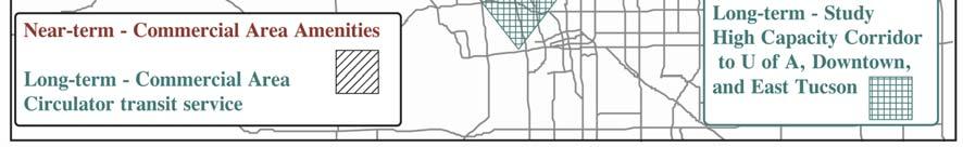
175 Exhibit 7-10 CONSOLIDATION OF WORKSHOP RECOMMENDATIONS (SOUTH HALF OF CORRIDOR) Final Report Page 7-21
176 Exhibit 7-11 BRIDGES WITH SUFFICIENCY RATINGS AT OR LESS THAN 80 PERCENT AND WHETHER THEY ARE INCLUDED IN PLANNED OR PROGRAMMED PROJECTS Structure No. Structure Name Mile Marker Road Segment Location Sufficiency Rating Are these addressed in Planned or Programmed Projects? 2006 Cañada Del Oro Bridge Tangerine Road to Hanley Boulevard Yes, in six-lane widening 4733 Twenty-Seven Wash RCB Culvert Pinto Lane to Golder Ranch Road Yes, drainage improvement project is planned 1550 Rillito Creek Bridge River Road to Auto Mall Drive Pima Wash RCB Culvert Rudasill Road to River Road Yes, in culvert/shoulder project RCB Culvert Hardy Road to Magee Road CMP Culvert Hardy Road to Magee Road RCB Culvert Calle Concordia to Hardy Road RCB Culvert Calle Concordia to Hardy Road RCB Culvert El Conquistador Way to Linda Vista Boulevard Yes, in six-lane widening RCB Culvert Pusch View Lane to El Conquistador Way Yes, in six-lane widening RCB Culvert Pusch View Lane to El Conquistador Way Yes, in six-lane widening RCB Culvert Hanley Boulevard to La Reserve Drive Yes, in six-lane widening. Final Report Page 7-22
177 In addition, ADOT and the local agencies should work together to develop a suitable uniform application of traffic signal preemption equipment along the corridor. Other alternatives include programming the planned Road Weather Information System north of Tucson system in the northern area of the corridor, and a Proposed Variable Message Sign at MP 92. The ITS improvements for the corridor are summarized in Exhibit Investment Options to Address AASHTO Design Deficiencies AASHTO design deficiencies were identified in project assessments. These included four horizontal curve deficiencies and three vertical curve deficiencies in the corridor. Some of these deficiencies will be addressed in planned or proposed projects, as indicated in Exhibit The deficiencies in the area from Willow Springs to Oracle would be addressed in the option proposed by this study to widen this section to four lanes. The deficiencies in the section from Miracle Mile to Ina Road could be addressed either through the proposed option to widen to eight lanes from Auto Mall Drive north, or the proposed option to construct an additional traffic lane (possibly a diamond lane) through this entire section Access Control Investment Options The procedure to develop an access management concept for the SR 77 corridor, involved dividing the roadway into urban, suburban, and rural segments based on the level of access control compatible with existing and future adjacent land uses. Exhibit 7-14 presents the current and proposed access conditions. Characteristics include the type of section (urban, suburban, and rural), adjacent land use, signal spacing, an access management strategy or the roadway segment, and driveway density. Access management strategies have been categorized into a comprehensive strategy and retrofit strategies, which are defined below. Comprehensive Access Management A comprehensive access management strategy blends land use and high level access management techniques to minimize the impacts of adjacent property on traffic operations and safety on SR 77. The characteristics of this strategy include: A multi-lane divided highway with a median. Long uniform signal spacing or grade-separated interchanges. Median openings between traffic signals or interchanges. Low driveway density. The strategy could also include frontage or backage roads connected to intersections or interchanges to provide access to adjacent properties. In addition, subdivisions and commercial properties would be designed with internal parallel streets connecting to major streets intersecting with SR 77. Final Report Page 7-23
178 Exhibit 7-12 ITS IMPROVEMENTS Final Report Page 7-24
179 Exhibit 7-13 EXISTING AASHTO DESIGN DEFICIENCIES FROM PROJECT ASSESSMENT REPORTS Project Assessment Begin MP End MP Horizontal Curves Have Excessive or Insufficient Superelevation for Design Speed Vertical Curves Exceed Criteria for Maximum Grade Vertical Curves Have Insufficient Stopping Sight Distance for Design Speed Are These Addressed in Planned or Programmed Projects? Junction Miracle No Mile to Ina Road Calle Concordia to Tangerine Road * Yes, widening to six lanes First Avenue to Tangerine Road Yes, widening to six lanes Willow Springs to Oracle No * Excessive but not deficient superelevation. Final Report Page 7-25
180 Segment I-10 to Oracle Road 1.4 Urban Mixed Commercial/ Miracle Mile to River Road Exhibit 7-14 PROPOSED CORRIDOR ACCESS MANAGEMENT CONCEPT SR 77 I-10 TO ORACLE Current Access Conditions Proposed Access Characteristics Access Length Driveway Signals per Type of Future Management Driveway Signal (miles) Land Use Density Mile A. Segment Land Use Strategy Density (1) Spacing High 3.6 Urban In-fill Retrofit Moderate 1/4 mile (>1/4 mile) Redevelop Industrial/Hotel Mixed Use 1.8 Commercial High 3.9 Urban Commercial Retrofit Moderate 1/4 mile (1/4 mile) Comprehensive River Road to Ina Road 4.6 Commercial Moderate 1.6 (>1/2 mile) Ina Road to El Conquistador Way El Conquistador Way to Golder Ranch Drive Golder Ranch Drive to Pinto Lane Pinto Lane to Saddlebrook Boulevard Saddlebrook Boulevard to End of Corridor 2.6 Commercial/ Multifamily Low 1.9 (1/2 mile) 7.3 Residential Very Low 1.0 (1 mile) 1.9 Low Density Residential 1.2 Very Low Density Residential 14.5 Very Low Density Residential Moderate 0.5 (2 mile) Low to Very Low 0.8 (1 mile) Suburban Commercial Retrofit Comprehensive Suburban Suburban Urban Urban Redevelopment on southern end. Planned Developments on northern end Large developments In-fill Commercial Mixed Use New Development Very Low N.A. Rural New Residential Development Low to Moderate 1.5 mile River, Orange Grove & Ina Comprehensive Low 1/2 mile Comprehensive Low 1 mile Retrofit Low to Moderate 1 mile Comprehensive Low 1 mile Comprehensive Low 2.0 miles Redesign SR 79/SR 77 Intersection 1. Driveway densities: Very low less than 10 access points per mile; Low greater than 10 and less than 20 access points per mile; Moderate greater than 20 and less than 40 access points per mile; High greater than 40 access points per mile Final Report Page 7-26
181 Retrofit Access Management Strategies Retrofit access strategies are techniques that are applied to existing roadway sections and retrofit techniques can be applied to mitigate the adverse effects of unregulated access. The application of a retrofit program to manage access to an existing roadway is often difficult. Restraints, such as the unavailability of land make certain access management techniques impossible. In addition, property rights need to be respected and the resulting legal, social, and political aspects of access management need to be thoroughly understood by the implementing agency and all stakeholders. A key retrofit strategy is consolidation of driveways. The need for consolidating driveways along SR 77 was identified through an analysis of driveway density and crash types that can be related to access. Roadway segments along SR 77 were inventoried to identify need to consolidate driveways based on driveway density and crash rates over a three-year history. Exhibit 6-10 (see Chapter 6) shows the locations of the Level 1 and Level 2 access management segments along the corridor. Other segments were included in a given level to form a consistent larger segment. It is recommended that these segments be studied in detail to develop specific access management design concepts for each segment based on the proposed access characteristics provided in Exhibit Other Improvements Based on input during the Technical Advisory Committee field review and other information, a need exists for a grade-separated wildlife crossing to recognize an existing wildlife corridor connecting Cañada del Oro and Big Wash. Suggestions have been made for this crossing to be located approximately 1-1/2 miles north of the Catalina State Park entrance, near the Cañada del Oro Wash crossing, and other locations using State Trust land. During road improvements in this general area, a wildlife crossing should be implemented. Final Report Page 7-27
182
183 8. OPPORTUNITIES AND CONSTRAINTS This chapter identifies financial, right of way, and environmental opportunities and constraints that may impact the development of transportation improvements. 8.1 FINANCIAL OPPORTUNITIES AND CONSTRAINTS Based on information from the Pima Association of Governments 2025 Regional Transportation Plan Amendment (Adopted January, 2004) current revenue sources for the Regional Transportation Plan consist of Federal, State, and local highway funds, which include: State vehicle license tax, revenues from the State transportation taxes distributed to the jurisdictions and the Metropolitan Planning Organization, lottery revenues, development impact fees, construction sales tax, fare box proceeds, and general fund contributions. Most revenue sources are restricted in how they can be used. Federal funds usually require State or local match dollars. An opportunity for additional revenue for all modes of transportation is a local sales tax to fund a voter-approved slate of projects developed through the Regional Transportation Authority. 8.2 RIGHT-OF-WAY OPPORTUNITIES AND CONSTRAINTS General right-of-way opportunities and constraints along SR 77 were evaluated through a review of right-of-way maps for the corridor. In the review of the right-of-way maps, emphasis was placed on identifying the minimum ROW width on SR 77 segments and using this information to identify areas that had insufficient right-of-way width for either the eight-lane widening alternative or for construction of diamond lanes. These areas are shown in Exhibit 8-1, and shown in tabular form in Exhibit 8-2. Based on the information presented in Section 7.1.4, it was assumed that the urban cross-section of the eight-lane alternative would have a mid-block width of 146 feet, and the fringe urban cross-section would require 200 feet of ROW. The urban cross-section for the diamond lane alternative was assumed to have the following mid-block characteristics: 6-2 travel lanes 2-15 diamond lanes (buses, bicycles, and right-turns) 1-20 median, and 2-8 areas behind the curb (including sidewalk) Total ROW = 138 feet The fringe urban cross-section is capable of accommodating the diamond lane alternative within the 200 feet of available ROW. Minimum mid-block right-of-way widths for segments of SR 77 are indicated in Exhibit 8-3. These minimum ROW widths were used to identify general constraints to roadway widening along the corridor by comparing these widths to the mid-block cross-section width required for the eight-lane and diamond lane alternatives. The results of this comparison are also shown in Exhibit 8-3. Final Report Page 8-1
184 Exhibit 8-1 SR 77 ROW CONSTRAINTS TO ROADWAY CAPACITY IMPROVEMENTS Final Report Page 8-2
185 Exhibit 8-2 GENERAL OPPORTUNITIES OR CONSTRAINTS FOR ROADWAY CAPACITY IMPROVEMENTS Location Opportunity or Constraint Miracle Mile, I-10 to Oracle Road Constraints from existing development and cemeteries on the north side of the road. SR 77, Miracle Mile to Limberlost Road Constraints from limited ROW, existing development, and cemeteries on west side of SR 77, between Miracle Mile and Prince Road. SR 77, Limberlost Road to Auto Mall Constraints include limited ROW, and existing development. Drive Northern Hills Drive to Orange Grove Constraints include lack of available ROW and existing Road development. Oracle Road/Orange Grove Road Existing development and lack of ROW is a constraint to Intersection grade-separated intersection implementation. SR 77, CDO Wash Pinal County border to Project End Bridge constraints, drainage considerations. Opportunities include limited existing development and available right-of-way. The analysis indicates that there are some very significant ROW constraints to either the eightlane or the diamond lane alternatives from Miracle Mile Road to north of Auto Mall Drive. From a location north of Auto Mall Drive to Ina Road the ROW constraints are less severe, but still present, particularly from Casas Adobes Road to Ina Road. This is consistent with the more detailed ROW analysis presented in Section of this report. The analysis also suggests that from Ina Road north, the existing 200 feet of ROW is generally sufficient to accommodate either the eight-lane roadway alternative or the option to introduce diamond lanes along the corridor. This is also consistent with the more detailed evaluation of ROW provided in Section of this document. This evaluation of the ROW constraints lends support to the recommendation that the eight-lane roadway alternative be considered from only north of Auto Mall Drive. This analysis also suggests that the implementation of a diamond lane may not be practical south of River Road. Preliminary plans for three grade-separated intersections were developed, with one at Ina Road, Orange Grove Road, and River Road. Assuming that a four-lane overpass is used (the detailed micro-simulation indicates that this is operationally feasible), each of the GSIs would require approximately 200 feet of ROW along Oracle Road. At River Road, the preliminary plan indicates that the GSI would fit within the existing ROW with no property impacts on either Oracle Road or River Road. At Orange Grove Road the 200 feet of ROW required for the GSI would have significant impacts on existing commercial development at the intersection, and this could represent a significant constraint at this location. Final Report Page 8-3
186 Exhibit 8-3 COMPARISON OF SR 77 SEGMENT EXISTING RIGHT-OF-WAY WIDTHS TO REQUIREMENTS FOR EIGHT-LANE OR DIAMOND LANE ALTERNATIVES Minimum Mid-Block ROW Width Mid-Block Width Required for Eight-Lane Alternative (ft) Is Existing ROW Sufficient? Mid-Block Width Required for Diamond Lane Alternative (ft) Is Existing ROW Sufficient? Segment From Segment To Miracle Mile/Laguna Street Delano Street Unknown 146 No 138 Unknown Delano Street Fort Lowell Road No 138 No Fort Lowell Road South of West Navajo Road No 138 No South of West Navajo Road North Yavapai Road No 138 No North Yavapai Road W. Prince Road No 138 No West Prince Road Pastime Road No 138 No Pastime Road W. Roger Road No 138 No West Roger Road Limberlost Drive No 138 No Limberlost Drive North of Auto Mall Drive No 138 Yes North of Auto Mall Drive ~410 ft. N. of Northern Hills Dr Yes 138 Yes ~410 ft. N. of Northern Hills Dr. Casas Adobes Road Yes 138 Yes Casas Adobes Road Ina Road No 138 Yes Ina Road Tangerine Road Yes 200 Yes Notes The mid-block width for the 8-lane alternative is based on dimensions for the urban and rural cross-sections presented in Section The width for the diamond lane alternative is 138 ft. for the urban cross-section, and 198 ft. for the rural cross-section. N/A= not available Final Report Page 8-4
187 The impacts to existing businesses, including a potential full take, and the elimination of existing parking could result in an added cost of several million dollars for the GSI at Orange Grove Road. This could result in this alternative becoming more expensive than widening to eight-lanes in this area. Therefore, a GSI at Orange Grove Road is only recommended if it can be shown through a more detailed study to be more cost-effective than widening SR 77 to eight-lanes in this area. At Ina Road, the GSI appears as though it could be accommodated within the existing ROW along Oracle Road. The traffic analysis at this location indicated the potential need for dual right-turn lanes on westbound Ina Road at Oracle Road. The provision of dual right-turn lanes would have significant ROW impacts on the northeast corner of this intersection. 8.3 ENVIRONMENTAL ISSUES AND CONSTRAINTS Environmental constraints that could potentially impact development of transportation improvement projects on the corridor are described as follows: Terrain The terrain within the project area does not appear to be a critical constraint in the development of improvement projects within the corridor Sensitive Species and Habitats There are 20 species of plants and animals in Pima County, Arizona that are listed as threatened or endangered by the U. S. Fish and Wildlife Service (USFWS), and there are 14 species listed in Pinal County, Arizona. These species and their habitats are protected by the Endangered Species Act (ESA) of 1973, and must be considered prior to development. Consultation with the USFWS may be required if development will impact any of these species or designated critical habitat. The Arizona Game and Fish Department (AGFD) Heritage Data Management System (HDMS) documents the known locations of special status species in the state. In a letter dated February 10, 2003, Sabra Schwartz, AGFD HDMS Coordinator identified seven special status species that are known to occur within the vicinity of the project area. Exhibit 8-4 lists these special status species. AGFD did not offer any specific recommendations regarding these species at this time; however, these species will be addressed during the design of specific projects and mitigated for if necessary. The HDMS can be used as a guide of potential species and habitats that have been documented in the SR 77 Corridor. It is important to note that other species may occur in the areas that have not yet been documented Cactus Ferruginous Pygmy Owl Surveys Portions of the SR 77/Oracle Road Multimodal Corridor are located within Survey Zones 1 and 2 for the pygmy-owl as designated by the U. S. Fish and Wildlife Service (USFWS). These survey zones are shown in Exhibit 8-5. Survey Zone 1 includes areas within the current range of the pygmy-owl with a high potential for occupancy. This zone includes portions of Pima and southern Pinal Counties and Final Report Page 8-6
188 Exhibit 8-4 AGFD SPECIAL STATUS SPECIES THAT ARE KNOWN TO OCCUR IN THE VICINITY OF THE CORRIDOR AREA Common Name Scientific Name Status Arizona Metalmark Calephelis rawsonii arizonensis S (USFS) California Leaf-Nosed Bat Macrotus californicus SC, S (BLM), WSC Thornber Fishhook Cactus Mammillaria thornberi SR Pima Indian Mallow Abutilon parishii SC, S (USFS), SR Sonoran Desert Tortoise Gopherus agassizii SC, WSC (Sonoran population) Lowland Leopard Frog Rana yavapaiensis SC, S (USFS), WSC Giant Spotted Whiptail Cnemidophorus burti stictogrammus SC, S (BLM), WSC Status Definitions: WSC: Wildlife of Special Concern in Arizona. Species whose occurrence in Arizona is or may be in jeopardy, or with known perceived threats or population declines, as described by the AGFD s listing of Wildlife of Special Concern in Arizona (WSCA, in prep.) Species included in WSCA are currently the same as those in Threatened Native Wildlife in Arizona (1988). SC: Species of Concern. The terms Species of Concern or Species at Risk should be considered termsof-art that describe the entire realm of taxa whose conservation status may be of concern to the USFWS, but neither term has official status (currently all former C2 species). S: Sensitive. Species classified as sensitive when occurring on lands managed by U.S. Forest Service (USFS) or Bureau of Land Management (BLM). SR: Salvage Restricted. Arizona Native Plant Law (1999) requires a permit for collection. Final Report Page 8-7
189 Exhibit 8-5 PYGMY OWL SURVEY ZONES PINAL Catalina Purple = Survey Zone 1 Blue = Survey Zone 2 encompasses all recent pygmy-owl locations. Within the SR 77/Oracle Road Multimodal Corridor, Survey Zone 1 extends from Ina Road, north to approximately Pusch View Lane. Survey Zone 2 includes the currently known range of the pygmy-owl within Pima County and southern Pinal County. The USFWS expects pygmy-owls to disperse into suitable habitat in Zone 2 and there is a greater likelihood of documenting new pygmy-owl locations within this zone. Within the SR 77/Oracle Road Multimodal Corridor, Survey Zone 2 extends from River Road north to Ina Road, and from just south of Pusch View Lane north to through the terminus of the project area. Pygmy-owl surveys could be required where suitable habitat occurs north of River Road prior to any ground disturbance activities. USFWS survey protocol requires three surveys to be conducted each year for two consecutive years prior to construction. At least one survey each year must be conducted during the time period of February 15 to April 15, when the Pygmy-owl is most active. Final Report Page 8-7
190 8.3.3 Cultural Resources Previously Recorded Archaeological Sites Not Listed on the National Register of Historic Places Sixteen archaeological sites have been recorded along the current alignment of SR 77 Corridor that are not currently on the National Register of Historic Places (NRHP). Many of these sites are considered eligible for inclusion to the NRHP, but adequate assessments have not been conducted at this time. Six of these sites are prehistoric artifact scatters, five are historic roads, two are multiple component (containing prehistoric and historic elements), one is a historic artifact scatter, and one is a historic steam pump. An archaeological survey may be required to determine if the potential for subsurface archaeological deposits exists. Following an archaeological survey, a determination regarding site eligibility shall occur and management tactics may include preservation, archaeological testing, monitoring, or data recovery. If previously unidentified cultural resources are encountered during any activity related to a recommended improvement within the SR 77 corridor, the contractor must stop work immediately at that location and take all reasonable steps to secure the preservation of those resources. High Capacity Alternative A high-capacity alternative corridor has been proposed to the west of SR 77, between La Cholla Boulevard and La Canada Drive. If this corridor is used, cultural resources issues will arise that are similar to those identified for the SR 77 corridor. However, the identification of those issues within the alternate corridor is beyond the scope of this project. Additional work will be required to identify resources within the alternate corridor. Section 4(f) Lands Section 4(f) evaluations may be necessary for each specific improvement identified where FHWA funds are used. Section 4(f), of the U.S. Department of Transportation Act of 1966, states that the Federal Highway Administration may approve a transportation program or project requiring publicly-owned land of a public park, recreation area, or wildlife and waterfowl refuge of national, state, or local significance, or land of a historic site of national, state, or local significance (as determined by the federal, state, or local officials having jurisdiction over the pare, area, refuge, or site) only if there is no prudent or feasible alternative to using that land and the program or project includes all possible planning to minimize harm to the park, recreation area, wildlife and waterfowl refuge, or historic site resulting from the use (49 U.S.C. 303). Cemeteries Two privately owned cemeteries are immediately adjacent to SR 77 and require careful consideration during the planning phases of this project. Holy Hope Cemetery (3555 North Oracle Road) and Evergreen Memorial Park (3015 North Oracle Road) are positioned along SR 77 near the junction of Miracle Mile and Oracle Road. Holy Hope Cemetery opened in 1906 and Evergreen Memorial Park opened in These institutions may be eligible to the NRHP and Final Report Page 8-8
191 require special consideration. In addition, the presence of mortuary remains also requires special attention if a project would have use of these properties. Public Parks Five parks are adjacent to SR 77 and must be considered when major roadway changes occur. Rillito River Park (Pima County) Coronado National Forest Catalina State Park James Kreigh Park Pusch Ridge Wilderness Area Air and Noise Quality Air Quality Transportation construction projects on the SR 77 corridor will require an Air Quality Activity Permits from the Pima County Department of Environmental Quality. This permit will address the increased amounts of airborne particulate matter (PM-10) that will result from construction activities, and provide guidelines for dust mitigation. Mitigation measures can be expected to include the use of spray bars, wetting agents, dust suppressants, and the covering of loads. Transportation construction projects on the SR 77 corridor must also be listed in the Arizona Statewide Transportation Improvement Program (STIP) as required by the Transportation Equity Act for the 21st Century (TEA-21), and must comply with federal National Ambient Air Quality Standards (NAAQS). Noise Quality If the project involves additional through lanes (added capacity), changes to the vertical or horizontal alignment, or new alignment, a noise analysis will be required. Noise impacts must be addressed in compliance with Title 23, Code of Federal Regulations, Part 772 (23 CFR 772), Procedures for Abatement of Highway Traffic noise and Construction Noise Title VI Issues Title VI issues need to be considered for any project that may have an impact on members or minority groups or on persons who may be disadvantaged by reason of age, disability, income, or lack of personal transportation. Exhibit 8-6 lists areas within the SR 77 corridor to which Title VI is especially relevant. Specific information on Title VI characteristics of the corridor is provided in Section 3.2 of this document. Final Report Page 8-9
192 Exhibit 8-6 AREAS WITH POSSIBLE TITLE VI ISSUES Community Northern Project Limits to Pima/Pinal County Border Possible Title VI Issues Higher than average percent below poverty level, and higher than average percent disabled population. Higher than average minority population. County Line to Ina Road Higher than average proportion of persons over age 65. Ina Road to River Road Higher than average proportion of persons over age 65. River Road to Speedway Boulevard Higher than average percent below poverty level, higher than average percent disabled population, and higher than average minority population. Transportation improvements are based on providing benefits to all, and minimizing negative impacts, particularly to minority, elderly, and low-income groups. Looking at the corridor as a whole, projects recommended are not expected to disproportionately affect minority, elderly, or disadvantaged populations. In particular, the proposed project alternative to realign Fort Lowell Road in the vicinity of SR 77 was not recommended, in part, because of right-of-way impacts to a low-income area. Additionally the transit projects recommended for this corridor will benefit all residents, and particularly areas with Title VI concerns. Efforts were made throughout the corridor profile study to involve members of minority and low income communities. Three open houses to obtain input on corridor issues are planned to be held to obtain input on the recommendations. When individual projects are programmed, the specific impacts will be evaluated and those projects that may directly affect the minority, elderly and disadvantaged populations identified in this screening will be incorporated in a continuing public participation process. This process will actively seek input on the impacts and potential mitigation measures related to the specific project Pima County Environmentally Sensitive Roadway Guidelines The portion of the SR77/Oracle Road Multimodal Corridor that is within Pima County qualifies as an Environmentally Sensitive Roadway (ESR) as defined by the Pima County Department of Transportation. The ESR design process incorporates biological, cultural, and visual resource discovery into the design process for projects within Environmentally Sensitive Lands (ESL) with the goal of minimizing disturbances to these valuable resources. In Pima County, ESL are defined by certain Sonoran Desert Conservation Plan (SDCP) Conservation Lands System (CLS) categories and/or the designation of a Scenic and/or Historic Route. ESL may exhibit several characteristics, such as the presence of habitat for special status species, vegetation communities that are growing in scarcity, cultural resources, and designated scenic routes. Final Report Page 8-10
193 8.3.7 Pusch Ridge Wilderness Area The National Wilderness Preservation Act of 1964 protects and preserves such designated lands by prohibiting human facilities such as roads, power lines, and other development on these lands. The Pusch Ridge Wilderness Area of the Coronado National Forest (Santa Catalina Ranger District) is located just east of SR 77/Oracle Road Multimodal study area, in the vicinity of Oro Valley (see Exhibit 8-7). This wilderness area is among the most biologically diverse in the nation. The SR 77/Oracle Road Multimodal Corridor project area includes approximately 5.5 square miles (3,565 acres) of the Pusch Ridge Wilderness Area and 6 square miles (3,990 acres) of the adjacent Catalina State Park. A critical environmental constraint is that projects for the SR 77 Corridor Profile Study cannot impact the Pusch Ridge Wilderness Area Drainage Considerations 100-Year Floodplains There are several areas within the SR 77/Oracle Road Multimodal Corridor Project that are identified as Federal Emergency Management Agency (FEMA) 100-year floodplains. If project work affects these areas then a Floodplain Permit(s) will need to be obtained for these areas. Drainage Considerations for Intersection Improvements Exhibit 7-2 of this document illustrates twelve possible locations for intersection improvements. There are no constraints in regards to drainage for these alternatives. The standard drainage concerns would exist with these improvements. These would include the possible need for new storm drain or cross culvert extensions with the addition of new pavement. Drainage Considerations for Grade-Separated Interchange Alternatives The preliminary plans indicate that in all proposed grade-separated alternatives SR 77 will be elevated and the east/west roadway would remain at existing grade. This approach removes the drainage issues at the intersections. A specific example of a constraint if the design is revised to construct below grade is Oracle Road/Orange Grove Road. There are currently two 72 SRPs which collect and convey Casa Adobes Wash north of Orange Grove Road and connect into the existing RCB below Oracle immediately south of the intersection. The culverts are designed to convey the 100-year discharge of 1050 cfs. This is a significant flow and though not impossible to mitigate for, a large pump system would be required to ensure that the underpass would be driveable during intense thunderstorms. Drainage Considerations for Diamond Lane Alternative The alternative of constructing diamond lanes along any stretch of the project does not produce any critical constraints with regards to drainage. The installation of a curbed outside lane would only require construction of a new storm drain or depressed curbs spaced at an appropriate interval to allow for runoff to exit the pavement. Final Report Page 8-11
194 HOLLA BL N LA CHOLLA BL N 1ST AV N ALVERN Exhibit 8-7 PUSCH RIDGE WILDERNESS AREA (Shown in Blue) N LA CHOLLA BL N LA CHOLLA BL W NARANJA DR N LA CANADA DR N LA CANADA DR W NARANJA DR W LAMBERT LN W LINDA VISTA BL W CALLE CONCORDIA N ORACLE RD N 1ST N ORACLE RD E LINDA VISTA BL N ORAC N LA CHOLLA BL W MAGEE RD W HARDY RD N LA CANADA DR N ORACLE RD W MAGEE RD N NORTHERN AV N ORACLE RD E MAGEE RD N CHRISTIE DR NA RD W INA RD W INA RD W INA RD E INA RD E INA RD INA RD E INA RD E INA RD Drainage Considerations for Roadway Widening Options The widening of the existing roadway section does not involve any critical constraints. The design would only need to incorporate a storm drain system if curbs were constructed. If the design did not use a curb section then the design would only need to ensure that the roadside drainage swale has sufficient capacity to take into account the increase in runoff. Drainage Considerations for Alternative High-Capacity Corridor The east/west alternative of expanding Tangerine Road from SR-77 to I-10 has no critical constraints associated with the project. The roadway widening would follow current design guidelines. The design would require new cross culverts at all of the numerous existing dip sections and possible up sizing of any under capacity existing cross culverts. The two north/ south alternatives have no critical constraints either. Either alternative, like Tangerine Road, would follow current drainage guidelines. The only negative for the La Cholla Boulevard Final Report Page 8-12
195 alternative would be a new bridge over the Cañada del Oro Wash where only a dip section exists today. The La Canada Drive alternative would not have this additional expense since the Town of Oro Valley has a bridge-widening project presently under construction. Projects that disturb greater than one acre will require a National Pollutant Discharge Elimination System (NPDES) permit (Section 402 of the Clean Water Act). Any construction actions that result in a discharge of dredged or fill material into waters of the U.S., including wetlands, will require a Section 404 permit, and will require Section 401 certification based on the anticipated effects of any construction projects on water quality Summary of Environmental Resource Issues The SR 77/Oracle Road Multimodal Corridor Project will need to address the following constraints during the design process: possible consultation with the USFWS regarding threatened and endangered species, possible surveys for cactus ferruginous pygmy-owls, the proximity to the Pusch Ridge Wilderness Area, Floodplain Permitting, Air Quality Permitting, Section 4(f) Permitting, Noise Permitting, and Clean Water Act Permitting. The proximity of the final alternative to the Pusch Ridge Wilderness is the only identified biological/ecological constraint that will drive the location and project description for the SR 77/Oracle Road Multimodal Corridor Project. The other constraints will be broadly applied across the project area, regardless of the final project description. Although all of these constraints will need to be addressed during the design process, none of them represent fatal flaws, or issues that would present any foreseeable hindrance to construction or economic feasibility. Final Report Page 8-13
196
197 9. DEFICIENCY PRIORITIZATION AND PROPOSED TRANSPORTATION PROJECTS 9.1 PRIORITIZATION OF DEFICIENCIES The transportation deficiencies identified in Chapter 6 were assigned priorities based on a ranking of 1 to 3 with the 1 indicating the highest priority and 3 the lowest. Priority 1 deficiencies consist of the following: Traffic safety needs. Existing levels of service D or worse. Other needs to be addressed by projects in ADOT s current Five-Year Highway Construction Program. All of the following deficiencies that were not eligible for Priority 1 were classified as Priority 2: Needs identified by ADOT District Engineers or local jurisdictions within the corridor. Forecast year 2030 levels of service D or worse. Nonexistent intercity bus service within the corridor. Access management needs. All deficiencies that were not in the categories defined above were assigned Priority 3. Exhibit 9-1 shows the priority ratings assigned to the deficiencies identified throughout the corridor. 9.2 PROPOSED IMPROVEMENT PROJECTS Exhibit 9-1 lists proposed improvement projects to mitigate the deficiencies identified in summarized in Chapter 6 of this document. The table lists project locations generally from north to south. Projects include the following categories: Roadway Capacity Improvements Lighting Projects Intelligent Transportation System Projects Access Management Projects Transit Projects Bicycle and Pedestrian Projects Projects Previously Programmed It should be noted that the right-of-way limitations at the intersection of Orange Grove Road could constrain the application of the grade-separated intersection at this location. A more detailed study of the ROW impacts of this alternative should be conducted to determine if a GSI would be more cost-effective than widening SR 77 to eight-lanes through this area. The recommendation of the GSI at Orange Grove is conditional upon the findings of such an investigation. Final Report Page 9-1
198 The capacity and level of service analysis conducted by this study indicates that the planned sixlane cross-section for SR 77 will not provide sufficient capacity to accommodate year 2030 traffic at an acceptable level of service. However, it should be noted that the Arizona Department of Transportation does not build eight-lane urban or fringe urban arterials. Several alternative routes have been proposed for improvement by the Pima Association of Governments Regional Transportation Authority Plan being developed at the time this study was conducted. These improvements include widening of La Canada Boulevard, La Cholla Boulevard, and First Avenue. These improvements will provide some congestion relief along some sections of SR 77, but based on the congestion information provided by PAG for this study, it does not appear that these improvements will mitigate congestion along SR 77. It should also be noted that at this time there are only a few projects in the PAG 2030 Regional Transportation Plan (RTP), including the Regional Transportation Authority (RTA) projects, that directly address the congestion, safety, and access management issues on SR 77 identified in this study. Therefore, significant additional multi-modal improvements will be required to mitigate the deficiencies identified by this study. Transit projects primarily involve feasibility studies to determine the eventual phasing of transit improvements in the corridor. The PAG 2030 RTP and RTA projects include several transit system improvements affecting Oro Valley and the SR 77 corridor that directly address transit issues identified in this study. 9.3 COST ESTIMATES Exhibit 9-2 provides generalized unit cost estimates for various types of transportation projects. Most estimates are based on similar project cost estimates from the Regional Transportation Plan, previous corridor profiles, and on costs of similar projects in the current State Five-Year Transportation Facilities Construction Program. All costs are in 2005 dollars. It should be emphasized that these are tentative cost estimates for planning purposes only. Site-specific cost estimates will be developed at the time of project scoping. Where a previously planned or programmed project for the PAG 2030 RTP, RTA, or TIP directly address an identified deficiency, the project cost estimate form these planning documents was used in this study. Also, costs are based on programmed project cost estimates, project assessment reports, and other corridor profile studies. These estimates are for planning purposes and may not be reflective of true construction or implementation cost estimates. A summary of the estimated costs for widening SR 77 to an eight-lane facility in comparison to, and in conjunction with, the use of up to three grade separated intersections is provided in Exhibit 9-3. Final Report Page 9-2
199 Exhibit 9-1 LIST OF PROPOSED PROJECTS Number Milepost Location SR 77 Deficiency Deficiency Priority Ranking Project Total Cost ($ X 1,000) Affected Jurisdiction Time Frame Planned or Programmed CAPACITY PROJECTS C-1 TBD TBD Need for alternative high capacity corridor to relieve congestion along SR Feasibility study for alternative high capacity corridor. Study to evaluate regional impacts of new high capacity corridor N/S connecting to a new high capacity E/W corridor. This study would determine whether sufficient traffic could be diverted from Oracle Rd. to eliminate the need to widen to 8-lanes or construct GSIs. $400 Pima County, ADOT, Oro Valley, City of Tucson near No C-2 C-3 C SR junction to Town of Oracle Poor LOS by DCR for 4-lane widening $500 Pinal County long No SR junction to Town of Oracle Poor LOS by C Milepost 91.9 C-6 92 SR 77, Milepost 92 SR junction to Town of Oracle (12.2 mi) Poor LOS by C SR 77/SR 79 junction C-8 C-9 C C C-12 C-13 C-14 C-15 C-16 C-17 C and Drainage culvert headwall is in the clear zone 1 Identified need in ADOT Statewide Plan Intelligent Transportation Infrastructure (Dec. 2002) 3 Safety concerns include elevation changes, narrow road, poor sight distance, late afternoon sun blinds motorists. Also, second highest ratio of day to night crashes. 1 SR 77/79 junction to Pinal County Line Poor LOS by DCR for 6-lane widening $500 SR 77/79 junction to Pinal County Line Poor LOS by Design for 6-lane widening $1,800 SR 77/79 junction to Pinal County Line Poor LOS by Design of 4-lane widening project $3,700 Pinal County long No Construction of four lane widening $36,600 Pinal County long No Reconstruct Drainage Culvert $650 Pinal County near No Provide Variable Message Sign at MP 92 $200 Pinal County mid No Reconstruct intersection with widening. Provide roadway lighting. $500 Pinal County near No Widen to 6 lane divided roadway, possibly with roadway segment lighting. $18,000 ADOT/Pinal County long No ADOT/Pinal County long No ADOT/Pinal County long No SR 77: Pinal County Line to Tangerine Road, Phase 1 Capacity deficiencies 1 Widen to 6 lanes $18,000 ADOT near Widen to 6 lanes SR 77: Tangerine Road to La (incorporate equestrian ped Reserve Drive & Pusch View Lane pushbutton at Linda Vista to Calle Concordia Capacity deficiencies 1 Blvd. Intersection) $26,500 ADOT near SR 77, Golder Ranch Road to Oro Valley Town Limits (north limits)(1.5 miles) Poor LOS by DCR for 8-lane widening $200 Pima County long No SR 77, Golder Ranch Road to Oro Valley Town Limits (north limits)(1.5 miles) Poor LOS by Design for 8-lane widening $1,000 Pima County long No SR 77, Golder Ranch Road to Oro Valley Town Limits (north limits)(1.5 miles) Poor LOS by SR 77, Oro Valley northern Town limits to Oro Valley southern Town limits (south of Magee Road) Poor LOS by DCR for 8-lane widening $500 SR 77, Oro Valley northern Town limits to Oro Valley southern Town limits (south of Magee Road) Poor LOS by Design for 8-lane widening $5,300 SR 77, Oro Valley northern Town limits to Oro Valley southern Construction of 8-lane Town limits (south of Magee widening including $700K Road) Poor LOS by for ROW $53,700 Yes (PP-1) Yes (PP-2) Construction of 8-lane widening $10,000 Pima County long No Town of Oro Valley long No Town of Oro Valley long No Town of Oro Valley long No C SR 77 / First Avenue Crash rate increase 1 Intersection improvements $500 ADOT / Oro Valley near Yes (PP-3) Final Report Page 9-3
200 Exhibit 9-1 LIST OF PROPOSED PROJECTS (Continued) Number Milepost Location SR 77 Deficiency C SR 77 / Ina Road C SR 77 / Ina Road C SR 77 / Ina Road Deficiency Priority Ranking Congestion, interim need for WB right turn lanes 1 Congestion, interim need for WB right turn lanes 1 Congestion, interim need for WB right turn lanes 1 C SR 77/Orange Grove Road Congestion 1 C SR 77/Orange Grove Road Congestion 1 C SR 77/Orange Grove Road Congestion 1 C SR 77/ River Road Congestion 1 C SR 77/ River Road Congestion 1 C SR 77/ River Road Congestion 1 C SR 77/ Auto Mall Drive Total Cost ($ X Project 1,000) DCR for intersection improvements. Possible Grade-Separated Interchange (requires additional capacity improvements northbound to Magee Road) $300 Design of intersection improvements (possible To be GSI) determined Construction of intersection improvements (possible GSI) including $500K for ROW To be determined DCR for intersection improvements (ROW constraints may prohibit a GSI at this location) $300 Design of intersection improvements To be determined Construction of intersection To be improvements determined DCR for intersection improvements (possible GSI) $300 Design of intersection improvements Construction of intersection improvements (possible GSI including $3M for ROW) To be determined To be determined Insufficient capacity for southbound left turn movement 1 Intersection Improvements $500 C SR 77/ Wetmore Road High intersection crash rate 1 Intersection Improvements $500 C SR 77/ Limberlost Road C SR 77/ Roger Road C SR 77/Prince Road Need for right turn lanes and left turn phasing. 1 Intersection Improvements $500 Need for right turn lanes northbound and southbound. 1 Intersection Improvements $500 Poor future LOS, need for right turn lanes 1 Intersection Improvements $300 C SR 77/ Ft. Lowell Road Need for right turn lanes 1 Intersection Improvements $500 C C Miracle Mile Road/ Flowing Wells Road High intersection crash rate 1 Intersection Improvements $500 Widen to 8-lanes (This is an alternative to GSIs at River Oro Valley southern Town Road, Orange Grove Rd, limits (south of Magee Rd.) to and Ina Rd.) including Auto Mall Drive Congestion 2 $771K for ROW $36,771 Affected Jurisdiction Time Frame Planned or Programmed ADOT/ Pima County near Yes (PP-4) ADOT/ Pima County ADOT/ Pima County ADOT / Pima County ADOT / Pima County ADOT / Pima County mid mid mid Yes (PP-4) Yes (PP-4) Partially under PP-8 Partially under PP-8 Partially under PP-8 ADOT / Pima County mid Yes (PP-5) ADOT / Pima County mid Yes (PP-5) ADOT /Pima County mid Yes (PP-5) ADOT / City of Tucson near No ADOT / City of Tucson near No ADOT / City of Tucson near No ADOT / City of Tucson near No ADOT / City of Tucson near Yes (PP-6) ADOT / City of Tucson near No ADOT / City of Tucson near No ADOT/Pima County/City of Tucson long No ACCESS CONTROL PROJECTS A-1 N/A SR 77 Corridor A-2 A , A A-5 A , A SR 77, River Road to Miracle Mile Road, I-10 to Oracle Road Lack of coordination regarding access policies on the corridor 2 Highest need for driveway consolidation 2 SR 77, Hardy Road to River Road Need for driveway consolidation 2 SR 77, Pinto Lane to Golder Ranch Road Need for driveway consolidation 2 SR 77, River Road to Miracle Mile Road, I-10 to Oracle Road Develop and Adopt Access Management Plan $350 ADOT and jurisdictions near No Develop DCR for Access Retrofit Plan $50 ADOT/COT near No Develop DCR for Access Retrofit Plan $50 Develop DCR for Access Retrofit Plan Included in roadway widening ADOT/Pima County near No ADOT/ Pima County /Catalina long No Highest need for driveway consolidation 2 Implement Access Plan $5,000 ADOT/COT near No SR 77, Hardy Road to River Road Need for driveway consolidation 2 Implement Access Plan SR 77, Pinto Lane to Golder Ranch Road Need for driveway consolidation 2 Implement Access Plan Included in roadway widening Included in roadway widening ADOT/Pima County long No ADOT/ Pima County /Catalina long No Final Report Page 9-4
201 Exhibit 9-1 LIST OF PROPOSED PROJECTS (Continued) Number Milepost Location SR 77 Deficiency Deficiency Priority Ranking Project Total Cost ($ X 1,000) Affected Jurisdiction Time Frame Planned or Programmed TRANSIT PROJECTS T-1 various T-2 various T-3 various T-4 various T-5 various SR 77/SR 79 junction, South of Saddlebrooke Boulevard, Near Tangerine Road/La Cholla Blvd. Intersection, First Ave./SR 77 Intersection, Magee Rd,/ SR 77 Intersection, Ina Rd./SR 77 Intersection, River Rd./ SR 77 Intersection Town of Catalina from Golder Ranch Road north. From I-10/Miracle Mile to River Road. SR 77/Magee Road intersection commercial area. SR 77/Ina Road intersection commercial area. Need for additional Park-and-Ride Lots to support improved transit service. 2 Need for improved access to transit service. 2 Need for improved access to transit service. 2 Need for improved access to transit service. 2 Need for improved access to transit service. 2 T-6 various Town of Catalina Lack of local transit service 2 SR 77 from Saddlebrooke Park & Ride lot to Tohono Tadai T-7 various Transit Center Peak period transit level of service 2 T-8 various T-9 various T-10 various From First Ave. /SR 77 area to north of Tangerine Road. Lack of local transit service 2 Orange Grove Rd. corridor from SR 77 to I-10 Lack of local transit service 2 SR 77/Saddlebrooke Blvd. Park & Ride lot to the Town of Oracle. Lack of local transit service 3 T-11 various Town of Oracle Lack of local transit service 3 T-12 various Saddlebrooke development. Lack of local transit service 3 SR 77 from Saddlebrooke Park & Ride lot to Tohono Tadai T-13 various Transit Center Peak period transit frequency 3 T-14 various SR 77 from Saddlebrooke Park & Ride lot to Tohono Tadai Transit Center T-15 various SR 77 to I-10 Link SR 77 to University of Arizona, Downtown and east Tucson area T-16 various links. BICYCLE /PEDESTRIAN PROJECTS Lack of high-capacity transit service. 3 Lack of high-capacity transit service. 3 Lack of high-capacity transit service. 3 Implement Park & Ride Lots as transit service extends north and service improves. Amenities for transit access, including sidewalks, crosswalks, shelters, benches, ADA compatible. Amenities for transit access, including sidewalks, crosswalks, shelters, benches, ADA compatible. Amenities for transit access, including sidewalks, crosswalks, shelters, benches, ADA compatible. Amenities for transit access, including sidewalks, crosswalks, shelters, benches, ADA compatible. Implement new local service providing neighborhood circulator and fixed-route service as thresholds met. Peak hour express bus service. Implement new local service providing neighborhood circulator and fixed-route service as thresholds met. Implement new local service providing neighborhood circulator and fixed-route service as thresholds met. Add new peak period bus service link Add neighborhood transit circulator with connection to SR 77 fixed route service. Add neighborhood transit circulator with connection to SR 77 fixed route service. Expanded all-day limitedstop transit service. Study upgrade of transit service to Bus Rapid Transit (BRT). Include possible use of diamond lanes to increase speed. Study high capacity corridor link to I-10 corridor. Study high capacity corridor links to U of A, Downtown, and east Tucson. To be determined Various mid To be determined To be determined To be determined To be determined To be determined ADOT, City of Tucson. mid Partially under PP-13 Partially under PP-12 and PP- 20 ADOT, City of Tucson. near No ADOT, Oro Valley near No ADOT, Pima County near No Town of Catalina / Oro Valley / City of Yes (PP-12 and Tucson mid PP-20) To be determined Various mid To be determined Oro Valley mid Partially under PP-19 Yes (PP-12 and PP-17) To be determined Pima Co. mid No To be determined To be determined Pinal Co., Town of Oracle long No Town of Oracle long No To be determined Pinal County long No To be determined Various long No To be determined Various long No To be determined Various long No To be determined City of Tucson long No BP , , Pinal County, Town of Catalina Bicyclists have trouble negotiating rumble strips, shoulder deficiencies for bicyclists. 1 Shoulder improvements to improve bicycle safety To be determined Pinal County near No BP-2 Rillito Park/SR 77 No exit from Rillito Park bike path on east side of SR 77 3 Construct bike/ped path BP-3 various Transit stops along SR 77 Lack of ADA compliant access. 1 Provide ADA compliant access to all transit stops. ADOT /Pima County near No To be determined ADOT mid No Final Report Page 9-5
202 Number Milepost Location SR 77 Deficiency BP SR 77 / First Avenue BP SR 77 / El Conquistador Way PB PB Exhibit 9-1 LIST OF PROPOSED PROJECTS (Continued) Deficiency Priority Ranking Difficult for pedestrians to cross SR 77 at this location. 1 Lack of pedestrian access from transit stop to resort for employees. 2 Project Address pedestrian needs at this location. Total Cost ($ X 1,000) To be determined Affected Jurisdiction ADOT/Oro Valley Time Frame near Planned or Programmed Possibly through planned roadway widening. Study to assess need and develop recommendation. $15 Oro Valley near No SR 77: North of River Road to Auto Mall Drive Pedestrian needs 1 Construct sidewalks $210 ADOT near No SR 77: North of Wetmore Road to south of Rodger Road Pedestrian needs 1 Construct sidewalks $219 ADOT near No BP SR 77: Prince Road to Miracle Mile Pedestrian needs 1 Construct sidewalks $316 ADOT near No PB SR 77: River Road to Ina Road Lack of sidewalks 3 Construct sidewalks Cost included in 8-lane widening option ADOT long Yes (PP-10) PB SR 77: Golder Ranch Road to Ina Road Lack of sidewalks 3 Construct Multi-Use Paths Cost included in 8-lane widening option ADOT long No LIGHTING PROJECTS L SR 77, Pinto Lane to Pusch View Lane (west) High proportion of night versus day accidents 1 Possible roadway segment lighting To be determined Town of Catalina/Oro Valley mid No L Miracle Mile, Oracle Road to I-10 Non-standard lighting 3 Upgrade Non-Standard Lighting $300 ADOT / City of Tucson near No ITS PROJECTS I-1 92 SR 77, Milepost 92 SR 77 signalized intersections, Rudasill Road to Golder Ranch I-2 Various Road. I-3 TBD SR 77 north of Tucson OTHER PROJECTS Identified need in ADOT Statewide Plan Intelligent Transportation Infrastructure (Dec. 2002) 3 No communications with Tucson TOC. 3 Identified in ADOT Statewide Plan Intelligent Transportation Infrastructure 3 Provide Variable Message Sign at MP 92 $200 Pinal County mid No Establish and maintain communications with the Tucson TOC. TBD Various near No Provide Road Weather Information System $100 Pinal County near No O-1 TBD Location on SR 77 in Oro Valley-to be determined O-2 TBD To be determined SR 77 presents a barrier to wildlife. 3 Study to determine location of wildlife corridor $100 Oro Valley near No SR 77 presents a barrier to wildlife. 3 Construct Wildlife Corridor TBD Oro Valley near No PREVIOUSLY PLANNED AND PROGRAMMED PROJECTS ALONG SR 77 PP-1 PP-2 PP-3 PP-4 PP-5 SR 77: Pinal County Line to Tangerine Road Capacity deficiencies Widen to 6 lanes $18,000 ADOT mid PAG TIP/2011 Widen to 6 lanes SR 77: Tangerine Road to La (incorporate equestrian ped Reserve Drive & Pusch View pushbutton at Linda Vista Lane to Calle Concordia Capacity deficiencies Blvd. Intersection) $26,500 ADOT mid PAG TIP/2011 SR 77: Oracle / intersection Capacity deficiencies Intersection improvements Unknown SR 77: Oracle / Ina intersection: Capacity deficiencies Intersection improvements Unknown SR 77: Oracle / intersection Capacity deficiencies Intersection improvements Unknown ADOT / Oro Valley long PAG RTA ADOT / Pima County long PAG RTA ADOT/Pima County/ Tucson long PAG RTA PP-6 SR 77/Prince Road Intersection Capacity deficiencies Add right turn lanes $330 Tucson long PAG RTP/2030 Oracle / Drachman / PP-7 intersection Capacity deficiencies Reconstruct intersection $2,218 Tucson near PAG TIP/2011 Final Report Page 9-6
203 Exhibit 9-1 LIST OF PROPOSED PROJECTS (Continued) Number PP-8 Milepost Location Orange Grove Road: Corona to Skyline (includes Oracle intersection) SR 77 Deficiency Capacity deficiencies Deficiency Priority Ranking Project Total Cost ($ X 1,000) Affected Jurisdiction Time Frame Widen to 4 lanes, bike lanes and sidewalks $41,948 Pima County mid Planned or Programmed PAG RTA and RTP/2030 PP-9 SR 77: Rodger Road to River Road Lack of sidewalks and bike lanes Construct new sidewalk, bike lanes, and landscaping $694 ADOT near PAG TIP/2011 PP-10 SR 77: Ina Road to River Road Pedestrian needs Install sidewalks Unknown ADOT mid PAG RTA PP-11 CDO Wash: La Canada Blvd. to First Ave. Pedestrian and bicycle needs PP-12 Oro Valley Lack of local transit service PP-13 Oro Valley Lack of park-and-ride facilities PP-14 Oro Valley Need to expand local paratransit circulator Construct new 12 wide linear trail $1,603 Oro Valley mid PAG TIP/2011 Oro Valley Circulator Service: Develop new system in Oro Valley $7,730 Oro Valley long PAG RTA Oro Valley Park-and-Ride: Develop new park-and-ride service $2,450 Oro Valley long PAG RTA Coyote Run Service Expansion $2,500 Oro Valley mid PAG TIP/2011 PP-15 Oro Valley Need to expand transit service PP-16 Oro Valley Need to expand pedestrian and bicycle facilities PP-17 Oro Valley Enhance local transit PP-18 Oro Valley Maintain existing paratransit services PP-19 Oro Valley Expand rapid bus service PP-20 Oro Valley & Catalina Extent local transit service Purchase paratransit/vanpool vehicles $264 Oro Valley mid PAG TIP/2011 Construct bike lanes/shared use paths per OV plan $4,780 Oro Valley long PAG RTP/2030 Connections to Oracle. Provide new transit circulator 18 years of service $9,960 Oro Valley long PAG RTP/2030 Paratransit services in Oro Valley. Maintain existing Coyote Run paratransit service $11,000 Oro Valley long PAG RTP/2030 Downtown to Tangerine via Oracle Rd 15 years of service $38,000 Oro Valley long PAG RTP/2030 SunTran Route 16 Oracle/Catalina: Extend route $9,222 Oro Valley long PAG RTP/2030 Final Report Page 9-7
204 Exhibit 9-2 COST ESTIMATES FOR CONSTRUCTION PROJECTS PROJECT TYPE Roadway Widening (per lanemile) Cost to design and widen a mile of State Highway from two to four lanes is $3,000,000 ESTIMATED COST (in thousands) SOURCE $6,750 per mile 1 Based on cost of widening Miracle Mile, I-10 to Oracle Road, from 4 to 6 lanes in 2025 Amended RTP $3,000 PAG TIP SR 77 Widening Projects Cost to design and widen a mile of State Highway from four to six lanes is $3,000,000 Widen Intersection for Turn Lanes Paved Shoulders GSI (based on construction cost estimates prepared for Working Paper #2) Intersection Illumination Road Weather Information Systems Variable Message Signs $200/site Drainage Upgrade $3,000 za $500/mile $700/mile $10,000 Ina Road $12,000 Orange Grove Road $13,000 River Road $50/intersection $100/site $200/site $650/site PAG TIP SR 77 Widening Projects SR 77 Corridor Profile Study SR 264 Corridor Profile Study Feasibility Study $50-$ Based on cost of widening Miracle Mile, I-10 to Oracle Road, from 6 to 8 lanes in PAG 2025 Amended RTP, January 28, 2004, (Appendix 2, page 2). 2. Costs excluded cost of right-of-way. Final Report Page 9-8
205 Exhibit 9-3 COST COMPARISON OF WIDENING SR 77 TO EIGHT LANES AND THE USE OF GSIs Project Description Widen to eight lanes (14.2 miles) Golder Ranch Road to south of River Road Widen to eight lanes (12.6 miles) north of Ina Road to Golder Ranch Road, and Orange Grove Road to south of River Road, with single GSI at Ina Road. Widen to eight lanes (11.6 miles) north of Ina Road to Golder Ranch Road and north of River Road to Orange Grove Road, with 2 GSIs, (Ina Road, River Road) Widen to eight-lanes (10.4 miles) north of Ina Road to Golder Ranch Road, with 3 GSIs (Ina Road, Orange Grove Road, River Road) Estimated Cost $107M $99M 102M $112M Final Report Page 9-9
206
207 10. PUBLIC INVOLVEMENT The public involvement process to date for this project involved a series of open house meetings, held at three locations within the corridor, to explain the purpose of the study, present information about the corridor and obtain input on issues to be considered in developing project alternatives and recommendations. Another element of the public involvement process was a series of two transit workshops to determine alternatives for transit in the corridor. The third element of the public involvement process involved input from the Technical Advisory Committee for the project, particularly during a field review of the project area. These elements of public involvement are summarized below FIRST SERIES OF PUBLIC OPEN HOUSES The first series of three public open houses on the project were held in May of 2003, at three locations within the corridor: Nash Elementary School (located at the south end of the corridor, on South Kelso Street), the Oro Valley Town Hall, to serve Oro Valley and Pima County residents, and the Coronado School, to serve residents at the northern end of the corridor. Displays were presented describing the existing traffic and environmental conditions within the corridor. Questionnaires were handed out at the open houses and a summary of the responses regarding transportation issues, problems and concerns at each of three open houses is provided in Exhibits 10-1, 10-2, and TRANSIT WORKSHOPS The first of the two transit workshops involving community and transportation group representatives was held August 20, 2003, to identify transit needs and concerns. A brainstorming session was conducted in which workshop participants were asked to identify transit-related needs and concerns, as shown in Exhibit The greatest number of needs and concerns were expressed relating to bus routing, particularly a perceived need for additional service in the northern portion of the corridor. Pedestrian facilities were also a particular concern, together with roadway design and access. On December 2, 2003, the second transit workshop was conducted. Workshop participants were presented with background information relating to determining thresholds for different levels of transit service. The participants were then divided into three groups, each of which was presented several large-scale worksheet maps of the corridor and color markers with which to draft transit service concepts. The three draft concept maps were used by the Project Team to assist in formulating transit alternatives TECHNICAL ADVISORY COMMITTEE FIELD TRIP On September 22, 2003, project TAC members and project staff attended a field trip, hosted by the project team. The field trip was a bus tour of SR 77. The purpose of the field trip was to focus on specific issues in the corridor, and to gather input from the field trip participants. Sun Tran provided a bus and driver to facilitate the field trip. Final Report Page 10-1
208 Exhibit 10-1 OVERVIEW OF SURVEY RESPONSES FROM NASH ELEMENTARY SCHOOL OPEN HOUSE MAY 2003 Please share with us your comments on any transportation issues, problems, and concerns relating to the SR 77/Oracle Road Corridor. Roadway: There will be much more SR 77/Oracle Road traffic by Wetmore Road/Limberlost due to planned Home Depot and other businesses. Must plan now for higher volume. Planned sidewalk improvements on Miracle Mile please let neighborhood know well before construction. Timetable of widening Oracle Road to six lanes. Better timing of traffic signals, specifically left-turn signals when no cars are turning. I ve been rear-ended two times in the past four years. I was stopped and hit at mph. Your work will save a lot of pain. Good for you, good for me. Limit access to Oracle Road to increase speeds, decrease accidents. Transit & Light Rail: Any consideration for smaller buses and extended hours? Magee Road to Linda Vista Boulevard Shopping Center buses need to run more frequently so that people can go shopping and return in an hour or two. Trolley/light rail along more developed areas. Let transit options help shape future developments. Bicycle: Bicycle lane in Catalina. More bicycle paths/lanes would be great. Bike route unsafe and dangerous. North of Roger Road need bike paths. No exit from Rillito Park bike path on east side of Oracle Road. Incredibly dangerous as people will exit on west side and cross Oracle Road. Every major north, south, east, west street should have bike path. Bike path maps should be on poles showing local area. Provide separated bike paths. Other: I m glad some advance planning is going into this problem and I m convinced a range/variety of solutions is probably required: improved traffic control; park & ride; bicycle routes; light rail. I hope this can all be done interactively with town, county and state government as well as with citizens and developers. No one likes sitting in traffic or breathing bad air. ADOT should require cities like Oro Valley to charge impact fees on the developers who are causing the traffic concerns and loss of wildlife habitat. Excessive noise 24 hours a day as southeast corner of Hardy & Oracle Road. Condominiums 50 feet from Oracle Road a noise barrier is needed. Final Report Page 10-2
209 Exhibit 10-2 OVERVIEW OF SURVEY RESPONSES FROM ORO VALLEY TOWN HALL OPEN HOUSE MAY 2003 Please share with us your comments on any transportation issues, problems, and concerns relating to the SR 77/Oracle Road Corridor. Roadway: This road is almost beyond repair in terms of transportation problems additional north-south routes need to be examined. Heavy traffic all day, all night noise from the road 1 mile away. Property tax has increased by 5 fold in 10 years and to pay for necessary improvements will require more property tax increase and what we get in return is more congestion and noise. In some cases traffic signals do not favor Oracle or Route 77 long enough. There are times when you have long lines of traffic stopped to allow 1 or 2 cars access to Oracle. Example is Lind Vista some times no cars will come out. Calle Concordia is another example. Do critical areas very soon. Intersections should be first consideration. Limit curb cuts. Fix curb cut at southwest corner of Oracle and Ina. Need left turn lights at intersections like Tangerine and Oracle. Get right arrows/left arrows synchronized. Access management. I would like to see solid transit recommendations for high capacity transit (BRT) to be supported and funded by the state. Major intersection gridlock at heavy commute times. Left turn back-up impacting through traffic flow as well as having long turn lanes. Back-up to turn at 1 st Avenue. Seems like additional lanes are needed. Width to 6 lanes from Calle Concordia to Tangerine Road ASAP. Traffic congestion is very heavy from Miracle Mile to 1 st Avenue on SR 77 and heavy on La Canada from Miracle Mile to Tangerine. Ever-widening road and grade separated crossings create more traffic by encouraging more long-distance commuters that fill the roads. I ve driven too much in Los Angeles to want to import to enlarge to grow, etc. The LA road system is truly cancer. We need a system to get people out of their cars. Speed limit on La Canada should be 35 mph near school crossings. There should be pedestrian cycle initiated crossing lights or signal lights. Transit & Light Rail: Lack of bus pull-outs & shaded benches for bus passengers on cement pads with smoothed transition from parking lot to pad. Lack of school crossings being shown on maps. Indication of new construction and its impact. I want mass transit /light rail at least along Oracle to Pinal County line. I like the black skies no lighting. Rail/transit should be on Rillito River from Cortaro & Thornydale to Alvernon & Grant. Additional traffic lanes for bus use only at major bus stops/can be bus or bus/bike use. I am retired & no candidate for regular bus service. Bicycle: Bicycles are involved in too many accidents on SR 77. Shoulders are needed from Prince to River Rd. as well as in the Town of Oracle turn off area. This is a critical safety issue will save lives, money and increase visitors to our county. Complete striped shoulder (5 feet preferred) from Roger to River Road. This is needed to fully complete the Oracle Road bikeway. River to Ina is being done in We need this section to complete it. Also have space at each intersection for bicycles left of any right turn only lane. Most bicycle accidents are the fault of the cyclists. What measures are being taken to fully address this? Final Report Page 10-3
210 Exhibit 10-2 OVERVIEW OF SURVEY RESPONSES FROM ORO VALLEY TOWN HALL OPEN HOUSE - MAY 2003 (Continued) Wildlife: Much too late to worry about wildlife. Wildlife corridor diminished beyond salvage. Provide wildlife with bridges or other means to cross Oracle Road. Other: The projected number of residences starting at Oracle Junction & south is going to dramatically increase traffic on 77. Financial problems of Arizona are going to limit capacity improvements needed to handle the traffic increases. I see a collision of need vs. resources that is going to leave us with a serious congestion issue. These plans needed to start 10 years ago. At least you are thinking about it. I would be willing to pay an additional sales tax plus a property tax increase to widen & resurface. Oracle Rd. from the Pinal County line to Miracle Mile and south into Central Tucson is sorely underfunded. Funding for state projects is insufficient to accommodate anticipated growth of population & traffic. Final Report Page 10-4
211 Exhibit 10-3 OVERVIEW OF SURVEY RESPONSES FROM CORONADO SCHOOL OPEN HOUSE MAY Please share with us your comments on any transportation issues, problems, and concerns relating to the SR 77/Oracle Road Corridor. Roadway: Linda Vista east and west bound traffic needs to move at same time. No left turn is necessary. Three lanes are needed from Calle Concordia north to at least 1 st Avenue. Dual left turn lanes north bound Oracle & 1 st Avenue. Create an expressway for Pinal County section of 77. Limit access to 1 mile or greater intervals. In the long run this will increase the value of property and the effect of tax money invested in 77. Acquire right of way for frontage roads from 1 st Avenue north to Oracle junction. Install frontage roads to improve current and future access to housing developments & commercial areas. Use occasional overpasses and very few stoplights for Oracle Road access. The need for an expressway from Oracle-San Manuel and River Road. Widening Oracle piecemeal is not going to solve the problem. Creating frontage roads and overpasses will cut down on additional traffic lights and congestion. I support the current road improvement and also those being planned. Good access is important. How about an express lane? Love the rubberized asphalt! A freeway system would be a help. Study looks good-but the need for new highways is now. Way too late in execution. I believe Oracle should be eight lanes with a four-lane limited access parkway down the center, two lanes each side for business and residential access. Presently it looks like this could be accomplished. From the county line south to Magee, I don t think anything should limit Oracle as a north-south major highway access to the northeast part of the state or the White Mountains. Put in passing lanes between Oracle Junction and Oracle. Provide safe turn/merge lanes at new Willow Springs/77 junction. The portion between Oracle and Oracle Junction needs passing lanes. Complete expansion of SR 77 to 6 lanes (to Golder Ranch Road) before Don t let road become decayed. Insufficient capacity. If traffic lights were synchronized would have smoother flow. There will be a very large increase in traffic Willow Springs and Saddlebrooke Ranch begin construction but road widening probably won t help in time to relieve additional traffic. La Reserve community would like to know how much of the main entrance at Oracle and La Reserve Drive will need to be changed. How much of the landscape and signage will be removed to expand Oracle? ADOT address safety issues for motorists and cyclists on SR 77 from Oracle to end of study area. Too narrow at Oracle Junction. Elevation changes create safety issues. Topography changes can slow traffic greatly. Poor sight distance from Oracle Junction to Oracle. More commuting from Oracle to Tucson from mine shut-down. Late afternoon sun orientation causes severe blinding for southbound traffic. Reduce the number of access areas to Oracle. Keep areas away from intersections at shopping centers, etc. Transit & Light Rail: The bus bench is too near our condo. We have problems with it on the corner. Now it is going to move closer to where we are living. The bums occupy it most of the time and use our property for a bathroom. Please someone look into this. For the Oro Valley area, LRT would be expensive, slow to catch on but ultimately would prove to be a good investment. Bicycle: As a member of the bicycling group I would like to see five feet bicycle safe lanes particularly on Oracle from San Manual to Ina, all of Tangerine & 1 st Avenue. Final Report Page 10-5
212 Exhibit 10-3 SURVEY RESPONSES FROM CORONADO SCHOOL OPEN HOUSE MAY 2003 (Continued) Bicycle: Don t forget the bike lanes. The shoulders for bicycle riding are too narrow going south on Oracle Road from Saddlebrooke. Allow at least five feet of areas not including the rumble strip. Storm drains must be bicycle friendly. At major right hand turns, create bike safe transition and have begin right turn, yield to bikes signs. Add bike lanes on Tangerine. Please consider safe cycling lanes from at least Ina Road up to the village of Oracle. Avoid rumble strips in the emergency lane. Bike lanes should be at least five feet wide. Put back emergency/bike lane at Oracle. Emergency/ bike lanes should be preserved and should be added to the area between Circle K and Ford dealer. Please make it bike friendly. No rumble strips in bike lanes. Bike friendly storm drains. Five feet of bikeable area not including gutter pan and rumble strip. Safe bike-right turn transition. Safer bicycle environment in major commercial areas. At major exits, alert drivers to oncoming cyclists or traffic. No hydrant markers in bike lane. Rejuvenate bike path in Catalina. Check out proposed development in new Robson community. Wildlife: Need wildlife corridors (underpasses) between the last housing area on west side and Rancho Vistoso Blvd. on east side of highway. More than one is needed in area. It s the last open space area for connections between Tortolita & Catalina mountains. Wildlife corridor under Oracle. Protect wildlife corridor between Tortolita and Santa Catalina Mountains. The bighorn sheep need to go from Pusch Ridge to the mountains to the north. Horses destroy trails-look at Pusch Ridge trail head. Other: Need to define limits of Oro Valley annexation plans to north and west of SR 77. This will impact road needs. I believe the plans you have in place are solid. We appreciate your setting up the meeting like this one to get local feedback. Need to ask questions about access to medical care and ambulance service. Also, you need a history of Oracle Road. Final Report Page 10-6
213 Exhibit 10-4 ANALYSIS OF FIRST TRANSIT WORKSHOP PARTICIPANT INPUT Concern Concept Proposal Verbatim Responses Received from Workshop Participants Education and Enforcement Traffic enforcement and education Bike race/traffic coordination Require bike races and running marathons to clean up afterward! Funding Greatest funding needs are outside current City limits Higher Speed Transit Bus rapid transit Establish BRT line (bus rapid transit) High speed transit Exclusive transit way Park and Ride New/developed park-and-rides Park and ride consolidate boarding points Passenger Facilities Bus shelters Real time bus shelter information Real-time info at major transit stops ADA compliant bus stops Coordinated bus stop improvements Lights at stops Pedestrian Facilities Pedestrian crossing facilities and opportunities Pedestrian crossings Continuous pedestrian facilities sidewalks Continuous five-foot sidewalks with shade landscape (urban area) Difficult crossing Oracle on foot Sidewalk approaches to stops Sidewalks Shaded pedestrian access to stops Planning PAG needs to get and use and distribute all their 5303 funds A coordinated roadway design concept Note: Multiple or similar responses indicate that more than one participant noted the concern Final Report Page 10-7
214 Exhibit 10-4 ANALYSIS OF FIRST TRANSIT WORKSHOP PARTICIPANT INPUT (Continued) Verbatim Responses Received from Workshop Participants Roadway Design and Access Multiuse lanes Right turn lane, development access Dedicated bus/bike lane (convert existing) Entry/exit aprons for small side roads Frontage road in Catalina Bike route (lane) Bus pullouts Bus pull-offs at all stops Routing Service Transit system from south to north part of the town Need to transfer at Tohono to complete trip No service between Wetmore Road and River Road Connect better at south end to UA Coyote Run connects to Sun Tran stops Weekend service past Ina Road Intercity service to Oracle into Pinal County Some type of bus service to Catalina Service to new generators PCC North Regular route bus service north of Ina Bus route to Rancho Vistoso Buses to Catalina, Oracle Bus out Tangerine Road Service General Frequent bus service More weekend bus service Later night bus service Weekend/evening service increase or addition Expand accessibility of transit Door to door transit system Signalization Transit signal priority Sufficient pedestrian crossing time across full roadway Wildlife Safety and Crossing Crossing area for wildlife (grade separated) Corridor crossing for wild animals Wildlife and horse crossings Note: Multiple or similar responses indicate that more than one participant noted the concern Concern Concept Proposal Final Report Page 10-8
215 Prior to the tour, the project team asked the TAC members for a list of locations where the bus should stop. Discussion topics (by location) are listed below. Town of Catalina The Town of Catalina should have a small area transportation and land use plan developed. Tangerine Road ADOT is widening Tangerine Road to four lanes from Oracle Road to First Avenue, and Oro Valley is continuing the widening to the west of First Avenue. The new Northwest Hospital will be complete in This and other neighborhood, commercial and industrial developments in this area may require modifications to the intersection of SR 77/ Tangerine Road, including northbound dual left-turn lanes. ADOT indicated that these improvements may be included in the planned widening of SR 77 to six lanes in the vicinity of this intersection. Catalina State Park Oro Valley requests a provision for maintaining a wildlife corridor from the Oro Valley northern town boundary through to the Tortolita Mountains. A well-designed underpass at the CDO Wash crossing at SR 77 would allow for wildlife to pass under SR 77 safely. The Project Team must consider wildlife corridor and equestrian crossing concerns north of the Catalina State Park entrance. The entrance to Catalina State Park may need a signal, especially when the new Innovation Park Drive connects to Oracle Road from the west at this location. Rams Field Pass The Rams Field Pass/Oracle Road intersection may warrant a traffic signal. Pusch View Lane to First Avenue Segment of SR 77 This area of SR 77 is planned for improvement to six lanes by Oro Valley. The section from Pusch View Lane to La Reserve Drive will complement the abutting sections of SR 77 that are planned for widening by ADOT to six lanes. Transit issues at this location include non-ada compliant bus stops and a lack of a park-and-ride lot at this major shopping center area. Pusch View Lane will connect to Lambert Lane. At the First Avenue/Oracle Road intersection, dual left-turn lanes are needed northbound into the Home Depot Center. The Project Team must consider how to get pedestrians across Oracle Road at First Avenue. El Conquistador Way Although there is a bus stop near the intersection of SR 77/El Conquistador Way, hotel workers do not have a pedestrian path from SR 77 to the hotel to walk safely. Southbound Oracle Road backs up in the morning peak at El Conquistador Way. The road grade on Oracle Road may contribute to this condition. Linda Vista Boulevard Horse riders cross SR 77 at this location. Oro Valley recommends a traffic signal push button high enough for a horse rider to use when crossing SR 77 at this traffic signal. In addition, signs could be posted along SR 77 and Linda Vista Boulevard identifying equestrian activity near this location. Magee Road The transit stop at the southwest corner of the Magee Road/Oracle Road intersection is non-ada compliant. A park-and-ride lot on the east side of SR 77 is not easy to access from the west side bus stop, nor is it an authorized park and ride lot. Final Report Page 10-9
216 Magee Road to Ina Road Segment of SR 77 Several commercial developments are to be constructed on the west side of SR 77 including a major sporting goods store and a Fry s Shopping Center. At the Magee Road/Oracle Road intersection southbound, the Town of Oro Valley wants a bus pullout and better pedestrian access. The existing bus bench is located in the roadway clear zone, and access is not ADA compliant. This is a transfer point with the Oro Valley transit system. The southeast corner is unofficially a park-and-ride lot for the Sun Tran Route 101 Express bus. Ina Road The Ina Road/SR 77 intersection is one of the intersections the project team is studying as a potential location for a grade-separated intersection (GSI). A concern regarding transit service is that there is no transit stop for Sun Tran Route 16 on the northern approach to the SR 77/Ina Road intersection. This is because this transit route travels westbound on Ina Road from SR 77 and drivers cannot turn left from the bus stop because of long queues on the northbound approach to the intersection. The bus stop at this location is only for Route 162 (Honeywell Express Route). At the southeast corner of the Oracle Road/Ina Road intersection there is no sidewalk or pedestrian connection from the curb at the corner to the bank parking lot. A path is worn through the dirt/gravel where pedestrians travel from the curb into the parking lot. Orange Grove Road The Orange Grove Road/Oracle Road intersection is one of the potential locations to be analyzed for a GSI, based on comments from the TAC. River Road The River Road/Oracle Road intersection is one of the potential locations to be analyzed for a GSI. Tucson Mall Area A connection needs to be provided from the Tohono Tadai Transit Center to the Tucson Mall and to the other commercial areas near the transit center. Possible solutions might be a TICET type of shuttle vehicle that would circulate from the transit center to surrounding commercial areas. Another possible connection might be a pedestrian walkway from the transit center to the 2 nd floor of the Tucson Mall, possibly with moving sidewalks like those used in airports. Dual left turns are needed for the southbound left-turn movement at the main entrance to the Tucson Mall at Auto Mall Drive. Prince Road The Prince Road/Oracle Road intersection is one of the potential locations to be studied for a GSI. Prince Road is a heavy transfer point for transit services, which must be considered in the GSI feasibility analysis. Fort Lowell Road ADOT will be constructing sidewalks on the west side of SR 77 from Prince Road to Miracle Mile Road. Several utility and signal poles and equipment will be relocated as a result. Miracle Mile An analysis of a connection between Fort Lowell Road and Miracle Mile Road is to be conducted as part of this study. ADOT will be constructing sidewalks on both sides of Miracle Mile from Oracle Road to I-10. Final Report Page 10-10
217 There was a question about whether the bike lane on Miracle Mile could be converted to a diamond lane. Utility poles on the south side of Miracle Mile prohibit the eastbound right-turn to southbound Fairview Avenue. A number of other pedestrian and transit concerns were discussed including: 1. Sidewalks and lift pads are needed for bus passengers on Oracle Road. 2. There is no place for pedestrians to walk north of River Road. 3. There was a question regarding whether the new shoulder north of River Road could be made wide enough to provide a diamond lane for buses. (How much wider than the planned shoulder must it be to provide a diamond lane?) 4. Bus pullouts and sidewalks north of River Road are key issues. 5. ADOT should have a sidewalk policy, particularly in developing areas, that provides for sidewalks once development reaches a specified density. 6. TransCore must consider bus stop locations and access as part of the GSI analysis. 7. There are quite a few disabled bus passengers along the section of Oracle Road, south of Prince Road, which should be considered in the development of alternatives FINAL SERIES OF PUBLIC OPEN HOUSES The final series of three public open houses on the project were held in April 2007, at three locations within the corridor: Nash Elementary School (located at the south end of the corridor, on South Kelso Street), the Oro Valley Town Hall, to serve Oro Valley and Pima County residents, and the Coronado School, to serve residents at the northern end of the corridor. Displays were presented describing the following corridor subjects: Year 2002 and year 2030 traffic volumes. Year 2003 and year 2030 roadway congestion (year 2030 included all planned and programmed capacity projects in the corridor). Corridor traffic safety issues. Anticipated corridor land development. Planned and programmed capacity projects in the corridor. Planned and programmed alternative mode projects in the corridor. Summary of roadway capacity improvement options and concepts for the corridor. Summary of bicycle and pedestrian facility improvement options for the corridor. Access management concepts for the corridor. Intelligent transportation system (ITS) concepts. Possible roadway lighting improvements. Transit service improvement concepts for the corridor. A brief Power Point presentation was also provided at the open houses. Attendees were encouraged to ask questions and comment on the materials presented. A public comment form was handed out at the open houses and a summary of the responses regarding transportation issues, problems and concerns at each of three open houses is provided in Exhibits Public comments were also recorded on a large flip chart during question and answer periods. These Final Report Page 10-11
218 comments are provided in Exhibit Additional public comments were also submitted via . These comments are provided in Exhibit Exhibit 10-5 PUBLIC COMMENTS SUBMITTED AT THE FINAL SERIES OF OPEN HOUSES Coronado School Please do more to get articles re these projects in Explorer, Northwest News, Tucson Weekly. Don t make right hand lane (adjacent to bike lanes) too narrow for motor homes with extended mirrors. As a bicyclist it is very important to me to continue the bicycle lane on both sides of the road (Route 77) through the town of Catalina. There has already been several cyclists killed and many injured in this area. SR 77 through Catalina is extremely dangerous for bicyclers one life was lost several other have had serious accidents. It would seem that a very dangerous hazard should not be tabled for years, but addressed when it is identified. 1.Alt. high capacity corridor from Tangerine is a must do ASAP. 2. Repave Calle Concordia between La Cañada and Northern. (Town Road) 3. Please add or widen bike lanes on Hi 77 thru Catalina. 4. Proceed with I 10 Tucson bypass planning, as I 10 cannot handle (even 10 lanes) all the cars and trucks. Would like to see signals set so that cars traveling at speed limit 5 mph not be slowed down by signals. Access & egress to Oracle Rd through Catalina needs to be restricted. Increased traffic has made this extremely dangerous. Enforce &/or lower speed limit thru Catalina. 1. We need bike lanes on Oracle Rd. We ve had one bicycle death in the last yr due to a bike/car collision and there have been several accidents. 2. Communication of meeting needs improvement. There was no newspaper notice of this meeting!! 3. Why wasn t the District Engineer at this meeting? Bicyclists need immediate installation of bike lanes through Catalina. This should be done prior to planned 6 lane widening. There will no doubt be many bike accidents and casualties in the next 10 yrs if not done (improvements) soon! Access management is a vital and critical part of traffic control, reduction of vehicular accidents and a much safer corridor for cyclist and pedestrians. This has been proven in hundreds of studies. Land development MUST work with ADOT in Planning. I believe the best solution for cyclist along RT 77 would be totally separate from roadway. I worked on this type of situation in Ohio for the past 18 years. Public transportation need to extend to at least Oracle junction with park & ride lots all the way along the bus routes. I am very concerned about the lack of bike lanes through Catalina. This is an extremely dangerous stretch of road. Rosalie Harmon, a member of the Saddlebrook Cyclemasters, died as a result of a biking accident there in November In the spring of 2004, a car swerved out of the left-hand lane and crashed into a tandum ridden by Cyclemasters Donna and Jerry Goode. They were life flighted to UMC. Donna spent approximately 4-1/2 months in the hospital and rehabilitation facilities before she returned home. In the fall of 2006 Peggy Siegel was driven off a narrow section of the road by a truck which refused to yield. She has ridden very little since. We desperately need a bike lane! Final Report Page 10-12
219 Exhibit 10-5 PUBLIC COMMENTS SUBMITTED AT THE FINAL SERIES OF OPEN HOUSES (Continued) Coronado School 1. I m a cyclist and am very concerned about having a bike lane of sufficient width. 2. Since construction won t start for at least 5 years thru Catalina, I propose a temporary off-road bike lane be installed thru Catalina. Cost would be minimum. Safety would be greatly improved. Immediately eliminate curb through Town of Catalina. Replace with temporary 4-5 wide blacktop through Catalina. In serious need of bike lanes and improved bike safety through Catalina and all the way to Oracle. Pima Co. is otherwise very bike friendly We need a bike lane in this Catalina area on RT 77. We need a widening of the bike lanes from Golder Ranch Road through Catalina past Pinto Lane. IMMEDIATELY before any more cyclist are killed! Many more cyclists have been injured! 1. I m a cyclist from Saddlebrook, I see the roads are going to be widened up to the junction. We re here listening to the proposal. I think with your predictions Oracle will be heavily traveled. I would like to suggest extending public transportation to the junction which would elevate traffic and make Oracle much safer for all. Very happy to see bike lanes thru Catalina. Good access from Tucson to Saddlebrook. Widening of bike lanes through Catalina for cycling safety. Bike lane improvements through Catalina. Please make generous provision for bicycle lanes in your planning We are part of a large group of cyclist that reside in Rancho Vistoso. We use Oracle as a route northward and need a safe cycling environment in both directions and we need it soon! Wide bike lanes are necessary through Catalina. Catalina = wide bicycle lanes are a must. Situation now is dangerous for all but the most experienced and cautious cyclists. Also, rumble strip should just touch the white line, and not be within the bike-riding area. Thanks. We need bike lanes through Catalina to create a safe riding area for cyclists. People have been killed and severely injured riding through this area. Please remember the many cyclist that use SR 77 / Oracle Rd. We need a safe lane. Final Report Page 10-13
220 Exhibit 10-6 PUBLIC COMMENTS RECORDED AT THE FINAL SERIES OF OPEN HOUSES Nash Elementary School 1. Can the Amphi School District use Sun Tran bus pull-outs for school buses? What needs to be done to allow this? 2. Dangerous school bus stops for high school (Hardy Rd., Calle Concordia, and Linda Vista). 3. Support provision of continuous sidewalks and bike lanes along Oracle Road Corridor Oro Valley Town Hall The recommended bicycle/pedestrian improvements along Hwy 77 are a very welcome idea and would be very well received by residents of Oro Valley. Please include this idea in your plans Coronado School 1. Please study sooner than later your Access Management of SR 77 # Wilds Rd (actually Golder Ranch Road through Pinto Lane, to expand bike lanes through Catalina. It s dangerous for bikers (cyclists) and deaths have occurred. 2. Why was design and construction process North of Calle Concordia pushed back? 3. Need better coordination with private development. 4. What would it take to extend public transit up to SR 77/79 jct? It would make the corridor easier to travel and safer. 5. Narrow bike lane thru Catalina needs to be mitigated now! Not safe for cyclists. 6. Pavement seam in bike lane/ cub is dangerous for cyclists. Do something. 7. Is wildlife corridor being addressed? 8. Has EIS been done for area from county line north to Town of Oracle? 9. Section through Catalina is very dangerous and needs to be address now!!! 10. ADOT should address cycling safety through Catalina now!! 11 Need better communication regarding public meetings. We didn t see any notice in the paper. 12. Why wasn t anyone here from the District office? 13. Suggestions: A. Explore restriping to provide wider bike lane thru Catalina. B. Take out the curb and widen shoulder. C. Narrow lanes to feet to encourage slower traffic speeds and widen bike lane. 14. Alternate high capacity is a good idea. 15. Use 6 bike lane instead of 5. Final Report Page 10-14
221 Exhibit 10-7 PUBLIC COMMENTS SUBMITTED VIA It would be such a unique idea if the planners for both development and road projects would ask the citizens that actually reside in the area how they feel about changing the make-up of OUR community. First of all does anyone bother to consider the loss of the beautiful environment of the area and does anyone bother to consider the falling water tables? It does not appear that anyone does. The residents of this area moved here with the express purpose of living in a quiet area with open areas so that our children and grandchildren would know the beauty and peace of such a nice area. We did not care if there were huge shopping centers because it was available within a short drive into Tucson. It is time for our government officials to start saying NO to the developers otherwise our great grandchildren will never see what a beautiful open area is and will only know a concrete jungle. We have been forced to watch as the developers in Eagle Crest have bladed down entire mountains & hills in order to build more housing and deplete our water supply further and congest the roads of our community. Then the huge dirt hauling trucks have moved that dirt and filled in the beautiful valley just past Tangerine Road to build yet another shopping center I'm sorry I was not able to attend Monday's meeting on the Oracle road corridor but as a cyclist, would like to add my vote that safety features need to be added for the portion of Oracle between the county line and Golder Ranch Road in Catalina. Thank you for your consideration COMMENTS RECEIVED FROM THE TOWN OF ORO VALLEY The Town Manager for the Town of Oro Valley provided his comments, as a representative of the Town, in a letter addressed to the Arizona Department of Transportation, Transportation Planning Division. This letter is provided below in Exhibit COMMENTS RECEIVED FROM PINAL COUNTY Comments on behalf of Pinal County were provided as shown in Exhibit The Pinal County Open Space and Trails Plan referenced in Exhibit 10-9 is provided in Exhibit Final Report Page 10-15
222 Exhibit 10-8 COMMENTS FROM THE TOWN MANAGER OF THE TOWN OF ORO VALLEY Final Report Page 10-16
223 Exhibit 10-8 (Continued) COMMENTS FROM THE TOWN MANAGER OF THE TOWN OF ORO VALLEY Final Report Page 10-17
224 Exhibit 10-9 COMMENTS PROVIDED ON BEHALF OF PINAL COUNTY Final Report Page 10-18
225 Exhibit 10-9 (continued) COMMENTS PROVIDED ON BEHALF OF PINAL COUNTY Final Report Page 10-19
226 Exhibit PINAL COUNTY OPEN SPACE AND TRAILS MASTER PLAN Source: Pinal County, Arizona, May Final Report Page 10-20
227 APPENDIX A Properties Listed on the National Register of Historic Places Within Study Area
228
229 NRHP Properties within the Study Area Name Address Year Added Historical Significance Area of Significance Historic Function Current Function Acadia Ranch 825 Mt. Lemmon Road (Old SR 77) 1984 Event, Architecture/ Engineering Health/Medicine, Architecture ( , , ) Domestic, Government, Health Care (Hotel, Post Office, Resort) Commerce/Trade, Recreation and Culture (Museum, Specialty Store, Warehouse All Saint's Church (The Oracle Union Church) 695 E. American Avenue (Old SR 77) 1984 Architecture/ Engineering Architecture ( ) Religion, Social (Civic, Religious Structure) Religion, Social (Civic, Religious Structure) Antonio Matus House 856 W. Calle Santa Ana, Tucson 1991 Event, Architecture/ Engineering Native American, Architecture, Social History, ( , private ownership) Domestic (Single Dwelling) Domestic (Single Dwelling) John Spring Neighborhood Historic District, Building Roughly bounded by W. Speedway Boulevard., N. Ninth Avenue, W. 5th Street, N. Main Avenue, W. 2nd Street, and N. 10th Street, Tucson 1989 Event, Architecture/ Engineering Community planning and development, Exploration/Settlement, Architecture, Social History ( , private and local government ownership) Domestic (Single Dwelling) Commerce/Trade, Domestic (Single Dwelling) Rillito Racetrack--Chute (Rillito Racetrack) 4502 N. First Avenue, Tucson 1986 Event Entertainment/Recreation ( , local government ownership) Recreation and Culture (Sports Facility) Commerce/Trade Sabedra--Huerta House N. 13th Avenue, Tucson 1988 Event, Architecture/ Engineering Community Planning and Development, Architecture ( , private ownership) Domestic (Multiple Dwelling) Vacant/Not in use Speedway--Drachman Historic District (University Heights Elementary School Roughly bounded by Lee Street, Park Avnue., Speedway Boulevard, 7th Avenue, Drachman Street and 2nd Avenue 1989 Event, Architecture/ Engineering Community Planning and Development, Health/Medicine, Architecture ( , private and local government ownership) Domestic, Education, Health (Sanatorium, School, Secondary Structure, Single dwelling) Domestic, Health Care (Multiple and Single Dwelling, Sanatorium, Secondary Structure) University Heights Elementary School 1201 N. Park Avenue, Tucson 1983 Event, Architecture/ Engineering Education, Architecture ( , local government ownership) Education (School) Vacant/Not in use
230 NRHP Properties within the Study Area Name Address Year Added Historical Significance Area of Significance Historic Function Current Function USDA Tucson Plant Materials Center ( PMC) 3241 N. Romero Road., Tucson 1997 Event, Architecture/ Engineering Agriculture, Architecture, Conservation ( , Federal ownership) Agriculture/Subsistence, Education, Government (Horticulture Facility, Processing, Reserach Facility, Storage) Agriculture/Subsistence, Education, Government (Horticulture Facility, Processing, Reserach Facility, Storage) West University Historic District Roughly bounded by Speedway Boulevard, 6th Street, Park and Stone Avenues, Tucson 1980 Event, Architecture/ Engineering Commerce, Art, Education, Politics/Government, Architecture, Religion ( , local government ownership) Domestic (Multiple and Single Dwelling) Domestic (Multiple and Single Dwelling)
231 APPENDIX B Previous Archaeological Surveys Within Study Area
232
233 Previous Archaeological Surveys within Project Area. ASM Project Number Institute Performing Survey Reason for Performing Survey Size 55-3 Arizona State Museum Pipline construction 475 ft by 80 ft Sites Identified IOs Identified 73-1 Arizona State Museum Reconnaissance 4,000 m2 6 No data 76-1 Arizona State Museum Sewer 15.5 miles by 200 ft Reference 15 0 Komerska 1955 No data Rubicek, Cummings, and Hartmann 1973 Brew and Rogge Pima Community College Preservation and conservation 1,636 acres 10 0 Heuett Arizona State Museum Development clearance 160 acres 0 No data Brew Arizona State Museum Development clearance acres 0 0 Urban Arizona State Museum Park development 325 acres 33 0 Betancourt Arizona State Museum KV line clearance 40-miles by ft 4 0 Rozen Arizona State Museum Development clearance acres No data No data Urban 1980a Arizona State Museum Assessment state park 3.5 sq. miles 4 0 Huckell Arizona State Museum Clearinghouse 1 acre 0 0 Urban 1980b Arizona State Museum Park construction 5.3 acre 0 0 Brew Arizona State Museum Intercepter construction Arizona State Museum Subdivision construction clearance 20 miles by ft 2 0 Project Registration form on file at ASM 14 acres 0 0 Urban 1980c 81-5 Arizona State Museum No data No data 3 0 Creel Arizona State Museum Clearinghouse 9.5 acres 0 0 Urban 1981a Arizona State Museum Clearinghouse 1/7th acre 0 0 Urban 1981b Arizona State Museum Development clearance 9.33 acres 0 0 Urban 1981c Arizona State Museum Low cost housing property clearance 6 acres None 0 Urban 1981d Arizona State Museum Clearinghouse 2.46 acre 0 0 Urban 1981e Arizona State Museum Housing development clearance 3 acres 0 0 Urban 1881f Arizona State Museum Low income housing clearance 1/3 acre 0 0 Urban 1981g Arizona State Museum Development clearance 379 acres 0 0 Urban 1981h
234 Previous Archaeological Surveys within Project Area. ASM Project Number Institute Performing Survey Reason for Performing Survey Size Sites Identified IOs Identified Reference Arizona State Museum Clearinghouse 6 acres No data No data Urban 1981I Arizona State Museum Development clearance 6 acres 0 0 George Arizona State Museum Clearinghouse 0.5 acre 0 0 Urban 1981j Arizona State Museum Low income apartment construction clearance 6.33 acres 0 0 Urban 1981k Arizona State Museum Development clearance 31 acres 0 0 Urban 1981l Arizona State Museum Commercial 7 acres 0 0 Madsen 1982a Arizona State Museum Powerline 2 acres 0 0 Madsen 1982b Arizona State Museum Powerline.30 acres 0 0 Madsen 1982c Arizona State Museum Housing development clearance 15 aces, but should be more like 0 0 Urban Arizona State Museum ADOT mineral pit clearance No data 0 0 Sullivan Arizona State Museum Road widening clearance Arizona State Museum Complete Archaeological Service Associates University of Arizona property sale Transmission line 9 miles by 250 ft 1 0 Elson 1982a, b 70 acres 1 0 Madsen 1982d 80-miles by 100 ft 12 0 Hammack Arizona State Museum Development clearance 160 acres 0 1 Bartlett Arizona State Museum Development clearance 30 acres 0 0 Urban 1983a 83-4 Arizona State Museum Development clearance 150 acres 1 0 Urban 1983b Arizona State Museum Public Recreation Facility 800 acres 3 2 Madsen Arizona State Museum Low income housing development clearance 1.32 acres 0 0 Urban 1983c Arizona State Museum Housing development clearance 1/8 acre 0 0 Urban 1983d Arizona State Museum Housing development clearance 0.5 acre 0 0 Urban 1883e Arizona State Museum Housing development clearance 2.67 acre 0 0 Urban 1983f Arizona State Museum Material source and haul road 30 acres and.3 miles by 0 0 Perrine ft 84-5 New World Research Housing development clearance 7.78 acres 1 0 Phillips 1984
235 Previous Archaeological Surveys within Project Area. ASM Project Number Institute Performing Survey Reason for Performing Survey Size Sites Identified IOs Identified Reference Professional Archaeological Services and Technologies Development clearance 390 acres 0 0 Stephen 1984a Professional Archaeological Services and Technologies Development 74 acres 0 0 Stephen 1984b Arizona State Museum Sewage disposal.63 acres 1 0 Deaver Arizona State Museum Preserve Rillito Race Track 88 acres 0 0 Hartmann Arizona State Museum Airstrip use acres 1 0 Skibo Arizona State Museum Development clearance 3 acres 1 0 Castalia Arizona State Museum School site 9.91 acres 0 0 Rozen New World Research Land development clearance 0.7 acre 0 0 Weed Institute for American Research Water line construction 30.9 miles 11 0 Dart New Mexico State University at Las 240 miles by Batche 1985; Pipeline clearance Cruces, CRM 200 ft Higgins Archaeological Consulting Services Buried cable clearance 49.4 miles by 20 ft 4 No data Effland Cultural and Environmental Systems Pipeline clearance 3 miles by 400 ft 0 4 Heuett Cultural and Environmental Systems Road and bridge 2 miles by 250 ft 0 0 Slawson Arizona State Museum Elk's lodge 2 acres 0 0 Madsen 1986a Arizona State Museum Communication site 20 acres 0 0 Madsen 1986b Arizona State Museum Communication site 10 acres 0 0 Madsen 1986c Professional Archaeological Services and Technologies Road 6.1 miles by 200 ft 0 41 Stephen, Billings, and Craig Institute of American Research Development clearance 8,000 acres Craig and Wallace Arizona State Museum Road.2296 acres 0 0 Madsen 1987a Professional Archaeological Services and Technologies Development clearance 264 acres 1 5 Stephen Arizona State Museum School site acres 0 0 Madsen 1987d Arizona State Museum Construction 10 acres 0 0 Madsen 1987c Institute of American Research Research inventory 2,400 acres 29 No data Elson and Doelle 1987
236 Previous Archaeological Surveys within Project Area. ASM Project Number Institute Performing Survey Reason for Performing Survey Size Sites Identified IOs Identified Reference Institute of American Research. Road Improvement 0.03 acres 0 0 Mayro 1987a Institute for American Reseach/Desert 1.23-miles Bernard-Shaw Road improvement extension 0 0 Archaeology by 200 ft miles by Institute of American Research Bank stabilization 2 5 Mayro 1987b 400 ft Institute for American Reseach/Desert Archaeology Construction clearance 1 acre 1 None Dames and Moore Fiber optic line 862 acres Archaeological Research Services, Inc. Road 12 miles by 800 ft Mayro and Elson 1987 O'Brien and Bruder, Gregory, Togge, and Hull 1987 Stone and Bontrager Institute of American Research. Proposed hotel land clearance 4.5 acres 0 0 Craig Cultural and Environmental Systems Rezoning for development 400 acres Slawson Arizona State Museum Road widening clearance 3.5-miles by Goodfellow ft Arizona State Parks Trade 240 acres 0 6 ASM Site Files Office Pima County Water/flood control.68 acre 0 0 Mayro Cultural and Environmental Systems Road clearance 1-mile by 50 ft 89-2 Statistical Research, Inc. River channelization clearance No data No data No data Archaeological Consulting Services Utility clearance 16.5 miles by 10 ft 0 1 Maldonado 1988 ASM Site Files Office 1 8 Rankin Cultural and Environmental Systems Park 254 acres 0 2 Slawson Cultural and Environmental Systems Powerline 11 miles by 30 ft 5 19 Heuett Statistical Research, Inc. Road widening clearance 2.25-miles by 300 ft 0 0 Troncone Desert Archaeology, Inc. Road clearance 6-miles by 20 ft 1 0 Demaagd Desert Archaeology, Inc. Road widening clearance 26 acres 2 6 Dart Desert Archaeology, Inc. Water main replacement 6,000 ft by 100 ft 0 0 Eppley 1991a
237 Previous Archaeological Surveys within Project Area. ASM Project Number Institute Performing Survey Reason for Performing Survey Size Sites Identified IOs Identified Reference Desert Archaeology, Inc. Road widening clearance 3, 280 ft by 100 ft 0 0 Eppley 1991b Archaeological Research Services, Inc. Road 8.6 miles by 200 ft 2 8 Hathaway Cultural and Environmental Systems Reservoir 81 acres 0 0 Slawson Desert Archaeology, Inc. Water main replacement 4,050 ft by 30 ft 0 0 Eppley 1991c Desert Archaeology, Inc. Water main replacement 3,200 ft by 30 ft 0 0 Eppley, 1991d Desert Archaeology, Inc. Bank stabilization 7,000 ft by 30 ft 1 0 Eppley 1991e Professional Archaeological Services and Technologies Grazing 320 acres 2 0 Stephen Cultural and Environmental Systems Reservoir 16.8 acres 1 0 Maldonaldo Archaeological Consulting Services Pipeline installatin 20-miles by 60 ft 0 13 Adams Desert Archaeology, Inc. Fence 2.75 miles by ft 0 15 Levi Iguana Archaeological Research Purchase 40 acres 0 0 Scott Tierra Right of Way Construction 2.8 acres 0 0 Roth, Archaeological Consulting Services Utility clearance 24.6 acres 0 0 Potter Frank D. Ayeres Development clearance 978 acres Ayres Cultural and Environmental Systems Road widening clearance 2-miles by 150 ft 0 2 Slawson Frank D. Ayeres Road 4.2 miles by 40 ft 0 0 Ayres Desert Archaeology, Inc. Replacement Water Main 1.5 miles by 40 ft 0 0 Eppley Tierra Right of Way Development clearance acres 0 3 Roth Cultural and Environmental Systems Development clearance 80 acres 0 2 Slawson Cultural and Environmental Systems Development clearance 11 acres 0 0 Sullivan Western Cultural Resource Management Transmission line clearance 12.6-miles by 125 ft Brown and Rohman Tierra Right of Way Development clearance 15 acres 0 0 Carpenter Frank D. Ayeres Development clearance 375 acres 1 43 Ayers 1995
238 Previous Archaeological Surveys within Project Area. ASM Project Number Institute Performing Survey Reason for Performing Survey Size Archaeological Research Services, Inc. Road maintenance 5 miles by 200 ft Sites Identified IOs Identified No data No data No data No data No data Desert Archaeology, Inc. Water main improvements Professional Archaeological Services and Technologies 1.2-miles by 8 ft Reference 2 3 Woodall 1994 ASM Site Files Office 0 6 Freeman 1995 Development clearance 2.35 acres 0 3 Stephen 1995a Tierra Right of Way Development clearance 30 acres 0 1 Tompkins Desert Archaeology, Inc. Paveing and drainage improvements 1-mile by 30 ft 0 0 Swartz 1996a Desert Archaeology, Inc. Park construction 30 acre 0 0 Swartz 1995b Professional Archaeological Services and Technologies Development clearance 1.4 acred 0 0 Stephen 1995b Professional Archaeological Services and Technologies Movie production 12.5 acres 0 0 Stephen 1995c Desert Archaeology, Inc. Development clearance 20 acres 1 7 Wallace Desert Archaeology, Inc. Water main replacement 6,000 ft by 9 ft 0 0 Eppley 1996a Desert Archaeology, Inc. Commercial clearance 6.3 acres 0 No data Swartz 1996a Old Pueblo Archaeological Center Construction clearance 6.88 acres 1 0 Lorentzen Tierra Right of Way Residential development 0.57 acre 0 0 Lenhart 1996a Desert Archaeology, Inc. Water main replacement 1.6-miles by 12 ft 0 0 Sliva Archaeological Research Services, Inc. Pavement preservation project 1.3-miles by ft 1 0 Woodall Desert Archaeology, Inc. Water main installation 1.9-miles by 20 ft 0 0 Swartz 1996b Desert Archaeology, Inc. Road enhancements 7-miles by 5 ft 0 0 Eppley 1996b Old Pueblo Archaeological Center Development clearance 9.47 acres 0 0 Lenhart 1996b Professional Archaeological Services and Technologies Development clearance 3,272 ft by 80 ft; 1,318 ft by 40 ft 0 0 Stephen 1996a SWCA Environmental Consultants Road clearance 12 acres 0 2 Myers 1965
239 Previous Archaeological Surveys within Project Area. ASM Project Number Institute Performing Survey Reason for Performing Survey Size Sites Identified IOs Identified Reference Desert Archaeology, Inc. Reclaimed water main 36, 000 ft by replacement 10 ft 0 0 Eppley 1996c Desert Archaeology, Inc. Installation of projective jetties 0.1-mile by 10 ft 0 0 Diehl Archaeological Research Services, Inc. Road clearance 1.6 miles by ft 1 0 Stone Archaeological Research Services, Inc. Road clearance 1.6-miles by ft 1 0 Stone Professional Archaeological Services 2359 ft by 15 Road and Technologies ft 0 0 Stephen 1996b P Development clearance 1.49 acres 0 0 Stephen 1996c Professional Archaeological Services and Technologies Development clearance 18 acres 1 1 Stephen 1996d Cultural and Environmental Systems Development clearance 2.3 acres 0 0 Heuett Old Pueblo Archaeological Center Development clearance acres 0 0 Jones 1997a Desert Archaeology, Inc. Water main installation 832 ft by 10 ft 0 0 Eppley 1997a Desert Archaeology, Inc. Water main replacement 4 miles by 10 ft 0 0 Eppley 1997b Doug Ayer Roads.75 miles by 110 ft 0 0 Ayers SWCA Environmental Consultants Road improvements 2-miles by 120 ft 0 0 Yoder Archaeological Research Services, Inc. Maintenance 8.07 miles by 200 ft 3 16 Lite Old Pueblo Archaeological Center Development clearance 8.67 acres 0 0 Jones 1997b No data No data No data No data No data SWCA Environmental Consultants Utility clearance Monitoring Project ASM Site Files Office 0 0 Slaughter Old Pueblo Archaeological Center Development clearance acres 2 8 Lorentzen Aztlan Development clearance 17.4 acres 0 2 Sullivan Archaeological Research Services, Inc. Road 3 miles by ft 0 7 Barz Louis Berger Construction 28 acres 0 10 Hohmann and Davis Old Pueblo Archaeological Center Development clearance 7.99 acres 0 4 Jones 1998
240 Previous Archaeological Surveys within Project Area. ASM Project Number Institute Performing Survey Reason for Performing Survey Size Sites Identified IOs Identified Reference Desert Archaeology, Inc. Traffic signal improvement less than 1 acre 0 0 Eppley Desert Archaeology, Inc. Shoulder grading and road 2-miles by surfacing 15 ft 0 0 Vint Desert Archaeology, Inc. Water main installation 7-miles by 30 ft 1 1 Silva 1998a SWCA Environmental Consultants Construction clearance 2.87 acres 0 0 Wellman Desert Archaeology, Inc. Water main replacement 2.7-miles by 30 ft 0 0 Sliva 1998b Arizona State Museum Land sale 40 acres 0 9 Madsen Cultural and Environmental Systems Development clearance acres 0 6 Heuett 1998a Cultural and Environmental Systems Development clearance acres 0 0 Heuett 1998b Cultural and Environmental Systems Roads 2.97 miles by 500 ft 0 1 Heuett 1998c.98 miles by Cultural and Environmental Systems ft Water reclamation utility right 200 ft;.82 of way miles by Heuett 1998d Cultural and Environmental Systems Roads and easement.49 by 500 ft 0 0 Heuett 1998e Desert Archaeology, Inc. Pipe rehabilitation 5.5 miles by 0 0 Diehl 1998a Desert Archaeology, Inc. Road and sidewalk improvement Professional Archaeological Services and Technologies 30 ft 2.4-miles by 30 ft 0 0 Diehl 1998b Residential Clearance 20 acres 1 20 Stephen Cultural and Environmental Systems Development clearance 2,240 acres 4 34 Heuett 1998f Archaeological Research Services, Inc. Highway Desert Archaeology, Inc. Street light installation 26.6 miles by ft right of way 3-miles by 80 ft Statistical Research, Inc. Pre-purchase assessment 12 acres 0 0 Wright et. al Diehl 1999a Folb and Ezzo Old Pueblo Archaeological Center Development clearance 10.9 acres 0 0 Kaldahl Desert Archaeology, Inc. Pipe rehabilitation 7.5 miles of 30 ft 0 0 Diehl 1999b
241 Previous Archaeological Surveys within Project Area. ASM Project Number Institute Performing Survey Reason for Performing Survey Size Sites Identified IOs Identified Old Pueblo Archaeological Center Development clearance 1.36 acres 0 0 Reference Dart and Kaldahl Logan Simpson Design Road and facility expansion 59.7 acres 0 12 Schaafsma Old Pueblo Archaeological Center Development clearance 14 acres 0 0 Lorentzen, 1999a Desert Archaeology, Inc. Road widening clearance 0.6-mile of Diehl and ft Wocherl Old Pueblo Archaeological Center Day care center 2.5 acres 0 0 Lorentzen 1999b Old Pueblo Archaeological Center Development clearance 2.39 acres 0 0 Lorentzen 1999c Professional Archaeological Services and Technologies Land development clearance 0.64 acre 0 0 Stephen 1999a Tierra Right of Way High school 37.7 acres 1 3 Hayes Cultural and Environmental Systems Development clearance 480 acres 3 7 Heuett Tierra Right of Way Sewer.25 miles by 200 ft 0 1 Hayes Tierra Right of Way Rezoning 5 acres 0 1 Fratt Professional Archaeological Services and Technologies Park development 173 acres 0 0 Stephen 1999b Tierra Right of Way High school 80 acres 2 26 Fratt Old Pueblo Archaeological Center Road clearance 1.25-miles by 150 ft 0 0 Jones 2000a 00-5 Old Pueblo Archaeological Center Development clearance 8.92 acres 0 0 Jones 2000b 00-7 Old Pueblo Archaeological Center Development clearance 11.8 acres 0 0 Jones 2000c 00-9 Old Pueblo Archaeological Center River Park improvements clearance Tierra Right of Way Utility clearance Professional Archaeological Services and Technologies 7.5 acres 0 0 Jones 2000d.12 miles by 10 ft 0 0 Hayes 2000a Office construction clearance 10.5 acres 0 0 Stephen Old Pueblo Archaeological Center Box culvert clearance 6.21 acres 0 0 McKee Old Pueblo Archaeological Center Development clearance 10 acres 0 0 Jones 2000e Desert Archaeology, Inc. Light pole replacement Professional Archaeological Services and Technologies less than 0.5 acres 0 0 Diehl 2001a Development clearance acres 1 No data Stephen 2000a
242 Previous Archaeological Surveys within Project Area. ASM Project Number Institute Performing Survey Reason for Performing Survey Size Sites Identified IOs Identified Reference Professional Archaeological Services and Technologies Development clearance 440 acre 2 3 Stephen 2000b Lone Mountain Archaeological Services Land development clearance 9.49 acres 0 0 Watson Old Pueblo Archaeological Center Clearance 0.90 acre 0 0 Jones 2000f Desert Archaeology, Inc. Water main component 5 miles of 30 replacement ft 0 0 Diehl Lone Mountain Archaeological 1.7 miles by Road Services, Inc. 180 ft 0 2 Knoblock Old Pueblo Archaeological Center Development clearance 6 acres 0 0 Jones 2000g Tierra Archaeological and Environmental Consulting Development, residential housing 16.5 acres 0 2 Hayes 2000b Old Pueblo Archaeological Center Turbine construction Excavation N/A N/A Jones 2000h Arizona State Parks Trail 5.8 miles by 50 ft 0 0 Johnson Tierra Right of Way Property development clearance 1.67 acres 0 0 Hayes and Klune 2001a Kearns, Lennon, Western Cultural Resource mile Fiber optic line 8 15 Jones, and Mehls Management by ft Old Pueblo Archaeological Center Cell Tower 0.05 acre 0 0 Kaldahl Tierra Right of Way Assessment state park 1.32 miles by 15 ft Tierra Right of Way Development clearance No data Hayes 2001 Hayes and Klune 2001b No data No data 2.5 acres 0 0 Kaldahl SWCA Environmental Consultants Road widening and improvements clearance 2 miles by 150 ft 0 1 Tucker Desert Archaeology, Inc. Traffic signal installation 0.5 acre 0 0 Diehl 2001b Desert Archaeology, Inc. Cable.6 acres 0 1 Diehl 2001c Old Pueblo Archaeological Center Buried cable clearance 5,167 ft and 30 ft 0 0 Jones and Dart 2001a Archaeological Research Services, Inc. Cell Tower 0.12 acres 0 0 Goldstein Old Pueblo Archaeological Center Development clearance acres 0 1 Jones and Dart 2001b
243 Previous Archaeological Surveys within Project Area. ASM Project Number Institute Performing Survey Reason for Performing Survey Size Sites Identified IOs Identified Old Pueblo Archaeological Center Development clearance 2.55 acres 0 1 Reference Jones and Dart 2001c Desert Archaeology, Inc. Property sale 1.67 acres 0 0 Brack SWCA Environmental Consultants Road widening clearance 22.2 miles by 150 ft 0 2 Plummer 2001
244 REFERENCES CITED IN APPENDIX B Adams, Kim and Barbara S. Macnider 1992 An Archaeological Assessment for the Rillito Loop, Santa Few Pacific Pipeline, Tucson to Marana, Pima County, Arizona. Archaeological Consulting Services, Tempe. Ayres, Doug 1995 A Cultural Resource Inventory of 265 Acres Located Southwest of SaddleBrooke, in Township 10 South, Range 14 East, Pinal County, Arizona. Frank D. Ayres, Tucson A Cultural Resource Inventory of Seven Access Road Right-of-Way Parcels Located in the Falcon Valley, Townships 9 and 10 South, Range 14 East, Gila and Salt River Baseline and Meridian, Pinal County, Arizona. Doug Ayres, Tucson. Bartlett, Michael 1983 Archaeological Clearance Survey of a Proposed Land Development Project for the Land Development Group, Inc. near Tucson, Pima County, Arizona. Arizona State Museum Cultural Resource Management Division, University of Arizona, Tucson. Barz, David D A Cultural Resources Survey along a 3.0 Mile Long Segment of State route 77 (Mileposts 79.2 to 82.2) between First Avenue and Tangerine Road, Oro Valley, Pima County, Arizona. Project Report No. 98:16. Archaeological Research Services, Inc., Tempe, Arizona. Batchie, David G A Preliminary Report of Archaeological Sites Found Along the All American Pipeline Right-of-Way Between Oracle, Arizona and a Point 145 Miles to the West. New Mexico State University, Las Cruces. Bernard-Shaw, Mary 1987 River Road from La Cholla to La Cañada. Institute of American Research, Tucson. Betancourt, Julio 1978 Cultural Resources within the Proposed Santa Cruz Riverpark Archaeological District. Archaeological Series No Arizona State Musuem, Tucson. Brack, M.L A Cultural Resources Assessment of 3401 North Freeway, Tucson, Pima County, Arizona. Desert Archaeology, Tucson.
245 Brew, Susan A Letter Report to US Homes. Arizona State Museum, University of Arizona, Tucson Archaeological Clearance of Denny Dunn Neighborhood Park, Dated August 15, Arizona State Museum, University of Arizona, Tucson. Brew, Susan and Gene Rogge 1976 Letter Report to Brown and Caldwell. Arizona State Museum, University of Arizona, Tucson. Brown, Gary and Marian Rohman 1994 Cultural Resource Inventory for Western Area Power Administration on the Oracle-Tucson 115-kV Transmission Line, Pinal and Pima Counties, Arizona. Report No. 94AZ003. Western Cultural Resource Management, Phoenix. Carpenter, John P An Archaeological assessment of a 15-Acre Parcel at the Intersection of Orange Grove Road and Montebella Road, Tucson Arizona. Tierra Archaeological and Environmental Consultants, Tucson. Castalia, Patricia and William Deaver 1984 Archaeological Investigations at AZ AA:12:468 (ASM), A Hohokam Habitation Site near the Confluence of the Santa Cruz and Rillito Rivers, Pima County, Arizona. Arizona State Museum Cultural Resource Management Division, University of Arizona, Tucson. Ciolek-Torrello, Richard and Jeffrey A. Homburg 1989 Cultural Resources Surveys: A Overview of the Rillito River Drainage Area, Pima County, Arizona. Technical Series No. 2. Statistical Research Inc., Tucson. Craig, Douglas B Letter Report to Acorn Associates. Institute for American Research, Tucson. Craig, Douglas B. Henry D. Wallace 1987 Prehistoric Settlement in the Cañada del Oro Valley, Arizona: The Rancho Vistoso Survey Project. Anthropological Papers No. 8. Institute for American Research, Tucson. Creel, Darrell 1981 La Cholla Feasibility Study. Letter Report Project Arizona State Museum Cultural Resource Management Section, University of Arizona, Tucson. Dart, Allen 1985 An Archaeological Survey of the El Rio-Star Pass Water Line, Tucson, Arizona. Technical Report No Institute for American Research, Tucson.
246 1991 Archaeological Survey for the City of Tucson s Proposed Silverbell Road Grant Road to Speedway Boulevard Widening Plan R Letter Report No Desert Archaeology, Tucson. Dart, Allen and Eric J. Kaldahl 1999 Cultural Resources Survey of the Pusch Ridge Chevron Station Property at 8080 North Oracle Road, North of Magee Road in Pima County, Arizona. Letter Report No Old Pueblo Archaeology Center, Tucson. Deaver, William 1984 An Archaeological Clearance Survey of the Catalina Wastewater Treatment Plant. Cultural Resource Management Division, Arizona State Museum, University of Arizona, Tucson. DeMaagd, Holly S Archaeological Survey of Speedway/Pima Widening Project. Letter Report No Desert Archaeology, Tucson. Diehl, Allison 1998a Archaeological Survey of the Speedway Campbell Cast Iron Rehabilitation, Tucson, Arizona. Letter Report No Desert Archaeology, Tucson. 1998b Archaeological Survey of Miracle Manor, Tucson, Arizona. Letter Report No Desert Archaeology, Tucson. 1999a An Archaeological Survey of Prince Road Between I-10 and 1 st Avenue, Tucson, Arizona. Letter Report No Desert Archaeology, Tucson. 1999b Archaeological Survey for the University Boulevard Sixth Avenue Cast Iron Main Rehabilitation Project, Tucson, Arizona. Letter Report No Desert Archaeology, Tucson Cultural Resource Survey for the Moratorium Streets Cast Iron Main Rehabilitation Project, Tucson, Pima County, Arizona. Project Report No Desert Archaeology, Tucson. 2001a Cultural Resource Survey of the Intersection of Prince Road and Stone Avenue, Tucson, Arizona. Project Report No Desert Archaeology, Tucson. 2001b Cultural Resource Survey for Traffic Signals on West Grant Road, Tucson, Arizona. Project Report No Desert Archaeology, Tucson. 2001c Cultural Resource Survey of a Proposed Utility Installation in the Vicinity of the Intersection of Magoo Road and Sotol Avenue, Pima County, Arizona. Project Report No Desert Archaeology, Tucson.
247 2001d Cultural Resources Survey of a Proposed Utility Installation Along Stallion Place East of Columbus Boulevard, Pima County, Arizona. Project Report No Desert Archaeology, Tucson. Diehl, Allison and Helga Wöecherl 1999 Archaeological Survey of Wetmore Drive between Fairview Avenue and Oracle Road, Tucson, Arizona Report No Desert Archaeology, Tucson. Effland, Richard W A Cultural Resource Survey for a AT &T Fiber Optic Communication Cable between Apache Junction and Tucson: State Land Portion. Cultural Resources Report No. 33. Archaeological Consulting Services, Tempe, Arizona. Elson, Mark 1982a Archaeological Clearance Survey, SR 89 Between Mile Post 84 and Pima-Pinal County Line, Pima County, Arizona. Arizona State Museum, University of Arizona, Tucson. 1982b An Archaeological Clearance Survey, ADOT project F , SR 89 Between Mile Post 84 and Pima-Pinal County Line, Pima County, Arizona. Cultural Resource Management Division, Arizona State Museum, University of Arizona, Tucson. Elson, Mark and William Doelle 1987 Archaeological Survey in Catalina State Park with a Focus on Romero Ruin. Technical Report No Institute for American Research, Tucson. Eppley, Lisa G. 1991a Glenn-Fairview Main Replacement. Letter Report No Desert Archaeology, Tucson. 1991b Fairview Avenue Grant Road to 15 th Avenue Widening. Letter Report No Desert Archaeology, Tucson. 1991c Archaeological Survey of Rudasill/Williams Miscellaneous Connection and Lazy C Drive Main Replacement Plan No Letter Report No Desert Archaeology, Tucson. 1991d Archaeological Survey of Park-Blacklidge Main Replacement. Letter Report No Desert Archaeology, Tucson. 1991e Archaeological Survey of Silvercroft Wash Speedway to Grant Replacement Plan No. E Letter Report No Desert Archaeology, Tucson.
248 1994 Water Main Replacement at Magee and Wanda. Letter Report No Desert Archaeology Inc., Tucson. 1996a An Archaeological Survey for a Main Replacement Project Near Ft. Lowell Road and Mountain Avenue. Letter Report No Desert Archaeology, Tucson. 1996b Archaeological Survey Prior to Road Improvements at Various Locations within the City of Tucson. Letter Report No Desert Archaeology, Tucson. 1996c Letter Report. Archaeological Survey fro a Main Replacement Project in Miscellaneous Northside Areas. Letter Report Desert Archaeology Inc., Tucson. 1997a An Archaeological Survey for a Water Main Installation Project in the Cottonwood/40 th Street Silverbell Tract. Letter Report No Desert Archaeology, Tucson. 1997b An Archaeological Survey for the Broadway-Campbell Main Replacement Project. Letter Report No Desert Archaeology, Tucson Archaeological Survey for Traffic Signal Improvements at the Intersection of Glenn Street and Park Avenue. Letter Report No Desert Archaeology, Tucson. Folb, Lisa and Joseph A. Ezzo 1999 An Archaeological Survey of the Sari Property, Oro Valley, Pima County, Arizona. Technical Report Statistical Research Inc., Tucson. Fratt, Lee 1999 An Archaeological Assessment Survey of 5 Acres near Orange Grove Road and North Hospital Road in Tucson, Pima County Arizona. Survey Report No A. Tierra Archaeological and Environmental Consultants, Tucson. Freeman, Andrea K. L Letter Report. Archaeological Survey for a Proposed Water Main Improvement Along Parts of Magee Road and Paseo del Norte Between La Cañada Drive and First Avenue. Letter Report No Desert Archaeology, Tucson Archaeological Survey for the Proposed Installation of Projective Jetties along the Santa Cruz River, Tucson, Arizona. Letter Report No Desert Archaeology, Tucson. George, Annick 1981 Twin Lakes Subdivision Survey. Cultural Resource Management Division, Arizona State Museum, University of Arizona, Tucson.
249 Goldstein, Beau J A Cultural Resources Survey of Approximately 0.12 Acres of City of Oro Valley Land in Kriegh Park, Located 23 West Calle Concordi, Oro Valley, Pima County, Arizona. Project Report No. 2001:140. Archaeological Research Services, Inc., Tempe, Arizona. Goodfellow, Jon K An Archaeological Clearance Survey for the Proposed Right of Way of the Ina Road - Skyline Drive Expansion Project. Arizona State Museum, University of Arizona, Tucson. Hammack, Nancy S Cultural Resource Assessment, Tucson-Apache 115 kv Transmission Line. Complete Archaeological Service Associates, Cortez, Colorado. Hartmann, Gayle Harrison 1984 Letter Report RE: Survey of Rillito Race Track. Cultural Resource Management Division, Arizona State Museum, University of Arizona, Tucson. Harry, Karen G. and Richard Ciolek-Torrello 1989 Farming the Floodplain: A Look at Prehistoric and Historic Land-Use along the Rillito River Drainage Area, Pima County, Arizona. Technical Series No. 2. Statistical Research Inc., Tucson. Hathaway, Jeffrey B Cultural Resources Survey of an 8.6 Mile Segment of State Route 77 Right-of-Way Southwest of Mammoth in Southwestern Pinal County, Arizona. Archaeological Research Services, Tempe. Hayes, John 1999 An Archaeological Assessment Survey of 37.7 Acres South of Solder Ranch Drive in Catalina, Pima County, Arizona. Tierra Archaeological and Environmental Consultants. TAEC Survey Report No A. Tucson. 2000a A Cultural Resources Assessment Survey of a 600 ft. Right-of-Way near Milepost 91 Along U.S. Highway 89 in Oracle Junction, Pinal County, Arizona. Technical Report No (3)104A. Tierra Archaeological and Environmental Consultants, Tucson. 2000b A Cultural Resources Assessment Survey of 16.5 Acres at the Northeast Corner of La Canada Drive and Orange Grove Road in Northwest Tucson, Pima County, Arizona. Survey Report No A. Tierra Archaeological and Environmental Consultants, Tucson.
250 2001 A Cultural Resources Assessment Survey of 1.32 Miles of Arizona State Trust Land Near Oracle, Pinal County, Arizona. Technical Report No (3)19A. Tierra Archaeological and Environmental Consultants, Tucson. Hayes, John and Lee Fratt 1999 An Archaeological Assessment Survey of Approximately 1,300 Linear Feet for the Coronado School Off-Site Sewer Extension in Catalina, Pima County, Arizona. Survey Report No A. Tierra Archaeological and Environmental Consultants, Tucson. Hayes, John and Ingrid Klune 2001a A Cultural Resources Assessment Survey of 1.67 Acres at the Intersection of Roger Road and Fairview Avenue in Tucson, Pima County, Arizona. Survey Report No A. Tierra Right of Way and Environmental Consultants, Tucson 2001b Cultural Resources Assessment of 2,175 Feet between Pusch View Lane and Lambert Lane in Oro Valley, Pima County Arizona. Survey Report NO A. Tierra Archaeological and Environmental Consultants, Tucson. Heuett, Mary Lou 1986 Class III Survey of Catalina Sewer Outfall Pipeline Right-of-Way for PRC Engineering. Cultural and Environmental Services, Tucson A Class III Cultural Resources Survey for the 11 Miles of the 69 kv Saddlebrook Transmission Line Near Catalina in Pinal County, Arizona. Cultural and Environmental Services, Tucson Class I and Class III Surveys of 2.3 Acre Parcel for a Proposed Commercial Development. Cultural and Environmental Services, Tucson. 1998a A Cultural Resource Inventory of Three Parcels in the Proposed SaddleBrooke Ranch Development in Falcon Valley, Southeastern Pinal County, Arizona. Cultural and Environmental Services, Tucson. 1998b A Cultural Inventory of a 62-Acre Parcel Adjacent to SaddleBrooke Boulevard in Pinal County, Arizona. Cultural and Environmental Services, Tucson. 1998c A Cultural Resource Inventory of Three Roads and Open Space Easements for the Proposed Saddle Brooke Ranch Development in Southeastern Pinal County, Arizona. Cultural and Environmental Services, Tucson. 1998d A Cultural Resource Inventory of a Proposed Water Reclamation Plant Site, Force Main Right-of-Way and Access and Utility Right-of-Way for the SaddleBrooke Ranch Development in Southeastern Pinal County, Arizona. Cultural and Environmental Services, Tucson.
251 1998e A Cultural Resource Inventory for Entry Road and Open Space Easement No. 4 for the Proposed SaddleBrooke Ranch Development in Southeastern Pinal County, Arizona. Cultural and Environmental Services, Tucson. 1998f A Cultural Resource Inventory of a portion of the Falcon Valley Ranch in Pinal County, Arizona. Cultural and Environmental Services, Tucson Archaeological Investigations Along Big Wash in Falcon Valley on the Falcon Valley Ranch in Southeastern Pinal County, Arizona. Cultural and Environmental Services, Tucson. Hewitt, James M. and David S. Johnson 1978 Tortolita Mountain Archaeological Project Field Report, Pima Community College, Tucson. Higgins, Howard C. and Judy Brunson 1985 A Preliminary Report of the Archaeological Sites Found Along the All American Pipeline Right-of-Way Between Ward Road in Maricopa County, Arizona and a Point 95 Miles to the West. New Mexico State University, Las Cruces. Hohmann, John W. and Margaret "Peg" Davis 1997 A Phase I (Class III) Archaeological Survey of 28 Acres for Rooney Ranch, Oro Valley, Pima County, Arizona. CRGCR No. 70. Louis Berger and Associates Inc. Phoenix. Holzkamper, F.M. and J. McConville n.d. Field Notes of an Archaeological Survey of the Southern Pacific Railroad Company. Arizona State Museum Library Archives, Tucson. Huckell, Lisa W An Archaeological Assessment of the Proposed Catalina State Park. Archaeological Series No Arizona State Museum, University of Arizona, Tucson. Johnson, Catherine B An Archaeological Survey of Proposed Trails in Oracle State Park, Pinal County, Arizona. Arizona State Parks, Phoenix. Jones, Jeffrey T. 1997a An Archaeological Survey of Chula Vista Ranch Lots 1-14, Pima County, Arizona. Letter Report No Old Pueblo Archaeology Center, Tucson. 1997b An Archaeological Survey of 8.67 Acres in Section 10, Township 13 South, Range 13 East in Pima County, Arizona. Letter Report No Old Pueblo Archaeology Center, Tucson.
252 1998 An Archaeological Survey of 6.75 Acres at the Southeast corner of La Reserve Drive and Oracle Road, Pima County, Arizona. Letter Report No Old Pueblo Archaeology Center, Tucson 2000a Cultural Resources survey of Both Sides of River Road Between North First Avenue and Camino Escuela in Tucson, Pima County, Arizona (Pima County W.O. 4BRUCS). Letter Report Old Pueblo Archaeology Center, Tucson. 2000b Cultural Resources Survey of Proposed Casas Adobes Plaza Expansion #9751 at Southwest Corner of Ina and Oracle Roads in Pima County, Arizona. Letter Report No Old Pueblo Archaeology Center, Tucson. 2000c Cultural Resources Survey of Two Parcels Totaling 11.8 Acres East of La Cholla Boulevard and North of Rudasill Road in Pima County, Arizona. Letter Report No Old Pueblo Archaeology Center, Tucson. 2000d Cultural Resources Survey of Proposed Rillito River Park south Bank Improvements from La Cholla Boulevard to Shamrock Dairy in Pima County, Arizona (Pima County W.O. 4FMCCL). Letter Report No Old Pueblo Archaeology Center, Tucson. 2000e Cultural Resources Survey of Ten Acres at Linda Vista Boulevard and Egleston Drive, Oro Valley, Arizona. OPAC Letter Report No Old Pueblo Archaeology Center, Tucson. 2000f Cultural Resources Survey of 0.90 Acres North of River Road and West of Campbell Avenue in Pima County, Arizona 9P ). Letter Report No Old Pueblo Archaeology Center, Tucson. 2000g Cultural Resources Survey of Approximately Six Acres at Oracle Junction, Arizona (ASLD Application No ). Letter Report No Old Pueblo Archaeology Center, Tucson. 2000h An Archaeological Test Excavation for the Proposed Demoss Petrie Electrical Substation Turbine Foundation at 2501 North Flowing Wells Road, Tucson, Arizona. Letter Report No Old Pueblo Archaeology Center, Tucson. Jones, Jeffrey T. and Allen Dart 2001a Cultural Resources Survey of Four Separate 30-Feet Wide Corridors Totaling 5,167 Feet Long Along River, Cloud, Mountain Shadows and Trico-Marana Roads in Pima County, Arizona. Letter Report No Old Pueblo Archaeology Center, Tucson. 2001b Cultural Resource Assessment of the proposed Riverview Estates Subdivision in Tucson, Arizona. Letter Report No Old Pueblo Archaeology Center, Tucson.
253 2001c Cultural Resources Survey of the Wolfrey El Conquistador 2.55-Acre Parcel in Oro Valley, Arizona. Letter Report No Old Pueblo Archaeology Center, Tucson. Kaldahl, Eric J Letter Report. Cultural Resources Survey of a 10.9-Acre Property at the Southwest Corner of the Oracle and Chula Vista Roads Intersection, North of Tucson in Pima County, Arizona. Letter Report Old Pueblo Archaeology Center, Tucson Cultural Resource Survey of a Proposed Communications Tower at 863 E. Grant Road in Tucson, Arizona. Letter Report No Old Pueblo Archaeology Center, Tucson. Kaldahl, Eric J. and Allen Dart 2001 Cultural Resources Survey of a 24-Mile Long Corridor Along Both Sides of Orange Grove Road between Thornydale Road and Corona Road in Marana and Pima County, Arizona. Letter Report No Old Pueblo Archaeology Center, Tucson. Kearns, Timothy M., Thomas J. Lennon, Joshua Jones, and Steven F. Mehls 2001 An Archaeological Survey of Link Three of the AT&T Nexgen/Core Project, Arizona and California. Report No. WCRM(F)179. Western Cultural Resource Management, Phoenix. Knoblock, Keith 2000 Cultural Resource Survey in Support of Arizona State Land Department Application No Lone Mountain Archaeological Services, Tucson. Komerska, Robert and David Breternitz 1955 Archaeological Survey for Engineering Management, Inc., Yuma and Eastward for Southern Pacific Pipeline Weekly Reports. Arizona State Museum Library Archives, Tucson. Lenhart, Austin 1996a An Archaeological Assessment of a Development Property in Tucson, Pima County, Arizona for Rogers Civic Engineering. Technical Report No Archaeological and Environmental Consultants, Tucson. 1996b An Archaeological Evaluation Survey of Two Privately Owned Properties in the Town of Marana. Letter Report No Old Pueblo Archaeology Center, Tucson.
254 Levi, Laura 1992 Archaeological Survey of the Northwestern Fenceline at Catalina State Park. Letter Report No Desert Archaeology, Tucson. Lite, Jeremy A A Cultural Resources Survey of 8.07 Miles of State Route 77 Right-of-Way (Between Mileposts 95.8 and ) Near Oracle, Pinal County, Arizona. Project Report No Archaeological Research Services, Tucson. Lorentzen, Leon H An Archaeological Survey of Parcel , Pima County, Arizona. Letter Report No Old Pueblo Archaeology Center, Tucson. 1999a Cultural Resources Survey of 14-Acre Miller L. L. C. Property on Oracle road Between Linda Vista Boulevard and Desert Sky Road in Oro Valley, Arizona. Letter Report No Old Pueblo Archaeology Center, Tucson. 1999b A Cultural Resources Survey of Pusch Ridge Day Care 2.5 acre Proposed Development Parcel in Oro Valley, Pima County, Arizona. Letter Report No Old Pueblo Archaeology Center, Tucson. 1999c Cultural Resources Survey of El Conquistador Plaza Acre Proposed Development of Parcel in Oro Valley, Arizona. Letter Report No Old Pueblo Archaeology Center, Tucson. Lorentzen, Leon H., Allen Dart, and R. Jeffrey Brooks 1997 Archaeological Survey of the Desert Springs Development Property near Oracle and Tangerine Roads in Pima County, Arizona. Letter Report No Old Pueblo Archaeology Center, Tucson. Madsen, John H. 1982a Letter Report to the State Land Department for # Arizona State Museum, University of Arizona, Tucson. 1982bLetter Report to the State Land Department for # Museum, University of Arizona, Tucson. Arizona State 1982c Letter Report to the State Land Department for # Arizona State Museum, University of Arizona, Tucson. 1982d Letter Report for University of Arizona Property Sale. Arizona State Museum, University of Arizona, Tucson Letter Report: A Cultural Resource Survey of the Catalina State Park Addition, Pima County, Arizona. Arizona State Museum, University of Arizona, Tucson.
255 1986a Letter Report to the State Land Department for # Arizona State Museum, University of Arizona, Tucson. 1986b Letter Report for Arizona State Museum, University of Arizona, Tucson. 1986c Letter Report for Arizona State Museum, University of Arizona, Tucson. 1987a Letter Report to the State Land Department for # Arizona State Museum, University of Arizona, Tucson. 1987b Letter Report to the State Land Department for # Arizona State Museum, University of Arizona, Tucson. 1987c Letter Report to State Land Department for # Arizona State Museum, University of Arizona, Tucson Archaeological Clearance Survey from Arizona State Museum, University of Arizona (Project ID: Catalina property Lots A,B,C, D) Assessors Tax Code A; 0020; 003-; 004A. Letter Report to State Land Department for A to 4A. Arizona State Museum, University of Arizona, Tucson. Maldonaldo, Ronald P An Archaeological Survey for the Proposed Stone Avenue Extension Alignment. Cultural and Environmental Systems, Tucson A Class III Archaeological Survey of the Palisades "C" Zone Reservoir, Pima County, Arizona. Cultural and Environmental Systems, Tucson. Mayro, Linda L. 1987a Letter Report to Ms. Becky Sayre Pearson, Pima County Transportation and Flood Control. Institute for American Research, Tucson. 1987b Santa Cruz River; St. Mary s to Speedway, Speedway to Grant, Grant to Ft. Lowell. Institute for American Research, Tucson Memo: Archaeological Assessment Fairview Avenue Detention Basin. Pima County, Tucson. Mayro, Linda and Mark Elson 1987 Archaeological Survey/Testing of the SE Corner of Ruthrauff Road and La Cholla Boulevard. Institute of American Research, Tucson.
256 McKee, Brian R. and Allen Dart 2001 Cultural Resources Survey of Corridors Proposed for Box Culvert Construction and Drainageway Improvements Associated with Fairview Avenue Between Wetmore Road and Limberlost Drive In Pima County, Arizona (Pima County W.O. 5FVL11). Letter Report Old Pueblo Archaeology Center, Tucson. Myers, Laurel 1996 An Archaeological Survey Along First Avenue and Orange Grove for Proposed Road Improvements, Pima County, Arizona. Archaeological Report No SWCA Environmental Consultants, Tucson. O Brien, Patrick M., J. Simon Bruder, David A. Gregory, A.E. Rogge, and Deborah A. Hull 1987 Cultural Resource Technical Report for the U.S. Telecom Fiber Optic Cable Project from San Timoteo Canyon, California to Socorro, Texas. Dames and Moore, Phoenix. Parkhurst, Janet H Historic Structure Documentation for Residence and Bunkhouse at 525 West Chula Vista Road (or 6854 North Fountain Grove Place) (Southwest Corner of Chula Vista Road and Oracle Road) Pima County, North of Tucson, Arizona. Janet A. Strittmatter, Inc., Historic Architect, Tucson. Perrine, Stephen 1983 An Archaeological Clearance Survey of ADOT Materials Pit Pima County Letter Report. Cultural Resource Management Division, Arizona State Museum, University of Arizona, Tucson. Phillips, David A Letter Report to Earl Wigham Development Corp., February 16, New World Research, Tucson. Plummer, Shannon D An Archaeological Survey for Proposed Road Improvements along Tangerine Road, Oro Valley, Pima County, Arizona. Cultural Resources Report No SWCA Environmental Consultants, Tucson. Potter, Jim 1993 Archaeological Survey of Proposed Road Widening and Parking Construction for Oracle State Park, Pinal County, Arizona. Archaeological Consulting Services, Phoenix. Rankin, Adrianne 1989 An Archaeological Survey of a US West Underground Communications Cable from Catalina to Oracle, Pima and Pinal Counties, Arizona. Archaeological Consulting Services, Tempe.
257 Roth, Barbara J Letter Report to John Carrizosa, Buck Lewis Engineering. Tierra Services, Tucson Letter Report to Mr. Clark Resche. Tierra Archaeological and Environmental Consultants, Tucson. Rozen, Kenneth 1979 The Archaeological Survey of the Northern Tucson 138 kv Transmission Line System: The Northern Tucson Basin and Lower Santa Cruz Valley, Arizona. Arizona State Museum, Archaeological Series No Arizona State Museum, University of Arizona, Tucson Letter Report to the State Land Department for # Arizona State Museum, University of Arizona, Tucson. Rubicek, Dennis, Ellen Cummings, and Gayle Hartmann 1973 A Reconnaissance and Preliminary Evaluation of the Archaeology of Ranch Romero. Arizona State Museum, University of Arizona, Tucson Schaafsma, Hoski S Cultural Resources Survey of Road and Facilities Expansion and Improvements at Catalina State Park, Pima County, Arizona. Logan Simpson Design, Tempe. Scott, Barry G An Archaeological Survey of a Forty Acre Parcel, Catalina, Pima County, Arizona. Iguana Archaeological Research Consultants, Tucson. Skibo, James 1984 Letter Report to Mr. Robert L. Hessee RE: State Land Application Arizona State Museum Cultural Resource Management Division, University of Arizona, Tucson. Slaughter, Mark 1997 Archaeological Monitoring of the South Rillito Sewer Interceptor: Mountain Avenue and Roger Road Intersection, Pima County, Arizona. Archaeological Report No SWCA, Tucson. Slawson, Laurie V Archaeological Survey for Golder Ranch Road Bridge Project. Cultural and Environmental Services, Tucson A Class III Archaeological Survey of 400 Acres at North First Avenue and Oracle Road. Technical Series No. 7. Cultural and Environmental Systems, Tucson.
258 1991 A Class III Archaeological Survey of the Oracle E, G, and I Zone Reservoirs, Pima County, Arizona. Cultural and Environmental Services, Tucson A Class III Archaeological Survey for Proposed Road Improvements Along First Avenue in Tucson. Cultural and Environmental Systems, Tucson A Class III Archaeological Survey of 80 Acres North of Wilds Road in Pima County, Arizona. Cultural and Environmental Systems, Tucson. Slawson, Laurie V. and Ronald P. Maldonado 1989 A Class III Archaeological Survey of 254 Acres within Oracle State Park. Technical Report Series No. 12. Cultural and Environmental Services, Tucson. Sliva, Jane 1996 Glenn-Mountain Survey. Letter Report No Desert Archaeology, Tucson. 1998a Archaeological Survey of the Catalina Foothills, Tucson Arizona. Letter Report Desert Archaeology, Tucson. 1998b Archaeological Survey of Four Water Main Alignments North of Glenn Street Near Swan Road, Tucson, Arizona. Letter Report No Desert Archaeology, Tucson. Stephen, David V.M. 1984a Letter Report to William Joplin of Bellemar Development Company. Professional Archaeological Services and Technologies, Tucson. 1984b Letter Report to Robert Barger of Atlas-Glenex Development Company. Professional Archaeological Services and Technologies, Tucson Letter Report for Eagle Crest Land Expansion. Field Report No Professional Archaeological Services and Technologies, Tucson Letter Report for Section 36 Project. Professional Archaeological Services and Technologies, Tucson. 1995a Oracle Route 77 Project. Letter Report No Professional Archaeological Services and Technologies, Tucson. 1995b Oracle Highway/Golder Ranch Road (ASLD No ) Project. Letter Report No Professional Archaeological Services and Technologies, Tucson. 1995c Haul Road and Saddlebrook Road Locators Project. PAST Letter Report No Professional Archaeological Services and Technologies, Tucson.
259 1996a Coronado Ridge Right of Way (ASLD KE ) Project. Letter Report No Professional Archaeological Services and Technologies, Tucson. 1996b Seeley 15-Foot Easement Project. Letter Report No Professional Archaeological Services and Technologies, Tucson. 1996c Oracle Highway Section 20 (ASLD # ) Project. Letter Report No Professional Archaeological Services and Technologies, Tucson. 1996d Letter Report for Pomelo/Los Altos Road Project. Report No and Professional Archaeological Services and Technologies, Tucson Letter Report for Shamrock Center (Lots 1-23) Project. Report No Professional Archaeological Services and Technologies, Tucson. 1999a Letter Report for Prince/Fairview NEC Project. Report No Professional Archaeological Services and Technologies, Tucson. 1999b Letter Report for Naranja Section 2 (ASLD # ) Project. Report No Professional Archaeological Services and Technologies, Tucson. 2000a Letter Report for Tangerine/SWC Project. Report No Professional Archaeological Services and Technologies, Tucson. 2000b Letter Report for Eagle Crest State Land (ASLD ) Project. Report No Professional Archaeological Services and Technologies, Tucson Letter Report for Sunset/La Cholla NEC Project. Report No Professional Archaeological Services and Technologies, Tucson. Stephen, David V. M., James R. "Buff" Billings, and Douglas R. Craig 1986 Oracle Highway Archaeological Exploration (Hwy 89 between MP and MP 87.81) Pima and Pinal Counties, Arizona. Professional Archaeological Services and Technology, Tucson. Stone, Bradford W Cultural Resources Survey of 1.6 Mile Long Segment of State Route 77 (Oracle Road) in Oro Valley, Pima County, Arizona. Project Report 96:96. Archaeological Research Services, Inc., Tempe, Arizona. Stone, Lyle M. and Daniel R. Bontrager 1987 Cultural Resources Survey of a 12 Mile Long Segment of Tangerine Road between First Avenue and Interstate 10 in Northeast Pima County, Arizona. Archaeological Research Services, Tempe, Arizona.
260 Sullivan, Alan P Letter Report to ADOT. Arizona State Museum, University of Arizona, Tucson. Sullivan, Mark E A Class III Archaeological Survey of 11 Acres along Twin Lakes Drive in Pima County, Arizona. Cultural and Environmental Systems, Tucson A Cultural Resources Inventory of Catalina Foothills Church Land on Skyline Drive and Orange Grove Road in Pima County, Arizona. Technical Report No Aztlan Archaeology Inc., Tucson. Swartz, Deborah L. 1995a An Archaeological Survey along Mountain Avenue. Letter Report No Desert Archaeology, Tucson. 1995b An Archaeological Survey of a Parcel North of Grant Road, along the Santa Cruz River. Letter Report No Desert Archaeology, Tucson. 1996a DAI Letter Report : An Archaeological Survey of a Parcel near the Southeast Corner of Ruthrauff Road and La Cholla Boulevard. Desert Archaeology, Tucson. 1996b Archaeological Surveys of Several Road Segments near First Avenue and Grant Road. Letter Report No Desert Archaeology, Tucson. Tompkins, Charles N An Archeological Assessment of a 30-Acre Parcel between the Tucson-Florence Highway and Northern Road, South of Magee Road, Tucson, Arizona. Technical Report No Tierra Right of Way Services Ltd., Tucson. Troncone, Steve M Letter Report: Cultural Resource Survey of Orange Grove Road W.O. 4T905A. Skyline Drive to Oracle Road. Statistical Research Inc., Tucson. Tucker, David B The Orange Grove Road Survey: A Class III Cultural Resource Sur4vey of Orange Grove Road Between Corona and Oracle Roads, Tucson, Pima County, Arizona (CEI Project No. 2K048). Cultural Resource Report No SWCA, Tucson. Urban, Sharon F Clearinghouse Report No Arizona State Museum, University of Arizona, Tucson. 1980a Form Report for Clearinghouse No Arizona State Museum, University of Arizona, Tucson.
261 1980b Clearinghouse Report No Arizona State Museum, University of Arizona, Tucson. 1980c Form Report to HUD. Project No Arizona State Museum, University of Arizona, Tucson. 1981a Clearinghouse Report No Arizona State Museum, University of Arizona, Tucson. 1981b Clearinghouse Report No Arizona State Museum, University of Arizona, Tucson. 1981c Form Report for HUD Clearinghouse Nos and Arizona State Museum, University of Arizona, Tucson. 1981d Form Report to HUD. Project No Arizona State Museum, University of Arizona, Tucson. 1981e Clearinghouse Report No Arizona State Museum, University of Arizona, Tucson. 1981f Form Report to HUD. Project No Arizona State Museum, University of Arizona, Tucson. 1981g Form Report to HUD Project No Arizona State Museum, University of Arizona, Tucson. 1981h Clearinghouse Report No Arizona State Museum, University of Arizona, Tucson. 1981i Clearinghouse Report No Arizona State Museum, University of Arizona, Tucson. 1981j Clearinghouse Report No (146-60). University of Arizona, Tucson. Arizona State Museum, 1981k Form Report to HUD Project No Arizona State Museum, University of Arizona, Tucson. 1981l Clearinghouse Report No Arizona State Museum, University of Arizona, Tucson Clearinghouse Form Report for Arizona State Museum, University of Arizona, Tucson.
262 1983a Letter Report to Mr. Christopher Borzek. Arizona State Museum, University of Arizona, Tucson. 1983b Letter Report to Mr. David B. Elwood, March 1, Arizona State Museum, University of Arizona, Tucson. 1983c Form Report to HUD Project No Arizona State Museum, University of Arizona, Tucson. 1983d Clearinghouse Report No Arizona State Museum, University of Arizona, Tucson. 1983e Clearinghouse Report No Arizona State Museum, University of Arizona, Tucson. 1983f Clearinghouse form No D165. Arizona State Museum, University of Arizona, Tucson. Vint, James 1998 Archaeological Survey along Shoulders of Limberlost Drive Between First and Campbell Avenues. Letter Report No Desert Archaeology, Tucson. Wallace, Henry D Archaeological Survey of a Sun Tran Maintenance Facility near Prince Street and Romero Road. Letter Report No Desert Archaeology, Tucson. Watson, James T Letter Report, Lone Mountain Report Number 473. Lone Mountain Archaeological Services, Inc., Tucson. Weed, Carol S Letter Report to Ms. Eva Folsom, Sun Country Development Company, Dated April 26, New World Research, Tucson. Wellman, Kevin D Letter Report Dated February 2, SWCA Environmental Consultants, Tucson. Woodall, Gregory R Cultural Resources Sur4vey for a 5.0 Mile Segment of State Route 77 Right-of- Way Between Oracle Junction and Biosphere Road (Mileposts ), Southeastern Pinal County, Arizona. Project Report No. 94:43. Archaeological Research Services, Tempe.
263 1996 Cultural Resource Survey of Miracle Mile Road (SR 77) Between the Rillito Railroad Overpass and Oracle Road, within the City of Tucson, Pima County, Arizona. Archaeological Research Services, Tucson. Wright, Thomas E., Linda S. Grafil, and Emily C. Shillingburg 1998 A Cultural Resources Survey of Two Segments of State Route 79: Mileposts (North of Oracle Junction) and Mileposts (South of Florence), Pinal County, Arizona. Project Report No Archaeological Research Services, Tempe. Yoder, Thomas 1997 An Archaeological Survey and Historic Building Inventory of the Wetmore Road- Ruthrauff Road Improvements Study Area. Archaeological Report No SWCA Environmental Consultants, Tucson.
264
265 APPENDIX C Map Showing Sensitivity Zones as Defined by the Sonoran Desert Conservation Plan
266


267
Executive Summary. September 3, 2014
 D Executive Summary September 3, 2014 Study Background and Purpose Citizens for Picture Rocks is a community advocacy group representing the Picture Rocks Fire Department, Pima County Sheriff s Department,
Clackamas County Comprehensive Plan
 ROADWAYS The County s road system permits the movement of goods and people between communities and regions, using any of a variety of modes of travel. Roads provide access to virtually all property. They
ADOT Statewide Bicycle and Pedestrian Program Summary of Phase IV Activities APPENDIX B PEDESTRIAN DEMAND INDEX
 ADOT Statewide Bicycle and Pedestrian Program Summary of Activities APPENDIX B PEDESTRIAN DEMAND INDEX May 24, 2009 Pedestrian Demand Index for State Highway Facilities Revised: May 29, 2007 Introduction
Chapter 5 Future Transportation
 Chapter 5 Future Transportation The Future Land Use Plan identifies the desired land use designations. The land uses desired for Crozet depend, in large part, on the success of the transportation system,
TRASBURG RANSPORTATION
 TRASBURG RANSPORTATION LAN DEVELOPED BY THE TRANSPORTATION PLANNING DIVISION OF THE VIRGINIA DEPARTMENT OF TRANSPORTATION IN COOPERATION WITH THE U.S. DEPARTMENT OF TRANSPORTATION, FEDERAL HIGHWAY ADMINISTRATION
Highway 49, Highway 351 and Highway 91 Improvements Feasibility Study Craighead County
 Highway 49, Highway 351 and Highway 91 Improvements Feasibility Study Craighead County Executive Summary March 2015 Highway 49, Highway 351 and Highway 91 Improvements Feasibility Study Craighead County
APPENDIX G: INTERSECTION NEEDS AT OKEECHOBEE BOULEVARD
 APPENDIX G: INTERSECTION NEEDS AT OKEECHOBEE BOULEVARD INTERSECTION NEEDS AT SR 7 and OKEECHOBEE BOULEVARD SR 7 Extension Project Development and Environment (PD&E) Study From Okeechobee Boulevard (SR
Executive Summary June 2015
 Executive Summary June 2015 Highway 112 Corridor Study Benton and Washington Counties Executive Summary June 2015 Prepared by Transportation Planning and Policy Division Arkansas State Highway and Transportation
MAG Town of Cave Creek Bike Study Task 6 Executive Summary and Regional Significance Report
 Page 1 MAG Town of Cave Creek Bike Study Task 6 Executive Summary and Regional Significance Report August 1, 2012 MAG Project #481 Page 2 Task 6 Executive Summary and Regional Significance Report Introduction
EXECUTIVE SUMMARY REGIONALLY SIGNIFICANT ROUTES FOR SAFETY AND MOBILITY REGIONALLY SIGNIFICANT ROUTES SEPTEMBER 2008 PARTNERING FOR SAFETY & MOBILITY
 REGIONALLY SIGNIFICANT ROUTES REGIONALLY SIGNIFICANT ROUTES FOR SAFETY AND MOBILITY EXECUTIVE SUMMARY PARTNERING FOR SAFETY & MOBILITY SEPTEMBER 2008 Kimley-Horn Kimley Kimley-Horn and and Associates,
4. ENVIRONMENTAL IMPACT ANALYSIS 9. TRANSPORTATION AND TRAFFIC
 4. ENVIRONMENTAL IMPACT ANALYSIS 9. TRANSPORTATION AND TRAFFIC 4.9.1 INTRODUCTION The following section addresses the Proposed Project s impact on transportation and traffic based on the Traffic Study
Tulsa Metropolitan Area LONG RANGE TRANSPORTATION PLAN
 Tulsa Metropolitan Area LONG RANGE TRANSPORTATION PLAN Indian Nations Council of Governments August 2005 CONTACTING INCOG In developing the Destination 2030 Long Range Transportation Plan, INCOG s Transportation
PROJECT NO. 093 MA 199 H C. FEDERAL NO. xxxx WIKIEUP-WICKENBURG-PHOENIX HIGHWAY TEGNER STREET, ALTERNATIVE 10 PROJECT IMPROVEMENT
 PROJECT NO. 093 MA 199 H 5807 01C FEDERAL NO. xxxx WIKIEUP-WICKENBURG-PHOENI HIGHWAY TEGNER STREET, ALTERNATIVE 10 PROJECT IMPROVEMENT (INTERSECTION IMPROVEMENT) US 93/US 60 FINAL PROJECT ASSESSMENT April
City of Wayzata Comprehensive Plan 2030 Transportation Chapter: Appendix A
 A1. Functional Classification Table A-1 illustrates the Metropolitan Council s detailed criteria established for the functional classification of roadways within the Twin Cities Metropolitan Area. Table
Basalt Creek Transportation Refinement Plan Recommendations
 Basalt Creek Transportation Refinement Plan Recommendations Introduction The Basalt Creek transportation planning effort analyzed future transportation conditions and evaluated alternative strategies for
ARTINSVILLE ENRY OUNTY REA RANSPORTATION TUDY
 ARTINSVILLE ENRY OUNTY REA RANSPORTATION TUDY DEVELOPED BY THE TRANSPORTATION AND MOBILITY PLANNING DIVISION OF THE VIRGINIA DEPARTMENT OF TRANSPORTATION IN COOPERATION WITH THE U.S. DEPARTMENT OF TRANSPORTATION,
City of Homewood Transportation Plan
 City of Homewood Transportation Plan Prepared for: City of Homewood, Alabama Prepared by: Skipper Consulting, Inc. May 2007 TABLE OF CONTENTS INTRODUCTION... 1 BACKGROUND INFORMATION... 1 EXISTING TRANSPORTATION
5.0 Roadway System Plan
 Southwest Boise Transportation Study Page 16 5.0 Roadway System Plan The Roadway System Plan outlines roadway improvements in the Initial Study Area. It forecasts future deficiencies on the arterial system,
ACTIVE TRANSPORTATION
 ACTIVE TRANSPORTATION Mobility 2040 Supported Goals Improve the availability of transportation options for people and goods. Support travel efficiency measures and system enhancements targeted at congestion
SAN FRANCISCO MUNICIPAL TRANSPORTATION AGENCY
 THIS PRINT COVERS CALENDAR ITEM NO. : 11 DIVISION: Sustainable Streets BRIEF DESCRIPTION: SAN FRANCISCO MUNICIPAL TRANSPORTATION AGENCY Approving traffic modifications on Twin Peaks Boulevard between Christmas
Gordon Proctor Director Policy on Accommodating Bicycle and Pedestrian Travel on ODOT Owned or Maintained Facilities
 Approved: Policy: 20-004(P) Responsible Office: Planning Gordon Proctor Director Policy on Accommodating Bicycle and Pedestrian Travel on ODOT Owned or Maintained Facilities I. POLICY STATEMENT: This policy
DRAFT BUENA VISTA 2020 TRANSPORTATION PLAN
 DRAFT BUENA VISTA 2020 TRANSPORTATION PLAN DEVELOPED BY THE TRANSPORTATION PLANNING DIVISION OF THE VIRGINIA DEPARTMENT OF TRANSPORTATION IN COOPERATION WITH THE U.S. DEPARTMENT OF TRANSPORTATION, FEDERAL
MCTC 2018 RTP SCS and Madera County RIFP Multi-Modal Project Eval Criteria GV13.xlsx
 MCTC 8 RTP SCS and Madera County RIFP Multi-Modal Project Eval Criteria GV.xlsx Madera County Transportation Commission Regional Transportation Plan / Sustainable Communities Strategy Multi-Modal Project
West Dimond Blvd Upgrade Jodhpur Street to Sand Lake Road
 West Dimond Blvd Jodhpur St to Sand Lake CSS Transportation Project Summary Municipality of Anchorage Project # 05 005 Project Manager: John Smith, P.E. (MOA PM&E) Project Administrator: Julie Makela,
Circulation in Elk Grove includes: Motor vehicles, including cars and trucks
 Circulation, as it is used in this General Plan, refers to the many ways people and goods move from place to place in Elk Grove and the region. Circulation in Elk Grove includes: Motor vehicles, including
Phone: Fax: Project Reference No. (to be filled out by MassHighway):
:") Massachusetts Highway Department District 3 Project Need Form (PNF) This form is intended to provide preliminary information about the proposed project. It is not expected that all information that is
Massachusetts Highway Department District 3 Project Need Form (PNF) This form is intended to provide preliminary information about the proposed project. It is not expected that all information that is
South King County High-Capacity Transit Corridor Study
 HIGH-CAPACITY TRANSIT CORRIDOR STUDY South King County Corridor South King County High-Capacity Transit Corridor Study Corridor Report August 2014 South King County High Capacity Transit Corridor Report
Paoli Road Improvement Feasibility Study
 Paoli Road Improvement Feasibility Study & Public Participation Project March 24, 2015 Prepared for: Tredyffrin Township Prepared by: McMahon Associates, Inc. with Town Planning Partnership, LLC Glackin
Project Development & Environment (PD&E) Study. November 17, SR 90 (SW 8th Street and SW 7th Street) SW 8 th Street/SW 7 th Street PD&E Study 1
 Study. November 17, SR 90 (SW 8th Street and SW 7th Street) SW 8 th Street/SW 7 th Street PD&E Study 1") Financial Management Number: 432639-6-22-01 Federal Aid Project Number: 0202-054-P Efficient Transportation Decision Making Number: 14230 Project Development & Environment (PD&E) Study SR 90 (SW 8th Street
Financial Management Number: 432639-6-22-01 Federal Aid Project Number: 0202-054-P Efficient Transportation Decision Making Number: 14230 Project Development & Environment (PD&E) Study SR 90 (SW 8th Street
TRANSPORTATION NEEDS ASSESSMENT
 TRANSPORTATION NEEDS ASSESSMENT A travel demand analysis was carried out to determine the operational issues and the potential benefit that adding traffic capacity would have on the road network. All the
Recommended Roadway Plan Section 2 - Land Development and Roadway Access
 Recommended Roadway Plan Section 2 - Land Development and Roadway Access SECTION 2 Land Development and Roadway Access 2.1 Land Use and Access Management The Federal Highway Administration (FHWA) defines
State Highway 44/State Street High Capacity Corridor
 Background State Highway 44/State Street runs from I-84 in Canyon County through parts of the cities of Middleton, Star, Eagle, and Garden City to downtown Boise. It is a commuter route from several communities
El Paso County 2040 Major Transportation Corridors Plan
 El Paso County 2040 Major Transportation Corridors Plan Connect-our-County Online Transportation User Survey Preliminary Results June 24, 2010 Years of Residence 2. How many years have you LIVED HERE?
General Plan Circulation Element Update Scoping Meeting April 16, 2014 Santa Ana Senior Center, 424 W. 3rd Street, Santa Ana, CA 92701
 General Plan Circulation Element Update Scoping Meeting April 16, 2014 Santa Ana Senior Center, 424 W. 3rd Street, Santa Ana, CA 92701 Meeting Agenda 1. Purpose of Scoping Meeting 2. Project Overview 3.
BIKE PLAN CONTENTS GATEWAY
 CONTENTS Acknowledgments...vii Great Rivers Greenway District Board of Directors... vii Great Rivers Greenway District Staff... vii Project Consultants... vii Committees... viii Citizens Advisory Committee
Americans with Disabilities Act Transition Plan for Public Right-of-Way Improvements
 Americans with Disabilities Act Transition Plan for Public Right-of-Way Improvements Prepared by: Public Works Department Engineering Division October 2015 Table of Contents Section I Introduction.. 3
Corpus Christi Metropolitan Transportation Plan Fiscal Year Introduction:
 Introduction: The Safe, Accountable, Flexible, Efficient Transportation Equity Act: A Legacy for Users (SAFETEA-LU) has continued the efforts started through the Intermodal Surface Transportation Efficiency
INTRODUCTION THOROUGHFARE SYSTEM CLASSIFICATIONS
 INTRODUCTION The thoroughfare plan will assist public officials in the development of a specialized system for efficient and safe movement of vehicular traffic while minimizing potential conflicts with
WYDOT DESIGN GUIDES. Guide for. Non-NHS State Highways
 WYDOT DESIGN GUIDES Guide for Non-NHS State Highways 2014 GUIDE FOR Non-NATIONAL HIGHWAY SYSTEM (Non-NHS) STATE HIGHWAYS PRESERVATION REHABILITATION RECONSTRUCTION INTRODUCTION This Guide is directed to
AGENDA REPORT. Issue: Discussion of potential improvements on Barnwell Road at Niblick Drive
 AGENDA REPORT To: From: By: Honorable Mayor and City Council Members Warren Hutmacher, City Manager Tom Black, Public Works Director Date: March 23, 2016 Agenda: March 28, 2016 WORK SESSION AGENDA: Barnwell
MnDOT Implementation of Complete Streets Policy. January 2014
 MnDOT Implementation of Complete Streets Policy January 2014 1 Prepared by Minnesota Department of Transportation 395 John Ireland Boulevard Saint Paul, Minnesota 55155-1899 Phone: 651-296-3000 Toll-Free:
Lee s Summit Road Improvement Study Public Open House June 7, 2007 Summary of Comment Card Responses
 Lee s Summit Road Improvement Study Public Open House June 7, 2007 Summary of Comment Card Responses Introduction At the Lee s Summit Road Improvement Study Public Open House held Thursday, June 7, 2007
Paul Huston, P.E., Design-Build Coordinator Chuck Gonderinger, HDR Engineering. Minnesota Department of Transportation (the Department)
") To: From: Paul Huston, P.E., Design-Build Coordinator Chuck Gonderinger, HDR Engineering Date: March 20, 2001 Subject: Roadway Geometric Design Criteria Project: TH 14/218 Design-Build Project, SP 7408-29,
To: From: Paul Huston, P.E., Design-Build Coordinator Chuck Gonderinger, HDR Engineering Date: March 20, 2001 Subject: Roadway Geometric Design Criteria Project: TH 14/218 Design-Build Project, SP 7408-29,
Chapter 4 Traffic Analysis
 Chapter 4 Traffic Analysis PURPOSE The traffic analysis component of the K-68 Corridor Management Plan incorporates information on the existing transportation network, such as traffic volumes and intersection
5. RUNNINGWAY GUIDELINES
 5. RUNNINGWAY GUIDELINES These guidelines should be considered collectively when making runningway decisions. A runningway is the linear component of the transit system that forms the right-of-way reserved
3.0 PROJECT DESCRIPTION
 The following section of the Draft EIR contains a description of the proposed Elk Grove Boulevard/SR 99 Interchange Modification project, consistent with the requirements of CEQA Guidelines Section 15124.
Intersection Traffic Control Feasibility Study
 Intersection Traffic Control Feasibility Study CSAH 9 at CSAH 60 (185th Avenue) Prepared For: Dakota County Transportation Department Western Service Center 14955 Galaxie Avenue, 3rd Floor Apple Valley,
Route 7 Corridor Study
 Route 7 Corridor Study Executive Summary Study Area The following report analyzes a segment of the Virginia State Route 7 corridor. The corridor study area, spanning over 5 miles in length, is a multi
Roadway Classification Review
 District of North Vancouver 355 West Queens Road North Vancouver British Columbia V7N 4N5 Roadway Classification Review District of North Vancouver January 2013 District of North Vancouver Roadway Classification
Street Paving and Sidewalk Policy
 City Commission Policy 600 Street Paving and Sidewalk Policy DEPARTMENT: Public Works DATE ADOPTED: June 7, 1995 DATE OF LAST REVISION: December 10, 2014 Policy No. 600.01 AUTHORITY: PASS City of Tallahassee-Leon
SANTA CLARA COUNTYWIDE BICYCLE PLAN August 2008
 SANTA CLARA COUNTYWIDE BICYCLE PLAN August 2008 To assist VTA and Member Agencies in the planning, development and programming of bicycle improvements in Santa Clara County. Vision Statement To establish,
WYDOT DESIGN GUIDES. Guide for. NHS Arterial (Non-Interstate)
") WYDOT DESIGN GUIDES Guide for NHS Arterial (Non-Interstate) 2014 GUIDE FOR NATIONAL HIGHWAY SYSTEM (NHS) HIGHWAYS (NHS ARTERIALS, Non-Interstate) PRESERVATION REHABILITATION RECONSTRUCTION INTRODUCTION
WYDOT DESIGN GUIDES Guide for NHS Arterial (Non-Interstate) 2014 GUIDE FOR NATIONAL HIGHWAY SYSTEM (NHS) HIGHWAYS (NHS ARTERIALS, Non-Interstate) PRESERVATION REHABILITATION RECONSTRUCTION INTRODUCTION
Item to be Addressed Checklist Consideration YES NO N/A Required Description Complete Streets Guidelines
 Passaic County Complete Streets Checklist - Concept Development Project Name Item to be Addressed Checklist Consideration YES NO N/A Required Description Complete Streets Guidelines Existing Plans Have
Donahue Drive Corridor Traffic Operational Evaluation
 Donahue Drive Corridor Traffic Operational Evaluation PREPARED FOR: THE CITY OF AUBURN PREPARED BY: JANUARY 2007 Donahue Drive Corridor Study--Auburn, Alabama TABLE OF CONTENTS Introduction... 1 Background
ADA Transition Plan. City of Gainesville FY19-FY28. Date: November 5, Prepared by: City Of Gainesville Department of Mobility
 ADA Transition Plan FY19-FY28 Date: November 5, 2018 Prepared by: City Of Gainesville Department of Mobility 1.0 INTRODUCTION 1.1 BACKGROUND The federal statute known as the Americans with Disabilities
Planning Guidance in the 2012 AASHTO Bike Guide
 Planning Guidance in the 2012 AASHTO Bike Guide Presentation by: RJ Eldridge Peter Lagerwey August 22, 2012 WEBINAR 2: PLANNING GUIDANCE IN THE 2012 AASHTO BIKE GUIDE Today s Webinar Significant Updates
Transportation Master Plan Advisory Task Force
 Transportation Master Plan Advisory Task Force Network Alternatives & Phasing Strategy February 2016 BACKGROUND Table of Contents BACKGROUND Purpose & Introduction 2 Linking the TMP to Key Council Approved
Oldham County Major Thoroughfare Plan
 Prepared for: Oldham County Planning & Zoning Commission Prepared by: December 2003 Table of Contents I. INTRODUCTION...1 A. Contents of Report...1 B. Purpose of Study...2 C. Related Project Documents...2
Houma-Thibodaux Metropolitan Planning Organization STP<200K Funding Application APPLICATION
 APPLICATION HOUMA-THIBODAUX METROPOLITAN PLANNING ORGANIZATION (HTMPO) FOR SURFACE TRANSPORTATION PROGRAM (STP
WELCOME TO OPEN HOUSE # 1 June 14, 2017
 Langstaff Road Weston Road to Highway 7 Class Environmental Assessment Study WELCOME TO OPEN HOUSE # 1 June 14, 2017 Please sign in and join our mailing list Purpose of Open House #1 & Study Area York
JONESBORO HIGHWAY 63 HIGHWAY 18 CONNECTOR STUDY
 JONESBORO HIGHWAY 63 HIGHWAY 18 CONNECTOR STUDY Craighead County May 2007 JONESBORO HIGHWAY 63 HIGHWAY 18 CONNECTOR STUDY Craighead County May 2007 Prepared by Planning and Research Division Arkansas State
State Highway 16 Kuna-Mora Road to Ada/Gem County Line
 Background Update! (February 2018): This project has been partially funded; see below. State Highway 16 is the main commuter route from Gem County to the Treasure Valley. An increase in traffic and accidents
M-58 HIGHWAY ACCESS MANAGEMENT STUDY Mullen Road to Bel-Ray Boulevard. Prepared for CITY OF BELTON. May 2016
 M-58 HIGHWAY ACCESS MANAGEMENT STUDY Prepared for CITY OF BELTON By May 2016 Introduction Missouri State Highway 58 (M-58 Highway) is a major commercial corridor in the City of Belton. As development has
Bluffdale/ UDOT South High-T Intersection Project Type Operations
 Bluffdale/ UDOT 14600 South High-T Intersection Project Type Operations 14600 South and Redwood Road $ 600,000 $ 550,000 This project is to install a new High-T intersection at Redwood Road and 14600 South
RESOLUTION NO ?? A RESOLUTION OF THE CITY OF NEPTUNE BEACH ADOPTING A COMPLETE STREETS POLICY
 RESOLUTION NO. 2018-?? A RESOLUTION OF THE CITY OF NEPTUNE BEACH ADOPTING A COMPLETE STREETS POLICY WHEREAS, safe, convenient, and accessible transportation for all users is a priority of the City of Neptune
Executive Summary Route 30 Corridor Master Plan
 Route Corridor Master Plan Project Overview The Route Corridor Master Plan is a coordinated multimodal transportation and land use plan for the entire stretch of Route through East Whiteland Township,
I-395 Express Lanes Northern Extension Project Crystal City Civic Association September 21, 2016
 I-395 Express Lanes Northern Extension Project Crystal City Civic Association September 21, 2016 Mike Snare, PE, Project Manager Virginia Department of Transportation GEC Michelle Holland, Megaprojects
Scottsdale Road/Rural Road Alternatives Analysis (AA) Study. Arizona ITE/IMSA Spring Conference March 7, 2012
 Study. Arizona ITE/IMSA Spring Conference March 7, 2012") Scottsdale Road/Rural Road Alternatives Analysis (AA) Study Arizona ITE/IMSA Spring Conference March 7, 2012 Study Location and Duration Primary Study Corridor (major focus of effort) Rural Road and Scottsdale
Scottsdale Road/Rural Road Alternatives Analysis (AA) Study Arizona ITE/IMSA Spring Conference March 7, 2012 Study Location and Duration Primary Study Corridor (major focus of effort) Rural Road and Scottsdale
Chapter 6: Transportation
 Chapter 6: Transportation I. INTRODUCTION The purpose of the Transportation Plan element of the Comprehensive Plan is to provide guidance to the City of North Mankato, as well as existing and future landowners
Legislative Update Williamsburg Residency
 Hampton Roads District Legislative Update Williamsburg Residency Jim Brewer, Resident Administrator 757-253-5140 Projects Under Way Warwick Boulevard Project http://www.warwickboulevard.org/ Contractors:
Houma-Thibodaux Metropolitan Planning Organization STP<200K Funding Application APPLICATION
 APPLICATION HOUMA-THIBODAUX METROPOLITAN PLANNING ORGANIZATION (HTMPO) FOR SURFACE TRANSPORTATION PROGRAM (STP
Final Project Prioritization Plan
 Final Project Prioritization Plan For the NM 599 Corridor Executive Summary I. EXECUTIVE SUMMARY NM 599 serves as a North/South by-pass for vehicles traveling through Santa Fe and a WIPP route for low
Bicycle - Motor Vehicle Collisions on Controlled Access Highways in Arizona
 Bicycle - Motor Vehicle Collisions on Controlled Access Highways in Arizona Analysis from January 1, 1991 to June 30, 2002 Richard C. Moeur, PE Traffic Design Manager, Northern Region Michelle N. Bina
City of Gainesville Transportation/Roadway Needs PROJECT SUMMARY
 A1 Roadway Resurfacing $23,846,000 TYPE: Preservation of existing system Roadway resurfacing A2 Signal Replacement $6,000,000 TYPE: Preservation of existing system Replace traffic signals. B1 W 6th St
Classification Criteria
 SCHEDULE D TO RECOMMENDED OFFICIAL PLAN AMENDMENT NO. 40 SCHEDULE C-4 Road Criteria Criteria Traffic Service Objective Land Service/Access Typical Daily Traffic Volume Flow characteristics Travel Speed
Roadway Design Manual
 Roadway Design Manual Manual Notice Archive by Texas Department of Transportation (512) 302-2453 all rights reserved Manual Notice 2009-1 From: Manual: Mark A. Marek, P.E Roadway Design Manual Effective
Environmental Assessment Findings & Recommendations. Public Hearing November 13, 2014
 Environmental Assessment Findings & Recommendations Public Hearing November 13, 2014 Welcome! Welcome and Introductions Project and Environmental Assessment Overview Public Comments Adjourn Purpose of
TABLE OF CONTENTS. Executive Summary
 Executive Summary Background... ES-1 Pedestrian Network... ES-2 Bikeway Network... ES-2 Collision History... ES-2 Public Input... ES-4 Conclusions and Recommendations... ES-4 1. Introduction and Setting
State Road 54/56 Tampa Bay s Northern Loop. The Managed Lane Solution Linking I-75 to the Suncoast Parkway
 State Road 54/56 Tampa Bay s Northern Loop The Managed Lane Solution Linking I-75 to the Suncoast Parkway SUNCOAST PARKWAY Both I 75 and the Suncoast Parkway are planning, or in the process of constructing,
Solana Beach Comprehensive Active Transportation Strategy (CATS)
") Solana Beach Comprehensive Active Transportation Strategy (CATS) 3.0 Goals & Policies The Solana Beach CATS goals and objectives outlined below were largely drawn from the Solana Beach Circulation Element
Solana Beach Comprehensive Active Transportation Strategy (CATS) 3.0 Goals & Policies The Solana Beach CATS goals and objectives outlined below were largely drawn from the Solana Beach Circulation Element
Proposed. City of Grand Junction Complete Streets Policy. Exhibit 10
 Proposed City of Grand Junction Complete Streets Policy Exhibit 10 1 City of Grand Junction Complete Streets Policy Vision: The Complete Streets Vision is to develop a safe, efficient, and reliable travel
I-20 ODESSA-MIDLAND CORRIDOR STUDY. Public Meeting for Schematic Design
 I-20 ODESSA-MIDLAND CORRIDOR STUDY Public Meeting for Schematic Design The environmental review, consultation, and other actions required by applicable Federal environmental laws for this project are being,
TRAFFIC ACTION PLAN. North Central Neighborhood CITY OF SAN MATEO
 TRAFFIC ACTION PLAN North Central Neighborhood CITY OF SAN MATEO Draft February 2017 Table of Contents Introduction... 1 The Traffic Forum Process... 4 Neighborhood Traffic Issues... 6 Neighborhood Recommendations
TOWN OF CHAPEL HILL POLICY AND PROCEDURES FOR TRAFFIC CALMING MEASURES
 TOWN OF CHAPEL HILL POLICY AND PROCEDURES FOR TRAFFIC CALMING MEASURES (Adopted by the Town Council on June 30, 2004) (Revised December 6, 2010) (Revised February 8, 2016) POLICY AND PROCEDURES FOR TRAFFIC
Glenn Avenue Corridor Traffic Operational Evaluation
 Glenn Avenue Corridor Traffic Operational Evaluation PREPARED FOR: THE CITY OF AUBURN PREPARED BY: DECEMBER 2007 Glenn Avenue Corridor Study--Auburn, Alabama TABLE OF CONTENTS Introduction... 1 Background
CITY OF COCOA BEACH 2025 COMPREHENSIVE PLAN. Section VIII Mobility Element Goals, Objectives, and Policies
 CITY OF COCOA BEACH 2025 COMPREHENSIVE PLAN Section VIII Mobility Element Goals, Objectives, and Policies Adopted August 6, 2015 by Ordinance No. 1591 VIII MOBILITY ELEMENT Table of Contents Page Number
Sponsored by the Office of Traffic and Safety of the Iowa Department of Transportation NOVEMBER 2001 CTRE
 PAVED SHOULDERS ON PRIMARY HIGHWAYS IN IOWA: AN ANALYSIS OF SHOULDER SURFACING CRITERIA, COSTS, AND BENEFITS EXECUTIVE SUMMARY Sponsored by the Office of Traffic and Safety of the Iowa Department of Transportation
REGIONAL BICYCLE AND PEDESTRIAN DESIGN GUIDELINES
 REGIONAL BICYCLE AND PEDESTRIAN DESIGN GUIDELINES November 16, 2011 Deb Humphreys North Central Texas Council of Governments Bicycle and Pedestrian Advisory Committee Snapshot of the Guide 1. Introduction
Exhibit 1 PLANNING COMMISSION AGENDA ITEM
 Exhibit 1 PLANNING COMMISSION AGENDA ITEM Project Name: Grand Junction Circulation Plan Grand Junction Complete Streets Policy Applicant: City of Grand Junction Representative: David Thornton Address:
APPENDIX 2 LAKESHORE ROAD TRANSPORTATION REVIEW STUDY EXECUTIVE SUMMARY
 APPENDIX 2 LAKESHORE ROAD TRANSPORTATION REVIEW STUDY EXECUTIVE SUMMARY Appendix 2 City of Mississauga Lakeshore Road FINAL REPORT Transportation Review Study December 2010 EXECUTIVE SUMMARY Study Purpose
INTRODUCTION. The focus of this study is to reduce congestion and improve mobility for all modes of transportation. Figure ES-1 Study Corridor Map
 INTRODUCTION The I-280 Corridor Study is a highway planning study led by Santa Clara VTA, in partnership with the City of Cupertino and in coordination with other stakeholders in the study area. The study
North Coast Corridor:
 North Coast Corridor: Connecting People, Transportation & Environment Legislative Hearing: 11.8.10 1 North Coast Corridor Region s Lifeline A Regional Strategy Mobility, Economy & Environment North Coast
3.9 Recreational Trails and Natural Areas
 3.9 Recreational Trails and Natural Areas 3.9.1 Introduction Parks and other recreational facilities such as trails, bicycle routes, and open space are important community resources. This section discusses
APPROVE A RESOLUTION ADOPTING A COMPLETE STREETS POLICY
 STAFF REPORT MEETING DATE: September 13, 2016 TO: FROM: City Council Bob Brown, Community Development Director Russ Thompson, Public Works Director Patrick Filipelli, Management Analyst 922 Machin Avenue
The Route 29 Corridor Study was initiated at the request of Virginia s Commonwealth
 CHAPTER 2: Study Background and approach The Route 29 Corridor Study was initiated at the request of Virginia s Commonwealth Transportation Board in response to requests from members of the General Assembly
CITY OF BLOOMINGTON COMPLETE STREETS POLICY
 CITY OF BLOOMINGTON COMPLETE STREETS POLICY POLICY OBJECTIVE: The City of Bloomington will enhance safety, mobility, accessibility and convenience for transportation network users of all ages and abilities,
Access Management Regulations and Standards for Minor Arterials, Collectors, Local Streets
 Access Management Regulations and Standards for Minor Arterials, Collectors, Local Streets September 2009 Paul Grasewicz Access Management Administrator Concept of Access Management The way to manage access
Corridor Advisory Group and Task Force Meeting #10. July 27, 2011
 Corridor Advisory Group and Task Force Meeting #10 July 27, 2011 1 Agenda Recap CAG/TF #9 Public Meeting #2 Summary Single Mode Alternatives Evaluation Results Next Steps 2 3 CAG/TF #9 Recap CAG /TF #9
Staunton. Transportation Plan. Transportation Planning Division. Virginia Department of Transportation
 2020 Transportation Plan Developed for the Transportation Planning Division of the Virginia Department of Transportation in cooperation with the U.S. Department of Transportation, Federal Highway Administration
State Highway 16/McDermott Road Kuna-Mora Road to Ada/Gem County Line
 Background State Highway 16 is the main commuter route from Gem County to the Treasure Valley. An increase in traffic and accidents on this highway have been a concern for several years, and the Idaho