Levels, and Road Uses
|
|
|
- Oswald Norman
- 5 years ago
- Views:
Transcription


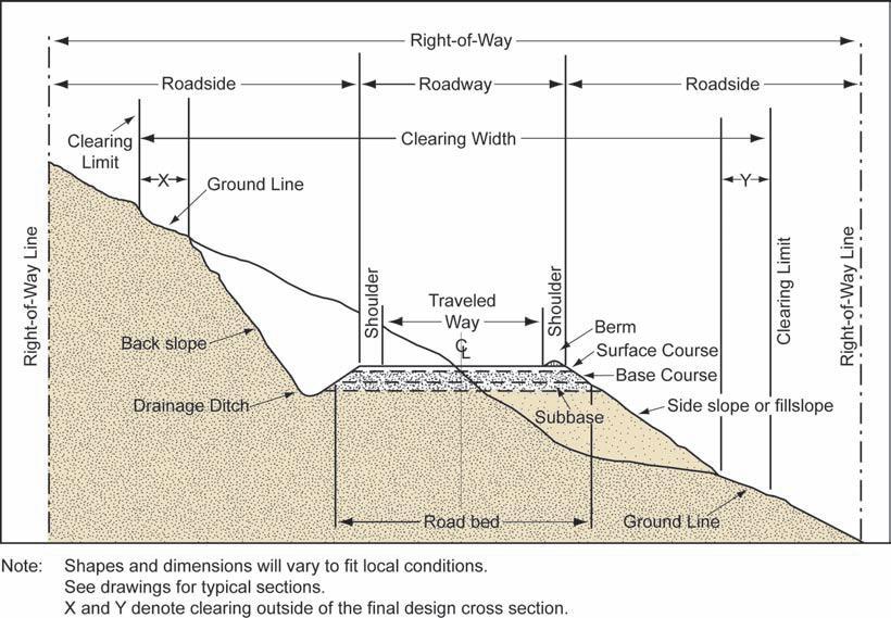
1 Tahoe Unsurfaced Roads Workshop UC Cooperative Extension / SAF / TRPA / LWQCB / CGS / USFS Road Standards, Maintenance Levels, and Road Uses Gordon R. Keller, PE, GE Geotechnical Engineer grkeller@fs.fed.us or gordonrkeller@gmail.com 1
2

3
4 ROAD STANDARDS Design Speed Road Width Maximum Grades Curve Radius Shoulders? Surface Drainage Type Surfacing Type
5 Typical Design Standards for Low-Volume Roads Type of Road Aspect of Design Rural Road Collector Road Design Speed 35 kph 60 kph Design Load (AASHTO) H 15 H 20 Road Width 4.0 m 5.5 m (minimum) Shoulders None 0.5 m Road Grade: -Maximum Favorable 15% 12% -Maximum Adverse 12% 10% Horizontal Curve Radius 15 m (minimum) 25 m (minimum) Crown/Shape Outsloped (5% minimum) Crown (±3% minimum) Types of Drainages Transverse Pipes and Rolling Dips Pipe Culvert Cross-drains Riding Surface Native Soil ±15 cm Gravel
6


7 Road Planning Coupe Access Road Permanent Road Shire Road In Coupe Road Arterial / Highways VicForests VicForests
")
8 AASHTO Guidelines for Geometric Design of Very Low-Volume Local Roads (ADT 400) 2001
9 ROAD MAINTENANCE LEVELS Consider the following factors when selecting maintenance levels: 1. Road Management Objectives. 4. User safety. 5. Volume, type, class, of traffic. 6. Surface type. 7. Travel speed. 8. User comfort and convenience.
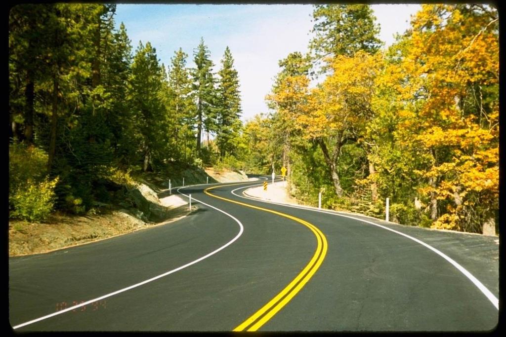
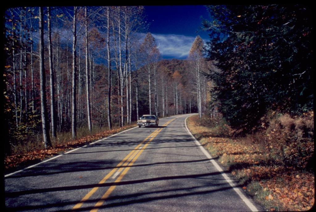
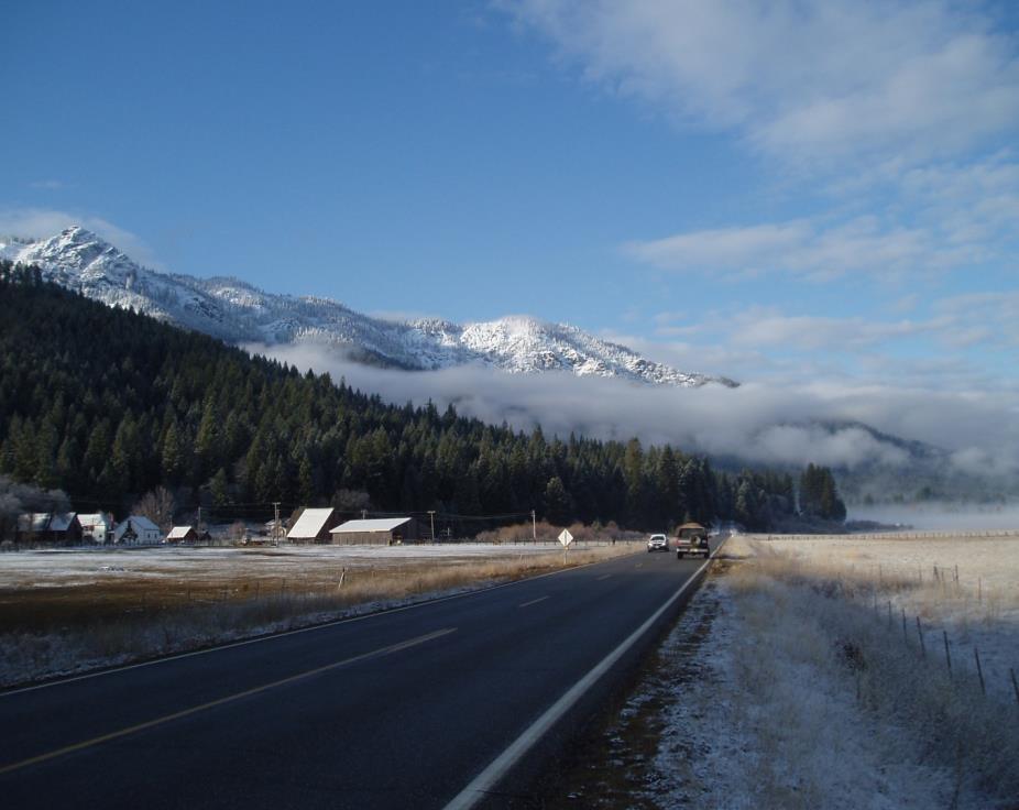
10 MAINTENANCE LEVEL 5 Assigned to roads that provide a high degree of user comfort and convenience. These roads are normally smooth, double lane, paved facilities. Some may be aggregate surfaced and dust abated. Manual on Uniform Traffic Control Devices is applicable. Have high traffic volume and speed. Usually an arterial or collector, and connect to State or County roads.

11
12
13
14

15
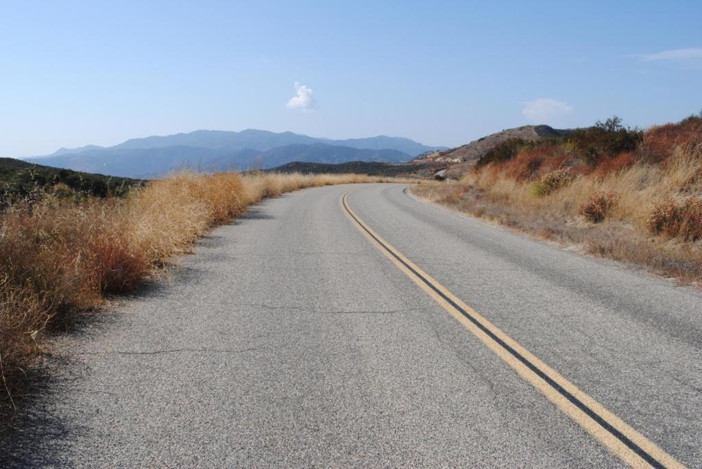
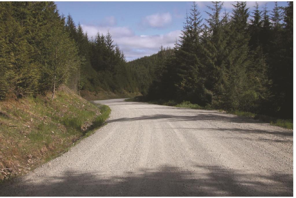
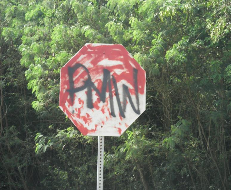
16


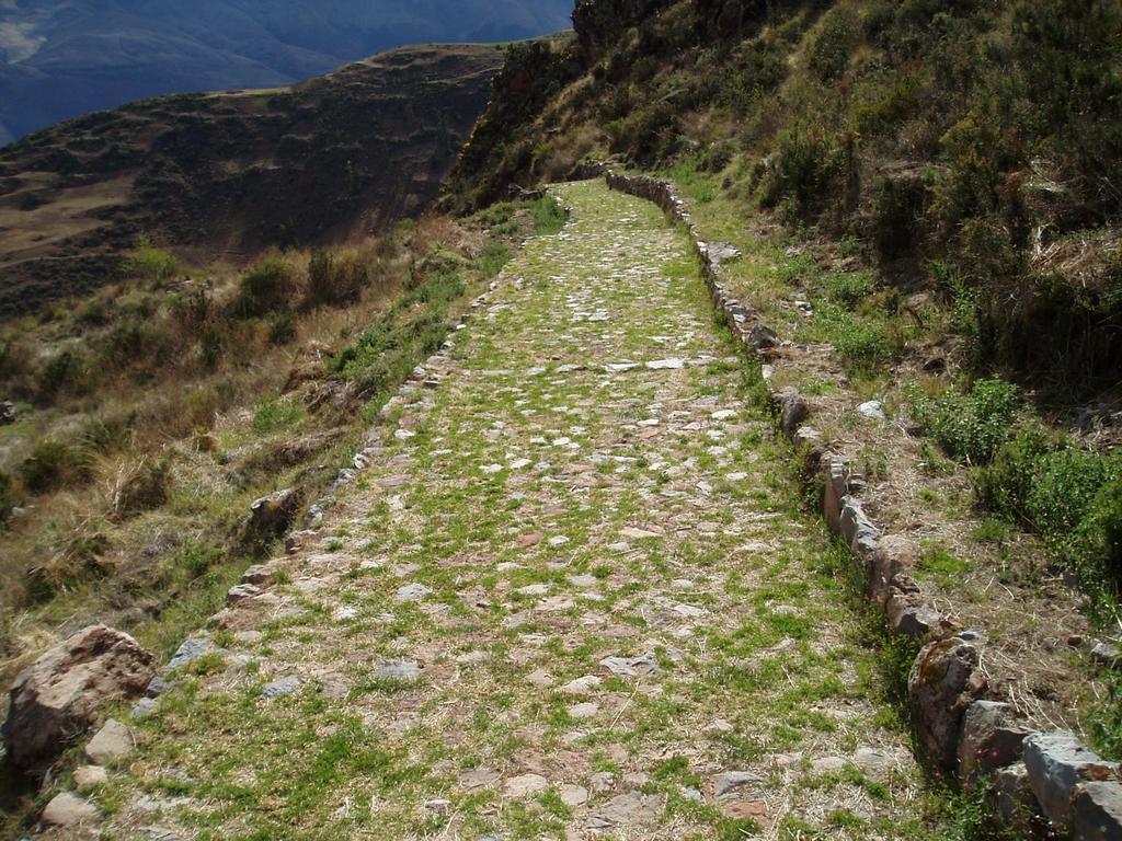
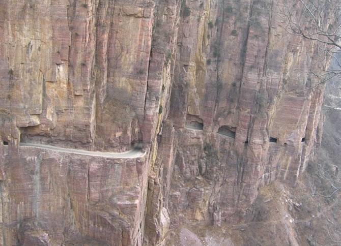
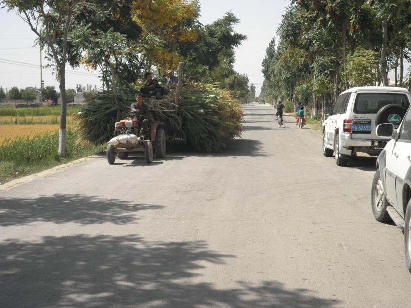
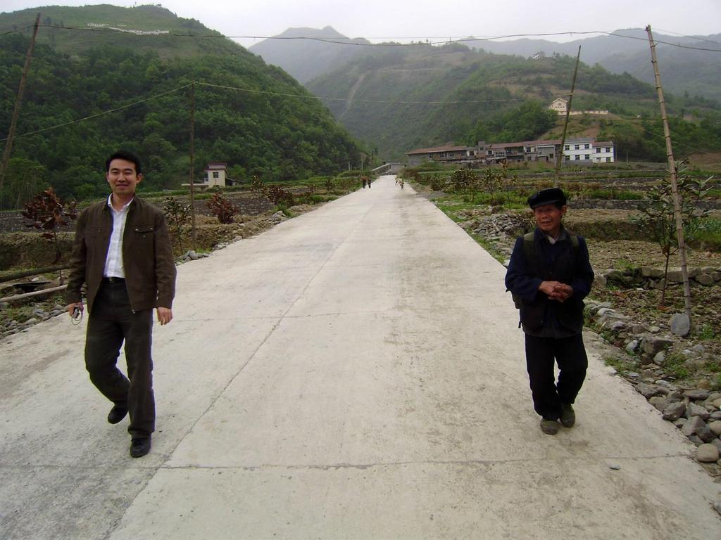
17 Hong Miao Li, Fuzhou, China
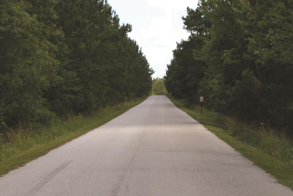
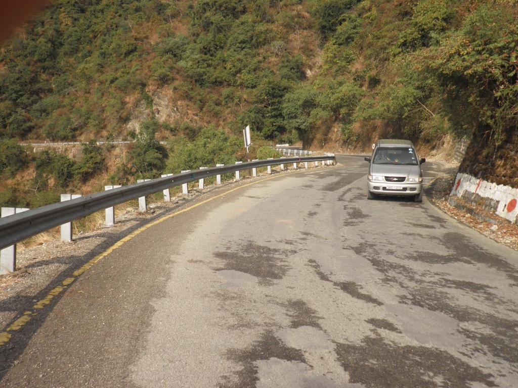
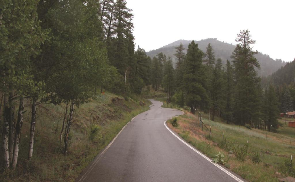
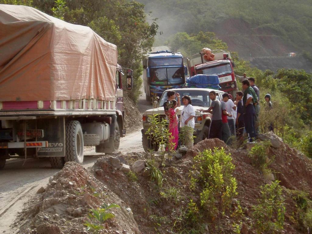
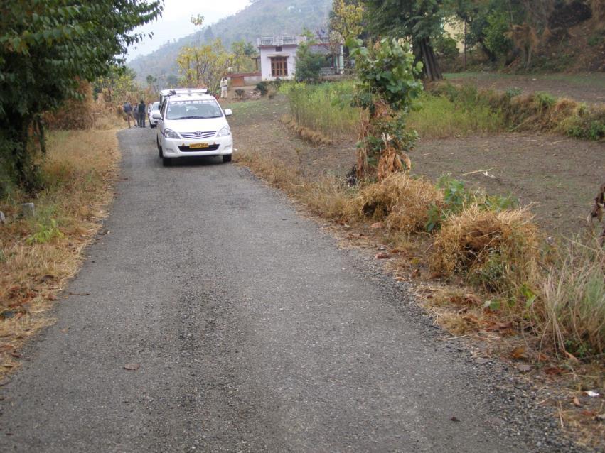
18 MAINTENACE LEVEL 4 Assigned to roads that provide a moderate degree of user comfort and convenience at moderate travel speeds. Most roads are double lane and aggregate surfaced. However, some roads may be single lane. Some roads may be paved and/or dust abated. Manual on Uniform Traffic Control Devices is applicable. Usually are collector roads and often connect to State/County roads.
19
20
21
22
23
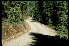
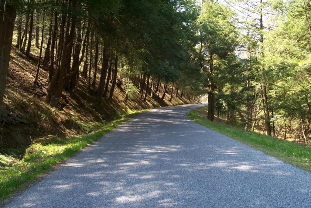
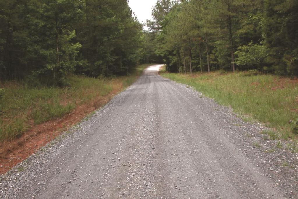
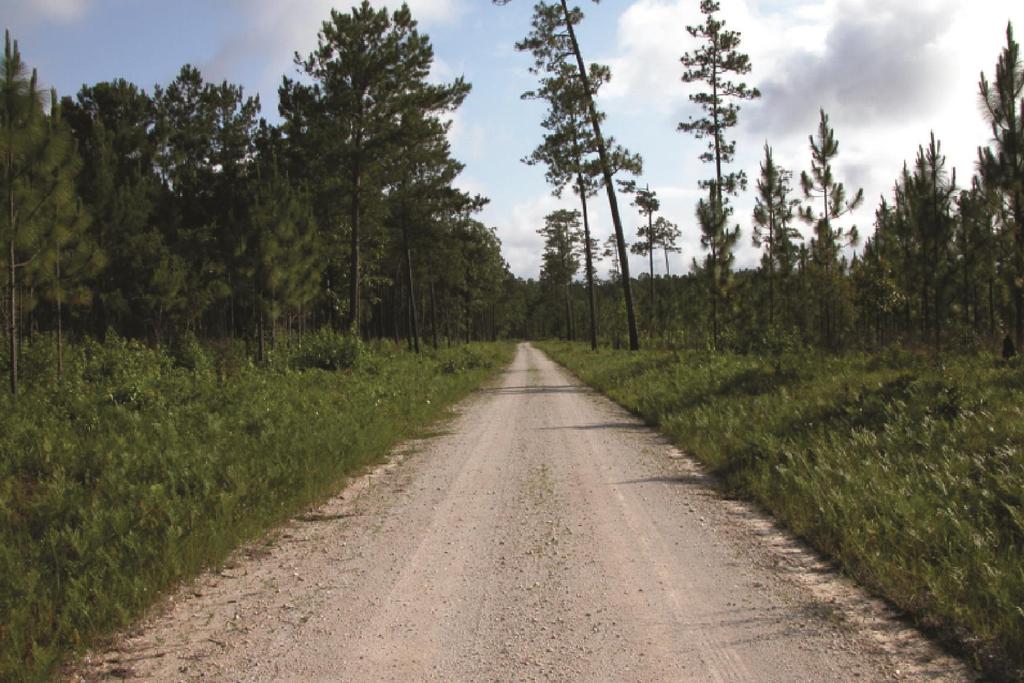
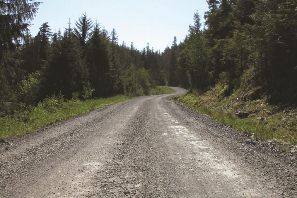
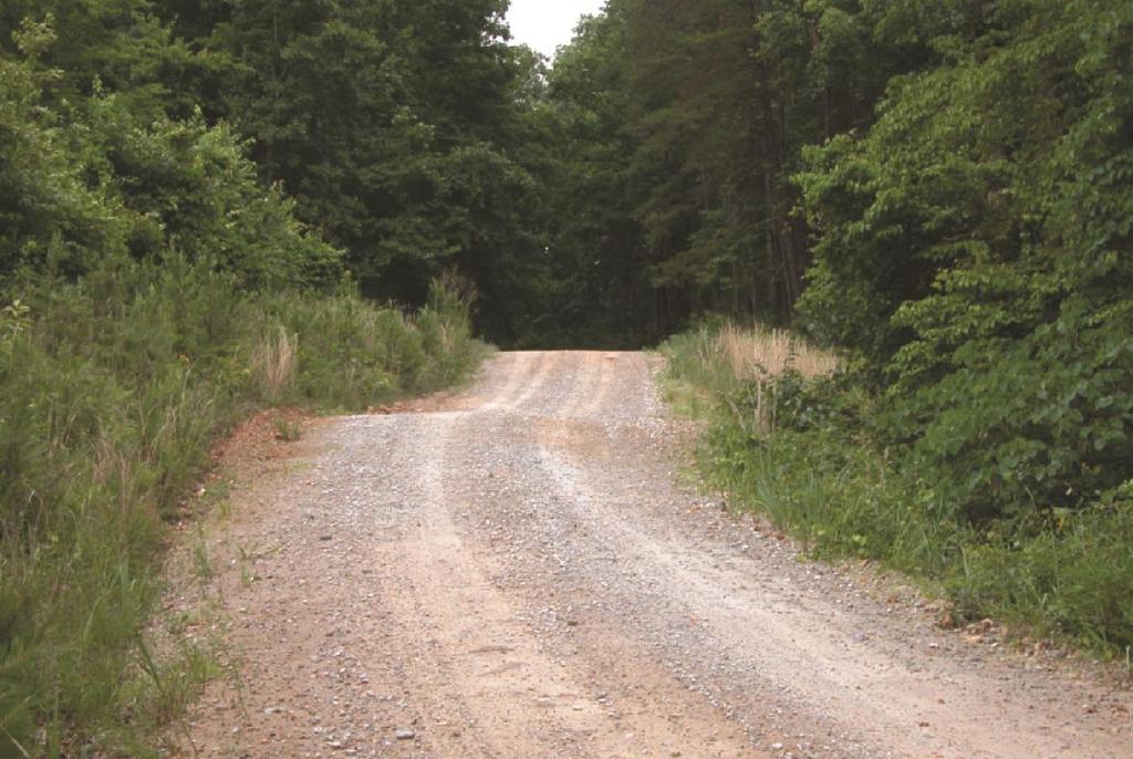
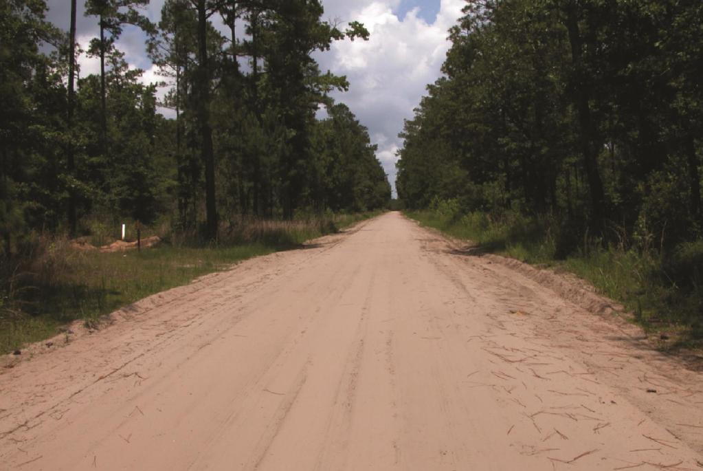
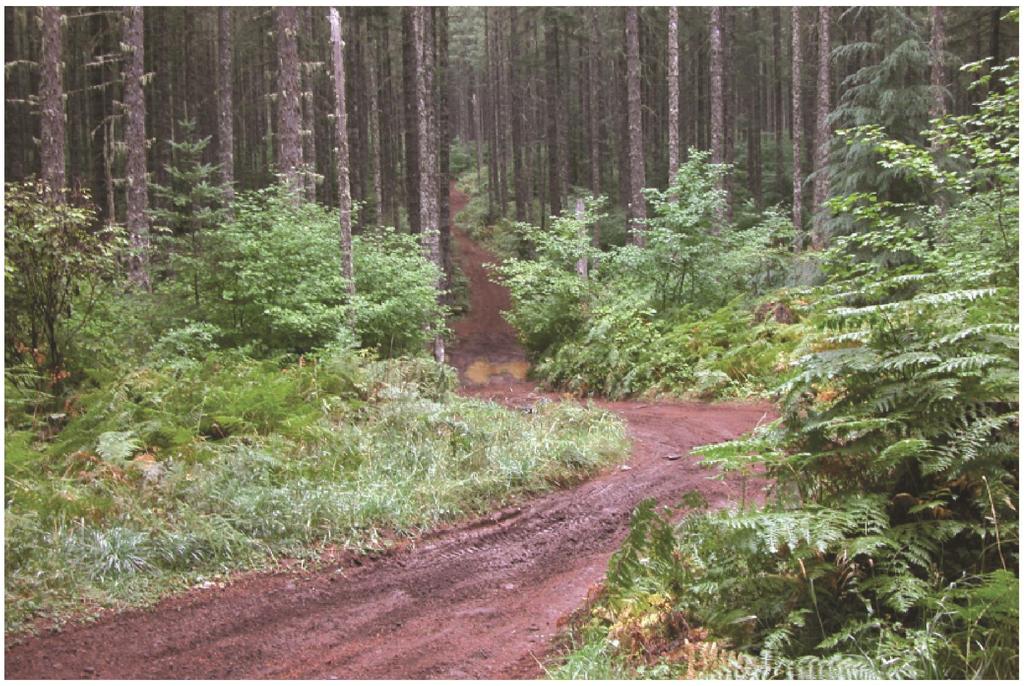
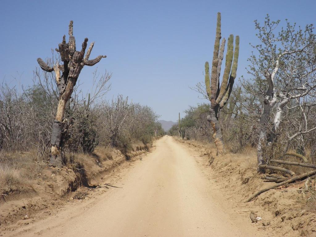
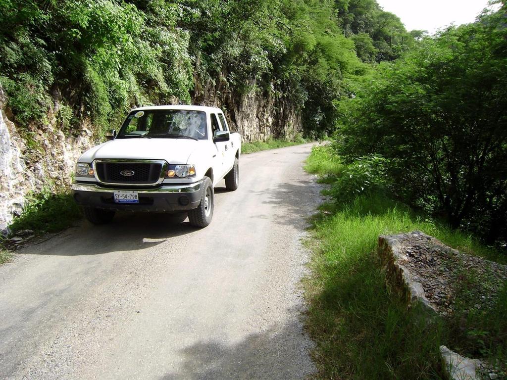
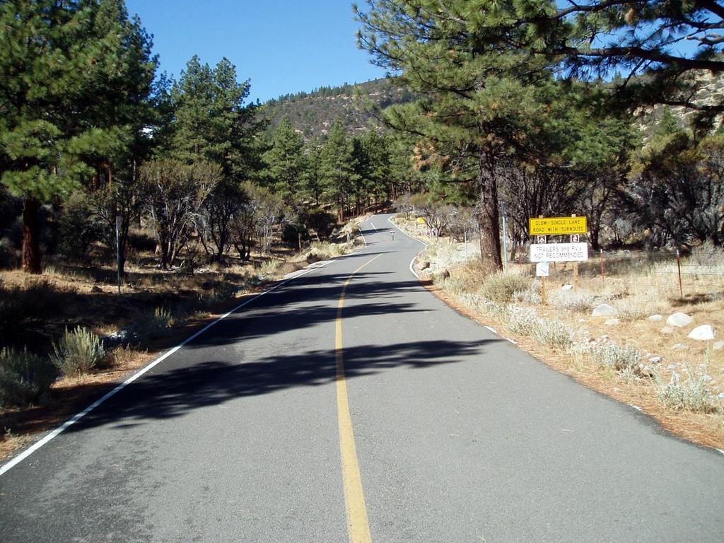
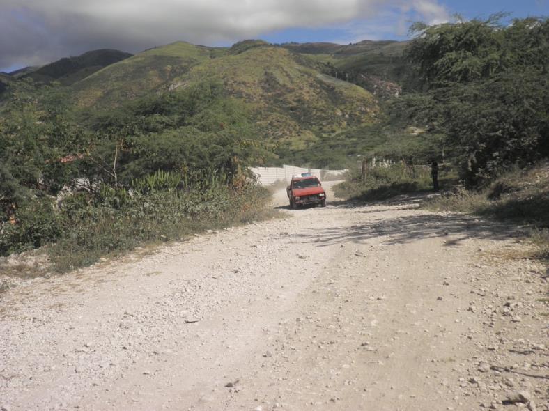
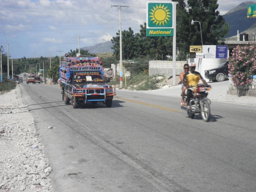
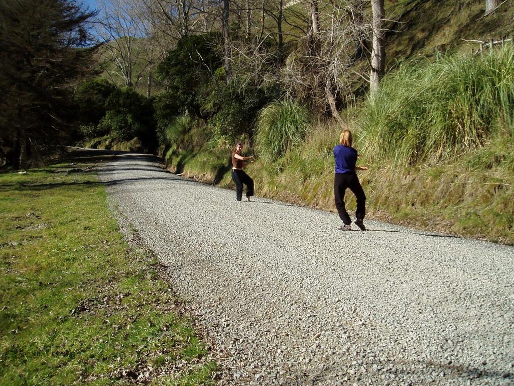
24 MAINTENANCE LEVEL 3 Assigned to roads open and maintained for travel by a prudent driver in a standard passenger car. User comfort and convenience are not considered priorities. The Manual on Uniform Traffic Control Devices (MUTCD) is applicable. Warning signs and traffic control devices are provided to alert motorists of situations that may violate expectations. Roads in this maintenance level are typically low speed with single lanes and turnouts. Low to moderate traffic volume. Often gravel surface. May be native surface.
25
26
27
28
29
30
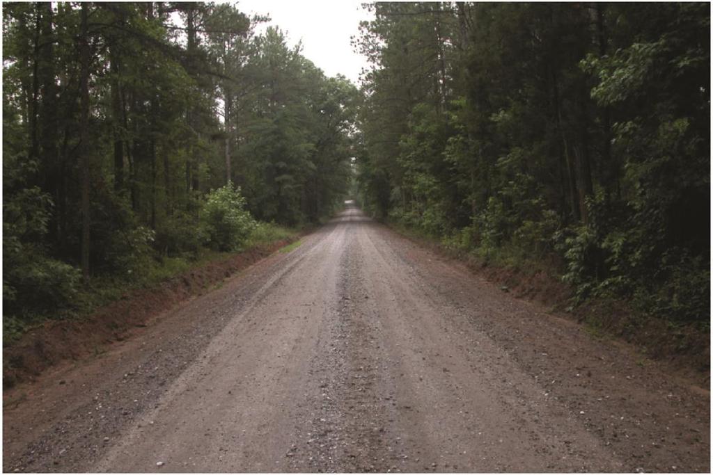
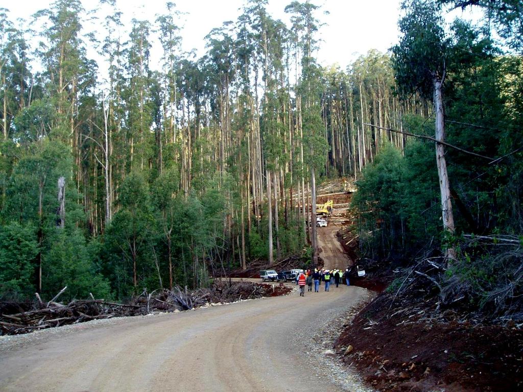
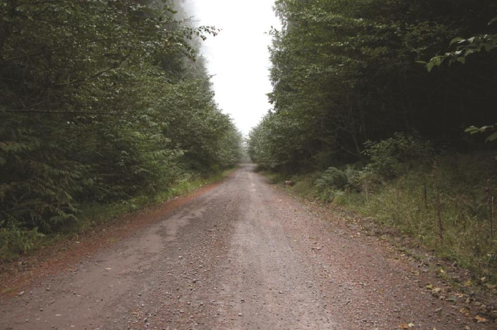
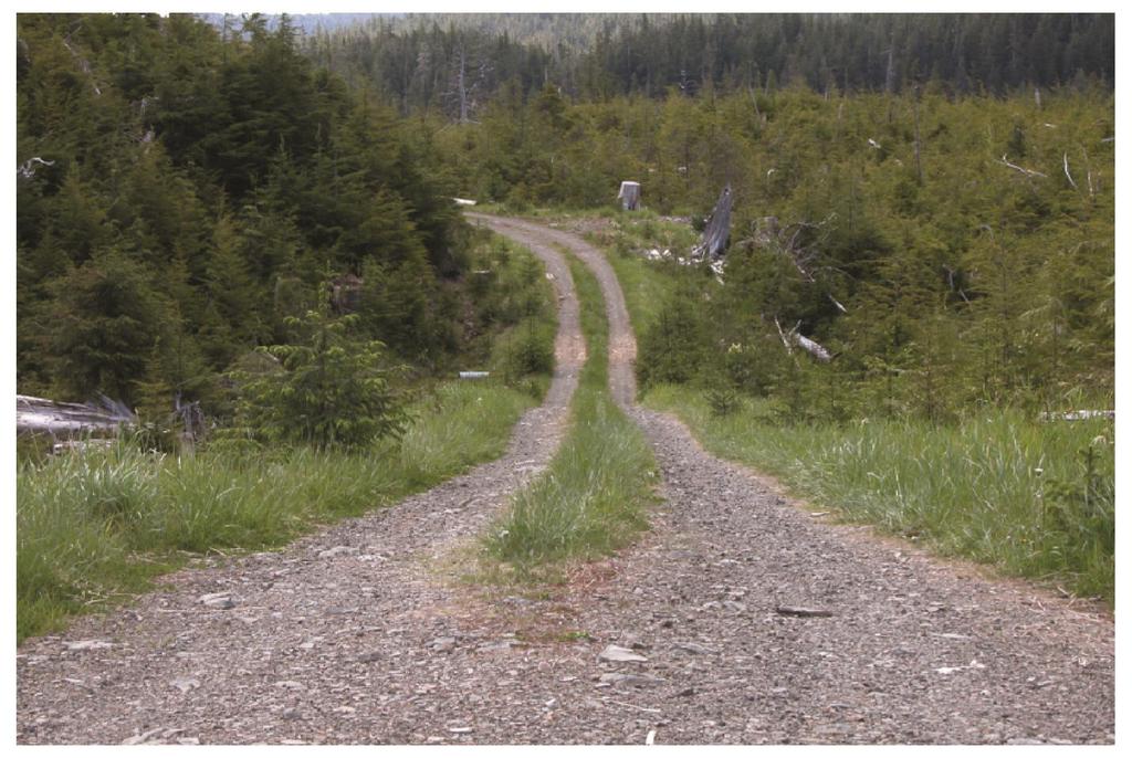
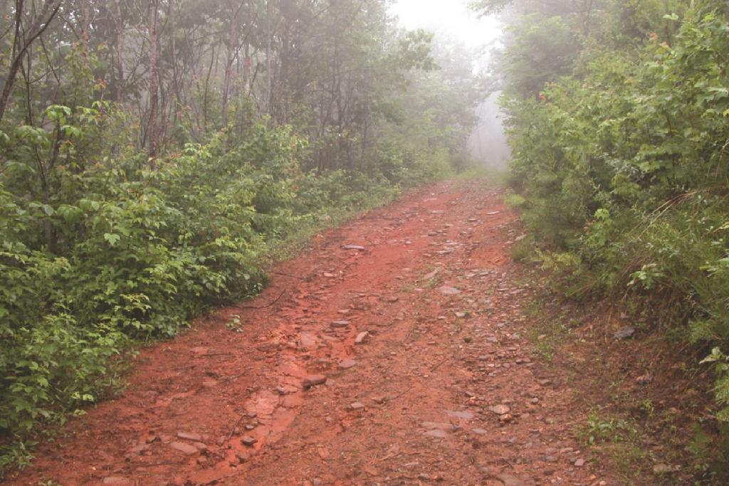
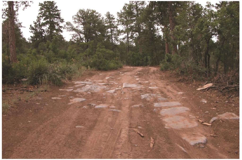
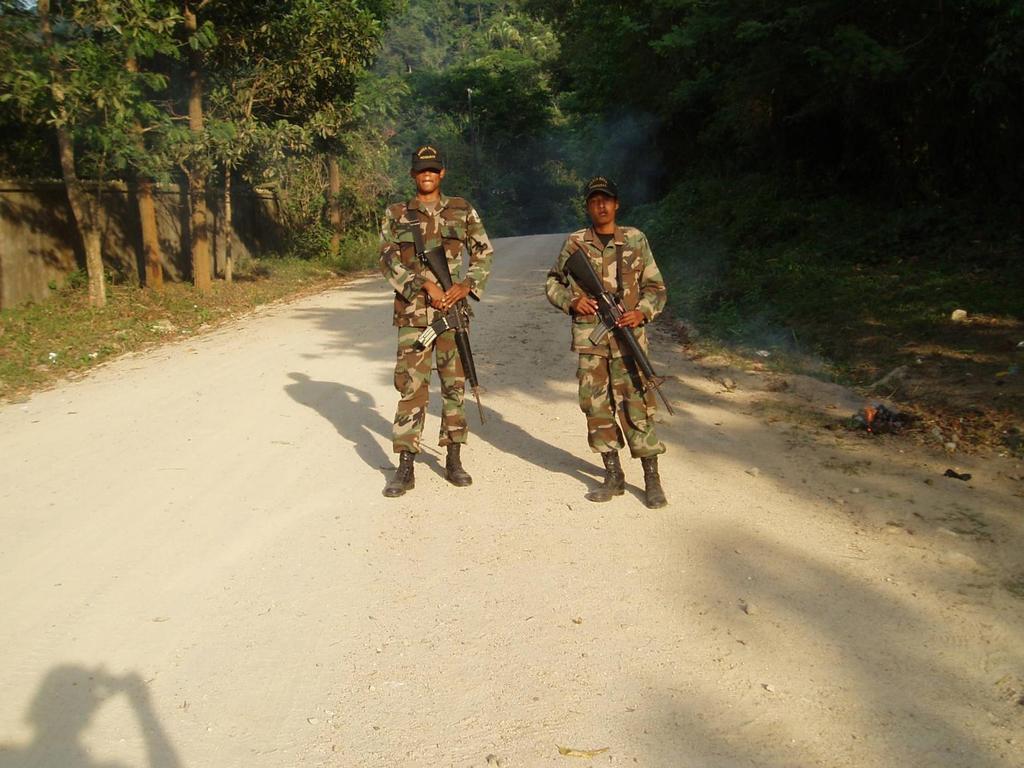
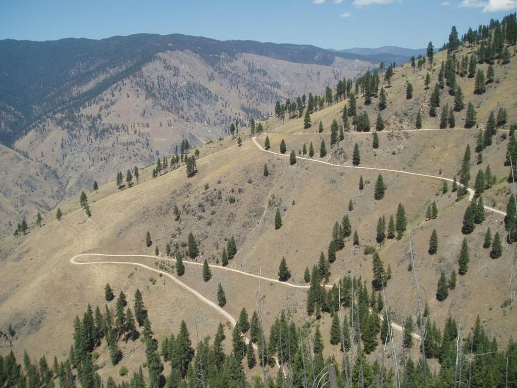
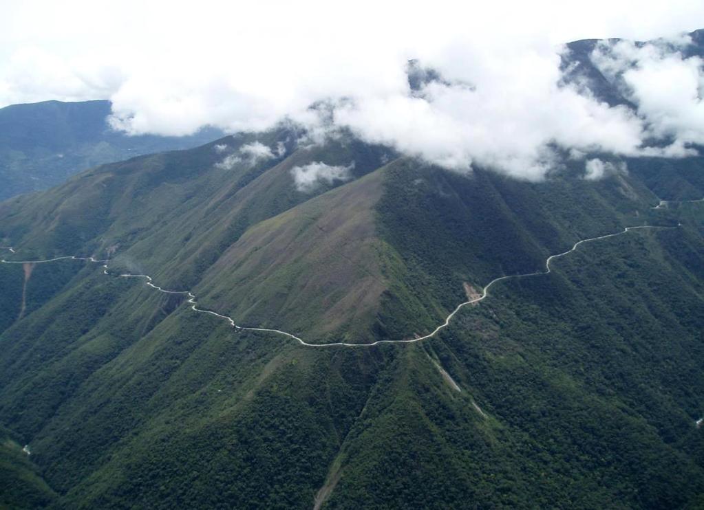
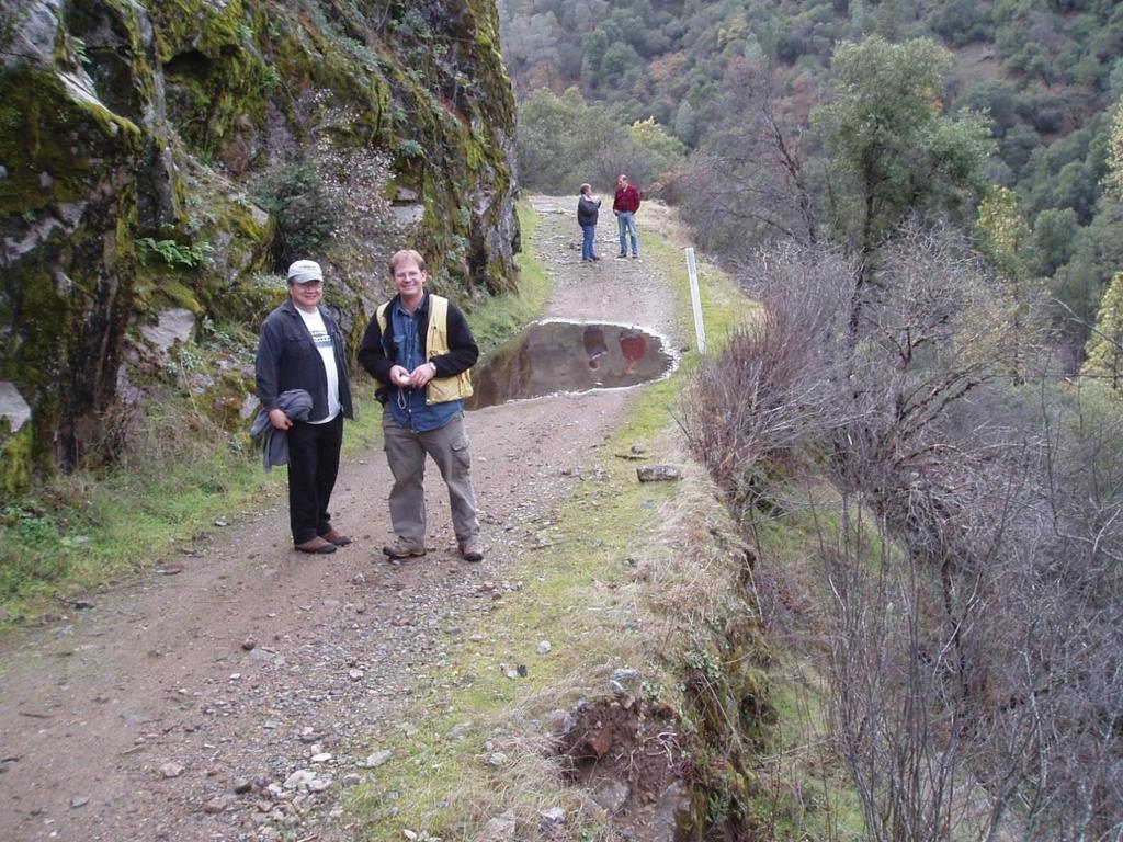
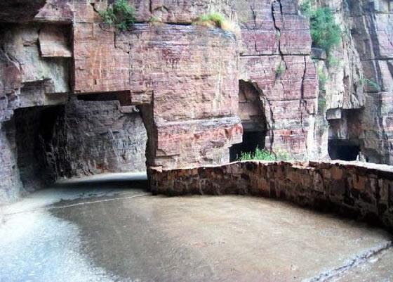
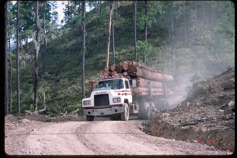
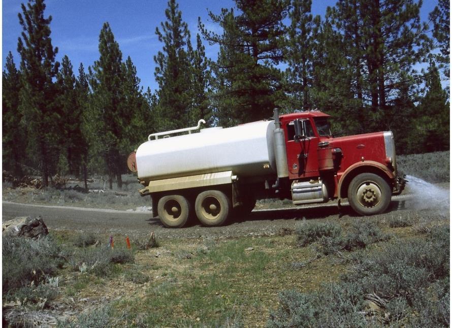
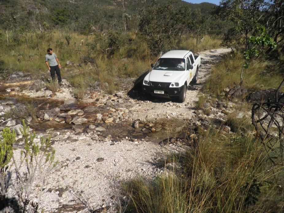
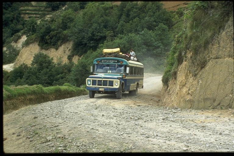
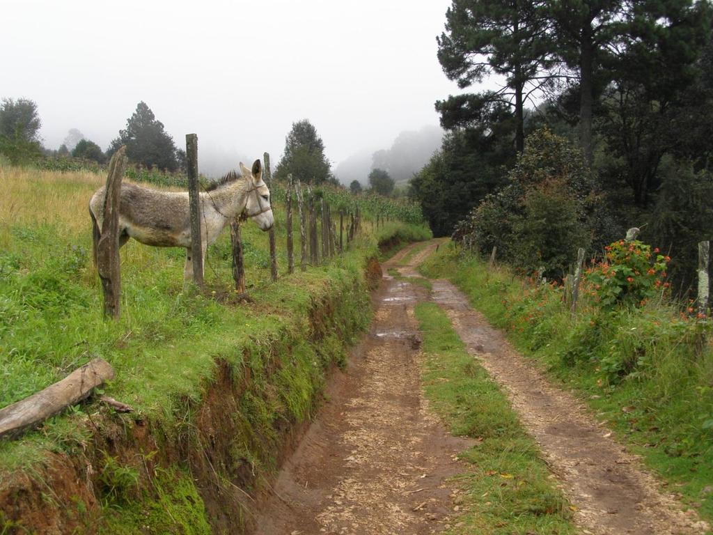
31 MAINTENANCE LEVEL 2 Assigned to roads open for use by high clearance vehicles. Passenger car traffic, user comfort, and user convenience are not considerations. Warning signs and traffic control devices are not provided with the exception that some signing, such as W-18-1 No Traffic Signs, may be posted at intersections. Motorists should have no expectations of being alerted to potential hazards while driving these roads. Traffic is normally minor, usually consisting of one or a combination of administrative, permitted, dispersed recreation, or other specialized uses. Log haul may occur at this level. Typically Local roads that connect to Collectors
32
33
34
35
36
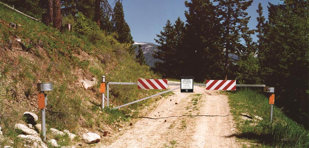
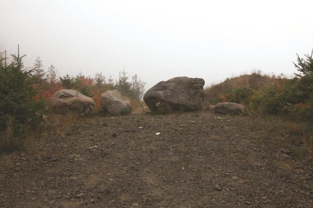
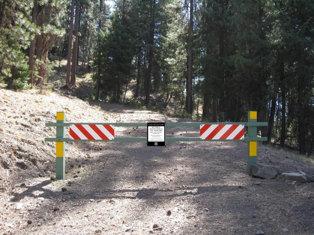
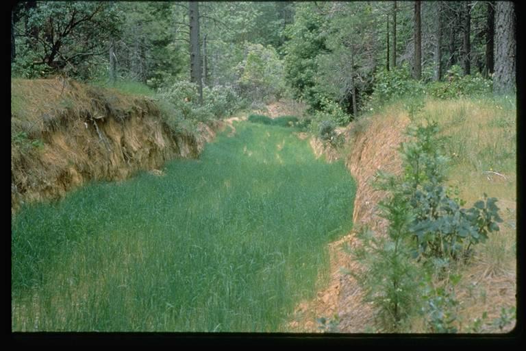
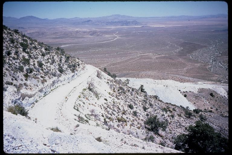
37 MAINTENANCE LEVEL 1 These are roads that have been placed in storage between intermittent uses. The period of storage must exceed one year. Basic custodial maintenance is performed to prevent damage to adjacent resources and to perpetuate the road for future resource management needs. Emphasis is normally given to maintaining drainage facilities and runoff patterns. Planned road deterioration may occur. Appropriate traffic management strategies are "prohibit" and "eliminate" traffic. Entrance is blocked. These roads are not shown on motor vehicle use maps. They may have non-motorized uses.

38 ROADS IN STORAGE
39
40
41
42

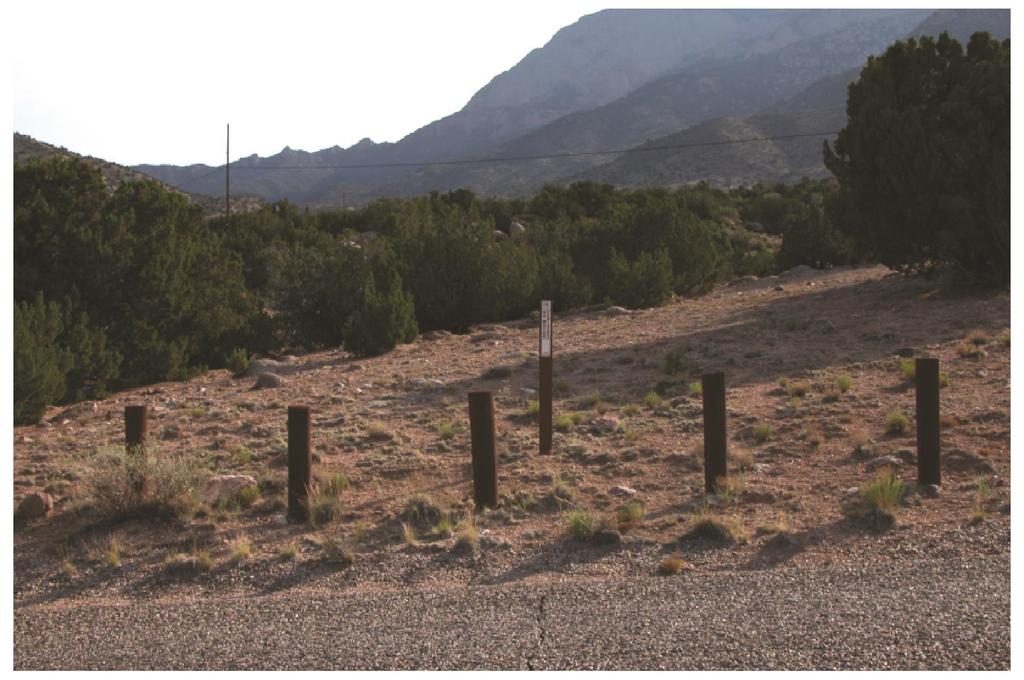
43 CLOSED ROADS


44 Road Closure and Control

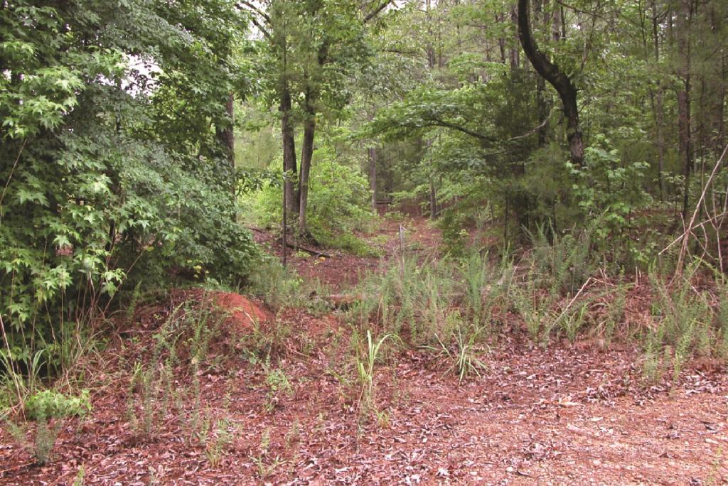
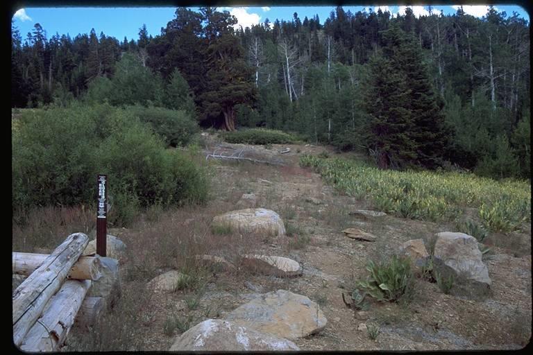
45 DECOMMISSIONED AND OBLITERATED ROADS
46
47
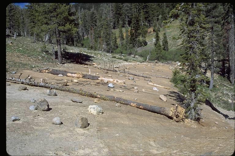
48 ROAD OBLITERATION
49
50


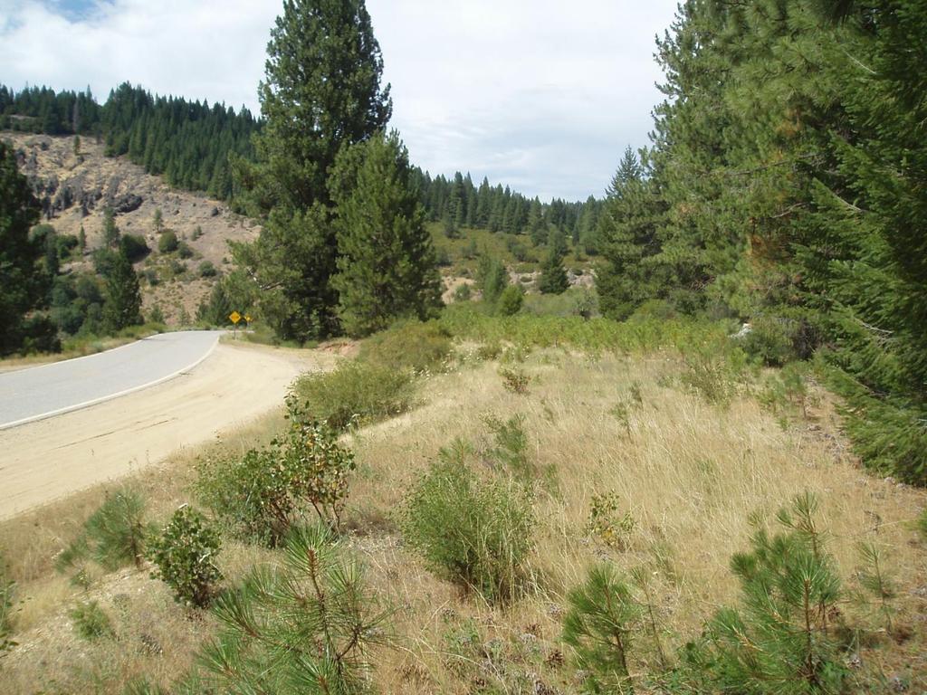
51 OTHER ROAD CLOSURE OR CONTROL
52

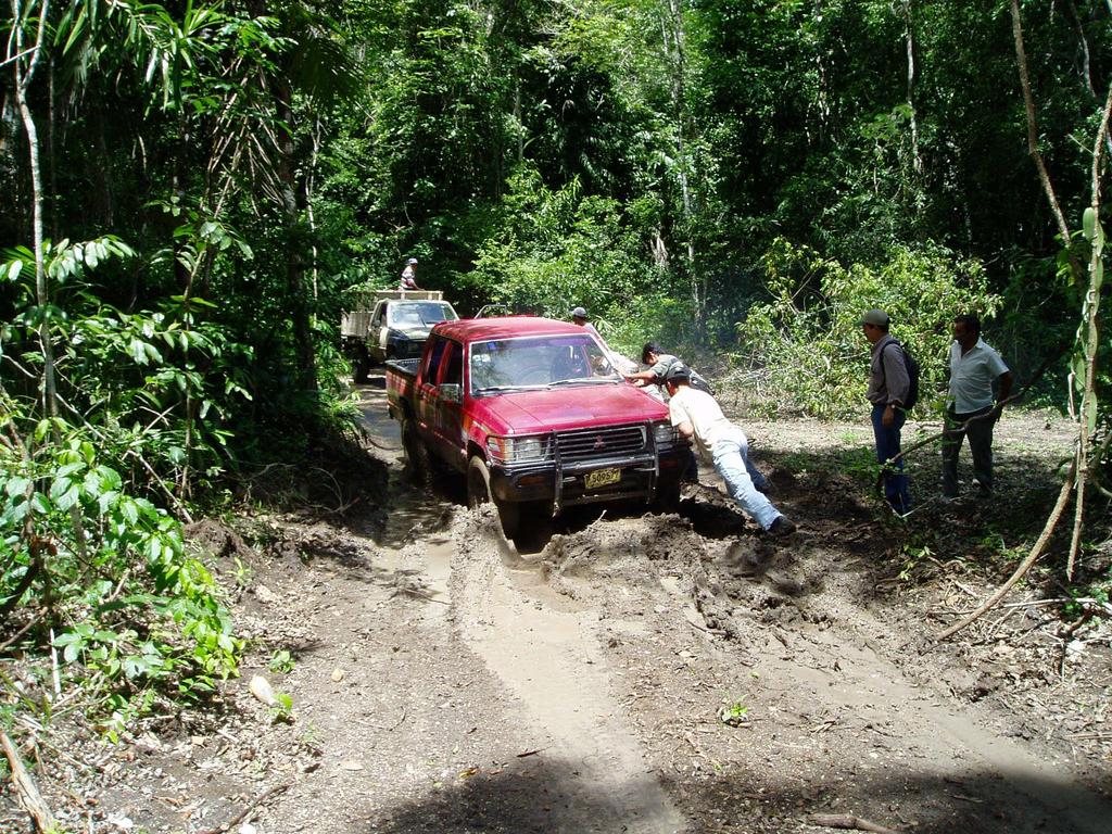
53 TOUGH ROADS
54
55
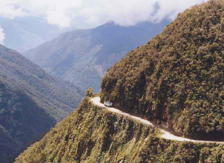
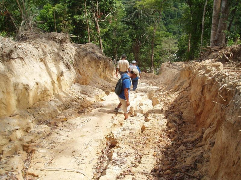
56 DANGEROUS/NARROW ROADS
57
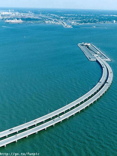
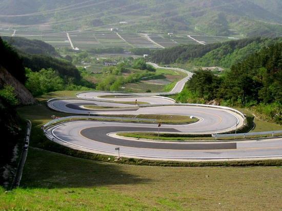
58

59
60

61

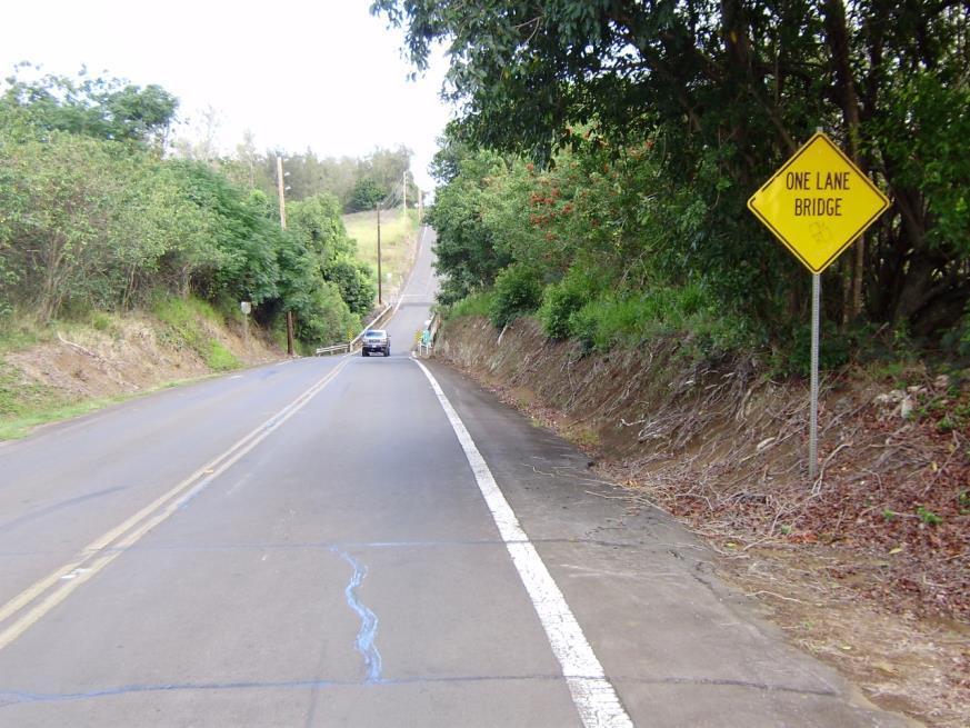
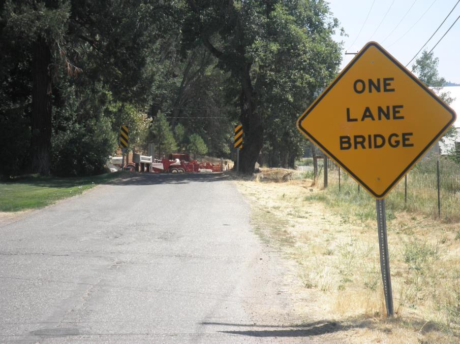
62 TWO LANE TO ONE LANE
63
64

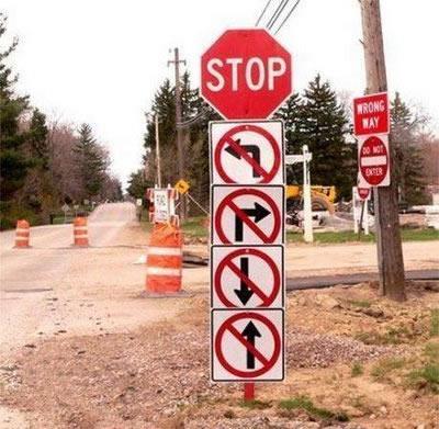
65 SAFETY SIGNS

66 WIERD ROADS
67
68
69

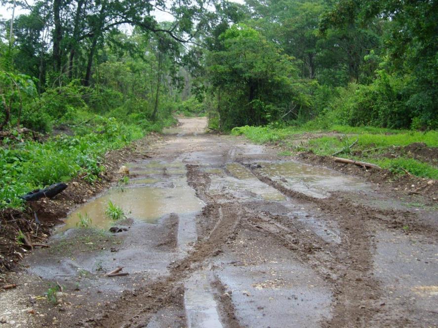
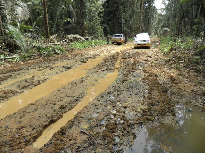
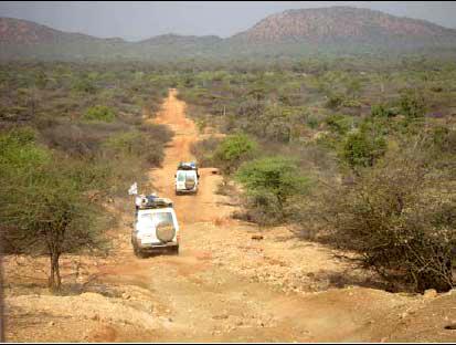
70 BAD ROADS
71
72

73

74 NORMAL USES
75

76
77
78
79
80
81
82
83

84 BORING ROAD

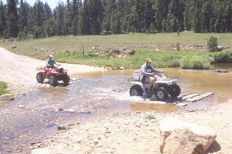
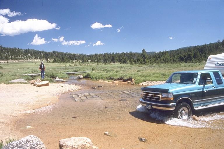
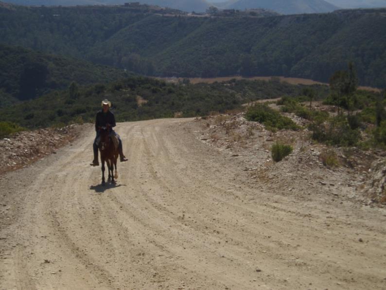
85 ATYPICAL USES

86

87

88
89
90
91

92

93
City of Roseville Section 13 Design Standards. _Bikeways January 2016 SECTION 13 BIKEWAYS
 SECTION 13 BIKEWAYS 13-1 GENERAL The City of Roseville bikeway standards are designed to insure that transportation and recreational bikeways are constructed in a manner that would provide a safe and comfortable
Recommended Roadway Plan Section 2 - Land Development and Roadway Access
 Recommended Roadway Plan Section 2 - Land Development and Roadway Access SECTION 2 Land Development and Roadway Access 2.1 Land Use and Access Management The Federal Highway Administration (FHWA) defines
PERFORMANCE ACTIVITY 306 DRAINAGE PIPE WORK DESCRIPTION 4
 PERFORMANCE ACTIVITY 306 DRAINAGE PIPE WORK DESCRIPTION 1 WORK DESCRIPTION 2 WORK DESCRIPTION 3 WORK DESCRIPTION 4 Repair Install Remove Clean 306 DRAINAGE PIPE ACTIVITY DESCRIPTION Install, repair, clean,
Driveway Design Criteria
 Design Manual Chapter 5 - Roadway Design 5L - Access Management 5L-4 Driveway Design Criteria A. General For efficient and safe operations, access drives and minor public street intersections can be improved
Alberta Infrastructure HIGHWAY GEOMETRIC DESIGN GUIDE AUGUST 1999
 Alberta Infrastructure HIGHWAY GEOMETRIC DESIGN GUIDE AUGUST 1999,1'(; A ACCELERATION Data on acceleration from stop D-29 Effects of grade D-35 Intersections D-97, D-99 Lanes D-97, F-5, F-7, F-15, F-21,
Road Design Guidelines for Low Impact to Hydrology *
 Five Counties Salmonid Conservation Program P.O. Box 2819 Weaverville, CA 96093 (530) 623-1351 Ext. 5 FAX (530) 623-1353 email: mlancaster@trinitycounty.org Road Design Guidelines for Low Impact to Hydrology
Access requests to County streets and roadways are processed through one of the following methods:
 13.1 GENERAL APPLICATION PROCESS Access requests to County streets and roadways are processed through one of the following methods: A. Planned Developments may set general locations for access points.
South Carolina Department of Transportation. Engineering Directive
 South Carolina Department of Transportation Engineering Directive Directive Number: ED-22 Effective: December 16, 2009 Subject: References: Purpose: This Directive Applies to: Considerations for Bicycle
Access Location, Spacing, Turn Lanes, and Medians
 Design Manual Chapter 5 - Roadway Design 5L - Access Management 5L-3 Access Location, Spacing, Turn Lanes, and Medians This section addresses access location, spacing, turn lane and median needs, including
This Chapter sets forth the minimum design, technical criteria and specifications to be used in the preparation of all roadway plans.
 4.1 GENERAL This Chapter sets forth the minimum design, technical criteria and specifications to be used in the preparation of all roadway plans. These Roadway Standards are for new construction and modification
CHAPTER 1 STANDARD PRACTICES
 CHAPTER 1 STANDARD PRACTICES OBJECTIVES 1) Functions and Limitations 2) Standardization of Application 3) Materials 4) Colors 5) Widths and Patterns of Longitudinal Pavement Marking Lines 6) General Principles
Appendix 3 Roadway and Bike/Ped Design Standards
 Appendix 3 Roadway and Bike/Ped Design Standards OTO Transportation Plan 2040 4/20/2017 Page A3-1 Adopted Standards The adopted OTO Design Standards and Major Thoroughfare Plan are contained herein.
SECTION 14: LANDSCAPING AND BEAUTIFICATION
 SECTION 14: LANDSCAPING AND BEAUTIFICATION RULE 14.1 GENERAL PROVISIONS 14.1.1 The rules and guidelines contained in this section have been established to provide proper guidelines for the beautification
Engineering Your Community Safe
 Engineering Your Community Safe Andi Bill Transportation Information Center thanks its partners for their support and assistance National Traffic Safety Goal Reasonable goal? Who s Involved? What can you
MUNICIPALITY OF ANCHORAGE TRAFFIC CODE UPDATE MASTER RECOMMENDATION REPORT: 9.14, 9.16, 9.18
 MUNICIPALITY OF ANCHORAGE TRAFFIC CODE UPDATE MASTER RECOMMENDATION REPORT: 9.14, 9.16, 9.18 Report Date: Please send all recommendations for update to Shane Locke (343-8413, lockesr@muni.org) 8-Apr-09
Designing with the Railroad
 Designing with the Railroad 23 CFR 646.214 (b)(2) requires that crossings be evaluated when they are within limits or near terminus of Federally Funded project. Some rough numbers for planning: Active
October 2004 REVISIONS (2) SUPERELEVATION DEVELOPMENT 11.3(2)
 SUPERELEVATION DEVELOPMENT 11.3(2)") October 2004 REVISIONS (2) Chapter 11 HORIZONTAL ALIGNMENT SUPERELEVATION DEVELOPMENT 11.3(2) Chapter 12 VERTICAL ALIGNMENT VERTICAL CURVES PASSING SIGHT DISTANCE 12.5(2) VERTICAL CURVES STOPPING SIGHT
October 2004 REVISIONS (2) Chapter 11 HORIZONTAL ALIGNMENT SUPERELEVATION DEVELOPMENT 11.3(2) Chapter 12 VERTICAL ALIGNMENT VERTICAL CURVES PASSING SIGHT DISTANCE 12.5(2) VERTICAL CURVES STOPPING SIGHT
Off-road Trails. Guidance
 Off-road Trails Off-road trails are shared use paths located on an independent alignment that provide two-way travel for people walking, bicycling, and other non-motorized users. Trails specifically along
Part-time Shoulder Use Guide
 1 Part-time Shoulder Use Guide FHWA Guide AASHTO SCOD, Baltimore, MD June 2016 DOTs Face Increasing Challenges 2 Performance Based Practical Design 3 PBPD is a decision making approach that helps agencies
INDEX. Geometric Design Guide for Canadian Roads INDEX
 Acceleration lane, see Lanes, Acceleration Access, 8.1 Access Management and Functional Classification 8.2 Access Management by Design Classification 8.3 Access Configuration 8.4 Building Set-Back Guidelines
Field Guide for Unpaved Rural Roads
 Field Guide for Unpaved Rural Roads Funded by the Federal Highway Administration Local Technical Assistance Program (LTAP) Developed by the Wyoming Technology Transfer (T2) Center, March 1997 Updated by
Pavement Markings (1 of 3)
") Pavement Markings (1 of 3) DESCRIPTION AND DEFINITION Disadvantages Relatively high cost (over typical Crash reduction as yet unknown painted edge line) No tactile effect The STOP AHEAD pavement marking
Pavement Markings (1 of 3) DESCRIPTION AND DEFINITION Disadvantages Relatively high cost (over typical Crash reduction as yet unknown painted edge line) No tactile effect The STOP AHEAD pavement marking
American Railway Engineering and Maintenance of Way Association Letter Ballot. Draft
 American Railway Engineering and Maintenance of Way Association Letter Ballot 1. Committee and Subcommittee: Committee 5 Track Subcommittee 9 Road Crossings 2. Letter Ballot Number: 05-17-16 3. Assignment:
Engineering Report: Apache-Sitgreaves National Forests. Black Mesa Ranger District. Analysis of. National Forest System Roads (NFSRs) #s 504 & 169
 #s 504 & 169") Engineering Report: Apache-Sitgreaves National Forests Black Mesa Ranger District Analysis of National Forest System Roads (NFSRs) #s 504 & 169 for Motorized Mixed Use Designation Forest: Apache-Sitgreaves
Engineering Report: Apache-Sitgreaves National Forests Black Mesa Ranger District Analysis of National Forest System Roads (NFSRs) #s 504 & 169 for Motorized Mixed Use Designation Forest: Apache-Sitgreaves
Description of Road Management Objectives, Existing Use, and Proposed Use:
 Engineering Report White River National Forest Eagle-Holy Cross Ranger District Analysis of Road # 700 Red Sandstone Road for Motorized Mixed Use Designation Page 1 of 12 Forest: White River District:
Description of Road Management Objectives, Existing Use, and Proposed Use:
 Engineering Report White River National Forest Eagle-Holy Cross Ranger District Analysis of Road # 600 Coffee Pot Road for Motorized Mixed Use Designation Page 1 of 12 Forest: White River District: Eagle-Holy
SECTION 3 STREET DESIGN
 3.01 GENERAL SECTION 3 STREET DESIGN For purposes of geometric and structural design, streets shall be classified according to the following table. The City Engineer will determine the class of all proposed
Part-time Shoulder Use Guide
 1 Part-time Shoulder Use Guide FHWA Guide AASHTO SCOTE, Savannah GA June 2016 DOTs Face Increasing Challenges 2 Performance Based Practical Design 3 PBPD is a decision making approach that helps agencies
TABLE OF CONTENTS LIST OF FIGURES. Figure Title
 TABLE OF CONTENTS Table of Contents... 1 List of Figures... 1 Chapter Forty-two... 2 42-1.0 STOPPING SIGHT DISTANCE... 2 42-1.01 Theoretical Discussion...2 42-1.02 Passenger Car Stopping Sight Distance...
MUNICIPALITY OF ANCHORAGE Traffic Department MEMORANDUM
 MUNICIPALITY OF ANCHORAGE DATE: MEMORANDUM TO: FROM: SUBJECT: Anchorage Contractors, Builders, Designers, and Land Owners Robert E. Kniefel, P.E., Municipal Traffic Engineer Municipal Driveway Standards
Developed by: The American Traffic Safety Services Association (ATSSA) 15 Riverside Parkway, Suite 100 Fredericksburg, VA
 15 Riverside Parkway, Suite 100 Fredericksburg, VA") Addendum Developed by: The American Traffic Safety Services Association (ATSSA) 15 Riverside Parkway, Suite 100 Fredericksburg, VA 22406-1022 800-272-8772 This material is based upon work supported by
Addendum Developed by: The American Traffic Safety Services Association (ATSSA) 15 Riverside Parkway, Suite 100 Fredericksburg, VA 22406-1022 800-272-8772 This material is based upon work supported by
Roadway Design Manual
 Roadway Design Manual Manual Notice Archive by Texas Department of Transportation (512) 302-2453 all rights reserved Manual Notice 2009-1 From: Manual: Mark A. Marek, P.E Roadway Design Manual Effective
PERFORMANCE ACTIVITY 405 LIMB MANAGEMENT
 PERFORMANCE ACTIVITY 405 LIMB MANAGEMENT 405 LIMB MANAGEMENT ACTIVITY DESCRIPTION Cut and/or remove and/or grind tree limbs from the right-of-way. TRAFFIC CONTROL Utilize intermittent mobile operations
Geometric Design Tables
 Design Manual Chapter 5 - Roadway Design 5C - Geometric Design Criteria 5C-1 Geometric Design Tables A. General The following sections present two sets of design criteria tables - Preferred Roadway Elements
Bicyclist Signing Guidelines
 Bicyclist Signing Guidelines April, 2009 1 Introduction This paper describes the Montana Department of Transportation s (MDT) current practices related to bicyclist safety and signing issues and presents
Figure 1: Graphical definitions of superelevation in terms for a two lane roadway.
 Iowa Department of Transportation Office of Design Superelevation 2A-2 Design Manual Chapter 2 Alignments Originally Issued: 12-31-97 Revised: 12-10-10 Superelevation is the banking of the roadway along
Appendix T CCMP TRAIL TRAFFIC & TRANSPORTATION DESIGN STANDARD
 Appendix T CCMP 3.3.4 TRAIL TRAFFIC & TRANSPORTATION DESIGN STANDARD 3.3.4 Trail Traffic and Transportation Design Multi-use trails have certain design standards, which vary depending on the agency that
City of Prince Albert Statement of POLICY and PROCEDURE. Department: Public Works Policy No. 66. Section: Transportation Issued: July 14, 2014
 Page: 1 of 8 1 POLICY 1.01 The City shall follow all of the specifications in the Manual of Uniform Traffic Control Devices for Canada, prepared by the National Committee of Uniform Traffic Control, and
City of Wayzata Comprehensive Plan 2030 Transportation Chapter: Appendix A
 A1. Functional Classification Table A-1 illustrates the Metropolitan Council s detailed criteria established for the functional classification of roadways within the Twin Cities Metropolitan Area. Table
CHAPTER 16 PEDESTRIAN FACILITIES DESIGN AND TECHNICAL CRITERIA TABLE OF CONTENTS
 CHAPTER 16 PEDESTRIAN FACILITIES DESIGN AND TECHNICAL CRITERIA TABLE OF CONTENTS Section Title Page 16.1 General... 16-1 16.1.1 AASHTO Reference... 16-1 16.1.2 ADA Requirements... 16-1 16.2 Sidewalks...
MOBILE COUNTY COMMISSION DESIGN GUIDELINES for Improving. Existing County Maintained Unpaved Local Roads
 4 t MOBILE COUNTY COMMISSION DESIGN GUIDELINES for Improving Existing County Maintained Unpaved Local Roads 2012 FORWARD The Mobile County Commission is charged, by law, with authority in relation to the
ROUNDABOUTS/TRAFFIC CIRCLES
 GENERAL 1. Description This standard identifies minimum requirements that shall be met for Roundabouts and Neighborhood Traffic Circles in the design and construction of elements for Arlington County Horizontal
Access Management in the Vicinity of Intersections
 Access Management in the Vicinity of Intersections FHWA-SA-10-002 Technical Summary Photo: Ralph Bentley (used with permission) 0 Access Management is: The design, implementation and management of entry
MUTCD Part 6G: Type of Temporary Traffic Control Zone Activities
 MUTCD Part 6G: Type of Temporary Traffic Control Zone Activities 6G.01 Typical Applications Each temporary traffic control (TTC) zone is different. Many variables, such as location of work, highway type,
CHAPTER 6H. TYPICAL APPLICATIONS
 2006 Edition Page 6H-1 CHAPTER 6H. TYPICAL APPLICATIONS Section 6H.01 Typical Applications Support: Whenever the acronym TTC is used in this Chapter, it refers to temporary traffic control. Standard: The
Access Management Standards
 Access Management Standards Section 1: Application of Access Standards This chapter describes the Department's access management standards for access connections on the county roadway system. The standards
POLICY FOR NEIGHBORHOOD TRAFFIC CALMING
 POLICY FOR NEIGHBORHOOD TRAFFIC CALMING I. STATEMENT OF PURPOSE This policy provides a procedure for the consideration, evaluation and implementation of requests for traffic calming measures. II. DEFINITIONS
Who is Toole Design Group?
 2018 AASHTO Bike Guide Status Update NCHRP 15 60 Amalia Leighton Cody, PE, AICP & Kenneth Loen, PE Washington APWA October 4, 2018 Who is Toole Design Group? TDG is a full service engineering, planning
Chapter V TRAFFIC CONTROLS. Tewodros N.
 Chapter V TRAFFIC CONTROLS www.tnigatu.wordpress.com tedynihe@gmail.com Lecture Overview Traffic markings Longitudinal markings Transverse markings Object markers and delineator Traffic signs Regulatory
WYDOT DESIGN GUIDES. Guide for. Non-NHS State Highways
 WYDOT DESIGN GUIDES Guide for Non-NHS State Highways 2014 GUIDE FOR Non-NATIONAL HIGHWAY SYSTEM (Non-NHS) STATE HIGHWAYS PRESERVATION REHABILITATION RECONSTRUCTION INTRODUCTION This Guide is directed to
Off-Road Facilities Part 1: Shared Use Path Design
 Off-Road Facilities Part 1: Shared Use Path Design Presentation by: Eric Mongelli, P.E. Tom Huber October 9, 2012 FOLLOW THE CONVERSATION ON TWITTER Toole Design Group is live tweeting this webinar @tooledesign
7 DESIGN CRITER RIA 7.1 Design Space Requirements
 7 DESIGN CRITERIA 7.1 Design Space Requirements The Nebraskaa Department of Roads (NDOR) provided examples of intersections where an approved guardrail end terminal and Approach Guardrail Transition (AGT)
Appendix A. Knoxville TPO Greenway Signage Guidelines. Appendix A: Knoxville TPO Greenway Signage Guidelines Knox to Oak Ridge Greenway Master Plan
 Appendix A Knoxville TPO Greenway Signage Guidelines 75 Overview: Adequate signing and marking are essential on shared-use paths, especially to alert bicyclists to potential conflicts and to convey regulatory
CITY OF SASKATOON COUNCIL POLICY
 ORIGIN/AUTHORITY Clause 1, Report No. 1-1980 and Clause 4, Report No. 22-1990 of the Works and Utilities Committee; Clause 6, Report No. 17-2004 of the Planning and Operations Committee; and Clause D5,
General References Definitions. (1) Design Guidance. (2) Supporting Information
 Design Guidance. (2) Supporting Information") Chapter 1240 Turning Roadways 1240.01 General 1240.02 References 1240.03 Definitions 1240.04 Turning Roadway Widths 1240.05 Documentation 1240.01 General The roadway on a curve may need to be widened to
Chapter 1240 Turning Roadways 1240.01 General 1240.02 References 1240.03 Definitions 1240.04 Turning Roadway Widths 1240.05 Documentation 1240.01 General The roadway on a curve may need to be widened to
By: CHE ROS ISMAIL PROF DR MOHD ROSLI HAININ DR HARYATI YAACOB DR SITTI ASMAH HASSAN JGP-FKA, UTM
 By: CHE ROS ISMAIL PROF DR MOHD ROSLI HAININ DR HARYATI YAACOB DR SITTI ASMAH HASSAN JGP-FKA, UTM CONTENT 1. INTRODUCTION 2. STAGES OF HIGHWAY DEVELOPMENT 3. ROAD CATEGORY/CLASSIFICATION 4. DESIGN STANDARDS
Monroe County Department of Transportation Vertical Curve Safety Study
 Monroe County, New York PREPARED FOR: Monroe County Department of Transportation 50 West Main Street Suite 6100 Rochester, NY 14614 PREPARED BY: 255 East Avenue Rochester, New York 14604 project # 434934
Updated August 1, 2016
 Updated August 1, 2016 American Association of State Highway and Transportation Officials An Application from the State Highway or Transportation Department of North Carolina for: Elimination of a U.S.
Progress Report on the Design and Planning of an Infrastructure Improvement Project for the Sunnyside TIF District (Phase II)
") Presentation to the CNRC Board of Directors Regular Meeting March 11, 2015 1 Agenda Preferred Alternate Refinement for University Avenue, 3rd Street, and Beverly Avenue Intersection Improvements validate
Presentation to the CNRC Board of Directors Regular Meeting March 11, 2015 1 Agenda Preferred Alternate Refinement for University Avenue, 3rd Street, and Beverly Avenue Intersection Improvements validate
Dakota County Transportation Department Roadway Guidance Signing
 Dakota County Transportation Department Roadway Guidance Signing Background There are three types of permanent traffic signs. Regulatory (stop, do not enter, and speed limit) signs are signs that direct
FOREST SERVICE HANDBOOK NATIONAL HEADQUARTERS (WO) WASHINGTON, DC
 WASHINGTON, DC") Page 1 of 14 FOREST SERVICE HANDBOOK NATIONAL HEADQUARTERS (WO) WASHINGTON, DC FSH 7709.55 - TRAVEL PLANNING HANDBOOK Amendment No.: 7709.55-2009-3 Effective Date: January 8, 2009 Duration: This amendment
Page 1 of 14 FOREST SERVICE HANDBOOK NATIONAL HEADQUARTERS (WO) WASHINGTON, DC FSH 7709.55 - TRAVEL PLANNING HANDBOOK Amendment No.: 7709.55-2009-3 Effective Date: January 8, 2009 Duration: This amendment
NATIONAL FLAGGER EXAMINATION
 GRADE NAME (PRINT): HOME ADDRESS: CITY/STATE/ZIP: HOME PHONE: E-MAIL ADDRESS: INSTRUCTOR: DATE: YES, I give ATSSA permission to add my phone number to the National Flagger database (flagger.com), which
STATEMENT of POLICY and PROCEDURE
 SCHEDULE B to BY-LAW NO. 96-2013 STATEMENT of POLICY and PROCEDURE No. Responsibility: Roads Date: October 21, 2013 Policy: Road Design Standards Revised: Approved by: By-law No. 96-2013 Pages: 6 Purpose:
3-13 UFC - GENERAL PROVISIONS AND GEOMETRIC DESIGN FOR ROADS, STREETS, WALKS, AND OPEN
 maintenance, and erosion. Stability is required to maintain the integrity of the pavement structure, and a slope stability analysis should be conducted for cuts and fills greater than 15 feet. For lower
GEOMETRIC DESIGN STANDARDS FOR NEW RESIDENTIAL SUBDIVISION STREETS TABLE 1A CG-6 CURB AND GUTTER SECTION
 TABLE 1A CG-6 CURB AND GUTTER SECTION HORIZONTAL AND VERTICAL CONTROLS CURB AND GUTTER ROADWAYS MAXIMUM 3:1 CUT OR FILL SLOPE CURVE DATA MIN. SIGHT DISTANCE PROJECTED TRAFFIC VOLUME (ADT) MIN. DESIGN SPEED
PLACEMENT OF SIGNS RECOMMENDED PRACTICES SUB-SECTION
 Page 1 of 6 RECOMMENDED PRACTICES PART SECTION SUB-SECTION HIGHWAY SIGNS GENERAL General Proper positioning of signs is an important element in the overall control of traffic within a roadway network.
Shoulders. Chapter 4: chapter contents
 Chapter 4: Shoulders chapter contents Characteristics of Well-Maintained Shoulders 73 Optimal Timing/Conditions for Maintenance 73 Shoulder Maintenance Issues 74 Shoulder Maintenance Activities 75 Repairing
On Road Bikeways Part 1: Bicycle Lane Design
 On Road Bikeways Part 1: Bicycle Lane Design Presentation by: Nick Jackson Bill Schultheiss, P.E. September 04, 2012 FOLLOW THE CONVERSATION ON TWITTER Toole Design Group is live tweeting this webinar
Traffic Signs and Markings. Instructor: Dr. Yahya Sarraj Associate Prof. Of Transportation
 and Markings Instructor: Dr. Yahya Sarraj Associate Prof. Of Transportation Definition; A traffic sign is defined as a device mounted on a fixed or portable support whereby a specific message is conveyed
CHAPTER 3A. GENERAL PAGE CHAPTER 3B. PAVEMENT AND CURB MARKINGS PAGE
 Virginia Supplement to the 2009 MUTCD Revision 1 Page TC-3-1 PART 3. MARKINGS CHAPTER 3A. GENERAL PAGE Section 3A.01 Functions and Limitations Section 3A.02 Standardization of Application Section 3A.03
County of Spartanburg South Carolina
 County of Spartanburg South Carolina Traffic Calming Program June 2012 (Revised/Program on Hold) PURPOSE The potential negative impacts from vehicular traffic on residential roads have been a longstanding
Chapter 4 On-Road Bikeways
 Chapter 4: 4-1.0 Introduction On-Road Bikeways This chapter provides guidelines to help select and design safe on-road bikeways. On-road bikeways include bicycle lanes, shared lanes, shoulders, and wide
American Association of State Highway and Transportation Officials
 American Association of State Highway and Transportation Officials An Application from the State Highway or Transportation Department of FLORIDA for the Elimination of a U.S. (I) Route U.S. 98 Alternate
Table of Contents. Introduction. Prompt List Arterials and Streets. Prompt List Interchange. Prompt List Intersections. Prompt List Limited Access
 Table of Contents Introduction Prompt List Arterials and Streets Prompt List Interchange Prompt List Intersections Prompt List Limited Access Prompt List MOT Prompt List Pedestrian Bicyclist Prompt List
TRAFFIC CONTROL DEVICES MANUAL FOR WORK ZONES
 TRAFFIC CONTROL DEVICES MANUAL FOR WORK ZONES APPLICATION Delineation devices are used to warn and alert motorists of hazards created by work activities in or near the travelled way and to guide and direct
THE FUTURE OF THE TxDOT ROADWAY DESIGN MANUAL
 THE FUTURE OF THE TXDOT ROADWAY DESIGN MANUAL Kenneth Mora, P.E. (Design Division) 10/10/2017 Table of contents 1 2 Reduction in FHWA design controlling criteria Innovative Intersection Guidance 3-7 8-42
CITY OF ELKO BICYCLE AND PATHWAY PLAN
 CITY OF ELKO BICYCLE AND PATHWAY PLAN INTRODUCTION: The City of Elko is intended to provide the basic framework for the development of a functional bicycle and pathway system for the community with connections
Section 9A.07 Meaning of Standard, Guidance, Option, and Support
 2012 Edition Page 895 PART 9. TRAFFIC CONTROLS FOR BICYCLE FACILITIES CHAPTER 9A. GENERAL Section 9A.01 Requirements for Bicyclist Traffic Control Devices 01 General information and definitions concerning
Where Did the Road Go? The Straight and Narrow about Curves
 Where Did the Road Go? The Straight and Narrow about Curves Renae Kuehl, SRF Consulting Group October 23, 2018 What is a County Roadway Safety Plan or CRSP?" CRSP Identifies priority location-specific
Dr. Naveed Anwar Executive Director, AIT Consulting Affiliated Faculty, Structural Engineering Director, ACECOMS
 Dr. Naveed Anwar Executive Director, AIT Consulting Affiliated Faculty, Structural Engineering Director, ACECOMS Overview Highway Functions and Classifications Highway Design Components Design Control
BI-DIRECTIONALS FREE-ACCESS
 BI-DIRECTIONALS FREE-ACCESS Dimensions may vary depending on design vehicle and turning movements. See GEO-650-Series for addtional details. SPECIAL Special situations, i.e., See Notes 4 & 5 wide streets,
WEST AVENUE AND NEW ROAD TRAFFIC STUDY PART III WEST AVENUE CLOSURE ALTERNATIVES ANALYSIS
 WEST AVENUE AND NEW ROAD TRAFFIC STUDY PART III WEST AVENUE CLOSURE ALTERNATIVES ANALYSIS CITY OF LINWOOD ATLANTIC COUNTY, NEW JERSEY March 30, 2006 PREPARED FOR: City of Linwood 400 Poplar Avenue Linwood,
ORANGE COUNTY PUBLIC WORKS TRAFFIC INVESTIGATIONS
 ORANGE COUNTY PUBLIC WORKS TRAFFIC INVESTIGATIONS STAFF REPORT OF: January 6, 2019 SUPERVISORIAL DISTRICT: 5 SUBJECT: LOCATION: INVESTIGATOR: O Neill Drive at Roanoke Drive; Ladera Ranch; TB 922-E6 Clever
APPENDIX A SECTION A-1-GEOMETRIC DESIGN STANDARDS
 APPENDIX A SECTION A-1-GEOMETRIC DESIGN STANDARDS Introduction... A-1 Flexibility In Design... A-1 Secondary Project Improvements... A-2 Roadway Width... A-3 Design Speed (V)... A-3 Operating Speed...
DISTRIBUTION: Electronic Recipients List TRANSMITTAL LETTER NO. (17-01) MINNESOTA DEPARTMENT OF TRANSPORTATION. MANUAL: Road Design English Manual
 MINNESOTA DEPARTMENT OF TRANSPORTATION. MANUAL: Road Design English Manual") DISTRIBUTION: Electronic Recipients List MINNESOTA DEPARTMENT OF TRANSPORTATION DEVELOPED BY: Design Standards Unit ISSUED BY: Office of Project Management and Technical Support TRANSMITTAL LETTER NO.
DISTRIBUTION: Electronic Recipients List MINNESOTA DEPARTMENT OF TRANSPORTATION DEVELOPED BY: Design Standards Unit ISSUED BY: Office of Project Management and Technical Support TRANSMITTAL LETTER NO.
Technical Memorandum. Shoulder Width Standards for State Highways. Expiration. Implementation. Introduction. Purpose
 Minnesota Department of Transportation Engineering Services Division Technical Memorandum No. 17-12-TS-05 Technical Memorandum To: Electronic Distribution Recipients From: Nancy T. Daubenberger, P.E. Divison
Construction Specifications Manual
 Isle of Wight County Pedestrian and Bicycle Master Plan Construction Specifications Manual Adopted August 20, 2009 Introduction The Isle of Wight County Pedestrian and Bicycle Facilities Master Plan was
Appendix Work Zone Traffic Control
 ppendix Work Zone Traffic Control The purpose of this appendix is to present basic guidelines for work zone traffic control and to supplement the Highway Work Zone Safety Checklist. This appendix presents
RURAL HIGHWAY SHOULDERS THAT ACCOMMODATE BICYCLE AND PEDESTRIAN USE (TxDOT Project ) June 7, Presented by: Karen Dixon, Ph.D., P.E.
 June 7, Presented by: Karen Dixon, Ph.D., P.E.") RURAL HIGHWAY SHOULDERS THAT ACCOMMODATE BICYCLE AND PEDESTRIAN USE (TxDOT Project 0-6840) June 7, 2016 Presented by: Karen Dixon, Ph.D., P.E., TTI Team: Kay Fitzpatrick, Raul Avelar, & Subasish Das Project
RURAL HIGHWAY SHOULDERS THAT ACCOMMODATE BICYCLE AND PEDESTRIAN USE (TxDOT Project 0-6840) June 7, 2016 Presented by: Karen Dixon, Ph.D., P.E., TTI Team: Kay Fitzpatrick, Raul Avelar, & Subasish Das Project
Township Signing Practices
 Township Signing Practices The average Minnesota township has approximately 30 miles of roadway with an average of 6 total traffic signs per mile (both directions) 1 At a replacement cost of approximately
GWINNETT COUNTY DEPARTMENT OF TRANSPORTATION
 GWINNETT COUNTY DEPARTMENT OF TRANSPORTATION 1 of 7 June 20, 2007 GENERAL: The following guidelines shall be used in the determination of the requirement for left turn lanes for development projects and
REGIONAL BICYCLE AND PEDESTRIAN DESIGN GUIDELINES
 REGIONAL BICYCLE AND PEDESTRIAN DESIGN GUIDELINES November 16, 2011 Deb Humphreys North Central Texas Council of Governments Bicycle and Pedestrian Advisory Committee Snapshot of the Guide 1. Introduction
ENGINEERING STANDARD FOR GEOMETRIC DESIGN OF ROADS AND STREETS ORIGINAL EDITION MAR. 1996
 ENGINEERING STANDARD FOR GEOMETRIC DESIGN OF ROADS AND STREETS ORIGINAL EDITION MAR. 1996 This standard specification is reviewed and updated by the relevant technical committee on Dec. 2000(1) and July.
MEMORANDUM TERESA MCCLISH, COMMUNITY DEVELOPMENT DIRECTOR SUBJECT: CONSIDERATION OF RESTRICTING PARKING ADJACENT TO 170 AND 171 BRISCO ROAD
 MEMORANDUM TO: FROM: BY: TRAFFIC COMMISSION TERESA MCCLISH, COMMUNITY DEVELOPMENT DIRECTOR MATT HORN, CITY ENGINEER SUBJECT: CONSIDERATION OF RESTRICTING PARKING ADJACENT TO 170 AND 171 BRISCO ROAD DATE:
Design of Turn Lane Guidelines
 Design of Turn Lane Guidelines CTS Transportation Research Conference May 24, 2012 Howard Preston, PE Minnesota Department of Transportation Research Services Office of Policy Analysis, Research & Innovation
ROAD MAINTENANCE Potpourri MUTCD Speed Limits Road Closures Springtime Maintenance Concerns by Duane A. Blanck, P.E.
 ROAD MAINTENANCE Potpourri MUTCD Speed Limits Road Closures Springtime Maintenance Concerns by Duane A. Blanck, P.E. Minnesota Association of Townships 2017 Short Courses What is it? Where is it available?
Review of Guidelines for Cycleway Safety Fencing
 Review of Guidelines for Cycleway 1.0 PURPOSE 1.1 This document is meant to provide a review of available reference documents for determining appropriate fencing requirements for cycleway paths and shared
TRAFFIC LINE MANUAL Edition Revision 1 June 2012 TRAFFIC-ROADWAY SECTION
 TRAFFIC LINE MANUAL 2011 Edition Revision 1 June 2012 TRAFFIC-ROADWAY SECTION TABLE OF CONTENTS Foreword...iv Section A: General Principles A-1 Functions and Limitations... 1 A-2 Colors... 1 A-3 Colored
APPENDIX B(1) SUBDIVISION STREET DESIGN GUIDE. SECTION B(1) 1 INTRODUCTION Introduction... B(1)-1
 SUBDIVISION STREET DESIGN GUIDE. SECTION B(1) 1 INTRODUCTION Introduction... B(1)-1") APPENDIX B(1) SUBDIVISION STREET DESIGN GUIDE SECTION B(1) 1 INTRODUCTION Introduction... B(1)-1 SECTION B(1) 2 DESIGN REQUIREMENTS Projected Traffic / Operational / Capacity Analysis... B(1)-2 Functional
APPENDIX B(1) SUBDIVISION STREET DESIGN GUIDE SECTION B(1) 1 INTRODUCTION Introduction... B(1)-1 SECTION B(1) 2 DESIGN REQUIREMENTS Projected Traffic / Operational / Capacity Analysis... B(1)-2 Functional
American Association of State Highway and Transportation Officials An Application from the State Highway or Transportation Department of
 American Association of State Highway and Transportation Officials An Application from the State Highway or Transportation Department of for: Elimination of a U.S. (Interstate) Route Establishment of a