STRATEGIC TRANSPORT STUDY
|
|
|
- Annabel Elliott
- 6 years ago
- Views:
Transcription


1 STRATEGIC TRANSPORT STUDY MAYOR OF LONDON
2 Transport for London Euston Area Plan Strategic Transport Study Draft, November 2013 Name Contact Details Signature Author Charles Snead Terri Collett Phil Hawkins Reviewer(s): Richard McGreevy Version Number Issue Date Description Rev. Approved 0.1 August 2013 Initial draft for internal review Issue to TfL Policy Analysis and surface modes 0.2 September 2013 Draft for internal review Issued to Tim Thomas & Lucinda Turner RM RM 0.3 November 2013 Draft issue to Camden RM 0.4 November 2013 Draft issue to Management Board RM 0.5 December 2013 Final version to Camden RM Acknowledgements Transport for London London Borough of Camden Greater London Authority MAYOR OF LONDON
3 TfL Planning EAP Transport Study - Preliminary Summary Report Contents Executive Summary... i 1. Introduction Policy context for the Transport Study Euston area vision and objectives Current transport provision and issues Planned and committed developments Future development pressures Intervention identification Future development intervention scenarios Assessment of interventions against EAP and MTS goals Transport strategy Implementation Conclusions and next steps Appendix A: Intervention appraisal against EAP objectives and MTS Appendix B: Supporting technical documents Appendix C: Abbreviations Appendix D: Glossary
4 TfL Planning EAP Transport Study - Preliminary Summary Report Table of Figures Figure 1 Transport Strategy for the Euston area... iii Figure 2 Euston Area Plan Transport Study process... 2 Figure 3 Euston Opportunity Area... 6 Figure 4 - Euston Area Plan Road Network Figure 5- Strategic traffic movement on Euston Road Figure 6 - Location of junction delays and the volume / capacity (V/C) of links Figure 7 Euston Road Air Quality Focus Area Figure 8 - Collision location and severity Figure 9 Collisions involving Pedestrians and Cyclists Figure 10 - Euston public transport network Figure 11 - Public Transport Accessibility Levels in Euston Figure 12 All day mode share of residents trips to/from the EAP area Figure 13 All day mode share of trips to/from Euston station Figure 14 - Euston bus passenger destinations Figure 15 Current crowding on London Underground lines- morning peak Figure 16 - Euston area and 25 minute pedestrian catchment Figure 17 - Weekday average hourly pedestrian flows Figure 18 - Weekend average hourly pedestrian flows Figure 19 Weekday observed pedestrian flows Figure 20 - Current Pedestrian Comfort Level scores (TfL, 2013) Figure 21 - Location of Barclays Cycle Hire stations Figure 22 - Destinations of cycle trips from the Euston area Figure 23 Weekday morning peak hour observed cycle movements Figure 24 Taxi pick up facilities at Euston station Figure 25 Euston station taxi and passenger queues Figure 26 Proposed HS2 design for Euston station Figure 27 - Euston HS2 passenger forecasts morning peak Figure 28 - Predicted distribution of HS2 passengers (DfT/TfL) Figure 29 - Network delay and Volume / Capacity ratios: Reference Case Figure 30 Network delay Reference Case + HS Figure 31 Network delay - EAP medium development, No HS
5 TfL Planning EAP Transport Study - Preliminary Summary Report Figure 32 - Network delay EAP medium development + HS Figure 33 Traffic model cordon areas Figure 34 - Forecast crowding on London Underground - Reference Case Figure 35 Forecast crowding on London Underground - Reference Case + HS Figure 36 - Forecast crowding on London Underground - Medium EAP, no HS Figure 37 - Forecast crowding on London Underground - medium EAP plus HS Figure 38 - Reference Case 2031 bus boardings Figure 39 - Medium EAP development and HS2 forecast bus boardings Figure 40 - Forecast pedestrian flows - reference case with HS Figure 41 - Forecast crossing movements - Reference Case plus HS Figure 42 - Crossing PCLs Reference Case plus HS Figure 43 - Option appraisal process Figure 44 - Pedestrian movement and access options Figure 45 - Cycling movement and access options Figure 46 - Bus access options Figure 47 - Rail options Figure 48 - Example of consolidation process Figure 49 - Pedestrian crossing flows. Reference Case with HS Figure 50 - Forecast diagonal pedestrian crossing flows Figure 51 - Forecast pedestrian flows: To and through Euston station Figure 52 - Morning peak hour pedestrian flows: Preferred Masterplan (No HS2) Figure 53 - Preferred masterplan morning peak diagonal crossing flows Figure 54 - Morning peak hour pedestrian flows: Masterplan with HS Figure 55 - Morning peak pedestrian flows: Masterplan with HS2 and high permeability Figure 56 EAP proposed new cycle links connections into emerging cycle network Figure 57 - Morning peak hour forecast cycle flows with additional cycle facilities scenario.72 Figure 58 - Morning Peak London Underground Reduced Crowding with Crossrail Figure 59 - Transport strategy for the Euston area Figure 60 Artist impression of potential street scene of Gordon Street in
6 TfL Planning EAP Transport Study - Preliminary Summary Report List of Tables Table 1: Reported collisions within the EAP Table 2: Taxi Passenger Occupancy Rates Table 3: Reference case scenario descriptions Table 4: Highway model headlines general traffic excluding bus and taxi Table 5: HS2 Onward Modes Table 6: Euston Road eastbound delays to car with pedestrian improvement package Table 7: Summary of recommend options for the Euston area and objectives delivered Table 8: Implementation of the Euston Transport Strategy... 96
7 Executive Summary Introduction This report documents the findings of the Euston Area Plan (EAP) Strategic Transport Study, undertaken by Transport for London (TfL) in conjunction with project partners the Greater London Authority (GLA) and the London Borough of Camden (LBC). The EAP is a joint planning framework to guide development in the Euston area up to 2031; it will be adopted as an Area Action Plan (AAP) within Camden s Local Development Framework and as Supplementary Planning Guidance to the Mayor s London Plan. The Strategic Transport Study provides an evidence base for the transport measures included within the EAP and responds to major transport infrastructure proposals, including High Speed 2 (HS2) and Crossrail 2. An evidence base of future year challenges has been developed from a number of work streams, including: Highway and public transport modelling using TfL s transport demand models; Bespoke pedestrian and cycling investigation and analysis; A freight study for Euston Station and the surrounding area. Policy Direction The London Plan and Camden Core Strategy seek to ensure that growth and development is supported by adequate transport infrastructure. Transport policy, particularly at a Mayoral and borough level, seeks to promote a modal shift towards more sustainable transport modes particularly walking and cycling. Objectives The EAP has been developed to address ten key objectives for the area, which were published for consultation last winter and received a strong level of public support. Transport underpins all of the EAP s objectives, but particularly the following five: New streets above the station and tracks; Improving the environment along Euston Road; Promoting sustainable travel; Enhancing existing public transport; Planning for future public transport. Future Development Pressures Over time, travel patterns respond to changes in the economy and the transition and intensification of local land use as well as new transport infrastructure. The two most significant drivers for the Euston area will be the potential arrival of HS2 and re-development of Euston station from 2026, which more than doubles the number of passengers using the station, and the regeneration of the November 2013 i DRAFT
8 area facilitated by the Euston Area Plan, which proposes an increase of between 2,800 and 3,700 homes and 7,700 to 14,000 jobs. Coupled with the general and significant growth in demand for travel in London, the additional homes and jobs will add to the existing pressure on the transport network, both on the strategic network and the local network in the area. Furthermore HS2 will deliver a significant increase in passengers arriving at Euston. The station is well served by London Underground services, however these are already extremely busy during the peaks, and while committed improvements being delivered under the Tube upgrade programme will provide additional capacity on services, the additional demand from HS2 will add to the pressure and mean that more capacity is required. With increases in rail passengers and more people living and working in the area, the volumes of passengers exiting and accessing the station are set to rise. There will be additional pressure on pedestrian crossings and footways that are already close to capacity, particularly on Euston Road. There is also expected to be a significant increase in demand for cycling and taxi demand is also forecast to increase. Transport Strategy The Transport Strategy has been developed to demonstrate how future demand for travel can be accommodated and its impacts mitigated. Whilst doing this it also seeks to improve the local connections for existing communities whilst reducing the negative impacts of transport on those communities and the environment. The Strategy supports the delivery of the EAP vision for a mix of residential, retail, office and specialist research facilities supported by sustainable transport provision and development, where walking and cycling are the norm rather than the exception. The Transport Strategy is based on the morning peak demand and station design associated with HS2 in February 2013, and is summarised in Figure 1. If demand were to change significantly this may justify a change to some of the recommended interventions of this study. The Strategy builds on the area s good network of strategic and local connections and is centred on the creation of an interchange and station of the highest quality which meets the operational requirements for projected growth and the clear need for improved facilities. This includes a legible, safe and accessible transport interchange between different modes of travel and, particularly, between public transport, pedestrians and cyclists with extensive and improved permeability across the station site and improved connectivity with the surrounding areas. The Strategy aims to maximise the number of trips by walking and cycling. Transforming a trafficdominated environment bringing more pedestrians and cyclists can bring life into an area, make it feel safer and, through increasing footfall also benefit local businesses. In addition to reducing the east west severance effect of the station and tracks, the Strategy addresses the north south severance and safety impacts caused by the vehicular traffic on the Euston Road. Euston Road experiences significant problems with air quality and noise, as a result of the traffic volume and mix, and the Strategy contains proposals which complement the proposed central London Ultra Low Emission Zone. November 2013 ii DRAFT

9 NEW WALKING LINKS NEW WALKING AND CYCLING LINKS ENHANCE EXISTIING WALKING AND CYCLING LINKS ENHANCE EXISTING CYCLING LINKS NEW UNDERGROUND WALKING LINK PEDESTRIAN / CYCLE ONLY LINK POTENTIAL CYCLE PARKING ZONE IMPROVED PERMEABILITY ACCROSS EUSTON ROAD POTENTIAL LINEAR BUS FACILITY POTENTIAL FREIGHT SERVICING FACILITY NEW UNDERGROUND ENTRANCES NEW STATION ENTRANCES POTENTIAL SITES FOR BARCLAYS CYCLE HIRE DOCKING STATIONS TAXI DROP OFF / PICK UP LOCATION OPTIONS POTENTIAL LOW EMISSION ZONE INDICATIVE CROSSRAIL 2 ALIGNMENT (TUNNEL) Figure 1 Transport Strategy for the Euston area November 2013 iii DRAFT
10 The new housing and commercial development planned within the EAP will be car-free with only operational and disabled parking. Therefore, most trips to and from the new homes, shops, offices and other facilities in the area will take place on foot, bicycle or public transport. In addition, freight and servicing for these developments will be planned from the outset and not as an afterthought. Maximising the use of public transport and active modes of travel, such as walking and cycling, is therefore a key tenet of the strategy, shown in Figure 1. Sustainable transport is encouraged by the provision of a safe, attractive, legible, high capacity and permeable network of routes. Raising the quality of the public space will be a key requirement to facilitate this. For longer distance trips improvements to public transport capacity, including the delivery of Crossrail 2, new London Underground entrances and enhanced bus provision are required. Improvements to the taxi and private hire access and waiting environments are also needed, including a taxi sharing scheme. A number of proposals require further, more detailed investigation. These include the following: Interventions along Euston Road, including: o Improved pedestrian crossings. Pedestrian crossing enhancements are required but further work is needed to understand the scale and implications of these enhancements; o Improvements to Euston Road to reduce the impact of traffic. This includes consideration of a 20 mph speed limit. Detailed investigation into the wider implementation of 20 mph zones on the TLRN within the Euston area; The location, scale and management of the taxi ranking facilities; Improvements to cycle facilities on an east-west corridor, including along Euston Road, focusing on making it safer and more convenient; Detailed investigation into the location and standards of the Euston Station Ultra Low Emissions Zone. Conclusions The Transport Strategy sets out the long term vision for transport and the measures needed to deliver it within the Euston area. The Strategy has been developed to improve the local connections for existing communities whilst reducing the negative impacts of transport on those communities and the environment. It also facilitates the scale and nature of the development proposed by the EAP and accommodates the significant additional demand generated by HS2. The Transport Strategy has been designed with a degree of flexibility to reflect the uncertainty that is associated with the HS2 project, which is at a relatively early stage in its development and in response to this, the Strategy is adaptable and its principles can be applied, either within a scenario of HS2 being implemented or a scenario where it is not taken forward. November 2013 iv DRAFT
11 1. Introduction This report documents the findings of the Euston Area Plan (EAP) Strategic Transport Study, undertaken by Transport for London (TfL) in conjunction with project partners the Greater London Authority (GLA) and the London Borough of Camden (LBC). The EAP is a joint planning framework to guide development in the Euston area up to 2031; it will be adopted as part of Camden s Local Development Framework and as Supplementary Planning Guidance to the Mayor s London Plan Study Purpose The study has developed a draft Transport Strategy to deliver the aims of the EAP and provides an evidence base and appraisal of the proposed transport measures. The Strategic Transport Study responds to major transport infrastructure proposals, including HS2 and Crossrail 2. It excludes assessment of transport impacts within the stations themselves in the area Methodology The Strategic Transport Study has been developed with stakeholder involvement. The stages involved are shown in Figure 2 and include the identification of current and future transport issues and opportunities; future mode share aspirations and interventions to address the identified future transport issues. Data for the study has been drawn from a wide variety of sources. In addition, a number of additional pieces of analysis have been commissioned, including: Highway and public transport modelling using CLoHAM and Railplan; Pedestrian and cycling investigation and analysis; A freight study for Euston Station and surrounding area. The modelling methodology and assumptions are further detailed in Section 6. November DRAFT
12 Figure 2 Euston Area Plan Transport Study process 1.3. Report Structure The report structure is described below: Chapter 2 : describes the regional and local transport policy context of the Euston Area Plan; Chapter 3 : introduces the Euston Area Plan and the plan s vision and objectives; Chapter 4 : details the current transport situation; Chapter 5 : introduces development and infrastructural projects proposed to be developed within the study area and surrounds; Chapters 6 : examines the expected future transport situation based on differing development scenarios; Chapters 7, 8 and 9 : identifies and appraises potential solutions to meet the additional demands put on the transport network by development growth; Chapters 10 and 11 sets out the Transport Strategy and implementation; Chapter 12 provides the study conclusions and identifies next steps. November DRAFT
13 2. Policy context for the Transport Study. The Strategic Transport Study reflects the policy framework of the London Plan (2011), the Mayor s Transport Strategy (2010), and LBC s Transport Strategy (2011). Transport policy, at a Mayoral and borough level, seeks to promote a modal shift towards more sustainable transport modes including walking and cycling. The Mayor s Transport Strategy, London Plan and Camden Core Strategy seek to ensure that growth and development is supported by adequate transport infrastructure. Key policies related to transport, and relevant in this context, are set out below Regional Policy Context London Plan, 2011 The London Plan identifies Opportunity Areas, including Euston, as locations with significant capacity to accommodate new housing, commercial and other development linked to existing or potential improvements to public transport accessibility. London Plan, Land for transport and industrial uses Supplementary Planning Guidance (SPG 16), 2012 SPG 16 sets out the requirement to resist the loss of bus standing facilities or driver facilities, or access thereto, and to consult with TfL about seeking alternatives where changes are required. The SPG 16 policy is as follows: SPG 16, Buses: Garages, stations, passenger infrastructure, Coaches In implementing London Plan policies the Mayor will and boroughs, TfL and other partners should: (v) resist the loss of any existing bus station or passenger interchange, or access thereto and from, unless a suitable alternative is agreed with TfL; (viii) resist the loss of existing bus stops, standing or driver facilities, or access thereto and from, unless suitable alternative provision is agreed with TfL. Borough DPDs and development briefs should identify sites or locations where new, improved or expanded stopping and/or stand facilities (including facilities for drivers) are required by TfL, taking opportunities to improve or provide on-street facilities and off-highway space when sites are redeveloped; Mayor s Transport Strategy, 2010 The Mayor s Transport Strategy (MTS) is the principal policy framework for the planning, management and development of transport in London, for both the movement of people and goods. The MTS includes planned enhancements to London s transport infrastructure including high speed connections at Euston. November DRAFT
14 The goals the MTS seeks to achieve are to: Support economic development and population growth; Enhance the quality of life for all Londoners; Improve the safety and security of all Londoners; Improve transport opportunities for all Londoners; Reduce transport s contribution to climate change, and improve its resilience. Mayor s 2020 Vision, 2013 The Mayor s 2020 Vision emphasises the importance of London investing in the infrastructure needed to keep the city growing and sets a broad course to enable the city to meet the connected challenges of rapid population growth and economic success. The Vision includes development of High Speed 2 and Crossrail 2 at Euston, and the creation of a Euston-King s Cross-St Pancras interchange station, connecting with HS1 and enabling regeneration of this growth area. The Mayor s Vision for Cycling in London, 2013 The Mayor s Cycling Vision sets out plans for a substantial and transformative change in provision for cycling in London. This includes a network of direct, high-capacity, joined-up cycle routes and a significant increase in the volume and quality of cycle parking at stations and the development of a Dutch-style superhub at at least one of the central London termini. Roads Task Force, 2013 The Mayor s Roads Task Force (RTF) 1 sets out a bold new vision for the future of London s roads and streets, to ensure the capital can cope with major population growth, support jobs and thousands of new homes, while remaining one of the most attractive, vibrant, accessible and competitive world cities. The RTF s vision focuses on three core aims: To enable people and vehicles to move efficiently on London s streets and roads; To transform the environment for cycling, walking and public transport; To improve the public realm and provide better and safer places for all the activities that take place on the city s streets, and provide an enhanced quality of life. Euston Road was identified as a case study and categorised as a City Hub / Boulevard which is defined as part of the strategic road network but with aspirations for a high quality of place. 1 Further information is accessible online at: November DRAFT
15 Safe Streets for London, the Road Safety Action Plan for London 2020, 2013 This TfL action plan sets out the aim to cut the number of people killed or seriously injured by 40 per cent by The report has a key focus on how to reduce serious casualties among vulnerable road users cyclists, pedestrians, and motorcyclists who account for a disproportionate number of the total killed or seriously injured (KSI) on the capital s roads Local Policy Context The Core Strategy Policy CS11 sets out LBC s approach to promoting sustainable and efficient travel, supporting key infrastructure needed to support growth in Camden, measures to promote walking, cycling and public transport, and to manage private travel and freight. Many of these strategic elements are taken forward in the Camden Transport Strategy 2011 (CTS). The CTS sets out the future direction for transport in Camden. Camden s population is forecast to grow by 17% (c35,000 people) by This will put significant extra pressure on the transport network in the borough and surrounding areas. Euston is identified as a growth area within the Plan and a high priority area for funding. The CTS identifies that the severance impacts of Euston Road are of particular concern. Policy 7.3 includes that LBC will work with TfL to improve conditions for pedestrians and cyclists using the TLRN, to reduce severance, improve safety and enhance access to services and opportunities. Camden Development Policies DP16 and DP17 seek to ensure that new development is properly integrated with the transport network and is supported by adequate walking, cycling and public transport links. Other local plans To the south west, the Fitzrovia Area Action Plan is being produced by LBC as a shared vision for the area, coordinating development proposals across a number of significant sites. The boundaries for the EAP and the Fitzrovia Area Action Plan meet on the southern side of Euston Road at the junction with Tottenham Court Road. To the east, the Somers Town Strategy is being developed by LBC to address how growth and investment can be best coordinated to maximise benefits for the communities in the Somers Town area. November DRAFT
16 3. Euston area vision and objectives The study area, as shown in Figure 3, is located within central London and covers approximately 4% (85 hectares) of land in the borough of Camden and contains 9% of Camden s overall population, with 18,000 residents, and 8% of Camden s households. The study area is bounded by the Euston Road to the south, Mornington Crescent station to the north, Regent s Park to the west and the British Library to the east. The area has a slightly younger population than Camden as whole, which itself has a relatively young age profile compared to the national average and has a slightly higher proportion of residents from Minority Ethnic groups compared to the borough average (38.4 per cent compared to 36.8 per cent). The Euston Area Plan proposes an increase of between 2,800 and 3,700 homes and 7,700 to 14,000 jobs and sets out options for how this growth can be accommodated. This Plan supports intensification of housing provision and mixed use development including retail, office and community uses. N Figure 3 Euston Opportunity Area 2 2Euston Area Plan NLA -Economic Visioning workshop, 20 th November 2012 November DRAFT
17 The Opportunity Area includes important land uses including Euston Station, the Maria Fidelis School, the National Temperance Hospital and Regent s Park, Churchway and Ampthill Estates. A number of other important land uses are located in the vicinity including the British Library, University College London, University College Hospital, Wellcome Trust, Quakers Friends House, King s Cross / St Pancras stations and Euston Square Underground Station. The EAP represents an opportunity to secure improvements to Euston Station and the wider area by connecting residential communities, providing local business and employment opportunities, new homes and open space and improved access to public transport facilities Vision and Objectives The vision and main principles of the Opportunity Area are informed by background research and a visioning workshop on 19 June 2012, attended by key stakeholders and the Management Board, which includes National Rail, TfL, LBC and the GLA. The vision is: The Euston area will be rejuvenated as both a local hub of activity and a gateway to London through new high quality comprehensive and transformational development above and around a world class transport interchange at Euston Station. New homes, businesses, shops, community facilities, schools, new and improved public realm and open space will transform the area. The redeveloped station will help to reconnect the communities to the north, south, east and west. Existing businesses, such as those at Drummond Street, and surrounding residential communities at Regent s Park, Somers Town and Mornington Crescent will flourish with investment in re-provided and new homes, businesses, open space and facilities where necessary, and their important role in the future of Euston celebrated and enhanced. Euston s role as a medical research, knowledge, innovation and creative industry base will be enhanced and thrive around the cluster of world class education and research institutions in the area. A network of clear and convenient streets will connect key attractions and green spaces in the area. Critical to this will be new and improved links through, above and around a redeveloped station and an improved greener environment along Euston Road. Euston Road will no longer be a barrier to pedestrian and cycle movement and onward journeys from the station. Euston has long been too polluted - the proposals in this plan will help to make it less so. November DRAFT
18 A set of 10 key objectives for the Opportunity Area has been set by the EAP Management Board and through public consultation. Although all of the EAP objectives are influenced by transport, the following EAP objectives specifically relate to transport: New streets above the station and tracks: To create new streets on the ground above the station and railway tracks to make it easier for people to move between Somers Town and Regent s Park and from Euston Road to Mornington Crescent. Improving the environment along Euston Road: To create new and improved crossing points across Euston Road and improve the pedestrian and cyclist experience. Promoting sustainable travel: To promote walking and cycling in the area, through encouraging improvements to the streets and enhancing facilities for pedestrians and cyclists and those using the station. Enhancing existing public transport: To encourage improvements to Underground services, station, bus and taxi facilities and particularly new entrances into the station to the north, east and west. Planning for future public transport: To ensure that if a new station is developed, adequate improvements to the Underground services and new transport links, such as Crossrail 2, are provided to prevent congestion and overcrowding of the Underground trains Aspirations In order to deliver the EAP objectives relating to transport a number of targets and aspirations has been set. The EAP provides the chance, in particular, to increase the proportion of onward journeys by foot and cycle through significantly improved pedestrian and cycle connections linking Euston to the wider area. The following walking and cycling targets have therefore been developed for the EAP area, based on EAP objectives, policy, evidence and stakeholder aspirations: Increase walk mode share from 20% to at least 22% for all trips to and from Euston station 3 ; Increase walk mode share from 22% to at least 24% for all non-station based trips within the EAP boundary 3 ; Increase cycle mode share from 3% to at least 7% for all Euston station and non Euston station based trips within the EAP boundary 4. Other aspirations include: Increase the average taxi occupancy rates at Euston station from 1.7 to 2.2 by 2031; Provide an improved waiting environment for taxi passengers and an appropriate level of provision for taxi ranking, drop off and pick up 5 ; Enhance the level of service provided to bus passengers; 3 The walk mode share increases are in line with Camden s Core Plan walking mode share target increases of two percentage points 4 The Mayor of London has set a target of five per cent mode share for cycling across the whole of London by In order to achieve this, the areas with greatest potential need to attain an even higher cycle mode share. The central location of development expected in the Euston area makes it an ideal location in which to achieve this. 5 The taxi occupancy increase is considered to be achievable if a taxi share scheme with taxi marshalling is put into operation, as set out in TfL s Taxi Ranks at major interchanges best practice guidance. November DRAFT
19 Minimise the volume of car trips (to the station and the wider area) through measures such as car-free development 6 and restricting through traffic on residential and other sensitive streets. Strasbourg station has good public realm The cyclepoint hub at Leeds station makes it easy to combine bicycle and train journeys. 4. Current transport provision and issues This chapter summarises the current transport provision and issues within the Euston area. It considers a number of existing data sources to present an overview of the existing transport network, travel patterns and conditions Roads Road Network The area is well connected to the Transport for London and the Borough Principal Road Networks (TLRN and BPRN). To the south, strategic connectivity is provided by the A501 Euston Road, which forms part of the Inner Ring Road and northern boundary to the Congestion Charging Zone. The A400 Hampstead Road also forms part of the TLRN and links the area to Camden Town to the north. The A4200 Eversholt Street with Upper Woburn Place to the east forms a key north-south link to Holborn and Central London. Figure 4 illustrates this. 6 Car-free development would still maintain car access and parking for Blue Badge holders. November DRAFT
20 Figure 4 - Euston Area Plan Road Network A series of banned turns at a number of junctions have been introduced along Euston Road to improve traffic flow and facilitate pedestrian crossings. For eastbound traffic there is no right turn at the junction with Gordon Street and no left into Eversholt Street. Westbound traffic on Euston Road is permitted to go ahead only at the junctions with Upper Woburn Place and Eversholt Street and with Gordon Street and Melton Street. North-south movements at the junction of Upper Woburn Place, Eversholt Street and Euston Road are subject to ahead only restrictions. All of the roads in the study area, including the Transport for London controlled Euston and Hampstead Road, are subject to 30mph speed limits. The Euston Road corridor is critical to the accessibility of Euston, King s Cross and St Pancras Stations and provides a vital east-west link for buses, taxis, freight and general traffic. As well as having high traffic flows, this section of Euston Road is characterised by also having high levels of pedestrian movement, both along and across it. The A501 turns into a one way system at King s Cross before heading further east to Angel. Hampstead Road and Eversholt Street are important north-south connections through the Opportunity Area. Hampstead Road is generally two lanes in each direction, but narrows to one lane in each direction at the rail bridge. Eversholt Street is generally three lanes wide with one lane in each direction for general traffic with an intermittent bus lane. While the roads in the area support the distribution of local traffic, Euston Road provides a more strategic function. As the northern Inner Ring Road, bordering the Central London Congestion Charge zone, the road also carries a significant proportion of longer distance traffic. This is part of the TLRN and caters for approximately 72,000 motorised vehicles per day. Morning peak flows are mainly from the west, going eastbound to destinations in the City and Westminster. November DRAFT

21 Figure 5 illustrates the pattern of demand using Euston Road. Euston Area Plan Strategic Transport Study Parking Supply Figure 5- Strategic traffic movement on Euston Road The Borough of Camden encourages reduced reliance on cars by negotiating car-free and car-capped housing developments. Parking controls cover all of Camden s public highways and are designed to enable a variety of different users to have access to kerbside parking, as appropriate. The area to the north of Euston Road is subject to controlled parking zone enforcement where permit holders, whether resident, business or visitor, can apply to use permit bays 7. Euston Station is located within Zone CA-G Crown Estate which is controlled everyday 00:00-23:59 8. Within Euston Station there are 216 public car parking spaces available, including 4 blue badge spaces. There is one existing coach parking bay and one parking space for a car club on the west side of the railway station on Cardington Street, opposite the Hotel Ibis Network Performance Performance indicators have been collected for the area s road network from TfL s highway network assignment model. In general, the modelling of current conditions reveals that, although the Euston Road is extremely busy, the closely placed signalised junctions are able to manage traffic relatively 7 Interim Parking and Enforcement Plan Part of Camden s Local Implementation Plan, Camden s transport strategy 2005/ November DRAFT

22 Euston Area Plan Strategic Transport Study effectively. Figure 6 illustrates that across the area most of the network flows relatively smoothly with only a few pockets of heavily congested links. Current year highway modelling also shows that only a few roads in the area are nearing their capacity. This includes the northbound Grays Inn Road approaching Euston Road and parts of Albany Street and Hampstead Road. All these links are close to junctions that appear to be key constraint points although the junctions are not regarded as significantly over-capacity. Figure 6 - Location of junction delays and the volume / capacity (V/C) of links. CLoHAM Forecast 2008 A Journey Time Reliability (JTR) metric has been defined by TfL s Network Performance team. The measure is defined as the percentage of journeys, of a nominal 30 minute average length which are completed within 35 minutes. If a corridor can be managed such that 9 out of 10 journeys can be completed within 35 minutes for an allowable 30 minute journey then that corridor would be considered to be 90% reliable. The 30 minute journey time represents the average journey time of a typical commuter travelling by car across London (Travel in London Report 2007). The JTR metric has been collated for the section of Euston Road through the EAP study area. While a target has been set at 89.5% this is an aggregated network wide target for the London s entire TLRN and not generally applied as a target for single segments, nevertheless, metrics for the last year (excluding the Olympic period) show an average Journey Time Reliability for this stretch of 84% Air Quality Priority Area The Mayor s Air Quality Strategy has identified the Euston Road corridor as an air quality focus area in central London as PM10, and NO2 pollution levels regularly exceed European Union limits. NO2 pollution levels along Euston Road are shown in Figure 7. Euston Road was classified as one of the air quality hot spots which require attention in order to reduce levels of PM10. The cause of the air November DRAFT

23 quality problem is predominantly the volume of traffic but is exacerbated by the mix of traffic, in particular the high volumes of taxis Collision Locations Figure 7 Euston Road Air Quality Focus Area Figure 8 shows the locations of the reported collisions for 2006 to 2012 within the EAP study area; Table 1 records the collision details. During this period there were a total of 666 reported collisions. Of these collisions, four were fatal and 78 were serious. The collision data also highlights the high volume of pedestrian and cycle casualties, as shown in Figure 9. Table 1: Reported collisions within the EAP Casualty severity Mode Fatal Serious Slight Total Pedestrian Pedal cycle Powered 2 wheeler Car Taxi Bus or Coach Goods vehicle Private hire Total November DRAFT

 were identified as occurring on Euston Road, 17 (22%) on Hampstead Road and 10 (13%) on Eversholt Street.")
24 Of the four fatal collisions within the EAP, three involved pedestrians and one involved a taxi occupant. The three pedestrian fatalities involved pedestrians who crossed the road in front of moving vehicles at Euston Road / Fitzroy Street junction, Islington Place / Eversholt Street junction and at Euston Road / Tottenham Court Road junction. The fatal collision which involved the taxi occurred along Euston Road at the junction with Churchway Road. Out of the 78 serious collisions within the EAP area, 29 (37%) were identified as occurring on Euston Road, 17 (22%) on Hampstead Road and 10 (13%) on Eversholt Street. Collisions occur along the entire length of Euston Road, Hampstead Road and Eversholt Road with concentrations at junctions and pedestrian crossings. The collision rate along Euston Road and Hampstead Road is above average compared to the TLRN 9 as a whole and Eversholt Street is also well above the average collision rate for Camden. The Safe Streets for London 2013 plan sets a new target to reduce the number of those killed or seriously injured (KSI) by 40 per cent by 2020, compared to the average. Figure 8 - Collision location and severity Collision data: November DRAFT
25 Figure 9 Collisions involving Pedestrians and Cyclists 4.2. Public Transport Network The Euston National Rail, Underground and bus station together constitute the main transport hub in the Euston area. Five London Underground lines, shown in Figure 10, serve the area; the Northern and Victoria lines serve Euston and the Metropolitan, Circle and Hammersmith and City lines serve Euston Square. These public transport facilities perform an important local and strategic function for residents, commuters and visitors. November DRAFT


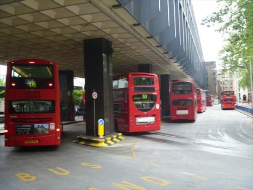
26 Euston station interchange Figure 10 - Euston public transport network Euston station has a comprehensive high frequency network with 25,000 morning peak period arrivals on National Rail, making it one of the busiest London rail termini. Euston station also has the highest usage by non-londoners and over half of passengers connect to an Underground line from Euston 10. Euston Underground access is via the station concourse and it is the only station on the network without independent access. As such, station operations are highly dependant on conditions on the main concourse. The bus station serves an important function as an interchange between the rail station and the high frequency bus network and is identified as a national and inter-regional interchange in TfL s Interchange Framework. The bus station also allows buses to navigate the left and right turn bans at Eversholt Street as well as allowing terminating buses to stand and turn. Bus routes that serve Euston station include east-west connections towards Baker Street/ Paddington and King s Cross/ Angel and the City, and north-south links connecting with Camden Town and the West End and Bloomsbury. There are up to 127 buses per hour in the weekday peak servicing Euston station and up to 60 buses per hour in the weekday peak servicing Hampstead Road Public Transport Accessibility Levels The area s good access to the public transport network is reflected in its high Public Transport Accessibility Levels (PTAL). PTALs measure the density of public transport provision in an area and include the number of bus stops, Underground and rail stations, and frequency of services. Figure TfL, Central Rail Termini Study, 2011 November DRAFT


27 below illustrates. The results are expressed on a scale of 1a to 6b, where 1a indicates extremely poor accessibility to the location by public transport and 6b indicates excellent access. The majority of the area has excellent access to the public transport network Local travel patterns Figure 11 - Public Transport Accessibility Levels in Euston The mode of travel by residents of the EAP area, shown in Figure 12, reflects the area s high accessibility by public transport, with two thirds of the trips from or to the area in the AM peak period being undertaken by public transport, including by Underground (30 per cent), National Rail (19 per cent) or bus (17 per cent). November DRAFT
28 Van / Lorry, 1% Walk, 22% Cycle, 3% Car driver, 9% Bus, 17% Underground, 30% National Rail, 19% Underground National Rail Bus Car driver Cycle Walk Van / Lorry Figure 12 All day mode share of residents trips to/from the EAP area 11 Figure 13 shows the mode share by distance travelled by users from Euston station and reveals that walking is a popular mode choice for travel up to 2km from Euston station, while between 2km and 8km over 70 per cent of passengers use the Underground. For distance travelled of over 8km from Euston station 44 per cent of passengers use rail, while 49 per cent use the Underground. 100% 90% 80% 70% 60% 50% 40% 30% 20% 6% 4% 2% 3% 2% 1% 3% 8% 3% 7% 0% 3% 4% 3% 2% 3% 14% 10% 7% 12% 8% 44% 20% 2% 53% 87% 71% 82% 56% 49% Other/Unknown Cycle Taxi Rail Bus Underground Walk 10% 0% 8% 0-1 km 1-2 km 2-5 km 5-8 km 8+ km Total Mode share 20% Figure 13 All day mode share of trips to/from Euston station Source: TfL, LTDS mode share for the EAP area - all trip types, 2005/06 to 2010/11 12 Source: TfL, Central London Rail Termini Study, 2011 November DRAFT
29 Euston bus station The current bus facility provides the dual functions of providing access to the railway station and acting as a transport hub for local residents and businesses. There are over 4,000 boarders in the morning peak. Of these, approximately 2,500 interchange from rail to bus (some 10 per cent of the 23,500 arrivals by rail) and 1,500 are bus to bus interchangers or come from the local area. The current arrangement of the bus station and surrounding buildings acts as a barrier to pedestrian movement and offers a poor quality urban environment for a major gateway to London. The current bus station accommodates 6 bus stops with 9 bus spaces, serving 11 routes and 118 buses per hour. There are common stops for services travelling north, east, south and west. In addition there are standing spaces for 10 buses. Euston bus station plays an important role, not only in allowing efficient interchange between buses and trains but also for people changing from one bus route to another. Oyster card data indicates that there are currently in the order of 5,000 people making this kind of transfer every day. A number of studies have been carried out by TfL regarding Euston station and interchange, including the Euston Interchange: Option Development Summary Report (October 2008) and the Euston Interchange Report (2010). Key issues highlighted in these reports and from discussions with stakeholders include the following: Bus facilities in the context of poorly designed urban realm area results in low permeability Poor legibility and constrained crossing capacity across Euston Road and Euston Square Gardens to the station results in low permeability The existing bus interchange is near capacity. Figure 14 shows the destination of passenger trips boarding at Euston Station bus stops in the AM peak hour with the majority (39%) going toward Holborn / south of the river. Of the bus passengers boarding at Euston Station bus routes 59, 38 and 73 are the most popular with 19%, 18% and 14% of bus users in the AM peak. November DRAFT

30 Figure 14 - Euston bus passenger destinations Rail capacity and crowding Travel in the study area is dominated by the flows of people passing through Euston station, which is one of the busiest termini in London. The Central London Rail Termini study (2011) identifies that the Euston Underground station suffers from crowding during the peaks with queues of people wishing to access the station from the National Rail station concourse. With no dedicated street access, Euston Underground station is not able to operate independently of the main station. On-train crowding is also apparent during the morning and evening peaks, as Figure 15 illustrates below. The crowding levels shown are based on the number of people standing per square metre on trains. The crowding map shows significant crowding on lines serving Euston; the southbound Victoria line with more than 4 people standing per square metre, and both Northern Line branches with 3 to 4 passengers standing per square metre. There is currently no crowding on National Rail services from Euston Station in the AM Peak. November DRAFT

31 Figure 15 Current crowding on London Underground lines- morning peak 4.3. Pedestrians Local walking connections The Euston area is within a five minute walk of University College London and Somers Town. The British Library, Regent s Park, King s Cross and St Pancras are within 10 minutes, the British Museum is within 15 minutes and Oxford Circus is within a 20 minute walk. The 25 minute walking catchment from the station exits is shown below in Figure 16. Euston station sits back from Euston Road and is located between Eversholt Street to the east and Melton Street to the west. Euston station connects to the wider area via Station Square, offering retail and catering services, however the quality of routes leading in and out of the open space is mostly poor. While Euston Station provides an important interchange for rail, Tube and bus modes, there is currently a poor environment for station users and pedestrians. Euston Road, Euston Station and tracks are barriers to north-south and east-west pedestrian and cycle movement and create a November DRAFT


32 poor local environment. The public realm quality of Euston Square Gardens at the front of the station is also poor with extensive guard railing resulting in narrow and poorly legible passages for pedestrians. Figure 16 - Euston area and 25 minute pedestrian catchment Poor quality walkways connecting Euston station to the surrounding area The arrangement of Euston bus station, the guard railing and the layout of the buildings in the area creates severance between Euston Road, Station Square and Euston station. Along Euston Road, pavements are narrow and are often congested due to the infrequency of pedestrian signalised crossing points, long wait times and crowded pedestrian waiting areas. November DRAFT

33 Pedestrian flows A sample of pedestrian movements was recorded at the main exits of Euston Station on Thursday 31 January 2013 and Saturday 2 February 2013 and approximately a quarter of the pedestrians for both weekday and weekend interchanged to either bus or London Underground at Euston Square. Video surveys of pedestrian and cyclist movement patterns in the study area also took place on Thursday 31 January 2013 and Saturday 2 February Movement observed on the weekday showed the highest morning flows were between 08:00 and 09:00, while flows in the evening peaked between 17:00 and 18:00. Average flows over the day along Euston Road were in the order of 2,000 people per hour. Weekend flows were generally lower with around 1,000 people per hour walking along Euston Road. Figure 17 - Weekday average hourly pedestrian flows On the weekday, the highest levels of movement were observed at the station exits, with average flows in excess of 2,400 people per hour. The western diagonal route through the gardens to Euston Road was also very popular with average hourly flows over the day of around 2,000 people per hour. The routes between Euston station, Euston Square Underground station and the footway leading November DRAFT

34 towards King s Cross /St Pancras are also well used. The lowest levels of movement were recorded in the areas further away from the station and within residential areas in Somers Town and Regent s Park Estate, as Figure 17 illustrates. Weekend flows, shown in Figure 18, were significantly lower compared to the weekday. The highest movement flows were observed around Euston station and on Euston Road close to the British Library. Streets leading from Euston Road into central London were found to be busy, while areas to the north of Euston Road were very quiet. Figure 18 - Weekend average hourly pedestrian flows Figure 19 shows the observed pedestrian movements for the weekday morning peak ( ) within the study area. Movement south of Euston station, in locations such as Euston Road, Upper Woburn Place and Gower Street is high, while lower pedestrian movement was observed north of Euston Road, in the Regent s Estate area and to the east and west of Euston station. November DRAFT


35 Busy pedestrian crossings outside Euston station Figure 19 Weekday observed pedestrian flows Constraints to pedestrian movement and access at crossings Euston Road currently forms a barrier between central London and Euston station. Here and more widely the existing guard railing and locations of pedestrian crossings clearly influence route choice. The evidence highlights informal crossing aligned with pedestrian desire lines in many locations, in particular Euston Road, Eversholt Street, Melton Street and Euston Street. November DRAFT
36 TfL assesses the pedestrian environment, along footways and crossings, by looking at the amount and quality of space allocated to walking, combined with the walking flows through it, and scores them from A+ (excellent) through to F (poor). The measures are referred to as Pedestrian Comfort Levels (PCLs). The majority of the surroundings of Euston station currently have PCLs ranging from A+ to C+ in the morning peak hour, which represents pedestrians having enough space to walk at the speed that they choose. However, eight locations were identified as having a poor pedestrian environment indicated by a PCL score of F during the morning peak, as shown below in Figure 20. High pedestrian flows and reduced capacity on a number of crossings result in poor levels of pedestrian comfort, in particular Euston Square / Melton Street with a PCL score of E; and the A501 Euston Road at Upper Woburn Place Eastern Arm with PCL scores of D and E. Upper Woburn Place Crossings PCL : D and E Eversholt Street PCL : F Grafton Place PCL : F F F Euston Road PCL : F B A+ A A B+ A- Melton Street Crossing PCL : E A- A- E B A F A B D A F A A+ Endsleigh Gardens PCL : F Pedestrian Comfort Levels Euston Station AM Peak Hour 08:00-09:00 See PCL Guidance for detailed description of comfort levels A- A+ A- Gordon Street PCL : F Figure 20 - Current Pedestrian Comfort Level scores (TfL, 2013) Pedestrian Environment Review While PCLs provide an assessment of the physical space at junctions and crossing locations, Pedestrian Environment Review System (PERS) provides an assessment of the wider context including whether the environment provides easy, convenient and pleasant conditions for all users. PERS is a walking audit methodology tool used to baseline walking conditions by capturing issues and problems that pedestrians encounter, such as poor air quality, noise, safety or lighting conditions. It collects a mixture of qualitative and quantitative evidence on the environment using checklists to capture how the environment is performing for pedestrians. November DRAFT


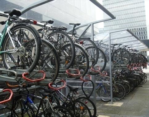
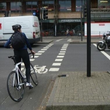
37 A PERS street audit was undertaken in 2012 to assess the pedestrian environment surrounding Euston Station. Key issues highlighted within this Euston Station PERS audit include: Euston Road was identified to have a poor quality of environment, mainly due to high traffic flows which negatively impact air quality, and noise levels Euston Road was identified to have a poor permeability due to traffic dominance which forms a barrier to crossing movements Crossing provision and performance vary throughout the study area. The lack of pedestrian green man phases and staggered arrangements at the crossings along Euston Road with Euston Square results in a lack of crossing points and long pedestrian wait times. In addition, the Eversholt Street crossing with Grafton Place eastern and the western arm of the Euston Road crossing with Gordon Street, do not include pedestrian crossing phases Cycling The cycle network and cycle docking stations within and surrounding the EAP area are shown in Figure 21. The station is located in close proximity to London Cycle Route 6 which runs from Camden Square to Elephant and Castle. In addition, Hampstead Road and Cardington Street are shown on TfL s cycle route maps as being recommended as quieter roads for cycling. Along Euston Road there is minimal cycling provision; however, there are bus lanes which afford some protection, advance cycle stop lines at the Gordon Street approach to Euston Road and a dedicated cycle crossing across Euston Road opposite Ossulston Road. Cycle crossing on Euston Road, well utilised cycle parking at Euston station and Cycle Hire The area is served by Barclays Cycle Hire with 11 docking stations and 258 docking points. The Cycle parking at Euston station is well used, and there are currently 286 cycle parking spaces located behind Nando s and Cafe Rouge at the entrance to the station, outside Sainsbury s and Marks & Spencer. Data from the London Travel Demand Survey (2012) shows that on an average weekday, cycling accounts for approximately 3 per cent of trips to and from the London Borough of Camden. This is higher than the London average which is due to the borough s central London context and the positive investment made by the borough to promote cycling. Census 2011 data showed that seven per cent of Camden residents cycle to work. Three per cent of residents of the EAP area cycle to or from the area on an average day. However, the Central London Rail Termini Survey (2011) showed that cycling accounts for less three per cent of onward travel from Euston station. November DRAFT


38 Cycle movement Figure 21 - Location of Barclays Cycle Hire stations The British Library, Regent s Park, King s Cross and St Pancras are within a five minute cycle of Euston station. Camden Town and Oxford Circus are within a ten minute cycle, Westminster is within 15 minutes and Victoria and Waterloo stations are within a 20 minute cycle. All of these destinations are within a 4km distance. Since 2006 there has been an increase in the number of cyclists crossing borough screenlines. This is in comparison to a decrease in the number of motorised vehicles crossing the screenlines during the peaks. Analysis undertaken of the users of the Cycle Hire docking stations located within a 500m distance (as the crow flies) of Euston station shows that cycle trips to and from the station tend to be less than 3km. In the morning peak, the majority of trips are towards the City of London and Holborn. In October 2012, a survey of the onward travel of Euston station passengers was undertaken. The weekday survey showed that the largest proportion of cycle trips from Euston station across the whole day was in a southerly and south eastern direction to Oxford Circus, Holborn and the City. The majority of trips were within a 4km radius of the station. November DRAFT

39 Figure 22 - Destinations of cycle trips from the Euston area Weekday count data from a survey undertaken on behalf of HS2 (October, 2012) showed a high proportion of cyclists crossing Euston Road, at the junctions between Euston Road/Hampstead Road and to Euston Road/Ossulston Street, in the southbound direction in the AM Peak with an opposite trend observed in the PM peak. A high number of cyclists also cross Eversholt Street and Hampstead Road in an east-west direction indicating the importance of trips through the Opportunity Area. A cycle demand study was undertaken in February On the weekday, highest average hourly flows across the day were observed on: Tavistock Place (300 cyclists per hour), Euston Road (140 cyclists per hour) and on Eversholt Street / Upper Woburn Place, Hampstead Road and Gower Street (60 cyclists per hour). The highest levels of movement were recorded on Tavistock Place during the morning peak hour, , with over 640 cyclists per hour. Significantly lower cyclist movement was recorded on the weekend, with around 90 cyclists per hour on Tavistock Place and around 60 cyclists per hour along Euston Road. Figure 23 shows the observed cyclist movements for the weekday AM Peak ( ) within the EAP area. The highest flows were observed on Euston Road, Woburn Place, Tavistock Place, Hampstead Road and Eversholt Street. November DRAFT


40 Figure 23 Weekday morning peak hour observed cycle movements Issues for cycling Key issues identified during the transport study include: Screenline and count data identified Euston Road, Hampstead Road and Eversholt Street as strategically important routes. Cycling infrastructure on these key corridors needs to be enhanced. Cycle Hire data indicates that there is a suppressed demand for Cycle Hire at central London termini, including Euston. The analysis showed that the majority of cycle hire trips from Euston station are to areas with a high density of employment suggesting they are commuter trips. Collisions involving pedal cyclists mainly occur at junctions on the Euston Road and Hampstead Road. Improvements are required on these routes and at key junctions to make it safer for cyclists. Cycle parking provided at Euston station is not sufficient to meet current demand and there is evidence of informal parking around the station. November DRAFT

 Designated ranking space for 11 ranking taxis Disabled pick up Sharing rank Non sharing rank ramp in Designated ranking space for 15 ranking taxis Taxis ran k righ t u p")

41 4.5. Taxi access and volumes The taxi rank and drop off at Euston station is currently located at basement level at the southwest corner of the station, entered and exited from Melton Street via one-way ramps. The current taxi rank layout is shown in Figure 24. Adjacent to the taxi rank is a multi-level parking facility for use by private vehicles with a capacity of 216 paid long-stay spaces (including 4 blue badge holder spaces). Drop off (30m of kerb space) Designated ranking space for 11 ranking taxis Disabled pick up Sharing rank Non sharing rank ramp in Designated ranking space for 15 ranking taxis Taxis ran k righ t u p the ramp, back onto Melton Street and Gordon Street Shared / fixed price area 23m (not in use) ramp out Pick up area (32m) Used by 3 to 4 cabs but space for 6 Because the shared area is not in use taxis rank in two lanes and then merge before picking up non sharing passengers Figure 24 Taxi pick up facilities at Euston station Taxi rank within Euston station and taxis along Euston station Taxi and passenger volumes and occupancy The AM and PM peaks have just over 300 taxis an hour entering and exiting the taxi rank, totalling up to 600 movements within each peak 13. Figure 25 shows the relationship between taxi volumes and passenger queues at Euston station. The maximum queue length of passengers waiting for a taxi on 24 October was 38 people. The maximum number of taxis queuing, in any one period, on the rank was 63 during the day HS2, Euston Station, Concourse and Inter-Modal Interchange Sizing, Contract No C Survey data on taxi occupancy, queues and flows at Euston Station, ARUP, 25 th June 2012 November DRAFT
42 Number of pedestrians / taxi s waiting Time Figure 25 Euston station taxi and passenger queues 15 Table 2 sets out the taxi occupancy rates for the morning and evening peaks, and shows that for passengers departing the station the average occupancy rate is around 1.7 to 1.8 people per taxi. Table 2: Taxi Passenger Occupancy Rates 16 Peak Hour Time Period Entry Exit Combined AM Peak Hour Average PM Peak Hour Average Issues for taxi access and passenger waiting environment A number of issues have been identified during the transport study concerning the existing taxi ranking location and passenger waiting facility, including: The taxi rank can only operate when Euston station is open and cannot serve the area outside of these times; The taxi pick-up and drop-off area has very poor air quality; Taxi drivers do not turn off their engines when queuing, intensifying air quality concerns; There are perceived personal safety and security issues due to the taxi rank location; There is taxi sharing signage, but it is not currently in operation and this may cause confusion; Taxi passenger occupancy rates could be higher; High volumes of taxis often cause queues back on to Melton Street and Gordon Street. 15 Survey data on taxi occupancy, queues and flows at Euston Station, ARUP, 25 th June HS2, Euston Station, Concourse and Inter-Modal Interchange Sizing, Contract No C220 November DRAFT
43 4.6. Freight Station access arrangements for road freight transport Euston station has five off-street delivery and servicing areas - Gate M, the Parcel Deck, Gate L, Gate J, and Gate E. In general, access to the station for delivery and servicing activity is available 24-hours a day, seven days a week. In addition, Melton Street and Eversholt Street provide further on-street loading and unloading opportunities. Gate M, the main service yard, is the access point with the highest utilisation, followed by Melton Street. All of the entrances to the delivery and servicing yards are controlled through automated gates or barriers operated by a staffed security reception, which monitors all trips Type and volumes of road freight deliveries to Euston station Euston station generates approximately 650 delivery, collection and servicing trips per week. The average number of deliveries per occupant is two per day and 13 per week. Food, drink and packaging account for 66% of the vehicle movements. In addition, milk deliveries account for a further 5% of all deliveries. Insufficient storage space at St Pancras and King s Cross means that food and catering supplies are stored at Euston and shuttled across throughout the day. For example, 70 round trips by a 26 tonne rigid HGV take place each week between Euston station and St Pancras station to transport Eurostar on-board catering Frequency of road freight deliveries to Euston station The number of deliveries by day of the week for Euston station s retail tenants is relatively consistent on weekdays, with a high of 47 deliveries on one weekday during the survey period. There are fewer deliveries on weekends, especially Sunday. The peak period for vehicle arrivals is from 0600 to 1500, with the peak hour for arrivals from There are a limited number of out-of-hours deliveries. The average vehicle dwell time for a delivery is 19 minutes. Some retail tenants receive deliveries from the same supplier over the course of a week Freight Storage at Euston station Retailers are not allowed to bring roll cages on to the main concourse during peak times ( and ). This creates some issues for retailers especially due to the lack of storage space. Only two key retailers (Marks & Spencer and WH Smith) have storage facilities in the yard underneath the main concourse Rail Freight Euston station has not seen any regular rail freight services since the transfer of Royal Mail trains in At present, all freight and servicing activity takes place by road. However, a freight trial was undertaken at Euston station in 2012 as part of the Last Mile Logistics (LAMILO) project, which 17 Freight information taken from High Speed 2 Identifying opportunities for freight at Euston and Old Oak Common, Final Report, University of Westminster, April 2013 unless stated otherwise November DRAFT
44 investigated initiatives to reduce the impact of last mile deliveries. The LaMiLo project is partfunded by the European Regional Development Fund. Goods were delivered using a rail service into Euston station, making use of underutilised platforms; the goods were then transferred to their final destination using lorries Euston station freight delivery and access issues The key issues identified at Euston station, include: Apart from a recent trial no freight is brought in by rail; The current delivery and servicing arrangements are considered to be relatively unmanaged with little or no control over how and when deliveries are made. This can lead to problems in the yard and is also considered a potential security risk; High levels of on-street delivery and servicing activity take place on the surrounding streets in order to serve the retailers in the plaza, which have a negative impact on the local street network Summary of existing transport issues The key existing transport issues within the EAP area are summarised below: Severance impact of Euston station Euston station occupies a large area of land and has no east west or north-south connections through it. This, in conjunction with the orientation of the road network, results in poor east west pedestrian links to King s Cross and Regent s Park, and poor north-south connections to Camden Town. Constrained pedestrian access / permeability to Euston station The existing layout of the bus interchange at the front of the station, along with the guard rail, poor quality urban realm, location of the podium building and No.1 Eversholt Street, creates a barrier to pedestrian movement. Severance impact of Euston Road Euston Road, forming part of the Inner Ring Road and the boundary to the Congestion Charging Zone, is a key link for traffic but the high traffic volumes and the number of lanes means that it forms a barrier for pedestrians and cyclists between central London and areas to the north. This effect is exacerbated by the layout of the existing bus station, junctions without pedestrian crossing phases, Euston Square Gardens and the surrounding buildings. Air quality along Euston Road The Mayor s Air Quality Strategy identifies the Euston Road corridor as a priority area in central London as PM 10, NO X and NO 2 pollution levels regularly exceed European Union limits. Lack of cycle parking at Euston station The existing cycle parking provision is not sufficient to meet current levels of demand. November DRAFT
45 Low taxi occupancy rates and a poor taxi driver, marshal and passenger waiting environment There are high volumes of taxis serving Euston station and no taxi sharing system in operation. The taxi pick-up and drop-off area is underground and has a poor quality environment with air quality and security issues. Peak crowding on London Underground lines In the morning peak there are high levels of crowding on the southbound Victoria and Northern lines. No dedicated Underground access to Euston station Access to Euston Underground station is within the National Rail station footprint. It is the only Underground station without a dedicated access to the street, which reduces operational flexibility. Above average collision rate along Euston Road Collisions occur along the entire length of Euston Road with concentrations at junctions and pedestrian crossings. The collision rate is above the average for the TLRN. The Safe Streets for London, 2013 plan sets a new target to reduce the number of those killed or seriously injured (KSI) by 40 per cent by Limited freight servicing arrangements The current delivery and servicing arrangements are considered to be relatively unmanaged with little or no control over how and when deliveries are made. This can lead to occurrences when multiple vehicles arrive at the same time, leading to vehicles queuing out on to Eversholt Street. November DRAFT
46 5. Planned and committed developments Euston Area Plan Strategic Transport Study There are several developments planned or underway within the EAP area, enhancing the place value and permeability of the area (such as Euston Circus), creating new neighbourhoods and increasing capacity (such as Crossrail 2) and demand on transport infrastructure (such as HS2). These and other key transport and development projects are detailed below Planned developments King s Cross / St Pancras development (scheduled to be completed 2021) In 2006, planning permission was granted for 8 million sq ft gross of mixed use development to the north of King s Cross Station. The site totals 67 acres, and the development provides 3.4 million sq ft net of new office space, 500,000 sq ft of retail, cafés, bars and restaurants, up to 2,000 new homes, a new university and a range of other leisure, hotel and cultural uses. Francis Crick Institute (under construction) This is a new medical research centre under construction on a 1.5 hectare site, north of the British Library. Due for completion in 2015, the Institute will employ 1,500 staff. The proposals support strategies to encourage pedestrian routes to the north along Brill Place and to the south of the building as alternatives to the Euston Road between the major stations of St Pancras International and Euston Planned and proposed infrastructure initiatives rail HS2 Euston station redevelopment (proposed) HS2 is a planned high-speed rail link between London and northern England, via Birmingham. On 10 January 2012, the Government announced the results of the 2011 consultation and their decision to progress with HS2 and produce a design to support a Hybrid Bill being lodged in late Under the March 2010 scheme, HS2 will start from Euston station and require significant station redevelopment. The impact of a new interchange at Euston would have significant implications on the rail and surface transport networks, for instance the creation of a HS2 terminal at Euston would place significant additional pressure on the existing London Underground interchange, while building new platforms for HS2 services would require the relocation of the taxi rank and freight access. The proposed HS2 design is shown in Figure 26; it includes a linear bus street and a new road link to the north of the station. Euston Square station is only around 300 metres walk from the main concourse at Euston station. However, it is currently not possible to directly access the sub-surface Underground lines from Euston station. As part of the HS2 scheme, it is proposed that a subway link would be provided directly from the expanded Euston station to the eastern end of the sub-surface Euston Square Underground platform. Crossrail 2 (Safeguarded route) Crossrail 2 is a safeguarded route for an underground railway through central London running from south-west London to north-east London. If HS2 is approved, it is proposed that the safeguarded alignment for Crossrail 2 be altered to include a stop in the vicinity of Euston. November DRAFT
 A new simplified junction design has been developed for Euston Circus")
47 Figure 26 Proposed HS2 design for Euston station (Source: HS2 press release 19 April 2013) 5.3. Planned and proposed infrastructure initiatives road network Euston Circus junction improvement (under construction) A new simplified junction design has been developed for Euston Circus including streetscape redesign and simplified pedestrian crossings. Construction has commenced on site and due for completion in early King s Cross strategic road network (investigation phase) The A501 Euston Road / Pentonville Road is currently a barrier to pedestrian movement while the three one-way systems in the area lead to an environment dominated by motor traffic. TfL is investigating the potential redevelopment of the road layout around King s Cross including the possible conversion of the three one-way systems to enable part, or full, two-way traffic operation. A preferred option should be identified by Spring 2014 with delivery proposed for 2018 subject to agreement on an option, and modelling showing it is feasible to proceed. Tottenham Court Road and Gower Street (design phase) This scheme involves the introduction of public realm improvements and 2-way traffic along Tottenham Court Road and Gower Street. The scheme would improve journey times for buses, the attractiveness of streets, pedestrian and cycling facilities, and help to remove the frequent queues of buses on New Oxford Street. Hampstead Road cycle lane (preliminary design) TfL is currently developing a scheme involving enhanced cycle facilities along Hampstead Road as a key north south cycle route within the area. A combination of cycle lanes inside the current bus lanes and physical segregation, along with the provision of advance cycle stop lines, is proposed. Bloomsbury Campus, 2010 (masterplan) The Bloomsbury Masterplan provides a strategic framework for the future development of the estate. The masterplan includes a proposal to close Gordon Street off to traffic and to use the street for key events, so that it can become a pleasant north-south route through the wider Bloomsbury area, strengthening the University s presence and connecting it to the railway stations on Euston Road. November DRAFT
48 6. Future development pressures Over time, travel patterns respond to changes in the economy and intensification of local land use as well as new transport infrastructure. This chapter identifies the future demand generated by the development proposals, desire lines, issues and opportunities for the Euston area under a range of growth scenarios. The two potentially most significant drivers of change for the Euston area will be the arrival of HS2 Phases 1 and 2 at Euston, from 2026 and 2036 respectively (as described in section 5.2), and the delivery of the development set out in the EAP by The arrival of HS2 will result in more than double the number of passengers arriving at the station together with a comprehensive redevelopment of the station itself. There are development plans for the area that consider scenarios with and without HS2. With HS2 slightly more development land, associated with the station and track works, is released. On top of these developments in the area specifically, a general increase is expected in demand for travel across London reflecting population and employment growth across the capital. London s population is projected to rise from around 8.3 million today to 9.95 million by Similarly, there is a rise in employment predicted from around 4.9 million jobs today to around 5.6 million jobs by Euston Area Plan development scenarios As the EAP has developed in response to the evolving Euston station plans by HS2 Ltd a number of different scenarios for growth have been considered. In order to inform the strategic transport assessment a decision was taken to use a medium level of growth consisting of 3,700 new homes and 7,750 new jobs. The forecasting will be reviewed when there is more certainty about the final HS2 passenger forecasts, station designs and development levels in the EAP HS2 Phase 2 demand From the current figure of around 24,000 morning peak period arrivals at Euston, a rise in morning peak demand to 29,000 arrivals, reflecting background growth in rail demand, is expected by With the introduction of HS2 Phase 1 that year, rail arrivals are set to rise to 36,000. After the introduction of HS2 Phase 2 morning peak arrivals are predicted to rise to 56,000 by Of these, 25,000 are expected to arrive on HS2 services. Figure 27 illustrates the predicted increase in passengers and the mix of HS2 and conventional National Rail arrivals. Figure 27 - Euston HS2 passenger forecasts morning peak November DRAFT


49 The predicted destinations of HS2 arrivals, based on the existing distribution of long distance intercity arrivals at Euston, are shown in Figure 28. It can be seen that the focus of onward trips coming into Euston on HS2 will be the West End and the City. Figure 28 - Predicted distribution of HS2 passengers (DfT/TfL) The scenarios are based on HS2 Ltd s design Option 8, February 2013 and associated assumptions. HS2 / TfL are continuing to examine the potential level of future demand, including the balance of demand from National Rail and HS2 services which may differ from the assumptions which were available for the EAP modelling Network assumption scenarios To understand the potential impacts on the network of the various growth scenarios, TfL has applied its demand modelling tools to measure the changing travel patterns associated with the future growth scenarios. In the first instance it is necessary to understand the impact that the general growth in population and employment across London will have, as well as any committed future schemes that will be in place. A future benchmarking scenario is normally referred to as the Reference Case. TfL s current modelling framework looks as far ahead as In addition, 2041 forecasts are currently being developed. Table 3 sets out the main scenarios considered. November DRAFT
50 Table 3: Reference case scenario descriptions Euston Area Plan Strategic Transport Study Scenario name Reference Case 2031 Year 2031 Network assumptions Committed schemes only Growth assumption Background growth only Commentary London Plan levels of growth across London assumed Reference Case plus HS Committed schemes plus network changes associated with HS2 Background growth to 2031 plus HS2 Phase 2 related demand Hybrid year 2031 background growth plus HS2 Phase 2 related highway demand Reference Case plus EAP development 2031 Committed schemes only Background growth plus EAP development aspirations for and additional 5,900 jobs and 3,100 Development total based on earlier estimates. Current assumptions Reference Case plus HS2 plus EAP development 2031 Committed schemes plus network changes associated with HS2 Background growth to 2031 plus HS2 Phase 2 related demand plus EAP development aspirations for and additional 7,750 jobs and 3,700 homes. Hybrid year 2031 background growth plus HS2 Phase 2 related highway demand Reference Case: Committed schemes only to 2031 For the Reference Case, a set of assumptions needs to be defined about future population, employment and transport schemes likely to be in place. These assumptions then need to be tested to understand the future transport issues arising should no further interventions be delivered beyond those already committed. This then forms the Reference Case, or future benchmark against which further proposals can be measured. Looking forward to 2031, a number of currently committed public transport and highway schemes can be considered to be in place. The following are of relevance to the EAP: Increased frequencies on the Northern and Victoria lines; Metropolitan line upgrade; Improvements to the Euston Circus junction on Euston Road to improve the priority for pedestrians. In addition to these committed schemes, the remodelling of the King s Cross gyratory to enable twoway traffic operation was also included, as, while not yet committed, was considered likely to be in place by Committed schemes to 2031 plus HS2 Phase 2 The introduction of HS2 would lead to a number of changes to the highway network resulting from the changes in the station footprint as well as the new arrangements for vehicle access. As the design for Euston has evolved, so too have the assumptions about the road closures associated with the new station footprint and access arrangements. November DRAFT
51 While these are still to be finalised, the following road layout changes were assumed when the models were defined early in 2013: New east-west pedestrian and cycle link to the immediate north of the station joining Eversholt Street and Hampstead Road; Melton Street would be closed to traffic except for new bus station access and cyclists; The western aspect of the station would be to Cobourg Street. The road would be closed to through traffic with the exception of cyclists who would have a dedicated cycle lane. The link would provide station access for taxis and cars (with cars/private vehicles only able to travel northwards along Cobourg Street); The new linear bus station would run across the front of the station with access from Melton Street and Eversholt Street; Gordon Street, between Endsleigh Gardens and Euston Road would become pedestrian and cyclist only; Sub-surface pedestrian link under Euston road to Euston square station and the new Gordon Street entrance. Committed schemes and EAP medium level development to 2031 Should the HS2 project not go ahead at Euston then plans still exist for the comprehensive redevelopment of the area. However, these plans are less advanced and no further highway interventions are planned beyond those already committed and in the Reference Case. Medium level development aspirations without HS2 would see an additional 5,900 jobs and 3,100 new homes. Development is expected to be car-free. Committed Schemes, EAP medium level development to 2031 plus HS2 Phase 2 This scenario includes the Reference Case network and background growth assumptions, with HS2 related demand, plus the EAP medium development aspirations associated with the HS2 station proposals. This would see an additional 7,750 jobs and 3,700 homes in the plan area. 6.3 Highway Network Performance Reference Case: Committed Schemes Only to 2031 Current forecasts for traffic growth to 2031 predict a rise of around 10 per cent in traffic levels by 2031 across London. For trips to and from the Euston area the growth in traffic is predicted to be less, at around 6 per cent 18. With the increases in traffic levels in and around Euston some additional delay is to be expected. The modelling predicts minor increases in delays at the junctions of Cardington Street and Euston Road, Upper Woburn Place and Euston Road and at the junction of Eversholt Street and Grafton Place. Figure 29 illustrates. 18 Estimates from LTS model do not include capacity impact of any strategic schemes to provide improvements for walking and cycling November DRAFT

52 Figure 29 - Network delay and Volume / Capacity ratios: Reference Case 2031 November DRAFT


53 Euston Area Plan Strategic Transport Study Highway network performance Committed schemes to 2031 plus HS2 Phase 2 Committed schemes and EAP medium level development to 2031, no HS2 Committed schemes, EAP medium level development to 2031 plus HS2 Phase 2 The increase in taxis associated with HS2 is currently estimated at an additional 365 taxi movements in each direction, to and from the station during the morning peak hour. This is based on a predicted rise in average occupancy from 1.7 to 2.2 by The revised taxi access arrangements and the increase in taxi demand have an impact on the network within the study area. Specifically, the junction at Hampstead Road and Cobourg Street to the new pick-up and dropoff facility shows significant delay. The EAP related development is planned to be car-free and will generate just 200 extra car trips in the morning peak. As such, the impact of the development over the impact associated with growth in the 2031 Reference Case is negligible. Figure 32 shows the level of road congestion in the With HS2 medium EAP development and HS2 related highway changes and demand. Although the scale of development is marginally higher in the EAP with HS2, again it shows only a small increase in trips, around 200 extra car trips. There are some delays at local junctions compared to the 2031 Reference Case. Most noteworthy is the increase in junction delay along Hampstead Road to the taxi pick up point. This shows further delays occurring from the movement of taxis to and from the taxi rank when compared with the Reference Case Predictions for general traffic show an increased average speed within the EAP area due to the network changes along Euston Road with the HS2 proposals. The junction of Euston Road and Melton Street has been modified with the closure of Gordon Street to the south. This allows for more green time to be given to the east-west movement along Euston Road, reducing delays at this junction. The closure of the Euston station bus entry exit slip allows extra green time to be given to the east-west Euston Road movement as well, while removing the existing bus lane between Melton Street and the bus station entry slip provides further capacity for general traffic. Figure 31 illustrates this. Compared to the Reference Case, with no HS2 there are only marginal changes. This includes slightly increased congestion along Euston Road, Eversholt Street and to the north-west at Prince Albert Road. The bulk of the road network performs at a similar level despite the EAP development. Figure 30 illustrates this. Figure 30 Network delay Reference Case + HS2 November Figure 31 Network delay - EAP medium development, No HS2 DRAFT Figure 32 - Network delay EAP medium development + HS2
54 6.3.1 Summary of strategic highway impacts Table 4 summarises the results for general traffic performance recorded for all the highway modelling scenarios. The indicators show results for the EAP area (shown in by the red boundary line) and a wider area (shown by the blue boundary line) in figure 33. Key Wider study area cordon EAP area cordon Figure 33 Traffic model cordon areas Table 4: Highway model headlines general traffic excluding bus and taxi Area EAP area Wider area Indicator Reference Case 2031 HS2 Low EAP Scenario Low EAP + HS2 Medium EAP Medium EAP + HS2 Average speed (kph) Travel distance (pcukm) 5,579 4,728 5,613 4,760 5,627 4,782 Travel time (pcuhrs) Average speed (kph) Travel distance (pcukm) 29,700 29,089 29,764 29,184 29,803 29,242 Travel time (pcuhrs) ,008 2,121 2,033 2,122 There are only marginal changes in traffic speeds and marginal reduction in journey times, for all growth scenarios when HS2 network changes are introduced. The increased capacity released by the simplification of the junctions on Euston Road and the removal of the bus lane offsets any additional impact caused by increased taxi movements. The opposite effect, of reducing traffic speeds with HS2, is then seen for the wider study area. November DRAFT

55 6.4 Public Transport Reference Case: Committed schemes only to 2031 Public transport demand is predicted to rise between now and 2031, with a 40 per cent rise forecast in London Underground boarders and alighters at stations in the study area compared to today. High levels of crowding on London Underground lines serving Euston are expected. Figure 34 illustrates expected London Underground crowding measured as the number of standing passengers per square metres in the morning peak. The Victoria Line southbound through Euston is predicted to be particularly busy with over 4 standees per square metre, the Northern Line Bank and Charing Cross branches are also expected to be busy southbound through Euston with between 3 and 4 standees per square metre on each. Figure 34 - Forecast crowding on London Underground - Reference Case 2031 November DRAFT


56 Committed schemes to 2031 plus HS2 Phase 2 The vast majority of HS2 passengers arriving at Euston are predicted to switch to London Underground services to continue their journey into central London, the City and beyond. Table 5 illustrates the anticipated interchange movements in the morning peak at Euston. Table 5: HS2 Onward Modes From / To Norther n Line Bank SB Nthn Line Bank NB Nthn Line CX SB Nthn Line CX NB Victoria SB Victoria NB Street / Bus / Euston Sq Other rail HS2 12% 2% 23% 3% 17% 8% 31% 3% Compared to the Reference Case without HS2, there is a worsening in London Underground crowding seen on the Northern line Charing Cross branch south from Warren Street toward Tottenham Court Road where crowding levels have risen to between 3 and 4 standees per square during the morning peak. Figure 35 illustrates. Committed schemes and EAP medium level development to 2031, no HS2 The additional homes and jobs increase the demand for public transport to and from the area. While the new jobs and homes are predicted to produce some 3,000 additional public transport trips in the AM peak period, these form a small proportion of total trips on the local network. As a result, there are negligible changes in crowding on routes serving Euston as Figure 36 illustrates. Station level analysis predicts an extra 1,200 alighters (4% increase) to use Euston station in this scenario compared to the Reference Case scenario. Euston Square is forecast to generate the next highest additional alighters, at 500 (+2%) above the Reference Case. Committed schemes, EAP medium level development to 2031 plus HS2 Phase 2 Whilst the increase in trips generated by the EAP development is greater in the HS2 scenario than without HS2 due to the increase in development scale, 7,750 jobs and 3,700 homes, it again forms a small proportion of total trips on the local network overall. As a result, there are again negligible changes in crowding on routes serving Euston. Figure 37 illustrates this. The most significant increases in alighters are forecast at Euston station which sees an extra 1,200 (+4%) alighters and Euston Square station which gets another 800 (+5%) alighters, both when comparing against the Reference Case with HS2. Figure 35 Forecast crowding on London Underground - Reference Case + HS Figure 36 - Forecast crowding on London Underground - Medium EAP, no HS2 Figure 37 - Forecast crowding on London Underground - medium EAP plus HS2 November DRAFT

57 6.4.1 Summary of public transport impacts Background growth in demand for public transport is predicted to rise dramatically between now and 2031, with a 40% rise forecast in London Underground boarders and alighters at stations in the study area compared to today. Euston station is well served by London Underground services, however, these are already extremely busy during the peaks and, while committed improvements will provide additional capacity on London Underground services, there are high levels of crowding expected on the London Underground lines serving Euston. The additional demand from HS2 Phase 2, around 15,000 additional London Underground boarders at Euston in the morning peak period, will add to the pressure and mean that more capacity is required. Compared to HS2 related demand and the general increase in background growth, the EAP developments are anticipated to have a marginal impact on public transport demand, with an estimated additional 3,000 trips associated with the development in the study area in the morning peak. The development is not expected to cause significant increases in London Underground crowding levels. Bus use at Euston station is predicted to increase by around 67% with the introduction of HS2 and EAP Medium development proposals The Reference Case bus boardings are shown in Figure 38 and bus boardings with HS2 and EAP are shown in Figure 39. Figure 38 - Reference Case 2031 bus boardings November DRAFT

58 Figure 39 - Medium EAP development and HS2 forecast bus boardings 6.5 Pedestrian accessibility and wayfinding Future flows TfL commissioned specialist pedestrian modelling to predict changes in walking patterns under a number of development scenarios with and without HS2. The arrival of HS2 at Euston offers opportunities for a major reconfiguration of the station with new north-south and east-west links across the station footprint and railway. Figure 40 illustrates these new walk connections and the predicted walking flows they may attract. Inspection of this with HS2 Reference Case reveals a significant overall increase in pedestrian demand throughout the area and station, brought about by increased numbers of HS2 passenger arrivals and general background development growth. For example, the modelling highlights high demand for the new walk links through Euston station, with pedestrian flows of over 2,000 people per hour while Euston Road experiences flows of over 4,000 people per hour. The reconfigured Cobourg Street servicing the station is also predicted to attract high pedestrian flows. The new east-west link directly to the north of the station linking Hampstead Road and Eversholt Street is predicted to be relatively popular with pedestrians, attracting around people per hour. November DRAFT


59 However, the modelling predicts relatively low pedestrian demand for the new north-south route running north of the station and this can be explained by the lack of continuity this link has with Hampstead Road. Figure 40 - Forecast pedestrian flows - reference case with HS Crossings and Pedestrian Comfort Levels (PCL) Associated with these increased pedestrian flows through the area will be additional crossing movements. The busiest crossing during the morning peak is at Euston Road junction with Upper Woburn Place with around 10,000 people per hour wishing to cross. Gordon Street crossing is also very busy, with around 9,000 people per hour. There are significant flows of pedestrians to the west, across Melton Street and along Euston Road north side, with around 6,000 pedestrians per hour. Figure 41 illustrates this. These higher pedestrian flows will place additional pressure on the crossings which are already reaching capacity. Both the main Euston Road crossings, Upper Woburn and Gordon Street would suffer deterioration in Pedestrian Comfort Levels to levels D and E. Figure 42 illustrates this. November DRAFT

60 Figure 41 - Forecast crossing movements - Reference Case plus HS2 C+ E E B- C E E C A E B- E D B+ D Pedestrian Comfort Levels Euston Station Intersection Crossings Ref case+hs2 AM Peak Hour 08:00-09:00 See PCL Guidance for detailed description of comfort levels Figure 42 - Crossing PCLs Reference Case plus HS2 November DRAFT
61 6.5.3 Summary of pedestrian accessibly impacts Euston Area Plan Strategic Transport Study An important objective of the EAP is to reduce the severance effect of the Euston Road and the station complex. The HS2 proposals allow for some new walk connectivity through the station and these links, in particular the east-west routes, are predicted to be very popular. However, the additional numbers of people accessing and egressing the station and related developments will put pressure on the Euston Road crossings and mean deteriorating conditions for pedestrians. Although some relief may be offered, for example by the new sub-surface link to Euston Square station, it will be necessary to improve crossing capacity significantly to both mitigate the impacts of increased walking and to realise the objective of reducing severance caused by Euston Road. 6.6 Cycling The Mayor s Cycling Vision aims to double the amount of cycling over the next 10 years and provide the infrastructure and support to achieve this. There will be particular focus on significant improvements to routes and junctions on TfL s road network as well as a partnership with the boroughs to deliver improvements on local roads. Proposals include: a central London Cycle Grid of cycle links, complementing the radial Cycle Super-Highways and the network of Quietways and; a significant increase in the volume and quality of cycle parking at stations and the development of a Dutch-style superhub at least one of the central London termini. In addition, the impact of the additional passenger demand generated by HS2 will be partly mitigated by ambitious plans to promote more cycle access to the station. TfL will require HS2 to provide cycle parking in the Euston station area that aligns with Mayoral targets, with provision to support at least a 7 per cent cycle mode share. 6.7 Summary of future development pressures The most significant driver of change at Euston will be the arrival of HS2 which is predicted to deliver a large increase in inter-city, longer distance passengers. While Euston station is well served by London Underground services, these are already extremely busy during the peak periods and, while committed improvements will provide additional capacity on London Underground services, the additional demand from HS2 will add to the pressure with the result that more capacity is required to disperse the additional demand. At street level, HS2 will see more passengers wishing to continue their journey on foot, bicycle, or by taxi and there will be added pressure on pedestrian crossings as well as increased taxi movements. Careful traffic management and improved pedestrian and cycle facilities will need to be delivered to mitigate these impacts. November DRAFT
62 7 Intervention identification A comprehensive list of transportation interventions to mitigate the identified issues, and provide for future demand, was developed through stakeholder liaison and the application of specialist knowledge and evidence. Options have been developed in cognisance of the current strategic role the Euston Road plays as London s northern inner ring road. The option appraisal process is shown in Figure 43 and is aligned with both TfL s Strategic Assessment Framework criteria and the EAP objectives. Option identification Identification of transport interventions needed to support each development scenario. Ensures all possible options are captured Initial high level option sifting High level assessment of the options to determine a short list of options for each scenario. Ensures consistency with EAP objectives and MTS Option development and identification of packages Further investigation of options taken forward and creation of supporting options into packages Ensures synergies of options are considered Option testing Assessment of preferred options on the transport networks using sub-regional models Ensures transportation impacts are assessed Option appraisal Evaluation of option packages against criteria to identify preferred interventions Ensures social, economic, environmental impacts are assessed Preferred package of interventions identified Figure 43 - Option appraisal process 7.1 Option identification The options which met the initial high level criteria are included below under the following categories and are assessed using a combination of quantitative and qualitative methods in Sections 8 and 9: Pedestrian accessibility, wayfinding and the urban realm; Cycle accessibility; Facilities for bus users; Rail capacity and access; Freight delivery and servicing; Taxi facilities for passengers and drivers; Managing travel demand; Highway interventions. The options do not necessarily represent the EAP partners preferences and the testing includes a wide variety of interventions in order to ensure that the Transport Study optioneering process is robust and thorough. November DRAFT


63 Pedestrian accessibility, wayfinding and the urban realm options To significantly improve permeability, wayfinding, accessibility and to cater for increased pedestrian volumes the following options were identified, see Figure 44. The pedestrian options for investigation include measures to promote walking, including new routes and facilities, expansion of Legible London signage and significant public realm improvements. New walking and cycling links are also proposed along Gordon Street, Drummond Street, Cobourg Street and to the north of the station. Key walking routes in the area New walking route New walking route through concourse New underground link Road stopped up for general traffic Station entrances Junction improvements Figure 44 - Pedestrian movement and access options Cycling accessibility options To provide for an increase in cycle volumes at Euston station and within the EAP area the following options were identified, see Figure 45. The options for investigation include new routes, safety measures, enhanced junction improvements and provision of cycle parking and Cycle Hire stations. Key cycle routes through the area Segregated cycle tracks Cycle lanes Road stopped up for general traffic Cycle parking (scale and location indicative Junction improvements Figure 45 - Cycling movement and access options November DRAFT

 and Eversholt Street (for north-south routes) and provide standing and")
 On-street stops Existing facility New linear bus station Figure 46 - Bus access options Rail")
64 Facilities for bus users options To cater for increased bus passenger demand, to improve the waiting environment and to allow for an improved urban realm and connection between Euston Road and Euston station, the following bus station / stop options for investigation were identified, see Figure 46. Proposals include: Improved wayfinding and passenger facilities; Re-provide existing bus station with improvements to pedestrian crossings and urban design; New linear bus facility with additional bus stands to the north-east corner of the station; Relocate bus stops and services to Euston Road (for east-west routes) and Eversholt Street (for north-south routes) and provide standing and turning space elsewhere. Standing and turning area to north, compatible with all options (scale and location indicative only) On-street stops Existing facility New linear bus station Figure 46 - Bus access options Rail capacity and access options To cater for increased rail demand and provide an improved passenger experience the rail options, shown in Figure 47, include: New station entrances for Euston Underground station; Underground pedestrian links to Euston station and Euston Square; Improved wayfinding; Crossrail 2. Figure 47 - Rail options November DRAFT
 see Figure 48; Station and development servicing plans; Dedicated space for freight loading and storage")
65 Freight delivery and servicing options To promote sustainable freight movements and reduction in freight volumes during peak periods, proposals include: Shift operations from road to rail; Encourage the use of environmentally friendly freight vehicles; Consolidation centre (road based freight) see Figure 48; Station and development servicing plans; Dedicated space for freight loading and storage within Euston Station. Figure 48 - Example of consolidation process Improving taxi facilities for passengers and drivers To promote sustainable modes, improve the taxi passenger environment and promote taxi sharing proposals include: Taxi ranking along Hampstead Road; Taxi ranking along Cobourg Street; Promotion of higher taxi occupancy through provision of a taxi share system with dedicated marshals; Improved wayfinding and passenger facilities. Travel demand management To promote sustainable modes and integrated transport, improve the environment and reduce the volume of motorised traffic proposals include: Zero or ultra low emission zone for the station; Car-free development 19 to minimise traffic generation of new developments; Innovative and integrated ticketing for services to Euston station. Highway interventions To promote sustainable vehicle movements and reduction in volumes, especially during peak periods, proposals include: 20mph zone within the EAP boundary; Gordon Street, between Endsleigh Gardens and Euston Road, becomes pedestrian and cyclist only. 7.2 Summary The transport interventions identified focus on the promotion of sustainable and active modes to accommodate the development related growth and the additional demand generated by HS2. The options include large scale schemes to cater for the onward dispersal of passengers and smaller scale initiatives to improve bus facilities and increase pedestrian and cycling permeability, through the provision of new walking and cycling links to and through the station and Opportunity Area, improved 19 Car-free development would still maintain car access and parking for Blue Badge holders. November DRAFT
66 way-finding, legibility and urban realm. The options are covered further in Chapter 8 and assessed against the EAP and MTS objectives in Chapter 9. November DRAFT
67 8 Future development intervention scenarios This chapter describes the interventions that were identified in Chapter 7 in more detail, and investigates the potential benefits and negative impacts of each intervention and how successfully they address the identified existing and potential future issues. The potential interventions are described in more detail in the following sections: 8.1 Pedestrian accessibility, wayfinding and the urban realm; 8.2 Cycle accessibility; 8.3 Facilities for bus users; 8.4 Rail capacity and access; 8.5 Freight delivery and servicing; 8.6 Taxi facilities for passengers and drivers; 8.7 Managing travel demand; 8.8 Highway interventions. 8.1 Pedestrian accessibility, wayfinding and urban realm These proposals are grouped around the following themes: Pedestrian crossing improvements (section 8.1.1); Enhance existing pedestrian links (section 8.1.2); New high quality pedestrian links through and adjacent to the area (section 8.1.3); Improved wayfinding (section 8.1.4) Pedestrian crossing improvements The EAP aims to change the role of the Euston area to being a destination in its own right, as well as a transport hub. Euston Road forms part of central London s northern Inner Ring Road but is recognised as a barrier to north-south pedestrian permeability. Reducing this severance is a key objective of the EAP, not only to address today s issues, but also to facilitate the anticipated increase in walking arising from the EAP growth and the significant increased passenger demand generated by HS2. East-west permeability has also suffered, primarily due to the station itself. New connections over and through the station will significantly improve permeability and these can be complemented by improved crossings on Hampstead Road and Eversholt Street. The busiest of the existing Euston Road crossings are already close to capacity and there is evidence of informal crossing outside of these facilities. To address these current and future pressures the following two levels of intervention were tested: Green pedestrian crossing phases on all crossings, including diagonal crossings at key junctions and widened refuges/footpaths; New green man phases on important crossings, increased crossing time at key junctions and widened refuges/footways. November DRAFT


68 TfL has used specialist transport models to understand the potential impacts of these improvements to crossings, both on the pattern of pedestrian movement and on traffic. Bespoke pedestrian modelling has looked at demand patterns arising from a package of improvements to pedestrian connections, including new links through the station, and new diagonal crossings on Euston Road at Upper Woburn Place and at Gordon Street. Existing crossing facilities to 2031with HS2 Predicted future flows of pedestrians, including anticipated growth from general growth and HS2 passengers, is shown in Figure 49. Modelling predicts there will be increasingly high levels of pedestrian demand at both Upper Woburn Place and Gordon Street junctions with Euston Road with up to 10,000 people crossing at each junction per hour at peak times. The single busiest crossing is predicted to be Melton Street with morning peak hour crossings of 6,500 people per hour compared with 2,500 crossings currently observed in the morning peak hour. Figure 49 - Pedestrian crossing flows. Reference Case with HS2 November DRAFT
69 Diagonal crossing facilities to 2031 with HS2 Surveys indicate that the predominant movements from Euston are to the southwest and southeast, to destinations in the West End and Bloomsbury. To align facilities to desire lines, diagonal crossings are proposed at Upper Woburn Place and at Gordon Street. Such crossings would involve introducing all red phases for general traffic. Predicted use of the local crossings under this scenario is shown in Figure 50. Due to the additional diagonal crossings giving more crossing options, the pedestrian demand is more spread out compared to conventional straight across movement. There are high levels of pedestrian demand at both Upper Woburn Place crossing and Gordon Street crossing with over 4,000 people per hour crossing to Euston on each diagonal arm. Demand for traditional straight across movements also remains strong with around 7,000 people per hour crossing at each junction. Overall, compared to the Reference Case, total predicted morning peak crossings of Euston Road at the three facilities in front of the station increases from around 20,000 per hour to 31,000 per hour. Figure 50 - Forecast diagonal pedestrian crossing flows TfL s specialist traffic model was used to assess the impact on vehicular traffic of a package of local improvements including the cycle lanes on Eversholt Street and Hampstead Road, and the enhanced pedestrian crossing phase. To understand the effect of this increased pedestrian and cycling priority across Euston Road, the change in car travel time along the stretch of Euston Road, between Gordon Street and Churchway, was assessed. The closure of Gordon Street at Euston Road, the reconfigured November DRAFT
70 linear bus station and the removal of the bus lane outside Euston station increases road capacity for general traffic and this is seen in the reduced travel time for traffic along it. Introducing pedestrian priority adds delay to general traffic of around a minute when compared to delay predicted for the Reference Case. Table 6: Euston Road eastbound delays to car with pedestrian improvement package Scenario Car travel time (s) Delay Delay (s) over Reference Case Reference Case Reference Case 2031 plus EAP development and HS Commentary Linear bus station and Gordon Street closure reduces delay along Euston Road Reference Case + EAP development options package Additional pedestrian green time causes additional delay to traffic of about 1 minute Pedestrian crossing improvements summary Impacts would vary depending on the degree to which pedestrians were prioritised over traffic. An indicative assessment shows the intervention could have the following impacts: Improved crossing capacity and reduced pedestrian crowding; Aligned crossings to pedestrian desire lines and hence reduced journey times; Safety improvements as a result of reduced informal crossing; Encourage walking for journeys through the area and to the station; Increased delays to traffic and buses. Recommendation: Recommendation: Improvements to pedestrian crossing facilities at intersections should be provided where high pedestrian volumes warrant it. Delays to traffic will need to be considered and mitigated. Improvements in the quality and capacity of pedestrian crossings facilities are required but the exact provision is to be determined following further analysis Enhance existing pedestrian links Euston station is poorly integrated with its immediate surroundings and the quality of the public realm in the vicinity of the station, Euston Square Gardens and the bus station is poor. Many areas have extensive provision of guard railing resulting in poor permeability for pedestrians. To improve the integration of the station and continue to improve the pedestrian permeability of the area, the following interventions have been proposed: Enhance and provide direct and high quality pedestrian links through Euston Square Gardens to Euston station; Enhance the existing surface pedestrian links connecting Euston station to the north, east, south and west of the station, to Better Street level 2 (interventions aimed at improving the function of streets) or higher. November DRAFT

71 Enhance and provide direct high quality pedestrian links through Euston Square Gardens to Euston station This option is aimed at improving pedestrian access to the station through urban realm enhancements and links which align to pedestrian desire lines. Pedestrian modelling has looked at a package of improvements to enhance permeability through new through-station walk links and diagonal pedestrian crossings on Euston Road. Modelling suggests that, even with a change in level, the new links through Euston Square Gardens into the station would be attractive options with between 1,000 and 3,000 people per hour using them in the peaks. Figure 51 - Forecast pedestrian flows: To and through Euston station Enhance existing pedestrian links through Euston Square Gardens to Euston station summary An indicative assessment shows the intervention could have the following impacts: Alignment of pedestrian routes to desire lines; Urban realm improvements; Encourage walking for journeys through the area and to the station. November DRAFT
72 Recommendation: Improvements to the pedestrian links through Euston Square Garden should be provided and redevelopment options for Euston station should develop detailed proposals to enhance this key access route. Enhance the existing surface pedestrian links connecting Euston station to the north, east, south and west of the station, to Better Street level 2 This proposal is about improving the integration of the station into the local area and enhancing the pedestrian experience for links to destinations such as King s Cross/St. Pancras, Bloomsbury and the West End, Regent s Park, Mornington Crescent and Camden Town. Improvements would include a wayfinding strategy, general streetscape and urban realm improvements achieving the Mayor s Better Streets initiative level 2 or higher. The Better Streets program proposes a staged approach to be adopted by local highway authorities when considering interventions aimed at improving the function of their streets. Level 1 - Tidy up. Get rid of unnecessary road markings and infrastructure that are easy to remove, such as broken seats; Level 2 - De-clutter. More thoroughly, justify each piece of street furniture with a presumption that it should be removed unless there is a clear case for retention; Level 3 - Relocate/merge functions. Make the remaining street features and equipment work together. Enhance the existing surface pedestrian links connecting Euston station to the north, east, south and west summary An indicative assessment shows the intervention could have the following impacts: Urban realm improvements on key pedestrian routes to important destinations in the area; Alignment with desire lines; Encourage walking for journeys through the area and to the station. Recommendation: Implement Better Streets principles to at least Level 2 to improve existing pedestrian links through the EAP area and to adjacent key destinations, integrated with a wayfinding strategy New high quality pedestrian links through and adjacent to the area This option continues the theme of improving pedestrian and cycle permeability in this case through the Euston area as well as through the station itself. The options here form part of the comprehensive redevelopment of the station under the EAP development and HS2 Ltd s station proposals. The following options are proposed: a) Car free links - walking and cycle only along Gordon Street between Euston Road and Gordon Square; b) A new east west link to the north of Euston station connecting Varndell Street to Polygon Road; c) New pedestrian links through Euston station. November DRAFT
73 a) Car free links - walking and cycle only along Gordon Street between Euston Road and Gordon Square An option is proposed that includes stopping through motorised traffic along Gordon Street from the junction with Euston Road to Endsleigh Gardens. HS2 has proposed to close Gordon Street off to general traffic. In this option, the restricted vehicle access extends further south to Gordon Square. This would offer opportunities to provide additional cycle parking and Barclays Cycle Hire points. The banning of traffic from Gordon Street also frees up capacity at the junction for traffic on Euston Road, mitigating the additional delay of increased pedestrian priority at this junction. Table 6, on page 59, indicates the level of delay anticipated with these closures. b) A new east west link to the north of Euston station connecting Varndell Street to Polygon Road This option provides a critical east - west link for pedestrians and cyclists, helping to overcome the severance of the station block and the track throat and connecting the Regent s Park area to King s Cross and St Pancras. If the link carries general traffic then special attention and design is required to ensure that a high quality environment is provided for pedestrians and cyclists. Alternatively, if through-traffic is not permitted then special attention needs to be made to encourage activity and informal surveillance to ensure the safety and security of users, especially at night. This could be achieved by designing the link as a street with overlooking buildings alongside it, where possible, with clear sightlines and adequate width. c) New pedestrian links through Euston station The redevelopment of Euston station offers the opportunity to provide new attractive and active east-west and north-south connections. Current proposals by HS2 Ltd for Euston station to accommodate HS2 would involve the retention of the current classic rail platforms and concourse at ground level while lowering the new HS2 platforms. This would mean that any new through-station links would need to navigate the existing, or reconfigured, station block and require significant changes in level for walkers. Detailed pedestrian modelling has been undertaken to predict walking patterns and flows when new links through the station are provided. The analysis focused on three scenarios of varying permeability through the opportunity area: i. Preferred masterplan - An option where the new rail station is entirely lowered to allow full at-grade pedestrian connections through the station. This option does not include the HS2 demand and is not aligned to the current HS2 Ltd station proposals but considers the potential impact on pedestrian connectivity with a comprehensive redevelopment of the station. ii. iii. Masterplan with HS2 - This option incorporates the proposals of HS2 Ltd and involves changes in level of pedestrian links to allow for the retention of the current classic station block. Masterplan with HS2 and high permeability - An option building on the Masterplan with HS2 option, but with added pedestrian priority and connections outside the station. November DRAFT

74 i. Preferred masterplan Figure 52 illustrates the results of the pedestrian modelling. This highlights the enhanced connectivity and consequent high demand for the new walk links through Euston station with morning peak hour flows of over 2,000 people. The central link connecting Drummond Street with Doric Way is particularly popular with between 2,000 and 3,000 people per hour during the morning peak. Morning peak flows along Euston Road are also high, with over 3,000 people per hour, as well as significant flows on both Eversholt Street and Cardington Street with morning peak flows in excess of 2,000 people per hour. The model highlights improved east-west connectivity between Phoenix Road and Robert Street and further to the south on Drummond Street. Significant demand is also expected from Euston to King s Cross. Figure 52 - Morning peak hour pedestrian flows: Preferred Masterplan (No HS2) Figure 53 illustrates high levels of predicted pedestrian demand at both the Upper Woburn Place crossing and the Gordon Street crossing during the morning peak, with around 2,000 to 3,000 people per hour on the diagonal crossings and 2,000 to 3,000 on the existing straight across arms. Demand is less than in the With HS2 scenarios as these passengers make a significant contribution to local walk activity. November DRAFT

75 Figure 53 - Preferred masterplan morning peak diagonal crossing flows Preferred masterplan summary An indicative assessment shows the intervention could have the following impacts: Strongly encourages walking for journeys through the area and to the station through at-grade links; Improved urban realm; Improved crossing capacity and Pedestrian Comfort Levels; Some delays to traffic previously using the links. ii. Masterplan with HS2 An increase in pedestrian demand is predicted within the new spatial layout of Euston station with over 2,000 people per hour during the morning peak. Along Euston Road the model predicts over 4,000 pedestrians per hour during the morning peak. Compared to the Preferred masterplan the forecasts for pedestrian demand along the north-south route above Euston station are reduced by around 50%, with around 500 to 1,000 pedestrians in the morning peak hour. This is due to a lack of continuity towards Hampstead Road. Demand along the new Phoenix Road link bridge is also predicted to be less at around 500-1,000 people per hour. November DRAFT


76 Figure 54 - Morning peak hour pedestrian flows: Masterplan with HS2 Predicted crossing demand is significantly higher than in the Preferred masterplan scenario due to the presence of HS2 passenger arrivals. Figure 49, shown on page 55, highlights high levels of pedestrian demand anticipated at both the Upper Woburn Place crossing and the Gordon Street crossing, with a combined two-way crossing flow of around 10,000 people at each facility in the morning peak hour. Masterplan with HS2 summary An indicative assessment shows the intervention could have the following impacts: Encourages walking for journeys through the area and to the station through new walk links; Improved urban realm; Some delays to traffic previously using the links. November DRAFT


77 iii. Masterplan with HS2 and higher permeability The new east-west links across the station are expected to attract significant demand with up to 3,000 people per hour on the new Drummond Street Doric Way connection. Euston Road, Eversholt Street and the new Cobourg Street are also popular with over 4,000 people per hour anticipated during the morning peak. The demand along the new Phoenix Road alignment is predicted to attract above 1,000 people per hour. New development to the northwest of the station is predicted to attract moderate levels of pedestrian demand. High levels of pedestrian demand are predicted at both the Upper Woburn Place and Gordon Street crossings with between 2,800 and 5,800 people per hour. Crossings movements at the central crossing on Euston Road directly in front of the station, are predicted to reach relatively high levels compared to the other scenarios at 1,200 people per hour in the morning peak. Figure 55 - Morning peak pedestrian flows: Masterplan with HS2 and high permeability Due to the diagonal crossing segments pedestrian demand is more spread out compared to other scenarios. Figure 50 shown on page 56 illustrates this. November DRAFT
78 Masterplan with HS2 and high permeability summary An indicative assessment shows the intervention could have the following impacts: Strongly encourages walking for journeys through the area and to the station through provision of new links and new bridges across the track; Improved urban realm; Improved crossing capacity and Pedestrian Comfort Levels; Some delays to traffic previously using the links. Recommendation: Provide new links and walking and cycling only along Gordon Street as part of the transport strategy. The provision of new links through the Station would be beneficial for pedestrian permeability, in particular strengthening east west connections. However, the potential for provision for new links through the station site will be more limited if significant over site development is not provided Improving wayfinding Euston station is a key London gateway for visitors to the Capital and, as such, attracts a high number of people unfamiliar with the network and their potential journey options. The introduction of HS2 services will further increase the number of visitors and so options that improve people s ability to navigate the area by foot or bicycle will become more and more important, both to reduce pressure on the public transport network and to promote more active modes. In this regard, implementation of consistent wayfinding, such as Legible London, at key locations is proposed. A wayfinding strategy is a fundamental element of the approach to encourage walking and should also complement any proposals for new links, decluttering and urban realm enhancements. The wayfinding provided should also include signage to rail, bus, cycle parking, cycle hire and taxi services. A wayfinding study commissioned by the Central London Partnership in 2006 found that predictable, consistent and authoritative public information is the key to building pedestrians' confidence and hence encourages walking. Legible London provides a consistent wayfinding solution that helps people walk around the Capital. There are now over 1,200 signs across London with more being installed every year. To maximise the value of the system to pedestrians it is important that Legible London is present and prominent at major gateways into London, such as Euston station. An effective wayfinding system at Euston can help to encourage walk trips to key destinations such as Camden Town and the West End. Improving wayfinding summary An indicative assessment shows the intervention could have the following impacts: Promotes walking, especially amongst new and occasional visitors who may be less familiar with central London; Supports onward dispersal, on foot, from transport nodes; High quality, trusted brand, creating a positive first impression of London; Forms part of TfL s transport system being used across the TfL estate including the Underground, buses, DLR and Barclays Cycle Hire; Highlights locations of other available public transport options; Relatively high cost compared to other lower quality wayfinding systems, but cost includes maintenance and regular map refreshes to maintain system relevance. November DRAFT
79 Recommendation: A comprehensive wayfinding strategy should be developed to complement proposals for new and improved pedestrian links, decluttering and urban realm enhancements. 8.2 Improving cycle accessibility The cycling proposals are grouped around the following themes: Enhance existing junctions for cyclists (section 8.2.1); New high quality cycle facilities on quiet streets (section 8.2.2); New high quality cycle lanes on busier roads (section 8.2.3); High quality cycle parking (section 8.2.4); Barclays Cycle Hire (section 8.2.5) Enhance existing junctions for cyclists The Mayor s Cycling Vision sets out plans for substantial and transformative change in provision for cycling in London. Given the level of current cycling and the predicted growth in future volumes of cyclists, especially in central London, it is vital that all movements are made as safe and comfortable as possible. Conflicts between cyclists and taxis / freight vehicles should be minimised where possible, particularly at the freight servicing access points and the access points to the taxi ranks. Minimum levels of service 20 should be specified for all of the junctions within the EAP, defined according to the ease and safety with which cyclists can negotiate the junction. Enhance existing junctions for cyclists summary An indicative assessment suggests the proposed interventions could have the following benefits: Helps to reduce the risk of cycle collisions; Improvement to the real and perceived safety of cycling; Encourages use of cycles for journeys through the area and to the station; Depending on the detailed design, the proposals may have a marginal impact on capacity for general traffic. Recommendation: Improvements to cycle facilities at existing junctions should be made to enhance conditions for cycling New high quality cycle facilities on quiet streets Consistent with delivering the Mayor s Cycling Vision for the EAP, a series of measures are proposed to improve conditions for cycling on some of the less busy routes through the area. The following interventions are proposed: Enhance existing links e.g. Park Village East; New east-west link connecting Varndell Street and Polygon Road. 20 Guidance will be available in future drafts of the London Cycle Design Standards November DRAFT
80 New high quality cycle facilities on quiet streets summary Euston Area Plan Strategic Transport Study An indicative assessment suggests the interventions could have the following benefits: Reduced cycle collisions; Real and perceived safety improvements for cyclists; Encourage use of cycles for journeys through the area and to the station; In some sections a lane of general traffic could be lost, any loss of capacity to general traffic may cause delay and potential traffic dispersal onto the surrounding network. Recommendation: New, high quality cycle links to be provided to form part of an attractive, convenient, coherent and joined-up network of routes on quieter trafficked roads New high quality cycle lanes on busier roads Cycling is already popular on the strategic road network through the area, including Euston Road, Eversholt Street and Hampstead Road. The cycling proposed interventions are designed to integrate with the surrounding cycle network, in particular, the London Cycle Network, the Quietways and the London Cycle Grid. Despite the high volumes of motor vehicles travelling along Euston Road it is also a key corridor for cyclists, with a combined eastbound and westbound total of up to 280 cyclists in the morning peak hour. In order to ensure cyclists can move along Euston Road safely and without being obstructed by other vehicles the provision of cycle lanes has been assessed. Whilst it would be possible to install cycle lanes in some sections without removing traffic lanes, in order to be fully assessed a design would need to be drawn up for the whole length of the road under consideration. Impacts on traffic could be considerable but nonetheless the importance of this east-west route for cyclists should not be underestimated and until a suitably direct and safe east-west alternative is found, cyclists are likely to continue to use Euston Road. The following interventions are proposed for further investigation: Cycle facilities along Euston Road; Cycle lanes along Hampstead Road; Cycle lanes along Eversholt Street. Figure 56 shows the proposed links and how they connect into the potential future wider cycle network. November DRAFT


81 POPOSED EAP WALKING / CYCLE ONLY LINKS POPOSED EAP NEW CYCLE LANES POPOSED EAP ENHANCED CYCLE LINKS EMERGING LONDON WIDE CYCLE LINKS Figure 56 EAP proposed new cycle links connections into emerging cycle network Pioneering cycle modelling has been undertaken which predicts cycling patterns responding to improvements to cycle facilities and based on a general uplift of over 200 per cent in cycle use in central London 21. The model predicts high cycle flows along the most accessible cycling landscape, including Hampstead Road and Eversholt Street, with over 500 cyclists per hour on these links following the introduction of cycle lanes. Figure 57 illustrates this. The key results from the cycle modelling of the proposed interventions are as follows: High growth in cyclist demand throughout large parts of the street network. Hampstead Road, Eversholt Street, Melton Street, and Tavistock Place are key primary cyclists routes in the area with over 500 cyclists per hour; High flows around Melton Street reflecting the influence of additional cycle hire volume and cycle infrastructure provision; Medium levels of cyclists on the new east-west route across the station, Euston Road and key north-south routes into central London such as Gower Street and Woburn Place; Moderate levels of cyclists predicted along the new north-south routes of Park Village East. 21 Source: Trend Based Forecasts. Strategy Analysis, TfL, 2012 November DRAFT


82 Figure 57 - Morning peak hour forecast cycle flows with Additional cycle facilities scenario New high quality cycle lanes on busier roads summary An indicative assessment suggests the interventions could have the following benefits: Reduced cycle collisions; Real and perceived safety improvements; Encourage use of cycles for journeys through the area and to the station; In some sections a lane of general traffic could be lost, any loss of capacity to general traffic may cause delay and potential traffic dispersal onto the surrounding network. Recommendation: Improved cycle facilities to be provided on the TLRN. Undertake further assessment to identify appropriate cycle provision along Euston Road or an alternative east-west corridor High quality cycle parking The provision of cycle parking should support the achievement of the Mayor s cycle target of a 5 per cent London-wide mode-share by Prime cycle trip attractors, such as Euston station and areas in central London, will have a higher cycle mode share and will need to provide for more than 5 per cent. Therefore, the level of cycle parking that is commensurate with this ambition and which accommodates future growth should be provided at the station. Cycle parking at Euston station should be located to allow cyclists to access it safely on desire lines from the surrounding network and should be close and convenient to station entrances, well lit and subject to natural and more formal surveillance. The proportion of cycle parking provided at station entrances should reflect the November DRAFT
83 level of demand associated with each of the station entrances. The quality of the cycle parking provision is also critical and it should be covered where possible and a portion of it should also be secure. Cycle parking in new residential and commercial developments should have generous levels of secure and convenient cycle parking provision to provide for a high and growing mode share for cycling. High quality cycle parking summary An indicative assessment suggests the intervention could have the following benefits: Encourage use of bicycles for journeys to/from the station and new development; Station re-development provides an opportunity to provide a step change in provision with high capacity and high quality cycle parking which could be used as a model of best practice; Loss of potential land for development; Could have a negative effect on the urban realm if not carefully designed. Recommendation: The regeneration of the station and residential and commercial development should include provision of high quality, secure and convenient cycle parking to accommodate a high cycle mode share Barclays Cycle Hire Barclays Cycle Hire provides an alternative transport mode for people accessing the station, living, working or visiting the area. Additional docking points will be required to accommodate the expected uplift in rail passengers. In order to cater for the strong southerly cycle desire line as well to expedite the re-stocking of bikes, a large Barclays Cycle Hire superhub close to the Gordon Street station entrance should be provided as part of the cycle hire offer at the new Euston HS2 station. Furthermore, additional cycle hire capacity beyond this would be required to serve any retail / residential uplift from the redevelopment plans. TfL s Cycle Hire team can advise further on the level of additional capacity required upon receipt of more detailed information about the scale of the commercial/residential plans. The following will be considered: New docking stations and bikes associated with new developments; Additional Barclay s Cycle Hire stands within surrounding streets to support all stations within the EAP. Barclay s Cycle Hire facilities summary An indicative assessment suggests the intervention could have the following benefits: Encourage use of cycles for journeys through the area and to the station; Provides a new mode which allows occasional visitors to London to cycle without owning a bike; Space constraints in surrounding streets. Recommendation: Cycle Hire capacity to be expanded to serve the growth in rail passenger demand and commercial / residential demand generated by the new development, including a superhub close to the Gordon Street station entrance to serve the proposed Euston HS2 station. November DRAFT
84 8.3 Improving bus facilities and the urban realm Euston Area Plan Strategic Transport Study Additional bus stops and stands with good interchange between bus and rail will be required to meet the demand from HS2 and new developments. Onward travel by bus will also help to reduce crowding on the Underground. Whilst the increase in passenger demand at Euston will require adequate space for buses to operate, it is also important that bus facilities enhance movement for pedestrians and cyclists around the station and more widely through the Euston area, and contributes positively to the public realm and townscape. The redevelopment of Euston station offers the opportunity to consider high quality alternatives to the current bus station facility which improve the setting of Euston Square Gardens and station frontage while also enhancing the experience for bus passengers and people walking and cycling. Strategic policy, recognising the importance and scarcity of appropriate bus stations, seeks to protect interchange facilities. The London Plan s policy is to: resist the loss of any existing bus station or passenger interchange, or access thereto and from, unless a suitable alternative is agreed with TfL. The following options have been assessed: Re-provide the existing bus station (section 8.3.1), with improvements to pedestrian crossings and the urban realm, and the provision of additional bus standing space for terminating services in the northwest corner of the station site; Provide a new linear bus facility with pedestrian crossings and enhanced urban realm (section 8.3.2), and additional bus standing space for terminating services in the northeast corner of the station site; Replace the current station with new bus stops on Euston Road (for east-west routes) and Eversholt Street (for north-south routes) (section 8.3.3), and put stands and turning space in the northeast corner of the station site. In all options the bus facilities should be clearly signposted from the station and surrounding area, and the passenger waiting facilities should be of a high standard, including information, shelters and lighting etc Existing bus station with improvements to pedestrian crossings and the urban design Pedestrian permeability is compromised by the layout of the current bus station and surrounding buildings. An option to retain the facility as is, with improvements to pedestrian connections, would allow the bus station to maintain the ability to stop, stand and turn buses, while the bus standing area in the northeast corner of the station site would offer additional capacity to stand terminating services. November DRAFT
85 Existing bus station summary with improvements to pedestrian crossings and the urban design An indicative assessment suggests the intervention could have the following impacts: Common stops for buses going in the same direction; Prominent close location, easy and convenient for passengers to locate; Bus operations maintained (ability to turn and stand buses); Offers the least opportunity for enhanced urban realm and pedestrian permeability; Does not provide the capacity to accommodate additional demand; Loss of potential development land Linear bus facility and provide additional northern standing space A linear bus station, involving a facility running the width of the station, but narrower than the present layout and with pedestrian crossing facilities aligned to desire lines, would offer greater opportunities for pedestrian permeability. Linear bus facility and provide additional northern standing space summary An indicative assessment suggests the intervention could have the following impacts: Common stops for buses going in the same direction; Prominent close location, easy and convenient for passengers to locate; Bus operations maintained with ability to turn and stand buses; Provide the capacity to accommodate additional demand Designed like a high quality street, with reduce severance compared to existing bus station; Fewer opportunities to make transformative changes to the front of the station than option 8.3.3; Loss of potential development land Replace the current station with new bus stops on Euston Road and Eversholt Street This option would involve the relocation of the stops of the west to east bound bus services to Euston Road and the north - south services to stops on Eversholt Street. The east to west bound services on Euston Road already stop on Euston Road. This would increase the development potential of the front of the station and provide high quality public space as a gateway to London. Terminating services would all be required to turn and stand in the northeast corner of the station site. November DRAFT
86 Replace the current station with new bus stops on Euston Road and Eversholt Street summary An indicative assessment suggests the intervention could have the following impacts: Greater opportunity to create a high quality, attractive gateway to Euston station with significantly improved urban realm; New pedestrian links can be matched to desire lines; Would reduce severance between Euston Gardens and station; Increased potential development space in front of station; Difficult to provide common stops for all routes and would increase distance passengers need to walk to access buses; Bus operations compromised; increased mileage, emissions, operating costs and travel time when compared to existing or the linear facility; Strategic modelling results suggest that reduced traffic capacity on Euston Road causes severe delays for traffic and dispersal onto the surrounding local roads. Improving bus facilities and the urban realm summary The development of the site offers the opportunity to provide better facilities for bus users which, whilst maintaining operational requirements, provides enhanced pedestrian routes and urban realm. Recommendation: The linear option is TfL s preferred option as it achieves many of the public realm and permeability improvement apirations without the negative impact on bus users, bus operations or traffic impact of the on-street option. The balance of stands to the northeast will need to be investigated further along with the promotion of excellent urban design. 8.4 Improving rail capacity and access The marked increase in HS2 arrivals following Phase 1 (2026) and Phase 2 (2036) will lead to increased demand for London Underground services at Euston. Lines are already crowded and there are limits to what more capacity can be squeezed out of the existing infrastructure. Crossrail 2, which links stations in the capital on a north-east to south-west axis with Surrey and Hertfordshire, is considered a key requirement for Euston to disperse the increased demand generated by HS2. Other complementary demand management measures will also need to be considered to assist passengers to make the best choices for their onward travel to and from the station and the Euston area. The following interventions are proposed: New station entrances aligned with local streets, underground pedestrian links to Euston station (Section 8.4.1) Crossrail 2 (section 8.4.2) November DRAFT
87 8.4.1 New station entrances and underground pedestrian links to Euston station New entrances to the station are proposed linking to the road network in the north, east and west. A number of new entrances to the Underground station are proposed including south of Euston Road and inside the railway station. The new entrance to the south of Euston Road will be free to use for non-paying passengers and will provide an alternative to crossing Euston Road at surface level. Promotion of new entrances and underground pedestrian links to Euston station summary An indicative assessment suggests the intervention could have the following impacts: Improved access to the station; Improved permeability through the area, overcoming the severance caused by Euston Road; Operational flexibility for London Underground independent from the mainline station; Capacity benefits for general traffic on Euston Road; Pedestrian underpasses can become crime hotspots if not managed properly; Ongoing cost for operation and maintenance. Recommendation: Provide new entrances to Euston Underground station to increase capacity, reduce severance and improve operational flexibility Crossrail 2 Crossrail 2 would create a new high frequency, high capacity rail line with shorter journey times between south west and north east London. It would help to relieve congestion on busy main line routes into central London and on the Underground network. Support from the Mayor of London for the HS2 terminus at Euston is conditional on the provision of a new Euston-St Pancras station on a proposed Crossrail 2 route, to accommodate the predicted additional passenger demand generated by HS2. The Mayor of London has recently consulted on two alternative potential schemes: a London Metro option and a Regional option. The Metro option could offer a high frequency underground service across central London. This option could be a self-contained underground railway and could operate between Wimbledon and Alexandra Palace. The route would relieve congestion on trains and platforms on the Northern, Piccadilly and Victoria lines. The Regional option could benefit Hertfordshire, Surrey and beyond by relieving busy National Rail lines. This route could be a combined underground and overground railway, operating from Alexandra Palace and stations in Hertfordshire to various locations in south west London and Surrey. For both the Metro and Regional options, a new station sitting between Euston and King s Cross/St. Pancras is proposed that would offer travel options to central London connections at Tottenham Court Road and Victoria. Crossrail2 is considered a requirement at Euston to provide the necessary additional capacity for HS2 passenger dispersal. Modelling shows reduced morning peak crowding levels on the Victoria line southbound, from Highbury and Islington through to Oxford Circus, and some relief to crowding on the Northern line Charing Cross branch, between Warren Street and Tottenham Court Road. Figure 58 illustrates. November DRAFT

88 Figure 58 - Morning Peak London Underground Reduced Crowding with Crossrail2 Crossrail 2 summary An indicative assessment suggests the intervention could have the following impacts: Provides additional public transport capacity to disperse demand generated by HS2; Improved options for existing & HS2 passengers, and improved connectivity for residents; Relieves crowding on London Underground services through the area; Construction impacts need to be carefully managed. Recommendation: Provision of Crossrail 2 necessary to accommodate and distribute the passenger demand generated by HS Freight delivery and servicing With increased development planned under the EAP proposals and greater commercial activity at the station, associated with HS2, there will be potential increased servicing trips to and from the area. Setting out a framework to manage this activity will help minimise the impact and reduce the number of vehicles in the area. To manage increased demand for freight servicing the following interventions are proposed: Revise mode of delivery shifting operations from road to rail (section 8.5.1); Revise mode of delivery use of environmentally-friendly freight vehicles (section 8.5.2); Consolidation centre (section 8.5.3); Freight Delivery and Servicing Plans (DSP) for the station site (section 8.5.4); Suitable design at Euston station for servicing (section 8.5.5). November DRAFT
89 8.5.1 Revise mode of delivery shifting operations from road to rail Euston offers the scope for rail freight for several reasons: The scale of commercial activity within the station; Euston Area Plan Strategic Transport Study Central London location; Existing platform 1 has direct access for freight vehicles; Congestion on local network. The requirements for rail freight operation at Euston will depend on the nature of the activity, particularly whether it would be serving only the station or a wider catchment. Given the space constraints, it will not be practicable to provide a dedicated freight terminal or track, so consideration needs to be given to maintaining platform(s) capable of handling freight. Shifting operations from road to rail summary An indicative assessment suggests the intervention could have the following impacts: Reduce cycle / freight collisions; Perceived safety improvements; Encourage more pedestrian and cycle movements; Reduce peak hour traffic levels; Reduce emissions of harmful exhaust gases during the busiest periods; Often requires specialist handling/transfer equipment and storage space at the terminal; Increasing rail volumes / reduce capacity for other services; Results in less flexibility for freight movements; Terminus platforms present challenges for freight trains, but these are not insurmountable. Rail freight may be disrupted during regular rail / station maintenance Recommendation: Maintain provision for rail freight at Euston station, including the access to platforms by freight vehicles, and increase its use Revise mode of delivery use of environmentally-friendly freight vehicles The use of ultra low emission vehicles produces less pollution per unit of distance travelled than conventional diesel-powered road freight vehicles. If the delivery distances are short then nonmotorised modes can be used, such as electrically-assisted cargo bikes, while for slightly longer distances electric or hydrogen vehicles could be used. Using environmentally-friendly freight vehicles is also consistent with the proposals for a central London Ultra Low Emission Zone and a Euston Ultra Low Emission Zone which would result in freight vehicles entering the station area requiring to meet ultra low emission standards. Use of environmentally-friendly freight vehicles summary An indicative assessment suggests the intervention could have the following impacts: Reduce emissions of harmful exhaust gases during the busiest periods; Reduced noise; Responsibility for introduction of this kind of scheme will need to be clarified; Ongoing costs for operation and enforcement. November DRAFT
90 Recommendation: Further investigation of the potential for an Ultra Low Emission zone for Euston station Consolidation centre The provision of a consolidation centre would involve a logistics facility situated in relatively close proximity to Euston station where goods can be transferred between vehicles to reduce net vehicle kilometres on the final delivery leg in urban areas. Consolidation centre summary An indicative assessment suggests the intervention could have the following impacts: Reduce peak hour traffic levels; Reduce emissions of harmful exhaust gases during the busiest periods; Consolidation centres tend to be better situated further out of the centre of the city; Loss of potential land for development; Responsibility for introduction of this kind of scheme will need to be clarified. Recommendation: Not recommended for the EAP area due to land requirements, increase in freight movements locally, and impact on the local road network Freight Delivery and Servicing Plans (DSP) for the station site DSPs can help to encourage out of peak travel freight deliveries and freight movement efficiencies. Freight journeys are reduced by changing practices in terms of the way materials and supplies are ordered at the site and the management of the delivery process. A booking system could also be introduced which would assist in preventing vehicle queuing, traffic disruption and delays. Delivery Servicing Plans (DSP) summary An indicative assessment suggests the intervention could have the following impacts: Reduced peak hour traffic levels; Reduced emissions of harmful exhaust gases during the busiest periods; Responsibility for introduction of this kind of scheme will need to be defined; Ongoing costs for promotion, monitoring and enforcement. Noise impacts for out of hours deliveries (can be mitigated) Recommendation: Incorporate Freight Delivery and Service Plans for new developments, including the Station, within the EAP Dedicated space for freight loading and storage Major railway stations generate significant freight transport flows, and their design and operation can have a big influence on the impacts of freight transport activity. Careful design at Euston station should be encouraged including adequate on-site storage space and off street loading, to reduce the frequency with which goods need to be replenished and prevent on-street vehicle queuing, traffic disruption and delays. November DRAFT
91 Freight friendly design at Euston station summary An indicative assessment suggests that the provision of dedicated space for freight loading and storage at Euston station could have the following impacts: Reduce cycle / freight collisions; Perceived safety improvements; Encourage more pedestrian and cycle movements; Reduce traffic congestion; Reduce freight vehicle km s, disruptions and delays; Depending on design, may increase construction costs and have land take requirements. Recommendation: Provision for dedicated space for freight loading and storage to be incorporated in new development. 8.6 Improving taxi facilities for passengers and drivers The redevelopment of Euston Station offers the opportunity to provide safe, accessible, efficient, and well designed taxi and private hire facilities. Taxi and private hire provision and impacts will be managed, considering the need to enhance provision, whilst providing an improved passenger waiting environment and minimising any negative impact on the public realm. These impacts will be managed by: Providing taxi ranks of an appropriate scale and away from residents wherever possible Designing taxi ranks that minimise conflicts for pedestrians and cyclists; Active management of queuing and good driver behaviour using marshals; Increasing taxi occupancy rates by using taxi-share and other initiatives; Encouraging train passengers to walk, cycle and use public transport; Providing for taxi ranking and pick-up on streets which do not adversely impact on residents or businesses; Avoiding taxi movement in more sensitive areas and minimising the impacts on local residents. Proposals include: Taxi rank on Hampstead Road bridge (section 8.6.1); Taxi rank on Cobourg Street (section 8.6.2); Promotion of higher taxi occupancy through provision of a taxi share system with dedicated marshals (section 8.6.3). The current taxi facilities offer a very poor quality environment for waiting passengers and taxi drivers alike. The underground facility has very poor air quality and is perceived as being unsafe. The station re-development offers the opportunity to provide a facility which meets the operational requirements of taxis as well as an improved waiting environment for passengers. Two alternative ranking options have been assessed: Hampstead Road and Cobourg Street. Both options involve accessing the station and rejoining the road network after pick up via Hampstead Road rather than November DRAFT
92 Euston Road. This frees the south west corner of the station from taxis and allows an improved quality of urban realm to be developed in this location. Regardless of the chosen options the taxi facilities should be clearly signposted from the station and the passenger waiting facilities should be of a high standard, including shelter and lighting etc Taxi rank on Hampstead Road bridge The taxi ranking along Hampstead Road Bridge would involve taxis joining the rank on the north side of Hampstead Road bridge and moving south before picking up at the northwest corner of the station and then rejoining Hampstead Road. Taxis who are dropping off passengers on the west of the station are required to loop back in order to join the back of the rank. Taxi rank along Hampstead Road Bridge summary An indicative assessment suggests that a taxi rank on Hampstead Road could have the following impacts: Taxis removed from the southern end of the station allow space for improved pedestrian and cycle routes; Open air pick up location with improved air quality and security in the vicinity of the rank; Cobourg Street largely free of traffic allowing improved urban realm; Potential constructability constraints with the provision of ranking on the bridge (due to width of bridge required); Potential conflict between turning taxis joining rank and southbound cyclists on Hampstead Road bridge; Inefficient taxi routing (taxis required to travel north to back of rank after dropping off); Best practice encourages taxi ranking to be within close proximity to the station; Safety concerns with northbound taxis attempting to U-turn to rejoin rank Taxi ranking on Cobourg Street Taxis taking passengers to the HS2 side of the station drop off at the northwest corner and then proceeding to rank further south on Cobourg Street before picking up in the southeast corner, U- turning and travelling north again to rejoin Hampstead Road. Taxi rank along Cobourg Street summary An indicative assessment suggests that a taxi rank along Cobourg Street could have the following impacts: Taxis removed from the southern end of the station allow space for improved pedestrian and cycle routes; Open air pick up location with improved air quality and security; Effective taxi operation; Cobourg Street dominated by ranking taxis, limits opportunity to provide high quality urban realm. Taxi rank options summary The feasibility and deliverability of the taxi rank options is largely dependent on the emerging HS2 design. The assessment completed as part of the EAP highlights the significant urban realm benefits November DRAFT
93 associated with keeping Cobourg Street traffic free. There are, however, significant operational and construction issues with ranking taxis on Hampstead Road bridge which would need to be overcome for this option to be pursued. The scale of the taxi rank also needs to be considered further. There is a risk that under provision might result in informal ranking on adjacent streets. Further work is required to understand the optimum scale of the facility. Recommendation: The operational and constructability issues with ranking taxis on Hampstead Road bridge would need to be further investigated and resolved in discussion with HS2, LBC and the taxi industry before this option could be included within the Transport Strategy. The position of taxi ranking and pick-up within close proximity to the station would have economic benefits. However, this could also have a negative impact on the urban realm of the area. Alternative locations and taxi routing would need to be further investigated and resolved in discussion with HS2 TfL, LBC and the taxi industry before a specific option is included within the Transport Strategy Provision of a taxi share system at Euston station during peak times During peak hours dedicated marshals would coordinate the movement of passengers into shared taxis. It would be a voluntary scheme which provides the option for passengers to travel in groups to key advertised destinations for a fixed price which is considerably lower than the normal fare. Taxi share system at Euston station summary Based on experiences of taxi sharing schemes elsewhere in London the following can be expected: Reduced peak hour traffic levels; Reduced emissions of harmful exhaust gases; Responsibility for introduction of this kind of scheme would need to be developed; Ongoing costs for promotion, monitoring and enforcement. Recommendation: The operational strategy for taxi ranks at Euston should include a taxi share scheme. 8.7 Managing travel demand The focus of proposals to support the development of the EAP and mitigate the impacts of HS2 has been on improvements to sustainable and active travel modes rather than increased highway capacity. The following interventions are proposed: Promoting sustainable urban mobility through the provision of car free development 22, integrated travel solutions and real time information delivered through mobile applications (section 8.7.1); 22 Car free development would still maintain car access and parking for Blue Badge holders. November DRAFT
94 Promoting sustainable urban mobility Consideration of the most sustainable options to make a journey can encourage a change in travel behaviour and help residents and businesses have a better environment in which to live and work. Sustainable business travel should be influenced through the provision of integrated travel solutions and real time information delivered through mobile applications, in line with the organisation s Corporate Social Responsibility and fiscal policies. Sustainable residential travel will be encouraged through the promotion of car-light and car free development, flexible working and active travel (walking and cycling). This will reduce peak hour traffic levels by encouraging uptake of walking, cycling and public transport. The use of car clubs can also reduce dependency on private vehicle ownership. The viability of these services is dependent upon achieving high levels of vehicle utilisation by residential and commercial users, and therefore any development in the Euston area should make consideration for the promotion and provision of car club services, particularly those that provide low emission vehicles. Promoting sustainable urban mobility summary An indicative assessment suggests the intervention could have the following impacts: Low cost and effective solution to promotes sustainable and active modes; Instil sustainable travel patterns from outset; Responsibility for introduction of this kind of scheme would need to be developed; Ongoing costs for promotion and monitoring. Recommendation: Each stage of the development process should incorporate sustainable urban mobility principles including a significant proportion of car-light and car free development. 8.8 Highway Interventions The Roads Task Force (July 2013) set out a vision, framework and approach to planning improvements to the road network. The Roads Task Force vision focuses on three core aims: To enable people and vehicles to move efficiently on London s streets and roads To transform the environment for cycling, walking and public transport To improve the public realm and provide better and safer places for all the activities that take place on the city s streets, and provide an enhanced quality of life London s roads were split into nine different types and Euston Road was identified as a City hub/boulevard for which the priorities should be improving the living function of the road whilst maintaining the moving function. Highway proposals concentrate on managing highway demand rather than meeting it. The following interventions are proposed: 20mph zone within EAP boundary (section 8.8.1); Zero or ultra low emission zone for the station (section 8.8.2); Use of Gordon Street between Euston Road and Gordon Square for pedestrians and cyclists only (section 8.8.3). November DRAFT
95 mph zone within EAP boundary Camden is currently in the process of implementing a borough-wide 20 mph speed limit which includes all roads except the TLRN. Given the concentration of pedestrian and cycling activity expected in the vicinity of Euston station it is likely that the benefits of a 20mph zone, which also included the TLRN, would be considerable. It is proposed that TfL and Camden work together to explore the feasibility of a 20mph zone along Euston Road and Hampstead Road, considering the impacts on the TLRN in this area. 20mph zone within EAP summary An indicative assessment suggests the intervention could have the following impacts: Reduction in number of collisions; 23 Reduction in severity of injuries; Lower emissions of harmful exhaust emissions / dust through reduced rates of acceleration and braking; More attractive conditions for walking and cycling due to reduced vehicle speeds; Recommendation: TfL and Camden should investigate the feasibility of introducing a 20 mph zone for the EAP area, including Euston Road and Hampstead Road. This should take into account the aims of the Roads Task Force for a City hub / boulevard road typology Zero or Ultra Low Emission Zone for the station The creation of an Ultra Low Emissions Zone (ULEZ) around Euston station would improve air quality and reduce CO 2 emissions by achieving the following: A reduction in air pollutant emissions from road transport, particularly those with the greatest health impacts, to support Mayoral strategies and contribute to achieving compliance with EU air quality limit values; A reduction in CO 2 emissions from road transport to support Camden and the Mayoral strategies for a London-wide reduction in CO 2 ; Promote sustainable travel / mode shift and more sustainable and quieter servicing and deliveries; Increase the proportion of ultra low or zero emission vehicles in Camden and promote low and zero emission vehicle technology. Any vehicle entering the station area would need to be ultra low emission (less than 26g/km of CO 2 ). The exact extent of the ULEZ zone requires further investigation and would be designed to complement the proposed central London ULEZ and the existing London-wide Low Emission zones. The impact of an ultra / zero emission zone on all vehicles including: freight; private cars; buses; taxi and private hire services needs to be investigated further along with the identification of any required mitigation or complementary measures, including associated infrastructure requirements. Impacts needing investigation could include the impacts on local freight and servicing management, taxi and private hire operators and drivers; passengers; and traffic movements in the surrounding area. 23 TfL s Road Safety Action Plan for London, Safe Streets for London a study of 20mph zones implemented in London 23 has shown them to deliver a 42 per cent reduction in all casualties and a 53 per cent reduction in KSI casualties. November DRAFT
96 Zero or ultra low emission zone summary An indicative assessment suggests the intervention could have the following impacts: Reduced noise and harmful air quality emissions in an area of high public exposure; Could encourage the uptake of low emission vehicles; Could encourage more sustainable transport and reduced car trips; Could encourage reduced and more sustainable and consolidated servicing and deliveries within the EAP area; Could encourage uptake elsewhere; Responsibility for introduction of this kind of scheme would need to be defined; Ongoing costs for promotion, monitoring and enforcement. Recommendation: Take forward as part of the Transport Strategy. Further work is required to define the exact level of the emissions standards, the times of operation and how it would be enforced Gordon Street between Euston Road and Gordon Square for pedestrians and cyclists only The creation of pedestrian and cycle only links on Gordon Street will create convenient and attractive links for these active modes to Euston station. Changes to traffic signal timings at the junction of Euston Road and Gordon Street will help to off-set some of the traffic capacity impacts caused by the proposals to provide enhanced pedestrian crossing facilities. Use of Gordon Street for pedestrians and cyclists summary The potential impacts would be as follows: Real and perceived safety improvements for cyclists; Encourage use of cycles for journeys through the area and to the station; Better conditions / enhanced environment for pedestrians. Recommendation: Introduce these proposals as part of the package to improve pedestrian and cyclist access. November DRAFT
97 9 Assessment of interventions against EAP and MTS goals This chapter sets out an assessment of the potential transport interventions that have been identified to address the challenges arising from the anticipated growth in the Euston area, against the EAP objectives and MTS goals. The options identified in Section 7 and 8 have been evaluated in order to recommend measures to be included within the EAP. Transport options have been assessed against the following EAP transport objectives and the goals of the MTS: Support economic development and population growth; Enhance the quality of life of Londoners; Improve the safety and security of all Londoners; Improve transport opportunities for all Londoners; Reduce transport s contribution to climate change, and improve its resilience; New streets above the station and tracks; Improving the environment along Euston Road; Promoting sustainable travel; Enhancing existing and plan for future public transport. Taking into account the known constraints, risks and opportunities each option has been evaluated with a positive or negative rating and this appraisal is included as Appendix A. The recommended options from the appraisal and how they achieve the EAP transport objectives and goals of the MTS are summarised in Table 7. November DRAFT
98 Table 7: Summary of recommended options for the Euston area and objectives delivered Objectives delivered Options Support economic development and population growth Enhance the quality of life of Londoners Improve the safety and security of all Londoners Improve transport opportunities for all Londoners Reduce transport s contribution to climate change, and improve its resilience New streets above the station and tracks Improving the environment along Euston Road Promoting sustainable travel Enhancing existing and plan for future public transport New and enhanced walking and cycling links, including new routes and facilities and Legible London signage. Improved permeability across Euston Road. Significant public realm improvements. The delivery of Crossrail 2. New Underground station entrances and underground links. Improvements to bus facilities, including enhanced conditions for waiting passengers. Improvements to taxi facilities, including appropriate taxi and private hire provision and enhanced conditions for waiting passengers. The promotion of sustainable freight. Freight Delivery and Servicing Plans for the station site. The introduction of an Ultra Low Emissions Zone at Euston. Investigation of 20mph zone along TLRN. November DRAFT
99 10 Transport strategy The transport strategy has been developed to accommodate the demand, and mitigate the impacts, generated by HS2, facilitate the scale and nature of the development proposed by the EAP, and improve the local connections for existing communities whilst reducing the negative impacts of transport on those communities and the environment. The strategy builds on the area s good network of strategic and local connections and is centred on the creation of an interchange and station of the highest quality which meets the operational requirements for projected growth and the clear need for improved facilities. This includes a legible, safe and accessible transport interchange between different modes of travel and, particularly, between public transport, pedestrians and cyclists with extensive and improved permeability across the station site and improved connectivity with the surrounding areas. The strategy aims to maximise the number of trips by walking and cycling. In addition to reducing the east west severance effect of the station and tracks, the strategy also addresses the north south severance and safety impacts caused by the traffic on the Euston Road. Euston Road experiences significant problems with air quality and noise, as a result of traffic emissions and vehicle noise, and the strategy contains proposals which complement the proposed central London Ultra Low Emission Zone. The new housing and commercial development planned within the EAP will be car-free with only operational and disabled parking. Therefore, most trips to and from the new homes, shops, offices and other facilities in the area will take place on foot, bicycle or public transport. In addition, freight and servicing for these developments will be planned from the outset and not as an afterthought. Maximising the use of public transport and active modes of travel, such as walking and cycling, is a key tenet of the strategy, shown in Figure 59. Raising the quality of the public space will be a key requirement to facilitate this. The strategy supports the delivery of the EAP vision for a mix of residential, retail, office and specialist research facilities supported by sustainable transport provision and development, where walking and cycling are the norm rather than the exception. Sustainable transport is encouraged by the provision of a safe, legible, high capacity and permeable network of routes. November DRAFT
100 NEW WALKING LINKS NEW WALKING AND CYCLING LINKS ENHANCE EXISTIING WALKING AND CYCLING LINKS ENHANCE EXISTING CYCLING LINKS NEW UNDERGROUND WALKING LINK PEDESTRIAN / CYCLE ONLY LINK POTENTIAL CYCLE PARKING ZONE IMPROVED PERMEABILITY ACCROSS EUSTON ROAD POTENTIAL LINEAR BUS FACILITY POTENTIAL FREIGHT SERVICING FACILITY NEW UNDERGROUND ENTRANCES NEW STATION ENTRANCES POTENTIAL SITES FOR BARCLAYS CYCLE HIRE DOCKING STATIONS TAXI DROP OFF / PICK UP LOCATION OPTIONS POTENTIAL LOW EMISSION ZONE INDICATIVE CROSSRAIL 2 ALIGNMENT (TUNNEL) Figure 59 - Transport strategy for the Euston area November DRAFT


101 Key transport measures to mitigate development and support growth generally in the area include: Improving pedestrian accessibility, wayfinding and the urban realm: TfL and the LBC seek to strongly promote walking for local trips in order to reduce reliance on public transport services and reduce traffic volumes through the area. A connected walking network will be provided throughout the Euston area, linking Euston station and new developments with surrounding areas; including: Enhanced capacity at key pedestrian crossings to reduce crowding; More pedestrian crossings to ensure that key desire lines are met; Enhanced direct and high quality pedestrian links through Euston Square to Euston station; Enhanced existing surface pedestrian links connecting Euston station to the north, east, south and west. Existing key walking routes should be enhanced to Better Streets level 2 or higher through: o Improved pedestrian crossing facilities; o Consistent Legible London wayfinding; o De-cluttering, including removal of guardrail as appropriate; o Widened pavements; o Greening of public and private spaces. Public realm improvements will be sought for the area including Drummond Street, Euston Street and Stephenson Way. In association with this, Drummond Street / Euston Street should be given pedestrian priority with through traffic restricted and appropriate local access measures in place; New walking and cycling only links to Euston station with the closure of traffic on Gordon Street; Consistent wayfinding with the implementation of Legible London wayfinding. Figure 60 Artist impression of potential street scene of Gordon Street in 2031 November DRAFT
Living Streets response to the Draft London Plan
 Living Streets response to the Draft London Plan Contents Living Streets response to the Draft London Plan... 1 About Living Streets... 2 Summary... 2 Consultation response... 3 Chapter 1: Planning London
March Maidstone Integrated Transport Strategy Boxley Parish Council Briefing Note. Context. Author: Parish Clerk 2 March 2016
 Context. Author: Parish Clerk 2 The Draft Integrated Transport Policy (DITS) sets out a vision and objectives, and identifies a detailed programme of interventions to support the Maidstone Borough Local
Oxford Street West. 21 December https://consultations.tfl.gov.uk/roads/oxford-street/?cid=oxford-street
 Oxford Street West 21 December 2017 https://consultations.tfl.gov.uk/roads/oxford-street/?cid=oxford-street This consultation response is on behalf of the London Cycling Campaign (LCC), the capital s leading
Transportation Master Plan Advisory Task Force
 Transportation Master Plan Advisory Task Force Network Alternatives & Phasing Strategy February 2016 BACKGROUND Table of Contents BACKGROUND Purpose & Introduction 2 Linking the TMP to Key Council Approved
9. Parking Supporting Statement
 9. Parking Supporting Statement Content 1. Setting the Scene 2. Vision 3. Parking and the Shared Priorities 4. Issues 5. Delivery Programme in the first Plan Period 2001/02 2005/06 6. Good Practice 7.
LEA BRIDGE ROAD - A STREET FOR EVERYONE Public consultation document
 LEA BRIDGE ROAD - A STREET FOR EVERYONE Public consultation document TELL US Bakers Arms to Leyton Green Road (Section D, E, F) Leyton Green Road to Whipps Cross Roundabout (Section G) YOUR VIEWS www.enjoywalthamforest.co.uk
2. Context. Existing framework. The context. The challenge. Transport Strategy
 Transport Strategy Providing quality connections Contents 1. Introduction 2. Context 3. Long-term direction 4. Three-year priorities 5. Strategy tree Wellington City Council July 2006 1. Introduction Wellington
North West Non-Technical Summary of the Transport Assessment September 2011
 North West Non-Technical Summary of the Transport Assessment September 2011 Introduction This is a Non-Technical Summary of the findings of the Transport assessment work undertaken for the proposed North
ENFIELD TOWN THE REVISED DESIGN
 TOWN THE REVISED DESIGN We re turning Enfield into a borough that encourages walking and cycling, a place that s easy for all of us to get around however we choose to travel. A greener place, with safer
ABERDEEN: CITY OF THE FUTURE
 ABERDEEN: CITY OF THE FUTURE A contribution towards discussions on a future transport strategy for Aberdeen and its Region Prepared by the Centre for Transport Research University of Aberdeen June 2010
Building a sustainable world city: the role of transport and land use in London. London s relationship with transport
 Building a sustainable world city: the role of transport and land use in London Peter Wright Policy Manager, TfL Overview London s relationship with transport Past Current Future Questions? 1 London s
Part 3: Active travel and public transport planning in new housing developments
 1 Linking active travel and public transport to housing growth and planning Part 3: Active travel and public transport planning in new housing developments Active Travel Toolkit Slide Pack July 2017 Linking
EXECUTIVE SUMMARY Callan Park accommodates travel from a wide range of transport modes, including walking, cycling, bus and light rail.
 TRANSPORT AND ACCESS EXECUTIVE SUMMARY Callan Park accommodates travel from a wide range of transport modes, including walking, cycling, bus and light rail. Whilst there are some walking facilities within
Appendix N(b): Portishead Station Outline Travel Plan
: Portishead Station Outline Travel Plan") Portishead Branch Lane (MetroWest Phase 1): Environment Impact Assessment Appendix N(b): Portishead Station Outline Travel Plan Prepared for West of England Councils September 2017 1 The Square Temple
Portishead Branch Lane (MetroWest Phase 1): Environment Impact Assessment Appendix N(b): Portishead Station Outline Travel Plan Prepared for West of England Councils September 2017 1 The Square Temple
Update June 2018 OUR 2017 PUBLIC ENGAGEMENT
 Update June 2018 Hi, Let s Get Wellington Moving (LGWM) is developing a Recommended Programme of Investment (RPI) that meets our programme objectives and supports the city s and region s growth. As part
21.07 TRANSPORT CONNECTIVITY AND INFRASTRUCTURE
 21.07 TRANSPORT CONNECTIVITY AND INFRASTRUCTURE 21.07-1 Connectivity and Choice Transport connectivity and mode choice are critical to achieving productive, sustainable and socially just cities. Travel
Launceston's Transport Futures. Greater travel options for the people of Launceston
 Launceston's Transport Futures Greater travel options for the people of Launceston Final Draft 13 Jan 2014 1 Page Number Executive summary 3 What is Transport Futures? 4 Vision 6 Economy, access and liveability
1 Road and HGV danger in London. Hannah White, Freight & Fleet Programme Manager November 2017
 1 Road and HGV danger in London Hannah White, Freight & Fleet Programme Manager November 2017 2 London and its transport networks London: 8.6m residents + 30m visitors 30m journeys per day 6.3m by bus
Central London Bus Services Review
 Central London Bus Services Review Sustrans response to Transport for London November 2018 About Sustrans Sustrans is the charity making it easier for people to walk and cycle. We are engineers and educators,
Douglas Land Use and Transportation Strategy (DLUTS) Summary. August 2013
 Summary. August 2013") Douglas Land Use and Transportation Strategy (DLUTS) Summary August 2013 Background Douglas is a large and popular residential suburb of approximately 30,000 persons on the periphery of Cork City along
Douglas Land Use and Transportation Strategy (DLUTS) Summary August 2013 Background Douglas is a large and popular residential suburb of approximately 30,000 persons on the periphery of Cork City along
Nottingham Cycle City Frequently Asked Questions
 Nottingham Cycle City Frequently Asked Questions About the scheme How much money is to be spent on cycling? And where is the money from? We have 6.1 million in Growth Fund which we will be investing directly
IAN WHITE ASSOCIATES. Crawley Station Gateway Public Realm
 IAN WHITE ASSOCIATES Crawley Station Gateway Public Realm contents 1. objectives & client brief 2. site appraisal 3. best practice guidance 4. design concept 1. objectives & client brief Crawley Train
Report to Cabinet. 18 May 2016
 Agenda Item 8 Report to Cabinet 18 May 2016 Subject: Presenting Cabinet Member: Proposed CCTV Enforcement of Traffic Contraventions in a Bus Lane (Key Decision Ref. No. HE030) Highways and Environment
MILTON ROAD LLF PROJECT UPDATE
 Greater Cambridge City Deal MILTON ROAD LLF PROJECT UPDATE 9 th May 2017 Project objectives Comprehensive priority for buses in both directions wherever practicable; Additional capacity for sustainable
Cycle traffic and the Strategic Road Network. Sandra Brown, Team Leader, Safer Roads- Design
 Cycle traffic and the Strategic Road Network Sandra Brown, Team Leader, Safer Roads- Design Highways England A Government owned Strategic Highways Company Department for Transport Road Investment Strategy
London Cycle Network Annual Report 2000
 London Cycle Network Annual Report 2000 A cycle network for London by 2005 A cycle network for London by 2005 The London Cycle Network will: provide local links between residential neighbourhoods, railway
1.5 On this basis it is fundamental that the Transport Strategy for the site focuses on the following key criteria,
 1.0 Introduction 1.1 The Transport Assessment has been prepared on behalf of Eon and Roger Bullivant Ltd in respect of the proposed mixed use sustainable urban extension of Drakelow Park. 1.2 The methodology
A1307 Haverhill to Cambridge: Approval to consult on transport improvement concepts
 Report To: Greater Cambridge City Deal Executive Board 3 March 2016 Lead Officer: Graham Hughes, Executive Director of Economy, Transport and Environment, Cambridgeshire County Council A1307 Haverhill
Wayfinding and Walking in London. Lilli Matson Transport for London May 2013
 Wayfinding and Walking in London Lilli Matson Transport for London May 2013 I want to make walking in London as attractive and enjoyable as possible by making walking count Mayor of London Boris Johnson
BELFAST RAPID TRANSIT. Ciarán de Búrca Director, Transport Projects Division Department for Regional Development
 BELFAST RAPID TRANSIT Ciarán de Búrca Director, Transport Projects Division Department for Regional Development Objectives of Belfast Rapid Transit To provide a modern, safe, efficient and high quality
EUROPEAN TRANSPORT CONFERENCE 2006 ROAD SAFETY IN LONDON PAST SUCCESSES AND FUTURE INNOVATIONS
 EUROPEAN TRANSPORT CONFERENCE 26 ROAD SAFETY IN LONDON PAST SUCCESSES AND FUTURE INNOVATIONS Mr Chris Lines Head of the London Road Safety Unit, Transport for London 1. PAST SUCCESSES Road safety is a
Mornington Crescent Junction (Cobden Junction)
") Mornington Crescent Junction (Cobden Junction) Public Consultation This consultation leaflet provides proposals on the next phase of the Camden Town Project at the southern part of Camden High Street and
Mornington Crescent Junction (Cobden Junction) Public Consultation This consultation leaflet provides proposals on the next phase of the Camden Town Project at the southern part of Camden High Street and
TRANSPORT AND MOVEMENT
 TRANSPORT AND MOVEMENT Movement Strategy Public Transport Cycling and Walking Road Network Parking Standards Transport Impact Assessments Traffic Management Policies DRAFT POOLBEG PLANNING SCHEME Movement
E4 Cycle Route Exeter University to Redhayes Bridge. - Recommendations from Exeter Cycling Campaign
 E4 Cycle Route Exeter University to Redhayes Bridge - Recommendations from Exeter Cycling Campaign 1.0 Introduction Exeter Cycling Campaign has prepared this report to provide recommendations for Devon
University of Leeds Travel Plan
 University of Leeds Travel Plan 2015-2018 Contents 1: Introduction 1.1 What is a Travel Plan? 1.2 Why do we need one? 1.3 Sustainability Strategy 2: Overview 2.1 The bigger picture 2.2 The City scale 2.3
Your views are important. Please fill in a form before you leave. Or alternatively
 Drum Property Group is delighted to welcome you to this exhibition which sets out our initial proposals for a mixed-use development at Stead s Place, Edinburgh. We are keen to hear the views of local people
MARKHOUSE ROAD IMPROVEMENTS
 MARKHOUSE ROAD IMPROVEMENTS www.enjoywalthamforest.co.uk Waltham Forest is changing and we want you to be part of it. Thanks to a funding pot of 27million from Transport for London, we re delivering the
Active Travel Strategy Dumfries and Galloway
 Active Travel Strategy Dumfries and Galloway Our Active Travel Strategy The agreed Interventions for Dumfries and Galloway Council s Local Transport Strategy includes an action to Develop an Active Travel
Purpose and Need. Chapter Introduction. 2.2 Project Purpose and Need Project Purpose Project Need
 Chapter 2 Purpose and Need 2.1 Introduction The El Camino Real Bus Rapid Transit (BRT) Project (Project) would make transit and other transportation improvements along a 17.6-mile segment of the El Camino
A127/A130 Fairglen Interchange Improvement Schemes. Information Leaflet February 2017
 A127/A130 Fairglen Interchange Improvement Schemes Information Leaflet February 2017 1 2 Foreword By Councillor Kevin Bentley Essex is continuing to grow as a vibrant economic hub and as a fantastic place
Strategic Cycling Analysis. Identifying future cycling demand in London June 2017
 Strategic Cycling Analysis Identifying future cycling demand in London June 2017 Contents Page Executive Summary 1 Introduction 3 PART ONE Chapter 1: The Strategic Cycling Analysis 8 Chapter 2: Cycling
A65 TRANSPORT ASSESSMENT. 13 th May 2005
 A65 TRANSPORT ASSESSMENT 13 th May 2005 1 CONTENTS 1.0 Introduction 2.0 Overview 3.0 Detailed Assessment of the A65 Corridor 4.0 Future Proposals 5.0 Conclusions List of Figures Figure 1: AM Average Traffic
Bristol City Council has produced a draft Bristol Transport Strategy document.
 Bristol Transport Strategy Summary Document Introduction Bristol City Council has produced a draft Bristol Transport Strategy document. The Strategy fills a gap in transport policy for Bristol. We have
Strategic Director for Environment. Enclosures Appendix A - Option drawings. Jamie Blake- Strategic Director for Environment
 Chipping Barnet Area Committee 9 July 2018 Title Report of Wards Status Urgent Key Cromer Road Request for 20mph Zone Strategic Director for Environment High Barnet Public No No Enclosures Appendix A -
APPENDIX 2 LAKESHORE ROAD TRANSPORTATION REVIEW STUDY EXECUTIVE SUMMARY
 APPENDIX 2 LAKESHORE ROAD TRANSPORTATION REVIEW STUDY EXECUTIVE SUMMARY Appendix 2 City of Mississauga Lakeshore Road FINAL REPORT Transportation Review Study December 2010 EXECUTIVE SUMMARY Study Purpose
WEST YORKSHIRE LTP CYCLE PROSPECTUS
 WEST YORKSHIRE LTP CYCLE PROSPECTUS The West Yorkshire Ambition: To be recognised as a great place for safe cycling, inspiring more people to cycle more often. INTRODUCTION Cycling is low cost, environmentally
The Cabinet Member for Highways & Streetscene. Aurang Zeb - Head of Highways & Transport
 LONDON BOROUGH OF RICHMOND UPON THAMES Cabinet Member Decision DATE: January 2012 REPORT OF: LEAD OFFICER: SUBJECT: WARDS: The Cabinet Member for Highways & Streetscene Aurang Zeb - Head of Highways &
Sandwell General Hospital Travel Plan 2014
 Sandwell General Hospital Travel Plan 2014 Travel Plan Survey Dated 24 th June 2013 Travel plan finalised March 2014 Prepared by Michael Raynor, JMP Consultants Ltd Site Address Lyndon, West Bromwich,
Moving Cambridge. City of Cambridge Transportation Master Plan Public Consultation Centre. March 7, :00 8:00 PM.
 City of Cambridge Transportation Master Plan Public Consultation Centre March 7, 2018 5:00 8:00 PM Region of Waterloo City of Cambridge Transportation Master Plan Public Consultation Centre March 7, 2018
Transport Workshop Dearbhla Lawson Head of Transport & Infrastructure Policy & Funding University of the Third Age.
 Transport Workshop Dearbhla Lawson Head of Transport & Infrastructure Policy & Funding University of the Third Age 30 th March 2015 1 Presentation Overview Roles and responsibilities Snapshot of Key Challenges
Joint Response to the Department for Transport Consultation on the Station Champions Report on Better Rail Stations. February 2010
 Joint Response to the Department for Transport Consultation on the Station Champions Report on Better Rail Stations Joint Response to the Better Rail Stations Consultation This response has been prepared
ANNEX1 The investment required to achieve the Government s ambition to double cycling activity by 2025
 ANNEX1 The investment required to achieve the Government s ambition to double cycling activity by 2025 May 2016 About Sustrans Sustrans makes smarter travel choices possible, desirable and inevitable.
Cycle network linking Wolverhampton city centre and Bilston town centre with employment sites and residential areas:
 Context and Problems Corridor length 12.3 km; Population within 800m 59,922; Jobs within 800m 59,100; Unemployment 11%; Average Index of Multiple Deprivation 46; Households with no car 45%; Proportion
Environment Policy & Scrutiny Committee
 Environment Policy & Scrutiny Committee Date: 2 nd March 2015 Classification: Title: Report of: Cabinet Member Portfolios Wards Involved: Policy Context: Financial Summary: Report Authors and Contact Details:
High frequency bus services operating to Little Island; Creation of a new Park and Ride site and train station at North Esk;
 Cork County Council 7 th December 2018 Dear Adrian O Neill (aoneill@jbbarry.ie) The Transport and Mobility Forum, Cork (TMF) is a representative group of organisations who have a common interest in sustainable
Background. The scale of the problem. The scale of the problem. Road Safety in London, the statistics. 280 Fatalities from road crashes in 2002
 Impacts: 8th Intercontinental Conference - Geneva Thursday, 13 November 23 European Road Safety Programme Implementation by Cities AN OVERVIEW OF THE LONDON PICTURE Lukman Agboola Senior Road Safety Engineer
Westminster s Joint Health and Wellbeing Strategy
 Westminster s Joint Health and Wellbeing Strategy 2013 2016 Response from Sustrans General comments From a strategic perspective, Sustrans welcomes the Health and Wellbeing Strategy s focus on encouraging
WELCOME TO OPEN HOUSE # 1 June 14, 2017
 Langstaff Road Weston Road to Highway 7 Class Environmental Assessment Study WELCOME TO OPEN HOUSE # 1 June 14, 2017 Please sign in and join our mailing list Purpose of Open House #1 & Study Area York
Sustainable Urban Mobility Plan for Aberdeen, Scotland. Louise Napier Senior Planner Aberdeen City Council
 Sustainable Urban Mobility Plan for Aberdeen, Scotland Louise Napier Senior Planner Aberdeen City Council A bit about me.. Louise Napier Senior Planner (Transport Strategy & Programmes) Aberdeen City Council
Walking and Cycling Action Plan Summary. A Catalyst for Change The Regional Transport Strategy for the west of Scotland
 Walking and Cycling Action Plan Summary A Catalyst for Change The Regional Transport Strategy for the west of Scotland 2007-2021 Strathclyde Partnership for Transport Contents Purpose...2 Issues, Constraints
Have your say on the transformation of Oxford Street West
 Have your say on the transformation of Oxford Street West About Living Streets We are Living Streets, the UK charity for everyday walking. We want to create a walking nation, free from congested roads
Chapter 4 Route Window C3 Hyde Park and Park Lane shafts. Transport for London
 Chapter 4 Route Window C3 Hyde Park and Park Lane shafts Transport for London HYDE PARK AND PARK LANE SHAFTS 4 Route Window C3 Hyde Park and Park Lane shafts Introduction 4.1 In this route window, which
Tel: Karime Hassan Chief Executive Exeter City Council Civic Centre Paris Street Exeter EX1 1JN
 Page 1 of 6 Karime Hassan Chief Executive Exeter City Council Civic Centre Paris Street Exeter EX1 1JN Dear Mr Hassan 14th September 2015 Re: Development of Bus & Coach Station Site Following the submission
Map 1 shows the two roads, and how they fit into the public transport network in and around Cambridge.
 Milton Road and Histon Road corridors bus priority infrastructure 1. Purpose The County Council would like to understand in more detail, the options to deliver the most effective corridor-based public
Loughborough University Travel Planning
 Document Ti tle Client Name Loughborough University Travel Planning Loughborough University Travel Plan Executive Summary 2015-2020 23 December 2015 Loughborough University Travel Planning Project no:
Developing a Birmingham Transport Space Allocation policy. David Harris Transport Policy Manager Economy Directorate Birmingham City Council
 Developing a Birmingham Transport Space Allocation policy David Harris Transport Policy Manager Economy Directorate Birmingham City Council Birmingham s Sustainable Urban Mobility Plan Birmingham Connected
RIVER CROSSINGS: EAST OF SILVERTOWN CROSSINGS
 TRANSPORT FOR LONDON RIVER CROSSINGS: EAST OF SILVERTOWN CROSSINGS SUPPORTING TECHNICAL DOCUMENTATION TRAFFIC IMPACT REPORT Neil Georgeson July 2014 This report examines the traffic impacts that potential
Birmingham Connected. Edmund Salt. Transportation Policy Birmingham City Council
 Birmingham Connected Edmund Salt Transportation Policy Birmingham City Council www.birmingham.gov.uk/connected Birmingham Connected the story so far Broadly following EU Guidance We ve done all of this
PERSONALISED TRAVEL PLANNING IN MIDLETON, COUNTY CORK
 PERSONALISED TRAVEL PLANNING IN MIDLETON, COUNTY CORK Elaine Brick Principal Transport Planner AECOM Abstract Smarter Travel funding was awarded to the Chartered Institute of Highways and Transportation
Proposed. City of Grand Junction Complete Streets Policy. Exhibit 10
 Proposed City of Grand Junction Complete Streets Policy Exhibit 10 1 City of Grand Junction Complete Streets Policy Vision: The Complete Streets Vision is to develop a safe, efficient, and reliable travel
The case study was drafted by Rachel Aldred on behalf of the PCT team.
 Rotherhithe Case Study: Propensity to Cycle Tool This case study has been written to use the Propensity to Cycle Tool (PCT: www.pct.bike) to consider the impact of a bridge in South-East London between
Speed Limit Policy Isle of Wight Council
 APPENDIX B Speed Limit Policy Isle of Wight Council 2009 Contents Section 1 Introduction 1.1 Links with the Local Transport Plan Section 2 Speed Limits on Urban Roads and Residential Areas 2.1 20mph Limits
Design Workshops Summary of all Feedback January 2017
 Histon Road Corridor Design Workshops Summary of all Feedback January 2017 CITY DEAL AND GROWTH Commitment to Growth: Government, County, City and District Emerging Local Plans: 33,000 new homes 45,000
North Coast Corridor:
 North Coast Corridor: Connecting People, Transportation & Environment Legislative Hearing: 11.8.10 1 North Coast Corridor Region s Lifeline A Regional Strategy Mobility, Economy & Environment North Coast
Contents Location Map Welcome and Introduction Travel Plan Management Science Park Accessibility Walking Cycling Bus Rail Car Sharing Contact Details
 Contents Contents Location Map Welcome and Introduction Travel Plan Management Science Park Accessibility Walking Cycling Bus Rail Car Sharing Contact Details 1 2 3 5 7 9 11 13 15 17 19 Thames Valley Science
Final Plan 20 December 2016
 Final Plan 20 December 2016 Introduction Aims of the Travel Plan How do we travel? Understanding travel behaviours? The University Master Plan and its implications Galway City sustainable transport policies
ONE SIZE DOESN T FIT ALL RECONCILING OVERLAPPING TRANSPORT NETWORKS IN A CONSTRAINED URBAN ENVIRONMENT
 One Size Doesn t Fit All S Corbett, C Chenery Page 1 ONE SIZE DOESN T FIT ALL RECONCILING OVERLAPPING TRANSPORT NETWORKS IN A CONSTRAINED URBAN ENVIRONMENT Authors/Presenters: Sam Corbett, Principal Transport
Public Consultation Centre
 Region of Waterloo Transportation Master Plan Update Public Consultation Centre See the Information Package on how to contact the Project Team and complete the Comment Sheet www.regionofwaterloo.ca/en/exploring-the-region/transportation-master-plan.aspx
EXECUTIVE SUMMARY... vii 1 STUDY OVERVIEW Study Scope Study Area Study Objectives
 Contents EXECUTIVE SUMMARY... vii 1 STUDY OVERVIEW... 1-1 1.1 Study Scope... 1-1 1.2 Study Area... 1-1 1.3 Study Objectives... 1-3 2 EXISTING CONDITIONS... 2-1 2.1 Existing Freeway Conditions... 2-4 2.1.1
A future cycle route network for North Staffordshire mb/08/16 Need for a strategy. Existing cycle route network
 Need for a strategy 1. The government s aim is to double cycling levels nationally by 2025 [note 1]. This would bring significant health, environmental, economic and traffic benefits [note 2]. It is widely
Mill Hill Broadway Capacity Improvement
 1 16 MARCH 2016 Mill Hill Broadway Capacity Improvement Presentation to Barnet Members and Mill Hill Residents Association 2 Background A1 is one of 23 Transport for London Road Network (TLRN) Strategic
This objective implies that all population groups should find walking appealing, and that it is made easier for them to walk more on a daily basis.
 Walking for life The Norwegian Walking Strategy Guro Berge Norwegian public Roads Administration "Walking for life" is the slogan for the National Walking Strategy that is now being formulated in Norway.
Missed Opportunity Areas:
 Missed Opportunity Areas: Traffic and transport implications of the Brent Cross and Battersea Power Station developments Despite awareness of the need to meet higher standards of urban design and promote
PEDESTRIAN ACTION PLAN
 ATTACHMENT 2 CITY OF SANTA MONICA PEDESTRIAN ACTION PLAN CITY OF SANTA MONICA PEDESTRIAN ACTION PLAN This page intentionally left blank EXECUTIVE SUMMARY CHAPTER 1 EXECUTIVE SUMMARY Setting the Stage
GD 0043/18 ACTIVE TRAVEL STRATEGY
 GD 0043/18 ACTIVE TRAVEL STRATEGY 2018-2021 May 2018 Minister s Introduction There is strong evidence that regular physical activity reduces the risk of a range of health conditions. The best way to increase
Welcome. Background. Goals. Vision
 Welcome The formal Public Information Centre (PIC) for the Transportation Master Plan How We GO will be held in early 2017. At that time we will present the recommended transportation system for Niagara
A7 Transportation and Access: Application 2 - LBHF
 A7 Transportation and Access: Application 2 - LBHF Addendum to the Environmental Statement Volume I January 2012 Introduction A7.1 This Chapter of the Addendum to the June 2011 Environmental Statement
Access BART: TOD and Improved Connections. October 29, 2008
 Access BART: TOD and Improved Connections October 29, 2008 1 Access BART Study Goals Evaluate at the system-level land use and access scenarios to optimize ridership Identify station clusters that provide
REF. PE01595: MORATORIUM ON SHARED SPACE SCHEMES
 PE1595/RRR Sustrans submission of 17 March 2017 Following the Public Petitions Committee meeting on 9 th February 2017 you wrote to Sustrans Scotland requesting a clarification on our position on the use
Regional Transportation Needs Within Southeastern Wisconsin
 Regional Transportation Needs Within Southeastern Wisconsin #118274 May 24, 2006 1 Introduction The Southeastern Wisconsin Regional Planning Commission (SEWRPC) is the official areawide planning agency
EXECUTIVE SUMMARY OF CALEDON TRANSPORTATION NEEDS STUDY
 EXECUTIVE SUMMARY OF CALEDON TRANSPORTATION NEEDS STUDY The Caledon Transportation Needs Study has been undertaken as a joint project by the Town of Caledon and the Region of Peel to determine the existing
CITY OF BLOOMINGTON COMPLETE STREETS POLICY
 CITY OF BLOOMINGTON COMPLETE STREETS POLICY POLICY OBJECTIVE: The City of Bloomington will enhance safety, mobility, accessibility and convenience for transportation network users of all ages and abilities,
Public Consultation on Braintree Integrated Transport Package (ITP) HAVE YOUR. Consultation open from 24 September to 5 November 2018 SAY
 HAVE YOUR. Consultation open from 24 September to 5 November 2018 SAY") Public Consultation on Braintree Integrated Transport Package (ITP) HAVE YOUR SAY Consultation open from 24 September to 5 November 2018 Contents Introduction 3 Background 4 Springwood Drive Roundabout
Public Consultation on Braintree Integrated Transport Package (ITP) HAVE YOUR SAY Consultation open from 24 September to 5 November 2018 Contents Introduction 3 Background 4 Springwood Drive Roundabout
Lea Bridge Road A street for everyone Tell us
 Lea Bridge Road A street for everyone Tell us Public consultation document Section H your views 1 Lea Bridge Road: a street for everyone Introduction Mni-Holland is an exciting programme to improve walking
Technical note. 1. Introduction
 Project: A428 study - Phase 2 To: Adrian Shepherd Subject: Park & Ride site locations From: Atkins Date: Jun 3, 2016 cc: Ashley Heller 1. Introduction 1.1. Purpose of Technical Note The purpose of this
The Consultation has now ended.
 The Consultation has now ended. We have received Cabinet Member approval to undertake implementation of the Baker Street Two Way scheme. You are not viewing the most recent documentation. Please visit
City of Wayzata Comprehensive Plan 2030 Transportation Chapter: Appendix A
 A1. Functional Classification Table A-1 illustrates the Metropolitan Council s detailed criteria established for the functional classification of roadways within the Twin Cities Metropolitan Area. Table
This report is PUBLIC [NOT PROTECTIVELY MARKED] WMCA Board. (1) To approve the adoption of the West Midlands Cycle Design Guidance.
![This report is PUBLIC [NOT PROTECTIVELY MARKED] WMCA Board. (1) To approve the adoption of the West Midlands Cycle Design Guidance.](/thumbs/94/121802829.jpg "This report is PUBLIC [NOT PROTECTIVELY MARKED] WMCA Board. (1) To approve the adoption of the West Midlands Cycle Design Guidance.") This report is PUBLIC [NOT PROTECTIVELY MARKED] WMCA Board Date 8 December 2017 Report title Portfolio Lead Accountable Chief Executive Accountable Employee Report has been considered by West Midlands
This report is PUBLIC [NOT PROTECTIVELY MARKED] WMCA Board Date 8 December 2017 Report title Portfolio Lead Accountable Chief Executive Accountable Employee Report has been considered by West Midlands
Cabinet Member for Highways & Streetscene. Highway Infrastructure Manager
 LONDON BOROUGH OF RICHMOND UPON THAMES DATE: AUGUST 2015 DECISION MAKER: LEAD OFFICER: SUBJECT: WARDS: Cabinet Member for Highways & Streetscene Highway Infrastructure Manager PROPOSED CYCLING IMPROVEMENTS
Transport Assessment Haine Road Ramsgate CT12 5ET
 Haine Road Ramsgate CT12 5ET September 2016 39 Cossington Road Canterbury Kent CT1 3HU Tel 01227 472128 www.rmbconsultants.co.uk This report has been prepared by in accordance with the instructions of