TELEGRAPH AVENUE COMPLETE STREETS PLAN DRAFT FINAL PLAN
|
|
|
- Veronica Floyd
- 5 years ago
- Views:
Transcription


1 TELEGRAPH AVENUE COMPLETE STREETS PLAN DRAFT FINAL PLAN SEPTEMBER 2014
2 TABLE OF CONTENTS Executive Summary...1 Project Purpose and Need...5 Analysis of Street Design Options...11 Recommended Project...17 Description of the Recommended Project...17 Recommended Pedestrian Facility Improvements...21 Recommended Transit Facility Improvements...26 Recommended Bicycle Facility Improvements...29 Recommended Motor Vehicle Facility Improvements...36 Typical Details...38 Other Elements...48 Phasing Plan and Cost Estimate...53 Appendix A: Recommended Project Plan Sheets...A1 Appendix B: Technical Analysis... B1 Appendix C: Open House Comments...C1 Your voter-approved transportation dollars funded this project!
3 TELEGRAPH AVENUE COMPLETE STREETS PLAN DRAFT FINAL PLAN SEPTEMBER 2014
4
5 D R A F T F I N A L P L A N EXECUTIVE SUMMARY This DRAFT Final Plan presents complete street improvements (i.e.; the Recommended Project ), for the Telegraph Avenue Corridor (primarily from 57th Street to 20th Street). The process leading to this Recommended Project included analysis of existing conditions and prior planning studies 1, a public survey to solicit broad community input 2, development of alternative roadway design options 3, and stakeholder meetings and public open houses to study design options 4. Based on these work products and events, the City of Oakland developed this DRAFT Final Plan comprising of the following sections: Project Purpose and Need: The Recommended Project purpose statement guides the redesign of Telegraph Avenue to be a more complete street as follows: improving safety and accessibility of all modes; making the street more comfortable and enjoyable for walking and bicycling; and balancing the needs and convenience of all users, including transit and motorists. The project s existing conditions analysis, as well as over 1,100 responses from community members submitted via a public survey, demonstrate the need for these improvements on Telegraph Avenue, and provided valuable input into the design options developed by the project. Alternative Roadway Design Analysis: The project divided the corridor into segments and developed alternative cross section options for each, as well as variations on those alternatives to study conditions at bus stops and major intersections. The project developed more detailed design options for improving transit stops and service, as well as pedestrians and bicyclists safety and comfort. The alternative roadway design options were presented to members of the public at a series of community open houses to solicit input on preferred options for the Recommended Project. Recommended Project: Informed by community and stakeholder input, the project narrowed the alternative options developed to arrive at a Recommended Project. The recommendation centers on implementing a road diet to calm traffic and improve conditions for pedestrians, bicyclists and transit, as well as motor vehicles. New lane striping and a combination of permanent and interim improvements will better balance the needs and convenience of all Telegraph Avenue users. Table 1 summarizes the Recommended Project elements. Phasing Plan and Cost Estimates: The proposed improvements cover 2.4 miles of Telegraph Avenue. As such, implementation of the project will be phased and coordinated with opportunities to leverage planned and budgeted roadway improvements. This Plan anticipates that phasing will be divided into two primary parts: 20th Street to 38th Street, and 38th Street to 57th Street. Cost estimates are similarly divided. The initial phases of the project will focus on 20th Street to 38th Street, including already planned and budgeted roadway resurfacing between 16th Street and 27th Street. As part of the project s phasing, certain improvements could be implemented in an interim format, using temporary and/or movable materials, such as paint, flex-posts and planters. Note that the scheduled re-paving would cover only the paving and roadway striping portion of project costs. 1 The full Existing Conditions Report and figures can be found on the City s Telegraph Avenue project website at 2 The Stakeholder Outreach and Public Survey Report that analyzes and summarizes stakeholder input and responses to the public online survey can be found at 3 The full Roadway Design Options Report can be found on the City s Telegraph Avenue project website at 4 Public open house exhibits can be found on the City s Telegraph Avenue project website at EXECUTIVE SUMMARY 1

6
7 D R A F T F I N A L P L A N Table 1: Summary of Recommended Project Elements LOCATION REMOVE PROVIDE SEGMENT A (52ND 57TH STREET) Center turn lane (left turn pockets maintained at signalized intersections) Transit islands Combination of buffered and standard bike lanes SEGMENT B (46TH - 52ND STREET) SEGMENT C (20TH - 46TH STREET) CORRIDOR-WIDE (20TH 57TH STREET) N/A One travel lane in each direction Selected crosswalks Selected underutilized bus stops Bulb-outs at transit stops and pedestrian crossings Shared lane markings (sharrows) Transit islands Buffered bike lanes New high visibility crosswalks and upgrades to existing crosswalks Bulb-outs and mid-block refuges New crossing beacons at key pedestrian and bicycle crossings Improved connections with parallel and cross-town bike routes Traffic signal upgrades and selected bus stop relocation for more reliable transit service Table 2 summarizes the Recommended Project design elements and expected benefits by travel mode. Table 2: Key Multimodal Performance Improvements TRAVEL KEY DESIGN ELEMENTS MODE PEDESTRIAN TRANSIT BICYCLE MOTOR VEHICLES Road Diet Bulb-outs and mid-block refuges Additional and upgraded high visibility crosswalks New signals at key pedestrian crossings Improved signal operation Stop consolidation Transit islands and bus bulb-outs Signal upgrades and adjusted bus stop locations to prioritize transit Combination of buffered bike lanes, standard bike lanes, and shared lane markings Green pavement color at conflict points and bike route junctures Cycle tracks behind transit islands Road Diet Protected left turns (i.e., left-turn arrows) New right-turn lanes Limited on-street parking impact Maintain acceptable vehicle operations, per City of Oakland standards KEY BENEFITS Reduce multiple threat crashes Shorten crossing distances and protect pedestrians in crosswalks Calm vehicle speeds Create more accommodating pedestrian realm Provide placemaking improvements Meet or exceed current transit speeds Improve transit boarding/alighting and passenger waiting experience Improve transit operating safety by reducing bus-bike conflict points Improve bicyclist safety and comfort Reduce bike-vehicle conflict points Reduce bus-bike conflict points Improve connections with parallel and cross town bike routes Improve driver and passenger safety Improve compliance with posted speed limits Maintain on-street parking for local businesses Maintain adequate vehicle capacity and travel time Reduce vehicle-bike conflict points EXECUTIVE SUMMARY 3
8
9 D R A F T F I N A L P L A N PROJECT PURPOSE AND NEED The project s purpose statement guides the redesign of Telegraph Avenue to be a more complete street as follows: improving safety and accessibility of all modes; making the street more comfortable and enjoyable for walking and bicycling; and balancing the needs and convenience of all users, including transit and motor vehicles. Public survey results and existing conditions analysis demonstrate Telegraph Avenue s need for these improvements, and provide valuable input that has helped to shape the design options developed by the project. This section of the Plan provides the purpose statement and a summary of survey results and existing conditions, as well as an outline of plan objectives based on these materials. PURPOSE STATEMENT A project purpose statement was presented for public review and comment as part of the web-based survey. Based on comments received and other input from project stakeholders, the purpose statement has been revised to read as follows: The Telegraph Avenue Complete Streets Plan will design Telegraph Avenue to be a better street for walking, bicycling, riding transit, and driving between 20th Street and the Berkeley border, with a focus on the area south of 57th Street. In its current state, Telegraph Avenue has safety challenges for all users, including speeding, a lack of space for bicyclists, inadequately-sized bus stops, difficult pedestrian crossings, and public safety concerns. A redesign of Telegraph Avenue must improve the safety and accessibility of all modes, make the street more comfortable and enjoyable for walking and bicycling, and balance the needs and convenience of all users. The project will consider not only through-travel but also access to the businesses, residences, restaurants, and gathering spaces that make Telegraph Avenue a great destination. The Complete Streets Plan will use an extensive outreach process including surveys, stakeholder interviews, and public meetings to create a design that meets the community s needs. When completed in late 2014, the Plan will provide a long-term design concept for the corridor, as well as a funding and phasing plan with near-term action items that the City can pursue immediately. Note: Existing City of Oakland policy statements and resolutions provided a basis for the above statement. STAKEHOLDER OUTREACH AND PUBLIC SURVEY REPORT STAKEHOLDER OUTREACH As part of the project s overall outreach efforts, City staff conducted or attended over 30 stakeholder interviews and meetings with neighborhood associations, advocacy groups, and transit agencies to better understand the opportunities, challenges, and concerns of people who use and visit Telegraph Avenue. Stakeholder interview participants represented a variety of perspectives and experiences, including new and long time residents, business owners, transit drivers, and active transportation advocates. Input from the City s stakeholder interviews is included in the survey report and played a critical role in the development of design options and the final recommended plan. PUBLIC SURVEY The project collaborated on a web-based community survey that received over 1,100 individual responses during the two months that it was active (December 3rd, 2013 through February 7th, 2014). The survey asked community members how they use Telegraph Avenue, what they believe to be the strengths and weaknesses of the corridor, and what improvements they would most like to see. The information from the survey was used to inform the development of design options that increase the safety and comfort of all users on the corridor. Stakeholder groups were asked to circulate the survey link to their constituents via lists and social media (e.g., Twitter). Groups to whom the survey was provided for wider distribution include: PROJECT PURPOSE and NEED 5
10 T E L E G R A P H A V E N U E C O M P L E T E S T R E E T S P L A N Longfellow Neighborhood Association KONO Community Benefits District Greater Mosswood Neighborhood Association Nextdoor.com neighborhood groups (Rockridge, Shafter, Temescal, Longfellow, Bushrod, Santa Fe, Piedmont Avenue) Rockridge Community Planning Council Temescal Business Improvement District Temescal Merchant s Association Walk Oakland/Bike Oakland (WOBO) Bike East Bay (formerly named the East Bay Bicycle Coalition) The survey was also advertised via flyers distributed to local business and posters located within view of bus stops and popular destinations along the corridor. Finally, the East Bay Express published an article about the project and provided the survey link to its readers. The complete survey report is available online 5 and includes an appendix with the survey instrument, a summary of survey responses, and the raw response data. SUMMARY OF SURVEY REPORT The following key findings provide an overview of the survey results that shaped the development of design options and the final recommended plan for Telegraph Avenue: Survey respondents largely live and work within or nearby the immediate project area. Survey respondents represent an evenly distributed range of users of the four primary travel modes (for all trips commuting, errands, recreation, etc.). As a result, survey responses provide substantial feedback from users of all of the primary transportation options along the corridor. Of all respondents: Survey respondents and stakeholders value Telegraph Avenue as a neighborhood commercial corridor because of the many destinations and services available, and because of the direct and convenient connection it provides between these places. Survey respondents and stakeholders dislike the autooriented nature of the Telegraph Avenue corridor and the conflicts that exist between transportation modes. They would like to see improvements for bicycling and walking, as well as riding transit, prioritized over improvements for driving. The most requested improvements include: Continuous bicycle facilities, specifically protected lanes and green pavement color to promote safety and visibility; Pedestrian realm and safety improvements, including better pedestrian lighting and crossing improvements; Better bus stop amenities and more reliable bus service; Improvements to roadway conditions, including better roadway lighting, repaired pavement and improved striping visibility; and, Traffic calming and less vehicle speeding, including traffic signal synchronization to reduce congestion and manage vehicle speeds. Survey respondents representing all travel modes overwhelmingly agree with regard to the above key survey findings (i.e., responses by frequent motorists closely mirror the responses from frequent transit riders, bicyclists, and pedestrians) percent most frequently ride a bicycle 25.2 percent most frequently walk 24.1 percent most frequently take transit (BART or AC Transit) 22.1 percent most frequently drive. 5 The Stakeholder Outreach and Public Survey Report that analyzes and summarizes stakeholder input and responses to the public online survey can be found at 6 PROJECT PURPOSE and NEED
11 D R A F T F I N A L P L A N SUMMARY OF EXISTING CONDITIONS The following highlights key findings from the project s Existing Conditions Analysis; the full Existing Conditions Report is available in its entirety on the project website 6. CRASH DATA The project analyzed crash data from 2007 to 2011 between 20th Street and Alcatraz Avenue. During this period, the most common collision on Telegraph Avenue involved motorists colliding with other motorists, with 138 reported collisions. 66 motorist-bicyclist collisions and 68 motoristpedestrian collisions were also reported during this period, all of which resulted in injuries. Collisions resulted primarily from drivers speeding, failing to yield and/or signal when making turns, failing to yield to bicyclists when opening car doors ( dooring ) and when turning, and failing to yield to pedestrians in crosswalks. Collisions were dispersed throughout the corridor, suggesting that corridor-wide solutions should be provided. SPEED DATA Speed data were collected on Telegraph Avenue in July 2014 using a calibrated radar speed gun at the following locations in both the northbound and southbound directions: 1. Between 27th Street and Sycamore Street 2. Between 34th Street and 36th Street 3. Between 40th Street and West MacArthur Boulevard 4. Between 52nd Street and 55th Street The surveys were conducted on a typical weekday between 10:00 am and 2:00 pm to capture free flow speed and avoid peak periods of congestion that result in lower speeds. Each location, northbound and southbound, was surveyed for one hour, capturing between 80 and 140 vehicles. Table 3 presents the 85th percentile speed and median speed at each survey location. The 85th percentile speed is the speed at which 85 percent of vehicles are traveling less than or equal to, and is one of the metrics used to determine the speed limit of a roadway. Telegraph Avenue has a 25 mph posted speed limit south of Claremont Avenue and 30 mph north of Claremont Avenue. The data shows that the majority of the drivers on Telegraph are speeding; traveling in the range of 2 to 10 miles per hour over the speed limit. This difference in speed may appear to be minimal, but it actually has a significant effect on the severity of accidents on Telegraph. Table 3: Existing Motor Vehicle Travel on Telegraph Avenue LOCATION BETWEEN SYCAMORE ST AND 27TH ST BETWEEN 34TH ST AND 36TH ST BETWEEN 38TH ST AND 40TH ST BETWEEN 52ND ST AND 55TH ST Source: Fehr & Peers, 2014 POSTED SPEED LIMIT (MPH) MEDIAN SPEED SURVEYED SPEEDS (MPH) (BOTH LANES COMBINED) NORTHBOUND SOUTHBOUND 85TH PERCENTILE % TRAVELING OVER SPEED LIMIT MEDIAN SPEED 85TH PERCENTILE % TRAVELING OVER SPEED LIMIT % % % % % % % % 6 PROJECT PURPOSE and NEED 7
12 T E L E G R A P H A V E N U E C O M P L E T E S T R E E T S P L A N Speeding is one of the behaviors contributing to Telegraph Avenue having a relatively high frequency of vehicular accidents, as speeding contributes to the frequency and severity of crashes, see Table 4. The differences between a vehicle driving at 25 mph versus 35 mph are significant: over an 85% increase in stopping distance, a 267% increase in crash risk, and 800% increase in fatality risk. Table 4: Relationship of Vehicle Speed to Accidents VEHICLE SPEED STOPPING DISTANCE CRASH RISK FATALITY RISK feet 5% 2% feet 15% 5% feet 55% 45% feet 90% 85% Notes *Stopping distance includes how far it takes to perceive, react, and brake **Source: Traditional Neighborhood Development: Street Design Guidelines (1999), Institute of Transportation Engineers Planning Council Committee 5P-8. Source: National Association of City Transportation Officials (NACTO), Urban Street Design Guide, 2014 BICYCLE VOLUMES Bicycle tube counts were collected on Telegraph Avenue between 40th Street and 41st Street over a nine-day period in October On average over 1,200 bicycle trips were counted on weekdays and nearly 700 on weekends, the highest recorded bicycle volume to date in the City of Oakland. The Telegraph Avenue bicycle counts are nearly twice as high as parallel continuous routes (e.g., Webster Street), despite higher auto volumes on Telegraph Avenue, indicating the appeal of the corridor s many destinations and direct connections for people riding bicycles. PEDESTRIAN CROSSINGS The project corridor currently has 30 marked crossings over approximately 2.3 miles, for an average spacing of over 400 feet between crossings. The I-580 and HWY-24 underpasses create crossing spacing of over 700 feet. Other large gaps between crossings exist in the commercial/retail districts of Temescal and KONO where retail businesses line both sides of the street. At unsignalized crossings, only 20 to 38 percent of drivers were observed to yield to pedestrians. This analysis suggests that crossing conditions should be improved by increasing the number of crossings per mile, shortening crossing distances with bulb-outs and median refuges, and considering additional treatments such as highvisibility markings, flashers, overhead and hybrid beacons. See Appendix B for more information on bicycle and pedestrian volumes. TRANSIT TRAVEL TIME AND DELAY AC Transit operates the Line 1 and 1R bus routes within the project corridor, with average stop spacing of 850 feet and 2,500 feet, respectively. The following stops shared by the Line 1 and 1R have the highest passenger activity: 20th Street, 24th Street, 30th Street/31st Street, 40th Street, and 49th Street. Line 1 speeds average between 7.8 and 11.4 mph, while Line 1R speeds average between 10.3 and 14.7 mph. Bus stops feature a range of amenity levels with some stops featuring shelters, seating, and next-bus displays, while others have only flag signs. TRAFFIC OPERATIONS Motor vehicle, pedestrian and bicycle volumes were collected at key intersections in the corridor in October 2013, and supplemented with previously reported data. It is City of Oakland policy that Telegraph Avenue should perform at Level of Service (LOS) E or better (see definition on opposite page). Motorists currently experience low to moderate delay throughout the corridor. All signalized intersections perform at LOS C or better during the AM and PM peak hour, with the exceptions of Telegraph Avenue and 51st Street, and Telegraph Avenue and 52nd Street, which operate at LOS D in the PM peak hour. 8 PROJECT PURPOSE and NEED
13 D R A F T F I N A L P L A N PAUDIES The project reviewed relevant documents, including past BRT and AC Transit studies, streetscape plans, parking analysis, and City of Oakland policies. Highlights from these studies, plans and policies were used to inform the range of design options developed by the project to improve the Telegraph Avenue corridor. Level of Service Definition Level of service (LOS) is a term used to describe the operating conditions of a roadway or intersection. The level of service of a facility is designated with a letter, A to F, based on motorist delay with A representing the most free flowing operating conditions; LOS A is not necessarily the ideal condition as it can indicate that an intersection is overbuilt. City of Oakland policy requires that Telegraph Avenue maintain an intersection LOS of E or higher. PLAN OBJECTIVES Based on the project purpose statement, stakeholder interviews, public survey results, and existing conditions analysis, the project developed the following plan objectives to guide development of design options and the final recommended plan: Design a street that promotes Telegraph Avenue as both: A destination for neighbors and visitors A connection between neighborhoods and districts Design a street that supports the health and growth of retail and commercial businesses Design a street that supports healthy living and sustainability, with a focus on creating a better balance of travel mode choices for all users: Create design options that include pedestrian realm and safety improvements Incorporate better pedestrian crossing facilities to protect pedestrians and create a more walkable and attractive pedestrian realm Implement traffic calming and reduce vehicle speeding Incorporate a road diet and other design options to manage vehicle speeds while maintaining acceptable capacity for existing and anticipated vehicle volumes Create a better and more reliable transit experience Incorporate better bus stop designs, locations and signal systems to make service more reliable and reduce bus-bike conflicts Create design options that include continuous bicycle facilities for the length of the corridor Incorporate dedicated bike lanes and green pavement color to promote safety and visibility Reduce bus-bike and vehicle-bike conflicts PROJECT PURPOSE and NEED 9
14
15 D R A F T F I N A L P L A N ANALYSIS OF STREET DESIGN OPTIONS This section summarizes the process by which alternative street design options were developed, presented to the public, and evaluated. ALTERNATIVE ROADWAY DESIGN OPTIONS CORRIDOR SEGMENTS For the purposes of developing design options, the project divided Telegraph into three primary segments based on traffic volumes and Level of Service (LOS see definition in previous inset box), land use context and connections with the surrounding multimodal transportation network. Table 5 provides an overview of general characteristics for each segment, relative to one another. Table 5: Corridor Segment Characteristics SEGMENT SEGMENT A (52ND - 57TH STREET) SEGMENT B (46TH - 52ND STREET) SEGMENT C (20TH 46TH STREET) INTERSECTION LOS 1 AVERAGE HOURLY VEHICLE TRAFFIC VOLUME 2 POTENTIAL FOR ROAD DIET PEDESTRIAN & COMMERCIAL ACTIVITY Good 1,800 (AM); 2,200 (PM) Medium Medium Fair 1,300 (AM); 1,500 (PM) Low - Medium High - Medium Good - Excellent 1,000 (AM); 1,300 (PM) High High - Medium 1 Relative to the other segments in the corridor 2 Calculated as the sum of vehicle volumes at signalized intersections divided by the number of signalized intersections per segment; Segment A: 57th Street to 52nd Street; Segment B: 52nd Street to 46th Street; Segment C: 46th Street to 20th Street. CROSS SECTIONS Based on each segment s characteristics, the project explored the potential to implement a lane reduction (i.e., road diet ) to calm vehicle traffic and create space for improvements targeted to pedestrians, transit and bicyclists. Based on the standard vehicle travel lane parameters, the project developed and evaluated fifteen different cross section configurations over the length of the corridor. Likely options were identified based on context and existing conditions analysis, engineering judgment, and input from stakeholders and responses from community members through the project s online survey. Table 6 provides an overview of these options. Analysis of Street design options 11
16 T E L E G R A P H A V E N U E C O M P L E T E S T R E E T S P L A N Table 6: Summary of Most Likely Roadway Design Options by Corridor Segment SEGMENT SEGMENT A (52 ND - 57 TH STREET) SEGMENT B (46 TH - 52 ND STREET) SEGMENT C (20 TH - 46 TH STREET) EXISTING CONDITION Two travel lanes in each direction Continuous center turn-lane Parking on both sides Two travel lanes in each direction Continuous center turn-lane Parking on both sides Two travel lanes in each direction Continuous center turn-lane Parking on both sides TRAFFIC OPERATIONAL DESIGN OPTION 1 DESIGN OPTION 2 REQUIREMENTS 1 Two through lanes in each direction Two through lanes in each direction Center turn lane One through lane in each direction Center turn lane Remove: Center turn-lane Parking under SR-24 overpass Add: Striped bike lanes Remove: N/A Add: Shared lane markings for bicycles Remove: One travel lane in either direction Add: Remove: Center turn-lane Parking on one side of street and under SR-24 overpass Add: Protected cycle track Remove: Parking on one side of street Add: Striped bike lanes Remove: One travel lane in either direction Buffered bicycle lanes Protected cycle tracks 1 Operational requirements necessary to meet City of Oakland policy for efficient traffic flow based on Level of Service BUS STOP AND TRANSIT OPTIONS Existing transit service on Telegraph Avenue consists of the AC Transit Line 1 and 1R. With the opening of BRT service between Uptown Oakland and San Leandro, AC Transit is exploring the potential to consolidate the Line 1 and 1R into a single line between downtown Oakland and Berkeley. The project developed a range of physical and operations options for implementation of such a consolidated line for the Oakland portion of that corridor (20th Street to Alcatraz Avenue). Add: STOP CONSOLIDATION A consolidated Line 1 would provide more consistent headways between buses, reduce bus bunching, and maintain more consistent transit stop spacing. The project recommends that certain stops be maintained and others be relocated or consolidated. The resulting stop locations were determined with respect to current ridership data, and destinations such as BART stations, hospital/medical centers, commercial clusters, and schools, as well as proximity to other AC Transit lines. The spacing of consolidated stops averages approximately 1,100 feet, with a maximum distance of 1,650 feet. TRANSIT DESIGN TREATMENT OPTIONS To further improve transit reliability and improve the transit rider and operator experience (better stop amenities, easier boarding/alighting, fewer conflicts between buses and vehicles/bicycles), the project developed a suite of transit design options: 12 Relocation of bus stops to intersection far side: This strategy improves bus speed and reliability by preventing buses from missing a green phase on the near-side of a signalized intersection. It also reduces delay and improves safety by positioning the bus beyond crosswalks, reducing the likelihood of transit riders and other pedestrians crossing in front of the bus. Transit Signal Priority (TSP): In combination with far side bus stops, using existing TSP or upgrading the feature improves bus speed and reliability by giving buses longer green phases to proceed through traffic signals with less delay. Bus bulb-outs and transit islands: Bus bulb-outs improve bus speed and reliability by reducing the time required to serve a bus stop, providing more room for amenities at bus stops, improving the ease of boarding and alighting buses, and reducing pedestrian crossing distances. Where bus bulb-outs Analysis of Street design options
17 D R A F T F I N A L P L A N are separated from the curb as transit islands they provide space for a bicycle facility between the curb and bus stop to eliminate conflicts between bicyclists and buses pulling into and away from stops. Queue-jump lane (potential future improvement): Queue jump lanes improve speed and reliability by providing a separate lane for buses approaching a traffic signal (typically shared with right-turning vehicles) to reduce transit delay due to roadway congestion. Queue-jump lanes can be implemented in conjunction with parking lanes to serve transit during peak-hour commute times without reducing parking capacity during other times. The current Recommended Project does not include queue jump lanes, pending further analysis of their desirability on Telegraph. However, curb extensions and other design elements are compatible with future queue jumps at Grand Avenue, 27th Street, MacArthur Boulevard, and 40th Street. CONSOLIDATED LINE 1 PERFORMANCE The project analyzed the expected performance of transit under three alternatives: Transit Alternative 1: Consolidated Line 1 with no other changes; Transit Alternative 2: Consolidated Line 1 with proposed road diet; and Transit Alternative 3: Consolidated Line 1 with proposed road diet and transit design treatments. As a complete package as analyzed in Transit Alternative 3, the proposed transit and roadway improvements would provide substantial multi-modal benefits to all users of the corridor, including transit riders and operators, pedestrians, and bicyclists, while maintaining or improving transit operating speeds. PEDESTRIAN CROSSING OPTIONS Standard crosswalk striping at signal-controlled intersections is typically a sufficient indication of where pedestrians should cross a street and provides good visibility of crossings to drivers. At unsignalized crosswalks, which occur frequently throughout the project corridor, motorists must legally yield to pedestrians crossing the street but often fail to do so. To make these locations more visible and convenient, additional design enhancements options were identified, including highvisibility striping and signs; curb extensions or bulb-outs and median refuges; and special pedestrian traffic signals called rectangular rapid flashing beacons (RRFB) and pedestrian hybrid beacons (PHB). STREETSCAPE AND URBAN DESIGN OPTIONS The project included design options from the 2005 Telegraph Avenue Pedestrian Streetscape Improvement Project, including more pedestrian-scaled lighting, corner bulb-outs, median refuges, and high-visibility crosswalks, additional street tree plantings, parking meter repair/replacement with kiosks, bus bulb-outs, and sidewalk repair/repaving. Bike lanes present additional placemaking and urban design opportunities for Telegraph Avenue beyond those envisioned by the 2005 Streetscape Project. These include transit islands and planters. The project also revisited the 2005 Streetscape Project concept of vacating Shattuck Avenue between 45th and 46th Streets, incorporating a pavement to parks strategy with green infrastructure and an improved connection between Telegraph Avenue and Shattuck Avenue. Analysis of Street design options 13
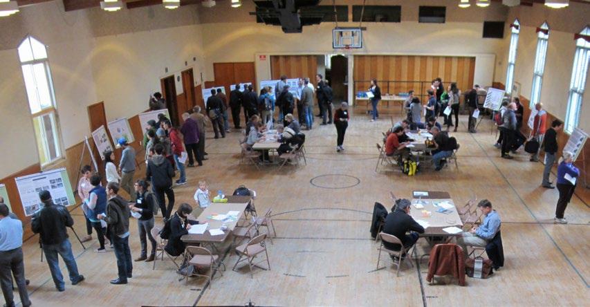
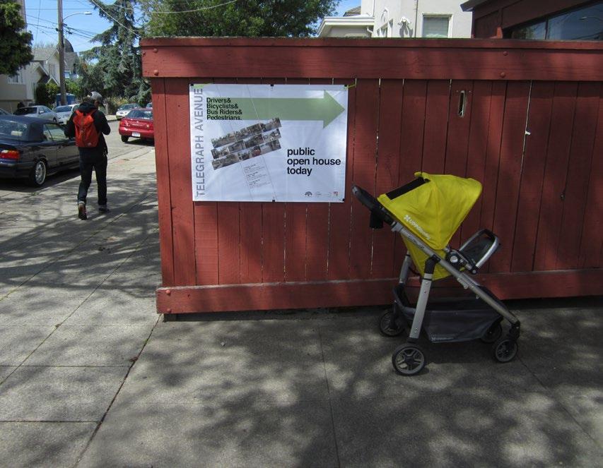
18 T E L E G R A P H A V E N U E C O M P L E T E S T R E E T S P L A N PUBLIC OUTREACH FOR ROADWAY DESIGN OPTIONS PUBLIC OPEN HOUSES Following publication of the Roadway Design Options Report, a series of public open houses were held in April and May 2014 to allow community members, stakeholders, and elected officials to learn more about the alternative options and provide feedback to the project on reaching a preferred concept for the corridor. Public open houses were held on April 24 at Beebe Memorial Cathedral near the MacArthur BART station, April 26 at Faith Presbyterian Church in the Temescal neighborhood, and May 1 at Humanist Hall in the KONO neighborhood. The open houses included a series of exhibits. Participants were provided with a comment card to submit input, and also had access to copies of the full existing conditions reports, public survey reports, and design options reports. At the three events, brief background presentations were given and tables were provided to allow small group discussion as participants learned about and considered the alternative design options. Over 250 people attended the open houses and submitted over 200 comment cards. Following the events, the exhibit boards were posted on the City s project website 7 and an electronic version of the comment card was made available to people who were not able to participate in one of the public events. Approximately 35 comment cards were received electronically. PUBLIC OPEN HOUSE FEEDBACK In all, 240 comment cards were received from the public open houses and subsequent electronic posting. The comment cards demonstrated overwhelming consensus in favor of implementing a road diet from 20th Street to 46th Street on the Telegraph Avenue corridor. Comments indicated a strong desire for traffic calming and pedestrian safety measures in addition to the road diet, such as bulb-outs and other crossing improvements, to slow vehicle speeds and improve the safety and quality of the pedestrian experience on Telegraph Avenue. Approximately 90 percent of respondents supported a road diet to calm traffic between 20th Street and 48th Street. Of these, roughly 70 percent supported dedicating roadway space from the road diet to create a parking-protected cycle track option, with the remaining 30 percent supporting buffered bike lanes. Respondents also expressed broad support for transit islands to minimize bus-bicycle conflict at bus stops, and also supported the design of separated bus pads to allow vehicles to easily pass stopped buses. Features such as transit signal priority (TSP) and moving buses to the far side of signalized intersections was also favored. Respondents had mixed responses regarding on-street parking. A majority supported the removal of on-street parking as necessary to create more robust pedestrian, transit and bicycle improvements. A minority of respondents did express concern about maintaining adequate parking for local businesses. Participants also generally agreed that double parking for loading and delivery should be discouraged, with trucks using dedicated loading zones and hours, or using the center turn lane and accessing the sidewalk via adjacent marked crosswalks. See Appendix C for a detailed summary of responses from the Public Open Houses. 7 See the project website at: 14 Analysis of Street design options
19
20
21 D R A F T F I N A L P L A N The Recommended Project is depicted in a series of illustrative plans in Appendix A. DESCRIPTION OF THE The Recommended Project is based largely on Design Option 1, as described in Table 6 above. Table 7 summarizes the Recommended Project, with an overview of the key features for each segment as well as corridor-wide features. These corridor-wide features include: new high visibility crosswalks and upgrades to existing crosswalks, improved connections with parallel and cross-town bicycle routes, bulb-outs and mid-block refuges, new flashing signals at key pedestrian and bicycle crossings, additional crosswalks to reduce distance between crossings along corridor, traffic signal upgrades to improve safety and transit speeds, and bus stop relocations at selected sites for more reliable transit service. The following descriptions provide a summary of the key roadway design features of each segment. : SEGMENT A Segment A, from 52nd Street to 57th Street, maintains two through lanes to accommodate peak hour vehicle volumes. The center turn lane is removed for portions of Segment A, though left turn pockets are maintained as necessary at intersections and the SR-24 interchange. Removal of the center turn lane provides space to construct new transit islands to make transit service more reliable and continue striped bike lanes, which are already present north of 57th Street. The transit islands also allow bicycles to travel behind the bus stops, to eliminate bus-bike conflicts. In certain locations, buffered bike lanes can be accommodated to provide even greater separation between moving vehicles and bicyclists. To accommodate the proposed improvements, parking is removed from one side under SR-24 and along portions of Telegraph Avenue between 52nd Street and 56th Street. To minimize the impact of this parking removal, a new parking lot is recommended under SR-24, providing 39 replacement parking spaces. The time frame, and possibility, for this parking lot is difficult to predict as an agreement would be needed with Caltrans and a planning approval process providing opportunity for public input would be needed. : SEGMENT B Segment B maintains two through lanes in each direction and also maintains a center turn lane. A difference between the Design Options Alternatives Report and the Recommended Project, due to public feedback, is that Segment B was extended to include the area between 46th Street and 48th Street.. This shift addresses merchant and community member concern about roadway capacity during the peak hour in Segment B, maintaining two through lanes in each direction between 46th Street and 52nd Street to account for heavy traffic volume and queues at the Telegraph Avenue/51st Street intersection Also, having bicycle lanes extend from 46th Street south provide an opportunity for a continuous bicycle lane connection between downtown and the bicycle lanes on Shattuck Avenue. Transit bulb-outs are provided at relocated stops to improve transit performance and the transit passenger experience, and a third northbound travel lane is provided between 51st Street and 52nd Street, which serves as a right-turn only lane, to help 17
22 T E L E G R A P H A V E N U E C O M P L E T E S T R E E T S P L A N clear the intersection of 51st Street and Telegraph Avenue during the peak hour. The high-speed slip lane onto northbound Claremont Avenue is removed, served instead by the new right-turn lane. A new plaza area can be created in the space formerly occupied by the slip lane and pedestrian refuge island. Shared lane markings, or sharrows are included through Segment B to increase awareness of bicyclists. : SEGMENT C Segment C extends from 46th Street to 20th Street. This segment features a Road Diet to calm traffic and increase safety for all roadway users, especially pedestrians crossing Telegraph Avenue, but also motorists and bicyclists. The road diet is achieved through the removal of one through lane in each direction. The remaining roadway space is devoted to accommodating a collection of multimodal transportation enhancements, including providing transit islands to make bus service more reliable and improve the transit passenger experience, and providing right turn pockets for motorists at locations with high right turn demand. Buffered bike lanes are also provided to separate bicyclists from motorists and transit vehicles, which in conjunction with the recommended transit islands greatly reduce the prevalence of bus-bike and vehicle-bike conflicts along the Telegraph Avenue corridor. Closing the last block of Shattuck Avenue between 45th and 46th Streets to standardize the intersection of Telegraph Avenue and 45th Street, a concept carried over from the 2005 Pedestrian Streetscape Master Plan, is further developed as part of the Recommended Project to include a pedestrian plaza that could accommodate a new café use, outdoor seating and potentially stormwater management planters. This improvement would also eliminate the awkward intersection of Shattuck and Telegraph Avenues and 45th Street. A further targeted study of the Telegraph Avenue/Shattuck Avenue intersection is recommended to refine the design options in this area. This recommendation is due to the complexity of this intersection as well as the importance of the location as a Temescal gateway. Smaller scale pedestrian open space improvements are recommended at the high-speed slip lanes at the intersection of Telegraph Avenue and MacArthur Boulevard, as well as the wide eastern leg of 22nd Street, which has an expansive area of road pavement for a minor one-way street. Grant funding is being provided in connection with the MacArthur Transit Village for the construction of improvements to fill in the slip lanes. KEY ELEMENTS OF THE The Recommended Project includes a suite of transportation and safety improvements. The key elements of the project are listed and described in Table 7. 18
23 D R A F T F I N A L P L A N Table 7: Recommended Project - Key Elements TREATMENT HIGH-VISIBILITY CROSSWALK STRIPING AND SIGNS SEGMENT A B C CURB BULB-OUTS PROTECTED LEFT TURNS RIGHT TURN LANES MEDIAN REFUGES RECTANGULAR RAPID FLASHING BEACONS PEDESTRIAN HYBRID BEACON PEDESTRIAN RECALL AT SOME TRAFFIC SIGNALS Ladder or zebra crosswalk striping, or other custom format Signs indicating the location of crossings DESCRIPTION BENEFITS MODES Extension of the sidewalk towards the edge of the adjacent parking lane Also referred to as curb extensions Add left-turn phasing at high-volume intersections Add right-turn pockets at high-volume intersections Physical or painted island adjacent to the pedestrian crossing in the middle of the street Also referred to as median nose Push-button activated flashing lights mounted to pedestrian crossing signs along the side of the street Push-button activated overhead flashing lights mounted on mast arms above the roadway When activated, drivers see a flashing yellow light followed by a solid yellow light, then a solid red light, requiring them to stop The beacon than goes to flashing red, allowing drivers to proceed after stopping Pedestrian walk phase is automatically initiated every cycle, without the need for a pedestrian to push a button Pedestrians Improves visibility of crossings to roadway users Drivers Improves driver yield rates compared to standard crosswalks Bicyclists Provides better visibility between pedestrians and motorists Pedestrians Shortens the pedestrian crossing distance Drivers Potential to reduce vehicle turning speeds with reduced effective curb radius Bicyclists Reduce right-hook collisions between turning vehicles and cyclists by providing location guidance Drivers Eliminating permitted left-turns has safety benefit for all modes Drivers Protects pedestrians from vehicles in travel lanes Pedestrians can cross one half of street at a time On-demand, high-visibility indication to drivers and bicyclists that a pedestrian is crossing the street Addresses multiple-threat condition on multi-lane roadways by providing active notification that is visible to vehicles in all travel lanes Improves driver yield rates compared to standard flashing beacons or in-roadway warning lights On-demand, high-visibility indication to drivers and bicyclists that a pedestrian is crossing the street Addresses multiple-threat condition on multi-lane roadways by requiring all vehicles to stop May result in less vehicle delay compared to a full traffic signal by allowing vehicles to proceed after stopping once pedestrians are clear Pedestrians Drivers Pedestrians Drivers Bicyclists Pedestrians Drivers Bicyclists Allows pedestrians to cross intersection even if they arrive at the intersection after the vehicle phase has started Pedestrians TRANSIT SIGNAL PRIORITY (TSP) A system at traffic signals that detects buses and either extends the green time (if the signal is already green) or shortens the red time (if the signal is red) Reduces transit signal delay Improves transit reliability Transit Riders RELOCATING BUS STOPS FROM NEAR-SIDE TO FAR- SIDE OF INTERSECTIONS BUS BULBS/CURB EXTENSIONS TRANSIT ISLANDS STANDARD BIKE LANE BUFFERED BIKE LANES SHARROWS BIKE BOXES 2-STAGE LEFT TURN QUEUE BOXES GREEN PAINT Moves the bus stop after the intersection so that buses pick up and drop off passengers after they travel through the traffic signal, instead of before Extension of the sidewalk into the roadway (typically into the parking lane) at a bus stop Similar to a bus bulb as it places the bus stop adjacent to the travel lane, but in addition provides space behind the bus stop to allow bikes to continue in a dedicated lane around the bus stop Defines a lane for bicycle travel in the roadway Similar to a standard bike lane but with additional striping width or buffer along one or both sides of the bike lane Shared lane markings or sharrows at bicycle symbols positioned on bicycle routes, within vehicle travel lanes, where a bicycle lane is not provided Defines a zone for bicyclists to wait at traffic signals in line with, but ahead of vehicles, when turning left with traffic Defines a zone for bicyclists to wait at traffic signals outside the path of other bicyclists, to queue for a two-stage turn left movement Requires prohibition of right turn on red for traffic that has a bike box in front of them Green roadway surface coloring to mark merging zones or potential conflict points between bicycles and other roadway users Used where vehicle right turn pockets must cross the bike lane, and as a backing for sharrows, bike boxes, 2-stage left turn queue boxes, and behind transit islands Reduces likelihood of missing a traffic signal s green phase Improves transit reliability Reduces likelihood of pedestrians crossing in front of the bus (intersection crosswalks located behind the bus stop) Reduces the time required to serve a bus stop Provides more room for amenities at bus stops Reduces pedestrian crossing distance Eliminates the bus-bike conflict at bus stops Reduces the time required to serve a bus stop Provides more room for amenities at bus stops Reduces pedestrian crossing distance Provides dedicated space for bicyclists and makes it easier for bicyclists to position themselves outside of the door zone of parked vehicles Creates more physical distance between bicyclists in the bicycle lane and moving and/or parked vehicles Creates a more visible boundary between bicycles and motor vehicles Transit Riders Pedestrians Transit Riders Pedestrians Transit Riders Bicyclists Pedestrians Bicyclists Drivers Bicyclists Drivers Alerts other roadway users to the potential presence of bicyclists Bicyclists Allows bicyclists to position themselves in front of vehicles during a red light to make left turn Reduces the need to merge with moving vehicle traffic to make left turns Allows bicyclists to make left turns without merging into the traffic lane Allows bicyclists to position themselves outside the path of travel of other bicyclists on a green signal phase, and in line with other vehicles waiting through a red signal phase Increases the visibility of bicycle infrastructure Alerts other roadway users and bicyclists to the potential conflict points Bicyclists Bicyclists Bicyclists Drivers Legend: Throughout segment Select segment locations High benefit Moderate benefit Sources: TCQSM, 3rd Edition; Fehr & Peers,

24 T E L E G R A P H A V E N U E C O M P L E T E S T R E E T S P L A N Bus 24,000 lbs Car 2,000 lbs Cyclist/Pedestrian lbs MULTIPLE-THREAT COLLISIONS On multi-lane roads, pedestrians can be hidden by vehicles in the travel lane, and by parked cars. On Telegraph Avenue, a person crossing the street is at risk crossing two lanes in the same direction, which occurs twice on the five-lane roadway (two lanes in each direction). Reaction & Stopping Distance vs. Speed Distance (Feet) Vehicle Speed (MPH) Reaction Distance Stopping Distance Risk of Pedestrian Fatality Percent Vehicle Speed (MPH) Figure 01: Pedestrian Conditions 20
25 D R A F T F I N A L P L A N RECOMMENDED PEDESTRIAN FACILITY IMPROVEMENTS Under existing conditions, the five-lane roadway configuration of Telegraph Avenue results in multiple-threat conditions for pedestrians at every unsignalized intersection. The multiple-threat condition occurs on multi-lane roadways where one vehicle may yield to a pedestrian, but a vehicle in an adjacent lane fails to yield, often because their sight line to the pedestrian is blocked by the stopped vehicle (see Figure 01). Addressing the multiple-threat condition is a priority on the Telegraph Avenue corridor. A variety of treatments have been evaluated and final recommendations range from implementing a road diet where feasible, to improving crosswalk location, signalization, signs, and striping. PEDESTRIAN FACILITY IMPROVEMENT ELEMENTS While standard crosswalk striping is typically sufficient at signal controlled pedestrian crossing locations, additional design enhancements may be required to improve safety at unsignalized crosswalk locations where motorist yielding is required. See Table 8 for images and descriptions of these treatments, as well as their recommended applicability in the Telegraph Avenue corridor, and see Appendix A and Figures 08, 09 and 10 for more detailed illustrations of recommended physical improvements. ROADWAY IMPROVEMENTS High-Visibility Striping and Signs: consist of a ladderstyle crosswalk and pedestrian crossing warning signs, which improve visibility of the crossing itself to motorists. These may be accompanied with advanced yield markings, particularly on multi-lane roadways Curb Extensions: extend the curb and sidewalks further into the roadway, shortening the length of the crosswalk. These act as a traffic calming device by narrowing the effective width of the roadway. Because they extend into the roadway, often past parallel-parked vehicles, they improve visibility for pedestrians and shorten the distance pedestrians have to cross. Corner bulb-outs can be constructed with reduced curb radii, which further slow the speed of turning vehicles and can accommodate directional curb ramps. Median Refuges: are placed in the center of the roadway separating opposing lanes of traffic with cutouts or ramps for accessibility along the pedestrian path. Median refuge islands are recommended where right-of-way allows and conditions warrant. Refuges allow pedestrians to cross in two stages during which they can focus their attention on one direction of approaching traffic at a time. SIGNALIZATION IMPROVEMENTS Rectangular Rapid Flashing Beacons (RRFBs): are an enhancement of the flashing beacon that replaces the traditional slow flashing incandescent lamps with rapid flashing LED lamps. The RRFB may be push-button activated or activated with passive detection. Pedestrian Hybrid Beacon (PHB): is a pedestrianactivated warning device located on the roadside or on mast arms over midblock pedestrian crossings. The beacon head consists of two red lenses above a single yellow lens. The beacon head is dark until activated by the pedestrian desires to cross the street, at which point the device flashes the yellow lens to warn drivers of the following stop display of a steady red indication to drivers and a WALK indication to pedestrians. This is followed by a flashing red phase during which drivers must stop before proceeding. These are also known as HAWK signals. 21
 Segment B (46 th")
 Pedestrian Hybrid")
 Median refuge island OR RRFB (where refuge island is")

 Image source: Mike")
26 T E L E G R A P H A V E N U E C O M P L E T E S T R E E T S P L A N Table 8: Summary of Pedestrian Crossing Options LOCATION All Segment A (52 nd - 57 th Street) Segment B (46 th - 52 nd Street) Segment C (20 th - 46 th Street) PREFERRED OPTIONS High-visibility crosswalk markings; AND Curb extensions (permanent and interim format) Pedestrian Hybrid Beacon (PHB) Rectangular Rapid Flashing Beacon (RRFB) with median refuge island OR PHB (where refuge island is infeasible) Median refuge island OR RRFB (where refuge island is infeasible)v High Visibility Striping and Signs Image source: Curb Extensions Median Refuges Image source: Mike King Rectangular Rapid Flashing Beacon (RRFB) Image source: Pedestrian Hybrid Beacon (PHB) Image source: Mike Cynecki, 22
27 Consolidated Proposed Line 1 (On Telegraph Avenue) Proposed Consolidated Removed Bus Stops Proposed Consolidated Line 1 (On Telegraph (On Telegraph Avenue) Avenue) Line 1 (On Telegraph Avenue) Removed Bus Stops Bus Stop Removed Stops (On TelegraphBus Avenue) (On Telegraph cross street) (On Avenue) Bus Stop Stop Sign Bus Stop (On cross street) (On cross street) Traffic Signal Stop Sign Stop Sign Figure 02: Pedestrian andsignal Transit Facility Recommendations Traffic Traffic Signal R E C O M M E ND E D P R O J E C T 1500 Feet Feet ST39TH 39TH 39TH ST38TH 38TH 38TH ST APGAR APGAR APGAR ST 40TH 40TH 40TH ST41ST 41ST 41ST ST42ND 42ND 42ND ST43RD 43RD 43RD ST44TH 44TH 44TH ST45TH 45TH 45TH ST46TH 46TH 46TH ST48TH 48TH 48TH Future MacArthur BART Transit Village Future MacArthur BART Transit Village September 2014 Source: CD+A, 2014, Fehr & Peers, 2014, City of Oakland, 2013, Telegraph Avenue Pedestrian Streetscape Improvements Project, 2005 September 2014 September 2014 Source: CD+A, 2014, Fehr & Peers, 2014, City of Oakland, 2013, Telegraph Avenue Pedestrian Streetscape Improvements Project, 2005 S S FUTURE RT OP ST STOP S ONE ONE WAYWAY ONE ONE WAYWAY RT Uptown Food Retail 19TH ST BART STATION (500 ft) 19TH ST BART STATION 19TH ST BART (500 ft) STATION (500 ft) ST MWILLIA M ST M ST WILLIA WILLIA ST 20TH 20TH 20TH ONE WAY ONE ONE ST21ST ST WAY STWAY 21ST 21ST ST22ND 22ND 22ND ST23RD 23RD 23RD AV AV AV GRAND GRAND GRAND NORTHGATE AV NORTHGATE AV NORTHGATE AV Pedestrian and Transit Facility Recommendations Pedestrian and Transit Facility Recommendations Pedestrian and Transit Facility Recommendations Corridor Segment SEGMENT-A Existing Crosswalk Existing Standard Ladder Crosswalk Existing Standard Crosswalk Pedestrian Crossing not Existing Ladder Crosswalk Existing Ladder Crosswalk allowed Pedestrian Crossing not Pedestrian Sidewalks allowed Crossing not allowed Sidewalks Pedestrian Sidewalks Hybrid Beacon Corridor Segment SEGMENT-A Corridor Segment SEGMENT-A Pedestrian Open Space / Plaza Pedestrian generating / attracting uses Pedestrian generating / attracting Rectangular Rapid Flashing Beaconuses Pedestrian Hybrid Beacon Pedestrian Hybrid Beacon Rectangular Rapid Flashing Beacon Rectangular Rapid Flashing Beacon Proposed Crosswalk Removal Proposed Crosswalk Removal Pedestrian generating / attracting uses STOP FUTURE ONE WAY ONE WAY ST23RD 23RD 23RD ST24TH 24TH 24TH KONO Commercial/Retail KONO Commercial/Retail FUTURE RT Uptown Food Retail Uptown Food Retail Source: CD+A, 2014, Fehr & Peers, 2014, City of Oakland, 2013, Telegraph Avenue Pedestrian Streetscape Improvements Project, 2005 Existing Standard Crosswalk Proposed New Crosswalk Proposed New Crosswalk Proposed Crosswalk Proposed New Crosswalk Removal Y BROA BROADWAY DWA Y KONO Commercial/Retail KONO Commercial/Retail KONO Commercial/Retail ST24TH 24TH 24TH Fast Food Fast Food VALLEY ST VALLEY ST VALLEY ST KONO Commercial/Retail ST25TH 25TH 25TH Trinity Episcopal Church Trinity Fast Food ST25TH 25TH 25TH Street Academy Oakland StreetSchool Academy School Episcopal Trinity Church Episcopal Church 980 Feet Future MacArthur BART Transit Village DWA STST ORE ORE ORE ST SYCAM SYCAM SYCAM Markets/Cafes Markets/Cafes ST30TH 30TH 30TH ST31ST 31ST 31ST ST32ND 32ND 32ND Markets/Cafes 3333 RDRD ST33 STRD ST Food Retail Food Retail Food/Retail Food/Retail BROA ST26TH 26TH 26TH Food / Retail Food / Retail Food / Retail 3434 THTH ST34 STTH ST Food Retail Temescal Commercial/Retail Temescal Commercial/Retail Food/Retail Beebe Cathedral Beebe Cathedral 980 Oakland Street Academy School Oakland Walgreens Walgreens Food Retail Food Retail ONE WAY ONE WAY ST 27TH 27TH 27TH Medical Summit Center Medical Center ONE WAY MER MER RIMRIAM MCER MAC ST AST CRIST Alta Bates Summit Medical Alta Bates Center Summit Alta Bates Temescal Commercial/Retail Temescal Commercial/Retail Temescal Commercial/Retail Beebe Cathedral ST29TH 29TH 29TH Walgreens Office AV CK AV U T T CK SHA TTU A H S Temescal Comm/Retail Temescal Comm/Retail 2929 THTH ST29 STTH ST Food Retail cont d SEGMENT-C SEGMENT-C cont d TTU SHA Post Post AVOffice Temescal Comm/Retail Children s Hospital Children s Hospital HAWTHORNE HAWTHORNE HAWTHORNE AVAV AV SEGMENT-C cont d Children s Hospital Shopping Temescal Center Shopping Center CK Temescal Commercial/Retail Temescal Commercial/Retail Post Office Temescal Commercial/Retail SEGMENT-C SEGMENT-C B Temescal Triangle Temescal Triangle SEGMENT-C P L A N B 3737 THTH ST37 STTH ST 580 Temescal Shopping Center Temescal Temescal Commercial/Retail Oakland Technical High School (0.5 miles) / Emerson Elemetary Oakland Technical HighSchool School(0.2 (0.5miles) miles) / Emerson Elemetary School (0.2 miles) F I N A L B 3636 THTH ST36 STTH ST HTSHTST 56TH 5S6T5T6 ST N ST EEST ILN AILEEN AIL AEE T T T H S T7 HTSH S 57T 575 T T T D S R3 DRSD S 53R 535 Public Library Public Library Temescal Triangle International High School High International School ST47TH 47TH 47TH Public Library International High School ST28TH 28TH 28TH Children s Hospital Children s Hospital Temescal Alley Temescal Alley CLARKE ST CLARKE ST 2828 THTH ST28 STTH ST SEGMENT-B SEGMENT-B Temescal Alley CLARKE ST ST48TH 48TH 48TH SEGMENT-B ST30TH 30TH 30TH Children s Hospital / Bananas Children s Hospital / Bananas Children s Hospital T T T D S N2 DNSD S 52N 525 ST55 STST THTH 55TH 55 SEGMENT-A SEGMENT-A Children s Hospital / Bananas ST49TH 49TH 49TH DMV ODMV N ST49TH 49TH 49TH EM CL TA CLARE V AR MO EM NT ON A T AV V SEGMENT-A 51ST 51ST 51ST ST AR 515S1S 51S TS TS TS TT T CL D R A F T MA MCAC MAC ARATRT ART HUHRUR HUR BLBVLV BLV DD D Oakland Technical High School (0.5 miles) / Emerson Elemetary School (0.2 miles) DMV T T T H S T5 HTSH S 45T 454 ROCKRIDGE BART STATION ROCKRIDGE (0.6 miles) BART ROCKRIDGE STATION BART (0.6 miles) STATION (0.6 miles) Pedestrian Open Space / Plaza Pedestrian Open Space / Plaza 23
28 This page intentionally left blank
29 D R A F T F I N A L P L A N CORRIDOR CROSSWALK PLACEMENT The Recommended Project includes the addition, relocation and removal of crosswalks, as indicated in Figure 02. The crosswalk locations proposed consider adjacent land uses, potential roadway reconfiguration, and transit option recommendations. The project corridor from 57th to 20th Street features 35 existing marked crosswalks (counting three- and four-way intersections as one crosswalk and offset intersections with two marked crosswalks as two) over approximately 2.4 miles, for an average spacing of over 400-feet between crosswalks. This interval is slightly larger than that of a typical city block in an urbanized area, and indeed the corridor is predominantly intersected by cross streets at every 250 to 350-feet. A notable exception is the segment under the I-580 overpass where crosswalks are separated by a gap of over 700-feet. Numerous other locations throughout the corridor require pedestrians to travel up to 500-feet to reach a destination directly across the street, using available marked crosswalks. The recommended crosswalk locations shown in Figure 02 results in a total of 41 marked crosswalks throughout the project corridor. This improves the average spacing between crosswalks to approximately 300-feet, within the interval of street intersections indicated above. There are no gaps between crosswalks of more than 400-feet, with the exception of the I-580 overpass, which remains unchanged. SEGMENT A Segment A extends between 57th Street and 52nd Street. No unsignalized crosswalks exist in this segment. One new unsignalized crosswalk is proposed roughly equidistant from existing signalized crosswalks, near the proposed location of relocated bus stops. Given the multiple threat condition, high vehicle volumes, and lack of median, a PHB (Pedestrian Hybrid Beacon) is recommended at this location. In addition, a PHB is commended at the 57th Street crosswalk. SEGMENT B Segment B extends between 52nd Street and 46th Street. Through this segment, several uncontrolled crosswalks exist, primarily at offset intersections. Since this segment would remain a multi-lane roadway as proposed under the project, installation of an RRFB (Rectangular Rapid Flashing Beacon) is recommended at the uncontrolled crosswalks to manage high volumes of pedestrians and address the potential for multiple threat collisions. RRFBs are recommended at 46th Street and 47th Street, while a PHB is recommended for 49th Street as a median refuge is not present at this location. SEGMENT C Segment C extends between 46th Street and 20th Street. A road diet on Telegraph Avenue from five lanes to three lanes is proposed through this segment of the corridor. The lane reduction on Telegraph eliminates the potential for multiple threat collisions, and indicates that yielding rates are likely to be higher along the corridor through a visual and physical narrowing of the roadway. As a result, lower level treatments, including median refuges, curb extensions, and high-visibility signing and striping are proposed at these locations. These uncontrolled crossings should be monitored in the future for motorist compliance. Should motorist yielding rates be lower than expected, RRFBs could be considered at these locations. 25
30 T E L E G R A P H A V E N U E C O M P L E T E S T R E E T S P L A N RECOMMENDED TRANSIT FACILITY IMPROVEMENTS Using the equations described in the Transit Capacity and Quality of Service Manual, 3rd Edition (TCQSM), the effects of the proposed project on transit speeds in the corridor were evaluated and compared to baseline conditions. The baseline scenario assumes that lines 1 and 1R will be combined into a single hybrid line. From the baseline scenario, proposed components of the project were added to the bus speed models. These include a lane reduction from 20th Street to 46th Street, installing transit signal priority (TSP) at all traffic signals, moving bus stops from near-side to far-side at signals, and installing transit islands and bus bulbs. See Appendix A and Figures 11 and 12 for more detail about the proposed improvements. BASELINE CONDITIONS AC Transit plans to combine Line 1 and Line 1R into one line within the time frame of implementing the Telegraph Complete Street project. The line would serve fewer bus stops than the existing Line 1 but more bus stops than the existing Line 1R. This analysis assumes that the new line would operate at a frequency of approximately 10 buses per hour, which is the combined frequency of lines 1 and 1R 8. STOP CONSOLIDATION AC Transit identified the optimal bus stop spacing of the new line at approximately 4 bus stops per mile. Baseline conditions for the purposes of this study include bus stops with a high existing daily ridership relative to other bus stops in the corridor, while also considering adjacent land uses. Figure 03 presents a map of proposed stop locations for the combined line based on passenger activity of each bus stop. See Appendix B of the Roadway Design Options Report 9 for detailed ridership data. Baseline conditions assume the following bus stops would be eliminated as part of consolidation: Grand Avenue both directions 45th Street southbound 29th Street both directions 32nd Street southbound 36th Street both directions 43rd Street northbound 55th Street and Claremont/52nd both directions, relocate and combine 60th Street southbound 62nd Street both directions The bus stops at 55th Street and Claremont Avenue/52nd Street would be consolidated into mid-block bus stops in both directions. Since dwell time depends on the number of riders at each stop, an estimate of riders for the consolidated stops was determined, see the Roadway Design Options Report. 8 Actual frequency will be determined during implementation of the consolidated route. 9 The full Roadway Design Options Report can be found on the City s Telegraph Avenue project website at 26
31 Sacramento St CALIFORNIA D R A F T F I N A L P L A N ERKELEY Alcatraz Ave Adeline St 62nd St College Ave Shattuck Ave 59th St 60th St Claremont Ave Stanford Ave Aileen St 56th St Transfer: AC Transit Line 12 55th St 58th St Transfer: AC Transit Line Broadway Broadway Ter 3 RNIA ILLE 45th St 49th St 48th St 47th St 46th St 51st St OAKLAND San Pablo Ave Transfer: AC Transit Lines 31, 57 44th St 43rd St Pleasant Valley Ave 41st St West St 40th St eline St 580 MLK Jr. Way Telegraph Ave 36th St W MacArthur Blvd 37th St KEY PIEDMONT Existing Stop to Remain 33rd St 32nd St 31st St 34th St Hawthorne Ave Harrison St Oakland Ave Stop Removed New Stop Market St th St 28th St 30th St 29th St MacArthur Blvd Average Daily Ridership for Line 1 and Line 1R * 0-33 W Grand Ave Brush St 22nd St Northgate Ave 24th St 26th St 25th St 24th St Broadway 23rd St AC Transit Line 12 AC Transit Line 57 AC Transit Line 31 Castro St 21st St 20th St Lake Merritt Grand Ave Notes: Size of circle shows magnitude of daily bus stop ridership * Daily Ridership (Ons + Offs) 580 Source: AC Transit, Figure 03: Proposed Line 1 and 1R Bus Stop Consolidation Figure 2. Proposed Bus Stop Locations WC _2_PropBusStopCon 27
32 T E L E G R A P H A V E N U E C O M P L E T E S T R E E T S P L A N As described above, the Recommended Project includes the following elements that will affect transit travel times based on the TCQSM methodology: Removal of one through lane in both directions of Telegraph Avenue between 20th Street and 46th Street resulting in an increase of vehicles in the curb lane Implementation of active TSP at all signals in the study area Relocation of bus stops from near-side to far-side at traffic signals preventing bus operators from missing a green phase due to passenger boarding and alighting, removing conflicts between right-turning vehicles and buses, reducing sight-distance issues at intersection approaches, and encouraging pedestrians to cross the street behind the bus These modifications were applied to the model to quantify their potential to change bus speeds on the corridor. To account for transit signal priority, the ratio of green time to cycle length at a signal was increased by 10 percent. The models also assume that all near-side bus stops at signals would move to far-side with the exception of northbound 50th Street. The project proposes to move this bus stop to near-side of 49th Street. For the scenario with a road diet from 20th Street to 46th Street, the models assume that transit islands or bus bulbs/curb extensions would be applied at all bus stops north of 46th Street, allowing buses to stop in the travel lane. The results of the analysis suggest that the proposed bus enhancement treatments would maintain existing bus speeds on the corridor even with impact of the road diet on corridor bus speeds in the AM and PM peak hours. Table 9: Operating Speeds with Recommended Project 50TH TO CORRIDOR 20TH TO 30TH 30TH TO 40TH 40TH TO 50TH NORTHBOUND ALCATRAZ AM PM AM PM AM PM AM PM AM PM Baseline Recommended Project ALCATRAZ TO CORRIDOR SOUTHBOUND 50TH 50TH TO 40TH 40TH TO 30TH 30TH TO 20TH AM PM AM PM AM PM AM PM AM PM Baseline Recommended Project ADDITIONAL TRANSIT FACILITY IMPROVEMENTS In addition to the quantifiable elements of the proposed project identified above, the Recommended Project will implement buffered bike lanes and transit islands with cycle tracks behind (see Figure 11). These design features are not accounted for in the TCQSM methodology. Under existing conditions, buses and bikes share the same space along the corridor requiring buses to either merge into the inside lane to pass bikes or to travel behind the bike at a reduced speed, and creating conflict points with buses entering and exiting bus stops. Bike lanes will remove these bus-bike conflicts and allow buses to safely pass bikes in a separate lane between and at bus stops. Currently, busses must also use the inside lane to pass cars that are making parallel parking maneuvers. With the Recommended Project, parallel parking maneuvers will likely take place in a portion of the buffered bike lane, reducing conflicts between buses and parking cars. The addition of bus islands will provide additional benefit over traditional bus bulbs. The bus islands will allow bikes to travel around the back of the bus stop, eliminating the existing bike-bus conflict that occurs as a bus enters and exits the stop. This allows the bus island to be aligned with the travel lane with buses pulling directly in to the stop instead of through the bike lane. The placement of bus islands within the road diet segment greatly reduces the distance required for a bus to pull into a bus stop when compared to the existing condition on Telegraph Avenue. 28
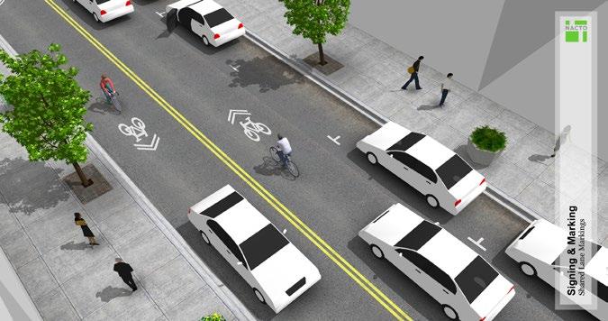
33 D R A F T F I N A L P L A N RECOMMENDED BICYCLE FACILITY IMPROVEMENTS BICYCLE FACILITY DESIGN OPTIONS The Telegraph Avenue Complete Streets Plan considered four categories of bicycle accommodation along the street: cycle tracks, buffered bike lanes, bike lanes, and shared lane markings or sharrows (see Figures for examples of these elements). The National Association of City Transportation Officials (NACTO) has published the NACTO Urban Bikeway Design Guide 10 for design and implementation of bicycle infrastructure, which provides the following definitions of these elements: CYCLE TRACKS See Figure 04. A cycle track is an exclusive bike facility that combines the user experience of a separated path with the on-street infrastructure of a conventional bike lane. A cycle track is physically separated from motor traffic and distinct from the sidewalk. Cycle tracks have different forms but all share common elements they provide space that is intended to be exclusively or primarily used for bicycles, and are separated from motor vehicle travel lanes, parking lanes, and sidewalks. In situations where on-street parking is allowed cycle tracks are located to the curb-side of the parking (in contrast to bike lanes). BUFFERED BIKE LANES See Figure 05. Buffered bike lanes are conventional bicycle lanes paired with a designated buffer space separating the bicycle lane from the adjacent motor vehicle travel lane and/ or parking lane. BIKE LANES See Figure 06. A Bike Lane is defined as a portion of the roadway that has been designated by striping, signage, and pavement markings for the preferential or exclusive use of bicyclists. Bike lanes enable bicyclists to ride at their preferred speed without interference from prevailing traffic conditions and facilitate predictable behavior and movements between bicyclists and motorists A bike lane is distinguished from a cycle track in that it has no physical barrier (bollards, medians, raised curbs, etc.) that restricts the encroachment of motorized traffic. Currently, there are bike lanes on both sides of Telegraph Avenue between 57th Street and Alcatraz Avenue. SHARED LANE MARKINGS OR SHARROWS See Figure 07. Shared Lane Markings (SLMs), or sharrows, are road markings used to indicate a shared lane environment for bicycles and automobiles. Among other benefits shared lane markings reinforce the legitimacy of bicycle traffic on the street and recommend proper bicyclist positioning. The shared lane marking is not a facility type, it is a pavement marking with a variety of uses to support a complete bikeway network. Desirable shared lane marking applications strengthen connections in a bikeway network [and] fill a gap in an otherwise continuous bike path or bike lane, generally for a short distance. 10 Quoted text on this page comes from the NACTO Urban Bikeway Design Guide A deeper look at these sections can be found on the subsequent pages. 29


34 T E L E G R A P H A V E N U E C O M P L E T E S T R E E T S P L A N Raised Cycle Track - Concept Illustration Raised cycle track: Vancouver, BC Flickr user: Bejan Raised cycle track: Cambridge, MA Figure 04: Cycle Tracks Source for all images on this page: NACTO Urban Bikeway Design Guide


35 D R A F T F I N A L P L A N Buffered Bike Lanes - Concept Illustration Buffered bike lanes: New York, NY Buffered bike lanes: Portland, OR Figure 05: Buffered Bike Lanes Source for all images on this page: NACTO Urban Bikeway Design Guide


36 T E L E G R A P H A V E N U E C O M P L E T E S T R E E T S P L A N Bike Lanes - Concept Illustration Bike lanes: Chicago, IL CDOT Bike lanes: San Francisco, CA - Dan Burden Figure 06: Bike Lanes Source for all images on this page: NACTO Urban Bikeway Design Guide
:")

37 D R A F T F I N A L P L A N Shared Lane Markings ( Sharrows ) - Concept Illustration Shared lane markings ( sharrows ): Brookline, MA Shared lane markings ( sharrows ): Long Beach, CA Figure 07: Shared Lane Markings Source for all images on this page: NACTO Urban Bikeway Design Guide
38 T E L E G R A P H A V E N U E C O M P L E T E S T R E E T S P L A N EVALUATION OF BICYCLE FACILITY DESIGN OPTIONS Buffered bike lanes provide people on bikes greater protection than standard bike lanes or sharrows. As they exist in the Recommended Plan (see Appendix A), buffered bike lanes are 6-feet wide and include a 3-foot buffer from moving vehicles and a 2-foot buffer from the parking lane (which is 8-feet wide). The bike facility is buffered from buses at transit stops through the use of transit islands, and from motorists making right turns at locations with high demand through the use of right turn pockets. While buffered bike lanes must be crossed by vehicles accessing on-street parking and can be misused by motorists double-parking (which is illegal), the combined 11-foot width of the buffered bike facility provides enough space to allow bicyclists to navigate around these and other obstructions while staying within the buffer zone. When this is not possible because of larger obstructions, buffered bike lanes provide the option for bicyclists to take the lane as they are not separated from the adjacent travel lanes by a physical buffer. COMPARISON WITH CYCLE TRACKS Cycle tracks are located between the parking lane and the sidewalk. As such, bicyclists are restricted to use the width of the cycle track alone, which makes avoiding obstructions in the lane more difficult, including slower bicyclists. Furthermore, pedestrians entering and exiting parked vehicles and transit islands must cross the path of cyclists. In busy commercial areas, and during peak commute hours, the restriction of cyclists to a confined, albeit protected cycle track facility, could prove more inconvenient for many bicyclists. While cycle tracks do provide a more protected facility at mid-block locations where driveways are not present, and there are a variety of special design solutions for cycle tracks crossing intersections and driveways, the frequency of both along Telegraph Avenue (one driveway or intersection nearly every 150 feet, on average) presents a number of issues, including the potential loss of about one parking space per driveway crossing and 1 additional loss per intersection, compared with the Recommended Plan. FACILITY CONSISTENCY AND CYCLIST SAFETY The contrast between the protection provided by a cycle track at mid-block locations, and while crossing frequent driveways and intersections, is starker than that for buffered bike lanes. A cyclist in a buffered bike lane is constantly in view of, and can themselves easily view, adjacent moving vehicles. As such, bicyclists are never obscured from turning motorists view by parked vehicles, so they are more likely to be aware of vehicle movements in advance of driveways and intersections, and less likely to be struck by those motorists. While properly designed cycle track facilities do provide adequate sight lines and space to accommodate such turning movements safely, they consume more roadway space, namely parking spaces, than do buffered bike lanes. ROADWAY PERFORMANCE In its current format, the outside travel lane on Telegraph Avenue does not perform very well. It serves as a de facto bicycle lane, it hosts vehicle turning and parking movements, it serves as a bus lane and bus stop, and motorists expect to use it as a functioning through lane. By implementing a road diet from 20th to 46th Street, the Recommended Project eliminates through motorists from the outside lane, provides separated, bus-only lanes at stops, and provides dedicated bicycle facilities outside of the path of moving vehicles and buses. Additionally, separated right turn pockets are provided at intersections with high right turn demand. As a constructive part of a balanced complete streets approach to Telegraph Avenue, a buffered bike lane provides the space needed to accommodate parallel parking maneuvers outside of the remaining through lane, which is important to maintaining desirable vehicle and bus through movement in that single through lane. With a cycle track the bicycle facility does not provide the flexibility for parking maneuvering, double parking, faster bicycles passing slower bicycles, etc. This would likely result in slower travel times for all the sorts of personal, commercial and transit vehicles that travel along Telegraph Avenue. A significant decrease in travel time could deteriorate Telegraph Avenue s important role as a connector between downtown, North Oakland, and to neighborhoods further north. There are relatively few streets that serve this connector function in Oakland s northern street network. 34
39 D R A F T F I N A L P L A N BICYCLE FACILITY DESIGNS As illustrated in Appendix A and described in Table 7, the Recommended Project accommodates bicycle facilities along the Telegraph Avenue corridor as follows: SEGMENT A The Recommended Project includes a combination of standard and buffered bike lanes connecting the existing bike lanes on Telegraph Avenue at 57th Street through to 52nd Street. Transit islands with cycle tracks behind are recommended at the consolidated mid-block bus stop location between 55th and 52nd Streets, bike boxes are provided at 55th Street to facilitate connections from that designated cross town bike route, and sharrows are provided through intersections. See Appendix A, Figure A-2 and A-3 for an example of Telegraph Avenue with the center turn lane removed, and standard bike lanes added. SEGMENT B Between 52nd Street and 46th Street, sharrows are provided in the outside travel lane. Parallel bike route connections are present along 46th Street, Shattuck Avenue and 55th Street to the west, and via Webster Street/Shafter Avenue/Cavour Street/Vicente Way/55th Street to the east. See Appendix A, Figure A-4 for an example of Telegraph Avenue with existing lanes maintained, and sharrows added. SEGMENT C Buffered bicycle lanes are recommended between 20th Street and 46th Street. Additional features include transit islands with cycle tracks behind, separated right turn pockets and bike through lanes with flexible bollard-separation at intersections with high right turn demand, sharrows and dashed bike lane markings through intersections, and twostage left turn queue boxes and bike boxes to facilitate connections with other routes in the City of Oakland bike network, including Grand Avenue, 27th Street, MacArthur Boulevard, 40th Street, and Shattuck Avenue via a new bicycle crossing of Telegraph Avenue at 46th Street. See Appendix A, Figure A-11 for an example of Telegraph Avenue with one travel lane in each direction removed, and buffered bike lanes added. 35
40 T E L E G R A P H A V E N U E C O M P L E T E S T R E E T S P L A N RECOMMENDED MOTOR VEHICLE FACILITY IMPROVEMENTS VEHICLE TRAVEL Peak hour traffic operations at signalized intersection under the Recommended Project were evaluated using the Synchro software and the 2010 Highway Capacity Manual (HCM) methodology. For the proposed project, estimated traffic volumes from the MacArthur Transit Village were added to the existing traffic volumes analyzed under existing conditions. These volumes were then carried through the corridor and balanced between intersections for consistency. The MacArthur Transit Village represents a 4.4 percent increase in peak hour traffic at the Telegraph Avenue/MacArthur Boulevard intersection. Appendix B provides the Existing Plus MacArthur Transit Village peak hour turning movement volumes. The Synchro network used to analyze existing conditions was updated to reflect the proposed road diet between 20th Street and 46th Street. This includes the reduction of one through lane in each direction, the addition of right-turn pockets where proposed, and optimization of signal timings based on the new lane configuration. Lane reconfiguration is not proposed for signalized intersections north of 46th Street; therefore, there is no change to existing signalized intersection operations. The results of the operational analysis are shown in Appendix B, Figure B-4. All signalized intersections continue to operate at Level of Service C or better with the proposed project. PARKING CORRIDOR-WIDE PARKING IMPACTS The Recommended Project improvements will result in a slight overall reduction in on-street parking corridor-wide: under 4% overall loss of on-street parking on Telegraph, and less than 1% loss of Telegraph corridor parking, which includes adjacent cross street parking. These figures assume the presence of two public but off-street surface parking lots: one recommended under SR-24 and one planned in upper Temescal at the older Frazee Paints property. See Table 11 for additional details. Parking changes related to bringing bus stops up to current standards and improving pedestrian safety and visibility at intersections and mid-block crossing are responsible for a majority of on-street parking losses. The proposed transit islands require approximately 100 feet of curb space, including the bus platform itself and transition space for the bike lane. For comparison purposes, this is the minimum that would be required for an adequately sized curbside lane to allow the bus to pull out of the roadway and align itself with the curb. In many circumstances, more space would be required, consuming more parking. At intersections where bulb-outs are recommended to reduce pedestrian crossing distance, parking is preserved up to the bulb-out itself. This is equivalent to the standard red curb length required at intersection approaches, thus there is no net loss in parking at most locations. The exception is where an existing, inadequately size red zone is replaced with a properly sized bulb-out. 36
41 D R A F T F I N A L P L A N Table 11: Recommended Project Parking Impacts SEGMENT 20TH - 34TH 34TH - 44TH 44TH - 51ST 51ST - 57TH TOTAL EXISTING ON-STREET PARKING CHANGES TO ON- STREET PARKING NEW LOTS TOTAL CHANGE Existing Telegraph Existing Cross Street ,627 Total Existing ,151 Loss - Corner bulb Loss - Mid-block bulb Loss - Other Gain - On-street Total change on-street Gain - New off-street lot Total change with lot Percent of Telegraph -14.9% -7.8% -2.6% -35.5% -2.9% Percent of Corridor 3.0% -2.2% 9.5% 0.3% -0.7% PARKING IMPACTS IN SEGMENT A The greatest loss of parking in a single block occurs under SR-24, where all on-street parking is removed, except for 5 spaces. This parking removal is required to provide space to connect bike lanes on Telegraph from Aileen Street to 55th Street. The existing curb-to-curb dimension precludes preservation of parking on even one side of Telegraph Avenue with standard bike lanes in this location; as such, buffered bike lanes are provided to maximize protection of bicyclists from moving vehicles entering and exiting the highway. Additional parking loss is incurred between 55th Street and 52nd Street, to preserve right turn lanes at those intersections and transition to the mid-block transit islands. To counteract these parking losses in Segment A, a 39-space surface parking lot is recommended on vacant land below SR-24. This parking lot would actually benefit local auto-depended businesses north of SR-24, which currently rely on parking below the highway, by concentrating additional parking in close proximity to their doors. To ensure parking is available for people patronizing local businesses, meters and/or parking time limits are recommended. Without this parking lot, the change in parking between 57th and 51st Street is a net loss of 38 on-street spaces, or 36 percent loss. With the parking lot, there is a net gain of 1 space, or 0.3 percent increase. PARKING IMPACTS IN SEGMENT B An additional paid, but public parking lot is planned for the existing private lot behind the Frazee Paint building on Telegraph and 49th Street, in the center of the popular upper Temescal commercial district. Without this parking lot, the Recommended Project s impact on on-street parking between 44th and 51st Street a loss of 2 parking spaces, or a 2.6 percent decrease. Counting the new parking lot at Frazee Paint, there is actually a net gain of 24 parking spaces, or 9.5 percent increase in parking capacity. PARKING IMPACTS IN SEGMENT C Between 44th Street and 34th Street, the Recommended Project s impact on parking is a loss of 12 spaces, for a 7.8 percent decrease in Telegraph Avenue on-street parking, or a 2.2 percent decrease in corridor on-street parking. Between 34th Street and 20th Street, the Recommended Project s impact on parking is a loss of 28 spaces, for a 14.9 percent decrease in Telegraph Avenue on-street parking, or a 3.0 percent decrease in corridor on-street parking. 37
42 T E L E G R A P H A V E N U E C O M P L E T E S T R E E T S P L A N TYPICAL DETAILS OF THE This section illustrates and further describes the key elements of the Recommended Project; the full length of the Recommended Project and the location of these elements are illustrated in Appendix A: Recommended Project Plan Sheets. CORNER BULB-OUTS A bulb-out provides better visibility between pedestrians and motorists, shortens the pedestrian crossing distance, and has the potential to reduce vehicle speeds around corners by reducing the effective turning radius, which further improves safety. Corner bulb-outs typically occupy space close to intersections, where parking is already prohibited. As such, bulb-outs do not typically displace existing on-street parking. Figure 08 illustrates the two typical corner bulb-out recommendations for the project: PERMANENT BULB-OUT A permanent bulb-out expands the existing sidewalk and curb and gutter, and with it, expands the pedestrian realm. Permanent bulb-outs also can provide the space required to provide multiple, directional curb ramps that are aligned with their respective crosswalks. Permanent bulb-outs can necessitate storm drain relocations or other improvements to manage the flow of storm water from the surface of the street, because curbs are the flow line for runoff. Use of landscape planters and tree wells for green storm water infrastructure, use of trench drains, and other details can resolve storm drain issues. Bulb-outs can increase landscape areas and usable sidewalk space for pedestrians or adjacent business, as well as having the potential to be extended along the curb at bus stops, see discussion of Transit Bulb-outs below. Planters and other features can be accommodated within permanent bulb-outs to provide an identity for business districts and neighborhoods, and improve the aesthetic appearance of the pedestrian realm. INTERIM BULB-OUT Certain physical conditions and/or funding constraints may prevent construction of permanent corner bulb-outs, including roadways with a large crown, or where stormwater drainage inlets cannot be moved. Where such physical conditions, or when budgetary limits exist, interim paint and planter bulb-outs can be implemented to achieve many of the same benefits at a fraction of the cost. Interim bulb-outs utilize existing curb ramp(s) and do not involve the physical construction of additional sidewalk or curb and gutter. Rather, painted zones that mirror the shape of a permanent bulb-out define interim bulb-outs. Bollards or planters placed within the painted area create a physical barrier between pedestrians and moving traffic. While interim bulb-outs do not expand the sidewalk area, they do achieve the transportation goals of improving visibility between pedestrians and drivers or bicyclists that are approaching the crossing and slow drivers that are making right turns by reducing the effective curb radius. In addition, they provide opportunities for merchant associations or neighborhood 38 groups to customize some aspects of the improvement through special paint colors or patterns, and selection of planter elements and plant palettes. As such, interim bulbouts can help build a neighborhood or shopping district s identity and sense of place. Use of decorative treatments and/or planters in interim bulb-outs will typically require a maintenance agreement with a local partner. T-INTERSECTION MID-BLOCK BULB-OUTS At T-intersections, a bulb-out that is on the far side of the intersection, away from the street that is intersecting with Telegraph, a mid-block bulb-out can be provided to help create safer crossing conditions (see Figure 09). A mid-block bulb-out provides better visibility between pedestrians and motorists and shortens the pedestrian crossing distance. Depending on the size of the mid-block bulb-out, additional features such as stormwater planters, seating, and street trees can be included to further enhance the quality of the pedestrian realm. Depending on the location, on-street parking may be affected by the placement of mid-block bulbouts, particularly if a crosswalk was not previously in place. EXTENDED BULB-OUT A version of the mid-block crossing occurs at offset or T intersections, which are common on Telegraph Avenue (see Figure 09). The City of Oakland does not typically allow parking on the far side of offset intersections. Converting these areas to extended bulb-outs provides better visibility between pedestrians and motorists and shortens the pedestrian crossing distance, as with mid-block and corner bulb-outs. Because they are significantly longer than other mid-block bulb-outs, additional features such as bicycle corrals, stormwater planters, seating, and street trees can be more easily included to further enhance the quality of the pedestrian realm.
43 D R A F T F I N A L P L A N Bike lane dashed through intersection New permanent bulb-out with directional curb ramps Parallel parking, typical Existing curb ramp Planters, typical Painted area, typical Feet Figure 08: Corner Bulb-out 39
44 T E L E G R A P H A V E N U E C O M P L E T E S T R E E T S P L A N Median refuge Bike lane dashed through intersection Bike corral Street tree in stormwater planter Cafe seating Planters, typical Parking lane, typical 1 20 Feet Figure 09: Extended Bulb-out and T-intersection, Mid-block Bulbout
45 D R A F T F I N A L P L A N MEDIAN REFUGE NOSE At mid-block, T-intersection or one-way street intersections, left turns pockets are often unnecessary in at least one direction. As a result, a median refuge can be placed in the center turn lane adjacent to new or existing crosswalks, providing additional safety benefits to crossing pedestrians by allowing them to focus on crossing one direction of traffic at a time, with a refuge between. As with corner bulb-outs, interim paint and planter median refuges can be constructed where space or budgets initially preclude permanent construction (see Figure 10). Where median refuges are used at offset or T intersections, as is very common on Telegraph Avenue, they can also potentially reduce vehicle speeds by reducing the effective turning radius for vehicles making left turns onto Telegraph Avenue. Median refuges provide additional benefits, as well. On corridors with active commercial and retail uses such as Telegraph Avenue, median refuges can provide protection for delivery vehicle drivers who choose to park in the center turn lane. By positioning the loading area of their truck towards the median refuge, drivers are able to load and unload deliveries in an area protected from moving vehicles, and have access to the crosswalk to more safely reach destinations on either side of the street; delivery vehicle parking in the center turn lane is a behavior that exists along Telegraph today in both KONO and Temescal districts. TRANSIT ISLAND Transit islands place the bus stop adjacent to the travel lane on a roughly 9-foot by 70-foot platform or island similar to a bulb-out, but separated from the sidewalk (see Figure 11). This separation provides space along the existing curb to allow bikes to continue in a dedicated lane behind the bus stop, eliminating the bus-bike conflicts that are common today at stop locations. The bike lane behind the stop is colored green to differentiate the bikeway from the sidewalk and transit island, while a railing, benches, shelter and planters can be used on the island and adjacent sidewalk to facilitate safe and convenient pedestrian access to transit islands. The stops are typically provided with two ADA-accessible curb ramps. One of the access points is typically aligned with a crosswalk and protected with a median nose, which effectively creates a bulb-out that significantly shortens the roadway crossing distance for pedestrians. A second access point is provided at the far end of the transit island. Yield markings in the path of bicyclists and standard crosswalk striping, as well as posted Bikes Yield to Pedestrians signs, indicate to bicyclists that pedestrians have right of way. Transit islands also reduce the time required to serve a bus stop by preventing operators from needing to pull out of and back into the travel lane. As configured in the Recommended Project, all transit islands include a separate, full-length bus only concrete pad at the stop, as well as a merging area following each stop to reduce the delay of bus entry and exit. All transit islands provide a minimum clear boarding and alighting area of 60-feet, and allow bus operators to more easily align the full length of the bus parallel to the stop so that all doors are adjacent to the platform rather than just the front door. In addition, transit islands provide more room for amenities at bus stops, because they are removed from the sidewalk. Shelters, planters, benches or leaning bars, and a protective railing adjacent to the bike lane are among the amenities that could be provided. Separating the bus facility from the sidewalk in turn frees up space on the sidewalk for landscaping, including stormwater planters and café seating as shown in the illustration. See Appendix A for the recommended location of transit islands. They are included as part of the improvements in Segment A and Segment C, and account for 16 of the 20 transit stops in the project corridor. TRANSIT BULB-OUT Transit bulb-outs are effectively longer versions of regular sidewalk bulb-outs that accommodate a full 60-foot clear zone along the curb for boarding and alighting at bus stops. Similar to transit islands, they reduce the time required to serve a bus stop and provide more room for amenities, while freeing up space on the sidewalk. As with typical bulb-outs, transit bulb-outs reduce pedestrian crossing distance where they are aligned with crosswalks. Unlike transit islands, buses stop in an outside travel lane, which is also shared with bicycles and vehicles. The Recommended Plan includes two transit bulb-outs in Segment B. See Figure 12 for an example. 41
46 This page intentionally left blank

47 D R A F T F I N A L P L A N Feet Interim Format Painted area, typical Planter, typical Figure 10: Mid-block Crossing and Median Refuge Nose Parallel parking, typical Mid-block bulb-out Potential amenities: seating, landscape, stormwater planters Buffered bike lane continues along bulb-out Bike lane dashed through intersection Median refuge 43
48 T E L E G R A P H A V E N U E C O M P L E T E S T R E E T S P L A N Feet Shelter Stop amenitites Platform ramp, typical Median refuge Figure 11 Transit Island Crosswalk Yield markings, typical Shared lane marking Sharrow 76 Cafe seating Stormwater planter with trees Parallel parking, typical Buffered bike lane Variable width Cycle track behind transit island 44
49 D R A F T F I N A L P L A N Feet ONLY BUS Shelter and bench Bus pad ONLY BUS Figure 12: Transit Bulb-out Shared lane marking Sharrow, typical Parallel parking, typical Street tree in tree grate Crosswalk, typical Stormwater planter Cafe seating 45
50 T E L E G R A P H A V E N U E C O M P L E T E S T R E E T S P L A N PAVEMENT-TO-PARKS At several locations along Telegraph Avenue, intersections with cross streets produce excessively large areas of roadway, or result in complicated intersections or slip lanes that create safety hazards for all roadway users, especially pedestrians. The Recommended Project includes concepts for the redesign of these locations to improve their safety and repurpose roadway space for public open space and placemaking improvements. KASPER S KORNER The most developed concept in the Recommended Project is located where Shattuck Avenue intersects Telegraph Avenue at 45th Street. The existing intersection is awkward with several difficult and atypical turning and merging movements, and has been the site of numerous vehicle collisions 11. Vehicles traveling south on Shattuck often fail to obey their yield signal when merging into Telegraph Avenue, in part because there is a receiving lane on Telegraph. The 2005 Telegraph Avenue Pedestrian Streetscape Improvement Project identified Shattuck Avenue between 45th and 46th Streets as a potential street segment for closure. In the Pedestrian Streetscape Improvement Project s proposed concept, the adjacent triangular parcel is expanded into the street right-ofway and shown with new development. The project has developed a conceptual rendering of this location reimagined as an expanded public plaza with seating, stormwater planters with boardwalks to provide access across both sides of the plaza, reuse of the existing Kasper s building for a café or similar use, and additional space for food trucks and other public gatherings or programmed uses that also permits emergency vehicle access through the site (see Figure 13, and Appendix A, Figure A-5). The design provides improvements to the intersections at Telegraph Avenue and 46th Street, creating a two-way configuration on 46th Street to provide access to Telegraph Avenue from Shattuck Avenue and 46th Street. Pedestrian access to the plaza is improved with a new crossing and sidewalk edge on the east side of the Kasper s building along Telegraph. The intersection of 45th and Telegraph is also improved, with bulb-outs to shorten crossing distances, and better-aligned high visibility crosswalks. If this segment of Shattuck Avenue were to be closed and the public right of way repurposed, a design and approvals process involving adjacent property owners and area stakeholders would be necessary. OTHER PAVEMENT-TO-PARKS OPPORTUNITY SITES See Figure 02 and Appendix A for the locations of the following Pavement-to-Parks improvement concepts. Temescal Gateway South of the intersection of Telegraph Avenue and 45th Street, the Recommended Project includes a large median island that could be used as a gateway to upper Temescal. As illustrated in Figure 13, the gateway could feature landscape improvements, in addition to signs, public art, or other elements as determined in conjunction with the neighborhood and surrounding businesses and property owners. Note that realizing this opportunity would require eliminating the left-turn from northbound Telegraph Avenue to 45th Street, which is a legal though seldom made turn today. 22nd Street Westbound 22nd Street is significantly wider than other cross streets where it intersects Telegraph Avenue. The Recommended Project includes a concept to shorten this crossing and repurpose unnecessary street right-of-way as a public open space. By extending the sidewalks along Telegraph Avenue and 22nd Street, a plaza area could be created and used for pedestrian seating, public art, or additional planters and/or stormwater features, as determined in conjunction with the neighborhood and adjacent businesses and property owners. Claremont Avenue and MacArthur Boulevard Slip Lanes The slip lanes that allow vehicles to make turns onto northbound Claremont Avenue and east and westbound MacArthur Boulevard create modal conflicts and issues of pedestrian and cyclist comfort, especially for those traveling along Telegraph Avenue. Closing these slip lanes, as proposed by the Recommended Project, would create more standardized right turns for vehicles, increase safety, and provide public plaza areas where pedestrian seating, public art, or additional planters and/or stormwater features could be installed, as determined in conjunction with the neighborhood and adjacent businesses and property owners. 11 See the Existing Conditions Report 46

51 D R A F T F I N A L P L A N Separated pedestrian and bike crossing Temescal Gateway Telegraph Ave Boardwalks over planters Cafe seating area Kasper s Building Controlled vehicle access Shattuck Ave Rain garden flow-through planters Trench drain to planters Controlled vehicle access THIS AREA SUBJECT TO FURTHER DESIGN ANALYSIS Kasper s Alley: Food truck parking Temporary event space Emergency vehicle access 46th St 45th St 1 20 Feet Figure 13: Kaspers Korner Design Concept Update Based on 2005 Telegraph Avenue Pedestrian Streetscape Improvement Project NOTE: Additional information about the surrounding roadway design elements shown above is available in Appendix A, Figure A
52 T E L E G R A P H A V E N U E C O M P L E T E S T R E E T S P L A N OTHER ELEMENTS OF THE TRANSIT SIGNAL PRIORITY The Recommended Project includes active transit signal priority (TSP) at all signals in the study area. Active TSP modifies traffic signal timing as a bus approaches an intersection. The bus would trigger either an extension of the green phase or an early call of the green phase at a TSPenabled intersection. After serving the bus, the signal will return to normal operations within a few cycles. The benefits of TSP include reduction in signal delay and improvement of schedule reliability. TRAFFIC SIGNAL ENHANCEMENTS FOR PEDESTRIANS The Recommended Project includes pedestrian enhancements at signalized intersections to make the pedestrian experience consistent throughout the corridor. Under existing conditions, some signals do not have pedestrian heads and many do not have countdown pedestrian heads. The project will add countdown pedestrian heads to all signalized intersections. The project will also upgrade all pedestrian push buttons to meet Americans with Disabilities Act guidelines, including audible feedback. Pedestrian phase recall will also be implemented at several locations. This provides automatic recall of the walk phase at a traffic signal without the need for a pedestrian to push a button. While this is currently the case at many several pedestrian crossings along Telegraph Avenue, there is opportunity to add additional locations to further enhance the pedestrian experience. The reduced pedestrian crossing distances help facilitate this by requiring less time for the pedestrian phase. Pedestrian recall is recommended at the following intersections on Telegraph Avenue: 48 20th Street Grand Avenue 27th Street W. MacArthur Boulevard 40th Street 45th Street WEBSTER STREET/SHAFTER AVENUE TRAFFIC CALMING To the east of Telegraph Avenue, a parallel vehicle and bicycle boulevard route exists along Webster Street and Shafter Avenue, between 28th Street and 51st Street (with a connection via Cavour Street and Vicente Way to 55th Street/Telegraph Avenue). In conjunction with any road diet project on Telegraph Avenue north of MacArthur Boulevard, the Webster/Shafter bike route should also be enhanced to reduce the likelihood of cut-through automobile traffic on these residential streets. This traffic calming will also facilitate improved bicyclist experience by potentially reducing the number of stop signs along the route. In particular, the proposed improvements include replacing stop signs with traffic circles and adding speed humps to meet speed/volume thresholds appropriate for a bicycle boulevard. POTENTIAL FUTURE ELEMENTS TRANSIT QUEUE JUMP LANES Queue jump lanes are intended to reduce delay associated with traffic signals. The bus would enter a right-turn lane upstream of the traffic signal and would continue through the intersection into a far-side stop before pulling back into general traffic. To be effective, the queue jump lane must extend as long as the typical peak period vehicle queue (and thus remove parking in most cases). It would also require special signal phasing to resolve conflicts between bicycles, right-turning vehicles, and buses. At this time, the project is not proposing queue jump lanes given these conflicts and the estimated low signalized intersection delay. However, if future traffic conditions change such that a queue jump lane would be beneficial, the project does not preclude future implementation. PROTECTED CYCLE TRACKS The Recommended Project includes buffered bike lanes throughout Segment C and a modified buffered bike lane where possible in Segment A (see Table 7 and Appendix A). The combined dimension of the parking lane, buffers, and bicycle lane in the current configuration could also accommodate a cycle track, buffer, and in most locations also allow a parking lane, as an alternative bicycle facility (see Figure 14). The transit islands that are included in the Recommended Project would also work well with cycle tracks
53 D R A F T F I N A L P L A N The City s analysis of trade-offs that led to the Recommended Project s incorporation of buffered bike lanes instead of cycle tracks is described in the following Multimodal Performance Analysis section of this Plan. However, at a future date it may be desirable based on observation and stakeholder and community input to consider replacement of the buffered bike lane facility with a cycle track, as well as its implementation at other locations throughout the Telegraph Avenue corridor. BICYCLE LANES IN SEGMENT B The Recommended Project maintains existing parking, through lanes, and center turn lane in Segment B (see Table 7 and Appendix A). As such, a separate bicycle facility cannot be accommodated as part of the Recommended Project between 46th Street and 52nd Street. However, at a future date it may be desirable, based on observation and stakeholder and community input, to consider the implementation of dedicated bike lanes or other separated bike facilities through Segment B, in conjunction with on-street parking removal as described in the Roadway Design Options Report (see Figure 15), and/or in conjunction with changes to the City of Oakland s current traffic policies, which currently require the preservation of the existing travel lanes and center turn lane. 49

54 T E L E G R A P H A V E N U E C O M P L E T E S T R E E T S P L A N Figure 14: View showing possible future bicycle conditions with cycle track 50
55 D R A F T F I N A L P L A N Figure 15: View showing possible future bicycle conditions in with bike lanes and parking on one side only 51
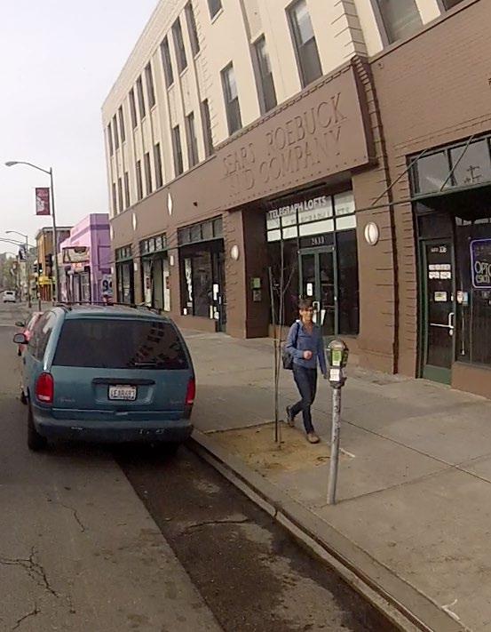
56
Broad Street Bicycle Boulevard Design Guidelines
 Broad Street Bicycle Boulevard Design Guidelines Building from the strategies introduced in the 2013 Bicycle Transportation Plan and community input received thus far, City Transportation Staff have identified
Active Transportation Facility Glossary
 Active Transportation Facility Glossary This document defines different active transportation facilities and suggests appropriate corridor types. Click on a facility type to jump to its definition. Bike
Telegraph Avenue Complete Streets DRAFT Recommendations. Oakland Public Works Department September 11 and 13, 2014 Open Houses
 Telegraph Avenue Complete Streets DRAFT Recommendations Oakland Public Works Department September 11 and 13, 2014 Open Houses Presentation Overview What are complete streets? What problem are we trying
Appendix A: Crosswalk Policy
 Appendix A: Crosswalk Policy Appendix A: Crosswalk Policy Introduction This citywide Crosswalk Policy is aimed at improving pedestrian safety and enhancing pedestrian mobility by providing a framework
Caltrans Sloat Boulevard Pedestrian Safety Project Response to Community Questions, Comments & Concerns
 Caltrans Sloat Boulevard Pedestrian Safety Project Response to Community Questions, Comments & Concerns Revised: May 10, 2016 The California Department of Transportation (Caltrans) is planning various
MEMORANDUM. Charlotte Fleetwood, Transportation Planner
 MEMORANDUM Date: Updated August 22, 2017 To: Organization: Charlotte Fleetwood, Transportation Planner Boston Transportation Department From: Jason DeGray, P.E., PTOE, Regional Director of Engineering
CURBSIDE ACTIVITY DESIGN
 5 CURBSIDE ACTIVITY DESIGN This chapter provides design guidance for separated bike lanes adjacent to curbside activities including parking, loading and bus stops. Typical configurations are presented
Agenda. Overview PRINCE GEORGE S PLAZA METRO AREA PEDESTRIAN PLAN
 PRINCE GEORGE S PLAZA METRO AREA PEDESTRIAN PLAN May 28, 2008 Agenda Welcome and introductions Project overview and issue identification Planning context and strengths Design challenges and initial recommendations
Bicycle Facilities Planning
 Bicycle Facilities Planning Overview Types of Cyclists Purpose for Riding Types of Facilities Bike Lanes Bicycle Boulevards Cycle Tracks Intersections Signals Signing and Marking Discussion Types of Bicyclists
Transportation Planning Division
 Transportation Planning Division Presentation Outline Study Tasks Recap of Previous Meetings Data Collected Focus Areas within Study Limits Design Principles Tool Box Recommended Concepts Schedule Moving
Pedestrian & Bicycle Safety Innovations & Applications
 Pedestrian & Bicycle Safety Innovations & Applications County Engineers Association of Maryland Spring, 2017 Conference May 25, 2017 George Branyan Pedestrian Program Coordinator District Department of
BETHEL ROAD AND SEDGWICK ROAD CORRIDOR STUDY
 DRAFT PLAN City Council Meeting August 14, 2017 STUDY AREA Sedgwick Corridor State Route 160, principal arterial with Class 3 access management designation, commuter and freight route, connection to SR
25th Avenue Road Diet Project A One Year Evaluation. Transportation Fund for Clean Air Project #05R07
 25th Avenue Road Diet Project A One Year Evaluation Transportation Fund for Clean Air Project #05R07 Submitted by: The San Francisco Municipal Transportation Agency Dan Provence May 22, 2009 EXECUTIVE
Dr. M.L. King, Jr. Street North Complete Streets Resurfacing Opportunities HOUSING, LAND USE, AND TRANSPORTATION COMMITTEE MARCH 22, 2018
 Dr. M.L. King, Jr. Street North Complete Streets Resurfacing Opportunities HOUSING, LAND USE, AND TRANSPORTATION COMMITTEE MARCH 22, 2018 What s Happening The City plans to mill and resurface Dr. M.L.
Main-McVay Transit Study: Phase 2 Options Definition and High Level Constraints Evaluation
 Main-McVay Transit Study: Phase 2 Options Definition and High Level Constraints Evaluation APRIL 2016 A collaborative study between: For Additional Information or to Comment If you would like additional
PRINCE GEORGE S PLAZA METRO AREA PEDESTRIAN PLAN
 PRINCE GEORGE S PLAZA METRO AREA PEDESTRIAN PLAN May 28, 2008 Agenda Welcome and introductions Project overview and issue identification Planning context and strengths Design challenges and initial recommendations
2014/2015 BIKE ROUTE PLAN 83 AVENUE PROTECTED BIKE LANE
 About the Project 2014/2015 BIKE ROUTE PLAN The City of Edmonton is planning a major bike route on the south side of Edmonton. This bike route is one part of a plan to provide citizens with transportation
Guidance. ATTACHMENT F: Draft Additional Pages for Bicycle Facility Design Toolkit Separated Bike Lanes: Two-Way to One-Way Transitions
 ATTACHMENT F: Draft Additional Pages for Bicycle Facility Design Toolkit Separated Bike Lanes: Two-Way to One-Way Transitions This treatment provides a transition from two-way separated bike lanes to one-way
Draft North Industrial Area-Wide Traffic Plan
 Summary of North Industrial and Hudson Bay Industrial Recommended Improvements Table 1. Summary of s Item Location 1 2 3 4 5 6 7 8 9 10 11 12 Millar Ave north of 51st St Super 8 Motel back lane 400 Block
EXECUTIVE SUMMARY. Vision
 Vision Walking and bicycling in Salt Lake City will be safe, convenient, comfortable, and viable transportation options that connect people to places, foster recreational and economic development opportunities,
City of Albert Lea Policy and Procedure Manual 4.10 ALBERT LEA CROSSWALK POLICY
 4.10 ALBERT LEA CROSSWALK POLICY PURPOSE: Pedestrian crosswalks are an integral part of our transportation infrastructure. To be effective and promote safety, marked crosswalks must be installed after
Outreach Approach RENEW SF served as the primary liaison with the North Beach community; the Chinatown. Executive Summary
 Executive Summary Executive Summary The Columbus Avenue Neighborhood Transportation Study s objective is to identify changes to transportation infrastructure and policies that could enhance the livability
Cycle Track Design Best Practices Cycle Track Sections
 Design Best Practices Sections It is along street segments where the separation and protection methods of cycle tracks offer more comfort than conventional bicycle lanes, and are more attractive to a wide
Providence Downtown Transit Connector STAKEHOLDER MEETING #2. Stakeholder Meeting #1 October 24, 2016
 Providence Downtown Transit Connector STAKEHOLDER MEETING #2 Stakeholder Meeting #1 October 24, 2016 February 2017 1 AGENDA 1 DTC Goals and Expectations 2 Street Design Concepts 3 Potential Benefits and
GLOSSARY CROSSWALK. CROSSING TYPES
 CROSSWALK The part of a roadway at an intersection included within the connections of the lateral lines of the sidewalks on opposite sides of the street measured from the curbs, or in the absence of curbs
NJDOT Complete Streets Checklist
 Background The New Jersey Department of Transportation s Complete Streets Policy promotes a comprehensive, integrated, connected multi-modal network by providing connections to bicycling and walking trip
City of Seattle Edward B. Murray, Mayor
 City of Seattle Edward B. Murray, Mayor Department of Transportation Scott Kubly, Director Eastlake Community Council 117 E Louisa St. #1 Seattle, WA 98102-3278 January 28, 2016 RE: Roosevelt to Downtown
2014/2015 BIKE ROUTE PLAN 83 AVENUE PROTECTED BIKE LANE
 About the Project The City of Edmonton is planning a major bike route on the southside of Edmonton. The Strathcona Bike Route will connect the communities of Strathcona, Garneau and the University area,
APPENDIX A: Complete Streets Checklist DRAFT NOVEMBER 2016
 APPENDIX A: Complete Streets Checklist DRAFT NOVEMBER 2016 Complete Streets Checklist MetroPlan Orlando s Complete Streets Checklist is an internal planning tool for staff to further implementation of
Chapter 2: Standards for Access, Non-Motorized, and Transit
 Standards for Access, Non-Motorized, and Transit Chapter 2: Standards for Access, Non-Motorized, and Transit The Washtenaw County Access Management Plan was developed based on the analysis of existing
Simulation Analysis of Intersection Treatments for Cycle Tracks
 Abstract Simulation Analysis of Intersection Treatments for Cycle Tracks The increased use of cycle tracks also known as protected bike lanes has led to investigations of how to accommodate them at intersections.
Mission-Geneva Transportation Study Community Workshop 2 July 8, 2006
 Community Workshop 2 July 8, 2006 Small Group Workbook 1 Basic Improvements on Mission Street Streetscape. Pedestrian-scale lighting; landscaping; community art on utility boxes; more (possibly unique)
PEDESTRIAN ACTION PLAN
 ATTACHMENT 2 CITY OF SANTA MONICA PEDESTRIAN ACTION PLAN CITY OF SANTA MONICA PEDESTRIAN ACTION PLAN This page intentionally left blank EXECUTIVE SUMMARY CHAPTER 1 EXECUTIVE SUMMARY Setting the Stage
MEMORANDUM. Date: 9/13/2016. Citywide Crosswalk Policy
 MEMORANDUM Date: 9/13/2016 Re: Citywide Crosswalk Policy Foreword Through the s Circulation Element and Complete Streets Policy, it is the City s goal to promote walking trips and provide safe facilities
Designing for Pedestrian Safety in Washington, DC
 Designing for Pedestrian Safety in Washington, DC February 25, 2014 George Branyan Pedestrian Program Coordinator District Department of Transportation DC Journey to work mode split: 2012 Means of Transportation
Chapter 5: Crossing the Street
 Chapter 5: Crossing the Street Whether walking or bicycling, a student s journey to school will more than likely require crossing one or more streets. Per the Safe Routes to School Guide, maintained by
Omaha s Complete Streets Policy
 Omaha s Complete Streets Policy (Adopted August 2015) VISION To create great places and enhance our quality of life, the City of Omaha will provide safe, accessible streets for all users. Complete Streets
Bicycle and Pedestrian Advisory Committee (BPAC) November 21, 2013
 November 21, 2013") Bicycle and Pedestrian Advisory Committee (BPAC) November 21, 2013 OVERALL LAND USE CONCEPT Overall Broadway Valdez District: 95.5 acres (35.1 acres right-of ways + 60.4 acres developable land) Plan Subareas:
Bicycle and Pedestrian Advisory Committee (BPAC) November 21, 2013 OVERALL LAND USE CONCEPT Overall Broadway Valdez District: 95.5 acres (35.1 acres right-of ways + 60.4 acres developable land) Plan Subareas:
UNCONTROLLED PEDESTRIAN CROSSING GUIDELINES
 City and County of Denver UNCONTROLLED PEDESTRIAN CROSSING GUIDELINES Prepared for: Prepared by: Adopted September 2016 This page is intentionally left blank. Contents for Denver Uncontrolled Pedestrian
Tonight is for you. Learn everything you can. Share all your ideas.
 Strathcona Neighbourhood Renewal Draft Concept Design Tonight is for you. Learn everything you can. Share all your ideas. What is Neighbourhood Renewal? Creating a design with you for your neighbourhood.
Welcome! San Jose Avenue Open House August 25, 2015
 Welcome! San Jose Avenue Open House August 25, 2015 Vision Zero The City and County of San Francisco adopted Vision Zero San Francisco Vision Zero High Injury Network as a policy in 2014, committing an
Hennepin County Pedestrian Plan Public Comment Report
 Hennepin County Pedestrian Plan Public Comment Report On May 31, 2013, the draft Hennepin County Pedestrian Plan was released for a 45-day public comment period ending July 15, 2013. The county received
Governance and Priorities Committee Report For the July 2, 2015 Meeting
 CITY OF VICTORIA For the July 2, 2015 Meeting To: Governance and Priorities Committee Date: From: Subject: Brad Dellebuur, A/Assistant Director, Transportation and Parking Services Executive Summary The
Bicycle Boulevards and Neighborhood Greenways
 Bicycle Boulevards and Neighborhood Greenways Traffic Safety is Improving for Everyone 90 80 70 60 50 40 30 20 10 0 PORTLAND: TOTAL TRAFFIC FATALITIES 1986-2008 1986 1987 1988 1989 1990 1991 1992 1993
HARRISON STREET/OAKLAND AVENUE COMMUNITY TRANSPORTATION PLAN
 HARRISON STREET/OAKLAND AVENUE Community Workshop #4: Draft Plan Review December 3, 2009 D E S I G N, C O M M U N I T Y & E N V I R O N M E N T INTRODUCTIONS Key Project Staff: Alisa Shen, Project Manager,
Community Transportation Plan
 Community Transportation Plan Appendix A: Traffic Calming CITY OF DECATUR COMMUNITY TRANSPORTATION PLAN Appendix A: City of Decatur City-wide Residential Traffic Calming Program Process & Procedures The
Data Analysis February to March Identified safety needs from reported collisions and existing travel patterns.
 Welcome! Thank you for participating in today s Valencia Bikeway Improvements workshop. Data Analysis February to March Identified safety needs from reported collisions and existing travel patterns. Initial
M-58 HIGHWAY ACCESS MANAGEMENT STUDY Mullen Road to Bel-Ray Boulevard. Prepared for CITY OF BELTON. May 2016
 M-58 HIGHWAY ACCESS MANAGEMENT STUDY Prepared for CITY OF BELTON By May 2016 Introduction Missouri State Highway 58 (M-58 Highway) is a major commercial corridor in the City of Belton. As development has
Implementing Complete Streets in Ottawa. Project Delivery Process and Tools Complete Streets Forum 2015 October 1, 2015
 Implementing Complete Streets in Ottawa October 1, 2015 The Essentials Complete Streets Implementation Framework will become part of the routine delivery of City transportation projects Approach uses every
Southside Pilot Proposal
 To improve bicycle access and mobility to UC Berkeley, Downtown Berkeley, and the Southside area, a pilot project could include a two-way parking-protected cycle track. Turn pockets and island bus stops
5. RUNNINGWAY GUIDELINES
 5. RUNNINGWAY GUIDELINES These guidelines should be considered collectively when making runningway decisions. A runningway is the linear component of the transit system that forms the right-of-way reserved
Appendix C. TRAFFIC CALMING PROGRAM TOOLBOX
 Appendix C. TRAFFIC CALMING PROGRAM TOOLBOX PHASE I...2 Do Not Enter Sign...3 One-Way Sign...4 Turn Prohibition...5 Pavement Markings...6 Speed Monitoring Trailer...7 Neighborhood Speed Watch...8 Police
SAN FRANCISCO MUNICIPAL TRANSPORTATION AGENCY
 THIS PRINT COVERS CALENDAR ITEM NO. : 10.2 DIVISION: Sustainable Streets BRIEF DESCRIPTION: SAN FRANCISCO MUNICIPAL TRANSPORTATION AGENCY Adopting Conceptual Proposal for Streetscape Improvements to Broadway,
Complete Street Analysis of a Road Diet: Orange Grove Boulevard, Pasadena, CA
 Complete Street Analysis of a Road Diet: Orange Grove Boulevard, Pasadena, CA Aaron Elias, Bill Cisco Abstract As part of evaluating the feasibility of a road diet on Orange Grove Boulevard in Pasadena,
Broad Street Bicycle Boulevard City Council Study Session Summary
 Broad Street Bicycle Boulevard City Council Study Session Summary Overview: On August 15 th, 2017, a City Council Study Session was held to invite community input and request City Council guidance on a
TOWN OF MORAGA MORAGA WAY AND CAMINO PABLO/CANYON ROAD IMPROVEMENTS Town Council Meeting March 13, 2019
 TOWN OF MORAGA MORAGA WAY AND CAMINO PABLO/CANYON ROAD IMPROVEMENTS Town Council Meeting March 13, 2019 1 Edric Kwan, Public Works Director Josh Peterman, Principal, Fehr and Peers Shawn Knapp, Senior
Chapter 3: Multi-Modal Circulation and Streetscapes
 CHAPTER 3: MULTI-MODAL CIRCULATION AND STREETSCAPES Chapter 3: Multi-Modal Circulation and Streetscapes Overview Streetscape improvements have already been completed for Depot Street between Main Avenue
Item B1 November 19, 2009
 November 19, 2009 Planning and Development Department Land Use Planning Division DATE: November 19, 2009 STAFF REPORT TO: FROM: SUBJECT: Members of the Transportation Commission Elizabeth Greene Senior
Multimodal Analysis in the 2010 Highway Capacity Manual
 Multimodal Analysis in the 2010 Highway Capacity Manual It s not just cars anymore! Jamie Parks, AICP HCAT Conference May 9-10, 2011 Multimodal LOS in the 2010 HCM History and background Overview of methods
MOBILITY WORKSHOP. Joint City Council and Transportation Commission May 5, 2014
 MOBILITY WORKSHOP Joint City Council and Transportation Commission May 5, 2014 Review of General Plan M-1 Develop world-class transit system M-3 Maintain/enhance pedestrian-oriented City M-4 Create comprehensive
THE ALAMEDA CONCEPT DESIGN COMMUNITY MEETING 3. A Plan for The Beautiful Way JANUARY 28, 2010
 CONCEPT DESIGN COMMUNITY MEETING 3 JANUARY 28, 2010 AGENDA INTRODUCTION COMMUNITY INPUT ROADWAY STUDIES STREETSCAPE DESIGN STATIONS DISCUSSION SUMMARY AND DISCUSSION NEXT STEPS CLOSE INTRODUCTION SCHEDULE
Richmond-Adelaide Cycle Tracks
 Public Drop-In Event Richmond-Adelaide Cycle Tracks June 25, 2018 12:00 p.m. 3:00 p.m. 4:30 p.m. 7:30 p.m. Metro Hall, Rotunda 55 John Street 1 Purpose of Event In Scope Communicate an update about the
Community Task Force July 25, 2017
 Community Task Force July 25, 2017 Welcome and Introductions Project Partners Regional Transportation District (RTD) Colorado Department of Transportation (CDOT) Denver Regional Council of Governments
CITY OF OTTAWA ROADWAY MODIFICATION APPROVAL UNDER DELEGATED AUTHORITY
 RMA-2015-ATM-038 CITY OF OTTAWA ROADWAY MODIFICATION APPROVAL UNDER DELEGATED AUTHORITY DATE: April 22, 2015 SUBJECT Approval of Roadway Modifications Recommended through an Area Traffic Management Study
Figure 4-10: Pedestrian Improvements Types of Potential Station Area Improvements - Place-Making Improvements
 INCORPORATE FEATURE PAVIN IN CROSSWALK AND INTERSECTION FIELDS Identifies high-priority pedestrian areas and create a station identity through colorful and interesting patterns ADD CURB EXTENSIONS Extending
Report. Typical Sections. City of Middleton, WI
 Report Typical Sections City of Middleton, WI December 2006 Report for City of Middleton, Wisconsin Typical Sections repared by: Traffic Associates LLC and STRAND ASSOCIATES, INC. 910 West Wingra Drive
Lee s Summit Road Improvement Study Public Open House June 7, 2007 Summary of Comment Card Responses
 Lee s Summit Road Improvement Study Public Open House June 7, 2007 Summary of Comment Card Responses Introduction At the Lee s Summit Road Improvement Study Public Open House held Thursday, June 7, 2007
Data Analysis February to March Identified safety needs from reported collisions and existing travel patterns.
 Welcome! Thank you for participating in today s Valencia Bikeway Improvements workshop. Data Analysis February to March Identified safety needs from reported collisions and existing travel patterns. Initial
CITY OF COCOA BEACH 2025 COMPREHENSIVE PLAN. Section VIII Mobility Element Goals, Objectives, and Policies
 CITY OF COCOA BEACH 2025 COMPREHENSIVE PLAN Section VIII Mobility Element Goals, Objectives, and Policies Adopted August 6, 2015 by Ordinance No. 1591 VIII MOBILITY ELEMENT Table of Contents Page Number
C. Best Practice Pedestrian Treatment Toolbox
 C. Best Practice Pedestrian Toolbox The Best Practice Pedestrian Toolbox presents the recommended tools in striping, signalization, signage, geometry and other categories for improving both uncontrolled
SAN FRANCISCO MUNICIPAL TRANSPORTATION AGENCY
 THIS PRINT COVERS CALENDAR ITEM NO.: 10.3 DIVISION: Sustainable Streets BRIEF DESCRIPTION: SAN FRANCISCO MUNICIPAL TRANSPORTATION AGENCY Approving various traffic and parking modifications on Bay Street
Monterey Road Complete Streets
 Monterey Road Complete Streets Complete Street Objectives Improve livability and economic vitality Enhance pedestrian environment Accommodate bicyclists safely Reduce noise and air pollution Create attractive,
AGENDA ITEM G-2 Public Works
 AGENDA ITEM G-2 Public Works STAFF REPORT City Council Meeting Date: 12/6/2016 Staff Report Number: 16-214-CC Regular Business: Approve the Oak Grove University Crane Bike Improvement Concept Plan, authorize
CITY OF SARATOGA SPRINGS PEDESTRIAN CROSSING TOOLBOX
 CITY OF SARATOGA SPRINGS PEDESTRIAN CROSSING TOOLBOX This toolbox is to be used to guide pedestrian crossing improvements within the City of Saratoga Springs. Details for each crossing type are provided.
C/CAG. Sunnybrae Elementary School Walking and Bicycling Audit. San Mateo-Foster City School District JUNE 2013
 Sunnybrae Elementary School Walking and Bicycling Audit JUNE 2013 San Mateo-Foster City School District C/CAG City/County Association of Governments of San Mateo County SUNNYBRAE ELEMENTARY SCHOOL WALKING
Complete Streets. Designing Streets for Everyone. Sarnia
 Complete Streets Designing Streets for Everyone Sarnia Complete Streets ~ Sarnia ~ 2018 Introduction Our City is made up of a network of streets that we use to go for a walk, cycle to work, drive to the
Roadways. Roadways III.
 Introduction 97 Roadway Design Principles 98 Safe Speeds 99 Optimizing of Street Space 00 Minimum Lane Widths in the City of Boston 02 Design Features that Reduce Operating Speeds 05 Travel Lanes Transit
SAN FRANCISCO MUNICIPAL TRANSPORTATION AGENCY
 THIS PRINT COVERS CALENDAR ITEM NO. : 11 DIVISION: Sustainable Streets BRIEF DESCRIPTION: SAN FRANCISCO MUNICIPAL TRANSPORTATION AGENCY Approving traffic modifications on Twin Peaks Boulevard between Christmas
COMPLETE STREETS PLANNER S PORTFOLIO
 COMPLETE STREETS PLANNER S PORTFOLIO ISSUE 3 APRIL 2016 PLANNER S PORTFOLIO COMPLETE STREETS 1 2 6 10 14 OVERVIEW MATURE NEIGHBORHOODS GROWING SUBURBS CENTRAL PLACES ACTIVITY CORRIDORS Planner s Portfolio
Purpose and Need. Chapter Introduction. 2.2 Project Purpose and Need Project Purpose Project Need
 Chapter 2 Purpose and Need 2.1 Introduction The El Camino Real Bus Rapid Transit (BRT) Project (Project) would make transit and other transportation improvements along a 17.6-mile segment of the El Camino
CITY OF LOS ANGELES INTER-DEPARTMENTAL MEMORANDUM
 CITY OF LOS ANGELES INTER-DEPARTMENTAL MEMORANDUM Date: April 1, 219 To: Honorable City Council c/o City Clerk, Room 395, City Hall Attention: Honorable Mike Bonin, Chair, Transportation Committee From:
Multimodal Through Corridors and Placemaking Corridors
 68 Multimodal Through Corridors and Placemaking Corridors Corridors have different functions in a region. Some corridors are used to get smoothly and rapidly through a region or to get quickly to major
Byron Avenue. Public Meeting. Thursday June 16, Traffic Calming Design Sherbourne Road to Island Park Drive
 Byron Avenue Traffic Calming Design Sherbourne Road to Island Park Drive Public Meeting Thursday June 16, 2016 Our Lady of Fatima Parish 153 Woodroffe Avenue 6 9pm 1 Project Summary Area Projects Background
FOLSOM-HOWARD STREETSCAPE OVERVIEW
 FOLSOM-HOWARD STREETSCAPE OVERVIEW SoMa residents should have the same kinds of amenities that other neighborhoods have. The Folsom- Howard Streetscape Project will make SoMa more livable by making it
Vision: Traditional hamlet with an attractive business/pedestrian friendly main street connected to adjacent walkable neighborhoods
 N D. Focus Area II Vision: Traditional hamlet with an attractive business/pedestrian friendly main street connected to adjacent walkable neighborhoods Transit Road Focus Area II is located in the Hamlet
Balancing Operation & Safety for Motorized and Non-Motorized Traffic
 Balancing Operation & Safety for Motorized and Non-Motorized Traffic Brian Willham, PE, PTOE Iowa Director - MOVITE June 30, 2014 Learning Objectives: When & Why should we measure the performance of complete
Bay to Bay Boulevard Complete Streets Project
 Bay to Bay Boulevard Complete Streets Project Dale Mabry Highway to Bayshore Boulevard February 08, 2018 Photo Source: Tampa Bay Times Alessandra Da Pra Meeting Format Introduction Resurfacing Information
Community Task Force March 14, 2018
 Community Task Force March 14, 2018 Welcome and Introductions Project Partners Regional Transportation District (RTD) City of Aurora Colorado Department of Transportation (CDOT) Denver Regional Council
NEIGHBORHOOD TRAFFIC CALMING POLICY
 NEIGHBORHOOD TRAFFIC CALMING POLICY I. PURPOSE The City of Kent continually strives to strengthen and protect its neighborhoods by improving the quality of life in residential areas. Traffic conditions
Northbound San Jose Avenue & I-280 Off-Ramp Road Diet Pilot Project
 Project Overview Fed by a two-lane Interstate-280 (I-280) off-ramp, high vehicular volumes and speeds are longstanding issues along San Jose Avenue. Residents in the surrounding neighborhoods have expressed
SETTINGS AND OPPORTUNITIES MOBILITY & ACCESS
 7 mobility & access how do people use el camino what is it like to drive on el camino/to park along el camino what is the pedestrian experience like what is the role of transit along the corridor what
Residential Traffic Calming Program Guide. Town of Ashland, Virginia
 Residential Traffic Calming Program Guide Town of Ashland, Virginia August 1, 2006 TABLE OF CONTENTS A. INTRODUCTION... 1 B. GOALS... 1 C. CRITERIA... 1 D. IDENTIFYING NEIGHBORHOOD TRAFFIC CONCERNS...
Pedestrian Safety Guide for Transit Agencies
 Pedestrian Safety Guide for Transit Agencies FDOT/FTPA/CUTR Professional Development Workshop June 15, 2010 1 Purpose Presentation Overview Bus Stop Location and Design Process/Partnership 2 Purpose Every
Oakland Pedestrian Master Plan Oakland Pedestrian Plan Draft Recommendations Chapter Outline
 EISEN LETUNIC T R A N S P O R T A T I O N, ENVIRO N M E N TA L A N D URBAN PLANNIN G MEMORANDUM To Oakland Pedestrian Plan Technical Advisory Committee & Pedestrian Advisory Group From Victoria Eisen Date
Item to be Addressed Checklist Consideration YES NO N/A Required Description Complete Streets Guidelines
 Passaic County Complete Streets Checklist - Concept Development Project Name Item to be Addressed Checklist Consideration YES NO N/A Required Description Complete Streets Guidelines Existing Plans Have
APPENDIX 2 LAKESHORE ROAD TRANSPORTATION REVIEW STUDY EXECUTIVE SUMMARY
 APPENDIX 2 LAKESHORE ROAD TRANSPORTATION REVIEW STUDY EXECUTIVE SUMMARY Appendix 2 City of Mississauga Lakeshore Road FINAL REPORT Transportation Review Study December 2010 EXECUTIVE SUMMARY Study Purpose
City of Vallejo Traffic Calming Toolbox
 City of Vallejo Traffic Calming Toolbox June 1, 2013 Final Table of Contents Introduction... 1 Non-Physical Devices... 3 High-Visibility Crosswalk... 3 In Pavement Lighted Crosswalk... 4 Rapid Flashing
Community Task Force November 15, 2017
 Community Task Force November 15, 2017 Welcome and Introductions Project Partners Regional Transportation District (RTD) Colorado Department of Transportation (CDOT) Denver Regional Council of Governments
G AT E WAY PLAN. Community BRIEFING KIT GATEWAY BIKE
 G AT E WAY PLAN GATEWAY BIKE Community BRIEFING KIT PLAN August 2016 TABLE OF CONTENTS INTRODUCTION... 1 THE BENEFITS OF A BIKEABLE COMMUNITY... 2 ECONOMY...2 SAFETY...3 HEALTH...3 HOUSEHOLD SPENDING...3
TRAFFIC ACTION PLAN. North Central Neighborhood CITY OF SAN MATEO
 TRAFFIC ACTION PLAN North Central Neighborhood CITY OF SAN MATEO Draft February 2017 Table of Contents Introduction... 1 The Traffic Forum Process... 4 Neighborhood Traffic Issues... 6 Neighborhood Recommendations