FISH PASSAGE DESIGN FOR UNNAMED CREEK
|
|
|
- Jason Hampton
- 5 years ago
- Views:
Transcription

1 EA3330 FISH PASSAGE DESIGN FOR UNNAMED CREEK Prepared by: M.N. Gaboury environmental research associates 9768 Second Street Sidney, BC V8L 3Y8 Prepared for: BC Hydro Fish and Wildlife Compensation Program Peace Region th Ave (3rd floor), Prince George, BC V2L 3H9
2 Blank page
3 TABLE OF CONTENTS LIST OF FIGURES... ii LIST OF TABLES... ii LIST OF APPENDICES... ii LIST OF PHOTOS... ii 1 INTRODUCTION STUDY AREA METHODS Hydrology Fish Passage Design Methodology REHABILITATION DESIGN Hydrology Fish Passage Design Criteria Instream Backwater Riffles Channel Berms Culvert Baffle Design Project Implementation Access, Logistics, Materials and Labour Fish Habitat Construction Timing Windows Timing of Works, Priorities and Scheduling Environmental Controls ACKNOWLEDGMENTS REFERENCES APPENDICES PHOTOPLATES Page i
4 LIST OF FIGURES Figure 1. Index map of Unnamed Creek... 2 Figure 2. Swimming distance and velocity relationships applicable to salmon and trout (Katapodis 1993)... 6 Figure 3. Existing profile of Unnamed Creek adjacent to the culvert crossing on Road Figure 4. Existing cross sections of Unnamed Creek adjacent to the culvert crossing on Road Figure 5. Profile view of Unnamed Creek showing proposed fish passage rehabilitation measures Figure 6. Representative channel cross sections in Unnamed Creek showing proposed riffle crest and berm elevations Figure 7. Schematic riffle construction drawing Figure 8. Typical design and installation drawing of fish baffles for a round corrugated culvert (Reproduced from Armtec) LIST OF TABLES Table 1. Summary of annual maximum daily peak and mean monthly discharges for Peace River area streams and discharge estimates for Unnamed Creek... 5 Table 2. Swimming speeds for rainbow trout and sockeye (Whyte et al. 1997) Table 3. Dimensions for backwater riffle structures in Unnamed Creek Table 4. Gradation of rock sizes in recommended riprap for berms (After Anonymous 2000).. 14 Table 5. Dimensions of berm structures in Unnamed Creek Table 6. Culvert characteristics and baffle specifications at fish passage improvement site Table 7. Mean and near boundary velocities for culverts with baffles over a range of potential fish passage flows Table 8. Cost estimate for rehabilitation works in Unnamed Creek, Table 9. Instream work windows for the Peace Region (Reproduced from BC MOE 19 LIST OF APPENDICES Appendix A. Guidelines for instream work (Chilibeck et al. 1993). LIST OF PHOTOS Photo 1. Looking upstream in Unnamed Creek from chainage m. Photo 2. Looking upstream at cross section at m in Unnamed Creek. Photo 3. Looking downstream at cross section at chainage m. Photo 4. Looking downstream at cross section at chainage m. Photo 5. Looking upstream at cross section at chainage m. Photo 6. Looking upstream in Unnamed Creek culvert at chainage m. Photo 7. Looking downstream at culvert in Unnamed Creek from chainage m. Page ii
5 1 INTRODUCTION Fish passage in Unnamed Creek is obstructed by the culvert crossing on 12 Mile Road (Road 190) (A. Langston, BC Hydro Fish and Wildlife Compensation Program - Peace Region pers. comm.). Fish species of interest in Unnamed Creek include rainbow trout (Oncorhynchus mykiss) and kokanee (Oncorhynchus nerka). The goal of this project was to develop a detailed treatment prescription that provided fish passage for the species and life stages of interest at Unnamed Creek. The design has been prepared for implementation by a construction contractor experienced in working instream, constructing full-spanning rock weirs and installing culvert baffles. This report describes a fish passage design for this priority culvert, including construction drawings, material specifications and quantities and an itemized breakdown of estimated construction costs. 2 STUDY AREA Unnamed Creek is located within Butler Ridge Provincial Park, ~37 km northwest of Hudson s Hope, BC. Unnamed is a 4 th order (at 1:20,000 scale) stream with a drainage area of km 2 (Figure 1). The creek enters Dunlevy Inlet of Williston Reservoir ~20 km northwest of the W.A.C. Bennett Dam. 3.1 Hydrology 3 METHODS Mean annual, mean monthly and 2, 10, 25, 50 and 100 year return period maximum discharges were estimated for the project stream based on hydrometric data from Water Survey of Canada (WSC) stations within the Peace River area. Estimated flood frequency values for this smaller stream were based on an analysis of average unit values for the regional stations at Dawson Creek (07FD015), Flatbed Creek (07FB009), Dickebusch Creek (07FB004), Quality Creek (07FB005), Sukunka River (07FB007) and Windrem Creek (07FB011). The estimates of maximum daily peak discharges for the various flood frequencies were determined using HydroTech analysis system, developed by Science Technology Associates (Anonymous 1997). The drainage area of Unnamed Creek was determined using ArcView GIS. 3.2 Fish Passage Design Methodology Detailed site surveys, and the preparation of rehabilitation design drawings adhered to the BC Ministry of Environment s Activity Standards Document that describes: Strategic Resource Planning for the Development of Watershed Enhancement Plans, and Enhancement and Rehabilitation procedures for instream structures and treatments: Page 1


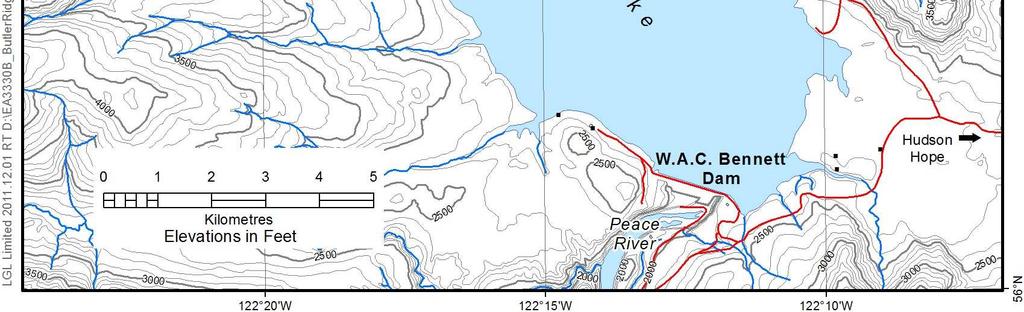
6 Figure 1. Index map of Unnamed Creek. Page 2
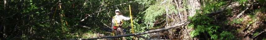
7 The rehabilitation design methodology involved the following steps: 1. Conducting a field survey of the fish passage obstruction area. A field survey to assess the fish passage obstruction was conducted 9 August Field information collected at the Unnamed Creek culvert crossing area included: Topographic (engineer s level) surveys of the stream channel and floodplain near the culvert to provide plan, profile and cross section elevation drawings for the section of channel and culvert to be modified to provide fish passage, and Photographs of the project site, labeled with D/M/Y, Geographic Position System (GPS) location in Lat/Long or UTM coordinates, and point of view. 2. Preparing a site-specific fish passage design. The Unnamed Creek fish passage design drawings included: Existing and proposed rehabilitation profiles of the channel, floodplain and culvert, Cross section plots of specific project site locations with rehabilitation project details overlain on the cross sectional plot (Note: left and right banks as viewed looking downstream), Methods for design, including design criteria, assumptions and calculations, Methods, specifications and scheduling for construction, and Estimated construction costs for the rehabilitation project. Manning s equation was used to estimate culvert capacity with and without baffles at 50 and 100 yr return period maximum daily discharges. Roughness values used in Manning s equation calculations included: for calculating capacity discharges in a round, corrugated culvert; for calculating capacity discharges in a round, corrugated culvert with baffles; and for baffled culvert at discharges <10 yr return period flows. Slope and culvert diameter values in the equation were based on field measurements obtained during this project. 4.1 Hydrology 4 REHABILITATION DESIGN Discharges in the Unnamed Creek have not been monitored on a continual basis by Water Survey of Canada (WSC). Typically, mean monthly flows in these Peace watersheds begin to rise in March-April in response to snow melt, peak in mid-may, and steadily decline to baseflow conditions in July through February. Based on HydroTech software analyses, average two-year and 100-year maximum daily unit discharges for gauged watersheds of <120 km 2 were estimated at 63 and 1400 l/sec/km 2, respectively (Table 1). The average unit flood discharge (daily max) with a return period of 50 yr was calculated at 885 l/s/km 2 for those hydrometric stations with less than 120 km 2 but averaged 632 l/s/km 2 with a range between 286 and 1516 l/s/km 2 for all the hydrometric stations. The 50 yr flood in Unnamed Creek was an estimated at 20.5 m 3 /s using a value of 885 l/s/km 2. Page 3
8 Mean monthly discharges for May and June were estimated at 0.32 and 0.27 m 3 /s, respectively, and for September the mean flow was estimated at 0.05 m 3 /s (Table 1). 4.2 Fish Passage Design Criteria For the goal of providing consistent access during the open water period into Unnamed Creek, the species of interest was primarily rainbow trout and secondarily kokanee. Swimming speeds for rainbow trout and sockeye (kokanee is a land-locked form of anadromous sockeye) that would allow fish passage through culverts over 24 m in length range from m/s for juveniles up to m/s for adults (Table 2; Whyte et al. 1997). A preferred method of determining fish swimming speeds for specific culverts, where distance between resting pools is known, is based on fish length and swimming distance (Figure 2; Katapodis 1993). For culverts without baffles, water velocities would need to be less than the prolonged swimming speed of the target fish species. For culverts with baffles, fish should be able to burst over the notch in the baffle and rest in the backwater and velocity shadow created by the baffles. For example, swimming speeds of 1.5 m/s could be maintained by trout of 25 cm length over a swimming distance of about 1 m, while prolonged swimming speeds of 1 m/s could be maintained by trout of 25 cm length over a swimming distance of about 2 m (Figure 2). Smaller trout of about 200 mm could burst at 1.2 m/s for 1 m and at a prolonged speed of 0.9 m/s over a swimming distance of about 2 m. Minimum water depths in the baffled culverts should be based on the fish being completely submerged in the flow to maximize thrust from body and tail movements. Consequently, minimum depths for migration through the culvert should be ~0.23 m (Whyte et al. 1997). The fish passage criteria that guided the preparation of this design were: 1. Upstream fish passage for juvenile trout required primarily during spring and early summer when access to rearing habitat is desirable; 2. Upstream fish passage to access spawning habitat required by adult kokanee primarily in September and for adult rainbow trout in May-June; 3. Average culvert velocities in the baffled culverts at the time of fish migration should not exceed the burst swimming speed of the target fish species; 4. Near boundary water velocities in the baffled culvert should allow for fish to migrate upstream between baffles at a prolonged swimming speed; and 5. Minimum flow depth of ~0.20 m between baffles in the culvert during fish migration periods. Page 4
9 Table 1. Summary of annual maximum daily peak and mean monthly discharges for Peace River area streams and discharge estimates for Unnamed Creek. Gauge Station Name Years No. of Area Unit Discharge (l/s/km 2 ) Average Monthly Discharge (l/s/km 2 ) Years (km 2 ) Mean Annual 2 yr 10 yr 25 yr 50 yr 100 yr Max January February March April May June July August September October November December 07FD015 Dawson Ck. above S. Dawson Ck.* FB009 Flatbed Ck. at KM 110 Heritage Highway FB004 Dickebusch Ck. near the mouth* FB005 Quality Ck. near the mouth* FB007 Sukunka R. above Chamberlain Ck FB011 Windrem Creek near Chetwynd* Mean of All Gauges Mean of * Stations Above < Gauge Station Name No. of Area Discharge (m 3 /s) Average Monthly Discharge (m 3 /s) Years Years (km 2 ) Mean Annual 2 yr 10 yr 25 yr 50 yr 100 yr Max January February March April May June July August September October November December 07FD015 Dawson Ck. above S. Dawson Ck.* FB009 Flatbed Ck. at KM 110 Heritage Highway FB004 Dickebusch Ck. near the mouth* FB005 Quality Ck. near the mouth* FB007 Sukunka R. above Chamberlain Ck FB011 Windrem Creek near Chetwynd* Estimate 0.14 for0.05 Unnamed0.04 Creek (based 0.05on * stations) 0.25 Page 5
10 blank page
11 Table 2. Swimming speeds for rainbow trout and sockeye (Whyte et al. 1997). Species and Life Stage Sustained Speed* (m/s) Prolonged Speed* (m/s) Burst Speed* (m/s) Rainbow Trout Adults Juveniles (125 mm) Juveniles (50 mm) Sockeye Adults Juveniles (130 mm) Juveniles (50 mm) * Sustained speed - can be maintained indefinitely Prolonged speed - can be maintained for up to 200 minutes Burst speed - can be maintained for up to 165 seconds Figure 2. Swimming distance and velocity relationships applicable to salmon and trout (Katapodis 1993). Page 6
12 4.3 Instream Backwater Riffles To re-establish fish access through the Unnamed Creek culvert, a series of riffles are proposed to backwater the culvert and create several fish accessible steps in water surface along the existing channel (Figure 3 and Figure 4; Photo 1 to Photo 7). A total of five riffle structures are proposed for Unnamed Creek. Because the riffle section will have a localized channel slope that is lower than the existing slope, the slope from the most downstream riffle to the existing streambed must provide a gradual transition to prevent excessive bed erosion and headcutting. Design sketches that show profile and cross section views of the proposed riffle structures in each section of channel are provided in Figure 5 and Figure 6. The riffle structures will have downstream face slopes of 5-25% and should be constructed following the guidelines in the schematic riffle construction drawing (Table 3; Figure 7). The riffles should be built with a range of rock sizes. The largest rocks are selected to be stable at the 50 yr return period flood stage, but smaller boulders may tumble as initial adjustments in the riffle occur. The larger rocks placed on the surface of the riffle create chutes and small drops that provide diverse rearing habitat for parr and assist fish passage at low flows. These rocks are the most vulnerable to movement and represent the upper range of rock size required for the riffle. Table 3. Dimensions for backwater riffle structures in Unnamed Creek. Structure Number Chainage (m) Bed Elevation (m) Riffle Crest Elevation (m) Backwater Riffle Structures Riffle Height above Existing Bed (m) Crest to Crest Difference Slope (%) D/S Face Length (m) Channel Width (m) Volume of Rock Required (m 3 ) Total 716 An approximation of the size of rock that would be stable on the constructed riffle structures in Unnamed Creek may be obtained by analyzing the tractive force on the downstream face of the riffle and applying guidelines for selecting riprap materials (Newbury and Gaboury 1994). This analysis requires an estimate of the 50 yr return period discharge, channel slope and probable channel width. As Unnamed Creek is an ungauged stream with no hydrological records, unit area flood flows were calculated from gauged watersheds in the Peace region and used to estimate the 50 yr flood for the creek (Table 1). Based on this analysis, a conservative 1 in 50 yr discharge of 20.5 m 3 /s was applied as the design flow in calculations to size the boulders for the riffle structures. Page 7
13 Tractive force, T (kg/m 2 ) for the riffle structures may be estimated as T = 1000 x Flow Depth (D in meters) x Slope of the Downstream Face of the Riffle (S in m/m) or: T = 1000 x D x S (Chow 1959) Although the gradient in this section of Unnamed Creek is ~4.8%, the stability of the riffle materials under the design flow condition can be tested where critical flow is assumed to occur on the downstream riffle faces which have 5-25% slopes. The design discharge for Gravel Hill Creek is 20.5 m 3 /s. In this case, the critical depth in the channel at the design discharge would be solved using the continuity equation and mean channel width. Using a conservative mean channel width of ~18 m for Unnamed Creek after rehabilitation and a 20% slope on the downstream face of the riffle, the calculations are: Discharge (Q) = velocity x depth (d) x width with v c = (g x d) ½ substituted for velocity 20.5 = (9.8 x d) ½ x d x 18 d = 0.50 m Tractive Force (T) = 1000 x depth (m) x slope (m/m) T = 1000 x 0.50 x 0.20 T = kg/m 2 Studies of stable channels, summarized by Lane (1955), indicate that the relationship between the tractive force and bed material diameter at incipient motion for pebble-size and larger materials is T (kg/m 2 ) = diameter (θ cm). Suitable rock size for a riffle with a 20% slope on the downstream face is therefore ~1.0 m. Larger rock sizes of ~1.2 m would be required for the 25% sloped riffle and ~0.5 m rock for the 5 and 10% sloped riffles. Rock diameter of m should be used for construction of the riffle crest and downstream surface of the riffles. Smaller diameter rocks ( m diameter) can be used in the core of the structure. Larger diameter boulders ( m) should be randomly spaced on the downstream face of the riffles approximately cm apart to provide greater hydraulic roughness and habitat diversity. The volume of rock required for the five riffles is about 716 m 3. Design specifications for the riffle structures, including riffle crest location, design elevation and volume of rock for each structure are provided in Table 3. Page 8
14 Blank page
15 Figure 3. Existing profile of Unnamed Creek adjacent to the culvert crossing on Road 190. Page 9
16 Figure 4. Existing cross sections of Unnamed Creek adjacent to the culvert crossing on Road 190. Page 10
17 Figure 5. Profile view of Unnamed Creek showing proposed fish passage rehabilitation measures. Page 11
18 Figure 6. Representative channel cross sections in Unnamed Creek showing proposed riffle crest and berm elevations. Page 12
19 Figure 7. Schematic riffle construction drawing. Page 13
20 4.4 Channel Berms The existing culvert is perched above the channel bed by ~1.5 m. To provide fish access through the culvert, the design necessitates relatively high crest elevations for the riffle immediately downstream of the culvert. As a result, the construction of berms to contain flows within the channel is required on both banks. The berms would be constructed with a suitable core of compacted earth fill consisting of gravelly sandy silt and silty sand. Riprap would be used to face the length and top of the berms. Gradation of the Class 100 kg riprap recommended for the face and top of the berms is specified in Table 4. The berms would have a top width of ~2 m and 2 to 1 side slopes. Berm elevations and dimensions are shown in Table 5, Figure 5 and Figure 6. Table 4. Gradation of rock sizes in recommended riprap for berms (After Anonymous 2000). Class of Riprap (kg) Nominal Thickness of Riprap (mm) Rock Gradation: Percentage Larger Than Given Rock Mass (kg) 85% 50% 15% Table 5. Dimensions of berm structures in Unnamed Creek. Volume of Volume of Left or Start End TOB Berm Crest Berm Height Berm Top Length Total Volume Riprap Right Chainage Chainage Elevation Elevation above Existing Side Width of of Berm Sand / Gravel Required (m ) Bank (m) (m) (m) (m) Bed (m) Slopes Berm (m) (m) Required (m ) Required (m ) Left Bank Right Bank : : : : : : : Total Culvert Baffle Design The fish passage rehabilitation design will include installation of culvert baffles in the Unnamed Creek culvert. Ten ~30 cm high baffles are recommended (Table 6). The baffles would be of a notched weir design with a semi-circular cut out rather than a v-shaped notch (Figure 8). As shown in the typical baffle drawing, the baffle notch would alternate from the left to right side of the culvert. Also, the baffles should be bolted into the culvert rather than welded because persistent streamflows would make welding of these retrofitted baffles very difficult. Bolt-in baffles should provide a more secure attachment to the culvert as compared to baffles with an expansion ring design, and should also require less maintenance over the long term. Page 14
21 Table 6. Culvert characteristics and baffle specifications at fish passage improvement site. Culvert Baffles Creek Name Diameter (m) Length (m) Slope (%) Number Height (cm) Spacing (m) Drop Between Baffle Crests (cm) Unnamed Creek Discharge estimates using Manning s equation found that the existing Unnamed Creek culvert has sufficient capacity for the 100 yr return period maximum daily discharge. The hydraulic efficiency of the culvert is significantly reduced with the installation of baffles. With the proposed 30 cm baffles, discharge capacity was reduced from ~32 to ~18 m3/s, a decrease of ~45%. Similar levels of reduction have been determined for other baffle installations. Baker and Votapka (1990) reported hydraulic efficiency reductions of 31% for a 30 cm baffle and 43% for a 40 cm high baffle. It was assumed in the calculations of culvert capacity at these large flood discharges that roughness (n) in the culvert was without baffles and (Baker and Votapka 1990) with baffles. Also, in the calculations the diameter of the culvert with baffles was equal to the culvert diameter minus the height of the baffles. In turbulent flow in culverts, fish will take advantage of the velocity reduction near the boundary by swimming in the bottom 80 mm of flow. This is particularly important for juveniles which are weaker than adults in swimming performance. The mean velocity in this 80 mm near boundary layer was calculated for various potential fish passage flows (Table 7). The velocity in this bottom layer is usually in the range of 40-80% of the mean culvert velocity (Behlke et al. 1991). It was assumed that fish would burst over the baffle notch and would likely rest in the pool between baffles or swim at a prolonged swimming speed to the next baffle upstream. The mean culvert and near boundary velocities for the proposed baffle site will allow adult fish to migrate successfully upstream through the culvert. Except at flows when mean culvert velocities are >1.1 m/s, juveniles of 125 mm could burst over the culvert baffles and migrate through the pools between the baffles. Juveniles of <50 mm could migrate upstream at flows less than about mean annual flow. Table 7. Mean and near boundary velocities for culverts with baffles over a range of potential fish passage flows. Flow Event May June September Mean Annual 2 yr Flood Mean Flow (cms) Depth (cm) Mean Culvert Boundary Velocity (m/s) Velocity (m/s) Page 15
22 Blank page
23 Figure 8. Typical design and installation drawing of fish baffles for a round corrugated culvert (Reproduced from Armtec). Page 16
24 blank page
25 4.6 Project Implementation Access, Logistics, Materials and Labour Access for delivery of materials to the proposed rehabilitation site at Unnamed Creek is good. Permanent gravel Road 190 provides access to the site. A short trail off this road should be constructed to access individual riffle sites along the channel. Dump trucks should haul sand/gravel, riprap and boulders to the site. A track hydraulic excavator should be used to construct the riffle and berm structures. The required crew and machinery will be a crew supervisor, an excavator operator, technicians to install the baffles, and an environmental monitor. Continued professional input from a biologist/hydrologist that is familiar with instream structure construction is recommended. The materials, equipment and labour required to construct the design as outlined include: Sand / gravel for the core of the berms and for the interstitial spaces in the riffle rocks; Riprap or boulders and cobble between 0.2 and 1.2 m diameter (b-axis); Special equipment required: Excavator (e.g., Hitachi 200 or Cat E70B) for construction of riffles and berms; Dump trucks; Sand / gravel compactor; Water pump(s); and Fish traps (Gee) and fish exclusion netting. Labour required: Ground crew; Excavator operator; Crew supervisor; and Technical support. Table 8 provides a cost estimate of about 97,000 to implement the rehabilitation works in Unnamed Creek. Page 17
26 Table 8. Cost estimate for rehabilitation works in Unnamed Creek, Fish Passage Description Major Equipment: 1 Excavator, all found 2 Excavators mob/demob. 3 Loader/small excavator 4 Dump Truck, all found Sub-total major equipment Manpower: 1 Habitat Restoration Specialist 2 Labour Sub-total manpower Light Equipment: 1 Drilling Equipment Rental 2 Water Pumps 3 Soil Compactors Sub-total light equipment Materials: 1 Riprap for Riffles 2 Riprap for Dykes 3 Sand/Gravel for Riffles & Dykes 4 Steel Fish Baffles 5 Miscellaneous supplies Sub-total materials Sub-Total 15% Contingency Total Cost Unit Unit Cost Approx. Quantity hour km hour hour , ,500 11,250 50,280 pers-day pers-day 1, ,500 8,000 24,500 week week week 500 1,000 2, ,000 2,000 3,500 m , ,000 1,000 m m each Cost 6,000 84,280 12,642 96,922 Note: Assumed sand/gravel and riprap to be provided at no cost by BC Hydro. Gravel and riprap loading, transport and placement costs are incorporated in excavator, loader and trucking costs above. Page 18

27 4.6.2 Fish Habitat Construction Timing Windows The following table summarizes recommended timing windows for instream construction (Table 9). Windows of least risk are designed to protect critical life stages of native fish species known to occur in a stream. The generation and subsequent deposition of sediment in fish streams is of particular concern. Based on the windows of least risk, the timing window during which the instream construction could proceed without causing harm to native fish habitat in the project streams would be from July 15 to August 15. Table 9. Instream work windows for the Peace Region (Reproduced from BC MOE Timing of Works, Priorities and Scheduling A Notification for Proposed Works and Changes In and About a Stream under Water Act Regulation 204/88' for the proposed projects should be prepared for signature once this site has been confirmed for implementation ( Also, the site is within Butler Ridge Provincial Park and therefore a Park Use Permit and any other related approvals will be required in advance of physical works ( It is anticipated that construction of the proposed rehabilitation works would proceed during the fisheries work window in one season Environmental Controls A qualified environmental monitor must be on site at all times during construction to ensure that all potential impacts to fish habitat are mitigated. This person will be responsible for ensuring that sediment control procedures are followed as per established Land Development Guidelines (Chilibeck el al. 1993) and that fish salvage operations are conducted, as necessary. Appendix A contains excerpts from the DFO Land Development Guidelines on a variety of issues related to work in and around streams. All construction personnel should be familiar with these guidelines prior to commencing work on the site. Four guiding principles are worthy of note here: Page 19
28 the natural riparian vegetation and stream banks should be protected and/or rehabilitated during and after construction; prevent the introduction of pollutants and deleterious substances by controlling construction activities and site conditions; prevent the generation of sediment by utilizing proper instream construction controls and supervision; and conduct fish salvage as required to remove fish from the area of impact (using minnow traps, beach seines, or lastly, electrofishing). Page 20
29 5 ACKNOWLEDGMENTS Several people participated in one way or another in the completion of this study. We thank Arne Langston (BC Hydro Fish and Wildlife Compensation Program Peace Region) for his assistance in providing historic and current information on the watershed, assisting with the field survey and providing contract management. Robin Tamasi () prepared the maps for the report. The support of these individuals is greatly appreciated. Financial support for this project was provided by the BC Hydro Fish and Wildlife Compensation Program Peace Region ( Page 21
30 6 REFERENCES Anonymous HydroTech analysis system. Science Technology Associates. Anonymous Riprap design and construction guide. Prepared for Public Safety Section, Water Management Branch, Ministry of Environment, Lands and Parks, Province of British Columbia. Prepared by Northwest Hydraulic Consultants Ltd. Baker, C.O. and F.E. Votapka Fish passage through culverts. Report No. FHWA-FL USDA Forest Service, San Dimas, CA. Behlke, C.E., D.L. Kane, R.F. McLean, and M.D. Travis Fundamentals of Culvert Design for Passage of Weak-Swimming Fish, Final Report. Alaska DOT&PF and USDT, Federal Highway Administration, FHWA-AK-RD pages. Chilibeck, B, G. Chislett and G. Norris Land development guidelines for the protection of aquatic habitat. Co-published by Ministry of Environment, Lands and Parks and Department of Fisheries and Oceans. British Columbia, Canada. 128 pp. Chow, V.T Open Channel Hydraulics. McGraw-Hill, New York, NY. 680 p. Katapodis, C Fish passage at culvert highway crossings. Conference presentation at Highways and the Environment, Charlottetown, May 17-19, Fisheries and Habitat Management, Freshwater Institute, MB. Lane, E.W Design of Stable Channels. ASCE Transactions 120: Newbury, R.W. and M.N. Gaboury Stream Analysis and Fish Habitat Design: A Field Manual. Second edition. Newbury Hydraulics, Gibsons, BC. 262 p. Newbury, R.W., M.N. Gaboury, and D.J. Bates Restoring Habitats in Channelized or Uniform Streams Using Riffle and Pool Sequences. In Slaney, P.A. and D. Zaldokas [eds.] Fish Habitat Rehabilitation Procedures. British Columbia Ministry of Environment, Lands and Parks, and British Columbia Ministry of Forests, Watershed Restoration Program, Technical Circular No. 9. Whyte, I.W., S. Babakaiff, M.A. Adams and P.A. Giroux Restoring fish access and rehabilitation of spawning sites. In Slaney, P.A. and D. Zaldokas [eds.] Fish Habitat Rehabilitation Procedures. British Columbia Ministry of Environment, Lands and Parks, and British Columbia Ministry of Forests, Watershed Restoration Program, Technical Circular No. 9. Page 22
31 APPENDICES
32 Appendix A. Guidelines for instream work (Chilibeck et al. 1993). SECTION 5 INSTREAM WORK Objective It is recognized that at times it may be necessary to perform instream work as part of the process of developing land. The objective of the instream work guidelines is to promote careful planning and construction practices to limit the potential for impacts on the aquatic environment. Instream work is any work performed below the high water mark, either within or above the wetted perimeter, of any feature within the Fisheries Sensitive Zone (FSZ). Prior to commencement of any instream work and with sufficient lead time, proponents should consult with DFO/MWLAP for information regarding FSZ species timing windows and construction methods. Because instream work has the potential to be extremely destructive to fish habitat, methods and procedures to minimize instream activities should be considered during the planning and design stages of a project. The procedures should be specifically designed to achieve the following objectives throughout the project. Protect the natural stream conditions and structure to promote stability of bank and bed structures, and retain riparian vegetation. Provide the instream conditions required for unhindered fish passage upstream and downstream. Prevent introduction of pollutants and deleterious substances by controlling construction activities and site conditions. Prevent generation of sediment, impacting fish and aquatic habitat, by utilizing the proper instream construction technique and supervision. Guidelines for Instream Work General guidelines for instream work include: Consult with local DFO/MWLAP staff regarding presence, distribution and timing of migrations of fish species in the stream or watercourse, and FSZ window (Appendices 2 and 3). Plan instream work for periods within the confirmed FSZ window that will minimize disturbance and impact on fish and fish habitat. Plan instream work for periods of suitable stream and environmental conditions, determined in consultation with DFO/MWLAP. Minimize the duration of the instream activities. All material placed within the wetted perimeter must be coarse, non-erodible, and non-toxic to fish. Do not remove gravels, rock or debris from any stream without the approval of DFO/MWLAP. Minimize disturbance to stream banks where equipment enters and leaves the watercourse. Reconstruct and revegetate stream banks to their original condition as soon as activity has finished (see Section 2 in Chilibeck 1992). Use the proper equipment for the proposed construction activity. Avoid damage caused by stuck equipment or delays because of insufficient capacity for proposed work.
33 Ensure that all construction equipment is mechanically sound to avoid leaks of oil, gasoline, hydraulic fluids and grease. Consider steam cleaning and check-up of construction equipment prior to use instream. Require the use of biodegradable hydraulic fluids for machinery used for instream work. Timing of Instream Work It must always be assumed that fish are present in a watercourse since the utilization and residency times for different species vary widely in accordance with their spawning and rearing cycle requirements. The windows of allowable times when instream work can be tolerated are often based on the reduced sensitivity of the fish to disturbances rather than the absence of fish during these times. The work should be coordinated and timed so that conflict with the fish populations is minimized. Appendix 2 contains information on the species-specific freshwater FSZ timing windows. The utilization of various habitats (freshwater lakes, rivers, estuarine and marine environments) by both resident and anadromous fish populations place restrictions on instream work. Timing windows of allowable instream work should always be confirmed with DFO/MWLAP personnel responsible for the local area in which the proposed development is located. Site specific differences exist and DFO/MWLAP staff should be consulted early as possible in the planning process. Sediment and Erosion Control during Instream Work Sediment Control The temporary containment and removal of sediment-laden water will probably be necessary during instream work, even when isolation techniques are used. Contaminated water within the work site must be pumped onto a land site where it will not re-enter the creek, or will do so only after filtration and settling has taken place. Instream Machine Crossings Where no alternate access to the opposite side of a watercourse exists, where it is impossible to do certain instream work from the banks, or where it is not feasible to isolate a worksite during construction, it may be necessary to take machinery and/or equipment into or through a flowing stream. In such situations, the local fisheries agencies must be consulted beforehand. Access should be arranged for the period of flow with the least impact to fish and fish habitat. All vehicles and equipment must be clean and in good repair to avoid leakage of petroleum products. Access by fording should be restricted to one crossing location, and traffic should be limited. Instream control measures and engineered roads using clean fill materials may be necessary. The access site must be chosen with care, where banks are low, the stream substrate is suitable, and the water shallow. Upon completion, the banks should be restored, restabilized and revegetated to prevent erosion. Erosion Control and Streambank Rehabilitation
34 Any time a bank or the channel bottom is disturbed, restorative action should be taken to prevent erosion, siltation and to replace lost fish habitat. If adequate site selection and careful construction techniques are implemented, minimal disturbance and rehabilitation should be required to the riparian zone and the stream. Each site needs to be assessed individually at the planning stage to determine what rehabilitation will be needed. Erosion control materials should not encroach into the stream's cross-sectional width. Encroachment can create backwatering (flooding) and increase stream velocities that may cause scouring and erosion. It may be possible to reuse excavated materials. In some cases, however, they may have to be totally replaced with materials more suitable for fish habitat (i.e. using washed, silt-free gravel as backfill). Acceptable bank erosion control methods include hand seeding, hydroseeding, silt blankets, rock riprap and revegetation using plantings. Scalping existing instream material, like gravel bars or large rocks, will not be permitted. The top of banks and the riparian zone may also need to be stabilized, commonly by planting trees, shrubs, and various bushy types of vegetation. Native species should be used for all revegetation projects. Maintenance of Instream Structures Well designed and constructed instream structures should require minimum maintenance. Frequent inspections, particularly during high runoff periods, are very important. Improper functioning of a structure during or after a major storm event may indicate the need for minor repairs or modifications. It is advisable to perform such minor repairs immediately in order to prevent the need for major repairs later, and to ensure safety and reduce the environmental impact. General maintenance should be carried out according to an agreed schedule of works and agency contact procedure. If emergency measures are required, only justifiable essential preventative actions should be taken to protect life and major losses of property. If time allows, contact the fisheries agencies before carrying out emergency repairs. Guidelines for Construction Practices within the Fisheries Sensitive Zone The following provisions are steps intended to protect leave strips and maintain a healthy functional riparian zone. Planning and Minimizing Impacted Area Streambank characteristics and vegetation should be taken into account when planning development activities in and around rivers and streams. During development of the land, there should be no unauthorized work or disturbance into the FSZ. Where encroachment into a leave strip is required, specific plans must be prepared and approved by DFO/MOELP in advance. Requests for permission to encroach will only be considered for major vehicle or footbridge crossings, utility crossings, and stormwater discharge outfalls. The plans for such encroachments should include details including the extent of work areas; plans for the control of water discharged from the work area; the timing of work; and the details for restoration after construction. Carefully select access points to streambank through the riparian zone, minimize the size and duration of disturbance, and preserve streamside vegetation and undergrowth wherever possible. Limit machinery and equipment access and direct disturbance to streambank areas.
35 Stabilizing Impacted Area Physical stabilization of eroding or eroded banks may be required to promote bank stability and regeneration of riparian vegetation. Design and construction of stabilization works should prevent their subsequent erosion. Remove disturbed, unstable debris from the riparian zone to prevent it from being swept away during high water. Retain stable large woody debris (LWD) which does not impede flows and fish migration, or promote bank erosion. Revegetating Impacted Area Revegetate disturbed areas immediately following completion of work in riparian zones. Establish ground cover to prevent surface erosion and deeper rooted plants and shrubs to prevent streambank erosion. Cedar, vine maple, alder, cottonwood, willow, salmonberry and red osier dogwood are common native plants used to augment brush and large plant formation. Large tree species will provide long-term sources of LWD.
36 PHOTOS


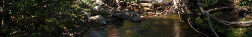
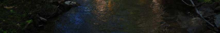
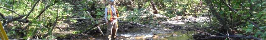
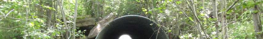
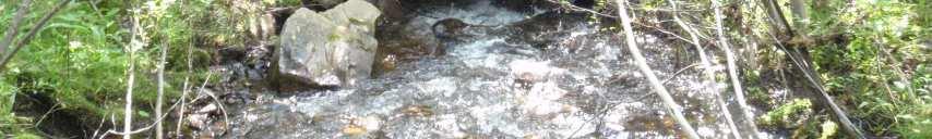
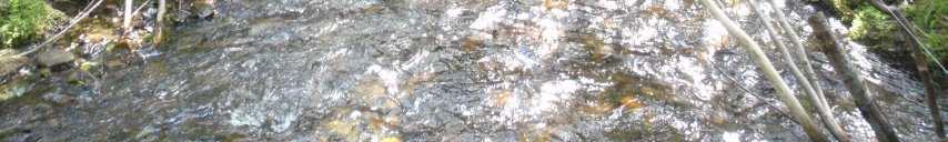
37 Photo 1. Looking upstream in Unnamed Creek from chainage m. Photo 2. Looking upstream at cross section at m in Unnamed Creek.

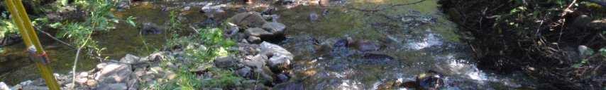
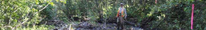
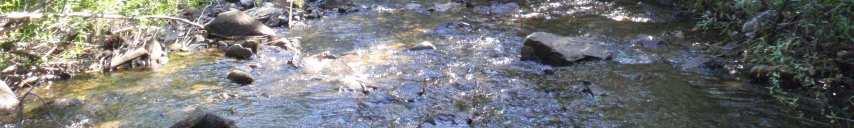
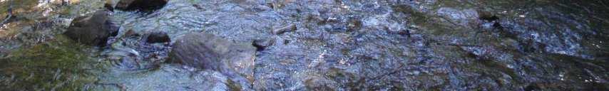
38 Photo 3. Looking downstream at cross section at chainage m. Photo 4. Looking downstream at cross section at chainage m.


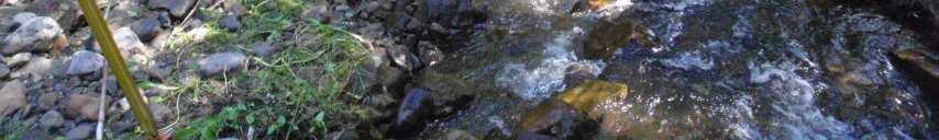
39 Photo 5. Looking upstream at cross section at chainage m. Photo 6. Looking upstream in Unnamed Creek culvert at chainage m.

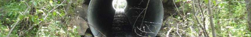
40 Photo 7. Looking downstream at culvert in Unnamed Creek from chainage m.
Firth Creek Habitat Enhancement Project 1993
 Firth Creek Habitat Enhancement Project 1993 A. R. Langston December 1993 PWFWCP Report No. 77 The Peace/Williston Fish & Wildlife Compensation Program is a cooperative venture of BC Hydro and the provincial
FINAL REPORT. Yonkers Creek Migration Barrier Removal Project Wonderstump Road Del Norte County. Submitted By:
 FINAL REPORT Yonkers Creek Migration Barrier Removal Project Wonderstump Road Del Norte County Submitted By: Del Norte County Community Development Department Yonkers Creek Migration Barrier Removal Project
COA-F17-F-1343 YEAR END REPORT
 DAVE MARSHALL SALMON RESERVE RESTORATION, MAINTENANCE, AND UPGRADES YEAR END REPORT Prepared for: Fish and Wildlife Compensation Program Prepared by: Edith Tobe, RPBio, Executive Director Box 1791, Squamish,
Steelhead Society of BC. Thompson River Watershed Restoration and Enhancement Project #4 Nicola River Bank Stabilization and Enhancement Project
 Steelhead Society of BC Presents: Thompson River Watershed Restoration and Enhancement Project #4 Nicola River Bank Stabilization and Enhancement Project Application for Funding December 2013 1.0 BACKGROUND
(Revised February,2005) CULVERTS, BRIDGES, AND FORDS
 CULVERTS, BRIDGES, AND FORDS") GUIDE TO STREAM CROSSINGS (Revised February,2005) CULVERTS, BRIDGES, AND FORDS Culverts, bridges, and fords are all methods used to cross-streams. Culverts are the most common stream crossing structure.
GUIDE TO STREAM CROSSINGS (Revised February,2005) CULVERTS, BRIDGES, AND FORDS Culverts, bridges, and fords are all methods used to cross-streams. Culverts are the most common stream crossing structure.
CALIFORNIA SALMONID STREAM HABITAT RESTORATION MANUAL APPENDIX IX-A CULVERT CRITERIA FOR FISH PASSAGE INTRODUCTION
 APPENDIX IX-A STATE OF CALIFORNIA RESOURCES AGENCY DEPARTMENT OF FISH AND GAME CULVERT CRITERIA FOR FISH PASSAGE For habitat protection, ecological connectivity should be a goal of stream-road crossing
Rehabilitation of Grimes Creek, a Stream Impacted in the Past by Bucket-lined Dredge Gold Mining, Boise River Drainage, July 2008 to August 2011.
 Rehabilitation of Grimes Creek, a Stream Impacted in the Past by Bucket-lined Dredge Gold Mining, Boise River Drainage, July 2008 to August 2011. Pam Harrington TU,1020 W. Main Street Suite 440, Boise,
Aquatic Organism Passage at Road-Stream Crossings CHUCK KEEPORTS FOREST HYDROLOGIST ALLEGHENY NATIONAL FOREST WARREN, PENNSYLVANIA
 Aquatic Organism Passage at Road-Stream Crossings CHUCK KEEPORTS FOREST HYDROLOGIST ALLEGHENY NATIONAL FOREST WARREN, PENNSYLVANIA TOPICS COVERED Aquatic Organism Passage (AOP) Benefits of AOP Crossings
Fish Passage Culvert Assessment for Cahilty Creek Watershed FIA Project #
 Fish Passage Culvert Assessment for Cahilty Creek Watershed FIA Project # 4602004 Prepared for Weyerhaeuser Company Ltd. Jason Ladyman R.P.F. 1550 Mission Flats Road PO Box 40 Kamloops BC V2C 5K3 Prepared
Discussion on the Selection of the Recommended Fish Passage Design Discharge
 Discussion on the Selection of the Recommended Fish Passage Design Discharge Introduction The provision of fish passage is a requirement for most proposed culvert and bridge installations in Alberta, depending
Project Completion Abstract Fish Passage Activity ( Engineering Activities)
") Project Completion Abstract Fish Passage Activity ( Engineering Activities) SUBMIT COMPLETED FORM TO DISTRICT MANAGER AND FIA ADMINISTRATOR AFTER PROJECT COMPLETION SECTION A GENERAL INFORMATION Recipient:
Project Completion Abstract Fish Passage Activity ( Engineering Activities) SUBMIT COMPLETED FORM TO DISTRICT MANAGER AND FIA ADMINISTRATOR AFTER PROJECT COMPLETION SECTION A GENERAL INFORMATION Recipient:
Trout Unlimited Comments on the Scope of Environmental Impact Statement for the Constitution Pipeline Project, Docket No. PF12-9
 October 9, 2012 Kimberly D. Bose, Secretary Federal Energy Regulatory Commission 888 First Street, NE, Room 1A Washington, DC 20426 RE: Trout Unlimited Comments on the Scope of Environmental Impact Statement
BC Ministry of Forests. March Fish Stream Crossing Guidebook. Forest Practices Code of British Columbia.
 FRST 557 Lecture 7c Bridges and Culverts: Water Velocity and Discharge Lesson Background and Overview: The previous two lessons presented methods for estimating water volume flow at a particular site and
Hydraulic Modeling of Stream Enhancement Methods
 Hydraulic Modeling of Stream Enhancement Methods Matthew J. Curry John J. Levitsky Abstract Development within watersheds increases the amounts of runoff causing stream erosion and degradation of stream
PROJECT TO INSTALL LARGE WOOD HABITAT STRUCTURES IN THE CARMEL RIVER USING CALIFORNIA DEPARTMENT OF FISH AND GAME GRANT FUNDS
 PROJECT TO INSTALL LARGE WOOD HABITAT STRUCTURES IN THE CARMEL RIVER USING CALIFORNIA DEPARTMENT OF FISH AND GAME GRANT FUNDS The Monterey Peninsula Water Management District (MPWMD), in cooperation with
Culvert Design for Low and High Gradient Streams in the Midwest. Dale Higgins, Hydrologist Chequamegon-Nicolet National Forest
 Culvert Design for Low and High Gradient Streams in the Midwest Dale Higgins, Hydrologist Chequamegon-Nicolet National Forest Overview Culvert Design Considerations Hydraulic Terms Culvert Impacts Low
APPENDIX C VEGETATED EMERGENCY SPILLWAY. VERSION 1.0 March 1, 2011
 APPENDIX C VEGETATED EMERGENCY SPILLWAY VERSION 1.0 March 1, 2011 [NOTE: Could use a better photo more clearly showing the emergency spillway in the context of the dam.] SECTION C-1: DESCRIPTION OF PRACTICE
Suitable Applications Check dams may be appropriate in the following situations: To promote sedimentation behind the dam.
 Categories EC Erosion Control SE Sediment Control TC Tracking Control WE Wind Erosion Control Non-Stormwater NS Management Control Waste Management and WM Materials Pollution Control Legend: Primary Category
FISH PASSAGE IMPROVEMENT in California s Watersheds. Assessments & Recommendations by the Fish Passage Forum
 FISH PASSAGE IMPROVEMENT in California s Watersheds Assessments & Recommendations by the Fish Passage Forum FISH PASSAGE IMPROVEMENT in California s Watersheds The mission of the Fish Passage Forum is
Five Counties Salmonid Conservation Program - Fish Passage Design Workshop. February 2013
 Program - Aquatic Organisms and Stream Crossings Ecological Connectivity A watershed is a network of channels that drain a common boundary. Channel characteristics formed by interaction of precipitation,
JAP Additional Information Sheet
 JAP Additional Information Sheet Block 15: Purpose and Need The USACE purpose of the project is to provide a safe and reliable whitewater park for the recreational public in a city park, which will provide
Low Gradient Velocity Control Short Term Steep Gradient Channel Lining Medium-Long Term Outlet Control Soil Treatment Permanent [1]
![Low Gradient Velocity Control Short Term Steep Gradient Channel Lining Medium-Long Term Outlet Control Soil Treatment Permanent [1]](/thumbs/80/80811988.jpg "Low Gradient Velocity Control Short Term Steep Gradient Channel Lining Medium-Long Term Outlet Control Soil Treatment Permanent [1]") Check Dams DRAINAGE CONTROL TECHNIQUE Low Gradient Velocity Control Short Term Steep Gradient Channel Lining Medium-Long Term Outlet Control Soil Treatment Permanent [1] [1] Though not generally considered
Check Dams DRAINAGE CONTROL TECHNIQUE Low Gradient Velocity Control Short Term Steep Gradient Channel Lining Medium-Long Term Outlet Control Soil Treatment Permanent [1] [1] Though not generally considered
Shovelnose Creek Off-Channel Complex Berm Repair
 Shovelnose Creek Off-Channel Complex Berm Repair Recent high discharge events have put valuable off-channel salmonid rearing and spawning habitat at risk in the upper Squamish River. This document is a
OKANAGAN RIVER RESTORATION INITIATIVE - FAQ
 OKANAGAN RIVER RESTORATION INITIATIVE - FAQ Initiative background: The health of the q awsitk w (Okanagan River) has been severely impacted by the channelization works that occurred in the mid-1950 s.
EA 1574 FISH HABITAT RESTORATION DESIGNS FOR ENGLISHMAN RIVER
 EA 1574 FISH HABITAT RESTORATION DESIGNS FOR ENGLISHMAN RIVER January 2003 FISH HABITAT RESTORATION DESIGNS FOR ENGLISHMAN RIVER Submitted to: BC Conservation Foundation 3-1200 Princess Royal Ave. Nanaimo,
Mid-Columbia Fisheries Enhancement Group Annual Report Fiscal Year 06: July 1, 2005 June 30, 2006
 Mid-Columbia Fisheries Enhancement Group Annual Report Fiscal Year 06: July 1, 2005 June 30, 2006 Mission Statement The mission of the Mid-Columbia Fisheries Enhancement Group is to restore self-sustaining
FISHERIES BLUE MOUNTAINS ADAPTATION PARTNERSHIP
 FISHERIES A warming climate, by itself, substantially affects the hydrology of watersheds in the Blue Mountains. Among the key hydrologic changes projected under all scenarios for the 2040s and beyond
3. The qualification raised by the ISRP is addressed in #2 above and in the work area submittal and review by the ISRP as addressed in #1.
 Please find attached a response from The Confederated Tribes of the Warm Springs Reservation of Oregon (CTWSRO) for Project # 2008-301-00, Habitat Restoration Planning, Design and Implementation within
Big Spring Creek Habitat Enhancement and Fishery Management Plans
 Big Spring Creek Habitat Enhancement and Fishery Management Plans November 5, 2012 Big Spring Events and Activities Center Newville, PA Charlie McGarrell Regional Habitat Biologist Pennsylvania Fish and
Executive Summary. Map 1. The Santa Clara River watershed with topography.
 Santa Clara River Steelhead Trout: Assessment and Recovery Opportunities December 2005 Prepared By: Matt Stoecker and Elise Kelley, Ph.D. University of California, Santa Barbara Prepared For: The Santa
Annex E Bridge Pier Protection Plan
 Annex E Bridge Pier Protection Plan Table E1 Bridge Types and Locations Table E2 Flow Conditions For River Sections Figure E1 Bridge Abutment Protection Figure E2 Bridge Pier Protection Figure E3 Central
HEC 26 Aquatic Organism Passage Design Manual Evolution & Application
 HEC 26 Aquatic Organism Passage Design Manual Evolution & Application Sven Leon, P.E., Hydraulics Engineer Federal Highway Administration 2015 Alaska Fish Passage Meeting October 13 14, 2015 VTRC, Juneau,
TOP:001.3 U.S. Fish and Wildlife Service TECHNICAL OPERATING PROCEDURE
 TOP:001.3 March 12, 2015 U.S. Fish and Wildlife Service Marquette Biological Station 3090 Wright Street Marquette, Michigan 49855 U.S.A. and U.S. Fish and Wildlife Service Ludington Biological Station
Illinois Lake Management Association Conference March 23, 2018 By Trent Thomas Illinois Department of Natural Resources Division of Fisheries
 Illinois Lake Management Association Conference March 23, 2018 By Trent Thomas Illinois Department of Natural Resources Division of Fisheries Sources of Habitat Impairment Sedimentation Channelization
Eastern Brook Trout Joint Venture Annual Report The Nature Conservancy 2013
 Eastern Brook Trout Joint Venture Annual Report The Nature Conservancy 2013 2013 Annual Performance Report Enhancing Connectivity in the Ash-Black Rock Sub-basin of the West Branch Narraguagus River. Project
APPENDIX J HYDROLOGY AND WATER QUALITY
 APPENDIX J HYDROLOGY AND WATER QUALITY J-1 Technical Report on Airport Drainage, Northern Sector Airport and Ordinance Creek Watershed / Preliminary Creek Constructed Natural Channel Culvert J-2 Preliminary
Creation of Fish and Wildlife Habitat on the Closed Salmon Harbour Mine in Minto, NB
 Creation of Fish and Wildlife Habitat on the Closed Salmon Harbour Mine in Minto, NB M. Coleman 1, R. Rutherford 2, RA Currie 3 1 NB Power 2 Thaumas Environmental Consultants Ltd 3 RA Currie Ltd. Location
USING A LABYRINTH WEIR TO INCREASE HYDRAULIC CAPACITY. Dustin Mortensen, P.E. 1 Jake Eckersley, P.E. 1
 USING A LABYRINTH WEIR TO INCREASE HYDRAULIC CAPACITY Dustin Mortensen, P.E. 1 Jake Eckersley, P.E. 1 Plum Creek Floodwater Retarding Structure No. 6 is located in an area of Kyle, Texas, that is currently
Fish Habitat Restoration and Monitoring in Southeast Washington. Andy Hill Eco Logical Research, Inc.
 Fish Habitat Restoration and Monitoring in Southeast Washington Andy Hill Eco Logical Research, Inc. Fish Habitat Restoration and Monitoring in Southeast Washington Talk overview: Restoration projects
Cheakamus River IR 11 Floodplain Restoration Final Report Project Number 13.CMS.01
 Cheakamus River IR 11 Floodplain Restoration Final Report Project Number 13.CMS.01 Prepared by: Squamish River Watershed Society Box 1791 Squamish, B.C. V08B 0B3 With financial support of: BC Hydro Fish
Fish Passage Culvert Inspection (FPCI) 12 Sites on TFL 18 (FIA ) 1 Site on FL #A18688 (Thuya Creek) (FIA )
 12 Sites on TFL 18 (FIA ) 1 Site on FL #A18688 (Thuya Creek) (FIA )") Fish Passage Culvert Inspection (FPCI) 12 Sites on TFL 18 (FIA 444603) 1 Site on FL #A18688 (Thuya Creek) (FIA 450502) Prepared for: Canadian Forest Products Ltd. Vavenby Division Prepared by: Doug Wahl,
Fish Passage Culvert Inspection (FPCI) 12 Sites on TFL 18 (FIA 444603) 1 Site on FL #A18688 (Thuya Creek) (FIA 450502) Prepared for: Canadian Forest Products Ltd. Vavenby Division Prepared by: Doug Wahl,
SELBY CREEK SILVERADO TRAIL CULVERT FISH PASSAGE ASSESSMENT
 SELBY CREEK SILVERADO TRAIL CULVERT FISH PASSAGE ASSESSMENT NAPA COUNTY, CALIFORNIA PREPARED BY NAPA COUNTY RESOURCE CONSERVATION DISTRICT 1303 JEFFERSON ST. SUITE 500B NAPA, CALIFORNIA 94559 WWW.NAPARCD.ORG
Rock Ramp Design Guidelines. David Mooney MS Chris Holmquist-Johnson MS Drew Baird Ph.D. P.E. Kent Collins P.E.
 Rock Ramp Design Guidelines David Mooney MS Chris Holmquist-Johnson MS Drew Baird Ph.D. P.E. Kent Collins P.E. Rock Ramp Design Guidelines OUTLINE Local and System Interactions with Rock Ramps Ramp Geometry
Massachusetts Stream Crossing Case Studies
 Massachusetts Stream Crossing Case Studies Amy Singler Associate Director, River Restoration Program Carrie Banks River Continuity Coordinator Case Studies: Public Benefits: Movement of goods and people
Presented by Fred Halterman, URS Jennie Agerton, URS
 Presented by Fred Halterman, URS Jennie Agerton, URS What is Eco Friendly Culvert Design? Culvert design that: Maintains connectivity for aquatic organism migration Maintains connectivity for gene flow
Don Pedro Project Relicensing
 Don Pedro Project Relicensing M ODESTO I RRIGATION D ISTRICT TURLOCK I RRIGATION D ISTRICT FERC PROJECT N O. 2299 Resident Fish in Don Pedro Reservoir Don Pedro Reservoir Fish Stocking (1971-Present) CDFG
Packwood Hydroelectric Project Barrier Analysis December 12, 2006
 Packwood Hydroelectric Project Barrier Analysis December 12, 2006 Study Area Natural barriers to upstream fish passage on Lake Creek at RM 1.03 and RM 1.95 Snyder Creek culvert under the Project tailrace
Chutes Part 2: Synthetic linings
 s Part 2: Synthetic linings DRAINAGE CONTROL TECHNIQUE Low Gradient Velocity Control Short Term Steep Gradient Channel Lining Medium-Long Term Outlet Control [1] Soil Treatment Permanent [2] [1] s can
Report prepared for: Prepared by: January 2002 BEAK Ref
 AQUATIC ENVIRONMENTAL STUDY KANATA WEST CONCEPT PLAN Report prepared for: ROBINSON CONSULTANTS Prepared by: BEAK INTERNATIONAL INCORPORATED 14 Abacus Road Brampton, Ontario L6T 5B7 January 2002 BEAK Ref.
Trout Buffer Variance
 Trout Buffer Variance Ashley L. Rodgers, PE Spring 2015 Why a Trout Buffer Capturing pollutants in runoff to keep the water clean. Capturing sediment to keep mud out of the water. Providing shade to keep
Understanding the Impacts of Culvert Performance on Stream Health
 Understanding the Impacts of Culvert Performance on Stream Health Kristin Thomas Aquatic Ecologist Michigan Trout Unlimited Transportation and the Environment Conference 12/5/2018 Importance of adequately
WFC 10 Wildlife Ecology & Conservation Nov. 29, Restoration Ecology: Rivers & Streams. Lisa Thompson. UC Cooperative Extension
 Restoration Ecology: Rivers and Streams WFC 10 29 Nov 2010 Restoration of ecosystems often involves creating new systems with only partial resemblance to the original ecosystems Lisa Thompson Fisheries
Guidance Note. Hydropower Guidance Note: HGN 8 Fish Passage. When do you need to install a fish pass?
 Guidance Note Hydropower Guidance Note: This guidance note is not intended as a statement of law. It should be read in combination with, and in the context of, the relevant enactments and EU obligations.
Staff, Organizations Directly Affected (including but not limited to):
:") 3-2-02.01 Steelhead Stream Classification Effective Date: December 13, 2005 This Policy Replaces: None. Staff, Organizations Directly Affected (including but not limited to): Ministry of Water, Land and
3-2-02.01 Steelhead Stream Classification Effective Date: December 13, 2005 This Policy Replaces: None. Staff, Organizations Directly Affected (including but not limited to): Ministry of Water, Land and
Stevens Creek Corridor
 O F F I C E O F T H E D I R E C T O R O F P U B L I C W O R K S Stevens Creek Corridor Creek Restoration Project Volume Three Project Update: Creek Photos, Before & After BY GAIL SEEDS - PROJECT MANAGER,
Minnesota Department of Natural Resources Division of Fish and Wildlife Section of Fisheries. Stream Survey Report. Luxemburg Creek.
 Minnesota F-29-R(P)-24 Area 315 Study 3 March 2016 Minnesota Department of Natural Resources Division of Fish and Wildlife Section of Fisheries Stream Survey Report Luxemburg Creek 2015 Mark Pelham Sauk
STREAM CLASSIFICATION AND MAPPING. Prepared For. MacMillan Bloedel Ltd. Menzies Bay Division BOX 6000, Campbell River V9W 5E1.
 STREAM CLASSIFICATION AND MAPPING OF STREAMS IN MENZIES AND OYSTER BAY Prepared For MacMillan Bloedel Ltd. Menzies Bay Division BOX 6000, Campbell River V9W 5E1 September 1998 a a North Island Biological
Tuolumne River Gravel Introduction
 Tuolumne River Gravel Introduction 2000 2003 Tuolumne River La Grange Gravel Addition, Phase II Course Sediment Replenishment Program Tuolumne River Salmonid Habitat Improvement Project River Mile 49.9
Creek Trash Assessment (CTA) Methodology (Demonstration: Mill Run Creek, Cheltenham, Pa.)
 Methodology (Demonstration: Mill Run Creek, Cheltenham, Pa.)") Creek Trash Assessment (CTA) Methodology (Demonstration: Mill Run Creek, Cheltenham, Pa.) Mill Run Creek emerges from a storm sewer in Philadelphia to an open creek in Cheltenham. The Creek downstream
Creek Trash Assessment (CTA) Methodology (Demonstration: Mill Run Creek, Cheltenham, Pa.) Mill Run Creek emerges from a storm sewer in Philadelphia to an open creek in Cheltenham. The Creek downstream
City of Burnaby Environmental Review Committee (ERC) Guide for Applicants
 Guide for Applicants") City of Burnaby Environmental Review Committee (ERC) Guide for Applicants 2017-2018 This Guide summarizes the ERC process for project review including applications for a relaxation (variance) to the development
City of Burnaby Environmental Review Committee (ERC) Guide for Applicants 2017-2018 This Guide summarizes the ERC process for project review including applications for a relaxation (variance) to the development
FINAL Caples Lake Fisheries Management Plan. Version 4.0
 FINAL Caples Lake Fisheries Management Plan Version 4.0 August 15, 2008 Purpose The Caples Lake Fisheries Management Plan (Plan) outlines the stocking plan to reestablish a sport fishery in Caples Lake
Assessment of Baseline Geomorphic Features at. Proposed Stream Crossings On The Proposed County Road 595. Marquette County, Michigan
 Assessment of Baseline Geomorphic Features at Proposed Stream Crossings On The Proposed County Road 595 Marquette County, Michigan Prepared for: Kennecott Eagle Minerals Company Marquette, Michigan Prepared
RULES OF THE OIL AND GAS PROGRAM DIVISION OF WATER RESOURCES CHAPTER DRILLING WELLS TABLE OF CONTENTS
 RULES OF THE OIL AND GAS PROGRAM DIVISION OF WATER RESOURCES CHAPTER 0400-52-06 DRILLING WELLS TABLE OF CONTENTS 0400-52-06-.01 Drilling Equipment 0400-52-06-.03 Casingheads 0400-52-06-.02 Blowout Prevention
Minnesota Department of Natural Resources Division of Fish and Wildlife Section of Fisheries. Stream Survey Report. Cold Spring Creek.
 Minnesota F-29-R(P)-24 Area 315 Study 3 March 2013 Minnesota Department of Natural Resources Division of Fish and Wildlife Section of Fisheries Stream Survey Report Cold Spring Creek 2012 Mark Pelham Montrose
Chadbourne Dam Repair and Fish Barrier
 Chadbourne Dam Repair and Fish Barrier Final Report for the Western Native Trout Initiative Prepared by: Carol Endicott Yellowstone Cutthroat Trout Conservation Biologist Montana Fish, Wildlife & Parks
REPORT TO THE MINISTER OF NATURAL RESOURCES. Pursuant to an appointment made by the Honourable Frank S. Miller, Minister of Natural
 Room 569, Fifth Floor, Mowat Block, Queen's Park, Toronto, Ontario. M7A la2 IN THE MATTER OF The Lakes and Rivers Improvement Act; AND IN THE MATTER OF An application by Rudolph Adam for approval under
Stream Crossings I: Engineering and Design Approaches to Provide Fish Passage at Culvert Slipline Projects in Connecticut
 University of Massachusetts - Amherst ScholarWorks@UMass Amherst International Conference on Engineering and Ecohydrology for Fish Passage International Conference on Engineering and Ecohydrology for Fish
Washington State Fish Passage Barrier Removal Projects. Casey Kramer, PE WSDOT State Hydraulics Engineer
 Washington State Fish Passage Barrier Removal Projects Casey Kramer, PE WSDOT State Hydraulics Engineer 2014 National Hydraulic Engineering Conference Iowa City, IA August 20 th, 2014 WSDOT Fish Passage
Schedule for Culvert Works in or on the Bed or Bank of a Watercourse PLEASE READ THIS PAGE BEFORE COMPLETING THE APPLICATION FORM
 10A Schedule for Culvert Works in or on the Bed or Bank of a Watercourse This form is to be used for applications to use, erect, place, extend, alter or replace a culvert in or on the beds or banks of
Illinois State Water Survey
 Illinois State Water Survey HYDROLOGY DIVISION SWS Contract Report 508 COMPARISON OF 1987 AND 1989 BED PROFILE SURVEYS OF THE LOWER CACHE RIVER by Richard Allgire Office of Sediment and Wetland Studies
MCCAW REACH RESTORATION
 Final Report MCCAW REACH FISH RESTORATION PHASE B Jack McCaw Inland Empire Action Coalition http://www.wwccd.net/ Phone: 509-956-3777 Hours: 8:00-4:30 Walla Walla County Conservation District Snake River
FSOC Upstream Fish Passage Guidance Document
 FSOC Upstream Fish Passage Guidance Document STEP 1: Identify species and life stages in need of fish passage STEP 2: Identify fishway options and species applicability STEP 3 Fish passage criteria review
COLUMBIA LAKE DAM REMOVAL PROJECT
 COLUMBIA LAKE DAM REMOVAL PROJECT Major Goals of the Columbia Lake Dam Removal: Reconnect 10 miles of the Paulins Kill River to the Delaware River, restoring natural flow regime and sediment transport.
Subject: Developed fish ladder alternatives for Pastori Avenue at San Anselmo Creek
 Page 1 of 18 SENT VIA EMAIL Sandra Guldman Friends of Corte Madera Creek Watershed Box 415 Larkspur, CA 94977 Subject: Developed fish ladder alternatives for Pastori Avenue at San Anselmo Creek Dear Sandra,
STREAM SURVEY File form No..
 scanned for KRIS THE RESOURCES AGENCY OF CALIFORNIA California Department of Fish and Game STREAM SURVEY File form No.. Date: September 4, 1969. NAME: North Fork Schooner Gulch Creek COUNTY: Mendocino.
FISH PASSAGE ALTERNATIVES ANALYSIS ON PENNYPACK CREEK AT VERREE ROAD DAM AND ROOSEVELT BOULEVARD DAM PHILADELPHIA, PENNSYLVANIA
 FISH PASSAGE ALTERNATIVES ANALYSIS ON PENNYPACK CREEK AT VERREE ROAD DAM AND ROOSEVELT BOULEVARD DAM PHILADELPHIA, PENNSYLVANIA Prepared for: One Parkway, 10 th Floor 1515 Arch Street Philadelphia, PA
Tips for Using & Printing Spreadsheets
 Key to Spreadsheets Spreadsheet # Type Description/Purpose a Development & Construction in Waterways b Debits Development & Construction in Other Aquatic Areas c Indirect Impacts to Waterways from Development
The Blue Heron Slough Conservation Bank
 1 The Blue Heron Slough Conservation Bank CONSERVATION BANKING July 19-23, 2010 CASE STUDY SERIES The Blue Heron Slough Conservation Bank (Washington) I. OVERVIEW & BACKGROUND: Location: Snohomish River
ROAD OCCUPANCY PERMIT APPLICATION # Damascus Township, 60 Conklin Hill Road, Damascus, PA Tel Fax
 Instructions: For a driveway access permit, fill in sections 1, 2, 3 and 4, and the appropriate drawings and sign. For a Utility access, fill in sections 1, 2, 3 and 5, and figures 1 and 3. Prepare a detailed
Conserving the Forests, Lakes and Streams of Northeast Michigan
 4241 Old US 27 South, Suite 2, Gaylord, Michigan 49735 (989) 448-2293 www.huronpines.org info@huronpines.org Prioritized Restoration Projects in the AuSable River Watershed Summer 2015 Update from Huron
Eastern Brook Trout. Roadmap to
 Eastern Brook Trout Roadmap to CONSERVATION Our Brook Trout heritage he wild Brook Trout is an American symbol of persistence, adaptability, and the pristine wilderness that covered North America prior
Final Fish Salvage & Temporary Tailrace Barrier Report for the Wallowa Falls Hydroelectric Project Tailrace. (FERC No. P-308) December 18, 2017
 December 18, 2017") Final for the Wallowa Falls Hydroelectric Project Tailrace (FERC No. P-308) December 18, 2017 Prepared by: Jeremiah Doyle PacifiCorp 825 NE Multnomah Street Portland, OR 97232 December 18, 2017 Page 1
Final for the Wallowa Falls Hydroelectric Project Tailrace (FERC No. P-308) December 18, 2017 Prepared by: Jeremiah Doyle PacifiCorp 825 NE Multnomah Street Portland, OR 97232 December 18, 2017 Page 1
Columbia Lake Dam Removal Project
 Columbia Lake Dam Removal Project The Columbia Lake dam located 1/4 mile upstream of the Paulins Kill River's confluence with the Delaware River in Knowlton Township, Warren County has been proposed for
Study Update Tailrace Slough Use by Anadromous Salmonids
 Study Update Tailrace Slough Use by Anadromous Salmonids Goals and Objectives Identify what anadromous salmonids use the tailrace slough by: Life Stage (Juvenile, migrating and spawning adults) Timing
Fish Passage Assessment of Private Stream Crossings on Lower Stonybrook Creek
 Fish Passage Assessment of Private Stream Crossings on Lower Stonybrook Creek Prepared by: Michael Love & Associates In cooperation with: Center for Ecosystem Management and Restoration Funded by: Coastal
MINISTRY OF ENVIRONMENT ENVIRONMENTAL STEWARDSHIP DIVISION FISH AND WILDLIFE BRANCH. Horsefly River Angling Management Plan
 MINISTRY OF ENVIRONMENT ENVIRONMENTAL STEWARDSHIP DIVISION FISH AND WILDLIFE BRANCH Horsefly River Angling Management Plan January 30 th, 2006 Area/Fishery Description The Horsefly River watershed provides
Final Fish Salvage & Temporary Tailrace Barrier Report for the Wallowa Falls Hydroelectric Project Tailrace. (FERC No. P-308) December 20, 2018
 December 20, 2018") Final Fish Salvage & Temporary Tailrace Barrier Report for the Wallowa Falls Hydroelectric Project Tailrace (FERC No. P-308) December 20, 2018 Prepared by: Jeremiah Doyle PacifiCorp 825 NE Multnomah Street
Final Fish Salvage & Temporary Tailrace Barrier Report for the Wallowa Falls Hydroelectric Project Tailrace (FERC No. P-308) December 20, 2018 Prepared by: Jeremiah Doyle PacifiCorp 825 NE Multnomah Street
Restoring the Kootenai: A Tribal Approach to Restoration of a Large River in Idaho
 Restoring the Kootenai: A Tribal Approach to Restoration of a Large River in Idaho Susan Ireland, Kootenai Tribe of Idaho Future of our Salmon Conference Technical Session August 2016 Healthy Floodplains,
DEADWOOD CREEK FISH PASSAGE IMPROVEMENT PROJECT
 DEADWOOD CREEK FISH PASSAGE IMPROVEMENT PROJECT Coho Salmon in Deadwood Creek Project Area - November 2, 2004 FINAL REPORT National Fish and Wildlife Foundation Project #2002-0368-014 CA Department of
Ontario Ministry of Transportation (MTO) Restoring Fish Passage to a Tributary of the Saugeen River
 Restoring Fish Passage to a Tributary of the Saugeen River") Ontario Ministry of Transportation (MTO) Restoring Fish Passage to a Tributary of the Saugeen River 2017 Transportation Association of Canada Environmental Achievement Award Nomination Submission Prepared
Ontario Ministry of Transportation (MTO) Restoring Fish Passage to a Tributary of the Saugeen River 2017 Transportation Association of Canada Environmental Achievement Award Nomination Submission Prepared
Minnesota Department of Natural Resources Division of Fish and Wildlife Section of Fisheries. Stream Survey Report. Three Mile Creek 2011
 Minnesota Department of Natural Resources Division of Fish and Wildlife Section of Fisheries Stream Survey Report Three Mile Creek 2011 By Joseph D. Stewig Montrose Area Fisheries Office TABLE OF CONTENTS
Amendment to a Biological Assessment/Evaluation completed for the Coon Creek Land Disposal completed December Grand Valley Ranger District
 Amendment to a Biological Assessment/Evaluation completed for the Coon Creek Land Disposal completed December 2007 Grand Valley Ranger District Grand Mesa, Uncompahgre, Gunnison National Forests Prepared
Union Pacific Railroad
 Input Questions: 404/401 Pre Application Meeting, December 18, 2013, Portland, Oregon 1. What is the project purpose and need? The purpose of the project is to improve the efficiency and average velocity
Project Report for Marsh Creek and Albion River Instream Fish Barrier Removal Flynn Creek Road, CR 135, M.P. 8.1 and 8.3
 Project Report for Marsh Creek and Albion River Instream Fish Barrier Removal Flynn Creek Road, CR 135, M.P. 8.1 and 8.3 Project Title: Marsh Creek and Albion River Instream Fish Barrier Removal, Flynn
Request Number IR1-12: Flow Passage. Information Request
 Request Number IR1-12: Flow Passage Information Request Provide additional information about the 100 metre flow passage channel scenario between the Westshore Terminals and the proposed Project terminal
Joe Rathbun Michigan DEQ Water Resources Division Nonpoint Source Unit * Thanks to The Nature Conservancy
 Joe Rathbun Michigan DEQ Water Resources Division Nonpoint Source Unit rathbunj@mi.gov * Thanks to The Nature Conservancy Road-stream intersections = 67,511 Culverts = 60,700 Bridges = 6,811 Perched Piping
Great Lakes Stream Crossing Inventory Instructions
 Great Lakes Stream Crossing Inventory Instructions This document is a guide to completing the Stream Crossing Data Sheet (2/28/11 version). Careful attention to this guidance will ensure consistent crossing
Coquitlam Water Use Plan
 Coquitlam Water Use Plan Assessment of Fisheries Access to Streams Tributary To Coquitlam Reservoir COQMON#1 Study Period: September 1, 2006 May 31, 2007 Report Date: January 2008 Scott Ducharme Aquatec
Minnesota Department of Natural Resources Division of Fish and Wildlife Section of Fisheries. Stream Survey Report. Cold Spring Creek.
 Minnesota F-29-R(P)-24 Area 315 Study 3 March 2015 Minnesota Department of Natural Resources Division of Fish and Wildlife Section of Fisheries Stream Survey Report Cold Spring Creek 2014 Mark Pelham Montrose
D.B. Wilson Station CCR Landfill
 D.B. Wilson Station CCR Landfill Disposal of Coal Combustion Residuals (CCR) from Electric Utilities Final Rule Closure and Post-closure Care Plan October 11, 2016 Prepared By: Project ID: 160030A Big